
Interstate 35 in Texas
Encyclopedia
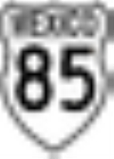
Interstate 35
in Texas (abbreviated I-35 or IH-35) is a major north–south Interstate Highway running from Laredo
near the United States-Mexico border to the Red River
north of Gainesville
where it crosses into Oklahoma
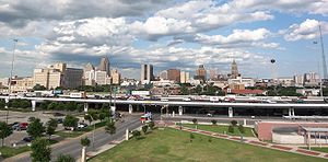
. Along its route, it passes through the cities of San Antonio
, Austin
, and Waco
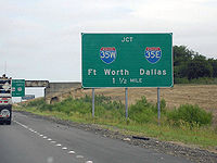
before it splits into two auxiliary routes just north of Hillsboro
. Interstate 35E
heads northeast where it passes through Dallas
. Interstate 35W
turns northwest to run through Fort Worth
. The two branches meet up in Denton
to again form Interstate 35, where it continues to the Oklahoma border. The exit numbers for Interstate 35E maintain the sequence of exit numbers from the southern segment of Interstate 35, and the northern segment of Interstate 35 follows on from the sequence of exit numbers from Interstate 35E. Interstate 35W maintains its own sequence of exit numbers.
In Texas, Interstate 35 runs for just over 407 miles (655 km), which does not include either the 85-mile (137-km) segment of Interstate 35W or the 97-mile (156-km) segment of Interstate 35E. Texas contains more miles of the overall length of Interstate 35 than any other state, almost one-third of the entire length.
In general, this article only describes Interstate 35; for Interstates 35E and 35W, see their respective articles.
, I-35 is listed as the PanAm Expressway. It starts out as four lanes from the south until it reaches the Poteet-Jourdanton Freeway, expanding to six to eight mainlanes of travel. Its southern point begins in the southwest corner of town and travels northeast, crossing Interstate 410
near its southwest point. At the southwest corner of downtown, it reaches an intersection with Interstate 10
, United States Route 87 and United States Route 90. US 90 continues east and west from this junction, while I-10 westbound/U.S. 87 northbound joins with I-35 northbound along the western side of downtown. In this section, it splits lanes to form two levels, a lower one for local traffic and a higher one for express traffic. They briefly rejoin near the northwest corner of downtown to allow I-10/U.S. 87 to split off and go northwest.
I-35 continues, resplitting lanes again as it curves around the northwest corner of downtown and turns east. It rejoins the lanes as it goes through an intersection at the northeast corner of downtown, where Interstate 37's
northern terminus is located, while United States Highway 281 will continue on the north–south freeway. I-35 continues east for a few miles until it begins to curve back to the northeast. It merges with I-410 on its eastern north–south leg from its northbound direction in a triangular interchange and continues north concurrently from there. A couple miles later, I-410 will split off onto its northern west–east leg, while I-35 resumes its north-northeast course past the northeast corner of the city.
Trucks are restricted from travel in the far left lane of I-35 in either direction throughout the San Antonio area. The restriction covers Bexar, Guadalupe, and Comal counties.
. It forms the eastern boundary of downtown Austin and also passes through the eastern side of the University of Texas campus. I-35 is co-located with U.S. Highway 290 through central Austin.
Trucks are restricted from travel in the far left lane of I-35 in either direction throughout the Austin area. The restriction covers Hays
and Travis
counties and most of Williamson county and ends north of Jarrell, Tx
where I-35 is reduced to four lanes.
I-35 is split into two decks between Martin Luther King Boulevard and Airport Boulevard, north of downtown Austin. Both the upper and lower decks are signed as I-35 and US 290, and they use a common set of exit numbers, with some exit numbers duplicated between the two decks. The upper deck lanes are express lanes, with no on- or off-ramps. Drivers wishing to exit between Martin Luther King Boulevard and Airport Boulevard must use the lower deck.
The I-35 corridor between San Antonio and Austin is considered one of the most congested stretches of highway in the Interstate System. Much of this traffic is due to I-35 being considered one of the primary North American Free Trade Agreement
(NAFTA) corridors. Efforts to alleviate the congestion include the construction of State Highway 130, which when complete will form an I-35 bypass loop to the east of Austin, and the development of the Trans-Texas Corridor
, which has a planned alignment that parallels I-35. Many local and regional governance organizations have on-going studies on other methods to improve mobility on I-35, which include such features as commuter rail lines and additional managed lanes.
 In Waco, Interstate 35 is known as the Jack Kultgen Freeway. I-35 has six to eight lanes in Waco, and portions of I-35 between Waco and Hillsboro are currently being expanded from four to six lanes. It passes just to the west of the Baylor University
campus.
Beginning in Waco and continuing up until just before the I-35E/I-35W split north of Hillsboro, I-35 is co-located with U.S. Highway 77.
Just north of Denton, U.S. Highway 77 is co-located with Interstate 35 through to the Oklahoma border, although it is not signed as such.
). The formal opening of Interstate 35 in Austin took place in 1962. The alignment was chosen to line up with U.S. Highway 81 and with East Avenue, which formed the eastern boundary of Austin. US 81 has since been truncated and does not extend to Austin, and East Avenue today forms part of the frontage road for I-35 through downtown Austin.
In 1975, a 2 miles (3.2 km) set of elevated express lanes were added to I-35 between 15th Street and Airport Boulevard. The reason double-decking was used is because the highway is bounded in the area by the University of Texas campus on the west and by the Mount Calvary Cemetery on the east, restricting the available right-of-way. The lower deck kept its original configuration, which featured short on- and off-ramps with limited visibility. In 2000, some off-ramps on the lower deck were removed, in response to the already dangerous conditions becoming more so as traffic levels on the road increased. Interstate 35 in general and the double-decked section in particular have been viewed as a social dividing line between the central Austin and U.T. communities and the more economically depressed East Austin neighborhoods.
Interstate 35 at one time had one of the few at-grade railroad crossings in the Interstate Highway system
. The crossing was removed during the 1970s.
Interstate 35
Interstate 35 is a north–south Interstate Highway in the central United States. I-35 stretches from Laredo, Texas, on the U.S.-Mexico border to Duluth, Minnesota, at Minnesota Highway 61 and 26th Avenue East. Many interstates used to have splits or spurs indicated with suffixed letters , but I-35...
in Texas (abbreviated I-35 or IH-35) is a major north–south Interstate Highway running from Laredo
Laredo, Texas
Laredo is the county seat of Webb County, Texas, United States, located on the north bank of the Rio Grande in South Texas, across from Nuevo Laredo, Tamaulipas, Mexico. According to the 2010 census, the city population was 236,091 making it the 3rd largest on the United States-Mexican border,...
near the United States-Mexico border to the Red River
Red River (Mississippi watershed)
The Red River, or sometimes the Red River of the South, is a major tributary of the Mississippi and Atchafalaya Rivers in the southern United States of America. The river gains its name from the red-bed country of its watershed. It is one of several rivers with that name...
north of Gainesville
Gainesville, Texas
Gainesville is a city in and the county seat of Cooke County, Texas, United States. The population was 15,538 at the 2000 census.-History:...
where it crosses into Oklahoma
Interstate 35 in Oklahoma
Oklahoma is the second state that Interstate 35 passes through from south to north. In Oklahoma, I-35 runs from the Red River at the Texas border to the Kansas line near Braman, for a length of 236 miles . I-35 has one spur route in the state, Interstate 235 in the inner city of Oklahoma...
. Along its route, it passes through the cities of San Antonio
San Antonio, Texas
San Antonio is the seventh-largest city in the United States of America and the second-largest city within the state of Texas, with a population of 1.33 million. Located in the American Southwest and the south–central part of Texas, the city serves as the seat of Bexar County. In 2011,...
, Austin
Austin, Texas
Austin is the capital city of the U.S. state of :Texas and the seat of Travis County. Located in Central Texas on the eastern edge of the American Southwest, it is the fourth-largest city in Texas and the 14th most populous city in the United States. It was the third-fastest-growing large city in...
, and Waco
Waco, Texas
Waco is a city in and the county seat of McLennan County, Texas. Situated along the Brazos River and on the I-35 corridor, halfway between Dallas and Austin, it is the economic, cultural, and academic center of the 'Heart of Texas' region....
before it splits into two auxiliary routes just north of Hillsboro
Hillsboro, Texas
Hillsboro is a city in and the county seat of Hill County in Central Texas. The population was 8,232 at the 2000 census.Hillsboro, located on Interstate 35 where I-35E and I-35W meet south of the Dallas-Fort Worth Metroplex, is the primary center for trade and commerce in Hill County...
. Interstate 35E
Interstate 35E (Texas)
Interstate 35E , an Interstate Highway, is the eastern half of Interstate 35 where it splits to serve different cities in Texas. I-35 splits into two branch routes, I-35W and I-35E at Hillsboro. I-35E runs north for , maintaining I-35's sequence of exit numbers. It runs through Dallas before...
heads northeast where it passes through Dallas
Dallas, Texas
Dallas is the third-largest city in Texas and the ninth-largest in the United States. The Dallas-Fort Worth Metroplex is the largest metropolitan area in the South and fourth-largest metropolitan area in the United States...
. Interstate 35W
Interstate 35W (Texas)
Interstate 35W , an Interstate Highway, is the western half of Interstate 35 where it splits to serve different cities in Texas. I-35 splits into two branch routes, I-35W and I-35E at Hillsboro. I-35W runs north for , carrying its own separate sequence of exit numbers. It runs through Fort Worth...
turns northwest to run through Fort Worth
Fort Worth, Texas
Fort Worth is the 16th-largest city in the United States of America and the fifth-largest city in the state of Texas. Located in North Central Texas, just southeast of the Texas Panhandle, the city is a cultural gateway into the American West and covers nearly in Tarrant, Parker, Denton, and...
. The two branches meet up in Denton
Denton, Texas
The city of Denton is the county seat of Denton County, Texas in the United States. Its population was 119,454 according to the 2010 U.S. Census, making it the eleventh largest city in the Dallas/Fort Worth Metroplex...
to again form Interstate 35, where it continues to the Oklahoma border. The exit numbers for Interstate 35E maintain the sequence of exit numbers from the southern segment of Interstate 35, and the northern segment of Interstate 35 follows on from the sequence of exit numbers from Interstate 35E. Interstate 35W maintains its own sequence of exit numbers.
In Texas, Interstate 35 runs for just over 407 miles (655 km), which does not include either the 85-mile (137-km) segment of Interstate 35W or the 97-mile (156-km) segment of Interstate 35E. Texas contains more miles of the overall length of Interstate 35 than any other state, almost one-third of the entire length.
In general, this article only describes Interstate 35; for Interstates 35E and 35W, see their respective articles.
Laredo and South Texas
In Laredo, Interstate 35 is 6-8 mainlanes in each direction later dropping to 4 near the Bob Bullock Loop (Loop 20). After being multiplexed for 20 miles (32.2 km) with US highway 83, I-35 continues north-northeast across the South Texas Plains. The highway passes through the towns of Cotulla, Dilley, Pearsall, Devine, and Lytle before reaching San Antonio. From the Webb-La Salle county line to the Frio-Medina county line, the interstate has a speed limit of 75 mi/h due to low population counts, while it retains a truck speed limit of 70 mi/h.San Antonio
In San AntonioSan Antonio, Texas
San Antonio is the seventh-largest city in the United States of America and the second-largest city within the state of Texas, with a population of 1.33 million. Located in the American Southwest and the south–central part of Texas, the city serves as the seat of Bexar County. In 2011,...
, I-35 is listed as the PanAm Expressway. It starts out as four lanes from the south until it reaches the Poteet-Jourdanton Freeway, expanding to six to eight mainlanes of travel. Its southern point begins in the southwest corner of town and travels northeast, crossing Interstate 410
Interstate 410
Interstate 410 is a loop route of Interstate 10 around San Antonio, Texas. It is identified as Connally Loop in honor of former Texas governor John Connally...
near its southwest point. At the southwest corner of downtown, it reaches an intersection with Interstate 10
Interstate 10
Interstate 10 is the fourth-longest Interstate Highway in the United States, after I-90, I-80, and I-40. It is the southernmost east–west, coast-to-coast Interstate Highway, although I-4 and I-8 are further south. It stretches from the Pacific Ocean at State Route 1 in Santa Monica,...
, United States Route 87 and United States Route 90. US 90 continues east and west from this junction, while I-10 westbound/U.S. 87 northbound joins with I-35 northbound along the western side of downtown. In this section, it splits lanes to form two levels, a lower one for local traffic and a higher one for express traffic. They briefly rejoin near the northwest corner of downtown to allow I-10/U.S. 87 to split off and go northwest.
I-35 continues, resplitting lanes again as it curves around the northwest corner of downtown and turns east. It rejoins the lanes as it goes through an intersection at the northeast corner of downtown, where Interstate 37's
Interstate 37
Interstate 37 is a intrastate Interstate Highway located within the U.S. state of Texas. The highway was first designated in 1959 as a route between Corpus Christi and San Antonio. Construction in the urban areas of Corpus Christi and San Antonio began in the 1960s and the segments of the...
northern terminus is located, while United States Highway 281 will continue on the north–south freeway. I-35 continues east for a few miles until it begins to curve back to the northeast. It merges with I-410 on its eastern north–south leg from its northbound direction in a triangular interchange and continues north concurrently from there. A couple miles later, I-410 will split off onto its northern west–east leg, while I-35 resumes its north-northeast course past the northeast corner of the city.
Trucks are restricted from travel in the far left lane of I-35 in either direction throughout the San Antonio area. The restriction covers Bexar, Guadalupe, and Comal counties.
Austin
In Austin, Interstate 35 is named Interregional Highway. Through most of the greater Austin area, I-35 is six to eight lanes, dropping to four lanes north of Williamson countyWilliamson County, Texas
Williamson County is a county located on both the Edwards Plateau to the west, consisting of rocky terrain and hills, and Blackland Prairies in the east consising of rich, fertile farming land, The two areas are roughly bisected by Interstate 35...
. It forms the eastern boundary of downtown Austin and also passes through the eastern side of the University of Texas campus. I-35 is co-located with U.S. Highway 290 through central Austin.
Trucks are restricted from travel in the far left lane of I-35 in either direction throughout the Austin area. The restriction covers Hays
Hays County, Texas
Hays County is a county located on the Edwards Plateau in the U.S. state of Texas. In 2010, its official population had reached 157,107. It is named for John Coffee Hays, a Texas Ranger and Mexican-American War officer. The seat of the county is San Marcos....
and Travis
Travis County, Texas
As of 2009, the U.S. census estimates there were 1,026,158 people, 320,766 households, and 183,798 families residing in the county. The population density was 821 people per square mile . There were 335,881 housing units at an average density of 340 per square mile...
counties and most of Williamson county and ends north of Jarrell, Tx
Jarrell, Texas
Jarrell is a city in Williamson County, Texas, United States and is located about 12 miles north of Georgetown, Texas or about 38 miles north of Austin. and 1,448 according to a 2008 Census Bureau estimate.. The total population is 984 according to the 2010 census.-History:Founded in 1909 by real...
where I-35 is reduced to four lanes.
I-35 is split into two decks between Martin Luther King Boulevard and Airport Boulevard, north of downtown Austin. Both the upper and lower decks are signed as I-35 and US 290, and they use a common set of exit numbers, with some exit numbers duplicated between the two decks. The upper deck lanes are express lanes, with no on- or off-ramps. Drivers wishing to exit between Martin Luther King Boulevard and Airport Boulevard must use the lower deck.
The I-35 corridor between San Antonio and Austin is considered one of the most congested stretches of highway in the Interstate System. Much of this traffic is due to I-35 being considered one of the primary North American Free Trade Agreement
North American Free Trade Agreement
The North American Free Trade Agreement or NAFTA is an agreement signed by the governments of Canada, Mexico, and the United States, creating a trilateral trade bloc in North America. The agreement came into force on January 1, 1994. It superseded the Canada – United States Free Trade Agreement...
(NAFTA) corridors. Efforts to alleviate the congestion include the construction of State Highway 130, which when complete will form an I-35 bypass loop to the east of Austin, and the development of the Trans-Texas Corridor
Trans-Texas Corridor
The Trans-Texas Corridor was a transportation network that was discontinued in the planning and early construction stages in the U.S. State of Texas. The network, as originally envisioned, would have been composed of a network of supercorridors up to wide to carry parallel links of tollways,...
, which has a planned alignment that parallels I-35. Many local and regional governance organizations have on-going studies on other methods to improve mobility on I-35, which include such features as commuter rail lines and additional managed lanes.
Waco and Central Texas
Baylor University
Baylor University is a private, Christian university located in Waco, Texas. Founded in 1845, Baylor is accredited by the Southern Association of Colleges and Schools.-History:...
campus.
Beginning in Waco and continuing up until just before the I-35E/I-35W split north of Hillsboro, I-35 is co-located with U.S. Highway 77.
Denton and North Texas
Just southwest of Denton, Interstate 35W and Interstate 35E join to reform Interstate 35, which then continues north to the Oklahoma border. The exit numbers on I-35 continue on from the last exit of Interstate 35E.Just north of Denton, U.S. Highway 77 is co-located with Interstate 35 through to the Oklahoma border, although it is not signed as such.
Central Texas
The right-of-way for the future Interstate 35 in Austin began being purchased in 1946, running along the so-called "inter-regional highway" (named for the precursor to the current Interstate Highway SystemInterstate Highway System
The Dwight D. Eisenhower National System of Interstate and Defense Highways, , is a network of limited-access roads including freeways, highways, and expressways forming part of the National Highway System of the United States of America...
). The formal opening of Interstate 35 in Austin took place in 1962. The alignment was chosen to line up with U.S. Highway 81 and with East Avenue, which formed the eastern boundary of Austin. US 81 has since been truncated and does not extend to Austin, and East Avenue today forms part of the frontage road for I-35 through downtown Austin.
In 1975, a 2 miles (3.2 km) set of elevated express lanes were added to I-35 between 15th Street and Airport Boulevard. The reason double-decking was used is because the highway is bounded in the area by the University of Texas campus on the west and by the Mount Calvary Cemetery on the east, restricting the available right-of-way. The lower deck kept its original configuration, which featured short on- and off-ramps with limited visibility. In 2000, some off-ramps on the lower deck were removed, in response to the already dangerous conditions becoming more so as traffic levels on the road increased. Interstate 35 in general and the double-decked section in particular have been viewed as a social dividing line between the central Austin and U.T. communities and the more economically depressed East Austin neighborhoods.
Interstate 35 at one time had one of the few at-grade railroad crossings in the Interstate Highway system
Interstate Highway System
The Dwight D. Eisenhower National System of Interstate and Defense Highways, , is a network of limited-access roads including freeways, highways, and expressways forming part of the National Highway System of the United States of America...
. The crossing was removed during the 1970s.
North Texas
Construction on Interstate 35 in the DFW region began around 1960 with the upgrading of U.S. 77 to Interstate standards between Dallas and Denton. By 1965, Interstate 35 was complete from Dallas to the Oklahoma border, and by 1967 it was complete from both Dallas and Fort Worth southward to Austin. The remaining segment of Interstate 35W from Fort Worth to Denton was not completed until 1969.Exit list
| County | Location | # Exit number An exit number is a number assigned to a road junction, usually an exit from a freeway. It is usually marked on the same sign as the destinations of the exit, as well as a sign in the gore.... |
Destinations | Notes |
|---|---|---|---|---|
| Webb Webb County, Texas Webb County is a county located in the U.S. state of Texas. The official 2010 population for the county is 250,304. In 2000, its population was 193,117, and in 2006 its population had been estimated to have reached to 231,470. Its county seat is Laredo... |
Laredo Laredo, Texas Laredo is the county seat of Webb County, Texas, United States, located on the north bank of the Rio Grande in South Texas, across from Nuevo Laredo, Tamaulipas, Mexico. According to the 2010 census, the city population was 236,091 making it the 3rd largest on the United States-Mexican border,... |
Southbound exit and northbound entrance | ||
| 1A | Scott Street, Washington Street | Southbound exit and northbound entrance | ||
| 1B | Park Street, Sanchez Street | Southbound exit and northbound entrance | ||
| 2 | , Houston | |||
| 3A | San Bernardo Avenue, Calton Road | |||
| 3B | ||||
| 4 | Del Mar Boulevard, Old Santa Maria Road | |||
| 4A | Northbound exit and southbound entrance | |||
| 4B | International Boulevard, Las Cruces Drive, Shiloh Drive | Signed as exit 7 southbound | ||
| 5 | San Isidro Parkway | Northbound exit only | ||
| 8A | Signed as exit 8 southbound | |||
| 8B | No southbound exit | |||
| 9 | Killam Industrial Boulevard | Southbound exit only | ||
| 12 | Carriers Drive - Port Laredo | Northbound exit only | ||
| 13 | Uniroyal Interchange | |||
| 18 | North end of US 83 overlap | |||
| 22 | Webb Webb, Texas Webb is a rural unincorporated community in Webb County, Texas, United States, located 20 miles north of Laredo. According to the 1990 census it had a population of 40.-History:... |
|||
| 24 | – Monterrey Monterrey Monterrey , is the capital city of the northeastern state of Nuevo León in the country of Mexico. The city is anchor to the third-largest metropolitan area in Mexico and is ranked as the ninth-largest city in the nation. Monterrey serves as a commercial center in the north of the country and is the... |
|||
| 27 | Callaghan Callaghan, Texas Callaghan is a ranching community in Webb County, Texas and was established in 1881. The community was named after a nearby ranch owned by Charles Callaghan. The community was once a cattle shipping point on the International and Great Northern Railroad. Callaghan is served by the Callaghan Ranch... |
|||
| 32 | San Roman Interchange | |||
| 38 | Northbound exit and southbound entrance | |||
| La Salle | 39 | |||
| 48 | Caimen Creek Interchange | |||
| 56 | ||||
| 63 | Elm Creek Interchange | |||
| 65 | ||||
| Cotulla Cotulla, Texas Cotulla is a city in and the county seat of La Salle County, Texas, United States. The population was 3,614 at the 2000 census.-History:In 1868, Polish immigrant Joseph Cotulla arrived in La Salle County and eventually established a large ranching operation... |
67 | |||
| 69 | No southbound entrance | |||
| 74 | Gardendale Gardendale, Texas Gardendale is a census-designated place in Ector County, Texas, United States. The population was 1,197 at the 2000 census. It is part of the Odessa Metropolitan Statistical Area.-Geography:Gardendale is located at .... |
|||
| 77 | ||||
| 82 | ||||
| Frio | ||||
| Dilley Dilley, Texas Dilley is a city in Frio County, Texas, United States. The population was 3,674 at the 2000 census. It is located off Interstate 35 south of the county seat in Pearsall.-Geography:Dilley is located at .... |
84 | |||
| 85 | ||||
| 86 | ||||
| 91 | ||||
| Pearsall Pearsall, Texas Pearsall is a city in and the county seat of Frio County, Texas, United States. The population was 7,001 at the 2000 census.-Geography:Pearsall is located at .... |
99 | |||
| 101 | ||||
| 104 | ||||
| 111 | , Piedras Negras Piedras Negras Piedras Negras may refer to:* Piedras Negras, Coahuila, a city in northern Mexico* Piedras Negras , an archaeological site of the pre-Columbian Maya civilization, located in the present-day Petén department of Guatemala... |
|||
| Moore Moore, Texas Moore is a census-designated place in Frio County, Texas, United States. The population was 644 at the 2000 census.-Geography:Moore is located at .... |
114 | |||
| Medina | 121 | |||
| Devine Devine, Texas Devine is a city in Medina County, Texas, United States. The population was 4,140 at the 2000 census. It is part of the San Antonio Metropolitan Statistical Area.-Geography:Devine is located at .... |
122 | |||
| 124 | ||||
| Natalia Natalia, Texas Natalia is a city in Medina County, Texas, United States. The population was 1,663 at the 2000 census. It was founded in 1912 and was named after Natalie Pearson Nicholson, daughter of Frederick Stark Pearson, engineer, designer and builder of the Medina Dam.... |
127 | |||
| Atascosa | Lytle Lytle, Texas Lytle is a city in Atascosa, Bexar, and Medina counties in the U.S. state of Texas. The population was 2,383 at the 2000 census. It is part of the San Antonio Metropolitan Statistical Area.-Geography:Lytle is located at... |
131 | ||
| Bexar Bexar County, Texas As of the census of 2000, there were 1,392,931 people, 488,942 households, and 345,681 families residing in the county. The population density was 1,117 people per square mile . There were 521,359 housing units at an average density of 418 per square mile... |
133 | Southbound exit and northbound entrance | ||
| 135 | Luckey Road | |||
| 137 | Shepherd Road | |||
| 139 | Kinney Road | |||
| Von Ormy Von Ormy, Texas Von Ormy is a city located in southwest Bexar County, Texas, United States. It has been known as Von Ormy since the late 1880s. Prior to 1880, the community was known as Mann's Crossing, Garza's Crossing, Medina Crossing, and Paso de las Garzas. The former settlements of Kirk, Texas and Bexar,... |
140 | |||
| 141 | Benton City Road – Von Ormy Von Ormy, Texas Von Ormy is a city located in southwest Bexar County, Texas, United States. It has been known as Von Ormy since the late 1880s. Prior to 1880, the community was known as Mann's Crossing, Garza's Crossing, Medina Crossing, and Paso de las Garzas. The former settlements of Kirk, Texas and Bexar,... |
|||
| San Antonio | 142 | Medina River Medina River The Medina River is located in south central Texas, USA, in the Medina Valley. Named after Pedro Medina, a Spanish engineer, by Alonso de León, Spanish governor of Coahuila, New Spain in 1689. It was also known as the Rio Mariano, Rio San Jose, or Rio de Bagres... Turnaround |
Northbound exit and southbound entrance | |
| 144 | Fischer Road | |||
| 145A | ||||
| 145B | No northbound entrance | |||
| 146 | Cassin Road | Southbound exit is via exit 147 | ||
| 147 | Somerset Road | |||
| 148A | ||||
| 148B | Palo Alto Road | |||
| 149 | Hutchins Boulevard | Southbound exit and northbound entrance | ||
| 150A | Zarzamora Street | |||
| 150B | ||||
| 151 | Southcross Boulevard | |||
| 152A | Division Avenue | |||
| 152B | Malone Avenue, Theo Avenue | |||
| 153 | , Houston | South end of I-10/US 87 overlap | ||
| 154A | ||||
| 154B | South Laredo Street, Cevallos Street | |||
| 155A | – The Alamo | |||
| 155B | Frio Street, Durango Boulevard – Downtown San Antonio Downtown San Antonio Downtown San Antonio is the central business district of San Antonio, Texas, United States.Downtown is encircled by three numerical freeways, I-35, I-37, and I-10... |
|||
| 155C | West Houston Street, Commerce Street | Southbound exit only | ||
| 156 | North end of I-10/US 87 overlap | |||
| 157A | San Pedro Avenue, Main Avenue, Lexington Avenue | |||
| 157B | McCullough Avenue, Brooklyn Avenue | |||
| 158 | Signed as exits 158A (north) and 158B (south) southbound | |||
| 158C | Southbound exit only | |||
| 159A | New Braunfels Avenue | |||
| 159B | Walters Street – Fort Sam Houston Fort Sam Houston Fort Sam Houston is a U.S. Army post in San Antonio, Texas.Known colloquially as "Fort Sam," it is named for the first President of the Republic of Texas, Sam Houston.... |
|||
| 160 | AT&T Center Parkway | Northbound exit is via exit 159B | ||
| 160 | Splashtown Drive | Northbound exit and southbound entrance | ||
| 161 | Binz-Englemann Road | Northbound exit and southbound entrance | ||
| 162 | Northbound exit and southbound entrance | |||
| 162 | Binz-Englemann Road – Brooke Army Medical Center Brooke Army Medical Center Brooke Army Medical Center at Fort Sam Houston, San Antonio is part of the United States Army Medical Command. It is a University of Texas Health Science Center and USUHS teaching hospital and contains the Army Burn Center.... |
Southbound exit and northbound entrance | ||
| 163 | Petroleum Drive – Brooke Army Medical Center Brooke Army Medical Center Brooke Army Medical Center at Fort Sam Houston, San Antonio is part of the United States Army Medical Command. It is a University of Texas Health Science Center and USUHS teaching hospital and contains the Army Burn Center.... |
Northbound exit and southbound entrance | ||
| 163 | South end of I-410 overlap; southbound exit and northbound entrance | |||
| 164A | Rittiman Road | |||
| 164B | Eisenhauer Road | |||
| 165 | ||||
| 166 | North end of I-410 overlap | |||
| 167A | Randolph Boulevard – Windcrest Windcrest, Texas Windcrest is a city in Bexar County, Texas, United States. The population was 5,105 at the 2000 census. It is part of the San Antonio Metropolitan Statistical Area.-Geography:Windcrest is located at .... |
Northbound exit is via exit 166 | ||
| 167B | Thousand Oaks Drive, Starlight Terrace | Signed as exit 167 northbound | ||
| 168 | Weidner Road | |||
| 169 | Wurzbach Parkway Wurzbach Parkway Wurzbach Parkway is a part freeway and part major arterial road in San Antonio, Texas built to provide relief on Interstate 410 and Loop 1604 on the city's northside. The highway is named for Harry M. Wurzbach, who represented the San Antonio area in Congress as a Republican in the 1920s and 30s.... , O'Connor Road |
|||
| 170A | Judson Road | Signed as exit 170 southbound | ||
| Live Oak Live Oak, Texas Live Oak is a city in Bexar County, Texas, United States. The population was 9,156 at the 2000 census. It is part of the San Antonio Metropolitan Statistical Area.-Geography:Live Oak is located at .... |
170B | Toepperwein Road | Southbound exit is part of exit 172 | |
| 171 | Southbound exit is via exit 172 | |||
| 172 | ||||
| Selma Selma, Texas Selma is a city in Bexar, Comal, and Guadalupe Counties in the U.S. state of Texas. It is part of the San Antonio Metropolitan Statistical Area... |
173 | Olympia Parkway, Old Austin Road | ||
| 174A | ||||
| Guadalupe Guadalupe County, Texas Guadalupe County is a county located in the U.S. state of Texas. In 2000, its population was 89,023. It is named for the Guadalupe River. The seat of the county is Seguin. It was founded in 1846.... |
||||
| Schertz Schertz, Texas Schertz is a city in Bexar, Comal, and Guadalupe counties in the U.S. state of Texas within the metropolitan area. The population was 31,465 at the 2010 census.On July 16, 2007 CNNMoney.com rated Schertz one of the best places to live in the United States... |
174B | Schertz Parkway | ||
| 175 | ||||
| 176 | Wiederstein Road | |||
| Comal Comal County, Texas Comal County is a county located on the Edwards Plateau in the U.S. state of Texas. In 2010, its population was 108,472. Its seat is New Braunfels.Comal County is part of the San Antonio Metropolitan Statistical Area.-History Timeline:... |
177 | |||
| 178 | ||||
| 180 | Schwab Road | |||
| New Braunfels New Braunfels, Texas New Braunfels is a city in Comal and Guadalupe counties in the U.S. state of Texas that is a principal city of the metropolitan area. Braunfels means "brown rock" in German; the city is named for Braunfels, in Germany. The city's population was 57,740 as of the 2010 census, up 58% from the 2000... |
182 | Engel Road | ||
| 183 | Solms Road | |||
| 184 | ||||
| 185 | ||||
| 186 | Walnut Avenue | |||
| 187 | ||||
| 188 | Guadalupe River Guadalupe River (Texas) The Guadalupe River runs from Kerr County, Texas to San Antonio Bay on the Gulf of Mexico. The river is a popular destination for rafters and canoers. Larger cities along the river include New Braunfels, Kerrville, Seguin, Gonzales, Cuero, and Victoria... Turnaround |
Northbound exit only | ||
| 189 | ||||
| 190A | Signed as exit 190 northbound | |||
| 190B | Post Road | Southbound exit and northbound entrance | ||
| 191 | ||||
| 193 | Conrads Road, Kohlenberg Road | |||
| 195 | Watson Lane, Old Bastrop Road | |||
| 196 | ||||
| Hays Hays County, Texas Hays County is a county located on the Edwards Plateau in the U.S. state of Texas. In 2010, its official population had reached 157,107. It is named for John Coffee Hays, a Texas Ranger and Mexican-American War officer. The seat of the county is San Marcos.... |
San Marcos San Marcos, Texas San Marcos is a city in the U.S. state of Texas, and is the seat of Hays County. Located within the metropolitan area, the city is located on the Interstate 35 corridor—between Austin and San Antonio.... |
199 | Posey Road | |
| 200 | Centerpoint Road | |||
| 201 | McCarty Lane | |||
| 202 | ||||
| 204A | Signed as exit 204 northbound | |||
| 204B | C. M. Allen Parkway | Southbound exit only | ||
| 205 | ||||
| 206 | ||||
| 207 | River Ridge Parkway | Southbound exit only | ||
| 208 | Blanco River | |||
| 210 | Yarrington Road | |||
| Kyle Kyle, Texas Kyle is a town in Hays County, Texas, United States. The population was 5,314 at the 2000 census; it was 26,103 in the 2008 census estimate, making Kyle one of the fastest growing cities in Texas.-Geography:... |
213 | |||
| 215 | ||||
| Buda Buda, Texas Buda is a city in Hays County, Texas, United States. The population was 2,404 at the 2000 census. City leaders estimated the population exceeded 5,100 in 2008 and the official 2009 Census Bureau estimate showed the population had increased to 7,784 as of July 1, 2009. The 2010 US Census listed... |
217 | |||
| 220 | ||||
| 221 | Southbound exit and northbound entrance | |||
| Travis Travis County, Texas As of 2009, the U.S. census estimates there were 1,026,158 people, 320,766 households, and 183,798 families residing in the county. The population density was 821 people per square mile . There were 335,881 housing units at an average density of 340 per square mile... |
223A | Southbound exit via exit 223 | ||
| 223 | Northbound exit via exit 220 | |||
| Austin Austin, Texas Austin is the capital city of the U.S. state of :Texas and the seat of Travis County. Located in Central Texas on the eastern edge of the American Southwest, it is the fourth-largest city in Texas and the 14th most populous city in the United States. It was the third-fastest-growing large city in... |
225 | |||
| 226 | ||||
| 227 | Slaughter Lane (Loop 275 Texas State Highway Loop 275 Loop 275 is a , two-segment state-maintained roadway located in Austin, Texas.- History :Loop 275 was originally formed in 1939 as an alternate route for US 81, which traversed Austin at that time. In 1954, US 81 was realigned to form the Interregional Highway, which would later form the initial... north) |
|||
| Frontage Road | Northbound exit and entrance | |||
| 228 | William Cannon Drive | |||
| 229 | Stassney Lane | |||
| 230 | South end of US 290 overlap | |||
| 231 | Woodward Street | Northbound exit is via exit 230 | ||
| 232A | Oltorf Street | |||
| 232B | Woodland Avenue | |||
| 233 | Riverside Drive | |||
| Bridge over the Colorado River Colorado River (Texas) The Colorado River is a river that runs through the U.S. state of Texas; it should not be confused with the much longer Colorado River which flows from Colorado into the Gulf of California.... (Lady Bird Lake) |
||||
| 233B 234A |
Holly Street | Northbound exit only | ||
| 234A | Cesar Chavez Street, Holly Street | Southbound exit and northbound entrance | ||
| 234B | Cesar Chavez Street, 2nd-4th Streets | Northbound exit and southbound entrance | ||
| 234B | 8th-3rd Streets – Huston-Tillotson University Huston-Tillotson University Huston–Tillotson University is a historically black university in Austin, Texas, United States. The school is affiliated with the United Methodist Church, the United Church of Christ, and the United Negro College Fund.... |
Southbound exit and northbound entrance | ||
| 234C | 6th-12th Streets | Northbound exit and southbound entrance | ||
| 234C | 12th-11th Streets – State Capitol | Southbound exit and northbound entrance | ||
| 235A | 15th Street, MLK Boulevard – University of Texas, State Capitol Texas State Capitol The Texas State Capitol is located in Austin, Texas, and is the fourth building to be the house of Texas government in Austin. It houses the chambers of the Texas Legislature and the office of the governor of Texas. It was designed originally during 1881 by architect Elijah E. Myers, and was... |
|||
| 235B | Manor Road | |||
| 236 | Dean Keeton Street, 32nd-38½ Streets | Signed as exits 236A (Dean Keeton Street, 32nd Street) and 236B (38½ Street) southbound | ||
| 237A | Airport Boulevard | |||
| 237B | 51st Street, Cameron Road | Signed as exit 238A southbound | ||
| 238A | Southbound exit is via 238B | |||
| 238B | North end of US 290 overlap | |||
| 239 | St. Johns Avenue | |||
| 240A | Signed as exits 240A (south) and 240B (north) northbound | |||
| 241 | Rundberg Lane | |||
| 243 | Braker Lane | |||
| 244 | Yager Lane | Southbound exit is via exit 245 | ||
| 245 | ||||
| 246 | Howard Lane (Loop 275 Texas State Highway Loop 275 Loop 275 is a , two-segment state-maintained roadway located in Austin, Texas.- History :Loop 275 was originally formed in 1939 as an alternate route for US 81, which traversed Austin at that time. In 1954, US 81 was realigned to form the Interregional Highway, which would later form the initial... south) |
|||
| 247 | ||||
| 248 | Grand Avenue Parkway | |||
| Williamson Williamson County, Texas Williamson County is a county located on both the Edwards Plateau to the west, consisting of rocky terrain and hills, and Blackland Prairies in the east consising of rich, fertile farming land, The two areas are roughly bisected by Interstate 35... |
Round Rock Round Rock, Texas Round Rock is a city in Travis and Williamson counties in the U.S. state of Texas. It is part of the metropolitan area. The 2010 census places the population at 99,887.... |
250 | Signed as exits 250A (Louis Henna Boulevard) and 250B (SH 45) southbound | |
| 251 | ||||
| 252A | McNeil Road | no direct exits, Northbound exit via exit 251, Southbound exit via 252B | ||
| 252B | ||||
| 253 | Signed as exits 253 (Sam Bass Road) and 253A (US 79) southbound | |||
| 254 | ||||
| 256 | ||||
| 257 | Westinghouse Road | |||
| Georgetown Georgetown, Texas Georgetown is a city and also the county seat of Williamson County, Texas, United States with a population of 47,400 at the 2010 census. Southwestern University, founded in 1840, is the oldest university in Texas and is located in Georgetown, about 1/2 mile east of the historic square... |
259 | No northbound entrance | ||
| 260 | ||||
| 261 | ||||
| 262 | Signed as exit 261A northbound | |||
| 264 | ||||
| 265 | ||||
| 266 | ||||
| 268 | ||||
| 271 | Theon Road | |||
| Jarrell Jarrell, Texas Jarrell is a city in Williamson County, Texas, United States and is located about 12 miles north of Georgetown, Texas or about 38 miles north of Austin. and 1,448 according to a 2008 Census Bureau estimate.. The total population is 984 according to the 2010 census.-History:Founded in 1909 by real... |
274 | County Road 312 | Southbound exit and northbound entrance | |
| 275 | ||||
| 277 | Yankee Road | Southbound exit and northbound entrance | ||
| Bell Bell County, Texas Bell County is a county located in the U.S. state of Texas. Bell County was founded in 1850. It is part of the Killeen–Temple–Fort Hood Metropolitan Statistical Area. In 2000, the county's population was 237,974; in 2010 the U.S. Census Bureau reported that its population had reached... |
279 | Hill Road | ||
| 280 | Prairie Dell Prairie Dell, Texas Prairie Dell is an unincorporated community in Bell County, Texas, United States. According to the Handbook of Texas, the community had an estimated population of 12 in 2000.... |
|||
| 281 | Rest Area | Signed as exit 282A southbound | ||
| 282 | Signed as exit 282B southbound | |||
| 283 | ||||
| Salado Salado, Texas Salado is a village in Bell County, Texas, United States. Salado was first incorporated in 1867 for the sole purpose of building a bridge across the Salado Creek... |
284 | Stagecoach Road, Robertson Road | ||
| 285 | ||||
| 286 | ||||
| Belton Belton, Texas Belton is a city in Bell County, Texas, United States. The population was 14,623 at the 2000 census. It is the county seat of Bell County.Belton is part of the Killeen – Temple – Fort Hood metropolitan area.-Geography:... |
287 | Amity Road | ||
| 289A | Tahuaya Road | |||
| 289B | Frontage Road | Northbound exit only | ||
| 290 | Shanklin Road | |||
| 292 | ||||
| 293A | South end of US 190 overlap | |||
| 293B | Northbound exit is via exit 293A | |||
| 294A | ||||
| 294B | ||||
| Temple Temple, Texas Temple is a city in Bell County, Texas, United States. Located near the county seat of Belton, Temple lies in the region referred to as Central Texas. Located off Interstate 35, Temple is 65 miles north of Austin and 34 miles south of Waco. In the 2010 Census, Temple's population was 66,102, an... |
297 | |||
| 298 | Frontage Road | Northbound exit only | ||
| 299 | North end of US 190 overlap | |||
| 300 | 49th-57th Streets, Avenue H | |||
| 301 | ||||
| 302 | Nugent Avenue | |||
| 303A | Signed as exit 303 southbound | |||
| 303B | Mayborn Civic and Convention Center, Cultural Activities Center | Northbound exit and entrance | ||
| 304 | ||||
| 305 | Berger Road | |||
| Troy Troy, Texas Troy is a city in Bell County, Texas, United States. The population was 1,378 at the 2000 census. It is part of the Killeen–Temple–Fort Hood Metropolitan Statistical Area.-Geography:Troy is located at .... |
306 | |||
| 308 | ||||
| 311 | Big Elm Road | |||
| Falls Falls County, Texas Falls County is a county located in the U.S. state of Texas. In 2000, its population was 18,576. In 2003, the population of the county was estimated to be 17,926. It is named for the waterfalls on the Brazos River, which can be found at the Falls On The Brazos Park, a campsite located only a few... |
314 | Old Blevins Road | ||
| McLennan McLennan County, Texas McLennan County is a county located on the Edwards Plateau in Central Texas. In 2000, its population was 213,517; in 2008 the U.S. Census Bureau estimated its population to be 230,213. Its seat is Waco. The county is named for Neil McLennan, an early settler.... |
Eddy | 315 | ||
| Bruceville | 318A | Frontage Road | Southbound exit and northbound entrance | |
| 318A | Bruceville | Northbound exit and southbound entrance | ||
| 318B | Bruceville | Southbound exit and northbound entrance | ||
| 318B | Picnic Area | Northbound exit and entrance | ||
| 319 | Woodlawn Road | |||
| Lorena Lorena, Texas Lorena is a small city in McLennan County, Texas, United States. The population was 1,433 at the 2000 census. It is part of the Waco Metropolitan Statistical Area.... |
322 | |||
| 323 | Southbound exit and northbound entrance | |||
| Hewitt Hewitt, Texas Hewitt is a city in McLennan County, Texas, United States. The population was 11,085 at the 2000 census, and was 12,987 after a 2005 estimate. It is part of the Waco Metropolitan Statistical Area... |
325 | |||
| 328 | ||||
| Waco Waco, Texas Waco is a city in and the county seat of McLennan County, Texas. Situated along the Brazos River and on the I-35 corridor, halfway between Dallas and Austin, it is the economic, cultural, and academic center of the 'Heart of Texas' region.... |
330A | Corporation Boulevard | Southbound exit only | |
| 330B | Signed as exit 330 northbound | |||
| 331 | New Road | |||
| 333A | ||||
| 333B | 24th-19th Streets | Northbound exit and southbound entrance | ||
| 334A | South end of US 77 overlap; signed as exit 334 southbound | |||
| 334B | 8th Street | Northbound exit only | ||
| 335A | 5th-4th Streets – Downtown Waco | |||
| 335B | ||||
| 335C | Martin Luther King Jr. Boulevard, Lake Brazos Parkway | |||
| 336 | Forrest Street | Northbound exit and southbound entrance | ||
| 337A | Signed as exits 337A (south) and 337B (north) northbound | |||
| Bellmead Bellmead, Texas Bellmead is a city in McLennan County, Texas, United States. The population was 9,214 at the 2000 census. It is part of the Waco Metropolitan Statistical Area.-Geography:Bellmead is located at .... |
338A | |||
| 338B | Behrens Circle | |||
| 339 | ||||
| Lacy-Lakeview Lacy-Lakeview, Texas Lacy Lakeview is a city in McLennan County, Texas, United States. It is part of the Waco Metropolitan Statistical Area. The population was 5,764 at the 2000 census... |
340 | Meyers Lane | Southbound exit is via exit 341 | |
| 341 | Craven Avenue | |||
| 342A | ||||
| 342B | ||||
| 343 | ||||
| 345 | Old Dallas Road | |||
| 345A | Frontage Road | Southbound exit and northbound entrance | ||
| 346 | Ross Road | |||
| 349 | Wiggins Road | |||
| 351 | ||||
| 353 | ||||
| 355 | County Line Road | |||
| Hill | ||||
| 356 | County Road 3102 | |||
| Abbott Abbott, Texas Abbott is a city in Hill County in Central Texas. The population was 356 in 2010. It is perhaps best known as the birthplace of country musician Willie Nelson.-History:... |
358 | |||
| 359 | ||||
| 362 | Chatt Road | |||
| Hillsboro Hillsboro, Texas Hillsboro is a city in and the county seat of Hill County in Central Texas. The population was 8,232 at the 2000 census.Hillsboro, located on Interstate 35 where I-35E and I-35W meet south of the Dallas-Fort Worth Metroplex, is the primary center for trade and commerce in Hill County... |
364A | |||
| 364B | Northbound exit and southbound entrance | |||
| 367 | Northbound exit and southbound entrance | |||
| 368A | No southbound entrance | |||
| 368B | Northbound exit is via exit 368A | |||
| 370A | North end of US 77 overlap; signed as exit 370 northbound | |||
| Northbound exit and southbound entrance | ||||
| Northbound exit and southbound entrance | ||||
| See and | ||||
| Denton Denton County, Texas Denton County is a county located in the U.S. state of Texas. In 2000, its population was 432,976; in 2009 the estimated population had reached 628,300. Part of the Dallas – Fort Worth Metroplex, it is one of the fastest-growing counties in the United States. The county seat is Denton. The county... |
Denton Denton, Texas The city of Denton is the county seat of Denton County, Texas in the United States. Its population was 119,454 according to the 2010 U.S. Census, making it the eleventh largest city in the Dallas/Fort Worth Metroplex... |
– Dallas | Southbound exit and northbound entrance | |
| 467 | Southbound exit and northbound entrance | |||
| 468 | Southbound exit and northbound entrance | |||
| 469 | ||||
| 470 | Southbound exit is via exit 471 | |||
| 471 | South end of US 77 overlap | |||
| 472 | Ganzer Road | |||
| 473 | ||||
| 474 | Cowling Road | Northbound exit and southbound entrance | ||
| 475A | Southbound exit and northbound entrance | |||
| 475B | Rector Road | |||
| Sanger Sanger, Texas Sanger is a city in Denton County, Texas, United States. The population was 4,534 at the 2000 census. The 2006 population was 6,200. -Geography:Sanger is located at .... |
477 | |||
| 478 | ||||
| 479 | Belz Road | |||
| 480 | Lois Road | |||
| 481 | View Road | |||
| 482 | Chisam Road | |||
| Cooke Cooke County, Texas As of the census of 2000, there were 36,363 people, 13,643 households, and 10,000 families residing in the county. The population density was 42 people per square mile . There were 15,061 housing units at an average density of 17 per square mile... |
483 | |||
| 485 | Frontage Road | Southbound exit and northbound entrance | ||
| 486 | ||||
| Valley View Valley View, Texas Valley View is a city in Cooke County, Texas, United States. The population was 737 at the 2000 census.-History:The town was first settled in 1870 by the Lee family. L. W. Lee plotted a town on his land in 1872, naming it Valley View, presumably for the view offered at the site of Spring Creek valley... |
487 | No southbound entrance | ||
| 488 | Signed as exit 489 southbound | |||
| 491 | Spring Creek Road | |||
| 494 | ||||
| 495 | Frontage Road | Southbound exit and northbound entrance | ||
| Gainesville Gainesville, Texas Gainesville is a city in and the county seat of Cooke County, Texas, United States. The population was 15,538 at the 2000 census.-History:... |
496A | Weaver Street | Northbound exit only | |
| 496B | ||||
| 497 | Frontage Road | |||
| 498A | Signed as exits 498A (east) and 498B (west) northbound | |||
| 498B | Livestock — Poultry — Exotics Inspection Station | Southbound exit and entrance | ||
| 499 | Frontage Road | Northbound exit and entrance | ||
| 500 | ||||
| 501 | ||||
| 502 | Texas Travel Info Center, Rest Area | Southbound exit and entrance | ||
| 504 | Frontage Road | |||
Auxiliary routes
-
.svg.png) Interstate 35EInterstate 35E (Texas)Interstate 35E , an Interstate Highway, is the eastern half of Interstate 35 where it splits to serve different cities in Texas. I-35 splits into two branch routes, I-35W and I-35E at Hillsboro. I-35E runs north for , maintaining I-35's sequence of exit numbers. It runs through Dallas before...
Interstate 35EInterstate 35E (Texas)Interstate 35E , an Interstate Highway, is the eastern half of Interstate 35 where it splits to serve different cities in Texas. I-35 splits into two branch routes, I-35W and I-35E at Hillsboro. I-35E runs north for , maintaining I-35's sequence of exit numbers. It runs through Dallas before...
is a branch route of I-35 that runs from a split just north of HillsboroHillsboro, TexasHillsboro is a city in and the county seat of Hill County in Central Texas. The population was 8,232 at the 2000 census.Hillsboro, located on Interstate 35 where I-35E and I-35W meet south of the Dallas-Fort Worth Metroplex, is the primary center for trade and commerce in Hill County...
, passing through WaxahachieWaxahachie, TexasWaxahachie is a city in Ellis County, Texas, United States, and a southern suburb of Dallas. The population was 21,426 at the 2000 census. It is the county seat of Ellis County....
, DallasDallas, TexasDallas is the third-largest city in Texas and the ninth-largest in the United States. The Dallas-Fort Worth Metroplex is the largest metropolitan area in the South and fourth-largest metropolitan area in the United States...
and LewisvilleLewisville, TexasLewisville is a city in Denton County in the U.S. state of Texas. The 2010 United States Census placed the population at 95,290 within . The city also includes of Lewisville Lake....
before reforming I-35 just south of DentonDenton, TexasThe city of Denton is the county seat of Denton County, Texas in the United States. Its population was 119,454 according to the 2010 U.S. Census, making it the eleventh largest city in the Dallas/Fort Worth Metroplex...
. -
.svg.png) Interstate 35WInterstate 35W (Texas)Interstate 35W , an Interstate Highway, is the western half of Interstate 35 where it splits to serve different cities in Texas. I-35 splits into two branch routes, I-35W and I-35E at Hillsboro. I-35W runs north for , carrying its own separate sequence of exit numbers. It runs through Fort Worth...
Interstate 35WInterstate 35W (Texas)Interstate 35W , an Interstate Highway, is the western half of Interstate 35 where it splits to serve different cities in Texas. I-35 splits into two branch routes, I-35W and I-35E at Hillsboro. I-35W runs north for , carrying its own separate sequence of exit numbers. It runs through Fort Worth...
is a branch route of I-35 that runs from a split just north of HillsboroHillsboro, TexasHillsboro is a city in and the county seat of Hill County in Central Texas. The population was 8,232 at the 2000 census.Hillsboro, located on Interstate 35 where I-35E and I-35W meet south of the Dallas-Fort Worth Metroplex, is the primary center for trade and commerce in Hill County...
, passing through Fort WorthFort Worth, TexasFort Worth is the 16th-largest city in the United States of America and the fifth-largest city in the state of Texas. Located in North Central Texas, just southeast of the Texas Panhandle, the city is a cultural gateway into the American West and covers nearly in Tarrant, Parker, Denton, and...
before reforming I-35 just south of DentonDenton, TexasThe city of Denton is the county seat of Denton County, Texas in the United States. Its population was 119,454 according to the 2010 U.S. Census, making it the eleventh largest city in the Dallas/Fort Worth Metroplex...
. -
 Interstate 635Interstate 635 (Texas)Interstate 635 or the Lyndon B. Johnson Freeway is a partial loop around Dallas, Texas between Interstate 20 in Balch Springs, Texas and State Highway 121 at the north entrance of the Dallas-Fort Worth International Airport in Grapevine, Texas. The route is long...
is a partial loop around the northern and eastern boundaries of DallasDallas, TexasDallas is the third-largest city in Texas and the ninth-largest in the United States. The Dallas-Fort Worth Metroplex is the largest metropolitan area in the South and fourth-largest metropolitan area in the United States...
. I-635 intersects with I-35E in north Dallas, and does not intersect either I-35W or I-35.
Miscellanea
- Interstate 35 has been designated the Texas portion of the Purple HeartPurple HeartThe Purple Heart is a United States military decoration awarded in the name of the President to those who have been wounded or killed while serving on or after April 5, 1917 with the U.S. military. The National Purple Heart Hall of Honor is located in New Windsor, New York...
Trail. Signage noting this designation is being added along the route.