
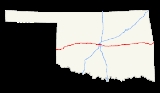
Interstate 40 in Oklahoma
Encyclopedia
Interstate 40 is an Interstate Highway in Oklahoma
that runs 331 miles (530 km) across the state from Texas to Arkansas. West of Oklahoma City, it parallels and replaces Old US-66, and east of Oklahoma City, it parallels US-62, US-266 and US-64.
Cities along the route include Erick, Sayre, Elk City, Clinton, Weatherford, El Reno, Oklahoma City, Shawnee, Okemah, Henryetta, Checotah and Sallisaw.
, in Beckham County
. It crosses the North Fork of the Red River near Sayre
and runs through the south side of Elk City
. It then cuts across the northwest corner of Washita County
before entering Custer County
, where it passes through Clinton
and Weatherford
. After leaving Weatherford, I-40 then runs across the northern tip of Caddo County
before it enters Canadian County
.
I-40 runs through the south side of El Reno
, entering the Oklahoma City metro. It then passes through Yukon
before entering Oklahoma City proper. There, it has a junction with Interstate 44 (the Amarillo Junction). It then runs just south of downtown Oklahoma City on an elevated, dilapidated structure called the I-40 Crosstown, which is scheduled for replacement in 2012. It next meets Interstate 35 in the Fort Smith Junction complex, forming a concurrency
with it for about two miles (3 km). It then passes through Del City
and Midwest City
on a freeway known as the Tinker Diagonal, providing access to Tinker Air Force Base
in Oklahoma City.
In far eastern Oklahoma City, I-40 meets Interstate 240
in a partial junction before passing through the north side of Shawnee
. In Henryetta
, I-40 serves as the northern terminus of the Indian Nation Turnpike
. In McIntosh County
, it crosses the northernmost arm of Lake Eufaula
and meets the US-69 freeway south of Checotah
.
Near Webbers Falls
, I-40 is the southern terminus of the Muskogee Turnpike
. It then crosses the Arkansas River before heading around southern Sallisaw
. The interstate crosses into Arkansas north of Moffett
.
 West of Oklahoma City, Interstate 40 parallels and replaces Old US-66. US-66 was decommissioned in Oklahoma in 1985.
The I-40 bridge over the Arkansas River
/McClellan-Kerr Navigation System near Webbers Falls was struck by a barge on May 26, 2002, causing the bridge to collapse and resulting in the death of 14 people.
was built in 1966, is too narrow for existing traffic, and is very dilapidated. Current plans call for I-40 to be relocated a few blocks south of the exiting route, the elevated route torn down, and a landscaped boulevard built on the old right-of-way, similar to the I-30 reconstruction through downtown Fort Worth, Texas.
 I-40 has eight business route
s in Oklahoma, six of which are old alignments of US-66. A number of other old alignments of US-66 are also present west of Oklahoma City.
Erick I-40 Business Loop (formerly US-66) is a Business Loop that runs from I-40 two miles (3 km) west of Erick
to the old alignment of US-66, through Erick, and back to I-40, four miles (6 km) east of Erick.
Sayre I-40 Business Loop (formerly US-66) is a Business Loop that begins two miles (3 km) south of Sayre at US-283, runs north into the coty, and then leaves Sayre to the east, rejoining I-40 two miles (3 km) east of US-283.
Elk City I-40 Business Loop (formerly US-66) is a Business Loop that begins at Exit 32, seven miles (11 km) west of Elk City. It runs for ten miles (16 km) through Elk City, rejoining I-40 at Exit 41.
Clinton I-40 Business Loop (formerly US-66) is a Business Loop that begins at Exit 65, runs five miles (8 km) through Clinton, and rejoinds I-40 at Exit 69.
Weatherford I-40 Business Loop (formerly US-66) is a Business Loop that exits I-40 at Exit 82B, runs four miles (6 km) through Weatherford, and rejoins I-40 at Exit 82.
El Reno I-40 Business Loop (formerly US-66) is a Business Loop through El Reno. It exits I-40 at Exit 119, runs eight miles (13 km) through El Reno, and rejoins I-40 at Exit 125, the interchange with US-81.
Henryetta I-40 Business Loop (formerly US-62/US-75) is a Business Loop that leaves I-40 at Exit 237, runs four miles (6 km) through Henryetta, and rejoins I-40 at Exit 240, the interchange with US-75 and the Indian Nation Turnpike.
Sallisaw I-40 Business Loop is a Business Loop that leaves I-40 at Exit 308, US-59, runs four miles (6 km) through Sallisaw, and rejoins I-40 at Exit 311, US-64.

Oklahoma
Oklahoma is a state located in the South Central region of the United States of America. With an estimated 3,751,351 residents as of the 2010 census and a land area of 68,667 square miles , Oklahoma is the 28th most populous and 20th-largest state...
that runs 331 miles (530 km) across the state from Texas to Arkansas. West of Oklahoma City, it parallels and replaces Old US-66, and east of Oklahoma City, it parallels US-62, US-266 and US-64.
Cities along the route include Erick, Sayre, Elk City, Clinton, Weatherford, El Reno, Oklahoma City, Shawnee, Okemah, Henryetta, Checotah and Sallisaw.
Route description
Interstate 40 enters Oklahoma near TexolaTexola, Oklahoma
Texola is a town in Beckham County, Oklahoma, United States. The population was 36 at the 2010 census.-Geography:Texola is located at , elevation 2,140 feet ....
, in Beckham County
Beckham County, Oklahoma
Beckham County is a county located in the U.S. state of Oklahoma. As of 2000, the population was 19,799. Its county seat is Sayre.Founded upon statehood in 1907, Beckham County was named for J. C. W...
. It crosses the North Fork of the Red River near Sayre
Sayre, Oklahoma
Sayre is a city in and the county seat of Beckham County, in Western Oklahoma, the United States. It is half-way between Oklahoma City, Oklahoma, and Amarillo, Texas on Interstate 40 and the former U.S. Route 66. The population was 4,375 at the 2010 census....
and runs through the south side of Elk City
Elk City, Oklahoma
Elk City is a city in Beckham County, Oklahoma, United States. The population was 11,693 at the 2010 census. Elk City is located on Interstate 40 and Historic U.S. Route 66 in Western Oklahoma, approximately west of Oklahoma City and east of Amarillo....
. It then cuts across the northwest corner of Washita County
Washita County, Oklahoma
Washita County is a county located in the U.S. state of Oklahoma. As of 2000, the population was 11,508. Its county seat is New Cordell. It was formerly located in Cloud Chief, Oklahoma....
before entering Custer County
Custer County, Oklahoma
Custer County is a county located in the U.S. state of Oklahoma. It was named in honor of General George Armstrong Custer. As of 2000, the population was 26,142. Its county seat is Arapaho.-Geography:...
, where it passes through Clinton
Clinton, Oklahoma
Clinton is a city in Custer and Washita counties in the U.S. state of Oklahoma. The population was 9,033 at the 2010 census.-History:The community began in 1899 when two men, J.L. Avant and E.E...
and Weatherford
Weatherford, Oklahoma
Weatherford is a city in Custer County, Oklahoma, United States. The population was 10,833 at the 2010 census.-Geography:Weatherford is located at , elevation 1,647 feet ....
. After leaving Weatherford, I-40 then runs across the northern tip of Caddo County
Caddo County, Oklahoma
Caddo County is a county located in the U.S. state of Oklahoma. As of 2000, the population was 30,150. Its county seat is Anadarko. It is named after the Caddo tribe who were settled here on the 1870s...
before it enters Canadian County
Canadian County, Oklahoma
Canadian County is a county located in the U.S. state of Oklahoma. As of 2010, the population was 115,541. Its county seat is El Reno. Canadian County is also part of the Oklahoma City Metropolitan Statistical Area. Canadian County is named for the Canadian River.-Geography:According to the U.S...
.
I-40 runs through the south side of El Reno
El Reno, Oklahoma
El Reno is a city in Canadian County, Oklahoma, United States, in the central part of the state. A part of the Oklahoma City Metropolitan Statistical Area, El Reno is west of downtown Oklahoma City...
, entering the Oklahoma City metro. It then passes through Yukon
Yukon, Oklahoma
Yukon is a city in Canadian County, Oklahoma, United States and is part of the Oklahoma City Metropolitan Area. The population was 22,709 at the 2010 census....
before entering Oklahoma City proper. There, it has a junction with Interstate 44 (the Amarillo Junction). It then runs just south of downtown Oklahoma City on an elevated, dilapidated structure called the I-40 Crosstown, which is scheduled for replacement in 2012. It next meets Interstate 35 in the Fort Smith Junction complex, forming a concurrency
Concurrency (road)
A concurrency, overlap, or coincidence in a road network is an instance of one physical road bearing two or more different highway, motorway, or other route numbers...
with it for about two miles (3 km). It then passes through Del City
Del City, Oklahoma
Del City is a city in Oklahoma County, Oklahoma, United States, and a part of the Oklahoma City metropolitan area. The population was 21,332 at the 2010 census....
and Midwest City
Midwest City, Oklahoma
Midwest City is a city in Oklahoma County, Oklahoma, United States, and a part of the Oklahoma City metropolitan area. As of the 2010 census, the population was 54,371, making it the eighth largest city in the state....
on a freeway known as the Tinker Diagonal, providing access to Tinker Air Force Base
Tinker Air Force Base
Tinker Air Force Base is a major U.S. Air Force base, with tenant U.S. Navy and other Department of Defense missions, located in the southeast Oklahoma City, Oklahoma area, directly south of the suburb of Midwest City, Oklahoma.-Overview:...
in Oklahoma City.
In far eastern Oklahoma City, I-40 meets Interstate 240
Interstate 240 (Oklahoma)
Interstate 240 is an Interstate Highway in Oklahoma, USA, that runs 16.22 miles west from Interstate 40 to Interstate 44 in southern Oklahoma City. After its terminus in southwest Oklahoma City, the main I-240 roadbed becomes Interstate 44 and Airport Road toward Will Rogers World Airport...
in a partial junction before passing through the north side of Shawnee
Shawnee, Oklahoma
Shawnee is a city in Pottawatomie County, Oklahoma, United States. The population was 29,857 at the 2010 census. The city is part of the Oklahoma City-Shawnee Combined Statistical Area; it is also the county seat of Pottawatomie County and the principal city of the Shawnee Micropolitan Statistical...
. In Henryetta
Henryetta, Oklahoma
Henryetta is a city in Okmulgee County, Oklahoma, United States. The population was 6,096 at the 2000 census.Henryetta is notable as the high school hometown of NFL Hall of Fame quarterback Troy Aikman...
, I-40 serves as the northern terminus of the Indian Nation Turnpike
Indian Nation Turnpike
The Indian Nation Turnpike is a toll road in southeastern Oklahoma. It is the longest tollway in the state.-Route description:The Indian Nation turnpike is built to parkway-like design standards, omitting a center barrier and left-hand shoulders for a slightly mounded grassy median that is flush...
. In McIntosh County
McIntosh County, Oklahoma
McIntosh County is a county located in the U.S. state of Oklahoma. As of 2000, the population was 19,456. Its county seat is Eufaula.-Geography:...
, it crosses the northernmost arm of Lake Eufaula
Lake Eufaula
Lake Eufaula may refer to:*Eufaula Lake, an artificial lake on the Canadian River in Oklahoma, USA*Walter F. George Lake, an artificial lake on the Chattahoochee River between Alabama and Georgia, USA that is also known known as Lake Eufaula, from the town of Eufaula, Alabama on its western banks...
and meets the US-69 freeway south of Checotah
Checotah, Oklahoma
Checotah is a city in McIntosh County, Oklahoma, United States. It was named for Samuel Checote, the first chief of the Creek Nation elected after the Civil War. The population was 3,481 at the 2000 census....
.
Near Webbers Falls
Webbers Falls, Oklahoma
Webbers Falls is a town in Muskogee County, Oklahoma, United States. The population was 726 at the 2000 census. The name comes from a 7 foot falls in the Arkansas River, itself named in honor of Walter Webber, a Cherokee leader who lived there in the early 19th Century.-The I-40 Bridge Disaster:The...
, I-40 is the southern terminus of the Muskogee Turnpike
Muskogee Turnpike
-Route description:Opened in 1969, the 53-mile route begins at the Broken Arrow Expressway southeast of Tulsa, near an intersection with the Creek Turnpike. The Turnpike ends at Interstate 40 west of Webbers Falls. There are two toll collection plazas located along the length of the Muskogee...
. It then crosses the Arkansas River before heading around southern Sallisaw
Sallisaw, Oklahoma
Sallisaw is a city in Sequoyah County, Oklahoma, United States. It is part of the Fort Smith, Arkansas-Oklahoma Metropolitan Statistical Area. The population was 8,880 at the 2010 census. It is the county seat of Sequoyah County. It has three highways running through it: U.S. 59, or Kerr Boulevard,...
. The interstate crosses into Arkansas north of Moffett
Moffett, Oklahoma
Moffett is a town in Sequoyah County, Oklahoma, United States. It is part of the Fort Smith, Arkansas-Oklahoma Metropolitan Statistical Area. The population was 179 at the 2000 census.-Geography:Moffett is located at ....
.
History
The I-40 bridge over the Arkansas River
Arkansas River
The Arkansas River is a major tributary of the Mississippi River. The Arkansas generally flows to the east and southeast as it traverses the U.S. states of Colorado, Kansas, Oklahoma, and Arkansas. The river's initial basin starts in the Western United States in Colorado, specifically the Arkansas...
/McClellan-Kerr Navigation System near Webbers Falls was struck by a barge on May 26, 2002, causing the bridge to collapse and resulting in the death of 14 people.
Future
The I-40 Crosstown Oklahoma City CrosstownOklahoma City Crosstown
The Oklahoma City Crosstown is an elevated four mile stretch of Interstate 40 that dissects downtown Oklahoma City from Agnew Avenue to Byers Avenue. It is owned and maintained by the Oklahoma Department of Transportation...
was built in 1966, is too narrow for existing traffic, and is very dilapidated. Current plans call for I-40 to be relocated a few blocks south of the exiting route, the elevated route torn down, and a landscaped boulevard built on the old right-of-way, similar to the I-30 reconstruction through downtown Fort Worth, Texas.
Business routes and old alignments
Business route
A business route in the United States and Canada is a short special route connected to a parent numbered highway at its beginning, then routed through the central business district of a nearby city or town, and finally reconnecting with the same parent numbered highway again at its...
s in Oklahoma, six of which are old alignments of US-66. A number of other old alignments of US-66 are also present west of Oklahoma City.
Erick I-40 Business Loop (formerly US-66) is a Business Loop that runs from I-40 two miles (3 km) west of Erick
Erick, Oklahoma
Erick is a city in Beckham County, Oklahoma, United States. The population was 1,052 at the 2010 census.-Geography:Erick is located at , elevation 2,060 feet ....
to the old alignment of US-66, through Erick, and back to I-40, four miles (6 km) east of Erick.
Sayre I-40 Business Loop (formerly US-66) is a Business Loop that begins two miles (3 km) south of Sayre at US-283, runs north into the coty, and then leaves Sayre to the east, rejoining I-40 two miles (3 km) east of US-283.
Elk City I-40 Business Loop (formerly US-66) is a Business Loop that begins at Exit 32, seven miles (11 km) west of Elk City. It runs for ten miles (16 km) through Elk City, rejoining I-40 at Exit 41.
Clinton I-40 Business Loop (formerly US-66) is a Business Loop that begins at Exit 65, runs five miles (8 km) through Clinton, and rejoinds I-40 at Exit 69.
Weatherford I-40 Business Loop (formerly US-66) is a Business Loop that exits I-40 at Exit 82B, runs four miles (6 km) through Weatherford, and rejoins I-40 at Exit 82.
El Reno I-40 Business Loop (formerly US-66) is a Business Loop through El Reno. It exits I-40 at Exit 119, runs eight miles (13 km) through El Reno, and rejoins I-40 at Exit 125, the interchange with US-81.
Henryetta I-40 Business Loop (formerly US-62/US-75) is a Business Loop that leaves I-40 at Exit 237, runs four miles (6 km) through Henryetta, and rejoins I-40 at Exit 240, the interchange with US-75 and the Indian Nation Turnpike.
Sallisaw I-40 Business Loop is a Business Loop that leaves I-40 at Exit 308, US-59, runs four miles (6 km) through Sallisaw, and rejoins I-40 at Exit 311, US-64.
Exit list
| County | Location | Mile | # Exit number An exit number is a number assigned to a road junction, usually an exit from a freeway. It is usually marked on the same sign as the destinations of the exit, as well as a sign in the gore.... |
Destinations | Notes |
|---|---|---|---|---|---|
.svg.png) I-40 I-40Interstate 40 in Texas In the U.S. state of Texas, Interstate 40 runs east–west through the panhandle in the northwest part of the state. The only large city it passes through is Amarillo, where it meets the north end of Interstate 27.-History:... enters Texas Texas Texas is the second largest U.S. state by both area and population, and the largest state by area in the contiguous United States.The name, based on the Caddo word "Tejas" meaning "friends" or "allies", was applied by the Spanish to the Caddo themselves and to the region of their settlement in... |
|||||
| Beckham Beckham County, Oklahoma Beckham County is a county located in the U.S. state of Oklahoma. As of 2000, the population was 19,799. Its county seat is Sayre.Founded upon statehood in 1907, Beckham County was named for J. C. W... |
1 | Texola Texola, Oklahoma Texola is a town in Beckham County, Oklahoma, United States. The population was 36 at the 2010 census.-Geography:Texola is located at , elevation 2,140 feet .... |
|||
| 5 | |||||
| Erick Erick, Oklahoma Erick is a city in Beckham County, Oklahoma, United States. The population was 1,052 at the 2010 census.-Geography:Erick is located at , elevation 2,060 feet .... |
7 | ||||
| 11 | |||||
| 14 | Hext Road | ||||
| Sayre Sayre, Oklahoma Sayre is a city in and the county seat of Beckham County, in Western Oklahoma, the United States. It is half-way between Oklahoma City, Oklahoma, and Amarillo, Texas on Interstate 40 and the former U.S. Route 66. The population was 4,375 at the 2010 census.... |
20 | ||||
| 23 | |||||
| 25 | |||||
| 26 | Cemetery Road | ||||
| 32 | |||||
| 34 | Merritt Road | ||||
| Elk City Elk City, Oklahoma Elk City is a city in Beckham County, Oklahoma, United States. The population was 11,693 at the 2010 census. Elk City is located on Interstate 40 and Historic U.S. Route 66 in Western Oklahoma, approximately west of Oklahoma City and east of Amarillo.... |
38 | ||||
| 40 | East 7th Street | ||||
| 41 | |||||
| Washita Washita County, Oklahoma Washita County is a county located in the U.S. state of Oklahoma. As of 2000, the population was 11,508. Its county seat is New Cordell. It was formerly located in Cloud Chief, Oklahoma.... |
47 | Canute Canute, Oklahoma Canute is a town in Washita County, Oklahoma, United States. The population was 541 at the 2010 census.-History:Canute was established in the early 1900s and located on the now-defunct Rock Island Railroad. Following the advent of the automobile, Canute became a popular stop along U.S... |
|||
| 50 | Clinton Lake Road | ||||
| 53 | |||||
| Custer Custer County, Oklahoma Custer County is a county located in the U.S. state of Oklahoma. It was named in honor of General George Armstrong Custer. As of 2000, the population was 26,142. Its county seat is Arapaho.-Geography:... |
57 | Stafford Road | |||
| 61 | Haggard Road | ||||
| 62 | Parkersburg Road | ||||
| Clinton Clinton, Oklahoma Clinton is a city in Custer and Washita counties in the U.S. state of Oklahoma. The population was 9,033 at the 2010 census.-History:The community began in 1899 when two men, J.L. Avant and E.E... |
65 | No eastbound entrance | |||
| 65A | 10th Street, Neptune Drive | ||||
| 66 | |||||
| 69 | Westbound exit and eastbound entrance | ||||
| 71 | Custer City Road | ||||
| 80 | |||||
| Weatherford Weatherford, Oklahoma Weatherford is a city in Custer County, Oklahoma, United States. The population was 10,833 at the 2010 census.-Geography:Weatherford is located at , elevation 1,647 feet .... |
80A | – Southwestern Oklahoma State University Southwestern Oklahoma State University Southwestern Oklahoma State University is a public university in Weatherford and Sayre, Oklahoma. It is one of seven state regional universities in the state of Oklahoma.The current president of SWOSU is Randy Beutler.-History:... |
Eastbound exit and westbound entrance | ||
| 82 | |||||
| 84 | Airport Road | ||||
| Caddo Caddo County, Oklahoma Caddo County is a county located in the U.S. state of Oklahoma. As of 2000, the population was 30,150. Its county seat is Anadarko. It is named after the Caddo tribe who were settled here on the 1870s... |
88 | ||||
| 95 | Bethel Road | ||||
| 101 | |||||
| Canadian Canadian County, Oklahoma Canadian County is a county located in the U.S. state of Oklahoma. As of 2010, the population was 115,541. Its county seat is El Reno. Canadian County is also part of the Oklahoma City Metropolitan Statistical Area. Canadian County is named for the Canadian River.-Geography:According to the U.S... |
104 | Methodist Road | |||
| 108 |   US-281 Spur north – Geary US-281 Spur north – GearyGeary, Oklahoma Geary is a city in Blaine and Canadian counties in the U.S. state of Oklahoma. The population was 1,280 at the 2010 census.-Geography:Geary is located at .... , Watonga Watonga, Oklahoma Watonga is a city in Blaine County, Oklahoma, United States. The population was 4,658 at the 2000 census. It is the county seat of Blaine County.-Early History:... |
||||
| 115 | West end of US-270 overlap | ||||
| 119 | |||||
| El Reno El Reno, Oklahoma El Reno is a city in Canadian County, Oklahoma, United States, in the central part of the state. A part of the Oklahoma City Metropolitan Statistical Area, El Reno is west of downtown Oklahoma City... |
123 | Country Club Road | |||
| 125 | |||||
| 130 | Banner Road | ||||
| 132 | Cimarron Road – C.E. Page Airport | ||||
| Yukon Yukon, Oklahoma Yukon is a city in Canadian County, Oklahoma, United States and is part of the Oklahoma City Metropolitan Area. The population was 22,709 at the 2010 census.... |
136 | ||||
| 137 | Cornwell Drive, Czech Hall Road | ||||
| 138 | Westbound exit via exit 139 | ||||
| 139 | Kilpatrick Turnpike east | ||||
| 140 | Morgan Road | ||||
| Oklahoma Oklahoma County, Oklahoma Oklahoma County is a county located in the central partof the U.S. state of Oklahoma. The population was 718,633 at the 2010 census. The county seat and principal city is Oklahoma City... |
Oklahoma City Oklahoma city Oklahoma City is the capital and largest city of the U.S. state of Oklahoma.Oklahoma City may also refer to:*Oklahoma City metropolitan area*Downtown Oklahoma City*Uptown Oklahoma City*Oklahoma City bombing*Oklahoma City National Memorial... |
142 | Council Road | ||
| 143 | Rockwell Avenue | ||||
| 144 | MacArthur Boulevard | ||||
| 145 | Meridian Avenue | ||||
| 146 | Portland Avenue | Eastbound exit and westbound entrance | |||
| 147A | Signed as exits 147A (west) and 147B (east) | ||||
| 147C | May Avenue – Fair Park | Westbound exit and eastbound entrance | |||
| 148A | Agnew Avenue, Villa Avenue | ||||
| 148B | Penn Avenue | Eastbound exit and westbound entrance | |||
| 148C | Virginia Avenue | Westbound exit and eastbound entrance | |||
| 149A | Western Avenue, Reno Avenue, Sheridan Avenue | ||||
| 149B | Classen Boulevard | Westbound exit and eastbound entrance | |||
| 150A | Walker Avenue – Downtown Oklahoma City Downtown Oklahoma City Downtown Oklahoma City is located at the geographic center of the Oklahoma City metropolitan area and is the principal business district of the city. With 115 city blocks and around of office space, downtown Oklahoma City also is the economic, financial, and entertainment center of the city... |
Eastbound exit and westbound entrance | |||
| 150B | Harvey Avenue | Eastbound exit only | |||
| 150C | Robinson Avenue, E.K. Gaylord Boulevard, Shields Boulevard – Downtown Oklahoma City Downtown Oklahoma City Downtown Oklahoma City is located at the geographic center of the Oklahoma City metropolitan area and is the principal business district of the city. With 115 city blocks and around of office space, downtown Oklahoma City also is the economic, financial, and entertainment center of the city... |
No eastbound exit | |||
| 151A | Lincoln Boulevard | Eastbound exit only. Closed due to construction of the new I-40 Crosstown. | |||
| 151B | – Dallas | West end of I-35/US-62 overlap | |||
| 151C | , State Capitol Oklahoma State Capitol The Oklahoma State Capitol is the house of government of the U.S. state of Oklahoma. It is the building that houses the Oklahoma Legislature, and the meeting place of the Oklahoma Supreme Court. It is located along Lincoln Boulevard in Oklahoma City. The present structure includes a dome that was... , Oklahoma Health Center |
Signed as exit 126 westbound | |||
| 127 | Eastern Avenue, M. L. King Avenue | Eastbound exit and westbound entrance | |||
| 153 | , Wichita Wichita, Kansas Wichita is the largest city in the U.S. state of Kansas.As of the 2010 census, the city population was 382,368. Located in south-central Kansas on the Arkansas River, Wichita is the county seat of Sedgwick County and the principal city of the Wichita metropolitan area... |
East end of I-35/US-62 overlap | |||
| Del City Del City, Oklahoma Del City is a city in Oklahoma County, Oklahoma, United States, and a part of the Oklahoma City metropolitan area. The population was 21,332 at the 2010 census.... |
154 | Reno Avenue, Scott Street | |||
| 155A | Sunny Lane Road – Del City Del City, Oklahoma Del City is a city in Oklahoma County, Oklahoma, United States, and a part of the Oklahoma City metropolitan area. The population was 21,332 at the 2010 census.... |
||||
| 155B | Southeast 15th Street – Del City Del City, Oklahoma Del City is a city in Oklahoma County, Oklahoma, United States, and a part of the Oklahoma City metropolitan area. The population was 21,332 at the 2010 census.... , Midwest City Midwest City, Oklahoma Midwest City is a city in Oklahoma County, Oklahoma, United States, and a part of the Oklahoma City metropolitan area. As of the 2010 census, the population was 54,371, making it the eighth largest city in the state.... |
||||
| Midwest City Midwest City, Oklahoma Midwest City is a city in Oklahoma County, Oklahoma, United States, and a part of the Oklahoma City metropolitan area. As of the 2010 census, the population was 54,371, making it the eighth largest city in the state.... |
156A | Sooner Road | |||
| 156B | Hudiburg Drive | No eastbound entrance | |||
| 157A | Southeast 29th Street – Midwest City Midwest City, Oklahoma Midwest City is a city in Oklahoma County, Oklahoma, United States, and a part of the Oklahoma City metropolitan area. As of the 2010 census, the population was 54,371, making it the eighth largest city in the state.... |
Eastbound exit only | |||
| 157B | Air Depot Bloulevard - Tinker Gate | ||||
| 157C | Town Center Drive - Eaker Gate | ||||
| 159A | Hruskocy Gate | ||||
| 159B | Douglas Boulevard – Midwest City Midwest City, Oklahoma Midwest City is a city in Oklahoma County, Oklahoma, United States, and a part of the Oklahoma City metropolitan area. As of the 2010 census, the population was 54,371, making it the eighth largest city in the state.... , Tinker Air Force Base Tinker Air Force Base Tinker Air Force Base is a major U.S. Air Force base, with tenant U.S. Navy and other Department of Defense missions, located in the southeast Oklahoma City, Oklahoma area, directly south of the suburb of Midwest City, Oklahoma.-Overview:... Gates |
||||
| Oklahoma City Oklahoma City, Oklahoma Oklahoma City is the capital and the largest city in the state of Oklahoma. The county seat of Oklahoma County, the city ranks 31st among United States cities in population. The city's population, from the 2010 census, was 579,999, with a metro-area population of 1,252,987 . In 2010, the Oklahoma... |
162 | Anderson Road | |||
| 165 | , Dallas | West end of SH-3 overlap; westbound exit and eastbound entrance | |||
| 166 | Choctaw Road | ||||
| 169 | Peebly Road | ||||
| 172 | Newalla Road – Harrah Harrah, Oklahoma Harrah is a city in Oklahoma County, Oklahoma, United States, and a part of the Oklahoma City metropolitan area. Located east of downtown Oklahoma City, Harrah had a population of 5,148 people as of 2009.-Geography:... |
||||
| Pottawatomie Pottawatomie County, Oklahoma Pottawatomie County is a county located in the U.S. state of Oklahoma. The population was 65,521 as of the 2000 census. Its county seat is Shawnee... |
176 | West end of SH-102 overlap | |||
| 178 | East end of SH-102 overlap | ||||
| 181 | East end of US-270 overlap | ||||
| Shawnee Shawnee, Oklahoma Shawnee is a city in Pottawatomie County, Oklahoma, United States. The population was 29,857 at the 2010 census. The city is part of the Oklahoma City-Shawnee Combined Statistical Area; it is also the county seat of Pottawatomie County and the principal city of the Shawnee Micropolitan Statistical... |
185 | ||||
| 186 | |||||
| 192 | |||||
| Seminole Seminole County, Oklahoma Seminole County is a county located in the U.S. state of Oklahoma. The population was 24,894 at the 2000 census. Its county seat is Wewoka. Before Oklahoma's admission as a state, the county was the entire small portion of Indian Territory allocated to the Seminoles. Seminole County has been an... |
200 | ||||
| 212 | |||||
| Okfuskee Okfuskee County, Oklahoma Okfuskee County is a county located in the U.S. state of Oklahoma. As of 2000, the population was 11,814. Its county seat is Okemah.-Geography:... |
217 | ||||
| 221 | West end of US-62 overlap | ||||
| 227 | Clearview Road | ||||
| 231 | - Weleetka | West end of US-75 overlap | |||
| Okmulgee Okmulgee County, Oklahoma Okmulgee County is a county located in the U.S. state of Oklahoma. As of 2000, the population was 39,685. Its county seat is Okmulgee.-Geography:According to the U.S. Census Bureau, the county has a total area of 1,819 km²... |
Henryetta Henryetta, Oklahoma Henryetta is a city in Okmulgee County, Oklahoma, United States. The population was 6,096 at the 2000 census.Henryetta is notable as the high school hometown of NFL Hall of Fame quarterback Troy Aikman... |
237 | |||
| 240A | Indian Nation Turnpike Indian Nation Turnpike The Indian Nation Turnpike is a toll road in southeastern Oklahoma. It is the longest tollway in the state.-Route description:The Indian Nation turnpike is built to parkway-like design standards, omitting a center barrier and left-hand shoulders for a slightly mounded grassy median that is flush... – McAlester McAlester, Oklahoma McAlester is a city in Pittsburg County, Oklahoma, United States. The population was 17,783 at the 2000 census. It is the county seat of Pittsburg County. It is currently the largest city in the Choctaw Nation of Oklahoma, followed by Durant.... , Dallas |
||||
| 240B | East end of US-62/US-75 overlap | ||||
| McIntosh McIntosh County, Oklahoma McIntosh County is a county located in the U.S. state of Oklahoma. As of 2000, the population was 19,456. Its county seat is Eufaula.-Geography:... |
247 | Tiger Mountain Road | |||
| 255 | Pierce Road | ||||
| 259 | |||||
| 262 | |||||
| 264 | , Dallas | Signed as exits 264A (south) and 264B (north) | |||
| 265 | |||||
| 270 | Texanna Road – Porum Landing | ||||
| Muskogee Muskogee County, Oklahoma Muskogee County is a county located in the U.S. state of Oklahoma. As of 2010, the population was 70,990. Its county seat is Muskogee.-Government:... |
278 | ||||
| 284 | Ross Road | ||||
| 286 | Muskogee Turnpike Muskogee Turnpike -Route description:Opened in 1969, the 53-mile route begins at the Broken Arrow Expressway southeast of Tulsa, near an intersection with the Creek Turnpike. The Turnpike ends at Interstate 40 west of Webbers Falls. There are two toll collection plazas located along the length of the Muskogee... west – Muskogee Muskogee, Oklahoma Muskogee is a city in Muskogee County, Oklahoma, United States. It is the county seat of Muskogee County, and home to Bacone College. The population was 38,310 at the 2000 census, making it the eleventh-largest city in Oklahoma.... , Tulsa |
||||
| 287 | |||||
| Sequoyah Sequoyah County, Oklahoma Sequoyah County is a county located in the U.S. state of Oklahoma. It is part of the Fort Smith, Arkansas-Oklahoma Metropolitan Statistical Area. As of 2000, the population was 38,972. Its county seat is Sallisaw.-History:... |
291 | ||||
| 297 | |||||
| 303 | Dwight Mission Road | ||||
| Sallisaw Sallisaw, Oklahoma Sallisaw is a city in Sequoyah County, Oklahoma, United States. It is part of the Fort Smith, Arkansas-Oklahoma Metropolitan Statistical Area. The population was 8,880 at the 2010 census. It is the county seat of Sequoyah County. It has three highways running through it: U.S. 59, or Kerr Boulevard,... |
308 | ||||
| 311 | |||||
| 321 | |||||
| 325 | , Fort Smith Fort Smith, Arkansas Fort Smith is the second-largest city in Arkansas and one of the two county seats of Sebastian County. With a population of 86,209 in 2010, it is the principal city of the Fort Smith, Arkansas-Oklahoma Metropolitan Statistical Area, a region of 298,592 residents which encompasses the Arkansas... |
||||
| 330 | – Dora Dora, Arkansas Dora is an unincorporated community in Crawford County in the western part of the U.S. state of Arkansas. It is located approximately 3 miles west of Van Buren on the Arkansas-Oklahoma border along Interstate 40. Dora shares its ZIP code and other municipal services with Van Buren.The community... , Fort Smith Fort Smith, Arkansas Fort Smith is the second-largest city in Arkansas and one of the two county seats of Sebastian County. With a population of 86,209 in 2010, it is the principal city of the Fort Smith, Arkansas-Oklahoma Metropolitan Statistical Area, a region of 298,592 residents which encompasses the Arkansas... |
Eastbound exit and wesbound entrance | |||
.svg.png) I-40 I-40Interstate 40 in Arkansas Interstate 40 is an east–west Interstate Highway that has a section in the U.S. state of Arkansas connecting sections in Oklahoma to Tennessee. The route enters Arkansas from the west just north of the Arkansas River near Dora... enters Arkansas Arkansas Arkansas is a state located in the southern region of the United States. Its name is an Algonquian name of the Quapaw Indians. Arkansas shares borders with six states , and its eastern border is largely defined by the Mississippi River... |
|||||