
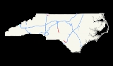
Interstate 74 in North Carolina
Encyclopedia
In the U.S. state
of North Carolina
, Interstate 74 (I-74) is an Interstate Highway
that is partially completed. Currently in four distinct segments in the state; when completed, it will traverse in a southeasterly direction from Virginia
to South Carolina
, connecting the cities of Winston-Salem
, High Point
, Rockingham
, and Whiteville
.
, Sandhills
, and Cape Fear
regions in the state.
state line (overlapped
with I-77
for approximately 4 miles (6.4 km). After separation, it goes east and connects to US 52
near Mount Airy
, where the first section ends.
Future I-74 is to be signed along US 52 from Mount Airy to Bethania
, where it will then separate onto the new Winston-Salem Northern Beltway
and go east around Winston-Salem
before connecting to existing US 311
south of Kernersville
. Under a new accelerated construction plan for the Beltway, right-of-way acquisition is to begin in 2012 and construction to start in 2015. Until construction is completed, travelers wanting to connect between the first and second section of I-74 should stay on US 52 through downtown Winston-Salem, and then take I-40
east to US 311 south towards High Point
.
The second section of I-74 is called the High Point East Belt, which begins at mile marker 65 in High Point to mile marker 79 near Glenola. It connects High Point with both I-85 Business
and I-85
. Construction is scheduled to be completed in October 2012 that will extend the freeway, along US 311, to I-73 at Sophia
.
Future I-74 starts again in Sophia, overlapped with I-73 and US 220, going south to Ulah
. The freeway is already completed, but it is not up to full interstate standards yet. It bypasses the city of Asheboro
where a project to improve US 220 to interstate standards is underway, due to be completed by the end of 2012.
The third section of I-74 is overlapped with I-73 and US 220
between (US 220) mile markers 51-24 (26 miles (41.8 km)). It bypasses the towns of Seagrove
, Biscoe
and Candor
. Visitor centers (completed in 2010) are located eastbound and westbound at mile marker 44. After Exit 24 (Alternate U.S. 220), the freeway continue as Future I-73, Future I-74 and US 220 for another 16 miles (25.7 km) towards Rockingham
before converting into an at-grade expressway
after Exit 9.
bypass freeway, which goes south around Rockingham and Hamlet
. Future I-73 ends near the NC 38
exit where it is planned to be routed south into South Carolina. Future I-74 continues to the end of the freeway. Between Hamlet and Laurinburg
is an at-grade expressway that will eventually be upgraded to Interstate standards. At Laurinburg, I-74 is to use the Laurinburg Bypass was at the standard North Carolina freeway grade and signed as I-74 in 2008; however, NCDOT had to remove the signage the following year when FHWA ruled against using them until the freeway was up to Interstate standards.
The fourth section of I-74 is officially named the American Indian Highway, completed in 2008, this (19 miles (30.6 km)) section stretches from Maxton
to south of Lumberton
, connecting with I-95
/US 301
. After NC 41
, I-74 ends for the final time as the highway continues on as an at-grade expressway signed as Future I-74/US 74.
and bypassing the town of Lake Waccamaw
. Before the town of Bolton
, it will separate from US 74 onto a proposed new freeway towards Shallotte
, then go west on the proposed extension of the Carolina Bays Parkway into South Carolina
. This entire section of I-74 is still under a Feasibility Study with several possible routing options, it thus may take years before connecting South Carolina. Current NCDOT plans suggest that construction may not begin until after 2020, and that this will likely be the last section of I-74 to be completed.
!County
!Location
!Mile
!#
!Destinations
!Notes
|-
|rowspan=11|Surry
!colspan=5|I-74 overlaps with Interstate 77 (Virginia state line to exit 101)
|-
|rowspan=2|Pine Ridge
|style="background:#ddffdd"|5
|style="background:#ddffdd"|5
|style="background:#ddffdd"|
|style="background:#ddffdd"|South end of I-77 overlap
|-
|6
|6
|
|
|-
|rowspan=4|Mount Airy
|8
|8
|Red Brush Road
|
|-
|11
|11
|
|
|-
|13
|13
|Park Drive
|
|-
|style="background:#ddffdd"|17
|style="background:#ddffdd"|17
|style="background:#ddffdd"|
|style="background:#ddffdd"|End of I-74 east/Begin of I-74 west; south end of US 52 overlap
|-
|
|style="background:#ffdead"|21
|style="background:#ffdead"|136
|style="background:#ffdead"|Cook School Road
|rowspan=5 style="background:#ffdead"|Proposed Upgrade of Pilot Mountain Parkway to Interstate Standards (Unfunded)
|-
|
|style="background:#ffdead"|22
|style="background:#ffdead"|135
|style="background:#ffdead"|W. Main St. – Pilot Mountain
|-
|Pilot Mountain
|style="background:#ffdead"|23
|style="background:#ffdead"|134
|style="background:#ffdead"|
|-
|
|style="background:#ffdead"|26
|style="background:#ffdead"|131
|style="background:#ffdead"|Pilot Knob Park Rd. – Pilot Mountain State Park
|-
|Stokes
|
|style="background:#ffdead"|28
|style="background:#ffdead"|129
|style="background:#ffdead"|Perch Rd. – Pinnacle
|-
|rowspan=15|Forsyth
|rowspan=2|King
|style="background:#ffdead"|34
|style="background:#ffdead"|123
|style="background:#ffdead"|S. Main St. – King
, Tobaccoville
|rowspan=4 style="background:#ffdead"|Proposed Upgrade of John M. Gold Freeway to Interstate Standards (Unfunded)
|-
|style="background:#ffdead"|35
|style="background:#ffdead"|122
|style="background:#ffdead"|Moore-RJR Drive
|-
|rowspan=2|Rural Hall
|style="background:#ffdead"|37
|style="background:#ffdead"|120
|style="background:#ffdead"|Westinghouse Road
|-
|style="background:#ffdead"|39
|style="background:#ffdead"|118
|style="background:#ffdead"|
|-
|Bethania
|style="background:#ffdead"|40
|style="background:#ffdead"|
|style="background:#ffdead"|
|rowspan=8 style="background:#ffdead"|Proposed Winston-Salem Northern Beltway
(Unfunded)
|-
|rowspan=2|Winston-Salem
|style="background:#ffdead"|43
|style="background:#ffdead"|
|style="background:#ffdead"|
|-
|style="background:#ffdead"|45
|style="background:#ffdead"|
|style="background:#ffdead"|Baux Mountain Road
|-
|rowspan=2|Walkertown
|style="background:#ffdead"|48
|style="background:#ffdead"|
|style="background:#ffdead"|
|-
|style="background:#ffdead"|51
|style="background:#ffdead"|
|style="background:#ffdead"|
|-
|Kernersville
|style="background:#ffdead"|53
|style="background:#ffdead"|
|style="background:#ffdead"|
|-
|Winston-Salem
|style="background:#ffdead"|56
|style="background:#ffdead"|
|style="background:#ffdead"|
|-
|rowspan=4|
|style="background:#ffdead"|57
|style="background:#ffdead"|
|style="background:#ffdead"|
|-
|style="background:#ffdead"|59
|style="background:#ffdead"|59
|style="background:#ffdead"|Union Cross Road
|rowspan=3 style="background:#ffdead"|Proposed Upgrade to Interstate Standards (Unfunded)
|-
|style="background:#ffdead"|60
|style="background:#ffdead"|60
|style="background:#ffdead"|High Point Road
|-
|style="background:#ffdead"|63
|style="background:#ffdead"|63
|style="background:#ffdead"|
|-
|rowspan=8|Guilford
|rowspan=8|High Point
|65
|65
|North Main Street
|Begin of I-74 east/End of I-74 west
|-
|66
|66
|Johnson Street
|
|-
|67
|67
|
|To John Wesley College
and Oak Hollow Mall
|-
|69
|69
|Greensboro Road
|To High Point University
|-
|70
|70
|Kivett Drive
|
|-
|rowspan=2|71
|71A
|East Green Drive
|
|-
|71B
|
|
|-
|75
|75
|
|Opened 22 Nov 2010
|-
|rowspan=3|Randolph
|Glenola
|style="background:#ffdddd"|79
|style="background:#ffdddd"|79
|style="background:#ffdddd"|Cedar Square Road
|style="background:#ffdddd"|End of I-74 east/Begin of I-74 west; Opened 22 Nov 2010
|-
|rowspan=2|Sophia
|style="background:#ffdead"|85
|style="background:#ffdead"|
|style="background:#ffdead"|
|rowspan=2 style="background:#ffdead"|Under Construction (Projected Oct. 2012)
|-
|style="background:#ffdead"|87
|style="background:#ffdead"|
|style="background:#ffdead"|
|-
!colspan=6|I-74 overlaps with Interstate 73
|-
|rowspan=7|Richmond
|rowspan=4|Rockingham
|style="background:#ffdead"|156
|style="background:#ffdead"|306
|style="background:#ffdead"|
|rowspan=7 style="background:#ffdead"|Proposed Upgrade to Interstate Standards (Unfunded)
|-
|style="background:#ffdead"|158
|style="background:#ffdead"|308
|style="background:#ffdead"|Galestown Rd. – Rockingham
, Cordova
|-
|style="background:#ffdead"|160
|style="background:#ffdead"|311
|style="background:#ffdead"|, Cheraw
|-
|style="background:#ffdead"|165
|style="background:#ffdead"|316
|style="background:#ffdead"|
|-
|rowspan=3|Hamlet
|style="background:#ffdead"|168
|style="background:#ffdead"|319
|style="background:#ffdead"|, Bennettsville
|-
|style="background:#ffdead"|169
|style="background:#ffdead"|320
|style="background:#ffdead"|
|-
|style="background:#ffdead"|170
|style="background:#ffdead"|321
|style="background:#ffdead"|
|-
|rowspan=9|Scotland
|rowspan=3|Old Hundred
|style="background:#ffdead"|
|style="background:#ffdead"|
|style="background:#ffdead"|
|rowspan=10 style="background:#ffdead"|Proposed Upgrade of Laurinburg Bypass to Interstate Standards (Unfunded)
|-
|style="background:#ffdead"|181
|style="background:#ffdead"|181
|style="background:#ffdead"|
|-
|style="background:#ffdead"|182
|style="background:#ffdead"|182
|style="background:#ffdead"|
|-
|rowspan=6|Laurinburg
|style="background:#ffdead"|183
|style="background:#ffdead"|183
|style="background:#ffdead"|, Bennettsville
|-
|style="background:#ffdead"|184
|style="background:#ffdead"|184
|style="background:#ffdead"|
|-
|style="background:#ffdead"|185
|style="background:#ffdead"|185
|style="background:#ffdead"|
|-
|style="background:#ffdead"|186
|style="background:#ffdead"|186
|style="background:#ffdead"|Highland Rd. – Laurinburg
, E. Laurinburg
|-
|style="background:#ffdead"|187
|style="background:#ffdead"|187
|style="background:#ffdead"|
|-
|style="background:#ffdead"|190
|style="background:#ffdead"|190
|style="background:#ffdead"| Airport Rd. – Laurinburg-Maxton Airport
, Maxton
|-
|rowspan=13|Robeson
|Maxton
|style="background:#ffdead"|191
|style="background:#ffdead"|191
|style="background:#ffdead"|
|-
|rowspan=8|
|rowspan=2|194
|194A
|
|Begin of I-74 east/End of I-74 west
|-
|194B
|
|
|-
|197
|197
|Cabinet Shop Road
|
|-
|200
|200
|
|
|-
|203
|203
|Dew Road - Pembroke
|
|-
|207
|207
|Back Swamp Road
|
|-
|rowspan=2|209
|209A
|
|
|-
|209B
|, Dillon
|
|-
|rowspan=2|Lumberton
|210
|210
|
|
|-
|213
|213
|
|End of I-74 east/Begin of I-74 west
|-
|rowspan=2|
|style="background:#ffdead"|221
|style="background:#ffdead"|
|style="background:#ffdead"|
|rowspan=2 style="background:#ffdead"|Proposed Upgrade to Interstate Standards (Unknown)
|-
|style="background:#ffdead"|222
|style="background:#ffdead"|
|style="background:#ffdead"|
|-
|rowspan=11|Columbus
|Evergreen
|style="background:#ffdead"|228
|style="background:#ffdead"|
|style="background:#ffdead"|
|rowspan=10 style="background:#ffdead"|Proposed Upgrade to Interstate Standards (Unfunded)
|-
|rowspan=3|Chadbourn
|style="background:#ffdead"|234
|style="background:#ffdead"|
|style="background:#ffdead"|
|-
|style="background:#ffdead"|236
|style="background:#ffdead"|
|style="background:#ffdead"|
|-
|style="background:#ffdead"|239
|style="background:#ffdead"|
|style="background:#ffdead"|Union Valley Road – Union Valley
|-
|rowspan=2|Whiteville
|style="background:#ffdead"|241
|style="background:#ffdead"|
|style="background:#ffdead"|
|-
|style="background:#ffdead"|244
|style="background:#ffdead"|
|style="background:#ffdead"|
|-
|Hallsboro
|style="background:#ffdead"|248
|style="background:#ffdead"|
|style="background:#ffdead"|Hallsboro Road – Hallsboro
|-
|Lake Waccamaw
|style="background:#ffdead"|252
|style="background:#ffdead"|
|style="background:#ffdead"|Chauncey Town Road – Lake Waccamaw
|-
|rowspan=3|Bolton
|style="background:#ffdead"|258
|style="background:#ffdead"|
|style="background:#ffdead"|
|-
|style="background:#ffdead"|259
|style="background:#ffdead"|
|style="background:#ffdead"|
|-
|style="background:#ffdead"|260
|style="background:#ffdead"|
|style="background:#ffdead"|
|rowspan=4 style="background:#ffdead"|Proposed New Freeway (Preliminary)
|-
|rowspan=6|Brunswick
|rowspan=2|Ash
|style="background:#ffdead"|
|style="background:#ffdead"|
|style="background:#ffdead"|
|-
|style="background:#ffdead"|
|style="background:#ffdead"|
|style="background:#ffdead"|Camp Branch Road
|-
|Shallotte
|style="background:#ffdead"|
|style="background:#ffdead"|
|style="background:#ffdead"|
|-
|rowspan=2|Grissettown
|style="background:#ffdead"|
|style="background:#ffdead"|
|style="background:#ffdead"|
|rowspan=3 style="background:#ffdead"|Proposed Carolina Bays Parkway (Preliminary)
|-
|style="background:#ffdead"|
|style="background:#ffdead"|
|style="background:#ffdead"|
|-
|Carolina Shores
|style="background:#ffdead"|
|style="background:#ffdead"|
|style="background:#ffdead"|
|-
, to travel from Michigan
to South Carolina
. Because of several disputes to the routing, a compromise was reached in 1995, by Senator John Warner
and Senator Lauch Faircloth
, that extended Interstate 74
from its then current eastern terminus of Cincinnati, Ohio
to overlap Interstate 73
. In Virginia
, I-74 would follow I-77
into North Carolina
, while I-73
would go east to Roanoke
then south along US 220 towards Greensboro
.ref>Justin Catanoso, "New Proposal for I-73 Stirs Triad Rivalry," Greensboro News & Record, April 14, 1995. Another compromise, between Senator Lauch Faircloth
and Senator Strom Thurmond
, agreed to have both interstates enter South Carolina: I-73 south of Rockingham
and I-74 south of Wilmington
. After later amendments and the Transportation Equity Act for the 21st Century of 1996 (TEA-21), on July 25, 1996, AASHTO
accepted Interstates 73/74 into the Interstate Highway System within the states of South Carolina, North Carolina, and Virginia.
In the May of 1997, the first section of I-73/I-74 was established on a 26 miles (41.8 km) of existing and new freeway between Ulah
and Candor
along US 220.
to NC 89 in 1994. It cost $10 million to build and was regarded simply as a place-holder for a future Interstate. Four years later, in 1998, the freeway was extended to US 601
and rebannered as I-74. On June 30, 1999, the freeway was extended an additional 5 miles (8 km) to US 52
, south of Mount Airy
. In April of 2001, I-74 was overlapped with I-77
from the Virginia
state line to exit 101.
was opened between Maxton
to NC 41
near Lumberton
, known as the American Indian Highway. The Laurinburg Bypass was also resigned I-74/US 74
at the same time. The following year the Laurinburg Bypass was removed of its I-74 designation by NCDOT, during the Summer, after a ruling from the FHWA
(it returned as Future I-74). The reason was that the section, though a freeway by North Carolina standards, it was not up to Interstate standards. It was also at this same time that NCDOT fixed a exit number error along mile markers 181-191.
to Cedar Square Road near Glenola. This also includes the 6.4 miles (10.3 km) section of new freeway that opened between I-85 Business Cedar Square Road.
U.S. state
A U.S. state is any one of the 50 federated states of the United States of America that share sovereignty with the federal government. Because of this shared sovereignty, an American is a citizen both of the federal entity and of his or her state of domicile. Four states use the official title of...
of North Carolina
North Carolina
North Carolina is a state located in the southeastern United States. The state borders South Carolina and Georgia to the south, Tennessee to the west and Virginia to the north. North Carolina contains 100 counties. Its capital is Raleigh, and its largest city is Charlotte...
, Interstate 74 (I-74) is an Interstate Highway
Interstate Highway System
The Dwight D. Eisenhower National System of Interstate and Defense Highways, , is a network of limited-access roads including freeways, highways, and expressways forming part of the National Highway System of the United States of America...
that is partially completed. Currently in four distinct segments in the state; when completed, it will traverse in a southeasterly direction from Virginia
Virginia
The Commonwealth of Virginia , is a U.S. state on the Atlantic Coast of the Southern United States. Virginia is nicknamed the "Old Dominion" and sometimes the "Mother of Presidents" after the eight U.S. presidents born there...
to South Carolina
South Carolina
South Carolina is a state in the Deep South of the United States that borders Georgia to the south, North Carolina to the north, and the Atlantic Ocean to the east. Originally part of the Province of Carolina, the Province of South Carolina was one of the 13 colonies that declared independence...
, connecting the cities of Winston-Salem
Winston-Salem, North Carolina
Winston-Salem is a city in the U.S. state of North Carolina, with a 2010 population of 229,617. Winston-Salem is the county seat and largest city of Forsyth County and the fourth-largest city in the state. Winston-Salem is the second largest municipality in the Piedmont Triad region and is home to...
, High Point
High Point, North Carolina
High Point is a city located in the Piedmont Triad region of North Carolina. As of 2010 the city had a total population of 104,371, according to the US Census Bureau. High Point is currently the eighth-largest municipality in North Carolina....
, Rockingham
Rockingham, North Carolina
Rockingham is a city in Richmond County, North Carolina, United States named after the Marquis of Rockingham. The population was 9,672 at the 2000 census. It is the county seat of Richmond County...
, and Whiteville
Whiteville, North Carolina
Whiteville is a city in Columbus County, North Carolina, United States. The population was 5,148 at the 2000 census. It is the only city of Columbus County and is the county seat....
.
Route description
As of November 2011, there is a total of 77 miles (123.9 km) of Interstate 74, broken in four sections across the Piedmont TriadPiedmont Triad
The Piedmont Triad, or Triad, is a north-central region of the U.S. state of North Carolina that consists of the area within and surrounding the three major cities of Greensboro, Winston-Salem, and High Point. This close group or "triad" of cities lies in the Piedmont geographical region of the...
, Sandhills
Sandhills (Carolina)
The Sandhills is a region in the interior of the U.S. states of North Carolina and South Carolina. It is a strip of ancient beach dunes which generally divides the Piedmont from the coastal plain, and is the evidence of a former coastline when the ocean level was higher, or the land lower. The...
, and Cape Fear
Cape Fear (region)
Cape Fear is a coastal plain and tidewater region of North Carolina centered about the city of Wilmington. The region takes its name from the adjacent Cape Fear headland, as does the Cape Fear River which flows through the region and empties into the Atlantic Ocean near the cape...
regions in the state.
Piedmont Triad
The first section of I-74 begins at the VirginiaVirginia
The Commonwealth of Virginia , is a U.S. state on the Atlantic Coast of the Southern United States. Virginia is nicknamed the "Old Dominion" and sometimes the "Mother of Presidents" after the eight U.S. presidents born there...
state line (overlapped
Concurrency (road)
A concurrency, overlap, or coincidence in a road network is an instance of one physical road bearing two or more different highway, motorway, or other route numbers...
with I-77
Interstate 77 in North Carolina
In the U.S. state of North Carolina, Interstate 77 is a Interstate Highway, which serves the city of Charlotte and the Western Piedmont.-Route description:...
for approximately 4 miles (6.4 km). After separation, it goes east and connects to US 52
U.S. Route 52 in North Carolina
U.S. Route 52 is an north–south United States highway that runs for from the South Carolina state line, near McFarlan, to the Virginia state line, near Mount Airy. It serves as a strategic highway through the central North Carolina Piedmont....
near Mount Airy
Mount Airy, North Carolina
Mount Airy is a city in Surry County, North Carolina, United States. As of the 2010 census, the city population was 10,388.-History:Mount Airy was settled in the 1750s as a stagecoach stop on the road between Winston-Salem and Galax, Virginia. It was named for a nearby plantation...
, where the first section ends.
Future I-74 is to be signed along US 52 from Mount Airy to Bethania
Bethania, North Carolina
Bethania is the oldest municipality in Forsyth County, North Carolina, United States, and was most recently incorporated in 1995, upon the reactivation of the original 1838/1839 town charter...
, where it will then separate onto the new Winston-Salem Northern Beltway
Winston-Salem Beltway
The Winston-Salem Beltway is a proposed freeway loop around the North Carolina city of Winston-Salem. The northeastern and northwestern segments of this beltway, deemed the Winston-Salem Northern Beltway project, are the parts of the loop currently underway...
and go east around Winston-Salem
Winston-Salem, North Carolina
Winston-Salem is a city in the U.S. state of North Carolina, with a 2010 population of 229,617. Winston-Salem is the county seat and largest city of Forsyth County and the fourth-largest city in the state. Winston-Salem is the second largest municipality in the Piedmont Triad region and is home to...
before connecting to existing US 311
U.S. Route 311
U.S. Route 311 is a United States highway that runs for entirely within the state of North Carolina. On its route from Eden it passes through the cities of Madison, Winston-Salem and High Point. Originally a spur route from US 11 starting in Roanoke, Virginia and ending at Rowland, North Carolina,...
south of Kernersville
Kernersville, North Carolina
Kernersville is a town in Forsyth County in the U.S. state of North Carolina. The population was 17,126 at the 2000 census. In 2007 the U.S. Census estimated the town's population at 22,309. Kernersville is located at the heart of the Piedmont Triad metropolitan area, which consists of the cities...
. Under a new accelerated construction plan for the Beltway, right-of-way acquisition is to begin in 2012 and construction to start in 2015. Until construction is completed, travelers wanting to connect between the first and second section of I-74 should stay on US 52 through downtown Winston-Salem, and then take I-40
Interstate 40 in North Carolina
Interstate 40 runs through the state of North Carolina from the Tennessee state line in the west to its eastern terminus in Wilmington.-Pigeon River Gorge:...
east to US 311 south towards High Point
High Point, North Carolina
High Point is a city located in the Piedmont Triad region of North Carolina. As of 2010 the city had a total population of 104,371, according to the US Census Bureau. High Point is currently the eighth-largest municipality in North Carolina....
.
The second section of I-74 is called the High Point East Belt, which begins at mile marker 65 in High Point to mile marker 79 near Glenola. It connects High Point with both I-85 Business
Interstate 85 Business (North Carolina)
In the U.S. state of North Carolina, Interstate 85 Business is a business loop of Interstate 85; which serves several cities in the Piedmont Triad.-Route description:...
and I-85
Interstate 85 in North Carolina
In the U.S. state of North Carolina, Interstate 85 scales the state for from the South Carolina border to the Virginia border. As the second-longest interstate in the state , it provides an important link between the cities of Atlanta, Georgia, Charlotte, Greensboro, Richmond, Virginia and...
. Construction is scheduled to be completed in October 2012 that will extend the freeway, along US 311, to I-73 at Sophia
Sophia, North Carolina
Sophia is an unincorporated area in central Randolph County in the U.S. state of North Carolina. It is located along U.S. Highway 311, just northwest of the route's intersection of with I-73/I-74/US 220 and southeast of Archdale, North Carolina. It is the location of WGHP-TV's television...
.
Future I-74 starts again in Sophia, overlapped with I-73 and US 220, going south to Ulah
Ulah, North Carolina
Ulah is an unincorporated community in Randolph County, south of the neighboring county seat of Asheboro, North Carolina.-References:...
. The freeway is already completed, but it is not up to full interstate standards yet. It bypasses the city of Asheboro
Asheboro, North Carolina
Asheboro is a city in Randolph County, North Carolina, United States. The population was 21,672 at the 2000 census. It is the county seat of Randolph County, and is the home of the state-owned North Carolina Zoo.-Geography:...
where a project to improve US 220 to interstate standards is underway, due to be completed by the end of 2012.
The third section of I-74 is overlapped with I-73 and US 220
U.S. Route 220
U.S. Route 220 is a long U.S. Route in the eastern United States.US 220 is a spur route of U.S. Route 20 but at present, the two routes do not intersect nor do they connect via other spurs of US 20. The former U. S. Route 120, which was signed in Pennsylvania between 1926 and 1967, intersected...
between (US 220) mile markers 51-24 (26 miles (41.8 km)). It bypasses the towns of Seagrove
Seagrove, North Carolina
Seagrove is a town in Randolph County, North Carolina, United States. The population was 246 at the 2000 census. The name is derived from a railroad official...
, Biscoe
Biscoe, North Carolina
Biscoe is a town in Montgomery County, North Carolina, United States. The population was 1,700 at the 2000 census. The town is named after Henry Biscoe, an important customer of the local lumber business.- History :...
and Candor
Candor, North Carolina
Candor is a town in Montgomery County, North Carolina, United States. The population was 825 at the 2000 census. Candor is the home of the North Carolina Peach Festival, which is held every year on the third Saturday of July. The town's welcome sign reads: Welcome to Candor...
. Visitor centers (completed in 2010) are located eastbound and westbound at mile marker 44. After Exit 24 (Alternate U.S. 220), the freeway continue as Future I-73, Future I-74 and US 220 for another 16 miles (25.7 km) towards Rockingham
Rockingham, North Carolina
Rockingham is a city in Richmond County, North Carolina, United States named after the Marquis of Rockingham. The population was 9,672 at the 2000 census. It is the county seat of Richmond County...
before converting into an at-grade expressway
Limited-access road
A limited-access road known by various terms worldwide, including limited-access highway, dual-carriageway and expressway, is a highway or arterial road for high-speed traffic which has many or most characteristics of a controlled-access highway , including limited or no access to adjacent...
after Exit 9.
Sandhills
At Rockingham, Future I-73 and I-74 will separate from current US 220 along a to-be-built bypass around the west of the city and then join the existing US 74U.S. Route 74
U.S. Route 74 is an east–west United States highway that runs for from Cleveland, Tennessee to Wrightsville Beach, North Carolina.-Tennessee:Established in 1987, US-74 western terminus is exit 20 on I-75 in Cleveland...
bypass freeway, which goes south around Rockingham and Hamlet
Hamlet, North Carolina
Hamlet is a town in Richmond County, North Carolina, United States. The population was 6,018 at the 2000 census.-Geography:Hamlet is located at ....
. Future I-73 ends near the NC 38
North Carolina Highway 38
NC 38 is a north/south state highway in central North Carolina; it is entirely in Richmond County.-Route description:N.C. 38 begins at the South Carolina border, continuing S.C. 38. It continues northward, becoming Bennettsville Road in Hamlet, to an intersection with U.S. 74 Business....
exit where it is planned to be routed south into South Carolina. Future I-74 continues to the end of the freeway. Between Hamlet and Laurinburg
Laurinburg, North Carolina
Laurinburg is a mid-sized city in Scotland County, North Carolina, United States. It is the county seat of Scotland County. Located in southern North Carolina near the South Carolina state border, Laurinburg is southwest of Fayetteville and is home to St. Andrews Presbyterian College...
is an at-grade expressway that will eventually be upgraded to Interstate standards. At Laurinburg, I-74 is to use the Laurinburg Bypass was at the standard North Carolina freeway grade and signed as I-74 in 2008; however, NCDOT had to remove the signage the following year when FHWA ruled against using them until the freeway was up to Interstate standards.
The fourth section of I-74 is officially named the American Indian Highway, completed in 2008, this (19 miles (30.6 km)) section stretches from Maxton
Maxton, North Carolina
Maxton is a town in Robeson County and Scotland County Counties, North Carolina, in the United States. The population was 2,551 at the time of the 2000 U.S. Census.-History:...
to south of Lumberton
Lumberton, North Carolina
Lumberton is a city in Robeson County, North Carolina, United States. The population was 20,795 at the 2000 census. It is the county seat of Robeson County. Lumberton, located in southern North Carolina's Inner Banks region, is located on the Lumber River...
, connecting with I-95
Interstate 95 in North Carolina
Interstate 95 is a major Interstate Highway, running along the East Coast of the United States from Florida to Maine. In North Carolina, I-95 runs diagonally across the eastern third of the state, from Rowland in the southwest to Roanoke Rapids in the northeast of the Inner Banks.-Route...
/US 301
U.S. Route 301
U.S. Route 301 is a spur of U.S. Route 1 running through the South Atlantic States. It currently runs 1,099 miles from Glasgow, Delaware at U.S. Route 40 to Sarasota, Florida. It passes through the states of Delaware, Maryland, Virginia, North Carolina, South Carolina, Georgia, and Florida...
. After NC 41
North Carolina Highway 41
North Carolina Highway 41 is a state highway in the eastern part of North Carolina, U.S.A. The highway travels in an east–west orientation between Trenton and Lumberton, and in a north–south orientation between Lumberton and the South Carolina border, where it continues as S.C. 41....
, I-74 ends for the final time as the highway continues on as an at-grade expressway signed as Future I-74/US 74.
East of I-95
Future I-74 is to continue to follow US 74, going through the city of WhitevilleWhiteville, North Carolina
Whiteville is a city in Columbus County, North Carolina, United States. The population was 5,148 at the 2000 census. It is the only city of Columbus County and is the county seat....
and bypassing the town of Lake Waccamaw
Lake Waccamaw, North Carolina
Lake Waccamaw is a town in Columbus County, North Carolina, United States. The population was 1,411 at the 2000 census.-Geography:Lake Waccamaw is located at ....
. Before the town of Bolton
Bolton, North Carolina
Bolton is a town in Columbus County, North Carolina, United States. The population was 494 at the 2000 census.-Geography:Bolton is located at ....
, it will separate from US 74 onto a proposed new freeway towards Shallotte
Shallotte, North Carolina
Shallotte is a town in Brunswick County, North Carolina, United States. The population was 1,381 at the 2000 census. It is part of the Wilmington Metropolitan Statistical Area...
, then go west on the proposed extension of the Carolina Bays Parkway into South Carolina
South Carolina
South Carolina is a state in the Deep South of the United States that borders Georgia to the south, North Carolina to the north, and the Atlantic Ocean to the east. Originally part of the Province of Carolina, the Province of South Carolina was one of the 13 colonies that declared independence...
. This entire section of I-74 is still under a Feasibility Study with several possible routing options, it thus may take years before connecting South Carolina. Current NCDOT plans suggest that construction may not begin until after 2020, and that this will likely be the last section of I-74 to be completed.
Auxiliary routes
-
 Interstate 274Interstate 274In the U.S. state of North Carolina, Interstate 274 is the designation for a future beltway interstate route. When completed, it will connect US 158, near Clemmons, to Future I-74/US 52, in Bethania.-Route description:...
, is a proposed (but not an officially submitted request to AASHTOAmerican Association of State Highway and Transportation OfficialsAASHTO, the American Association of State Highway and Transportation Officials, is a standards setting body which publishes specifications, test protocols and guidelines which are used in highway design and construction throughout the United States...
) bypassBypass (road)A bypass is a road or highway that avoids or "bypasses" a built-up area, town, or village, to let through traffic flow without interference from local traffic, to reduce congestion in the built-up area, and to improve road safety....
route that will make-up the western-half of the Winston-Salem Northern BeltwayWinston-Salem BeltwayThe Winston-Salem Beltway is a proposed freeway loop around the North Carolina city of Winston-Salem. The northeastern and northwestern segments of this beltway, deemed the Winston-Salem Northern Beltway project, are the parts of the loop currently underway...
.
Exit list
{| class=wikitable!County
!Location
!Mile
!#
Exit number
An exit number is a number assigned to a road junction, usually an exit from a freeway. It is usually marked on the same sign as the destinations of the exit, as well as a sign in the gore....
!Destinations
!Notes
|-
|rowspan=11|Surry
Surry County, North Carolina
Surry County is a county located in the U.S. state of North Carolina. As of 2010, the population was 73,673. Its county seat is Dobson.- History :The county was formed in 1771 from Rowan County...
!colspan=5|I-74 overlaps with Interstate 77 (Virginia state line to exit 101)
|-
|rowspan=2|Pine Ridge
Pine Ridge, Surry County, North Carolina
Pine Ridge is an unincorporated community in the Stewarts Creek Township of northern Surry County, North Carolina near the city of Mount Airy on North Carolina Highway 89 . The community is located between the Little Fisher River and Stewarts Creek and has an altitude of 1,347 feet . Area...
|style="background:#ddffdd"|5
|style="background:#ddffdd"|5
|style="background:#ddffdd"|
|style="background:#ddffdd"|South end of I-77 overlap
|-
|6
|6
|
|
|-
|rowspan=4|Mount Airy
Mount Airy, North Carolina
Mount Airy is a city in Surry County, North Carolina, United States. As of the 2010 census, the city population was 10,388.-History:Mount Airy was settled in the 1750s as a stagecoach stop on the road between Winston-Salem and Galax, Virginia. It was named for a nearby plantation...
|8
|8
|Red Brush Road
|
|-
|11
|11
|
|
|-
|13
|13
|Park Drive
|
|-
|style="background:#ddffdd"|17
|style="background:#ddffdd"|17
|style="background:#ddffdd"|
|style="background:#ddffdd"|End of I-74 east/Begin of I-74 west; south end of US 52 overlap
|-
|
|style="background:#ffdead"|21
|style="background:#ffdead"|136
|style="background:#ffdead"|Cook School Road
|rowspan=5 style="background:#ffdead"|Proposed Upgrade of Pilot Mountain Parkway to Interstate Standards (Unfunded)
|-
|
|style="background:#ffdead"|22
|style="background:#ffdead"|135
|style="background:#ffdead"|W. Main St. – Pilot Mountain
Pilot Mountain, North Carolina
Pilot Mountain is a town in Surry County, North Carolina, United States. The population was 1,477 at the 2010 census. It is named for the nearby landmark of Pilot Mountain, a distinctive geological formation...
|-
|Pilot Mountain
Pilot Mountain, North Carolina
Pilot Mountain is a town in Surry County, North Carolina, United States. The population was 1,477 at the 2010 census. It is named for the nearby landmark of Pilot Mountain, a distinctive geological formation...
|style="background:#ffdead"|23
|style="background:#ffdead"|134
|style="background:#ffdead"|
|-
|
|style="background:#ffdead"|26
|style="background:#ffdead"|131
|style="background:#ffdead"|Pilot Knob Park Rd. – Pilot Mountain State Park
Pilot Mountain State Park
Pilot Mountain State Park is a North Carolina state park in Surry and Yadkin Counties, North Carolina in the United States. Located near Pinnacle, North Carolina on highway US 52, it covers 3,703 acres and includes the distinctive 2,241 foot peak of Pilot Mountain.-History:The Saura, a...
|-
|Stokes
Stokes County, North Carolina
-Demographics:As of the census of 2000, there were 44,711 people, 17,579 households, and 13,043 families residing in the county. The population density was 99 people per square mile . There were 19,262 housing units at an average density of 43 per square mile...
|
|style="background:#ffdead"|28
|style="background:#ffdead"|129
|style="background:#ffdead"|Perch Rd. – Pinnacle
Pinnacle, North Carolina
Pinnacle is an unincorporated community in southwestern Stokes County, North Carolina, United States, approximately five miles SSE of the town of Pilot Mountain, near Pilot Mountain State Park.-History:...
|-
|rowspan=15|Forsyth
Forsyth County, North Carolina
-Demographics:As of the census of 2000, there were 306,067 people, 123,851 households, and 81,741 families residing in the county. The population density was 747 people per square mile . There were 133,093 housing units at an average density of 325 per square mile...
|rowspan=2|King
King, North Carolina
King is a town in Stokes County, North Carolina, United States. Portions of the town are also in Forsyth County. The population was 5,952 at the 2000 census.King is also a part of the Piedmont Triad metropolitan area, located northwest of Winston-Salem....
|style="background:#ffdead"|34
|style="background:#ffdead"|123
|style="background:#ffdead"|S. Main St. – King
King, North Carolina
King is a town in Stokes County, North Carolina, United States. Portions of the town are also in Forsyth County. The population was 5,952 at the 2000 census.King is also a part of the Piedmont Triad metropolitan area, located northwest of Winston-Salem....
, Tobaccoville
Tobaccoville, North Carolina
Tobaccoville is a village in Forsyth and Stokes counties in the U.S. state of North Carolina. The population was 2,209 at the 2000 census. While a Tobaccoville post office was established in 1887, the village was not incorporated until 1991 .-Geography:Tobaccoville is located at Tobaccoville is a...
|rowspan=4 style="background:#ffdead"|Proposed Upgrade of John M. Gold Freeway to Interstate Standards (Unfunded)
|-
|style="background:#ffdead"|35
|style="background:#ffdead"|122
|style="background:#ffdead"|Moore-RJR Drive
|-
|rowspan=2|Rural Hall
Rural Hall, North Carolina
Rural Hall is a town in Forsyth County, North Carolina, United States. It is a part of the Piedmont Triad. The population was 2,464 at the 2000 census.-Geography:Rural Hall is located at ....
|style="background:#ffdead"|37
|style="background:#ffdead"|120
|style="background:#ffdead"|Westinghouse Road
|-
|style="background:#ffdead"|39
|style="background:#ffdead"|118
|style="background:#ffdead"|
|-
|Bethania
Bethania, North Carolina
Bethania is the oldest municipality in Forsyth County, North Carolina, United States, and was most recently incorporated in 1995, upon the reactivation of the original 1838/1839 town charter...
|style="background:#ffdead"|40
|style="background:#ffdead"|
|style="background:#ffdead"|
|rowspan=8 style="background:#ffdead"|Proposed Winston-Salem Northern Beltway
Winston-Salem Beltway
The Winston-Salem Beltway is a proposed freeway loop around the North Carolina city of Winston-Salem. The northeastern and northwestern segments of this beltway, deemed the Winston-Salem Northern Beltway project, are the parts of the loop currently underway...
(Unfunded)
|-
|rowspan=2|Winston-Salem
Winston-Salem, North Carolina
Winston-Salem is a city in the U.S. state of North Carolina, with a 2010 population of 229,617. Winston-Salem is the county seat and largest city of Forsyth County and the fourth-largest city in the state. Winston-Salem is the second largest municipality in the Piedmont Triad region and is home to...
|style="background:#ffdead"|43
|style="background:#ffdead"|
|style="background:#ffdead"|
|-
|style="background:#ffdead"|45
|style="background:#ffdead"|
|style="background:#ffdead"|Baux Mountain Road
|-
|rowspan=2|Walkertown
Walkertown, North Carolina
Walkertown is a town in Forsyth County, North Carolina, United States. It is part of the Piedmont Triad. The population was 4,009 at the 2000 census.It is named after an early resident.-Geography:Walkertown is located at ....
|style="background:#ffdead"|48
|style="background:#ffdead"|
|style="background:#ffdead"|
|-
|style="background:#ffdead"|51
|style="background:#ffdead"|
|style="background:#ffdead"|
|-
|Kernersville
Kernersville, North Carolina
Kernersville is a town in Forsyth County in the U.S. state of North Carolina. The population was 17,126 at the 2000 census. In 2007 the U.S. Census estimated the town's population at 22,309. Kernersville is located at the heart of the Piedmont Triad metropolitan area, which consists of the cities...
|style="background:#ffdead"|53
|style="background:#ffdead"|
|style="background:#ffdead"|
|-
|Winston-Salem
Winston-Salem, North Carolina
Winston-Salem is a city in the U.S. state of North Carolina, with a 2010 population of 229,617. Winston-Salem is the county seat and largest city of Forsyth County and the fourth-largest city in the state. Winston-Salem is the second largest municipality in the Piedmont Triad region and is home to...
|style="background:#ffdead"|56
|style="background:#ffdead"|
|style="background:#ffdead"|
|-
|rowspan=4|
|style="background:#ffdead"|57
|style="background:#ffdead"|
|style="background:#ffdead"|
|-
|style="background:#ffdead"|59
|style="background:#ffdead"|59
|style="background:#ffdead"|Union Cross Road
|rowspan=3 style="background:#ffdead"|Proposed Upgrade to Interstate Standards (Unfunded)
|-
|style="background:#ffdead"|60
|style="background:#ffdead"|60
|style="background:#ffdead"|High Point Road
|-
|style="background:#ffdead"|63
|style="background:#ffdead"|63
|style="background:#ffdead"|
|-
|rowspan=8|Guilford
Guilford County, North Carolina
Guilford County is a county located in the U.S. state of North Carolina. In 2010, the Census Bureau estimated the county's population to be 491,230. Its seat is Greensboro. Since 1938, an additional county court has been located in High Point, North Carolina, making Guilford one of only a handful...
|rowspan=8|High Point
High Point, North Carolina
High Point is a city located in the Piedmont Triad region of North Carolina. As of 2010 the city had a total population of 104,371, according to the US Census Bureau. High Point is currently the eighth-largest municipality in North Carolina....
|65
|65
|North Main Street
|Begin of I-74 east/End of I-74 west
|-
|66
|66
|Johnson Street
|
|-
|67
|67
|
|To John Wesley College
John Wesley College (North Carolina)
Laurel University is based on a campus in High Point, North Carolina, US, and provides education for leadership in society, the church, and the corporate world from a Christian point of view...
and Oak Hollow Mall
Oak Hollow Mall
Oak Hollow Mall is a regional shopping mall located in High Point, North Carolina. It is located at the intersection of Eastchester Drive and East Hartley Drive. At nearly 1.3 million square feet, Oak Hollow is the largest mall in Guilford County and the second largest mall in the Triad after...
|-
|69
|69
|Greensboro Road
|To High Point University
High Point University
High Point University is a private liberal arts university in High Point, North Carolina, USA, affiliated with the United Methodist Church.- Beginnings :...
|-
|70
|70
|Kivett Drive
|
|-
|rowspan=2|71
|71A
|East Green Drive
|
|-
|71B
|
|
|-
|75
|75
|
|Opened 22 Nov 2010
|-
|rowspan=3|Randolph
Randolph County, North Carolina
-Notable people:*Naomi Wise, murder victim*Richard Petty - Nascar driver.*Lee Petty - Nascar pioneer. Richard Petty's father.*Kyle Petty - Nascar driver. Son of Richard Petty*Adam Petty - Nascar driver. Kyle Petty's son...
|Glenola
|style="background:#ffdddd"|79
|style="background:#ffdddd"|79
|style="background:#ffdddd"|Cedar Square Road
|style="background:#ffdddd"|End of I-74 east/Begin of I-74 west; Opened 22 Nov 2010
|-
|rowspan=2|Sophia
Sophia, North Carolina
Sophia is an unincorporated area in central Randolph County in the U.S. state of North Carolina. It is located along U.S. Highway 311, just northwest of the route's intersection of with I-73/I-74/US 220 and southeast of Archdale, North Carolina. It is the location of WGHP-TV's television...
|style="background:#ffdead"|85
|style="background:#ffdead"|
|style="background:#ffdead"|
|rowspan=2 style="background:#ffdead"|Under Construction (Projected Oct. 2012)
|-
|style="background:#ffdead"|87
|style="background:#ffdead"|
|style="background:#ffdead"|
|-
!colspan=6|I-74 overlaps with Interstate 73
|-
|rowspan=7|Richmond
Richmond County, North Carolina
-Demographics:As of the census of 2000, there were 46,564 people, 17,873 households, and 12,582 families residing in the county. The population density was 98 people per square mile . There were 19,886 housing units at an average density of 42 per square mile...
|rowspan=4|Rockingham
Rockingham, North Carolina
Rockingham is a city in Richmond County, North Carolina, United States named after the Marquis of Rockingham. The population was 9,672 at the 2000 census. It is the county seat of Richmond County...
|style="background:#ffdead"|156
|style="background:#ffdead"|306
|style="background:#ffdead"|
|rowspan=7 style="background:#ffdead"|Proposed Upgrade to Interstate Standards (Unfunded)
|-
|style="background:#ffdead"|158
|style="background:#ffdead"|308
|style="background:#ffdead"|Galestown Rd. – Rockingham
Rockingham, North Carolina
Rockingham is a city in Richmond County, North Carolina, United States named after the Marquis of Rockingham. The population was 9,672 at the 2000 census. It is the county seat of Richmond County...
, Cordova
|-
|style="background:#ffdead"|160
|style="background:#ffdead"|311
|style="background:#ffdead"|, Cheraw
Cheraw, South Carolina
Cheraw is a town on the Pee Dee River in Chesterfield County, South Carolina, United States. The population was 5,524 at the 2000 census and center of an urban cluster with a total population of 9,069. It has been nicknamed "The Prettiest Town in Dixie." The harbor tub USS Cheraw was named in the...
|-
|style="background:#ffdead"|165
|style="background:#ffdead"|316
|style="background:#ffdead"|
|-
|rowspan=3|Hamlet
Hamlet, North Carolina
Hamlet is a town in Richmond County, North Carolina, United States. The population was 6,018 at the 2000 census.-Geography:Hamlet is located at ....
|style="background:#ffdead"|168
|style="background:#ffdead"|319
|style="background:#ffdead"|, Bennettsville
|-
|style="background:#ffdead"|169
|style="background:#ffdead"|320
|style="background:#ffdead"|
|-
|style="background:#ffdead"|170
|style="background:#ffdead"|321
|style="background:#ffdead"|
|-
|rowspan=9|Scotland
Scotland County, North Carolina
-Demographics:As of the census of 2000, there were 35,998 people, 13,399 households, and 9,674 families residing in the county. The population density was 113 people per square mile . There were 14,693 housing units at an average density of 46 per square mile...
|rowspan=3|Old Hundred
|style="background:#ffdead"|
|style="background:#ffdead"|
|style="background:#ffdead"|
|rowspan=10 style="background:#ffdead"|Proposed Upgrade of Laurinburg Bypass to Interstate Standards (Unfunded)
|-
|style="background:#ffdead"|181
|style="background:#ffdead"|181
|style="background:#ffdead"|
|-
|style="background:#ffdead"|182
|style="background:#ffdead"|182
|style="background:#ffdead"|
|-
|rowspan=6|Laurinburg
Laurinburg, North Carolina
Laurinburg is a mid-sized city in Scotland County, North Carolina, United States. It is the county seat of Scotland County. Located in southern North Carolina near the South Carolina state border, Laurinburg is southwest of Fayetteville and is home to St. Andrews Presbyterian College...
|style="background:#ffdead"|183
|style="background:#ffdead"|183
|style="background:#ffdead"|, Bennettsville
Bennettsville, South Carolina
Bennettsville is a city in and the county seat of Marlboro County, South Carolina, United States. and home to the Bennettsville Historic District...
|-
|style="background:#ffdead"|184
|style="background:#ffdead"|184
|style="background:#ffdead"|
|-
|style="background:#ffdead"|185
|style="background:#ffdead"|185
|style="background:#ffdead"|
|-
|style="background:#ffdead"|186
|style="background:#ffdead"|186
|style="background:#ffdead"|Highland Rd. – Laurinburg
Laurinburg, North Carolina
Laurinburg is a mid-sized city in Scotland County, North Carolina, United States. It is the county seat of Scotland County. Located in southern North Carolina near the South Carolina state border, Laurinburg is southwest of Fayetteville and is home to St. Andrews Presbyterian College...
, E. Laurinburg
East Laurinburg, North Carolina
East Laurinburg is a town in Scotland County, North Carolina, United States. The population was 295 at the 2000 census.-Geography:East Laurinburg is located at ....
|-
|style="background:#ffdead"|187
|style="background:#ffdead"|187
|style="background:#ffdead"|
|-
|style="background:#ffdead"|190
|style="background:#ffdead"|190
|style="background:#ffdead"|
Laurinburg-Maxton Airport
Laurinburg-Maxton Airport is a public airport located three miles north of the central business district of Maxton and east of Laurinburg. Maxton is located primarily in Robeson County, North Carolina, USA while Laurinburg is in Scotland County, North Carolina, USA as is the airport proper. This...
, Maxton
Maxton, North Carolina
Maxton is a town in Robeson County and Scotland County Counties, North Carolina, in the United States. The population was 2,551 at the time of the 2000 U.S. Census.-History:...
|-
|rowspan=13|Robeson
Robeson County, North Carolina
Robeson County is a county in the U.S. state of North Carolina. As of 2010 it had a population of 134,168. Since then, it has been one of the 10% of United States counties that were majority-minority; its combined population of American Indian, African American and Latino residents comprise over...
|Maxton
Maxton, North Carolina
Maxton is a town in Robeson County and Scotland County Counties, North Carolina, in the United States. The population was 2,551 at the time of the 2000 U.S. Census.-History:...
|style="background:#ffdead"|191
|style="background:#ffdead"|191
|style="background:#ffdead"|
|-
|rowspan=8|
|rowspan=2|194
|194A
|
|Begin of I-74 east/End of I-74 west
|-
|194B
|
|
|-
|197
|197
|Cabinet Shop Road
|
|-
|200
|200
|
|
|-
|203
|203
|Dew Road - Pembroke
Pembroke, North Carolina
Pembroke is a town in Robeson County, North Carolina, United States. The population was 2,399, at the 2000 census, 89% of which is Native American...
|
|-
|207
|207
|Back Swamp Road
|
|-
|rowspan=2|209
|209A
|
|
|-
|209B
|, Dillon
Dillon, South Carolina
Dillon, South Carolina, the county seat of Dillon County, was established on December 22, 1888. The name of the city came from James W. Dillon, who was a key component in bringing a railroad through this area of the state, which led to development and formation of the County. Dillon’s population...
|
|-
|rowspan=2|Lumberton
Lumberton, North Carolina
Lumberton is a city in Robeson County, North Carolina, United States. The population was 20,795 at the 2000 census. It is the county seat of Robeson County. Lumberton, located in southern North Carolina's Inner Banks region, is located on the Lumber River...
|210
|210
|
|
|-
|213
|213
|
|End of I-74 east/Begin of I-74 west
|-
|rowspan=2|
|style="background:#ffdead"|221
|style="background:#ffdead"|
|style="background:#ffdead"|
|rowspan=2 style="background:#ffdead"|Proposed Upgrade to Interstate Standards (Unknown)
|-
|style="background:#ffdead"|222
|style="background:#ffdead"|
|style="background:#ffdead"|
|-
|rowspan=11|Columbus
Columbus County, North Carolina
-Demographics:As of the census of 2000, there were 54,749 people, 21,308 households, and 15,043 families residing in the county. The population density was 58/sq mi . As of 2004, there were 24,668 housing units at an average density of 26/sq mi...
|Evergreen
Evergreen, North Carolina
Evergreen is an unincorporated community in Tatums Township, Columbus County, North Carolina, United States. It lies on North Carolina Highway 242 north of I-74, U.S. Route 74 and NC 130, at an elevation of 105 feet ....
|style="background:#ffdead"|228
|style="background:#ffdead"|
|style="background:#ffdead"|
|rowspan=10 style="background:#ffdead"|Proposed Upgrade to Interstate Standards (Unfunded)
|-
|rowspan=3|Chadbourn
Chadbourn, North Carolina
Chadbourn is a town in Columbus County, North Carolina, United States. The population was 2,129 at the 2000 census.-Geography:Chadbourn is located at ....
|style="background:#ffdead"|234
|style="background:#ffdead"|
|style="background:#ffdead"|
|-
|style="background:#ffdead"|236
|style="background:#ffdead"|
|style="background:#ffdead"|
|-
|style="background:#ffdead"|239
|style="background:#ffdead"|
|style="background:#ffdead"|Union Valley Road – Union Valley
Union Valley
Union Valley may refer to the following places:*Union Valley, North Carolina a town in Columbus County*Union Valley, Texas, a city in Hunt County*Union Valley Elementary School, a public school in Erial, New Jersey...
|-
|rowspan=2|Whiteville
Whiteville, North Carolina
Whiteville is a city in Columbus County, North Carolina, United States. The population was 5,148 at the 2000 census. It is the only city of Columbus County and is the county seat....
|style="background:#ffdead"|241
|style="background:#ffdead"|
|style="background:#ffdead"|
|-
|style="background:#ffdead"|244
|style="background:#ffdead"|
|style="background:#ffdead"|
|-
|Hallsboro
Hallsboro, North Carolina
Hallsboro is an unincorporated community in Columbus County, North Carolina, United States.-Crime rates:Because there are no specific crime rates for the town of Hallsboro, the data was taken from Columbus County.Crime Number Total 3,076...
|style="background:#ffdead"|248
|style="background:#ffdead"|
|style="background:#ffdead"|Hallsboro Road – Hallsboro
Hallsboro, North Carolina
Hallsboro is an unincorporated community in Columbus County, North Carolina, United States.-Crime rates:Because there are no specific crime rates for the town of Hallsboro, the data was taken from Columbus County.Crime Number Total 3,076...
|-
|Lake Waccamaw
Lake Waccamaw, North Carolina
Lake Waccamaw is a town in Columbus County, North Carolina, United States. The population was 1,411 at the 2000 census.-Geography:Lake Waccamaw is located at ....
|style="background:#ffdead"|252
|style="background:#ffdead"|
|style="background:#ffdead"|Chauncey Town Road – Lake Waccamaw
Lake Waccamaw, North Carolina
Lake Waccamaw is a town in Columbus County, North Carolina, United States. The population was 1,411 at the 2000 census.-Geography:Lake Waccamaw is located at ....
|-
|rowspan=3|Bolton
Bolton, North Carolina
Bolton is a town in Columbus County, North Carolina, United States. The population was 494 at the 2000 census.-Geography:Bolton is located at ....
|style="background:#ffdead"|258
|style="background:#ffdead"|
|style="background:#ffdead"|
|-
|style="background:#ffdead"|259
|style="background:#ffdead"|
|style="background:#ffdead"|
|-
|style="background:#ffdead"|260
|style="background:#ffdead"|
|style="background:#ffdead"|
|rowspan=4 style="background:#ffdead"|Proposed New Freeway (Preliminary)
|-
|rowspan=6|Brunswick
Brunswick County, North Carolina
-External links:*******....
|rowspan=2|Ash
|style="background:#ffdead"|
|style="background:#ffdead"|
|style="background:#ffdead"|
|-
|style="background:#ffdead"|
|style="background:#ffdead"|
|style="background:#ffdead"|Camp Branch Road
|-
|Shallotte
Shallotte, North Carolina
Shallotte is a town in Brunswick County, North Carolina, United States. The population was 1,381 at the 2000 census. It is part of the Wilmington Metropolitan Statistical Area...
|style="background:#ffdead"|
|style="background:#ffdead"|
|style="background:#ffdead"|
|-
|rowspan=2|Grissettown
|style="background:#ffdead"|
|style="background:#ffdead"|
|style="background:#ffdead"|
|rowspan=3 style="background:#ffdead"|Proposed Carolina Bays Parkway (Preliminary)
|-
|style="background:#ffdead"|
|style="background:#ffdead"|
|style="background:#ffdead"|
|-
|Carolina Shores
Carolina Shores, North Carolina
Carolina Shores is a town in Brunswick County, North Carolina, United States. The population was 1,482 at the 2000 census. It is part of the Wilmington Metropolitan Statistical Area. The town was incorporated in 1998 after a split from the town of Calabash, which came as the result of years of...
|style="background:#ffdead"|
|style="background:#ffdead"|
|style="background:#ffdead"|
|-
History
The Intermodal Surface Transportation and Efficiency Act (ISTEA) of 1991 initially authorized the new high priority transportation corridor 5, tentatively known as Interstate 73Interstate 73
Interstate 73 is a main route of the Interstate Highway System, currently located entirely within the U.S. state of North Carolina. It is part of a longer planned corridor, defined by various Federal laws to run from Myrtle Beach, South Carolina, to Grayling, Michigan, but only the part south of...
, to travel from Michigan
Michigan
Michigan is a U.S. state located in the Great Lakes Region of the United States of America. The name Michigan is the French form of the Ojibwa word mishigamaa, meaning "large water" or "large lake"....
to South Carolina
South Carolina
South Carolina is a state in the Deep South of the United States that borders Georgia to the south, North Carolina to the north, and the Atlantic Ocean to the east. Originally part of the Province of Carolina, the Province of South Carolina was one of the 13 colonies that declared independence...
. Because of several disputes to the routing, a compromise was reached in 1995, by Senator John Warner
John Warner
John William Warner, KBE is an American Republican politician who served as Secretary of the Navy from 1972 to 1974 and as a five-term United States Senator from Virginia from January 2, 1979, to January 3, 2009...
and Senator Lauch Faircloth
Lauch Faircloth
Duncan McLauchlin "Lauch" Faircloth , served one term as a Republican U.S. Senator from North Carolina.Before his Senate service, Faircloth was a prominent and wealthy hog farmer...
, that extended Interstate 74
Interstate 74
Interstate 74 is an Interstate Highway in the Midwestern and Southeastern United States. Its western end is at an intersection with Interstate 80 in Davenport, Iowa; the eastern end of its Midwest segment is at an intersection with Interstate 75 in Cincinnati, Ohio...
from its then current eastern terminus of Cincinnati, Ohio
Cincinnati, Ohio
Cincinnati is a city in the U.S. state of Ohio. Cincinnati is the county seat of Hamilton County. Settled in 1788, the city is located to north of the Ohio River at the Ohio-Kentucky border, near Indiana. The population within city limits is 296,943 according to the 2010 census, making it Ohio's...
to overlap Interstate 73
Interstate 73
Interstate 73 is a main route of the Interstate Highway System, currently located entirely within the U.S. state of North Carolina. It is part of a longer planned corridor, defined by various Federal laws to run from Myrtle Beach, South Carolina, to Grayling, Michigan, but only the part south of...
. In Virginia
Virginia
The Commonwealth of Virginia , is a U.S. state on the Atlantic Coast of the Southern United States. Virginia is nicknamed the "Old Dominion" and sometimes the "Mother of Presidents" after the eight U.S. presidents born there...
, I-74 would follow I-77
Interstate 77 in Virginia
In the U.S. state of Virginia, Interstate 77 is a north–south along the U.S. Route 52 corridor, serving Hillsville, Wytheville, and Bland...
into North Carolina
North Carolina
North Carolina is a state located in the southeastern United States. The state borders South Carolina and Georgia to the south, Tennessee to the west and Virginia to the north. North Carolina contains 100 counties. Its capital is Raleigh, and its largest city is Charlotte...
, while I-73
Interstate 73 in Virginia
Interstate 73 is an interstate currently in North Carolina with a proposed extension from Myrtle Beach, South Carolina to Grayling, Michigan passing through the states of South Carolina, North Carolina, Virginia, West Virginia, Ohio, and Michigan....
would go east to Roanoke
Roanoke, Virginia
Roanoke is an independent city in the Mid-Atlantic U.S. state of Virginia and is the tenth-largest city in the Commonwealth. It is located in the Roanoke Valley of the Roanoke Region of Virginia. The population within the city limits was 97,032 as of 2010...
then south along US 220 towards Greensboro
Greensboro, North Carolina
Greensboro is a city in the U.S. state of North Carolina. It is the third-largest city by population in North Carolina and the largest city in Guilford County and the surrounding Piedmont Triad metropolitan region. According to the 2010 U.S...
.ref>Justin Catanoso, "New Proposal for I-73 Stirs Triad Rivalry," Greensboro News & Record, April 14, 1995. Another compromise, between Senator Lauch Faircloth
Lauch Faircloth
Duncan McLauchlin "Lauch" Faircloth , served one term as a Republican U.S. Senator from North Carolina.Before his Senate service, Faircloth was a prominent and wealthy hog farmer...
and Senator Strom Thurmond
Strom Thurmond
James Strom Thurmond was an American politician who served as a United States Senator. He also ran for the Presidency of the United States in 1948 as the segregationist States Rights Democratic Party candidate, receiving 2.4% of the popular vote and 39 electoral votes...
, agreed to have both interstates enter South Carolina: I-73 south of Rockingham
Rockingham, North Carolina
Rockingham is a city in Richmond County, North Carolina, United States named after the Marquis of Rockingham. The population was 9,672 at the 2000 census. It is the county seat of Richmond County...
and I-74 south of Wilmington
Wilmington, North Carolina
Wilmington is a port city in and is the county seat of New Hanover County, North Carolina, United States. The population is 106,476 according to the 2010 Census, making it the eighth most populous city in the state of North Carolina...
. After later amendments and the Transportation Equity Act for the 21st Century of 1996 (TEA-21), on July 25, 1996, AASHTO
American Association of State Highway and Transportation Officials
AASHTO, the American Association of State Highway and Transportation Officials, is a standards setting body which publishes specifications, test protocols and guidelines which are used in highway design and construction throughout the United States...
accepted Interstates 73/74 into the Interstate Highway System within the states of South Carolina, North Carolina, and Virginia.
In the May of 1997, the first section of I-73/I-74 was established on a 26 miles (41.8 km) of existing and new freeway between Ulah
Ulah, North Carolina
Ulah is an unincorporated community in Randolph County, south of the neighboring county seat of Asheboro, North Carolina.-References:...
and Candor
Candor, North Carolina
Candor is a town in Montgomery County, North Carolina, United States. The population was 825 at the 2000 census. Candor is the home of the North Carolina Peach Festival, which is held every year on the third Saturday of July. The town's welcome sign reads: Welcome to Candor...
along US 220.
North Carolina Highway 752/Interstate 74 in Surry County
Predating I-74, NC 752 was established on a 1 miles (1.6 km) freeway connector between I-77Interstate 77 in North Carolina
In the U.S. state of North Carolina, Interstate 77 is a Interstate Highway, which serves the city of Charlotte and the Western Piedmont.-Route description:...
to NC 89 in 1994. It cost $10 million to build and was regarded simply as a place-holder for a future Interstate. Four years later, in 1998, the freeway was extended to US 601
U.S. Route 601
Currently, there is one U.S. Route 601 Business loops in North Carolina:* Dobson – It is a route that goes through downtown Dobson, via Main Street.Historically, another business loop had existed in Concord .-See also:...
and rebannered as I-74. On June 30, 1999, the freeway was extended an additional 5 miles (8 km) to US 52
U.S. Route 52 in North Carolina
U.S. Route 52 is an north–south United States highway that runs for from the South Carolina state line, near McFarlan, to the Virginia state line, near Mount Airy. It serves as a strategic highway through the central North Carolina Piedmont....
, south of Mount Airy
Mount Airy, North Carolina
Mount Airy is a city in Surry County, North Carolina, United States. As of the 2010 census, the city population was 10,388.-History:Mount Airy was settled in the 1750s as a stagecoach stop on the road between Winston-Salem and Galax, Virginia. It was named for a nearby plantation...
. In April of 2001, I-74 was overlapped with I-77
Interstate 77 in North Carolina
In the U.S. state of North Carolina, Interstate 77 is a Interstate Highway, which serves the city of Charlotte and the Western Piedmont.-Route description:...
from the Virginia
Virginia
The Commonwealth of Virginia , is a U.S. state on the Atlantic Coast of the Southern United States. Virginia is nicknamed the "Old Dominion" and sometimes the "Mother of Presidents" after the eight U.S. presidents born there...
state line to exit 101.
The American Indian Highway and Laurinburg Bypass
On September 26, 2008, a 19 miles (30.6 km) section of I-74/US 74U.S. Route 74
U.S. Route 74 is an east–west United States highway that runs for from Cleveland, Tennessee to Wrightsville Beach, North Carolina.-Tennessee:Established in 1987, US-74 western terminus is exit 20 on I-75 in Cleveland...
was opened between Maxton
Maxton, North Carolina
Maxton is a town in Robeson County and Scotland County Counties, North Carolina, in the United States. The population was 2,551 at the time of the 2000 U.S. Census.-History:...
to NC 41
North Carolina Highway 41
North Carolina Highway 41 is a state highway in the eastern part of North Carolina, U.S.A. The highway travels in an east–west orientation between Trenton and Lumberton, and in a north–south orientation between Lumberton and the South Carolina border, where it continues as S.C. 41....
near Lumberton
Lumberton, North Carolina
Lumberton is a city in Robeson County, North Carolina, United States. The population was 20,795 at the 2000 census. It is the county seat of Robeson County. Lumberton, located in southern North Carolina's Inner Banks region, is located on the Lumber River...
, known as the American Indian Highway. The Laurinburg Bypass was also resigned I-74/US 74
U.S. Route 74
U.S. Route 74 is an east–west United States highway that runs for from Cleveland, Tennessee to Wrightsville Beach, North Carolina.-Tennessee:Established in 1987, US-74 western terminus is exit 20 on I-75 in Cleveland...
at the same time. The following year the Laurinburg Bypass was removed of its I-74 designation by NCDOT, during the Summer, after a ruling from the FHWA
Federal Highway Administration
The Federal Highway Administration is a division of the United States Department of Transportation that specializes in highway transportation. The agency's major activities are grouped into two "programs," the Federal-aid Highway Program and the Federal Lands Highway Program...
(it returned as Future I-74). The reason was that the section, though a freeway by North Carolina standards, it was not up to Interstate standards. It was also at this same time that NCDOT fixed a exit number error along mile markers 181-191.
The High Point East Belt
On November 22, 2010, a 14 miles (22.5 km) section was added between North Main Street in High PointHigh Point, North Carolina
High Point is a city located in the Piedmont Triad region of North Carolina. As of 2010 the city had a total population of 104,371, according to the US Census Bureau. High Point is currently the eighth-largest municipality in North Carolina....
to Cedar Square Road near Glenola. This also includes the 6.4 miles (10.3 km) section of new freeway that opened between I-85 Business Cedar Square Road.
Alternate names
Though the highway is commonly known as "I-74" throughout the state, the highway does have other known names it uses locally in areas.- American Indian Highway - Official name of the 19 miles (30.6 km) section of I-74 in Robeson County (mile marker 191-213). It is named to honor the large American Indian population in Robeson County.
- High Point East Belt - Road name in Guilford County.
See also
- U.S. Route 74U.S. Route 74U.S. Route 74 is an east–west United States highway that runs for from Cleveland, Tennessee to Wrightsville Beach, North Carolina.-Tennessee:Established in 1987, US-74 western terminus is exit 20 on I-75 in Cleveland...
- Carolina Bays Parkway
- I-73/74 North–South Corridor
- Interstate 73
- Interstate 77Interstate 77 in North CarolinaIn the U.S. state of North Carolina, Interstate 77 is a Interstate Highway, which serves the city of Charlotte and the Western Piedmont.-Route description:...
- Winston-Salem BeltwayWinston-Salem BeltwayThe Winston-Salem Beltway is a proposed freeway loop around the North Carolina city of Winston-Salem. The northeastern and northwestern segments of this beltway, deemed the Winston-Salem Northern Beltway project, are the parts of the loop currently underway...