
Interstate 526
Encyclopedia
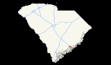
Interstate 526 or the Mark Clark Expressway is a beltway, Interstate Highway of Interstate 26
in Berkeley and Charleston counties in South Carolina
, USA.
with the western terminus at U.S. Highway 17
west of the Ashley River
, and the eastern terminus is at U.S. Highway 17
, near Mt.Pleasant
. Interstate I-26 and U.S. Highway 52
/78
intersect with Interstate 526 in the City of North Charleston, South Carolina
. There have been attempts to complete I-526 across Johns Island
(to meet SC 30
) as originally planned so that it will form three fourths of a circle around Charleston but each attempt has failed due to lack of credible funding and vocal opposition.
South Carolina Highway 30
is an orphaned segment of Interstate 526. Approximately 10 miles (16.1 km) separate the eastern terminus of I-526's current extent from the eastern terminus of SC 30. The mileage markers and exit numbers on both SC 30 and I-526 are based on an eventual merging of the routes: with miles 1 to 3 occurring on SC 30 and miles 10 to 30 used on the current I-526 route.
I-526 crosses the Cooper River
via the Don N. Holt Bridge
, the Wando River over the James B. Edwards Bridge
, and the Ashley River
by way of the General William B. Westmoreland Bridge
.
onto Johns Island and James Island
across SC 171, with a planted island divider in the middle and Suspension bridge
s over the Stono River
to Johns Island. It will terminate at Western Terminus and Eastern Terminus at new stoplight intersections. SC 30
will be decommissioned. Interstate 526 would go thru Mount Pleasant
, North Charleston
, Charleston
, Johns Island
and James Island
. In 2009, the Town of James Island
passed a resolution opposing the building of I-526 across any part of the town. Many residents, the Coastal Conservation League as well as a grassroots group, called Nix 526, are voicing opposition to the proposed road. In April 2011, Charleston County
Council voted not to ask the state for $500 million for the last eight miles of the road, and the Conservation League and Southern Environmental Law Center both supported this decision.
, the route continues as Business Spur 526. Business 526 is named Chuck Dawley Boulevard, a surface street, and terminates at its junction with South Carolina Highway 703 (Ben Sawyer Boulevard). This street was formerly the eastern part of Coleman Boulevard and was U.S. Route 17-701 Business. Coleman Boulevard continues westward from the junction of SC 703 until its intersection with US 17 near the Cooper River Bridge.
Although Business 526 travels toward the southwest from the I-526 terminus, it is still signed east–west, corresponding with I-526.
|-
!County
!City
!Exit
!Destinations
!Notes
|-
|rowspan=11|Charleston
|rowspan=2|Charleston
|
|
|At-grade intersection
|-
|11
|
|
|-
|rowspan=9|North Charleston
|-
!colspan=8|General William B. Westmoreland Bridge
across the Ashley River
|-
|14
|Leeds Avenue
|
|-
|15
|
|
|-
|16
|Montague Avenue, International Boulevard – Charleston International Airport
|Signed as exits 16A (Montague Avenue, International Boulevard) and 16B (Airport) eastbound
|-
|17
|
|Signed as exits 17A (east) and 17B (west)
|-
|18
|
|Signed as exits 18A (east) and 18B (west)
|-
|19
|North Rhett Avenue
|
|-
|20
|Virginia Avenue
|Westbound exit is via a u-turn at exit 19
|-
!colspan=5|Don N. Holt Bridge
across the Cooper River
|-
|rowspan=2|Berkeley
|rowspan=2|Charleston
|23
|Clements Ferry Road
|Signed as exits 23A (south) and 23B (north) eastbound
|-
|24
|River Landing Drive, 7 Farms Drive, Island Park Drive – Daniel Island
|
|-
|rowspan=6|Charleston
|rowspan=6|Mount Pleasant
|-
!colspan=5|James B. Edwards Bridge
across the Wando River
|-
|28
|Long Point Road
|
|-
|29
|
|Eastbound exit and westbound entrance
|-
|30
|
|No eastbound exit to US 17 north
|-
|
|Chuck Dawley Boulevard, Boman Road
|At-grade intersection
Interstate 26
Interstate 26 is a nominally east–west main route of the Interstate Highway System in the Southeastern United States. I-26 runs from the junction of U.S. Route 11W and U.S. Route 23 in Kingsport, Tennessee, generally southeastward to U.S. Route 17 in Charleston, South Carolina...
in Berkeley and Charleston counties in South Carolina
South Carolina
South Carolina is a state in the Deep South of the United States that borders Georgia to the south, North Carolina to the north, and the Atlantic Ocean to the east. Originally part of the Province of Carolina, the Province of South Carolina was one of the 13 colonies that declared independence...
, USA.
Route description
Interstate 526 forms a 19.26 miles (31 km) half-circle around the historic peninsular and West Ashley portions of the City of CharlestonCharleston, South Carolina
Charleston is the second largest city in the U.S. state of South Carolina. It was made the county seat of Charleston County in 1901 when Charleston County was founded. The city's original name was Charles Towne in 1670, and it moved to its present location from a location on the west bank of the...
with the western terminus at U.S. Highway 17
U.S. Route 17 in South Carolina
In the U.S. state of South Carolina, U.S. Route 17 is a north–south highway located near the Atlantic Ocean. The route enters the state from Georgia at the Savannah River and serves Charleston and Myrtle Beach before entering North Carolina near Calabash.-Route description:US 17 enters into...
west of the Ashley River
Ashley River (South Carolina)
The Ashley River is a blackwater / tidal river in South Carolina, rising from the Wassamassaw and Great Cypress Swamps in western Berkeley County. It consolidates its main channel about five miles west of Summerville, widening into a tidal estuary just south of Fort Dorchester...
, and the eastern terminus is at U.S. Highway 17
U.S. Route 17 in South Carolina
In the U.S. state of South Carolina, U.S. Route 17 is a north–south highway located near the Atlantic Ocean. The route enters the state from Georgia at the Savannah River and serves Charleston and Myrtle Beach before entering North Carolina near Calabash.-Route description:US 17 enters into...
, near Mt.Pleasant
Mount Pleasant, South Carolina
Mount Pleasant is a large affluent suburban town in Charleston County, South Carolina, United States. It is a member of the Charleston–North Charleston–Summerville Metropolitan Statistical Area, for statistical purpose only, as designated by the U.S. Office of Management and Budget....
. Interstate I-26 and U.S. Highway 52
U.S. Route 52
U.S. Route 52 is a United States highway that runs across the northern, eastern and southeastern regions of the United States. Contrary to most other even-numbered U.S...
/78
U.S. Route 78
U.S. Highway 78 is an east–west United States highway that runs for 715 miles from Memphis, Tennessee, to Charleston, South Carolina. Between Memphis and Birmingham, Alabama, it is being upgraded to become Interstate 22....
intersect with Interstate 526 in the City of North Charleston, South Carolina
North Charleston, South Carolina
North Charleston is the 3rd largest city in the U.S. state of South Carolina with incorporated areas in Berkeley, Charleston, and Dorchester counties. On June 12, 1972 the city of North Charleston incorporated and was the 9th largest city in South Carolina. According to the 2010 Census, North...
. There have been attempts to complete I-526 across Johns Island
Johns Island, South Carolina
Johns Island, also spelled John's Island, is the largest island in the U.S. State of South Carolina. It is one of the many Sea Islands along the coast of South Carolina.-Background:...
(to meet SC 30
South Carolina Highway 30
South Carolina Highway 30 is a long freeway in Charleston, South Carolina, United States. The freeway runs from South Carolina Highway 171 on James Island to U.S. Route 17 in downtown Charleston.- Route description :SC 30 begins at South Carolina Highway 171 on James Island, at exit 3...
) as originally planned so that it will form three fourths of a circle around Charleston but each attempt has failed due to lack of credible funding and vocal opposition.
South Carolina Highway 30
South Carolina Highway 30
South Carolina Highway 30 is a long freeway in Charleston, South Carolina, United States. The freeway runs from South Carolina Highway 171 on James Island to U.S. Route 17 in downtown Charleston.- Route description :SC 30 begins at South Carolina Highway 171 on James Island, at exit 3...
is an orphaned segment of Interstate 526. Approximately 10 miles (16.1 km) separate the eastern terminus of I-526's current extent from the eastern terminus of SC 30. The mileage markers and exit numbers on both SC 30 and I-526 are based on an eventual merging of the routes: with miles 1 to 3 occurring on SC 30 and miles 10 to 30 used on the current I-526 route.
I-526 crosses the Cooper River
Cooper River (South Carolina)
The Cooper River is a mainly tidal river in the U.S. state of South Carolina. These cities are located along the river, Mt. Pleasant, Charleston, North Charleston, Goose Creek and Hanahan. Short and wide, it is joined first by the blackwater East Branch, then farther downstream, the tidal Wando River...
via the Don N. Holt Bridge
Don N. Holt Bridge
The Don N. Holt Bridge is a parallel chord, three-span continuous, modified Warren-type truss bridge that spans the Cooper River between Charleston and North Charleston...
, the Wando River over the James B. Edwards Bridge
James B. Edwards Bridge
The James B. Edwards Bridge is a pair of pre-cast concrete box girder bridges that span the Wando River between Mount Pleasant and Daniel Island. It was built in 1989 by the South Carolina Department of Transportation.The bridge is named for James B...
, and the Ashley River
Ashley River (South Carolina)
The Ashley River is a blackwater / tidal river in South Carolina, rising from the Wassamassaw and Great Cypress Swamps in western Berkeley County. It consolidates its main channel about five miles west of Summerville, widening into a tidal estuary just south of Fort Dorchester...
by way of the General William B. Westmoreland Bridge
General William B. Westmoreland Bridge
The General William C. Westmoreland Bridge connects the city of North Charleston with the West Ashley area of Charleston in South Carolina. Composed of twin spans, it carries two lanes of I-526 in each direction across the Ashley River and the surrounding marshes. It is often referred to as...
.
Future
Interstate 526 is proposed to be completed as a ground-level parkway from US Route 17U.S. Route 17 in South Carolina
In the U.S. state of South Carolina, U.S. Route 17 is a north–south highway located near the Atlantic Ocean. The route enters the state from Georgia at the Savannah River and serves Charleston and Myrtle Beach before entering North Carolina near Calabash.-Route description:US 17 enters into...
onto Johns Island and James Island
James Island (South Carolina)
James Island is one of South Carolina's most urban Sea Islands. The island is separated from peninsular downtown Charleston by the Ashley River, from the mainland by Wappoo Creek and the Wappoo Cut, and from Johns Island by the Stono River...
across SC 171, with a planted island divider in the middle and Suspension bridge
Suspension bridge
A suspension bridge is a type of bridge in which the deck is hung below suspension cables on vertical suspenders. Outside Tibet and Bhutan, where the first examples of this type of bridge were built in the 15th century, this type of bridge dates from the early 19th century...
s over the Stono River
Stono River
The Stono River is a tidal channel in southeast South Carolina, located southwest of Charleston. The channel runs southwest to northeast between the mainland and Wadmalaw Island and Johns Island, from north Edisto River between Johns and James Island. The Intracoastal Waterway runs through...
to Johns Island. It will terminate at Western Terminus and Eastern Terminus at new stoplight intersections. SC 30
South Carolina Highway 30
South Carolina Highway 30 is a long freeway in Charleston, South Carolina, United States. The freeway runs from South Carolina Highway 171 on James Island to U.S. Route 17 in downtown Charleston.- Route description :SC 30 begins at South Carolina Highway 171 on James Island, at exit 3...
will be decommissioned. Interstate 526 would go thru Mount Pleasant
Mount Pleasant, South Carolina
Mount Pleasant is a large affluent suburban town in Charleston County, South Carolina, United States. It is a member of the Charleston–North Charleston–Summerville Metropolitan Statistical Area, for statistical purpose only, as designated by the U.S. Office of Management and Budget....
, North Charleston
North Charleston, South Carolina
North Charleston is the 3rd largest city in the U.S. state of South Carolina with incorporated areas in Berkeley, Charleston, and Dorchester counties. On June 12, 1972 the city of North Charleston incorporated and was the 9th largest city in South Carolina. According to the 2010 Census, North...
, Charleston
Charleston, South Carolina
Charleston is the second largest city in the U.S. state of South Carolina. It was made the county seat of Charleston County in 1901 when Charleston County was founded. The city's original name was Charles Towne in 1670, and it moved to its present location from a location on the west bank of the...
, Johns Island
Johns Island, South Carolina
Johns Island, also spelled John's Island, is the largest island in the U.S. State of South Carolina. It is one of the many Sea Islands along the coast of South Carolina.-Background:...
and James Island
James Island (South Carolina)
James Island is one of South Carolina's most urban Sea Islands. The island is separated from peninsular downtown Charleston by the Ashley River, from the mainland by Wappoo Creek and the Wappoo Cut, and from Johns Island by the Stono River...
. In 2009, the Town of James Island
James Island (South Carolina)
James Island is one of South Carolina's most urban Sea Islands. The island is separated from peninsular downtown Charleston by the Ashley River, from the mainland by Wappoo Creek and the Wappoo Cut, and from Johns Island by the Stono River...
passed a resolution opposing the building of I-526 across any part of the town. Many residents, the Coastal Conservation League as well as a grassroots group, called Nix 526, are voicing opposition to the proposed road. In April 2011, Charleston County
Charleston County, South Carolina
Charleston County is a county located in the U.S. state of South Carolina. According to a 2005 U.S. Census Bureau estimate, its population was 330,368. Its county seat is Charleston. It is the third-most populous county in the state . Charleston County was created in 1901 by an act of the South...
Council voted not to ask the state for $500 million for the last eight miles of the road, and the Conservation League and Southern Environmental Law Center both supported this decision.
Business Route
After I-526 goes over U.S. Highway 17 at its eastern terminus in Mount PleasantMount Pleasant, South Carolina
Mount Pleasant is a large affluent suburban town in Charleston County, South Carolina, United States. It is a member of the Charleston–North Charleston–Summerville Metropolitan Statistical Area, for statistical purpose only, as designated by the U.S. Office of Management and Budget....
, the route continues as Business Spur 526. Business 526 is named Chuck Dawley Boulevard, a surface street, and terminates at its junction with South Carolina Highway 703 (Ben Sawyer Boulevard). This street was formerly the eastern part of Coleman Boulevard and was U.S. Route 17-701 Business. Coleman Boulevard continues westward from the junction of SC 703 until its intersection with US 17 near the Cooper River Bridge.
Although Business 526 travels toward the southwest from the I-526 terminus, it is still signed east–west, corresponding with I-526.
Exit list
{| class=wikitable|-
!County
!City
!Exit
!Destinations
!Notes
|-
|rowspan=11|Charleston
Charleston County, South Carolina
Charleston County is a county located in the U.S. state of South Carolina. According to a 2005 U.S. Census Bureau estimate, its population was 330,368. Its county seat is Charleston. It is the third-most populous county in the state . Charleston County was created in 1901 by an act of the South...
|rowspan=2|Charleston
Charleston, South Carolina
Charleston is the second largest city in the U.S. state of South Carolina. It was made the county seat of Charleston County in 1901 when Charleston County was founded. The city's original name was Charles Towne in 1670, and it moved to its present location from a location on the west bank of the...
|
|
|At-grade intersection
|-
|11
|
|
|-
|rowspan=9|North Charleston
North Charleston, South Carolina
North Charleston is the 3rd largest city in the U.S. state of South Carolina with incorporated areas in Berkeley, Charleston, and Dorchester counties. On June 12, 1972 the city of North Charleston incorporated and was the 9th largest city in South Carolina. According to the 2010 Census, North...
|-
!colspan=8|General William B. Westmoreland Bridge
General William B. Westmoreland Bridge
The General William C. Westmoreland Bridge connects the city of North Charleston with the West Ashley area of Charleston in South Carolina. Composed of twin spans, it carries two lanes of I-526 in each direction across the Ashley River and the surrounding marshes. It is often referred to as...
across the Ashley River
Ashley River (South Carolina)
The Ashley River is a blackwater / tidal river in South Carolina, rising from the Wassamassaw and Great Cypress Swamps in western Berkeley County. It consolidates its main channel about five miles west of Summerville, widening into a tidal estuary just south of Fort Dorchester...
|-
|14
|Leeds Avenue
|
|-
|15
|
|
|-
|16
|Montague Avenue, International Boulevard – Charleston International Airport
Charleston International Airport
Charleston International Airport is a joint civil-military airport located in the city of North Charleston, Charleston County, South Carolina, USA. The airport serves the needs of the entire South Carolina Lowcountry. The airport has two runways and is operated under a joint-use agreement with...
|Signed as exits 16A (Montague Avenue, International Boulevard) and 16B (Airport) eastbound
|-
|17
|
|Signed as exits 17A (east) and 17B (west)
|-
|18
|
|Signed as exits 18A (east) and 18B (west)
|-
|19
|North Rhett Avenue
|
|-
|20
|Virginia Avenue
|Westbound exit is via a u-turn at exit 19
|-
!colspan=5|Don N. Holt Bridge
Don N. Holt Bridge
The Don N. Holt Bridge is a parallel chord, three-span continuous, modified Warren-type truss bridge that spans the Cooper River between Charleston and North Charleston...
across the Cooper River
Cooper River (South Carolina)
The Cooper River is a mainly tidal river in the U.S. state of South Carolina. These cities are located along the river, Mt. Pleasant, Charleston, North Charleston, Goose Creek and Hanahan. Short and wide, it is joined first by the blackwater East Branch, then farther downstream, the tidal Wando River...
|-
|rowspan=2|Berkeley
Berkeley County, South Carolina
Berkeley County is a county in the U.S. state of South Carolina. In 2000, its population was 142,651. The 2005 Census Bureau estimate placed the population at 151,673. Its county seat is Moncks Corner....
|rowspan=2|Charleston
Charleston, South Carolina
Charleston is the second largest city in the U.S. state of South Carolina. It was made the county seat of Charleston County in 1901 when Charleston County was founded. The city's original name was Charles Towne in 1670, and it moved to its present location from a location on the west bank of the...
|23
|Clements Ferry Road
|Signed as exits 23A (south) and 23B (north) eastbound
|-
|24
|River Landing Drive, 7 Farms Drive, Island Park Drive – Daniel Island
Daniel Island
Daniel Island is a island located in the City of Charleston, South Carolina . It is located in Berkely County and situated between the Cooper and Wando Rivers...
|
|-
|rowspan=6|Charleston
Charleston County, South Carolina
Charleston County is a county located in the U.S. state of South Carolina. According to a 2005 U.S. Census Bureau estimate, its population was 330,368. Its county seat is Charleston. It is the third-most populous county in the state . Charleston County was created in 1901 by an act of the South...
|rowspan=6|Mount Pleasant
Mount Pleasant, South Carolina
Mount Pleasant is a large affluent suburban town in Charleston County, South Carolina, United States. It is a member of the Charleston–North Charleston–Summerville Metropolitan Statistical Area, for statistical purpose only, as designated by the U.S. Office of Management and Budget....
|-
!colspan=5|James B. Edwards Bridge
James B. Edwards Bridge
The James B. Edwards Bridge is a pair of pre-cast concrete box girder bridges that span the Wando River between Mount Pleasant and Daniel Island. It was built in 1989 by the South Carolina Department of Transportation.The bridge is named for James B...
across the Wando River
Wando River
The Wando River is a tidewater river in the coastal area of South Carolina. It begins in the town of Awendaw and empties into the Cooper River at Charleston Harbor. Its drainage area is . -External links:...
|-
|28
|Long Point Road
|
|-
|29
|
|Eastbound exit and westbound entrance
|-
|30
|
|No eastbound exit to US 17 north
|-
|
|Chuck Dawley Boulevard, Boman Road
|At-grade intersection