
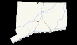
Interstate 691
Encyclopedia
Interstate 691 is a portion of the Interstate Highway System
in Connecticut
beginning at Interstate 91
in Meriden
and ending at Interstate 84
near the Cheshire
-Southington
town line. It is 8.92 miles (14.4 km) in length, including 0.54 mile (0.8690436 km) of the exit ramp to the merge with westbound I-84
.
I-691 is also known as the Henry D. Altobello Highway for its entire length.
. The freeway actually begins in Middlefield as Route 66, technically becoming I-691 at the junction with I-91
(Exit 11). However, westbound signage indicates I-691 begins at the start of the freeway (just west of Exit 13), while eastbound signage shows I-691 ending at the Route 15 interchange (at eastbound Exit 10 about 0.5 mile (0.80467 km) west of the interchange with I-91
). To go from I-91
northbound to I-691 westbound (or from I-691 eastbound to I-91
southbound), one must actually use Route 15.
 In the 1940s, the I-691 routing was part of a planned US 6A Expressway from Southington to Willimantic. A section of the expressway (from its Middlefield terminus west to Exit 8) first opened in 1966. By 1968, the US 6A designation was dropped in favor of Route 66. The highway was extended west to Exit 4 by 1971. The connection to I-84
was eventually completed in 1987, with the renumbering to I-691 done at the same time. The portion east of I-91
remained as Route 66. Environmental and community groups successfully blocked attempts to extend the freeway east of its present terminus due to potential impacts on a reservoir that provides drinking water for the local area. A compromise was reached in the late 1990s allowing CONNDOT
to convert Route 66 from a 2-lane road to a 4-lane divided highway from the eastern end of the I-691 freeway to Route 9 in Middletown
. Construction on the Route 66 widening project was completed in 2005.
Interstate Highway System
The Dwight D. Eisenhower National System of Interstate and Defense Highways, , is a network of limited-access roads including freeways, highways, and expressways forming part of the National Highway System of the United States of America...
in Connecticut
Connecticut
Connecticut is a state in the New England region of the northeastern United States. It is bordered by Rhode Island to the east, Massachusetts to the north, and the state of New York to the west and the south .Connecticut is named for the Connecticut River, the major U.S. river that approximately...
beginning at Interstate 91
Interstate 91 in Connecticut
Interstate 91 is a north–south Interstate Highway in the state of Connecticut. The interstate's southern end is in New Haven, Connecticut at Interstate 95.-Route description:...
in Meriden
Meriden, Connecticut
Meriden is a city in New Haven County, Connecticut, United States. According to 2005 Census Bureau estimates, the population of the city is 59,653.-History:...
and ending at Interstate 84
Interstate 84 in Connecticut
Interstate 84 is an East–West Interstate highway across the state of Connecticut into Danbury, Waterbury, Hartford and Union.-Route description:...
near the Cheshire
Cheshire, Connecticut
Cheshire is a town in New Haven County, Connecticut, United States. The population was 28,543 at the 2000 census. The center of population of Connecticut is located in Cheshire. In 2009 Cheshire was ranked 72 in Money Magazine's 100 Best Places to Live.Likewise, in 2011 Cheshire was ranked 73 in...
-Southington
Southington, Connecticut
Southington is a town in Hartford County, Connecticut, United States. It is part of Connecticut's 1st congressional district. It is situated about 20 miles southwest of Hartford, about 80 miles northeast of New York City, 105 miles southwest of Boston and 77 miles west of Providence...
town line. It is 8.92 miles (14.4 km) in length, including 0.54 mile (0.8690436 km) of the exit ramp to the merge with westbound I-84
Interstate 84 in Connecticut
Interstate 84 is an East–West Interstate highway across the state of Connecticut into Danbury, Waterbury, Hartford and Union.-Route description:...
.
I-691 is also known as the Henry D. Altobello Highway for its entire length.
Route description
I-691 is the main east–west highway of the city of MeridenMeriden, Connecticut
Meriden is a city in New Haven County, Connecticut, United States. According to 2005 Census Bureau estimates, the population of the city is 59,653.-History:...
. The freeway actually begins in Middlefield as Route 66, technically becoming I-691 at the junction with I-91
Interstate 91 in Connecticut
Interstate 91 is a north–south Interstate Highway in the state of Connecticut. The interstate's southern end is in New Haven, Connecticut at Interstate 95.-Route description:...
(Exit 11). However, westbound signage indicates I-691 begins at the start of the freeway (just west of Exit 13), while eastbound signage shows I-691 ending at the Route 15 interchange (at eastbound Exit 10 about 0.5 mile (0.80467 km) west of the interchange with I-91
Interstate 91 in Connecticut
Interstate 91 is a north–south Interstate Highway in the state of Connecticut. The interstate's southern end is in New Haven, Connecticut at Interstate 95.-Route description:...
). To go from I-91
Interstate 91 in Connecticut
Interstate 91 is a north–south Interstate Highway in the state of Connecticut. The interstate's southern end is in New Haven, Connecticut at Interstate 95.-Route description:...
northbound to I-691 westbound (or from I-691 eastbound to I-91
Interstate 91 in Connecticut
Interstate 91 is a north–south Interstate Highway in the state of Connecticut. The interstate's southern end is in New Haven, Connecticut at Interstate 95.-Route description:...
southbound), one must actually use Route 15.
History
Interstate 84 in Connecticut
Interstate 84 is an East–West Interstate highway across the state of Connecticut into Danbury, Waterbury, Hartford and Union.-Route description:...
was eventually completed in 1987, with the renumbering to I-691 done at the same time. The portion east of I-91
Interstate 91 in Connecticut
Interstate 91 is a north–south Interstate Highway in the state of Connecticut. The interstate's southern end is in New Haven, Connecticut at Interstate 95.-Route description:...
remained as Route 66. Environmental and community groups successfully blocked attempts to extend the freeway east of its present terminus due to potential impacts on a reservoir that provides drinking water for the local area. A compromise was reached in the late 1990s allowing CONNDOT
Connecticut Department of Transportation
The Connecticut Department of Transportation is responsible for the development and operation of highways, railroads, mass transit systems, ports, waterways and aviation facilities in the U.S. state of Connecticut. The current Commissioner of ConnDOT is Jeffrey Parker...
to convert Route 66 from a 2-lane road to a 4-lane divided highway from the eastern end of the I-691 freeway to Route 9 in Middletown
Middletown, Connecticut
Middletown is a city located in Middlesex County, Connecticut, along the Connecticut River, in the central part of the state, 16 miles south of Hartford. In 1650, it was incorporated as a town under its original Indian name, Mattabeseck. It received its present name in 1653. In 1784, the central...
. Construction on the Route 66 widening project was completed in 2005.
Exit list
| County | Location | Mile | # Exit number An exit number is a number assigned to a road junction, usually an exit from a freeway. It is usually marked on the same sign as the destinations of the exit, as well as a sign in the gore.... |
Destinations | Notes | ||
|---|---|---|---|---|---|---|---|
| Hartford Hartford County, Connecticut Hartford County is a county located in the north central part of the US state of Connecticut. The 2010 Census records show that the county population is at 894,014 making it the second most populated county in Connecticut.... / New Haven New Haven County, Connecticut New Haven County is a county located in the south central part of the U.S. state of Connecticut. As of the 2010 Census, the county population is 862,477 making it the third most populated county in Connecticut. There are 1,340 people per square mile... county line |
Southington Southington, Connecticut Southington is a town in Hartford County, Connecticut, United States. It is part of Connecticut's 1st congressional district. It is situated about 20 miles southwest of Hartford, about 80 miles northeast of New York City, 105 miles southwest of Boston and 77 miles west of Providence... / Cheshire Cheshire, Connecticut Cheshire is a town in New Haven County, Connecticut, United States. The population was 28,543 at the 2000 census. The center of population of Connecticut is located in Cheshire. In 2009 Cheshire was ranked 72 in Money Magazine's 100 Best Places to Live.Likewise, in 2011 Cheshire was ranked 73 in... |
8.38 | 1 | ||||
| 7.89 | 2 | ||||||
| New Haven New Haven County, Connecticut New Haven County is a county located in the south central part of the U.S. state of Connecticut. As of the 2010 Census, the county population is 862,477 making it the third most populated county in Connecticut. There are 1,340 people per square mile... |
Cheshire Cheshire, Connecticut Cheshire is a town in New Haven County, Connecticut, United States. The population was 28,543 at the 2000 census. The center of population of Connecticut is located in Cheshire. In 2009 Cheshire was ranked 72 in Money Magazine's 100 Best Places to Live.Likewise, in 2011 Cheshire was ranked 73 in... |
7.03 | 3 | ||||
| Hartford Hartford County, Connecticut Hartford County is a county located in the north central part of the US state of Connecticut. The 2010 Census records show that the county population is at 894,014 making it the second most populated county in Connecticut.... / New Haven New Haven County, Connecticut New Haven County is a county located in the south central part of the U.S. state of Connecticut. As of the 2010 Census, the county population is 862,477 making it the third most populated county in Connecticut. There are 1,340 people per square mile... county line |
Southington Southington, Connecticut Southington is a town in Hartford County, Connecticut, United States. It is part of Connecticut's 1st congressional district. It is situated about 20 miles southwest of Hartford, about 80 miles northeast of New York City, 105 miles southwest of Boston and 77 miles west of Providence... / Meriden Meriden, Connecticut Meriden is a city in New Haven County, Connecticut, United States. According to 2005 Census Bureau estimates, the population of the city is 59,653.-History:... |
4.79 | 4 | ||||
| New Haven New Haven County, Connecticut New Haven County is a county located in the south central part of the U.S. state of Connecticut. As of the 2010 Census, the county population is 862,477 making it the third most populated county in Connecticut. There are 1,340 people per square mile... |
Meriden Meriden, Connecticut Meriden is a city in New Haven County, Connecticut, United States. According to 2005 Census Bureau estimates, the population of the city is 59,653.-History:... |
2.92 | 5 | Eastbound exit, westbound entrance. | |||
| 2.37 | 6 | Lewis Avenue | Westbound exit, eastbound entrance. | ||||
| 1.95 | 7 | Columbia St. State St. – Downtown Meriden Meriden, Connecticut Meriden is a city in New Haven County, Connecticut, United States. According to 2005 Census Bureau estimates, the population of the city is 59,653.-History:... |
Milepost at Colony Street overpass. | ||||
| 1.32 | 8 | ||||||
| 0.50 | 9 | Westbound exit only. | |||||
| 0.50 | 10 | Eastbound exit, westbound entrance. Westbound exit only. |
|||||
| 0.00 | 11 | Westbound exit 11 is part of Route 66. | |||||
 |
|||||||