
List of leading shopping streets and districts by city
Encyclopedia
This page lists leading shopping streets and districts by city. This list highlights open-air street-side shopping districts that are destination locations in cities. Boutique stores
, fashion houses, and purveyors of specialty and/or luxury good
s usually charactere these locations. They may be located along a designated street or clustered in mixed-use commercial area within the city. In major cities and metropolitan areas, there may be more than one leading shopping street or district.
.jpg)
,_desde_callao.jpg)


Designer label
The term designer label refers to clothing and other personal accessory items sold under an often prestigious marque which is commonly named after a designer. The term is most often only applied to luxury items...
, fashion houses, and purveyors of specialty and/or luxury good
Luxury good
Luxury goods are products and services that are not considered essential and associated with affluence.The concept of luxury has been present in various forms since the beginning of civilization. Its role was just as important in ancient western and eastern empires as it is in modern societies...
s usually charactere these locations. They may be located along a designated street or clustered in mixed-use commercial area within the city. In major cities and metropolitan areas, there may be more than one leading shopping street or district.
China (People's Republic)
- BeijingBeijingBeijing , also known as Peking , is the capital of the People's Republic of China and one of the most populous cities in the world, with a population of 19,612,368 as of 2010. The city is the country's political, cultural, and educational center, and home to the headquarters for most of China's...
: WangfujingWangfujingWángfǔjǐng , located in Dongcheng District, Beijing, is one of the Chinese capital's most famous shopping streets. Much of the road is off-limits to cars and other motor vehicles, and it is not rare to see the entire street full of people. Since the middle of the Ming Dynasty there have been... - ChengduChengduChengdu , formerly transliterated Chengtu, is the capital of Sichuan province in Southwest China. It holds sub-provincial administrative status...
: Chunxilu - GuangzhouGuangzhouGuangzhou , known historically as Canton or Kwangchow, is the capital and largest city of the Guangdong province in the People's Republic of China. Located in southern China on the Pearl River, about north-northwest of Hong Kong, Guangzhou is a key national transportation hub and trading port...
: Beijing Road - HangzhouHangzhouHangzhou , formerly transliterated as Hangchow, is the capital and largest city of Zhejiang Province in Eastern China. Governed as a sub-provincial city, and as of 2010, its entire administrative division or prefecture had a registered population of 8.7 million people...
: Wulin Square, Euro Street, Hubin RoadEuro Street, Hubin RoadThe Euro Street, Hubin Road of Hangzhou has a Ferrari store, an Hermès homeware store and flagship stores of Hermès, Giorgio Armani , Ermenegildo Zegna, Dolce & Gabbana, Valentino, Alviero Martini, Corneliani, Omega SA, etc. Some stores are the first flagship of the brand in China.-References:***...
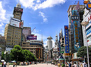
, HDA Plaza - ShanghaiShanghaiShanghai is the largest city by population in China and the largest city proper in the world. It is one of the four province-level municipalities in the People's Republic of China, with a total population of over 23 million as of 2010...
: Nanjing Road, Huaihai RoadHuaihai RoadHuaihai Road or Huaihai Lu is one of the two most famous shopping streets in Shanghai, China; the other is Nanjing Road. Compared with the more touristy Nanjing Road, Huaihai Road is more upscale, and is the preferered destinaton of local residents. Huaihai Road comprises three sections, the...
, XujiahuiXujiahuiXujiahui , also spelt Zikawei or Siccawei is an historical and cultural area in Xuhui District of Shanghai, China. The area is a well known precinct for shopping and entertainment in Shanghai.... - ShenzhenShenzhenShenzhen is a major city in the south of Southern China's Guangdong Province, situated immediately north of Hong Kong. The area became China's first—and one of the most successful—Special Economic Zones...
: Shennan Road, DongmenDongmenDongmen is a major shopping area within the Luohu district of Shenzhen.-Name:... - XiamenXiamenXiamen , also known as Amoy , is a major city on the southeast coast of the People's Republic of China. It is administered as a sub-provincial city of Fujian province with an area of and population of 3.53 million...
: Zhongshan RoadZhongshan RoadZhongshan, Jhongshan or Chung Shan is a common name of Chinese roads, usually in honour of Sun Yat-sen, better-known in Chinese as "Sun Zhongshan", who is considered by many to be the "Father of modern China"....
, Xiahe Road - Xian: Eastern Street
- Hong Kong IslandHong Kong IslandHong Kong Island is an island in the southern part of the Hong Kong Special Administrative Region. It has a population of 1,289,500 and its population density is 16,390/km², as of 2008...
: Causeway BayCauseway BayCauseway Bay is a heavily built-up area of Hong Kong, People's Republic of China, located on the Hong Kong Island, and covering parts of Wan Chai and Eastern districts. The Chinese name is also romanized as Tung Lo Wan as in Tung Lo Wan Road...
, Central DistrictCentral, Hong KongCentral is the central business district of Hong Kong. It is located in Central and Western District, on the north shore of Hong Kong Island, across Victoria Harbour from Tsim Sha Tsui, the southernmost point of Kowloon Peninsula... - Kowloon PeninsulaKowloon PeninsulaThe Kowloon Peninsula is a peninsula that forms the southern part of the main landmass in the territory of Hong Kong. The Kowloon Peninsula and the area of New Kowloon are collectively known as Kowloon....
: Nathan Road, Canton RoadCanton RoadCanton Road is a road in Hong Kong, linking the former west reclamation shore in Tsim Sha Tsui, Jordan, Yau Ma Tei and Mong Kok on the Kowloon Peninsula. The road runs mostly parallel and west to Nathan Road. It starts from the junction with Salisbury Road in the south and ends in the north at the...
, Peking RoadPeking RoadPeking Road is a road between Nathan Road and Canton Road in Tsim Sha Tsui, Kowloon, Hong Kong. The road is mainly hotels and shopping area on the street level.-Name:...
, Tsim Sha TsuiTsim Sha TsuiTsim Sha Tsui , often abbreviated as TST, is an urbanized area in southern Kowloon, Hong Kong. The area is administratively part of the Yau Tsim Mong District. Tsim Sha Tsui East is a piece of land reclaimed from the Hung Hom Bay now east of Tsim Sha Tsui...
, Mong KokMong KokMong Kok , less often known as Argyle , is an area in the Yau Tsim Mong District on Kowloon Peninsula, Hong Kong...
India
- AhmedabadAhmedabadAhmedabad also known as Karnavati is the largest city in Gujarat, India. It is the former capital of Gujarat and is also the judicial capital of Gujarat as the Gujarat High Court has its seat in Ahmedabad...
: C. G. RoadC. G. RoadThe Chiman Lal Girdhar Lal Road, colloquially the C. G. Road, is one of the main & posh roads of Ahmedabad. It has been ranked as the costliest retail location in the city.... - BangaloreBangaloreBengaluru , formerly called Bengaluru is the capital of the Indian state of Karnataka. Bangalore is nicknamed the Garden City and was once called a pensioner's paradise. Located on the Deccan Plateau in the south-eastern part of Karnataka, Bangalore is India's third most populous city and...
: Brigade Road, Mahatma Gandhi RoadMahatma Gandhi Road, BangaloreMahatma Gandhi Road also known as M.G. Road is a road in Bangalore, India. It runs east from Trinity Circle at one end to Anil Kumble circle at the other. Known as South Parade earlier to pre-independence, it was renamed as Mahatma Gandhi Road on 26 February 1948.M. G...
, - ChandigarhChandigarhChandigarh is a union territory of India that serves as the capital of two states, Haryana and Punjab. The name Chandigarh translates as "The Fort of Chandi". The name is from an ancient temple called Chandi Mandir, devoted to the Hindu goddess Chandi, in the city...
: Sector 17Sector 17Sector17 is the commercial center of Chandigarh, India having number of banks with their offices here. Sector 17 also has the ISBT of Chandigarh, it is a center for people of Chandigarh for their social gathering It is surrounded by Sec-22,Sec-16, Sec-18 and Sec-9.-Sector 17 market:Sector 17 market... - ChennaiChennaiChennai , formerly known as Madras or Madarasapatinam , is the capital city of the Indian state of Tamil Nadu, located on the Coromandel Coast off the Bay of Bengal. Chennai is the fourth most populous metropolitan area and the sixth most populous city in India...
: Pondy BazaarPondy BazaarPondy Bazaar , officially called Soundarapandian Angadi, is a market located in T. Nagar, Chennai. It is the principal shopping district of Chennai. Though the origin of its name remains unclear, the most widely believed theory is that the market was named after W. P. A... - KochiKochi-Places:* Kochi, a city in the state of Kerala, India, formerly known as Cochin* Kingdom of Cochin, a former feudal city-state on Malabar Coast, India** Fort Kochi, one of the three main urban components which constitute the present day city of Kochi, Kerala, India...
: Mahatma Gandhi RoadMahatma Gandhi Road, KochiMahatma Gandhi Road , popularly known as M. G. Road, is the main artery as well as the commercial high street of the city of Kochi, in the state of Kerala, India. The road lies north-south with its boundaries at the Venduruthy bridge, Thevara in the south, and the Madhava Pharmacy Junction in the... - DelhiDelhiDelhi , officially National Capital Territory of Delhi , is the largest metropolis by area and the second-largest by population in India, next to Mumbai. It is the eighth largest metropolis in the world by population with 16,753,265 inhabitants in the Territory at the 2011 Census...
: Connaught PlaceConnaught Place, New DelhiConnaught Place Connaught Place Connaught Place (Hindi: कनॉट प्लेस, (officially Rajiv Chowk) is one of the largest financial, commercial and business centers in Delhi. It is often abbreviated as CP and houses the headquarters of several Indian firms. Its surroundings occupy a place of pride...
, Khan MarketKhan MarketKhan Market , named in honour of Khan Abdul Ghaffar Khan , it is the costliest market strip in New Delhi. It has been ranked as the costliest retail location in India...
, South ExtensionSouth ExtensionSouth Extension is a neighbourhood of South Delhi, India. Situated on Ring Road, Delhi, just east of All India Institute of Medical Sciences. It is divided into two parts - South Extension I and South Extension II . This is one of the posh market places in Delhi, promising international shopping...
, Nehru PlaceNehru PlaceNehru Place is a large commercial, financial, and business center in Delhi, India. Though its importance as a financial center has declined in recent years, Nehru Place is still a prominent commercial area in South Delhi and houses the headquarters of several Indian firms and rivals with other... - GurgaonGurgaonGurgaon is the second largest city in the Indian state of Haryana. Gurgaon is the industrial and financial center of Haryana. It is located 30 km south of national capital New Delhi, about 10 kilometers from Dwarka Sub City and 268 km south of Chandigarh, the state capital...
: Mehrauli Gurgaon Road - Hyderabad: Banjara HillsBanjara HillsBanjara Hills is an urban commercial center in Hyderabad, Andhra Pradesh. Banjara Hills is one of more than 150 cities/boroughs comprising Greater Hyderabad, the second largest metropolitan area in India. This is an upmarket locality and is close to Jubilee Hills. This area was a hilly forest area...
, Koti, AbidsAbidsAbids or Abid Shop is a major commercial center in Hyderabad, India. Abids is well known as the oldest and famous business area of Hyderabad. The state government building APSFC, and the President plaza are located here. A wide variety of businesses are located here... - KolkataKolkataKolkata , formerly known as Calcutta, is the capital of the Indian state of West Bengal. Located on the east bank of the Hooghly River, it was the commercial capital of East India...
: Park StreetPark StreetPark Street may refer to:* Park Street, Boston, Massachusetts, USA** Park Street , Boston, USA* Park Street, Hertfordshire, England** Park Street railway station in Hertfordshire* Park Street, Kolkata, India* Park Street, Bristol, England...
, Camac StreetCamac StreetCamac Street is a street running in the central business district of Kolkata, India, from Park Street to AJC Bose Road. The road was named after William Camac, a senior merchant in the days of Lord Cornwallis and Lord Wellesley...
, Esplande, New MarketNew Market- United States :*New Market, Alabama**New Market Historic District , listed on the National Register of Historic Places in Alabama*New Market, Delaware*New Market, Indiana*New Market, Iowa*New Market, Kentucky...
, Gariahat - LucknowLucknowLucknow is the capital city of Uttar Pradesh in India. Lucknow is the administrative headquarters of Lucknow District and Lucknow Division....
: HazratganjHazratganjHazratganj is situated in the heart of Lucknow, Uttar Pradesh.It has a term associated with it "Ganjing" , Ganjing is a term used to describe ambling in the wide lanes and bylanes of city's Hazratganj market. It is a busy shopping area, where most of the bazaars of Lucknow are located and is... - Ludhiana: Mall Road
- MumbaiMumbaiMumbai , formerly known as Bombay in English, is the capital of the Indian state of Maharashtra. It is the most populous city in India, and the fourth most populous city in the world, with a total metropolitan area population of approximately 20.5 million...
: Nariman PointNariman PointNariman Point is Mumbai's premier business district and country's first central business district. It was named after Khursheed Framji Nariman, a Parsi visionary. The area is situated on land reclaimed from the sea. It had the distinction of having the highest commercial real estate rental space...
, Colaba CausewayColaba CausewayThe Colaba Causeway is a commercial street , and a major causeway or land link between Colaba and the Old Woman's Island in the city of Mumbai, India.... - PunePunePune , is the eighth largest metropolis in India, the second largest in the state of Maharashtra after Mumbai, and the largest city in the Western Ghats. Once the centre of power of the Maratha Empire, it is situated 560 metres above sea level on the Deccan plateau at the confluence of the Mula ...
: M.G Road,Laxmi Road - JaipurJaipurJaipur , also popularly known as the Pink City, is the capital and largest city of the Indian state of Rajasthan. Founded on 18 November 1727 by Maharaja Sawai Jai Singh II, the ruler of Amber, the city today has a population of more than 3.1 million....
: Johari Bazaar
Iran
- AhvazAhvaz-History:For a more comprehensive historical treatment of the area, see the history section of Khūzestān Province.-Ancient history:Ahvaz is the anagram of "Avaz" and "Avaja" which appear in Darius's epigraph...
: Kian Pars - Isfahan: Tohid Street
- KermanKerman- Geological characteristics :For the Iranian paleontologists, Kerman has always been considered a fossil paradise. Finding new dinosaur footprints in 2005 has now revealed new hopes for paleontologists to better understand the history of this area.- Economy :...
: 1001 Shab Street, Emam Hossein Boulevard - MashhadMashhadMashhad , is the second largest city in Iran and one of the holiest cities in the Shia Muslim world. It is also the only major Iranian city with an Arabic name. It is located east of Tehran, at the center of the Razavi Khorasan Province close to the borders of Afghanistan and Turkmenistan. Its...
: Ahmad Abad Avenue - TehranTehranTehran , sometimes spelled Teheran, is the capital of Iran and Tehran Province. With an estimated population of 8,429,807; it is also Iran's largest urban area and city, one of the largest cities in Western Asia, and is the world's 19th largest city.In the 20th century, Tehran was subject to...
: Valiasr StreetValiasr StreetValiasr Street is a tree-lined street in Tehran, Iran, dividing the metropolis into western and eastern parts. It is considered one of Tehran's main thoroughfares and commercial centres...
, JordanJordan, TehranJordan is the name of a popular avenue in Tehran, Iran. It is also the name of the district in Northern Tehran through which the avenue runs.-Location:...
, Gandi Street, Mirdamad BoulevardMirdamad BoulevardMirdamad Boulevard is the center of Davoodiyeh district in the north of Tehran. The boulevard starts from Valiasr Street in its west and continues eastward passing Mother Square up to Shariati street...
, Maadar Square
Israel
- Jerusalem: Ben Yehuda Street, Emek RefaimEmek RefaimEmek Refaim is the main street of the German Colony, a neighborhood in Jerusalem, Israel. It takes its name from the biblical Valley of Rephaim which began its descent from Jerusalem here.-Etymology:...
, Mamilla MallMamilla MallMamilla Mall is a shopping street in Jerusalem, located between Jaffa Gate and the David Citadel Hotel. The mall features an outdoor promenade and a two-level indoor section as well as boutiques and fashion chain stores.... - Tel AvivTel AvivTel Aviv , officially Tel Aviv-Yafo , is the second most populous city in Israel, with a population of 404,400 on a land area of . The city is located on the Israeli Mediterranean coastline in west-central Israel. It is the largest and most populous city in the metropolitan area of Gush Dan, with...
: Ibn Gabirol StreetIbn Gabirol StreetIbn Gabirol Street is a major street in Tel Aviv, Israel.Ibn Gabirol Street is named after the medieval Hebrew poet and philosopher Solomon ibn Gabirol...
, Dizengoff StreetDizengoff StreetDizengoff Street is a major street in central Tel Aviv, named after Tel Aviv's first mayor, Meir Dizengoff.The street runs from the corner of Ibn Gabirol Street in its southernmost point to the port area of Tel Aviv in its northwestern point...
, Kikar HamedinaKikar HamedinaKikar Hamedina , is one of the largest plazas in Tel Aviv.Around the plaza, which was designed by architect Oscar Niemeyer Kikar Hamedina (English: "State Square"), is one of the largest plazas in Tel Aviv.Around the plaza, which was designed by architect Oscar Niemeyer Kikar Hamedina (English:...
Japan
- FukuokaFukuoka, Fukuokais the capital city of Fukuoka Prefecture and is situated on the northern shore of the island of Kyushu in Japan.Voted number 14 in a 2010 poll of the World's Most Livable Cities, Fukuoka is praised for its green spaces in a metropolitan setting. It is the most populous city in Kyushu, followed by...
: TenjinTenjin, Fukuokarefers to the downtown area of Fukuoka City, Japan. It is located in Central ward....
, NakasuNakasuis the red-light district which exists between the sandbank of the and the in Fukuoka City, Fukuoka Prefecture, Japan. It is named after a popular, but very short-lived, entertainment quarter of Edo, which existed in the late 18th century... - HiroshimaHiroshimais the capital of Hiroshima Prefecture, and the largest city in the Chūgoku region of western Honshu, the largest island of Japan. It became best known as the first city in history to be destroyed by a nuclear weapon when the United States Army Air Forces dropped an atomic bomb on it at 8:15 A.M...
: Kamiyachō, Hacchōbori, Hondori Street - KobeKobe, pronounced , is the fifth-largest city in Japan and is the capital city of Hyōgo Prefecture on the southern side of the main island of Honshū, approximately west of Osaka...
: HarborlandHarborlandis a shopping district in Chuo-ku, Kobe, Japan.This shopping district was made on the site of the former freight yard, Minatogawa Kamotsu Station of the Japanese National Railways. The yard was removed in 1982 and the shopping district opened in 1992.-Access:...
, Nankinmachi(Kobe Chinatown)Kobe ChinatownKobe Chinatown is located in Kobe, Japan. One of only 3 designated Chinatowns in Japan, Nankinmachi is situated south of Motomachi station adjacent to the elegant Daimaru Department Store. This small, yet lively enclave is home to not only one of the few remaining Chinese communities in the...
, MotomachiMotomachi (Hyogo)is a district of Chūō Ward in Kobe, Japan. It is located between Mount Rokko and the port of Kobe.It is located adjacent to Nankinmachi and Kyū-kyoryūchi...
, SannomiyaSannomiyais a district of Chūō-ku, Kobe, Japan. Today, it is the biggest downtown area in the city.Before the 1920s, Sannomiya was just an edge of the city. The major downtowns were Motomachi and Shinkaichi, which are west of Sannomiya... - KyotoKyotois a city in the central part of the island of Honshū, Japan. It has a population close to 1.5 million. Formerly the imperial capital of Japan, it is now the capital of Kyoto Prefecture, as well as a major part of the Osaka-Kobe-Kyoto metropolitan area.-History:...
: around Shijō StreetShijo Streetruns center of Kyoto, Japan east to west through the commercial center of the city. Shijō literally means fourth street of Heian-kyō, the ancient capital.- Along the street :...
(GionGionis a district of Kyoto, Japan, originally developed in the Middle Ages, in front of Yasaka Shrine. The district was built to accommodate the needs of travelers and visitors to the shrine...
, Shijō Kawaramachi, Shijō Karasuma), PontochōPontochoPontochō is a Hanamachi district in Kyoto, Japan, known for geisha and home to many geisha houses and traditional tea houses. Like Gion, Pontochō is famous for the preservation of forms of traditional architecture and entertainment.-Etymology:...
, Shin-Kyōgoku Street - Nagoya: Meieki(district around Nagoya StationNagoya Stationis a train station in Nakamura-ku, Nagoya, Japan. It is one of the world's largest train stations by floor area , and houses the headquarters of the Central Japan Railway Company . Much of this space is located in the "JR Central Towers" atop the station, as well as in underground concourses. The...
), SakaeSakae Station (Aichi)is a train station in Sakae, which is in Naka-ku, Nagoya, Aichi Prefecture, Japan-Lines:*Nagoya Municipal Subway**Higashiyama Line **Meijō Line -Platforms:...
, Kanayama - OsakaOsakais a city in the Kansai region of Japan's main island of Honshu, a designated city under the Local Autonomy Law, the capital city of Osaka Prefecture and also the biggest part of Keihanshin area, which is represented by three major cities of Japan, Kyoto, Osaka and Kobe...
: UmedaUmedaUmeda is the main commercial and central business district in Kita-ku, Osaka, Japan, best known as the city's main northern railway terminus .Umeda is a large traffic hub, as well as the principal office and hotel district...
, Minami area (America-muraAmerikamuraAmerikamura is usually referred to by locals as "Ame-mura." It is a sizable retail and entertainment area near Shinsaibashi in the Minami district of Osaka, Japan....
, DōtonboriDotonboriis one of the principal tourist destinations in Osaka, Japan. It is a single street, running alongside the Dōtonbori canal between the Dōtonboribashi Bridge and the Nipponbashi Bridge in the Namba ward of Osaka...
, Horie, NambaNambais a district of Osaka, Japan. Namba is regarded as the center of so-called Minami area of Osaka. Its name is one of variations on the former name of Osaka, Naniwa...
, NipponbashiNipponbashiis a shopping district of Naniwa Ward, Osaka, Japan. The area is centered along Sakaisuji Avenue, extending from the Ebisu-chō Interchange of the Hanshin Expressway in the south, to Nansan-dōri in the north...
, ShinsaibashiShinsaibashiShinsaibashi is a district in the Chūō-ku ward of Osaka, Japan and the city's main shopping area. It centers around Shinsaibashi-suji, a covered shopping street, that is north of Dōtonbori and parallel and east of Mido-suji street. Associated with Shinsaibashi, and west of Mido-suji street, is...
, Sennichimae), TennōjiTennoji-ku, Osakais one of 24 wards of Osaka, Japan. It is named after the Shitennō-ji , which is located in the ward.-General information:... - Sapporo: Odori ParkOdori Parkis a park located in the heart of Sapporo, Hokkaidō, Japan. Odori means "large street" in Japanese. It stretches east to west through Nishi 1 chōme, Ōdōri to Nishi 12 chōme, Ōdōri , and divides the city into north and south sections. Odori Park spans about 1.5 km and covers 78,901 m²...
, Tanuki Kōji - Sendai: Ichibanchō, Chuō Street
- TokyoTokyo, ; officially , is one of the 47 prefectures of Japan. Tokyo is the capital of Japan, the center of the Greater Tokyo Area, and the largest metropolitan area of Japan. It is the seat of the Japanese government and the Imperial Palace, and the home of the Japanese Imperial Family...
: AkihabaraAkihabara, also known as , is an area of Tokyo, Japan. It is located less than five minutes by rail from Tokyo Station. Its name is frequently shortened to in Japan...
, AoyamaAoyama, Tokyois a neighborhood of Tokyo, located in the northeastern Minato Ward. During the Edo Period, Aoyama was home to various temples, shrines, and samurai residences. The name Aoyama derived from a samurai named Aoyama Tadanari who served the Tokugawa Shogunate and held his mansion in this area...
, AsakusaAsakusais a district in Taitō, Tokyo, Japan, most famous for the Sensō-ji, a Buddhist temple dedicated to the bodhisattva Kannon. There are several other temples in Asakusa, as well as various festivals.- History :...
, DaikanyamaDaikanyama, or simply , is a place in Shibuya, Tokyo, Japan.The Japanese Postal Code of Daikanyama is 150-0034.-Geography:Daikanyama contains luxury boutiques and upscale pastry shops. In many respects, Aoyama, Omotesando, and Daikanyama all share things in common—they are in central Tokyo and have small...
, EbisuEbisu, Tokyois a neighborhood in Shibuya, Tokyo, Japan. Conveniently near Roppongi and central Shibuya, Ebisu is easily accessed by the JR Yamanote and Hibiya lines via Ebisu Station...
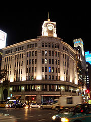
, GinzaGinzais a district of Chūō, Tokyo, located south of Yaesu and Kyōbashi, west of Tsukiji, east of Yūrakuchō and Uchisaiwaichō, and north of Shinbashi.It is known as an upscale area of Tokyo with numerous department stores, boutiques, restaurants and coffeehouses. Ginza is recognized as one of the most...
, HarajukuHarajukuHarajuku is the common name for the area around Harajuku Station on the Yamanote Line in the Shibuya ward of Tokyo, Japan....
, IkebukuroIkebukurois a commercial and entertainment district in Toshima, Tokyo, Japan. Toshima ward offices, Ikebukuro station, and several shops, restaurants, and enormous department stores are located within city limits....
, JiyugaokaJiyūgaokais a commercial and residential neighborhood in Meguro and Setagaya, located in Tokyo.- Neighbourhood :Jiyūgaoka consists of the area surrounding Jiyūgaoka Station, where the Tōyoko Line and Ōimachi Line intersect...
, Kinshicho, NihonbashiNihonbashi, or Nihombashi, is a business district of Chūō, Tokyo, Japan which grew up around the bridge of the same name which has linked two sides of the Nihonbashi River at this site since the 17th century. The first wooden bridge was completed in 1603, and the current bridge made of stone dates from 1911...
, Omotesandō, RoppongiRoppongiis a district of Minato, Tokyo, Japan, famous as home to the rich Roppongi Hills area and an active night club scene. Many foreign embassies are located in Roppongi, and the night life is popular with locals and foreigners alike...
, ShibuyaShibuya, Tokyois one of the 23 special wards of Tokyo, Japan. As of 2008, it has an estimated population of 208,371 and a population density of 13,540 persons per km². The total area is 15.11 km²....
, ShimokitazawaShimokitazawais a neighborhood in Setagaya, Tokyo. It consists of the neighborhood immediately surrounding Shimo-Kitazawa Station, where the Odakyū and Keiō Inokashira Lines intersect. Also known as "Shimokita", the district is a center for stage theater and live music venues. It is home to the historic Honda...
, Shinjuku, UenoUeno, Tokyois a district in Tokyo's Taitō Ward, best known as the home of Ueno Station and Ueno Park. Ueno is also home to some of Tokyo's finest cultural sites, including the Tokyo National Museum, the National Museum of Western Art, and the National Science Museum, as well as a major public concert hall...
, YūrakuchōYurakuchois a neighborhood of Chiyoda, Tokyo, Japan situated in between the Ginza and Hibiya Park, near the neighborhood of Shinbashi. Unlike its tonier neighbor Ginza, Yūrakuchō provides a glimpse of Japanese life from the early postwar period, with its many izakaya and outdoor yakitori restaurants , many... - Western TokyoWestern TokyoWestern Tokyo, also known as the , or , consists of the part of Tokyo Prefecture to the west of the 23 special wards.-Overview:Whereas the special wards occupy the space that was formerly the city of Tokyo, western Tokyo consists of the 26 cities, three towns, and one village that were not part of...
: KichijōjiKichijojiis a neighborhood in the city of Musashino in Tokyo, Japan. It is centered on the commercial area to the north of its train station and has a youthful, artistic, slightly countercultural reputation...
, Machida, Tachikawa, Hachiōji - YokohamaYokohamais the capital city of Kanagawa Prefecture and the second largest city in Japan by population after Tokyo and most populous municipality of Japan. It lies on Tokyo Bay, south of Tokyo, in the Kantō region of the main island of Honshu...
: Minato Mirai 21Minato Mirai 21, often shortened to Minato Mirai or MM is a large urban development in Yokohama, Japan. Minato Mirai 21 area is designated for new urban center planned to connect city's traditional center of Kannai and Yokohama Station area....
, Motomachi, Yokohama ChinatownYokohama ChinatownYokohama Chinatown is located in Yokohama, Japan, which is located just south of Tokyo. Its history is about 150 years long...
, Ermou - KawasakiKawasaki, Kanagawais a city located in Kanagawa Prefecture, Japan, between Tokyo and Yokohama. It is the 9th most populated city in Japan and one of the main cities forming the Greater Tokyo Area and Keihin Industrial Area....
: KawasakiKawasaki-ku, Kawasakiis one of the seven wards of the city of Kawasaki in Kanagawa Prefecture, Japan. As of 2010, the ward had an estimated population of 216,826 and a density of 5,530 persons per km². The total area was 39.21 km²... - SaitamaSaitama Prefectureis a prefecture of Japan located in the Kantō region of the island of Honshu. The capital is the city of Saitama.This prefecture is part of the Greater Tokyo Area, and most of Saitama's cities can be described as suburbs of Tokyo, to which a large amount of residents commute each day.- History...
: ŌmiyaOmiya, Saitamawas a city in Saitama Prefecture, Japan. In 2001 it merged with two other cities to form the city of Saitama. Since 1 April 2003, the area of former Ōmiya city is Kita-ku, Minuma-ku, Nishi-ku, and Ōmiya-ku of Saitama city.-Origin and pre-modern history:...
, UrawaUrawa-ku, Saitamais a ward of Saitama City, Japan. It is surrounded by Midori-ku , Minami-ku , Chūō-ku , Ōmiya-ku , and Minuma-ku of Saitama city.... - ChibaChiba Prefectureis a prefecture of Japan located in the Kantō region and the Greater Tokyo Area. Its capital is Chiba City.- History :Chiba Prefecture was established on June 15, 1873 with the merger of Kisarazu Prefecture and Inba Prefecture...
: ChibaChiba, Chibais the capital city of Chiba Prefecture, Japan. It is located approximately 40 km east of the center of Tokyo on Tokyo Bay. Chiba City became a government designated city in 1992. Its population as of 2008 is approximately 960,000....
, KashiwaKashiwa, Chibais a city located in northern Chiba Prefecture, Japan. As of February 2011, the city had an estimated population of 404,820 and a population density of 3520 persons per km²...
, FunabashiFunabashi, Chibais a city located in northwestern Chiba Prefecture, Japan. As of February 2011, the city had an estimated population of 609,157 and a population density of 7110 persons per km². The total area was 85.64 km². It is the 7th most populous city in Greater Tokyo....
Lebanon
- BeirutBeirutBeirut is the capital and largest city of Lebanon, with a population ranging from 1 million to more than 2 million . Located on a peninsula at the midpoint of Lebanon's Mediterranean coastline, it serves as the country's largest and main seaport, and also forms the Beirut Metropolitan...
: Beirut Central DistrictBeirut Central DistrictThe Beirut Central District or Centre Ville is the name given to Beirut’s historical and geographical core, the “vibrant financial, commercial, and administrative hub of the country.” At the heart of Lebanon’s capital, Beirut Central District is an area thousands of years old, traditionally a...
, Rue VerdunRue VerdunRue Verdun, or Verdun Street, is an upscale commercial and residential street in Beirut, Lebanon. The street, which is a major shopping center and tourist attraction, was named in honor of the Battle of Verdun during World War I. However, "Verdun" remains the street's unofficial name...
, FochFoch-People with the surname Foch:*Ferdinand Foch , Marshal of France and Allied Supreme Commander in World War I*Nina Foch , Dutch actress-Other uses:...
-AllenbyAllenbyAllenby is a surname of English origin and may refer to:*Edmund Allenby, 1st Viscount Allenby , a British soldier** Named for the above:**Allenby Street, Tel Aviv, Israel**Allenby Bridge between Jordan and Israel...
Quarter, Rue Hamra, Rue MaaradRue MaaradRue Maarad is a main street in the Beirut Central District, the “vibrant financial, commercial, and administrative hub of Lebanon". Severely damaged in the Lebanese Civil War, the street underwent a thorough reconstruction and development plan by the Lebanese real estate giant Solidere...
, Beirut SouksBeirut SouksThe Beirut Souks is a major commercial district in Beirut Central District. With over 200 shops and a department store, it is Beirut's largest shopping area, as well as the most dense.The souks have historically been at the commercial heart of Beirut...
, - JouniehJouniehJounieh is a Mediterranean coastal city about 16 kilometers north of Beirut, Lebanon. Jounieh is known for its seaside resorts, pubs, restaurants and nightclubs, as well as its old stone souk, ferry, and cablecar , which takes passengers up the mountain to the shrine of Our Lady of Lebanon in...
: Rue Kaslik - TripoliTripoliTripoli is the capital and largest city in Libya. It is also known as Western Tripoli , to distinguish it from Tripoli, Lebanon. It is affectionately called The Mermaid of the Mediterranean , describing its turquoise waters and its whitewashed buildings. Tripoli is a Greek name that means "Three...
: Rue El Mina - ZahléZahléZahlé is the capital and largest city of Beqaa Governorate, Lebanon. With around 50,000 inhabitants, it is the fourth largest city in Lebanon, after Beirut, Tripoli and Jounieh...
: Rue Brazil
Malaysia
- Kuala LumpurKuala LumpurKuala Lumpur is the capital and the second largest city in Malaysia by population. The city proper, making up an area of , has a population of 1.4 million as of 2010. Greater Kuala Lumpur, also known as the Klang Valley, is an urban agglomeration of 7.2 million...
: Petaling StreetPetaling StreetPetaling Street is a Chinatown located in Kuala Lumpur, Malaysia. It is infamous for pirated clothes and accessories along with bootleg DVDs and CDs. Petaling Street however does not exclusively offer pirated products...
(China Town), Bukit BintangBukit BintangBukit Bintang is the name of the shopping and entertainment district of Kuala Lumpur, Malaysia. It encompasses Jalan Bukit Bintang and its immediate surrounding areas...
, BangsarBangsarBangsar, also Bungsar , is an affluent residential suburb on the outskirts of Kuala Lumpur, lying about south-west of the city centre. It is part of the Lembah Pantai parliamentary constituency...
, Ara DamansaraAra DamansaraAra Damansara is a township in Damansara, Petaling Jaya, Selangor, Malaysia. It is located near the Subang Airport and the opposite side of Saujana Golf and Country Club.- History :...
, BrickfieldsBrickfieldsBrickfields is a small to medium-sized town and residential neighbourhood located just outside central Kuala Lumpur, Malaysia. It is known as Kuala Lumpur's Little India due to the high percentage of Indian residents and businesses.- History :In 1881, a flood swept through Kuala Lumpur following...
(Little India), Jalan Masjid India, Jalan Tuanku Abdul RahmanJalan Tuanku Abdul RahmanJalan Tuanku Abdul Rahman is the famous road and streets in Kuala Lumpur, Malaysia. This road is named after the first Yang di-Pertuan Agong, Tuanku Abdul Rahman.-Attractions:...
, Pasar Seni, Chow KitChow KitChow Kit is a sub-district in central Kuala Lumpur, Malaysia. It is located around Jalan Chow Kit and is enclosed by the parallel streets of Jalan Raja Laut and Jalan Tuanku Abdul Rahman. It is named after the tin miner and municipal councillor Loke Chow Kit. Today the area features a large... - PenangPenangPenang is a state in Malaysia and the name of its constituent island, located on the northwest coast of Peninsular Malaysia by the Strait of Malacca. It is bordered by Kedah in the north and east, and Perak in the south. Penang is the second smallest Malaysian state in area after Perlis, and the...
: Padang Kota, Burmah Street, Gurney DriveGurney DriveGurney Drive is a popular seafront promenade in Georgetown, Penang, Malaysia. The road is also one Penang's most popular tourist destinations, famous for the "hawker food" sold from food stalls formerly located along the seafront, now relocated close by...
Pakistan
- KarachiKarachiKarachi is the largest city, main seaport and the main financial centre of Pakistan, as well as the capital of the province of Sindh. The city has an estimated population of 13 to 15 million, while the total metropolitan area has a population of over 18 million...
: Zamzama Boulevard, Tariq RoadTariq Road"Tariq ibn Ziyad Road"'or Tariq Road is located in Karachi, Sindh, Pakistan. It is one of the best shopping places of Karachi. In fact, it is the most famous and number one shopping centre, and people from almost all areas of Karachi come and buy from Tariq road.There are approximately more than...
, Zaibunissa Street - LahoreLahoreLahore is the capital of the Pakistani province of Punjab and the second largest city in the country. With a rich and fabulous history dating back to over a thousand years ago, Lahore is no doubt Pakistan's cultural capital. One of the most densely populated cities in the world, Lahore remains a...
: M.M. Alam RoadM. M. Alam roadM. M. Alam road is a road in Lahore, Punjab, Pakistan. It runs from Main Market to Firdous Market in Gulberg. The road runs parallel to famous Main Boulevard thus providing an alternate route and a huge business for restaurants, fashion boutiques, shopping malls, beauty saloons and décor stores...
, Mall Road (Quaid-e-Azam Road), Main Boulevard - IslamabadIslamabadIslamabad is the capital of Pakistan and the tenth largest city in the country. Located within the Islamabad Capital Territory , the population of the city has grown from 100,000 in 1951 to 1.7 million in 2011...
: I-10 Markaz, Jinnah Avenue Blue Area
Philippines
- Makati CityMakati CityThe City of Makati is one of the 17 cities that make up Metro Manila, one of the most populous metropolitan areas in the world. Makati is the financial center of the Philippines and one of the major financial, commercial and economic hubs in Asia...
:Ayala AvenueAyala AvenueAyala Avenue is an avenue in Makati City in the Philippines. It is one of the busiest thoroughfares in Metro Manila, crossing through the heart of Makati's central business district. Because of the many businesses located on the avenue, Ayala Avenue is aptly nicknamed the Wall Street of the...
, Ayala CenterAyala CenterThe Ayala Center is a commercial complex operated by Ayala Land Incorporated located in the central business district of Makati in Metro Manila, Philippines.-About the Center:...
, Greenbelt Mall Complex, Powerplant Mall, - ManilaManilaManila is the capital of the Philippines. It is one of the sixteen cities forming Metro Manila.Manila is located on the eastern shores of Manila Bay and is bordered by Navotas and Caloocan to the north, Quezon City to the northeast, San Juan and Mandaluyong to the east, Makati on the southeast,...
:Robinson's Place Manila - Midtown - Taguig CityTaguig CityTaguig is a city in Metro Manila in the Philippines. From a thriving fishing community along the shores of Laguna de Bay, it is now an important residential, commercial and industrial center...
:Fort BonifacioFort BonifacioFort Bonifacio is a highly urbanized district in Taguig City, Metro Manila, Philippines. The district is named after the main Philippine Army camp in Metro Manila, Fort Andres Bonifacio, which in turn was named after the famous Philippine revolutionary hero Andres Bonifacio...
, Bonifacio High Street, Serendra Shops - Pasay CityPasay CityThe City of Pasay is one of the cities and municipalities that make up Metro Manila in the Philippines. It is bordered on the north by the country's capital, Manila, to the northeast by Makati City, to the east by Taguig City, and Parañaque City to the south.Pasay City was one of the original four...
:SM Mall of AsiaSM Mall of AsiaSM Mall of Asia is a shopping mall owned and developed by SM Prime Holdings, the largest mall developer and owner in the Philippines. SM Mall of Asia is the 2nd largest mall in the Philippines after SM City North EDSA, 3rd largest shopping mall in Asia and the 4th largest shopping mall in the world...
, Bay CityBay City-Places:Australia* Westfield Bay City, a shopping centre in Geelong, VictoriaPhilippines* Bay City , the reclamation area of Metro Manila in the PhilippinesUnited States* Bay City, Pope County, Illinois* Bay City, Michigan...
, Pagcor CityPagcor CityEntertainment City Manila or simply Pagcor City is Asia's Las Vegas-like gaming and entertainment complex that PAGCOR proposed to offer on 8 km² of land on the reclamation area of Manila Bay, Philippines...
, Resorts World ManilaResorts World ManilaResorts World Manila is a luxury casino resort, located in Newport City, across the Ninoy Aquino International Airport Terminal 3, in Manila, Philippines. The resort is a joint venture between AGI and Genting Hong Kong... - Quezon CityQuezon CityQuezon City is the former capital and the most populous city in the Philippines. Located on the island of Luzon, Quezon City is one of the cities and municipalities that make up Metro Manila, the National Capital Region. The city was named after Manuel L...
:EDSA- North TriNomaTriNomaTriNoma is a large shopping mall in Quezon City, Philippines, owned by property development firm Ayala Land Inc...
, Eastwood CityEastwood CityEastwood City is a commercial and residential development located in the Libis area of Quezon City in the Philippines. It is developed by Megaworld Corporation. It currently hosts 12 luxury residential condominium towers, with several more being developed.... - Mandaluyong CityMandaluyong CityThe City of Mandaluyong is one of the cities and municipalities that comprise Metro Manila in the Philippines. It is bordered on the west by the country's capital, Manila, to the north by San Juan City, to the east by Quezon City and Pasig City, and by Makati City to the south...
:Ortigas CenterOrtigas CenterOrtigas Center is Metro Manila's second most important Philippine financial district-cum-central business district after the Makati Financial and Central Business District in Makati City. With an area of at least 100 hectares, the district is located at the boundaries of Pasig City, Mandaluyong... - Cebu CityCebu CityThe City of Cebu is the capital city of Cebu and is the second largest city in the Philippines, the second most significant metropolitan centre in the Philippines and known as the oldest settlement established by the Spaniards in the country.The city is located on the eastern shore of Cebu and was...
: Cebu Business ParkCebu Business ParkCebu Business Park is a 50-hectare masterplanned development in Cebu City, Philippines. It integrates business, residential, sports, recreation and leisure facilities....
, Fuente Osmena Circle, OsmenaOsmeñaOsmeña is a family name of the Philippines. It may refer to:* Sergio Osmeña , President* Sergio Osmeña, Jr. , Senator* John Henry Osmeña , Senator* Emilio Mario Osmeña , Governor of Cebu...
, - Davao CityDavao CityThe City of Davao is the largest city in the island of Mindanao in the Philippines. Its international airport and seaports are among the busiest cargo hubs in the Philippines....
: J.P. Laurel Avenue
Saudi Arabia
- JeddahJeddahJeddah, Jiddah, Jidda, or Jedda is a city located on the coast of the Red Sea and is the major urban center of western Saudi Arabia. It is the largest city in Makkah Province, the largest sea port on the Red Sea, and the second largest city in Saudi Arabia after the capital city, Riyadh. The...
: Tahlia StreetTahlia StreetTahlia Street , is an important fashion and shopping street and saudi arabia in the mid-town of Jeddah, Saudi Arabia. It contains many upscale department shops, and boutiques, such as Prada, Gucci, Versace, Cartier, Chanel, Louis Vuitton, Dolce & Gabbana, Ralph Lauren or Giorgio Armani...
, Prince Sultan Street, Palestine Street (Telecommunications), Al-Balad - RiyadhRiyadhRiyadh is the capital and largest city of Saudi Arabia. It is also the capital of Riyadh Province, and belongs to the historical regions of Najd and Al-Yamama. It is situated in the center of the Arabian Peninsula on a large plateau, and is home to 5,254,560 people, and the urban center of a...
: Tahlia Street, Olaya Street
Singapore
- SingaporeSingaporeSingapore , officially the Republic of Singapore, is a Southeast Asian city-state off the southern tip of the Malay Peninsula, north of the equator. An island country made up of 63 islands, it is separated from Malaysia by the Straits of Johor to its north and from Indonesia's Riau Islands by the...
: Orchard RoadOrchard RoadOrchard Road is a road in Singapore that is the retail and entertainment hub of the city-state. It is regularly frequented by the local population as well as being a major tourist attraction...
, Marina CentreMarina CentreMarina Centre is a zone of reclaimed land within the Downtown Core in the southern part of Singapore. Together with the Marina South area, it encloses the sheltered Marina Bay....
, Bugis StreetBugis StreetBugis, in the city-state of Singapore, was renowned internationally from the 1950s to the 1980s for its nightly gathering of trans women, a phenomenon which made it one of Singapore's top tourist destinations during that period....
, HarbourFrontHarbourFrontHarbourFront is a district situated in southern Singapore, within the Bukit Merah Planning Area. Harbourfront is also the gateway to Sentosa....
South Korea
- BusanBusanBusan , formerly spelled Pusan is South Korea's second largest metropolis after Seoul, with a population of around 3.6 million. The Metropolitan area population is 4,399,515 as of 2010. It is the largest port city in South Korea and the fifth largest port in the world...
: Gwangbok-dong, Nampo-dong - DaeguDaeguDaegu , also known as Taegu, and officially the Daegu Metropolitan City, is a city in South Korea, the fourth largest after Seoul, Busan, and Incheon, and the third largest metropolitan area in the country with over 2.5 million residents. The city is the capital and principal city of the...
: Dongseongno - SeoulSeoulSeoul , officially the Seoul Special City, is the capital and largest metropolis of South Korea. A megacity with a population of over 10 million, it is the largest city proper in the OECD developed world...
: MyeongdongMyeongdongMyeong-dong or Myong-dong is a dong in Jung-gu, Seoul, South Korea between Chungmu-ro, Eulji-ro, and Namdaemun-ro. It covers 0.99 km² with a population of 3,529 and is mostly a commercial area, being one of Seoul's main shopping and tourism districts.-History:Myeongdong dates back to the...
, ApgujeongApgujeongApgujeong-dong is a residential, fashion and shopping district in the Gangnam district of Seoul. The dong originates from a pavilion with the same name founded by Han Myeong-hoe , a high-ranking government officer during the Joseon dynasty...
, Cheongdam, Dongdaemun MarketDongdaemun MarketDongdaemun Market or Tongdaemun is the large commercial district comprising traditional markets and shopping centers in Jongno-gu, Seoul, South Korea...
, InsadongInsadongInsadong is a dong, or neighborhood of the Jongno-gu district of the South Korean city of Seoul. The main street is Insadong-gil, which is connected to a multitude of alleys that lead deeper into the district...
, ItaewonItaewonItaewon is a city district, in Yongsan-gu, Seoul, South Korea. It is served by Seoul Subway Line 6 via Itaewon, Noksapyeong and Hanganjin stations. About 22,000 people reside in the district and it is a popular area for residents of Seoul, tourists, and U.S...
, Gangnam-guGangnam-guGangnam-gu is one of the 25 gu which make up the city of Seoul, South Korea. It is one of the most affluent areas of Seoul and is located in the southeast of the city...
, Samseong-dongSamseong-dongSamseong-Dong is a ward of Gangnam-gu in Seoul, South Korea.-See also:*COEX Convention & Exhibition Center*POSCO*Bongeunsa*Dong of Gangnam-gu*Kimchi Field Museum-External links:...
, Yongsan, HongdaeHongdaeThe Hongdae Area is a region in South Korea known for its entertainment and clubs. The area is part of the Mapo-gu district northwest of Seoul, South Korea.-Name:...
, DaehangnoDaehangnoDaehangno is a neighborhood in Seoul north of the Han River within Jongno-gu and Seodaemun-gu.Formerly known as Sunggyobang , meaning "high respect for teaching", its current name was designated when the 1.1km six-lane road from Hyehwa-dong rotary to Ihwadong crossroad was designated as a...
, Namdaemun MarketNamdaemun marketNamdaemun Market is a large traditional market in Seoul, South Korea. The market is located next to Namdaemun, the "Great South Gate," which was the main southern gate to the old city. It is the oldest and largest market in Korea.-History:...
Republic of China (Taiwan)
- TaipeiTaipeiTaipei City is the capital of the Republic of China and the central city of the largest metropolitan area of Taiwan. Situated at the northern tip of the island, Taipei is located on the Tamsui River, and is about 25 km southwest of Keelung, its port on the Pacific Ocean...
: Da'an, Xinyi, XimendingXimendingXimending is a neighborhood and shopping district in the Wanhua District of Taipei, Taiwan. It was the first pedestrian zone in Taiwan.-Overview:...
, Tianmu - KaohsiungKaohsiungKaohsiung is a city located in southwestern Taiwan, facing the Taiwan Strait on the west. Kaohsiung, officially named Kaohsiung City, is divided into thirty-eight districts. The city is one of five special municipalities of the Republic of China...
: Cianjhen
Thailand
- BangkokBangkokBangkok is the capital and largest urban area city in Thailand. It is known in Thai as Krung Thep Maha Nakhon or simply Krung Thep , meaning "city of angels." The full name of Bangkok is Krung Thep Mahanakhon Amon Rattanakosin Mahintharayutthaya Mahadilok Phop Noppharat Ratchathani Burirom...
: RatchaprasongRatchaprasongRatchaprasong is the name of an intersection, and a shopping district named after it in Pathum Wan District, Bangkok, adjacent to Siam District. Located at the BTS Skytrain's Chit Lom Station and the intersection of Phloenchit, Rama I and Ratchadamri Roads...
, Sukhumvit RoadSukhumvit RoadSukhumvit Road , or Thailand Route 3 , is a major road in Thailand, and a major surface road of Bangkok and other cities it winds through. It follows a coastal route from Bangkok to Trat and is just over in length....
, Thong Lor, Siam SquareSiam SquareSiam Square is a shopping and entertainment area in the Siam District of Bangkok, Thailand. The area connects to other shopping centres and links to the other shopping districts by sky bridge, such as Siam Center/Siam Discovery Center, MBK Center, Siam Paragon, Ratchaprasong shopping district and...
, Si LomSi LomSi Lom is a sub-District and road in Bang Rak district, Bangkok, Thailand. Constructed in 1851 as part of a dyke and irrigation system, Silom road has become one of Bangkok's most cosmopolitan streets and major financial center; it is the home to some of the largest companies in Thailand ex...
, Victory Monument, Ladprao, Ratchada, ChatuchakChatuchak (district)Chatuchak is one of the 50 districts of Bangkok, Thailand. The district is bounded by seven other districts : Lak Si, Bang Khen, Lat Phrao, Huai Khwang, Din Daeng, Phaya Thai and Bang Sue.-History:...
, Wang LangWang LangWang Lang was a warlord during the late Han Dynasty and a politician of Cao Wei during the Three Kingdoms era of Chinese history. Through his granddaughter's marriage to Sima Zhao, he would become great-grandfather of Sima Yan, who later became the founding emperor of the Jin Dynasty.-Early life...
, Bang Lumphu - Khao San Road, PhahuratPhahuratPhahurat or Pahurat , often known as Thailand's Little India, is an ethnic neighborhood surrounding Phahurat Road in Phra Nakhon District, Bangkok. The area that would become Phahurat was an enclave of Vietnamese immigrants who came to Siam during the reign of King Taksin...
- Sampeng, Bobae - Chiang MaiChiang MaiChiang Mai sometimes written as "Chiengmai" or "Chiangmai", is the largest and most culturally significant city in northern Thailand. It is the capital of Chiang Mai Province , a former capital of the Kingdom of Lanna and was the tributary Kingdom of Chiang Mai from 1774 until 1939. It is...
: Changkran RoadChangkran RoadChangkran Road is the most famous shopping street in Chiang Mai just besides Tha Phe Road the main commercial and tourists street of the city. The road was growing up from the promote of the first night bazaar of Chiang Mai and Thailand for sell handicraft products to the tourists at night...
, Nimmanhemin Rd - Hat YaiHat YaiHat Yai is a city in southern Thailand near the Malaysian border. Located at , it has a population of 157,359 in the city itself and about 800,000 in the greater Hat Yai area. Hat Yai is the largest city of Songkhla Province, the largest metropolitan area in Southern, and third largest...
: Kimyong Market, Niphat Uthit 1st, 2nd, 3rd Roads, Sanehanusorn Road - PattayaPattayaPattaya is a city in Thailand, located on the east coast of the Gulf of Thailand, about 165 km southeast of Bangkok located within but not part of Amphoe Bang Lamung in the province of Chonburi....
: Beach Road - Patong: Patong Beach Road
- Si Racha: Si Racha Nakorn Road
Vietnam
- Ho Chi Minh CityHo Chi Minh CityHo Chi Minh City , formerly named Saigon is the largest city in Vietnam...
(Saigon): District 1District 1, Ho Chi Minh CityDistrict 1 is the central urban district of Ho Chi Minh City, the largest city in Vietnam. With a total area of the District has a population of 204,899 people . The district is divided into 10 small subsets which are called wards. District 1 is where most of the city's administrative offices,...
, Nguyen Trai Street. - Ho Chi Minh CityHo Chi Minh CityHo Chi Minh City , formerly named Saigon is the largest city in Vietnam...
(Saigon): District 1District 1, Ho Chi Minh CityDistrict 1 is the central urban district of Ho Chi Minh City, the largest city in Vietnam. With a total area of the District has a population of 204,899 people . The district is divided into 10 small subsets which are called wards. District 1 is where most of the city's administrative offices,...
, Dong Khoi Street.
Austria
- SalzburgSalzburg-Population development:In 1935, the population significantly increased when Salzburg absorbed adjacent municipalities. After World War II, numerous refugees found a new home in the city. New residential space was created for American soldiers of the postwar Occupation, and could be used for...
: GetreidegasseGetreidegasseGetreidegasse is a busy shopping street in the Old-Town section of Salzburg. The house at no. 9 Getreidegasse is the place where Wolfgang Amadeus Mozart was born and where he lived until the age of 17... - ViennaViennaVienna is the capital and largest city of the Republic of Austria and one of the nine states of Austria. Vienna is Austria's primary city, with a population of about 1.723 million , and is by far the largest city in Austria, as well as its cultural, economic, and political centre...
: Mariahilfer Straße, Neubaugasse, Favoritenstraße, upscale: GrabenGraben, ViennaDer Graben is one of the most famous streets in Vienna's first district, the city centre. It begins at Stock-im-Eisen-Platz next to the Palais Equitable and ends at the junction of Kohlmarkt and Tuchlauben. Another street in the first district is called Tiefer Graben...
, Kohlmarkt, Kärntnerstraße - GrazGrazThe more recent population figures do not give the whole picture as only people with principal residence status are counted and people with secondary residence status are not. Most of the people with secondary residence status in Graz are students...
: HerrengasseHerrengasseThe Herrengasse is a street in Vienna, located in the first district Innere Stadt.-History:...
Belgium
- Antwerp: MeirMeir (Antwerp)Meir is the main shopping street in Antwerp, Belgium, together with the Nieuwstraat / Rue Neuve avenue in Brussels it is the most important shopping area in the country....
- BrugesBrugesBruges is the capital and largest city of the province of West Flanders in the Flemish Region of Belgium. It is located in the northwest of the country....
: Steenstraat - BrusselsBrusselsBrussels , officially the Brussels Region or Brussels-Capital Region , is the capital of Belgium and the de facto capital of the European Union...
: Avenue LouiseAvenue LouiseAvenue Louise or Louizalaan is a major thoroughfare in Brussels. It runs southeast from Louise Square to the Bois de la Cambre, covering a distance of .- History :...
, Boulevard de Waterloo, Rue NeuveRue Neuve (Brussels)Rue Neuve or Nieuwstraat is a pedestrian street in Brussels' city center. It is the most popular shopping area in Belgium by number of shoppers... - GhentGhentGhent is a city and a municipality located in the Flemish region of Belgium. It is the capital and biggest city of the East Flanders province. The city started as a settlement at the confluence of the Rivers Scheldt and Lys and in the Middle Ages became one of the largest and richest cities of...
: Veldstraat
Bosnia and Herzegovina
- Banja LukaBanja Luka-History:The name "Banja Luka" was first mentioned in a document dated February 6, 1494, but Banja Luka's history dates back to ancient times. There is a substantial evidence of the Roman presence in the region during the first few centuries A.D., including an old fort "Kastel" in the centre of...
: Gospodska street - SarajevoSarajevoSarajevo |Bosnia]], surrounded by the Dinaric Alps and situated along the Miljacka River in the heart of Southeastern Europe and the Balkans....
: Maršala Tita street and Ferhadija street
Bulgaria
- SofiaSofiaSofia is the capital and largest city of Bulgaria and the 12th largest city in the European Union with a population of 1.27 million people. It is located in western Bulgaria, at the foot of Mount Vitosha and approximately at the centre of the Balkan Peninsula.Prehistoric settlements were excavated...
: Vitosha BoulevardVitosha BoulevardVitosha Boulevard is the main commercial street in the centre of Sofia, the capital of Bulgaria, which is abundant in many posh stores, restaurants and bars. It extends from the St Nedelya Square to the Southern Park... - VarnaVarnaVarna is the largest city and seaside resort on the Bulgarian Black Sea Coast and third-largest in Bulgaria after Sofia and Plovdiv, with a population of 334,870 inhabitants according to Census 2011...
: Knyaz Boris 1 Boulevard - BurgasBurgas-History:During the rule of the Ancient Romans, near Burgas, Debeltum was established as a military colony for veterans by Vespasian. In the Middle Ages, a small fortress called Pyrgos was erected where Burgas is today and was most probably used as a watchtower...
: Aleksandrovska street - PlovdivPlovdivPlovdiv is the second-largest city in Bulgaria after Sofia with a population of 338,153 inhabitants according to Census 2011. Plovdiv's history spans some 6,000 years, with traces of a Neolithic settlement dating to roughly 4000 BC; it is one of the oldest cities in Europe...
: Batenberg street
Croatia
- DubrovnikDubrovnikDubrovnik is a Croatian city on the Adriatic Sea coast, positioned at the terminal end of the Isthmus of Dubrovnik. It is one of the most prominent tourist destinations on the Adriatic, a seaport and the centre of Dubrovnik-Neretva county. Its total population is 42,641...
: StradunStradun (street)Stradun or Placa is the main street of Dubrovnik, Croatia. The limestone-paved pedestrian street runs some 300 metres through the Old Town, the historic part of the city surrounded by the Walls of Dubrovnik.... - SplitSplit (city)Split is a Mediterranean city on the eastern shores of the Adriatic Sea, centered around the ancient Roman Palace of the Emperor Diocletian and its wide port bay. With a population of 178,192 citizens, and a metropolitan area numbering up to 467,899, Split is by far the largest Dalmatian city and...
: Riva, Marmontova - ZagrebZagrebZagreb is the capital and the largest city of the Republic of Croatia. It is in the northwest of the country, along the Sava river, at the southern slopes of the Medvednica mountain. Zagreb lies at an elevation of approximately above sea level. According to the last official census, Zagreb's city...
: IlicaIlica (street)Ilica street is one of the longest streets in Zagreb and considered to be the most expensive residential street in the city. The busy street is home to many shops and cultural sites and spans the entire western half of the city, from the Ban Jelačić Square in the city centre up to the Črnomerec...
Cyprus
- NicosiaNicosiaNicosia from , known locally as Lefkosia , is the capital and largest city in Cyprus, as well as its main business center. Nicosia is the only divided capital in the world, with the southern and the northern portions divided by a Green Line...
: Makariou Avenue, Stasikratous StreetStasikratous StreetStasikratous Street , is a major shopping steet located in the centre of Nicosia, Cyprus.Situated behind Makariou Anevue the street begins at the intersection of Spyrou Kyprianou Avenue and Makariou Anevue. Stasikratous street hosts a number of internationally prestigious brands. It has been...
, Ledra StreetLedra StreetLedra Street is a major shopping thoroughfare in central Nicosia, Cyprus, which links North and South Nicosia....
, Onasagorou StreetOnasagorou StreetOnasagorou Street is a major shopping street in central Nicosia that runs from Eleftheria square to Faneromeni School. It has been a fashionable shopping street since the 19th century and is currently the home of many high-priced fashion shops. It is currently one of the most expensive strips of... - FamagustaFamagustaFamagusta is a city on the east coast of Cyprus and is capital of the Famagusta District. It is located east of Nicosia, and possesses the deepest harbour of the island.-Name:...
: University AvenueUniversity Avenue-Canada:*University Avenue *University Avenue *University Avenue *University Avenue *University Avenue *University Street, Montreal-United States:... - LimassolLimassolLimassol is the second-largest city in Cyprus, with a population of 228,000 . It is the largest city in geographical size, and the biggest municipality on the island. The city is located on Akrotiri Bay, on the island's southern coast and it is the capital of Limassol District.Limassol is the...
: Makarious III Avenue, Anexartisias Street, Agiou Andreou Street - LarnacaLarnacaLarnaca, is the third largest city on the southern coast of Cyprus after Nicosia and Limassol. It has a population of 72,000 and is the island's second largest commercial port and an important tourist resort...
: Ermou Street - PaphosPaphosPaphos , sometimes referred to as Pafos, is a coastal city in the southwest of Cyprus and the capital of Paphos District. In antiquity, two locations were called Paphos: Old Paphos and New Paphos. The currently inhabited city is New Paphos. It lies on the Mediterranean coast, about west of the...
: Makarios III Avenue, Glastonodos Street, Ermou Street, Nikodemou Mylona Street
France
- BordeauxBordeauxBordeaux is a port city on the Garonne River in the Gironde department in southwestern France.The Bordeaux-Arcachon-Libourne metropolitan area, has a population of 1,010,000 and constitutes the sixth-largest urban area in France. It is the capital of the Aquitaine region, as well as the prefecture...
: Rue Sainte-Catherine - BrestBrest, FranceBrest is a city in the Finistère department in Brittany in northwestern France. Located in a sheltered position not far from the western tip of the Breton peninsula, and the western extremity of metropolitan France, Brest is an important harbour and the second French military port after Toulon...
: Rue de SiamRue de SiamThe Rue de Siam is the main arterial street of Brest. Its name comes from the arrival of three ambassadors led by Kosa Pan, sent by the King of Siam on the 29th of June 1686 to meet Louis XIV in Versailles. They went with six mandarins, three translators, two secretaries and a retinue of servants,... - CannesCannesCannes is one of the best-known cities of the French Riviera, a busy tourist destination and host of the annual Cannes Film Festival. It is a Commune of France in the Alpes-Maritimes department....
: Promenade de la CroisettePromenade de la CroisetteThe Promenade de la Croisette is a prominent road in Cannes, France. It stretches along the shore of the Mediterranean Sea and is about 2 km long. The Croisette is known for the Palais des Festivals et des Congrès, where the Cannes Film Festival is held...
, Rue d'Antibes - LilleLilleLille is a city in northern France . It is the principal city of the Lille Métropole, the fourth-largest metropolitan area in the country behind those of Paris, Lyon and Marseille. Lille is situated on the Deûle River, near France's border with Belgium...
: Vieux Lille - LyonLyonLyon , is a city in east-central France in the Rhône-Alpes region, situated between Paris and Marseille. Lyon is located at from Paris, from Marseille, from Geneva, from Turin, and from Barcelona. The residents of the city are called Lyonnais....
: Place BellecourPlace BellecourThe Place Bellecour is a large town square in Lyon, France, to the north of the Ainay district. Measuring 312 m by 200 m , it is the largest clear square in Europe, and the third biggest square of France, behind the place des Quinconces in Bordeaux et the place de la...
, Rue de la RépubliqueRue de la RépubliqueRue de la République is a street located in the 1st and 2nd arrondissements of Lyon. This is the main shopping street of the city. This zone is served by the metro stations Bellecour, Hôtel de Ville - Louis Pradel and Cordeliers...
, Part-Dieu - MarseilleMarseilleMarseille , known in antiquity as Massalia , is the second largest city in France, after Paris, with a population of 852,395 within its administrative limits on a land area of . The urban area of Marseille extends beyond the city limits with a population of over 1,420,000 on an area of...
: Cours Saint-LouisCours Saint-LouisThe cours Saint-Louis is a street in Marseille, named after Louis of Toulouse rather than Saint Louis. It is the location of small pavilions to designs by Pascal Coste from which flowers are sold.... - MontpellierMontpellier-Neighbourhoods:Since 2001, Montpellier has been divided into seven official neighbourhoods, themselves divided into sub-neighbourhoods. Each of them possesses a neighbourhood council....
: Rue de la Loge, Place de la ComédiePlace de la ComédieThe Place de la Comédie is the main focal point of the city of Montpellier, in the Hérault département in southern France. It is located at the south-west point of the city centre, at , where in previous times the fortifications of the city were located.... - NiceNiceNice is the fifth most populous city in France, after Paris, Marseille, Lyon and Toulouse, with a population of 348,721 within its administrative limits on a land area of . The urban area of Nice extends beyond the administrative city limits with a population of more than 955,000 on an area of...
: Avenue Jean-Médecin, Rue Paradis, Avenue de Verdun - ParisParisParis is the capital and largest city in France, situated on the river Seine, in northern France, at the heart of the Île-de-France region...
: Champs-ÉlyséesChamps-ÉlyséesThe Avenue des Champs-Élysées is a prestigious avenue in Paris, France. With its cinemas, cafés, luxury specialty shops and clipped horse-chestnut trees, the Avenue des Champs-Élysées is one of the most famous streets and one of the most expensive strip of real estate in the world. The name is...
, Boulevard HaussmannBoulevard HaussmannBoulevard Haussmann, running from the 8th to the 9th arrondissement,is one of the wide tree-lined boulevards created in Paris during the Second French Empire by Baron Haussmann, with enthusiastic support from Napoleon III....
, Rue de Rivoli, Boulevard des CapucinesBoulevard des CapucinesThe Boulevard des Capucines is one of the four 'grands boulevards' in Paris, a chain of boulevards running east-west that also includes Boulevard de la Madeleine, Boulevard des Italiens, and Boulevard Montmartre....
, Rue du Faubourg Saint Honoré, Avenue MontaigneAvenue MontaigneAvenue Montaigne is a street in the 8th arrondisement of Paris, France-Name origin:Avenue Montaigne was originally called the allée des Veuves because women in mourning gathered there, but the street has changed much since those days of the early 18th century. The current name comes from Michel...
, Avenue George V, the axis formed by Rue de Castiglione, Place VendômePlace VendômePlace Vendôme is a square in the 1st arrondissement of Paris, France, located to the north of the Tuileries Gardens and east of the Église de la Madeleine. It is the starting point of the Rue de la Paix. Its regular architecture by Jules Hardouin-Mansart and pedimented screens canted across the...
, Rue de la Paix and Place de l'OpéraPlace de l'OpéraThe Place de l'Opéra is a square in the 9th arrondissement of Paris, at the junction of boulevard des Italiens, boulevard des Capucines, avenue de l'Opéra, rue Auber, rue Halévy, rue de la Paix and rue du Quatre-Septembre. It was built at the same time as the operahouse , which is sited on it and...
, Rue de Sèvres, as well as segments of Boulevard Saint-GermainBoulevard Saint-GermainThe Boulevard Saint-Germain is a major street in Paris on the Left Bank of the Seine river. It curves in a 3.5 kilometer arc from the Pont de Sully in the east to the Pont de la Concorde in the west and traverses the 5th, 6th and 7th arrondissements...
and Rue de Rennes near Saint-Germain-des-PrésSaint-Germain-des-PrésSaint-Germain-des-Prés is an area of the 6th arrondissement of Paris, France, located around the church of the former Abbey of Saint-Germain-des-Prés....
. - Saint-TropezSaint-TropezSaint-Tropez is a town, 104 km to the east of Marseille, in the Var department of the Provence-Alpes-Côte d'Azur region of southeastern France. It is also the principal town in the canton of Saint-Tropez....
: Quai Jean Jaurès, Quai Suffren - ToulouseToulouseToulouse is a city in the Haute-Garonne department in southwestern FranceIt lies on the banks of the River Garonne, 590 km away from Paris and half-way between the Atlantic Ocean and the Mediterranean Sea...
: Rue Saint Rome - ToursToursTours is a city in central France, the capital of the Indre-et-Loire department.It is located on the lower reaches of the river Loire, between Orléans and the Atlantic coast. Touraine, the region around Tours, is known for its wines, the alleged perfection of its local spoken French, and for the...
: Rue NationaleRue NationaleThe Rue Nationale is one of the oldest street and the busiest shopping street in the city of Tours.-Description:The Rue Nationale is located in the center of Tours. It is 700 meters long and extends over a flat land from north to south...
Germany
- BerlinBerlinBerlin is the capital city of Germany and is one of the 16 states of Germany. With a population of 3.45 million people, Berlin is Germany's largest city. It is the second most populous city proper and the seventh most populous urban area in the European Union...
: TauentzienstraßeTauentzienstraßeTauentzienstraße is a major shopping street in the western part of Berlin, Germany. It is approximately 500 metres long and lies between two important squares, Wittenbergplatz and Breitscheidplatz...
, KurfürstendammKurfürstendammThe Kurfürstendamm, known locally as the Ku'damm, is one of the most famous avenues in Berlin. The street takes its name from the former Kurfürsten of Brandenburg. This very broad, long boulevard can be considered the Champs-Élysées of Berlin — full of shops, houses, hotels and restaurants...
, Schloßstraße, upscale: FriedrichstraßeFriedrichstraßeThe Friedrichstraße is a major culture and shopping street in central Berlin, forming the core of the Friedrichstadt neighborhood. It runs from the northern part of the old Mitte district to the Hallesches Tor in the district of Kreuzberg... - BochumBochumBochum is a city in North Rhine-Westphalia, western Germany. It is located in the Ruhr area and is surrounded by the cities of Essen, Gelsenkirchen, Herne, Castrop-Rauxel, Dortmund, Witten and Hattingen.-History:...
: Kortumstraße - BremenBremenThe City Municipality of Bremen is a Hanseatic city in northwestern Germany. A commercial and industrial city with a major port on the river Weser, Bremen is part of the Bremen-Oldenburg metropolitan area . Bremen is the second most populous city in North Germany and tenth in Germany.Bremen is...
: Obernstraße - CologneCologneCologne is Germany's fourth-largest city , and is the largest city both in the Germany Federal State of North Rhine-Westphalia and within the Rhine-Ruhr Metropolitan Area, one of the major European metropolitan areas with more than ten million inhabitants.Cologne is located on both sides of the...
: Hohe StraßeHohe StraßeHohe Straße is a shopping street in the old town of Cologne, Germany, and one of the city's both oldest and busiest streets. Together with many of its adjacent side streets, Hohe Straße is part of a designated pedestrian zone and spans about 680 meters from Cologne Cathedral on its Northern end to...
, SchildergasseSchildergasseThe Schildergasse is a shopping street in central Cologne, Germany, and with 13,000 people passing through every hour, it is the busiest shopping street in Europe... - DortmundDortmundDortmund is a city in Germany. It is located in the Bundesland of North Rhine-Westphalia, in the Ruhr area. Its population of 585,045 makes it the 7th largest city in Germany and the 34th largest in the European Union....
: Westenhellweg - DresdenDresdenDresden is the capital city of the Free State of Saxony in Germany. It is situated in a valley on the River Elbe, near the Czech border. The Dresden conurbation is part of the Saxon Triangle metropolitan area....
: Prager Straße, Königstraße - DuisburgDuisburg- History :A legend recorded by Johannes Aventinus holds that Duisburg, was built by the eponymous Tuisto, mythical progenitor of Germans, ca. 2395 BC...
: Königstraße (Duisburg) - DüsseldorfDüsseldorfDüsseldorf is the capital city of the German state of North Rhine-Westphalia and centre of the Rhine-Ruhr metropolitan region.Düsseldorf is an important international business and financial centre and renowned for its fashion and trade fairs. Located centrally within the European Megalopolis, the...
: SchadowstraßeSchadowstraßeSchadowstraße is a shopping street in Düsseldorf, Germany, located in the districts of Stadtmitte and Pempelfort. The street cuts through downtown Düsseldorf, starting at Königsallee, passing the Tausendfüßler and reaching up to Berliner Allee...
, upscale: KönigsalleeKönigsalleeThe Königsallee is an urban boulevard in Düsseldorf, state capital of North Rhine-Westphalia, Germany. The Königsallee is noted for both the landscaped canal that runs along its center, as well as for the fashion showrooms and luxury retail stores located along its sides.Nicknamed Kö by the... - ErfurtErfurtErfurt is the capital city of Thuringia and the main city nearest to the geographical centre of Germany, located 100 km SW of Leipzig, 150 km N of Nuremberg and 180 km SE of Hannover. Erfurt Airport can be reached by plane via Munich. It lies in the southern part of the Thuringian...
: Anger - EssenEssen- Origin of the name :In German-speaking countries, the name of the city Essen often causes confusion as to its origins, because it is commonly known as the German infinitive of the verb for the act of eating, and/or the German noun for food. Although scholars still dispute the interpretation of...
: Kettwiger Straße - FrankfurtFrankfurtFrankfurt am Main , commonly known simply as Frankfurt, is the largest city in the German state of Hesse and the fifth-largest city in Germany, with a 2010 population of 688,249. The urban area had an estimated population of 2,300,000 in 2010...
: ZeilZeilThe Zeil is a street in the city centre of Frankfurt, Germany. The name, which dates back to the 14th century, is derived from the German word Zeile 'row' and originally referred to a row of houses on the eastern end of the north side; the name was not extended to the entire street until...
, Neue Kräme, Roßmarkt upscale: Goethestraße - HamburgHamburg-History:The first historic name for the city was, according to Claudius Ptolemy's reports, Treva.But the city takes its modern name, Hamburg, from the first permanent building on the site, a castle whose construction was ordered by the Emperor Charlemagne in AD 808...
: MönckebergstraßeMönckebergstraßeThe Mönckebergstraße is one of the main shopping streets in Hamburg, Germany. It is named after Johann Georg Mönckeberg, mayor of Hamburg in the 1890s and 1900s....
, Spitalerstraße, upscale: Neuer Wall, Jungfernstieg - Hannover: Georgstraße, Bahnhofstraße
- KarlsruheKarlsruheThe City of Karlsruhe is a city in the southwest of Germany, in the state of Baden-Württemberg, located near the French-German border.Karlsruhe was founded in 1715 as Karlsruhe Palace, when Germany was a series of principalities and city states...
: Kaiserstraße - KasselKasselKassel is a town located on the Fulda River in northern Hesse, Germany. It is the administrative seat of the Kassel Regierungsbezirk and the Kreis of the same name and has approximately 195,000 inhabitants.- History :...
: Königsstraße - LeipzigLeipzigLeipzig Leipzig has always been a trade city, situated during the time of the Holy Roman Empire at the intersection of the Via Regia and Via Imperii, two important trade routes. At one time, Leipzig was one of the major European centres of learning and culture in fields such as music and publishing...
: Petersstraße, Grimmaische Straße - MannheimMannheimMannheim is a city in southwestern Germany. With about 315,000 inhabitants, Mannheim is the second-largest city in the Bundesland of Baden-Württemberg, following the capital city of Stuttgart....
: Planken - MunichMunichMunich The city's motto is "" . Before 2006, it was "Weltstadt mit Herz" . Its native name, , is derived from the Old High German Munichen, meaning "by the monks' place". The city's name derives from the monks of the Benedictine order who founded the city; hence the monk depicted on the city's coat...
: Kaufingerstraße, Neuhauser Straße, upscale: Theatinerstraße, MaximilianstraßeMaximilianstraße (Munich)The neo-Renaissance Maximilianstraße in Munich is one of the city's four royal avenues. It starts at Max-Joseph-Platz, where the Residenz and the National Theatre are situated, and runs from west to east.... - NurembergNurembergNuremberg[p] is a city in the German state of Bavaria, in the administrative region of Middle Franconia. Situated on the Pegnitz river and the Rhine–Main–Danube Canal, it is located about north of Munich and is Franconia's largest city. The population is 505,664...
: Karolinenstraße - StuttgartStuttgartStuttgart is the capital of the state of Baden-Württemberg in southern Germany. The sixth-largest city in Germany, Stuttgart has a population of 600,038 while the metropolitan area has a population of 5.3 million ....
: Königstraße - WiesbadenWiesbadenWiesbaden is a city in southwest Germany and the capital of the federal state of Hesse. It has about 275,400 inhabitants, plus approximately 10,000 United States citizens...
: Wilhelmstraße, Kirchgasse
Greece
- AthensAthensAthens , is the capital and largest city of Greece. Athens dominates the Attica region and is one of the world's oldest cities, as its recorded history spans around 3,400 years. Classical Athens was a powerful city-state...
: Voukourestiou StreetVoukourestiou StreetVoukourestiou Street named after the Treaty of Bucharest, which in 1913 ended the second Balkan War, is a rather narrow street in the Kolonaki district of Athens known for its high-end boutiques...
, Ermou Street, Stadiou StreetStadiou StreetStadiou Street is Athens' major street linking the Omonoia and Syntagma Squares. It runs diagonally and is one-way from northwest to southeast... - ThessalonikiThessalonikiThessaloniki , historically also known as Thessalonica, Salonika or Salonica, is the second-largest city in Greece and the capital of the region of Central Macedonia as well as the capital of the Decentralized Administration of Macedonia and Thrace...
: Tsimiski StreetTsimiski StreetTsimiski Street is a major avenue in Thessaloniki, the second-largest city Greece. It starts from the area of the Thessaloniki International Trade Fair grounds, between Aggelaki Street and Nikolaou Germanou Street and ends in the crossroad with Ionos Dragoumi Street, on the western side of the... - LarissaLarissaLarissa is the capital and biggest city of the Thessaly region of Greece and capital of the Larissa regional unit. It is a principal agricultural centre and a national transportation hub, linked by road and rail with the port of Volos, the city of Thessaloniki and Athens...
: Kouma street
Ireland
- CorkCork (city)Cork is the second largest city in the Republic of Ireland and the island of Ireland's third most populous city. It is the principal city and administrative centre of County Cork and the largest city in the province of Munster. Cork has a population of 119,418, while the addition of the suburban...
: St. Patrick's Street - Dublin: Grafton Street, Henry StreetHenry Street (Dublin)Henry Street is located on Dublin's Northside and is one of the two principal shopping streets of Dublin , running from the Spire of Dublin and the General Post Office on O'Connell Street in the east to Liffey Street in the west...
, O'Connell StreetO'Connell StreetO'Connell Street is Dublin's main thoroughfare. It measures 49 m in width at its southern end, 46 m at the north, and is 500 m in length...
, Wicklow StreetWicklow StreetWicklow Street is a well known shopping street located in the heart of Dublin city centre, running from Grafton Street in the east to Exchequer Street and South William Street in the west.... - GalwayGalwayGalway or City of Galway is a city in County Galway, Republic of Ireland. It is the sixth largest and the fastest-growing city in Ireland. It is also the third largest city within the Republic and the only city in the Province of Connacht. Located on the west coast of Ireland, it sits on the...
: Shop StreetShop StreetShop Street is the main thoroughfare in Galway City, County Galway in Ireland.It is a pedestrianised street, containing central Galway's best preserved ancient building, Lynch's Castle. As the main shopping street in Galway City, it contains old brick buildings, bright storefronts, numerous pubs... - LimerickLimerickLimerick is the third largest city in the Republic of Ireland, and the principal city of County Limerick and Ireland's Mid-West Region. It is the fifth most populous city in all of Ireland. When taking the extra-municipal suburbs into account, Limerick is the third largest conurbation in the...
: O'Connell StreetO'Connell Street, LimerickO'Connell Street is Limerick's Main Thoroughfare. It was previously known as George's Street until it was renamed after Daniel O'Connell. Shops on O'Connell Street include Penneys, Debenhams and Brown Thomas...
Italy
- BariBariBari is the capital city of the province of Bari and of the Apulia region, on the Adriatic Sea, in Italy. It is the second most important economic centre of mainland Southern Italy after Naples, and is well known as a port and university city, as well as the city of Saint Nicholas...
: Via Sparano - BolognaBolognaBologna is the capital city of Emilia-Romagna, in the Po Valley of Northern Italy. The city lies between the Po River and the Apennine Mountains, more specifically, between the Reno River and the Savena River. Bologna is a lively and cosmopolitan Italian college city, with spectacular history,...
: Via Farini - BresciaBresciaBrescia is a city and comune in the region of Lombardy in northern Italy. It is situated at the foot of the Alps, between the Mella and the Naviglio, with a population of around 197,000. It is the second largest city in Lombardy, after the capital, Milan...
: Corso Palestro, Corso Magenta, Via San Martino della Battaglia - CataniaCataniaCatania is an Italian city on the east coast of Sicily facing the Ionian Sea, between Messina and Syracuse. It is the capital of the homonymous province, and with 298,957 inhabitants it is the second-largest city in Sicily and the tenth in Italy.Catania is known to have a seismic history and...
: Via Etnea, Corso Italia - FlorenceFlorenceFlorence is the capital city of the Italian region of Tuscany and of the province of Florence. It is the most populous city in Tuscany, with approximately 370,000 inhabitants, expanding to over 1.5 million in the metropolitan area....
: Via dei Calzaiuoli, Via della Vigna Nuova, Via Roma, Via de' TornabuoniVia de' TornabuoniVia de' Tornabuoni, or Via Tornabuoni, is a streets of the center of Florence, Italy, that goes from Antinori square to ponte Santa Trinita, across Santa Trinita square, characterized by the presence of fashion boutiques....
, Piazza della RepubblicaPiazza della Repubblica (Florence)Piazza della Repubblica is a city square in Florence, Italy. It is on the site, first of the city's forum and then of the city's old ghetto, which was swept away during the city improvement works or Risanamento initiated during the brief period when Florence was the capital of a reunited Italy,... - GenoaGenoaGenoa |Ligurian]] Zena ; Latin and, archaically, English Genua) is a city and an important seaport in northern Italy, the capital of the Province of Genoa and of the region of Liguria....
: Via Roma, Via XX Settembre, Via Luccoli - La SpeziaLa SpeziaLa Spezia , at the head of the Gulf of La Spezia in the Liguria region of northern Italy, is the capital city of the province of La Spezia. Located between Genoa and Pisa on the Ligurian Sea, it is one of the main Italian military and commercial harbours and hosts one of Italy's biggest military...
: Via Cavour, Via Prione, Via Chiodo - LivornoLivornoLivorno , traditionally Leghorn , is a port city on the Tyrrhenian Sea on the western edge of Tuscany, Italy. It is the capital of the Province of Livorno, having a population of approximately 160,000 residents in 2009.- History :...
: Via Ricasoli, Via Grande - MilanMilanMilan is the second-largest city in Italy and the capital city of the region of Lombardy and of the province of Milan. The city proper has a population of about 1.3 million, while its urban area, roughly coinciding with its administrative province and the bordering Province of Monza and Brianza ,...
: Via MontenapoleoneVia MontenapoleoneVia Monte Napoleone, also spelt as Via Montenapoleone, is an elegant and expensive street in Milan, Italy, famous for its ready-to-wear fashion and jewelry shops...
, Corso Giacomo Matteotti, Galleria Vittorio Emanuele, Via della SpigaVia della SpigaVia della Spiga is one of the Italian city of Milan's most prestigious and upscale shopping streets, forming the north-east boundary of the luxurious Quadrilatero della Moda , along with Via Monte Napoleone, Via Manzoni, Via Sant'Andrea and Corso Venezia.-Shops and boutiques:*Alan Jurno*Anna...
, Corso VeneziaCorso VeneziaCorso Venezia is a street in Milan, Italy. It is one of the city's most exclusive and elegant avenue, being part of the city's upscale Quadrilatero della moda shopping district, along with Via Montenapoleone, Via della Spiga, Via Sant'Andrea and Via Manzoni...
, Piazza San Babila, Via ManzoniVia ManzoniVia Manzoni is a busy and fashionable street in the Italian city of Milan which leads from the Piazza della Scala north-west towards Piazza Cavour...
, Via San Pietro all'Orto, Via Sant'AndreaVia Sant'AndreaVia Sant'Andrea is a luxury shopping street in Milan, Italy, forming part of the quadrilatero della moda, along with Via Montenapoleone, Via della Spiga, Via Manzoni and Corso Venezia.-Shops:*Alba Eloisa d'Alessandro*Antonio Fusco*Ballantyne*Casadei...
, Via Verri, Corso Vercelli, Corso Buenos AiresCorso Buenos AiresCorso Buenos Aires is a major street in north-eastern Milan, Italy. With over 350 shops and outlets, it qualifies as the most important shopping street of the city; it also features the highest concentration of clothings stores in Europe... - NaplesNaplesNaples is a city in Southern Italy, situated on the country's west coast by the Gulf of Naples. Lying between two notable volcanic regions, Mount Vesuvius and the Phlegraean Fields, it is the capital of the region of Campania and of the province of Naples...
: Via ToledoVia ToledoVia Toledo is an ancient street in the city of Naples, in Italy. The street is long almost 1,2 km. It starts to Piazza Dante and end near Piazza del Plebiscito....
, Via Chiaia, Piazza de' Martiri, Via Calabritto, Via Scarlatti - PaduaPaduaPadua is a city and comune in the Veneto, northern Italy. It is the capital of the province of Padua and the economic and communications hub of the area. Padua's population is 212,500 . The city is sometimes included, with Venice and Treviso, in the Padua-Treviso-Venice Metropolitan Area, having...
: Via San Fermo, Via Altinate, Piazza Garibaldi, Via Santa Lucia, Via CavourVia CavourVia Cavour may refer to:*Via Cavour, Florence*Via Cavour, Palermo*Via Cavour, Rome*Via Cavour, Torino... - PalermoPalermoPalermo is a city in Southern Italy, the capital of both the autonomous region of Sicily and the Province of Palermo. The city is noted for its history, culture, architecture and gastronomy, playing an important role throughout much of its existence; it is over 2,700 years old...
: Via Ruggero Settimo, Viale della Libertà, Via Roma - PisaPisaPisa is a city in Tuscany, Central Italy, on the right bank of the mouth of the River Arno on the Tyrrhenian Sea. It is the capital city of the Province of Pisa...
: Corso Italia, Borgo Stretto - RomeRomeRome is the capital of Italy and the country's largest and most populated city and comune, with over 2.7 million residents in . The city is located in the central-western portion of the Italian Peninsula, on the Tiber River within the Lazio region of Italy.Rome's history spans two and a half...
: Via Appia Nuova, Via Cola di Rienzo, Via dei Condotti (near Piazza di SpagnaSpanish StepsThe Spanish Steps are a set of steps in Rome, Italy, climbing a steep slope between the Piazza di Spagna at the base and Piazza Trinità dei Monti, dominated by the Trinità dei Monti church at the top. The Scalinata is the widest staircase in Europe...
), Via Frattina, Via del Babuino, Via del CorsoVia del CorsoThe Via del Corso , commonly known as the Corso, is a main street in the historical centre of Rome. It is remarkable for being absolutely straight in an area characterized by narrow meandering alleys and small piazzas...
, Via VenetoVia VenetoVia Veneto is one of the most famous streets in Rome, Italy.The official name is via Vittorio Veneto, after the Battle of Vittorio Veneto.... - Torino: Via Roma, Via Garibaldi
- Venezia: Piazza San MarcoPiazza San MarcoPiazza San Marco , is the principal public square of Venice, Italy, where it is generally known just as "the Piazza". All other urban spaces in the city are called "campi"...
, Calle Larga XXII Marzo, Calle Valaresso - VeronaVeronaVerona ; German Bern, Dietrichsbern or Welschbern) is a city in the Veneto, northern Italy, with approx. 265,000 inhabitants and one of the seven chef-lieus of the region. It is the second largest city municipality in the region and the third of North-Eastern Italy. The metropolitan area of Verona...
: Via Mazzini, Corso di Porta Borsari
Macedonia
- SkopjeSkopjeSkopje is the capital and largest city of the Republic of Macedonia with about a third of the total population. It is the country's political, cultural, economic, and academic centre...
: Macedonia Street, Skopska Čaršija, Bit pazar - BitolaBitolaBitola is a city in the southwestern part of the Republic of Macedonia. The city is an administrative, cultural, industrial, commercial, and educational centre. It is located in the southern part of the Pelagonia valley, surrounded by the Baba and Nidže mountains, 14 km north of the...
: Širok SokakŠirok SokakŠirok Sokak is a long pedestrian street in Bitola, Republic of Macedonia. The street is considered to be the centre of Bitola. It roughly starts at Magnolia Square and ends in the City Park. It is filled with an endless amount of neo-classical buildings that contain stores, cafés, and restaurants....
Netherlands
- AmsterdamAmsterdamAmsterdam is the largest city and the capital of the Netherlands. The current position of Amsterdam as capital city of the Kingdom of the Netherlands is governed by the constitution of August 24, 1815 and its successors. Amsterdam has a population of 783,364 within city limits, an urban population...
: P.C. HooftstraatP.C. HooftstraatThe P.C. Hooftstraat is a shopping street in Amsterdam, Netherlands. In 1876 it was named after Pieter Corneliszoon Hooft , a Dutch historian, poet and playwright. The street is located in the stadsdeel Amsterdam Oud-Zuid and runs from the Stadhouderskade to the Vondelpark...
, KalverstraatKalverstraatThe Kalverstraat is the busiest shopping street of Amsterdam, the capital of the Netherlands. It is named after the kalvermarkt that was held here until the 17th Century.... - Eindhoven: Rechtestraat, Demer
- MaastrichtMaastrichtMaastricht is situated on both sides of the Meuse river in the south-eastern part of the Netherlands, on the Belgian border and near the German border...
: Kleine Straat, Grote Straat, Brugstraat, Stokstraat - The HagueThe HagueThe Hague is the capital city of the province of South Holland in the Netherlands. With a population of 500,000 inhabitants , it is the third largest city of the Netherlands, after Amsterdam and Rotterdam...
: Noordeinde, Spuistraat, Grote Marktstraat - RotterdamRotterdamRotterdam is the second-largest city in the Netherlands and one of the largest ports in the world. Starting as a dam on the Rotte river, Rotterdam has grown into a major international commercial centre...
: Beurstraverse, Meent, LijnbaanLijnbaanThe Lijnbaan is the main shopping street of Rotterdam. It was opened in 1953, as the main pedestrian street in the new shopping district, after the old shopping district was completely destroyed during the bombing of Rotterdam by the German Luftwaffe. It was designed by the firm Van den Broek &...
Norway
- OsloOsloOslo is a municipality, as well as the capital and most populous city in Norway. As a municipality , it was established on 1 January 1838. Founded around 1048 by King Harald III of Norway, the city was largely destroyed by fire in 1624. The city was moved under the reign of Denmark–Norway's King...
: Karl Johans gateKarl Johans gateKarl Johans gate is the main street of the city of Oslo, Norway. The street was named in honor of King Karl Johan, who was King of Sweden and of Norway....
, BogstadveienBogstadveienBogstadveien is a street in the district of Frogner in Oslo, Norway.Bogstadveien features many of the city's wide range of exclusive shops as well as entertainment, hotels and restaurants. The road is also known for the two annual car-free shopping events called the Bilfri... - TrondheimTrondheimTrondheim , historically, Nidaros and Trondhjem, is a city and municipality in Sør-Trøndelag county, Norway. With a population of 173,486, it is the third most populous municipality and city in the country, although the fourth largest metropolitan area. It is the administrative centre of...
: Nordre gate - BergenBergenBergen is the second largest city in Norway with a population of as of , . Bergen is the administrative centre of Hordaland county. Greater Bergen or Bergen Metropolitan Area as defined by Statistics Norway, has a population of as of , ....
: StrandgatenStrandgaten, BergenStrandgaten is a street in the city centre of Bergen, Norway, west of the bay of Vågen. It starts at Torgallmenningen and follows the eastern shore of the Nordnes peninsula to Tidemands gate, where it becomes Nordnesgaten... - StavangerStavangerStavanger is a city and municipality in the county of Rogaland, Norway.Stavanger municipality has a population of 126,469. There are 197,852 people living in the Stavanger conurbation, making Stavanger the fourth largest city, but the third largest urban area, in Norway...
: ForusForusForus is an industrial district in the borough Hinna in Stavanger, Norway. It borders to the Gandsfjord and stretches south and west to the municipalities Sandnes and Sola...
Portugal
- CoimbraCoimbraCoimbra is a city in the municipality of Coimbra in Portugal. Although it served as the nation's capital during the High Middle Ages, it is better-known for its university, the University of Coimbra, which is one of the oldest in Europe and the oldest academic institution in the...
: Ferreira Borges Street, Visconde da Luz - LisbonLisbonLisbon is the capital city and largest city of Portugal with a population of 545,245 within its administrative limits on a land area of . The urban area of Lisbon extends beyond the administrative city limits with a population of 3 million on an area of , making it the 9th most populous urban...
: Rua Augusta, Avenida da Liberdade, Rua Garrett, Rua do Ouro, ChiadoChiadoChiado is the name of a square and its surrounding area in the city of Lisbon, in Portugal. The Chiado is located between the neighbourhoods of Bairro Alto and Baixa Pombalina....
, Baixa Pombalina, Rua do Carmo, RossioRossioThe Rossio is the popular name of the Pedro IV Square in the city of Lisbon, in Portugal. It is located in the Pombaline Downtown of Lisbon and has been one of its main squares since the Middle Ages... - PortoPortoPorto , also known as Oporto in English, is the second largest city in Portugal and one of the major urban areas in the Iberian Peninsula. Its administrative limits include a population of 237,559 inhabitants distributed within 15 civil parishes...
: Santa Catarina Street - Póvoa de VarzimPóvoa de VarzimPóvoa de Varzim is a Portuguese city in the Norte Region and sub-region of Greater Porto, with a 2011 estimated population of 63,364. According to the 2001 census, there were 63,470 inhabitants with 42,396 living in the city proper. The urban area expanded, southwards, to Vila do Conde, and there...
: Rua da Junqueira
Romania
- BucharestBucharestBucharest is the capital municipality, cultural, industrial, and financial centre of Romania. It is the largest city in Romania, located in the southeast of the country, at , and lies on the banks of the Dâmbovița River....
: Calea VictorieiCalea VictorieiCalea Victoriei is a major avenue in central Bucharest. It leads from Splaiul Independenţei to the north and then northwest up to Piaţa Victoriei, where Şoseaua Kiseleff continues north....
, Bulevardul MagheruBulevardul MagheruBulevardul Gheorghe Magheru is a boulevard in central Bucharest, located between Piaţa Romană and Bulevardul Nicolae Bălcescu, which leads to the University Square. It is named after General Gheorghe Magheru, a Romanian revolutionary and soldier from Wallachia.Formerly known as Bulevardul Take...
, Bulevardul Nicolae Bălcescu - Cluj-NapocaCluj-NapocaCluj-Napoca , commonly known as Cluj, is the fourth most populous city in Romania and the seat of Cluj County in the northwestern part of the country. Geographically, it is roughly equidistant from Bucharest , Budapest and Belgrade...
: Bulevardul EroilorEroilor Avenue, Cluj-NapocaEroilor Avenue is a central avenue in Cluj-Napoca, Romania, connecting the Avram Iancu and Unirii squares. The northern side of the avenue was converted during the late 2000s into a pedestrian zone....
, Piaţa UniriiUnirii Square, Cluj-NapocaPiaţa Unirii is the largest and most important plaza in the Romanian city of Cluj-Napoca. The square is one of the largest in Romania, with dimensions of 220 m by 160 m. The centre of the city spreads out from this square. The St. Michael's Church, with the highest church tower in Romania , is...
, Bulevardul Regele FerdinandRegele Ferdinand Avenue, Cluj-NapocaRegele Ferdinand Avenue , is a street in central Cluj-Napoca, Romania, featuring a wide range of structures built between 18th and 19th centuries... - ConstanţaConstantaConstanța is the oldest extant city in Romania, founded around 600 BC. The city is located in the Dobruja region of Romania, on the Black Sea coast. It is the capital of Constanța County and the largest city in the region....
: Strada Ștefan cel Mare, Bulevardul Tomis, Bulevardul Alexandru Lăpuşneanu - OradeaOradeaOradea is the capital city of Bihor County, in the Crișana region of north-western Romania. The city has a population of 204,477, according to the 2009 estimates. The wider Oradea metropolitan area has a total population of 245,832.-Geography:...
: Calea Republicii
Russia
- KazanKazanKazan is the capital and largest city of the Republic of Tatarstan, Russia. With a population of 1,143,546 , it is the eighth most populous city in Russia. Kazan lies at the confluence of the Volga and Kazanka Rivers in European Russia. In April 2009, the Russian Patent Office granted Kazan the...
: Baumana Street, Pushkina Street, Kremlyovskaya Street - KrasnodarKrasnodarKrasnodar is a city in Southern Russia, located on the Kuban River about northeast of the Black Sea port of Novorossiysk. It is the administrative center of Krasnodar Krai . Population: -Name:...
: Krasnaya street - MoscowMoscowMoscow is the capital, the most populous city, and the most populous federal subject of Russia. The city is a major political, economic, cultural, scientific, religious, financial, educational, and transportation centre of Russia and the continent...
: Tverskaya StreetTverskaya StreetTverskaya Street , known as Gorky Street between 1935 and 1990, is the main and probably best-known radial street of Moscow, Russia. The street runs from the central Manege Square north-west in the direction of Saint Petersburg and terminated at the Garden Ring, giving its name to Tverskoy District...
area (including Kuznetsky MostKuznetsky MostKuznetsky Most is a street in central Moscow, that runs from Bolshaya Dmitrovka Street to Lubyanka Street. The name, literally Blacksmith's Bridge, refers to the 18th century bridge over Neglinnaya River, now running in an underground tunnel, and a nearby foundry and the settlement of its workers...
, Stoleshnikov LaneStoleshnikov LaneStoleshnikov Pereulok or Stoleshnikov Lane is a short street with boutiques and shops with many luxury goods located within the Boulevard Ring in central Moscow and known as one of the most expensive shopping areas in Moscow....
and Tverskoy BoulevardTverskoy BoulevardTverskoy Boulevard is one of the main thoroughfares in central Moscow. It is a part of the Boulevard Ring and begins at the end of the Nikitsky Boulevard, at the crossing with Nikitsky Street. The boulevard ends at the Pushkin Square and Tverskaya Street, one of the busiest places in Moscow...
); Petrovka StreetPetrovka StreetPetrovka Street is a street in Moscow, Russia, that runs north from Kuznetsky Most and Theatral Square up past Strastnoy Boulevard and Petrovsky Boulevard....
, Tretyakov Drive), Arbat streetArbat StreetThe Arbat is an approximately one-kilometer long pedestrian street in the historical centre of Moscow. The Arbat has existed at least since the 15th century, thus laying claim to being one of the oldest surviving streets of the Russian capital. It forms the heart of the Arbat District of Moscow...
, Novy Arbat street, Kutuzovsky ProspektKutuzovsky ProspektKutuzovsky Prospekt is a major radial avenue in Moscow, Russia, named after Mikhail Illarionovich Kutuzov, leader of Russian field army during the French invasion of Russia...
, Leninsky Avenue - Rostov-on-DonRostov-on-Don-History:The mouth of the Don River has been of great commercial and cultural importance since the ancient times. It was the site of the Greek colony Tanais, of the Genoese fort Tana, and of the Turkish fortress Azak...
: Bolshaya Sadovaya street - Saint PetersburgSaint PetersburgSaint Petersburg is a city and a federal subject of Russia located on the Neva River at the head of the Gulf of Finland on the Baltic Sea...
: Nevsky ProspektNevsky ProspektNevsky Avenue |Prospekt]]) is the main street in the city of St. Petersburg, Russia. Planned by Peter the Great as beginning of the road to Novgorod and Moscow, the avenue runs from the Admiralty to the Moscow Railway Station and, after making a turn at Vosstaniya Square, to the Alexander...
and Gostiny DvorGostiny DvorGreat Gostiny Dvor is a vast department store on Nevsky Avenue in St Petersburg.This Gostiny Dvor is not only the city's oldest shopping centre, but also one of the first shopping arcades in the world...
, Liteyny ProspektLiteyny ProspektLiteyny Avenue is a wide avenue in the Central District of Saint Petersburg, Russia. The avenue runs from Liteyny Bridge to Nevsky Avenue....
, Garden StreetGarden StreetSadovaya Street or Garden Street is a major thoroughfare in Saint Petersburg, Russia, passing through the historic city center.From east to west, it begins near the Field of Mars, crosses the Moika River at the First Sadovy Bridge, then passes over Spassky Island, the Kryukov Canal , and Pokrovsky...
, Bolshoi Prospekt - SochiSochiSochi is a city in Krasnodar Krai, Russia, situated just north of Russia's border with the de facto independent republic of Abkhazia, on the Black Sea coast. Greater Sochi sprawls for along the shores of the Black Sea near the Caucasus Mountains...
: Navaginskaya street, Vorovskogo street, Democraticheskaya street - VolgogradVolgogradVolgograd , formerly called Tsaritsyn and Stalingrad is an important industrial city and the administrative center of Volgograd Oblast, Russia. It is long, north to south, situated on the western bank of the Volga River...
: Lenin Avenue, Raboche-Krestiyanskaya street - YekaterinburgYekaterinburgYekaterinburg is a major city in the central part of Russia, the administrative center of Sverdlovsk Oblast. Situated on the eastern side of the Ural mountain range, it is the main industrial and cultural center of the Urals Federal District with a population of 1,350,136 , making it Russia's...
: Prospekt LeninaProspekt Lenina, YekaterinburgLenina Avenue is a main street of Yekaterinburg, Russia. It starts at Moskovskaya Street to the west, and ends at Kirov Square to the east. The street is one of the busiest in Yekaterinburg and is a major shopping area....
, Kuybysheva Street
Spain
- BarcelonaBarcelonaBarcelona is the second largest city in Spain after Madrid, and the capital of Catalonia, with a population of 1,621,537 within its administrative limits on a land area of...
: Portal de l'ÀngelPortal de l'ÀngelPortal de l'Àngel is a pedestrian street in the Ciutat Vella district of Barcelona by Plaça Catalunya, and part of the large shopping area that spans from Avinguda Diagonal to Barri Gòtic...
, Carrer de la Portaferrissa Passeig de Gràcia, Rambla Catalunya, Avinguda Diagonal, Carrer de Pelai, Carrer de Sants - GranadaGranadaGranada is a city and the capital of the province of Granada, in the autonomous community of Andalusia, Spain. Granada is located at the foot of the Sierra Nevada mountains, at the confluence of three rivers, the Beiro, the Darro and the Genil. It sits at an elevation of 738 metres above sea...
: Calle Recogidas - Las Palmas de Gran CanariaLas Palmas de Gran CanariaLas Palmas de Gran Canaria commonly known as Las Palmas is the political capital, jointly with Santa Cruz, the most populous city in the Autonomous Community of the Canary Islands and the ninth largest city in Spain, with a population of 383,308 in 2010. Nearly half of the people of the island...
: Calle Mayor de Triana - MadridMadridMadrid is the capital and largest city of Spain. The population of the city is roughly 3.3 million and the entire population of the Madrid metropolitan area is calculated to be 6.271 million. It is the third largest city in the European Union, after London and Berlin, and its metropolitan...
: Calle Serrano y Calle José Ortega y Gasset both in Barrio de Salamanca, Gran ViaGran VíaGran Vía is an ornate and upscale shopping street located in central Madrid. It leads from Calle de Alcalá, close to Plaza de Cibeles, to Plaza de España....
, Calle Fuencarral, Calle MayorCalle mayorMain street is a 1956 Spanish drama film directed by Juan Antonio Bardem. It features a French-Spanish cast led by the American actress Betsy Blair, who was dubbed into Spanish, as well as the Spanish actor José Suárez. It is based on a Carlos Arniches' play titled La señorita de Trévelez. The...
, Calle del Carmen, Calle Preciados - MálagaMálagaMálaga is a city and a municipality in the Autonomous Community of Andalusia, Spain. With a population of 568,507 in 2010, it is the second most populous city of Andalusia and the sixth largest in Spain. This is the southernmost large city in Europe...
: Calle Marqués de Larios - MarbellaMarbellaMarbella is a town in Andalusia, Spain. It is situated on the Mediterranean Sea, in the province of Málaga, beneath the La Concha mountain. In 2000 the city had 98,823 inhabitants, in 2004, 116,234, in 2010 approximately 135,000....
: Avenida Ramón y Cajal, Avenida Ricardo Soriano - SevilleSevilleSeville is the artistic, historic, cultural, and financial capital of southern Spain. It is the capital of the autonomous community of Andalusia and of the province of Seville. It is situated on the plain of the River Guadalquivir, with an average elevation of above sea level...
: Calle Tetuán, Calle Sierpes - Puerto BanúsPuerto BanúsPuerto José Banús, more commonly known as Puerto Banús is a marina located in the area of Nueva Andalucía, to the southwest of Marbella, Spain on the Costa del Sol. It was built in May 1970 by José Banús, a local property developer, as a luxury marina and shopping complex for the rich and famous...
: Muelle Ribera - Valencia: Carrer Colón, Carrer En Joan d'Àustria
- VigoVigoVigo is a city and municipality in north-west Spain, in Galicia, situated on the ria of the same name on the Atlantic Ocean.-Population:...
: Calle Principe, Calle Urzaiz, Calle Gran Via
Sweden
- Göteborg: Avenyn
- StockholmStockholmStockholm is the capital and the largest city of Sweden and constitutes the most populated urban area in Scandinavia. Stockholm is the most populous city in Sweden, with a population of 851,155 in the municipality , 1.37 million in the urban area , and around 2.1 million in the metropolitan area...
: Drottninggatan, G%C3%B6tgatan, Birger JarlsgatanBirger JarlsgatanBirger Jarlsgatan is one of the longest streets in central Stockholm, Sweden. The street forms the border between Östermalm and the two neighbouring districts Norrmalm and Vasastaden....
Switzerland
- BerneBerneThe city of Bern or Berne is the Bundesstadt of Switzerland, and, with a population of , the fourth most populous city in Switzerland. The Bern agglomeration, which includes 43 municipalities, has a population of 349,000. The metropolitan area had a population of 660,000 in 2000...
: The Old CityOld City of BerneThe Old City of Bern is the medieval city center of Bern, Switzerland. Built on a narrow hill surrounded on three sides by the Aare River, its compact layout has remained essentially unchanged since its construction during the 12th to the 15th century...
, in particular the MarktgasseMarktgasseThe Marktgasse is one of the streets in the Old City of Bern, the medieval city center of Bern, Switzerland. It is part of the Innere Neustadt which was built during the 13th Century. It runs from the Käfigturm between Waisenhausplatz and Bärenplatz in the west to the Zytglogge between...
and KramgasseKramgasseThe Kramgasse is one of the principal streets in the Old City of Bern, the medieval city center of Bern, Switzerland. It was the center of urban life in Bern up until the 19th century. Today, it is a popular shopping street...
. - GenevaGenevaGeneva In the national languages of Switzerland the city is known as Genf , Ginevra and Genevra is the second-most-populous city in Switzerland and is the most populous city of Romandie, the French-speaking part of Switzerland...
: "Les Rues Basses" (Sequence of four streets: Rue de la Confédération, Rue du Marché, Rue de la Croix d'Or and Rue de Rive) - ZürichZürichZurich is the largest city in Switzerland and the capital of the canton of Zurich. It is located in central Switzerland at the northwestern tip of Lake Zurich...
: BahnhofstrasseBahnhofstrasse, ZürichBahnhofstrasse is Zurich's main downtown street and one of the world's most expensive and exclusive shopping avenues. In 2010 a study has named the Bahnhofstrasse the third most expensive street for retail property in Europe, and the fifth most expensive worldwide. It came into exsistence when the... - BaselBaselBasel or Basle In the national languages of Switzerland the city is also known as Bâle , Basilea and Basilea is Switzerland's third most populous city with about 166,000 inhabitants. Located where the Swiss, French and German borders meet, Basel also has suburbs in France and Germany...
: Freie Strasse
Turkey
- AnkaraAnkaraAnkara is the capital of Turkey and the country's second largest city after Istanbul. The city has a mean elevation of , and as of 2010 the metropolitan area in the entire Ankara Province had a population of 4.4 million....
: Tunali Hilmi Street, 7th Street7th Street (Ankara, Turkey)7th Street or Aşgabat Street is a popular street in Ankara, Turkey. There are many cafes, restaurants and shops. It is located in the heart of the city, in Bahçelievler.... - IstanbulIstanbulIstanbul , historically known as Byzantium and Constantinople , is the largest city of Turkey. Istanbul metropolitan province had 13.26 million people living in it as of December, 2010, which is 18% of Turkey's population and the 3rd largest metropolitan area in Europe after London and...
: Abdi İpekçi Avenue, Bağdat AvenueBagdat AvenueBağdat Avenue is a notable high street located on the Anatolian side of Istanbul, Turkey. The street runs approximately from east to west in the Maltepe and Kadıköy districts, almost parallel to the coastline of the Sea of Marmara...
, İstiklal AvenueIstiklal Avenueİstiklal Avenue or Istiklal Street is one of the most famous avenues in Istanbul, Turkey, visited by nearly 3 million people in a single day over the course of weekends...
Ukraine
- KievKievKiev or Kyiv is the capital and the largest city of Ukraine, located in the north central part of the country on the Dnieper River. The population as of the 2001 census was 2,611,300. However, higher numbers have been cited in the press....
: KhreschatykKhreschatykKhreshchatyk is the main street of Kiev, Ukraine. The street has a length of 1.2 km. It stretches from the European Square through the Maidan and to Bessarabska Square where the Besarabsky Market is located.... - LvivLvivLviv is a city in western Ukraine. The city is regarded as one of the main cultural centres of today's Ukraine and historically has also been a major Polish and Jewish cultural center, as Poles and Jews were the two main ethnicities of the city until the outbreak of World War II and the following...
: Freedom Prospect - KhersonKhersonKherson is a city in southern Ukraine. It is the administrative center of the Kherson Oblast , and is designated as its own separate raion within the oblast. Kherson is an important port on the Black Sea and Dnieper River, and the home of a major ship-building industry...
: Suvorov street - EupatoriaEupatoriaYevpatoria or Eupatoria is a city in Crimea, Ukraine.-History:The first recorded settlement in the area, called Kerkinitis , was built by Greek colonists around 500 BC...
: Naberezhnaia street - Feodosia: Tsentralnaia street
- SimferopolSimferopol-Russian Empire and Civil War:The city was renamed Simferopol in 1784 after the annexation of the Crimean Khanate to the Russian Empire by Catherine II of Russia. The name Simferopol is derived from the Greek, Συμφερόπολις , translated as "the city of usefulness." In 1802, Simferopol became the...
: Kirpova street - OdessaOdessaOdessa or Odesa is the administrative center of the Odessa Oblast located in southern Ukraine. The city is a major seaport located on the northwest shore of the Black Sea and the fourth largest city in Ukraine with a population of 1,029,000 .The predecessor of Odessa, a small Tatar settlement,...
: Privoz street
England
- BirminghamBirminghamBirmingham is a city and metropolitan borough in the West Midlands of England. It is the most populous British city outside the capital London, with a population of 1,036,900 , and lies at the heart of the West Midlands conurbation, the second most populous urban area in the United Kingdom with a...
: Corporation StreetCorporation Street, BirminghamCorporation Street is a main shopping street in Birmingham city centre, England.It runs from the law courts at its northern end to the centre of New Street at its southern.- Planning :...
, New StreetNew Street, BirminghamNew Street is a street in central Birmingham, England . It is one of the city's principal thoroughfares and shopping streets. Named after it is Birmingham New Street Station, although that does not have an entrance on New Street except through the Pallasades Shopping Centre.-History:New Street is...
, BullringBullring, BirminghamThe Bull Ring is a major commercial area of Birmingham, England. It has been an important feature of Birmingham since the Middle Ages, when its market was first held...
, The Mailbox, - BrightonBrightonBrighton is the major part of the city of Brighton and Hove in East Sussex, England on the south coast of Great Britain...
: The LanesThe Lanes (Brighton)The Lanes are a collection of narrow lanes in Brighton, in the city of Brighton and Hove famous for their small shops and narrow alleyways.-History:...
, North LaineNorth LaineNorth Laine is a shopping and residential district of Brighton, on the English south coast immediately adjacent to the Royal Pavilion. Once a slum area, nowadays with its many pubs and cafés, theatres and museums, it is seen as Brighton's bohemian and cultural quarter.-History:Due to its... - BristolBristolBristol is a city, unitary authority area and ceremonial county in South West England, with an estimated population of 433,100 for the unitary authority in 2009, and a surrounding Larger Urban Zone with an estimated 1,070,000 residents in 2007...
: Queen's Promenade (Triangle) and Whiteladies RoadWhiteladies RoadWhiteladies Road is a main road in Bristol, England. It runs north from the Victoria Rooms to Durdham Down, and separates Clifton on the west side from Redland on the east... - LeedsLeedsLeeds is a city and metropolitan borough in West Yorkshire, England. In 2001 Leeds' main urban subdivision had a population of 443,247, while the entire city has a population of 798,800 , making it the 30th-most populous city in the European Union.Leeds is the cultural, financial and commercial...
: Victoria QuarterVictoria QuarterThe Victoria Quarter is an upmarket shopping area in Leeds, England. It consists of three blocks situated between Briggate and Vicar Lane, comprising the County Arcade, Cross Arcade, Queen Victoria Street and King Edward Street....
, BriggateBriggateBriggate is one of the pedestrianised principal shopping streets in central Leeds, England. Most of Leeds' department stores are on Briggate, including the Harvey Nichols branch. It is home to a number of major high street retailers as well as banks, restaurants and cafes. Recently there have been...
, King Edward Street, The Headrow - LondonLondonLondon is the capital city of :England and the :United Kingdom, the largest metropolitan area in the United Kingdom, and the largest urban zone in the European Union by most measures. Located on the River Thames, London has been a major settlement for two millennia, its history going back to its...
: West End shopping districtWest End of LondonThe West End of London is an area of central London, containing many of the city's major tourist attractions, shops, businesses, government buildings, and entertainment . Use of the term began in the early 19th century to describe fashionable areas to the west of Charing Cross...
(including Bond StreetBond StreetBond Street is a major shopping street in the West End of London that runs north-south through Mayfair between Oxford Street and Piccadilly. It has been a fashionable shopping street since the 18th century and is currently the home of many high price fashion shops...
, Oxford StreetOxford StreetOxford Street is a major thoroughfare in the City of Westminster in the West End of London, United Kingdom. It is Europe's busiest shopping street, as well as its most dense, and currently has approximately 300 shops. The street was formerly part of the London-Oxford road which began at Newgate,...
, Savile RowSavile RowSavile Row is a shopping street in Mayfair, central London, famous for its traditional men's bespoke tailoring. The term "bespoke" is understood to have originated in Savile Row when cloth for a suit was said to "be spoken for" by individual customers...
, Jermyn StreetJermyn StreetJermyn Street is a street in the City of Westminster, central London, to the south, parallel and adjacent to Piccadilly.It is well known as a street where the shops are almost exclusively aimed at the Gentleman's market and is famous for its resident shirtmakers Jermyn Street is a street in the...
, PiccadillyPiccadillyPiccadilly is a major street in central London, running from Hyde Park Corner in the west to Piccadilly Circus in the east. It is completely within the city of Westminster. The street is part of the A4 road, London's second most important western artery. St...
and Regent StreetRegent StreetRegent Street is one of the major shopping streets in London's West End, well known to tourists and Londoners alike, and famous for its Christmas illuminations...
), KnightsbridgeKnightsbridgeKnightsbridge is a road which gives its name to an exclusive district lying to the west of central London. The road runs along the south side of Hyde Park, west from Hyde Park Corner, spanning the City of Westminster and the Royal Borough of Kensington and Chelsea...
area (including Sloane StreetSloane StreetSloane Street is a major London street which runs north to south, from Knightsbridge to Sloane Square, crossing Pont Street about half way along, entirely in The Royal Borough of Kensington and Chelsea. Sloane Street takes its name from Sir Hans Sloane, who purchased the surrounding area in 1712...
), Kings RoadKings RoadKing's Road or Kings Road, known popularly as The King's Road or The KR, is a major, well-known street stretching through Chelsea and Fulham, both in west London, England...
, Covent GardenCovent GardenCovent Garden is a district in London on the eastern fringes of the West End, between St. Martin's Lane and Drury Lane. It is associated with the former fruit and vegetable market in the central square, now a popular shopping and tourist site, and the Royal Opera House, which is also known as...
area (including Neal Street, Long Acre and Seven DialsSeven DialsSeven Dials is a small but well-known road junction in the West End of London in Covent Garden where seven streets converge. At the centre of the roughly-circular space is a pillar bearing six sundials, a result of the pillar being commissioned before a late stage alteration of the plans from an...
), Notting HillNotting HillNotting Hill is an area in London, England, close to the north-western corner of Kensington Gardens, in the Royal Borough of Kensington and Chelsea...
(including Westbourne GroveWestbourne GroveWestbourne Grove is a retail road running across Notting Hill, in the Royal Borough of Kensington and Chelsea, a section of west London, England. It runs from Kensington Park Road in the west to Queensway in the east, crossing over Portobello Road...
), Royal Exchange - LiverpoolLiverpoolLiverpool is a city and metropolitan borough of Merseyside, England, along the eastern side of the Mersey Estuary. It was founded as a borough in 1207 and was granted city status in 1880...
: Bold StreetBold Street, LiverpoolBold Street is a street in Liverpool, England. It is known for its cafés and for the Church of St Luke, which is situated at the top end. The bottom end leads into the area surrounding Clayton Square, which is part of the main retail district of central Liverpool. The bottom end contains more...
, Church StreetChurch Street, LiverpoolChurch Street is Liverpool's main shopping area, lying between Bold Street to the East and Lord Street to the West. It takes its name from St Peters a church consecraited in 1704 and demolished in 1923. Liverpool One opened fully in October 2008 being the redevelopment of a large part of the...
, Lord StreetLord Street, LiverpoolLord Street is one of the main streets in central Liverpool, England that forms the city's main shopping district. The street is relatively short at less than 300 metres in length, it joins on to Church Street to the east and James Street alongside Derby Square and the Queen Elizabeth II Law Courts... - ManchesterManchesterManchester is a city and metropolitan borough in Greater Manchester, England. According to the Office for National Statistics, the 2010 mid-year population estimate for Manchester was 498,800. Manchester lies within one of the UK's largest metropolitan areas, the metropolitan county of Greater...
: Market Street, Oldham StreetOldham StreetOldham Street is in Manchester city centre and forms part of the city's historic Northern Quarter district. The Northern Quarter dominated by buildings that were built before World War II....
, King StreetKing Street, ManchesterKing Street is one of the most important thoroughfares of the city of Manchester, England. Once the centre of the north-west banking industry it is now predominantly an affluent shopping area.-History:...
, DeansgateDeansgateDeansgate is a main road through the city centre of Manchester, England. It runs roughly north–south in a near straight route through the western part of the city centre and is the longest road in the city centre at over one mile long....
, Exchange SquareExchange Square (Manchester)Exchange Square is located in the English city of Manchester. The square was heavily redeveloped after the IRA 1996 Manchester bombing. This reconstruction included the moving of two pubs to make room for the new Marks & Spencer store.... - Newcastle upon TyneNewcastle upon TyneNewcastle upon Tyne is a city and metropolitan borough of Tyne and Wear, in North East England. Historically a part of Northumberland, it is situated on the north bank of the River Tyne...
: Northumberland StreetNorthumberland StreetNorthumberland Street is a major shopping street in the city of Newcastle upon Tyne, in the North East of England. It is home to a wide range of different retailers, banks and cafes, and in terms of rental per square metre, Northumberland Street is the most expensive location in the UK outside of...
, Grainger TownGrainger TownGrainger Town is the historic heart of Newcastle upon Tyne, England.Based around classical streets built by Richard Grainger, a builder and developer, between 1824 and 1841, some of Newcastle upon Tyne's finest buildings and streets lie within the Grainger Town area of the City centre including... - NottinghamNottinghamNottingham is a city and unitary authority in the East Midlands of England. It is located in the ceremonial county of Nottinghamshire and represents one of eight members of the English Core Cities Group...
: Bridlesmith GateBridlesmith GateBridlesmith Gate is a pedestrianised shopping street in the city centre of Nottingham, England.It is located between Middle Pavement and Victoria Street. St. Peter's Gate and Bottle Lane stem off it along with Byard Lane.... - SheffieldSheffieldSheffield is a city and metropolitan borough of South Yorkshire, England. Its name derives from the River Sheaf, which runs through the city. Historically a part of the West Riding of Yorkshire, and with some of its southern suburbs annexed from Derbyshire, the city has grown from its largely...
: Devonshire QuarterDevonshire QuarterThe Devonshire Quarter is an area in the centre of Sheffield, England. It is based around the Division Street and Devonshire Street shopping areas, known for their small independent shops and variety of pubs and bars...
, FargateFargateFargate is a pedestrian precinct and shopping area in Sheffield, England. It runs between Barker's Pool and High Street opposite the cathedral. It was pedestrianised in 1973...
, The MoorThe MoorThe Moor is a primary pedestrianised thoroughfare and one of the main shopping streets of Sheffield, England. Along its length lie some of the most popular department stores and it is seen as one of the primary retail cores of the city centre... - YorkYorkYork is a walled city, situated at the confluence of the Rivers Ouse and Foss in North Yorkshire, England. The city has a rich heritage and has provided the backdrop to major political events throughout much of its two millennia of existence...
: The Shambles
Northern Ireland
- BelfastBelfastBelfast is the capital of and largest city in Northern Ireland. By population, it is the 14th biggest city in the United Kingdom and second biggest on the island of Ireland . It is the seat of the devolved government and legislative Northern Ireland Assembly...
: Royal Avenue, High Street, Donegall Place
Scotland
- AberdeenAberdeenAberdeen is Scotland's third most populous city, one of Scotland's 32 local government council areas and the United Kingdom's 25th most populous city, with an official population estimate of ....
: Union StreetUnion Street, AberdeenUnion Street is a major street and shopping thoroughfare in Aberdeen, Scotland.It was built, along with the adjoining King Street, in the beginning of the 19th Century under plans suggested by Charles Abercrombie to provide an impressive entrance way into the city, and nearly bankrupted the city... - EdinburghEdinburghEdinburgh is the capital city of Scotland, the second largest city in Scotland, and the eighth most populous in the United Kingdom. The City of Edinburgh Council governs one of Scotland's 32 local government council areas. The council area includes urban Edinburgh and a rural area...
: Multrees WalkMultrees WalkMultrees Walk is a pedestrian shopping area off the east side of St. Andrew Square, Edinburgh, Scotland. Created in 2003 as part of a redevelopment, it links St Andrew Square and St James Shopping Centre and its shops sell luxury goods including clothing, stationery and handbags.-Multrees...
, George StreetGeorge Street, EdinburghSituated to the north of Princes Street, George Street is a major street in the centre of Edinburgh, the capital of Scotland. Laid out from 1767 as part of James Craig's plan for the New Town, George Street was named in honour of King George III.-Geography:...
, Princes StreetPrinces StreetPrinces Street is one of the major thoroughfares in central Edinburgh, Scotland, UK, and its main shopping street. It is the southernmost street of Edinburgh's New Town, stretching around 1 mile from Lothian Road in the west to Leith Street in the east. The street is mostly closed to private... - GlasgowGlasgowGlasgow is the largest city in Scotland and third most populous in the United Kingdom. The city is situated on the River Clyde in the country's west central lowlands...
: Buchanan StreetBuchanan StreetBuchanan Street is one of the main shopping thoroughfares in Glasgow, the largest city in Scotland. It forms the central stretch of Glasgow's famous shopping district with a generally more upmarket range of shops than the neighbouring streets: Argyle Street, and Sauchiehall Street.-History:...
, Argyle StreetArgyle Street, GlasgowArgyle Street is a major thoroughfare in the city centre of Glasgow, Scotland.With Buchanan Street and Sauchiehall Street, Argyle Street forms the main shopping artery in the city centre...
, Sauchiehall StreetSauchiehall StreetSauchiehall Street is one of the main shopping/business streets in the city centre of Glasgow, Scotland. Along with Buchanan Street and Argyle Street, it forms the main shopping area of Glasgow, containing the majority of Glasgow's high street and chain stores.Although commonly associated with the...
, Princes SquarePrinces SquarePrinces Square is a shopping centre on Buchanan Street in central Glasgow, Scotland. It was developed in 1986 to a design by Edinburgh architects, the Hugh Martin Partnership. The new five-storey, retail centre occupies a pre-existing cobbled square dating from 1841, which was reconfigured by...
, Merchant CityMerchant CityThe Merchant City is a district in the city centre of Glasgow, Scotland.- History :The medieval Glasgow Cross was located on the road between High Street and Saltgait. Its modern replacement was built to the south-east of the original location to aid traffic. The town's tron was placed on the...
district including Ingram Street
Wales
- CardiffCardiffCardiff is the capital, largest city and most populous county of Wales and the 10th largest city in the United Kingdom. The city is Wales' chief commercial centre, the base for most national cultural and sporting institutions, the Welsh national media, and the seat of the National Assembly for...
: Queen Street, St. Mary Street/High StreetSt. Mary Street/High StreetSt. Mary Street and High Street are major commercial streets in the Castle Quarter of Cardiff city centre, Wales, which form a major north–south thoroughfare in the centre. High Street begins at the junction of Castle Street on the A4161 and ends at the junction of Church Street and Quay Street,...
, The HayesThe HayesThe Hayes is a commercial area in the southern city centre of the Welsh capital, Cardiff. Based around the road of that name leading south towards the east end of the city centre, the area is mostly pedestrianised....
Canada
British Columbia
- VancouverVancouverVancouver is a coastal seaport city on the mainland of British Columbia, Canada. It is the hub of Greater Vancouver, which, with over 2.3 million residents, is the third most populous metropolitan area in the country,...
: Robson StreetRobson StreetRobson Street is a major southeast-northwest thoroughfare in downtown and West End of Vancouver, British Columbia, Canada. Its core commercial blocks from Burrard Street to Jervis are also known as Robsonstrasse. Its name honours John Robson, a major figure in British Columbia's entry into the...
, Granville StreetGranville StreetGranville Street is a major street in Vancouver, British Columbia, Canada, and part of Highway 99.-Location:Granville Street runs generally north-south through the centre of Vancouver, passing through several neighbourhoods and commercial areas, differing appreciably in their land value and the...
, Granville IslandGranville IslandGranville Island is a peninsula and shopping district in Vancouver, British Columbia, Canada. It is located in False Creek directly across from Downtown Vancouver's peninsula, under the south end of the Granville Street Bridge....
, West Fourth Avenue/KitsilanoKitsilanoKitsilano is an upmarket neighbourhood on the West Side of the city of Vancouver, British Columbia, Canada.Known colloquially as "Kits", this neighborhood is home to many yuppies, young families and students as well as yoga studios, organic markets, cafes and Vancouver's Greektown. The primary...
Ontario
- OttawaOttawaOttawa is the capital of Canada, the second largest city in the Province of Ontario, and the fourth largest city in the country. The city is located on the south bank of the Ottawa River in the eastern portion of Southern Ontario...
: Byward MarketByward MarketByWard Market is a district in Lower Town located east of the government & business district, surrounding the market buildings and open-air market on George, York, ByWard and William Streets.The district is bordered on the west by Sussex Drive, on the...
, Rideau StreetRideau StreetRideau Street is a major street in downtown Ottawa, Ontario, Canada and one of Ottawa's oldest and most famous streets running from Wellington Street in the west to Montreal Road in the east where it connects to the Vanier district...
, Elgin StreetElgin Street (Ottawa)Elgin Street is a street in the Golden Triangle of Ottawa, Ontario, Canada. Originally named Biddy's Lane, it was later named after Lord Elgin....
, Sussex DriveSussex DriveSussex Drive is a major street in Ottawa, Ontario, Canada, and one of the city's major ceremonial and institutional routes.... - TorontoTorontoToronto is the provincial capital of Ontario and the largest city in Canada. It is located in Southern Ontario on the northwestern shore of Lake Ontario. A relatively modern city, Toronto's history dates back to the late-18th century, when its land was first purchased by the British monarchy from...
: YorkvilleYorkville, TorontoYorkville is a district in Toronto, Ontario, Canada, well known for its shopping. It is a former village, annexed by the City of Toronto. It is roughly bounded by Bloor Street to the south, Davenport Road to the north, Yonge Street to the east and Avenue Road to the west, and is considered part of...
, Bloor StreetBloor StreetBloor Street is a major east–west residential and commercial thoroughfare in Toronto, in the Canadian province of Ontario. Bloor Street runs from the Prince Edward Viaduct westward into Mississauga, where it ends at Central Parkway. East of the viaduct, Danforth Avenue continues along the same...
, Queen Street WestQueen Street WestQueen Street West describes both the western branch of Queen Street, a major east-west thoroughfare, and a series of neighbourhoods or commercial districts, situated west of Yonge Street in downtown Toronto, Ontario, Canada. Queen Street begins in the west at the intersection of King Street, The...
, Yonge StreetYonge StreetYonge Street is a major arterial route connecting the shores of Lake Ontario in Toronto to Lake Simcoe, a gateway to the Upper Great Lakes. It was formerly listed in the Guinness Book of Records as the longest street in the world at , and the construction of Yonge Street is designated an "Event of...
in MidtownMidtown, TorontoMidtown Toronto is an area of Toronto, Ontario, Canada roughly defined as the area north of Bloor Street and south of Lawrence Avenue, The east and west borders are somewhat defined as Bayview Avenue to Marlee Avenue/Oakwood Avenue/Ossington Avenue. The centre of this area is Yonge and Eglinton... - HamiltonHamilton, OntarioHamilton is a port city in the Canadian province of Ontario. Conceived by George Hamilton when he purchased the Durand farm shortly after the War of 1812, Hamilton has become the centre of a densely populated and industrialized region at the west end of Lake Ontario known as the Golden Horseshoe...
: Hess VillageHess Street (Hamilton, Ontario)Hess Street, is a Lower City collector road in Hamilton, Ontario, Canada. It starts off at the base of the Niagara Escarpment right before Aberdeen Avenue, and is a one-way street going north past the Durand and Central neighbourhoods. Between Main and King Street West is where you will find Hess... - LondonLondonLondon is the capital city of :England and the :United Kingdom, the largest metropolitan area in the United Kingdom, and the largest urban zone in the European Union by most measures. Located on the River Thames, London has been a major settlement for two millennia, its history going back to its...
: Richmond Row
Quebec
- MontrealMontrealMontreal is a city in Canada. It is the largest city in the province of Quebec, the second-largest city in Canada and the seventh largest in North America...
: Saint Catherine StreetSaint Catherine StreetThis article is about the street in Montreal called the rue Sainte-Catherine in French. For other streets of this name, see Rue Sainte-Catherine ....
, Saint Laurent Boulevard, Saint Denis StreetSaint Denis StreetSaint Denis Street is a major north-south thoroughfare in Montreal, Quebec.The street itself extends from the Notre-Dame-de-Bon-Secours Chapel on Saint Paul Street in Old Montreal to the bank of the Rivière des Prairies at the north end of the island...
, Mount Royal AvenueMount Royal AvenueMount Royal Avenue is a street in Montreal. The main part of the street transects the borough of Le Plateau-Mont-Royal, from Park Avenue at the foot of Mount Royal, for which the road is named, to rue Frontenac. Another section in Rosemont–La Petite-Patrie runs from rue Molson to Pie-IX Boulevard...
, Golden Square MileGolden Square MileThe Golden Square Mile was the name of a luxurious neighbourhood at the foot of Mount Royal in the west-central section of downtown Montreal, Canada... - Quebec CityQuebec CityQuebec , also Québec, Quebec City or Québec City is the capital of the Canadian province of Quebec and is located within the Capitale-Nationale region. It is the second most populous city in Quebec after Montreal, which is about to the southwest...
: Saint Jean Street
Costa Rica
- San JoséSan José, Costa RicaSan José is the capital and largest city of Costa Rica. Located in the Central Valley, San José is the seat of national government, the focal point of political and economic activity, and the major transportation hub of this Central American nation.Founded in 1738 by order of Cabildo de León, San...
: Avenida Central, Rohrmoser - Escazú: Guachipelín
Mexico
- GuadalajaraGuadalajara, JaliscoGuadalajara is the capital of the Mexican state of Jalisco, and the seat of the municipality of Guadalajara. The city is located in the central region of Jalisco in the western-pacific area of Mexico. With a population of 1,564,514 it is Mexico's second most populous municipality...
: AndaresAndaresAndares is a shopping mall located in Zapopan, Mexico in the Guadalajara metropolitan area. This outdoor and indoor shopping center is set in Puerta de Hierro...
, Puerta de HierroPuerta de HierroPuerta de Hierro is one of the wealthiest districts in Zapopan, Mexico as part of the Metropolitan Area of Guadalajara... - Mexico CityMexico CityMexico City is the Federal District , capital of Mexico and seat of the federal powers of the Mexican Union. It is a federal entity within Mexico which is not part of any one of the 31 Mexican states but belongs to the federation as a whole...
: Avenida Presidente MasarykAvenida Presidente MasarykAvenida Presidente Masaryk refers to one of the trendiest streets in Polanco, Mexico City, Mexico. It runs from Calzada Gral. Mariano Escobedo to F. C. de Cuernavaca Avenue.- The Trendiest Street in Mexico :...
, PolancoPolanco (Mexico)Polanco is the name that usually refers to a group of seven official neighborhoods in Mexico City, located north of Chapultepec Park. The official names of the neighborhoods are: Los Morales , Del Bosque, Polanco Reforma, Polanco Chapultepec, Chapultepec Morales, Bosque de Chapultepec and...
, Colonia del ValleColonia del ValleColonia del Valle is a neighborhood in the Benito Juarez borough of Mexico City. The city includes "...a great number of parks, vast and tree-lined streets, prestigious shopping malls, and some city landmarks..."...
, Altavista Street, Santa FeSanta Fe (Mexico City)thumb|400px|Panoramic view of Santa Fethumb|200px|Carlos Lazo AveSanta Fe or City Santa Fe is one of Mexico City's major business districts, located in the west part of the city in the delegaciones of Cuajimalpa and Álvaro Obregón. Paseo de la Reforma and Constituyentes are the primary means of...
, Colonia Condesa, Colonia RomaColonia RomaColonia Roma is a colonia or neighborhood located in the Cuauhtémoc borough of Mexico City just west of the city’s historic center. The area was a very shallow part of Lake Texcoco, dotted with tiny islands and one small island village of Aztacalco during the pre-Hispanic period...
, Zona RosaZona RosaZona Rosa is a neighborhood in Mexico City which is known for its shopping, nightlife, gay community, and its recently established Korean community...
, Colonia HipódromoColonia HipódromoColonia Hipódromo is a colonia west of the historic center of Mexico City in the Cuauhtémoc borough. It is one of three colonias that are jointly known as “La Condesa.” The colonia and the La Condesa area is centered on Parque México, a large park built on a former private racetrack belonging to... - MonterreyMonterreyMonterrey , is the capital city of the northeastern state of Nuevo León in the country of Mexico. The city is anchor to the third-largest metropolitan area in Mexico and is ranked as the ninth-largest city in the nation. Monterrey serves as a commercial center in the north of the country and is the...
: Calzada del Valle/Calzada San PedroCalzada del Valle/Calzada San PedroCalzada del Valle and Calzada San Pedro, is a beautiful three lane intersecting gardened boulevards inside the exclusive area of San Pedro Garza García, a suburb of the larger metropolitan city of Monterrey, Nuevo León, Mexico. Some of the most exclusive shops, apartment buildings and business...
Arizona
- PhoenixPhoenix, ArizonaPhoenix is the capital, and largest city, of the U.S. state of Arizona, as well as the sixth most populated city in the United States. Phoenix is home to 1,445,632 people according to the official 2010 U.S. Census Bureau data...
: Camelback Road - ScottsdaleScottsdale, ArizonaScottsdale is a city in the eastern part of Maricopa County, Arizona, United States, adjacent to Phoenix. According to the U.S. Census Bureau, as of 2010 the population of the city was 217,385...
: Downtown Scottsdale, North Scottsdale Road - TucsonTucson, ArizonaTucson is a city in and the county seat of Pima County, Arizona, United States. The city is located 118 miles southeast of Phoenix and 60 miles north of the U.S.-Mexico border. The 2010 United States Census puts the city's population at 520,116 with a metropolitan area population at 1,020,200...
: East Skyline Drive, Fourth Avenue
California
- BerkeleyBerkeley, CaliforniaBerkeley is a city on the east shore of the San Francisco Bay in Northern California, United States. Its neighbors to the south are the cities of Oakland and Emeryville. To the north is the city of Albany and the unincorporated community of Kensington...
: 4th Street, Shattuck Avenue, Solano AvenueSolano AvenueSolano Avenue in Berkeley and Albany, California is a two mile long east-west street. Solano Avenue is one of the larger shopping districts in the Berkeley area... - Beverly HillsBeverly Hills, CaliforniaBeverly Hills is an affluent city located in Los Angeles County, California, United States. With a population of 34,109 at the 2010 census, up from 33,784 as of the 2000 census, it is home to numerous Hollywood celebrities. Beverly Hills and the neighboring city of West Hollywood are together...
: Rodeo DriveRodeo DriveRodeo Drive of Beverly Hills, California is a shopping district known for designer label and haute couture fashion. The name generally refers to a three-block long stretch of boutiques and shops but the street stretches further north and south....
, Wilshire BoulevardWilshire BoulevardWilshire Boulevard is one of the principal east-west arterial roads in Los Angeles, California, United States. It was named for Henry Gaylord Wilshire , an Ohio native who made and lost fortunes in real estate, farming, and gold mining. Henry Wilshire initiated what was to become Wilshire... - BurlingameBurlingame, CaliforniaBurlingame is a city in San Mateo County, California. It is located on the San Francisco Peninsula and has a significant shoreline on San Francisco Bay. The city is named after diplomat Anson Burlingame. It is renowned for its many surviving examples of Victorian architecture, its affluence, and...
: Burlingame Avenue - CarmelCarmel-by-the-Sea, CaliforniaCarmel-by-the-Sea, often called simply Carmel, is a small city in Monterey County, California, United States, founded in 1902 and incorporated in 1916. Situated on the Monterey Peninsula, the town is known for its natural scenery and rich artistic history...
: Ocean Avenue - Costa MesaCosta Mesa, CaliforniaCosta Mesa is a city in Orange County, California. The population was 109,960 at the 2010 census. Since its incorporation in 1953, the city has grown from a semi-rural farming community of 16,840 to a primarily suburban and "edge" city with an economy based on retail, commerce, and light...
: South Coast MetroSouth Coast MetroSouth Coast Metro is an area in Orange County, California loosely defined by its proximity to South Coast Plaza and John Wayne Airport, and comprising the surrounding portions of Santa Ana, Costa Mesa, Irvine, and Newport Beach. It lies completely within the 714 area code... - GlendaleGlendale, CaliforniaGlendale is a city in Los Angeles County, California, United States. As of the 2010 Census, the city population is 191,719, down from 194,973 at the 2000 census. making it the third largest city in Los Angeles County and the 22nd largest city in the state of California...
: North Brand Boulevard - Laguna Beach: Forest Avenue
- Los AngelesLos ÁngelesLos Ángeles is the capital of the province of Biobío, in the commune of the same name, in Region VIII , in the center-south of Chile. It is located between the Laja and Biobío rivers. The population is 123,445 inhabitants...
: Melrose AvenueMelrose AvenueMelrose Avenue is an internationally renowned shopping, dining and entertainment destination in Los Angeles that starts from Santa Monica Boulevard at the border between Beverly Hills and West Hollywood and ends at Lucille Avenue in Silver Lake...
, Sunset StripSunset StripThe Sunset Strip is the name given to the mile-and-a-half stretch of Sunset Boulevard that passes through West Hollywood, California. It extends from West Hollywood's eastern border with Hollywood at Harper Avenue, to its western border with Beverly Hills at Sierra Drive...
, Robertson BoulevardRobertson BoulevardRobertson Boulevard is a street in Los Angeles that also passes through the incorporated cities of West Hollywood, Beverly Hills, and Culver City....
, Fairfax District - Los Gatos: Santa Cruz Avenue
- Newport BeachNewport Beach, CaliforniaNewport Beach, incorporated in 1906, is a city in Orange County, California, south of downtown Santa Ana. The population was 85,186 at the 2010 census.The city's median family income and property values consistently place high in national rankings...
: Newport CenterNewport CenterNewport Center is a business, shopping, and entertainment district located on a high bluff overlooking Newport Harbor in Newport Beach, California. Newport Center is also famously dubbed "Fashion Island" amongst locals. It was created in the early 1960s as part of William Pereira's master plan for... - OaklandOakland, CaliforniaOakland is a major West Coast port city on San Francisco Bay in the U.S. state of California. It is the eighth-largest city in the state with a 2010 population of 390,724...
: College AvenueRockridge, Oakland, CaliforniaRockridge is a residential neighborhood and commercial district in Oakland, California. Rockridge is generally defined as the area east of Telegraph Avenue, south of the Berkeley city limits, west of the Oakland hills and north of the intersection of Pleasant Valley Avenue/51st Street and...
, Piedmont AvenuePiedmont Avenue, Oakland, CaliforniaThe Piedmont Avenue neighborhood is a district in North Oakland, California. It is named for Piedmont Avenue, the main commercial street of the district... - Palo Alto: University Avenue
- San Francisco: Union SquareUnion Square, San Francisco, CaliforniaUnion Square is a plaza of bordered by Geary, Powell, Post and Stockton Streets in San Francisco, California. "Union Square" also refers to the central shopping, hotel, and theater district that surrounds the plaza for several blocks. The area got its name because it was once used for rallies and...
, Union StreetUnion Street (San Francisco)Union Street is an east-west street in San Francisco that starts out at Montgomery Street, and runs through Russian Hill and Cow Hollow shopping district and ends in the Presidio in San Francisco....
in Cow Hollow - Santa BarbaraSanta Barbara, CaliforniaSanta Barbara is the county seat of Santa Barbara County, California, United States. Situated on an east-west trending section of coastline, the longest such section on the West Coast of the United States, the city lies between the steeply-rising Santa Ynez Mountains and the Pacific Ocean...
: State Street - Santa MonicaSanta Monica, CaliforniaSanta Monica is a beachfront city in western Los Angeles County, California, US. Situated on Santa Monica Bay, it is surrounded on three sides by the city of Los Angeles — Pacific Palisades on the northwest, Brentwood on the north, West Los Angeles on the northeast, Mar Vista on the east, and...
: Montana AvenueMontana AvenueMontana Avenue in California USA is a primarily residential street that stretches from Ocean Avenue to Barrington Avenue in Brentwood. The intersection of Montana and Barrington is one of the busiest in the area, due to its proximity to Sunset Boulevard...
, Third Street PromenadeThird Street PromenadeThe Third Street Promenade is a public entertainment venue in the downtown area of Santa Monica, California. It is considered a premier shopping and dining district on the Westside and draws crowds from all over Los Angeles County...
Colorado
- AspenAspen, ColoradoThe City of Aspen is a Home Rule Municipality that is the county seat and the most populous city of Pitkin County, Colorado, United States. The United States Census Bureau estimates that the city population was 5,804 in 2005...
: Galena Street - BoulderBoulder, ColoradoBoulder is the county seat and most populous city of Boulder County and the 11th most populous city in the U.S. state of Colorado. Boulder is located at the base of the foothills of the Rocky Mountains at an elevation of...
: Pearl Street MallPearl Street MallThe Pearl Street Mall is a four block pedestrian mall in Boulder, Colorado...
Florida
- Coral GablesCoral Gables, FloridaCoral Gables is a city in Miami-Dade County, Florida, southwest of Downtown Miami, in the United States. The city is home to the University of Miami....
: Miracle MileMiracle Mile (Coral Gables)Miracle Mile is a section of Coral Way between Douglas Road and LeJeune Road in the city of Coral Gables, Florida, United States... - Ft. Lauderdale: Las Olas BoulevardLas Olas BoulevardLas Olas Boulevard is a popular thoroughfare in Fort Lauderdale, Florida, United States that runs from Andrews Avenue in the Central Business District to A1A and Fort Lauderdale Beach. The easternmost section of the boulevard is interlaced with canals and waterfront homes...
- Miami: Miami Design DistrictMiami Design DistrictThe Design District, historically a part of the Buena Vista, is a neighborhood of greater Midtown, Miami, Florida, United States, south of Little Haiti...
, Coconut Grove, Flagler Street - Miami BeachMiami Beach, FloridaMiami Beach is a coastal resort city in Miami-Dade County, Florida, United States, incorporated on March 26, 1915. The municipality is located on a barrier island between the Atlantic Ocean and Biscayne Bay, the latter which separates the Beach from Miami city proper...
: Lincoln RoadLincoln RoadLincoln Road is a pedestrian road running east-west between 16th Street and 17th Street in Miami Beach, Florida, United States. Once open to vehicular traffic, it now hosts a pedestrian row of shops, restaurants, galleries, and other businesses between Washington Avenue and Alton...
, Collins Avenue, Washington Avenue, Ocean DriveOcean Drive (South Beach)Ocean Drive is a street in South Beach—the southern part of Miami Beach, Florida. It is known for its Art Deco hotels. Ocean Drive is also the location of the famed , one of the most photographed houses in North America. The street is the center of the city's Art Deco District, which is home to...
, Española Way, Alton Road - OrlandoOrlando, FloridaOrlando is a city in the central region of the U.S. state of Florida. It is the county seat of Orange County, and the center of the Greater Orlando metropolitan area. According to the 2010 US Census, the city had a population of 238,300, making Orlando the 79th largest city in the United States...
: International DriveInternational DriveInternational Drive is the main tourist strip of Orlando, Florida, located several miles southwest of proper Downtown Orlando in the southernmost limits of the city... - NaplesNaples, FloridaNaples is a city in Collier County, Florida, United States. As of July 1, 2007, the U.S. Census Bureau estimated the city's population at 21,653. Naples is a principal city of the Naples–Marco Island Metropolitan Statistical Area, which had an estimated total population of 315,839 on July 1, 2007...
: 5th Avenue South, Third Street South - PalatkaPalatka, FloridaPalatka is a city in Putnam County, Florida, United States. The population was 10,033 at the 2000 census. As of 2004, the population recorded by the U.S. Census Bureau is 10,796. It is the county seat of Putnam County and includes East Palatka. Palatka is the principal city of the Palatka...
: Lemon Street - Palm BeachPalm Beach, FloridaThe Town of Palm Beach is an incorporated town in Palm Beach County, Florida, United States. The Intracoastal Waterway separates it from the neighboring cities of West Palm Beach and Lake Worth...
: Worth AvenueWorth AvenueWorth Avenue, sometimes referred to as the Rodeo Drive of Florida, is a famous upscale shopping district in Palm Beach, Florida, in the United States. The street stretches four blocks from Lake Worth to the Atlantic Ocean. The street first became fashionable after the construction in 1918 of the... - TampaTampa, FloridaTampa is a city in the U.S. state of Florida. It serves as the county seat for Hillsborough County. Tampa is located on the west coast of Florida. The population of Tampa in 2010 was 335,709....
: SohoSoho, Tampa, FloridaSoHo Tampa, short for "South Howard Avenue," is an entertainment district within the Hyde Park neighborhood of Tampa. Some of the main cross streets are Kennedy Boulevard , Cleveland Street, Platt Street and Swann Avenue. The area has some of the finest examples of architecture in the city... - The VillagesThe Villages, FloridaThe Villages is a master-planned age-restricted retirement community located mainly in Sumter County, Florida, United States, but also includes portions of Lake and Marion counties. The community is controlled by several Community Development Districts , most of which are controlled by H. Gary...
: Lake Sumter Landing - Winter ParkWinter Park, FloridaWinter Park is a suburban city in Orange County, Florida, United States. The population was 24,090 at the 2000 census. According to the U.S. Census Bureau's 2006 estimates, the city had a population of 28,083. It is part of the Orlando–Kissimmee Metropolitan Statistical Area...
: Park Avenue
Georgia
- Atlanta: Peachtree StreetPeachtree StreetPeachtree Street is the main street of Atlanta. The city grew up around the street, and many of its historical and municipal buildings are or were located along it...
, BuckheadBuckhead (Atlanta)Buckhead is the uptown district of Atlanta, Georgia, United States, comprising approximately the northern one-fifth of the city. Buckhead is a major commercial and financial center of the Southeast, and it is the third-largest business district in Atlanta, behind Downtown and Midtown...
, Underground AtlantaUnderground AtlantaUnderground Atlanta is a shopping and entertainment district in the Five Points neighborhood of downtown Atlanta, Georgia, United States, near the intersection of the east and west MARTA rail lines. First opened in 1969, it takes advantage of the viaducts built over the city's many railroad tracks... - DunwoodyDunwoody, GeorgiaDunwoody is a city located in DeKalb County, Georgia, United States. It is a northern suburb of Atlanta. Dunwoody became incorporated as a city on December 1, 2008...
and Sandy SpringsSandy Springs, GeorgiaSandy Springs is a city in north Georgia, United States. It is a northern suburb of Atlanta. With a 2010 population of 93,853, Sandy Springs is the sixth-largest city in the state and the second-largest city in Metro Atlanta. Sandy Springs is located in north Fulton County, Georgia, just south of...
: Perimeter CenterPerimeter CenterPerimeter Center is a neighborhood and major edge city in metro Atlanta, Georgia, United States. It is centered on Perimeter Mall, the nucleus around which it has formed. Perimeter Center is located north-northeast of Atlanta proper, and lies within two cities - Dunwoody and Sandy Springs...
Illinois
- ChicagoChicagoChicago is the largest city in the US state of Illinois. With nearly 2.7 million residents, it is the most populous city in the Midwestern United States and the third most populous in the US, after New York City and Los Angeles...
: Magnificent MileMagnificent MileThe Magnificent Mile, sometimes referred to as The Mag Mile, is a neighborhood in Chicago, Illinois, that runs along a portion of Michigan Avenue extending from the Chicago River to Oak Street in the Near North Side community area. The district is located adjacent to downtown; it is also one block...
, Michigan AvenueMichigan Avenue (Chicago)Michigan Avenue is a major north-south street in Chicago which runs at 100 east south of the Chicago River and at 132 East north of the river from 12628 south to 950 north in the Chicago street address system...
, Oak StreetOak Street (Chicago)Oak Street is a short street on Chicago's Gold Coast at 1000 North in Chicago's street numbering system, running from 138 east to 648 west in the Near North Side community area of Chicago in Cook County, Illinois, United States. It ends without crossing the North Branch of the Chicago River...
, State StreetState Street (Chicago)State Street is a large south-north street in Chicago, Illinois, USA and its south suburbs. It begins on the Near North Side at North Avenue. For much of its course, it lies between Wabash Avenue on the east and Dearborn Street/Lafayette Avenue on the west...
, Wicker ParkWicker Park, ChicagoWicker Park is a Chicago neighborhood northwest of the Loop, south of Bucktown and west of Pulaski Park within West Town. Charles and Joel Wicker purchased of land along Milwaukee Avenue in 1870 and laid out a subdivision with a mix of lot sizes surrounding a park...
, Clybourn Corridor, BucktownLogan Square, ChicagoLogan Square is one of the 77 city-designated community areas located on the near northwest side of the City of Chicago. The name, used here to describe the community area defined by U.S. census tracts, also applies to one of a number of smaller, more loosely defined residential neighborhoods...
, Gold CoastNear North Side, ChicagoThe Near North Side is one of 77 well-defined community areas of Chicago, Illinois, United States. It is located north and east of the Chicago River, just north of the central business district . To its east is Lake Michigan and its northern boundary is the 19th-century city limit of Chicago,...
Louisiana
- New Orleans: Royal StreetRoyal Street, New OrleansRoyal Street is a street in New Orleans, Louisiana. It is one of the oldest streets in the city, dating from the French Colonial era, and is most well known for the antique shops, art galleries, and stately hotels that line its sides as it runs through New Orleans' French Quarter and tourist...
, CarrolltonCarrollton, LouisianaCarrollton is a neighborhood of uptown New Orleans, Louisiana, USA, which includes the Carrollton Historic District. It is the part of Uptown New Orleans farthest up river from the French Quarter...
, Canal StreetCanal Street, New OrleansCanal Street is a major thoroughfare in the city of New Orleans. Forming the upriver boundary of the city's oldest neighborhood, the French Quarter , it acted as the dividing line between the older French/Spanish Colonial-era city and the newer American Sector, today's Central Business District.The...
Maryland
- AnnapolisAnnapolis, MarylandAnnapolis is the capital of the U.S. state of Maryland, as well as the county seat of Anne Arundel County. It had a population of 38,394 at the 2010 census and is situated on the Chesapeake Bay at the mouth of the Severn River, south of Baltimore and about east of Washington, D.C. Annapolis is...
: Main Street - BaltimoreBaltimoreBaltimore is the largest independent city in the United States and the largest city and cultural center of the US state of Maryland. The city is located in central Maryland along the tidal portion of the Patapsco River, an arm of the Chesapeake Bay. Baltimore is sometimes referred to as Baltimore...
: Fells Point - Chevy ChaseChevy Chase, MarylandChevy Chase is the name of both a town and an unincorporated census-designated place in Montgomery County, Maryland. In addition, a number of villages in the same area of Montgomery County include "Chevy Chase" in their names...
: Wisconsin AvenueWisconsin Avenue (Washington, D.C.)Wisconsin Avenue is a major thoroughfare in Washington, D.C., and its Maryland suburbs. It starts in Georgetown just north of the Potomac River, at an intersection with K Street under the Whitehurst Freeway...
Massachusetts
- BostonBostonBoston is the capital of and largest city in Massachusetts, and is one of the oldest cities in the United States. The largest city in New England, Boston is regarded as the unofficial "Capital of New England" for its economic and cultural impact on the entire New England region. The city proper had...
: Newbury Street, Boylston StreetBoylston StreetBoylston Street is the name of a major east-west thoroughfare in the city of Boston, Massachusetts. Another Boylston Street runs through Boston's western suburbs....
, Copley SquareCopley SquareCopley Square is a public square located in the Back Bay neighborhood of Boston, Massachusetts, named for the donor of the land on which it was developed. The square is named for John Singleton Copley, a famous portrait painter of the late 18th century and native of Boston. A bronze statue of...
, Downtown CrossingDowntown CrossingDowntown Crossing is a shopping district in Boston, Massachusetts, located due east of Boston Common and west of the Financial District. It features large department stores as well as restaurants, music stores, souvenir sellers, general retail establishments, and many street vendors...
, Charles Street
Michigan
- Detroit: Lower Woodward AvenueLower Woodward Avenue Historic DistrictThe Lower Woodward Avenue Historic District, also known as Merchant's Row, is a mixed-use retail, commercial, and residential district in downtown Detroit, Michigan, located between Campus Martius Park and Grand Circus Park Historic District at 1201 through 1449 Woodward Avenue and 1400 through...
, Greektown, Eastern MarketEastern Market Historic DistrictEastern Market is a historic commercial district in Detroit, Michigan. It is located approximately one mile northeast of the city's downtown and is bordered on the south by Gratiot Avenue, the north by Mack Avenue, the east by St. Aubin Street, and the west by the Chrysler Expressway... - BirminghamBirmingham, MichiganBirmingham is a city in Oakland County of the U.S. state of Michigan and an affluent suburb of Detroit. As of the 2010 census, the population was 20,103...
: Old Woodward Avenue - FrankenmuthFrankenmuth, MichiganFrankenmuth is a city in Saginaw County in the U.S. state of Michigan. The population was 4,838 at the 2000 census. The 2009 census estimate places the population at 4,619. The city is located within Frankenmuth Township, but is politically independent. Bronner's CHRISTmas Wonderland, which bills...
: South Main Street - Grosse PointeGrosse PointeGrosse Pointe refers to a coastal area in Metro Detroit, Michigan, United States that comprises five adjacent individual communities. From southwest to northeast, they are:*Grosse Pointe Park, city*Grosse Pointe, city*Grosse Pointe Farms, city...
: The Village on Kercheval Avenue - RochesterRochester, MichiganRochester is an affluent city in north Oakland County in the U.S. state of Michigan on the northern outskirts of metro Detroit. The population was 12,711 at the 2010 census...
: Main Street - Royal OakRoyal Oak, MichiganRoyal Oak is a city in Oakland County of the U.S. state of Michigan. It is a suburb of Detroit. As of the 2010 census, the city had a total population of 57,236. It should not be confused with Royal Oak Charter Township, a separate community located nearby....
: Main Street - NorthvilleNorthville, MichiganNorthville is a city located in and divided by Oakland and Wayne counties in the U.S. state of Michigan and a suburb in Metro Detroit. The population was 5,970 at the 2010 census. The Oakland County portion is surrounded by the city of Novi. The Wayne County portion is surrounded by Northville...
: W. Main Street - PlymouthPlymouth, MichiganPlymouth is a city in Wayne County of the U.S. state of Michigan. The population was 9,132 at the 2010 census. The City of Plymouth is an enclave completely surrounded by Plymouth Charter Township, Michigan.-Geography:...
: Main Street - Traverse CityTraverse City, MichiganTraverse City is a city in the U.S. state of Michigan. It is the county seat of Grand Traverse County, although a small portion extends into Leelanau County. It is the largest city in the 21-county Northern Michigan region. The population was 14,674 at the 2010 census, with 143,372 in the Traverse...
: Front Street
Minnesota
- DuluthDuluth, MinnesotaDuluth is a port city in the U.S. state of Minnesota and is the county seat of Saint Louis County. The fourth largest city in Minnesota, Duluth had a total population of 86,265 in the 2010 census. Duluth is also the second largest city that is located on Lake Superior after Thunder Bay, Ontario,...
: Superior Street - Minneapolis: Nicollet MallNicollet MallNicollet Mall is a portion of Nicollet Avenue running through downtown Minneapolis, Minnesota, United States. Working as a pedestrian and transit mall, it is also an upscale shopping and dining district...
, UptownUptown, MinneapolisUptown is a popular commercial district in southwestern Minneapolis, Minnesota, centered at the Uptown Theater at the intersection of Hennepin Avenue and Lagoon Avenue. It has traditionally spanned the corners of four neighborhoods, Lowry Hill East, ECCO, CARAG and East Isles neighborhoods, within... - St. PaulSaint Paul, MinnesotaSaint Paul is the capital and second-most populous city of the U.S. state of Minnesota. The city lies mostly on the east bank of the Mississippi River in the area surrounding its point of confluence with the Minnesota River, and adjoins Minneapolis, the state's largest city...
: Grand Avenue - RochesterRochester, MinnesotaRochester is a city in the U.S. state of Minnesota and is the county seat of Olmsted County. Located on both banks of the Zumbro River, The city has a population of 106,769 according to the 2010 United States Census, making it Minnesota's third-largest city and the largest outside of the...
: Peace Plaza
Missouri
- ClaytonClayton, MissouriClayton is an inner-ring suburb of St. Louis and the county seat of St. Louis County, Missouri. The population was 15,939 at the 2010 census. The city was organized in 1877 and is named after Ralph Clayton, who donated the land for the courthouse.-Geography:...
: Central Business District - Kansas CityKansas City, MissouriKansas City, Missouri is the largest city in the U.S. state of Missouri and is the anchor city of the Kansas City Metropolitan Area, the second largest metropolitan area in Missouri. It encompasses in parts of Jackson, Clay, Cass, and Platte counties...
: Country Club PlazaCountry Club PlazaThe Country Club Plaza is an upscale shopping district and residential neighborhood in Kansas City, Missouri, USA. It was the first shopping center in the world designed to accommodate shoppers arriving by automobile...
Nebraska
- OmahaOmaha, NebraskaOmaha is the largest city in the state of Nebraska, United States, and is the county seat of Douglas County. It is located in the Midwestern United States on the Missouri River, about 20 miles north of the mouth of the Platte River...
: The Old Market - LincolnLincoln, NebraskaThe City of Lincoln is the capital and the second-most populous city of the US state of Nebraska. Lincoln is also the county seat of Lancaster County and the home of the University of Nebraska. Lincoln's 2010 Census population was 258,379....
: "O" Street
Nevada
- Las VegasLas Vegas metropolitan areaThe Las Vegas Valley is the heart of the Las Vegas-Paradise, NV MSA also known as the Las Vegas–Paradise–Henderson MSA which includes all of Clark County, Nevada, and is a metropolitan area in the southern part of the U.S. state of Nevada. The Valley is defined by the Las Vegas Valley landform, a ...
: Las Vegas StripLas Vegas StripThe Las Vegas Strip is an approximately stretch of Las Vegas Boulevard in Clark County, Nevada; adjacent to, but outside the city limits of Las Vegas proper. The Strip lies within the unincorporated townships of Paradise and Winchester... - RenoReno, NevadaReno is the county seat of Washoe County, Nevada, United States. The city has a population of about 220,500 and is the most populous Nevada city outside of the Las Vegas metropolitan area...
: Virginia Street - SparksSparks, NevadaSparks is a city in Washoe County, Nevada, United States, located east of Reno, Nevada. The 2010 U.S. Census Bureau population count was 90,264. Sparks is often referred to as half of a twin city .-Geography and Climate:...
: Victorian Square
New Jersey
- Hudson CountyHudson County, New JerseyHudson County is the smallest county in New Jersey and one of the most densely populated in United States. It takes its name from the Hudson River, which creates part of its eastern border. Part of the New York metropolitan area, its county seat and largest city is Jersey City.- Municipalities...
: Bergenline Avenue, Journal SquareJournal SquareJournal Square is a business district, residential area, and transportation hub in Jersey City, New Jersey, which takes its name from the newspaper Jersey Journal whose headquarters are located there. The "square" itself is at the intersection of Kennedy Boulevard and Bergen Avenues...
, - Atlantic CityAtlantic City, New JerseyAtlantic City is a city in Atlantic County, New Jersey, United States, and a nationally renowned resort city for gambling, shopping and fine dining. The city also served as the inspiration for the American version of the board game Monopoly. Atlantic City is located on Absecon Island on the coast...
: The Boardwalk, Pacifc Avenue - MontclairMontclair, New Jersey-Demographics:As of the census of 2000, there were 38,977 people, 15,020 households, and 9,687 families residing in the township. The population density was 6,183.6 people per square mile . There were 15,531 housing units at an average density of 2,464.0 per square mile...
: Upper Montclair - PrincetonPrinceton, New JerseyPrinceton is a community located in Mercer County, New Jersey, United States. It is best known as the location of Princeton University, which has been sited in the community since 1756...
: Nassau StreetNassau Street (Princeton)Nassau Street is the main downtown thoroughfare of Princeton, New Jersey. As such, of all the streets in Princeton, Nassau Street is the one most often full of automobile and pedestrian traffic. It is the southernmost portion of Route 27 and ends at U.S. Route 206. The main gates of Princeton... - RidgewoodRidgewood, New JerseyRidgewood is a village in Bergen County, New Jersey, United States. As of the 2010 United States Census, the village population was 24,958. Ridgewood is an affluent suburban bedroom community of New York City, located approximately northwest of Midtown Manhattan.The Village of Ridgewood was...
: East Ridgewood Avenue
New York
- New York CityNew York CityNew York is the most populous city in the United States and the center of the New York Metropolitan Area, one of the most populous metropolitan areas in the world. New York exerts a significant impact upon global commerce, finance, media, art, fashion, research, technology, education, and...
: Fifth Avenue, 57th Street57th Street (Manhattan)57th Street is one of New York City's major east-west thoroughfares, which runs east-west in the Midtown section of the borough of Manhattan, from the New York City Department of Sanitation's dock on the Hudson River at the West Side Highway to a small park overlooking the East River built on a...
, Seventh AvenueSeventh Avenue (Manhattan)Seventh Avenue, known as Adam Clayton Powell Jr. Boulevard north of Central Park, is a thoroughfare on the West Side of the borough of Manhattan in New York City. It is southbound below Central Park and a two-way street north of the park....
, Madison Avenue, SoHoSoHoSoHo is a neighborhood in Lower Manhattan, New York City, notable for being the location of many artists' lofts and art galleries, and also, more recently, for the wide variety of stores and shops ranging from trendy boutiques to outlets of upscale national and international chain stores...
, West Village, Times SquareTimes SquareTimes Square is a major commercial intersection in the borough of Manhattan in New York City, at the junction of Broadway and Seventh Avenue and stretching from West 42nd to West 47th Streets...
, South Street SeaportSouth Street SeaportThe South Street Seaport is a historic area in the New York City borough of Manhattan, located where Fulton Street meets the East River, and adjacent to the Financial District. The Seaport is a designated historic district, distinct from the neighboring Financial District...
, Columbus CircleColumbus CircleColumbus Circle, named for Christopher Columbus, is a major landmark and point of attraction in the New York City borough of Manhattan, located at the intersection of Eighth Avenue, Broadway, Central Park South , and Central Park West, at the southwest corner of Central Park. It is the point from... - BuffaloBuffalo, New YorkBuffalo is the second most populous city in the state of New York, after New York City. Located in Western New York on the eastern shores of Lake Erie and at the head of the Niagara River across from Fort Erie, Ontario, Buffalo is the seat of Erie County and the principal city of the...
: Elmwood Avenue, Hertel Avenue
North Carolina
- CharlotteCharlotte, North CarolinaCharlotte is the largest city in the U.S. state of North Carolina and the seat of Mecklenburg County. In 2010, Charlotte's population according to the US Census Bureau was 731,424, making it the 17th largest city in the United States based on population. The Charlotte metropolitan area had a 2009...
: UptownCharlotte center cityCharlotte center city is the central area of Charlotte, North Carolina. The headquarters for the Fortune 500 companies Bank of America and Duke Energy are located here, as well as the headquarters for East Coast operations for Wells Fargo.Museums, sporting venues, shops, hotels, restaurants, and... - RaleighRaleigh, North CarolinaRaleigh is the capital and the second largest city in the state of North Carolina as well as the seat of Wake County. Raleigh is known as the "City of Oaks" for its many oak trees. According to the U.S. Census Bureau, the city's 2010 population was 403,892, over an area of , making Raleigh...
: Glenwood Avenue
Ohio
- Cleveland: Mayfield Road, Cedar Road, Chagrin Boulevard
- Cincinnati: 5th Street
- ColumbusColumbus, OhioColumbus is the capital of and the largest city in the U.S. state of Ohio. The broader metropolitan area encompasses several counties and is the third largest in Ohio behind those of Cleveland and Cincinnati. Columbus is the third largest city in the American Midwest, and the fifteenth largest city...
: New Bond Street, Lane Ave, Polaris Parkway
Oklahoma
- EdmondEdmond, OklahomaEdmond is a city in Oklahoma County, Oklahoma, United States, and a part of the Oklahoma City metropolitan area in the central part of the state. As of the 2010 census, the population was 81,405, making it the sixth largest city in the state of Oklahoma....
: Spring Creek, Broadway - Oklahoma CityOklahoma cityOklahoma City is the capital and largest city of the U.S. state of Oklahoma.Oklahoma City may also refer to:*Oklahoma City metropolitan area*Downtown Oklahoma City*Uptown Oklahoma City*Oklahoma City bombing*Oklahoma City National Memorial...
: Automobile AlleyAutomobile AlleyAutomobile Alley Historic District is an upscale Urban neighborhood in Oklahoma City, located roughly along North Broadway Avenue in Downtown Oklahoma City...
, MidtownMidtown Oklahoma CityMidtown is located due North West of downtown Oklahoma City surrounded by Automobile Alley to the east and Asia District to the North. It is home to St. Anthony's Hospital and smaller communities like Plaza District and Church Row...
, Penn Square, Western Avenue
Oregon
- PortlandPortland, OregonPortland is a city located in the Pacific Northwest, near the confluence of the Willamette and Columbia rivers in the U.S. state of Oregon. As of the 2010 Census, it had a population of 583,776, making it the 29th most populous city in the United States...
: Northwest DistrictNorthwest District, Portland, OregonThe Northwest District is a densely populated retail and residential neighborhood in the Northwest section of Portland, Oregon. Craftsman- and Old Portland-style houses are packed tightly together with grand old apartment buildings and sleek new condominiums, within walking distance of...
, Pearl DistrictPearl District, Portland, OregonThe Pearl District is an area of Portland, Oregon, formerly occupied by warehouses, light industry and railroad classification yards and now noted for its art galleries, upscale businesses and residences. The area has been undergoing significant urban renewal since the late 1990s, including the...
Pennsylvania
- Philadelphia: Rittenhouse SquareRittenhouse SquareRittenhouse Square is one of the five original open-space parks planned by William Penn and his surveyor Thomas Holme during the late 17th century in central Philadelphia, Pennsylvania. The park cuts off 19th Street at Walnut Street and also at a half block above Manning Street. Its boundaries are...
, Walnut StreetWalnut Street (Philadelphia)Walnut Street is located in downtown Philadelphia and extends from the city's Delaware River waterfront through Center City and West Philadelphia. Walnut Street has been characterized as "the city's premier shopping district"...
, Old CityOld City, Philadelphia, PennsylvaniaOld City is a neighborhood in Center City, Philadelphia, Pennsylvania, United States, in the area near e Delaware River where William Penn and the Quakers first settled... - Pittsburgh: Fifth & Forbes District of Downtown, Walnut Street in ShadysideShadyside (Pittsburgh)Shadyside is a neighborhood in the East End of Pittsburgh, Pennsylvania, United States. It has zip codes of both 15232 and 15206, and has representation on Pittsburgh City Council by the council member for District 8...
, Forbes Avenue in Squirrel Hill
Puerto Rico
- San Juan: Fortaleza Street in Old San Juan, Ashford Avenue in El Condado
Rhode Island
- ProvidenceProvidence, Rhode IslandProvidence is the capital and most populous city of Rhode Island and was one of the first cities established in the United States. Located in Providence County, it is the third largest city in the New England region...
: Westminster Street, Thayer StreetThayer StreetThayer Street in Providence, Rhode Island is a popular destination for students of the area's nearby schools of Brown University, Moses Brown School, Wheeler School, RISD, Providence College, Johnson & Wales University, and Rhode Island College....
, Wayland Square, Wickenden StreetWickenden StreetWickenden Street in Providence, Rhode Island is a popular destination for students of the area's colleges and schools. The street is surrounded by universities on the East Side of Providence's College Hill, including Brown University, RISD, Moses Brown School, & The Wheeler School.-History:The... - NewportNewport, Rhode IslandNewport is a city on Aquidneck Island in Newport County, Rhode Island, United States, about south of Providence. Known as a New England summer resort and for the famous Newport Mansions, it is the home of Salve Regina University and Naval Station Newport which houses the United States Naval War...
: Thames StreetThames StreetThames Street may refer to:* Oxpens Road, Oxford*Thames Street *Thames Street...
Tennessee
- KnoxvilleKnoxville, TennesseeFounded in 1786, Knoxville is the third-largest city in the U.S. state of Tennessee, U.S.A., behind Memphis and Nashville, and is the county seat of Knox County. It is the largest city in East Tennessee, and the second-largest city in the Appalachia region...
: Cumberland Avenue, Old CityOld City (Knoxville)The Old City is a neighborhood in Knoxville, Tennessee, USA, located at the northeast corner of the city's downtown area. Originally part of a raucous and vice-ridden section of town known as "The Bowery," the Old City has since been revitalized through extensive redevelopment efforts carried out...
, Kingston Pike - MemphisMemphis, TennesseeMemphis is a city in the southwestern corner of the U.S. state of Tennessee, and the county seat of Shelby County. The city is located on the 4th Chickasaw Bluff, south of the confluence of the Wolf and Mississippi rivers....
: Peabody PlacePeabody Place (Memphis, Tennessee)Peabody Place is a mixed use residential, retail, and office redevelopment project located in Downtown Memphis, Tennessee that covers eight city blocks....
, Poplar Avenue
Texas
- Dallas: West Village, Victory Park, Uptown DallasUptown DallasUptown is a PID and neighborhood in Dallas, Texas. Uptown is adjacent-to and north-of downtown Dallas, and is bordered by US 75 on the east, N Haskell Avenue on the northeast, Katy Trail on the northwest, Bookhout Street and Cedar Springs Road on the west, N Akard Street on the southwest and Spur...
, Park Lane - Fort WorthFort Worth, TexasFort Worth is the 16th-largest city in the United States of America and the fifth-largest city in the state of Texas. Located in North Central Texas, just southeast of the Texas Panhandle, the city is a cultural gateway into the American West and covers nearly in Tarrant, Parker, Denton, and...
: Camp Bowie Boulevard, Sundance SquareSundance SquareSundance Square is the name of an area in downtown Fort Worth, Texas. Named after the Sundance Kid in western folklore, it is a popular place for nightlife and entertainment in Fort Worth and for tourists visiting the Dallas/Fort Worth Metroplex...
, West 7th Street - GalvestonGalveston, TexasGalveston is a coastal city located on Galveston Island in the U.S. state of Texas. , the city had a total population of 47,743 within an area of...
: Strand Historic District - Houston: UptownUptown HoustonThe Uptown District of Houston is located 6.2 miles west of downtown and is centered along Post Oak Boulevard, Westheimer Road , and the Galleria...
, Rice VillageRice VillageRice Village is a shopping district in Houston, Texas, United States.Rice Village is a collection of shops, restaurants and pubs, situated about a half-mile west of the center of Rice University's campus...
Utah
- Salt Lake City: Main Street, Sugar House
- ProvoProvo, UtahProvo is the third largest city in the U.S. state of Utah, located about south of Salt Lake City along the Wasatch Front. Provo is the county seat of Utah County and lies between the cities of Orem to the north and Springville to the south...
: Center Street
Virginia
- AlexandriaAlexandria, VirginiaAlexandria is an independent city in the Commonwealth of Virginia. As of 2009, the city had a total population of 139,966. Located along the Western bank of the Potomac River, Alexandria is approximately six miles south of downtown Washington, D.C.Like the rest of northern Virginia, as well as...
: Old Town Alexandria - RichmondRichmond, VirginiaRichmond is the capital of the Commonwealth of Virginia, in the United States. It is an independent city and not part of any county. Richmond is the center of the Richmond Metropolitan Statistical Area and the Greater Richmond area...
: Cary Street
Washington
- Seattle: Pine Street, 5th Avenue, Belltown
- Tacoma: Sixth AvenueSixth Avenue (Tacoma)Sixth Avenue is a major avenue in Tacoma, Washington, which throughout a large portion of the city provides the division between the north and south numbered streets....
Washington, D.C.
- Adams MorganAdams MorganAdams Morgan is a culturally diverse neighborhood in Northwest Washington, D.C., centered at the intersection of 18th Street and Columbia Road. Adams Morgan is considered the center of Washington's Hispanic immigrant community, and is a major night life area with many bars and restaurants,...
: 18th Street NW18th Street NW (Washington, D.C.)18th Street Northwest is a prominent north–south thoroughfare in the Northwest quadrant of Washington, D.C.Part of Pierre Charles L'Enfant's plan for Washington, the roadway today is one of the main streets in the Adams Morgan neighborhood . 18th Street also travels through downtown Washington and...
and Columbia RoadColumbia RoadColumbia Road is a street in Washington, D.C., that forks from Connecticut Avenue north of Dupont Circle, and branches north and east through 16th Street to the McMillan Reservoir... - Chinatown: H & I Streets between 5th & 8th Streets, Gallery Place Metro Station.
- Dupont CircleDupont CircleDupont Circle is a traffic circle, park, neighborhood, and historic district in Northwest Washington, D.C. The traffic circle is located at the intersection of Massachusetts Avenue NW, Connecticut Avenue NW, New Hampshire Avenue NW, P Street NW, and 19th Street NW...
: Connecticut Avenue - GeorgetownGeorgetown, Washington, D.C.Georgetown is a neighborhood located in northwest Washington, D.C., situated along the Potomac River. Founded in 1751, the port of Georgetown predated the establishment of the federal district and the City of Washington by 40 years...
: Wisconsin AvenueWisconsin Avenue (Washington, D.C.)Wisconsin Avenue is a major thoroughfare in Washington, D.C., and its Maryland suburbs. It starts in Georgetown just north of the Potomac River, at an intersection with K Street under the Whitehurst Freeway...
& M Street, and Washington HarbourWashington HarbourWashington Harbour is a Class-A mixed-use development along the Potomac River on the Georgetown waterfront in Washington, D.C. Designed by Arthur Cotton Moore and constructed in 1986, the complex consists of two towers housing luxury condominiums, offices, shops and restaurants, as well as on-site...
at K Street NWK StreetK Street can refer to:* K Street , a street located in Washington, D.C.** By metonymy, the U.S. lobbying industry, many of whose firms have offices on this street* K Street Project, a lobbying effort by the Republican Party...
between 30th and 31st Streets - Penn Quarter: H Street
Wisconsin
- MadisonMadison, WisconsinMadison is the capital of the U.S. state of Wisconsin and the county seat of Dane County. It is also home to the University of Wisconsin–Madison....
: State StreetState Street (Madison)State Street is a pedestrian mall located in downtown Madison, Wisconsin, United States, near the Wisconsin State Capitol. The road proper extends from the west corner of land comprising the Capitol westward to Lake Street, adjoining the campus of the University of Wisconsin - Madison at Library...
, King Street - Milwaukee: Brady StreetBrady StreetBrady Street is a road located in Whitechapel, East London. The top ends joins onto Whitechapel Road and the bottom end onto Three Colts Lane, near Bethnal Green railway station. Until the 1970s the Brady Street Dwellings stood in Brady Street. They were demolished and Swanley School now stands on...
, Historic Third Ward, Kilbourn Town
South America
Argentina
- Buenos AiresBuenos AiresBuenos Aires is the capital and largest city of Argentina, and the second-largest metropolitan area in South America, after São Paulo. It is located on the western shore of the estuary of the Río de la Plata, on the southeastern coast of the South American continent...
: PalermoPalermo, Buenos AiresPalermo is a neighborhood, or barrio of the Argentine capital, Buenos Aires. It is located in the northeast of the city, bordering the barrios of Belgrano to the north, Almagro and Recoleta to the south, Villa Crespo and Colegiales to the west and the Río de la Plata river to the east. With a total...
, RecoletaRecoletaRecoleta is a downtown residential neighborhood in the city of Autonomous City of Buenos Aires, Argentina; it is an area of great historical and architectural interest, due, particularly to the Recoleta Cemetery located there...
, Florida StreetFlorida StreetFlorida Street is an elegant shopping street in Downtown Buenos Aires, Argentina. A pedestrian street since 1971, some stretches have been pedestrianized since 1913....
, Avenida Santa FeSanta Fe AvenueAvenida Santa Fe is one of the principal thoroughfares in Buenos Aires, Argentina. The artery is essential to the imaginary axis of Barrio Norte in Buenos Aires, comprising the areas influenced by the route of the avenue through Retiro, Recoleta and Palermo neighborhoods, it is considered one of...
, Avenida AlvearAvenida AlvearAvenida Alvear is an upscale thoroughfare in Buenos Aires, Argentina. Located in the neighbourhood of Recoleta, it extends for seven blocks, from the Plazoleta Carlos Pellegrini to Alvear Plaza...
, Córdoba AvenueCórdoba AvenueCórdoba Avenue is one of the principal thoroughfares in Buenos Aires, Argentina.-History:Mayor Torcuato de Alvear, inspired by the urban redevelopment works in Paris at the hand of Baron Haussmann, drew up master plans for major boulevards, running east to west, every six blocks. During the 1880s,... - CórdobaCórdoba, ArgentinaCórdoba is a city located near the geographical center of Argentina, in the foothills of the Sierras Chicas on the Suquía River, about northwest of Buenos Aires. It is the capital of Córdoba Province. Córdoba is the second-largest city in Argentina after the federal capital Buenos Aires, with...
: 9 de Julio Street, Rafael Núñez Avenue, Recta Martinolli Avenue, Vélez Sarsfield Avenue - Rosario: Cordoba StreetCórdoba Street (Rosario)Córdoba Street is one of the most important streets in Rosario, Santa Fe Province, Argentina. It runs east–west through the center of the city, from the coastal avenue by the Paraná River to the western limit of the urbanized area....
Brazil
- CuritibaCuritibaCuritiba is the capital of the Brazilian state of Paraná. It is the largest city with the biggest economy of both Paraná and southern Brazil. The population of Curitiba numbers approximately 1.75 million people and the latest GDP figures for the city surpass US$61 billion according to...
: Rua XV de NovembroRua XV de NovembroRua XV de Novembro is one of the major streets in downtown Curitiba. Also known as Flower Street , it is one of the first major pedestrian streets in Brazil...
(Centro), Avenida Batel, Rua Comendador Araújo, Al. Dr. Carlos de Carvalho - Rio de JaneiroRio de JaneiroRio de Janeiro , commonly referred to simply as Rio, is the capital city of the State of Rio de Janeiro, the second largest city of Brazil, and the third largest metropolitan area and agglomeration in South America, boasting approximately 6.3 million people within the city proper, making it the 6th...
: LeblonLeblonLeblon is an affluent neighbourhood and a beach in Rio de Janeiro, Brazil. It's a neighbourhood of upper class people in the southern zone of the city...
, Rua Garcia d'Ávila (Ipanema), Barra da TijucaBarra da TijucaBarra da Tijuca is a famous neighborhood in Rio de Janeiro, Brazil, located southwest of the city on the Atlantic Ocean. Barra, as it is popularly known, will have most of the venues of the 2016 Summer Olympics, which will be the first edition held in South America. Barra is well-known for its... - São PauloSão PauloSão Paulo is the largest city in Brazil, the largest city in the southern hemisphere and South America, and the world's seventh largest city by population. The metropolis is anchor to the São Paulo metropolitan area, ranked as the second-most populous metropolitan area in the Americas and among...
: Avenida PaulistaAvenida PaulistaPaulista Avenue is one of the most important avenues in São Paulo, Brazil...
, Rua Oscar FreireRua Oscar FreireRua Oscar Freire is a tree-lined street stretching from Alameda Casa Branca to Avenida Doutor Arnaldo in the Jardins district of São Paulo. It was named after Oscar Freire de Carvalho, a physician and forensic medicine professor from Bahia, who helped develop the city's first morgue .According to...
, Rua Bela Cintra, Rua Haddock Lobo and Rua Voluntários da Pátria. - Vitoria: Avenida Chapot Presvot, Aleixo Neto, Princesa IsabelPrincesa IsabelPrincesa Isabel is a town and municipality in the state of Paraíba in the Northeast Region of Brazil....
Bolivia
- La PazLa PazNuestra Señora de La Paz is the administrative capital of Bolivia, as well as the departmental capital of the La Paz Department, and the second largest city in the country after Santa Cruz de la Sierra...
: San Miguel neighborhood (mainly Montenegro Av./21st street) - Santa Cruz de la SierraSanta Cruz de la SierraSanta Cruz de la Sierra, commonly known as Santa Cruz, is the capital of the Santa Cruz department in eastern Bolivia and the largest city in the country...
: Equipetrol (Aka "Fashion Street")
Colombia
- BogotáBogotáBogotá, Distrito Capital , from 1991 to 2000 called Santa Fé de Bogotá, is the capital, and largest city, of Colombia. It is also designated by the national constitution as the capital of the department of Cundinamarca, even though the city of Bogotá now comprises an independent Capital district...
: 93 Park93 Park93 Park or 93rd Street Park is a Commercial and recreation park located over the 93 Street in the north of Bogota, Colombia. Is one of Bogota's most popular shopping, night clubs and restaurant areas...
, 7th Av, 15th Av, 116th Av, 119th Av, 122nd Av, 11th Av, Zona T, Zona Rosa. - Cartagena de Indias: Downtown, San Martín Ave.
- MedellínMedellínMedellín , officially the Municipio de Medellín or Municipality of Medellín, is the second largest city in Colombia. It is in the Aburrá Valley, one of the more northerly of the Andes in South America. It has a population of 2.3 million...
: Gold Mile - CaliCalìCalì, also written in English as Cali, is an Italian surname, widespread mainly in the Ionian side of Sicily.For the surname Calì is assumed the origin of the Greek word kalos , or from its Sanskrit root kali, "time."The surname refers to:...
: Ciudad Jardín
Paraguay
- AsunciónAsunciónAsunción is the capital and largest city of Paraguay.The "Ciudad de Asunción" is an autonomous capital district not part of any department. The metropolitan area, called Gran Asunción, includes the cities of San Lorenzo, Fernando de la Mora, Lambaré, Luque, Mariano Roque Alonso, Ñemby, San...
: Calle Palma St. in the Downtown, parts of Villa MorraVilla MorraVilla Morra is a neighbourhood of Asunción, the capital of Paraguay. It has a population of 4114 people. The name "Villa Morra" comes from the family name of one of the first owners of the Asunción Tramways company, Mr. Franciso Morra....
neighbourhood around Mariscal López Ave., San Martín Ave. and España Ave.
Peru
- ArequipaArequipaArequipa is the capital city of the Arequipa Region in southern Peru. With a population of 836,859 it is the second most populous city of the country...
: Avenida el Ejército in Cayma DistrictCayma DistrictCayma District is one of the twenty-nine districts of the Arequipa Province in Peru.... - CuscoCuscoCusco , often spelled Cuzco , is a city in southeastern Peru, near the Urubamba Valley of the Andes mountain range. It is the capital of the Cusco Region as well as the Cuzco Province. In 2007, the city had a population of 358,935 which was triple the figure of 20 years ago...
: Avenida el Sol in the Downtown, The Avenida la Cultura in Wanchaq DistrictWanchaq DistrictWanchaq District is one of eight districts of the province Cusco in Peru. It includes Avenida de la Cultura, and Avenida de los Incas. It is home to 2 hospitals, and borders the district of San Sebastian. -References:... - LimaLimaLima is the capital and the largest city of Peru. It is located in the valleys of the Chillón, Rímac and Lurín rivers, in the central part of the country, on a desert coast overlooking the Pacific Ocean. Together with the seaport of Callao, it forms a contiguous urban area known as the Lima...
: Avenida LarcoAvenida LarcoAvenida Larco is an avenue located in downtown Miraflores in Lima which is home to various stores and restaurants. It used to be the commercial heart of Lima during the 70s and 80s, but declined since then. Nevertheless, with the opening of the Larcomar mall in the last block of Larco, this area...
and LarcomarLarcomarThe Larcomar is a shopping center in the Miraflores district of Lima, Peru owned by Chilean company Parque Arauco S.A. . It is frequently visited by international tourists, as well as by locals from Miraflores and other parts of Lima. It is located on Avenida Jose Larco, and it is next to the...
in MirafloresMiraflores District, LimaMiraflores is a district of the Lima Province in Peru. Known for its shopping areas, gardens, flower-filled parks and beaches, it is one of the upscale districts that make up the city of Lima....
, Jockey PlazaJockey PlazaJockey Plaza is a shopping center in the Santiago de Surco district of Lima, Peru. It is located next to the University of Lima, right outside of La Molina. It is frequented by many affluent people from La Molina, Santiago de Surco, and other parts of Lima. Jockey Plaza includes Ripley and Saga...
in Surco, The Jiron de la Union in the Downtown, Plaza San MiguelSan Miguel District, LimaSan Miguel, is a district in western Lima, Peru. It is bordered by the districts of Bellavista and downtown Lima on the north; Pueblo Libre, Magdalena del Mar and downtown Lima on the east; the Pacific Ocean on the south; and the La Perla district on the west....
, parts of San Isidro such as Conquistadores Ave., Petit Thouars Ave. in MirafloresMiraflores District, LimaMiraflores is a district of the Lima Province in Peru. Known for its shopping areas, gardens, flower-filled parks and beaches, it is one of the upscale districts that make up the city of Lima.... - TrujilloTrujillo, PeruTrujillo, in northwestern Peru, is the capital of the La Libertad Region, and the third largest city in Peru. The urban area has 811,979 inhabitants and is an economic hub in northern Peru...
: Francisco PizarroFrancisco PizarroFrancisco Pizarro González, Marquess was a Spanish conquistador, conqueror of the Incan Empire, and founder of Lima, the modern-day capital of the Republic of Peru.-Early life:...
in the Downtown
Uruguay
- MontevideoMontevideoMontevideo is the largest city, the capital, and the chief port of Uruguay. The settlement was established in 1726 by Bruno Mauricio de Zabala, as a strategic move amidst a Spanish-Portuguese dispute over the platine region, and as a counter to the Portuguese colony at Colonia del Sacramento...
: 18 de Julio Avenue18 de Julio AvenueAvenida 18 de Julio, or 18 de Julio Avenue, is the most important avenue in Montevideo, Uruguay. It is named after the date the first Constitution of Uruguay was written: July 18, 1830....
, Avda. Italia, Avda. Alfredo Arocena, Avda. Dr. Luis Alberto de Herrera, Peatonal SarandíPeatonal SarandíPeatonal Sarandí is the main pedestrian street of Ciudad Vieja in Montevideo, Uruguay, and the most frequented tourist venue of the city. It starts from the Ciudadela, runs along Plaza Constitución and ends at the Rambla , at the eastern end of Ciudad Vieja... - SaltoSalto, UruguaySalto is the capital city of the Salto Department in northwestern Uruguay and the second largest city of the country. It is located on Route 3, about northwest of Montevideo, and on the east bank of Río Uruguay, across the city Concordia of Argentina...
: Calle Uruguay - Punta del EstePunta del EstePunta del Este is a resort town on the Atlantic Coast in the Maldonado Department of southeastern Uruguay. It is located on the intersection of Route 10 with Route 39, directly southeast of the department capital Maldonado and about east of Montevideo...
: Avda. Gorlero, Calle 20 - Ciudad de la CostaCiudad de la CostaCiudad de la Costa is a city in Canelones Department of Uruguay, on the banks of the Río de la Plata between the streams Arroyo Carrasco and Arroyo Pando. It is considered an extension of the metropolitan area of Montevideo which it borders to the west, while to the east it borders Costa de Oro. It...
: Avda. Ing. Luis Giannattasio
Venezuela
- CaracasCaracasCaracas , officially Santiago de León de Caracas, is the capital and largest city of Venezuela; natives or residents are known as Caraquenians in English . It is located in the northern part of the country, following the contours of the narrow Caracas Valley on the Venezuelan coastal mountain range...
: Las Mercedes and Valle Arriba in Baruta
- CaracasCaracasCaracas , officially Santiago de León de Caracas, is the capital and largest city of Venezuela; natives or residents are known as Caraquenians in English . It is located in the northern part of the country, following the contours of the narrow Caracas Valley on the Venezuelan coastal mountain range...
: La Castellana and Altamira in Chacao
- CaracasCaracasCaracas , officially Santiago de León de Caracas, is the capital and largest city of Venezuela; natives or residents are known as Caraquenians in English . It is located in the northern part of the country, following the contours of the narrow Caracas Valley on the Venezuelan coastal mountain range...
: Los Naranjos and La Lagunita in El Hatillo
- MaracaiboMaracaiboMaracaibo is a city and municipality located in northwestern Venezuela off the western coast of the Lake Maracaibo. It is the second-largest city in the country after the national capital Caracas and the capital of Zulia state...
: El Milagro
- Valencia: El ViñedoEl ViñedoEl Viñedo is a neighborhood in northern Valencia. It is home to many of the city's best restaurants and nightclubs; this area is known as "La calle de los cafés" . El Viñedo is home to many of Valencia's best hotels: the new Embassy Suites hotel is in El Viñedo and is widely regarded as one of...
- MaracayMaracayMaracay is a city in north-central Venezuela, near the Caribbean coast, and is the capital and most important city of the state of Aragua. Most of it falls under the jurisdiction of the Girardot Municipality. The population as per the 2001 census was 750,000...
: Las DeliciasLas DeliciasLas Delicias is a city in Baja California in Tijuana Municipality. The city had a population of 15,486 as of 2010.-External links:...
- Puerto La CruzPuerto la CruzPuerto la Cruz is a port city located in Anzoátegui State, in Venezuela. It is the seat of the Juan Antonio Sotillo Municipality. The city has road connections to the state capital, Barcelona, to Lecheria and to Guanta, and has the potential to become the largest and most important metropolitan...
: Paseo Colon
Queensland
- BrisbaneBrisbaneBrisbane is the capital and most populous city in the Australian state of Queensland and the third most populous city in Australia. Brisbane's metropolitan area has a population of over 2 million, and the South East Queensland urban conurbation, centred around Brisbane, encompasses a population of...
: Queen Street Mall, Edward Street, BrisbaneEdward Street, BrisbaneEdward Street is a busy thoroughfare in the Brisbane central business district, Queensland, Australia. It is a one way street located between Albert Street and Creek Street, and runs from Upper Edward Street to Alice Street....
, Little Stanley Street, Brunswick StreetBrunswick Street, BrisbaneBrunswick Street is a main thoroughfare within the suburbs of New Farm and Fortitude Valley in Brisbane, Australia. The street is not entirely roadway but is a pedestrian mall for a hundred metres near its centre....
New South Wales
- SydneySydneySydney is the most populous city in Australia and the state capital of New South Wales. Sydney is located on Australia's south-east coast of the Tasman Sea. As of June 2010, the greater metropolitan area had an approximate population of 4.6 million people...
: Pitt Street Mall, Market StreetMarket Street, SydneyMarket Street is a cross street in the Central Business District of Sydney, New South Wales, Australia. It runs from Sussex Street near Darling Harbour in the west, to Elizabeth Street at St. James railway station in the east....
, Oxford StreetOxford Street, SydneyOxford Street is a major thoroughfare in Sydney, Australia running from Whitlam Square on the south-east corner of Hyde Park in the central business district of Sydney to Bondi Junction in the Eastern Suburbs. Close to the CBD in particular, the street is lined with numerous shops, bars and...
, Castlereagh StreetCastlereagh Street, SydneyCastlereagh Street is a major north-south street in the centre of the Central Business District of Sydney, New South Wales, Australia .-Description:...
, King Street, SydneyKing Street, SydneyKing Street is today the central thoroughfare of the suburb of Newtown in Sydney, New South Wales, Australia. It's in this street that the residents of the area are most visible, confirming Newtown's reputation as a cosmopolitan community with a higher than average concentration of students,...
, Double Bay, King StreetKing Street-Australia:*King Street, Melbourne, Victoria, Australia*King Street, Newtown, Sydney, New South Wales, Australia*King Street, Perth, Western Australia, Australia*King Street, Sydney, New South Wales, Australia*King Street, Devonport, Tasmania, Australia-Canada:...
, George Street, SydneyGeorge Street, SydneyGeorge Street is one of Sydney's most notable city streets. There are more high rise buildings and more ASX 100 companies located here than anywhere else in Australia, and is well known for being busy around-the-clock...
, Victoria AvenueVictoria AvenueVictoria Avenue may refer to :*Victoria Avenue, Perth, Australia*Victoria Avenue , Canada*Victoria Avenue , Quebec, Canada*Victoria Avenue , Canada...
, The CorsoManly, New South WalesManly is a suburb of northern Sydney, in the state of New South Wales, Australia. Manly is located 17 kilometres north-east of the Sydney central business district and is the administrative centre of the local government area of Manly Council, in the Northern Beaches region.-History:Manly was named...
, Hay Street
South Australia
- AdelaideAdelaideAdelaide is the capital city of South Australia and the fifth-largest city in Australia. Adelaide has an estimated population of more than 1.2 million...
: Rundle Mall, Rundle Street, North TerraceNorth Terrace, AdelaideNorth Terrace is one of the four terraces that bound the central business and residential district of the city of Adelaide, the capital city of South Australia. It runs east-west, along the northern edge of the CBD.-North Side of North Terrace:... - BurnsideBurnside, South AustraliaBurnside is a small suburb that is part of the City of Burnside in the eastern suburbs of Adelaide. It is primarily a residential suburb, and was one of the first suburbs of Adelaide...
: Burnside VillageBurnside VillageBurnside Village is a popular fashion mall and shopping centre located in Adelaide, South Australia. It is situated in the City of Burnside suburb of Glenside, in the eastern suburbs.... - Unley: King William Road
- NetherbyNetherby, South AustraliaNetherby is a suburb of Adelaide, South Australia in the City of Mitcham.Unley High School and Urrbrae Agricultural High School are located in the suburb.-References:...
: Fullarton RoadFullarton Road, AdelaideFullarton Road is a main road in the South Australian capital city of Adelaide. It runs north-south in a straight line from the eastern edge of the CBD to the south-eastern suburbs of the city. Its northern beginning is at the intersection of Payneham and Magill Roads, the site of the former Maid... - ParksideParkside, South AustraliaParkside is an inner southern suburb of Adelaide, South Australia. It is located in the City of Unley.-History:The suburb was once home to the mental health campus of the Royal Adelaide Hospital...
: Glen Osmond Road - NorwoodNorwood, South AustraliaNorwood is a suburb of Adelaide, about 4 km east of the Adelaide city centre. The suburb is in the City of Norwood Payneham & St Peters, the oldest South Australian local government municipality, with a city population over 34,000.-History:...
: The Parade
Tasmania
- Hobart: Liverpool Street, Elizabeth Street MallElizabeth Street, HobartElizabeth Street is a major street which runs North-South through the city and suburbs of Hobart, Tasmania, Australia. It is named after Elizabeth Macquarie, the wife of the Governor of New South Wales from 1810-1821, Lachlan Macquarie....
, Collins Street, Salamanca Place
Victoria
- MelbourneMelbourneMelbourne is the capital and most populous city in the state of Victoria, and the second most populous city in Australia. The Melbourne City Centre is the hub of the greater metropolitan area and the Census statistical division—of which "Melbourne" is the common name. As of June 2009, the greater...
: Collins StreetCollins Street, MelbourneCollins Street is a major street in the Melbourne central business district and runs approximately east to west.It is notable as Melbourne's traditional main street and best known street, is often regarded as Australia's premier street, with some of the country's finest Victorian era buildings.The...
, Bourke Street, Flinders Lane, Chapel Street
Western Australia
- PerthPerth, Western AustraliaPerth is the capital and largest city of the Australian state of Western Australia and the fourth most populous city in Australia. The Perth metropolitan area has an estimated population of almost 1,700,000....
: King StreetKing Street, PerthKing Street is located in the CBD of Perth, Western Australia. The street has a very European feel with its early 20th century, low-rise architecture and restored facades....
, Hay StreetHay Street, PerthHay Street is a major road through the CBD of Perth, Western Australia. The street was named after Robert William Hay, the Permanent Under Secretary for Colonies. Sections of the road were called Howick Street and Twiss Street until 1897...
, Wesley Quarter
New Zealand
- AucklandAucklandThe Auckland metropolitan area , in the North Island of New Zealand, is the largest and most populous urban area in the country with residents, percent of the country's population. Auckland also has the largest Polynesian population of any city in the world...
: Queen StreetQueen Street, AucklandQueen Street is the major commercial thoroughfare in the Auckland CBD, Auckland, New Zealand's main population centre. It starts at Queens Wharf on the Auckland waterfront, adjacent to the Britomart Transport Centre and the Downtown Ferry Terminal, and runs uphill for almost three kilometres in a...
, Ponsonby Road, NewmarketNewmarket, New ZealandNewmarket is an Auckland suburb to the south-east of the central business district. With its high building density, especially of retail shops, it is considered New Zealand's premier retailing area, and a rival of local competitor Auckland CBD... - ChristchurchChristchurchChristchurch is the largest city in the South Island of New Zealand, and the country's second-largest urban area after Auckland. It lies one third of the way down the South Island's east coast, just north of Banks Peninsula which itself, since 2006, lies within the formal limits of...
: Cashel Street - DunedinDunedinDunedin is the second-largest city in the South Island of New Zealand, and the principal city of the Otago Region. It is considered to be one of the four main urban centres of New Zealand for historic, cultural, and geographic reasons. Dunedin was the largest city by territorial land area until...
: George StreetGeorge Street, DunedinGeorge Street is the main street of Dunedin, the second largest city in the South Island of New Zealand. It runs for two and a half kilometres north-northeast from The Octagon in the city centre to the foot of Pine Hill. It is straight and undulates gently as it skirts the edge of the hills to its...
, Stuart StreetStuart Street, DunedinStuart Street is one of the main streets of Dunedin, New Zealand. As with many of Dunedin's streets, it is named after a main street in Edinburgh, Scotland.... - HamiltonHamilton, New ZealandHamilton is the centre of New Zealand's fourth largest urban area, and Hamilton City is the country's fourth largest territorial authority. Hamilton is in the Waikato Region of the North Island, approximately south of Auckland...
: Victoria Street - WellingtonWellingtonWellington is the capital city and third most populous urban area of New Zealand, although it is likely to have surpassed Christchurch due to the exodus following the Canterbury Earthquake. It is at the southwestern tip of the North Island, between Cook Strait and the Rimutaka Range...
: Lambton Quay, Cuba StreetCuba Street, WellingtonCuba Street is one of the most prominent streets in Wellington, New Zealand.-Location and origin:Named after an early settler ship to New Zealand, the Cuba, it is to the south of the CBD, but still in the inner city. Cuba Street was once the route of the Wellington trams...