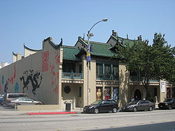
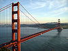
List of California Historical Landmarks
Encyclopedia
This is a list of California Historical Landmark
California Historical Landmark
California Historical Landmarks are buildings, structures, sites, or places in the state of California that have been determined to have statewide historical significance by meeting at least one of the criteria listed below:...

s
. The official list may be seen here.

Alameda County
Alameda County, California
Alameda County is a county in the U.S. state of California. It occupies most of the East Bay region of the San Francisco Bay Area. As of the 2010 census it had a population of 1,510,271, making it the 7th most populous county in the state...

For more details, please see http://ohp.parks.ca.gov/default.asp?page_id=21388.
  • Alameda Terminal
    Alameda Terminal
    Alameda Terminal was a railroad station located in Alameda, California on the eastern shore of San Francisco Bay.It was built in 1869 by the Central Pacific Railroad as part of the First Transcontinental Railroad project and was designated the western terminus of the line.The Pacific Railroad Act...

     of the First Transcontinental Railroad
    First Transcontinental Railroad
    The First Transcontinental Railroad was a railroad line built in the United States of America between 1863 and 1869 by the Central Pacific Railroad of California and the Union Pacific Railroad that connected its statutory Eastern terminus at Council Bluffs, Iowa/Omaha, Nebraska The First...

     (#440), now located within Naval Air Station Alameda
    Naval Air Station Alameda
    Naval Air Station Alameda was a United States Navy Naval Air Station in Alameda, California, on San Francisco Bay.NAS Alameda had two runways: 07-25 and 13-31...

  • Berkeley Women's City Club (#908)
  • Site of Blossom Rock navigation trees, Redwood Regional Park
    Redwood Regional Park
    Redwood Regional Park is a park of the East Bay Regional Parks District in the San Francisco Bay Area. It is located in the hills east of Oakland. The park contains the largest remaining natural stand of coast redwood found in the East Bay. Redwood forests are more commonly found closer to the...

     (#962), used to help ships avoid a submerged rock near Yerba Buena Island
    Yerba Buena Island
    Yerba Buena Island sits in the San Francisco Bay between San Francisco and Oakland, California. The Yerba Buena Tunnel runs through its center and connects the western and eastern spans of the San Francisco-Oakland Bay Bridge. It has had several other names over the decades: Sea Bird Island, Wood...

  • Francisco Alviso Adobe
    Alviso Adobe Community Park
    The Alviso Adobe Community Park is a park in the city of Pleasanton, California, United States. It is built around an adobe house constructed in 1854 by Francisco Alviso, a rare surviving example of an early American adobe that was continuously in use until 1969...

     (#510), one of the earliest adobe
    Adobe
    Adobe is a natural building material made from sand, clay, water, and some kind of fibrous or organic material , which the builders shape into bricks using frames and dry in the sun. Adobe buildings are similar to cob and mudbrick buildings. Adobe structures are extremely durable, and account for...

    s in the Amador Valley
  • Camino of Rancho San Antonio (#299), Oakland
    Oakland, California
    Oakland is a major West Coast port city on San Francisco Bay in the U.S. state of California. It is the eighth-largest city in the state with a 2010 population of 390,724...

  • Site of the China Clipper
    China Clipper flight departure site
    California Historical Landmark number 968 on Alameda Naval Air Station marks the site from which Pan American World Airways initiated trans-Pacific airmail service on 22 November 1935. A flying boat named China Clipper made the first trip, and the publicity for that flight caused all flying boats...

     flight departure (#968)
  • Church of St. James the Apostle (#694), founded under authority of Bishop Kip, first Episcopal Bishop for California, this church in Oakland
    Oakland, California
    Oakland is a major West Coast port city on San Francisco Bay in the U.S. state of California. It is the eighth-largest city in the state with a 2010 population of 390,724...

     has provided uninterrupted service since June 27, 1858
  • Site of College of California
    College of California
    The College of California was the predecessor of the University of California system of public universities. The private college was founded in 1855 by noted educator Dr. Samuel H. Willey...

     (#45), original site of the University of California
    University of California
    The University of California is a public university system in the U.S. state of California. Under the California Master Plan for Higher Education, the University of California is a part of the state's three-tier public higher education system, which also includes the California State University...

  • Site of first county courthouse (#503), in Union City
    Union City, California
    Union City is a city in Alameda County, California, United States. It was incorporated in 1959, combining the communities of Alvarado and Decoto. Alvarado was the original county seat of Alameda County, and the site of the first county courthouse is a California Historical Landmark . The city...

    .
  • Concannon Vineyard
    Concannon Vineyard
    Concannon Vineyard is the second-largest winery in the Livermore Valley of California, producing around 30,000 cases annually. It is well known for its Petite Sirah and Concannon was the first winery to bottle this grape as a varietal wine in 1961. It also produces several other varieties of wine,...

     (#641), founded by James Concannon
  • Cresta Blanca Winery
    Cresta Blanca Winery
    Cresta Blanca Winery was one of the original Livermore Valley wineries. It was founded by Charles Wetmore in 1882 with cuttings of Sauvignon blanc from Meursault, Burgundy, France. Its first vintage, a dry white wine in 1884 won Grand Prize at the 1889 Paris Exposition, becoming the first...

     (#586), founded by Charles Wetmore
  • Croll Building
    Croll Building
    The Croll Building, in Alameda, California, was the site of Croll's Gardens and Hotel, famous as training quarters for the some of the greatest fighters in boxing history from 1883 to 1914. James J...

     (#954), pivotal in the development of boxing
    Boxing
    Boxing, also called pugilism, is a combat sport in which two people fight each other using their fists. Boxing is supervised by a referee over a series of between one to three minute intervals called rounds...

     in California
  • Eden Congregational Church
    Eden Congregational Church
    Eden Congregational Church, also known as Pioneer Chapel, is a historic church building located just north of downtown Hayward in Alameda County, California. The building was listed on the National Register of Historic Places in 2007...

    , in Hayward
    Hayward, California
    Hayward is a city located in the East Bay in Alameda County, California. With a population of 144,186, Hayward is the sixth largest city in the San Francisco Bay Area and the third largest in Alameda County. Hayward was ranked as the 37th most populous municipality in California. It is included in...

  • Emeryville Shellmound
    Emeryville Shellmound
    The Emeryville Shellmound, in Emeryville, California, is a once-massive archaeological shell midden deposit...

     (#335)
  • Site of Estudillo Home (#279), home of José Joaquin Estudillo
    José Joaquín Estudillo
    José Joaquín Estudillo was a Mexican citizen of Alta California who was the second alcalde of Yerba Buena, California , and whose land holdings, known as Rancho San Leandro, formed the basis of the city of San Leandro.-Biography:He was born at the Presidio of Monterey, to José María Estudillo, a...

    , founder of the city of San Leandro
    San Leandro, California
    San Leandro is a city in Alameda County, California, United States. It is considered a suburb of Oakland and San Francisco. The population was 84,950 as of 2010 census. The climate of the city is mild throughout the year.-Geography and water resources:...

  • First Unitarian Church of Oakland
    First Unitarian Church of Oakland
    The First Unitarian Church of Oakland, in Oakland, California, was designed in 1889 by Walter J. Mathews. This solid masonry Romanesque church departed radically from California's traditional Gothic wood frame construction...

     (#896)
  • Green Shutter Hotel
    Green Shutter Hotel
    The Green Shutter Hotel is a historic hotel building located in downtown Hayward in Alameda County, California. The building was listed on the National Register of Historic Places in 2004. It is also a California Historical Landmark.-History:...

    , downtown Hayward
    Downtown Hayward
    Downtown Hayward is the original and current city center of Hayward, California, and is home to the current Hayward City Hall, along with the two previous city halls, Alex Giualini Plaza and The Tower at Hayward City Center...

  • Leland Stanford Winery (#642), founded by Leland Stanford
    Leland Stanford
    Amasa Leland Stanford was an American tycoon, industrialist, robber baron, politician and founder of Stanford University.-Early years:...

  • Livermore Memorial Monument (#241), marking the hacienda
    Hacienda
    Hacienda is a Spanish word for an estate. Some haciendas were plantations, mines, or even business factories. Many haciendas combined these productive activities...

     of Robert Livermore
    Robert Livermore
    Robert Thomas Livermore was a rancher and landowner in the early days of California, whose holdings eventually formed the basis of the city that bears his name: Livermore, California....

    , the first settler of the Livermore Valley
    Livermore Valley
    The Livermore Valley AVA is an American Viticultural Area in Alameda County, California, surrounding the city of Livermore in the Tri-Valley region. Both the AVA and the city are named after Robert Livermore, a landowner whose holdings encompassed the valley. The groundwater basin underlying the...

  • Meek Mansion and Carriage House, Cherryland
    Cherryland, California
    Cherryland is a census-designated place in Alameda County, California, United States.The unincorporated community is located between the cities of San Leandro to the north and Hayward to the south...

    , north of Hayward, administered by the Hayward Area Parks and Recreation Department
  • Joaquin Miller Home (#107), home of the eccentric poet Joaquin Miller
    Joaquin Miller
    Joaquin Miller was the pen name of the colorful American poet Cincinnatus Heine Miller , nicknamed the "Poet of the Sierras".-Early years and family:...

  • Mills Hall (#849), of Mills College
    Mills College
    Mills College is an independent liberal arts women's college founded in 1852 that offers bachelor's degrees to women and graduate degrees and certificates to women and men. Located in Oakland, California, Mills was the first women's college west of the Rockies. The institution was initially founded...

  • Mission San José (#334)
  • Paramount Theater
    Paramount Theater (Oakland, California)
    The Paramount Theatre is a massive Art Deco movie theater located in downtown Oakland, California, USA. When it was built in 1931, it was the largest multi-purpose theater on the West Coast, seating 3476 Today, the Paramount is the home of the Oakland East Bay Symphony and the Oakland Ballet, it...

     (#884), an ambitious Art Deco
    Art Deco
    Art deco , or deco, is an eclectic artistic and design style that began in Paris in the 1920s and flourished internationally throughout the 1930s, into the World War II era. The style influenced all areas of design, including architecture and interior design, industrial design, fashion and...

     movie theater
  • Pardee Home
    Pardee Home
    The Pardee Home is a house in Oakland, California that was home to three generations of the Pardee family. It is now a non-profit museum, showing over 100 years of the life of a prominent California family...

     (#1027), home of former governor George Pardee
    George Pardee
    George Cooper Pardee was an American doctor of medicine and politician. The 21st Governor of California, holding office from January 7, 1903, to January 9, 1907, Pardee was the second native-born Californian to assume the governorship, after Romualdo Pacheco, and the first governor born in...

  • Peralta Hacienda Site (#925), headquarters of Rancho San Antonio
  • Peralta Home
    Peralta Home
    The Peralta Home, at 561 Lafayette Avenue in San Leandro was the first brick house built in Alameda County. It was constructed in the Spanish Colonial1860 for Ignacio Peralta, early San Leandro Spanish settler, by W.P. Toler ....

     (#285), the first brick house built in Alameda County
    Alameda County, California
    Alameda County is a county in the U.S. state of California. It occupies most of the East Bay region of the San Francisco Bay Area. As of the 2010 census it had a population of 1,510,271, making it the 7th most populous county in the state...

  • Piedmont Way (#986), designed by Frederick Law Olmsted
    Frederick Law Olmsted
    Frederick Law Olmsted was an American journalist, social critic, public administrator, and landscape designer. He is popularly considered to be the father of American landscape architecture, although many scholars have bestowed that title upon Andrew Jackson Downing...

    , in Berkeley
    Berkeley, California
    Berkeley is a city on the east shore of the San Francisco Bay in Northern California, United States. Its neighbors to the south are the cities of Oakland and Emeryville. To the north is the city of Albany and the unincorporated community of Kensington...

  • Rancho San Antonio (Peralta) (#246), the 44800 acres (181 km²) land grant to Luís María Peralta
    Luís María Peralta
    Luis María Peralta was a soldier in the Spanish Army, who received one of the largest of the Spanish land grants, Rancho San Antonio, a plot that encompassed most of the East Bay region of California.-Biography:...

     that encompasses the cities of San Leandro
    San Leandro, California
    San Leandro is a city in Alameda County, California, United States. It is considered a suburb of Oakland and San Francisco. The population was 84,950 as of 2010 census. The climate of the city is mild throughout the year.-Geography and water resources:...

    , Oakland
    Oakland, California
    Oakland is a major West Coast port city on San Francisco Bay in the U.S. state of California. It is the eighth-largest city in the state with a 2010 population of 390,724...

    , Alameda
    Alameda, California
    Alameda is a city in Alameda County, California, United States. It is located on Alameda Island and Bay Farm Island, and is adjacent to Oakland in the San Francisco Bay. The Bay Farm Island portion of the city is adjacent to the Oakland International Airport. At the 2010 census, the city had a...

    , Emeryville
    Emeryville, California
    Emeryville is a small city located in Alameda County, California, in the United States. It is located in a corridor between the cities of Berkeley and Oakland, extending to the shore of San Francisco Bay. Its proximity to San Francisco, the Bay Bridge, the University of California, Berkeley, and...

    , Piedmont
    Piedmont, California
    Piedmont is a small, affluent city in Alameda County, California, United States. It is surrounded by the city of Oakland. The population was 10,667 at the 2010 census. Piedmont was incorporated in 1907 and was developed significantly in the 1920s and 1930s...

    , Berkeley
    Berkeley, California
    Berkeley is a city on the east shore of the San Francisco Bay in Northern California, United States. Its neighbors to the south are the cities of Oakland and Emeryville. To the north is the city of Albany and the unincorporated community of Kensington...

    , and Albany
    Albany, California
    Albany is a city in Alameda County, California, United States. The population was 18,539 at the 2010 census.-History:In 1908, a group of local women protested the dumping of Berkeley garbage in their community...

  • Site of the identification of the rainbow trout
    Rainbow trout
    The rainbow trout is a species of salmonid native to tributaries of the Pacific Ocean in Asia and North America. The steelhead is a sea run rainbow trout usually returning to freshwater to spawn after 2 to 3 years at sea. In other words, rainbow trout and steelhead trout are the same species....

     species, San Leandro Creek
    San Leandro Creek
    San Leandro Creek is a year-round natural stream flowing along the east side of the range which comprises the Berkeley Hills and the San Leandro Hills, immediately east of Oakland. In the hills, it runs into Upper San Leandro Reservoir and then Lake Chabot, both manmade lakes lying north of the...

     (#970)
  • Site of first public school
    Public education
    State schools, also known in the United States and Canada as public schools,In much of the Commonwealth, including Australia, New Zealand, South Africa, and the United Kingdom, the terms 'public education', 'public school' and 'independent school' are used for private schools, that is, schools...

     in Castro Valley
    Castro Valley, California
    Castro Valley is a census-designated place in Alameda County, California, United States. As of the 2000 census, it is the fifth most populous unincorporated area in California, and the twenty-third in the United States...

     (#776), part of the original Guillermo Castro
    Guillermo Castro
    Guillermo Castro was the son of Carlos Castro of Rancho San Francisco de las Llagas, near Coyote, California in Santa Clara County. He was a soldier, rancher, surveyor, and magistrate in his lifetime.-Biography:...

     land grant and donated by Josiah Grover Brickell in 1866 for "educational purposes only"
  • Site of Saint Mary's College of California
    Saint Mary's College of California
    Saint Mary's College of California is a private, coeducational college located in Moraga, California, United States, a small suburban community about east of Oakland and 20 miles east of San Francisco. It has a 420-acre campus in the Moraga hills. It is affiliated with the Roman Catholic Church...

     (#676)
  • San Leandro Oyster Beds
    San Leandro Oyster Beds
    The San Leandro Oyster Beds in San Leandro, California, were the origin of the oyster industry in the U.S. state of California. During the 1890s the oyster industry thrived until it became the single most important fishery in the state. Moses Wicks is supposed to have been the first to bring seed...

     (#824)
  • Site of nation's first successful sugar beet
    Sugar beet
    Sugar beet, a cultivated plant of Beta vulgaris, is a plant whose tuber contains a high concentration of sucrose. It is grown commercially for sugar production. Sugar beets and other B...

     factory (#768), founded by E. H. Dyer
    E. H. Dyer
    Ebenezer Herrick Dyer was an American businessman who established the first successful commercial beet sugar mill in the U.S., and as such was called the "father of the American beet sugar industry"....

    , "father of the American beet sugar industry," in Union City
    Union City, California
    Union City is a city in Alameda County, California, United States. It was incorporated in 1959, combining the communities of Alvarado and Decoto. Alvarado was the original county seat of Alameda County, and the site of the first county courthouse is a California Historical Landmark . The city...

  • Ukrania (#1025), the homestead of Agapius Honcharenko
    Agapius Honcharenko
    Reverend Agapius Honcharenko , aka Ahapii or Ahapius) was a Ukrainian patriot and exiled Greek Orthodox priest. He was a prominent scholar, humanitarian, and early champion for human rights....

  • University of California, Berkeley
    University of California, Berkeley
    The University of California, Berkeley , is a teaching and research university established in 1868 and located in Berkeley, California, USA...

     campus (#946)
  • USS Hornet (CV-12)
    USS Hornet (CV-12)
    USS Hornet is a United States Navy aircraft carrier of the Essex class. Construction started in August 1942; she was originally named , but was renamed in honor of the , which was lost in October 1942, becoming the eighth ship to bear the name.Hornet was commissioned in November 1943, and after...

     (#1029)
  • Vallejo Flour Mill
    Vallejo Flour Mill
    The Vallejo Flour Mill in Fremont, California, was built in 1850 by José de Jesús Vallejo, elder brother of General Mariano Guadalupe Vallejo on his Rancho Arroyo de la Alameda...

     (#46)
  • Wente Vineyards
    Wente Vineyards
    Wente Vineyards is a winery in Livermore, California and holds the distinction of being "the oldest continuously operating, family-owned winery in California." The Wente Estate is registered as California Historical Landmark #957.-History:...

     (#957), home of California's first varietal
    Varietal
    "Varietal" describes wines made primarily from a single named grape variety, and which typically displays the name of that variety on the wine label. Examples of grape varieties commonly used in varietal wines are Cabernet Sauvignon, Chardonnay and Merlot...

     wine label, Sauvignon blanc
    Sauvignon blanc
    Sauvignon Blanc is a green-skinned grape variety which originates from the Bordeaux region of France. The grape most likely gets its name from the French word sauvage and blanc due to its early origins as an indigenous grape in South West France., a possible descendant of savagnin...


Alpine County
Alpine County, California
Alpine County is the smallest county, by population, in the U.S. state of California. As of 2010, it had a population of 1,175, all rural. There are no incorporated cities in the county. The county seat is Markleeville...

For more details, please see http://ohp.parks.ca.gov/default.asp?page_id=21389.
  • Kit Carson
    Kit Carson
    Christopher Houston "Kit" Carson was an American frontiersman and Indian fighter. Carson left home in rural present-day Missouri at age 16 and became a Mountain man and trapper in the West. Carson explored the west to California, and north through the Rocky Mountains. He lived among and married...

     Marker (#315), at the summit of Carson Pass
    Carson Pass
    Carson Pass is the Sierra Crest mountain pass over which State Route 88 crosses. The historic pass was a point on the Carson Trail during the California Gold Rush and was used for American Civil War shipping to California until the completion of the First Transcontinental Railroad...

    , marking where Carson carved his name into a tree in 1844 while guiding John C. Frémont
    John C. Frémont
    John Charles Frémont , was an American military officer, explorer, and the first candidate of the anti-slavery Republican Party for the office of President of the United States. During the 1840s, that era's penny press accorded Frémont the sobriquet The Pathfinder...

     through the Sierra Nevada. The original can be found at Sutter's Fort
    Sutter's Fort
    Sutter's Fort State Historic Park is a state-protected park in Sacramento, California which includes Sutter's Fort and the California State Indian Museum. Begun in 1839 and originally called "New Helvetia" by its builder, John Sutter, the fort was a 19th century agricultural and trade colony in...

    , Sacramento
    Sacramento, California
    Sacramento is the capital city of the U.S. state of California and the county seat of Sacramento County. It is located at the confluence of the Sacramento River and the American River in the northern portion of California's expansive Central Valley. With a population of 466,488 at the 2010 census,...

    .
  • Ebbetts Pass
    Ebbetts Pass
    Ebbetts Pass, named after John Ebbetts, is a high mountain pass through the Sierra Nevada range in Alpine County, California. Ebbetts is the eastern of two passes in the area traversed by State Route 4. The western pass is the Pacific Grade Summit . The pass is registered as California Historical...

     Route (#318), on the California Trail
    California Trail
    The California Trail was an emigrant trail of about across the western half of the North American continent from Missouri River towns to what is now the state of California...

    , discovered by John Ebbetts
    John Ebbetts
    Major John Ebbetts was a California pioneer credited with the first recorded traverse of Ebbetts Pass in April 1851 while searching for a route for the railroad. The route he took is now California State Route 4. He had come to California in 1849. He was the head of the Knickerbocker Exploring...

  • Old Emigrant Road (#661), near Caples Lake—This rough and circuitous section of the route to Placerville
    Placerville, California
    Placerville is the county seat of El Dorado County, California. The population was 10,389 at the 2010 census, up from 9,610 at the 2000 census. It is part of the Sacramento–Arden-Arcade–Roseville Metropolitan Statistical Area.-Geography:...

     became obsolete in 1863 when a better route was blasted out of the face of the cliff at Carson Spur.
  • Marklee's Cabin Site (#240), Markleeville
    Markleeville, California
    Markleeville is a census-designated place and the county seat of Alpine County, California. The population was 210 at the 2010 census, up from 197 at the 2000 census.The CDP of Markleeville also includes Woodfords....

    , now the site of the Alpine County Courthouse
    Alpine County Courthouse
    Alpine County Courthouse is a building built in 1928 in Markleeville, California.It is a California Historical Landmark.It was listed on the National Register of Historic Places in 2004....

    .
  • Memorial to Pioneer Odd Fellows (#378)—On some large rocks near Carson Pass
    Carson Pass
    Carson Pass is the Sierra Crest mountain pass over which State Route 88 crosses. The historic pass was a point on the Carson Trail during the California Gold Rush and was used for American Civil War shipping to California until the completion of the First Transcontinental Railroad...

    , a group of pioneers inscribed their names and the emblem of the Independent Order of Odd Fellows
    Independent Order of Odd Fellows
    The Independent Order of Odd Fellows , also known as the Three Link Fraternity, is an altruistic and benevolent fraternal organization derived from the similar British Oddfellows service organizations which came into being during the 18th century, at a time when altruistic and charitable acts were...

     in 1849.
  • Pony Express
    Pony Express
    The Pony Express was a fast mail service crossing the Great Plains, the Rocky Mountains, and the High Sierra from St. Joseph, Missouri, to Sacramento, California, from April 3, 1860 to October 1861...

     Remount Station (#805), Woodfords
    Woodfords, California
    Woodfords is an unincorporated community in Alpine County, California, near Markleeville. For census purposes, it is included in Alpine Village...

    , an official stop for five weeks starting April 4, 1860.

Amador County
Amador County, California
Amador County is a county located in the Sierra Nevada of the U.S. state of California. As of the 2010 census, the population was 38,091. The county seat is Jackson.Amador County bills itself as "The Heart of the Mother Lode" and lies within the Gold Country...

For more details, please see http://ohp.parks.ca.gov/default.asp?page_id=21390.
  • Argonaut
    Argonaut Mine
    The Argonaut Mine is a gold mine in Jackson, California, United States. It was discovered in 1850 and was the site of the worst gold-mining disaster in the state's history. The mine closed in 1942 and, along with the nearby Kennedy Mine, is registered as California Historical Landmark #786.It was...

     and Kennedy Mine
    Kennedy Mine
    The Kennedy Gold Mine is a gold mine in Jackson, California, one of the deepest mines in the world. It closed in 1942 and together with nearby Argonaut Mine, is registered as California Historical Landmark #786...

    s (#786), Jackson
    Jackson, California
    Jackson is the county seat of Amador County, California. The population was 4,651 at the 2010 census, up from 3,989 at the 2000 census...

  • Big Bar (#41), Jackson
    Jackson, California
    Jackson is the county seat of Amador County, California. The population was 4,651 at the 2010 census, up from 3,989 at the 2000 census...

    —The Mokelumne River
    Mokelumne River
    The Mokelumne River is a river in Northern California. The Upper Mokelumne River originates in the Sierra Nevada mountain range and flows into Pardee Reservoir and then Camanche Reservoir in the Sierra foothills. The Lower Mokelumne River refers to the portion of the river below Camanche Dam...

     was mined at this point in 1848. Established in 1849, the Whale Boat Ferry operated until the first bridge was built, about 1852.
  • Butte Store (#39), Jackson
    Jackson, California
    Jackson is the county seat of Amador County, California. The population was 4,651 at the 2010 census, up from 3,989 at the 2000 census...

    —The only structure remaining of Butte City, prosperous mining town of the 1850s.
  • Chaw'se Roundhouse
    Indian Grinding Rock State Historic Park
    Chaw'se Indian Grinding Rock State Historic Park is a historical state park located in the Sierra Nevada foothills of California, eight miles east of Jackson...

     (#1001), Pine Grove
  • Clinton (#37), Pine Grove—The center of a placer mining
    Placer mining
    Placer mining is the mining of alluvial deposits for minerals. This may be done by open-pit or by various surface excavating equipment or tunneling equipment....

     community during the 1850s and of quartz
    Quartz
    Quartz is the second-most-abundant mineral in the Earth's continental crust, after feldspar. It is made up of a continuous framework of SiO4 silicon–oxygen tetrahedra, with each oxygen being shared between two tetrahedra, giving an overall formula SiO2. There are many different varieties of quartz,...

     mining as late as the 1880s. This town once decided Amador County elections as its votes were always counted last.
  • Community Methodist Church of Ione
    Community Methodist Church of Ione
    The Community Methodist Church of Ione, is a Methodist Episcopal church in Ione, California, United States.The cornerstone was laid in 1862 and the church, constructed of locally fired brick, was completed in 1866...

     (#506), Ione
    Ione, California
    Ione is a city in Amador County, California, United States. The population was 7,918 at the 2010 census, up from 7,129 at the 2000 census. Once known as "Bed-Bug" and "Freeze Out," Ione was an important supply center on the main road to the Mother Lode and Southern Mines during the California Gold...

  • D. Stewart Co. Store (#788), Ione
    Ione, California
    Ione is a city in Amador County, California, United States. The population was 7,918 at the 2010 census, up from 7,129 at the 2000 census. Once known as "Bed-Bug" and "Freeze Out," Ione was an important supply center on the main road to the Mother Lode and Southern Mines during the California Gold...

    —This general merchandise store built in 1856 was the first building erected in Ione Valley.
  • D'Agostini Winery
    D'Agostini Winery
    D'Agostini Winery refers to both a winery in Healdsburg, California owned by Armagan Champagne Cellars as well as the original vineyard and wine cellar located in Plymouth , which are owned by Sobon Estate Winery...

     (#762), Plymouth
    Plymouth, California
    Plymouth is a city in Amador County, California, United States. The population was 980 at the 2000 census. The town was originally named Pokerville, when it was settled during the time of the Gold Rush...

    —Founded in 1856 and generally regarded as the first place where Zinfandel
    Zinfandel
    Zinfandel is a variety of red grape planted in over 10 percent of California vineyards. DNA fingerprinting revealed that it is genetically equivalent to the Croatian grape Crljenak Kaštelanski, and also the Primitivo variety traditionally grown in Puglia , where it was introduced in the 18th century...

     was planted in California.
  • Drytown, California
    Drytown, California
    Drytown is a census-designated place in Amador County, California. It is located south of Plymouth on Dry Creek, at an elevation of 646 feet . The current population is 167. The town is registered as California Historical Landmark #31. The community is in ZIP code 95699 and area code 209...

     (#31)
  • Kirkwood's (#40), Kirkwood
    Kirkwood, California
    Kirkwood is a census-designated place in Alpine and Amador counties, California, United States. The population was 158 at the 2010 census. Kirkwood's main attraction is the Kirkwood Mountain Resort. The town is accessible by State Route 88...

    —One of the earliest resorts in the Sierra Nevada Mountains
  • Knight Foundry
    Knight Foundry
    Knight Foundry, also known as Knight's Foundry and Shops, is a cast iron foundry and machine shop in Sutter Creek, California. It was established in 1873 to supply heavy equipment and repair facilities to the gold mines and timber industry of the Mother Lode. Samuel N. Knight developed a high...

     (#1007), Sutter Creek
    Sutter Creek, California
    Sutter Creek is a city in Amador County, California, United States. The population was 2,501 at the 2010 census, up from 2,303 at the 2000 census...

  • Irishtown (#38), Pine Grove—An important stopping place for emigrants on their way to the southern mines. The first white settlers on this spot found it a "city of wigwam
    Wigwam
    A wigwam or wickiup is a domed room dwelling used by certain Native American tribes. The term wickiup is generally used to label these kinds of dwellings in American Southwest and West. Wigwam is usually applied to these structures in the American Northeast...

    s," and hundreds of mortars
    Mortar and pestle
    A mortar and pestle is a tool used to crush, grind, and mix solid substances . The pestle is a heavy bat-shaped object, the end of which is used for crushing and grinding. The mortar is a bowl, typically made of hard wood, ceramic or stone...

     in the rocks testify that this was a favorite Indian camping ground.
  • Jackson Gate (#118), Jackson
    Jackson, California
    Jackson is the county seat of Amador County, California. The population was 4,651 at the 2010 census, up from 3,989 at the 2000 census...

    —In 1850 about 500 miners worked here and the first mining ditch in the county was dug here. Its water sold for $1 per inch.
  • Site of Jackson's Pioneer Jewish
    Judaism
    Judaism ) is the "religion, philosophy, and way of life" of the Jewish people...

     Synagogue
    Synagogue
    A synagogue is a Jewish house of prayer. This use of the Greek term synagogue originates in the Septuagint where it sometimes translates the Hebrew word for assembly, kahal...

     (#865), Jackson
    Jackson, California
    Jackson is the county seat of Amador County, California. The population was 4,651 at the 2010 census, up from 3,989 at the 2000 census...

    —Location of the first synagogue in the Mother Lode
    Gold Country
    Gold Country is a region in the central and northeastern part of California, United States. It is famed for the mineral deposits and gold mines that attracted waves of immigrants, known as the 49ers, during the 1849 California Gold Rush.-Geography:State Route 49 was built through the Gold Country,...

     (dedicated 1857).
  • Lancha Plana, California
    Lancha Plana, California
    Lancha Plana was a small settlement in Amador County, California, formed as a result of a flatboat ferry crossing across the Mokelumne River. It was founded by Mexican settlers in 1848. It lay on the north bank of the Mokelumne River, south-southeast of Ione, at an elevation of 220 feet...

     (#30)
  • Maiden's Grave (#28), burial spot of Rachel Welton, who died while crossing the Carson Pass
    Carson Pass
    Carson Pass is the Sierra Crest mountain pass over which State Route 88 crosses. The historic pass was a point on the Carson Trail during the California Gold Rush and was used for American Civil War shipping to California until the completion of the First Transcontinental Railroad...

     in 1850
  • Middle Bar (#36)—Site of gold rush
    California Gold Rush
    The California Gold Rush began on January 24, 1848, when gold was found by James W. Marshall at Sutter's Mill in Coloma, California. The first to hear confirmed information of the gold rush were the people in Oregon, the Sandwich Islands , and Latin America, who were the first to start flocking to...

     town on the Mokelumne River
    Mokelumne River
    The Mokelumne River is a river in Northern California. The Upper Mokelumne River originates in the Sierra Nevada mountain range and flows into Pardee Reservoir and then Camanche Reservoir in the Sierra foothills. The Lower Mokelumne River refers to the portion of the river below Camanche Dam...

    , now inundated by Pardee Reservoir at certain times of the year.
  • Old Emigrant Road (#662), Hwy. 88
    California State Route 88
    State Route 88 , also known as the Carson Pass Highway, is a California State Highway that travels in an east–west direction, from Stockton, crossing the Sierra Nevada at Carson Pass, and ending at the border with Nevada, whereupon it becomes Nevada State Route 88, eventually terminating at U.S...

    —This difficult portion of the road was used by thousands of vehicles from 1848 to 1863, when it was superseded by a route approximating the present highway.
  • Oleta (Old Fiddletown, California
    Fiddletown, California
    Fiddletown is a census-designated place in Amador County, California. It lies at an elevation of 1683 feet . It is located at . The town is registered as California Historical Landmark #35 and is listed in the National Register of Historic Places . The community is in ZIP code 95629 and area code...

    ) (#35),
  • Pioneer Hall (#34), Jackson
    Jackson, California
    Jackson is the county seat of Amador County, California. The population was 4,651 at the 2010 census, up from 3,989 at the 2000 census...

    —The Order of Native Daughters of the Golden West was organized on these premises on September 11, 1886.
  • Plymouth Trading Post (#470), Plymouth
    Plymouth, California
    Plymouth is a city in Amador County, California, United States. The population was 980 at the 2000 census. The town was originally named Pokerville, when it was settled during the time of the Gold Rush...

    —This building, constructed entirely of brick, was built in 1857. In 1873 the many small mines of the area were combined to become Plymouth Consolidated, and this building became the new company's office and commissary.
  • Preston Castle
    Preston School of Industry
    The Preston School of Industry, also known as Preston Castle, is one of the oldest and best-known reform schools in the United States. It is located in Ione, California, in Amador County....

     (#867), Ione
    Ione, California
    Ione is a city in Amador County, California, United States. The population was 7,918 at the 2010 census, up from 7,129 at the 2000 census. Once known as "Bed-Bug" and "Freeze Out," Ione was an important supply center on the main road to the Mother Lode and Southern Mines during the California Gold...

  • Site of First Amateur Astronomical Observatory of Record in California (#715), Volcano
    Volcano, California
    Volcano is a census-designated place in Amador County, California. It lies at an elevation of 2070 feet . The population was 115 at the 2010 census. It is located at , just north of Pine Grove. The town is registered as California Historical Landmark #29...

    —where George Madeira
    George Madeira
    George David Madeira was a mining engineer and mineralogist who founded the first astronomical observatory in California in the town of Volcano....

     observed the Great Comet of 1861 with a three-inch (76 mm) refractor telescope.
  • Sutter Creek, California
    Sutter Creek, California
    Sutter Creek is a city in Amador County, California, United States. The population was 2,501 at the 2010 census, up from 2,303 at the 2000 census...

     (#118)
  • Volcano, California
    Volcano, California
    Volcano is a census-designated place in Amador County, California. It lies at an elevation of 2070 feet . The population was 115 at the 2010 census. It is located at , just north of Pine Grove. The town is registered as California Historical Landmark #29...

     (#29)

Butte County
Butte County, California
Butte County is a county located in the Central Valley of the US state of California, north of the state capital of Sacramento. As of the 2010 census, it had a population of 220,000. The county seat is Oroville. Butte County is the "Land of Natural Wealth and Beauty."Butte County is watered by the...

For more details, please see http://ohp.parks.ca.gov/default.asp?page_id=21391.
  • Bidwell's Bar
    Bidwell's Bar, California
    Bidwell's Bar was a gold mining camp in Butte County, California, United States, which lay at the end of the California Trail...

     (#330), the second county seat of Butte County, now covered by Lake Oroville
    Lake Oroville
    Lake Oroville, also known as Lake Edmonston, is a reservoir in the U.S. state of California, formed by the Oroville Dam across the Feather River. The lake is situated in the foothills of the Sierra Nevada about northeast of Oroville. At over , it is one of the largest reservoirs in California,...

  • Bidwell Bar Bridge
    Bidwell Bar Bridge
    The Bidwell Bar Bridge, in Oroville, California, refers to two suspension bridges which cross different parts of Lake Oroville. The original Bidwell Bar Bridge was the first steel suspension bridge in California. The $35,000, 240-foot long original was completed in December 1855, and was built of...

     (#314), Oroville
    Oroville, California
    Oroville is the county seat of Butte County, California. The population was 15,506 at the 2010 census, up from 13,004 at the 2000 census...

    —the first suspension bridge
    Suspension bridge
    A suspension bridge is a type of bridge in which the deck is hung below suspension cables on vertical suspenders. Outside Tibet and Bhutan, where the first examples of this type of bridge were built in the 15th century, this type of bridge dates from the early 19th century...

     in California
  • Chico Forestry Station and Nursery (#840-2), Bidwell Park
    Bidwell Park
    Bidwell Park is a municipal park located in Chico, California. The park was established July 10, 1905 through the donation by Annie Bidwell of approximately 2,500 acres of land to the City of Chico...

    , Chico
    Chico, California
    Chico is the most populous city in Butte County, California, United States. The population was 86,187 at the 2010 census, up from 59,954 at the time of the 2000 census...

    —one of the first forestry and nursery stations in the U.S., it operated from 1888 to 1903.
  • Chinese Temple (#770), Oroville
    Oroville, California
    Oroville is the county seat of Butte County, California. The population was 15,506 at the 2010 census, up from 13,004 at the 2000 census...

    —temple of worship for over 10,000 Chinese residents
  • Discovery site of Ishi
    Ishi
    Ishi was the last member of the Yahi, the last surviving group of the Yana people of the U.S. state of California. Ishi is believed to have been the last Native American in Northern California to have lived most of his life completely outside the European American culture...

    , the last Yahi Indian (#809), Oroville
    Oroville, California
    Oroville is the county seat of Butte County, California. The population was 15,506 at the 2010 census, up from 13,004 at the 2000 census...

  • Dogtown nugget discovery site (#771), Magalia
    Magalia, California
    Magalia is a census-designated place in Butte County, California, United States. The population was 11,310 at the 2010 census.-History:...

    , a 54-pound (20 kg) gold nugget
    Gold nugget
    A gold nugget is a naturally occurring piece of native gold. Watercourses often concentrate and grow the nuggets. Nuggets are recovered by placer mining, but they are also found in residual deposits where the gold-bearing veins or lodes are weathered...

  • Hooker Oak
    Hooker Oak
    Hooker Oak was a large valley oak tree in Chico, California. It was named after English botanist and Director of the Royal Botanical Gardens, Sir Joseph Dalton Hooker by Annie Bidwell in 1887...

     (#313), Chico
    Chico, California
    Chico is the most populous city in Butte County, California, United States. The population was 86,187 at the 2010 census, up from 59,954 at the time of the 2000 census...

  • Oregon City
    Oregon City, California
    Oregon City , an unincorporated area between Oroville and Cherokee in Butte County, California, was one of the first mining camps in the county. It was established in the autumn of 1848 by a party of Oregonians, who came to California over the Applegate and Lassen Trails. Little more than a year...

     (#807)
  • Rancho Chico and Bidwell Adobe (#329), now Bidwell Mansion State Historic Park
    Bidwell Mansion State Historic Park
    Bidwell Mansion, located at 525 Esplanade in Chico, California, was the home of General John Bidwell and Annie Bidwell from the late 1868 until 1900, when Gen. Bidwell died. Annie continued to live there until her death in 1918...


Calaveras County
Calaveras County, California
Calaveras County is a county located in the Gold Country of the U.S. state of California. Calaveras is the Spanish word for skulls; the county was reportedly named for the remains of Native Americans discovered by the Spanish explorer Captain Gabriel Moraga. As of the 2010 census, the county had a...

For more details, please see http://ohp.parks.ca.gov/default.asp?page_id=21392.
  • Altaville, California
    Altaville, California
    Altaville is a former unincorporated community in Calaveras County, California, now located in the northwest portion of the city of Angels Camp. It sits at an elevation of 1,542 feet above sea level and is located at , at the intersections of SR 49 and SR 4...

     (#288)
  • Altaville Grammar School
    Altaville Grammar School
    The Altaville Grammar School in Altaville, California is one of the oldest grammar schools in California. It was built in 1858 of brick in the Greek Revival style and remained in use until 1950, when it was replaced by the Mark Twain Elementary School in Altaville. After its abandonment, it fell...

     (#499), Altaville
    Altaville, California
    Altaville is a former unincorporated community in Calaveras County, California, now located in the northwest portion of the city of Angels Camp. It sits at an elevation of 1,542 feet above sea level and is located at , at the intersections of SR 49 and SR 4...

  • Angels Camp, California
    Angels Camp, California
    Angels Camp, also known as City of Angels and formerly Angel's Camp, Angels, Angels City, Carson's Creek, and Clearlake, is the only incorporated city in Calaveras County, California, United States. The population was 3,835 at the 2010 census, up from 3,004 at the 2000 census...

     (#287)
  • Angels Hotel
    Angels Hotel
    The Angels Hotel in Angels Camp, California was the hotel where the author Mark Twain heard a story that he would later turn into his short story, "The Celebrated Jumping Frog of Calaveras County."...

     (#734), Angels Camp
    Angels Camp, California
    Angels Camp, also known as City of Angels and formerly Angel's Camp, Angels, Angels City, Carson's Creek, and Clearlake, is the only incorporated city in Calaveras County, California, United States. The population was 3,835 at the 2010 census, up from 3,004 at the 2000 census...

    , where Mark Twain
    Mark Twain
    Samuel Langhorne Clemens , better known by his pen name Mark Twain, was an American author and humorist...

     heard the story that would become "The Celebrated Jumping Frog of Calaveras County
    The Celebrated Jumping Frog of Calaveras County
    "The Celebrated Jumping Frog of Calaveras County" is an 1865 short story by Mark Twain, his first great success as a writer, bringing him national attention. The story has also been published as "Jim Smiley and His Jumping Frog" and "The Notorious Jumping Frog of Calaveras County"...

    "
  • Birthplace of Archie Stevenot
    Archie Stevenot
    Archie Stevenot was a prominent citizen in Calaveras County, California and Supreme Noble Grand Humbug of E Clampus Vitus. Born in Carson Hill, Stevenot helped found the California Chamber of Commerce and his family established the borax industry in the state...

     (#769), Hwy. 4—The Stevenot family established the borax
    Borax
    Borax, also known as sodium borate, sodium tetraborate, or disodium tetraborate, is an important boron compound, a mineral, and a salt of boric acid. It is usually a white powder consisting of soft colorless crystals that dissolve easily in water.Borax has a wide variety of uses...

     industry in California
  • Old Mining Camp of Brownsville (#465)—A thriving mining camp on rich Pennsylvania Gulch in the 1850s and 1860s, the camp was named for Alfred Brown, former owner of Table Mountain Ranch. Laws of the Brownsville mining district provided that each miner could own one wet and one dry claim, not to exceed 150 square feet (14 m²) each.
  • Calaveritas, California
    Calaveritas, California
    Calaveritas is an unincorporated community in Calaveras County, California. It sits on the banks of the Calaveritas Creek at an elevation of 1,109 feet above sea level and is located at...

     (#255)
  • California Caverns
    California Caverns
    The California Caverns, in Cave City, are a series of caverns that are one of the earliest officially recorded caves in the Mother Lode region of California...

     (#956), Cave City
    Cave City, California
    Cave City is an unincorporated community in Calaveras County, California. It lies at an elevation of and is located at . The community is in ZIP code 95222 and area code 209.Like most communities in Calaveras County, Cave City began as a mining town...

  • Camanche, California
    Camanche, California
    Camanche is a former settlement in Calaveras County, California. It lay at an elevation of 220 feet . Once called Limerick, the town became Camanche in 1849. Gold mining at nearby Cat Camp, Poverty Bar, and Sand Hill brought its population to a peak of 1,500...

     (#254)
  • Campo Seco, California
    Campo Seco, California
    Campo Seco is an unincorporated community in Calaveras County, California. It sits an elevation of 564 feet above sea level and is located at . The community is in ZIP code 95226 and area code 209....

     (#257)
  • Carson Hill, California
    Carson Hill, California
    Carson Hill is a ghost town in Calaveras County, California. It sits at an elevation of 1447 feet above sea level and is located at , about south-southeast of Angels Camp. It was one of the most productive mining camps in the state, with nearly $26 million in gold and quartz found in the area...

     (#274)
  • Chili Gulch
    Chili Gulch
    Chili Gulch is a gulch in Calaveras County, California. This five-mile gulch was the richest placer mining section in Calaveras County. It received its name from Chileans who worked it in 1848 and 1849, and was the scene of the so-called Chilean War...

     (#265)
  • Congregational Church
    Congregational church
    Congregational churches are Protestant Christian churches practicing Congregationalist church governance, in which each congregation independently and autonomously runs its own affairs....

     (#261), Mokelumne Hill
    Mokelumne Hill, California
    Mokelumne Hill is a census-designated place in Calaveras County, California, United States. The population was 646 at the 2010 census, down from 774 at the 2000 census. It is commonly referred to as "Moke Hill" by locals...

    —The church building, erected in 1856, is the oldest Congregational Church building in the state.
  • Copperopolis, California
    Copperopolis, California
    Copperopolis is a census-designated place in Calaveras County, California, United States. The population was 3,671 at the 2010 census, up from 2,363 at the 2000 census. The town is located along State Route 4 and is registered as California Historical Landmark #296.- History :Unlike most of the...

     (#296)
  • Double Springs (#264), Valley Springs
    Valley Springs, California
    Valley Springs is a census-designated place in Calaveras County, California, United States. The population was 3,553 at the 2010 census, up from 2,560 at the 2000 census. The town is located at the intersection of State Route 12 and Route 26...

    —Founded February 18, 1850, Double Springs was once the seat
    County seat
    A county seat is an administrative center, or seat of government, for a county or civil parish. The term is primarily used in the United States....

     of Calaveras County. The old courthouse, said to be constructed of lumber brought from China
    China
    Chinese civilization may refer to:* China for more general discussion of the country.* Chinese culture* Greater China, the transnational community of ethnic Chinese.* History of China* Sinosphere, the area historically affected by Chinese culture...

    , is still standing, but not on its original site
  • Douglas Flat, California
    Douglas Flat, California
    Douglas Flat is an unincorporated community in Calaveras County, California. It lies at an elevation of 1965 feet and is located at . The community is in ZIP code 95229 and area code 209....

     (#272)
  • Fourth Crossing
    Fourth Crossing, California
    Fourth Crossing is an unincorporated community in Calaveras County, California. It lies at an elevation of 922 feet and is located on State Route 49 at...

     (#258)
  • Glencoe, California
    Glencoe, California
    Glencoe is an unincorporated community in Calaveras County, California. It lies at an elevation of 2749 feet and is located at . The community is in ZIP code 95232 and area code 209....

     (#280)
  • I.O.O.F. Hall
    I.O.O.F. Hall (Mokelumne Hill, California)
    The I.O.O.F. Hall in Mokelumne Hill, California, which is California Historical Landmark #256, is said to be California's first three-story building to be erected outside the coastal towns. The original building was erected in 1854 as a two-story building...

     (#256), Mokelumne Hill
    Mokelumne Hill, California
    Mokelumne Hill is a census-designated place in Calaveras County, California, United States. The population was 646 at the 2010 census, down from 774 at the 2000 census. It is commonly referred to as "Moke Hill" by locals...

    —This is said to be California's first three-story building to be erected outside the coastal towns. The original building was erected in 1854 as a two-story building. A third story to be used for lodge purposes was added later.
  • Jenny Lind, California
    Jenny Lind, California
    Jenny Lind is an unincorporated community in Calaveras County, California. It lies at an elevation of 253 feet and is located at . The community is in ZIP code 95252 and area code 209....

     (#266)
  • Jesus Maria, California
    Jesus Maria, California
    Jesus Maria is an unincorporated community in Calaveras County, California. It lies at an elevation of 1043 feet and is located at . The community is in ZIP code 95222 and area code 209....

     (#284)
  • Leger Hotel
    Leger Hotel
    The Leger Hotel, in Mokelumne Hill, California is one of the oldest hotels still operating in California. The hotel and courthouse building are registered as California Historical Landmark #663, and located in present day Calaveras County, California....

     (#663), Mokelumne Hill
    Mokelumne Hill, California
    Mokelumne Hill is a census-designated place in Calaveras County, California, United States. The population was 646 at the 2010 census, down from 774 at the 2000 census. It is commonly referred to as "Moke Hill" by locals...

    —In operation since 1851, one of the buildings served as the Calaveras County Courthouse until 1866.
  • Milton, California
    Milton, California
    Milton is an unincorporated community in Calaveras County, California. It lies at an elevation of 394 feet and is located at . The community is in ZIP code 95684 and area code 209....

     (#262)
  • Mokelumne Hill, California
    Mokelumne Hill, California
    Mokelumne Hill is a census-designated place in Calaveras County, California, United States. The population was 646 at the 2010 census, down from 774 at the 2000 census. It is commonly referred to as "Moke Hill" by locals...

     (#269)
  • Mountain Ranch, California
    Mountain Ranch, California
    Mountain Ranch is a census-designated place in Calaveras County, California, United States. The population was 1,628 at the 2010 census, up from 1,557 at the 2000 census. The town is registered as California Historical Landmark #282...

     (#282)
  • Murphys, California
    Murphys, California
    Murphys is a census-designated place in Calaveras County, California, United States...

     (#275)
  • Murphys Hotel
    Murphys Hotel
    The Murphys Hotel in Murphys, California is one of the oldest hotels still operating in California.First called the Sperry and Perry Hotel, it was opened by James L. Sperry and John Perry on August 20, 1856. The town of Murphys was a popular stopping point along the stagecoach route from Milton to...

     (#267), Murphys
    Murphys, California
    Murphys is a census-designated place in Calaveras County, California, United States...

  • O'Byrne Ferry (#281), The Shores of Poker Flat
    The Shores of Poker Flat, California
    The Shores of Poker Flat is an unincorporated community in Calaveras County, California. It lies at an elevation of 584 feet above sea level and is located at , on the shore of the Tulloch Reservoir. The community is in ZIP code 95222 and area code 209.It has been claimed that this was the locale...

    —In 1852 a chain cable bridge replaced the ferries that once crossed the Stanislaus River
    Stanislaus River
    The Stanislaus River in California is one of the largest tributaries of the San Joaquin River. The river is long and has north, middle and south forks...

     here, to be supplanted in its turn by a covered truss bridge
    Truss bridge
    A truss bridge is a bridge composed of connected elements which may be stressed from tension, compression, or sometimes both in response to dynamic loads. Truss bridges are one of the oldest types of modern bridges...

     in 1862.
  • Paloma, California
    Paloma, California
    Paloma is an unincorporated community in Calaveras County, California. It lies at an elevation of 1362 feet and is located at . The community is in ZIP code 95252 and area code 209.Gwin Mine, Paloma, and Lower Rich Gulch were mined for placer gold in 1849, and quartz was discovered by J...

     (#295)
  • Peter L. Traver Building (#466), Murphys
    Murphys, California
    Murphys is a census-designated place in Calaveras County, California, United States...

    —Constructed by Peter L. Traver in 1856, this is the oldest stone building in Murphys. Its iron shutters and sand on the roof protected it from the fires of 1859, 1874, and 1893. It served as a general store, a Wells Fargo
    Wells Fargo
    Wells Fargo & Company is an American multinational diversified financial services company with operations around the world. Wells Fargo is the fourth largest bank in the U.S. by assets and the largest bank by market capitalization. Wells Fargo is the second largest bank in deposits, home...

     office, and later a garage.
  • Pioneer Cemetery
    Cemetery
    A cemetery is a place in which dead bodies and cremated remains are buried. The term "cemetery" implies that the land is specifically designated as a burying ground. Cemeteries in the Western world are where the final ceremonies of death are observed...

     (#271), San Andreas
    San Andreas, California
    San Andreas is an unincorporated census-designated place and the county seat of Calaveras County, California. The population was 2,783 at the 2010 census, up from 2,615 at the 2000 census. Like most towns in the region, it was originally founded during the California Gold Rush...

    —Established in 1851, most of the graves are unmarked; stones appeared over only three of them in 1936. This cemetery is located almost opposite where the town of North Branch originally stood, before the site was mined for gold.
  • Prince-Garibardi Building (#735), Altaville
    Altaville, California
    Altaville is a former unincorporated community in Calaveras County, California, now located in the northwest portion of the city of Angels Camp. It sits at an elevation of 1,542 feet above sea level and is located at , at the intersections of SR 49 and SR 4...

    —This structure was erected in 1852 by B.R. Prince and G. Garibardi for a general merchandise business. Improved in 1857 with living quarters on the second floor, it is still used for living and warehouse purposes.
  • Rail Road Flat, California
    Rail Road Flat, California
    Rail Road Flat is a census-designated place in Calaveras County, California, United States. The population was 475 at the 2010 census, down from 549 at the 2000 census.-History:...

     (#286)
  • Robinson's Ferry (#276), Hwy. 49
    California State Route 49
    State Route 49 is a north–south state highway in the U.S. state of California that passes through many historic mining communities of the 1849 California gold rush. Highway 49 is numbered after the "49ers", the waves of immigrants who swept into the area looking for gold, and a portion of it...

    —In 1848 John W. Robinson and Stephen Mead established ferry transport for freight, animals and persons across the Stanislaus River
    Stanislaus River
    The Stanislaus River in California is one of the largest tributaries of the San Joaquin River. The river is long and has north, middle and south forks...

    . Charges were 50 cents for each passenger, horse, jenny
    Donkey
    The donkey or ass, Equus africanus asinus, is a domesticated member of the Equidae or horse family. The wild ancestor of the donkey is the African Wild Ass, E...

     or other animal.
  • San Andreas, California
    San Andreas, California
    San Andreas is an unincorporated census-designated place and the county seat of Calaveras County, California. The population was 2,783 at the 2010 census, up from 2,615 at the 2000 census. Like most towns in the region, it was originally founded during the California Gold Rush...

     (#252)
  • Sandy Gulch, California
    Sandy Gulch, California
    Sandy Gulch is an unincorporated community in Calaveras County, California, just southwest of West Point on State Route 26. It lies at an elevation of 2592 feet above sea level and is located at . The community is in ZIP code 95248 and area code 209....

     (#253)
  • Stone Corral (#263), Hwy. 26
    California State Route 26
    State Route 26 is a state highway in the U.S. state of California, running from Stockton to State Route 88 near Pioneer.-Route description:This route is part of the California Freeway and Expressway System....

    —Consisting of a hotel, barns, and the large corrals for which it was named, this was one of the stopping places on the road from the mines to Stockton
    Stockton, California
    Stockton, California, the seat of San Joaquin County, is the fourth-largest city in the Central Valley of the U.S. state of California. With a population of 291,707 at the 2010 census, Stockton ranks as this state's 13th largest city...

    .
  • Vallecito, California
    Vallecito, California
    Vallecito is a census-designated place in Calaveras County, California, United States. The population was 442 at the 2010 census, up from 427 at the 2000 census. The town is registered as California Historical Landmark #273...

     (#273)
  • Vallecito Bell Monument (#370), Vallecito
    Vallecito, California
    Vallecito is a census-designated place in Calaveras County, California, United States. The population was 442 at the 2010 census, up from 427 at the 2000 census. The town is registered as California Historical Landmark #273...

  • Valley Springs, California
    Valley Springs, California
    Valley Springs is a census-designated place in Calaveras County, California, United States. The population was 3,553 at the 2010 census, up from 2,560 at the 2000 census. The town is located at the intersection of State Route 12 and Route 26...

     (#251)
  • West Point, California
    West Point, California
    West Point is a census-designated place in Calaveras County, California, in the United States. As of the 2010 United States Census, West Point's population was 674, down from 746 as of the 2000 census. The town is registered as California Historical Landmark #268...

     (#268)

Colusa County
Colusa County, California
Colusa County is a county located in the Central Valley of the U.S. state of California, northwest of state capital Sacramento. As of the 2010 census, its population was 21,419. The county seat is Colusa.-History:...

For more details, please see http://ohp.parks.ca.gov/default.asp?page_id=21414
  • Colusa County Courthouse
    Colusa County Courthouse
    The Colusa County Courthouse, in Colusa, California was erected in 1861. This Federal/Classic Revival style building is the oldest remaining courthouse in the Sacramento Valley. The "Southern" style reflects the county's heritage and states' rights sympathies during the American Civil War, largely...

     (#890), the oldest remaining courthouse in the Sacramento Valley
    Sacramento Valley
    The Sacramento Valley is the portion of the California Central Valley that lies to the north of the San Joaquin-Sacramento Delta in the U.S. state of California. It encompasses all or parts of ten counties.-Geography:...

  • Letts Valley (#736)
  • Swift's Stone Corral (#238), a corral
    Corral
    Corral is a town, commune and sea port in Los Ríos Region, Chile. It is located south of Corral Bay. Corral is best known for the forts of Corral Bay, a system of defensive batteries and forts made to protect Valdivia during colonial times. Corral was the headquarters of the system...

     made of stone by Granville P. Swift
    Granville P. Swift
    Granville Perry Swift was a California pioneer who participated in the Bear Flag Revolt in 1846 and who was highly successful at gold mining. His great-uncle was Daniel Boone....

    , a rancher in Stone Creek Valley

Contra Costa County
Contra Costa County, California
Contra Costa County is a primarily suburban county in the San Francisco Bay Area of the U.S. state of California. As of the 2010 census, it had a population of 1,049,025...

For more details, please see http://ohp.parks.ca.gov/default.asp?page_id=21415.
  • Alvarado Adobe (#512), San Pablo
    San Pablo, California
    San Pablo is a city in Contra Costa County, California, United States. The city of Richmond surrounds nearly the whole city. The population was 29,139 at the 2010 census. The current Mayor is Paul V. Morris, and the current Vice Mayor is Cecilia Valdez. Current Councilmembers include Arturo M....

  • Martinez Adobe (#511), Martinez
    Martinez, California
    Martinez is a city and the county seat of Contra Costa County, California, United States. The population was 35,824 at the 2010 census. The downtown is notable for its large number of preserved old buildings...

    , built in 1849 by Vincente J. Martinez. Also known as the Franklin Canyon Adobe.
  • John Muir National Historic Site
    John Muir National Historic Site
    The John Muir National Historic Site is located in the San Francisco Bay Area, in Martinez, Contra Costa County, California. It preserves the 14-room Italianate Victorian mansion where the naturalist and writer John Muir lived, as well as a nearby tract of native oak woodlands and grasslands...

     (#312), Martinez
    Martinez, California
    Martinez is a city and the county seat of Contra Costa County, California, United States. The population was 35,824 at the 2010 census. The downtown is notable for its large number of preserved old buildings...

    —home of John Muir
    John Muir
    John Muir was a Scottish-born American naturalist, author, and early advocate of preservation of wilderness in the United States. His letters, essays, and books telling of his adventures in nature, especially in the Sierra Nevada mountains of California, have been read by millions...

  • Castro Home or El Cerrito Adobe (#356), El Cerrito
    El Cerrito, California
    -Transportation:The city's primary transportation infrastructure consists of the El Cerrito Plaza and El Cerrito del Norte BART stations along with several local bus lines, operated by AC Transit, providing access to the surrounding area and the nearby cities of Albany, Berkeley and Richmond...

    . built by the Castro family, destroyed by fire in 1956.
  • Don Fernando Pacheco Adobe
    Don Fernando Pacheco Adobe
    The Don Fernando Pacheco Adobe, is located at 3119 Grant Street in Concord, California. In 1828, Don Salvio Pacheco, whose ancestors were soldier-colonists with Anza, petitioned the Mexican government for lands in the valley. A native California and retired Spanish militiaman, Don Salvio was...

     (#455), Concord
    Concord, California
    Concord is the largest city in Contra Costa County, California, USA. At the 2010 census, the city had a population of 122,067. Originally founded in 1869 as the community of Todos Santos by Salvio Pacheco, the name was changed to Concord within months...

  • Moraga Adobe
    Moraga Adobe
    The Moraga Adobe, is located at 24 Adobe Lane in Moraga, California. It was built by Don Joaquin Moraga who was the grandson of Jose Joaquin Moraga an early Spanish explorer in California who founded the city of San Jose, California In 1835, Mexico granted 13,326 acres, El Rancho Laguna de los...

     (#509), Orinda
    Orinda, California
    -2010:The 2010 United States Census reported that Orinda had a population of 17,643. The population density was 1,389.5 people per square mile . The racial makeup of Orinda was 14,533 White, 149 African American, 22 Native American, 2,016 Asian, 24 Pacific Islander, 122 from other races, and...

    , built in 1841 by Joaquin, grandson of Presidio of San Francisco
    Presidio of San Francisco
    The Presidio of San Francisco is a park on the northern tip of the San Francisco Peninsula in San Francisco, California, within the Golden Gate National Recreation Area...

    's founder, Jose Joaquin Moraga
    José Joaquín Moraga
    José Joaquín de la Santísima Trinidad Moraga was an early explorer to Alta California...

    .
  • Mount Diablo (#905), Mount Diablo State Park
    Mount Diablo State Park
    Mount Diablo is a mountain in Contra Costa County, California in the San Francisco Bay Area, located south of Clayton and northeast of Danville. It is an isolated upthrust peak of , visible from most of the San Francisco Bay Area and much of northern California...

    , California.
  • Murder site of Doctor John Marsh
    John Marsh (pioneer)
    “Doctor” John Marsh was born in 1799 in South Danvers, Massachusetts and died in Pacheco, California in 1856. He was an early pioneer and settler in California, and although he did not have a medical degree, is often regarded as the first person to practice medicine in California.-Early life:Marsh...

     (#722), Martinez
    Martinez, California
    Martinez is a city and the county seat of Contra Costa County, California, United States. The population was 35,824 at the 2010 census. The downtown is notable for its large number of preserved old buildings...

  • Don Salvio Pacheco Adobe
    Don Salvio Pacheco Adobe
    The Don Salvio Pacheco Adobe is a historic adobe house in Concord, California. In 1834, Salvio Pacheco was awarded the Rancho Monte del Diablo Mexican land grant, including what is now known as Concord and parts of Pleasant Hill...

     (#515), Concord
    Concord, California
    Concord is the largest city in Contra Costa County, California, USA. At the 2010 census, the city had a population of 122,067. Originally founded in 1869 as the community of Todos Santos by Salvio Pacheco, the name was changed to Concord within months...

  • "The Old Homestead
    The Old Homestead
    The Old Homestead is a 1935 American romantic western musical film directed by William Nigh.-Cast:*Mary Carlisle ... Nancy Abbott*Lawrence Gray ... Bob Shackleforth*Willard Robertson ... Uncle Jed*Dorothy Lee ... Elsie Wilson...

    " (#731), Crockett
    Crockett, California
    Crockett is a census-designated place in Contra Costa County, California, United States. The population was 3,094 at the 2010 census...

    , first American home in Crockett.
  • Captain Pedro Fages
    Pedro Fages
    Pere Fages Beleta , nicknamed L'Ós , was a soldier, explorer, and the second Spanish military Governor of Las Californias Province of New Spain from 1770 to 1774, and the Governor of Las Californias from 1782 to 1791.-Life:...

     Trail (#853), Danville
    Danville, California
    The Town of Danville is located in the San Ramon Valley in Contra Costa County, California. It is one of the incorporated municipalities in California that uses "town" in its name instead of "city". The population was 42,039 in 2010. Danville is one of the wealthiest suburbs of Oakland and San...

    , route explored by Monterey commander Fagen in 1772.
  • Mount Diablo Coal Field (#932), Black Diamonds Regional Park, Antioch, California
    Antioch, California
    Antioch is a city in Contra Costa County, California. Located in the East Bay region of the San Francisco Bay Area along the San Joaquin-Sacramento River Delta, it is a suburb of San Francisco and Oakland. The city's population was 102,372 at the U.S...

  • Giant Powder Company Site (#1002-1), Richmond
    Richmond, California
    Richmond is a city in western Contra Costa County, California, United States. The city was incorporated on August 7, 1905. It is located in the East Bay, part of the San Francisco Bay Area. It is a residential inner suburb of San Francisco, as well as the site of heavy industry, which has been...

    , Giant Powder Company was the first in US to produce dynamite
    Dynamite
    Dynamite is an explosive material based on nitroglycerin, initially using diatomaceous earth , or another absorbent substance such as powdered shells, clay, sawdust, or wood pulp. Dynamites using organic materials such as sawdust are less stable and such use has been generally discontinued...

    . The company moved the factory to Richmond in 1892 after explosions at the San Francisco and Berkeley sites.
  • East Brother Light Station (#951), located at the straits of San Pablo, it is the oldest wood-frame lighthouse
    Lighthouse
    A lighthouse is a tower, building, or other type of structure designed to emit light from a system of lamps and lenses or, in older times, from a fire, and used as an aid to navigation for maritime pilots at sea or on inland waterways....

     still in operation on the West Coast.

Del Norte County
Del Norte County, California
Del Norte County is a county located at the far northwest corner of the U.S. state of California on the Pacific adjacent to the Oregon border. As of the 2010 census, it had a population of 28,610. The county seat is Crescent City, the county's only incorporated city. Del Norte is the abbreviated...

For more details, please see http://ohp.parks.ca.gov/default.asp?page_id=21416.
  • Battery Point Lighthouse (#951), one of the first lighthouses on the California coast
  • Brother Jonathan
    Brother Jonathan (steamer)
    The Brother Jonathan was a paddle steamer that crashed on an uncharted rock near Point St. George, off the coast of Crescent City, California, on July 30, 1865. The ship was carrying 244 passengers and crew with a large shipment of gold. Only 19 survived the wreck, making it the deadliest shipwreck...

     Cemetery (#541), dedicated to those who lost their lives in the wreck of the steamship Brother Jonathan
  • Camp Lincoln (#545), abandoned United States military post
  • Crescent City Turnpike (#645)
  • SS Emidio
    SS Emidio
    SS Emidio was a 6912-ton tanker of the General Petroleum Corporation , which became the first casualty of the Imperial Japanese Navy's submarine force action on California's Pacific Coast. Emidio was sailing in ballast from Seattle, Washington enroute to San Pedro, California...

     (#497), first casualty of the Imperial Japanese Navy
    Imperial Japanese Navy
    The Imperial Japanese Navy was the navy of the Empire of Japan from 1869 until 1947, when it was dissolved following Japan's constitutional renunciation of the use of force as a means of settling international disputes...

    's submarine
    Submarine
    A submarine is a watercraft capable of independent operation below the surface of the water. It differs from a submersible, which has more limited underwater capability...

     force action on California's Pacific Coast
  • Fort Ter-Waw (#544), abandoned United States military post
  • Site of old Indian village at Pebble Beach, Crescent City
    Crescent City, California
    Crescent City is the county seat and only incorporated city in Del Norte County, California. Named for the crescent-shaped stretch of sandy beach south of the city, Crescent City had a total population of 7,643 in the 2010 census, up from 4,006 in the 2000 census...

     (#649), one of the principal villages of the native Tolowa
    Tolowa
    The Tolowa are a Native American tribe. They still reside in their traditional territories in northwestern California and southern Oregon. Tolowa are members of the federally recognized Smith River Rancheria, Elk Valley Rancheria, Confederated Tribes of Siletz, as well as the unrecognized Tolowa...

     Indians

El Dorado County
El Dorado County, California
El Dorado County is a county located in the historic Gold Country in the Sierra Nevada Mountains and foothills of the U.S. state of California. The 2010 population was 181,058. The El Dorado county seat is in Placerville....

For more details, please see http://ohp.parks.ca.gov/default.asp?page_id=21417.
  • Diamond Springs, California
    Diamond Springs, California
    Diamond Springs is a census-designated place in El Dorado County, California, United States. It is part of the Sacramento–Arden-Arcade–Roseville Metropolitan Statistical Area. The population was 11,037 at the 2010 census, up from 4,888 at the 2000 census. The town is registered as...

     (#487)
  • Georgetown, California
    Georgetown, California
    Georgetown is a census-designated place in El Dorado County, California. It is the northeastern-most town in the Californian Mother Lode. The population was 2,367 at the 2010 census, up from 962 at the 2000 census...

     (#484)
  • Gold discovery site
    Sutter's Mill
    Sutter's Mill was a sawmill owned by 19th century pioneer John Sutter in partnership with James W. Marshall. It was located in Coloma, California, at the bank of the South Fork American River...

     (#530), Marshall Gold Discovery State Historic Park
    Marshall Gold Discovery State Historic Park
    Marshall Gold Discovery State Historic Park is a California state park near Placerville, California, USA. It marks the discovery of gold by James W. Marshall at Sutter's Mill in 1848...

    , Coloma
    Coloma, California
    Coloma is a census-designated place in El Dorado County, California, USA. It is approximately northeast of Sacramento, California. Coloma is most noted for being the site where James W. Marshall first discovered gold in California, at Sutter's Mill on January 24, 1848, leading to the California...

  • Greenwood, California
    Greenwood, El Dorado County, California
    Greenwood is an unincorporated community in El Dorado County, California...

     (#521)
  • Hangman's Tree (#141), Placerville
    Placerville, California
    Placerville is the county seat of El Dorado County, California. The population was 10,389 at the 2010 census, up from 9,610 at the 2000 census. It is part of the Sacramento–Arden-Arcade–Roseville Metropolitan Statistical Area.-Geography:...

    —In the days of 1849, when this city was called Hangtown, vigilante
    Vigilante
    A vigilante is a private individual who legally or illegally punishes an alleged lawbreaker, or participates in a group which metes out extralegal punishment to an alleged lawbreaker....

    s executed many men for various crimes. This was the site of Hay Yard, on which stood the "Hangman's Tree."
  • Marshall's Blacksmith Shop (#319), Hwy. 193, located on the Gray Eagle Mine property, was built in 1872-73.
  • Marshall Monument (#143), Marshall Gold Discovery State Historic Park
    Marshall Gold Discovery State Historic Park
    Marshall Gold Discovery State Historic Park is a California state park near Placerville, California, USA. It marks the discovery of gold by James W. Marshall at Sutter's Mill in 1848...

    , Coloma
    Coloma, California
    Coloma is a census-designated place in El Dorado County, California, USA. It is approximately northeast of Sacramento, California. Coloma is most noted for being the site where James W. Marshall first discovered gold in California, at Sutter's Mill on January 24, 1848, leading to the California...

    —Commemorates James Marshall
    James W. Marshall
    James Wilson Marshall was an American carpenter and sawmill operator, whose discovery of gold in the American River in California on January 24, 1848 set the stage for the California Gold Rush. The mill property was owned by Johan Sutter who employed Marshall to build his mill...

    's discovery of gold on the South Fork of the American River
    American River
    The American River is a California watercourse noted as the site of Sutter's Mill, northwest of Placerville, California, where gold was found in 1848, leading to the California Gold Rush...

    .
  • Old Dry Diggins/Old Hangtown/Placerville
    Placerville, California
    Placerville is the county seat of El Dorado County, California. The population was 10,389 at the 2010 census, up from 9,610 at the 2000 census. It is part of the Sacramento–Arden-Arcade–Roseville Metropolitan Statistical Area.-Geography:...

     (#475)
  • Shingle Springs, California
    Shingle Springs, California
    Shingle Springs is a census-designated place in El Dorado County, California, United States. The population was 4,432 at the 2010 census, up from 2,643 at the 2000 census. It is located about 40 miles from Sacramento in the historic Gold Country foothills and sits directly on Highway 50...

     (#456)
  • Site of Studebaker's shop (#142), Placerville
    Placerville, California
    Placerville is the county seat of El Dorado County, California. The population was 10,389 at the 2010 census, up from 9,610 at the 2000 census. It is part of the Sacramento–Arden-Arcade–Roseville Metropolitan Statistical Area.-Geography:...

    —John Mohler Studebaker, one of the founders of the Studebaker
    Studebaker
    Studebaker Corporation was a United States wagon and automobile manufacturer based in South Bend, Indiana. Founded in 1852 and incorporated in 1868 under the name of the Studebaker Brothers Manufacturing Company, the company was originally a producer of wagons for farmers, miners, and the...

     company, had a sort of woodworking shop here where he repaired and worked on wagon wheels and the like.
  • Wakamatsu Tea and Silk Farm Colony (#815), Gold Hill, California
    Gold Hill, El Dorado County, California
    Gold Hill is an unincorporated community in El Dorado County, California. It is located south of Coloma, at an elevation of 1621 feet ....

    , site of the only Japanese tea and silk farm in California.
  • Methodist Episcopal Church (#767), Placerville
    Placerville, California
    Placerville is the county seat of El Dorado County, California. The population was 10,389 at the 2010 census, up from 9,610 at the 2000 census. It is part of the Sacramento–Arden-Arcade–Roseville Metropolitan Statistical Area.-Geography:...

    , erected in 1851, it is the oldest church building in the county.
  • Coloma Road —Coloma (#748), Marshall Gold Discovery State Historic Park
    Marshall Gold Discovery State Historic Park
    Marshall Gold Discovery State Historic Park is a California state park near Placerville, California, USA. It marks the discovery of gold by James W. Marshall at Sutter's Mill in 1848...

    , Coloma
    Coloma, California
    Coloma is a census-designated place in El Dorado County, California, USA. It is approximately northeast of Sacramento, California. Coloma is most noted for being the site where James W. Marshall first discovered gold in California, at Sutter's Mill on January 24, 1848, leading to the California...

    , route taken by Marshall with news of gold discovery, and then later by miners and in 1849, it was the first stage
    Stagecoach
    A stagecoach is a type of covered wagon for passengers and goods, strongly sprung and drawn by four horses, usually four-in-hand. Widely used before the introduction of railway transport, it made regular trips between stages or stations, which were places of rest provided for stagecoach travelers...

     line route in California, established by James E. Birch
    James E. Birch
    He was born in Port Hill, Prince Edward Island, the son of Thomas Birch, an Irish immigrant. He worked as a clerk for James and John Yeo for thirteen years. He then went to Boston for several months and returned to work for the Yeos as bookkeeper for three more years...

    .
  • Coloma Road —Rescue (#747)
  • Central Overland Pony Express
    Pony Express
    The Pony Express was a fast mail service crossing the Great Plains, the Rocky Mountains, and the High Sierra from St. Joseph, Missouri, to Sacramento, California, from April 3, 1860 to October 1861...

     Stations:
    • Friday's Station (#728), established about 1858 by Friday Burke and James Small. Located at stateline on State Route 50.
    • Yank's Station (#708), established in 1851 by Martin Smith.
    • Strawberry Valley House (#707)
    • Webster's Sugar Loaf House (#706)
    • Moore's Station (#705)
    • Sportsman's Hill (#704)
    • Pleasant Grove House (#703)
    • El Dorado —Nevada House (Mud Springs) (#700)
    • Mormon Tavern (#699)
    • Placerville (#701), Placerville
      Placerville, California
      Placerville is the county seat of El Dorado County, California. The population was 10,389 at the 2010 census, up from 9,610 at the 2000 census. It is part of the Sacramento–Arden-Arcade–Roseville Metropolitan Statistical Area.-Geography:...

      , a relay station and the western terminus of the pony express route.
  • Negro Hill, Salmon Falls, Condemned Bar (#570,571,572), Folsom Lake State Recreation Area
    Folsom Lake State Recreation Area
    Folsom Lake State Recreation Area is located on and around Folsom Lake, near the Sierra-Nevada foothills city of Folsom, California about 25 miles east of Sacramento. Latitude/Longitude: 38.7075 / -121.1549...

     in Folsom, California. Mining towns sites now under Folsom Lake.
  • Mormon Island (#569), Folsom Lake State Recreation Area
    Folsom Lake State Recreation Area
    Folsom Lake State Recreation Area is located on and around Folsom Lake, near the Sierra-Nevada foothills city of Folsom, California about 25 miles east of Sacramento. Latitude/Longitude: 38.7075 / -121.1549...

    , site of second major gold discovery in the state.
  • Site of California's First Grange Hall
    Site of California's First Grange Hall
    The Site of California's First Grange Hall, also known as Pilot Hill Grange Hall No. 1, is a historic site that has been designated a California Historical Landmark. It is the site of California's first Grange Hall, Pilot Hill Grange Hall No. 1...

     (#552), Pilot Hill Grange Hall No. 1, built by Alexander A. Baylay in 1889.
  • El Dorado (#486), El Dorado
    El Dorado, California
    El Dorado , not to be confused with the nearby El Dorado Hills, is an unincorporated community in El Dorado County, California. It is located southwest of Placerville, at an elevation of 1608 feet . The population was 4,096 at the 2000 census...

    , originally known as Mud Springs, it was located on the old Carson Trail and became the center of a mining district with a population of several thousand people during the height of the California Gold Rush
    California Gold Rush
    The California Gold Rush began on January 24, 1848, when gold was found by James W. Marshall at Sutter's Mill in Coloma, California. The first to hear confirmed information of the gold rush were the people in Oregon, the Sandwich Islands , and Latin America, who were the first to start flocking to...

    .

Fresno County
Fresno County, California
Fresno County is a county located in the Central Valley of the U.S. state of California, south of Stockton and north of Bakersfield. As of the 2010 census, it is the tenth most populous county in California with a population of 930,450, and the sixth largest in size with an area of . The county...

For more details, please see http://ohp.parks.ca.gov/default.asp?page_id=21418.
  • Arroyo de Cantua (#344), headquarters of notorious bandit Joaquin Murrieta
    Joaquin Murrieta
    Joaquin Carrillo Murrieta , also called the Mexican or Chilean Robin Hood or the Robin Hood of El Dorado, was a semi-legendary figure in California during the California Gold Rush of the 1850s...

    , who was supposedly killed here July 25, 1853 by a posse of state rangers led by Captain Harry Love
    Harry Love (lawman)
    Harry Love was the head of California's first law enforcement agency, the California State Rangers, and became famous for allegedly killing the notorious bandit Joaquin Murrieta.-Early life:...

    .
  • Forestiere Underground Gardens
    Forestiere Underground Gardens
    Forestiere Underground Gardens Located at 5021 West Shaw Avenue in Fresno, California are an unusual manmade creation built by Baldasare Forestiere, an immigrant from Sicily, over a period of 40 years from 1906 to until his death in 1946. The gardens, while subterranean, have many skylights and...

     (#916)
  • Fort Miller (#584), established in 1852 as a temporary headquarters for the Commissioners during the latter part of the Mariposa Indian War. The peace treaty was signed there April 29, 1851. Now inundated by Millerton Lake
    Millerton Lake
    Millerton Lake is an artificial lake near the town of Friant about north of downtown Fresno. The reservoir was created by the construction of Friant Dam on the San Joaquin River which with the lake serves as much of the county line between Fresno County to the south and Madera County to the...

    .
  • Fresno City
    Fresno City, California
    Fresno City is a former settlement in Fresno County, California. It was located at the head of navigation on Fresno Slough northwest of Tranquillity, at an elevation of 164 feet . The city was named after the Spanish word for the Oregon Ash trees that commonly grew along the river banks.The town...

     (#488), not to be confused with the city of Fresno
    Fresno, California
    Fresno is a city in central California, United States, the county seat of Fresno County. As of the 2010 census, the city's population was 510,365, making it the fifth largest city in California, the largest inland city in California, and the 34th largest in the nation...

    . This town gradually arose at the head of navigation of the Fresno Slough, and existed from approximately 1855 to 1875 - today there are no traces of it left.
  • Fresno City College
    Fresno City College
    Fresno City College is a community college in Fresno, California. Established in 1910, it was the first community college in California and the second in the nation...

     site of the first junior college
    Junior college
    The term junior college refers to different educational institutions in different countries.-India:In India, most states provide schooling through 12th grade...

     in California (#803), Fresno
    Fresno, California
    Fresno is a city in central California, United States, the county seat of Fresno County. As of the 2010 census, the city's population was 510,365, making it the fifth largest city in California, the largest inland city in California, and the 34th largest in the nation...

    —Constructed in 1895, the school was known as Fresno High School from 1895 to 1921. Established as the first junior college of California in 1910, in 1911 it became a normal school, forerunner to Fresno State College. From 1921 to 1948 it was called Fresno Technical High School, and Fresno Junior College from 1948 to 1959.
  • Site of the Fresno Free Speech Fight (#873), Fresno
    Fresno, California
    Fresno is a city in central California, United States, the county seat of Fresno County. As of the 2010 census, the city's population was 510,365, making it the fifth largest city in California, the largest inland city in California, and the 34th largest in the nation...

    —From October 1910 to March 1911, the Industrial Workers of the World
    Industrial Workers of the World
    The Industrial Workers of the World is an international union. At its peak in 1923, the organization claimed some 100,000 members in good standing, and could marshal the support of perhaps 300,000 workers. Its membership declined dramatically after a 1924 split brought on by internal conflict...

     fought for the right of free speech in their efforts to organize Fresno's unskilled labor force. This was the first fight for free speech in California, and the first attempt to organize the valley's unskilled workers.
  • Temporary Detention Camps for Japanese Americans, Fresno and Pinedale Assembly Centers (#934)—As a prelude to interment
    Japanese American internment
    Japanese-American internment was the relocation and internment by the United States government in 1942 of approximately 110,000 Japanese Americans and Japanese who lived along the Pacific coast of the United States to camps called "War Relocation Camps," in the wake of Imperial Japan's attack on...

     at Manzanar
    Manzanar
    Manzanar is most widely known as the site of one of ten camps where over 110,000 Japanese Americans were imprisoned during World War II. Located at the foot of the Sierra Nevada in California's Owens Valley between the towns of Lone Pine to the south and Independence to the north, it is...

     and Tule Lake
    Tule Lake War Relocation Center
    Tule Lake Segregation Center National Monument was an internment camp in the northern California town of Newell near Tule Lake. It was used in the Japanese American internment during World War II. It was the largest and most controversial of the camps, and did not close until after the war, in...

     internment camps, Japanese Americans were temporarily confined in makeshift camps found at Fresno Fairgrounds
    Big Fresno Fairgrounds
    The Big Fresno Fairgrounds is the site of the annual Big Fresno Fair and a convention center complex capable of hosting conventions, trade shows and banquets located in Fresno, California.- Facilities :...

     horse stables and in Pinedale.

Glenn County
Glenn County, California
Glenn County is in the California Central Valley. As of 2010, it had a population of 28,122. The county seat is the city of Willows.-History:Glenn County was formed in 1891 from parts of Colusa County. It was named for Dr. Hugh J...

For more details, please see http://ohp.parks.ca.gov/default.asp?page_id=21419
  • Granville P. Swift Adobe (#345), built by Granville P. Swift
    Granville P. Swift
    Granville Perry Swift was a California pioneer who participated in the Bear Flag Revolt in 1846 and who was highly successful at gold mining. His great-uncle was Daniel Boone....

  • Site of first posted water notice by Will S. Green
    Will S. Green
    William Semple Green was a California pioneer, a steamboat captain, mail carrier, surveyor, newspaper publisher, writer, legislator, United States Surveyor General for California, California State Treasurer, and irrigationist.-Private life:He came to California during the California gold rush,...

     (#831) — On December 18, 1883, on an oak
    Oak
    An oak is a tree or shrub in the genus Quercus , of which about 600 species exist. "Oak" may also appear in the names of species in related genera, notably Lithocarpus...

     tree on the west bank of the Sacramento River
    Sacramento River
    The Sacramento River is an important watercourse of Northern and Central California in the United States. The largest river in California, it rises on the eastern slopes of the Klamath Mountains, and after a journey south of over , empties into Suisun Bay, an arm of the San Francisco Bay, and...

     immediately east of this spot, he posted the first water notice, stating that 500,000 miner's inch
    Miner's inch
    The miner's inch is a unit of flow in terms of volume per unit time. It is sometimes used in relation to flow of water.-Definition:*1/60 ft³/s New Zealand...

    es (350 m³/s) of river water was being diverted for irrigation of lands on the west side of the Sacramento Valley
    Sacramento Valley
    The Sacramento Valley is the portion of the California Central Valley that lies to the north of the San Joaquin-Sacramento Delta in the U.S. state of California. It encompasses all or parts of ten counties.-Geography:...

    .

Humboldt County
Humboldt County, California
Humboldt County is a county in the U.S. state of California, located on the far North Coast 200 miles north of San Francisco. According to 2010 Census Data, the county’s population was 134,623...

For more details, please see http://ohp.parks.ca.gov/default.asp?page_id=21420.
  • Trinidad Head
    Trinidad Head, California
    Trinidad Head is a rocky promontory surrounded by sea stacks sheltering Trinidad Harbor, adjacent to the town of Trinidad in Humboldt County, California, USA, designated as California Historical Landmark #146.-History:...

     (#146)
  • Fort Humboldt
    Fort Humboldt State Historic Park
    Fort Humboldt State Historic Park is a California state park located in the southern portion of Eureka, just off U.S. Route 101. The North Coast regional headquarters of the California State Parks is located onsite.-Early years, 1853–1860:...

     (#154)
  • The Old Arrow Tree (#164), Korbel
    Korbel, Humboldt County, California
    Korbel is an unincorporated community in Humboldt County, California. It is located east-southeast of Blue Lake, at an elevation of 154 feet . The ZIP Code is 95550....

  • Centerville Beach Cross
    Centerville Beach Cross
    On January 6, 1860 the SS Northerner, owned by the Pacific Mail Steamship Company struck a rock near Cape Mendocino and wrecked on Centerville Beach, in Humboldt County, California.-History:...

     (#173), Ferndale
    Ferndale, California
    Ferndale is a city in Humboldt County, California, United States. Known for its well-preserved Victorian buildings, the city's population was 1,371 at the 2010 census, down from 1,382 at the 2000 census...

    , site of the shipwreck in 1860 of the steamer Northerner.
  • Camp Curtis
    Camp Curtis
    Camp Curtis, California State Historic Landmark #215, was located about one mile north of Arcata, California, and served as the headquarters and garrison of the 1st Battalion California Volunteer Mountaineers from 1862 to 1865....

     (#215), Arcata
    Arcata, California
    -Demographics:-2010 Census data:The 2010 United States Census reported that Arcata had a population of 17,231. The population density was 1,567.4 people per square mile...

    , headquarters of the 1st Battalion California Volunteer Mountaineers
    1st Battalion California Volunteer Mountaineers
    1st Battalion California Volunteer Mountaineers was an infantry battalion in the Union Army during the American Civil War. It spent its entire term of service in the western United States, attached to the Department of the Pacific...

      from 1862 to 1865.
  • Town of Trinidad
    Trinidad, California
    Trinidad is a seaside city in Humboldt County, located on the Pacific Ocean north of the Arcata-Eureka Airport and north of the college town of Arcata...

     (#216)
  • City of Eureka
    Eureka, California
    Eureka is the principal city and the county seat of Humboldt County, California, United States. Its population was 27,191 at the 2010 census, up from 26,128 at the 2000 census....

     (#477)
  • California's First Drilled Oil Wells (#543)
  • Jacoby Building (#783), Arcata
    Arcata, California
    -Demographics:-2010 Census data:The 2010 United States Census reported that Arcata had a population of 17,231. The population density was 1,567.4 people per square mile...

     Built for Augustus Jacoby in 1857.
  • Old Indian Village of Tsurai
    Tsurau, California
    Tsurau is a former Yurok settlement in Humboldt County, California. It was located at Trinidad, at an elevation of 174 feet and is California State Historic Landmark #838....

     (#838), Trinidad
    Trinidad, California
    Trinidad is a seaside city in Humboldt County, located on the Pacific Ocean north of the Arcata-Eureka Airport and north of the college town of Arcata...

    , a prehistoric permanent Yurok village occupied until 1916.
  • Arcata and Mad River Railroad
    Arcata and Mad River Railroad
    The Arcata and Mad River Railroad was affectionately known as the "Annie and Mary". AMR's predecessor, the Union Plank Walk, Rail Track, and Wharf Company, was incorporated on December 15, 1854, to provide access over the mud flats near the town of Union to ocean going shipping for a distance of...

     (#842)
  • Humboldt Harbor Historical District (#882)
  • Ferndale
    Ferndale, California
    Ferndale is a city in Humboldt County, California, United States. Known for its well-preserved Victorian buildings, the city's population was 1,371 at the 2010 census, down from 1,382 at the 2000 census...

     (#883)

Imperial County
Imperial County, California
Imperial County is a county located in the Imperial Valley, in the far southeast of the U.S. state of California, bordering both Arizona and Mexico. It is part of the El Centro Metropolitan Area, which encompasses all of Imperial County. The population as of 2000 was 142,361. The county seat is the...

For more details, please see http://ohp.parks.ca.gov/default.asp?page_id=21421.
  • Charley's World of Lost Art (#939), 7 miles (11 km) southwest of Winterhaven
    Winterhaven, California
    Winterhaven is a census-designated place in Imperial County, California. Winterhaven is located east of Pilot Knob, The population was 394 at the 2010 census, down from 529 at the 2000 census. It is part of the 'El Centro, California Metropolitan Statistical Area'...

    . One of the Twentieth Century Folk Art Environments.
  • Camp Salvation (#808) in Calexico
    Calexico, California
    Calexico is a city in Imperial County, California. The population was 38,572 at the 2010 census, up from 27,109 at the 2000 census. Calexico is about east of San Diego and west of Yuma, Arizona...

  • Desert Training Center—Camp Pilot Knob
    Pilot Knob (Imperial County, California)
    Pilot Knob is a peak in Imperial County, California.Pilot Knob is located southeast of Ogilby, It rises to an elevation of...

     (#985), established by Maj. Gen. George S. Patton, Jr.
    George S. Patton
    George Smith Patton, Jr. was a United States Army officer best known for his leadership while commanding corps and armies as a general during World War II. He was also well known for his eccentricity and controversial outspokenness.Patton was commissioned in the U.S. Army after his graduation from...

     at Felicity
    Felicity, California
    Felicity is an unincorporated community in Imperial County, California, referred to as the "Center of the World".It lies at an elevation of 285 feet ....

  • Site of Fort Romualdo Pacheco (#944), 6½ miles west of Imperial
    Imperial, California
    Imperial is a city in Imperial County, California. Imperial is located north of El Centro. As of the 2010 census, the city had a population of 14,758. It is part of the El Centro metropolitan area. The City of Imperial is a bustling center in the Imperial Valley due to its central location in The...

  • Fort Yuma
    Fort Yuma
    Fort Yuma is a fort in California that is located in Imperial County, across the Colorado River from Yuma, Arizona. It was on the Butterfield Overland Mail route from 1858 until 1861 and was abandoned May 16, 1883, and transferred to the Department of the Interior. The Fort Yuma Indian School and a...

     (#806) in Winterhaven
    Winterhaven, California
    Winterhaven is a census-designated place in Imperial County, California. Winterhaven is located east of Pilot Knob, The population was 394 at the 2010 census, down from 529 at the 2000 census. It is part of the 'El Centro, California Metropolitan Statistical Area'...

  • Hernando de Alarcón
    Hernando de Alarcón
    Hernando de Alarcón, a Spanish navigator of the 16th century, noted for having led an early expedition to the Baja California peninsula, meant to be coordinated with Francisco Vasquéz de Coronado's overland expedition, and for penetrating the lower Colorado River, perhaps as far as the modern...

     Expedition (#568), first sighting of Alta California
    Alta California
    Alta California was a province and territory in the Viceroyalty of New Spain and later a territory and department in independent Mexico. The territory was created in 1769 out of the northern part of the former province of Las Californias, and consisted of the modern American states of California,...

     by non-Indians in 1540, near Andrade
    Andrade, California
    Andrade is a small unincorporated town in the southeasternmost corner of the state of California, in Imperial County. It is directly across the border from Los Algodones, the northernmost town of the municipality of Mexicali, in Baja California, and in all of Mexico. The ZIP Code is 92283...

  • Site of Mission La Purísima Concepción
    Mission Puerto de Purísima Concepción
    Mission Puerto de Purísima Concepción was founded in October, 1780, by Father Francisco Garcés. The settlement was not part of the California mission chain, but was administered as a part of the Arizona missions...

     (#350), 1 miles (1.6 km) south of Winterhaven
    Winterhaven, California
    Winterhaven is a census-designated place in Imperial County, California. Winterhaven is located east of Pilot Knob, The population was 394 at the 2010 census, down from 529 at the 2000 census. It is part of the 'El Centro, California Metropolitan Statistical Area'...

  • Site of Mission San Pedro y San Pablo de Bicuñer
    Mission San Pedro y San Pablo de Bicuñer
    Mission San Pedro y San Pablo de Bicuñer was founded on January 7, 1781 by Father Francisco Garcés to protect the Anza Trail where it forded the Colorado River....

     (#921), 4.4 miles (7.1 km) northeast of Bard
    Bard, California
    Bard is an unincorporated community in Imperial County, California, United States. It lies at an elevation of 138 feet .The first post office at Bard opened in 1910 and closed in 1933. The post office was re-established in 1937. Bard's ZIP Code is 92222. The name honors Thomas R. Bard, a promoter...

  • Site of Mountain Springs Station (#194) near Mountain Springs. Plaque is located adjacent to Desert View Tower.
  • Old Plank Road
    Old Plank Road
    The Old Plank Road is a plank road in Imperial County, California that was built in 1915 as an east–west route over the Algodones Dunes. It effectively connected the extreme lower section of Southern California to Arizona and provided the last link in a commercial route between San Diego and...

     (#845), 18 miles (29 km) west of Winterhaven
    Winterhaven, California
    Winterhaven is a census-designated place in Imperial County, California. Winterhaven is located east of Pilot Knob, The population was 394 at the 2010 census, down from 529 at the 2000 census. It is part of the 'El Centro, California Metropolitan Statistical Area'...

  • Picacho Mines (#193), gold mines, 18.2 mi (29.3 km) north of Winterhaven
    Winterhaven, California
    Winterhaven is a census-designated place in Imperial County, California. Winterhaven is located east of Pilot Knob, The population was 394 at the 2010 census, down from 529 at the 2000 census. It is part of the 'El Centro, California Metropolitan Statistical Area'...

  • Tecolote Rancho Site (#1034), (Imperial Valley home of author Harold Bell Wright
    Harold Bell Wright
    Harold Bell Wright was a best-selling American writer of fiction, essays, and non-fiction during the first half of the 20th century. Although mostly forgotten or ignored after the middle of the 20th century, he is said to have been the first American writer to sell a million copies of a novel and...

    ), Holtville
    Holtville, California
    Holtville is a city in Imperial County, California. Holtville is located east of El Centro, The population was 5,939 at the 2010 census, up from 5,612 at the 2000 census. It is part of the 'El Centro, California, Metropolitan Statistical Area'...

  • Tumco Mines (#182), gold mines and ghost town, 4.5 miles (7.2 km) northeast of Ogilby
    Ogilby, California
    Ogilby is an unincorporated community in Imperial County, California. Ogilby is located on the Southern Pacific Railroad east of El Centro, and 3.8 miles north of Interstate 8 on County Road S34. The name is official for federal use and a feature ID Number of 252950 has been assigned...

  • Yuha Well (#1008) near Seeley
    Seeley, California
    Seeley is a census-designated place in Imperial County, California. Seeley is located west of El Centro, The population was 1,739 at the 2010 census, up from 1,624 at the 2000 census. It is part of the El Centro Metropolitan Area.-History:...

    . Used by Anza
    Juan Bautista de Anza
    Juan Bautista de Anza Bezerra Nieto was a Novo-Spanish explorer and Governor of New Mexico for the Spanish Empire.-Early life:...

     Expedition in 1775.

Inyo County
Inyo County, California
-National protected areas:* Death Valley National Park * Inyo National Forest * Manzanar National Historic Site-Major highways:* U.S. Route 6* U.S. Route 395* State Route 127* State Route 136* State Route 168* State Route 178...

For more details, please see http://ohp.parks.ca.gov/default.asp?page_id=21422.
  • Manzanar Relocation Center
    Manzanar
    Manzanar is most widely known as the site of one of ten camps where over 110,000 Japanese Americans were imprisoned during World War II. Located at the foot of the Sierra Nevada in California's Owens Valley between the towns of Lone Pine to the south and Independence to the north, it is...

     (#850)
  • San Francis Ranch (#208), Bishop
    Bishop, California
    Bishop is a city in Inyo County, California, United States. Though Bishop is the only city and the largest populated place in Inyo County, the county seat is Independence. Bishop is located near the northern end of the Owens Valley, at an elevation of 4147 feet . The population was 3,879 at the...

    , a peace treaty between the settlers and the Paiute
    Paiute
    Paiute refers to three closely related groups of Native Americans — the Northern Paiute of California, Idaho, Nevada and Oregon; the Owens Valley Paiute of California and Nevada; and the Southern Paiute of Arizona, southeastern California and Nevada, and Utah.-Origin of name:The origin of...

     Indians was signed here.
  • Site of Bend City (#209)
  • Mayfield Canyon Battleground (#211)
  • Site of Putnam's Cabin (#223), Independence
    Independence, California
    Independence is the county seat of Inyo County, California. Independence is located south-southeast of Bishop, at an elevation of 3930 feet . The population of this census-designated place was 669 at the 2010 census, up from 574 at the 2000 census....

    , Charles Putnam built the first permanent cabin in Inyo County in 1861.
  • Mary Austin's Home (#229)
  • First Permanent White Habitation in Owens Valley
    Owens Valley
    Owens Valley is the arid valley of the Owens River in eastern California in the United States, to the east of the Sierra Nevada and west of the White Mountains and Inyo Mountains on the west edge of the Great Basin section...

     (#230)
  • Camp Independence (Fort) (#349)
  • Burned Wagons Point (#441), Death Valley National Park
    Death Valley National Park
    Death Valley National Park is a national park in the U.S. states of California and Nevada located east of the Sierra Nevada in the arid Great Basin of the United States. The park protects the northwest corner of the Mojave Desert and contains a diverse desert environment of salt-flats, sand dunes,...

  • Death Valley
    Death Valley
    Death Valley is a desert valley located in Eastern California. Situated within the Mojave Desert, it features the lowest, driest, and hottest locations in North America. Badwater, a basin located in Death Valley, is the specific location of the lowest elevation in North America at 282 feet below...

     Gateway (#442), Death Valley National Park
    Death Valley National Park
    Death Valley National Park is a national park in the U.S. states of California and Nevada located east of the Sierra Nevada in the arid Great Basin of the United States. The park protects the northwest corner of the Mojave Desert and contains a diverse desert environment of salt-flats, sand dunes,...

  • Valley Wells (#443)
  • Bennett—Arcane Long Loop (#444), Death Valley National Park
    Death Valley National Park
    Death Valley National Park is a national park in the U.S. states of California and Nevada located east of the Sierra Nevada in the arid Great Basin of the United States. The park protects the northwest corner of the Mojave Desert and contains a diverse desert environment of salt-flats, sand dunes,...

  • 1872 Earthquake
    1872 Lone Pine earthquake
    The Great Lone Pine earthquake was one of the largest earthquakes to hit California in recorded history. The quake struck on March 26, 1872 and its epicenter was near Lone Pine, California in Owens Valley...

     Victims Grave (#507)
  • Cottonwood Charcoal Kilns (#537)
  • Furnace of the Owens Lake Silver-Lead Company (#752)
  • Old Harmony Borax Works (#773), Death Valley National Park
    Death Valley National Park
    Death Valley National Park is a national park in the U.S. states of California and Nevada located east of the Sierra Nevada in the arid Great Basin of the United States. The park protects the northwest corner of the Mojave Desert and contains a diverse desert environment of salt-flats, sand dunes,...

  • Farley's Olancha Mill Site (#796), Olancha
    Olancha, California
    Olancha is a census-designated place in Inyo County of the U.S. state of California. Olancha is located on U.S. Route 395 in California, south-southeast of Independence, at an elevation of 3658 feet...

  • Old Stovepipe Wells (#826), Death Valley National Park
    Death Valley National Park
    Death Valley National Park is a national park in the U.S. states of California and Nevada located east of the Sierra Nevada in the arid Great Basin of the United States. The park protects the northwest corner of the Mojave Desert and contains a diverse desert environment of salt-flats, sand dunes,...

  • Eichbaum Toll Road (#848), Death Valley National Park
    Death Valley National Park
    Death Valley National Park is a national park in the U.S. states of California and Nevada located east of the Sierra Nevada in the arid Great Basin of the United States. The park protects the northwest corner of the Mojave Desert and contains a diverse desert environment of salt-flats, sand dunes,...

  • Manzanar Assembly Center (#934)
  • Laws Narrow Gauge Railroad Station and Yard (#953), Bishop
    Bishop, California
    Bishop is a city in Inyo County, California, United States. Though Bishop is the only city and the largest populated place in Inyo County, the county seat is Independence. Bishop is located near the northern end of the Owens Valley, at an elevation of 4147 feet . The population was 3,879 at the...

    , the station was named in honor of R.J. Laws, Assistant Superintendent of the Carson & Colorado Railroad that operated between Carson City, Nevada
    Carson City, Nevada
    The Consolidated Municipality of Carson City is the capital of the state of Nevada. The words Consolidated Municipality refer to a series of changes in 1969 which abolished Ormsby County and merged all the settlements contained within its borders into Carson City. Since that time Carson City has...

     and Keeler, California
    Keeler, California
    Keeler is a census-designated place in Inyo County, California, United States. Keeler is located on the east shore of Owens Lake south-southeast of New York Butte, at an elevation of 3602 feet...

     from 1883 until 1960.
  • Bishop Creek Battleground (#811)

Kern County
Kern County, California
Spreading across the southern end of the California Central Valley, Kern County is the fifth-largest county by population in California. Its economy is heavily linked to agriculture and to petroleum extraction, and there is a strong aviation and space presence. Politically, it has generally...

For more details, please see http://ohp.parks.ca.gov/default.asp?page_id=21423.
  • Freeman Junction
    Freeman Junction, California
    Freeman Junction, a ghost town in Kern County, California, USA, was first homesteaded in the 1920s by Clare C. Miley, who was born in 1900. By the 1930s a restaurant, gas station and mining activities dominated the site....

     (#766), a ghost town
    Ghost town
    A ghost town is an abandoned town or city. A town often becomes a ghost town because the economic activity that supported it has failed, or due to natural or human-caused disasters such as floods, government actions, uncontrolled lawlessness, war, or nuclear disasters...

     first homesteaded in the 1920s by Clare C. Miley
  • Garlock
    Garlock, California
    Garlock is an unincorporated community in Kern County, California. It is located east-southeast of Saltdale, at an elevation of 2169 feet .A post office operated at Garlock from 1896 to 1904 and from 1923 to 1926....

     (#671)
  • Indian Wells
    Indian Wells California Historical Landmark
    An Indian Wells California Historical Landmark was erected near the Indian Wells Lodge, 4.9 miles north of Freeman Junction on Highway 14 where William L...

     (#457)
  • Lakeview Gusher
    Lakeview Gusher
    Lakeview Gusher Number One was an immense out-of-control pressurized oil well in the Midway-Sunset Oil Field in Kern County, California, resulting in what is the largest single oil spill in history, lasting 18 months and releasing of crude oil. In what was one of the largest oil reserves in...

     (#485)
  • Tehachapi Loop
    Tehachapi Loop
    The Tehachapi Loop is a long 'spiral', or helix, on The Union Pacific Railroad through Tehachapi Pass, in south central California. The railroad line connects Bakersfield in the San Joaquin Valley to Mojave in the Antelope Valley. The loop takes its name from the circuitous route it takes, in...

     (#508)
  • Oak Creek Pass (#97), Tehachapi
    Tehachapi, California
    Tehachapi is a city incorporated in 1909 located in the Tehachapi Mountains between Bakersfield and Mojave in Kern County, California. Tehachapi is located east-southeast of Bakersfield, at an elevation of...

  • Keysville
    Keyesville, California
    Keyesville is an unincorporated community in Kern County, California. It is located 2 miles west of Lake Isabella, at an elevation of 2848 feet . Keyesville is named for Richard M. Keyes, whose discovery of gold in 1853 started the Kern River Gold Rush...

     (#98), Lake Isabella
    Lake Isabella, California
    Lake Isabella is a census-designated place in the southern Sierra Nevadas, in Kern County, California, United States, located near Lake Isabella. Lake Isabella is located east-northeast of Bakersfield, at an elevation of 2513 feet...

  • Walker's Pass
    Walker Pass
    Walker Pass is a mountain pass by Lake Isabella in the southern Sierra Nevada mountains. It is located in northeastern Kern County, approximately 53 mi ENE of Bakersfield and 10 mi WNW of Ridgecrest...

     (#99)
  • Havilah
    Havilah, California
    Havilah is an unincorporated community in Kern County, California. It is located south-southeast of Miracle Hot Springs, at an elevation of 3136 feet ....

     (#100)
  • Fort Tejon
    Fort Tejon
    Fort Tejon in California is a former United States Army outpost which was intermittently active from June 24, 1854, until September 11, 1864. It is located in the Grapevine Canyon area of Tejon Pass along Interstate 5, the main route through the mountains separating the Central Valley from Los...

     (#129), Fort Tejon State Historic Park
  • Willow Springs
    Willow Springs, Kern County, California
    Willow Springs is an unincorporated community in Kern County, California, United States. It is located west of Rosamond, at an elevation of 2523 feet .Willow Springs is the site of the Willow Springs International Motorsports Park....

     (#130)
  • Kernville
    Kernville, California
    Kernville is a census-designated place in the southern Sierra Nevadas, in Kern County, California, United States. Kernville is located northeast of Bakersfield, at an elevation of 2667 feet...

     (#132)
  • Sebastian Indian Reservation
    Sebastian Indian Reservation
    The Sebastian Indian Reservation was established on lands of in 1853 by Edward F. Beale in the far southeastern corner of the San Joaquin Valley in the Tejon Canyon. The reservation was within the Rancho El Tejon Mexican land grant, but Beale hoped if the land claims were upheld the land could be...

    (#133), the Sebastian or Tejon Indian Reservation was established by Edward Beale
    Edward Fitzgerald Beale
    Edward Fitzgerald "Ned" Beale was a national figure in 19th century America. He was naval officer, military general, explorer, frontiersman, Indian affairs superintendent, California rancher, diplomat, and friend of Kit Carson, Buffalo Bill Cody and Ulysses S. Grant...

     in 1853
  • Gordon's Ferry
    Gordon's Ferry
    Gordon's Ferry is both a geographical location and a historic site in Bakersfield, California. It is located where China Grade Loop crosses the Kern River and meets with Alfred Harrell Highway in Northeast Bakersfield. It is named after a ferry that used to cross the river near the existing bridge...

     (#137)
  • Garcés Circle
    Francisco Garcés
    Francisco Hermenegildo Tomás Garcés was a Spanish Franciscan missionary who explored much of the southwestern part of North America, including what are now Arizona, southern California, and northeastern Baja California. Garcés was born April 12, 1738, in Morata de Jalón , Zaragoza province,...

     (#277), Bakersfield
    Bakersfield, California
    Bakersfield is a city near the southern end of the San Joaquin Valley in Kern County, California. It is roughly equidistant between Fresno and Los Angeles, to the north and south respectively....

  • Garcés Kern River Crossing
    Francisco Garcés
    Francisco Hermenegildo Tomás Garcés was a Spanish Franciscan missionary who explored much of the southwestern part of North America, including what are now Arizona, southern California, and northeastern Baja California. Garcés was born April 12, 1738, in Morata de Jalón , Zaragoza province,...

     (#278)
  • Don Pedro Fages-Grapevine Pass (#283)
  • Discovery Well of Kern Oil Field (#290)
  • Fages-Zalvidea Crossing (#291)
  • Rose Station (#300)
  • Site of Francisco Garcés visit in 1776
    Francisco Garcés
    Francisco Hermenegildo Tomás Garcés was a Spanish Franciscan missionary who explored much of the southwestern part of North America, including what are now Arizona, southern California, and northeastern Baja California. Garcés was born April 12, 1738, in Morata de Jalón , Zaragoza province,...

     (#371)
  • Tulamniu Indian Site (#374)
  • California Standard Oil Well No. 1 (#376)
  • Colonel Thomas Baker Memorial (#382), founded "Baker's Field"
    Bakersfield, California
    Bakersfield is a city near the southern end of the San Joaquin Valley in Kern County, California. It is roughly equidistant between Fresno and Los Angeles, to the north and south respectively....

     in 1863
  • Desert Spring (#476)
  • Buttonwillow Tree (#492), Buttonwillow, California
    Buttonwillow, California
    Buttonwillow is a census-designated place in the San Joaquin Valley, in Kern County, California, United States. Buttonwilliow is located west of Bakersfield, at an elevation of 269 feet . The population was 1,508 at the 2010 census, up from 1,266 at the 2000 census...

  • Glennville Adobe (#495)
  • McKittrick Tar Pits
    McKittrick Tar Pits
    The McKittrick Tar Pits are a series of natural asphalt lakes situated in the western part of Kern County in southern California. The pits are the most extensive asphalt lakes in the state...

     at McKittrick Oil Field
    McKittrick Oil Field
    The McKittrick Oil Field is a large oil and gas field in western Kern County, California. The town of McKittrick overlies the northeastern portion of the oil field...

     (#498)
  • Buena Vista Refinery (#604)
  • Posey Station-Butterfield Overland Mail Lines (#539)
  • Sinks of the Tejon (also Alamo, a Butterfield station) (#540)
  • Well "2-6" (#581), Fellows
    Fellows, California
    Fellows is a census-designated place in Kern County, California, United States. Fellows is located west-northwest of Taft, at an elevation of 1316 feet . The population was 106 at the 2010 census, down from 153 at the 2000 census...

    , located as a wildcat by Fred Ripley on June 1, 1909, produced more than 2,000 barrels a day and started one of California's great oil booms
  • Kern River Slough Station (#588)
  • Mountain House (#589)
  • Francisco Garcés Baptismal Site
    Francisco Garcés
    Francisco Hermenegildo Tomás Garcés was a Spanish Franciscan missionary who explored much of the southwestern part of North America, including what are now Arizona, southern California, and northeastern Baja California. Garcés was born April 12, 1738, in Morata de Jalón , Zaragoza province,...

     (#631)
  • Old Town of Tehachapi
    Tehachapi, California
    Tehachapi is a city incorporated in 1909 located in the Tehachapi Mountains between Bakersfield and Mojave in Kern County, California. Tehachapi is located east-southeast of Bakersfield, at an elevation of...

     (#643)
  • 20-Mule Team Borax Terminus (#652), Mojave
    Mojave, California
    Mojave is a census-designated place in Kern County, California, United States. Mojave is located east of Bakersfield, at an elevation of 2762 feet...

  • Point on the Jedediah Smith Trail
    Jedediah Smith
    Jedediah Strong Smith was a hunter, trapper, fur trader, trailblazer, author, cartographer, cattleman, and explorer of the Rocky Mountains, the American West Coast and the Southwest during the 19th century...

     (#660)
  • Lavers Crossing (#672), Glennville
    Glennville, California
    Glennville is an unincorporated community in Kern County, California. It is located north-northeast of Bakersfield, at an elevation of 3176 feet ....

  • Alexis Godey Last Home Site (#690), worked as a guide for John Fremont's Kern area sxpeditions.
  • Elisha Stevens Home Site (#732), Bakersfield
    Bakersfield, California
    Bakersfield is a city near the southern end of the San Joaquin Valley in Kern County, California. It is roughly equidistant between Fresno and Los Angeles, to the north and south respectively....

    , in 1844 Elisha Stevens
    Stephens-Townsend-Murphy Party
    The Stephens-Townsend-Murphy Party consisted of ten families who migrated from Iowa to California prior to the Mexican-American War or the California Gold Rush. The Stephens Party is significant in California history because they were the first wagon train to cross the Sierra Nevada during the...

     led the 50-member Murphy-Townsend emigrant wagon train from Council Bluffs, Iowa
    Council Bluffs, Iowa
    Council Bluffs, known until 1852 as Kanesville, Iowathe historic starting point of the Mormon Trail and eventual northernmost anchor town of the other emigrant trailsis a city in and the county seat of Pottawattamie County, Iowa, United States and is on the east bank of the Missouri River across...

     to Sutter's Fort
    Sutter's Fort
    Sutter's Fort State Historic Park is a state-protected park in Sacramento, California which includes Sutter's Fort and the California State Indian Museum. Begun in 1839 and originally called "New Helvetia" by its builder, John Sutter, the fort was a 19th century agricultural and trade colony in...

    .
  • Bealville (#741), Caliente
    Caliente, California
    Caliente is an unincorporated community in Kern County, California. It is located east-southeast of Bakersfield, at an elevation of 1312 feet ....

    , Edward Beale
    Edward Fitzgerald Beale
    Edward Fitzgerald "Ned" Beale was a national figure in 19th century America. He was naval officer, military general, explorer, frontiersman, Indian affairs superintendent, California rancher, diplomat, and friend of Kit Carson, Buffalo Bill Cody and Ulysses S. Grant...

     established a home here in 1855.
  • Edward M. Kern Campsite
    Edward Kern
    Edward Meyer Kern was born 26 Oct 1822 or 1823 in Philadelphia - the son of John Kern III and Mary Elizabeth Bignell. He was trained as an artist and was appointed to accompany John C. Fremont on his third expedition in 1845. He was paid $3.00 a day on this trip. He served as cartographer as well...

     (#742)
  • Caliente
    Caliente, California
    Caliente is an unincorporated community in Kern County, California. It is located east-southeast of Bakersfield, at an elevation of 1312 feet ....

     (#757)
  • Site of the Flight of the Gossamer Condor
    Gossamer Condor
    -See also:-Further reading:*Morton Grosser. Gossamer Odyssey: The Triumph of Human-Powered Flight. MBI Press, 2004; Dover Publications, Inc., 1991; Houghton Mifflin Co., 1981*Morton Grosser. On Gossamer Wings. York Custom Graphics, 1982...

     (#923)
  • Rand Mining District (#938), Randsburg
    Randsburg, California
    Randsburg is a census-designated place in Kern County, California, United States. Randsburg is located south of Ridgecrest, at an elevation of 3504 feet . The population was 69 at the 2010 census, down from 77 at the 2000 census.-Geography:Randsburg is located at . It is on the west side of U.S...


Kings County
Kings County, California
Kings County is a county located in the Central Valley of the U.S. state of California. It is located in a rich agricultural region. Kings County is also home to NAS Lemoore, which is the U.S. Navy's newest and largest master jet air station. The county seat is Hanford...

For more details, please see http://ohp.parks.ca.gov/default.asp?page_id=21424
  • El Adobe de los Robles Rancho (#206), second oldest adobe
    Adobe
    Adobe is a natural building material made from sand, clay, water, and some kind of fibrous or organic material , which the builders shape into bricks using frames and dry in the sun. Adobe buildings are similar to cob and mudbrick buildings. Adobe structures are extremely durable, and account for...

     in the San Joaquin Valley
    San Joaquin Valley
    The San Joaquin Valley is the area of the Central Valley of California that lies south of the Sacramento – San Joaquin River Delta in Stockton...

    , built by Daniel Rhoads
    Daniel Rhoads
    Daniel Rhoads was a California, USA, pioneer and rancher who helped rescue the Donner Party....

  • Kingston
    Kingston, California
    Kingston is a former town that is no longer in existence. Originally in Fresno County, until 1909 when Fresno County lands in the vicinity, south of Kings river were transfered to Kings County, California. It was located on the south bank of the Kings River northwest of Hanford at Whitmore's...

     (#270)
  • Location of the Famous Mussel Slough Tragedy
    Mussel Slough Tragedy
    The Mussel Slough Tragedy was a dispute over land titles between settlers and the Southern Pacific Railroad that took place on May 11, 1880, on a farm located northwest of Hanford, California, in the central San Joaquin Valley, leaving seven people dead. Frank Norris' 1901 novel, The Octopus: A...

     (#245) — Hanford
    Hanford, California
    Hanford is an important commercial and cultural center in the south central San Joaquin Valley and is the county seat of Kings County, California. It is the principal city of the Hanford-Corcoran, California Metropolitan Statistical Area , which encompasses all of Kings County, including the cities...


Lake County
Lake County, California
Lake County is a county located in the north central portion of the U.S. state of California, north of the San Francisco Bay Area. It takes its name from Clear Lake, the dominant geographic feature in the county and the largest natural lake wholly within California...

For more details, please see http://ohp.parks.ca.gov/default.asp?page_id=21425.
  • The Battle of Bloody Island (#427), Upper Lake
    Upper Lake, California
    Upper Lake is a census-designated place in Lake County, California, United States. Upper Lake is located north of Lakeport, at an elevation of 1345 feet . The population was 1,052 at the 2010 census, up from 989 at the 2000 census...

    —Now a hill surrounded by reclaimed land, Bloody Island
    Bloody Island Massacre
    The Bloody Island Massacre occurred on an island called in the Pomo language, Bo-no-po-ti or Badon-napo-ti , at the north end of Clear Lake, Lake County, California on May 15, 1850. It was a place where the Pomo had traditionally gathered for ceremonies...

     was where, in 1850, U.S. soldiers nearly annihilated the Indian inhabitants for the murder of two white men. Doubt exists of these Indians' guilt.
  • Old Lake County Courthouse (#897)
  • Lower Lake Stone Jail
    Lower Lake Stone Jail
    Lower Lake Stone Jail, in Lower Lake, California, claimed to be the smallest jail in the United States, was erected in 1876 of stone locally quarried and reinforced with iron. During the days of the first quicksilver operations of the Sulphur Bank Mine, lasting from 1873 to 1883, rapid town growth...

     (#429), Lower Lake
    Lower Lake, California
    Lower Lake is a census-designated place in Lake County, California, USA. Lower Lake is located east-southeast of Kelseyville, at an elevation of 1371 feet...

    , said to be the smallest in the United States
  • St. Helena Toll Road and Bull Trail (#467), Middletown
    Middletown, California
    Middletown is a census-designated place in Lake County, California, United States. Middletown is located south of Lower Lake, at an elevation of 1099 feet . The population was 1,323 at the 2010 census, up from 1,020 at the 2000 census...

    —The toll road, completed in 1868, replaced the old bull trail from Napa Valley to Middletown, which was built by volunteers in the 1850s, and had grades up to 35 percent.
  • Site of Stone and Kelsey Home (#426), Kelseyville
    Kelseyville, California
    Kelseyville is a census-designated place in Lake County, California, United States. Kelseyville is located southeast of Lakeport, at an elevation of 1384 feet...

    —house built by ranchers Charles Stone and Andy Kelsey on land purchased from Salvador Vallejo. They forced Pomo
    Pomo people
    The Pomo people are an indigenous peoples of California. The historic Pomo territory in northern California was large, bordered by the Pacific Coast to the west, extending inland to Clear Lake, and mainly between Cleone and Duncans Point...

     Indians to do the construction work, causing much resentment. Finally, in the fall of 1849, the Pomo killed both Stone and Kelsey - their remains are buried beneath this monument.
  • Stone House
    Stone House (Lake County, California)
    The Stone House, the oldest building in Lake County, California, was erected of stone in 1853–54 by Robert Sterling, whose wife was the first non-Indian woman in Coyote Valley. It was rebuilt in 1894 and served as headquarters of the Rancho Guenoc land grant and the first store in the...

     (#450), oldest building in Lake County
  • Sulphur Bank Mine
    Sulphur Bank Mine
    The Sulphur Bank Mine is located near Clearlake Oaks and Clear Lake in Lake County, California. The mine became one of the most noted mercury producers in the world....

     (#428), Clearlake Oaks
    Clearlake Oaks, California
    Clearlake Oaks is a census-designated place in Lake County, California, United States. It is located on the extreme south sast of Clear Lake, 13 miles east-southeast of Lakeport, at an elevation of 1,335 feet...


Lassen County
Lassen County, California
Lassen County is a county located in the northeastern portion of the U.S. state of California. As of the 2010 census, the population was 34,895, up from 33,828 at the 2000 census...

For more details, please see http://ohp.parks.ca.gov/default.asp?page_id=21426.
  • Peter Lassen's
    Peter Lassen
    Peter Lassen was a Danish-American blacksmith, rancher, prospector and Freemason.-Early life:Peter Lassen was born on October 31, 1800 in Farum, Denmark and immigrated to Boston, Massachusetts in 1830...

     Grave (#565)
  • Roop's Fort
    Roop's Fort
    Roop's Fort, also known as Roop's Trading Post, Fort Defiance, and Roop House in Susanville, California, was built in 1854 by Isaac Roop....

     (#76), Susanville
    Susanville, California
    Susanville is the county seat of Lassen County, California, United States. Susanville is located on the Susan River in the south-central part of the county, at an elevation of 4186 feet . The population was 17,974 at the 2010 census, up from 13,541 at the 2000 census...

    , built in 1854 by Isaac Roop
    Isaac Roop
    Isaac Newton Roop was a lifelong member of the Whig party, United States politician, and pioneer.-Biography:Roop was born in Carroll County, Maryland. He married his tutor, Nancy Gardner, on December 24, 1840...

    .
  • Noble Emigrant Trail —Susanville (#675), Lassen Memorial Park, Susanville, California, a resting place, now a city park, for emigrants on the trail blazed by William Nobles in 1851.
  • Noble Emigrant Trail (#677), State Route 395, 76 miles north of Litchfield
    Litchfield, California
    Litchfield is a census-designated place in Lassen County, California. It is located east of Susanville, at an elevation of 4065 feet . The population was 195 at the 2010 census.-History:...

  • Lassen Emigrant Trail (#678), State Route 36 near Westwood
    Westwood, California
    Westwood is a census-designated place in Lassen County, California, United States. Westwood is located west-southwest of Susanville, at an elevation of 5128 feet...

  • Lassen Emigrant Trail—Beiber (#763), trail was first used in 1848 when Peter Lassen
    Peter Lassen
    Peter Lassen was a Danish-American blacksmith, rancher, prospector and Freemason.-Early life:Peter Lassen was born on October 31, 1800 in Farum, Denmark and immigrated to Boston, Massachusetts in 1830...

     led a 12-wagon emigrant train from Missouri.
  • Fort Janesville (#758)

Los Angeles County
Los Angeles County, California
Los Angeles County is a county in the U.S. state of California. As of 2010 U.S. Census, the county had a population of 9,818,605, making it the most populous county in the United States. Los Angeles County alone is more populous than 42 individual U.S. states...

For more details, please see Los Angeles County.
  • Casa de Governor Pío Pico
    Pio Pico State Historic Park
    Pío Pico State Historic Park is the site of "El Ranchito," also known as the Pío Pico Adobe or Pío Pico Mansion, the final home of Pío Pico, the last Governor of Alta California under Mexican rule and a pivotal figure in early California history. Located in Whittier, California, at 6003 Pioneer...

     (#127), Whittier
    Whittier, California
    Whittier is a city in Los Angeles County, California about southeast of Los Angeles. The city had a population of 85,331 at the 2010 census, up from 83,680 as of the 2000 census, and encompasses 14.7 square miles . Like nearby Montebello, the city constitutes part of the Gateway Cities...

    . Home of Pío Pico
    Pío Pico
    Pío de Jesús Pico was the last Governor of Alta California under Mexican rule.-Origins:...

    , last Governor of California under Mexican rule.
  • Nuestra Señora la Reina de los Angeles
    La Iglesia de Nuestra Señora Reina de los Angeles
    La Iglesia de Nuestra Señora la Reina de Los Angeles is a Catholic church founded on August 18, 1814 by Fray Luis Gil y Taboada, who placed the cornerstone of a new church amid the ruins of the former "sub-mission," the Nuestra Señora Reina de los Angeles Asistencia to serve the local...

     (#144), the Church of Our Lady the Queen of the Angels (old Plaza Church) near Olvera Street
    Olvera Street
    Olvera Street is in the oldest part of Downtown Los Angeles, California, and is part of the El Pueblo de Los Angeles Historic Monument. Many Latinos refer to it as "La Placita Olvera." Circa 1911 it was described as Sonora Town....

     in downtown Los Angeles
    Los Angeles, California
    Los Angeles , with a population at the 2010 United States Census of 3,792,621, is the most populous city in California, USA and the second most populous in the United States, after New York City. It has an area of , and is located in Southern California...

    . Dedicated on December 8, 1822
  • Avila Adobe
    Avila Adobe
    The Avila Adobe, was built in 1818 by Francisco Avila, and has the distinction of being the oldest standing residence in Los Angeles, California. It is located in the paseo of historical Olvera Street and is now a part of El Pueblo de Los Angeles Historic Monument, a Los Angeles State Historic Park...

     (#145), in Los Angeles
    Los Ángeles
    Los Ángeles is the capital of the province of Biobío, in the commune of the same name, in Region VIII , in the center-south of Chile. It is located between the Laja and Biobío rivers. The population is 123,445 inhabitants...

    , oldest existing house in Los Angeles, built circa 1818 by the mayor of the pueblo
  • Banning Park (#147), in Wilmington, built by Phineas Banning
    Phineas Banning
    Phineas Banning was an American businessman, financier, and entrepreneur.Known as "The Father of the Port of Los Angeles," he was one of the founders of the town of Wilmington, which was named for his birthplace...

    , father of the Los Angeles Harbor, in the 1850s, home to his family until 1927
  • Brand Park/Memory Garden
    Memory Garden
    Memory Garden is a doom metal and heavy metal band from Kumla, Sweden. They were signed to Metal Blade Records until 2002, and signed with Vic Records in 2006....

     (#150), part of the original Mission San Fernando Rey de España
    Mission San Fernando Rey de España
    Mission San Fernando Rey de España was founded on "The Feast of the Birth of Mary" , 1797. The settlement is located on the former Encino Rancho in the Mission Hills community of northern Los Angeles, near the site of the first gold discovery in Alta California.-History:Mission San Fernando Rey de...

     land grant
  • Campo de Cahuenga
    Campo de Cahuenga
    The Campo de Cahuenga, near the historic Cahuenga Pass in present day Studio City, Los Angeles, California, was an adobe ranch-house on the Rancho Cahuenga where the Treaty of Cahuenga was signed between Lieutenant Colonel John C. Frémont and General Andrés Pico in 1847, ending hostilities in...

     (#151), in Los Angeles
    Los Ángeles
    Los Ángeles is the capital of the province of Biobío, in the commune of the same name, in Region VIII , in the center-south of Chile. It is located between the Laja and Biobío rivers. The population is 123,445 inhabitants...

    , site of the signing of the Treaty of Cahuenga
    Treaty of Cahuenga
    The Treaty of Cahuenga, also called the "Capitulation of Cahuenga," ended the fighting of the Mexican-American War in Alta California in 1847. It was not a formal treaty between nations but an informal agreement between rival military forces in which the Californios gave up fighting...

  • Dominguez Rancho Adobe
    Dominguez Rancho Adobe
    The Dominguez Rancho Adobe is California Historical Landmark Number 152, and in 1976 was placed on the National Register of Historic Places by the United States Department of the Interior....

     (#152), in Compton
    Compton, California
    Compton is a city in southern Los Angeles County, California, United States, southeast of downtown Los Angeles. The city of Compton is one of the oldest cities in the county and on May 11, 1888, was the eighth city to incorporate. The city is considered part of the South side by residents of Los...

    , site of the Battle of Dominguez Rancho
    Battle of Dominguez Rancho
    The Battle of Dominguez Rancho or The Battle of the Old Woman's Gun was a military engagement of the Mexican-American War...

     in 1846
  • Los Angeles Plaza (#156), center of the Los Angeles settlement founded by Governor Felipe de Neve
    Felipe de Neve
    Felipe de Neve was a Spanish governor of Las Californias, an area that included present-day California , Baja California and Baja California Sur . His tenure as governor was from 1775 to 1782...

  • Mission San Fernando Rey de España
    Mission San Fernando Rey de España
    Mission San Fernando Rey de España was founded on "The Feast of the Birth of Mary" , 1797. The settlement is located on the former Encino Rancho in the Mission Hills community of northern Los Angeles, near the site of the first gold discovery in Alta California.-History:Mission San Fernando Rey de...

     (#157), in Mission Hills
    Mission Hills, Los Angeles, California
    Mission Hills is a suburban community in the San Fernando Valley region of the city of Los Angeles, California.It is located near the northern junction of the Golden State Freeway and the San Diego Freeway . The Ronald Reagan Freeway bisects the neighborhood. Mission Hills is the northern...

    , founded in 1787
  • Mission San Gabriel Arcángel
    Mission San Gabriel Arcángel
    The Mission San Gabriel Arcángel is a fully functioning Roman Catholic mission and a historic landmark in San Gabriel, California. The settlement was founded by Spaniards of the Franciscan order on "The Feast of the Birth of Mary," September 8, 1771, as the fourth of what would become 21 Spanish...

     (#158), in San Gabriel
    San Gabriel, California
    San Gabriel is a city in Los Angeles County, California, United States. It is named after the Mission San Gabriel Arcángel, founded by Junipero Serra. The city grew outward from the mission and in 1852 became the original township of Los Angeles County. San Gabriel was incorporated in 1913...

    , founded 1771
  • Pico House
    Pico House
    The Pico House is a historic building in Los Angeles, California, dating from its days as a small town in Southern California. Located on 430 North Main Street, it sits across the old Los Angeles Plaza from Olvera Street and El Pueblo de Los Angeles Historic Monument...

     (hotel) (#159), built by Pío Pico
    Pío Pico
    Pío de Jesús Pico was the last Governor of Alta California under Mexican rule.-Origins:...

     in 1867–1870. First three-story hotel in the city, it is part of the El Pueblo de Los Angeles Historic Monument in downtown Los Angeles
    Downtown Los Angeles
    Downtown Los Angeles is the central business district of Los Angeles, California, United States, located close to the geographic center of the metropolitan area...

  • Plummer Park
    Plummer Park
    Plummer Park is a park in West Hollywood, California, on the eastern side of the city. The east side of West Hollywood is dominated by Russian immigrants, and the park is a popular gathering place for Russians. In 2005, a controversial monument to Soviet Army dead in World War II was built in the...

     and Oldest House in Hollywood (#160), the house, built in the 1870s, was relocated from Santa Monica Boulevard to Calabasas
    Calabasas, California
    Calabasas is an affluent city in Los Angeles County, California in the western United States. It is located in the hills in the southwestern San Fernando Valley and the Santa Monica Mountains between Woodland Hills, Agoura Hills, West Hills, and Malibu, California. As of the 2010 census, the city...

  • Mission Vieja (#161), original location of Mission San Gabriel Arcángel
    Mission San Gabriel Arcángel
    The Mission San Gabriel Arcángel is a fully functioning Roman Catholic mission and a historic landmark in San Gabriel, California. The settlement was founded by Spaniards of the Franciscan order on "The Feast of the Birth of Mary," September 8, 1771, as the fourth of what would become 21 Spanish...

     in Montebello
    Montebello, California
    Montebello is a city in Los Angeles County, California, United States, in the southwestern part of the San Gabriel Valley. It is located on of land just east of downtown Los Angeles. It is considered part of the Gateway Cities, and the city is a member of the Gateway Cities Council of...

    , abandoned by the fathers for a different location five miles (8 km) away.
  • La Mesa Battlefield (#167), in Vernon
    Vernon, California
    Vernon is a city five miles south of downtown Los Angeles, California. The population was 112 at the 2010 United States Census, the smallest of any incorporated city in the state....

    , site of the last engagement of the Mexican-American War in California
    California
    California is a state located on the West Coast of the United States. It is by far the most populous U.S. state, and the third-largest by land area...

    , fought January 9, 1847
  • Oak of the Golden Dream
    Rancho San Francisco
    Rancho San Francisco was a land grant in present day northwestern Los Angeles County and eastern Ventura County, California. It was of by Governor Juan B. Alvarado to Antonio del Valle, a Spanish army officer, in recognition for his service to the state of Alta California...

     (#168), near Newhall, site of the first authenticated gold
    Gold
    Gold is a chemical element with the symbol Au and an atomic number of 79. Gold is a dense, soft, shiny, malleable and ductile metal. Pure gold has a bright yellow color and luster traditionally considered attractive, which it maintains without oxidizing in air or water. Chemically, gold is a...

     discovery in California (March 9, 1842)
  • Drum Barracks
    Drum Barracks
    The Drum Barracks, also known as Camp Drum and the Drum Barracks Civil War Museum, is the last remaining original American Civil War era military facility in the Los Angeles area...

     (#169), in Wilmington, was the Union headquarters for southern California
    Southern California
    Southern California is a megaregion, or megapolitan area, in the southern area of the U.S. state of California. Large urban areas include Greater Los Angeles and Greater San Diego. The urban area stretches along the coast from Ventura through the Southland and Inland Empire to San Diego...

    , Arizona Territory
    Arizona Territory
    The Territory of Arizona was an organized incorporated territory of the United States that existed from February 24, 1863 until February 14, 1912, when it was admitted to the Union as the 48th state....

     and New Mexico Territory
    New Mexico Territory
    thumb|right|240px|Proposed boundaries for State of New Mexico, 1850The Territory of New Mexico was an organized incorporated territory of the United States that existed from September 9, 1850, until January 6, 1912, when the final extent of the territory was admitted to the Union as the State of...

     during the American Civil War
    American Civil War
    The American Civil War was a civil war fought in the United States of America. In response to the election of Abraham Lincoln as President of the United States, 11 southern slave states declared their secession from the United States and formed the Confederate States of America ; the other 25...

  • Hancock Park La Brea
    La Brea Tar Pits
    The La Brea Tar Pits are a cluster of tar pits around which Hancock Park was formed, in the urban heart of Los Angeles. Asphaltum or tar has seeped up from the ground in this area for tens of thousands of years. The tar is often covered with water...

     (#170), in Los Angeles
    Los Angeles, California
    Los Angeles , with a population at the 2010 United States Census of 3,792,621, is the most populous city in California, USA and the second most populous in the United States, after New York City. It has an area of , and is located in Southern California...

    , a 23 acres (93,077.8 m²) site which includes the La Brea Tar Pits, donated to the county in 1924 by George Allan Hancock.
  • Merced Theatre (#171) in downtown Los Angeles
    Downtown Los Angeles
    Downtown Los Angeles is the central business district of Los Angeles, California, United States, located close to the geographic center of the metropolitan area...

    , part of the El Pueblo de Los Angeles Historic Monument, first building in city built just for entertainment
  • Pioneer Oil Refinery (#172), near Newhall, site of the first California
    California
    California is a state located on the West Coast of the United States. It is by far the most populous U.S. state, and the third-largest by land area...

     oil refinery
    Oil refinery
    An oil refinery or petroleum refinery is an industrial process plant where crude oil is processed and refined into more useful petroleum products, such as gasoline, diesel fuel, asphalt base, heating oil, kerosene, and liquefied petroleum gas...

  • Casa Adobe de San Rafael (#235), in Glendale
    Glendale, California
    Glendale is a city in Los Angeles County, California, United States. As of the 2010 Census, the city population is 191,719, down from 194,973 at the 2000 census. making it the third largest city in Los Angeles County and the 22nd largest city in the state of California...

    , home of Tomas Avila Sanchez
    Tomas Avila Sanchez
    Tomas Avila Sanchez , Californio soldier and public official. He served on the Los Angeles County Board of Supervisors and served as Los Angeles County Sheriff.-Biography:...

    , Sheriff of Los Angeles County and 2nd Lieutenant of the Los Angeles Mounted Rifles
    Los Angeles Mounted Rifles
    The Los Angeles Mounted Rifles was a company of the California State Militia formed in 1861. It was the only California state unit to serve the Confederacy.- Formation :...

    , built in 1865
  • First Home of Pomona College (#289), the small, frame cottage in which classes of Pomona College
    Pomona College
    Pomona College is a private, residential, liberal arts college in Claremont, California. Founded in 1887 in Pomona, California by a group of Congregationalists, the college moved to Claremont in 1889 to the site of a hotel, retaining its name. The school enrolls 1,548 students.The founding member...

     were held from September, 1888 until January, 1889, in Pomona
    Pomona, California
    -2010:The 2010 United States Census reported that Pomona had a population of 149,058, a slight decline from the 2000 census population. The population density was 6,491.2 people per square mile...

  • Lugo Adobe (site of) (#301), built for Don Vincente Lugo in the 1840s, razed 1951. Southwest corner of Los Angeles and Alameda Streets, Downtown Los Angeles
    Downtown Los Angeles
    Downtown Los Angeles is the central business district of Los Angeles, California, United States, located close to the geographic center of the metropolitan area...

    . From 1865 to 1867 it was the first home of St. Vincent's College, the ancestral school of today's Loyola Marymount University
    Loyola Marymount University
    Loyola Marymount University is a comprehensive co-educational private Roman Catholic university in the Jesuit and Marymount traditions located in Los Angeles, California, United States...

    .
  • Old Mill
    El Molino Viejo
    El Molino Viejo, also known as The Old Mill, is a former grist mill in the San Rafael Hills of present day San Marino, California, USA, and was built in 1816 by Father José Maria de Zalvidea from the Mission San Gabriel Arcángel...

     (#302), also known as El Molino Viejo, built about 1816 to grind grain grown at Mission San Gabriel Arcángel
    Mission San Gabriel Arcángel
    The Mission San Gabriel Arcángel is a fully functioning Roman Catholic mission and a historic landmark in San Gabriel, California. The settlement was founded by Spaniards of the Franciscan order on "The Feast of the Birth of Mary," September 8, 1771, as the fourth of what would become 21 Spanish...

    . Located in San Marino
    San Marino, California
    San Marino is a small, affluent city in Los Angeles County, California. Incorporated in 1913, the City founders designed the community to be uniquely residential, with expansive properties surrounded by beautiful gardens, wide streets, and well maintained parkways...

  • Rómulo Pico Adobe (Ranchito Rómulo)
    Rómulo Pico Adobe
    Rómulo Pico Adobe, also known as Ranchito Rómulo and Andres Pico Adobe, was built in 1853 and is the oldest residence in the San Fernando Valley, and the second oldest residence in the City of Los Angeles. Located in the Mission Hills section of Los Angeles, the Rómulo Pico Adobe is a short...

     (#362), in Mission Hills
    Mission Hills, Los Angeles, California
    Mission Hills is a suburban community in the San Fernando Valley region of the city of Los Angeles, California.It is located near the northern junction of the Golden State Freeway and the San Diego Freeway . The Ronald Reagan Freeway bisects the neighborhood. Mission Hills is the northern...

    , built ca1834.
  • Centinela Springs (#363), artesian springs in what is now Centinela Park in Inglewood
    Inglewood, California
    Inglewood is a city in southwestern Los Angeles County, California, southwest of downtown Los Angeles. It was incorporated on February 14, 1908. Its population stood at 109,673 as of the 2010 Census...

  • E.J. Baldwin's Queen Anne Cottage (#367), Victorian guest house built for E.J. "Lucky" Baldwin
    Lucky Baldwin
    Elias Jackson "Lucky" Baldwin was a prominent California businessman and investor of the second half of the 19th century.-Biography:...

     in 1881 on the estate which is now the Los Angeles County Arboretum and Botanic Garden
    Los Angeles County Arboretum and Botanic Garden
    The Los Angeles County Arboretum and Botanic Garden, 127 acres , is an arboretum, botanical garden, and historical site nestled into hills near the San Gabriel Mountains, at 301 North Baldwin Avenue, Arcadia, California, USA...

     in Arcadia
    Arcadia, California
    Arcadia is an affluent city in Los Angeles County, California, United States, and located approximately northeast of downtown Los Angeles in the San Gabriel Valley and at the base of the San Gabriel Mountains....

  • Hugo Reid Adobe (#368), 1839 dwelling built by Hugo Reid
    Hugo Reid
    Hugo Reid was a resident of Los Angeles, California who wrote a series of newspaper letters that described the culture, language, and modern circumstances of the local Gabrieliño Indians and criticized their treatment under the Franciscan mission system.-Life:Born in 1809 or 1810 in Cardross,...

    . Located on the County Arboretum grounds near the Queen Anne Cottage.
  • Ygnacio Palomares Adobe
    Ygnacio Palomares Adobe
    The Ygnacio Palomares Adobe, also known as Adobe de Palomares, is a one-story adobe in Pomona, California, built between 1850 and 1855 as a residence for Don Ygnacio Palomares. The adobe was abandoned in the 1880s and was left to the elements until it was acquired by the City of Pomona in the 1930s...

     (#372), 1854 dwelling of Ygnacio Palomares on his Rancho San Jose, in Pomona
    Pomona, California
    -2010:The 2010 United States Census reported that Pomona had a population of 149,058, a slight decline from the 2000 census population. The population density was 6,491.2 people per square mile...

    .
  • Old Salt Lake (#373), natural evaporation pond, later the location of a 19th century commercial salt works in Redondo Beach
    Redondo Beach, California
    Redondo Beach is one of the three Beach Cities located in Los Angeles County, California, United States. The population was 66,748 at the 2010 census, up from 63,261 at the 2000 census. The city is located in the South Bay region of the greater Los Angeles area.Redondo Beach was originally part of...

    .
  • Site of Home of Diego Sepulveda (#380), built in the 1850s,the first two-story Monterey-style adobe built in Southern California. In San Pedro
    San Pedro, Los Angeles, California
    San Pedro is a port district of the city of Los Angeles, California, United States. It was annexed in 1909 and is a major seaport of the area...

  • Site of Old Whaling Station (#381), operated from 1874–77, and again to 1884, in the Portuguese Bend
    Portuguese Bend
    The Portuguese Bend region is the largest area of natural vegetation remaining on the Palos Verdes Peninsula, in Los Angeles County, California....

     area of Rancho Palos Verdes
    Rancho Palos Verdes, California
    Rancho Palos Verdes is a city in Los Angeles County, California that was incorporated on September 7, 1973. The population was 41,643 at the 2010 census...

    .
  • Site of adobe home of Jose Dolores Sepulveda (#383), 1818 house in Torrance
    Torrance, California
    Torrance is a city incorporated in 1921 and located in the South Bay region of Los Angeles County, California, United States. Torrance has of shore-front beaches on the Pacific Ocean, quieter and less well-known by tourists than others on the Santa Monica Bay, such as those of neighboring...

  • Timms' Point and Landing (#384), site of a mid-19th century wharf on San Pedro Bay, San Pedro
    San Pedro, Los Angeles, California
    San Pedro is a port district of the city of Los Angeles, California, United States. It was annexed in 1909 and is a major seaport of the area...

  • Rio San Gabriel Battlefield
    Battle of Rio San Gabriel
    The Battle of Rio San Gabriel fought on January 8, 1847 was a decisive action of the California campaign of the Mexican-American War and occurred at a ford of the San Gabriel River, at what are today parts of the cities of Whittier, Pico Rivera and Montebello, about ten miles south-east of downtown...

     (#385), in Montebello
    Montebello, California
    Montebello is a city in Los Angeles County, California, United States, in the southwestern part of the San Gabriel Valley. It is located on of land just east of downtown Los Angeles. It is considered part of the Gateway Cities, and the city is a member of the Gateway Cities Council of...

    , site of an engagement in the Mexican-American War on January 8, 1847.
  • La Casa de Carrión (#386), in La Verne
    La Verne, California
    La Verne is a city in Los Angeles County, California, United States. The population was 31,063 at the 2010 census, down from 31,638 at the 2000 census.-History:...

    , built in 1868 by Saturnino Carrión
  • Ortega-Vigare Adobe (#451), in San Gabriel
    San Gabriel, California
    San Gabriel is a city in Los Angeles County, California, United States. It is named after the Mission San Gabriel Arcángel, founded by Junipero Serra. The city grew outward from the mission and in 1852 became the original township of Los Angeles County. San Gabriel was incorporated in 1913...

    , San Gabriel's first bakery
  • Pomona Water Power Plant (#514), first hydroelectric installation in California for long-distance transmission of alternating current at high voltage
  • Well, CSO 4 (#516), in Newhall, California's first commercially productive well
  • Mentryville (#516-2), restored home and barn of Charles Alexander Mentry and Felton School
  • Serra Springs (California)
    Serra Springs (California)
    Serra Springs is California State Historical Landmark number 522, and is located on the campus of University High School in Los Angeles County, USA. The springs, called Kuruvungna by the native Gabrieleno Tongva people, were used as natural fresh water source by the Tongva people since the 5th...

     (#522), The Portolá Expedition of 1769
    Portola expedition
    250px|right|Point of San Francisco Bay DiscoveryThe Portolá Expedition was led by Gaspar de Portolá from July 14, 1769 to January 24, 1770. It was the first recorded Spanish land entry and exploration of present day California, United States...

     encamped at this spring, and it is reported that in 1770 Father Junípero Serra
    Junípero Serra
    Blessed Junípero Serra, O.F.M., , known as Fra Juníper Serra in Catalan, his mother tongue was a Majorcan Franciscan friar who founded the mission chain in Alta California of the Las Californias Province in New Spain—present day California, United States. Fr...

     said Mass
    Mass
    Mass can be defined as a quantitive measure of the resistance an object has to change in its velocity.In physics, mass commonly refers to any of the following three properties of matter, which have been shown experimentally to be equivalent:...

     here to the Indians of this area. This spring was also the former water supply of the town of Santa Monica. These springs are known primarily as the Kuruvunga springs, and are one of the last sacred sites of the Gabrieleno Tongva people. The site is now the campus of the University High School. Location: University High School Horticulture Area, 11800 Texas Ave, Los Angeles.
  • Charles Fletcher Lummis
    Charles Fletcher Lummis
    Charles Fletcher Lummis was a United States journalist and Indian activist; he is also acclaimed as a historian, photographer, poet and librarian....

     Home (#531), El Alisal {the sycamore} in the Arroyo Seco
    Arroyo Seco (Los Angeles County)
    The Arroyo Seco, meaning "dry stream" in Spanish, is a seasonal river, canyon, watershed, and cultural area in Los Angeles County, California, United States. The Arroyo Seco has been called the most celebrated canyon in Southern California.-River course:...

    , Los Angeles.
  • Original Building of the University of Southern California :Image:11-11-06-USC-WidneyAlumniHouse.jpg (#536), dedicated in 1880 and still in use today on the University's campus in Los Angeles
    Los Angeles, California
    Los Angeles , with a population at the 2010 United States Census of 3,792,621, is the most populous city in California, USA and the second most populous in the United States, after New York City. It has an area of , and is located in Southern California...

  • Cecil B. DeMille Studio Barn
    Lasky-DeMille Barn
    The Lasky-DeMille Barn is one of Hollywood's first film studios and a designated California State Historic Landmark. It is now the site of the Hollywood Heritage Museum.-History:...

     (#554), the building in which was made the first feature-length movie in Hollywood. Now relocated and the home of the Hollywood Heritage Museum
    Hollywood Heritage Museum
    The Hollywood Heritage Museum, also known as the "Hollywood Studio Museum," is located on Highland Ave. in Hollywood, California, USA.The museum is opposite the Hollywood Bowl and is housed in the restored Lasky-DeMille Barn, which was acquired in February 1983 by Hollywood Heritage, Inc., and...

    .
  • Rancho San Francisco
    Rancho San Francisco
    Rancho San Francisco was a land grant in present day northwestern Los Angeles County and eastern Ventura County, California. It was of by Governor Juan B. Alvarado to Antonio del Valle, a Spanish army officer, in recognition for his service to the state of Alta California...

     (#556), land grant given to Antonio del Valle in 1839, now the site of part of the community of Valencia.
  • St. Vincent's Place (#567), from 1868 to 1887 the site of St. Vincent's College (now Loyola Marymount University
    Loyola Marymount University
    Loyola Marymount University is a comprehensive co-educational private Roman Catholic university in the Jesuit and Marymount traditions located in Los Angeles, California, United States...

    ), the first institution of higher learning established in Southern California. At St. Vincent's Court, north of 7th St. between Broadway
    Broadway (Los Angeles)
    Broadway is a major thoroughfare in Los Angeles, California, that runs from Lincoln Heights on the Eastside, through Chinatown, passing through Central Plaza and the Dragon Gate, the Los Angeles Civic Center, passing the Los Angeles Times building at First Street, and Broadway's historic commercial...

     and Hill Street, Downtown Los Angeles
    Downtown Los Angeles
    Downtown Los Angeles is the central business district of Los Angeles, California, United States, located close to the geographic center of the metropolitan area...

    .
  • 580 Well, Alamitos 1 (#580) in Signal Hill, California
    Signal Hill, California
    Signal Hill is a small city in California located in the Greater Los Angeles area. Signal Hill, completely surrounded by the city of Long Beach, was incorporated on April 22, 1924, roughly three years after oil was discovered in Signal Hill. As of the 2010 census, the city population was...

    , established California as a major oil producer
  • Lang
    Lang
    Lang may refer to:*Lang * "Langue" was Ferdinand de Saussure's term for what in contemporary linguistics is referred to as "competency " or "I-language" , referring to an idea of an internal cognitive "language" as distinct from surface forms —natural spoken language.-Places:Antarctica*Lang...

    (#590), in Soledad Canyon
    Soledad Canyon
    Soledad Canyon is a long narrow canyon / valley located in Los Angeles County, California between the cities of Palmdale and Santa Clarita. Soledad Canyon contains the localities of Vincent, Acton, Ravenna, Russ, and Agua Dulce....

    , near Canyon Country, California. In 1876, Charles Crocker
    Charles Crocker
    Charles Crocker was an American railroad executive.-Early years:Crocker was born in Troy, New York, to a modest family and moved to an Indiana farm at age 14. He soon became independent, working on several farms, a sawmill, and at an iron forge. In 1845 he founded a small, independent iron...

    , President of the Southern Pacific Company, drove a gold spike here to complete his company's San Joaquin Valley
    San Joaquin Valley
    The San Joaquin Valley is the area of the Central Valley of California that lies south of the Sacramento – San Joaquin River Delta in Stockton...

     line, the first rail connection of Los Angeles
    Los Ángeles
    Los Ángeles is the capital of the province of Biobío, in the commune of the same name, in Region VIII , in the center-south of Chile. It is located between the Laja and Biobío rivers. The population is 123,445 inhabitants...

     with San Francisco and transcontinental lines.
  • Old Short Cut (#632), California's first ranger station, in Angeles National Forest
    Angeles National Forest
    The Angeles National Forest of the U.S. National Forest Service is located in the San Gabriel Mountains of Los Angeles County, southern California. It was established on July 1, 1908, incorporating the first San Bernardino National Forest and parts of the former Santa Barbara and San Gabriel...

  • Catalina Adobe (#637) in Glendale
    Glendale, California
    Glendale is a city in Los Angeles County, California, United States. As of the 2010 Census, the city population is 191,719, down from 194,973 at the 2000 census. making it the third largest city in Los Angeles County and the 22nd largest city in the state of California...

    , an early adobe home
  • Grave of Greek George (#646), in Whittier, California
    Whittier, California
    Whittier is a city in Los Angeles County, California about southeast of Los Angeles. The city had a population of 85,331 at the 2010 census, up from 83,680 as of the 2000 census, and encompasses 14.7 square miles . Like nearby Montebello, the city constitutes part of the Gateway Cities...

    , grave of George Caralambo; he was part of the Camel Corps experiment
  • The Cascades
    The Cascades
    The Cascades were an American vocal group best known for their single "Rhythm of the Rain", recorded in 1962 and an international hit the following year.-Career:...

     (#653), in San Fernando, California
    San Fernando, California
    San Fernando is a city located in the San Fernando Valley, in northwestern region of Los Angeles, California, United States. The population was 23,645 at the 2010 census, up from 23,564 at the 2000 census.-History:...

    , terminus of the Los Angeles-Owens River Aqueduct
  • Portolá Trail Campsite (I), (#655), near Elysian Park
  • Bella Union Hotel (#656), site of significant early hotel; in Downtown Los Angeles
    Downtown Los Angeles
    Downtown Los Angeles is the central business district of Los Angeles, California, United States, located close to the geographic center of the metropolitan area...

  • Western Hotel (#658), site of significant early hotel; in Lancaster, California
    Lancaster, California
    Lancaster is a charter city in northern Los Angeles County, in the high desert, near the Kern County line. Lancaster currently ranks as the 30th largest city in California, and the 148th largest city in the United States. Lancaster is the principal city within the Antelope Valley...

  • Heritage House (#664), in Compton, California
    Compton, California
    Compton is a city in southern Los Angeles County, California, United States, southeast of downtown Los Angeles. The city of Compton is one of the oldest cities in the county and on May 11, 1888, was the eighth city to incorporate. The city is considered part of the South side by residents of Los...

    , as originally built by A.R. Loomis
  • Portolá Trail Campsite (II), (#665), near Beverly Hills, California
    Beverly Hills, California
    Beverly Hills is an affluent city located in Los Angeles County, California, United States. With a population of 34,109 at the 2010 census, up from 33,784 as of the 2000 census, it is home to numerous Hollywood celebrities. Beverly Hills and the neighboring city of West Hollywood are together...

  • Governor Stoneman Adobe aka Los Robles
    Los Robles
    Los Robles is a municipality and village in La Rioja Province in northwestern Argentina....

     (the Oaks) (#669) in San Marino, California
    San Marino, California
    San Marino is a small, affluent city in Los Angeles County, California. Incorporated in 1913, the City founders designed the community to be uniquely residential, with expansive properties surrounded by beautiful gardens, wide streets, and well maintained parkways...

  • Paradox Hybrid Walnut Tree (#681) in Whittier, California
    Whittier, California
    Whittier is a city in Los Angeles County, California about southeast of Los Angeles. The city had a population of 85,331 at the 2010 census, up from 83,680 as of the 2000 census, and encompasses 14.7 square miles . Like nearby Montebello, the city constitutes part of the Gateway Cities...

    , planted by the University of California Experiment Station
  • Lyons Station Stagecoach Stop
    Lyons Station Stagecoach Stop
    Lyons Station stagecoach stop, was located in what is now Newhall was the location of a tavern and stage depot called Wiley’s Station in the early 1850's located in the Newhall Pass on the Stockton - Los Angeles Road to the northern goldfeilds. It was a regular stop for early California stage...

     (#688) in Newhall, California
    Newhall, California
    Newhall is the southernmost and oldest district of Santa Clarita, California. Prior to the 1987 consolidation of Valencia, Canyon Country, Saugus, Newhall, and other geographically proximate settlements into the conglomerate city of Santa Clarita, it was an independent but unincorporated town...

    , a regular stop for Butterfield
    Butterfield Overland Mail
    The Butterfield Overland Mail Trail was a stagecoach route in the United States, operating from 1857 to 1861. It was a conduit for the U.S. mail from two eastern termini, Memphis, Tennessee and St. Louis, Missouri, meeting Fort Smith, Arkansas, and continuing through Indian Territory, New Mexico,...

     and other early California stage line
  • Los Encinos State Historic Park
    Los Encinos State Historic Park
    Los Encinos State Historic Park is located near the corner of Balboa and Ventura Blvd. in Encino, California. It was the hub of Rancho Los Encinos...

    , (#689) in Encino, California, "Franciscan padres used Encino as their headquarters while exploring the valley before establishing Mission San Fernando in 1797..."
  • Griffith Ranch (#716) in San Fernando, California
    San Fernando, California
    San Fernando is a city located in the San Fernando Valley, in northwestern region of Los Angeles, California, United States. The population was 23,645 at the 2010 census, up from 23,564 at the 2000 census.-History:...

    ; the ranch was purchased by David Wark Griffith in 1912
  • Angeles National Forest
    Angeles National Forest
    The Angeles National Forest of the U.S. National Forest Service is located in the San Gabriel Mountains of Los Angeles County, southern California. It was established on July 1, 1908, incorporating the first San Bernardino National Forest and parts of the former Santa Barbara and San Gabriel...

     (#717), first National Forest
    United States National Forest
    National Forest is a classification of federal lands in the United States.National Forests are largely forest and woodland areas owned by the federal government and managed by the United States Forest Service, part of the United States Department of Agriculture. Land management of these areas...

     in California, second in the United States
  • Site of the Initial United States Air Meet in 1910, in Carson
    Carson, California
    Carson is a city in Los Angeles County, California. As of the 2010 census, Carson had a total population of 91,714. Located south of downtown Los Angeles and approximately 14 miles away from the Los Angeles International Airport, it is known as a suburb of the city....

     (#718); area evolved into heart of aerospace industry
  • Old Plaza Firehouse (#730), part of El Pueblo de Los Angeles Historic Monument; first building constructed as a fire station in Los Angeles
  • Mirror Building (#744), on Spring Street in Downtown Los Angeles
    Downtown Los Angeles
    Downtown Los Angeles is the central business district of Los Angeles, California, United States, located close to the geographic center of the metropolitan area...

    ; site of Butterfield Overland Mail Company
    Butterfield Overland Mail
    The Butterfield Overland Mail Trail was a stagecoach route in the United States, operating from 1857 to 1861. It was a conduit for the U.S. mail from two eastern termini, Memphis, Tennessee and St. Louis, Missouri, meeting Fort Smith, Arkansas, and continuing through Indian Territory, New Mexico,...

     building
  • San Fernando Cemetery (#753), in Sylmar, California, oldest non-sectarian cemetery in San Fernando Valley. Originally Morningside Cemetery.
  • Site of the Los Angeles Star (#789), at Fletcher Bowron Square in downtown Los Angeles
    Downtown Los Angeles
    Downtown Los Angeles is the central business district of Los Angeles, California, United States, located close to the geographic center of the metropolitan area...

    , home of the Los Angeles Star, influential early newspaper.
  • First Jewish Site in Los Angeles (#822), at Chavez Ravine
    Chávez Ravine
    Chavez Ravine is an area in Sulfir Canyon that is the current site of Dodger Stadium in Los Angeles, California.It was named after Julian Chavez, a Los Angeles Councilman in the 19th century.-History:...

    , acquired by Hebrew Benevolent Society of Los Angeles in 1854.
  • Old Santa Monica Forestry Station (#840), at Rustic Canyon operated as agricultural test site (1887–1923)
  • The Gamble House (#871). Acknowledged masterpiece of Arts and crafts
    Arts and crafts
    Arts and crafts comprise a whole host of activities and hobbies that are related to making things with one's hands and skill. These can be sub-divided into handicrafts or "traditional crafts" and "the rest"...

     architecture near the Arroyo Seco
    Arroyo Seco (Los Angeles County)
    The Arroyo Seco, meaning "dry stream" in Spanish, is a seasonal river, canyon, watershed, and cultural area in Los Angeles County, California, United States. The Arroyo Seco has been called the most celebrated canyon in Southern California.-River course:...

     in Pasadena
    Pasadena, California
    Pasadena is a city in Los Angeles County, California, United States. Although famous for hosting the annual Rose Bowl football game and Tournament of Roses Parade, Pasadena is the home to many scientific and cultural institutions, including the California Institute of Technology , the Jet...

    . Designed by Charles and Henry Greene
    Greene and Greene
    Greene and Greene was an architectural firm established by brothers Charles Sumner Greene and Henry Mather Greene , influential early 20th Century American architects...

    .
  • Workman Home and Family Cemetery (#874) in City of Industry, home of early pioneers, the Workman family
    Workman-Temple family
    The Workman-Temple family relates to the pioneer interconnected Workman and Temple families that were prominent in: the history of colonial Pueblo de Los Angeles and American Los Angeles; the Los Angeles Basin and San Gabriel Valley regions; and Southern California — from 1830 to 1930 in Mexican...

    , arrived 1841 and purchased the 48790 acres (197 km²) Rancho La Puente
    Rancho La Puente
    Rancho La Puente was a ranch in the eastern San Gabriel Valley that, in its fullest extent, measured just under , and remained intact until about 1870. By modern landmarks, the ranch extended from San Gabriel River on the west to just west of the 57 Freeway on the east and from Ramona...

    . Family cemetery named El Campo Santo
    El Campo Santo Cemetery
    El Campo Santo is a cemetery located at the Workman and Temple Family Homestead Museum, 15415 East Don Julian Road, in City of Industry, California....

    .
  • Pasadena Playhouse
    Pasadena Playhouse
    The Pasadena Playhouse is a historic performing arts venue located 39 S El Molino Avenue in Pasadena, California. The 686-seat auditorium produces a variety of cultural and artistic events, professional shows, and community engagements each year.-History:...

     (#887). California's honorary State Theatre, located in central Pasadena
    Pasadena, California
    Pasadena is a city in Los Angeles County, California, United States. Although famous for hosting the annual Rose Bowl football game and Tournament of Roses Parade, Pasadena is the home to many scientific and cultural institutions, including the California Institute of Technology , the Jet...

    .
  • St. Francis Dam Disaster Site
    St. Francis Dam
    The St. Francis Dam was a concrete gravity-arch dam, designed to create a reservoir as a storage point of the Los Angeles Aqueduct. It was located 40 miles northwest of Los Angeles, California, near the present city of Santa Clarita....

     (#919). The monument is located about a mile and a half downstream from the actual site of the collapsed dam, at the San Francisquito Power Plant #2, in San Francisquito Canyon, northwest of the city of Santa Clarita
    Santa Clarita, California
    Santa Clarita is the fourth largest city in Los Angeles County, California, United States and the twenty-fourth largest city in the state of California. The 2010 US Census reported the city's population grew 16.7% from the year 2000 to 176,320 residents. It is located about northwest of downtown...

    .
  • Old Trapper's Lodge (20th Century Folk Art environments) (#939), Woodland Hills, represents the life work of John Ehn who wanted to pass on a sense of the Old West. He created the Lodge and "Boot Hill' using personal experiences, myths and tall tales as well as his family as models. Ehn died in 1981, the Lodge was moved from Sun Valley, California to Pierce College
    Pierce College
    Pierce College is a community college district operating in and serving Pierce County in the U.S. state of Washington. The district consists of two main colleges, Pierce College Fort Steilacoom in Lakewood and Pierce College Puyallup in Puyallup, and auxiliary campuses at Fort Lewis, McChord Air...

     in Woodland Hills.
  • Los Angeles Memorial Coliseum
    Los Angeles Memorial Coliseum
    The Los Angeles Memorial Coliseum is a large outdoor sports stadium in the University Park neighborhood of Los Angeles, California, at Exposition Park, that is home to the Pacific-12 Conference's University of Southern California Trojans football team...

     (#960), located in Exposition Park
    Exposition Park (Los Angeles)
    Exposition Park is located in University Park, Los Angeles, California, across the street from the University of Southern California. Exposition Park houses the following:* Los Angeles Memorial Coliseum* Los Angeles Memorial Sports Arena...

    , near downtown Los Angeles
    Los Angeles, California
    Los Angeles , with a population at the 2010 United States Census of 3,792,621, is the most populous city in California, USA and the second most populous in the United States, after New York City. It has an area of , and is located in Southern California...

  • Pacific Asia Museum (Grace Nicholson's Treasure House of Oriental and Western Art)
    Pacific Asia Museum
    The Pacific Asia Museum is an Asian art museum located at 46 N. Los Robles Avenue, Pasadena, California, United States.The museum was founded in 1971 by the Pacificulture Foundation, which purchased “The Grace Nicholson Treasure House of Oriental Art” from the City of Pasadena...

     (#988), 1926 Asian-inspired building in downtown Pasadena
    Pasadena, California
    Pasadena is a city in Los Angeles County, California, United States. Although famous for hosting the annual Rose Bowl football game and Tournament of Roses Parade, Pasadena is the home to many scientific and cultural institutions, including the California Institute of Technology , the Jet...

    .
  • Christmas Tree Lane
    Christmas Tree Lane
    Christmas Tree Lane is a boulevard of deodar cedar trees in Altadena, California. The trees on the Lane, Santa Rosa Avenue, have been lighted annually as a Christmas Holiday display since 1920. The association which runs it claims it "is the oldest large-scale Christmas lighting spectacle in the...

     (#990) located in Altadena, California
    Altadena, California
    Altadena is an unincorporated area and census-designated place in Los Angeles County, California, United States, approximately from the downtown Los Angeles Civic Center, and directly north of the city of Pasadena, California...

    .
  • T.R. Craig Residence “Peppergate Ranch”(#992) West Hills, California Built in 1939. One-story single-family residence designed by master architect Paul R. Williams (1894-1980) in the Ranch Style.
  • Watts Towers of Simon Rodia
    Watts Towers
    The Watts Towers or Towers of Simon Rodia in the Watts district of Los Angeles, California, is a collection of 17 interconnected structures, two of which reach heights of over 99 feet . The Towers were built by Italian immigrant construction worker Sabato Rodia in his spare time over a period of...

     (#993) in the Watts
    Watts, Los Angeles, California
    Watts is a mostly residential neighborhood in South Los Angeles, California.-History:The area now known as Watts is located on the Rancho La Tajauta Mexican land grant...

     district of Los Angeles
    Los Angeles, California
    Los Angeles , with a population at the 2010 United States Census of 3,792,621, is the most populous city in California, USA and the second most populous in the United States, after New York City. It has an area of , and is located in Southern California...

    .
  • Long Beach Marine Stadium
    Long Beach Marine Stadium
    The Long Beach Marine Stadium is a marine venue located in Long Beach, California. It hosted the rowing events for the 1932 Summer Olympics in neighboring Los Angeles...

     (#1014) in Long Beach
    Long Beach, California
    Long Beach is a city situated in Los Angeles County in Southern California, on the Pacific coast of the United States. The city is the 36th-largest city in the nation and the seventh-largest in California. As of 2010, its population was 462,257...

    , a training and competitive center for rowers, first built for the 1932 Olympics.
  • Manhattan Beach State Pier (#1018) in Manhattan Beach
    Manhattan Beach, California
    Manhattan Beach is the wealthiest beachfront city located in southwestern Los Angeles County, California, USA. The city is on the Pacific coast, south of El Segundo, and north of Hermosa Beach. Manhattan Beach is the home of both beach and indoor volleyball, and surfing. During the winter, the...

    , is the "oldest remaining example of early reinforced concrete pier construction" in the state
  • Liberty Hill Site (#1021) in San Pedro was the site of an important strike in the 1930s
  • Hay Tree (#1038) in Paramount
    Paramount, California
    Paramount is a city in Los Angeles County, California, United States. According to the 2010 census, the city had a total population of 54,098 down from 55,266 at the 2000 census...

     is a camphor tree is a relic from the area's once-thriving hay
    Hay
    Hay is grass, legumes or other herbaceous plants that have been cut, dried, and stored for use as animal fodder, particularly for grazing livestock such as cattle, horses, goats, and sheep. Hay is also fed to pets such as rabbits and guinea pigs...

     industry
  • Childhood Home of the Beach Boys (#1041) is located in Hawthorne
    Hawthorne, California
    Hawthorne is a city in southwestern Los Angeles County, California. The city at the 2010 census had a population of 84,293, up from 84,112 at the 2000 census.-Geography:...


Madera County
Madera County, California
Madera County is a county of the U.S. state of California, located in the Central Valley and the Sierra Nevada north of Fresno County. It comprises the Madera-Chowchilla, CA Metropolitan Statistical Area. As of the 2010 census the population was 150,865...

For more details, please see http://ohp.parks.ca.gov/default.asp?page_id=21428.
  • Wassama Roundhouse
    Wassama Roundhouse
    The Wassama Roundhouse is a California Native American ceremonial roundhouse. It is located in the Sierra Nevada foothills, in Madera County of central California.-History:...

     (#1001), Wassama Roundhouse State Historic Park, Oakhurst
    Oakhurst, California
    Oakhurst is a census-designated place in Madera County, California, south of the entrance to Yosemite National Park, in the foothills of the Sierra Nevada mountain range. Oakhurst is located on the Fresno River south-southwest of Yosemite Forks, at an elevation of 2274 feet...


Marin County
Marin County, California
Marin County is a county located in the North San Francisco Bay Area of the U.S. state of California, across the Golden Gate Bridge from San Francisco. As of 2010, the population was 252,409. The county seat is San Rafael and the largest employer is the county government. Marin County is well...

For more details, please see http://ohp.parks.ca.gov/default.asp?page_id=21429.

  • First Sawmill in Marin County (#207), owner John Reed
    John Reed (Early Californian)
    John Thomas Reed was an early California European settler who was the grantee of Rancho Corte Madera del Presidio in what is present day Marin County, California.-Life:Reed went to Acapulco, Mexico in 1820...

     1833-34. Location: Mill Valley
  • Oldest House North of San Francisco Bay
    Olompali State Historic Park
    Olompali State Historic Park is a park on the Marin Peninsula, north of Novato, California, USA, which overlooks the Petaluma River and San Pablo Bay. In 1977, the State of California purchased Rancho Olompali and made it into a state historical park. The foundations of two prehistoric adobe...

     (#210), built 1776 in Olompali, home of Camilo Ynitia. Location: Olompali State Historic Park
    Olompali State Historic Park
    Olompali State Historic Park is a park on the Marin Peninsula, north of Novato, California, USA, which overlooks the Petaluma River and San Pablo Bay. In 1977, the State of California purchased Rancho Olompali and made it into a state historical park. The foundations of two prehistoric adobe...

    , N of Novato
  • Mission San Rafael Arcangel
    Mission San Rafael Arcángel
    Mission San Rafael Arcángel was founded in 1817 as a medical asistencia of the Mission San Francisco de Asís as a hospital to treat sick Native Americans of the Bay Area, making it Alta California's first sanitarium. The weather was much better in the North Bay than in San Francisco, and helped...

     (#220), 20th mission in California Mission Chain, established 1817. Location: San Rafael.
  • Lighter Wharf at Bolinas (#221), built early 1850s for shipments of lumber. Location: At N. end of Bolinas Lagoon
  • Olema Lime Kilns
    Olema Lime Kilns
    The Olema Lime Kilns at Point Reyes National Seashore in California were built in 1850 on land leased from Mexican grantee Rafael Garcia by James A. Shorb and William F. Mercer, two San Francisco entrepreneurs. The kilns were reportedly fired only a few times, and have lain abandoned for some 140...

     (#222), built by Russian stonemasons, who employed local Indians during the Russian occupation of Sonoma County coast, circa 1812. Location: State Hwy 1, 4 mi (6.4 km).2 of Olema
  • Angel Island
    Angel Island, California
    Angel Island is an island in San Francisco Bay that offers expansive views of the San Francisco skyline, the Marin County Headlands and Mount Tamalpais. The entire island is included within Angel Island State Park, and is administered by California State Parks. It has been used for a variety of...

     (#529), "Isla de los Angeles", once Mexican rancho, U.S. Military Post, and quarantine and immigration station. Location: Angel Island State Park
  • Pioneer Paper Mill (#552), The first paper mill on the Pacific Coast built 1856 by Samuel Penfield Taylor. Location: 1 mi (1.6 km).3nside Samuel P. Taylor State Park
    Samuel P. Taylor State Park
    Samuel P. Taylor State Park is a state park located in Marin County, California. It contains approximately of redwood and grassland. The park contains about of old-growth forest, some of which can be seen along the Pioneer Tree Trail.-History:...

    , 18 mi (29 km) W of Hwy 101 off Sir Francis Drake Blvd.
  • St. Vincent's School for Boys (#630), founded 1855. Location: 4 mi (6.4 km) N of San Rafael
  • Bird's Nest Glen (#679), Home of Lord Charles S. Fairfax
    Charles S. Fairfax
    Charles Snowdon Fairfax was an American Democratic politician of California. He was of Scottish noble descent and was himself entitled to the title as the 10th Lord Fairfax of Cameron. Fairfax was lured west as part of the gold rush...

    , California Assemblyman (1853–1855), Speaker of the Assembly (1854), and Clerk of the State Supreme Court (1856–1861). Location: Fairfax
  • Green Brae Brick Kiln (#917), on the San Quentin Peninsula, previously part of the Remillard Brick Company, largest brick manufacturer on the Pacific Coast. Location: Larkspur
  • Outdoor Art Club (#922), building erected 1904 by Bernard Maybeck
    Bernard Maybeck
    Bernard Ralph Maybeck was a architect in the Arts and Crafts Movement of the early 20th century. He was a professor at University of California, Berkeley...

    . Location: Mill Valley
  • China Camp
    China Camp State Park
    China Camp State Park is a state park of California, USA, surrounding a historic Chinese American shrimp-fishing village and a salt marsh. The park is located in San Rafael, California, on the shore of San Pablo Bay. It is known for its hiking and mountain biking trails, scenic views, and open...

     (#924), one of largest Chinese fishing villages in California, established by 1870. Location: At entrance to China Camp Village, China Camp State Park
    China Camp State Park
    China Camp State Park is a state park of California, USA, surrounding a historic Chinese American shrimp-fishing village and a salt marsh. The park is located in San Rafael, California, on the shore of San Pablo Bay. It is known for its hiking and mountain biking trails, scenic views, and open...

  • Golden Gate Bridge
    Golden Gate Bridge
    The Golden Gate Bridge is a suspension bridge spanning the Golden Gate, the opening of the San Francisco Bay into the Pacific Ocean. As part of both U.S. Route 101 and California State Route 1, the structure links the city of San Francisco, on the northern tip of the San Francisco Peninsula, to...

     (#974), construction began in 1933 by engineer Joseph Strauss and architect Irving Morrow, completed in 1937. Location: spans between Marin County and San Francisco
  • Marin County Civic Center
    Marin County Civic Center
    Marin County Civic Center, the last commission by Frank Lloyd Wright, is located in San Rafael, California. Groundbreaking for the Civic Center Administration Building took place in 1960, after Wright's death and under the watch of Wright's protégé, Aaron Green, and was completed in 1962. The...

     (#999), designed by Frank Lloyd Wright, the Administration Building finished in 1962 and the Hall of Justice in 1970 designed to be organic architecture, synthesis of buildings and landscape. Location: Civic Center, San Rafael.

Mariposa County
Mariposa County, California
Mariposa County is a county in the U.S. state of California, located in the western foothills of the Sierra Nevada mountains. It lies north of Fresno, east of Merced, and southeast of Stockton. As of the 2010 census, the population was 18,251 up from 17,130 at the 2000 census...

For more details, please see http://ohp.parks.ca.gov/default.asp?page_id=21430.
  • Yosemite Valley
    Yosemite Valley
    Yosemite Valley is a glacial valley in Yosemite National Park in the western Sierra Nevada mountains of California, carved out by the Merced River. The valley is about long and up to a mile deep, surrounded by high granite summits such as Half Dome and El Capitan, and densely forested with pines...

     (#790), Yosemite National Park
    Yosemite National Park
    Yosemite National Park is a United States National Park spanning eastern portions of Tuolumne, Mariposa and Madera counties in east central California, United States. The park covers an area of and reaches across the western slopes of the Sierra Nevada mountain chain...

  • Mariposa County Courthouse (#670)
  • Savage Trading Post (#527), El Portal
    El Portal, California
    El Portal is a census-designated place in Mariposa County, California. It is located west-southwest of Yosemite Village, at an elevation of 1939 feet . The population was 474 at the 2010 census....

      established in 1849 by James Savage
    Jim Savage
    Jim Savage or James D. Savage, , California pioneer, 49er, businessman, American soldier in the Mexican American War, and commander of the California Militia, Mariposa Battalion in the Mariposa War, discoverer of the Yosemite Valley.-Early years:...

    .
  • Aqua Fria (#518), first county seat of Mariposa County, one of the original 27 counties.
  • Hornitos
    Hornitos, California
    Hornitos is a census-designated place in Mariposa County, California. It is located on Burns Creek south of Coulterville, at an elevation of 843 feet . The population was 75 at the 2010 census....

     (#333), the first town in the county to incorporate.
  • Coulterville
    Coulterville, California
    Coulterville is a census-designated place in Mariposa County, California. It is located on Maxwell Creek northwest of Mariposa, at an elevation of 1699 feet . Coulterville had a population of 201 at the 2010 census. It is a mining town located in the foothills of the Sierra Nevada. The ZIP Code...

     (#332), named for George Coulter
    George Coulter
    George Coulter was a minister and general superintendent in the Church of the Nazarene....

  • Bear Valley (#331), first called Johnsonville, it is the site of John Fremont's hotel, Oso House.
  • Mormon Bar (#323), named for the members of the Mormon Battalion
    Mormon Battalion
    The Mormon Battalion was the only religiously based unit in United States military history, and it served from July 1846 to July 1847 during the Mexican-American War. The battalion was a volunteer unit of between 534 and 559 Latter-day Saints men led by Mormon company officers, commanded by regular...

     who mined the location in 1849.

Mendocino County
Mendocino County, California
Mendocino County is a county located on the north coast of the U.S. state of California, north of the greater San Francisco Bay Area and west of the Central Valley. As of the 2010 census, the population was 87,841, up from 86,265 at the 2000 census...

For more details, please see http://ohp.parks.ca.gov/default.asp?page_id=21431.
  • Squaw Rock, (#549), Highway 101 near Hopland, California
    Hopland, California
    Hopland is a census-designated place in Mendocino County, California. It is located on the west bank of the Russian River south-southeast of Ukiah, at an elevation of 502 feet . The population was 756 at the 2010 census....

  • Mendocino Presbyterian Church
    Mendocino Presbyterian Church
    The Mendocino Presbyterian Church is an historic Carpenter Gothic style Presbyterian church building located at 44831 Main Street, in Mendocino, California, It was designed by architects S. C. Bugbee & Son of San Francisco and between 1867-1868 it was built of redwood at a cost of $10,000 by ...

    , (#714)
  • Point Arena Light
    Point Arena Light
    Point Arena Light is a lighthouse in Mendocino County, California, United States, two miles north of Point Arena, California. It is located approximately north of San Francisco in the Fort Point Group of lighthouses. The lighthouse features a small museum and giftshop...

    , (#1035)
  • Fort Bragg
    Fort Bragg, California
    Fort Bragg is a city located in coastal Mendocino County, California along State Route 1, the major north-south highway along the Pacific Coast. Fort Bragg is located west of Willits, at an elevation of 85 feet...

     (#615)
  • Round Valley (#674), near Covelo, California
    Covelo, California
    Covelo is a census-designated place in Mendocino County, California, United States. Covelo is located east-northeast of Laytonville, at an elevation of 1398 feet...

  • Sun House
    Sun House
    Sun House can be:*The Sun House, Grace Hudson's 1911 redwood Craftsman bungalow home, is adjacent to the Grace Hudson Museum*The House of the Sun: a 2010 Russian movie*House of Suns: a 2008 science fiction novel*Sunhouse: short-lived Nottingham based band...

     (#926), built in1911-12, is a unique Craftsman style structure made of redwood. Designed by George Wilcox, John W. Hudson and Grace Carpenter Hudson.
  • Temple of Kuan Ti (#927).one of the oldest Chines houses of worship still in continuous use.
  • Ukiah Vichy Springs Resort (#980) springs discovered by Frank Marble in 1848, resort established in the 1850s by William Day. The only springs in the state that resemble the Grand Grille Springs of Vichy, France.

Merced County
Merced County, California
Merced County , is a county located in the Central Valley of the U.S. state of California, north of Fresno and southeast of San Jose. As of the 2010 census, the population was 255,793, up from 210,554 at the 2000 census. The county seat is Merced...

For more details, please see http://ohp.parks.ca.gov/default.asp?page_id=21432.
  • Snelling Courthouse (#409), in Snelling
    Snelling, California
    Snelling is a census-designated place in Merced County, California. It is located on the north bank of the Merced River north of Merced, at an elevation of 256 feet . The population was 231 at the 2010 census....

     on State Route 59
    California State Route 59
    State Route 59 is a California state highway that connects State Route 152 to the city of Merced and beyond, ending abruptly at the intersection of County Routes J59 and J16 in Snelling.-Route description:...

    .
  • Canal Farm Inn (#548), in Los Banos
    Los Banos, California
    Los Banos is a city in Merced County, California, near the junction of State Route 152 and Interstate 5. Los Banos is located southwest of Merced, at an elevation of 118 feet . The population was 35,972 at the 2010 census, up from 25,869 at the 2000 census...

  • Los Banos Creek (#550), in Los Banos
    Los Banos, California
    Los Banos is a city in Merced County, California, near the junction of State Route 152 and Interstate 5. Los Banos is located southwest of Merced, at an elevation of 118 feet . The population was 35,972 at the 2010 census, up from 25,869 at the 2000 census...

  • Pacheco Pass
    Pacheco Pass
    Pacheco Pass, elevation , is a mountain pass located in the Diablo Range in southeastern Santa Clara County, California. It is the main road over the hills separating the Santa Clara Valley and the Central Valley....

     (#829), along State Route 152
    California State Route 152
    State Route 152 is a state highway that runs near the latitudinal middle of the U.S. state of California from Watsonville to Route 99 southeast of Merced...

  • Merced County Fairgrounds (#934), in Merced
    Merced, California
    Merced is a city in, and the county seat of, Merced County, California in the San Joaquin Valley of Northern California. As of the 2010 census, the city had a population of 78,958. Incorporated in 1889, Merced is a charter city that operates under a council-manager government...

    , had a temporary detention camp for Japanese American
    Japanese American
    are American people of Japanese heritage. Japanese Americans have historically been among the three largest Asian American communities, but in recent decades have become the sixth largest group at roughly 1,204,205, including those of mixed-race or mixed-ethnicity...

    s from May to September 1942.

Modoc County
Modoc County, California
Modoc County is a county located in the far northeast corner of the U.S. state of California, bounded by the state of Oregon to the north and the state of Nevada to the east. As of the 2010 census, its population was 9,686, up from 9,449 at the 2000 census. The current county seat is Alturas, the...

For more details, please see http://ohp.parks.ca.gov/default.asp?page_id=21438.
  • Fremont's Camp (#6), the 1846 Fremont expedition camp site. Located 12 miles southeast of Tule Lake, California.
  • Bloody Point (#8), site of one of the largest massacres of emigrants on the Oregon Trail
    Oregon Trail
    The Oregon Trail is a historic east-west wagon route that connected the Missouri River to valleys in Oregon and locations in between.After 1840 steam-powered riverboats and steamboats traversing up and down the Ohio, Mississippi and Missouri rivers sped settlement and development in the flat...

     by Modoc Indians.
  • Cressler and Bonner Trading Post (#14) Cedarville
    Cedarville, California
    Cedarville is a census-designated place in Modoc County, California. It is located east of Alturas, at an elevation of 4652 feet ....

  • Bonner Grade (#15), the first road across the Warner Mountains
    Warner Mountains
    The Warner Mountains are an 85-mile-long mountain range running north-south through northeastern California and extending into southern Oregon in the United States...

    . Named for John H. Bonner.
  • Infernal Caverns Battleground
    Battle of Infernal Caverns
    The Battle of Infernal Caverns was a battle during the Snake War fought between Native Americans and the U.S. Army. The Native American warriors had made a fortress out of lava rocks in the Infernal Caverns of northern California. From there they were able to pour a steady fire upon the soldiers...

     (#16)
  • Battle of Land's Ranch (#108)
  • Chimney Rock (#109), site of a cabin built by Thomas Denson in 1870. Denson cut the cabin's chimney out of solid rock. His cabin was the second non-Indian dwelling built in the Pit River
    Pit River
    The Pit River is a major river draining from northeastern California into the state's Central Valley. The Pit, the Klamath and the Columbia are the only three rivers in the U.S...

     Valley.
  • Old Emigrant Trail (#111), one of the earliest emigrant trails in northeastern California.
  • Evans and Bailey fight (# 125)
  • Fort Bidwell (#430)
  • Applegate—Lassen Emigrant Trail at Fandango Pass
    Fandango Pass
    The Fandango Pass is a gap in the Warner Mountains of Modoc County, California, USA. Located in the Modoc National Forest, its elevation is above sea level...

     (#546)
  • Tule Lake Relocation Center (#850-2)

Mono County
Mono County, California
Mono County is a county located in the east central portion of the U.S. state of California, to the east of the Sierra Nevada between Yosemite National Park and Nevada. As of the 2010 census, the population was 14,202, up from 12,853 at the 2000 census...

For more details, please see http://ohp.parks.ca.gov/default.asp?page_id=21439.
  • Bodie
    Bodie, California
    Bodie is a ghost town in the Bodie Hills east of the Sierra Nevada mountain range in Mono County, California, United States, about 75 miles southeast of Lake Tahoe. It is located east-southeast of Bridgeport, at an elevation of 8379 feet . As Bodie Historic District, the U.S. Department of the...

     (#341), a California Gold Rush
    California Gold Rush
    The California Gold Rush began on January 24, 1848, when gold was found by James W. Marshall at Sutter's Mill in Coloma, California. The first to hear confirmed information of the gold rush were the people in Oregon, the Sandwich Islands , and Latin America, who were the first to start flocking to...

     mining town, now a ghost town
    Ghost town
    A ghost town is an abandoned town or city. A town often becomes a ghost town because the economic activity that supported it has failed, or due to natural or human-caused disasters such as floods, government actions, uncontrolled lawlessness, war, or nuclear disasters...

  • Dog Town (#792), site of the first major gold rush to the eastern slope of California's Sierra Nevada
  • Trail of the John C. Frémont
    John C. Frémont
    John Charles Frémont , was an American military officer, explorer, and the first candidate of the anti-slavery Republican Party for the office of President of the United States. During the 1840s, that era's penny press accorded Frémont the sobriquet The Pathfinder...

     1844 expedition (#995-1), Toiyabe National Forest—While exploring and mapping the area of what is presently the western United States, Lt. John C. Frémont's party passed through northern Mono County during the last week of January, 1844. After passing through Mono County, Frémont passed over the Sierra Nevada and travelled to Sutter's Fort
    Sutter's Fort
    Sutter's Fort State Historic Park is a state-protected park in Sacramento, California which includes Sutter's Fort and the California State Indian Museum. Begun in 1839 and originally called "New Helvetia" by its builder, John Sutter, the fort was a 19th century agricultural and trade colony in...

     in the Sacramento Valley
    Sacramento Valley
    The Sacramento Valley is the portion of the California Central Valley that lies to the north of the San Joaquin-Sacramento Delta in the U.S. state of California. It encompasses all or parts of ten counties.-Geography:...

    , where the party rested. To leave California the expedition headed south through the San Joaquin Valley
    San Joaquin Valley
    The San Joaquin Valley is the area of the Central Valley of California that lies south of the Sacramento – San Joaquin River Delta in Stockton...

    , and then headed easterly to leave California by the Old Spanish Trail
    Old Spanish Trail (trade route)
    The Old Spanish Trail is a historical trade route which connected the northern New Mexico settlements near or in Santa Fe, New Mexico with that of Los Angeles, California and southern California. Approximately long, it ran through areas of high mountains, arid deserts, and deep canyons. It is...

     to Utah
    Utah
    Utah is a state in the Western United States. It was the 45th state to join the Union, on January 4, 1896. Approximately 80% of Utah's 2,763,885 people live along the Wasatch Front, centering on Salt Lake City. This leaves vast expanses of the state nearly uninhabited, making the population the...

    .

Monterey County
Monterey County, California
Monterey County is a county located on the Pacific coast of the U.S. state of California, its northwestern section forming the southern half of Monterey Bay. The northern half of the bay is in Santa Cruz County. As of 2010, the population was 415,057. The county seat and largest city is Salinas...

For more details, please see http://ohp.parks.ca.gov/default.asp?page_id=21441.
  • Custom House
    Monterey State Historic Park
    Monterey State Historic Park is a historic state park located in Monterey, California. It includes part or all of the Monterey Old Town Historic District, a historic district which is a U.S. National Historic Landmark...

     (#1), John Drake Sloat raised the American flag over the custom house on July 7, 1846 to signal the passing of California to United States from Mexican rule.
  • Royal Presidio Chapel of San Carlos Borromeo
    Cathedral of San Carlos Borromeo
    The Cathedral of San Carlos Borromeo, also known as the Royal Presidio Chapel, is a Roman Catholic cathedral located in Monterey, California, United States. The cathedral is the oldest continuously operating parish and the oldest stone building in California. It was built in 1794 making it the...

     (#105)
  • Larkin House
    Monterey State Historic Park
    Monterey State Historic Park is a historic state park located in Monterey, California. It includes part or all of the Monterey Old Town Historic District, a historic district which is a U.S. National Historic Landmark...

     (#106)
  • Colton Hall
    Monterey State Historic Park
    Monterey State Historic Park is a historic state park located in Monterey, California. It includes part or all of the Monterey Old Town Historic District, a historic district which is a U.S. National Historic Landmark...

     (#126)
  • Landing site of Sebastian Vizcaino and Junipero Serra (#128)
  • Mission San Carlos Borromeo de Carmelo
    Mission San Carlos Borromeo de Carmelo
    Mission San Carlos Borroméo del río Carmelo, also known as the Carmel Mission, is a Roman Catholic mission church in Carmel, California. It is on the National Register of Historic Places and a U.S...

     (#135)
  • California's First Theatre (#136)
  • Mission San Antonio de Padua
    Mission San Antonio de Padua
    Mission San Antonio de Padua was founded on July 14, 1771, the third mission founded in Alta California by Father Presidente Junípero Serra, and site of the first Christian marriage and first use of fired-tile roofing in Upper California.-History:...

     (#232), Hunter-Liggett Military Reservation
    Fort Hunter Liggett
    Fort Hunter Liggett , named after General Hunter Liggett in 1941, is a United States Army fort in southern Monterey County, California, about 250 miles north of Los Angeles and south of San Francisco...

  • Mission Nuestra Señora de la Soledad
    Mission Nuestra Señora de la Soledad
    Mission Nuestra Señora de la Soledad is in the Salinas Valley near Soledad, in central Monterey County, California. The mission was founded on October 9, 1791 for the increasing settlement of upper Las Californias Province of the Viceroyalty of New Spain, and for the Indian Reductions to convert...

     (#233), Soledad
    Soledad, California
    Soledad, meaning "solitude" and "loneliness" in Spanish, is a city in Monterey County, California, United States. Soledad is located southeast of Salinas, at an elevation of 190 feet...

  • House of Governor Alvarado (#348), governor of Mexican California from 1836 to 1842.
  • Vasquez House (#351), adobe house of bandit Tiburcio Vásquez
    Tiburcio Vasquez
    Tiburcio Vásquez was a Californio bandit who was active in California from 1854 to 1874. The Vasquez Rocks, 40 miles north of Los Angeles, were one of his many hideouts and are named for him.-Early life:...

    .
  • Robert Louis Stevenson House
    Robert Louis Stevenson
    Robert Louis Balfour Stevenson was a Scottish novelist, poet, essayist and travel writer. His best-known books include Treasure Island, Kidnapped, and Strange Case of Dr Jekyll and Mr Hyde....

     (#352)
  • House of Four Winds (#353)
  • Old Pacific House (#254), Monterey State Historic Park
    Monterey State Historic Park
    Monterey State Historic Park is a historic state park located in Monterey, California. It includes part or all of the Monterey Old Town Historic District, a historic district which is a U.S. National Historic Landmark...

  • "The Glass House" Casa Materna of the Vallejos (#387), built in the 1820s by Ygnacio Vallejo, father of Mariano Guadalupe Vallejo
    Mariano Guadalupe Vallejo
    Mariano Guadalupe Vallejo was a Californian military commander, politician, and rancher. He was born a subject of Spain, performed his military duties as an officer of Mexico, and shaped the transition of California from a Mexican district to an American state...

    .
  • Richardson Adobe (#494)
  • Casa De Oro (#532)
  • Hill toen Ferry (#560)
  • Site of Battle of Natividad
    Battle of Natividad
    The Battle of the Natividad took place on November 16, 1846 in the Salinas Valley, in present day Monterey County, California, during the California Campaign of the Mexican-American War, between United States organized California militia and loyalist Mexican militia.-Battle:San Juan Bautista was...

     (#651)
  • Soberanes Adobe
    Monterey State Historic Park
    Monterey State Historic Park is a historic state park located in Monterey, California. It includes part or all of the Monterey Old Town Historic District, a historic district which is a U.S. National Historic Landmark...

     (#712)
  • Gutierrrez Adobe
    Monterey State Historic Park
    Monterey State Historic Park is a historic state park located in Monterey, California. It includes part or all of the Monterey Old Town Historic District, a historic district which is a U.S. National Historic Landmark...

     (#713)
  • Chautauqua Hall (#839), Pacific Grove
    Pacific Grove, California
    Pacific Grove is a coastal city in Monterey County, California, USA, with a population of 15,041 as of the 2010 census, down from 15,522 as of the 2000 census...

  • Adobe of Jose Eusebio Boronda (#870)
  • Salinas Assembly Center-temporary detention camp (#934)
  • Point Sur Light Station (#951)

Napa County
Napa County, California
Napa County is a county located north of the San Francisco Bay Area in the U.S. state of California. It is coterminous with the Napa, California, Metropolitan Statistical Area. As of 2010 the population is 136,484. The county seat is Napa....

For more details, please see http://ohp.parks.ca.gov/default.asp?page_id=21442.
  • Old Bale Mill
    Bale Grist Mill State Historic Park
    Bale Grist Mill State Historic Park is a California state park located in Napa County between St. Helena and Calistoga. The park is the site of a water-powered grist mill that was built in 1846. It was once the center of social activity as Napa Valley settlers gathered to have their corn and wheat...

     (#359) located on State Route 29
    California State Route 29
    State Route 29 is a state highway in the U.S. state of California that travels in a north–south direction from State Route 20 in Upper Lake to Interstate 80 in Vallejo.-Route description:...

     between St. Helena
    St. Helena, California
    St. Helena is a city in Napa County, California, United States. It is part of the northern San Francisco Bay Area. The population was 5,814 at the 2010 census....

     and Calistoga
    Calistoga, California
    Calistoga is a city in Napa County, California, United States. The population was 5,155 at the 2010 census.-Geography:According to the United States Census Bureau, the city has a total area of , 99.30% of it land and 0.70% of it water.-Climate:...

    .
  • Beringer Brothers Winery (#814) has the unique distinction of never having ceased operations since its founding in 1876 located in St. Helena
  • Charles Krug Winery (#563) founded by Charles krug
    Charles Krug
    Charles Krug was among the original pioneers of winemaking in the Napa Valley, and was the founder of the winery of the same name. Krug immigrated to the United States from Prussia in 1851 and served as an apprentice winemaker for both Agoston Haraszthy and then John Patchett before establishing...

     (1825–1892) in 1861 the oldest operating winery in Napa Valley
    Napa Valley AVA
    Napa Valley AVA is an American Viticultural Area located in Napa County, California, United States. Napa Valley is considered one of the top wine regions in the United States...

     located north of St. Helena
  • Churchill House-10K sq ft Mansion built 1892 by Architect Ernest Coxhead
    Ernest Coxhead
    Ernest Albert Coxhead was an English born architect, active in the US. He was trained in the offices of several English architects and attended the Royal Academy and the Architectural Association School of Architecture, both in London. He moved to California where he was the semi-official...

     in Shakespearean style (Now the Cedar Gables Inn B&B)
  • Chiles Mill (#547) the first flour mill in Northern California located in Chiles Valley
  • First Presbyterian Church Building (#878) constructed in 1874 and still currently in use located in Napa
  • George Yount Blockhouse Site (#564) built by early pioneer George C. Yount
    George C. Yount
    George Calvert Yount was a trapper in William Wolfskill's party from New Mexico and came to California in 1831. He was the first Euro-American permanent settler in the Napa Valley, where he was the grantee of two Mexican land grants. Yountville, California is named for him.-Biography:George C...

     located one mile (1.6 km) north of Yountville
    Yountville, California
    Yountville is an incorporated town in Napa County, California, United States. It is in the North Bay portion of the San Francisco Bay Area. The population was 2,933 at the 2010 census. Almost one third of the town's population lives on the grounds of the Veterans Home of California.The town's name...

    .
  • George Calvert Yount
    George C. Yount
    George Calvert Yount was a trapper in William Wolfskill's party from New Mexico and came to California in 1831. He was the first Euro-American permanent settler in the Napa Valley, where he was the grantee of two Mexican land grants. Yountville, California is named for him.-Biography:George C...

     (1794–1865) Gravesite (#693) located in Yountville Pioneer Cemetery
  • Hudson Cabin Site (#683) built in October 1845 by David Hudson was one of the early pioneers who helped develop the upper portion of Napa Valley located in Calistoga
  • Kelsey House Site (#686) located south of Calistoga
  • Napa Valley Opera House
    Napa Valley Opera House
    The Napa Valley Opera House is a theatre in Napa, California, USA. It opened on February 13, 1880 with a production of Gilbert and Sullivan’s HMS Pinafore. At the time, the town had a population of 5,000 people...

  • Napa Valley Railroad Depot (#687) built in 1868 located in Calistoga
  • Robert Louis Stevenson
    Robert Louis Stevenson
    Robert Louis Balfour Stevenson was a Scottish novelist, poet, essayist and travel writer. His best-known books include Treasure Island, Kidnapped, and Strange Case of Dr Jekyll and Mr Hyde....

     State Park (#710) after arriving in Calistoga by train in May 1880 Robert Louis Stevenson and Fanny Vandegrift
    Fanny Vandegrift
    Frances Matilda Van de Grift Osbourne Stevenson was the wife of Robert Louis Stevenson and mother of Isobel and Lloyd Osbourne.-Early life:...

     spent their honeymoon accompanied by her 12 year old son Lloyd Osbourne
    Lloyd Osbourne
    Samuel Lloyd Osbourne was an American author and the stepson of Scottish author Robert Louis Stevenson with whom he would co-author three books and provide input and ideas on others.-Early life:...

     in an abandoned three-story bunkhouse at a derelict mining camp called "Silverado" located on the park property north of Calistoga
  • Sam Brannan Cottage (#685) one of the cottages built by Calistoga's founding father in 1866 for a resort he was developing
  • Sam Brannan Store (#684)
  • Schramsberg Vineyards
    Schramsberg Vineyards
    Schramsberg Vineyards is a well-known winery located in Calistoga, California in the Napa Valley region. The vineyard, which was originally founded in 1862 produces a series of sparkling wines using the same method as champagne. Schramsberg is considered one of the premium brands in the...

     (#561) Founded in 1862 by Jacob Schram, this was the first hillside winery of the Napa Valley. Robert Louis Stevenson, visited here in 1880 and devoted a chapter of his book The Silverado Squatters
    The Silverado Squatters
    The Silverado Squatters is Robert Louis Stevenson's travel memoir of his two-month honeymoon trip with Fanny Vandegrift to Napa Valley, California in the late spring and early summer of 1880....

    to Schramsberg and its wines. located south of Calistoga
  • Twentieth Century Folk Art Environments (Thematic) - Litto (#939) eclectic collection of Emanuele 'Litto' Damonte (1896–1985)
  • York Cabin Site (#682) along with the Hudson Cabin, some of the first homes built in the area located in Calistoga
  • Veterans Home of California Yountville
    Veterans Home of California Yountville
    The Veterans Home of California is located in Yountville, California and was founded in 1884. The facility is the largest of its kind in the United States and has a population of 1100 aged and disabled veterans of World War II, Korean War, Vietnam War, Desert Storm, and Operation Enduring...

     (#828) established in 1884 by Mexican–American War
    Mexican–American War
    The Mexican–American War, also known as the First American Intervention, the Mexican War, or the U.S.–Mexican War, was an armed conflict between the United States and Mexico from 1846 to 1848 in the wake of the 1845 U.S...

     veterans and members of the Grand Army of the Republic
    Grand Army of the Republic
    The Grand Army of the Republic was a fraternal organization composed of veterans of the Union Army, US Navy, US Marines and US Revenue Cutter Service who served in the American Civil War. Founded in 1866 in Decatur, Illinois, it was dissolved in 1956 when its last member died...

    . In January 1897 the Veterans Home Association deeded the home and its 910 acres (3.7 km²) of land to the State, which has since maintained it. located in Yountville

Nevada County
Nevada County, California
Nevada County is a county located in the Sierra Nevada of California, in the Mother Lode country. As of 2010 its population was 98,764. The county seat is Nevada City.-History:Nevada County was created in 1851 from parts of Yuba County....

For more details, please see http://ohp.parks.ca.gov/default.asp?page_id=21443.
  • Donner Monument
    Donner Memorial State Park
    Donner Memorial State Park is a US state park located near Truckee, California. The park is named after the ill-fated Donner Party, and contains the Emigrant Trail Museum and the Pioneer Monument dedicated to them. The Donner Camp site at Alder Creek, where the Donner families were trapped by...

     (#134) Commemorates the ill-fated Donner Party
    Donner Party
    The Donner Party was a group of American pioneers who set out for California in a wagon train. Delayed by a series of mishaps, they spent the winter of 1846–47 snowbound in the Sierra Nevada...

     of California-bound emigrants, who wintered here in 1846–1847, many died of exposure and starvation. Location: Donner Memorial State Park,Old Hwy 40 at I-80 and Truckee exit, Truckee
    Truckee, California
    Truckee is an incorporated town in Nevada County, California, United States. The population was 16,180 at the 2010 census, up from 13,864 at the 2000 census.-Name:...

  • The World's First Long Distance Telephone Line
    First long-distance telephone line
    The world's first long-distance telephone line, established in 1877, connected French Corral with Bowman Lake at the headwaters of the Yuba River...

     (#247) The first long-distance telephone in the world, built in 1877 by the Ridge Telephone Company, connected French Corral with French Lake, 58 miles (93 km) away. It was operated by the Milton Mining Company from a building on this site that had been erected about 1853. Location: On Pleasant Valley Rd, in center of community of French Corral
    French Corral
    French Corral is an unincorporated community in Nevada County, California, United States, off State Route 49 via Pleasant Valley Road, and northwest of Nevada City....

  • Home of Lola Montez
    Home of Lola Montez
    The Home of Lola Montez is located in downtown Grass Valley, California at 248 Mill Street. Montez, the internationally known singer and dancer, moved here in 1853, and this is the only home she ever owned.-History:...

     (#292)- Lola was born in Limerick, Ireland on July 3, 1818, as María Dolores Eliza Rosanna Gilbert. After living in England and on the continent, Lola came to New York in 1851 and settled in Grass Valley in 1852. It was here she built the only home she ever owned and became friends with Lotta Crabtree, who lived up the street. Lola died January 17, 1861 and was buried in Greenwood Cemetery, New York. Location: 248 Mill St, Grass Valley
    Grass Valley, California
    -2010:The 2010 United States Census reported that Grass Valley had a population of 12,860. The population density was 2,711.3 people per square mile . The racial makeup of Grass Valley was 11,493 White, 46 African American, 208 Native American, 188 Asian, 9 Pacific Islander, 419 from other...

  • Home of Lotta Crabtree
    Home of Lotta Crabtree
    The Home of Lotta Crabtree is located in downtown Grass Valley, California at 238 Mill Street.-History:Lotta's father, John Crabtree, arrived to Grass Valley in the early 1850s as part of the California Gold Rush. Lotta and her mother joined him in 1853. The Crabtrees, British immigrants, ran...

     (#293) - Lotta Mignon Crabtree was born in New York on November 7, 1847. In 1852-3 the gold fever brought her family to California. Several months after arriving in San Francisco, Mrs. Crabtree and Lotta went to Grass Valley and with Mr. Crabtree started a boarding house for miners. It was here that Lotta met Lola Montez, who taught her to sing and dance. In Scales, Plumas County, Lotta made her first public appearance, which led to a successful career on stage here and abroad. Lotta died on September 25, 1924 and is buried in Woodlawn Cemetery in the Bronx, New York. Location: 238 Mill St, Grass Valley
  • Little Town of Rough and Ready
    Rough and Ready, California
    Rough and Ready is a census-designated place in Nevada County, California, United States. It is located west of Grass Valley, California, approximately 62 miles from Sacramento...

     (#294) - Established in 1849 and named in honor of General Zachary Taylor
    Zachary Taylor
    Zachary Taylor was the 12th President of the United States and an American military leader. Initially uninterested in politics, Taylor nonetheless ran as a Whig in the 1848 presidential election, defeating Lewis Cass...

    , after the Rough and Ready Company of miners from Wisconsin, this was one of the principal towns of Nevada County. In 1850, articles of secession were drawn up establishing the 'Republic of Rough and Ready.' As a result of disastrous fires, only a few structures remain today that were built in the 1850s. Location: NE corner of State Hwy 20 and Mountain Rose Rd, Rough and Ready
    Rough and Ready, California
    Rough and Ready is a census-designated place in Nevada County, California, United States. It is located west of Grass Valley, California, approximately 62 miles from Sacramento...

  • Site of one of the first discoveries of quartz gold in California
    Gold Hill (Nevada County, California)
    Gold Hill, in Grass Valley, California, was the site of one of the first discoveries of quartz gold in California. While quartz gold was also found in other areas of Nevada County, California during the same time, it is this find near Wolf Creek that led to quartz-mining frenzy and subsequent...

     (#297) - This tablet commemorates the discovery of gold-bearing quartz and the beginning of quartz mining in California. The discovery was made on Gold Hill by George Knight in October 1850. The occurrence of gold-bearing quartz was undoubtedly noted here and elsewhere about the same time or even earlier, but this discovery created the great excitement that started the development of quartz mining into a great industry. The Gold Hill Mine is credited with a total production of $4,000,000 between 1850 and 1857. Location: SW corner of Jenkins St and Hocking Ave, Grass Valley
  • Empire Mine
    Empire Mine State Historic Park
    Empire Mine State Historic Park is a state-protected mine and park in the Sierra Nevada Mountains in Grass Valley, California. The Empire Mine is on the National Register of Historic Places and a federal Historic District. Since 1975, California State Parks has administered and maintained the mine...

     (#298) - The Empire Mine was originally located by George D. Roberts in October 1850. In the spring of 1854, the Empire Mining Company was incorporated and in 1865 new works, including a 30-stamp mill, were erected. In 1869 Wm. B. Bourn, Sr. purchased the Empire, when he died, Wm. B. Bourn, Jr. took over its management. The Empire was in constant operation from 1850 to the late 1950s. Location: Empire Mine State Historic Park, 10791 Empire St, 1 mi (1.6 km).2 of Grass Valley
  • Bridgeport (Nyes Crossing) Covered Bridge
    Bridgeport Covered Bridge
    The Bridgeport Covered Bridge is located in Bridgeport, Nevada County, California, southwest of French Corral and north of Lake Wildwood. It is used as a pedestrian crossing over the South Yuba River. The bridge was designed by David Ingefield Wood, and built in 1862. Its lumber came from Plum...

     (#390) - Built in 1862 by David Isaac John Wood with lumber from his mill in Sierra County, this bridge was part of the Virginia Turnpike Company toll road which served the northern mines and the busy Nevada Comstock Lode. Utilizing a combination truss and arch construction, it is one of the oldest housed spans in the west and the longest single-span wood-covered bridge in the United States. Location: W side of Pleasant Valley Rd at S Fork of the Yuba River 2 mi (3.2 km).7 of French Corral
  • Alpha Hydraulic Diggings
    Alpha Hydraulic Diggings
    The Alpha Hydraulic Diggings are located one mile north of what was the town of Alpha during the California Gold Rush in 1850, but the site is now near the unincorporated town of Washington, California. The diggings became a registered California Historical Landmark on 1958-01-29...

     (#628) - One mile (1.6 km) north of here were the towns of Alpha and Omega, named by gold miners in the early 1850s. The tremendous hydraulic diggings, visible from near this point, engulfed most of the original townsites. Alpha was the birthplace of famed opera singer Emma Nevada
    Emma Nevada
    Emma Nevada was an American operatic soprano particularly known for her performances in operas by Bellini and Donizetti and the French composers Ambroise Thomas, Charles Gounod, and Léo Delibes...

    . Mining at Omega continued until 1949, and lumbering operations are carried on there today (1958). Location: Omega Rest Area, Hwy 20 (P.M. 35. 7), 6 mi (10 km) E of Washington Rd, Washington
    Washington, California
    Washington is a census-designated place located in Nevada County, California. Washington is located on the banks of the South Fork of The Yuba River and has a population of approximately two hundred people...

  • Omega Hydraulic Diggings
    Omega Hydraulic Diggings
    The Omega Hydraulic Diggings are located one mile north of what was the town of Omega, California during the California Gold Rush. The site is southeast of the unincorporated town of Washington, California...

     (629) - One mile (1.6 km) north of here were the towns of Alpha and Omega, named by gold miners in the early 1850s. The tremendous hydraulic diggings, visible from near this point, engulfed most of the original townsites. Alpha was the birthplace of famed opera singer Emma Nevada
    Emma Nevada
    Emma Nevada was an American operatic soprano particularly known for her performances in operas by Bellini and Donizetti and the French composers Ambroise Thomas, Charles Gounod, and Léo Delibes...

    . Mining at Omega continued until 1949, and lumbering operations are carried on there today (1958). Location: Omega Rest Area, Hwy 20 (P.M. 35. 7), 6 mi (10 km) E of Washington Rd, Washington
  • First Transcontinental Railroad-Truckee (#780) - While construction on Sierra tunnels delayed Central Pacific, advance forces at Truckee began building 40 miles (64.4 km) of track east and west of Truckee, moving supplies by wagon and sled, and Summit Tunnel was opened in December 1867. The line reached Truckee April 3, 1868, the Sierra was conquered. Rails reached Reno June 19, and construction advanced eastward toward the meeting with Union Pacific at the rate of one mile (1.6 km) daily. On May 10, 1869, the rails met at Promontory (Utah) to complete the first transcontinental railroad. Location: SP Depot, 70 Donner Pass Rd, Truckee
    Truckee, California
    Truckee is an incorporated town in Nevada County, California, United States. The population was 16,180 at the 2010 census, up from 13,864 at the 2000 census.-Name:...

  • Overland Emigrant Trail (#799) - Over a hundred sixty years ago, this trail resounded to creaking wheels of pioneer wagons and the cries of hardy travelers on their way to the gold fields. It is estimated that over thirty thousand people used this trail in 1849. Here the old trail approaches the present highway. Location: SE side of Wolf Creek Bridge, State Hwy 49 (P.M. 3.61), 10 mi (16.1 km) S of Grass Valley
  • South Yuba Canal Office
    South Yuba Canal Office
    The South Yuba Canal Office was the headquarters for the largest network of water flumes and ditches in California. It is located at 134 Main Street, Nevada City, California, USA.-Structure:Built in 1855, it was originally known as the Potter Building...

     (#832) - This was the headquarters for the largest network of water flumes and ditches in the state. The South Yuba Canal Water Company was the first incorporated to supply water for hydraulic mining. The original ditch was in use in May 1850, and this company office was in use from 1857 to 1880. The company's holdings later became part of the vast Pacific Gas and Electric Company
    Pacific Gas and Electric Company
    The Pacific Gas and Electric Company , commonly known as PG&E, is the utility that provides natural gas and electricity to most of the northern two-thirds of California, from Bakersfield almost to the Oregon border...

     hydroelectric system. Location: 134 Main St, Nevada City
    Nevada City, California
    -2010:The 2010 United States Census reported that Nevada City had a population of 3,068. The population density was 1,399.7 people per square mile . The racial makeup of Nevada City was 2,837 White, 26 African American, 28 Native American, 46 Asian, 0 Pacific Islander, 40 from other races,...

  • North Star Mine Powerhouse
    North Star Mine Powerhouse
    The North Star Mine Powerhouse is located at the North Star Mine in Grass Valley, California, USA. When the mining operations expanded subsequent to the California Gold Rush, the powerhouse was added. In 1895, it became the site of the largest tangential water wheel in the world...

     (#843) - The North Star Powerhouse, built by A. D. Foote
    Arthur De Wint Foote
    Arthur De Wint Foote was a mining and civil engineer who built Foote's Crossing across the Middle Yuba River and Foote's Crossing Road , and designed the hydraulic wheel for the North Star Mine Powerhouse, now a California Historical Landmark.-Early years:Foote was born...

     in 1895, was the first complete plant of its kind. Compressed air, generated by Pelton water wheels, furnished power for the entire mine operation. The 30 feet (9.1 m) Pelton wheel was the largest in the world, and was in continuous use for over 30 years. Location: Mining and Pelton Wheel Museum, S Mill at Allison Ranch Rd, Grass Valley
  • North Bloomfield Mining and Gravel Company
    North Bloomfield Mining and Gravel Company
    The North Bloomfield Mining and Gravel Company of North Bloomfield, California, was established in 1866 and operated a hydraulic gold-mining operation at the Malakoff Mine subsequent to the California Gold Rush...

     (#852)- This was a major hydraulic gold-mining operation in California. It boasted a vast system of canals and flumes, its 7800 feet (2,377.4 m) drainage tunnel was termed a feat of engineering skill. It was the principal defendant in an anti-debris lawsuit settled in 1884 by Judge Lorenzo Sawyer
    Lorenzo Sawyer
    Lorenzo Sawyer was an American lawyer and judge who was appointed the Supreme Court of California in 1860 and served as Chief Justice of California from 1868–70. He served as a circuit judge for the U.S...

    's famous decision, which created control that virtually ended hydraulic mining in California. Location: Malakoff Diggins State Historic Park
    Malakoff Diggins State Historic Park
    Malakoff Diggins State Historic Park belongs to the California State Historic Park system, a part of the California Department of Parks and Recreation. Malakoff Diggins is the site of California's largest hydraulic mines...

    , 16 mi (26 km) E of State Hwy 49
    California State Route 49
    State Route 49 is a north–south state highway in the U.S. state of California that passes through many historic mining communities of the 1849 California gold rush. Highway 49 is numbered after the "49ers", the waves of immigrants who swept into the area looking for gold, and a portion of it...

     on Tyler Foote's Crossing Road
    Foote's Crossing Road
    Foote's Crossing Road originates in North Columbia, California and winds through the Tahoe National Forest to connect with the community of Alleghany, California. It is a Registered Historic Place....

    , plaque located in park diggins overlook, 28 mi (45.1 km) N of Nevada City
    Nevada City, California
    -2010:The 2010 United States Census reported that Nevada City had a population of 3,068. The population density was 1,399.7 people per square mile . The racial makeup of Nevada City was 2,837 White, 26 African American, 28 Native American, 46 Asian, 0 Pacific Islander, 40 from other races,...

  • Mount Saint Mary's Convent and Academy
    Mount Saint Mary's Convent and Academy
    Mount Saint Mary's Convent and Academy, originally the Sacred Heart Convent and Holy Angels Orphanage and previously Mount St. Mary’s Convent and Orphan Asylum, and also known as Mount Saint Mary's Academy and Convent, is the only extant original orphanage in California and commemorates the Sisters...

     (#855) - Built by Reverend Thomas J. Dalton, the Sacred Heart Convent and Holy Angels Orphanage was dedicated May 2, 1865 by Bishop Eugene O'Connell. Under the Sisters of Mercy, it served from 1866 to 1932 as the first orphanage of the Northern Mines. It functioned as an academy from 1868 to 1965 and as a convent from 1866 to 1968. Location: S Church St between Chapel and Dalton Sts, Grass Valley
  • Nevada Theatre
    Nevada Theatre
    The Nevada Theatre, also known as the Cedar Theatre, located in downtown Nevada City, California, is California's oldest existing theater building...

     (#863) - California's oldest existing structure erected as a theater, the Nevada, opened September 9, 1865. Celebrities such as Mark Twain
    Mark Twain
    Samuel Langhorne Clemens , better known by his pen name Mark Twain, was an American author and humorist...

    , Jack London
    Jack London
    John Griffith "Jack" London was an American author, journalist, and social activist. He was a pioneer in the then-burgeoning world of commercial magazine fiction and was one of the first fiction writers to obtain worldwide celebrity and a large fortune from his fiction alone...

    , and Emma Nevada
    Emma Nevada
    Emma Nevada was an American operatic soprano particularly known for her performances in operas by Bellini and Donizetti and the French composers Ambroise Thomas, Charles Gounod, and Léo Delibes...

     have appeared on its stage. Closed in 1957, the theatre was later purchased through public donations and reopened May 17, 1968 to again serve the cultural needs of the community. Location: 401 Broad St, Nevada City
  • National Hotel (#899) - The National Exchange Hotel opened for business on August 20, 1856, the exterior is virtually unchanged since its construction as three brick buildings in 1856. The National is one of the oldest continuously operating hotels west of the Rockies. Location: 211 Broad St, Nevada City
  • Holbrooke Hotel
    Holbrooke Hotel
    The Holbrooke Hotel is located in Grass Valley, California, USA. It is notable as the oldest hotel that has been in continuous operation in California's Mother Lode...

     (# 914) - The hotel was built in 1862 around the Golden Gate Saloon, originally constructed in 1852 and the oldest continuously operating saloon in the Mother Lode region. The hotel's one-story fieldstone and brick construction is an outstanding example of mid-19th century Mother Lode masonry structures. Location: 212 W Main St, Grass Valley
  • Miners Foundry
    Miners Foundry
    The Miners Foundry is located at 325 Spring Street, Nevada City, California, USA...

     First Manufacturing Site of the Pelton Wheel
    Pelton wheel
    The Pelton wheel is an impulse turbine which is among the most efficient types of water turbines. It was invented by Lester Allan Pelton in the 1870s. The Pelton wheel extracts energy from the impulse of moving water, as opposed to its weight like traditional overshot water wheel...

     (#1012) - The Pelton Water Wheel, first commercially manufactured here at George Allan's Foundry and Machine Works in 1879, was a major advancement in water power utilization and greatly advanced hard-rock mining. Its unique feature was a series of paired buckets, shaped like bowls of spoons and separated by a splitter, that divided the incoming water jets into two parts. By the late 19th century, the Pelton Wheels were providing energy to operate industrial machinery throughout the world. In 1888, Lester Pelton moved his business to San Francisco
    San Francisco, California
    San Francisco , officially the City and County of San Francisco, is the financial, cultural, and transportation center of the San Francisco Bay Area, a region of 7.15 million people which includes San Jose and Oakland...

    , but granted continuing manufacturing rights to Allan's Foundry, where the wheels were manufactured into the early 20th century. Location: 325 Spring St, Nevada City
    Nevada City, California
    -2010:The 2010 United States Census reported that Nevada City had a population of 3,068. The population density was 1,399.7 people per square mile . The racial makeup of Nevada City was 2,837 White, 26 African American, 28 Native American, 46 Asian, 0 Pacific Islander, 40 from other races,...


Orange County
Orange County, California
Orange County is a county in the U.S. state of California. Its county seat is Santa Ana. As of the 2010 census, its population was 3,010,232, up from 2,846,293 at the 2000 census, making it the third most populous county in California, behind Los Angeles County and San Diego County...

For more details, please see http://ohp.parks.ca.gov/default.asp?page_id=21445.
  • North gate of the City of Anaheim
    Anaheim, California
    Anaheim is a city in Orange County, California. As of the 2010 United States Census, the city population was about 365,463, making it the most populated city in Orange County, the 10th most-populated city in California, and ranked 54th in the United States...

     (#112)
  • Anaheim Landing (#219), site of a port in operation for 15 years, in present day Seal Beach
    Seal Beach, California
    -Neighborhoods:Seal Beach encompasses the Leisure World retirement gated community with roughly 9,000 residents. This was the first major planned retirement community of its type in the U.S...

  • Balboa Pavilion
    Balboa Pavilion
    The Balboa Pavilion in Newport Beach, Orange County, California, is a state landmark. Established on July 1, 1906, the Balboa Pavilion played a prominent role in the development of Newport Beach by attracting real estate buyers to an area formerly designated as “swamp and overflow” land.The Balboa...

     (#959), one of the last surviving waterfront recreational pavilions in California
  • Barton Mound (#218), site where Los Angeles County Sheriff James R. Barton
    James R. Barton
    James R. Barton was the second sheriff of Los Angeles County, California, and the first to die in office, in the line of duty.Barton was born in Howard County, Missouri, emigrated to Mexico in 1841 and moved to Los Angeles in 1843. He served in the Mexican-American War. A carpenter, he was the...

     and three deputies from his posse were gunned down by fugitive Juan Flores
    Juan Flores
    Juan Flores was a 19th century Californio bandit who, with Pancho Daniel, led an outlaw gang known as "las Manillas" and later as the Flores Daniel Gang, throughout Southern California during 1856-1857...

  • Black Star Canyon
    Black Star Canyon
    Black Star Canyon is a remote mountain canyon in the Santa Ana Mountains, located in eastern Orange County, California. It is a watershed of the Santa Ana River...

     Indian Village Site (#217)
  • Carbondale (#228), site of an 1878 coal
    Coal
    Coal is a combustible black or brownish-black sedimentary rock usually occurring in rock strata in layers or veins called coal beds or coal seams. The harder forms, such as anthracite coal, can be regarded as metamorphic rock because of later exposure to elevated temperature and pressure...

     discovery
  • The headland of Dana Point
    Dana Point, California
    -Climate:Dana Point enjoys a mild climate where temperatures tend to average around the 60's. The warmest month of the year is August with an average temperature of 79 degrees Fahrenheit. The coldest month is December with an average minimum temperature of 44 degrees Fahrenheit.-2010:The 2010...

     (#189), visited by R. H. Dana in 1835
  • Flores Peak (#225), site in Modjeska Canyon where fugitive Juan Flores
    Juan Flores
    Juan Flores was a 19th century Californio bandit who, with Pancho Daniel, led an outlaw gang known as "las Manillas" and later as the Flores Daniel Gang, throughout Southern California during 1856-1857...

     and his men were captured by General Andrés Pico
    Andrés Pico
    Andrés Pico was a Californio who became a successful rancher, served as a military commander during the Mexican-American War; and was elected to the state assembly and senate after California became a state, when he was also commissioned as a brigadier general in the state militia.-Early...

     and his posse
  • Site of McFadden Wharf (#794), built in 1888 by the McFadden brothers, served as the seaward terminus of the Santa Ana and Newport Railway from 1891 to 1907
  • Mission San Juan Capistrano
    Mission San Juan Capistrano
    Mission San Juan Capistrano was a Spanish mission in Southern California, located in present-day San Juan Capistrano. It was founded on All Saints Day November 1, 1776, by Spanish Catholics of the Franciscan Order...

     (#200)
  • Modjeska's Home
    Modjeska House
    Modjeska House, also known as Arden, is a house designed by Stanford White in Modjeska, California. It is significant for being the only surviving home of Helena Modjeska, a Shakespearean actress and Polish patriot.-Background:...

     (#205), home of Madame Modjeska
    Helena Modjeska
    Helena Modjeska Helena Modjeska Helena Modjeska (October 12, 1840 – April 8, 1909, whose actual Polish surname was Modrzejewska , was a renowned actress who specialized in Shakespearean and tragic roles.Modjeska was the mother of Polish-American bridge engineer Ralph Modjeski....

    , designed by Stanford White
    Stanford White
    Stanford White was an American architect and partner in the architectural firm of McKim, Mead & White, the frontrunner among Beaux-Arts firms. He designed a long series of houses for the rich and the very rich, and various public, institutional, and religious buildings, some of which can be found...

     in 1888
  • Richard Nixon Birthplace
    Richard Nixon Library & Birthplace
    The Richard Nixon Presidential Library and Museum is the presidential library and final resting place of Richard Milhous Nixon, the 37th President of the United States. Located in Yorba Linda, California, the library is one of twelve administered by the National Archives and Records Administration...

     (#1015), birthplace of Richard Nixon
    Richard Nixon
    Richard Milhous Nixon was the 37th President of the United States, serving from 1969 to 1974. The only president to resign the office, Nixon had previously served as a US representative and senator from California and as the 36th Vice President of the United States from 1953 to 1961 under...

    , 37th President of the United States
    President of the United States
    The President of the United States of America is the head of state and head of government of the United States. The president leads the executive branch of the federal government and is the commander-in-chief of the United States Armed Forces....

    , born in Yorba Linda
    Yorba Linda, California
    Yorba Linda is a suburban city in northeastern Orange County, California, approximately northeast of Downtown Santa Ana, and southeast of Downtown Los Angeles....

     in 1913
  • Old Landing in Newport Beach
    Newport Beach, California
    Newport Beach, incorporated in 1906, is a city in Orange County, California, south of downtown Santa Ana. The population was 85,186 at the 2010 census.The city's median family income and property values consistently place high in national rankings...

     (#198)
  • Old Maizeland School (Rivera School) (#729), first school in the Rivera District, constructed in 1868
  • Old Santa Ana (#204), this site in Orange
    Orange, California
    Southern California is well-known for year-round pleasant weather: - On average, the warmest month is August. - The highest recorded temperature was in 1985. - On average, the coolest month is December. - The lowest recorded temperature was in 1950...

     was designated Santa Ana until the present city of Santa Ana
    Santa Ana, California
    Santa Ana is the county seat and second most populous city in Orange County, California, and with a population of 324,528 at the 2010 census, Santa Ana is the 57th-most populous city in the United States....

     was founded
  • Old Town Irvine (#1004), founded in 1887 as the distribution and storage center of the 125000 acres (506 km²) Irvine Ranch
  • Orange County's Original Courthouse
    Old Orange County Courthouse (California)
    The Old Orange County Courthouse, at one point also known as the Santa Ana County Courthouse, is a Romanesque Revival building that was opened in September 1901 and is located in Santa Ana's Historic Downtown District on Civic Center and Broadway streets. The Old Orange County Courthouse is...

     (#837), oldest existing county courthouse in Southern California
    Southern California
    Southern California is a megaregion, or megapolitan area, in the southern area of the U.S. state of California. Large urban areas include Greater Los Angeles and Greater San Diego. The urban area stretches along the coast from Ventura through the Southland and Inland Empire to San Diego...

    , built between 1900 and 1901
  • Olinda (#918), oil boomtown
    Boomtown
    A boomtown is a community that experiences sudden and rapid population and economic growth. The growth is normally attributed to the nearby discovery of a precious resource such as gold, silver, or oil, although the term can also be applied to communities growing very rapidly for different reasons,...

     from Edward L. Doheny's
    Edward L. Doheny
    Edward Laurence Doheny was an American oil tycoon, who in 1892, along with business partner Charles A. Canfield, drilled the first successful oil well in the Los Angeles City Oil Field, setting off the petroleum boom in Southern California.At first he was an unsuccessful prospector in the state of...

     first oil well in 1897 to the 1940s
  • Pioneer house of the Mother Colony (#201), Anaheim's
    Anaheim, California
    Anaheim is a city in Orange County, California. As of the 2010 United States Census, the city population was about 365,463, making it the most populated city in Orange County, the 10th most-populated city in California, and ranked 54th in the United States...

     first house
  • Red Hill (#203), a mining site in the 1890s in Santa Ana
    Santa Ana, California
    Santa Ana is the county seat and second most populous city in Orange County, California, and with a population of 324,528 at the 2010 census, Santa Ana is the 57th-most populous city in the United States....

  • Diego Sepúlveda Adobe
    Diego Sepúlveda Adobe
    The Diego Sepúlveda Adobe is an adobe structure built between 1817 and 1823 to house the mayordomo and herdsmen who tended the cattle and horses from nearby Mission San Juan Capistrano...

     (#227), headquarters of Diego Sepúlveda, one-time owner of Rancho Santiago de Santa Ana
    Rancho Santiago de Santa Ana
    Rancho Santiago de Santa Ana was a Spanish land concession in present day Orange County, California given by Governor José Joaquín de Arrillaga in 1810 to Jose Antonio Yorba and his nephew Pablo Peralta...

  • The Jose Serrano Adobe
    Jose Serrano Adobe
    Built by José Serrano in 1863, the José Serrano Adobe is the second of five adobe structures built by the Serranos on the Rancho Canada de los Alisos granted by Governor Juan B. Alvarado in 1842 and Governor Pio Pico in 1846...

     (#199), part of the Rancho Canada de los Alisos
    Rancho Cañada de los Alisos
    Rancho Cañada de los Alisos was a Mexican land grant in present day Orange County, California given by Governor Juan Bautista Alvarado to Jose Antonio Fernando Serrano in 1842, and enlarged by a second grant by Pio Pico in 1846. The name means "Glen of the Alders" in Spanish, after the native...

     land grant to José Serrano in 1842 by Governor Alvarado
    Juan Bautista Alvarado
    Juan Bautista Valentín Alvarado y Vallejo was a Californio and twice Governor of Alta California from 1836 to 1837, and 1838 to 1842.-Early years:...

  • Silverado
    Silverado, California
    Founded in 1878, Silverado , a California Historical Landmark, is an unincorporated community in Silverado Canyon, which is located in the Santa Ana Mountains in eastern Orange County, California. Portions of the town sit on a former Mexican land grant Rancho Lomas de Santiago. The majority of...

     (#202), a mining boomtown
    Boomtown
    A boomtown is a community that experiences sudden and rapid population and economic growth. The growth is normally attributed to the nearby discovery of a precious resource such as gold, silver, or oil, although the term can also be applied to communities growing very rapidly for different reasons,...

     from 1878 through 1881
  • Site of the first water-to-water flight (#775), in 1912, Glenn L. Martin flew his own plane from Balboa to Catalina
    Santa Catalina Island, California
    Santa Catalina Island, often called Catalina Island, or just Catalina, is a rocky island off the coast of the U.S. state of California. The island is long and across at its greatest width. The island is located about south-southwest of Los Angeles, California. The highest point on the island is...

  • Site of the Don Bernardo
    Bernardo Yorba
    Bernardo Yorba , was a native of Nueva California and the son of Spanish soldier, José Antonio Yorba. Bernardo became one of the most successful ranchers in Alta California with thousands of cattle and horses grazing on land grants totaling more than 35,000 acres...

     Yorba Hacienda
    Yorba Hacienda
    The Yorba Hacienda was a domestic dwelling constructed by Bernardo Yorba on the Rancho Cañón de Santa Ana Mexican land grant, and located in the present city of Yorba Linda, California. It was notable as the seat of the wealthiest member of the Yorba family and as the most palatial adobe hacienda...

     (#226), in Yorba Linda
    Yorba Linda, California
    Yorba Linda is a suburban city in northeastern Orange County, California, approximately northeast of Downtown Santa Ana, and southeast of Downtown Los Angeles....


Placer County
Placer County, California
Placer County is a county located in both the Sacramento Valley and Sierra Nevada regions of the U.S. state of California, in what is known as the Gold Country. It stretches from the suburbs of Sacramento to Lake Tahoe and the Nevada border. Because of the expansion of the Greater Sacramento,...

For more details, please see http://ohp.parks.ca.gov/default.asp?page_id=21450.
  • Town of Dutch Flat (#397), Dutch Flat
    Dutch Flat, California
    Dutch Flat is a small unincorporated community and census-designated place in Placer County, California, United States, about northeast of Auburn along Interstate 80. It was founded by German immigrants in 1851 and was once one of the richest gold mining locations of California...

    ,founded in 1851 by Joseph and Charles Dornbeck, the town was notable for its hydraulic mines
    Hydraulic mining
    Hydraulic mining, or hydraulicking, is a form of mining that uses high-pressure jets of water to dislodge rock material or move sediment. In the placer mining of gold or tin, the resulting water-sediment slurry is directed through sluice boxes to remove the gold.-Precursor - ground...

    .
  • Yankee Jim's (#398), location of first mining ditch in county. "Yankee Jim" discovered gold here in 1850.
  • Foresthill
    Foresthill, California
    Foresthill is a census-designated place in Placer County, California, United States. It is part of the Sacramento–Arden-Arcade–Roseville Metropolitan Statistical Area...

     (#399),the town was an important trading post for the many gold mines in the vicinity, including the Jenny Lind which produced more than a million dollars in gold.
  • Virginiatown (#400), Newcastle
    Newcastle, California
    Newcastle is an unincorporated town and census-designated place in Placer County, California. Newcastle is located northeast of Rocklin....

  • Iowa Hill (#401) a gold mining town credited with a production of 20 million dollars of gold by 1880. Destroyed by fire in 1857 and again in 1862. Was not rebuilt after the fire in 1922.
  • Michigan Bluff (#402), Leland Stanford
    Leland Stanford
    Amasa Leland Stanford was an American tycoon, industrialist, robber baron, politician and founder of Stanford University.-Early years:...

     operated a store here in what was originally called Michigan City. In 1858, the town was relocated to the present site and renamed Michigan Bluff.
  • Emigrant Gap
    Emigrant Gap
    Emigrant Gap is a gap in a ridge on the California Trail as it crosses the Sierra Nevada, to the west of what is now known as Donner Pass. Here the cliffs are so steep that, back in the 1840s, the pioneers on their way to California had to lower their wagons on ropes in order to continue.The...

     (#403), Interstate 80
    Interstate 80
    Interstate 80 is the second-longest Interstate Highway in the United States, following Interstate 90. It is a transcontinental artery running from downtown San Francisco, California to Teaneck, New Jersey in the New York City Metropolitan Area...

     at Emigrant Gap
  • Auburn
    Auburn, California
    Auburn is the county seat of Placer County, California. Its population at the 2010 census was 13,330. Auburn is known for its California Gold Rush history.Auburn is part of the Greater Sacramento area.- History :...

     (#404)
  • Gold Run
    Gold Run, California
    -History:A post office was established titled "Mountain Springs", after the Mountain Springs Hotel, in 1854, a few miles southwest of Dutch Flat. The town was founded by O. W. Hollenbeck, and was known for its hydraulic mines. The post office moved one mile north and the name was changed to Gold...

    , (#405), originally named Mountain Springs, founded by O. W. Hollenbeck in 1854.
  • Ophir, California
    Ophir, California
    Ophir is an unincorporated community in Placer County, California. Ophir is located west of Auburn. It lies at an elevation of 682 feet ....

     (#463), Gold Rush boomtown destroyed by fire 1852
  • Pioneer Express Trail (#585), Folsom Lake Recreation Area
    Folsom Lake
    Folsom Lake is a reservoir in Northern California about northeast of Sacramento in Placer, El Dorado, and Sacramento Counties. The lake is formed by Folsom Dam, constructed in 1955 to control the American River. The dam and lake are part of the Folsom Project, which also includes the Nimbus...

  • Pioneer Ski Area of America (#724), commemorates the area's early ski clubs of the 1860s.
  • Griffith Quarry
    Griffith Quarry
    Griffith Quarry, a registered California Historical Landmark listed on the National Register of Historic Places, was a former granite quarry near Penryn, California.-History:The quarry was established by Griffith Griffith, a native of Wales, in 1864...

     (#885), Important granite
    Granite
    Granite is a common and widely occurring type of intrusive, felsic, igneous rock. Granite usually has a medium- to coarse-grained texture. Occasionally some individual crystals are larger than the groundmass, in which case the texture is known as porphyritic. A granitic rock with a porphyritic...

     quarry and the site of the California's first successful granite polishing mill.
  • First Transcontinental Railroad
    Transcontinental railroad
    A transcontinental railroad is a contiguous network of railroad trackage that crosses a continental land mass with terminals at different oceans or continental borders. Such networks can be via the tracks of either a single railroad, or over those owned or controlled by multiple railway companies...

    —Roseville (#780-1), Old Town Rosevville, Roseville, California
    Roseville, California
    -2010:The 2010 United States Census reported that Roseville had a population of 118,788. The population density was 3,279.4 people per square mile...

    • Rocklin (#780-2), Rocklin
      Rocklin, California
      Rocklin is a city in Placer County, California located in the metropolitan area of Sacramento. It shares borders with Roseville, Loomis, and Lincoln...

    • Newcastle(#780-3), Newcastle
      Newcastle, California
      Newcastle is an unincorporated town and census-designated place in Placer County, California. Newcastle is located northeast of Rocklin....

    • Auburn (#780-4), Auburn
      Auburn, California
      Auburn is the county seat of Placer County, California. Its population at the 2010 census was 13,330. Auburn is known for its California Gold Rush history.Auburn is part of the Greater Sacramento area.- History :...

      , Central Pacific Railroad tracks reached Auburn on May 13, 1865.
    • Colfax (#780-5), Colfax
      Colfax, California
      Colfax is a city in Placer County, California, at the crossroads of Interstate 80 and State Route 174. It is part of the Sacramento–Arden-Arcade–Roseville Metropolitan Statistical Area. The population was 1,963 at the 2010 census...

      , the town of Illinois was renamed in honor of Schuyler Colfax
      Schuyler Colfax
      Schuyler Colfax, Jr. was a United States Representative from Indiana , Speaker of the House of Representatives , and the 17th Vice President of the United States . To date, he is one of only two Americans to have served as both House speaker and vice president.President Ulysses S...

      , the railroad tracks reached Colfax on September 1, 1865.
  • Outlet of Lake Tahoe
    Lake Tahoe
    Lake Tahoe is a large freshwater lake in the Sierra Nevada of the United States. At a surface elevation of , it is located along the border between California and Nevada, west of Carson City. Lake Tahoe is the largest alpine lake in North America. Its depth is , making it the USA's second-deepest...

     gate (#797), Tahoe City
    Tahoe City, California
    Tahoe City is an unincorporated community in Placer County, California. Tahoe City is located on Lake Tahoe, southeast of Donner Pass. It lies at an elevation of 6250 feet ....

  • Overland Emigrant Trail (#799-2)

Plumas County
Plumas County, California
Plumas County is a county located in the Sierra Nevada of the U.S. state of California. The county gets its name from the Spanish words for the Feather River , which flows through the county. As of the 2010 census, the population 20,007, down from 20,824 at the 2000 census...

For more details, please see http://ohp.parks.ca.gov/default.asp?page_id=21451.
  • Peter Lassen Marker
    Peter Lassen
    Peter Lassen was a Danish-American blacksmith, rancher, prospector and Freemason.-Early life:Peter Lassen was born on October 31, 1800 in Farum, Denmark and immigrated to Boston, Massachusetts in 1830...

    , site of Lassen's trading post (#184), Greenville
    Greenville, California
    Greenville is a census-designated place in Plumas County, California, United States, on the north-west side of Indian Valley. The population was 1,129 at the 2010 census, down from 1,160 at the 2000 census.-Geography:...

  • Jamison City, Eureka Mills, Johnstown and the Eureka Mine (#196), Plumas-Eureka State Park
    Plumas-Eureka State Park
    Plumas-Eureka State Park is an California state park located in the Sierra Nevada and Cascade Range in Plumas County, California.The park, as a mining museum, shows and protects the history of the active mid-19th century California Gold Rush mining period. As a large natural area it shows and...

  • Buck's Lake (#197), Quincy
    Quincy, California
    Quincy is a census-designated place and the county seat of Plumas County, California. The population was 1,728 at the 2010 census, down from 1,879 at the 2000 census. Quincy is named after the city of Quincy, Illinois...

    , Horace Bucklin and Francis Walker established a ranch in 1850, and later a hotel, post office and express office. site is now inundated by Bucks Lake in the Plumas National Forest
    Plumas National Forest
    Plumas National Forest is a 1,146,000-acre United States National Forest located in the Sierra Nevada, in northern California.-Geography:...

    .
  • Pioneer grave, Grizzly Creek (#212), Buck's Lake Road west of Quincy
    Quincy, California
    Quincy is a census-designated place and the county seat of Plumas County, California. The population was 1,728 at the 2010 census, down from 1,879 at the 2000 census. Quincy is named after the city of Quincy, Illinois...

  • Rabbit Creek Hotel Monument (#213), LaPorte, the town of LaPorte was originally known as Rabbit Creek.
  • Elizabethtown (#231), Quincy
    Quincy, California
    Quincy is a census-designated place and the county seat of Plumas County, California. The population was 1,728 at the 2010 census, down from 1,879 at the 2000 census. Quincy is named after the city of Quincy, Illinois...

  • Beckwourth Pass (#336), Chilcoot
    Chilcoot, California
    Chilcoot is an unincorporated community in Plumas County, California. It lies at an elevation of . Chilcoot is located east of Portola.For census purposes, Chilcoot is included in the census-designated place of Chilcoot-Vinton....

  • Rich Bar (#337), site of gold mining and where "Dame Shirley", Louise Amelia Knapp Smith Clappe
    Louise Amelia Knapp Smith Clappe
    Louise Amelia Knapp Smith Clappe wrote under the pen name of 'Dame Shirley'.Louise Clappe was born in Elizabeth, New Jersey. As a child, Clappe attended the primary public education that was mandatory of all Massachusetts schools. Her family valued education because they believed it was the...

    , wrote Letters from the California Mines, a classic work of the gold rush era.
  • Site of American Ranch and Hotel (#479)
  • Site of Plumas House (#480)
  • Spanish Ranch and Meadow Valley (#481)
  • Pioneer Schoolhouse (#625), first schoolhouse in Plumas County.
  • Pioneer Ski Area of America (#723)

Riverside County
Riverside County, California
Riverside County is a county in the U.S. state of California. One of 58 California counties, it covers in the southern part of the state, and stretches from Orange County to the Colorado River, which forms the state border with Arizona. The county derives its name from the city of Riverside,...

For more details, please see http://ohp.parks.ca.gov/default.asp?page_id=21452.
  • Site of Anza
    Juan Bautista de Anza
    Juan Bautista de Anza Bezerra Nieto was a Novo-Spanish explorer and Governor of New Mexico for the Spanish Empire.-Early life:...

     Camp, March 1774 (#103) 7 miles (11 km) southwest of Anza
    Anza, California
    Anza is a census-designated place located in southern Riverside County, California, in the Anza Valley, a semi-arid region at a mean elevation of above sea level. It is located south of Idyllwild, and approximately southwest of Palm Springs, southeast of Los Angeles, California and...

  • Anza
    Juan Bautista de Anza
    Juan Bautista de Anza Bezerra Nieto was a Novo-Spanish explorer and Governor of New Mexico for the Spanish Empire.-Early life:...

     Crossing of the Santa Ana River
    Santa Ana River
    The Santa Ana River is the largest river of Southern California in the United States. Its drainage basin spans four counties. It rises in the San Bernardino Mountains and flows past the cities of San Bernardino and Riverside, before cutting through the northern tip of the Santa Ana Mountains and...

     (#787) in Riverside
    Riverside, California
    Riverside is a city in Riverside County, California, United States, and the county seat of the eponymous county. Named for its location beside the Santa Ana River, it is the largest city in the Riverside-San Bernardino-Ontario metropolitan area of Southern California, 4th largest inland California...

  • Blythe Intaglios
    Blythe Intaglios
    The Blythe Intaglios or Blythe Geoglyphs are a group of gigantic figures found on the ground near Blythe, California in the Colorado Desert. The intaglios are found east of the Big Maria Mountains, about north of downtown Blythe, just west of U.S. Highway 95 near the Colorado River. The largest...

     (#101) 16 miles (26 km) north of Blythe
    Blythe, California
    Blythe is a city in Riverside County, California, United States, in the "Palo Verde Valley" of the Lower Colorado River Valley region, an agricultural area and part of the Colorado Desert along the Colorado River. Blythe was named after Thomas Blythe, a gold prospector who established primary...

     (also on the National Register of Historic Places
    National Register of Historic Places
    The National Register of Historic Places is the United States government's official list of districts, sites, buildings, structures, and objects deemed worthy of preservation...

    )
  • Site of Blythe Intake from Colorado River
    Colorado River
    The Colorado River , is a river in the Southwestern United States and northwestern Mexico, approximately long, draining a part of the arid regions on the western slope of the Rocky Mountains. The watershed of the Colorado River covers in parts of seven U.S. states and two Mexican states...

     (#948) 4.5 mi N of Blythe
    Blythe, California
    Blythe is a city in Riverside County, California, United States, in the "Palo Verde Valley" of the Lower Colorado River Valley region, an agricultural area and part of the Colorado Desert along the Colorado River. Blythe was named after Thomas Blythe, a gold prospector who established primary...

  • Temescal Butterfield Stage
    Butterfield Overland Mail
    The Butterfield Overland Mail Trail was a stagecoach route in the United States, operating from 1857 to 1861. It was a conduit for the U.S. mail from two eastern termini, Memphis, Tennessee and St. Louis, Missouri, meeting Fort Smith, Arkansas, and continuing through Indian Territory, New Mexico,...

     Station (#188) 7 miles (11 km) south of Corona
    Corona, California
    Corona is a city in Riverside County, California, United States. As of the 2010 census, the city had a population of 152,374, up from 124,966 at the 2000 census...

  • Carved Rock (#187), Luiseño petroglyph
    Petroglyph
    Petroglyphs are pictogram and logogram images created by removing part of a rock surface by incising, picking, carving, and abrading. Outside North America, scholars often use terms such as "carving", "engraving", or other descriptions of the technique to refer to such images...

    s, 8 miles (13 km) south of Corona
    Corona, California
    Corona is a city in Riverside County, California, United States. As of the 2010 census, the city had a population of 152,374, up from 124,966 at the 2000 census...

  • Site of Contractor's General Hospital, predecessor of Kaiser Permanente
    Kaiser Permanente
    Kaiser Permanente is an integrated managed care consortium, based in Oakland, California, United States, founded in 1945 by industrialist Henry J. Kaiser and physician Sidney Garfield...

     (#992) in Desert Center
    Desert Center, California
    -"Desert Steve" Ragsdale:The town was founded in 1921 by Stephen A. Ragsdale, also known as “Desert Steve”, and his wife, Lydia. Ragsdale was an itinerant preacher and cotton farmer, originally from Arkansas. In 1915, he left his farm in the Palo Verde Valley along the Colorado River to attend to...

  • Cornelius and Mercedes Jensen Ranch (#943) in Rubidoux
    Rubidoux, California
    Rubidoux was a census-designated place and an unincorporated community in Riverside County, California, United States. As of the 2010 census, the population was 34,280, up from 29,180 at the 2000 census. Like much of the fast-growing Inland Empire Metropolitan Area, Rubidoux is rapidly changing...

     (also on the National Register of Historic Places
    National Register of Historic Places
    The National Register of Historic Places is the United States government's official list of districts, sites, buildings, structures, and objects deemed worthy of preservation...

    )
  • Corona Founders Monument (#738) in Corona
    Corona, California
    Corona is a city in Riverside County, California, United States. As of the 2010 census, the city had a population of 152,374, up from 124,966 at the 2000 census...

  • Desert Training Center—Camp Young
    General George S. Patton Memorial Museum
    The General George S. Patton Memorial Museum, in Chiriaco Summit, California, is a museum erected in tribute to General George S. Patton on the site of the entrance of Camp Young, part of the Desert Training Center of World War II....

     (#985) established by Maj. Gen. George S. Patton, Jr.
    George S. Patton
    George Smith Patton, Jr. was a United States Army officer best known for his leadership while commanding corps and armies as a general during World War II. He was also well known for his eccentricity and controversial outspokenness.Patton was commissioned in the U.S. Army after his graduation from...

     at Chiriaco Summit
    Chiriaco Summit, California
    Chiriaco Summit is a small unincorporated town and travel stop located along Interstate 10 in the Colorado Desert of Southern California. It is west of Desert Center....

  • Desert Training Center—Camp Coxcomb (#985) established by Maj. Gen. George S. Patton, Jr.
    George S. Patton
    George Smith Patton, Jr. was a United States Army officer best known for his leadership while commanding corps and armies as a general during World War II. He was also well known for his eccentricity and controversial outspokenness.Patton was commissioned in the U.S. Army after his graduation from...

     at Desert Center
    Desert Center, California
    -"Desert Steve" Ragsdale:The town was founded in 1921 by Stephen A. Ragsdale, also known as “Desert Steve”, and his wife, Lydia. Ragsdale was an itinerant preacher and cotton farmer, originally from Arkansas. In 1915, he left his farm in the Palo Verde Valley along the Colorado River to attend to...

  • Desert Training Center—Camp Granite (#985) established by Maj. Gen. George S. Patton, Jr.
    George S. Patton
    George Smith Patton, Jr. was a United States Army officer best known for his leadership while commanding corps and armies as a general during World War II. He was also well known for his eccentricity and controversial outspokenness.Patton was commissioned in the U.S. Army after his graduation from...

     45 miles (72 km) east of Indio
    Indio, California
    Indio is a city in Riverside County, California, United States, located in the Coachella Valley of Southern California's Colorado Desert region. It lies east of Palm Springs, east of Riverside, and east of Los Angeles. It is about north of Mexicali, Baja California on the U.S.-Mexican border...

  • Hemet Maze Stone (#557), prehistoric petroglyph
    Petroglyph
    Petroglyphs are pictogram and logogram images created by removing part of a rock surface by incising, picking, carving, and abrading. Outside North America, scholars often use terms such as "carving", "engraving", or other descriptions of the technique to refer to such images...

     in the Lakeview Mountains
    Lakeview Mountains
    The Lakeview Mountains are a range of low mountains encompassing approximately of land in western Riverside County, Southern California, at the northern end of the Peninsular Ranges....

     west of Hemet
    Hemet, California
    Hemet is a city in the San Jacinto Valley in Riverside County, California, United States. It covers a total area of , about half of the valley, which it shares with the neighboring city of San Jacinto. The population was 78,657 at the 2010 census....

  • Highland Springs Resort (#001), former stagecoach stop, now a hotel & conference center in Cherry Valley
    Cherry Valley, California
    Cherry Valley is a census-designated place in Riverside County, California, United States. The population was 6,362 at the 2010 census, up from 5,891 at the 2000 census...

  • Site of Louis Robidoux House (#102) in Rubidoux
    Rubidoux, California
    Rubidoux was a census-designated place and an unincorporated community in Riverside County, California, United States. As of the 2010 census, the population was 34,280, up from 29,180 at the 2000 census. Like much of the fast-growing Inland Empire Metropolitan Area, Rubidoux is rapidly changing...

  • Mission Inn
    Mission Inn
    The Mission Inn, now known as The Mission Inn Hotel & Spa, is a historic landmark hotel in downtown Riverside, California. Although a composite of many architectural styles, it is generally considered the largest Mission Revival Style building in the United States.-History:The property began as a...

     (#761) in Riverside
    Riverside, California
    Riverside is a city in Riverside County, California, United States, and the county seat of the eponymous county. Named for its location beside the Santa Ana River, it is the largest city in the Riverside-San Bernardino-Ontario metropolitan area of Southern California, 4th largest inland California...

     (also a National Historic Landmark
    National Historic Landmark
    A National Historic Landmark is a building, site, structure, object, or district, that is officially recognized by the United States government for its historical significance...

    )
  • Site of Old Rubidoux Grist Mill (#303) in Rubidoux
    Rubidoux, California
    Rubidoux was a census-designated place and an unincorporated community in Riverside County, California, United States. As of the 2010 census, the population was 34,280, up from 29,180 at the 2000 census. Like much of the fast-growing Inland Empire Metropolitan Area, Rubidoux is rapidly changing...

  • Old Temescal Road (#638) 11 miles (18 km) south of Corona
    Corona, California
    Corona is a city in Riverside County, California, United States. As of the 2010 census, the city had a population of 152,374, up from 124,966 at the 2000 census...

  • Painted Rock (#190), pictograph, 7 miles (11 km) south of Corona
    Corona, California
    Corona is a city in Riverside County, California, United States. As of the 2010 census, the city had a population of 152,374, up from 124,966 at the 2000 census...

  • Parent Washington Navel Orange
    Orange (fruit)
    An orange—specifically, the sweet orange—is the citrus Citrus × sinensis and its fruit. It is the most commonly grown tree fruit in the world....

     Tree (#20) in Riverside
    Riverside, California
    Riverside is a city in Riverside County, California, United States, and the county seat of the eponymous county. Named for its location beside the Santa Ana River, it is the largest city in the Riverside-San Bernardino-Ontario metropolitan area of Southern California, 4th largest inland California...

  • Site of Pochea (#104), an Indian Village, in Hemet
    Hemet, California
    Hemet is a city in the San Jacinto Valley in Riverside County, California, United States. It covers a total area of , about half of the valley, which it shares with the neighboring city of San Jacinto. The population was 78,657 at the 2010 census....

  • Ramona Bowl, Site of The Ramona Pageant
    The Ramona Pageant
    The Ramona Outdoor Play, formerly known as the Ramona Pageant is an outdoor play staged annually at Hemet, California since 1923. The script is adapted from the 1884 novel Ramona by Helen Hunt Jackson. It is held over three consecutive weekends in April and May in the Ramona Bowl, a natural...

     (#1009) in Hemet
    Hemet, California
    Hemet is a city in the San Jacinto Valley in Riverside County, California, United States. It covers a total area of , about half of the valley, which it shares with the neighboring city of San Jacinto. The population was 78,657 at the 2010 census....

  • Saahatpa (#749), site of a Cahuilla
    Cahuilla
    The Cahuilla, Iviatim in their own language, are Indians with a common culture whose ancestors inhabited inland areas of southern California 2,000 years ago. Their original territory included an area of about . The traditional Cahuilla territory was near the geographic center of Southern California...

     Indian settlement estalished in 1851 and ravaged by an 1863 smallpox
    Smallpox
    Smallpox was an infectious disease unique to humans, caused by either of two virus variants, Variola major and Variola minor. The disease is also known by the Latin names Variola or Variola vera, which is a derivative of the Latin varius, meaning "spotted", or varus, meaning "pimple"...

     epidemic, in Beaumont
    Beaumont, California
    Beaumont is a city in Riverside County, California, United States in the Greater Los Angeles area.Now a growing, community planned city, the population was 36,877 at the 2010 census, and expected to be up to 125,000 projected by 2040, making Beaumont as California's next, newest fastest-growing...

    .
  • Santa Rosa Rancho (#1005)
    Rancho Santa Rosa (Moreno)
    Rancho Santa Rosa was a Mexican land grant in present day Riverside County, California given in 1846 by Governor Pio Pico to Juan Moreno. At the time of the US patent, Rancho Santa Rosa was a part of San Diego County...

     on the Santa Rosa Plateau
    Santa Rosa Plateau
    The Santa Rosa Plateau is an upland plateau and southeastern extension of the Santa Ana Mountains in Riverside County, southern California. It is bounded by the rapidly urbanizing Inland Empire cities of Murrieta to the northeast, and Temecula to the southeast.The Santa Rosa Plateau Ecological...

     in Murrieta
    Murrieta, California
    Murrieta has a Mediterranean climate or Dry-Summer Subtropical . Murrieta has plenty of sunshine throughout the year, with an average of 263 sunshine days and 35 days with measurable precipitation annually....

  • Ruins of Third Leandro Serrano Adobe (#224) 8 miles (13 km) southeast of Corona
    Corona, California
    Corona is a city in Riverside County, California, United States. As of the 2010 census, the city had a population of 152,374, up from 124,966 at the 2000 census...

  • Serrano Boulder (#185), site of the first house in Riverside County, 9 miles (14 km) south of Corona
    Corona, California
    Corona is a city in Riverside County, California, United States. As of the 2010 census, the city had a population of 152,374, up from 124,966 at the 2000 census...

  • Serrano Tanning Vats (#186) 8 miles (13 km) southeast of Corona
    Corona, California
    Corona is a city in Riverside County, California, United States. As of the 2010 census, the city had a population of 152,374, up from 124,966 at the 2000 census...

  • Soviet Transpolar Landing Site (#989) near San Jacinto
    San Jacinto, California
    San Jacinto is a city in Riverside County, California, U.S.A. It was named after Saint Hyacinth and is located at the north end of the San Jacinto Valley, with Hemet to its south. The mountains associated with the valley are the San Jacinto Mountains. The population was 44,199 at the 2010...

     by it's crew of three, Gromov, Yumashev, and Danilin in an Tupolev ANT-25
    Tupolev ANT-25
    The Tupolev ANT-25 was a Soviet long-range experimental aircraft which was also tried as a bomber. First constructed in 1933, it was used by the Soviet Union for a number of record-breaking flights.-History and records:...

     long range aircraft.
  • Yerxa's Discovery (Cabot's Pueblo Museum
    Cabot's Pueblo Museum
    Cabot's Pueblo Museum is historic house museum located in Desert Hot Springs, California, United States...

    ) (#054) Desert Hot Springs

Sacramento County
Sacramento County, California
Sacramento County is a county in the U.S. state of California. Its county seat is Sacramento, which is also the state capital. As of 2010 the county had a population of 1,418,788....

For more details, please see http://ohp.parks.ca.gov/default.asp?page_id=21454.
  • Adams and Company Building (#607), in Sacramento
    Sacramento, California
    Sacramento is the capital city of the U.S. state of California and the county seat of Sacramento County. It is located at the confluence of the Sacramento River and the American River in the northern portion of California's expansive Central Valley. With a population of 466,488 at the 2010 census,...

  • African American Episcopal Church, site of first established on the Pacific Coast (#1013), in Sacramento
  • Alexander Hamilton Willard
    Alexander Hamilton Willard
    Alexander Hamilton Willard was a blacksmith who joined the Lewis and Clark Expedition.-Origin:Alexander Hamilton Willard Sr. was born in July 1777 in the town Charlestown, New Hampshire, he was the oldest son of Lt Jonathan Willard and the only child of Betty Caswell...

     gravesite (#657), in Franklin
  • B. F. Hastings Building (#606), in Sacramento
  • California Almond Growers Exchange
    Blue Diamond Growers
    Blue Diamond Growers is a Californian agricultural cooperative and marketing organization that specializes in almonds. Founded in 1910 as the California Almond Grower’s Exchange, the organization claims to be the world's largest "tree nut processing and marketing company"...

     Processing Facility (#967), in Sacramento
  • Camp Union, Sutterville (#666), in Sacramento
  • California State Capitol Complex
    California State Capitol
    The California State Capitol is home to the government of California. The building houses the bicameral state legislature and the office of the governor....

     (#872), in Sacramento
  • Chevra Kaddisha (Home of Peace Cemetery) (#654-1), in Sacramento
  • China Slough (site) (#594), in Sacramento
  • Coloma Road - Nimbus Dam (#746), in Folsom Lake State Recreation Area
    Folsom Lake State Recreation Area
    Folsom Lake State Recreation Area is located on and around Folsom Lake, near the Sierra-Nevada foothills city of Folsom, California about 25 miles east of Sacramento. Latitude/Longitude: 38.7075 / -121.1549...

  • Coloma Road - Sutter's Fort (#745), in Sacramento
  • Congregational Church site (#613), in Sacramento
  • E. B. Crocker Art Gallery
    Crocker Art Museum
    The Crocker Art Museum is one of the leading arts institutions in California, and the longest continuously operating art museum in the West. Located in Sacramento, California, the Crocker has been an art innovator since 1885...

     (#599), in Sacramento
  • County Free Library Branch, site of first in California (#817), in Elk Grove
    Elk Grove, California
    Elk Grove is a city in Sacramento County, California, located just south of the state capital of Sacramento. It is part of the Sacramento–Arden-Arcade–Roseville Metropolitan Statistical Area. As of the 2010 census, the population of the city is 153,015...

  • D. O. Mills Bank Building (#609), in Sacramento
  • Eagle Theater (#595), in Sacramento
  • Ebner's Hotel (#602), in Sacramento
  • Elitha Cumi Donner
    Donner Party
    The Donner Party was a group of American pioneers who set out for California in a wagon train. Delayed by a series of mishaps, they spent the winter of 1846–47 snowbound in the Sierra Nevada...

     Wilder grave (#719), in Elk Grove
  • Governor's Mansion
    Governor's Mansion State Historic Park
    Governor's Mansion State Historic Park is the location of Historic Governor's Mansion of California, the former official home of the Governor of California. The mansion is listed on the National Register of Historic Places....

     (#823), Sacramento
  • Grist Mill built by Jared Dixon Sheldon (site) (#439), in Sloughhouse
    Sloughhouse, California
    Sloughhouse is an unincorporated community in Sacramento County, California, United States. Sloughhouse is located on California State Route 16 east-southeast of downtown Sacramento. Sloughhouse has a post office with ZIP code 95683, which was established in 1916. Jared Sheldon, who built a...

  • Headquarters of The Big Four (#600), in Sacramento
  • Jewish Synagogue, site of first owned by a congregation on the Pacific Coast (#654), in Sacramento
  • Lady Adams Building (#603), in Sacramento
  • Michigan Bar (#468), on State Route 16 (California)
    State Route 16 (California)
    State Route 16 is a state highway in the northern region of the U.S. state of California that runs from Route 20 in Colusa County to Route 49 just outside Plymouth in Amador County. It is discontinuous near Sacramento, being an unsigned route that runs concurrently with both Interstate 5 and U.S...

    , east of Michigan Bar Road
  • Murphy's Ranch (#680), in Elk Grove
  • New Helvetia
    New Helvetia
    New Helvetia , meaning "New Switzerland", was a Mexican-era California settlement.The Swiss pioneer John Sutter arrived in Mexican Alta California with other settlers in August 1839. He established the agricultural and trading colony and stockade Sutter's Fort as "Nueva Helvetia" in 1840...

     Cemetery (#592), in Sacramento
  • Newton Booth
    Newton Booth
    Newton Booth was an American politician.Born in Salem, Indiana, he attended the common schools. In 1841, his parents Beebe and Hannah Booth moved from Salem to Terre Haute, Indiana. Newton graduated from Asbury University, later renamed DePauw University, in nearby Greencastle, Indiana. He studied...

     home (site) (#596), in Sacramento
  • Nisipowinan village site (#900), in Sacramento
  • Old Folsom Powerhouse
    Folsom Powerhouse State Historic Park
    Folsom Powerhouse State Historic Park is a historical site located in Folsom near Sacramento, California, in the United States. Built in the late 19th century by the Natoma Water and Mining Company and prison labor from Folsom Prison, the hydroelelectric powerhouse first delivered power to...

     (#633), in Folsom
  • Old Folsom Powerhouse - Sacramento Station A (#633-2), in Sacramento
  • Old Sacramento
    Old Sacramento State Historic Park
    Old Sacramento State Historic Park is the historic region of Sacramento, California, which has been designated as a state park. It is generally referred to as Old Sacramento, or Old Sac, and since the 1960s has been restored and developed as a significant tourist attraction. All of it is...

     (#812)
  • Orleans Hotel (site) (#608), in Sacramento
  • Overton Building (#610), in Sacramento
  • Passenger Railroad, first in California (#526), in Sacramento
  • Passenger Railroad, terminal of first in California (#558), in Folsom
  • Pioneer Mutual Volunteer Firehouse site (#612), in Sacramento
  • Pioneer Telegraph Station (#366), in Sacramento
  • Pony Express
    Pony Express
    The Pony Express was a fast mail service crossing the Great Plains, the Rocky Mountains, and the High Sierra from St. Joseph, Missouri, to Sacramento, California, from April 3, 1860 to October 1861...

     Route - Five Mile (8 km) House (#697), in Sacramento
  • Pony Express Route - Fifteen Mile House (#698), in Rancho Cordova
    Rancho Cordova, California
    Rancho Cordova is a city in Sacramento County, California, USA, that incorporated in 2003. It is part of the Sacramento Metropolitan Area. The population was 64,776 at the 2010 census. Rancho Cordova is the Sacramento area's largest employment sub-center, with a daily influx of over 45,000...

  • Pony Express Route - Folsom (#702), in Folsom
  • Prairie City
    Prairie City, California
    Prairie City was a gold-mining community that once sat in the California foothills. The Folsom, California subdivision 'Prairie Oaks' was named because it is believed that the city once stood in this general area....

     (#464), in Folsom
    Folsom, California
    Folsom is a city in Sacramento County, California, United States. Folsom is most commonly known for its famous Folsom Prison. The population was 72,203 at the 2010 census....

  • Sacramento Bee Building (original) (#611), in Sacramento
  • Sacramento Historic City Cemetery
    Sacramento Historic City Cemetery
    The Sacramento Historic City Cemetery , located at 1000 Broadway, at 10th Street, is the oldest existing cemetery in Sacramento, California. The cemetery is located at the highest point in Sacramento...

    , aka Old City Cemetery (#566), in Sacramento
  • Sacramento Union
    Sacramento Union
    The Sacramento Union was a daily newspaper founded in 1851 in Sacramento, California. It was the oldest daily newspaper west of the Mississippi River before it closed its doors after 143 years in January 1994, no longer able to compete with The Sacramento Bee, which was founded in 1857, just six...

     (site) (#605), in Sacramento
  • Sam Brannan House (site) (#604), in Sacramento
  • Sloughhouse
    Sloughhouse, California
    Sloughhouse is an unincorporated community in Sacramento County, California, United States. Sloughhouse is located on California State Route 16 east-southeast of downtown Sacramento. Sloughhouse has a post office with ZIP code 95683, which was established in 1916. Jared Sheldon, who built a...

     (#575)
  • Stage and Railroad (site of first) (#598), in Sacramento
  • Stanford-Lathrop Home
    Leland Stanford Mansion State Historic Park
    Leland Stanford Mansion State Historic Park is a state and federally protected area in Sacramento, California. It features the Leland Stanford House, a mansion once owned by Leland Stanford, Governor of California from 1862 to 1863, U.S. Senator from 1885 to 1893, railroad tycoon, member of the Big...

     (#614), in Sacramento
  • State Capitols, site of first and second at Sacramento (#869)
  • State Indian Museum (#991), in Sacramento
  • Sutter's Fort
    Sutter's Fort
    Sutter's Fort State Historic Park is a state-protected park in Sacramento, California which includes Sutter's Fort and the California State Indian Museum. Begun in 1839 and originally called "New Helvetia" by its builder, John Sutter, the fort was a 19th century agricultural and trade colony in...

     (#525), in Sacramento
  • Sutter's Landing (#591), in Sacramento
  • Sutterville (#593), in Sacramento
  • Temporary Detention Camps For Japanese Americans - Sacramento Assembly Center (#934)
  • Transcontinental Railroad
    Transcontinental railroad
    A transcontinental railroad is a contiguous network of railroad trackage that crosses a continental land mass with terminals at different oceans or continental borders. Such networks can be via the tracks of either a single railroad, or over those owned or controlled by multiple railway companies...

     (first) (#780), in Sacramento
  • Transcontinental Railroad (first) - Western Base of the Sierra Nevada (#780-8), in Sacramento
  • Western Hotel (#601), in Sacramento
  • What Cheer House (#597), in Sacramento

San Benito County
San Benito County, California
San Benito County is a county located in the Coast Range Mountains of the U.S. state of California, south of San Jose. As of 2010 the population was 55,269. The county seat is Hollister, which includes nearly two-thirds of the county's population. El Camino Real passes through the county and...

For more details, please see http://ohp.parks.ca.gov/default.asp?page_id=21459.
  • Castro House (#179), San Juan Bautista State Historic Park, built for General Jose Castro in the 1840s, Castro sold the house to Donner Party
    Donner Party
    The Donner Party was a group of American pioneers who set out for California in a wagon train. Delayed by a series of mishaps, they spent the winter of 1846–47 snowbound in the Sierra Nevada...

     survivor Patrick Breen
    Patrick Breen
    Joseph Patrick Breen is an American actor. He has acted primarily on TV but has also appeared in numerous films, as well as on Broadway and Off Broadway...

     in 1848.
  • Plaza Hotel (#180), San Juan Bautista State Historic Park, a stage stop between Los Angeles and San Francisco, originally a one-story adobe barracks built in 1813-14.
  • Fremont Peak (#181), Fremont Peak State Park
    Fremont Peak State Park
    Fremont Peak State Park is a state park located in the Gabilan Range between Monterey County and San Benito County, California. It provides an opportunity to view the local environment and distant vistas....

  • Mission San Juan Bautista
    Mission San Juan Bautista
    Mission San Juan Bautista was founded on June 24, 1797 in what is now the San Juan Bautista Historic District of San Juan Bautista, California. Barracks for the soldiers, a nunnery, the Jose Castro House, and other buildings were constructed around a large grassy plaza in front of the church and...

     and plaza (#195)
  • New Idria Mine
    New Idria, California
    New Idria was an unincorporated town in San Benito County, California. It is named after a now-inoperative quicksilver mine of the same name. The mine itself was named in honor of the world's second largest quicksilver mine in Idrija, Slovenia The town grew to support the mining operations, but...

     (#324), ranks as one of the most famous quicksilver
    Mercury (element)
    Mercury is a chemical element with the symbol Hg and atomic number 80. It is also known as quicksilver or hydrargyrum...

     mines in the world, named for the Idria Mine in Austria.

San Bernardino County
San Bernardino County, California
San Bernardino County is a county in the U.S. state of California. As of the 2010 census, the population was 2,035,210, up from 1,709,434 as of the 2000 census...

For more details, please see http://ohp.parks.ca.gov/default.asp?page_id=21476.
  • Agua Mansa
    Agua Mansa, California
    Agua Mansa is a former settlement in an unincorpated area of San Bernardino County, California, United States. Now a ghost town, only the cemetery remains, it once was the largest settlement in San Bernardino County. The town was established in 1845 on the Santa Ana River, across from the town of...

     (#121) in Colton
    Colton, California
    Colton is a city in San Bernardino County, California, United States. The city is located in the Inland Empire region of the state and is approximately 57 miles east of Los Angeles. The population of Colton is 52,154 according to the 2010 census, up from 47,662 at the 2000 census.Colton is the...

  • A.K. Smiley Public Library (#994) in Redlands
    Redlands, California
    Redlands is a city in San Bernardino County, California, United States. As of the 2010 census, the city had a population of 68,747, up from 63,591 at the 2000 census. The city is located east of downtown San Bernardino.- History :...

     (Listed on the National Register of Historic Places
    National Register of Historic Places
    The National Register of Historic Places is the United States government's official list of districts, sites, buildings, structures, and objects deemed worthy of preservation...

    : NPS-94001487)
  • Angeles National Forest
    Angeles National Forest
    The Angeles National Forest of the U.S. National Forest Service is located in the San Gabriel Mountains of Los Angeles County, southern California. It was established on July 1, 1908, incorporating the first San Bernardino National Forest and parts of the former Santa Barbara and San Gabriel...

     (#717) in the San Gabriel Mountains
    San Gabriel Mountains
    The San Gabriel Mountains Range is located in northern Los Angeles County and western San Bernardino County, California, United States. The mountain range lies between the Los Angeles Basin and the Mojave Desert, with Interstate 5 to the west and Interstate 15 to the east...

    , first National Forest
    United States National Forest
    National Forest is a classification of federal lands in the United States.National Forests are largely forest and woodland areas owned by the federal government and managed by the United States Forest Service, part of the United States Department of Agriculture. Land management of these areas...

     in California, second in United States
  • The Arrowhead
    Arrowhead, California
    Arrowhead Springs is the name of a neighborhood in the municipality of San Bernardino, California, officially annexed to the city on November 19, 2009...

     (#977) in San Bernardino
    San Bernardino, California
    San Bernardino is a city located in the Riverside-San Bernardino metropolitan area , and serves as the county seat of San Bernardino County, California, United States...

  • Town of Calico (#782) in Yermo
    Yermo, California
    Yermo is a town in San Bernardino County, California. Its name is derived from the Spanish word for wilderness. It is located 13 miles east of Barstow in the Mojave Desert on Interstate 15, just south of the Calico Mountains...

  • Camp Cady (On The Mojave Road) (#963-1) 24 miles (39 km) north of Barstow
    Barstow, California
    Barstow is a city in San Bernardino County, California, United States. The population was 22,639 at the 2010 census, up from 21,119 at the 2000 census. Barstow is located north of San Bernardino....

  • Chimney Rock (#737) 3.2 miles (5.1 km) west of Luverne Valley
    Lucerne Valley, California
    Lucerne Valley is a census-designated place located in the Mojave Desert of western San Bernardino County, California. It lies east of the Victor Valley, whose population nexus includes Victorville, Apple Valley, and Hesperia...

    , site of battle between Indians and settlers in 1867
  • Cucamonga Rancho Winery (#490) in Rancho Cucamonga
    Rancho Cucamonga, California
    Rancho Cucamonga is a suburban city in San Bernardino County, California. As of the 2010 census, the city had a population of 165,269, up from 127,743 at the 2000 census. L. Dennis Michael was elected as Mayor on November 2, 2010. Jack Lam is the City Manager...

  • Daley Toll Road Monument (#579) 0.6 mile (0.965604 km) east of Rim Forest
  • Desert Training Center—Camp Clipper (#985) established by Maj. Gen. George S. Patton, Jr.
    George S. Patton
    George Smith Patton, Jr. was a United States Army officer best known for his leadership while commanding corps and armies as a general during World War II. He was also well known for his eccentricity and controversial outspokenness.Patton was commissioned in the U.S. Army after his graduation from...

     37 miles (60 km) west of Needles
    Needles, California
    Needles is a city located in the Mojave Desert on the western banks of the Colorado River in San Bernardino County, California. It is located in the Mohave Valley, which straddles the California–Arizona border. The city is accessible via Interstate 40 and U.S. Route 95...

  • Desert Training Center—Camp Ibis (#985) established by Maj. Gen. George S. Patton, Jr.
    George S. Patton
    George Smith Patton, Jr. was a United States Army officer best known for his leadership while commanding corps and armies as a general during World War II. He was also well known for his eccentricity and controversial outspokenness.Patton was commissioned in the U.S. Army after his graduation from...

     8 miles (13 km) east of Needles
    Needles, California
    Needles is a city located in the Mojave Desert on the western banks of the Colorado River in San Bernardino County, California. It is located in the Mohave Valley, which straddles the California–Arizona border. The city is accessible via Interstate 40 and U.S. Route 95...

  • Desert Training Center—Camp Iron Mountain (#985) established by Maj. Gen. George S. Patton, Jr.
    George S. Patton
    George Smith Patton, Jr. was a United States Army officer best known for his leadership while commanding corps and armies as a general during World War II. He was also well known for his eccentricity and controversial outspokenness.Patton was commissioned in the U.S. Army after his graduation from...

     45 miles (72 km) east of Indio
    Indio, California
    Indio is a city in Riverside County, California, United States, located in the Coachella Valley of Southern California's Colorado Desert region. It lies east of Palm Springs, east of Riverside, and east of Los Angeles. It is about north of Mexicali, Baja California on the U.S.-Mexican border...

  • Fort Benson (#617) in Colton
    Colton, California
    Colton is a city in San Bernardino County, California, United States. The city is located in the Inland Empire region of the state and is approximately 57 miles east of Los Angeles. The population of Colton is 52,154 according to the 2010 census, up from 47,662 at the 2000 census.Colton is the...

  • Garcés-Smith Monument (#618) in the San Bernardino National Forest
    San Bernardino National Forest
    San Bernardino National Forest is a federally-managed forest covering more than 800,000 acres . There are two main divisions which are the San Bernardino Mountains on the easternmost of the Transverse Range, and the San Jacinto and Santa Rosa Mountains on the northernmost of the Peninsular...

  • Guachama Rancheria (#95) in Redlands
    Redlands, California
    Redlands is a city in San Bernardino County, California, United States. As of the 2010 census, the city had a population of 68,747, up from 63,591 at the 2000 census. The city is located east of downtown San Bernardino.- History :...

  • Harry Wade Exit Route from Death Valley
    Death Valley
    Death Valley is a desert valley located in Eastern California. Situated within the Mojave Desert, it features the lowest, driest, and hottest locations in North America. Badwater, a basin located in Death Valley, is the specific location of the lowest elevation in North America at 282 feet below...

     (#622) 30 miles (48.3 km) north of Baker
    Baker, California
    Baker is a census-designated place located in San Bernardino County, California, USA. As of the 2010 census, the town had a total population of 735.Baker was founded as a station on the Tonopah and Tidewater Railroad in 1908,...

  • Harvey House (Casa del Desierto)
    Fred Harvey Company
    The origin of the Fred Harvey Company can be traced to the 1875 opening of two railroad eating houses located at Wallace, Kansas and Hugo, Colorado on the Kansas Pacific Railway. These cafés were opened by Fred Harvey, then a freight agent for the Chicago, Burlington and Quincy Railroad...

     (#892) in Barstow
    Barstow, California
    Barstow is a city in San Bernardino County, California, United States. The population was 22,639 at the 2010 census, up from 21,119 at the 2000 census. Barstow is located north of San Bernardino....

      (also on the National Register of Historic Places
    National Register of Historic Places
    The National Register of Historic Places is the United States government's official list of districts, sites, buildings, structures, and objects deemed worthy of preservation...

    )
  • Holcomb Valley
    Holcomb Valley
    Holcomb Valley, located in the San Bernardino Mountains about five miles north of Big Bear Lake, was the site of the most gold mined in Southern California. It was named after William F. Holcomb, who discovered gold there in 1860. That year started the largest gold rush in Southern California to...

     (#619), site of Southern California's largest gold rush. Plaque in Big Bear City
    Big Bear City, California
    Big Bear City is an unincorporated, census-designated place in San Bernardino County, California immediately east of Big Bear Lake. The population was 12,304 at the 2010 census, up from 5,779 at the 2000 census...

  • Site of Hula Ville (#939) 6 miles (10 km) northwest of Hesperia
    Hesperia, California
    Hesperia is a city in San Bernardino County, California, United States. It is located in the Mojave Desert north of San Bernardino. The locals refer to the surrounding area as the High Desert...

    , one of the Twentieth Century Folk Art Environments
  • Kimberly Crest
    Kimberly Crest
    Kimberly Crest House and Gardens is a French château-style Victorian mansion located in Redlands, California. The property is a registered California Historical Landmark and is listed on the National Register of Historic Places.-History:...

     (#1019), a châteauesque
    Châteauesque
    Châteauesque is one of several terms, including Francis I style, and, in Canada, the Château Style, that refer to a revival architectural style based on the French Renaissance architecture of the monumental French country homes built in the Loire Valley from the late fifteenth century to the...

     mansion in Redlands
    Redlands, California
    Redlands is a city in San Bernardino County, California, United States. As of the 2010 census, the city had a population of 68,747, up from 63,591 at the 2000 census. The city is located east of downtown San Bernardino.- History :...

     (Listed on the National Register of Historic Places
    National Register of Historic Places
    The National Register of Historic Places is the United States government's official list of districts, sites, buildings, structures, and objects deemed worthy of preservation...

    : NPS-96000328)
  • The Mojave Road
    Mojave Road
    The Mojave Road or Mojave Trail is a historic route and present day 'four-wheel drive road' across what is now the Mojave National Preserve in the Mojave Desert of California, United States.-History:...

     (#963) 30 miles (48.3 km) northeast of Barstow
    Barstow, California
    Barstow is a city in San Bernardino County, California, United States. The population was 22,639 at the 2010 census, up from 21,119 at the 2000 census. Barstow is located north of San Bernardino....

  • Madonna of the Trail
    Madonna of the Trail
    Madonna of the Trail is a series of 12 monuments dedicated to the spirit of pioneer women in the United States. The monuments were commissioned by the National Society of Daughters of the American Revolution...

     (#1028) in Upland
    Upland, California
    Upland is a city in San Bernardino County, California, located at an elevation of 1,242 feet . As of the 2010 census, the city had a population of 73,732, up from 68,393 at the 2000 census. It was incorporated on May 15, 1906, after previously being named North Ontario.-History and culture:Upland...

  • Site of Mormon Stockade (#44) in San Bernardino
    San Bernardino, California
    San Bernardino is a city located in the Riverside-San Bernardino metropolitan area , and serves as the county seat of San Bernardino County, California, United States...

  • Mormon Road (#96) 0.5 mile (0.80467 km) west of Crestline
    Crestline, California
    Crestline is a census-designated place in the San Bernardino Mountains of San Bernardino County, California, USA. The population was 10,770 at the 2010 census, up from 10,218 at the 2000 census.-Geography:Crestline is located at ....

  • San Bernardino Asistencia
    San Bernardino Asistencia
    The San Bernardino de Sena Estancia was established in 1819 as a ranch outpost of Mission San Gabriel Arcángel in Redlands, California. It was built to graze cattle...

     (#42) in Redlands
    Redlands, California
    Redlands is a city in San Bernardino County, California, United States. As of the 2010 census, the city had a population of 68,747, up from 63,591 at the 2000 census. The city is located east of downtown San Bernardino.- History :...

  • Mormon Trail Monument (#577) 20 miles (32.2 km) north of San Bernardino
    San Bernardino, California
    San Bernardino is a city located in the Riverside-San Bernardino metropolitan area , and serves as the county seat of San Bernardino County, California, United States...

  • National Old Trails Monument (#781) in Needles
    Needles, California
    Needles is a city located in the Mojave Desert on the western banks of the Colorado River in San Bernardino County, California. It is located in the Mohave Valley, which straddles the California–Arizona border. The city is accessible via Interstate 40 and U.S. Route 95...

  • Old Bear Valley Dam (#725) at Big Bear Lake
    Big Bear Lake
    Big Bear Lake is a reservoir in the San Bernardino Mountains, in San Bernardino County, California, United States. At a surface elevation of , it has an east-west length of approximately 7 miles and is approximately 2.5 miles at its widest measurement, though the lake's width mostly averages a...

  • Possum Trot (#939) 4 miles (6 km) northwest of Yermo
    Yermo, California
    Yermo is a town in San Bernardino County, California. Its name is derived from the Spanish word for wilderness. It is located 13 miles east of Barstow in the Mojave Desert on Interstate 15, just south of the Calico Mountains...

    , one of the Twentieth Century Folk Art Environments
  • Site of the Rancho Santa Ana del Chino
    Rancho Santa Ana del Chino
    Rancho Santa Ana del Chino was a Mexican land grant in the Chino Hills of present day San Bernardino County, California given to Antonio Maria Lugo in 1841 by Governor Juan Bautista Alvarado...

     Adobe of Isaac Williams (#942) 3 miles (5 km) southwest of Chino
    Chino, California
    Chino is a city in San Bernardino County, California, United States. It is located in the western end of the Riverside-San Bernardino Area and it is easily accessible via the Chino Valley and Pomona freeways....

  • Santa Fe And Salt Lake Trail Monument (#576) 17 miles (27 km) north of San Bernardino
    San Bernardino, California
    San Bernardino is a city located in the Riverside-San Bernardino metropolitan area , and serves as the county seat of San Bernardino County, California, United States...

  • Searles Lake
    Searles Lake
    Searles Lake is an endorheic dry lake in the Mojave Desert of San Bernardino County, California, with the mining community, Trona on its western shore. The evaporite basin is approximately long and at its widest point, yielding 1.7 million tons annually of industrial minerals within the basin to...

     Borax Discovery (#774) in Trona
  • Stoddard-Waite Monument (#578) 16 miles (26 km) north of San Bernardino
    San Bernardino, California
    San Bernardino is a city located in the Riverside-San Bernardino metropolitan area , and serves as the county seat of San Bernardino County, California, United States...

  • Sycamore Grove (#573) 0.7 miles (1.1 km) west of Devore
    Devore, California
    Devore is a neighborhood in the city of San Bernardino, California. It is located near the northern junction of Interstate 15 and Interstate 215. The area is just outside the boundaries of the San Bernardino National Forest; nearby cities/town centers include Universitytown, Fontana, and Rialto...

  • Site of Tapia Adobe (#360) in Rancho Cucamonga
    Rancho Cucamonga, California
    Rancho Cucamonga is a suburban city in San Bernardino County, California. As of the 2010 census, the city had a population of 165,269, up from 127,743 at the 2000 census. L. Dennis Michael was elected as Mayor on November 2, 2010. Jack Lam is the City Manager...

  • United States Rabbit Experimental Station (#950) in Fontana
    Fontana, California
    Fontana is a city of 196,069 residents in San Bernardino County, California. Founded in 1913, it remained essentially rural until World War II, when entrepreneur Henry J. Kaiser built a large steel mill in the area...

  • Von Schmidt State Boundary Monument (#859) 14 miles (23 km) north of Needles
    Needles, California
    Needles is a city located in the Mojave Desert on the western banks of the Colorado River in San Bernardino County, California. It is located in the Mohave Valley, which straddles the California–Arizona border. The city is accessible via Interstate 40 and U.S. Route 95...

  • Yorba-Slaughter Adobe (#191) 5.5 miles (8.9 km) south of Chino
    Chino, California
    Chino is a city in San Bernardino County, California, United States. It is located in the western end of the Riverside-San Bernardino Area and it is easily accessible via the Chino Valley and Pomona freeways....

      (also on the National Register of Historic Places
    National Register of Historic Places
    The National Register of Historic Places is the United States government's official list of districts, sites, buildings, structures, and objects deemed worthy of preservation...

    )
  • Yucaipa Adobe (#528) in Yucaipa
    Yucaipa, California
    Yucaipa is a city located east of San Bernardino, in San Bernardino County, California, United States. The population was 51,367 at the 2010 census, up from 41,207 at the 2000 census...

  • Yucaipa Rancheria (#620) in Yucaipa
    Yucaipa, California
    Yucaipa is a city located east of San Bernardino, in San Bernardino County, California, United States. The population was 51,367 at the 2010 census, up from 41,207 at the 2000 census...

  • The Zanja (#43) in Redlands
    Redlands, California
    Redlands is a city in San Bernardino County, California, United States. As of the 2010 census, the city had a population of 68,747, up from 63,591 at the 2000 census. The city is located east of downtown San Bernardino.- History :...

      (also on the National Register of Historic Places
    National Register of Historic Places
    The National Register of Historic Places is the United States government's official list of districts, sites, buildings, structures, and objects deemed worthy of preservation...

    )

San Diego County
San Diego County, California
San Diego County is a large county located in the southwestern corner of the US state of California. Hence, San Diego County is also located in the southwestern corner of the 48 contiguous United States. Its county seat and largest city is San Diego. Its population was about 2,813,835 in the 2000...

For more details, please see http://ohp.parks.ca.gov/default.asp?page_id=21478.

  • Adobe Chapel of The Immaculate Conception (#49)
  • Asistencia San Antonio de Pala (#243)
  • Ballast Point Whaling Station Site (#50)
  • Bancroft Ranch House (#626)
  • Box Canyon
    Box canyon
    Box Canyon is a Box canyon in Ouray County, Colorado, United States. It was originally founded as a mining camp and helped the city of Ouray establish itself as a permanent community. Box Canyon is home to Box Canyon Falls, a 285-foot waterfall, with quartzite walls that extend almost one hundred...

    (#472)
  • Butterfield Overland Mail Route
    Butterfield Overland Mail
    The Butterfield Overland Mail Trail was a stagecoach route in the United States, operating from 1857 to 1861. It was a conduit for the U.S. mail from two eastern termini, Memphis, Tennessee and St. Louis, Missouri, meeting Fort Smith, Arkansas, and continuing through Indian Territory, New Mexico,...

     (#647)
  • Cabrillo Landing Site (#56)
  • Camp Wright (#482)
  • Campo Stone Store (#411)
  • Casa de Bandini (#72)
  • Casa de Cota (Site of) (#75)
  • Casa de Carrillo (#74)
  • Casa de Estudillo
    Casa de Estudillo
    The Casa de Estudillo, also known as the Estudillo House, is a historic adobe house in San Diego, California, United States. It was constructed in 1827 by José María Estudillo and his son José Antonio Estudillo, early settlers of San Diego, and was considered one of the finest houses in Mexican...

     (#53)
  • Casa de Lopez (#60)
  • Casa de Machado (#71)
  • Casa de Pedrorena (#70)
  • Casa de Stewart (#73)
  • Chapel of Santa Ysabel (Site Of)
    Santa Ysabel Asistencia
    The Santa Ysabel Asistencia was founded on September 20, 1818 at Cañada de Santa Ysabel in the mountains east of San Diego , as a "sub-mission" to Mission San Diego de Alcalá, and to serve as a rest stop for those travelling between San Diego and Sonora...

     (#369)
  • Congress Hall Site (#66)
  • Derby Dike (#244)
  • El Camino Real
    El Camino Real (California)
    El Camino Real and sometimes associated with Calle Real usually refers to the 600-mile California Mission Trail, connecting the former Alta California's 21 missions , 4 presidios, and several pueblos, stretching from Mission San Diego de Alcalá in San Diego...

     (#784)
  • El Campo Santo (#68)
  • El Vado (#634)
  • Ferryboat Berkeley
    Berkeley (ferryboat)
    The Berkeley was one of several ferryboats of the Southern Pacific Railroad that operated on San Francisco Bay between the Oakland Pier and the San Francisco Ferry Building for sixty years...

     (#1031)
  • First Military Flying School In America (#818)
  • First Publicly Owned School Building (#538)
  • Fort Guijarros
    Fort Guijarros
    Fort Guijarros was a Spanish fort in what is now San Diego, California, USA. The name means "Fort Cobblestones" in English. It was built in 1797 on Ballast Point as the first defensive fortifications for San Diego Bay...

     (Site of) (#69)
  • Fort Rosecrans (#62)
  • Fort Rosecrans National Cemetery
    Fort Rosecrans National Cemetery
    Fort Rosecrans National Cemetery is situated in the city of San Diego, California, on the Fort Rosecrans Military Reservation. The cemetery is located approximately 10 miles west of downtown San Diego, overlooking the bay and the city...

     (#55)
  • Fort Stockton (#54)
  • Historic Planned Community Of Rancho Santa Fe (#982)
  • Hotel del Coronado
    Hotel del Coronado
    Hotel del Coronado is a beachfront luxury hotel in the city of Coronado, just across the San Diego Bay from San Diego, California. It is one of the few surviving examples of an American architectural genre: the wooden Victorian beach resort...

     (#844)
  • Julian
    Julian, California
    Julian is a census-designated place in San Diego County, California, in the United States. As of the 2010 census, the population was 1,502, down from 1,621 at the 2000 census.Julian is an official California Historical Landmark No. 412...

     (#412)
  • Kate O. Sessions Nursery (Site of the) (#764)
  • La Cañada de los Coches Rancho (#425)
  • La Christianita (#562)
  • La Punta de los Muertos (#57)
  • Las Flores Asistencia
    Las Flores Asistencia
    The Las Flores Estancia was established in 1823 as an estancia . It was part of the Spanish missions, asistencias, and estancias system in Las Californias—Alta California. Las Flores Estancia was situated approximately halfway between Mission San Luis Rey de Francia and Mission San Juan Capistrano...

     (#616)
  • Leo Carrillo Ranch (Rancho de los Kiotes) (#1020)
  • Los Puertecitos (#635)
  • Mission Dam and Flume (#52)
  • Mission San Diego de Alcalá
    Mission San Diego de Alcalá
    Mission Basilica San Diego de Alcalá, in San Diego, California, was the first Franciscan mission in the Las Californias Province of the Viceroyalty of New Spain. It was founded in 1769 by Spanish friar Junípero Serra in an area long inhabited by the Kumeyaay Indians...

     (#242)
  • Mission San Luis Rey de Francia
    Mission San Luis Rey de Francia
    Mission San Luis Rey de Francia, also known as Mission San Luis Rey or San Luis Rey Mission Church, was founded on June 13, 1798 in coastal Las Californias, in the present day U.S. city of Oceanside in California. The local Quechnajuichom Native American tribe became known as the Luiseño 'Mission...

     (#239)
  • Montgomery Memorial (#711)
  • Mule Hill (#452)
  • National City Depot Transcontinental Railroad (#1023)
  • Oak Grove Stage Station (#502)
  • Old La Playa (#61)
  • Old Landing, (Site of El Desembarcadero) (#64)
  • Old Point Loma Lighthouse (#51)
  • Old Town San Diego State Historic Park
    Old Town San Diego State Historic Park
    Old Town San Diego State Historic Park, located in the Old Town neighborhood of San Diego, California, is a state protected historical park in San Diego. It commemorates the early days of the town of San Diego and includes many historic buildings from the period 1820 to 1870. The park was...

     (#830)
  • Palm Springs
    Palm Springs, California
    Palm Springs is a desert city in Riverside County, California, within the Coachella Valley. It is located approximately 37 miles east of San Bernardino, 111 miles east of Los Angeles and 136 miles northeast of San Diego...

     (#639)
  • Pedro Fages Trail (#858)
  • Peg Leg Smith Monument (#750)
  • Plaza, San Diego Viejo (Washington Square) (#63)
  • Rancho Guajome Adobe
    Rancho Guajome Adobe
    Rancho Guajome Adobe, listed in the National Register of Historic Places as Guajome Ranch House, is an adobe house in Vista, California...

     (#940)
  • San Diego Barracks (#523)
  • San Diego Presidio Site (#59)
  • San Diego State College, Site of First Doctorate Degree Granted by the California State College System (#798)
  • San Felipe Valley And Stage Station (#793)
  • San Gregorio
    San Gregorio, California
    -History:Named after Pope Gregory I , San Gregorio was a booming town in the 1850s, when wealthy San Franciscans would travel to the San Gregorio House by stagecoach to enjoy fishing, hunting, sea bathing, and boat races. The building still stands, but is no longer a functioning hotel. However, the...

     (#673)
  • San Pasqual Battlefield State Historic Park
    San Pasqual Battlefield State Historic Park
    San Pasqual Battlefield State Historic Park honors the soldiers who fought in the 1846 Battle of San Pasqual, the bloodiest battle in California during the Mexican-American War...

     (#533)
  • Santa Catarina (#785)
  • Santa Margarita Ranch House (#1026)
  • Serra Palm (Site of) (#67)
  • Spanish Landing (#891)
  • Star of India
    Star of India (ship)
    Star of India was built in 1863 as Euterpe, a full-rigged iron windjammer ship in Ramsey, Isle of Man. After a full career sailing from Great Britain to India and New Zealand, she became a salmon hauler on the Alaska to California route...

     (#1030)
  • The Exchange Hotel (#491)
  • The Whaley House (#65)
  • Vallecito Stage Depot (Station) (#304)
  • Warner's Ranch
    Warner's Ranch
    Warner's Ranch near Warner Springs, California, was notable as a way station for large numbers of emigrants on the Southern Trail from 1849 to 1861, as it was a stop on both the Gila River Trail and the Butterfield Overland Mail stagecoach line...

     (#311)

San Francisco County

For more details, please see http://ohp.parks.ca.gov/default.asp?page_id=21482.
  • Presidio of San Francisco
    Presidio of San Francisco
    The Presidio of San Francisco is a park on the northern tip of the San Francisco Peninsula in San Francisco, California, within the Golden Gate National Recreation Area...

     (# 79)
  • Montgomery Block
    Montgomery Block
    The Montgomery Block was San Francisco's first fireproof and earthquake resistant building. It was located at 628 Montgomery Street, on the south-east corner of the intersection of Montgomery and Washington streets....

     (# 80)
  • Landing site of Captain John B. Montgomery
    John B. Montgomery
    John Berrien Montgomery was an officer in the United States Navy who served during the Mexican-American War and the American Civil War.-Biography:...

     (# 81)
  • Fort Point Castillo de San Joaquín (# 82)
  • San Francisco Bay Shoreline markers
    San Francisco Bay
    San Francisco Bay is a shallow, productive estuary through which water draining from approximately forty percent of California, flowing in the Sacramento and San Joaquin rivers from the Sierra Nevada mountains, enters the Pacific Ocean...

     (# 83)
  • Rincon Hill
    Rincon Hill
    Rincon Hill is a neighborhood in San Francisco, California. It is one of San Francisco's 44 hills, and one of its original "Seven Hills."-Location:...

     (# 84)
  • Office of the California Star Newspaper
    The Daily Alta California
    The Alta California or Daily Alta California was a 19th-century San Francisco newspaper...

     (# 85)
  • California Theatre site at 430 Bush Street (# 86)
  • Site of first U.S. Branch Mint in California (# 87)
  • Niantic Hotel
    Niantic (whaling vessel)
    Niantic was a whaleship that brought fortune-seekers to Yerba Buena later renamed San Francisco during the California Gold Rush of 1849. Run aground and converted into a storeship and hotel, she was a prominent landmark in the booming city for several years. The site of Niantic beside the...

    , Whaling vessel turned storeship and hotel (# 88)
  • Site of Parrott Granite Block (# 89)
  • Fort Gunnybags (# 90)
  • Telegraph Hill
    Telegraph Hill, San Francisco
    Telegraph Hill refers to a neighborhood in San Francisco, California. It is one of San Francisco's 44 hills, and one of its original "Seven Hills."-Location:...

     (# 91)
  • Portsmouth Plaza (# 119)
  • El Dorado, Parker House, and Dennison's exchange (# 192)
  • Entrance Of San Carlos Bay into S. F. Bay (# 236)
  • Site of original Mission Dolores Chapel and Dolores Lagoon (# 327-1)
  • Long Wharf (# 328)
  • Site of first meeting of Freemasons in California (# 408)
  • Lucas, Turner & Co. Bank (Sherman's Bank) (# 453)
  • Woodward's Gardens (# 454)
  • Site of brick building of Mellus and Howard (# 459)
  • Eastern terminus of Clay Street Hill railroad (# 500)
  • First public school (# 587)
  • Union Square
    Union Square, San Francisco, California
    Union Square is a plaza of bordered by Geary, Powell, Post and Stockton Streets in San Francisco, California. "Union Square" also refers to the central shopping, hotel, and theater district that surrounds the plaza for several blocks. The area got its name because it was once used for rallies and...

     (# 623)
  • Site of the What Cheer House (# 650)
  • Sarcophagus of Thomas Starr King
    Thomas Starr King
    Thomas Starr King was an American Unitarian and Universalist minister, influential in California politics during the American Civil War. Starr King spoke zealously in favor of the Union and was credited by Abraham Lincoln with preventing California from becoming a separate republic...

     (# 691)
  • Western Business headquarters of the Pony Express
    Pony Express
    The Pony Express was a fast mail service crossing the Great Plains, the Rocky Mountains, and the High Sierra from St. Joseph, Missouri, to Sacramento, California, from April 3, 1860 to October 1861...

     (# 696)
  • Site of Mark Hopkins Institute of Art (# 754)
  • Site of Laurel Hill Cemetery (# 760)
  • Original site of Saint Mary's College
    Saint Mary's College of California
    Saint Mary's College of California is a private, coeducational college located in Moraga, California, United States, a small suburban community about east of Oakland and 20 miles east of San Francisco. It has a 420-acre campus in the Moraga hills. It is affiliated with the Roman Catholic Church...

     (# 772)
  • El Camino Real
    El Camino Real (California)
    El Camino Real and sometimes associated with Calle Real usually refers to the 600-mile California Mission Trail, connecting the former Alta California's 21 missions , 4 presidios, and several pueblos, stretching from Mission San Diego de Alcalá in San Diego...

     (# 784) (as Father Serra knew it and helped blaze it)
  • Original site of the Bancroft Library
    Bancroft Library
    The Bancroft Library is the primary special collections library of the University of California, Berkeley. It was acquired as a gift/purchase from its founder, Hubert Howe Bancroft, with the proviso that it retain the name Bancroft Library in perpetuity...

     (# 791)
  • Site of Old St. Mary's Church
    Old Saint Mary's Cathedral
    Old Cathedral of Saint Mary of the Immaculate Conception is a proto-cathedral and parish of the Roman Catholic Church in San Francisco, California. The cathedral is located on the corner of Grant Avenue and California Street...

     (# 810)
  • Hudson's Bay Company
    Hudson's Bay Company
    The Hudson's Bay Company , abbreviated HBC, or "The Bay" is the oldest commercial corporation in North America and one of the oldest in the world. A fur trading business for much of its existence, today Hudson's Bay Company owns and operates retail stores throughout Canada...

     headquarters (# 819)
  • Conservatory of Flowers
    Conservatory of Flowers
    The Conservatory of Flowers is a greenhouse and botanical garden that houses a collection of rare and exotic plants in Golden Gate Park, San Francisco, California. With construction completed in 1878, it remains the oldest building in the park, and the oldest municipal wooden conservatory remaining...

     (# 841)
  • Site of first California State Fair (# 861)
  • Old U. S. Mint
    United States Mint
    The United States Mint primarily produces circulating coinage for the United States to conduct its trade and commerce. The Mint was created by Congress with the Coinage Act of 1792, and placed within the Department of State...

     (# 875)
  • City of Paris building (# 876)
  • Invention site of the three-wheel bell slot machine (# 937)
  • Farnworth's Green Street lab (# 941)
  • Birthplace of United Nations
    United Nations
    The United Nations is an international organization whose stated aims are facilitating cooperation in international law, international security, economic development, social progress, human rights, and achievement of world peace...

    , War Memorial Complex (# 964)
  • Golden Gate Bridge
    Golden Gate Bridge
    The Golden Gate Bridge is a suspension bridge spanning the Golden Gate, the opening of the San Francisco Bay into the Pacific Ocean. As part of both U.S. Route 101 and California State Route 1, the structure links the city of San Francisco, on the northern tip of the San Francisco Peninsula, to...

     (# 974)
  • Treasure Island
    Treasure Island
    Treasure Island is an adventure novel by Scottish author Robert Louis Stevenson, narrating a tale of "pirates and buried gold". First published as a book on May 23, 1883, it was originally serialized in the children's magazine Young Folks between 1881–82 under the title Treasure Island; or, the...

    -Golden Gate International Exposition, 1939-40 (# 987)
  • Site of first dynamite factory in U. S. (# 1002)
  • Original site of the third Baptist Church (# 1010)
  • Juana Briones, Yerba Buena pioneer settler
    Juana Briones de Miranda
    Juana Briones de Miranda was born near the Santa Cruz Mission, in California. Her parents arrived with the earliest explorations of this then remote fringe of the Spanish empire, and her family members had accompanied both the Gaspar de Portolà and the Juan Bautista de Anza Expeditions...

     (# 1024)

San Joaquin County
San Joaquin County, California
San Joaquin County is a county located in Central Valley of the U.S. state of California, just east of the San Francisco Bay Area. As of the 2010 census, the population was 685,306. The county seat is Stockton.-History:...

For more details, please see http://ohp.parks.ca.gov/default.asp?page_id=21483.
  • Benson's Ferry (#149), Thornton
    Thornton, California
    Thornton is a census-designated place in San Joaquin County, California, United States. Thornton is located along Interstate 5 west-southwest of Galt...

    , established in 1849, this river ferry was bought by John A. Benson in 1850 and he operated it until his murder in 1859.
  • Lone Star Mill (#155)
  • Site of Mokelumne City (#162), the second largest town in the county, it was established in 1850 and destroyed by the floods of 1862.
  • Site of Wood's Ferry, Wood's Bridge (#163), Woodbridge
    Woodbridge, California
    Woodbridge is a census-designated place in San Joaquin County, California. Woodbridge sits at an elevation of . The 2010 United States census reported Woodbridge's population was 3,984....

     in 1858 a bridge was built at the ferry site and toll fees were charged. One dollar per pair of animals with wagon and fifty cents for additional pair of animals.
  • Webber Point (#165), Stockton
    Stockton, California
    Stockton, California, the seat of San Joaquin County, is the fourth-largest city in the Central Valley of the U.S. state of California. With a population of 291,707 at the 2010 census, Stockton ranks as this state's 13th largest city...

    , Charles Weber, one of the founders of the city of Stockton, built an adobe-and-redwood two-story house here in 1850 and occupied it until his death in 1881.
  • Site of first building in present City of Stockton (178)
  • Battle site between General Vallejo's forces and San Joaquin valley Indians (#214)
  • Town of Woodbridge
    Woodbridge, California
    Woodbridge is a census-designated place in San Joaquin County, California. Woodbridge sits at an elevation of . The 2010 United States census reported Woodbridge's population was 3,984....

     (#358) Jeremiah Woods established a ferry and later a bridge across the Mokelumne River
    Mokelumne River
    The Mokelumne River is a river in Northern California. The Upper Mokelumne River originates in the Sierra Nevada mountain range and flows into Pardee Reservoir and then Camanche Reservoir in the Sierra foothills. The Lower Mokelumne River refers to the portion of the river below Camanche Dam...

    , connecting Stockton to Sacramento.
  • Locke's Ford (#365), Lockeford
    Lockeford, California
    Lockeford is a census-designated place in San Joaquin County, California, United States. The population was 3,233 at the 2010 census, up from 3,179 at the 2000 census.-Geography:Lockeford is located at ....

  • New Hope
    New Hope
    -Places:United States*New Hope, Alabama*New Hope, Florida*New Hope, Georgia*New Hope, Illinois*New Hope, Kentucky*New Hope, Minnesota*New Hope, Mississippi*New Hope, North Carolina*New Hope, Ohio*New Hope, Pennsylvania*New Hope, Tennessee...

    (#436), Ripon
    Ripon, California
    Ripon is a city located in . The population was 14,297 at the 2010 census.-History:Ripon, on the site previously known as Murphy's Ferry, Stanislaus City, & Stanislaus Station, was renamed for , which was itself named for a city in Yorkshire, England...

    , the first known agriculture colony in San Joaquin Valley. Established by Mormon pioneers from the ship Brooklyn.
  • First landing place of sailing launch Comet
    Comet
    A comet is an icy small Solar System body that, when close enough to the Sun, displays a visible coma and sometimes also a tail. These phenomena are both due to the effects of solar radiation and the solar wind upon the nucleus of the comet...

    (#437), Tracy
    Tracy, California
    Tracy is the second most populated city in San Joaquin County, California, United States and an exurb of the San Francisco Bay Area. The population was 82,922 at the 2010 census.-History:...

  • Burial place of John Brown ("Juan Flaco") (#513), he was the "Paul Revere
    Paul Revere
    Paul Revere was an American silversmith and a patriot in the American Revolution. He is most famous for alerting Colonial militia of approaching British forces before the battles of Lexington and Concord, as dramatized in Henry Wadsworth Longfellow's poem, Paul Revere's Ride...

     of California". In four days he rode from Los Angeles to San Francisco to warn Commodore Stockton of the siege
    Siege
    A siege is a military blockade of a city or fortress with the intent of conquering by attrition or assault. The term derives from sedere, Latin for "to sit". Generally speaking, siege warfare is a form of constant, low intensity conflict characterized by one party holding a strong, static...

     of Los Angeles in 1846.
  • San Joaquin Valley College
    San Joaquin Valley College
    San Joaquin Valley College is a for-profit junior college with ten campuses located in California and one campus. SJVC was founded in 1977 by Robert and Shirley Perry...

     (#520), Woodbridge
    Woodbridge, California
    Woodbridge is a census-designated place in San Joaquin County, California. Woodbridge sits at an elevation of . The 2010 United States census reported Woodbridge's population was 3,984....

  • French Camp
    French Camp, California
    French Camp is a census-designated place in San Joaquin County, California, United States. The population was 3,376 at the 2010 census, down from 4,109 at the 2000 census. San Joaquin General Hospital is located in French Camp....

     (#668), this was the western terminus of the California Trail
    California Trail
    The California Trail was an emigrant trail of about across the western half of the North American continent from Missouri River towns to what is now the state of California...

    .
  • Carnegie
    Carnegie
    Carnegie may refer to:*Andrew Carnegie, Scottish-American industrialist and philanthropist, for whom many entries on this page are named*Dale Carnegie, motivational speaker and author*David Carnegie , Scottish-Swedish industrialist...

    (#740), Tracy
    Tracy, California
    Tracy is the second most populated city in San Joaquin County, California, United States and an exurb of the San Francisco Bay Area. The population was 82,922 at the 2010 census.-History:...

    , Carnegie State Vehicular Recreation Area
    Carnegie State Vehicular Recreation Area
    Carnegie State Vehicular Recreation Area is a state park unit of California, USA, providing off-roading opportunities in the Diablo Range. Located in southern Alameda and San Joaquin counties, it is one of six state vehicular recreation areas administered by the California Department of Parks and...

    , a town of 3,500 people during the years 1895 to 1912, located on the Alemeda and San Joaquin Railroad line. The Carnegie Brick and Pottery Company operated here and used clay from the nearby Tesla Coal Mine.
  • Corral Hollow
    Corral Hollow
    Corral Hollow, formed by Corral Hollow Creek, is a canyon with part in Alameda County and parts in San Joaquin County, 6.5 miles Southwest of Tracy, California...

     (#755), Tracy
    Tracy, California
    Tracy is the second most populated city in San Joaquin County, California, United States and an exurb of the San Francisco Bay Area. The population was 82,922 at the 2010 census.-History:...

  • Temple Israel Cemetery (#765), Stockton
    Stockton, California
    Stockton, California, the seat of San Joaquin County, is the fourth-largest city in the Central Valley of the U.S. state of California. With a population of 291,707 at the 2010 census, Stockton ranks as this state's 13th largest city...

    , the oldest Jewish cemetery in continuous use in California.
  • Site of San Joaquin City (#777), Tracy
    Tracy, California
    Tracy is the second most populated city in San Joaquin County, California, United States and an exurb of the San Francisco Bay Area. The population was 82,922 at the 2010 census.-History:...

  • Site of completion of Pacific railroad (#780-7), Mossdale Crossing Park, Tracy
    Tracy, California
    Tracy is the second most populated city in San Joaquin County, California, United States and an exurb of the San Francisco Bay Area. The population was 82,922 at the 2010 census.-History:...

  • Reuel Colt Gridley
    Reuel Colt Gridley
    Reuel Colt Gridley was an American storekeeper who gained nationwide attention in 1864, when he repeatedly auctioned a plain sack of flour and raised over $250,000 for the United States Sanitary Commission, which provided aid to wounded American Civil War soldiers.-Background:In 1864, Gridley...

     Monument (#801), during the Civil War, Gridley raised funds ($275,000) for the soldiers by selling and reselling a sack of flour.
  • Lodi Arch
    Lodi Arch
    The Lodi Arch, also known as Mission Arch, in Lodi, California, is one of the few remaining Mission Revival ceremonial structures within the state of California. It was built in 1907 by architect E. B. Brown for the Lodi Tokay Carnival....

     (#931), Lodi
    Lodi, California
    Lodi is a city located in , in the northern portion of California's Central Valley. The population was 62,134 at the 2010 census. The California Department of Finance's population estimate as of January 1, 2011 is 62,473....

    , one of the few remaining Mission Revival ceremonial structures within the state, it was built in 1907 by architect E. B. Brown for the Lodi Tokay Carnival.
  • Stockton Assembly Center (#934)
  • California Chicory Works (#935), French Camp
    French Camp, California
    French Camp is a census-designated place in San Joaquin County, California, United States. The population was 3,376 at the 2010 census, down from 4,109 at the 2000 census. San Joaquin General Hospital is located in French Camp....

    , C.A. Bachmann and Charles H. W. Brandt formed the company in 1885 and it operated until about 1911. The company had its own ship, The Dora and German equipment to process the chicory
    Chicory
    Common chicory, Cichorium intybus, is a somewhat woody, perennial herbaceous plant usually with bright blue flowers, rarely white or pink. Various varieties are cultivated for salad leaves, chicons , or for roots , which are baked, ground, and used as a coffee substitute and additive. It is also...

    , a substitute and/or additive for coffee.
  • Trail of John C. Fremont
    John C. Frémont
    John Charles Frémont , was an American military officer, explorer, and the first candidate of the anti-slavery Republican Party for the office of President of the United States. During the 1840s, that era's penny press accorded Frémont the sobriquet The Pathfinder...

     1844 Expedition (#995), Fremont's report added to the growing American interest in the Far West, making this expedition one of the most influential events in the westward expansion.
  • Stockton Developmental Center (#1016), established in 1853 as the Insane Asylum of California at Stockton. The California legislature was convinced that the turbulence of the California Gold Rush
    California Gold Rush
    The California Gold Rush began on January 24, 1848, when gold was found by James W. Marshall at Sutter's Mill in Coloma, California. The first to hear confirmed information of the gold rush were the people in Oregon, the Sandwich Islands , and Latin America, who were the first to start flocking to...

     was the cause of many people to suffer mental problems.

San Luis Obispo County
San Luis Obispo County, California
San Luis Obispo County is a county located along the Pacific Ocean in the Central Coast of the U.S. state of California, between Los Angeles and the San Francisco Bay Area. As of the 2010 census its population was 269,637, up from 246,681 at the 2000 census...

For more details, please see http://ohp.parks.ca.gov/default.asp?page_id=21484.
  • Mission San Luis Obispo de Tolosa
    Mission San Luis Obispo de Tolosa
    Mission San Luis Obispo de Tolosa was founded 1772 on the Central Coast of California on a site located halfway between Santa Barbara and Monterey. It was named after Saint Louis of Anjou, the bishop of Toulouse. The Mission church of San Luis Obispo is unusual in its design in that its...

     (#325) founded by Junipero Serra
    Junípero Serra
    Blessed Junípero Serra, O.F.M., , known as Fra Juníper Serra in Catalan, his mother tongue was a Majorcan Franciscan friar who founded the mission chain in Alta California of the Las Californias Province in New Spain—present day California, United States. Fr...

     with Chumash Indian labor, this mission is the fifth in a chain of 21 missions in the state. The combination of belfry
    Bell tower
    A bell tower is a tower which contains one or more bells, or which is designed to hold bells, even if it has none. In the European tradition, such a tower most commonly serves as part of a church and contains church bells. When attached to a city hall or other civic building, especially in...

     and vestibule
    Vestibule (architecture)
    A vestibule is a lobby, entrance hall, or passage between the entrance and the interior of a building.The same term can apply to structures in modern or ancient roman architecture. In modern architecture vestibule typically refers to a small room or hall between an entrance and the interior of...

     is unique among the missions.
  • Mission San Miguel (#326), 16th of the 21 California missions.
  • Santa Margarita de Cortona Asistencia (#364)
  • Estrella Adobe Church (#542)
  • Hearst San Simeon State Historical Monument
    Hearst Castle
    Hearst Castle is a National Historic Landmark mansion located on the Central Coast of California, United States. It was designed by architect Julia Morgan between 1919 and 1947 for newspaper magnate William Randolph Hearst, who died in 1951. In 1957, the Hearst Corporation donated the property to...

     (#640)
  • Dallidet Adobe (#720)
  • Sebastian store (#726)
  • Ah Louis Store
    Ah Louis
    On Wong , more commonly known as Ah Louis, was a Chinese American banker, labor contractor, farmer, and shopkeeper in San Luis Obispo, California during the late 19th and early 20th century. His Ah Louis Store building is on the National Register of Historic Places...

     (#802), first Chinese store in the county.
  • Morro Rock
    Morro Rock
    Morro Rock is a volcanic plug located just offshore from Morro Bay, California, at the entrance to Morro Bay Harbor. A causeway connects it with the shore, effectively making it a tied island. The area surrounding the base of Morro Rock can be visited. The rock is protected as the Morro Rock State...

     (#821)
  • Rios-Caledonia Adobe
    Rios-Caledonia Adobe
    The Rios-Caledonia Adobe is a California Historical Landmark and is on the National Register of Historic Places. It is an adobe dwelling built in 1835, located in San Miguel, California, in San Luis Obispo County.-History:...

     (#936), San Miguel
  • Nitt Witt Ridge
    Nitt Witt Ridge
    Nitt Witt Ridge is a house on two-and-a-half-acres in Cambria, California, located at 881 Hillcrest Dr, Cambria Pines. Artist/recluse Arthur "Art" Harold Beal Nitt Witt Ridge is a house on two-and-a-half-acres in Cambria, California, located at 881 Hillcrest Dr, Cambria Pines. Artist/recluse...

     - Twentieth Century Folk Art Environments (#939), Cambria Pines
    Cambria Pines, California
    Cambria Pines is an unincorporated community in San Luis Obispo County, California, United States. Cambria Pines is located along the Pacific coast north of Cambria. It is served by the Pacific Coast Highway....

  • Administration and Veteran's Memorial Building (#958), Atascadero
    Atascadero, California
    Atascadero is a city in San Luis Obispo County, California, about equidistant from San Francisco and Los Angeles on U-S Highway 101. Atascadero is farther inland than most other San Luis Obispo County cities, and as a result, usually experiences warmer, drier summers and cooler winters than...

      headquarters for the Atascadero Colony and also served as a private boys school, veteran's memorial building and county offices.
  • Rancho Nipomo
    Rancho Nipomo
    Rancho Nipomo was a Mexican land grant in present day San Luis Obispo County, California given in 1837 by Governor Juan B. Alvarado to William Goodwin Dana. The grant encompassed present day Nipomo.-History:...

     (#1033)

San Mateo County
San Mateo County, California
San Mateo County is a county located in the San Francisco Bay Area of the U.S. state of California. It covers most of the San Francisco Peninsula just south of San Francisco, and north of Santa Clara County. San Francisco International Airport is located at the northern end of the county, and...

For more details, please see http://ohp.parks.ca.gov/default.asp?page_id=21520.
  • Portolà expedition camp (#2) - in 1769, the Gaspar de Portolà
    Gaspar de Portolà
    Gaspar de Portolà i Rovira was a soldier, governor of Baja and Alta California , explorer and founder of San Diego and Monterey. He was born in Os de Balaguer, province of Lleida, in Catalonia, Spain, of Catalan nobility. Don Gaspar served as a soldier in the Spanish army in Italy and Portugal...

     expedition made camp near El Palo Alto
    El Palo Alto
    El Palo Alto is a coast redwood tree located in El Palo Alto Park on the banks of San Francisquito Creek in Palo Alto, California, United States...

    , the tall tree. They traveled from San Diego, California
    San Diego, California
    San Diego is the eighth-largest city in the United States and second-largest city in California. The city is located on the coast of the Pacific Ocean in Southern California, immediately adjacent to the Mexican border. The birthplace of California, San Diego is known for its mild year-round...

      looking for Monterey Bay
    Monterey Bay
    Monterey Bay is a bay of the Pacific Ocean, along the central coast of California. The bay is south of San Francisco and San Jose, between the cities of Santa Cruz and Monterey....

     but instead found San Francisco Bay
    San Francisco Bay
    San Francisco Bay is a shallow, productive estuary through which water draining from approximately forty percent of California, flowing in the Sacramento and San Joaquin rivers from the Sierra Nevada mountains, enters the Pacific Ocean...

    . Located in Menlo Park, California
    Menlo Park, California
    Menlo Park, California is a city at the eastern edge of San Mateo County, in the San Francisco Bay Area of California, in the United States. It is bordered by San Francisco Bay on the north and east; East Palo Alto, Palo Alto, and Stanford to the south; Atherton, North Fair Oaks, and Redwood City...

    .

  • Broderick-Terry Dueling Place (# 19) - In the early morning of September 13, 1859, U.S. Senator David C. Broderick
    David C. Broderick
    David Colbreth Broderick was a Democratic U.S. Senator from California. He was a first cousin of Andrew Kennedy and Case Broderick.-Early life and education:...

     and Chief Justice David S. Terry of the California Supreme Court fought the famous duel that ended dueling in California in a ravine east of here, near the shore of Lake Merced. Senator Broderick was mortally wounded. The site is marked with a monument and granite shafts where the two men stood. Location: 1100 Lake Merced Blvd, Daly City

  • Portolà expedition camp (#21) - October 28, 1769 the Gaspar de Portolà
    Gaspar de Portolà
    Gaspar de Portolà i Rovira was a soldier, governor of Baja and Alta California , explorer and founder of San Diego and Monterey. He was born in Os de Balaguer, province of Lleida, in Catalonia, Spain, of Catalan nobility. Don Gaspar served as a soldier in the Spanish army in Italy and Portugal...

     expedition made camp near the mouth of Pilarcitos Creek
    Pilarcitos Creek
    Pilarcitos Creek is a coastal stream in San Mateo County, California, USA, that rises on the western slopes of the Santa Cruz Mountains and descends through Pilarcitos Canyon to discharge into the Pacific Ocean at Pilarcitos Creek Beach, a unit of Half Moon Bay State Beach.-History:The Portolà...

     near Half Moon Bay, California
    Half Moon Bay, California
    Half Moon Bay is a coastal city in San Mateo County, California, USA. Its population was 11,324 as of the 2010 census. Immediately at the north of Half Moon Bay is the Pillar Point Harbor and the unincorporated community of Princeton-by-the-Sea....

    .

  • Portolà expedition camp (#22) - October 27, 1769 the Gaspar de Portolà
    Gaspar de Portolà
    Gaspar de Portolà i Rovira was a soldier, governor of Baja and Alta California , explorer and founder of San Diego and Monterey. He was born in Os de Balaguer, province of Lleida, in Catalonia, Spain, of Catalan nobility. Don Gaspar served as a soldier in the Spanish army in Italy and Portugal...

     expedition made camp at the mouth of Purisima Creek near Half Moon Bay, California
    Half Moon Bay, California
    Half Moon Bay is a coastal city in San Mateo County, California, USA. Its population was 11,324 as of the 2010 census. Immediately at the north of Half Moon Bay is the Pillar Point Harbor and the unincorporated community of Princeton-by-the-Sea....

    .

  • Portolà expedition camp (#23) - October 23, 1769 the Gaspar de Portolà
    Gaspar de Portolà
    Gaspar de Portolà i Rovira was a soldier, governor of Baja and Alta California , explorer and founder of San Diego and Monterey. He was born in Os de Balaguer, province of Lleida, in Catalonia, Spain, of Catalan nobility. Don Gaspar served as a soldier in the Spanish army in Italy and Portugal...

     expedition made camp at the mouth of Gazos Creek near Pescadero, California
    Pescadero, California
    Pescadero is a census-designated place in San Mateo County, California two miles east of State Route 1 and Pescadero State Beach. The center of town, on Pescadero Creek Road, is located at latitude 37.255 and longitude 122.38028. The town is south of Half Moon Bay. The ZIP Code is 94060 and...

    .

  • Portolà expedition camp (#24) - October 31, 1769 the Gaspar de Portolà
    Gaspar de Portolà
    Gaspar de Portolà i Rovira was a soldier, governor of Baja and Alta California , explorer and founder of San Diego and Monterey. He was born in Os de Balaguer, province of Lleida, in Catalonia, Spain, of Catalan nobility. Don Gaspar served as a soldier in the Spanish army in Italy and Portugal...

     expedition made camp at San Pedro Creek
    San Pedro Creek
    San Pedro Creek is a perennial stream in the City of Pacifica, San Mateo County, California in the San Francisco Bay Area whose tributaries originate on Sweeney Ridge in the Golden Gate National Recreation Area and Montara Mountain in the Santa Cruz Mountains.The creek mainstem flows through the...

     near Pacifica, California
    Pacifica, California
    Pacifica is a city in San Mateo County, California, on the coast of the Pacific Ocean between San Francisco and Half Moon Bay.-Overview:The City of Pacifica is spread along a six mile stretch of the north central California coastal beach and hills, nestled in several small valleys spanning between...

    . Scouts first reported a body of water that is now San Francisco Bay
    San Francisco Bay
    San Francisco Bay is a shallow, productive estuary through which water draining from approximately forty percent of California, flowing in the Sacramento and San Joaquin rivers from the Sierra Nevada mountains, enters the Pacific Ocean...

    .

  • Portolà expedition camp (#25) - October 30, 1769 the Gaspar de Portolà
    Gaspar de Portolà
    Gaspar de Portolà i Rovira was a soldier, governor of Baja and Alta California , explorer and founder of San Diego and Monterey. He was born in Os de Balaguer, province of Lleida, in Catalonia, Spain, of Catalan nobility. Don Gaspar served as a soldier in the Spanish army in Italy and Portugal...

     expedition made camp at the foot of Montara Mountain
    Montara, California
    Montara is a census-designated place in San Mateo County, California, United States. The population was 2,909 at the 2010 census. Nearby communities include Moss Beach and Princeton-by-the-Sea.-Geography and environment:...

    .

  • Portolà expedition camp (#26) - October 24, 1769 the Gaspar de Portolà
    Gaspar de Portolà
    Gaspar de Portolà i Rovira was a soldier, governor of Baja and Alta California , explorer and founder of San Diego and Monterey. He was born in Os de Balaguer, province of Lleida, in Catalonia, Spain, of Catalan nobility. Don Gaspar served as a soldier in the Spanish army in Italy and Portugal...

     expedition made camp at San Gregorio Creek
    San Gregorio, California
    -History:Named after Pope Gregory I , San Gregorio was a booming town in the 1850s, when wealthy San Franciscans would travel to the San Gregorio House by stagecoach to enjoy fishing, hunting, sea bathing, and boat races. The building still stands, but is no longer a functioning hotel. However, the...

     near what is now San Gregorio State Beach
    San Gregorio State Beach
    San Gregorio State Beach is a beach near San Gregorio, California, USA, south of Half Moon Bay. Part of the California State Park System, the beach lies just west of the intersection of State Route 1 and State Route 84...

     on State Route 1.

  • Portolà expedition camp (#27) - October 24, 1769 the Gaspar de Portolà
    Gaspar de Portolà
    Gaspar de Portolà i Rovira was a soldier, governor of Baja and Alta California , explorer and founder of San Diego and Monterey. He was born in Os de Balaguer, province of Lleida, in Catalonia, Spain, of Catalan nobility. Don Gaspar served as a soldier in the Spanish army in Italy and Portugal...

     expedition made camp at what is now San Andreas Lake
    Crystal Springs Reservoir
    Crystal Springs Reservoir is a pair of artificial lakes located in the northern Santa Cruz Mountains of San Mateo County, California situated in the rift valley created by the San Andreas Fault just to the west of the cities of San Mateo and Hillsborough, and I-280...

     which is west of Millbrae, California
    Millbrae, California
    Millbrae is a city in San Mateo County, California, United States, just west of San Francisco Bay, with San Bruno on the north and Burlingame on the south. The population was 21,532 at the 2010 census.-History:...

    . This same camp was reused November 4, 1769

  • Anza expedition camp (#47) - on March 29, 1776 the Juan Bautista de Anza
    Juan Bautista de Anza
    Juan Bautista de Anza Bezerra Nieto was a Novo-Spanish explorer and Governor of New Mexico for the Spanish Empire.-Early life:...

     expedition made camp on the banks of San Mateo Creek
    San Mateo, California
    San Mateo is a city in San Mateo County, California, United States, in the San Francisco Bay Area. With a population of approximately 100,000 , it is one of the larger suburbs on the San Francisco Peninsula, located between Burlingame to the north, Foster City to the east, Belmont to the south,...

     during their search for site for the Mission and Presidio of San Francisco.

  • Anza expedition camp (#48) - on March 26, 1776 the Juan Bautista de Anza
    Juan Bautista de Anza
    Juan Bautista de Anza Bezerra Nieto was a Novo-Spanish explorer and Governor of New Mexico for the Spanish Empire.-Early life:...

     expedition made camp during their search for site for the Mission
    Mission San Francisco de Asís
    Mission San Francisco de Asís, or Mission Dolores, is the oldest surviving structure in San Francisco and the sixth religious settlement established as part of the California chain of missions...

     and Presidio of San Francisco
    Presidio of San Francisco
    The Presidio of San Francisco is a park on the northern tip of the San Francisco Peninsula in San Francisco, California, within the Golden Gate National Recreation Area...

    . Located in Burlingame, California
    Burlingame, California
    Burlingame is a city in San Mateo County, California. It is located on the San Francisco Peninsula and has a significant shoreline on San Francisco Bay. The city is named after diplomat Anson Burlingame. It is renowned for its many surviving examples of Victorian architecture, its affluence, and...

    .

  • Portola expedition camp (#92) - November 11, 1769 the Gaspar de Portolà
    Gaspar de Portolà
    Gaspar de Portolà i Rovira was a soldier, governor of Baja and Alta California , explorer and founder of San Diego and Monterey. He was born in Os de Balaguer, province of Lleida, in Catalonia, Spain, of Catalan nobility. Don Gaspar served as a soldier in the Spanish army in Italy and Portugal...

     expedition made their first camp near the current location of the Pulgas Water Temple
    Pulgas Water Temple
    The Pulgas Water Temple is a stone structure in Woodside, California, USA, designed by architect William G. Merchant. It was erected by the San Francisco Water Department to commemorate the 1934 completion of the Hetch Hetchy Aqueduct and is located at the aqueduct's terminus...

    , on Cañada Road near Woodside, California
    Woodside, California
    Woodside is a small incorporated town in San Mateo County, California, United States, on the San Francisco Peninsula. It uses a council-manager system of government. The U.S. Census estimated the population of the town to be 5,287 in 2010....

    .

  • Woodside Store (#93) was built in 1854 and is now open as a public museum. It is located at the crossroads of Tripp Road and Kings Mountain Road, Woodside, California
    Woodside, California
    Woodside is a small incorporated town in San Mateo County, California, United States, on the San Francisco Peninsula. It uses a council-manager system of government. The U.S. Census estimated the population of the town to be 5,287 in 2010....

    .

  • Portola expedition camp (#94) - November 5, 1769 the Gaspar de Portolà
    Gaspar de Portolà
    Gaspar de Portolà i Rovira was a soldier, governor of Baja and Alta California , explorer and founder of San Diego and Monterey. He was born in Os de Balaguer, province of Lleida, in Catalonia, Spain, of Catalan nobility. Don Gaspar served as a soldier in the Spanish army in Italy and Portugal...

     expedition made camp near the current locations of Upper Crystal Springs Lake
    Crystal Springs Reservoir
    Crystal Springs Reservoir is a pair of artificial lakes located in the northern Santa Cruz Mountains of San Mateo County, California situated in the rift valley created by the San Andreas Fault just to the west of the cities of San Mateo and Hillsborough, and I-280...

     and the Crystal Springs Dam in San Mateo, California
    San Mateo, California
    San Mateo is a city in San Mateo County, California, United States, in the San Francisco Bay Area. With a population of approximately 100,000 , it is one of the larger suburbs on the San Francisco Peninsula, located between Burlingame to the north, Foster City to the east, Belmont to the south,...

    .

  • Tunitas Beach, Indian Village Site On de Portolà Route (#375) - The Gaspar de Portolà
    Gaspar de Portolà
    Gaspar de Portolà i Rovira was a soldier, governor of Baja and Alta California , explorer and founder of San Diego and Monterey. He was born in Os de Balaguer, province of Lleida, in Catalonia, Spain, of Catalan nobility. Don Gaspar served as a soldier in the Spanish army in Italy and Portugal...

     Expedition of 1769 discovered this Indian village on Tunitas Creek, in the southwest corner of the Rancho Cañada de Verde y Arroyo de la Purisima
    Rancho Cañada de Verde y Arroyo de la Purisima
    Rancho Cañada de Verde y Arroyo de la Purisima was a Mexican land grant in present day San Mateo County, California given in 1838 by Governor Juan B. Alvarado to José María Alviso...

     land grant to José María Alviso
    José María Alviso
    José María de Jesus Alviso was an early settler of the Silicon Valley in California, alcalde of San José, and grantee of Rancho Milpitas. Alviso's house, the Jose Maria Alviso Adobe, is listed on National Register of Historic Places.-Biography:Alviso was born in 1798 and baptized at Mission Santa...

     in 1838. Location: Mouth of Tunitas Creek at Tunitas Beach, 1000 ft (304.8 m) W of State Hwy 1 (P.M. 20.9), 6.8 mi (10.9 km) S of Half Moon Bay
    Half Moon Bay
    Half Moon Bay is a city in San Mateo County, CaliforniaHalf Moon Bay may also refer to:- Geographic features :* Half Moon Bay , a bay on the San Mateo County Coast of California...


  • The Sanchez Adobe (#391) site of an outpost of Mission Dolores (1786–1793) and in 1842 became the home of Francisco Sánchez (1805–1862) and is now a public museum in Sanchez Adobe County Park, in Pacifica, California
    Pacifica, California
    Pacifica is a city in San Mateo County, California, on the coast of the Pacific Ocean between San Francisco and Half Moon Bay.-Overview:The City of Pacifica is spread along a six mile stretch of the north central California coastal beach and hills, nestled in several small valleys spanning between...

    .

  • The Hospice (#393) - was an outpost of Mission Dolores on El Camino Real
    El Camino Real (California)
    El Camino Real and sometimes associated with Calle Real usually refers to the 600-mile California Mission Trail, connecting the former Alta California's 21 missions , 4 presidios, and several pueblos, stretching from Mission San Diego de Alcalá in San Diego...

    . It is located near the Baywood District in San Mateo, California
    San Mateo, California
    San Mateo is a city in San Mateo County, California, United States, in the San Francisco Bay Area. With a population of approximately 100,000 , it is one of the larger suburbs on the San Francisco Peninsula, located between Burlingame to the north, Foster City to the east, Belmont to the south,...


  • San Francisco Bay
    San Francisco Bay
    San Francisco Bay is a shallow, productive estuary through which water draining from approximately forty percent of California, flowing in the Sacramento and San Joaquin rivers from the Sierra Nevada mountains, enters the Pacific Ocean...

     discovery site (#394) - scouts from the Gaspar de Portolà
    Gaspar de Portolà
    Gaspar de Portolà i Rovira was a soldier, governor of Baja and Alta California , explorer and founder of San Diego and Monterey. He was born in Os de Balaguer, province of Lleida, in Catalonia, Spain, of Catalan nobility. Don Gaspar served as a soldier in the Spanish army in Italy and Portugal...

     expedition realized the body of water they had found was a bay on October 31, 1769. On November 4, the expedition climbed Sweeney Ridge
    Sweeney Ridge
    Sweeney Ridge, a national park in Pacifica, California, is part of the Golden Gate National Recreation Area. Historically, the ridge was the location of the San Francisco Bay Discovery Site, as part of the Portolá Expedition on November 4, 1769.-Description:...

     near Pacifica, California
    Pacifica, California
    Pacifica is a city in San Mateo County, California, on the coast of the Pacific Ocean between San Francisco and Half Moon Bay.-Overview:The City of Pacifica is spread along a six mile stretch of the north central California coastal beach and hills, nestled in several small valleys spanning between...

    . Also listed on the National Register of Historic Places: NPS-68000022.

  • Former site of Searsville (#474) - flooded circa 1891 when a dam was built. Located near Woodside, California
    Woodside, California
    Woodside is a small incorporated town in San Mateo County, California, United States, on the San Francisco Peninsula. It uses a council-manager system of government. The U.S. Census estimated the population of the town to be 5,287 in 2010....

    .

  • San Mateo County's first sawmill (#478) - built on the banks of Alambique Creek in 1847. A second mill was built on San Francisquito Creek
    San Francisquito Creek
    San Francisquito Creek is a creek that flows into southwest San Francisco Bay in California, United States of America. Historically it was called the Arroyo de San Francisco by Juan Bautista de Anza in 1776...

    . The mills were similar to Sutter's Mill at Coloma, California
    Coloma, California
    Coloma is a census-designated place in El Dorado County, California, USA. It is approximately northeast of Sacramento, California. Coloma is most noted for being the site where James W. Marshall first discovered gold in California, at Sutter's Mill on January 24, 1848, leading to the California...

     the site of the 1848 gold discovery by James Marshall
    James W. Marshall
    James Wilson Marshall was an American carpenter and sawmill operator, whose discovery of gold in the American River in California on January 24, 1848 set the stage for the California Gold Rush. The mill property was owned by Johan Sutter who employed Marshall to build his mill...

    . Located in Woodside, California
    Woodside, California
    Woodside is a small incorporated town in San Mateo County, California, United States, on the San Francisco Peninsula. It uses a council-manager system of government. The U.S. Census estimated the population of the town to be 5,287 in 2010....

    .

  • Union Cemetery (#816) - 6 acres (24,281.2 m²) were purchased on March 16, 1859, is located near the crossroads of Woodside Road (State Route 84
    California State Route 84
    State Route 84 is a split-section California State Highway consisting of two sections. The first section is an east–west arterial road running from San Gregorio to Menlo Park, across the Dumbarton Bridge through Fremont and Newark and ending at I-580 in Livermore. The route overlaps the...

    ) and El Camino Real
    El Camino Real (California)
    El Camino Real and sometimes associated with Calle Real usually refers to the 600-mile California Mission Trail, connecting the former Alta California's 21 missions , 4 presidios, and several pueblos, stretching from Mission San Diego de Alcalá in San Diego...

     in Redwood City, California
    Redwood City, California
    Redwood City is a California charter city located on the San Francisco Peninsula in Northern California, approximately 27 miles south of San Francisco, and 24 miles north of San Jose. Redwood City's history spans from its earliest inhabitation by the Ohlone people, to its tradition as a port for...

    . It is also listed on the National Register of Historic Places: NPS-83001237.

  • Case de Tableta (#825) - This structure, built by Felix Buelna in the 1850s, served as a gambling retreat and meeting place for Mexican-Californios. It was strategically located on the earliest trail used both by rancheros and American settlers crossing the peninsula to the coast. Acquired by an American in 1868, it has continued to serve under various names as a roadhouse and saloon. Location: 3915 Alpine Rd at Arastradero Rd, town of Portola Valley

  • Burlingame Train Station (#846) - opened October 10, 1894. Located in Burlingame, California
    Burlingame, California
    Burlingame is a city in San Mateo County, California. It is located on the San Francisco Peninsula and has a significant shoreline on San Francisco Bay. The city is named after diplomat Anson Burlingame. It is renowned for its many surviving examples of Victorian architecture, its affluence, and...

    .

  • Ralston Hall
    Ralston Hall
    Ralston Hall Mansion located in Belmont, California, was the country house of William Chapman Ralston, a San Francisco businessman, founder of the Bank of California, and financier of the Comstock Lode. It is an opulent Italianate Villa, modified with touches of Steamboat Gothic and Victorian...

     (#856) - built in 1868 by William Chapman Ralston
    William Chapman Ralston
    William "Billy" Chapman Ralston was a San Francisco, California businessman and financier, and was the founder of the Bank of California.-Biography:...

    , a San Francisco financier. Located at the College of Notre Dame
    Notre Dame de Namur University
    Notre Dame de Namur University — formerly the College of Notre Dame — is a private, Catholic University located in Belmont, California in the San Francisco Bay Area. Notre Dame de Namur University is an accredited university in San Mateo County, and the fifth-oldest university in California...

     in Belmont, California
    Belmont, California
    Belmont is a city in San Mateo County, California, United States. It is in the San Francisco Bay Area, located half-way down the San Francisco Peninsula between San Mateo and San Carlos. It was originally part of the Rancho de las Pulgas, for which one of its main roads, the Alameda de las Pulgas,...

    .

  • Carolands
    Carolands
    The Carolands Chateau is a 65,000 square foot  mansion in Hillsborough, California. Its 75 foot -high atrium holds the record as the largest enclosed space in an American private residence...

     (#886) - built in 1915 for Harriet Pullman Carolan, heiress to the Pullman railroad car fortune. Located in Hillsborough, California
    Hillsborough, California
    Hillsborough is an incorporated town in San Mateo County, California, in the San Francisco Bay Area. Hillsborough is one of the wealthiest communities in America and has the highest income of places in the United States with populations of at least 10,000...


  • Steele Brothers Dairy Ranches (#906) - Beginning in the 1850s, the Steele brothers pioneered one of the first large-scale commercial cheese and dairy businesses in California. They extended their operations from Point Reyes to Rancho Punta del Año Nuevo
    Rancho Punta del Año Nuevo
    Rancho Punta del Año Nuevo was a Mexican land grant in present day San Mateo County, California given in 1842 by Governor Juan B. Alvarado to Simeon Castro. At the time, the grant was in Santa Cruz County; an 1868 boundary adjustment gave the land to San Mateo County...

     in 1862. This 7000 acres (28.3 km²) ranch consisted of five dairies extending from Gazos Creek to Point Año Nuevo. For a century the Steele brothers' dairy ranches were of importance in California's agricultural development. Location: Año Nuevo State Reserve, NW corner of State Hwy 1 (P.M. 0.9) and New Year's Creek Rd, 14 mi (22.5 km) S of Pescadero

  • Filoli
    Filoli
    Filoli is a country house set in of formal gardens surrounded by estate, located in Woodside, California, about 25 miles south of San Francisco, at the southern end of Crystal Springs Lake, on the eastern slope of the Santa Cruz Mountains....

     (#907) - built as the home of William B. Bourn II. The architect was Willis Polk
    Willis Polk
    Willis Jefferson Polk was an American architect best known for his work in San Francisco, California.-Life:He was born in Jacksonville, Illinois and was related to United States President James Polk....

     and is located near Woodside, California
    Woodside, California
    Woodside is a small incorporated town in San Mateo County, California, United States, on the San Francisco Peninsula. It uses a council-manager system of government. The U.S. Census estimated the population of the town to be 5,287 in 2010....

    .

  • Our Lady of the Wayside Church
    Our Lady of the Wayside Church
    Our Lady of the Wayside Church is a modest church built in 1912 for the then-growing Catholic parish of Portola Valley by a combined effort of Jewish, Protestant and Catholic members of The Family, a San Francisco men's club that owns a nearby rural retreat....

     (#909)- This country church, built in 1912, was the first building designed by architect Timothy L. Pflueger
    Timothy L. Pflueger
    Timothy Ludwig Pflueger was a prominent architect, interior designer and architectural lighting designer in the San Francisco Bay Area in the first half of the 20th century. Together with James R...

    . Pflueger, who had just begun work for James Rupert Miller
    James Rupert Miller
    James Rupert Miller was an architect active in San Francisco, California in the first half of the 20th century...

    , shows his awareness of the Spanish California missions in the style, which contrasts with the large commercial buildings and Art Deco theaters for which he later became recognized. Construction of this church was initiated by a non-denominational club, The Family
    The Family (club)
    The Family is a private club in San Francisco, California, formed in 1901 by newspapermen who left the Bohemian Club. The club maintains a clubhouse in the city as well as rural property 35 miles to the south in Woodside....

    . Location: 930 Portola Rd, town of Portola Valley

  • Pigeon Point Lighthouse
    Pigeon Point Lighthouse
    Pigeon Point Light Station or Pigeon Point Lighthouse is a lighthouse built in 1871 to guide ships on the Pacific coast of California. It is the tallest lighthouse on the West Coast of the United States. It is still an active Coast Guard aid to navigation...

     (#930) - is a brick lighthouse with a Fresnel lens
    Fresnel lens
    A Fresnel lens is a type of lens originally developed by French physicist Augustin-Jean Fresnel for lighthouses.The design allows the construction of lenses of large aperture and short focal length without the mass and volume of material that would be required by a lens of conventional design...

    . Located off of State Route 1. The closest town is Davenport, California
    Davenport, California
    Davenport is a census-designated place in Santa Cruz County, California. Davenport sits at an elevation of . The 2010 United States census reported Davenport's population was 408.-Situation:...

    .

  • Tanforan Assembly Center for Japanese-Americans (#934) - the temporary detention camps represents the first phase of the incarceration of Californians of Japanese ancestry during World War II. The center was constructed at the Tanforan racetrack. Now the location of The Shops at Tanforan
    The Shops at Tanforan
    The Shops at Tanforan is a redeveloped, regional shopping mall in San Bruno, California. It is located in the Peninsula of the San Francisco Bay Area, 10 miles south of San Francisco. It is served by the adjacent San Bruno Bay Area Rapid Transit station, as well as several local SamTrans bus...

    , a shopping mall, is on El Camino Real
    El Camino Real (California)
    El Camino Real and sometimes associated with Calle Real usually refers to the 600-mile California Mission Trail, connecting the former Alta California's 21 missions , 4 presidios, and several pueblos, stretching from Mission San Diego de Alcalá in San Diego...

     in San Bruno, California
    San Bruno, California
    San Bruno is a city in San Mateo County, California, United States. The population was 41,114 at the 2010 census.The city is adjacent to San Francisco International Airport and Golden Gate National Cemetery.-Geography:San Bruno is located at...

    .

  • Twentieth Century Folk Art Environments (Thematic) - CAPIDRO (#939) - The late John Guidici, a retired gardener, began landscaping his Menlo Park house in 1932, using mostly cement, local sand, and the shells that were available free at local beaches. Location: 262 Princeton Rd, Menlo Park

  • First Congregational Church of Pescadero (#949)- Built in May 1867, this is the oldest church building on its original site within the San Mateo-Santa Clara County region. Its Classical Revival style reflects the cultural background of pioneer Yankee settlers of the south San Francisco peninsula coast. The steeple was appended to the bell tower in 1890. During repairs caused by a minor fire in 1940, the social hall was added. Location: San Gregorio St, Pescadero, California
    Pescadero, California
    Pescadero is a census-designated place in San Mateo County, California two miles east of State Route 1 and Pescadero State Beach. The center of town, on Pescadero Creek Road, is located at latitude 37.255 and longitude 122.38028. The town is south of Half Moon Bay. The ZIP Code is 94060 and...

    .

  • Menlo Park Train Station (#955) - constructed in 1867 is the oldest railroad passenger station in California and was built near Stanford University
    Stanford University
    The Leland Stanford Junior University, commonly referred to as Stanford University or Stanford, is a private research university on an campus located near Palo Alto, California. It is situated in the northwestern Santa Clara Valley on the San Francisco Peninsula, approximately northwest of San...

    . The station provided transportation for soldiers at Camp Fremont
    Camp Fremont
    Camp Fremont was a World War I-era military base located near Palo Alto, California. Construction started in July, 1917 and the post closed in September, 1919.-Location:...

     during World War I
    World War I
    World War I , which was predominantly called the World War or the Great War from its occurrence until 1939, and the First World War or World War I thereafter, was a major war centred in Europe that began on 28 July 1914 and lasted until 11 November 1918...

    . It is located in Menlo Park, California
    Menlo Park, California
    Menlo Park, California is a city at the eastern edge of San Mateo County, in the San Francisco Bay Area of California, in the United States. It is bordered by San Francisco Bay on the north and east; East Palo Alto, Palo Alto, and Stanford to the south; Atherton, North Fair Oaks, and Redwood City...

    .

Santa Barbara County
Santa Barbara County, California
Santa Barbara County is a county located in the southern portion of the U.S. state of California, on the Pacific coast. As of 2010 the county had a population of 423,895. The county seat is Santa Barbara and the largest city is Santa Maria.-History:...

For more details, please see http://ohp.parks.ca.gov/default.asp?page_id=21521.
  • Gaviota Pass (#248), the site of an attempted ambush on John Fremont and his battalion in 1846. Fremont learned of the ambush and traveled over the San Marcos Pass instead, taking Santa Barbara without bloodshed.
  • Mission Santa Ines
    Mission Santa Inés
    Mission Santa Inés was founded on September 17, 1804 by Father Estévan Tapís, who had succeeded Father Fermín Lasuén as President of the California mission chain...

     (#305), Solvang
    Solvang, California
    Solvang is a city in Santa Barbara County, California, United States. It is one of the communities that make up the Santa Ynez Valley. The population was 5,245 at the 2010 census, down from 5,332 at the 2000 census...

  • Burton Mound (#306), Santa Barbara
    Santa Barbara, California
    Santa Barbara is the county seat of Santa Barbara County, California, United States. Situated on an east-west trending section of coastline, the longest such section on the West Coast of the United States, the city lies between the steeply-rising Santa Ynez Mountains and the Pacific Ocean...

    , believed to be the site of the Native American village of Syujtun, it has yielded important archaeological evidence. The village was recorded by Juan Rodriguez Cabrillo
    Juan Rodríguez Cabrillo
    Juan Rodriguez Cabrillo was a Portuguese explorer noted for his exploration of the west coast of North America on behalf of Spain. Cabrillo was the first European explorer to navigate the coast of present day California in the United States...

    , in 1542, and again in 1769 by Spanish missionary Juan Crespi
    Juan Crespi
    Father Juan Crespí was a Majorcan missionary and explorer of Las Californias. He entered the Franciscan order at the age of seventeen. He came to America in 1749, and accompanied explorers Francisco Palóu and Junípero Serra. In 1767 he went to the Baja Peninsula and was placed in charge of the...

    . Acquired in 1860 by Don Luis Burton.
  • Casa De La Guerra
    Casa de la Guerra
    The Casa de la Guerra was the residence of the fifth commandant of the Presidio de Santa Barbara, José de la Guerra y Noriega from 1828 until his death in 1858. Descendants of José lived in the home until 1943. The site is currently owned and operated by the Santa Barbara Trust for Historic...

     (#307), El Pasco Plaza, Santa Barbara
    Santa Barbara, California
    Santa Barbara is the county seat of Santa Barbara County, California, United States. Situated on an east-west trending section of coastline, the longest such section on the West Coast of the United States, the city lies between the steeply-rising Santa Ynez Mountains and the Pacific Ocean...

    , birthplace of the town of Santa Barbara. The first city meeting took place here in 1875.
  • Covarrubias Adobe (#308), Santa Barbara
    Santa Barbara, California
    Santa Barbara is the county seat of Santa Barbara County, California, United States. Situated on an east-west trending section of coastline, the longest such section on the West Coast of the United States, the city lies between the steeply-rising Santa Ynez Mountains and the Pacific Ocean...

    , built by Indian labor in 1817 for Domingo Carrillo.
  • Mission Santa Barbara
    Mission Santa Barbara
    In 1840, Alta California and Baja California were removed from the Diocese of Sonora to form the Diocese of Both Californias. Bishop Francisco Garcia Diego y Moreno, OFM, established his cathedra at Mission Santa Barbara, making the chapel the pro-cathedral of the diocese until 1849...

     (#309), Santa Barbara
    Santa Barbara, California
    Santa Barbara is the county seat of Santa Barbara County, California, United States. Situated on an east-west trending section of coastline, the longest such section on the West Coast of the United States, the city lies between the steeply-rising Santa Ynez Mountains and the Pacific Ocean...

  • Mission La Purisima (#340), Lompoc
    Lompoc, California
    Lompoc is a city in Santa Barbara County, California, United States. The city was incorporated in 1888. The population was 42,434 at the 2010 census, up from 41,103 at the 2000 census....

    , built in 1787 by Father Lasuen, damaged by an earthquake in 1812, and abandoned in 1834. Restored by the National Park Service and Civilian Conservation Corps. It is the only example of a complete mission in California.
  • Old Lobero theater (#361), Santa Barbara
    Santa Barbara, California
    Santa Barbara is the county seat of Santa Barbara County, California, United States. Situated on an east-west trending section of coastline, the longest such section on the West Coast of the United States, the city lies between the steeply-rising Santa Ynez Mountains and the Pacific Ocean...

  • Carpinteria and Indian Village of Mishopshnow (#535), Carpinteria
    Carpinteria, California
    Carpinteria is a small oceanside city located in southeastern Santa Barbara County, California, east of Santa Barbara and northwest of Ventura. The population was 13,040 at the 2010 census, down from 14,194 at the 2000 census....

    , a Chumash village discovered by Juan Rodriguez Cabrillo
    Juan Rodríguez Cabrillo
    Juan Rodriguez Cabrillo was a Portuguese explorer noted for his exploration of the west coast of North America on behalf of Spain. Cabrillo was the first European explorer to navigate the coast of present day California in the United States...

     in 1542.
  • Hastings Adobe (#559), Santa Barbara
    Santa Barbara, California
    Santa Barbara is the county seat of Santa Barbara County, California, United States. Situated on an east-west trending section of coastline, the longest such section on the West Coast of the United States, the city lies between the steeply-rising Santa Ynez Mountains and the Pacific Ocean...

  • Well "Hill-4" (#582), first well to use a cementing technique that was the forerunner of the modern day method of water shutoff.
  • Royal Spanish Presidio (#636), El Presidio de Santa Barbara State Historic Park, Santa Barbara
    Santa Barbara, California
    Santa Barbara is the county seat of Santa Barbara County, California, United States. Situated on an east-west trending section of coastline, the longest such section on the West Coast of the United States, the city lies between the steeply-rising Santa Ynez Mountains and the Pacific Ocean...

  • Carrillo Adobe (#721), Santa Barbara
    Santa Barbara, California
    Santa Barbara is the county seat of Santa Barbara County, California, United States. Situated on an east-west trending section of coastline, the longest such section on the West Coast of the United States, the city lies between the steeply-rising Santa Ynez Mountains and the Pacific Ocean...

  • Chapel of San Ramon (#877), Santa Maria
    Santa Maria, California
    Santa Maria is a city in Santa Barbara County, on the Central Coast of California. The 2010 census population was 100,062, putting it ahead of Santa Barbara for the first time and making it the largest city in the county...

  • Site of original mission and remaining ruins of Mission La Purisima (#928) Lompoc
    Lompoc, California
    Lompoc is a city in Santa Barbara County, California, United States. The city was incorporated in 1888. The population was 42,434 at the 2010 census, up from 41,103 at the 2000 census....


Santa Clara County
Santa Clara County, California
Santa Clara County is a county located at the southern end of the San Francisco Bay Area in the U.S. state of California. As of 2010 it had a population of 1,781,642. The county seat is San Jose. The highly urbanized Santa Clara Valley within Santa Clara County is also known as Silicon Valley...

For more details, please see http://ohp.parks.ca.gov/default.asp?page_id=21522.
  • Old Adobe Women's Club (#249), Santa Clara
  • Old site, Mission Santa Clara de Thamien
    Mission Santa Clara de Asís
    Mission Santa Clara de Asís was founded on January 12, 1777 and named for Santa Clara de Asis , the foundress of the order of the Poor Clares. Although ruined and rebuilt six times, the settlement was never abandoned.-History:...

     and Old Spanish Bridge (#250), founded 1777, first mission in the valley, at the Indian village of So-co-is-u-ka on Guadalupe River
    Guadalupe River (California)
    The Guadalupe River is a short river in California whose headwater creeks originate in the Santa Cruz Mountains near the summit of Loma Prieta and Mount Umunhum. The river mainstem now begins on the Santa Clara Valley floor at the northern end of Lake Almaden, which is fed by Los Alamitos Creek and...

    . Location: SE corner of Central Expressway and De la Cruz Blvd, Santa Clara.
  • Vasquez Tree and site of 21 miles (33.8 km) House (#259), Morgan Hill
  • Santa Clara Campaign Treaty Site (#260), Santa Clara
  • Mission Santa Clara de Asís
    Mission Santa Clara de Asís
    Mission Santa Clara de Asís was founded on January 12, 1777 and named for Santa Clara de Asis , the foundress of the order of the Poor Clares. Although ruined and rebuilt six times, the settlement was never abandoned.-History:...

     (#338), founded 1777. Location: The Alameda and Lexington Street, in University of Santa Clara.
  • New Almaden Mine
    New Almaden
    The New Almaden quicksilver mine in the Santa Teresa Hills in Santa Clara County, California, United States, is the oldest and most productive quicksilver mine in the U.S. The site was known to the Ohlone Indians for its cinnabar long before a Mexican settler discovered the ores in 1820...

     (#339), San Jose
    • New Almaden Mine (#339-1), New Almaden
  • Edwin Markham
    Edwin Markham
    Charles Edwin Anson Markham was an American poet. From 1923 to 1931 he was Poet Laureate of Oregon.-Life:Edwin Markham was born in Oregon City, Oregon and was the youngest of 10 children; his parents divorced shortly after his birth...

     Home (#416), San Jose
  • First Normal School in California (San Jose State)
    San José State University
    San Jose State University is a public university located in San Jose, California, United States...

     (#417), San Jose
  • First site of El Pueblo de San José de Guadalupe (#433), San Jose
  • Site of City Gardens - Nursery of Louis Pellier (#434), San Jose
  • Saratoga
    Saratoga, California
    Saratoga is a city in Santa Clara County, California, USA. It is located on the west side of the Santa Clara Valley, directly west of San Jose, in the San Francisco Bay area. The population was 29,926 at the 2010 census....

     (#435), Saratoga
  • Circle of Palms Plaza
    Circle of Palms Plaza
    The Circle of Palms Plaza is located in downtown San Jose, California. It is the location of California Historical Marker 461, the site of California's first state capital from 1849-1851...

     (#461), site of California's first state capitol (1849–1851), location: Market Street at Plaza de César Chávez
    Plaza de Cesar Chavez
    Plaza de César Chávez is a 2.2-acre park in Downtown San Jose, California, USA, named after César Chávez in 1993. It is surrounded by South Market Street, across which is The Tech Museum of Innovation, the San Jose Museum of Art, the Circle of Palms Plaza and the Fairmont San Jose Hotel...

     park in downtown San Jose
  • Gubserville (#447), San Jose
  • Patchen (#448), Holy City
  • Forbes Flour Mill (#458), Los Gatos
  • Site of California's First State Capitol (#461), San Jose
  • Moreland School
    Moreland School District
    The Moreland School District operates four K-5 grade elementary schools, one K-8 school, and one grade 6-8 middle school in San Jose, California, United States. The district's FTE teachers serve around 4,025 ADA students. It was established in 1851, the oldest known rural school district in...

     (#489), San Jose
  • Almaden Vineyards
    Almaden Vineyards
    Almaden Vineyards is a winery located in Escalon and Madera, California. They claim to be California's oldest winery.Their original location was at the Old Almaden Winery south of San José between Los Gatos and Almaden...

     (#505), San Jose
  • Site of Juana Briones de Miranda
    Juana Briones de Miranda
    Juana Briones de Miranda was born near the Santa Cruz Mission, in California. Her parents arrived with the earliest explorations of this then remote fringe of the Spanish empire, and her family members had accompanied both the Gaspar de Portolà and the Juan Bautista de Anza Expeditions...

     Home on Rancho La Purísima Concepción
    Rancho La Purísima Concepción
    Rancho La Purísima Concepción was a Mexican land grant in present day Santa Clara County, California given in 1840 by Governor Juan Alvarado to José Gorgonio and his son José Ramon, Ohlone Indians...

     (#524), Palo Alto
  • Martin Murphy Home and Estate (#644), Sunnyvale
  • Paul Masson Mountain Winery
    Mountain Winery
    The Mountain Winery, formerly the Paul Masson Mountain Winery, is a winery in Saratoga, California, USA. It was founded by Paul Masson, a pioneer of the California wine industry...

     (#733), Saratoga
  • Arroyo de San José de Cupertino (#800), Cupertino
  • Montgomery Hill (#813), San Jose
  • Eadweard Muybridge
    Eadweard Muybridge
    Eadweard J. Muybridge was an English photographer who spent much of his life in the United States. He is known for his pioneering work on animal locomotion which used multiple cameras to capture motion, and his zoopraxiscope, a device for projecting motion pictures that pre-dated the flexible...

     and the Development of Motion Pictures (#834), Palo Alto
  • Pioneer Electronics Research Laboratory (#836), Palo Alto
  • Old Post Office
    San Jose Museum of Art
    The San Jose Museum of Art is an art museum in Downtown San Jose, California, USA. Founded in 1969, the museum hosts a large permanent collection emphasizing West Coast artists of the 20th- and 21st-century. It is located next to the Circle of Palms Plaza and Plaza de César Chávez...

     (#854), San Jose
  • John Adams Squire House (#857), Palo Alto
  • Luís María Peralta Adobe
    Peralta Adobe
    The Peralta Adobe is the oldest building in San Jose, California, built in 1797. It is named after Luis María Peralta, its most famous resident. The original builder was probably Manuel González, an Apache Indian....

     (#866), San Jose
  • Winchester Mystery House
    Winchester Mystery House
    The Winchester Mystery House is a well-known mansion in California. It once was the personal residence of Sarah Winchester, the widow of gun magnate William Wirt Winchester. It was continuously under construction for 38 years and is reported to be haunted. It now serves as a tourist attraction...

     (#868), San Jose
  • Hayes Mansion
    Hayes Mansion
    The Hayes Mansion is a hotel resort in San Jose, California, United States. It was constructed originally as a mansion and has been referred to as one of the best examples of late 19th-century Mediterranean Revival architecture the Santa Clara Valley...

     (#888), San Jose
  • Hostess House (#895), Palo Alto
  • Roberto-Suñol Adobe (#898), San Jose
  • First Unitarian Church of San Jose
    First Unitarian Church of San Jose
    The First Unitarian Church of San Jose is located at 160 North Third Street in downtown San Jose, California, across from St. James Park, and was designed in "Richardsonian Romanesque" style by architect George Page, who also designed the Hayes Mansion...

     (#902), San Jose
  • Kotani-En (#903), Los Gatos
  • Charles Copeland Morse House
    Charles Copeland Morse House
    The Charles Copeland Morse House was the home of Charles Copeland Morse, founder of the Ferry-Morse Seed Company. It is located in Santa Clara, California, and is a California Historical Landmark , as well as listed on the National Register of Historic Places.This house is a classic Queen Anne...

     (#904), Santa Clara
  • Cathedral Basilica of St. Joseph
    Cathedral Basilica of St. Joseph (San Jose)
    -External links:* *...

     (#910), San Jose
  • Lou Henry Hoover
    Lou Henry Hoover
    Lou Henry Hoover was the wife of President of the United States Herbert Hoover and First Lady of the United States, 1929-1933. Mrs. Hoover was president of the Girl Scouts of the USA for two terms, 1922-1925 and 1935-1937....

     House (#913), Palo Alto
  • First successful introduction of the honeybee to California (#945), San Jose
  • Site of the world's first broadcasting station
    KCBS (AM)
    KCBS is an all-news radio station in San Francisco, California, that is a key West Coast flagship radio station of the CBS Radio Network and Westwood One. Its transmitter is located in Novato, California. KCBS currently has studios on Battery Street, where it shares the location with co-owned KPIX...

     (#952), San Jose
  • Home site of Sarah Wallis (#969), Palo Alto
  • HP Garage, birthplace of Silicon Valley
    Silicon Valley
    Silicon Valley is a term which refers to the southern part of the San Francisco Bay Area in Northern California in the United States. The region is home to many of the world's largest technology corporations...

     (#976), Palo Alto
  • Site of the invention of the first commercially practicable integrated circuit
    Integrated circuit
    An integrated circuit or monolithic integrated circuit is an electronic circuit manufactured by the patterned diffusion of trace elements into the surface of a thin substrate of semiconductor material...

     (#1000), Palo Alto
  • Gilroy Yamato Hot Springs
    Gilroy Yamato Hot Springs
    Gilroy Yamato Hot Springs, a California Historical Landmark and on the list of National Register of Historical Places, is a property near Gilroy, California famed for its mineral hot springs and historic development by early settlers and Japanese immigrants. The earliest extant Italianate–Victorian...

     Resort (#1017), Gilroy

Santa Cruz County
Santa Cruz County, California
Santa Cruz County is a county located on the Pacific coast of the U.S. state of California, on the California Central Coast. The county forms the northern coast of the Monterey Bay. . As of the 2010 U.S. Census, its population was 262,382. The county seat is Santa Cruz...

For more details, please see http://ohp.parks.ca.gov/default.asp?page_id=21523.
  • Mission Santa Cruz
    Mission Santa Cruz
    Mission Santa Cruz was established in 1791 and named for the feast of the Exultation of the Cross, the name that the explorer Gaspar de Portolà gave to the area when he camped on the banks of the San Lorenzo River on October 17, 1769, and erected a wooden cross...

     (#342) Mision la Exaltación de la Santa Cruz established in 1791
  • Glenwood, California
    Glenwood, California
    Glenwood, California, is a ghost town in Santa Cruz County. It is located at coordinates ; decimal degrees: latitude 37.10833, longitude -121.98556. It is 891 feet above sea level....

     (#449) Historic town from 1851
  • Branciforte Adobe
    Branciforte Adobe
    The Branciforte Adobe, also known as the Craig-Lorenzana Adobe, is the only remaining dwelling from the Villa de Branciforte, the settlement that was established in 1797 at the time of the Mission Santa Cruz....

     (#496) Original settlement from 1791
  • Felton Covered Bridge
    Felton Covered Bridge
    The Felton Covered Bridge is a Brown truss covered bridge over the San Lorenzo River in Felton, Santa Cruz County in the U.S. state of California. It was built in 1892 and is approximately 80 feet long. The bridge was placed on the National Register of Historic Places in 1973, and had a major...

     (#583) Built in 1892
  • Big Basin Redwoods State Park
    Big Basin Redwoods State Park
    Big Basin Redwoods State Park is a state park in the U.S. state of California, located in Santa Cruz County, about northwest of Santa Cruz. The park contains almost all of the Waddell Creek watershed, which was formed by the seismic uplift of its rim, and the erosion of its center by the many...

     (#827)
  • Hihn Building (#860) Superintendent of Camp Capitola
    Capitola, California
    Capitola is a city in Santa Cruz County, California, United States, on the coast of Monterey Bay. The population was 9,918 at the 2010 census.-History:...

     in 1883
  • Santa Cruz Beach Boardwalk
    Santa Cruz Beach Boardwalk
    The Santa Cruz Beach Boardwalk is an oceanfront amusement park in Santa Cruz, California. Founded in 1907, it is California's oldest surviving amusement park and one of the few seaside parks on the West Coast of the United States.- Overview :...

     (#983) Built in 1907, includes Looff Carousel
    Santa Cruz Looff Carousel and Roller Coaster
    Santa Cruz Looff Carousel and Roller Coaster On The Beach Boardwalk is a National Historic Landmark composed of two parts, a Looff carousel and the Giant Dipper wooden roller coaster, on the boardwalk at Santa Cruz, California.-Looff Carousel:...

    , and Giant Dipper
    Giant Dipper
    The Giant Dipper is a historic wooden roller coaster located at the Santa Cruz Beach Boardwalk, an amusement park in Santa Cruz, California. It opened on May 17, 1924. It is the fifth-oldest roller coaster in the United States; over 55 million riders have ridden it since its opening...

  • Castro Adobe
    Castro Adobe
    The Rancho San Andrés Castro Adobe was the governing seat of the Castro family. It also served as a fiesta house.-History:The house was built in 1848–1849 by Juan José Castro. His father Jose Joaquin Castro , came to California as a 6 year old with his family from Sinaloa Mexico on the 1775–1776...

     (#998) Colonial headquarters of Rancho San Andrés
    Rancho San Andrés
    Rancho San Andrés was a Mexican land grant in present day Santa Cruz County, California given in 1833 by Governor José Figueroa to José Joaquín Castro. The grant on Monterey Bay extended from La Selva Beach on the north to Watsonville Slough on the south...


Shasta County
Shasta County, California
Shasta County is a county located in the northern portion of the U.S. state of California. The county occupies the northern reaches of the Sacramento Valley, with portions extending into the southern reaches of the Cascade Range. As of the 2010 census, the population was 177,223, up from 163,256...

For more details, please see http://ohp.parks.ca.gov/default.asp?page_id=21524.
  • Reading Adobe (#10),Reading Island Park, Cottonwood
    Cottonwood, California
    Cottonwood is a census-designated place in Shasta County, California, United States. The population was 3,316 at the 2010 census, up from 2,960 at the 2000 census. Cottonwood is a stagecoach town founded in 1882. Cottonwood is equidistant between Redding and Red Bluff , in both directions...

      home of pioneer Pierson B. Reading
    Pierson B. Reading
    Pierson Barton Reading was a California pioneer.-Life:Pierson B. Reading, was born in New Jersey. He came across country to California with Samuel J. Hensley as a member of the Chiles-Walker party in 1843...

     who was a major in Fremont's battalion, and a signer to the Treaty of Cahuenga
    Treaty of Cahuenga
    The Treaty of Cahuenga, also called the "Capitulation of Cahuenga," ended the fighting of the Mexican-American War in Alta California in 1847. It was not a formal treaty between nations but an informal agreement between rival military forces in which the Californios gave up fighting...

     that ended Mexican rule in California.
  • Noble Pass route (#11), Lassen Volcanic National Park
    Lassen Volcanic National Park
    Lassen Volcanic National Park is a United States National Park in northeastern California. The dominant feature of the park is Lassen Peak; the largest plug dome volcano in the world and the southern-most volcano in the Cascade Range...

    , emigrant route blazed by William Noble in 1852.
  • Reading's Bar (#32), Redding
    Redding, California
    Redding is a city in far-Northern California. It is the county seat of Shasta County, California, USA. With a population of 89,861, according to the 2010 Census...

  • Southern's Stage Station (#33), Castella
    Castella, California
    Castella is a small, unincorporated town of 240 in the upper Sacramento Canyon of Shasta County, California. It is located 46 miles north of Redding on Interstate 5, and is home to Castle Crags State Park. It has a Chevron gas station/store and a post office. The ZIP Code is 96017...

    , site of famous Southern Hotel and Stage Station built by Simeon Fisher Southern in 1859.
  • Old California-Oregon Road (#58), Anderson
    Anderson, California
    Anderson is a city in Shasta County, California, USA, approximately 10 miles south of Redding. The population was 9,932 at the 2010 census, up from 9,022 at the 2000 census....

    , the main route of pioneers between Trinity River
    Trinity River (California)
    The Trinity River is the longest tributary of the Klamath River, approximately long, in northwestern California in the United States. It drains an area of the Coast Ranges, including the southern Klamath Mountains, northwest of the Sacramento Valley...

     and the gold mines of northern California.
  • Old town of Shasta, California
    Shasta, California
    Shasta is a census-designated place in Shasta County, California. Shasta sits at an elevation of . The 2010 United States census reported Shasta's population was 1,771....

     (#77), Shasta State Historic Park
  • Clear Creek (Sacramento River) (#78), Redding
    Redding, California
    Redding is a city in far-Northern California. It is the county seat of Shasta County, California, USA. With a population of 89,861, according to the 2010 Census...

    , the creek in which Pierson B. Reading first discovered gold.
  • Battle Rock(#116), Castella
    Castella, California
    Castella is a small, unincorporated town of 240 in the upper Sacramento Canyon of Shasta County, California. It is located 46 miles north of Redding on Interstate 5, and is home to Castle Crags State Park. It has a Chevron gas station/store and a post office. The ZIP Code is 96017...

    , the Battle of the Crags in the Modoc War
    Modoc War
    The Modoc War, or Modoc Campaign , was an armed conflict between the Native American Modoc tribe and the United States Army in southern Oregon and northern California from 1872–1873. The Modoc War was the last of the Indian Wars to occur in California or Oregon...

     was fought here in 1855.
  • Dersch Homestead (#120), Anderson
    Anderson, California
    Anderson is a city in Shasta County, California, USA, approximately 10 miles south of Redding. The population was 9,932 at the 2010 census, up from 9,022 at the 2000 census....

    , in 1861, George and Anna Dersch established a homestead here at a stopping place for emigrants on the Lassen and Noble trails.
  • Whiskeytown
    Whiskeytown
    Whiskeytown was an alternative country band formed in Raleigh, North Carolina in 1994. Fronted by Ryan Adams, other members included Caitlin Cary, Phil Wandscher, Eric "Skillet" Gilmore, and Mike Daly. They disbanded in 2000, with Adams leaving to pursue his solo career...

     (#131), a pioneer town now inundated by Whiskeytown Reservoir
    Whiskeytown Lake
    Whiskeytown Lake is a lake in Shasta County in northwestern California, about west of Redding. The lake is in the Whiskeytown Unit of the Whiskeytown-Shasta-Trinity National Recreation Area. It has a capacity of and is formed by Whiskeytown Dam on Clear Creek...

    .
  • Bass Hill Marker (#148), a favorite "hold-up" spot by robbers on the California-Oregon stage road. The marker commemorates W.L. Smith, agent of the California and Oregon Stage Company.
  • French Gulch
    French Gulch, California
    French Gulch is a census-designated place in Shasta County, California, United States. The population was 346 at the 2010 census, up from 254 at the 2000 census.-Geography:French Gulch is located at ....

     (#166), worked by French miners in 1849, the area produced more than $20 million in gold.
  • Site of Fort Crook (#355), Glenburn
    Glenburn, California
    Glenburn is a former settlement in Kern County, California. It was located northwest of Bakersfield.A post office operated at Glenburn from 1890 to 1891....

    , established in 1857 by Lt. George Crook for protection of emigrants and settlers. Fort was abandoned in 1869.
  • Pioneer baby's grave (#377), Shasta
    Shasta, California
    Shasta is a census-designated place in Shasta County, California. Shasta sits at an elevation of . The 2010 United States census reported Shasta's population was 1,771....

     on State Route 299, highway 299 was rerouted around the grave site in 1929. Charles died in December 1864, the infant son of George and Helena Brownstein of Red Bluff. There were no Jewish cemeteries in Red Bluff at the time, so the family made the long journey to the Shasta Hebrew Congregation cemetery that existed since 1857.
  • Fort Reading (#379), Anderson
    Anderson, California
    Anderson is a city in Shasta County, California, USA, approximately 10 miles south of Redding. The population was 9,932 at the 2010 census, up from 9,022 at the 2000 census....

    , the first and largest fort in northern California was established in 1852 by E.N. Davis of the 2nd Infantry. Named to honor Pierson B. Reading
    Pierson B. Reading
    Pierson Barton Reading was a California pioneer.-Life:Pierson B. Reading, was born in New Jersey. He came across country to California with Samuel J. Hensley as a member of the Chiles-Walker party in 1843...

    . Abandoned in 1867.
  • Father Rinaldi's Foundation of 1856 (#483), Shasta
    Shasta, California
    Shasta is a census-designated place in Shasta County, California. Shasta sits at an elevation of . The 2010 United States census reported Shasta's population was 1,771....

  • Bell's Bridge, California (#519), Redding
    Redding, California
    Redding is a city in far-Northern California. It is the county seat of Shasta County, California, USA. With a population of 89,861, according to the 2010 Census...

    , a toll bridge built in 1851 by J.J. Bell.
  • Lockhart Ferry (#555), Fall River Mills
    Fall River Mills, California
    Fall River Mills is an unincorporated town and census-designated place in Shasta County, California, United States. The population was 573 as of the 2010 census.-Production & Industry:The community is known for its agriculture...

    , established in 1856 as a link on the first wagon road between Yreka, California
    Yreka, California
    Yreka is the county seat of Siskiyou County, California, United States. The population was 7,765 at the 2010 census, up from 7,290 at the 2000 census.- History:...

     and Red Bluff
    Red Bluff, California
    Red Bluff is a city in and the county seat of Tehama County, California, United States. The population was 14,076 at the 2010 census, up from 13,147 at the 2000 census....

    .
  • Site of first school in Fall River Valley (#759), McArthur
    McArthur, California
    McArthur is a census-designated place in Shasta County, California, United States. The population was 338 at the 2010 census, down from 365 at the 2000 census...


Sierra County
Sierra County, California
Sierra County is a county located in the Sierra Nevada of the U.S. state of California, northeast of Sacramento on the border with Nevada. As of the 2010 census the population was 3,240, down from 3,555 at the 2000 census. The county seat is Downieville....

For more details, please see http://ohp.parks.ca.gov/default.asp?page_id=21525.
  • Henness Pass Road (#421), Alleghany
    Alleghany, California
    Alleghany is a small census-designated place in Sierra County, California, United States in the Sierra Nevada mountains. It is situated in the Gold Country and continues to be a significant locale for gold mining. The famous Sixteen-to-One Mine has been in operation since the days of the...

    , an emigrant road between Virginia City, Nevada and Marysville, California, built and used in 1849.
  • Plum Valley House (#695), Alleghany
    Alleghany, California
    Alleghany is a small census-designated place in Sierra County, California, United States in the Sierra Nevada mountains. It is situated in the Gold Country and continues to be a significant locale for gold mining. The famous Sixteen-to-One Mine has been in operation since the days of the...

    , a toll station on the Henness Pass Road.
  • Sierra County Sheriff's Gallows (#971), Sierra County Jail Yard, Downieville, California
    Downieville, California
    Downieville is a census-designated place in and the county seat of Sierra County, California, United States. Downieville sits at an elevation of...

    , Used only once by Sheriff Samuel Stewart to execute John Woodward in 1885.Hanging was outlawed in 1941.

Siskiyou County
Siskiyou County, California
Siskiyou County is a county located in the far northernmost part of the U.S. state of California, in the Shasta Cascade region on the Oregon border. Yreka is the county seat. Because of its substantial natural beauty, outdoor recreation opportunities, and Gold Rush era history, it is an important...

For more details, please see http://ohp.parks.ca.gov/default.asp?page_id=21526
  • Captain Jack's Stronghold
    Captain Jack's Stronghold
    Captain Jack's Stronghold, named for Modoc chief Captain Jack, is a part of Lava Beds National Monument.The stronghold can be accessed from the Perez turnoff, off Highway 139 between Tulelake and Canby, California....

     (#9), 3.8 miles west of NE entrance to Lava Beds National Monument
    Lava Beds National Monument
    Lava Beds National Monument is located in northeastern California, in Siskiyou and Modoc Counties. The Monument lies on the northeastern flank of the Medicine Lake Volcano, with the largest total area covered by a volcano in the Cascade Range....

    , Captain Jack and Indian forces resisted capture by the U.S. Army from December 1, 1872 to April 18, 1873. See also Modoc War
    Modoc War
    The Modoc War, or Modoc Campaign , was an armed conflict between the Native American Modoc tribe and the United States Army in southern Oregon and northern California from 1872–1873. The Modoc War was the last of the Indian Wars to occur in California or Oregon...

    .
  • Guillem's graveyard (#13), original graveyard of the almost 100 soldiers killed in the Modoc Indian War
    Modoc War
    The Modoc War, or Modoc Campaign , was an armed conflict between the Native American Modoc tribe and the United States Army in southern Oregon and northern California from 1872–1873. The Modoc War was the last of the Indian Wars to occur in California or Oregon...

     of 1872-3. The bodies were reburied at the National Cemetery in the 1890s.
  • Canby's Cross-1873 (#110), Lava Beds National Monument
    Lava Beds National Monument
    Lava Beds National Monument is located in northeastern California, in Siskiyou and Modoc Counties. The Monument lies on the northeastern flank of the Medicine Lake Volcano, with the largest total area covered by a volcano in the Cascade Range....

  • Site of Fort Jones
    Fort Jones, California
    Fort Jones is a city in the Scott Valley area of Siskiyou County, California, United States. The population was 839 at the 2010 census, up from 600 as of the 2000 census.-History:...

     (#317)
  • Strawberry Valley Stage Station (#396)
  • Emigrant Crossing of present highway
    California Trail
    The California Trail was an emigrant trail of about across the western half of the North American continent from Missouri River towns to what is now the state of California...

     (#517), emigrant trail into the Shasta Valley and Yreka.
  • West Miner Street, Third Street Historic District of Yreka, California
    Yreka, California
    Yreka is the county seat of Siskiyou County, California, United States. The population was 7,765 at the 2010 census, up from 7,290 at the 2000 census.- History:...

     (#901)

Solano County
Solano County, California
Solano County is a county located in Bay-Delta region of the U.S. state of California, about halfway between San Francisco and Sacramento and is one of the nine San Francisco Bay Area counties. The county's population was reported by the U.S. Census to be 413,344 in 2010...

  • Benicia Capitol
    Benicia Capitol State Historic Park
    Benicia Capitol State Historic Park is a state park in Benicia, California. The park is dedicated to California’s third capitol building, where the California State Legislature and bureaucracy convened from February 3, 1853 to February 24, 1854...

     (#153), Benicia
    Benicia, California
    Benicia is a waterside city in Solano County, California, United States. It was the first city in California to be founded by Anglo-Americans, and served as the state capital for nearly thirteen months from 1853 to 1854. The population was 26,997 at the 2010 census. The city is located in the San...

     - one of four California capitol locations. Erected in 1854.
  • First Building Erected In California by Masonic Lodge for Use as a Hall (#174), Benicia
    Benicia, California
    Benicia is a waterside city in Solano County, California, United States. It was the first city in California to be founded by Anglo-Americans, and served as the state capital for nearly thirteen months from 1853 to 1854. The population was 26,997 at the 2010 census. The city is located in the San...

  • Site of First Protestant Church (#175), Benicia
    Benicia, California
    Benicia is a waterside city in Solano County, California, United States. It was the first city in California to be founded by Anglo-Americans, and served as the state capital for nearly thirteen months from 1853 to 1854. The population was 26,997 at the 2010 census. The city is located in the San...

    , first Protestant church in the state with a resident pastor.
  • Benicia Arsenal
    Benicia Arsenal
    The Benicia Arsenal 1851-1964, and Benicia Barracks 1852-1866, was a large military reservation located next to Suisun Bay in Benicia, California. For over 100 years, the arsenal was the primary US Army Ordnance facility for the West Coast of the United States.In 1847 a parcel of land adjoining...

     (#176), Benicia
    Benicia, California
    Benicia is a waterside city in Solano County, California, United States. It was the first city in California to be founded by Anglo-Americans, and served as the state capital for nearly thirteen months from 1853 to 1854. The population was 26,997 at the 2010 census. The city is located in the San...

    , Captain Charles P. Stone established this depot in 1851.
  • Site Of Former Benicia Barracks (#177), Benicia
    Benicia, California
    Benicia is a waterside city in Solano County, California, United States. It was the first city in California to be founded by Anglo-Americans, and served as the state capital for nearly thirteen months from 1853 to 1854. The population was 26,997 at the 2010 census. The city is located in the San...

  • Vaca-Peña Adobe (#534), Vacaville
    Vacaville, California
    Vacaville, California is a city located in the northeastern portion of the San Francisco Bay Area in Solano County. The city is nearly half way between Sacramento and San Francisco on I-80. It sits approximately from Sacramento, and from San Francisco...

    , site of the 10-square-league Rancho Los Putos that Governor Pio Pico
    Pío Pico
    Pío de Jesús Pico was the last Governor of Alta California under Mexican rule.-Origins:...

     granted to Manuel Cabeza Vaca and Juan Felipe Pena in 1845. Their descendants still own the adobe, erected in 1843.
  • Site of State Capitol at Vallejo (#574), Vallejo
    Vallejo, California
    Vallejo is the largest city in Solano County, California, United States. The population was 115,942 at the 2010 census. It is located in the San Francisco Bay Area on the northeastern shore of San Pablo Bay...

    , state capitol from Feb. 4, 1851 to Feb. 4, 1853.
  • First U.S. Naval Station in the Pacific (#751), Vallejo
    Vallejo, California
    Vallejo is the largest city in Solano County, California, United States. The population was 115,942 at the 2010 census. It is located in the San Francisco Bay Area on the northeastern shore of San Pablo Bay...

     at Mare Island Naval Shipyard
    Mare Island Naval Shipyard
    The Mare Island Naval Shipyard was the first United States Navy base established on the Pacific Ocean. It is located 25 miles northeast of San Francisco in Vallejo, California. The Napa River goes through the Mare Island Strait and separates the peninsula shipyard from the main portion of the...

  • Rockville Stone Chapel (#779), Rockville
    Rockville, California
    Rockville is a small unincorporated community in northern-central Solano County, California southwest of Fairfield and closest to Cordelia.The main economic activities are farming, tourism, and the large regional Rockville Cemetery....

  • Benicia Seminary (#795), Benicia
    Benicia, California
    Benicia is a waterside city in Solano County, California, United States. It was the first city in California to be founded by Anglo-Americans, and served as the state capital for nearly thirteen months from 1853 to 1854. The population was 26,997 at the 2010 census. The city is located in the San...

  • University of California Experimental Farm, Wolfskill Grant (#804), Winters
    Winters, California
    Winters is a city in Yolo County, California. The population was 6,624 as of the 2010 census. It is part of the Sacramento–Arden-Arcade–Roseville Metropolitan Statistical Area. The city is near Lake Berryessa. It is noted as the one-time residence of cartoonist R...

  • Saint Paul's Episcopal Church (#862), Benicia
    Benicia, California
    Benicia is a waterside city in Solano County, California, United States. It was the first city in California to be founded by Anglo-Americans, and served as the state capital for nearly thirteen months from 1853 to 1854. The population was 26,997 at the 2010 census. The city is located in the San...

  • Fischer-Hanlon House (#880), Benicia
    Benicia, California
    Benicia is a waterside city in Solano County, California, United States. It was the first city in California to be founded by Anglo-Americans, and served as the state capital for nearly thirteen months from 1853 to 1854. The population was 26,997 at the 2010 census. The city is located in the San...

    , owned by Joseph Fisher, a Swiss emigrant, the house is an example of East Coast Federalist styling.
  • Turner/Robertson Shipyard, 1883–1918 (#973), Benicia
    Benicia, California
    Benicia is a waterside city in Solano County, California, United States. It was the first city in California to be founded by Anglo-Americans, and served as the state capital for nearly thirteen months from 1853 to 1854. The population was 26,997 at the 2010 census. The city is located in the San...

    , in 1882, Matthew Turner
    Matthew Turner (shipbuilder)
    Matthew Turner was an American sea captain, shipbuilder and designer. He constructed 228 vessels, of which 154 were built in the Matthew Turner shipyard in Benicia...

    , the most prodigious shipbuilder in North America, relocated his shipyard to Benicia. Turner constructed 228 vessels, and 169 were launched from here.

Sonoma County
Sonoma County, California
Sonoma County, located on the northern coast of the U.S. state of California, is the largest and northernmost of the nine San Francisco Bay Area counties. Its population at the 2010 census was 483,878. Its largest city and county seat is Santa Rosa....

  • Mission San Francisco Solano
    Mission San Francisco Solano
    Mission San Francisco Solano was founded on July 4, 1823, and named for Francis Solanus, a missionary to the Indians of Peru born in Montilla, Spain, known as the "Wonder Worker of the New World." Originally planned as an asistencia to Mission San Rafael Arcángel, it is the northernmost Alta...

     (#3) - On July 4, 1823, Padre José Altamira founded this northernmost of California's Franciscan missions, the only one established in California under independent Mexico. In 1834, secularization orders were carried out by Military Commandant M. G. Vallejo, and Mission San Francisco Solano became a parish church serving the Pueblo and Sonoma Valley until it was sold in 1881.
    • Location: Sonoma State Historic Park, NW corner of Spain at 1st St E, Sonoma

  • Vallejo Estate
    Vallejo Estate
    The Vallejo Estate, also known as Lachryma Montis, is an historic Carpenter Gothic Victorian architecture style house and grounds located on the corner of West Spain Street and Third Street West in Sonoma, California...

     (#4) -Also known as Lachryma Montis (Tears of the Mountain) is a historic Carpenter Gothic
    Carpenter Gothic
    Carpenter Gothic, also sometimes called Carpenter's Gothic, and Rural Gothic, is a North American architectural style-designation for an application of Gothic Revival architectural detailing and picturesque massing applied to wooden structures built by house-carpenters...

     house and grounds in Sonoma built 1851–1852 by General Mariano Guadalupe Vallejo
    Mariano Guadalupe Vallejo
    Mariano Guadalupe Vallejo was a Californian military commander, politician, and rancher. He was born a subject of Spain, performed his military duties as an officer of Mexico, and shaped the transition of California from a Mexican district to an American state...

    . Its name was derived from the springs that now are the source of Sonoma's water supply. General Vallejo, born at Monterey July 7, 1808, was commander of the northern Mexican frontier, founder of the Pueblo of Sonoma, and a member of the first Constitutional Convention of California.
    • Location: Vallejo Home, Sonoma State Historic Park, Spain at 3rd St W Sonoma

  • Fort Ross (#5) - Founded in 1812 by Russians from Alaska. When Russians withdrew to Alaska in 1841, Captain Sutter bought the improvements and supplies. The State acquired the fort in 1906 and the remaining buildings-Greek Orthodox Chapel, Commandant's Quarters, and Stockade-were restored. The chapel, destroyed by fire in 1970, was reconstructed in 1974.
    • Location: 19005 Coast Hwy, State Hwy 1 (P.M. 33.0), 12 mi (19.3 km) N of Jenner

  • Bear Flag Monument
    Sonoma Plaza
    Sonoma Plaza is the central plaza in the former El Pueblo de Sonoma, now known as Sonoma, California. The town is centered around this plaza, the largest plaza in California. This plaza is surrounded by many historical buildings, including the Mission San Francisco Solano, Captain Salvador...

     (#7) - On June 14, 1846, the Bear Flag Party raised the Bear Flag in the Sonoma Town Plaza, and Bear Flag Revolt declared California free]] from Mexican rule. Following the raising of the American flag at Monterey July 7, 1846 by Commodore John Drake Sloat, on July 9 the Bear Flag was hauled down and the American flag raised in its place by Lieutenant Joseph W. Revere, U.S.A., who had been sent to Sonoma from San Francisco by Commander John B. Montgomery of the U.S. Sloop-of-War Portsmouth.
    • Location: Sonoma Plaza, E Spain and 1st St E, Sonoma Plaza

  • Blue Wing Inn (#17) - Erected by General M. G. Vallejo about 1840 to accommodate emigrants and other travelers, the Inn was purchased in gold rush days by Cooper and Spriggs, two retired seafaring men, and operated as hotel and store. It was among first hostelries in Northern California. Notable guests, according to local tradition, included John C. Frémont, U. S. Grant, Governor Pío Pico, Kit Carson, Fighting Joe Hooker, William T. Sherman, Phil Sheridan, and members of the Bear Flag Party.
    • Location: Sonoma State Historic Park, 133 E Spain St, Sonoma

  • Rancho Petaluma Adobe
    Rancho Petaluma Adobe
    Rancho Petaluma Adobe is the name of a historic ranch house built from adobe bricks that was owned and constructed by General Mariano Guadalupe Vallejo, commandant of the Sonoma Pueblo from 1834 to 1857. It is the largest example of the Monterey Colonial style of architecture in the United States...

     (#18) - It took about ten years to complete this building, begun in 1834 as a result of General M. G. Vallejo's order to settle the area. On Vallejo's 66000 acres (267 km²) rancho such necessities as candles, soap, blankets, shoes, and saddles were manufactured by native artisans in shops which included a tannery, smithy, and grist mill.
    • Location: Adobe at 3325 Adobe Rd, plaque located 6 mi (10 km) W of site, 300 ft (91.4 m) NW of intersection of Old Redwood Hwy and Adobe Rd, Petaluma USGS Quadrangle Sheet Name: PETALUMA 15

  • Luther Burbank Home and Gardens
    Luther Burbank Home and Gardens
    Luther Burbank Home and Gardens is a city park containing the former home, greenhouse, gardens, and grave of noted American horticulturist Luther Burbank . It is located at the intersection of Santa Rosa Avenue and Sonoma Avenue in Santa Rosa, California, in the United States. The park is open...

     (#234) - In this garden Luther Burbank wrought with living plants to bring to the world greater fertility, wealth, and beauty, developing new varieties that produced better fruits and more beautiful flowers.
    • Location: 200 block of Santa Rosa Ave, Santa Rosa

  • Temelec Hall
    Temelec, California
    Temelec is a census-designated place in Sonoma County, California, United States. The population was 1,441 at the 2010 census.-Temelec Hall:...

     (#237) - This structure was erected in 1858 by Captain Granville P. Swift, a member of the Bear Flag Party, using stone quarried here by native Indian labor. General Percifor F. Smith, U.S. military commander in California, lived in the little house nearby in 1849.
    • Location: Temelec Adult Community, 220 Temelec Circle, 3 mi (5 km) SE of Sonoma

  • Presidio of Sonoma
    Presidio of Sonoma
    El Presidio de Sonoma, or Sonoma Barracks, was a military outpost established in Alta California in 1836. It was built to house troops under General Mariano Guadalupe Vallejo, the Commandant of the Northern Frontier, as part of Mexico's strategy to subdue the Native Americans of the Sonoma Valley...

     (Sonoma Barracks) (#316) - Sonoma Barracks was erected in 1836 by General M. G. Vallejo. It became the headquarters of the Bear Flag Party, which in June 1846 proclaimed a 'California Republic' and raised the Bear Flag on Sonoma's Plaza. Twenty-three days later, on July 7, 1846, Commodore John Drake Sloat took possession of California for the United States government. Stevenson's Regiment, Company C, U.S.A., occupied the barracks in April 1847.
    • Location: Sonoma State Historic Park, NW corner of E Spain and 1st St E, Sonoma

  • Haraszthy Villa Site (#391-2) - Here Count Agoston Haraszthy
    Agoston Haraszthy
    Agoston Haraszthy was a Hungarian-American traveler, writer, town-builder, and pioneer winemaker in Wisconsin and California, often referred to as the "Father of California Viticulture," or the "Father of Modern Winemaking in California"...

    , 'Father of California Viticulture,' built an imposing villa in 1857-58, as his home. California's first formal Vintage Celebration, a masked ball, was held at this site on October 23, 1864. General and Mrs. Mariano Guadalupe Vallejo were guests of honor. While living here, Haraszthy oversaw operations of the Winery and Buena Vista Vinicultural Society.
    • Location: Castle Rd near Buena Vista Winery, Sonoma

  • Buena Vista Winery and Vineyards (#392) - Founded in 1857, this is the birthplace of California wine. Its founder, Colonel Agoston Haraszthy
    Agoston Haraszthy
    Agoston Haraszthy was a Hungarian-American traveler, writer, town-builder, and pioneer winemaker in Wisconsin and California, often referred to as the "Father of California Viticulture," or the "Father of Modern Winemaking in California"...

    , called the father of the state's wine industry, toured Europe in 1861 to gather grape vine cuttings, he also oversaw planting the vineyards and digging wine storage tunnels into the limestone rock of the hillsides.
    • Location: 18000 Old Winery Rd, 2 mi (3.2 km) NE of Sonoma

  • Swiss Hotel (#496) - The Swiss Hotel was constructed about 1850 by Salvador Vallejo. This adobe adjoined his first Sonoma dwelling, built in 1836. Occupied by various pioneers, in 1861 it was the house of Dr. Victor J. Faure, vintner of prize-winning wines made from the grapes of the Vallejo family vineyards. Later, it was used as a hotel and restaurant.
    • Location: 18 W Spain St, Sonoma

  • Salvador Vallejo Adobe (#501) - This was the home of Captain Salvador Vallejo, brother of General Mariano G. Vallejo, who founded Sonoma. The adobe was built by Indian labor between 1836 and 1846, and was occupied by Captain Vallejo and his family until the Bear Flag Party seized Sonoma on June 4, 1846. Cumberland College, a Presbyterian coeducational boarding school, was located here from 1858 to 1864.
    • Location: 421-1st St W Sonoma

  • Italian Swiss Colony
    Asti, California
    Asti is an unincorporated community in Sonoma County, California, USA. It is located near U.S. Route 101 in the Alexander Valley between Cloverdale and Healdsburg....

     (#621) - Here in 1881 Italian immigrants established an agricultural colony. Choice wines produced from grape plantings from the Old World soon brought wide acclaim. By 1905, 10 gold medals had been awarded these wines at international competition.
    • Location: SE corner of Asti Rd and Asti Post Office Rd, Asti. USGS Quadrangle Sheet Name: ASTI

  • Union Hotel and Union Hall (#627) - The original hotel was a one-story adobe, the adjoining hall was a one-story frame structure. After the fire of 1866, a two-story stone hotel and a two-story frame hall with rooms upstairs for hotel guests were built. The Union Hotel was conducted as a hotel until 1955, when the Bank of America acquired the property.
    • Location: 35 Napa and 1st St W Sonoma

  • Nash Adobe(#667) - This house was built by H. A. Green in 1847. Here John H. Nash was taken prisoner by Lieutenant William T. Sherman in July 1847 for refusing to relinquish his post as alcalde to Lilburn W. Boggs. The adobe was restored in 1931 by Zolita Bates, great-granddaughter of Nancy Patton Adler, who lived here after her 1848 marriage to Lewis Adler, pioneer merchant of San Francisco and Sonoma.
    • Location: 579-1st St E, Sonoma

  • William Hood House
    William Hood House
    The William Hood House was built in 1858 by William Hood. Its California Historical Landmark number is 692. It was listed on the National Register of Historic Places on February 6, 1998.The house was built from bricks that were made on the property...

     (#692) - This was the site of the 18833 acres (76.2 km²) Rancho Los Guilicos
    Rancho Los Guilicos
    Rancho Los Guilicos was a Mexican land grant in present day Sonoma County, California given in 1837 by Governor Juan B. Alvarado to John Wilson...

     land grant by Governor Juan Bautista Alvarado to John Wilson and his wife, Ramona Carrillo, sister-in-law of General Mariano Guadalupe Vallejo, in 1839. The house, constructed in 1858 by William Hood for his bride, Elsia Shaw of Sonoma, incorporates the original bricks fired on the property. The property was purchased in 1943 by the California Department of the Youth Authority for Los Guilucos School for Girls.
    • Location: Hood Mansion, Santa Rosa Jr College, 7501 Sonoma Hwy (Hwy 12), Santa Rosa. USGS Quadrangle Sheet Name: SANTA ROSA

  • Vineyard and Winery San Francisco Solano Mission Vineyard (#739) - Here the Franciscan Fathers of San Francisco Solano de Sonoma Mission produced sacramental wine from the first vineyard in Sonoma Valley, planted in 1825. After secularization of the mission in 1835, General Mariano G. Vallejo, Commandant of Alta California's northern frontier, produced prize-winning wines from these grapes. A young immigrant from Italy, Samuele Sebastiani, with his wife Elvira, purchased this property in the early 20th century. Since that time, he and his family have continued with distinction the traditions handed down to them. Much of the original mission vineyard is still planted to choice wine grapes.
    • Location: 394-4th St E at Spain St, Sonoma

  • Jack London State Historic Park
    Jack London State Historic Park
    Jack London State Historic Park, also known as Jack London Home and Ranch, is a California State Historic Park near Glen Ellen, California, United States, situated on the eastern slope of Sonoma Mountain...

     (#743) - This is the 'House of Happy Walls,' built in 1919 by Charmian K. London in memory of her husband, renowned author Jack London. Here are housed many of his works and the collection gathered in their travels throughout the world. In 1960 Charmian's house, the ruins of Jack's 'Wolf House,' and his grave were presented to the State by his nephew, Irving Shepard.
    • Location: Glen Ellen. USGS Quadrangle Sheet Name: SANTA ROSA 15

  • Saint Teresa of Avila Church (#820) - Constructed of redwood in 1859 by New England ship's carpenters on land donated by Jasper O'Farrell, the church has served this coastal community continuously for over a century. Father Louis Rossi was appointed pastor on March 8, 1860, and Archbishop Alemany dedicated the church on June 2, 1861.
    • Location: Bodega Hwy near Bodega Ln, Bodega. USGS Quadrangle Sheet Name: BODEGA HEAD

  • Bodega Bay and Harbor
    Bodega Harbor
    Bodega Harbor is a small shallow natural harbor on the Pacific coast of northern California in the United States, approximately 40 mi northwest of San Francisco...

     (#833) - Discovered in 1602-03 by Vizcaino's expedition, the bay was named by Bodega in his survey of 1775. The harbor was used in 1790 by Colnett and in 1809 and 1811 by the Kusov expeditions. The Russian-American company and their Aleut hunters used the bay as an outpost until 1841, Stephen Smith took control in 1843. Pioneer ships of many nations used Bodega Bay as an anchorage.
    • Location: Doran Park, 1 mi (1.6 km).6 of State Hwy 1 (P.M. 9.4), on Doran Beach Rd, 0 mi (0 km).5 of Bodega Bay

  • Cooper's Sawmill (#835) - In 1834, Mariano G. Vallejo's brother-in-law, John B.R. Cooper
    John B.R. Cooper
    John Bautista Rogers Cooper was born in England and raised in Massachusetts. He came to California as master of the ship Rover, and was a pre-gold rush pioneer of Monterey, California...

    , constructed California's first known power-operated commercial sawmill. In addition to sawing redwood lumber, the mill and surrounding settlement served as a barrier to Russian encroachment from the west. Located on Mark West Creek, the waterpowered mill was destroyed by flood in the winter of 1840-41.
    • Location: SW corner, intersection of Mirabel and River Rds (P.M. 174) near Mirabel Park, 8 mi (13 km) W of Santa Rosa

  • Cotati Downtown Plaza
    Cotati, California
    Cotati is an incorporated city in Sonoma County, California, U.S.A., located about north of San Francisco in the 101 corridor between Rohnert Park and Petaluma....

     (#879) - Cotati's hexagonal town plan, one of only two such in the United States, was designed during the 1890s by Newton Smyth as an alternative to the traditional grid. Each of the streets surrounding the six-sided town plaza, where early settler Dr. Thomas Page's barn once stood, is named after one of Page's sons, 'Cotati' derives from the name of a local Indian chief.
    • Location: Downtown plaza, SE corner of Old Redwood Hwy and E Cotati Ave, Cotati

  • Walters Ranch Hop Kiln (#893) - This is the most significant surviving example of a stone hop kiln in the North Coast region. Built by Angelo 'Skinny' Sodini in 1905, it served the Russian River Valley and North Coast regions, once the major hop-growing areas in the West. In the latter part of the 19th century, Sol Walters purchased 380 acres (1.5 km²), part of the Rancho Sotoyome
    Rancho Sotoyome
    Rancho Sotoyome was a Mexican land grant given to Henry D. Fitch. Sotoyome or "Satiyomes" was the name of a Wappo tribe. The grant, in present day Sonoma County, California, extended along the Russian River encompassing the Alexander Valley and present day Healdsburg.-History:San Diego sea captain...

    .
    • Location: 6050 Westside Rd, Healdsburg

  • Petrified Forest (California) (#915) - The petrified forest
    Petrified wood
    Petrified wood is the name given to a special type of fossilized remains of terrestrial vegetation. It is the result of a tree having turned completely into stone by the process of permineralization...

    , historically and scientifically significant as the state's only petrified forest dating from the Eocene
    Eocene
    The Eocene Epoch, lasting from about 56 to 34 million years ago , is a major division of the geologic timescale and the second epoch of the Paleogene Period in the Cenozoic Era. The Eocene spans the time from the end of the Palaeocene Epoch to the beginning of the Oligocene Epoch. The start of the...

     period, is unique in its size, scope, and variety of petrification. Discovered in 1870, the forest is about a mile long by half a mile wide.
    • Location: 4100 Petrified Forest Rd, 5 mi (8 km) NW of Calistoga

  • Twentieth Century Folk Art Environments (Thematic)-John Medica Gardens (#939) - 'Trying to make it look better,' John Medica spent 20 years transforming a barren hillside into a magical garden of plants and creative stone works. Castles were his greatest triumph. A native of Yugoslavia, self-taught, Medica created an oasis for people and animals to enjoy. This imaginative assemblage is one of California's remarkable Twentieth Century Folk Art Environments.
    • Location: 5000 Medica Rd, Santa Rosa

  • Icaria-Sperenza Commune (#981) - Icaria-Speranza was a Utopian community based on the writings of French philosopher Etienne Cabet
    Étienne Cabet
    Étienne Cabet was a French philosopher and utopian socialist. He was the founder of the Icarian movement and led a group of emigrants to found a new society in the United States.-Biography:...

    . In 1881, at Cloverdale, French immigrant families led by the Dehay and Leroux families began their social experiment in cooperative living based on solidarity and depending on an agrarian economy. It lasted until 1886. Icaria-Speranza was the only Icarian Colony in California and the last of seven established throughout the United States. On this site stood the Icarian schoolhouse, deeded to the county in 1886.
    • Location: W side of Asti Rd, 1.68 mi (2.7 km) N of Asti Post Office Rd, S of Cloverdale. USGS Quadrangle Sheet Name: HOPLAND 15


For more details, please see http://ohp.parks.ca.gov/default.asp?page_id=21528.
or list of all California sites at http://ceres.ca.gov/geo_area/counties/Sonoma/landmarks.html
  • See also the town of Sonoma
    Sonoma, California
    Sonoma is a historically significant city in Sonoma Valley, Sonoma County, California, USA, surrounding its historic town plaza, a remnant of the town's Mexican colonial past. It was the capital of the short-lived California Republic...

     and Santa Rosa, California
    Santa Rosa, California
    Santa Rosa is the county seat of Sonoma County, California, United States. The 2010 census reported a population of 167,815. Santa Rosa is the largest city in California's Wine Country and fifth largest city in the San Francisco Bay Area, after San Jose, San Francisco, Oakland, and Fremont and 26th...


Stanislaus County
Stanislaus County, California
Stanislaus County is a county located in the Central Valley of the U.S. state of California. As the price of housing has increased in the San Francisco Bay Area, many people who work in the southern reaches of the Bay Area have opted for the longer commute and moved to Stanislaus County for the...

For more details, please see http://ohp.parks.ca.gov/default.asp?page_id=21529.
  • Knight's Ferry
    Knights Ferry, California
    Knights Ferry is a town in Stanislaus County, California, United States. Nestled in the foothills of the Sierra Nevada, it is about east of Modesto on the Stanislaus River. The Willms Ranch, a California Landmark near the town, was one of many filming locations for the television series Bonanza...

     (#347)
  • La Grange
    La Grange, California
    La Grange is a small unincorporated community in rural Stanislaus County, California, United States. Its altitude is 249 feet. As of 2008 it has a population of 345. , and it is located at .-History:...

     (#414)
  • The Willms Ranch (#415), Knights Ferry
    Knights Ferry, California
    Knights Ferry is a town in Stanislaus County, California, United States. Nestled in the foothills of the Sierra Nevada, it is about east of Modesto on the Stanislaus River. The Willms Ranch, a California Landmark near the town, was one of many filming locations for the television series Bonanza...

    , still owned by the Willms family, John Willms and John Kappelmann established a hotel and butcher business in 1849.
  • Empire City (#418), a memorial dedicated to the pioneers of Empire City, was the head of navigation on the Tuolumne River
    Tuolumne River
    The Tuolumne River is a California river that flows nearly from the central Sierra Nevada to the San Joaquin River in the Central Valley...

    .
  • Turlock Assembly Center (#934), one of many Temporary Detention Camps for Japanese-Americans during World War II, located in the Stanislaus County Fairgrounds

Sutter County
Sutter County, California
Sutter County is a county located along the Sacramento River in the Central Valley of the U.S. state of California, north of state capital Sacramento. Sutter County is part of the Greater Sacramento CSA....

For more details, please see http://ohp.parks.ca.gov/default.asp?page_id=21530.
  • Site of Hock Farm (#346), first non-Indian settlement in Sutter County, established in 1841 by John Augustus Sutter
    John Sutter
    Johann Augus Sutter was a Swiss pioneer of California known for his association with the California Gold Rush by the discovery of gold by James W. Marshall and the mill making team at Sutter's Mill, and for establishing Sutter's Fort in the area that would eventually become Sacramento, the...

     (later of Sutter's Mill
    Sutter's Mill
    Sutter's Mill was a sawmill owned by 19th century pioneer John Sutter in partnership with James W. Marshall. It was located in Coloma, California, at the bank of the South Fork American River...

     fame)
  • Site of propagation of the Thompson Seedless grape
    Grape
    A grape is a non-climacteric fruit, specifically a berry, that grows on the perennial and deciduous woody vines of the genus Vitis. Grapes can be eaten raw or they can be used for making jam, juice, jelly, vinegar, wine, grape seed extracts, raisins, molasses and grape seed oil. Grapes are also...

     (#929), developed by William Thompson
    William Thompson (viticulturist)
    William Thompson was a viticulturist. He emigrated to California in 1863 and developed the Thompson Seedless table grape , which is also used for grape juice and wine, as well as 95% of the raisins produced in California....

     in the 1870s

Tehama County
Tehama County, California
Tehama County is a county located in the northern part of the U.S. state of California. It is bisected by the Sacramento River. As of 2010 its population was 63,463, up from 56,039 as of 2000. The county seat is Red Bluff.-History:...

For more details, please see http://ohp.parks.ca.gov/default.asp?page_id=21531.
  • Home of Mrs. John Brown (#117), the widow of John Brown
    John Brown (abolitionist)
    John Brown was an American revolutionary abolitionist, who in the 1850s advocated and practiced armed insurrection as a means to abolish slavery in the United States. He led the Pottawatomie Massacre during which five men were killed, in 1856 in Bleeding Kansas, and made his name in the...

     moved to Red Bluff
    Red Bluff, California
    Red Bluff is a city in and the county seat of Tehama County, California, United States. The population was 14,076 at the 2010 census, up from 13,147 at the 2000 census....

     with her children in 1864 and stayed there until 1870
  • Residence of General William B. Ide
    William B. Ide
    William Brown Ide was a California pioneer and Commander of the short-lived California Republic.-Life:...

     (#12), only President of the California Republic
    California Republic
    The California Republic, also called the Bear Flag Republic, is the name used for a period of revolt against Mexico initially proclaimed by a handful of American settlers in Mexican California on June 14, 1846, in Sonoma. This was shortly before news of the Mexican–American War had reached the area...

     (known as the Bear Flag Republic)
  • Indian Military Post, Nomi Lackee
    Nomlaki
    The Nomlaki are a Wintun people native to the area of the Sacramento Valley, extending westward to the Coast Range in Northern California. Currently one person speaks Nomlaki...

     Indian Reservation (#357), destination for the forced migration
    Forced migration
    Forced migration refers to the coerced movement of a person or persons away from their home or home region...

     of "militant Indians", in operation from 1854 to the early or mid 1860s
  • First Tehama County Courthouse (#183)

Trinity County
Trinity County, California
Trinity County is a large, rugged and mountainous, heavily forested county located in the northwestern portion of the U.S. state of California, along the Trinity River and within the Salmon/Klamath Mountains. It covers an area of over two million acres , and as of the 2010 census its population...

For more details, please see http://ohp.parks.ca.gov/default.asp?page_id=21532.
  • La Grange Mine
    La Grange Mine
    The La Grange Mine is a former mine located in Trinity County, California At one time it was the largest hydraulic mine in California. Started operating in 1862, over 3,500,000 dollars of gold was extracted before it was closed down in 1918 due to rising costs of labor and steel after World War I...

     (hydraulic) (#778), hydraulic
    Hydraulic mining
    Hydraulic mining, or hydraulicking, is a form of mining that uses high-pressure jets of water to dislodge rock material or move sediment. In the placer mining of gold or tin, the resulting water-sediment slurry is directed through sluice boxes to remove the gold.-Precursor - ground...

     gold mine, operated from 1862 to 1918
  • Weaverville Joss House State Historic Park
    Weaverville Joss House State Historic Park
    Weaverville Joss House State Historic Park is a state park located in the center of the town of Weaverville, California. The site is a Taoist temple which is still in use, and is the oldest Chinese temple in California.-History:...

     (#709), Chinese house of worship, built in 1874

Tulare County
Tulare County, California
Tulare County is a county located in the Central Valley of the U.S. state of California, south of Fresno. Sequoia National Park is located in the county, as are part of Kings Canyon National Park, in its northeast corner , and part of Mount Whitney, on its eastern border...

For more details, please see http://ohp.parks.ca.gov/default.asp?page_id=21533.
  • First Tule River Indian reservation (#388), Porterville
    Porterville, California
    Porterville is a city in the San Joaquin Valley, in Tulare County, California, United States. Porterville's population was 54,165 at the 2010 census. The city's population grew dramatically as the city annexed many properties and unincorporated areas in and around Porterville. Not included in the...

    , established in 1857, moved to present location in 1873.
  • Kaweah Post Office, Kaweah Colony (#389), Kaweah
    Kaweah, California
    Kaweah is an unincorporated community in Tulare County, California, United States. Kaweah is north-northwest of Three Rivers. Kaweah has a post office with ZIP code 93237....

  • Charter Oak/Election Tree (#410), Visalia
    Visalia, California
    Visalia is a Central California city situated in the heart of California’s agricultural San Joaquin Valley, approximately southeast of San Francisco and north of Los Angeles...

    , in 1852 under the tree, James Savage
    Jim Savage
    Jim Savage or James D. Savage, , California pioneer, 49er, businessman, American soldier in the Mexican American War, and commander of the California Militia, Mariposa Battalion in the Mariposa War, discoverer of the Yosemite Valley.-Early years:...

     conducted an election to organize the county, which was also known as "Four Creeks County".
  • Tailholt
    White River, California
    White River is a little village in Tulare County, ten miles east of Delano, California, United States. It was founded as a gold camp in 1856, during the Kern River Gold Rush. It was first located on the Coarse Gold Gulch two miles east of the present site and was called Dogtown.When the first road...

     (#413), now White River, a gold mining camp during the Kern River
    Kern River
    The Kern River is a river in the U.S. state of California, approximately long. It drains an area of the southern Sierra Nevada mountains northeast of Bakersfield. Fed by snowmelt near Mount Whitney, the river passes through scenic canyons in the mountains and is a popular destination for...

     gold rush.
  • Butterfield Stage Route (#471)
  • Tule River Stage Station
    Porterville, California
    Porterville is a city in the San Joaquin Valley, in Tulare County, California, United States. Porterville's population was 54,165 at the 2010 census. The city's population grew dramatically as the city annexed many properties and unincorporated areas in and around Porterville. Not included in the...

     (#473)
  • Fountain Springs
    Fountain Springs, California
    Fountain Springs was a settlement established in Tulare County before 1855, at the junction of the Stockton - Los Angeles Road and the road to the Kern River gold mines. From 1858 to 1861, Fountain Springs was a station on the Butterfield Overland Mail route, 14 miles southeast of Tule River...

     (#648),established before 1855, a station on the Butterfield Overland Mail route.
  • Tulare Assembly Center (#934)

Tuolumne County
Tuolumne County, California
Tuolumne County is a county in the Sierra Nevada of the U.S. state of California. The northern half of Yosemite National Park is located in the eastern part of the county. As of the 2010 census, the population was 55,365, up from 54,501 at the 2000 census...

For more details, please see http://ohp.parks.ca.gov/default.asp?page_id=21534.
  • Montezuma
    Montezuma, California
    Montezuma is a former hamlet and township in Solano County, California, located in the California Delta region of the state; the township, which embraced the hamlet, and several other places, such as Bird's Landing--which still exists--included portions of the Montezuma Hills.The hamlet was also a...

     (#122), a mining town in the 1850s. At its peak, Montezuma City had four saloons, two hotels, post office and church. The town was almost destroyed by a fire in the Clarks Hotel in 1866.
  • Columbia
    Columbia, California
    Columbia is a former California Gold Rush boomtown located in the Sierra Nevada foothills. The central portion of the town is preserved as a California state historic park and a National Historic Landmark that preserves the original, gold-rush-town flavor of the town, once dubbed the "Gem of the...

     (#123), Columbia State Historic Park
    Columbia State Historic Park
    Columbia State Historic Park, also known as Columbia Historic District, is a California state park and National Historic Landmark District located in Columbia, California. It includes almost 30 buildings built during the California Gold Rush, most of which remain today...

     dubbed the "Gem of the Southern Mines", it had a population of 4,000 to 5,000 after the discovery of gold here by the Hildreth party in 1850.
  • Tuttletown
    Tuttletown, California
    Tuttletown is a census-designated place in Tuolumne County, California. It is located on State Route 49 near the gold rush community of Columbia. Tuttletown sits at an elevation of...

     (#124), a stopping/rest area named for Anson A.H. Tuttle who built the first log cabin here in 1848.
  • Mark Twain
    Mark Twain
    Samuel Langhorne Clemens , better known by his pen name Mark Twain, was an American author and humorist...

     cabin (#138), Tuttletown
    Tuttletown, California
    Tuttletown is a census-designated place in Tuolumne County, California. It is located on State Route 49 near the gold rush community of Columbia. Tuttletown sits at an elevation of...

    , a replica cabin with original chimney and fireplace. Twain gathered material here for The Jumping Frog of Calaveras County and Roughing It
    Roughing It
    Roughing It is a book of semi-autobiographical travel literature written by American humorist Mark Twain. It was written during 1870–71 and published in 1872 as a prequel to his first book Innocents Abroad...

  • St. James Episcopal Church
    St. James Episcopal Church (Sonora, California)
    St. James Church, also known as the Red Church, is an historic church building located at 42 Snell Street, in Sonora, California. Built in 1859 in the Carpenter Gothic style, its board and batten exterior walls are of California redwood and are painted red. It was consecrated in 1870 by the Rt,...

    , (#139) Sonora
    Sonora, California
    Sonora is the county seat of Tuolumne County, California. As of the 2010 census, the city population was 4,903, up from 4,423 at the 2000 census. Sonora is the only incorporated community in Tuolumne County.-Geography:...

    , the oldest Episcopal in California.
  • Wells Fargo Epress Company building (#140), Chinese Camp
    Chinese Camp, California
    Chinese Camp is a census-designated place in Tuolumne County, California, United States. The population was 126 at the 2010 census, down from 146 at the 2000 census. It lies in the grassy foothills of the Sierra Nevada near the southern end of California's Gold Country.-History:Chinese Camp is the...

  • Shaw's Flat (#395), Columbia
    Columbia, California
    Columbia is a former California Gold Rush boomtown located in the Sierra Nevada foothills. The central portion of the town is preserved as a California state historic park and a National Historic Landmark that preserves the original, gold-rush-town flavor of the town, once dubbed the "Gem of the...

    , a gold mining town. Located on the SE corner of Shaw's Flat Road and Mt Brow Rpad, 2.6 mi SW of Columbia. One notable resident was James Graham Fair
    James Graham Fair
    James Graham Fair was the overnight millionaire part-owner of the Comstock Lode, a United States Senator and a colorful real estate and railroad speculator.-Early life:...

     -San Francisco's Fairmont Hotel is named after him.
  • Big Oak Flat (#406), the oak tree was reported to have a diameter of 13 feet and stood in the center of town.
  • Summersville (#407)
  • Jacksonville (#419), historic gold mining town now inundated by San Pedro Reservoir.
  • Soulsbyville
    Soulsbyville, California
    Soulsbyville is an unincorporated census-designated place in Tuolumne County, California, United States. The population was 2,215 at the 2010 census, up from 1,729 at the 2000 census.-Geography:Soulsbyville is located at ....

     (#420), first community in county to be founded entirely upon a lode mine. 499 Cornish hard rock miners arrived in 1858 from Cornwall, England.
  • Sonora-Mono Road (#422), completed in 1864 to connect Sonora, California
    Sonora, California
    Sonora is the county seat of Tuolumne County, California. As of the 2010 census, the city population was 4,903, up from 4,423 at the 2000 census. Sonora is the only incorporated community in Tuolumne County.-Geography:...

     and Bridgeport
    Bridgeport, California
    Bridgeport is a census-designated place that is the county seat of Mono County, California. It lies at an elevation of 6463 feet in the middle of the Bridgeport Valley. Bridgeport is located at the intersection of highways US 395 and State Route 182. The population was 575 at the 2010...

    .
  • Chinese Camp
    Chinese Camp, California
    Chinese Camp is a census-designated place in Tuolumne County, California, United States. The population was 126 at the 2010 census, down from 146 at the 2000 census. It lies in the grassy foothills of the Sierra Nevada near the southern end of California's Gold Country.-History:Chinese Camp is the...

     (#423)
  • Sawmill Flat (#424), Columbia
    Columbia, California
    Columbia is a former California Gold Rush boomtown located in the Sierra Nevada foothills. The central portion of the town is preserved as a California state historic park and a National Historic Landmark that preserves the original, gold-rush-town flavor of the town, once dubbed the "Gem of the...

     Located at 22041 Sawmill Flat Road, 2 mi SE of Columbia.
  • Jamestown
    Jamestown, California
    Jamestown is a census-designated place in Tuolumne County, California, United States. The population was 3,433 at the 2010 census, up from 3,017 at the 2000 census.A scene from the movie Hidalgo was filmed in Jamestown...

     (#431), known as the gateway to the Mother Lode, the town was founded by George James in 1848.
  • Springfield
    Springfield, California
    Springfield is an unincorporated community located in Tuolumne County, California. It is a former California Gold Rush boomtown in the foothills of the Sierra Nevada. Springfield is located 1.1 mi SW of Columbia another gold rush boomtown.-History:...

     (#432), Columbia
    Columbia, California
    Columbia is a former California Gold Rush boomtown located in the Sierra Nevada foothills. The central portion of the town is preserved as a California state historic park and a National Historic Landmark that preserves the original, gold-rush-town flavor of the town, once dubbed the "Gem of the...

    , named for the abundant springs coming from limestone rock in the area.
  • Parrott's Ferry (#438), established in 1860 by Thomas Parrott to connect Tuttletown and Vallecito.
  • Cherokee (#445), Tuolumne City
    Tuolumne City, California
    Tuolumne is a census-designated place in Tuolumne County, California, United States. The population was 1,779 at the 2010 census, down from 1,865 at the 2000 census.-History:...

  • Groveland
    Groveland, California
    Groveland is a census-designated place in Tuolumne County, California. Groveland sits at an elevation of . The 2010 United States census reported Groveland's population was 601....

     (#446)
  • Second Garrote (#460), a gold mining town established by miners from Big Oak Flat and Groveland.

Ventura County
Ventura County, California
Ventura County is a county in the southern part of the U.S. state of California. It is located on California's Pacific coast. It is often referred to as the Gold Coast, and has a reputation of being one of the safest populated places and one of the most affluent places in the country...

For more details, please see http://ohp.parks.ca.gov/default.asp?page_id=21535.
  • Grandma Prisbrey's Bottle Village
    Grandma Prisbrey's Bottle Village
    Grandma Prisbrey's Bottle Village, also known as Bottle Village, is a folk art piece, located in Simi Valley, California.This assemblage is one of California's Twentieth Century Folk Art Environments...

     (#939), Simi Valley
    Simi Valley, California
    -2010:The 2010 United States Census reported that Simi Valley had a population of 124,237. The population density was 2,940.8 people per square mile...

  • Site of Junípero Serra
    Junípero Serra
    Blessed Junípero Serra, O.F.M., , known as Fra Juníper Serra in Catalan, his mother tongue was a Majorcan Franciscan friar who founded the mission chain in Alta California of the Las Californias Province in New Spain—present day California, United States. Fr...

    's cross (#113), erected at the founding of the Mission San Buenaventura
    Mission San Buenaventura
    Mission San Buenaventura was founded on Easter Sunday, March 31, 1782 in Las Californias, part of the Spanish Viceroyalty of New Spain. Named for a Franciscan theologian, Saint Bonaventure, it was the last of the missions founded by Father Serra...

  • Mission San Buenaventura
    Mission San Buenaventura
    Mission San Buenaventura was founded on Easter Sunday, March 31, 1782 in Las Californias, part of the Spanish Viceroyalty of New Spain. Named for a Franciscan theologian, Saint Bonaventure, it was the last of the missions founded by Father Serra...

     (#310)
  • Mission San Buenaventura
    Mission San Buenaventura
    Mission San Buenaventura was founded on Easter Sunday, March 31, 1782 in Las Californias, part of the Spanish Viceroyalty of New Spain. Named for a Franciscan theologian, Saint Bonaventure, it was the last of the missions founded by Father Serra...

     aqueduct (#114-1), which carried water from the Ventura River
    Ventura River
    The Ventura River is a river in Ventura County, California. The river forms at the confluence of Matilija Creek and North Fork Matilija Creek, upstream from the Pacific Ocean...

     to the mission
  • Old Mission Reservoir (#114), part of the water system for Mission San Buenaventura
    Mission San Buenaventura
    Mission San Buenaventura was founded on Easter Sunday, March 31, 1782 in Las Californias, part of the Spanish Viceroyalty of New Spain. Named for a Franciscan theologian, Saint Bonaventure, it was the last of the missions founded by Father Serra...

  • Olivas Adobe
    Olivas Adobe
    The Olivas Adobe, located in Ventura, California, is an adobe built in 1841 by Raymundo Olivas.Olivas received, in recognition of his service at the Presidio of Santa Barbara, approximately as part of land grant from Governor Juan Bautista Alvarado in 1841, which he named Rancho San Miguel...

     (#115), home of Don Raymundo Olivas, the only early two-story adobe in the valley
  • Portolà
    Gaspar de Portolà
    Gaspar de Portolà i Rovira was a soldier, governor of Baja and Alta California , explorer and founder of San Diego and Monterey. He was born in Os de Balaguer, province of Lleida, in Catalonia, Spain, of Catalan nobility. Don Gaspar served as a soldier in the Spanish army in Italy and Portugal...

     Expedition (#727), Santa Paula
    Santa Paula, California
    Santa Paula is a city within Ventura County, California, United States. The population was 29,321 at the 2010 census, up from 28,598 at the 2000 census...

     — On August 13, 1769, the Portolà Expedition arrived at the junction of the Arroyo Mupu and Santa Paula Creek, at a place they named the Holy Martyrs Ipolito (Hippolytus) and Cassiano (Cassian of ImolaCassian). The priests of the Mission San Buenaventura
    Mission San Buenaventura
    Mission San Buenaventura was founded on Easter Sunday, March 31, 1782 in Las Californias, part of the Spanish Viceroyalty of New Spain. Named for a Franciscan theologian, Saint Bonaventure, it was the last of the missions founded by Father Serra...

     here established the Asistencia Santa Paula, where they held services for the Mupu Indians.
  • Rancho Camulos
    Rancho Camulos
    Rancho Camulos, now known as Rancho Camulos Museum, is a ranch located in the Santa Clara River Valley east of Piru, California and just north of the Santa Clara River, in present day Ventura County, California. It was the home of Ygnacio del Valle, an alcalde of the Pueblo de Los Angeles and...

     (#553), home of Ygnacio del Valle
    Ygnacio del Valle
    Ygnacio Ramón de Jesus del Valle was a rancher and landowner in the eastern Santa Clara River Valley, California, United States, as well as an alcalde of Los Angeles. His estate, Rancho Camulos, is registered as a National Historic Landmark.- Early life :Del Valle was born in Jalisco, Mexico...

     and setting of Helen Hunt Jackson
    Helen Hunt Jackson
    Helen Maria Hunt Jackson, born Helen Fiske , was a United States writer who became an activist on behalf of improved treatment of Native Americans by the U.S. government. She detailed the adverse effects of government actions in her history A Century of Dishonor...

    's 1884 novel Ramona
    Ramona
    Ramona is a 1884 United States historical novel written by Helen Hunt Jackson. It is the story of a Scots-Native American orphan girl in Southern California, who suffers racial discrimination and hardship. Originally serialized in the Christian Union on a weekly basis, the novel became immensely...

    .
  • Rancho Simi
    Simi Adobe-Strathearn House
    The historic Simi Adobe-Strathearn House served as the headquarters of Rancho Simi, also known as Rancho San José de Nuestra Senora de Altagarcia y Simi, one of the land grants in Alta California by the Spanish government. The name derives from Shimiji, the name of the Chumash village here before...

     (#979)
  • Stagecoach Inn
    Stagecoach Inn (California)
    The Stagecoach Inn in Newbury Park, California, originally known as the Grand Union Hotel, was used as a resting area for people who traveled from Los Angeles to Santa Barbara. It is California Historical Landmark no. 659 and is listed in the National Register of Historic Places.The Grand Union...

     (#659), Newbury Park
    Newbury Park, California
    The community of Newbury Park, California is located in the western portion of the city of Thousand Oaks and Casa Conejo, an unincorporated area of southeastern Ventura County's Conejo Valley, which is also in the northwestern Greater Los Angeles Area...

  • Sycamore
    California Sycamore
    Platanus racemosa is a species of sycamore tree known by several common names, including California sycamore, Western sycamore, California plane tree, and in Spanish Aliso...

     Tree (#756), on State Route 126
    California State Route 126
    State Route 126 is a highway in Ventura and Los Angeles counties, California. The route runs from U.S. Route 101 in Ventura to Interstate 5 in Santa Clarita...

    , east of Santa Paula
    Santa Paula, California
    Santa Paula is a city within Ventura County, California, United States. The population was 29,321 at the 2010 census, up from 28,598 at the 2000 census...

     — John C. Frémont
    John C. Frémont
    John Charles Frémont , was an American military officer, explorer, and the first candidate of the anti-slavery Republican Party for the office of President of the United States. During the 1840s, that era's penny press accorded Frémont the sobriquet The Pathfinder...

     passed this tree on his way to sign a treaty with General Andrés Pico
    Andrés Pico
    Andrés Pico was a Californio who became a successful rancher, served as a military commander during the Mexican-American War; and was elected to the state assembly and senate after California became a state, when he was also commissioned as a brigadier general in the state militia.-Early...

     to secure California for annexation to the United States. The tree has served as a resting place, a polling place, a temporary post office
    Post office
    A post office is a facility forming part of a postal system for the posting, receipt, sorting, handling, transmission or delivery of mail.Post offices offer mail-related services such as post office boxes, postage and packaging supplies...

    , and an outdoor chapel
    Chapel
    A chapel is a building used by Christians as a place of fellowship and worship. It may be part of a larger structure or complex, such as a church, college, hospital, palace, prison or funeral home, located on board a military or commercial ship, or it may be an entirely free-standing building,...

    .
  • Union Oil Company Building
    Union Oil Company Building
    The Santa Paula Hardware Company Building, located in Santa Paula, California, and more commonly referred to as the Union Oil Company Building, is significant for its historical importance as the birthplace of the Union Oil Company on October 17, 1890...

     (#996), birthplace of the Union Oil Company, Santa Paula
    Santa Paula, California
    Santa Paula is a city within Ventura County, California, United States. The population was 29,321 at the 2010 census, up from 28,598 at the 2000 census...

  • Ventura County Courthouse
    Ventura County Courthouse
    The Ventura County Courthouse, also known as Ventura City Hall, located in Ventura, California, was designed in 1910 by one of the early pioneers of architecture in Southern California: Albert C. Martin, Sr. It now serves as the Ventura City Hall....

     (#847), an outstanding example of neo-classical architecture
  • Warring Park (#624), site of a large village of Piru Indians, Piru
    Piru, California
    Piru is a small unincorporated census-designated town located in eastern Ventura County, California, in the Santa Clara River Valley near the Santa Clara River and Highway 126, about seven miles east of Fillmore and about west of Interstate 5. The population was 2,063 at the 2010 census, up from...


Yolo County
Yolo County, California
Yolo County is a county located in the northern part of the U.S. state of California, bordered by the other counties of Sacramento, Solano, Napa, Lake, Colusa, and Sutter. The city of Woodland is its county seat, though Davis is its largest city....

For more details, please see http://ohp.parks.ca.gov/default.asp?page_id=21536.
  • Gable Mansion
    Gable Mansion
    The Gable Mansion is a historic mansion in Woodland, California, listed as a California Historical Landmark, that was built in 1885 for Amos and Harvey Gable, two Yolo County pioneers and ranchers.-History:...

     (#864), home of Amos and Harvey Gable, Yolo County pioneer ranchers, built in 1885
  • Woodland Opera House
    Woodland Opera House
    The Woodland Opera House, listed on the National Register of Historic Places and a California Historical Landmark, is one of four fully functioning 19th century opera houses in California. It is a contributing property to the Downtown Historic District of Woodland, California.-History:Designed in...

     (#851), site of first opera house to serve the Sacramento Valley
    Sacramento Valley
    The Sacramento Valley is the portion of the California Central Valley that lies to the north of the San Joaquin-Sacramento Delta in the U.S. state of California. It encompasses all or parts of ten counties.-Geography:...

    , built in 1885; present structure built in 1895–1896

Yuba County
Yuba County, California
Yuba County is a county located in the U.S. state of California's Central Valley, north of Sacramento, along the Feather River. As of the 2010 census, its population was 72,155. The county seat is Marysville. Yuba County is part of the Greater Sacramento area.-History:Yuba County was one of the...

For more details, please see http://ohp.parks.ca.gov/default.asp?page_id=21537.
  • Bok Kai Temple
    Bok Kai Temple
    The Bok Kai Temple is a traditional Chinese temple located at the corner of D and First Streets in the city of Marysville, California, and served as the center of what was a bustling Chinatown .-History:Five years after the first contingent of Chinese arrived in California to work the...

     (#889), built in 1888 to replace the first temple built in the early 1850s, this temple has been a Chinese community project since 1866
  • Johnson's Ranch (#493), the first settlement in California reached by emigrant trains using the Emigrant Trail during the California Gold Rush
    California Gold Rush
    The California Gold Rush began on January 24, 1848, when gold was found by James W. Marshall at Sutter's Mill in Coloma, California. The first to hear confirmed information of the gold rush were the people in Oregon, the Sandwich Islands , and Latin America, who were the first to start flocking to...

    , owned by William Johnson
  • Overland Emigrant Trail
    California Trail
    The California Trail was an emigrant trail of about across the western half of the North American continent from Missouri River towns to what is now the state of California...

     (#799-3), used by an estimated 30,000 people to cross the Sierra Nevada into the gold fields in 1849
  • Smartsville
    Smartville, California
    Smartsville is a census-designated place in Yuba County, California, in the foothills of the Sierra Nevada mountains of California. It is one of the many historic towns in California's gold country. Located at an altitude of Smartsville lies about east-northeast of Marysville, along State Route 20...

     (#321), known for its churches
  • Temporary detention camps
    Japanese American internment
    Japanese-American internment was the relocation and internment by the United States government in 1942 of approximately 110,000 Japanese Americans and Japanese who lived along the Pacific coast of the United States to camps called "War Relocation Camps," in the wake of Imperial Japan's attack on...

     for Japanese-Americans–Marysville Assembly Center (#934)
  • Timbuctoo
    Timbuctoo, California
    Timbuctoo is an unincorporated community in Yuba County, California. It lies northwest of Smartsville, at an elevation of 397 feet .-History:Timbuctoo was once the largest town in eastern Yuba County...

     (#320), largest town in eastern Yuba County in 1855
  • Site of the Wheatland Hop Riot
    Wheatland Hop Riot
    The Wheatland Hop Riot, an important and highly-publicized event in California labor history, was the second major labor dispute in the United States supposedly initiated by the Industrial Workers of the World...

     of 1913 (#1003), a watershed event in California labor history

See also


External links

The source of this article is wikipedia, the free encyclopedia.  The text of this article is licensed under the GFDL.
 
x
OK