
Yolo County, California
Encyclopedia
Yolo County is a county
located in the northern part of the U.S. state
of California
, bordered by the other counties of Sacramento
, Solano
, Napa
, Lake
, Colusa
, and Sutter
. The city of Woodland
is its county seat
, though Davis
is its largest city.
As of the 2010 census, Yolo County had a population of 200,849. Excluding the conurbation
of the University of California, Davis
and the surrounding City of Davis, and the neighboring City of Sacramento
, Yolo County remains a relatively rural agricultural region. This is evidenced by the multi-billion dollar California tomato
industry, centering around Yolo County, dominating 90% of the canning and processed tomato market in the United States
.
Yolo County is part of the Greater Sacramento
area.
In the original act of 1850 the name was spelled "Yola." Yolo is a Native American
name variously believed to be a corruption of a tribal name Yo-loy meaning "a place abounding in rushes" or of the name of the chief, Yodo, or of the village of Yodoi.
s of its four incorporated cities
: Davis
, West Sacramento
, Winters
, and Woodland
.
 According to the 2000 census, the county has a total area of 1022.89 square miles (2,649.3 km²), of which 1013.27 square miles (2,624.4 km²) (or 99.06%) is land and 9.62 square miles (24.9 km²) (or 0.94%) is water.
Each integer road number is one mile (1.6 km) apart, with letters designating occasional roads less than one mile (1.6 km) apart. County roads entering urban areas generally are named once they cross the city boundary. Some examples include County Road 101 in Woodland
being renamed Pioneer Ave and County Road 102 in Davis
being named Pole Line Road.
Yolo is a strongly Democratic county in Presidential
and congressional
elections. The last Republican to win a majority in the county was Dwight Eisenhower
in 1952
.
Yolo is part of California's 1st
and 2nd
congressional districts, which are held by Democrat Mike Thompson
and Republican Wally Herger
respectively. In the state legislature
, Yolo is in the 2nd and 8th Assembly districts, which are held by Republican Jim Nielsen
and Democrat Mariko Yamada
, respectively, and the 5th Senate district, which is held by Democrat Lois Wolk
.
In November 2008, Yolo was one of just three counties in California's interior in which voters rejected Proposition 8
to ban gay marriage. Yolo voters rejected Proposition 8 by 58.4 percent to 41.6 percent. The other interior counties in which Proposition 8 failed to receive a majority of votes were Alpine County
and Mono County
.
, and 11,700 (5.8%) from two or more races. Hispanic or Latino of any race were 60,953 persons (30.3%).
of 2000, there were 168,660 people, 59,375 households, and 37,465 families residing in the county. The population density
was 166 people per square mile (64/km²). There were 61,587 housing units at an average density of 61 per square mile (23/km²). The racial makeup of the county was 67.67% White
, 2.03% Black
or African American
, 1.16% Native American
, 9.85% Asian
, 0.30% Pacific Islander
, 13.76% from other races
, and 5.23% from two or more races. 25.91% of the population were Hispanic
or Latino
of any race. 10.0% were of German, 6.6% English
and 6.4% Irish
ancestry according to Census 2000. 68.5% spoke English
, 19.5% Spanish
, 2.1% Chinese
or Mandarin
and 1.8% Russian
as their first language.
There were 59,375 households out of which 33.6% had children under the age of 18 living with them, 47.6% were married couples
living together, 11.1% had a female householder with no husband present, and 36.9% were non-families. 23.3% of all households were made up of individuals and 7.3% had someone living alone who was 65 years of age or older. The average household size was 2.71 and the average family size was 3.25.
In the county the population was spread out with 25.2% under the age of 18, 18.3% from 18 to 24, 28.2% from 25 to 44, 18.9% from 45 to 64, and 9.4% who were 65 years of age or older. The median age was 30 years. For every 100 females there were 95.6 males. For every 100 females age 18 and over, there were 92.2 males.
The median income for a household in the county was $40,769, and the median income for a family was $51,623. Males had a median income of $38,022 versus $30,687 for females. The per capita income
for the county was $19,365. About 9.5% of families and 18.4% of the population were below the poverty line, including 16.0% of those under age 18 and 7.4% of those age 65 or over.
County (United States)
In the United States, a county is a geographic subdivision of a state , usually assigned some governmental authority. The term "county" is used in 48 of the 50 states; Louisiana is divided into parishes and Alaska into boroughs. Parishes and boroughs are called "county-equivalents" by the U.S...
located in the northern part of the U.S. state
U.S. state
A U.S. state is any one of the 50 federated states of the United States of America that share sovereignty with the federal government. Because of this shared sovereignty, an American is a citizen both of the federal entity and of his or her state of domicile. Four states use the official title of...
of California
California
California is a state located on the West Coast of the United States. It is by far the most populous U.S. state, and the third-largest by land area...
, bordered by the other counties of Sacramento
Sacramento County, California
Sacramento County is a county in the U.S. state of California. Its county seat is Sacramento, which is also the state capital. As of 2010 the county had a population of 1,418,788....
, Solano
Solano County, California
Solano County is a county located in Bay-Delta region of the U.S. state of California, about halfway between San Francisco and Sacramento and is one of the nine San Francisco Bay Area counties. The county's population was reported by the U.S. Census to be 413,344 in 2010...
, Napa
Napa County, California
Napa County is a county located north of the San Francisco Bay Area in the U.S. state of California. It is coterminous with the Napa, California, Metropolitan Statistical Area. As of 2010 the population is 136,484. The county seat is Napa....
, Lake
Lake County, California
Lake County is a county located in the north central portion of the U.S. state of California, north of the San Francisco Bay Area. It takes its name from Clear Lake, the dominant geographic feature in the county and the largest natural lake wholly within California...
, Colusa
Colusa County, California
Colusa County is a county located in the Central Valley of the U.S. state of California, northwest of state capital Sacramento. As of the 2010 census, its population was 21,419. The county seat is Colusa.-History:...
, and Sutter
Sutter County, California
Sutter County is a county located along the Sacramento River in the Central Valley of the U.S. state of California, north of state capital Sacramento. Sutter County is part of the Greater Sacramento CSA....
. The city of Woodland
Woodland, California
Woodland is the county seat of Yolo County, California, located approximately northwest of Sacramento, and is a part of the Sacramento - Arden-Arcade - Roseville Metropolitan Statistical Area. The population was 55,468 at the 2010 census.Woodland's origins trace back to 1850 when California...
is its county seat
County seat
A county seat is an administrative center, or seat of government, for a county or civil parish. The term is primarily used in the United States....
, though Davis
Davis, California
Davis is a city in Yolo County, California, United States. It is part of the Sacramento–Arden-Arcade–Roseville Metropolitan Statistical Area...
is its largest city.
As of the 2010 census, Yolo County had a population of 200,849. Excluding the conurbation
Conurbation
A conurbation is a region comprising a number of cities, large towns, and other urban areas that, through population growth and physical expansion, have merged to form one continuous urban and industrially developed area...
of the University of California, Davis
University of California, Davis
The University of California, Davis is a public teaching and research university established in 1905 and located in Davis, California, USA. Spanning over , the campus is the largest within the University of California system and third largest by enrollment...
and the surrounding City of Davis, and the neighboring City of Sacramento
Sacramento, California
Sacramento is the capital city of the U.S. state of California and the county seat of Sacramento County. It is located at the confluence of the Sacramento River and the American River in the northern portion of California's expansive Central Valley. With a population of 466,488 at the 2010 census,...
, Yolo County remains a relatively rural agricultural region. This is evidenced by the multi-billion dollar California tomato
Tomato
The word "tomato" may refer to the plant or the edible, typically red, fruit which it bears. Originating in South America, the tomato was spread around the world following the Spanish colonization of the Americas, and its many varieties are now widely grown, often in greenhouses in cooler...
industry, centering around Yolo County, dominating 90% of the canning and processed tomato market in the United States
United States
The United States of America is a federal constitutional republic comprising fifty states and a federal district...
.
Yolo County is part of the Greater Sacramento
Sacramento metropolitan area
The Greater Sacramento area, or officially Sacramento–Arden Arcade–Yuba City, CA-NV Combined Statistical Area, is a combined statistical area consisting of several metropolitan statistical areas and seven counties in Northern California and one in Western Nevada. These are Sacramento, Yolo, El...
area.
History
Yolo County was one of the original counties of California, created in 1850 at the time of statehood.In the original act of 1850 the name was spelled "Yola." Yolo is a Native American
Native Americans in the United States
Native Americans in the United States are the indigenous peoples in North America within the boundaries of the present-day continental United States, parts of Alaska, and the island state of Hawaii. They are composed of numerous, distinct tribes, states, and ethnic groups, many of which survive as...
name variously believed to be a corruption of a tribal name Yo-loy meaning "a place abounding in rushes" or of the name of the chief, Yodo, or of the village of Yodoi.
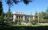
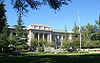
Government
The county is governed by a board of five district supervisors as well as the governmentGovernment
Government refers to the legislators, administrators, and arbitrators in the administrative bureaucracy who control a state at a given time, and to the system of government by which they are organized...
s of its four incorporated cities
City
A city is a relatively large and permanent settlement. Although there is no agreement on how a city is distinguished from a town within general English language meanings, many cities have a particular administrative, legal, or historical status based on local law.For example, in the U.S...
: Davis
Davis, California
Davis is a city in Yolo County, California, United States. It is part of the Sacramento–Arden-Arcade–Roseville Metropolitan Statistical Area...
, West Sacramento
West Sacramento, California
West Sacramento is a city in Yolo County, California. It is contiguous with Sacramento, but is separated by the Sacramento River which is also the county line, so West Sacramento is in a different county than Sacramento...
, Winters
Winters, California
Winters is a city in Yolo County, California. The population was 6,624 as of the 2010 census. It is part of the Sacramento–Arden-Arcade–Roseville Metropolitan Statistical Area. The city is near Lake Berryessa. It is noted as the one-time residence of cartoonist R...
, and Woodland
Woodland, California
Woodland is the county seat of Yolo County, California, located approximately northwest of Sacramento, and is a part of the Sacramento - Arden-Arcade - Roseville Metropolitan Statistical Area. The population was 55,468 at the 2010 census.Woodland's origins trace back to 1850 when California...
.
Geography
Incorporated cities
- DavisDavis, CaliforniaDavis is a city in Yolo County, California, United States. It is part of the Sacramento–Arden-Arcade–Roseville Metropolitan Statistical Area...
- West SacramentoWest Sacramento, CaliforniaWest Sacramento is a city in Yolo County, California. It is contiguous with Sacramento, but is separated by the Sacramento River which is also the county line, so West Sacramento is in a different county than Sacramento...
- WintersWinters, CaliforniaWinters is a city in Yolo County, California. The population was 6,624 as of the 2010 census. It is part of the Sacramento–Arden-Arcade–Roseville Metropolitan Statistical Area. The city is near Lake Berryessa. It is noted as the one-time residence of cartoonist R...
- WoodlandWoodland, CaliforniaWoodland is the county seat of Yolo County, California, located approximately northwest of Sacramento, and is a part of the Sacramento - Arden-Arcade - Roseville Metropolitan Statistical Area. The population was 55,468 at the 2010 census.Woodland's origins trace back to 1850 when California...
Unincorporated communities
Other unincorporated areas or communities not incorporated into the above cities, include:- BrooksBrooks, CaliforniaBrooks is an unincorporated community in Yolo County, California located in the Capay Valley in the northwest of the county. Brooks' ZIP Code is 95606 and its area code 530. Brooks is home to a large casino Cache Creek Casino Resort. It lies at an elevation of 341 feet .A post office was opened...
- CapayCapay, CaliforniaCapay is an unincorporated community in Yolo County, California. It is located on Cache Creek west-northwest of Esparto, in the Capay Valley, in the northwestern part of the county. Capay's ZIP Code is 95607 and its area code 530. It lies at an elevation of 210 feet...
- ClarksburgClarksburg, CaliforniaClarksburg is a census-designated place in Yolo County, California. It is located on the Sacramento River, in the extreme southeastern corner of the county...
(a CDP) - ConawayConaway, CaliforniaConaway is an unincorporated community in Yolo County, California. It lies on the Sacramento Northern Railroad north-northeast of Davis, an elevation of 33 feet ....
- DunniganDunnigan, CaliforniaDunnigan is a census-designated place in Yolo County, California on Interstate 5. The population was 1,416 at the 2010 census. Dunnigan's ZIP code is 95937 and its area code 530. It lies at an elevation of 69 feet .-History:...
(a CDP) - El MaceroEl Macero, CaliforniaEl Macero is an unincorporated community just outside the city limits of Davis, California, USA, in Yolo County. Until 2006 it had a separate ZIP Code, 95618. In 2006, eastern and southern parts of Davis were added to the 95618 zone. Formerly, a separate post office served El Macero; this is now...
- EspartoEsparto, CaliforniaEsparto is a census-designated place in Yolo County, California, United States. It is part of the Sacramento–Arden-Arcade–Roseville Metropolitan Statistical Area...
(a CDP) - GuindaGuinda, CaliforniaGuinda is a census-designated place in Yolo County, California. It is located in the Capay Valley, in the northwestern portion of the county, northwest of Esparto. Guinda's ZIP Code is 95637 and its area code 530. It lies at an elevation of 361 feet ....
(a CDP) - Knights LandingKnights Landing, CaliforniaKnights Landing is a census-designated place in Yolo County, California, USA founded by William Knight. It is located on the Sacramento River in the northeastern portion of the county. Knights Landing's ZIP Code is 95645 and its area code 530. It lies at an elevation of 36 feet...
(a CDP) - MadisonMadison, CaliforniaMadison is a census-designated place in Yolo County, California. Madison's ZIP Code is 95653 and its area code 530. It is located west of Woodland, at an elevation of 151 feet . The 2010 United States census reported Madison's population was 503.-History:The Cache Creek post office opened in...
(a CDP)
- PlainfieldPlainfield, CaliforniaPlainfield is an unincorporated community in Yolo County, California. It is located between Davis and Woodland in the central portion of the county. Plainfield's ZIP Code is 95695 and its area code 530. A post office was established in the community in 1873 but was discontinued in 1908. It lies at...
- RumseyRumsey, CaliforniaRumsey is an unincorporated community in Yolo County, California. It is located northwest of Esparto, in the Capay Valley, in the northwestern part of the county. Rumsey's ZIP Code is 95679 and its area code 530. It lies at an elevation of 420 feet ....
- YoloYolo, CaliforniaYolo is an unincorporated community and census-designated place in Yolo County, California. It is located 5 miles northwest of the county seat, Woodland. Yolo's ZIP Code is 95697 and its area code 530. It lies at an elevation of 82 feet...
- ZamoraZamora, CaliforniaZamora is an unincorporated community in rural Yolo County, California, U.S., on Interstate 5 due west of Knights Landing. Its ZIP code is 95698 and its area code 530. It is in the northern part of the county...
Adjacent counties
- Sacramento County, CaliforniaSacramento County, CaliforniaSacramento County is a county in the U.S. state of California. Its county seat is Sacramento, which is also the state capital. As of 2010 the county had a population of 1,418,788....
- east - Solano County, CaliforniaSolano County, CaliforniaSolano County is a county located in Bay-Delta region of the U.S. state of California, about halfway between San Francisco and Sacramento and is one of the nine San Francisco Bay Area counties. The county's population was reported by the U.S. Census to be 413,344 in 2010...
- south - Napa County, CaliforniaNapa County, CaliforniaNapa County is a county located north of the San Francisco Bay Area in the U.S. state of California. It is coterminous with the Napa, California, Metropolitan Statistical Area. As of 2010 the population is 136,484. The county seat is Napa....
- west - Lake County, CaliforniaLake County, CaliforniaLake County is a county located in the north central portion of the U.S. state of California, north of the San Francisco Bay Area. It takes its name from Clear Lake, the dominant geographic feature in the county and the largest natural lake wholly within California...
- northwest - Colusa County, CaliforniaColusa County, CaliforniaColusa County is a county located in the Central Valley of the U.S. state of California, northwest of state capital Sacramento. As of the 2010 census, its population was 21,419. The county seat is Colusa.-History:...
- north - Sutter County, CaliforniaSutter County, CaliforniaSutter County is a county located along the Sacramento River in the Central Valley of the U.S. state of California, north of state capital Sacramento. Sutter County is part of the Greater Sacramento CSA....
- northeast
Major highways
- Interstate 5
.svg.png) Interstate 5 in CaliforniaInterstate 5 is a major north–south route of the Interstate Highway System in the U.S. state of California. It begins at the Mexico – United States border at the San Ysidro crossing, goes north across the length of California and crosses into Oregon south of the Medford-Ashland metropolitan...
Interstate 5 in CaliforniaInterstate 5 is a major north–south route of the Interstate Highway System in the U.S. state of California. It begins at the Mexico – United States border at the San Ysidro crossing, goes north across the length of California and crosses into Oregon south of the Medford-Ashland metropolitan...
enters the eastern portion of the county at the Sacramento RiverSacramento RiverThe Sacramento River is an important watercourse of Northern and Central California in the United States. The largest river in California, it rises on the eastern slopes of the Klamath Mountains, and after a journey south of over , empties into Suisun Bay, an arm of the San Francisco Bay, and...
and continues through the northern terminus of the county, north of Dunnigan, CA. - Interstate 80
.svg.png) Interstate 80 in CaliforniaIn the U.S. state of California, Interstate 80 , a major east–west route of the Interstate Highway System, has its western terminus in San Francisco, California, United States. From there it heads east across the Bay Bridge to Oakland, where it turns north and crosses the Carquinez Bridge...
Interstate 80 in CaliforniaIn the U.S. state of California, Interstate 80 , a major east–west route of the Interstate Highway System, has its western terminus in San Francisco, California, United States. From there it heads east across the Bay Bridge to Oakland, where it turns north and crosses the Carquinez Bridge...
enters the eastern portion of the county at the Sacramento RiverSacramento RiverThe Sacramento River is an important watercourse of Northern and Central California in the United States. The largest river in California, it rises on the eastern slopes of the Klamath Mountains, and after a journey south of over , empties into Suisun Bay, an arm of the San Francisco Bay, and...
and continues to the southern terminus southeast of Davis, CA. - Interstate 505
.svg.png) Interstate 505Interstate 505 is an Interstate Highway in California between Interstate 80 in Vacaville and Interstate 5 near Dunnigan. I-505 is primarily a rural interstate, but travels through Vacaville and the city of Winters. The interstate is the primary route connecting the San Francisco Bay Area and the...
Interstate 505Interstate 505 is an Interstate Highway in California between Interstate 80 in Vacaville and Interstate 5 near Dunnigan. I-505 is primarily a rural interstate, but travels through Vacaville and the city of Winters. The interstate is the primary route connecting the San Francisco Bay Area and the...
splits off from I-5 south of Dunnigan and continues through the southern terminus of Yolo County near Winters, CA - State Route 16 enters the county from the northwestern county boundary northwest of Rumsey, CA and continues through to Woodland, CA interchanging with I-5.

- State Route 45
 California State Route 45State Route 45 is a state highway in the U.S. State of California that travels in a north–south direction from Route 113 in Knights Landing to Route 32 in Hamilton City.-Route description:...
begins in Knights Landing, CA at California State Route 113 and continues through the northern county line. - State Route 113
 California State Route 113State Route 113 is a north–south state highway in the U.S. state of California that runs from around west of Rio Vista at State Route 12 to State Route 99 south of Yuba City. It is an important connecting route between Interstate 80 and Interstate 5. Past the southern terminus are...
enters the county southeast of Davis, CA and continues through the northeastern terminus near Knights Landing, CA. - State Route 128
 California State Route 128State Route 128 is a state highway in the U.S. state of California, connecting the Mendocino coast to the Central Valley through the state's Wine Country.-Route description:...
enters the county from the west near Lake Berryessa and continues to I-505 near Winters, CA.
County Roads
Transportation in Yolo County is based on a system of numbered County Roads. The numbering system works in the following way:- North/South roads have numbers from 41 to 117 and increase from west to east
- East/West roads have numbers from 1 to 38A, and then from 151 to 161 and increase from north to south.
Each integer road number is one mile (1.6 km) apart, with letters designating occasional roads less than one mile (1.6 km) apart. County roads entering urban areas generally are named once they cross the city boundary. Some examples include County Road 101 in Woodland
Woodland, California
Woodland is the county seat of Yolo County, California, located approximately northwest of Sacramento, and is a part of the Sacramento - Arden-Arcade - Roseville Metropolitan Statistical Area. The population was 55,468 at the 2010 census.Woodland's origins trace back to 1850 when California...
being renamed Pioneer Ave and County Road 102 in Davis
Davis, California
Davis is a city in Yolo County, California, United States. It is part of the Sacramento–Arden-Arcade–Roseville Metropolitan Statistical Area...
being named Pole Line Road.
Public transportation
- YolobusYolobusYolobus provides public transportation throughout Yolo County, California and into downtown Sacramento, to western Sacramento County and northeastern Solano County. Yolobus is the only public transit system that provides daily service to the Sacramento International Airport and Cache Creek Casino...
(Yolo County Transportation District) runs buses throughout Yolo County and into SacramentoSacramento, CaliforniaSacramento is the capital city of the U.S. state of California and the county seat of Sacramento County. It is located at the confluence of the Sacramento River and the American River in the northern portion of California's expansive Central Valley. With a population of 466,488 at the 2010 census,...
, and Sacramento International AirportSacramento International AirportSacramento International Airport is a public airport located 10 miles northwest of the central business district of Sacramento, in Sacramento County, California, USA. It is run by Sacramento County...
. - The City of Davis and the University of California, DavisUniversity of California, DavisThe University of California, Davis is a public teaching and research university established in 1905 and located in Davis, California, USA. Spanning over , the campus is the largest within the University of California system and third largest by enrollment...
jointly run UnitransUnitransUnitrans is the name for the transit system which operates in Davis, California. It takes its name from an abbreviation of the words "University Transport". Excepting several managerial and maintenance positions, Unitrans is managed and operated entirely by students of the University of...
, a combination local city bus and campus shuttle. - Fairfield-Suisun Transit Line 30 also stops in Davis on its runs between FairfieldFairfield, CaliforniaFairfield is a city located in Solano County in Northern California, USA. It is generally considered the midpoint between the cities of San Francisco and Sacramento, approximately from the city center of both cities, approximately from the city center of Oakland, less than from Napa Valley, 18...
(Solano County) and Sacramento. - AmtrakAmtrakThe National Railroad Passenger Corporation, doing business as Amtrak , is a government-owned corporation that was organized on May 1, 1971, to provide intercity passenger train service in the United States. "Amtrak" is a portmanteau of the words "America" and "track". It is headquartered at Union...
has a station in DavisDavis (Amtrak station)The Davisville Railroad Depot was built by the California Pacific Railroad between August 24, 1868, and November 15, 1868, connecting Davis to Washington to the east, Vallejo to the southwest, and Marysville to the northeast via a wye at Davis to Woodland, where the line separated to go northwest...
.
Airports
- Sacramento International AirportSacramento International AirportSacramento International Airport is a public airport located 10 miles northwest of the central business district of Sacramento, in Sacramento County, California, USA. It is run by Sacramento County...
is located in nearby Sacramento County. - Watts Woodland Airport, UC Davis University AirportUniversity AirportUniversity Airport is a public-use airport located two nautical miles west of the central business district of Davis, a city in Yolo County, California, United States. It is owned by the University of California. and operated by Transportation and Parking Services of the University of California,...
and Yolo County AirportYolo County AirportYolo County Airport is a county-owned public-use airport located six miles northeast of Winters, five miles northwest of Davis and five miles southwest of Woodland, all cities located in Yolo County, California, USA...
are three general aviation airports located within Yolo County. - Borges airport a small airport located near ClarksburgClarksburg, CaliforniaClarksburg is a census-designated place in Yolo County, California. It is located on the Sacramento River, in the extreme southeastern corner of the county...
Politics
| Year | GOP Republican Party (United States) The Republican Party is one of the two major contemporary political parties in the United States, along with the Democratic Party. Founded by anti-slavery expansion activists in 1854, it is often called the GOP . The party's platform generally reflects American conservatism in the U.S... |
DEM Democratic Party (United States) The Democratic Party is one of two major contemporary political parties in the United States, along with the Republican Party. The party's socially liberal and progressive platform is largely considered center-left in the U.S. political spectrum. The party has the lengthiest record of continuous... |
Others |
|---|---|---|---|
| 2008 United States presidential election, 2008 The United States presidential election of 2008 was the 56th quadrennial presidential election. It was held on November 4, 2008. Democrat Barack Obama, then the junior United States Senator from Illinois, defeated Republican John McCain, the senior U.S. Senator from Arizona. Obama received 365... |
67.1% 53,488 | 2.1% 1,669 | |
| 2004 United States presidential election, 2004 The United States presidential election of 2004 was the United States' 55th quadrennial presidential election. It was held on Tuesday, November 2, 2004. Republican Party candidate and incumbent President George W. Bush defeated Democratic Party candidate John Kerry, the then-junior U.S. Senator... |
59.3% 42,885 | 1.9% 1,379 | |
| 2000 United States presidential election, 2000 The United States presidential election of 2000 was a contest between Republican candidate George W. Bush, then-governor of Texas and son of former president George H. W. Bush , and Democratic candidate Al Gore, then-Vice President.... |
54.9% 33,747 | 7.5% 4,632 | |
| 1996 United States presidential election, 1996 The United States presidential election of 1996 was a contest between the Democratic national ticket of President Bill Clinton of Arkansas and Vice President Al Gore of Tennessee and the Republican national ticket of former Senator Bob Dole of Kansas for President and former Housing Secretary Jack... |
56.9% 33,033 | 10.7% 6,239 | |
| 1992 United States presidential election, 1992 The United States presidential election of 1992 had three major candidates: Incumbent Republican President George Bush; Democratic Arkansas Governor Bill Clinton, and independent Texas businessman Ross Perot.... |
53.3% 33,297 | 18.5% 11,565 | |
| 1988 United States presidential election, 1988 The United States presidential election of 1988 featured no incumbent president, as President Ronald Reagan was unable to seek re-election after serving the maximum two terms allowed by the Twenty-second Amendment. Reagan's Vice President, George H. W. Bush, won the Republican nomination, while the... |
57.0% 30,429 | 1.1% 585 | |
| 1984 United States presidential election, 1984 The United States presidential election of 1984 was a contest between the incumbent President Ronald Reagan, the Republican candidate, and former Vice President Walter Mondale, the Democratic candidate. Reagan was helped by a strong economic recovery from the deep recession of 1981–1982... |
50.9% 25,879 | 1.3% 645 | |
| 1980 United States presidential election, 1980 The United States presidential election of 1980 featured a contest between incumbent Democrat Jimmy Carter and his Republican opponent, Ronald Reagan, as well as Republican Congressman John B. Anderson, who ran as an independent... |
43.3% 21,527 | 17.2% 8,560 | |
| 1976 United States presidential election, 1976 The United States presidential election of 1976 followed the resignation of President Richard Nixon in the wake of the Watergate scandal. It pitted incumbent President Gerald Ford, the Republican candidate, against the relatively unknown former governor of Georgia, Jimmy Carter, the Democratic... |
54.3% 23,533 | 3.3% 1,408 | |
| 1972 United States presidential election, 1972 The United States presidential election of 1972 was the 47th quadrennial United States presidential election. It was held on November 7, 1972. The Democratic Party's nomination was eventually won by Senator George McGovern, who ran an anti-war campaign against incumbent Republican President Richard... |
55.4% 23,694 | 2.5% 1,075 | |
| 1968 United States presidential election, 1968 The United States presidential election of 1968 was the 46th quadrennial United States presidential election. Coming four years after Democrat Lyndon B. Johnson won in a historic landslide, it saw Johnson forced out of the race and Republican Richard Nixon elected... |
54.7% 15,833 | 6.9% 2,004 | |
| 1964 United States presidential election, 1964 The United States presidential election of 1964 was held on November 3, 1964. Incumbent President Lyndon B. Johnson had come to office less than a year earlier following the assassination of his predecessor, John F. Kennedy. Johnson, who had successfully associated himself with Kennedy's... |
69.5% 18,266 | 0.1% 32 | |
| 1960 United States presidential election, 1960 The United States presidential election of 1960 was the 44th American presidential election, held on November 8, 1960, for the term beginning January 20, 1961, and ending January 20, 1965. The incumbent president, Republican Dwight D. Eisenhower, was not eligible to run again. The Republican Party... |
54.9% 12,395 | 0.4% 90 | |
| 1956 United States presidential election, 1956 The United States presidential election of 1956 saw a popular Dwight D. Eisenhower successfully run for re-election. The 1956 election was a rematch of 1952, as Eisenhower's opponent in 1956 was Democrat Adlai Stevenson, whom Eisenhower had defeated four years earlier.Incumbent President Eisenhower... |
51.7% 10,075 | 0.3% 57 | |
| 1952 United States presidential election, 1952 The United States presidential election of 1952 took place in an era when Cold War tension between the United States and the Soviet Union was escalating rapidly. In the United States Senate, Republican Senator Joseph McCarthy of Wisconsin had become a national figure after chairing congressional... |
46.0% 8,119 | 0.8% 139 | |
| 1948 United States presidential election, 1948 The United States presidential election of 1948 is considered by most historians as the greatest election upset in American history. Virtually every prediction indicated that incumbent President Harry S. Truman would be defeated by Republican Thomas E. Dewey. Truman won, overcoming a three-way... |
52.5% 6,655 | 3.7% 469 | |
| 1944 United States presidential election, 1944 The United States presidential election of 1944 took place while the United States was preoccupied with fighting World War II. President Franklin D. Roosevelt had been in office longer than any other president, but remained popular. Unlike 1940, there was little doubt that Roosevelt would run for... |
57.7% 5,837 | 0.5% 46 | |
| 1940 United States presidential election, 1940 The United States presidential election of 1940 was fought in the shadow of World War II as the United States was emerging from the Great Depression. Incumbent President Franklin D. Roosevelt , a Democrat, broke with tradition and ran for a third term, which became a major issue... |
58.8% 6,380 | 0.9% 101 | |
| 1936 United States presidential election, 1936 The United States presidential election of 1936 was the most lopsided presidential election in the history of the United States in terms of electoral votes. In terms of the popular vote, it was the third biggest victory since the election of 1820, which was not seriously contested.The election took... |
68.9% 5,992 | 1.2% 106 | |
| 1932 United States presidential election, 1932 The United States presidential election of 1932 took place as the effects of the Wall Street Crash of 1929, the Smoot-Hawley Tariff Act of 1930, the Revenue Act of 1932, and the Great Depression were being felt intensely across the country. President Herbert Hoover's popularity was falling as... |
67.8% 5,780 | 2.8% 234 | |
| 1928 United States presidential election, 1928 The United States presidential election of 1928 pitted Republican Herbert Hoover against Democrat Al Smith. The Republicans were identified with the booming economy of the 1920s, whereas Smith, a Roman Catholic, suffered politically from Anti-Catholic prejudice, his anti-prohibitionist stance, and... |
42.4% 2,641 | 0.6% 38 | |
| 1924 United States presidential election, 1924 The United States presidential election of 1924 was won by incumbent President Calvin Coolidge, the Republican candidate.Coolidge was vice-president under Warren G. Harding and became president in 1923 when Harding died in office. Coolidge was given credit for a booming economy at home and no... |
14.6% 797 | 40.0% 2,180 | |
| 1920 United States presidential election, 1920 The United States presidential election of 1920 was dominated by the aftermath of World War I and a hostile response to certain policies of Woodrow Wilson, the Democratic president. The wartime economic boom had collapsed. Politicians were arguing over peace treaties and the question of America's... |
32.8% 1,787 | 5.3% 286 |
Yolo is a strongly Democratic county in Presidential
President of the United States
The President of the United States of America is the head of state and head of government of the United States. The president leads the executive branch of the federal government and is the commander-in-chief of the United States Armed Forces....
and congressional
United States Congress
The United States Congress is the bicameral legislature of the federal government of the United States, consisting of the Senate and the House of Representatives. The Congress meets in the United States Capitol in Washington, D.C....
elections. The last Republican to win a majority in the county was Dwight Eisenhower
Dwight D. Eisenhower
Dwight David "Ike" Eisenhower was the 34th President of the United States, from 1953 until 1961. He was a five-star general in the United States Army...
in 1952
United States presidential election, 1952
The United States presidential election of 1952 took place in an era when Cold War tension between the United States and the Soviet Union was escalating rapidly. In the United States Senate, Republican Senator Joseph McCarthy of Wisconsin had become a national figure after chairing congressional...
.
Yolo is part of California's 1st
California's 1st congressional district
California's 1st congressional district is a congressional district located in the U.S. state of California and presently consists of the northern coastline and includes Del Norte, Humboldt, Lake, Mendocino and Napa counties and parts of Sonoma and Yolo counties.The district is currently...
and 2nd
California's 2nd congressional district
California's 2nd congressional district is a congressional district located in the U.S. state of California. The district contains much of the far northern part of the state, north of Sacramento. It is the largest district by area in California...
congressional districts, which are held by Democrat Mike Thompson
Mike Thompson
Michael C. Thompson , is the U.S. Representative for , serving since 1999. He is a member of the Democratic Party. The district includes Napa, Lake, Mendocino, Humboldt and Del Norte Counties as well as parts of Yolo and Sonoma Counties....
and Republican Wally Herger
Wally Herger
Walter William "Wally" Herger, Jr. , American politician, has been a Republican member of the United States House of Representatives since 1987, representing the California's 2nd congressional district. The second district is physically large...
respectively. In the state legislature
California State Legislature
The California State Legislature is the state legislature of the U.S. state of California. It is a bicameral body consisting of the lower house, the California State Assembly, with 80 members, and the upper house, the California State Senate, with 40 members...
, Yolo is in the 2nd and 8th Assembly districts, which are held by Republican Jim Nielsen
Jim Nielsen
James Wiley Nielsen is an American politician from California and a member of the Republican party. Nielsen served on the Yolo County Republican Committee before winning election to the California State Senate in 1978...
and Democrat Mariko Yamada
Mariko Yamada
Mariko Yamada is a Democratic assemblywoman from California's 8th Assembly district. Assemblywoman Yamada was elected in 2008 after defeating West Sacramento mayor Christopher Cabaldon in a competitive Democratic primary, a defeat that many considered an upset win for Yamada...
, respectively, and the 5th Senate district, which is held by Democrat Lois Wolk
Lois Wolk
Lois Wolk is a California State Senator, representing the 5th district of California. Wolk is a member of the Democratic Party and was elected to the Senate in 2008.-Early life:...
.
In November 2008, Yolo was one of just three counties in California's interior in which voters rejected Proposition 8
California Proposition 8 (2008)
Proposition 8 was a ballot proposition and constitutional amendment passed in the November 2008 state elections...
to ban gay marriage. Yolo voters rejected Proposition 8 by 58.4 percent to 41.6 percent. The other interior counties in which Proposition 8 failed to receive a majority of votes were Alpine County
Alpine County, California
Alpine County is the smallest county, by population, in the U.S. state of California. As of 2010, it had a population of 1,175, all rural. There are no incorporated cities in the county. The county seat is Markleeville...
and Mono County
Mono County, California
Mono County is a county located in the east central portion of the U.S. state of California, to the east of the Sierra Nevada between Yosemite National Park and Nevada. As of the 2010 census, the population was 14,202, up from 12,853 at the 2000 census...
.
2010
The 2010 United States Census reported that Yolo County had a population of 200,849. The racial makeup of Yolo County was 126,883 (63.2%) White, 5,208 (2.6%) African American, 2,214 (1.1%) Native American, 26,052 (13.0%) Asian, 910 (0.5%) Pacific Islander, 27,882 (13.9%) from other racesRace (United States Census)
Race and ethnicity in the United States Census, as defined by the Federal Office of Management and Budget and the United States Census Bureau, are self-identification data items in which residents choose the race or races with which they most closely identify, and indicate whether or not they are...
, and 11,700 (5.8%) from two or more races. Hispanic or Latino of any race were 60,953 persons (30.3%).
| Population reported at 2010 United States Census | |||||||||
|---|---|---|---|---|---|---|---|---|---|
Yolo County, California Yolo County is a county located in the northern part of the U.S. state of California, bordered by the other counties of Sacramento, Solano, Napa, Lake, Colusa, and Sutter. The city of Woodland is its county seat, though Davis is its largest city.... |
Population |
American |
American |
|
Islander |
races Race (United States Census) Race and ethnicity in the United States Census, as defined by the Federal Office of Management and Budget and the United States Census Bureau, are self-identification data items in which residents choose the race or races with which they most closely identify, and indicate whether or not they are... |
more races |
or Latino (of any race) |
|
| Yolo County Yolo County, California Yolo County is a county located in the northern part of the U.S. state of California, bordered by the other counties of Sacramento, Solano, Napa, Lake, Colusa, and Sutter. The city of Woodland is its county seat, though Davis is its largest city.... |
200,849 | 126,883 | 5,208 | 2,214 | 26,052 | 910 | 27,882 | 11,700 | 60,953 |
city |
Population |
American |
American |
|
Islander |
races Race (United States Census) Race and ethnicity in the United States Census, as defined by the Federal Office of Management and Budget and the United States Census Bureau, are self-identification data items in which residents choose the race or races with which they most closely identify, and indicate whether or not they are... |
more races |
or Latino (of any race) |
|
| Davis Davis, California Davis is a city in Yolo County, California, United States. It is part of the Sacramento–Arden-Arcade–Roseville Metropolitan Statistical Area... |
65,622 | 42,571 | 1,528 | 339 | 14,355 | 136 | 3,121 | 3,572 | 8,172 |
| West Sacramento West Sacramento, California West Sacramento is a city in Yolo County, California. It is contiguous with Sacramento, but is separated by the Sacramento River which is also the county line, so West Sacramento is in a different county than Sacramento... |
48,744 | 29,521 | 2,344 | 798 | 5,106 | 534 | 6,709 | 3,732 | 15,282 |
| Winters Winters, California Winters is a city in Yolo County, California. The population was 6,624 as of the 2010 census. It is part of the Sacramento–Arden-Arcade–Roseville Metropolitan Statistical Area. The city is near Lake Berryessa. It is noted as the one-time residence of cartoonist R... |
6,624 | 4,635 | 43 | 56 | 63 | 7 | 1,488 | 332 | 3,469 |
| Woodland Woodland, California Woodland is the county seat of Yolo County, California, located approximately northwest of Sacramento, and is a part of the Sacramento - Arden-Arcade - Roseville Metropolitan Statistical Area. The population was 55,468 at the 2010 census.Woodland's origins trace back to 1850 when California... |
55,468 | 34,904 | 855 | 726 | 3,458 | 169 | 12,488 | 2,868 | 26,289 |
place Census-designated place A census-designated place is a concentration of population identified by the United States Census Bureau for statistical purposes. CDPs are delineated for each decennial census as the statistical counterparts of incorporated places such as cities, towns and villages... |
Population |
American |
American |
|
Islander |
races Race (United States Census) Race and ethnicity in the United States Census, as defined by the Federal Office of Management and Budget and the United States Census Bureau, are self-identification data items in which residents choose the race or races with which they most closely identify, and indicate whether or not they are... |
more races |
or Latino (of any race) |
|
| Clarksburg Clarksburg, California Clarksburg is a census-designated place in Yolo County, California. It is located on the Sacramento River, in the extreme southeastern corner of the county... |
418 | 339 | 2 | 2 | 16 | 1 | 37 | 21 | 109 |
| Dunnigan Dunnigan, California Dunnigan is a census-designated place in Yolo County, California on Interstate 5. The population was 1,416 at the 2010 census. Dunnigan's ZIP code is 95937 and its area code 530. It lies at an elevation of 69 feet .-History:... |
1,416 | 836 | 107 | 25 | 19 | 1 | 339 | 89 | 583 |
| Esparto Esparto, California Esparto is a census-designated place in Yolo County, California, United States. It is part of the Sacramento–Arden-Arcade–Roseville Metropolitan Statistical Area... |
3,108 | 1,855 | 45 | 50 | 129 | 6 | 904 | 119 | 1,538 |
| Guinda Guinda, California Guinda is a census-designated place in Yolo County, California. It is located in the Capay Valley, in the northwestern portion of the county, northwest of Esparto. Guinda's ZIP Code is 95637 and its area code 530. It lies at an elevation of 361 feet .... |
254 | 175 | 26 | 0 | 1 | 1 | 43 | 8 | 68 |
| Knights Landing Knights Landing, California Knights Landing is a census-designated place in Yolo County, California, USA founded by William Knight. It is located on the Sacramento River in the northeastern portion of the county. Knights Landing's ZIP Code is 95645 and its area code 530. It lies at an elevation of 36 feet... |
995 | 560 | 4 | 10 | 7 | 0 | 338 | 76 | 644 |
| Madison Madison, California Madison is a census-designated place in Yolo County, California. Madison's ZIP Code is 95653 and its area code 530. It is located west of Woodland, at an elevation of 151 feet . The 2010 United States census reported Madison's population was 503.-History:The Cache Creek post office opened in... |
503 | 224 | 1 | 8 | 3 | 3 | 235 | 29 | 384 |
| Monument Hills Monument Hills, California Monument Hills is a census-designated place in Yolo County, California. Monument Hills sits at an elevation of 135 feet . The 2010 United States census reported Monument Hills's population was 1,542.-Geography:... |
1,542 | 1,163 | 20 | 32 | 77 | 17 | 153 | 80 | 403 |
| University of California, Davis University of California, Davis The University of California, Davis is a public teaching and research university established in 1905 and located in Davis, California, USA. Spanning over , the campus is the largest within the University of California system and third largest by enrollment... |
5,786 | 2,443 | 144 | 22 | 2,443 | 7 | 364 | 363 | 728 |
communities Unincorporated area In law, an unincorporated area is a region of land that is not a part of any municipality.To "incorporate" in this context means to form a municipal corporation, a city, town, or village with its own government. An unincorporated community is usually not subject to or taxed by a municipal government... |
Population |
American |
American |
|
Islander |
races Race (United States Census) Race and ethnicity in the United States Census, as defined by the Federal Office of Management and Budget and the United States Census Bureau, are self-identification data items in which residents choose the race or races with which they most closely identify, and indicate whether or not they are... |
more races |
or Latino (of any race) |
|
| All others not CDPs (combined) | 10,369 | 7,657 | 89 | 146 | 375 | 28 | 1,663 | 411 | 3,284 |
2000
As of the censusCensus
A census is the procedure of systematically acquiring and recording information about the members of a given population. It is a regularly occurring and official count of a particular population. The term is used mostly in connection with national population and housing censuses; other common...
of 2000, there were 168,660 people, 59,375 households, and 37,465 families residing in the county. The population density
Population density
Population density is a measurement of population per unit area or unit volume. It is frequently applied to living organisms, and particularly to humans...
was 166 people per square mile (64/km²). There were 61,587 housing units at an average density of 61 per square mile (23/km²). The racial makeup of the county was 67.67% White
Race (United States Census)
Race and ethnicity in the United States Census, as defined by the Federal Office of Management and Budget and the United States Census Bureau, are self-identification data items in which residents choose the race or races with which they most closely identify, and indicate whether or not they are...
, 2.03% Black
Race (United States Census)
Race and ethnicity in the United States Census, as defined by the Federal Office of Management and Budget and the United States Census Bureau, are self-identification data items in which residents choose the race or races with which they most closely identify, and indicate whether or not they are...
or African American
Race (United States Census)
Race and ethnicity in the United States Census, as defined by the Federal Office of Management and Budget and the United States Census Bureau, are self-identification data items in which residents choose the race or races with which they most closely identify, and indicate whether or not they are...
, 1.16% Native American
Race (United States Census)
Race and ethnicity in the United States Census, as defined by the Federal Office of Management and Budget and the United States Census Bureau, are self-identification data items in which residents choose the race or races with which they most closely identify, and indicate whether or not they are...
, 9.85% Asian
Race (United States Census)
Race and ethnicity in the United States Census, as defined by the Federal Office of Management and Budget and the United States Census Bureau, are self-identification data items in which residents choose the race or races with which they most closely identify, and indicate whether or not they are...
, 0.30% Pacific Islander
Race (United States Census)
Race and ethnicity in the United States Census, as defined by the Federal Office of Management and Budget and the United States Census Bureau, are self-identification data items in which residents choose the race or races with which they most closely identify, and indicate whether or not they are...
, 13.76% from other races
Race (United States Census)
Race and ethnicity in the United States Census, as defined by the Federal Office of Management and Budget and the United States Census Bureau, are self-identification data items in which residents choose the race or races with which they most closely identify, and indicate whether or not they are...
, and 5.23% from two or more races. 25.91% of the population were Hispanic
Race (United States Census)
Race and ethnicity in the United States Census, as defined by the Federal Office of Management and Budget and the United States Census Bureau, are self-identification data items in which residents choose the race or races with which they most closely identify, and indicate whether or not they are...
or Latino
Race (United States Census)
Race and ethnicity in the United States Census, as defined by the Federal Office of Management and Budget and the United States Census Bureau, are self-identification data items in which residents choose the race or races with which they most closely identify, and indicate whether or not they are...
of any race. 10.0% were of German, 6.6% English
English people
The English are a nation and ethnic group native to England, who speak English. The English identity is of early mediaeval origin, when they were known in Old English as the Anglecynn. England is now a country of the United Kingdom, and the majority of English people in England are British Citizens...
and 6.4% Irish
Irish people
The Irish people are an ethnic group who originate in Ireland, an island in northwestern Europe. Ireland has been populated for around 9,000 years , with the Irish people's earliest ancestors recorded having legends of being descended from groups such as the Nemedians, Fomorians, Fir Bolg, Tuatha...
ancestry according to Census 2000. 68.5% spoke English
English language
English is a West Germanic language that arose in the Anglo-Saxon kingdoms of England and spread into what was to become south-east Scotland under the influence of the Anglian medieval kingdom of Northumbria...
, 19.5% Spanish
Spanish language
Spanish , also known as Castilian , is a Romance language in the Ibero-Romance group that evolved from several languages and dialects in central-northern Iberia around the 9th century and gradually spread with the expansion of the Kingdom of Castile into central and southern Iberia during the...
, 2.1% Chinese
Chinese language
The Chinese language is a language or language family consisting of varieties which are mutually intelligible to varying degrees. Originally the indigenous languages spoken by the Han Chinese in China, it forms one of the branches of Sino-Tibetan family of languages...
or Mandarin
Standard Mandarin
Standard Chinese or Modern Standard Chinese, also known as Mandarin or Putonghua, is the official language of the People's Republic of China and Republic of China , and is one of the four official languages of Singapore....
and 1.8% Russian
Russian language
Russian is a Slavic language used primarily in Russia, Belarus, Uzbekistan, Kazakhstan, Tajikistan and Kyrgyzstan. It is an unofficial but widely spoken language in Ukraine, Moldova, Latvia, Turkmenistan and Estonia and, to a lesser extent, the other countries that were once constituent republics...
as their first language.
There were 59,375 households out of which 33.6% had children under the age of 18 living with them, 47.6% were married couples
Marriage
Marriage is a social union or legal contract between people that creates kinship. It is an institution in which interpersonal relationships, usually intimate and sexual, are acknowledged in a variety of ways, depending on the culture or subculture in which it is found...
living together, 11.1% had a female householder with no husband present, and 36.9% were non-families. 23.3% of all households were made up of individuals and 7.3% had someone living alone who was 65 years of age or older. The average household size was 2.71 and the average family size was 3.25.
In the county the population was spread out with 25.2% under the age of 18, 18.3% from 18 to 24, 28.2% from 25 to 44, 18.9% from 45 to 64, and 9.4% who were 65 years of age or older. The median age was 30 years. For every 100 females there were 95.6 males. For every 100 females age 18 and over, there were 92.2 males.
The median income for a household in the county was $40,769, and the median income for a family was $51,623. Males had a median income of $38,022 versus $30,687 for females. The per capita income
Per capita income
Per capita income or income per person is a measure of mean income within an economic aggregate, such as a country or city. It is calculated by taking a measure of all sources of income in the aggregate and dividing it by the total population...
for the county was $19,365. About 9.5% of families and 18.4% of the population were below the poverty line, including 16.0% of those under age 18 and 7.4% of those age 65 or over.
Public schools
The county's public schools are managed by the Yolo County Office of Education.See also
- List of school districts in Yolo County, California
- National Register of Historic Places listings in Yolo County, California