

Angeles National Forest
Encyclopedia
San Gabriel Mountains
The San Gabriel Mountains Range is located in northern Los Angeles County and western San Bernardino County, California, United States. The mountain range lies between the Los Angeles Basin and the Mojave Desert, with Interstate 5 to the west and Interstate 15 to the east...
of Los Angeles County
Los Angeles County, California
Los Angeles County is a county in the U.S. state of California. As of 2010 U.S. Census, the county had a population of 9,818,605, making it the most populous county in the United States. Los Angeles County alone is more populous than 42 individual U.S. states...
, southern California
California
California is a state located on the West Coast of the United States. It is by far the most populous U.S. state, and the third-largest by land area...
. It was established on July 1, 1908, incorporating the first San Bernardino National Forest
San Bernardino National Forest
San Bernardino National Forest is a federally-managed forest covering more than 800,000 acres . There are two main divisions which are the San Bernardino Mountains on the easternmost of the Transverse Range, and the San Jacinto and Santa Rosa Mountains on the northernmost of the Peninsular...
and parts of the former Santa Barbara
Santa Barbara National Forest
Santa Barbara National Forest was established as the Santa Barbara Forest Reserve by the General Land Office in California on December 22, 1903 with by consolidation of Pine Mountain and Zaka Lake and Santa Ynez Forest Reserves. After the transfer of federal forests to the U.S. Forest Service in...
and San Gabriel National Forest
San Gabriel National Forest
San Gabriel National Forest was established as the San Gabriel Forest Reserve by the General Land Office in California on December 20, 1892 with . After the transfer of federal forests to the U.S...
s. It covers 655387 acre (1,024 sq mi; 2,652.3 km²) and is located just north of the metropolitan area
Metropolitan area
The term metropolitan area refers to a region consisting of a densely populated urban core and its less-populated surrounding territories, sharing industry, infrastructure, and housing. A metropolitan area usually encompasses multiple jurisdictions and municipalities: neighborhoods, townships,...
of Los Angeles
Los Ángeles
Los Ángeles is the capital of the province of Biobío, in the commune of the same name, in Region VIII , in the center-south of Chile. It is located between the Laja and Biobío rivers. The population is 123,445 inhabitants...
.
A small part extends eastward into southwestern San Bernardino County
San Bernardino County, California
San Bernardino County is a county in the U.S. state of California. As of the 2010 census, the population was 2,035,210, up from 1,709,434 as of the 2000 census...
, in the Mount San Antonio ("Mount Baldy")
Mount San Antonio
Mount San Antonio, commonly known as Old Baldy or Mt Baldy, at , is the highest peak in the San Gabriel Mountains, and the highest point in Los Angeles County...
area. A tiny section also extends westward into northeastern Ventura County
Ventura County, California
Ventura County is a county in the southern part of the U.S. state of California. It is located on California's Pacific coast. It is often referred to as the Gold Coast, and has a reputation of being one of the safest populated places and one of the most affluent places in the country...
, in the Lake Piru
Lake Piru
Lake Piru is an artificial lake located in Los Padres National Forest of Ventura County, California, created by the construction in 1955 of the Santa Felicia Dam on Piru Creek which is a tributary of the Santa Clara River. It is situated downstream from Pyramid Lake and can be accessed from Piru...
area. Forest headquarters are in Arcadia, California
Arcadia, California
Arcadia is an affluent city in Los Angeles County, California, United States, and located approximately northeast of downtown Los Angeles in the San Gabriel Valley and at the base of the San Gabriel Mountains....
.
The Angeles National Forest manages the habitat
Habitat
* Habitat , a place where a species lives and grows*Human habitat, a place where humans live, work or play** Space habitat, a space station intended as a permanent settlement...
s, flora
Flora
Flora is the plant life occurring in a particular region or time, generally the naturally occurring or indigenous—native plant life. The corresponding term for animals is fauna.-Etymology:...
and fauna
Fauna
Fauna or faunæ is all of the animal life of any particular region or time. The corresponding term for plants is flora.Zoologists and paleontologists use fauna to refer to a typical collection of animals found in a specific time or place, e.g. the "Sonoran Desert fauna" or the "Burgess shale fauna"...
ecosystem
Ecosystem
An ecosystem is a biological environment consisting of all the organisms living in a particular area, as well as all the nonliving , physical components of the environment with which the organisms interact, such as air, soil, water and sunlight....
s, and watershed
Drainage basin
A drainage basin is an extent or an area of land where surface water from rain and melting snow or ice converges to a single point, usually the exit of the basin, where the waters join another waterbody, such as a river, lake, reservoir, estuary, wetland, sea, or ocean...
s. Some of the rivers with watersheds within its boundaries provide valuable non-groundwater recharge water for Southern California
Southern California
Southern California is a megaregion, or megapolitan area, in the southern area of the U.S. state of California. Large urban areas include Greater Los Angeles and Greater San Diego. The urban area stretches along the coast from Ventura through the Southland and Inland Empire to San Diego...
. The existing protected and restored
Restoration ecology
-Definition:Restoration ecology is the scientific study and practice of renewing and restoring degraded, damaged, or destroyed ecosystems and habitats in the environment by active human intervention and action, within a short time frame...
native vegetation absorb and slow surface runoff
Surface runoff
Surface runoff is the water flow that occurs when soil is infiltrated to full capacity and excess water from rain, meltwater, or other sources flows over the land. This is a major component of the water cycle. Runoff that occurs on surfaces before reaching a channel is also called a nonpoint source...
of rainwater to minimize severe floods and landslide
Landslide
A landslide or landslip is a geological phenomenon which includes a wide range of ground movement, such as rockfalls, deep failure of slopes and shallow debris flows, which can occur in offshore, coastal and onshore environments...
s in adjacent communities.
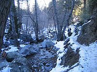
The land within the Forest is diverse, both in appearance and terrain. Elevations range from 365 meters to 3,067 m (1,200 to 10,064 ft). The Pacific Crest Trail
Pacific Crest Trail
The Pacific Crest Trail is a long-distance mountain hiking and equestrian trail on the Western Seaboard of the United States. The southern terminus is at the California border with Mexico...
crosses the forest.
Natural history
Much of this National Forest is covered with dense chaparralCalifornia chaparral and woodlands
The California chaparral and woodlands is a terrestrial ecoregion of lower northern, central, and southern California and northwestern Baja California , located on the west coast of North America...
shrub forests with oak woodland
California oak woodland
California oak woodland is a plant community found throughout the California chaparral and woodlands ecoregion of California in the United States and northwestern Baja California in Mexico...
s, which changes to pine and fir-covered slopes in the higher elevations.
Tree species for which the forest is important include bigcone Douglas-fir (Pseudotsuga macrocarpa), Coulter Pine
Coulter Pine
The Coulter Pine or Big-cone Pine is a native of the coastal mountains of southern California and northern Baja California . Isolated groves are found as far north as the San Francisco Bay Area in Mt. Diablo State Park and Black Diamond Mines Regional Preserve...
(Pinus coulteri), and California Walnut (Juglans californica). The National Forest also contains some 29000 acres (11,735.9 ha) of old growth, with: Jeffrey Pine
Jeffrey Pine
The Jeffrey Pine, Pinus jeffreyi, named in honor of its botanist documenter John Jeffrey, is a North American pine related to Ponderosa Pine.-Distribution and habitat:...
(Pinus jeffreyi) forests and mixed conifer forest
California mixed evergreen forest
California mixed evergreen forest is an ecoregion, of the temperate broadleaf and mixed forests biome, that occurs in the Pacific Coast Ranges of southwestern Oregon and California, and in the Coast, Transverse, and Peninsular Ranges in California...
s (Coast Douglas-fir
Coast Douglas-fir
Pseudotsuga menziesii, known as Douglas-fir, Oregon Pine, or Douglas spruce, is an evergreen conifer species native to western North America. Its variety Pseudotsuga menziesii var. menziesii, also known as coast Douglas-fir grows in the coastal regions, from west-central British Columbia, Canada...
(Pseudotsuga menziesii var. menziesii), Ponderosa Pine
Ponderosa Pine
Pinus ponderosa, commonly known as the Ponderosa Pine, Bull Pine, Blackjack Pine, or Western Yellow Pine, is a widespread and variable pine native to western North America. It was first described by David Douglas in 1826, from eastern Washington near present-day Spokane...
(Pinus ponderosa), and White Fir
White Fir
White Fir is a fir native to the mountains of western North America, occurring at altitudes of 900-3,400 m. It is a medium to large evergreen coniferous tree growing to 25–60 m tall and with a trunk diameter of up to 2 m . It is popular as an ornamental landscaping tree and as a Christmas Tree...
(Abies concolor)), and Lodgepole Pine
Lodgepole Pine
Lodgepole Pine, Pinus contorta, also known as Shore Pine, is a common tree in western North America. Like all pines, it is evergreen.-Subspecies:...
(Pinus contorta) the most abundant types.
Access
A National Forest Adventure PassNational Forest Adventure Pass
The National Forest Adventure Pass is a recreation fee pass issued by the United States Forest Service that permits bearers in the four National Forests in Southern California to park their cars for the purpose of recreation...
is required for parking at many locations in the Angeles National Forest and other National Forests in Southern California
Southern California
Southern California is a megaregion, or megapolitan area, in the southern area of the U.S. state of California. Large urban areas include Greater Los Angeles and Greater San Diego. The urban area stretches along the coast from Ventura through the Southland and Inland Empire to San Diego...
, and this can be obtained online or from visitor centers and local merchants. Los Angeles County
Los Angeles County, California
Los Angeles County is a county in the U.S. state of California. As of 2010 U.S. Census, the county had a population of 9,818,605, making it the most populous county in the United States. Los Angeles County alone is more populous than 42 individual U.S. states...
has declared that passes are not required on county-maintained roads. There are also many other areas that do not require the pass.
Wilderness areas
The Angeles National Forest does contain three nationally-designated wilderness area
National Wilderness Preservation System
The National Wilderness Preservation System of the United States protects federally managed land areas designated for preservation in their natural condition. It was established by the Wilderness Act upon the signature of President Lyndon B. Johnson on September 3, 1964...
s:
- the Cucamonga WildernessCucamonga WildernessThe Cucamonga Wilderness is a federally designated wilderness area located in the San Gabriel Mountains of Southern California. The wilderness is managed by the United States Forest Service in Angeles and San Bernardino National Forests. Elevations range from about ....
- the San Gabriel WildernessSan Gabriel WildernessThe San Gabriel Wilderness is a wilderness area created in 1968 of more than 36,118 acres within the Angeles National Forest. The area lies on the southern slopes of the San Gabriel Mountains, between the Angeles Crest and the West Fork of the San Gabriel River.The area was originally set aside...
- the Sheep Mountain WildernessSheep Mountain WildernessSheep Mountain Wilderness is a wilderness area of in the Angeles National Forest located in Southern California. The US Congress passed the California Wilderness Act of 1984 which created the wilderness and added it to the National Wilderness Preservation System.Notable hiking in the area includes...
.
History
The San Gabriel Forest Reserve was established on December 20, 1892, the San Bernardino Forest ReserveSan Bernardino Forest Reserve
The San Bernardino Forest Reserve was established by the General Land Office in California on February 25, 1893 with in the San Bernardino Mountains. After the transfer of federal forests to the U.S. Forest Service in 1905, it became a National Forest on March 4, 1907...
on February 25, 1893, and the Santa Barbara Forest Reserve on December 22, 1903. They became National Forest
United States National Forest
National Forest is a classification of federal lands in the United States.National Forests are largely forest and woodland areas owned by the federal government and managed by the United States Forest Service, part of the United States Department of Agriculture. Land management of these areas...
s on March 4, 1907, and they were combined on July 1, 1908, with all of the San Bernardino forest and portions of San Gabriel forest and Santa Barbara forest composing the new Angeles National Forest. On September 30, 1925, portions of the Angeles National Forest and the Cleveland National Forest
Cleveland National Forest
Cleveland National Forest encompasses 460,000 acres , mostly of chaparral, with a few riparian areas. A warm dry mediterranean climate prevails over the Forest. It is the southernmost National forest of California. It is administered by the United States Forest Service, a government agency within...
were detached to re-establish the San Bernardino National Forest
San Bernardino National Forest
San Bernardino National Forest is a federally-managed forest covering more than 800,000 acres . There are two main divisions which are the San Bernardino Mountains on the easternmost of the Transverse Range, and the San Jacinto and Santa Rosa Mountains on the northernmost of the Peninsular...
.
Station wildfire
More than 161000 acres (651.5 km²) of the forest were burned by an arson fire that began on August 26, 2009, near Angeles Crest HighwayAngeles Crest Highway
The Angeles Crest Highway is a two-lane segment of California State Route 2 in the United States. The road is in length, with its western terminus at the intersection at Foothill Boulevard in La Cañada Flintridge and its eastern terminus at State Route 138 northeast of Wrightwood...
in La Cañada
La Cañada Flintridge, California
La Cañada Flintridge is a small and affluent city in Los Angeles County, California, United States whose population at the 2010 census was 20,246, down from 20,318 at the 2000 census. According to Forbes, as of 2010, La Cañada Flintridge ranks as the 143rd most expensive U.S...
and quickly spread, fueled by dry brush that had not burned for over 150 years. The fire burned for more than a month and was the worst in Los Angeles County history, charring one-fourth of the forest (250 square miles), displacing wildlife, and destroying 91 homes, cabins and outbuildings and 1 family-owned mountain cafe, Hidden Springs cafe. During the fire, two firefighters died after driving off the Mt.Gleason County Road looking for an alternate route to get the inmates out at Camp 16.
The "Station Fire" threatened the Mount Wilson Observatory
Mount Wilson Observatory
The Mount Wilson Observatory is an astronomical observatory in Los Angeles County, California, United States. The MWO is located on Mount Wilson, a 5,715 foot peak in the San Gabriel Mountains near Pasadena, northeast of Los Angeles...
atop Mt. Wilson
Mount Wilson (California)
Mount Wilson is one of the better known peaks in the San Gabriel Mountains, part of the Angeles National Forest in Los Angeles County, California. It is the location of the Mount Wilson Observatory and has become the astronomical center of Southern California with and telescopes, and and tall...
. The site includes two telescopes, two solar towers, and transmitters for 22 television stations, several FM radio stations, and police and fire department emergency channels.
Ranger Districts
- Santa Clara/Mojave Rivers District
- Station: Santa Clarita
- Los Angeles River District
- Station: San Fernando
- San Gabriel River District
- Station: Glendora
General
- Acres of land: 655,387 (2652 km²)
- Wilderness areas acres: 80,284 (324.9 km²)
- Miles of roads: 1,032 (1661 km)
- Visitor centers: 4
- Information centers: 4
- Fire lookout towers: 2
- Recreational residences: 505
- Picnic areas: 36
- Campgrounds: 66
- Ski areas: 2
- Entrance stations: 2
Trails
- Trailheads: 53
- Trail miles: 697 (1122 km)
- Off highway vehicle areas: 3
- Off highway vehicle route miles: 261 (420 km)
Natural features
- Wilderness areas: 5
- Lakes and reservoirs: 10
- Rivers and stream miles: 240
Sensitive species
- Sensitive plant: 22
- Sensitive wildlife: 23
- Threatened & endangered species: 16
Mountain peaks
Mountain peaks within the National Forest include:- Mount San AntonioMount San AntonioMount San Antonio, commonly known as Old Baldy or Mt Baldy, at , is the highest peak in the San Gabriel Mountains, and the highest point in Los Angeles County...
3,067 m (10,064 ft) also known as "Mt. Baldy" - Pine Mountain 2,940 m (9,648 ft)
- Dawson Peak 2,918 m (9,575 ft)
- South Mount HawkinsSouth Mount HawkinsSouth Mount Hawkins is located in the San Gabriel Mountains, and contained within the Angeles National Forest. The mountain was named after Nellie Hawkins, a popular waitress of the Squirrel Inn located on the North Fork of the San Gabriel River....
2,372 m (7,783') Lookout destroyed in Curve Fire 2002 - Vetter MountainVetter MountainVetter Mountain is located in the San Gabriel Mountains and within the Angeles National Forest, Los Angeles County, California. Elevation 5908 feet....
1,800 m (5,908 ft) Site of historic Vetter Mountain Fire lookout towerFire lookout towerA fire lookout tower, fire tower or lookout tower, provides housing and protection for a person known as a "fire lookout" whose duty it is to search for wildfires in the wilderness... - Mount WilsonMount Wilson (California)Mount Wilson is one of the better known peaks in the San Gabriel Mountains, part of the Angeles National Forest in Los Angeles County, California. It is the location of the Mount Wilson Observatory and has become the astronomical center of Southern California with and telescopes, and and tall...
1,740 m (5,710 ft) also providing the location of the Mount Wilson ObservatoryMount Wilson ObservatoryThe Mount Wilson Observatory is an astronomical observatory in Los Angeles County, California, United States. The MWO is located on Mount Wilson, a 5,715 foot peak in the San Gabriel Mountains near Pasadena, northeast of Los Angeles... - Mount IslipMount IslipMount Islip is a peak in the Angeles National Forest. On a clear day the sharp, high peak provides impressive views of both the Mojave Desert and the Los Angeles Basin all the way to the ocean....
2,514m (8,250 ft) Site of historic Mt. Islip fire lookout tower http://www.fs.fed.us/r5/angeles/recreation/hike-islipsad2littlejimmy-mtislip.shtml - Mount Baden-Powell
- Mount BurnhamMount BurnhamMount Burnham is one of the highest peaks in the San Gabriel Mountains. It is in the Sheep Mountain Wilderness. It is named for Frederick Russell Burnham the famous American military scout who taught scoutcraft to Robert Baden-Powell and became one of the inspirations for the founding of the Boy...
- Throop PeakThroop PeakThroop is a peak in the Angeles National Forest. The high peak provides views of both the Mojave Desert and the Los Angeles Basin all the way to the ocean. The peak was named for Amos G. Throop, founder of Caltech, formerly called Throop College.-Access:...
- Mount Disappointment (California)Mount Disappointment (California)Mount Disappointment is a mountain in the San Gabriel Mountains in Los Angeles County, California with a summit elevation of . It was named "Disappointment" in 1894 when USGS surveyors sighted it from the Santa Susana Mountains, believing it to be the highest point in the immediate area, decided to...
- Echo MountainEcho MountainEcho Mountain is a summit on the Angeles National Forest above Altadena, California.-Geography:Echo Mountain was shaped from an alluvial fan between Rubio and Las Flores canyons. It is geographically defined by Castle Canyon to its leeward side, Rubio Canyon at its foot, and Las Flores Canyon on...
- Mount HarwoodMount HarwoodMount Harwood is the first summit east of Mount San Antonio. The United States Geological Survey recognized the name to honor California educator and conservationist Aurelia Squire Harwood in 1965. Prior to this, the peak now known as Thunder Mountain was also referred to as Mount Harwood....
- Iron Mountain (Los Angeles County)
- Mount Lowe (California)Mount Lowe (California)Mount Lowe is a mountain on the southern fold of the San Gabriel Mountains. Originally named Oak Mountain, it was renamed for Professor Thaddeus S.C. Lowe, who is credited for being the first white man to set foot on and plant the American flag at its peak, and who built the Mount Lowe Railway to...
- San Gabriel PeakSan Gabriel PeakSan Gabriel Peak is a summit in the San Gabriel Mountains in the U.S. state of California. It was named by the United States Geological Survey in 1894 and is located in the Angeles National Forest. This peak was first named The Commodore for Commodore Perry Switzer.The name is derived from the...
- Telegraph Peak
- Mount Lukens 1547 m (5,074 ft)
- Mount Gleason (6,502 ft)
- Waterman MountainWaterman MountainWaterman Mountain, at 8,038 ft, is a prominent peak in the San Gabriel Mountains of Los Angeles County, California within the Angeles National Forest. Several small ski areas are located on its north side: Mount Waterman, Kratka Ridge, and Buckhorn Ski Club...
Water sports
- Pyramid LakePyramid Lake (California)Pyramid Lake is an artificial lake formed by Pyramid Dam on Piru Creek, near Castaic, California. The reservoir lies on the border between the Angeles National Forest and the Los Padres National Forest in the northwestern portion of Los Angeles County....
is located next to Interstate 5 (take Smokey Bear exit), 20 miles (32.2 km) north of Magic Mountain Amusement Park in Valencia, CA. - Castaic LakeCastaic LakeCastaic Lake is an artificial lake on Castaic Creek formed by Castaic Dam, in northwestern Los Angeles County, California, near the town of Castaic. The lake with a surface elevation of approximately above sea level is the terminus of the West Branch of the California Aqueduct, though some comes...
is located 7 miles (11.3 km) north of Magic Mountain Amusement Park in Valencia, CA just off Interstate 5 (take Lake Hughes exit.) The lake is managed by the L.A. County Department of Parks and Recreation - Elizabeth Lake is located approximately 10 miles (16.1 km) west of Palmdale, CA on Elizabeth Lake Rd.
Volunteer organizations
- Angeles National Forest Fire Lookout AssociationAngeles National Forest Fire Lookout AssociationThe Angeles National Forest Fire Lookout Association is a non-profit 501 organization of citizen volunteers dedicated to the preservation, restoration and operation of the fire lookout towers in the Angeles National Forest, Los Angeles County, and other Southern California areas...
- Altadena Mountain Rescue TeamAltadena Mountain RescueThe Altadena Mountain Rescue Team is staffed by reserve Los Angeles County Sheriff deputies . The organization's goals are saving lives through mountain rescue and safety education. Headquartered at the Altadena Sheriff’s Station, near the San Gabriel Mountains, the team is operational 24 hours...
- Sierra Madre Search & Rescue
- San Gabriel Mountain Trailbuilders - California's elite trail repair group
- Angeles Volunteer Association - Organizes Visitor Center information, trail repair, and a broad spectrum of forestry efforts
- Fisheries Resource Volunteer Corps
- San Dimas Mountain Rescue Team - Highly trained mountain rescue team
See also
- Henninger FlatsHenninger FlatsHenninger Flats is a small hanging basin above sea level in the San Gabriel Mountains in the Angeles National Forest. It was part of the Mt Wilson Toll Road. The trailhead to reach the flats is at the top end of Eaton Canyon in Pasadena, California.-History:...
- Los Padres National ForestLos Padres National ForestLos Padres National Forest is a forest located in southern and central California, which includes most of the mountainous land along the California coast from Ventura to Monterey, extending inland...
- adjacent northwest - Los Padres National ForestLos Padres National ForestLos Padres National Forest is a forest located in southern and central California, which includes most of the mountainous land along the California coast from Ventura to Monterey, extending inland...
- adjacent southeast
Additional reading
- Russ Leadabrand, A Guide o the San Gabriel Mountains of California (L. A.: Ritche Press, 1963).
- John W. Robinson, The San Gabriels: Southern California Mountain Country (San Marino: Goldwest Books, 1977).
- W. W. Robinson, The Forest and the People: The Story of the Angeles National Forest (LA: Title and Trust Insurance co., 1946).
External links
- Official Angeles National Forest website - at National Forest Service
- Outdoor LA Hiking Trails - Hiking trails in the area with maps and directions to the trailheads.
- Crystal Lake Recreation Area - Largest campground in the Angeles National Forest
- Southern California Trails at Local Hikes
- Dark Behind It Rose the Forest - Article highlighting crime in the Park
- Hiking Trails around Wrightwood, in the Angeles National Forest - Wrightwood Hiking Trails
- Mountains around Wrightwood, in the Angeles National Forest - San Gabriel Mountains
- Canyons and Valleys around Wrightwood, in the Angeles National Forest - Canyons and Valleys in the Angeles National Forest