
Contra Costa County, California
Encyclopedia
Contra Costa County is a primarily suburban county in the San Francisco Bay Area
of the U.S. state
of California
. As of the 2010 census, it had a population of 1,049,025. The county seat
is Martinez
.
epoch, portions of the landforms now in the area (then marshy and grassy savanna
) were populated by a wide range of now extinct mammals, known in modern times by the fossil
remains excavated in the southern part of the county. In the northern part of the county, significant coal and sand deposits were formed in even earlier geologic eras. Other areas of the county have ridges exposing ancient but intact (not fossilized) seashells, embedded in sandstone
layers alternating with limestone
. Layers of volcanic ash ejected from geologically recent but now extinct volcanos, compacted and now tilted by compressive forces, may be seen at the site of some road excavations. This county is an agglomeration of several distinct geologic terrane
s, as is most of the greater San Francisco Bay Area
, which is one of the most geologically complex regions in the world. The great local mountain Mount Diablo
has been formed and continues to be elevated by compressive forces resulting from the action of plate tectonics
and at its upper reaches presents ancient seabed rocks
scraped from distant oceanic sedimentation locations and accumulated and lifted by these great forces. Younger deposits at middle altitudes include pillow lava
s, the product of undersea volcanic eruptions.
(useful for the making of arrowheads) throughout the region from far distant Californian tribes. Unlike the nomad
ic native American of the Great Plains
it appears that these tribes did not incorporate warfare into their culture but were instead generally cooperative. Within these cultures the concept of individual or collective land ownership was nonexistent. Early European settlers in the region, however, did not record much about the culture of the natives. Most of what is known culturally comes from preserved contemporaneous and excavated artifacts and from inter-generational knowledge passed down through northerly outlying tribes of the larger region.
(a military establishment) in 1776. Although there were no missions established within this county, Spanish influence here was direct and extensive, through the establishment of land grants from the King of Spain to favored settlers.
resulted in the secularization of the missions with the re-distribution of their lands, and a new system of land grants under the Mexican Federal Law of 1824. Mission lands extended throughout the Bay Area, including portions of Contra Costa County. Between 1836 and 1846, during the era when California was a province of independent Mexico, the following 15 land grants were made in Contra Costa County.
The smallest unit was one square league, or about seven square miles, or 4400 acres (17.8 km²), maximum to one individual was eleven leagues, or 48400 acres (195.9 km²), including no more than 4428 acres (17.9 km²) of irrigable land. Rough surveying was based on a map, or diseño, measured by streams, shorelines, and/or horseman who marked it with rope and stakes. Lands outside Rancho grants were designated ‘el sobrante,' as in surplus or excess, and considered common lands. The law required the construction of a house within a year. Fences were not required and were forbidden where they might interfere with roads or trails. Locally a large family required roughly 2000 head of cattle and two square leagues of land (fourteen square miles) to live comfortably. Foreign entrepreneurs came to the area in order to provide goods that Mexico couldn’t, and trading ships were taxed.
s in California would soon end. This change began with the Bear Flag Revolt in 1846 when about 30 settlers originally from the United States declared a republic
in June 1846 and were enlisted and fighting under the U.S. flag by July 1846. Following the Mexican–American War
of 1846–48, California was controlled by U.S. settlers organized under the California Battalion
and the U.S. Navy's Pacific Squadron
. After some minor skirmishes California was under U.S. control by January 1847 and formally annexed and paid for by the U.S. in 1848. Twenty-seven years of ineffective years of Mexican rule had ended as 161 years (as of 2011) of rapid state advancement continued under U.S. federal, state and local government and private development. By 1850 the over-100,000 population and rapidly growing California population gain due to the California gold rush
and the large amount of gold being exported east gave California enough clout to choose its own boundaries, write its own constitution and be admitted to the Union as a free state in 1850 without going through territorial status as required for most other states.
In 1850 California had a non-Indian population of over 100,000. The number of Indians living in California in 1850 has been estimated to be from 60,000 to 100,000. By 1850 the Mission Indian populations had largely succumbed to disease and abuse and only numbered a few thousand. California's 1852 state Census gives 31,266 Indian residents; but this is an under-count since there was little incentive and much difficulty in getting it more correct.
name means opposite coast, because of its location opposite San Francisco, in an easterly direction, on San Francisco Bay
. Southern portions of the county's territory, including all of the bayside portions opposite San Francisco and northern portions of Santa Clara County
, were given up to form Alameda County
effective March 25, 1853.
The land titles in Contra Costa County may be traced to multiple subdivisions of a few original land grants. The grantee's family names live on in a few city and town names such as Martinez
, Pacheco and Moraga
and in the names of streets, residential subdivisions, and business parks. A few mansions from the more prosperous farms have been preserved as museums and cultural centers and one of the more rustic examples has been preserved as a working demonstration ranch, Borges Ranch.
hosted one of the two Bay Area sites of Kaiser Shipyards
and wartime pilots were trained at what is now Concord/Buchanan Field Airport. Additionally, a large Naval Weapons Depot and munitions ship loading facilities at Port Chicago
remain active to this day, but with the inland storage facilities recently declared surplus, extensive redevelopment is being planned for this last large central-county tract. The loading docks were the site of a devastating explosion
in 1944. Port Chicago was bought out and demolished by the Federal Government to form a safety zone near the Naval Weapons Station loading docks. At one time the Atlas Powder Company (subsequently closed)produced gunpowder and dynamite. The site of the former Atlas Powder Company is located at Point Pinole Regional Shoreline
, part of the East Bay Regional Parks District.
and the desire for suburban living, large tract housing developers would purchase large central county farmsteads and develop them with roads, utilities and housing. Once mostly rural walnut orchards and cattle ranches, the area was first developed as low cost, large lot suburbs, with a typical low cost home being placed on a "quarter acre" (1,000 m²) lot — actually a little less at 10,000 square feet (930 m²). Some of the expansion of these suburban areas was clearly attributable to white flight
from decaying areas of Alameda County
and the consolidated city-county
of San Francisco
, but much was due to the postwar baby boom
of the era creating demand for three and four bedroom houses with large yards which were unaffordable or unavailable in the established bayside cities.
.
The central county cities have in turn spawned their own suburbs within the county, extending east along the county's estuarine north shore; with the older development areas of Bay Point
and Pittsburg
being augmented by extensive development in Antioch
, Oakley
, and Brentwood
.
The effects of the housing value crash (2008-2011) have varied widely throughout the county. Values of houses in prosperous areas with good schools have declined only modestly in value, while houses recently built outlying suburbs in the eastern county have experienced severe reductions in value, accelerated by high unemployment and consequent mortgage foreclosures, owner strategic walk-aways, and the too-rapid conversion of neighborhoods from owner-occupancy to rentals.
It is bounded on the south and west by Alameda County
; on the northwest San Francisco Bay
(San Francisco and Marin
Counties); on the North by San Pablo Bay
, the Carquinez Strait
, and Suisun Bay
(Solano
and Sacramento
Counties); and on the east by the San Joaquin River
(San Joaquin County).
–Berkeley Hills
, several inland valleys, and Mount Diablo
, an isolated 3,849-foot (1,173 m) upthrust peak at the north end of the Diablo Range of hills. The summit of Mount Diablo is the origin of the Mount Diablo Meridian
and Base Line
, on which the surveys
of much of California and western Nevada are based.
The Hayward Fault Zone
runs through the western portion of the county, from Kensington to Richmond. The Calaveras Fault
runs in the south-central portion of the county, from Alamo to San Ramon. The Concord Fault runs through part of Concord and Pacheco, and the Clayton-Marsh Creek-Greenville Fault
runs from Clayton at its north end to near Livermore. These slip-strike earthquake faults and the Diablo thrust fault near Danville
are all considered capable of significantly destructive earthquakes and many lesser related faults are present in the area that cross critical infrastructure such as water, natural gas, and petroleum product pipelines, roads, highways, railroads, and BART rail transit.
.jpg)
West County
Incorporated places
Unincorporated places
Central County
Incorporated places
Unincorporated places
East County
Incorporated places
Unincorporated places
(MDSP), created legislatively in 1921 and rededicated in 1931 after land acquisitions had been completed. At the time this comprised a very small portion of the mountain.
In the 1960s the open space of the mountain was threatened with suburban development expanding from the surrounding valleys. In 1971, when MDSP included 6788 acres (27.5 km²), the non-profit organization Save Mount Diablo, was formed and open space preservation accelerated. MDSP was the first of twenty-nine Diablo area parks and preserves created around the peaks, today totaling more than 89000 acres (360.2 km²). These Diablo public lands stretch southeast and include the Concord Naval Weapons Station
, Shell Ridge Open Space and Lime Ridge Open Spaces near Walnut Creek, to the State Park, and east to the Los Vaqueros Reservoir
watershed and four surrounding East Bay Regional Park District preserves, including Morgan Territory
Regional Preserve, Brushy Peak Regional Preserve
, Vasco Caves Regional Preserve, and Round Valley Regional Preserve
s. The new Cowell Ranch State Park, and Black Diamond Mines Regional Preserve
, are among the open spaces stretching back to the north. In this way the open spaces controlled by cities, the East Bay Regional Park District, Mount Diablo State Park, and various regional preserves now adjoin and protect most of the elevated regions of the mountain.
The name Mount Diablo is said to originate from an incident involving Spanish soldiers who christened a thicket ‘Monte del Diablo’ when natives they were pursuing apparently disappeared in the thicket. Anglo settlers later misunderstood the use of the word ‘monte’ (which can mean ‘mountain’, or ‘thicket’), and fastened the name on the most obvious local landmark.
on the northern waterfront and from there to the industrial areas east along the waterfront as well as farming regions to the south.
In 1903 the first tunnel through the Oakland hills (now Old Tunnel Road) was built, principally as a means of bringing hay
by horse, mule, or ox-drawn wagons from central and eastern agricultural areas to feed the draft animals that provided the power to public and private transportation in the East Bay at the time. The tunnel exited in the hills high above the crossroads of Orinda
with the road continuing on to Lafayette
, Walnut Creek
, and Danville
. The road was just wide enough for one car in each direction, and had no shoulders.
In 1937 the two-bore Caldecott Tunnel
for road vehicles was completed, making interior Contra Costa much more accessible. After World War II the tunnels allowed waves of development to proceed, oriented toward Oakland rather than the northern shoreline, and the northern shoreline cities began to decline. The tunnel has since been augmented with an additional bore, with the central bore reversed in direction to accommodate commute traffic. Owing to extensive reverse commuting and general increases in traffic, a fourth bore is currently under construction.
, in Alameda County, Including Union Pacific
, Southern Pacific
, and Santa Fe
railroads. From Oakland, there are two primary routes east:
Formed in 1909, the Oakland Antioch Railway was renamed the Oakland Antioch & Eastern Railway in 1911. It extended through a 3400 feet (1,036.3 m) tunnel in the Oakland Hills, from Oakland to Walnut Creek, Concord and on to Bay Point.
The current owner of the Santa Fe Railroad's assets, BNSF Railway
has the terminus of its transcontinental route in Richmond
. Originally built by the San Francisco and San Joaquin Valley Railroad in 1896, the line was purchased by the Atchison, Topeka and Santa Fe Railway
shortly thereafter. The line leaves Richmond through industrial and residential parts of West County before striking due east through Franklin Canyon and Martinez
on its way to Stockton
, Bakersfield
and Barstow
.
These railroads spurred the development of industry in the county throughout the late 19th and early 20th centuries, particularly driving development of the Standard Oil
(now Chevron
) refinery
and port complex in Richmond.
There were a large number of short lines in the county between the late 19th century and the early 20th century. The rights of way of a number of these railroads also served as utility rights of way, particularly for water service, and so were preserved, and in the late 20th century enhanced as walking, jogging, and bicycle riding trails in the central portion of the county.
BART train network stops in many cities in the County, and the County Connection
bus service serves areas not immediately adjacent to BART stations. In addition, the local transportation demand management organization 511 Contra Costa
offers services to County residents who wish to switch from single occupancy vehicle driving to greener modes.
region, pears dominated, and many old (but untended) roadside trees are still picked seasonally by passers-by. In eastern county, stone fruit, especially cherries, is still grown commercially, with seasonal opportunities for people to pick their own fruit for a modest fee.
, a concrete-lined and fenced irrigation canal still makes a loop through central county and provided industrial and agricultural grade water to farms and industry. While no longer used for extensive irrigation, it is still possible for adjoining landowners (now large suburban lot owners) to obtain pumping permits. Most of this water is destined for the heavy industry near Martinez. As with the railroad rights of way there is now an extensive public trail system along these canals.
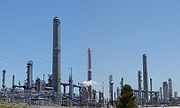 Owing to its extensive waterfront on San Francisco
, San Pablo
, and Suisun
bays the northwestern and northern segments have long been sites for heavy industry, including a number of still active oil refineries
(particularly Chevron
in Richmond, Shell Oil and Tesoro - in Martinez), chemical plants (Dow Chemical) and a once substantial integrated steel plant, Posco Steel
(formerly United States Steel), now reduced to secondary production of strip sheet and wire. The San Joaquin River
forms a continuation of the northern boundary turns southward to form the eastern boundary of the county. Some substantial Sacramento-San Joaquin Delta "islands" (actually leveed former marshes) are included in this corner of the county.
, with a mix of races and income levels — a character actively sought by some housing purchasers. The downside of this is a corresponding lack of affordable housing for those in lower paying service jobs — a problem endemic throughout the region. There has recently been a housing boom or tract housing in Richmond
and also in the Hercules
areas. These gentrifying areas are the most diverse in Contra Costa County.
The central part of the county is a valley traversed by Interstate 680 and Highway 24. The towns east of the hills, on or near Highway 24 and their surrounding areas (Lafayette
, Moraga
and Orinda
) are collectively known as Lamorinda. The major central county cities along Interstate 680 are Martinez, Concord, Pleasant Hill, Walnut Creek, Danville, San Ramon, and unincorporated Alamo. Owing to the high quality of its public schools (due largely to both demographics and added support from prosperous parents), this area has become a magnet for well–off families with children. During the real estate boom, housing prices were driven to astounding levels. From 2007, home prices in the region have seen substantial decreases and the affordability rate has risen. During the real estate boom, the high price of homes and scarcity of land resulted in many speculators purchasing older, smaller homes and partially or completely tearing them down in order to construct larger homes.
In this way the central county region has become a mix of older suburbs, newer developments, small lot "infill" developments, and extensive shopping areas.
in the "East County" towns of Pittsburg
, Antioch
, and Oakley
- new "bedroom" communities" to serve the now "edge cities". The median income of a family in the two relatively affluent East County towns of Brentwood
and Discovery Bay
is approaching $100k/yr. placing them in the top fifteen percent of affluent towns in the United States. California Distinguished Schools, golf courses, vineyards, and upscale homes are found in Brentwood and Discovery Bay. Discovery Bay is based on a waterfront community of 3,500+ homes with private docks with access to the Sacramento-San Joaquin River Delta. Discovery Bay also features gated and non-gated "off-water" communities with homes from 1,400 square feet (130 m2) up to 4,700 square feet (440 m2). The Streets of Brentwood, an outdoor lifestyle retail center, opened in Brentwood in the Fall of 2008. The Streets of Brentwood's upscale shops include Banana Republic, Coldwater Creek, DSW Shoes, Jos. A. Bank, REI, Swarovski, Victoria’s Secret, and White House/Black Market. The only all-digital Rave Motion Pictures in the San Francisco Bay Area is located in the Streets of Brentwood.
In 2011, Vasco Road is undergoing further construction/improvement to reduce the driving time between East County/Brentwood and Livermore. Highway 4 is currently undergoing multi-million dollar improvements that are scheduled to add lanes through Antioch and Pittsburg by 2015 in order to reduce the driving time between East County and Concord/Walnut Creek.
have fallen on harder times, with Richmond having difficulty balancing its school budget. This may be arguably attributed to a side effect of Proposition 13: it applies also to large industrial and merchandising companies, which have seen their share of property taxes (the bulk of which is used to support local schools) decline severely. As housing prices have not kept pace with the more central and outlying regions and housing turnover is also low (which establishes a new tax base for the parcel), the school districts are having difficulty obtaining proper funding. A lack of the availability of the kind of community support available in the more prosperous regions also contributes to the problem, with higher income residents of some of these declining or gentrifying areas sending their children to private schooling, creating a self reinforcing decline in the public schools.
A number of large corporations now have headquarters in large developments along what is called the 680 corridor, that segment of Interstate Highway 680 that extends from Concord in the north to San Ramon
in the south, continuing into inland Alameda County
from Dublin
to Pleasanton
.
By the early 1990s, more square footage of office space had been built in the 680 corridor than in San Francisco's Financial District.
), with long term residents and many elsewhere in the county concerned that it will lose its remaining small-town charm and utility in an effort to become more like the county's major recreational shopping center of Walnut Creek
.
The inland portions of the Concord Naval Weapons Station
have been declared surplus by the Federal government and this area is expected to provide what is likely the last opportunity to plan and build city-sized development within the central county. This area will become a portion of the city of Concord and it is expected that development will be confined to the lower and flatter portions of the depot, with the remainder becoming a substantial addition to the county's open space
. As much of the land to be developed is largely relatively flat grassland space, with the most prominent structures ammunition bunkers that will be removed, the planning of future uses of the property will be largely unconstrained by previous uses.
published by the Bay Area News Group-East Bay (part of the Media News Group, Denver, Colorado), with offices in Walnut Creek
. The paper was originally a paper run and owned by the Lesher
family. Since the death of Dean Lesher in 1993, the paper has had several owners. The publisher also issues weekly local papers, such as the Concord Transcript which is the local paper for Concord and nearby Clayton
.
, and 62,225 (5.9%) from two or more races. Hispanic or Latino of any race were 255,560 persons (24.4%); 17.1% of Contra Costa County is Mexican, 1.9% Salvadoran, 0.7% Nicaraguan, 0.7% Puerto Rican, 0.5% Guatemalan, 0.5% Peruvian, 0.2% Cuban, and 0.2% Colombian.
of 2000, there were 948,816 people, 344,129 households, and 242,266 families residing in the county. The population density
was 1,318 people per square mile (509/km²). There were 354,577 housing units at an average density of 492 per square mile (190/km²).
The largest ethnicites were 9.0% German, 7.7% Irish, 7.3% English and 6.5% Italian ancestry according to Census 2000. 74.1% spoke English, 13.1% Spanish, 2.6% Tagalog
and 1.8% Chinese
or Mandarin
as their first language.
By 2005 53.2% of Contra Costa County's population were non-Hispanic whites. African-Americans made up 9.6% of the population, while Asians constituted 13.1% of it. Latinos were now 21.1% of the county population.
In 2000 there were 344,129 households out of which 35.4% had children under the age of 18 living with them, 54.5% were married couples living together, 11.5% had a female householder with no husband present, and 29.6% were non-families. 22.9% of all households were made up of individuals and 8.00% had someone living alone who was 65 years of age or older. The average household size was 2.72 and the average family size was 3.23.
In the county the population was spread out with:
The median age was 36 years. For every 100 females there were 95.4 males. For every 100 females age 18 and over, there were 92.2 males.
The median income for a household in the county was $63,675, and the median income for a family was $73,039 (these figures had risen to $75,483 and $87,435 respectively as of a 2007
estimate).
Males had a median income of $52,670 versus $38,630 for females. The per capita income
for the county was $30,615. About 5.4% of families and 7.6% of the population were below the poverty line, including 9.8% of those under age 18 and 6.0% of those age 65 or over.
In 2000, the largest denominational groups were Catholics (with 204,070 adherents) and Evangelical Protestants (with 74,449 adherents). The largest religious bodies were The Catholic Church (with 204,070 members) and The Baptist General Conference
(with 24,803 members).
Contra Costa County has become a Democratic stronghold, with even wealthy cities like Orinda and Walnut Creek voting Democratic in recent elections. The last Republican to win a majority in the county was Ronald Reagan
in 1984
. With the exceptions of Danville
and Clayton
, every city, town, and the unincorporated areas of Contra Costa County have more registered Democrats than Republicans.
Contra Costa is part of California's 7th
, 10th
, and 11th
congressional districts. All three are held by Democrats: George Miller, John Garamendi
, and Jerry McNerney
, respectively. In the State Assembly
, parts of the 11th, 14th, and 15th districts are in the county. The 11th, 14th, and 15th districts are represented by Democrats Susan Bonilla
, Nancy Skinner
, and Joan Buchanan
, respectively. In the State Senate
, all of the 7th district and part of the 9th district are in the county. Both districts are represented by Democrats, the 7th by Mark DeSaulnier
and the 9th by Loni Hancock
.
s have been proposed in Richmond
and the surrounding area of West Contra Costa County.
San Francisco Bay Area
The San Francisco Bay Area, commonly known as the Bay Area, is a populated region that surrounds the San Francisco and San Pablo estuaries in Northern California. The region encompasses metropolitan areas of San Francisco, Oakland, and San Jose, along with smaller urban and rural areas...
of the U.S. state
U.S. state
A U.S. state is any one of the 50 federated states of the United States of America that share sovereignty with the federal government. Because of this shared sovereignty, an American is a citizen both of the federal entity and of his or her state of domicile. Four states use the official title of...
of California
California
California is a state located on the West Coast of the United States. It is by far the most populous U.S. state, and the third-largest by land area...
. As of the 2010 census, it had a population of 1,049,025. The county seat
County seat
A county seat is an administrative center, or seat of government, for a county or civil parish. The term is primarily used in the United States....
is Martinez
Martinez, California
Martinez is a city and the county seat of Contra Costa County, California, United States. The population was 35,824 at the 2010 census. The downtown is notable for its large number of preserved old buildings...
.
Pre-human
In prehistoric times, particularly the MioceneMiocene
The Miocene is a geological epoch of the Neogene Period and extends from about . The Miocene was named by Sir Charles Lyell. Its name comes from the Greek words and and means "less recent" because it has 18% fewer modern sea invertebrates than the Pliocene. The Miocene follows the Oligocene...
epoch, portions of the landforms now in the area (then marshy and grassy savanna
Savanna
A savanna, or savannah, is a grassland ecosystem characterized by the trees being sufficiently small or widely spaced so that the canopy does not close. The open canopy allows sufficient light to reach the ground to support an unbroken herbaceous layer consisting primarily of C4 grasses.Some...
) were populated by a wide range of now extinct mammals, known in modern times by the fossil
Fossil
Fossils are the preserved remains or traces of animals , plants, and other organisms from the remote past...
remains excavated in the southern part of the county. In the northern part of the county, significant coal and sand deposits were formed in even earlier geologic eras. Other areas of the county have ridges exposing ancient but intact (not fossilized) seashells, embedded in sandstone
Sandstone
Sandstone is a sedimentary rock composed mainly of sand-sized minerals or rock grains.Most sandstone is composed of quartz and/or feldspar because these are the most common minerals in the Earth's crust. Like sand, sandstone may be any colour, but the most common colours are tan, brown, yellow,...
layers alternating with limestone
Limestone
Limestone is a sedimentary rock composed largely of the minerals calcite and aragonite, which are different crystal forms of calcium carbonate . Many limestones are composed from skeletal fragments of marine organisms such as coral or foraminifera....
. Layers of volcanic ash ejected from geologically recent but now extinct volcanos, compacted and now tilted by compressive forces, may be seen at the site of some road excavations. This county is an agglomeration of several distinct geologic terrane
Terrane
A terrane in geology is short-hand term for a tectonostratigraphic terrane, which is a fragment of crustal material formed on, or broken off from, one tectonic plate and accreted or "sutured" to crust lying on another plate...
s, as is most of the greater San Francisco Bay Area
San Francisco Bay Area
The San Francisco Bay Area, commonly known as the Bay Area, is a populated region that surrounds the San Francisco and San Pablo estuaries in Northern California. The region encompasses metropolitan areas of San Francisco, Oakland, and San Jose, along with smaller urban and rural areas...
, which is one of the most geologically complex regions in the world. The great local mountain Mount Diablo
Mount Diablo State Park
Mount Diablo is a mountain in Contra Costa County, California in the San Francisco Bay Area, located south of Clayton and northeast of Danville. It is an isolated upthrust peak of , visible from most of the San Francisco Bay Area and much of northern California...
has been formed and continues to be elevated by compressive forces resulting from the action of plate tectonics
Plate tectonics
Plate tectonics is a scientific theory that describes the large scale motions of Earth's lithosphere...
and at its upper reaches presents ancient seabed rocks
Franciscan Assemblage
The Franciscan Assemblage is a geological term for an accreted terrane of heterogeneous rocks found on and near the San Francisco Peninsula. It was named by geologist Andrew Lawson who also named the San Andreas Fault which bounds the Franciscan Assemblage....
scraped from distant oceanic sedimentation locations and accumulated and lifted by these great forces. Younger deposits at middle altitudes include pillow lava
Pillow lava
Pillow lavas are lavas that contain characteristic pillow-shaped structures that are attributed to the extrusion of the lava under water, or subaqueous extrusion. Pillow lavas in volcanic rock are characterized by thick sequences of discontinuous pillow-shaped masses, commonly up to one metre in...
s, the product of undersea volcanic eruptions.
Native American period
There is an extensive but little recorded human history pre-European settlement in this area, with the present county containing portions of regions populated by a number of native American tribes. The earliest definitively established occupation by modern man (Homo sapiens) appears to have occurred six to ten thousand years ago. However, there may have been human presence far earlier, at least as far as non–settling populations are concerned. The known settled populations were hunter-gatherer societies that had no knowledge of metals and that produced utilitarian crafts for everyday use (especially woven reed baskets) of the highest quality and with graphic embellishments of great aesthetic appeal. Extensive trading from tribe to tribe transferred exotic materials such as obsidianObsidian
Obsidian is a naturally occurring volcanic glass formed as an extrusive igneous rock.It is produced when felsic lava extruded from a volcano cools rapidly with minimum crystal growth...
(useful for the making of arrowheads) throughout the region from far distant Californian tribes. Unlike the nomad
Nomad
Nomadic people , commonly known as itinerants in modern-day contexts, are communities of people who move from one place to another, rather than settling permanently in one location. There are an estimated 30-40 million nomads in the world. Many cultures have traditionally been nomadic, but...
ic native American of the Great Plains
Great Plains
The Great Plains are a broad expanse of flat land, much of it covered in prairie, steppe and grassland, which lies west of the Mississippi River and east of the Rocky Mountains in the United States and Canada. This area covers parts of the U.S...
it appears that these tribes did not incorporate warfare into their culture but were instead generally cooperative. Within these cultures the concept of individual or collective land ownership was nonexistent. Early European settlers in the region, however, did not record much about the culture of the natives. Most of what is known culturally comes from preserved contemporaneous and excavated artifacts and from inter-generational knowledge passed down through northerly outlying tribes of the larger region.
Spanish colonial
Early interaction of these Native Americans with Europeans came with the Spanish colonization via the establishment of missions in this area, with the missions in San Jose, Sonoma, and San Francisco and particularly the establishment of a PresidioPresidio of San Francisco
The Presidio of San Francisco is a park on the northern tip of the San Francisco Peninsula in San Francisco, California, within the Golden Gate National Recreation Area...
(a military establishment) in 1776. Although there were no missions established within this county, Spanish influence here was direct and extensive, through the establishment of land grants from the King of Spain to favored settlers.
Mexican land grants
In 1821 Mexico gained independence from Spain. While little changed in ranchero life, the Mexican War of IndependenceMexican War of Independence
The Mexican War of Independence was an armed conflict between the people of Mexico and the Spanish colonial authorities which started on 16 September 1810. The movement, which became known as the Mexican War of Independence, was led by Mexican-born Spaniards, Mestizos and Amerindians who sought...
resulted in the secularization of the missions with the re-distribution of their lands, and a new system of land grants under the Mexican Federal Law of 1824. Mission lands extended throughout the Bay Area, including portions of Contra Costa County. Between 1836 and 1846, during the era when California was a province of independent Mexico, the following 15 land grants were made in Contra Costa County.
|
Rancho Laguna de los Palos Colorados Rancho Laguna de Los Palos Colorados was a Mexican land grant in present day Contra Costa County, California given in 1841 by Governor Juan Alvarado to Joaquin Moraga and his cousin, Juan Bernal. The name means "Ranch of the Lake of the Redwoods" in Spanish... Rancho Las Juntas Rancho Las Juntas was a Mexican land grant in present day Contra Costa County, California given in 1844 by Governor Manuel Micheltorena to William Welch. The name Las Juntas translates as "the Crossroads"... Rancho Los Medanos Rancho Los Medanos was a Mexican land grant in present day Contra Costa County, California given in 1839 by Governor Juan Alvarado to Jose Antonio Mesa and Jose Miguel Garcia. The name "los medanos" is derived from the sand hills located along the San Joaquin River on its northern boundary... Rancho Los Meganos Rancho Los Meganos was a Mexican land grant in present day Contra Costa County, California given in 1835 by Governor José Castro to Jose Noriega. "Meganos" means "sand dunes" in Spanish. Rancho Los Meganos extends eastward from present day Antioch along the San Joaquin River to the Old River... Rancho Monte del Diablo Rancho Monte del Diablo was a Mexican land grant in present day Contra Costa County, California given in 1834 by Governor José Figueroa to Salvio Pacheco. The name "Monte del Diablo" means "thicket of the devil" in Spanish. The name was later incorrectly translated as Mount Diablo... |
Rancho El Pinole Rancho El Pinole was a Mexican land grant in present day Contra Costa County, California given in 1842 by Governor Juan Alvarado to Ygnacio Martinez... Rancho San Pablo Rancho San Pablo was a land grant in present day Contra Costa County, California given in 1823 by Governor Luís Antonio Argüello to Francisco María Castro , a former soldier at the San Francisco Presidio and one-time alcalde of the Pueblo of San José. The grant was reconfirmed by Governor José... Rancho San Ramon (Amador) Rancho San Ramon was a Mexican land grant in present day Contra Costa County, California given in 1834 by Governor Jose Figueroa to Jose Maria Amador.... Rancho San Ramon (Pacheco-Castro) Rancho San Ramon was a Mexican land grant in present day Contra Costa County, California given in 1833 by Governor Jose Figueroa to Mariano Castro and Bartolome Pacheco. Governor Figueroa granted Castro and Pacheco two square leagues of San Ramon Valley from the crest of the western ridge to the... Rancho El Sobrante Rancho El Sobrante was a Mexican land grant in present day Contra Costa County, California given in 1841 by Governor Juan Alvarado to Juan Jose Castro and Victor Castro... |
The smallest unit was one square league, or about seven square miles, or 4400 acres (17.8 km²), maximum to one individual was eleven leagues, or 48400 acres (195.9 km²), including no more than 4428 acres (17.9 km²) of irrigable land. Rough surveying was based on a map, or diseño, measured by streams, shorelines, and/or horseman who marked it with rope and stakes. Lands outside Rancho grants were designated ‘el sobrante,' as in surplus or excess, and considered common lands. The law required the construction of a house within a year. Fences were not required and were forbidden where they might interfere with roads or trails. Locally a large family required roughly 2000 head of cattle and two square leagues of land (fourteen square miles) to live comfortably. Foreign entrepreneurs came to the area in order to provide goods that Mexico couldn’t, and trading ships were taxed.
- Rancho Canada de los VaquerosRancho Cañada de los VaquerosRancho Cañada de los Vaqueros was a Mexican land grant mostly in present day Contra Costa County, California but partially in Alameda County, California given in 1844 by Governor Manuel Micheltorena to Antonio Higuera, Francisco Alviso and Manuel Miranda...
was granted to Francisco Alviso, Antonio Higuera, and Manuel Miranda (26660 acres (107.9 km²) confirmed in 1889 to heirs of Robert Livermore). - Two ranchos, both called Rancho San Ramon, were granted by the Mexican government in the San Ramon Valley. In 1833, Bartolome Pacheco (southern San Ramon Valley) and Mariano Castro (northern San Ramon Valley) shared the two square league Rancho San RamonRancho San Ramon (Pacheco-Castro)Rancho San Ramon was a Mexican land grant in present day Contra Costa County, California given in 1833 by Governor Jose Figueroa to Mariano Castro and Bartolome Pacheco. Governor Figueroa granted Castro and Pacheco two square leagues of San Ramon Valley from the crest of the western ridge to the...
. Jose Maria Amador was granted a four square league Rancho San RamonRancho San Ramon (Amador)Rancho San Ramon was a Mexican land grant in present day Contra Costa County, California given in 1834 by Governor Jose Figueroa to Jose Maria Amador....
in 1834. - In 1834 Rancho Monte del DiabloRancho Monte del DiabloRancho Monte del Diablo was a Mexican land grant in present day Contra Costa County, California given in 1834 by Governor José Figueroa to Salvio Pacheco. The name "Monte del Diablo" means "thicket of the devil" in Spanish. The name was later incorrectly translated as Mount Diablo...
(present day Concord, CaliforniaConcord, CaliforniaConcord is the largest city in Contra Costa County, California, USA. At the 2010 census, the city had a population of 122,067. Originally founded in 1869 as the community of Todos Santos by Salvio Pacheco, the name was changed to Concord within months...
) was confirmed with 17921 acres (72.5 km²) to Salvio Pacheco (born July 15, 1793, died 1876). The Pacheco family settled at the Rancho in 1846 (between the Pacheco shipping port townsite and ClaytonClayton, CaliforniaClayton is a city in Contra Costa County, California, United States. The population was 10,897 as of the 2010 census.- Geography :...
area, and including much of Lime Ridge). The boundary lines were designated with stone markers. Clayton was later located on sobrante lands just east of Rancho Monte del Diablo (Mount Diablo). - In 1834, Rancho Arroyo de Las Nueces y BolbonesRancho Arroyo de Las Nueces y BolbonesRancho Arroyo de Las Nueces y Bolbones was a Mexican land grant in present day Contra Costa County, California given in 1834 by Governor José Figueroa to Juana Sanchez de Pacheco. The grant was named after the principal waterway, Arroyo de los Nueces and for the local group of indigenous...
aka Rancho San MiguelRancho San MiguelRancho San Miguel is a Neighborhood in Walnut Creek, California. It is named after the Alta California Rancho Rancho Arroyo de Las Nueces y Bolbones which was also referred to as Rancho San Miguel...
(present day Walnut CreekWalnut Creek, CaliforniaWalnut Creek is an incorporated city located east of the city of Oakland. It lies in the East Bay region of the San Francisco Bay Area. While not as large as neighboring Concord, Walnut Creek serves as the business and entertainment hub for the neighboring cities within central Contra Costa...
), was granted to Juana Sanchez de Pacheco, in recognition of the service of Corporal Miguel Pacheco 37 years earlier (confirmed 1853, patented to heirs 1866); the grant was for two leagues, but drawn free hand on the diseño/map, and reading "two leagues, more or less" as indicated in the diseño, but actually including and confirmed for nearly four leagues or nearly 18000 acres (72.8 km²), but only 10000 acres (40.5 km²) were ever shown as having once belonged to Juana Sanchez. - 'Meganos' means 'sand dunes.' A "paraje que llaman los Méganos" 'place called the sand dunes' (with a variant spelling) is mentioned in DuránDuránDurán or Duran is the Hispanic version of the French surname Durand which originated in Gers near Toulouse, France during the 13th century.- People :* Carolus-Duran, French painter* Cassius Duran, Brazilian diver...
's diary on May 24, 1817. Two Los Meganos Ranchos were granted, later differentiated as Rancho Los MeganosRancho Los MeganosRancho Los Meganos was a Mexican land grant in present day Contra Costa County, California given in 1835 by Governor José Castro to Jose Noriega. "Meganos" means "sand dunes" in Spanish. Rancho Los Meganos extends eastward from present day Antioch along the San Joaquin River to the Old River...
(1835, three leagues or at least 13285 acres (53.8 km²)) in what is now the BrentwoodBrentwood, CaliforniaBrentwood is a city in Contra Costa County, California, United States. It is located in the East Bay region of the San Francisco Bay Area. The population is 51,481 as of 2010....
area, to Jose Noriega then acquired by John MarshJohn Marsh (Pioneer)“Doctor” John Marsh was born in 1799 in South Danvers, Massachusetts and died in Pacheco, California in 1856. He was an early pioneer and settler in California, and although he did not have a medical degree, is often regarded as the first person to practice medicine in California.-Early life:Marsh...
; and Rancho Los MedanosRancho Los MedanosRancho Los Medanos was a Mexican land grant in present day Contra Costa County, California given in 1839 by Governor Juan Alvarado to Jose Antonio Mesa and Jose Miguel Garcia. The name "los medanos" is derived from the sand hills located along the San Joaquin River on its northern boundary...
(to Jose Antonio Mesa and Jose Miguel Garcia, Pittsburg area, dated November 26, 1839).
Bear Flag Republic and the statehood of California
The exclusive land ownership in California by the approximate 9,000 HispanicHispanic
Hispanic is a term that originally denoted a relationship to Hispania, which is to say the Iberian Peninsula: Andorra, Gibraltar, Portugal and Spain. During the Modern Era, Hispanic sometimes takes on a more limited meaning, particularly in the United States, where the term means a person of ...
s in California would soon end. This change began with the Bear Flag Revolt in 1846 when about 30 settlers originally from the United States declared a republic
Republic
A republic is a form of government in which the people, or some significant portion of them, have supreme control over the government and where offices of state are elected or chosen by elected people. In modern times, a common simplified definition of a republic is a government where the head of...
in June 1846 and were enlisted and fighting under the U.S. flag by July 1846. Following the Mexican–American War
Mexican–American War
The Mexican–American War, also known as the First American Intervention, the Mexican War, or the U.S.–Mexican War, was an armed conflict between the United States and Mexico from 1846 to 1848 in the wake of the 1845 U.S...
of 1846–48, California was controlled by U.S. settlers organized under the California Battalion
California Battalion
The first California Volunteer Militia was commonly called the California Battalion was organized by John C. Fremont during the Mexican-American War in Alta California, present day California, United States.-Formation:...
and the U.S. Navy's Pacific Squadron
Pacific Squadron
The Pacific Squadron was part of the United States Navy squadron stationed in the Pacific Ocean in the 19th and early 20th centuries. Initially with no United States ports in the Pacific, they operated out of storeships which provided naval supplies and purchased food and obtained water from local...
. After some minor skirmishes California was under U.S. control by January 1847 and formally annexed and paid for by the U.S. in 1848. Twenty-seven years of ineffective years of Mexican rule had ended as 161 years (as of 2011) of rapid state advancement continued under U.S. federal, state and local government and private development. By 1850 the over-100,000 population and rapidly growing California population gain due to the California gold rush
California Gold Rush
The California Gold Rush began on January 24, 1848, when gold was found by James W. Marshall at Sutter's Mill in Coloma, California. The first to hear confirmed information of the gold rush were the people in Oregon, the Sandwich Islands , and Latin America, who were the first to start flocking to...
and the large amount of gold being exported east gave California enough clout to choose its own boundaries, write its own constitution and be admitted to the Union as a free state in 1850 without going through territorial status as required for most other states.
In 1850 California had a non-Indian population of over 100,000. The number of Indians living in California in 1850 has been estimated to be from 60,000 to 100,000. By 1850 the Mission Indian populations had largely succumbed to disease and abuse and only numbered a few thousand. California's 1852 state Census gives 31,266 Indian residents; but this is an under-count since there was little incentive and much difficulty in getting it more correct.
Contra Costa's creation and division
Contra Costa County was one of the original counties of California, created in 1850 at the time of statehood. The county was originally to be called Mt. Diablo County, but the name was changed prior to incorporation as a county. The county's Spanish languageSpanish language
Spanish , also known as Castilian , is a Romance language in the Ibero-Romance group that evolved from several languages and dialects in central-northern Iberia around the 9th century and gradually spread with the expansion of the Kingdom of Castile into central and southern Iberia during the...
name means opposite coast, because of its location opposite San Francisco, in an easterly direction, on San Francisco Bay
San Francisco Bay
San Francisco Bay is a shallow, productive estuary through which water draining from approximately forty percent of California, flowing in the Sacramento and San Joaquin rivers from the Sierra Nevada mountains, enters the Pacific Ocean...
. Southern portions of the county's territory, including all of the bayside portions opposite San Francisco and northern portions of Santa Clara County
Santa Clara County, California
Santa Clara County is a county located at the southern end of the San Francisco Bay Area in the U.S. state of California. As of 2010 it had a population of 1,781,642. The county seat is San Jose. The highly urbanized Santa Clara Valley within Santa Clara County is also known as Silicon Valley...
, were given up to form Alameda County
Alameda County, California
Alameda County is a county in the U.S. state of California. It occupies most of the East Bay region of the San Francisco Bay Area. As of the 2010 census it had a population of 1,510,271, making it the 7th most populous county in the state...
effective March 25, 1853.
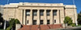
The land titles in Contra Costa County may be traced to multiple subdivisions of a few original land grants. The grantee's family names live on in a few city and town names such as Martinez
Martinez, California
Martinez is a city and the county seat of Contra Costa County, California, United States. The population was 35,824 at the 2010 census. The downtown is notable for its large number of preserved old buildings...
, Pacheco and Moraga
Moraga, California
Moraga is a suburban incorporated town located in Contra Costa County, California, United States, in the San Francisco Bay Area. It is named in honor of Joaquin Moraga, whose grandfather was José Joaquin Moraga, second in command to Juan Bautista de Anza...
and in the names of streets, residential subdivisions, and business parks. A few mansions from the more prosperous farms have been preserved as museums and cultural centers and one of the more rustic examples has been preserved as a working demonstration ranch, Borges Ranch.
1941–1945
During World War II, RichmondRichmond, California
Richmond is a city in western Contra Costa County, California, United States. The city was incorporated on August 7, 1905. It is located in the East Bay, part of the San Francisco Bay Area. It is a residential inner suburb of San Francisco, as well as the site of heavy industry, which has been...
hosted one of the two Bay Area sites of Kaiser Shipyards
Kaiser Shipyards
The Kaiser Shipyards were seven major shipbuilding yards located mostly on the U.S. west coast during World War II. They were owned by the Kaiser Shipbuilding Company, a creation of American industrialist Henry J...
and wartime pilots were trained at what is now Concord/Buchanan Field Airport. Additionally, a large Naval Weapons Depot and munitions ship loading facilities at Port Chicago
Port Chicago, California
Port Chicago was a town on the southern banks of Suisun Bay, in Contra Costa County, California. It was located east-northeast of Martinez, at an elevation of 13 feet...
remain active to this day, but with the inland storage facilities recently declared surplus, extensive redevelopment is being planned for this last large central-county tract. The loading docks were the site of a devastating explosion
Port Chicago disaster
The Port Chicago disaster was a deadly munitions explosion that occurred on July 17, 1944, at the Port Chicago Naval Magazine in Port Chicago, California, United States. Munitions detonated while being loaded onto a cargo vessel bound for the Pacific Theater of Operations, killing 320 sailors and...
in 1944. Port Chicago was bought out and demolished by the Federal Government to form a safety zone near the Naval Weapons Station loading docks. At one time the Atlas Powder Company (subsequently closed)produced gunpowder and dynamite. The site of the former Atlas Powder Company is located at Point Pinole Regional Shoreline
Point Pinole Regional Shoreline
The Point Pinole Regional Shoreline is a regional park on the shores of the San Pablo Bay, California . It is approximately in area, and is operated by the East Bay Regional Park District.-History:...
, part of the East Bay Regional Parks District.
Early postwar period
With the postwar baby boomBaby boom
A baby boom is any period marked by a greatly increased birth rate. This demographic phenomenon is usually ascribed within certain geographical bounds and when the number of annual births exceeds 2 per 100 women...
and the desire for suburban living, large tract housing developers would purchase large central county farmsteads and develop them with roads, utilities and housing. Once mostly rural walnut orchards and cattle ranches, the area was first developed as low cost, large lot suburbs, with a typical low cost home being placed on a "quarter acre" (1,000 m²) lot — actually a little less at 10,000 square feet (930 m²). Some of the expansion of these suburban areas was clearly attributable to white flight
White flight
White flight has been a term that originated in the United States, starting in the mid-20th century, and applied to the large-scale migration of whites of various European ancestries from racially mixed urban regions to more racially homogeneous suburban or exurban regions. It was first seen as...
from decaying areas of Alameda County
Alameda County, California
Alameda County is a county in the U.S. state of California. It occupies most of the East Bay region of the San Francisco Bay Area. As of the 2010 census it had a population of 1,510,271, making it the 7th most populous county in the state...
and the consolidated city-county
Consolidated city-county
In United States local government, a consolidated city–county is a city and county that have been merged into one unified jurisdiction. As such it is simultaneously a city, which is a municipal corporation, and a county, which is an administrative division of a state...
of San Francisco
San Francisco, California
San Francisco , officially the City and County of San Francisco, is the financial, cultural, and transportation center of the San Francisco Bay Area, a region of 7.15 million people which includes San Jose and Oakland...
, but much was due to the postwar baby boom
Post-World War II baby boom
The end of World War II brought a baby boom to many countries, especially Western ones. There is some disagreement as to the precise beginning and ending dates of the post-war baby boom, but it is most often agreed to begin in the years immediately after the war, ending more than a decade later;...
of the era creating demand for three and four bedroom houses with large yards which were unaffordable or unavailable in the established bayside cities.
Later postwar period (1955–1970)
A number of large companies have followed their employees to the suburbs, filling large business parks. The establishment of a large, prosperous population in turn fostered the development of large shopping centers and created demand for an extensive supporting infrastructure including roads, schools, libraries, police, firefighting, water, sewage, and flood control.Modern period
The establishment of BART, the modernization of Highway 24, and the addition of a third Caldecott Tunnel all served to reinforce the demographic and economic trends in the Diablo area, with cities such as Walnut Creek becoming edge citiesEdge city
"Edge city" is an American term for a concentration of business, shopping, and entertainment outside a traditional urban area in what had recently been a residential suburb or semi-rural community...
.
The central county cities have in turn spawned their own suburbs within the county, extending east along the county's estuarine north shore; with the older development areas of Bay Point
Bay Point, California
Bay Point, formerly West Pittsburg, is a suburb and census-designated place located in eastern Contra Costa County, California, just west of the city of Pittsburg and northeast over a low range of hills from Concord...
and Pittsburg
Pittsburg, California
Pittsburg is a city located in eastern Contra Costa County, California, the outer portion of the East Bay region of the San Francisco Bay Area. The population was 63,264 at the 2010 census....
being augmented by extensive development in Antioch
Antioch, California
Antioch is a city in Contra Costa County, California. Located in the East Bay region of the San Francisco Bay Area along the San Joaquin-Sacramento River Delta, it is a suburb of San Francisco and Oakland. The city's population was 102,372 at the U.S...
, Oakley
Oakley, California
Oakley is a city in Contra Costa County, California, United States. The population was 35,432 at the 2010 U.S. Census. Oakley is part of the East Contra Costa Bicycle Plan, which has existing facilities in Oakley as well as plans for further expansion....
, and Brentwood
Brentwood, California
Brentwood is a city in Contra Costa County, California, United States. It is located in the East Bay region of the San Francisco Bay Area. The population is 51,481 as of 2010....
.
The effects of the housing value crash (2008-2011) have varied widely throughout the county. Values of houses in prosperous areas with good schools have declined only modestly in value, while houses recently built outlying suburbs in the eastern county have experienced severe reductions in value, accelerated by high unemployment and consequent mortgage foreclosures, owner strategic walk-aways, and the too-rapid conversion of neighborhoods from owner-occupancy to rentals.
Political geography
According to the 2000 census, the county has a total area of 802.15 square miles (2,077.6 km²), of which 719.95 square miles (1,864.7 km²) (or 89.75%) is land and 82.2 square miles (212.9 km²) (or 10.25%) is water.It is bounded on the south and west by Alameda County
Alameda County, California
Alameda County is a county in the U.S. state of California. It occupies most of the East Bay region of the San Francisco Bay Area. As of the 2010 census it had a population of 1,510,271, making it the 7th most populous county in the state...
; on the northwest San Francisco Bay
San Francisco Bay
San Francisco Bay is a shallow, productive estuary through which water draining from approximately forty percent of California, flowing in the Sacramento and San Joaquin rivers from the Sierra Nevada mountains, enters the Pacific Ocean...
(San Francisco and Marin
Marin County, California
Marin County is a county located in the North San Francisco Bay Area of the U.S. state of California, across the Golden Gate Bridge from San Francisco. As of 2010, the population was 252,409. The county seat is San Rafael and the largest employer is the county government. Marin County is well...
Counties); on the North by San Pablo Bay
San Pablo Bay
San Pablo Bay is a tidal estuary that forms the northern extension of San Francisco Bay in northern California in the United States. Most of the Bay is shallow; however, there is a deep water channel approximately in mid bay, which allows access to Sacramento, Stockton, Benicia, Martinez, and...
, the Carquinez Strait
Carquinez Strait
The Carquinez Strait is a narrow tidal strait in northern California. It is part of the tidal estuary of the Sacramento and the San Joaquin rivers as they drain into the San Francisco Bay...
, and Suisun Bay
Suisun Bay
Suisun Bay is a shallow tidal estuary at in northern California, USA. It lies at the confluence of the Sacramento and San Joaquin Rivers, forming the entrance to the Sacramento-San Joaquin River Delta, an inverted river delta...
(Solano
Solano County, California
Solano County is a county located in Bay-Delta region of the U.S. state of California, about halfway between San Francisco and Sacramento and is one of the nine San Francisco Bay Area counties. The county's population was reported by the U.S. Census to be 413,344 in 2010...
and Sacramento
Sacramento County, California
Sacramento County is a county in the U.S. state of California. Its county seat is Sacramento, which is also the state capital. As of 2010 the county had a population of 1,418,788....
Counties); and on the east by the San Joaquin River
San Joaquin River
The San Joaquin River is the largest river of Central California in the United States. At over long, the river starts in the high Sierra Nevada, and flows through a rich agricultural region known as the San Joaquin Valley before reaching Suisun Bay, San Francisco Bay, and the Pacific Ocean...
(San Joaquin County).
Physical geography
Contra Costa County's physical geography is dominated by the bayside alluvial plain, the Oakland HillsOakland Hills, Oakland, California
Oakland Hills is an informal term used to indicate the city neighborhoods lying within the eastern portion of Oakland, California.-The geologic feature:...
–Berkeley Hills
Berkeley Hills
The Berkeley Hills are a range of the Pacific Coast Ranges that overlook the northeast side of the valley that surrounds San Francisco Bay. They were previously called the "Contra Costa Range/Hills" , but with the establishment of Berkeley and the University of California, the current usage was...
, several inland valleys, and Mount Diablo
Mount Diablo State Park
Mount Diablo is a mountain in Contra Costa County, California in the San Francisco Bay Area, located south of Clayton and northeast of Danville. It is an isolated upthrust peak of , visible from most of the San Francisco Bay Area and much of northern California...
, an isolated 3,849-foot (1,173 m) upthrust peak at the north end of the Diablo Range of hills. The summit of Mount Diablo is the origin of the Mount Diablo Meridian
Principal meridian
A meridian is an imaginary line on the Earth's surface from the North Pole to the South Pole that connects all locations with a given longitude. Each is half of a great circle on the Earth's surface...
and Base Line
Baseline (surveying)
In the United States Public Land Survey System, a baseline is the principal east-west line that divides survey townships between north and south. The baseline meets its corresponding meridian at the point of origin, or initial point, for the land survey...
, on which the surveys
Public Land Survey System
The Public Land Survey System is a method used in the United States to survey and identify land parcels, particularly for titles and deeds of rural, wild or undeveloped land. Its basic units of area are the township and section. It is sometimes referred to as the rectangular survey system,...
of much of California and western Nevada are based.
The Hayward Fault Zone
Hayward Fault Zone
The Hayward Fault Zone is a geologic fault zone capable of generating significantly destructive earthquakes. This strike-slip fault is about long, situated mainly along the western base of the hills on the east side of San Francisco Bay...
runs through the western portion of the county, from Kensington to Richmond. The Calaveras Fault
Calaveras Fault
The Calaveras Fault is a major branch of the San Andreas Fault located in northern California in the San Francisco Bay Area. To the east of the Hayward-Rodgers Creek fault, the Calaveras fault extends 123 km, splaying from the San Andreas fault near Hollister and terminating at Danville at its...
runs in the south-central portion of the county, from Alamo to San Ramon. The Concord Fault runs through part of Concord and Pacheco, and the Clayton-Marsh Creek-Greenville Fault
Clayton-Marsh Creek-Greenville Fault
The Clayton-Marsh Creek-Greenville Fault is a fault located in the eastern San Francisco Bay Area of California, in Alameda County and Contra Costa County.It is part of the somewhat parallel system of faults that are secondary to the San Andreas Fault...
runs from Clayton at its north end to near Livermore. These slip-strike earthquake faults and the Diablo thrust fault near Danville
Danville, California
The Town of Danville is located in the San Ramon Valley in Contra Costa County, California. It is one of the incorporated municipalities in California that uses "town" in its name instead of "city". The population was 42,039 in 2010. Danville is one of the wealthiest suburbs of Oakland and San...
are all considered capable of significantly destructive earthquakes and many lesser related faults are present in the area that cross critical infrastructure such as water, natural gas, and petroleum product pipelines, roads, highways, railroads, and BART rail transit.
Cities and towns
West County
Incorporated places
- El CerritoEl Cerrito, Contra Costa County, California-Transportation:The city's primary transportation infrastructure consists of the El Cerrito Plaza and El Cerrito del Norte BART stations along with several local bus lines, operated by AC Transit, providing access to the surrounding area and the nearby cities of Albany, Berkeley and Richmond...
- HerculesHercules, CaliforniaHercules is a city in western Contra Costa County, California. Situated along the coast of San Pablo Bay, it is located in the eastern region of the San Francisco Bay Area, about northeast of San Francisco. The city has a 2010 population of 24,060 according to the U.S...
- PinolePinole, CaliforniaPinole is a city in Contra Costa County, California, United States. The population was 18,390 at the 2010 census. It is one of many small “bedroom communities” along the I-80 corridor in Western Contra Costa County. It is located about northeast of San Francisco, and approximately a half-hour...
- RichmondRichmond, CaliforniaRichmond is a city in western Contra Costa County, California, United States. The city was incorporated on August 7, 1905. It is located in the East Bay, part of the San Francisco Bay Area. It is a residential inner suburb of San Francisco, as well as the site of heavy industry, which has been...
- San PabloSan Pablo, CaliforniaSan Pablo is a city in Contra Costa County, California, United States. The city of Richmond surrounds nearly the whole city. The population was 29,139 at the 2010 census. The current Mayor is Paul V. Morris, and the current Vice Mayor is Cecilia Valdez. Current Councilmembers include Arturo M....
Unincorporated places
- Bayview-MontalvinBayview-Montalvin, CaliforniaBayview-Montalvin is a former census-designated place in Contra Costa County, California, United States. The population was 5,004 at the 2000 census.Prior to the 2010 census, the CDP was dissolved into Bayview CDP and Montalvin Manor CDP.-Geography:...
- CrockettCrockett, CaliforniaCrockett is a census-designated place in Contra Costa County, California, United States. The population was 3,094 at the 2010 census...
- East Richmond HeightsEast Richmond Heights, CaliforniaEast Richmond Heights is an unincorporated and census-designated place in western Contra Costa County, California, United States. The community is locally referred to as Richmond View or Arlington Heights, especially in the context of real estate advertisements...
- El SobranteEl Sobrante, CaliforniaEl Sobrante is a census-designated place in Contra Costa County, California, United States. The population was 12,669 at the 2010 census...
- Hasford HeightsHasford Heights, CaliforniaHasford Heights historically Grand Canyon is an unincorporated community in western Contra Costa County, California in the area of the city of Richmond.-History:...
- KensingtonKensington, CaliforniaKensington is an unincorporated community and census-designated place located in the East Bay, part of the San Francisco Bay Area, in Contra Costa County, California, United States. The population was 5,077 at the 2010 census.- Law and government :Kensington is an unincorporated area of Contra...
- North RichmondNorth Richmond, CaliforniaNorth Richmond is a community in Contra Costa County, California, a census-designated place of 3,717 adjacent to and nearly surrounded by the city Richmond, to which it is generally socially and culturally attached...
- Port CostaPort Costa, CaliforniaPort Costa is a census-designated place in Contra Costa County, California, United States. The population was 190 at the 2010 census.-Geography:...
- RodeoRodeo, CaliforniaRodeo is a census-designated place located in Contra Costa County, California on the shore of San Pablo Bay. The population was 8,679 at the 2010 census. The town is named for the livestock roundups common in the late 19th century...
- RollingwoodRollingwood, CaliforniaRollingwood is a census-designated place in Contra Costa County, California, United States. As of the 2010 census, Rollingwood's population was 2,969.-Geography:...
- Tara HillsTara Hills, CaliforniaTara Hills is a census-designated place in Contra Costa County, California, United States. The population was 5,126 at the 2010 census.-Geography:According to the United States Census Bureau, the CDP has a total area of , all of it land....
Central County
Incorporated places
- ClaytonClayton, CaliforniaClayton is a city in Contra Costa County, California, United States. The population was 10,897 as of the 2010 census.- Geography :...
- ConcordConcord, CaliforniaConcord is the largest city in Contra Costa County, California, USA. At the 2010 census, the city had a population of 122,067. Originally founded in 1869 as the community of Todos Santos by Salvio Pacheco, the name was changed to Concord within months...
- DanvilleDanville, CaliforniaThe Town of Danville is located in the San Ramon Valley in Contra Costa County, California. It is one of the incorporated municipalities in California that uses "town" in its name instead of "city". The population was 42,039 in 2010. Danville is one of the wealthiest suburbs of Oakland and San...
- LafayetteLafayette, CaliforniaLafayette is a city in Contra Costa County, California, United States. As of the 2010 census, the city's population was 23,893. It was named after the Marquis de Lafayette, a French military hero of the American Revolutionary War...
- MartinezMartinez, CaliforniaMartinez is a city and the county seat of Contra Costa County, California, United States. The population was 35,824 at the 2010 census. The downtown is notable for its large number of preserved old buildings...
- MoragaMoraga, CaliforniaMoraga is a suburban incorporated town located in Contra Costa County, California, United States, in the San Francisco Bay Area. It is named in honor of Joaquin Moraga, whose grandfather was José Joaquin Moraga, second in command to Juan Bautista de Anza...
- OrindaOrinda, California-2010:The 2010 United States Census reported that Orinda had a population of 17,643. The population density was 1,389.5 people per square mile . The racial makeup of Orinda was 14,533 White, 149 African American, 22 Native American, 2,016 Asian, 24 Pacific Islander, 122 from other races, and...
- Pleasant HillPleasant Hill, CaliforniaPleasant Hill is a city in Contra Costa County, California, United States, in the East Bay of the San Francisco Bay Area. The population was 33,152 at the 2010 census. It was incorporated in 1961...
- San RamonSan Ramon, California-2010 census:The 2010 United States Census reported that San Ramon had a population of 72,148. The population density was 3,991.1 people per square mile...
- Walnut CreekWalnut Creek, CaliforniaWalnut Creek is an incorporated city located east of the city of Oakland. It lies in the East Bay region of the San Francisco Bay Area. While not as large as neighboring Concord, Walnut Creek serves as the business and entertainment hub for the neighboring cities within central Contra Costa...
Unincorporated places
- AlamoAlamo, CaliforniaAlamo is an unincorporated community and census-designated place in Contra Costa County, California, in the United States. It is located in the East Bay region of the San Francisco Bay Area...
- BlackhawkBlackhawk, CaliforniaBlackhawk is an unincorporated master planned community and census-designated place located in Contra Costa County, California, east of Danville and Oakland. The ZIP Code is 94506. The community is inside area code 925.-Blackhawk Ranch, 1917 to 1979:...
- Camino TassajaraCamino Tassajara, CaliforniaCamino Tassajara is a census-designated place in Contra Costa County, California. Camino Tassajara sits at an elevation of 846 feet . The 2010 United States census reported Camino Tassajara's population was 2,197.-Geography:...
- CanyonCanyon, CaliforniaCanyon is an unincorporated community in Contra Costa County, California situated between Oakland and Moraga in the San Francisco Bay Area. The community is named for its location in the upper canyon of San Leandro Creek along the eastern slope of the Berkeley Hills...
- ClydeClyde, CaliforniaClyde is a census-designated place in Contra Costa County, California, United States. The population was 678 at the 2010 census. It is located east of Martinez.-Geography:...
- Contra Costa CentreContra Costa Centre, CaliforniaContra Costa Centre is a census-designated place in Contra Costa County, California. Contra Costa Centre sits at an elevation of 92 feet . The 2010 United States census reported Contra Costa Centre's population was 5,364...
- DiabloDiablo, CaliforniaDiablo is a census-designated place in Contra Costa County, California, United States. The population was 1,158 at the 2010 census. It is located east-northeast of Danville...
- Mountain ViewMountain View, Contra Costa County, CaliforniaMountain View is a census-designated place in Contra Costa County, California, United States. The population was 2,372 at the 2010 census.-Geography:Mountain View is located at ....
- Pacheco
- Vine HillVine Hill, CaliforniaVine Hill is a census-designated place in Contra Costa County, California, United States. The population was 3,761 at the 2010 census. It is located east of downtown Martinez.-Geography:...
East County
Incorporated places
- AntiochAntioch, CaliforniaAntioch is a city in Contra Costa County, California. Located in the East Bay region of the San Francisco Bay Area along the San Joaquin-Sacramento River Delta, it is a suburb of San Francisco and Oakland. The city's population was 102,372 at the U.S...
- BrentwoodBrentwood, CaliforniaBrentwood is a city in Contra Costa County, California, United States. It is located in the East Bay region of the San Francisco Bay Area. The population is 51,481 as of 2010....
- OakleyOakley, CaliforniaOakley is a city in Contra Costa County, California, United States. The population was 35,432 at the 2010 U.S. Census. Oakley is part of the East Contra Costa Bicycle Plan, which has existing facilities in Oakley as well as plans for further expansion....
- PittsburgPittsburg, CaliforniaPittsburg is a city located in eastern Contra Costa County, California, the outer portion of the East Bay region of the San Francisco Bay Area. The population was 63,264 at the 2010 census....
Unincorporated places
- Bay PointBay Point, CaliforniaBay Point, formerly West Pittsburg, is a suburb and census-designated place located in eastern Contra Costa County, California, just west of the city of Pittsburg and northeast over a low range of hills from Concord...
- Bethel IslandBethel Island, CaliforniaBethel Island is a census-designated place on Bethel Island in Contra Costa County, California, United States. The population was 2,137 at the 2010 census.-Geography:...
- ByronByron, CaliforniaByron is a census-designated place in Contra Costa County, California, United States. The population was 1,277 at the 2010 census.-Geography:...
- Discovery BayDiscovery Bay, CaliforniaDiscovery Bay is a census-designated place in extreme eastern Contra Costa County, California in the United States about from San Francisco. As of 2010, its population was 13,352....
- KnightsenKnightsen, CaliforniaKnightsen is a census-designated place in Contra Costa County, California, in the United States. As of the 2010 census, the CDP population was 1,568, up from 861 reported in the 2000 census.-Geography:...
Other named regions and developments
- Saranap - an unincorporated residential area between Walnut Creek and Lafayette, centered around the site of a (now-gone) inter-urban train station, comprising much of ZIP CodeZIP CodeZIP codes are a system of postal codes used by the United States Postal Service since 1963. The term ZIP, an acronym for Zone Improvement Plan, is properly written in capital letters and was chosen to suggest that the mail travels more efficiently, and therefore more quickly, when senders use the...
94595. - RossmoorRossmoor, Walnut Creek, CaliforniaRossmoor is a gated community in Walnut Creek, California, with a population of about 9200. It was one of the first "active adult" communities for residents 55 years or older in the San Francisco Bay Area.- History :...
- a senior development incorporated into Walnut Creek (not to be confused with the Southern California RossmoorRossmoor, CaliforniaRossmoor is an affluent planned census-designated place located in Orange County, California. As of the 2010 census, the CDP had a total population of 10,244, down from 10,298 at the 2000 census...
).
Adjacent counties
- Alameda CountyAlameda County, CaliforniaAlameda County is a county in the U.S. state of California. It occupies most of the East Bay region of the San Francisco Bay Area. As of the 2010 census it had a population of 1,510,271, making it the 7th most populous county in the state...
- south (all the southern border) - Marin CountyMarin County, CaliforniaMarin County is a county located in the North San Francisco Bay Area of the U.S. state of California, across the Golden Gate Bridge from San Francisco. As of 2010, the population was 252,409. The county seat is San Rafael and the largest employer is the county government. Marin County is well...
- west (via the Richmond-San Rafael BridgeRichmond-San Rafael BridgeThe Richmond – San Rafael Bridge is the northernmost of the east–west crossings of the San Francisco Bay in California, USA, connecting Richmond on the east to San Rafael on the west end...
and San Pablo and San Francisco Bays) - Solano CountySolano County, CaliforniaSolano County is a county located in Bay-Delta region of the U.S. state of California, about halfway between San Francisco and Sacramento and is one of the nine San Francisco Bay Area counties. The county's population was reported by the U.S. Census to be 413,344 in 2010...
- north (via the Carquinez Bridges and Benicia-Martinez Bridge and the Carquinez Strait, Grizzly Bay, Suisun Bay, and Sacramento/San Joaquin River delta and mouth) - Sacramento CountySacramento County, CaliforniaSacramento County is a county in the U.S. state of California. Its county seat is Sacramento, which is also the state capital. As of 2010 the county had a population of 1,418,788....
- northeast (in the delta Islands and via the Antioch Bridge) - San Joaquin CountySan Joaquin County, CaliforniaSan Joaquin County is a county located in Central Valley of the U.S. state of California, just east of the San Francisco Bay Area. As of the 2010 census, the population was 685,306. The county seat is Stockton.-History:...
- east (across the San Joaquin River and many islands and sloughs, most of the eastern border) - San Francisco County - southwest (on Red Rock IslandRed Rock IslandRed Rock Island is an uninhabited, island in the San Francisco Bay located just south of the Richmond – San Rafael Bridge. The property is the only privately owned island in San Francisco Bay. The boundaries of three counties – San Francisco, Marin and Contra Costa – converge on this high rock...
and on the San Francisco Bay)
National protected areas
- Antioch Dunes National Wildlife RefugeAntioch Dunes National Wildlife RefugeAntioch Dunes National Wildlife Refuge is a sensitive sand dune habitat located near the city of Antioch, California on the south shore of the San Joaquin River. It serves as a refuge for three endangered species of plants and insects, and is closed to the public except for tours and events...
- Eugene O'Neill National Historic SiteEugene O'Neill National Historic SiteThe Eugene O'Neill National Historic Site, located in Danville, California, preserves Tao House, the Monterey Colonial hillside home of America's only Nobel Prize-winning playwright, Eugene O'Neill.-History:...
- John Muir National Historic SiteJohn Muir National Historic SiteThe John Muir National Historic Site is located in the San Francisco Bay Area, in Martinez, Contra Costa County, California. It preserves the 14-room Italianate Victorian mansion where the naturalist and writer John Muir lived, as well as a nearby tract of native oak woodlands and grasslands...
- Rosie the Riveter/World War II Home Front National Historical ParkRosie the Riveter/World War II Home Front National Historical ParkRosie the Riveter/World War II Home Front National Historical Park is located in Richmond, California, near San Francisco. The park encompasses an array of historic properties in the city which were constructed during the 1940s to support America's entry into World War II.The park is a "partnership...
Landmark of Mount Diablo
The most notable natural landmark in the county is 3849 feet (1,173 m) Mount Diablo, at the northerly end of the Diablo Range. Mount Diablo and its neighboring North Peak are the centerpiece of Mt. Diablo State ParkMount Diablo State Park
Mount Diablo is a mountain in Contra Costa County, California in the San Francisco Bay Area, located south of Clayton and northeast of Danville. It is an isolated upthrust peak of , visible from most of the San Francisco Bay Area and much of northern California...
(MDSP), created legislatively in 1921 and rededicated in 1931 after land acquisitions had been completed. At the time this comprised a very small portion of the mountain.
In the 1960s the open space of the mountain was threatened with suburban development expanding from the surrounding valleys. In 1971, when MDSP included 6788 acres (27.5 km²), the non-profit organization Save Mount Diablo, was formed and open space preservation accelerated. MDSP was the first of twenty-nine Diablo area parks and preserves created around the peaks, today totaling more than 89000 acres (360.2 km²). These Diablo public lands stretch southeast and include the Concord Naval Weapons Station
Concord Naval Weapons Station
Concord Naval Weapons Station was a military base established in 1942 north of the city of Concord, California at the shore of the Sacramento River where it widens into Suisun Bay. The station functioned as a World War II armament storage depot, supplying ships at Port Chicago...
, Shell Ridge Open Space and Lime Ridge Open Spaces near Walnut Creek, to the State Park, and east to the Los Vaqueros Reservoir
Los Vaqueros Reservoir
The Los Vaqueros Reservoir was completed by the Contra Costa Water District in 1998 to improve the quality of drinking water for its 550,000 customers in Central and Eastern Contra Costa County in Northern California...
watershed and four surrounding East Bay Regional Park District preserves, including Morgan Territory
Morgan Territory
Morgan Territory is a region in California on the east side of Mount Diablo in the San Francisco East Bay's Contra Costa County. The area is named for settler Jeremiah Morgan .-Jeremiah Morgan:...
Regional Preserve, Brushy Peak Regional Preserve
Brushy Peak Regional Preserve
Brushy Peak Regional Preserve is a regional park that is part of the East Bay Regional Parks and the Livermore Area Recreation and Park District systems. It is located in unincorporated land just north of Livermore, California.- External links :...
, Vasco Caves Regional Preserve, and Round Valley Regional Preserve
Round Valley Regional Preserve
Round Valley Regional Preserve is a regional park just outside of Antioch, CA and Brentwood, CA that is part of the East Bay Regional Parks system.-External links:*...
s. The new Cowell Ranch State Park, and Black Diamond Mines Regional Preserve
Black Diamond Mines Regional Preserve
The Black Diamond Mines Regional Preserve is a 6,000-acre park located north of Mount Diablo in Contra Costa County, California under the administration of the East Bay Regional Park District. The 60 miles of trails in the Preserve cross rolling foothill terrain covered with grassland, California...
, are among the open spaces stretching back to the north. In this way the open spaces controlled by cities, the East Bay Regional Park District, Mount Diablo State Park, and various regional preserves now adjoin and protect most of the elevated regions of the mountain.
The name Mount Diablo is said to originate from an incident involving Spanish soldiers who christened a thicket ‘Monte del Diablo’ when natives they were pursuing apparently disappeared in the thicket. Anglo settlers later misunderstood the use of the word ‘monte’ (which can mean ‘mountain’, or ‘thicket’), and fastened the name on the most obvious local landmark.
Transportation infrastructure
Prior to 1903 most travel to central Contra Costa County was by boat or rail to MartinezMartinez, California
Martinez is a city and the county seat of Contra Costa County, California, United States. The population was 35,824 at the 2010 census. The downtown is notable for its large number of preserved old buildings...
on the northern waterfront and from there to the industrial areas east along the waterfront as well as farming regions to the south.
In 1903 the first tunnel through the Oakland hills (now Old Tunnel Road) was built, principally as a means of bringing hay
Hay
Hay is grass, legumes or other herbaceous plants that have been cut, dried, and stored for use as animal fodder, particularly for grazing livestock such as cattle, horses, goats, and sheep. Hay is also fed to pets such as rabbits and guinea pigs...
by horse, mule, or ox-drawn wagons from central and eastern agricultural areas to feed the draft animals that provided the power to public and private transportation in the East Bay at the time. The tunnel exited in the hills high above the crossroads of Orinda
Orinda, California
-2010:The 2010 United States Census reported that Orinda had a population of 17,643. The population density was 1,389.5 people per square mile . The racial makeup of Orinda was 14,533 White, 149 African American, 22 Native American, 2,016 Asian, 24 Pacific Islander, 122 from other races, and...
with the road continuing on to Lafayette
Lafayette, California
Lafayette is a city in Contra Costa County, California, United States. As of the 2010 census, the city's population was 23,893. It was named after the Marquis de Lafayette, a French military hero of the American Revolutionary War...
, Walnut Creek
Walnut Creek, California
Walnut Creek is an incorporated city located east of the city of Oakland. It lies in the East Bay region of the San Francisco Bay Area. While not as large as neighboring Concord, Walnut Creek serves as the business and entertainment hub for the neighboring cities within central Contra Costa...
, and Danville
Danville, California
The Town of Danville is located in the San Ramon Valley in Contra Costa County, California. It is one of the incorporated municipalities in California that uses "town" in its name instead of "city". The population was 42,039 in 2010. Danville is one of the wealthiest suburbs of Oakland and San...
. The road was just wide enough for one car in each direction, and had no shoulders.
In 1937 the two-bore Caldecott Tunnel
Caldecott Tunnel
The Caldecott Tunnel is a three bore highway tunnel between Oakland, California and Contra Costa County, California. The east-west tunnel is signed as a part of State Route 24, which is also known as the William Byron Rumford...
for road vehicles was completed, making interior Contra Costa much more accessible. After World War II the tunnels allowed waves of development to proceed, oriented toward Oakland rather than the northern shoreline, and the northern shoreline cities began to decline. The tunnel has since been augmented with an additional bore, with the central bore reversed in direction to accommodate commute traffic. Owing to extensive reverse commuting and general increases in traffic, a fourth bore is currently under construction.
Major highways
- Interstate 80
.svg.png) Interstate 80 in CaliforniaIn the U.S. state of California, Interstate 80 , a major east–west route of the Interstate Highway System, has its western terminus in San Francisco, California, United States. From there it heads east across the Bay Bridge to Oakland, where it turns north and crosses the Carquinez Bridge...
Interstate 80 in CaliforniaIn the U.S. state of California, Interstate 80 , a major east–west route of the Interstate Highway System, has its western terminus in San Francisco, California, United States. From there it heads east across the Bay Bridge to Oakland, where it turns north and crosses the Carquinez Bridge... - Interstate 580
.svg.png) Interstate 580 (California)Interstate 580 is an 80-mile east–west Interstate Highway in Northern California. The heavily traveled spur route of Interstate 80 runs from San Rafael in the San Francisco Bay Area to Interstate 5 near Tracy in the Central Valley...
Interstate 580 (California)Interstate 580 is an 80-mile east–west Interstate Highway in Northern California. The heavily traveled spur route of Interstate 80 runs from San Rafael in the San Francisco Bay Area to Interstate 5 near Tracy in the Central Valley... - Interstate 680
.svg.png) Interstate 680 (California)Interstate 680 is a north–south Interstate Highway in Northern California. It curves around the eastern cities of the San Francisco Bay Area from San Jose to Interstate 80 at Cordelia, bypassing cities along the eastern shore of San Francisco Bay such as Oakland and Richmond while serving...
Interstate 680 (California)Interstate 680 is a north–south Interstate Highway in Northern California. It curves around the eastern cities of the San Francisco Bay Area from San Jose to Interstate 80 at Cordelia, bypassing cities along the eastern shore of San Francisco Bay such as Oakland and Richmond while serving... - State Route 4

- State Route 24
 California State Route 24State Route 24 in the U.S. state of California is a heavily-traveled east–west freeway in the eastern side of the San Francisco Bay Area of northern California that runs from the Interstate 580/Interstate 980 interchange in Oakland to the Interstate 680 junction in Walnut Creek...
 - State Route 160
 California State Route 160State Route 160 is a state highway in the U.S. state of California consisting of two sections. The longer, southern, section is a scenic highway through the alluvial plain of the Sacramento River, linking SR 4 in Antioch with Sacramento via the Antioch Bridge...
 - State Route 242
 California State Route 242State Route 242 is a short three-mile connector route that links Interstate 680 north of Pleasant Hill to State Route 4 in Concord. In 2000, State Route 242 was widended to six through-traffic lanes for the entire route. Ramp metering is present at all onramps, but is not used at this time. It...
 - San Pablo Avenue – formerly U.S. Route 40

Mass transit
- AmtrakAmtrakThe National Railroad Passenger Corporation, doing business as Amtrak , is a government-owned corporation that was organized on May 1, 1971, to provide intercity passenger train service in the United States. "Amtrak" is a portmanteau of the words "America" and "track". It is headquartered at Union...
runs its San JoaquinsSan JoaquinsThe San Joaquin is a passenger train operated by Amtrak as part of the Amtrak California network in California's Central Valley. Twelve trains a day run between its southern terminus at Bakersfield and Stockton, where the route splits to Oakland or Sacramento...
line to Southern CaliforniaSouthern CaliforniaSouthern California is a megaregion, or megapolitan area, in the southern area of the U.S. state of California. Large urban areas include Greater Los Angeles and Greater San Diego. The urban area stretches along the coast from Ventura through the Southland and Inland Empire to San Diego...
and Capital Corridor line to SacramentoSacramento, CaliforniaSacramento is the capital city of the U.S. state of California and the county seat of Sacramento County. It is located at the confluence of the Sacramento River and the American River in the northern portion of California's expansive Central Valley. With a population of 466,488 at the 2010 census,...
and San JoséSan Jose, CaliforniaSan Jose is the third-largest city in California, the tenth-largest in the U.S., and the county seat of Santa Clara County which is located at the southern end of San Francisco Bay...
through stations in Richmond, Martinez, and Antioch-Pittsburg. - BARTBay Area Rapid TransitBay Area Rapid Transit is a rapid transit system serving the San Francisco Bay Area. The heavy-rail public transit and subway system connects San Francisco with cities in the East Bay and suburbs in northern San Mateo County. BART operates five lines on of track with 44 stations in four counties...
High speed commuter rail system, which functions as the Bay Area'sSan Francisco Bay AreaThe San Francisco Bay Area, commonly known as the Bay Area, is a populated region that surrounds the San Francisco and San Pablo estuaries in Northern California. The region encompasses metropolitan areas of San Francisco, Oakland, and San Jose, along with smaller urban and rural areas...
metro system. - AC TransitAC TransitAC Transit is an Oakland-based regional public transit agency serving the western half of Alameda County and parts of western Contra Costa County in the western, Bay-side area of the East Bay of the San Francisco Bay Area...
provides local service in West County and in Orinda, in addition to western Alameda County, Transbay commuter services to San Francisco, BRTBRTBRT may refer to:* "Be right there" in Internet slang.* Baltic Rubber Trade, Ltd., owner of the BRT trademark.* Bayrak Radyo Televizyon Kurumu is the national public broadcaster of Northern Cyprus....
lines and the bulk of All Nighter service for the East BayEast Bay (San Francisco Bay Area)The East Bay is a commonly used, informal term for the lands on the eastern side of the San Francisco Bay, in the San Francisco Bay Area, in California, United States...
. - County ConnectionCounty ConnectionThe County Connection is a Concord-based public transit agency operating fixed-route bus and ADA paratransit service in and around central Contra Costa County in the San Francisco Bay Area...
provides local service in Central County and connecting services to Dublin and Pittsburg. - Tri-Delta TransitTri-Delta TransitTri Delta Transit, also known as Eastern Contra Costa Transit Authority, is the local public transportation provider for the eastern area of Contra Costa County in the San Francisco Bay Area of California, U.S.A.. It provides local bus service in the communities of Bay Point, Pittsburg, Antioch,...
provides local bus service in East County and connecting regional services to Martinez, Livermore, and Stockton. - WestCATWestCATWestCAT is a public transportation service in western Contra Costa County . It is a service of the Western Contra Costa Transit Authority....
provides local bus service in northern West County with connecting service to BART and transbay service to the city (San Francisco). - Golden Gate TransitGolden Gate TransitGolden Gate Transit is a public transportation system serving the North Bay region of the San Francisco Bay Area in California, United States. It mainly serves Marin and Sonoma Counties, and also provides limited service to San Francisco and Contra Costa County.Golden Gate Transit is one of three...
provides connecting transbay service between San Rafael and RichmondRichmond Station (California)Richmond Station is an at-grade Bay Area Rapid Transit and Amtrak station located in Richmond, California. Each system is served by an island platform. The Capitol Corridor, San Joaquins, California Zephyr, and Coast Starlight stop here and connect to BART. The station is currently being rebuilt...
and El Cerrito del Norte BART stations via the Richmond-San Rafael BridgeRichmond-San Rafael BridgeThe Richmond – San Rafael Bridge is the northernmost of the east–west crossings of the San Francisco Bay in California, USA, connecting Richmond on the east to San Rafael on the west end...
. - Vallejo Transit and Fairfield and Suisun Transit provide regional feeder service to El Cerrito del Norte BART from Solano CountySolano County, CaliforniaSolano County is a county located in Bay-Delta region of the U.S. state of California, about halfway between San Francisco and Sacramento and is one of the nine San Francisco Bay Area counties. The county's population was reported by the U.S. Census to be 413,344 in 2010...
. - Benicia Transit provides commuter service between the Vallejo Ferry Terminal and BART in Concord through BeniciaBenicia, CaliforniaBenicia is a waterside city in Solano County, California, United States. It was the first city in California to be founded by Anglo-Americans, and served as the state capital for nearly thirteen months from 1853 to 1854. The population was 26,997 at the 2010 census. The city is located in the San...
in Solano County.
Airports
The county also has two airports that are not currently providing passenger service:- Buchanan Field AirportBuchanan Field AirportFor the other uses, see Concord Airport .Buchanan Field Airport is located in Concord and Pacheco, California, USA, 27 nautical miles northeast of San Francisco International Airport, in Contra Costa County...
, located in ConcordConcord, CaliforniaConcord is the largest city in Contra Costa County, California, USA. At the 2010 census, the city had a population of 122,067. Originally founded in 1869 as the community of Todos Santos by Salvio Pacheco, the name was changed to Concord within months... - Byron AirportByron AirportByron Airport is a county-owned public-use airport located two miles south of the central business district of Byron, a community in Contra Costa County, California, United States...
, located two miles (3 km) south of ByronByron, CaliforniaByron is a census-designated place in Contra Costa County, California, United States. The population was 1,277 at the 2010 census.-Geography:...
Railroads
The western termini of several original transcontinental railroad routes have been located in OaklandOakland, California
Oakland is a major West Coast port city on San Francisco Bay in the U.S. state of California. It is the eighth-largest city in the state with a 2010 population of 390,724...
, in Alameda County, Including Union Pacific
Union Pacific Railroad
The Union Pacific Railroad , headquartered in Omaha, Nebraska, is the largest railroad network in the United States. James R. Young is president, CEO and Chairman....
, Southern Pacific
Southern Pacific Railroad
The Southern Pacific Transportation Company , earlier Southern Pacific Railroad and Southern Pacific Company, and usually simply called the Southern Pacific or Espee, was an American railroad....
, and Santa Fe
Atchison, Topeka and Santa Fe Railway
The Atchison, Topeka and Santa Fe Railway , often abbreviated as Santa Fe, was one of the larger railroads in the United States. The company was first chartered in February 1859...
railroads. From Oakland, there are two primary routes east:
- The former Southern Pacific (originally Central Pacific RailroadCentral Pacific RailroadThe Central Pacific Railroad is the former name of the railroad network built between California and Utah, USA that formed part of the "First Transcontinental Railroad" in North America. It is now part of the Union Pacific Railroad. Many 19th century national proposals to build a transcontinental...
) line north through RichmondRichmond, CaliforniaRichmond is a city in western Contra Costa County, California, United States. The city was incorporated on August 7, 1905. It is located in the East Bay, part of the San Francisco Bay Area. It is a residential inner suburb of San Francisco, as well as the site of heavy industry, which has been...
, closely hugging the San Pablo BaySan Pablo BaySan Pablo Bay is a tidal estuary that forms the northern extension of San Francisco Bay in northern California in the United States. Most of the Bay is shallow; however, there is a deep water channel approximately in mid bay, which allows access to Sacramento, Stockton, Benicia, Martinez, and...
coastline to MartinezMartinez, CaliforniaMartinez is a city and the county seat of Contra Costa County, California, United States. The population was 35,824 at the 2010 census. The downtown is notable for its large number of preserved old buildings...
, where it crosses Suisun BaySuisun BaySuisun Bay is a shallow tidal estuary at in northern California, USA. It lies at the confluence of the Sacramento and San Joaquin Rivers, forming the entrance to the Sacramento-San Joaquin River Delta, an inverted river delta...
on a drawbridge before proceeding to SacramentoSacramento, CaliforniaSacramento is the capital city of the U.S. state of California and the county seat of Sacramento County. It is located at the confluence of the Sacramento River and the American River in the northern portion of California's expansive Central Valley. With a population of 466,488 at the 2010 census,...
and the crossing of the Sierra Nevada via Donner PassDonner PassDonner Pass is a mountain pass in the northern Sierra Nevada, located above Donner Lake about nine miles west of Truckee, California. It has a steep approach from the east and a gradual approach from the west....
. - The former Western Pacific RailroadWestern Pacific RailroadThe Western Pacific Railroad was a Class I railroad in the United States. It was formed in 1903 as an attempt to break the near-monopoly the Southern Pacific Railroad had on rail service into northern California...
line which runs east through Niles Canyon, LivermoreLivermore, CaliforniaLivermore is a city in Alameda County. The population as of 2010 was 80,968. Livermore is located on the eastern edge of California's San Francisco Bay Area....
and over Altamont PassAltamont PassAltamont Pass, formerly Livermore Pass, is a mountain pass in the Diablo Range between Livermore in the Livermore Valley and Tracy in the San Joaquin Valley in Northern California...
en route to in a north-easterly direction to SacramentoSacramento, CaliforniaSacramento is the capital city of the U.S. state of California and the county seat of Sacramento County. It is located at the confluence of the Sacramento River and the American River in the northern portion of California's expansive Central Valley. With a population of 466,488 at the 2010 census,...
and the Feather RiverFeather RiverThe Feather River is the principal tributary of the Sacramento River, in the Sacramento Valley of Northern California. The river's main stem is about long. Its length to its most distant headwater tributary is about . Its drainage basin is about...
canyon/Beckwourth PassBeckwourth PassBeckwourth Pass is the lowest Sierra Crest mountain pass and is located at the Sierra Valley's eastern edge near Chilcoot-Vinton, Plumas County, California. Beckwourth Pass is east of Beckwourth, California, in the Sierra Nevada, and is northwest of Reno, Nevada. The pass carries California State...
crossing of the Sierra Nevada.
Formed in 1909, the Oakland Antioch Railway was renamed the Oakland Antioch & Eastern Railway in 1911. It extended through a 3400 feet (1,036.3 m) tunnel in the Oakland Hills, from Oakland to Walnut Creek, Concord and on to Bay Point.
The current owner of the Santa Fe Railroad's assets, BNSF Railway
BNSF Railway
The BNSF Railway is a wholly owned subsidiary of Berkshire Hathaway Inc., and is headquartered in Fort Worth, Texas. It is one of seven North American Class I railroads and the second largest freight railroad network in North America, second only to the Union Pacific Railroad, its primary...
has the terminus of its transcontinental route in Richmond
Richmond, California
Richmond is a city in western Contra Costa County, California, United States. The city was incorporated on August 7, 1905. It is located in the East Bay, part of the San Francisco Bay Area. It is a residential inner suburb of San Francisco, as well as the site of heavy industry, which has been...
. Originally built by the San Francisco and San Joaquin Valley Railroad in 1896, the line was purchased by the Atchison, Topeka and Santa Fe Railway
Atchison, Topeka and Santa Fe Railway
The Atchison, Topeka and Santa Fe Railway , often abbreviated as Santa Fe, was one of the larger railroads in the United States. The company was first chartered in February 1859...
shortly thereafter. The line leaves Richmond through industrial and residential parts of West County before striking due east through Franklin Canyon and Martinez
Martinez, California
Martinez is a city and the county seat of Contra Costa County, California, United States. The population was 35,824 at the 2010 census. The downtown is notable for its large number of preserved old buildings...
on its way to Stockton
Stockton, California
Stockton, California, the seat of San Joaquin County, is the fourth-largest city in the Central Valley of the U.S. state of California. With a population of 291,707 at the 2010 census, Stockton ranks as this state's 13th largest city...
, Bakersfield
Bakersfield, California
Bakersfield is a city near the southern end of the San Joaquin Valley in Kern County, California. It is roughly equidistant between Fresno and Los Angeles, to the north and south respectively....
and Barstow
Barstow, California
Barstow is a city in San Bernardino County, California, United States. The population was 22,639 at the 2010 census, up from 21,119 at the 2000 census. Barstow is located north of San Bernardino....
.
These railroads spurred the development of industry in the county throughout the late 19th and early 20th centuries, particularly driving development of the Standard Oil
Standard Oil
Standard Oil was a predominant American integrated oil producing, transporting, refining, and marketing company. Established in 1870 as a corporation in Ohio, it was the largest oil refiner in the world and operated as a major company trust and was one of the world's first and largest multinational...
(now Chevron
Chevron Corporation
Chevron Corporation is an American multinational energy corporation headquartered in San Ramon, California, United States and active in more than 180 countries. It is engaged in every aspect of the oil, gas, and geothermal energy industries, including exploration and production; refining,...
) refinery
Chevron Richmond Refinery
The Chevron Richmond Refinery is a petroleum refinery in Richmond, California, on San Francisco Bay. It is owned and operated by Chevron Corporation and employs more than 1,200 workers, making it the city's largest employer. The refinery processes approximately of crude oil a day in the...
and port complex in Richmond.
There were a large number of short lines in the county between the late 19th century and the early 20th century. The rights of way of a number of these railroads also served as utility rights of way, particularly for water service, and so were preserved, and in the late 20th century enhanced as walking, jogging, and bicycle riding trails in the central portion of the county.
Alternative commute infrastructure
Contra Costa County also provides alternative commute options for those without cars or who choose to commute in an environmentally friendly manner. The Bay Area Rapid TransitBay Area Rapid Transit
Bay Area Rapid Transit is a rapid transit system serving the San Francisco Bay Area. The heavy-rail public transit and subway system connects San Francisco with cities in the East Bay and suburbs in northern San Mateo County. BART operates five lines on of track with 44 stations in four counties...
BART train network stops in many cities in the County, and the County Connection
County Connection
The County Connection is a Concord-based public transit agency operating fixed-route bus and ADA paratransit service in and around central Contra Costa County in the San Francisco Bay Area...
bus service serves areas not immediately adjacent to BART stations. In addition, the local transportation demand management organization 511 Contra Costa
511 Contra Costa
-About 511 Contra Costa: is a comprehensive transportation demand management program that implements vehicle trip reduction and air quality programs on behalf of the local jurisdictions in Contra Costa County, California...
offers services to County residents who wish to switch from single occupancy vehicle driving to greener modes.
Agriculture
The great rancheros of the Spanish period were divided and sold for agricultural uses, with intensively irrigated farming made possible in some areas by the development of canals that brought water from the eastern riverside portions of the county to the central portion. Other areas could used the more limited water available from local creeks and from wells. Orchards dominated where such water was available, while other, seasonally dry areas were used for cattle ranching. In central parts of the county walnuts were an especially attractive orchard crop, using the thin-shelled English Walnut branches grafted to the hardy and disease-resistant American Walnut root stock. In the MoragaMoraga, California
Moraga is a suburban incorporated town located in Contra Costa County, California, United States, in the San Francisco Bay Area. It is named in honor of Joaquin Moraga, whose grandfather was José Joaquin Moraga, second in command to Juan Bautista de Anza...
region, pears dominated, and many old (but untended) roadside trees are still picked seasonally by passers-by. In eastern county, stone fruit, especially cherries, is still grown commercially, with seasonal opportunities for people to pick their own fruit for a modest fee.
Commuter railroads
The development of commuter railroads proceeded together with the subdivision of farms into parcels. In some cases, such as the development of Saranap, the same developer controlled both the railroad (Sacramento Northern) and the development. These early suburbanization developments were an extension of the earlier development of trolley car suburbs in what are now considered the highly urban environments of the near East Bay.Irrigation canals
The Contra Costa CanalContra Costa Canal
The Contra Costa Canal is a aqueduct in the U.S. state of California. It is part of the Central Valley Project managed by the United States Bureau of Reclamation to divert Sacramento-San Joaquin Delta water as far as Martinez, California in Central Contra Costa County. The Contra Costa Canal is...
, a concrete-lined and fenced irrigation canal still makes a loop through central county and provided industrial and agricultural grade water to farms and industry. While no longer used for extensive irrigation, it is still possible for adjoining landowners (now large suburban lot owners) to obtain pumping permits. Most of this water is destined for the heavy industry near Martinez. As with the railroad rights of way there is now an extensive public trail system along these canals.
Heavy industry
San Francisco Bay
San Francisco Bay is a shallow, productive estuary through which water draining from approximately forty percent of California, flowing in the Sacramento and San Joaquin rivers from the Sierra Nevada mountains, enters the Pacific Ocean...
, San Pablo
San Pablo Bay
San Pablo Bay is a tidal estuary that forms the northern extension of San Francisco Bay in northern California in the United States. Most of the Bay is shallow; however, there is a deep water channel approximately in mid bay, which allows access to Sacramento, Stockton, Benicia, Martinez, and...
, and Suisun
Suisun Bay
Suisun Bay is a shallow tidal estuary at in northern California, USA. It lies at the confluence of the Sacramento and San Joaquin Rivers, forming the entrance to the Sacramento-San Joaquin River Delta, an inverted river delta...
bays the northwestern and northern segments have long been sites for heavy industry, including a number of still active oil refineries
Oil refinery
An oil refinery or petroleum refinery is an industrial process plant where crude oil is processed and refined into more useful petroleum products, such as gasoline, diesel fuel, asphalt base, heating oil, kerosene, and liquefied petroleum gas...
(particularly Chevron
Chevron Corporation
Chevron Corporation is an American multinational energy corporation headquartered in San Ramon, California, United States and active in more than 180 countries. It is engaged in every aspect of the oil, gas, and geothermal energy industries, including exploration and production; refining,...
in Richmond, Shell Oil and Tesoro - in Martinez), chemical plants (Dow Chemical) and a once substantial integrated steel plant, Posco Steel
POSCO
POSCO is a multinational steel-making company headquartered in Pohang, South Korea. It is the world's third-largest steelmaker by market value and the most profitable Asia-based steelmaker....
(formerly United States Steel), now reduced to secondary production of strip sheet and wire. The San Joaquin River
San Joaquin River
The San Joaquin River is the largest river of Central California in the United States. At over long, the river starts in the high Sierra Nevada, and flows through a rich agricultural region known as the San Joaquin Valley before reaching Suisun Bay, San Francisco Bay, and the Pacific Ocean...
forms a continuation of the northern boundary turns southward to form the eastern boundary of the county. Some substantial Sacramento-San Joaquin Delta "islands" (actually leveed former marshes) are included in this corner of the county.
West County
The West County is the area near or on San Francisco and San Pablo bays. The housing stock in the region was extensively developed after the great San Francisco Earthquake of 1906. Much of the housing stock in these areas is becoming quite expensive. As an alternative to moving to either the expensive central county, or the too-distant East County, this area is becoming gentrifiedGentrification
Gentrification and urban gentrification refer to the changes that result when wealthier people acquire or rent property in low income and working class communities. Urban gentrification is associated with movement. Consequent to gentrification, the average income increases and average family size...
, with a mix of races and income levels — a character actively sought by some housing purchasers. The downside of this is a corresponding lack of affordable housing for those in lower paying service jobs — a problem endemic throughout the region. There has recently been a housing boom or tract housing in Richmond
Richmond, California
Richmond is a city in western Contra Costa County, California, United States. The city was incorporated on August 7, 1905. It is located in the East Bay, part of the San Francisco Bay Area. It is a residential inner suburb of San Francisco, as well as the site of heavy industry, which has been...
and also in the Hercules
Hercules, California
Hercules is a city in western Contra Costa County, California. Situated along the coast of San Pablo Bay, it is located in the eastern region of the San Francisco Bay Area, about northeast of San Francisco. The city has a 2010 population of 24,060 according to the U.S...
areas. These gentrifying areas are the most diverse in Contra Costa County.
Central county
The central part of the county is a valley traversed by Interstate 680 and Highway 24. The towns east of the hills, on or near Highway 24 and their surrounding areas (Lafayette
Lafayette, California
Lafayette is a city in Contra Costa County, California, United States. As of the 2010 census, the city's population was 23,893. It was named after the Marquis de Lafayette, a French military hero of the American Revolutionary War...
, Moraga
Moraga, California
Moraga is a suburban incorporated town located in Contra Costa County, California, United States, in the San Francisco Bay Area. It is named in honor of Joaquin Moraga, whose grandfather was José Joaquin Moraga, second in command to Juan Bautista de Anza...
and Orinda
Orinda, California
-2010:The 2010 United States Census reported that Orinda had a population of 17,643. The population density was 1,389.5 people per square mile . The racial makeup of Orinda was 14,533 White, 149 African American, 22 Native American, 2,016 Asian, 24 Pacific Islander, 122 from other races, and...
) are collectively known as Lamorinda. The major central county cities along Interstate 680 are Martinez, Concord, Pleasant Hill, Walnut Creek, Danville, San Ramon, and unincorporated Alamo. Owing to the high quality of its public schools (due largely to both demographics and added support from prosperous parents), this area has become a magnet for well–off families with children. During the real estate boom, housing prices were driven to astounding levels. From 2007, home prices in the region have seen substantial decreases and the affordability rate has risen. During the real estate boom, the high price of homes and scarcity of land resulted in many speculators purchasing older, smaller homes and partially or completely tearing them down in order to construct larger homes.
In this way the central county region has become a mix of older suburbs, newer developments, small lot "infill" developments, and extensive shopping areas.
East County
Lower cost modern tract developments continue along Suisun BaySuisun Bay
Suisun Bay is a shallow tidal estuary at in northern California, USA. It lies at the confluence of the Sacramento and San Joaquin Rivers, forming the entrance to the Sacramento-San Joaquin River Delta, an inverted river delta...
in the "East County" towns of Pittsburg
Pittsburg, California
Pittsburg is a city located in eastern Contra Costa County, California, the outer portion of the East Bay region of the San Francisco Bay Area. The population was 63,264 at the 2010 census....
, Antioch
Antioch, California
Antioch is a city in Contra Costa County, California. Located in the East Bay region of the San Francisco Bay Area along the San Joaquin-Sacramento River Delta, it is a suburb of San Francisco and Oakland. The city's population was 102,372 at the U.S...
, and Oakley
Oakley, California
Oakley is a city in Contra Costa County, California, United States. The population was 35,432 at the 2010 U.S. Census. Oakley is part of the East Contra Costa Bicycle Plan, which has existing facilities in Oakley as well as plans for further expansion....
- new "bedroom" communities" to serve the now "edge cities". The median income of a family in the two relatively affluent East County towns of Brentwood
Brentwood, California
Brentwood is a city in Contra Costa County, California, United States. It is located in the East Bay region of the San Francisco Bay Area. The population is 51,481 as of 2010....
and Discovery Bay
Discovery Bay, California
Discovery Bay is a census-designated place in extreme eastern Contra Costa County, California in the United States about from San Francisco. As of 2010, its population was 13,352....
is approaching $100k/yr. placing them in the top fifteen percent of affluent towns in the United States. California Distinguished Schools, golf courses, vineyards, and upscale homes are found in Brentwood and Discovery Bay. Discovery Bay is based on a waterfront community of 3,500+ homes with private docks with access to the Sacramento-San Joaquin River Delta. Discovery Bay also features gated and non-gated "off-water" communities with homes from 1,400 square feet (130 m2) up to 4,700 square feet (440 m2). The Streets of Brentwood, an outdoor lifestyle retail center, opened in Brentwood in the Fall of 2008. The Streets of Brentwood's upscale shops include Banana Republic, Coldwater Creek, DSW Shoes, Jos. A. Bank, REI, Swarovski, Victoria’s Secret, and White House/Black Market. The only all-digital Rave Motion Pictures in the San Francisco Bay Area is located in the Streets of Brentwood.
In 2011, Vasco Road is undergoing further construction/improvement to reduce the driving time between East County/Brentwood and Livermore. Highway 4 is currently undergoing multi-million dollar improvements that are scheduled to add lanes through Antioch and Pittsburg by 2015 in order to reduce the driving time between East County and Concord/Walnut Creek.
Urban decay at the fringes
Other cities in the once heavily industrialized northwestern and western waterfront areas such as RichmondRichmond, California
Richmond is a city in western Contra Costa County, California, United States. The city was incorporated on August 7, 1905. It is located in the East Bay, part of the San Francisco Bay Area. It is a residential inner suburb of San Francisco, as well as the site of heavy industry, which has been...
have fallen on harder times, with Richmond having difficulty balancing its school budget. This may be arguably attributed to a side effect of Proposition 13: it applies also to large industrial and merchandising companies, which have seen their share of property taxes (the bulk of which is used to support local schools) decline severely. As housing prices have not kept pace with the more central and outlying regions and housing turnover is also low (which establishes a new tax base for the parcel), the school districts are having difficulty obtaining proper funding. A lack of the availability of the kind of community support available in the more prosperous regions also contributes to the problem, with higher income residents of some of these declining or gentrifying areas sending their children to private schooling, creating a self reinforcing decline in the public schools.
County budget problems
Two forces have combined to create county budget problems peaking in 2008. First, (over a thirty year period) rather than compensate police, medical, and firefighting personnel directly, very favorable health and retirement benefits were granted without proper actuarial examination, leading to unexpected (yet predictable) high costs as personnel age and ultimately retire with continued "first class" health and retirement benefits. Second, the collapse of the "housing bubble" has enabled purchasers of distressed properties (many of which are owned by banks and other mortgage holders) to petition for lower property assessments, in many cases reducing by half the revenue to the county for specific parcels. Continuing downturns in employment prospects (particularly in new housing construction) have further increased the needs for various social services. These deficits and demands, combined with a lack of support from a similarly stressed California state government and the United States Federal government have combined to require unpleasant choices to be made by county supervisors and county service providers in the allocation of limited resources in a time of increasing demand. The projected budget deficit is $45 million as of early 2011.Technical innovators
In the 1970s and 80s many small and innovative technical firms were started in this county, most of which are no longer present, having either failed, been absorbed into larger corporations, or having outgrown their original location are now elsewhere in the Bay Area.Corporate headquarters
During the 1980s and early 1990s, many corporations that were formerly housed in the more central metropolitan area followed their employees by moving to large suburban and edge city office areas and office parks.A number of large corporations now have headquarters in large developments along what is called the 680 corridor, that segment of Interstate Highway 680 that extends from Concord in the north to San Ramon
San Ramon, California
-2010 census:The 2010 United States Census reported that San Ramon had a population of 72,148. The population density was 3,991.1 people per square mile...
in the south, continuing into inland Alameda County
Alameda County, California
Alameda County is a county in the U.S. state of California. It occupies most of the East Bay region of the San Francisco Bay Area. As of the 2010 census it had a population of 1,510,271, making it the 7th most populous county in the state...
from Dublin
Dublin, California
Dublin is a suburban city of the East Bay region of Alameda County, California, United States. Located along the north side of Interstate 580 at the intersection with Interstate 680, roughly east of Hayward, west of Livermore and north of San Jose, it was named after the city of Dublin in...
to Pleasanton
Pleasanton, California
Pleasanton is a city in Alameda County, California, incorporated in 1894. It is a suburb in the San Francisco Bay Area located about east of Oakland, and west of Livermore. The population was 70,285 at the 2010 census. In 2005 and 2007, Pleasanton was ranked the wealthiest middle-sized city in...
.
By the early 1990s, more square footage of office space had been built in the 680 corridor than in San Francisco's Financial District.
Redevelopment
There are currently political fights over the potential redevelopment of the county seat (MartinezMartinez, California
Martinez is a city and the county seat of Contra Costa County, California, United States. The population was 35,824 at the 2010 census. The downtown is notable for its large number of preserved old buildings...
), with long term residents and many elsewhere in the county concerned that it will lose its remaining small-town charm and utility in an effort to become more like the county's major recreational shopping center of Walnut Creek
Walnut Creek, California
Walnut Creek is an incorporated city located east of the city of Oakland. It lies in the East Bay region of the San Francisco Bay Area. While not as large as neighboring Concord, Walnut Creek serves as the business and entertainment hub for the neighboring cities within central Contra Costa...
.
The inland portions of the Concord Naval Weapons Station
Concord Naval Weapons Station
Concord Naval Weapons Station was a military base established in 1942 north of the city of Concord, California at the shore of the Sacramento River where it widens into Suisun Bay. The station functioned as a World War II armament storage depot, supplying ships at Port Chicago...
have been declared surplus by the Federal government and this area is expected to provide what is likely the last opportunity to plan and build city-sized development within the central county. This area will become a portion of the city of Concord and it is expected that development will be confined to the lower and flatter portions of the depot, with the remainder becoming a substantial addition to the county's open space
Urban open space
In land use planning, urban open space is open space areas for “parks”, “green spaces”, and other open areas. The landscape of urban open spaces can range from playing fields to highly maintained environments to relatively natural landscapes. They are commonly open to public access, however, urban...
. As much of the land to be developed is largely relatively flat grassland space, with the most prominent structures ammunition bunkers that will be removed, the planning of future uses of the property will be largely unconstrained by previous uses.
Media
The city of Concord is served by the daily newspaper, the Contra Costa TimesContra Costa Times
The Contra Costa Times is a daily newspaper based in Walnut Creek, California, U.S.. The paper serves Contra Costa and eastern Alameda counties, in the eastern part of the San Francisco Bay Area...
published by the Bay Area News Group-East Bay (part of the Media News Group, Denver, Colorado), with offices in Walnut Creek
Walnut Creek, California
Walnut Creek is an incorporated city located east of the city of Oakland. It lies in the East Bay region of the San Francisco Bay Area. While not as large as neighboring Concord, Walnut Creek serves as the business and entertainment hub for the neighboring cities within central Contra Costa...
. The paper was originally a paper run and owned by the Lesher
Dean Lesher
Dean Stanley Lesher was an American newspaper publisher, founder of the Contra Costa Times and the Contra Costa Newspapers chain. He was also a well-known philanthropist in the San Francisco Bay Area.-Early life:...
family. Since the death of Dean Lesher in 1993, the paper has had several owners. The publisher also issues weekly local papers, such as the Concord Transcript which is the local paper for Concord and nearby Clayton
Clayton, California
Clayton is a city in Contra Costa County, California, United States. The population was 10,897 as of the 2010 census.- Geography :...
.
Demographics
2010
The 2010 United States Census reported that Contra Costa County had a population of 1,049,025. The racial makeup of Contra Costa County was 614,512 (58.6%) White, 97,161 (9.3%) African American, 6,122 (0.6%) Native American, 151,469 (14.4%) Asian (4.6% Filipino, 3.8% Chinese, 2.1% Indian, 0.8% Korean, 0.7% Vietnamese, 0.7% Japanese, 0.4% Laotian, 0.2% Pakistani), 4,845 (0.5%) Pacific Islander, 112,691 (10.7%) from other racesRace (United States Census)
Race and ethnicity in the United States Census, as defined by the Federal Office of Management and Budget and the United States Census Bureau, are self-identification data items in which residents choose the race or races with which they most closely identify, and indicate whether or not they are...
, and 62,225 (5.9%) from two or more races. Hispanic or Latino of any race were 255,560 persons (24.4%); 17.1% of Contra Costa County is Mexican, 1.9% Salvadoran, 0.7% Nicaraguan, 0.7% Puerto Rican, 0.5% Guatemalan, 0.5% Peruvian, 0.2% Cuban, and 0.2% Colombian.
| Population reported at 2010 United States Census | |||||||||
|---|---|---|---|---|---|---|---|---|---|
Population |
American |
American |
|
Islander |
races Race (United States Census) Race and ethnicity in the United States Census, as defined by the Federal Office of Management and Budget and the United States Census Bureau, are self-identification data items in which residents choose the race or races with which they most closely identify, and indicate whether or not they are... |
more races |
or Latino (of any race) |
||
| Contra Costa County | 1,049,025 | 614,512 | 97,161 | 6,122 | 151,469 | 4,845 | 112,691 | 62,225 | 255,560 |
cities and towns |
Population |
American |
American |
|
Islander |
races Race (United States Census) Race and ethnicity in the United States Census, as defined by the Federal Office of Management and Budget and the United States Census Bureau, are self-identification data items in which residents choose the race or races with which they most closely identify, and indicate whether or not they are... |
more races |
or Latino (of any race) |
|
| Antioch Antioch, California Antioch is a city in Contra Costa County, California. Located in the East Bay region of the San Francisco Bay Area along the San Joaquin-Sacramento River Delta, it is a suburb of San Francisco and Oakland. The city's population was 102,372 at the U.S... |
102,372 | 50,083 | 17,667 | 887 | 10,709 | 817 | 14,310 | 7,899 | 32,436 |
| Brentwood Brentwood, California Brentwood is a city in Contra Costa County, California, United States. It is located in the East Bay region of the San Francisco Bay Area. The population is 51,481 as of 2010.... |
51,481 | 34,969 | 3,389 | 333 | 4,051 | 202 | 4,964 | 3,573 | 13,779 |
| Clayton Clayton, California Clayton is a city in Contra Costa County, California, United States. The population was 10,897 as of the 2010 census.- Geography :... |
10,897 | 9,273 | 146 | 34 | 717 | 16 | 234 | 477 | 982 |
| Concord Concord, California Concord is the largest city in Contra Costa County, California, USA. At the 2010 census, the city had a population of 122,067. Originally founded in 1869 as the community of Todos Santos by Salvio Pacheco, the name was changed to Concord within months... |
122,067 | 78,767 | 4,371 | 852 | 13,538 | 816 | 15,969 | 7,754 | 37,311 |
| Danville Danville, California The Town of Danville is located in the San Ramon Valley in Contra Costa County, California. It is one of the incorporated municipalities in California that uses "town" in its name instead of "city". The population was 42,039 in 2010. Danville is one of the wealthiest suburbs of Oakland and San... |
42,039 | 34,942 | 372 | 67 | 4,417 | 68 | 509 | 1,664 | 2,879 |
| El Cerrito El Cerrito, California -Transportation:The city's primary transportation infrastructure consists of the El Cerrito Plaza and El Cerrito del Norte BART stations along with several local bus lines, operated by AC Transit, providing access to the surrounding area and the nearby cities of Albany, Berkeley and Richmond... |
23,549 | 12,543 | 1,819 | 107 | 6,439 | 37 | 1,079 | 1,525 | 2,621 |
| Hercules Hercules, California Hercules is a city in western Contra Costa County, California. Situated along the coast of San Pablo Bay, it is located in the eastern region of the San Francisco Bay Area, about northeast of San Francisco. The city has a 2010 population of 24,060 according to the U.S... |
24,060 | 5,302 | 4,547 | 102 | 10,956 | 101 | 1,564 | 1,488 | 3,508 |
| Lafayette Lafayette, California Lafayette is a city in Contra Costa County, California, United States. As of the 2010 census, the city's population was 23,893. It was named after the Marquis de Lafayette, a French military hero of the American Revolutionary War... |
23,893 | 20,232 | 166 | 66 | 2,162 | 27 | 240 | 1,000 | 1,388 |
| Martinez Martinez, California Martinez is a city and the county seat of Contra Costa County, California, United States. The population was 35,824 at the 2010 census. The downtown is notable for its large number of preserved old buildings... |
35,824 | 27,603 | 1,303 | 255 | 2,876 | 121 | 1,425 | 2,241 | 5,258 |
| Moraga Moraga, California Moraga is a suburban incorporated town located in Contra Costa County, California, United States, in the San Francisco Bay Area. It is named in honor of Joaquin Moraga, whose grandfather was José Joaquin Moraga, second in command to Juan Bautista de Anza... |
16,016 | 12,201 | 277 | 31 | 2,393 | 25 | 281 | 808 | 1,123 |
| Oakley Oakley, California Oakley is a city in Contra Costa County, California, United States. The population was 35,432 at the 2010 U.S. Census. Oakley is part of the East Contra Costa Bicycle Plan, which has existing facilities in Oakley as well as plans for further expansion.... |
35,432 | 22,641 | 2,582 | 314 | 2,236 | 142 | 4,998 | 2,519 | 12,364 |
| Orinda Orinda, California -2010:The 2010 United States Census reported that Orinda had a population of 17,643. The population density was 1,389.5 people per square mile . The racial makeup of Orinda was 14,533 White, 149 African American, 22 Native American, 2,016 Asian, 24 Pacific Islander, 122 from other races, and... |
17,643 | 14,533 | 149 | 22 | 2,016 | 24 | 122 | 777 | 807 |
| Pinole Pinole, California Pinole is a city in Contra Costa County, California, United States. The population was 18,390 at the 2010 census. It is one of many small “bedroom communities” along the I-80 corridor in Western Contra Costa County. It is located about northeast of San Francisco, and approximately a half-hour... |
18,390 | 8,488 | 2,458 | 147 | 4,220 | 64 | 1,741 | 1,272 | 4,005 |
| Pittsburg Pittsburg, California Pittsburg is a city located in eastern Contra Costa County, California, the outer portion of the East Bay region of the San Francisco Bay Area. The population was 63,264 at the 2010 census.... |
63,264 | 23,106 | 11,187 | 517 | 9,891 | 645 | 13,270 | 4,648 | 26,841 |
| Richmond Richmond, California Richmond is a city in western Contra Costa County, California, United States. The city was incorporated on August 7, 1905. It is located in the East Bay, part of the San Francisco Bay Area. It is a residential inner suburb of San Francisco, as well as the site of heavy industry, which has been... |
103,701 | 32,590 | 27,542 | 662 | 13,984 | 537 | 22,573 | 5,813 | 40,921 |
| San Pablo San Pablo, California San Pablo is a city in Contra Costa County, California, United States. The city of Richmond surrounds nearly the whole city. The population was 29,139 at the 2010 census. The current Mayor is Paul V. Morris, and the current Vice Mayor is Cecilia Valdez. Current Councilmembers include Arturo M.... |
29,139 | 9,391 | 4,600 | 244 | 4,353 | 172 | 8,812 | 1,567 | 16,462 |
| San Ramon San Ramon, California -2010 census:The 2010 United States Census reported that San Ramon had a population of 72,148. The population density was 3,991.1 people per square mile... |
72,148 | 38,639 | 2,043 | 205 | 25,713 | 156 | 1,536 | 3,856 | 6,250 |
| Walnut Creek Walnut Creek, California Walnut Creek is an incorporated city located east of the city of Oakland. It lies in the East Bay region of the San Francisco Bay Area. While not as large as neighboring Concord, Walnut Creek serves as the business and entertainment hub for the neighboring cities within central Contra Costa... |
64,173 | 50,487 | 1,035 | 155 | 8,027 | 125 | 1,624 | 2,720 | 5,540 |
places Census-designated place A census-designated place is a concentration of population identified by the United States Census Bureau for statistical purposes. CDPs are delineated for each decennial census as the statistical counterparts of incorporated places such as cities, towns and villages... |
Population |
American |
American |
|
Islander |
races Race (United States Census) Race and ethnicity in the United States Census, as defined by the Federal Office of Management and Budget and the United States Census Bureau, are self-identification data items in which residents choose the race or races with which they most closely identify, and indicate whether or not they are... |
more races |
or Latino (of any race) |
|
| Acalanes Ridge Acalanes Ridge, California Acalanes Ridge is a census-designated place in Contra Costa County, California. Acalanes Ridge sits at an elevation of 492 feet . The 2010 United States census reported Acalanes Ridge's population was 1,137.... |
1,137 | 951 | 5 | 8 | 126 | 2 | 8 | 37 | 50 |
| Alamo Alamo, California Alamo is an unincorporated community and census-designated place in Contra Costa County, California, in the United States. It is located in the East Bay region of the San Francisco Bay Area... |
14,570 | 12,662 | 73 | 18 | 1,190 | 22 | 126 | 479 | 839 |
| Alhambra Valley Alhambra Valley, California Alhambra Valley is a census-designated place in Contra Costa County, California. Alhambra Valley sits at an elevation of 525 feet . The 2010 United States census reported Alhambra Valley's population was 924.-Geography:... |
924 | 838 | 3 | 0 | 42 | 5 | 17 | 19 | 81 |
| Bay Point Bay Point, California Bay Point, formerly West Pittsburg, is a suburb and census-designated place located in eastern Contra Costa County, California, just west of the city of Pittsburg and northeast over a low range of hills from Concord... |
21,349 | 8,848 | 2,469 | 225 | 2,121 | 147 | 6,154 | 1,385 | 11,730 |
| Bayview | 1,754 | 871 | 186 | 18 | 369 | 9 | 179 | 122 | 521 |
| Bethel Island Bethel Island, California Bethel Island is a census-designated place on Bethel Island in Contra Costa County, California, United States. The population was 2,137 at the 2010 census.-Geography:... |
2,137 | 1,843 | 40 | 15 | 46 | 4 | 119 | 70 | 280 |
| Blackhawk Blackhawk, California Blackhawk is an unincorporated master planned community and census-designated place located in Contra Costa County, California, east of Danville and Oakland. The ZIP Code is 94506. The community is inside area code 925.-Blackhawk Ranch, 1917 to 1979:... |
9,354 | 6,882 | 172 | 15 | 1,801 | 8 | 75 | 401 | 464 |
| Byron Byron, California Byron is a census-designated place in Contra Costa County, California, United States. The population was 1,277 at the 2010 census.-Geography:... |
1,277 | 911 | 61 | 11 | 4 | 11 | 224 | 55 | 503 |
| Camino Tassajara Camino Tassajara, California Camino Tassajara is a census-designated place in Contra Costa County, California. Camino Tassajara sits at an elevation of 846 feet . The 2010 United States census reported Camino Tassajara's population was 2,197.-Geography:... |
2,197 | 876 | 53 | 4 | 1,117 | 1 | 33 | 113 | 138 |
| Castle Hill Castle Hill, California Castle Hill is a census-designated place in Contra Costa County, California. Castle Hill sits at an elevation of 295 feet . The 2010 United States census reported Castle Hill's population was 1,299.-Geography:... |
1,299 | 1,112 | 29 | 1 | 110 | 2 | 9 | 36 | 78 |
| Clyde Clyde, California Clyde is a census-designated place in Contra Costa County, California, United States. The population was 678 at the 2010 census. It is located east of Martinez.-Geography:... |
678 | 530 | 11 | 4 | 58 | 3 | 25 | 47 | 99 |
| Contra Costa Centre Contra Costa Centre, California Contra Costa Centre is a census-designated place in Contra Costa County, California. Contra Costa Centre sits at an elevation of 92 feet . The 2010 United States census reported Contra Costa Centre's population was 5,364... |
5,364 | 3,488 | 216 | 18 | 1,155 | 17 | 171 | 299 | 560 |
| Crockett Crockett, California Crockett is a census-designated place in Contra Costa County, California, United States. The population was 3,094 at the 2010 census... |
3,094 | 2,468 | 146 | 31 | 108 | 24 | 123 | 194 | 490 |
| Diablo Diablo, California Diablo is a census-designated place in Contra Costa County, California, United States. The population was 1,158 at the 2010 census. It is located east-northeast of Danville... |
1,158 | 1,065 | 1 | 2 | 55 | 0 | 5 | 30 | 39 |
| Discovery Bay Discovery Bay, California Discovery Bay is a census-designated place in extreme eastern Contra Costa County, California in the United States about from San Francisco. As of 2010, its population was 13,352.... |
13,352 | 10,909 | 550 | 86 | 522 | 51 | 468 | 766 | 2,074 |
| East Richmond Heights East Richmond Heights, California East Richmond Heights is an unincorporated and census-designated place in western Contra Costa County, California, United States. The community is locally referred to as Richmond View or Arlington Heights, especially in the context of real estate advertisements... |
3,280 | 1,995 | 395 | 13 | 407 | 8 | 187 | 275 | 465 |
| El Sobrante El Sobrante, California El Sobrante is a census-designated place in Contra Costa County, California, United States. The population was 12,669 at the 2010 census... |
12,669 | 6,405 | 1,673 | 127 | 1,986 | 113 | 1,384 | 981 | 3,036 |
| Kensington Kensington, California Kensington is an unincorporated community and census-designated place located in the East Bay, part of the San Francisco Bay Area, in Contra Costa County, California, United States. The population was 5,077 at the 2010 census.- Law and government :Kensington is an unincorporated area of Contra... |
5,077 | 3,963 | 131 | 15 | 610 | 2 | 58 | 298 | 263 |
| Knightsen Knightsen, California Knightsen is a census-designated place in Contra Costa County, California, in the United States. As of the 2010 census, the CDP population was 1,568, up from 861 reported in the 2000 census.-Geography:... |
1,568 | 1,268 | 14 | 8 | 28 | 3 | 162 | 85 | 454 |
| Montalvin Manor | 2,876 | 1,295 | 222 | 36 | 306 | 27 | 855 | 135 | 1,800 |
| Mountain View Mountain View, Contra Costa County, California Mountain View is a census-designated place in Contra Costa County, California, United States. The population was 2,372 at the 2010 census.-Geography:Mountain View is located at .... |
2,372 | 1,896 | 60 | 30 | 70 | 20 | 155 | 141 | 524 |
| Norris Canyon Norris Canyon, California Norris Canyon is a census-designated place in Contra Costa County, California. Norris Canyon sits at an elevation of 1063 feet . The 2010 United States census reported Norris Canyon's population was 957.-Geography:... |
957 | 476 | 41 | 1 | 372 | 1 | 28 | 38 | 42 |
| North Gate North Gate, California North Gate is a census-designated place in Contra Costa County, California. North Gate sits at an elevation of . The 2010 United States census reported North Gate's population was 679.-Geography:... |
679 | 566 | 1 | 0 | 65 | 0 | 19 | 28 | 56 |
| North Richmond North Richmond, California North Richmond is a community in Contra Costa County, California, a census-designated place of 3,717 adjacent to and nearly surrounded by the city Richmond, to which it is generally socially and culturally attached... |
3,717 | 634 | 1,239 | 23 | 431 | 18 | 1,191 | 181 | 1,862 |
| Pacheco | 3,685 | 2,814 | 78 | 27 | 366 | 11 | 201 | 188 | 619 |
| Port Costa Port Costa, California Port Costa is a census-designated place in Contra Costa County, California, United States. The population was 190 at the 2010 census.-Geography:... |
190 | 172 | 2 | 2 | 7 | 0 | 0 | 7 | 10 |
| Reliez Valley Reliez Valley, California Reliez Valley is a census-designated place in Contra Costa County, California. Reliez Valley sits at an elevation of . The 2010 United States census reported Reliez Valley's population was 3,101.-Geography:... |
3,101 | 2,693 | 31 | 4 | 233 | 2 | 30 | 108 | 192 |
| Rodeo Rodeo, California Rodeo is a census-designated place located in Contra Costa County, California on the shore of San Pablo Bay. The population was 8,679 at the 2010 census. The town is named for the livestock roundups common in the late 19th century... |
8,679 | 3,823 | 1,410 | 53 | 1,762 | 62 | 885 | 684 | 2,134 |
| Rollingwood Rollingwood, California Rollingwood is a census-designated place in Contra Costa County, California, United States. As of the 2010 census, Rollingwood's population was 2,969.-Geography:... |
2,969 | 1,130 | 220 | 28 | 534 | 22 | 907 | 128 | 1,836 |
| San Miguel San Miguel, Contra Costa County, California San Miguel is a census-designated place in Contra Costa County, California. San Miguel sits at an elevation of . The 2010 United States census reported San Miguel's population was 3,392.-Geography:... |
3,392 | 2,986 | 31 | 3 | 190 | 3 | 38 | 141 | 200 |
| Saranap Saranap, California Saranap is a residential census-designated place within central Contra Costa County, California. Lying at an elevation of 180 feet , it is bounded on the south and east by portions of Walnut Creek and on the north and west by Lafayette... |
5,202 | 4,275 | 70 | 15 | 451 | 10 | 113 | 268 | 437 |
| Shell Ridge Shell Ridge, California Shell Ridge is a census-designated place in Contra Costa County, California. Shell Ridge sits at an elevation of . The 2010 United States census reported Shell Ridge's population was 959.-Geography:... |
959 | 821 | 5 | 2 | 73 | 6 | 8 | 44 | 59 |
| Tara Hills Tara Hills, California Tara Hills is a census-designated place in Contra Costa County, California, United States. The population was 5,126 at the 2010 census.-Geography:According to the United States Census Bureau, the CDP has a total area of , all of it land.... |
5,126 | 2,212 | 682 | 31 | 869 | 18 | 1,018 | 296 | 1,947 |
| Vine Hill Vine Hill, California Vine Hill is a census-designated place in Contra Costa County, California, United States. The population was 3,761 at the 2010 census. It is located east of downtown Martinez.-Geography:... |
3,761 | 2,568 | 111 | 33 | 196 | 35 | 561 | 257 | 1,169 |
communities Unincorporated area In law, an unincorporated area is a region of land that is not a part of any municipality.To "incorporate" in this context means to form a municipal corporation, a city, town, or village with its own government. An unincorporated community is usually not subject to or taxed by a municipal government... |
Population |
American |
American |
|
Islander |
races Race (United States Census) Race and ethnicity in the United States Census, as defined by the Federal Office of Management and Budget and the United States Census Bureau, are self-identification data items in which residents choose the race or races with which they most closely identify, and indicate whether or not they are... |
more races |
or Latino (of any race) |
|
| All others not CDPs (combined) | 9,882 | 7,630 | 391 | 88 | 475 | 17 | 825 | 456 | 2,025 |
2000
As of the censusCensus
A census is the procedure of systematically acquiring and recording information about the members of a given population. It is a regularly occurring and official count of a particular population. The term is used mostly in connection with national population and housing censuses; other common...
of 2000, there were 948,816 people, 344,129 households, and 242,266 families residing in the county. The population density
Population density
Population density is a measurement of population per unit area or unit volume. It is frequently applied to living organisms, and particularly to humans...
was 1,318 people per square mile (509/km²). There were 354,577 housing units at an average density of 492 per square mile (190/km²).
The largest ethnicites were 9.0% German, 7.7% Irish, 7.3% English and 6.5% Italian ancestry according to Census 2000. 74.1% spoke English, 13.1% Spanish, 2.6% Tagalog
Tagalog language
Tagalog is an Austronesian language spoken as a first language by a third of the population of the Philippines and as a second language by most of the rest. It is the first language of the Philippine region IV and of Metro Manila...
and 1.8% Chinese
Chinese language
The Chinese language is a language or language family consisting of varieties which are mutually intelligible to varying degrees. Originally the indigenous languages spoken by the Han Chinese in China, it forms one of the branches of Sino-Tibetan family of languages...
or Mandarin
Standard Mandarin
Standard Chinese or Modern Standard Chinese, also known as Mandarin or Putonghua, is the official language of the People's Republic of China and Republic of China , and is one of the four official languages of Singapore....
as their first language.
By 2005 53.2% of Contra Costa County's population were non-Hispanic whites. African-Americans made up 9.6% of the population, while Asians constituted 13.1% of it. Latinos were now 21.1% of the county population.
In 2000 there were 344,129 households out of which 35.4% had children under the age of 18 living with them, 54.5% were married couples living together, 11.5% had a female householder with no husband present, and 29.6% were non-families. 22.9% of all households were made up of individuals and 8.00% had someone living alone who was 65 years of age or older. The average household size was 2.72 and the average family size was 3.23.
In the county the population was spread out with:
- 26.5% under the age of 18
- 7.7% from 18 to 24
- 30.6% from 25 to 44
- 23.9% from 45 to 64
- 11.3% who were 65 years of age or older.
The median age was 36 years. For every 100 females there were 95.4 males. For every 100 females age 18 and over, there were 92.2 males.
The median income for a household in the county was $63,675, and the median income for a family was $73,039 (these figures had risen to $75,483 and $87,435 respectively as of a 2007
estimate).
Males had a median income of $52,670 versus $38,630 for females. The per capita income
Per capita income
Per capita income or income per person is a measure of mean income within an economic aggregate, such as a country or city. It is calculated by taking a measure of all sources of income in the aggregate and dividing it by the total population...
for the county was $30,615. About 5.4% of families and 7.6% of the population were below the poverty line, including 9.8% of those under age 18 and 6.0% of those age 65 or over.
In 2000, the largest denominational groups were Catholics (with 204,070 adherents) and Evangelical Protestants (with 74,449 adherents). The largest religious bodies were The Catholic Church (with 204,070 members) and The Baptist General Conference
Baptist General Conference
The Baptist General Conference is a national evangelical Baptist body with roots in Pietism in Sweden and inroads among evangelical Scandinavian-Americans, particularly in the American Upper Midwest. From its beginning among Scandinavian immigrants, the BGC has grown to a nationwide association...
(with 24,803 members).
Politics
| Year | GOP Republican Party (United States) The Republican Party is one of the two major contemporary political parties in the United States, along with the Democratic Party. Founded by anti-slavery expansion activists in 1854, it is often called the GOP . The party's platform generally reflects American conservatism in the U.S... |
DEM Democratic Party (United States) The Democratic Party is one of two major contemporary political parties in the United States, along with the Republican Party. The party's socially liberal and progressive platform is largely considered center-left in the U.S. political spectrum. The party has the lengthiest record of continuous... |
Others |
|---|---|---|---|
| 2008 United States presidential election, 2008 The United States presidential election of 2008 was the 56th quadrennial presidential election. It was held on November 4, 2008. Democrat Barack Obama, then the junior United States Senator from Illinois, defeated Republican John McCain, the senior U.S. Senator from Arizona. Obama received 365... |
68.0% 306,983 | 2.2% 9,825 | |
| 2004 United States presidential election, 2004 The United States presidential election of 2004 was the United States' 55th quadrennial presidential election. It was held on Tuesday, November 2, 2004. Republican Party candidate and incumbent President George W. Bush defeated Democratic Party candidate John Kerry, the then-junior U.S. Senator... |
62.3% 257,254 | 1.3% 5,166 | |
| 2000 United States presidential election, 2000 The United States presidential election of 2000 was a contest between Republican candidate George W. Bush, then-governor of Texas and son of former president George H. W. Bush , and Democratic candidate Al Gore, then-Vice President.... |
58.8% 224,338 | 4.1% 15,767 | |
| 1996 United States presidential election, 1996 The United States presidential election of 1996 was a contest between the Democratic national ticket of President Bill Clinton of Arkansas and Vice President Al Gore of Tennessee and the Republican national ticket of former Senator Bob Dole of Kansas for President and former Housing Secretary Jack... |
55.7% 196,512 | 9.1% 32,136 | |
| 1992 United States presidential election, 1992 The United States presidential election of 1992 had three major candidates: Incumbent Republican President George Bush; Democratic Arkansas Governor Bill Clinton, and independent Texas businessman Ross Perot.... |
50.9% 194,960 | 19.6% 74,898 | |
| 1988 United States presidential election, 1988 The United States presidential election of 1988 featured no incumbent president, as President Ronald Reagan was unable to seek re-election after serving the maximum two terms allowed by the Twenty-second Amendment. Reagan's Vice President, George H. W. Bush, won the Republican nomination, while the... |
51.1% 169,411 | 1.0% 3,448 | |
| 1984 United States presidential election, 1984 The United States presidential election of 1984 was a contest between the incumbent President Ronald Reagan, the Republican candidate, and former Vice President Walter Mondale, the Democratic candidate. Reagan was helped by a strong economic recovery from the deep recession of 1981–1982... |
44.6% 140,994 | 1.0% 2,993 | |
| 1980 United States presidential election, 1980 The United States presidential election of 1980 featured a contest between incumbent Democrat Jimmy Carter and his Republican opponent, Ronald Reagan, as well as Republican Congressman John B. Anderson, who ran as an independent... |
37.4% 107,398 | 12.5% 36,035 | |
| 1976 United States presidential election, 1976 The United States presidential election of 1976 followed the resignation of President Richard Nixon in the wake of the Watergate scandal. It pitted incumbent President Gerald Ford, the Republican candidate, against the relatively unknown former governor of Georgia, Jimmy Carter, the Democratic... |
48.2% 123,742 | 2.4% 6,194 | |
| 1972 United States presidential election, 1972 The United States presidential election of 1972 was the 47th quadrennial United States presidential election. It was held on November 7, 1972. The Democratic Party's nomination was eventually won by Senator George McGovern, who ran an anti-war campaign against incumbent Republican President Richard... |
43.5% 111,718 | 2.4% 6,122 | |
| 1968 United States presidential election, 1968 The United States presidential election of 1968 was the 46th quadrennial United States presidential election. Coming four years after Democrat Lyndon B. Johnson won in a historic landslide, it saw Johnson forced out of the race and Republican Richard Nixon elected... |
46.4% 101,668 | 9.0% 19,763 | |
| 1964 United States presidential election, 1964 The United States presidential election of 1964 was held on November 3, 1964. Incumbent President Lyndon B. Johnson had come to office less than a year earlier following the assassination of his predecessor, John F. Kennedy. Johnson, who had successfully associated himself with Kennedy's... |
63.4% 113,071 | 0.1% 163 | |
| 1960 United States presidential election, 1960 The United States presidential election of 1960 was the 44th American presidential election, held on November 8, 1960, for the term beginning January 20, 1961, and ending January 20, 1965. The incumbent president, Republican Dwight D. Eisenhower, was not eligible to run again. The Republican Party... |
52.9% 93,622 | 0.3% 579 | |
| 1956 United States presidential election, 1956 The United States presidential election of 1956 saw a popular Dwight D. Eisenhower successfully run for re-election. The 1956 election was a rematch of 1952, as Eisenhower's opponent in 1956 was Democrat Adlai Stevenson, whom Eisenhower had defeated four years earlier.Incumbent President Eisenhower... |
48.8% 71,733 | 0.2% 347 | |
| 1952 United States presidential election, 1952 The United States presidential election of 1952 took place in an era when Cold War tension between the United States and the Soviet Union was escalating rapidly. In the United States Senate, Republican Senator Joseph McCarthy of Wisconsin had become a national figure after chairing congressional... |
49.8% 70,416 | 0.6% 786 | |
| 1948 United States presidential election, 1948 The United States presidential election of 1948 is considered by most historians as the greatest election upset in American history. Virtually every prediction indicated that incumbent President Harry S. Truman would be defeated by Republican Thomas E. Dewey. Truman won, overcoming a three-way... |
55.0% 50,277 | 4.5% 4,141 | |
| 1944 United States presidential election, 1944 The United States presidential election of 1944 took place while the United States was preoccupied with fighting World War II. President Franklin D. Roosevelt had been in office longer than any other president, but remained popular. Unlike 1940, there was little doubt that Roosevelt would run for... |
64.0% 47,831 | 0.2% 138 | |
| 1940 United States presidential election, 1940 The United States presidential election of 1940 was fought in the shadow of World War II as the United States was emerging from the Great Depression. Incumbent President Franklin D. Roosevelt , a Democrat, broke with tradition and ran for a third term, which became a major issue... |
61.8% 30,900 | 1.0% 513 | |
| 1936 United States presidential election, 1936 The United States presidential election of 1936 was the most lopsided presidential election in the history of the United States in terms of electoral votes. In terms of the popular vote, it was the third biggest victory since the election of 1820, which was not seriously contested.The election took... |
72.3% 26,007 | 1.0% 364 | |
| 1932 United States presidential election, 1932 The United States presidential election of 1932 took place as the effects of the Wall Street Crash of 1929, the Smoot-Hawley Tariff Act of 1930, the Revenue Act of 1932, and the Great Depression were being felt intensely across the country. President Herbert Hoover's popularity was falling as... |
58.9% 17,218 | 3.7% 1,089 | |
| 1928 United States presidential election, 1928 The United States presidential election of 1928 pitted Republican Herbert Hoover against Democrat Al Smith. The Republicans were identified with the booming economy of the 1920s, whereas Smith, a Roman Catholic, suffered politically from Anti-Catholic prejudice, his anti-prohibitionist stance, and... |
38.4% 8,573 | 1.3% 281 | |
| 1924 United States presidential election, 1924 The United States presidential election of 1924 was won by incumbent President Calvin Coolidge, the Republican candidate.Coolidge was vice-president under Warren G. Harding and became president in 1923 when Harding died in office. Coolidge was given credit for a booming economy at home and no... |
6.7% 1,114 | 38.6% 6,398 | |
| 1920 United States presidential election, 1920 The United States presidential election of 1920 was dominated by the aftermath of World War I and a hostile response to certain policies of Woodrow Wilson, the Democratic president. The wartime economic boom had collapsed. Politicians were arguing over peace treaties and the question of America's... |
24.6% 3,483 | 11.7% 1,658 |
Contra Costa County has become a Democratic stronghold, with even wealthy cities like Orinda and Walnut Creek voting Democratic in recent elections. The last Republican to win a majority in the county was Ronald Reagan
Ronald Reagan
Ronald Wilson Reagan was the 40th President of the United States , the 33rd Governor of California and, prior to that, a radio, film and television actor....
in 1984
United States presidential election, 1984
The United States presidential election of 1984 was a contest between the incumbent President Ronald Reagan, the Republican candidate, and former Vice President Walter Mondale, the Democratic candidate. Reagan was helped by a strong economic recovery from the deep recession of 1981–1982...
. With the exceptions of Danville
Danville, California
The Town of Danville is located in the San Ramon Valley in Contra Costa County, California. It is one of the incorporated municipalities in California that uses "town" in its name instead of "city". The population was 42,039 in 2010. Danville is one of the wealthiest suburbs of Oakland and San...
and Clayton
Clayton, California
Clayton is a city in Contra Costa County, California, United States. The population was 10,897 as of the 2010 census.- Geography :...
, every city, town, and the unincorporated areas of Contra Costa County have more registered Democrats than Republicans.
Contra Costa is part of California's 7th
California's 7th congressional district
California's 7th congressional district is a congressional district located in the U.S. state of California that covers half of Contra Costa County and part of Solano County...
, 10th
California's 10th congressional district
California's 10th congressional district is a congressional district located in the U.S. state of California in the East San Francisco Bay Area region of Northern California....
, and 11th
California's 11th congressional district
California's 11th congressional district is a congressional district located in the U.S. state of California. Based in Northern California, it encompasses parts of San Joaquin, Alameda, Contra Costa, and Santa Clara counties....
congressional districts. All three are held by Democrats: George Miller, John Garamendi
John Garamendi
John Raymond Garamendi is the U.S. Representative for , serving since November 2009. He is a member of the Democratic Party. Garamendi was the California State Insurance Commissioner from 1991 to 1995, the U.S. Deputy Secretary of the Interior from 1995 to 1998, and the California State Insurance...
, and Jerry McNerney
Jerry McNerney
Gerald "Jerry" McNerney is an engineer, energy specialist, and the U.S. Representative for , serving since 2007. He is a member of the Democratic Party...
, respectively. In the State Assembly
California State Assembly
The California State Assembly is the lower house of the California State Legislature. There are 80 members in the Assembly, representing an approximately equal number of constituents, with each district having a population of at least 420,000...
, parts of the 11th, 14th, and 15th districts are in the county. The 11th, 14th, and 15th districts are represented by Democrats Susan Bonilla
Susan Bonilla
Susan Bonilla is an American politician currently serving in the California State Assembly. She is a Democrat representing the 11th district, encompassing parts of Contra Costa County...
, Nancy Skinner
Nancy Skinner (California politician)
Nancy Skinner is a member of the California State Assembly from California's 14th Assembly District. She is a Democrat. She has served as a member of the East Bay Regional Park Board, Ward 1 since 2006. She had previously founded and worked for several non-profit groups on global warming and...
, and Joan Buchanan
Joan Buchanan
Joan T. Buchanan is a Democratic public official and former school board member from Alamo, California. She has been a member of the California State Assembly since December 2008...
, respectively. In the State Senate
California State Senate
The California State Senate is the upper house of the California State Legislature. There are 40 state senators. The state legislature meets in the California State Capitol in Sacramento. The Lieutenant Governor is the ex officio President of the Senate and may break a tied vote...
, all of the 7th district and part of the 9th district are in the county. Both districts are represented by Democrats, the 7th by Mark DeSaulnier
Mark DeSaulnier
Mark James DeSaulnier is an American politician and a Democratic member of the California Legislature representing California's 7th State Senate district since December 2008. From 2006 to 2008, DeSaulnier represented California's 11th State Assembly district...
and the 9th by Loni Hancock
Loni Hancock
Loni Hancock is currently serving in her first term as the representative of California State Senate District 9. The 9th Senate District currently includes Alameda, Albany, Berkeley, Castro Valley, Dublin, El Sobrante, Emeryville, Livermore, Oakland, Piedmont, Richmond, and San Pablo...
.
Museums and historic sites
- National Register of Historic Places listings in Contra Costa County, California
- Blackhawk MuseumBlackhawk MuseumThe Blackhawk Museum is a museum in Blackhawk, California, best known for its significant collection of classic cars.The museum houses about ninety classic cars. It also houses a display showcasing the work of the Wheelchair Foundation . The facility is located within the Blackhawk Plaza outdoors...
http://www.blackhawkmuseum.org/ (This site also contains a paleontologicalPaleontologyPaleontology "old, ancient", ὄν, ὀντ- "being, creature", and λόγος "speech, thought") is the study of prehistoric life. It includes the study of fossils to determine organisms' evolution and interactions with each other and their environments...
museum of the University of California, BerkeleyUniversity of California, BerkeleyThe University of California, Berkeley , is a teaching and research university established in 1868 and located in Berkeley, California, USA...
) - John Marsh House http://www.johnmarshhouse.com/marsh_hs.htm
- Eugene O'Neill National Historic SiteEugene O'Neill National Historic SiteThe Eugene O'Neill National Historic Site, located in Danville, California, preserves Tao House, the Monterey Colonial hillside home of America's only Nobel Prize-winning playwright, Eugene O'Neill.-History:...
- John Muir National Historic SiteJohn Muir National Historic SiteThe John Muir National Historic Site is located in the San Francisco Bay Area, in Martinez, Contra Costa County, California. It preserves the 14-room Italianate Victorian mansion where the naturalist and writer John Muir lived, as well as a nearby tract of native oak woodlands and grasslands...
- Lindsay Wildlife MuseumLindsay Wildlife MuseumLindsay Wildlife Museum is a family museum and wildlife rehabilitation center in Walnut Creek, California. The museum is one of the oldest wildlife rehab centers in the United States, and a popular family museum in the San Francisco East Bay Area...
- Don Francisco Galindo HouseDon Francisco Galindo HouseThe Don Francisco Galindo House, known locally as the Galindo House and Gardens, is a 19th century house in Concord, California built in 1856 by Francisco Galindo and his wife, Maria Dolores Manuela Galindo, daughter of Salvio Pacheco who was the grantee of Rancho Monte del Diablo.The house is one...
- Don Salvio Pacheco AdobeDon Salvio Pacheco AdobeThe Don Salvio Pacheco Adobe is a historic adobe house in Concord, California. In 1834, Salvio Pacheco was awarded the Rancho Monte del Diablo Mexican land grant, including what is now known as Concord and parts of Pleasant Hill...
http://www.conhistsoc.org/WalkingTour/16.html - Martinez Adobe
- San Ramon Valley Museum http://www.museumsrv.org
- Borges Ranch
Parks and related places
- Briones Regional ParkBriones Regional ParkBriones Regional Park is a park maintained and operated by the East Bay Regional Park District in the U.S. state of California. The park is located in the rolling, grassy hills between the eastern and western regions of Contra Costa County near Lafayette, Orinda, Pleasant Hill and Martinez...
http://www.ebparks.org/parks/briones.htm* - Diablo Foothills http://www.ebparks.org/parks/diablo.htm
- Howe Homestead Park http://www.ci.walnut-creek.ca.us/openspace/oshowe_homestead.htm
- Mount Diablo State ParkMount Diablo State ParkMount Diablo is a mountain in Contra Costa County, California in the San Francisco Bay Area, located south of Clayton and northeast of Danville. It is an isolated upthrust peak of , visible from most of the San Francisco Bay Area and much of northern California...
- Las Trampas Regional WildernessLas Trampas Regional WildernessLas Trampas Regional Wilderness is a regional park located in Alameda and Contra Costa counties in Northern California. It is part of the East Bay Regional Park District. It consists of two long, hilly ridges flanking a narrow valley which contains a horse stable and visitor parking. Some of the...
http://www.ebparks.org/parks/lastram.htm* - Shell Ridge Open Space http://www.ci.walnut-creek.ca.us/openspace/shell_ridge.htm
- Lime Ridge Open Space http://www.ci.walnut-creek.ca.us/openspace/oslime_ridge.htm
- San Pablo Recreation Area (San Pablo Dam Reservoir) http://www.ebmud.com/services/recreation/east_bay/san_pablo/default.htm
- Sugarloaf Open Space http://www.ci.walnut-creek.ca.us/openspace/sugarloafpage.htm
- Acalanes Open Space http://www.ci.walnut-creek.ca.us/openspace/osacalanes.htm
- Point Isabel Regional ShorelinePoint Isabel Regional ShorelinePoint Isabel Regional Shoreline in Richmond, California, operated by East Bay Regional Park District, is an award-winning park offering activities for humans as well as dogs. It also features a concession offering food for humans and grooming for pets. It has easy access for pedestrians, public...
in RichmondRichmond, CaliforniaRichmond is a city in western Contra Costa County, California, United States. The city was incorporated on August 7, 1905. It is located in the East Bay, part of the San Francisco Bay Area. It is a residential inner suburb of San Francisco, as well as the site of heavy industry, which has been...
is the largest dog park in the country. - Adjoining or nearby these parks are lands of the East Bay Municipal Utility DistrictEast Bay Municipal Utility DistrictEast Bay Municipal Utility District , colloquially referred to as "East Bay Mud", provides water and sewage treatment for customers in portions of Alameda County and Contra Costa County in California, on the eastern side of San Francisco Bay, including the cities of Richmond, El Cerrito, Hercules,...
. These require special annual permits for hiking, bicycle riding and horse riding, available for a small fee. At least one member of a party traversing these areas must have such a permit.
Trails
- Iron Horse Regional TrailIron Horse Regional TrailThe Iron Horse Regional Trail is a pedestrian and bicycle rail trail in the East San Francisco Bay Area in California.This trail is located in inland central Alameda and Contra Costa counties, mostly following a Southern Pacific Railroad right of way established in 1891 and abandoned in 1977...
- California State Riding and Hiking Trail http://www.ebparks.org/parks/calrhktr.htm
- Contra Costa Canal Regional Trail http://www.ebparks.org/parks/canaltr.htm
- Delta de Anza Regional Trailhttp://www.ebparks.org/parks/deanza.htm
- Briones-Mount Diablo Regional Trail http://www.ebparks.org/parks/brdiotr.htm
- Lafayette-Moraga Regional Trail http://www.ebparks.org/parks/canaltr.ht
- Marsh Creek Trail http://www.ebparks.org/parks/marshtr.htm
- Hiking trails in Contra Costa County
California casino proposals
Since 2003, four Indian gaming casinoCasino
In modern English, a casino is a facility which houses and accommodates certain types of gambling activities. Casinos are most commonly built near or combined with hotels, restaurants, retail shopping, cruise ships or other tourist attractions...
s have been proposed in Richmond
Richmond, California
Richmond is a city in western Contra Costa County, California, United States. The city was incorporated on August 7, 1905. It is located in the East Bay, part of the San Francisco Bay Area. It is a residential inner suburb of San Francisco, as well as the site of heavy industry, which has been...
and the surrounding area of West Contra Costa County.
Proposals
- Hilltop MallHilltop MallHilltop Mall is a mall in the Hilltop neighborhood of Richmond, California. Hilltop is managed and co-owned by Simon Property Group, and is anchored by longtime tenants JC Penney, Macy's, Sears, and lastly Wal-Mart, a 2007 addition. -History:...
to be built on a 10 acre (0.0404686 km²) site. - Lytton Rancheria at Casino San PabloCasino San PabloCasino San Pablo is a Native American reservation with a gambling hall located in San Pablo, California. It is operated by the Lytton Band of Pomo Indians.-History:...
from the Scotts ValleyScotts Valley, CaliforniaScotts Valley is a small city in Santa Cruz County, California, United States, about thirty miles south of downtown San Jose and six miles north of Monterey Bay, in the upland slope of the Santa Cruz Mountains. As of the 2010 census, the city population was 11,580...
band of the PomoPomo peopleThe Pomo people are an indigenous peoples of California. The historic Pomo territory in northern California was large, bordered by the Pacific Coast to the west, extending inland to Clear Lake, and mainly between Cleone and Duncans Point...
tribe and have 2,500 (originally 5,000) slot machineSlot machineA slot machine , informally fruit machine , the slots , poker machine or "pokies" or simply slot is a casino gambling machine with three or more reels which spin when a button is pushed...
s. - Point Molate Casino Resort to have a luxury shopping mall, 1,100 room hotel/resort.
- North RichmondNorth Richmond, CaliforniaNorth Richmond is a community in Contra Costa County, California, a census-designated place of 3,717 adjacent to and nearly surrounded by the city Richmond, to which it is generally socially and culturally attached...
to be located on a 23 acre (0.09307778 km²) site and have a buffet.
See also
- List of California public officials charged with crimes, Contra Costa County
- Stege, CaliforniaStege, CaliforniaStege founded in 1876 and is an unincorporated community in western Contra Costa County, California, which has now been largely destroyed and absorbed by Richmond, California. It is located on the Southern Pacific Railroad south-southeast of downtown Richmond, at an elevation of 23 feet...
, former unincorporated area within the county
External links
- Contra Costa County government information
- Contra Costa County Library
- Contra Costa County Office of Education - ROP
- ContraCostaMeansBusiness.com - Contra Costa County's Business Portal
- Contra Costa Countywide Youth Commission (CYC)
- Contra Costa County Historical Society
- Halfway To Concord = Contra Costa News, Politics, Business, Events Calendar
- Budget Woes
- California State Association of Counties (CSAC)