
Butte County, California
Encyclopedia
Butte County is a county
located in the Central Valley
of the US state of California, north of the state capital of Sacramento
. As of the 2010 census, it had a population of 220,000. The county seat
is Oroville
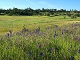
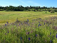
. Butte County is the "Land of Natural Wealth and Beauty."
Butte County is watered by the Feather River
and the Sacramento River
. Butte Creek and Big Chico Creek
are additional perennial streams, both tributary to the Sacramento. The county is the home of California State University, Chico
and of Butte Community College.
There are four major hospitals and the State of California defines Butte County as being inside Health Service Area 1. A special district, the Butte County Air Quality Management District, regulates airborne pollutant emissions in the county. It does this following regional regulations, state, and federal laws. For example, in recent years, the agency changed rules that used to allow residents to burn household trash outdoors.
The county is drained by the Feather River
and Butte Creek. Part of the county's western border is formed by the Sacramento River
. The county lies along the western slope of the Sierra Nevada, the steep slopes making it prime territory for the siting of hydroelectric power plants. About a half dozen of these plants are located in the county.
or the B-Line, provides service in and between Chico, Oroville, Paradise, Gridley and Biggs. Chico is also a connection point for Glenn Ride buses to Glenn County and Plumas Transit Systems buses to Plumas County.
Greyhound
buses stop in Chico.
, and 10,444 (4.7%) from two or more races. Hispanic or Latino of any race were 31,116 persons (14.1%).
, 1.39% Black
or African American
, 1.90% Native American
, 3.32% Asian
, 0.15% Pacific Islander
, 4.82% from other races
, and 3.90% from two or more races. 10.50% of the population were Hispanic
or Latino
of any race. 14.2% were of German, 11.1% English, 10.2% Irish, 7.8% American and 5.6% Italian ancestry according to Census 2000. 87.9% spoke English, 7.8% Spanish and 1.4% Hmong
as their first language.
There were 79,566 households out of which 28.40% had children under the age of 18 living with them, 46.70% were married couples living together, 11.20% had a female householder with no husband present, and 37.90% were non-families. 27.20% of all households were made up of individuals and 11.10% had someone living alone who was 65 years of age or older. The average household size was 2.48 and the average family size was 3.02.
In the county the population was spread out with 24.00% under the age of 18, 13.60% from 18 to 24, 24.80% from 25 to 44, 21.80% from 45 to 64, and 15.80% who were 65 years of age or older. The median age was 36 years. For every 100 females there were 96.10 males. For every 100 females age 18 and over, there were 92.60 males.
The median income for a household in the county was $31,924, and the median income for a family was $41,010. Males had a median income of $34,137 versus $25,393 for females. The per capita income for the county was $17,517. About 12.20% of families and 19.80% of the population were below the poverty line, including 23.80% of those under age 18 and 7.30% of those age 65 or over.
.
is headquartered in Oroville
. The Berry Creek Rancheria operates Gold Country Casino.
The Mooretown Rancheria of Maidu
Indians of California is also headquartered in Oroville. The Mooretown Rancheria operates Feather Falls Casino.
The governmental headquarters of the Mechoopda Indian Tribe of Chico Rancheria
is located in Chico
.
-Chico), and the 2nd by Jim Nielsen
(R
-Richvale) in the California State Assembly
. All of Butte County falls within the 4th senate district, represented by Doug LaMalfa
(R
, Grass Valley) in the California State Senate
.
On Nov. 4, 2008 Butte County voted 56.7 % for Proposition 8 which amended the California Constitution to ban same-sex marriages.
by Republican Wally Herger
, while the rest of the county is represented in California's 4th congressional district
by Republican Tom McClintock
.
Butte is a Republican
-leaning county in Presidential
and congressional
elections. The last Democrat to win a majority in the county was Lyndon Johnson
in 1964
, although Bill Clinton
and Barack Obama
won pluralities in 1992 and 2008, respectively.
Butte County contains the following colleges and universities:
, Chico
, Durham
, Gridley
, Oroville
and Paradise
. The mission of the Butte County Library is to provide all individuals, regardless of age, ethnic background, educational or economic level, with free access to ideas, information, and technology.
The library bookmobile provides library services to rural and mountain communities. The library serves low-literacy adults through several programs of the Butte County Library Literacy Services division, including the Adult Reading Program, Families for Literacy and the Literacy Coach, a 36 feet (11 m) vehicle that provides mobile programming like story times, parent meetings, workshops, and computer and teacher trainings.
The library operates as a department of the county of Butte, governed by the Butte County Board of Supervisors
.
, The Outlaw Josey Wales
, Friendly Persuasion, Magic Town
, The Klansman
, Ruby Ridge: An American Tragedy, The Adventures of Robin Hood and Under Wraps
.
County (United States)
In the United States, a county is a geographic subdivision of a state , usually assigned some governmental authority. The term "county" is used in 48 of the 50 states; Louisiana is divided into parishes and Alaska into boroughs. Parishes and boroughs are called "county-equivalents" by the U.S...
located in the Central Valley
California Central Valley
California's Central Valley is a large, flat valley that dominates the central portion of California. It is home to California's most productive agricultural efforts. The valley stretches approximately from northwest to southeast inland and parallel to the Pacific Ocean coast. Its northern half is...
of the US state of California, north of the state capital of Sacramento
Sacramento, California
Sacramento is the capital city of the U.S. state of California and the county seat of Sacramento County. It is located at the confluence of the Sacramento River and the American River in the northern portion of California's expansive Central Valley. With a population of 466,488 at the 2010 census,...
. As of the 2010 census, it had a population of 220,000. The county seat
County seat
A county seat is an administrative center, or seat of government, for a county or civil parish. The term is primarily used in the United States....
is Oroville
Oroville, California
Oroville is the county seat of Butte County, California. The population was 15,506 at the 2010 census, up from 13,004 at the 2000 census...
. Butte County is the "Land of Natural Wealth and Beauty."
Butte County is watered by the Feather River
Feather River
The Feather River is the principal tributary of the Sacramento River, in the Sacramento Valley of Northern California. The river's main stem is about long. Its length to its most distant headwater tributary is about . Its drainage basin is about...
and the Sacramento River
Sacramento River
The Sacramento River is an important watercourse of Northern and Central California in the United States. The largest river in California, it rises on the eastern slopes of the Klamath Mountains, and after a journey south of over , empties into Suisun Bay, an arm of the San Francisco Bay, and...
. Butte Creek and Big Chico Creek
Big Chico Creek
Big Chico Creek originates on Colby Mountain, located in Tehama County, California. The creek flows to its confluence with the Sacramento River in Butte County...
are additional perennial streams, both tributary to the Sacramento. The county is the home of California State University, Chico
California State University, Chico
California State University, Chico is the second-oldest campus in the twenty-three-campus California State University system. It is located in Chico, California, about ninety miles north of Sacramento...
and of Butte Community College.
There are four major hospitals and the State of California defines Butte County as being inside Health Service Area 1. A special district, the Butte County Air Quality Management District, regulates airborne pollutant emissions in the county. It does this following regional regulations, state, and federal laws. For example, in recent years, the agency changed rules that used to allow residents to burn household trash outdoors.
Geography
According to the 2000 census, the county has a total area of 1677.11 square miles (4,343.7 km²), of which 1639.49 square miles (4,246.3 km²) (or 97.76%) is land and 37.62 square miles (97.4 km²) (or 2.24%) is water.The county is drained by the Feather River
Feather River
The Feather River is the principal tributary of the Sacramento River, in the Sacramento Valley of Northern California. The river's main stem is about long. Its length to its most distant headwater tributary is about . Its drainage basin is about...
and Butte Creek. Part of the county's western border is formed by the Sacramento River
Sacramento River
The Sacramento River is an important watercourse of Northern and Central California in the United States. The largest river in California, it rises on the eastern slopes of the Klamath Mountains, and after a journey south of over , empties into Suisun Bay, an arm of the San Francisco Bay, and...
. The county lies along the western slope of the Sierra Nevada, the steep slopes making it prime territory for the siting of hydroelectric power plants. About a half dozen of these plants are located in the county.
Cities and towns
- BiggsBiggs, CaliforniaBiggs is a city in Butte County, California, United States. The population was 1,707 at the 2010 census, down from 1,793 at the 2000 census.- Geography :Biggs is located at ....
- ChicoChico, CaliforniaChico is the most populous city in Butte County, California, United States. The population was 86,187 at the 2010 census, up from 59,954 at the time of the 2000 census...
, home of CSU Chico - GridleyGridley, CaliforniaGridley is a city in Butte County, California, United States. The population was 6,584 at the 2010 census, up from 5,382 at the 2000 census.-History:...
- OrovilleOroville, CaliforniaOroville is the county seat of Butte County, California. The population was 15,506 at the 2010 census, up from 13,004 at the 2000 census...
- ParadiseParadise, CaliforniaParadise is an incorporated town in Butte County, in the northwest foothills of California's Central Valley, in the Sierra. The town is considered part of the Chico Metropolitan Area. The population was 26,218 at the 2010 census, down from 26,408 at the 2000 census...
Unincorporated communities
- BangorBangor, CaliforniaBangor is a census-designated place inside Butte County, California, about from the Yuba County line. The U.S. Geological Survey feature ID for the community is 218644, and for the census place is 2612459; and the elevation is given as above mean sea level . The community is in a shallow valley...
- CherokeeCherokee, CaliforniaCherokee is a census-designated place in Butte County, California An area inhabited by Maidu Indians prior to the gold rush. But that conversly takes its name from a band of Cherokee prospectors who perfected a mining claim on the site. The population was 69 at the 2010 census...
- CohassetCohasset, CaliforniaCohasset is a census-designated place in Butte County, California, United States, approximately NNE of Chico, California. Its main street is named Cohasset Road, which comes from the Algonquian Indian language and means "long rocky place"...
- ConcowConcow, CaliforniaConcow is an unincorporated community and census-designated place in Butte County, California, United States. It is named after the Native American tribe that is indigenous to the area, the Concow Maidu...
- DurhamDurham, CaliforniaDurham is a census-designated place in Butte County, California, United States. The population was 5,518 at the 2010 census.-Geography:...
- Forest RanchForest Ranch, CaliforniaForest Ranch is a census-designated place in Butte County, California. It includes Forest Ranch Elementary School , its own post office, and a CDF fire station. The community's ZIP code is 95942, and is shared with the community of Butte Meadows. The area code is 530...
- MagaliaMagalia, CaliforniaMagalia is a census-designated place in Butte County, California, United States. The population was 11,310 at the 2010 census.-History:...
- Oroville EastOroville East, CaliforniaOroville East or Kelly Ridge is a census-designated place in Butte County, California, United States. The population was 8,280 at the 2010 census, down from 8,680 at the 2000 census...
- PalermoPalermo, CaliforniaPalermo is a census-designated place in Butte County, California, United States. The population was 5,382 at the 2010 census, down from 5,720 at the 2000 census.-Geography:...
- RichvaleRichvale, CaliforniaRichvale is a small census-designated place in Butte County, California, USA, south of Chico and west of Oroville. The primary crop grown in the area surrounding Richvale is rice, irrigated from the Oroville Dam on the Feather River. Several farmers in the area are known for organic farming...
- South OrovilleSouth Oroville, CaliforniaSouth Oroville is a census-designated place in Butte County, California, United States. The population was 5,742 at the 2010 census, down from 7,695 at the 2000 census.For all practical purposes, South Oroville is tied to Oroville proper...
- Stirling CityStirling City, CaliforniaStirling City is a census-designated place in Butte County, California, located on Paradise Ridge in the western foothills of the Sierra Nevada. Contrary to its name, Stirling City is an unincorporated community. Its ZIP Code is 95978 and area code 530. It lies at an elevation of 3570 feet...
- ThermalitoThermalito, CaliforniaThermalito is a census-designated place in Butte County, California, United States. The population was 6,646 at the 2010 census, up from 6,045 at the 2000 census...
- Yankee HillYankee Hill, Butte County, CaliforniaYankee Hill is a census-designated place in Butte County, California. It is located east-southeast of Paradise, at an elevation of 1982 feet . The population was 333 at the 2010 census.-History:...
Ghost towns
- Hamilton – the original county seatCounty seatA county seat is an administrative center, or seat of government, for a county or civil parish. The term is primarily used in the United States....
of Butte County, this city has long been forgotten; the only reminder of it is now an overgrown cemetery. - Bidwell's Bar – now located under Lake OrovilleLake OrovilleLake Oroville, also known as Lake Edmonston, is a reservoir in the U.S. state of California, formed by the Oroville Dam across the Feather River. The lake is situated in the foothills of the Sierra Nevada about northeast of Oroville. At over , it is one of the largest reservoirs in California,...
- Forks of Butte
Adjacent counties
- Yuba County, CaliforniaYuba County, CaliforniaYuba County is a county located in the U.S. state of California's Central Valley, north of Sacramento, along the Feather River. As of the 2010 census, its population was 72,155. The county seat is Marysville. Yuba County is part of the Greater Sacramento area.-History:Yuba County was one of the...
– south - Sutter County, CaliforniaSutter County, CaliforniaSutter County is a county located along the Sacramento River in the Central Valley of the U.S. state of California, north of state capital Sacramento. Sutter County is part of the Greater Sacramento CSA....
– south - Colusa County, CaliforniaColusa County, CaliforniaColusa County is a county located in the Central Valley of the U.S. state of California, northwest of state capital Sacramento. As of the 2010 census, its population was 21,419. The county seat is Colusa.-History:...
– southwest - Glenn County, CaliforniaGlenn County, CaliforniaGlenn County is in the California Central Valley. As of 2010, it had a population of 28,122. The county seat is the city of Willows.-History:Glenn County was formed in 1891 from parts of Colusa County. It was named for Dr. Hugh J...
– west - Tehama County, CaliforniaTehama County, CaliforniaTehama County is a county located in the northern part of the U.S. state of California. It is bisected by the Sacramento River. As of 2010 its population was 63,463, up from 56,039 as of 2000. The county seat is Red Bluff.-History:...
– north - Plumas County, CaliforniaPlumas County, CaliforniaPlumas County is a county located in the Sierra Nevada of the U.S. state of California. The county gets its name from the Spanish words for the Feather River , which flows through the county. As of the 2010 census, the population 20,007, down from 20,824 at the 2000 census...
– east
National protected areas
- Butte Sink National Wildlife RefugeButte Sink National Wildlife RefugeButte Sink National Wildlife Refuge is a National Wildlife Refuge in California. Located in Colusa, Butte, and Sutter Counties, it is wetlands managed as part of the Sacramento National Wildlife Refuge Complex.-References:*...
(part) - Lassen National ForestLassen National ForestLassen National Forest is a national forest of 1,700 square miles in northeastern California. It is named after pioneer Peter Lassen, who mined, ranched and promoted the area to emigrant parties in the 1850s.- Overview :...
(part) - Plumas National ForestPlumas National ForestPlumas National Forest is a 1,146,000-acre United States National Forest located in the Sierra Nevada, in northern California.-Geography:...
(part) - Sacramento River National Wildlife RefugeSacramento River National Wildlife RefugeSacramento River National Wildlife Refuge is located along the Sacramento River in the Sacramento Valley of California. Landscape is very flat, bordered by the Sierra and Coast ranges, with intensive agriculture...
(part)
Major highways
- State Route 32
 California State Route 32State Route 32 is an east–west state highway in the U.S. State of California which is routed from Interstate 5 in Orland, through Chico, through the northern Sierra Nevada, ending at SR 36 and SR 89 in eastern Tehama County.-Route description:...
 - State Route 70
 California State Route 70State Route 70 is a state highway in the U.S. state of California. Connecting Sacramento with U.S. Route 395 near Beckwourth Pass via the Feather River Canyon, it was formerly known as U.S. Route 40 Alternate, crossing the Sierra Nevada at a lower elevation than Donner Pass on U.S. Route 40...
 - State Route 99
 California State Route 99California State Route 99 , commonly known as Highway 99 or, simply, as 99 , is a north–south state highway in the U.S. state of California, stretching almost the entire length of the Central Valley...
Public transportation
Butte Regional TransitButte Regional Transit
Butte Regional Transit is a public transit system which provides bus service in the communities of Biggs, Chico, Gridley, Magalia, Oroville, Palermo, Paradise and across Butte County, California. B-Line is the consolidation of CATS in Chico, OATS in Oroville and BCT in Butte County.-Butte Regional...
or the B-Line, provides service in and between Chico, Oroville, Paradise, Gridley and Biggs. Chico is also a connection point for Glenn Ride buses to Glenn County and Plumas Transit Systems buses to Plumas County.
Greyhound
Greyhound Lines
Greyhound Lines, Inc., based in Dallas, Texas, is an intercity common carrier of passengers by bus serving over 3,700 destinations in the United States, Canada and Mexico, operating under the well-known logo of a leaping greyhound. It was founded in Hibbing, Minnesota, USA, in 1914 and...
buses stop in Chico.
Airports
General Aviation airports in Butte County include:- Chico Municipal AirportChico Municipal AirportChico Municipal Airport , often called CMA, is a public airport located four miles north of the central business district of Chico, a city in Butte County, California, United States. The airport covers 1,475 acres and has two runways and one helipad. It is mostly used for general aviation, but...
- Oroville Municipal AirportOroville Municipal AirportOroville Municipal Airport is a public airport located 3 miles southwest of the city of Oroville in Butte County, California, USA.- Facilities :Oroville Municipal Airport covers and has two runways:...
- Paradise Airport
- Ranchaero Airport
- Richvale Airport
Demographics
2010
The 2010 United States Census reported that Butte County had a population of 220,000. The racial makeup of Butte County was 180,096 (81.9%) White, 3,415 (1.6%) African American, 4,395 (2.0%) Native American, 9,057 (4.1%) Asian, 452 (0.2%) Pacific Islander, 12,141 (5.5%) from other racesRace (United States Census)
Race and ethnicity in the United States Census, as defined by the Federal Office of Management and Budget and the United States Census Bureau, are self-identification data items in which residents choose the race or races with which they most closely identify, and indicate whether or not they are...
, and 10,444 (4.7%) from two or more races. Hispanic or Latino of any race were 31,116 persons (14.1%).
| Population reported at 2010 United States Census | |||||||||
|---|---|---|---|---|---|---|---|---|---|
Butte County, California Butte County is a county located in the Central Valley of the US state of California, north of the state capital of Sacramento. As of the 2010 census, it had a population of 220,000. The county seat is Oroville. Butte County is the "Land of Natural Wealth and Beauty."Butte County is watered by the... |
Population |
American |
American |
|
Islander |
races Race (United States Census) Race and ethnicity in the United States Census, as defined by the Federal Office of Management and Budget and the United States Census Bureau, are self-identification data items in which residents choose the race or races with which they most closely identify, and indicate whether or not they are... |
more races |
or Latino (of any race) |
|
| Butte County Butte County, California Butte County is a county located in the Central Valley of the US state of California, north of the state capital of Sacramento. As of the 2010 census, it had a population of 220,000. The county seat is Oroville. Butte County is the "Land of Natural Wealth and Beauty."Butte County is watered by the... |
220,000 | 180,096 | 3,415 | 4,395 | 9,057 | 452 | 12,141 | 10,444 | 31,116 |
cities and towns |
Population |
American |
American |
|
Islander |
races Race (United States Census) Race and ethnicity in the United States Census, as defined by the Federal Office of Management and Budget and the United States Census Bureau, are self-identification data items in which residents choose the race or races with which they most closely identify, and indicate whether or not they are... |
more races |
or Latino (of any race) |
|
| Biggs Biggs, California Biggs is a city in Butte County, California, United States. The population was 1,707 at the 2010 census, down from 1,793 at the 2000 census.- Geography :Biggs is located at .... |
1,707 | 1,302 | 11 | 54 | 9 | 1 | 252 | 78 | 580 |
| Chico Chico, California Chico is the most populous city in Butte County, California, United States. The population was 86,187 at the 2010 census, up from 59,954 at the time of the 2000 census... |
86,187 | 69,606 | 1,771 | 1,167 | 3,656 | 210 | 5,437 | 4,340 | 13,315 |
| Gridley Gridley, California Gridley is a city in Butte County, California, United States. The population was 6,584 at the 2010 census, up from 5,382 at the 2000 census.-History:... |
6,584 | 4,283 | 55 | 98 | 249 | 3 | 1,552 | 344 | 3,000 |
| Oroville Oroville, California Oroville is the county seat of Butte County, California. The population was 15,506 at the 2010 census, up from 13,004 at the 2000 census... |
15,546 | 11,686 | 453 | 573 | 1,238 | 56 | 554 | 986 | 1,945 |
| Paradise Paradise, California Paradise is an incorporated town in Butte County, in the northwest foothills of California's Central Valley, in the Sierra. The town is considered part of the Chico Metropolitan Area. The population was 26,218 at the 2010 census, down from 26,408 at the 2000 census... |
26,218 | 24,129 | 112 | 301 | 330 | 24 | 416 | 906 | 1,836 |
places Census-designated place A census-designated place is a concentration of population identified by the United States Census Bureau for statistical purposes. CDPs are delineated for each decennial census as the statistical counterparts of incorporated places such as cities, towns and villages... |
Population |
American |
American |
|
Islander |
races Race (United States Census) Race and ethnicity in the United States Census, as defined by the Federal Office of Management and Budget and the United States Census Bureau, are self-identification data items in which residents choose the race or races with which they most closely identify, and indicate whether or not they are... |
more races |
or Latino (of any race) |
|
| Bangor Bangor, California Bangor is a census-designated place inside Butte County, California, about from the Yuba County line. The U.S. Geological Survey feature ID for the community is 218644, and for the census place is 2612459; and the elevation is given as above mean sea level . The community is in a shallow valley... |
646 | 543 | 5 | 17 | 4 | 1 | 18 | 58 | 47 |
| Berry Creek Berry Creek, California Berry Creek is a census-designated place about northeast of Oroville, California in hilly terrain at above mean sea level. The community is located along Oroville-Quincy Highway on the shore of Madrone Lake. The US Geological Survey shows coordinates of for the town. The community is home to... |
1,424 | 1,249 | 8 | 48 | 13 | 3 | 13 | 90 | 98 |
| Butte Creek Canyon Butte Creek Canyon, California Butte Creek Canyon is a census-designated place in Butte County, California. Butte Creek Canyon sits at an elevation of 1024 feet . The 2010 United States census reported Butte Creek Canyon's population was 1,086.-Demographics:... |
1,086 | 1,011 | 0 | 20 | 18 | 1 | 8 | 28 | 48 |
| Butte Meadows Butte Meadows, California Butte Meadows is a census-designated place in Butte County, California, 5 miles off State Route 32 on Humboldt Rd. The area is about 45 minutes or east of Chico on SR32. Its elevation is listed at above sea level: certain to get snow in winter of any year. The area code is Area code 530. The area... |
40 | 38 | 0 | 0 | 0 | 0 | 0 | 2 | 0 |
| Butte Valley Butte Valley, California Butte Valley is a census-designated place named for a former settlement in Butte County, California, United States. It is located southeast of Chico. A post office operated at Butte Valley from 1861 to 1871, when it was re-located to Durham. Butte Valley sits at an elevation of 351 feet... |
899 | 782 | 0 | 19 | 9 | 1 | 42 | 46 | 89 |
| Cherokee Cherokee, California Cherokee is a census-designated place in Butte County, California An area inhabited by Maidu Indians prior to the gold rush. But that conversly takes its name from a band of Cherokee prospectors who perfected a mining claim on the site. The population was 69 at the 2010 census... |
69 | 48 | 0 | 2 | 8 | 0 | 0 | 11 | 1 |
| Clipper Mills Clipper Mills, California Clipper Mills is a census-designated place in Butte County, California. It lies at an elevation of 3550 feet . The local newspaper is the Rabbit Creek Journal. Clipper Mills has a post office, first established in 1861 and moved in 1891. Its zip code is 95930... |
142 | 131 | 0 | 3 | 0 | 0 | 2 | 6 | 5 |
| Cohasset Cohasset, California Cohasset is a census-designated place in Butte County, California, United States, approximately NNE of Chico, California. Its main street is named Cohasset Road, which comes from the Algonquian Indian language and means "long rocky place"... |
847 | 764 | 8 | 14 | 2 | 1 | 20 | 38 | 43 |
| Concow Concow, California Concow is an unincorporated community and census-designated place in Butte County, California, United States. It is named after the Native American tribe that is indigenous to the area, the Concow Maidu... |
710 | 611 | 0 | 24 | 5 | 3 | 10 | 57 | 56 |
| Durham Durham, California Durham is a census-designated place in Butte County, California, United States. The population was 5,518 at the 2010 census.-Geography:... |
5,518 | 5,088 | 19 | 55 | 35 | 9 | 165 | 147 | 614 |
| Forbestown Forbestown, California Forbestown is a census-designated place in Butte County, California. It lies at an elevation of 2772 feet . Its zip code is 95941 and its area code is 530. Forbestown had a population of 320 at the 2010 census.Forbestown is named for B.F. Forbes, who opened a store there in 1850... |
320 | 262 | 4 | 15 | 10 | 0 | 4 | 25 | 23 |
| Forest Ranch Forest Ranch, California Forest Ranch is a census-designated place in Butte County, California. It includes Forest Ranch Elementary School , its own post office, and a CDF fire station. The community's ZIP code is 95942, and is shared with the community of Butte Meadows. The area code is 530... |
1,184 | 1,116 | 8 | 6 | 4 | 1 | 20 | 29 | 52 |
| Honcut Honcut, California Honcut is a census-designated place in Butte County, California. It lies at an elevation of 108 feet . Lower Honcut Rd. links the community to California State Route 70. Honcut is near the Yuba County line... |
370 | 248 | 6 | 14 | 4 | 0 | 85 | 13 | 145 |
| Kelly Ridge Kelly Ridge, California Kelly Ridge is a census-designated place in Butte County, California. Kelly Ridge sits at an elevation of 1050 feet . The 2010 United States census reported Kelly Ridge's population was 2,544.-Demographics:... |
2,544 | 2,287 | 20 | 56 | 35 | 7 | 43 | 96 | 204 |
| Magalia Magalia, California Magalia is a census-designated place in Butte County, California, United States. The population was 11,310 at the 2010 census.-History:... |
11,310 | 10,398 | 40 | 141 | 90 | 17 | 134 | 490 | 765 |
| Nord Nord, California Nord is a census-designated place in Butte County, California. Its zip code is 95926 and its area code is 530. It lies at an elevation of 151 feet... |
320 | 233 | 1 | 6 | 16 | 0 | 48 | 16 | 122 |
| Oroville East Oroville East, California Oroville East or Kelly Ridge is a census-designated place in Butte County, California, United States. The population was 8,280 at the 2010 census, down from 8,680 at the 2000 census... |
8,280 | 6,830 | 126 | 477 | 294 | 8 | 147 | 398 | 702 |
| Palermo Palermo, California Palermo is a census-designated place in Butte County, California, United States. The population was 5,382 at the 2010 census, down from 5,720 at the 2000 census.-Geography:... |
5,382 | 3,901 | 39 | 221 | 246 | 4 | 642 | 329 | 1,281 |
| Rackerby Rackerby, California Rackerby is a census-designated place in Yuba County, California. It is located north-northeast of Marysville, at an elevation of 1378 feet ; part of the unincorporated community is located in Butte County... |
204 | 193 | 0 | 1 | 0 | 0 | 3 | 7 | 18 |
| Richvale Richvale, California Richvale is a small census-designated place in Butte County, California, USA, south of Chico and west of Oroville. The primary crop grown in the area surrounding Richvale is rice, irrigated from the Oroville Dam on the Feather River. Several farmers in the area are known for organic farming... |
244 | 216 | 0 | 11 | 0 | 0 | 10 | 7 | 27 |
| Robinson Mill | 80 | 74 | 0 | 1 | 0 | 1 | 0 | 4 | 11 |
| South Oroville South Oroville, California South Oroville is a census-designated place in Butte County, California, United States. The population was 5,742 at the 2010 census, down from 7,695 at the 2000 census.For all practical purposes, South Oroville is tied to Oroville proper... |
5,742 | 3,407 | 406 | 245 | 885 | 9 | 361 | 429 | 851 |
| Stirling City Stirling City, California Stirling City is a census-designated place in Butte County, California, located on Paradise Ridge in the western foothills of the Sierra Nevada. Contrary to its name, Stirling City is an unincorporated community. Its ZIP Code is 95978 and area code 530. It lies at an elevation of 3570 feet... |
295 | 264 | 1 | 11 | 0 | 0 | 1 | 18 | 17 |
| Thermalito Thermalito, California Thermalito is a census-designated place in Butte County, California, United States. The population was 6,646 at the 2010 census, up from 6,045 at the 2000 census... |
6,646 | 4,594 | 61 | 257 | 1,102 | 37 | 270 | 325 | 713 |
| Yankee Hill Yankee Hill, Butte County, California Yankee Hill is a census-designated place in Butte County, California. It is located east-southeast of Paradise, at an elevation of 1982 feet . The population was 333 at the 2010 census.-History:... |
333 | 305 | 2 | 7 | 4 | 0 | 5 | 10 | 22 |
communities Unincorporated area In law, an unincorporated area is a region of land that is not a part of any municipality.To "incorporate" in this context means to form a municipal corporation, a city, town, or village with its own government. An unincorporated community is usually not subject to or taxed by a municipal government... |
Population |
American |
American |
|
Islander |
races Race (United States Census) Race and ethnicity in the United States Census, as defined by the Federal Office of Management and Budget and the United States Census Bureau, are self-identification data items in which residents choose the race or races with which they most closely identify, and indicate whether or not they are... |
more races |
or Latino (of any race) |
|
| All others not CDPs (combined) | 29,123 | 24,497 | 259 | 531 | 791 | 55 | 1,879 | 1,111 | 4,486 |
2000
As of the census of 2000, there were 203,171 people, 79,566 households, and 49,410 families residing in the county. The population density was 124 people per square mile (48/km²). There were 85,523 housing units at an average density of 52 per square mile (20/km²). The racial makeup of the county was 84.52% WhiteRace (United States Census)
Race and ethnicity in the United States Census, as defined by the Federal Office of Management and Budget and the United States Census Bureau, are self-identification data items in which residents choose the race or races with which they most closely identify, and indicate whether or not they are...
, 1.39% Black
Race (United States Census)
Race and ethnicity in the United States Census, as defined by the Federal Office of Management and Budget and the United States Census Bureau, are self-identification data items in which residents choose the race or races with which they most closely identify, and indicate whether or not they are...
or African American
Race (United States Census)
Race and ethnicity in the United States Census, as defined by the Federal Office of Management and Budget and the United States Census Bureau, are self-identification data items in which residents choose the race or races with which they most closely identify, and indicate whether or not they are...
, 1.90% Native American
Race (United States Census)
Race and ethnicity in the United States Census, as defined by the Federal Office of Management and Budget and the United States Census Bureau, are self-identification data items in which residents choose the race or races with which they most closely identify, and indicate whether or not they are...
, 3.32% Asian
Race (United States Census)
Race and ethnicity in the United States Census, as defined by the Federal Office of Management and Budget and the United States Census Bureau, are self-identification data items in which residents choose the race or races with which they most closely identify, and indicate whether or not they are...
, 0.15% Pacific Islander
Race (United States Census)
Race and ethnicity in the United States Census, as defined by the Federal Office of Management and Budget and the United States Census Bureau, are self-identification data items in which residents choose the race or races with which they most closely identify, and indicate whether or not they are...
, 4.82% from other races
Race (United States Census)
Race and ethnicity in the United States Census, as defined by the Federal Office of Management and Budget and the United States Census Bureau, are self-identification data items in which residents choose the race or races with which they most closely identify, and indicate whether or not they are...
, and 3.90% from two or more races. 10.50% of the population were Hispanic
Race (United States Census)
Race and ethnicity in the United States Census, as defined by the Federal Office of Management and Budget and the United States Census Bureau, are self-identification data items in which residents choose the race or races with which they most closely identify, and indicate whether or not they are...
or Latino
Race (United States Census)
Race and ethnicity in the United States Census, as defined by the Federal Office of Management and Budget and the United States Census Bureau, are self-identification data items in which residents choose the race or races with which they most closely identify, and indicate whether or not they are...
of any race. 14.2% were of German, 11.1% English, 10.2% Irish, 7.8% American and 5.6% Italian ancestry according to Census 2000. 87.9% spoke English, 7.8% Spanish and 1.4% Hmong
Hmong language
Hmong or Mong is the common name for a dialect continuum of the West Hmongic branch of the Hmong–Mien/Miao–Yao language family spoken by the Hmong people of Sichuan, Yunnan, Guizhou, Guangxi, northern Vietnam, Thailand, and Laos...
as their first language.
There were 79,566 households out of which 28.40% had children under the age of 18 living with them, 46.70% were married couples living together, 11.20% had a female householder with no husband present, and 37.90% were non-families. 27.20% of all households were made up of individuals and 11.10% had someone living alone who was 65 years of age or older. The average household size was 2.48 and the average family size was 3.02.
In the county the population was spread out with 24.00% under the age of 18, 13.60% from 18 to 24, 24.80% from 25 to 44, 21.80% from 45 to 64, and 15.80% who were 65 years of age or older. The median age was 36 years. For every 100 females there were 96.10 males. For every 100 females age 18 and over, there were 92.60 males.
The median income for a household in the county was $31,924, and the median income for a family was $41,010. Males had a median income of $34,137 versus $25,393 for females. The per capita income for the county was $17,517. About 12.20% of families and 19.80% of the population were below the poverty line, including 23.80% of those under age 18 and 7.30% of those age 65 or over.
Government
| Year | GOP Republican Party (United States) The Republican Party is one of the two major contemporary political parties in the United States, along with the Democratic Party. Founded by anti-slavery expansion activists in 1854, it is often called the GOP . The party's platform generally reflects American conservatism in the U.S... |
DEM Democratic Party (United States) The Democratic Party is one of two major contemporary political parties in the United States, along with the Republican Party. The party's socially liberal and progressive platform is largely considered center-left in the U.S. political spectrum. The party has the lengthiest record of continuous... |
Others |
|---|---|---|---|
| 2008 United States presidential election, 2008 The United States presidential election of 2008 was the 56th quadrennial presidential election. It was held on November 4, 2008. Democrat Barack Obama, then the junior United States Senator from Illinois, defeated Republican John McCain, the senior U.S. Senator from Arizona. Obama received 365... |
49.9% 49,013 | 2.7% 2,606 | |
| 2004 United States presidential election, 2004 The United States presidential election of 2004 was the United States' 55th quadrennial presidential election. It was held on Tuesday, November 2, 2004. Republican Party candidate and incumbent President George W. Bush defeated Democratic Party candidate John Kerry, the then-junior U.S. Senator... |
44.1% 42,448 | 2.1% 2,047 | |
| 2000 United States presidential election, 2000 The United States presidential election of 2000 was a contest between Republican candidate George W. Bush, then-governor of Texas and son of former president George H. W. Bush , and Democratic candidate Al Gore, then-Vice President.... |
37.4% 31,338 | 8.1% 6,799 | |
| 1996 United States presidential election, 1996 The United States presidential election of 1996 was a contest between the Democratic national ticket of President Bill Clinton of Arkansas and Vice President Al Gore of Tennessee and the Republican national ticket of former Senator Bob Dole of Kansas for President and former Housing Secretary Jack... |
38.5% 30,651 | 12.5% 9,938 | |
| 1992 United States presidential election, 1992 The United States presidential election of 1992 had three major candidates: Incumbent Republican President George Bush; Democratic Arkansas Governor Bill Clinton, and independent Texas businessman Ross Perot.... |
38.2% 32,489 | 24.6% 20,917 | |
| 1988 United States presidential election, 1988 The United States presidential election of 1988 featured no incumbent president, as President Ronald Reagan was unable to seek re-election after serving the maximum two terms allowed by the Twenty-second Amendment. Reagan's Vice President, George H. W. Bush, won the Republican nomination, while the... |
42.5% 30,406 | 1.5% 1,082 | |
| 1984 United States presidential election, 1984 The United States presidential election of 1984 was a contest between the incumbent President Ronald Reagan, the Republican candidate, and former Vice President Walter Mondale, the Democratic candidate. Reagan was helped by a strong economic recovery from the deep recession of 1981–1982... |
35.3% 25,421 | 1.6% 1,162 | |
| 1980 United States presidential election, 1980 The United States presidential election of 1980 featured a contest between incumbent Democrat Jimmy Carter and his Republican opponent, Ronald Reagan, as well as Republican Congressman John B. Anderson, who ran as an independent... |
29.6% 19,520 | 12.6% 8,304 | |
| 1976 United States presidential election, 1976 The United States presidential election of 1976 followed the resignation of President Richard Nixon in the wake of the Watergate scandal. It pitted incumbent President Gerald Ford, the Republican candidate, against the relatively unknown former governor of Georgia, Jimmy Carter, the Democratic... |
44.1% 24,203 | 4.1% 2,251 | |
| 1972 United States presidential election, 1972 The United States presidential election of 1972 was the 47th quadrennial United States presidential election. It was held on November 7, 1972. The Democratic Party's nomination was eventually won by Senator George McGovern, who ran an anti-war campaign against incumbent Republican President Richard... |
36.8% 18,401 | 5.6% 2,808 | |
| 1968 United States presidential election, 1968 The United States presidential election of 1968 was the 46th quadrennial United States presidential election. Coming four years after Democrat Lyndon B. Johnson won in a historic landslide, it saw Johnson forced out of the race and Republican Richard Nixon elected... |
32.9% 12,887 | 10.5% 4,099 | |
| 1964 United States presidential election, 1964 The United States presidential election of 1964 was held on November 3, 1964. Incumbent President Lyndon B. Johnson had come to office less than a year earlier following the assassination of his predecessor, John F. Kennedy. Johnson, who had successfully associated himself with Kennedy's... |
51.5% 20,831 | 0.0% 14 | |
| 1960 United States presidential election, 1960 The United States presidential election of 1960 was the 44th American presidential election, held on November 8, 1960, for the term beginning January 20, 1961, and ending January 20, 1965. The incumbent president, Republican Dwight D. Eisenhower, was not eligible to run again. The Republican Party... |
41.9% 15,163 | 0.5% 174 | |
| 1956 United States presidential election, 1956 The United States presidential election of 1956 saw a popular Dwight D. Eisenhower successfully run for re-election. The 1956 election was a rematch of 1952, as Eisenhower's opponent in 1956 was Democrat Adlai Stevenson, whom Eisenhower had defeated four years earlier.Incumbent President Eisenhower... |
41.1% 12,933 | 0.5% 147 | |
| 1952 United States presidential election, 1952 The United States presidential election of 1952 took place in an era when Cold War tension between the United States and the Soviet Union was escalating rapidly. In the United States Senate, Republican Senator Joseph McCarthy of Wisconsin had become a national figure after chairing congressional... |
35.9% 10,913 | 0.9% 263 | |
| 1948 United States presidential election, 1948 The United States presidential election of 1948 is considered by most historians as the greatest election upset in American history. Virtually every prediction indicated that incumbent President Harry S. Truman would be defeated by Republican Thomas E. Dewey. Truman won, overcoming a three-way... |
45.7% 10,133 | 5.0% 1,100 | |
| 1944 United States presidential election, 1944 The United States presidential election of 1944 took place while the United States was preoccupied with fighting World War II. President Franklin D. Roosevelt had been in office longer than any other president, but remained popular. Unlike 1940, there was little doubt that Roosevelt would run for... |
52.6% 8,811 | 0.6% 105 | |
| 1940 United States presidential election, 1940 The United States presidential election of 1940 was fought in the shadow of World War II as the United States was emerging from the Great Depression. Incumbent President Franklin D. Roosevelt , a Democrat, broke with tradition and ran for a third term, which became a major issue... |
58.2% 10,684 | 1.4% 255 | |
| 1936 United States presidential election, 1936 The United States presidential election of 1936 was the most lopsided presidential election in the history of the United States in terms of electoral votes. In terms of the popular vote, it was the third biggest victory since the election of 1820, which was not seriously contested.The election took... |
65.9% 10,490 | 2.1% 335 | |
| 1932 United States presidential election, 1932 The United States presidential election of 1932 took place as the effects of the Wall Street Crash of 1929, the Smoot-Hawley Tariff Act of 1930, the Revenue Act of 1932, and the Great Depression were being felt intensely across the country. President Herbert Hoover's popularity was falling as... |
65.0% 9,645 | 5.8% 865 | |
| 1928 United States presidential election, 1928 The United States presidential election of 1928 pitted Republican Herbert Hoover against Democrat Al Smith. The Republicans were identified with the booming economy of the 1920s, whereas Smith, a Roman Catholic, suffered politically from Anti-Catholic prejudice, his anti-prohibitionist stance, and... |
37.8% 3,946 | 1.7% 180 | |
| 1924 United States presidential election, 1924 The United States presidential election of 1924 was won by incumbent President Calvin Coolidge, the Republican candidate.Coolidge was vice-president under Warren G. Harding and became president in 1923 when Harding died in office. Coolidge was given credit for a booming economy at home and no... |
12.5% 1,299 | 45.2% 4,691 | |
| 1920 United States presidential election, 1920 The United States presidential election of 1920 was dominated by the aftermath of World War I and a hostile response to certain policies of Woodrow Wilson, the Democratic president. The wartime economic boom had collapsed. Politicians were arguing over peace treaties and the question of America's... |
27.5% 2,262 | 6.8% 563 |
Local
The citizens of the county of Butte are represented by the five member Butte County Board of SupervisorsButte County Board of Supervisors
The governing body of Butte County, California. The board consists of five members elected by district for four year terms. As of January 3, 2010, the board of supervisors consisted of Bill Connely, Larry Wahl, Maureen Kirk, Steve Lambert, and Kim Yamaguchi....
.
Tribal
The Berry Creek Rancheria of Tyme Maidu Indians of CaliforniaBerry Creek Rancheria of Maidu Indians of California
The Berry Creek Rancheria of Tyme Maidu Indians are a Native American people inhabiting a northeastern part California, south of Lassen Peak.They are a federally recognized Maidu tribe, headquartered in Oroville in Butte County. Their reservation is , located south of Oroville, and within a mile of...
is headquartered in Oroville
Oroville, California
Oroville is the county seat of Butte County, California. The population was 15,506 at the 2010 census, up from 13,004 at the 2000 census...
. The Berry Creek Rancheria operates Gold Country Casino.
The Mooretown Rancheria of Maidu
Maidu
The Maidu are a group of Native Americans who live in Northern California. They reside in the central Sierra Nevada, in the drainage area of the Feather and American Rivers...
Indians of California is also headquartered in Oroville. The Mooretown Rancheria operates Feather Falls Casino.
The governmental headquarters of the Mechoopda Indian Tribe of Chico Rancheria
Mechoopda
The Mechoopda is a Native American tribe located in northern California. The tribe speaks a language related to Maidu.The tribe was formerly centered in a village located about 3½ miles south of contemporary Chico, California. The Mechoopda became a federally recognized tribe in 1992....
is located in Chico
Chico, California
Chico is the most populous city in Butte County, California, United States. The population was 86,187 at the 2010 census, up from 59,954 at the time of the 2000 census...
.
State
Most of Butte County falls within California's 3rd Assembly District with the southwest corner of the county being in the 2nd Assembly District. The 3rd district is represented by Dan Logue (RRepublican Party (United States)
The Republican Party is one of the two major contemporary political parties in the United States, along with the Democratic Party. Founded by anti-slavery expansion activists in 1854, it is often called the GOP . The party's platform generally reflects American conservatism in the U.S...
-Chico), and the 2nd by Jim Nielsen
Jim Nielsen
James Wiley Nielsen is an American politician from California and a member of the Republican party. Nielsen served on the Yolo County Republican Committee before winning election to the California State Senate in 1978...
(R
Republican Party (United States)
The Republican Party is one of the two major contemporary political parties in the United States, along with the Democratic Party. Founded by anti-slavery expansion activists in 1854, it is often called the GOP . The party's platform generally reflects American conservatism in the U.S...
-Richvale) in the California State Assembly
California State Assembly
The California State Assembly is the lower house of the California State Legislature. There are 80 members in the Assembly, representing an approximately equal number of constituents, with each district having a population of at least 420,000...
. All of Butte County falls within the 4th senate district, represented by Doug LaMalfa
Doug LaMalfa
Doug LaMalfa is an American politician currently serving in the California State Senate. He is a Republican representing the 4th district, encompassing Del Norte, Siskiyou, Shasta, Trinity, Tehama, Butte, Glenn, Colusa, Sutter, and Yuba counties, as well as parts of Nevada and Placer counties...
(R
Republican Party (United States)
The Republican Party is one of the two major contemporary political parties in the United States, along with the Democratic Party. Founded by anti-slavery expansion activists in 1854, it is often called the GOP . The party's platform generally reflects American conservatism in the U.S...
, Grass Valley) in the California State Senate
California State Senate
The California State Senate is the upper house of the California State Legislature. There are 40 state senators. The state legislature meets in the California State Capitol in Sacramento. The Lieutenant Governor is the ex officio President of the Senate and may break a tied vote...
.
On Nov. 4, 2008 Butte County voted 56.7 % for Proposition 8 which amended the California Constitution to ban same-sex marriages.
Federal
Most citizens of Butte County are represented in California's 2nd congressional districtCalifornia's 2nd congressional district
California's 2nd congressional district is a congressional district located in the U.S. state of California. The district contains much of the far northern part of the state, north of Sacramento. It is the largest district by area in California...
by Republican Wally Herger
Wally Herger
Walter William "Wally" Herger, Jr. , American politician, has been a Republican member of the United States House of Representatives since 1987, representing the California's 2nd congressional district. The second district is physically large...
, while the rest of the county is represented in California's 4th congressional district
California's 4th congressional district
California's 4th congressional district is a congressional district located in the U.S. state of California. It covers the northeastern corner of California along Route 395, encompassing El Dorado, Placer, Nevada, Sierra, Plumas, Lassen, and Modoc counties, as well as parts of Butte County...
by Republican Tom McClintock
Tom McClintock
Thomas Miller McClintock II is the U.S. Representative for , serving since 2009. He is a member of the Republican Party. He is a former Assemblyman and state Senator...
.
Butte is a Republican
Republican Party (United States)
The Republican Party is one of the two major contemporary political parties in the United States, along with the Democratic Party. Founded by anti-slavery expansion activists in 1854, it is often called the GOP . The party's platform generally reflects American conservatism in the U.S...
-leaning county in Presidential
President of the United States
The President of the United States of America is the head of state and head of government of the United States. The president leads the executive branch of the federal government and is the commander-in-chief of the United States Armed Forces....
and congressional
United States Congress
The United States Congress is the bicameral legislature of the federal government of the United States, consisting of the Senate and the House of Representatives. The Congress meets in the United States Capitol in Washington, D.C....
elections. The last Democrat to win a majority in the county was Lyndon Johnson
Lyndon B. Johnson
Lyndon Baines Johnson , often referred to as LBJ, was the 36th President of the United States after his service as the 37th Vice President of the United States...
in 1964
United States presidential election, 1964
The United States presidential election of 1964 was held on November 3, 1964. Incumbent President Lyndon B. Johnson had come to office less than a year earlier following the assassination of his predecessor, John F. Kennedy. Johnson, who had successfully associated himself with Kennedy's...
, although Bill Clinton
Bill Clinton
William Jefferson "Bill" Clinton is an American politician who served as the 42nd President of the United States from 1993 to 2001. Inaugurated at age 46, he was the third-youngest president. He took office at the end of the Cold War, and was the first president of the baby boomer generation...
and Barack Obama
Barack Obama
Barack Hussein Obama II is the 44th and current President of the United States. He is the first African American to hold the office. Obama previously served as a United States Senator from Illinois, from January 2005 until he resigned following his victory in the 2008 presidential election.Born in...
won pluralities in 1992 and 2008, respectively.
Educational institutions
There are roughly 90 public schools in the county according to the National Center for Educational Statistics. The schools are operated by the County Office of Education and 15 school districts, which are:- Bangor Union Elementary School District
- Biggs Unified School District
- Chico Unified School District
- Durham Unified School District
- Feather Falls Union Elementary School District
- Golden Feather Union Elementary School District
- Gridley Unified School District
- Manzanita Elementary School District
- Oroville City Elementary School District
- Oroville Union High School District
- Palermo Union School District
- Paradise Unified School District
- Pioneer Union Elementary School District
- Thermalito Union School District
Butte County contains the following colleges and universities:
- Butte CollegeButte CollegeButte College is a community college in the Butte - Glenn Community College District which is located in northern California between the towns of Chico, Oroville and Paradise, approximately 80 miles north of the state capital...
- California State University, ChicoCalifornia State University, ChicoCalifornia State University, Chico is the second-oldest campus in the twenty-three-campus California State University system. It is located in Chico, California, about ninety miles north of Sacramento...
Public libraries
Butte County Library provides library services to residents of the County through six branches in BiggsBiggs, California
Biggs is a city in Butte County, California, United States. The population was 1,707 at the 2010 census, down from 1,793 at the 2000 census.- Geography :Biggs is located at ....
, Chico
Chico, California
Chico is the most populous city in Butte County, California, United States. The population was 86,187 at the 2010 census, up from 59,954 at the time of the 2000 census...
, Durham
Durham, California
Durham is a census-designated place in Butte County, California, United States. The population was 5,518 at the 2010 census.-Geography:...
, Gridley
Gridley, California
Gridley is a city in Butte County, California, United States. The population was 6,584 at the 2010 census, up from 5,382 at the 2000 census.-History:...
, Oroville
Oroville, California
Oroville is the county seat of Butte County, California. The population was 15,506 at the 2010 census, up from 13,004 at the 2000 census...
and Paradise
Paradise, California
Paradise is an incorporated town in Butte County, in the northwest foothills of California's Central Valley, in the Sierra. The town is considered part of the Chico Metropolitan Area. The population was 26,218 at the 2010 census, down from 26,408 at the 2000 census...
. The mission of the Butte County Library is to provide all individuals, regardless of age, ethnic background, educational or economic level, with free access to ideas, information, and technology.
The library bookmobile provides library services to rural and mountain communities. The library serves low-literacy adults through several programs of the Butte County Library Literacy Services division, including the Adult Reading Program, Families for Literacy and the Literacy Coach, a 36 feet (11 m) vehicle that provides mobile programming like story times, parent meetings, workshops, and computer and teacher trainings.
The library operates as a department of the county of Butte, governed by the Butte County Board of Supervisors
Butte County Board of Supervisors
The governing body of Butte County, California. The board consists of five members elected by district for four year terms. As of January 3, 2010, the board of supervisors consisted of Bill Connely, Larry Wahl, Maureen Kirk, Steve Lambert, and Kim Yamaguchi....
.
As film location
Several movies have been filmed in Butte County, including Gone with the WindGone with the Wind (film)
Gone with the Wind is a 1939 American historical epic film adapted from Margaret Mitchell's Pulitzer-winning 1936 novel of the same name. It was produced by David O. Selznick and directed by Victor Fleming from a screenplay by Sidney Howard...
, The Outlaw Josey Wales
The Outlaw Josey Wales
The Outlaw Josey Wales is a 1976 American revisionist Western film set during and after the end of the American Civil War. It was directed by and starred Clint Eastwood , with Chief Dan George, Sondra Locke, Sam Bottoms, and Geraldine Keams.The film was adapted by Sonia Chernus and Philip Kaufman...
, Friendly Persuasion, Magic Town
Magic Town
Magic Town is a comedy film directed by William A. Wellman, starring James Stewart and Jane Wyman. It is one of the first films about the then-new science of public opinion polling...
, The Klansman
The Klansman
The Klansman is a 1974 American motion picture drama based on the book of the same name by William Bradford Huie. It was directed by Terence Young and starred Lee Marvin, Richard Burton, O.J. Simpson,Lola Falana and Linda Evans.-Plot:...
, Ruby Ridge: An American Tragedy, The Adventures of Robin Hood and Under Wraps
Under Wraps
Under Wraps is the 15th studio album by the band Jethro Tull, released in 1984. The songs' subject matter is heavily influenced by bandleader Ian Anderson's love of espionage fiction....
.
See also
- List of California counties
- List of school districts in Butte County, California
- National Register of Historic Places listings in Butte County, California
- Hiking trails in Butte County
Sources
- US Department of Education, National Center for Educational Statistics.
- State of California, Office of Statewide Health Planning and Development.