
Alameda County, California
Encyclopedia
Alameda County is a county in the U.S. state
of California
. It occupies most of the East Bay
region of the San Francisco Bay Area
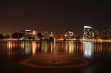
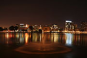
. As of the 2010 census it had a population of 1,510,271, making it the 7th most populous county in the state. The county includes the cities of Oakland
, which is its seat
and Berkeley
.
and a smaller portion of Santa Clara County
.
The Spanish
word alameda means "a place where poplar trees grow", a name which originally was given to the Arroyo de la Alameda (Poplar Grove Creek). The willow
and sycamore
trees along the banks of the river reminded the early explorers of a road lined with trees, also known as an alameda.
The county seat at the time it was formed was located at Alvarado
; it was moved to San Leandro
in 1856 where the county courthouse was destroyed by the devastating 1868 quake on the Hayward Fault. The county seat was then re-established in the town of Brooklyn from 1872-1875. Brooklyn is now part of Oakland
, which has been the county seat since 1873.
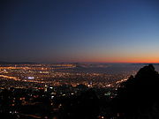
Much of what is now considered an intensively urban
region, with major cities, was developed as a trolley car suburb of San Francisco
in the late 19th and early 20th centuries. The historical progression from native American tribal lands to Spanish, then Mexican ranches, then to farms, ranches, and orchards, then multiple city centers and suburbs, is shared with the adjacent and closely associated Contra Costa County.
. Currently, District 1 is represented by Supervisor Scott Haggerty; District 2, Supervisor Nadia Lockyer; District 3, Supervisor Wilma Chan
; District 4, Supervisor Nate Miley; District 5, Supervisor Keith Carson
. The Board elects a president who presides at all meetings of the Board and appoints committees to handle work involving the major programs of the county. If the president is absent for a meeting, the vice president shall be responsible. A Board election occurs every two years for these positions. Supervisor Miley is serving currently as president; Supervisor Carson is vice president.
Board meetings are open to the public, and occur every Tuesday (with the exception of holidays and board retreats) at 9:00 am in the County Administration Building in Oakland. Day-to-day administrative operations are handled by the County Administrator. This position is appointed by the Board of Supervisors, currently held by Susan Muranishi.
The county's law enforcement is overseen by an elected Sheriff/Coroner and an elected District Attorney. The Sheriff supervises the deputies of the Alameda County Sheriff's Office
, whose primary responsibilities include policing unincorporated areas of the county and cities within the county which contract with the Sheriff's Office for police services; providing security and law enforcement for county buildings including courthouses, the county jail and other county properties; providing support resources, such as a forensics laboratory and search and rescue capabilities, to other law enforcement agencies throughout the county; and serving the process of the county's Superior Court system. The District Attorney's office is responsible for prosecuting all criminal violations of the laws of the state of California, the county, or its constituent municipalities, in the Alameda County Superior Court. The current Sheriff is Gregory J. Ahern, who was elected in 2006, succeeding Charles Plummer
, who had served in the post for 20 years. The Interim District Attorney is Nancy E. O'Malley, who was appointed to fill the position of retiring District Attorney Tom Orloff
in September 2009. The Sheriff's Office operates two jails, one being Santa Rita Jail
located in Dublin.
The Alameda County Fire Department (ACFD) was formed on July 1, 1993 as a dependent district, with the Board of Supervisors as its governing body. Municipal and specialized fire departments have been consolidated into the ACFD over the years. 1993 brought in the Castro Valley and Eden Consolidated FD, and the County Fire Patrol. San Leandro joined in 1995, Dublin in 1997, Lawrence Berkeley National Laboratory
in 2002, Lawrence Livermore National Laboratory
in 2007, The Alameda County Regional Emergency Communications Center in 2008, and Newark and Union City in 2010.
The Alameda County Water District
is operated by the county.
Alameda County Superior Court
operates in twelve separate locations throughout the county, with its central René C. Davidson Courthouse
located in Oakland near Lake Merritt
. Most major criminal trials and complex civil cases are heard at this location or in courtrooms within the County Administration Building across the street.
in Pleasanton
. The fair runs for 3 weekends from June to July. Attractions include horse racing, carnival rides, 4-H
exhibits, and live bands.
The San Francisco Bay borders the county on the west, and the City and County of San Francisco, California
has a small land border with the city of Alameda due to land filling http://factfinder.census.gov/servlet/ThematicMapFramesetServlet?_bm=y&-tree_id=4001&-_MapEvent=Pan&-context=tm&-errMsg=&-all_geo_types=N&-_useSS=N&-_dBy=140&-redoLog=false&-_zoomLevel=&-tm_name=DEC_2000_SF1_U_M00083&-tm_config=|b=50|l=en|t=4001|zf=0.0|ms=thm_def|dw=0.127654448550011|dh=0.07576475132991932|dt=gov.census.aff.domain.map.EnglishMapExtent|if=gif|cx=-122.18653389899086|cy=37.84539209943137|zl=4|pz=4|bo=|bl=|ft=350:349:335:389:388:332:331|fl=403:381:204:380:369:379:368|g=05000US06001|ds=DEC_2000_SF1_U|sb=50|tud=false|db=140|mn=0.6|mx=79.2|cc=1|cm=1|cn=5|cb=|um=Percent|pr=1|th=DEC_2000_SF1_U_M00083|sf=N|sg=&-PANEL_ID=tm_result&-_pageY=&-_lang=en&-_pageX=&-geo_id=05000US06001&-_mapY=&-_mapX=&-_latitude=&-_pan=SW&-ds_name=DEC_2000_SF1_U&-_longitude=&-_changeMap=Identify].The crest of the Berkeley Hills
form part of the northeastern boundary, and reach into the center of the county. A coastal plain several miles wide lines the bay; it is home to Oakland and the most populous regions. Livermore Valley lies in the eastern part of the county.
The Hayward Fault, a major branch of the San Andreas Fault to the west, runs through the most populated parts of Alameda County, while the Calaveras Fault
runs through the southeastern part of the county.
The county has a number of smaller named neighborhoods, not governed by cities.
was 2,047.6 people per square mile (790.6/km²). The racial makeup of Alameda County was 649,122 (43.0%) White, 190,451 (12.6%) African American, 9,799 (0.6%) Native American, 394,560 (26.1%) Asian, 12,802 (0.8%) Pacific Islander, 162,540 (10.8%) from other races
, and 90,997 (6.0%) from two or more races. Hispanic or Latino of any race were 339,889 persons (22.5%).
of 2000, there were 1,443,741 people, 523,366 households, out of which 32.60% had children under the age of 18 living within them, 47.00% married couples
living together, 13.00% had a female householder with no husband present, and 35.20% were non-families. 26.00% of all households were made up of individuals and 7.30% had someone living alone who was 65 years of age or older. The average household size was 2.71 and the average family size was 3.31.
In the county, the population was spread out with 24.60% under the age of 18, 9.60% from 18 to 24, 33.90% from 25 to 44, 21.70% from 45 to 64, and 10.20% who were 65 years of age or older. The median age was 34 years. For every 100 females there were 96.60 males. For every 100 females age 18 and over, there were 94.00 males.
The median income for a household in the county was $55,946, and the median income for a family was $65,857 (these figures had risen to $66,430 and $81,341 respectively as of a 2007 estimate). Males had a median income of $47,425 versus $36,921 for females. The per capita income
for the county was $26,680. About 7.70% of families and 11.00% of the population were below the poverty line, including 13.50% of those under age 18 and 8.10% of those age 65 or over.
In 2000, the largest denominational group was the Catholic
s (with 306,437 adherents) . The largest religious bodies were The Catholic Church (with 306,437 members) and Judaism
(with 32,500 members).
, when Dwight Eisenhower
carried the county. Historically, the county was Republican until the 1958 defeat of William F. Knowland
. Even when Ronald Reagan
won the national popular vote by an 18.3% margin in 1984
, Walter Mondale
won Alameda County by a slightly larger margin. In 2004
it voted for John Kerry
by a margin of over 50%. Every city and town voted Democratic. In the House of Representatives
, all of the 9th
district, parts of the 10th
and 11th
districts, and most of the 13th
district are in the county. All four districts are held by Democrats: Barbara Lee
, John Garamendi
, Jerry McNerney
, and Pete Stark
, respectively.
In the State Assembly
, parts of the 14th and 15th districts, all of the 16th and 18th districts, and most of the 20th district are in the county. All of its five legislators are Democrats: Nancy Skinner
of the 14th district, Sandré Swanson
of the 16th district, Mary Hayashi
of the 18th district, and Bob Wieckowski
of the 20th district, and Joan Buchanan
of the 15th district. In the State Senate
, most of the 9th and 10th districts are in the county and are both represented by Democrats: Loni Hancock
and Ellen Corbett, respectively.
According to the California Secretary of State, there are 709,414 registered voters in Alameda County. 401,847 (56.6%) are registered Democrats, 116,864 (16.5%) are registered Republicans, 33,689 (4.8%) are registered to minor political parties, and 157,014 (22.1%) declined to answer. This means Democrats have a 40.1% registration advantage over Republicans. Every city, town, and unincorporated area in Alameda County has more registered Democrats than Republicans.
On Nov. 4, 2008 Alameda County voted 62.0 % against Proposition 8
, which won statewide, and which amended the California Constitution
to ban same-sex marriage
s. The county garnered the sixth highest "no" vote, by percentage, of all California counties, and the was the second largest county, by total voter turnout, to vote against it.
, a division of the county administration, under the California Arts Council
, was created in 1965. Its fifteen appointed members act in an advisory capacity to the board of supervisors, in promoting the arts. The Oakland Museum of California
has a substantial collection of California art works and historical artifacts.
The Alameda County Library
operates libraries in the cities of Albany
, Dublin
, Fremont
, Newark
and Union City
and the unincorporated communities of Castro Valley
and San Lorenzo
. The cities of Alameda, Berkeley, Hayward, Livermore, Oakland, San Leandro, and Pleasanton have their own library systems.
, one of the campuses of the University of California
system, and one of the largest and most prestigious research universities in the world.
Other colleges and universities located within Alameda county include:
operates within Alameda and neighboring Contra Costa County, with numerous parks within the county, including, Tilden Regional Park
, Redwood Regional Park
, and Anthony Chabot Regional Park
. Eastshore State Park
is located partially along the bay shore of northern Alameda County. The San Francisco Bay Trail
, a project of the Association of Bay Area Governments
, will run along the bay shore of the county.
.
U.S. state
A U.S. state is any one of the 50 federated states of the United States of America that share sovereignty with the federal government. Because of this shared sovereignty, an American is a citizen both of the federal entity and of his or her state of domicile. Four states use the official title of...
of California
California
California is a state located on the West Coast of the United States. It is by far the most populous U.S. state, and the third-largest by land area...
. It occupies most of the East Bay
East Bay (San Francisco Bay Area)
The East Bay is a commonly used, informal term for the lands on the eastern side of the San Francisco Bay, in the San Francisco Bay Area, in California, United States...
region of the San Francisco Bay Area
San Francisco Bay Area
The San Francisco Bay Area, commonly known as the Bay Area, is a populated region that surrounds the San Francisco and San Pablo estuaries in Northern California. The region encompasses metropolitan areas of San Francisco, Oakland, and San Jose, along with smaller urban and rural areas...
. As of the 2010 census it had a population of 1,510,271, making it the 7th most populous county in the state. The county includes the cities of Oakland
Oakland, California
Oakland is a major West Coast port city on San Francisco Bay in the U.S. state of California. It is the eighth-largest city in the state with a 2010 population of 390,724...
, which is its seat
County seat
A county seat is an administrative center, or seat of government, for a county or civil parish. The term is primarily used in the United States....
and Berkeley
Berkeley, California
Berkeley is a city on the east shore of the San Francisco Bay in Northern California, United States. Its neighbors to the south are the cities of Oakland and Emeryville. To the north is the city of Albany and the unincorporated community of Kensington...
.
History
The county was formed on March 25, 1853 from a large portion of Contra Costa CountyContra Costa County, California
Contra Costa County is a primarily suburban county in the San Francisco Bay Area of the U.S. state of California. As of the 2010 census, it had a population of 1,049,025...
and a smaller portion of Santa Clara County
Santa Clara County, California
Santa Clara County is a county located at the southern end of the San Francisco Bay Area in the U.S. state of California. As of 2010 it had a population of 1,781,642. The county seat is San Jose. The highly urbanized Santa Clara Valley within Santa Clara County is also known as Silicon Valley...
.
The Spanish
Spanish language
Spanish , also known as Castilian , is a Romance language in the Ibero-Romance group that evolved from several languages and dialects in central-northern Iberia around the 9th century and gradually spread with the expansion of the Kingdom of Castile into central and southern Iberia during the...
word alameda means "a place where poplar trees grow", a name which originally was given to the Arroyo de la Alameda (Poplar Grove Creek). The willow
Willow
Willows, sallows, and osiers form the genus Salix, around 400 species of deciduous trees and shrubs, found primarily on moist soils in cold and temperate regions of the Northern Hemisphere...
and sycamore
Sycamore
Sycamore is a name which is applied at various times and places to three very different types of trees, but with somewhat similar leaf forms....
trees along the banks of the river reminded the early explorers of a road lined with trees, also known as an alameda.
The county seat at the time it was formed was located at Alvarado
Alvarado, California
Alvarado is a former settlement in and former county seat of Alameda County, California, now annexed to Union City. It was located north-northwest of downtown Newark....
; it was moved to San Leandro
San Leandro, California
San Leandro is a city in Alameda County, California, United States. It is considered a suburb of Oakland and San Francisco. The population was 84,950 as of 2010 census. The climate of the city is mild throughout the year.-Geography and water resources:...
in 1856 where the county courthouse was destroyed by the devastating 1868 quake on the Hayward Fault. The county seat was then re-established in the town of Brooklyn from 1872-1875. Brooklyn is now part of Oakland
Oakland, California
Oakland is a major West Coast port city on San Francisco Bay in the U.S. state of California. It is the eighth-largest city in the state with a 2010 population of 390,724...
, which has been the county seat since 1873.
Much of what is now considered an intensively urban
Urban area
An urban area is characterized by higher population density and vast human features in comparison to areas surrounding it. Urban areas may be cities, towns or conurbations, but the term is not commonly extended to rural settlements such as villages and hamlets.Urban areas are created and further...
region, with major cities, was developed as a trolley car suburb of San Francisco
San Francisco, California
San Francisco , officially the City and County of San Francisco, is the financial, cultural, and transportation center of the San Francisco Bay Area, a region of 7.15 million people which includes San Jose and Oakland...
in the late 19th and early 20th centuries. The historical progression from native American tribal lands to Spanish, then Mexican ranches, then to farms, ranches, and orchards, then multiple city centers and suburbs, is shared with the adjacent and closely associated Contra Costa County.
Government
The county is divided into five districts. A County Supervisor is elected in each district, with an election held every four years. This elected group is known as the Board of SupervisorsAlameda County Board of Supervisors
The Alameda County Board of Supervisors is the five member non-partisan governing board of Alameda County, California. Members of the board of supervisors are elected by district based on their residence...
. Currently, District 1 is represented by Supervisor Scott Haggerty; District 2, Supervisor Nadia Lockyer; District 3, Supervisor Wilma Chan
Wilma Chan
Wilma Chan is a politician in California. Chan served as the California State Assembly Majority Leader from 2002–2004; she was the first woman and the first Asian American to hold the position. She also served as Assembly Majority Whip from 2001-2002. Chan is a Democrat...
; District 4, Supervisor Nate Miley; District 5, Supervisor Keith Carson
Keith Carson
Keith Carson is a member of the Alameda County Board of Supervisors in Alameda County, California for District 5. Carson has served on the board of supervisors in Alameda County, California since 1993, after being subsequently re-elected in 1996, 2000, 2004 and 2010.-Personal life:Carson is a...
. The Board elects a president who presides at all meetings of the Board and appoints committees to handle work involving the major programs of the county. If the president is absent for a meeting, the vice president shall be responsible. A Board election occurs every two years for these positions. Supervisor Miley is serving currently as president; Supervisor Carson is vice president.
Board meetings are open to the public, and occur every Tuesday (with the exception of holidays and board retreats) at 9:00 am in the County Administration Building in Oakland. Day-to-day administrative operations are handled by the County Administrator. This position is appointed by the Board of Supervisors, currently held by Susan Muranishi.
The county's law enforcement is overseen by an elected Sheriff/Coroner and an elected District Attorney. The Sheriff supervises the deputies of the Alameda County Sheriff's Office
Alameda County Sheriff's Office
The Alameda County Sheriff's Office is a law enforcement agency serving Alameda County, California. The ACSO is accredited through the Commission on Accreditation for Law Enforcement Agencies , the American Correctional Association , National Commission on Correctional Health Care and the...
, whose primary responsibilities include policing unincorporated areas of the county and cities within the county which contract with the Sheriff's Office for police services; providing security and law enforcement for county buildings including courthouses, the county jail and other county properties; providing support resources, such as a forensics laboratory and search and rescue capabilities, to other law enforcement agencies throughout the county; and serving the process of the county's Superior Court system. The District Attorney's office is responsible for prosecuting all criminal violations of the laws of the state of California, the county, or its constituent municipalities, in the Alameda County Superior Court. The current Sheriff is Gregory J. Ahern, who was elected in 2006, succeeding Charles Plummer
Charles Plummer (sheriff)
Charles C. Plummer served as the sheriff of Alameda County, California from 1987 to 2007. He is believed to have been the longest serving police officer in California with more than 50 years of continuous service. He is considered a "legend" by many in the law enforcement community.The Alameda...
, who had served in the post for 20 years. The Interim District Attorney is Nancy E. O'Malley, who was appointed to fill the position of retiring District Attorney Tom Orloff
Tom Orloff
Thomas Jensen Orloff is the retired district attorney for Alameda County, California.Orloff began work in the DA's office after graduating Boalt Hall in 1970, trying 25 murder cases before becoming Chief Assistant DA in 1989. When District Attorney Jack Meehan retired in 1994, Orloff ran unopposed...
in September 2009. The Sheriff's Office operates two jails, one being Santa Rita Jail
Santa Rita Jail
Santa Rita Jail is a county jail located in Dublin, Alameda County, California adjacent to the Camp Parks Reserve Forces Training Area, and operated by the Alameda County Sheriff's Office...
located in Dublin.
The Alameda County Fire Department (ACFD) was formed on July 1, 1993 as a dependent district, with the Board of Supervisors as its governing body. Municipal and specialized fire departments have been consolidated into the ACFD over the years. 1993 brought in the Castro Valley and Eden Consolidated FD, and the County Fire Patrol. San Leandro joined in 1995, Dublin in 1997, Lawrence Berkeley National Laboratory
Lawrence Berkeley National Laboratory
The Lawrence Berkeley National Laboratory , is a U.S. Department of Energy national laboratory conducting unclassified scientific research. It is located on the grounds of the University of California, Berkeley, in the Berkeley Hills above the central campus...
in 2002, Lawrence Livermore National Laboratory
Lawrence Livermore National Laboratory
The Lawrence Livermore National Laboratory , just outside Livermore, California, is a Federally Funded Research and Development Center founded by the University of California in 1952...
in 2007, The Alameda County Regional Emergency Communications Center in 2008, and Newark and Union City in 2010.
The Alameda County Water District
Alameda County Water District
The Alameda County Water District is a public agency in Alameda County, California, USA, which has responsibilities for managing and protecting certain groundwater resources within Alameda County. While not an administrative unit of the county government, this water district derives certain of...
is operated by the county.
Alameda County Superior Court
Alameda County Superior Court
The Alameda County Superior Court is the branch of the California Superior Court with jurisdiction over Alameda County.-History:The original courthouse was established on June 6, 1853, in Alvarado, California . After the county seat moved to Oakland , a new courthouse was built in 1875, locating...
operates in twelve separate locations throughout the county, with its central René C. Davidson Courthouse
René C. Davidson Courthouse
The René C. Davidson Courthouse is a courthouse, part of the Alameda County Superior Court system. The courthouse is located in Oakland. It is adjacent to Lake Merritt.-History:...
located in Oakland near Lake Merritt
Lake Merritt
Lake Merritt is a large tidal lagoon that lies just east of downtown Oakland, California. It is surrounded by parkland and city neighborhoods. A popular 3.1 mile walking and jogging path runs along its perimeter...
. Most major criminal trials and complex civil cases are heard at this location or in courtrooms within the County Administration Building across the street.
Events
The annual county fair is held at the Alameda County FairgroundsAlameda County Fairgrounds
The Alameda County Fairgrounds is a facility located in Pleasanton, California. It is home to the annual Alameda County Fair as well as numerous trade shows and community events. Its racetrack was built in 1858, making it the oldest one-mile horse racing track in America...
in Pleasanton
Pleasanton, California
Pleasanton is a city in Alameda County, California, incorporated in 1894. It is a suburb in the San Francisco Bay Area located about east of Oakland, and west of Livermore. The population was 70,285 at the 2010 census. In 2005 and 2007, Pleasanton was ranked the wealthiest middle-sized city in...
. The fair runs for 3 weekends from June to July. Attractions include horse racing, carnival rides, 4-H
4-H
4-H in the United States is a youth organization administered by the National Institute of Food and Agriculture of the United States Department of Agriculture , with the mission of "engaging youth to reach their fullest potential while advancing the field of youth development." The name represents...
exhibits, and live bands.
Geography
According to the 2000 census, the county has a total area of 821.15 square miles (2,126.8 km²), of which 737.57 square miles (1,910.3 km²) (or 89.82%) is land and 83.57 square miles (216.4 km²) (or 10.18%) is water.The San Francisco Bay borders the county on the west, and the City and County of San Francisco, California
San Francisco, California
San Francisco , officially the City and County of San Francisco, is the financial, cultural, and transportation center of the San Francisco Bay Area, a region of 7.15 million people which includes San Jose and Oakland...
has a small land border with the city of Alameda due to land filling http://factfinder.census.gov/servlet/ThematicMapFramesetServlet?_bm=y&-tree_id=4001&-_MapEvent=Pan&-context=tm&-errMsg=&-all_geo_types=N&-_useSS=N&-_dBy=140&-redoLog=false&-_zoomLevel=&-tm_name=DEC_2000_SF1_U_M00083&-tm_config=|b=50|l=en|t=4001|zf=0.0|ms=thm_def|dw=0.127654448550011|dh=0.07576475132991932|dt=gov.census.aff.domain.map.EnglishMapExtent|if=gif|cx=-122.18653389899086|cy=37.84539209943137|zl=4|pz=4|bo=|bl=|ft=350:349:335:389:388:332:331|fl=403:381:204:380:369:379:368|g=05000US06001|ds=DEC_2000_SF1_U|sb=50|tud=false|db=140|mn=0.6|mx=79.2|cc=1|cm=1|cn=5|cb=|um=Percent|pr=1|th=DEC_2000_SF1_U_M00083|sf=N|sg=&-PANEL_ID=tm_result&-_pageY=&-_lang=en&-_pageX=&-geo_id=05000US06001&-_mapY=&-_mapX=&-_latitude=&-_pan=SW&-ds_name=DEC_2000_SF1_U&-_longitude=&-_changeMap=Identify].The crest of the Berkeley Hills
Berkeley Hills
The Berkeley Hills are a range of the Pacific Coast Ranges that overlook the northeast side of the valley that surrounds San Francisco Bay. They were previously called the "Contra Costa Range/Hills" , but with the establishment of Berkeley and the University of California, the current usage was...
form part of the northeastern boundary, and reach into the center of the county. A coastal plain several miles wide lines the bay; it is home to Oakland and the most populous regions. Livermore Valley lies in the eastern part of the county.
The Hayward Fault, a major branch of the San Andreas Fault to the west, runs through the most populated parts of Alameda County, while the Calaveras Fault
Calaveras Fault
The Calaveras Fault is a major branch of the San Andreas Fault located in northern California in the San Francisco Bay Area. To the east of the Hayward-Rodgers Creek fault, the Calaveras fault extends 123 km, splaying from the San Andreas fault near Hollister and terminating at Danville at its...
runs through the southeastern part of the county.
Incorporated cities
- AlamedaAlameda, CaliforniaAlameda is a city in Alameda County, California, United States. It is located on Alameda Island and Bay Farm Island, and is adjacent to Oakland in the San Francisco Bay. The Bay Farm Island portion of the city is adjacent to the Oakland International Airport. At the 2010 census, the city had a...
, a charter cityCharter cityA charter city is a city in which the governing system is defined by the city's own charter document rather than by state, provincial, regional or national laws. In locations where city charters are allowed by law, a city can adopt or modify its organizing charter by decision of its administration...
formed in 1916 - AlbanyAlbany, CaliforniaAlbany is a city in Alameda County, California, United States. The population was 18,539 at the 2010 census.-History:In 1908, a group of local women protested the dumping of Berkeley garbage in their community...
, incorporated as the City of Ocean View in 1908, renamed Albany in 1909 - BerkeleyBerkeley, CaliforniaBerkeley is a city on the east shore of the San Francisco Bay in Northern California, United States. Its neighbors to the south are the cities of Oakland and Emeryville. To the north is the city of Albany and the unincorporated community of Kensington...
, incorporated 1878 - DublinDublin, CaliforniaDublin is a suburban city of the East Bay region of Alameda County, California, United States. Located along the north side of Interstate 580 at the intersection with Interstate 680, roughly east of Hayward, west of Livermore and north of San Jose, it was named after the city of Dublin in...
, initially the Murray Township (1868), incorporated as Dublin in 1982 - EmeryvilleEmeryville, CaliforniaEmeryville is a small city located in Alameda County, California, in the United States. It is located in a corridor between the cities of Berkeley and Oakland, extending to the shore of San Francisco Bay. Its proximity to San Francisco, the Bay Bridge, the University of California, Berkeley, and...
, incorporated 1896 - FremontFremont, CaliforniaFremont is a city in Alameda County, California. It was incorporated on January 23, 1956, from the merger of five smaller communities: Centerville, Niles, Irvington, Mission San Jose, and Warm Springs...
, incorporated 1956, combining the former communities of Centerville, Niles, Irvington, Mission San Jose, and Warm Springs - HaywardHayward, CaliforniaHayward is a city located in the East Bay in Alameda County, California. With a population of 144,186, Hayward is the sixth largest city in the San Francisco Bay Area and the third largest in Alameda County. Hayward was ranked as the 37th most populous municipality in California. It is included in...
, named as early as 1852, chartered as Haywards in 1876, incorporated as Hayward in 1928 - LivermoreLivermore, CaliforniaLivermore is a city in Alameda County. The population as of 2010 was 80,968. Livermore is located on the eastern edge of California's San Francisco Bay Area....
, incorporated 1876 - NewarkNewark, CaliforniaNewark is a city in Alameda County, California, United States. It was incorporated as a city in September 1955. Newark is an enclave, completely surrounded by the city of Fremont. Its population was 42,573 at the 2010 census.-Geography:...
, incorporated 1955 - OaklandOakland, CaliforniaOakland is a major West Coast port city on San Francisco Bay in the U.S. state of California. It is the eighth-largest city in the state with a 2010 population of 390,724...
, incorporated 1852 - PiedmontPiedmont, CaliforniaPiedmont is a small, affluent city in Alameda County, California, United States. It is surrounded by the city of Oakland. The population was 10,667 at the 2010 census. Piedmont was incorporated in 1907 and was developed significantly in the 1920s and 1930s...
, incorporated 1907 - PleasantonPleasanton, CaliforniaPleasanton is a city in Alameda County, California, incorporated in 1894. It is a suburb in the San Francisco Bay Area located about east of Oakland, and west of Livermore. The population was 70,285 at the 2010 census. In 2005 and 2007, Pleasanton was ranked the wealthiest middle-sized city in...
, incorporated 1894 - San LeandroSan Leandro, CaliforniaSan Leandro is a city in Alameda County, California, United States. It is considered a suburb of Oakland and San Francisco. The population was 84,950 as of 2010 census. The climate of the city is mild throughout the year.-Geography and water resources:...
, incorporated 1872 - Union CityUnion City, CaliforniaUnion City is a city in Alameda County, California, United States. It was incorporated in 1959, combining the communities of Alvarado and Decoto. Alvarado was the original county seat of Alameda County, and the site of the first county courthouse is a California Historical Landmark . The city...
, incorporated 1959
Unincorporated communities
The unincorporated communities in Alameda County are governed directly by the county. Alameda County has 6 major unincorporated communities that qualify as census designated places (CDP):- AshlandAshland, CaliforniaAshland is a census-designated place in Alameda County, California, United States. The population was 21,925 at the 2010 census.-Geography:...
, east of San Leandro - Castro ValleyCastro Valley, CaliforniaCastro Valley is a census-designated place in Alameda County, California, United States. As of the 2000 census, it is the fifth most populous unincorporated area in California, and the twenty-third in the United States...
, north of Hayward, east of San Leandro - CherrylandCherryland, CaliforniaCherryland is a census-designated place in Alameda County, California, United States.The unincorporated community is located between the cities of San Leandro to the north and Hayward to the south...
, north of Hayward - FairviewFairview, CaliforniaFairview is a census-designated place in Alameda County, California, United States. It borders on the city of Hayward. The population was 10,003 at the 2010 census.-Geography:...
, north of Hayward - SunolSunol, CaliforniaSunol is an unincorporated census-designated place in Alameda County, California, United States. The population was 913 at the 2010 census....
, east of Fremont - San LorenzoSan Lorenzo, CaliforniaSan Lorenzo , also known as San Lorenzo Village is a census-designated place in Alameda County, California, United States. The population was 23,452 at the 2010 census.-Geography:...
, south of San Leandro, north of Hayward
The county has a number of smaller named neighborhoods, not governed by cities.
- AlbraeAlbrae, CaliforniaAlbrae is an unincorporated community in Alameda County, California. It is located on the Southern Pacific Railroad south-southwest of downtown Fremont, at an elevation of 10 feet ....
- AltamontAltamont, CaliforniaAltamont is an unincorporated community in Alameda County, California. It is located northeast of Livermore, at an elevation of 738 feet , in the Altamont Pass. It was in 1969 the site of the Altamont Free Concert at the Altamont Speedway...
- AscoAsco, CaliforniaAsco is an unincorporated community in Alameda County, California. It is located on the Southern Pacific Railroad west of Livermore, at an elevation of 351 feet . The name comes from the Alameda Sugar Company that raised crops there, including sugar beets, from 1899 to 1917....
- BaumbergBaumberg, CaliforniaBaumberg is an unincorporated community in Alameda County, California, adjacent to Hayward...
- BrightsideBrightside, CaliforniaBrightside is an unincorporated community in Alameda County, California. It is located west of Sunol, at an elevation of 203 feet . At the turn of the 20th century a vacation/resort area and previously a gravel quarry, it is now the site of the train yard belonging to Niles Canyon Railway....
- BrookshireBrookshire, CaliforniaBrookshire is an unincorporated community in Alameda County, California. It lies at an elevation of 581 feet ....
- CarpenterCarpenter, CaliforniaCarpenter is an unincorporated community in Alameda County, California, adjacent to Hayward. It lies at an elevation of 36 feet . Its zip code is 94544....
- DoughertyDougherty, Alameda County, CaliforniaDougherty is an unincorporated community in Alameda County, California. It is located just north of Dublin, at an elevation of 348 feet ....
- DresserDresser, CaliforniaDresser is an unincorporated community in Alameda County, California. Its ZIP code is 94536 and its area code is 510.- Geography and background :...
- East PleasantonEast Pleasanton, CaliforniaEast Pleasanton is an unincorporated community in Alameda County, California. It east-northeast of Pleasanton, at an elevation of 387 feet ....
- FarwellFarwell, CaliforniaFarwell is an unincorporated community in Alameda County, California. It is located north-northeast of downtown Fremont, at an elevation of 213 feet . Its ZIP code is 94536 and its area code is 510.The name is in honor of James Dumaresy Farwell, land owner....
- Hall StationHall Station, CaliforniaHall Station is an unincorporated community in Alameda County, California. It is located on the Southern Pacific Railroad north-northwest of downtown Newark at an elevation of 16 feet ....
- HalvernHalvern, CaliforniaHalvern is an unincorporated community in Alameda County, California. It is located on the Southern Pacific Railroad south-southeast of Hayward, at an elevation of 20 feet ....
- Kilkare WoodsKilkare Woods, CaliforniaKilkare Woods is a small rural unincorporated community of about 773 people in southern Alameda County, California, near Pleasanton. The town is along Kilkare Road and is in zip code 94586. It lies at an elevation of 827 feet . 96% of residents of the zip code spoke English as their primary...
- Komandorski VillageKomandorski Village, CaliforniaKomandorski Village is an unincorporated community in Alameda County, California. It is located northeast of Dublin, at an elevation of 371 feet ....
- Lorenzo StationLorenzo Station, CaliforniaLorenzo Station is an unincorporated community in Alameda County, California. It is located on the Southern Pacific Railroad south-southeast of San Leandro, at an elevation of 33 feet ....
- MattosMattos, CaliforniaMattos is an unincorporated community in Alameda County, California. It is located northeast of downtown Newark, at an elevation of 39 feet .The name is in honor John Garcia Mattos, Sr., who settled here in 1879....
- Mendenhall SpringsMendenhall Springs, CaliforniaMendenhall Springs is an unincorporated community in Alameda County, California. It is located southeast of Livermore, at an elevation of 1818 feet ....
- MidwayMidway, Alameda County, CaliforniaMidway is an unincorporated community in Alameda County, California, south-southeast of Altamont. It lies at an elevation of 358 feet . A post office operated in Midway from 1870 to 1918....
- Mountain HouseMountain House, Alameda County, CaliforniaMountain House is an unincorporated community in Alameda County, California, United States...
- Mowry LandingMowry Landing, CaliforniaMowry Landing is an unincorporated community in Alameda County, California. It is located southeast of Newark. It lies at an elevation of 10 feet ....
- RadumRadum, CaliforniaRadum is an unincorporated community in Alameda County, California. It lies at an elevation of 361 feet ....
- San Ramon VillageSan Ramon Village, CaliforniaSan Ramon Village is an unincorporated community in Alameda County, California. It is located north-northeast of Dublin, at an elevation of 354 feet ....
- Scotts CornerScotts Corner, CaliforniaScotts Corner is an unincorporated community in Alameda County, California. It is 1 mile east-southeast of Sunol, at an elevation of 259 feet ....
- SorensonSorenson, CaliforniaSorenson is an unincorporated community in Alameda County, California. It is located on the Western Pacific Railroad south-southeast of Hayward, at an elevation of 79 feet ....
- VeronaVerona, CaliforniaVerona is an unincorporated community in Alameda County, California. It is located on the Western Pacific and the Southern Pacific Railroads north of Sunol, at an elevation of 315 feet ....
Former townships
- Oakland Township - the northern portion subsequently became the cities of Berkeley and Albany
- Alameda Township - Now essentially coterminus with the City of Alameda
- Brooklyn Township - Mostly contained within Oakland and Piedmont
- Eden Township - parts have been incorporated into San Leandro and Hayward, the rest contains the communities of Castro Valley, San Lorenzo, and other unincorporated areas.
- Washington Township - contains Union City, Newark, Fremont, and small unincorporated areas nearby.
- Murray Township - Contains cities of Dublin, Pleasanton, and Livermore, and substantial unincorporated areas including Sunol.
Adjacent counties
- Santa Clara County, CaliforniaSanta Clara County, CaliforniaSanta Clara County is a county located at the southern end of the San Francisco Bay Area in the U.S. state of California. As of 2010 it had a population of 1,781,642. The county seat is San Jose. The highly urbanized Santa Clara Valley within Santa Clara County is also known as Silicon Valley...
- south - San Mateo County, CaliforniaSan Mateo County, CaliforniaSan Mateo County is a county located in the San Francisco Bay Area of the U.S. state of California. It covers most of the San Francisco Peninsula just south of San Francisco, and north of Santa Clara County. San Francisco International Airport is located at the northern end of the county, and...
- west - San Francisco County, California - west
- Contra Costa County, CaliforniaContra Costa County, CaliforniaContra Costa County is a primarily suburban county in the San Francisco Bay Area of the U.S. state of California. As of the 2010 census, it had a population of 1,049,025...
- north - San Joaquin County, CaliforniaSan Joaquin County, CaliforniaSan Joaquin County is a county located in Central Valley of the U.S. state of California, just east of the San Francisco Bay Area. As of the 2010 census, the population was 685,306. The county seat is Stockton.-History:...
- east - Stanislaus County, CaliforniaStanislaus County, CaliforniaStanislaus County is a county located in the Central Valley of the U.S. state of California. As the price of housing has increased in the San Francisco Bay Area, many people who work in the southern reaches of the Bay Area have opted for the longer commute and moved to Stanislaus County for the...
- southeast by a corner
Major highways
|
.svg.png)
.svg.png)
.svg.png)
.svg.png)
.svg.png)
.svg.png)


Mass transit
- ACE train - commuter rail using existing railroad tracks; primarily brings commuters from San Joaquin County to Santa Clara County
- AC TransitAC TransitAC Transit is an Oakland-based regional public transit agency serving the western half of Alameda County and parts of western Contra Costa County in the western, Bay-side area of the East Bay of the San Francisco Bay Area...
- local busBusA bus is a road vehicle designed to carry passengers. Buses can have a capacity as high as 300 passengers. The most common type of bus is the single-decker bus, with larger loads carried by double-decker buses and articulated buses, and smaller loads carried by midibuses and minibuses; coaches are...
system in western Alameda County and west Contra Costa County, with additional service across the three bridges from Alameda County to downtown San Francisco, San Mateo, and Palo Alto - BARTBay Area Rapid TransitBay Area Rapid Transit is a rapid transit system serving the San Francisco Bay Area. The heavy-rail public transit and subway system connects San Francisco with cities in the East Bay and suburbs in northern San Mateo County. BART operates five lines on of track with 44 stations in four counties...
- commuter rail centered on northwest Oakland, primarily serving commuters to downtown San Francisco and downtown Oakland - Capitol CorridorCapitol CorridorThe Capitol Corridor is a 168-mile passenger train route operated by Amtrak in California. Because it is fully supported by the state, the Capitol Corridor operates under Amtrak California. It runs from the San Francisco Bay Area to Sacramento, roughly parallel to Interstate 80...
- commuter rail using existing railroad tracks, extending from San Jose to Sacramento, running through western Alameda County - WHEELSWHEELS (California)WHEELS is a bus service that provides public transportation in the Tri-Valley Region of the San Francisco Bay Area, in the United States...
- bus system in the cities of southeastern Alameda County - Union City TransitUnion City TransitUnion City Transit is a public transit service in Union City, California, in the San Francisco Bay Area. It began operations in 1974 with the opening of the Union City BART station.The service was formerly known as "the Flea."...
- local city bus service within Union CityUnion City, CaliforniaUnion City is a city in Alameda County, California, United States. It was incorporated in 1959, combining the communities of Alvarado and Decoto. Alvarado was the original county seat of Alameda County, and the site of the first county courthouse is a California Historical Landmark . The city...
in addition to AC Transit - Emery-Go-Round - free bus service in EmeryvilleEmeryville, CaliforniaEmeryville is a small city located in Alameda County, California, in the United States. It is located in a corridor between the cities of Berkeley and Oakland, extending to the shore of San Francisco Bay. Its proximity to San Francisco, the Bay Bridge, the University of California, Berkeley, and...
. - Alameda / Oakland Ferry and Harbor Bay Ferry - connect Oakland, Alameda, and Bay Farm Island with downtown San Francisco
- San JoaquinsSan JoaquinsThe San Joaquin is a passenger train operated by Amtrak as part of the Amtrak California network in California's Central Valley. Twelve trains a day run between its southern terminus at Bakersfield and Stockton, where the route splits to Oakland or Sacramento...
- Amtrak route between Oakland and Bakersfield through Fresno and the Central Valley - VTASanta Clara Valley Transportation AuthorityThe Santa Clara Valley Transportation Authority is a special-purpose district responsible for public transit services, congestion management, specific highway improvement projects, and countywide transportation planning for Santa Clara County, California, United States...
- commuter service between southern Alameda county and job centers in the Silicon Valley - Dumbarton ExpressDumbarton ExpressThe Dumbarton Express is a California bus service operating between Union City BART station and Palo Alto Caltrain station via the Dumbarton Bridge. The service is operated by a group of operators including BART, VTA, Union City Transit, and AC Transit...
- additional service across the Dumbarton BridgeDumbarton Bridge (California)The Dumbarton Bridge is the southernmost of the highway bridges that span the San Francisco Bay in California. Carrying over 81,000 vehicles daily, it is also the shortest bridge across San Francisco Bay at 1.63 miles...
between Fremont and Palo Alto
Demographics
2010
The 2010 United States Census reported that Alameda County had a population of 1,510,271. The population densityPopulation density
Population density is a measurement of population per unit area or unit volume. It is frequently applied to living organisms, and particularly to humans...
was 2,047.6 people per square mile (790.6/km²). The racial makeup of Alameda County was 649,122 (43.0%) White, 190,451 (12.6%) African American, 9,799 (0.6%) Native American, 394,560 (26.1%) Asian, 12,802 (0.8%) Pacific Islander, 162,540 (10.8%) from other races
Race (United States Census)
Race and ethnicity in the United States Census, as defined by the Federal Office of Management and Budget and the United States Census Bureau, are self-identification data items in which residents choose the race or races with which they most closely identify, and indicate whether or not they are...
, and 90,997 (6.0%) from two or more races. Hispanic or Latino of any race were 339,889 persons (22.5%).
| Population reported at 2010 United States Census | |||||||||||||||||||||||||||||
|---|---|---|---|---|---|---|---|---|---|---|---|---|---|---|---|---|---|---|---|---|---|---|---|---|---|---|---|---|---|
Population |
American |
American |
|
Islander |
races Race (United States Census) Race and ethnicity in the United States Census, as defined by the Federal Office of Management and Budget and the United States Census Bureau, are self-identification data items in which residents choose the race or races with which they most closely identify, and indicate whether or not they are... |
more races |
or Latino (of any race) |
||||||||||||||||||||||
| Alameda County | 1,510,271 | 649,122 | 190,451 | 9,799 | 394,560 | 12,802 | 162,540 | 90,997 | 339,889 | ||||||||||||||||||||
cities |
Population |
American |
American |
|
Islander |
races Race (United States Census) Race and ethnicity in the United States Census, as defined by the Federal Office of Management and Budget and the United States Census Bureau, are self-identification data items in which residents choose the race or races with which they most closely identify, and indicate whether or not they are... |
more races |
or Latino (of any race) |
|||||||||||||||||||||
| Alameda Alameda, California Alameda is a city in Alameda County, California, United States. It is located on Alameda Island and Bay Farm Island, and is adjacent to Oakland in the San Francisco Bay. The Bay Farm Island portion of the city is adjacent to the Oakland International Airport. At the 2010 census, the city had a... |
73,812 | 37,460 | 4,759 | 426 | 23,058 | 381 | 2,463 | 5,265 | 8,092 | ||||||||||||||||||||
| Albany Albany, California Albany is a city in Alameda County, California, United States. The population was 18,539 at the 2010 census.-History:In 1908, a group of local women protested the dumping of Berkeley garbage in their community... |
18,539 | 10,128 | 645 | 88 | 5,790 | 37 | 607 | 1,244 | 1,891 | ||||||||||||||||||||
| Berkeley Berkeley, California Berkeley is a city on the east shore of the San Francisco Bay in Northern California, United States. Its neighbors to the south are the cities of Oakland and Emeryville. To the north is the city of Albany and the unincorporated community of Kensington... |
112,580 | 66,996 | 11,241 | 479 | 21,690 | 186 | 4,994 | 6,994 | 12,209 | ||||||||||||||||||||
| Dublin Dublin, California Dublin is a suburban city of the East Bay region of Alameda County, California, United States. Located along the north side of Interstate 580 at the intersection with Interstate 680, roughly east of Hayward, west of Livermore and north of San Jose, it was named after the city of Dublin in... |
46,036 | 23,634 | 4,347 | 246 | 12,321 | 287 | 2,458 | 2,743 | 6,663 | ||||||||||||||||||||
| Emeryville Emeryville, California Emeryville is a small city located in Alameda County, California, in the United States. It is located in a corridor between the cities of Berkeley and Oakland, extending to the shore of San Francisco Bay. Its proximity to San Francisco, the Bay Bridge, the University of California, Berkeley, and... |
10,080 | 4,490 | 1,764 | 44 | 2,775 | 16 | 348 | 643 | 927 | ||||||||||||||||||||
| Fremont Fremont, California Fremont is a city in Alameda County, California. It was incorporated on January 23, 1956, from the merger of five smaller communities: Centerville, Niles, Irvington, Mission San Jose, and Warm Springs... |
214,089 | 70,320 | 7,103 | 976 | 108,332 | 1,169 | 13,605 | 12,584 | 31,698 | ||||||||||||||||||||
| Hayward Hayward, California Hayward is a city located in the East Bay in Alameda County, California. With a population of 144,186, Hayward is the sixth largest city in the San Francisco Bay Area and the third largest in Alameda County. Hayward was ranked as the 37th most populous municipality in California. It is included in... |
144,186 | 49,309 | 17,099 | 1,396 | 31,666 | 4,535 | 30,004 | 10,177 | 58,730 | ||||||||||||||||||||
| Livermore Livermore, California Livermore is a city in Alameda County. The population as of 2010 was 80,968. Livermore is located on the eastern edge of California's San Francisco Bay Area.... |
80,968 | 60,418 | 1,702 | 476 | 6,802 | 277 | 6,960 | 4,333 | 16,920 | ||||||||||||||||||||
| Newark Newark, California Newark is a city in Alameda County, California, United States. It was incorporated as a city in September 1955. Newark is an enclave, completely surrounded by the city of Fremont. Its population was 42,573 at the 2010 census.-Geography:... |
42,573 | 17,566 | 2,002 | 279 | 11,571 | 621 | 7,735 | 2,799 | 14,994 | ||||||||||||||||||||
| Oakland Oakland, California Oakland is a major West Coast port city on San Francisco Bay in the U.S. state of California. It is the eighth-largest city in the state with a 2010 population of 390,724... |
390,724 | 134,925 | 109,471 | 3,040 | 65,811 | 2,222 | 53,378 | 21,877 | 99,068 | ||||||||||||||||||||
| Piedmont Piedmont, California Piedmont is a small, affluent city in Alameda County, California, United States. It is surrounded by the city of Oakland. The population was 10,667 at the 2010 census. Piedmont was incorporated in 1907 and was developed significantly in the 1920s and 1930s... |
10,667 | 7,917 | 144 | 6 | 1,939 | 13 | 94 | 554 | 421 | ||||||||||||||||||||
| Pleasanton Pleasanton, California Pleasanton is a city in Alameda County, California, incorporated in 1894. It is a suburb in the San Francisco Bay Area located about east of Oakland, and west of Livermore. The population was 70,285 at the 2010 census. In 2005 and 2007, Pleasanton was ranked the wealthiest middle-sized city in... |
70,285 | 47,058 | 1,190 | 226 | 16,322 | 134 | 2,002 | 3,353 | 7,264 | ||||||||||||||||||||
| San Leandro San Leandro, California San Leandro is a city in Alameda County, California, United States. It is considered a suburb of Oakland and San Francisco. The population was 84,950 as of 2010 census. The climate of the city is mild throughout the year.-Geography and water resources:... |
84,950 | 31,946 | 10,437 | 669 | 25,206 | 642 | 11,295 | 4,755 | 23,237 | ||||||||||||||||||||
| Union City Union City, California Union City is a city in Alameda County, California, United States. It was incorporated in 1959, combining the communities of Alvarado and Decoto. Alvarado was the original county seat of Alameda County, and the site of the first county courthouse is a California Historical Landmark . The city... |
69,516 | 16,640 | 4,402 | 329 | 35,363 | 892 | 7,253 | 4,637 | 15,895 | ||||||||||||||||||||
places Census-designated place A census-designated place is a concentration of population identified by the United States Census Bureau for statistical purposes. CDPs are delineated for each decennial census as the statistical counterparts of incorporated places such as cities, towns and villages... |
Population |
American |
American |
|
Islander |
races Race (United States Census) Race and ethnicity in the United States Census, as defined by the Federal Office of Management and Budget and the United States Census Bureau, are self-identification data items in which residents choose the race or races with which they most closely identify, and indicate whether or not they are... |
more races |
or Latino (of any race) |
|||||||||||||||||||||
| Ashland Ashland, California Ashland is a census-designated place in Alameda County, California, United States. The population was 21,925 at the 2010 census.-Geography:... |
21,925 | 6,705 | 4,269 | 232 | 4,031 | 260 | 5,124 | 1,304 | 9,394 | ||||||||||||||||||||
| Castro Valley Castro Valley, California Castro Valley is a census-designated place in Alameda County, California, United States. As of the 2000 census, it is the fifth most populous unincorporated area in California, and the twenty-third in the United States... |
61,388 | 35,602 | 4,260 | 329 | 13,140 | 417 | 3,757 | 3,883 | 10,689 |- |
Cherryland Cherryland, California Cherryland is a census-designated place in Alameda County, California, United States.The unincorporated community is located between the cities of San Leandro to the north and Hayward to the south... |
14,728 | 6,035 | 1,698 | 200 | 1,404 | 310 | 4,016 | 1,065 | 7,955 |- |
Fairview Fairview, California Fairview is a census-designated place in Alameda County, California, United States. It borders on the city of Hayward. The population was 10,003 at the 2010 census.-Geography:... |
10,003 | 4,499 | 2,105 | 76 | 1,525 | 129 | 913 | 756 | 2,171 |
| San Lorenzo San Lorenzo, California San Lorenzo , also known as San Lorenzo Village is a census-designated place in Alameda County, California, United States. The population was 23,452 at the 2010 census.-Geography:... |
23,452 | 11,115 | 1,136 | 228 | 5,054 | 182 | 4,207 | 1,530 | 8,843 | ||||||||||||||||||||
| Sunol Sunol, California Sunol is an unincorporated census-designated place in Alameda County, California, United States. The population was 913 at the 2010 census.... |
913 | 780 | 1 | 6 | 48 | 7 | 19 | 52 | 91 | ||||||||||||||||||||
communities Unincorporated area In law, an unincorporated area is a region of land that is not a part of any municipality.To "incorporate" in this context means to form a municipal corporation, a city, town, or village with its own government. An unincorporated community is usually not subject to or taxed by a municipal government... |
Population |
American |
American |
|
Islander |
races Race (United States Census) Race and ethnicity in the United States Census, as defined by the Federal Office of Management and Budget and the United States Census Bureau, are self-identification data items in which residents choose the race or races with which they most closely identify, and indicate whether or not they are... |
more races |
or Latino (of any race) |
|||||||||||||||||||||
| All others not CDPs (combined) | 8,857 | 5,579 | 676 | 48 | 712 | 85 | 1,308 | 449 | 2,737 |
2000
As of the censusCensus
A census is the procedure of systematically acquiring and recording information about the members of a given population. It is a regularly occurring and official count of a particular population. The term is used mostly in connection with national population and housing censuses; other common...
of 2000, there were 1,443,741 people, 523,366 households, out of which 32.60% had children under the age of 18 living within them, 47.00% married couples
Marriage
Marriage is a social union or legal contract between people that creates kinship. It is an institution in which interpersonal relationships, usually intimate and sexual, are acknowledged in a variety of ways, depending on the culture or subculture in which it is found...
living together, 13.00% had a female householder with no husband present, and 35.20% were non-families. 26.00% of all households were made up of individuals and 7.30% had someone living alone who was 65 years of age or older. The average household size was 2.71 and the average family size was 3.31.
In the county, the population was spread out with 24.60% under the age of 18, 9.60% from 18 to 24, 33.90% from 25 to 44, 21.70% from 45 to 64, and 10.20% who were 65 years of age or older. The median age was 34 years. For every 100 females there were 96.60 males. For every 100 females age 18 and over, there were 94.00 males.
The median income for a household in the county was $55,946, and the median income for a family was $65,857 (these figures had risen to $66,430 and $81,341 respectively as of a 2007 estimate). Males had a median income of $47,425 versus $36,921 for females. The per capita income
Per capita income
Per capita income or income per person is a measure of mean income within an economic aggregate, such as a country or city. It is calculated by taking a measure of all sources of income in the aggregate and dividing it by the total population...
for the county was $26,680. About 7.70% of families and 11.00% of the population were below the poverty line, including 13.50% of those under age 18 and 8.10% of those age 65 or over.
In 2000, the largest denominational group was the Catholic
Catholic
The word catholic comes from the Greek phrase , meaning "on the whole," "according to the whole" or "in general", and is a combination of the Greek words meaning "about" and meaning "whole"...
s (with 306,437 adherents) . The largest religious bodies were The Catholic Church (with 306,437 members) and Judaism
Judaism
Judaism ) is the "religion, philosophy, and way of life" of the Jewish people...
(with 32,500 members).
Politics
Alameda County is a stronghold of the Democratic Party. It has not voted for a Republican presidential candidate since 1956United States presidential election, 1956
The United States presidential election of 1956 saw a popular Dwight D. Eisenhower successfully run for re-election. The 1956 election was a rematch of 1952, as Eisenhower's opponent in 1956 was Democrat Adlai Stevenson, whom Eisenhower had defeated four years earlier.Incumbent President Eisenhower...
, when Dwight Eisenhower
Dwight D. Eisenhower
Dwight David "Ike" Eisenhower was the 34th President of the United States, from 1953 until 1961. He was a five-star general in the United States Army...
carried the county. Historically, the county was Republican until the 1958 defeat of William F. Knowland
William F. Knowland
William Fife Knowland was a United States politician, newspaperman, and Republican Party leader. He was a U.S. Senator representing California from 1945 to 1959. He served as Senate Majority Leader from 1953-1955, and as Minority Leader from 1955-1959. He was defeated in his 1958 run for...
. Even when Ronald Reagan
Ronald Reagan
Ronald Wilson Reagan was the 40th President of the United States , the 33rd Governor of California and, prior to that, a radio, film and television actor....
won the national popular vote by an 18.3% margin in 1984
United States presidential election, 1984
The United States presidential election of 1984 was a contest between the incumbent President Ronald Reagan, the Republican candidate, and former Vice President Walter Mondale, the Democratic candidate. Reagan was helped by a strong economic recovery from the deep recession of 1981–1982...
, Walter Mondale
Walter Mondale
Walter Frederick "Fritz" Mondale is an American Democratic Party politician, who served as the 42nd Vice President of the United States , under President Jimmy Carter, and as a United States Senator for Minnesota...
won Alameda County by a slightly larger margin. In 2004
United States presidential election, 2004
The United States presidential election of 2004 was the United States' 55th quadrennial presidential election. It was held on Tuesday, November 2, 2004. Republican Party candidate and incumbent President George W. Bush defeated Democratic Party candidate John Kerry, the then-junior U.S. Senator...
it voted for John Kerry
John Kerry
John Forbes Kerry is the senior United States Senator from Massachusetts, the 10th most senior U.S. Senator and chairman of the Senate Foreign Relations Committee. He was the presidential nominee of the Democratic Party in the 2004 presidential election, but lost to former President George W...
by a margin of over 50%. Every city and town voted Democratic. In the House of Representatives
United States House of Representatives
The United States House of Representatives is one of the two Houses of the United States Congress, the bicameral legislature which also includes the Senate.The composition and powers of the House are established in Article One of the Constitution...
, all of the 9th
California's 9th congressional district
California's 9th congressional district is a congressional district in the U.S. state of California that covers a significant portion of the East Bay portion of the San Francisco Bay Area...
district, parts of the 10th
California's 10th congressional district
California's 10th congressional district is a congressional district located in the U.S. state of California in the East San Francisco Bay Area region of Northern California....
and 11th
California's 11th congressional district
California's 11th congressional district is a congressional district located in the U.S. state of California. Based in Northern California, it encompasses parts of San Joaquin, Alameda, Contra Costa, and Santa Clara counties....
districts, and most of the 13th
California's 13th congressional district
California's 13th congressional district is a congressional district in the U.S. state of California that includes portions of Alameda and Santa Clara counties.The district is currently represented by Democrat Fortney "Pete" Stark.-Voting:...
district are in the county. All four districts are held by Democrats: Barbara Lee
Barbara Lee
Barbara Jean Lee is the U.S. Representative for , serving since 1998. She is a member of the Democratic Party. She is the first woman to represent that district. Lee was the Chair of the Congressional Black Caucus and was the Co-Chair of the Congressional Progressive Caucus...
, John Garamendi
John Garamendi
John Raymond Garamendi is the U.S. Representative for , serving since November 2009. He is a member of the Democratic Party. Garamendi was the California State Insurance Commissioner from 1991 to 1995, the U.S. Deputy Secretary of the Interior from 1995 to 1998, and the California State Insurance...
, Jerry McNerney
Jerry McNerney
Gerald "Jerry" McNerney is an engineer, energy specialist, and the U.S. Representative for , serving since 2007. He is a member of the Democratic Party...
, and Pete Stark
Pete Stark
Fortney Hillman "Pete" Stark, Jr. is the U.S. Representative for , serving since 1973. He is a member of the Democratic Party. Currently he is the 5th most senior Representative, as well as 6th most senior member of Congress overall...
, respectively.
In the State Assembly
California State Assembly
The California State Assembly is the lower house of the California State Legislature. There are 80 members in the Assembly, representing an approximately equal number of constituents, with each district having a population of at least 420,000...
, parts of the 14th and 15th districts, all of the 16th and 18th districts, and most of the 20th district are in the county. All of its five legislators are Democrats: Nancy Skinner
Nancy Skinner (California politician)
Nancy Skinner is a member of the California State Assembly from California's 14th Assembly District. She is a Democrat. She has served as a member of the East Bay Regional Park Board, Ward 1 since 2006. She had previously founded and worked for several non-profit groups on global warming and...
of the 14th district, Sandré Swanson
Sandré Swanson
Sandré Swanson was elected to the California State Assembly in November 2006. Mr. Swanson represents the 16th Assembly District. The district includes the cities of Alameda, Oakland, and Piedmont. Swanson previously served as Chief of Staff to Congresswoman Barbara Lee, he was also district...
of the 16th district, Mary Hayashi
Mary Hayashi
Mary Hayashi was elected to the California State Assembly in 2006. She was re-elected in 2008 and 2010. She is a Democrat. She represents the 18th Assembly District which includes San Leandro, Hayward, Dublin and the unincorporated areas of Ashland, Cherryland, and San Lorenzo...
of the 18th district, and Bob Wieckowski
Bob Wieckowski
Bob Wieckowski is an American attorney and politician in California. He was elected November 2, 2010 to the California State Assembly to represent the 20th District, which includes the cities of Fremont, Newark, Union City, and Milpitas, as well as portions of San Jose, Pleasanton, Hayward, and...
of the 20th district, and Joan Buchanan
Joan Buchanan
Joan T. Buchanan is a Democratic public official and former school board member from Alamo, California. She has been a member of the California State Assembly since December 2008...
of the 15th district. In the State Senate
California State Senate
The California State Senate is the upper house of the California State Legislature. There are 40 state senators. The state legislature meets in the California State Capitol in Sacramento. The Lieutenant Governor is the ex officio President of the Senate and may break a tied vote...
, most of the 9th and 10th districts are in the county and are both represented by Democrats: Loni Hancock
Loni Hancock
Loni Hancock is currently serving in her first term as the representative of California State Senate District 9. The 9th Senate District currently includes Alameda, Albany, Berkeley, Castro Valley, Dublin, El Sobrante, Emeryville, Livermore, Oakland, Piedmont, Richmond, and San Pablo...
and Ellen Corbett, respectively.
According to the California Secretary of State, there are 709,414 registered voters in Alameda County. 401,847 (56.6%) are registered Democrats, 116,864 (16.5%) are registered Republicans, 33,689 (4.8%) are registered to minor political parties, and 157,014 (22.1%) declined to answer. This means Democrats have a 40.1% registration advantage over Republicans. Every city, town, and unincorporated area in Alameda County has more registered Democrats than Republicans.
| Year | GOP Republican Party (United States) The Republican Party is one of the two major contemporary political parties in the United States, along with the Democratic Party. Founded by anti-slavery expansion activists in 1854, it is often called the GOP . The party's platform generally reflects American conservatism in the U.S... |
DEM Democratic Party (United States) The Democratic Party is one of two major contemporary political parties in the United States, along with the Republican Party. The party's socially liberal and progressive platform is largely considered center-left in the U.S. political spectrum. The party has the lengthiest record of continuous... |
Others |
|---|---|---|---|
| 2008 United States presidential election, 2008 The United States presidential election of 2008 was the 56th quadrennial presidential election. It was held on November 4, 2008. Democrat Barack Obama, then the junior United States Senator from Illinois, defeated Republican John McCain, the senior U.S. Senator from Arizona. Obama received 365... |
78.9% 489,106 | 1.8% 11,724 | |
| 2004 United States presidential election, 2004 The United States presidential election of 2004 was the United States' 55th quadrennial presidential election. It was held on Tuesday, November 2, 2004. Republican Party candidate and incumbent President George W. Bush defeated Democratic Party candidate John Kerry, the then-junior U.S. Senator... |
75.2% 422,585 | 1.5% 8,594 | |
| 2000 United States presidential election, 2000 The United States presidential election of 2000 was a contest between Republican candidate George W. Bush, then-governor of Texas and son of former president George H. W. Bush , and Democratic candidate Al Gore, then-Vice President.... |
69.4% 342,889 | 6.5% 32,168 | |
| 1996 United States presidential election, 1996 The United States presidential election of 1996 was a contest between the Democratic national ticket of President Bill Clinton of Arkansas and Vice President Al Gore of Tennessee and the Republican national ticket of former Senator Bob Dole of Kansas for President and former Housing Secretary Jack... |
65.8% 303,903 | 11.2% 51,560 | |
| 1992 United States presidential election, 1992 The United States presidential election of 1992 had three major candidates: Incumbent Republican President George Bush; Democratic Arkansas Governor Bill Clinton, and independent Texas businessman Ross Perot.... |
63.0% 334,224 | 16.3% 86,629 | |
| 1988 United States presidential election, 1988 The United States presidential election of 1988 featured no incumbent president, as President Ronald Reagan was unable to seek re-election after serving the maximum two terms allowed by the Twenty-second Amendment. Reagan's Vice President, George H. W. Bush, won the Republican nomination, while the... |
64.8% 310,283 | 1.2% 5,899 | |
| 1984 United States presidential election, 1984 The United States presidential election of 1984 was a contest between the incumbent President Ronald Reagan, the Republican candidate, and former Vice President Walter Mondale, the Democratic candidate. Reagan was helped by a strong economic recovery from the deep recession of 1981–1982... |
58.7% 282,041 | 1.3% 6,425 | |
| 1980 United States presidential election, 1980 The United States presidential election of 1980 featured a contest between incumbent Democrat Jimmy Carter and his Republican opponent, Ronald Reagan, as well as Republican Congressman John B. Anderson, who ran as an independent... |
48.3% 201,720 | 13.7% 57,366 | |
| 1976 United States presidential election, 1976 The United States presidential election of 1976 followed the resignation of President Richard Nixon in the wake of the Watergate scandal. It pitted incumbent President Gerald Ford, the Republican candidate, against the relatively unknown former governor of Georgia, Jimmy Carter, the Democratic... |
57.9% 235,988 | 4.0% 16,413 | |
| 1972 United States presidential election, 1972 The United States presidential election of 1972 was the 47th quadrennial United States presidential election. It was held on November 7, 1972. The Democratic Party's nomination was eventually won by Senator George McGovern, who ran an anti-war campaign against incumbent Republican President Richard... |
55.0% 259,254 | 2.1% 10,079 | |
| 1968 United States presidential election, 1968 The United States presidential election of 1968 was the 46th quadrennial United States presidential election. Coming four years after Democrat Lyndon B. Johnson won in a historic landslide, it saw Johnson forced out of the race and Republican Richard Nixon elected... |
53.9% 219,545 | 8.5% 34,519 | |
| 1964 United States presidential election, 1964 The United States presidential election of 1964 was held on November 3, 1964. Incumbent President Lyndon B. Johnson had come to office less than a year earlier following the assassination of his predecessor, John F. Kennedy. Johnson, who had successfully associated himself with Kennedy's... |
66.4% 283,833 | 0.1% 509 | |
| 1960 United States presidential election, 1960 The United States presidential election of 1960 was the 44th American presidential election, held on November 8, 1960, for the term beginning January 20, 1961, and ending January 20, 1965. The incumbent president, Republican Dwight D. Eisenhower, was not eligible to run again. The Republican Party... |
54.0% 217,172 | 0.4% 1,474 | |
| 1956 United States presidential election, 1956 The United States presidential election of 1956 saw a popular Dwight D. Eisenhower successfully run for re-election. The 1956 election was a rematch of 1952, as Eisenhower's opponent in 1956 was Democrat Adlai Stevenson, whom Eisenhower had defeated four years earlier.Incumbent President Eisenhower... |
47.3% 174,033 | 0.3% 1,187 | |
| 1952 United States presidential election, 1952 The United States presidential election of 1952 took place in an era when Cold War tension between the United States and the Soviet Union was escalating rapidly. In the United States Senate, Republican Senator Joseph McCarthy of Wisconsin had become a national figure after chairing congressional... |
46.5% 178,239 | 0.8% 3,079 | |
| 1948 United States presidential election, 1948 The United States presidential election of 1948 is considered by most historians as the greatest election upset in American history. Virtually every prediction indicated that incumbent President Harry S. Truman would be defeated by Republican Thomas E. Dewey. Truman won, overcoming a three-way... |
47.8% 154,549 | 5.6% 18,194 | |
| 1944 United States presidential election, 1944 The United States presidential election of 1944 took place while the United States was preoccupied with fighting World War II. President Franklin D. Roosevelt had been in office longer than any other president, but remained popular. Unlike 1940, there was little doubt that Roosevelt would run for... |
57.7% 169,631 | 0.5% 1,374 | |
| 1940 United States presidential election, 1940 The United States presidential election of 1940 was fought in the shadow of World War II as the United States was emerging from the Great Depression. Incumbent President Franklin D. Roosevelt , a Democrat, broke with tradition and ran for a third term, which became a major issue... |
55.2% 148,224 | 1.2% 3,311 | |
| 1936 United States presidential election, 1936 The United States presidential election of 1936 was the most lopsided presidential election in the history of the United States in terms of electoral votes. In terms of the popular vote, it was the third biggest victory since the election of 1820, which was not seriously contested.The election took... |
63.6% 149,323 | 1.3% 3,011 | |
| 1932 United States presidential election, 1932 The United States presidential election of 1932 took place as the effects of the Wall Street Crash of 1929, the Smoot-Hawley Tariff Act of 1930, the Revenue Act of 1932, and the Great Depression were being felt intensely across the country. President Herbert Hoover's popularity was falling as... |
52.0% 106,388 | 4.3% 8,761 | |
| 1928 United States presidential election, 1928 The United States presidential election of 1928 pitted Republican Herbert Hoover against Democrat Al Smith. The Republicans were identified with the booming economy of the 1920s, whereas Smith, a Roman Catholic, suffered politically from Anti-Catholic prejudice, his anti-prohibitionist stance, and... |
33.6% 60,875 | 1.0% 1,780 | |
| 1924 United States presidential election, 1924 The United States presidential election of 1924 was won by incumbent President Calvin Coolidge, the Republican candidate.Coolidge was vice-president under Warren G. Harding and became president in 1923 when Harding died in office. Coolidge was given credit for a booming economy at home and no... |
6.1% 8,020 | 32.5% 43,016 | |
| 1920 United States presidential election, 1920 The United States presidential election of 1920 was dominated by the aftermath of World War I and a hostile response to certain policies of Woodrow Wilson, the Democratic president. The wartime economic boom had collapsed. Politicians were arguing over peace treaties and the question of America's... |
20.3% 21,468 | 10.6% 11,244 |
On Nov. 4, 2008 Alameda County voted 62.0 % against Proposition 8
California Proposition 8 (2008)
Proposition 8 was a ballot proposition and constitutional amendment passed in the November 2008 state elections...
, which won statewide, and which amended the California Constitution
California Constitution
The document that establishes and describes the duties, powers, structure and function of the government of the U.S. state of California. The original constitution, adopted in November 1849 in advance of California attaining U.S. statehood in 1850, was superseded by the current constitution, which...
to ban same-sex marriage
Same-sex marriage
Same-sex marriage is marriage between two persons of the same biological sex or social gender. Supporters of legal recognition for same-sex marriage typically refer to such recognition as marriage equality....
s. The county garnered the sixth highest "no" vote, by percentage, of all California counties, and the was the second largest county, by total voter turnout, to vote against it.
Arts
The Alameda County Arts CommissionAlameda County Arts Commission
The Alameda County Arts Commission is the Alameda County, California, USA arts council serving the arts in Alameda County.The Alameda County Arts Commission runs under the California state arts council, the California Arts Council ....
, a division of the county administration, under the California Arts Council
California Arts Council
The California Arts Council is a state agency based in Sacramento. Its eleven council members are appointed by the Governor and the state Legislature...
, was created in 1965. Its fifteen appointed members act in an advisory capacity to the board of supervisors, in promoting the arts. The Oakland Museum of California
Oakland Museum of California
Oakland Museum of California or Oakland Museum is a museum dedicated to the art, history, and natural science of California located in Oakland, California....
has a substantial collection of California art works and historical artifacts.
Education
The Alameda County Office of Education oversees seventeen K-12 school districts and one K-8 district in Alameda County. In all, there are approximately 10,000 teachers serving 225,000 students. The ACOE also services three community college districts with a total enrollment of approximately 55,000 students.The Alameda County Library
Alameda County Library
The Alameda County Library, in Alameda County, California, is a public library system that provides services from ten branch libraries in the cities of Albany, Dublin, Fremont, Newark and Union City and the unincorporated communities of Castro Valley and San Lorenzo...
operates libraries in the cities of Albany
Albany, California
Albany is a city in Alameda County, California, United States. The population was 18,539 at the 2010 census.-History:In 1908, a group of local women protested the dumping of Berkeley garbage in their community...
, Dublin
Dublin, California
Dublin is a suburban city of the East Bay region of Alameda County, California, United States. Located along the north side of Interstate 580 at the intersection with Interstate 680, roughly east of Hayward, west of Livermore and north of San Jose, it was named after the city of Dublin in...
, Fremont
Fremont, California
Fremont is a city in Alameda County, California. It was incorporated on January 23, 1956, from the merger of five smaller communities: Centerville, Niles, Irvington, Mission San Jose, and Warm Springs...
, Newark
Newark, California
Newark is a city in Alameda County, California, United States. It was incorporated as a city in September 1955. Newark is an enclave, completely surrounded by the city of Fremont. Its population was 42,573 at the 2010 census.-Geography:...
and Union City
Union City, California
Union City is a city in Alameda County, California, United States. It was incorporated in 1959, combining the communities of Alvarado and Decoto. Alvarado was the original county seat of Alameda County, and the site of the first county courthouse is a California Historical Landmark . The city...
and the unincorporated communities of Castro Valley
Castro Valley, California
Castro Valley is a census-designated place in Alameda County, California, United States. As of the 2000 census, it is the fifth most populous unincorporated area in California, and the twenty-third in the United States...
and San Lorenzo
San Lorenzo, California
San Lorenzo , also known as San Lorenzo Village is a census-designated place in Alameda County, California, United States. The population was 23,452 at the 2010 census.-Geography:...
. The cities of Alameda, Berkeley, Hayward, Livermore, Oakland, San Leandro, and Pleasanton have their own library systems.
Colleges and Universities
Alameda County is home to the University of California, BerkeleyUniversity of California, Berkeley
The University of California, Berkeley , is a teaching and research university established in 1868 and located in Berkeley, California, USA...
, one of the campuses of the University of California
University of California
The University of California is a public university system in the U.S. state of California. Under the California Master Plan for Higher Education, the University of California is a part of the state's three-tier public higher education system, which also includes the California State University...
system, and one of the largest and most prestigious research universities in the world.
Other colleges and universities located within Alameda county include:
- Berkeley City CollegeBerkeley City CollegeBerkeley City College , formerly Vista Community College, one of the California Community Colleges, is part of the Peralta Community College District. It is centrally located in downtown Berkeley, two blocks west of the UC Berkeley campus...
- California State University, East BayCalifornia State University, East BayCalifornia State University, East Bay is a public university located in the eastern region of the San Francisco Bay Area. The university, as part of the 23-campus California State University system, offers over 100 areas of study...
, one of the campuses of the California State UniversityCalifornia State UniversityThe California State University is a public university system in the state of California. It is one of three public higher education systems in the state, the other two being the University of California system and the California Community College system. It is incorporated as The Trustees of the...
system - Chabot CollegeChabot CollegeChabot College is a community college located in Hayward, California.-Campus:The campus has a 200-seat theatre, a 1,432-seat performing arts center, a full-size planetarium, four major athletic fields, an HD television studio, and an Olympic-class swimming pool.-History:Chabot College was the first...
, a two year community college, part of the Chabot-Las Positas Community College District - College of AlamedaCollege of AlamedaCollege of Alameda is a two-year community college located in Alameda, California.The college is part of the Peralta Community College District and was opened in 1968. The college has been located at its campus at Atlantic Avenue and Webster Street since 1970...
, a two year community college, part of the Peralta Community College DistrictPeralta Community College DistrictThe Peralta Community College District is the community college district serving northern Alameda County, California. The district operates four community colleges: Berkeley City College, Laney College and Merritt College in Oakland, and College of Alameda. From 1968 to 1988, non-contiguous Plumas...
of northern Alameda County - Ex'pression College for Digital ArtsEx'pression College for Digital ArtsEx'pression College for Digital Arts is a private, for-profit college located in Emeryville, California, geared toward the entertainment industry and known for its around-the-clock schedule and five week classes...
- Holy Names UniversityHoly Names UniversityHoly Names University is a private, coeducational university located in Oakland, California. It is affiliated with the Roman Catholic Church and is administered by the Sisters of the Holy Names of Jesus and Mary.-History:...
- Laney CollegeLaney CollegeLaney College is a community college located in Oakland, California, next to the Lake Merritt BART station and the Kaiser Convention Center. Laney is the largest of the four colleges of the Peralta Community College District which serves northern Alameda County.Laney College originally opened in...
, a two year community college, part of the Peralta Community College system - Las Positas CollegeLas Positas CollegeLas Positas College is a community college located in Livermore, California, United States, on . It began as an extension program of Chabot College in 1963, offering 24 classes and enrolling 810 students at three sites, including Livermore High School...
- Merritt CollegeMerritt CollegeMerritt College is a two-year community college located in the Oakland Hills in Alameda County, California. The school's enrollment is approximately 6,000 students. The college is named after physician Dr...
, a two year community college, part of the Peralta Community College system - Mills CollegeMills CollegeMills College is an independent liberal arts women's college founded in 1852 that offers bachelor's degrees to women and graduate degrees and certificates to women and men. Located in Oakland, California, Mills was the first women's college west of the Rockies. The institution was initially founded...
, a private 4 year women's college and coeducational graduate school - Ohlone CollegeOhlone CollegeOhlone College is a community college located in Fremont, California. It was established in 1965. Ohlone College is a single college, multi campus district serving the areas of Fremont, Newark, and Union City with its main campus and district office in Fremont...
, part of the Ohlone Community College District - Samuel Merritt University
- University of California, BerkeleyUniversity of California, BerkeleyThe University of California, Berkeley , is a teaching and research university established in 1868 and located in Berkeley, California, USA...
, part of the University of California system
School Districts (K-12)
- Alameda Unified School DistrictAlameda Unified School DistrictThe Alameda Unified School District serves the city of Alameda, California USA.The school district is a "unified" district , meaning that it includes K-8 schools and high schools in the same jurisdiction. As with all California school districts, it is not a part of the city government of Alameda...
- Albany Unified School DistrictAlbany Unified School District-History:Beginning in 2002-2003 the school district established an open door policy allowing non-Albany residents to attend Albany USD schools. By 2007 the district had so many new in-district students that it began to put limitations on out of district transfers....
- Berkeley Unified School DistrictBerkeley Unified School DistrictBerkeley Unified School District is the public school district for the city of Berkeley, California. Its administrative offices are located in Berkeley's old city hall on Martin Luther King Jr. Way between Center Street and Allston Way...
- Castro Valley Unified School DistrictCastro Valley Unified School DistrictThe Castro Valley Unified School District is a public preschool through adult school district. Overall, the district contains almost 9,000 students...
- Dublin Unified School DistrictDublin Unified School DistrictDublin Unified School District is a public school district in Alameda County, California. It has 9 school sites serving Dublin, California.The DUSD ranks among the top 9% of all unified school districts in California according to the 2009 California Academic Performance Index. In 2010 the Dublin...
- Emery Unified School DistrictEmery Unified School DistrictEmery Unified School District is a small public school district in Emeryville, California. The district operates two schools, Anna Yates Elementary school with about 350 students for grades K-6 and Emery Secondary School for grades 7-12 with about 420 student.Emery Unified School District and ...
- Fremont Unified School DistrictFremont Unified School DistrictFremont Unified School District is a primary and secondary education school district located in Fremont, California.The District has 28 elementary school campuses, 5 junior high campuses, and 5 high school campuses, as well as one alternative school campus.-School campuses and attendance areas:The...
- Hayward Unified School DistrictHayward Unified School DistrictThe Hayward Unified School District ', is a public school district serving the city of Hayward, California. Supervised by the superintendent, and the HUSD board of trustees, the district serves more than 21,000 students in 36 schools, and employing more than 1,000 teachers. The current...
- Livermore Valley Joint Unified School DistrictLivermore Valley Joint Unified School DistrictLivermore Valley Joint Unified School District is a public school district located in Livermore, California. It is located in Alameda County...
- Lammersville Joint Unified School DistrictLammersville Joint Unified School DistrictLammersville Joint Unified School district -formerly Lammersville Elementary school district is a Prekindergarten through twelfth grade Unified School district in Mountain House, California, which serves area west of Tracy and parts of Alameda County...
- New Haven Unified School DistrictNew Haven Unified School DistrictNew Haven Unified School District is a public school district serving approximately 13,000 kindergarten through 12th-grade students at 11 schools in Union City and south Hayward, The District also serves approximately 2,500 students at the New Haven Adult School.New Haven Unified was created in...
- Newark Unified School District
- Oakland Unified School DistrictOakland Unified School DistrictOakland Unified School District is a public education school district which operates elementary schools , middle schools , and high schools in Oakland, California.-History:...
- Piedmont Unified School DistrictPiedmont Unified School DistrictThe Piedmont Unified School District comprises the seven schools in the city of Piedmont, California.-Schools:* Egbert W. Beach Elementary School* Frank C...
- Pleasanton Unified School DistrictPleasanton Unified School DistrictThe Pleasanton Unified School District is a public primary and secondary education school district located in Pleasanton, California. It consists of nine elementary schools, three middle schools, two high schools, and two alternative high schools....
- San Leandro Unified School DistrictSan Leandro Unified School DistrictSan Leandro Unified School District is a publicly funded unified school district in San Leandro, Alameda County, California. The District has 12 schools and 447 teachers, with a total enrollment of 8,729 students in kindergarten through 12th grade.-Staff:...
- San Lorenzo Unified School DistrictSan Lorenzo Unified School DistrictSan Lorenzo Unified School District is a school district serving the San Lorenzo, San Leandro areas and part of Hayward in Alameda County, California. It was established in 1865. Several "small learning communities," each with a distinctive program, have been created at the district's three high...
- Sunol Glen Unified School District
Sports
The following sports teams play in Alameda County.| Club | Sport | Founded | League | Venue |
|---|---|---|---|---|
| California Golden Bears California Golden Bears The California Golden Bears is the nickname used for 29 varsity athletic programs and various club teams of the University of California, Berkeley... |
NCAA | 1868 | NCAA: Pac-10 | California Memorial Stadium California Memorial Stadium California Memorial Stadium is an outdoor football stadium on the campus of the University of California in Berkeley. Commonly known as Memorial Stadium, it is the home field for the University of California Golden Bears of the Pacific-12 Conference... (Football), Haas Pavilion Haas Pavilion The Walter A. Haas, Jr. Pavilion is the home of the University of California's men's and women's basketball, women's volleyball, and men's and women's gymnastics teams... (Basketball), Evans Diamond Evans Diamond Evans Diamond is a college baseball stadium in Berkeley, California, on the campus of the University of California. Opened in 1933, it is the home field of the Cal Golden Bears of the Pac-10, with a seating capacity of 2,500. Evans Diamond is located in the UC sports complex in the southwest corner... (Baseball) |
| Oakland Athletics Oakland Athletics The Oakland Athletics are a Major League Baseball team based in Oakland, California. The Athletics are a member of the Western Division of Major League Baseball's American League. From to the present, the Athletics have played in the O.co Coliseum.... |
Baseball Baseball Baseball is a bat-and-ball sport played between two teams of nine players each. The aim is to score runs by hitting a thrown ball with a bat and touching a series of four bases arranged at the corners of a ninety-foot diamond... |
1901 (in Oakland since 1968) | Major League Baseball Major League Baseball Major League Baseball is the highest level of professional baseball in the United States and Canada, consisting of teams that play in the National League and the American League... : American League American League The American League of Professional Baseball Clubs, or simply the American League , is one of two leagues that make up Major League Baseball in the United States and Canada. It developed from the Western League, a minor league based in the Great Lakes states, which eventually aspired to major... |
Oakland-Alameda County Coliseum |
| Oakland Raiders Oakland Raiders The Oakland Raiders are a professional American football team based in Oakland, California. They currently play in the Western Division of the American Football Conference in the National Football League... |
American Football American football American football is a sport played between two teams of eleven with the objective of scoring points by advancing the ball into the opposing team's end zone. Known in the United States simply as football, it may also be referred to informally as gridiron football. The ball can be advanced by... |
1960 (in Los Angeles Los Angeles, California Los Angeles , with a population at the 2010 United States Census of 3,792,621, is the most populous city in California, USA and the second most populous in the United States, after New York City. It has an area of , and is located in Southern California... from 1982–1994) |
National Football League National Football League The National Football League is the highest level of professional American football in the United States, and is considered the top professional American football league in the world. It was formed by eleven teams in 1920 as the American Professional Football Association, with the league changing... : American Conference. AFC West AFC West The AFC West is a division of the National Football League's American Football Conference, currently comprising the Denver Broncos, San Diego Chargers, Kansas City Chiefs, and the Oakland Raiders.-History:... |
Oakland-Alameda County Coliseum |
| Golden State Warriors Golden State Warriors The Golden State Warriors are an American professional basketball team based in Oakland, California. They are part of the Pacific Division of the Western Conference in the National Basketball Association... |
Basketball Basketball Basketball is a team sport in which two teams of five players try to score points by throwing or "shooting" a ball through the top of a basketball hoop while following a set of rules... |
1946 (In Oakland since 1971) | National Basketball Association National Basketball Association The National Basketball Association is the pre-eminent men's professional basketball league in North America. It consists of thirty franchised member clubs, of which twenty-nine are located in the United States and one in Canada... : Western Conference. |
Oracle Arena |
Parks and recreation
There are more than 350 parks located within the county. The East Bay Regional Park DistrictEast Bay Regional Park District
The East Bay Regional Park District is a special district operating in Alameda County and Contra Costa County, California, within the East Bay area of the San Francisco Bay Area...
operates within Alameda and neighboring Contra Costa County, with numerous parks within the county, including, Tilden Regional Park
Tilden Regional Park
Tilden Regional Park, also known as "Tilden" , is a regional park in the East Bay, part of the San Francisco Bay Area in California. It is situated between the Berkeley Hills and San Pablo Ridge....
, Redwood Regional Park
Redwood Regional Park
Redwood Regional Park is a park of the East Bay Regional Parks District in the San Francisco Bay Area. It is located in the hills east of Oakland. The park contains the largest remaining natural stand of coast redwood found in the East Bay. Redwood forests are more commonly found closer to the...
, and Anthony Chabot Regional Park
Anthony Chabot Regional Park
Anthony Chabot Regional Park is a regional park on in the San Leandro Hills adjacent to Oakland, San Leandro and Castro Valley.The park is adjacent to Lake Chabot Regional Park and also to EBMUD's Upper San Leandro Reservoir. It houses a golfing club and a marksmanship club...
. Eastshore State Park
Eastshore State Park
Eastshore State Park is a state park and wildlife refuge along the San Francisco Bay shoreline of the East Bay between the cities of Richmond, Albany, Berkeley, Emeryville, and Oakland. It encompasses remnant natural wetlands, restored wetlands as well as landfill west of the Eastshore Freeway. It...
is located partially along the bay shore of northern Alameda County. The San Francisco Bay Trail
San Francisco Bay Trail
The San Francisco Bay Trail is a bicycle and pedestrian trail that will eventually allow continuous travel around the shoreline of San Francisco Bay. As of 2011, approximately 310 miles of trail have been completed...
, a project of the Association of Bay Area Governments
Association of Bay Area Governments
The Association of Bay Area Governments is a regional planning agency incorporating various local governments in the San Francisco Bay Area in California. It deals with land use, housing, environmental quality, and economic development. Non-profit organizations as well as governmental...
, will run along the bay shore of the county.
Services
The county operates hospitals and primary care clinics, through the Alameda County Medical CenterAlameda County Medical Center
Alameda County Medical Center is a medical organization operated by Alameda County, California. It operates hospitals and primary care medical clinics within the county.-Hospitals:*Highland Hospital, Oakland...
.
Landmarks
Alameda County has eight National Historic Landmarks.See also
- USS Alameda County (LST-32)USS Alameda County (LST-32)USS Alameda County was an built for the United States Navy during World War II. Named for Alameda County, California, she was the only U.S. Naval vessel to bear the name....
the only US Naval vessel named after the county - National Register of Historic Places listings in Alameda County, CaliforniaNational Register of Historic Places listings in Alameda County, CaliforniaThis list includes properties and districts listed on the National Register of Historic Places in Alameda County, California. Click the "Map of all coordinates" link to the right to view a Google map of all properties and districts with latitude and longitude coordinates in the table below.-Current...
- Solar power in Alameda CountySolar power in Alameda CountySolar power in Alameda County was first used in a large scale on the roof of the Santa Rita Jail, in 2004. At the time it was the largest photovoltaic installation in the United States...
- List of California public officials charged with crimes, Alameda County
External links
- Alameda County's Official Web Site
- http://www.acgov.org/board/map.pdf map of Alameda County with supervisorial district boundaries
- Alameda County Fairgrounds - Annual county fair June to July
- A short film about Alameda County from 1958
- Short radio episode Baseball from "Lil' Yokohama," by Oakland writer Toshio Mori, 1941. California Legacy ProjectCalifornia Legacy ProjectThe California Legacy Project began in 2000 as a project at Santa Clara University in Santa Clara, CA and later partnered with Heyday Books in Berkeley, CA. The project uses a research team of SCU interns to create radio scripts for the radio anthology "Your California Legacy" on KAZU 90.3 FM,...
. - Alameda County Fire Department
- Alameda County Fire Department Training Division
- Hiking trails in Alameda County, at the Berkeley Wiki website