

Mendocino County, California
Encyclopedia
Mendocino County is a county
located on the north coast of the U.S. state
of California
, north of the greater San Francisco Bay Area
and west of the Central Valley
. As of the 2010 census, the population was 87,841, up from 86,265 at the 2000 census. The county seat
is Ukiah
.
The county is noted for its distinctive Pacific Ocean
coastline, Redwood forests, wine production
, microbrews, and liberal
views on cannabis
. It is estimated that roughly two-thirds of the economy is based on the cultivation of marijuana.
The notable historic and recreational attraction of the "Skunk Train
" connects Fort Bragg
with Willits
in Mendocino County via steam-locomotive trains and other vehicles.
The county derives its name from Cape Mendocino
, which was probably named in honor of either Antonio de Mendoza
, Viceroy
of New Spain
, 1535–1542 (who sent the Juan Cabrillo Expedition to this coast in 1542), or Lorenzo Suárez de Mendoza
, Viceroy from 1580 to 1583. Mendocino is the adjectival form of the family name
of Mendoza.
Neither Spanish nor Mexican influence extended into Mendocino County beyond establishing two Mexican land grants in southern Mendocino County: Rancho Sanel
in Hopland, in 1844 and Rancho Yokaya
that forms the majority of the Ukiah Valley, in 1845.
In the 19th century, the county witnessed many of the most serious atrocities in the extermination of the Californian Native American
tribes who originally lived in the area, like the Yuki
, the Pomo, the Cahto, and the Wintun
. The systematic occupation of their lands, the reduction of many of their members into slavery and the raids against their settlements led to the Mendocino War
in 1859, where hundreds of Indians were killed. The segregation continued well into the 20th century.
s lying within its borders, the fourth most of any county in the United States (after San Diego County, California
; Sandoval County, New Mexico
; and Riverside County, California
).
provides local and intercity bus service within Mendocino County. Limited service also connects with transit in Sonoma County
The Greyhound Bus Lines currently serves Ukiah
.
AMTRAK
has bus service that connects Mendocino to passenger service on rail lines such as the "Coast Starlight".
The historic "Skunk Train
" connects Fort Bragg, California
with Willits
in Mendocino County via steam-locomotive trains and other vehicles. Conceivably, it could be used for public transportation, as well as its recreational uses.
For commercial service, passengers in Mendocino County need to go to Eureka
, one county to the north in Humboldt County
, or to Sonoma County Airport
in Santa Rosa
, Sonoma County
, one county to the south. More comprehensive service is available from Sacramento
to the east or San Francisco, well to the south.
Emergency services for the largely unincorporated county are coordinated through Howard Forest Station
, a local Cal Fire station just south of Willits.
, and 3,970 (4.5%) from two or more races. Hispanic or Latino of any race were 19,505 persons (22.2%).
of 2000, there were 86,265 people, 33,266 households, and 21,855 families residing in the county. The population density
was 25 people per square mile (9/km²). There were 36,937 housing units at an average density of 10 per square mile (4/km²). The racial makeup of the county was 80.76% White
, 0.62% Black
or African American
, 4.76% Native American
, 1.20% Asian
, 0.15% Pacific Islander
, 8.61% from other races
, and 3.90% from two or more races. 16.48% of the population were Hispanic
or Latino
of any race. 12.2% were of German, 10.8% English
, 8.6% Irish
, 6.1% Italian
and 5.6% American
ancestry according to Census 2000. 84.4% spoke English
and 13.2% Spanish
as their first language.
There were 33,266 households out of which 31.4% had children under the age of 18 living with them, 48.9% were married couples
living together, 11.7% had a female householder with no husband present, and 34.3% were non-families. 27.0% of all households were made up of individuals and 10.4% had someone living alone who was 65 years of age or older. The average household size was 2.53 and the average family size was 3.04.
In the county the population was spread out with 25.5% under the age of 18, 8.1% from 18 to 24, 25.6% from 25 to 44, 27.1% from 45 to 64, and 13.6% who were 65 years of age or older. The median age was 39 years. For every 100 females there were 98.9 males. For every 100 females age 18 and over, there were 97.1 males.
The median income for a household in the county was $35,996, and the median income for a family was $42,168. Males had a median income of $33,128 versus $23,774 for females. The per capita income
for the county was $19,443. About 10.9% of families and 15.9% of the population were below the poverty line, including 21.5% of those under age 18 and 7.7% of those age 65 or over.
Mendocino is a strongly Democratic
county in Presidential
and congressional
elections. The last Republican to win a majority in the county was Ronald Reagan
in 1980
and 1984
. It is part of California's 1st congressional district
, which is held by Democrat Mike Thompson
. In the state legislature
Mendocino is in the 1st Assembly district, which is held by Democrat Wes Chesbro, and the 2nd Senate district, which is held by Democrat Noreen Evans
. As of April 2008, the California Secretary of State
reports that Mendocino County has 47,168 registered voters. Of those, 22,264 (47.2%) are registered Democratic; 11,422 (24.2%) are registered Republican; 4,179 (8.9%) are registered with other political parties, and 9,303 (19.7%) declined to state a political party.
In 2000, Mendocino County voters approved Measure G, which calls for the decriminalization of marijuana when used and cultivated for personal use. Measure G passed with a 58% majority vote, making it the first county in the United States to declare prosecution of small-scale marijuana offenses the "lowest priority" for local law enforcement. Measure G does not protect individuals who cultivate, transport or possess marijuana for sale. However, Measure G was passed at the local government level affecting only Mendocino County, and therefore does not affect existing state or federal laws. The city of Berkeley
has had a similar law (known as the Berkeley Marijuana Initiative II) since 1979 which has generally been found to be unenforceable.
In 2008, the Mendocino County Board of Supervisors placed Measure B on the June 3 county-wide ballot. After three months of hard-fought campaigning and national attention, voters narrowly approved "B", which repealed the provisions of 2000's Measure G. However, opponents of Measure B intend to continue the challenge in court as the wording of Measure B relies heavily on S.B. 420's state limitations which were recently ruled unconstitutional by the California supreme court. On July 3, the Sheriff and District Attorneys offices announced that they would not be enforcing the new regulations for the time being, citing pending legal challenges and conflicts with existing state law.
In April, 2009, Sheriff Tom Allman issued his department's medical marijuana enforcement policy, which includes the provisions of Measure B and also cites the California Supreme Court Ruling narrowly defining "caregiver" in the state's medical marijuana law.
In 2004, Measure H was passed in Mendocino County with a 57% majority, making it the first county in the United States to ban the production and cultivation of genetically modified organism
s.
On Nov. 4, 2008 Mendocino County voted 63.2 % against Proposition 8 which amended the California Constitution to define marriage as a union between one man and one woman.
of Mendocino County is C. David Eyster, the elected Sheriff
and Coroner
is Thomas D. Allman, and the appointed Chief Executive Officer is Carmel Angelo. Mendocino County is governed by a board of five supervisors, each with a separate district. The first district is represented by Carre Brown, and serves the central-eastern region of the county, including Potter Valley
, Redwood Valley
, Calpella
, and Talmage
. The second district, represented by John McCowen, serves Ukiah
. The third district, in the northeastern quadrant of the county from Willits
north to Laytonville
and Covelo
, is represented by John Pinches. The fourth district covers the northwestern quadrant of the county, including the coast from Caspar
northwards through Fort Bragg
; its supervisor is Kendall Smith. The supervisor for the fifth district is Dan Hamburg
; his district covers the southern portion of the county, including the coast from Mendocino
to Gualala
, the Anderson Valley
, the western outskirts of Ukiah
, and portions of the Russian River
valley near Hopland
. Hamburg also previously served as a county supervisor, and also served one term as a Congressman in Washington, D.C.
 from south to north:
Local Schools
County (United States)
In the United States, a county is a geographic subdivision of a state , usually assigned some governmental authority. The term "county" is used in 48 of the 50 states; Louisiana is divided into parishes and Alaska into boroughs. Parishes and boroughs are called "county-equivalents" by the U.S...
located on the north coast of the U.S. state
U.S. state
A U.S. state is any one of the 50 federated states of the United States of America that share sovereignty with the federal government. Because of this shared sovereignty, an American is a citizen both of the federal entity and of his or her state of domicile. Four states use the official title of...
of California
California
California is a state located on the West Coast of the United States. It is by far the most populous U.S. state, and the third-largest by land area...
, north of the greater San Francisco Bay Area
San Francisco Bay Area
The San Francisco Bay Area, commonly known as the Bay Area, is a populated region that surrounds the San Francisco and San Pablo estuaries in Northern California. The region encompasses metropolitan areas of San Francisco, Oakland, and San Jose, along with smaller urban and rural areas...
and west of the Central Valley
California Central Valley
California's Central Valley is a large, flat valley that dominates the central portion of California. It is home to California's most productive agricultural efforts. The valley stretches approximately from northwest to southeast inland and parallel to the Pacific Ocean coast. Its northern half is...
. As of the 2010 census, the population was 87,841, up from 86,265 at the 2000 census. The county seat
County seat
A county seat is an administrative center, or seat of government, for a county or civil parish. The term is primarily used in the United States....
is Ukiah
Ukiah, California
The average high temperature is 73.5 °F . Average low temperature is 46.1 °F . Temperatures reach 90 °F on an average of 65.6 days annually and 100 °F on an average of 14.4 days annually. Due to frequent low humidity, summer temperatures normally drop into the fifties at night. Freezing...
.
The county is noted for its distinctive Pacific Ocean
Pacific Ocean
The Pacific Ocean is the largest of the Earth's oceanic divisions. It extends from the Arctic in the north to the Southern Ocean in the south, bounded by Asia and Australia in the west, and the Americas in the east.At 165.2 million square kilometres in area, this largest division of the World...
coastline, Redwood forests, wine production
American Viticultural Area
An American Viticultural Area is a designated wine grape-growing region in the United States distinguishable by geographic features, with boundaries defined by the Alcohol and Tobacco Tax and Trade Bureau , United States Department of the Treasury....
, microbrews, and liberal
Social liberalism
Social liberalism is the belief that liberalism should include social justice. It differs from classical liberalism in that it believes the legitimate role of the state includes addressing economic and social issues such as unemployment, health care, and education while simultaneously expanding...
views on cannabis
Cannabis (drug)
Cannabis, also known as marijuana among many other names, refers to any number of preparations of the Cannabis plant intended for use as a psychoactive drug or for medicinal purposes. The English term marijuana comes from the Mexican Spanish word marihuana...
. It is estimated that roughly two-thirds of the economy is based on the cultivation of marijuana.
The notable historic and recreational attraction of the "Skunk Train
California Western Railroad
The California Western Railroad , popularly called the Skunk Train, is a heritage railroad in Mendocino County, California, running from the railroad's headquarters in the coastal town of Fort Bragg, and the interchange with the Northwestern Pacific Railroad at Willits.The CWR runs steam and...
" connects Fort Bragg
Fort Bragg, California
Fort Bragg is a city located in coastal Mendocino County, California along State Route 1, the major north-south highway along the Pacific Coast. Fort Bragg is located west of Willits, at an elevation of 85 feet...
with Willits
Willits, California
Willits is a city in Mendocino County, California, United States. Willits is located north-northwest of Ukiah, at an elevation of 1391 feet . The population was 4,888 at the 2010 census, down from 5,073 at the 2000 census. Willits is at the center of Mendocino County and its redwood forests...
in Mendocino County via steam-locomotive trains and other vehicles.
History
Mendocino County was one of the original counties of California, created in 1850 at the time of statehood. Due to an initially low population, it did not have a separate government until 1859 and was under the administration of Sonoma County prior to that.The county derives its name from Cape Mendocino
Cape Mendocino
Cape Mendocino located on the Lost Coast entirely within Humboldt County, California, USA, is the westernmost point on the coast of California. It has been a landmark since the 16th century when the Manila Galleons would reach the coast here following the prevailing westerlies all the way across...
, which was probably named in honor of either Antonio de Mendoza
Antonio de Mendoza
Antonio de Mendoza y Pacheco, Marquis of Mondéjar, Count of Tendilla , was the first viceroy of New Spain, serving from April 17, 1535 to November 25, 1550, and the second viceroy of Peru, from September 23, 1551 to July 21, 1552...
, Viceroy
Viceroy
A viceroy is a royal official who runs a country, colony, or province in the name of and as representative of the monarch. The term derives from the Latin prefix vice-, meaning "in the place of" and the French word roi, meaning king. A viceroy's province or larger territory is called a viceroyalty...
of New Spain
New Spain
New Spain, formally called the Viceroyalty of New Spain , was a viceroyalty of the Spanish colonial empire, comprising primarily territories in what was known then as 'América Septentrional' or North America. Its capital was Mexico City, formerly Tenochtitlan, capital of the Aztec Empire...
, 1535–1542 (who sent the Juan Cabrillo Expedition to this coast in 1542), or Lorenzo Suárez de Mendoza
Lorenzo Suárez de Mendoza, 4th conde de la Coruña
Lorenzo Suárez de Mendoza, 4th conde de la Coruña was the fifth viceroy of New Spain, who governed from October 4, 1580 to June 29, 1583...
, Viceroy from 1580 to 1583. Mendocino is the adjectival form of the family name
Family name
A family name is a type of surname and part of a person's name indicating the family to which the person belongs. The use of family names is widespread in cultures around the world...
of Mendoza.
Neither Spanish nor Mexican influence extended into Mendocino County beyond establishing two Mexican land grants in southern Mendocino County: Rancho Sanel
Rancho Sanel
Rancho Sanel was a Mexican land grant in present day Mendocino County, California given in 1844 by Governor Manuel Micheltorena to Fernando Feliz . The grant extended along the Russian River and encompassed present day Hopland. It is named after a village of the Pomo people near Hopland; the...
in Hopland, in 1844 and Rancho Yokaya
Rancho Yokaya
Rancho Yokaya was a Mexican land grant in present day Mendocino County, California given in 1845 by Governor Pío Pico to Cayetano Juarez. The name Yokaya means "south valley" in the language of the Pomo people...
that forms the majority of the Ukiah Valley, in 1845.
In the 19th century, the county witnessed many of the most serious atrocities in the extermination of the Californian Native American
Native Americans in the United States
Native Americans in the United States are the indigenous peoples in North America within the boundaries of the present-day continental United States, parts of Alaska, and the island state of Hawaii. They are composed of numerous, distinct tribes, states, and ethnic groups, many of which survive as...
tribes who originally lived in the area, like the Yuki
Yuki tribe
The Yuki are a Native American people from the zone of Round Valley, in what today is part of the territory of Mendocino County, Northern California. Yuki tribes are thought to have settled as far south as Hood Mountain in present-day Sonoma County...
, the Pomo, the Cahto, and the Wintun
Wintun
Wintun is the name generally given to a group of related Native American tribes who live in Northern California, including the Wintu , Nomlaki , and Patwin tribes. Their range is from approximately present-day Lake Shasta to San Francisco Bay, along the western side of the Sacramento River to the...
. The systematic occupation of their lands, the reduction of many of their members into slavery and the raids against their settlements led to the Mendocino War
Mendocino War
The Mendocino War was a conflict between settlers and Native Americans that took place in Mendocino County, California in 1859. Several hundred American Indians were killed. Many young Indians were sold into servitude in the white settlements....
in 1859, where hundreds of Indians were killed. The segregation continued well into the 20th century.
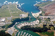
Geography
According to the 2000 census, the county has a total area of 3878.14 square miles (10,044.3 km²), of which 3508.97 square miles (9,088.2 km²) (or 90.48%) is land and 369.17 square miles (956.1 km²) (or 9.52%) is water.Cities and towns
- AlbionAlbion, CaliforniaAlbion is a census-designated place in Mendocino County, California. It is located south of Fort Bragg, at an elevation of 174 feet . Albion had a population of 168 at the 2010 census.-Geography:...
- Anchor BayAnchor Bay, CaliforniaAnchor Bay is a census-designated place in Mendocino County, California. It is located west of Gualala, at an elevation of 105 feet...
- BoonvilleBoonville, CaliforniaBoonville is a census-designated place in Mendocino County, California. It is located southwest of Ukiah, at an elevation of 381 feet . The population was 1,035 at the 2010 census.-History:...
- BranscombBranscomb, CaliforniaBranscomb is an unincorporated community in Mendocino County in the U.S. state California. It is located west-southwest of Laytonville, at an elevation of 1565 feet , on a river terrace to the east of the South Fork Eel River....
- CalpellaCalpella, CaliforniaCalpella is a census-designated place in Mendocino County, California. It is located on the Russian River north of Ukiah, at an elevation of 682 feet . It is within the Ukiah Valley where U.S. Route 101 and State Route 20 intersect. The population was 679 at the 2010 census...
- CasparCaspar, CaliforniaCaspar is a census-designated place in Mendocino County, California. It is located north of Mendocino, at an elevation of 82 feet . Caspar is located on the Pacific Ocean. In the Caspar area is the historic Point Cabrillo Light Station, which was built in 1909...
- CleoneCleone, CaliforniaCleone is a census-designated place in Mendocino County, California. It is located north-northeast of Fort Bragg on California State Highway 1, at an elevation of 79 feet . It most likely takes its name from Kelio, a division or village of the Pomo people...
- ComptcheComptche, CaliforniaComptche is a census-designated place in Mendocino County, California, United States. It is located southeast of Fort Bragg, at an elevation of 187 feet . There is a KG-3 Primary school serving the town. The population was 159 at the 2010 census....
- CoveloCovelo, CaliforniaCovelo is a census-designated place in Mendocino County, California, United States. Covelo is located east-northeast of Laytonville, at an elevation of 1398 feet...
- Dos RiosDos Rios, CaliforniaDos Rios is an unincorporated community in Mendocino County, California. It is located east-southeast of Laytonville, at an elevation of 961 feet ....
- Elk
- Fort BraggFort Bragg, CaliforniaFort Bragg is a city located in coastal Mendocino County, California along State Route 1, the major north-south highway along the Pacific Coast. Fort Bragg is located west of Willits, at an elevation of 85 feet...
- GualalaGualala, CaliforniaGualala is an unincorporated community in Mendocino County in the U.S. state of California. It is located southwest of Hopland, at an elevation of 49 feet . It is located on the Pacific coast at the mouth of the Gualala River, on State Route 1. It serves as a commercial center for the...
- HoplandHopland, CaliforniaHopland is a census-designated place in Mendocino County, California. It is located on the west bank of the Russian River south-southeast of Ukiah, at an elevation of 502 feet . The population was 756 at the 2010 census....
- InglenookInglenook, CaliforniaInglenook is an unincorporated community in Mendocino County, California. It is located on Inglenook Creek south of Westport and approximately north of Cleone, at an elevation of 102 feet . California State Highway 1 passes through the town, connecting it to Cleone and Fort Bragg to the south and...
- LaytonvilleLaytonville, CaliforniaLaytonville is a census-designated place in Mendocino County, California, United States. Laytonville, is located north-northwest of Willits, at an elevation of 1670 feet...
- LeggettLeggett, CaliforniaLeggett is a census-designated place in Mendocino County, California. It is located on the South Fork of the Eel River northwest of Laytonville, at an elevation of 984 feet . It is home to some of the largest trees in the world...
- Little RiverLittle River, CaliforniaLittle River is a small census-designated place in Mendocino County, California. It lies at an elevation of 66 feet . It is located two miles south of the town of Mendocino and running along the Pacific Ocean coast on State Route 1...
- LongvaleLongvale, CaliforniaLongvale is an unincorporated community in Mendocino County, California. It is located south-southeast of Laytonville, at an elevation of 1191 feet .A post office operated at Longvale from 1911 to 1958....
- ManchesterManchester, CaliforniaManchester is a census-designated place in Mendocino County, California. It is located north of Point Arena, at an elevation of 85 feet . The population was 195 at the 2010 census.-History:...
- MendocinoMendocino, CaliforniaMendocino is a census-designated place in Mendocino County, California, United States. Mendocino is located south of Fort Bragg, at an elevation of 154 feet...
- NavarroNavarro, CaliforniaNavarro is an unincorporated community in Mendocino County, California. It is located west of Ukiah, at an elevation of 269 feet...
- NoyoNoyo, CaliforniaNoyo is an unincorporated community in Mendocino County, California. It is located south of the center of Fort Bragg, at an elevation of 108 feet...
- Old HoplandOld Hopland, CaliforniaOld Hopland is an unincorporated community in Mendocino County, California. It is located in the Sanel Valley on the east bank of the Russian River, 0.8 miles east of Hopland and 13 miles south-southeast of Ukiah, at an elevation of 499 feet ....
- PhiloPhilo, CaliforniaPhilo is a census-designated place in Mendocino County, California. It is located northwest of Boonville, at an elevation of 331 feet . The population was 349 at the 2010 census....
- PiercyPiercy, CaliforniaPiercy is an unincorporated community in Mendocino County, California. It is located on the South Fork of the Eel River north-northwest of Leggett, at an elevation of 794 feet ....
- Pine GrovePine Grove, Mendocino County, CaliforniaPine Grove is an unincorporated community in Mendocino County, California. It is located north-northwest of Mendocino, at an elevation of 167 feet . On the ocean just west of the community is the Point Cabrillo Light station....
- Point ArenaPoint Arena, CaliforniaPoint Arena is a small coastal city in Mendocino County, California, United States. Point Arena is located west of Hopland, at an elevation of 118 feet . The population was 449 at the 2010 census, down from 474 at the 2000 census, making it one of the smallest incorporated cities in the state...
- Potter ValleyPotter Valley, CaliforniaPotter Valley is a census-designated place in Mendocino County, California, United States. It is located north-northeast of Ukiah, at an elevation of 948 feet . It is located at the headwaters of the East Fork of the Russian River...
- Redwood ValleyRedwood Valley, CaliforniaRedwood Valley is a census-designated place in Mendocino County, California. It is located southwest of Potter Valley, at an elevation of 722 feet . It comprises the northern portion of the Ukiah Valley. It is about 8 mi north of Ukiah and 12 mi south of Willits. Potter Valley is to...
- RockportRockport, CaliforniaRockport is an unincorporated community in Mendocino County, California. It is located north-northwest of Westport, at an elevation of 30 feet ....
- TalmageTalmage, CaliforniaTalmage is a census-designated place in Mendocino County, California, United States. Talmage is located east-southeast of Ukiah, at an elevation of 627 feet . The population was 1,130 at the 2010 census, down from 1,141 at the 2000 census...
- UkiahUkiah, CaliforniaThe average high temperature is 73.5 °F . Average low temperature is 46.1 °F . Temperatures reach 90 °F on an average of 65.6 days annually and 100 °F on an average of 14.4 days annually. Due to frequent low humidity, summer temperatures normally drop into the fifties at night. Freezing...
- WillitsWillits, CaliforniaWillits is a city in Mendocino County, California, United States. Willits is located north-northwest of Ukiah, at an elevation of 1391 feet . The population was 4,888 at the 2010 census, down from 5,073 at the 2000 census. Willits is at the center of Mendocino County and its redwood forests...
- WestportWestport, CaliforniaWestport is an unincorporated community in Mendocino County, California. It is located on the Pacific Ocean north of Fort Bragg, at an elevation of 125 feet ....
- YorkvilleYorkville, CaliforniaYorkville is an unincorporated community in Mendocino County, California. It is located southwest of Hopland, at an elevation of 922 feet ....
Adjacent counties
- Sonoma County, CaliforniaSonoma County, CaliforniaSonoma County, located on the northern coast of the U.S. state of California, is the largest and northernmost of the nine San Francisco Bay Area counties. Its population at the 2010 census was 483,878. Its largest city and county seat is Santa Rosa....
—south - Lake County, CaliforniaLake County, CaliforniaLake County is a county located in the north central portion of the U.S. state of California, north of the San Francisco Bay Area. It takes its name from Clear Lake, the dominant geographic feature in the county and the largest natural lake wholly within California...
—east - Glenn County, CaliforniaGlenn County, CaliforniaGlenn County is in the California Central Valley. As of 2010, it had a population of 28,122. The county seat is the city of Willows.-History:Glenn County was formed in 1891 from parts of Colusa County. It was named for Dr. Hugh J...
—east - Tehama County, CaliforniaTehama County, CaliforniaTehama County is a county located in the northern part of the U.S. state of California. It is bisected by the Sacramento River. As of 2010 its population was 63,463, up from 56,039 as of 2000. The county seat is Red Bluff.-History:...
—northeast - Trinity County, CaliforniaTrinity County, CaliforniaTrinity County is a large, rugged and mountainous, heavily forested county located in the northwestern portion of the U.S. state of California, along the Trinity River and within the Salmon/Klamath Mountains. It covers an area of over two million acres , and as of the 2010 census its population...
—north - Humboldt County, CaliforniaHumboldt County, CaliforniaHumboldt County is a county in the U.S. state of California, located on the far North Coast 200 miles north of San Francisco. According to 2010 Census Data, the county’s population was 134,623...
—north
Indian reservations
Mendocino County has nine Indian reservationIndian reservation
An American Indian reservation is an area of land managed by a Native American tribe under the United States Department of the Interior's Bureau of Indian Affairs...
s lying within its borders, the fourth most of any county in the United States (after San Diego County, California
San Diego County, California
San Diego County is a large county located in the southwestern corner of the US state of California. Hence, San Diego County is also located in the southwestern corner of the 48 contiguous United States. Its county seat and largest city is San Diego. Its population was about 2,813,835 in the 2000...
; Sandoval County, New Mexico
Sandoval County, New Mexico
-Indian reservations:Sandoval County has 12 Indian reservations and two joint-use areas lying within its borders, the second most of any county in the United States -Indian reservations:Sandoval County has 12 Indian reservations and two joint-use areas lying within its borders, the second most of...
; and Riverside County, California
Riverside County, California
Riverside County is a county in the U.S. state of California. One of 58 California counties, it covers in the southern part of the state, and stretches from Orange County to the Colorado River, which forms the state border with Arizona. The county derives its name from the city of Riverside,...
).
- Coyote Valley ReservationCoyote Valley ReservationThe Coyote Valley Reservation in Redwood Valley, California is home to about 170 members of the Coyote Valley tribe of the Native American Pomo people, who descend from the Shodakai Pomo.It is also the location of the Coyote Valley Shodakai Casino....
- Guidiville Rancheria
- Hopland Rancheria
- Laytonville Rancheria
- Manchester-Point Arena Rancheria
- Pinoleville Rancheria
- Redwood Valley RancheriaRedwood Valley RancheriaThe Redwood Valley Rancheria is the land reservation where the Native American community known as The Redwood Valley Band of Pomo Indians resides. It is located northeast of the town of Redwood Valley in Mendocino County, California.-Location and land status:The reservation spans on the...
- Round Valley Reservation (partly in Trinity CountyTrinity County, CaliforniaTrinity County is a large, rugged and mountainous, heavily forested county located in the northwestern portion of the U.S. state of California, along the Trinity River and within the Salmon/Klamath Mountains. It covers an area of over two million acres , and as of the 2010 census its population...
) - Sherwood Valley Rancheria
National protected areas
- King Range National Conservation Area (part)
- Mendocino National ForestMendocino National ForestThe Mendocino National Forest is located in the Coastal Mountain Range in northwestern California and comprises 913,306 acres...
(part)
Major highways
- State Route 1
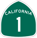 California State Route 1State Route 1 , more often called Highway 1, is a state highway that runs along much of the Pacific coast of the U.S. state of California. It is famous for running along some of the most beautiful coastlines in the world, leading to its designation as an All-American Road.Highway 1 does not run...
 - U.S. Route 101
.svg.png)
- State Route 20

- State Route 128
 California State Route 128State Route 128 is a state highway in the U.S. state of California, connecting the Mendocino coast to the Central Valley through the state's Wine Country.-Route description:...
 - State Route 162

- State Route 175

- State Route 222
 California State Route 222State Route 222 , also known as Talmage Road, is a short state highway in the U.S. state of California in Mendocino County.-Route description:...
(unsigned) - State Route 253
 California State Route 253State Route 253, also known as the Ukiah–Boonville Road, is a highway in Mendocino County, California. It runs from California State Route 128 near Boonville to U.S. Route 101 near Ukiah, connecting the Anderson Valley to the Ukiah Valley across the mountains of the Mendocino Range.-Route...
 - State Route 271
 California State Route 271State Route 271 is a state highway in northern California, USA. It is a former routing of U.S. Route 101 , now reduced to being a frontage road for that route in discontiguous segments. It also connects with Route 1 just before that route's terminus with US 101 in Leggett...
Public transportation
The Mendocino Transit AuthorityMendocino Transit Authority
The Mendocino Transit Authority is a public bus system that serves Ukiah, the Mendocino Valley, and coastal regions of Mendocino County, California.-Routes:MTA operates several routes, most of which radiate from Ukiah.-External links:*...
provides local and intercity bus service within Mendocino County. Limited service also connects with transit in Sonoma County
Sonoma County, California
Sonoma County, located on the northern coast of the U.S. state of California, is the largest and northernmost of the nine San Francisco Bay Area counties. Its population at the 2010 census was 483,878. Its largest city and county seat is Santa Rosa....
The Greyhound Bus Lines currently serves Ukiah
Ukiah, California
The average high temperature is 73.5 °F . Average low temperature is 46.1 °F . Temperatures reach 90 °F on an average of 65.6 days annually and 100 °F on an average of 14.4 days annually. Due to frequent low humidity, summer temperatures normally drop into the fifties at night. Freezing...
.
AMTRAK
Amtrak
The National Railroad Passenger Corporation, doing business as Amtrak , is a government-owned corporation that was organized on May 1, 1971, to provide intercity passenger train service in the United States. "Amtrak" is a portmanteau of the words "America" and "track". It is headquartered at Union...
has bus service that connects Mendocino to passenger service on rail lines such as the "Coast Starlight".
The historic "Skunk Train
California Western Railroad
The California Western Railroad , popularly called the Skunk Train, is a heritage railroad in Mendocino County, California, running from the railroad's headquarters in the coastal town of Fort Bragg, and the interchange with the Northwestern Pacific Railroad at Willits.The CWR runs steam and...
" connects Fort Bragg, California
Fort Bragg, California
Fort Bragg is a city located in coastal Mendocino County, California along State Route 1, the major north-south highway along the Pacific Coast. Fort Bragg is located west of Willits, at an elevation of 85 feet...
with Willits
Willits, California
Willits is a city in Mendocino County, California, United States. Willits is located north-northwest of Ukiah, at an elevation of 1391 feet . The population was 4,888 at the 2010 census, down from 5,073 at the 2000 census. Willits is at the center of Mendocino County and its redwood forests...
in Mendocino County via steam-locomotive trains and other vehicles. Conceivably, it could be used for public transportation, as well as its recreational uses.
Airports
- Ukiah Municipal AirportUkiah Municipal AirportUkiah Municipal Airport is a public airport located one mile south of Ukiah, serving Mendocino County, California, USA. This general aviation airport covers and has one runway.-External links:*...
is a general aviation airport owned by the City of Ukiah. It is located south of downtown Ukiah. - Little River AirportLittle River AirportLittle River Airport is a small county-owned public-use airport located three nautical miles southeast of the central business district of Little River, in Mendocino County, California, United States.Although most U.S...
is a general aviation airport serving the Mendocino coast.
For commercial service, passengers in Mendocino County need to go to Eureka
Eureka, California
Eureka is the principal city and the county seat of Humboldt County, California, United States. Its population was 27,191 at the 2010 census, up from 26,128 at the 2000 census....
, one county to the north in Humboldt County
Humboldt County, California
Humboldt County is a county in the U.S. state of California, located on the far North Coast 200 miles north of San Francisco. According to 2010 Census Data, the county’s population was 134,623...
, or to Sonoma County Airport
Charles M. Schulz - Sonoma County Airport
Charles M. Schulz – Sonoma County Airport is a county-owned public-use airport located 6 nautical miles northwest of downtown Santa Rosa, a city in Sonoma County, California, United States. It serves the county and surrounding areas of Wine Country in California.The airport is named after Charles M...
in Santa Rosa
Santa Rosa, California
Santa Rosa is the county seat of Sonoma County, California, United States. The 2010 census reported a population of 167,815. Santa Rosa is the largest city in California's Wine Country and fifth largest city in the San Francisco Bay Area, after San Jose, San Francisco, Oakland, and Fremont and 26th...
, Sonoma County
Sonoma County, California
Sonoma County, located on the northern coast of the U.S. state of California, is the largest and northernmost of the nine San Francisco Bay Area counties. Its population at the 2010 census was 483,878. Its largest city and county seat is Santa Rosa....
, one county to the south. More comprehensive service is available from Sacramento
Sacramento
Sacramento is the capital of the state of California, in the United States of America.Sacramento may also refer to:- United States :*Sacramento County, California*Sacramento, Kentucky*Sacramento – San Joaquin River Delta...
to the east or San Francisco, well to the south.
Emergency services for the largely unincorporated county are coordinated through Howard Forest Station
Howard Forest Station
Howard Forest Station is a CAL Fire station and emergency command center in Mendocino County, California, located along U.S. Route 101 and south of the city of Willits. The Howard Forest ECC serves as a secondary public safety answering point for fire and emergency medical services in largely...
, a local Cal Fire station just south of Willits.
Demographics
2010
The 2010 United States Census reported that Mendocino County had a population of 87,841. The racial makeup of Mendocino County was 67,218 (76.5%) White, 622 (0.7%) African American, 4,277 (4.9%) Native American, 1,450 (1.7%) Asian, 119 (0.1%) Pacific Islander, 10,185 (11.6%) from other racesRace (United States Census)
Race and ethnicity in the United States Census, as defined by the Federal Office of Management and Budget and the United States Census Bureau, are self-identification data items in which residents choose the race or races with which they most closely identify, and indicate whether or not they are...
, and 3,970 (4.5%) from two or more races. Hispanic or Latino of any race were 19,505 persons (22.2%).
| Population reported at 2010 United States Census | |||||||||
|---|---|---|---|---|---|---|---|---|---|
Mendocino County, California Mendocino County is a county located on the north coast of the U.S. state of California, north of the greater San Francisco Bay Area and west of the Central Valley. As of the 2010 census, the population was 87,841, up from 86,265 at the 2000 census... |
Population |
American |
American |
|
Islander |
races Race (United States Census) Race and ethnicity in the United States Census, as defined by the Federal Office of Management and Budget and the United States Census Bureau, are self-identification data items in which residents choose the race or races with which they most closely identify, and indicate whether or not they are... |
more races |
or Latino (of any race) |
|
| Mendocino County Mendocino County, California Mendocino County is a county located on the north coast of the U.S. state of California, north of the greater San Francisco Bay Area and west of the Central Valley. As of the 2010 census, the population was 87,841, up from 86,265 at the 2000 census... |
87,841 | 67,218 | 622 | 4,277 | 1,450 | 119 | 10,185 | 3,970 | 19,505 |
city |
Population |
American |
American |
|
Islander |
races Race (United States Census) Race and ethnicity in the United States Census, as defined by the Federal Office of Management and Budget and the United States Census Bureau, are self-identification data items in which residents choose the race or races with which they most closely identify, and indicate whether or not they are... |
more races |
or Latino (of any race) |
|
| Fort Bragg Fort Bragg, California Fort Bragg is a city located in coastal Mendocino County, California along State Route 1, the major north-south highway along the Pacific Coast. Fort Bragg is located west of Willits, at an elevation of 85 feet... |
7,273 | 5,439 | 51 | 160 | 108 | 14 | 1,165 | 336 | 2,313 |
| Point Arena Point Arena, California Point Arena is a small coastal city in Mendocino County, California, United States. Point Arena is located west of Hopland, at an elevation of 118 feet . The population was 449 at the 2010 census, down from 474 at the 2000 census, making it one of the smallest incorporated cities in the state... |
449 | 305 | 2 | 1 | 0 | 0 | 118 | 23 | 150 |
| Ukiah Ukiah, California The average high temperature is 73.5 °F . Average low temperature is 46.1 °F . Temperatures reach 90 °F on an average of 65.6 days annually and 100 °F on an average of 14.4 days annually. Due to frequent low humidity, summer temperatures normally drop into the fifties at night. Freezing... |
16,075 | 11,592 | 174 | 601 | 412 | 34 | 2,385 | 877 | 4,458 |
| Willits Willits, California Willits is a city in Mendocino County, California, United States. Willits is located north-northwest of Ukiah, at an elevation of 1391 feet . The population was 4,888 at the 2010 census, down from 5,073 at the 2000 census. Willits is at the center of Mendocino County and its redwood forests... |
4,888 | 3,862 | 34 | 216 | 68 | 5 | 479 | 224 | 1,008 |
place Census-designated place A census-designated place is a concentration of population identified by the United States Census Bureau for statistical purposes. CDPs are delineated for each decennial census as the statistical counterparts of incorporated places such as cities, towns and villages... |
Population |
American |
American |
|
Islander |
races Race (United States Census) Race and ethnicity in the United States Census, as defined by the Federal Office of Management and Budget and the United States Census Bureau, are self-identification data items in which residents choose the race or races with which they most closely identify, and indicate whether or not they are... |
more races |
or Latino (of any race) |
|
| Albion Albion, California Albion is a census-designated place in Mendocino County, California. It is located south of Fort Bragg, at an elevation of 174 feet . Albion had a population of 168 at the 2010 census.-Geography:... |
168 | 150 | 1 | 4 | 5 | 0 | 0 | 8 | 4 |
| Anchor Bay Anchor Bay, California Anchor Bay is a census-designated place in Mendocino County, California. It is located west of Gualala, at an elevation of 105 feet... |
340 | 301 | 2 | 5 | 2 | 1 | 12 | 17 | 29 |
| Boonville Boonville, California Boonville is a census-designated place in Mendocino County, California. It is located southwest of Ukiah, at an elevation of 381 feet . The population was 1,035 at the 2010 census.-History:... |
1,035 | 630 | 9 | 18 | 7 | 2 | 340 | 29 | 520 |
| Brooktrails Brooktrails, California Brooktrails is a census-designated place in Mendocino County, California. The Fire Department and golf course lie at an elevation of 1634 feet , but its western edge rises to nearly 3000'. The population was 3,235 at the 2010 census... |
3,235 | 2,818 | 22 | 87 | 26 | 4 | 109 | 169 | 329 |
| Calpella Calpella, California Calpella is a census-designated place in Mendocino County, California. It is located on the Russian River north of Ukiah, at an elevation of 682 feet . It is within the Ukiah Valley where U.S. Route 101 and State Route 20 intersect. The population was 679 at the 2010 census... |
679 | 465 | 3 | 25 | 3 | 0 | 145 | 38 | 256 |
| Caspar Caspar, California Caspar is a census-designated place in Mendocino County, California. It is located north of Mendocino, at an elevation of 82 feet . Caspar is located on the Pacific Ocean. In the Caspar area is the historic Point Cabrillo Light Station, which was built in 1909... |
509 | 474 | 3 | 0 | 8 | 0 | 3 | 21 | 15 |
| Cleone Cleone, California Cleone is a census-designated place in Mendocino County, California. It is located north-northeast of Fort Bragg on California State Highway 1, at an elevation of 79 feet . It most likely takes its name from Kelio, a division or village of the Pomo people... |
618 | 518 | 1 | 3 | 3 | 0 | 79 | 14 | 124 |
| Comptche Comptche, California Comptche is a census-designated place in Mendocino County, California, United States. It is located southeast of Fort Bragg, at an elevation of 187 feet . There is a KG-3 Primary school serving the town. The population was 159 at the 2010 census.... |
159 | 146 | 0 | 1 | 1 | 0 | 5 | 6 | 10 |
| Covelo Covelo, California Covelo is a census-designated place in Mendocino County, California, United States. Covelo is located east-northeast of Laytonville, at an elevation of 1398 feet... |
1,255 | 611 | 14 | 475 | 10 | 0 | 49 | 96 | 163 |
| Hopland Hopland, California Hopland is a census-designated place in Mendocino County, California. It is located on the west bank of the Russian River south-southeast of Ukiah, at an elevation of 502 feet . The population was 756 at the 2010 census.... |
756 | 521 | 4 | 38 | 10 | 0 | 142 | 41 | 263 |
| Laytonville Laytonville, California Laytonville is a census-designated place in Mendocino County, California, United States. Laytonville, is located north-northwest of Willits, at an elevation of 1670 feet... |
1,227 | 839 | 16 | 244 | 10 | 1 | 60 | 57 | 141 |
| Leggett Leggett, California Leggett is a census-designated place in Mendocino County, California. It is located on the South Fork of the Eel River northwest of Laytonville, at an elevation of 984 feet . It is home to some of the largest trees in the world... |
122 | 101 | 0 | 3 | 0 | 0 | 0 | 18 | 4 |
| Little River Little River, California Little River is a small census-designated place in Mendocino County, California. It lies at an elevation of 66 feet . It is located two miles south of the town of Mendocino and running along the Pacific Ocean coast on State Route 1... |
117 | 113 | 0 | 1 | 0 | 0 | 0 | 3 | 2 |
| Manchester Manchester, California Manchester is a census-designated place in Mendocino County, California. It is located north of Point Arena, at an elevation of 85 feet . The population was 195 at the 2010 census.-History:... |
195 | 151 | 0 | 4 | 1 | 0 | 29 | 10 | 48 |
| Mendocino Mendocino, California Mendocino is a census-designated place in Mendocino County, California, United States. Mendocino is located south of Fort Bragg, at an elevation of 154 feet... |
894 | 834 | 5 | 8 | 13 | 1 | 6 | 27 | 42 |
| Philo Philo, California Philo is a census-designated place in Mendocino County, California. It is located northwest of Boonville, at an elevation of 331 feet . The population was 349 at the 2010 census.... |
349 | 171 | 2 | 4 | 5 | 0 | 157 | 10 | 204 |
| Potter Valley Potter Valley, California Potter Valley is a census-designated place in Mendocino County, California, United States. It is located north-northeast of Ukiah, at an elevation of 948 feet . It is located at the headwaters of the East Fork of the Russian River... |
646 | 516 | 2 | 13 | 2 | 0 | 97 | 16 | 154 |
| Redwood Valley Redwood Valley, California Redwood Valley is a census-designated place in Mendocino County, California. It is located southwest of Potter Valley, at an elevation of 722 feet . It comprises the northern portion of the Ukiah Valley. It is about 8 mi north of Ukiah and 12 mi south of Willits. Potter Valley is to... |
1,729 | 1,432 | 7 | 63 | 10 | 1 | 155 | 61 | 305 |
| Talmage Talmage, California Talmage is a census-designated place in Mendocino County, California, United States. Talmage is located east-southeast of Ukiah, at an elevation of 627 feet . The population was 1,130 at the 2010 census, down from 1,141 at the 2000 census... |
1,130 | 503 | 3 | 27 | 273 | 4 | 278 | 42 | 366 |
communities Unincorporated area In law, an unincorporated area is a region of land that is not a part of any municipality.To "incorporate" in this context means to form a municipal corporation, a city, town, or village with its own government. An unincorporated community is usually not subject to or taxed by a municipal government... |
Population |
American |
American |
|
Islander |
races Race (United States Census) Race and ethnicity in the United States Census, as defined by the Federal Office of Management and Budget and the United States Census Bureau, are self-identification data items in which residents choose the race or races with which they most closely identify, and indicate whether or not they are... |
more races |
or Latino (of any race) |
|
| All others not CDPs (combined) | 48,881 | 38,588 | 301 | 2,492 | 541 | 57 | 4,851 | 2,051 | 9,605 |
2000
As of the censusCensus
A census is the procedure of systematically acquiring and recording information about the members of a given population. It is a regularly occurring and official count of a particular population. The term is used mostly in connection with national population and housing censuses; other common...
of 2000, there were 86,265 people, 33,266 households, and 21,855 families residing in the county. The population density
Population density
Population density is a measurement of population per unit area or unit volume. It is frequently applied to living organisms, and particularly to humans...
was 25 people per square mile (9/km²). There were 36,937 housing units at an average density of 10 per square mile (4/km²). The racial makeup of the county was 80.76% White
Race (United States Census)
Race and ethnicity in the United States Census, as defined by the Federal Office of Management and Budget and the United States Census Bureau, are self-identification data items in which residents choose the race or races with which they most closely identify, and indicate whether or not they are...
, 0.62% Black
Race (United States Census)
Race and ethnicity in the United States Census, as defined by the Federal Office of Management and Budget and the United States Census Bureau, are self-identification data items in which residents choose the race or races with which they most closely identify, and indicate whether or not they are...
or African American
Race (United States Census)
Race and ethnicity in the United States Census, as defined by the Federal Office of Management and Budget and the United States Census Bureau, are self-identification data items in which residents choose the race or races with which they most closely identify, and indicate whether or not they are...
, 4.76% Native American
Race (United States Census)
Race and ethnicity in the United States Census, as defined by the Federal Office of Management and Budget and the United States Census Bureau, are self-identification data items in which residents choose the race or races with which they most closely identify, and indicate whether or not they are...
, 1.20% Asian
Race (United States Census)
Race and ethnicity in the United States Census, as defined by the Federal Office of Management and Budget and the United States Census Bureau, are self-identification data items in which residents choose the race or races with which they most closely identify, and indicate whether or not they are...
, 0.15% Pacific Islander
Race (United States Census)
Race and ethnicity in the United States Census, as defined by the Federal Office of Management and Budget and the United States Census Bureau, are self-identification data items in which residents choose the race or races with which they most closely identify, and indicate whether or not they are...
, 8.61% from other races
Race (United States Census)
Race and ethnicity in the United States Census, as defined by the Federal Office of Management and Budget and the United States Census Bureau, are self-identification data items in which residents choose the race or races with which they most closely identify, and indicate whether or not they are...
, and 3.90% from two or more races. 16.48% of the population were Hispanic
Race (United States Census)
Race and ethnicity in the United States Census, as defined by the Federal Office of Management and Budget and the United States Census Bureau, are self-identification data items in which residents choose the race or races with which they most closely identify, and indicate whether or not they are...
or Latino
Race (United States Census)
Race and ethnicity in the United States Census, as defined by the Federal Office of Management and Budget and the United States Census Bureau, are self-identification data items in which residents choose the race or races with which they most closely identify, and indicate whether or not they are...
of any race. 12.2% were of German, 10.8% English
English people
The English are a nation and ethnic group native to England, who speak English. The English identity is of early mediaeval origin, when they were known in Old English as the Anglecynn. England is now a country of the United Kingdom, and the majority of English people in England are British Citizens...
, 8.6% Irish
Irish people
The Irish people are an ethnic group who originate in Ireland, an island in northwestern Europe. Ireland has been populated for around 9,000 years , with the Irish people's earliest ancestors recorded having legends of being descended from groups such as the Nemedians, Fomorians, Fir Bolg, Tuatha...
, 6.1% Italian
Italian people
The Italian people are an ethnic group that share a common Italian culture, ancestry and speak the Italian language as a mother tongue. Within Italy, Italians are defined by citizenship, regardless of ancestry or country of residence , and are distinguished from people...
and 5.6% American
United States
The United States of America is a federal constitutional republic comprising fifty states and a federal district...
ancestry according to Census 2000. 84.4% spoke English
English language
English is a West Germanic language that arose in the Anglo-Saxon kingdoms of England and spread into what was to become south-east Scotland under the influence of the Anglian medieval kingdom of Northumbria...
and 13.2% Spanish
Spanish language
Spanish , also known as Castilian , is a Romance language in the Ibero-Romance group that evolved from several languages and dialects in central-northern Iberia around the 9th century and gradually spread with the expansion of the Kingdom of Castile into central and southern Iberia during the...
as their first language.
There were 33,266 households out of which 31.4% had children under the age of 18 living with them, 48.9% were married couples
Marriage
Marriage is a social union or legal contract between people that creates kinship. It is an institution in which interpersonal relationships, usually intimate and sexual, are acknowledged in a variety of ways, depending on the culture or subculture in which it is found...
living together, 11.7% had a female householder with no husband present, and 34.3% were non-families. 27.0% of all households were made up of individuals and 10.4% had someone living alone who was 65 years of age or older. The average household size was 2.53 and the average family size was 3.04.
In the county the population was spread out with 25.5% under the age of 18, 8.1% from 18 to 24, 25.6% from 25 to 44, 27.1% from 45 to 64, and 13.6% who were 65 years of age or older. The median age was 39 years. For every 100 females there were 98.9 males. For every 100 females age 18 and over, there were 97.1 males.
The median income for a household in the county was $35,996, and the median income for a family was $42,168. Males had a median income of $33,128 versus $23,774 for females. The per capita income
Per capita income
Per capita income or income per person is a measure of mean income within an economic aggregate, such as a country or city. It is calculated by taking a measure of all sources of income in the aggregate and dividing it by the total population...
for the county was $19,443. About 10.9% of families and 15.9% of the population were below the poverty line, including 21.5% of those under age 18 and 7.7% of those age 65 or over.
Politics
| Year | GOP Republican Party (United States) The Republican Party is one of the two major contemporary political parties in the United States, along with the Democratic Party. Founded by anti-slavery expansion activists in 1854, it is often called the GOP . The party's platform generally reflects American conservatism in the U.S... |
Dem Democratic Party (United States) The Democratic Party is one of two major contemporary political parties in the United States, along with the Republican Party. The party's socially liberal and progressive platform is largely considered center-left in the U.S. political spectrum. The party has the lengthiest record of continuous... |
Others |
|---|---|---|---|
| 2008 United States presidential election, 2008 The United States presidential election of 2008 was the 56th quadrennial presidential election. It was held on November 4, 2008. Democrat Barack Obama, then the junior United States Senator from Illinois, defeated Republican John McCain, the senior U.S. Senator from Arizona. Obama received 365... |
69.6% 27,843 | 4.0% 1,620 | |
| 2004 United States presidential election, 2004 The United States presidential election of 2004 was the United States' 55th quadrennial presidential election. It was held on Tuesday, November 2, 2004. Republican Party candidate and incumbent President George W. Bush defeated Democratic Party candidate John Kerry, the then-junior U.S. Senator... |
63.5% 24,385 | 2.8% 1,089 | |
| 2000 United States presidential election, 2000 The United States presidential election of 2000 was a contest between Republican candidate George W. Bush, then-governor of Texas and son of former president George H. W. Bush , and Democratic candidate Al Gore, then-Vice President.... |
48.3% 16,634 | 16.0% 5,504 | |
| 1996 United States presidential election, 1996 The United States presidential election of 1996 was a contest between the Democratic national ticket of President Bill Clinton of Arkansas and Vice President Al Gore of Tennessee and the Republican national ticket of former Senator Bob Dole of Kansas for President and former Housing Secretary Jack... |
45.7% 14,952 | 24.4% 7,975 | |
| 1992 United States presidential election, 1992 The United States presidential election of 1992 had three major candidates: Incumbent Republican President George Bush; Democratic Arkansas Governor Bill Clinton, and independent Texas businessman Ross Perot.... |
50.2% 18,344 | 28.0% 10,236 | |
| 1988 United States presidential election, 1988 The United States presidential election of 1988 featured no incumbent president, as President Ronald Reagan was unable to seek re-election after serving the maximum two terms allowed by the Twenty-second Amendment. Reagan's Vice President, George H. W. Bush, won the Republican nomination, while the... |
55.4% 17,152 | 2.6% 816 | |
| 1984 United States presidential election, 1984 The United States presidential election of 1984 was a contest between the incumbent President Ronald Reagan, the Republican candidate, and former Vice President Walter Mondale, the Democratic candidate. Reagan was helped by a strong economic recovery from the deep recession of 1981–1982... |
45.9% 14,407 | 2.1% 646 | |
| 1980 United States presidential election, 1980 The United States presidential election of 1980 featured a contest between incumbent Democrat Jimmy Carter and his Republican opponent, Ronald Reagan, as well as Republican Congressman John B. Anderson, who ran as an independent... |
38.2% 10,784 | 17.7% 5,008 | |
| 1976 United States presidential election, 1976 The United States presidential election of 1976 followed the resignation of President Richard Nixon in the wake of the Watergate scandal. It pitted incumbent President Gerald Ford, the Republican candidate, against the relatively unknown former governor of Georgia, Jimmy Carter, the Democratic... |
49.5% 10,653 | 5.0% 1,072 | |
| 1972 United States presidential election, 1972 The United States presidential election of 1972 was the 47th quadrennial United States presidential election. It was held on November 7, 1972. The Democratic Party's nomination was eventually won by Senator George McGovern, who ran an anti-war campaign against incumbent Republican President Richard... |
43.3% 9,435 | 5.7% 1,251 | |
| 1968 United States presidential election, 1968 The United States presidential election of 1968 was the 46th quadrennial United States presidential election. Coming four years after Democrat Lyndon B. Johnson won in a historic landslide, it saw Johnson forced out of the race and Republican Richard Nixon elected... |
44.3% 7,935 | 9.3% 1,664 | |
| 1964 United States presidential election, 1964 The United States presidential election of 1964 was held on November 3, 1964. Incumbent President Lyndon B. Johnson had come to office less than a year earlier following the assassination of his predecessor, John F. Kennedy. Johnson, who had successfully associated himself with Kennedy's... |
65.1% 11,869 | 0.2% 36 | |
| 1960 United States presidential election, 1960 The United States presidential election of 1960 was the 44th American presidential election, held on November 8, 1960, for the term beginning January 20, 1961, and ending January 20, 1965. The incumbent president, Republican Dwight D. Eisenhower, was not eligible to run again. The Republican Party... |
50.2% 9,476 | 0.5% 94 | |
| 1956 United States presidential election, 1956 The United States presidential election of 1956 saw a popular Dwight D. Eisenhower successfully run for re-election. The 1956 election was a rematch of 1952, as Eisenhower's opponent in 1956 was Democrat Adlai Stevenson, whom Eisenhower had defeated four years earlier.Incumbent President Eisenhower... |
42.8% 7,767 | 0.2% 43 | |
| 1952 United States presidential election, 1952 The United States presidential election of 1952 took place in an era when Cold War tension between the United States and the Soviet Union was escalating rapidly. In the United States Senate, Republican Senator Joseph McCarthy of Wisconsin had become a national figure after chairing congressional... |
38.1% 6,813 | 1.1% 191 | |
| 1948 United States presidential election, 1948 The United States presidential election of 1948 is considered by most historians as the greatest election upset in American history. Virtually every prediction indicated that incumbent President Harry S. Truman would be defeated by Republican Thomas E. Dewey. Truman won, overcoming a three-way... |
44.1% 5,553 | 5.4% 682 | |
| 1944 United States presidential election, 1944 The United States presidential election of 1944 took place while the United States was preoccupied with fighting World War II. President Franklin D. Roosevelt had been in office longer than any other president, but remained popular. Unlike 1940, there was little doubt that Roosevelt would run for... |
53.8% 5,452 | 0.4% 36 | |
| 1940 United States presidential election, 1940 The United States presidential election of 1940 was fought in the shadow of World War II as the United States was emerging from the Great Depression. Incumbent President Franklin D. Roosevelt , a Democrat, broke with tradition and ran for a third term, which became a major issue... |
56.1% 7,055 | 1.3% 169 | |
| 1936 United States presidential election, 1936 The United States presidential election of 1936 was the most lopsided presidential election in the history of the United States in terms of electoral votes. In terms of the popular vote, it was the third biggest victory since the election of 1820, which was not seriously contested.The election took... |
62.7% 6,432 | 1.6% 164 | |
| 1932 United States presidential election, 1932 The United States presidential election of 1932 took place as the effects of the Wall Street Crash of 1929, the Smoot-Hawley Tariff Act of 1930, the Revenue Act of 1932, and the Great Depression were being felt intensely across the country. President Herbert Hoover's popularity was falling as... |
61.4% 5,867 | 3.3% 319 | |
| 1928 United States presidential election, 1928 The United States presidential election of 1928 pitted Republican Herbert Hoover against Democrat Al Smith. The Republicans were identified with the booming economy of the 1920s, whereas Smith, a Roman Catholic, suffered politically from Anti-Catholic prejudice, his anti-prohibitionist stance, and... |
34.6% 2,628 | 2.0% 150 | |
| 1924 United States presidential election, 1924 The United States presidential election of 1924 was won by incumbent President Calvin Coolidge, the Republican candidate.Coolidge was vice-president under Warren G. Harding and became president in 1923 when Harding died in office. Coolidge was given credit for a booming economy at home and no... |
12.0% 739 | 31.5% 1,933 | |
| 1920 United States presidential election, 1920 The United States presidential election of 1920 was dominated by the aftermath of World War I and a hostile response to certain policies of Woodrow Wilson, the Democratic president. The wartime economic boom had collapsed. Politicians were arguing over peace treaties and the question of America's... |
26.5% 1,789 | 7.7% 517 |
Mendocino is a strongly Democratic
Democratic Party (United States)
The Democratic Party is one of two major contemporary political parties in the United States, along with the Republican Party. The party's socially liberal and progressive platform is largely considered center-left in the U.S. political spectrum. The party has the lengthiest record of continuous...
county in Presidential
President of the United States
The President of the United States of America is the head of state and head of government of the United States. The president leads the executive branch of the federal government and is the commander-in-chief of the United States Armed Forces....
and congressional
United States Congress
The United States Congress is the bicameral legislature of the federal government of the United States, consisting of the Senate and the House of Representatives. The Congress meets in the United States Capitol in Washington, D.C....
elections. The last Republican to win a majority in the county was Ronald Reagan
Ronald Reagan
Ronald Wilson Reagan was the 40th President of the United States , the 33rd Governor of California and, prior to that, a radio, film and television actor....
in 1980
United States presidential election, 1980
The United States presidential election of 1980 featured a contest between incumbent Democrat Jimmy Carter and his Republican opponent, Ronald Reagan, as well as Republican Congressman John B. Anderson, who ran as an independent...
and 1984
United States presidential election, 1984
The United States presidential election of 1984 was a contest between the incumbent President Ronald Reagan, the Republican candidate, and former Vice President Walter Mondale, the Democratic candidate. Reagan was helped by a strong economic recovery from the deep recession of 1981–1982...
. It is part of California's 1st congressional district
California's 1st congressional district
California's 1st congressional district is a congressional district located in the U.S. state of California and presently consists of the northern coastline and includes Del Norte, Humboldt, Lake, Mendocino and Napa counties and parts of Sonoma and Yolo counties.The district is currently...
, which is held by Democrat Mike Thompson
Mike Thompson
Michael C. Thompson , is the U.S. Representative for , serving since 1999. He is a member of the Democratic Party. The district includes Napa, Lake, Mendocino, Humboldt and Del Norte Counties as well as parts of Yolo and Sonoma Counties....
. In the state legislature
California State Legislature
The California State Legislature is the state legislature of the U.S. state of California. It is a bicameral body consisting of the lower house, the California State Assembly, with 80 members, and the upper house, the California State Senate, with 40 members...
Mendocino is in the 1st Assembly district, which is held by Democrat Wes Chesbro, and the 2nd Senate district, which is held by Democrat Noreen Evans
Noreen Evans
Noreen Evans is an American politician in the California State Senate. She is a Democrat representing the 2nd district, encompassing Humboldt, Mendocino, Lake, and Napa counties, as well as parts of Sonoma and Solano counties....
. As of April 2008, the California Secretary of State
California Secretary of State
The Secretary of State of California is the chief elections officer of that U.S. state. The Secretary of State is also responsible for the California State Archives, as well as chartering corporations. The Secretary of State is elected to four year terms, concurrent with the other constitutional...
reports that Mendocino County has 47,168 registered voters. Of those, 22,264 (47.2%) are registered Democratic; 11,422 (24.2%) are registered Republican; 4,179 (8.9%) are registered with other political parties, and 9,303 (19.7%) declined to state a political party.
In 2000, Mendocino County voters approved Measure G, which calls for the decriminalization of marijuana when used and cultivated for personal use. Measure G passed with a 58% majority vote, making it the first county in the United States to declare prosecution of small-scale marijuana offenses the "lowest priority" for local law enforcement. Measure G does not protect individuals who cultivate, transport or possess marijuana for sale. However, Measure G was passed at the local government level affecting only Mendocino County, and therefore does not affect existing state or federal laws. The city of Berkeley
Berkeley, California
Berkeley is a city on the east shore of the San Francisco Bay in Northern California, United States. Its neighbors to the south are the cities of Oakland and Emeryville. To the north is the city of Albany and the unincorporated community of Kensington...
has had a similar law (known as the Berkeley Marijuana Initiative II) since 1979 which has generally been found to be unenforceable.
In 2008, the Mendocino County Board of Supervisors placed Measure B on the June 3 county-wide ballot. After three months of hard-fought campaigning and national attention, voters narrowly approved "B", which repealed the provisions of 2000's Measure G. However, opponents of Measure B intend to continue the challenge in court as the wording of Measure B relies heavily on S.B. 420's state limitations which were recently ruled unconstitutional by the California supreme court. On July 3, the Sheriff and District Attorneys offices announced that they would not be enforcing the new regulations for the time being, citing pending legal challenges and conflicts with existing state law.
In April, 2009, Sheriff Tom Allman issued his department's medical marijuana enforcement policy, which includes the provisions of Measure B and also cites the California Supreme Court Ruling narrowly defining "caregiver" in the state's medical marijuana law.
In 2004, Measure H was passed in Mendocino County with a 57% majority, making it the first county in the United States to ban the production and cultivation of genetically modified organism
Genetically modified organism
A genetically modified organism or genetically engineered organism is an organism whose genetic material has been altered using genetic engineering techniques. These techniques, generally known as recombinant DNA technology, use DNA molecules from different sources, which are combined into one...
s.
On Nov. 4, 2008 Mendocino County voted 63.2 % against Proposition 8 which amended the California Constitution to define marriage as a union between one man and one woman.
Government
As of 2011, the elected District AttorneyDistrict attorney
In many jurisdictions in the United States, a District Attorney is an elected or appointed government official who represents the government in the prosecution of criminal offenses. The district attorney is the highest officeholder in the jurisdiction's legal department and supervises a staff of...
of Mendocino County is C. David Eyster, the elected Sheriff
Sheriff
A sheriff is in principle a legal official with responsibility for a county. In practice, the specific combination of legal, political, and ceremonial duties of a sheriff varies greatly from country to country....
and Coroner
Coroner
A coroner is a government official who* Investigates human deaths* Determines cause of death* Issues death certificates* Maintains death records* Responds to deaths in mass disasters* Identifies unknown dead* Other functions depending on local laws...
is Thomas D. Allman, and the appointed Chief Executive Officer is Carmel Angelo. Mendocino County is governed by a board of five supervisors, each with a separate district. The first district is represented by Carre Brown, and serves the central-eastern region of the county, including Potter Valley
Potter Valley, California
Potter Valley is a census-designated place in Mendocino County, California, United States. It is located north-northeast of Ukiah, at an elevation of 948 feet . It is located at the headwaters of the East Fork of the Russian River...
, Redwood Valley
Redwood Valley, California
Redwood Valley is a census-designated place in Mendocino County, California. It is located southwest of Potter Valley, at an elevation of 722 feet . It comprises the northern portion of the Ukiah Valley. It is about 8 mi north of Ukiah and 12 mi south of Willits. Potter Valley is to...
, Calpella
Calpella, California
Calpella is a census-designated place in Mendocino County, California. It is located on the Russian River north of Ukiah, at an elevation of 682 feet . It is within the Ukiah Valley where U.S. Route 101 and State Route 20 intersect. The population was 679 at the 2010 census...
, and Talmage
Talmage, California
Talmage is a census-designated place in Mendocino County, California, United States. Talmage is located east-southeast of Ukiah, at an elevation of 627 feet . The population was 1,130 at the 2010 census, down from 1,141 at the 2000 census...
. The second district, represented by John McCowen, serves Ukiah
Ukiah, California
The average high temperature is 73.5 °F . Average low temperature is 46.1 °F . Temperatures reach 90 °F on an average of 65.6 days annually and 100 °F on an average of 14.4 days annually. Due to frequent low humidity, summer temperatures normally drop into the fifties at night. Freezing...
. The third district, in the northeastern quadrant of the county from Willits
Willits, California
Willits is a city in Mendocino County, California, United States. Willits is located north-northwest of Ukiah, at an elevation of 1391 feet . The population was 4,888 at the 2010 census, down from 5,073 at the 2000 census. Willits is at the center of Mendocino County and its redwood forests...
north to Laytonville
Laytonville, California
Laytonville is a census-designated place in Mendocino County, California, United States. Laytonville, is located north-northwest of Willits, at an elevation of 1670 feet...
and Covelo
Covelo, California
Covelo is a census-designated place in Mendocino County, California, United States. Covelo is located east-northeast of Laytonville, at an elevation of 1398 feet...
, is represented by John Pinches. The fourth district covers the northwestern quadrant of the county, including the coast from Caspar
Caspar, California
Caspar is a census-designated place in Mendocino County, California. It is located north of Mendocino, at an elevation of 82 feet . Caspar is located on the Pacific Ocean. In the Caspar area is the historic Point Cabrillo Light Station, which was built in 1909...
northwards through Fort Bragg
Fort Bragg, California
Fort Bragg is a city located in coastal Mendocino County, California along State Route 1, the major north-south highway along the Pacific Coast. Fort Bragg is located west of Willits, at an elevation of 85 feet...
; its supervisor is Kendall Smith. The supervisor for the fifth district is Dan Hamburg
Daniel Hamburg
Daniel Hamburg is an American politician and a former Democratic Party Congressman and 1998 Green Party Gubernatorial candidate from California. He remains active in both the Democratic Party and Green Party.-Early life:...
; his district covers the southern portion of the county, including the coast from Mendocino
Mendocino, California
Mendocino is a census-designated place in Mendocino County, California, United States. Mendocino is located south of Fort Bragg, at an elevation of 154 feet...
to Gualala
Gualala, California
Gualala is an unincorporated community in Mendocino County in the U.S. state of California. It is located southwest of Hopland, at an elevation of 49 feet . It is located on the Pacific coast at the mouth of the Gualala River, on State Route 1. It serves as a commercial center for the...
, the Anderson Valley
Anderson Valley
Anderson Valley is a sparsely populated region in western Mendocino County in Northern California. Located approximately 100 miles north of San Francisco, the name "Anderson Valley" applies broadly to several rural, unincorporated communities in or near the alluvial terraces along Anderson Creek...
, the western outskirts of Ukiah
Ukiah, California
The average high temperature is 73.5 °F . Average low temperature is 46.1 °F . Temperatures reach 90 °F on an average of 65.6 days annually and 100 °F on an average of 14.4 days annually. Due to frequent low humidity, summer temperatures normally drop into the fifties at night. Freezing...
, and portions of the Russian River
Russian River
Russian River may refer to one of the following rivers in the United States:* Russian River * Russian River Russian River may also refer to a brewpub in Santa Rosa, California:* Russian River Brewing Company...
valley near Hopland
Hopland, California
Hopland is a census-designated place in Mendocino County, California. It is located on the west bank of the Russian River south-southeast of Ukiah, at an elevation of 502 feet . The population was 756 at the 2010 census....
. Hamburg also previously served as a county supervisor, and also served one term as a Congressman in Washington, D.C.
Rivers
- Russian RiverRussian River (California)The Russian River, a southward-flowing river, drains of Sonoma and Mendocino counties in Northern California. With an annual average discharge of approximately , it is the second largest river flowing through the nine county Greater San Francisco Bay Area with a mainstem 110 miles ...
(inland) - Gualala RiverGualala RiverThe Gualala River is a river on the northern coast of California. Most of the river is in Sonoma County, but a portion is in Mendocino County. The headwaters of the river are high in the Coast Range, and it empties into the Pacific Ocean...
- Garcia RiverGarcia RiverThe Garcia River is a river on the northern coast of California, in southern Mendocino County. The river's watershed covers and its mainstem is long. The watershed receives of precipitation per year near the coast and inland. The watershed's elevation ranges from sea level near the ocean to in...
- Elk Creek
- Navarro RiverNavarro RiverThe Navarro River is a river in Mendocino County, California. It flows northwest through the Coastal Range to the Pacific Ocean. Encompassing , its watershed includes the Anderson Valley, a well-known wine-growing region in Mendocino County. The main stem of the Navarro River begins less than ...
- Albion RiverAlbion RiverThe Albion River is an river in Mendocino County, California. The river drains about on the Mendocino Coast and empties into the Pacific Ocean near the town of Albion, California, where California State Route 1 crosses it on the Albion River Bridge. The river's overall direction is east to west,...
- Little River
- Big RiverBig River (California)The Big River is a river in Mendocino County, California, draining an area of about . The Big River watershed borders the watersheds of the Noyo River to the north, the Eel River and Russian River to the east, and the Little River, Albion River, and Navarro River to the south.The river's...
- Noyo RiverNoyo RiverThe Noyo River is a river on the north coast of California in Mendocino County. The river's headwaters are in the steep Mendocino Range, but downstream the river flows through gently sloping marine terraces before draining into the Pacific Ocean...
- Pudding Creek
- Virgin Creek
- Ten Mile RiverTen Mile River (California)Ten Mile River is a river in northern Mendocino County, California, United States. It is named for the fact that its mouth is ten miles north of the mouth of the Noyo River. The middle and north forks of the river are each long, and the river extends for seven more miles from their confluence to...
- Usal CreekUsal CreekUsal Creek is the southernmost drainage basin unbridged by California State Route 1 on California's Lost Coast. The unpaved county road following the westernmost ridge line south from the King Range crosses Usal Creek near the Pacific coast, but the bridge may be removed during winter months...
- Eel RiverEel River (California)The Eel River is a major river system of the northern Pacific coast of the U.S. state of California. Approximately 200 miles long, it drains a rugged area in the California Coast Ranges between the Sacramento Valley and the ocean. For most of its course, the river flows northwest, parallel to the...
(inland)
Beaches
- Big River Beach
- Caspar Headlands State BeachCaspar Headlands State BeachCaspar Headlands State Beach is a protected beach in the state park system of California, USA. It is located in Northern California in Mendocino County near the village of Caspar. The park was established in 1972.-History:...
- Van Damme BeachVan Damme State ParkVan Damme State Park consists of about of land in Mendocino County, California, near the town of Little River on State Route 1. It was named for Charles Van Damme , who was born in the area and purchased the land that is now the park with profits from a San Francisco ferry business...
- Greenwood State Beach
- Seaside Beach
- Wesport-Union Landing State Beach
- Manchester State Beach
- Navarro Beach
- Portuguese Beach
- Schooner Gulch State BeachSchooner Gulch State BeachSchooner Gulch State Beach is a beach located in Mendocino County, California. It is located approximately 50 miles northwest of Santa Rosa. It offers a scenic spot along the Mendocino coast and a stunning perch for watching sunsets. Visitors to the beach come to surf, fish, and picnic.-References:...
- Long Valley Creek
- 10 Mile Creek
Parks, reserves and related places
- Admiral William Standley State Recreation AreaAdmiral William Standley State Recreation AreaAdmiral William Standley State Recreation Area is a state recreation area of California, USA, featuring of redwoods on the Eel River. It is located west of Laytonville, California, in Mendocino County...
- Caspar Headlands State Recreation Area
- Hendy Woods State ParkHendy Woods State ParkHendy Woods State Park is a state park located in Mendocino County, California. The park contains two groves of old growth Coast Redwood: Big Hendy and Little Hendy . The Navarro River runs through the length of the park....
- Jug Handle State Reserve
- MacKerricher State ParkMacKerricher State ParkMacKerricher State Park in Northern California offers a variety of habitats: beach, bluff, headland, dune, forest, and wetland. Tide pools are along the shore. Seals live on the rocks off the park’s Mendocino coast. More than 90 species of birds visit or live near Cleone Lake, a former tidal lagoon...
- Mailliard Redwoods State Reserve
- Manchester State ParkManchester State Park (California)Manchester State Park consists of including of protected beachfront on the Pacific Ocean in Northern California near Point Arena. The park is noted for steelhead and salmon fishing as well as driftwood from the catch basin.Camping is available on a first come, first served basis...
- Mendocino Coast Botanical GardensMendocino Coast Botanical GardensThe Mendocino Coast Botanical Gardens are located on 47 acres in Fort Bragg, California, USA between California's Highway One and the Pacific Ocean. It includes canyons, wetlands, coastal bluffs, and a closed-cone pine forest....
- Mendocino Headlands State ParkMendocino Headlands State ParkMendocino Headlands State Park is a California State Park in Mendocino, California. It consists of of undeveloped seaside bluffs and islets surrounding the town of Mendocino, two beaches , and the much larger Big River Unit stretching for eight miles along both banks of the nearby Big River.The...
- Mendocino National ForestMendocino National ForestThe Mendocino National Forest is located in the Coastal Mountain Range in northwestern California and comprises 913,306 acres...
- Mendocino Woodlands State ParkMendocino Woodlands State ParkThe Mendocino Woodlands State Park is a group camping facility located at 39350 Little Lake Road, Mendocino County, California, seven miles inland from the town of Mendocino. It was built as a Recreational Demonstration Area by the Civilian Conservation Corps...
- Montgomery Woods State ReserveMontgomery Woods State ReserveMontgomery Woods State Reserve is a state-owned park located in the Coastal Range in Mendocino County, California, United States. The Reserve occupies the headwaters of Montgomery Creek, a tributary of Big River, which flows into the Pacific Ocean at Mendocino Headlands State Park...
- Navarro River Redwoods State ParkNavarro River Redwoods State ParkNavarro River Redwoods State Park is a state park in Mendocino County, California consisting of of second-growth redwood forest in a narrow stretch long on both banks of the Navarro River, from the town of Navarro to the river's confluence with the Pacific Ocean.-Activities and facilities:The...
- Point Cabrillo Light Station
- Reynolds Wayside Campground
- Round Valley Indian Reservation
- Russian Gulch State ParkRussian Gulch State ParkRussian Gulch State Park is a California State Park in coastal Mendocino County, California, two miles north of Mendocino and seven miles south of Fort Bragg.-Park features:...
- Sea Lion Cove State Marine Conservation AreaSea Lion Cove State Marine Conservation AreaSea Lion Cove State Marine Conservation Area is a marine protected area that lies onshore, just south of Point Arena in Mendocino County on California’s north central coast. The marine protected area covers 0.22 square miles...
- Sinkyone Wilderness State ParkSinkyone Wilderness State ParkSinkyone Wilderness State Park is a state park in Mendocino County, California. The wilderness area borders the Pacific Ocean to the west and the King Range National Conservation Area to the north. The nearest settlement is the unincorporated town of Leggett...
- Smythe Redwoods State Reserve
- Standish-Hickey State Recreation Area
- Van Damme State ParkVan Damme State ParkVan Damme State Park consists of about of land in Mendocino County, California, near the town of Little River on State Route 1. It was named for Charles Van Damme , who was born in the area and purchased the land that is now the park with profits from a San Francisco ferry business...
- Hiking trails in Mendocino County
Education
Community Colleges- College of the RedwoodsCollege of the RedwoodsCollege of the Redwoods is a public two-year community college whose main campus, comprising , is located on the southernmost edge of Eureka in Humboldt County, California. This sprawling site is spacious and distinctive in its modernistic use of massive, exposed wooden support beams in each...
(satellite campus) in Fort Bragg - Mendocino CollegeMendocino CollegeMendocino College is a two-year tax-supported community college located in Ukiah, California. Mendocino College was founded in 1973. The main campus is located on of hilltop land north of downtown Ukiah in the Ukiah valley. Currently there are about 5,155 students, 55 full-time faculty, and 200...
in Ukiah - Pacific Union CollegePacific Union CollegePacific Union College is a private, coeducational liberal arts college located in Angwin, California, United States. It is the only four-year college in Napa County, California....
's Albion Biological Field StationAlbion Biological Field StationThe Albion Biological Field Station is a research and education facility near the Pacific coast of Mendocino County, California, operated by Pacific Union College, a private liberal arts college affiliated with the Adventist Church located in the Napa Valley....
Local Schools
- Mendocino K-12 Public School Districts