

List of National Historic Landmarks in California
Encyclopedia
This is a complete List of National Historic Landmarks in California, of which there exist 137. The United States
National Historic Landmark (NHL)
program is operated under the auspices of the National Park Service
, and recognizes structures, districts, objects, and similar resources nationwide according to a list of criteria of national significance. The state
of California
is home to 137 of these landmarks, expressing the diversity of California’s heritage, including pre-Columbian peoples, the Spanish and Mexican periods, maritime activity, space exploration, and many other themes.
 The table below lists all 137 of these sites, along with added detail and description. The sites are distributed across 35 of California's 58 counties.
Eugene O'Neill National Historic Site
is also named Tao House and is listed as an NHL under that name above. John Muir National Historic Site
is listed as NHL John Muir House above. Manzanar National Historic Site is listed as Manzanar War Relocation Center above. The other four are:
United States
The United States of America is a federal constitutional republic comprising fifty states and a federal district...
National Historic Landmark (NHL)
National Historic Landmark
A National Historic Landmark is a building, site, structure, object, or district, that is officially recognized by the United States government for its historical significance...
program is operated under the auspices of the National Park Service
National Park Service
The National Park Service is the U.S. federal agency that manages all national parks, many national monuments, and other conservation and historical properties with various title designations...
, and recognizes structures, districts, objects, and similar resources nationwide according to a list of criteria of national significance. The state
U.S. state
A U.S. state is any one of the 50 federated states of the United States of America that share sovereignty with the federal government. Because of this shared sovereignty, an American is a citizen both of the federal entity and of his or her state of domicile. Four states use the official title of...
of California
California
California is a state located on the West Coast of the United States. It is by far the most populous U.S. state, and the third-largest by land area...
is home to 137 of these landmarks, expressing the diversity of California’s heritage, including pre-Columbian peoples, the Spanish and Mexican periods, maritime activity, space exploration, and many other themes.
Current NHLs
One site, Yuma Crossing and Associated Sites, is shared with Arizona and is listed by the National Park Service in that state. Lower Klamath National Wildlife Refuge is shared with Oregon but credited to California.| Landmark name | Image | Year listed | Locality | County | Description | |
|---|---|---|---|---|---|---|
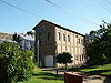
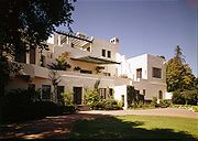
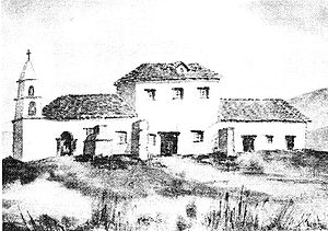
| The Abbey, Joaquin Miller House Joaquin Miller House Joaquin Miller House, also known as The Abbey and The Hights, in Oakland, California, United States was the home of poet Joaquin Miller.-Joaquin Miller:... |
.jpg) |
Oakland Oakland, California Oakland is a major West Coast port city on San Francisco Bay in the U.S. state of California. It is the eighth-largest city in the state with a 2010 population of 390,724... 37°48′45"N 122°11′8"W |
Alameda National Register of Historic Places listings in Alameda County, California This list includes properties and districts listed on the National Register of Historic Places in Alameda County, California. Click the "Map of all coordinates" link to the right to view a Google map of all properties and districts with latitude and longitude coordinates in the table below.-Current... |
Joaquin Miller Joaquin Miller Joaquin Miller was the pen name of the colorful American poet Cincinnatus Heine Miller , nicknamed the "Poet of the Sierras".-Early years and family:... , known as the "Poet of the Sierras", lived here from 1886 until his death in 1913. |
||
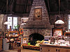
| The Ahwahnee Ahwahnee Hotel The Ahwahnee Hotel is a destination hotel in Yosemite National Park, California, on the floor of Yosemite Valley, constructed from stone, concrete, wood and glass, which opened in 1927... |
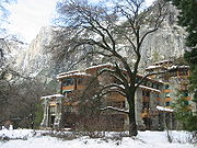 |
Yosemite National Park Yosemite National Park Yosemite National Park is a United States National Park spanning eastern portions of Tuolumne, Mariposa and Madera counties in east central California, United States. The park covers an area of and reaches across the western slopes of the Sierra Nevada mountain chain... 37°44′44.7"N 119°34′27"W |
Mariposa | National Park Service-built and operated hotel in Yosemite National Park Yosemite National Park Yosemite National Park is a United States National Park spanning eastern portions of Tuolumne, Mariposa and Madera counties in east central California, United States. The park covers an area of and reaches across the western slopes of the Sierra Nevada mountain chain... ; designed by Gilbert Stanley Underwood Gilbert Stanley Underwood Gilbert Stanley Underwood was an American architect best known for his National Park lodges. Born in 1890, Underwood received his B.A. from Yale in 1920 and a M.A. from Harvard in 1923. After opening an office in Los Angeles that year, he became associated with Daniel Ray Hull of the National... ; exemplifies National Park Service Rustic National Park Service Rustic National Park Service rustic, also colloquially known as Parkitecture, is a style of architecture that arose in the United States National Park System to create buildings that harmonized with their natural environment. Since its founding, the National Park Service consistently has sought to provide... architecture. |
||
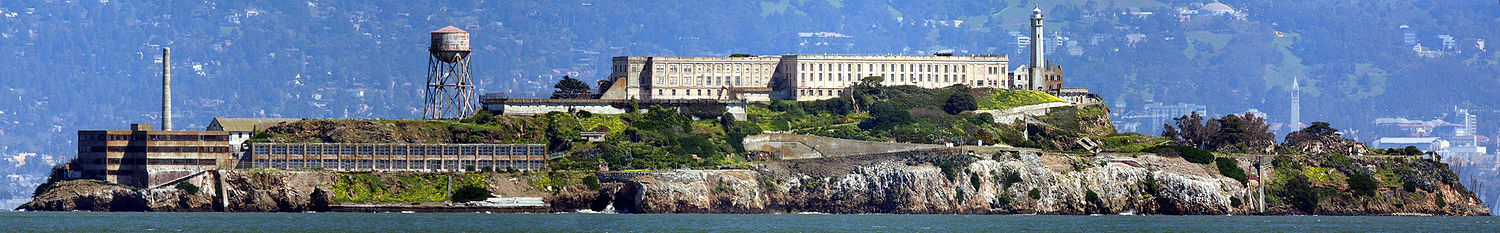
| Alcatraz Island Alcatraz Island Alcatraz Island is an island located in the San Francisco Bay, offshore from San Francisco, California, United States. Often referred to as "The Rock" or simply "Traz", the small island was developed with facilities for a lighthouse, a military fortification, a military prison, and a Federal... |
 |
San Francisco San Francisco, California San Francisco , officially the City and County of San Francisco, is the financial, cultural, and transportation center of the San Francisco Bay Area, a region of 7.15 million people which includes San Jose and Oakland... 37°49′35"N 122°25′21"W |
San Francisco | Former maximum security Federal prison; Frank Morris escaped, but few others did; part of Golden Gate National Recreation Area Golden Gate National Recreation Area The Golden Gate National Recreation Area is a U.S. National Recreation Area administered by the National Park Service that surrounds the San Francisco Bay area. It is one of the most visited units of the National Park system in the United States, with over 13 million visitors a year... ; visited by tourist ferries. |
||
| Alma (scow schooner) Alma (1891) The Alma is an 1891 built scow schooner, which is now preserved as a National Historic Landmark at the San Francisco Maritime National Historical Park in San Francisco, California.- History of the Alma :... |
_1.jpg) |
San Francisco San Francisco, California San Francisco , officially the City and County of San Francisco, is the financial, cultural, and transportation center of the San Francisco Bay Area, a region of 7.15 million people which includes San Jose and Oakland... 37.8077249487°N 122.420855832°W |
San Francisco | Flat-bottomed scow Scow A scow, in the original sense, is a flat-bottomed boat with a blunt bow, often used to haul bulk freight; cf. barge. The etymology of the word is from the Dutch schouwe, meaning such a boat.-Sailing scows:... schooner Schooner A schooner is a type of sailing vessel characterized by the use of fore-and-aft sails on two or more masts with the forward mast being no taller than the rear masts.... that was built in 1891 and used in San Francisco Bay San Francisco Bay San Francisco Bay is a shallow, productive estuary through which water draining from approximately forty percent of California, flowing in the Sacramento and San Joaquin rivers from the Sierra Nevada mountains, enters the Pacific Ocean... and Sacramento-San Joaquin River Delta. Now part of the San Francisco Maritime National Historical Park San Francisco Maritime National Historical Park The San Francisco Maritime National Historical Park is located in San Francisco, California, USA. The park includes a fleet of historic vessels, a visitor center, a maritime museum, and a library/research facility... . Official plaque located in the San Francisco Maritime National Historical Park Visitor Center, located at the corner of Hyde and Jefferson Streets. |
||
| Angelus Temple Angelus Temple Angelus Temple was the central house of worship of the International Church of the Foursquare Gospel in the Echo Park district of Los Angeles, California.... |
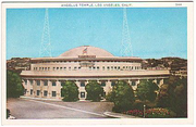 |
Los Angeles Los Angeles, California Los Angeles , with a population at the 2010 United States Census of 3,792,621, is the most populous city in California, USA and the second most populous in the United States, after New York City. It has an area of , and is located in Southern California... 34.076373°N 118.261319°W |
Los Angeles | Church built by and for Aimee Semple McPherson Aimee Semple McPherson Aimee Semple McPherson , also known as Sister Aimee, was a Canadian-American Los Angeles, California evangelist and media celebrity in the 1920s and 1930s. She founded the Foursquare Church... , evangelical sensation of the 1920s and 1930s. |
||
| Juan de Anza House Juan de Anza House Juan de Anza House, also known as Anza House, is small one-story California adobe in San Juan Bautista, California, USA. It was a simple pole and mud brick building that was typical for the Mexican era in California, including in the 1820-1840 time period in which it was built... |
.jpg) |
San Juan Bautista San Juan Bautista, California San Juan Bautista is a city in San Benito County, California, United States. The population was 1,862 at the 2010 census, up from 1,549 at the 2000 census. The city of San Juan Bautista was named after Mission San Juan Bautista... 36.843624°N 121.535313°W |
San Benito | One-story adobe house typical of Mexican era, later "Americanized", also in typical way. | ||
| Aquatic Park Historic District Aquatic Park Historic District Aquatic Park Historic District is a building complex on the San Francisco Bay waterfront in San Francisco, California, United States. It is located within San Francisco Maritime National Historical Park and is itself a National Historic Landmark.... |
 |
San Francisco San Francisco, California San Francisco , officially the City and County of San Francisco, is the financial, cultural, and transportation center of the San Francisco Bay Area, a region of 7.15 million people which includes San Jose and Oakland... 37°48′23"N 122°25′25"W |
San Francisco | Streamline Moderne Streamline Moderne Streamline Moderne, sometimes referred to by either name alone or as Art Moderne, was a late type of the Art Deco design style which emerged during the 1930s... beach, pier, and public bathhouse Public bathing Public baths originated from a communal need for cleanliness. The term public may confuse some people, as some types of public baths are restricted depending on membership, gender, religious affiliation, or other reasons. As societies have changed, public baths have been replaced as private bathing... built by the WPA Works Progress Administration The Works Progress Administration was the largest and most ambitious New Deal agency, employing millions of unskilled workers to carry out public works projects, including the construction of public buildings and roads, and operated large arts, drama, media, and literacy projects... in 1936. Official plaque located in the San Francisco Maritime National Historical Park Visitor Center, located at the corner of Hyde and Jefferson Streets. |
||
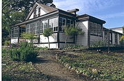
| Asilomar Conference Grounds Asilomar Conference Grounds Asilomar Conference Grounds is a conference center built for the YWCA in 1913 at Asilomar State Beach in Pacific Grove, California. Julia Morgan designed and built 16 of the buildings on the property, of which 11 are still standing. It became part of Asilomar State Beach and Conference Grounds in... |
 |
Pacific Grove Pacific Grove, California Pacific Grove is a coastal city in Monterey County, California, USA, with a population of 15,041 as of the 2010 census, down from 15,522 as of the 2000 census... 36°37′11"N 121°55′53"W |
Monterey | Arts and Crafts style conference center built for the YWCA YWCA The YWCA USA is the United States branch of a women's membership movement that strives to create opportunities for women's growth, leadership and power in order to attain a common vision—to eliminate racism and empower women. The YWCA is a non-profit organization, the first of which was founded in... by Julia Morgan Julia Morgan Julia Morgan was an American architect. The architect of over 700 buildings in California, she is best known for her work on Hearst Castle in San Simeon, California... in 1913. |
||
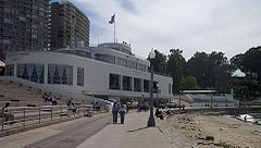
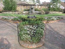
| Balboa Park | 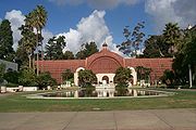 |
San Diego San Diego, California San Diego is the eighth-largest city in the United States and second-largest city in California. The city is located on the coast of the Pacific Ocean in Southern California, immediately adjacent to the Mexican border. The birthplace of California, San Diego is known for its mild year-round... 32°43′53"N 117°8′43"W |
San Diego | 1,200 acre (4.9 km²) urban cultural complex in San Diego San Diego, California San Diego is the eighth-largest city in the United States and second-largest city in California. The city is located on the coast of the Pacific Ocean in Southern California, immediately adjacent to the Mexican border. The birthplace of California, San Diego is known for its mild year-round... . Reserved in 1855, it is one of the oldest public recreation sites in the US United States The United States of America is a federal constitutional republic comprising fifty states and a federal district... . It includes open areas and vegetation as well as museums, theaters, gardens, shops, restaurants and the San Diego Zoo San Diego Zoo The San Diego Zoo in Balboa Park, San Diego, California, is one of the most progressive zoos in the world, with over 4,000 animals of more than 800 species... . |
||
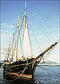
| Balclutha Balclutha (1886) Balclutha, also known as Star of Alaska, Pacific Queen, or Sailing Ship BALCLUTHA, is a steel-hulled full rigged ship that was built in 1886. She is the only square rigged ship left in the San Francisco Bay area and is representative of several different commercial ventures, including lumber,... |
_2_edit1.jpg) |
San Francisco San Francisco, California San Francisco , officially the City and County of San Francisco, is the financial, cultural, and transportation center of the San Francisco Bay Area, a region of 7.15 million people which includes San Jose and Oakland... 37.80767992°N 122.411768091°W |
San Francisco | The only remaining square rigged ship in the San Francisco Bay San Francisco Bay San Francisco Bay is a shallow, productive estuary through which water draining from approximately forty percent of California, flowing in the Sacramento and San Joaquin rivers from the Sierra Nevada mountains, enters the Pacific Ocean... area, it was built in 1886 and served on several different trade routes. It is now part of the San Francisco Maritime National Historical Park San Francisco Maritime National Historical Park The San Francisco Maritime National Historical Park is located in San Francisco, California, USA. The park includes a fleet of historic vessels, a visitor center, a maritime museum, and a library/research facility... . Official plaque located in the San Francisco Maritime National Historical Park Visitor Center, located at the corner of Hyde and Jefferson Streets. |
||
| Baldwin Hills Village |  |
Baldwin Hills Baldwin Hills, Los Angeles, California Baldwin Hills is a community and neighborhood in the South Los Angeles area of Los Angeles, within southwestern Los Angeles County, California... 34°01′11"N 118°21′39"W |
Los Angeles | Now known as Village Green, this 627 unit condo Condominium A condominium, or condo, is the form of housing tenure and other real property where a specified part of a piece of real estate is individually owned while use of and access to common facilities in the piece such as hallways, heating system, elevators, exterior areas is executed under legal rights... complex was one of the first new planned communities Planned community A planned community, or planned city, is any community that was carefully planned from its inception and is typically constructed in a previously undeveloped area. This contrasts with settlements that evolve in a more ad hoc fashion. Land use conflicts are less frequent in planned communities since... when it was built between 1935 and 1942. |
||
| Hubert H. Bancroft Ranch House Hubert H. Bancroft Ranch House Hubert H. Bancroft Ranch House is a historic structure in Spring Valley, California. The property also contains a natural spring, named El aguaje de San Jorge Hubert H. Bancroft Ranch House is a historic structure in Spring Valley, California. The property also contains a natural spring, named El... |
.jpg) |
Spring Valley 32.734641849°N 116.988259712°W |
San Diego | Adobe home of historian and ethnologist Hubert Howe Bancroft Hubert Howe Bancroft Hubert Howe Bancroft was an American historian and ethnologist who wrote and published works concerning the western United States, Texas, Mexico, Central America, British Columbia and Alaska.-Biography:... , publisher of many Pacific Coast histories and books on Native American Indigenous peoples of the Americas The indigenous peoples of the Americas are the pre-Columbian inhabitants of North and South America, their descendants and other ethnic groups who are identified with those peoples. Indigenous peoples are known in Canada as Aboriginal peoples, and in the United States as Native Americans... culture. |
||
| Bank of Italy Building | _edit1.jpg) |
San Francisco San Francisco, California San Francisco , officially the City and County of San Francisco, is the financial, cultural, and transportation center of the San Francisco Bay Area, a region of 7.15 million people which includes San Jose and Oakland... 37.794412°N 122.403040°W |
San Francisco | Became the headquarters of Bank of Italy in 1908; precursor of the Bank of America Bank of America Bank of America Corporation, an American multinational banking and financial services corporation, is the second largest bank holding company in the United States by assets, and the fourth largest bank in the U.S. by market capitalization. The bank is headquartered in Charlotte, North Carolina... ); also known as the Clay-Montgomery Building. |
||
| Aline Barnsdall Complex (Hollyhock House) |  |
Los Angeles Los Angeles, California Los Angeles , with a population at the 2010 United States Census of 3,792,621, is the most populous city in California, USA and the second most populous in the United States, after New York City. It has an area of , and is located in Southern California... 34.099958°N 118.294614°W |
Los Angeles | Hollyhock House, a building designed by Frank Lloyd Wright Frank Lloyd Wright Frank Lloyd Wright was an American architect, interior designer, writer and educator, who designed more than 1,000 structures and completed 500 works. Wright believed in designing structures which were in harmony with humanity and its environment, a philosophy he called organic architecture... and built in 1919–1921 for Aline Barnsdall. Now the centerpiece of the Barnsdall Art Park Barnsdall Art Park The Barnsdall Art Park has as its mission the presentation, promotion, enrichment, and development of the arts and artists of the Los Angeles region in all its cultural diversity... . |
||
| Berkeley (ferry) Berkeley (ferryboat) The Berkeley was one of several ferryboats of the Southern Pacific Railroad that operated on San Francisco Bay between the Oakland Pier and the San Francisco Ferry Building for sixty years... |
 |
San Diego San Diego, California San Diego is the eighth-largest city in the United States and second-largest city in California. The city is located on the coast of the Pacific Ocean in Southern California, immediately adjacent to the Mexican border. The birthplace of California, San Diego is known for its mild year-round... 32.7169330288°N 117.172654718°W |
San Diego | First propeller-driven ferry on the west coast; currently the main "building" of the Maritime Museum of San Diego. | ||
| Big Four House Big Four House The Big Four House is a historic building in Sacramento, California, built in 1852. Its name refers to The Big Four, Collis Huntington, Mark Hopkins, Leland Stanford, and Charles Crocker, who organized the Central Pacific railway and founded the Southern Pacific Railroad here.It was declared a... |
 |
Sacramento Sacramento, California Sacramento is the capital city of the U.S. state of California and the county seat of Sacramento County. It is located at the confluence of the Sacramento River and the American River in the northern portion of California's expansive Central Valley. With a population of 466,488 at the 2010 census,... 38°34′58"N 121°30′12"W |
Sacramento | Built in 1852; house where Collis Huntington, Mark Hopkins, Leland Stanford Leland Stanford Amasa Leland Stanford was an American tycoon, industrialist, robber baron, politician and founder of Stanford University.-Early years:... , and Charles Crocker Charles Crocker Charles Crocker was an American railroad executive.-Early years:Crocker was born in Troy, New York, to a modest family and moved to an Indiana farm at age 14. He soon became independent, working on several farms, a sawmill, and at an iron forge. In 1845 he founded a small, independent iron... organized the Central Pacific Central Pacific Railroad The Central Pacific Railroad is the former name of the railroad network built between California and Utah, USA that formed part of the "First Transcontinental Railroad" in North America. It is now part of the Union Pacific Railroad. Many 19th century national proposals to build a transcontinental... railway and founded the Southern Pacific Railroad Southern Pacific Railroad The Southern Pacific Transportation Company , earlier Southern Pacific Railroad and Southern Pacific Company, and usually simply called the Southern Pacific or Espee, was an American railroad.... . |
||
| Bodie Historic District Bodie, California Bodie is a ghost town in the Bodie Hills east of the Sierra Nevada mountain range in Mono County, California, United States, about 75 miles southeast of Lake Tahoe. It is located east-southeast of Bridgeport, at an elevation of 8379 feet . As Bodie Historic District, the U.S. Department of the... |
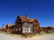 |
Bodie Bodie, California Bodie is a ghost town in the Bodie Hills east of the Sierra Nevada mountain range in Mono County, California, United States, about 75 miles southeast of Lake Tahoe. It is located east-southeast of Bridgeport, at an elevation of 8379 feet . As Bodie Historic District, the U.S. Department of the... 38°12′44"N 119°0′44"W |
Mono | Establish in 1859, it became a Gold Rush California Gold Rush The California Gold Rush began on January 24, 1848, when gold was found by James W. Marshall at Sutter's Mill in Coloma, California. The first to hear confirmed information of the gold rush were the people in Oregon, the Sandwich Islands , and Latin America, who were the first to start flocking to... boomtown in 1876. It is currently a State park preserved in arrested decay Arrested decay "Arrested decay" is a term coined by the State of California, United States to explain how it would preserve its Bodie State Historic Park. A more common application of this concept is the preservation of war ruins as memorials.- United States :... , neither restored nor destroyed. It is one of very few towns of this type to survive untouched. |
||
| Borax Lake Site Borax Lake Site Borax Lake Site, also known as Borax Lake--Hodges Archaeological Site is an archaeological site near Clearlake, California.In 2006, a National Park Service statement about it read:It was declared a National Historic Landmark in 2006.... |
image pending | Clear Lake Clearlake, California Clearlake is a city located in Lake County, California. Clearlake is located north-northwest of Lower Lake, at an elevation of 1417 feet... |
Lake | The archaeological type site Type site In archaeology a type site is a site that is considered the model of a particular archaeological culture... of the unique Paleo-Indian Clovis Clovis culture The Clovis culture is a prehistoric Paleo-Indian culture that first appears 11,500 RCYBP , at the end of the last glacial period, characterized by the manufacture of "Clovis points" and distinctive bone and ivory tools... people known as the Post Pattern Post Pattern The Post Pattern refers to a Paleo-Indian archaeological culture of artifacts found in northwest California dating between 9,000-13,000 years ago. Excavation sites are around Clear Lake and Borax Lake. The Post Pattern is a local manifestation of the Western Pluvial Lakes Tradition.It is believed... . This site extended their known range and introduced an unusual lake shore dwelling population. |
||
| Bradbury Building Bradbury Building The Bradbury Building is an architectural landmark in Los Angeles, California. The building was built in 1893 and is located at 304 South Broadway in downtown.-History:... |
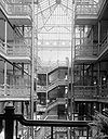 |
Los Angeles Los Angeles, California Los Angeles , with a population at the 2010 United States Census of 3,792,621, is the most populous city in California, USA and the second most populous in the United States, after New York City. It has an area of , and is located in Southern California... 34.050744°N 118.248170°W |
Los Angeles | 1893 Italian Renaissance architectural landmark. Known for its striking interiors and cage elevators. It has been used extensively as a location in films such as Blade Runner Blade Runner Blade Runner is a 1982 American science fiction film directed by Ridley Scott and starring Harrison Ford, Rutger Hauer, and Sean Young. The screenplay, written by Hampton Fancher and David Peoples, is loosely based on the novel Do Androids Dream of Electric Sheep? by Philip K... . |
||
| Luther Burbank House and Garden Luther Burbank Home and Gardens Luther Burbank Home and Gardens is a city park containing the former home, greenhouse, gardens, and grave of noted American horticulturist Luther Burbank . It is located at the intersection of Santa Rosa Avenue and Sonoma Avenue in Santa Rosa, California, in the United States. The park is open... |
 |
Santa Rosa Santa Rosa, California Santa Rosa is the county seat of Sonoma County, California, United States. The 2010 census reported a population of 167,815. Santa Rosa is the largest city in California's Wine Country and fifth largest city in the San Francisco Bay Area, after San Jose, San Francisco, Oakland, and Fremont and 26th... 38.436141°N 122.712208°W |
Sonoma | City park containing the former home, greenhouse, gardens, and grave of noted American horticulturist Luther Burbank Luther Burbank Luther Burbank was an American botanist, horticulturist and a pioneer in agricultural science.He developed more than 800 strains and varieties of plants over his 54-year career. Burbank's varied creations included fruits, flowers, grains, grasses, and vegetables... . |
||
| C.A. Thayer (schooner) C.A. Thayer (1895) The C.A. Thayer is a schooner built in 1895 near Eureka, California. The schooner is now preserved at the San Francisco Maritime National Historical Park... |
 |
San Francisco San Francisco, California San Francisco , officially the City and County of San Francisco, is the financial, cultural, and transportation center of the San Francisco Bay Area, a region of 7.15 million people which includes San Jose and Oakland... 37.8079063201°N 122.421081619°W |
San Francisco | Schooner built in 1895; now preserved at the San Francisco Maritime National Historical Park San Francisco Maritime National Historical Park The San Francisco Maritime National Historical Park is located in San Francisco, California, USA. The park includes a fleet of historic vessels, a visitor center, a maritime museum, and a library/research facility... ; worked in lumber trade to San Francisco from Washington, Oregon, and Northern California. Official plaque located in the San Francisco Maritime National Historical Park Visitor Center, located at the corner of Hyde and Jefferson Streets. |
||
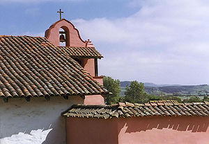
| Carmel Mission | 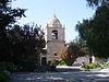 |
Carmel 36.5410005723°N 121.918551601°W |
Monterey | The second Roman Catholic California Mission Church Spanish missions in California The Spanish missions in California comprise a series of religious and military outposts established by Spanish Catholics of the Franciscan Order between 1769 and 1823 to spread the Christian faith among the local Native Americans. The missions represented the first major effort by Europeans to... , this was the headquarters of the padre presidente, Father Fermin Francisco de Lasuen . It was destroyed in the mid-19th century and restored in 1884 and 1920. It remains a parish church today. |
||
| Jose Castro House Jose Castro House Jose Castro House, now known as the Castro-Breen Adobe, in San Juan Bautista, California, USA, is a historic adobe home built by José Castro in 1840, Commandant General of Alta California.... |
.jpg) |
San Juan Bautista San Juan Bautista, California San Juan Bautista is a city in San Benito County, California, United States. The population was 1,862 at the 2010 census, up from 1,549 at the 2000 census. The city of San Juan Bautista was named after Mission San Juan Bautista... 36.8428379948°N 121.534683313°W |
San Benito | Historic adobe home built by José Castro, Commandant General of Northern California. It is part of the San Juan Bautista Historic District. | ||
| Coloma Coloma, California Coloma is a census-designated place in El Dorado County, California, USA. It is approximately northeast of Sacramento, California. Coloma is most noted for being the site where James W. Marshall first discovered gold in California, at Sutter's Mill on January 24, 1848, leading to the California... |
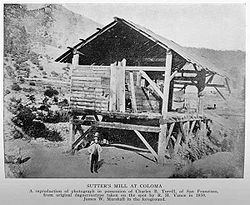 |
Coloma Coloma, California Coloma is a census-designated place in El Dorado County, California, USA. It is approximately northeast of Sacramento, California. Coloma is most noted for being the site where James W. Marshall first discovered gold in California, at Sutter's Mill on January 24, 1848, leading to the California... 38.8°N 120.8892°W |
El Dorado | Town where the California Gold Rush California Gold Rush The California Gold Rush began on January 24, 1848, when gold was found by James W. Marshall at Sutter's Mill in Coloma, California. The first to hear confirmed information of the gold rush were the people in Oregon, the Sandwich Islands , and Latin America, who were the first to start flocking to... when James W. Marshall James W. Marshall James Wilson Marshall was an American carpenter and sawmill operator, whose discovery of gold in the American River in California on January 24, 1848 set the stage for the California Gold Rush. The mill property was owned by Johan Sutter who employed Marshall to build his mill... discovered gold at Sutter's mill Sutter's Mill Sutter's Mill was a sawmill owned by 19th century pioneer John Sutter in partnership with James W. Marshall. It was located in Coloma, California, at the bank of the South Fork American River... on January 24, 1848. Now a ghost town Ghost town A ghost town is an abandoned town or city. A town often becomes a ghost town because the economic activity that supported it has failed, or due to natural or human-caused disasters such as floods, government actions, uncontrolled lawlessness, war, or nuclear disasters... , it is a significant part of the Marshall Gold Discovery State Historic Park Marshall Gold Discovery State Historic Park Marshall Gold Discovery State Historic Park is a California state park near Placerville, California, USA. It marks the discovery of gold by James W. Marshall at Sutter's Mill in 1848... |
||
| Columbia Historic District Columbia State Historic Park Columbia State Historic Park, also known as Columbia Historic District, is a California state park and National Historic Landmark District located in Columbia, California. It includes almost 30 buildings built during the California Gold Rush, most of which remain today... |
 |
Sonora Sonora, California Sonora is the county seat of Tuolumne County, California. As of the 2010 census, the city population was 4,903, up from 4,423 at the 2000 census. Sonora is the only incorporated community in Tuolumne County.-Geography:... 38°2′8.84"N 120°24′3.81"W |
Tuolumne | Within two years of discovering gold in this town, it was the 3rd largest city in California. The historic district is now an open museum and the best preserved California Gold Rush California Gold Rush The California Gold Rush began on January 24, 1848, when gold was found by James W. Marshall at Sutter's Mill in Coloma, California. The first to hear confirmed information of the gold rush were the people in Oregon, the Sandwich Islands , and Latin America, who were the first to start flocking to... town. |
||
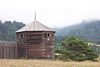
| Commander's House, Fort Ross Fort Ross, California Fort Ross is a former Russian establishment on the Pacific Coast in what is now Sonoma County, California, in the United States. It was the hub of the southernmost Russian settlements in North America in between 1812 to 1841... |
 |
Fort Ross Fort Ross, California Fort Ross is a former Russian establishment on the Pacific Coast in what is now Sonoma County, California, in the United States. It was the hub of the southernmost Russian settlements in North America in between 1812 to 1841... 38°30′52"N 123°14′37"W |
Sonoma | Only original structure at Fort Ross; also known as Rotchev House; Russian-built in 1812 | ||
| Coso Rock Art District Coso Rock Art District Coso Rock Art District, containing the Big and Little Petroglyph Canyons, is a rock art site containing over 20,000 of Paleo-Indian and/or Native American Petroglyphs The Coso Range is between the Sierra Nevada and the Argus Range. Indian Wells Valley lies to the south of this location... (formerly Big and Little Petroglyph Canyons) |
 |
Naval Air Weapons Station China Lake Naval Air Weapons Station China Lake - About : is part of under Commander, Navy Installation Command and is located in the Western Mojave Desert region of California, approximately north of Los Angeles. Occupying three counties – Kern, San Bernardino and Inyo – the installation’s closest neighbors are the cities of Ridgecrest,... |
Inyo | Over 20,000 Indian petroglyphs are located in this NHLD, which also incorporates two earlier NHLs Big and Little Petroglyph Canyons. The site is located within Naval Air Weapons Station China Lake Naval Air Weapons Station China Lake - About : is part of under Commander, Navy Installation Command and is located in the Western Mojave Desert region of California, approximately north of Los Angeles. Occupying three counties – Kern, San Bernardino and Inyo – the installation’s closest neighbors are the cities of Ridgecrest,... . |
||
| Donner Camp Donner Memorial State Park Donner Memorial State Park is a US state park located near Truckee, California. The park is named after the ill-fated Donner Party, and contains the Emigrant Trail Museum and the Pioneer Monument dedicated to them. The Donner Camp site at Alder Creek, where the Donner families were trapped by... |
 |
Truckee Truckee, California Truckee is an incorporated town in Nevada County, California, United States. The population was 16,180 at the 2010 census, up from 13,864 at the 2000 census.-Name:... 39.32°N 120.241667°W |
Nevada | Museum and monument to Donner party; trapped by weather during the winter of 1846–1847; resorted to cannibalism to survive | ||
| Eames House (Case Study House 8) Eames House The Eames House is a landmark of mid-20th century modern architecture located at 203 North Chautauqua Boulevard in the Pacific Palisades neighborhood of Los Angeles... |
 |
Pacific Palisades 34.029722°N 118.519444°W |
Los Angeles | Built in 1949 by husband-and-wife design pioneers Charles and Ray Eames; also known as Case Study House No. 8. | ||
| Elmshaven (Ellen Gould White House) Elmshaven (Ellen Gould White House) "Elmshaven", in St. Helena, California, also known as Ellen White House or Robert Pratt Place was a home of Ellen G. White from 1900 until her death in 1915. She was notable for her prophetic ministry which was instrumental in founding the Sabbatarian Adventist movement that led to the rise of the... |
image pending | St. Helena St. Helena, California St. Helena is a city in Napa County, California, United States. It is part of the northern San Francisco Bay Area. The population was 5,814 at the 2010 census.... 38.5351240606°N 122.477946296°W |
Napa | Ellen Gould White lived and worked here from 1900 until her death in 1915. She was notable for her prophetic ministry which led to the rise of the Seventh-day Adventist Church Seventh-day Adventist Church The Seventh-day Adventist Church is a Protestant Christian denomination distinguished by its observance of Saturday, the original seventh day of the Judeo-Christian week, as the Sabbath, and by its emphasis on the imminent second coming of Jesus Christ... . |
||
| Estudillo House | .jpg) |
San Diego San Diego, California San Diego is the eighth-largest city in the United States and second-largest city in California. The city is located on the coast of the Pacific Ocean in Southern California, immediately adjacent to the Mexican border. The birthplace of California, San Diego is known for its mild year-round... 32.754196°N 117.197075°W |
San Diego | Adobe house; constructed in 1827; was considered one of the finest houses in Mexican California. | ||
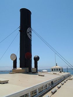
| Eureka (double-ended ferry) Eureka (ferryboat) The Eureka is a side-wheel paddle steamboat, built in 1890, which is now preserved at the San Francisco Maritime National Historical Park in San Francisco, California. Originally named the Ukiah to commemorate the railway's recent extension into the City of Ukiah, the boat was built by the San... |
.jpg) |
San Francisco San Francisco, California San Francisco , officially the City and County of San Francisco, is the financial, cultural, and transportation center of the San Francisco Bay Area, a region of 7.15 million people which includes San Jose and Oakland... 37.8074567997°N 122.42131233°W |
San Francisco | Side-wheel paddle steamboat; built in 1890 by the San Francisco and North Pacific Railroad Company; preserved at the San Francisco Maritime National Historical Park. Official plaque located in the San Francisco Maritime National Historical Park Visitor Center, located at the corner of Hyde and Jefferson Streets. | ||
| USCGC Fir |  |
Rio Vista Rio Vista, California Rio Vista is a city located in the eastern end of Solano County, California in the San Francisco Bay Area, on the Sacramento River, in the Sacramento River Delta region. The population was 7,360 at the 2010 census.... 38.149758°N 121.68317°W |
Sacramento | 174 foot U.S. Coast Guard cutter; lighthouse tender Lighthouse tender A lighthouse tender is a ship specifically designed to maintain, support, or tend to lighthouses, or lightvessels, providing supplies, fuel, mail and transportation.... ; decommissioned. |
||
| First Church of Christ, Scientist First Church of Christ, Scientist (Berkeley, California) First Church of Christ, Scientist, in Berkeley, California is a building designed by Bernard Ralph Maybeck. It was declared a National Historic Landmark in 1977. The church is widely considered Maybeck's masterpiece.-External links:* - Official website... |
 |
Berkeley Berkeley, California Berkeley is a city on the east shore of the San Francisco Bay in Northern California, United States. Its neighbors to the south are the cities of Oakland and Emeryville. To the north is the city of Albany and the unincorporated community of Kensington... 37.865504°N 122.255642°W |
Alameda National Register of Historic Places listings in Alameda County, California This list includes properties and districts listed on the National Register of Historic Places in Alameda County, California. Click the "Map of all coordinates" link to the right to view a Google map of all properties and districts with latitude and longitude coordinates in the table below.-Current... |
Church designed by Bernard Ralph Maybeck | ||
| James C. Flood Mansion James C. Flood Mansion James C. Flood Mansion, also known as Pacific-Union Club, in San Francisco, California, USA, was a townhouse for James C. Flood, a 19th century silver-baron. It was the first brownstone building built west of the Mississippi River. With The Fairmont Hotel, the only buildings on Nob Hill to... |
_4.jpg) |
San Francisco San Francisco, California San Francisco , officially the City and County of San Francisco, is the financial, cultural, and transportation center of the San Francisco Bay Area, a region of 7.15 million people which includes San Jose and Oakland... 37.791854°N 122.410818°W |
San Francisco | Mansion of James C. Flood, 19th century silver-baron; first brownstone Brownstone Brownstone is a brown Triassic or Jurassic sandstone which was once a popular building material. The term is also used in the United States to refer to a terraced house clad in this material.-Types:-Apostle Island brownstone:... building built west of the Mississippi River Mississippi River The Mississippi River is the largest river system in North America. Flowing entirely in the United States, this river rises in western Minnesota and meanders slowly southwards for to the Mississippi River Delta at the Gulf of Mexico. With its many tributaries, the Mississippi's watershed drains... ; one of the only buildings on Nob Hill to survive the 1906 San Francisco earthquake 1906 San Francisco earthquake The San Francisco earthquake of 1906 was a major earthquake that struck San Francisco, California, and the coast of Northern California at 5:12 a.m. on Wednesday, April 18, 1906. The most widely accepted estimate for the magnitude of the earthquake is a moment magnitude of 7.9; however, other... and fire; purchased by the Pacific-Union Club Pacific-Union Club The Pacific-Union Club is a private social club located at 1000 California Street in San Francisco, California, at the top of Nob Hill. It was founded in 1889 as a merger of two earlier clubs: the Pacific Club and the Union Club .... after the earthquake |
||
| Folsom Powerhouse Folsom Powerhouse State Historic Park Folsom Powerhouse State Historic Park is a historical site located in Folsom near Sacramento, California, in the United States. Built in the late 19th century by the Natoma Water and Mining Company and prison labor from Folsom Prison, the hydroelelectric powerhouse first delivered power to... |
 |
Folsom Folsom, California Folsom is a city in Sacramento County, California, United States. Folsom is most commonly known for its famous Folsom Prison. The population was 72,203 at the 2010 census.... 38.680556°N 121.175556°W |
Sacramento | Built in late 19th century using prison labor from Folsom Prison; first delivered power to Sacramento in 1895; remained in operation until 1952. | ||
| Fort Ross Fort Ross, California Fort Ross is a former Russian establishment on the Pacific Coast in what is now Sonoma County, California, in the United States. It was the hub of the southernmost Russian settlements in North America in between 1812 to 1841... |
 |
Fort Ross Fort Ross, California Fort Ross is a former Russian establishment on the Pacific Coast in what is now Sonoma County, California, in the United States. It was the hub of the southernmost Russian settlements in North America in between 1812 to 1841... 38.5124247055°N 123.242708003°W |
Sonoma | Established by Ivan Kuskov of the Russian-American Company in 1812; thriving settlement from 1812 to 1841 | ||
| Fresno Sanitary Landfill | image pending | Fresno Fresno, California Fresno is a city in central California, United States, the county seat of Fresno County. As of the 2010 census, the city's population was 510,365, making it the fifth largest city in California, the largest inland city in California, and the 34th largest in the nation... 36.7°N 119.829722°W |
Fresno | Opened in 1937; first modern landfill Landfill A landfill site , is a site for the disposal of waste materials by burial and is the oldest form of waste treatment... in the U.S. United States The United States of America is a federal constitutional republic comprising fifty states and a federal district... ; model for other landfills around the country; and one of the longest-lived. |
||
| David B. Gamble House | 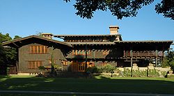 |
Pasadena Pasadena, California Pasadena is a city in Los Angeles County, California, United States. Although famous for hosting the annual Rose Bowl football game and Tournament of Roses Parade, Pasadena is the home to many scientific and cultural institutions, including the California Institute of Technology , the Jet... 34.151669°N 118.160364°W |
Los Angeles | Arts and Crafts masterpiece; shows influence from traditional Japanese aesthetics and a certain California spaciousness born of available land and a permissive climate. | ||
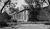
| Gonzalez House Rafael Gonzalez House The Rafael Gonzales House is an historic house located at 835 Laguna Street in Santa Barbara, California. The National Historic Landmark Statement of Significance, written in 1970, reads:... |
image pending | Santa Barbara Santa Barbara, California Santa Barbara is the county seat of Santa Barbara County, California, United States. Situated on an east-west trending section of coastline, the longest such section on the West Coast of the United States, the city lies between the steeply-rising Santa Ynez Mountains and the Pacific Ocean... 34.424209°N 119.695281°W |
Santa Barbara | Built about 1825 by Don Rafael Gonzales; typical of Mexican-era adobe town houses; adobe walls at least 2' thick | ||
| Guajome Ranch House Rancho Guajome Adobe Rancho Guajome Adobe, listed in the National Register of Historic Places as Guajome Ranch House, is an adobe house in Vista, California... |
 |
Vista Vista, California Vista is a city in north San Diego County, California. It was incorporated January 28, 1963 and became a charter city on June 13, 2007. Located just seven miles inland from the Pacific Ocean in northern San Diego County, the City of Vista has a Mediterranean climate... 33.233375°N 117.253969°W |
San Diego | Spanish Colonial hacienda with two courtyards. | ||
| Gunther Island Site 67 | Eureka Eureka, California Eureka is the principal city and the county seat of Humboldt County, California, United States. Its population was 27,191 at the 2010 census, up from 26,128 at the 2000 census.... 40°48′36"N 124°10′19"W |
Humboldt | An archaeological site surrounding a Wiyot shell midden Midden A midden, is an old dump for domestic waste which may consist of animal bone, human excrement, botanical material, vermin, shells, sherds, lithics , and other artifacts and ecofacts associated with past human occupation... , located in Tolowot, on Indian Island Indian Island (Humboldt Bay) Indian Island or Duluwat Island is located on Humboldt Bay within the City of Eureka, California. The village of Tolowot or Tuluwat on Duluwat Island was the site of the spiritual if not political center of the Wiyot people and is where the main thrust of the 1860 Wiyot Massacre by European... in Humboldt Bay Humboldt Bay Humboldt Bay is a natural bay and a multi-basin, bar-built coastal lagoon located on the rugged North Coast of California, United States entirely within Humboldt County. The regional center and county seat of Eureka and the college town of Arcata adjoin the bay, which is the second largest enclosed... near Eureka, California Eureka, California Eureka is the principal city and the county seat of Humboldt County, California, United States. Its population was 27,191 at the 2010 census, up from 26,128 at the 2000 census.... . This site helped define the Gunther Pattern in archaeology and was also the site of the 1860 Wiyot Massacre 1860 Wiyot Massacre The Wiyot Massacre refers to the incidents on February 26, 1860, at Tuluwat on what is now known as Indian Island, near Eureka in Humboldt County, California.-Event:... . |
|||
| Hale Solar Observatory Hale Solar Laboratory The Hale Solar Laboratory was the laboratory of astronomer George Ellery Hale, and is located in Pasadena, Los Angeles County, California.-History:... |
 |
Pasadena Pasadena, California Pasadena is a city in Los Angeles County, California, United States. Although famous for hosting the annual Rose Bowl football game and Tournament of Roses Parade, Pasadena is the home to many scientific and cultural institutions, including the California Institute of Technology , the Jet... 34.132974°N 118.121818°W |
Los Angeles | Laboratory of George Ellery Hale George Ellery Hale George Ellery Hale was an American solar astronomer.-Biography:Hale was born in Chicago, Illinois. He was educated at MIT, at the Observatory of Harvard College, , and at Berlin . As an undergraduate at MIT, he is known for inventing the spectroheliograph, with which he made his discovery of... , inventor of the spectroheliograph Spectroheliograph The spectroheliograph is an instrument used in astronomy. It captures a photographic image of the Sun at a single wavelength of light, a monochromatic image... , with which he made his discoveries of the solar vortices and magnetic fields of sun spots. |
||
| Hanna-Honeycomb House Hanna-Honeycomb House The Hanna-Honeycomb House, also known as simply the Hanna House, located on the Stanford University campus in Stanford, California, USA, was Frank Lloyd Wright's first work in the San Francisco region and his first work with non-rectangular structures... |
 |
Palo Alto Palo Alto, California Palo Alto is a California charter city located in the northwest corner of Santa Clara County, in the San Francisco Bay Area of California, United States. The city shares its borders with East Palo Alto, Mountain View, Los Altos, Los Altos Hills, Stanford, Portola Valley, and Menlo Park. It is... 37.416131°N 122.164135°W |
Santa Clara | Located on Stanford University Stanford University The Leland Stanford Junior University, commonly referred to as Stanford University or Stanford, is a private research university on an campus located near Palo Alto, California. It is situated in the northwestern Santa Clara Valley on the San Francisco Peninsula, approximately northwest of San... campus, this was Frank Lloyd Wright Frank Lloyd Wright Frank Lloyd Wright was an American architect, interior designer, writer and educator, who designed more than 1,000 structures and completed 500 works. Wright believed in designing structures which were in harmony with humanity and its environment, a philosophy he called organic architecture... 's first work in the San Francisco region as well as his first work with non-rectangular structures. |
||
| Harada House Harada House The Harada House, built in 1884, and located at 3356 Lemon Street in Riverside, California, became the focus of an important court case testing exclusionary legislation.... |
Riverside Riverside, California Riverside is a city in Riverside County, California, United States, and the county seat of the eponymous county. Named for its location beside the Santa Ana River, it is the largest city in the Riverside-San Bernardino-Ontario metropolitan area of Southern California, 4th largest inland California... 33.985167°N 117.369250°W |
Riverside | Property involved in 1916-1918 constitutional Constitutional law Constitutional law is the body of law which defines the relationship of different entities within a state, namely, the executive, the legislature and the judiciary.... test of an alien land law California Alien Land Law of 1913 The California Alien Land Law of 1913 prohibited "aliens ineligible for citizenship" from owning land or property, but permitted three-year leases. It affected the Chinese, Indian, Japanese, and Korean immigrant farmers in California. It passed thirty-five to two in the Senate and seventy-two to... ; at issue was the rights of the children of a Japanese immigrant |
|||
| Hearst San Simeon Estate Hearst Castle Hearst Castle is a National Historic Landmark mansion located on the Central Coast of California, United States. It was designed by architect Julia Morgan between 1919 and 1947 for newspaper magnate William Randolph Hearst, who died in 1951. In 1957, the Hearst Corporation donated the property to... |
 |
San Simeon San Simeon, California San Simeon is a census-designated place on the Pacific coast of San Luis Obispo County, California. Its position along State Route 1 is approximately halfway between Los Angeles and San Francisco, each of those cities being roughly 230 mi away... 35°41′6"N 121°10′4"W |
San Luis Obispo | Built by newspaper magnate William Randolph Hearst William Randolph Hearst William Randolph Hearst was an American business magnate and leading newspaper publisher. Hearst entered the publishing business in 1887, after taking control of The San Francisco Examiner from his father... ; open for public tours; Hearst formally named the estate "La Cuesta Encantada". |
||
| Hercules (tug) Hercules (1907) The Hercules is a 1907 built steam tug, which is now preserved at the San Francisco Maritime National Historical Park in San Francisco, California.- History of the Hercules :... |
.jpg) |
San Francisco San Francisco, California San Francisco , officially the City and County of San Francisco, is the financial, cultural, and transportation center of the San Francisco Bay Area, a region of 7.15 million people which includes San Jose and Oakland... 37.8084470841°N 122.421077397°W |
San Francisco | This 1907 steam tug is now a museum ship at the San Francisco Maritime National Historical Park San Francisco Maritime National Historical Park The San Francisco Maritime National Historical Park is located in San Francisco, California, USA. The park includes a fleet of historic vessels, a visitor center, a maritime museum, and a library/research facility... . Official plaque located in the San Francisco Maritime National Historical Park Visitor Center, located at the corner of Hyde and Jefferson Streets. |
||
| Lou Henry and Herbert Hoover House Lou Henry and Herbert Hoover House The Lou Henry and Herbert Hoover House, located on the campus of Stanford University in Palo Alto, California, USA, is the former house of Herbert Hoover, 31st President of the United States, and his wife Lou Henry Hoover, who designed it... |
 |
Palo Alto Palo Alto, California Palo Alto is a California charter city located in the northwest corner of Santa Clara County, in the San Francisco Bay Area of California, United States. The city shares its borders with East Palo Alto, Mountain View, Los Altos, Los Altos Hills, Stanford, Portola Valley, and Menlo Park. It is... 37.417719°N 122.169060°W |
Santa Clara | Designed by Lou Henry Hoover Lou Henry Hoover Lou Henry Hoover was the wife of President of the United States Herbert Hoover and First Lady of the United States, 1929-1933. Mrs. Hoover was president of the Girl Scouts of the USA for two terms, 1922-1925 and 1935-1937.... , wife of Herbert Hoover Herbert Hoover Herbert Clark Hoover was the 31st President of the United States . Hoover was originally a professional mining engineer and author. As the United States Secretary of Commerce in the 1920s under Presidents Warren Harding and Calvin Coolidge, he promoted partnerships between government and business... , this is where the Hoovers lived before and after his presidency. It is now the official residence of the president of Stanford University Stanford University The Leland Stanford Junior University, commonly referred to as Stanford University or Stanford, is a private research university on an campus located near Palo Alto, California. It is situated in the northwestern Santa Clara Valley on the San Francisco Peninsula, approximately northwest of San... |
||
| USS Hornet (CVS-12) (aircraft carrier) USS Hornet (CV-12) USS Hornet is a United States Navy aircraft carrier of the Essex class. Construction started in August 1942; she was originally named , but was renamed in honor of the , which was lost in October 1942, becoming the eighth ship to bear the name.Hornet was commissioned in November 1943, and after... |
 |
Alameda Alameda, California Alameda is a city in Alameda County, California, United States. It is located on Alameda Island and Bay Farm Island, and is adjacent to Oakland in the San Francisco Bay. The Bay Farm Island portion of the city is adjacent to the Oakland International Airport. At the 2010 census, the city had a... 37.77272°N 122.302895°W |
Alameda National Register of Historic Places listings in Alameda County, California This list includes properties and districts listed on the National Register of Historic Places in Alameda County, California. Click the "Map of all coordinates" link to the right to view a Google map of all properties and districts with latitude and longitude coordinates in the table below.-Current... |
Essex class aircraft carrier Essex class aircraft carrier The Essex class was a class of aircraft carriers of the United States Navy, which constituted the 20th century's most numerous class of capital ships with 24 vessels built in both "short-hull" and "long-hull" versions. Thirty-two were originally ordered; however as World War II wound down, six were... which was commissioned in November 1943. She played a role in the Pacific battles of World War II World War II World War II, or the Second World War , was a global conflict lasting from 1939 to 1945, involving most of the world's nations—including all of the great powers—eventually forming two opposing military alliances: the Allies and the Axis... and then went on to serve in the Vietnam War Vietnam War The Vietnam War was a Cold War-era military conflict that occurred in Vietnam, Laos, and Cambodia from 1 November 1955 to the fall of Saigon on 30 April 1975. This war followed the First Indochina War and was fought between North Vietnam, supported by its communist allies, and the government of... . It also recovered the Apollo Astronauts as they returned from the Moon. |
||
| Hotel del Coronado Hotel del Coronado Hotel del Coronado is a beachfront luxury hotel in the city of Coronado, just across the San Diego Bay from San Diego, California. It is one of the few surviving examples of an American architectural genre: the wooden Victorian beach resort... |
 |
Coronado Coronado, California Coronado, also known as Coronado Island, is an affluent resort city located in San Diego County, California, 5.2 miles from downtown San Diego. Its population was 24,697 at the 2010 census, up from 24,100 at the 2000 census. U.S. News and World Report lists Coronado as one of the most expensive... 32.680895°N 117.176599°W |
San Diego | The largest beach resort on the North American Pacific Coast, this Victorian building is an iconic symbol of San Diego. | ||
| Edwin Hubble House Edwin Hubble House Edwin Hubble House is a National Historic Landmark house located at 1340 Woodstock Road, in San Marino, California. It was the home of astronomer Edwin Hubble. He lived there from 1925 until he died in 1953, and the house remained in the Hubble family until approximately 1973.It was declared a... |
San Marino San Marino, California San Marino is a small, affluent city in Los Angeles County, California. Incorporated in 1913, the City founders designed the community to be uniquely residential, with expansive properties surrounded by beautiful gardens, wide streets, and well maintained parkways... 34.123261°N 118.121400°W |
Los Angeles | Home of astronomer Edwin Hubble Edwin Hubble Edwin Powell Hubble was an American astronomer who profoundly changed the understanding of the universe by confirming the existence of galaxies other than the Milky Way - our own galaxy... from 1925 until his death in 1953. |
|||
| Jeremiah O'Brien (Liberty ship) SS Jeremiah O'Brien -See also:*Liberty ship*Victory ship - other surviving Liberty ship*Nash - last surviving Army ship at D-Day... |
.jpg) |
San Francisco San Francisco, California San Francisco , officially the City and County of San Francisco, is the financial, cultural, and transportation center of the San Francisco Bay Area, a region of 7.15 million people which includes San Jose and Oakland... 37.8063206324°N 122.428591541°W |
San Francisco | This Liberty ship Liberty ship Liberty ships were cargo ships built in the United States during World War II. Though British in conception, they were adapted by the U.S. as they were cheap and quick to build, and came to symbolize U.S. wartime industrial output. Based on vessels ordered by Britain to replace ships torpedoed by... is a rare survivor of the 6,939-ship armada that stormed Normandy on D-Day, 1944. |
||
| La Purisima Mission Mission La Purísima Concepción Mission La Purisima Concepción, or La Purisima Mission, with the original Spanish name being La Misión de La Purísima Concepción de la Santísima Virgen María, was founded on the Feast Day of the Immaculate Conception of the Blessed Virgin on December 8, 1787... |
 |
Lompoc Lompoc, California Lompoc is a city in Santa Barbara County, California, United States. The city was incorporated in 1888. The population was 42,434 at the 2010 census, up from 41,103 at the 2000 census.... 34.671803°N 120.422457°W |
Santa Barbara | Now a historical park, it is the only example in California of a "complete" mission complex. | ||
| Lake Merritt Wild Duck Refuge Lake Merritt Lake Merritt is a large tidal lagoon that lies just east of downtown Oakland, California. It is surrounded by parkland and city neighborhoods. A popular 3.1 mile walking and jogging path runs along its perimeter... |
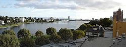 |
Oakland Oakland, California Oakland is a major West Coast port city on San Francisco Bay in the U.S. state of California. It is the eighth-largest city in the state with a 2010 population of 390,724... 37.8039°N 122.2591°W |
Alameda National Register of Historic Places listings in Alameda County, California This list includes properties and districts listed on the National Register of Historic Places in Alameda County, California. Click the "Map of all coordinates" link to the right to view a Google map of all properties and districts with latitude and longitude coordinates in the table below.-Current... |
Now known as Lake Merritt park, it is notable for being the first official wildlife refuge in the United States, designated in 1870. | ||
| Lane Victory (victory ship) SS Lane Victory SS Lane Victory is a Second World War Victory ship which is preserved as a museum ship in the San Pedro area of Los Angeles, California. As a rare surviving Victory ship, it is a U.S... |
 |
San Pedro 33.748599°N 118.273935°W |
Los Angeles | A rare example of a Victory Ship Victory ship The Victory ship was a type of cargo ship produced in large numbers by North American shipyards during World War II to replace shipping losses caused by German submarines... , it is now a still operational museum ship which makes 6 public cruises a year to Catalina Island. |
||
| Larkin House Larkin House The Larkin House, located at 464 Calle Principale, Monterey, California was built in 1835 by Thomas O. Larkin. It is claimed that the house was the first two story house in all of California, and that it was the first house with a fireplace in Monterey... |
.jpg) |
Monterey Monterey, California The City of Monterey in Monterey County is located on Monterey Bay along the Pacific coast in Central California. Monterey lies at an elevation of 26 feet above sea level. As of the 2010 census, the city population was 27,810. Monterey is of historical importance because it was the capital of... 36.598893°N 121.895642°W |
Monterey | This house, part of the larger NHLD Monterey State Historic Park Monterey State Historic Park Monterey State Historic Park is a historic state park located in Monterey, California. It includes part or all of the Monterey Old Town Historic District, a historic district which is a U.S. National Historic Landmark... , combined Spanish building techniques with New England features, creating the Monterey Colonial style of architecture. |
||
| Las Flores Adobe Las Flores Asistencia The Las Flores Estancia was established in 1823 as an estancia . It was part of the Spanish missions, asistencias, and estancias system in Las Californias—Alta California. Las Flores Estancia was situated approximately halfway between Mission San Luis Rey de Francia and Mission San Juan Capistrano... |
 |
Camp Pendleton Marine Corps Base Camp Pendleton Marine Corps Base Camp Pendleton is the major West Coast base of the United States Marine Corps and serves as its prime amphibious training base... 33.299949°N 117.461067°W |
San Diego | An Estancia halfway between two missions, it is now part of a Boy Scout Boy Scout A Scout is a boy or a girl, usually 11 to 18 years of age, participating in the worldwide Scouting movement. Because of the large age and development span, many Scouting associations have split this age group into a junior and a senior section... camp located inside Camp Pendleton just off of Interstate 5 Interstate 5 Interstate 5 is the main Interstate Highway on the West Coast of the United States, running largely parallel to the Pacific Ocean coastline from Canada to Mexico . It serves some of the largest cities on the U.S... . |
||
| Leconte Memorial Lodge LeConte Memorial Lodge The LeConte Memorial Lodge is a structure in Yosemite National Park in California, United States. LeConte is spelled variously as Le Conte or as Leconte. The lodge was declared a National Historic Landmark in 1987.-History:... |
 |
Yosemite National Park Yosemite National Park Yosemite National Park is a United States National Park spanning eastern portions of Tuolumne, Mariposa and Madera counties in east central California, United States. The park covers an area of and reaches across the western slopes of the Sierra Nevada mountain chain... 37.7383029633°N 119.578421199°W |
Mariposa | Built by the Sierra Club Sierra Club The Sierra Club is the oldest, largest, and most influential grassroots environmental organization in the United States. It was founded on May 28, 1892, in San Francisco, California, by the conservationist and preservationist John Muir, who became its first president... in 1903 in honor of Joseph LeConte Joseph LeConte Joseph Le Conte was an American geologist and professor at the University of California, Berkeley.-Biography:... , one of the founding members of the Sierra Club. It was a Yosemite visitors center, but is now run by the Sierra Club as a museum and library. |
||
| Lightship WAL-605, Relief | 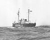 |
Oakland Oakland, California Oakland is a major West Coast port city on San Francisco Bay in the U.S. state of California. It is the eighth-largest city in the state with a 2010 population of 390,724... 37.795689°N 122.280592°W |
Alameda National Register of Historic Places listings in Alameda County, California This list includes properties and districts listed on the National Register of Historic Places in Alameda County, California. Click the "Map of all coordinates" link to the right to view a Google map of all properties and districts with latitude and longitude coordinates in the table below.-Current... |
A lightvessel Lightvessel A lightvessel, or lightship, is a ship which acts as a lighthouse. They are used in waters that are too deep or otherwise unsuitable for lighthouse construction... now located in Oakland Oakland, California Oakland is a major West Coast port city on San Francisco Bay in the U.S. state of California. It is the eighth-largest city in the state with a 2010 population of 390,724... . |
||
| Little Tokyo Historic District | 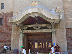 |
Los Angeles Los Angeles, California Los Angeles , with a population at the 2010 United States Census of 3,792,621, is the most populous city in California, USA and the second most populous in the United States, after New York City. It has an area of , and is located in Southern California... 34.050556°N 118.239444°W |
Los Angeles | An ethnic Japanese American district in downtown Los Angeles, one of three official Japantown Japantown is a common name for official Japanese communities in big cities outside Japan. Alternatively, a Japantown may be called J-town, Little Tokyo, or Nihonmachi , the first two being common names for the Japanese communities in San Francisco and Los Angeles, respectively.-North America:Japantowns were... s in the United States. |
||
| Locke Historic District Locke, California Locke , also known as Locke Historic District, is an unincorporated community in California's Sacramento – San Joaquin River Delta built by Chinese immigrants during the early 20th century. It was originally named Lockeport after George Locke, who owned the land that the town was built upon at a... |
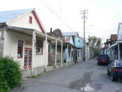 |
Locke Locke, California Locke , also known as Locke Historic District, is an unincorporated community in California's Sacramento – San Joaquin River Delta built by Chinese immigrants during the early 20th century. It was originally named Lockeport after George Locke, who owned the land that the town was built upon at a... 38°15′2"N 121°30′35"W |
Sacramento | The largest remaining example of a historic rural Chinese American community, built in 1915. | ||
| Jack London Ranch Jack London State Historic Park Jack London State Historic Park, also known as Jack London Home and Ranch, is a California State Historic Park near Glen Ellen, California, United States, situated on the eastern slope of Sonoma Mountain... |
 |
Glen Ellen Glen Ellen, California Glen Ellen is a census-designated place in Sonoma Valley, Sonoma County, California, USA. The population was 784 at the 2010 census, down from 992 at the 2000 census. Glen Ellen is the location of Jack London State Historic Park , Sonoma Valley Regional Park, and a former home of Hunter S.... 38.350556°N 122.543056°W |
Sonoma | Home of Jack London Jack London John Griffith "Jack" London was an American author, journalist, and social activist. He was a pioneer in the then-burgeoning world of commercial magazine fiction and was one of the first fiction writers to obtain worldwide celebrity and a large fortune from his fiction alone... from 1905 until his death. |
||
| Los Alamos Ranch House Los Alamos Ranch House The Los Alamos Ranch House is a historic adobe house from the mid-19th century, located near Los Alamos in northern Santa Barbara County, California... |
image pending | Los Alamos Los Alamos, California Los Alamos is a census-designated place in Santa Barbara County, California, United States. Although located in the Los Alamos Valley, the town of Los Alamos is usually considered to be a part of the Santa Ynez Valley community... |
Santa Barbara | A good example of the Mexican style single story adobe ranch-house located next to the El Camino Real El Camino Real (California) El Camino Real and sometimes associated with Calle Real usually refers to the 600-mile California Mission Trail, connecting the former Alta California's 21 missions , 4 presidios, and several pueblos, stretching from Mission San Diego de Alcalá in San Diego... . It was often used as an overnight stop when travelling between Santa Barbara and Monterey. |
||
| Los Angeles Memorial Coliseum Los Angeles Memorial Coliseum The Los Angeles Memorial Coliseum is a large outdoor sports stadium in the University Park neighborhood of Los Angeles, California, at Exposition Park, that is home to the Pacific-12 Conference's University of Southern California Trojans football team... |
 |
Los Angeles Los Angeles, California Los Angeles , with a population at the 2010 United States Census of 3,792,621, is the most populous city in California, USA and the second most populous in the United States, after New York City. It has an area of , and is located in Southern California... 34°0′50.4"N 118°17′16"W |
Los Angeles | The only stadium in the world which has hosted the Summer Olympic Games Summer Olympic Games The Summer Olympic Games or the Games of the Olympiad are an international multi-sport event, occurring every four years, organized by the International Olympic Committee. Medals are awarded in each event, with gold medals for first place, silver for second and bronze for third, a tradition that... (1932 /1984), the World Series World Series The World Series is the annual championship series of Major League Baseball, played between the American League and National League champions since 1903. The winner of the World Series championship is determined through a best-of-seven playoff and awarded the Commissioner's Trophy... (1959) and the Super Bowl Super Bowl The Super Bowl is the championship game of the National Football League , the highest level of professional American football in the United States, culminating a season that begins in the late summer of the previous calendar year. The Super Bowl uses Roman numerals to identify each game, rather... (1967 /1973). It is currently the home of the USC Trojans football team. |
||
| Los Cerritos Ranch House Los Cerritos Ranch House Los Cerritos Ranch House, also known as Rancho Los Cerritos or Casa de los Cerritos, in Long Beach, California, was "the largest and most impressive adobe residence erected in southern California during the Mexican period". Los Cerritos means "the little hills" in English... |
.jpg) |
Long Beach Long Beach, California Long Beach is a city situated in Los Angeles County in Southern California, on the Pacific coast of the United States. The city is the 36th-largest city in the nation and the seventh-largest in California. As of 2010, its population was 462,257... 33.836392°N 118.194523°W |
Los Angeles | Largest adobe home built in Southern California during Mexican era. | ||
| Lower Klamath National Wildlife Refuge Lower Klamath National Wildlife Refuge The Lower Klamath National Wildlife Refuge is a wildlife preserve operated by the United States Fish and Wildlife Service located in the Klamath Basin along a portion of the northern California and southern Oregon border near Klamath Falls, Oregon... |
 |
Dorris, CA Dorris, California Dorris is a city in Siskiyou County, California, United States. The population was 939 at the 2010 census, up from 886 at the 2000 census.-Geography:... and Klamath Falls, OR Klamath Falls, Oregon Klamath Falls is a city in Klamath County, Oregon, United States. Originally called Linkville when George Nurse founded the town in 1867, after the Link River on whose falls this city sat, although no falls currently exist; the name was changed to Klamath Falls in 1892... 41°58′N 121°46′W |
Siskiyou, CA and Klamath, OR |
This national wildlife refuge National Wildlife Refuge National Wildlife Refuge is a designation for certain protected areas of the United States managed by the United States Fish and Wildlife Service. The National Wildlife Refuge System is the world's premiere system of public lands and waters set aside to conserve America's fish, wildlife and plants... , established in 1908, was the first large block of public land Public land In all modern states, some land is held by central or local governments. This is called public land. The system of tenure of public land, and the terminology used, varies between countries... set aside for wildlife management Wildlife management Wildlife management attempts to balance the needs of wildlife with the needs of people using the best available science. Wildlife management can include game keeping, wildlife conservation and pest control... purposes. Because of the refuge's extensive overlap with the Klamath Basin Klamath Basin The Klamath Basin is the region in the U.S. states of Oregon and California drained by the Klamath River. It contains most of Klamath County and parts of Lake and Jackson counties in Oregon, and parts of Del Norte, Humboldt, Modoc, Siskiyou, and Trinity counties in California. The drainage basin... water reclamation Water reclamation Water reclamation is a process by which wastewater from homes and businesses is cleaned using biological and chemical treatment so that the water can be returned to the environment safely to augment the natural systems from which it came... project, it has become an ongoing example of the tensions between conservation Conservation movement The conservation movement, also known as nature conservation, is a political, environmental and a social movement that seeks to protect natural resources including animal, fungus and plant species as well as their habitat for the future.... and economic Economy An economy consists of the economic system of a country or other area; the labor, capital and land resources; and the manufacturing, trade, distribution, and consumption of goods and services of that area... demands in public land management Land management Land management is the process of managing the use and development of land resources. Land resources are used for a variety of purposes which may include organic agriculture, reforestation, water resource management and eco-tourism projects.-See also:*Sustainable land management*Acreage... . |
||
| Manzanar War Relocation Center | 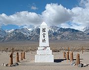 |
Indepen- dence Independence, California Independence is the county seat of Inyo County, California. Independence is located south-southeast of Bishop, at an elevation of 3930 feet . The population of this census-designated place was 669 at the 2010 census, up from 574 at the 2000 census.... 36°43′41"N 118°9′16"W |
Inyo | The most widely known American forced relocation camp where 11,070 Japanese Americans were imprisoned during World War II. | ||
| Mare Island Naval Shipyard Mare Island Naval Shipyard The Mare Island Naval Shipyard was the first United States Navy base established on the Pacific Ocean. It is located 25 miles northeast of San Francisco in Vallejo, California. The Napa River goes through the Mare Island Strait and separates the peninsula shipyard from the main portion of the... |
_at_mare_island_naval_yard,_stern_view.jpg) |
Vallejo Vallejo, California Vallejo is the largest city in Solano County, California, United States. The population was 115,942 at the 2010 census. It is located in the San Francisco Bay Area on the northeastern shore of San Pablo Bay... 38.10°N 122.27°W |
Solano | The first US naval facility on the West Coast, it built and supported WWII naval forces as well as nuclear submarines. It closed in 1996 and is currently under redevelopment which is threatening the historic buildings. | ||
| Marin County Civic Center Marin County Civic Center Marin County Civic Center, the last commission by Frank Lloyd Wright, is located in San Rafael, California. Groundbreaking for the Civic Center Administration Building took place in 1960, after Wright's death and under the watch of Wright's protégé, Aaron Green, and was completed in 1962. The... |
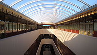 |
San Rafael San Rafael, California San Rafael is a city and the county seat of Marin County, California, United States. The city is located in the North Bay region of the San Francisco Bay Area... 37°59′52"N 122°31′50"W |
Marin | The last major commission by Frank Lloyd Wright Frank Lloyd Wright Frank Lloyd Wright was an American architect, interior designer, writer and educator, who designed more than 1,000 structures and completed 500 works. Wright believed in designing structures which were in harmony with humanity and its environment, a philosophy he called organic architecture... , this government run complex hosts a variety of events including the county fair. Its architecture has led to inclusion in or inspiration for several films. It is also known for two violent attacks in the 1970s. |
||
| Mendocino Woodlands Recreational Demonstra- tion Area Mendocino Woodlands State Park The Mendocino Woodlands State Park is a group camping facility located at 39350 Little Lake Road, Mendocino County, California, seven miles inland from the town of Mendocino. It was built as a Recreational Demonstration Area by the Civilian Conservation Corps... |
image pending | Mendocino Mendocino, California Mendocino is a census-designated place in Mendocino County, California, United States. Mendocino is located south of Fort Bragg, at an elevation of 154 feet... 39°19′43"N 123°41′54"W |
Mendocino | The only Recreational Demonstration Area Recreational Demonstration Area The Recreational Demonstration Area program was a National Park Service program during the 1930s and early 1940s that built forty-six public parks in twenty-four states on , chiefly near urban areas in the United States... built by the Civilian Conservation Corps Civilian Conservation Corps The Civilian Conservation Corps was a public work relief program that operated from 1933 to 1942 in the United States for unemployed, unmarried men from relief families, ages 18–25. A part of the New Deal of President Franklin D... that's been continually used as a campground. It has been managed by a nonprofit agency since 1949 and remains in use today as Mendocino Woodlands State Park Mendocino Woodlands State Park The Mendocino Woodlands State Park is a group camping facility located at 39350 Little Lake Road, Mendocino County, California, seven miles inland from the town of Mendocino. It was built as a Recreational Demonstration Area by the Civilian Conservation Corps... . |
||
| Mission Beach Roller Coaster Mission Beach Roller Coaster The Giant Dipper, also known as the Mission Beach Roller Coaster, is a wooden roller coaster, built in 1925. The Giant Dipper is in Belmont Park, right on Mission Beach in San Diego... |
|
San Diego San Diego, California San Diego is the eighth-largest city in the United States and second-largest city in California. The city is located on the coast of the Pacific Ocean in Southern California, immediately adjacent to the Mexican border. The birthplace of California, San Diego is known for its mild year-round... 32.7699345629°N 117.250059665°W |
San Diego | one of only 2 remaining wooden coasters on the West coast, it was built in 1925 by noted coaster builders Prior and Church. It was saved from destruction in 1987, restored, and is still operating today. | ||
| Mission Inn Mission Inn The Mission Inn, now known as The Mission Inn Hotel & Spa, is a historic landmark hotel in downtown Riverside, California. Although a composite of many architectural styles, it is generally considered the largest Mission Revival Style building in the United States.-History:The property began as a... |
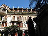 |
Riverside Riverside, California Riverside is a city in Riverside County, California, United States, and the county seat of the eponymous county. Named for its location beside the Santa Ana River, it is the largest city in the Riverside-San Bernardino-Ontario metropolitan area of Southern California, 4th largest inland California... 33.9816175011°N 117.371665653°W |
Riverside | This hotel Hotel A hotel is an establishment that provides paid lodging on a short-term basis. The provision of basic accommodation, in times past, consisting only of a room with a bed, a cupboard, a small table and a washstand has largely been replaced by rooms with modern facilities, including en-suite bathrooms... has become the largest Mission Revival style Mission Revival Style architecture The Mission Revival Style was an architectural movement that began in the late 19th century for a colonial style's revivalism and reinterpretation, which drew inspiration from the late 18th and early 19th century Spanish missions in California.... through progressive additions and embellishments since its first predecessor cottage Cottage __toc__In modern usage, a cottage is usually a modest, often cozy dwelling, typically in a rural or semi-rural location. However there are cottage-style dwellings in cities, and in places such as Canada the term exists with no connotations of size at all... was built Construction In the fields of architecture and civil engineering, construction is a process that consists of the building or assembling of infrastructure. Far from being a single activity, large scale construction is a feat of human multitasking... in 1876. In addition to lodgings, it features shops Retailing Retail consists of the sale of physical goods or merchandise from a fixed location, such as a department store, boutique or kiosk, or by mail, in small or individual lots for direct consumption by the purchaser. Retailing may include subordinated services, such as delivery. Purchasers may be... , a chapel Chapel A chapel is a building used by Christians as a place of fellowship and worship. It may be part of a larger structure or complex, such as a church, college, hospital, palace, prison or funeral home, located on board a military or commercial ship, or it may be an entirely free-standing building,... , furniture Furniture Furniture is the mass noun for the movable objects intended to support various human activities such as seating and sleeping in beds, to hold objects at a convenient height for work using horizontal surfaces above the ground, or to store things... from around the world, and Tiffany Louis Comfort Tiffany Louis Comfort Tiffany was an American artist and designer who worked in the decorative arts and is best known for his work in stained glass. He is the American artist most associated with the Art Nouveau and Aesthetic movements... windows. |
||
| Mission San Miguel Arcángel Mission San Miguel Arcángel Mission San Miguel Arcángel was founded on July 25, 1797 by the Franciscan order, on a site chosen specifically due to the large number of Salinan Indians that inhabited the area, whom the Spanish priests wanted to evangelize. It is located at 775 Mission Street, San Miguel, in San Luis Obispo... |
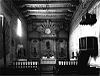 |
San Miguel 35.744722°N 120.698056°W |
San Luis Obispo | The 16th California Mission church remains well preserved and still in use today though under earthquake remediation construction. Inside are murals by Esteban Munras Esteban Munras Esteban Carlos Munras was a 19th century artist, probably best known for the vibrantly-colored frescoes that adorn the chapel interior at Mission San Miguel Arcángel in California.-Life:... . |
||
| Mission Santa Inés Mission Santa Inés Mission Santa Inés was founded on September 17, 1804 by Father Estévan Tapís, who had succeeded Father Fermín Lasuén as President of the California mission chain... |
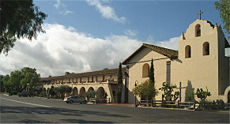 |
Solvang Solvang, California Solvang is a city in Santa Barbara County, California, United States. It is one of the communities that make up the Santa Ynez Valley. The population was 5,245 at the 2010 census, down from 5,332 at the 2000 census... 34.594454°N 120.136657°W |
Santa Barbara | The 19th California Mission church was the site of an Indian revolt in 1824. It has undergone restoration since the 1940s and is a working parish church today. | ||
| Modjeska House Modjeska House Modjeska House, also known as Arden, is a house designed by Stanford White in Modjeska, California. It is significant for being the only surviving home of Helena Modjeska, a Shakespearean actress and Polish patriot.-Background:... |
image pending | Modjeska 33.7163426263°N 117.623823831°W |
Orange | Designed by Stanford White Stanford White Stanford White was an American architect and partner in the architectural firm of McKim, Mead & White, the frontrunner among Beaux-Arts firms. He designed a long series of houses for the rich and the very rich, and various public, institutional, and religious buildings, some of which can be found... , from 1888 to 1906 this was the home of Helena Modjeska Helena Modjeska Helena Modjeska Helena Modjeska Helena Modjeska (October 12, 1840 – April 8, 1909, whose actual Polish surname was Modrzejewska , was a renowned actress who specialized in Shakespearean and tragic roles.Modjeska was the mother of Polish-American bridge engineer Ralph Modjeski.... , a Polish patriot and Shakespearean actress. |
||
| Monterey Old Town Historic District Monterey State Historic Park Monterey State Historic Park is a historic state park located in Monterey, California. It includes part or all of the Monterey Old Town Historic District, a historic district which is a U.S. National Historic Landmark... |
.jpg) |
Monterey Monterey, California The City of Monterey in Monterey County is located on Monterey Bay along the Pacific coast in Central California. Monterey lies at an elevation of 26 feet above sea level. As of the 2010 census, the city population was 27,810. Monterey is of historical importance because it was the capital of... 36.599722°N 121.893611°W |
Monterey | Also known as Monterey State Historic Park Monterey State Historic Park Monterey State Historic Park is a historic state park located in Monterey, California. It includes part or all of the Monterey Old Town Historic District, a historic district which is a U.S. National Historic Landmark... , this NHLD contains both California's First Theatre, and the Monterey Customs House, where the American flag was first raised over California. It also incorporates the National Historic Landmark National Historic Landmark A National Historic Landmark is a building, site, structure, object, or district, that is officially recognized by the United States government for its historical significance... ed Larkin House Larkin House The Larkin House, located at 464 Calle Principale, Monterey, California was built in 1835 by Thomas O. Larkin. It is claimed that the house was the first two story house in all of California, and that it was the first house with a fireplace in Monterey... known for its leading architecture. |
||
| John Muir House John Muir National Historic Site The John Muir National Historic Site is located in the San Francisco Bay Area, in Martinez, Contra Costa County, California. It preserves the 14-room Italianate Victorian mansion where the naturalist and writer John Muir lived, as well as a nearby tract of native oak woodlands and grasslands... |
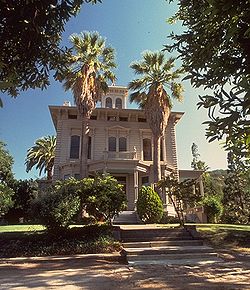 |
Martinez Martinez, California Martinez is a city and the county seat of Contra Costa County, California, United States. The population was 35,824 at the 2010 census. The downtown is notable for its large number of preserved old buildings... 37.991679°N 122.130511°W |
Contra Costa | John Muir John Muir John Muir was a Scottish-born American naturalist, author, and early advocate of preservation of wilderness in the United States. His letters, essays, and books telling of his adventures in nature, especially in the Sierra Nevada mountains of California, have been read by millions... lived here from 1890 until his death in 1914, the time period of some of his most notable achievements including founding the Sierra Club Sierra Club The Sierra Club is the oldest, largest, and most influential grassroots environmental organization in the United States. It was founded on May 28, 1892, in San Francisco, California, by the conservationist and preservationist John Muir, who became its first president... and laying the groundwork for the creation of the National Park Service National Park Service The National Park Service is the U.S. federal agency that manages all national parks, many national monuments, and other conservation and historical properties with various title designations... . It is open to the public. |
||
| New Almaden New Almaden The New Almaden quicksilver mine in the Santa Teresa Hills in Santa Clara County, California, United States, is the oldest and most productive quicksilver mine in the U.S. The site was known to the Ohlone Indians for its cinnabar long before a Mexican settler discovered the ores in 1820... |
 |
San Jose San Jose, California San Jose is the third-largest city in California, the tenth-largest in the U.S., and the county seat of Santa Clara County which is located at the southern end of San Francisco Bay... 37.18°N 121.835556°W |
Santa Clara | Also known as Senador, one of the oldest and most productive mercury Mercury (element) Mercury is a chemical element with the symbol Hg and atomic number 80. It is also known as quicksilver or hydrargyrum... mines in the United States. It helped ensure the California Gold Rush California Gold Rush The California Gold Rush began on January 24, 1848, when gold was found by James W. Marshall at Sutter's Mill in Coloma, California. The first to hear confirmed information of the gold rush were the people in Oregon, the Sandwich Islands , and Latin America, who were the first to start flocking to... could take place. Now part of Almaden Quicksilver County Park Almaden Quicksilver County Park Almaden Quicksilver County Park is a 4,147 acres park that includes the grounds of former mercury mines adjacent to south San Jose, California, USA... . |
||
| Richard M. Nixon Birthplace Richard Nixon Birthplace The Richard Nixon Birthplace is where Richard Nixon was born and lived from 1913 to 1922. It was built in 1913 in the California style with "Bungaloid elements" by his father, Francis A... |
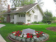 |
Yorba Linda Yorba Linda, California Yorba Linda is a suburban city in northeastern Orange County, California, approximately northeast of Downtown Santa Ana, and southeast of Downtown Los Angeles.... 33.888611°N 117.818759°W |
Orange | The birthplace and home of President Richard Milhous Nixon from 1913 to 1922. Now part of the Richard Nixon Presidential Library and Museum | ||
| Frank Norris Cabin Frank Norris Cabin Frank Norris Cabin, also known as Redwood Retreat, was a retreat of the writer Frank Norris near Gilroy, California. Norris purchased the ranch near Gilroy in 1902, but died that year, and the extent to which he used this cabin is unclear.... |
.jpg) |
Gilroy Gilroy, California Gilroy is the southernmost city in Santa Clara County, California, United States. The population was 48,821 at the 2010 census. Gilroy is well-known for its garlic crop and for the annual Gilroy Garlic Festival, featuring various garlicky foods, including garlic ice cream. Gilroy also produces... 37.036389°N 121.7125°W |
Santa Clara | Also known as Redwood Retreat this was the home of author Frank Norris Frank Norris Benjamin Franklin Norris, Jr. was an American novelist, during the Progressive Era, writing predominantly in the naturalist genre. His notable works include McTeague , The Octopus: A Story of California , and The Pit .-Life:Frank Norris was born in Chicago, Illinois in 1870... in the last year of his life. |
||
| Oak Grove Butterfield Stage Station Oak Grove Butterfield Stage Station Oak Grove Butterfield Stage Station is located in Warner Springs, California and is the only surviving station on the Butterfield Overland Mail stagecoach line... |
.jpg) |
Warner Springs Warner Springs, California Warner Springs is a small unincorporated community in northern San Diego County, California. It is associated with two National Historic Landmarks, the Oak Grove Butterfield Stage Station and Warner's Ranch, both connected to the Butterfield Overland Mail stagecoach line. It is also near the... 33.389728°N 116.794097°W |
San Diego | The only surviving station house on the Butterfield Overland Mail Butterfield Overland Mail The Butterfield Overland Mail Trail was a stagecoach route in the United States, operating from 1857 to 1861. It was a conduit for the U.S. mail from two eastern termini, Memphis, Tennessee and St. Louis, Missouri, meeting Fort Smith, Arkansas, and continuing through Indian Territory, New Mexico,... stagecoach Stagecoach A stagecoach is a type of covered wagon for passengers and goods, strongly sprung and drawn by four horses, usually four-in-hand. Widely used before the introduction of railway transport, it made regular trips between stages or stations, which were places of rest provided for stagecoach travelers... line. The nearby location of Warner's Ranch Warner's Ranch Warner's Ranch near Warner Springs, California, was notable as a way station for large numbers of emigrants on the Southern Trail from 1849 to 1861, as it was a stop on both the Gila River Trail and the Butterfield Overland Mail stagecoach line... was also part of the line. |
||
| Old Customhouse Old Customhouse (Monterey, California) The Old Customhouse is an Spanish Colonial style adobe structure built around 1827 by the Mexican government in the Pueblo de Monterey, Alta California, in present day Monterey County in the U.S. state of California... |
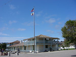 |
Monterey Monterey, California The City of Monterey in Monterey County is located on Monterey Bay along the Pacific coast in Central California. Monterey lies at an elevation of 26 feet above sea level. As of the 2010 census, the city population was 27,810. Monterey is of historical importance because it was the capital of... 36.5961971882°N 121.892068798°W |
Monterey | This 1827 Adobe structure is the oldest public building in California and is where the American Flag was raised, declaring California part of the United States United States The United States of America is a federal constitutional republic comprising fifty states and a federal district... . It is now a museum located inside the Monterey State Historic Park Monterey State Historic Park Monterey State Historic Park is a historic state park located in Monterey, California. It includes part or all of the Monterey Old Town Historic District, a historic district which is a U.S. National Historic Landmark... , itself a NHLD. |
||
| Old Mission Dam Old Mission Dam The Old Mission Dam, located in San Diego, California was the first major irrigation project on the Pacific coast. The stone and cement dam is , at its base and . Water was released for a sawmill and irrigation at the Mission San Diego de Alcalá, away.... |
 |
San Diego San Diego, California San Diego is the eighth-largest city in the United States and second-largest city in California. The city is located on the coast of the Pacific Ocean in Southern California, immediately adjacent to the Mexican border. The birthplace of California, San Diego is known for its mild year-round... 32.8381927311°N 117.042314031°W |
San Diego | The first major irrigation project on the Pacific coast, this dam supplied water for milling and irrigation at the Mission San Diego de Alcalá Mission San Diego de Alcalá Mission Basilica San Diego de Alcalá, in San Diego, California, was the first Franciscan mission in the Las Californias Province of the Viceroyalty of New Spain. It was founded in 1769 by Spanish friar Junípero Serra in an area long inhabited by the Kumeyaay Indians... , 5 miles away. Now part of Mission Trails Regional Park Mission Trails Regional Park Mission Trails Regional Park is a 5,800 acre open space preserve within the city of San Diego, California, established in 1974. It is the sixth largest municipally-owned park in the United States, and the largest in California.-Description:... |
||
| Old Sacramento Historic District Old Sacramento State Historic Park Old Sacramento State Historic Park is the historic region of Sacramento, California, which has been designated as a state park. It is generally referred to as Old Sacramento, or Old Sac, and since the 1960s has been restored and developed as a significant tourist attraction. All of it is... |
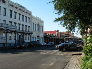 |
Sacramento Sacramento, California Sacramento is the capital city of the U.S. state of California and the county seat of Sacramento County. It is located at the confluence of the Sacramento River and the American River in the northern portion of California's expansive Central Valley. With a population of 466,488 at the 2010 census,... 38.582778°N 121.503333°W |
Sacramento | Built up after the California Gold Rush California Gold Rush The California Gold Rush began on January 24, 1848, when gold was found by James W. Marshall at Sutter's Mill in Coloma, California. The first to hear confirmed information of the gold rush were the people in Oregon, the Sandwich Islands , and Latin America, who were the first to start flocking to... , this historic district also includes the NHL National Historic Landmark A National Historic Landmark is a building, site, structure, object, or district, that is officially recognized by the United States government for its historical significance... locations of the Pony Express Terminal Pony Express Terminal The Pony Express Terminal, also known as the B. F. Hastings Bank Building, in Sacramento, California, was the western endpoint of the Pony Express. The building was also the first location of the California Supreme Court... and the Big Four House Big Four House The Big Four House is a historic building in Sacramento, California, built in 1852. Its name refers to The Big Four, Collis Huntington, Mark Hopkins, Leland Stanford, and Charles Crocker, who organized the Central Pacific railway and founded the Southern Pacific Railroad here.It was declared a... . |
||
| Old Scripps Building Old Scripps Building The Old Scripps Building in La Jolla, California, built in 1909, is the oldest oceanographic research building in continuous use in the United States.. It was the first building of the Scripps Institution of Oceanography, the nation's first oceanographic institute, founded in 1903... |
 |
La Jolla 32.864446°N 117.252395°W |
San Diego | The first building of Scripps Institution of Oceanography Scripps Institution of Oceanography Scripps Institution of Oceanography in La Jolla, California, is one of the oldest and largest centers for ocean and earth science research, graduate training, and public service in the world... , which is the oldest oceanographic institute in the United States. It formed the starting point of what has become the University of California, San Diego University of California, San Diego The University of California, San Diego, commonly known as UCSD or UC San Diego, is a public research university located in the La Jolla neighborhood of San Diego, California, United States... . |
||
| Old United States Mint San Francisco Mint The San Francisco Mint is a branch of the United States Mint, and was opened in 1854 to serve the gold mines of the California Gold Rush. It quickly outgrew its first building and moved into a new one in 1874. This building, the Old United States Mint, also known affectionately as The Granite Lady,... |
_3.jpg) |
San Francisco San Francisco, California San Francisco , officially the City and County of San Francisco, is the financial, cultural, and transportation center of the San Francisco Bay Area, a region of 7.15 million people which includes San Jose and Oakland... 37.782727°N 122.406479°W |
San Francisco | Built for the San Francisco Mint San Francisco Mint The San Francisco Mint is a branch of the United States Mint, and was opened in 1854 to serve the gold mines of the California Gold Rush. It quickly outgrew its first building and moved into a new one in 1874. This building, the Old United States Mint, also known affectionately as The Granite Lady,... in 1874 to handle the overflow from the California Gold Rush California Gold Rush The California Gold Rush began on January 24, 1848, when gold was found by James W. Marshall at Sutter's Mill in Coloma, California. The first to hear confirmed information of the gold rush were the people in Oregon, the Sandwich Islands , and Latin America, who were the first to start flocking to... , this building is affectionately as The Granite Lady. It is one of the few that survivors of the great 1906 San Francisco earthquake 1906 San Francisco earthquake The San Francisco earthquake of 1906 was a major earthquake that struck San Francisco, California, and the coast of Northern California at 5:12 a.m. on Wednesday, April 18, 1906. The most widely accepted estimate for the magnitude of the earthquake is a moment magnitude of 7.9; however, other... and served until 1937. |
||
| USS Pampanito (submarine) USS Pampanito (SS-383) USS Pampanito , a Balao-class submarine, was a United States Navy ship, the only one named for a variety of the pompano fish . She completed six war patrols from 1944 to 1945 and served as a Naval Reserve Training ship from 1960 to 1971... |
.jpg) |
San Francisco San Francisco, California San Francisco , officially the City and County of San Francisco, is the financial, cultural, and transportation center of the San Francisco Bay Area, a region of 7.15 million people which includes San Jose and Oakland... 37.8086004153°N 122.415623276°W |
San Francisco | A Balao class submarine Balao class submarine The Balao class was a successful design of United States Navy submarine used during World War II, and with 122 units built, the largest class of submarines in the United States Navy. An improvement on the earlier Gato class, the boats had slight internal differences... , she served in World War II World War II World War II, or the Second World War , was a global conflict lasting from 1939 to 1945, involving most of the world's nations—including all of the great powers—eventually forming two opposing military alliances: the Allies and the Axis... before becoming a museum ship and part of the San Francisco Maritime National Park Association San Francisco Maritime National Park Association The San Francisco Maritime National Park Association was founded in 1950 as the San Francisco Maritime Museum Association to operate then independent Maritime Museum. In 1978 the Maritime Museum was transferred to the National Park Service, and it now forms the core of the San Francisco Maritime... . She still has several working parts, including the periscopes and a torpedo tube. |
||
| Paramount Theatre Paramount Theater (Oakland, California) The Paramount Theatre is a massive Art Deco movie theater located in downtown Oakland, California, USA. When it was built in 1931, it was the largest multi-purpose theater on the West Coast, seating 3476 Today, the Paramount is the home of the Oakland East Bay Symphony and the Oakland Ballet, it... |
 |
Oakland Oakland, California Oakland is a major West Coast port city on San Francisco Bay in the U.S. state of California. It is the eighth-largest city in the state with a 2010 population of 390,724... 37.809457°N 122.267984°W |
Alameda National Register of Historic Places listings in Alameda County, California This list includes properties and districts listed on the National Register of Historic Places in Alameda County, California. Click the "Map of all coordinates" link to the right to view a Google map of all properties and districts with latitude and longitude coordinates in the table below.-Current... |
The largest theatre on the West Coast when it was built, it is notable for its Art Deco Art Deco Art deco , or deco, is an eclectic artistic and design style that began in Paris in the 1920s and flourished internationally throughout the 1930s, into the World War II era. The style influenced all areas of design, including architecture and interior design, industrial design, fashion and... appearance. It is the home of the Oakland East Bay Symphony Oakland East Bay Symphony The Oakland East Bay Symphony is a leading orchestra based in Oakland, California. The current music director and conductor is Michael Morgan, who has held the position since September 1990. The Paramount Theatre has been the home of the Symphony since the 1995. Bryan Nies has been Assistant... and the Oakland Ballet Oakland Ballet The Oakland Ballet company is a non-profit ballet company based in Oakland, California since its foundation in 1961. It often performs in the NHL Art-Deco Paramount Theatre. Ronn Guidi served as artistic director from 1961 through 1996. In 2006, the organization closed temporarily, but was... and is managed by a nonprofit organization. |
||
| Parsons Memorial Lodge Parsons Memorial Lodge The Parsons Memorial Lodge is a small building built in 1915 by the Sierra Club at the northern end of Tuolumne Meadows of Yosemite National Park. It was one of the earliest structures built of stone in a National Park.-Memorial:... |
Yosemite National Park Yosemite National Park Yosemite National Park is a United States National Park spanning eastern portions of Tuolumne, Mariposa and Madera counties in east central California, United States. The park covers an area of and reaches across the western slopes of the Sierra Nevada mountain chain... 37.8766108572°N 119.366616789°W |
Tuolumne | This solidly built structure was the first stone structure in a National Park National park A national park is a reserve of natural, semi-natural, or developed land that a sovereign state declares or owns. Although individual nations designate their own national parks differently A national park is a reserve of natural, semi-natural, or developed land that a sovereign state declares or... . It was built by the Sierra Club and is still standing today with only minor variations. It reflects the Bay Area architecture influences of Bernard Maybeck Bernard Maybeck Bernard Ralph Maybeck was a architect in the Arts and Crafts Movement of the early 20th century. He was a professor at University of California, Berkeley... as well as the practical weather concerns of the High Sierra valley. |
|||
| Petaluma Adobe Rancho Petaluma Adobe Rancho Petaluma Adobe is the name of a historic ranch house built from adobe bricks that was owned and constructed by General Mariano Guadalupe Vallejo, commandant of the Sonoma Pueblo from 1834 to 1857. It is the largest example of the Monterey Colonial style of architecture in the United States... |
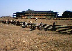 |
Petaluma Petaluma, California Petaluma is a city in Sonoma County, California, in the United States. In the 2010 Census the population was 57,941.Located in Petaluma is the Rancho Petaluma Adobe, a National Historic Landmark. It was built beginning in 1836 by General Mariano Guadalupe Vallejo, then Commandant of the San... 38.25547°N 122.58451°W |
Sonoma | The largest example of Monterey Colonial architecture in the United States, this adobe Adobe Adobe is a natural building material made from sand, clay, water, and some kind of fibrous or organic material , which the builders shape into bricks using frames and dry in the sun. Adobe buildings are similar to cob and mudbrick buildings. Adobe structures are extremely durable, and account for... structure was the ranch house of General Mariano Guadalupe Vallejo Mariano Guadalupe Vallejo Mariano Guadalupe Vallejo was a Californian military commander, politician, and rancher. He was born a subject of Spain, performed his military duties as an officer of Mexico, and shaped the transition of California from a Mexican district to an American state... , commandant of the Sonoma Pueblo. It is now the centerpiece of Petaluma Adobe State Historic Park, which is threatened with closure. |
||
| Pioneer Deep Space Station Goldstone Deep Space Communications Complex The Goldstone Deep Space Communications Complex — commonly called the Goldstone Observatory — is located in California's Mojave Desert. Operated by ITT Corporation for the Jet Propulsion Laboratory, its main purpose is to track and communicate with space missions. It includes the Pioneer... |
 |
Fort Irwin Fort Irwin Military Reservation Fort Irwin & the National Training Center is a major training area for the United States Military and is a census-designated place located in the Mojave Desert in northern San Bernardino County, California. Fort Irwin sits at an elevation of . The 2010 United States census reported Fort Irwin's... 35.3874891024°N 116.856198162°W |
San Bernardino | NASA's Deep Space Network Deep Space Network The Deep Space Network, or DSN, is a world-wide network of large antennas and communication facilities that supports interplanetary spacecraft missions. It also performs radio and radar astronomy observations for the exploration of the solar system and the universe, and supports selected... for tracking unmanned spacecraft Spacecraft A spacecraft or spaceship is a craft or machine designed for spaceflight. Spacecraft are used for a variety of purposes, including communications, earth observation, meteorology, navigation, planetary exploration and transportation of humans and cargo.... in deep space Outer space Outer space is the void that exists between celestial bodies, including the Earth. It is not completely empty, but consists of a hard vacuum containing a low density of particles: predominantly a plasma of hydrogen and helium, as well as electromagnetic radiation, magnetic fields, and neutrinos.... was inaugurated when this antenna Radio telescope A radio telescope is a form of directional radio antenna used in radio astronomy. The same types of antennas are also used in tracking and collecting data from satellites and space probes... became operational in 1958. |
||
| Point Reyes Lifeboat Station Point Reyes Lifeboat Station Point Reyes Lifeboat Station, also known as Point Reyes Lifeboat Rescue Station, was built in 1927 by the United States Lifesaving Service . It used rail launched 36 foot motorized lifeboats to aid ships foundering on Point Reyes. It was a replacement to another station that was built in 1888... |
 |
Point Reyes Point Reyes Point Reyes is a prominent cape on the Pacific coast of northern California. It is located in Marin County approximately WNW of San Francisco. The term is often applied to the Point Reyes Peninsula, the region bounded by Tomales Bay on the northeast and Bolinas Lagoon on the southeast... 37.993889°N 122.973889°W |
Marin | Last remaining instance of a USLS United States Life-Saving Service The United States Life-Saving Service was a United States government agency that grew out of private and local humanitarian efforts to save the lives of shipwrecked mariners and passengers... rail launched lifeboat Lifeboat (rescue) A rescue lifeboat is a boat rescue craft which is used to attend a vessel in distress, or its survivors, to rescue crewmen and passengers. It can be hand pulled, sail powered or powered by an engine... station, commonly used on the Pacific coast. This site rescued crews from ships that foundered on Point Reyes Point Reyes Point Reyes is a prominent cape on the Pacific coast of northern California. It is located in Marin County approximately WNW of San Francisco. The term is often applied to the Point Reyes Peninsula, the region bounded by Tomales Bay on the northeast and Bolinas Lagoon on the southeast... . It is now protected as part of the Point Reyes National Seashore Point Reyes National Seashore Point Reyes National Seashore is a park preserve located on the Point Reyes Peninsula in Marin County, California, USA. As a national seashore, it is maintained by the US National Park Service as a nationally important nature preserve within which existing agricultural uses are allowed to continue... . |
||
| Pony Express Terminal Pony Express Terminal The Pony Express Terminal, also known as the B. F. Hastings Bank Building, in Sacramento, California, was the western endpoint of the Pony Express. The building was also the first location of the California Supreme Court... |
.jpg) |
Sacramento Sacramento, California Sacramento is the capital city of the U.S. state of California and the county seat of Sacramento County. It is located at the confluence of the Sacramento River and the American River in the northern portion of California's expansive Central Valley. With a population of 466,488 at the 2010 census,... 38.582898°N 121.504248°W |
Sacramento | The Western end of the Pony Express Pony Express The Pony Express was a fast mail service crossing the Great Plains, the Rocky Mountains, and the High Sierra from St. Joseph, Missouri, to Sacramento, California, from April 3, 1860 to October 1861... , this bank building has also served as the first home of the Supreme Court of California Supreme Court of California The Supreme Court of California is the highest state court in California. It is headquartered in San Francisco and regularly holds sessions in Los Angeles and Sacramento. Its decisions are binding on all other California state courts.-Composition:... . It is now part of the Old Sacramento State Historic Park Old Sacramento State Historic Park Old Sacramento State Historic Park is the historic region of Sacramento, California, which has been designated as a state park. It is generally referred to as Old Sacramento, or Old Sac, and since the 1960s has been restored and developed as a significant tourist attraction. All of it is... , itself a National Historic Landmark District. |
||
| Potomac (Presidential yacht) USS Potomac (AG-25) USS Potomac , formerly the USCGC Electra, was Franklin Delano Roosevelt’s presidential yacht from 1936 until his death in 1945. It is one of only three still existing presidential yachts. On August 3, 1941, she played a decoy role while Roosevelt held a secret conference to develop the Atlantic... |
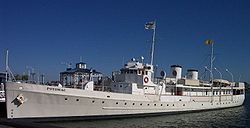 |
Oakland Oakland, California Oakland is a major West Coast port city on San Francisco Bay in the U.S. state of California. It is the eighth-largest city in the state with a 2010 population of 390,724... 37.793512671°N 122.278992912°W |
Alameda National Register of Historic Places listings in Alameda County, California This list includes properties and districts listed on the National Register of Historic Places in Alameda County, California. Click the "Map of all coordinates" link to the right to view a Google map of all properties and districts with latitude and longitude coordinates in the table below.-Current... |
Formerly the USCGC Electra, this ship was Franklin Delano Roosevelt’s presidential yacht from 1936 until his death in 1945 and only one of three still existing presidential yachts. On August 3, 1941, she played a decoy role while Roosevelt snuck off to sign the Atlantic Charter Atlantic Charter The Atlantic Charter was a pivotal policy statement first issued in August 1941 that early in World War II defined the Allied goals for the post-war world. It was drafted by Britain and the United States, and later agreed to by all the Allies... . She is now a museum ship. |
||
| Presidio of San Francisco Presidio of San Francisco The Presidio of San Francisco is a park on the northern tip of the San Francisco Peninsula in San Francisco, California, within the Golden Gate National Recreation Area... |
 |
San Francisco San Francisco, California San Francisco , officially the City and County of San Francisco, is the financial, cultural, and transportation center of the San Francisco Bay Area, a region of 7.15 million people which includes San Jose and Oakland... 37°48′N 122°28′W |
San Francisco | Used as a fortified military base from 1776 to 1995 by Spain, Mexico, and the United States. It is now part of the Golden Gate National Recreation Area Golden Gate National Recreation Area The Golden Gate National Recreation Area is a U.S. National Recreation Area administered by the National Park Service that surrounds the San Francisco Bay area. It is one of the most visited units of the National Park system in the United States, with over 13 million visitors a year... and serves a mix of commercial and public uses. It is required to be financially self supporting by 2013. |
||
| Ralph J. Scott (fireboat) Ralph J. Scott (fireboat) The Ralph J. Scott, also known as Fireboat #2, is a 100-foot fireboat that was attached to the Los Angeles Fire Department serving the Port of Los Angeles. It was retired in 2003 after 78 years and replaced by the Warner L. Lawrence. The Ralph J... |
.jpg) |
San Pedro 33.741292°N 118.278953°W |
Los Angeles | A fireboat for the LAFD from 1925 until its retirement in 2003, it could pump 17,000 US gal/min (1,070 L/s). It is now located near the Los Angeles Maritime Museum Los Angeles Maritime Museum The Los Angeles Maritime Museum is a non-profit museum.-The Museum:The Los Angeles Maritime Museum is located on the main channel in Los Angeles Harbor, San Pedro, California, in the former Municipal Ferry Terminal building. The ferry ceased after the Vincent Thomas Bridge was opened to traffic in... . |
||
| William C. Ralston Home Ralston Hall Ralston Hall Mansion located in Belmont, California, was the country house of William Chapman Ralston, a San Francisco businessman, founder of the Bank of California, and financier of the Comstock Lode. It is an opulent Italianate Villa, modified with touches of Steamboat Gothic and Victorian... |
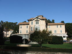 |
Belmont Belmont, California Belmont is a city in San Mateo County, California, United States. It is in the San Francisco Bay Area, located half-way down the San Francisco Peninsula between San Mateo and San Carlos. It was originally part of the Rancho de las Pulgas, for which one of its main roads, the Alameda de las Pulgas,... 37.5175°N 122.286111°W |
San Mateo | Home of William Chapman Ralston William Chapman Ralston William "Billy" Chapman Ralston was a San Francisco, California businessman and financier, and was the founder of the Bank of California.-Biography:... , a San Francisco businessman, founder of the Bank of California Bank of California The Bank of California was opened in San Francisco, California, on July 4, 1864, by William Chapman Ralston. It was the first commercial bank in the Western United States, the second-richest bank in the nation, and considered instrumental in developing the American Old West.-History:The ancestor of... , and financier of the Comstock Lode Comstock Lode The Comstock Lode was the first major U.S. discovery of silver ore, located under what is now Virginia City, Nevada, on the eastern slope of Mount Davidson, a peak in the Virginia Range. After the discovery was made public in 1859, prospectors rushed to the area and scrambled to stake their claims... . Now part of Notre Dame de Namur University Notre Dame de Namur University Notre Dame de Namur University — formerly the College of Notre Dame — is a private, Catholic University located in Belmont, California in the San Francisco Bay Area. Notre Dame de Namur University is an accredited university in San Mateo County, and the fifth-oldest university in California... . |
||
| Rancho Camulos Rancho Camulos Rancho Camulos, now known as Rancho Camulos Museum, is a ranch located in the Santa Clara River Valley east of Piru, California and just north of the Santa Clara River, in present day Ventura County, California. It was the home of Ygnacio del Valle, an alcalde of the Pueblo de Los Angeles and... |
 |
Piru Piru, California Piru is a small unincorporated census-designated town located in eastern Ventura County, California, in the Santa Clara River Valley near the Santa Clara River and Highway 126, about seven miles east of Fillmore and about west of Interstate 5. The population was 2,063 at the 2010 census, up from... 34.40565°N 118.756667°W |
Ventura | The home of Ygnacio del Valle Ygnacio del Valle Ygnacio Ramón de Jesus del Valle was a rancher and landowner in the eastern Santa Clara River Valley, California, United States, as well as an alcalde of Los Angeles. His estate, Rancho Camulos, is registered as a National Historic Landmark.- Early life :Del Valle was born in Jalisco, Mexico... , an alcalde Alcalde Alcalde , or Alcalde ordinario, is the traditional Spanish municipal magistrate, who had both judicial and administrative functions. An alcalde was, in the absence of a corregidor, the presiding officer of the Castilian cabildo and judge of first instance of a town... of Los Angeles Los Ángeles Los Ángeles is the capital of the province of Biobío, in the commune of the same name, in Region VIII , in the center-south of Chile. It is located between the Laja and Biobío rivers. The population is 123,445 inhabitants... and member of the California State Assembly California State Assembly The California State Assembly is the lower house of the California State Legislature. There are 80 members in the Assembly, representing an approximately equal number of constituents, with each district having a population of at least 420,000... . The ranch was known as the Home of Ramona because it is likely that the popular 1884 novel Ramona Ramona Ramona is a 1884 United States historical novel written by Helen Hunt Jackson. It is the story of a Scots-Native American orphan girl in Southern California, who suffers racial discrimination and hardship. Originally serialized in the Christian Union on a weekly basis, the novel became immensely... by Helen Hunt Jackson Helen Hunt Jackson Helen Maria Hunt Jackson, born Helen Fiske , was a United States writer who became an activist on behalf of improved treatment of Native Americans by the U.S. government. She detailed the adverse effects of government actions in her history A Century of Dishonor... was set there. The novel helped in raising awareness about the Californio Californio Californio is a term used to identify a Spanish-speaking Catholic people, regardless of race, born in California before 1848... lifestyle. It is now a museum. |
||
| Rangers' Club Rangers' Club The Rangers' Club is a building in Yosemite Valley in Yosemite National Park that was donated by the independently wealthy first director of the National Park Service, Stephen Tyng Mather. He intended it to be used by the newly hired park rangers who were taking over from the departing army... |
Yosemite National Park Yosemite National Park Yosemite National Park is a United States National Park spanning eastern portions of Tuolumne, Mariposa and Madera counties in east central California, United States. The park covers an area of and reaches across the western slopes of the Sierra Nevada mountain chain... 37.7454635709°N 119.586783467°W |
Mariposa | Stephen Tyng Mather Stephen Tyng Mather Stephen Tyng Mather was an American industrialist and conservationist. As the president and owner of the Thorkildsen-Mather Borax Company, he became a millionaire... , the wealthy first director of the National Park Service National Park Service The National Park Service is the U.S. federal agency that manages all national parks, many national monuments, and other conservation and historical properties with various title designations... personally donated this building to house the newly hired rangers covering Yosemite National Park Yosemite National Park Yosemite National Park is a United States National Park spanning eastern portions of Tuolumne, Mariposa and Madera counties in east central California, United States. The park covers an area of and reaches across the western slopes of the Sierra Nevada mountain chain... . Its rustic architecture inspired all National Park National park A national park is a reserve of natural, semi-natural, or developed land that a sovereign state declares or owns. Although individual nations designate their own national parks differently A national park is a reserve of natural, semi-natural, or developed land that a sovereign state declares or... construction through WWII. |
|||
| Rogers Dry Lake Rogers Dry Lake Rogers Dry Lake is an endorheic desert salt pan in the Mojave Desert of Kern County, California. The lake derives its name from the Anglicization from the Spanish name, Rodriguez Dry Lake. It is the central part of Edwards Air Force Base as its hard surface provides a natural extension to the... |
 |
Edwards Air Force Base Edwards Air Force Base Edwards Air Force Base is a United States Air Force base located on the border of Kern County, Los Angeles County, and San Bernardino County, California, in the Antelope Valley. It is southwest of the central business district of North Edwards, California and due east of Rosamond.It is named in... 34°57′N 117°52′W |
Kern and San Bernardino | Centerpiece of Edwards Air Force Base Edwards Air Force Base Edwards Air Force Base is a United States Air Force base located on the border of Kern County, Los Angeles County, and San Bernardino County, California, in the Antelope Valley. It is southwest of the central business district of North Edwards, California and due east of Rosamond.It is named in... , this endorheic Endorheic An endorheic basin is a closed drainage basin that retains water and allows no outflow to other bodies of water such as rivers or oceans... desert salt pan in the Mojave Desert Mojave Desert The Mojave Desert occupies a significant portion of southeastern California and smaller parts of central California, southern Nevada, southwestern Utah and northwestern Arizona, in the United States... has the worlds largest Compass Rose Compass rose A compass rose, sometimes called a windrose, is a figure on a compass, map, nautical chart or monument used to display the orientation of the cardinal directions — North, East, South and West - and their intermediate points. It is also the term for the graduated markings found on the traditional... and the worlds largest runway at 7.2 miles. It is one of the alternate Space Shuttle Space Shuttle The Space Shuttle was a manned orbital rocket and spacecraft system operated by NASA on 135 missions from 1981 to 2011. The system combined rocket launch, orbital spacecraft, and re-entry spaceplane with modular add-ons... landing sites. |
||
| Room 307, Gilman Hall, University of California Gilman Hall Gilman Hall is a building on the campus of the University of California, Berkeley. Room 307 was where Glenn T. Seaborg and his coworkers identified plutonium as a new element on February 23, 1941 and as such, is designated a National Historic Landmark... |
Berkeley Berkeley, California Berkeley is a city on the east shore of the San Francisco Bay in Northern California, United States. Its neighbors to the south are the cities of Oakland and Emeryville. To the north is the city of Albany and the unincorporated community of Kensington... 37.8707850755°N 122.255046283°W |
Alameda National Register of Historic Places listings in Alameda County, California This list includes properties and districts listed on the National Register of Historic Places in Alameda County, California. Click the "Map of all coordinates" link to the right to view a Google map of all properties and districts with latitude and longitude coordinates in the table below.-Current... |
Room 307 in Gilman Hall at UCB University of California, Berkeley The University of California, Berkeley , is a teaching and research university established in 1868 and located in Berkeley, California, USA... is where Glenn T. Seaborg Glenn T. Seaborg Glenn Theodore Seaborg was an American scientist who won the 1951 Nobel Prize in Chemistry for "discoveries in the chemistry of the transuranium elements", contributed to the discovery and isolation of ten elements, and developed the actinide concept, which led to the current arrangement of the... and his coworkers identified plutonium Plutonium Plutonium is a transuranic radioactive chemical element with the chemical symbol Pu and atomic number 94. It is an actinide metal of silvery-gray appearance that tarnishes when exposed to air, forming a dull coating when oxidized. The element normally exhibits six allotropes and four oxidation... as a new element on February 23, 1941. |
|||
| Rose Bowl Rose Bowl (stadium) The Rose Bowl is an outdoor athletic stadium in Pasadena, California, U.S., in Los Angeles County. The stadium is the site of the annual college football bowl game, the Rose Bowl, held on New Year's Day. In 1982, it became the home field of the UCLA Bruins college football team of the Pac-12... |
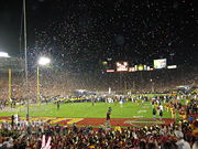 |
Pasadena Pasadena, California Pasadena is a city in Los Angeles County, California, United States. Although famous for hosting the annual Rose Bowl football game and Tournament of Roses Parade, Pasadena is the home to many scientific and cultural institutions, including the California Institute of Technology , the Jet... 34.1595343932°N 118.166774324°W |
Los Angeles | Home field of the UCLA Bruins UCLA Bruins The UCLA Bruins are the sports teams for University of California, Los Angeles . The Bruin men's and women's teams participate in NCAA Division I as part of the Pacific-12 Conference and the Mountain Pacific Sports Federation . For football, they are in the Football Bowl Subdivision of Division I... college football team as well as the annual Rose Bowl Game Rose Bowl Game The Rose Bowl is an annual American college football bowl game, usually played on January 1 at the Rose Bowl in Pasadena, California. When New Year's Day falls on a Sunday, the game is played on Monday, January 2... . It also hosted events from the 1932 and 1984 Olympics |
||
| Royal Presidio Chapel Cathedral of San Carlos Borromeo The Cathedral of San Carlos Borromeo, also known as the Royal Presidio Chapel, is a Roman Catholic cathedral located in Monterey, California, United States. The cathedral is the oldest continuously operating parish and the oldest stone building in California. It was built in 1794 making it the... |
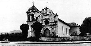 |
Monterey Monterey, California The City of Monterey in Monterey County is located on Monterey Bay along the Pacific coast in Central California. Monterey lies at an elevation of 26 feet above sea level. As of the 2010 census, the city population was 27,810. Monterey is of historical importance because it was the capital of... 36.595847°N 121.890299°W |
Monterey | This Cathedral is the oldest continuously operating parish, the oldest stone building in California, the smallest Cathedral in the United States and one of the two oldest Cathedrals in the United States. It is the only existing Presidio cathedral in California and the only original building in the Monterey Presidio. | ||
| San Diego Mission Church | 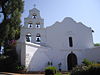 |
San Diego San Diego, California San Diego is the eighth-largest city in the United States and second-largest city in California. The city is located on the coast of the Pacific Ocean in Southern California, immediately adjacent to the Mexican border. The birthplace of California, San Diego is known for its mild year-round... 32.7827680173°N 117.106253353°W |
San Diego | This was the first Spanish Mission Spanish missions in California The Spanish missions in California comprise a series of religious and military outposts established by Spanish Catholics of the Franciscan Order between 1769 and 1823 to spread the Christian faith among the local Native Americans. The missions represented the first major effort by Europeans to... in Alta California Alta California Alta California was a province and territory in the Viceroyalty of New Spain and later a territory and department in independent Mexico. The territory was created in 1769 out of the northern part of the former province of Las Californias, and consisted of the modern American states of California,... and the start of El Camino Real El Camino Real (California) El Camino Real and sometimes associated with Calle Real usually refers to the 600-mile California Mission Trail, connecting the former Alta California's 21 missions , 4 presidios, and several pueblos, stretching from Mission San Diego de Alcalá in San Diego... . Originally located in the Presidio of San Diego Presidio of San Diego El Presidio Reál de San Diego is an historical fort established on May 14, 1769, by Commandant Pedro Fages for Spain. It was the first permanent European settlement on the Pacific Coast of the United States. As the first of the presidios and Spanish missions in California, it was the base of... , it later moved a few miles away. The nearby Old Mission Dam Old Mission Dam The Old Mission Dam, located in San Diego, California was the first major irrigation project on the Pacific coast. The stone and cement dam is , at its base and . Water was released for a sawmill and irrigation at the Mission San Diego de Alcalá, away.... , also a NHL National Historic Landmark A National Historic Landmark is a building, site, structure, object, or district, that is officially recognized by the United States government for its historical significance... , provided water for milling and farming. |
||
| San Diego Presidio |  |
San Diego San Diego, California San Diego is the eighth-largest city in the United States and second-largest city in California. The city is located on the coast of the Pacific Ocean in Southern California, immediately adjacent to the Mexican border. The birthplace of California, San Diego is known for its mild year-round... 32.758611°N 117.193333°W |
San Diego | The first fortified presidio Presidio A presidio is a fortified base established by the Spanish in North America between the sixteenth and nineteenth centuries. The fortresses were built to protect against pirates, hostile native Americans and enemy colonists. Other presidios were held by Spain in the sixteenth and seventeenth... , it along with the first mission, San Diego Mission Church, paved the way for Spanish Spain Spain , officially the Kingdom of Spain languages]] under the European Charter for Regional or Minority Languages. In each of these, Spain's official name is as follows:;;;;;;), is a country and member state of the European Union located in southwestern Europe on the Iberian Peninsula... colonization of California. No structures remain, but the site is now located in Presidio Park Presidio Park Presidio Park is a city historic park in San Diego, California. It is the site where the San Diego Presidio and the San Diego Mission, the first European settlements in what is now the western United States, were founded in 1769... . |
||
| San Francisco Bay Discovery Site San Francisco Bay Discovery Site The San Francisco Bay Discovery Site is where the first recorded European discovery of San Francisco Bay took place on November 4, 1769. Spanish explorer Gaspar de Portolà, unable to find the port of Monterey, California, continued north close to what is now Pacifica... |
San Bruno San Bruno, California San Bruno is a city in San Mateo County, California, United States. The population was 41,114 at the 2010 census.The city is adjacent to San Francisco International Airport and Golden Gate National Cemetery.-Geography:San Bruno is located at... 37.603056°N 122.454722°W |
San Mateo | On November 4, 1769 the expedition of Spanish explorer Gaspar de Portolà reached the summit of the 1,200-foot (370 m) high Sweeney Ridge Sweeney Ridge Sweeney Ridge, a national park in Pacifica, California, is part of the Golden Gate National Recreation Area. Historically, the ridge was the location of the San Francisco Bay Discovery Site, as part of the Portolá Expedition on November 4, 1769.-Description:... , where he sighted San Francisco Bay San Francisco Bay San Francisco Bay is a shallow, productive estuary through which water draining from approximately forty percent of California, flowing in the Sacramento and San Joaquin rivers from the Sierra Nevada mountains, enters the Pacific Ocean... . It is now part of the Golden Gate National Recreation Area Golden Gate National Recreation Area The Golden Gate National Recreation Area is a U.S. National Recreation Area administered by the National Park Service that surrounds the San Francisco Bay area. It is one of the most visited units of the National Park system in the United States, with over 13 million visitors a year... . |
|||
| San Francisco Cable Cars San Francisco cable car system The San Francisco cable car system is the world's last permanently operational manually operated cable car system, in the US sense of a tramway whose cars are pulled along by cables embedded in the street. It is an icon of San Francisco, California... |
 |
San Francisco San Francisco, California San Francisco , officially the City and County of San Francisco, is the financial, cultural, and transportation center of the San Francisco Bay Area, a region of 7.15 million people which includes San Jose and Oakland... 37.795556°N 122.4075°W |
San Francisco | The iconic image of San Francisco, this is the only remaining permanently operational manually-operated cable car Cable car A cable car is any of a variety of transportation systems relying on cables to pull vehicles along or lower them at a steady rate, or a vehicle on these systems.-Aerial lift:Aerial lifts where the vehicle is suspended in the air from a cable:... system in the world. |
||
| San Francisco Civic Center Civic Center, San Francisco, California The Civic Center in San Francisco, California, is an area of a few blocks north of the intersection of Market Street and Van Ness Avenue that contains many of the city's largest government and cultural institutions. It has two large plazas and a number of buildings in classical architectural style... |
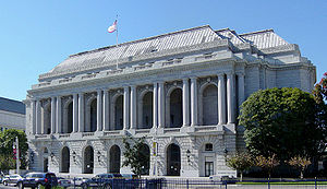 |
San Francisco San Francisco, California San Francisco , officially the City and County of San Francisco, is the financial, cultural, and transportation center of the San Francisco Bay Area, a region of 7.15 million people which includes San Jose and Oakland... 37°46′47"N 122°25′4"W |
San Francisco | The United Nations Charter United Nations Charter The Charter of the United Nations is the foundational treaty of the international organization called the United Nations. It was signed at the San Francisco War Memorial and Performing Arts Center in San Francisco, United States, on 26 June 1945, by 50 of the 51 original member countries... was signed here in 1945 as well as the post WWII peace treaty with Japan. This collection of Beaux Arts buildings serves a number of uses, including the Exposition Auditorium from the 1915 Panama-Pacific International Exposition. |
||
| San Francisco Port of Embarkation, U.S. Army Fort Mason Fort Mason, once known as San Francisco Port of Embarkation, US Army, in San Francisco, California, is a former United States Army post located in the northern Marina District, alongside San Francisco Bay. Fort Mason served as an Army post for more than 100 years, initially as a coastal defense... |
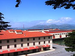 |
San Francisco San Francisco, California San Francisco , officially the City and County of San Francisco, is the financial, cultural, and transportation center of the San Francisco Bay Area, a region of 7.15 million people which includes San Jose and Oakland... 37°48′26"N 122°25′50"W |
San Francisco | Originally built during the American Civil War American Civil War The American Civil War was a civil war fought in the United States of America. In response to the election of Abraham Lincoln as President of the United States, 11 southern slave states declared their secession from the United States and formed the Confederate States of America ; the other 25... for coastal defense, this fort became the primary transportation hub in the Pacific for the United States during World War I World War I World War I , which was predominantly called the World War or the Great War from its occurrence until 1939, and the First World War or World War I thereafter, was a major war centred in Europe that began on 28 July 1914 and lasted until 11 November 1918... and World War II World War II World War II, or the Second World War , was a global conflict lasting from 1939 to 1945, involving most of the world's nations—including all of the great powers—eventually forming two opposing military alliances: the Allies and the Axis... . In World War II World War II World War II, or the Second World War , was a global conflict lasting from 1939 to 1945, involving most of the world's nations—including all of the great powers—eventually forming two opposing military alliances: the Allies and the Axis... alone, over 1,647,174 passengers and 23,589,472 tons went through this fort. It is now part of the Golden Gate National Recreation Area Golden Gate National Recreation Area The Golden Gate National Recreation Area is a U.S. National Recreation Area administered by the National Park Service that surrounds the San Francisco Bay area. It is one of the most visited units of the National Park system in the United States, with over 13 million visitors a year... |
||
| San Juan Bautista Plaza Historic District San Juan Bautista Plaza San Juan Bautista Plaza Historic District, also known as San Juan Bautista State Historic Park is a historic district in San Juan Bautista, California that is a National Historic Landmark and a California state historic park. It includes the Mission San Juan Bautista, the Jose Castro House , and... |
.jpg) |
San Juan Bautista San Juan Bautista, California San Juan Bautista is a city in San Benito County, California, United States. The population was 1,862 at the 2010 census, up from 1,549 at the 2000 census. The city of San Juan Bautista was named after Mission San Juan Bautista... 36.8437377837°N 121.53455399°W |
San Benito | A prime example of the Spanish-Mexican Colonial plan of buildings surrounding the central plaza and Mission Spanish missions in California The Spanish missions in California comprise a series of religious and military outposts established by Spanish Catholics of the Franciscan Order between 1769 and 1823 to spread the Christian faith among the local Native Americans. The missions represented the first major effort by Europeans to... church. The NHLD also includes the Jose Castro House Jose Castro House Jose Castro House, now known as the Castro-Breen Adobe, in San Juan Bautista, California, USA, is a historic adobe home built by José Castro in 1840, Commandant General of Alta California.... , itself a National Historic Landmark National Historic Landmark A National Historic Landmark is a building, site, structure, object, or district, that is officially recognized by the United States government for its historical significance... . It was featured prominently in the Hitchcock Alfred Hitchcock Sir Alfred Joseph Hitchcock, KBE was a British film director and producer. He pioneered many techniques in the suspense and psychological thriller genres. After a successful career in British cinema in both silent films and early talkies, Hitchcock moved to Hollywood... film Vertigo Vertigo (film) Vertigo is a 1958 psychological thriller film directed by Alfred Hitchcock and starring James Stewart, Kim Novak, and Barbara Bel Geddes. The screenplay was written by Alec Coppel and Samuel A... . |
||
| San Luis Rey Mission Church | 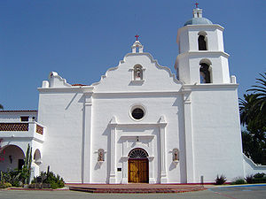 |
Oceanside Oceanside, California -2010:The 2010 United States Census reported that Oceanside had a population of 167,086. The population density was 3,961.8 people per square mile... 33.3675°N 117.218333°W |
San Diego | California's most pristine Spanish Mission Complex Spanish missions in California The Spanish missions in California comprise a series of religious and military outposts established by Spanish Catholics of the Franciscan Order between 1769 and 1823 to spread the Christian faith among the local Native Americans. The missions represented the first major effort by Europeans to... , this is the third church at this site. |
||
| Santa Barbara County Courthouse Santa Barbara County Courthouse The Santa Barbara County Courthouse is located at 1100 Anacapa Street, Santa Barbara, California. Designed by William Mooser III and completed in 1929, the Spanish Colonial Revival style building replaced the smaller Greek Revival courthouse of the same location... |
 |
Santa Barbara Santa Barbara, California Santa Barbara is the county seat of Santa Barbara County, California, United States. Situated on an east-west trending section of coastline, the longest such section on the West Coast of the United States, the city lies between the steeply-rising Santa Ynez Mountains and the Pacific Ocean... 34.425°N 119.69°W |
Santa Barbara | Known for the beauty of its Spanish-Colonial Revival architecture, which inspired and influenced many other designers. | ||
| Santa Barbara Mission Mission Santa Barbara In 1840, Alta California and Baja California were removed from the Diocese of Sonora to form the Diocese of Both Californias. Bishop Francisco Garcia Diego y Moreno, OFM, established his cathedra at Mission Santa Barbara, making the chapel the pro-cathedral of the diocese until 1849... |
Santa Barbara Santa Barbara, California Santa Barbara is the county seat of Santa Barbara County, California, United States. Situated on an east-west trending section of coastline, the longest such section on the West Coast of the United States, the city lies between the steeply-rising Santa Ynez Mountains and the Pacific Ocean... 34.437362°N 119.712634°W |
Santa Barbara | The only Spanish mission in California to remain under the leadership of the Franciscan Friars since the day of its founding. | |||
| Santa Cruz Looff Carousel and Roller Coaster Santa Cruz Looff Carousel and Roller Coaster Santa Cruz Looff Carousel and Roller Coaster On The Beach Boardwalk is a National Historic Landmark composed of two parts, a Looff carousel and the Giant Dipper wooden roller coaster, on the boardwalk at Santa Cruz, California.-Looff Carousel:... |
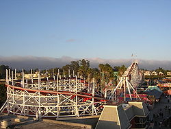 |
Santa Cruz Santa Cruz, California Santa Cruz is the county seat and largest city of Santa Cruz County, California in the US. As of the 2010 U.S. Census, Santa Cruz had a total population of 59,946... 36°57′52"N 122°1′0"W |
Santa Cruz | The Looff Charles I. D. Looff Charles I. D. Looff was a master carver and builder of hand-carved carousels and amusement rides in America. Looff built the first carousel at Coney Island in 1876. During his lifetime, he manufactured over 50 carousels,twelve amusements parks, several roller coasters and Ferris wheels, and built... family was one of the major early manufacturers Manufacturing Manufacturing is the use of machines, tools and labor to produce goods for use or sale. The term may refer to a range of human activity, from handicraft to high tech, but is most commonly applied to industrial production, in which raw materials are transformed into finished goods on a large scale... of carousel Carousel A carousel , or merry-go-round, is an amusement ride consisting of a rotating circular platform with seats for riders... s, including this 1911 example. Only five other intact Looff carousels remain in the United States United States The United States of America is a federal constitutional republic comprising fifty states and a federal district... . The 1924 Giant Dipper roller coaster is the older of the two large, wooden scaffolded Scaffolding Scaffolding is a temporary structure used to support people and material in the construction or repair of buildings and other large structures. It is usually a modular system of metal pipes or tubes, although it can be from other materials... roller coasters remaining on the West Coast West Coast of the United States West Coast or Pacific Coast are terms for the westernmost coastal states of the United States. The term most often refers to the states of California, Oregon, and Washington. Although not part of the contiguous United States, Alaska and Hawaii do border the Pacific Ocean but can't be included in... . |
||
| Santa Monica Looff Hippodrome | 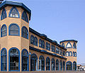 |
Santa Monica Santa Monica, California Santa Monica is a beachfront city in western Los Angeles County, California, US. Situated on Santa Monica Bay, it is surrounded on three sides by the city of Los Angeles — Pacific Palisades on the northwest, Brentwood on the north, West Los Angeles on the northeast, Mar Vista on the east, and... 34.010184°N 118.496368°W |
Los Angeles | Built by the Looff Charles I. D. Looff Charles I. D. Looff was a master carver and builder of hand-carved carousels and amusement rides in America. Looff built the first carousel at Coney Island in 1876. During his lifetime, he manufactured over 50 carousels,twelve amusements parks, several roller coasters and Ferris wheels, and built... family to house one of their carousels, this structure now houses a different carousel, but remains a rare example of what was once a much larger Amusement complex. |
||
| Upton Sinclair House Upton Sinclair House The Upton Sinclair House located at 464 N. Myrtle Avenue, Monrovia, California, was the home of American novelist Upton Sinclair between 1942 and 1966. It is a 1923 Spanish Colonial Revival style building in a district of similar houses, located in the suburban Los Angeles community of Monrovia,... |
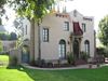 |
Monrovia Monrovia, California Monrovia is a city located in the foothills of the San Gabriel Mountains in the San Gabriel Valley of Los Angeles County, California, United States. The population was 36,590 at the 2010 census, down from 36,929 at the 2000 census... 34.161969°N 118.001210°W |
Los Angeles | Home of American novelist Upton Sinclair Upton Sinclair Upton Beall Sinclair Jr. , was an American author who wrote close to one hundred books in many genres. He achieved popularity in the first half of the twentieth century, acquiring particular fame for his classic muckraking novel, The Jungle . It exposed conditions in the U.S... between 1942 and 1966 and where he wrote most of his later works. |
||
| Sonoma Plaza Sonoma Plaza Sonoma Plaza is the central plaza in the former El Pueblo de Sonoma, now known as Sonoma, California. The town is centered around this plaza, the largest plaza in California. This plaza is surrounded by many historical buildings, including the Mission San Francisco Solano, Captain Salvador... |
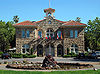 |
Sonoma Sonoma, California Sonoma is a historically significant city in Sonoma Valley, Sonoma County, California, USA, surrounding its historic town plaza, a remnant of the town's Mexican colonial past. It was the capital of the short-lived California Republic... 38.2844470556°N 122.457393148°W |
Sonoma | The largest plaza in California, this was the location of the Bear Flag Revolt in 1846 which led to the Mexican-American War | ||
| Space Flight Operations Facility Space Flight Operations Facility Space Flight Operations Facility is a control room and related communications equipment areas at the Jet Propulsion Laboratory in Pasadena, California... |
 |
Pasadena Pasadena, California Pasadena is a city in Los Angeles County, California, United States. Although famous for hosting the annual Rose Bowl football game and Tournament of Roses Parade, Pasadena is the home to many scientific and cultural institutions, including the California Institute of Technology , the Jet... 34.1993285017°N 118.173617161°W |
Los Angeles | Control room at Jet Propulsion Laboratory Jet Propulsion Laboratory Jet Propulsion Laboratory is a federally funded research and development center and NASA field center located in the San Gabriel Valley area of Los Angeles County, California, United States. The facility is headquartered in the city of Pasadena on the border of La Cañada Flintridge and Pasadena... where all NASA interplanetary and deep space missions are monitored. |
||
| Space Launch Complex 10 Vandenberg AFB Space Launch Complex 10 Space Launch Complex 10, or Missile Launch Complex 10, is located on Vandenberg Air Force Base in Lompoc, California. It was built in 1958 to test ballistic missiles and developed into a space launching facility in 1963. Prior to 1966 Space Launch Complex 10 West was known as Vandenberg AFB Pad... |
 |
Vandenberg Air Force Base Vandenberg Air Force Base Vandenberg Air Force Base is a United States Air Force Base, located approximately northwest of Lompoc, California. It is under the jurisdiction of the 30th Space Wing, Air Force Space Command .... 34.765278°N 120.622222°W |
Santa Barbara | First built in 1958 to test missiles, it was used to launch space missions from 1963 to 1980. It is now a rare, well preserved example of the equipment and facilities from that era. | ||
| Leland Stanford House Leland Stanford Mansion State Historic Park Leland Stanford Mansion State Historic Park is a state and federally protected area in Sacramento, California. It features the Leland Stanford House, a mansion once owned by Leland Stanford, Governor of California from 1862 to 1863, U.S. Senator from 1885 to 1893, railroad tycoon, member of the Big... |
 |
Sacramento Sacramento, California Sacramento is the capital city of the U.S. state of California and the county seat of Sacramento County. It is located at the confluence of the Sacramento River and the American River in the northern portion of California's expansive Central Valley. With a population of 466,488 at the 2010 census,... 38.576528°N 121.497914°W |
Sacramento | The home of Leland Stanford Leland Stanford Amasa Leland Stanford was an American tycoon, industrialist, robber baron, politician and founder of Stanford University.-Early years:... , Governor of California Governor of California The Governor of California is the chief executive of the California state government, whose responsibilities include making annual State of the State addresses to the California State Legislature, submitting the budget, and ensuring that state laws are enforced... from 1862 to 1863, U.S. Senator from 1885 to 1893, railroad tycoon, member of the Big Four and founder of Stanford University Stanford University The Leland Stanford Junior University, commonly referred to as Stanford University or Stanford, is a private research university on an campus located near Palo Alto, California. It is situated in the northwestern Santa Clara Valley on the San Francisco Peninsula, approximately northwest of San... . |
||
| Star of India Star of India (ship) Star of India was built in 1863 as Euterpe, a full-rigged iron windjammer ship in Ramsey, Isle of Man. After a full career sailing from Great Britain to India and New Zealand, she became a salmon hauler on the Alaska to California route... |
 |
San Diego San Diego, California San Diego is the eighth-largest city in the United States and second-largest city in California. The city is located on the coast of the Pacific Ocean in Southern California, immediately adjacent to the Mexican border. The birthplace of California, San Diego is known for its mild year-round... 32.7142265105°N 117.172862915°W |
San Diego | A seaworthy iron hulled museum ship Museum ship A museum ship, or sometimes memorial ship, is a ship that has been preserved and converted into a museum open to the public, for educational or memorial purposes... in the San Diego Maritime Museum, she is the oldest ship that still sails regularly and the oldest iron hulled merchant ship still floating. |
||
| Steedman Estate | Montecito Montecito, California Montecito is an unincorporated community in Santa Barbara County, California. As a census-designated place, it had a population of 8,965 in 2010. This does not include areas such as Coast Village Road, that, while usually considered part of Montecito, are actually within the city limits of Santa... 34°26′7"N 119°38′8"W |
Santa Barbara | ||||
| Sutter's Fort Sutter's Fort Sutter's Fort State Historic Park is a state-protected park in Sacramento, California which includes Sutter's Fort and the California State Indian Museum. Begun in 1839 and originally called "New Helvetia" by its builder, John Sutter, the fort was a 19th century agricultural and trade colony in... |
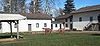 |
Sacramento Sacramento, California Sacramento is the capital city of the U.S. state of California and the county seat of Sacramento County. It is located at the confluence of the Sacramento River and the American River in the northern portion of California's expansive Central Valley. With a population of 466,488 at the 2010 census,... 38.5704472774°N 121.470071911°W |
Sacramento | A 19th century agricultural and trade colony, it was known for its connection to the Donner Party Donner Party The Donner Party was a group of American pioneers who set out for California in a wagon train. Delayed by a series of mishaps, they spent the winter of 1846–47 snowbound in the Sierra Nevada... , the California Gold Rush California Gold Rush The California Gold Rush began on January 24, 1848, when gold was found by James W. Marshall at Sutter's Mill in Coloma, California. The first to hear confirmed information of the gold rush were the people in Oregon, the Sandwich Islands , and Latin America, who were the first to start flocking to... and the formation of Sacramento as well as its proximity to the California Trail California Trail The California Trail was an emigrant trail of about across the western half of the North American continent from Missouri River towns to what is now the state of California... and Siskiyou Trail Siskiyou Trail The Siskiyou Trail stretched from California's Central Valley to Oregon's Willamette Valley; modern-day Interstate 5 follows this pioneer path... s. Now a state park, threatened with closure in 2008. |
||
| Sweden- borgian Church Swedenborgian Church (San Francisco, California) Swedenborgian Church is a Swedenborgian church significant for its architecture in the Pacific Heights neighborhood of San Francisco, California. It is regarded as one of California's earliest pure Arts and Crafts buildings. The first pastor of the church the Reverend Joseph Worcester bought the... |
.jpg) |
San Francisco San Francisco, California San Francisco , officially the City and County of San Francisco, is the financial, cultural, and transportation center of the San Francisco Bay Area, a region of 7.15 million people which includes San Jose and Oakland... 37.790229°N 122.445882°W |
San Francisco | One of California's earliest pure Arts and Crafts Arts and Crafts movement Arts and Crafts was an international design philosophy that originated in England and flourished between 1860 and 1910 , continuing its influence until the 1930s... buildings, this Swedenborgianism church remains open today with almost no architectural changes. |
||
| Tao House Eugene O'Neill National Historic Site The Eugene O'Neill National Historic Site, located in Danville, California, preserves Tao House, the Monterey Colonial hillside home of America's only Nobel Prize-winning playwright, Eugene O'Neill.-History:... |
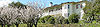 |
Danville Danville, California The Town of Danville is located in the San Ramon Valley in Contra Costa County, California. It is one of the incorporated municipalities in California that uses "town" in its name instead of "city". The population was 42,039 in 2010. Danville is one of the wealthiest suburbs of Oakland and San... 37.825961°N 122.02755°W |
Contra Costa | America's only Nobel Prize Nobel Prize The Nobel Prizes are annual international awards bestowed by Scandinavian committees in recognition of cultural and scientific advances. The will of the Swedish chemist Alfred Nobel, the inventor of dynamite, established the prizes in 1895... -winning playwright Eugene O'Neill Eugene O'Neill Eugene Gladstone O'Neill was an American playwright and Nobel laureate in Literature. His poetically titled plays were among the first to introduce into American drama techniques of realism earlier associated with Russian playwright Anton Chekhov, Norwegian playwright Henrik Ibsen, and Swedish... lived here from 1937 to 1944 while writing his final and most memorable plays: The Iceman Cometh The Iceman Cometh The Iceman Cometh is a play written by American playwright Eugene O'Neill in 1939. First published in 1940 the play premiered on Broadway at the Martin Beck Theatre on 9 October 1946, directed by Eddie Dowling where it ran for 136 performances to close on 15 March 1947.-Characters:* Night Hawk-... , Long Day's Journey Into Night Long Day's Journey Into Night Long Day's Journey Into Night is a 1956 drama in four acts written by American playwright Eugene O'Neill. The play is widely considered to be his masterwork... , and A Moon for the Misbegotten A Moon for the Misbegotten A Moon for the Misbegotten is a play by Eugene O'Neill. The play can be thought of as a sequel to the autobiographical Long Day's Journey into Night... . |
||
| The Forty Acres | Delano Delano, California Delano's climate is characteristic of the San Joaquin Valley. The weather is hot and dry during the summer and cool and damp in winter. Frequent ground fog known regionally as "tule fog" can obscure vision. Record temperatures range between 115°F and 14°F... 35°45′47.71"N 119°17′14.99"W |
Kern | ||||
| Tule Lake Segregation Center Tule Lake War Relocation Center Tule Lake Segregation Center National Monument was an internment camp in the northern California town of Newell near Tule Lake. It was used in the Japanese American internment during World War II. It was the largest and most controversial of the camps, and did not close until after the war, in... |
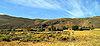 |
Newell Newell, California Newell is a census-designated place in Modoc County, California in the United States. It is located west-northwest of Alturas, at an elevation of 4,042 feet . The population was 449 at the 2010 census.... |
Modoc | The largest Japanese American internment Japanese American internment Japanese-American internment was the relocation and internment by the United States government in 1942 of approximately 110,000 Japanese Americans and Japanese who lived along the Pacific coast of the United States to camps called "War Relocation Camps," in the wake of Imperial Japan's attack on... camp, it also had the highest security and stayed open longest, even after World War II World War II World War II, or the Second World War , was a global conflict lasting from 1939 to 1945, involving most of the world's nations—including all of the great powers—eventually forming two opposing military alliances: the Allies and the Axis... . The Redress movement in the 1980s and pilgrimage Pilgrimage A pilgrimage is a journey or search of great moral or spiritual significance. Typically, it is a journey to a shrine or other location of importance to a person's beliefs and faith... s to Tule Lake led to the Civil Liberties Act of 1988 Civil Liberties Act of 1988 The Civil Liberties Act of 1988 is a United States federal law that granted reparations to Japanese-Americans who had been interned by the United States government during World War II. The act was sponsored by California's Democratic Congressman Norman Mineta, an internee as a child, and Wyoming's... . |
||
| Twenty-Five-Foot Space Simulator Twenty-Five-Foot Space Simulator The Twenty-Five-Foot Space Simulator is an high stainless-steel cylinder at the Jet Propulsion Laboratory in Pasadena, California. in diameter, it is used for testing spacecraft in space-like conditions of extreme cold, near-vacuum pressure, and high radiation... |
 |
Pasadena Pasadena, California Pasadena is a city in Los Angeles County, California, United States. Although famous for hosting the annual Rose Bowl football game and Tournament of Roses Parade, Pasadena is the home to many scientific and cultural institutions, including the California Institute of Technology , the Jet... 34.2009587786°N 118.172880016°W |
Los Angeles | An 85 foot high stainless-steel cylinder at the Jet Propulsion Laboratory Jet Propulsion Laboratory Jet Propulsion Laboratory is a federally funded research and development center and NASA field center located in the San Gabriel Valley area of Los Angeles County, California, United States. The facility is headquartered in the city of Pasadena on the border of La Cañada Flintridge and Pasadena... used for testing spacecraft in space-like conditions. Ranger Ranger program The Ranger program was a series of unmanned space missions by the United States in the 1960s whose objective was to obtain the first close-up images of the surface of the Moon. The Ranger spacecraft were designed to take images of the lunar surface, returning those images until they were destroyed... , Surveyor Surveyor program The Surveyor Program was a NASA program that, from 1966 through 1968, sent seven robotic spacecraft to the surface of the Moon. Its primary goal was to demonstrate the feasibility of soft landings on the Moon... , Mariner Mariner program The Mariner program was a program conducted by the American space agency NASA that launched a series of robotic interplanetary probes designed to investigate Mars, Venus and Mercury from 1963 to 1973... , and Voyager Voyager program The Voyager program is a U.S program that launched two unmanned space missions, scientific probes Voyager 1 and Voyager 2. They were launched in 1977 to take advantage of a favorable planetary alignment of the late 1970s... spacecraft were all tested in this facility. |
||
| Unitary Plan Wind Tunnel Unitary Plan Wind Tunnel The Unitary Plan Wind Tunnel, located at the NASA Ames Research Center in Moffett Federal Airfield, Mountain View, California, USA, was a research facility used extensively to design and test new generations of aircraft, both commercial and military, as well as NASA space vehicles, including the... |
 |
Moffett Field Moffett Federal Airfield Moffett Federal Airfield , also known as Moffett Field, is a joint civil-military airport located between northern Mountain View and northern Sunnyvale, California, USA. The airport is near the south end of San Francisco Bay, northwest of San Jose. Formerly a United States Navy facility, the former... 37.4156663073°N 122.059785401°W |
Santa Clara | This wind tunnel built in the 1950s allowed commercial and military aircraft as well as the Space Shuttle to be aerodynamically tested. | ||
| United States Immigration Station, Angel Island United States Immigration Station, Angel Island Angel Island Immigration Station was an immigrant processing facility on Angel Island, in the San Francisco Bay. It opened in 1910 and is listed on the National Register of Historic Places. It is now the site of a museum. The museum and grounds were renovated and reopened to the public in February... |
 |
Tiburon Tiburon, California Tiburon is an incorporated town in Marin County, California. It occupies most of the Tiburon Peninsula, which reaches south into the San Francisco Bay. The smaller city of Belvedere occupies the south-east part of the peninsula and is contiguous with Tiburon... 37°51′44"N 122°25′13"W |
Marin | The "Ellis Island of the West" processed over 1 million Asian immigrants between 1910 and 1940. Now part of Angel Island State Park, it is undergoing renovation until 2009. | ||
| Walker Pass Walker Pass Walker Pass is a mountain pass by Lake Isabella in the southern Sierra Nevada mountains. It is located in northeastern Kern County, approximately 53 mi ENE of Bakersfield and 10 mi WNW of Ridgecrest... |
Onyx, California Onyx, California Onyx is a census-designated place in Kern County, California, United States. Onyx is located east-northeast of Weldon, at an elevation of 2795 feet... 35.663056°N 118.026944°W |
Kern | Joseph Reddeford Walker Joseph Reddeford Walker Joseph R. Walker was a mountain man and experienced scout.-Biography:Walker was born in Roane County, Tennessee. In the spring of 1833, Benjamin Bonneville sent a party of men under Joseph Walker to explore the Great Salt Lake and to find an overland route to California... mapped this pass in 1834 after learning of it from Native Americans Native Americans in the United States Native Americans in the United States are the indigenous peoples in North America within the boundaries of the present-day continental United States, parts of Alaska, and the island state of Hawaii. They are composed of numerous, distinct tribes, states, and ethnic groups, many of which survive as... . He then led the first immigrant wagon train through it in 1846. This pass significantly contributed to the development of California. |
|||
| Wapama (steam schooner) Wapama (steam schooner) Wapama, also known as Tongass, is a vessel now located in Richmond, California. She is the last surviving example of some 225 wooden steam schooners that served the lumber trade and other coastal services along the Pacific Coast of the United States She is managed by the National Park Service at... |
.jpg) |
San Francisco San Francisco, California San Francisco , officially the City and County of San Francisco, is the financial, cultural, and transportation center of the San Francisco Bay Area, a region of 7.15 million people which includes San Jose and Oakland... 37.8079063201°N 122.421081619°W |
San Francisco | This 204' wooden schooner was one of 200 ships plying the lumber trade along the Pacific coast. Now managed by the San Francisco Maritime National Historic Park, she has been moved to Richmond, California Richmond, California Richmond is a city in western Contra Costa County, California, United States. The city was incorporated on August 7, 1905. It is located in the East Bay, part of the San Francisco Bay Area. It is a residential inner suburb of San Francisco, as well as the site of heavy industry, which has been... for possible renovation. She is threatened by severe dry rot. Official plaque located in the San Francisco Maritime National Historical Park Visitor Center, located at the corner of Hyde and Jefferson Streets. |
||
| Warner's Ranch Warner's Ranch Warner's Ranch near Warner Springs, California, was notable as a way station for large numbers of emigrants on the Southern Trail from 1849 to 1861, as it was a stop on both the Gila River Trail and the Butterfield Overland Mail stagecoach line... |
Warner Springs Warner Springs, California Warner Springs is a small unincorporated community in northern San Diego County, California. It is associated with two National Historic Landmarks, the Oak Grove Butterfield Stage Station and Warner's Ranch, both connected to the Butterfield Overland Mail stagecoach line. It is also near the... 33.238611°N 116.650833°W |
San Diego | The only trading post between New Mexico and Los Angeles, this ranch developed into a stop on the Butterfield Overland Mail Butterfield Overland Mail The Butterfield Overland Mail Trail was a stagecoach route in the United States, operating from 1857 to 1861. It was a conduit for the U.S. mail from two eastern termini, Memphis, Tennessee and St. Louis, Missouri, meeting Fort Smith, Arkansas, and continuing through Indian Territory, New Mexico,... stagecoach line along with nearby Oak Grove Oak Grove Butterfield Stage Station Oak Grove Butterfield Stage Station is located in Warner Springs, California and is the only surviving station on the Butterfield Overland Mail stagecoach line... . Now a hot springs resort. |
|||
| Watts Towers Watts Towers The Watts Towers or Towers of Simon Rodia in the Watts district of Los Angeles, California, is a collection of 17 interconnected structures, two of which reach heights of over 99 feet . The Towers were built by Italian immigrant construction worker Sabato Rodia in his spare time over a period of... |
 |
Los Angeles Los Angeles, California Los Angeles , with a population at the 2010 United States Census of 3,792,621, is the most populous city in California, USA and the second most populous in the United States, after New York City. It has an area of , and is located in Southern California... 33.9369667128°N 118.240549404°W |
Los Angeles | These towers built by Simon Rodia Simon Rodia Sabato "Simon" Rodia was an Italian-American architect. Rodia created the Watts Towers, one of the most famous landmarks in Los Angeles.-Biography:... are a superb example of non-traditional vernacular architecture Vernacular architecture Vernacular architecture is a term used to categorize methods of construction which use locally available resources and traditions to address local needs and circumstances. Vernacular architecture tends to evolve over time to reflect the environmental, cultural and historical context in which it... and American Naïve Naïve art Naïve art is a classification of art that is often characterized by a childlike simplicity in its subject matter and technique. While many naïve artists appear, from their works, to have little or no formal art training, this is often not true... art. |
||
| Wawona Hotel and Thomas Hill Studio Wawona Hotel The Wawona Hotel is a historic hotel located within Yosemite National Park. It was declared a National Historic Landmark in 1987.Wawona Hotel is one of the oldest mountain resort hotels in California and a classic of Victorian era resorts. The Victorian style hotel was built in 1876 to serve... |
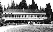 |
Yosemite National Park Yosemite National Park Yosemite National Park is a United States National Park spanning eastern portions of Tuolumne, Mariposa and Madera counties in east central California, United States. The park covers an area of and reaches across the western slopes of the Sierra Nevada mountain chain... 37.536389°N 119.653611°W |
Mariposa | Built in 1879 for tourists visiting the Mariposa Grove Mariposa Grove Mariposa Grove is a sequoia grove located near Wawona, California, United States, in the southernmost part of Yosemite National Park. It is the largest grove of Giant Sequoias in the park, with several hundred mature examples of the tree... , this hotel is also where the Hudson River School Hudson River school The Hudson River School was a mid-19th century American art movement embodied by a group of landscape painters whose aesthetic vision was influenced by romanticism... painter Thomas Hill Thomas Hill (painter) Thomas Hill was an American artist of the 19th century. He produced many fine paintings of the California landscape, in particular of the Yosemite Valley, as well as the White Mountains of New Hampshire.-Biography:... painted towards the end of his life. |
||
| Well No. 4, Pico Canyon Oil Field Pico Canyon Oilfield Well No. 4, Pico Canyon Oilfield, located about seven miles west of Newhall, California in the Santa Susana Mountains, was the first commercially successful oil well in the Western United States, and is considered the birthplace of California's oil industry... |
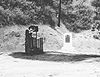 |
San Fernando San Fernando, California San Fernando is a city located in the San Fernando Valley, in northwestern region of Los Angeles, California, United States. The population was 23,645 at the 2010 census, up from 23,564 at the 2000 census.-History:... 34.369444°N 118.630278°W |
Los Angeles | Drilled in 1876 to 376 feet (115 m), this was the first commercially successful oil well in California, producing 25 barrels a day (4 m³/d). | ||
| Yuma Crossing and Associated Sites Yuma Crossing and Associated Sites Yuma Crossing is a site in Arizona and California that is significant for its association with transportation and communication across the Colorado River. It connected New Spain and Las Californias in the Spanish Colonial period in and also during the Western expansion of the United States. ... |
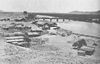 |
Winterhaven Winterhaven, California Winterhaven is a census-designated place in Imperial County, California. Winterhaven is located east of Pilot Knob, The population was 394 at the 2010 census, down from 529 at the 2000 census. It is part of the 'El Centro, California Metropolitan Statistical Area'... 32°43′45"N 114°36′55"W |
Imperial | A major crossroads for Alta California Alta California Alta California was a province and territory in the Viceroyalty of New Spain and later a territory and department in independent Mexico. The territory was created in 1769 out of the northern part of the former province of Las Californias, and consisted of the modern American states of California,... as well as the Westward expansion of the United States. It has several archaeological and historical sites, shared with Arizona across the Colorado River Colorado River The Colorado River , is a river in the Southwestern United States and northwestern Mexico, approximately long, draining a part of the arid regions on the western slope of the Rocky Mountains. The watershed of the Colorado River covers in parts of seven U.S. states and two Mexican states... , including Fort Yuma Fort Yuma Fort Yuma is a fort in California that is located in Imperial County, across the Colorado River from Yuma, Arizona. It was on the Butterfield Overland Mail route from 1858 until 1861 and was abandoned May 16, 1883, and transferred to the Department of the Interior. The Fort Yuma Indian School and a... and other state parks. |
Historic areas of the NPS in California
National Historic Sites, National Historical Parks, some National Monuments, and certain other areas listed in the National Park system are historic landmarks of national importance that are highly protected already, often before the inauguration of the NHL program in 1960, and are then often not also named NHLs per se. There are seven of these in California. The National Park Service lists these seven together with the NHLs in the state,Eugene O'Neill National Historic Site
Eugene O'Neill National Historic Site
The Eugene O'Neill National Historic Site, located in Danville, California, preserves Tao House, the Monterey Colonial hillside home of America's only Nobel Prize-winning playwright, Eugene O'Neill.-History:...
is also named Tao House and is listed as an NHL under that name above. John Muir National Historic Site
John Muir National Historic Site
The John Muir National Historic Site is located in the San Francisco Bay Area, in Martinez, Contra Costa County, California. It preserves the 14-room Italianate Victorian mansion where the naturalist and writer John Muir lived, as well as a nearby tract of native oak woodlands and grasslands...
is listed as NHL John Muir House above. Manzanar National Historic Site is listed as Manzanar War Relocation Center above. The other four are:
| Landmark name |
Image | Date established | Location | County | Description | |
|---|---|---|---|---|---|---|
| Cabrillo National Monument Cabrillo National Monument Cabrillo National Monument is located at the southern tip of the Point Loma Peninsula in San Diego, California. It commemorates the landing of Juan Rodríguez Cabrillo at San Diego Bay on September 28, 1542. This event marked the first time that a European expedition had set foot on what later... |
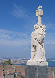 |
San Diego San Diego, California San Diego is the eighth-largest city in the United States and second-largest city in California. The city is located on the coast of the Pacific Ocean in Southern California, immediately adjacent to the Mexican border. The birthplace of California, San Diego is known for its mild year-round... |
San Diego San Diego County, California San Diego County is a large county located in the southwestern corner of the US state of California. Hence, San Diego County is also located in the southwestern corner of the 48 contiguous United States. Its county seat and largest city is San Diego. Its population was about 2,813,835 in the 2000... |
|||
| Fort Point National Historic Site | 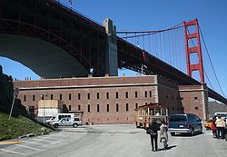 |
San Francisco San Francisco, California San Francisco , officially the City and County of San Francisco, is the financial, cultural, and transportation center of the San Francisco Bay Area, a region of 7.15 million people which includes San Jose and Oakland... |
San Francisco | |||
| Rosie the Riveter/World War II Home Front National Historical Park Rosie the Riveter/World War II Home Front National Historical Park Rosie the Riveter/World War II Home Front National Historical Park is located in Richmond, California, near San Francisco. The park encompasses an array of historic properties in the city which were constructed during the 1940s to support America's entry into World War II.The park is a "partnership... |
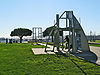 |
Richmond Richmond, California Richmond is a city in western Contra Costa County, California, United States. The city was incorporated on August 7, 1905. It is located in the East Bay, part of the San Francisco Bay Area. It is a residential inner suburb of San Francisco, as well as the site of heavy industry, which has been... |
Contra Costa Contra Costa County, California Contra Costa County is a primarily suburban county in the San Francisco Bay Area of the U.S. state of California. As of the 2010 census, it had a population of 1,049,025... |
|||
| San Francisco Maritime National Historical Park San Francisco Maritime National Historical Park The San Francisco Maritime National Historical Park is located in San Francisco, California, USA. The park includes a fleet of historic vessels, a visitor center, a maritime museum, and a library/research facility... |
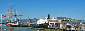 |
San Francisco San Francisco, California San Francisco , officially the City and County of San Francisco, is the financial, cultural, and transportation center of the San Francisco Bay Area, a region of 7.15 million people which includes San Jose and Oakland... |
San Francisco | |||
Former NHLs and Possible Future NHLs
In addition, there are five similar sites that are not currently NHLs. Three sites in California were designated National Historic Landmarks, and subsequently de-designated. Two landmark ships have been moved to other states, and one site has been determined eligible for landmark status, but the designation not finalized. These sites are:| Landmark name |
Image |
Year listed |
Locality |
County |
Description |
|
|---|---|---|---|---|---|---|
| a | |
image pending | 1964, withdrawn 2004 |
Broderick Broderick, California Broderick is a former town in Yolo County, California, USA, now forming part of the City of West Sacramento. It is located just west of the Sacramento River in the eastern portion of the county. Broderick's ZIP Code is 95605 and its area code 916... 38.5808401987°N 121.507276585°W |
Yolo Yolo County, California Yolo County is a county located in the northern part of the U.S. state of California, bordered by the other counties of Sacramento, Solano, Napa, Lake, Colusa, and Sutter. The city of Woodland is its county seat, though Davis is its largest city.... |
|
| b | Fort Ross, California Fort Ross is a former Russian establishment on the Pacific Coast in what is now Sonoma County, California, in the United States. It was the hub of the southernmost Russian settlements in North America in between 1812 to 1841... |
 |
1969, withdrawn 1971 |
Fort Ross Fort Ross, California Fort Ross is a former Russian establishment on the Pacific Coast in what is now Sonoma County, California, in the United States. It was the hub of the southernmost Russian settlements in North America in between 1812 to 1841... |
Sonoma Sonoma County, California Sonoma County, located on the northern coast of the U.S. state of California, is the largest and northernmost of the nine San Francisco Bay Area counties. Its population at the 2010 census was 483,878. Its largest city and county seat is Santa Rosa.... |
|
| c | USS Hoga (YT-146) The USS Hoga was a United States Navy yard tug named after the Sioux Indian word for "fish." After World War II, the tug was known as the Port of Oakland and then the City of Oakland when it was a fireboat in that city.... |
 |
1989 | Oakland Oakland, California Oakland is a major West Coast port city on San Francisco Bay in the U.S. state of California. It is the eighth-largest city in the state with a 2010 population of 390,724... and Benicia Benicia, California Benicia is a waterside city in Solano County, California, United States. It was the first city in California to be founded by Anglo-Americans, and served as the state capital for nearly thirteen months from 1853 to 1854. The population was 26,997 at the 2010 census. The city is located in the San... (formerly) |
Alameda Alameda County, California Alameda County is a county in the U.S. state of California. It occupies most of the East Bay region of the San Francisco Bay Area. As of the 2010 census it had a population of 1,510,271, making it the 7th most populous county in the state... (formerly) |
Relocated to Arkansas. |
| d | |
image pending | 1994, withdrawn 1999 |
Menlo Park Menlo Park, California Menlo Park, California is a city at the eastern edge of San Mateo County, in the San Francisco Bay Area of California, in the United States. It is bordered by San Francisco Bay on the north and east; East Palo Alto, Palo Alto, and Stanford to the south; Atherton, North Fair Oaks, and Redwood City... |
San Mateo San Mateo County, California San Mateo County is a county located in the San Francisco Bay Area of the U.S. state of California. It covers most of the San Francisco Peninsula just south of San Francisco, and north of Santa Clara County. San Francisco International Airport is located at the northern end of the county, and... |
|
| e | |
image pending | 1990 determined eligible |
Malibu | Los Angeles Los Angeles County, California Los Angeles County is a county in the U.S. state of California. As of 2010 U.S. Census, the county had a population of 9,818,605, making it the most populous county in the United States. Los Angeles County alone is more populous than 42 individual U.S. states... |
|
See also
- California Point of Historical InterestCalifornia Point of Historical InterestCalifornia Points of Historical Interest are sites, buildings, features, or events that are of local significance and have anthropological, cultural, military, political, architectural, economic, scientific or technical, religious, experimental, or other value...
- California Register of Historical ResourcesCalifornia Register of Historical ResourcesThe California Register of Historical Resources is a California state government program for use by state and local agencies, private groups and citizens to identify, evaluate, register and protect California's historical resources...
- Historic preservationHistoric preservationHistoric preservation is an endeavor that seeks to preserve, conserve and protect buildings, objects, landscapes or other artifacts of historical significance...
- History of CaliforniaHistory of CaliforniaThe history of California can be divided into several periods: the Native American period; European exploration period from 1542 to 1769; the Spanish colonial period, 1769 to 1821; the Mexican period, 1821 to 1848; and United States statehood, which continues to the present day...
- List of California Historical Landmarks
- List of California State Historic Parks
- National Register of Historic Places listings in California
- National Register of Historic PlacesNational Register of Historic PlacesThe National Register of Historic Places is the United States government's official list of districts, sites, buildings, structures, and objects deemed worthy of preservation...