
List of rivers discharging into the North Sea
Encyclopedia
The major rivers discharging into the North Sea
are:
{| align="left"
|- valign="top"
{| class="wikitable sortable"
! River!! Total area River Basin District !! class="unsortable"|Source
|-
| Elbe
|| 148268 km² (57,246.6 sq mi)||
|-
| Ems || 17879 km² (6,903.1 sq mi)||
|-
|Forth
||3600 km² (1,390 sq mi) ||
|-
|Humber
||26109 km² (10,080.7 sq mi) ||
|-
| Meuse
|| 34548 km² (13,339.1 sq mi)||
|-
| Rhine || 197100 km² (76,100.7 sq mi)||
|-
| Scheldt
|| 36416 km² (14,060.3 sq mi)||
|-
|Spey
||2988 km² (1,153.7 sq mi) ||
|-
|Tay
||9600 km² (3,706.6 sq mi) ||
|-
|Thames||16133 km² (6,229 sq mi) ||
|-
|Tyne
||2200 km² (849.4 sq mi) ||
|-
|Weser||46300 km² (17,876.5 sq mi) ||
|-
|Ythan
||3600 km² (1,390 sq mi) ||
|}
Flowing into the North Sea
From Foreness Point
to Shoeburyness
Flowing into the North Sea - North of the Thames Estuary
.jpg) From Shoeburyness
From Shoeburyness
to St Abb's Head
 The Aa is an 89 km long river in northern France
. Its source is near the village Bourthes
. It flows through the départements and cities of Pas-de-Calais: Saint-Omer
and Nord: Gravelines
.
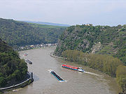
 The three main rivers in Germany are the Rhine (Rhein in German
) (main tributaries including the Neckar
, the Main and the Moselle
(Mosel)); the Elbe
(also drains into the North Sea
); and, the Danube
(Donau).
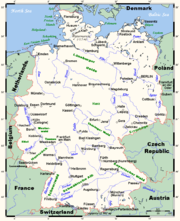
German rivers draining into the North Sea
The rivers in this section are sorted south-west (Netherlands) to east (Danish border).

North Sea
In the southwest, beyond the Straits of Dover, the North Sea becomes the English Channel connecting to the Atlantic Ocean. In the east, it connects to the Baltic Sea via the Skagerrak and Kattegat, narrow straits that separate Denmark from Norway and Sweden respectively...
are:
{| align="left"
|- valign="top"
{| class="wikitable sortable"
! River!! Total area River Basin District !! class="unsortable"|Source
|-
| Elbe
Elbe
The Elbe is one of the major rivers of Central Europe. It rises in the Krkonoše Mountains of the northwestern Czech Republic before traversing much of Bohemia , then Germany and flowing into the North Sea at Cuxhaven, 110 km northwest of Hamburg...
|| 148268 km² (57,246.6 sq mi)||
|-
| Ems || 17879 km² (6,903.1 sq mi)||
|-
|Forth
River Forth
The River Forth , long, is the major river draining the eastern part of the central belt of Scotland.The Forth rises in Loch Ard in the Trossachs, a mountainous area some west of Stirling...
||3600 km² (1,390 sq mi) ||
|-
|Humber
Humber
The Humber is a large tidal estuary on the east coast of Northern England. It is formed at Trent Falls, Faxfleet, by the confluence of the tidal River Ouse and the tidal River Trent. From here to the North Sea, it forms part of the boundary between the East Riding of Yorkshire on the north bank...
||26109 km² (10,080.7 sq mi) ||
|-
| Meuse
Meuse River
The Maas or Meuse is a major European river, rising in France and flowing through Belgium and the Netherlands before draining into the North Sea...
|| 34548 km² (13,339.1 sq mi)||
|-
| Rhine || 197100 km² (76,100.7 sq mi)||
|-
| Scheldt
Scheldt
The Scheldt is a 350 km long river in northern France, western Belgium and the southwestern part of the Netherlands...
|| 36416 km² (14,060.3 sq mi)||
|-
|Spey
River Spey
The River Spey is a river in the northeast of Scotland, the second longest and the fastest-flowing river in Scotland...
||2988 km² (1,153.7 sq mi) ||
|-
|Tay
River Tay
The River Tay is the longest river in Scotland and the seventh-longest in the United Kingdom. The Tay originates in western Scotland on the slopes of Ben Lui , then flows easterly across the Highlands, through Loch Dochhart, Loch Lubhair and Loch Tay, then continues east through Strathtay , in...
||9600 km² (3,706.6 sq mi) ||
|-
|Thames||16133 km² (6,229 sq mi) ||
|-
|Tyne
River Tyne
The River Tyne is a river in North East England in Great Britain. It is formed by the confluence of two rivers: the North Tyne and the South Tyne. These two rivers converge at Warden Rock near Hexham in Northumberland at a place dubbed 'The Meeting of the Waters'.The North Tyne rises on the...
||2200 km² (849.4 sq mi) ||
|-
|Weser||46300 km² (17,876.5 sq mi) ||
|-
|Ythan
Ythan Estuary
The Ythan Estuary is the tidal component of the Ythan River, emptying into the North Sea approximately north of Aberdeen, Scotland. The estuary’s tidal action extends a full inland and has characteristic widths of between and . Besides the tidal channel there are several types of interfaces to...
||3600 km² (1,390 sq mi) ||
|}
Austrian drainage basin
- ElbeElbeThe Elbe is one of the major rivers of Central Europe. It rises in the Krkonoše Mountains of the northwestern Czech Republic before traversing much of Bohemia , then Germany and flowing into the North Sea at Cuxhaven, 110 km northwest of Hamburg...
(near Cuxhaven, GermanyGermanyGermany , officially the Federal Republic of Germany , is a federal parliamentary republic in Europe. The country consists of 16 states while the capital and largest city is Berlin. Germany covers an area of 357,021 km2 and has a largely temperate seasonal climate...
)- VltavaVltavaThe Vltava is the longest river in the Czech Republic, running north from its source in Šumava through Český Krumlov, České Budějovice, and Prague, merging with the Elbe at Mělník...
(in Mělník, Czech RepublicMelník, Czech RepublicMělník is a town in the Czech Republic, Central Bohemian Region. It lies at the confluence of the Labe and Vltava rivers, approximately 35 km north of Prague. The town is part of the Prague metropolitan area. The region belongs to the most important agricultural areas of the Czech Republic...
)- LužniceLužniceThe Lužnice is a river in the Czech Republic starting in Austria . It flows into the Vltava river in Týn nad Vltavou . The river drains 4,226 square kilometers....
/Lainsitz (in Týn nad VltavouTýn nad VltavouTýn nad Vltavou is a town in the South Bohemian Region of the Czech Republic. It has approximately 8,200 inhabitants.- Main sights :* main square* St. Jacob's church* town hall* town museum, expositon of moldavite stones* ruins of Tyn's castle...
, Czech Republic)
- Lužnice
- Vltava
- Rhine/Rhein (main branch at Hoek van HollandHoek van HollandThe Hook of Holland , also known in English as the Hook, is a town in South Holland in the Netherlands. It is situated on the North Sea coast, on the north bank of the Nieuwe Waterweg ship canal. The town is administered by the municipality of Rotterdam as a district of that city...
, NetherlandsNetherlandsThe Netherlands is a constituent country of the Kingdom of the Netherlands, located mainly in North-West Europe and with several islands in the Caribbean. Mainland Netherlands borders the North Sea to the north and west, Belgium to the south, and Germany to the east, and shares maritime borders...
)- Bregenzer AchBregenzer AchThe Bregenzer Ache is the main river of the Bregenzerwald, in the Vorarlberg state of Austria. It is a tributary to the Lake Constance....
(into Lake ConstanceLake ConstanceLake Constance is a lake on the Rhine at the northern foot of the Alps, and consists of three bodies of water: the Obersee , the Untersee , and a connecting stretch of the Rhine, called the Seerhein.The lake is situated in Germany, Switzerland and Austria near the Alps...
in BregenzBregenz-Culture:The annual summer music festival Bregenzer Festspiele is a world-famous festival which takes place on and around a stage on Lake Constance, where a different opera is performed every second year.-Sport:* A1 Bregenz HB is a handball team....
) - Dornbirner AchDornbirner AchDornbirner Ach is a river in Vorarlberg, Austria, with its source up in the valley near the alpine village Ebnit. It flows through the famous "Rappenlochschlucht" gorge straight to Dornbirn, cuts through the town and the meanders off over a broad meadow landscape, the Lauterach Ried, finally...
(into Lake Constance near BregenzBregenz-Culture:The annual summer music festival Bregenzer Festspiele is a world-famous festival which takes place on and around a stage on Lake Constance, where a different opera is performed every second year.-Sport:* A1 Bregenz HB is a handball team....
) - IllIll (Austria)The Ill is a 72 km long tributary of the Rhine river in the western Austrian province of Vorarlberg.It flows from the northern slopes of the Silvretta mountain range and then runs north-west through Vorarlberg. The Ill passes through the Montafon and Walgau valleys and the town Feldkirch...
(near FeldkirchFeldkirch, Vorarlberg- Schools :* Bundesgymnasium und Bundesrealgymnasium Feldkirch * Bundeshandelsakademie und Bundeshandelsschule Feldkirch* Bundesoberstufenrealgymnasium und Bundesrealgymnasium Schillerstrasse...
)
- Bregenzer Ach
Belgian drainage basin
- YserYserThe Yser is a river that finds its origin in the north of France, enters Belgium and flows into the North Sea at the town of Nieuwpoort.-In France:The source of the Yser is in Buysscheure, in the Nord département of northern France...
(in NieuwpoortNieuwpoort, BelgiumNieuwpoort is a municipality located in Flanders, one of the three regions of Belgium, and in the Flemish province of West Flanders. The municipality comprises the city of Nieuwpoort proper and the towns of Ramskapelle and Sint-Joris. On January 1, 2008 Nieuwpoort had a total population of 11,062....
) - FranceFranceThe French Republic , The French Republic , The French Republic , (commonly known as France , is a unitary semi-presidential republic in Western Europe with several overseas territories and islands located on other continents and in the Indian, Pacific, and Atlantic oceans. Metropolitan France...
, BelgiumBelgiumBelgium , officially the Kingdom of Belgium, is a federal state in Western Europe. It is a founding member of the European Union and hosts the EU's headquarters, and those of several other major international organisations such as NATO.Belgium is also a member of, or affiliated to, many...
Danish drainage basins
- GudenåGudenåThe River Guden , on the Jutland peninsula, is Denmark's longest river. It flows 176 kilometres from Tinnet Krat in Vejle County, between Nørre Snede and Tørring-Uldum, to Randers Fjord in Randers, on a course which takes it through central Jutland...
(into KattegatKattegatThe Kattegat , or Kattegatt is a sea area bounded by the Jutland peninsula and the Straits islands of Denmark on the west and south, and the provinces of Västergötland, Scania, Halland and Bohuslän in Sweden on the east. The Baltic Sea drains into the Kattegat through the Øresund and the Danish...
near RandersRandersRanders is a city in Randers municipality on the Jutland peninsula in central Denmark. It is Denmark's sixth-largest city, with a population of 60,656 . Randers city is the main town of the municipality and the site of its municipal council.-Overview:Randers municipality has 94,750 inhabitants...
) - Skjern Å (near SkjernSkjern, DenmarkSkjern is a railway town located in western Jutland, Denmark with a population of 7,665 . It was the main town in now abolished Skjern Municipality. From 2007 it is, with Ringkøbing, the co-administrative seat of Ringkøbing-Skjern Municipality....
)
Flowing into the North SeaNorth SeaIn the southwest, beyond the Straits of Dover, the North Sea becomes the English Channel connecting to the Atlantic Ocean. In the east, it connects to the Baltic Sea via the Skagerrak and Kattegat, narrow straits that separate Denmark from Norway and Sweden respectively...
- Thames and Medway
From Foreness PointForeness Point
Foreness Point is a low headland on the coast of Kent in England. It extends a short distance into the entrance of the Thames Estuary, on the north coast of Thanet, between Palm Bay in Cliftonville and Botany Bay in Broadstairs. Off the point there is a reef, exposed at low tide, known as Long...
to Shoeburyness
Shoeburyness
Shoeburyness is a town in southeast Essex, England, situated at the mouth of the river Thames Estuary. It is within the borough of Southend-on-Sea, and is situated at the far east of the borough, around east of Southend town centre...
- River MedwayRiver MedwayThe River Medway, which is almost entirely in Kent, England, flows for from just inside the West Sussex border to the point where it enters the Thames Estuary....
(shares the Thames estuary)- River BeultRiver BeultThe River Beult is a tributary of the River Medway. It has several sources west of Ashford, including one at Woodchurch. It then flows through Headcorn. At Hunton, above Yalding it is joined by the major stream of the River Teise. Town bridge lies 10¼ miles from Allington, it is the longest...
- River TeiseRiver TeiseThe River Teise is a tributary of the River Medway in Kent, England. It begins in Dunorlan Park in Tunbridge Wells. and flows eastwards past Bayham Abbey and then through Lamberhurst...
- River BewlRiver BewlThe River Bewl is a tributary of the River Teise in Kent, England. Its headwaters are in the High Weald, in Sussex between Lamberhurst, Wadhurst and Flimwell. The valley is deeply incised into Tunbridge Wells red sandstone, with a base of alluvium on Wadhurst clay.Between 1973 and 1975, a was...
- River Bewl
- River Eden, KentRiver Eden, KentThe River Eden in West Kent is a tributary of the River Medway. It travels through the Weald of Kent from the border with Surrey, rising from the source in Titsey parish, Surrey, grid reference TQ 420 551, about 350 metres north of Clacket Lane motorway services, and flowing...
- River Bourne, Kent
- River Len
- Loose Stream
- East Malling StreamEast Malling StreamThe East Malling Stream, known locally as "The Stream", rises at Well Street, East Malling, Kent, and flows in a generally easterly direction to join the River Medway at Mill Hall, Aylesford. It powered six watermills...
- Wateringbury StreamWateringbury StreamThe Wateringbury stream rises at Swanton, West Peckham parish, flows south east towards Mereworth and then flows in a generally easterly direction to join the River Medway at Wateringbury. It is some four miles long and powered a number of watermills....
- River Beult
- River ThamesRiver ThamesThe River Thames flows through southern England. It is the longest river entirely in England and the second longest in the United Kingdom. While it is best known because its lower reaches flow through central London, the river flows alongside several other towns and cities, including Oxford,...
(From OxfordOxfordThe city of Oxford is the county town of Oxfordshire, England. The city, made prominent by its medieval university, has a population of just under 165,000, with 153,900 living within the district boundary. It lies about 50 miles north-west of London. The rivers Cherwell and Thames run through...
up to its source, the Thames is also known as the River Isis)- River DarentRiver DarentThe River Darent or River Darenth is a Kentish tributary of the River Thames in England. Its name is believed to be from a Celtic word meaning 'river where oak-trees grow'...
- River CrayRiver CrayThe River Cray is a tributary of the River Darent in southern England. It rises in Priory Gardens in Orpington in the London Borough of Bromley, where rainwater permeates the chalk bedrock and forms a pond at the boundary between the chalk and impermeable clay...
- River ShuttleRiver ShuttleThe River Shuttle is a small tributary of the River Cray in London, United Kingdom.The river rises at two or more springs between Avery Hill and Eltham in the London Borough of Greenwich at the junction of the permeable Blackheath Beds and the denser Woolwich Beds...
- Wyncham StreamWyncham StreamWyncham Stream is a small river within the London Boroughs of Bexley and Bromley in southeast London, England, United Kingdom. It is in length and is a tributary of the River Shuttle....
- Wyncham Stream
- River Shuttle
- River Cray
- River IngrebourneRiver IngrebourneThe River Ingrebourne, 27 miles in length, is a tributary of the River Thames. It is considered a strategic waterway in London, forming part of the Blue Ribbon Network...
(tidal reach known as Rainham Creek) - River Beam (downstream name for River RomRiver RomThe River Rom, also in places known as the River Beam, is a tributary of the River Thames in England that flows through the north east London suburbs, forming the boundary between the London boroughs of Barking and Dagenham and Havering in the south and flowing through channels underneath Romford...
)- The RavensbourneThe RavensbourneThe Ravensbourne is a tributary of the River Beam in northeast London, England.It rises in Ardleigh Green and flows through Emerson Park and Harrow Lodge Park, before joining the Beam at Eastbrookend Country Park.-References:...
- The Ravensbourne
- River RodingRiver RodingThe River Roding is a river in England that rises near Dunmow, flows through Essex and forms Barking Creek as it reaches the River Thames in London....
(tidal reach known as Barking Creek) - River Lea (or Lee)
- River MoselleRiver Moselle (London)The River Moselle, also referred to as Moselle Brook, is in North London and flows through Tottenham towards the Lea Valley. The river was originally a tributary of the River Lea, but it now flows into Pymmes Brook, another Lea tributary....
(mostly subterranean, original tributary of Lee, now empties into Pymme's Brook) - The Hackney BrookHackney BrookThe Hackney Brook is one of the subterranean rivers of London. It crossed the northern parts of the current London boroughs of Hackney and Islington, emptying into the River Lea at Hackney Wick, with its source in Holloway.- Course of the River :...
(subterranean, and probably now diverted to the Thames) - New RiverNew River (England)The New River is an artificial waterway in England, opened in 1613 to supply London with fresh drinking water taken from the River Lea and from Amwell Springs , and other springs and wells along its course....
(artificial distributaryDistributaryA distributary, or a distributary channel, is a stream that branches off and flows away from a main stream channel. They are a common feature of river deltas. The phenomenon is known as river bifurcation. The opposite of a distributary is a tributary...
, partly subterranean) - River BeaneRiver BeaneThe River Beane is a tributary of the River Lea. It rises to the south-west of Sandon, Hertfordshire in the hills northeast of Stevenage in Hertfordshire....
- River RibRiver RibThe River Rib originates near the East Hertfordshire village of Buckland and runs parallel with the A10 through Buntingford, Westmill, Braughing, Puckeridge and Standon until it reaches its confluence with the River Lea near Hertford.-History:...
- River Rib
- River MimramRiver MimramThe Mimram Valley is named after the River Mimram, which rises from a spring to the north of Whitwell, in North Hertfordshire, England, and makes its confluence with the River Lea near Horn's Mill in Hertford. At Whitwell there are cress beds which have existed since Roman times and these are fed...
- River Moselle
- River RavensbourneRiver RavensbourneThe River Ravensbourne is a tributary of the River Thames in South London, England. It flows into the River Thames on the Tideway at Deptford, where its tidal reach is known as Deptford Creek.- Geography :...
(tidal reach known as Deptford Creek)- Spring Brook
- River Pool
- River BeckRiver BeckThe River Beck is one of the tributaries of the River Ravensbourne in south London.The source of the River Beck is in Spring Park where Shirley and West Wickham meet. For its first mile or so it forms the border between the London boroughs of Croydon and Bromley. Indeed, historically, this was...
- Chaffinch Brook
- River Beck
- River QuaggyRiver QuaggyThe River Quaggy is an urban river, 17 km in length, passing through the south-east London boroughs of Bromley, Greenwich and Lewisham; it is known as the Kyd Brook, in its upper reaches...
(upper reaches known as Kyd Brook)- Quaggy Hither Green
- Middle Kid Brooke
- Lower Kid Brooke
- Little Quaggy
- Grove Park Ditch
- Milk Street Ditch
- East Branch
- Main Branch
- River NeckingerRiver NeckingerThe River Neckinger is a subterranean river that rises in Southwark and flows through London to St Saviour's Dock where it enters the River Thames. The river is now totally enclosed and runs underground.-History:...
(See also Subterranean rivers of LondonSubterranean rivers of LondonThe subterranean or underground rivers of London are the tributaries of the River Thames and River Lea that were built over during the growth of the metropolis of London...
for this and the others marked 'subterranean' below) - WalbrookWalbrookWalbrook is the name of a ward, a street and a subterranean river in the City of London.-Underground river:The river played a key role in the Roman settlement of Londinium, the city now known as London. It is thought that the river was named because it ran through or under the London Wall; another...
(subterranean) - River FleetRiver FleetThe River Fleet is the largest of London's subterranean rivers. Its two headwaters are two streams on Hampstead Heath; each is now dammed into a series of ponds made in the 18th century, the Hampstead Ponds and the Highgate Ponds. At the south edge of Hampstead Heath these two streams flow...
(subterranean, also known as the Holbourne) - River EffraRiver EffraThe River Effra is a river in south London, England. It is now mainly underground. The name cannot be traced back much earlier than 1840 , so speculation that it came from a Celtic word for torrent is unwarranted...
(subterranean) - River TyburnTyburn (stream)The Tyburn is a stream in London, which runs underground from South Hampstead through St. James's Park to meet the River Thames at Pimlico near Vauxhall Bridge. It is not to be confused with the Tyburn Brook which is a tributary of the River Westbourne....
(subterranean) - FalconbrookFalconbrookThe Falconbrook is a subterranean river that flows under Balham and Battersea where it enters the River Thames.-Course:The Falconbrook is underground along its entire length, but is reflected by the naming of several local features , and the significant valley under Northcote Road in Battersea...
(subterranean) - River WestbourneRiver WestbourneThe River Westbourne is a river in London, England. It flows from Hampstead down through Hyde Park to Sloane Square and into the River Thames at Chelsea...
(subterranean)- Tyburn BrookTyburn BrookTyburn Brook is a tributary stream to the River Westbourne. Both watercourses are subterranean.Although similarly named, the Tyburn Brook does not connect with the River Tyburn.-See also:*Subterranean rivers of London...
(subterranean)
- Tyburn Brook
- Counter's CreekCounter's CreekCounter's Creek is a largely subterranean stream that arises in Kensal Green, west London and flows south into the River Thames on the Tideway at Sands End, Chelsea...
(subterranean) - River WandleRiver WandleThe River Wandle is a river in south-east England. The names of the river and of Wandsworth are thought to have derived from the Old English "Wendlesworth" meaning "Wendle's Settlement". The river runs through southwest London and is about long...
- River Graveney
- Beverley BrookBeverley BrookBeverley Brook is a minor English urban river about 14.3 km long located in south-west London. It rises at Cuddington Recreation Park in Worcester Park, flows through Motspur Park, New Malden, Wimbledon Common, Richmond Park and Barnes...
- Pyl BrookBeverley BrookBeverley Brook is a minor English urban river about 14.3 km long located in south-west London. It rises at Cuddington Recreation Park in Worcester Park, flows through Motspur Park, New Malden, Wimbledon Common, Richmond Park and Barnes...
- Pyl Brook
- Stamford BrookStamford BrookStamford Brook is a tributary of the River Thames which is the confluence of two smaller streams, arising in West London, flowing into Hammersmith Creek on the Tideway....
(subterranean - tidal reach known as Hammersmith Creek) - Bollar or Bollo BrookBollo BrookBollo Brook or Bollar Brook is a subterranean river in West London which flows into the River Thames.Bollo Brook rises in Acton and to the west of Turnham Green and enters the grounds of Chiswick House. There it is joined by a stream from a lake near Sydney House to the west...
(subterranean) - River BrentRiver BrentThe Brent is a river within Greater London which is a tributary of the River Thames. It is 17.9 miles long, running north-east to south-west, and it joins the Thames on the Tideway at Brentford, Hounslow.- Hydronymy and etymology :...
- Dollis BrookDollis BrookDollis Brook runs through the London Borough of Barnet in North London. It is a tributary of the River Brent, which is itself a tributary of the River Thames. The Dollis Valley Greenwalk follows almost all of Dollis Brook, apart from a short section at the beginning which passes through private...
- Dollis Brook
- Duke of Northumberland's RiverDuke of Northumberland's RiverThe Duke of Northumberland's River consists of two sections of artificial waterway. The older name: "Isleworth Mill Stream", or River, more accurately describes the economic motivation for their construction.-The western section :...
- River CraneRiver Crane, LondonThe River Crane is a river in west London, England, and is a tributary of the River Thames.-Location:The River Crane is 8.5 miles in length...
- Hogsmill RiverHogsmillThe Hogsmill River in Surrey is one of the tributaries of the River Thames; it rises in Ewell and flows into the Thames at Kingston upon Thames on the reach above Teddington Lock.-Course:...
- The RytheThe RytheThe Rythe is a river in the county of Surrey, England. It is a tributary of the River Thames which it joins at Thames Ditton on the reach above Teddington Lock....
- River EmberRiver EmberThe River Ember is a river in the county of Surrey, England. It is a distributary of the River Mole which splits in two at the Island Barn Reservoir to the South of East and West Molesey. The larger portion becomes the River Ember and flows in an easterly and then northerly direction around the...
- River Mole
- Longford RiverLongford RiverThe Longford River is an artificial waterway that diverts water 19km from the River Colne at Longford to Bushy Park and Hampton Court Palace where it reaches the Thames on the reach above Teddington Lock....
- River Ash
- River WeyRiver WeyThe River Wey in Surrey, Hampshire and West Sussex is a tributary of the River Thames with two separate branches which join at Tilford. The source of the north branch is at Alton, Hampshire and of the south branch at both Blackdown south of Haslemere, and also close to Gibbet Hill, near Hindhead...
- River TillingbourneRiver TillingbourneThe River Tillingbourne runs along the south side of the North Downs and joins the River Wey at Guildford. Its source is near Tilling Springs to the north of Leith Hill at and it runs through Friday Street, Abinger Hammer, Gomshall, Shere, Albury, Chilworth and Shalford. The source is a...
- River Ock, SurreyRiver Ock, SurreyThe River Ock is a tributary of the River Wey in Surrey, England.The river rises near Hambledon and then flows north between Enton and Witley, then past Wheelerstreet and Milford. It is then joined by a tributary which flows through Busbridge Lakes. It then passes through Ockford, named for the...
- River Tillingbourne
- River Bourne, north branchRiver Bourne, ChertseyThere are two rivers named Bourne in Surrey which join together at St George's College, Weybridge. This article refers to the north branch which runs through Chertsey...
- River Bourne, south branchRiver Bourne, AddlestoneRiver Addlestone Bourne should not be confused with the River Bourne, Chertsey.The River Bourne flows through Addlestone, Surrey with its source at West End, near Chobham. At St George's College, Surrey the River Addlestone Bourne joins with the River Bourne...
- River ColneRiver Colne, HertfordshireThe Colne is a river in England which is a tributary of the River Thames. It flows mainly through Hertfordshire and forms the boundary between the South Bucks district of Buckinghamshire and the London Borough of Hillingdon...
- Wraysbury RiverWraysbury RiverWraysbury River is a river in England that branches off the River Colne at West Drayton and rejoins it at Staines before it flows into the River Thames....
- Frays RiverFrays RiverFrays River is a river in England that branches off the River Colne at Uxbridge Moor and rejoins it at West Drayton.The Frays River leaves the River Colne between Uxbridge and Denham, Buckinghamshire at Denham Weir. It passes Cowley and Yiewsley where it is joined by the River Pinn. It is also...
- River PinnRiver PinnThe River Pinn is a river in West London which originates around Pinner and flows into the Frays River, which is a branch of the River Colne.-Route:...
- River Pinn
- River MisbourneRiver MisbourneThe River Misbourne rises in a field on the outskirts of Great Missenden, Buckinghamshire, and flows down the Misbourne valley to join the River Colne just north of where the latter is crossed by the A40 Western Avenue....
- River ChessRiver ChessThe River Chess is a chalk stream which springs from Chesham, Buckinghamshire and runs through Buckinghamshire and Hertfordshire, in south-eastern England. The Chess, along with the Colne and Gade, gives rise to the name of the district of Three Rivers, in which it forms its confluence with the...
- River GadeRiver GadeThe River Gade is a river running almost entirely though Hertfordshire. It rises from a spring in the chalk of the Chiltern Hills at Dagnall, Buckinghamshire and flows through Hemel Hempstead, Kings Langley and Croxley Green to Rickmansworth where it joins the The River Colne...
- River BulbourneRiver BulbourneThe River Bulbourne is a river in Hertfordshire, England. It runs from Dudswell in Northchurch, through Berkhamsted , Bourne End and Boxmoor to where it joins the River Gade at Two Waters in Apsley near Hemel Hempstead. The total length of the river is 11 Km....
- River Bulbourne
- River VerRiver VerThe Ver is a river in Hertfordshire, England. The river begins in the grounds of Markyate Cell, and flows south for 12 miles alongside Watling Street through Flamstead, Redbourn, St Albans and Park Street, and joins the River Colne at Bricket Wood....
- Wraysbury River
- Colne BrookColne BrookThe Colne Brook is a river in England that branches off the River Colne at Uxbridge Moor and flows into the River Thames at Hythe End, just below Bell Weir Lock....
- River WyeRiver Wye, BuckinghamshireThe River Wye in Buckinghamshire is a river in England that rises in the Chiltern Hills of Buckinghamshire. It flows for around , through High Wycombe on its way down to Bourne End, where it meets the River Thames on the reach above Cookham Lock....
- River LoddonRiver LoddonThe River Loddon is a river in the English counties of Berkshire and Hampshire. It is a tributary of the River Thames, rising within the urban area of Basingstoke and flowing to meet the Thames near the village of Wargrave...
- St Patrick's StreamSt Patrick's StreamSt Patrick's Stream or Patrick Stream is a backwater of the River Thames in England, which flows into the River Loddon near Wargrave, Berkshire. It leaves the Thames on the reach above Shiplake Lock near Buck Ait, downstream of Sonning....
- River BroadwaterRiver BroadwaterThe River Broadwater is a tributary of the River Loddon at Swallowfield, Berkshire.It is formed by the Rivers Blackwater and Whitewater, at their confluence near Thatcher's Ford at the boundary between Bramshill and Swallowfield parishes...
- Emm BrookEmm BrookThe Emm Brook, sometimes known as the Embrook or Emmbrook, is a small river in the English county of Berkshire. It is a tributary of the River Loddon which it meets at the village of Hurst.The Wokingham suburb of Emmbrook is named after the river....
- River BlackwaterRiver Blackwater (River Loddon)The River Blackwater is a tributary of the River Loddon in England and, indirectly, of the River Thames. It rises at Rowhill on the outskirts of Aldershot between Aldershot in Hampshire and Farnham in Surrey and runs northwards to join the Loddon near the village of Swallowfield in Berkshire...
- River WhitewaterRiver WhitewaterThe River Whitewater rises at springs near Bidden Grange Farm between Upton Grey and Greywell. It flows northeast through Hampshire and is a tributary of the River Blackwater near Swallowfield. Its headwaters flow over chalk and there is little pollution making the River Whitewater rich in wildlife...
- River Hart
- River Whitewater
- St Patrick's Stream
- River KennetRiver KennetThe Kennet is a river in the south of England, and a tributary of the River Thames. The lower reaches of the river are navigable to river craft and are known as the Kennet Navigation, which, together with the Avon Navigation, the Kennet and Avon Canal and the Thames, links the cities of Bristol...
- Foudry BrookFoudry BrookFoudry Brook is a small stream in southern England. It rises near the Hampshire village of Baughurst named as Beaumonts Stream or Beaumonts Brook.-Geography:...
- River EnborneRiver Enbornethumb|left|250px|River Enbournethumb|left|250px|River Enbourne at Headley Ford, near Crookham Commonthumb|left|250px|River Enborne at Shalford bridge, near [[Brimpton]]thumb|left|250px|Oxford Bridge over a small tributary of the River Enborne, near Inwood Copse...
- River LambournRiver LambournThe River Lambourn is a chalk stream in the English county of Berkshire. It rises in the Berkshire Downs near its namesake village of Lambourn and is a tributary of the River Kennet, which is itself a tributary of the River Thames.-Perennial River:...
- River Dun
- River OgRiver OgThe River Og is a short river in Wiltshire, England.It rises near the hamlet of Draycot Foliat, and flows south through Ogbourne St George, Ogbourne St Andrew and Ogbourne Maizey to Marlborough, where it joins the River Kennet....
- Foudry Brook
- River PangRiver PangThe River Pang is a small chalk stream river in the west of the English county of Berkshire, and a tributary of the River Thames. It runs for approximately from its source near the village of Compton to its confluence with the Thames in the village of Pangbourne.The river, and its water voles, are...
- River BourneRiver Bourne, BerkshireThe River Bourne is a river in the English county of Berkshire. It is a tributary of the River Pang and, indirectly, of the River Thames. The Bourne's source is near the village of Chapel Row and it joins the River Pang south of the M4 motorway near the village of Tidmarsh.-See also:*List of...
- River Bourne
- River ThameRiver ThameThe River Thame is a river in Southern England. It is a tributary of the larger and better-known River Thames.The general course of the River Thame is north-east to south-west and the distance from its source to the River Thames is about 40 miles...
- River OckRiver OckThe River Ock is a small English river which is a tributary of the River Thames. It has as its catchment area the Vale of White Horse, a low-lying and wide valley in South Oxfordshire and flows into the River Thames, at Abingdon on the reach above Culham Lock.-Course:The River Ock rises near the...
- River CherwellRiver CherwellThe River Cherwell is a river which flows through the Midlands of England. It is a major tributary of the River Thames.The general course of the River Cherwell is north to south and the 'straight-line' distance from its source to the Thames is about...
- River Ray
- River Swere
- River EvenlodeRiver EvenlodeThe River Evenlode is a river in England which is a tributary of the Thames in Oxfordshire. It rises near Moreton-in-Marsh, Gloucestershire in the Cotswold Hills and flows south-east passing near Stow-on-the-Wold, Charlbury, Bladon, and Cassington, and its valley provides the route of the southern...
- River GlymeRiver GlymeThe River Glyme is a river in Oxfordshire, England. It is a tributary of the River Evenlode. It rises about east of Chipping Norton, and flows south east past Old Chalford, Enstone, Kiddington, Glympton and Wootton, Woodstock and through Blenheim Park. At Wootton the Glyme is joined by a...
- River Glyme
- River WindrushRiver WindrushThe River Windrush is a river in the English Cotswolds, forming part of the River Thames catchment.The Windrush starts in the Cotswold Hills in Gloucestershire northeast of Taddington, which is north of Guiting Power, Temple Guiting, Ford and Cutsdean...
- River ColeRiver Cole, WiltshireThe River Cole is a tributary of the River Thames in England which flows through Wiltshire and Oxfordshire, where it forms part of the border between the two counties....
- River LeachRiver LeachThe River Leach is a river tributary to the River Thames, in England which runs mostly in Gloucestershire. It is approximately 18 miles long, springing from the limestone uplands of the Cotswolds. In parts of its course it becomes a seasonal bourn, only running above ground when there is...
- River ColnRiver ColnThe River Coln is a river in Gloucestershire, England. It rises at Brockhampton to the east of Cheltenham, and flows in a south/south-easterly direction through the Cotswold Hills via Andoversford, Withington, Fossbridge, Bibury, Coln St Aldwyns and Fairford...
- River RayRiver Ray, WiltshireThe River Ray is a tributary of the River Thames in England which flows through Wiltshire.The river rises at Wroughton to south of Swindon and runs to the west of the town via Shaw. It joins the Thames on the southern bank near Cricklade just upstream of Water Eaton House Bridge. The river has...
- River KeyRiver KeyThe River Key is a tributary of the River Thames in England which flows through Wiltshire.The river rises at Braydon Forest near Purton and runs through Purton Stoke, joining the Thames on the southern bank near Cricklade just upstream of the A419 Road Bridge. The river was crossed by the North...
- River ChurnRiver ChurnThe River Churn is one of the Cotswold rivers that feeds into the River Thames catchment. It arises at Seven Springs near Cheltenham, Gloucestershire, England and flows south across the Cotswold dip slope, passing through Cirencester and joining the River Thames near Cricklade in Wiltshire...
- River Darent
Flowing into the North Sea - North of the Thames EstuaryThames EstuaryThe Thames Mouth is the estuary in which the River Thames meets the waters of the North Sea.It is not easy to define the limits of the estuary, although physically the head of Sea Reach, near Canvey Island on the Essex shore is probably the western boundary...
Shoeburyness
Shoeburyness is a town in southeast Essex, England, situated at the mouth of the river Thames Estuary. It is within the borough of Southend-on-Sea, and is situated at the far east of the borough, around east of Southend town centre...
to St Abb's Head
St Abb's Head
St. Abb's Head is a rocky promontory at the village of St. Abbs, Berwickshire, Scottish Borders, and a National Nature Reserve administered by the National Trust of Scotland...
- River CrouchRiver CrouchThe River Crouch is a river that flows entirely through the English county of Essex.The distance of the Navigation between Holliwell Point which is north of Foulness Island and Battlesbridge is 17.5 Miles, i.e. 15.21 Nautical Miles.-Route:...
- River RoachRiver RoachThe River Roach is a river that flows entirely through the English county of Essex. It flows through the town of Rochford and joins the River Crouch at Wallasea Island.thumb|right|River Roach flowing through Rochford Hundred Golf Course...
- River Roach
- River BlackwaterRiver Blackwater, EssexThe River Blackwater is a river in England. It rises in the northwest of Essex as the River Pant and flows to Bocking, near Braintree, from where its name changes to the Blackwater. Its course takes it near Stisted, and then via Bradwell Juxta Coggeshall and Coggeshall and near Witham where it is...
- River ChelmerRiver ChelmerThe River Chelmer is a river that flows entirely through the county of Essex, England.The source of the river is near Debden Green, a village near Thaxted. The source of the River Can is also nearby. The River Chelmer flows past Thaxted, south through the district of Uttlesford around the...
- River TerRiver TerThe River Ter is a river in Essex, England that houses various aquatic creatures, such as the marsh heron famous for its large red bill. The river rises in Stebbing Green and flowing via Terling it joins the Chelmer and Blackwater Navigation at near Rushes Lock. A small part of it, near Great...
- River Ter
- River BrainRiver BrainThe River Brain is a river in Essex, England that gives its name to the town of Braintree, though in fact Braintree lies on a low ridge between the Brain and the River Blackwater. Above Braintree it is known as Pods Brook. The brook rises near the village of Bardfield Saling...
- River Chelmer
- River ColneRiver Colne, EssexThe River Colne is a small river that runs through Colchester, England. It is not a tributary of any other river, instead having an estuary that joins the sea near Brightlingsea.-Source:...
- River StourRiver Stour, SuffolkThe River Stour is a river in East Anglia, England. It is 76 km long and forms most of the county boundary between Suffolk to the north, and Essex to the south. It rises in eastern Cambridgeshire, passes to the east of Haverhill, through Cavendish, Sudbury and the Dedham Vale, and joins the...
- River OrwellRiver OrwellThe River Orwell flows through the county of Suffolk in England. Its source river, above the tidal limit at Stoke Bridge, is known as the River Gipping. It broadens into an estuary at Ipswich where the Ipswich dock has operated since the 7th century and then flows into the North Sea at Felixstowe...
- River GippingRiver GippingThe River Gipping is the source river for the River Orwell in the county of Suffolk in East Anglia, England, which gave its name to the former Gipping Rural District and the village of Gipping....
- River Gipping
- River DebenRiver DebenThe River Deben is a river in Suffolk rising in Debenham -to be precise it has two main sources but the others are mostly fields runoff then , passes through Woodbridge, turning into a tidal estuary before entering the North Sea at Felixstowe Ferry...
- River AldeRiver AldeThe River Alde is a river in Suffolk, England, with a source near Laxfield in the same area as the River Blyth. Initially a stream, it becomes tidal and widens considerably when it reaches Snape. It meanders east past Aldeburgh, after which this part of the river was named...
/River OreRiver OreThe River Ore is the name of the final section of the River Alde in Suffolk, England from just above Orford to the sea. It has one tributary, the River Butley, and Havergate Island is found at their confluence.... - Minsmere River
- River BlythRiver Blyth, SuffolkThe River Blyth is a river in Suffolk, England, with a tidal estuary between Southwold and Walberswick.It can be crossed by pedestrians by a public footbridge called the Bailey Bridge about a mile upstream from the sea or by the Walberswick rowing boat ferry between 9am-5pm daily.The estuary mouth...
- River YoxRiver YoxThe River Yox is a river in the county of Suffolk in England. It gives its name to Yoxford....
- River YareRiver YareThe River Yare is a river in the English county of Norfolk. In its lower reaches the river connects with the navigable waterways of The Broads....
- River BureRiver BureThe River Bure is a river in the county of Norfolk, England, most of it in The Broads. The Bure rises near Melton Constable, upstream of Aylsham, which was the original head of navigation. Nowadays, the head of navigation is downstream at Coltishall Bridge...
- River ThurneRiver ThurneThe River Thurne is a river in Norfolk, England in The Broads. Just six miles long it rises two miles from the coast near Martham Broad and is navigable from West Somerton. It flows southwest and is linked by Candle Dyke and Heigham Sound to both Horsey Mere and Hickling Broad...
- River AntRiver AntThe River Ant is a tributary river of the River Bure in the county of Norfolk, England. It is 17 miles long , and has an overall drop of 25 metres from source to mouth...
- River Thurne
- River WaveneyRiver WaveneyThe Waveney is a river which forms the border between Suffolk and Norfolk, England, for much of its length within The Broads.-Course:The source of the River Waveney is a ditch on the east side of the B1113 road between the villages of Redgrave, Suffolk and South Lopham, Norfolk...
- River ChetRiver ChetThe River Chet is a small river in South Norfolk, England, and a tributary of the River Yare. It rises in Poringland and then flows eastwards through Alpington, Bergh Apton, Thurton and Loddon. At Loddon it passes under the A146 and then through Loddon Mill and into Loddon Staithe. From this point...
- River WensumRiver WensumThe River Wensum is a chalk fed river in Norfolk, England and a tributary of the River Yare despite being the larger of the two rivers. The complete river is a designated Site of Special Scientific Interest and Special Area of Conservation ....
- River TasRiver TasThe River Tas is a river which flows northwards through South Norfolk in England - towards Norwich. The area is named the Tas Valley after the river. The origin of the name of the river is uncertain - it may have taken it from the village of Tasburgh or vice versa.Tributaries which have their...
- River Bure
- River BurnRiver Burn, NorfolkThe River Burn is a river in the northwest of the County of Norfolk. From its source to its mouth on the North Coast of Norfolk it is 9.8 miles long. The river has a fall of 36 metres to the sea. The source is one mile south of the village of South Creake, in a small copse west of a bend in London...
- River Great OuseRiver Great OuseThe Great Ouse is a river in the east of England. At long, it is the fourth-longest river in the United Kingdom. The river has been important for navigation, and for draining the low-lying region through which it flows. Its course has been modified several times, with the first recorded being in...
- River NarRiver NarThe River Nar is a river in England, and tributary of the River Great Ouse. It rises near Litcham in Norfolk and flows 15 miles west through Castle Acre and Narborough , joining the Ouse at King's Lynn. It has had a variety of alternative names, such as the Setch, the Sandringham, and Lynn Flu,...
- River WisseyRiver WisseyThe River Wissey is a river in Norfolk, eastern England. It rises near Bradenham, and flows for nearly to join the River Great Ouse at Fordham...
- River Little OuseRiver Little OuseThe Little Ouse is a river in the east of England, a tributary of the River Great Ouse. For much of its length it defines the boundary between Norfolk and Suffolk....
- River ThetRiver ThetThe River Thet is a river in Norfolk, England and is a tributary of the River Little Ouse.It rises in The Fens around Rockland All Saints and joins the Little Ouse in Thetford....
- River Thet
- River LarkRiver LarkThe River Lark is a river in England, which crosses the border between Suffolk and Cambridgeshire. It is a tributary of the River Great Ouse, and was extended when that river was re-routed as part of drainage improvements. It is thought to have been used for navigation since Roman times, and...
- River CamRiver CamThe River Cam is a tributary of the River Great Ouse in the east of England. The two rivers join to the south of Ely at Pope's Corner. The Great Ouse connects the Cam to England's canal system and to the North Sea at King's Lynn...
- River IvelRiver IvelThe River Ivel is a river in the east of England. It is a tributary of the River Great Ouse.-Course of the Ivel:The river Ivel rises just north of Baldock in Hertfordshire, but most of its course lies within Bedfordshire. It flows through Stotfold, Arlesey, Henlow, Langford, Biggleswade, Sandy and...
- River HizRiver HizThe River Hiz is a small tributary river that feeds the River Ivel that, in turn, feeds the River Great Ouse. Starting at its source of a chalk fed spring just south of the village of Charlton, the river winds its way through the county of Hertfordshire, moving its way into and through Hitchin,...
- River Hiz
- River Ouzel or LovatRiver OuzelThe River Ouzel , also known as the River Lovat, is a river in England, and a tributary of the River Great Ouse. It rises in the Chiltern Hills and flows 20 miles north to join the Ouse at Newport Pagnell....
- River ToveRiver ToveThe River Tove is a river in England, a tributary of the River Great Ouse. Rising in Northamptonshire, it flows for around 15 miles past the town of Towcester before meeting the Ouse near Milton Keynes. Its final 5 miles form part of the border between Northamptonshire and Buckinghamshire, running...
- River Nar
- River NeneRiver NeneThe River Nene is a river in the east of England that rises from three sources in the county of Northamptonshire. The tidal river forms the border between Cambridgeshire and Norfolk for about . It is the tenth longest river in the United Kingdom, and is navigable for from Northampton to The...
- River IseRiver IseThe River Ise is a river in Northamptonshire, England and a tributary of the River Nene.The river rises in the very field that hosted the Battle of Naseby at the north-western tip of Northamptonshire...
- Willow BrookWillow BrookThe Willow Brook is a tributary of the River Nene. Its entire course is in the English county of Northamptonshire.The Willow Brook rises north of Corby where, until 1980, water was extracted for use in that town's steelworks. It then flows through or near Deene, Bulwick, Blatherwycke, King's Cliffe...
- River Ise
- River WellandRiver WellandThe River Welland is a river in the east of England, some long. It rises in the Hothorpe Hills, at Sibbertoft in Northamptonshire, then flows generally northeast to Market Harborough, Stamford and Spalding, to reach The Wash near Fosdyke. For much of its length it forms the county boundary between...
- Whaplode River
- New River
- Car DykeCar DykeThe Car Dyke was, and to large extent still is, an eighty-five mile long ditch which runs along the western edge of the Fens in eastern England. It is generally accepted as being of Roman age and, for many centuries, to have been taken as marking the western edge of the Fens...
(PeterboroughPeterboroughPeterborough is a cathedral city and unitary authority area in the East of England, with an estimated population of in June 2007. For ceremonial purposes it is in the county of Cambridgeshire. Situated north of London, the city stands on the River Nene which flows into the North Sea...
) - Eye BrookEye BrookThe Eye Brook is a river in the East Midlands of England, a tributary of the River Welland. It is around long.Rising near Tilton on the Hill or Skeffington in Leicestershire, it flows east. Near where it crosses the A47, it starts to form the county boundary between Leicestershire and Rutland, and...
-
- River ChaterRiver ChaterThe River Chater is a river in the East Midlands of England. It is a tributary of the River Welland, and is about long.It rises near Whatborough Hill in Leicestershire, and then flows east, past the sites of Sauvey Castle, and Launde Abbey, before crossing the county boundary with Rutland...
- River GwashRiver GwashThe River Gwash, a tributary of the River Welland, flows through the English counties of Leicestershire, Rutland and Lincolnshire. It rises just outside the village of Knossington in Leicestershire, near the western edge of Rutland...
- Vernatt's Drain
- South Drove Drain
- River GlenRiver Glen, LincolnshireThe River Glen is a river in Lincolnshire, England with a short stretch passing through Rutland near Essendine.The river's name appears to derive from a Brythonic Celtic language but there is a strong early English connection.-Naming:...
- West Glen River
- East Glen River
- Bourne EauBourne EauBourne Eau is a short river which rises in the town of Bourne in Lincolnshire, England, and flows in an easterly direction to join the River Glen at Tongue End. It is an embanked river, as its normal level is higher than that of the surrounding Fens...
- Risegate Eau
- River Chater
- Boston HavenThe Haven, BostonThe Haven is the tidal river of the Port of Boston, Lincolnshire in England. It provides access for shipping between Boston Deeps in The Wash and the town, particularly, the dock. It also serves as the outfall into the sea, of the River Witham and of several major land drains of the northern Fens...
- South Forty-Foot DrainSouth Forty-foot drainThe South Forty-Foot Drain is the main channel for the land-drainage of the Black Sluice Level in the Lincolnshire Fens. It lies in eastern England between Guthram Gowt and the Black Sluice pumping station on The Haven, at Boston...
- Hammond Beck
- North Forty Foot Drain
- Clay Dike
- Skerth Drain
- River WithamRiver WithamThe River Witham is a river, almost entirely in the county of Lincolnshire, in the east of England. It rises south of Grantham close to South Witham, at SK8818, passes Lincoln at SK9771 and at Boston, TF3244, flows into The Haven, a tidal arm of The Wash, near RSPB Frampton Marsh...
- River SleaRiver SleaThe River Slea is an 18-mile long tributary of the River Witham, in Lincolnshire, England. In 1872 the river was described as "a never-ending source of pure water", and was a trout river renowned throughout the East coast of England...
- Billinghay Skirth
- River Brant
- Fossdyke Navigation
- River BainRiver BainThe River Bain is a river in Lincolnshire, England, and a tributary of the River Witham.The Bain rises in the Lincolnshire Wolds at Ludford, a village on The Viking Way long-distance footpath, and flows through or past the villages of Burgh on Bain, Biscathorpe, Donington on Bain, Goulceby with...
- River WaringRiver WaringThe River Waring is a small river in Lincolnshire, England, and a tributary of the River Bain. The Waring rises in the parish of Belchford and runs through Belchford village, passing between the villages of Fulletby, West Ashby and Low Toynton before arriving at Horncastle, where it divides...
- River Waring
- Newham Drain
- Castle Dike
- River Slea
- Maud Foster Drain
- West Fen Drain
- Medlam Drain
- Stone Bridge Drain
- West Fen Catchwater Drain
- East Fen Catchwater Drain
- West Fen Drain
- Hobhole Drain
- Cowbridge Drain
- Bell Water Drain
- Fodder Dike
- South Forty-Foot Drain
- Steeping River
- River LymnRiver LymnThe River Lymn is a river in Lincolnshire, England. It rises in the Wolds on the eastern slope of Castcliffe Hill in Fulletby parish. It flows south-eastwards to the Lincolnshire Marsh, where it becomes known as the Steeping River on the boundary of Great Steeping parish...
- Cow Bank Drain
- River Lymn
- Saltfleet Haven
- Great Eau
- Long Eau
- Mar Dike
- South Dike
- Great Eau
- Grainthorpe Haven
- River Lud
- Tetney Haven
- River Humber
- River FreshneyRiver FreshneyThe River Freshney is a river in the English county of North East Lincolnshire. The town of Grimsby stands on its banks. It rises from at least four springs on the edge of the Lincolnshire Wolds, although local folklore and oral tradition has it springing from Welbeck Hill...
- East Halton Beck
- The Beck
- River AncholmeRiver AncholmeThe River Ancholme is a river in North Lincolnshire, England, and a tributary of the Humber estuary.It rises south of Bishopbridge and passes through many Lincolnshire villages and the market town of Brigg before flowing north into the Humber at South Ferriby.North of Bishopbridge, where the River...
- West Drain
- Halton Drain
- River TrentRiver TrentThe River Trent is one of the major rivers of England. Its source is in Staffordshire on the southern edge of Biddulph Moor. It flows through the Midlands until it joins the River Ouse at Trent Falls to form the Humber Estuary, which empties into the North Sea below Hull and Immingham.The Trent...
- River TorneRiver TorneThe River Torne is a river in the north of England, which flows through the counties of South Yorkshire and North Lincolnshire. It rises at the Upper Lake at Sandbeck Hall, near Maltby in South Yorkshire, and empties into the River Trent at Keadby pumping station...
- River Eau
- River IdleRiver IdleThe River Idle is a river in Nottinghamshire, England. Its source is the confluence of the River Maun and River Meden, near Markham Moor. From there, it flows north through Retford and Bawtry before entering the River Trent at Stockwith near Misterton...
- River MaunRiver MaunThe River Maun is a river in Nottinghamshire, England. Its source lies in Kirkby-in-Ashfield, and from there it flows north east through Mansfield , Edwinstowe and Ollerton, these being the heart of the Sherwood Forest area...
- River MedenRiver MedenThe River Meden is a river in Nottinghamshire, England. Its source lies just north of Huthwaite, near the Derbyshire border, and from there it flows north east through Pleasley and Warsop before merging temporarily with the River Maun near Bothamsall...
- River RytonRiver RytonThe River Ryton is a tributary of the River Idle. It is formed from a series of tributaries but begins at Lindrick Common in the Metropolitan Borough of Rotherham, South Yorkshire, England. Most of its course is in Nottinghamshire, flowing through the town of Worksop...
- River Maun
- River DevonRiver Devon, NottinghamshireThe River Devon is a tributary of the River Trent, which rises in Leicestershire and joins the Trent at Newark in Nottinghamshire, England. In its upper reaches, it supplies Knipton Reservoir, which was built to supply water to the Grantham Canal, and Belvoir Lakes, designed by Capability Brown...
- River GreetRiver GreetThe River Greet is a small river in Nottinghamshire, England. Rising close to the village of Kirklington, the Greet flows in a southeasterly direction past Southwell and Rolleston to meet the River Trent at Fiskerton.-Hydrology:...
- River LeenRiver LeenThe River Leen rises in the Robin Hood Hills just outside Kirkby-in-Ashfield. It then flows through the grounds of Newstead Abbey, skirts Hucknall, goes through Papplewick and on through Bestwood Country Park, and following the route of the Leen Valley into suburban and urban Nottingham, passing...
- River ErewashRiver ErewashThe River Erewash is a river in England that flows roughly southwards through Derbyshire, close to its eastern border with Nottinghamshire.-Etymology:...
- River SoarRiver SoarThe River Soar is a tributary of the River Trent in the English East Midlands.-Description:It rises near Hinckley in Leicestershire and is joined by the River Sence near Enderby before flowing through Leicester , Barrow-on-Soar, beside Loughborough and Kegworth, before joining the Trent near...
- River WreakeRiver WreakeThe River Wreake is a river in Leicestershire, England. It is a tributary of the River Soar. The river between Stapleford Park and Melton Mowbray is known as the River Eye and becomes the Wreake below Melton Mowbray....
- River SenceRiver SenceThe River Sence is a river in Leicestershire, England. The tributaries of the Sence including the Saint and Tweed fan out over much of western Leicestershire from Charnwood Forest and Coalville in the north-east to Hinckley and almost to Watling Street in the south and south-west...
- River Wreake
- River DerwentRiver Derwent, DerbyshireThe Derwent is a river in the county of Derbyshire, England. It is 66 miles long and is a tributary of the River Trent which it joins south of Derby. For half its course, the river flows through the Peak District....
- River AmberRiver AmberThe River Amber is a river in Derbyshire, England which rises close to the village of Ashover, near Clay Cross, and flows southwards through Ogston Reservoir to Pentrich then westwards to join the River Derwent at Ambergate...
- River WyeRiver Wye, DerbyshireThe River Wye is a limestone river in the Peak District of Derbyshire, England. It is in length, and is one of the major tributaries of the River Derwent, which flows into the River Trent, and ultimately into the Humber and the North Sea....
- River LathkillRiver LathkillThe River Lathkill is a river in the Peak District National Park in Derbyshire, England.First recorded in 1280, the name "Lathkill" possibly has Scandinavian roots, the old Norse hlada-kill translating as "narrow valley with a barn".-Course:...
- River BradfordRiver BradfordThe River Bradford is a river in Peak District National Park in England. Its source is near Middleton-by-Youlgrave and after passing below Youlgreave it joins the River Lathkill at Alport...
- River Bradford
- River Lathkill
- River NoeRiver NoeThe River Noe is a tributary of the River Derwent in Derbyshire, England. It flows approximately 7.5 miles from its source, the confluence of two streams running off Kinder Scout in the Peak District, east through Edale and then southeast through the village of Hope.The river flows into the River...
- River AshopRiver AshopThe River Ashop is a river in the Derbyshire Peak District, England. Its source is on Black Ashop Moor, just east of the Pennine Way, and north of Kinder Scout....
- River AlportRiver AlportThe River Alport flows for 9 km in the Dark Peak of the Peak District in Derbyshire, England. Its source is on Bleaklow, from which it flows south through the Grains in the Water swamp, then over gritstone to Alport Bridge on the A57 Snake Pass route from Sheffield to Manchester, where it joins...
- River Alport
- River WestendRiver WestendThe River Westend flows through the Dark Peak of the Derbyshire Peak District in England. Its source is at Bleaklow Stones on Bleaklow, from where it flows south east into a western arm of the Howden Reservoir...
- River Amber
- River DoveRiver Dove, DerbyshireThe River Dove is the principal river of the southwestern Peak District, in the Midlands of England and is around in length. It rises on Axe Edge Moor near Buxton and flows generally south to its confluence with the River Trent at Newton Solney. From there, its waters reach the North Sea via the...
- River ManifoldRiver ManifoldThe River Manifold is a river in Staffordshire, England. It is a tributary of the River Dove ....
- River HampsRiver HampsThe River Hamps is a river in Staffordshire, England. It is tributary of the River Manifold, which itself flows into the River Dove near Ilam. For its entire length the river flows through the Peak District National Park.- Etymology :...
- River Hamps
- River Manifold
- River TameRiver Tame, West MidlandsThe River Tame is the main river of the West Midlands, and the most important tributary of the River Trent. The Tame is about 40 km from source at Oldbury to its confluence with the Trent near Alrewas, but the main river length of the entire catchment, i.e...
- River BlytheRiver BlytheThe Blythe is a river in the English Midlands which runs from Warwickshire, through the borough of Solihull and on to Coleshill. It runs along the Meriden Gap in the Midlands Plateau,...
- River ColeRiver Cole, West MidlandsThe River Cole is a river in the English Midlands. It rises in Redhill, near Kings Norton, South of Birmingham. After flowing through Birmingham, it passes Coleshill, to which it gave its name. It joins the River Blythe, of which it is a tributary, near Ladywalk, shortly before the Blythe meets...
- River Cole
- River ReaRiver ReaThe River Rea is a small river which passes through Birmingham, England. The name of the river derives from a root found in many Indo-European languages and means "to run" or "to flow". It frequently bursts its banks after heavy rain....
- River AnkerRiver AnkerThe River Anker is a river in England. The river flows through the centre of Nuneaton towards Tamworth in Staffordshire. The river continues on before merging with the River Tame in Tamworth...
- River Blythe
- Paupers' Drain
- River SowRiver SowThe River Sow is a tributary of the River Trent in Staffordshire, England.The river rises to the south of Newcastle-under-Lyme and flows south to become the major river through Stafford. It also flows near Bishop's Offley and Tixall. At Baswich it is joined by the River Penk, before meeting the...
- River PenkRiver PenkThe River Penk is a small river flowing though Staffordshire, England. Its course is mainly within South Staffordshire, and it drains most of the northern part of that district, together with some adjoining areas of Cannock Chase, Stafford, Wolverhampton, and Shropshire...
- River Penk
- River Torne
- River OuseRiver Ouse, YorkshireThe River Ouse is a river in North Yorkshire, England. The river is formed from the River Ure at Cuddy Shaw Reach near Linton-on-Ouse, about 6 miles downstream of the confluence of the River Swale with the River Ure...
- Swinefleet Warping Drain
- River Don
- River RotherRiver Rother, South YorkshireThe River Rother is a river in the northern midlands of England, after which the town of Rotherham and the Rother Valley parliamentary constituency are named. It rises near Clay Cross in Derbyshire, and flows through the centre of Chesterfield, where it feeds the Chesterfield Canal...
- River Doe LeaRiver Doe LeaThe River Doe Lea is a river which flows near Glapwell and Doe Lea in Derbyshire, England. The river eventually joins the River Rother near Renishaw. The river contained 1000 times the safe level of dioxins in 1991, according to a statement made by Dennis Skinner, in the House of Commons in 1992...
- River HipperRiver HipperThe River Hipper is a tributary of the River Rother in Derbyshire, England. Its source is a large expanse of wetlands, fed by the surrounding moors between Chatsworth and Chesterfield, known as the Hipper Sick on Beeley Moor which is part of the Chatsworth Estate...
- River DroneRiver DroneThe River Drone is a river which flows south from its source on the Sheffield, South Yorkshire border. It flows through Dronfield, Unstone and Unstone Green in Derbyshire before merging at Sheepbridge to the north of Chesterfield with the Barlow Brook. It then flows south east till it merges with...
- River Doe Lea
- River SheafRiver SheafThe River Sheaf is a river in Sheffield, South Yorkshire, England. Its source is the union of the Totley Brook and the Old Hay Brook in Totley, now a suburb of Sheffield. It flows northwards, past Dore, through the valley called Abbeydale and north of Heeley...
- Porter BrookPorter BrookThe Porter Brook is a river in the City of Sheffield, Englanddescending over 300 metres from its source among the sedge grass on Burbage moor behind a small farm on Hangram just inside the Peak District National Park in the west of the city at Clough Hollow, near the village of Ringinglow...
- Meers BrookMeers BrookThe Meers Brook is a stream in Sheffield, England and one of the main tributaries of the River Sheaf.The Meers Brook originates in Gleadless and flows downhill through Gleadless Valley and Meersbrook then, tunnelled, continues underneath Meersbrook to pour into the River Sheaf near Saxon Road and...
- Porter Brook
- River RivelinRiver RivelinThe River Rivelin is a river in South Yorkshire, England.It rises on the Hallam moors, north west of Sheffield, and on the outskirts of Sheffield joins the River Loxley . The Rivelin Valley, through which the river flows, is a three and a half mile long woodland valley which includes the popular...
- River LoxleyRiver LoxleyThe River Loxley is a river in the City of Sheffield South Yorkshire, England. Its source is a series of streams which rise some to the north-west of Sheffield on Bradfield Moors, and converge at Low Bradfield...
- River Little Don
- River DearneRiver DearneThe River Dearne is a river in South Yorkshire, England. It flows roughly east for more than , from its source just inside West Yorkshire, through Denby Dale, Clayton West, Darton, Barnsley, Darfield, Wath upon Dearne, Bolton on Dearne, Adwick upon Dearne and Mexborough to its confluence with the...
- River Dove
- River WentRiver WentThe River Went is a river in Yorkshire, England. It rises close to Featherstone and flows eastward, joining the River Don at Reedholme Common.A possible site of the Battle of Winwaed is believed to be located somewhere along the valley of the Went.-Route:...
- River Rother
- River AireRiver AireThe River Aire is a major river in Yorkshire, England of length . Part of the river is canalised, and is known as the Aire and Calder Navigation....
- River WorthRiver WorthThe River Worth is a river in West Yorkshire, England. It flows from minor tributaries on the moors above Watersheddles Reservoir down the Worth Valley to Haworth, where it is joined by Bridgehouse Beck which flows from Oxenhope...
- River CalderRiver Calder, West YorkshireThe River Calder is a river in West Yorkshire, in Northern England.The Calder rises on the green eastern slopes of the Pennines flows through alternating green countryside, former woollen-mill villages, and large and small towns before joining the River Aire near Castleford.The river's valley is...
- River ColneRiver Colne, West YorkshireThe River Colne is a river in West Yorkshire formed by a confluence at the foot of the Pennines close to the village of Marsden.-Course:Numerous brooks formed by rainwater high in the Pennines of West Yorkshire, flow down the hillsides through the small valleys to feed two Yorkshire Water...
- River HolmeRiver HolmeThe River Holme is a river in the Holme Valley, West Yorkshire, England and is a tributary of the River Colne. It starts from Digley reservoir and is then fed firstly by the run-off stream from Brownhill Reservoir, then by Dobbs Dike...
- River Holme
- River HebbleRiver HebbleHebble Brook is the body of water passing from Ogden Reservoir south, at Ogden, Halifax. The reservoir itself is sourced from water draining off Skirden Edge, through Skirden Clough, to the west and from the north the reservoir takes in water from Deep Gulf and Spa Flat, above the now disused Fly...
- River Colne
- River Worth
- River DerwentRiver Derwent, YorkshireThe Derwent is a river in Yorkshire in the north of England. It is used for water abstraction, leisure and sporting activities and effluent disposal as well as being of significant importance as the site of several nature reserves...
- River RyeRiver Rye, YorkshireThe River Rye is a river in the English county of North Yorkshire. It rises just south of the Cleveland Hills, east of Osmotherley, and flows through Hawnby, Rievaulx, Helmsley, Nunnington, West and East Ness, Butterwick, Brawby, and Ryton, before joining the River Derwent at near Malton.On some...
- River SevenRiver SevenThe River Seven is a river in North Yorkshire, England.The River Seven rises on Danby High Moor, in the middle of the North York Moors, and flows south for about 15 miles or 25 km to meet the River Rye, at Brawby....
- River DoveRiver Dove, North YorkshireThe River Dove is a river the county of North Yorkshire, England, and is a tributary of the River Rye, itself a tributary of the River Derwent. It is the drainage basin of the moorland of Farndale, Stocksdale, Baysdale, Greenhow and Westerdale. It is formed by the confluence of Blakey Gill and West...
- River RiccalRiver RiccalThe River Riccal is a river of North Yorkshire, England, lying within the North Yorks Moors National Park. It is a tributary of the River Rye, which in turn is a tributary of the River Derwent. The name originates in the fourteenth century as Ricolvegraines means Rye Calf, where Calf is a small...
- River Seven
- River Hertford
- River Rye
- River WharfeRiver WharfeThe River Wharfe is a river in Yorkshire, England. For much of its length it is the county boundary between West Yorkshire and North Yorkshire. The name Wharfe is Celtic and means "twisting, winding".The valley of the River Wharfe is known as Wharfedale...
- River DibbRiver DibbThe River Dibb is located in North Yorkshire, England. It is a tributary of the River Wharfe. The Grimwith Reservoir is on the River Dibb at a point some 2½ miles from Appletreewick...
- River SkirfareRiver SkirfareRiver Skirfare is a small river that flows through Littondale and ends where it joins the larger River Wharfe. The sourceis the confluence of Foxup Beck and Cosh Beck at the hamlet of Foxup.-Course:...
- River WashburnRiver WashburnThe River Washburn is a river in Yorkshire, England. It originates high in the Yorkshire Dales and ends where it meets the River Wharfe. It lies within the Nidderdale Area of Outstanding Natural Beauty.-Course:...
- River Dibb
- River FossRiver FossThe River Foss is an improved river in North Yorkshire, England, and a tributary of the River Ouse. It rises in the Foss Crooks woods near Oulston reservoir close to the village of Yearsley and runs south through the Vale of York to the Ouse...
- River NiddRiver NiddThe River Nidd is a tributary of the River Ouse in the English county of North Yorkshire. In its first few miles it is dammed three times to create Angram Reservoir, Scar House Reservoir and Gouthwaite Reservoir which attract around 150,000 visitors a year...
- River UreRiver UreThe River Ure is a river in North Yorkshire, England, approximately long from its source to the point where it changes name to the River Ouse. It is the principal river of Wensleydale, which is the only one of the Dales now named after a village rather than its river...
- River SwaleRiver SwaleThe River Swale is a river in Yorkshire, England and a major tributary of the River Ure, which itself becomes the River Ouse, emptying into the North Sea via the Humber Estuary....
- Cod BeckCod Beck, North YorkshireCod Beck is a river in North Yorkshire, England. It has a catchment area of .The river extends from above Cod Beck Reservoir at Osmotherley on the edge of the North York Moors through Thirsk and on to join the River Swale at Topcliffe....
- River WiskeRiver WiskeThe River Wiske is a river in the county of Yorkshire, England and is a tributary of the River Swale. The Wiske gives its name to several of the villages it passes through. The name Wiske is derived from an Old English word wisca meaning a water meadow....
- Cod Beck
- River CoverRiver CoverThe River Cover is a river in the Yorkshire Dales in North Yorkshire, England. The Yorkshire Dales Rivers Trust has a remit to conserve the ecological condition of the river Cover...
- River BainRiver Bain, North YorkshireThe River Bain is a river in North Yorkshire, England. It is designated legally as a Main River, so at around two and a half miles long is reputed to be the shortest river in England...
- River Swale
- River HullRiver HullThe River Hull is a navigable river in the East Riding of Yorkshire in the north of England. It rises from a series of springs to the west of Driffield, and enters the Humber estuary at Kingston upon Hull. Following a period when the Archbishops of York charged tolls for its use, it became a free...
- Sands Drain
- Winestead Drain
- River Freshney
- Gypsey RaceGypsey RaceThe Gypsey Race is a stream that runs through the villages of West Lutton, East Lutton, Helperthorpe, Weaverthorpe, Butterwick, Foxholes, Wold Newton, Burton Fleming, Rudston and Boynton. The stream flows into the North Sea in Bridlington harbour....
- Scalby Beck
- River Esk
- Iburndale Beck
- Little Beck
- May Beck
- Little Beck
- Iburndale Beck
- Skelton Beck
- River TeesRiver TeesThe River Tees is in Northern England. It rises on the eastern slope of Cross Fell in the North Pennines, and flows eastwards for 85 miles to reach the North Sea between Hartlepool and Redcar.-Geography:...
- River LevenRiver Leven, North YorkshireThe River Leven is a river in North Yorkshire, England and is a tributary to the River Tees. It rises on Warren Moor, part of Kildale Moor, in the North Yorks Moors and flows to the north of the moors to join the River Tees at Yarm.-Course:...
- River SkerneRiver SkerneThe River Skerne is a tributary of the River Tees it flows through County Durham in England.The Skerne is about long, the Skerne begins in magnesian limestone hills between Trimdon and Trimdon Grange and ends at Hurworth Place where it joins the River Tees....
- River Greta
- River BalderRiver BalderThe Balder is an English river that rises on the eastern slope of Stainmore Common in the Pennine Chain and flows eastwards for about 13 miles to the River Tees at Cotherstone.The River Balder is in County Durham...
- River LuneRiver Lune (Durham)The River Lune is a river in County Durham, England.The Lune rises close to Lune Head Farm at the confluence of Lune Head Beck and Cleve Beck...
- River Leven
- River WearRiver WearThe River Wear is located in North East England, rising in the Pennines and flowing eastwards, mostly through County Durham, to the North Sea at Sunderland.-Geology and history:...
- River BrowneyRiver BrowneyThe River Browney is a river in County Durham, England, and the largest tributary of the River Wear.According to Durham County Council Internet GIS, the River Browney rises from a spring in Park Head Plantation, on the eastern slope of Skaylock Hill, roughly a mile south east of Waskerley...
- River Deerness
- River GaunlessRiver GaunlessThe River Gaunless is a river of County Durham in England.Formed just south of the village of Copley, by the confluence of Arn Gill and Hindon Beck , the Gaunless wends its way east, passing the settlements of Butterknowle, Cockfield and Evenwood and through...
- River Browney
- River Tyne
- River South Tyne
- River AllenRiver Allen, NorthumberlandThe River Allen is a river in the English county of Northumberland.The Allen is a tributary of the River South Tyne. It gives its name to Allendale....
- River East Allen
- River West Allen
- Haltwhistle BurnHaltwhistle BurnThe Haltwhistle Burn is a river which lies to the east of the Northumbrian town of Haltwhistle. Rising in the peaty uplands below the ridge of the Whin Sill, the burn passes through the Roman Military Zone south of Hadrian's Wall and through a dramatic sandstone gorge before descending between...
- River Allen
- River North Tyne
- Warks Burn
- Chirdon Burn
- Lewis Burn
- Devil's WaterDevil's WaterDevil's Water is a river in Northumberland, England. A tributary of the River Tyne it joins that river from the south, near the village of Dilston about south-west of Corbridge. It is formed from the waters of several smaller burns and sikes between Embley and Hackford some to the south of...
- River DerwentRiver Derwent, North East EnglandThe River Derwent is a river on the border between County Durham and Northumberland in the north east of England. It broadens into the Derwent Reservoir, west of Consett. The Derwent is a tributary of the River Tyne, which it joins near the MetroCentre...
- River TeamRiver TeamThe River Team is a tributary of the River Tyne in Gateshead, England.Its source is near Annfield Plain, where it is known as Kyo Burn. Then changing its name again to Causey Burn as it flows underneath the famous Causey Arch. It then flows past Beamish Museum in County Durham then crosses the...
- River South Tyne
- River BlythRiver Blyth, NorthumberlandThe River Blyth flows eastwards through southern Northumberland into the North Sea at the town of Blyth. It flows through Plessey Woods Country Park. The River Pont is a tributary....
- River WansbeckRiver WansbeckThe River Wansbeck runs through the county of Northumberland, England. It rises above Sweethope Lough on the edge of Forelaws Forest in the area known locally as The Wanneys ; runs through the town of Ashington before discharging into the North Sea at Sandy Bay near Newbiggin-by-the-Sea.The River...
- River FontRiver FontThe River Font is a small river in Northumberland, England. The river is a tributary to the River Wansbeck which it joins at Mitford.-References:...
- River Font
- River CoquetRiver CoquetThe River Coquet runs through the county of Northumberland, England, discharging into the North Sea on the east coast of England at Amble. Warkworth Castle is built in a loop of the Coquet....
- River AlnRiver AlnThe River Aln runs through the county of Northumberland in England, discharging into the North Sea on the east coast of England.The river gives its name to the town of Alnwick and to the village of Alnmouth, and its source, Alnham in the Cheviot Hills...
- River TweedRiver TweedThe River Tweed, or Tweed Water, is long and flows primarily through the Borders region of Great Britain. It rises on Tweedsmuir at Tweed's Well near where the Clyde, draining northwest, and the Annan draining south also rise. "Annan, Tweed and Clyde rise oot the ae hillside" as the Border saying...
- Whiteadder WaterWhiteadder WaterWhiteadder Water is a river in East Lothian and Berwickshire, Scotland. It also flows for a very short distance through Northumberland before joining the River Tweed...
, Scotland- Blackadder WaterBlackadder WaterBlackadder Water is a river in Berwickshire in the Scottish Borders area of Scotland, forming part of the River Tweed system.Rising in the Harecleugh Forest plantation just south of the Twin Law cairns, north of the village of Westruther. The headwaters of the Blackadder join with those of the...
, Scotland
- Blackadder Water
- River TillRiver TillThe River Till in Northumberland is the only tributary of the River Tweed which flows wholly in England. . The upper part of the Till, which rises on Comb Fell, is known as the River Breamish...
- River GlenRiver Glen, NorthumberlandThe River Glen in Northumberland, England is a tributary of the River Till. The College Burn and Bowmont Water, both flowing out of the Cheviot Hills, meet near Kirknewton to form the River Glen...
- River Glen
- Eden WaterEden WaterEden Water is a tributary of the River Tweed in the Scottish Borders area of Scotland. "Water" is the Lowland Scots term for a small river.The Eden Burn rises to the east of Lauder at Corsbie Moor. The Eden Water passes Bassendean village and Bassendean House and the hamlets of Fawside and Mack's...
, Scotland - River TeviotRiver TeviotThe River Teviot, or Teviot Water, is a river of the Scottish Borders area of Scotland, and a tributary of the River Tweed.It rises in the western foothills of Comb Hill on the border of Dumfries and Galloway...
, Scotland - Leader Water, Scotland
- Gala WaterGala WaterThe Gala Water is a river in the Scottish Borders area of Scotland and a tributary of the River Tweed. It is sometimes known as the "Gala", which nickname is also shared with Galashiels, which it flows through. The "Braw Lads O Gala Watter" is a song about people from Galashiels.-Gallery:...
, Scotland - Ettrick Water, Scotland
- Leithen WaterLeithen WaterLeithen Water is a tributary of the River Tweed in Scotland. It joins it near the town of Innerleithen, whose name comes from the Scottish Gaelic inbhir, meaning a confluence, and anglicised as "inner" or "inver". The Brythonic equivalent is "Aber". "Leithen" is a Celtic name meaning grey in...
, Scotland - Quair WaterQuair WaterThe Quair Water is a tributary of the River Tweed in the Scottish Borders area of Scotland. Its name is related to Traquair.-See also:*List of places in the Scottish Borders*List of places in Scotland*List of rivers of Scotland-External links:**...
, Scotland - Eddleston WaterEddleston WaterEddleston Water is a small river north of Peebles, in the Scottish Borders area of Scotland which joins the River Tweed at Peebles. It is also known locally as "The Cuddy"....
, Scotland - Manor WaterManor WaterThe Manor Water is a river in the Scottish Borders area of Scotland. It rises in the Ettrick Forest and flows into the River Tweed one mile south of Peebles.-See also:*List of places in the Scottish Borders*List of places in Scotland...
, Scotland - Holms WaterHolms WaterThe Holms Water is a river and a tributary of the River Tweed, in the Scottish Borders area of Scotland, near Glenkirk, Stanhope, Peeblesshire and Hearthstane.-See also:*List of places in the Scottish Borders*List of places in Scotland...
, Scotland
- Whiteadder Water
French drainage basin
France
The French Republic , The French Republic , The French Republic , (commonly known as France , is a unitary semi-presidential republic in Western Europe with several overseas territories and islands located on other continents and in the Indian, Pacific, and Atlantic oceans. Metropolitan France...
. Its source is near the village Bourthes
Bourthes
Bourthes is a commune in the Pas-de-Calais department in the Nord-Pas-de-Calais region of France.-Geography:A village situated some 15 miles southeast of Boulogne-sur-Mer at the D128 and D131 crossroads. The source of the river Aa is found here....
. It flows through the départements and cities of Pas-de-Calais: Saint-Omer
Saint-Omer
Saint-Omer , a commune and sub-prefecture of the Pas-de-Calais department west-northwest of Lille on the railway to Calais. The town is named after Saint Audomar, who brought Christianity to the area....
and Nord: Gravelines
Gravelines
Gravelines is a commune in the Nord department in northern France.It lies at the mouth of the river Aa 15 miles southwest of Dunkirk. There is a market in the town square on Saturdays. The "Arsenal" approached from the town square is home to an extensive and carefully displayed art collection....
.
- Aa (in GravelinesGravelinesGravelines is a commune in the Nord department in northern France.It lies at the mouth of the river Aa 15 miles southwest of Dunkirk. There is a market in the town square on Saturdays. The "Arsenal" approached from the town square is home to an extensive and carefully displayed art collection....
)
German drainage basin
German language
German is a West Germanic language, related to and classified alongside English and Dutch. With an estimated 90 – 98 million native speakers, German is one of the world's major languages and is the most widely-spoken first language in the European Union....
) (main tributaries including the Neckar
Neckar
The Neckar is a long river, mainly flowing through the southwestern state of Baden-Württemberg, but also a short section through Hesse, in Germany. The Neckar is a major right tributary of the River Rhine...
, the Main and the Moselle
Moselle River
The Moselle is a river flowing through France, Luxembourg, and Germany. It is a left tributary of the Rhine, joining the Rhine at Koblenz. A small part of Belgium is also drained by the Mosel through the Our....
(Mosel)); the Elbe
Elbe
The Elbe is one of the major rivers of Central Europe. It rises in the Krkonoše Mountains of the northwestern Czech Republic before traversing much of Bohemia , then Germany and flowing into the North Sea at Cuxhaven, 110 km northwest of Hamburg...
(also drains into the North Sea
North Sea
In the southwest, beyond the Straits of Dover, the North Sea becomes the English Channel connecting to the Atlantic Ocean. In the east, it connects to the Baltic Sea via the Skagerrak and Kattegat, narrow straits that separate Denmark from Norway and Sweden respectively...
); and, the Danube
Danube
The Danube is a river in the Central Europe and the Europe's second longest river after the Volga. It is classified as an international waterway....
(Donau).
German rivers draining into the North SeaNorth SeaIn the southwest, beyond the Straits of Dover, the North Sea becomes the English Channel connecting to the Atlantic Ocean. In the east, it connects to the Baltic Sea via the Skagerrak and Kattegat, narrow straits that separate Denmark from Norway and Sweden respectively...
The rivers in this section are sorted south-west (Netherlands) to east (Danish border).- MaasMeuse RiverThe Maas or Meuse is a major European river, rising in France and flowing through Belgium and the Netherlands before draining into the North Sea...
(main branch at Stellendam, NetherlandsNetherlandsThe Netherlands is a constituent country of the Kingdom of the Netherlands, located mainly in North-West Europe and with several islands in the Caribbean. Mainland Netherlands borders the North Sea to the north and west, Belgium to the south, and Germany to the east, and shares maritime borders...
)- NiersNiersThe Niers is a river in Germany and the Netherlands, right tributary to the river Meuse. Its source is near Erkelenz, south of Mönchengladbach, in North Rhine-Westphalia . The Niers flows through Mönchengladbach, Viersen, Wachtendonk, Geldern and Goch before flowing into the Meuse just across the...
(in GennepGennepGennep is a municipality and a city in the southeastern Netherlands.- Population centres :Aaldonk, Dam, De Looi, Diekendaal, Gennep, Heijen, Hekkens, Milsbeek, Ottersum, Smele, Ven-Zelderheide and Zelder.- The city of Gennep :...
, Netherlands) - RurRurThe Rur , — not to be confused with the Ruhr — is a river which flows through portions of Belgium, Germany and the Netherlands. It is a right tributary to the river Meuse...
/Roer (in RoermondRoermondRoermond is a city, a municipality, and a diocese in the southeastern part of the Netherlands.The city of Roermond is a historically important town, on the lower Roer at the east bank of the Meuse river. It received city rights in 1231...
, Netherlands)- WurmWurmThe Wurm is a river in Germany , a left tributary of the Rur. The source of the Wurm are several brooks in the forests southwest of Aachen, which form the Wurm after the Diepenbenden reservoir. From there the Wurm nowadays flows through canals through the city of Aachen, until it resurfaces at the...
(near HeinsbergHeinsbergHeinsberg is the capital of the district Heinsberg in North Rhine-Westphalia, Germany. It is situated near the border with the Netherlands, on the river Wurm, approx...
) - IndeIndeThe Inde is a small river in Belgium and Germany, left tributary of the Rur. It has its source near Raeren in Eastern Belgium, runs through Aachen-Kornelimünster, Eschweiler and Inden, and flows into the river Rur near Jülich...
(in JülichJülichJülich is a town in the district of Düren, in the federal state of North Rhine-Westphalia, Germany. Jülich is well known as location of a world-famous research centre, the Forschungszentrum Jülich and as shortwave transmission site of Deutsche Welle...
)
- Wurm
- Niers
- Rhine/Rhein (main branch at Hoek van HollandHoek van HollandThe Hook of Holland , also known in English as the Hook, is a town in South Holland in the Netherlands. It is situated on the North Sea coast, on the north bank of the Nieuwe Waterweg ship canal. The town is administered by the municipality of Rotterdam as a district of that city...
, NetherlandsNetherlandsThe Netherlands is a constituent country of the Kingdom of the Netherlands, located mainly in North-West Europe and with several islands in the Caribbean. Mainland Netherlands borders the North Sea to the north and west, Belgium to the south, and Germany to the east, and shares maritime borders...
)- LippeLippe RiverThe Lippe is a river in North Rhine-Westphalia, Germany. It is a right tributary of the Rhine and in length.The source is located at the edge of the Teutoburg Forest in Bad Lippspringe close to the city of Paderborn. It runs westward through Paderborn, Lippstadt and then along the northern edge...
(in WeselWeselWesel is a city in North Rhine-Westphalia, Germany. It is the capital of the Wesel district.-Division of the town:Suburbs of Wesel include Lackhausen, Obrighoven, Ginderich, Feldmark,Fusternberg, Büderich, Flüren and Blumenkamp.-History:...
)- AlmeAlme RiverThe Alme is a 50 km long river in North Rhine-Westphalia, Germany. It is a left tributary of the Lippe, into which it flows near Paderborn. The Alme defines the Alme Valley and flows through the towns Büren, Borchen and Paderborn.- Tributaries :...
(in PaderbornPaderbornPaderborn is a city in North Rhine-Westphalia, Germany, capital of the Paderborn district. The name of the city derives from the river Pader, which originates in more than 200 springs near Paderborn Cathedral, where St. Liborius is buried.-History:...
)
- Alme
- EmscherEmscherThe Emscher is a relatively small river and tributary of the Rhine, flowing through the Ruhr area in North Rhine-Westphalia in western Germany. Its total length is 84km with an average discharge near the mouth into the lower Rhine of 16 m³/s .The Emscher has its source in Holzwickede, east of the...
(near DinslakenDinslakenDinslaken is a city in the district of Wesel, in North Rhine-Westphalia, Germany. It is known for its harness horse race track, its now closed coal mine in Lohberg and its wealthy neighborhoods Hiesfeld and Eppinghoven.- Geography :...
) - Ruhr (in DuisburgDuisburg- History :A legend recorded by Johannes Aventinus holds that Duisburg, was built by the eponymous Tuisto, mythical progenitor of Germans, ca. 2395 BC...
)- VolmeVolmeThe Volme is a river in North Rhine-Westphalia, Germany, the left tributary of the Ruhr. It is 49.8 km long, of which 21.3 km lie within the city limits of Hagen....
(near HagenHagenHagen is the 39th-largest city in Germany, located in the federal state of North Rhine-Westphalia. It is located on the eastern edge of the Ruhr area, 15 km south of Dortmund, where the rivers Lenne, Volme and Ennepe meet the river Ruhr...
) - LenneLenneThe Lenne is a river in the Sauerland area in North Rhine-Westphalia, western Germany, a left tributary of the Ruhr.Having its source on top of the Kahler Asten near Winterberg in an intermittent spring at an elevation of 2,687 feet, the Lenne ends after a course of 128 km flowing into the...
(near Hagen) - MöhneMöhneThe Möhne is a small-size river in western Germany , right tributary of the Ruhr. The Möhne passes the towns of Brilon, Rüthen, Warstein. There is large articifical lake near the mouth of the river, the Möhne Reservoir, used for hydro power generation and leisure activities....
(in Neheim-Hüsten)
- Volme
- ErftErftThe Erft is a river in North Rhine-Westphalia, Germany. It flows through the foothills of the Eifel, and joins the Lower Rhine . Its origin is near Nettersheim, and its mouth in Neuss-Grimlinghausen south of the Josef-Cardinal-Frings-bridge. The river is 103 km long, which is significantly...
(in NeussNeussNeuss is a city in North Rhine-Westphalia, Germany. It is located on the west bank of the Rhine opposite Düsseldorf. Neuss is the largest city within the Rhein-Kreis Neuss district and owes its prosperity to its location at the crossing of historic and modern trade routes. It is primarily known...
) - WupperWupperThe Wupper is a right tributary to the Rhine river in the state of North Rhine-Westphalia, Germany. Rising near Marienheide in western Sauerland it runs through the mountainous area of the Bergisches Land Berg County and enters the Rhine at Leverkussen, south of Düsseldorf...
/Wipper (in LeverkusenLeverkusenLeverkusen is a city in North Rhine-Westphalia, Germany on the eastern bank of the Rhine. To the South, Leverkusen borders the city of Cologne and to the North is the state capital Düsseldorf....
) - SiegSiegThe Sieg is a river in North Rhine-Westphalia and Rhineland-Palatinate, Germany named after the Sigambrer. It is a right tributary of the Rhine and 153 kilometres in length....
(in BonnBonnBonn is the 19th largest city in Germany. Located in the Cologne/Bonn Region, about 25 kilometres south of Cologne on the river Rhine in the State of North Rhine-Westphalia, it was the capital of West Germany from 1949 to 1990 and the official seat of government of united Germany from 1990 to 1999....
)- AggerAgger RiverThe Agger is a river in Germany, a right tributary of the Sieg in North Rhine-Westphalia. It is 64 km long. Its source is in the Sauerland hills, near Meinerzhagen. It winds through the towns Engelskirchen, Overath and Lohmar. Near Siegburg the Agger flows into the Sieg....
(in SiegburgSiegburg--122.148.78.228 05:06, 14 November 2011 Siegburg is a city in the district of Rhein-Sieg-Kreis, in North Rhine-Westphalia, Germany...
) - NisterNister RiverThe Nister is a river in Rhineland-Palatinate, Germany, a right tributary of the Sieg. It is 64 km long. Its source is in the Westerwald hills, near Willingen. It flows through the towns Bad Marienberg and Hachenburg. Near Wissen the Nister flows into the Sieg....
(in WissenWissenWissen is a town in the district of Altenkirchen, in Rhineland-Palatinate, Germany. It is situated on the river Sieg, approximately 12 km northeast of Altenkirchen.Wissen is the seat of the Verbandsgemeinde Wissen....
)
- Agger
- AhrAhrAhr is a river in Germany, a left tributary of the Rhine. Its source is at an elevation of approximately 470 metres above sea level in Blankenheim in the Eifel, in the cellar of a timber-frame house near the castle of Blankenheim...
(near SinzigSinzigSinzig is a town in the district of Ahrweiler, in Rhineland-Palatinate, Germany. It is situated on the river Rhine, approx. 5 km south-east of Remagen and 25 km south-east of Bonn, and it has approximately 20,000 inhabitants .-History:...
) - WiedWied RiverThe Wied is a river in Rhineland-Palatinate, Germany, right tributary of the Rhine. It is 102 km long. It flows generally south-west, through the Westerwald hills. Its source is near Dreifelden. It flows through Altenkirchen, Neustadt and Waldbreitbach, and ends in the Rhine in Neuwied....
(in NeuwiedNeuwiedNeuwied is a town in the north of the German state of Rhineland-Palatinate, capital of the District of Neuwied. Neuwied lies on the right bank of the Rhine, 12 km northwest of Koblenz, on the railway from Frankfurt am Main to Cologne...
) - MoselleMoselle RiverThe Moselle is a river flowing through France, Luxembourg, and Germany. It is a left tributary of the Rhine, joining the Rhine at Koblenz. A small part of Belgium is also drained by the Mosel through the Our....
(in KoblenzKoblenzKoblenz is a German city situated on both banks of the Rhine at its confluence with the Moselle, where the Deutsches Eck and its monument are situated.As Koblenz was one of the military posts established by Drusus about 8 BC, the...
)- ElzbachElzbachThe Elzbach is a small river in Rhineland-Palatinate, Germany, a left tributary of the Moselle. It rises in the Eifel, near Kelberg. The Elz flows through Monreal and along the castle Burg Eltz. It flows into the Moselle in Moselkern, in the Verbandsgemeinde of Treis-Karden....
(in MoselkernMoselkernMoselkern is an Ortsgemeinde – a municipality belonging to a Verbandsgemeinde, a kind of collective municipality – in the Cochem-Zell district in Rhineland-Palatinate, Germany...
) - AlfAlf RiverThe Alf is a small river in Rhineland-Palatinate, Germany, a left tributary of the Moselle. It rises in the Eifel, near Darscheid, east of Daun. The Alf flows south through Mehren, Gillenfeld and Bausendorf, where it turns east to flow into the Moselle in the village Alf....
(in Alf) - LieserLieser RiverThe Lieser is a small river in Rhineland-Palatinate, Germany, a left tributary of the Moselle. It rises in the Eifel, near Boxberg, north of Daun. The Lieser flows south through Daun, Manderscheid and Wittlich. It flows into the Moselle west of the village of Lieser....
(near Bernkastel-KuesBernkastel-KuesBernkastel-Kues is a well-known winegrowing centre on the Middle Moselle in the Bernkastel-Wittlich district in Rhineland-Palatinate, Germany...
) - SalmSalm River (Germany)The Salm is a 63 km-long river in western Germany , a left-bank tributary to the river Moselle. It rises in the Eifel, near the village of Salm, south of Gerolstein. The Salm flows generally south, through Großlittgen, Dreis, and Salmtal. It passes west of Wittlich. It empties into the Moselle...
(near KlüsserathKlüsserathKlüsserath on the Moselle River is a commune of the Verbandsgemeinde Schweich in the district Trier-Saarburg in Rhineland-Palatinate in Germany, between Bernkastel-Kues and Trier.-Location:...
) - KyllKyllThe Kyll , noted by the Roman poet Ausonius as Celbis, is a 142km long river in western Germany , left tributary of the Moselle. It rises in the Eifel mountains, near the border with Belgium and flows generally south through the towns Stadtkyll, Gerolstein, Kyllburg and east of Bitburg...
(near TrierTrierTrier, historically called in English Treves is a city in Germany on the banks of the Moselle. It is the oldest city in Germany, founded in or before 16 BC....
-Ehrang) - SaarSaar RiverThe Saar is a river in northeastern France and western Germany, and a right tributary of the Moselle. It rises in the Vosges mountains on the border of Alsace and Lorraine and flows northwards into the Moselle near Trier. It has two headstreams , that both start near Mont Donon, the highest peak...
(near KonzKonzKonz is a town in the Trier-Saarburg district, in Rhineland-Palatinate, Germany. It is situated at the confluence of the rivers Saar and Moselle, approx. 8 km southwest of Trier....
)- NiedNiedThe Nied is a river in Lorraine, France, and Saarland, Germany, left tributary of the Saar River. It has two headstreams, the Nied allemande and the Nied française , that join in Condé-Northen....
(near Rehlingen-SiersburgRehlingen-SiersburgRehlingen-Siersburg is a municipality in the district of Saarlouis, in Saarland, Germany. It is situated on the river Saar, approx. 8 km northwest of Saarlouis, and 30 km northwest of Saarbrücken....
) - PrimsPrimsThe Prims is a 91 km long river in western Germany, right tributary of the Saar River. It rises in the Hunsrück mountains, near the village Malborn. It flows generally south through the towns Nonnweiler, Wadern and Schmelz. It flows into the Saar in Dillingen....
(in DillingenDillingen, SaarlandDillingen is a town in the district of Saarlouis, in Saarland, Germany. It is situated on the river Saar, approx. 5 km northwest of Saarlouis, and 25 km northwest of Saarbrücken. The Dillinger Hütte steelworks is located here....
) - BliesBliesThe Blies is a right tributary of the Saar River in south-western Germany and north-eastern France . The Blies flows from three springs in the Hunsrück mountains near Selbach, Germany. It is approximately 100 km long, ending in the French city of Sarreguemines...
(in SarregueminesSarregueminesSarreguemines is a commune in the Moselle department in Lorraine in north-eastern France.It is the seat of an arrondissement.-Geography:...
)- SchwarzbachSchwarzbach (Blies)The Schwarzbach is a river in southwestern Germany, left tributary of the Blies. Its source is in the Palatinate Forest, near Trippstadt. It flows through the states Rhineland-Palatinate and Saarland. Towns along its course are Waldfischbach-Burgalben, Contwig and Zweibrücken...
(near ZweibrückenZweibrückenZweibrücken is a city in Rhineland-Palatinate, Germany, on the Schwarzbach river.- Name :Zweibrücken appears in Latin texts as Geminus Pons and Bipontum, in French texts as Deux-Ponts. The name derives from Middle High German Zweinbrücken...
)
- Schwarzbach
- Nied
- SauerSauerThe Sauer or Sûre is a river in Belgium, Luxembourg and Germany. A left tributary of the river Moselle, its total length is 173 km....
(in WasserbilligWasserbilligWasserbillig is a town in the commune of Mertert, in eastern Luxembourg. , Wasserbillig has 2,186 inhabitants, which makes it the largest town in Mertert. It lies at the confluence of the rivers Moselle and Sauer, which form the border with Germany at the town...
)- PrümPrüm RiverThe Prüm is a river in Rhineland-Palatinate, Germany, left tributary of the Sauer. Its total length is 85 km. The Prüm rises in the Schneifel hills, north of the town of Prüm, close to the border with Belgium. It flows southward through Prüm, Waxweiler, Holsthum, and Irrel. The Prüm discharges to...
(near EchternachEchternachEchternach is a commune with city status in the canton of Echternach, which is part of the district of Grevenmacher, in eastern Luxembourg. Echternach lies near the border with Germany, and is the oldest town in Luxembourg....
)- Nims (in IrrelIrrelIrrel is a municipality in the district Bitburg-Prüm, in Rhineland-Palatinate, Germany. It is situated in the Eifel, near the border with Luxembourg, at the confluence of the rivers Prüm and Nims. It is located approx. 15 km south-west of Bitburg and 5 km north-east of Echternach.Irrel is...
)
- Nims (in Irrel
- OurOur RiverThe Our is a river of Belgium, Luxembourg and Germany. It is a left tributary to the river Sauer/Sûre. Its total length is 78 km....
(in WallendorfWallendorfWallendorf is a municipality in the German state of Rhineland-Palatinate, on the Sauer river. It was first mentioned in an old document from 1136 as "Vualcheresdorf". Wallendorf has 388 inhabitants. It is located on the German side of a bridge connecting it to the Luxembourgish town of...
)
- Prüm
- Elzbach
- LahnLahnThe Lahn River is a -long, right tributary of the Rhine River in Germany. Its course passes through the federal states of North Rhine-Westphalia , Hesse , and Rhineland-Palatinate ....
(in LahnsteinLahnsteinLahnstein is a verband-free town of Rhein-Lahn-Kreis in Rhineland-Palatinate, Germany. It is situated at the confluence of the Lahn River with the Rhine, approximately south of Koblenz...
)- AarAar (Lahn)The Aar is a river in western Germany, left tributary of the Lahn. It rises in the Taunus mountains, near Taunusstein. It flows generally north through the towns Taunusstein, Bad Schwalbach, Aarbergen and Hahnstätten...
(in Diez) - WeilWeil RiverThe Weil is small 50 km long river in Hesse, Germany. It is a left tributary to the Lahn river and the city of Weilburg is located next to its mouth. The river flows exclusively through the Taunus mountain range with its source being located between the Kleiner Feldberg and Großer Feldberg...
(in WeilburgWeilburgWeilburg is, with just under 14,000 inhabitants, the third biggest town in Limburg-Weilburg district in Hesse, Germany, after Limburg an der Lahn and Bad Camberg.- Location :...
) - Dill (in WetzlarWetzlarWetzlar is a city in the state of Hesse, Germany. Located at 8° 30′ E, 50° 34′ N, Wetzlar straddles the river Lahn and is on the German Timber-Framework Road which passes mile upon mile of half-timbered houses. Historically, the city has acted as the hub of the Lahn-Dill-Kreis on the north edge of...
) - OhmOhm RiverThe Ohm, the right tributary of the Lahn, is a river in Hesse, Germany, Its total length is 59 km. The Ohm originates in the Vogelsberg Mountains, east of the town Ulrichstein. It flows generally northwest through Ulrichstein, Mücke, Homberg , Amöneburg, and Kirchhain. The Ohm joins the Lahn...
(in CölbeCölbeCölbe is a community in Marburg-Biedenkopf district in Hesse, Germany.- Location :Cölbe's municipal area lies on the southern edge of the Burgwald, a low mountain range and part of the Hessisches Bergland , and borders directly on the university city of Marburg to the south...
)
- Aar
- Nahe (in BingenBingen am RheinBingen am Rhein is a town in the Mainz-Bingen district in Rhineland-Palatinate, Germany.The settlement’s original name was Bingium, a Celtic word that may have meant “hole in the rock”, a description of the shoal behind the Mäuseturm, known as the Binger Loch. Bingen was the starting point for the...
)- Alsenz (near Bad KreuznachBad KreuznachBad Kreuznach is the capital of the district of Bad Kreuznach, Rhineland-Palatinate, Germany. It is located on the Nahe river, a tributary of the Rhine...
) - GlanGlan (Nahe)The Glan is a river in southwestern Germany, right tributary of the Nahe River. It is approximately long. It rises in the Saarland, northwest of Homburg. It flows generally north, through Rhineland-Palatinate, and empties into the Nahe in Odernheim am Glan, near Bad Sobernheim...
(near Bad SobernheimBad SobernheimBad Sobernheim is a municipality in the district of Bad Kreuznach, in Rhineland-Palatinate, Germany. It is situated on the river Nahe, approx. 20 km south-west of Bad Kreuznach....
)
- Alsenz (near Bad Kreuznach
- SelzSelzThe Selz is a river in Rhineland-Palatinate, Germany, a left tributary to the Rhine. It flows through the biggest German wine region, which is called Rheinhessen....
(in Ingelheim) - Main (in MainzMainzMainz under the Holy Roman Empire, and previously was a Roman fort city which commanded the west bank of the Rhine and formed part of the northernmost frontier of the Roman Empire...
)- NiddaNidda RiverThe Nidda is a right tributary of the Main river in Hesse.It springs from the Vogelsberg on the Taufstein mountain range near the town of Schotten, flows through the Niddastausee dam, and the towns of Nidda, Niddatal, Karben, and Bad Vilbel...
(in FrankfurtFrankfurtFrankfurt am Main , commonly known simply as Frankfurt, is the largest city in the German state of Hesse and the fifth-largest city in Germany, with a 2010 population of 688,249. The urban area had an estimated population of 2,300,000 in 2010...
-Höchst)- WetterWetter (river)The Wetter is small 69km long river in Hesse, Germany and right tributary to the Nidda.After leaving the Vogelsberg mountain range the river flows through the Wetterau, a fertile landscape just north of Frankfurt, which is named after the river. The principal towns the river along the river are...
(in NiddatalNiddatalNiddatal is a town in the Wetteraukreis district in Hesse, Germany. It is located on the Nidda River, 6 km southeast of Friedberg, and 22 km northeast of Frankfurt am Main....
)
- Wetter
- KinzigKinzig (Main)The Kinzig is a river in southern Hesse, Germany. It is a right tributary of the Main. It is 82 km long. Its source is in the Spessart hills, near Schlüchtern. The Kinzig flows into the Main in Hanau. The Main-Kinzig-Kreis was named after the river...
(in HanauHanauHanau is a town in the Main-Kinzig-Kreis, in Hesse, Germany. It is located 25 km east of Frankfurt am Main. Its station is a major railway junction.- Geography :...
) - TauberTauberFor the singer, see Richard Tauber.For the mathematician, see Alfred Tauber.The Tauber is a river in Franconia, Germany. It is a left tributary of the Main and is 122 km in length...
(in Wertheim am MainWertheim am MainWertheim is a town in southwestern Germany, in the state of Baden-Württemberg with a population of 24,202. It is located on the confluence of the rivers Tauber and Main.It is known for its wine, castle and medieval town centre.-Geography:...
) - Fränkische SaaleFränkische SaaleThe Franconian Saale or is a 125 km long river in Bavaria, Germany. It is a right-bank tributary of the Main, in Lower Franconia. It should not be confused with the larger Saxon Saale , which is a tributary of the Elbe River....
(in Gemünden am MainGemünden am MainGemünden am Main is a town in the Main-Spessart district in the Regierungsbezirk of Lower Franconia in Bavaria, Germany and lies roughly 40 km down the Main from Würzburg.- Location :...
) - RegnitzRegnitzThe Regnitz is a river in Bavaria, Germany. It is a left tributary of the Main and is in length.The river is formed by the confluence of the rivers Rednitz and Pegnitz, which meet in the city of Fürth. From there the Regnitz runs northwards through the cities of Erlangen and Forchheim...
(in BambergBambergBamberg is a city in Bavaria, Germany. It is located in Upper Franconia on the river Regnitz, close to its confluence with the river Main. Bamberg is one of the few cities in Germany that was not destroyed by World War II bombings because of a nearby Artillery Factory that prevented planes from...
)- PegnitzPegnitz RiverThe Pegnitz is a small river in Franconia in the German federal state of Bavaria. The Pegnitz has its source in the city of the same name at an altitude of and meets the Rednitz at northwest of Fürth...
(in FürthFürthThe city of Fürth is located in northern Bavaria, Germany in the administrative region of Middle Franconia. It is now contiguous with the larger city of Nuremberg, the centres of the two cities being only 7 km apart....
) - RednitzRednitzThe Rednitz is a river in Franconia, Germany, tributary of the Regnitz . The Rednitz is formed by the confluence of the rivers Fränkische Rezat and Schwäbische Rezat, in Georgensgmünd . The Rednitz flows north through Roth bei Nürnberg, Schwabach and the southwestern quarters of Nuremberg...
(in FürthFürthThe city of Fürth is located in northern Bavaria, Germany in the administrative region of Middle Franconia. It is now contiguous with the larger city of Nuremberg, the centres of the two cities being only 7 km apart....
)- Fränkische RezatFränkische RezatThe Fränkische Rezat is a 64 km long river in southern Germany. It is the western, left source river of the Rednitz. It rises in the Frankenhöhe hills, near Oberdachstetten. It flows generally east through the towns Lehrberg, Ansbach, Windsbach and Spalt. It flows into the Rednitz in Georgensgmünd....
(in GeorgensgmündGeorgensgmündGeorgensgmünd is a municipality in the district of Roth, in Bavaria, Germany....
) - Schwäbische RezatSchwäbische RezatThe Schwäbische Rezat is a river in southern Germany. It is the southern, right source river of the Rednitz. It rises in the Franconian Jura hills, near Weißenburg in Bayern. It flows generally north through the towns Weißenburg in Bayern, Ellingen and Pleinfeld. It flows into the Rednitz in...
(in Georgensgmünd)
- Fränkische Rezat
- Pegnitz
- ItzItzThe Itz is a river in Germany and a right tributary of the Main.The Itz begins in Sachsenbrunn , Thuringia and flows southward through Bachfeld and Schalkau. It crosses into Bavaria and feeds the Froschgrundsee reservoir. It continues through Dörfles-Esbach, Coburg, and Großheirath, then is...
(in BaunachBaunachBaunach is a town in the Upper Franconian district of Bamberg and the seat of the administrative community of Baunach. Until administrative reform in 1972, Baunach belonged to the Lower Franconian district of Ebern....
) - Red Main (near KulmbachKulmbachKulmbach is the capital of the district of Kulmbach in Bavaria in Germany. The town is famous for Plassenburg Castle, which houses the largest tin soldier museum in the world, and for its famous sausages, or Bratwürste.-Location:...
)
- Nidda
- NeckarNeckarThe Neckar is a long river, mainly flowing through the southwestern state of Baden-Württemberg, but also a short section through Hesse, in Germany. The Neckar is a major right tributary of the River Rhine...
(in MannheimMannheimMannheim is a city in southwestern Germany. With about 315,000 inhabitants, Mannheim is the second-largest city in the Bundesland of Baden-Württemberg, following the capital city of Stuttgart....
)- JagstJagstThe Jagst is a right tributary of the Neckar in northern Baden-Württemberg. It is 189 km long. Its source is in the hills east of Ellwangen, close to the Bavarian border. It winds through the towns Ellwangen, Crailsheim, Kirchberg an der Jagst, Langenburg, Krautheim, Möckmühl and Neudenau...
(near Bad FriedrichshallBad FriedrichshallBad Friedrichshall is a town in the district of Heilbronn in Baden-Württemberg in southern Germany. It is situated at the confluence of the Jagst and the Kocher into the Neckar, 10 km north of Heilbronn...
) - KocherKocherThe Kocher is a 168 km long right tributary of the Neckar in the north-eastern part of Baden-Württemberg, Germany. The name "Kocher" originates from its Celtic name "cochan" and probably means winding, meandering river. The Kocher rises in the eastern foothills of the Swabian Alb from two karst...
(in Bad Friedrichshall) - EnzEnzThe Enz is a left tributary of the Neckar in Baden-Württemberg.It is 112 km long.Its headstreams – the Little Enz and the Big Enz – rise in the northern Black Forest, the latter at Enzklösterle. In Calmbach , the Little Enz and the Big Enz join to form the Enz. The river passes through...
(in BesigheimBesigheimBesigheim is a municipality in the district of Ludwigsburg in Baden-Württemberg in southern Germany.It is situated 13 km north of Ludwigsburg at the confluence of the Neckar and Enz rivers. The town has many old buildings and a town hall that dates back to 1459...
) - Murr (in Marbach am NeckarMarbach am NeckarMarbach am Neckar is a town on the river Neckar in Baden-Württemberg, Germany. The nearest larger cities are Ludwigsburg and Stuttgart ....
) - RemsRemsThe Rems is a right tributary of the Neckar in eastern Baden-Württemberg. It is 78 km long. Its source is in Essingen, near Aalen. It flows generally west through the towns Böbingen an der Rems, Schwäbisch Gmünd, Plüderhausen, Schorndorf, Remshalden and Waiblingen. At Remseck the Rems flows...
(in RemseckRemseckRemseck am Neckar is a town in the district of Ludwigsburg, Baden-Württemberg, Germany. It is situated at the confluence of the rivers Rems and Neckar, about 12 km northeast of Stuttgart, and 7 km southeast of Ludwigsburg.-History:...
) - FilsFils RiverThe Fils river is a 63 km long river in Baden-Württemberg, Germany, a right tributary of the Neckar.Its source is in the Swabian Alb hills near Wiesensteig. It flows through Geislingen and Göppingen to join the Neckar in Plochingen, east of Stuttgart. Due to the contribution of the Fils, the...
(in Plochingen)
- Jagst
- QueichQueichThe Queich is a tributary of the Rhine, which rises in the southern part of the Palatinate Forest, and flows through the Upper Rhine valley to its confluence with the Rhine in Germersheim. It is 52 km long and is one of the four major drainage systems of the Palatinate Forest along with the...
(near GermersheimGermersheimGermersheim is a town in the German state of Rhineland-Palatinate, of around 20,000 inhabitants. It is also the seat of the Germersheim district. The neighboring towns and cities are Speyer, Landau, Philippsburg, Karlsruhe and Wörth.-Coat of arms:...
) - PfinzPfinzThe Pfinz is a right-side tributary of the Rhine in Baden-Württemberg. Its origin is located at the northern edge of the Black Forest near the Straubenhardt borough of Pfinzweiler. Near Durlach it enters the Upper Rhine Plain and continues, splitting into several beds and canals, in northwesterly...
(near Germersheim) - LauterLauter (Rhine)The Lauter is a river in Germany and France, left tributary of the Rhine. Its length is 55 km. It is formed by the confluence of two headstreams north of Hinterweidenthal in the Pfälzerwald, Rhineland-Palatinate, Germany...
(in LauterbourgLauterbourgLauterbourg is a commune and Bas-Rhin department in Alsace in north-eastern France. Situated on the German border and not far from the German city of Karlsruhe, it is the easternmost commune in Metropolitan France...
) - MurgMurgThe Murg is a river and right tributary of the Rhine in Baden-Württemberg, Germany.-Source:The river has numerous tributaries and is known as the Murg only from the point of confluence of the rivers Rechtmurg and Rotmurg in the community of Obertal, a part of Baiersbronn...
(near RastattRastattRastatt is a city and baroque residence in the District of Rastatt, Baden-Württemberg, Germany. It is located on the Murg river, above its junction with the Rhine and has a population of around 50'000...
) - SauerSauer (France)The Sauer is a river in France and Germany . A left tributary of the river Rhine, its total length is about 70 km. Its upper course, in Germany, is called Saarbach. Its source is in the Palatinate forest, near the French border, south of Pirmasens. It flows into France near Schœnau, and continues...
(in SeltzSeltzSeltz is a commune in the Bas-Rhin department of the Alsace region in north-eastern France. It is located on the Sauer river near its confluence with the Rhine, opposite the German town of Rastatt.-History:...
, FranceFranceThe French Republic , The French Republic , The French Republic , (commonly known as France , is a unitary semi-presidential republic in Western Europe with several overseas territories and islands located on other continents and in the Indian, Pacific, and Atlantic oceans. Metropolitan France...
) - AcherAcherThe Acher is a river in the district of Ortenau, Baden-Württemberg, Germany and a right tributary of the Rhine River. It flows in an eastwesterly direction from the Black Forest toward the Rhine, between the Rench River to the South and the Oos River to the North.Its source is located near the top...
(near LichtenauLichtenau (Baden)Lichtenau is a small town in Rastatt district in southwestern Baden-Württemberg, Germany.-Geography:Lichtenau is located in the Upper Rhine River Plains on the right bank of the Rhine between Rastatt and Kehl.-Neighboring communities:...
) - RenchRenchThe Rench is a river in the district of Ortenau, Baden-Württemberg, Germany and a right-side tributary of the Rhine River. Its source is near Kniebis Mountain not far from Bad Griesbach in the Black Forest...
(near Lichtenau) - KinzigKinzig (Rhine)The Kinzig is a river in southwestern Germany, a right tributary of the Rhine.It runs for 95 km from the Black Forest through the Upper Rhine River Plains. The Kinzig valley and secondary valleys constitute the largest system of valleys in the Black Forest...
(near KehlKehlKehl is a town in southwestern Germany in the Ortenaukreis, Baden-Württemberg. It is located on the river Rhine, directly opposite the French city of Strasbourg.-History:...
) - ElzElz (Rhine)The Elz is a river in Baden-Württemberg, Germany, a right tributary of the Rhine. It rises in the Black Forest, near the source of the Breg. The Elz flows through Elzach, Waldkirch and Emmendingen before reaching the Rhine near Lahr. Its length is approx. ....
(near LahrLahrLahr is a city in western Baden-Württemberg, Germany, approximately 38 km north of Freiburg in Breisgau and 100 km south of Karlsruhe...
) - WieseWieseThe Wiese is a river in Baden-Württemberg, Germany, and Basel-City, Switzerland, a right tributary of the Rhine. It rises in the Black Forest, on the Feldberg. The Wiese flows through Todtnau, Schönau im Schwarzwald, Schopfheim and Lörrach...
(near BaselBaselBasel or Basle In the national languages of Switzerland the city is also known as Bâle , Basilea and Basilea is Switzerland's third most populous city with about 166,000 inhabitants. Located where the Swiss, French and German borders meet, Basel also has suburbs in France and Germany...
) - WutachWutach RiverThe Wutach is a river in Baden-Württemberg, Germany. It is formed in the southern part of the Black Forest by the confluence of two smaller rivers, the Haslach and the Gutach, near the town of Lenzkirch....
(in Waldshut-TiengenWaldshut-TiengenWaldshut-Tiengen is a city in southwestern Baden-Württemberg right at the Swiss border. It is the district seat and at the same time the biggest city in Waldshut district and a "middle centre" in the area of the "high centre" Lörrach/Weil am Rhein to whose middle area most towns and communities in...
)
- Lippe
- IJsselIJsselRiver IJssel , sometimes called Gelderse IJssel to avoid confusion with its Hollandse IJssel namesake in the west of the Netherlands, is a branch of the Rhine in the Dutch provinces of Gelderland and Overijssel...
(into the IJsselmeerIJsselmeerIJsselmeer is a shallow artificial lake of 1100 km² in the central Netherlands bordering the provinces of Flevoland, North Holland and Friesland, with an average depth of 5 to 6 m. The IJsselmeer is the largest lake in Western Europe....
near Kampen, Netherlands)- BerkelBerkelThe Berkel is a river in the Netherlands and Germany. It is a right tributary of the River IJssel.The river rises in Billerbeck, near the German city of Münster in North Rhine-Westphalia, and crosses the border with the Netherlands near Vreden and Rekken...
(in Zutphen, Netherlands) - Oude IJsselOude IJsselOude IJssel or Issel is a river in Germany and the Netherlands approximately 80 km long. It is a right tributary of the river IJssel....
/Issel (in DoesburgDoesburgDoesburg Doesburg Doesburg (Dutch is a municipality and a city in the eastern Netherlands in the province of Gelderland. Doesburg received city rights in 1237 and currently has 11,602 inhabitants (1 January 2007, source: CBS). The city is situated on the right bank of river IJssel, at the...
, Netherlands)
- Berkel
- Zwarte WaterZwarte WaterThe Zwarte Water is a river in the Dutch province of Overijssel. It is formed just south of the city of Zwolle when two streams, the Soestwetering and the Nieuwe Wetering, merge...
(into the IJsselmeer near GenemuidenGenemuidenGenemuiden is a city located in the north western part of the Province of Overijssel. It received city rights in 1275 which is also the first time Genemuiden gets mentioned in history....
, Netherlands)- VechteVechteThe Vechte or Vecht , often called Overijsselse Vecht in the Netherlands to avoid confusion with its Utrecht counterpart, is a river in Germany and the Netherlands...
(near ZwolleZwolleZwolle is a municipality and the capital city of the province of Overijssel, Netherlands, 120 kilometers northeast of Amsterdam. Zwolle has about 120,000 citizens.-History:...
, Netherlands)- DinkelDinkelThe Dinkel is a river in Germany and the Netherlands, left tributary of the Vecht. Its total length is 93 km, of which 47 km in Germany. The Dinkel originates in North Rhine-Westphalia, Germany, between Ahaus and Coesfeld. It flows north to Gronau, crosses the border with the Netherlands , flows...
(in NeuenhausNeuenhausNeuenhaus is a town in the district of Grafschaft Bentheim in Lower Saxony, and is the seat of a like-named Joint Community . Neuenhaus lies on the river Vechte near the border with the Kingdom of the Netherlands and is roughly 10 km northwest of Nordhorn, and 30 km north of...
)
- Dinkel
- Vechte
- Ems (near DelfzijlDelfzijlDelfzijl is a municipality and city in the northeast of the Netherlands. It is situated on the left bank of the river Ems estuary, which forms the border with Germany.-Population centres:...
, Netherlands)- HaseHaseThe Hase is a 193 km long river in Lower Saxony, Germany. It is a right tributary of the Ems, but part of its flow goes to the Else, that is part of the Weser basin. Its source is in the Teutoburg Forest, south-east of Osnabrück, on the north slope of the 307 m high Hankenüll hill.- Weser-Ems...
(in MeppenMeppen, GermanyMeppen is a town in and the seat of the Emsland district of Lower Saxony, Germany, at the confluence of the Ems, Hase, and Nordradde rivers and the Dortmund-Ems canal...
)
- Hase
- WeserWeser RiverThe Weser is a river in north-western Germany. Formed at Hann. Münden by the Fulda and Werra, it flows through Lower Saxony, then reaching the historic port city of Bremen before emptying into the North Sea 50 km further north at Bremerhaven, which is also a seaport...
(near BremerhavenBremerhavenBremerhaven is a city at the seaport of the free city-state of Bremen, a state of the Federal Republic of Germany. It forms an enclave in the state of Lower Saxony and is located at the mouth of the River Weser on its eastern bank, opposite the town of Nordenham...
)- HunteHunteThe Hunte is a 189 km long river in north-western Germany , left tributary of the Weser. It rises in the Wiehengebirge hills. In the Northern German Plain it flows through lake Dümmer. It flows generally northwards through the towns Bad Essen, Diepholz, Wildeshausen and Oldenburg. It flows...
(in ElsflethElsflethElsfleth is a town in the district of Wesermarsch, Lower Saxony, Germany. It is situated at the confluence of the Hunte with the Weser, on the left bank of the Weser, on the railway Hude-Nordenham. It has an Evangelical church, a school of navigation , a harbour and docks.Elsfleth offers many...
) - LesumLesumThe Lesum is a 10 km long river in northern Germany, right tributary of the Weser. It is formed at the confluence of the rivers Wümme and Hamme, near Ritterhude, northwest of Bremen. It flows west and flows into the Weser in Bremen-Vegesack....
(in Bremen-VegesackBremen-Vegesack-Geography:Vegesack is located at the mouth of the river Lesum, beside the Weser River . Abutting the district of Vegesack to the northwest is the district of Blumenthal, in the southeast the district of Burglesum...
)- WümmeWümme RiverThe Wümme is a river in northern Germany. It is the left tributary of the Lesum, which runs into the river Weser.It runs 118 km across northern Lower Saxony and the state of Bremen, marking the border between the two states for part of its course....
(in RitterhudeRitterhudeRitterhude is a municipality in the district of Osterholz, in Lower Saxony, Germany. It is situated on the Hamme River, approx. 6 km southwest of Osterholz-Scharmbeck, and 13 km northwest of Bremen.- Geographical location :...
)
- Wümme
- AllerAllerThe Aller is a river, long, in the states of Saxony-Anhalt and Lower Saxony in Germany. It is a right-hand, and hence eastern, tributary of the River Weser and is also its largest tributary. Its last form the Lower Aller federal waterway...
(near Verden (Aller)Verden, GermanyVerden an der Aller, also called Verden or simply Verden , is a town in Lower Saxony, Germany, on the river Aller. It is the administrative centre of the district of Verden...
)- BöhmeBöhme RiverThe Böhme is a right-bank, northeastern tributary of the Aller in the district of Soltau-Fallingbostel in the north German state of Lower Saxony. The river is long.- Course :...
(near RethemRethemRethem is a town in the Heidekreis in Lower Saxony, Germany. It is situated on the river Aller, approx. 25 km southwest of Bad Fallingbostel, and 18 km southeast of Verden...
) - LeineLeineThe Leine is a river in Thuringia and Lower Saxony, Germany. It is a left tributary of the Aller river and 281 km in length.The river's source is located close to the town of Leinefelde in Thuringia...
(near SchwarmstedtSchwarmstedtSchwarmstedt is a municipality in the Heidekreis in Lower Saxony, Germany. It is situated near the confluence of the rivers Aller and Leine, approx. 20 km south of Bad Fallingbostel, and 30 km east of Nienburg...
)- InnersteInnersteThe Innerste is a river in Lower Saxony, Germany. It is a right tributary of the Leine river and 95 km in length.- Origin of the name :...
(near SarstedtSarstedtSarstedt is a town in the district of Hildesheim, Lower Saxony, Germany. It has around 17,800 inhabitants. Sarstedt is close to Hanover.The GEO 600 gravitational wave detector is located nearby....
) - RhumeRhumeThe Rhume is a 48 km long river in Lower Saxony, Germany. It is a right tributary of the Leine. Its source is a karstic spring in Rhumspringe, south of the Harz mountain range...
(in NortheimNortheimNortheim is a city in Lower Saxony, Germany, seat of the district of Northeim, with, as of 2002, a population of 31 000. It's located on the German Half-Timbered House Road.-History:...
)- Oder (Harz)Oder (Harz)The Oder is a 56 km long river in Lower Saxony, Germany. It is a right tributary of the Rhume. Its source is in the Harz mountains, near Sankt Andreasberg. It flows southwest through Bad Lauterberg, Pöhlde and Hattorf am Harz...
(in Katlenburg-LindauKatlenburg-LindauKatlenburg-Lindau is a municipality in the Landkreis of Northeim, in Lower Saxony, Germany. It is situated approx. 10 km southeast of Northeim, and 20 km northeast of Göttingen...
)
- Oder (Harz)
- Innerste
- ÖrtzeÖrtzeThe Örtze is a river in the North German state of Lower Saxony, which rises north of Munster in the Große Heide and, after , joins the Aller southeast of Winsen.- Source and course :...
(in Winsen an der Aller) - FuhseFuhseThe Fuhse is a stream of Lower Saxony, Germany, a left tributary of the Aller. Spelled Fuse in maps of the 19th century and earlier, the name is thought to derive from the ancient Fosa flumen, after which the Germanic tribe of the Fosi took their name .The Fuhse originates on the west slope of the...
(in CelleCelleCelle is a town and capital of the district of Celle, in Lower Saxony, Germany. The town is situated on the banks of the River Aller, a tributary of the Weser and has a population of about 71,000...
) - OkerOkerThe Oker is a river in Lower Saxony, Germany, that has historically formed an important political boundary. It is a left tributary of the River Aller, in length and runs in a generally northerly direction.- Course :...
(in Müden (Aller)MeinersenMeinersen is a municipality in the district of Gifhorn, in Lower Saxony, Germany. It is situated between the rivers Oker and Aller, approx. 12 km west of Gifhorn, and 25 km southeast of Celle....
)- SchunterSchunterThe Schunter is a river in Lower Saxony, Germany, with a length of 58 km, right tributary of the Oker. It originates in the Elm hills near Räbke west of Helmstedt, flows northward to Süpplingenburg, then turns westward and joins the Oker at Schwülper, downstream of Braunschweig...
(near Braunschweig)
- Schunter
- Böhme
- WerreWerreThe Werre is a river in the Detmold region of North Rhine-Westphalia, Germany, left tributary of the Weser. Its source is near Horn-Bad Meinberg. The Werre flows generally north through the towns Detmold, Lage, Bad Salzuflen, Herford and Löhne. It flows into the Weser close to Bad Oeynhausen. The...
(in Bad OeynhausenBad OeynhausenBad Oeynhausen is a spa town in the Minden-Lübbecke district, in North Rhine-Westphalia, Germany.- Geography :Bad Oeynhausen is located on the banks of the Weser river, which runs along the eastern edges of the town. Bad Oeynhausen has the world's highest carbonated, thermal saltwater fountain,...
) - DiemelDiemelThe Diemel is a river in Hesse and North Rhine-Westphalia, Germany, left tributary of the Weser. Its source is near Willingen, in Sauerland. The Diemel flows generally northeast through the towns Marsberg, Warburg and Trendelburg. It flows into the Weser in Bad Karlshafen. The total length of the...
(in Bad KarlshafenBad KarlshafenBad Karlshafen is a baroque, thermal salt spa town in the district of Kassel, in Hesse, Germany. It has 2300 inhabitants in the main ward of Bad Karlshafen, and a further 1900 in the medieval ward of Helmarshausen...
) - FuldaFulda RiverThe Fulda is a river in Hesse, Germany. It is one of two headstreams of the Weser . The Fulda is 218 km in length....
(in Hannoversch Münden)- EderEderThe Eder is a 177 km long river in Germany, and a tributary of the Fulda River. It was first mentioned by the Roman historian Tacitus as the Adrana in the territory of the Chatti....
(in EdermündeEdermündeEdermünde is a community in northern Hesse, Germany.-Location:Edermünde lies in the north of the Schwalm-Eder district not far southwest of Kassel. This is where the river Eder empties into the river Fulda...
)- SchwalmSchwalmThe Schwalm is a river in Hesse, Germany, right tributary of the Eder. It rises on the north side of the Vogelsberg Mountains. It flows north through Alsfeld, Schwalmstadt and Borken...
(near FritzlarFritzlarFritzlar is a small German town in the Schwalm-Eder district in northern Hesse, north of Frankfurt, with a storied history. It can reasonably be argued that the town is the site where the Christianization of northern Germany began and the birthplace of the German empire as a political entity.The...
)
- Schwalm
- HauneHauneThe Haune is a 64 km long river in Hesse, Germany, right tributary of the Fulda. Its source is southeast of the town Fulda, in the Rhön Mountains. The Haune flows generally north through the towns Hünfeld, Burghaun and Haunetal. It flows into the Fulda in Bad Hersfeld....
(in Bad HersfeldBad HersfeldThe festival and spa town of Bad Hersfeld is the district seat of Hersfeld-Rotenburg district in northeastern Hesse, Germany, roughly 50 km southeast of Kassel....
)
- Eder
- WerraWerraThe Werra is a river in central Germany, the right-source river of the Weser. The Werra has its source near Eisfeld in southern Thuringia. After 293 km the Werra joins the river Fulda in the town of Hann. Münden, forming the Weser....
(in Hannoversch Münden)- HörselHörselThe Hörsel is a 56 km long river in Thuringia, Germany, right tributary of the Werra. It is formed by the confluence of two smaller rivers in Leinatal, at the northern edge of the Thuringian Forest. The Hörsel flows generally northwest through the towns Hörselgau, Wutha-Farnroda and Eisenach....
(near EisenachEisenachEisenach is a city in Thuringia, Germany. It is situated between the northern foothills of the Thuringian Forest and the Hainich National Park. Its population in 2006 was 43,626.-History:...
) - UlsterUlster RiverThe Ulster is a 56 km long river in Thuringia and Hesse, Germany, left tributary of the Werra. Its source is in the Rhön Mountains, near Ehrenberg. The Ulster flows generally north through the towns Hilders, Tann, Geisa and Unterbreizbach. It flows into the Werra in Philippsthal....
(in Philippsthal)
- Hörsel
- Hunte
- ElbeElbeThe Elbe is one of the major rivers of Central Europe. It rises in the Krkonoše Mountains of the northwestern Czech Republic before traversing much of Bohemia , then Germany and flowing into the North Sea at Cuxhaven, 110 km northwest of Hamburg...
(near Cuxhaven)- OsteOsteThe Oste is a river in northern Lower Saxony, Germany with a length of 153 km, left tributary of the Elbe. It flows through the districts of Harburg, Rotenburg, Stade and Cuxhaven and empties into the Elbe river near Otterndorf. Its drainage area is 1.711 km² and the decline between the...
(near OtterndorfOtterndorfOtterndorf is a town on the coast of the North Sea in the region of Lower Saxony, Germany, and is part of the Samtgemeinde Land Hadeln . The town is at the mouth of the river Medem on part of the Elbe delta in the district Cuxhaven...
) - StörStörThe Stör is a river in Schleswig-Holstein, Germany, right tributary of the Elbe. Its total length is 87 km. The Stör rises east of Neumünster, and flows west through Neumünster, Kellinghusen, and Itzehoe. The Stör joins the Elbe near Glückstadt....
(near GlückstadtGlückstadtGlückstadt is a town in the Steinburg district of Schleswig-Holstein, Germany. It is located on the right bank of the Lower Elbe at the confluence of the small Rhin river, about northwest of Altona...
) - AlsterAlsterThe Alster is a right tributary of the River Elbe in Northern Germany. It has its source near Henstedt-Ulzburg, Schleswig-Holstein, flows roughly southwards and reaches the Elbe in Hamburg. In the centre of Hamburg the Alster has been dammed...
(in HamburgHamburg-History:The first historic name for the city was, according to Claudius Ptolemy's reports, Treva.But the city takes its modern name, Hamburg, from the first permanent building on the site, a castle whose construction was ordered by the Emperor Charlemagne in AD 808...
) - BilleBilleThe river Bille is a small, slow-flowing river in Stormarn, Schleswig-Holstein, a right tributary of the Elbe. Its source is near Linau, north of the Hahnheide forest. It then flows south of Trittau, representing the border between Stormarn and Lauenburg, continues south of Reinbek and reaches the...
(near Hamburg) - IlmenauIlmenau RiverThe Ilmenau is a river in Lower Saxony, Germany, which is one of the left tributaries of the Elbe. It originates in the Lüneburg Heath, south of Uelzen. It empties into the Elbe near Winsen . The Ilmenau is 107 km long. The largest towns along the Ilmenau are Uelzen and Lüneburg...
(near Winsen (Luhe)Winsen (Luhe)Winsen is the capital of the district of Harburg, in Lower Saxony, Germany. It is situated on the small river Luhe, near its confluence with the Elbe, approx. 25 km southeast of Hamburg, and 20 km northwest of Lüneburg....
) - JeetzelJeetzelThe river Jeetzel, which begins in the Altmark under the name Jeetze, flows from Saxony-Anhalt through Lower Saxony, in Germany. From its source near the village of Dönitz, it flows north through Beetzendorf, Salzwedel, Wustrow, Lüchow and Dannenberg, before joining the Elbe in Hitzacker...
(in HitzackerHitzackerHitzacker is a town in the Lüchow-Dannenberg district of Lower Saxony, Germany. It is situated on the river Elbe, approx. 8 km north of Dannenberg, and 45 km east of Lüneburg. The 2007 population of Hitzacker was 4,982, and its postal code is 29456. The mayor is Karl Guhl...
) - LöcknitzLöcknitz RiverThe Löcknitz is a river in northern Germany . It is a right tributary of the Elbe and its total length is 66 km. The Löcknitz originates south of Parchim, and flows through Karstädt, Lenzen, and Dömitz. The Löcknitz joins the Elbe in Wehningen, a few km downstream from Dömitz....
(near DömitzDömitzDömitz is a municipality in the Ludwigslust-Parchim district, in Mecklenburg-Western Pomerania, Germany. It is situated on the right bank of the Elbe, 25 km southwest of Ludwigslust, and 37 km northwest of Wittenberge....
)- EldeEldeThe Elde is a river in northern Germany , a right tributary of the Löcknitz. Its total length is 220 km. The Elde originates near Altenhof, south of Malchow. It first flows southeast towards the southern end of Lake Müritz, which it enters at Vipperow. It flows out of the Müritz at its...
(near LenzenLenzenLenzen is a small town in the district of Prignitz, in Brandenburg, Germany. It is part of the Amt Lenzen-Elbtalaue.-Overview:Lenzen is situated near the Elbe, approx. 20 km northwest of Wittenberge. It was the scene of an early victory by the Germans over the Wends in 929...
)
- Elde
- AlandAland RiverThe Aland is a river in the German states of Lower Saxony and Saxony-Anhalt, left tributary of the Elbe. It is the continuation of the river Biese , which is the continuation of the river Milde. The Aland is 27 km long, whereas the total Milde-Biese-Aland system is 97 km long. The Aland...
(in SchnackenburgSchnackenburgSchnackenburg is a town in the Lüchow-Dannenberg district, in Lower Saxony, Germany. It is situated on the left bank of the Elbe. It is part of the Samtgemeinde Gartow.-Etymology of the toponym:...
) - StepenitzStepenitz (Brandenburg)The Stepenitz is a river in Brandenburg, Germany. It is a right tributary of the Elbe and runs for approximately 84 kilometers. The Dömnitz is a left tributary of the Stepenitz....
(in WittenbergeWittenbergeWittenberge is a town of twenty thousand people on the lower Elbe in the district of Prignitz , Brandenburg, Germany.-History:...
) - HavelHavelThe Havel is a river in north-eastern Germany, flowing through the German states of Mecklenburg-Vorpommern, Brandenburg, Berlin and Saxony-Anhalt. It is a right tributary of the Elbe river and in length...
(near HavelbergHavelbergHavelberg is a town in the district of Stendal, in Saxony-Anhalt, Germany. It is situated on the Havel, and part of the town is built on an island in the centre of the river. The two parts were incorporated as a town in 1875...
)- DosseDosseThe Dosse is a river in the district of Ostprignitz-Ruppin in the northwestern part of Brandenburg, Germany. It is a right tributary of the Havel. The Dosse is 94 km long, with its source on the border between Mecklenburg-Vorpommern and Brandenburg, arising out of three small brooks that unite...
(near Havelberg) - RhinRhinThe Rhin is a 125 km long river in Brandenburg, Germany, right tributary to the river Havel. It flows through the city Neuruppin and several lakes. A few km downstream from Rhinow it flows into the Havel, approx. 20 km upstream from where the Havel meets the Elbe....
(near WarnauWarnauWarnau is a municipality in the district of Plön, in Schleswig-Holstein, Germany....
) - PlanePlane RiverThe Plane is a river in Brandenburg, Germany, left tributary of the Havel. Its total length is 57 km. The Plane originates in the High Fläming Nature Park, near Rabenstein. It flows north through Planetal and Golzow. The Plane joins the Havel in the Breitlingsee lake west of Brandenburg an der Havel....
(near BrandenburgBrandenburg (town)Brandenburg an der Havel is a town in the state of Brandenburg, Germany, with a population of 71,778 . It is located on the banks of the River Havel. The town of Brandenburg, which is almost as widely known as the state of Brandenburg, provided the name for the medieval Bishopric of Brandenburg,...
) - NutheNutheThe Nuthe is a river in Brandenburg, Germany, left tributary of the Havel. Its total length is 65 km. The Nuthe originates in the Fläming region, near Niedergörsdorf. It flows north through Jüterbog, Luckenwalde and Trebbin. The Nuthe joins the Havel in central Potsdam.It has been said that...
(in PotsdamPotsdamPotsdam is the capital city of the German federal state of Brandenburg and part of the Berlin/Brandenburg Metropolitan Region. It is situated on the River Havel, southwest of Berlin city centre....
) - SpreeSpreeThe Spree is a river that flows through the Saxony, Brandenburg and Berlin states of Germany, and in the Ústí nad Labem region of the Czech Republic...
(in Berlin-SpandauSpandauSpandau is the fifth of the twelve boroughs of Berlin. It is the fourth largest and westernmost borough, situated at the confluence of the Havel and Spree rivers and along the western bank of the Havel, but the least populated.-Overview:...
)- DahmeDahme RiverThe Dahme is a river that flows through the Brandenburg and Berlin states of Germany. It is a left bank tributary of the River Spree and is approximately in length.-Course:The source of the Dahme is near the eponymous town Dahme....
(in Berlin-KöpenickKöpenickKöpenick is a historic town and locality that is situated at the confluence of the rivers Dahme and Spree in the south-east of the German capital city of Berlin. It was formerly known as Copanic and then Cöpenick, only officially adopting the current spelling in 1931...
)
- Dahme
- Dosse
- OhreOhreThe Ohře is a 316 km long river in Germany and the Czech Republic , left tributary of the Elbe. The basin area of the river has a size of 6,255 km², of which 5,614 km² are in the Czech Republic and 641 km² in Germany...
(near MagdeburgMagdeburgMagdeburg , is the largest city and the capital city of the Bundesland of Saxony-Anhalt, Germany. Magdeburg is situated on the Elbe River and was one of the most important medieval cities of Europe....
) - SaaleSaaleThe Saale, also known as the Saxon Saale and Thuringian Saale , is a river in Germany and a left-bank tributary of the Elbe. It is not to be confused with the smaller Franconian Saale, a right-bank tributary of the Main, or the Saale in Lower Saxony, a tributary of the Leine.-Course:The Saale...
(in BarbyBarby, GermanyBarby is a town in the Salzlandkreis district, in Saxony-Anhalt, Germany. It is situated on the left bank of the Elbe river, near the confluence with the Saale, approx. southeast of Magdeburg...
)- BodeBode RiverThe Bode is a river in the German state of Saxony-Anhalt, a left tributary of the Saale.It rises in the Harz mountains and drains them in a northerly direction. After it discharges into the Saale at Nienburg...
(in Nienburg (Saale)) - Wipper (Saale)Wipper (Saale)The Wipper is a river in Saxony-Anhalt, Germany, left tributary of the Saale and has a length of 85 km. The name is coming from the old German word "Uipparaha" which means "singing, springing river".-River course:...
(near BernburgBernburgBernburg is a town in Saxony-Anhalt, Germany, capital of the district of Salzlandkreis. It is situated on the river Saale, approx. 30 km downstream from Halle. The town is dominated by its huge Renaissance castle featuring a museum as well as a popular, recently updated bear pit in its...
) - Weiße ElsterWeiße ElsterThe White Elster or Weisse Elster is a long river in central Europe, right tributary of the Saale. Its source is in the westernmost part of the Czech Republic, near Aš. After a few kilometres, it flows into eastern Germany...
(near Halle (Saale))- ParthePartheThe Parthe is a river in Saxony, Germany, right tributary of the Weiße Elster. Its total length is 60 km. The Parthe originates in northern Saxony, between Colditz and Bad Lausick. It flows northwest through Parthenstein, Naunhof, Borsdorf and Taucha before entering the city of Leipzig...
(in LeipzigLeipzigLeipzig Leipzig has always been a trade city, situated during the time of the Holy Roman Empire at the intersection of the Via Regia and Via Imperii, two important trade routes. At one time, Leipzig was one of the major European centres of learning and culture in fields such as music and publishing...
) - PleißePleißeThe Pleiße is a right tributary of the Weiße Elster in Saxony, Germany. It has its source southwest of Zwickau at Ebersbrunn, then flows through Werdau, Crimmitschau, Altenburg, and other cities in Saxony and Thuringia, before meeting the Weiße Elster in Leipzig.The river naturally had a length of...
(in Leipzig) - Weida (near GeraGeraGera, the third-largest city in the German state of Thuringia , lies in east Thuringia on the river Weiße Elster, approximately 60 kilometres to the south of the city of Leipzig and 80 kilometres to the east of Erfurt...
)
- Parthe
- UnstrutUnstrutThe Unstrut is a river in Germany and a left tributary of the Saale. It originates in northern Thuringia near Dingelstädt and its catchment area is the whole of the Thuringian Basin...
(near NaumburgNaumburgNaumburg is a town in Germany, on the Saale River. It is in the district Burgenlandkreis in the Bundesland of Saxony-Anhalt. It is approximately southwest of Leipzig, south-southwest of Halle, and north-northeast of Jena....
)- Wipper (Unstrut)Wipper (Unstrut)The Wipper is a river in Thuringia, Germany, left tributary of the Unstrut. It originates in the Eichsfeld area, northwestern Thuringia, near Leinefelde-Worbis. The total length of the Wipper is 95 km. The Wipper joins the Unstrut near Heldrungen. Towns along the Wipper include Bleicherode and...
(near HeldrungenHeldrungenHeldrungen is a town in the Kyffhäuserkreis district, Thuringia, Germany.Nearby rivers are the Unstrut and the Wipper.It is known for its fortification with two water ditches, four vauban bastions and five rondells. In the center of the fortification is a renaissance castle, which was built within...
) - GeraGera RiverThe Gera is a river in Thuringia, Germany, a right tributary of the Unstrut. It originates in the Thuringian Forest, west of Ilmenau. The Gera is formed in Plaue, by the confluence of the Wilde Gera and the Zahme Gera. It empties into the Unstrut in Straußfurt. The total length of the Gera is...
(in StraußfurtStraußfurtStraußfurt is a municipality in the Sömmerda district of Thuringia, Germany....
)
- Wipper (Unstrut)
- IlmIlm (Thuringia)The Ilm is a long river in Thuringia, Germany. It is a left tributary of the Saale, into which it flows in Großheringen near Bad Kösen.Towns along the Ilm are Ilmenau, Stadtilm, Kranichfeld, Bad Berka, Weimar, Apolda and Bad Sulza....
(in GroßheringenGroßheringenGroßheringen is a municipality in the Weimarer Land district of Thuringia, Germany....
) - SchwarzaSchwarza River (Saale)The Schwarza is a left tributary of the Saale in Thuringia, Germany, and 53 km long. Its source is in the Thuringian Forest, near Neuhaus am Rennweg. It flows into the Saale in Rudolstadt. Other towns on the Schwarza are Schwarzburg and Bad Blankenburg. It has 50 tributaries, the largest being the...
(in SchwarzaRudolstadtRudolstadt is a town in the German Bundesland of Thuringia, close to the Thuringian Forest to the southwest, and to Jena and Weimar to the north....
)
- Bode
- MuldeMuldeThe Mulde is a river in Saxony and Saxony-Anhalt, Germany. It is a left tributary of the Elbe and 124 km in length.The river is formed by the confluence, near Colditz, of the Zwickauer Mulde and the Freiberger Mulde , both rising from the Ore Mountains...
(in DessauDessauDessau is a town in Germany on the junction of the rivers Mulde and Elbe, in the Bundesland of Saxony-Anhalt. Since 1 July 2007, it is part of the merged town Dessau-Roßlau. Population of Dessau proper: 77,973 .-Geography:...
)- Zwickauer MuldeZwickauer MuldeThe Zwickauer Mulde is a river in the Free State of Saxony, Germany. It is the left tributary of the Mulde and 166 km in length.The source of the river is in the Ore Mountains, near Schöneck, in the Vogtlandkreis. It runs northeast to Aue, then northwest to Zwickau , and further north through...
(near ColditzColditzColditz is a town in the Free State of Saxony, Germany, near Leipzig, located on the banks of the river Mulde. The town has a population of 5,188 ....
)- Chemnitz (near WechselburgWechselburgWechselburg is a municipality in the district of Mittelsachsen, in Saxony, Germany. It is well known for its twelfth century Benedictine monastery, theWechselburg Priory.- References :...
)
- Chemnitz (near Wechselburg
- Freiberger MuldeFreiberger MuldeThe Freiberger Mulde is a river in Saxony, Germany. It is a right tributary of the Mulde and 124 km in length.The source of the river is in the Ore Mountains, near Moldava, in the Czech Republic. It runs northwest, crossing the border with Germany after a few km, to Freiberg , and further...
(near Colditz)- ZschopauZschopau RiverThe Zschopau is a river in Saxony, Germany, left tributary of the Freiberger Mulde. Its source is in the Erzgebirge, on the slopes of the Fichtelberg, near the border with the Czech Republic. It flows north through the towns Schlettau, Wolkenstein, Zschopau, Flöha, Frankenberg, Mittweida and...
(near DöbelnDöbelnDöbeln is a town in the Free State of Saxony, Germany, part of the Mittelsachsen district, located at both banks of the river Freiberger Mulde.-History:It was founded in the 10th century, the first written proof of its existence dates back to the year 981....
)
- Zschopau
- Zwickauer Mulde
- Schwarze ElsterSchwarze ElsterThe Black Elster or Schwarze Elster is a 179 km long river in eastern Germany, in the states Saxony, Brandenburg and Saxony-Anhalt, right tributary of the Elbe. Its source is in the Upper Lusatia region, near Elstra....
(near WittenbergWittenbergWittenberg, officially Lutherstadt Wittenberg, is a city in Germany in the Bundesland Saxony-Anhalt, on the river Elbe. It has a population of about 50,000....
) - WeißeritzWeißeritzThe Weißeritz is a river in Saxony. The 12 km short left tributary of the Elbe runs through Freital and Dresden. Its name is derived from west Slavic bystrica . The official name of the river used in documents and hydrographic maps is Vereinigte Weißeritz...
(in DresdenDresdenDresden is the capital city of the Free State of Saxony in Germany. It is situated in a valley on the River Elbe, near the Czech border. The Dresden conurbation is part of the Saxon Triangle metropolitan area....
)- Wilde WeißeritzWilde WeißeritzThe Wilde Weißeritz is a river in the Czech Republic and in Saxony which drains the eastern Ore Mountains. It is the longest tributary of the Weißeritz.The valley of the Wilde Weißeritz is almost free of settlements...
(in FreitalFreitalFreital is the biggest town in the Sächsische Schweiz-Osterzgebirge district, in the Free State of Saxony, Germany. It is situated on the small river Weißeritz, 8 km southwest of Dresden.- Geography :...
)
- Wilde Weißeritz
- WesenitzWesenitzThe Wesenitz is a river in the Free State of Saxony, Germany, right tributary of the Elbe. Its total length is 83 km. The Wesenitz runs through the tourist regions of the Lusatian Highlands and Saxon Switzerland...
(in PirnaPirnaPirna is a town in the Free State of Saxony, Germany, capital of the administrative district Sächsische Schweiz-Osterzgebirge. The town's population is over 40,000. Pirna is located near Dresden and is an important district town as well as a Große Kreisstadt...
) - OhřeOhreThe Ohře is a 316 km long river in Germany and the Czech Republic , left tributary of the Elbe. The basin area of the river has a size of 6,255 km², of which 5,614 km² are in the Czech Republic and 641 km² in Germany...
/Eger (in LitoměřiceLitomericeLitoměřice is a town at the junction of the rivers Elbe and Ohře in the north part of the Czech Republic, approximately 64 km northwest of Prague....
, Czech RepublicCzech RepublicThe Czech Republic is a landlocked country in Central Europe. The country is bordered by Poland to the northeast, Slovakia to the east, Austria to the south, and Germany to the west and northwest....
) - VltavaVltavaThe Vltava is the longest river in the Czech Republic, running north from its source in Šumava through Český Krumlov, České Budějovice, and Prague, merging with the Elbe at Mělník...
(in MělníkMelnik-Places:Bulgaria* Melnik, Bulgaria, a town in Bulgaria* Shiroka Melnishka Losa, a Bulgarian wine grape also known as MelnikCzech Republic* Mělník, a townUnited States* Melnik, Wisconsin, an unincorporated community...
, Czech Republic)- BerounkaBerounkaThe Berounka is a river in the Czech Republic. It carries the name Mže from its source in Germany, next to the Czech border, until its confluence with the Radbuza in Pilsen...
(near PraguePraguePrague is the capital and largest city of the Czech Republic. Situated in the north-west of the country on the Vltava river, the city is home to about 1.3 million people, while its metropolitan area is estimated to have a population of over 2.3 million...
, Czech Republic)- MžeMžeThe Mže is a 107 km long river in the Czech Republic. Its source is situated in the Griesbach Forest , Germany, near the village of Asch, in the municipality of Mähring, Tirschenreuth district. It forms the state boundary on the short distance of 3 kilometers and then finally enters the Czech...
/Mies (in Pilsen, Czech Republic)
- Mže
- Berounka
- Oste
- EiderEider RiverThe Eider is the longest river of the German state of Schleswig-Holstein. The river starts near Bordesholm and reaches the southwestern outskirts of Kiel on the shores of the Baltic Sea, but flows to the west, ending in the North Sea...
(in TönningTönningTönning is a town in the district of Nordfriesland in the German state of Schleswig-Holstein. During the Great Northern War, Tönning was besieged twice.-Geography:...
)- TreeneTreene RiverThe Treene is a river, long, in the north of Schleswig-Holstein. It is a right-bank tributary of the Eider River. It starts in northern Angeln, southeast of Flensburg, and flows mainly south-south-west before joining the Eider near Friedrichstadt....
(in FriedrichstadtFriedrichstadtFriedrichstadt is a town in the district of Nordfriesland, in Schleswig-Holstein, Germany. It is situated on the river Eider approx. 12 km south of Husum. It was founded in 1621 by Dutch settlers...
)
- Treene
Netherlands drainage basin
- Zwarte WaterZwarte WaterThe Zwarte Water is a river in the Dutch province of Overijssel. It is formed just south of the city of Zwolle when two streams, the Soestwetering and the Nieuwe Wetering, merge...
(into IJsselmeerIJsselmeerIJsselmeer is a shallow artificial lake of 1100 km² in the central Netherlands bordering the provinces of Flevoland, North Holland and Friesland, with an average depth of 5 to 6 m. The IJsselmeer is the largest lake in Western Europe....
near GenemuidenGenemuidenGenemuiden is a city located in the north western part of the Province of Overijssel. It received city rights in 1275 which is also the first time Genemuiden gets mentioned in history....
) - NetherlandsNetherlandsThe Netherlands is a constituent country of the Kingdom of the Netherlands, located mainly in North-West Europe and with several islands in the Caribbean. Mainland Netherlands borders the North Sea to the north and west, Belgium to the south, and Germany to the east, and shares maritime borders...
- Vecht (Overijssel)/Vechte (near ZwolleZwolleZwolle is a municipality and the capital city of the province of Overijssel, Netherlands, 120 kilometers northeast of Amsterdam. Zwolle has about 120,000 citizens.-History:...
)- ReggeRegge RiverThe Regge is a river in Overijssel, the Netherlands, tributary of the Vecht. The source of the Regge is near the town Goor. It flows north through Rijssen, Nijverdal, and Hellendoorn. The Regge joins the Vecht near Ommen....
(near OmmenOmmenOmmen is a municipality and a Hanseatic city in the Vecht valley of the Salland region, which is at the heart of the province of Overijssel in the eastern Netherlands. Historical records first name Ommen in the early 12th century and it was officially founded as a city in 1248...
) - DinkelDinkelThe Dinkel is a river in Germany and the Netherlands, left tributary of the Vecht. Its total length is 93 km, of which 47 km in Germany. The Dinkel originates in North Rhine-Westphalia, Germany, between Ahaus and Coesfeld. It flows north to Gronau, crosses the border with the Netherlands , flows...
(in NeuenhausNeuenhausNeuenhaus is a town in the district of Grafschaft Bentheim in Lower Saxony, and is the seat of a like-named Joint Community . Neuenhaus lies on the river Vechte near the border with the Kingdom of the Netherlands and is roughly 10 km northwest of Nordhorn, and 30 km north of...
)
- Regge
- Vecht (Overijssel)/Vechte (near Zwolle
- IJsselIJsselRiver IJssel , sometimes called Gelderse IJssel to avoid confusion with its Hollandse IJssel namesake in the west of the Netherlands, is a branch of the Rhine in the Dutch provinces of Gelderland and Overijssel...
(into IJsselmeerIJsselmeerIJsselmeer is a shallow artificial lake of 1100 km² in the central Netherlands bordering the provinces of Flevoland, North Holland and Friesland, with an average depth of 5 to 6 m. The IJsselmeer is the largest lake in Western Europe....
near Kampen) - NetherlandsNetherlandsThe Netherlands is a constituent country of the Kingdom of the Netherlands, located mainly in North-West Europe and with several islands in the Caribbean. Mainland Netherlands borders the North Sea to the north and west, Belgium to the south, and Germany to the east, and shares maritime borders...
- BerkelBerkelThe Berkel is a river in the Netherlands and Germany. It is a right tributary of the River IJssel.The river rises in Billerbeck, near the German city of Münster in North Rhine-Westphalia, and crosses the border with the Netherlands near Vreden and Rekken...
(in Zutphen) - Oude IJsselOude IJsselOude IJssel or Issel is a river in Germany and the Netherlands approximately 80 km long. It is a right tributary of the river IJssel....
(in DoesburgDoesburgDoesburg Doesburg Doesburg (Dutch is a municipality and a city in the eastern Netherlands in the province of Gelderland. Doesburg received city rights in 1237 and currently has 11,602 inhabitants (1 January 2007, source: CBS). The city is situated on the right bank of river IJssel, at the...
) - branch of the river Rhine (near PannerdenPannerdenPannerden is a village in the Dutch province of Gelderland. It is located in the municipality of Rijnwaarden.Pannerden was a separate municipality from 1818 to 1985, when it became a part of the new municipality of Rijnwaarden.-External links:*...
)
- Berkel
- Rhine/Rhein (main branch at Hoek van HollandHoek van HollandThe Hook of Holland , also known in English as the Hook, is a town in South Holland in the Netherlands. It is situated on the North Sea coast, on the north bank of the Nieuwe Waterweg ship canal. The town is administered by the municipality of Rotterdam as a district of that city...
) - SwitzerlandSwitzerlandSwitzerland name of one of the Swiss cantons. ; ; ; or ), in its full name the Swiss Confederation , is a federal republic consisting of 26 cantons, with Bern as the seat of the federal authorities. The country is situated in Western Europe,Or Central Europe depending on the definition....
, LiechtensteinLiechtensteinThe Principality of Liechtenstein is a doubly landlocked alpine country in Central Europe, bordered by Switzerland to the west and south and by Austria to the east. Its area is just over , and it has an estimated population of 35,000. Its capital is Vaduz. The biggest town is Schaan...
, AustriaAustriaAustria , officially the Republic of Austria , is a landlocked country of roughly 8.4 million people in Central Europe. It is bordered by the Czech Republic and Germany to the north, Slovakia and Hungary to the east, Slovenia and Italy to the south, and Switzerland and Liechtenstein to the...
, GermanyGermanyGermany , officially the Federal Republic of Germany , is a federal parliamentary republic in Europe. The country consists of 16 states while the capital and largest city is Berlin. Germany covers an area of 357,021 km2 and has a largely temperate seasonal climate...
, FranceFranceThe French Republic , The French Republic , The French Republic , (commonly known as France , is a unitary semi-presidential republic in Western Europe with several overseas territories and islands located on other continents and in the Indian, Pacific, and Atlantic oceans. Metropolitan France...
, BelgiumBelgiumBelgium , officially the Kingdom of Belgium, is a federal state in Western Europe. It is a founding member of the European Union and hosts the EU's headquarters, and those of several other major international organisations such as NATO.Belgium is also a member of, or affiliated to, many...
, NetherlandsNetherlandsThe Netherlands is a constituent country of the Kingdom of the Netherlands, located mainly in North-West Europe and with several islands in the Caribbean. Mainland Netherlands borders the North Sea to the north and west, Belgium to the south, and Germany to the east, and shares maritime borders...
- LingeLingeLinge is a river in the Betuwe that is over 100 km long, which makes it one of the longest rivers that flow entirely within the Netherlands.It starts near the village Doornenburg near the German border. A legend tells us that if there will be no more pigs grazing at the castle of Doornenburg, the...
(in GorinchemGorinchemGorinchem , also called Gorkum , is a city and municipality in the western Netherlands, in the province of South Holland. The municipality covers an area of 21.99 km² of which 3.03 km² is water...
) - LippeLippe RiverThe Lippe is a river in North Rhine-Westphalia, Germany. It is a right tributary of the Rhine and in length.The source is located at the edge of the Teutoburg Forest in Bad Lippspringe close to the city of Paderborn. It runs westward through Paderborn, Lippstadt and then along the northern edge...
(in WeselWeselWesel is a city in North Rhine-Westphalia, Germany. It is the capital of the Wesel district.-Division of the town:Suburbs of Wesel include Lackhausen, Obrighoven, Ginderich, Feldmark,Fusternberg, Büderich, Flüren and Blumenkamp.-History:...
) - EmscherEmscherThe Emscher is a relatively small river and tributary of the Rhine, flowing through the Ruhr area in North Rhine-Westphalia in western Germany. Its total length is 84km with an average discharge near the mouth into the lower Rhine of 16 m³/s .The Emscher has its source in Holzwickede, east of the...
(near DinslakenDinslakenDinslaken is a city in the district of Wesel, in North Rhine-Westphalia, Germany. It is known for its harness horse race track, its now closed coal mine in Lohberg and its wealthy neighborhoods Hiesfeld and Eppinghoven.- Geography :...
) - Ruhr (in DuisburgDuisburg- History :A legend recorded by Johannes Aventinus holds that Duisburg, was built by the eponymous Tuisto, mythical progenitor of Germans, ca. 2395 BC...
)- LenneLenneThe Lenne is a river in the Sauerland area in North Rhine-Westphalia, western Germany, a left tributary of the Ruhr.Having its source on top of the Kahler Asten near Winterberg in an intermittent spring at an elevation of 2,687 feet, the Lenne ends after a course of 128 km flowing into the...
(near HagenHagenHagen is the 39th-largest city in Germany, located in the federal state of North Rhine-Westphalia. It is located on the eastern edge of the Ruhr area, 15 km south of Dortmund, where the rivers Lenne, Volme and Ennepe meet the river Ruhr...
)
- Lenne
- DüsselDüsselThe Düssel is a small right tributary of the River Rhine in North Rhine Westphalia, Germany. Its source is between Wülfrath and Velbert. It flows westward through the Neander Valley where the fossils of the first Neanderthal man were found in 1856...
(in DüsseldorfDüsseldorfDüsseldorf is the capital city of the German state of North Rhine-Westphalia and centre of the Rhine-Ruhr metropolitan region.Düsseldorf is an important international business and financial centre and renowned for its fashion and trade fairs. Located centrally within the European Megalopolis, the...
) - ErftErftThe Erft is a river in North Rhine-Westphalia, Germany. It flows through the foothills of the Eifel, and joins the Lower Rhine . Its origin is near Nettersheim, and its mouth in Neuss-Grimlinghausen south of the Josef-Cardinal-Frings-bridge. The river is 103 km long, which is significantly...
(in NeussNeussNeuss is a city in North Rhine-Westphalia, Germany. It is located on the west bank of the Rhine opposite Düsseldorf. Neuss is the largest city within the Rhein-Kreis Neuss district and owes its prosperity to its location at the crossing of historic and modern trade routes. It is primarily known...
) - WupperWupperThe Wupper is a right tributary to the Rhine river in the state of North Rhine-Westphalia, Germany. Rising near Marienheide in western Sauerland it runs through the mountainous area of the Bergisches Land Berg County and enters the Rhine at Leverkussen, south of Düsseldorf...
(in LeverkusenLeverkusenLeverkusen is a city in North Rhine-Westphalia, Germany on the eastern bank of the Rhine. To the South, Leverkusen borders the city of Cologne and to the North is the state capital Düsseldorf....
) - SiegSiegThe Sieg is a river in North Rhine-Westphalia and Rhineland-Palatinate, Germany named after the Sigambrer. It is a right tributary of the Rhine and 153 kilometres in length....
(in BonnBonnBonn is the 19th largest city in Germany. Located in the Cologne/Bonn Region, about 25 kilometres south of Cologne on the river Rhine in the State of North Rhine-Westphalia, it was the capital of West Germany from 1949 to 1990 and the official seat of government of united Germany from 1990 to 1999....
) - AhrAhrAhr is a river in Germany, a left tributary of the Rhine. Its source is at an elevation of approximately 470 metres above sea level in Blankenheim in the Eifel, in the cellar of a timber-frame house near the castle of Blankenheim...
(near SinzigSinzigSinzig is a town in the district of Ahrweiler, in Rhineland-Palatinate, Germany. It is situated on the river Rhine, approx. 5 km south-east of Remagen and 25 km south-east of Bonn, and it has approximately 20,000 inhabitants .-History:...
) - WiedWied RiverThe Wied is a river in Rhineland-Palatinate, Germany, right tributary of the Rhine. It is 102 km long. It flows generally south-west, through the Westerwald hills. Its source is near Dreifelden. It flows through Altenkirchen, Neustadt and Waldbreitbach, and ends in the Rhine in Neuwied....
(in NeuwiedNeuwiedNeuwied is a town in the north of the German state of Rhineland-Palatinate, capital of the District of Neuwied. Neuwied lies on the right bank of the Rhine, 12 km northwest of Koblenz, on the railway from Frankfurt am Main to Cologne...
) - MoselleMoselle RiverThe Moselle is a river flowing through France, Luxembourg, and Germany. It is a left tributary of the Rhine, joining the Rhine at Koblenz. A small part of Belgium is also drained by the Mosel through the Our....
(in KoblenzKoblenzKoblenz is a German city situated on both banks of the Rhine at its confluence with the Moselle, where the Deutsches Eck and its monument are situated.As Koblenz was one of the military posts established by Drusus about 8 BC, the...
)- KyllKyllThe Kyll , noted by the Roman poet Ausonius as Celbis, is a 142km long river in western Germany , left tributary of the Moselle. It rises in the Eifel mountains, near the border with Belgium and flows generally south through the towns Stadtkyll, Gerolstein, Kyllburg and east of Bitburg...
(near Trier-EhrangTrierTrier, historically called in English Treves is a city in Germany on the banks of the Moselle. It is the oldest city in Germany, founded in or before 16 BC....
) - RuwerRuwer RiverThe Ruwer is a river in Germany with a length of 46 kilometres, a right tributary of the Moselle River. The valley of the Ruwer is a part of the wine-growing region Mosel near Trier in Rhineland-Palatinate...
(near Trier-RuwerTrierTrier, historically called in English Treves is a city in Germany on the banks of the Moselle. It is the oldest city in Germany, founded in or before 16 BC....
) - SaarSaar RiverThe Saar is a river in northeastern France and western Germany, and a right tributary of the Moselle. It rises in the Vosges mountains on the border of Alsace and Lorraine and flows northwards into the Moselle near Trier. It has two headstreams , that both start near Mont Donon, the highest peak...
(near KonzKonzKonz is a town in the Trier-Saarburg district, in Rhineland-Palatinate, Germany. It is situated at the confluence of the rivers Saar and Moselle, approx. 8 km southwest of Trier....
)- NiedNiedThe Nied is a river in Lorraine, France, and Saarland, Germany, left tributary of the Saar River. It has two headstreams, the Nied allemande and the Nied française , that join in Condé-Northen....
(near Rehlingen-SiersburgRehlingen-SiersburgRehlingen-Siersburg is a municipality in the district of Saarlouis, in Saarland, Germany. It is situated on the river Saar, approx. 8 km northwest of Saarlouis, and 30 km northwest of Saarbrücken....
)
- Nied
- SauerSauerThe Sauer or Sûre is a river in Belgium, Luxembourg and Germany. A left tributary of the river Moselle, its total length is 173 km....
(in WasserbilligWasserbilligWasserbillig is a town in the commune of Mertert, in eastern Luxembourg. , Wasserbillig has 2,186 inhabitants, which makes it the largest town in Mertert. It lies at the confluence of the rivers Moselle and Sauer, which form the border with Germany at the town...
)- PrümPrüm RiverThe Prüm is a river in Rhineland-Palatinate, Germany, left tributary of the Sauer. Its total length is 85 km. The Prüm rises in the Schneifel hills, north of the town of Prüm, close to the border with Belgium. It flows southward through Prüm, Waxweiler, Holsthum, and Irrel. The Prüm discharges to...
(near EchternachEchternachEchternach is a commune with city status in the canton of Echternach, which is part of the district of Grevenmacher, in eastern Luxembourg. Echternach lies near the border with Germany, and is the oldest town in Luxembourg....
) - Our (in WallendorfWallendorfWallendorf is a municipality in the German state of Rhineland-Palatinate, on the Sauer river. It was first mentioned in an old document from 1136 as "Vualcheresdorf". Wallendorf has 388 inhabitants. It is located on the German side of a bridge connecting it to the Luxembourgish town of...
) - AlzetteAlzetteThe Alzette is a river with a length of 73 kilometers in France and Luxembourg. It is a right tributary of the Sauer.It rises in Thil near the town Villerupt in the Meurthe-et-Moselle département, France. It crosses the border with Luxembourg after a few kilometres. In Lameschmillen it is joined...
(in EttelbrückEttelbruckEttelbruck is a commune with city status in central Luxembourg, with a population of approximately 7,500. As of 2005, the town of Ettelbruck itself, which lies in the east of the commune, has a population of 6,191. The town of Warken and Grentzingen are also within the commune...
)
- Prüm
- Seille (in MetzMetzMetz is a city in the northeast of France located at the confluence of the Moselle and the Seille rivers.Metz is the capital of the Lorraine region and prefecture of the Moselle department. Located near the tripoint along the junction of France, Germany, and Luxembourg, Metz forms a central place...
) - MeurtheMeurthe RiverThe Meurthe is a river in north-eastern France, right tributary to the river Moselle. Its source is in the Vosges mountains, near the Col de la Schlucht in the Vosges département...
(in FrouardFrouardFrouard is a commune in the Meurthe-et-Moselle department in the region of Lorraine, north-eastern France. It is located 10 km north of Nancy near the confluence of the Moselle and Meurthe. It is noted for its Medieval mill; and was latterly a steel industry centre...
) - MadonMadonThe Madon is a long river in the Vosges and Meurthe-et-Moselle départements, northeastern France. Its source is near Vioménil. It flows generally north...
(in Neuves-MaisonsNeuves-MaisonsNeuves-Maisons is a commune in the Meurthe-et-Moselle department in north-eastern France....
) - VologneVologneThe Vologne is a river of the Vosges department in France. It is tributary of the Moselle River. Its source is in the Vosges Mountains, on the northwestern slope of the Hohneck...
(near ÉloyesÉloyesÉloyes is a commune in the Vosges department in Lorraine in northeastern France.-References:*...
) - MoselotteMoselotteThe Moselotte is a river in Lorraine, in the French department of Vosges. It is a direct right tributary of the Moselle, and thus a sub-tributary of the Rhine.-Geography:...
(in RemiremontRemiremontRemiremont is a commune in the Vosges department in Lorraine in northeastern France.Inhabitants are called Romarimontains.-Geography:Remiremont is located on the Moselle, close to its confluence with the Moselotte, southeast of Épinal...
)
- Kyll
- LahnLahnThe Lahn River is a -long, right tributary of the Rhine River in Germany. Its course passes through the federal states of North Rhine-Westphalia , Hesse , and Rhineland-Palatinate ....
(in LahnsteinLahnsteinLahnstein is a verband-free town of Rhein-Lahn-Kreis in Rhineland-Palatinate, Germany. It is situated at the confluence of the Lahn River with the Rhine, approximately south of Koblenz...
)- OhmOhm RiverThe Ohm, the right tributary of the Lahn, is a river in Hesse, Germany, Its total length is 59 km. The Ohm originates in the Vogelsberg Mountains, east of the town Ulrichstein. It flows generally northwest through Ulrichstein, Mücke, Homberg , Amöneburg, and Kirchhain. The Ohm joins the Lahn...
(in CölbeCölbeCölbe is a community in Marburg-Biedenkopf district in Hesse, Germany.- Location :Cölbe's municipal area lies on the southern edge of the Burgwald, a low mountain range and part of the Hessisches Bergland , and borders directly on the university city of Marburg to the south...
)
- Ohm
- Nahe (in BingenBingen am RheinBingen am Rhein is a town in the Mainz-Bingen district in Rhineland-Palatinate, Germany.The settlement’s original name was Bingium, a Celtic word that may have meant “hole in the rock”, a description of the shoal behind the Mäuseturm, known as the Binger Loch. Bingen was the starting point for the...
) - Main (in MainzMainzMainz under the Holy Roman Empire, and previously was a Roman fort city which commanded the west bank of the Rhine and formed part of the northernmost frontier of the Roman Empire...
)- NiddaNidda RiverThe Nidda is a right tributary of the Main river in Hesse.It springs from the Vogelsberg on the Taufstein mountain range near the town of Schotten, flows through the Niddastausee dam, and the towns of Nidda, Niddatal, Karben, and Bad Vilbel...
(in Frankfurt-HöchstHöchst (Frankfurt am Main)Höchst is a district of Frankfurt am Main, Germany. It is part of the Ortsbezirk West, and is subdivided into 4 Stadtbezirke.Höchst am Main became part of Frankfurt am Main in 1928 together with its boroughs Sindlingen, Unterliederbach and Zeilsheim. It is situated 10 km west of downtown...
) - KinzigKinzig (Main)The Kinzig is a river in southern Hesse, Germany. It is a right tributary of the Main. It is 82 km long. Its source is in the Spessart hills, near Schlüchtern. The Kinzig flows into the Main in Hanau. The Main-Kinzig-Kreis was named after the river...
(in HanauHanauHanau is a town in the Main-Kinzig-Kreis, in Hesse, Germany. It is located 25 km east of Frankfurt am Main. Its station is a major railway junction.- Geography :...
) - TauberTauberFor the singer, see Richard Tauber.For the mathematician, see Alfred Tauber.The Tauber is a river in Franconia, Germany. It is a left tributary of the Main and is 122 km in length...
(in Wertheim am MainWertheim am MainWertheim is a town in southwestern Germany, in the state of Baden-Württemberg with a population of 24,202. It is located on the confluence of the rivers Tauber and Main.It is known for its wine, castle and medieval town centre.-Geography:...
) - Franconian Saale (in GemündenGemünden am MainGemünden am Main is a town in the Main-Spessart district in the Regierungsbezirk of Lower Franconia in Bavaria, Germany and lies roughly 40 km down the Main from Würzburg.- Location :...
) - RegnitzRegnitzThe Regnitz is a river in Bavaria, Germany. It is a left tributary of the Main and is in length.The river is formed by the confluence of the rivers Rednitz and Pegnitz, which meet in the city of Fürth. From there the Regnitz runs northwards through the cities of Erlangen and Forchheim...
(in BambergBambergBamberg is a city in Bavaria, Germany. It is located in Upper Franconia on the river Regnitz, close to its confluence with the river Main. Bamberg is one of the few cities in Germany that was not destroyed by World War II bombings because of a nearby Artillery Factory that prevented planes from...
)- Pegnitz (river) (in FürthFürthThe city of Fürth is located in northern Bavaria, Germany in the administrative region of Middle Franconia. It is now contiguous with the larger city of Nuremberg, the centres of the two cities being only 7 km apart....
) - RednitzRednitzThe Rednitz is a river in Franconia, Germany, tributary of the Regnitz . The Rednitz is formed by the confluence of the rivers Fränkische Rezat and Schwäbische Rezat, in Georgensgmünd . The Rednitz flows north through Roth bei Nürnberg, Schwabach and the southwestern quarters of Nuremberg...
(in FürthFürthThe city of Fürth is located in northern Bavaria, Germany in the administrative region of Middle Franconia. It is now contiguous with the larger city of Nuremberg, the centres of the two cities being only 7 km apart....
)
- Pegnitz (river) (in Fürth
- Nidda
- NeckarNeckarThe Neckar is a long river, mainly flowing through the southwestern state of Baden-Württemberg, but also a short section through Hesse, in Germany. The Neckar is a major right tributary of the River Rhine...
(in MannheimMannheimMannheim is a city in southwestern Germany. With about 315,000 inhabitants, Mannheim is the second-largest city in the Bundesland of Baden-Württemberg, following the capital city of Stuttgart....
)- JagstJagstThe Jagst is a right tributary of the Neckar in northern Baden-Württemberg. It is 189 km long. Its source is in the hills east of Ellwangen, close to the Bavarian border. It winds through the towns Ellwangen, Crailsheim, Kirchberg an der Jagst, Langenburg, Krautheim, Möckmühl and Neudenau...
(near Bad FriedrichshallBad FriedrichshallBad Friedrichshall is a town in the district of Heilbronn in Baden-Württemberg in southern Germany. It is situated at the confluence of the Jagst and the Kocher into the Neckar, 10 km north of Heilbronn...
) - KocherKocherThe Kocher is a 168 km long right tributary of the Neckar in the north-eastern part of Baden-Württemberg, Germany. The name "Kocher" originates from its Celtic name "cochan" and probably means winding, meandering river. The Kocher rises in the eastern foothills of the Swabian Alb from two karst...
(in Bad FriedrichshallBad FriedrichshallBad Friedrichshall is a town in the district of Heilbronn in Baden-Württemberg in southern Germany. It is situated at the confluence of the Jagst and the Kocher into the Neckar, 10 km north of Heilbronn...
) - EnzEnzThe Enz is a left tributary of the Neckar in Baden-Württemberg.It is 112 km long.Its headstreams – the Little Enz and the Big Enz – rise in the northern Black Forest, the latter at Enzklösterle. In Calmbach , the Little Enz and the Big Enz join to form the Enz. The river passes through...
(in BesigheimBesigheimBesigheim is a municipality in the district of Ludwigsburg in Baden-Württemberg in southern Germany.It is situated 13 km north of Ludwigsburg at the confluence of the Neckar and Enz rivers. The town has many old buildings and a town hall that dates back to 1459...
) - FilsFils RiverThe Fils river is a 63 km long river in Baden-Württemberg, Germany, a right tributary of the Neckar.Its source is in the Swabian Alb hills near Wiesensteig. It flows through Geislingen and Göppingen to join the Neckar in Plochingen, east of Stuttgart. Due to the contribution of the Fils, the...
(in Plochingen)
- Jagst
- LauterLauter (Rhine)The Lauter is a river in Germany and France, left tributary of the Rhine. Its length is 55 km. It is formed by the confluence of two headstreams north of Hinterweidenthal in the Pfälzerwald, Rhineland-Palatinate, Germany...
(in LauterbourgLauterbourgLauterbourg is a commune and Bas-Rhin department in Alsace in north-eastern France. Situated on the German border and not far from the German city of Karlsruhe, it is the easternmost commune in Metropolitan France...
) - MurgMurgThe Murg is a river and right tributary of the Rhine in Baden-Württemberg, Germany.-Source:The river has numerous tributaries and is known as the Murg only from the point of confluence of the rivers Rechtmurg and Rotmurg in the community of Obertal, a part of Baiersbronn...
(near RastattRastattRastatt is a city and baroque residence in the District of Rastatt, Baden-Württemberg, Germany. It is located on the Murg river, above its junction with the Rhine and has a population of around 50'000...
) - Ill (near StrasbourgStrasbourgStrasbourg is the capital and principal city of the Alsace region in eastern France and is the official seat of the European Parliament. Located close to the border with Germany, it is the capital of the Bas-Rhin département. The city and the region of Alsace are historically German-speaking,...
) - KinzigKinzig (Rhine)The Kinzig is a river in southwestern Germany, a right tributary of the Rhine.It runs for 95 km from the Black Forest through the Upper Rhine River Plains. The Kinzig valley and secondary valleys constitute the largest system of valleys in the Black Forest...
(near KehlKehlKehl is a town in southwestern Germany in the Ortenaukreis, Baden-Württemberg. It is located on the river Rhine, directly opposite the French city of Strasbourg.-History:...
) - ElzElz (Rhine)The Elz is a river in Baden-Württemberg, Germany, a right tributary of the Rhine. It rises in the Black Forest, near the source of the Breg. The Elz flows through Elzach, Waldkirch and Emmendingen before reaching the Rhine near Lahr. Its length is approx. ....
(near LahrLahrLahr is a city in western Baden-Württemberg, Germany, approximately 38 km north of Freiburg in Breisgau and 100 km south of Karlsruhe...
) - WieseWieseThe Wiese is a river in Baden-Württemberg, Germany, and Basel-City, Switzerland, a right tributary of the Rhine. It rises in the Black Forest, on the Feldberg. The Wiese flows through Todtnau, Schönau im Schwarzwald, Schopfheim and Lörrach...
(in BaselBaselBasel or Basle In the national languages of Switzerland the city is also known as Bâle , Basilea and Basilea is Switzerland's third most populous city with about 166,000 inhabitants. Located where the Swiss, French and German borders meet, Basel also has suburbs in France and Germany...
) - Aare (in KoblenzKoblenz, SwitzerlandKoblenz is a municipality in the district of Zurzach in the canton of Aargau in Switzerland.-History:Koblenz is first mentioned in 10th or 11th Century as Confluentia, for the confluence of the Aare and Rhine rivers. In 1265 it was mentioned as Cobilz. In the Roman era a goods yard and...
)- LimmatLimmatThe Limmat is a river in Switzerland. It is the continuation of the Linth river, known as Limmat from the point of effluence from Lake Zurich, in the city of Zurich. From Zurich it flows in a northwesterly direction, after 35 km reaching the river Aare...
(in BruggBrugg, SwitzerlandBrugg is a municipality in the Swiss canton of Aargau and is the seat of the district of the same name. The city is located at the confluence of the Reuss, Aare, and Limmat Rivers, with the Aare flowing through the city’s old town...
) - ReussReuss RiverThe Reuss is a river in Switzerland. With a length of and a drainage basin of , it is the fourth largest river in Switzerland...
(in BruggBrugg, SwitzerlandBrugg is a municipality in the Swiss canton of Aargau and is the seat of the district of the same name. The city is located at the confluence of the Reuss, Aare, and Limmat Rivers, with the Aare flowing through the city’s old town...
) - Emme (near SolothurnSolothurnThe city of Solothurn is the capital of the Canton of Solothurn in Switzerland. The city also comprises the only municipality of the district of the same name.-Pre-roman settlement:...
) - SaaneSaâneThe Saâne is a river of Normandy, France, in length, flowing through the department of Seine-Maritime.- Geography :The Saâne has its source in the Pays de Caux in the territory of the hamlet of Varvannes, in the commune of Val-de-Saâne...
/Sarine (near Bern)
- Limmat
- Thur (near SchaffhausenSchaffhausenSchaffhausen is a city in northern Switzerland and the capital of the canton of the same name; it has an estimated population of 34,587 ....
) - Ill (near FeldkirchFeldkirch, Vorarlberg- Schools :* Bundesgymnasium und Bundesrealgymnasium Feldkirch * Bundeshandelsakademie und Bundeshandelsschule Feldkirch* Bundesoberstufenrealgymnasium und Bundesrealgymnasium Schillerstrasse...
) - VorderrheinVorderrheinThe Vorderrhein is one of the two sources of the Rhine. Its catchment area of is located predominantly in the Canton of Graubünden . The Vorderrhein is about long, thus more than 5% longer than the Hinterrhein...
(near ChurChurChur or Coire is the capital of the Swiss canton of Graubünden and lies in the northern part of the canton.-History:The name "chur" derives perhaps from the Celtic kora or koria, meaning "tribe", or from the Latin curia....
) - HinterrheinHinterrhein (river)The Hinterrhein is one of the initial tributaries of the Rhine in the Canton of Graubünden in Switzerland, flowing from the village Hinterrhein near the San Bernardino pass through the Rheinwald valley into a gorge called Roflaschlucht...
(near ChurChurChur or Coire is the capital of the Swiss canton of Graubünden and lies in the northern part of the canton.-History:The name "chur" derives perhaps from the Celtic kora or koria, meaning "tribe", or from the Latin curia....
)
- Linge
- MeuseMeuse RiverThe Maas or Meuse is a major European river, rising in France and flowing through Belgium and the Netherlands before draining into the North Sea...
/Maas (main branch near HellevoetsluisHellevoetsluisHellevoetsluis is a small city and municipality on Voorne-Putten Island in the western Netherlands, in the province of South Holland...
) - FranceFranceThe French Republic , The French Republic , The French Republic , (commonly known as France , is a unitary semi-presidential republic in Western Europe with several overseas territories and islands located on other continents and in the Indian, Pacific, and Atlantic oceans. Metropolitan France...
, BelgiumBelgiumBelgium , officially the Kingdom of Belgium, is a federal state in Western Europe. It is a founding member of the European Union and hosts the EU's headquarters, and those of several other major international organisations such as NATO.Belgium is also a member of, or affiliated to, many...
, NetherlandsNetherlandsThe Netherlands is a constituent country of the Kingdom of the Netherlands, located mainly in North-West Europe and with several islands in the Caribbean. Mainland Netherlands borders the North Sea to the north and west, Belgium to the south, and Germany to the east, and shares maritime borders...
- DiezeDiezeThe Dieze is a short river in North Brabant, The Netherlands, tributary of the Meuse. It is formed by the confluence of the rivers Aa and Dommel in 's-Hertogenbosch. The part of the Dieze in the centre of 's-Hertogenbosch is called "Binnendieze": a partly covered network of canals...
(near 's-Hertogenbosch)- AaAa River (Meuse)The Aa is a small river in The Netherlands. It rises near Meijel in the southeastern province of Limburg, in the Peel region. It flows northwest through the province of North Brabant towards 's-Hertogenbosch, roughly along the Zuid-Willemsvaart canal. In 's-Hertogenbosch, at the confluence of the...
(in 's-Hertogenbosch) - DommelDommelThe Dommel is a creek in Belgium and the Netherlands, left tributary of the Dieze. It rises in north-eastern Belgium near Peer and flows into the southern part of the Netherlands. The Dommel takes in water from the Keersop, Tongelreep, Run, Gender and Kleine Dommel streams and merges at...
(in 's-Hertogenbosch)
- Aa
- NiersNiersThe Niers is a river in Germany and the Netherlands, right tributary to the river Meuse. Its source is near Erkelenz, south of Mönchengladbach, in North Rhine-Westphalia . The Niers flows through Mönchengladbach, Viersen, Wachtendonk, Geldern and Goch before flowing into the Meuse just across the...
(in GennepGennepGennep is a municipality and a city in the southeastern Netherlands.- Population centres :Aaldonk, Dam, De Looi, Diekendaal, Gennep, Heijen, Hekkens, Milsbeek, Ottersum, Smele, Ven-Zelderheide and Zelder.- The city of Gennep :...
) - SwalmSwalmThe Swalm is a small river in Germany and the Netherlands, tributary to the river Meuse. Its source is near Wegberg, in the district Heinsberg, south-west of Mönchengladbach, in North Rhine-Westphalia . The Swalm flows through Wegberg and Brüggen before flowing into the Meuse just across the...
(in SwalmenSwalmenSwalmen is a town in the south-eastern Netherlands. The town is situated between the German border and the Meuse river .Until 1 January 2007, Swalmen was a separate municipality, covering the villages Swalmen, Asselt and Boukoul...
) - RurRurThe Rur , — not to be confused with the Ruhr — is a river which flows through portions of Belgium, Germany and the Netherlands. It is a right tributary to the river Meuse...
/Roer (in RoermondRoermondRoermond is a city, a municipality, and a diocese in the southeastern part of the Netherlands.The city of Roermond is a historically important town, on the lower Roer at the east bank of the Meuse river. It received city rights in 1231...
)- WurmWurmThe Wurm is a river in Germany , a left tributary of the Rur. The source of the Wurm are several brooks in the forests southwest of Aachen, which form the Wurm after the Diepenbenden reservoir. From there the Wurm nowadays flows through canals through the city of Aachen, until it resurfaces at the...
(near HeinsbergHeinsbergHeinsberg is the capital of the district Heinsberg in North Rhine-Westphalia, Germany. It is situated near the border with the Netherlands, on the river Wurm, approx...
) - IndeIndeThe Inde is a small river in Belgium and Germany, left tributary of the Rur. It has its source near Raeren in Eastern Belgium, runs through Aachen-Kornelimünster, Eschweiler and Inden, and flows into the river Rur near Jülich...
(in JülichJülichJülich is a town in the district of Düren, in the federal state of North Rhine-Westphalia, Germany. Jülich is well known as location of a world-famous research centre, the Forschungszentrum Jülich and as shortwave transmission site of Deutsche Welle...
)
- Wurm
- GeulGeulThe Geul is a river in Belgium and the Netherlands. It is a right tributary to the river Meuse. The source of the Geul is near the German-Belgian border south of Aachen at approx. altitude. After approx. it flows into the Netherlands, and after a further it flows into the river Meuse, north of...
(near MeerssenMeerssenMeerssen is a place and a municipality in southeastern Netherlands.-History:The Treaty of Meerssen was signed in Meerssen in 870. The Treaty of Meerssen was an agreement of the division of the Carolingian Empire by the surviving sons of Louis I, Charles II of the West Franks and Louis the German...
) - JekerJekerThe Jeker is a river in Belgium and the Netherlands. It is a left tributary to the river Meuse. The source of the Jeker is near the village Geer in the Belgian province Liège. Most of its course is in Belgium , except the final approx. 5 km in the Netherlands...
/Geer (in MaastrichtMaastrichtMaastricht is situated on both sides of the Meuse river in the south-eastern part of the Netherlands, on the Belgian border and near the German border...
) - OurtheOurtheThe Ourthe is a 165 km long river in the Ardennes in Wallonia . It is a right tributary to the river Meuse. The Ourthe is formed at the confluence of the Ourthe Occidentale and the Ourthe Orientale , west of Houffalize.The source of the Ourthe Occidentale is near Libramont-Chevigny, in the...
(in Liège)- VesdreVesdrethumb|right|250px|The course of the VesdreThe Weser or Vesdre is a river in eastern Belgium, in the province of Liège, and is a right tributary to the river Ourthe. Its source lies in the High Fens , close to the border with Germany near Monschau...
(near Liège) - AmblèveAmblève (river)The Amblève or Amel is a 93 km long river in eastern Belgium in the province of Liège. It is a right tributary of the river Ourthe. It rises near Büllingen in the High Fens , close to the border with Germany.Tributaries of the Amblève are the rivers Warche, Eau Rouge, Salm and Lienne...
(in Comblain-au-PontComblain-au-PontComblain-au-Pont is a Walloon municipality located in the Belgian province of Liège. On January 1, 2006 Comblain-au-Pont had a total population of 5,372. The total area is 22.68 km² which gives a population density of 237 inhabitants per km². It is situated at the confluence of the rivers...
)- Salm (in Trois-PontsTrois-PontsTrois-Ponts is a municipality of Belgium. It lies in the country's Walloon Region and Province of Liege. On January 1, 2006 Trois-Ponts had a total population of 2,445. The total area is 68.90 km² which gives a population density of 35 inhabitants per km². It is situated at the confluence of the...
)
- Salm (in Trois-Ponts
- Vesdre
- SambreSambreThe Sambre is a river in northern France and Wallonia, southern Belgium, left tributary of the Meuse River. The ancient Romans called the river Sabis.-Course:...
(in NamurNamur (city)Namur is a city and municipality in Wallonia, in southern Belgium. It is both the capital of the province of Namur and of Wallonia....
) - LesseLesseThe Lesse is a river in the Ardennes, in the Walloon region of Belgium. It is a right tributary to the river Meuse.The source of the Lesse is near Libramont-Chevigny, in the Belgian province of Luxembourg. The Lesse flows roughly in north-western direction. Near Han-sur-Lesse the entire river goes...
(in DinantDinantDinant is a Walloon city and municipality located on the River Meuse in the Belgian province of Namur, Belgium. The Dinant municipality includes the old communes of Anseremme, Bouvignes-sur-Meuse, Dréhance, Falmagne, Falmignoul, Foy-Notre-Dame, Furfooz, Lisogne, Sorinnes, and Thynes.-Origins to...
-Anseremme) - Viroin (in Vireux-MolhainVireux-MolhainVireux-Molhain is a commune in the Ardennes department in northern France.-Population:-References:*...
) - SemoisSemoisThe Semois is a river flowing from the Ardennes uplands of Belgium and France towards the River Meuse, of which it is a right tributary....
/Semoy (in MontherméMontherméMonthermé is a commune in the Ardennes department in northern France.-Population:-References:*...
) - BarBar RiverThe Bar is a river in the Ardennes department, northern France, left tributary of the river Meuse. Its source is near Buzancy, in the southern part of the Ardennes department. It flows through Brieulles-sur-Bar, Tannay, Chémery-sur-Bar and Cheveuges. It flows into the Meuse in Vrigne-Meuse, west of...
(near Dom-le-MesnilDom-le-MesnilDom-le-Mesnil is a commune in the Ardennes department in northern France.-Population:-References:*...
) - ChiersChiersThe Chiers is a river in Luxembourg, Belgium and France. It is a right tributary to the river Meuse. Its total length is about 130 km.The source of the Chiers is near Differdange, in Luxembourg...
(in BazeillesBazeillesBazeilles is a commune in the Ardennes department in northern France.It lies near Sedan.-History:During the 1870 Franco-Prussian war, Bazeilles was the site of the Battle of Bazeilles, one of the first occasions of modern urban warfare.-Population:...
)
- Dieze
- ScheldtScheldtThe Scheldt is a 350 km long river in northern France, western Belgium and the southwestern part of the Netherlands...
/Schelde/Escaut (near Flushing, NetherlandsFlushing, NetherlandsVlissingen is a municipality and a city in the southwestern Netherlands on the former island of Walcheren. With its strategic location between the Scheldt river and the North Sea, Vlissingen has been an important harbour for centuries. It was granted city rights in 1315. In the 17th century...
) - FranceFranceThe French Republic , The French Republic , The French Republic , (commonly known as France , is a unitary semi-presidential republic in Western Europe with several overseas territories and islands located on other continents and in the Indian, Pacific, and Atlantic oceans. Metropolitan France...
, BelgiumBelgiumBelgium , officially the Kingdom of Belgium, is a federal state in Western Europe. It is a founding member of the European Union and hosts the EU's headquarters, and those of several other major international organisations such as NATO.Belgium is also a member of, or affiliated to, many...
, NetherlandsNetherlandsThe Netherlands is a constituent country of the Kingdom of the Netherlands, located mainly in North-West Europe and with several islands in the Caribbean. Mainland Netherlands borders the North Sea to the north and west, Belgium to the south, and Germany to the east, and shares maritime borders...
- RupelRupelThe Rupel is a tidal river in northern Belgium, right tributary of the Scheldt. It is about 12 km long. It flows through the Belgian province Antwerp. It is formed by the confluence of the rivers Dijle and Nete, in Rumst. It flows into the Scheldt at Rupelmonde. Towns along the Rupel are...
(in RupelmondeRupelmondeRupelmonde is a town in the municipality of Kruibeke, in the Belgian province of East Flanders. It stands on the bank of the river Schelde opposite the confluence of the eponymous Rupel, and is famed for its sundials as well as having what is probably Belgium's only tidemill...
)- Nete (in RumstRumstRumst is a municipality located in the Belgian province of Antwerp. Since 1976 the municipality not only comprises Rumst proper but also the towns of Reet and Terhagen, which were independent municipalities before that year.Industry in Rumst, like Boom, was heavily focused around the production...
) - DijleDijleDyle or Dijle or historically the River Dyle in English, is a river in central Belgium, left tributary of the Rupel. It is long. It flows through the Belgian provinces of Walloon Brabant, Flemish Brabant and Antwerp...
(in Rumst)- ZenneZenneThe Zenne or Senne is a small river that flows through Brussels, left tributary of the Dijle/Dyle. Its source is in the municipality of Soignies. It is an indirect tributary of the Scheldt, through the Dijle and the Rupel...
(in MechelenMechelenMechelen Footnote: Mechelen became known in English as 'Mechlin' from which the adjective 'Mechlinian' is derived...
) - DemerDemerThe Demer is an 85 km long river in eastern Belgium, right tributary of the Dijle. It flows through the Belgian provinces Limburg and Flemish Brabant. Its source is near Tongeren. It flows into the river Dijle in Werchter, Rotselaar municipality....
(in RotselaarRotselaarRotselaar is a municipality located in the Belgian province of Flemish-Brabant, near the convergence of the Demer and the Dijle. Since January 1, 1977 the municipality comprises the towns of Rotselaar proper, Werchter and Wezemaal. On January 1, 2006 Rotselaar had a total population of 15,068...
)
- Zenne
- Nete (in Rumst
- Durme (in TemseTemseTemse is a municipality located in Flanders, one of the three regions of Belgium, and in the Flemish province of East Flanders. The municipality comprises the towns of Elversele, Steendorp, Temse proper and Tielrode. On January 1, 2006 Temse had a total population of 26,287...
) - DenderDenderThe Dendre or Dender is a 65 km long river in Belgium, right tributary of the river Scheldt. The confluence of both rivers is in the Belgian town Dendermonde....
(in DendermondeDendermondeDendermonde is a Belgian city and municipality located in the Flemish province of East Flanders in the Denderstreek. The municipality comprises the city of Dendermonde proper and the towns of Appels, Baasrode, Grembergen, Mespelare, Oudegem, Schoonaarde, and Sint-Gillis-bij-Dendermonde...
)- MarkMark (Dender)The Mark or Marcq is a river in Belgium, right tributary of the Dender. It rises south-west of Enghien, Hainaut. It passes through the homonymous village Marcq, Enghien and Galmaarden. The Mark flows into the Dender between Lessines and Geraardsbergen. The Dender is a tributary of the Scheldt....
(near LessinesLessinesLessines is a Walloon municipality located in the Belgian province of Hainaut. On January 1, 2006 Lessines had a total population of 17,848. The total area is 72.29 km² which gives a population density of 247 inhabitants per km²...
)
- Mark
- Leie (in GhentGhentGhent is a city and a municipality located in the Flemish region of Belgium. It is the capital and biggest city of the East Flanders province. The city started as a settlement at the confluence of the Rivers Scheldt and Lys and in the Middle Ages became one of the largest and richest cities of...
) - Scarpe (Mortagne-du-NordMortagne-du-Nord-References:*...
) - HaineHaineThe Haine is a river in southern Belgium and northern France , right tributary of the river Scheldt. The Haine gave its name to the County of Hainaut, and the present province of Hainaut. Its source is in Anderlues, Belgium...
(in Condé-sur-l'EscautCondé-sur-l'Escaut-Administration:Condé-sur-l'Escaut is the eastern member of the agglomerated Valenciennes metropolitan area, which together administers 35 communes.-References:...
)
- Rupel
Norwegian drainage basin
- Otta (in OpplandOpplandis a county in Norway, bordering Sør-Trøndelag, Møre og Romsdal, Sogn og Fjordane, Buskerud, Akershus, Oslo and Hedmark. The county administration is in Lillehammer. Oppland is, together with Hedmark, one of the only two landlocked counties of Norway....
into Gudbrandsdalslågen at OttaOtta, Norwayis a town in the municipality of Sel in the county of Oppland in Norway. It has about 2,750 inhabitants. The Otta river joins the Gudbrandsdalslågen river at Otta. Next to Otta lies the massive Rondane, which became the first national park in Norway in 1962, and which has several mountains over...
) - GudbrandsdalslågenGudbrandsdalslågenThe Gudbrandsdalslågen river flows through the Gudbrandsdal of Norway.The Gudbrandsdalslågen begins in the lake Lesjaskogsvatnet , which lies in Lesja municipality in Oppland. Lesjavatn is the only lake in Norway which has two outlets; they flow into two of Norway’s more famous rivers...
(into Lake MjøsaMjøsaMjøsa is Norway's largest lake, as well as one of the deepest lakes in Norway and in Europe as a whole, after Hornindalsvatnet. It is located in the southern part of Norway, about 100 km north of Oslo...
in Oppland) - VormaVormaVorma is a river in Norway that brings water from lake Mjøsa into the Glomma river. The Vorma is 30 kilometers long and flows through the town of Eidsvoll. The Vorma goes from Lake Mjøsa via Minnesund to join with the Glomma at Årnes....
(out of Lake MjøsaMjøsaMjøsa is Norway's largest lake, as well as one of the deepest lakes in Norway and in Europe as a whole, after Hornindalsvatnet. It is located in the southern part of Norway, about 100 km north of Oslo...
into Glomma at ÅrnesÅrnesÅrnes is the administrative centre of Nes municipality, Akershus, Norway.Its population is 3,140. Årnes is located in the nort-east of Akershus along Glomma , and is the largest municipality in Nes Kommune...
) - GlommaGlommaThe Glomma or Glåma is the longest and largest river in Norway. The long river has a drainage basin that covers a full 13% of Norway's area, all in the southern part of Norway.-Geography:...
(into OslofjordOslofjordThe Oslofjord is a bay in the south-east of Norway, stretching from an imaginary line between the Torbjørnskjær and Færder lighthouses and down to Langesund in the south to Oslo in the north....
at FredrikstadFredrikstadis a city and municipality in Østfold county, Norway. The administrative centre of the municipality is the city of Fredrikstad....
) - RenaelvaRenaelvaThe Renaelva river flows into the Glomma in Åmot municipality in the county of Hedmark, Norway. One bridge that connect east and west side of the river, is Kjøllsæter Bridge...
(in HedmarkHedmarkis a county in Norway, bordering Sør-Trøndelag, Oppland and Akershus. The county administration is in Hamar.Hedmark makes up the northeastern part of Østlandet, the southeastern part of the country. It includes a long part of the borderline with Sweden, Dalarna County and Värmland County. The...
into Glomma at ÅmotÅmotÅmot is a municipality in Hedmark county, Norway. It is part of the traditional region of Østerdalen. The administrative centre of the municipality is the village of Rena...
) - NumedalslågenNumedalslågen-Location:Numedalslågen stretches for over 250 kilometres through the counties of Vestfold and Buskerud, beginning at the Hardangervidda plateau and meeting the ocean at Larvik in Vestfold. Numedalslågen is one of Norway's longest rivers. The rivers runs through the municipalities Larvik, Lardal,...
(in LarvikLarvikis a city and municipality in Vestfold county, Norway. The administrative centre of the municipality is the city of Larvik. Larvik kommune - has about 41 364 inhabitants and covers 530 km2....
, VestfoldVestfoldis a county in Norway, bordering Buskerud and Telemark. The county administration is in Tønsberg.Vestfold is located west of the Oslofjord, as the name indicates. It includes many smaller, but well-known towns in Norway, such as Larvik, Sandefjord, Tønsberg and Horten. The river Numedalslågen runs...
) - HallingdalselvaHallingdalselvaHallingdalselva is a river which flows through the valley and traditional district of Hallingdal in Buskerud County, Norway....
(through HallingdalHallingdalHallingdal is a valley and traditional district in Buskerud county in Norway. It consists of the municipalities of Flå, Nes, Gol, Hemsedal, Ål and Hol.-History:Ancient routes went to Vestlandet through Valdres and Hallingdal and down Røldal to Odda...
into Lake KrøderenKrøderen (lake)Krøderen, sometimes called Krøderfjorden, is a lake in Buskerud, Norway.The lake stretches about north from the village of Krøderen in Krødsherad on it southern end and reaches north to the village of Gulsvik in Flå municipality in the valley of Hallingdal. The lake has a surface area of 42.88...
, BuskerudBuskerudis a county in Norway, bordering Akershus, Oslo, Oppland, Sogn og Fjordane, Hordaland, Telemark, and Vestfold. The county administration is located in Drammen.-Geography:...
) - Begna (in BuskerudBuskerudis a county in Norway, bordering Akershus, Oslo, Oppland, Sogn og Fjordane, Hordaland, Telemark, and Vestfold. The county administration is located in Drammen.-Geography:...
) - Dramselva (into OslofjordOslofjordThe Oslofjord is a bay in the south-east of Norway, stretching from an imaginary line between the Torbjørnskjær and Færder lighthouses and down to Langesund in the south to Oslo in the north....
in DrammenDrammenDrammen is a city in Buskerud County, Norway. The port and river city of Drammen is centrally located in the eastern and most populated part of Norway.-Location:...
, BuskerudBuskerudis a county in Norway, bordering Akershus, Oslo, Oppland, Sogn og Fjordane, Hordaland, Telemark, and Vestfold. The county administration is located in Drammen.-Geography:...
) - SkienSkien RiverThe Skien watershed is the third largest watershed of Norway after the watersheds of the Glomma and the Drammen rivers.The catchment area is 10,780 sq km, and maximum length is 252 km.The Skien watershed includes rivers which feed Lake Norsjø above Skien;...
(into MøsvatnMøsvatnMøsvatn is twelfth largest lake in Norway with a surface area of 78.31 km². It lies primarily in Vinje municipality in Telemark county. The lake lies in the watershed of the Skien river and discharges into the Måna river. Along the shores of the lake, many traces of stone age settlers can be...
, TelemarkTelemarkis a county in Norway, bordering Vestfold, Buskerud, Hordaland, Rogaland and Aust-Agder. The county administration is in Skien. Until 1919 the county was known as Bratsberg amt.-Location:...
) - TinnTinnTinn is a municipality in Telemark county, Norway. It is part of the traditional region of Øst-Telemark. The administrative centre of the municipality is the town of Rjukan....
(into MøsvatnMøsvatnMøsvatn is twelfth largest lake in Norway with a surface area of 78.31 km². It lies primarily in Vinje municipality in Telemark county. The lake lies in the watershed of the Skien river and discharges into the Måna river. Along the shores of the lake, many traces of stone age settlers can be...
, TelemarkTelemarkis a county in Norway, bordering Vestfold, Buskerud, Hordaland, Rogaland and Aust-Agder. The county administration is in Skien. Until 1919 the county was known as Bratsberg amt.-Location:...
) - NidelvaNidelva (Aust-Agder)Nidelva in Aust-Agder is the main river in the Arendal drainage basin. It is formed by the confluence of two rivers, Nisserelva and Fyreselv. The river flows into the Skagerak at Arendal. The total length of the system is , the watershed covers...
(in ArendalArendalis a town and municipality in the county of Aust-Agder, Norway. Arendal belongs to the traditional region of Sørlandet.The town of Arendal is the administrative center the municipality and also of Aust-Agder county...
, Aust-AgderAust-Agderis a county in Norway, bordering Telemark, Rogaland, and Vest-Agder. In 2002, there were 102,945 inhabitants, which is 2.2% of the total population in Norway. Its area is . The administrative center of the county is in Arendal....
) - OtraOtraThe Otra river is the largest river in the Sørlandet region of Norway. It flows from the Setesdalsheiene mountains in Bykle municipality in Aust-Agder county in the north, down to the municipality of Kristiansand in the south, where it flows into the Skagerrak.The Otra is long, making it Norway’s...
(in KristiansandKristiansand-History:As indicated by archeological findings in the city, the Kristiansand area has been settled at least since 400 AD. A royal farm is known to have been situated on Oddernes as early as 800, and the first church was built around 1040...
, Vest-AgderVest-AgderIn the 16th century, Dutch merchant vessels began to visit ports in southern Norway to purchase salmon and other goods. Soon thereafter the export of timber began, as oak from southern Norway was exceptionally well suited for shipbuilding...
)
Scotland drainage basin
- TyneRiver Tyne, ScotlandThe River Tyne is a river in Scotland, UK. It rises in the Moorfoot Hills in Midlothian near Tynehead to the south of Edinburgh, at the junction of the B6458 and the B6367. It continues for approx...
(near DunbarDunbarDunbar is a town in East Lothian on the southeast coast of Scotland, approximately 28 miles east of Edinburgh and 28 miles from the English Border at Berwick-upon-Tweed....
) - TayRiver TayThe River Tay is the longest river in Scotland and the seventh-longest in the United Kingdom. The Tay originates in western Scotland on the slopes of Ben Lui , then flows easterly across the Highlands, through Loch Dochhart, Loch Lubhair and Loch Tay, then continues east through Strathtay , in...
(near DundeeDundeeDundee is the fourth-largest city in Scotland and the 39th most populous settlement in the United Kingdom. It lies within the eastern central Lowlands on the north bank of the Firth of Tay, which feeds into the North Sea...
) - DeeRiver Dee, AberdeenshireThe River Dee is a river in Aberdeenshire, Scotland. It rises in the Cairngorms and flows through Strathdee to reach the North Sea at Aberdeen...
(in AberdeenAberdeenAberdeen is Scotland's third most populous city, one of Scotland's 32 local government council areas and the United Kingdom's 25th most populous city, with an official population estimate of ....
) - DonRiver Don, AberdeenshireThe River Don is a river in north-east Scotland. It rises in the Grampians and flows eastwards, through Aberdeenshire, to the North Sea at Aberdeen. The Don passes through Alford, Kemnay, Inverurie, Kintore, and Dyce...
(in AberdeenAberdeenAberdeen is Scotland's third most populous city, one of Scotland's 32 local government council areas and the United Kingdom's 25th most populous city, with an official population estimate of ....
) - Ythan (in Newburgh, AberdeenshireNewburgh, AberdeenshireNewburgh is a coastal village in Aberdeenshire, Scotland. The village dates to 1261 AD, when Lord Sinclair wanted to establish a chapel in the area. Originally built as a school, somewhat later the chapel of Holy Rood was established.-Geography:...
) - Spey (near ElginElgin, MorayElgin is a former cathedral city and Royal Burgh in Moray, Scotland. It is the administrative and commercial centre for Moray. The town originated to the south of the River Lossie on the higher ground above the flood plain. Elgin is first documented in the Cartulary of Moray in 1190...
)
Swedish drainage basin
- Göta älvGöta älvThe Göta is a river that drains lake Vänern into the Kattegat at the city of Gothenburg on the western coast of Sweden. It is located in Götaland, with the river itself being a site of early Geatish settlement. The length is 93 km. Often the combination of Göta älv and Klarälven is mentioned...
(into KattegatKattegatThe Kattegat , or Kattegatt is a sea area bounded by the Jutland peninsula and the Straits islands of Denmark on the west and south, and the provinces of Västergötland, Scania, Halland and Bohuslän in Sweden on the east. The Baltic Sea drains into the Kattegat through the Øresund and the Danish...
in GothenburgGothenburgGothenburg is the second-largest city in Sweden and the fifth-largest in the Nordic countries. Situated on the west coast of Sweden, the city proper has a population of 519,399, with 549,839 in the urban area and total of 937,015 inhabitants in the metropolitan area...
)- Lake VänernVänernVänern is the largest lake in Sweden, the largest lake in the EU and the third largest lake in Europe after Ladoga and Onega in Russia. It is located in the provinces of Västergötland, Dalsland, and Värmland in the southwest of the country.- History :...
- KlarälvenKlarälvenKlarälven is a river flowing through Norway and Sweden. Together with Göta älv, which it is called as the river has passed through the lake Vänern, thus regarded as an entity, Göta älv-Klarälven is the longest river in Scandinavia and in the Nordic countries and its Swedish part the longest river...
/Trysilelva (into Vänern near KarlstadKarlstadKarlstad is a city, the seat of Karlstad Municipality, the capital of Värmland County, and the largest city in the province Värmland in Sweden. The city had 61,685 inhabitants in 2010 out of a municipal total that during the first quarter 2010 was 84,885 inhabitants...
)
- Klarälven
- Lake Vänern
- ViskanViskanViskan is a river in the south west of Sweden. It is about 140 kilometers long. It starts in the lake Tolken outside Ulricehamn and has its outlet in the Kattegatt. It runs through Borås. The name means Whisper River....
(into KattegatKattegatThe Kattegat , or Kattegatt is a sea area bounded by the Jutland peninsula and the Straits islands of Denmark on the west and south, and the provinces of Västergötland, Scania, Halland and Bohuslän in Sweden on the east. The Baltic Sea drains into the Kattegat through the Øresund and the Danish...
near VarbergVarbergVarberg is a locality and the seat of Varberg Municipality, Halland County, Sweden with 26,041 inhabitants in 2005.Varberg and all of Halland are well known for their 'typical west coast' sandy beaches. In Varberg the coast changes from wide sandy beaches to rocky terrain that continues north into...
) - Ätran (into KattegatKattegatThe Kattegat , or Kattegatt is a sea area bounded by the Jutland peninsula and the Straits islands of Denmark on the west and south, and the provinces of Västergötland, Scania, Halland and Bohuslän in Sweden on the east. The Baltic Sea drains into the Kattegat through the Øresund and the Danish...
in FalkenbergFalkenbergFalkenberg is a locality and the seat of Falkenberg Municipality, Halland County, Sweden, with 18,972 inhabitants in 2005.The town has a population of 19,000 and is located at the mouth of the river Ätran. The name consists of the Swedish words for falcon and mountain...
) - Nissan (into KattegatKattegatThe Kattegat , or Kattegatt is a sea area bounded by the Jutland peninsula and the Straits islands of Denmark on the west and south, and the provinces of Västergötland, Scania, Halland and Bohuslän in Sweden on the east. The Baltic Sea drains into the Kattegat through the Øresund and the Danish...
in HalmstadHalmstadHalmstad is a port, university, industrial and recreational city at the mouth of Nissan in the province of Halland on the Swedish west coast. Halmstad is the seat of Halmstad Municipality and the capital of Halland County...
) - Lagan (into KattegatKattegatThe Kattegat , or Kattegatt is a sea area bounded by the Jutland peninsula and the Straits islands of Denmark on the west and south, and the provinces of Västergötland, Scania, Halland and Bohuslän in Sweden on the east. The Baltic Sea drains into the Kattegat through the Øresund and the Danish...
near LaholmLaholmLaholm is a locality and the seat of Laholm Municipality, Halland County, Sweden, with 5,835 inhabitants in 2005.Laholm is, despite its small population, for historical reasons often still referred to as a city...
)
Switzerland drainage basin
The Rhine River, together with its tributaries the Aare River and the Thur River drain about two thirds of the water into the North Sea.See also
- Drainage basinDrainage basinA drainage basin is an extent or an area of land where surface water from rain and melting snow or ice converges to a single point, usually the exit of the basin, where the waters join another waterbody, such as a river, lake, reservoir, estuary, wetland, sea, or ocean...
- European river zonationEuropean river zonationThe classification of European rivers comes from the fish fauna found in them. Changes in taxonomic composition relate to physical and chemical changes that occur longitudinally.- Trout zone :...
- Geography of EuropeGeography of EuropeEurope is traditionally reckoned as one of seven continents. Physiographically, however, it is the northwestern peninsula of the larger landmass known as Eurasia : Asia occupies the eastern bulk of this continuous landmass and all share a common continental shelf...
- Geography of GermanyGeography of GermanyGermany is a country in Central Europe, stretching from the Alps, across the North European Plain to the North Sea and the Baltic Sea. Germany has the second largest population in Europe and is seventh largest in area. The territory of Germany covers , consisting of of land and of water...
- Geography of the North SeaGeography of the North SeaThe geography of the North Sea studies coastal and submarine features as well as the people who live on its coasts. It is bounded by the east coasts of England and Scotland to the west and the northern and central European mainland to the east and south, including Norway, Denmark, Germany, the...
- Geography of SwitzerlandGeography of SwitzerlandSwitzerland is a mountainous and landlocked country located in Western or Central Europe . It is surrounded by 5 countries: Austria and Liechtenstein to the east, France to the west, Italy to the south and Germany to the north...
- List of European rivers with alternative names
- Latin names of European rivers
- List of rivers of England