

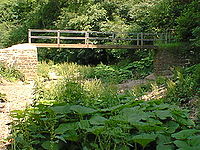
River Manifold
Encyclopedia
River
A river is a natural watercourse, usually freshwater, flowing towards an ocean, a lake, a sea, or another river. In a few cases, a river simply flows into the ground or dries up completely before reaching another body of water. Small rivers may also be called by several other names, including...
in Staffordshire
Staffordshire
Staffordshire is a landlocked county in the West Midlands region of England. For Eurostat purposes, the county is a NUTS 3 region and is one of four counties or unitary districts that comprise the "Shropshire and Staffordshire" NUTS 2 region. Part of the National Forest lies within its borders...
, England. It is a tributary
Tributary
A tributary or affluent is a stream or river that flows into a main stem river or a lake. A tributary does not flow directly into a sea or ocean...
of the River Dove
River Dove, Derbyshire
The River Dove is the principal river of the southwestern Peak District, in the Midlands of England and is around in length. It rises on Axe Edge Moor near Buxton and flows generally south to its confluence with the River Trent at Newton Solney. From there, its waters reach the North Sea via the...
(which also flows through the Peak District
Peak District
The Peak District is an upland area in central and northern England, lying mainly in northern Derbyshire, but also covering parts of Cheshire, Greater Manchester, Staffordshire, and South and West Yorkshire....
forming the boundary between Derbyshire
Derbyshire
Derbyshire is a county in the East Midlands of England. A substantial portion of the Peak District National Park lies within Derbyshire. The northern part of Derbyshire overlaps with the Pennines, a famous chain of hills and mountains. The county contains within its boundary of approx...
and Staffordshire
Staffordshire
Staffordshire is a landlocked county in the West Midlands region of England. For Eurostat purposes, the county is a NUTS 3 region and is one of four counties or unitary districts that comprise the "Shropshire and Staffordshire" NUTS 2 region. Part of the National Forest lies within its borders...
).
The Manifold rises just south of Buxton
Buxton
Buxton is a spa town in Derbyshire, England. It has the highest elevation of any market town in England. Located close to the county boundary with Cheshire to the west and Staffordshire to the south, Buxton is described as "the gateway to the Peak District National Park"...
near Axe Edge, at the northern edge of the White Peak
White Peak
The White Peak is the lower, southern part of the Peak District in England. In contrast to the Dark Peak, the underlying limestone is not capped by impervious millstone grit, so caves and dry river valleys are common features of the area...
of the Peak District National Park, known for its limestone
Limestone
Limestone is a sedimentary rock composed largely of the minerals calcite and aragonite, which are different crystal forms of calcium carbonate . Many limestones are composed from skeletal fragments of marine organisms such as coral or foraminifera....
beds. It continues for 12 miles before it joins the Dove. For part of its course, it runs underground, (except when in spate), from Wetton Mill to Ilam
Ilam, Staffordshire
Ilam is a village in the Staffordshire Peak District, lying on the River Manifold. This article describes some of the main features of the village and surroundings.- Ilam village :...
. During this section it is joined by its major tributary, the River Hamps
River Hamps
The River Hamps is a river in Staffordshire, England. It is tributary of the River Manifold, which itself flows into the River Dove near Ilam. For its entire length the river flows through the Peak District National Park.- Etymology :...
.
Villages on the river include Longnor
Longnor, Staffordshire
Longnor is a village in the Staffordshire Peak District, England. The settlement dates from early times, the first recorded Church building being in the Middle Ages. The village was named Longenalre in the Domesday Book. Located on a major crossroads, Longnor was a significant market town in the...
, Hulme End
Hulme End
- Introduction :Hulme End is a small hamlet in Staffordshire, England. It is located in the Peak District National Park about 10 miles north of Ashbourne...
, Waterhouses
Waterhouses, Staffordshire
Waterhouses is a village in the south of the Staffordshire Peak District.It is around 8 miles from Leek and Ashbourne, being nearly the halfway point between the two towns on the A523 road, which roughly follows the southern boundary of the Peak District National Park...
(which is actually on the River Hamps
River Hamps
The River Hamps is a river in Staffordshire, England. It is tributary of the River Manifold, which itself flows into the River Dove near Ilam. For its entire length the river flows through the Peak District National Park.- Etymology :...
), and Ilam
Ilam, Staffordshire
Ilam is a village in the Staffordshire Peak District, lying on the River Manifold. This article describes some of the main features of the village and surroundings.- Ilam village :...
.
Its name may come from Anglo-Saxon manig-fald = "many folds", referring to its meander
Meander
A meander in general is a bend in a sinuous watercourse. A meander is formed when the moving water in a stream erodes the outer banks and widens its valley. A stream of any volume may assume a meandering course, alternately eroding sediments from the outside of a bend and depositing them on the...
s.
Manifold Way
- See main article: Manifold Way
The Manifold Way is the name given to an 8-mile long distance footpath from Hulme End
Hulme End
- Introduction :Hulme End is a small hamlet in Staffordshire, England. It is located in the Peak District National Park about 10 miles north of Ashbourne...
to Waterhouses
Waterhouses, Staffordshire
Waterhouses is a village in the south of the Staffordshire Peak District.It is around 8 miles from Leek and Ashbourne, being nearly the halfway point between the two towns on the A523 road, which roughly follows the southern boundary of the Peak District National Park...
, along the former route of the narrow gauge (2' 6") Leek and Manifold Valley Light Railway
Leek and Manifold Valley Light Railway
The Leek and Manifold Valley Light Railway was a narrow gauge railway in Staffordshire, Great Britain that operated between 1904 and 1934. When in operation, the line mainly carried milk from dairies in the region, acting as a feeder to the standard gauge system. It also provided passenger...
which operated between 1904 and 1934. Opened in July 1937 after the LMS handed over the trackbed to Staffordshire County Council, it is tarmacked throughout.
The Manifold Valley Visitor Centre is housed in Hulme End Station which also has a model of the railway.
Limestone crags and caves
The limestone cliffs which fringe the valley contain several rock-climbing areas, and named rock features, including Thor's CaveThor's Cave
Thor's Cave is a natural cavern located at in the Manifold Valley of the White Peak in Staffordshire, England. It is classified as a Karst cave...
and Beeston Tor which overlooks the confluence with the River Hamps
River Hamps
The River Hamps is a river in Staffordshire, England. It is tributary of the River Manifold, which itself flows into the River Dove near Ilam. For its entire length the river flows through the Peak District National Park.- Etymology :...
.
Mining in the Manifold Valley
The Manifold Valley was famous for the mining of copper and lead, and the Mines at EctonEcton, Staffordshire
For the village and civil parish in Northamptonshire, see EctonEcton is a hamlet in the Staffordshire Peak District . It is on the Manifold Way, an 8 mile walk- and cycle-path which follows the line of the former Leek and Manifold Valley Light Railway....
were some of the richest in the Country. The discovery of Stone Age
Stone Age
The Stone Age is a broad prehistoric period, lasting about 2.5 million years , during which humans and their predecessor species in the genus Homo, as well as the earlier partly contemporary genera Australopithecus and Paranthropus, widely used exclusively stone as their hard material in the...
implements in some of the caves imply that minerals were mined around the Manifold Valley thousands of years ago.
Nowadays there is little trace of the Industry that made many people (mainly the Duke of Devonshire
Duke of Devonshire
Duke of Devonshire is a title in the peerage of England held by members of the Cavendish family. This branch of the Cavendish family has been one of the richest and most influential aristocratic families in England since the 16th century, and have been rivalled in political influence perhaps only...
who at one time owned the Ecton mines) very rich. The main areas of interest are around Ecton where the old spoil banks and the old engine house still remain.