

River Ouzel
Encyclopedia
River
A river is a natural watercourse, usually freshwater, flowing towards an ocean, a lake, a sea, or another river. In a few cases, a river simply flows into the ground or dries up completely before reaching another body of water. Small rivers may also be called by several other names, including...
in England, and a tributary
Tributary
A tributary or affluent is a stream or river that flows into a main stem river or a lake. A tributary does not flow directly into a sea or ocean...
of the River Great Ouse
River Great Ouse
The Great Ouse is a river in the east of England. At long, it is the fourth-longest river in the United Kingdom. The river has been important for navigation, and for draining the low-lying region through which it flows. Its course has been modified several times, with the first recorded being in...
. It rises in the Chiltern Hills
Chiltern Hills
The Chiltern Hills form a chalk escarpment in South East England. They are known locally as "the Chilterns". A large portion of the hills was designated officially as an Area of Outstanding Natural Beauty in 1965.-Location:...
and flows 20 miles north to join the Ouse at Newport Pagnell
Newport Pagnell
Newport Pagnell is a town in the Borough of Milton Keynes , England. It is separated by the M1 motorway from Milton Keynes itself, though part of the same urban area...
.
It is usually called the River Ouzel, except near Newport Pagnell where both names are used. The name Lovat was recorded (in the form "Lovente") in the thirteenth century, a map of 1724 marks the river as "Lowsel R", and a map surveyed in 1765 shows it as "Ouzel River". The modern Ordnance Survey
Ordnance Survey
Ordnance Survey , an executive agency and non-ministerial government department of the Government of the United Kingdom, is the national mapping agency for Great Britain, producing maps of Great Britain , and one of the world's largest producers of maps.The name reflects its creation together with...
uses only the name Ouzel, except north of Willen Lake where it is marked as "River Ouzel or Lovat".
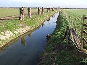
Course
From springsSpring (hydrosphere)
A spring—also known as a rising or resurgence—is a component of the hydrosphere. Specifically, it is any natural situation where water flows to the surface of the earth from underground...
just north of Dagnall
Dagnall
Dagnall is a village in the parish of Edlesborough, in Buckinghamshire, England.The place name is derived from the Old English for "Daegga's Knoll". In manorial rolls of 1196 it was listed as Dagenhale....
, the river initially forms the boundary between Bedfordshire
Bedfordshire
Bedfordshire is a ceremonial county of historic origin in England that forms part of the East of England region.It borders Cambridgeshire to the north-east, Northamptonshire to the north, Buckinghamshire to the west and Hertfordshire to the south-east....
and Buckinghamshire
Buckinghamshire
Buckinghamshire is a ceremonial and non-metropolitan home county in South East England. The county town is Aylesbury, the largest town in the ceremonial county is Milton Keynes and largest town in the non-metropolitan county is High Wycombe....
. It is joined by the Ouzel Brook from Houghton Regis
Houghton Regis
Houghton Regis is a town and civil parish sandwiched between the major towns of Luton to the east and Dunstable to the west. The parish includes the ancient hamlets of Bidwell, Thorn and Sewell...
, and by Whistle Brook (also known at Ivinghoe
Ivinghoe
Ivinghoe is a village and civil parish within Aylesbury Vale district in Buckinghamshire, England, close to the border with Hertfordshire and Bedfordshire. It is four miles north of Tring and six miles south of Leighton Buzzard, close to the village of Pitstone.The village name is Anglo-Saxon in...
as Whizzle Brook) from Pitstone
Pitstone
Pitstone is a village and civil parish within the Aylesbury Vale district of Buckinghamshire, England. It is located at the foot of the Chiltern Hills, about seven miles east of Aylesbury and six miles south of Leighton Buzzard...
. Near Grove Lock, just south of Leighton Buzzard
Leighton Buzzard
-Lower schools:*Beaudesert Lower School - Apennine Way*Clipstone Brook Lower School - Brooklands Drive*Greenleas Lower School - Derwent Road*Dovery Down Lower School - Heath Road*Heathwood Lower School - Heath Road*Leedon Lower School - Highfield Road...
, it was once joined by Ledburn Brook, which has since been diverted into the Grand Junction Canal
Grand Junction Canal
The Grand Junction Canal is a canal in England from Braunston in Northamptonshire to the River Thames at Brentford, with a number of branches. The mainline was built between 1793 and 1805, to improve the route from the Midlands to London, by-passing the upper reaches of the River Thames near Oxford...
(now the Grand Union Canal
Grand Union Canal
The Grand Union Canal in England is part of the British canal system. Its main line connects London and Birmingham, stretching for 137 miles with 166 locks...
). At Leighton Buzzard, the river is joined by Clipstone Brook from Milton Bryan
Milton Bryan
Milton Bryan is a village and civil parish located in Central Bedfordshire. It lies just off the A4012 road, near to its junction with the A5 at Hockliffe. The nearest large town to Milton Bryan is Leighton Buzzard, very closely followed by Dunstable...
via Hockliffe
Hockliffe
Hockliffe is a village and civil parish in Bedfordshire on the crossroads of the A5 road which lies upon the course of the roman road known as Watling Street and the A4012 road.It is about four miles east of Leighton Buzzard...
and Clipstone
Clipstone, Bedfordshire
Clipstone is a small hamlet in Bedfordshire, England. It lies within the parish of Eggington that borders with Leighton Buzzard, Heath and Reach and Hockliffe...
, and to the north of the town the excess water from the canal is released into the river at the Twelve Arches. The river then flows through Milton Keynes
Milton Keynes
Milton Keynes , sometimes abbreviated MK, is a large town in Buckinghamshire, in the south east of England, about north-west of London. It is the administrative centre of the Borough of Milton Keynes...
, where it is joined by Water Eaton Brook, and as it exits the town it is joined by Crawley Brook from Husborne Crawley. Finally, the river flows through Newport Pagnell to its junction with the Great Ouse.