
River Thurne
Encyclopedia
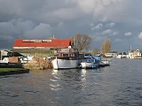
The River Thurne is a river
in Norfolk, England in The Broads
. Just six miles (10 km) long it rises two miles (3 km) from the coast near Martham Broad
and is navigable from West Somerton. It flows southwest and is linked by Candle Dyke and Heigham Sound to both Horsey Mere
and Hickling Broad
. It continues southwest and flows through Potter Heigham
(passing under its medieval bridge) and enters the River Bure
just south of Thurne
dyke, near St. Benet's Abbey
.
Above Potter Heigham, the river is joined by Candle Dyke, which connects to Heigham Sound, from which White Slea Mere leads on to Hickling Broad, where there are moorings. Both Heigham Sound and Hickling Broad are quite shallow, and the navigation channels are clearly marked. Hickling Broad is also a National Nature Reserve. From Heigham Sound, Meadow Dyke leads northwards to Horsey Mere, most of which is a National Trust nature reserve. The National Trust also own Horsey Drainage Mill. Beyond Horsey Mere lies Waxham New Cut, along which boats up to 30 feet (9.1 m) long can travel for about 1.5 miles (2.4 km) to Lound Bridge. The sea is less than 1 miles (1.6 km) from the bridge at this point, although it is 26 miles (41.8 km) away by boat.
The main river is navigable almost to its source. The channel passes between the parts of Martham Broad, which is a nature reserve owned by the Norfolk Wildlife Trust, to reach West Somerton staithes. The staithes are at the end of a dyke cut from Martham Broad to the village.
Below Potter Heigham, Womack Water is navigable to Ludham, about 1 miles (1.6 km) from the main channel, but is only 4 feet (1.2 m) deep. Navigation is restricted to boats under 46 feet (14 m) in length. Thurne Dyke, a little further below that, is only 3 foot (0.9144 m) deep and can be navigated for 170 yards (155.4 m) to the village of Thurne.
The only other place at which vehicles can cross the navigable channel is at Martham
Ferry, where a nineteenth century bridge was replaced in the early 1920s by a floating swing bridge. The deck rests on two semi-circular steel buoyancy tanks, and there are concrete abutments on both sides of the river. The bridge pivots on a post at the south side of the river, and is connected by a chain to a winch on the north bank. The structure is grade II listed, and provides access for farm vehicles from Ferrygate Lane to Heigham Holmes, a national nature reserve
managed by the National Trust
, which is surrounded by water on all sides, and is normally only open to visitors on one day each year. The deck is lowered onto the concrete abutments when in position by pumping water into the buoyancy tanks, and pumping it out again before the bridge can be opened for naviagation. The National Trust are looking to replace the bridge, due to the slow and cumbersome nature of its operation. An engineering survey suggested that a conventional swing bridge
or bascule bridge
could not easily be installed at the site, and so a replacement of a similar design, but incorporating powered operation is the preferred option.
There are nine drainage mills situated along the banks of the river. Brograve Mill on the Waxham New Cut is an early nineteenth century, three-storey brick mill, which is derelict but retained parts of its sails and most of its internal machinery in 2003. West Somerton Mill was built in 1900 by Dan England, from the millwrights England's of Ludham
, and is in better condition. Although it has no sails, its internal turbine pump and some of the other machinery are still extant. Horsey Mill is a four-storey structure which pumped water into Horsey Mere, and is owned by the National Trust. It was built in the mid-nineteenth century, and was modified in 1897 and again in 1912, when the work was carried out by Dan England. It originally powered a scoop wheel
to raise the water into the mere, but this was replaced by a pumping engine in an outbuilding at the foot of the tower. It ceased to operate in 1943 after being struck by lightning, and was acquired by the National Trust five years later. It was restored in 1961, the work being carried out by the Norfolk Windmills Trust. Its fantail was destroyed during a gale in 1987, and during further restoration, which was completed in 2004, new sails were fitted, but with no shutters or the spider mechanism which operates them. Heigham Holmes Mill is a mid-nineteenth century four-storey brick tower which retains most of its machinery. It is grade II* listed. Like West Somerton, Martham Mill was also built by Dan England, but consists of four storeys and was completed in 1908. It drove a turbine pump, and has now been converted into a residence, as has High's Mill, another four-storey brick tower mill built in the mid-nineteenth century. The next mill downstream is the derelict Repp's Drainage Mill below Potter Heigham.
Thurne Dyke windpump was built in 1820 as a two-storey mill, but a third storey was added in the middle of the nineteenth century. Its cap was blown off during a gale in 1919, and a steam turbine was installed in 1926. It ceased to operate in 1936, and gradually became derelict until it was bought by Bob Morse in 1949, after he moved to Norfolk. He started to restore it with help from Albert England, a descendant of the original builders. Further work was done by the millwrights Thomas Smithdale and Sons of Acle in 1962, and Morse was assisted by the Norfolk Mills Trust from 1975, who funded the fitting of some of the shutters to the sails in 2002, enabling the mill to turn under wind power again. It still contains its internal machinery, which drove an external turbine, housed in an iron casing, and it is grade II* listed. Morse went on to form Morse's Wind Engine Park, a museum devoted to wind pumps from around the world, before he died in 2007. The final mill on the river is at St Benet's Level. It is again grade II* listed, and is a four-storey mill built in the late eighteenth century. It was restored in 1976, when the bevel gears had to be replaced, but all other machinery and the external turbine are intact.
River
A river is a natural watercourse, usually freshwater, flowing towards an ocean, a lake, a sea, or another river. In a few cases, a river simply flows into the ground or dries up completely before reaching another body of water. Small rivers may also be called by several other names, including...
in Norfolk, England in The Broads
The Broads
The Broads are a network of mostly navigable rivers and lakes in the English counties of Norfolk and Suffolk. The Broads, and some surrounding land were constituted as a special area with a level of protection similar to a UK National Park by The Norfolk and Suffolk Broads Act of 1988...
. Just six miles (10 km) long it rises two miles (3 km) from the coast near Martham Broad
Martham Broad
Martham Broad is a broad and National Nature Reserve on the River Thurne in the English county of Norfolk. The broad is located within The Broads National Park about 2 km north of the village of Martham....
and is navigable from West Somerton. It flows southwest and is linked by Candle Dyke and Heigham Sound to both Horsey Mere
Horsey Mere
Horsey Mere is one of the Norfolk Broads in the east of England; it is one of the more northerly broads close to the North Sea coast.It is reached by Hickling Broad and the River Thurne. The nearest settlements are Horsey and West Somerton....
and Hickling Broad
Hickling Broad
Hickling Broad lies within The Broads National Park in Norfolk, England,. 4 km south-east of Stalham.It is a National Nature Reserve established by English Nature and in the care of the Norfolk Wildlife Trust, who run boat trips around the reserve for visitors. It is also part of the Upper...
. It continues southwest and flows through Potter Heigham
Potter Heigham
Potter Heigham is a village and civil parish on the River Thurne in the English county of Norfolk. It is situated some north-east of the city of Norwich on the A149 road, and on The Broads....
(passing under its medieval bridge) and enters the River Bure
River Bure
The River Bure is a river in the county of Norfolk, England, most of it in The Broads. The Bure rises near Melton Constable, upstream of Aylsham, which was the original head of navigation. Nowadays, the head of navigation is downstream at Coltishall Bridge...
just south of Thurne
Thurne
Thurne is a small village and civil parish in the English county of Norfolk. It is located on the River Thurne in The Broads, some west of the town of Great Yarmouth and east of the city of Norwich....
dyke, near St. Benet's Abbey
St. Benet's Abbey
St Benet's Abbey is a ruined abbey of the Order of Saint Benedict situated on the River Bure within The Broads in Norfolk England. It is also known as St Benet's at Holme or Hulme.-Background:...
.
Navigation
Much of the River Thurne system is navigable, but there are a number of restrictions to the size of boats that can use it. The most famous is the medieval bridge at Potter Heigham. Most road traffic now uses the A149 Bypass, slightly to the north, but the narrow central arch restricts passage to boats needing headroom of less than 6.6 feet (2 m), and is the lowest bridge on the Broads. In addition, the river is still tidal here, and although the rise and fall is only about 6 inches (15.2 cm), currents through the bridge are quite strong. It is a requirement that all hire craft take on a pilot before they pass under the bridge.Above Potter Heigham, the river is joined by Candle Dyke, which connects to Heigham Sound, from which White Slea Mere leads on to Hickling Broad, where there are moorings. Both Heigham Sound and Hickling Broad are quite shallow, and the navigation channels are clearly marked. Hickling Broad is also a National Nature Reserve. From Heigham Sound, Meadow Dyke leads northwards to Horsey Mere, most of which is a National Trust nature reserve. The National Trust also own Horsey Drainage Mill. Beyond Horsey Mere lies Waxham New Cut, along which boats up to 30 feet (9.1 m) long can travel for about 1.5 miles (2.4 km) to Lound Bridge. The sea is less than 1 miles (1.6 km) from the bridge at this point, although it is 26 miles (41.8 km) away by boat.
The main river is navigable almost to its source. The channel passes between the parts of Martham Broad, which is a nature reserve owned by the Norfolk Wildlife Trust, to reach West Somerton staithes. The staithes are at the end of a dyke cut from Martham Broad to the village.
Below Potter Heigham, Womack Water is navigable to Ludham, about 1 miles (1.6 km) from the main channel, but is only 4 feet (1.2 m) deep. Navigation is restricted to boats under 46 feet (14 m) in length. Thurne Dyke, a little further below that, is only 3 foot (0.9144 m) deep and can be navigated for 170 yards (155.4 m) to the village of Thurne.
Structures
Potter Heigham bridge is one of the most well-known structures on the Broads. It consists of three arches, two triangular ones built in the fourteenth century, and a central circular arch built when the bridge was altered in the fifteenth century. The brick parapets date from the late eighteenth century. The bridge is a grade II listed structure, and is also a scheduled ancient monument. Just to the north of it is the A149 Potter Heigham Bypass bridge, which now carries most of the traffic which formerly used the medieval bridge, and provides a navigable headroom of 7 in 7 in (2.31 m).The only other place at which vehicles can cross the navigable channel is at Martham
Martham
Martham is a village and civil parish in the English county of Norfolk and within the Broads National Park. It is situated some north-west of the town of Great Yarmouth and north-east of the city of Norwich....
Ferry, where a nineteenth century bridge was replaced in the early 1920s by a floating swing bridge. The deck rests on two semi-circular steel buoyancy tanks, and there are concrete abutments on both sides of the river. The bridge pivots on a post at the south side of the river, and is connected by a chain to a winch on the north bank. The structure is grade II listed, and provides access for farm vehicles from Ferrygate Lane to Heigham Holmes, a national nature reserve
National Nature Reserves in England
National Nature Reserves in England are managed by Natural England and are key places for wildlife and natural features in England. They were established to protect the most important areas of habitat and of geological formations...
managed by the National Trust
National Trust for Places of Historic Interest or Natural Beauty
The National Trust for Places of Historic Interest or Natural Beauty, usually known as the National Trust, is a conservation organisation in England, Wales and Northern Ireland...
, which is surrounded by water on all sides, and is normally only open to visitors on one day each year. The deck is lowered onto the concrete abutments when in position by pumping water into the buoyancy tanks, and pumping it out again before the bridge can be opened for naviagation. The National Trust are looking to replace the bridge, due to the slow and cumbersome nature of its operation. An engineering survey suggested that a conventional swing bridge
Swing bridge
A swing bridge is a movable bridge that has as its primary structural support a vertical locating pin and support ring, usually at or near to its centre of gravity, about which the turning span can then pivot horizontally as shown in the animated illustration to the right...
or bascule bridge
Bascule bridge
A bascule bridge is a moveable bridge with a counterweight that continuously balances the span, or "leaf," throughout the entire upward swing in providing clearance for boat traffic....
could not easily be installed at the site, and so a replacement of a similar design, but incorporating powered operation is the preferred option.
There are nine drainage mills situated along the banks of the river. Brograve Mill on the Waxham New Cut is an early nineteenth century, three-storey brick mill, which is derelict but retained parts of its sails and most of its internal machinery in 2003. West Somerton Mill was built in 1900 by Dan England, from the millwrights England's of Ludham
Ludham
Ludham is a village and civil parish in the English county of Norfolk, in The Broads, at the end of a dyke leading to Womack Water and flowing into the River Thurne...
, and is in better condition. Although it has no sails, its internal turbine pump and some of the other machinery are still extant. Horsey Mill is a four-storey structure which pumped water into Horsey Mere, and is owned by the National Trust. It was built in the mid-nineteenth century, and was modified in 1897 and again in 1912, when the work was carried out by Dan England. It originally powered a scoop wheel
Scoop wheel
right|thumb|Rim driven Scoop wheel of the [[Stretham Old Engine]], CambridgeshireA scoop wheel may be a pump or an excavator.-Scoop wheel pump:...
to raise the water into the mere, but this was replaced by a pumping engine in an outbuilding at the foot of the tower. It ceased to operate in 1943 after being struck by lightning, and was acquired by the National Trust five years later. It was restored in 1961, the work being carried out by the Norfolk Windmills Trust. Its fantail was destroyed during a gale in 1987, and during further restoration, which was completed in 2004, new sails were fitted, but with no shutters or the spider mechanism which operates them. Heigham Holmes Mill is a mid-nineteenth century four-storey brick tower which retains most of its machinery. It is grade II* listed. Like West Somerton, Martham Mill was also built by Dan England, but consists of four storeys and was completed in 1908. It drove a turbine pump, and has now been converted into a residence, as has High's Mill, another four-storey brick tower mill built in the mid-nineteenth century. The next mill downstream is the derelict Repp's Drainage Mill below Potter Heigham.
Thurne Dyke windpump was built in 1820 as a two-storey mill, but a third storey was added in the middle of the nineteenth century. Its cap was blown off during a gale in 1919, and a steam turbine was installed in 1926. It ceased to operate in 1936, and gradually became derelict until it was bought by Bob Morse in 1949, after he moved to Norfolk. He started to restore it with help from Albert England, a descendant of the original builders. Further work was done by the millwrights Thomas Smithdale and Sons of Acle in 1962, and Morse was assisted by the Norfolk Mills Trust from 1975, who funded the fitting of some of the shutters to the sails in 2002, enabling the mill to turn under wind power again. It still contains its internal machinery, which drove an external turbine, housed in an iron casing, and it is grade II* listed. Morse went on to form Morse's Wind Engine Park, a museum devoted to wind pumps from around the world, before he died in 2007. The final mill on the river is at St Benet's Level. It is again grade II* listed, and is a four-storey mill built in the late eighteenth century. It was restored in 1976, when the bevel gears had to be replaced, but all other machinery and the external turbine are intact.