River Dove, Derbyshire
Encyclopedia
The River Dove is the principal river of the southwestern Peak District
, in the Midlands of England
and is around 72 kilometres (45 mi) in length. It rises on Axe Edge Moor
near Buxton
and flows generally south to its confluence
with the River Trent
at Newton Solney. From there, its waters reach the North Sea
via the Humber Estuary
. For most of its way it forms the boundary between the counties of Staffordshire
(to the west) and Derbyshire
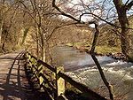
(to the east). The river meanders past Longnor
and Hartington
and cuts through a set of stunning limestone
gorges, Beresford Dale, Wolfscote Dale, Milldale and Dovedale.
The river is a famous trout
stream. Charles Cotton
's Fishing House, which was the inspiration for Izaak Walton
's The Compleat Angler, stands in the woods by the river near Hartington.

From Hartington
to its confluence with the River Manifold
at Ilam
, the river flows through a series of scenic limestone
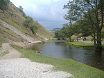
valleys, known collectively as Dovedale. Dovedale is also particularly used for the name of that section between the stepping stones under Thorpe Cloud
and Milldale. The Dovedale
gorge is considered so scenic that it attracts a million visitors a year. Good riverside paths make the whole route accessible to walkers.
 Much of the dale is in the ownership of the National Trust
, being part of their South Peak Estate
. Dovedale itself was acquired in 1934, with successive properties being added until 1938, and Wolfscote Dale in 1948. Dovedale was declared a National Nature Reserve
in 2006.
Dovedale's attractions include rock pillars such as Ilam Rock, Viator's Bridge, and the limestone carvings Lovers' Leap and Reynard's Cave.
Peak District
The Peak District is an upland area in central and northern England, lying mainly in northern Derbyshire, but also covering parts of Cheshire, Greater Manchester, Staffordshire, and South and West Yorkshire....
, in the Midlands of England
England
England is a country that is part of the United Kingdom. It shares land borders with Scotland to the north and Wales to the west; the Irish Sea is to the north west, the Celtic Sea to the south west, with the North Sea to the east and the English Channel to the south separating it from continental...
and is around 72 kilometres (45 mi) in length. It rises on Axe Edge Moor
Axe Edge Moor
Axe Edge Moor is the major moorland west of Buxton in the Peak District. It is mainly gritstone . Its highest point is at . This is slightly lower than Shining Tor .The moor is the source of the River Dove, River Manifold, River Dane, River Wye and River Goyt...
near Buxton
Buxton
Buxton is a spa town in Derbyshire, England. It has the highest elevation of any market town in England. Located close to the county boundary with Cheshire to the west and Staffordshire to the south, Buxton is described as "the gateway to the Peak District National Park"...
and flows generally south to its confluence
Confluence
Confluence, in geography, describes the meeting of two or more bodies of water.Confluence may also refer to:* Confluence , a property of term rewriting systems...
with the River Trent
River Trent
The River Trent is one of the major rivers of England. Its source is in Staffordshire on the southern edge of Biddulph Moor. It flows through the Midlands until it joins the River Ouse at Trent Falls to form the Humber Estuary, which empties into the North Sea below Hull and Immingham.The Trent...
at Newton Solney. From there, its waters reach the North Sea
North Sea
In the southwest, beyond the Straits of Dover, the North Sea becomes the English Channel connecting to the Atlantic Ocean. In the east, it connects to the Baltic Sea via the Skagerrak and Kattegat, narrow straits that separate Denmark from Norway and Sweden respectively...
via the Humber Estuary
Humber
The Humber is a large tidal estuary on the east coast of Northern England. It is formed at Trent Falls, Faxfleet, by the confluence of the tidal River Ouse and the tidal River Trent. From here to the North Sea, it forms part of the boundary between the East Riding of Yorkshire on the north bank...
. For most of its way it forms the boundary between the counties of Staffordshire
Staffordshire
Staffordshire is a landlocked county in the West Midlands region of England. For Eurostat purposes, the county is a NUTS 3 region and is one of four counties or unitary districts that comprise the "Shropshire and Staffordshire" NUTS 2 region. Part of the National Forest lies within its borders...
(to the west) and Derbyshire
Derbyshire
Derbyshire is a county in the East Midlands of England. A substantial portion of the Peak District National Park lies within Derbyshire. The northern part of Derbyshire overlaps with the Pennines, a famous chain of hills and mountains. The county contains within its boundary of approx...
(to the east). The river meanders past Longnor
Longnor, Staffordshire
Longnor is a village in the Staffordshire Peak District, England. The settlement dates from early times, the first recorded Church building being in the Middle Ages. The village was named Longenalre in the Domesday Book. Located on a major crossroads, Longnor was a significant market town in the...
and Hartington
Hartington
Hartington is a village in the Derbyshire Peak District, England, lying on the River Dove close to the Staffordshire border. According to the 2001 census, the parish of Hartington Town Quarter, which also includes Pilsbury, had a population of 345...
and cuts through a set of stunning limestone
Limestone
Limestone is a sedimentary rock composed largely of the minerals calcite and aragonite, which are different crystal forms of calcium carbonate . Many limestones are composed from skeletal fragments of marine organisms such as coral or foraminifera....
gorges, Beresford Dale, Wolfscote Dale, Milldale and Dovedale.
The river is a famous trout
Trout
Trout is the name for a number of species of freshwater and saltwater fish belonging to the Salmoninae subfamily of the family Salmonidae. Salmon belong to the same family as trout. Most salmon species spend almost all their lives in salt water...
stream. Charles Cotton
Charles Cotton
Charles Cotton was an English poet and writer, best known for translating the work of Michel de Montaigne from the French, for his contributions to The Compleat Angler, and for the highly influential The Compleat Gamester which has been attributed to him.-Early life:He was born at Beresford Hall...
's Fishing House, which was the inspiration for Izaak Walton
Izaak Walton
Izaak Walton was an English writer. Best known as the author of The Compleat Angler, he also wrote a number of short biographies which have been collected under the title of Walton's Lives.-Biography:...
's The Compleat Angler, stands in the woods by the river near Hartington.
Dovedale

From Hartington
Hartington
Hartington is a village in the Derbyshire Peak District, England, lying on the River Dove close to the Staffordshire border. According to the 2001 census, the parish of Hartington Town Quarter, which also includes Pilsbury, had a population of 345...
to its confluence with the River Manifold
River Manifold
The River Manifold is a river in Staffordshire, England. It is a tributary of the River Dove ....
at Ilam
Ilam, Staffordshire
Ilam is a village in the Staffordshire Peak District, lying on the River Manifold. This article describes some of the main features of the village and surroundings.- Ilam village :...
, the river flows through a series of scenic limestone
Limestone
Limestone is a sedimentary rock composed largely of the minerals calcite and aragonite, which are different crystal forms of calcium carbonate . Many limestones are composed from skeletal fragments of marine organisms such as coral or foraminifera....
valleys, known collectively as Dovedale. Dovedale is also particularly used for the name of that section between the stepping stones under Thorpe Cloud
Thorpe Cloud
Thorpe Cloud is an isolated limestone hill lying between the villages of Thorpe and Ilam at the southern end of Dovedale. It is a popular hill amongst the many day-trippers who visit the area, and provides a fine viewpoint north up the dale and south across the Midland plain.Like much of the dale,...
and Milldale. The Dovedale
Dovedale
Dovedale is a popular dale in the Peak District, England. It is owned by the National Trust, and annually attracts a million visitors. The valley is cut by the River Dove and runs for just over between Milldale in the north and a wooded ravine near Thorpe Cloud and Bunster Hill in the south...
gorge is considered so scenic that it attracts a million visitors a year. Good riverside paths make the whole route accessible to walkers.

National Trust for Places of Historic Interest or Natural Beauty
The National Trust for Places of Historic Interest or Natural Beauty, usually known as the National Trust, is a conservation organisation in England, Wales and Northern Ireland...
, being part of their South Peak Estate
South Peak Estate
The South Peak Estate of the National Trust comprises several land holdings in the Southern Peak District. Some of these, like Shining Cliff Wood and Alport Height, are just outside the National Park boundary...
. Dovedale itself was acquired in 1934, with successive properties being added until 1938, and Wolfscote Dale in 1948. Dovedale was declared a National Nature Reserve
National Nature Reserve
For details of National nature reserves in the United Kingdom see:*National Nature Reserves in England*National Nature Reserves in Northern Ireland*National Nature Reserves in Scotland*National Nature Reserves in Wales...
in 2006.
Dovedale's attractions include rock pillars such as Ilam Rock, Viator's Bridge, and the limestone carvings Lovers' Leap and Reynard's Cave.
See also
- Rivers of the United Kingdom
- List of rivers of England

