
Wateringbury Stream
Encyclopedia
The Wateringbury stream rises at Swanton, West Peckham
West Peckham
West Peckham is a village in the local government district of Tonbridge and Malling in Kent, England. The River Bourne flows through the extreme west of the parish, and formerly powered a paper mill and corn mill . The Wateringbury Stream rises in the parish...
parish, flows south east towards Mereworth
Mereworth
Mereworth is a village near the town of Maidstone in Kent, England. The Wateringbury Stream flows through the village and powered a watermill, the site of which now lies within the grounds of Mereworth Castle.-History:...
and then flows in a generally easterly direction to join the River Medway
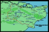
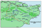
River Medway
The River Medway, which is almost entirely in Kent, England, flows for from just inside the West Sussex border to the point where it enters the Thames Estuary....
at Wateringbury
Wateringbury
Wateringbury is a village near the town of Maidstone in Kent, England. The Wateringbury Stream flows into the River Medway just above Bow Bridge. It formerly powered three watermills in the village, one of which survives. Wateringbury railway station is on the Medway Valley Line.- Demography :As...
. It is some four miles (6 km) long and powered a number of watermills.
Mereworth Mill.
TQ 673 535 51.256008°N 0.398537°WThe Domesday Book records two mills, value 10/-, at Marovrde (Mereworth). The site of the last mill now lies in the grounds of Mereworth Castle
Mereworth Castle
Mereworth Castle is a grade I listed Palladian country house in Mereworth, Kent, England.Originally the site of a fortified manor licensed in 1332, the present building is not actually a castle, but was built in the 1720s as an almost exact copy of Palladio's Villa Rotunda. It was designed in 1723...
. In 1460, it was held by Thomas Hunte. In 1521 it was a fulling
Fulling
Fulling or tucking or walking is a step in woolen clothmaking which involves the cleansing of cloth to eliminate oils, dirt, and other impurities, and making it thicker. The worker who does the job is a fuller, tucker, or walker...
mill, belonging to Sir Thomas Nevyle. In 1772 James Pound was the occupant, followed by his widow in March 1780 and John Pound in September 1780. He was at the mill until October 1791. Thomas Edmead was at the mill from 1792-1827. The mill was purchased by Viscount Falmouth c.1856. The mill was demolished by 1907 and the site is today marked by a waterfall at the eastern end of the lakes in the grounds of Mereworth Castle. The head would have been some 8 feet (2.44 m) or 10 feet (3.05 m), suggesting a high breast shot or overshot waterwheel.
Mill at Wateringbury
The Domesday BookDomesday Book
Domesday Book , now held at The National Archives, Kew, Richmond upon Thames in South West London, is the record of the great survey of much of England and parts of Wales completed in 1086...
records three mills at Otringeberge (Wateringbury). Two mills were held by Ralf, son of Turald and valued at 3/-, a third was held by Hugh de Braibourne and worth 16d.
This mill was marked on C & G Greenwood's map of Kent, 1822. It was not mentioned in a survey of the parish carried out in 1828.
Brattle (Upper) Mill, Wateringbury
TQ 686 534 51.254726°N 0.417104°W
Water turbine
A water turbine is a rotary engine that takes energy from moving water.Water turbines were developed in the 19th century and were widely used for industrial power prior to electrical grids. Now they are mostly used for electric power generation. They harness a clean and renewable energy...
c.1910 and it was about this time the mill was last used for milling, then being used to generate electricity. Brattle Mill was sometimes known as Upper Mill. A 15 in 6 in (4.72 m) diameter by 6 feet (1.83 m) wide cast iron overshot waterwheel from Lower Mill, Polegate
Polegate
Polegate is a town and civil parish in the Wealden District of East Sussex, England, United Kingdom. It is located five miles north of the seaside resort of Eastbourne, and is part of the greater area of that town. Although once a railway settlement, its importance as such has now waned with...
, Sussex, was reconstructed at the mill in the early 1980s and the owner intended to reconstruct the machinery to return the building to a working mill. The mill originally worked three pairs of millstones.
Warden Mill, Wateringbury
TQ 690 532 51.252811°N 0.422737°WWarden Mill was a corn mill that took its name from the farm to which it belonged, Warden Farm. The first reference to this mill was in November 1822, when John Savage of Cobham leased the mill from John Selby of Marden
Marden, Kent
Marden is a village about 13 km south of Maidstone and civil parish in the Maidstone District of Kent, England. The parish is located on the flood plain of the River Beult near Maidstone. It is on the B2079 road linking the A229 Maidstone with the A21 at Flimwell. It has its own railway...
and John Fellow of Eynsford
Eynsford
Eynsford is a village and civil parish in the Sevenoaks District of Kent, England. It is located on the River Darent, south of Dartford in Kent.-The village:...
. In October 1829 James Fremlin took over the lease. Selby and Fellow(s) held the freehold of the mill until October 1838. In 1839 the area of the mill pond was given as ¾ acre
Acre
The acre is a unit of area in a number of different systems, including the imperial and U.S. customary systems. The most commonly used acres today are the international acre and, in the United States, the survey acre. The most common use of the acre is to measure tracts of land.The acre is related...
. Charles Whittaker was the owner of the mill in 1842 and by April 1845 Whittaker and Fremlin were joint owners, but by November 1847 the mill had passed back to John Selby. James Fremlin purchased a moiety of the property in October 1871. He purchased the other share in the property in December 1876. Richard Clemetson took over the mill between 1878 and 1887, followed by William James Hawes sometime between 1890 and 1895. The mill last worked in 1913 and was demolished c.1914. The head of water was some 8 feet (2.44 m). It is thought that this mill had a breast shot waterwheel.
Possible water power site
Swanton, Mereworth
TQ 646 539 51.260388°N 0.360059°WA large pond high in the Swanton valley may indicate the site of an old furnace mill. The head available being sufficient to power a large overshot waterwheel.
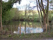
Holy Well
TQ 676 532 51.253809°N 0.374055°WThe Wateringbury Stream flows past a group of cottages in Pizien Well Road, Wateringbury. The name Pizien may be a corruption of Poison. Local superstition was that a bride would drink the water from the well to ensure fertility.
Ford

Ford (crossing)
A ford is a shallow place with good footing where a river or stream may be crossed by wading or in a vehicle. A ford is mostly a natural phenomenon, in contrast to a low water crossing, which is an artificial bridge that allows crossing a river or stream when water is low.The names of many towns...
at TQ 680 531. 51.252208°N 0.408372°W