
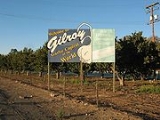
Gilroy, California
Encyclopedia
Gilroy is the southernmost city in Santa Clara County, California
, United States
. The population was 48,821 at the 2010 census. Gilroy is well-known for its garlic
crop and for the annual Gilroy Garlic Festival
, featuring various garlicky foods, including garlic ice cream
. Gilroy also produces mushroom
s in considerable quantity. Gilroy's nickname is "Garlic Capital of the World," although Gilroy does not lead the world in garlic production. While garlic is grown in Gilroy, its nickname comes from the fact that Gilroy Foods processes more garlic than any other factory in the world; most pickled, minced, and powdered garlic come from Gilroy.
Approximately eight miles northeast of Gilroy, via Gilroy Hot Springs Road, lies the famous Victorian
resort Gilroy Yamato Hot Springs
, a California Historical Landmark
. Gilroy also is home to the Gilroy Premium Outlets
, a large shopping center consisting entirely of factory outlet stores.
Long-time local landmarks include Gilroy Gardens Family Theme Park
, along California State Route 152
, just west of town, and Mount Madonna County Park, at Hecker Pass, about twelve miles west of town, off Highway 152. Another large presence is the Gilroy Foods
plant at the southeast edge of town.37°00′06"N 121°32′27"W
Cattle, garlic, and strawberries occupy areas toward Hollister
to the southeast and San Martin
to the north.
The Disney XD show Zeke & Luther is set in Gilroy.
began to arrive in the area in the 1770s, and in 1797 Mission San Juan Bautista
was established near the Pajaro River. In 1809, Ygnacio Ortega was granted the 13066 acres (52.9 km²) Spanish land concession Rancho San Ysidro
. The village of San Ysidro (not to be confused with the present-day San Diego community
) grew nearby, at the foot of Pacheco Pass
which linked the El Camino Real
and the Santa Clara Valley
with the San Joaquin Valley
. California's main export at this time was tallow
and thousands of barrels were produced and shipped to the rest of New Spain
. Trade and diplomatic intercourse with foreigners was strictly forbidden by the royal government but was quietly performed by Californios desperate for luxury goods.
During the War of 1812
, the armed merchantman Isaac Todd was sent by the North West Company
to seize Fort Astoria
, an American trading post at the mouth of the Columbia River
. The ship departed from Portsmouth, England, made its way around Cape Horn
and proceeded up the Pacific coast of the Americas, stopping at Spanish ports for supplies along the way. In January 1814, the Todd arrived at the Presidio of Monterey. During the visit, ordinary seaman John Gilroy (a Scotsman
who had changed his name from John Cameron when he went to sea to avoid recognition) either jumped ship or, depending on the historical source, was left ashore to recover from scurvy
. In any event he found his way to San Ysidro, converted to Roman Catholicism
and became the first non-Spanish settler in Alta California legally recognized by the Spanish crown. More Americans and Europeans entered the region over time, but the area remained under the control of Spain (and after 1821, independent Mexico
); Gilroy married the daughter of his employer and eventually became alcalde
of the village himself.
When the annexation of California by the United States in 1848 was followed by the
discovery of gold in the Sierra Nevada, the trickle of immigrants from the eastern states
became frequent. As many of the original Californio
landowners sold off their land, lost
it to squatters or were dispossessed through title hearings, the area around San Ysidro became known as Pleasant Valley. On March 12, 1870 it was officially incorporated by the state legislature as the town of Gilroy (John Gilroy had died in 1869). By then the town center had been relocated west of the El Camino Real (the locale of the original village is today a sparsely populated area known as Old Gilroy
). Cattle ranching and timber from the nearby Santa Cruz Mountains
were important to the economy for some time, but as in the rest of the valley agriculture was the town's greatest source of income. Farming remains significant, but in the 1970s the city began evolving into a bedroom community for Silicon Valley to the north.
 There are a number of extant historical buildings dating from the mid-19th century. Built in 1857, the Christian Church at 160 Fifth Street is the oldest wood framed church in Santa Clara County in continuous use. Blacksmith
George Eustice's house at 213 Fifth Street was constructed in 1869; Eustice was an American Civil War
veteran who fought at Gettysburg
. Samuel Moore was a long time Gilroy postmaster
, whose home was built in the 1870s at 7151 Church Street. Nearby to the northeast is the historic resort site Gilroy Yamato Hot Springs
, developed in the late 19th century.
(Bailey Avenue (37.206770, -121.729150) to Monterey/Day Road (37.038210, -121.584480)) on U.S. Route 101 and 31 km (19.3 mi) inland from the Pacific Coast. Lying in a southern extension of the Santa Clara Valley
at an elevation of about 61 m (200 ft) above MSL
, it is bounded by the Santa Cruz Mountains
to the west and the Diablo Range
to the east. According to the United States Census Bureau
, the city has a total area of 16.2 square miles (42 km²). 16.1 square miles (41.7 km²) of it is land and 0.06% is water.
Contributing to environmental noise
are primarily U.S. Route 101, El Camino Real, Leavesley Road and other major arterials. The number of people exposed to sound levels above 60 CNEL is approximately 4,000.
, Gilroy enjoys a warm, Mediterranean climate
. Temperatures range from an average midsummer maximum of 32.3°C (90.2°F) to an average midwinter low of 0.9°C (33.6°F). Average annual precipitation is 480 mm (18.9 in), and the summer months are typically dry. Snowfall is rare, about once every 20 years, and is light and short-lived when it occurs. Summer months are characterized by coastal fog which arrives from the ocean around 10 p.m. and dissipates the next morning by 10 a.m. Winter months have many sunny and partly cloudy days, with frequent breaks between rainstorms. The local terrain is inconducive to tornado
es, severe windstorms, and thunderstorms. The local climate supports chaparral
and grassland biome
s, with stands of live oak
at higher elevations.
Average January temperatures are a maximum of around 60°F and a minimum of around 40°F. Average July temperatures are a maximum of around 90°F and a minimum of around 60°F. There are an average of 33.0 days with highs of 100°F ( 37.7°C) or possible higher and an average of 18.0 days with lows of 32°F (0°C) or possible lower. The record high temperature of 115°F was on July 15, 1972. The record low temperature of 17°F was on December 22, 1990.
There are an average of 58 days with measurable precipitation. The wettest year was 1983 with 37.76 inches and the dryest year was 1977 with 11.17 inches. The most rainfall in one month was 14.64 inches in January 1914.
was 3,021.7 people per square mile (1,166.7/km²). The racial makeup of Gilroy was 28,674 (58.7%) White, 942 (1.9%) African American, 831 (1.7%) Native American, 3,448 (7.1%) Asian, 111 (0.2%) Pacific Islander, 12,322 (25.2%) from other races
, and 2,493 (5.1%) from two or more races. Hispanic or Latino of any race were 28,214 persons (57.8%).
The Census reported that 48,015 people (98.3% of the population) lived in households, 642 (1.3%) lived in non-institutionalized group quarters, and 164 (0.3%) were institutionalized.
There were 14,175 households, out of which 7,111 (50.2%) had children under the age of 18 living in them, 8,160 (57.6%) were opposite-sex married couples
living together, 2,212 (15.6%) had a female householder with no husband present, 964 (6.8%) had a male householder with no wife present. There were 996 (7.0%) unmarried opposite-sex partnerships
, and 102 (0.7%) same-sex married couples or partnerships. 2,136 households (15.1%) were made up of individuals and 908 (6.4%) had someone living alone who was 65 years of age or older. The average household size was 3.39. There were 11,336 families
(80.0% of all households); the average family size was 3.69.
The population was spread out with 14,983 people (30.7%) under the age of 18, 4,514 people (9.2%) aged 18 to 24, 14,104 people (28.9%) aged 25 to 44, 11,122 people (22.8%) aged 45 to 64, and 4,098 people (8.4%) who were 65 years of age or older. The median age was 32.4 years. For every 100 females there were 98.5 males. For every 100 females age 18 and over, there were 97.1 males.
There were 14,854 housing units at an average density of 919.4 per square mile (355.0/km²), of which 8,624 (60.8%) were owner-occupied, and 5,551 (39.2%) were occupied by renters. The homeowner vacancy rate was 1.7%; the rental vacancy rate was 4.6%. 27,798 people (56.9% of the population) lived in owner-occupied housing units and 20,217 people (41.4%) lived in rental housing units.
was 2,615.2 per square mile (1,010.1/km²). There were 12,152 housing units at an average density of 766.5 per square mile (296.0/km²). The racial makeup of the city was 58.9% White, 1.8% African American, 1.6% Native American, 4.4% Asian, 0.3% Pacific Islander, 27.7% from other races
, and 5.4% from two or more races. 53.8% of the population were Hispanic or Latino of any race.
There were 11,869 households out of which 47.7% had children under the age of 18 living with them, 60.8% were married couples
living together, 14.2% had a female householder with no husband present, and 19.2% were non-families. 14.3% of all households were made up of individuals and 5.9% had someone living alone who was 65 years of age or older. The average household size was 3.46 and the average family size was 3.74.
In the city the population was spread out with 32.6% under the age of 18, 10.0% from 18 to 24, 32.7% from 25 to 44, 18.0% from 45 to 64, and 6.8% who were 65 years of age or older. The median age was 30 years. For every 100 females there were 99.3 males. For every 100 females age 18 and over, there were 98.6 males.
The median income for a household in the city was $66,401, and the median income for a family was $80,371. Males had a median income of $45,759 versus $34,710 for females. The per capita income
for the city was $22,071. About 7.3% of families and 10.4% of the population were below the poverty line, including 12.8% of those under 18 and 6.5% of those 65 and older.
Gilroy is located in the 13th Senate
District, represented by Democrat
Elaine Alquist
, and in the 28th Assembly
District, represented by Democrat Luis Alejo
. Federally, Gilroy is located in California's 15th congressional district
, which has a Cook PVI
of D +14 and is represented by Democrat Mike Honda
.
(1905–1949)- was an American Jazz singer best known for performing with Duke Ellington
'sOrchestra from 1931-1942.
Jeff Garcia
(born 1970)- Former quarterback of the San Francisco 49ers
, Cleveland Browns
, Detroit Lions
, Philadelphia Eagles
, and Tampa Bay Buccaneers
Robert Guerrero
(born 1983)- Professional boxer, 3 time IBF champion and current WBA and WBO interim champion.
Santa Clara County, California
Santa Clara County is a county located at the southern end of the San Francisco Bay Area in the U.S. state of California. As of 2010 it had a population of 1,781,642. The county seat is San Jose. The highly urbanized Santa Clara Valley within Santa Clara County is also known as Silicon Valley...
, United States
United States
The United States of America is a federal constitutional republic comprising fifty states and a federal district...
. The population was 48,821 at the 2010 census. Gilroy is well-known for its garlic
Garlic
Allium sativum, commonly known as garlic, is a species in the onion genus, Allium. Its close relatives include the onion, shallot, leek, chive, and rakkyo. Dating back over 6,000 years, garlic is native to central Asia, and has long been a staple in the Mediterranean region, as well as a frequent...
crop and for the annual Gilroy Garlic Festival
Gilroy Garlic Festival
The Gilroy Garlic Festival is one of the largest food festivals in the United States, held annually in Gilroy, California on the last full weekend in July at Christmas Hill Park. The 2010 Garlic Festival was held from July 24-26, 2010.-Past festivals:...
, featuring various garlicky foods, including garlic ice cream
Ice cream
Ice cream is a frozen dessert usually made from dairy products, such as milk and cream, and often combined with fruits or other ingredients and flavours. Most varieties contain sugar, although some are made with other sweeteners...
. Gilroy also produces mushroom
Mushroom
A mushroom is the fleshy, spore-bearing fruiting body of a fungus, typically produced above ground on soil or on its food source. The standard for the name "mushroom" is the cultivated white button mushroom, Agaricus bisporus; hence the word "mushroom" is most often applied to those fungi that...
s in considerable quantity. Gilroy's nickname is "Garlic Capital of the World," although Gilroy does not lead the world in garlic production. While garlic is grown in Gilroy, its nickname comes from the fact that Gilroy Foods processes more garlic than any other factory in the world; most pickled, minced, and powdered garlic come from Gilroy.
Approximately eight miles northeast of Gilroy, via Gilroy Hot Springs Road, lies the famous Victorian
Victorian era
The Victorian era of British history was the period of Queen Victoria's reign from 20 June 1837 until her death on 22 January 1901. It was a long period of peace, prosperity, refined sensibilities and national self-confidence...
resort Gilroy Yamato Hot Springs
Gilroy Yamato Hot Springs
Gilroy Yamato Hot Springs, a California Historical Landmark and on the list of National Register of Historical Places, is a property near Gilroy, California famed for its mineral hot springs and historic development by early settlers and Japanese immigrants. The earliest extant Italianate–Victorian...
, a California Historical Landmark
California Historical Landmark
California Historical Landmarks are buildings, structures, sites, or places in the state of California that have been determined to have statewide historical significance by meeting at least one of the criteria listed below:...
. Gilroy also is home to the Gilroy Premium Outlets
Simon Property Group
Simon Property Group, Inc. is an American commercial real estate company, ranked #1 in the United States as the largest real estate investment trust. Simon is a fully integrated real estate company which operates from five retail real estate platforms: regional malls, Premium Outlet Centers, The...
, a large shopping center consisting entirely of factory outlet stores.
Long-time local landmarks include Gilroy Gardens Family Theme Park
Gilroy Gardens
Gilroy Gardens is a garden-themed family theme park in Gilroy, California and current location of the world-famous Circus Trees created by Axel Erlandson. It was founded by Michael and Claudia Bonfante after selling their Nob Hill Foods supermarket chain to build the park. The park was constructed...
, along California State Route 152
California State Route 152
State Route 152 is a state highway that runs near the latitudinal middle of the U.S. state of California from Watsonville to Route 99 southeast of Merced...
, just west of town, and Mount Madonna County Park, at Hecker Pass, about twelve miles west of town, off Highway 152. Another large presence is the Gilroy Foods
ConAgra Foods
ConAgra Foods, Inc. is an American packaged foods company. ConAgra's products are available in supermarkets, as well as restaurants and food service establishments. Its headquarters are located in Omaha, Nebraska...
plant at the southeast edge of town.37°00′06"N 121°32′27"W
Cattle, garlic, and strawberries occupy areas toward Hollister
Hollister, California
Hollister is a city in and the county seat of San Benito County, California, United States. The population was 34,928 at the 2010 census. Hollister is primarily an agricultural town.-History:...
to the southeast and San Martin
San Martin, California
San Martin is a census-designated place and an unincorporated town in Santa Clara County, California, United States. It takes its name from St. Martin of Tours, the patron saint of early pioneer Martin Murphy, who built the first Catholic church in the area...
to the north.
The Disney XD show Zeke & Luther is set in Gilroy.
History
Trailblazers led by Father Junípero SerraJunípero Serra
Blessed Junípero Serra, O.F.M., , known as Fra Juníper Serra in Catalan, his mother tongue was a Majorcan Franciscan friar who founded the mission chain in Alta California of the Las Californias Province in New Spain—present day California, United States. Fr...
began to arrive in the area in the 1770s, and in 1797 Mission San Juan Bautista
Mission San Juan Bautista
Mission San Juan Bautista was founded on June 24, 1797 in what is now the San Juan Bautista Historic District of San Juan Bautista, California. Barracks for the soldiers, a nunnery, the Jose Castro House, and other buildings were constructed around a large grassy plaza in front of the church and...
was established near the Pajaro River. In 1809, Ygnacio Ortega was granted the 13066 acres (52.9 km²) Spanish land concession Rancho San Ysidro
Rancho San Ysidro
Rancho San Ysidro was a Spanish land concession in present day Santa Clara County, California given in 1809 by Governor José Joaquín de Arrillaga to Ygnacio Ortega. After his death the lands were divided among his three children by Mexican Governor José Figueroa in 1833...
. The village of San Ysidro (not to be confused with the present-day San Diego community
San Ysidro, San Diego, California
San Ysidro is a community in the southern section of San Diego. It is located in the southernmost part of San Diego County, immediately north of the U.S.-Mexico border. It neighbors Otay Mesa West to the north, Otay Mesa to the east, and Nestor and the Tijuana River Valley to the west...
) grew nearby, at the foot of Pacheco Pass
Pacheco Pass
Pacheco Pass, elevation , is a mountain pass located in the Diablo Range in southeastern Santa Clara County, California. It is the main road over the hills separating the Santa Clara Valley and the Central Valley....
which linked the El Camino Real
El Camino Real (California)
El Camino Real and sometimes associated with Calle Real usually refers to the 600-mile California Mission Trail, connecting the former Alta California's 21 missions , 4 presidios, and several pueblos, stretching from Mission San Diego de Alcalá in San Diego...
and the Santa Clara Valley
Santa Clara Valley
The Santa Clara Valley is a valley just south of the San Francisco Bay in Northern California in the United States. Much of Santa Clara County and its county seat, San José, are in the Santa Clara Valley. The valley was originally known as the Valley of Heart’s Delight for its high concentration...
with the San Joaquin Valley
San Joaquin Valley
The San Joaquin Valley is the area of the Central Valley of California that lies south of the Sacramento – San Joaquin River Delta in Stockton...
. California's main export at this time was tallow
Tallow
Tallow is a rendered form of beef or mutton fat, processed from suet. It is solid at room temperature. Unlike suet, tallow can be stored for extended periods without the need for refrigeration to prevent decomposition, provided it is kept in an airtight container to prevent oxidation.In industry,...
and thousands of barrels were produced and shipped to the rest of New Spain
New Spain
New Spain, formally called the Viceroyalty of New Spain , was a viceroyalty of the Spanish colonial empire, comprising primarily territories in what was known then as 'América Septentrional' or North America. Its capital was Mexico City, formerly Tenochtitlan, capital of the Aztec Empire...
. Trade and diplomatic intercourse with foreigners was strictly forbidden by the royal government but was quietly performed by Californios desperate for luxury goods.
During the War of 1812
War of 1812
The War of 1812 was a military conflict fought between the forces of the United States of America and those of the British Empire. The Americans declared war in 1812 for several reasons, including trade restrictions because of Britain's ongoing war with France, impressment of American merchant...
, the armed merchantman Isaac Todd was sent by the North West Company
North West Company
The North West Company was a fur trading business headquartered in Montreal from 1779 to 1821. It competed with increasing success against the Hudson's Bay Company in what was to become Western Canada...
to seize Fort Astoria
Fort Astoria
Fort Astoria was the Pacific Fur Company's primary fur trading post in the Northwest, and was the first American-owned settlement on the Pacific coast. After a short two-year term of US ownership, the British owned and operated it for 33 years. It was the first British port on the Pacific coast...
, an American trading post at the mouth of the Columbia River
Columbia River
The Columbia River is the largest river in the Pacific Northwest region of North America. The river rises in the Rocky Mountains of British Columbia, Canada, flows northwest and then south into the U.S. state of Washington, then turns west to form most of the border between Washington and the state...
. The ship departed from Portsmouth, England, made its way around Cape Horn
Cape Horn
Cape Horn is the southernmost headland of the Tierra del Fuego archipelago of southern Chile, and is located on the small Hornos Island...
and proceeded up the Pacific coast of the Americas, stopping at Spanish ports for supplies along the way. In January 1814, the Todd arrived at the Presidio of Monterey. During the visit, ordinary seaman John Gilroy (a Scotsman
Scotland
Scotland is a country that is part of the United Kingdom. Occupying the northern third of the island of Great Britain, it shares a border with England to the south and is bounded by the North Sea to the east, the Atlantic Ocean to the north and west, and the North Channel and Irish Sea to the...
who had changed his name from John Cameron when he went to sea to avoid recognition) either jumped ship or, depending on the historical source, was left ashore to recover from scurvy
Scurvy
Scurvy is a disease resulting from a deficiency of vitamin C, which is required for the synthesis of collagen in humans. The chemical name for vitamin C, ascorbic acid, is derived from the Latin name of scurvy, scorbutus, which also provides the adjective scorbutic...
. In any event he found his way to San Ysidro, converted to Roman Catholicism
Roman Catholic Church
The Catholic Church, also known as the Roman Catholic Church, is the world's largest Christian church, with over a billion members. Led by the Pope, it defines its mission as spreading the gospel of Jesus Christ, administering the sacraments and exercising charity...
and became the first non-Spanish settler in Alta California legally recognized by the Spanish crown. More Americans and Europeans entered the region over time, but the area remained under the control of Spain (and after 1821, independent Mexico
Mexico
The United Mexican States , commonly known as Mexico , is a federal constitutional republic in North America. It is bordered on the north by the United States; on the south and west by the Pacific Ocean; on the southeast by Guatemala, Belize, and the Caribbean Sea; and on the east by the Gulf of...
); Gilroy married the daughter of his employer and eventually became alcalde
Alcalde
Alcalde , or Alcalde ordinario, is the traditional Spanish municipal magistrate, who had both judicial and administrative functions. An alcalde was, in the absence of a corregidor, the presiding officer of the Castilian cabildo and judge of first instance of a town...
of the village himself.
When the annexation of California by the United States in 1848 was followed by the
discovery of gold in the Sierra Nevada, the trickle of immigrants from the eastern states
became frequent. As many of the original Californio
Californio
Californio is a term used to identify a Spanish-speaking Catholic people, regardless of race, born in California before 1848...
landowners sold off their land, lost
it to squatters or were dispossessed through title hearings, the area around San Ysidro became known as Pleasant Valley. On March 12, 1870 it was officially incorporated by the state legislature as the town of Gilroy (John Gilroy had died in 1869). By then the town center had been relocated west of the El Camino Real (the locale of the original village is today a sparsely populated area known as Old Gilroy
Old Gilroy, California
Old Gilroy is an unincorporated community in Santa Clara County, California. It was the original townsite of Gilroy, California, which is now located nearby....
). Cattle ranching and timber from the nearby Santa Cruz Mountains
Santa Cruz Mountains
The Santa Cruz Mountains, part of the Pacific Coast Ranges, are a mountain range in central California, United States. They form a ridge along the San Francisco Peninsula, south of San Francisco, separating the Pacific Ocean from San Francisco Bay and the Santa Clara Valley, and continuing south,...
were important to the economy for some time, but as in the rest of the valley agriculture was the town's greatest source of income. Farming remains significant, but in the 1970s the city began evolving into a bedroom community for Silicon Valley to the north.
Blacksmith
A blacksmith is a person who creates objects from wrought iron or steel by forging the metal; that is, by using tools to hammer, bend, and cut...
George Eustice's house at 213 Fifth Street was constructed in 1869; Eustice was an American Civil War
American Civil War
The American Civil War was a civil war fought in the United States of America. In response to the election of Abraham Lincoln as President of the United States, 11 southern slave states declared their secession from the United States and formed the Confederate States of America ; the other 25...
veteran who fought at Gettysburg
Battle of Gettysburg
The Battle of Gettysburg , was fought July 1–3, 1863, in and around the town of Gettysburg, Pennsylvania. The battle with the largest number of casualties in the American Civil War, it is often described as the war's turning point. Union Maj. Gen. George Gordon Meade's Army of the Potomac...
. Samuel Moore was a long time Gilroy postmaster
Postmaster
A postmaster is the head of an individual post office. Postmistress is not used anymore in the United States, as the "master" component of the word refers to a person of authority and has no gender quality...
, whose home was built in the 1870s at 7151 Church Street. Nearby to the northeast is the historic resort site Gilroy Yamato Hot Springs
Gilroy Yamato Hot Springs
Gilroy Yamato Hot Springs, a California Historical Landmark and on the list of National Register of Historical Places, is a property near Gilroy, California famed for its mineral hot springs and historic development by early settlers and Japanese immigrants. The earliest extant Italianate–Victorian...
, developed in the late 19th century.
Geography and environment
Gilroy is located at 37.012048°N 121.580080°W. It is approximately 26 km (16.2 mi) south of San Jose, CaliforniaSan Jose, California
San Jose is the third-largest city in California, the tenth-largest in the U.S., and the county seat of Santa Clara County which is located at the southern end of San Francisco Bay...
(Bailey Avenue (37.206770, -121.729150) to Monterey/Day Road (37.038210, -121.584480)) on U.S. Route 101 and 31 km (19.3 mi) inland from the Pacific Coast. Lying in a southern extension of the Santa Clara Valley
Santa Clara Valley
The Santa Clara Valley is a valley just south of the San Francisco Bay in Northern California in the United States. Much of Santa Clara County and its county seat, San José, are in the Santa Clara Valley. The valley was originally known as the Valley of Heart’s Delight for its high concentration...
at an elevation of about 61 m (200 ft) above MSL
Sea level
Mean sea level is a measure of the average height of the ocean's surface ; used as a standard in reckoning land elevation...
, it is bounded by the Santa Cruz Mountains
Santa Cruz Mountains
The Santa Cruz Mountains, part of the Pacific Coast Ranges, are a mountain range in central California, United States. They form a ridge along the San Francisco Peninsula, south of San Francisco, separating the Pacific Ocean from San Francisco Bay and the Santa Clara Valley, and continuing south,...
to the west and the Diablo Range
Diablo Range
The Diablo Range is a mountain range in the California Coast Ranges subdivision of the Pacific Coast Ranges. It is located in the eastern San Francisco Bay area south to the Salinas Valley area of northern California, the United States.-Geography:...
to the east. According to the United States Census Bureau
United States Census Bureau
The United States Census Bureau is the government agency that is responsible for the United States Census. It also gathers other national demographic and economic data...
, the city has a total area of 16.2 square miles (42 km²). 16.1 square miles (41.7 km²) of it is land and 0.06% is water.
Contributing to environmental noise
Environmental noise
Environmental noise is the summary of noise from transport, industrial and recreational activities.The definition is pursuant to the directive 2002/49/EC article 10.1. This directive should give a common approach intended to avoid, prevent or reduce the harmful effects of environmental noise. The...
are primarily U.S. Route 101, El Camino Real, Leavesley Road and other major arterials. The number of people exposed to sound levels above 60 CNEL is approximately 4,000.
Climate
Due to the moderating influence of the Pacific OceanPacific Ocean
The Pacific Ocean is the largest of the Earth's oceanic divisions. It extends from the Arctic in the north to the Southern Ocean in the south, bounded by Asia and Australia in the west, and the Americas in the east.At 165.2 million square kilometres in area, this largest division of the World...
, Gilroy enjoys a warm, Mediterranean climate
Mediterranean climate
A Mediterranean climate is the climate typical of most of the lands in the Mediterranean Basin, and is a particular variety of subtropical climate...
. Temperatures range from an average midsummer maximum of 32.3°C (90.2°F) to an average midwinter low of 0.9°C (33.6°F). Average annual precipitation is 480 mm (18.9 in), and the summer months are typically dry. Snowfall is rare, about once every 20 years, and is light and short-lived when it occurs. Summer months are characterized by coastal fog which arrives from the ocean around 10 p.m. and dissipates the next morning by 10 a.m. Winter months have many sunny and partly cloudy days, with frequent breaks between rainstorms. The local terrain is inconducive to tornado
Tornado
A tornado is a violent, dangerous, rotating column of air that is in contact with both the surface of the earth and a cumulonimbus cloud or, in rare cases, the base of a cumulus cloud. They are often referred to as a twister or a cyclone, although the word cyclone is used in meteorology in a wider...
es, severe windstorms, and thunderstorms. The local climate supports chaparral
Chaparral
Chaparral is a shrubland or heathland plant community found primarily in the U.S. state of California and in the northern portion of the Baja California peninsula, Mexico...
and grassland biome
Biome
Biomes are climatically and geographically defined as similar climatic conditions on the Earth, such as communities of plants, animals, and soil organisms, and are often referred to as ecosystems. Some parts of the earth have more or less the same kind of abiotic and biotic factors spread over a...
s, with stands of live oak
Live oak
Live oak , also known as the southern live oak, is a normally evergreen oak tree native to the southeastern United States...
at higher elevations.
Average January temperatures are a maximum of around 60°F and a minimum of around 40°F. Average July temperatures are a maximum of around 90°F and a minimum of around 60°F. There are an average of 33.0 days with highs of 100°F ( 37.7°C) or possible higher and an average of 18.0 days with lows of 32°F (0°C) or possible lower. The record high temperature of 115°F was on July 15, 1972. The record low temperature of 17°F was on December 22, 1990.
There are an average of 58 days with measurable precipitation. The wettest year was 1983 with 37.76 inches and the dryest year was 1977 with 11.17 inches. The most rainfall in one month was 14.64 inches in January 1914.
2010
The 2010 United States Census reported that Gilroy had a population of 48,821. The population densityPopulation density
Population density is a measurement of population per unit area or unit volume. It is frequently applied to living organisms, and particularly to humans...
was 3,021.7 people per square mile (1,166.7/km²). The racial makeup of Gilroy was 28,674 (58.7%) White, 942 (1.9%) African American, 831 (1.7%) Native American, 3,448 (7.1%) Asian, 111 (0.2%) Pacific Islander, 12,322 (25.2%) from other races
Race (United States Census)
Race and ethnicity in the United States Census, as defined by the Federal Office of Management and Budget and the United States Census Bureau, are self-identification data items in which residents choose the race or races with which they most closely identify, and indicate whether or not they are...
, and 2,493 (5.1%) from two or more races. Hispanic or Latino of any race were 28,214 persons (57.8%).
The Census reported that 48,015 people (98.3% of the population) lived in households, 642 (1.3%) lived in non-institutionalized group quarters, and 164 (0.3%) were institutionalized.
There were 14,175 households, out of which 7,111 (50.2%) had children under the age of 18 living in them, 8,160 (57.6%) were opposite-sex married couples
Marriage
Marriage is a social union or legal contract between people that creates kinship. It is an institution in which interpersonal relationships, usually intimate and sexual, are acknowledged in a variety of ways, depending on the culture or subculture in which it is found...
living together, 2,212 (15.6%) had a female householder with no husband present, 964 (6.8%) had a male householder with no wife present. There were 996 (7.0%) unmarried opposite-sex partnerships
POSSLQ
POSSLQ is an abbreviation for "Persons of Opposite Sex Sharing Living Quarters," a term coined in the late 1970s by the United States Census Bureau as part of an effort to more accurately gauge the prevalence of cohabitation in American households....
, and 102 (0.7%) same-sex married couples or partnerships. 2,136 households (15.1%) were made up of individuals and 908 (6.4%) had someone living alone who was 65 years of age or older. The average household size was 3.39. There were 11,336 families
Family (U.S. Census)
A family or family household is defined by the United States Census Bureau for statistical purposes as "a householder and one or more other people related to the householder by birth, marriage, or adoption. They do not include same-sex married couples even if the marriage was performed in a state...
(80.0% of all households); the average family size was 3.69.
The population was spread out with 14,983 people (30.7%) under the age of 18, 4,514 people (9.2%) aged 18 to 24, 14,104 people (28.9%) aged 25 to 44, 11,122 people (22.8%) aged 45 to 64, and 4,098 people (8.4%) who were 65 years of age or older. The median age was 32.4 years. For every 100 females there were 98.5 males. For every 100 females age 18 and over, there were 97.1 males.
There were 14,854 housing units at an average density of 919.4 per square mile (355.0/km²), of which 8,624 (60.8%) were owner-occupied, and 5,551 (39.2%) were occupied by renters. The homeowner vacancy rate was 1.7%; the rental vacancy rate was 4.6%. 27,798 people (56.9% of the population) lived in owner-occupied housing units and 20,217 people (41.4%) lived in rental housing units.
2000
As of the United States 2000 Census, there were 41,464 people, 11,869 households, and 9,590 families residing in the city. The population densityPopulation density
Population density is a measurement of population per unit area or unit volume. It is frequently applied to living organisms, and particularly to humans...
was 2,615.2 per square mile (1,010.1/km²). There were 12,152 housing units at an average density of 766.5 per square mile (296.0/km²). The racial makeup of the city was 58.9% White, 1.8% African American, 1.6% Native American, 4.4% Asian, 0.3% Pacific Islander, 27.7% from other races
Race (United States Census)
Race and ethnicity in the United States Census, as defined by the Federal Office of Management and Budget and the United States Census Bureau, are self-identification data items in which residents choose the race or races with which they most closely identify, and indicate whether or not they are...
, and 5.4% from two or more races. 53.8% of the population were Hispanic or Latino of any race.
There were 11,869 households out of which 47.7% had children under the age of 18 living with them, 60.8% were married couples
Marriage
Marriage is a social union or legal contract between people that creates kinship. It is an institution in which interpersonal relationships, usually intimate and sexual, are acknowledged in a variety of ways, depending on the culture or subculture in which it is found...
living together, 14.2% had a female householder with no husband present, and 19.2% were non-families. 14.3% of all households were made up of individuals and 5.9% had someone living alone who was 65 years of age or older. The average household size was 3.46 and the average family size was 3.74.
In the city the population was spread out with 32.6% under the age of 18, 10.0% from 18 to 24, 32.7% from 25 to 44, 18.0% from 45 to 64, and 6.8% who were 65 years of age or older. The median age was 30 years. For every 100 females there were 99.3 males. For every 100 females age 18 and over, there were 98.6 males.
The median income for a household in the city was $66,401, and the median income for a family was $80,371. Males had a median income of $45,759 versus $34,710 for females. The per capita income
Per capita income
Per capita income or income per person is a measure of mean income within an economic aggregate, such as a country or city. It is calculated by taking a measure of all sources of income in the aggregate and dividing it by the total population...
for the city was $22,071. About 7.3% of families and 10.4% of the population were below the poverty line, including 12.8% of those under 18 and 6.5% of those 65 and older.
Parks and recreation
- Coyote Lake-Harvey Bear Ranch County Park, immediately east of Gilroy
- Gilroy GardensGilroy GardensGilroy Gardens is a garden-themed family theme park in Gilroy, California and current location of the world-famous Circus Trees created by Axel Erlandson. It was founded by Michael and Claudia Bonfante after selling their Nob Hill Foods supermarket chain to build the park. The park was constructed...
, a few miles west of Gilroy on State Route 152California State Route 152State Route 152 is a state highway that runs near the latitudinal middle of the U.S. state of California from Watsonville to Route 99 southeast of Merced...
.
Politics
In the state legislatureCalifornia State Legislature
The California State Legislature is the state legislature of the U.S. state of California. It is a bicameral body consisting of the lower house, the California State Assembly, with 80 members, and the upper house, the California State Senate, with 40 members...
Gilroy is located in the 13th Senate
California State Senate
The California State Senate is the upper house of the California State Legislature. There are 40 state senators. The state legislature meets in the California State Capitol in Sacramento. The Lieutenant Governor is the ex officio President of the Senate and may break a tied vote...
District, represented by Democrat
Democratic Party (United States)
The Democratic Party is one of two major contemporary political parties in the United States, along with the Republican Party. The party's socially liberal and progressive platform is largely considered center-left in the U.S. political spectrum. The party has the lengthiest record of continuous...
Elaine Alquist
Elaine Alquist
Elaine Kontominas Alquist is currently a Democratic State Senator from California's 13th Senate District...
, and in the 28th Assembly
California State Assembly
The California State Assembly is the lower house of the California State Legislature. There are 80 members in the Assembly, representing an approximately equal number of constituents, with each district having a population of at least 420,000...
District, represented by Democrat Luis Alejo
Luis Alejo
Luis Alejo represents the 28th District of the California State Assembly. He was first elected in 2010 with 62% of the vote....
. Federally, Gilroy is located in California's 15th congressional district
California's 15th congressional district
California's 15th congressional district is a congressional district in the U.S. state of California that covers part of Santa Clara County west of San Jose and includes the cities of Los Gatos and Cupertino in Silicon Valley...
, which has a Cook PVI
Cook Partisan Voting Index
The Cook Partisan Voting Index , sometimes referred to as simply the Partisan Voting Index , is a measurement of how strongly an American congressional district or state leans toward one political party compared to the nation as a whole...
of D +14 and is represented by Democrat Mike Honda
Mike Honda
Michael Makoto "Mike" Honda is an American Democratic Party politician. He currently serves as the U.S. Representative for , encompassing western San Jose and Silicon Valley...
.
Education
- Gavilan CollegeGavilan CollegeGavilan College is a community college located in Gilroy, California.The college was established in 1919 as the San Benito County Junior College. It operated as such until 1963, when a new community college district was drawn that included both San Benito County and southern Santa Clara County...
- Gilroy High SchoolGilroy High SchoolGilroy High School is a co-educational public school located in Gilroy, California, that serves the city of Gilroy. It is one of two public high schools in the city and has an approximate enrollment of 1,500 students.-Athletics:...
- Gilroy Early College Academy (GECA)
- Christopher High School
- Mt. Madonna High School
- South Valley Middle School
- Brownell Middle School
- Ascencion Solorsano Middle School
- Rucker Elementary School
- Elliot Elementary School
- Glen View Elementary School
- Las Animas Elementary School
- Antonio del Buono Elementary School
- Luigi Aprea Elementary School
- El Roble Elementary School
- Rod Kelley Elementary School
Major highways
- U.S. Route 101
- State Route 152California State Route 152State Route 152 is a state highway that runs near the latitudinal middle of the U.S. state of California from Watsonville to Route 99 southeast of Merced...
– Several proposals to improve eastbound State Routes 152 and 156California State Route 156State Route 156 is a state highway in California, USA, running from Castroville to State Route 152 near Hollister.This route is eligible for the State Scenic Highway System.-Route description:...
are stalled because of funding concerns.
Public transportation
- The Santa Clara Valley Transportation AuthoritySanta Clara Valley Transportation AuthorityThe Santa Clara Valley Transportation Authority is a special-purpose district responsible for public transit services, congestion management, specific highway improvement projects, and countywide transportation planning for Santa Clara County, California, United States...
provides local buses and express buses to San Jose and SunnyvaleSunnyvale, CaliforniaSunnyvale is a city in Santa Clara County, California, United States. It is one of the major cities that make up the Silicon Valley located in the San Francisco Bay Area...
. - CaltrainCaltrainCaltrain is a California commuter rail line on the San Francisco Peninsula and in the Santa Clara Valley in the United States. The northern terminus of the rail line is in San Francisco, at 4th and King streets; its southern terminus is in Gilroy...
provides weekday rush-hourRush hourA rush hour or peak hour is a part of the day during which traffic congestion on roads and crowding on public transport is at its highest. Normally, this happens twice a day—once in the morning and once in the evening, the times during when the most people commute...
commuter rail service to the Santa Clara ValleySanta Clara ValleyThe Santa Clara Valley is a valley just south of the San Francisco Bay in Northern California in the United States. Much of Santa Clara County and its county seat, San José, are in the Santa Clara Valley. The valley was originally known as the Valley of Heart’s Delight for its high concentration...
and the San Francisco PeninsulaSan Francisco PeninsulaThe San Francisco Peninsula is a peninsula in the San Francisco Bay Area that separates the San Francisco Bay from the Pacific Ocean. On its northern tip is the City and County of San Francisco. Its southern base is in Santa Clara County, including the cities of Palo Alto, Los Altos, and Mountain...
. - Amtrak CaliforniaAmtrak CaliforniaAmtrak California is a brand name used by the Caltrans Division of Rail for all state-supported Amtrak rail routes within the U.S. State of California...
's Capitol CorridorCapitol CorridorThe Capitol Corridor is a 168-mile passenger train route operated by Amtrak in California. Because it is fully supported by the state, the Capitol Corridor operates under Amtrak California. It runs from the San Francisco Bay Area to Sacramento, roughly parallel to Interstate 80...
line runs a San Jose-Santa BarbaraSanta Barbara, CaliforniaSanta Barbara is the county seat of Santa Barbara County, California, United States. Situated on an east-west trending section of coastline, the longest such section on the West Coast of the United States, the city lies between the steeply-rising Santa Ynez Mountains and the Pacific Ocean...
Thruway Motorcoach connection with a stop in Gilroy. - Monterey-Salinas Transit's Line 55, which stops in Gilroy, is a rush-hour San Jose-MontereyMonterey, CaliforniaThe City of Monterey in Monterey County is located on Monterey Bay along the Pacific coast in Central California. Monterey lies at an elevation of 26 feet above sea level. As of the 2010 census, the city population was 27,810. Monterey is of historical importance because it was the capital of...
express bus that also serves as an Amtrak Thruway Motorcoach connection. - San Benito County Express provides intercounty bus service to Hollister and San Juan BautistaSan Juan Bautista, CaliforniaSan Juan Bautista is a city in San Benito County, California, United States. The population was 1,862 at the 2010 census, up from 1,549 at the 2000 census. The city of San Juan Bautista was named after Mission San Juan Bautista...
.
Notable natives
Ivie AndersonIvie Anderson
Ivie Anderson was an American jazz singer. She was best-known for her performances with Duke Ellington's orchestra between 1931 and 1942....
(1905–1949)- was an American Jazz singer best known for performing with Duke Ellington
Duke Ellington
Edward Kennedy "Duke" Ellington was an American composer, pianist, and big band leader. Ellington wrote over 1,000 compositions...
'sOrchestra from 1931-1942.
Jeff Garcia
Jeff Garcia
Jeffrey Jason "Jeff" Garcia is an American football quarterback who is currently a free agent. He played college football at San Jose State University....
(born 1970)- Former quarterback of the San Francisco 49ers
San Francisco 49ers
The San Francisco 49ers are a professional American football team based in San Francisco, California, playing in the West Division of the National Football Conference in the National Football League . The team was founded in 1946 as a charter member of the All-America Football Conference and...
, Cleveland Browns
Cleveland Browns
The Cleveland Browns are a professional football team based in Cleveland, Ohio. They are currently members of the North Division of the American Football Conference in the National Football League...
, Detroit Lions
Detroit Lions
The Detroit Lions are a professional American football team based in Detroit, Michigan. They are members of the North Division of the National Football Conference in the National Football League , and play their home games at Ford Field in Downtown Detroit.Originally based in Portsmouth, Ohio and...
, Philadelphia Eagles
Philadelphia Eagles
The Philadelphia Eagles are a professional American football team based in Philadelphia, Pennsylvania. They are members of the East Division of the National Football Conference in the National Football League...
, and Tampa Bay Buccaneers
Tampa Bay Buccaneers
The Tampa Bay Buccaneers are a professional American football franchise based in Tampa, Florida, U.S. They are currently members of the Southern Division of the National Football Conference in the National Football League – they are the only team in the division not to come from the old NFC West...
Robert Guerrero
Robert Guerrero
Robert Joseph Guerrero is a professional American boxer of Mexican descent. He is the former IBF Super Featherweight champion and a former two-time IBF featherweight champion of the world. Nicknamed The Ghost, Guerrero's record is 29 wins, 1 loss, and 1 draw, and 2 no contest, with 18 of his wins...
(born 1983)- Professional boxer, 3 time IBF champion and current WBA and WBO interim champion.