

List of beaches
Encyclopedia
Albania
- Velipoja
- Vlora
- Lezha
- Durrësi
- Saranda
- ShëngjinShëngjinShëngjin is a coastal town in the Lezha District, northwestern Albania. The town is home to one of Albania's entry ports, Port of Shëngjin....
- Kavaja
- Dhrimi
- Himara
- Borshi
Argentina
- Mar del PlataMar del PlataMar del Plata is an Argentine city located on the coast of the Atlantic Ocean, south of Buenos Aires. Mar del Plata is the second largest city of Buenos Aires Province. The name "Mar del Plata" had apparently the sense of "sea of the Río de la Plata region" or "adjoining sea to the Río de la Plata"...
- CarilóCarilóCariló is a beach resort town in Argentina. It is situated in a man made forest on the Atlantic coast of the Province of Buenos Aires, approximately 360 km south of Buenos Aires city in the administrative division of Pinamar Partido.Until a few years ago, access to the town was strictly...
- Las GrutasLas GrutasLas Grutas is a beach resort town located in the Argentine province of Río Negro, in the department of San Antonio, with a stable population of 3,500 inhabitant.s...
- MiramarMiramar, Buenos Aires ProvinceMiramar is an Argentine city located on the coast of the Atlantic Ocean in Buenos Aires Province, south of Buenos Aires. It is the capital of General Alvarado Partido...
- Monte HermosoMonte HermosoMonte Hermoso is a town located on the Atlantic coast of Argentina, some east of the city of Bahía Blanca, in the south of the Province of Buenos Aires...
- NecocheaNecocheaNecochea is a port city in the southwest of the province of Buenos Aires, Argentina, located on the Atlantic coast, on the edge of the Quequén Grande river, from Buenos Aires City and southwest from Mar del Plata...
- PinamarPinamarPinamar is an Argentine coastal resort town located on the coast of the Atlantic Ocean in Buenos Aires Province. It has about 20,000 inhabitants as per the ....
- Puerto MadrynPuerto MadrynPuerto Madryn is a city in the province of Chubut in the Argentine Patagonia. It is the head town of the Viedma Department, and has about 57,571 inhabitants according to the last census in 2001....
- Rada TillyRada TillyRada Tilly is a town in Escalante Department, Chubut Province , Argentina. The town is between Punta Piedras hill to the north and Punta del Marqués to the south...
- San Clemente del TuyúSan Clemente del TuyúSan Clemente del Tuyú is an Argentine town in the Partido de la Costa district of the Province of Buenos Aires.-History:Noticed by Ferdinand Magellan in 1520, who gave nearby Cape San Antonio its name, Spanish authorities first surveyed the area in 1580...
- Villa GesellVilla GesellVilla Gesell is a seaside village in Villa Gesell Partido, Buenos Aires Province, Argentina. It was founded in 1931, afforestating a dune field. The growth of the city allowed it to annex the nearby cities of Mar de las Pampas, Las Gaviotas and Mar Azul....
Source: Argentina's Travel Guide - Beaches.
Aruba
- Palm Beach, ArubaPalm Beach, ArubaPalm Beach, Aruba is a city northwest of Oranjestad, the capital of Aruba, and is home to the high rise hotels such asHyatt Regency Aruba Resort & Casino, Aruba Marriott Resort, Occidental Grand Aruba and Radisson Aruba Resort, Casino & Spa and a new shopping district that was finished in 2009...
- Eagle BeachEagle BeachEagle Beach is a beach and neighborhood of Oranjestad, Aruba. The neighborhood is famous for its many low-rise resorts and wide public beach. It has soft white sand and has been rated one of the best beaches in the world.-External links:*...
Source: Aruba Vacation Travel Guide Beach Map
Australia
Sydney- Avalon BeachAvalon, New South WalesAvalon is a northern beachside suburb of Sydney, in the state of New South Wales, Australia. Avalon is located 35 kilometres north of the Sydney central business district, in the local government area of Pittwater Council, in the Northern Beaches region....
(Northern BeachesNorthern Beaches (Sydney)The Northern Beaches is an informal term used to describe the northern coastal suburbs of Sydney, in the state of New South Wales, Australia, located near the coast of the Pacific Ocean...
) - Bondi Beach
- Coogee Beach
- Cronulla BeachCronulla BeachCronulla Beach , is a patrolled beach on Bate Bay, in Cronulla, New South Wales, Australia. The Cronulla Pavilion and the Cronulla Lifesaving Club are two prominent buildings located close to the sand. Cronulla Park sits behind the beach. The Cronulla Rock Pools are between Cronulla Beach and North...
- Manly Beach
- Maroubra Beach
- Bronte BeachBronte BeachBronte Beach is a small but popular recreational beach on Nelson Bay in Bronte in the eastern suburbs of Sydney, Australia. Bronte beach is 2 kilometers south of Bondi Beach and north of the much larger Coogee Beach. A long distance ocean swimming event is held every December between Bondi Beach...
- Tamarama
Victoria
- Bells BeachBells BeachBells Beach is a coastal locality of Victoria, Australia in Surf Coast Shire and a renowned surf beach, located 100 km south-west of Melbourne, on the Great Ocean Road near the towns of Torquay and Jan Juc....
, TorquayTorquay, VictoriaTorquay is a township in Victoria, Australia, which faces Bass Strait, 21 km. south of Geelong and is the gateway to the Great Ocean Road. It is bordered on the west by Spring Creek and its coastal features include Point Danger and Zeally Bay...
, Victoria - St Kilda Beach
- Ninety Mile Beach (Victoria)
- Lorne, VictoriaLorne, VictoriaLorne is a seaside town on Louttit Bay in Victoria, Australia. It is situated about the Erskine River and is a popular destination on the Great Ocean Road tourist route...
Other
- Byron Bay, New South WalesByron Bay, New South WalesByron Bay is a beachside town located in the far-northeastern corner of the state of New South Wales, Australia. It is located north of Sydney and south of Brisbane. Cape Byron, a headland adjacent to the town, is the easternmost point of mainland Australia. At the 2006 Census, the town had a...
- Central Coast (New South Wales)
- Cable BeachCable BeachCable Beach is a stretch of beach near Broome, Western Australia. Cable Beach was named after the telegraph cable laid between Broome and Java in 1889....
, Western Australia - Rainbow Beach, Queensland
- Surfers Paradise, Gold Coast, QueenslandGold Coast, QueenslandGold Coast is a coastal city of Australia located in South East Queensland, 94km south of the state capital Brisbane. With a population approximately 540,000 in 2010, it is the second most populous city in the state, the sixth most populous city in the country, and also the most populous...
- Cottesloe Beach, Cottesloe, Western Australia
- Mindil Beach, Northern TerritoryMindil Beach, Northern TerritoryMindil Beach is a beach located near the Darwin's central business district. Mindil Beach holds the Mindil Beach Sunset Markets which runs during the Dry season of every year.-Events:...
- Palm Cove, QueenslandPalm Cove, QueenslandPalm Cove is a beach community in Far North Queensland, Australia located north of the city of Cairns. It is named for the palm trees that line the beach. At the 2006 census, Palm Cove had a population of 1,215.-History:...
- Four Mile Beach, QueenslandPort Douglas, QueenslandPort Douglas is a town in Far North Queensland, Australia, approximately north of Cairns. Its permanent population was 948 residents in 2006. The town's population can often double, however, with the influx of tourists during the peak tourism season May–September. The town is named in honour of...
- Casuarina BeachCasuarina BeachCasuarina Beach is in Karainagar, Jaffna District, Sri Lanka, about 20 kilometers from Jaffna. The Casuarina Beach in Karainagar is also called and written as Casoorina, Cashoorina and few other variants. This is said to be the best beach in the Jaffna Peninsula...
, Tweed HeadsTweed Heads, New South WalesTweed Heads is a town located on the Tweed River in north-eastern New South Wales, Australia in Tweed Shire. Tweed Heads is located next to the border with Queensland, adjacent to the "Twin Town" of Coolangatta, a suburb of the Gold Coast...
, New South WalesNew South WalesNew South Wales is a state of :Australia, located in the east of the country. It is bordered by Queensland, Victoria and South Australia to the north, south and west respectively. To the east, the state is bordered by the Tasman Sea, which forms part of the Pacific Ocean. New South Wales... - Coolangatta, southern Gold CoastGold Coast, QueenslandGold Coast is a coastal city of Australia located in South East Queensland, 94km south of the state capital Brisbane. With a population approximately 540,000 in 2010, it is the second most populous city in the state, the sixth most populous city in the country, and also the most populous...
, Queensland - Mooloolaba, Sunshine CoastSunshine Coast, QueenslandThe Sunshine Coast is an urban area in South East Queensland, north of the state capital of Brisbane on the Pacific Ocean coastline. Although it does not have a central business district, by population it ranks as the 10th largest metropolis in Australia and the third largest in...
, Queensland - Mermaid Beach, Gold CoastGold Coast, QueenslandGold Coast is a coastal city of Australia located in South East Queensland, 94km south of the state capital Brisbane. With a population approximately 540,000 in 2010, it is the second most populous city in the state, the sixth most populous city in the country, and also the most populous...
Queensland - Shark Island, Cronulla BeachShark Island, Cronulla BeachShark Island is a dangerous reef break about 100 metres off Cronulla, New South Wales, Australia. It comprises a rock ledge that is fully exposed at low tide....
- Whitehaven BeachWhitehaven BeachWhitehaven Beach is a 7 km stretch along Whitsunday Island. The island is accessible by boat from the mainland tourist ports of Airlie Beach and Shute Harbour, as well as Hamilton Island....
, Queensland - Gold CoastGold Coast, QueenslandGold Coast is a coastal city of Australia located in South East Queensland, 94km south of the state capital Brisbane. With a population approximately 540,000 in 2010, it is the second most populous city in the state, the sixth most populous city in the country, and also the most populous...
, Queensland
Bangladesh
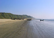
- Cox's Bazar Beach, Cox's BazarCox's BazarCox's Bazar is a town, a fishing port and district headquarters in Bangladesh. It is known for its wide sandy beach which is the world's longest natural sandy sea beach. It is an unbroken 125 km sandy sea beach with a gentle slope. It is located 150 km south of Chittagong. Cox’s Bazar...
. Longest natural sandy beach in the world. - KuakataKuakataKuakata is a panaromic sea beach on the southernmost tip of Bangladesh. Located in the Patuakhali district, Kuakata has a wide sandy beach from where one can see both the sunrise and sunset. It is about 320 Kilometres south of Dhaka, the capital, and about 70 Kilometres from the district...
Beach, Patuakhali - St. Martin's IslandSt. Martin's IslandSt. Martin's Island is a small island in the northheast part of the Bay of Bengal, about 9 km south of the tip of the Cox's Bazar-Teknaf peninsula, and forming the southernmost part of Bangladesh. It is not a coral island in Bangladesh. It is about 8 km west of the northwest coast of...
, Cox's Bazar
Barbados
- Crane Beach
- Miami BeachMiami Beach, BarbadosMiami Beach, Barbados, near the town of Oistins, is a popular sandy beach in Barbados. It is located on the south coast of the island, with usually calm waters and brilliant sunset views. On its north side is Enterprise Beach, a much more sheltered bay popular with families. Miami Beach is popular...
Brazil
Rio de Janeiro- Flamengo
- BotafogoBotafogoBotafogo is a beachfront neighborhood in Rio de Janeiro, Brazil. It is a mostly middle class and small commerce community, and is located between the hills of Mundo Novo, Dona Marta and São João .- History :Botafogo was named after João Pereira de Sousa Botafogo, who was responsible for the...
- Urca
- Vermelha
- Leme
- Copacabana
- Arpoador
- IpanemaIpanemaFor other uses, see Ipanema . For the British rock band, see Ipanema .Ipanema is a neighborhood located in the southern region of the city of Rio de Janeiro, Brazil, between Leblon and Arpoador...
- LeblonLeblonLeblon is an affluent neighbourhood and a beach in Rio de Janeiro, Brazil. It's a neighbourhood of upper class people in the southern zone of the city...
- Gavea
- Vidigal
- São Conrado
- Barra da TijucaBarra da TijucaBarra da Tijuca is a famous neighborhood in Rio de Janeiro, Brazil, located southwest of the city on the Atlantic Ocean. Barra, as it is popularly known, will have most of the venues of the 2016 Summer Olympics, which will be the first edition held in South America. Barra is well-known for its...
Niterói
- ItacoatiaraItacoatiaraItacoatiara is one of the 48 official neighborhoods into which the city of Niterói, Rio de Janeiro in Brazil is divided.- Beach :Itacoatiara beach is located about 30 minutes east of downtown Niterói by car, or one hour by bus....
- CamboinhasCamboinhasCamboinhas is one of the 48 neighborhoods into which the city of Niterói, in Brazil, is divided.The name originated in a marine accident in the 1950s. In that decade, a ship called Camboinhas grounded on the beach.A Brazilian Navy's corvette named "Angostura" was sent to save the ship, but...
Other cities
- Angra dos ReisAngra dos ReisAngra dos Reis is a Brazilian municipality located in the southern part of Rio de Janeiro state. It is located at an altitude of 6 meters and includes in its territory 365 offshore islands. It was discovered on January 6, 1502, but has been under continual settlement since 1556. Its population...
- Cabo FrioCabo FrioCabo Frio is a Brazilian municipality in Rio de Janeiro state, founded by the Portuguese on November 13, 1615.The city's economy is mainly based on tourism, as most of the cities situated in the called Região dos Lagos . The city is usually visited by people from Minas Gerais, Brasília and Rio de...
- ParatyParatyParaty [pronounced Par-a-CHEE] is a preserved Portuguese colonial and Brazilian Imperial town with a population of about 36,000. It is located on the Costa Verde , a lush, green corridor that runs along the coastline of the state of Rio de Janeiro, in Brazil...
São Sebastião
São Sebastião, São Paulo
São Sebastião is a Brazilian city, located on the southeast coast of Brazil, in the state of São Paulo. The population in 2006 is 75,886, its density is 188.1/km² and the area is 403 km². The Tropic of Capricorn lies 25 km north...
- BarequeçabaBarequeçabaBarequeçaba is a beach located 7 km south from the centre of the Brazilian city of São Sebastião, São Paulo, following the BR-101 highway which is the main road going along the Brazilian coast from Rio de Janeiro to Santos.Barequeçaba combines both a permanent population, and a floating tourist...
- JuquehyJuquehyJuqueí is a beach in the city of São Sebastião, São Paulo, located in the northern coastline of São Paulo state. It is famous for its white sands, green mountains and transparent water. Besides its natural attractions, Juquehy is also known for its traditional cuisine, such as "Pescado a Cambucu."...
- Toque-Toque Grande
- Guaecá
- MaresiasMaresiasMaresias is a beach and district at the Atlantic Ocean in the city of São Sebastião, located on São Paulo state's northern coastline, Brazil. The name comes from the ocean breeze that affects the beach and the neighborhood....
Ilhabela
- Praia da Feiticeira
- Praia do Curral
- Praia de Castelhanos
- Praia do Veloso
- Ilha das Cabras
Other states and cities
- Boa Viagem, RecifeBoa Viagem, RecifeBoa Viagem is a neighborhood in the city of Recife, Pernambuco in the privileged southern zone of the town. The neighborhood has one of the most visited beaches in Northeastern Brazil, Boa Viagem beach....
- Porto de GalinhasPorto de GalinhasPorto de Galinhas is a beach in the municipality of Ipojuca, Pernambuco, Brazil. Porto de Galinhas is a major tourist destination. The beach is famous for its bright-water beaches and the natural pools.It is part of the municipality of Ipojuca, and located south of the state capital, Recife.It has...
(IpojucaIpojucaIpojuca is a municipality in Pernambuco. As of 2009 the population according to IBGE was 75,512 and the per capita income was R$76.418 making it one of the highest in Brazil. The settlement dates to 1560, but the official founding date is 1861 and the community was incorporated as a town in 1864...
, PernambucoPernambucoPernambuco is a state of Brazil, located in the Northeast region of the country. To the north are the states of Paraíba and Ceará, to the west is Piauí, to the south are Alagoas and Bahia, and to the east is the Atlantic Ocean. There are about of beaches, some of the most beautiful in the...
) - Ponta NegraPonta NegraPonta Negra is a famous beach and neighborhood located in the Brazilian city of Natal, the capital of the state of Rio Grande do Norte. Located in the extreme south of the beach is the Morro do Careca , a large dune and an iconic landmark of the city...
(NatalNatal, Rio Grande do Norte-History:The northeastern tip of South America, Cabo São Roque, to the north of Natal and the closest point to Europe from Latin America, was first visited by European navigators in 1501, in the 1501–1502 Portuguese expedition led by Amerigo Vespucci, who named the spot after the saint of the day...
) - Canoa QuebradaCanoa Quebrada|thumb|right|200px|Canoa QuebradaCanoa Quebrada , known as the pearl of the east coast of Ceará, Brazil, is an international tourist beach resort 164 km from Fortaleza, in the municipality of Aracati....
, AracatiAracatiAracati is a city in the state of Ceará, northeast of Brazil. The population of Aracati is 61,431 . It is part of the microregion of Litoral de Aracati, which is one of the four microregions that make up the macroregion of Jaguaribe. - Notes :...
, CearáCearáCeará is one of the 27 states of Brazil, located in the northeastern part of the country, on the Atlantic coast. It is currently the 8th largest Brazilian State by population and the 17th by area. It is also one of the main touristic destinations in Brazil. The state capital is the city of... - FortalezaFortalezaFortaleza is the state capital of Ceará, located in Northeastern Brazil. With a population close to 2.5 million , Fortaleza is the 5th largest city in Brazil. It has an area of and one of the highest demographic densities in the country...
, BrazilBrazilBrazil , officially the Federative Republic of Brazil , is the largest country in South America. It is the world's fifth largest country, both by geographical area and by population with over 192 million people... - FlorianópolisFlorianópolis-Climate:Florianópolis experiences a warm humid subtropical climate, falling just short of a true tropical climate. The seasons of the year are distinct, with a well-defined summer and winter, and characteristic weather for autumn and spring. Frost is infrequent, but occurs occasionally in the winter...
Santa CatarinaSanta Catarina (state)Santa Catarina is a state in southern Brazil with one of the highest standards of living in Latin America. Its capital is Florianópolis, which mostly lies on the Santa Catarina Island. Neighbouring states are Rio Grande do Sul to the south and Paraná to the north. It is bounded on the east by...
, BrazilBrazilBrazil , officially the Federative Republic of Brazil , is the largest country in South America. It is the world's fifth largest country, both by geographical area and by population with over 192 million people... - Jericoacoara, CearáCearáCeará is one of the 27 states of Brazil, located in the northeastern part of the country, on the Atlantic coast. It is currently the 8th largest Brazilian State by population and the 17th by area. It is also one of the main touristic destinations in Brazil. The state capital is the city of...
, BrazilBrazilBrazil , officially the Federative Republic of Brazil , is the largest country in South America. It is the world's fifth largest country, both by geographical area and by population with over 192 million people... - LeblonLeblonLeblon is an affluent neighbourhood and a beach in Rio de Janeiro, Brazil. It's a neighbourhood of upper class people in the southern zone of the city...
, BrazilBrazilBrazil , officially the Federative Republic of Brazil , is the largest country in South America. It is the world's fifth largest country, both by geographical area and by population with over 192 million people... - Natal, Brazil, BrazilBrazilBrazil , officially the Federative Republic of Brazil , is the largest country in South America. It is the world's fifth largest country, both by geographical area and by population with over 192 million people...
- Pipa BeachPipa BeachPipa Beach is one of the most famous beaches of Brazil. Located next to city of Natal, the capital city of state of Rio Grande do Norte...
, BrazilBrazilBrazil , officially the Federative Republic of Brazil , is the largest country in South America. It is the world's fifth largest country, both by geographical area and by population with over 192 million people... - Praia do CassinoPraia do CassinoPraia do Cassino is located adjacent to the city of Rio Grande, in the state of Rio Grande do Sul, Brazil. It is commonly known in Brazil as the longest beach in the world , stretching from the Molhes in Cassino beach to nearly Chuí, on...
, BrazilBrazilBrazil , officially the Federative Republic of Brazil , is the largest country in South America. It is the world's fifth largest country, both by geographical area and by population with over 192 million people...
Canada
- Cavendish BeachCavendish BeachCavendish Beach is a Canadian beach in the community of Cavendish, Prince Edward Island.Fronting the Gulf of St. Lawrence, this broad natural sand beach stretches for 8 kilometres from the entrance to New London Bay in the west, to the red sandstone cliffs at Cavendish East in the east...
, Prince Edward IslandPrince Edward IslandPrince Edward Island is a Canadian province consisting of an island of the same name, as well as other islands. The maritime province is the smallest in the nation in both land area and population... - Cherry BeachCherry BeachCherry Beach is a lakeside park located at the foot of Cherry Street just south of Unwin Avenue in Toronto, Ontario, Canada. It is on Toronto's outer harbour just east of the Eastern Gap....
, Toronto - Crescent BeachCrescent Beach (Surrey)Crescent Beach is a community within South Surrey, British Columbia. Crescent Beach is home to , the Crescent Beach Pier and , all local landmarks....
, British ColumbiaBritish ColumbiaBritish Columbia is the westernmost of Canada's provinces and is known for its natural beauty, as reflected in its Latin motto, Splendor sine occasu . Its name was chosen by Queen Victoria in 1858... - Crystal Beach, OntarioCrystal Beach, OntarioCrystal Beach is a community within Fort Erie, Ontario with a population of 3,800. It was named for the "crystal-clear" water conditions present when it was founded on the northeast shore of Lake Erie, across from Buffalo....
- English Bay (Vancouver), including Sunset Beach, Second Beach and Third Beach
- Grand Beach, ManitobaManitobaManitoba is a Canadian prairie province with an area of . The province has over 110,000 lakes and has a largely continental climate because of its flat topography. Agriculture, mostly concentrated in the fertile southern and western parts of the province, is vital to the province's economy; other...
- Hillside Beach ManitobaHillside Beach, ManitobaHillside Beach is summer resort located on the eastern shore of Lake Winnipeg in the Canadian province of Manitoba in the .Manitoba summers are short but gorgeous...
- Jericho BeachJericho BeachJericho Beach, a popular Vancouver beach, is located west of the seaside neighbourhood of Kitsilano. It is surrounded by Jericho Beach Park, a large grassy area with a pond, which is a good picnic destination. In the local Indigenous Sḵwxwú7mesh language, Jericho Beach is iy'a'l'mexw meaning "good...
, Vancouver, BCBritish ColumbiaBritish Columbia is the westernmost of Canada's provinces and is known for its natural beauty, as reflected in its Latin motto, Splendor sine occasu . Its name was chosen by Queen Victoria in 1858... - Kew Beach, Toronto
- KitsilanoKitsilanoKitsilano is an upmarket neighbourhood on the West Side of the city of Vancouver, British Columbia, Canada.Known colloquially as "Kits", this neighborhood is home to many yuppies, young families and students as well as yoga studios, organic markets, cafes and Vancouver's Greektown. The primary...
, Vancouver, BCBritish ColumbiaBritish Columbia is the westernmost of Canada's provinces and is known for its natural beauty, as reflected in its Latin motto, Splendor sine occasu . Its name was chosen by Queen Victoria in 1858... - Locarno BeachLocarno BeachLocarno Beach is one of the beaches that line English Bay in Vancouver. It is situated in the West Point Grey neighbourhood, between Jericho Beach and the Spanish Banks beaches...
, Vancouver, BCBritish ColumbiaBritish Columbia is the westernmost of Canada's provinces and is known for its natural beauty, as reflected in its Latin motto, Splendor sine occasu . Its name was chosen by Queen Victoria in 1858... - Parlee BeachParlee BeachParlee Beach Provincial Park is a Canadian provincial park located in Pointe-du-Chêne, New Brunswick.It is owned by the Government of New Brunswick and operated by the Department of Tourism and Parks...
, New BrunswickNew BrunswickNew Brunswick is one of Canada's three Maritime provinces and is the only province in the federation that is constitutionally bilingual . The provincial capital is Fredericton and Saint John is the most populous city. Greater Moncton is the largest Census Metropolitan Area... - Sauble Beach, OntarioOntarioOntario is a province of Canada, located in east-central Canada. It is Canada's most populous province and second largest in total area. It is home to the nation's most populous city, Toronto, and the nation's capital, Ottawa....
- Spanish BankSpanish BankSpanish Banks are a series of beaches in the city of Vancouver, Canada, located along the shores of English Bay in the West Point Grey neighbourhood...
, Vancouver, BCBritish ColumbiaBritish Columbia is the westernmost of Canada's provinces and is known for its natural beauty, as reflected in its Latin motto, Splendor sine occasu . Its name was chosen by Queen Victoria in 1858... - Victoria Beach ManitobaVictoria Beach, ManitobaVictoria Beach is a rural municipality located on the southeastern shores of Lake Winnipeg. It is approximately north of Winnipeg, the provincial capital of Manitoba, Canada. Its land area is 20.279 km² , making it the smallest rural municipality in Manitoba. It is slightly less than half the size...
- Wasaga Beach, Wasaga Beach, OntarioOntarioOntario is a province of Canada, located in east-central Canada. It is Canada's most populous province and second largest in total area. It is home to the nation's most populous city, Toronto, and the nation's capital, Ottawa....
- White Rock BeachWhite Rock, British ColumbiaWhite Rock is a city in British Columbia, Canada, that lies within the Metro Vancouver regional district. It borders Semiahmoo Bay and is surrounded on three sides by the City of Surrey, British Columbia. To the south lies the Semiahmoo First Nation, which is within the city limits of Surrey...
, BCBritish ColumbiaBritish Columbia is the westernmost of Canada's provinces and is known for its natural beauty, as reflected in its Latin motto, Splendor sine occasu . Its name was chosen by Queen Victoria in 1858... - Wreck BeachWreck BeachWreck Beach is a popular clothing-optional beach located in Pacific Spirit Regional Park, which is in turn part of the University Endowment Lands just west of Vancouver, British Columbia, Canada...
, including Acadia Beach and Tower Beach, Vancouver, BCBritish ColumbiaBritish Columbia is the westernmost of Canada's provinces and is known for its natural beauty, as reflected in its Latin motto, Splendor sine occasu . Its name was chosen by Queen Victoria in 1858...
Costa Rica
Limon Province- Tortuguero, Costa Rica
- Tortuguero National ParkTortuguero National ParkTortuguero National Park is a National Park within the Tortuguero Conservation Area. The reserve is also included in the Humedal Caribe Noreste, a wetland of international importance under the Ramsar Convention. The park is located in the Limón Province of northeastern Costa Rica...
- Cahuita National ParkCahuita National ParkCahuita National Park is a national park in the Caribbean La Amistad Conservation Area of Costa Rica located on the southern Caribbean coast in Limón Province, connected to the town of Cahuita...
- Puerto Viejo de TalamancaPuerto Viejo de TalamancaPuerto Viejo de Talamanca is a coastal town in the Talamanca Canton in Limón Province. The town is located in southeastern Costa Rica. Puerto Viejo de Talamanca is known simply as Puerto Viejo to locals. A town in northeastern Costa Rica is also commonly known as Puerto Viejo; this fact can confuse...
Guanacaste Province
- Gulf of PapagayoGulf of PapagayoThe Gulf of Papagayo is a large body of water off Guanacaste province and the northwestern coast of Costa Rica. It lies at .The Gulf and its coastline are part of a major tourism project by Costa Rica's government...
- Playa GrandePlaya Grande, Costa RicaPlaya Grande is a beach town on the Pacific coast of Costa Rica just north of Tamarindo. Playa Grande is internationally popular as one of Costa Rica’s best surfing spots as well as being home to Parque Nacional Marino Las Baulas, the nesting ground of the largest marine reptile, the Leatherback...
- Playa TamarindoTamarindo, Costa RicaTamarindo is a town and distrito located on the Northern Pacific coast of Costa Rica in the Province of Guanacaste. The district has a population of 3,525, although the town itself is about 500. But it can swell to 5,000 people or more during the tourist season and during special holidays...
- Playa NegraPlaya NegraPlaya Negra is a beach in the Guanacaste Province of Costa Rica and a featured location in the movie Endless Summer II. It is south of the town of Tamarindo.Los Pargos is the town where Playa Negra is located....
- NosaraNosaraNosara is a city in the Nicoya canton, Guanacaste province of Costa Rica on the Pacific Coast.-Geography and demographics:Despite the Nicoya peninsula being one of the last locations with large areas of unpaved roads in Costa Rica, Nosara is one of the oldest expatriate communities in the country,...
- Santa TeresaSanta Teresa, Costa RicaSanta Teresa is a small town in Puntarenas Province, Costa Rica. It is located about west of the capital city of San José. Like other coastal villages on the Nicoya Peninsula, Santa Teresa started as a remote fishing village, relying on agriculture, cattle ranching and small- scale fishing...
- MontezumaMontezuma, Costa RicaMontezuma is a town in Puntarenas Province, Costa Rica which began as a remote fishing village and has gained popularity since the 1980s among tourists on a budget....
Puntarenas Province
- PuntarenasPuntarenasPuntarenas is the capital and largest city in the province Puntarenas, Costa Rica, at the Pacific coast. The eponymous and oddly shaped province has its largest section in the South, far from the capital.Some 100,000 live in the city and close towns...
- Playa BlancaPlaya BlancaPlaya Blanca, meaning "White Beach" is the southernmost town of the Spanish island of Lanzarote. It is the newest, yet fastest growing resort on the Island...
- Playa Herradura
- Jacó, Costa RicaJaco, Costa RicaJacó is a coastal city, in the county of Garabito in Costa Rica's Puntarenas province. Located in the Central Pacific Region, on the pacific coast of Costa Rica. Jacó is approximately one hour by car from San José and Costa Rica's primary International Airport . Manuel Antonio National Park is...
- Manuel Antonio National ParkManuel Antonio National ParkManuel Antonio National Park, in Spanish the Parque Nacional Manuel Antonio, is a small National Park in the Central Pacific Conservation Area located on the Pacific coast of Costa Rica, just south of the city of Quepos, Puntarenas, and from the national capital of San José...
Croatia
- Zlatni RatZlatni RatZlatni Rat is a narrow white pebble beach on a promontory near Bol, located 2 km west of Bol harbour, on the southern coast of the island of Brač, Croatia. The shape of the beach shifts with the changes in tide, currents and wind, veering out into the sea 634 m long...
, BolBol, CroatiaBol is a town on the south of the island of Brač in theSplit-Dalmatia County of Croatia, population 1,661 .Bol is renowned for its most popular beach, the Zlatni rat . It is a promontory composed mostly of pebble rock that visibly shifts with the tidal movement, a unique sight...
, Island of BračBracBrač is an island in the Adriatic Sea within Croatia, with an area of 396 km², making it the largest island in Dalmatia, and the third largest in the Adriatic. Its tallest peak, Vidova Gora, or Mount St. Vid, stands at 778 m, making it the highest island point in the Adriatic... - ZrćeZrceZrće is a long pebble beach on the Adriatic island of Pag in the northern part of the Croatian coast. It is located near Novalja, about 4 kilometers from the town's center...
, near NovaljaNovaljaNovalja is a town in the north of the island of Pag in the Croatian part of Adriatic Sea. In recent times Novalja became famous because of the Zrće Beach, which is one of the biggest summer party zones in Europe.- History :...
, Island of PagPag (island)Pag is a Croatian island in the northern Adriatic Sea. It is the fifth-largest island of the Croatian coast, and the one with the longest coastline.... - BrelaBrelaBrela is a municipality in the Split-Dalmatia county of Croatia, population 1,771 . The municipality consists of two villages: Brela and Gornja Brela. Village Brela is located on the Adriatic coastline of Dalmatia, about 15 km northwest of Makarska....
, CroatiaCroatiaCroatia , officially the Republic of Croatia , is a unitary democratic parliamentary republic in Europe at the crossroads of the Mitteleuropa, the Balkans, and the Mediterranean. Its capital and largest city is Zagreb. The country is divided into 20 counties and the city of Zagreb. Croatia covers ...
Estonia
- AaAa, EstoniaAa is a village in northern Estonia, on the southern coast of the Gulf of Finland in the eastern part of the Lüganuse Parish of Ida-Viru County, 10 km from Lüganuse. Part of the village, including the Aa manor house, is situated on the North Estonian limestone bank.According to the 2000 census, the...
- Anne CanalTartuTartu is the second largest city of Estonia. In contrast to Estonia's political and financial capital Tallinn, Tartu is often considered the intellectual and cultural hub, especially since it is home to Estonia's oldest and most renowned university. Situated 186 km southeast of Tallinn, the...
- EmajõeEmajõgiThe Emajõgi is a river in Estonia which flows from Lake Võrtsjärv through Tartu County into Lake Peipus, crossing the city of Tartu for 10 km. It has a length of 100 km...
- HaabneemeHaabneemeHaabneeme is a small borough in Viimsi Parish, Harju County, in northern Estonia alongside Viimsi. It's located about 9 km northeast of the centre of Tallinn, on the eastern coast of Tallinn Bay. With a population of 4,977 Haabneeme is the largest settlement in the municipality.Haabneeme was...
- HarkuLake HarkuLake Harku is a lake on the western border of Tallinn, Estonia. It has an average depth of and a maximum depth of .-See also:*List of lakes in Estonia*Lake Ülemiste, another lake in Tallinn...
- JoaoruNarva RiverThe Narva is a river flowing into the Baltic Sea, the largest river in Estonia. Draining Lake Peipsi, the river forms the border of Estonia and Russia and flows through the towns of Narva/Ivangorod and Narva-Jõesuu into Narva Bay. Though the river is only 77 km long, in terms of volume...
- KaberneemeKaberneemeKaberneeme is a village in Jõelähtme Parish, Harju County in northern Estonia. It's famous for its beach.-External links:* weather.ee...
- KakumäeKakumäeKakumäe is a subdistrict in the district of Haabersti, Tallinn, the capital of Estonia. It is located at the top of the Kakumäe Peninsula, which is part of the Baltic Klint. Kakumäe has a population of 1,139 -References:...
- KärdlaKärdlaKärdla is the largest town on the Estonian island of Hiiumaa and the capital of Hiiu County.-Geography:Kärdla is located on the north-eastern coast of Hiiumaa, by the Gulf of Tareste . Southeast of the town is the Kärdla meteorite crater, which is 455 million years old.Several small rivers flow...
- KauksiKauksi, Ida-Viru CountyKauksi is a small village in Iisaku Parish, Ida-Viru County in northeastern Estonia. Kauksi has 59 inhabitants . It lies on the northern side of Estonia's largest lake, Peipus ....
- KloogaKloogarannaKloogaranna is a village in Keila Parish, Harju County, Estonia. It has a population of 121 .Kloogaranna has a station on the Elektriraudtee rail line....
- Kubija
- Kuremaa
- KuressaareKuressaareKuressaare is a town and a municipality on Saaremaa island in Estonia. It is the capital of Saare County. The current population is about 14,706 Kuressaare is a town and a municipality on Saaremaa island in Estonia. It is the capital of Saare County. The current population is about 14,706...
- Narva-JõesuuNarva-JõesuuNarva-Jõesuu is a town in Ida-Viru County, Estonia, located on the country's northern Baltic Sea coast near the Russian border. The name of the town in Estonian and Russian means "mouth of the Narva River"....
- Paide Artificial Lake
- PikakariPaljassaarePaljassaare is a subdistrict in the district of Põhja-Tallinn, Tallinn, the capital of Estonia. It has a population of 585 .-External links:***...
- Paralepa
- PärnuPärnuPärnu is a city in southwestern Estonia on the coast of Pärnu Bay, an inlet of the Gulf of Riga in the Baltic Sea. It is a popular summer vacation resort with many hotels, restaurants, and large beaches. The Pärnu River flows through the city and drains into the Gulf of Riga...
- PiritaPirita (subdistrict)Pirita is a subdistrict in the district of Pirita, Tallinn, the capital of Estonia. It has a population of 867 .-References:...
- PühajärvPühajärvPühajärv is a lake of Estonia, near the town of Otepää. The Väike Emajõgi river flows out of the lake.-See also:*List of lakes of Estonia...
- Riiska
- Stroomi
- TamulaLake TamulaLake Tamula is a lake in southern Estonia, located on the southeastern side of the town of Võru. The lake has an area of 2.313 km², average depth is 4.2 m and maximum depth 7.5 m....
- ToilaToilaToila is a small borough in northeastern Estonia. It is located in Ida-Viru county, some 10 km northeast from the town of Jõhvi. Toila is the administrative centre of Toila Parish and has a population of 896 .- Tourism :...
- TüriTüriTüri is a town in Järva County, Estonia. It is the administrative centre of Türi Parish. Since 2000, Türi is known as the "spring capital" of Estonia.- History :*1347 Türi first mentioned in historical records by the name of Turgel...
- ValklaValkla- External links :*...
- Vanamõisa
- VärskaVärskaVärska is a small borough in Värska Parish, Põlva County in southeastern Estonia.- External links :*...
- VereviLake VereviLake Verevi is a lake located on the western side of the town of Elva in southern Estonia.There is one main dock, that has two slides , side-by-side. The big dock has an enclosed area used specifically for swimming. There is a smaller dock about 40 ft. out, that has two diving boards...
- ViljandiLake ViljandiLake Viljandi is a lake in Viljandi County, Estonia. The lake lies in the deep primeval valley of Viljandi, depth 11 m, length 4.6 km, width 450 m. The Uueveski and Valuoja streams and a number of springs flow into the lake. In the south-eastern part of the lake the Raudna River flows out. ...
- VõsuVõsuVõsu is a small borough in Lääne-Viru County, Estonia. It is the administrative centre of Vihula Parish.1971–1999 Võsu was a borough , 1992–1999 it had a municipality status.-External links:*...
Gibraltar
- Eastern BeachEastern Beach, GibraltarEastern Beach is the largest beach in Gibraltar, stretching for several hundred metres along the east side of the isthmus joining The Rock to Spain. The sandy beach extends from the north of Catalan Bay to the runway of Gibraltar Airport....
- Catalan BayCatalan BayCatalan Bay is a small bay and fishing village in Gibraltar, on the eastern side of The Rock away from the main city.-Etymology:The true origin of the name of Catalan Bay is unknown, but a couple of theories exist...
- Sandy BaySandy Bay, GibraltarSandy Bay is a small bay on the eastern Mediterranean coast of Gibraltar, on the opposite side of The Rock from the main city. It is situated to the south of Catalan Bay and is accessible via Sir Herbert Miles Road.-Water Catchments:...
Greece
- Milos Island Beaches
- Valtos BeachValtos BeachValtos Beach is a large crescent-shaped beach 5 minutes walk northwest of Parga, Greece....
, PargaPargaParga, , is a town and municipality located in the northwestern part of the regional unit of Preveza in Epirus, northwestern Greece. The seat of the municipality is the village Kanallaki. Parga lies on the Ionian coast between the cities of Preveza and Igoumenitsa... - RhodesRhodesRhodes is an island in Greece, located in the eastern Aegean Sea. It is the largest of the Dodecanese islands in terms of both land area and population, with a population of 117,007, and also the island group's historical capital. Administratively the island forms a separate municipality within...
- GytheioGytheioGytheio , the ancient Gythium or Gytheion , is a town and a former municipality in Laconia, Peloponnese, Greece. Since the 2011 local government reform it is part of the municipality East Mani, of which it is a municipal unit. It was the seaport of Sparta, some 40 km north...
, Laconia - Mani - ZacharoZacharoZacharo is a town and municipality in southwestern Greece. Administratively, it belongs to the Elis peripheral unit, in the Periphery of West Greece. Zacharo is situated on the Ionian Sea coast, in the area of the Gulf of Kyparissia. The town is crossed by the highway named GR-9/E55, that links...
India
- TarkarliTarkarliTarkarli is a village in Malvan Taluka, district Sindhudurg. It is Tourist Destination in Coastal Maharashtra, an attractive beach. From there, one can see the famous naval fort Sindhudurg built by Shivaji Maharaj. This village is famous for its Ramnavmi Utsav. Here in Mapurush Temple the...
, SindhudurgSindhudurgSindhudurg is a fortress which occupies an islet in the Arabian Sea, just off the coast of Maharashtra in western India. The fortress lies on the shore of Malvan town of Sindhudurg District in the Konkan region of Maharashtra, south of Mumbai.-History:Sindhudurg was built by the great Maratha...
, MaharashtraMaharashtraMaharashtra is a state located in India. It is the second most populous after Uttar Pradesh and third largest state by area in India... - Marina BeachMarina BeachMarina Beach is a beach in the city of Chennai , India, along the Bay of Bengal, part of the Indian Ocean. The beach runs from near Fort St. George in the north to Besant Nagar in the south, a distance of , making it the longest urban beach in the country and the world's second longest...
, ChennaiChennaiChennai , formerly known as Madras or Madarasapatinam , is the capital city of the Indian state of Tamil Nadu, located on the Coromandel Coast off the Bay of Bengal. Chennai is the fourth most populous metropolitan area and the sixth most populous city in India... - Rishikonda Beach, Vishakhapatnam
- Golden Beach, ChennaiGolden Beach, ChennaiGolden beach is a beach located on the Bay of Bengal in Chennai, India. VGP Golden Beach is a major tourist attraction in Chennai. It is situated on the East Coast Road, the seaside road from Chennai to Cuddalore via Pondicherry....
, ChennaiChennaiChennai , formerly known as Madras or Madarasapatinam , is the capital city of the Indian state of Tamil Nadu, located on the Coromandel Coast off the Bay of Bengal. Chennai is the fourth most populous metropolitan area and the sixth most populous city in India... - Elliot's BeachElliot's beachElliot's Beach or "Besant Nagar Beach" ' is located in Besant Nagar, Chennai, India. It forms the end-point of the Marina Beach shore and is named after Edward Elliot, Governor of Madras. It has the Velankanni Church and the Ashtalakshmi Kovil nearby and is sometimes nicknamed 'Bessie'...
, ChennaiChennaiChennai , formerly known as Madras or Madarasapatinam , is the capital city of the Indian state of Tamil Nadu, located on the Coromandel Coast off the Bay of Bengal. Chennai is the fourth most populous metropolitan area and the sixth most populous city in India... - Silver Beach (India)Silver Beach (India)Silver Beach is a beach on the southeast coast of India. It is located from downtown Cuddalore, the headquarters of Cuddalore district in the state of Tamil Nadu. Silver Beach, however, is untouched by the busy life of the city. It is the second longest beach on the Coromandel Coast and one of the...
, CuddaloreCuddaloreCuddalore is a fast growing industrial city and headquarter of Cuddalore district in the Tamil Nadu state of southern India. Located south of Pondicherry on the coast of Bay of Bengal, Cuddalore has a large number of industries which employ a great deal of the city's population.Cuddalore is known... - Arambol BeachArambolArambol Beach is located approximately a one hour drive from the Dabolim Airport within the Pernem administrative region of northern Goa, India. The beach attracts many international tourists, mainly during the winter season between November and March...
, Goa - Chapora BeachChapora BeachChapora Beach is a coastal village at Chapora River estuary lying alongside a beach stretch in North Goa that is around 10 km. from Mapusa, a City in Northern Goa. It is close to Chapora Fort, an old Portuguese fort. Chapora is also close to a trawler-fishing jetty....
, GoaGoaGoa , a former Portuguese colony, is India's smallest state by area and the fourth smallest by population. Located in South West India in the region known as the Konkan, it is bounded by the state of Maharashtra to the north, and by Karnataka to the east and south, while the Arabian Sea forms its... - CalanguteCalanguteCalangute is a census town with a permanent population of approximately 16,000 in North Goa, in the state of Goa, India. It is famous for its beach, the largest in north Goa, visited by thousands of domestic and international tourists alike. The peak tourist season is during Christmas and New...
, GoaGoaGoa , a former Portuguese colony, is India's smallest state by area and the fourth smallest by population. Located in South West India in the region known as the Konkan, it is bounded by the state of Maharashtra to the north, and by Karnataka to the east and south, while the Arabian Sea forms its... - CandolimCandolimCandolim is a census town in North Goa in the state of Goa, India. It is situated just south of the famous Calangute beach, and is popular tourist destination.- History :...
, GoaGoaGoa , a former Portuguese colony, is India's smallest state by area and the fourth smallest by population. Located in South West India in the region known as the Konkan, it is bounded by the state of Maharashtra to the north, and by Karnataka to the east and south, while the Arabian Sea forms its... - Dona PaulaDona PaulaDona Paula is a former village, and tourist destination, in the suburbs of Panaji, Goa, India. It is today home to the National Institute of Oceanography, and just alongside it lie the Goa University and the International Centre Goa...
, GoaGoaGoa , a former Portuguese colony, is India's smallest state by area and the fourth smallest by population. Located in South West India in the region known as the Konkan, it is bounded by the state of Maharashtra to the north, and by Karnataka to the east and south, while the Arabian Sea forms its... - MiramarMiramar, PanajiMiramar is a place in Panaji city in the state of Goa, India. It is the nearest beach to the Goan capital and unarguably the most visited beach of Goa. Hordes of people, mostly tourists, are found every day flocking to this beach...
, GoaGoaGoa , a former Portuguese colony, is India's smallest state by area and the fourth smallest by population. Located in South West India in the region known as the Konkan, it is bounded by the state of Maharashtra to the north, and by Karnataka to the east and south, while the Arabian Sea forms its... - BenaulimBenaulimBenaulim also known as Banavali , is a census town in South Goa district in the state of Goa, India. It is a beach town a little south of Margao in Goa, India....
, GoaGoaGoa , a former Portuguese colony, is India's smallest state by area and the fourth smallest by population. Located in South West India in the region known as the Konkan, it is bounded by the state of Maharashtra to the north, and by Karnataka to the east and south, while the Arabian Sea forms its... - Palolem BeachPalolem BeachPalolem is a beach in South Goa, India.-Location:Palolem Beach is at , within 2 kilometres from the market town of Chaudi in the south Goan taluka of Canacona, which is about one hour's drive from the coastal town of Karwar in Karnataka and about 40 minutes from Margao .-The beach:The beach is...
, GoaGoaGoa , a former Portuguese colony, is India's smallest state by area and the fourth smallest by population. Located in South West India in the region known as the Konkan, it is bounded by the state of Maharashtra to the north, and by Karnataka to the east and south, while the Arabian Sea forms its... - Versova Beach, MumbaiMumbaiMumbai , formerly known as Bombay in English, is the capital of the Indian state of Maharashtra. It is the most populous city in India, and the fourth most populous city in the world, with a total metropolitan area population of approximately 20.5 million...
- Juhu beach, MumbaiMumbaiMumbai , formerly known as Bombay in English, is the capital of the Indian state of Maharashtra. It is the most populous city in India, and the fourth most populous city in the world, with a total metropolitan area population of approximately 20.5 million...
- KovalamKovalamKovalam is a beach town on the Arabian Sea in Thiruvananthapuram city, Kerala, India. It is located around 13 km from the down town of Trivandrum.-Etymology:...
, Trivandrum, KeralaKeralaor Keralam is an Indian state located on the Malabar coast of south-west India. It was created on 1 November 1956 by the States Reorganisation Act by combining various Malayalam speaking regions.... - BeyporeBeyporeBeypore or Beypur is a ancient port town and part of Calicut municipal corporation in Kozhikode district in the state of Kerala, India. The place was formerly known as Vaypura / Vadaparappanad. Tippu Sultan named the town “Sultan Pattanam”.This place also has a marina and a beautiful beach...
, KeralaKeralaor Keralam is an Indian state located on the Malabar coast of south-west India. It was created on 1 November 1956 by the States Reorganisation Act by combining various Malayalam speaking regions.... - Cherai BeachCherai BeachCherai Beach is located in Vypin island, Kochi, India. Cherai Beach is just 25 km from Kochi, and 30 km from Cochin International Airport. The nearest towns are North Paravur and Kodungallur and the nearest railway station is Aluva .The 15 km of long golden beach is clean,...
, KeralaKeralaor Keralam is an Indian state located on the Malabar coast of south-west India. It was created on 1 November 1956 by the States Reorganisation Act by combining various Malayalam speaking regions.... - VarkalaVarkalaVarkala is a coastal town and municipality in Thiruvananthapuram district situated in the Indian state of Kerala. It is located 50 kilometres north-west of Thiruvananthapuram and 37 km south-west of Kollam city.Varkala is the only place in southern Kerala where cliffs are found adjacent to...
, Trivandrum, KeralaKeralaor Keralam is an Indian state located on the Malabar coast of south-west India. It was created on 1 November 1956 by the States Reorganisation Act by combining various Malayalam speaking regions.... - Shankumugham BeachShankumugham BeachShankumugham Beach is a beach in Thiruvananthapuram district of Kerala, south India. The beach is on the western side of Thiruvananthapuram city and very near to Trivandrum International Airport....
, Trivandrum, KeralaKeralaor Keralam is an Indian state located on the Malabar coast of south-west India. It was created on 1 November 1956 by the States Reorganisation Act by combining various Malayalam speaking regions.... - Saddam BeachSaddam BeachSaddam Beach is a fishing village in the Malappuram district of the Indian state of Kerala. The village is made up of a two kilometre coastal belt between Puthenkadapuram and Kettungal in Parappanangadi...
, KeralaKeralaor Keralam is an Indian state located on the Malabar coast of south-west India. It was created on 1 November 1956 by the States Reorganisation Act by combining various Malayalam speaking regions.... - Alibaug Beach, MaharashtraMaharashtraMaharashtra is a state located in India. It is the second most populous after Uttar Pradesh and third largest state by area in India...
- Andaman & Nicobar
- Alappuzha BeachAlappuzha BeachAlappuzha Beach is a beach in the Allepey district of Kerala, India.The beach has a small park nearby. Alappuzha Lighthouse stands near the beach which is also a curiosity for tourists....
- Puri BeachPuri BeachPuri Beach is a beach in the city of Puri in the state of Orissa, India. It is on the shore of the Bay of Bengal. It is known for being a tourist attraction and a Hindu sacred place...
, OrissaOrissaOrissa , officially Odisha since Nov 2011, is a state of India, located on the east coast of India, by the Bay of Bengal. It is the modern name of the ancient nation of Kalinga, which was invaded by the Maurya Emperor Ashoka in 261 BC. The modern state of Orissa was established on 1 April... - Digha Beach, West BengalWest BengalWest Bengal is a state in the eastern region of India and is the nation's fourth-most populous. It is also the seventh-most populous sub-national entity in the world, with over 91 million inhabitants. A major agricultural producer, West Bengal is the sixth-largest contributor to India's GDP...
Indonesia
- SanurSanur, BaliSanur is a coastal stretch of beach of Denpasar city of southeast Bali, about 30 minutes drive from Ngurah Rai International Airport, which has grown into a little town in its own right....
, BaliBaliBali is an Indonesian island located in the westernmost end of the Lesser Sunda Islands, lying between Java to the west and Lombok to the east... - SeminyakSeminyakSeminyak is a mixed tourist / residential area on the west coast of Bali just north of Kuta and Legian. Originally a separate township, this is now just another suburb of Kuta. This area is very popular with resident expatriates and land and accommodation prices are amongst the highest in Bali....
, BaliBaliBali is an Indonesian island located in the westernmost end of the Lesser Sunda Islands, lying between Java to the west and Lombok to the east... - LegianLegianLegian is a suburban and beach area on the west coast of Bali just north of Kuta and south of Seminyak the area between Jl. Melasti and Jl. Dhyana Pura ....
, BaliBaliBali is an Indonesian island located in the westernmost end of the Lesser Sunda Islands, lying between Java to the west and Lombok to the east... - Dreamland Beach, BaliBaliBali is an Indonesian island located in the westernmost end of the Lesser Sunda Islands, lying between Java to the west and Lombok to the east...
- Nusa DuaNusa DuaNusa Dua is known as an enclave of large international 5-star resorts in south-eastern Bali. It is located 40 kilometres from Denpasar, the provincial capital of Bali, and administered under Kuta South District. Nusa Dua means two islands....
, BaliBaliBali is an Indonesian island located in the westernmost end of the Lesser Sunda Islands, lying between Java to the west and Lombok to the east... - KutaKutaKuta is administratively a district and subdistrict/village in southern Bali, Indonesia. A former fishing village, it was one of the first towns on Bali to see substantial tourist development, and as a beach resort remains one of Indonesia's major tourist destinations...
, BaliBaliBali is an Indonesian island located in the westernmost end of the Lesser Sunda Islands, lying between Java to the west and Lombok to the east... - JimbaranJimbaranJimbaran is a fishing village and tourist resort in Bali, Indonesia. Located south of Ngurah Rai International Airport, the beach has seafood restaurants and luxury hotels, including the five-star Intercontinental Hotel Bali, Four Seasons and Jimbaran Puri Bali...
, BaliBaliBali is an Indonesian island located in the westernmost end of the Lesser Sunda Islands, lying between Java to the west and Lombok to the east... - Lovina, BaliBaliBali is an Indonesian island located in the westernmost end of the Lesser Sunda Islands, lying between Java to the west and Lombok to the east...
- Uluwatu, BaliBaliBali is an Indonesian island located in the westernmost end of the Lesser Sunda Islands, lying between Java to the west and Lombok to the east...
- Padang Beach, West SumatraWest SumatraWest Sumatra is a province of Indonesia. It lies on the west coast of the island Sumatra. It borders the provinces of North Sumatra to the north, Riau and Jambi to the east, and Bengkulu to the southeast. It includes the Mentawai Islands off the coast...
- Balekambang Beach, Malang, East Java
- Sendang Biru Beach, Malang, East Java
- Ngliyep Beach, Malang, East Java
- Tamban Beach, Malang, East Java
- Plengkung Beach, Banyuwangi, East Java
- Senggigi Beach, LombokLombokLombok is an island in West Nusa Tenggara province, Indonesia. It forms part of the chain of the Lesser Sunda Islands, with the Lombok Strait separating it from Bali to the west and the Alas Strait between it and Sumbawa to the east...
- Kukup Beach, Yogyakarta
- Tanjung Lesung Beach, BantenBantenBanten is a province of Indonesia in Java. Formerly part of the Province of West Java, it was made a separate province in 2000.The administrative center is Serang. Preliminary results from the 2010 census counted some 10.6 million people.-Geography:...
- Ujung Genteng Beach, Sukabumi, West Java
- Losari Beach, Makassar, South Sulawesi
- Parangtritis Beach, Yogyakarta
- Pulau Weh Beach, Nangroe Aceh Darussalam
Ireland
- BallybunionBallybunionBallybunion or Ballybunnion is a coastal town and seaside resort in County Kerry, Ireland, from the town of Listowel. There are castle ruins near the town, although all that remains is a single wall, and two golf courses in the area including the famous Ballybunion Golf Club, a top class Links...
, County KerryCounty KerryKerry means the "people of Ciar" which was the name of the pre-Gaelic tribe who lived in part of the present county. The legendary founder of the tribe was Ciar, son of Fergus mac Róich. In Old Irish "Ciar" meant black or dark brown, and the word continues in use in modern Irish as an adjective... - BallyheigueBallyheigueBallyheigue, officially Ballyheige , is a coastal village in County Kerry, Ireland. It is approximately north of Tralee on the R551. Its name is pronounced ....
, County KerryCounty KerryKerry means the "people of Ciar" which was the name of the pre-Gaelic tribe who lived in part of the present county. The legendary founder of the tribe was Ciar, son of Fergus mac Róich. In Old Irish "Ciar" meant black or dark brown, and the word continues in use in modern Irish as an adjective... - Banna StrandBanna StrandBanna Strand, also known as Banna Beach, is situated in Tralee Bay. It is an Atlantic Ocean beach extending from Ballyheigue Beach at the Blackrock in the North to Barrow Beach at its southern edge, located in County Kerry. It is located approx 12 km north west of Tralee. It features sand...
, County KerryCounty KerryKerry means the "people of Ciar" which was the name of the pre-Gaelic tribe who lived in part of the present county. The legendary founder of the tribe was Ciar, son of Fergus mac Róich. In Old Irish "Ciar" meant black or dark brown, and the word continues in use in modern Irish as an adjective... - BarleycoveBarleycoveBarleycove or Barlycove is the name of a townland and beach in County Cork, Province of Munster, on the south coast of Ireland. It is said to be one of the better beaches in West Cork, if not Ireland. It is situated close to Mizen Head on the Mizen Peninsula, with Crookhaven or Goleen being the...
, County CorkCounty CorkCounty Cork is a county in Ireland. It is located in the South-West Region and is also part of the province of Munster. It is named after the city of Cork . Cork County Council is the local authority for the county... - BrayBrayBray is a town in north County Wicklow, Ireland. It is a busy urban centre and seaside resort, with a population of 31,901 making it the fourth largest in Ireland as of the 2006 census...
, County WicklowCounty WicklowCounty Wicklow is a county in Ireland. It is part of the Mid-East Region and is also located in the province of Leinster. It is named after the town of Wicklow, which derives from the Old Norse name Víkingalág or Wykynlo. Wicklow County Council is the local authority for the county... - Brittas BayBrittas BayBrittas Bay Coastcare Group Brittas Bay in County Wicklow, Ireland is a 4 km stretch of beach on the Irish Sea coast. The beach is accessed from the R750 regional road which runs parallel to the beach, separated from it by extensive areas of sand dunes...
, County WicklowCounty WicklowCounty Wicklow is a county in Ireland. It is part of the Mid-East Region and is also located in the province of Leinster. It is named after the town of Wicklow, which derives from the Old Norse name Víkingalág or Wykynlo. Wicklow County Council is the local authority for the county... - BundoranBundoranBundoran is a town in County Donegal, part of the Province of Ulster in the north of Ireland. The town is located on the N15 road near Ballyshannon, 3 hours drive from Dublin and around two and a quarter hours drive from Belfast...
, County DonegalCounty DonegalCounty Donegal is a county in Ireland. It is part of the Border Region and is also located in the province of Ulster. It is named after the town of Donegal. Donegal County Council is the local authority for the county... - Cappa Pier, KilrushKilrushKilrush is a coastal town in County Clare, Ireland. It is located near the mouth of the River Shannon in the south-west of the county. Kilrush is a town of great historical significance, being one of the listed Heritage Towns of Ireland.-History:...
, County ClareCounty Clare-History:There was a Neolithic civilisation in the Clare area — the name of the peoples is unknown, but the Prehistoric peoples left evidence behind in the form of ancient dolmen; single-chamber megalithic tombs, usually consisting of three or more upright stones... - Gurteen BeachGurteen BeachGurteen Beach , located in Roundstone, County Galway, in the Connemara region of the west of Ireland, lies back-to-back with Dog's Bay. The two beaches were formed by a sand spit and tombolo which now separates the two bays known as Gurteen Bay and Dog's Bay...
, County GalwayCounty GalwayCounty Galway is a county in Ireland. It is located in the West Region and is also part of the province of Connacht. It is named after the city of Galway. Galway County Council is the local authority for the county. There are several strongly Irish-speaking areas in the west of the county... - InniscroneInniscroneEnniscrone – also spelt Inniscrone and officially named Inishcrone – is a small seaside town in County Sligo, Ireland. A sandy beach, tourist campsite, and golf course all attract a large number of visitors...
, County Sligo - Kells Bay, County KerryCounty KerryKerry means the "people of Ciar" which was the name of the pre-Gaelic tribe who lived in part of the present county. The legendary founder of the tribe was Ciar, son of Fergus mac Róich. In Old Irish "Ciar" meant black or dark brown, and the word continues in use in modern Irish as an adjective...
- KilkeeKilkeeKilkee is a small coastal town in County Clare, Ireland. It is located midway between Kilrush and Doonbeg on the N67 road. The town, one of the most famous resorts in Ireland, is particularly popular as a seaside resort with people from Limerick City...
, County ClareCounty Clare-History:There was a Neolithic civilisation in the Clare area — the name of the peoples is unknown, but the Prehistoric peoples left evidence behind in the form of ancient dolmen; single-chamber megalithic tombs, usually consisting of three or more upright stones... - LahinchLahinchLahinch or Lehinch is a village on Liscannor Bay, on the northwest coast of County Clare, in northern Munster, Ireland. It lies on the N67 national secondary road....
, County ClareCounty Clare-History:There was a Neolithic civilisation in the Clare area — the name of the peoples is unknown, but the Prehistoric peoples left evidence behind in the form of ancient dolmen; single-chamber megalithic tombs, usually consisting of three or more upright stones... - FanoreFanoreFanore is a small village in County Clare, on the west coast of Ireland.Lying on the road between Ballyvaughan and Doolin, Fanore is renowned for its extensive sandy beach. The village is very popular with walkers, surfers, tourists and is particularly interesting to botanists, owing to its...
, County ClareCounty Clare-History:There was a Neolithic civilisation in the Clare area — the name of the peoples is unknown, but the Prehistoric peoples left evidence behind in the form of ancient dolmen; single-chamber megalithic tombs, usually consisting of three or more upright stones... - LaytownLaytownLaytown is a village on the R150 regional road on the Irish Sea coast of County Meath, Ireland. Historically it was called Ninch , after the townland it occupies...
, County MeathCounty MeathCounty Meath is a county in Ireland. It is part of the Mid-East Region and is also located in the province of Leinster. It is named after the ancient Kingdom of Mide . Meath County Council is the local authority for the county... - MyrtlevilleMyrtlevilleMyrtleville is a small seaside village in County Cork, Ireland. It is mostly within the townland of Ballinluska, just west of the entrance to Cork Harbour...
, County CorkCounty CorkCounty Cork is a county in Ireland. It is located in the South-West Region and is also part of the province of Munster. It is named after the city of Cork . Cork County Council is the local authority for the county... - Quilty Beach, QuiltyQuilty, County ClareQuilty , historically Killty, is a small fishing village between Miltown Malbay and Doonbeg in County Clare, Ireland. Lobster, salmon, bass, herring and mackerel are landed at Quilty, formerly known for its curing industry....
, County ClareCounty Clare-History:There was a Neolithic civilisation in the Clare area — the name of the peoples is unknown, but the Prehistoric peoples left evidence behind in the form of ancient dolmen; single-chamber megalithic tombs, usually consisting of three or more upright stones... - RosscarberyRosscarberyRosscarbery or Roscarbery is a town in County Cork, Ireland. The town is on a shallow estuary, which opens onto Rosscarbery Bay.-History:...
, County CorkCounty CorkCounty Cork is a county in Ireland. It is located in the South-West Region and is also part of the province of Munster. It is named after the city of Cork . Cork County Council is the local authority for the county... - Sherkin IslandSherkin IslandSherkin Island, historically called Inisherkin , lies southwest of County Cork in Ireland alongside other islands of Roaringwater Bay. It had a population of 106 people at the time of the 2006 Census, measures 3 miles long by 1.5 miles wide...
, County CorkCounty CorkCounty Cork is a county in Ireland. It is located in the South-West Region and is also part of the province of Munster. It is named after the city of Cork . Cork County Council is the local authority for the county... - Spanish PointSpanish PointSpanish Point is a village in the parish of Miltown Malbay in County Clare, Ireland, situated on the west coast of Ireland. The town is home to many holiday homes, and during the winter has a significantly smaller population. It is also one of the better surf breaks in County Clare...
, County ClareCounty Clare-History:There was a Neolithic civilisation in the Clare area — the name of the peoples is unknown, but the Prehistoric peoples left evidence behind in the form of ancient dolmen; single-chamber megalithic tombs, usually consisting of three or more upright stones... - RossnowlaghRossnowlaghRossnowlagh or Rosnowlagh is a seaside beach resort in south County Donegal, Ireland. It is about 8.5 km north of Ballyshannon and 16.0 km southwest of Donegal Town. The extensive beach is very popular with families and is frequented by walkers, surfers, wind-surfers, kite-surfers and swimmers,...
, County DonegalCounty DonegalCounty Donegal is a county in Ireland. It is part of the Border Region and is also located in the province of Ulster. It is named after the town of Donegal. Donegal County Council is the local authority for the county... - Tramore, County WaterfordCounty Waterford*Abbeyside, Affane, Aglish, Annestown, An Rinn, Ardmore*Ballinacourty, Ballinameela, Ballinamult, Ballinroad, Ballybeg, Ballybricken, Ballyduff Lower, Ballyduff Upper, Ballydurn, Ballygunner, Ballylaneen, Ballymacarbry, Ballymacart, Ballynaneashagh, Ballysaggart, Ballytruckle, Bilberry, Bunmahon,...
- White Strand, Miltown MalbayMiltown MalbaySpanish Point Airfield is an privately owned airfield between Milltown Malbay and Spanish Point. The airfield, located on Sandhill Road in the townland Leagard South, was established by three local pilots in 1991, and the original clubhouse was opened by then Irish Minister for Defense Mr...
, County ClareCounty Clare-History:There was a Neolithic civilisation in the Clare area — the name of the peoples is unknown, but the Prehistoric peoples left evidence behind in the form of ancient dolmen; single-chamber megalithic tombs, usually consisting of three or more upright stones... - YoughalYoughalYoughal is a town in County Cork, Ireland. Sitting on the estuary of the River Blackwater, in the past it was militarily and economically important. Being built on the edge of a steep riverbank, the town has a distinctive long and narrow layout...
, County CorkCounty CorkCounty Cork is a county in Ireland. It is located in the South-West Region and is also part of the province of Munster. It is named after the city of Cork . Cork County Council is the local authority for the county...
Italy
- AlessanoAlessanoAlessano is a town and comune in the province of Lecce, part of Apulia region of south-east Italy....
, ApuliaApuliaApulia is a region in Southern Italy bordering the Adriatic Sea in the east, the Ionian Sea to the southeast, and the Strait of Òtranto and Gulf of Taranto in the south. Its most southern portion, known as Salento peninsula, forms a high heel on the "boot" of Italy. The region comprises , and... - AllisteAllisteAlliste is a town and comune in the Italian province of Lecce in the Apulia region of south-east Italy....
, ApuliaApuliaApulia is a region in Southern Italy bordering the Adriatic Sea in the east, the Ionian Sea to the southeast, and the Strait of Òtranto and Gulf of Taranto in the south. Its most southern portion, known as Salento peninsula, forms a high heel on the "boot" of Italy. The region comprises , and... - AndranoAndranoAndrano is a town and comune in the Italian province of Lecce in the Apulia region of south-east Italy....
, ApuliaApuliaApulia is a region in Southern Italy bordering the Adriatic Sea in the east, the Ionian Sea to the southeast, and the Strait of Òtranto and Gulf of Taranto in the south. Its most southern portion, known as Salento peninsula, forms a high heel on the "boot" of Italy. The region comprises , and... - Castrignano del CapoCastrignano del CapoCastrignano del Capo is a town and comune in the province of Lecce in the Apulia region of south-east Italy. It has three frazioni: Santa Maria di Leuca, Giuliano, Salignano....
, ApuliaApuliaApulia is a region in Southern Italy bordering the Adriatic Sea in the east, the Ionian Sea to the southeast, and the Strait of Òtranto and Gulf of Taranto in the south. Its most southern portion, known as Salento peninsula, forms a high heel on the "boot" of Italy. The region comprises , and... - Castro, ApuliaApuliaApulia is a region in Southern Italy bordering the Adriatic Sea in the east, the Ionian Sea to the southeast, and the Strait of Òtranto and Gulf of Taranto in the south. Its most southern portion, known as Salento peninsula, forms a high heel on the "boot" of Italy. The region comprises , and...
- CorsanoCorsanoCorsano is a town and comune in the province of Lecce in the Apulia region of south-east Italy.-Geography:It is located on the last slopes of the Salentine Murge, facing the Adriatic Sea coast. The distance from Lecce is 60 km.-History:...
, ApuliaApuliaApulia is a region in Southern Italy bordering the Adriatic Sea in the east, the Ionian Sea to the southeast, and the Strait of Òtranto and Gulf of Taranto in the south. Its most southern portion, known as Salento peninsula, forms a high heel on the "boot" of Italy. The region comprises , and... - DisoDisoDiso is a town and comune in the Italian province of Lecce in the Apulia region of south-east Italy. It is an ancient city, having existed since the early 11th century, and features several churches, buildings and squares....
, ApuliaApuliaApulia is a region in Southern Italy bordering the Adriatic Sea in the east, the Ionian Sea to the southeast, and the Strait of Òtranto and Gulf of Taranto in the south. Its most southern portion, known as Salento peninsula, forms a high heel on the "boot" of Italy. The region comprises , and... - Gagliano del CapoGagliano del CapoGagliano del Capo is a town and comune in the Italian province of Lecce in the Apulia region of south-east Italy.-Main sights:*Palazzo Ciardo *Mother Church, built in 1574*Church of St. Francis of Paola- External Links :...
, ApuliaApuliaApulia is a region in Southern Italy bordering the Adriatic Sea in the east, the Ionian Sea to the southeast, and the Strait of Òtranto and Gulf of Taranto in the south. Its most southern portion, known as Salento peninsula, forms a high heel on the "boot" of Italy. The region comprises , and... - GalatoneGalatoneGalatone is a town and comune located in Salento, in the province of Lecce , ancient seat of the Marquess of Galatone.-History:...
, ApuliaApuliaApulia is a region in Southern Italy bordering the Adriatic Sea in the east, the Ionian Sea to the southeast, and the Strait of Òtranto and Gulf of Taranto in the south. Its most southern portion, known as Salento peninsula, forms a high heel on the "boot" of Italy. The region comprises , and... - GallipoliGallipoliThe Gallipoli peninsula is located in Turkish Thrace , the European part of Turkey, with the Aegean Sea to the west and the Dardanelles straits to the east. Gallipoli derives its name from the Greek "Καλλίπολις" , meaning "Beautiful City"...
, ApuliaApuliaApulia is a region in Southern Italy bordering the Adriatic Sea in the east, the Ionian Sea to the southeast, and the Strait of Òtranto and Gulf of Taranto in the south. Its most southern portion, known as Salento peninsula, forms a high heel on the "boot" of Italy. The region comprises , and... - LecceLecceLecce is a historic city of 95,200 inhabitants in southern Italy, the capital of the province of Lecce, the second province in the region by population, as well as one of the most important cities of Puglia...
, ApuliaApuliaApulia is a region in Southern Italy bordering the Adriatic Sea in the east, the Ionian Sea to the southeast, and the Strait of Òtranto and Gulf of Taranto in the south. Its most southern portion, known as Salento peninsula, forms a high heel on the "boot" of Italy. The region comprises , and... - Melendugno, ApuliaApuliaApulia is a region in Southern Italy bordering the Adriatic Sea in the east, the Ionian Sea to the southeast, and the Strait of Òtranto and Gulf of Taranto in the south. Its most southern portion, known as Salento peninsula, forms a high heel on the "boot" of Italy. The region comprises , and...
- Morciano di LeucaMorciano di LeucaMorciano di Leuca is a town and comune in the province of Lecce, in the Apulia region of south-east Italy.-History: The origins of Morciano di Leuca probably go back to the 9th century AD, with the destruction of the city by the Saracens. In 1190 King Tancredi of Sicily gave Sinibaldo Sambiasi...
, ApuliaApuliaApulia is a region in Southern Italy bordering the Adriatic Sea in the east, the Ionian Sea to the southeast, and the Strait of Òtranto and Gulf of Taranto in the south. Its most southern portion, known as Salento peninsula, forms a high heel on the "boot" of Italy. The region comprises , and... - BadolatoBadolatoBadolato is a comune and town in the province of Catanzaro in the Calabria region of Italy. As of 2007 Badolato had an estimated population of 3,275.- Territory :The village of Badolato is 30 km from Catanzaro on Calabria's Ionian coast...
, CalabriaCalabriaCalabria , in antiquity known as Bruttium, is a region in southern Italy, south of Naples, located at the "toe" of the Italian Peninsula. The capital city of Calabria is Catanzaro.... - BelcastroBelcastroBelcastro is a village and comune in the province of Catanzaro, in the Calabria region of southern Italy....
, CalabriaCalabriaCalabria , in antiquity known as Bruttium, is a region in southern Italy, south of Naples, located at the "toe" of the Italian Peninsula. The capital city of Calabria is Catanzaro.... - BorgiaBorgiaThe Borgias, also known as the Borjas, Borjia, were a European Papal family of Italian and Spanish origin with the name stemming from the familial fief seat of Borja belonging to their Aragonese Lords; they became prominent during the Renaissance. The Borgias were patrons of the arts, and their...
, CalabriaCalabriaCalabria , in antiquity known as Bruttium, is a region in southern Italy, south of Naples, located at the "toe" of the Italian Peninsula. The capital city of Calabria is Catanzaro.... - BotricelloBotricelloBotricello is a town and comune in the province of Catanzaro, in the Calabria region of southern Italy....
, CalabriaCalabriaCalabria , in antiquity known as Bruttium, is a region in southern Italy, south of Naples, located at the "toe" of the Italian Peninsula. The capital city of Calabria is Catanzaro.... - Catanzaro, CalabriaCalabriaCalabria , in antiquity known as Bruttium, is a region in southern Italy, south of Naples, located at the "toe" of the Italian Peninsula. The capital city of Calabria is Catanzaro....
- CropaniCropaniCropani is a comune and town in the province of Catanzaro in the Calabria region of Italy....
, CalabriaCalabriaCalabria , in antiquity known as Bruttium, is a region in southern Italy, south of Naples, located at the "toe" of the Italian Peninsula. The capital city of Calabria is Catanzaro.... - DavoliDavoliDavoli is a town and comune in the province of Catanzaro, in the Calabria region of southern Italy....
, CalabriaCalabriaCalabria , in antiquity known as Bruttium, is a region in southern Italy, south of Naples, located at the "toe" of the Italian Peninsula. The capital city of Calabria is Catanzaro.... - GuardavalleGuardavalleGuardavalle is a comune and town in the province of Catanzaro in the Calabria region of Italy....
, CalabriaCalabriaCalabria , in antiquity known as Bruttium, is a region in southern Italy, south of Naples, located at the "toe" of the Italian Peninsula. The capital city of Calabria is Catanzaro.... - CitaraCitaraCitara is a beach located in Forio d'Ischia, in the Ischia island of Italy, near Punta Imperatore. Its name comes from Romans who consecrated the site to Venus Citarea, whose statue made of white marble was found in the area. An old legend has it that the rocks, which can be seen from the beach,...
, IschiaIschiaIschia is a volcanic island in the Tyrrhenian Sea. It lies at the northern end of the Gulf of Naples, about 30 km from the city of Naples. It is the largest of the Phlegrean Islands. Roughly trapezoidal in shape, it measures around 10 km east to west and 7 km north to south and has...
, CampaniaCampaniaCampania is a region in southern Italy. The region has a population of around 5.8 million people, making it the second-most-populous region of Italy; its total area of 13,590 km² makes it the most densely populated region in the country... - Castel VolturnoCastel VolturnoCastel Volturno is a comune in the Province of Caserta in the Italian region Campania, located about 35 km northwest of Naples and about 35 km west of Caserta on the Volturno river.-History:...
, CampaniaCampaniaCampania is a region in southern Italy. The region has a population of around 5.8 million people, making it the second-most-populous region of Italy; its total area of 13,590 km² makes it the most densely populated region in the country... - CelloleCelloleCellole is a comune in the Province of Caserta in the Italian region Campania, located about 50 km northwest of Naples and about 45 km northwest of Caserta...
, CampaniaCampaniaCampania is a region in southern Italy. The region has a population of around 5.8 million people, making it the second-most-populous region of Italy; its total area of 13,590 km² makes it the most densely populated region in the country... - MondragoneMondragoneMondragone is a comune or municipality in the Province of Caserta in the Italian region of Campania. It is located about 45 km northwest of Naples and about 40 km west of Caserta.-History:...
, CampaniaCampaniaCampania is a region in southern Italy. The region has a population of around 5.8 million people, making it the second-most-populous region of Italy; its total area of 13,590 km² makes it the most densely populated region in the country... - Sessa AuruncaSessa AuruncaSessa Aurunca is a town and comune of Campania, Italy, in the province of Caserta. It located on the south west slope of the extinct volcano of Roccamonfina, 40 km by rail west north west of Caserta and 30 km east of Formia....
, CampaniaCampaniaCampania is a region in southern Italy. The region has a population of around 5.8 million people, making it the second-most-populous region of Italy; its total area of 13,590 km² makes it the most densely populated region in the country... - Bellaria-Igea MarinaBellaria-Igea MarinaBellaria – Igea Marina is a town and comune in the province of Rimini, northern Italy, with approximately 18,300 inhabitants....
, Emilia Romagna - CattolicaCattolicaCattolica is a town and comune in the Province of Rimini, Italy, with 16,233 inhabitants.-History:Archaeological excavations show that the area was already settled in Roman times....
, Emilia Romagna - CerviaCerviaCervia is a town and comune in the province of Ravenna , central Italy.-History:Originally called Ficocle, it was probably of Greek origin and was located midway from current Cervia and Ravenna...
, Emilia Romagna - CesenaticoCesenaticoCesenatico is a port town with about 20,000 inhabitants on the Adriatic coast of Italy. It is located in the province of Forlì-Cesena in the region of Emilia-Romagna, about 30 km south of Ravenna...
, Emilia Romagna - GatteoGatteoGatteo is a comune in the Province of Forlì-Cesena in the Italian region Emilia-Romagna, located about 90 km southeast of Bologna and about 30 km southeast of Forlì...
, Emilia Romagna - Misano AdriaticoMisano AdriaticoMisano Adriatico is a comune in the Province of Rimini in the Italian region Emilia-Romagna, located about 120 km southeast of Bologna and about 14 km southeast of Rimini....
, Emilia Romagna - RavennaRavennaRavenna is the capital city of the Province of Ravenna in the Emilia-Romagna region of Italy and the second largest comune in Italy by land area, although, at , it is little more than half the size of the largest comune, Rome...
, Emilia Romagna - RiccioneRiccioneRiccione is a comune in the Province of Rimini, Emilia-Romagna, northern Italy. As of 2007 Riccione had an estimated population of 34,868.-History:...
, Emilia Romagna - RiminiRiminiRimini is a medium-sized city of 142,579 inhabitants in the Emilia-Romagna region of Italy, and capital city of the Province of Rimini. It is located on the Adriatic Sea, on the coast between the rivers Marecchia and Ausa...
, Emilia Romagna - San Mauro PascoliSan Mauro PascoliSan Mauro Pascoli is a comune in the Province of Forlì-Cesena in the Italian region Emilia-Romagna, located about 100 km southeast of Bologna and about 35 km southeast of Forlì...
, Emilia Romagna - Savignano sul RubiconeSavignano sul RubiconeSavignano sul Rubicone is a comune in the Province of Forlì-Cesena in the Italian region Emilia-Romagna, located about 90 km southeast of Bologna and about 30 km southeast of Forlì....
, Emilia Romagna - Grado, ItalyGrado, ItalyGrado is a town and comune in the north-eastern Italian region of Friuli-Venezia Giulia, located on a peninsula of the Adriatic Sea between Venice and Trieste....
, Friuli Venezia Giulia - AlassioAlassioAlassio is a town and "comune" of 11.312 inhabitants in the province of Savona situated in the North West of Italy and approximately 80 km from the French border.Alassio is known for its natural beauty and scenic views...
, LiguriaLiguriaLiguria is a coastal region of north-western Italy, the third smallest of the Italian regions. Its capital is Genoa. It is a popular region with tourists for its beautiful beaches, picturesque little towns, and good food.-Geography:... - AlbengaAlbengaAlbenga is a city and comune situated on the Gulf of Genoa on the Italian Riviera in the Province of Savona in Liguria, northern Italy.left|thumb|220px|Towers of Albenga.The economy is mostly based on tourism, local commerce and agriculture-History:...
, LiguriaLiguriaLiguria is a coastal region of north-western Italy, the third smallest of the Italian regions. Its capital is Genoa. It is a popular region with tourists for its beautiful beaches, picturesque little towns, and good food.-Geography:... - Albisola SuperioreAlbisola SuperioreAlbisola Superiore is a comune in the Province of Savona in the Italian region Liguria, located about 35 km southwest of Genoa and about 5 km northeast of Savona.-Main sights:...
, LiguriaLiguriaLiguria is a coastal region of north-western Italy, the third smallest of the Italian regions. Its capital is Genoa. It is a popular region with tourists for its beautiful beaches, picturesque little towns, and good food.-Geography:... - Albissola MarinaAlbissola MarinaAlbissola Marina is a comune in the Province of Savona in the Italian region Liguria, located about 35 km west of Genoa and about 4 km northeast of Savona.-History:...
, LiguriaLiguriaLiguria is a coastal region of north-western Italy, the third smallest of the Italian regions. Its capital is Genoa. It is a popular region with tourists for its beautiful beaches, picturesque little towns, and good food.-Geography:... - AmegliaAmegliaAmeglia is a comune in the Province of La Spezia in the Italian region Liguria, located about 90 km southeast of Genoa and about 11 km southeast of La Spezia.Ameglia borders the following municipalities: Lerici, Sarzana....
, LiguriaLiguriaLiguria is a coastal region of north-western Italy, the third smallest of the Italian regions. Its capital is Genoa. It is a popular region with tourists for its beautiful beaches, picturesque little towns, and good food.-Geography:... - ArenzanoArenzanoArenzano is a coastal town and comune in the province of Genoa, Liguria, Italy. , it has a population of 11,568. This varies a lot during the holiday seasons, since it is a reasonably popular holiday resort for Italians....
, LiguriaLiguriaLiguria is a coastal region of north-western Italy, the third smallest of the Italian regions. Its capital is Genoa. It is a popular region with tourists for its beautiful beaches, picturesque little towns, and good food.-Geography:... - BergeggiBergeggiBergeggi is a comune in the Province of Savona in the Italian region Liguria, located about 90 km southwest of Genoa and about 50 km southwest of Savona. As of 31 December 2004, it had a population of 1,212 and an area of 3.7 km².Bergeggi borders the following municipalities:...
, LiguriaLiguriaLiguria is a coastal region of north-western Italy, the third smallest of the Italian regions. Its capital is Genoa. It is a popular region with tourists for its beautiful beaches, picturesque little towns, and good food.-Geography:... - BogliascoBogliascoBogliasco is a comune in the Province of Genoa in the Italian region Liguria, located about 11 km southeast of Genoa. Together with the comuni of Camogli, Recco, Pieve Ligure and Sori, it is part of the so-called Golfo Paradiso...
, LiguriaLiguriaLiguria is a coastal region of north-western Italy, the third smallest of the Italian regions. Its capital is Genoa. It is a popular region with tourists for its beautiful beaches, picturesque little towns, and good food.-Geography:... - BonassolaBonassolaBonassola is a comune in the Province of La Spezia in the Italian region Liguria, located about 60 km southeast of Genoa and about 20 km northwest of La Spezia...
, LiguriaLiguriaLiguria is a coastal region of north-western Italy, the third smallest of the Italian regions. Its capital is Genoa. It is a popular region with tourists for its beautiful beaches, picturesque little towns, and good food.-Geography:... - BordigheraBordigheraBordighera is a town and comune in the Province of Imperia, Liguria .-History:The city was founded around the 4th century BC by the Ligures....
, LiguriaLiguriaLiguria is a coastal region of north-western Italy, the third smallest of the Italian regions. Its capital is Genoa. It is a popular region with tourists for its beautiful beaches, picturesque little towns, and good food.-Geography:... - Borghetto Santo SpiritoBorghetto Santo SpiritoBorghetto Santo Spirito is a comune in the Province of Savona in the Italian region Liguria, located about 70 km southwest of Genoa and about 30 km southwest of Savona...
, LiguriaLiguriaLiguria is a coastal region of north-western Italy, the third smallest of the Italian regions. Its capital is Genoa. It is a popular region with tourists for its beautiful beaches, picturesque little towns, and good food.-Geography:... - Borgio VerezziBorgio VerezziBorgio Verezzi is a comune in the Province of Savona in the Italian region Liguria, located about 60 km southwest of Genoa and about 20 km southwest of Savona...
, LiguriaLiguriaLiguria is a coastal region of north-western Italy, the third smallest of the Italian regions. Its capital is Genoa. It is a popular region with tourists for its beautiful beaches, picturesque little towns, and good food.-Geography:... - CamogliCamogliCamogli is a small Italian fishing village and tourist resort located on the west side of the peninsula of Portofino, on the Golfo Paradiso at the Riviera di Levante, in the province of Genoa on the Italian Riviera. its population was of 5582 inhabitants. The name means "house of wives"...
, LiguriaLiguriaLiguria is a coastal region of north-western Italy, the third smallest of the Italian regions. Its capital is Genoa. It is a popular region with tourists for its beautiful beaches, picturesque little towns, and good food.-Geography:... - CamporossoCamporossoCamporosso is a comune in the Province of Imperia in the Italian region Liguria, located about 160 km southwest of Genoa and about 45 km west of Imperia...
, LiguriaLiguriaLiguria is a coastal region of north-western Italy, the third smallest of the Italian regions. Its capital is Genoa. It is a popular region with tourists for its beautiful beaches, picturesque little towns, and good food.-Geography:... - Celle LigureCelle LigureCelle Ligure is a comune in the Province of Savona in the Italian region Liguria, located about 30 km west of Genoa and about 8 km northeast of Savona...
, LiguriaLiguriaLiguria is a coastal region of north-western Italy, the third smallest of the Italian regions. Its capital is Genoa. It is a popular region with tourists for its beautiful beaches, picturesque little towns, and good food.-Geography:... - CerialeCerialeCeriale is a comune in the Province of Savona in the Italian region Liguria, located about 70 km southwest of Genoa and about 30 km southwest of Savona...
, LiguriaLiguriaLiguria is a coastal region of north-western Italy, the third smallest of the Italian regions. Its capital is Genoa. It is a popular region with tourists for its beautiful beaches, picturesque little towns, and good food.-Geography:... - Cervo, LiguriaLiguriaLiguria is a coastal region of north-western Italy, the third smallest of the Italian regions. Its capital is Genoa. It is a popular region with tourists for its beautiful beaches, picturesque little towns, and good food.-Geography:...
- ChiavariChiavariChiavari is a town and comune on the Italian Riviera in the Province of Genoa, region of Liguria. It is situated near the mouth of the Entella River, in the center of a fertile plain surrounded by mountains except on the southwest, where it comes down to the Mediterranean Sea...
, LiguriaLiguriaLiguria is a coastal region of north-western Italy, the third smallest of the Italian regions. Its capital is Genoa. It is a popular region with tourists for its beautiful beaches, picturesque little towns, and good food.-Geography:... - CipressaCipressaCipressa is a comune in the Province of Imperia in the Italian region Liguria, located about 100 km southwest of Genoa and about 9 km southwest of Imperia...
, LiguriaLiguriaLiguria is a coastal region of north-western Italy, the third smallest of the Italian regions. Its capital is Genoa. It is a popular region with tourists for its beautiful beaches, picturesque little towns, and good food.-Geography:... - CogoletoCogoletoCogoleto is a comune in the Province of Genoa in the Italian region Liguria, located about 25 km west of Genoa. Its territory extends from the sea to the Ligurian Apennines; it is part of the Natural Regional Park of Monte Beigua....
, LiguriaLiguriaLiguria is a coastal region of north-western Italy, the third smallest of the Italian regions. Its capital is Genoa. It is a popular region with tourists for its beautiful beaches, picturesque little towns, and good food.-Geography:... - CostaraineraCostaraineraCostarainera is a comune in the Province of Imperia in the Italian region Liguria, located about 100 km southwest of Genoa and about 9 km southwest of Imperia. As of 31 December 2004, it had a population of 775 and an area of 2.4 km².Costarainera borders the following...
, LiguriaLiguriaLiguria is a coastal region of north-western Italy, the third smallest of the Italian regions. Its capital is Genoa. It is a popular region with tourists for its beautiful beaches, picturesque little towns, and good food.-Geography:... - Deiva MarinaDeiva MarinaDeiva Marina is an Italian town and comune in the province of La Spezia , located about 65 km south of the city of Genoa on the Riviera di Levante....
, LiguriaLiguriaLiguria is a coastal region of north-western Italy, the third smallest of the Italian regions. Its capital is Genoa. It is a popular region with tourists for its beautiful beaches, picturesque little towns, and good food.-Geography:... - Diano MarinaDiano MarinaDiano Marina is a comune in the Province of Imperia in the Italian region Liguria, located about 90 km southwest of Genoa and about 5 km northeast of Imperia...
, LiguriaLiguriaLiguria is a coastal region of north-western Italy, the third smallest of the Italian regions. Its capital is Genoa. It is a popular region with tourists for its beautiful beaches, picturesque little towns, and good food.-Geography:... - Finale LigureFinale LigureFinale Ligure is a comune on the Gulf of Genoa in the Province of Savona in Liguria, Italy. It is considered part of the Italian Riviera.-Geography:...
, LiguriaLiguriaLiguria is a coastal region of north-western Italy, the third smallest of the Italian regions. Its capital is Genoa. It is a popular region with tourists for its beautiful beaches, picturesque little towns, and good food.-Geography:... - FramuraFramuraFramura is a comune in the Province of La Spezia in the Italian region Liguria, located about 50 km southeast of Genoa and about 25 km northwest of La Spezia...
, LiguriaLiguriaLiguria is a coastal region of north-western Italy, the third smallest of the Italian regions. Its capital is Genoa. It is a popular region with tourists for its beautiful beaches, picturesque little towns, and good food.-Geography:... - GenoaGenoaGenoa |Ligurian]] Zena ; Latin and, archaically, English Genua) is a city and an important seaport in northern Italy, the capital of the Province of Genoa and of the region of Liguria....
, LiguriaLiguriaLiguria is a coastal region of north-western Italy, the third smallest of the Italian regions. Its capital is Genoa. It is a popular region with tourists for its beautiful beaches, picturesque little towns, and good food.-Geography:... - ImperiaImperiaImperia may be:* Imperia , an Italian city* Province of Imperia, the Italian province of the above city of Imperia* IMPERIA, a vodka produced by Russian Standard* Imperia , a statue in Constance, Germany...
, LiguriaLiguriaLiguria is a coastal region of north-western Italy, the third smallest of the Italian regions. Its capital is Genoa. It is a popular region with tourists for its beautiful beaches, picturesque little towns, and good food.-Geography:... - LaiguegliaLaiguegliaLaigueglia is a town and comune in the province of Savona, in Liguria .220px|left|thumb|Aerial view of Laigueglia in the 1970s.Nearby is the Capo Mele Lighthouse....
, LiguriaLiguriaLiguria is a coastal region of north-western Italy, the third smallest of the Italian regions. Its capital is Genoa. It is a popular region with tourists for its beautiful beaches, picturesque little towns, and good food.-Geography:... - La SpeziaLa SpeziaLa Spezia , at the head of the Gulf of La Spezia in the Liguria region of northern Italy, is the capital city of the province of La Spezia. Located between Genoa and Pisa on the Ligurian Sea, it is one of the main Italian military and commercial harbours and hosts one of Italy's biggest military...
, LiguriaLiguriaLiguria is a coastal region of north-western Italy, the third smallest of the Italian regions. Its capital is Genoa. It is a popular region with tourists for its beautiful beaches, picturesque little towns, and good food.-Geography:... - LavagnaLavagnaLavagna is a fishing port city of c. 13,000 inhabitants in the curving stretch of the Italian Riviera di Levante called the gulf of Tigullio, in the province of Genoa in Liguria. The borgo of Lavagna was an important Ligurian cultural center in the Middle Ages...
, LiguriaLiguriaLiguria is a coastal region of north-western Italy, the third smallest of the Italian regions. Its capital is Genoa. It is a popular region with tourists for its beautiful beaches, picturesque little towns, and good food.-Geography:... - LericiLericiLerici is a town and comune in the province of La Spezia in Liguria , part of the Italian Riviera. Its nearest bay is the Bay of Lerici. The town is connected by ferry to the Cinque Terre and Portovenere....
, LiguriaLiguriaLiguria is a coastal region of north-western Italy, the third smallest of the Italian regions. Its capital is Genoa. It is a popular region with tourists for its beautiful beaches, picturesque little towns, and good food.-Geography:... - Levanto, LiguriaLiguriaLiguria is a coastal region of north-western Italy, the third smallest of the Italian regions. Its capital is Genoa. It is a popular region with tourists for its beautiful beaches, picturesque little towns, and good food.-Geography:...
- LoanoLoanoLoano is a comune in the Province of Savona in the Italian region Liguria, located about 60 km southwest of Genoa and about 30 km southwest of Savona...
, LiguriaLiguriaLiguria is a coastal region of north-western Italy, the third smallest of the Italian regions. Its capital is Genoa. It is a popular region with tourists for its beautiful beaches, picturesque little towns, and good food.-Geography:... - MonegliaMonegliaMoneglia is a comune in the Province of Genoa in the Italian region Liguria, located about 50 km southeast of Genoa. It is a tourist resort on the Riviera di Levante.-Main sights:...
, LiguriaLiguriaLiguria is a coastal region of north-western Italy, the third smallest of the Italian regions. Its capital is Genoa. It is a popular region with tourists for its beautiful beaches, picturesque little towns, and good food.-Geography:... - Monterosso al Mare, LiguriaLiguriaLiguria is a coastal region of north-western Italy, the third smallest of the Italian regions. Its capital is Genoa. It is a popular region with tourists for its beautiful beaches, picturesque little towns, and good food.-Geography:...
- NoliNoliNoli |Ligurian]] Nöi ) is a coast comune of Liguria, Italy, in the Province of Savona, it is about SW of Genoa by rail, about 4 m above sea-level. It has a population of 2,957. In 1901, it had a population of 1,985...
, LiguriaLiguriaLiguria is a coastal region of north-western Italy, the third smallest of the Italian regions. Its capital is Genoa. It is a popular region with tourists for its beautiful beaches, picturesque little towns, and good food.-Geography:... - OspedalettiOspedalettiOspedaletti is a comune in the Province of Imperia in the Italian region of Liguria, located about 120 km southwest of Genoa and about 25 km southwest of Imperia...
, LiguriaLiguriaLiguria is a coastal region of north-western Italy, the third smallest of the Italian regions. Its capital is Genoa. It is a popular region with tourists for its beautiful beaches, picturesque little towns, and good food.-Geography:... - Pietra LigurePietra LigurePietra Ligure is a comune in the Province of Savona in the Italian region Liguria, located about 60 km southwest of Genoa and about 20 km southwest of Savona...
, LiguriaLiguriaLiguria is a coastal region of north-western Italy, the third smallest of the Italian regions. Its capital is Genoa. It is a popular region with tourists for its beautiful beaches, picturesque little towns, and good food.-Geography:... - Pieve LigurePieve LigurePieve Ligure is a comune in the Province of Genoa in the Italian region Liguria, located about 13 km southeast of Genoa....
, LiguriaLiguriaLiguria is a coastal region of north-western Italy, the third smallest of the Italian regions. Its capital is Genoa. It is a popular region with tourists for its beautiful beaches, picturesque little towns, and good food.-Geography:... - PortofinoPortofinoPortofino is a small Italian fishing village, comune and tourist resort located in the province of Genoa on the Italian Riviera. The town is crowded round its small harbour, is closely associated with Paraggi Beach, which is a few minutes up the coast...
, LiguriaLiguriaLiguria is a coastal region of north-western Italy, the third smallest of the Italian regions. Its capital is Genoa. It is a popular region with tourists for its beautiful beaches, picturesque little towns, and good food.-Geography:... - Porto Venere, LiguriaLiguriaLiguria is a coastal region of north-western Italy, the third smallest of the Italian regions. Its capital is Genoa. It is a popular region with tourists for its beautiful beaches, picturesque little towns, and good food.-Geography:...
- RapalloRapalloRapallo is a municipality in the province of Genoa, in Liguria, northern Italy. As of 2007 it counts approximately 34,000 inhabitants, it is part of the Tigullio Gulf and is located in between Portofino and Chiavari....
, LiguriaLiguriaLiguria is a coastal region of north-western Italy, the third smallest of the Italian regions. Its capital is Genoa. It is a popular region with tourists for its beautiful beaches, picturesque little towns, and good food.-Geography:... - ReccoReccoRecco is a comune in the province of Genoa, region of Liguria, Italy. It is known for its focaccia al formaggio which is made with Crescenza. The consortium that dictates the official recipe of the focaccia, supposedly the result of a Saracen attack in the 1200s, is seeking the European Union PGI...
, LiguriaLiguriaLiguria is a coastal region of north-western Italy, the third smallest of the Italian regions. Its capital is Genoa. It is a popular region with tourists for its beautiful beaches, picturesque little towns, and good food.-Geography:... - Riomaggiore, LiguriaLiguriaLiguria is a coastal region of north-western Italy, the third smallest of the Italian regions. Its capital is Genoa. It is a popular region with tourists for its beautiful beaches, picturesque little towns, and good food.-Geography:...
- Riva LigureRiva LigureRiva Ligure is a comune in the Province of Imperia in the Italian region Liguria, located about 110 km southwest of Genoa and about 13 km southwest of Imperia...
, LiguriaLiguriaLiguria is a coastal region of north-western Italy, the third smallest of the Italian regions. Its capital is Genoa. It is a popular region with tourists for its beautiful beaches, picturesque little towns, and good food.-Geography:... - San Bartolomeo al MareSan Bartolomeo al MareSan Bartolomeo al Mare is a comune in the Province of Imperia in the Italian region Liguria, located about 90 km southwest of Genoa and about 7 km northeast of Imperia...
, LiguriaLiguriaLiguria is a coastal region of north-western Italy, the third smallest of the Italian regions. Its capital is Genoa. It is a popular region with tourists for its beautiful beaches, picturesque little towns, and good food.-Geography:... - SanremoSanremoSanremo or San Remo is a city with about 57,000 inhabitants on the Mediterranean coast of western Liguria in north-western Italy. Founded in Roman times, the city is best known as a tourist destination on the Italian Riviera. It hosts numerous cultural events, such as the Sanremo Music Festival...
, LiguriaLiguriaLiguria is a coastal region of north-western Italy, the third smallest of the Italian regions. Its capital is Genoa. It is a popular region with tourists for its beautiful beaches, picturesque little towns, and good food.-Geography:... - Santa Margherita LigureSanta Margherita Ligurethumb|250px|Villa Durazzo.Santa Margherita Ligure is a comune in the province of Genoa in the Italian region Liguria, located about 35 km southeast of Genoa, in the Tigullio traditional area.left|220px|thumb|16th century castle....
, LiguriaLiguriaLiguria is a coastal region of north-western Italy, the third smallest of the Italian regions. Its capital is Genoa. It is a popular region with tourists for its beautiful beaches, picturesque little towns, and good food.-Geography:... - Santo Stefano al MareSanto Stefano al MareSanto Stefano al Mare is a comune in the Province of Imperia in the Italian region Liguria, located about 100 km southwest of Genoa and about 9 km southwest of Imperia...
, LiguriaLiguriaLiguria is a coastal region of north-western Italy, the third smallest of the Italian regions. Its capital is Genoa. It is a popular region with tourists for its beautiful beaches, picturesque little towns, and good food.-Geography:... - SarzanaSarzanaSarzana is a town and comune in the Province of La Spezia, of Liguria, Italy, 15 km east of Spezia, on the railway to Pisa, at the point where the railway to Parma diverges to the north...
, LiguriaLiguriaLiguria is a coastal region of north-western Italy, the third smallest of the Italian regions. Its capital is Genoa. It is a popular region with tourists for its beautiful beaches, picturesque little towns, and good food.-Geography:... - SavonaSavonaSavona is a seaport and comune in the northern Italian region of Liguria, capital of the Province of Savona, in the Riviera di Ponente on the Mediterranean Sea....
, LiguriaLiguriaLiguria is a coastal region of north-western Italy, the third smallest of the Italian regions. Its capital is Genoa. It is a popular region with tourists for its beautiful beaches, picturesque little towns, and good food.-Geography:... - Sestri LevanteSestri LevanteSestri Levante is a town and comune in Liguria, Italy. Lying on the Mediterranean Sea, it is approximately 56 kilometers south of Genoa and is set on a promontory. While nearby Portofino and the Cinque Terre are probably the most well known tourist destinations on the Italian Riviera, Sestri...
, LiguriaLiguriaLiguria is a coastal region of north-western Italy, the third smallest of the Italian regions. Its capital is Genoa. It is a popular region with tourists for its beautiful beaches, picturesque little towns, and good food.-Geography:... - Sori, LiguriaLiguriaLiguria is a coastal region of north-western Italy, the third smallest of the Italian regions. Its capital is Genoa. It is a popular region with tourists for its beautiful beaches, picturesque little towns, and good food.-Geography:...
- SpotornoSpotornoSpotorno is a comune in the Province of Savona in the Italian region Liguria, located about 45 km southwest of Genoa and about 9 km southwest of Savona. As of 31 December 2004, it had a population of 4,171 and an area of 8.1 km².Spotorno borders the following municipalities:...
, LiguriaLiguriaLiguria is a coastal region of north-western Italy, the third smallest of the Italian regions. Its capital is Genoa. It is a popular region with tourists for its beautiful beaches, picturesque little towns, and good food.-Geography:... - TaggiaTaggiaTaggia is a comune in the Province of Imperia in the Italian region Liguria, located about 110 km southwest of Genoa and about 15 km west of Imperia. It has c...
, LiguriaLiguriaLiguria is a coastal region of north-western Italy, the third smallest of the Italian regions. Its capital is Genoa. It is a popular region with tourists for its beautiful beaches, picturesque little towns, and good food.-Geography:... - Vado LigureVado LigureVado Ligure, in antiquity Vado Sabatia, is a town and comune in the province of Savona, Liguria, in northern Italy.- Economy :Vado has a large industrial and commercial port....
, LiguriaLiguriaLiguria is a coastal region of north-western Italy, the third smallest of the Italian regions. Its capital is Genoa. It is a popular region with tourists for its beautiful beaches, picturesque little towns, and good food.-Geography:... - VallecrosiaVallecrosiaVallecrosia is a comune in the Province of Imperia in the Italian region Liguria, located about 120 km southwest of Genoa and about 30 km west of Imperia. It is next to the busy city of Ventimiglia...
, LiguriaLiguriaLiguria is a coastal region of north-western Italy, the third smallest of the Italian regions. Its capital is Genoa. It is a popular region with tourists for its beautiful beaches, picturesque little towns, and good food.-Geography:... - VarazzeVarazzeVarazze is a comune in the Province of Savona in the Italian region Liguria, located about 30 km west of Genoa and about 11 km northeast of Savona in the Riviera di Ponente...
, LiguriaLiguriaLiguria is a coastal region of north-western Italy, the third smallest of the Italian regions. Its capital is Genoa. It is a popular region with tourists for its beautiful beaches, picturesque little towns, and good food.-Geography:... - VentimigliaVentimigliaVentimiglia is a city and comune in Liguria, northern Italy, in the province of Imperia. It is located southwest of Genoa by rail, and 7 km from the French-Italian border, on the Gulf of Genoa, having a small harbour at the mouth of the Roia River, which divides the town into two parts...
, LiguriaLiguriaLiguria is a coastal region of north-western Italy, the third smallest of the Italian regions. Its capital is Genoa. It is a popular region with tourists for its beautiful beaches, picturesque little towns, and good food.-Geography:... - VernazzaVernazzaWARNING: On October 25, 2011, Vernazza was struck by torrential rains, massive flooding and mudslides that left the town buried in over 4 meters of mud and debris, causing over 100 million euro worth of damage. The town is evacuated and in a continued state of emergency...
, LiguriaLiguriaLiguria is a coastal region of north-western Italy, the third smallest of the Italian regions. Its capital is Genoa. It is a popular region with tourists for its beautiful beaches, picturesque little towns, and good food.-Geography:... - ZoagliZoagliZoagli is a comune in the Province of Genoa in the Italian region Liguria, located about 30 km southeast of Genoa.-History:Zoagli was probably founded by the Tigulli Ligurian tribe...
, LiguriaLiguriaLiguria is a coastal region of north-western Italy, the third smallest of the Italian regions. Its capital is Genoa. It is a popular region with tourists for its beautiful beaches, picturesque little towns, and good food.-Geography:... - Falconara MarittimaFalconara Marittima-Transportation:The Ancona Airport is located in Falconara Marittima. Falconara beach is about 2 miles away from the airport. The Orte -Falconara Main line is one of the few transversal lines on the Italian Railway Network; even the Adriatic line passes through Falconara railway station.-Sport:The...
, MarcheMarcheThe population density in the region is below the national average. In 2008, it was 161.5 inhabitants per km2, compared to the national figure of 198.8. It is highest in the province of Ancona , and lowest in the province of Macerata... - Gabicce MareGabicce MareGabicce Mare is a comune in the Province of Pesaro e Urbino in the Italian region Marche, located about 70 km northwest of Ancona and 16 km north of Pesaro....
, MarcheMarcheThe population density in the region is below the national average. In 2008, it was 161.5 inhabitants per km2, compared to the national figure of 198.8. It is highest in the province of Ancona , and lowest in the province of Macerata... - Costa SmeraldaCosta SmeraldaThe Costa Smeralda is a coastal area and tourist destination in northern Sardinia, 55 km long and covering more than 30 km². With white sand beaches, a golf club, private jet and helicopter service, and hotels costing up to US$2,000 - 3,000 per night in the peak season, the area has...
, SardiniaSardiniaSardinia is the second-largest island in the Mediterranean Sea . It is an autonomous region of Italy, and the nearest land masses are the French island of Corsica, the Italian Peninsula, Sicily, Tunisia and the Spanish Balearic Islands.The name Sardinia is from the pre-Roman noun *sard[],... - Marina di RagusaMarina di RagusaMarina di Ragusa is a village in southern Italy, a frazione of the comune of Ragusa. The site is noted for its beautiful beaches and lively nightlife. Marina di Ragusa is located on the Mediterranean coast of the island of Sicily, directly opposite the island of Malta...
, SicilySicilySicily is a region of Italy, and is the largest island in the Mediterranean Sea. Along with the surrounding minor islands, it constitutes an autonomous region of Italy, the Regione Autonoma Siciliana Sicily has a rich and unique culture, especially with regard to the arts, music, literature,... - CapraiaCapraiaCapraia, called Capraria in ancient times, is an island of Italy, part of the Tuscan Archipelago, off the northwest coast; it is also a comune belonging to the Province of Livorno. It is 62 km from the city of Livorno by sea, and 32 km northwest of the island of Elba; it is slightly...
, TuscanyTuscanyTuscany is a region in Italy. It has an area of about 23,000 square kilometres and a population of about 3.75 million inhabitants. The regional capital is Florence .... - Campo nell'ElbaCampo nell'ElbaCampo nell'Elba is a comune on the island of Elba, in the Province of Livorno in the Italian region of Tuscany, located about 140 km southwest of Florence and about 90 km south of Livorno.-External links:* *...
, ElbaElbaElba is a Mediterranean island in Tuscany, Italy, from the coastal town of Piombino. The largest island of the Tuscan Archipelago, Elba is also part of the National Park of the Tuscan Archipelago and the third largest island in Italy after Sicily and Sardinia...
, TuscanyTuscanyTuscany is a region in Italy. It has an area of about 23,000 square kilometres and a population of about 3.75 million inhabitants. The regional capital is Florence .... - CapoliveriCapoliveriCapoliveri is a comune on the island of Elba in Italy. Administratively it is part of the Province of Livorno in the Tuscany region, located about 130 km southwest of Florence and about 90 km south of Livorno.-External links:* *...
, ElbaElbaElba is a Mediterranean island in Tuscany, Italy, from the coastal town of Piombino. The largest island of the Tuscan Archipelago, Elba is also part of the National Park of the Tuscan Archipelago and the third largest island in Italy after Sicily and Sardinia...
, TuscanyTuscanyTuscany is a region in Italy. It has an area of about 23,000 square kilometres and a population of about 3.75 million inhabitants. The regional capital is Florence .... - MarcianaMarcianaMarciana is a town and comune in the province of Livorno, Tuscany , located in the western Elba Island....
, ElbaElbaElba is a Mediterranean island in Tuscany, Italy, from the coastal town of Piombino. The largest island of the Tuscan Archipelago, Elba is also part of the National Park of the Tuscan Archipelago and the third largest island in Italy after Sicily and Sardinia...
, TuscanyTuscanyTuscany is a region in Italy. It has an area of about 23,000 square kilometres and a population of about 3.75 million inhabitants. The regional capital is Florence .... - Marciana MarinaMarciana MarinaMarciana Marina is a town and comune in the province of Livorno , one of the most important towns of Elba Island.It is situated at sea level, with nearly 2.000 inhabitants....
, ElbaElbaElba is a Mediterranean island in Tuscany, Italy, from the coastal town of Piombino. The largest island of the Tuscan Archipelago, Elba is also part of the National Park of the Tuscan Archipelago and the third largest island in Italy after Sicily and Sardinia...
, TuscanyTuscanyTuscany is a region in Italy. It has an area of about 23,000 square kilometres and a population of about 3.75 million inhabitants. The regional capital is Florence .... - Porto AzzurroPorto AzzurroPorto Azzurro is a comune in the Province of Livorno in the Italian region Tuscany; it is on the island of Elba, located about 130 km southwest of Florence and about 90 km south of Livorno. It formerly called Porto Longone, and in 1557 Jacob VI Appiani, Prince of Piombino, granted Spain...
, ElbaElbaElba is a Mediterranean island in Tuscany, Italy, from the coastal town of Piombino. The largest island of the Tuscan Archipelago, Elba is also part of the National Park of the Tuscan Archipelago and the third largest island in Italy after Sicily and Sardinia...
, TuscanyTuscanyTuscany is a region in Italy. It has an area of about 23,000 square kilometres and a population of about 3.75 million inhabitants. The regional capital is Florence .... - Portoferraio, ElbaElbaElba is a Mediterranean island in Tuscany, Italy, from the coastal town of Piombino. The largest island of the Tuscan Archipelago, Elba is also part of the National Park of the Tuscan Archipelago and the third largest island in Italy after Sicily and Sardinia...
, TuscanyTuscanyTuscany is a region in Italy. It has an area of about 23,000 square kilometres and a population of about 3.75 million inhabitants. The regional capital is Florence .... - Rio MarinaRio MarinaRio Marina is a comune in the Province of Livorno in the Italian region Tuscany, located on the Elba Island.-History:The first traces of settlements in the area date to the 15th century...
, ElbaElbaElba is a Mediterranean island in Tuscany, Italy, from the coastal town of Piombino. The largest island of the Tuscan Archipelago, Elba is also part of the National Park of the Tuscan Archipelago and the third largest island in Italy after Sicily and Sardinia...
, TuscanyTuscanyTuscany is a region in Italy. It has an area of about 23,000 square kilometres and a population of about 3.75 million inhabitants. The regional capital is Florence .... - Rio nell'ElbaRio nell'ElbaRio nell'Elba is a comune in the Province of Livorno in the Italian region Tuscany, located about 130 km southwest of Florence and about 80 km south of Livorno....
, ElbaElbaElba is a Mediterranean island in Tuscany, Italy, from the coastal town of Piombino. The largest island of the Tuscan Archipelago, Elba is also part of the National Park of the Tuscan Archipelago and the third largest island in Italy after Sicily and Sardinia...
, TuscanyTuscanyTuscany is a region in Italy. It has an area of about 23,000 square kilometres and a population of about 3.75 million inhabitants. The regional capital is Florence .... - Giglio IslandGiglio IslandIsola del Giglio is an island and Italian comune situated in the Tyrrhenian Sea, off the coast of Tuscany, part of the Province of Grosseto.-Geography:...
, TuscanyTuscanyTuscany is a region in Italy. It has an area of about 23,000 square kilometres and a population of about 3.75 million inhabitants. The regional capital is Florence .... - BibbonaBibbonaBibbona is a comune in the Province of Livorno in the Italian region Tuscany, located about 80 km southwest of Florence and about 40 km southeast of Livorno in the Val di Cecina.-Main sights:...
, TuscanyTuscanyTuscany is a region in Italy. It has an area of about 23,000 square kilometres and a population of about 3.75 million inhabitants. The regional capital is Florence .... - CamaioreCamaioreCamaiore is a town and comune of 31,503 inhabitants within the province of Lucca, Tuscany, Italy. It stretches from the Alps to the east, to the plains and the coast of Versilia to the west.-Morphology:...
, TuscanyTuscanyTuscany is a region in Italy. It has an area of about 23,000 square kilometres and a population of about 3.75 million inhabitants. The regional capital is Florence .... - CapalbioCapalbioCapalbio is a comune in the Province of Grosseto in the Italian region Tuscany, located about 150 km south of Florence and about 45 km southeast of Grosseto....
, TuscanyTuscanyTuscany is a region in Italy. It has an area of about 23,000 square kilometres and a population of about 3.75 million inhabitants. The regional capital is Florence .... - CarraraCarraraCarrara is a city and comune in the province of Massa-Carrara , notable for the white or blue-grey marble quarried there. It is on the Carrione River, some west-northwest of Florence....
, TuscanyTuscanyTuscany is a region in Italy. It has an area of about 23,000 square kilometres and a population of about 3.75 million inhabitants. The regional capital is Florence .... - Castagneto CarducciCastagneto CarducciCastagneto Carducci is a comune in the Province of Livorno in the Italian region Tuscany, located about 90 km southwest of Florence and about 50 km southeast of Livorno...
, TuscanyTuscanyTuscany is a region in Italy. It has an area of about 23,000 square kilometres and a population of about 3.75 million inhabitants. The regional capital is Florence .... - Castiglione della PescaiaCastiglione della PescaiaCastiglione della Pescaia is an ancient seaside town in the province of Grosseto , Italy. The modern city grew around a medieval fortress and a large fishery, from which it got its designation...
, TuscanyTuscanyTuscany is a region in Italy. It has an area of about 23,000 square kilometres and a population of about 3.75 million inhabitants. The regional capital is Florence .... - Cecina, TuscanyTuscanyTuscany is a region in Italy. It has an area of about 23,000 square kilometres and a population of about 3.75 million inhabitants. The regional capital is Florence ....
- FollonicaFollonicaFollonica is a town and comune of province of Grosseto in the Italian region of Tuscany, on the Gulf of Follonica , about 40 km NW of the city of Grosseto.-History:...
, TuscanyTuscanyTuscany is a region in Italy. It has an area of about 23,000 square kilometres and a population of about 3.75 million inhabitants. The regional capital is Florence .... - Forte dei MarmiForte dei MarmiForte dei Marmi is a sea town and comune in the province of Lucca, in northern Tuscany . It is the birthplace of Paola Ruffo di Calabria, Queen of the Belgians....
, TuscanyTuscanyTuscany is a region in Italy. It has an area of about 23,000 square kilometres and a population of about 3.75 million inhabitants. The regional capital is Florence .... - GrossetoGrossetoGrosseto is a city and comune in the central Italian region of Tuscany, the capital of the Province of Grosseto. The city lies 14 km from the Tyrrhenian Sea, in the Maremma, at the centre of an alluvial plain, on the Ombrone river....
, TuscanyTuscanyTuscany is a region in Italy. It has an area of about 23,000 square kilometres and a population of about 3.75 million inhabitants. The regional capital is Florence .... - Leghorn, TuscanyTuscanyTuscany is a region in Italy. It has an area of about 23,000 square kilometres and a population of about 3.75 million inhabitants. The regional capital is Florence ....
- Magliano in ToscanaMagliano in ToscanaMagliano in Toscana is a comune in the Province of Grosseto in the Italian region Tuscany, located about 130 km south of Florence and about 25 km southeast of Grosseto...
, TuscanyTuscanyTuscany is a region in Italy. It has an area of about 23,000 square kilometres and a population of about 3.75 million inhabitants. The regional capital is Florence .... - MassaMassaMassa is a town and comune in Tuscany, central Italy, the administrative centre of the province of Massa-Carrara. It is located in the Frigido River Valley, near the Alpi Apuane, some 5 kilometers from the Tyrrhenian Sea....
, TuscanyTuscanyTuscany is a region in Italy. It has an area of about 23,000 square kilometres and a population of about 3.75 million inhabitants. The regional capital is Florence .... - Monte ArgentarioMonte ArgentarioMonte Argentario is a comune and a peninsula belonging to the Province of Grosseto in the Italian region Tuscany, located about 150 km south of Florence and about 35 km south of Grosseto...
, TuscanyTuscanyTuscany is a region in Italy. It has an area of about 23,000 square kilometres and a population of about 3.75 million inhabitants. The regional capital is Florence .... - MontignosoMontignosoMontignoso is a comune in the Province of Massa-Carrara in the Italian region Tuscany, located about 90 km northwest of Florence and about 3 km southeast of Massa....
, TuscanyTuscanyTuscany is a region in Italy. It has an area of about 23,000 square kilometres and a population of about 3.75 million inhabitants. The regional capital is Florence .... - OrbetelloOrbetelloOrbetello is a town and comune in the province of Grosseto , Italy. It is located c. 35 km south of Grosseto, on the eponymous lagoon, which is home to an important Natural Reserve.-History:...
, TuscanyTuscanyTuscany is a region in Italy. It has an area of about 23,000 square kilometres and a population of about 3.75 million inhabitants. The regional capital is Florence .... - PietrasantaPietrasantaPietrasanta is a town and comune on the coast of northern Tuscany in Italy, in the province of Lucca. Pietrasanta is part of Versilia, on the last foothills of the Apuan Alps, about 32 km north of Pisa...
, TuscanyTuscanyTuscany is a region in Italy. It has an area of about 23,000 square kilometres and a population of about 3.75 million inhabitants. The regional capital is Florence .... - PiombinoPiombinoPiombino is an Italian town and comune of circa 35,000 inhabitants in the province of Livorno . It lies on the border between the Ligurian Sea and the Tyrrhenian Sea, in front of Elba Island and at the northern side of Maremma.-Overview:...
, TuscanyTuscanyTuscany is a region in Italy. It has an area of about 23,000 square kilometres and a population of about 3.75 million inhabitants. The regional capital is Florence .... - PisaPisaPisa is a city in Tuscany, Central Italy, on the right bank of the mouth of the River Arno on the Tyrrhenian Sea. It is the capital city of the Province of Pisa...
, TuscanyTuscanyTuscany is a region in Italy. It has an area of about 23,000 square kilometres and a population of about 3.75 million inhabitants. The regional capital is Florence .... - Rosignano MarittimoRosignano MarittimoRosignano Marittimo is a comune in the Province of Livorno in the Italian region Tuscany, located about 80 km southwest of Florence and about 20 km southeast of Livorno....
, TuscanyTuscanyTuscany is a region in Italy. It has an area of about 23,000 square kilometres and a population of about 3.75 million inhabitants. The regional capital is Florence .... - San Giuliano TermeSan Giuliano TermeSan Giuliano Terme is a comune in the Province of Pisa in the Italian region Tuscany, located about 60 km west of Florence and about 7 km northeast of Pisa.- Main sights :...
, TuscanyTuscanyTuscany is a region in Italy. It has an area of about 23,000 square kilometres and a population of about 3.75 million inhabitants. The regional capital is Florence .... - San Vincenzo, TuscanyTuscanyTuscany is a region in Italy. It has an area of about 23,000 square kilometres and a population of about 3.75 million inhabitants. The regional capital is Florence ....
- ScarlinoScarlinoScarlino is a comune in the Province of Grosseto in the Italian region Tuscany, located about southwest of Florence and about northwest of Grosseto....
, TuscanyTuscanyTuscany is a region in Italy. It has an area of about 23,000 square kilometres and a population of about 3.75 million inhabitants. The regional capital is Florence .... - VecchianoVecchianoVecchiano is a comune in the Province of Pisa in the Italian region Tuscany, located about 70 km west of Florence and about 8 km north of Pisa...
, TuscanyTuscanyTuscany is a region in Italy. It has an area of about 23,000 square kilometres and a population of about 3.75 million inhabitants. The regional capital is Florence .... - ViareggioViareggioViareggio is a city and comune located in northern Tuscany, Italy, on the coast of the Tyrrhenian Sea. With a population of over 64,000 it is the main centre of the northern Tuscan Riviera known as Versilia, and the second largest city within the Province of Lucca.It is known as a seaside resort...
, TuscanyTuscanyTuscany is a region in Italy. It has an area of about 23,000 square kilometres and a population of about 3.75 million inhabitants. The regional capital is Florence ....
Jamaica
There are over 50 public beaches in Jamaica. Some make an entry charge (for use of facilities) and have security guards.Many sea-front hotels are able to control access to what is effectively their private beach. They may, for a fee, allow non-residents to gain access and use their facilities.
- Alligator PondAlligator PondAlligator Pond is a fishing village on the southwestern coast of Jamaica in the parish of Saint Elizabeth.Unlike the tourist-oriented coasts in the northern part of the country, Alligator Pond's shoreline is as much about work as play; here fishermen launch their boats to catch some of the island's...
- Billys Bay
- Bluefields BeachBluefields BeachBluefields Beach Park is a very popular public beach in the south-east of Westmoreland. It gets very busy at weekends and holidays.The old road from Black River to Savanna-la-Mar is separated from the beach by only a low stone wall...
- Boston Beach
- Calabash Bay
- Doctor's Cave Beach ClubDoctor's Cave Beach ClubDoctor's Cave Beach Club, Montego Bay has been one of the most famous beaches in Jamaica for nearly a century....
- Font Hill BeachFont Hill BeachFont Hill Beach is located in St Elizabeth, on the south coast of Jamaica, between Black River and Whitehouse. It is within a nature reserve on the Font Hill property owned by the Petroleum Company of Jamaica. It is an attractive, well kept beach with clean golden sand and safe swimming in a roped...
- Frenchmans Bay
- Frenchman's Cove
- Great Pedro Bay
- Gut RiverGut RiverGut River is a river, beach and small hamlet on an isolated stretch of south facing coastline in Manchester, Jamaica. The name is said by the locals to derive from the German word for good.-River:...
- Hellshire BeachHellshire BeachHellshire Beach, Jamaica, is located near Portmore, and famed for its fried fish and safe swimming. It has near white sands with a very small trace of black sand...
- James Bond BeachJames Bond BeachJames Bond Beach sits on a small peninsula at Oracabessa Bay about 10 miles from Ocho Rios on Jamaica's north coast. Located just off Main Street Oracabessa, adjacent to luxury estates Goldeneye and Golden Clouds, James Bond Beach has brightly painted changing rooms, a water sports centre, a bar...
- Long Bay BeachLong Bay BeachLong Bay Beach is an almost deserted crescent of black sand on the central south coast of Jamaica in Manchester Parish.-External links:**...
- NegrilNegrilNegril is a small but widely dispersed beach resort town located across parts of two Jamaican parishes of Westmoreland and Hanover. Westmoreland is the westernmost parish in Jamaica, located on the south side of the island...
- Ocean View BeachOcean View BeachOcean View Beach is a private beach located in Runaway Bay in St Ann, Jamaica. It offers a good standard of facilities and swimming, for a fee....
- Treasure BeachTreasure BeachTreasure Beach is the generic name given to four Jamaican coves and their associated settlements: Billy's Bay, Frenchman's Bay, Calabash Bay and Great Pedro Bay....
- Whitehouse BeachWhitehouse BeachWhitehouse Beach adjoins an area of former salt marsh in Westmoreland, Jamaica. The area is being developed as a tourist resort. It is located about west of the town of Whitehouse....
- Winifred BeachWinifred BeachWinifred Beach is in Portland, Jamaica. It is traditionally Jamaican, with local food stalls, donkey rides and plenty of shade.A campaign in progress to keep it public in the face of moves to develop and enclose the surrounding area.-External links:...
Lebanon
- ChekkaChekkaChekka is coastal town located in the South of North Lebanon. It is located north of Râs ach-Chaq’a’ and Herri beaches, or Theoprosopon of classical times and south of the ancient Phoenician port of Enfeh and the city of Tripoli. The origin of the word is believed to be Canaanite from the word...
Beach - El MinaEl MinaEl-Mina or El Mina,which means "harbour" in Arabic, is a coastal city in Northern Lebanon. El-Mina occupies the location of the old Phoenician city of Tripoli, Lebanon's second largest city...
- ByblosByblosByblos is the Greek name of the Phoenician city Gebal . It is a Mediterranean city in the Mount Lebanon Governorate of present-day Lebanon under the current Arabic name of Jubayl and was also referred to as Gibelet during the Crusades...
Beach - TabarjaTabarjaTabarja is a coastal town in Lebanon, situated 28 kilometers north of Beirut.Tabarja's name is derivative of the Greek, ΠΕΡΙΦΕΡΕΙΑ, which means "district headquarters."...
Beach
Malaysia
- Tioman IslandTioman IslandTioman Island is a small island located 32 km off the east coast of Peninsular Malaysia in the state of Pahang, and is some 39 km long and 12 km wide. It has eight main villages, the largest and most populous being Kampung Tekek in the north...
, PahangPahangPahang is the third largest state in Malaysia, after Sarawak and Sabah, occupying the huge Pahang River river basin. It is bordered to the north by Kelantan, to the west by Perak, Selangor, Negeri Sembilan, to the south by Johor and to the east by Terengganu and the South China Sea.Its state... - Redang IslandRedang IslandRedang Island, locally known as Pulau Redang or just "Redang" is one of the largest islands off the east coast of Malaysia. It is one of nine islands, which form a marine park, and which offer snorkeling and diving opportunities...
, TerengganuTerengganuTerengganu is a sultanate and constitutive state of federal Malaysia. The state is also known by its Arabic honorific, Darul Iman... - Lang Tengah IslandLang Tengah IslandLang Tengah Island is an island off the coast of Terengganu, Malaysia. It features crystal clear seawater, white beaches and an untouched tropical jungle...
, TerengganuTerengganuTerengganu is a sultanate and constitutive state of federal Malaysia. The state is also known by its Arabic honorific, Darul Iman... - Perhentian IslandsPerhentian IslandsThe Perhentian Islands lie approximately 10 nautical miles off the coast of northeastern Malaysia inthe state of Terengganu, approximately 40 miles south of the Thai border....
, TerengganuTerengganuTerengganu is a sultanate and constitutive state of federal Malaysia. The state is also known by its Arabic honorific, Darul Iman... - Kapas IslandKapas IslandKapas Island or Pulau Kapas is an island 6 kilometers off the coast of Terengganu, Malaysia. "Kapas" is the malay word for cotton. It features crystal clear seawater, pristine powdery white beaches and untouched tropical jungle. It is promoted as a "snorkeling paradise", with several dive resorts...
, TerengganuTerengganuTerengganu is a sultanate and constitutive state of federal Malaysia. The state is also known by its Arabic honorific, Darul Iman... - Tenggol Island, TerengganuTerengganuTerengganu is a sultanate and constitutive state of federal Malaysia. The state is also known by its Arabic honorific, Darul Iman...
- Langkawi Island, KedahKedahKedah is a state of Malaysia, located in the northwestern part of Peninsular Malaysia. The state covers a total area of over 9,000 km², and it consists of the mainland and Langkawi. The mainland has a relatively flat terrain, which is used to grow rice...
- Pangkor IslandPangkor IslandPulau Pangkor is an island off the coast of Perak in north-west peninsular Malaysia, reached by ferry from Lumut . It has a land area of only 8 square kilometers, and a population of approximately 25,000 islanders...
, PerakPerakPerak , one of the 13 states of Malaysia, is the second largest state in the Peninsular Malaysia bordering Kedah and Yala Province of Thailand to the north, Penang to the northwest, Kelantan and Pahang to the east, Selangor the Strait of Malacca to the south and west.Perak means silver in Malay... - Port DicksonPort DicksonPort Dickson or PD to locals is a beach and holiday destination situated about 32 km from Seremban and 90 km from Kuala Lumpur. It is located in the state of Negeri Sembilan in Peninsular Malaysia...
, Negeri SembilanNegeri SembilanNegeri Sembilan, one of the 13 states that constitutes Malaysia, lies on the western coast of Peninsular Malaysia, just south of Kuala Lumpur and borders Selangor on the north, Pahang in the east, and Malacca and Johor to the south.... - Batu FerringhiBatu FerringhiBatu Feringgi is a beach area in Penang, Malaysia. Along this famous beach area, there are numerous large hotels, restaurants, transport rental services, and souvenir stores...
, PenangPenangPenang is a state in Malaysia and the name of its constituent island, located on the northwest coast of Peninsular Malaysia by the Strait of Malacca. It is bordered by Kedah in the north and east, and Perak in the south. Penang is the second smallest Malaysian state in area after Perlis, and the...
Malta
- Anchor BayAnchor BayAnchor Bay may refer to:* Anchor Bay, California, a small coastal community in northern California* Anchor Bay, is a bay in Malta, also known as Prajjiet or Popeye Village Bay* Anchor Bay Entertainment, a home video company...
, Popeye VillagePopeye VillagePopeye Village, also known as Sweethaven Village, is a group of rustic and ramshackle wooden buildings located at Anchor Bay in the north-west corner of the Mediterranean island of Malta, two miles from the village of Mellieħa....
, Mellieħa - Armier BayArmier BayArmier Bay , is situated in the locality of Mellieħa, Malta. The Armier Bay consists of two beaches, the biggest beach is known as Armier and the other one as Little Armier. The sea of this bay is a crystal blue, like the sea of Blue Lagoon...
, MarfaMarfaMarfa may refer to:People* Marfa Boretskaya* Marfa Sobakina* Marfa Samuilovna Skavronskaya Places* Marfa, TexasMeteorology* Marfa frontMusic* Marfa Music* Marfa...
, Mellieħa - Blue Lagoon, CominoCominoComino is an island of the Maltese archipelago between the islands of Malta and Gozo in the Mediterranean Sea, measuring in area. Named after the cumin seed that once flourished in the Maltese islands, Comino is noted for its tranquility and isolation. It has a permanent population of only four...
- Għajn Tuffieħa, MġarrMgarrMġarr or Imġarr, formerly known as Mgiarro, is a small town in the northwest of the mainland of Malta. Mgarr is a typical rural village situated in an isolated region, west of Mosta. It is surrounded with rich farmland and vineyards...
- Golden BayGolden BayGolden Bay lies at the edge of the junction between the Tasman Sea and Cook Strait. It stretches for 45 kilometres from the long sand spit of Farewell Spit in the north to Separation Point in Abel Tasman National Park at its southern extremity...
, ManikataManikataManikata is a small village in the limits of Mellieħa in the northwestern part of Malta. It oversees the farming areas in the valley between il-Ballut and il-Manikata. Population 539, Families 40....
, Mellieħa - Ġnejna BayGnejna BayĠnejna Bay is a popular tourist destination located about 1 kilometer from the village of Mġarr on the western coast of Malta. The beach surrounding the bay is mostly sandy...
, MġarrMgarrMġarr or Imġarr, formerly known as Mgiarro, is a small town in the northwest of the mainland of Malta. Mgarr is a typical rural village situated in an isolated region, west of Mosta. It is surrounded with rich farmland and vineyards... - MarsalfornMarsalfornMarsalforn is a village on the north west coast of Gozo, the second largest island of the Maltese archipelago. The village lies between the hill-top towns of Xagħra and Żebbuġ The village forms part of the locality of Żebbuġ. Marsalforn is the most popular tourist resort on Gozo. It is well...
, Żebbuġ, GozoZebbug, GozoIż-Żebbuġ is a small village on the island of Gozo in Malta located in the northwest of the island, close to the towns of Gharb and Marsalforn, on a hilltop overlooking the coast. As of November 2005, it had a population of 1770. The word Żebbuġ means "olives", a crop for which the village used to... - Mellieħa Bay or (Għadira Beach), Mellieħa
- Mistra, XemxijaXemxijaXemxija is a resort area on the west side of St. Paul's Bay, Malta.Xemxija is the gateway to the sandy beaches of Golden Bay to the west, and to Mellieha Bay to the north. Xemxija is a quiet resort, surrounded by Maltese countryside and some of the most fertile valleys in Malta. There is also a...
, San Pawl il-Baħar - Paradise BayParadise BayParadise Bay is a harbour in West Antarctica.It is one of only two ports used for cruise ships to stop on the continent; the other is Neko Harbour....
, ĊirkewwaCirkewwaĊirkewwa is a harbour situated on a point at the northernmost part of Malta.It is the site of the Ċirkewwa Ferry Terminal, where regular car ferries operate to the port of Mġarr on Gozo. In the summer, boat trips to Comino also operate, as well as organised diving excursions...
, Mellieħa - Pretty Bay, BirżebbuġaBirzebbugaBirżebbuġa is a small but flourishing seaside resort not far from Marsaxlokk in south-east Malta. It is approximately 8 miles from the City of Valletta. Popular among Maltese holiday-makers for decades, this village is perhaps best known for its important archaeological sites, especially Għar...
- Pwales Beach, XemxijaXemxijaXemxija is a resort area on the west side of St. Paul's Bay, Malta.Xemxija is the gateway to the sandy beaches of Golden Bay to the west, and to Mellieha Bay to the north. Xemxija is a quiet resort, surrounded by Maltese countryside and some of the most fertile valleys in Malta. There is also a...
, San Pawl il-Baħar - Ramla BayRamla BayRamla Bay is located at the bottom of a rich and fertile valley on the northern side of the island of Gozo. Gozo is one of the Maltese islands. The village of Xagħra, located on one of the hills of Gozo, overlooks this valley. It is about a forty minute walk from Xagħra to the bay. The bay can also...
, Xagħra, GozoGozoGozo is a small island of the Maltese archipelago in the Mediterranean Sea. The island is part of the Southern European country of Malta; after the island of Malta itself, it is the second-largest island in the archipelago... - San Blas, NadurNadur-History:The word "Nadur" which in Maltese means "lookout", is derived from the Arabic word nadara. The town's motto means much the same. Ajwa....
, GozoGozoGozo is a small island of the Maltese archipelago in the Mediterranean Sea. The island is part of the Southern European country of Malta; after the island of Malta itself, it is the second-largest island in the archipelago... - Santa Maria Bay, CominoCominoComino is an island of the Maltese archipelago between the islands of Malta and Gozo in the Mediterranean Sea, measuring in area. Named after the cumin seed that once flourished in the Maltese islands, Comino is noted for its tranquility and isolation. It has a permanent population of only four...
- St. George's Bay (Birżebbuġa), BirżebbuġaBirzebbugaBirżebbuġa is a small but flourishing seaside resort not far from Marsaxlokk in south-east Malta. It is approximately 8 miles from the City of Valletta. Popular among Maltese holiday-makers for decades, this village is perhaps best known for its important archaeological sites, especially Għar...
- St. George's Bay, PacevillePacevilleLocated west of St. Julian's, Malta, Paceville is the name given to an informal district heavily populated with nightclubs, bars, pubs and restaurants, and is a very important nightlife hub on the island. Paceville is located between Spinola Point and Dragonara Point, delimiting Spinola Bay and St...
, San Ġiljan - St. Paul's BaySt. Paul's BaySaint Paul's Bay is a town in Malta, situated in the north east of the island of Malta, sixteen kilometres from the capital city Valletta.Its name refers to the shipwreck of Saint Paul, as documented in the Acts of the Apostles, due to the tradition that Saint Paul was shipwrecked on the isles,...
, BuġibbaBugibbaBuġibba [pronounced bu-jibb-buh] is a small town in Malta, situated adjacent to Qawra and forming part of the local council of St. Paul's Bay. With numerous hotels, restaurants, pubs, clubs, and a casino, it is a popular resort among tourists....
, San Pawl il-Baħar - St. Thomas Bay, MarsaskalaMarsaskalaMarsaskala is a sea-side village in Malta that has grown up around the small harbour at the head of Marsaskala Bay, a long narrow inlet also known as Marsaskala Creek...
- XlendiXlendiXlendi is a village in Malta situated in the south west of the island of Gozo. The name is probably derived from the word "xelandion", a type of Byzantine vessel which may have anchored in the port. It is surrounded by the villages of Munxar, Fontana and Kerċem. Xlendi falls under Munxar for...
, MunxarMunxarMunxar or Il-Munxar is a village which lies on the southern side of Gozo Island, Malta, close to the village of Sannat. It has its own local village council...
, GozoGozoGozo is a small island of the Maltese archipelago in the Mediterranean Sea. The island is part of the Southern European country of Malta; after the island of Malta itself, it is the second-largest island in the archipelago...
Mexico
- AcapulcoAcapulcoAcapulco is a city, municipality and major sea port in the state of Guerrero on the Pacific coast of Mexico, southwest from Mexico City. Acapulco is located on a deep, semi-circular bay and has been a port since the early colonial period of Mexico’s history...
, GuerreroGuerreroGuerrero officially Estado Libre y Soberano de Guerrero is one of the 31 states which, with the Federal District, comprise the 32 Federal Entities of Mexico. It is divided in 81 municipalities and its capital city is Chilpancingo.... - Cabo San LucasCabo San LucasCabo San Lucas , commonly called Cabo, is a city at the southern tip of the Baja California peninsula, in the municipality of Los Cabos in the Mexican state of Baja California Sur. As of the 2010 census, the population was 68,463 people...
, Baja California SurBaja California SurBaja California Sur , is one of the 31 states which, with the Federal District, comprise the 32 Federal Entities of Mexico. Before becoming a state on October 8, 1974, the area was known as the South Territory of Baja California. It has an area of , or 3.57% of the land mass of Mexico and comprises... - CancúnCancúnCancún is a city of international tourism development certified by the UNWTO . Located on the northeast coast of Quintana Roo in southern Mexico, more than 1,700 km from Mexico City, the Project began operations in 1974 as Integrally Planned Center, a pioneer of FONATUR Cancún is a city of...
, Quintana RooQuintana RooQuintana Roo officially Estado Libre y Soberano de Quintana Roo is one of the 31 states which, with the Federal District, comprise the 32 Federal Entities of Mexico. It is divided in 10 municipalities and its capital city is Chetumal.... - CozumelCozumelCozumel is an island in the Caribbean Sea off the eastern coast of Mexico's Yucatan Peninsula, opposite Playa del Carmen, and close to the Yucatan Channel. Cozumel is one of the ten municipalities of the state of Quintana Roo...
, Quintana RooQuintana RooQuintana Roo officially Estado Libre y Soberano de Quintana Roo is one of the 31 states which, with the Federal District, comprise the 32 Federal Entities of Mexico. It is divided in 10 municipalities and its capital city is Chetumal.... - EnsenadaEnsenada, Baja CaliforniaEnsenada is a coastal city in Mexico and the third-largest city in Baja California. It is located south of San Diego on the Baja California Peninsula. The city is locally referred to as La Cenicienta del Pacífico, or, The Cinderella of the Pacific...
, Baja CaliforniaBaja CaliforniaBaja California officially Estado Libre y Soberano de Baja California is one of the 31 states which, with the Federal District, comprise the 32 Federal Entities of Mexico. It is both the northernmost and westernmost state of Mexico. Before becoming a state in 1953, the area was known as the North... - HuatulcoHuatulcoHuatulco , centered on the town of La Crucecita, is a tourist development in Mexico. It is located on the Pacific coast in the state of Oaxaca. Huatulco's tourism industry is centered on its nine bays thus the name Bahias de Huatulco but has since been unofficially shortened to simply Huatulco...
, OaxacaOaxacaOaxaca , , officially Estado Libre y Soberano de Oaxaca is one of the 31 states which, along with the Federal District, comprise the 32 federative entities of Mexico. It is divided into 571 municipalities; of which 418 are governed by the system of customs and traditions... - IxtapaIxtapaIxtapa is a beach resort in the municipality of Zihuatanejo de Azueta, in the Mexican state of Guerrero. It is located to the northwest of the municipal seat, Zihuatanejo, and some northwest of Acapulco....
, GuerreroGuerreroGuerrero officially Estado Libre y Soberano de Guerrero is one of the 31 states which, with the Federal District, comprise the 32 Federal Entities of Mexico. It is divided in 81 municipalities and its capital city is Chilpancingo.... - ManzanilloManzanillo, ColimaThe name Manzanillo refers to the city as well as its surrounding municipality in the Mexican state of Colima. The city, located on the Pacific Ocean, contains Mexico's busiest port. Manzanillo was the third port created by the Spanish in the Pacific during the New Spain period...
, ColimaColimaColima is one of the 31 states which, with the Federal District, make up the 32 Federal Entities of Mexico. It shares its name with its capital and main city, Colima.... - MazatlánMazatlánMazatlán is a city in the Mexican state of Sinaloa; the surrounding municipio for which the city serves as the municipal seat is Mazatlán Municipality. It is located at on the Pacific coast, across from the southernmost tip of the Baja California peninsula.Mazatlán is a Nahuatl word meaning...
, SinaloaSinaloaSinaloa officially Estado Libre y Soberano de Sinaloa is one of the 31 states which, with the Federal District, comprise the 32 Federal Entities of Mexico. It is divided in 18 municipalities and its capital city is Culiacán Rosales.... - Nuevo VallartaNuevo VallartaNuevo Vallarta is a planned residential-resort community located in Mexico in the state of Nayarit. It is about fifteen minutes north of Puerto Vallarta's Licenciado Gustavo Díaz Ordaz International Airport by automobile. Nuevo Vallarta receives many tourists from both the United States and Canada...
, NayaritNayaritNayarit officially Estado Libre y Soberano de Nayarit is one of the 31 states which, with the Federal District, comprise the 32 Federal Entities of Mexico. It is divided in 20 municipalities and its capital city is Tepic.It is located in Western Mexico... - Playa del CarmenPlaya del CarmenPlaya del Carmen is a balneario resort city just south of Cancún on the coast of the Caribbean Sea, in the northeast of the Mexican state of Quintana Roo. The city is the seat of the Solidaridad municipality. In the 2010 census, the city had a population of 149,923 people and it is rapidly growing...
, Quintana RooQuintana RooQuintana Roo officially Estado Libre y Soberano de Quintana Roo is one of the 31 states which, with the Federal District, comprise the 32 Federal Entities of Mexico. It is divided in 10 municipalities and its capital city is Chetumal.... - Puerto Escondido, OaxacaOaxacaOaxaca , , officially Estado Libre y Soberano de Oaxaca is one of the 31 states which, along with the Federal District, comprise the 32 federative entities of Mexico. It is divided into 571 municipalities; of which 418 are governed by the system of customs and traditions...
- Puerto PeñascoPuerto PeñascoPuerto Peñasco is a city and municipality located in the northwest of the state of Sonora about 100 km from the Arizona border. It is located on the small strip of land that joins the peninsula of Baja California with the rest of Mexico. The area is part of the Altar Desert, one of the driest...
, SonoraSonoraSonora officially Estado Libre y Soberano de Sonora is one of the 31 states which, with the Federal District, comprise the 32 Federal Entities of Mexico. It is divided into 72 municipalities; the capital city is Hermosillo.... - Puerto VallartaPuerto VallartaPuerto Vallarta is a Mexican balneario resort city situated on the Pacific Ocean's Bahía de Banderas.The 2010 census reported Puerto Vallarta's population as 255,725 making it the sixth-largest city in the state of Jalisco...
, JaliscoJaliscoJalisco officially Estado Libre y Soberano de Jalisco is one of the 31 states which, with the Federal District, comprise the 32 Federal Entities of Mexico. It is located in Western Mexico and divided in 125 municipalities and its capital city is Guadalajara.It is one of the more important states...
Montenegro
- Jaz BeachJaz BeachJaz is a beach in the Budva Municipality in Montenegro. It is located 2.5 km west of Budva city. It consists of two parts, one 850 m long and the other, formerly a nudist beach, 450 m long...
, BudvaBudvaBudva is a coastal town in Montenegro. It has around 15,000 inhabitants, and it is the centre of municipality... - Trsteno, BudvaBudvaBudva is a coastal town in Montenegro. It has around 15,000 inhabitants, and it is the centre of municipality...
- Ploče, BudvaBudvaBudva is a coastal town in Montenegro. It has around 15,000 inhabitants, and it is the centre of municipality...
- Mogren, BudvaBudvaBudva is a coastal town in Montenegro. It has around 15,000 inhabitants, and it is the centre of municipality...
- BečićiBeciciBečići is a town within the municipality of Budva, Montenegro. It is located south-east of Budva, and has 771 permanent residents .Serbs 405 - 52,52%Montenegrins 264 - 34,24%...
, BudvaBudvaBudva is a coastal town in Montenegro. It has around 15,000 inhabitants, and it is the centre of municipality... - BuljaricaBuljaricaBuljarica is a beach in the Budva Municipality of western Montenegro. It is about from Petrovac in the direction of Bar, The beach is long.-Geography:Buljarica has development potential to rival that of famed Velika Plaža of the south Montenegrin coast...
, BudvaBudvaBudva is a coastal town in Montenegro. It has around 15,000 inhabitants, and it is the centre of municipality... - Slovenska Plaza, BudvaBudvaBudva is a coastal town in Montenegro. It has around 15,000 inhabitants, and it is the centre of municipality...
- Sveti StefanSveti StefanSveti Stefan, , now Aman Sveti Stefan including the Villa Miločer is a small islet and hotel and resort in Montenegro, approximately southeast of Budva. The resort includes the islet of Sveti Stefan and part of the mainland, where the Villa Miločer part of the resort is located...
, BudvaBudvaBudva is a coastal town in Montenegro. It has around 15,000 inhabitants, and it is the centre of municipality... - Kraljičina Plaža, BudvaBudvaBudva is a coastal town in Montenegro. It has around 15,000 inhabitants, and it is the centre of municipality...
- Miločer, BudvaBudvaBudva is a coastal town in Montenegro. It has around 15,000 inhabitants, and it is the centre of municipality...
- Pržno, BudvaBudvaBudva is a coastal town in Montenegro. It has around 15,000 inhabitants, and it is the centre of municipality...
- KamenovoKamenovoKamenovo is a village situated in Petrovac na Mlavi municipality in Serbia....
, BudvaBudvaBudva is a coastal town in Montenegro. It has around 15,000 inhabitants, and it is the centre of municipality... - Drobni Pijesak, BudvaBudvaBudva is a coastal town in Montenegro. It has around 15,000 inhabitants, and it is the centre of municipality...
- Petrovac, BudvaBudvaBudva is a coastal town in Montenegro. It has around 15,000 inhabitants, and it is the centre of municipality...
- Velika PlazaVelika PlažaVelika Plaža is a beach in Ulcinj Municipality, Montenegro. It stretches from Port Milena in Ulcinj to Bojana River, which separates it from Ada Bojana.-Overview:...
(Plazhi i Madhë), UlcinjUlcinjUlcinj is a coastal resort town and municipality in Montenegro. The town of Ulcinj has a population of 10,828 of which the majority are Albanians... - Ponta Nuradinit, UlcinjUlcinjUlcinj is a coastal resort town and municipality in Montenegro. The town of Ulcinj has a population of 10,828 of which the majority are Albanians...
- Mendra, UlcinjUlcinjUlcinj is a coastal resort town and municipality in Montenegro. The town of Ulcinj has a population of 10,828 of which the majority are Albanians...
- Ada BojanaAda BojanaAda Bojana is an island in the Ulcinj Municipality in Montenegro.The name Ada means island in Turkish language.The island is created by river delta of Bojana River. The legend says it was formed by gathering river sand around a ship sunk at the mouth of Bojana river, but it is more likely to be a...
, UlcinjUlcinjUlcinj is a coastal resort town and municipality in Montenegro. The town of Ulcinj has a population of 10,828 of which the majority are Albanians... - ValdanosValdanosValdanos is a beach and major olive production region in Ulcinj, Montenegro. Valdanos Bay is one of many beaches in Montenegro's South Coast well-known to Montenegrin's and visitors, which also include the nearby Ulcinj beaches at Velika Plaza, Ada Bojana, and Ladies Beach.Valdanos beach is...
, UlcinjUlcinjUlcinj is a coastal resort town and municipality in Montenegro. The town of Ulcinj has a population of 10,828 of which the majority are Albanians... - Ladies Beach, UlcinjUlcinjUlcinj is a coastal resort town and municipality in Montenegro. The town of Ulcinj has a population of 10,828 of which the majority are Albanians...
- Liman, UlcinjUlcinjUlcinj is a coastal resort town and municipality in Montenegro. The town of Ulcinj has a population of 10,828 of which the majority are Albanians...
- Liman II, UlcinjUlcinjUlcinj is a coastal resort town and municipality in Montenegro. The town of Ulcinj has a population of 10,828 of which the majority are Albanians...
- Mala Plaza (Plazhi i Vogël), UlcinjUlcinjUlcinj is a coastal resort town and municipality in Montenegro. The town of Ulcinj has a population of 10,828 of which the majority are Albanians...
- SutomoreSutomoreSutomore is a small coastal town in Bar Municipality, Montenegro. A 2003 census put the population at 1,827.-History:...
, BarBar, MontenegroBar is a coastal town in Montenegro. It has a population of 17,727... - Žukotrlica, BarBar, MontenegroBar is a coastal town in Montenegro. It has a population of 17,727...
- Crvena Plaža, BarBar, MontenegroBar is a coastal town in Montenegro. It has a population of 17,727...
- Gradska Plaža, BarBar, MontenegroBar is a coastal town in Montenegro. It has a population of 17,727...
Myanmar
- Ngapali Beach, Rakhine StateRakhine StateRakhine State is a Burmese state. Situated on the western coast, it is bordered by Chin State in the north, Magway Region, Bago Region and Ayeyarwady Region in the east, the Bay of Bengal to the west, and the Chittagong Division of Bangladesh to the northwest. It is located approximately between...
- Sittwe BeachSittwe-Economy:In February 2007, India announced a plan to develop the port, which would enable ocean access from Indian Northeastern states, so called "Seven sisters", like Mizoram, via the Kaladan River....
, Rakhine State - Chaungtha Beach, Ayeyarwady Region
- Ngwesaung Beach, Ayeyarwady Region
- Maungmagan Beach, Tanintharyi Region
- Kan Thar Yar Beach, Rakhine StateRakhine StateRakhine State is a Burmese state. Situated on the western coast, it is bordered by Chin State in the north, Magway Region, Bago Region and Ayeyarwady Region in the east, the Bay of Bengal to the west, and the Chittagong Division of Bangladesh to the northwest. It is located approximately between...
New Zealand
- AnawhataAnawhataAnawhata is a beach on the coast of New Zealand west of Auckland.-Location:Distance from Auckland; 40km . To the south of Anawhata is Piha, Karekare and Whatipu...
- Boulder BeachBoulder BeachBoulder Beach is a rocky beach which is located on the Pacific side of the Otago Peninsula, New Zealand. Boulder Beach can be accessed by a number of walking tracks. These tracks begin at Braidwood Road, Paradise Road, Buskin Road, Seal Point Road, and Karetai Road. All these tracks are linked and...
- Hot Water BeachHot Water BeachHot Water Beach is a beach on the east coast of the Coromandel Peninsula, New Zealand, approximately 12 kilometres south east of Whitianga, and approximately 175 kilometres from Auckland by car. Its name comes from underground hot springs which filter up through the sand between the high and low...
- Karekare, New ZealandKarekare, New ZealandKarekare is a small coastal settlement in northern New Zealand, where the Waitakere Ranges descend into a large black sand surf beach.- Location :It is located 35 kilometres west of Auckland city centre, south of the larger beach of Piha....
- MuriwaiMuriwaiMuriwai, also called Muriwai Beach, is a coastal community located on the west coast of North Island, New Zealand. It is also home to a large colony of gannets.- Location :...
- Ninety Mile BeachNinety Mile Beach, New ZealandNinety Mile Beach is a beach located on the western coast of the far north of the North Island of New Zealand. It stretches from just west of Kaitaia towards Cape Reinga along the Aupouri Peninsula. It begins close to the headland of Reef Point, to the west of Ahipara Bay, sweeping briefly...
- Oreti BeachOreti BeachOreti Beach is the central bay of three lying on the Foveaux Strait coast of Southland, New Zealand, the others being Te Waewae Bay and Toetoes Bay...
- Paraparaumu BeachParaparaumu BeachParaparaumu Beach is situated to the west of the 'township' of Paraparaumu, located 50 km north of Wellington, New Zealand. The area overlooks Kapiti Island....
- PihaPihaPiha is a northern New Zealand coastal settlement with a population of about 600. It is one of the most popular beaches in the area and a major day-trip destination for Aucklanders throughout the year, although especially so in summer.-Location:...
- Red BeachRed BeachRed Beach is a suburb and beach on the Hibiscus Coast, Orewa, New Zealand. State Highway 1 runs through the suburb, but the majority of traffic travels along the Northern motorway inland instead, and the motorway will be redesignated as State Highway 1 when an extension is complete in 2009.The...
- St Clair and St Kilda BeachesOcean Beach, OtagoOcean Beach is a long sandy beach which runs along the Pacific Ocean coast of south Dunedin, New Zealand. It stretches for some three kilometres from Saint Clair in the southwest along the coast of Saint Kilda to the foot of Lawyer's Head in the east...
, DunedinDunedinDunedin is the second-largest city in the South Island of New Zealand, and the principal city of the Otago Region. It is considered to be one of the four main urban centres of New Zealand for historic, cultural, and geographic reasons. Dunedin was the largest city by territorial land area until... - Snells BeachSnells BeachSnells Beach is a small town in the north of Auckland Region in the North Island of New Zealand. It is situated on the eastern coast of the Mahurangi Peninsula and its namesake beach faces east across Kawau Bay to Kawau Island...
- Te Henga (Bethells Beach)Te Henga (Bethells Beach)Te Henga is a coastal community located in the north of the North Island, New Zealand. The Māori name Te Henga, meaning sand, originally applied to a wide area of the lower Waitakere River valley, but in 1976 the New Zealand Geographic Board changed the name of the beach from Bethells Beach to Te...
- Tunnel BeachTunnel Beach, New ZealandTunnel Beach is a locality southwest of the city centre of Dunedin, New Zealand. Located just south of St Clair, Tunnel Beach has sea-carved sandstone cliffs, rock arches and caves...
- WhatipuWhatipuWhatipu is a remote beach on the west coast of the Auckland Region in the North Island of New Zealand.- Access, Location:The road to it is unsealed, and beach access is poorly signposted from the end of the road....
- Worser BayWorser BayWorser Bay in Wellington, New Zealand is along the beach from Seatoun and over the hill from Miramar on the Miramar Peninsula. It has a calm sandy beach with a road running along the base of the Seatoun Heights hill...
Pakistan
- Cape MountCape MonzeCape Monze is a beach on the Arabian Sea located near the Hub River and Gadani Beach in Karachi, Sindh, Pakistan....
- Clifton BeachClifton Beach, KarachiClifton Beach or Seaview is a beach in Karachi, Pakistan located on the Arabian Sea. It is one of the neighborhoods of Clifton, Saddar Town. It was the world's most popular silver-sand beach and health resort during 20th century but in 2003 it was affected by an oil spill...
- French BeachFrench Beach, KarachiFrench Beach of Karachi is located half way between Hawkes Bay and Paradise Point, is a small fishing village frequented by Karachi's elite and known to the locals as Haji Ismill Goth. Surrounded by a boundary wall, it offers 95 huts, constructed by the villagers, for rent. The village doesn't have...
- Hawke's Bay
- Paradise PointParadise PointParadise Point, on the Arabian Sea, is a beach in Karachi, Sindh, Pakistan. Paradise Point is a sandstone rock promontory with a natural arch....
- Sandspit BeachSandspit BeachSandspit Beach is situated south west of Karachi, Sindh, Pakistan. It is a very famous tourist spot. The sea at Sandspit is very calm and quiet from October to March and very rough during the monsoon. Remarkable variety of marine life-algae, and crabs are found here. The shallow water here is ideal...
- Sea ViewSeaview, Clifton beachSeaview is a beach in Karachi, Sindh Pakistan.The Seaview beach is a section of Clifton beach located in Clifton. It is one of the most popular entertainment sites in Karachi. The beach needs serious attention and consideration of the city government, as the area has become increasingly dirty and...
Gaddani
- Gaddani BeachGadani BeachGadani Beach is a beach on the Arabian Sea located near the Hub River and Cape Monze in Gadani, Lasbela District, Balochistan, Pakistan.Gadani Beach is the location of Gadani ship-breaking yard, which is one of the world's largest ship-breaking yards....
Gwadar
- Gwadar beachGwadarGwadar also known as Godar is a developing port city on the southwestern Arabian Sea coast of Pakistan. It is the district headquarters of Gwadar District in Balochistan province and has a population of approximately 50,000.Gwadar is strategically located at the apex of the Arabian Sea and at the...
Pasni
- Pasni beachPasni CityPasni is a medium-sized town and a fishing port in Gwadar, Balochistan, Pakistan. Its population is around 33.000. It is located on the Makran coast on Arabian Sea about 300 km from Karachi...
Ormara
- Ormara beachOrmaraOrmara is a port city located in the Makran or coastal region of Balochistan Province in Pakistan. It is located 360 km west of Karachi and 230 km east of Gwadar on the Arabian Sea. This port is also mentioned in Periplus of the Erythraean Sea as Oraea.- History :Ormara is an old...
Peru
- AncónAncón DistrictAncón is a district of northern Lima Province in Peru. It is a popular beach resort, visited every summer by hundreds of people from Lima.Officially established as a district on October 29, 1874, the current mayor of Ancón is Jaime Jesús Pajuelo Torres. The district's postal code is...
, LimaLimaLima is the capital and the largest city of Peru. It is located in the valleys of the Chillón, Rímac and Lurín rivers, in the central part of the country, on a desert coast overlooking the Pacific Ocean. Together with the seaport of Callao, it forms a contiguous urban area known as the Lima... - Barranco, LimaLimaLima is the capital and the largest city of Peru. It is located in the valleys of the Chillón, Rímac and Lurín rivers, in the central part of the country, on a desert coast overlooking the Pacific Ocean. Together with the seaport of Callao, it forms a contiguous urban area known as the Lima...
- Contralmirante VillarContralmirante Villar ProvinceContralmirante Villar is a province of the Tumbes Region in Peru. Its capital is the town of Zorritos.The Cerros de Amotape National Park is located in this province, which is the largest in the Tumbes Region.-Boundaries:* North: Pacific Ocean...
, TumbesTumbes RegionTumbes is a coastal region in northwestern Peru and southwestern Ecuador. Due to the region's location near the Equator it has a warm climate, with beaches that are considered among the finest in Peru... - HuanchacoHuanchacoHuanchaco beach is a summer vacation spot located in the northern city of Trujillo, Peru. Huanchaco is famous for a few things but particularly for being a surfer's dream spot and its caballitos de totora. The most famous food here is the ceviche. Huanchaco is nearby the very famous ruins of Chan...
, TrujilloTrujillo, PeruTrujillo, in northwestern Peru, is the capital of the La Libertad Region, and the third largest city in Peru. The urban area has 811,979 inhabitants and is an economic hub in northern Peru... - MancoraMáncoraMáncora is a town and beach resort in the Piura Region, in northwestern Peru. It is located in the Talara Province and is capital of the Máncora District. The town has 8,852 inhabitants ....
, PiuraPiura RegionPiura is a coastal region in northwestern Peru. The region's capital is Piura and its largest port cities, Paita and Talara, are also among the most important in Peru... - La Punta, CallaoCallaoCallao is the largest and most important port in Peru. The city is coterminous with the Constitutional Province of Callao, the only province of the Callao Region. Callao is located west of Lima, the country's capital, and is part of the Lima Metropolitan Area, a large metropolis that holds almost...
- Punta HermosaPunta HermosaPunta Hermosa is one of 43 districts of the Lima Province in Peru. The capital of the district is the village of Punta Hermosa. The district's main attractions are its beaches.-Geography:...
, LimaLimaLima is the capital and the largest city of Peru. It is located in the valleys of the Chillón, Rímac and Lurín rivers, in the central part of the country, on a desert coast overlooking the Pacific Ocean. Together with the seaport of Callao, it forms a contiguous urban area known as the Lima... - Santa María del Mar, LimaLimaLima is the capital and the largest city of Peru. It is located in the valleys of the Chillón, Rímac and Lurín rivers, in the central part of the country, on a desert coast overlooking the Pacific Ocean. Together with the seaport of Callao, it forms a contiguous urban area known as the Lima...
Philippines
- Bantayan IslandBantayan IslandBantayan Island is in the Visayan Sea, Philippines, located just west off the northern tip of Cebu Island. The island, politically a part of the Province of Cebu, is about wide by long, with a total population of 120,101, as of the 2000 census. It is also the main and largest island of the...
, Cebu - El NidoEl Nido, PalawanEl Nido is a first class municipality and managed resource protected area in the province of Palawan in the Philippines...
, PalawanPalawanPalawan is an island province of the Philippines located in the MIMAROPA region or Region 4. Its capital is Puerto Princesa City, and it is the largest province in the country in terms of total area of jurisdiction. The islands of Palawan stretch from Mindoro in the northeast to Borneo in the... - CoronCoron, PalawanCoron is a first class municipality in the province of Palawan, Philippines. According to the 2000 census, it had a population of 32,243 people in 6,264 households....
, PalawanPalawanPalawan is an island province of the Philippines located in the MIMAROPA region or Region 4. Its capital is Puerto Princesa City, and it is the largest province in the country in terms of total area of jurisdiction. The islands of Palawan stretch from Mindoro in the northeast to Borneo in the... - Caramoan Island, Camarines SurCamarines SurCamarines Sur is a province of the Philippines located in the Bicol Region in Luzon. Its capital is Pili and the province borders Camarines Norte and Quezon to the north, and Albay to the south...
- Balesin Island, QuezonQuezon-History:Originally, what now forms Quezon was divided among the provinces of Batangas, Laguna, and Nueva Ecija. The area was first explored by Juan de Salcedo in 1571-1572, during his expedition from Laguna to Camarines provinces....
- Maira-ira Beach, Pagudpud
- Samal Island, DavaoDavaoDavao refers to several closely related places in Mindanao in the Philippines. The term is used most often to refer to the city.*Davao Region, an administrative region*Davao del Norte province*Davao del Sur province*Davao Oriental province...
- Nasugbu, BatangasBatangasBatangas is a first class province of the Philippines located on the southwestern part of Luzon in the CALABARZON region. Its capital is Batangas City and it is bordered by the provinces of Cavite and Laguna to the north and Quezon to the east. Across the Verde Island Passages to the south is the...
- Puerto Galera, MindoroMindoroMindoro is the seventh-largest island in the Philippines. It is located off the coast of Luzon, and northeast of Palawan. The southern coast of Mindoro forms the northeastern extremum of the Sulu Sea.-History:...
- Honda Bay, PalawanPalawanPalawan is an island province of the Philippines located in the MIMAROPA region or Region 4. Its capital is Puerto Princesa City, and it is the largest province in the country in terms of total area of jurisdiction. The islands of Palawan stretch from Mindoro in the northeast to Borneo in the...
- San VicenteSan Vicente, PalawanSan Vicente is a 1st class municipality in the province of Palawan, Philippines. According to the 2000 census, it has a population of 21,654 people in 4,174 households.-Barangays:San Vicente is politically subdivided into 10 barangays.* Alimanguan* Binga...
, PalawanPalawanPalawan is an island province of the Philippines located in the MIMAROPA region or Region 4. Its capital is Puerto Princesa City, and it is the largest province in the country in terms of total area of jurisdiction. The islands of Palawan stretch from Mindoro in the northeast to Borneo in the... - Malapascua IslandMalapascua IslandMalapascua Island is a Filipino island situated in the Visayan Sea, located across a shallow strait from the northernmost tip of Cebu Island. Administratively, it is part of the insular barangay of Logon, Daanbantayan Municipality, Cebu Province, the Philippines...
, Cebu - Amanpulo, PamalicanPamalicanPamalican Island is a small island of the Cuyo Islands in the Sulu Sea, between Palawan and Panay, in the north part of the Palawan Province of the Philippines. The island is set in the middle of a 7 square-kilometer coral reef...
, PalawanPalawanPalawan is an island province of the Philippines located in the MIMAROPA region or Region 4. Its capital is Puerto Princesa City, and it is the largest province in the country in terms of total area of jurisdiction. The islands of Palawan stretch from Mindoro in the northeast to Borneo in the... - Misibis Bay, Cagraray IslandCagraray IslandCagraray Island is located in the province of Albay in the Philippines. Except barangays San Antonio and Salvacion which belongs to Malilipot, the other barangays of Cagraray belong to the municipality of Bacacay, Albay....
, AlbayAlbayAlbay is a province of the Philippines located in the Bicol Region in Luzon. Its capital is Legazpi City and the province borders Camarines Sur to the north and Sorsogon to the south. Also to the northeast is Lagonoy Gulf.... - BoracayBoracayBoracay is an island of the Philippines located approximately south of Manila and 2 km off the northwest tip of Panay Island in the Western Visayas region of the Philippines. Boracay Island and its beaches have received awards numerous times. Boracay was awarded in the "Travelers' Choice...
, AklanAklanAklan is a province of the Philippines located in the Western Visayas. Its capital is Kalibo. It is located at the northwest portion of Panay Island, bordering Antique Province to the southwest, and Capiz Province to the east... - Panglao IslandPanglao IslandPanglao is an island in the Philippines located in the Central Visayas, with an area of 80.5 sq. kilometers. Politically, it is divided into two municipalities: Dauis and Panglao, part of Bohol Province...
, BoholBoholBohol is an island province of the Philippines located in the Central Visayas region, consisting of Bohol Island and 75 minor surrounding islands. Its capital is Tagbilaran City. With a land area of and a coastline long, Bohol is the tenth largest island of the Philippines... - Camaya CoastCamaya CoastCamaya Coast is a popular beach and the name of the surrounding 300-hectare suburb in Mariveles, Bataan, Philippines. Camaya Coast is located 7 kilometers west of the Bataan Export Processing Zone business district, in the local government area of Mariveles, Bataan, the Philippines...
, BataanBataanBataan is a province of the Philippines occupying the whole of the Bataan Peninsula on Luzon. The province is part of the Central Luzon region. The capital of Bataan is Balanga City and it is bordered by the provinces of Zambales and Pampanga to the north... - Mactan IslandMactan IslandMactan is an island located a few kilometres from Cebu Island in the Philippines. The island is part of Cebu Province and it is divided into Lapu-Lapu City and the municipality of Cordova...
, Mactan Cebu
Portugal
- Adraga, SintraSintraSintra is a town within the municipality of Sintra in the Grande Lisboa subregion of Portugal. Owing to its 19th century Romantic architecture and landscapes, becoming a major tourist centre, visited by many day-trippers who travel from the urbanized suburbs and capital of Lisbon.In addition to...
- AlbufeiraAlbufeiraAlbufeira is a Portuguese municipality in the Faro District, Algarve region. Its name came from the Arabic: البحيرة . The city has a population of 13,646. The municipality has a population of 35,281 inhabitants and a total area of 140.6 km²...
- Costa da CaparicaCosta da CaparicaCosta da Caparica is a Portuguese city and a parish, located in the municipality of Almada. It has a population of 11,707 inhabitants and a total area of 10.88 km². Costa da Caparica is a city since December 2004.-Beaches:...
- VilamouraVilamouraVilamoura is in the municipality of Loulé, in the Algarve, Portugal. Its boundaries lie within the parish of Quarteira. Vilamoura is a purpose built resort and Marina which was started from scratch by a wealthy banker from Porto, Cupertino de Miranda. The resort was started in 1974 and is still...
- Porto Santo
Singapore
- Palawan Beach, Siloso Beach & Tanjong Beach (Sentosa Island of Singapore)SentosaSentosa, which translates to peace and tranquility in Malay , is a popular island resort in Singapore, visited by some five million people a year...
- East Coast ParkEast Coast ParkThe East Coast Park is a beach park located on the southeastern coast of Singapore. It was opened in the 1970s, when the government completed reclaiming land off the coast at Katong which extends from Changi to Tanjong Rhu...
- Changi Beach ParkChangi Beach ParkThe Changi Beach Park is a beach park located at the northeastern tip of Singapore.The 28-hectare Changi Beach Park is one of the oldest coastal parks in Singapore, retaining the "kampung" or village atmosphere of the 60's and 70's...
- West Coast ParkWest Coast ParkWest Coast Park is located in West Coast, Singapore, parallel to West Coast Highway. It is themed ‘Play Centre in the West’. The park covers an area of 50 hectares.-History:...
Sri Lanka
- UnawatunaUnawatunaUnawatuna is a coastal village in Galle district of Sri Lanka.Unawatuna is a major tourist attraction and famous for its beautiful beach and corals.-From Ramayana:The description of the beach paradises in Valmiki's epic Ramayana sounds like Unawatuna....
- HikkaduwaHikkaduwaHikkaduwa is a small town on the south coast of Sri Lanka. It is located in the Southern Province, about 17 km north-west of Galle. Hikkaduwa is famous for its beach, surfing, corals and night life....
- BeruwalaBeruwalaBeruwala, is a small resort town in the south western coastal belt of Sri Lanka. The name Beruwala is derived from the Sinhalese word for the place where the sail is lowered. It marks the spot for the first Muslim settlement on the island, established by Arab traders around the 8th century AD...
- Mount Lavinia
- NegomboNegomboNegombo is a town of about 121,933, approximately 37 km north of Colombo, in Sri Lanka. It is located at the mouth of the Negombo Lagoon, about 7 km from the Bandaranaike International Airport...
- BentotaBentotaBentota is a Sri Lankan coastal city located on the southern tip of the Galle District of the Southern Province, about south of Beruwala on the A2 highway. Its population is estimated to be between 25,000-50,000...
- Ambalangoda
- WeligamaWeligamaWeligama is a Urban Council in Matara district on the southern coast of Sri Lanka. The term Weligama literally means "sandy village" which refers to the area's sandy sweep bay. Tourism & Fishing are two main business. Situated at a distance of 144 km from Colombo, Weligama is a popular tourist...
- NilaveliNilaveliNilaveli is a coastal resort town located about 20 km North-West of Trincomalee, Trincomalee District, Sri Lanka...
- Arugam Bay
- KalkudahKalkudahKalkudah or Kalkuda is a coastal resort town located about 35 kilometers northwest of Batticaloa, Batticaloa District, Sri Lanka. It used to be a popular tourist destination, however due to 2004 Indian Ocean Tsunami and Sri Lankan Civil War tourist numbers have declined...
- PasikudahPasikudahPasikudah or Pasikuda is a coastal resort town located about 35 kilometers northwest of Batticaloa, Batticaloa District, Sri Lanka. It used to be a popular tourist destination, however due to 2004 Indian Ocean Tsunami and Sri Lankan Civil War tourist numbers have declined...
Thailand
- Haad RinHaad RinHaad Rin is a peninsular beach area and town on the southern tip of Ko Pha Ngan, an island in the Gulf of Thailand. Its two main beaches are Sunset Beach to the south and the larger Sunrise Beach to the north...
- PattayaPattayaPattaya is a city in Thailand, located on the east coast of the Gulf of Thailand, about 165 km southeast of Bangkok located within but not part of Amphoe Bang Lamung in the province of Chonburi....
- PhuketPhuket CityPhuket is a city located in the southeast of Phuket Island, Thailand. It is the capital of the Phuket Province, covering all of the island. As of 2007 the city has a population of 75,573 people...
- Ao NangAo NangAo Nang is a small resort town and subdistrict in the Mueang Krabi District of Krabi Province, Thailand.-Geography:Ao Nang is a central point of the coastal province of Krabi, Thailand. The town consists chiefly of a main street, which is dominated by restaurants, pubs, shops and other commerce...
, KrabiKrabiKrabi is a town on the west coast of southern Thailand at the mouth of the Krabi River where it empties in Phangnga Bay. As of 2005 the town has a population of 24,986. The town is the capital of Krabi Province and Krabi district... - Ko Phi Phi DonKo Phi Phi DonKo Phi Phi Don is the largest of the Phi Phi Islands, in Thailand. It is the only island in the group with permanent inhabitants.Like the other islands in the group, Ko Phi Phi Don is a non-volcanic island largely made of limestone. It is almost separated into two islands, but a strand of flat...
- Ko Phi Phi Leh
- Ko Tarutao National Marine ParkTarutao National Marine ParkTarutao National Marine Park consists of 51 islands located in the Andaman Sea, off the coast of Satun Province of Southern Thailand. The Tarutao National Marine Park consists of two island groups: Tarutao and Adang-Rawi , which are scattered from 20 to 70 kilometers distance from the...
Turkey
- Kaputaş BeachKaputas BeachKaputaş Beach is a long beach between Kaş and Kalkan in southwestern Turkey. It is situated at a distance of 20 km from Kaş and 7 from Kalkan, at a point where an extremely narrow valley towered by steep cliffs and forests joins the sea shore in the cove of the same name as the beach...
, KaşKasKas is the brand name of soft drink produced by PepsiCo. It comes in grapefruit, orange , lemon , bitter , and apple flavors. Kasfruit juices are also offered in multiple flavors...
- KalkanKalkanKalkan is a town on the Turkish Mediterranean coast, and an important tourist destination. The area includes many historical sites and many fine beaches .... - ÖlüdenizÖlüdenizÖlüdeniz is a small resort village in the Fethiye district which is in the Muğla Province the South West coast of Turkey on the Aegean Sea to the south and the high, steep sided Babadağ Mountain, south of Fethiye. The town is a beach resort.Ölüdeniz remains one of the most photographed beaches on...
, FethiyeFethiyeFethiye is a city and district of Muğla Province in the Aegean region of Turkey with about 68,000 inhabitants .-History:... - Patara BeachPatara BeachPatara beach is one of the largest and most beautiful beaches near the ancient city of Patara in Turkey.At 12 kilometres, Patara beach is the longest in its region and sometimes reaches a width of 200–300 metres. The beach has soft sand and shallow sea. It is one of the places that sea turtle...
- İztuzu BeachIztuzu Beachİztuzu Beach is a 4.5km long beach near Dalyan, in the Ortaca district of the Province of Muğla in southwestern Turkey. The beach is a narrow spit of land, which forms a natural barrier between the fresh water delta of the Dalyan river and the Mediterranean...
, DalyanDalyanDalyan is a town in Muğla Province located between the well-known districts of Marmaris and Fethiye on the south-west coast of Turkey. The town is an independent municipality, within the administrative district of Ortaca.... - AntalyaAntalyaAntalya is a city on the Mediterranean coast of southwestern Turkey. With a population 1,001,318 as of 2010. It is the eighth most populous city in Turkey and country's biggest international sea resort.- History :...
Ukraine
- Arcadia BeachArcadia BeachArcadia beach Playazh Arkadiya is Odessa, Ukraine's most famous beach. The beach was named after a mountainous district in Greece, which was known as the home of pastoral villagers....
, OdessaOdessaOdessa or Odesa is the administrative center of the Odessa Oblast located in southern Ukraine. The city is a major seaport located on the northwest shore of the Black Sea and the fourth largest city in Ukraine with a population of 1,029,000 .The predecessor of Odessa, a small Tatar settlement,...
(Odessa OblastOdessa OblastOdesa Oblast, also written as Odessa Oblast , is the southernmost and largest oblast of south-western Ukraine. The administrative center of the oblast is the city of Odessa.-History:...
) - HidroparkHidroparkHydropark is a landscape-recreational park on the Dnieper River in Kiev, Ukraine.It was created as an entertainment complex with mainly water activities: beaches, boating, water attractions. It is located on Venetian and Dolobetsk islands; the Venetian Bridge connects these islands...
, KievKievKiev or Kyiv is the capital and the largest city of Ukraine, located in the north central part of the country on the Dnieper River. The population as of the 2001 census was 2,611,300. However, higher numbers have been cited in the press.... - Trukhaniv IslandTrukhaniv IslandTrukhaniv Island is an island located on the Dnieper River opposite the historic Podil neighbourhood of the city of Kiev. It has an area of . The island is mostly covered by greenery, like the Hidropark island nearby. Until 1957, the only method of transportation to the island was by boat in the...
, KievKievKiev or Kyiv is the capital and the largest city of Ukraine, located in the north central part of the country on the Dnieper River. The population as of the 2001 census was 2,611,300. However, higher numbers have been cited in the press....
United Kingdom
- Biggar BankBiggar, CumbriaBiggar is a village towards the south of Walney Island in Cumbria, England. Along with the village of North Scale, it is the oldest settlement on the island. It now forms part of the Borough of Barrow-in-Furness....
- BlackpoolBlackpoolBlackpool is a borough, seaside town, and unitary authority area of Lancashire, in North West England. It is situated along England's west coast by the Irish Sea, between the Ribble and Wyre estuaries, northwest of Preston, north of Liverpool, and northwest of Manchester...
, England - BournemouthBournemouthBournemouth is a large coastal resort town in the ceremonial county of Dorset, England. According to the 2001 Census the town has a population of 163,444, making it the largest settlement in Dorset. It is also the largest settlement between Southampton and Plymouth...
, England - BridlingtonBridlingtonBridlington is a seaside resort, minor sea fishing port and civil parish on the Holderness Coast of the North Sea, in the East Riding of Yorkshire, England. It has a static population of over 33,000, which rises considerably during the tourist season...
, East Riding of YorkshireEast Riding of YorkshireThe East Riding of Yorkshire, or simply East Yorkshire, is a local government district with unitary authority status, and a ceremonial county of England. For ceremonial purposes the county also includes the city of Kingston upon Hull, which is a separate unitary authority...
, England - BrightonBrightonBrighton is the major part of the city of Brighton and Hove in East Sussex, England on the south coast of Great Britain...
, England - Chesil BeachChesil BeachChesil Beach, sometimes called Chesil Bank, in Dorset, southern England is one of three major shingle structures in Britain. Its toponym is derived from the Old English ceosel or cisel, meaning "gravel" or "shingle"....
, DorsetDorsetDorset , is a county in South West England on the English Channel coast. The county town is Dorchester which is situated in the south. The Hampshire towns of Bournemouth and Christchurch joined the county with the reorganisation of local government in 1974...
, England - Church Ope CoveChurch Ope CoveChurch Ope Cove is a small secluded beach on the sheltered eastern side of the Isle of Portland in Dorset, southern England. The beach has many unusual features for the Isle of Portland. To access the beach there is a path which runs through a wood and a pirate graveyard next to the remains of...
, DorsetDorsetDorset , is a county in South West England on the English Channel coast. The county town is Dorchester which is situated in the south. The Hampshire towns of Bournemouth and Christchurch joined the county with the reorganisation of local government in 1974...
, England - Clacton-on-SeaClacton-on-SeaClacton-on-Sea is the largest town on the Tendring peninsula, in Essex, England and was founded in 1871. It is a seaside resort that attracted many tourists in the summer months between the 1950s and 1970s, but which like many other British sea-side resorts went into decline as a holiday...
, EssexEssexEssex is a ceremonial and non-metropolitan county in the East region of England, and one of the home counties. It is located to the northeast of Greater London. It borders with Cambridgeshire and Suffolk to the north, Hertfordshire to the west, Kent to the South and London to the south west...
, England - Earnse BayEarnse BayEarnse Bay is a sand and shingle beach located along the western side of Walney Island in the Borough of Barrow-in-Furness, Cumbria, England. Along with Sandy Gap and Biggar Bank, Earnse Bay forms a more or less continuous stretch of eight miles of coastline...
- Fistral BeachFistral BeachFistral Beach is in Fistral Bay on the north coast of Cornwall, England, United Kingdom. It is situated half-a-mile west of Newquay at ....
, NewquayNewquayNewquay is a town, civil parish, seaside resort and fishing port in Cornwall, England. It is situated on the North Atlantic coast of Cornwall approximately west of Bodmin and north of Truro....
, England - Morecambe BayMorecambe BayMorecambe Bay is a large bay in northwest England, nearly due east of the Isle of Man and just to the south of the Lake District National Park. It is the largest expanse of intertidal mudflats and sand in the United Kingdom, covering a total area of 310 km².-Natural features:The rivers Leven,...
, LancashireLancashireLancashire is a non-metropolitan county of historic origin in the North West of England. It takes its name from the city of Lancaster, and is sometimes known as the County of Lancaster. Although Lancaster is still considered to be the county town, Lancashire County Council is based in Preston...
, England - Mount's BayMount's BayMount's Bay is a large, sweeping bay on the English Channel coast of Cornwall in the United Kingdom, stretching from the Lizard Point to Gwennap Head on the eastern side of the Land's End peninsula. Towards the middle of the bay is St Michael's Mount...
, CornwallCornwallCornwall is a unitary authority and ceremonial county of England, within the United Kingdom. It is bordered to the north and west by the Celtic Sea, to the south by the English Channel, and to the east by the county of Devon, over the River Tamar. Cornwall has a population of , and covers an area of...
, England - NewquayNewquayNewquay is a town, civil parish, seaside resort and fishing port in Cornwall, England. It is situated on the North Atlantic coast of Cornwall approximately west of Bodmin and north of Truro....
, CornwallCornwallCornwall is a unitary authority and ceremonial county of England, within the United Kingdom. It is bordered to the north and west by the Celtic Sea, to the south by the English Channel, and to the east by the county of Devon, over the River Tamar. Cornwall has a population of , and covers an area of...
, England - Portstewart StrandPortstewart StrandPortstewart Strand is a sandy, two-mile long beach in Portstewart, County Londonderry, Northern Ireland, on the northern Atlantic Ocean coast of the island of Ireland...
, Northern IrelandNorthern IrelandNorthern Ireland is one of the four countries of the United Kingdom. Situated in the north-east of the island of Ireland, it shares a border with the Republic of Ireland to the south and west... - Sandsfoot CoveSandsfoot CastleSandsfoot Castle is one of Henry VIII's Device Forts, also known as Henrician Castles, built in the 1530s to the west of Weymouth, Dorset, England, opposite its contemporary Portland Castle...
, DorsetDorsetDorset , is a county in South West England on the English Channel coast. The county town is Dorchester which is situated in the south. The Hampshire towns of Bournemouth and Christchurch joined the county with the reorganisation of local government in 1974...
, England - Scarborough, North YorkshireNorth YorkshireNorth Yorkshire is a non-metropolitan or shire county located in the Yorkshire and the Humber region of England, and a ceremonial county primarily in that region but partly in North East England. Created in 1974 by the Local Government Act 1972 it covers an area of , making it the largest...
, England - Southend on Sea, Essex, England
- St Oswald's BaySt Oswald's BaySt Oswald's Bay is located near Lulworth on the Jurassic Coast in Dorset, England.The bay has a narrow beach of shingle with high chalk cliffs. There are sometimes rockfalls and landslides on the cliffs. The beach is cut off at high tide at the western end. At the eastern end, the climb to the...
, DorsetDorsetDorset , is a county in South West England on the English Channel coast. The county town is Dorchester which is situated in the south. The Hampshire towns of Bournemouth and Christchurch joined the county with the reorganisation of local government in 1974...
, England - StudlandStudlandStudland is a small village on the Isle of Purbeck in the English county of Dorset. It is famous for its beaches and nature reserve. In 2001 Studland had a population of 480, the lowest in 50 years...
, DorsetDorsetDorset , is a county in South West England on the English Channel coast. The county town is Dorchester which is situated in the south. The Hampshire towns of Bournemouth and Christchurch joined the county with the reorganisation of local government in 1974...
, England - Rampside BeachRampsideRampside is a village in Cumbria, England, located a few miles south-east of the town of Barrow-in-Furness, in the north-western corner of Morecambe Bay on the Furness peninsula.-History:...
- RoanheadRoanheadRoanhead refers to the limestone outcrop of Roanhead Crag and the farmland behind it, but in recent years the term has been taken to mean the sandy beaches ajoining Sandscale Haws extending to Snab Point, and as this meaning is used on official websites, it must be accepted.The Irish Sea lies to...
- WeymouthWeymouth BeachWeymouth Beach is a gently curving arc of sand in Weymouth Bay, beside the town of Weymouth in Dorset, England. Immediately adjacent to the beach is The Esplanade....
, DorsetDorsetDorset , is a county in South West England on the English Channel coast. The county town is Dorchester which is situated in the south. The Hampshire towns of Bournemouth and Christchurch joined the county with the reorganisation of local government in 1974...
, England
United States
Alabama- Flora-BamaFlora-BamaThe Flora-Bama Lounge and Package , located on Perdido Key in Pensacola, Florida, is a beachside oyster bar, beach bar, and Gulf Coast cultural landmark, touted as being America's "Last Great Roadhouse". The Flora-Bama takes its name from its location on the Florida-Alabama border line...
- Gulf ShoresGulf Shores, Alabama-External links:*...
- Orange BeachOrange Beach, AlabamaOrange Beach is a city in Baldwin County, Alabama, United States. At the 2000 census the population was 3,784. It is part of the Daphne–Fairhope–Foley Micropolitan Statistical Area.-Geography:...
California
- Black's BeachBlack's BeachBlack's Beach is a secluded section of beach beneath the bluffs of Torrey Pines on the Pacific Ocean in La Jolla, San Diego, California, United States. It is officially part of Torrey Pines State Beach...
- Capistrano BeachCapistrano Beach, Dana Point, CaliforniaCapistrano Beach, while possessing its own zip code, is in fact a part of the city of Dana Point in Orange County, California. It is bordered by San Clemente to the south and Laguna Beach to the north. Other nearby cities include San Juan Capistrano. Capistrano Beach is one of the few remaining...
- CarlsbadCarlsbad, California-2010:The 2010 United States Census reported that Carlsbad had a population of 105,328. The population density was 2,693.1 people per square mile . The racial makeup of Carlsbad was 87,205 White, 1,379 African American, 514 Native American, 7,460 Asian, 198 Pacific Islander, 4,189 from other...
- Carmel-by-the-SeaCarmel-by-the-Sea, CaliforniaCarmel-by-the-Sea, often called simply Carmel, is a small city in Monterey County, California, United States, founded in 1902 and incorporated in 1916. Situated on the Monterey Peninsula, the town is known for its natural scenery and rich artistic history...
- CarpinteriaCarpinteria, CaliforniaCarpinteria is a small oceanside city located in southeastern Santa Barbara County, California, east of Santa Barbara and northwest of Ventura. The population was 13,040 at the 2010 census, down from 14,194 at the 2000 census....
- Children's Pool BeachChildren's Pool BeachChildren's Pool Beach, also known as Casa Beach, is a small sandy beach located at 850 Coast Boulevard, at the end of Jenner Street, in La Jolla, California....
, La Jolla - Corona del Mar
- CoronadoCoronado, CaliforniaCoronado, also known as Coronado Island, is an affluent resort city located in San Diego County, California, 5.2 miles from downtown San Diego. Its population was 24,697 at the 2010 census, up from 24,100 at the 2000 census. U.S. News and World Report lists Coronado as one of the most expensive...
- Dana PointDana Point, California-Climate:Dana Point enjoys a mild climate where temperatures tend to average around the 60's. The warmest month of the year is August with an average temperature of 79 degrees Fahrenheit. The coldest month is December with an average minimum temperature of 44 degrees Fahrenheit.-2010:The 2010...
- Del MarDel Mar, CaliforniaDel Mar is an upscale beach town in San Diego County, California. The population was 4,161 at the 2010 census, down from 4,389 at the 2000 census. The San Diego County Fair is hosted on the Del Mar Fairgrounds every summer. Del Mar is Spanish for "of the sea" or "by the sea", because it is located...
- EncinitasEncinitas, CaliforniaEncinitas is a coastal beach city in San Diego County, California. Located within Southern California, it is approximately north of San Diego in North County and about south of Los Angeles. As of the 2010 census, the city had a population of 59,518, up from 58,014 at the 2000 census. Encinitas is...
- Grover BeachGrover Beach, CaliforniaGrover Beach is a city in San Luis Obispo County, California, United States. The population was 13,156 at the 2010 census, up from 13,067 at the 2000 census. This city was originally called, "Grover City". The name was changed by popular vote in 1992 to emphasize the seaside...
- Hermosa BeachHermosa Beach, CaliforniaHermosa Beach is a beachfront city in Los Angeles County, California, United States. Its population was 19,506 at the 2010 census, up from 18,566 at the 2000 census....
- Huntington BeachHuntington Beach, CaliforniaHuntington Beach is a seaside city in Orange County in Southern California. According to the 2010 census, the city population was 189,992; making it the largest beach city in Orange County in terms of population...
- Imperial BeachImperial Beach, CaliforniaImperial Beach is a residential beach city in San Diego County, California, with a population of 26,324 at the 2010 census. The city is the most southern beach city in Southern California and the West Coast of the United States...
- La JollaLa Jolla, San Diego, CaliforniaLa Jolla is an affluent, hilly seaside resort community, occupying of curving coastline along the Pacific Ocean in Southern California within the northern city limits of San Diego. La Jolla had the highest home prices in the nation in 2008 and 2009; the average price of a standardized...
, San DiegoSan Diego, CaliforniaSan Diego is the eighth-largest city in the United States and second-largest city in California. The city is located on the coast of the Pacific Ocean in Southern California, immediately adjacent to the Mexican border. The birthplace of California, San Diego is known for its mild year-round... - La Jolla CoveLa Jolla CoveLa Jolla Cove is a cove and a beach in La Jolla, San Diego, California. It is a very small beach within walking distance from the Children's Pool Beach and is considered one of the most beautiful beaches in Southern California...
, La Jolla - La Jolla ShoresLa Jolla ShoresLa Jolla Shores is a beach and popular vacation/residential community of the same name in La Jolla, San Diego, California. The quaint La Jolla Shores business district is a relaxed, mixed-use village encircling Laureate Park,on Avenida de la Playa in the village of La Jolla Shores.The beach is...
, La Jolla - Laguna BeachLaguna Beach, CaliforniaLaguna Beach is a seaside resort city and artist community located in southern Orange County, California, United States, approximately southwest of the county seat of Santa Ana...
- Long BeachLong Beach, CaliforniaLong Beach is a city situated in Los Angeles County in Southern California, on the Pacific coast of the United States. The city is the 36th-largest city in the nation and the seventh-largest in California. As of 2010, its population was 462,257...
- Malibu
- Manhattan BeachManhattan Beach, CaliforniaManhattan Beach is the wealthiest beachfront city located in southwestern Los Angeles County, California, USA. The city is on the Pacific coast, south of El Segundo, and north of Hermosa Beach. Manhattan Beach is the home of both beach and indoor volleyball, and surfing. During the winter, the...
- Mission BeachMission Beach, San Diego, CaliforniaMission Beach is a community built on a sandbar between the Pacific Ocean and Mission Bay. It is part of the city of San Diego, California.Mission Beach spans nearly two miles of ocean front. It is bounded by the San Diego River estuary on the south, Mission Bay Park on the east, and the community...
, San DiegoSan Diego, CaliforniaSan Diego is the eighth-largest city in the United States and second-largest city in California. The city is located on the coast of the Pacific Ocean in Southern California, immediately adjacent to the Mexican border. The birthplace of California, San Diego is known for its mild year-round... - MontereyMonterey, CaliforniaThe City of Monterey in Monterey County is located on Monterey Bay along the Pacific coast in Central California. Monterey lies at an elevation of 26 feet above sea level. As of the 2010 census, the city population was 27,810. Monterey is of historical importance because it was the capital of...
- Morro BayMorro Bay, CaliforniaMorro Bay is a waterfront city in San Luis Obispo County, California, United States. As of the 2010 census, the city population was 10,234, down from 10,350 at the 2000 census.- History :...
- Newport BeachNewport Beach, CaliforniaNewport Beach, incorporated in 1906, is a city in Orange County, California, south of downtown Santa Ana. The population was 85,186 at the 2010 census.The city's median family income and property values consistently place high in national rankings...
- Ocean BeachOcean Beach, San Diego, CaliforniaOcean Beach is a beachfront neighborhood of San Diego, California.-Geography:Ocean Beach is located in San Diego on the Southern California coast. It lies on the Pacific Ocean at the estuary of the San Diego River, at the western terminus of Interstate 8. It is approximately from Downtown San...
, San DiegoSan Diego, CaliforniaSan Diego is the eighth-largest city in the United States and second-largest city in California. The city is located on the coast of the Pacific Ocean in Southern California, immediately adjacent to the Mexican border. The birthplace of California, San Diego is known for its mild year-round... - Ocean BeachOcean Beach, San Francisco, CaliforniaOcean Beach is a beach that runs along the west coast of San Francisco, California, United States, at the Pacific Ocean. It is adjacent to Golden Gate Park, the Richmond District and the Sunset District. The Great Highway runs alongside the beach, and Cliff House and the site of the former Sutro...
, San FranciscoSan Francisco, CaliforniaSan Francisco , officially the City and County of San Francisco, is the financial, cultural, and transportation center of the San Francisco Bay Area, a region of 7.15 million people which includes San Jose and Oakland... - OceansideOceanside, California-2010:The 2010 United States Census reported that Oceanside had a population of 167,086. The population density was 3,961.8 people per square mile...
- OxnardOxnard, CaliforniaOxnard is the 113th largest city in the United States, 19th largest city in California and largest city in Ventura County, California, by way of population. It is located at the western edge of the fertile Oxnard Plain, and is an important agricultural center, with its distinction as the...
- Pacific BeachPacific Beach, San Diego, CaliforniaPacific Beach is a neighborhood of San Diego, bounded by La Jolla to the north, Mission Beach and Mission Bay to the south, Interstate 5 to the east and the Pacific Ocean to the west. While largely populated by young people, surfers, and college students, the population is becoming older, more...
, San DiegoSan Diego, CaliforniaSan Diego is the eighth-largest city in the United States and second-largest city in California. The city is located on the coast of the Pacific Ocean in Southern California, immediately adjacent to the Mexican border. The birthplace of California, San Diego is known for its mild year-round... - Pacific GrovePacific Grove, CaliforniaPacific Grove is a coastal city in Monterey County, California, USA, with a population of 15,041 as of the 2010 census, down from 15,522 as of the 2000 census...
- Palos Verdes EstatesPalos Verdes Estates, CaliforniaPalos Verdes Estates is a city, incorporated in 1939, in Los Angeles County, California, USA on the Palos Verdes Peninsula. The city was masterplanned by the noted American landscape architect and planner Frederick Law Olmsted, Jr. The population was 13,438 at the 2010 census, up from 13,340 in the...
- Redondo BeachRedondo Beach, CaliforniaRedondo Beach is one of the three Beach Cities located in Los Angeles County, California, United States. The population was 66,748 at the 2010 census, up from 63,261 at the 2000 census. The city is located in the South Bay region of the greater Los Angeles area.Redondo Beach was originally part of...
- San ClementeSan Clemente, CaliforniaSan Clemente is a city in Orange County, California. The population was 63,522 at the 2010 census. Located on the California Coast, midway between Los Angeles and San Diego at the southern tip of the county, it is known for its ocean, hill, and mountain views, a pleasant climate and its Spanish...
- San Onofre Beach
- San PedroSan Pedro, Los Angeles, CaliforniaSan Pedro is a port district of the city of Los Angeles, California, United States. It was annexed in 1909 and is a major seaport of the area...
, Los AngelesLos Angeles, CaliforniaLos Angeles , with a population at the 2010 United States Census of 3,792,621, is the most populous city in California, USA and the second most populous in the United States, after New York City. It has an area of , and is located in Southern California... - Santa BarbaraSanta Barbara, CaliforniaSanta Barbara is the county seat of Santa Barbara County, California, United States. Situated on an east-west trending section of coastline, the longest such section on the West Coast of the United States, the city lies between the steeply-rising Santa Ynez Mountains and the Pacific Ocean...
- Santa CruzSanta Cruz, CaliforniaSanta Cruz is the county seat and largest city of Santa Cruz County, California in the US. As of the 2010 U.S. Census, Santa Cruz had a total population of 59,946...
- Santa MonicaSanta Monica, CaliforniaSanta Monica is a beachfront city in western Los Angeles County, California, US. Situated on Santa Monica Bay, it is surrounded on three sides by the city of Los Angeles — Pacific Palisades on the northwest, Brentwood on the north, West Los Angeles on the northeast, Mar Vista on the east, and...
- Solana BeachSolana Beach, CaliforniaSolana Beach is a city in San Diego County, California. The population was 12,867 at the 2010 census.-Geography:Solana Beach is located at ....
- Sunset BeachSunset Beach, CaliforniaSunset Beach is a beachfront community in Huntington Beach in Orange County, California. In 2011, it was annexed by Huntington Beach and is now part of that city. Prior to, it was a census-designated place, with a population of 971 at the 2010 census....
- Surfside
- TorranceTorrance, CaliforniaTorrance is a city incorporated in 1921 and located in the South Bay region of Los Angeles County, California, United States. Torrance has of shore-front beaches on the Pacific Ocean, quieter and less well-known by tourists than others on the Santa Monica Bay, such as those of neighboring...
- VenturaVentura, CaliforniaVentura is the county seat of Ventura County, California, United States, incorporated in 1866. The population was 106,433 at the 2010 census, up from 100,916 at the 2000 census. Ventura is accessible via U.S...
Connecticut
- Calf Pasture BeachCalf Pasture BeachCalf Pasture Beach is an historically significant park and beach in East Norwalk, Connecticut along Long Island Sound.The area of the park lands is approximately ....
, East NorwalkEast NorwalkEast Norwalk is a neighborhood located in Norwalk, Connecticut.The neighborhood is a culturally diverse, mostly middle-class section of the city, inhabited by many different ethnicities such as Greeks, Italians, Hispanics, African Americans, and long time "Connecticut Yankee" residents... - Fairfield BeachFairfield, ConnecticutFairfield is a town located in Fairfield County, Connecticut, United States. It is bordered by the towns of Bridgeport, Trumbull, Easton, Redding and Westport along the Gold Coast of Connecticut. As of the 2010 census, the town had a population of 59,404...
- Hammonasset Beach State ParkHammonasset Beach State ParkHammonasset Beach State Park is a state park located in Madison, a town in New Haven County, Connecticut, United States.It is Connecticut's largest shoreline park, with over two miles of beach. Activities include bicycling, boating, fishing, hiking, picnicking and swimming. The park has over 550...
- Pleasure BeachPleasure BeachPleasure Beach is the Bridgeport portion of a Connecticut barrier beach that extends 2-1/2 miles westerly from Point No Point...
- Rocky Neck State ParkRocky Neck State ParkRocky Neck State Park is a state park and beach in East Lyme, Connecticut. It includes the Rocky Neck Pavilion which is listed on the National Register of Historic Places.-History:...
- Sherwood Island State ParkSherwood Island State ParkSherwood Island State Park is a park on the shore of Long Island Sound, in the Greens Farms section of Westport, Connecticut.It covers of beach, wetlands and woodlands...
- Silver Sands State ParkSilver Sands State ParkSilver Sands State Park is a Connecticut State park in Milford, Connecticut, USA which offers facilities for swimming in the Long Island Sound, picnicking, trails, boardwalks and opportunities for bird-watching. It includes the bird sanctuary of Charles Island, which is rumored to be the site of...
Delaware
- Bethany BeachBethany Beach, DelawareBethany Beach is an incorporated town in Sussex County, Delaware, United States. According to the 2010 Census Bureau figures, the population of the town is 1,060; however, during the summer months some 15,000 more populate the town as vacationers...
- Bowers BeachBowers, DelawareBowers is a town in Kent County, Delaware, United States. It is part of the Dover, Delaware Metropolitan Statistical Area. According to the 2010 Census, the population of the town is 335.-Geography:Bowers is located at ....
- Broadkill BeachBroadkill Beach, DelawareBroadkill Beach is an unincorporated beach community in Sussex County, in the U.S. state of Delaware, located on the Broadkill River. It is part of the Seaford, Delaware Micropolitan Statistical Area....
- Cape HenlopenCape Henlopen State ParkCape Henlopen State Park is a Delaware state park on on Cape Henlopen in Sussex County, Delaware, in the United States. William Penn made the beaches of Cape Henlopen one of the first public lands established in what has become the United States in 1682 with the declaration that Cape Henlopen...
- Delaware Seashore State ParkDelaware Seashore State ParkDelaware Seashore State Park is located near Dewey Beach, in Delaware, United States. It is bounded on the east by the mighty Atlantic Ocean and on the west by Rehoboth Bay and Indian River Bay. The park covers . It is a major attraction for millions of visitors who enjoy the large variety of...
- Henlopen AcresHenlopen Acres, DelawareAs of the census of 2000, there were 139 people, 69 households, and 42 families residing in the town. The population density was 544.2 people per square mile . There were 198 housing units at an average density of 775.2 per square mile...
- LewesLewes, DelawareLewes is an incorporated city in Sussex County, Delaware, USA, on the Delmarva Peninsula. According to the 2010 census, the population is 2,747, a decrease of 6.3% from 2000....
- Middlesex BeachMiddlesex Beach, DelawareMiddlesex Beach is an unincorporated community in Sussex County, Delaware, United States. Middlesex Beach is located on the Atlantic Ocean and Delaware Route 1 between Bethany Beach and South Bethany.-External links:*...
- Rehoboth BeachRehoboth Beach, DelawareRehoboth Beach is a city in Sussex County, Delaware, United States. According to the 2010 census, the population is 1,327, a decrease of 11.2% from 2000...
- Slaughter BeachSlaughter Beach, DelawareAs of the census of 2000, there were 198 people, 108 households, and 64 families residing in the town. The population density was 147.9 people per square mile . There were 253 housing units at an average density of 189.0 per square mile...
- South BethanySouth Bethany, DelawareAs of the census of 2000, there were 492 people, 253 households, and 170 families residing in the town. The population density was 948.6 people per square mile . There were 1,137 housing units at an average density of 2,192.1 per square mile...
Florida
- Atlantic BeachAtlantic Beach, FloridaAtlantic Beach, a city in Duval County, Florida, is the northernmost of the Jacksonville Beaches communities. When the majority of communities in Duval County consolidated with Jacksonville, Florida in 1968, Atlantic Beach, along with Jacksonville Beach, Neptune Beach, and Baldwin, Florida,...
- Beverly BeachBeverly Beach, FloridaBeverly Beach is a town in Flagler County, Florida, United States. The population was 547 at the 2000 census. It is part of the Palm Coast Metropolitan Statistical Area.-Geography:Beverly Beach is located at ....
- Boca Raton
- Boynton Beach
- Butler Beach
- Clearwater BeachClearwater, FloridaClearwater is a city located in Pinellas County, Florida, US, nearly due west of Tampa and northwest of St. Petersburg. In the west of Clearwater lies the Gulf of Mexico and in the east lies Tampa Bay. As of the 2000 census, the city had a total population of 108,787. It is the county seat of...
- Cocoa Beach
- Crescent BeachCrescent Beach, FloridaCrescent Beach is an unincorporated census-designated place in St. Johns County, Florida, United States. The population was 985 at the 2000 census.-Geography:Crescent Beach is located at ....
- Dania BeachDania Beach, FloridaDania Beach is a city in Broward County, Florida, United States. As of the 2010 census, the city's population was 29,639. It is part of the South Florida metropolitan area, which was home to 5,564,635 people at the 2010 census. Dania Beach is the location of one of the largest jai alai frontons in...
- Daytona Beach
- Daytona Beach Shores
- Deerfield Beach
- Delray Beach
- DestinDestin, FloridaDestin is a city located in Okaloosa County, Florida. It is a principal city of the Fort Walton Beach-Crestview-Destin, Florida Metropolitan Statistical Area.Located on Florida's Emerald Coast, Destin is known for its white beaches and emerald green waters...
- Fernandina Beach
- Flora-BamaFlora-BamaThe Flora-Bama Lounge and Package , located on Perdido Key in Pensacola, Florida, is a beachside oyster bar, beach bar, and Gulf Coast cultural landmark, touted as being America's "Last Great Roadhouse". The Flora-Bama takes its name from its location on the Florida-Alabama border line...
- Fort Walton BeachFort Walton Beach, FloridaFort Walton Beach is a city in southern Okaloosa County, Florida, United States. As of 2005, the population estimate for Fort Walton Beach was 19,992, and as of 2010, the population estimate for Fort Walton Beach is 19,507 recorded by the U.S. Census Bureau...
- Flagler Beach
- Grayton BeachGrayton Beach, FloridaGrayton Beach is a small, historic beach village on the Florida Panhandle Gulf coast halfway between Destin and Panama City in Walton County and adjacent to Grayton Beach State Park...
- Gulf StreamGulf Stream, FloridaGulf Stream is a town in Palm Beach County, Florida, United States. The population was 716 at the 2000 census.and ranked as the 11th highest-income place in the United States. As of 2004, the population recorded by the U.S. Census Bureau is 746.-Geography:...
- Gulf BreezeGulf Breeze, FloridaGulf Breeze is a city located on the Fairpoint Peninsula in Santa Rosa County, Florida, United States and is a suburb of Pensacola which lies to the north, across Pensacola Bay. The population was 5,665 at the 2000 census. As of 2005, the population estimated by the U.S. Census Bureau is 6,455. ...
- Hallandale
- Highland BeachHighland Beach, FloridaHighland Beach is a town in Palm Beach County, Florida, in the United States. As of 2007, the population recorded by the U.S. Census Bureau was 3,988.-Geography:Highland Beach is located at ....
- Hillsboro BeachHillsboro Beach, FloridaHillsboro Beach is a town in Broward County, Florida, United States. The town was named for the Earl of Hillsborough, who received large grants of land from the King of England while Florida was an English possession. The strip along State Road A1A includes an exclusive stretch called "Hillsboro...
- Hobe Sound
- HollywoodHollywood, Florida-Demographics:As of 2000, there were 59,673 households out of which 24.9% had children under the age of 18 living with them, 41.5% were married couples living together, 11.9% had a female householder with no husband present, and 42.2% were non-families. 34.4% of all households were made up of...
- Holmes BeachHolmes Beach, FloridaHolmes Beach is a city on Anna Maria Island in Manatee County, Florida, United States. The population was 4,966 at the 2000 census. As of 2004, the population recorded by the U.S. Census Bureau is 5,100. It is part of the Bradenton–Sarasota–Venice Metropolitan Statistical Area...
- Indialantic
- Indian Harbour Beach
- Indian River Shores
- Indian Rocks BeachIndian Rocks Beach, FloridaIndian Rocks Beach is a city in Pinellas County, Florida, United States. The population was 5,072 at the 2000 census. As of 2007, the population estimated by the U.S. Census Bureau is 5,167.-Geography:...
- Jacksonville Beach
- Jensen BeachJensen Beach, FloridaJensen Beach is a census-designated place in Martin County, Florida, United States. The population was 11,100 at the 2000 census. It is part of the Port St...
- Juno BeachJuno Beach, FloridaJuno Beach is a town in Palm Beach County, Florida, United States. The population was 3,262 at the 2000 census. As of 2004, the population recorded by the U.S. Census Bureau is 3,391. Juno Beach is home to the headquarters of Florida Power & Light...
- JupiterJupiter, FloridaJupiter is a town located in Palm Beach County, Florida. As of the 2000 census, the town had a total population of 39,328. The estimate population for 2009 is 50,606. As of 2006, the population had grown to 50,028, according to the University of Florida, Bureau of Economic and Business Research....
- Key BiscayneKey BiscayneKey Biscayne is an island located in Miami-Dade County, Florida, United States, between the Atlantic Ocean and Biscayne Bay. It is the southernmost of the barrier islands along the Atlantic coast of Florida, and lies south of Miami Beach and southeast of Miami...
- Key LargoKey LargoKey Largo is an island in the upper Florida Keys archipelago and, at long, the largest of the Keys. It is also the northernmost of the Florida Keys in Monroe County, and the northernmost of the Keys connected by U.S. Highway 1...
- Key WestKey WestKey West is an island in the Straits of Florida on the North American continent at the southernmost tip of the Florida Keys. Key West is home to the southernmost point in the Continental United States; the island is about from Cuba....
- Lake WorthLake Worth, FloridaLake Worth is a city in Palm Beach County, Florida, which takes its name from the body of water along its eastern border, originally called "Lake Worth", and now generally known as the Lake Worth Lagoon. The lake itself was named for General William J. Worth, who led U.S. forces during the last...
- Madeira BeachMadeira Beach, FloridaMadeira Beach is a city in Pinellas County, Florida, United States bordered on the west by the Gulf of Mexico and on the east by St. Petersburg. As of 2004, the population estimated by the U.S. Census Bureau is 4,492. Those living in this small Florida city are within minutes of the beach if they...
- MarathonMarathon, FloridaMarathon is a city on Knight's Key, Boot Key, Key Vaca, Fat Deer Key, Long Point Key, Crawl Key and Grassy Key islands in the middle Florida Keys, in Monroe County, Florida, in the United States. As of the 2000 census, the city had a total population of 10,255. As of 2005, the population estimated...
- Marco IslandMarco Island, FloridaMarco Island is a city in Collier County, Florida, United States, located on an island by the same name in the Gulf of Mexico off the coast of Southwest Florida. It is a principal city of the Naples–Marco Island Metropolitan Statistical Area...
- Melbourne Beach
- Miami BeachMiami Beach, FloridaMiami Beach is a coastal resort city in Miami-Dade County, Florida, United States, incorporated on March 26, 1915. The municipality is located on a barrier island between the Atlantic Ocean and Biscayne Bay, the latter which separates the Beach from Miami city proper...
- Navarre BeachNavarre Beach, FloridaNavarre Beach, is an unincorporated community in Santa Rosa County in the U.S. state of Florida. It is on Santa Rosa Island, a barrier island in the Gulf of Mexico. The community is considered part of the Pensacola–Ferry Pass–Brent Metropolitan Statistical Area.Immediately to its east...
- New Smyrna BeachNew Smyrna Beach, FloridaNew Smyrna Beach is a city in Volusia County, Florida, United States. The population was 20,048 according to the 2000 census. As of 2007, the population recorded by the U.S. Census Bureau is 23,161.-History:...
- Neptune BeachNeptune Beach, FloridaNeptune Beach is a beachfront city in Duval County, Florida, United States, located to the east of Jacksonville. When the majority of communities in Duval County consolidated with the city of Jacksonville in 1968, Neptune Beach, along with Jacksonville Beach, Atlantic Beach, and Baldwin, remained...
- North Palm Beach
- OrchidOrchid, FloridaOrchid is a town in Indian River County, Florida, United States. The population was 140 at the 2000 census and was the 9th highest-income place in the United States. As of 2004, the population recorded by the U.S. Census Bureau is 292. It is ranked sixth in Florida locations by per capita income...
- Ormond BeachOrmond Beach, FloridaOrmond Beach is a city in Volusia County, Florida, United States. The population was 36,301 at the 2000 census. As of 2004, the population recorded by the U.S. Census Bureau is 37,929. Ormond Beach is the northern neighbor of Daytona Beach and is home to Tomoka State Park.-History:Ormond Beach was...
- Palm BeachPalm Beach, FloridaThe Town of Palm Beach is an incorporated town in Palm Beach County, Florida, United States. The Intracoastal Waterway separates it from the neighboring cities of West Palm Beach and Lake Worth...
- Palm Beach Shores
- Palm Coast
- Panama City Beach
- Pensacola Beach
- Perdido KeyPerdido Key, FloridaPerdido Key, Florida is an unincorporated community located in Escambia County, Florida, between Pensacola, Florida and Orange Beach, Alabama. "Perdido" means "lost" in the Spanish language, and Perdido Key is sometimes called "Lost Key" by local residents and businesses.The community is located on...
- Pompano Beach
- Ponce Inlet
- Ponte Vedra Beach
- Riviera BeachRiviera Beach, FloridaRiviera Beach is a city in Palm Beach County, Florida, U.S.A. which was incorporated September 29, 1922. Because of where its eastern boundary lies, it is also the easternmost municipality in the South Florida metropolitan area. The population was 29,884 at the 2000 census. As of 2004, the...
- Royal Palm BeachRoyal Palm Beach, FloridaRoyal Palm Beach is a village in southeast Florida, located in Palm Beach County. The population was measured at 21,523 in the 2000 census. As of April 2008, the recorded population was 31,864...
- Sandestin Beach
- Satellite Beach
- SeasideSeaside, FloridaSeaside is an unincorporated master-planned community on the Florida panhandle in Walton County, between Panama City Beach and Destin. The town has become the topic of slide lectures in architectural schools and in housing-industry magazines, and is visited by design professionals from all over the...
- Siesta Key BeachSiesta Key, FloridaSiesta Key is a barrier island off the central western coast of Florida in the United States of America. It is situated between Sarasota Bay and the Gulf of Mexico. A portion of it lies within the city boundary of Sarasota, but the majority of the key is a census-designated place in Sarasota County...
- South Beach, Miami
- St. Augustine Beach
- St. George Island Beach
- St. Pete BeachSt. Pete Beach, FloridaSt. Pete Beach is a coastal city in Pinellas County, Florida, United States famous for its status as a tourist destination. St. Pete Beach was formed from the Towns of Pass-a-Grille, Don CeSar, Belle Vista, St. Petersburg Beach and unincorporated Pinellas County. At the time of its incorporation...
- StuartStuart, FloridaStuart is the only incorporated city of Martin County, Florida, on Florida's Treasure Coast. The population was 14,633 at the 2000 census. As of 2007, the population recorded by the U.S. Census Bureau is 15,964....
- Sunny Isles Beach
- Vero BeachVero Beach, FloridaVero Beach is a city in Indian River County, Florida, USA. According to the U.S. Census Bureau's 2006 estimates, the city had a population of 16,939. It is the county seat of Indian River County...
- Vilano Beach
- Wabasso Beach
Georgia
- Cumberland Island National SeashoreCumberland Island National SeashoreCumberland Island National Seashore preserves most of Cumberland Island in Camden County, Georgia, the largest of Georgia's Golden Isles. The seashore features beaches and dunes, marshes, and freshwater lakes...
- Jekyll IslandJekyll IslandJekyll Island is an island off the coast of the U.S. state of Georgia, in Glynn County; it is one of the Sea Islands and one of the Golden Isles of Georgia. The city of Brunswick, Georgia, the Marshes of Glynn, and several other islands, including the larger St. Simons Island, are nearby...
- Saint Simons Island
- Sapelo IslandSapelo IslandSapelo Island is a state-protected island located in McIntosh County, Georgia. The island is reachable only by airplane or boat, with the primary ferry coming from the Sapelo Island Visitors Center in McIntosh County, Georgia, a seven mile , twenty-minute trip.Approximately 97 percent of the...
- Tybee Island
Hawaii
- Green Sands BeachGreen Sands BeachPapakōlea Beach is a green sand beach located near South Point, in the Kaū district of the island of Hawaii...
, Hawaii islandHawaii (island)The Island of Hawaii, also called the Big Island or Hawaii Island , is a volcanic island in the North Pacific Ocean... - Hanauma Bay Nature PreserveHanauma BayHanauma is a marine embayment formed within a volcanic cone and located along the southeast coast of the Island of Oahu in the Hawaiian Islands....
, OahuOahuOahu or Oahu , known as "The Gathering Place", is the third largest of the Hawaiian Islands and most populous of the islands in the U.S. state of Hawaii. The state capital Honolulu is located on the southeast coast... - Hapuna Beach State Recreation AreaHapuna Beach State Recreation AreaHāpuna Beach State Recreation Area is a large park and sandy beach on the Big Island of Hawaii. The Hapuna Beach Prince Hotel is also located adjacent to the beach. Hāpuna is popular with residents and visitors....
, Hawaii islandHawaii (island)The Island of Hawaii, also called the Big Island or Hawaii Island , is a volcanic island in the North Pacific Ocean... - Kaanapali BeachKaanapali, HawaiiKāanapali is a census-designated place in Maui County, Hawaii, United States. The population was 1,375 at the 2000 census. The master-planned town is located in the Old Hawaii ahupuaa of Hanakao`o, as in the same name of the southern end of Kaanapali Beach's Hanakao`o Canoe...
, MauiMauiThe island of Maui is the second-largest of the Hawaiian Islands at and is the 17th largest island in the United States. Maui is part of the state of Hawaii and is the largest of Maui County's four islands, bigger than Lānai, Kahoolawe, and Molokai. In 2010, Maui had a population of 144,444,... - Kailua, OahuOahuOahu or Oahu , known as "The Gathering Place", is the third largest of the Hawaiian Islands and most populous of the islands in the U.S. state of Hawaii. The state capital Honolulu is located on the southeast coast...
- Kee Beach, KauaiKauaiKauai or Kauai, known as Tauai in the ancient Kaua'i dialect, is geologically the oldest of the main Hawaiian Islands. With an area of , it is the fourth largest of the main islands in the Hawaiian archipelago, and the 21st largest island in the United States. Known also as the "Garden Isle",...
- Sunset BeachSunset Beach (Oahu)thumb|right|Sunset Beach on Oahu's North ShoreSunset Beach is on the North Shore of Oahu in Hawai'i and known for big wave surfing during the winter season. The original Hawaiian name for this place is Paumalū...
, OahuOahuOahu or Oahu , known as "The Gathering Place", is the third largest of the Hawaiian Islands and most populous of the islands in the U.S. state of Hawaii. The state capital Honolulu is located on the southeast coast... - Waikiki BeachWaikikiWaikiki is a neighborhood of Honolulu, in the City and County of Honolulu, on the south shore of the island of Oahu, in Hawaii. Waikiki Beach is the shoreline fronting Waikīkī....
, OahuOahuOahu or Oahu , known as "The Gathering Place", is the third largest of the Hawaiian Islands and most populous of the islands in the U.S. state of Hawaii. The state capital Honolulu is located on the southeast coast... - Mauna Kea Beach, Hawaii islandHawaii (island)The Island of Hawaii, also called the Big Island or Hawaii Island , is a volcanic island in the North Pacific Ocean...
Louisiana
- Holly BeachHolly Beach, LouisianaHolly Beach , also known as the "Cajun Riviera" , is a coastal community in unincorporated Cameron Parish, Louisiana, United States.Known for crabbing and a drive on the beach, this small Southwest Louisiana community mainly consisted of beach-front cabins called "camps" which, due to the threat of...
Maine
- Higgins BeachHiggins BeachHiggins Beach is a small beach located in the state of Maine in the United States. It is located in the town of Scarborough in Cumberland County. The beach is north of Prouts Neck and Old Orchard Beach and south of Crescent Beach State Park....
- Old Orchard Beach
- Reid State ParkReid State ParkReid State Park is a state park on Georgetown Island, in Sagadahoc County, Maine. There are several naturally sandy beaches which contrast with the usually rocky coast of Maine. The conditions make for excellent swimming during the summer months, with a natural inlet providing a somewhat warmer...
Maryland
- Ocean CityOcean City, MarylandOcean City, sometimes known as OC, or OCMD, is an Atlantic Ocean resort town in Worcester County, Maryland, United States. Ocean City is widely known in the Mid-Atlantic region of the United States and is a frequent destination for vacationers in that area...
- Ocean PinesOcean Pines, MarylandOcean Pines is a census-designated place in Worcester County, Maryland, United States. The population was 11,710 at the 2010 census. It is the principal of and is included in the Ocean Pines, Maryland Micropolitan Statistical Area, which is included in the Salisbury-Ocean Pines, Maryland Combined...
Massachusetts
- Bumpkin IslandBumpkin IslandBumpkin Island, also known as Round Island, Bomkin Island, Bumkin Island or Ward's Island, is an island in the Hingham Bay area of the Boston Harbor. Since 1996 it is part of the Boston Harbor Islands National Recreation Area. The island has an area of , plus an intertidal zone of a further...
- Cape Cod National SeashoreCape Cod National SeashoreThe Cape Cod National Seashore , created on August 7, 1961 by President John F. Kennedy, encompasses on Cape Cod, Massachusetts. It includes ponds, woods and beachfront of the Atlantic coastal pine barrens ecoregion...
- Castle Island
- Craigville BeachCraigville Beach, BarnstableCraigville Beach is part of Vineyard Sound.It is located in Craigville and is a very popular tourist hot spot on Cape Cod. Unlike many private Cape beaches which offer parking to residents only, Craigville is a public beach area, available to non-residents for a daily parking fee...
- Crane BeachCrane BeachCrane Beach is a conservation and recreation property located in Ipswich, Massachusetts, immediately north of Cape Ann. It consists of a four mile long sandy beachfront, dunes, and a maritime pitch pine forest...
- Duxbury BeachDuxbury BeachDuxbury Beach is a beach in the town of Duxbury, Massachusetts. It is four miles long and is accessed by the Powder Point Bridge from Duxbury.It is a barrier beach, defined by sand dunes, rosa ragusa, and beach grass...
- Lovells IslandLovells IslandLovells Island, or Lovell's Island, is a island in the Boston Harbor Islands National Recreation Area, in Massachusetts. The island is across The Narrows from Georges Island and some offshore of downtown Boston. It is named after Captain William Lovell, who was an early settler of nearby Dorchester...
- Marconi BeachMarconi beachMarconi Beach is part of the Cape Cod National Seashore in Massachusetts. The beach is named for Italian inventor Guglielmo Marconi. In 1903, the first transatlantic wireless communication originating in the United States was successfully transmitted from nearby Marconi Station, a message from U.S...
- Martha's VineyardMartha's VineyardMartha's Vineyard is an island located south of Cape Cod in Massachusetts, known for being an affluent summer colony....
- Monument Beach
- Nantasket BeachNantasket BeachNantasket Beach is a beach in Hull, Massachusetts. The shore has fine, light gray sand and is one of the busiest beaches in Greater Boston. At low tide, there are acres of tide pools.-Name:...
- ProvincetownProvincetown, MassachusettsProvincetown is a New England town located at the extreme tip of Cape Cod in Barnstable County, Massachusetts, United States. The population was 3,431 at the 2000 census, with an estimated 2007 population of 3,174...
- Revere BeachRevere BeachRevere Beach is a public beach in Revere, Massachusetts. Located about 4 miles north of downtown Boston, the beach, founded in 1895, is the first public beach in the country. In the past, it was known as the Coney Island of New England...
- Round HillRound Hill, MassachusettsRound Hill is a location in Dartmouth, Massachusetts of historical significance.- History :Edward Howland Robinson Green, known as "Colonel" Ned Green, the only son of the renowned female tycoon and miser, Hetty Green, built his home on Round Hill after his mother's death in 1916 left him with a...
- Savin Hill BeachSavin Hill BeachSavin Hill Beach is a public beach in the Dorchester neighborhood of Boston, Massachusetts. It is proximate to Malibu Beach.The closest subway stop is Savin Hill on the MBTA Red Line....
- Spectacle Island
- West BeachWest Beach, Beverly, Massachusetts-Location: The Beach is open for the summer season from Memorial Day to Labor Day.During the nine month off-season the property is open to the general public.West Beach is a small private beach on the North Shore of Massachusetts located...
- Winthrop BeachWinthrop BeachWinthrop Beach is the main beach of Winthrop, Massachusetts. It is located along Winthrop Shore Drive, spanning the roadway. The beach begins off Crest Ave. at an area known as the "Green Bars", named for the green railings along the seawall. The beach ends at the base of Water Tower Hill...
- Wollaston BeachWollaston BeachWollaston Beach is a public beach located along Quincy Shore Drive in the Wollaston, section of Quincy, Massachusetts. It is located on Quincy Bay, part of Boston Harbor. It is cared for by the Friends of Wollaston Beach , and the Massachusetts Department of Conservation and Recreation . At its...
- Yirrell BeachYirrell BeachYirrell Beach is a main beach of Winthrop, Massachusetts....
Michigan
- Duck Lake State ParkDuck Lake State ParkDuck Lake State Park is a , day-use state park located along Lake Michigan south of Whitehall, Michigan in Muskegon County. The land was purchased by the Nature Conservancy from two Boy Scout organizations and acquired by the state in 1974. It officially opened in 1988.The park, which runs along...
- Grand Haven BeachGrand Haven State ParkGrand Haven State Park is a state park in Michigan. The park is located in Grand Haven, Michigan on the coast of Lake Michigan on the south side of the mouth of the Grand River and harbor....
- Hoffmaster State ParkHoffmaster State ParkP.J. Hoffmaster State Park is a state park along Lake Michigan located at the southwest corner of Norton Shores, Michigan in Muskegon County and the northwest corner of Spring Lake Township in Ottawa County. It is operated by the Michigan Department of Natural Resources. The park includes of land...
- Holland BeachHolland State ParkHolland State Park is located in the U.S. state of Michigan, in Park Township, Ottawa County, four miles west of the city of Holland. The park covers about on the northern side of the channel connecting Lake Macatawa with Lake Michigan, and consists of separate Lake Macatawa and Lake Michigan...
- McLain State ParkMcLain State ParkMcLain State Park is a state park in Houghton County, Michigan on the Keweenaw Peninsula, in Copper Country. It is located on M-203 halfway between Hancock and Calumet.-Description:...
- Muskegon BeachMuskegon State ParkMuskegon State Park is a state park along Lake Michigan and Muskegon Lake near North Muskegon, Michigan in Muskegon County, Michigan. The park, located four miles west of North Muskegon, has two miles of sand beach on Lake Michigan and one mile on Muskegon Lake.-Facilities and attractions:The...
- Orchard BeachOrchard Beach State ParkOrchard Beach State Park is a state park in Manistee Township, just north of Manistee, Michigan. Situated on a bluff overlooking Lake Michigan, the park offers a beach, campground and hiking trails.-History:...
- Oval BeachSaugatuck, MichiganSaugatuck is a city in Allegan County in the U.S. state of Michigan. The population was 925 at the 2010 census. The city is within Saugatuck Township, but is administratively autonomous....
- Saugatuck Dunes BeachSaugatuck Dunes State ParkSaugatuck Dunes State Park is a 1,120 acre Michigan state park. It is located on Lake Michigan between Saugatuck and Holland in Allegan County, Michigan....
- Sleeping Bear Dunes National LakeshoreSleeping Bear Dunes National LakeshoreSleeping Bear Dunes National Lakeshore is a United States National Lakeshore located along the northwest coast of the Lower Peninsula of Michigan in Leelanau County and Benzie County....
- South Haven BeachSouth Haven, MichiganSouth Haven is a city in the U.S. state of Michigan. Most of the city is in Van Buren County, although a small portion extends into Allegan County. The population was 5,021 at the 2000 census....
- Van Buren State ParkVan Buren State Park (Michigan)Van Buren State Park is a state park on Lake Michigan south of South Haven, Michigan, United States. The park, which is maintained and operated by the Department of Natural Resources, is located in the southwest corner of South Haven Township and the northwest corner of Covert Township, just north...
- Warren Dunes BeachWarren Dunes State ParkWarren Dunes State Park is a Michigan state park, located along the eastern shore of Lake Michigan in Berrien County. The park's large sand dunes and lakeshore beaches make it one of the most popular of Michigan’s state parks with an average of about one million visitors annually.Large sand dunes...
Mississippi
- BiloxiBiloxi, MississippiBiloxi is a city in Harrison County, Mississippi, in the United States. The 2010 census recorded the population as 44,054. Along with Gulfport, Biloxi is a county seat of Harrison County....
- GulfportGulfport, MississippiGulfport is the second largest city in Mississippi after the state capital Jackson. It is the larger of the two principal cities of the Gulfport-Biloxi, Mississippi Metropolitan Statistical Area, which is included in the Gulfport-Biloxi-Pascagoula, Mississippi Combined Statistical Area. As of the...
- Long BeachLong Beach, MississippiLong Beach is a city located in Harrison County, Mississippi, USA. It is part of the Gulfport–Biloxi, Mississippi Metropolitan Statistical Area...
- Ocean SpringsOcean Springs, MississippiOcean Springs is a city in Jackson County, Mississippi, United States, about east of Biloxi. It is part of the Pascagoula, Mississippi Metropolitan Statistical Area. The population was 17,225 at the 2000 census...
- PascagoulaPascagoula, MississippiPascagoula is a city in Jackson County, Mississippi, United States. It is the principal city of the Pascagoula, Mississippi Metropolitan Statistical Area, as a part of the Gulfport–Biloxi–Pascagoula, Mississippi Combined Statistical Area. The population was 26,200 at the 2000 census...
New Hampshire
- Hampton BeachHampton Beach, New HampshireHampton Beach is a village district, census-designated place, and beach resort within the town of Hampton, in the U.S. state of New Hampshire, located on the Atlantic Ocean. Its population at the 2010 census was 2,275. Hampton Beach is located in Rockingham County, approximately south of Portsmouth...
- Rye BeachRye Beach, New HampshireRye Beach is a community along the Atlantic Ocean in Rye, New Hampshire in the United States. It is located along New Hampshire Route 1A near the southern border of the town of Rye, directly south of Jenness Beach State Park and north of Little Boar's Head .The Ocean House built in 1844 was owned...
New Jersey
- Asbury ParkAsbury Park, New JerseyAsbury Park is a city in Monmouth County, New Jersey, United States, located on the Jersey Shore and part of the New York City Metropolitan Area. As of the 2010 United States Census, the city population was 16,116. The city is known for its rich musical history, including its association with...
- Atlantic CityAtlantic City, New JerseyAtlantic City is a city in Atlantic County, New Jersey, United States, and a nationally renowned resort city for gambling, shopping and fine dining. The city also served as the inspiration for the American version of the board game Monopoly. Atlantic City is located on Absecon Island on the coast...
- AvalonAvalon, New JerseyAs of April 2009, the average home sales price in Avalon was $1,567,662 .As of the census of 2000, there were 2,143 people, 1,045 households, and 668 families residing in the borough. The population density was 508.4 people per square mile...
- Barnegat LightBarnegat Light, New JerseyBarnegat Light is a Borough in Ocean County, New Jersey, United States. As of the United States 2010 Census, the borough population was 574. The borough borders the Atlantic Ocean on Long Beach Island and is home to Barnegat Lighthouse....
- Bay HeadBay Head, New JerseyBay Head is a Borough in Ocean County, New Jersey, United States. As of the 2010 United States Census, the borough population was 968. Bay Head is situated on the Barnegat Peninsula, a long, narrow barrier peninsula that separates Barnegat Bay from the Atlantic Ocean...
- Beach HavenBeach Haven, New JerseyBeach Haven is a Borough in Ocean County, New Jersey in the United States. The borough is located on Long Beach Island and borders the Atlantic Ocean...
- BelmarBelmar, New JerseyBelmar is a borough in Monmouth County, New Jersey, United States. As of the 2010 United States Census, the borough population was 5,794. The Borough of Belmar is governed under the Faulkner Act system of municipal government....
- Bradley BeachBradley Beach, New JerseyBradley Beach is a borough in Monmouth County, New Jersey, United States. As of the 2010 United States Census, the borough population was 4,298. The summer population can reach 30,000.-History:...
- BrigantineBrigantine, New JerseyBrigantine is an island city in Atlantic County, New Jersey, United States. As of the 2010 United States Census, the city population was 9,450....
- Cape MayCape May, New JerseyCape May is a city at the southern tip of Cape May Peninsula in Cape May County, New Jersey, where the Delaware Bay meets the Atlantic Ocean and is one of the country's oldest vacation resort destinations. It is part of the Ocean City Metropolitan Statistical Area. As of the 2010 United States...
- Cape May PointCape May Point, New JerseyCape May Point is a borough located at the tip of the Cape May Peninsula in Cape May County. It is part of the Ocean City Metropolitan Statistical Area. As of the 2010 United States Census, the resident population was 291...
- Diamond BeachDiamond Beach, New JerseyDiamond Beach is a census-designated place and unincorporated area located within Lower Township, in Cape May County, New Jersey. It is part of the Ocean City Metropolitan Statistical Area...
- Dover Beaches NorthDover Beaches North, New JerseyDover Beaches North is a census-designated place and unincorporated area located within Toms River, in Ocean County, New Jersey. As of the United States 2000 Census, the CDP population was 1,785. The CDP includes the communities of half of Normandy Beach, Normandy Shores, Ocean Beaches 1,2 and 3,...
- Dover Beaches SouthDover Beaches South, New JerseyDover Beaches South more commonly known as Ortley Beach is a census-designated place and unincorporated area located within Toms River Township, in Ocean County, New Jersey. As of the 2000 United States Census, the CDP population was 1,594. It is more commonly called Ortley Beach...
- Gunnison Beach
- Island BeachIsland Beach State ParkIsland Beach State Park is a New Jersey state park located just south of Seaside Park on the Barnegat Peninsula in Berkeley Township, Ocean County, New Jersey, United States. The park is operated and maintained by the New Jersey Division of Parks and Forestry...
- KeansburgKeansburg, New JerseyKeansburg is a borough in Monmouth County, New Jersey, United States. As of the 2010 United States Census, the borough population was 10,105.Keansburg was formed as a borough by an act of the New Jersey Legislature on March 26, 1917, from portions of both Middletown Township and Raritan Township ,...
- KeyportKeyport, New JerseyKeyport is a borough in Monmouth County, New Jersey, United States. As of the 2010 United States Census, the borough population was 7,240. Keyport's nickname is the "Pearl of the Bayshore" or the "Gateway to the Bayshore"....
- LavalletteLavallette, New JerseyLavallette is a Borough in Ocean County, New Jersey, United States. As of the United States 2010 Census, the borough population was 1,875. Lavallette is situated on the Barnegat Peninsula, a long, narrow barrier peninsula that separates Barnegat Bay from the Atlantic Ocean.Lavallette was...
- Loch ArbourLoch Arbour, New JerseyLoch Arbour is a village in Monmouth County, New Jersey, United States. As of the United States 2010 Census, the village population was 194, making it the fifth smallest municipality by population in the state of New Jersey....
- Long Beach Island
- Long BranchLong Branch, New JerseyLong Branch is a city in Monmouth County, New Jersey, United States. As of the 2010 United States Census, the city population was 30,719.Long Branch was formed on April 11, 1867, as the Long Branch Commission, from portions of Ocean Township...
- LongportLongport, New JerseyLongport is a borough in Atlantic County, New Jersey on the Atlantic Ocean shore of Absecon Island. As of the 2010 United States Census, the borough population was 895....
- ManasquanManasquan, New Jersey-Government:Manasquan is governed under the Borough form of New Jersey municipal government. The government consists of a Mayor and a Borough Council comprising six council members, with all positions elected at large. A Mayor is elected directly by the voters to a four-year term of office and only...
- MantolokingMantoloking, New JerseyMantoloking is a Borough in Ocean County, New Jersey, United States . As of the United States 2010 Census, the borough had a total population of 296. The borough has an estimated summer population of approximately 5,000...
- Margate CityMargate City, New JerseyMargate City is a city in Atlantic County, New Jersey. As of the 2010 United States Census, the city population was 6,354.Margate City was originally incorporated as the borough of South Atlantic City by an Act of the New Jersey Legislature on September 7, 1885, from portions of Egg Harbor...
- Middletown
- Monmouth BeachMonmouth Beach, New JerseyMonmouth Beach is a borough in Monmouth County, New Jersey, United States. As of the 2010 United States Census, the borough population was 3,279....
- North Beach HavenNorth Beach Haven, New JerseyNorth Beach Haven is a census-designated place in Long Beach Township, Ocean County, New Jersey, in the United States. As of the 2000 census, the CDP population was 2,427.-Geography:North Beach Haven is located at ....
- North Cape MayNorth Cape May, New JerseyNorth Cape May is a census-designated place and unincorporated area located within Lower Township, in Cape May County, New Jersey, in the United States. It is part of the Ocean City Metropolitan Statistical Area. As of the 2000 census, the CDP population was 3,618...
- North WildwoodNorth Wildwood, New JerseyNorth Wildwood is a city located on the Jersey Shore in Cape May County, New Jersey, United States. It is part of the Ocean City Metropolitan Statistical Area. 4,935 residents were counted during the United States 2000 Census...
- OceanportOceanport, New JerseyOceanport is a borough in Monmouth County, New Jersey, United States. As of the 2010 United States Census, the borough population was 5,832.Oceanport was formed as a borough by an act of the New Jersey Legislature on April 6, 1920, from portions of Eatontown Township , based on the results of a...
- Ocean CityOcean City, New JerseyOcean City is a city in Cape May County, New Jersey, United States. It is the principal city of the Ocean City Metropolitan Statistical Area which encompasses all of Cape May County. As of the 2010 United States Census, the city population was 11,701...
- Ocean GroveOcean Grove, New JerseyOcean Grove is an unincorporated community and a census-designated place in Neptune Township, Monmouth County, New Jersey. It had a population of 3,342 at the 2010 census. It is located on the Atlantic Ocean Jersey Shore, between Asbury Park to the north and Bradley Beach to the south...
- Ortley Beach
- Point Pleasant BeachPoint Pleasant Beach, New JerseyPoint Pleasant Beach is a Borough in Ocean County, New Jersey, United States. As of the 2010 United States Census, the borough population was 4,665....
- Red BankRed Bank, New Jersey-Demographics:As of the census of 2000, there were 11,844 people, 5,201 households, and 2,501 families residing in the borough. The population density was 6,639.1 people per square mile . There were 5,450 housing units at an average density of 3,055.0 per square mile...
- Sandy HookSandy Hook, New JerseySandy Hook is a barrier spit, approximately 6.0 miles in length and varying between 0.10 and 1 miles wide in Middletown Township in Monmouth County, along the Atlantic Ocean coast of eastern New Jersey in the United States. The barrier spit encloses the southern entrance of Lower New York Bay...
- Sea BrightSea Bright, New JerseySea Bright is a borough in Monmouth County, New Jersey, United States. As of the 2010 United States Census, the borough population was 1,412.Sea Bright was formed as a borough by an act of the New Jersey Legislature on March 21, 1889, from portions of Ocean Township, based on the results of a...
- Sea GirtSea Girt, New JerseySea Girt is a borough in Monmouth County, New Jersey, United States. As of the 2010 United States Census, the borough population was 1,828.Sea Girt was formed as a borough by an act of the New Jersey Legislature on March 29, 1917, from portions of Wall Township, based on the results of a referendum...
- Sea Isle CitySea Isle City, New JerseySea Isle City is a city in Cape May County, New Jersey, United States. It is part of the Ocean City Metropolitan Statistical Area. As of the 2010 United States Census, the city population was 2,114. Visitors raise the population to as much as 40,000 during the peak summer season from Memorial Day...
- Seaside HeightsSeaside Heights, New JerseySeaside Heights is a Borough in Ocean County, New Jersey, United States. As of the 2010 United States Census, the borough population was 2,887. Seaside Heights is situated on the Barnegat Peninsula, a long, narrow barrier peninsula that separates Barnegat Bay from the Atlantic Ocean...
- Seaside ParkSeaside Park, New JerseySeaside Park is a Borough in Ocean County, New Jersey, United States. As of the United States 2010 Census, the borough population was 1,579. Seaside Park is situated on the Barnegat Peninsula, a long, narrow barrier peninsula that separates Barnegat Bay from the Atlantic Ocean.The first inhabitants...
- Ship BottonShip Bottom, New JerseyShip Bottom is a Borough in Ocean County, New Jersey, United States. As of the United States 2010 Census, the borough population was 1,156. The borough is located on Long Beach Island and borders the Atlantic Ocean....
- Spring LakeSpring Lake, New JerseySpring Lake is a borough in Monmouth County, New Jersey, United States. As of the 2010 United States Census, the borough population was 2,993....
- Stone HarborStone Harbor, New JerseyStone Harbor is a borough in Cape May County, New Jersey, United States. It is part of the Ocean City Metropolitan Statistical Area. It shares the barrier island Seven Mile Island with its northern neighbor Avalon...
- StrathmereStrathmere, New JerseyStrathmere is a census-designated place and unincorporated area located within Upper Township, in Cape May County, New Jersey. It is part of the Ocean City Metropolitan Statistical Area. As of the United States 2000 Census, the CDP population was 175....
- Surf CitySurf City, New JerseySurf City is a borough in Ocean County, New Jersey, United States. As of the 2010 United States Census, the borough population was 1,205. The borough borders the Atlantic Ocean on Long Beach Island....
- Toms RiverToms River, New JerseyToms River is a census-designated place and unincorporated area located within Toms River Township and is the county seat of Ocean County, New Jersey. It is part of a larger Toms River Township...
- Union BeachUnion Beach, New JerseyUnion Beach is a borough in Monmouth County, New Jersey, United States. As of the 2010 United States Census, the borough population was 6,245....
- Ventnor CityVentnor City, New JerseyVentnor City is a city in Atlantic County, New Jersey on the Atlantic Ocean. As of the 2010 United States Census, the city population was 10,650....
- VillasVillas, New JerseyVillas, better known as the Villas, is a census-designated place and unincorporated area located within Lower Township, in Cape May County, New Jersey. It is part of the Ocean City Metropolitan Statistical Area...
- WallWall Township, New JerseyWall Township is a township in Monmouth County, New Jersey, United States. As of the 2010 United States Census, the township population was 26,164.Wall Township was formally incorporated as a township by an act of the New Jersey Legislature on March 7, 1851...
- West WildwoodWest Wildwood, New JerseyWest Wildwood is a borough in Cape May County, New Jersey, United States. It is part of the Ocean City Metropolitan Statistical Area. As of the 2010 United States Census, the borough population was 603....
- WildwoodWildwood, New JerseyWildwood is a city in Cape May County, New Jersey, United States. It is part of the Ocean City Metropolitan Statistical Area and is a popular summer resort destination. As of the 2010 United States Census, the city's year-round population was 5,325...
- Wildwood CrestWildwood Crest, New JerseyWildwood Crest is a borough in Cape May County, New Jersey, United States. It is part of the Ocean City Metropolitan Statistical Area. As of the 2000 United States Census, the borough population was 3,980....
New York
- Atlantic BeachAtlantic Beach, New YorkAtlantic Beach is an affluent village off the South Shore of Long Island in the Town of Hempstead, Nassau County, New York. It is located on Long Beach Barrier Island, one of the outer barrier islands which it shares with Long Beach, East Atlantic Beach, Atlantic Beach Estates, Lido Beach and Point...
- Brighton BeachBrighton BeachBrighton Beach is an oceanside neighborhood in the New York City borough of Brooklyn. As of 2000, it has a population of 75,692 with a total of 31,228 households.-Location:...
, BrooklynBrooklynBrooklyn is the most populous of New York City's five boroughs, with nearly 2.6 million residents, and the second-largest in area. Since 1896, Brooklyn has had the same boundaries as Kings County, which is now the most populous county in New York State and the second-most densely populated... - Coney IslandConey IslandConey Island is a peninsula and beach on the Atlantic Ocean in southern Brooklyn, New York, United States. The site was formerly an outer barrier island, but became partially connected to the mainland by landfill....
, BrooklynBrooklynBrooklyn is the most populous of New York City's five boroughs, with nearly 2.6 million residents, and the second-largest in area. Since 1896, Brooklyn has had the same boundaries as Kings County, which is now the most populous county in New York State and the second-most densely populated... - East HamptonEast Hampton (town), New YorkThe Town of East Hampton is located in southeastern Suffolk County, New York, at the eastern end of the South Shore of Long Island. It is the easternmost town in the state of New York...
- Fire Island
- Lido Beach
- Long BeachLong Beach, New YorkLong Beach is a city in Nassau County, New York. Just south of Long Island, it is located on Long Beach Barrier Island, which is the westernmost of the outer barrier islands off Long Island's South Shore. As of the United States 2010 Census, the city population was 33,275...
- Montauk, New YorkMontauk, New YorkMontauk [ˈmɒntɒk] is a census-designated place that roughly corresponds to the hamlet with the same name located in the town of East Hampton in Suffolk County, New York, United States on the South Shore of Long Island. As of the United States 2000 Census, the CDP population was 3,851 as of 2000...
- Ocean BeachOcean Beach, New YorkOcean Beach is a village in the southern part of the Town of Islip, on Fire Island, within Suffolk County, New York, United States. It is a popular tourist location, due to its popular nightlife and variety of stores and restaurants.-History:...
- SouthamptonSouthampton (town), New YorkThe Town of Southampton is located in southeastern Suffolk County, New York, U.S., partly on the South Fork of Long Island. As of the United States 2000 Census, the town had a total population of 54,712...
- Point LookoutPoint Lookout, New YorkPoint Lookout is a hamlet located in the town Hempstead in Nassau County, New York. The population was 1,219 at the 2010 census.-Geography:...
- Rockaway BeachRockaway Beach, QueensRockaway Beach is a neighborhood on the Rockaway Peninsula in the New York City borough of Queens. It is located on the South Shore of Long Island. The neighborhood is bounded by Arverne to the east and Rockaway Park to the west...
- Westhampton Beach
- West Hampton DunesWest Hampton Dunes, New YorkWest Hampton Dunes is an incorporated village in Suffolk County, New York, U.S., on the South Shore of Long Island. The population was 11 at the 2000 census, making it the least populated municipality in the state of New York.-History:...
North Carolina
- Atlantic BeachAtlantic Beach, North Carolina-Demographics:As of the census of 2008, there were 1,815 people, 971 households, and 498 families residing in the town. The population density was . There were 4,728 housing units at an average density of 2,206.0 per square mile...
- AvonAvon, North CarolinaAvon is a a census-designated place in Dare County in the State of North Carolina in the United States of America. It is located at latitude 35°21'7" North, longitude 75°30'39" West. The village is south of Salvo and north of Buxton on Hatteras Island...
- BuxtonBuxton, North CarolinaBuxton is an unincorporated community of nearly 1,500 people on Hatteras Island near Cape Hatteras. It is located in Dare County in the U.S. state of North Carolina. North Carolina Highway 12 links the community to other Outer Banks communities such as Avon, Frisco, and Hatteras...
- Cape HatterasCape HatterasCape Hatteras is a cape on the coast of North Carolina. It is the point that protrudes the farthest to the southeast along the northeast-to-southwest line of the Atlantic coast of North America...
- Carolina Beach
- Caswell Beach
- CorollaCorolla, North CarolinaCorolla is an unincorporated community located in Poplar Branch township, Currituck County, North Carolina along the northern Outer Banks. It has a permanent population of approximately 500 people; during the summer vacation season, the population surges into the thousands...
- Duck
- Emerald IsleEmerald Isle, North CarolinaEmerald Isle is a town in Carteret County, North Carolina, United States. It is part of the Crystal Coast and is located entirely on the Bogue Banks...
- Holden Beach
- Indian Beach
- Kure Beach
- Long BeachLong Beach, North CarolinaLong Beach, North Carolina is a coastal neighborhood that is incorporated into Oak Island, North Carolina in the year of 1955. Located on Oak Island, it is well known for the total devastation it sustained during Hurricane Hazel in 1954; only five of the 357 buildings survived the storm...
- HatterasHatteras, North CarolinaHatteras is an unincorporated community in Dare County, North Carolina, United States, on the Outer Banks island of Hatteras. North Carolina Highway 12 passes through the community linking it to Frisco and Ocracoke . It is south of the famous Cape Hatteras and the Cape Hatteras Lighthouse in Buxton...
- Nags Head
- North Topsail BeachNorth Topsail Beach, North CarolinaNorth Topsail Beach is a town in Onslow County, North Carolina, United States. The 2008 estimated population was 955. It is located on Topsail Island.North Topsail Beach is part of the Jacksonville, North Carolina Metropolitan Statistical Area.-Geography:...
- Oak IslandOak Island, North CarolinaOak Island, North Carolina is a seaside town located mostly on the barrier island of Oak Island , in Brunswick County, North Carolina, United States. A small part of the town extends onto the mainland north of the island's bridge. The population was 6,571 at the 2000 census...
- Ocean Isle Beach
- Ocracoke, North CarolinaOcracoke, North CarolinaOcracoke is a census-designated place and unincorporated town located at the southern end of Ocracoke Island, located entirely within Hyde County, North Carolina. The population was 769 as of the 2000 census...
- Pine Knoll Shores
- PortsmouthPortsmouth, North CarolinaPortsmouth was a fishing and shipping village located on the north end of the Core Banks on the Outer Banks in North Carolina. The site lies on Portsmouth Island in Carteret County, across Ocracoke Inlet from the village of Ocracoke. The town was established in 1753, and abandoned in 1971...
- RodantheRodanthe, North CarolinaRodanthe is an unincorporated community located in Dare County, North Carolina, on Hatteras Island, part of North Carolina's Outer Banks. Rodanthe, along with Waves and Salvo, are part of the settlement of Chicamacomico...
- Salter PathSalter Path, North CarolinaSalter Path is an unincorporated community in Carteret County, North Carolina, United States. A Crystal Coast community, it lies on Bogue Banks between the towns of Emerald Isle and Indian Beach.-History:...
- SalvoSalvo, North CarolinaSalvo is an unincorporated community located in Dare County, North Carolina, on Hatteras Island, part of North Carolina's Outer Banks. Originally part of the settlement of Chicamacomico, Salvo was originally known as Clarks or Clarksville.The name "Salvo" allegedly stems from the American Civil...
- Southern Shores
- Sunset BeachSunset Beach, North CarolinaSunset Beach is a seaside town in Brunswick County, North Carolina, United States. The population was 1,824 at the 2000 census. It is part of the Wilmington Metropolitan Statistical Area.-Geography:Sunset Beach is located at ....
- Surf CitySurf City, North CarolinaSurf City is a town in Pender and Onslow counties in the U.S. state of North Carolina. The population was 2,057 at the 2008 census. It is located on Topsail Island....
- WavesWaves, North CarolinaWaves is an unincorporated community in Dare County, North Carolina, USA. It is on Hatteras Island, part of North Carolina's Outer Banks. Waves, along with Rodanthe and Salvo, are part of the settlement of Chicamacomico....
- Wrightsville Beach
- Yaupon Beach
Ohio
- Edgewater State Park
- Headlands Beach State ParkHeadlands Beach State ParkHeadlands Beach State Park is a public beach in Mentor and Painesville Township, Ohio, USA. It is the longest natural beach on Lake Erie. The Cleveland The Plain Dealer ranked Headlands as Ohio's Best Beach....
Oregon
- Cannon BeachCannon Beach, OregonCannon Beach is a city in Clatsop County, Oregon, United States. The population was 1,588 as of the 2000 census. The 2007 estimate is 1,680 residents.- History :...
- Depoe BayDepoe Bay, OregonDepoe Bay is a city in Lincoln County, Oregon, United States, located on U.S. Route 101 next to the Pacific Ocean. The population was 1,174 at the 2000 census, with an unofficial estimated population of 1,355 in 2007...
- Gold BeachGold Beach, OregonGold Beach is a city in and the county seat of Curry County, Oregon, United States, on the Oregon Coast. The population was 1,897 at the 2000 census.-History:...
- Lincoln CityLincoln City, OregonLincoln City is a city in Lincoln County, Oregon, United States. It is named after the county. The population was 7,930 at the 2010 census.- History :...
- ManzanitaManzanita, OregonManzanita is a coastal city in Tillamook County, Oregon, United States. It is located on U.S. Route 101 about 25 miles south of Seaside and 25 miles north of Tillamook. The population was 564 as of the 2000 census.-History:...
- NewportNewport, OregonNewport is a city in Lincoln County, Oregon, United States. It was incorporated in 1882, though the name dates back to the establishment of a post office in 1868...
- Port OrfordPort Orford, OregonPort Orford is a city in Curry County, Oregon, United States. It is on the southern Oregon Coast, at the northern end of what coastal Oregonians call the Banana Belt, because the weather from Port Orford south is noticeably warmer than the weather north of nearby Cape Blanco...
- Rockaway BeachRockaway Beach, OregonRockaway Beach is a city in Tillamook County, Oregon, United States. The population was 1,267 at the 2000 census.-History:The community of Rockaway was established as a seaside resort in 1909 by the Rockaway Beach Company. It was named after Rockaway Beach on Long Island in New York. Rockaway post...
- SeasideSeaside, OregonSeaside is a city in Clatsop County, Oregon, United States. The name Seaside is derived from Seaside House, a historic summer resort built in the 1870s by railroad magnate Ben Holladay. The city's population was 6,457 at the 2010 census.-History:...
- YachatsYachats, OregonYachats is a small coastal city in Lincoln County, Oregon, United States. According to Oregon Geographic Names, the name comes from the Siletz language, and means "dark water at the foot of the mountain". There is a range of differing etymologies, however. William Bright says the name comes from...
Pennsylvania
- ErieErie, PennsylvaniaErie is a city located in northwestern Pennsylvania in the United States. Named for the lake and the Native American tribe that resided along its southern shore, Erie is the state's fourth-largest city , with a population of 102,000...
- Presque IslePresque Isle State ParkPresque Isle State Park is a Pennsylvania state park on an arching sandy peninsula that juts into Lake Erie, west of the city of Erie, in Millcreek Township, Erie County, Pennsylvania, in the United States. The peninsula sweeps northeastward, surrounding Presque Isle Bay along the park's...
Puerto Rico
- Luquillo Beach
- Boquerón BeachBoquerón, Puerto RicoBoquerón is a beach village located in the town of Cabo Rojo, Puerto Rico. The village is one of the main tourist attractions in the southwestern part of the island. As of the United States 2000 Census, the barrio population was 4,963....
Rhode Island
- Matunuck
- Misquamicut State BeachMisquamicut State BeachMisquamicut State Beach is a state park in Westerly Rhode Island. It is a part of Misquamicut Beach which is a seven mile length of beach that stretches from Weekapaug in the east, westward to Watch Hill, which was called Noyes Beach after Reverend James Noyes from the 18th century to the late...
- NarragansettNarragansett, Rhode IslandNarragansett is a town in Washington County, Rhode Island, United States. The population was 15,868 at the 2010 census, but there is a greater population in the summer. The nickname for the town is "Gansett". The town of Narragansett occupies a narrow strip of land running along the eastern bank...
- Point JudithPoint JudithPoint Judith is a village and a small cape, on the coast of Narragansett, Rhode Island, on the western side of Narragansett Bay where it opens out onto Rhode Island Sound....
- QuonochontaugQuonochontaugQuonochontaug is composed of three small beach communities in Charlestown, Rhode Island, USA. Located between two salt ponds, Ninigret Pond and Quonochontaug Pond, and their respective barrier beaches, the communities of West Beach, Central Beach, and East Beach house several hundred mostly summer...
- Weekapaug
South Carolina
- Atlantic BeachAtlantic Beach, South CarolinaAtlantic Beach is a small Seaside town in Horry County, South Carolina, United States. The population was 351 at the 2000 census. Most of the land around the town is annexed into the city of North Myrtle Beach.-Geography:Atlantic Beach is located at ....
- Cherry Grove BeachCherry Grove Beach, South CarolinaCherry Grove Beach, sometimes known as Cherry Grove, is neighborhood of the city of North Myrtle Beach in Horry County, South Carolina, United States. It lies along SC 9 and SC 65. The Cherry Grove Pier is a popular landmark of Cherry Grove. It was built early in the 1950s. It has weathered many...
- Crescent BeachCrescent Beach, South CarolinaCrescent Beach is a neighborhood of the city of North Myrtle Beach in Horry County, South Carolina, United States. In 1968 Crescent Beach merged with Windy Hill Beach, Ocean Drive Beach, and Cherry Grove Beach to form the city of North Myrtle Beach. Crescent Beach, CB is on the South Side of NMB...
- Edisto BeachEdisto Beach, South CarolinaEdisto Beach is a town in Colleton County, South Carolina, United States. The population was 641 at the 2000 census. The town limits include only the coastal area of Edisto Island .-History:Edisto Beach was originally settled by the Edisto Indians and was discovered...
- Folly BeachFolly Beach, South CarolinaFolly Beach is a city, located on historic Folly Island, in Charleston County, South Carolina, United States. The population was 2,117 at the 2000 census. As defined by the U.S. Office of Management and Budget, and used by the U.S...
- Myrtle BeachMyrtle Beach, South CarolinaMyrtle Beach is a coastal city on the east coast of the United States in Horry County, South Carolina. It is situated on the center of a large and continuous stretch of beach known as the Grand Strand in northeastern South Carolina. It is considered to be a major tourist destination in the...
- North Myrtle BeachNorth Myrtle Beach, South CarolinaNorth Myrtle Beach is a coastal resort city in Horry County, South Carolina, United States. It was created in 1968 from four existing municipalities north of Myrtle Beach, and serves as one of the primary tourist towns along the Grand Strand...
- Springmaid BeachSpringmaid Beach, South CarolinaSpringmaid Beach is a small unincorporated and resort community in Horry County, South Carolina, United States, south of Myrtle Beach. It lies north of Myrtle Beach State Park on Ocean Boulevard at Farrow Parkway....
- Surfside BeachSurfside Beach, South CarolinaSurfside Beach is a small seaside town in Horry County, South Carolina, United States situated directly south of Myrtle Beach, South Carolina. Its nickname is "The Family Beach". The population was 4,425 at the 2000 census...
Texas
- GalvestonGalveston, TexasGalveston is a coastal city located on Galveston Island in the U.S. state of Texas. , the city had a total population of 47,743 within an area of...
- Mustang IslandMustang Island State ParkMustang Island State Park is a state park located south of the city of Port Aransas, Texas, United States on the coast of the Gulf of Mexico that covers and has a beachfront. The land was acquired from private owners in 1972 and opened to the public in 1979....
- Padre IslandPadre Island National SeashorePadre Island National Seashore is a National Seashore located on Padre Island off the coast of South Texas. In contrast to South Padre Island , PINS is located on North Padre Island and consists of a long beach where nature is preserved...
- South Padre IslandSouth Padre Island, TexasSouth Padre Island is a town in Cameron County, Texas, United States. It is part of the Brownsville–Harlingen Metropolitan Statistical Area. It may be included as part of the Brownsville–Harlingen–Raymondville and the Matamoros–Brownsville metropolitan areas. The population was 2,816 at the...
- Surfside BeachSurfside Beach, TexasSurfside Beach is a city in Brazoria County, Texas, United States that is situated on the Gulf of Mexico just west of Galveston Island. The city is part of the Greater Houston area. The population was 763 at the 2000 census...
US Virgin Islands
- Magen's Bay, St. Thomas
- Trunk Bay, St. John
Vermont
- BurlingtonBurlington, VermontBurlington is the largest city in the U.S. state of Vermont and the shire town of Chittenden County. Burlington lies south of the U.S.-Canadian border and some south of Montreal....
- ColchesterColchester, VermontColchester is a town in Chittenden County, Vermont, United States. The population was 17,067 at the 2010 census. It is the fourth-largest municipality and second-largest town in Vermont by population.-Geography:...
- ShelburneShelburne, VermontShelburne is a town in southwestern Chittenden County, Vermont, United States, along the shores of Lake Champlain. The population was 7,144 at the 2010 census.-History:...
Virginia
- Buckroe BeachBuckroe Beach, VirginiaBuckroe Beach is a neighborhood in the independent city of Hampton, Virginia. It lies just north of Fort Monroe and fronts the mouth of Hampton Roads at the Chesapeake Bay...
- ChincoteagueChincoteague, VirginiaChincoteague is a town on Chincoteague Island in Accomack County, Virginia, United States. The population was 4,317 at the 2000 census. The town is perhaps best known for the Chincoteague Ponies, although these are not actually on the island of Chincoteague but on nearby Assateague Island...
- Colonial BeachColonial Beach, VirginiaColonial Beach is a town in Westmoreland County, Virginia, United States. The population was 3,228 at the 2000 census. Possessing the second largest beach front in the state, Colonial Beach was a popular resort town in the early to mid-20th century, before the Chesapeake Bay Bridge made ocean...
- Ocean View
- Virginia Beach
Washington
- Alki BeachAlki Beach ParkAlki Beach Park is a park located in the West Seattle neighborhood of Seattle, Washington that consists of the Elliott Bay beach between Alki Point and Duwamish Head. It has a half-mile of beachfront, and was the first public salt-water bathing beach on the west coast of the United States.-...
- Ocean ShoresOcean Shores, Washington-Demographics:As of the census of 2000, there were 3,836 people, 1,789 households, and 1,198 families residing in the city. The population density was 444.7 people per square mile . There were 3,170 housing units at an average density of 367.5 per square mile...
Vietnam
- Nha TrangNha TrangNha Trang is a coastal city and capital of Khanh Hoa province, on the South Central Coast of Vietnam. It is bounded on the North by Ninh Hoà district, on the East by the South China Sea, on the South by Cam Ranh town and on the West by Diên Khánh district...
, Khánh HòaKhanh Hoa ProvinceKhánh Hòa is a province of Vietnam, located in the South Central Coast. It has a population of 1,066,300 and spans an area of 5,197 km². Its capital is Nha Trang... - Ha Long Bay, Quảng Ninh
- Mũi NéMui NeMui Ne is a coastal resort town in the Binh Thuan Province of southeastern Vietnam. The town is close to the city of Phan Thiết. Tourism has transformed Mui Ne into a resort destination since 1995, when many visited to view the total solar eclipse of October 24, 1995. Mui Ne has many resorts on...
, Bình Thuận - Phú Quốc, Kiên Giang
- Vũng TàuVung TàuVũng Tàu is a city in southern Vietnam. Its population in 2005 was 240,000. The city area is including 13 urban wards and one village. It is the capital of Ba Ria-Vung Tau province, and is the crude oil extraction center of Vietnam. It is also known as one of the most beautiful cities of tourism...
, Bà Rịa-Vũng Tàu - Phan ThiếtPhan ThiếtPhan Thiết town is the capital of Binh Thuan province, in southeastern Vietnam. Phan Thiet is a municipality in central, south central sector, however, the development plan to 2025, it would be municipality Southeast Vietnam. The population of Phan Thiết city in 2005 is roughly 350,000 and is...
, Bình Thuận - Hội AnHoi AnHội An , or rarely Faifo, is a city of Vietnam, on the coast of the South China Sea in the South Central Coast of Vietnam. It is located in Quang Nam province and is home to approximately 120,000 inhabitants...
, Quảng Nam
See also
- List of environment topics
- Nude beachNude beachA nude beach is a beach where users are legally at liberty to be nude. Sometimes the terms clothing-optional beach or free beach are used. Nude bathing is one of the most common forms of nudity in public. As beaches are usually on public lands, any member of the public is entitled to use the...
- List of tourist attractions worldwide