

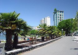
Geography of Canada
Encyclopedia
| acing="0"> |
 |
Continent
A continent is one of several very large landmasses on Earth. They are generally identified by convention rather than any strict criteria, with seven regions commonly regarded as continents—they are : Asia, Africa, North America, South America, Antarctica, Europe, and Australia.Plate tectonics is...
North America
North America is a continent wholly within the Northern Hemisphere and almost wholly within the Western Hemisphere. It is also considered a northern subcontinent of the Americas...
Subregion
A subregion is a conceptual unit which derives from a larger region or continent and is usually based on location. Cardinal directions, such as south or southern, are commonly used to define a subregion.- United Nations subregions :...
Northern America
Northern America is the northernmost region of the Americas, and is part of the North American continent. It lies directly north of the region of Middle America; the land border between the two regions coincides with the border between the United States and Mexico...
Area
Area is a quantity that expresses the extent of a two-dimensional surface or shape in the plane. Area can be understood as the amount of material with a given thickness that would be necessary to fashion a model of the shape, or the amount of paint necessary to cover the surface with a single coat...
- Total
- Water
9984670 km² (3,855,103 sq mi)
891163 km² (344,080 sq mi) (8.92%)
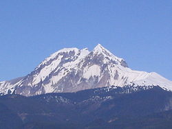
Mount Logan
Mount Logan is the highest mountain in Canada and the second-highest peak in North America, after Mount McKinley . The mountain was named after Sir William Edmond Logan, a Canadian geologist and founder of the Geological Survey of Canada . Mount Logan is located within Kluane National Park and...
,
5959 m (19,551 ft)
Atlantic Ocean
The Atlantic Ocean is the second-largest of the world's oceanic divisions. With a total area of about , it covers approximately 20% of the Earth's surface and about 26% of its water surface area...
, 0 m
Mackenzie River
The Mackenzie River is the largest river system in Canada. It flows through a vast, isolated region of forest and tundra entirely within the country's Northwest Territories, although its many tributaries reach into four other Canadian provinces and territories...
,
4241 km (2,635 mi)
Great Bear Lake
Great Bear Lake is the largest lake entirely within Canada , the third or fourth largest in North America, and the seventh or eighth largest in the world...
31153 km² (12,028 sq mi)
- Arable land
- Permanent
crops
- Permanent
pastures
- Forests and
woodlands
- Other
5%
0%
3%
54%
38% (1993 est.)
Climate
Climate encompasses the statistics of temperature, humidity, atmospheric pressure, wind, rainfall, atmospheric particle count and other meteorological elemental measurements in a given region over long periods...
:
Temperate
In geography, temperate or tepid latitudes of the globe lie between the tropics and the polar circles. The changes in these regions between summer and winter are generally relatively moderate, rather than extreme hot or cold...
in south to subarctic
Subarctic
The Subarctic is a region in the Northern Hemisphere immediately south of the true Arctic and covering much of Alaska, Canada, the north of Scandinavia, Siberia, and northern Mongolia...
or arctic
Arctic
The Arctic is a region located at the northern-most part of the Earth. The Arctic consists of the Arctic Ocean and parts of Canada, Russia, Greenland, the United States, Norway, Sweden, Finland, and Iceland. The Arctic region consists of a vast, ice-covered ocean, surrounded by treeless permafrost...
in north
Terrain
Terrain, or land relief, is the vertical and horizontal dimension of land surface. When relief is described underwater, the term bathymetry is used...
:
Plain
In geography, a plain is land with relatively low relief, that is flat or gently rolling. Prairies and steppes are types of plains, and the archetype for a plain is often thought of as a grassland, but plains in their natural state may also be covered in shrublands, woodland and forest, or...
s with mountains in west and lowlands
Hudson Bay Lowlands
The Hudson Bay Lowlands is a large, poorly drained piece of wetlands wedged between the Canadian Shield and southern shores of Hudson Bay and James Bay. Many wide and slow-moving rivers flow through this area toward the salt water of Hudson Bay. Mosquitoes and black flies thrive here. This is a...
in southeast
Iron
Iron is a chemical element with the symbol Fe and atomic number 26. It is a metal in the first transition series. It is the most common element forming the planet Earth as a whole, forming much of Earth's outer and inner core. It is the fourth most common element in the Earth's crust...
ore, nickel
Nickel
Nickel is a chemical element with the chemical symbol Ni and atomic number 28. It is a silvery-white lustrous metal with a slight golden tinge. Nickel belongs to the transition metals and is hard and ductile...
, zinc
Zinc
Zinc , or spelter , is a metallic chemical element; it has the symbol Zn and atomic number 30. It is the first element in group 12 of the periodic table. Zinc is, in some respects, chemically similar to magnesium, because its ion is of similar size and its only common oxidation state is +2...
, copper
Copper
Copper is a chemical element with the symbol Cu and atomic number 29. It is a ductile metal with very high thermal and electrical conductivity. Pure copper is soft and malleable; an exposed surface has a reddish-orange tarnish...
, gold
Gold
Gold is a chemical element with the symbol Au and an atomic number of 79. Gold is a dense, soft, shiny, malleable and ductile metal. Pure gold has a bright yellow color and luster traditionally considered attractive, which it maintains without oxidizing in air or water. Chemically, gold is a...
, lead
Lead
Lead is a main-group element in the carbon group with the symbol Pb and atomic number 82. Lead is a soft, malleable poor metal. It is also counted as one of the heavy metals. Metallic lead has a bluish-white color after being freshly cut, but it soon tarnishes to a dull grayish color when exposed...
, molybdenum
Molybdenum
Molybdenum , is a Group 6 chemical element with the symbol Mo and atomic number 42. The name is from Neo-Latin Molybdaenum, from Ancient Greek , meaning lead, itself proposed as a loanword from Anatolian Luvian and Lydian languages, since its ores were confused with lead ores...
, potash
Potash
Potash is the common name for various mined and manufactured salts that contain potassium in water-soluble form. In some rare cases, potash can be formed with traces of organic materials such as plant remains, and this was the major historical source for it before the industrial era...
, diamonds, silver
Silver
Silver is a metallic chemical element with the chemical symbol Ag and atomic number 47. A soft, white, lustrous transition metal, it has the highest electrical conductivity of any element and the highest thermal conductivity of any metal...
, fish
Fish
Fish are a paraphyletic group of organisms that consist of all gill-bearing aquatic vertebrate animals that lack limbs with digits. Included in this definition are the living hagfish, lampreys, and cartilaginous and bony fish, as well as various extinct related groups...
, timber
Timber
Timber may refer to:* Timber, a term common in the United Kingdom and Australia for wood materials * Timber, Oregon, an unincorporated community in the U.S...
, wildlife
Wildlife
Wildlife includes all non-domesticated plants, animals and other organisms. Domesticating wild plant and animal species for human benefit has occurred many times all over the planet, and has a major impact on the environment, both positive and negative....
, coal
Coal
Coal is a combustible black or brownish-black sedimentary rock usually occurring in rock strata in layers or veins called coal beds or coal seams. The harder forms, such as anthracite coal, can be regarded as metamorphic rock because of later exposure to elevated temperature and pressure...
, petroleum
Petroleum
Petroleum or crude oil is a naturally occurring, flammable liquid consisting of a complex mixture of hydrocarbons of various molecular weights and other liquid organic compounds, that are found in geologic formations beneath the Earth's surface. Petroleum is recovered mostly through oil drilling...
, natural gas
Natural gas
Natural gas is a naturally occurring gas mixture consisting primarily of methane, typically with 0–20% higher hydrocarbons . It is found associated with other hydrocarbon fuel, in coal beds, as methane clathrates, and is an important fuel source and a major feedstock for fertilizers.Most natural...
, hydropower
Hydropower
Hydropower, hydraulic power, hydrokinetic power or water power is power that is derived from the force or energy of falling water, which may be harnessed for useful purposes. Since ancient times, hydropower has been used for irrigation and the operation of various mechanical devices, such as...
Permafrost
In geology, permafrost, cryotic soil or permafrost soil is soil at or below the freezing point of water for two or more years. Ice is not always present, as may be in the case of nonporous bedrock, but it frequently occurs and it may be in amounts exceeding the potential hydraulic saturation of...
, cyclonic storms, tornado
Tornado
A tornado is a violent, dangerous, rotating column of air that is in contact with both the surface of the earth and a cumulonimbus cloud or, in rare cases, the base of a cumulus cloud. They are often referred to as a twister or a cyclone, although the word cyclone is used in meteorology in a wider...
es, forest fires
Air pollution
Air pollution is the introduction of chemicals, particulate matter, or biological materials that cause harm or discomfort to humans or other living organisms, or cause damage to the natural environment or built environment, into the atmosphere....
and water pollution
Water pollution
Water pollution is the contamination of water bodies . Water pollution occurs when pollutants are discharged directly or indirectly into water bodies without adequate treatment to remove harmful compounds....
, acid rain
Acid rain
Acid rain is a rain or any other form of precipitation that is unusually acidic, meaning that it possesses elevated levels of hydrogen ions . It can have harmful effects on plants, aquatic animals, and infrastructure. Acid rain is caused by emissions of carbon dioxide, sulfur dioxide and nitrogen...
s
The geography of Canada is vast and diverse. Occupying most of the northern portion of North America
North America
North America is a continent wholly within the Northern Hemisphere and almost wholly within the Western Hemisphere. It is also considered a northern subcontinent of the Americas...
(41% of the continent
Continent
A continent is one of several very large landmasses on Earth. They are generally identified by convention rather than any strict criteria, with seven regions commonly regarded as continents—they are : Asia, Africa, North America, South America, Antarctica, Europe, and Australia.Plate tectonics is...
), Canada
Canada
Canada is a North American country consisting of ten provinces and three territories. Located in the northern part of the continent, it extends from the Atlantic Ocean in the east to the Pacific Ocean in the west, and northward into the Arctic Ocean...
is the world's second largest country in total area.
Canada spans an immense territory between the Pacific Ocean
Pacific Ocean
The Pacific Ocean is the largest of the Earth's oceanic divisions. It extends from the Arctic in the north to the Southern Ocean in the south, bounded by Asia and Australia in the west, and the Americas in the east.At 165.2 million square kilometres in area, this largest division of the World...
to the west and the Atlantic Ocean
Atlantic Ocean
The Atlantic Ocean is the second-largest of the world's oceanic divisions. With a total area of about , it covers approximately 20% of the Earth's surface and about 26% of its water surface area...
to the east and the Arctic Ocean
Arctic Ocean
The Arctic Ocean, located in the Northern Hemisphere and mostly in the Arctic north polar region, is the smallest and shallowest of the world's five major oceanic divisions...
to the north (hence the country's motto "From sea to sea"), with the United States
United States
The United States of America is a federal constitutional republic comprising fifty states and a federal district...
to the south (contiguous United States
Contiguous United States
The contiguous United States are the 48 U.S. states on the continent of North America that are south of Canada and north of Mexico, plus the District of Columbia....
) and northwest (Alaska
Alaska
Alaska is the largest state in the United States by area. It is situated in the northwest extremity of the North American continent, with Canada to the east, the Arctic Ocean to the north, and the Pacific Ocean to the west and south, with Russia further west across the Bering Strait...
), and the Arctic Ocean
Arctic Ocean
The Arctic Ocean, located in the Northern Hemisphere and mostly in the Arctic north polar region, is the smallest and shallowest of the world's five major oceanic divisions...
to the north; Greenland
Greenland
Greenland is an autonomous country within the Kingdom of Denmark, located between the Arctic and Atlantic Oceans, east of the Canadian Arctic Archipelago. Though physiographically a part of the continent of North America, Greenland has been politically and culturally associated with Europe for...
is to the northeast. Off the southern coast of Newfoundland lies Saint-Pierre and Miquelon
Saint-Pierre and Miquelon
Saint Pierre and Miquelon is a self-governing territorial overseas collectivity of France. It is the only remnant of the former colonial empire of New France that remains under French control....
, an overseas collectivity of France
France
The French Republic , The French Republic , The French Republic , (commonly known as France , is a unitary semi-presidential republic in Western Europe with several overseas territories and islands located on other continents and in the Indian, Pacific, and Atlantic oceans. Metropolitan France...
. Since 1925, Canada has claimed the portion of the Arctic
Arctic
The Arctic is a region located at the northern-most part of the Earth. The Arctic consists of the Arctic Ocean and parts of Canada, Russia, Greenland, the United States, Norway, Sweden, Finland, and Iceland. The Arctic region consists of a vast, ice-covered ocean, surrounded by treeless permafrost...
between 60°W and 141°W longitude
Longitude
Longitude is a geographic coordinate that specifies the east-west position of a point on the Earth's surface. It is an angular measurement, usually expressed in degrees, minutes and seconds, and denoted by the Greek letter lambda ....
to the North Pole
North Pole
The North Pole, also known as the Geographic North Pole or Terrestrial North Pole, is, subject to the caveats explained below, defined as the point in the northern hemisphere where the Earth's axis of rotation meets its surface...
; however, this claim is contested.
Covering 9984670 km² or 3,855,102.6 sq mi (Land: 9093507 km² or 3,511,022.7 sq mi; Water: 891163 km² or 344,080 sq mi), Canada is slightly less than three-fifths as large as Russia, nearly 1.2 times larger than Australia
Australia
Australia , officially the Commonwealth of Australia, is a country in the Southern Hemisphere comprising the mainland of the Australian continent, the island of Tasmania, and numerous smaller islands in the Indian and Pacific Oceans. It is the world's sixth-largest country by total area...
, slightly larger than Europe
Europe
Europe is, by convention, one of the world's seven continents. Comprising the westernmost peninsula of Eurasia, Europe is generally 'divided' from Asia to its east by the watershed divides of the Ural and Caucasus Mountains, the Ural River, the Caspian and Black Seas, and the waterways connecting...
, and more than 40 times larger than the UK
United Kingdom
The United Kingdom of Great Britain and Northern IrelandIn the United Kingdom and Dependencies, other languages have been officially recognised as legitimate autochthonous languages under the European Charter for Regional or Minority Languages...
. In total area
Area
Area is a quantity that expresses the extent of a two-dimensional surface or shape in the plane. Area can be understood as the amount of material with a given thickness that would be necessary to fashion a model of the shape, or the amount of paint necessary to cover the surface with a single coat...
, Canada is slightly larger than both the U.S. and China
People's Republic of China
China , officially the People's Republic of China , is the most populous country in the world, with over 1.3 billion citizens. Located in East Asia, the country covers approximately 9.6 million square kilometres...
; however, Canada ranks fourth in land area (i.e., total area minus the area of lakes and rivers)—China is 9326410 km² (3,600,947 sq mi) and the U.S. is 9161923 km² (3,537,438.2 sq mi)
The northernmost settlement in Canada (and in the world) is Canadian Forces Station (CFS) Alert
CFS Alert
Canadian Forces Station Alert, also CFS Alert, is a Canadian Forces signals intelligence intercept facility located in Alert, Nunavut on the northeastern tip of Ellesmere Island, at ....
(just north of Alert, Nunavut
Alert, Nunavut
Alert, in the Qikiqtaaluk Region, Nunavut, Canada, is the northernmost permanently inhabited place in the world, from the North Pole. It takes its name from HMS Alert, which wintered east of the present station, off what is now Cape Sheridan, in 1875–1876.Alert was reported to have five permanent...
) on the northern tip of Ellesmere Island
Ellesmere Island
Ellesmere Island is part of the Qikiqtaaluk Region of the Canadian territory of Nunavut. Lying within the Canadian Arctic Archipelago, it is considered part of the Queen Elizabeth Islands, with Cape Columbia being the most northerly point of land in Canada...
—latitude
Latitude
In geography, the latitude of a location on the Earth is the angular distance of that location south or north of the Equator. The latitude is an angle, and is usually measured in degrees . The equator has a latitude of 0°, the North pole has a latitude of 90° north , and the South pole has a...
82.5°N—just 834 kilometres (518.2 mi) from the North Pole.
The magnetic North Pole
North Magnetic Pole
The Earth's North Magnetic Pole is the point on the surface of the Northern Hemisphere at which the Earth's magnetic field points vertically downwards . Though geographically in the north, it is, by the direction of the magnetic field lines, physically the south pole of the Earth's magnetic field...
lies within the Canadian Arctic territorial claim; however, recent measurements indicate it is moving towards Siberia
Siberia
Siberia is an extensive region constituting almost all of Northern Asia. Comprising the central and eastern portion of the Russian Federation, it was part of the Soviet Union from its beginning, as its predecessor states, the Tsardom of Russia and the Russian Empire, conquered it during the 16th...
.
Physical geography
Physical geography
Physical geography is one of the two major subfields of geography. Physical geography is that branch of natural science which deals with the study of processes and patterns in the natural environment like the atmosphere, biosphere and geosphere, as opposed to the cultural or built environment, the...
of Canada is widely varied. Boreal forests
Taiga
Taiga , also known as the boreal forest, is a biome characterized by coniferous forests.Taiga is the world's largest terrestrial biome. In North America it covers most of inland Canada and Alaska as well as parts of the extreme northern continental United States and is known as the Northwoods...
prevail throughout the country, ice is prominent in northerly Arctic regions and through the Rocky Mountains
Rocky Mountains
The Rocky Mountains are a major mountain range in western North America. The Rocky Mountains stretch more than from the northernmost part of British Columbia, in western Canada, to New Mexico, in the southwestern United States...
, and the relatively flat Canadian Prairies
Canadian Prairies
The Canadian Prairies is a region of Canada, specifically in western Canada, which may correspond to several different definitions, natural or political. Notably, the Prairie provinces or simply the Prairies comprise the provinces of Alberta, Saskatchewan, and Manitoba, as they are largely covered...
in the southwest facilitate productive agriculture. The Great Lakes
Great Lakes
The Great Lakes are a collection of freshwater lakes located in northeastern North America, on the Canada – United States border. Consisting of Lakes Superior, Michigan, Huron, Erie, and Ontario, they form the largest group of freshwater lakes on Earth by total surface, coming in second by volume...
feed the St. Lawrence River (in the southeast) where lowlands host much of Canada's population.
Appalachian Mountains
The Appalachian mountain rangeAppalachian Mountains
The Appalachian Mountains #Whether the stressed vowel is or ,#Whether the "ch" is pronounced as a fricative or an affricate , and#Whether the final vowel is the monophthong or the diphthong .), often called the Appalachians, are a system of mountains in eastern North America. The Appalachians...
extends from Georgia
Georgia (U.S. state)
Georgia is a state located in the southeastern United States. It was established in 1732, the last of the original Thirteen Colonies. The state is named after King George II of Great Britain. Georgia was the fourth state to ratify the United States Constitution, on January 2, 1788...
in the southern United States
Southern United States
The Southern United States—commonly referred to as the American South, Dixie, or simply the South—constitutes a large distinctive area in the southeastern and south-central United States...
through the Gaspé Peninsula
Gaspé Peninsula
The Gaspésie , or Gaspé Peninsula or the Gaspé, is a peninsula along the south shore of the Saint Lawrence River in Quebec, Canada, extending into the Gulf of Saint Lawrence...
and the Atlantic Provinces, creating rolling hills indented by river valleys. It also runs through parts of southern Quebec
Quebec
Quebec or is a province in east-central Canada. It is the only Canadian province with a predominantly French-speaking population and the only one whose sole official language is French at the provincial level....
.
The Appalachian mountains (more specifically the Notre Dame
Notre Dame Mountains
The Notre Dame Mountains are a portion of the Appalachian Mountains, extending from the Gaspé Peninsula of Quebec to the Green Mountains of Vermont....
and Long Range Mountains
Long Range Mountains
The Long Range Mountains are a series of mountains along the west coast of the Canadian island of Newfoundland. They also form the northernmost section of the Appalachian chain on the eastern seaboard of North America...
) are an old and eroded range of mountains, approximately 380 million years in age. Notable mountains in the Appalachians include Mount Jacques-Cartier (Quebec, 1268 m (4,160 ft) and Mount Carleton
Mount Carleton
Mount Carleton, in Mount Carleton Provincial Park, is the highest elevation in the Canadian province of New Brunswick, and is also the highest peak in the Canadian Maritime Provinces. It is one of the highlights of the Canadian portion of the International Appalachian Trail...
(New Brunswick, 817 m (2,680 ft)). Parts of the Appalachians are home to a rich endemic
Endemic (ecology)
Endemism is the ecological state of being unique to a defined geographic location, such as an island, nation or other defined zone, or habitat type; organisms that are indigenous to a place are not endemic to it if they are also found elsewhere. For example, all species of lemur are endemic to the...
flora and fauna and are considered to have been nunatak
Nunatak
A nunatak is an exposed, often rocky element of a ridge, mountain, or peak not covered with ice or snow within an ice field or glacier. The term is typically used in areas where a permanent ice sheet is present...
s during the last glaciation era.
Great Lakes and St. Lawrence Lowlands
Great Lakes
The Great Lakes are a collection of freshwater lakes located in northeastern North America, on the Canada – United States border. Consisting of Lakes Superior, Michigan, Huron, Erie, and Ontario, they form the largest group of freshwater lakes on Earth by total surface, coming in second by volume...
(bordered entirely by Ontario
Ontario
Ontario is a province of Canada, located in east-central Canada. It is Canada's most populous province and second largest in total area. It is home to the nation's most populous city, Toronto, and the nation's capital, Ottawa....
on the Canadian side) and St. Lawrence basin (often called St. Lawrence Lowlands), is another particularly rich sedimentary plain. Prior to its colonization and heavy urban sprawl
Urban sprawl
Urban sprawl, also known as suburban sprawl, is a multifaceted concept, which includes the spreading outwards of a city and its suburbs to its outskirts to low-density and auto-dependent development on rural land, high segregation of uses Urban sprawl, also known as suburban sprawl, is a...
of the 20th century, this Eastern Great Lakes lowland forests
Eastern Great Lakes lowland forests
The Eastern Great Lakes lowland forests is a Temperate Broadleaf and Mixed Forests ecoregion of North America, mostly in eastern Canada.-Setting:...
area was home to large mixed forests covering a mostly flat area of land between the Appalachian Mountains
Appalachian Mountains
The Appalachian Mountains #Whether the stressed vowel is or ,#Whether the "ch" is pronounced as a fricative or an affricate , and#Whether the final vowel is the monophthong or the diphthong .), often called the Appalachians, are a system of mountains in eastern North America. The Appalachians...
and the Canadian Shield
Canadian Shield
The Canadian Shield, also called the Laurentian Plateau, or Bouclier Canadien , is a vast geological shield covered by a thin layer of soil that forms the nucleus of the North American or Laurentia craton. It is an area mostly composed of igneous rock which relates to its long volcanic history...
. Most of this forest has been cut down through agriculture and logging operations, but the remaining forests are for the most part heavily protected. (see Eastern Great Lakes lowland forests
Eastern Great Lakes lowland forests
The Eastern Great Lakes lowland forests is a Temperate Broadleaf and Mixed Forests ecoregion of North America, mostly in eastern Canada.-Setting:...
). In this part of Canada the Gulf of St. Lawrence is the world's largest estuary
Estuary
An estuary is a partly enclosed coastal body of water with one or more rivers or streams flowing into it, and with a free connection to the open sea....
(see Gulf of St. Lawrence lowland forests
Gulf of St. Lawrence lowland forests
The Gulf of St. Lawrence lowland forests are a Temperate Broadleaf and Mixed Forests ecoregion of eastern Canada-Setting:Located on the Gulf of Saint Lawrence, the world's largest estuary, this ecoregion covers all of Prince Edward Island, the Les Îles-de-la-Madeleine of Quebec, most of...
).
While the relief of these lowlands is particularly flat and regular, a group of batholites known as the Monteregian Hills are spread along a mostly regular line across the area. The most notable are Montreal
Montreal
Montreal is a city in Canada. It is the largest city in the province of Quebec, the second-largest city in Canada and the seventh largest in North America...
's Mount Royal
Mount Royal
Mount Royal is a mountain in the city of Montreal, immediately west of downtown Montreal, Quebec, Canada, the city to which it gave its name.The mountain is part of the Monteregian Hills situated between the Laurentians and the Appalachians...
and Mont Saint-Hilaire
Mont Saint-Hilaire
Mont Saint-Hilaire , is an isolated hill, high, in the Montérégie region of southern Quebec. It is about thirty kilometres east of Montreal, and immediately east of the Richelieu River. It is one of the Monteregian Hills...
. These hills are known for a great richness in precious mineral
Mineral
A mineral is a naturally occurring solid chemical substance formed through biogeochemical processes, having characteristic chemical composition, highly ordered atomic structure, and specific physical properties. By comparison, a rock is an aggregate of minerals and/or mineraloids and does not...
s.
Canadian Shield
The northern parts of SaskatchewanSaskatchewan
Saskatchewan is a prairie province in Canada, which has an area of . Saskatchewan is bordered on the west by Alberta, on the north by the Northwest Territories, on the east by Manitoba, and on the south by the U.S. states of Montana and North Dakota....
, Manitoba
Manitoba
Manitoba is a Canadian prairie province with an area of . The province has over 110,000 lakes and has a largely continental climate because of its flat topography. Agriculture, mostly concentrated in the fertile southern and western parts of the province, is vital to the province's economy; other...
, Ontario, and Quebec, as well as most of Labrador
Labrador
Labrador is the distinct, northerly region of the Canadian province of Newfoundland and Labrador. It comprises the mainland portion of the province, separated from the island of Newfoundland by the Strait of Belle Isle...
, the mainland
Mainland
Mainland is a name given to a large landmass in a region , or to the largest of a group of islands in an archipelago. Sometimes its residents are called "Mainlanders"...
portions of the province of Newfoundland and Labrador
Newfoundland and Labrador
Newfoundland and Labrador is the easternmost province of Canada. Situated in the country's Atlantic region, it incorporates the island of Newfoundland and mainland Labrador with a combined area of . As of April 2011, the province's estimated population is 508,400...
, are located on a vast rock base known as the Canadian Shield
Canadian Shield
The Canadian Shield, also called the Laurentian Plateau, or Bouclier Canadien , is a vast geological shield covered by a thin layer of soil that forms the nucleus of the North American or Laurentia craton. It is an area mostly composed of igneous rock which relates to its long volcanic history...
. The Shield mostly consists of eroded hilly terrain and contains many lakes and important river
River
A river is a natural watercourse, usually freshwater, flowing towards an ocean, a lake, a sea, or another river. In a few cases, a river simply flows into the ground or dries up completely before reaching another body of water. Small rivers may also be called by several other names, including...
s used for hydroelectric
Hydroelectricity
Hydroelectricity is the term referring to electricity generated by hydropower; the production of electrical power through the use of the gravitational force of falling or flowing water. It is the most widely used form of renewable energy...
production, particularly in northern Quebec and Ontario. The shield also encloses an area of wetlands, the Hudson Bay
Hudson Bay
Hudson Bay , sometimes called Hudson's Bay, is a large body of saltwater in northeastern Canada. It drains a very large area, about , that includes parts of Ontario, Quebec, Saskatchewan, Alberta, most of Manitoba, southeastern Nunavut, as well as parts of North Dakota, South Dakota, Minnesota,...
lowlands. Some particular regions of the Shield are referred to as mountain range
Mountain range
A mountain range is a single, large mass consisting of a succession of mountains or narrowly spaced mountain ridges, with or without peaks, closely related in position, direction, formation, and age; a component part of a mountain system or of a mountain chain...
s, including the Torngat
Torngat Mountains
The Torngat Mountains are a mountain range on the Labrador Peninsula at the northern tip of Newfoundland and Labrador and eastern Quebec. They are part of the Arctic Cordillera. This is the peninsula that separates Ungava Bay from the Atlantic Ocean....
and Laurentian Mountains
Laurentian mountains
The Laurentian Mountains are a mountain range in southern Quebec, Canada, north of the St. Lawrence River and Ottawa River, rising to a highest point of 1166 metres at Mont Raoul Blanchard, north east of Quebec City in the Reserve Faunique des Laurentides. The Gatineau, L'Assomption, Lièvre,...
.
The Shield cannot support intensive agriculture
Agriculture
Agriculture is the cultivation of animals, plants, fungi and other life forms for food, fiber, and other products used to sustain life. Agriculture was the key implement in the rise of sedentary human civilization, whereby farming of domesticated species created food surpluses that nurtured the...
, although there is subsistence agriculture and small dairy farms in many of the river valleys and around the abundant lakes, particularly in the southern regions. Boreal forest covers much of the shield, with a mix of conifers that provide valuable timber resources in areas such as the Central Canadian Shield forests
Central Canadian Shield forests
The Central Canadian Shield forests are a taiga ecoregion of Canada.-Setting:This ecoregion consists of rolling hills, lakes, bogs and rocky outcrops covering a large curved swathe on the Canadian Shield from eastern Manitoba and Northern Ontario running southeastwards through Thunder Bay District...
ecoregion
Ecoregion
An ecoregion , sometimes called a bioregion, is an ecologically and geographically defined area that is smaller than an ecozone and larger than an ecosystem. Ecoregions cover relatively large areas of land or water, and contain characteristic, geographically distinct assemblages of natural...
that covers much of Northern Ontario
Northern Ontario
Northern Ontario is a region of the Canadian province of Ontario which lies north of Lake Huron , the French River and Lake Nipissing. The region has a land area of 802,000 km2 and constitutes 87% of the land area of Ontario, although it contains only about 6% of the population...
. The region is known for its extensive mineral reserves.
The Canadian Shield is known for its vast minerals, such as emeralds, diamonds and copper. The Canadian shield is also called the mineral house.
Canadian Interior Plains
The Canadian PrairiesCanadian Prairies
The Canadian Prairies is a region of Canada, specifically in western Canada, which may correspond to several different definitions, natural or political. Notably, the Prairie provinces or simply the Prairies comprise the provinces of Alberta, Saskatchewan, and Manitoba, as they are largely covered...
are part of a vast sedimentary plain
Great Plains
The Great Plains are a broad expanse of flat land, much of it covered in prairie, steppe and grassland, which lies west of the Mississippi River and east of the Rocky Mountains in the United States and Canada. This area covers parts of the U.S...
covering much of Alberta
Alberta
Alberta is a province of Canada. It had an estimated population of 3.7 million in 2010 making it the most populous of Canada's three prairie provinces...
, southern Saskatchewan, and southwestern Manitoba, as well as much of the region between the Rocky Mountains
Rocky Mountains
The Rocky Mountains are a major mountain range in western North America. The Rocky Mountains stretch more than from the northernmost part of British Columbia, in western Canada, to New Mexico, in the southwestern United States...
and the Great Slave
Great Slave Lake
Great Slave Lake is the second-largest lake in the Northwest Territories of Canada , the deepest lake in North America at , and the ninth-largest lake in the world. It is long and wide. It covers an area of in the southern part of the territory. Its given volume ranges from to and up to ...
and Great Bear
Great Bear Lake
Great Bear Lake is the largest lake entirely within Canada , the third or fourth largest in North America, and the seventh or eighth largest in the world...
lakes in Northwest Territories
Northwest Territories
The Northwest Territories is a federal territory of Canada.Located in northern Canada, the territory borders Canada's two other territories, Yukon to the west and Nunavut to the east, and three provinces: British Columbia to the southwest, and Alberta and Saskatchewan to the south...
. The plains generally describes the expanses of (largely flat) arable agricultural land which sustain extensive grain farming operations in the southern part of the provinces. Despite this, some areas such as the Cypress Hills and Alberta Badlands are quite hilly and the prairie provinces (Alberta
Alberta
Alberta is a province of Canada. It had an estimated population of 3.7 million in 2010 making it the most populous of Canada's three prairie provinces...
, Saskatchewan
Saskatchewan
Saskatchewan is a prairie province in Canada, which has an area of . Saskatchewan is bordered on the west by Alberta, on the north by the Northwest Territories, on the east by Manitoba, and on the south by the U.S. states of Montana and North Dakota....
and Manitoba
Manitoba
Manitoba is a Canadian prairie province with an area of . The province has over 110,000 lakes and has a largely continental climate because of its flat topography. Agriculture, mostly concentrated in the fertile southern and western parts of the province, is vital to the province's economy; other...
) contain large areas of forest such as the Mid-Continental Canadian forests
Mid-Continental Canadian forests
-Setting:This ecoregion extends from south of the Great Slave Lake in the Northwest Territories through most of northeastern Alberta, central Saskatchewan and parts of west-central Manitoba and consists of three main areas: the Slave River basin in northeastern Alberta, the lowlands of the northern...
Western Cordillera
The Canadian Cordillera, attached to the American cordilleraAmerican cordillera
The American Cordillera is a cordillera that consists of an essentially continuous sequence of mountain ranges that form the western "backbone" of North America, Central America, South America and Antarctica. From north to south, this sequence of overlapping and parallel ranges begins with the...
, stretches from the Rocky Mountains in the east to the Pacific Ocean
Pacific Ocean
The Pacific Ocean is the largest of the Earth's oceanic divisions. It extends from the Arctic in the north to the Southern Ocean in the south, bounded by Asia and Australia in the west, and the Americas in the east.At 165.2 million square kilometres in area, this largest division of the World...
.
The Canadian Rockies
Canadian Rockies
The Canadian Rockies comprise the Canadian segment of the North American Rocky Mountains range. They are the eastern part of the Canadian Cordillera, extending from the Interior Plains of Alberta to the Rocky Mountain Trench of British Columbia. The southern end borders Idaho and Montana of the USA...
are part of a major continental divide
Continental divide
A continental divide is a drainage divide on a continent such that the drainage basin on one side of the divide feeds into one ocean or sea, and the basin on the other side either feeds into a different ocean or sea, or else is endorheic, not connected to the open sea...
that extends north and south through western North America and western South America
South America
South America is a continent situated in the Western Hemisphere, mostly in the Southern Hemisphere, with a relatively small portion in the Northern Hemisphere. The continent is also considered a subcontinent of the Americas. It is bordered on the west by the Pacific Ocean and on the north and east...
. The Columbia
Columbia River
The Columbia River is the largest river in the Pacific Northwest region of North America. The river rises in the Rocky Mountains of British Columbia, Canada, flows northwest and then south into the U.S. state of Washington, then turns west to form most of the border between Washington and the state...
and the Fraser River
Fraser River
The Fraser River is the longest river within British Columbia, Canada, rising at Fraser Pass near Mount Robson in the Rocky Mountains and flowing for , into the Strait of Georgia at the city of Vancouver. It is the tenth longest river in Canada...
s have their headwaters in the Canadian Rockies and are the second and third largest rivers respectively to drain to the west coast of North America.
Chilcotin District
The Chilcotin District of British Columbia is usually known simply as "the Chilcotin", and also in speech commonly as "the Chilcotin Country" or simply Chilcotin. It is a plateau and mountain region in British Columbia on the inland lea of the Coast Mountains on the west side of the Fraser River....
and Cariboo
Cariboo
The Cariboo is an intermontane region of British Columbia along a plateau stretching from the Fraser Canyon to the Cariboo Mountains. The name is a reference to the woodland caribou that were once abundant in the region...
regions in central British Columbia
British Columbia
British Columbia is the westernmost of Canada's provinces and is known for its natural beauty, as reflected in its Latin motto, Splendor sine occasu . Its name was chosen by Queen Victoria in 1858...
(the Fraser Plateau
Fraser Plateau and Basin complex
The Fraser Plateau and Basin Complex is an ecoregion, as defined by the World Wildlife Fund. It encompasses the middle reaches of the watershed of the Fraser River as it traverses the northern part of the Interior Plateau of British Columbia...
) and the Nechako Plateau
Nechako Plateau
The Nechako Plateau is the northernmost subdivision of the Interior Plateau, one of the main geographic regions of the Canadian province of British Columbia...
further north. The Peace River
Peace River (Canada)
The Peace River is a river in Canada that originates in the Rocky Mountains of northern British Columbia and flows to the northeast through northern Alberta. The Peace River flows into the Slave River, a tributary of the Mackenzie River. The Mackenzie is the 12th longest river in the world,...
Valley in northeastern British Columbia is Canada's most northerly agricultural region, although it is part of the prairies. The dry, temperate climate of the Okanagan
Okanagan
The Okanagan , also known as the Okanagan Valley and sometimes as Okanagan Country is a region located in the Canadian province of British Columbia defined by the basin of Okanagan Lake and the Canadian portion of the Okanagan River. As of 2009, the region's population is approximately 350,927. The...
Valley in south central British Columbia provides ideal conditions for fruit growing and a flourishing wine industry. Between the plateau and the coast is a second mountain range, the Coast Mountains
Coast Mountains
The Coast Mountains are a major mountain range, in the Pacific Coast Ranges, of western North America, extending from southwestern Yukon through the Alaska Panhandle and virtually all of the Coast of British Columbia. They are so-named because of their proximity to the sea coast, and are often...
. The Coast Mountains contain some of the largest temperate-latitude icefields in the world.
On the south coast of British Columbia, Vancouver Island
Vancouver Island
Vancouver Island is a large island in British Columbia, Canada. It is one of several North American locations named after George Vancouver, the British Royal Navy officer who explored the Pacific Northwest coast of North America between 1791 and 1794...
is separated from the mainland by the continuous Juan de Fuca
Strait of Juan de Fuca
The Strait of Juan de Fuca is a large body of water about long that is the Salish Sea outlet to the Pacific Ocean...
, Georgia
Strait of Georgia
The Strait of Georgia or the Georgia Strait is a strait between Vancouver Island and the mainland coast of British Columbia, Canada. It is approximately long and varies in width from...
, and Johnstone
Johnstone Strait
Johnstone Strait is a channel along the north east coast of Vancouver Island in British Columbia, Canada. Opposite the Vancouver Island coast, running north to south, are Hanson Island, West Cracroft Island, the mainland British Columbia Coast, Hardwick Island, West Thurlow Island and East...
strait
Strait
A strait or straits is a narrow, typically navigable channel of water that connects two larger, navigable bodies of water. It most commonly refers to a channel of water that lies between two land masses, but it may also refer to a navigable channel through a body of water that is otherwise not...
s. Those straits include a large number of islands, notably the Gulf Islands
Gulf Islands
The Gulf Islands are the islands in the Strait of Georgia , between Vancouver Island and the mainland of British Columbia, Canada....
. North, near the Alaska
Alaska
Alaska is the largest state in the United States by area. It is situated in the northwest extremity of the North American continent, with Canada to the east, the Arctic Ocean to the north, and the Pacific Ocean to the west and south, with Russia further west across the Bering Strait...
n border, Haida Gwaii lies across Hecate Strait
Hecate Strait
Hecate Strait is a wide but shallow strait between the Haida Gwaii and the mainland of British Columbia, Canada. It merges with Queen Charlotte Sound to the south and Dixon Entrance to the north...
from the Bella Coola
Bella Coola, British Columbia
Bella Coola is a community of approximately 600 at the western extremity of the Bella Coola Valley. Bella Coola usually refers to the entire valley, encompassing the settlements of Bella Coola proper , Lower Bella Coola, Hagensborg, Saloompt, Nusatsum, Firvale and Stuie...
region. Other than in the plateau regions of the interior and the river valleys, most of British Columbia is coniferous forest. The only temperate rain forests in Canada are found along the Pacific coast in the Coast Mountains, on Vancouver Island, and on Haida Gwaii.
Volcanoes
Western Canada
Western Canada, also referred to as the Western provinces and commonly as the West, is a region of Canada that includes the four provinces west of the province of Ontario.- Provinces :...
has many volcano
Volcano
2. Bedrock3. Conduit 4. Base5. Sill6. Dike7. Layers of ash emitted by the volcano8. Flank| 9. Layers of lava emitted by the volcano10. Throat11. Parasitic cone12. Lava flow13. Vent14. Crater15...
es and is part of the system of volcanoes found around the margins of the Pacific Ocean
Pacific Ocean
The Pacific Ocean is the largest of the Earth's oceanic divisions. It extends from the Arctic in the north to the Southern Ocean in the south, bounded by Asia and Australia in the west, and the Americas in the east.At 165.2 million square kilometres in area, this largest division of the World...
, which is called the Pacific Ring of Fire
Pacific Ring of Fire
The Pacific Ring of Fire is an area where large numbers of earthquakes and volcanic eruptions occur in the basin of the Pacific Ocean. In a horseshoe shape, it is associated with a nearly continuous series of oceanic trenches, volcanic arcs, and volcanic belts and/or plate movements...
. There are over 200 young volcanic centres that stretch northward from the Cascade Range
Cascade Range
The Cascade Range is a major mountain range of western North America, extending from southern British Columbia through Washington and Oregon to Northern California. It includes both non-volcanic mountains, such as the North Cascades, and the notable volcanoes known as the High Cascades...
to the Yukon Territory. They are grouped into five volcanic belt
Volcanic belt
A volcanic belt is a large volcanically active region. Other terms are used for smaller areas of activity, such as volcanic fields. Volcanic belts are found above zones of unusually high temperature where magma is created by partial melting of solid material in the Earth's crust and upper mantle....
s with different volcano types and tectonic
Plate tectonics
Plate tectonics is a scientific theory that describes the large scale motions of Earth's lithosphere...
settings. The Northern Cordilleran Volcanic Province
Northern Cordilleran volcanic province
The Northern Cordilleran Volcanic Province , formerly known as the Stikine Volcanic Belt, is a geologic province defined by the occurrence of Miocene to Holocene volcanoes in the Pacific Northwest of North America...
was formed by faulting, cracking, rift
Rift
In geology, a rift or chasm is a place where the Earth's crust and lithosphere are being pulled apart and is an example of extensional tectonics....
ing, and the interaction between the Pacific Plate
Pacific Plate
The Pacific Plate is an oceanic tectonic plate that lies beneath the Pacific Ocean. At 103 million square kilometres, it is the largest tectonic plate....
and the North American plate
North American Plate
The North American Plate is a tectonic plate covering most of North America, Greenland, Cuba, Bahamas, and parts of Siberia, Japan and Iceland. It extends eastward to the Mid-Atlantic Ridge and westward to the Chersky Range in eastern Siberia. The plate includes both continental and oceanic crust...
. The Garibaldi Volcanic Belt
Garibaldi Volcanic Belt
The Garibaldi Volcanic Belt, also called the Canadian Cascade Arc, is a northwest-southeast trending volcanic chain in the Pacific Ranges of the Coast Mountains that extends from Watts Point in the south to the Ha-Iltzuk Icefield in the north. This chain of volcanoes is located in southwestern...
was formed by subduction
Subduction
In geology, subduction is the process that takes place at convergent boundaries by which one tectonic plate moves under another tectonic plate, sinking into the Earth's mantle, as the plates converge. These 3D regions of mantle downwellings are known as "Subduction Zones"...
of the Juan de Fuca Plate
Juan de Fuca Plate
The Juan de Fuca Plate, named after the explorer of the same name, is a tectonic plate, generated from the Juan de Fuca Ridge, and subducting under the northerly portion of the western side of the North American Plate at the Cascadia subduction zone...
beneath the North American Plate. The Anahim Volcanic Belt
Anahim Volcanic Belt
The Anahim Volcanic Belt is a long volcanic belt, stretching from just north of Vancouver Island to near Quesnel, British Columbia, Canada. The Anahim Volcanic Belt has had three main magmatic episodes: 15–13 Ma, 9–6 Ma, and 3–1 Ma. The volcanoes generally become younger eastward at a rate of to ...
was formed as a result of the North American Plate sliding westward over the Anahim hotspot
Anahim hotspot
The Anahim hotspot is a volcanic hotspot in central British Columbia, Canada. It is situated on the Interior Plateau, a large region that lies between the Cariboo and Monashee Mountains to the east, and the Hazelton Mountains, Coast Mountains and Cascade Range to the west...
. The Chilcotin Group is believed to have formed as a result of back-arc extension
Back-arc basin
Back-arc basins are geologic features, submarine basins associated with island arcs and subduction zones.They are found at some convergent plate boundaries, presently concentrated in the Western Pacific ocean. Most of them result from tensional forces caused by oceanic trench rollback and the...
behind the Cascadia subduction zone
Cascadia subduction zone
The Cascadia subduction zone is a subduction zone, a type of convergent plate boundary that stretches from northern Vancouver Island to northern California. It is a very long sloping fault that separates the Juan de Fuca and North America plates.New ocean floor is being created offshore of...
. The Wrangell Volcanic Field formed as a result of subduction
Subduction
In geology, subduction is the process that takes place at convergent boundaries by which one tectonic plate moves under another tectonic plate, sinking into the Earth's mantle, as the plates converge. These 3D regions of mantle downwellings are known as "Subduction Zones"...
of the Pacific Plate
Pacific Plate
The Pacific Plate is an oceanic tectonic plate that lies beneath the Pacific Ocean. At 103 million square kilometres, it is the largest tectonic plate....
beneath the North American Plate at the easternmost end of the Aleutian Trench
Aleutian Trench
The Aleutian Trench is a subduction zone and oceanic trench which runs along the southern coastline of Alaska and the adjacent waters of northeastern Siberia off the coast of Kamchatka Peninsula. It is classified as a "marginal trench" in the east as it runs along the margin of the continent, and...
.
Volcanism has also occurred in the Canadian Shield
Canadian Shield
The Canadian Shield, also called the Laurentian Plateau, or Bouclier Canadien , is a vast geological shield covered by a thin layer of soil that forms the nucleus of the North American or Laurentia craton. It is an area mostly composed of igneous rock which relates to its long volcanic history...
. It contains over 150 volcanic belt
Volcanic belt
A volcanic belt is a large volcanically active region. Other terms are used for smaller areas of activity, such as volcanic fields. Volcanic belts are found above zones of unusually high temperature where magma is created by partial melting of solid material in the Earth's crust and upper mantle....
s (now deformed and eroded down to nearly flat plain
Plain
In geography, a plain is land with relatively low relief, that is flat or gently rolling. Prairies and steppes are types of plains, and the archetype for a plain is often thought of as a grassland, but plains in their natural state may also be covered in shrublands, woodland and forest, or...
s) that range from 600 million to 2.8 billion years old. Many of Canada's major ore
Ore
An ore is a type of rock that contains minerals with important elements including metals. The ores are extracted through mining; these are then refined to extract the valuable element....
deposits are associated with Precambrian
Precambrian
The Precambrian is the name which describes the large span of time in Earth's history before the current Phanerozoic Eon, and is a Supereon divided into several eons of the geologic time scale...
volcanoes. There are pillow lava
Pillow lava
Pillow lavas are lavas that contain characteristic pillow-shaped structures that are attributed to the extrusion of the lava under water, or subaqueous extrusion. Pillow lavas in volcanic rock are characterized by thick sequences of discontinuous pillow-shaped masses, commonly up to one metre in...
s in the Northwest Territories
Northwest Territories
The Northwest Territories is a federal territory of Canada.Located in northern Canada, the territory borders Canada's two other territories, Yukon to the west and Nunavut to the east, and three provinces: British Columbia to the southwest, and Alberta and Saskatchewan to the south...
that are about 2.6 billion years old and are preserved in the Cameron River Volcanic Belt
Cameron River Volcanic Belt
The Cameron River Volcanic Belt is a Neoarchean volcanic belt near the Cameron River in the Northwest Territories, Canada. It contains pillow lavas about 2600 million years old, indicating that great oceanic volcanoes existed during the early stages of the formation of the Earth's crust.-See...
. The pillow lavas in rocks over 2 billion years old in the Canadian Shield signify that great oceanic volcanoes existed during the early stages of the formation of the Earth's crust. Ancient volcanoes play an important role in estimating Canada's mineral
Mineral
A mineral is a naturally occurring solid chemical substance formed through biogeochemical processes, having characteristic chemical composition, highly ordered atomic structure, and specific physical properties. By comparison, a rock is an aggregate of minerals and/or mineraloids and does not...
potential. Many of the volcanic belts bear ore deposits that are related to the volcanism.
Canadian Arctic
While the largest part of the Canadian Arctic is composed of seemingly endless permanent ice and tundraTundra
In physical geography, tundra is a biome where the tree growth is hindered by low temperatures and short growing seasons. The term tundra comes through Russian тундра from the Kildin Sami word tūndâr "uplands," "treeless mountain tract." There are three types of tundra: Arctic tundra, alpine...
north of the tree line, it encompasses geological regions of varying types: the Arctic Cordillera
Arctic Cordillera
The Arctic Cordillera is a vast, deeply dissected chain of mountain ranges extending along the northeastern flank of the Canadian Arctic Archipelago from Ellesmere Island to the northeasternmost part of the Labrador Peninsula in northern Labrador and northern Quebec, Canada...
(with the British Empire Range
British Empire Range
The British Empire Range is a mountain range on Ellesmere Island in Nunavut, Canada. The range is one of the most northern ranges in the world and the Arctic Cordillera, surpassed only by the Challenger Mountains which lies immediately to the northwest and the United States Range slightly further...
and the United States Range
United States Range
The United States Range is one of the most northern mountain ranges in the world and of the Arctic Cordillera and is surpassed only by the Challenger Mountains to the northwest. The range is located on the northeastern region of Ellesmere Island in Nunavut, Canada and is part of the Innuitian...
on Ellesmere Island
Ellesmere Island
Ellesmere Island is part of the Qikiqtaaluk Region of the Canadian territory of Nunavut. Lying within the Canadian Arctic Archipelago, it is considered part of the Queen Elizabeth Islands, with Cape Columbia being the most northerly point of land in Canada...
) contains the northernmost mountain system in the world. The Arctic Lowlands and Hudson Bay lowlands comprise a substantial part of the geographic region often designated as the Canadian Shield (in contrast to the sole geologic area). The ground in the Arctic is mostly composed of permafrost
Permafrost
In geology, permafrost, cryotic soil or permafrost soil is soil at or below the freezing point of water for two or more years. Ice is not always present, as may be in the case of nonporous bedrock, but it frequently occurs and it may be in amounts exceeding the potential hydraulic saturation of...
, making construction difficult and often hazardous, and agriculture virtually impossible.
The Arctic, when defined as everything north of the tree line, covers most of Nunavut
Nunavut
Nunavut is the largest and newest federal territory of Canada; it was separated officially from the Northwest Territories on April 1, 1999, via the Nunavut Act and the Nunavut Land Claims Agreement Act, though the actual boundaries had been established in 1993...
and the northernmost parts of Northwest Territories, Yukon, Manitoba, Ontario, Quebec, and Labrador.
Hydrography
| Drainage basins of Canada |
Canada holds vast reserves of water: its rivers discharge nearly 9% of the world's renewable water supply, it contains a quarter of the world's wetlands, and it has the third largest amount of glacier
Glacier
A glacier is a large persistent body of ice that forms where the accumulation of snow exceeds its ablation over many years, often centuries. At least 0.1 km² in area and 50 m thick, but often much larger, a glacier slowly deforms and flows due to stresses induced by its weight...
s (after Antarctica and Greenland
Greenland
Greenland is an autonomous country within the Kingdom of Denmark, located between the Arctic and Atlantic Oceans, east of the Canadian Arctic Archipelago. Though physiographically a part of the continent of North America, Greenland has been politically and culturally associated with Europe for...
). Because of extensive glaciation, Canada hosts more than two million lake
Lake
A lake is a body of relatively still fresh or salt water of considerable size, localized in a basin, that is surrounded by land. Lakes are inland and not part of the ocean and therefore are distinct from lagoons, and are larger and deeper than ponds. Lakes can be contrasted with rivers or streams,...
s: of those that are entirely within Canada, more than 31,000 are between 3 and 100 km² (1.2 and 38.6 sqmi) in area, while 563 are larger than 100 km² (38.6 sq mi).
Rivers
Canada’s two greatest rivers are the St. Lawrence, which drains the Great Lakes and empties into the Gulf of St. Lawrence, and the Mackenzie, which empties into the Arctic Ocean and drains a large part of northwestern Canada. While the St. Lawrence is the largest river in Canada in volume of water discharged at its mouth, the Mackenzie is the longest. Through its tributary, the Peace River, and tracing to its source in the Finlay River of British Columbia, the Mackenzie is 4,241 km (2,635 mi) long and is one of the longest rivers in the world. The St. Lawrence and the Mackenzie are the second and third largest rivers by volume of discharge, respectively, in North America.Drainage basins
The Atlantic watershed drains the entirety of the Atlantic provinces (parts of the Quebec-Labrador boundaryBorder
Borders define geographic boundaries of political entities or legal jurisdictions, such as governments, sovereign states, federated states and other subnational entities. Some borders—such as a state's internal administrative borders, or inter-state borders within the Schengen Area—are open and...
are fixed at the Atlantic continental divide
Continental divide
A continental divide is a drainage divide on a continent such that the drainage basin on one side of the divide feeds into one ocean or sea, and the basin on the other side either feeds into a different ocean or sea, or else is endorheic, not connected to the open sea...
), most of inhabited Quebec and large parts of southern Ontario. It is mostly drained by the economically important St. Lawrence River and its tributaries, notably the Saguenay
Saguenay River
The Saguenay River is a major river of Quebec, Canada.It drains Lac Saint-Jean in the Laurentian Highlands, leaving at Alma and running east, and passes the city of Saguenay. It drains into the Saint Lawrence River at Tadoussac....
, Manicouagan
Manicouagan River
The Manicouagan River is a river in Côte-Nord region of Quebec, Canada. The river originates at the Daniel-Johnson Dam of the Manicouagan Reservoir and flows approximately south, emptying into the Saint Lawrence River near Baie-Comeau...
and Ottawa
Ottawa River
The Ottawa River is a river in the Canadian provinces of Ontario and Quebec. For most of its length, it now defines the border between these two provinces.-Geography:...
rivers. The Great Lakes and Lake Nipigon
Lake Nipigon
Lake Nipigon is the largest lake entirely within the boundaries of the Canadian province of Ontario . It is sometimes described as the sixth Great Lake. Lying 260 metres above sea level, the lake drains into the Nipigon River and thence into Nipigon Bay of Lake Superior...
are also drained by the St. Lawrence. The Churchill River
Churchill River (Atlantic)
The Churchill River is a river in Newfoundland and Labrador which flows east from the Smallwood Reservoir in Labrador into the Atlantic Ocean via Lake Melville. The river is long and drains an area of ; it is the longest river in the province...
and St. John River are other important elements of the Atlantic watershed in Canada.
The Hudson Bay watershed drains over a third of Canada. It covers Manitoba, northern Ontario and Quebec, most of Saskatchewan, southern Alberta, southwestern Nunavut and the southern half of Baffin Island
Baffin Island
Baffin Island in the Canadian territory of Nunavut is the largest island in the Canadian Arctic Archipelago, the largest island in Canada and the fifth largest island in the world. Its area is and its population is about 11,000...
. This basin is most important in fighting drought
Drought
A drought is an extended period of months or years when a region notes a deficiency in its water supply. Generally, this occurs when a region receives consistently below average precipitation. It can have a substantial impact on the ecosystem and agriculture of the affected region...
in the prairies
Canadian Prairies
The Canadian Prairies is a region of Canada, specifically in western Canada, which may correspond to several different definitions, natural or political. Notably, the Prairie provinces or simply the Prairies comprise the provinces of Alberta, Saskatchewan, and Manitoba, as they are largely covered...
and producing hydroelectricity, especially in Manitoba, northern Ontario and Quebec. Major elements of this watershed include Lake Winnipeg
Lake Winnipeg
Lake Winnipeg is a large, lake in central North America, in the province of Manitoba, Canada, with its southern tip about north of the city of Winnipeg...
, Nelson River
Nelson River
The Nelson River is a river of north-central North America, in the Canadian province of Manitoba. Its full length is , it has mean discharge of , and has a drainage basin of , of which is in the United States...
, the North Saskatchewan
North Saskatchewan River
The North Saskatchewan River is a glacier-fed river that flows east from the Canadian Rockies to central Saskatchewan. It is one of two major rivers that join to make up the Saskatchewan River....
and South Saskatchewan River
South Saskatchewan River
The South Saskatchewan River is a major river in Canada that flows through the provinces of Alberta and Saskatchewan....
s, Assiniboine River
Assiniboine River
The Assiniboine River is a river that runs through the prairies of Western Canada in Saskatchewan and Manitoba. It is a tributary of the Red River. The Assiniboine is a typical meandering river with a single main channel embanked within a flat, shallow valley in some places and a steep valley in...
, and Nettilling Lake
Nettilling Lake
Nettilling Lake [nech'iling] is a cold freshwater lake located toward the south end of Baffin Island, Nunavut, Canada. It is also the world's largest lake on an island, with an area of 5,542 km2 and a maximum length of 123 km. The lake is in the Great Plain of the Koukdjuak about...
on Baffin Island. Wollaston Lake
Wollaston Lake
Wollaston Lake is located in northeastern Saskatchewan, Canada. With a surface area of 2286 km² , it is the largest lake in the world that drains naturally in two directions...
lies on the boundary between the Hudson Bay and Arctic Ocean watersheds and drains into both. It is the largest lake in the world that naturally drains in two directions.
The Continental Divide in the Rockies separates the Pacific watershed in British Columbia and the Yukon from the Arctic and Hudson Bay watersheds. This watershed irrigates the agriculturally important areas of inner British Columbia (such as the Okanagan and Kootenay
Kootenay River
The Kootenay is a major river in southeastern British Columbia, Canada and the northern part of the U.S. states of Montana and Idaho. It is one of the uppermost major tributaries of the Columbia River, which is the largest North American river that empties into the Pacific Ocean...
valleys), and is used to produce hydroelectricity. Major elements are the Yukon
Yukon River
The Yukon River is a major watercourse of northwestern North America. The source of the river is located in British Columbia, Canada. The next portion lies in, and gives its name to Yukon Territory. The lower half of the river lies in the U.S. state of Alaska. The river is long and empties into...
, Columbia
Columbia River
The Columbia River is the largest river in the Pacific Northwest region of North America. The river rises in the Rocky Mountains of British Columbia, Canada, flows northwest and then south into the U.S. state of Washington, then turns west to form most of the border between Washington and the state...
and Fraser River
Fraser River
The Fraser River is the longest river within British Columbia, Canada, rising at Fraser Pass near Mount Robson in the Rocky Mountains and flowing for , into the Strait of Georgia at the city of Vancouver. It is the tenth longest river in Canada...
s.
The northern parts of Alberta, Manitoba and British Columbia, most of Northwest Territories and Nunavut, and parts of the Yukon are drained by the Arctic watershed. This watershed has been little used for hydroelectricity, with the exception of the Mackenzie River
Mackenzie River
The Mackenzie River is the largest river system in Canada. It flows through a vast, isolated region of forest and tundra entirely within the country's Northwest Territories, although its many tributaries reach into four other Canadian provinces and territories...
, the longest river in Canada. The Peace
Peace River (Canada)
The Peace River is a river in Canada that originates in the Rocky Mountains of northern British Columbia and flows to the northeast through northern Alberta. The Peace River flows into the Slave River, a tributary of the Mackenzie River. The Mackenzie is the 12th longest river in the world,...
, Athabasca
Athabasca River
The Athabasca River originates from the Columbia Glacier of the Columbia Icefield in Jasper National Park in Alberta, Canada...
and Liard River
Liard River
The Liard River flows through Yukon, British Columbia and the Northwest Territories, Canada. Rising in the Saint Cyr Range of the Pelly Mountains in southeastern Yukon, it flows southeast through British Columbia, marking the northern end of the Rocky Mountains and then curving northeast back...
s, as well as Great Bear Lake and Great Slave Lake (respectively the largest and second largest lakes wholly enclosed by Canada) are significant elements of the Arctic watershed. Each of these elements eventually merges with the Mackenzie, thereby draining the vast majority of the Arctic watershed.
The southernmost part of Alberta drains into the Gulf of Mexico through the Milk River
Milk River (Montana-Alberta)
The Milk River is a tributary of the Missouri River, long, in the United States state of Montana and the Canadian province of Alberta. Rising in the Rocky Mountains, the river drains a sparsely populated, semi-arid watershed of , ending just east of Fort Peck, Montana.-Geography:It is formed in...
and its tributaries. The Milk River originates in the Rocky Mountains of Montana
Montana
Montana is a state in the Western United States. The western third of Montana contains numerous mountain ranges. Smaller, "island ranges" are found in the central third of the state, for a total of 77 named ranges of the Rocky Mountains. This geographical fact is reflected in the state's name,...
, then flows into Alberta, then returns into the United States
United States
The United States of America is a federal constitutional republic comprising fifty states and a federal district...
, where it is drained by the Missouri River
Missouri River
The Missouri River flows through the central United States, and is a tributary of the Mississippi River. It is the longest river in North America and drains the third largest area, though only the thirteenth largest by discharge. The Missouri's watershed encompasses most of the American Great...
. A small area of southwestern Saskatchewan is drained by Battle Creek
Battle Creek (Milk River)
Battle Creek is a stream that begins in southeastern Alberta along the border with Saskatchewan, in the Cypress Hills Interprovincial Park.It flows into the Milk River in Blaine County, Montana...
, which empties into the Milk River.
Floristic geography
Biodiversity Action Plan
A Biodiversity Action Plan is an internationally recognized program addressing threatened species and habitats and is designed to protect and restore biological systems. The original impetus for these plans derives from the 1992 Convention on Biological Diversity...
in response to the 1992 international accord; the plan addresses conservation of endangered species
Endangered species
An endangered species is a population of organisms which is at risk of becoming extinct because it is either few in numbers, or threatened by changing environmental or predation parameters...
and certain habitats. The main biome
Biome
Biomes are climatically and geographically defined as similar climatic conditions on the Earth, such as communities of plants, animals, and soil organisms, and are often referred to as ecosystems. Some parts of the earth have more or less the same kind of abiotic and biotic factors spread over a...
s of Canada are:
- TundraTundraIn physical geography, tundra is a biome where the tree growth is hindered by low temperatures and short growing seasons. The term tundra comes through Russian тундра from the Kildin Sami word tūndâr "uplands," "treeless mountain tract." There are three types of tundra: Arctic tundra, alpine...
- Boreal forest
- Mixed forest
- Broadleaf forestBroadleaf forestBroadleaf forest can refer to:* Temperate broadleaf and mixed forests* Tropical and subtropical dry broadleaf forests* Tropical and subtropical moist broadleaf forests...
- PrairiePrairiePrairies are considered part of the temperate grasslands, savannas, and shrublands biome by ecologists, based on similar temperate climates, moderate rainfall, and grasses, herbs, and shrubs, rather than trees, as the dominant vegetation type...
s - Rocky MountainsRocky MountainsThe Rocky Mountains are a major mountain range in western North America. The Rocky Mountains stretch more than from the northernmost part of British Columbia, in western Canada, to New Mexico, in the southwestern United States...
, vegetation includes various types of tundra and forests - Temperate coniferous forestsTemperate coniferous forestsTemperate coniferous forest is a terrestrial biome found in temperate regions of the world with warm summers and cool winters and adequate rainfall to sustain a forest. In most temperate coniferous forests, evergreen conifers predominate, while some are a mix of conifers and broadleaf evergreen...
, of which the Temperate rain forestTemperate rain forestTemperate rainforests are coniferous or broadleaf forests that occur in the temperate zone and receive high rainfall.-Definition:For temperate rain forests of North America, Alaback's definition is widely recognized:-Global distribution:...
s of coastal British Columbia is an example.
Political geography
Canada is divided into ten provinces and three territoriesProvinces and territories of Canada
The provinces and territories of Canada combine to make up the world's second-largest country by area. There are ten provinces and three territories...
. According to Statistics Canada
Statistics Canada
Statistics Canada is the Canadian federal government agency commissioned with producing statistics to help better understand Canada, its population, resources, economy, society, and culture. Its headquarters is in Ottawa....
, 72.0% of the population is concentrated within 150 kilometres (93.2 mi) of the nation's southern border with the United States, 70.0% live south of the 49th parallel
49th parallel north
The 49th parallel north is a circle of latitude that is 49 degrees north of the Earth's equatorial plane. It crosses Europe, Asia, the Pacific Ocean, North America, and the Atlantic Ocean....
, and over 60% of the population lives along the Great Lakes and St. Lawrence River between Windsor, Ontario
Windsor, Ontario
Windsor is the southernmost city in Canada and is located in Southwestern Ontario at the western end of the heavily populated Quebec City – Windsor Corridor. It is within Essex County, Ontario, although administratively separated from the county government. Separated by the Detroit River, Windsor...
and Quebec City
Quebec City
Quebec , also Québec, Quebec City or Québec City is the capital of the Canadian province of Quebec and is located within the Capitale-Nationale region. It is the second most populous city in Quebec after Montreal, which is about to the southwest...
. This leaves the vast majority of Canada's territory as sparsely populated wilderness; Canada's population density is 3.5 people/km2 (9.1/mi2), among the lowest in the world. Despite this, 79.7% of Canada's population resides in urban
Urban area
An urban area is characterized by higher population density and vast human features in comparison to areas surrounding it. Urban areas may be cities, towns or conurbations, but the term is not commonly extended to rural settlements such as villages and hamlets.Urban areas are created and further...
areas, where population densities are increasing.
Canada shares with the U.S. the world's longest undefended border at 8893 kilometres (5,525.9 mi); 2477 kilometres (1,539.1 mi) are with Alaska
Alaska
Alaska is the largest state in the United States by area. It is situated in the northwest extremity of the North American continent, with Canada to the east, the Arctic Ocean to the north, and the Pacific Ocean to the west and south, with Russia further west across the Bering Strait...
. The Danish
Denmark
Denmark is a Scandinavian country in Northern Europe. The countries of Denmark and Greenland, as well as the Faroe Islands, constitute the Kingdom of Denmark . It is the southernmost of the Nordic countries, southwest of Sweden and south of Norway, and bordered to the south by Germany. Denmark...
island dependency of Greenland
Greenland
Greenland is an autonomous country within the Kingdom of Denmark, located between the Arctic and Atlantic Oceans, east of the Canadian Arctic Archipelago. Though physiographically a part of the continent of North America, Greenland has been politically and culturally associated with Europe for...
lies to Canada's northeast, separated from the Canadian Arctic islands by Baffin Bay
Baffin Bay
Baffin Bay , located between Baffin Island and the southwest coast of Greenland, is a marginal sea of the North Atlantic Ocean. It is connected to the Atlantic via Davis Strait and the Labrador Sea...
and Davis Strait
Davis Strait
Davis Strait is a northern arm of the Labrador Sea. It lies between mid-western Greenland and Nunavut, Canada's Baffin Island. The strait was named for the English explorer John Davis , who explored the area while seeking a Northwest Passage....
. The French
France
The French Republic , The French Republic , The French Republic , (commonly known as France , is a unitary semi-presidential republic in Western Europe with several overseas territories and islands located on other continents and in the Indian, Pacific, and Atlantic oceans. Metropolitan France...
islands of Saint-Pierre and Miquelon
Saint-Pierre and Miquelon
Saint Pierre and Miquelon is a self-governing territorial overseas collectivity of France. It is the only remnant of the former colonial empire of New France that remains under French control....
lie off the southern coast of Newfoundland in the Gulf of St. Lawrence and have a maritime territorial enclave within Canada's Exclusive Economic Zone
Exclusive Economic Zone
Under the law of the sea, an exclusive economic zone is a seazone over which a state has special rights over the exploration and use of marine resources, including production of energy from water and wind. It stretches from the seaward edge of the state's territorial sea out to 200 nautical...
. Canada also shares a land border with Denmark
Denmark
Denmark is a Scandinavian country in Northern Europe. The countries of Denmark and Greenland, as well as the Faroe Islands, constitute the Kingdom of Denmark . It is the southernmost of the Nordic countries, southwest of Sweden and south of Norway, and bordered to the south by Germany. Denmark...
, as maps released in December 2006 show that the agreed upon boundaries run through the middle of Hans Island
Hans Island
Hans Island is a small, uninhabited barren knoll measuring , located in the centre of the Kennedy Channel of Nares Strait—the strait that separates Ellesmere Island from northern Greenland and connects Baffin Bay with the Lincoln Sea...
.
Canada's geographic proximity to the United States has historically bound the two countries together in the political world as well. Canada's position between the Soviet Union
Soviet Union
The Soviet Union , officially the Union of Soviet Socialist Republics , was a constitutionally socialist state that existed in Eurasia between 1922 and 1991....
(now Russia
Russia
Russia or , officially known as both Russia and the Russian Federation , is a country in northern Eurasia. It is a federal semi-presidential republic, comprising 83 federal subjects...
) and the U.S. was strategically important during the Cold War
Cold War
The Cold War was the continuing state from roughly 1946 to 1991 of political conflict, military tension, proxy wars, and economic competition between the Communist World—primarily the Soviet Union and its satellite states and allies—and the powers of the Western world, primarily the United States...
since the route over the North Pole and Canada was the fastest route by air between the two countries and the most direct route for intercontinental ballistic missile
Intercontinental ballistic missile
An intercontinental ballistic missile is a ballistic missile with a long range typically designed for nuclear weapons delivery...
s. Since the end of the Cold War, there has been growing speculation that Canada's Arctic maritime claims may become increasingly important if global warming
Global warming
Global warming refers to the rising average temperature of Earth's atmosphere and oceans and its projected continuation. In the last 100 years, Earth's average surface temperature increased by about with about two thirds of the increase occurring over just the last three decades...
melts the ice enough to open the Northwest Passage
Northwest Passage
The Northwest Passage is a sea route through the Arctic Ocean, along the northern coast of North America via waterways amidst the Canadian Arctic Archipelago, connecting the Atlantic and Pacific Oceans...
.
Similarly, the disputed—and tiny—Hans Island
Hans Island
Hans Island is a small, uninhabited barren knoll measuring , located in the centre of the Kennedy Channel of Nares Strait—the strait that separates Ellesmere Island from northern Greenland and connects Baffin Bay with the Lincoln Sea...
(with Denmark), in the Nares Strait
Nares Strait
Nares Strait is a waterway between Ellesmere Island and Greenland that is the northern part of Baffin Bay where it meets the Lincoln Sea. From south to north, the strait includes Smith Sound, Kane Basin, Kennedy Channel, Hall Basin and Robeson Channel...
between Ellesmere Island
Ellesmere Island
Ellesmere Island is part of the Qikiqtaaluk Region of the Canadian territory of Nunavut. Lying within the Canadian Arctic Archipelago, it is considered part of the Queen Elizabeth Islands, with Cape Columbia being the most northerly point of land in Canada...
and northern Greenland, may be a flashpoint for challenges to overall claims of Canadian sovereignty in The North.
Natural resources
Canada's abundance of natural resourcesNatural Resources
Natural Resources is a soul album released by Motown girl group Martha Reeves and the Vandellas in 1970 on the Gordy label. The album is significant for the Vietnam War ballad "I Should Be Proud" and the slow jam, "Love Guess Who"...
is reflected in their continued importance in the economy of Canada
Economy of Canada
Canada has the tenth largest economy in the world , is one of the world's wealthiest nations, and is a member of the Organization for Economic Co-operation and Development and Group of Eight . As with other developed nations, the Canadian economy is dominated by the service industry, which employs...
. Major resource-based industries are fisheries, forestry
Forestry
Forestry is the interdisciplinary profession embracing the science, art, and craft of creating, managing, using, and conserving forests and associated resources in a sustainable manner to meet desired goals, needs, and values for human benefit. Forestry is practiced in plantations and natural stands...
, agriculture
Agriculture
Agriculture is the cultivation of animals, plants, fungi and other life forms for food, fiber, and other products used to sustain life. Agriculture was the key implement in the rise of sedentary human civilization, whereby farming of domesticated species created food surpluses that nurtured the...
, petroleum products
Fossil fuel
Fossil fuels are fuels formed by natural processes such as anaerobic decomposition of buried dead organisms. The age of the organisms and their resulting fossil fuels is typically millions of years, and sometimes exceeds 650 million years...
and mining
Mining
Mining is the extraction of valuable minerals or other geological materials from the earth, from an ore body, vein or seam. The term also includes the removal of soil. Materials recovered by mining include base metals, precious metals, iron, uranium, coal, diamonds, limestone, oil shale, rock...
.
The fisheries industry has historically been one of Canada's strongest. Unmatched cod
Cod
Cod is the common name for genus Gadus, belonging to the family Gadidae, and is also used in the common name for various other fishes. Cod is a popular food with a mild flavor, low fat content and a dense, flaky white flesh. Cod livers are processed to make cod liver oil, an important source of...
stocks on the Grand Banks
Grand Banks
The Grand Banks of Newfoundland are a group of underwater plateaus southeast of Newfoundland on the North American continental shelf. These areas are relatively shallow, ranging from in depth. The cold Labrador Current mixes with the warm waters of the Gulf Stream here.The mixing of these waters...
off Newfoundland launched this industry in the 16th century. Today these stocks are nearly depleted, and their conservation has become a preoccupation of the Atlantic Provinces. On the West Coast, tuna
Tuna
Tuna is a salt water fish from the family Scombridae, mostly in the genus Thunnus. Tuna are fast swimmers, and some species are capable of speeds of . Unlike most fish, which have white flesh, the muscle tissue of tuna ranges from pink to dark red. The red coloration derives from myoglobin, an...
stocks are now restricted. The less depleted (but still greatly diminished) salmon
Salmon
Salmon is the common name for several species of fish in the family Salmonidae. Several other fish in the same family are called trout; the difference is often said to be that salmon migrate and trout are resident, but this distinction does not strictly hold true...
population continues to drive a strong fisheries industry. Canada claims 12 nautical miles (22.2 km) of territorial sea, a contiguous zone of 24 nautical miles (44.4 km), an exclusive economic zone
Exclusive Economic Zone
Under the law of the sea, an exclusive economic zone is a seazone over which a state has special rights over the exploration and use of marine resources, including production of energy from water and wind. It stretches from the seaward edge of the state's territorial sea out to 200 nautical...
of 200 nautical miles (370.4 km) and a continental shelf of 200 nautical miles (370.4 km) or to the edge of the continental margin.
Forestry has long been a major industry in Canada. Forest products contribute one fifth of the nation's exports. The provinces with the largest forestry industries are British Columbia, Ontario and Quebec. Fifty-four percent of Canada's land area is covered in forest. The boreal forests account for four-fifths of Canada's forestland.
Lower Mainland
The Lower Mainland is a name commonly applied to the region surrounding and including Vancouver, British Columbia, Canada. As of 2007, 2,524,113 people live in the region; sixteen of the province's thirty most populous municipalities are located there.While the term Lower Mainland has been...
and interior plateau of British Columbia, the St. Lawrence Basin and the Canadian Maritimes
Maritimes
The Maritime provinces, also called the Maritimes or the Canadian Maritimes, is a region of Eastern Canada consisting of three provinces, New Brunswick, Nova Scotia, and Prince Edward Island. On the Atlantic coast, the Maritimes are a subregion of Atlantic Canada, which also includes the...
. Main crops in Canada include flax
Flax
Flax is a member of the genus Linum in the family Linaceae. It is native to the region extending from the eastern Mediterranean to India and was probably first domesticated in the Fertile Crescent...
, oat
Oat
The common oat is a species of cereal grain grown for its seed, which is known by the same name . While oats are suitable for human consumption as oatmeal and rolled oats, one of the most common uses is as livestock feed...
s, wheat
Wheat
Wheat is a cereal grain, originally from the Levant region of the Near East, but now cultivated worldwide. In 2007 world production of wheat was 607 million tons, making it the third most-produced cereal after maize and rice...
, maize
Maize
Maize known in many English-speaking countries as corn or mielie/mealie, is a grain domesticated by indigenous peoples in Mesoamerica in prehistoric times. The leafy stalk produces ears which contain seeds called kernels. Though technically a grain, maize kernels are used in cooking as a vegetable...
, barley
Barley
Barley is a major cereal grain, a member of the grass family. It serves as a major animal fodder, as a base malt for beer and certain distilled beverages, and as a component of various health foods...
, sugar beet
Sugar beet
Sugar beet, a cultivated plant of Beta vulgaris, is a plant whose tuber contains a high concentration of sucrose. It is grown commercially for sugar production. Sugar beets and other B...
s and rye
Rye
Rye is a grass grown extensively as a grain and as a forage crop. It is a member of the wheat tribe and is closely related to barley and wheat. Rye grain is used for flour, rye bread, rye beer, some whiskeys, some vodkas, and animal fodder...
in the prairies; flax and maize in Western Ontario; Oats and potato
Potato
The potato is a starchy, tuberous crop from the perennial Solanum tuberosum of the Solanaceae family . The word potato may refer to the plant itself as well as the edible tuber. In the region of the Andes, there are some other closely related cultivated potato species...
es in the Maritimes. Fruit
Fruit
In broad terms, a fruit is a structure of a plant that contains its seeds.The term has different meanings dependent on context. In non-technical usage, such as food preparation, fruit normally means the fleshy seed-associated structures of certain plants that are sweet and edible in the raw state,...
and vegetable
Vegetable
The noun vegetable usually means an edible plant or part of a plant other than a sweet fruit or seed. This typically means the leaf, stem, or root of a plant....
s are grown primarily in the Annapolis Valley
Annapolis Valley
The Annapolis Valley is a valley and region in the Canadian province of Nova Scotia. It is located in the western part of the Nova Scotia peninsula, formed by a trough between two parallel mountain ranges along the shore of the Bay of Fundy.-Geography:...
of Nova Scotia, Southwestern Ontario
Southwestern Ontario
Southwestern Ontario is a subregion of Southern Ontario in the Canadian province of Ontario, centred on the city of London. It extends north to south from the Bruce Peninsula on Lake Huron to the Lake Erie shoreline, and east to south-west roughly from Guelph to Windsor. The region had a population...
, the Golden Horseshoe
Golden Horseshoe
The Golden Horseshoe is a densely populated and industrialized region centred around the Greater Toronto Area at the western end of Lake Ontario in Southern Ontario, Canada, with outer boundaries stretching south to Lake Erie and north to Georgian Bay. Most of it is also part of the Quebec City...
region of Ontario, along the south coast of Georgian Bay
Georgian Bay
Georgian Bay is a large bay of Lake Huron, located entirely within Ontario, Canada...
and in the Okanagan
Okanagan
The Okanagan , also known as the Okanagan Valley and sometimes as Okanagan Country is a region located in the Canadian province of British Columbia defined by the basin of Okanagan Lake and the Canadian portion of the Okanagan River. As of 2009, the region's population is approximately 350,927. The...
Valley of British Columbia. Cattle
Cattle
Cattle are the most common type of large domesticated ungulates. They are a prominent modern member of the subfamily Bovinae, are the most widespread species of the genus Bos, and are most commonly classified collectively as Bos primigenius...
and sheep
Domestic sheep
Sheep are quadrupedal, ruminant mammals typically kept as livestock. Like all ruminants, sheep are members of the order Artiodactyla, the even-toed ungulates. Although the name "sheep" applies to many species in the genus Ovis, in everyday usage it almost always refers to Ovis aries...
are raised in the valleys of British Columbia. Cattle, sheep and hogs are raised on the prairies, cattle and hogs in Western Ontario, sheep and hogs in Quebec, and sheep in the Maritimes. There are significant dairy
Dairy
A dairy is a business enterprise established for the harvesting of animal milk—mostly from cows or goats, but also from buffalo, sheep, horses or camels —for human consumption. A dairy is typically located on a dedicated dairy farm or section of a multi-purpose farm that is concerned...
regions in central Nova Scotia, southern New Brunswick, the St. Lawrence Valley, northeastern Ontario
Northeastern Ontario
Northeastern Ontario is the region within the Canadian province of Ontario which lies north and east of Lakes Superior and Huron.Northeastern Ontario consists of the districts of Algoma, Sudbury, Cochrane, Timiskaming, Nipissing and Manitoulin; and the single-tier municipality of Greater...
, southwestern Ontario, the Red River
Red River of the North
The Red River is a North American river. Originating at the confluence of the Bois de Sioux and Otter Tail rivers in the United States, it flows northward through the Red River Valley and forms the border between the U.S. states of Minnesota and North Dakota before continuing into Manitoba, Canada...
valley of Manitoba and the valleys of eastern British Columbia, on Vancouver Island
Vancouver Island
Vancouver Island is a large island in British Columbia, Canada. It is one of several North American locations named after George Vancouver, the British Royal Navy officer who explored the Pacific Northwest coast of North America between 1791 and 1794...
and the Lower mainland
Lower Mainland
The Lower Mainland is a name commonly applied to the region surrounding and including Vancouver, British Columbia, Canada. As of 2007, 2,524,113 people live in the region; sixteen of the province's thirty most populous municipalities are located there.While the term Lower Mainland has been...
.
Fossil fuels are a more recently developed resource in Canada, with oil
Petroleum
Petroleum or crude oil is a naturally occurring, flammable liquid consisting of a complex mixture of hydrocarbons of various molecular weights and other liquid organic compounds, that are found in geologic formations beneath the Earth's surface. Petroleum is recovered mostly through oil drilling...
and gas
Natural gas
Natural gas is a naturally occurring gas mixture consisting primarily of methane, typically with 0–20% higher hydrocarbons . It is found associated with other hydrocarbon fuel, in coal beds, as methane clathrates, and is an important fuel source and a major feedstock for fertilizers.Most natural...
being extracted from deposits in the Western Canadian Sedimentary Basin
Western Canadian Sedimentary Basin
The Western Canadian Sedimentary Basin is a vast sedimentary basin underlying of Western Canada including southwestern Manitoba, southern Saskatchewan, Alberta, northeastern British Columbia and the southwest corner of the Northwest Territories. It consists of a massive wedge of sedimentary rock...
since the mid 1900's. While Canada's crude oil deposits are fewer, technological developments in recent decades have opened up oil production in Alberta's Tar Sands
Tar sands
Bituminous sands, colloquially known as oil sands or tar sands, are a type of unconventional petroleum deposit. The sands contain naturally occurring mixtures of sand, clay, water, and a dense and extremely viscous form of petroleum technically referred to as bitumen...
to the point where Canada now has some of the largest reserves of oil in the world. In other forms, Canadian industry has long exploited large coal
Coal
Coal is a combustible black or brownish-black sedimentary rock usually occurring in rock strata in layers or veins called coal beds or coal seams. The harder forms, such as anthracite coal, can be regarded as metamorphic rock because of later exposure to elevated temperature and pressure...
and natural gas
Natural gas
Natural gas is a naturally occurring gas mixture consisting primarily of methane, typically with 0–20% higher hydrocarbons . It is found associated with other hydrocarbon fuel, in coal beds, as methane clathrates, and is an important fuel source and a major feedstock for fertilizers.Most natural...
reserves.
Canada's mineral resources are diverse and extensive. Across the Canadian Shield and in the north there are large iron
Iron
Iron is a chemical element with the symbol Fe and atomic number 26. It is a metal in the first transition series. It is the most common element forming the planet Earth as a whole, forming much of Earth's outer and inner core. It is the fourth most common element in the Earth's crust...
, nickel
Nickel
Nickel is a chemical element with the chemical symbol Ni and atomic number 28. It is a silvery-white lustrous metal with a slight golden tinge. Nickel belongs to the transition metals and is hard and ductile...
, zinc
Zinc
Zinc , or spelter , is a metallic chemical element; it has the symbol Zn and atomic number 30. It is the first element in group 12 of the periodic table. Zinc is, in some respects, chemically similar to magnesium, because its ion is of similar size and its only common oxidation state is +2...
, copper
Copper
Copper is a chemical element with the symbol Cu and atomic number 29. It is a ductile metal with very high thermal and electrical conductivity. Pure copper is soft and malleable; an exposed surface has a reddish-orange tarnish...
, gold
Gold
Gold is a chemical element with the symbol Au and an atomic number of 79. Gold is a dense, soft, shiny, malleable and ductile metal. Pure gold has a bright yellow color and luster traditionally considered attractive, which it maintains without oxidizing in air or water. Chemically, gold is a...
, lead
Lead
Lead is a main-group element in the carbon group with the symbol Pb and atomic number 82. Lead is a soft, malleable poor metal. It is also counted as one of the heavy metals. Metallic lead has a bluish-white color after being freshly cut, but it soon tarnishes to a dull grayish color when exposed...
, molybdenum
Molybdenum
Molybdenum , is a Group 6 chemical element with the symbol Mo and atomic number 42. The name is from Neo-Latin Molybdaenum, from Ancient Greek , meaning lead, itself proposed as a loanword from Anatolian Luvian and Lydian languages, since its ores were confused with lead ores...
, and uranium
Uranium
Uranium is a silvery-white metallic chemical element in the actinide series of the periodic table, with atomic number 92. It is assigned the chemical symbol U. A uranium atom has 92 protons and 92 electrons, of which 6 are valence electrons...
reserves. Large diamond
Diamond
In mineralogy, diamond is an allotrope of carbon, where the carbon atoms are arranged in a variation of the face-centered cubic crystal structure called a diamond lattice. Diamond is less stable than graphite, but the conversion rate from diamond to graphite is negligible at ambient conditions...
concentrations have been recently developed in the Arctic, making Canada one of the world's largest producers. Throughout the Shield there are many mining towns extracting these minerals. The largest, and best known, is Sudbury, Ontario. Sudbury is an exception to the normal process of forming minerals in the Shield since there is significant evidence that the Sudbury Basin
Sudbury Basin
The Sudbury Basin, also known as Sudbury Structure or the Sudbury Nickel Irruptive, is a major geologic structure in Ontario, Canada. It is the second-largest known impact crater or astrobleme on Earth, as well as one of the oldest....
is an ancient meteorite
Meteorite
A meteorite is a natural object originating in outer space that survives impact with the Earth's surface. Meteorites can be big or small. Most meteorites derive from small astronomical objects called meteoroids, but they are also sometimes produced by impacts of asteroids...
impact crater
Impact crater
In the broadest sense, the term impact crater can be applied to any depression, natural or manmade, resulting from the high velocity impact of a projectile with a larger body...
. The nearby, but less known Temagami Magnetic Anomaly
Temagami Magnetic Anomaly
The Temagami Magnetic Anomaly, also called the Temagami Anomaly or the Wanapitei Anomaly, is a large buried geologic structure in Ontario, Canada, stretching from Lake Wanapitei in the west to Bear Island in Lake Temagami....
has striking similarities to the Sudbury Basin. Its magnetic anomalies are very similar to the Sudbury Basin, and so it could be a second metal-rich impact crater. The Shield is also covered by vast boreal forests that support an important logging
Logging
Logging is the cutting, skidding, on-site processing, and loading of trees or logs onto trucks.In forestry, the term logging is sometimes used in a narrow sense concerning the logistics of moving wood from the stump to somewhere outside the forest, usually a sawmill or a lumber yard...
industry.
Canada's many rivers have afforded extensive development of hydroelectric power. Extensively developed in British Columbia, Ontario, Quebec and Labrador, the many dams have long provided a clean, dependable source of energy.
Natural hazards
Continuous permafrost in the north is a serious obstacle to development. Cyclonic storms form east of the Rocky mountains, a result of the mixing of air masses from the Arctic, Pacific, and North American interior, and produce most of the country's rain and snowSnow
Snow is a form of precipitation within the Earth's atmosphere in the form of crystalline water ice, consisting of a multitude of snowflakes that fall from clouds. Since snow is composed of small ice particles, it is a granular material. It has an open and therefore soft structure, unless packed by...
Current environmental issues
Air pollution and resulting acid rainAcid rain
Acid rain is a rain or any other form of precipitation that is unusually acidic, meaning that it possesses elevated levels of hydrogen ions . It can have harmful effects on plants, aquatic animals, and infrastructure. Acid rain is caused by emissions of carbon dioxide, sulfur dioxide and nitrogen...
severely affects lakes and damages forests. Metal smelting, coal-burning utilities, and vehicle emissions impact agricultural and forest productivity. And ocean waters are becoming contaminated from agricultural, industrial, mining, and forestry activities.
Global climate change
Climate change
Climate change is a significant and lasting change in the statistical distribution of weather patterns over periods ranging from decades to millions of years. It may be a change in average weather conditions or the distribution of events around that average...
and the warming of the polar region will likely cause significant changes to the environment, including loss of the polar bear
Polar Bear
The polar bear is a bear native largely within the Arctic Circle encompassing the Arctic Ocean, its surrounding seas and surrounding land masses. It is the world's largest land carnivore and also the largest bear, together with the omnivorous Kodiak Bear, which is approximately the same size...
, the exploration for resource then the extraction of these resources and an alternative transport route to the Panama Canal
Panama Canal
The Panama Canal is a ship canal in Panama that joins the Atlantic Ocean and the Pacific Ocean and is a key conduit for international maritime trade. Built from 1904 to 1914, the canal has seen annual traffic rise from about 1,000 ships early on to 14,702 vessels measuring a total of 309.6...
through the Northwest Passage
Northwest Passage
The Northwest Passage is a sea route through the Arctic Ocean, along the northern coast of North America via waterways amidst the Canadian Arctic Archipelago, connecting the Atlantic and Pacific Oceans...
.
Extreme points
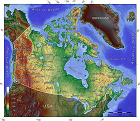
Cape Columbia
Cape Columbia is the northernmost point of land of Canada, located on Ellesmere Island in the Qikiqtaaluk Region of Nunavut. It marks the westernmost coastal point of Lincoln Sea in the Arctic Ocean...
, Ellesmere Island
Ellesmere Island
Ellesmere Island is part of the Qikiqtaaluk Region of the Canadian territory of Nunavut. Lying within the Canadian Arctic Archipelago, it is considered part of the Queen Elizabeth Islands, with Cape Columbia being the most northerly point of land in Canada...
, Nunavut
Nunavut
Nunavut is the largest and newest federal territory of Canada; it was separated officially from the Northwest Territories on April 1, 1999, via the Nunavut Act and the Nunavut Land Claims Agreement Act, though the actual boundaries had been established in 1993...
(83°08′ N, 74°13′W). The North Pole
North Pole
The North Pole, also known as the Geographic North Pole or Terrestrial North Pole, is, subject to the caveats explained below, defined as the point in the northern hemisphere where the Earth's axis of rotation meets its surface...
at 90°N is the northernmost water point. The northernmost point of the Canadian mainland is Murchison Promontory
Murchison Promontory
Murchison Promontory is a peninsula in northern Canada that is the northernmost point on mainland Canada and on the mainland of North America; it is also one of the Extreme points of Earth....
on Boothia Peninsula
Boothia Peninsula
Boothia Peninsula is a large peninsula in Nunavut's northern Canadian Arctic, south of Somerset Island. The northern part, Murchison Promontory, is the northernmost point of mainland Canada, and thus North America....
, Nunavut (71°58′N).
The southernmost point is Middle Island, in Lake Erie
Lake Erie
Lake Erie is the fourth largest lake of the five Great Lakes in North America, and the tenth largest globally. It is the southernmost, shallowest, and smallest by volume of the Great Lakes and therefore also has the shortest average water residence time. It is bounded on the north by the...
, Ontario
Ontario
Ontario is a province of Canada, located in east-central Canada. It is Canada's most populous province and second largest in total area. It is home to the nation's most populous city, Toronto, and the nation's capital, Ottawa....
(41°41′N, 82°40′W); the southernmost water point lies just south of the island, on the Ontario-Ohio
Ohio
Ohio is a Midwestern state in the United States. The 34th largest state by area in the U.S.,it is the 7th‑most populous with over 11.5 million residents, containing several major American cities and seven metropolitan areas with populations of 500,000 or more.The state's capital is Columbus...
border (41°40′35″N). The southernmost point of the Canadian mainland is Point Pelee
Point Pelee National Park
-See also:*National Parks of Canada*List of National Parks of Canada*Long Point-External links:**...
, Ontario (41°54′23″N).
The westernmost point is Boundary Peak 187 (141°00′7.128″W) at the southern end of the Yukon
Yukon
Yukon is the westernmost and smallest of Canada's three federal territories. It was named after the Yukon River. The word Yukon means "Great River" in Gwich’in....
-Alaska
Alaska
Alaska is the largest state in the United States by area. It is situated in the northwest extremity of the North American continent, with Canada to the east, the Arctic Ocean to the north, and the Pacific Ocean to the west and south, with Russia further west across the Bering Strait...
border which is roughly following 141°W but leans very slightly east as it goes North.
The easternmost point is Cape Spear
Cape Spear
Cape Spear, located on the Avalon Peninsula near St. John's, Newfoundland, is the easternmost point in North America , excluding Greenland and the portions of Alaska west of the 180th parallel of longitude . Cape Spear is close to Blackhead, an amalgamated area of the City of St. John's, about...
, Newfoundland (47°31′N, 52°37′W). The easternmost point of the Canadian mainland is Cape St. Charles
Cape St. Charles
Cape St. Charles is a headland on the coast of Labrador in the Canadian province of Newfoundland and Labrador. At longitude 55°37'15"W it is the most easterly point on the continental North America....
, Labrador (52°13′N, 55°37′W)
The lowest point is sea level
Sea level
Mean sea level is a measure of the average height of the ocean's surface ; used as a standard in reckoning land elevation...
at 0 m, whilst the highest point is Mount Logan
Mount Logan
Mount Logan is the highest mountain in Canada and the second-highest peak in North America, after Mount McKinley . The mountain was named after Sir William Edmond Logan, a Canadian geologist and founder of the Geological Survey of Canada . Mount Logan is located within Kluane National Park and...
at 5,959 m / 19,550 ft.
The Canadian pole of inaccessibility
Pole of inaccessibility
A pole of inaccessibility marks a location that is the most challenging to reach owing to its remoteness from geographical features that could provide access...
is Jackfish River, Alberta
Alberta
Alberta is a province of Canada. It had an estimated population of 3.7 million in 2010 making it the most populous of Canada's three prairie provinces...
(Latitude: 59°2′ 60 N, Longitude: 112°49′ 60 W).
See also
- Atlas of CanadaAtlas of CanadaThe Atlas of Canada is an Internet atlas published by Natural Resources Canada that has information on every city, town, village, and hamlet in Canada...
- Canadian GeographicCanadian GeographicCanadian Geographic is the bimonthly magazine of the Royal Canadian Geographical Society . It was first published in May 1930 under the name Canadian Geographical Journal. The society's objective was to produce a popular magazine dealing primarily with Canadian geography...
- Canadian RockiesCanadian RockiesThe Canadian Rockies comprise the Canadian segment of the North American Rocky Mountains range. They are the eastern part of the Canadian Cordillera, extending from the Interior Plains of Alberta to the Rocky Mountain Trench of British Columbia. The southern end borders Idaho and Montana of the USA...
- Extreme communities of CanadaExtreme communities of CanadaThis is a list of the extreme communities in Canada and its provinces and territories. They are further east, north, south or west than any other community, though they are generally not further than the extreme points of Canadian provinces. The record latitude or longitude is given.*Lloydminster...
- List of areas disputed by the United States and Canada
- List of highest points of Canadian provinces and territories
- Mountain peaks of CanadaMountain peaks of CanadaThis article comprises three sortable tables of major mountain peaks of Canada.Topographic elevation is the vertical distance above the reference geoid, a precise mathematical model of the Earth's sea level as an equipotential gravitational surface. Topographic prominence is the elevation...
- Temperature in CanadaTemperature in CanadaThe average temperatures of Canada vary across the country; the table below shows the temperature of various cities across Canada.The table can be reordered by clicking on the box in each column.-External links :*...
- Territorial evolution of CanadaTerritorial evolution of CanadaThe federation of Canada was created in 1867 when three colonies of British North America were united. One of these colonies split into two new provinces, three other colonies joined later...
Further reading
- Drushka, Ken (2003), Canada's forests: a history, McGill-Queen's University Press, ISBN 0773526609
External links
- Government of Canada - The Atlas of Canada
- Canadian Geographic - The Canadian Atlas Online