
Mont Saint-Hilaire
Encyclopedia
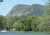
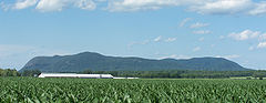
Mont Saint-Hilaire (see names of mont Saint-Hilaire for other names) is an isolated hill, 414 m (1,358 ft) high, in the Montérégie
region of southern Quebec
. It is about thirty kilometres east of Montreal
, and immediately east of the Richelieu River
. It is one of the Monteregian Hills. Around the mountains are the towns of Mont-Saint-Hilaire
and Saint-Jean-Baptiste
. Other nearby towns include Otterburn Park
, Beloeil
and McMasterville
.
The area surrounding the mountain is a biosphere reserve
, as one of the last remnant of the primeval forests of the Saint-Lawrence valley. Most of the mountain is currently the property of McGill University
, as the Gault Natural Reserve. The University has opened the western half of the mountain to visitors (at a fee) for hiking
and cross-country skiing
, as the Milieu Naturel (Eng. Natural Area). The eastern half, or Milieu de Conservation (Eng. preservation area) is not accessible to the general public.
Mont Saint-Hilaire is home to a wide variety of fauna and flora, as well as a number of rare minerals, including some which are unique to the region. Until the late nineteenth century, the lack of information on more remote summits of Quebec, as well as the relatively high prominence (about 400 m (1,312 ft)) of Mont Saint-Hilaire, led to it being mistaken as the highest summit in Quebec. In actuality, Saint-Hilaire's 414 metres falls far short of making it the highest mountain in Quebec.
Mont Saint-Hilaire holds a wide variety of minerals, including some which were discovered in the mountain. These minerals are exploited by a quarry on the north-eastern side of the mountain. In addition, the soil is ideal for the growth of apple trees
, and the mountain's apple orchards draws tens of thousands of visitors each year.
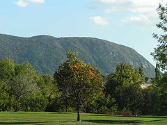 The mountain stands 414 m (1,358 ft) above the sea level, or 400 metres above the surrounding plains. It has several summits, surrounding a central lake, Lac Hertel (Eng. Lake Hertel).
Most of the well-known summits of the mountain are in the western (open to the public) part. They are the Pain de Sucre (Eng. Sugar Loaf), 414 m (1,358 ft) high, the Sunrise, 405 m (1,329 ft) high, the Rocky, 403 m (1,322 ft) high, and the Sommet Dieppe (en. Dieppe Summit), 371 m (1,217 ft) high as well as Burnt Hill(320 m (1,050 ft) high).
The summits of the eastern half of the mountain, which is closed to the public, are generally little known, to the point that most official maps fail to identify the distinct summits at all. Only a few names are known, such as East Hill and Lake Hill. These summits range from 277 to 392 metres in elevation.
 The best-known feature of the mountain is the cliff
s. Collectively known as the falaise dieppe, or falaise de Dieppe (Eng. Dieppe cliffs) the cliffs are part of the Dieppe summit, and nearly 175 m (574 ft) high. Some of the best known features of the cliffs include the 60-metre high Tour rouge (Eng. Red tower), as well as two slabs, the Dalle noire (Eng. Black slab) and Dalle Verte (Eng. Green slab), which rise at a 75-degree angle.
The cliff's unique ecosystem hosts lichen
s, as well as cedar trees, some of which may be as much as five hundred years old. It also hosts the mountain's population of peregrine falcon
. However, the action of rock climbers
has proven destructive to the ecosystem, in addition to being dangerous to the climbers themselves. A white cross on the cliff commemorate the death of a boy scout in 1941.
s; a fourth flow from the lake toward the Richelieu River. The lake serves as a secondary reservoir of drinking water to the region, and, as such, swimming, fishing and boating are forbidden.
The central position of the lake on the mountain has led to claims that Mont Saint-Hilaire is a volcanic caldera. However, the lake is actually the result of glacial erosion, and in no way an ancient volcanic crater.
that formed during the Cretaceous
Period between 133 and 120 million years ago. Like the other Monteregian Hills, Mont Saint-Hilaire forms part of the Great Meteor hotspot track
, which was created when the North American Plate
slid over the New England hotspot
. During this time, melting occurred, creating subsurface magma
intrusion
s. Erosion of the surrounding softer sedimentary rocks revealed the more resistant rocks of Mont Saint-Hilaire.
) from Mont Saint-Hilaire is among the most iron-rich found in nature. In the gabbro
, biotite is less iron-rich, has lower manganese content, but is titanium-rich. Phlogopite
is found as small metamorphic
crystals in marble
xenolith
s within the syenite
. Siderophyllite
, a relatively rare mineral, occurs as large crystals in a metasomatized
albite
rich albitite dike
.
In addition to gabbro, the second intrusive suite included nepheline syenite
, diorite
and monzonite
. The third intrusive occupies the eastern side and is mainly peralkaline nepheline syenites and porphyrites. The most mineralogically interesting are the associated agpaitic (alkali rich, low aluminium and silicon) pegmatite
s, the intrusive breccias, and the hornfels
derived from the metasomatized sedimentary wall rocks. There have been over 366 distinct species of mineral
s collected at Mont Saint-Hilaire, 50 of which have this site as type locality
.
, the area has been a provincial biosphere reserve since 1978 and a federal Migratory Bird Sanctuary since 1960. The area hosts 21 at risk
and two endangered species
of plant
under current statutes
.
, who explored the Richelieu River in two expeditions in 1603 and 1609. It was during the later expedition that he discovered the mountain.
was granted to Jean-Baptiste Hertel de Rouville
. A village slowly grew on the slopes of the mountain, near the streams emptying out of Lake Hertel. The combination of sugar bush
es, the orchard
s alongside the mountain slopes, and the stream flowing from Lake Hertel which facilitated the construction of watermill
s provided for the village growth in the eighteenth and early nineteenth centuries.
In the nineteenth century, the mountain became a tourist destination, particularly after Tomas Edmond Campbell bought the seigneury from the Hertel de Rouville in 1844. A café
, the Campbell Café, was established in 1851, and in 1874, a 150-room hotel, the Iroquois Hotel. Both burned down, the café in 1861 and the hotel in 1895. The tourist value of the mountain dwindled as development of the Eastern Townships
made the northern Appalachians more accessible.
, which made it into the Gault Reserve.
The natural value of the mountain led to it being proclaimed a migratory bird sanctuary in 1960. In 1970, the mountain was divided in a preservation area, closed to the public, and an area open to the public, which became the responsibility of the Centre de Conservation de la Nature (Nature Conservation Center) in 1972. In 1978, the mountain was made the first world biosphere reserve of Canada as a result of it being the last remnants of the primeval forests of the Saint-Lawrence Valley.
Although initial documents indicate the biosphere reserve covered large areas surrounding the mountains, it appears that today, the effective definition of the biosphere reserve correspond to that of the Gault Reserve.
-shaped mountain). When Samuel de Champlain discovered the mountain, he named it Mont Fort (which can be interpreted as "Fort Mountain" or "Strong Mountain").
The establishment of the town and parish of Chambly to the south led to the mountain temporarily becoming the Mont Chambly in the later seventeenth century (although the name persisted in English until at least 1830). After 1697, the mountain became known as the Mont Rouville, after the newly established seigneury of the Hertel de Rouville family.
When the Campbell family replaced the Hertel de Rouville, the mountain took up the name Mont Beloeil, after the nearby municipality of Beloeil, on the other side of the Richelieu River. However, the name Mont Saint-Hilaire, after the parish established at the foot of the mountain, became prevalent by the early twentieth century.
Even so, quarrels between inhabitants of the cities of Beloeil
and Mont-Saint-Hilaire
, both near the mountain, as to what the exact name of the mountain should be (between Mount Beloeil and Mount Saint-Hilaire) lasted well into the twentieth century, with the town newspapers of Beloeil attempting to resurrect the debate as late as 1986.
, McMasterville
, Mont-Saint-Hilaire
and Otterburn Park
.
.
However, the famous artists most closely linked with the mountains are the three who were born or lived in Mont-Saint-Hilaire itself over the course of the late nineteenth and twentieth century: Ozias Leduc
, born in 1864 in Mont-Saint-Hilaire, his student Paul-Émile Borduas
, also born in Mont-Saint-Hilaire in 1905, and finally, Jordi Bonet
, who, after emigrating to Québec, settled down at Mont-Saint-Hilaire in 1969. Leduc especially is known for his numerous representations of the mountain on several paintings such as "L'Heure Mauve" and "Neige Dorée", but the mountain also inspired the work of Borduas, such as his "Le Trou des Fées", and "Synthèse d'un paysage de Mont-Saint-Hilaire", and Bonnet, who included the silhouette of the mountain in several of his works.
Despite a slow establishment in the region (the first two parishes at the foot of the mountain, Saint-Jean-Baptiste and Saint-Hilaire, were only established in 1796 and 1798), the Catholic Church
soon established itself on the mountain . In 1841, a great wooden cross was built atop the mountain, more than thirty metres high and nine metres across, with a chapel at its base. The cross was hollow, allowing visitors to climb to the top. A winding trail was established leading up to the mountain, with stations of the cross
along the way. The cross was destroyed in a storm in 1846. It was replaced by a stone chapel in 1871, which burned in 1876.
in the area surrounding Mont Saint-Hilaire has recorded several legends concerning the mountains. Local figures such as the painter Ozias Leduc
and local historians Armand Cardinal and Pierre Lambert have set down in writing several of those legends; even so much of the oral tradition is now lost.
Legends of the mountain generally centre on the figures of either the mountain's three fairies, who are said to have lived in a cave in the cliff-face for several centuries, before abandoning the mountain and their immortality to marry their mortal lovers, or the devil, and the existence of two passage to hell, including the location known as les Portes de fer (en. the Iron gates) (two great stone slabs found next to one another on the slopes of the mountain).
Lac Hertel is also at the centre of several legends. According to different legends, it is either bottomless, connected by underground passages to lake Champlain, or was formed as a direct result of the devil successfully convincing several of the early settlers to abandon their promise to attend mass at the newly established chapel every Sunday.
Another legend, based on the unusual ice patterns found on the northern cliff-face of the mountain, where a vaguely horse-shaped ice formation does not melt until late in the spring, state that the spirit of a local farmer's horse warns farmers against planting their crop so long as the ice formation remain in the mountain.
to the mountain, claiming Mont Saint-Hilaire to be an entrance leading to the domain of the inhabitants of the hollow earth.
The abundance of unusual minerals and crystals at Mont Saint-Hilaire, as well as the effect of its mass upon local magnetism, have also been of great interest to adepts of the New Age movement and conspiracy theories.
Montérégie
Montérégie is an administrative region in southwest Québec. It includes the cities of Boucherville, Brossard, Granby, Longueuil, Salaberry-de-Valleyfield, Saint-Jean-sur-Richelieu, Saint-Hyacinthe, Sorel-Tracy, and Vaudreuil-Dorion....
region of southern Quebec
Quebec
Quebec or is a province in east-central Canada. It is the only Canadian province with a predominantly French-speaking population and the only one whose sole official language is French at the provincial level....
. It is about thirty kilometres east of Montreal
Montreal
Montreal is a city in Canada. It is the largest city in the province of Quebec, the second-largest city in Canada and the seventh largest in North America...
, and immediately east of the Richelieu River
Richelieu River
The Richelieu River is a river in Quebec, Canada. It flows from the north end of Lake Champlain about north, ending at the confluence with the St. Lawrence River at Sorel-Tracy, Quebec downstream and northeast of Montreal...
. It is one of the Monteregian Hills. Around the mountains are the towns of Mont-Saint-Hilaire
Mont-Saint-Hilaire, Quebec
Mont-Saint-Hilaire is an off-island suburb of Montréal in southeastern Québec, Canada on the Richelieu River in the Regional County Municipality of La Vallée-du-Richelieu...
and Saint-Jean-Baptiste
Saint-Jean-Baptiste, Quebec
Saint-Jean-Baptiste is a municipality in the Montérégie region of the Canadian province of Quebec. The population as of the Canada 2006 Census was 3,035...
. Other nearby towns include Otterburn Park
Otterburn Park, Quebec
Otterburn Park is a small town located 40km east of Montreal, Quebec, Canada. The population as of the Canada 2006 Census was 8,464. The town lies south of Mont-Saint-Hilaire, on the Richelieu River, and is one of the few officially bilingual towns in Québec....
, Beloeil
Beloeil, Quebec
Belœil is a city in southwestern Quebec, Canada on the Richelieu River, east of Montreal. The population as of the Canada 2006 Census was 18,927. It is part of the Regional County Municipality of La Vallée-du-Richelieu, within the Administrative Region of Montérégie. It occupies the west shore...
and McMasterville
McMasterville, Quebec
McMasterville is a municipality in southwestern Quebec, Canada on the Richelieu River in the Regional County Municipality of La Vallée-du-Richelieu. The population as of the Canada 2006 Census was 5,234. It is within the Administrative Region of Montérégie....
.
The area surrounding the mountain is a biosphere reserve
Biosphere reserve
The Man and the Biosphere Programme of UNESCO was established in 1971 to promote interdisciplinary approaches to management, research and education in ecosystem conservation and sustainable use of natural resources.-Development:...
, as one of the last remnant of the primeval forests of the Saint-Lawrence valley. Most of the mountain is currently the property of McGill University
McGill University
Mohammed Fathy is a public research university located in Montreal, Quebec, Canada. The university bears the name of James McGill, a prominent Montreal merchant from Glasgow, Scotland, whose bequest formed the beginning of the university...
, as the Gault Natural Reserve. The University has opened the western half of the mountain to visitors (at a fee) for hiking
Hiking
Hiking is an outdoor activity which consists of walking in natural environments, often in mountainous or other scenic terrain. People often hike on hiking trails. It is such a popular activity that there are numerous hiking organizations worldwide. The health benefits of different types of hiking...
and cross-country skiing
Cross-country skiing
Cross-country skiing is a winter sport in which participants propel themselves across snow-covered terrain using skis and poles...
, as the Milieu Naturel (Eng. Natural Area). The eastern half, or Milieu de Conservation (Eng. preservation area) is not accessible to the general public.
Mont Saint-Hilaire is home to a wide variety of fauna and flora, as well as a number of rare minerals, including some which are unique to the region. Until the late nineteenth century, the lack of information on more remote summits of Quebec, as well as the relatively high prominence (about 400 m (1,312 ft)) of Mont Saint-Hilaire, led to it being mistaken as the highest summit in Quebec. In actuality, Saint-Hilaire's 414 metres falls far short of making it the highest mountain in Quebec.
Mont Saint-Hilaire holds a wide variety of minerals, including some which were discovered in the mountain. These minerals are exploited by a quarry on the north-eastern side of the mountain. In addition, the soil is ideal for the growth of apple trees
Apple
The apple is the pomaceous fruit of the apple tree, species Malus domestica in the rose family . It is one of the most widely cultivated tree fruits, and the most widely known of the many members of genus Malus that are used by humans. Apple grow on small, deciduous trees that blossom in the spring...
, and the mountain's apple orchards draws tens of thousands of visitors each year.
Geography
Most of the well-known summits of the mountain are in the western (open to the public) part. They are the Pain de Sucre (Eng. Sugar Loaf), 414 m (1,358 ft) high, the Sunrise, 405 m (1,329 ft) high, the Rocky, 403 m (1,322 ft) high, and the Sommet Dieppe (en. Dieppe Summit), 371 m (1,217 ft) high as well as Burnt Hill(320 m (1,050 ft) high).
The summits of the eastern half of the mountain, which is closed to the public, are generally little known, to the point that most official maps fail to identify the distinct summits at all. Only a few names are known, such as East Hill and Lake Hill. These summits range from 277 to 392 metres in elevation.
Cliffs
Cliff
In geography and geology, a cliff is a significant vertical, or near vertical, rock exposure. Cliffs are formed as erosion landforms due to the processes of erosion and weathering that produce them. Cliffs are common on coasts, in mountainous areas, escarpments and along rivers. Cliffs are usually...
s. Collectively known as the falaise dieppe, or falaise de Dieppe (Eng. Dieppe cliffs) the cliffs are part of the Dieppe summit, and nearly 175 m (574 ft) high. Some of the best known features of the cliffs include the 60-metre high Tour rouge (Eng. Red tower), as well as two slabs, the Dalle noire (Eng. Black slab) and Dalle Verte (Eng. Green slab), which rise at a 75-degree angle.
The cliff's unique ecosystem hosts lichen
Lichen
Lichens are composite organisms consisting of a symbiotic organism composed of a fungus with a photosynthetic partner , usually either a green alga or cyanobacterium...
s, as well as cedar trees, some of which may be as much as five hundred years old. It also hosts the mountain's population of peregrine falcon
Peregrine Falcon
The Peregrine Falcon , also known as the Peregrine, and historically as the Duck Hawk in North America, is a widespread bird of prey in the family Falconidae. A large, crow-sized falcon, it has a blue-gray back, barred white underparts, and a black head and "moustache"...
. However, the action of rock climbers
Rock climbing
Rock climbing also lightly called 'The Gravity Game', is a sport in which participants climb up, down or across natural rock formations or artificial rock walls. The goal is to reach the summit of a formation or the endpoint of a pre-defined route without falling...
has proven destructive to the ecosystem, in addition to being dangerous to the climbers themselves. A white cross on the cliff commemorate the death of a boy scout in 1941.
Lac Hertel
At the centre of the mountain is Lac Hertel, a lake in a glacially-formed depression in the middle of the various summits. It covers an area of 0.3 square kilometres, and has a maximum depth of 9 m (30 ft). It is fed by three permanent streamStream
A stream is a body of water with a current, confined within a bed and stream banks. Depending on its locale or certain characteristics, a stream may be referred to as a branch, brook, beck, burn, creek, "crick", gill , kill, lick, rill, river, syke, bayou, rivulet, streamage, wash, run or...
s; a fourth flow from the lake toward the Richelieu River. The lake serves as a secondary reservoir of drinking water to the region, and, as such, swimming, fishing and boating are forbidden.
The central position of the lake on the mountain has led to claims that Mont Saint-Hilaire is a volcanic caldera. However, the lake is actually the result of glacial erosion, and in no way an ancient volcanic crater.
Geology
Mont Saint-Hilaire is one of the Monteregian Hills, a group of erosional remnants of intrusive mountains spreading across southern Quebec. It is composed of three distinct plutonic intrusionsIntrusion
An intrusion is liquid rock that forms under Earth's surface. Magma from under the surface is slowly pushed up from deep within the earth into any cracks or spaces it can find, sometimes pushing existing country rock out of the way, a process that can take millions of years. As the rock slowly...
that formed during the Cretaceous
Cretaceous
The Cretaceous , derived from the Latin "creta" , usually abbreviated K for its German translation Kreide , is a geologic period and system from circa to million years ago. In the geologic timescale, the Cretaceous follows the Jurassic period and is followed by the Paleogene period of the...
Period between 133 and 120 million years ago. Like the other Monteregian Hills, Mont Saint-Hilaire forms part of the Great Meteor hotspot track
Great Meteor hotspot track
The Great Meteor hotspot track, also referred to as the New England hotspot track, is a vast hotspot track in the Northern Hemisphere, stretching over from Nunavut in Northern Canada to the northern Atlantic Ocean...
, which was created when the North American Plate
North American Plate
The North American Plate is a tectonic plate covering most of North America, Greenland, Cuba, Bahamas, and parts of Siberia, Japan and Iceland. It extends eastward to the Mid-Atlantic Ridge and westward to the Chersky Range in eastern Siberia. The plate includes both continental and oceanic crust...
slid over the New England hotspot
New England hotspot
The New England hotspot, also referred to as the Great Meteor hotspot, is a long-lived volcanic hotspot in the Atlantic Ocean. The hotspot's most recent eruptive center is the Great Meteor Seamount, and it probably created a short line of mid to late-Tertiary age seamounts on the African Plate but...
. During this time, melting occurred, creating subsurface magma
Magma
Magma is a mixture of molten rock, volatiles and solids that is found beneath the surface of the Earth, and is expected to exist on other terrestrial planets. Besides molten rock, magma may also contain suspended crystals and dissolved gas and sometimes also gas bubbles. Magma often collects in...
intrusion
Intrusion
An intrusion is liquid rock that forms under Earth's surface. Magma from under the surface is slowly pushed up from deep within the earth into any cracks or spaces it can find, sometimes pushing existing country rock out of the way, a process that can take millions of years. As the rock slowly...
s. Erosion of the surrounding softer sedimentary rocks revealed the more resistant rocks of Mont Saint-Hilaire.
Mineral wealth
Mont Saint-Hilaire is a famous mineral locality because of its great number of rare and exotic mineral species. Annite (iron rich biotiteBiotite
Biotite is a common phyllosilicate mineral within the mica group, with the approximate chemical formula . More generally, it refers to the dark mica series, primarily a solid-solution series between the iron-endmember annite, and the magnesium-endmember phlogopite; more aluminous endmembers...
) from Mont Saint-Hilaire is among the most iron-rich found in nature. In the gabbro
Gabbro
Gabbro refers to a large group of dark, coarse-grained, intrusive mafic igneous rocks chemically equivalent to basalt. The rocks are plutonic, formed when molten magma is trapped beneath the Earth's surface and cools into a crystalline mass....
, biotite is less iron-rich, has lower manganese content, but is titanium-rich. Phlogopite
Phlogopite
Phlogopite is a yellow, greenish, or reddish-brown member of the mica family of phyllosilicates. It is also known as magnesium mica.Phlogopite is the magnesium endmember of the biotite solid solution series, with the chemical formula KMg3AlSi3O102. Iron substitutes for magnesium in variable amounts...
is found as small metamorphic
Metamorphic rock
Metamorphic rock is the transformation of an existing rock type, the protolith, in a process called metamorphism, which means "change in form". The protolith is subjected to heat and pressure causing profound physical and/or chemical change...
crystals in marble
Marble
Marble is a metamorphic rock composed of recrystallized carbonate minerals, most commonly calcite or dolomite.Geologists use the term "marble" to refer to metamorphosed limestone; however stonemasons use the term more broadly to encompass unmetamorphosed limestone.Marble is commonly used for...
xenolith
Xenolith
A xenolith is a rock fragment which becomes enveloped in a larger rock during the latter's development and hardening. In geology, the term xenolith is almost exclusively used to describe inclusions in igneous rock during magma emplacement and eruption...
s within the syenite
Syenite
Syenite is a coarse-grained intrusive igneous rock of the same general composition as granite but with the quartz either absent or present in relatively small amounts Syenite is a coarse-grained intrusive igneous rock of the same general composition as granite but with the quartz either absent or...
. Siderophyllite
Siderophyllite
Siderophyllite is a rare member of the mica group of silicate minerals with formula KFe++AlO102.The mineral occurs in nepheline syenite pegmatites and granite and aplite greisens. It is associated with microcline and astrophyllite at Pikes Peak, Colorado...
, a relatively rare mineral, occurs as large crystals in a metasomatized
Metasomatism
Metasomatism is the chemical alteration of a rock by hydrothermal and other fluids.Metasomatism can occur via the action of hydrothermal fluids from an igneous or metamorphic source. In the igneous environment, metasomatism creates skarns, greisen, and may affect hornfels in the contact...
albite
Albite
Albite is a plagioclase feldspar mineral. It is the sodium endmember of the plagioclase solid solution series. As such it represents a plagioclase with less than 10% anorthite content. The pure albite endmember has the formula NaAlSi3O8. It is a tectosilicate. Its color is usually pure white, hence...
rich albitite dike
Dike (geology)
A dike or dyke in geology is a type of sheet intrusion referring to any geologic body that cuts discordantly across* planar wall rock structures, such as bedding or foliation...
.
In addition to gabbro, the second intrusive suite included nepheline syenite
Nepheline syenite
Nephelene syenite is a holocrystalline plutonic rock that consists largely of nepheline and alkali feldspar. The rocks are mostly pale colored, grey or pink, and in general appearance they are not unlike granites, but dark green varieties are also known...
, diorite
Diorite
Diorite is a grey to dark grey intermediate intrusive igneous rock composed principally of plagioclase feldspar , biotite, hornblende, and/or pyroxene. It may contain small amounts of quartz, microcline and olivine. Zircon, apatite, sphene, magnetite, ilmenite and sulfides occur as accessory...
and monzonite
Monzonite
Monzonite is an intermediate igneous intrusive rock composed of approximately equal amounts of sodic to intermediate plagioclase and orthoclase feldspars with minor amounts of hornblende, biotite and other minerals...
. The third intrusive occupies the eastern side and is mainly peralkaline nepheline syenites and porphyrites. The most mineralogically interesting are the associated agpaitic (alkali rich, low aluminium and silicon) pegmatite
Pegmatite
A pegmatite is a very crystalline, intrusive igneous rock composed of interlocking crystals usually larger than 2.5 cm in size; such rocks are referred to as pegmatitic....
s, the intrusive breccias, and the hornfels
Hornfels
Hornfels is the group designation for a series of contact metamorphic rocks that have been baked and indurated by the heat of intrusive igneous masses and have been rendered...
derived from the metasomatized sedimentary wall rocks. There have been over 366 distinct species of mineral
Mineral
A mineral is a naturally occurring solid chemical substance formed through biogeochemical processes, having characteristic chemical composition, highly ordered atomic structure, and specific physical properties. By comparison, a rock is an aggregate of minerals and/or mineraloids and does not...
s collected at Mont Saint-Hilaire, 50 of which have this site as type locality
Type locality (geology)
Type locality , also called type area or type locale, is the where a particular rock type, stratigraphic unit, fossil or mineral species is first identified....
.
Ecology
As the last remnant in Quebec of the ancient Gulf of St. Lawrence lowland forestsGulf of St. Lawrence lowland forests
The Gulf of St. Lawrence lowland forests are a Temperate Broadleaf and Mixed Forests ecoregion of eastern Canada-Setting:Located on the Gulf of Saint Lawrence, the world's largest estuary, this ecoregion covers all of Prince Edward Island, the Les Îles-de-la-Madeleine of Quebec, most of...
, the area has been a provincial biosphere reserve since 1978 and a federal Migratory Bird Sanctuary since 1960. The area hosts 21 at risk
At Risk
At Risk is a 1994 film about a woman name Lara, after spending a year in Mexico unsuccessfully trying to save her marriage to Steven, returns to the U.S. to find Max, her lover in this AIDS cautionary tale.-Starring:*Elana K. Pyle as Lara Wade...
and two endangered species
Endangered species
An endangered species is a population of organisms which is at risk of becoming extinct because it is either few in numbers, or threatened by changing environmental or predation parameters...
of plant
Plant
Plants are living organisms belonging to the kingdom Plantae. Precise definitions of the kingdom vary, but as the term is used here, plants include familiar organisms such as trees, flowers, herbs, bushes, grasses, vines, ferns, mosses, and green algae. The group is also called green plants or...
under current statutes
Species at Risk Act
The Species at Risk Act is a piece of Canadian federal legislation which became law in Canada on December 12, 2002. It is designed to meet one of Canada's key commitments under the International Convention on Biological Diversity. The goal of the Act is to protect endangered or threatened...
.
History
The mountain, particularly the Pain-de-Sucre summit, was well-known by the Algonquin natives who used it as a vantage point to survey the valley of the Richelieu River below. The first European to explore the region was Samuel de ChamplainSamuel de Champlain
Samuel de Champlain , "The Father of New France", was a French navigator, cartographer, draughtsman, soldier, explorer, geographer, ethnologist, diplomat, and chronicler. He founded New France and Quebec City on July 3, 1608....
, who explored the Richelieu River in two expeditions in 1603 and 1609. It was during the later expedition that he discovered the mountain.
Development of the region
Settlement around the mountain began in 1694 when a seigneurySeigneurial system of New France
The seigneurial system of New France was the semi-feudal system of land distribution used in the North American colonies of New France.-Introduction to New France:...
was granted to Jean-Baptiste Hertel de Rouville
Jean-Baptiste Hertel de Rouville
Jean-Baptiste Hertel de Rouville was a colonial military officer of New France. He is best known in North America for leading the raid on Deerfield, Province of Massachusetts Bay against English settlers on 29 February 1704...
. A village slowly grew on the slopes of the mountain, near the streams emptying out of Lake Hertel. The combination of sugar bush
Sugar bush
Sugar bush refers to a forest stand which is exploited for maple syrup. The tree canopy is dominated by sugar maple or black maple. Other tree species, if present, form only a small fraction of the total tree cover...
es, the orchard
Orchard
An orchard is an intentional planting of trees or shrubs that is maintained for food production. Orchards comprise fruit or nut-producing trees which are grown for commercial production. Orchards are also sometimes a feature of large gardens, where they serve an aesthetic as well as a productive...
s alongside the mountain slopes, and the stream flowing from Lake Hertel which facilitated the construction of watermill
Watermill
A watermill is a structure that uses a water wheel or turbine to drive a mechanical process such as flour, lumber or textile production, or metal shaping .- History :...
s provided for the village growth in the eighteenth and early nineteenth centuries.
In the nineteenth century, the mountain became a tourist destination, particularly after Tomas Edmond Campbell bought the seigneury from the Hertel de Rouville in 1844. A café
Café
A café , also spelled cafe, in most countries refers to an establishment which focuses on serving coffee, like an American coffeehouse. In the United States, it may refer to an informal restaurant, offering a range of hot meals and made-to-order sandwiches...
, the Campbell Café, was established in 1851, and in 1874, a 150-room hotel, the Iroquois Hotel. Both burned down, the café in 1861 and the hotel in 1895. The tourist value of the mountain dwindled as development of the Eastern Townships
Eastern Townships
The Eastern Townships is a tourist region and a former administrative region in south-eastern Quebec, lying between the former seigneuries south of the Saint Lawrence River and the United States border. Its northern boundary roughly followed Logan's Line, the geologic boundary between the flat,...
made the northern Appalachians more accessible.
The Gault Reserve
Campbell sold the mountain in 1913 to Andrew Hamilton Gault. While he saw to the development of the region, Gault also insisted on protecting the wild nature of Mont Saint-Hilaire, where he planned to build a mansion home for his retirement. Construction of the mansion began in 1957, but Gault lived there a mere three weeks before he died. He bequeathed the property to McGill UniversityMcGill University
Mohammed Fathy is a public research university located in Montreal, Quebec, Canada. The university bears the name of James McGill, a prominent Montreal merchant from Glasgow, Scotland, whose bequest formed the beginning of the university...
, which made it into the Gault Reserve.
The natural value of the mountain led to it being proclaimed a migratory bird sanctuary in 1960. In 1970, the mountain was divided in a preservation area, closed to the public, and an area open to the public, which became the responsibility of the Centre de Conservation de la Nature (Nature Conservation Center) in 1972. In 1978, the mountain was made the first world biosphere reserve of Canada as a result of it being the last remnants of the primeval forests of the Saint-Lawrence Valley.
Although initial documents indicate the biosphere reserve covered large areas surrounding the mountains, it appears that today, the effective definition of the biosphere reserve correspond to that of the Gault Reserve.
Names of Mont Saint-Hilaire
The mountain was known to the natives as Wigwomadensis (WigwamWigwam
A wigwam or wickiup is a domed room dwelling used by certain Native American tribes. The term wickiup is generally used to label these kinds of dwellings in American Southwest and West. Wigwam is usually applied to these structures in the American Northeast...
-shaped mountain). When Samuel de Champlain discovered the mountain, he named it Mont Fort (which can be interpreted as "Fort Mountain" or "Strong Mountain").
The establishment of the town and parish of Chambly to the south led to the mountain temporarily becoming the Mont Chambly in the later seventeenth century (although the name persisted in English until at least 1830). After 1697, the mountain became known as the Mont Rouville, after the newly established seigneury of the Hertel de Rouville family.
When the Campbell family replaced the Hertel de Rouville, the mountain took up the name Mont Beloeil, after the nearby municipality of Beloeil, on the other side of the Richelieu River. However, the name Mont Saint-Hilaire, after the parish established at the foot of the mountain, became prevalent by the early twentieth century.
Even so, quarrels between inhabitants of the cities of Beloeil
Beloeil, Quebec
Belœil is a city in southwestern Quebec, Canada on the Richelieu River, east of Montreal. The population as of the Canada 2006 Census was 18,927. It is part of the Regional County Municipality of La Vallée-du-Richelieu, within the Administrative Region of Montérégie. It occupies the west shore...
and Mont-Saint-Hilaire
Mont-Saint-Hilaire, Quebec
Mont-Saint-Hilaire is an off-island suburb of Montréal in southeastern Québec, Canada on the Richelieu River in the Regional County Municipality of La Vallée-du-Richelieu...
, both near the mountain, as to what the exact name of the mountain should be (between Mount Beloeil and Mount Saint-Hilaire) lasted well into the twentieth century, with the town newspapers of Beloeil attempting to resurrect the debate as late as 1986.
Mont Saint-Hilaire in Culture
Mont Saint-Hilaire, owing to its stark form, has always played a significant part in the culture of the nearby region. It is an important regional icon, its silhouette appearing in the symbols of many towns and cities of the region, such as BeloeilBeloeil, Quebec
Belœil is a city in southwestern Quebec, Canada on the Richelieu River, east of Montreal. The population as of the Canada 2006 Census was 18,927. It is part of the Regional County Municipality of La Vallée-du-Richelieu, within the Administrative Region of Montérégie. It occupies the west shore...
, McMasterville
McMasterville, Quebec
McMasterville is a municipality in southwestern Quebec, Canada on the Richelieu River in the Regional County Municipality of La Vallée-du-Richelieu. The population as of the Canada 2006 Census was 5,234. It is within the Administrative Region of Montérégie....
, Mont-Saint-Hilaire
Mont-Saint-Hilaire, Quebec
Mont-Saint-Hilaire is an off-island suburb of Montréal in southeastern Québec, Canada on the Richelieu River in the Regional County Municipality of La Vallée-du-Richelieu...
and Otterburn Park
Otterburn Park, Quebec
Otterburn Park is a small town located 40km east of Montreal, Quebec, Canada. The population as of the Canada 2006 Census was 8,464. The town lies south of Mont-Saint-Hilaire, on the Richelieu River, and is one of the few officially bilingual towns in Québec....
.
In Art
Several artists have painted Mont Saint-Hilaire over the years. The first of them to do so was the English painter John Bainbrigge, who painted, while garrisoned in the region, three separate watercolour paintings of the mountains around 1838. A few decades later, the mountain also appeared in a painting by Cornelius KrieghoffCornelius Krieghoff
Cornelius David Krieghoff is probably the most popular Canadian painter of the 19th century. Krieghoff is most famous for his paintings of Canadian landscapes and Canadian life outdoors, which were sought-after in his own time as they are today. He is particularly famous for his winter scenes,...
.
However, the famous artists most closely linked with the mountains are the three who were born or lived in Mont-Saint-Hilaire itself over the course of the late nineteenth and twentieth century: Ozias Leduc
Ozias Leduc
Ozias Leduc is one of Quebec's early painters. He was born in Saint-Hilaire-de-Rouville. Leduc produced many portraits, still lives and landscapes, as well as religious works.-Biography:...
, born in 1864 in Mont-Saint-Hilaire, his student Paul-Émile Borduas
Paul-Émile Borduas
Paul-Émile Borduas was a Canadian painter known for his abstract paintings. He was also an activist for the separation of church and state, especially for art, in Quebec.- Biography :...
, also born in Mont-Saint-Hilaire in 1905, and finally, Jordi Bonet
Jordi Bonet
Jordi Bonet was a Catalan-born Quebec painter, ceramic artist, muralist, and sculptor.Born in Barcelona, Spain, he lost his right arm at the age of 9. His childhood would be marked by the Spanish Civil War...
, who, after emigrating to Québec, settled down at Mont-Saint-Hilaire in 1969. Leduc especially is known for his numerous representations of the mountain on several paintings such as "L'Heure Mauve" and "Neige Dorée", but the mountain also inspired the work of Borduas, such as his "Le Trou des Fées", and "Synthèse d'un paysage de Mont-Saint-Hilaire", and Bonnet, who included the silhouette of the mountain in several of his works.
In Religion
Some evidence suggests that Mont Saint-Hilaire, particularly the Pain de Sucre summit, was a sacred site of the Algonquin natives, who conducted rituals there.Despite a slow establishment in the region (the first two parishes at the foot of the mountain, Saint-Jean-Baptiste and Saint-Hilaire, were only established in 1796 and 1798), the Catholic Church
Roman Catholic Church
The Catholic Church, also known as the Roman Catholic Church, is the world's largest Christian church, with over a billion members. Led by the Pope, it defines its mission as spreading the gospel of Jesus Christ, administering the sacraments and exercising charity...
soon established itself on the mountain . In 1841, a great wooden cross was built atop the mountain, more than thirty metres high and nine metres across, with a chapel at its base. The cross was hollow, allowing visitors to climb to the top. A winding trail was established leading up to the mountain, with stations of the cross
Stations of the Cross
Stations of the Cross refers to the depiction of the final hours of Jesus, and the devotion commemorating the Passion. The tradition as chapel devotion began with St...
along the way. The cross was destroyed in a storm in 1846. It was replaced by a stone chapel in 1871, which burned in 1876.
In Legends
Oral traditionOral tradition
Oral tradition and oral lore is cultural material and traditions transmitted orally from one generation to another. The messages or testimony are verbally transmitted in speech or song and may take the form, for example, of folktales, sayings, ballads, songs, or chants...
in the area surrounding Mont Saint-Hilaire has recorded several legends concerning the mountains. Local figures such as the painter Ozias Leduc
Ozias Leduc
Ozias Leduc is one of Quebec's early painters. He was born in Saint-Hilaire-de-Rouville. Leduc produced many portraits, still lives and landscapes, as well as religious works.-Biography:...
and local historians Armand Cardinal and Pierre Lambert have set down in writing several of those legends; even so much of the oral tradition is now lost.
Legends of the mountain generally centre on the figures of either the mountain's three fairies, who are said to have lived in a cave in the cliff-face for several centuries, before abandoning the mountain and their immortality to marry their mortal lovers, or the devil, and the existence of two passage to hell, including the location known as les Portes de fer (en. the Iron gates) (two great stone slabs found next to one another on the slopes of the mountain).
Lac Hertel is also at the centre of several legends. According to different legends, it is either bottomless, connected by underground passages to lake Champlain, or was formed as a direct result of the devil successfully convincing several of the early settlers to abandon their promise to attend mass at the newly established chapel every Sunday.
Another legend, based on the unusual ice patterns found on the northern cliff-face of the mountain, where a vaguely horse-shaped ice formation does not melt until late in the spring, state that the spirit of a local farmer's horse warns farmers against planting their crop so long as the ice formation remain in the mountain.
In Esotericism
Since the late twentieth century, the mountain has become a major hub of alleged supernatural activity. The towns surrounding the mountain have shown the highest number of UFO sightings in Quebec. The Ufologist organisation, UFO-Québec, has claimed Mont Saint-Hilaire to be the central hub of all UFO observations in southern Quebec. On the night of May 22–23, 1981, several hundred people came to the mountain, after Richard Glenn claimed to have been warned of UFO visits to the mountain that night. The observations were severely limited by a rainstorm, although some alleged sightings still took place. Glenn also introduced the concept of the hollow earthHollow Earth
The Hollow Earth hypothesis proposes that the planet Earth is either entirely hollow or otherwise contains a substantial interior space. The hypothesis has been shown to be wrong by observational evidence, as well as by the modern understanding of planet formation; the scientific community has...
to the mountain, claiming Mont Saint-Hilaire to be an entrance leading to the domain of the inhabitants of the hollow earth.
The abundance of unusual minerals and crystals at Mont Saint-Hilaire, as well as the effect of its mass upon local magnetism, have also been of great interest to adepts of the New Age movement and conspiracy theories.
External links
- Alkali nuts
- UNESCO MaB page
- Mount Saint-Hilaire at McGill UniversityMcGill UniversityMohammed Fathy is a public research university located in Montreal, Quebec, Canada. The university bears the name of James McGill, a prominent Montreal merchant from Glasgow, Scotland, whose bequest formed the beginning of the university...