
New town
Encyclopedia
- Model city redirects here. For the US urban aid program of the 1960s and 1970s see Model Cities ProgramModel Cities ProgramThe Model Cities Program was an element of United States President Lyndon Johnson's Great Society and War on Poverty. The ambitious federal urban aid program ultimately fell short of its goals....
.
Planned community
A planned community, or planned city, is any community that was carefully planned from its inception and is typically constructed in a previously undeveloped area. This contrasts with settlements that evolve in a more ad hoc fashion. Land use conflicts are less frequent in planned communities since...
, or planned city, that was carefully planned from its inception and is typically constructed in a previously undeveloped area. This contrasts with settlements that evolve in a more ad hoc
Ad hoc
Ad hoc is a Latin phrase meaning "for this". It generally signifies a solution designed for a specific problem or task, non-generalizable, and not intended to be able to be adapted to other purposes. Compare A priori....
fashion. Land use conflicts are uncommon in new towns.
Burma
NaypyidawNaypyidaw
Naypyidaw is the capital city of Burma, also known as Myanmar. It is administered as the Naypyidaw Union Territory, as per the 2008 Constitution. On 6 November 2005, the administrative capital of Myanmar was officially moved to a greenfield 3.2 km west of Pyinmana, and approximately...
is the capital of Myanmar
Myanmar
Burma , officially the Republic of the Union of Myanmar , is a country in Southeast Asia. Burma is bordered by China on the northeast, Laos on the east, Thailand on the southeast, Bangladesh on the west, India on the northwest, the Bay of Bengal to the southwest, and the Andaman Sea on the south....
, also known as Burma. It is administered as the Naypyidaw Union Territory
Naypyidaw Union Territory
Naypyidaw Union Territory is a administrative division in central Burma . The Union Territory encompasses the administrative capital of Burma, Naypyidaw.-Townships:The Naypyidaw Union Territory consists of the following townships:...
, as per the 2008 Constitution. On 6 November 2005, the administrative capital of Burma was officially moved to a greenfield
Greenfield land
Greenfield land is a term used to describe undeveloped land in a city or rural area either used for agriculture, landscape design, or left to naturally evolve...
3.2 km west of Pyinmana
Pyinmana
Pyinmana ) is a logging town and sugarcane refinery center in the Mandalay Region of Myanmar. The administrative capital of Myanmar was officially moved to a militarized greenfield site two miles west of Pyinmana on November 6, 2005. Pyinmana is approximately north of Yangon...
, and approximately 300 km north of Yangon
Yangon
Yangon is a former capital of Burma and the capital of Yangon Region . Although the military government has officially relocated the capital to Naypyidaw since March 2006, Yangon, with a population of over four million, continues to be the country's largest city and the most important commercial...
(Rangoon), the previous capital. The capital's official name was announced on 27 March 2006, Burmese Armed Forces Day
Armed Forces Day
Several nations of the world hold an annual Armed Forces Day in honor of their military forces. - Armenia :Բանակի օր is celebrated on 28 January to commemorate the formation of the armed forces of the newly independent Republic of Armenia in 1992....
. Much of the city is still under construction, which is set to be completed by around 2012. As of 2009, the population was 925,000, which makes it Burma's third largest city, behind Yangon
Yangon
Yangon is a former capital of Burma and the capital of Yangon Region . Although the military government has officially relocated the capital to Naypyidaw since March 2006, Yangon, with a population of over four million, continues to be the country's largest city and the most important commercial...
and Mandalay
Mandalay
Mandalay is the second-largest city and the last royal capital of Burma. Located north of Yangon on the east bank of the Irrawaddy River, the city has a population of one million, and is the capital of Mandalay Region ....
.
Hong Kong
The area of Hong KongHong Kong
Hong Kong is one of two Special Administrative Regions of the People's Republic of China , the other being Macau. A city-state situated on China's south coast and enclosed by the Pearl River Delta and South China Sea, it is renowned for its expansive skyline and deep natural harbour...
is very mountainous and many places in the New Territories
New Territories
New Territories is one of the three main regions of Hong Kong, alongside Hong Kong Island and the Kowloon Peninsula. It makes up 86.2% of Hong Kong's territory. Historically, it is the region described in The Convention for the Extension of Hong Kong Territory...
have limited access to roads. Hong Kong started developing new towns in the 1950s, to accommodate booming populations. In the early days the term "satellite towns" was used. The very first new towns included Tsuen Wan
Tsuen Wan New Town
Tsuen Wan New Town is a new town in Hong Kong. It spans over Tsuen Wan, Kwai Chung and the eastern part of Tsing Yi Island. Traditionally, the officials of Tsuen Wan managed the area of proper Tsuen Wan, Kwai Chung, Tsing Yi Island, Ma Wan and Northeast Lantau Island.In 1982 the Tsuen Wan...
and Kwun Tong
Kwun Tong
Kwun Tong is an area in Kwun Tong District, situated at the eastern part of the Kowloon Peninsula, and its boundary stretches from Lion Rock in the north to Lei Yue Mun in the south, and from the winding paths of Kowloon Peak in the east to the north coast of the former Kai Tak Airport runway in...
. Wah Fu Estate
Wah Fu Estate
Wah Fu Estate is a public housing estate located by the Kellett Bay, Pok Fu Lam, Southern District, Hong Kong. It was built on a new town concept in 1967 and was renovated in around 2003...
was built in a remote corner on Hong Kong Island
Hong Kong Island
Hong Kong Island is an island in the southern part of the Hong Kong Special Administrative Region. It has a population of 1,289,500 and its population density is 16,390/km², as of 2008...
, with similar concepts in a smaller scale.
In the late 1960s and the 1970s, another stage of new town developments was launched. Nine new towns have been developed so far. Land use is carefully planned and development provides plenty of room for public housing projects. Rail transport is usually available at a later stage. The first towns are Sha Tin
Sha Tin New Town
Sha Tin New Town is one of the new towns in Hong Kong. It is within the Sha Tin District, which covers the areas of Sha Tin, Tai Wai, Fo Tan, Tai Shui Hang, Ma On Shan, etc. With development started in the 1970s, it covers an area of 35.87 square kilometres . It presently has a population over...
, Tsuen Wan
Tsuen Wan New Town
Tsuen Wan New Town is a new town in Hong Kong. It spans over Tsuen Wan, Kwai Chung and the eastern part of Tsing Yi Island. Traditionally, the officials of Tsuen Wan managed the area of proper Tsuen Wan, Kwai Chung, Tsing Yi Island, Ma Wan and Northeast Lantau Island.In 1982 the Tsuen Wan...
, Tuen Mun
Tuen Mun New Town
Tuen Mun New Town is a new town developed by Hong Kong Government in Tuen Mun of the New Territories, Hong Kong in 1970s. At the time of planning in 1965, the satellite town, as new town was then known as, was named Castle Peak....
and Tseung Kwan O
Tseung Kwan O
Tseung Kwan O is a bay in Sai Kung District, New Territories, Hong Kong. In the northern tip of the bay lies the Tseung Kwan O Village....
. Tuen Mun
Tuen Mun New Town
Tuen Mun New Town is a new town developed by Hong Kong Government in Tuen Mun of the New Territories, Hong Kong in 1970s. At the time of planning in 1965, the satellite town, as new town was then known as, was named Castle Peak....
was intended to be self-reliant, but was not successful and turned into a bedroom community like the other new towns. More recent developments are Tin Shui Wai
Tin Shui Wai New Town
Tin Shui Wai New Town is located in northwestern New Territories of Hong Kong. It is a part of the Yuen Long District, and is the second new town in Yuen Long and the eighth in Hong Kong. It is situated 25 kilometres due north-west of Central, Hong Kong on land reclaimed from low lying areas south...
and North Lantau (Tung Chung-Tai Ho)
North Lantau New Town
The North Lantau New Town , built on reclaimed land from the northern coast of the Lantau Island in the New Territories, is the newest among the nine new towns in Hong Kong. It was planned to span Tung Chung and Tai Ho. Nevertheless, as of 2006, only Tung Chung was developed, and a railway depot at...
. The government also plans to build such towns in Hung Shui Kiu
Hung Shui Kiu
Hung Shui Kiu is an area between Ping Shan and Lam Tei, in the western part of the New Territories of Hong Kong. It covers parts of Yuen Long andTuen Mun districts. It is largely rural residential.-Transportation:...
and Kwu Tung
Kwu Tung
Kwu Tung is an area in the northern New Territories, west of Sheung Shui and Fanling, and east of Lok Ma Chau and San Tin, in Hong Kong.Kwu Tung literally means "old cave" in the Cantonese language. Tung also indicates that it was the habitat of ancient native Cantonese people...
North. At present, there are a total of nine new towns:
- Tsuen Wan New TownTsuen Wan New TownTsuen Wan New Town is a new town in Hong Kong. It spans over Tsuen Wan, Kwai Chung and the eastern part of Tsing Yi Island. Traditionally, the officials of Tsuen Wan managed the area of proper Tsuen Wan, Kwai Chung, Tsing Yi Island, Ma Wan and Northeast Lantau Island.In 1982 the Tsuen Wan...
- Sha Tin New TownSha Tin New TownSha Tin New Town is one of the new towns in Hong Kong. It is within the Sha Tin District, which covers the areas of Sha Tin, Tai Wai, Fo Tan, Tai Shui Hang, Ma On Shan, etc. With development started in the 1970s, it covers an area of 35.87 square kilometres . It presently has a population over...
- Tuen Mun New TownTuen Mun New TownTuen Mun New Town is a new town developed by Hong Kong Government in Tuen Mun of the New Territories, Hong Kong in 1970s. At the time of planning in 1965, the satellite town, as new town was then known as, was named Castle Peak....
- Tai Po New TownTai Po New TownTai Po New Town , or Tai Po Town , is a new town in New Territories, Hong Kong.The town was designed to be expanded from and incorporate the Tai Po Market, Tai Po Old Market and Tai Wo Market...
- Fanling-Sheung Shui New TownFanling-Sheung Shui New TownFanling-Sheung Shui New Town was developed from the traditional market towns and villages around Fanling and Sheung Shui, within the present-day North District in the New Territories of Hong Kong....
- Yuen Long New TownYuen Long New TownYuen Long New Town is a new town in the northwest New Territories, Hong Kong. It was developed from the traditional market town of Yuen Long Town from the late 1970s....
- Tseung Kwan O New TownTseung Kwan O New TownTseung Kwan O New Town is one of the nine new towns in Hong Kong, mainly built on reclaimed land in the northern half of the Tseung Kwan O, after which it is named.-Geography:...
- Tin Shui Wai New TownTin Shui Wai New TownTin Shui Wai New Town is located in northwestern New Territories of Hong Kong. It is a part of the Yuen Long District, and is the second new town in Yuen Long and the eighth in Hong Kong. It is situated 25 kilometres due north-west of Central, Hong Kong on land reclaimed from low lying areas south...
- North Lantau New TownNorth Lantau New TownThe North Lantau New Town , built on reclaimed land from the northern coast of the Lantau Island in the New Territories, is the newest among the nine new towns in Hong Kong. It was planned to span Tung Chung and Tai Ho. Nevertheless, as of 2006, only Tung Chung was developed, and a railway depot at...
India
- Bhopal
- BhubaneswarBhubaneswarBhubaneswar is the capital of the Indian state of Orissa, officially Odisha. The city has a long history of over 2000 years starting with Chedi dynasty who had Sisupalgarh near present-day Bhubaneswar as their capital...
- ChandigarhChandigarhChandigarh is a union territory of India that serves as the capital of two states, Haryana and Punjab. The name Chandigarh translates as "The Fort of Chandi". The name is from an ancient temple called Chandi Mandir, devoted to the Hindu goddess Chandi, in the city...
- Gandhinagar
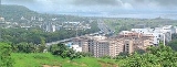
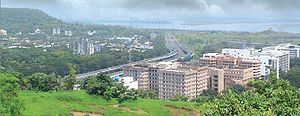
- Navi MumbaiNavi MumbaiNavi Mumbai is a Planned Satellite City on the west coast of the Indian state of Maharashtra. It was developed in 1972 as a twin city of Mumbai, and is the largest planned city on the planet, with under the jurisdiction of the Navi Mumbai Municipal Corporation and a total area of . Navi Mumbai...
- Greater NoidaGreater NoidaGreater Noida is located in the Gautam Budh Nagar district of the north Indian state of Uttar Pradesh . It is under the purview of the National Capital Region of India...
- Electronics City
- HITEC CityHITEC CityHITEC City stands for Hyderabad Information Technology Engineering Consultancy City, a major technology township which is at the center of the information technology industry in Hyderabad, Andhra Pradesh, India....
Israel
- Arad
- Ashdod
- ShohamShohamShoham is a town in the Center District of Israel.According to the Israel Central Bureau of Statistics , Shoham's population in the end of 2007 was 19,400. Its jurisdiction is 5,889 dunams ....
- KarmielKarmielKarmiel is a city in northern Israel. Established in 1964 as a development town, Karmiel is located in the Beit HaKerem Valley which divides upper and lower Galilee. The city is located south of the Acre-Safed road, from Safed and from Acre...
- Modi'in-Maccabim-Re'utModi'in-Maccabim-Re'utModi'in-Maccabim-Re'ut is a city in the Center District of Israel located approximately halfway between Jerusalem and Tel Aviv. It was formed in 2003 by the merger of Modi'in and Maccabim-Re'ut...
is a planned town complex in IsraelIsraelThe State of Israel is a parliamentary republic located in the Middle East, along the eastern shore of the Mediterranean Sea...
.
Japan
Borrowing from the New Town movement in the UK, some 30 new towns have been built in Japan all over the country. Most of these constructions were initiated during the period of rapid economic growth in the 1960s, but construction continued into the 1980s. Most of them are located near TokyoTokyo
, ; officially , is one of the 47 prefectures of Japan. Tokyo is the capital of Japan, the center of the Greater Tokyo Area, and the largest metropolitan area of Japan. It is the seat of the Japanese government and the Imperial Palace, and the home of the Japanese Imperial Family...
and the Kansai
Kansai
The or the lies in the southern-central region of Japan's main island Honshū. The region includes the prefectures of Mie, Nara, Wakayama, Kyoto, Osaka, Hyōgo, and Shiga. Depending on who makes the distinction, Fukui, Tokushima and even Tottori Prefecture are also included...
region. Some towns, (Senri New Town, Tama New Town
Tama New Town
is a large residential development, straddling the municipalities of Hachiōji, Tama, Inagi and Machida cities, in Tokyo, Japan. It was designed as a new town in 1965...
) do not provide much employment, and many of the residents commute to the nearby city. These towns fostered the infamous congestion of commuter trains (although as the metropolitan areas have grown, this commute has become relatively short in comparison to commutes from the new urban fringe).
Other New Towns act as industrial/academic agglomerations (sangyo-shuseki) (Tsukuba Science City, Kashima Port Town). These areas attempt to create an all-inclusive environment for daily living, in accordance with Uzō Nishiyama's "life-spheres" principle.
Japan has also developed the concept of new towns to what Manuel Castells
Manuel Castells
Manuel Castells is a sociologist especially associated with information society and communication research....
and Sir Peter Hall
Peter Hall (urbanist)
Sir Peter Geoffrey Hall, FBA is an English town planner, urbanist and geographer. He is the Bartlett Professor of Planning and Regeneration at The Bartlett, University College London and President of both the Town and Country Planning Association and the Regional Studies Association.He is...
call technopolis
Science park
A research park, science park, or science and technology park is an area with a collection of buildings dedicated to scientific research on a business footing. There are many approximate synonyms for "science park", including research park, technology park, technopolis and biomedical park...
. The technopolis program of the 1980s has precedents in the New Industrial Cities Act of the 60s. These cities are largely modeled after Tsukuba Academic New Town in that they attempt to agglomerate high-tech resources together in a campus-like environment.
In the past, the Japanese government had proposed relocating the capital to a planned city, but this plan was cancelled.
Overall, the Japan's New Town program consists of a many diverse projects, most of which focus on a primary function, but also aspire to create an all-inclusive urban environment. Japan's New Town program is heavily informed by the Anglo-American Garden City tradition, American neighborhood design, as well as Soviet strategies of industrial development.
In 2002 Prime Minister Junichiro Koizumi announced the end of new town construction, although the new towns continue to receive government funding and redevelopment.
Sources:
- Ministry of Construction, Japan International Cooperation Agency, City Bureau. 1975? City Planning in Japan.
- Hein, Carola. 2003. “Visionary Plans and Planners: Japanese Traditions and Western Influences” in Japanese Capitals in Historical
- Perspective, Nicholas Fiévé and Paul Waley, eds. New York: RoutledgeCurzon, 309-43.
Scott, W. Stephen. 2006. Just Housing? Evidence of Garden City Principles in a Postwar Japanese New Town. Undergraduate diss. New College of Florida.
Pakistan
- Jauharabad - a planned town situated in Khushab District, Punjab, Pakistan, population of approximately 40,000 and it is the District Capital of Khushab District.
Philippines
The planned city Pagcor CityPagcor City
Entertainment City Manila or simply Pagcor City is Asia's Las Vegas-like gaming and entertainment complex that PAGCOR proposed to offer on 8 km² of land on the reclamation area of Manila Bay, Philippines...
will be completed on 2012 and it will be part of Metro Manila
Metro Manila
Metropolitan Manila , the National Capital Region , or simply Metro Manila, is the metropolitan region encompassing the City of Manila and its surrounding areas in the Philippines...
's new city.
Singapore
The new town planning concept was introduced into SingaporeSingapore
Singapore , officially the Republic of Singapore, is a Southeast Asian city-state off the southern tip of the Malay Peninsula, north of the equator. An island country made up of 63 islands, it is separated from Malaysia by the Straits of Johor to its north and from Indonesia's Riau Islands by the...
with the building of the first New Town, Queenstown
Queenstown, Singapore
Queenstown1 is one of the early housing estates in Singapore, built before Toa Payoh and Ang Mo Kio, and was a test bed for much of Singapore's public housing...
, from July 1952 to 1973 by the country's public housing authority, the Housing and Development Board. Today, the vast majority of the approximately 11,000 public housing buildings are organised into 22 new towns across the country.
Each new town is designed to be completely self-sustainable. Helmed by a hierarchy of commercial developments, ranging from a town centre to precinct-level outlets, there is no need to venture out of town to meet the most common needs of residences. Employment can be found in industrial estates located within several towns. Educational, health care, and recreational needs are also taken care of with the provision of schools, hospitals, parks, sports complexes, and so on.
Singapore's expertise in successful new town design was internationally recognised when the Building and Social Housing Foundation
Building and Social Housing Foundation
The Building and Social Housing Foundation is an independent housing research charity, with work that covers a broad range of issues around housing. It was established in 1976 and is based in Coalville in Leicestershire in the United Kingdom, but does work internationally...
(BSHF) of the United Nations
United Nations
The United Nations is an international organization whose stated aims are facilitating cooperation in international law, international security, economic development, social progress, human rights, and achievement of world peace...
awarded the World Habitat Award
World Habitat Awards
The World Habitat Awards were established in 1985 by the Building and Social Housing Foundation as part of its contribution to the United Nations' International Year of Shelter for the Homeless in 1987....
to Tampines
Tampines
Tampines is the largest residential area in the city-state of Singapore and is located in the East Region of the main island. The town is so named because in the 1900s a large forest of Tampines trees were there....
New Town, which was selected as a representative of Singapore's new towns, on 5 October 1992.
Bosnia and Herzegovina
- SlobomirSlobomirSlobomir is a new town in Bosnia and Herzegovina. It is located on the Drina River near Bijeljina. It is part of the Bijeljina municipality. It was founded by Slobodan Pavlović, a Bosnian Serb philanthropist. It aims to be one of the major cities of post-war Bosnia-Herzegovina...
is a new town in Bosnia and HerzegovinaBosnia and HerzegovinaBosnia and Herzegovina , sometimes called Bosnia-Herzegovina or simply Bosnia, is a country in Southern Europe, on the Balkan Peninsula. Bordered by Croatia to the north, west and south, Serbia to the east, and Montenegro to the southeast, Bosnia and Herzegovina is almost landlocked, except for the...
and its name means: "the city of freedom and peace". It is located on the DrinaDrinaThe Drina is a 346 kilometer long river, which forms most of the border between Bosnia and Herzegovina and Serbia. It is the longest tributary of the Sava River and the longest karst river in the Dinaric Alps which belongs to the Danube river watershed...
river near BijeljinaBijeljinaBijeljina is a city and municipality in northeastern Bosnia and Herzegovina. The city is the second largest in the Republika Srpska entity after Banja Luka and fifth largest city in Bosnia and Herzegovina, and is situated on the flat rich plains of Semberija...
. It was founded by Slobodan Pavlović, a Bosnian philanthropistPhilanthropistA philanthropist is someone who engages in philanthropy; that is, someone who donates his or her time, money, and/or reputation to charitable causes...
. It aims to be one of the major cities of post-war Bosnia and HerzegovinaBosnia and HerzegovinaBosnia and Herzegovina , sometimes called Bosnia-Herzegovina or simply Bosnia, is a country in Southern Europe, on the Balkan Peninsula. Bordered by Croatia to the north, west and south, Serbia to the east, and Montenegro to the southeast, Bosnia and Herzegovina is almost landlocked, except for the...
. In fact, the city will be located in two countries, Bosnia and Herzegovina and SerbiaSerbiaSerbia , officially the Republic of Serbia , is a landlocked country located at the crossroads of Central and Southeast Europe, covering the southern part of the Carpathian basin and the central part of the Balkans...
, although majority of it will be in Bosnia and Herzegovina. The city is named after its founder, Slobodan Pavlović, and his wife, Mira. - KamengradKamengradKamengrad is the name of an ongoing construction project located in Višegrad, Republika Srpska by the famous Serbian director Emir Kusturica. Construction of Kamengrad, also known as Andrićgrad started on 28 June 2011, and entire village will be completed by 2014...
is town under construction by the famous SerbiaSerbiaSerbia , officially the Republic of Serbia , is a landlocked country located at the crossroads of Central and Southeast Europe, covering the southern part of the Carpathian basin and the central part of the Balkans...
n director Emir KusturicaEmir KusturicaEmir Nemanja Kusturica , is a Serbian filmmaker, actor and musician, recognized for several internationally acclaimed feature films...
, and will be located in VišegradVišegradVišegrad is a town and municipality in Bosnia and Herzegovina. It is part of the Republika Srpska entity. It is on the river Drina, located on the road from Goražde and Ustiprača towards Užice, Serbia.-History:...
, Republika SrpskaRepublika SrpskaRepublika Srpska is one of two main political entities of Bosnia and Herzegovina, the other being the Federation of Bosnia and Herzegovina...
.
Bulgaria
The cities of Stara ZagoraStara Zagora
Stara Zagora is the sixth largest city in Bulgaria, and a nationally important economic center. Located in Southern Bulgaria, it is the administrative capital of the homonymous Stara Zagora Province...
and Kazanlak
Kazanlak
Kazanlak, formerly Kazanlık is a Bulgarian town in Stara Zagora Province, located in the middle of the plain of the same name, at the foot of the Balkan mountain range, at the eastern end of the Rose Valley...
, in central Bulgaria, were rebuilt as planned cities after they were burnt to the ground in the 1877-1878 Russia-Turkey War. Also the city of Dimitrovgrad
Dimitrovgrad, Bulgaria
Dimitrovgrad is a town in Haskovo Province, South-central Bulgaria, located close to the province capital - Haskovo. It is a newly founded settlement, built in the end of the 1940s. and named after the communist leader Georgi Dimitrov. The town is the administrative centre of the homonymous...
in south Bulgaria, that was planned as a key industrial and infrastructure center.
Croatia
Červar-Porat is a resort townResort town
A resort town, sometimes called a resort city or resort destination, is a town or area where tourism or vacationing is a primary component of the local culture and economy...
in western Croatia
Croatia
Croatia , officially the Republic of Croatia , is a unitary democratic parliamentary republic in Europe at the crossroads of the Mitteleuropa, the Balkans, and the Mediterranean. Its capital and largest city is Zagreb. The country is divided into 20 counties and the city of Zagreb. Croatia covers ...
, located on the east coast of the Adriatic Sea
Adriatic Sea
The Adriatic Sea is a body of water separating the Italian Peninsula from the Balkan peninsula, and the system of the Apennine Mountains from that of the Dinaric Alps and adjacent ranges...
on the Červar lagoon. It was built as planned town in the 1970s, although the area was inhabited in Roman times. During the War of Independence it was used as a camp for refugees
Refugee camp
A refugee camp is a temporary settlement built to receive refugees. Hundreds of thousands of people may live in any one single camp. Usually they are built and run by a government, the United Nations, or international organizations, or NGOs.Refugee camps are generally set up in an impromptu...
from Bosnia and Herzegovina
Bosnia and Herzegovina
Bosnia and Herzegovina , sometimes called Bosnia-Herzegovina or simply Bosnia, is a country in Southern Europe, on the Balkan Peninsula. Bordered by Croatia to the north, west and south, Serbia to the east, and Montenegro to the southeast, Bosnia and Herzegovina is almost landlocked, except for the...
and Vukovar
Vukovar
Vukovar is a city in eastern Croatia, and the biggest river port in Croatia located at the confluence of the Vuka river and the Danube. Vukovar is the center of the Vukovar-Syrmia County...
. It was planned to house 6500 people.
Denmark
FredericiaFredericia
Fredericia is a town located in Fredericia municipality in the eastern part of the Jutland peninsula in Denmark, in a sub-region known locally as Trekanten, or The Triangle...
was designed as a combination of town and military fortress following the devastation caused by the Thirty Years' War
Thirty Years' War
The Thirty Years' War was fought primarily in what is now Germany, and at various points involved most countries in Europe. It was one of the most destructive conflicts in European history....
. A more recent example is Ørestaden; planned and built to strengthen development in the Copenhagen
Copenhagen
Copenhagen is the capital and largest city of Denmark, with an urban population of 1,199,224 and a metropolitan population of 1,930,260 . With the completion of the transnational Øresund Bridge in 2000, Copenhagen has become the centre of the increasingly integrating Øresund Region...
/Malmö
Malmö
Malmö , in the southernmost province of Scania, is the third most populous city in Sweden, after Stockholm and Gothenburg.Malmö is the seat of Malmö Municipality and the capital of Skåne County...
region.
Finland
The city of HelsinkiHelsinki
Helsinki is the capital and largest city in Finland. It is in the region of Uusimaa, located in southern Finland, on the shore of the Gulf of Finland, an arm of the Baltic Sea. The population of the city of Helsinki is , making it by far the most populous municipality in Finland. Helsinki is...
, previously just a small village, was rebuilt on a rocky peninsula near the sea in 1812 by decree of Alexander I, Grand-duke of Finland. The new town was to become the capital for the new Grand Duchy of Finland. The planner of the new town was Carl Ludvig Engel
Carl Ludvig Engel
Carl Ludvig Engel, or Johann Carl Ludwig Engel , was a German architect known for his neoclassical style. He had a great impact on the architecture of Finland in the first part of the 19th century....
.
However, the last city in Finland that was ordered to be built on a previously completely uninhabited land was Raahe
Raahe
Raahe is a town and municipality of Finland. Founded by Swedish statesman and Governor General of Finland Count Per Brahe the younger in 1649, it is one of 10 historic wooden towns remaining in Finland. Examples of other Finnish historic wooden towns are Kaskinen , Old Rauma, Porvoo , Jakobstad ,...
, founded by governor general Per Brahe the Younger in 1649.
Finland also has various "ekokyläs" or "ecological villages". For example, Tapiola
Tapiola
Tapiola or Hagalund is a district of Espoo on the south coast of Finland, and is one of the major urban centres of Espoo...
is a post-war garden city
Garden city movement
The garden city movement is a method of urban planning that was initiated in 1898 by Sir Ebenezer Howard in the United Kingdom. Garden cities were intended to be planned, self-contained communities surrounded by "greenbelts" , containing proportionate areas of residences, industry and...
on the edge of Espoo
Espoo
Espoo is the second largest city and municipality in Finland. The population of the city of Espoo is . It is part of the Helsinki Metropolitan Area along with the cities of Helsinki, Vantaa, and Kauniainen. Espoo shares its eastern border with Helsinki and Vantaa, while enclosing Kauniainen....
.
France
Many new cities, called bastides, were founded from the 12th to 14th centuries in southeastern France, where the Hundred Years War took place, in order to replace destroyed cities and organize defence and growth. Among those, MonpazierMonpazier
Monpazier is a commune in the Dordogne department in Aquitaine in southwest France.-Population:Its inhabitants are called Monpaziérois.-Sights:...
, Beaumont-de-Lomagne
Beaumont-de-Lomagne
Beaumont-de-Lomagne is a commune in the Tarn-et-Garonne department in the Midi-Pyrénées region in southern France.-History:Beaumont-de-Lomagne, bastide, was founded in 1276 following the act of coregency between the abbey of Grandselve and King Philip III of France - the King was represented by his...
, Villeréal
Villeréal
Villeréal is a commune in the Lot-et-Garonne department in south-western France.-See also:*Communes of the Lot-et-Garonne department...
are good examples.
Cardinal Richelieu founded the small Baroque town of Richelieu
Richelieu, Indre-et-Loire
Richelieu is a commune in the Indre-et-Loire department in central France.It lies south of Chinon and west of Sainte-Maure de Touraine and is surrounded by mostly agricultural land...
, which remains largely unchanged.
A program of new towns (French ville nouvelle) was developed in the mid-1960s to try to control the expansion of cities. Nine villes nouvelles were created.
- Near ParisParisParis is the capital and largest city in France, situated on the river Seine, in northern France, at the heart of the Île-de-France region...
: Cergy-PontoiseCergy-PontoiseCergy-Pontoise is a new town in France, in the Val d'Oise département, northwest of Paris on the Oise River. It owes its name to two of the communes that it covers, Cergy and Pontoise....
, Marne-la-ValléeMarne-la-ValléeMarne-la-Vallée is a new town located near Paris, France.Disneyland Paris, Val d'Europe,Université Paris-Est Marne-la-Vallée,and École des Ponts ParisTech are located in Marne-la-Vallée.-Status:...
, SénartSénartSénart is a new town in southern Île-de-France, covering parts of the departments of Seine-et-Marne and Essonne....
(former Melun-Sénart), Évry, Saint-Quentin-en-YvelinesSaint-Quentin-en-YvelinesSaint-Quentin-en-Yvelines is a new town in the French département of Yvelines. It is one of the original five villes nouvelles of Paris and was named after the Saint Quentin Pond, which was chosen to become the town's centre. The town was built from a greenfield site starting in the 1960s. In... - Near LilleLilleLille is a city in northern France . It is the principal city of the Lille Métropole, the fourth-largest metropolitan area in the country behind those of Paris, Lyon and Marseille. Lille is situated on the Deûle River, near France's border with Belgium...
: Villeneuve d'AscqVilleneuve d'AscqVilleneuve-d'Ascq is a commune in the Nord department in northern France. With more than 60,000 inhabitants, it is one of the main cities of the Urban Community of Lille Métropole and the largest in area after Lille ; it is also one of the main cities of the Nord-Pas de Calais region.Built up...
(Former Lille-Est) - Near GrenobleGrenobleGrenoble is a city in southeastern France, at the foot of the French Alps where the river Drac joins the Isère. Located in the Rhône-Alpes region, Grenoble is the capital of the department of Isère...
: L'Isle-d'AbeauL'Isle-d'AbeauL'Isle-d'Abeau is a commune to France in the department of Isère, at thirty kilometres from Lyon in the plain of Dauphiné.-Ville:This little city was grow with the creation the new city... - Near MarseilleMarseilleMarseille , known in antiquity as Massalia , is the second largest city in France, after Paris, with a population of 852,395 within its administrative limits on a land area of . The urban area of Marseille extends beyond the city limits with a population of over 1,420,000 on an area of...
: Rives de l'Etang de BerreÉtang de BerreThe Étang de Berre is a body of water adjacent to the Mediterranean, about 25km north-west of Marseille.-Geography:Created by the rise in water levels at the end of the last ice age, this small inland sea is composed of... - Near RouenRouenRouen , in northern France on the River Seine, is the capital of the Haute-Normandie region and the historic capital city of Normandy. Once one of the largest and most prosperous cities of medieval Europe , it was the seat of the Exchequer of Normandy in the Middle Ages...
: Val-de-ReuilVal-de-ReuilVal-de-Reuil is a commune in the Eure department in Normandy in northern France. It is located south of Rouen in the loop of the Seine. Created as a new town in the 1970s, initially as Vaudreuil, it later changed its name to Val-de-Reuil to avoid confusing with its neighbour, Le...
Germany
Planned cities in Germany are:- Bayreuth: an example of a medieval new city
- Berlin - FriedrichstadtFriedrichstadt (Berlin)Friedrichstadt was an independent suburb of Berlin, and is now a historical neighborhood of the city itself. The neighborhood is named after the Prussian king Frederick I.-Geography:...
- EisenhüttenstadtEisenhüttenstadtEisenhüttenstadt is a town in the Oder-Spree district of Brandenburg, Germany at the border with Poland. The town was founded in 1950 alongside a new steel mill as a socialist model city and has a population of 32,214...
: the "first socialist town" in Germany - FreudenstadtFreudenstadtFreudenstadt is a town in Baden-Württemberg in southern Germany. It is capital of the district Freudenstadt. The closest population centres are Offenburg to the west and Tübingen to the east ....
: the roads follow the layout of the Nine Men's Morris gameNine Men's MorrisNine Men's Morris is an abstract strategy board game for two players that emerged from the Roman Empire. The game is also known as Nine Man Morris, Mill, Mills, Merels, Merelles, and Merrills in English.... - Halle-Neustadt: a "stadteil" or "town part" in Halle, Saxony-AnhaltHalle, Saxony-AnhaltHalle is the largest city in the German state of Saxony-Anhalt. It is also called Halle an der Saale in order to distinguish it from the town of Halle in North Rhine-Westphalia...
- KarlsruheKarlsruheThe City of Karlsruhe is a city in the southwest of Germany, in the state of Baden-Württemberg, located near the French-German border.Karlsruhe was founded in 1715 as Karlsruhe Palace, when Germany was a series of principalities and city states...
: the roads follow the layout of a hand-held fan with the castle being at the juncture - LudwigsburgLudwigsburgLudwigsburg is a city in Baden-Württemberg, Germany, about north of Stuttgart city centre, near the river Neckar. It is the largest and primary city of the Ludwigsburg urban district with about 87,000 inhabitants...
: planned new capital for the duke of Württemberg - Mannheim Quadratestadt: squares named like ranks and files on a chessboard
- Munich MaxvorstadtMunichMunich The city's motto is "" . Before 2006, it was "Weltstadt mit Herz" . Its native name, , is derived from the Old High German Munichen, meaning "by the monks' place". The city's name derives from the monks of the Benedictine order who founded the city; hence the monk depicted on the city's coat...
: the first planned city expansion of MunichMunichMunich The city's motto is "" . Before 2006, it was "Weltstadt mit Herz" . Its native name, , is derived from the Old High German Munichen, meaning "by the monks' place". The city's name derives from the monks of the Benedictine order who founded the city; hence the monk depicted on the city's coat...
was realized from 1805 to 1810 according to a raster - NeustrelitzNeustrelitzNeustrelitz is a town in the Mecklenburgische Seenplatte district in the state of Mecklenburg-Vorpommern, Germany. It is situated on the shore of the Zierker See in the Mecklenburg Lake District. From 1738 until 1918 it was the capital of the duchy of Mecklenburg-Strelitz...
: founded in 1733 with streets spreading from an octagonal market place - PutbusPutbusPutbus is a small town on the southeastern part of the island of Rügen in Mecklenburg-Western Pomerania, North Germany. The town has 4,741 inhabitants and is a significant tourist destination with numerous seaside resorts....
: built around a circular centre with radially aligned streets - WolfsburgWolfsburgWolfsburg is a town in Lower Saxony, Germany. It is located on the River Aller northeast of Braunschweig , and is mainly notable as the headquarters of Volkswagen AG...
: founded in 1938 to host the factories for the newly built Volkswagen
Hungary
All Hungarian planned cities were built in the second half of the 20th century when a program of rapid industrialization was implemented by the communist government.- DunaújvárosDunaújvárosDunaújváros is a Hungarian city in Central Transdanubia, along the Danube river. It is in Fejér county.-History:Dunaújváros is one of the newest cities of the country...
, built next to the existing village Dunapentele to provide housing for workers of a large steel factory complex. Once named after Stalin, the city maintains its importance in heavy industry even after the recession following the end of Communist era. - TiszaújvárosTiszaújvárosTiszaújváros is an industrial town in Borsod-Abaúj-Zemplén county, Northern Hungary, south-east of Miskolc, near the river Tisza.Tiszaújváros owes its existence to the industrialization wave that took over the then-socialist Hungary after World War II...
, built next to the existing village Tiszaszederkény and was named after Lenin for decades. A significant chemical factory was built simultaneously. - KazincbarcikaKazincbarcikaKazincbarcika is the third largest city of Borsod-Abaúj-Zemplén county, Northern Hungary. It lies in the valley of the river Sajó, away from the county capital, Miskolc.-History:...
, created from the villages Sajókazinc, Barcika and Berente (the latter has become independent since then) in a mining area. The city and its population grew fast after the founding of a factory. - TatabányaTatabányaTatabánya is a city of 69,988 inhabitants in north-western Hungary, in the Central Transdanubian region. It is the capital of Komárom-Esztergom County.- Location :...
, created from four already existing villages was developed into a mining town and industrial centre and shortly after its elevation to town status became the county seat of its county, a status it still maintains despite the presence of historically more significant towns in the area. - BeloianniszBeloianniszBeloiannisz is a village in Fejér county, Hungary. It was founded by Communist Greek refugees who left Greece after the civil war, and was named after Nikos Beloyannis .-Location:...
(although not a town, only a village) was planned and built in the 1950s to provide home for Greek refugees of the Civil WarGreek Civil WarThe Greek Civil War was fought from 1946 to 1949 between the Greek governmental army, backed by the United Kingdom and United States, and the Democratic Army of Greece , the military branch of the Greek Communist Party , backed by Bulgaria, Yugoslavia and Albania...
.
Ireland
In the Republic of IrelandRepublic of Ireland
Ireland , described as the Republic of Ireland , is a sovereign state in Europe occupying approximately five-sixths of the island of the same name. Its capital is Dublin. Ireland, which had a population of 4.58 million in 2011, is a constitutional republic governed as a parliamentary democracy,...
, as in the United Kingdom, the term "new town" is often used to refer to planned towns built after World War II which were discussed as early as 1941. The term "new town" in Ireland was also used for some earlier developments, notably during the Georgian era
Georgian architecture
Georgian architecture is the name given in most English-speaking countries to the set of architectural styles current between 1720 and 1840. It is eponymous for the first four British monarchs of the House of Hanover—George I of Great Britain, George II of Great Britain, George III of the United...
. Part of Limerick
Limerick
Limerick is the third largest city in the Republic of Ireland, and the principal city of County Limerick and Ireland's Mid-West Region. It is the fifth most populous city in all of Ireland. When taking the extra-municipal suburbs into account, Limerick is the third largest conurbation in the...
city was built in a planned fashion as "Newtown Pery".
In 1961 the first new town of Shannon was commenced and a target of 6,000 inhabitants was set. This has since been exceeded. Shannon is of some regional importance today as an economic centre (with the Shannon Free Zone
Shannon Free Zone
Shannon Free Zone is a , international business park adjacent to Shannon International Airport, County Clare, Ireland which is 18 km from Ennis and 20 km from Limerick city. Businesses based on the site enjoy a very attractive tax package on their profits. This has served to attract a...
and Shannon International Airport), but until recently failed to expand in population as anticipated. Since the late 1990s, and particularly in the early 2000s, the population has been expanding at a much faster rate, with town rejuvenation, new retail and entertainment facilities and many new housing developments.
It was not until 1967 that the Wright Report planned four towns in County Dublin
County Dublin
County Dublin is a county in Ireland. It is part of the Dublin Region and is also located in the province of Leinster. It is named after the city of Dublin which is the capital of Ireland. County Dublin was one of the first of the parts of Ireland to be shired by King John of England following the...
. These were Blanchardstown
Blanchardstown
Blanchardstown is a large suburb of Dublin in the district of Fingal, Ireland. It is within the historical barony of Castleknock. It is located 10 km north-west of the city centre. The suburb is in the Dublin 15 postal area, the Dublin West electoral constituency, and Fingal County...
, Clondalkin
Clondalkin
-Today:Modern Clondalkin is a busy satellite town of Dublin, with a population of 43,929 in 2006. Retail facilities include Tesco Ireland- and Dunnes Stores-led shopping centres, and Aldi and Lidl stores on the Fonthill Road and New Nangor Road respectively, and the village centre is a base for...
, Lucan and Tallaght
Tallaght
Tallaght is the largest town, and county town, of South Dublin County, Ireland. The village area, dating from at least the 17th century, held one of the earliest settlements known in the southern part of the island, and one of medieval Ireland's more important monastic centres.Up to the 1960s...
but in actuality this was reduced to Blanchardstown, Lucan-Clondalkin and Tallaght. Each of these towns has approximately 50,000 inhabitants today.
The most recent new town in Ireland is Adamstown
Adamstown, Dublin
Adamstown is the first new town planned in Ireland since Shannon Town in 1982. The new settlement is being developed 16 km from Dublin city centre, on a 220 hectare site just south of Lucan, west of the Griffeen River and north of the Grand Canal. No date has been set for the official...
in County Dublin
County Dublin
County Dublin is a county in Ireland. It is part of the Dublin Region and is also located in the province of Leinster. It is named after the city of Dublin which is the capital of Ireland. County Dublin was one of the first of the parts of Ireland to be shired by King John of England following the...
. Building commenced in 2005 and it is anticipated that occupation will commence late in 2006 with the main development of 10,500 units being completed within a ten year timescale.
Italy
In the past centuries several new towns have been planned in Italy.One of the most famous is Pienza
Pienza
Pienza, a town and comune in the province of Siena, in the Val d'Orcia in Tuscany , between the towns of Montepulciano and Montalcino, is the "touchstone of Renaissance urbanism."...
, close to Siena
Siena
Siena is a city in Tuscany, Italy. It is the capital of the province of Siena.The historic centre of Siena has been declared by UNESCO a World Heritage Site. It is one of the nation's most visited tourist attractions, with over 163,000 international arrivals in 2008...
, a Renaissance
Renaissance
The Renaissance was a cultural movement that spanned roughly the 14th to the 17th century, beginning in Italy in the Late Middle Ages and later spreading to the rest of Europe. The term is also used more loosely to refer to the historical era, but since the changes of the Renaissance were not...
city, also called The Ideal Town or Utopia Town.
Between 1459 and 1462 the most famous architects of Italy worked there for the Pope Pius II and built the city centre of the small town.
Another example of renaissance planned cities is the walled star city of Palmanova
Palmanova
Palmanova is a town and comune in northeastern Italy, close to the border with Slovenia. It is located 20 km from Udine, 28 km from Gorizia and 55 km from Trieste near the junction of the Autostrada Alpe-Adria and the Autostrada Venezia-Trieste .Palmanova is famous for its fortress...
. It is a derivative of ideal circular cities, notable Filarete
Filarete
Antonio di Pietro Averlino , also "Averulino", known as Filarete was an Italian Renaissance architect, sculptor and architectural theorist from Florence. He is perhaps best remembered for his design of the ideal city of Sforzinda, the first ideal city plan of the Renaissance.-Biography:Antonio di...
's imaginary Sforzinda.
In early 20th century, during the fascist government of Benito Mussolini
Benito Mussolini
Benito Amilcare Andrea Mussolini was an Italian politician who led the National Fascist Party and is credited with being one of the key figures in the creation of Fascism....
, many new cities were founded, the most prominent being Littoria (renamed Latina after the fall of the Fascism). The city was inaugurated on December 18, 1932. Littoria was populated with immigrants coming from Northern Italy, mainly from Friuli
Friuli
Friuli is an area of northeastern Italy with its own particular cultural and historical identity. It comprises the major part of the autonomous region Friuli-Venezia Giulia, i.e. the province of Udine, Pordenone, Gorizia, excluding Trieste...
and Veneto
Veneto
Veneto is one of the 20 regions of Italy. Its population is about 5 million, ranking 5th in Italy.Veneto had been for more than a millennium an independent state, the Republic of Venice, until it was eventually annexed by Italy in 1866 after brief Austrian and French rule...
The great Sicilian earthquake of 1693 forced the complete rebuilding on new plans of many towns.
Other well known new cities are located close to Milan
Milan
Milan is the second-largest city in Italy and the capital city of the region of Lombardy and of the province of Milan. The city proper has a population of about 1.3 million, while its urban area, roughly coinciding with its administrative province and the bordering Province of Monza and Brianza ,...
in the metropolitan area.
Crespi d'Adda
Crespi d'Adda
Crespi d'Adda is a historical settlement in Capriate San Gervasio, Lombardy, northern Italy. It is an outstanding example of the 19th and early 20th-century "company towns" built in Europe and North America by enlightened industrialists to meet the workers' needs...
, a few kilometres east of Milan along the Adda River, was settled by the Crespi family. It was the first Ideal Worker's City in Italy, built close to the cotton factory. Today Crespi d'Adda is part of the Unesco World Heritage List.
Cusano Milanino
Cusano Milanino
Cusano Milanino is a town and comune in the province of Milan, in Lombardy. It borders Paderno Dugnano, Cinisello Balsamo, Cormano and Bresso....
was settled in the first years of the 20th century in the formerly small town of Cusano. It was built as a new green city, rich in parks, villas, large boulevards and called Milanino (Little Milan).
In the 1970s in the eastern metropolitan area of Milan a new city was built by Silvio Berlusconi
Silvio Berlusconi
Silvio Berlusconi , also known as Il Cavaliere – from knighthood to the Order of Merit for Labour which he received in 1977 – is an Italian politician and businessman who served three terms as Prime Minister of Italy, from 1994 to 1995, 2001 to 2006, and 2008 to 2011. Berlusconi is also the...
. It is called Milano Due
Milano Due
Milano Due is a residential centre in the Italian town of Segrate . It was built as a new town by Edilnord, belonging to the Fininvest group of Silvio Berlusconi....
. It is a garden city designed for families of the upper middle class, with peculiarity of having pedestrian paths completely free of traffic. In the 1980s another two similar cities were built by Berlusconi, Milano 3 and Milano Visconti. Each of them has around 12,000 inhabitants.
Malta
- The fortified cities of SengleaSengleaSenglea is a fortified city in the east of Malta, mainly in the Grand Harbour area. It is one of the Three Cities in the east of Malta, the other two being Cospicua and Vittoriosa. The city of Senglea is also called Civitas Invicta, because it managed to resist the Ottoman invasion at the Great...
and VallettaVallettaValletta is the capital of Malta, colloquially known as Il-Belt in Maltese. It is located in the central-eastern portion of the island of Malta, and the historical city has a population of 6,098. The name "Valletta" is traditionally reserved for the historic walled citadel that serves as Malta's...
were both built on a grid planGrid planThe grid plan, grid street plan or gridiron plan is a type of city plan in which streets run at right angles to each other, forming a grid...
by the Knights of MaltaKnights HospitallerThe Sovereign Military Hospitaller Order of Saint John of Jerusalem of Rhodes and of Malta , also known as the Sovereign Military Order of Malta , Order of Malta or Knights of Malta, is a Roman Catholic lay religious order, traditionally of military, chivalrous, noble nature. It is the world's...
in the 16th century. - The town of Paola, MaltaPaola, MaltaPaola, , is a town in the Grand Harbour area of Malta, with a population of 8,856 people . It is named after its founder, the Grandmaster Antoine de Paule, but is commonly known as Raħal Ġdid, which means new town in Maltese.Paola is renowned for its shopping centres, Good Friday procession, its...
, also known as Rahal Gdid (New Town), is built on a grid plan by the Grand Master Antoine de Paule.
Netherlands
One province of the NetherlandsNetherlands
The Netherlands is a constituent country of the Kingdom of the Netherlands, located mainly in North-West Europe and with several islands in the Caribbean. Mainland Netherlands borders the North Sea to the north and west, Belgium to the south, and Germany to the east, and shares maritime borders...
, Flevoland
Flevoland
Flevoland is a province of the Netherlands. Located in the centre of the country, at the location of the former Zuiderzee, the province was established on January 1, 1986; the twelfth province of the country, with Lelystad as its capital...
(pop. 370,000 (2006)), was reclaimed from IJsselmeer
IJsselmeer
IJsselmeer is a shallow artificial lake of 1100 km² in the central Netherlands bordering the provinces of Flevoland, North Holland and Friesland, with an average depth of 5 to 6 m. The IJsselmeer is the largest lake in Western Europe....
.
After a flood in 1916, it was decided that the Zuiderzee (Southern Sea), an inland sea within the Netherlands, would be closed and reclaimed. In 1932, a causeway
Causeway
In modern usage, a causeway is a road or railway elevated, usually across a broad body of water or wetland.- Etymology :When first used, the word appeared in a form such as “causey way” making clear its derivation from the earlier form “causey”. This word seems to have come from the same source by...
(the Afsluitdijk
Afsluitdijk
The Afsluitdijk is a major causeway in the Netherlands, constructed between 1927 and 1933 and running from Den Oever on Wieringen in North Holland province, to the village of Zurich in Friesland province, over a length of and a width of 90 m, at an initial height of 7.25 m above sea-level.It is...
) was completed, which closed off the sea completely. The Zuiderzee was subsequently called IJsselmeer (IJssel-lake) and its previously salty water became fresh.
The first part of the new lake that was reclaimed was the Noordoostpolder (Northeast polder). This new land included, among others, the former islands of Urk
Urk
Urk is a municipality and a town in the Flevoland province in the central Netherlands.Urk is first mentioned in historical records dating to the 10th century, when it was still an island in the Almere, a lake that would become part of the Zuiderzee in the 13th century after a series of incursions...
and Schokland
Schokland
Schokland is a former island in the Dutch Zuiderzee. Schokland lost its status as an island when the Noordoostpolder was reclaimed from the sea in 1942...
and it was included with the province of Overijssel.
After this, other parts were also reclaimed: the eastern part in 1957 (Oost-Flevoland) and the southern part (Zuid-Flevoland) in 1968. The municipalities on the three parts voted to become a separate province, which happened in 1986. The capital of Flevoland is Lelystad
Lelystad
Lelystad is a municipality and a city in the centre of the Netherlands, and it is the capital of the province of Flevoland. The city, built on reclaimed land, was founded in 1967 and was named after Cornelis Lely, who engineered the Afsluitdijk, making the reclamation possible...
, but the biggest city is Almere
Almere
Almere is a planned city and municipality in the province of Flevoland, the Netherlands, bordering Lelystad and Zeewolde. The municipality of Almere comprises the districts Almere Stad, Almere Haven, Almere Buiten, Almere Hout, Almere Poort and Almere Pampus .Almere is the youngest city in the...
(pop. 183,500 in February 2008).
Apart from these two larger cities, several 'New Villages' were built. In the Noordoostpolder the central town of Emmeloord is surrounded by ten villages, all on cycling distance from Emmeloord since that was the most popular way of transport in the 1940s (and it's still very popular). Most noteworthy of these villages is Nagele which was designed by famous modern architects of the time, Gerrit Rietveld
Gerrit Rietveld
Gerrit Thomas Rietveld was a Dutch furniture designer and architect. One of the principal members of the Dutch artistic movement called De Stijl, Rietveld is famous for his Red and Blue Chair and for the Rietveld Schröder House, which is a UNESCO World Heritage Site.-Biography:Rietveld was born in...
, Aldo van Eyck
Aldo van Eyck
Aldo van Eyck or van Eijk was an architect from the Netherlands.-Family:...
and Jaap Bakema among them. The other villages were built in a more traditional/vernacular style. In the more recent Flevolandpolders four more 'New Villages' were built. Initially more villages were planned, but the introduction of cars made fewer but larger villages possible.
- New towns outside Flevoland are HoofddorpHoofddorpHoofddorp is the main town of the Haarlemmermeer municipality in the province of North Holland in the Netherlands. In 2009, the population was just over 73,000...
and IJmuiden near Amsterdam, HellevoetsluisHellevoetsluisHellevoetsluis is a small city and municipality on Voorne-Putten Island in the western Netherlands, in the province of South Holland...
and SpijkenisseSpijkenisseSpijkenisse is a town and municipality in the western Netherlands, in the province of South Holland. The municipality had a population of 74,482 in 2006, and covers an area of 30.23 km²...
near Rotterdam and the navy port Den HelderDen HelderDen Helder is a municipality and a city in the Netherlands, in the province of North Holland. Den Helder occupies the northernmost point of the North Holland peninsula...
.
- The cities of AlmereAlmereAlmere is a planned city and municipality in the province of Flevoland, the Netherlands, bordering Lelystad and Zeewolde. The municipality of Almere comprises the districts Almere Stad, Almere Haven, Almere Buiten, Almere Hout, Almere Poort and Almere Pampus .Almere is the youngest city in the...
, Capelle aan den IJssel, HaarlemmermeerHaarlemmermeerHaarlemmermeer is a municipality in the Netherlands, in the province of North Holland. It is a polder, consisting of land reclaimed from water, and the name Haarlemmermeer means Haarlem's Lake, still referring to the body of water from which the region was reclaimed in the 19th century.Its main...
(also a reclaimed polder, 19th century), NieuwegeinNieuwegeinNieuwegein is a municipality and city in the Dutch province of Utrecht. It is bordered on the north by the city of Utrecht, the provincial capital...
, PurmerendPurmerendPurmerend is a municipality and a city in the Netherlands, in the province of North Holland.The city is surrounded by polders, such as the Purmer, Beemster and the Wormer. The city became the trade center of the region but the population grew relatively slow. Only after 1960 did the population...
and ZoetermeerZoetermeerZoetermeer is a city in the western Netherlands, in the province of South Holland. The municipality covers an area of 37.06 km² . A small village until the late 1960s, it had 6,392 inhabitants in 1950...
are members of the European New Town Platform.
Norway
- OsloOsloOslo is a municipality, as well as the capital and most populous city in Norway. As a municipality , it was established on 1 January 1838. Founded around 1048 by King Harald III of Norway, the city was largely destroyed by fire in 1624. The city was moved under the reign of Denmark–Norway's King...
: After a great fire in 1624, it was decided by the then King Christian IV that the city would be moved behind the Akershus fortress. The new town, named Christiania, was laid out in a grid and is now the downtown area known as "Kvadraturen". The original town of Oslo was later incorporated into Christiania, and is now a neighborhood in eastern Oslo; Gamlebyen or "The Old City". - The city of KristiansandKristiansand-History:As indicated by archeological findings in the city, the Kristiansand area has been settled at least since 400 AD. A royal farm is known to have been situated on Oddernes as early as 800, and the first church was built around 1040...
was formally founded in 1641 by King Christian IV. The city was granted all trade privileges on the southern coast of Norway, denying all other towns to trade with foreign states. As Oslo/Christiania before it, the city was behind a fortress, with a grid system allowing cannons to fire towards the two ports of the city and the river on the eastern end.
Poland
The very diverse layouts in Poland's planned cities is the result of the different aesthetics that were held as ideal during the development of these planned communities. Planned cities in PolandPoland
Poland , officially the Republic of Poland , is a country in Central Europe bordered by Germany to the west; the Czech Republic and Slovakia to the south; Ukraine, Belarus and Lithuania to the east; and the Baltic Sea and Kaliningrad Oblast, a Russian exclave, to the north...
have a long history and fall primarily into three time periods during which planned towns developed in Poland
Poland
Poland , officially the Republic of Poland , is a country in Central Europe bordered by Germany to the west; the Czech Republic and Slovakia to the south; Ukraine, Belarus and Lithuania to the east; and the Baltic Sea and Kaliningrad Oblast, a Russian exclave, to the north...
. These are the Nobleman's Republic
History of Poland (1569–1795)
The Nihil novi act adopted by the Polish Diet in 1505 transferred all legislative power from the king to the Diet. This event marked the beginning of the period known as "Nobles' Democracy" or "Nobles' Commonwealth" when the state was ruled by the "free and equal" Polish nobility...
(16th-18th c.), the interwar period (1918–1939) and Socialist Realism
Socialist realism
Socialist realism is a style of realistic art which was developed in the Soviet Union and became a dominant style in other communist countries. Socialist realism is a teleologically-oriented style having its purpose the furtherance of the goals of socialism and communism...
(1944–1956).
Polish-Lithuanian Commonwealth
The extreme opulence that Poland's nobility enjoyed during the RenaissanceRenaissance
The Renaissance was a cultural movement that spanned roughly the 14th to the 17th century, beginning in Italy in the Late Middle Ages and later spreading to the rest of Europe. The term is also used more loosely to refer to the historical era, but since the changes of the Renaissance were not...
left Poland's elites with not only obscene amounts of money to spend, but also motivated them to find new ways to invest their hefty fortunes out the grasp of the Royal Treasury. Jan Zamoyski
Jan Zamoyski
Jan Zamoyski , was a Polish-Lithuanian nobleman, magnate, 1st duke/ordynat of Zamość. Royal Secretary since 1566, Lesser Kanclerz ) of the Crown since 1576, Lord Grand-Chancellor of the Crown since 1578, and Grand Hetman of the Crown since 1581...
founded the city of Zamość
Zamosc
Zamość ukr. Замостя is a town in southeastern Poland with 66,633 inhabitants , situated in the south-western part of Lublin Voivodeship , about from Lublin, from Warsaw and from the border with Ukraine...
in order to circumvent royal tariffs and duties while also serving as the capital for his mini-state. Zamość was planned by the renowned Paduan architect Bernardo Morando
Bernardo Morando
Bernardo Morando, also known as Bernardino or Morandi was a Polish-Italian architect. He is notable as the author of a new town of Zamość, modelled on Renaissance theories of the 'ideal city'....
and modelled on Renaissance
Renaissance
The Renaissance was a cultural movement that spanned roughly the 14th to the 17th century, beginning in Italy in the Late Middle Ages and later spreading to the rest of Europe. The term is also used more loosely to refer to the historical era, but since the changes of the Renaissance were not...
theories of the 'ideal city'. Realizing the importance of trade, Zamoyski issued special location charters for representatives of peoples traditionally engaged in trade, i.e. to Greeks
Greeks
The Greeks, also known as the Hellenes , are a nation and ethnic group native to Greece, Cyprus and neighboring regions. They also form a significant diaspora, with Greek communities established around the world....
, Armenians
Armenians
Armenian people or Armenians are a nation and ethnic group native to the Armenian Highland.The largest concentration is in Armenia having a nearly-homogeneous population with 97.9% or 3,145,354 being ethnic Armenian....
and Sephardic Jews and secured exemptions on taxes, customs duties and tolls, which contributed to its fast development. Zamoyski's success with Zamość
Zamosc
Zamość ukr. Замостя is a town in southeastern Poland with 66,633 inhabitants , situated in the south-western part of Lublin Voivodeship , about from Lublin, from Warsaw and from the border with Ukraine...
spawned numerous other Polish nobles to found their own "private" cities such as Białystok and many of these towns survive today, while Zamość
Zamosc
Zamość ukr. Замостя is a town in southeastern Poland with 66,633 inhabitants , situated in the south-western part of Lublin Voivodeship , about from Lublin, from Warsaw and from the border with Ukraine...
is a World Heritage Site
World Heritage Site
A UNESCO World Heritage Site is a place that is listed by the UNESCO as of special cultural or physical significance...
since 1992 and is still considered one of the most precious urban complexes worldwide.
Interwar period
The preeminent example of a planned community in interwar Poland is GdyniaGdynia
Gdynia is a city in the Pomeranian Voivodeship of Poland and an important seaport of Gdańsk Bay on the south coast of the Baltic Sea.Located in Kashubia in Eastern Pomerania, Gdynia is part of a conurbation with the spa town of Sopot, the city of Gdańsk and suburban communities, which together...
. After World War I
World War I
World War I , which was predominantly called the World War or the Great War from its occurrence until 1939, and the First World War or World War I thereafter, was a major war centred in Europe that began on 28 July 1914 and lasted until 11 November 1918...
when Poland regained its independence it lacked a commercial seaport (De iure Poles
Poles
thumb|right|180px|The state flag of [[Poland]] as used by Polish government and diplomatic authoritiesThe Polish people, or Poles , are a nation indigenous to Poland. They are united by the Polish language, which belongs to the historical Lechitic subgroup of West Slavic languages of Central Europe...
could use Gdańsk
Gdansk
Gdańsk is a Polish city on the Baltic coast, at the centre of the country's fourth-largest metropolitan area.The city lies on the southern edge of Gdańsk Bay , in a conurbation with the city of Gdynia, spa town of Sopot, and suburban communities, which together form a metropolitan area called the...
, which was the main port of the country before the War and is again today, but in practice the Germans
Free City of Danzig
The Free City of Danzig was a semi-autonomous city-state that existed between 1920 and 1939, consisting of the Baltic Sea port of Danzig and surrounding areas....
residing in the city made it almost impossible), making it necessary to build one from scratch. The extensive and modern seaport facilities in Gdynia
Gdynia
Gdynia is a city in the Pomeranian Voivodeship of Poland and an important seaport of Gdańsk Bay on the south coast of the Baltic Sea.Located in Kashubia in Eastern Pomerania, Gdynia is part of a conurbation with the spa town of Sopot, the city of Gdańsk and suburban communities, which together...
, the most modern and extensive port facilities in Europe at the time, became Poland's central port on the Baltic Sea
Baltic Sea
The Baltic Sea is a brackish mediterranean sea located in Northern Europe, from 53°N to 66°N latitude and from 20°E to 26°E longitude. It is bounded by the Scandinavian Peninsula, the mainland of Europe, and the Danish islands. It drains into the Kattegat by way of the Øresund, the Great Belt and...
. In the shadow of the port, the city took shape mirroring in its scope the rapid development of 19th century Chicago
Chicago
Chicago is the largest city in the US state of Illinois. With nearly 2.7 million residents, it is the most populous city in the Midwestern United States and the third most populous in the US, after New York City and Los Angeles...
, growing from a small fishing village of 1,300 in 1921 into a full blown city with a population over 126,000 less than 20 years later. The Central Business District that Gdynia
Gdynia
Gdynia is a city in the Pomeranian Voivodeship of Poland and an important seaport of Gdańsk Bay on the south coast of the Baltic Sea.Located in Kashubia in Eastern Pomerania, Gdynia is part of a conurbation with the spa town of Sopot, the city of Gdańsk and suburban communities, which together...
developed is a showcase of Art Deco
Art Deco
Art deco , or deco, is an eclectic artistic and design style that began in Paris in the 1920s and flourished internationally throughout the 1930s, into the World War II era. The style influenced all areas of design, including architecture and interior design, industrial design, fashion and...
and Modernist architectural styles and predominate much of the cityscape. There are also villas, particularly in the city's villa districts such as Kamienna Góra where Historicism
Historicism (art)
Historicism refers to artistic styles that draw their inspiration from copying historic styles or artisans. After neo-classicism, which could itself be considered a historicist movement, the 19th century saw a new historicist phase marked by a return to a more ancient classicism, in particular in...
inspired Neo-Renaissance
Neo-Renaissance
Renaissance Revival is an all-encompassing designation that covers many 19th century architectural revival styles which were neither Grecian nor Gothic but which instead drew inspiration from a wide range of classicizing Italian modes...
and Neo-Baroque architecture.
Socialist realism
After the destruction of most Polish cities in World War II, the Communist regime that took power in Poland sought to bring about architecture that was in line with its vision of society. Thus urban complexes arose that reflected the ideals of socialist realismSocialist realism
Socialist realism is a style of realistic art which was developed in the Soviet Union and became a dominant style in other communist countries. Socialist realism is a teleologically-oriented style having its purpose the furtherance of the goals of socialism and communism...
. This can be seen in districts of Polish cities such as Warsaw
Warsaw
Warsaw is the capital and largest city of Poland. It is located on the Vistula River, roughly from the Baltic Sea and from the Carpathian Mountains. Its population in 2010 was estimated at 1,716,855 residents with a greater metropolitan area of 2,631,902 residents, making Warsaw the 10th most...
's MDM. The City of Nowa Huta
Nowa Huta
Nowa Huta - is the easternmost district of Kraków, Poland, . With more than 200,000 inhabitants it is one of the most populous areas of the city.- History :...
(now a district of Kraków
Kraków
Kraków also Krakow, or Cracow , is the second largest and one of the oldest cities in Poland. Situated on the Vistula River in the Lesser Poland region, the city dates back to the 7th century. Kraków has traditionally been one of the leading centres of Polish academic, cultural, and artistic life...
) and Tychy
Tychy
Tychy is a city in Silesia, Poland, approximately south of Katowice. Situated on the southern edge of the Upper Silesian industrial district, the city borders Katowice to the north, Mikołów to the west, Bieruń to the east and Kobiór to the south...
were built as the epitome of the proletarian future of Poland.
Portugal
Vila Real de Santo António was built after the 1755 Lisbon earthquake1755 Lisbon earthquake
The 1755 Lisbon earthquake, also known as the Great Lisbon Earthquake, was a megathrust earthquake that took place on Saturday 1 November 1755, at around 9:40 in the morning. The earthquake was followed by fires and a tsunami, which almost totally destroyed Lisbon in the Kingdom of Portugal, and...
, on the model which served to rebuilt the capital city of Portugal and on a similar orthogonal plan.
Romania
The city of Victoria, located in the Braşov CountyBrasov County
Brașov ; ) is a county of Romania, in Transylvania, with the capital city at Brașov. The county incorporates within its boundaries most of the Medieval "lands" Burzenland and Făgăraș Land.-Demographics:...
, was built by the communist government in the beginning of the second half of the 20th century.
Roman Empire
Although RomeRome
Rome is the capital of Italy and the country's largest and most populated city and comune, with over 2.7 million residents in . The city is located in the central-western portion of the Italian Peninsula, on the Tiber River within the Lazio region of Italy.Rome's history spans two and a half...
itself is not a planned settlement, the Romans built a large number of towns throughout their empire, often as colonies for the settlement of citizens or veterans. These were generally characterised by a grid of streets and a planned water-supply; and many modern European towns of originally Roman foundation still retain part of the original street-grid. The most impressive Roman planned town was the city of Constantinople
Constantinople
Constantinople was the capital of the Roman, Eastern Roman, Byzantine, Latin, and Ottoman Empires. Throughout most of the Middle Ages, Constantinople was Europe's largest and wealthiest city.-Names:...
from around the 4th century. Roman Emperor
Roman Emperor
The Roman emperor was the ruler of the Roman State during the imperial period . The Romans had no single term for the office although at any given time, a given title was associated with the emperor...
Constantine the Great chose the site for the new metropolis and began construction. His plans quickly fell into place. The modern city (now known as Istanbul
Istanbul
Istanbul , historically known as Byzantium and Constantinople , is the largest city of Turkey. Istanbul metropolitan province had 13.26 million people living in it as of December, 2010, which is 18% of Turkey's population and the 3rd largest metropolitan area in Europe after London and...
) has changed much since then, but it must be remembered that the city did not develop due to simple human migrational patterns nor pure military advantage. Constantine wanted a city to mark his magnificence and Constantinople fulfilled the desire.
Russia
- Saint PetersburgSaint PetersburgSaint Petersburg is a city and a federal subject of Russia located on the Neva River at the head of the Gulf of Finland on the Baltic Sea...
was built by Peter the GreatPeter I of RussiaPeter the Great, Peter I or Pyotr Alexeyevich Romanov Dates indicated by the letters "O.S." are Old Style. All other dates in this article are New Style. ruled the Tsardom of Russia and later the Russian Empire from until his death, jointly ruling before 1696 with his half-brother, Ivan V...
as a planned capital city starting in 1703. - MagnitogorskMagnitogorskMagnitogorsk is a mining and industrial city in Chelyabinsk Oblast, Russia, located on the eastern side of the extreme southern extent of the Ural Mountains by the Ural River. Population: 418,545 ;...
is an example of a planned industrial city based on Stalin's 1930s five-year plans. - The Avtozavodsky district of TolyattiTolyattiTolyatti , also known as Togliatti, is a city in Samara Oblast, Russia. It serves as the administrative center of Stavropolsky District, although it is administratively separate from it...
is a planned industrial city of Soviet post-war modernism.
Slovenia
Nova GoricaNova Gorica
Nova Gorica ; 21,082 ; 31,000 ) is a town and a municipality in western Slovenia, on the border with Italy...
, built after 1947 immediately to the east of the new border with Italy
Italy
Italy , officially the Italian Republic languages]] under the European Charter for Regional or Minority Languages. In each of these, Italy's official name is as follows:;;;;;;;;), is a unitary parliamentary republic in South-Central Europe. To the north it borders France, Switzerland, Austria and...
, in which the town of Gorizia
Gorizia
Gorizia is a town and comune in northeastern Italy, in the autonomous region of Friuli Venezia Giulia. It is located at the foot of the Julian Alps, bordering Slovenia. It is the capital of the Province of Gorizia, and it is a local center of tourism, industry, and commerce. Since 1947, a twin...
remained.
Spain
During the 16th and 17th centuries the population of Spain declined due to emigration to the Americas and later kings and governments made efforts to repopulate the country. In the second half of the 18th century, king Charles IIICharles III of Spain
Charles III was the King of Spain and the Spanish Indies from 1759 to 1788. He was the eldest son of Philip V of Spain and his second wife, the Princess Elisabeth Farnese...
implemented the so-called New Settlements (Nuevas Poblaciones) plan which would bring 10,000 immigrants from central Europe to the region of Sierra Morena
Sierra Morena
The Sierra Morena is one of the main systems of mountain ranges in Spain.It stretches for 400 kilometres East-West across southern Spain, forming the southern border of the Meseta Central plateau of the Iberian Peninsula, and providing the watershed between the valleys of the Guadiana to the...
. Pablo de Olavide
Pablo de Olavide
Pablo de Olavide y Jáuregui was a Spanish politician, lawyer and writer.He was born in a rich and influential creole Liman family and studied at the San Marcos University of Lima. He hold the doctorate in Theology in 1740 and the degree of Law in 1742...
was appointed superintendent and about forty new settlements were established of which the most notable was La Carolina
La Carolina
La Carolina is a city located in the province of Jaén, Spain. According to the 2006 census , the city has a population of 15576 inhabitants....
, which has a perfectly rectangular grid design. http://www.pueblos-espana.org/andalucia/jaen/la+carolina/
- Later kings and repopulation efforts led to the creation of more settlements, also with rectangular grid plans. One of them was the town of La Isabela (40.4295 N, 2.6876 W) which disappeared in the 1950s submerged under the waters of the newly created artificial lake of Buendía but is still visible just under the water in satellite imagery. PDF
- Tres CantosTres CantosTres Cantos is a township and municipality located in the autonomous community of Madrid, Spain, some 22 km north of the capital city, Madrid. As a "satellite city" of Madrid which was conceived by urban planners as recently as the 1970s, it is the youngest incorporated municipality in Spain, with...
, near MadridMadridMadrid is the capital and largest city of Spain. The population of the city is roughly 3.3 million and the entire population of the Madrid metropolitan area is calculated to be 6.271 million. It is the third largest city in the European Union, after London and Berlin, and its metropolitan...
, is a good example of a successful new town design in Spain. - Newer additional sections of large cities are often newly planned as is the case of the Salamanca districtSalamanca (Madrid)Salamanca is one of the 21 districts that form the city of Madrid, Spain. Salamanca is located to the northeast of the historical center of Madrid.-Overview:...
or Ciudad LinealCiudad LinealCiudad Lineal is a district in Madrid .-Subdivision:The district is administratively divided into 9 wards :*Atalaya*Colina*Concepción*Pinar de Chamartín *Pueblo Nuevo*Quintana...
in Madrid or the EixampleEixampleThe Eixample is a district of Barcelona between the old city and what were once surrounding small towns , constructed in the 19th and early 20th centuries....
in Barcelona.
Serbia
DrvengradDrvengrad
Drvengrad , also known as Küstendorf and Mećavnik , is a traditional village that the Serbian film director Emir Kusturica built for his film Life Is a Miracle. It is located in the Zlatibor District near the city of Užice, two hundred kilometers southwest of Serbia's capital, Belgrade...
, meaning Wooden Town in Serbian
Serbian language
Serbian is a form of Serbo-Croatian, a South Slavic language, spoken by Serbs in Serbia, Bosnia and Herzegovina, Montenegro, Croatia and neighbouring countries....
is a mock-traditional village that the Serbian
Serbs
The Serbs are a South Slavic ethnic group of the Balkans and southern Central Europe. Serbs are located mainly in Serbia, Montenegro and Bosnia and Herzegovina, and form a sizable minority in Croatia, the Republic of Macedonia and Slovenia. Likewise, Serbs are an officially recognized minority in...
film director Emir Kusturica
Emir Kusturica
Emir Nemanja Kusturica , is a Serbian filmmaker, actor and musician, recognized for several internationally acclaimed feature films...
had built for his film Life Is a Miracle
Life Is a Miracle
Life is a Miracle is a Serbian drama film directed by Emir Kusturica in 2004. It was entered into the 2004 Cannes Film Festival.-Plot:...
. It is located in the Zlatibor District
Zlatibor District
Zlatibor District is a district in the western, mountainous part of the Republic of Serbia. The district was named after the mountain region of Zlatibor. According to the 2011 Census Data, the Zlatibor District has a population of 284,729 people...
near the city of Užice
Užice
Užice is a city and municipality in western Serbia, located at the banks of the Đetinja river. It is the administrative center of the Zlatibor District...
, two hundred kilometers southwest of Serbia
Serbia
Serbia , officially the Republic of Serbia , is a landlocked country located at the crossroads of Central and Southeast Europe, covering the southern part of the Carpathian basin and the central part of the Balkans...
's capital, Belgrade
Belgrade
Belgrade is the capital and largest city of Serbia. It is located at the confluence of the Sava and Danube rivers, where the Pannonian Plain meets the Balkans. According to official results of Census 2011, the city has a population of 1,639,121. It is one of the 15 largest cities in Europe...
. It is located near Mokra Gora
Mokra Gora
Mokra Gora , meaning the Wet Mountain in English, is a village in Serbia on the northern slopes of mountain Zlatibor. Emphasis on historical reconstruction has made it into a popular tourist center with unique attractions....
and Višegrad
Višegrad
Višegrad is a town and municipality in Bosnia and Herzegovina. It is part of the Republika Srpska entity. It is on the river Drina, located on the road from Goražde and Ustiprača towards Užice, Serbia.-History:...
.
Sweden
- Göteborg was planned and built as a major fortified city from nothing in the 17th century.
- KarlskronaKarlskronaKarlskrona is a locality and the seat of Karlskrona Municipality, Blekinge County, Sweden with 35,212 inhabitants in 2010. It is also the capital of Blekinge County. Karlskrona is known as Sweden's only baroque city and is host to Sweden's only remaining naval base and the headquarters of the...
was also planned and built as a major city and naval base from nothing in the 17th century. - VällingbyVällingbyVällingby is a suburban district in Västerort in the north-western part of Stockholm Municipality, Sweden.Vällingby was planned in the early 1950s as a new town...
, a suburb, is an example of a new town in SwedenSwedenSweden , officially the Kingdom of Sweden , is a Nordic country on the Scandinavian Peninsula in Northern Europe. Sweden borders with Norway and Finland and is connected to Denmark by a bridge-tunnel across the Öresund....
from after 1950. - KirunaKirunaKiruna is the northernmost city in Sweden, situated in Lapland province, with 18,154 inhabitants in 2005. It is the seat of Kiruna Municipality Kiruna (Northern Sami: Giron, Finnish: Kiiruna) is the northernmost city in Sweden, situated in Lapland province, with 18,154 inhabitants in 2005. It is...
was built because of the large mine.
United Kingdom
England
New town can apply to specific communities especially in the United KingdomUnited Kingdom
The United Kingdom of Great Britain and Northern IrelandIn the United Kingdom and Dependencies, other languages have been officially recognised as legitimate autochthonous languages under the European Charter for Regional or Minority Languages...
where they were created under the New Towns Act 1946
New Towns Act 1946
The New Towns Act 1946 was an Act of the Parliament of the United Kingdom which allowed the government to designate areas as new towns, and passing development control functions to a Development Corporation. Several new towns were created in the years following its passing...
.
The Romans planned many towns in Britain, but the settlements were changed out of all recognition in subsequent centuries. The town of Winchelsea
Winchelsea
Winchelsea is a small village in East Sussex, England, located between the High Weald and the Romney Marsh, approximately two miles south west of Rye and seven miles north east of Hastings...
is said to be the first post-Roman new town in Britain, constructed to a grid system under the instructions of King Edward I
Edward I of England
Edward I , also known as Edward Longshanks and the Hammer of the Scots, was King of England from 1272 to 1307. The first son of Henry III, Edward was involved early in the political intrigues of his father's reign, which included an outright rebellion by the English barons...
in 1280, and largely completed by 1292. Another claimant to the title is Salisbury
Salisbury
Salisbury is a cathedral city in Wiltshire, England and the only city in the county. It is the second largest settlement in the county...
, established in the early 13th century
13th century
As a means of recording the passage of time, the 13th century was that century which lasted from 1201 through 1300 in accordance with the Julian calendar in the Christian/Common Era...
by the then Bishop of Sarum
Bishop of Salisbury
The Bishop of Salisbury is the ordinary of the Church of England's Diocese of Salisbury in the Province of Canterbury.The diocese covers much of the counties of Wiltshire and Dorset...
. The best known pre-20th century
20th century
Many people define the 20th century as running from January 1, 1901 to December 31, 2000, others would rather define it as beginning on January 1, 1900....
new town in the UK was undoubtedly the Edinburgh
Edinburgh
Edinburgh is the capital city of Scotland, the second largest city in Scotland, and the eighth most populous in the United Kingdom. The City of Edinburgh Council governs one of Scotland's 32 local government council areas. The council area includes urban Edinburgh and a rural area...
New Town
New Town, Edinburgh
The New Town is a central area of Edinburgh, the capital of Scotland. It is often considered to be a masterpiece of city planning, and is a UNESCO World Heritage Site...
, built in accordance with a 1766 master plan by James Craig
James Craig (architect)
James Craig was a Scottish architect. His brief career was concentrated almost entirely in Edinburgh, and he is remembered primarily for his layout of the first Edinburgh New Town.-Date of birth:...
and (along with Bath and Dublin) the archetype of the elegant Georgian
Georgian architecture
Georgian architecture is the name given in most English-speaking countries to the set of architectural styles current between 1720 and 1840. It is eponymous for the first four British monarchs of the House of Hanover—George I of Great Britain, George II of Great Britain, George III of the United...
style of British architecture.
However, the term "new town" is now used in the UK
United Kingdom
The United Kingdom of Great Britain and Northern IrelandIn the United Kingdom and Dependencies, other languages have been officially recognised as legitimate autochthonous languages under the European Charter for Regional or Minority Languages...
, in the main, to refer to the towns developed after World War II
World War II
World War II, or the Second World War , was a global conflict lasting from 1939 to 1945, involving most of the world's nations—including all of the great powers—eventually forming two opposing military alliances: the Allies and the Axis...
under the New Towns Act 1946
New Towns Act 1946
The New Towns Act 1946 was an Act of the Parliament of the United Kingdom which allowed the government to designate areas as new towns, and passing development control functions to a Development Corporation. Several new towns were created in the years following its passing...
. These grew out of the garden city movement
Garden city movement
The garden city movement is a method of urban planning that was initiated in 1898 by Sir Ebenezer Howard in the United Kingdom. Garden cities were intended to be planned, self-contained communities surrounded by "greenbelts" , containing proportionate areas of residences, industry and...
, launched around 1900 by Ebenezer Howard
Ebenezer Howard
Sir Ebenezer Howard is known for his publication Garden Cities of To-morrow , the description of a utopian city in which people live harmoniously together with nature. The publication resulted in the founding of the garden city movement, that realized several Garden Cities in Great Britain at the...
and Sir Patrick Geddes and the work of Raymond Unwin
Raymond Unwin
Sir Raymond Unwin was a prominent and influential English engineer, architect and town planner, with an emphasis on improvements in working class housing.-Early years:...
, and manifested at Letchworth Garden City and Welwyn Garden City
Welwyn Garden City
-Economy:Ever since its inception as garden city, Welwyn Garden City has attracted a strong commercial base with several designated employment areas. Among the companies trading in the town are:*Air Link Systems*Baxter*British Lead Mills*Carl Zeiss...
in Hertfordshire
Hertfordshire
Hertfordshire is a ceremonial and non-metropolitan county in the East region of England. The county town is Hertford.The county is one of the Home Counties and lies inland, bordered by Greater London , Buckinghamshire , Bedfordshire , Cambridgeshire and...
.
Following World War II
World War II
World War II, or the Second World War , was a global conflict lasting from 1939 to 1945, involving most of the world's nations—including all of the great powers—eventually forming two opposing military alliances: the Allies and the Axis...
, several towns (eventually numbering 28) were designated under the 1946 Act as New Towns, and were developed partly to house the large numbers of people who had lost homes during the war. New Towns policy was also informed by a series of wartime commissions, including:
- the Barlow Commission (1940) into the distribution of industrial population
- the Scott Committee into rural land use (1941)
- the Uthwatt Committee into compensation and betterment (1942)
- (later) the Reith ReportJohn Reith, 1st Baron ReithJohn Charles Walsham Reith, 1st Baron Reith, KT, GCVO, GBE, CB, TD, PC was a Scottish broadcasting executive who established the tradition of independent public service broadcasting in the United Kingdom...
into New Towns (1947)
Also crucial to thinking was the Abercrombie Plan for London
Patrick Abercrombie
Sir Leslie Patrick Abercrombie ) was an English town planner. Educated at Uppingham School, Rutland; brother of Lascelles Abercrombie, poet and literary critic.-Career:...
(1944), which envisaged moving a million and a half people from London to new and expanded towns. A similar plan was developed for the Clyde Valley
River Clyde
The River Clyde is a major river in Scotland. It is the ninth longest river in the United Kingdom, and the third longest in Scotland. Flowing through the major city of Glasgow, it was an important river for shipbuilding and trade in the British Empire....
in 1946 to combat similar problems faced in Glasgow
Glasgow
Glasgow is the largest city in Scotland and third most populous in the United Kingdom. The city is situated on the River Clyde in the country's west central lowlands...
. Together these committees reflected a strong consensus to halt the uncontrolled sprawl of London and other large cities, under the axiom if we can build better, we can live better. This consensus should probably be viewed in conjunction with emerging concern for social welfare reform (typified by the Beveridge Report
Beveridge Report
The Report of the Inter-Departmental Committee on Social Insurance and Allied Services, known commonly as the Beveridge Report was an influential document in the founding of the Welfare State in the United Kingdom...
).
The first of a ring of such "first generation" New Towns around London (1946) was Stevenage
Stevenage
Stevenage is a town and borough in Hertfordshire, England. It is situated to the east of junctions 7 and 8 of the A1, and is between Letchworth Garden City to the north, and Welwyn Garden City to the south....
, Hertfordshire and Basildon
Basildon
Basildon is a town located in the Basildon District of the county of Essex, England.It lies east of Central London and south of the county town of Chelmsford...
, Essex
Essex
Essex is a ceremonial and non-metropolitan county in the East region of England, and one of the home counties. It is located to the northeast of Greater London. It borders with Cambridgeshire and Suffolk to the north, Hertfordshire to the west, Kent to the South and London to the south west...
along the River Thames
River Thames
The River Thames flows through southern England. It is the longest river entirely in England and the second longest in the United Kingdom. While it is best known because its lower reaches flow through central London, the river flows alongside several other towns and cities, including Oxford,...
being the nearest to East London, both after Borehamwood
Borehamwood
-Film industry:Since the 1920s, the town has been home to several film studios and many shots of its streets are included in final cuts of 20th century British films. This earned it the nickname of the "British Hollywood"...
, Middlesex
Middlesex
Middlesex is one of the historic counties of England and the second smallest by area. The low-lying county contained the wealthy and politically independent City of London on its southern boundary and was dominated by it from a very early time...
. Hertfordshire actually counts four of eight London new towns where three of these four form a group. The group consists of Stevenage, Welwyn Garden City
Welwyn Garden City
-Economy:Ever since its inception as garden city, Welwyn Garden City has attracted a strong commercial base with several designated employment areas. Among the companies trading in the town are:*Air Link Systems*Baxter*British Lead Mills*Carl Zeiss...
(in corporation with adjacent Hatfield
Hatfield, Hertfordshire
Hatfield is a town and civil parish in Hertfordshire, England in the borough of Welwyn Hatfield. It has a population of 29,616, and is of Saxon origin. Hatfield House, the home of the Marquess of Salisbury, is the nucleus of the old town...
) and Letchworth
Letchworth
Letchworth Garden City, commonly known as Letchworth, is a town and civil parish in Hertfordshire, England. The town's name is taken from one of the three villages it surrounded - all of which featured in the Domesday Book. The land used was first purchased by Quakers who had intended to farm the...
, though standing apart, is an active part of the group. (Hall 1996: 133) New Towns in the North East
North East England
North East England is one of the nine official regions of England. It covers Northumberland, County Durham, Tyne and Wear, and Teesside . The only cities in the region are Durham, Newcastle upon Tyne and Sunderland...
were also planned such as Newton Aycliffe
Newton Aycliffe
Newton Aycliffe is a town in County Durham, England. Founded in 1947 under the New Towns Act of 1946, it is the oldest new town in the north of England.-Geography:...
(which Beveridge wanted to be the "ideal town to live in") and Peterlee
Peterlee
Peterlee is a new town in County Durham, England. Founded in 1948, Peterlee town originally mostly housed coal miners and their families.Peterlee has strong economic and community ties with Sunderland and Hartlepool.-Peterlee:...
. Two new towns were also planned in Scotland
Scotland
Scotland is a country that is part of the United Kingdom. Occupying the northern third of the island of Great Britain, it shares a border with England to the south and is bounded by the North Sea to the east, the Atlantic Ocean to the north and west, and the North Channel and Irish Sea to the...
at East Kilbride
East Kilbride
East Kilbride is a large suburban town in the South Lanarkshire council area, in the West Central Lowlands of Scotland. Designated as Scotland's first new town in 1947, it forms part of the Greater Glasgow conurbation...
(1947) and Glenrothes
Glenrothes
Glenrothes is a large town situated in the heart of Fife, in east-central Scotland. It is located approximately from both Edinburgh, which lies to the south and Dundee to the north. The town had an estimated population of 38,750 in 2008, making Glenrothes the third largest settlement in Fife...
(1948). Bracknell
Bracknell
Bracknell is a town and civil parish in the Borough of Bracknell Forest in Berkshire, England. It lies to the south-east of Reading, southwest of Windsor and west of central London...
in Berkshire
Berkshire
Berkshire is a historic county in the South of England. It is also often referred to as the Royal County of Berkshire because of the presence of the royal residence of Windsor Castle in the county; this usage, which dates to the 19th century at least, was recognised by the Queen in 1957, and...
, was designated a New Town in 1949 and is still expanding. Later a scatter of "second-generation" towns were built to meet specific problems, such as the development of the Corby
Corby
Corby Town is a town and borough located in the county of Northamptonshire. Corby Town is 23 miles north-east of the county town, Northampton. The borough had a population of 53,174 at the 2001 Census; the town on its own accounted for 49,222 of this figure...
steelworks. Finally, five "third-generation" towns were launched in the late 1960s: these were larger, some of them based on substantial existing settlements such as Peterborough
Peterborough
Peterborough is a cathedral city and unitary authority area in the East of England, with an estimated population of in June 2007. For ceremonial purposes it is in the county of Cambridgeshire. Situated north of London, the city stands on the River Nene which flows into the North Sea...
, and the most famous was probably Milton Keynes
Milton Keynes
Milton Keynes , sometimes abbreviated MK, is a large town in Buckinghamshire, in the south east of England, about north-west of London. It is the administrative centre of the Borough of Milton Keynes...
, midway between London and Birmingham
Birmingham
Birmingham is a city and metropolitan borough in the West Midlands of England. It is the most populous British city outside the capital London, with a population of 1,036,900 , and lies at the heart of the West Midlands conurbation, the second most populous urban area in the United Kingdom with a...
, known for its huge central park and shopping centre, designed from the outset as a new city – though in law it is a 'New Town'. Other towns, such as Ashford, Kent
Ashford, Kent
Ashford is a town in the borough of Ashford in Kent, England. In 2005 it was voted the fourth best place to live in the United Kingdom. It lies on the Great Stour river, the M20 motorway, and the South Eastern Main Line and High Speed 1 railways. Its agricultural market is one of the most...
, Basingstoke
Basingstoke
Basingstoke is a town in northeast Hampshire, in south central England. It lies across a valley at the source of the River Loddon. It is southwest of London, northeast of Southampton, southwest of Reading and northeast of the county town, Winchester. In 2008 it had an estimated population of...
and Swindon
Swindon
Swindon is a large town within the borough of Swindon and ceremonial county of Wiltshire, in South West England. It is midway between Bristol, west and Reading, east. London is east...
, were designated "Expanded Towns" and share many characteristics with the new towns. Scotland also gained three more new towns, Cumbernauld
Cumbernauld
Cumbernauld is a Scottish new town in North Lanarkshire. It was created in 1956 as a population overspill for Glasgow City. It is the eighth most populous settlement in Scotland and the largest in North Lanarkshire...
in 1956, famous for its enclosed 'town centre'
Cumbernauld Town Centre
Cumbernauld town centre is the main shopping centre for the New town of Cumbernauld, Scotland. It is widely accepted as the UK's first shopping mall and was the world's first multi-level covered town centre . The centre has now been expanded by the newly completed addition of the Antonine Centre...
, Livingston
Livingston, Scotland
Livingston is a town in West Lothian, Scotland. It is the fourth post-WWII new town to be built in Scotland, designated in 1962. It is about 15 miles west of Edinburgh and 30 miles east of Glasgow, and is bordered by the towns of Broxburn to the northeast and Bathgate to the northwest.Livingston...
(1962) and Irvine (1966) (see Film- New Towns in Scotland).
After a partial success within the London Metropolitan green belt, New Towns Basildon and Borehamwood and expansion of these areas combined with still chronic housing shortages in south-east London anouther small New Town, Thamesmead
Thamesmead
Thamesmead is a district of south-east London, England, located in the London Boroughs of Greenwich and Bexley. It is situated east of Charing Cross....
was developed adjacent to the Thames in the early 1960s but suffered from poor transport links that a few small adhoc developments today suffer from, though transport links have improved due to inward investment.
All the new towns featured a car-oriented layout with many roundabouts and a grid-based road system unusual in the old world. The earlier new towns, where construction was often rushed and whose inhabitants were generally plucked out of their established communities with little ceremony, rapidly got a poor press reputation as the home of "new town blues
New town blues
New town blues was a term coined by the British press to describe a sociological syndrome experienced by some of the residents of New Towns built in Britain after World War II.-See also:*Town and Country Planning in the United Kingdom...
". These issues were systematically addressed in the later towns, with the third generation towns in particular devoting substantial resources to cycle routes, public transport and community facilities, as well as employing teams of officers for social development work.
The financing of the UK new towns was creative. Land within the designated area was acquired at agricultural use value by the development corporation for each town, and infrastructure and building funds borrowed on 60-year terms from the UK Treasury. Interest on these loans was rolled up, in the expectation that the growth in land values caused by the development of the town would eventually allow the loans to be repaid in full. However, the high levels of retail price inflation experienced in the developed world in the 1970s and 1980s fed through into interest rates and frustrated this expectation, so that substantial parts of the loans had ultimately to be written off.
From the 1970s the first generation towns began to reach their initial growth targets. As they did so, their development corporations were wound up and the assets disposed of: rented housing to the local authority, and other assets to the Commission for the New Towns (in England; but alternative arrangements were made in Scotland and Wales
Wales
Wales is a country that is part of the United Kingdom and the island of Great Britain, bordered by England to its east and the Atlantic Ocean and Irish Sea to its west. It has a population of three million, and a total area of 20,779 km²...
). The Thatcher Government, from 1979, saw the new towns as a socialist experiment to be discontinued, and all the development corporations were dissolved by 1992 (with the closure of Milton Keynes Development Corporation
Milton Keynes Development Corporation
Milton Keynes Development Corporation was established on 23 January 1967 to provide the vision and execution of a "new city", Milton Keynes, that would be the modern interpretation of the Garden city movement concepts first expressed by Ebenezer Howard 60 years earlier...
), even for the third generation towns whose growth targets were still far from being achieved. Ultimately the Commission for the New Towns was also dissolved and its assets - still including a lot of undeveloped land - passed to the English Industrial Estates Corporation (later known as English Partnerships
English Partnerships
English Partnerships was the national regeneration agency for England, performing a similar role on a national level to that fulfilled by Regional Development Agencies on a regional level...
).
Many of the New Towns attempted to incorporate public art
Public art
The term public art properly refers to works of art in any media that have been planned and executed with the specific intention of being sited or staged in the physical public domain, usually outside and accessible to all...
and cultural programmes but with mixed methods and results. In Harlow
Harlow
Harlow is a new town and local government district in Essex, England. It is located in the west of the county and on the border with Hertfordshire, on the Stort Valley, The town is near the M11 motorway and forms part of the London commuter belt.The district has a current population of 78,889...
the architect in charge of the design of the new town, Frederick Gibberd
Frederick Gibberd
Sir Frederick Ernest Gibberd was an English architect and landscape designer.Gibberd was born in Coventry, the eldest of the five children of a local tailor, and was educated at the city's King Henry VIII School...
, founded the Harlow Art TrustHarlow Art Trust and used it to purchase works by leading sculptors, including Auguste Rodin
Auguste Rodin
François-Auguste-René Rodin , known as Auguste Rodin , was a French sculptor. Although Rodin is generally considered the progenitor of modern sculpture, he did not set out to rebel against the past...
, Henry Moore
Henry Moore
Henry Spencer Moore OM CH FBA was an English sculptor and artist. He was best known for his semi-abstract monumental bronze sculptures which are located around the world as public works of art....
and Barbara Hepworth
Barbara Hepworth
Dame Barbara Hepworth DBE was an English sculptor. Her work exemplifies Modernism, and with such contemporaries as Ivon Hitchens, Henry Moore, Ben Nicholson, Naum Gabo she helped to develop modern art in Britain.-Life and work:Jocelyn Barbara Hepworth was born on 10 January 1903 in Wakefield,...
. In Peterlee
Peterlee
Peterlee is a new town in County Durham, England. Founded in 1948, Peterlee town originally mostly housed coal miners and their families.Peterlee has strong economic and community ties with Sunderland and Hartlepool.-Peterlee:...
the abstract artist Victor Pasmore
Victor Pasmore
Edwin John Victor Pasmore was a British artist and architect. He pioneered the development of abstract art in Britain in the 1940s and 1950s.-Biography:...
was appointed part of the design team resulting in the Apollo Pavilion
Apollo Pavilion
The Apollo Pavilion, also known as the Pasmore Pavilion, is a controversial piece of public art in the new town of Peterlee in County Durham in the North East of England, designed by British artist and architect Victor Pasmore.-Design and construction:...
. Washington New Town was provided with a community theatre and art gallery. The public art in Milton Keynes
Public Art in Milton Keynes
Milton Keynes in England has a strong collection of modern art, primarily sculpture, in its public buildings and open spaces.-Public art:...
includes the (in)famous Concrete Cows
Concrete Cows
The Concrete Cows in Milton Keynes, England are an iconic work of sculpture, created in 1978 by Canadian-born artist, Liz Leyh. There are three cows and three calves, approximately half life size....
, which resulted from the work of an 'artist in residence
Artist in residence
Artist-in-residence programs and other residency opportunities allow visiting artists to stay and work so that they may apply singular focus to their art practice....
' and have gone on to become a recognised landmark. Glenrothes
Glenrothes
Glenrothes is a large town situated in the heart of Fife, in east-central Scotland. It is located approximately from both Edinburgh, which lies to the south and Dundee to the north. The town had an estimated population of 38,750 in 2008, making Glenrothes the third largest settlement in Fife...
led the way in Scotland being the first new town to appoint a town artist in 1968. A massive range of artworks (around 132 in total) ranging from concrete hippo
Hippo
A hippo or hippopotamus is either of two species of large African mammal which live mainly in and near water:* Hippopotamus* Pygmy HippopotamusHippo may also refer to:-Given names:...
s to bronze statues, dancing children, giant flowers, a dinosaur, a horse and chariot and crocodiles, to name but a few, were created. Town artists appointed in Glenrothes include David Harding and Malcolm Roberston.
Northern Ireland
In Northern IrelandNorthern Ireland
Northern Ireland is one of the four countries of the United Kingdom. Situated in the north-east of the island of Ireland, it shares a border with the Republic of Ireland to the south and west...
, building of Craigavon
Craigavon
Craigavon is a settlement in north County Armagh, Northern Ireland. It was a planned settlement that was begun in 1965 and named after Northern Ireland's first Prime Minister — James Craig, 1st Viscount Craigavon. It was intended to be a linear city incorporating Lurgan and Portadown, but this plan...
in County Armagh
County Armagh
-History:Ancient Armagh was the territory of the Ulaid before the fourth century AD. It was ruled by the Red Branch, whose capital was Emain Macha near Armagh. The site, and subsequently the city, were named after the goddess Macha...
commenced in 1966 between Lurgan
Lurgan
Lurgan is a town in County Armagh, Northern Ireland. The town is near the southern shore of Lough Neagh and in the north-eastern corner of the county. Part of the Craigavon Borough Council area, Lurgan is about 18 miles south-west of Belfast and is linked to the city by both the M1 motorway...
and Portadown
Portadown
Portadown is a town in County Armagh, Northern Ireland. The town sits on the River Bann in the north of the county, about 23 miles south-west of Belfast...
, although entire blocks of flats and shops lay empty, and later derelict, before eventually being bulldozed. The area, which now has a population exceeding 80,000 is mostly a dormitory town for Belfast.
Derry
Derry
Derry or Londonderry is the second-biggest city in Northern Ireland and the fourth-biggest city on the island of Ireland. The name Derry is an anglicisation of the Irish name Doire or Doire Cholmcille meaning "oak-wood of Colmcille"...
was the first ever planned city in Ireland. Work began on building the new city across the River Foyle from the ancient town of Derry (Doire Cholm Chille or Doire) in 1613. The walls were actually completed five years later in 1618. The central diamond within a walled city with four gates was thought to be a good design for defence.http://www.planningni.gov.uk/AreaPlans_Policy/Conservation/Londonderry/guides/historic_city.pdf In 1963 under the Matthew Plan the new city of Craigavon
Craigavon
Craigavon is a settlement in north County Armagh, Northern Ireland. It was a planned settlement that was begun in 1965 and named after Northern Ireland's first Prime Minister — James Craig, 1st Viscount Craigavon. It was intended to be a linear city incorporating Lurgan and Portadown, but this plan...
was founded out of the original towns of Portadown
Portadown
Portadown is a town in County Armagh, Northern Ireland. The town sits on the River Bann in the north of the county, about 23 miles south-west of Belfast...
and Lurgan
Lurgan
Lurgan is a town in County Armagh, Northern Ireland. The town is near the southern shore of Lough Neagh and in the north-eastern corner of the county. Part of the Craigavon Borough Council area, Lurgan is about 18 miles south-west of Belfast and is linked to the city by both the M1 motorway...
. This town today lies mostly incomplete as the troubles halted construction. The plan initially was to construct a relief settlement to take people out of the crowded city of Belfast.
Scotland
In the late 1950s and early 1960s Scotland saw a creation of several "post-war new towns". These were; CumbernauldCumbernauld
Cumbernauld is a Scottish new town in North Lanarkshire. It was created in 1956 as a population overspill for Glasgow City. It is the eighth most populous settlement in Scotland and the largest in North Lanarkshire...
, East Kilbride
East Kilbride
East Kilbride is a large suburban town in the South Lanarkshire council area, in the West Central Lowlands of Scotland. Designated as Scotland's first new town in 1947, it forms part of the Greater Glasgow conurbation...
, Glenrothes
Glenrothes
Glenrothes is a large town situated in the heart of Fife, in east-central Scotland. It is located approximately from both Edinburgh, which lies to the south and Dundee to the north. The town had an estimated population of 38,750 in 2008, making Glenrothes the third largest settlement in Fife...
, Irvine
Irvine, North Ayrshire
Irvine is a new town on the coast of the Firth of Clyde in North Ayrshire, Scotland. According to 2007 population estimates, the town is home to 39,527 inhabitants, making it the biggest settlement in North Ayrshire....
and Livingston
Livingston, Scotland
Livingston is a town in West Lothian, Scotland. It is the fourth post-WWII new town to be built in Scotland, designated in 1962. It is about 15 miles west of Edinburgh and 30 miles east of Glasgow, and is bordered by the towns of Broxburn to the northeast and Bathgate to the northwest.Livingston...
. Each of these towns are in Scotland's list of 20 most populated towns and cities. East Kilbride is the second largest town in Scotland, or the 6th largest settlement with a population of over 73,000 and Livingston with a population of 76,000. The other three towns are not as big with populations between 30,000 and 50,000. Livingston is seen by some as "Scotland's town of the future". This is due to its large, increasing population and its healthy economic status.
Wales
The only new towns in WalesWales
Wales is a country that is part of the United Kingdom and the island of Great Britain, bordered by England to its east and the Atlantic Ocean and Irish Sea to its west. It has a population of three million, and a total area of 20,779 km²...
have been Newtown and Cwmbran
Cwmbran
Cwmbrân is a new town in Wales. Today forming part of the county borough of Torfaen and lying within the historic boundaries of Monmouthshire, Cwmbrân was established in 1949 to provide new employment opportunities in the south eastern portion of the South Wales Coalfield. Cwmbrân means Crow...
. Cwmbran was established to provide new employment in the south eastern portion of the South Wales Coalfield
South Wales Coalfield
The South Wales Coalfield is a large region of south Wales that is rich with coal deposits, especially the South Wales Valleys.-The coalfield area:...
. The town is perhaps most widely known now for its international sports stadium
Cwmbran Stadium
Cwmbran Stadium is a multi-purpose stadium and state of the art sports complex in Cwmbran Wales. The stadium holds 10,500 people and the main outdoor arena consists of an international standard athletics track and field surrounding a grass football pitch...
and shopping centre
Cwmbran Shopping Centre
Cwmbran Shopping Centre is the second largest shopping centre in Wales. It is located in Cwmbran, Torfaen. Unlike some large shopping centres on the outskirts of towns and cities, Cwmbran Town Shopping Centre is in its own designated area in the centre of all the districts and neighbourhoods...
.
In the 1990s an experimental "new town" developed by the Prince of Wales
Charles, Prince of Wales
Prince Charles, Prince of Wales is the heir apparent and eldest son of Queen Elizabeth II and Prince Philip, Duke of Edinburgh. Since 1958 his major title has been His Royal Highness The Prince of Wales. In Scotland he is additionally known as The Duke of Rothesay...
to use very traditional or vernacular architectural styles was started at Poundbury
Poundbury
Poundbury is an experimental new town or urban extension on the outskirts of Dorchester in the county of Dorset, England.The development is built on land owned by the Duchy of Cornwall. It is built according to the principles of Prince Charles...
in Dorset
Dorset
Dorset , is a county in South West England on the English Channel coast. The county town is Dorchester which is situated in the south. The Hampshire towns of Bournemouth and Christchurch joined the county with the reorganisation of local government in 1974...
.
Ukraine
The city of SlavutychSlavutych
Slavutych is a new city in northern Ukraine, named after the Old Slavic name of the nearby Dnieper River. As of 2007, its population was 24,549.-Geography:...
in northern Ukraine
Ukraine
Ukraine is a country in Eastern Europe. It has an area of 603,628 km², making it the second largest contiguous country on the European continent, after Russia...
was purpose-built after the Chernobyl nuclear disaster to host personnel of the nuclear power plant
Chernobyl Nuclear Power Plant
The Chernobyl Nuclear Power Plant or Chornobyl Nuclear Power Plant is a decommissioned nuclear power station near the city of Pripyat, Ukraine, northwest of the city of Chernobyl, from the Ukraine–Belarus border, and about north of Kiev. Reactor 4 was the site of the Chernobyl disaster in...
and their families, evacuated from the abandoned
Ghost town
A ghost town is an abandoned town or city. A town often becomes a ghost town because the economic activity that supported it has failed, or due to natural or human-caused disasters such as floods, government actions, uncontrolled lawlessness, war, or nuclear disasters...
city of Pripyat.
Prypiat is also another new city built in 1970. The city was abandoned on April 27, 1986 after the Chernobyl nuclear disaster. On April 26 the city had 50.000 habitants, the majority workers at the Chernobyl nuclear power plant
Chernobyl Nuclear Power Plant
The Chernobyl Nuclear Power Plant or Chornobyl Nuclear Power Plant is a decommissioned nuclear power station near the city of Pripyat, Ukraine, northwest of the city of Chernobyl, from the Ukraine–Belarus border, and about north of Kiev. Reactor 4 was the site of the Chernobyl disaster in...
. Now the town is highly contaminated by radiation. Some of the former inhabitants of Prypiat now live in Slavutych
Slavutych
Slavutych is a new city in northern Ukraine, named after the Old Slavic name of the nearby Dnieper River. As of 2007, its population was 24,549.-Geography:...
.
Australia
Australia's most prominent fully planned city is CanberraCanberra
Canberra is the capital city of Australia. With a population of over 345,000, it is Australia's largest inland city and the eighth-largest city overall. The city is located at the northern end of the Australian Capital Territory , south-west of Sydney, and north-east of Melbourne...
designed by American architect Walter Burley Griffin
Walter Burley Griffin
Walter Burley Griffin was an American architect and landscape architect, who is best known for his role in designing Canberra, Australia's capital city...
. The early central areas of two other major capital cities -- Adelaide
Adelaide
Adelaide is the capital city of South Australia and the fifth-largest city in Australia. Adelaide has an estimated population of more than 1.2 million...
and Melbourne
Melbourne
Melbourne is the capital and most populous city in the state of Victoria, and the second most populous city in Australia. The Melbourne City Centre is the hub of the greater metropolitan area and the Census statistical division—of which "Melbourne" is the common name. As of June 2009, the greater...
-- were also planned by surveyors. Walter Burley Griffin was Australia's most notable city planner having also designed smaller cities and towns including Leeton
Leeton, New South Wales
Leeton is a town in the Riverina region of New South Wales, Australia. Leeton is situated approximately 550 km west of Sydney and 450 km north of Melbourne in the productive Murrumbidgee Irrigation Area. Leeton is administered by Leeton Shire Council...
and Griffith
Griffith, New South Wales
Griffith is a city in south-western New South Wales, Australia. It is also the seat of the City of Griffith local government area. Like the Australian capital, Canberra and the nearby town of Leeton, Griffith was designed by Walter Burley Griffin. Griffith was named after Sir Arthur Griffith the...
in New South Wales
New South Wales
New South Wales is a state of :Australia, located in the east of the country. It is bordered by Queensland, Victoria and South Australia to the north, south and west respectively. To the east, the state is bordered by the Tasman Sea, which forms part of the Pacific Ocean. New South Wales...
.
Adelaide
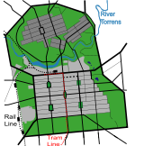
Adelaide
Adelaide is the capital city of South Australia and the fifth-largest city in Australia. Adelaide has an estimated population of more than 1.2 million...
was founded by British and German colonists in 1836 to test out Edward Gibbon Wakefield
Edward Gibbon Wakefield
Edward Gibbon Wakefield was a British politician, the driving force behind much of the early colonisation of South Australia, and later New Zealand....
's theories of systematic colonisation. Convict labour was not employed and the colony in theory would be financially self-sufficient; in practice government assistance was used in the early stages. Land had been sold before anyone set foot in the largely unexplored territory and the city (the basis for the future central business district
Central business district
A central business district is the commercial and often geographic heart of a city. In North America this part of a city is commonly referred to as "downtown" or "city center"...
) was surveyed and planned in a remarkably short space of time. Adelaide's design has been praised for its four-square layout, choice of setting and ample parklands which have had minimal encroachment of developments. The town centre was in sufficient proximity to a water source - the River Torrens
River Torrens
The River Torrens is the most significant river of the Adelaide Plains and was one of the reasons for the siting of the city of Adelaide, capital of South Australia. It flows from its source in the Adelaide Hills near Mount Pleasant, across the Adelaide Plains, past the city centre and empties...
.
Melbourne

Melbourne
Melbourne is the capital and most populous city in the state of Victoria, and the second most populous city in Australia. The Melbourne City Centre is the hub of the greater metropolitan area and the Census statistical division—of which "Melbourne" is the common name. As of June 2009, the greater...
was planned as a free settlement in 1837 through the Hoddle Grid
Hoddle Grid
The Hoddle Grid is the layout of the streets in the centre of the central business district of Melbourne. Named after its designer, Robert Hoddle, the Grid was laid out in 1837, and later extended...
, drawn up by Robert Hoddle
Robert Hoddle
Robert Hoddle was a surveyor of Port Phillip in the 1830s, and the creator of the Hoddle Grid, the street grid system upon which inner city Melbourne is based. He was also an accomplished artist and depicted scenes of the Port Philip region as well as New South Wales...
under instructions from George Gipps
George Gipps
Sir George Gipps was Governor of the colony of New South Wales, Australia, for eight years, between 1838 and 1846. His governorship was during a period of great change for New South Wales and Australia, as well as for New Zealand, which was administered as part of New South Wales for much of this...
, the original plan for Melbourne as part of the first land sales (prior to the planning only a handful of existing settlements were built on the fringe of the grid). The grid featured wide parallel streets, spanning a gently sloping valley between hills (Batman's Hill
Batman's Hill
Batman's Hill in Melbourne, Australia was named for the Vandemonian adventurer and grazier John Batman. Now removed, the 18 metre high hill was located to the south of today's Collins Street and Southern Cross railway station, and is the site of a steel marker the same height as the original...
, Flagstaff Hill and Eastern Hill) and roughly parallel to the course of the Yarra River
Yarra River
The Yarra River, originally Birrarung, is a river in east-central Victoria, Australia. The lower stretches of the river is where the city of Melbourne was established in 1835 and today Greater Melbourne dominates and influences the landscape of its lower reaches...
. The deliberate exclusion of city squares or open space within the grid was a subject of future frustration for the municipality and residents. Elizabeth Street, Melbourne
Elizabeth Street, Melbourne
Elizabeth Street is one of the main north-south streets in the central business district of Melbourne, Australia, part of the Hoddle Grid laid out in 1837.- Geography :...
in the centre of the grid was built over a gully
Gully
A gully is a landform created by running water, eroding sharply into soil, typically on a hillside. Gullies resemble large ditches or small valleys, but are metres to tens of metres in depth and width...
and has therefore been prone to flooding. Despite a later extension and later inclusion of planned suburbs, Melbourne's original plans were not as extensive as Adelaide's and the city so rapidly outgrew its original boundaries. As such it is often not considered to be a planned city, though the grid continues to define much of the character of the Melbourne city centre
Melbourne city centre
Melbourne City Centre is an area of Melbourne in Victoria, Australia. It is not to be confused with the larger local government area of the City of Melbourne...
.
Canberra
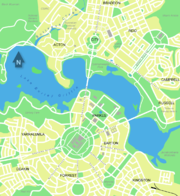
Canberra
Canberra is the capital city of Australia. With a population of over 345,000, it is Australia's largest inland city and the eighth-largest city overall. The city is located at the northern end of the Australian Capital Territory , south-west of Sydney, and north-east of Melbourne...
, established in 1908, was planned as the capital city of Australia and is Australia's most notable and ambitious example of civic planning. The city was designed to be the Federal Capital following the federation of the six Australian colonies which formed the Commonwealth of Australia. The new nation required a capital that was located away from other major settlements such as Melbourne and Sydney
Sydney
Sydney is the most populous city in Australia and the state capital of New South Wales. Sydney is located on Australia's south-east coast of the Tasman Sea. As of June 2010, the greater metropolitan area had an approximate population of 4.6 million people...
. Canberra is thus located in a Territory - the Australian Capital Territory
Australian Capital Territory
The Australian Capital Territory, often abbreviated ACT, is the capital territory of the Commonwealth of Australia and is the smallest self-governing internal territory...
- and not a State. Prior to this time the land that Canberra is found on was farming land, indigenous settlements, and forest. In 1912, after an extensive planning competition was completed, the vision of American Walter Burley Griffin
Walter Burley Griffin
Walter Burley Griffin was an American architect and landscape architect, who is best known for his role in designing Canberra, Australia's capital city...
was chosen as the winning design for the city. Extensive construction and public works were required to complete the city, this involved the flooding of a large parcel of land to form the center piece of the city, Lake Burley Griffin
Lake Burley Griffin
Lake Burley Griffin is an artificial lake in the centre of Canberra, the capital of Australia. It was completed in 1963 after the Molonglo River—which ran between the city centre and Parliamentary Triangle—was dammed...
. Unlike some other Australian cities, the road network, suburbs, parks and other elements of the city were designed in context with each other, rather than haphazard planning as witnessed in much of Sydney
Sydney
Sydney is the most populous city in Australia and the state capital of New South Wales. Sydney is located on Australia's south-east coast of the Tasman Sea. As of June 2010, the greater metropolitan area had an approximate population of 4.6 million people...
. Notable buildings include the High Court, Federal Parliament, Government House, War Memorial, Anzac Parade and headquarters of the Department of Defence.
New Zealand
New Zealand has several small New Towns, built for a specific purpose.Examples include Kawerau in the Bay of Plenty (a mill town), Twizel
Twizel
TwizelUrban AreaPopulation:1,000Extent:Territorial AuthorityName:Mackenzie District CouncilPopulation:Mayor:Website:Extent:Regional councilName:Environment Canterbury...
in North Otago, and Mangakino
Mangakino
Mangakino is a small town on the banks of the Waikato River in the North Island of New Zealand. It is located close to the hydroelectric power station at Lake Maraetai, southeast of Hamilton. Its population in 2001 was 1257...
in the Waikato (both for hydroelectricity). Construction of Kawerau began in 1953. Twizel was built in 1968 to service nearby hydroelectric projects, and was to close on their completion. However, its residents fought to save the town during 1983. Mangakino, constructed from 1946 was also meant to be a temporary construction town, but it too remains today. John Martin, founder of the Wairarapa town of Martinborough, set out the town's first streets in the pattern of the Union Flag
Union Flag
The Union Flag, also known as the Union Jack, is the flag of the United Kingdom. It retains an official or semi-official status in some Commonwealth Realms; for example, it is known as the Royal Union Flag in Canada. It is also used as an official flag in some of the smaller British overseas...
in the 19th century.
See also
- List of planned cities
- ArcologyArcologyArcology, a portmanteau of the words "architecture" and "ecology", is a set of architectural design principles aimed toward the design of enormous habitats of extremely high human population density. These largely hypothetical structures would contain a variety of residential, commercial, and...
- ArcosantiArcosantiArcosanti is an experimental town that began construction in 1970 in central Arizona, north of Phoenix, at an elevation of 3,732 feet...
- Cardus and decumanus in Roman coloniaColonia (Roman)A Roman colonia was originally a Roman outpost established in conquered territory to secure it. Eventually, however, the term came to denote the highest status of Roman city.-History:...
e - Garden city movementGarden city movementThe garden city movement is a method of urban planning that was initiated in 1898 by Sir Ebenezer Howard in the United Kingdom. Garden cities were intended to be planned, self-contained communities surrounded by "greenbelts" , containing proportionate areas of residences, industry and...
- Grid planGrid planThe grid plan, grid street plan or gridiron plan is a type of city plan in which streets run at right angles to each other, forming a grid...
- Housing estateHousing estateA housing estate is a group of buildings built together as a single development. The exact form may vary from country to country. Accordingly, a housing estate is usually built by a single contractor, with only a few styles of house or building design, so they tend to be uniform in appearance...
- Model villageModel villageA model village is a type of mostly self-contained community, in most cases built from the late eighteenth century onwards by industrialists to house their workers...
- New towns in the United KingdomNew towns in the United KingdomBelow is a list of some of the new towns in the United Kingdom created under the various New Town Acts of the 20th century. Some earlier towns were developed as Garden Cities or overspill estates early in the twentieth century. The New Towns proper were planned to disperse population following the...
- Principles of Intelligent UrbanismPrinciples of Intelligent UrbanismPrinciples of Intelligent Urbanism is a theory of urban planning composed of a set of ten axioms intended to guide the formulation of city plans and urban designs. They are intended to reconcile and integrate diverse urban planning and management concerns...
- Urban planningUrban planningUrban planning incorporates areas such as economics, design, ecology, sociology, geography, law, political science, and statistics to guide and ensure the orderly development of settlements and communities....
- urban planners, list of
- UtopiaUtopiaUtopia is an ideal community or society possessing a perfect socio-politico-legal system. The word was imported from Greek by Sir Thomas More for his 1516 book Utopia, describing a fictional island in the Atlantic Ocean. The term has been used to describe both intentional communities that attempt...
External links
- International New Town Institute (INTI)
- European New Town Platform
- Town and Country Planning Association (formerly the Garden Cities Association)
- The Alicia Patterson Foundation: Disappointing New Towns of Great Britain
- Movie: New Towns in Scotland
- UK Model Villages, Garden Cities and New Towns (this links to a Keyhole Markup LanguageKeyhole Markup LanguageKeyhole Markup Language is an XML notation for expressing geographic annotation and visualization within Internet-based, two-dimensional maps and three-dimensional Earth browsers. KML was developed for use with Google Earth, which was originally named Keyhole Earth Viewer. It was created by...
file that opens in Google EarthGoogle EarthGoogle Earth is a virtual globe, map and geographical information program that was originally called EarthViewer 3D, and was created by Keyhole, Inc, a Central Intelligence Agency funded company acquired by Google in 2004 . It maps the Earth by the superimposition of images obtained from satellite...
to see aerial photos of the places.)