

Elizabeth Street, Melbourne
Encyclopedia
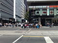
Elizabeth Street is one of the main north-south streets in the central business district of Melbourne
, Australia
, part of the Hoddle Grid
laid out in 1837.
past the western end of the Bourke Street Mall
, with the Queen Victoria Market
to the west at the northern end of the CBD. The street terminates in a large, complex roundabout
at the northern end, which connects to Peel Street to the south-west, Flemington Road
to the north-west, Royal Parade, the beginning of the Hume Highway
, the main route to Sydney
to the north, and Grattan Street to the East. This complex, high-traffic roundabout (known as the Haymarket roundabout
) is further complicated by tram
s travelling through it on routes 19
, 55
and 59
.
Elizabeth Street is the lowest point in the Melbourne central business district, with land rising both to the east and west, and more gradually to the north. Since it is built on top of the historical site of a natural creek, it has suffered numerous floods in Melbourne's history. The Elizabeth Street drain runs from Carlton in the north to the Yarra River
in the south, carrying stormwater from the inner northern suburbs and city centre. This drain is a significant source of pollutants entering the lower Yarra.
.
 As well as Flinders Street station at the southern end, there is a train station on the City Loop at the Melbourne Central shopping centre (the entrance is near the corner of Latrobe and Elizabeth), and regular route 19
trams to Coburg North, route 59
trams to Airport West
and route 57
trams to West Maribyrnong
.
shopping centre, Elizabeth Street is home to a number of photography retailers, and a considerable number of motorcycle dealers. The street has been the home of motorcycle retailing in inner Melbourne since 1903, the longest-existing such area in the world.
.
Melbourne
Melbourne is the capital and most populous city in the state of Victoria, and the second most populous city in Australia. The Melbourne City Centre is the hub of the greater metropolitan area and the Census statistical division—of which "Melbourne" is the common name. As of June 2009, the greater...
, Australia
Australia
Australia , officially the Commonwealth of Australia, is a country in the Southern Hemisphere comprising the mainland of the Australian continent, the island of Tasmania, and numerous smaller islands in the Indian and Pacific Oceans. It is the world's sixth-largest country by total area...
, part of the Hoddle Grid
Hoddle Grid
The Hoddle Grid is the layout of the streets in the centre of the central business district of Melbourne. Named after its designer, Robert Hoddle, the Grid was laid out in 1837, and later extended...
laid out in 1837.
Geography
From the south, the street runs from Flinders Street StationFlinders Street Station
Flinders Street Station is the central railway station of the suburban railway network of Melbourne, Victoria, Australia. It is on the corner of Flinders and Swanston Streets next to the Yarra River in the heart of the city, stretching from Swanston Street to Queen Street and covering two city...
past the western end of the Bourke Street Mall
Bourke Street, Melbourne
Bourke Street is one of Melbourne's best known streets. Historically been regarded as Melbourne's "second street", with the main street being Collins Street and "busier than Bourke Street" is a popular catchphrase. Bourke Street has traditionally been Melbourne's entertainment hub...
, with the Queen Victoria Market
Queen Victoria Market
The Queen Victoria Market is a major landmark in Melbourne, Australia, and at around seven hectares is the largest open air market in the Southern Hemisphere. The Market is significant to Melbourne's culture and heritage and has been listed on the Victorian Heritage Register...
to the west at the northern end of the CBD. The street terminates in a large, complex roundabout
Roundabout
A roundabout is the name for a road junction in which traffic moves in one direction around a central island. The word dates from the early 20th century. Roundabouts are common in many countries around the world...
at the northern end, which connects to Peel Street to the south-west, Flemington Road
Flemington Road, Melbourne
Flemington Road is a major thoroughfare in the inner suburbs of North Melbourne and Parkville in Melbourne, Victoria, Australia. It runs from the north end of Elizabeth Street to the south end of Mount Alexander Road, Flemington, and provides a main connection between the Melbourne CBD and the...
to the north-west, Royal Parade, the beginning of the Hume Highway
Hume Highway
The Hume Highway/Hume Freeway is one of Australia's major inter-city highways, running for 880 km between Sydney and Melbourne. It is part of the Auslink National Network and is a vital link for road freight to transport goods to and from the two cities as well as serving Albury-Wodonga and...
, the main route to Sydney
Sydney
Sydney is the most populous city in Australia and the state capital of New South Wales. Sydney is located on Australia's south-east coast of the Tasman Sea. As of June 2010, the greater metropolitan area had an approximate population of 4.6 million people...
to the north, and Grattan Street to the East. This complex, high-traffic roundabout (known as the Haymarket roundabout
Haymarket roundabout
Haymarket roundabout, informally known as the roundabout of death, is a notorious roundabout in inner-city Melbourne, Australia. The roundabout is formed at the junction of Peel St, Royal Parade, Elizabeth St, and Flemington Rd, on the northwest border of Melbourne's CBD. Two or three lanes of...
) is further complicated by tram
Tram
A tram is a passenger rail vehicle which runs on tracks along public urban streets and also sometimes on separate rights of way. It may also run between cities and/or towns , and/or partially grade separated even in the cities...
s travelling through it on routes 19
Melbourne tram route 19
Tram route 19 is a public transport service in Melbourne, Victoria, Australia. It runs from Flinders Street in the city centre to North Coburg in the northern suburbs. It runs through the suburbs of Melbourne, Parkville, Brunswick, Coburg, and Coburg North...
, 55
Melbourne tram route 55
Tram route 55 is a public transport service in Melbourne, Victoria, Australia. It runs from the corner of Bell Street and Melville Road in West Coburg to the Domain Road Interchange - Domain Road and St Kilda Road east of the city....
and 59
Melbourne tram route 59
Tram route 59 is a public transport service in Melbourne, Victoria, Australia. It runs from the intersection of Flinders Street and Elizabeth Street in the city centre to Airport West in the north western suburbs....
.
Elizabeth Street is the lowest point in the Melbourne central business district, with land rising both to the east and west, and more gradually to the north. Since it is built on top of the historical site of a natural creek, it has suffered numerous floods in Melbourne's history. The Elizabeth Street drain runs from Carlton in the north to the Yarra River
Yarra River
The Yarra River, originally Birrarung, is a river in east-central Victoria, Australia. The lower stretches of the river is where the city of Melbourne was established in 1835 and today Greater Melbourne dominates and influences the landscape of its lower reaches...
in the south, carrying stormwater from the inner northern suburbs and city centre. This drain is a significant source of pollutants entering the lower Yarra.
Floods
Positioned on a natural watercourse, Elizabeth Street has channeled flood waters during flash flooding south towards the Yarra River, in 1882, 1972 and more recently 2010 during the 2010 Victorian storms2010 Victorian storms
The 2010 Victorian storms were a series of storms that passed through much of the Australian state of Victoria on 6 March and 7 March 2010. One of the most severe storms passed directly over Greater Melbourne, bringing lightning, flash flooding, very large hail and strong winds to the state's capital...
.
Transport
Melbourne tram route 19
Tram route 19 is a public transport service in Melbourne, Victoria, Australia. It runs from Flinders Street in the city centre to North Coburg in the northern suburbs. It runs through the suburbs of Melbourne, Parkville, Brunswick, Coburg, and Coburg North...
trams to Coburg North, route 59
Melbourne tram route 59
Tram route 59 is a public transport service in Melbourne, Victoria, Australia. It runs from the intersection of Flinders Street and Elizabeth Street in the city centre to Airport West in the north western suburbs....
trams to Airport West
Airport West, Victoria
Airport West is a suburb 14 km north-west of Melbourne, Victoria, Australia. Its Local Government Area is the City of Moonee Valley. At the 2006 Census, Airport West had a population of 6660....
and route 57
Melbourne tram route 57
Tram route 57 is a public transport service in Melbourne, Victoria, Australia. It runs from the corner of Flinders Street and Elizabeth Street in the city centre to West Maribyrnong in the inner Western suburbs....
trams to West Maribyrnong
Maribyrnong, Victoria
Maribyrnong is a suburb 8 km north-west of Melbourne, Victoria, Australia. Its Local Government Area is the City of Maribyrnong, part of River Ward. At the 2006 Census, Maribyrnong had a population of 8242....
.
Commerce
As might be expected, there are a large number of retail shops on Elizabeth Street. As well as the Melbourne CentralMelbourne Central
Melbourne Central may refer to:*Melbourne Central Shopping Centre*Melbourne Central railway station...
shopping centre, Elizabeth Street is home to a number of photography retailers, and a considerable number of motorcycle dealers. The street has been the home of motorcycle retailing in inner Melbourne since 1903, the longest-existing such area in the world.
St Francis Church
The St Francis Church, which is a Catholic church is situated at the corner of Elizabeth and Lonsdale streets. It is listed on the Victorian Heritage RegisterVictorian Heritage Register
The Victorian Heritage Register lists places of cultural heritage significance to the State of Victoria, Australia. It has statutory weight under the Heritage Act 1995 which establishes Heritage Victoria as the permit authority...
.