
List of car-free places
Encyclopedia

J.H. Crawford
J.H. Crawford is an American-Dutch writer, theoretician of urban sustainability, originator of the carfree city concept and creator of the original reference design for the carfree city...
on Carfree.com and expanded by others. The list is now maintained exclusively on Wikipedia. The original list is still available but no longer updated. To be included, areas should meet at least one of the following criteria:
- They are unusual for their country or region
- They make up a sizeable fraction of a city, town, or island
For example, Freiburg
Freiburg
Freiburg im Breisgau is a city in Baden-Württemberg, Germany. In the extreme south-west of the country, it straddles the Dreisam river, at the foot of the Schlossberg. Historically, the city has acted as the hub of the Breisgau region on the western edge of the Black Forest in the Upper Rhine Plain...
's car free district is included because it is of significant size even for Germany; Leipzig
Leipzig
Leipzig Leipzig has always been a trade city, situated during the time of the Holy Roman Empire at the intersection of the Via Regia and Via Imperii, two important trade routes. At one time, Leipzig was one of the major European centres of learning and culture in fields such as music and publishing...
's is not since it is merely average and is a small part of the city. However, Portland, Oregon
Portland, Oregon
Portland is a city located in the Pacific Northwest, near the confluence of the Willamette and Columbia rivers in the U.S. state of Oregon. As of the 2010 Census, it had a population of 583,776, making it the 29th most populous city in the United States...
's are included since car free areas of any size are unusual in North America. Public transport
Public transport
Public transport is a shared passenger transportation service which is available for use by the general public, as distinct from modes such as taxicab, car pooling or hired buses which are not shared by strangers without private arrangement.Public transport modes include buses, trolleybuses, trams...
connections do not in themselves constitute a car free area.
Color-coding is used as follows:
| Place name | Most or all of the area is essentially car free. Children can play in most streets. |
| Place name | Large area that is nearly car free; pedestrians may still occasionally have to avoid cars. |
| Place name | Worthy of inclusion, but extent is limited or vehicles sometimes intrude appreciably. |
Austria
| Location | Area | Population | Character |
|---|---|---|---|
| Vienna Vienna Vienna is the capital and largest city of the Republic of Austria and one of the nine states of Austria. Vienna is Austria's primary city, with a population of about 1.723 million , and is by far the largest city in Austria, as well as its cultural, economic, and political centre... |
Autofreie Mustersiedlung Floridsdorf housing project | 250 units | New car free residential project, organized by Green party |
| Vienna Vienna Vienna is the capital and largest city of the Republic of Austria and one of the nine states of Austria. Vienna is Austria's primary city, with a population of about 1.723 million , and is by far the largest city in Austria, as well as its cultural, economic, and political centre... |
Innere Stadt Innere Stadt The Innere Stadt is the 1st municipal District of Vienna . The Innere Stadt is the old town of Vienna. Until the city boundaries were expanded in 1850, the Innere Stadt was congruent with the city of Vienna... is a sizable car free zone around St. Stephens Cathedral |
16 944 people | The historic center of Vienna including the main shopping streets, Graben Graben, Vienna Der Graben is one of the most famous streets in Vienna's first district, the city centre. It begins at Stock-im-Eisen-Platz next to the Palais Equitable and ends at the junction of Kohlmarkt and Tuchlauben. Another street in the first district is called Tiefer Graben... and Kärntner Straße Kärntner Straße Kärntner Straße is the most famous shopping street in central Vienna . It runs from the Stephansplatz out to the Wiener Staatsoper at Karlsplatz on the Ringstraße... . Stephansplatz Stephansplatz, Vienna The Stephansplatz is a square at the geographical centre of Vienna. It is named after its most prominent building, the Stephansdom, Vienna's cathedral and one of the tallest churches in the world... , Freyung Freyung (Vienna) The Freyung is a triangular public square in Vienna, located in the first district, or Innere Stadt.-History:The square originally lay outside the Roman fortification walls of Vindabona. In the 12th century, Irish monks arrived by invitation of Duke Henry II of Austria to build a monastery... , Minoritenplatz Minoritenplatz The Minoritenplatz is one of the oldest public squares in Vienna. It is located in the first district Innere Stadt, and is dominated by the Minoritenkirche church, after which the square is named. The church itself was constructed by the Greyfriars , after the Austrian Duke Leopold VI of Austria... and Judenplatz Judenplatz Judenplatz is a town square in Vienna's Innere Stadt that was the center of Jewish life and the Viennese Jewish Community in the Middle Ages. It is located in the immediate proximity of Am Hof square, Schulhof, and Wipplingerstraße. It exemplifies the long and eventful history of the city and the... are among the most important medieval squares of the area. |
| Graz Graz The more recent population figures do not give the whole picture as only people with principal residence status are counted and people with secondary residence status are not. Most of the people with secondary residence status in Graz are students... |
Several streets in the old town | Significant pedestrian zones and car free shopping areas | |
| Feldkirch Feldkirch, Vorarlberg - Schools :* Bundesgymnasium und Bundesrealgymnasium Feldkirch * Bundeshandelsakademie und Bundeshandelsschule Feldkirch* Bundesoberstufenrealgymnasium und Bundesrealgymnasium Schillerstrasse... |
Historic center | Oldest part of Feldkirch bordering the Ill river includes hotels, shopping, St. Nikolas Cathedral, City Hall, the Katzenturm, and the historic castle Schattenburg | |
| Salzburg Salzburg -Population development:In 1935, the population significantly increased when Salzburg absorbed adjacent municipalities. After World War II, numerous refugees found a new home in the city. New residential space was created for American soldiers of the postwar Occupation, and could be used for... |
A number of streets in the medieval center are car free | Lovely old town with significant car free shopping areas | |
Belgium
| Location | Area | Population | Character |
|---|---|---|---|
| Louvain-la-Neuve Louvain-la-Neuve Louvain-la-Neuve is a planned city in the municipality of Ottignies-Louvain-la-Neuve, Belgium, situated 30 km southeast of Brussels, in the French-speaking part of the country... |
Most or all of the city | University town; surface is car free; streets and parking are below pedestrian streets | |
| Brugge (Bruges Bruges Bruges is the capital and largest city of the province of West Flanders in the Flemish Region of Belgium. It is located in the northwest of the country.... ) |
Medieval town with large car free center | ||
| Gent Ghent Ghent is a city and a municipality located in the Flemish region of Belgium. It is the capital and biggest city of the East Flanders province. The city started as a settlement at the confluence of the Rivers Scheldt and Lys and in the Middle Ages became one of the largest and richest cities of... |
350,000 m² Entire city heart | 80.000 in car- free zone | Largest car free area in Belgium; Public transport, taxis and permit holders may enter but not exceed 5 km/h |
Bulgaria
| Location | Area | Population | Character |
|---|---|---|---|
| Blagoevgrad Blagoevgrad Blagoevgrad is а city in southwestern Bulgaria, the administrative centre of Blagoevgrad Province, with a population of about 74,302 . It lies on the banks of the Blagoevgradska Bistritsa River.... |
Downtown | This small university town of 60,000 contains a quite substantial pedestrian area, with one long walking street and several smaller ones, in addition to two large and one extremely large car free squares. | |
| Pazardzhik Pazardzhik Pazardzhik is a city situated along the banks of the Maritsa river, Southern Bulgaria. It is the capital of Pazardzhik Province and centre for the homonymous Pazardzhik Municipality... |
Downtown | A medium sized Bulgarian city (roughly 80,000 inhabitants) contains a proportionately large pedestrian network, where in one instance five different pedestrian streets intersect. | |
Croatia
| Location | Area | Population | Character |
|---|---|---|---|
| Zlarin Zlarin Zlarin is a small island of the Dalmatian coast of Croatia near the city of Šibenik. Administratively, it is part of the Šibenik-Knin County. In winter times the island has a population of 276 people, but from March to October its population grows substantially up to 1,500 people. Zlarin has a... |
Entire island (8.19 km2) | 276 | Only service vehicles and tractor Tractor A tractor is a vehicle specifically designed to deliver a high tractive effort at slow speeds, for the purposes of hauling a trailer or machinery used in agriculture or construction... s are allowed. Approximately 20 electrically powered golf carts are also used. |
| Location | Area | Population | Character |
|---|---|---|---|
| Prvić Prvic Prvić is a small island in the Croatian part of Adriatic Sea. It is situated in the Šibenik archipelago, about half a mile from the mainland, in the vicinity of Vodice... |
Entire island (2.37 km2) | 453 | Only service vehicles and tractor Tractor A tractor is a vehicle specifically designed to deliver a high tractive effort at slow speeds, for the purposes of hauling a trailer or machinery used in agriculture or construction... s are allowed. Approximately 2 electrically powered golf carts are also used. |
Denmark
| Location | Area | Population | Character |
|---|---|---|---|
| Strøget Strøget Strøget is a carfree zone in Copenhagen, Denmark. This popular tourist attraction in the centre of town is the longest pedestrian shopping area in Europe.... , Copenhagen Copenhagen Copenhagen is the capital and largest city of Denmark, with an urban population of 1,199,224 and a metropolitan population of 1,930,260 . With the completion of the transnational Øresund Bridge in 2000, Copenhagen has become the centre of the increasingly integrating Øresund Region... |
Large downtown car free shopping area | Central Copenhagen is one of the largest and oldest examples of auto-free zones, heavily used, much tourist traffic. Street lights are hung from cables attached to building walls which leaves the walks unimpeded by obstructing posts. The city's bicycle paths are extensive and well-used. photos | |
| Christiania community Freetown Christiania Not to be confused with Christiania, Norway, another name for Oslo.Christiania, also known as Freetown Christiania is a self-proclaimed autonomous neighbourhood of about 850 residents, covering 34 hectares in the borough of Christianshavn in the Danish capital Copenhagen... , Copenhagen Copenhagen Copenhagen is the capital and largest city of Denmark, with an urban population of 1,199,224 and a metropolitan population of 1,930,260 . With the completion of the transnational Øresund Bridge in 2000, Copenhagen has become the centre of the increasingly integrating Øresund Region... |
All of an old military reservation | 850 | Several streets with recycled and ad-hoc buildings; car free |
Finland
| Location | Area | Population | Character |
|---|---|---|---|
| Suomenlinna Suomenlinna Suomenlinna, until 1918 Viapori , or Sveaborg , is an inhabited sea fortress built on six islands , and which now forms part of the city of Helsinki, the capital of Finland.Suomenlinna is a UNESCO World Heritage site and popular with both tourists and locals, who... |
0.8 km² island | 850 | car free fortress in Helsinki Helsinki Helsinki is the capital and largest city in Finland. It is in the region of Uusimaa, located in southern Finland, on the shore of the Gulf of Finland, an arm of the Baltic Sea. The population of the city of Helsinki is , making it by far the most populous municipality in Finland. Helsinki is... , service traffic allowed. |
France
| Location | Area | Population | Character |
|---|---|---|---|
| Mont St. Michel | 4 km² island | about 60 | car free fortress/abbey |
| Île de Porquerolles, near Toulon Toulon Toulon is a town in southern France and a large military harbor on the Mediterranean coast, with a major French naval base. Located in the Provence-Alpes-Côte-d'Azur region, Toulon is the capital of the Var department in the former province of Provence.... |
Entire island is car-lite and many areas car free. | 5000 (summers) | Resort. Non-residents are not allowed to have cars. |
| Île de Sein (Enez-Sun) | Entire island is car free | ||
| Île de Bréhat, Bretagne | Entire island is car free | 421 | Easy for walking/biking |
| Île d'Yeu Île d'Yeu Île d'Yeu is an island and commune just off the Vendée coast of western France.The island's two harbours, Port-Joinville in the north and Port de la Meule, located in a rocky inlet of the southern granite coast, are famous for the fishing of tuna and lobster.... , Vendée |
Large car free center | 5000 (summer:40000) | Easy for walking/biking |
| Île de Batz Île de Batz The Île de Batz is an island off Roscoff in Brittany, France. Administratively, it is a commune in the Finistère department of Brittany in north-western France.-Population:... , Bretagne |
Entire island is car free | 594 | Easy for walking/biking |
| Lyon Lyon Lyon , is a city in east-central France in the Rhône-Alpes region, situated between Paris and Marseille. Lyon is located at from Paris, from Marseille, from Geneva, from Turin, and from Barcelona. The residents of the city are called Lyonnais.... |
Rue de la République Rue de la République Rue de la République is a street located in the 1st and 2nd arrondissements of Lyon. This is the main shopping street of the city. This zone is served by the metro stations Bellecour, Hôtel de Ville - Louis Pradel and Cordeliers... , Rue Victor Hugo Rue Victor Hugo (Lyon) Rue Victor-Hugo is a pedestrian street in the 2nd arrondissement of Lyon, in the Ainay district of the Presqu'île quarter, reputed to be one of the most known shopping area of Lyon. From north to south, it connects the Place Bellecour to the Place Carnot... , and side streets |
Metro area is about 1.7 million; car free area unknown | 17th-18th C mixed-use 6-story area |
| Lyon Lyon Lyon , is a city in east-central France in the Rhône-Alpes region, situated between Paris and Marseille. Lyon is located at from Paris, from Marseille, from Geneva, from Turin, and from Barcelona. The residents of the city are called Lyonnais.... |
Part of Vieux Lyon | Medieval quarter | |
| Port Grimaud Grimaud, Var Grimaud is a commune in the Var department in the Provence-Alpes-Côte d'Azur region in southeastern France.It is located on the French Riviera. The village of Grimaud is a perched village, with historical links to the Grimaldi family. Gibelin de Grimaldi aided William the Good drive the Saracens of... |
Large car free center | Resort | |
| Rue Mouffetard, Paris Rue Mouffetard, Paris Rue Mouffetard is a street in the 5th arrondissement of Paris, France.Situated in the fifth arrondissement of Paris, Rue Mouffetard is one of Paris's oldest and liveliest neighbourhoods. These days the area has many restaurants, shops, and cafés, and a regular open market... |
0.5 km | ||
| The pedestrian mall next to St. Germain, Paris | is about 1.5 km long and runs from place Odeon to rue Monge | ||
| Pompidou Center, Paris | Modern large-scale development | ||
| Les Halles Les Halles Les Halles is an area of Paris, France, located in the 1er arrondissement, just south of the fashionable rue Montorgueil. It is named for the large central wholesale marketplace, which was demolished in 1971, to be replaced with an underground modern shopping precinct, the Forum des Halles... , Paris |
Redeveloped market area | ||
| Montorgueil area, Paris | |||
| Dijon Dijon Dijon is a city in eastern France, the capital of the Côte-d'Or département and of the Burgundy region.Dijon is the historical capital of the region of Burgundy. Population : 151,576 within the city limits; 250,516 for the greater Dijon area.... |
Small car free center | Old buildings on narrow streets | |
| Strasbourg Strasbourg Strasbourg is the capital and principal city of the Alsace region in eastern France and is the official seat of the European Parliament. Located close to the border with Germany, it is the capital of the Bas-Rhin département. The city and the region of Alsace are historically German-speaking,... |
Part of the old town | Medieval core | |
| Colmar Colmar Colmar is a commune in the Haut-Rhin department in Alsace in north-eastern France.It is the capital of the department. Colmar is also the seat of the highest jurisdiction in Alsace, the appellate court.... |
Town Center | Large historic pedestrian area in center of town | |
| Chambéry Chambéry Chambéry is a city in the department of Savoie, located in the Rhône-Alpes region in southeastern France.It is the capital of the department and has been the historical capital of the Savoy region since the 13th century, when Amadeus V of Savoy made the city his seat of power.-Geography:Chambéry... |
Significant car free area | Medieval quarter | |
| Montpellier Montpellier -Neighbourhoods:Since 2001, Montpellier has been divided into seven official neighbourhoods, themselves divided into sub-neighbourhoods. Each of them possesses a neighbourhood council.... |
Many car free streets | 11,000 in the medieval quarter | Center of medieval university town |
| La Rochelle La Rochelle La Rochelle is a city in western France and a seaport on the Bay of Biscay, a part of the Atlantic Ocean. It is the capital of the Charente-Maritime department.The city is connected to the Île de Ré by a bridge completed on 19 May 1988... |
car free area and anti-car policies | 80,000 (entire city) | |
| Tours Tours Tours is a city in central France, the capital of the Indre-et-Loire department.It is located on the lower reaches of the river Loire, between Orléans and the Atlantic coast. Touraine, the region around Tours, is known for its wines, the alleged perfection of its local spoken French, and for the... |
Several blocks of the medieval old town are restricted to pedestrians only | Old medieval center | |
| Bordeaux Bordeaux Bordeaux is a port city on the Garonne River in the Gironde department in southwestern France.The Bordeaux-Arcachon-Libourne metropolitan area, has a population of 1,010,000 and constitutes the sixth-largest urban area in France. It is the capital of the Aquitaine region, as well as the prefecture... |
4 km of streets | Unknown; morning truck deliveries permitted; limited car access for residents | |
| Sarlat | Old part of city | Reportedly car free and pedestrian friendly except for central main street | |
| Lauzerte Lauzerte Lauzerte is a commune in the Tarn-et-Garonne department in the Midi-Pyrénées region in southern France.A medieval bastide perched above the valleys and hills of the area known as the Quercy Blanc, Lauzerte is one of the Most Beautiful Villages of France, a distinction granted to only 155 villages... |
Place des Cornieres | Car free; Bike & pedestrian only | |
| Yvoire Yvoire Yvoire is a commune in the Haute-Savoie department in the Rhône-Alpes region in south-eastern France.-Geography:Being located at the tip of the Leman peninsula , Yvoire delimits the two main parts of the Lake Geneva, the "petit lac" and the "grand lac".-Features:It is well known for its medieval... |
Old part of city | Medieval quarter |
Germany
| Location | Area | Population | Character | |
|---|---|---|---|---|
| Freiburg Freiburg Freiburg im Breisgau is a city in Baden-Württemberg, Germany. In the extreme south-west of the country, it straddles the Dreisam river, at the foot of the Schlossberg. Historically, the city has acted as the hub of the Breisgau region on the western edge of the Black Forest in the Upper Rhine Plain... im Breisgau |
Large car free center (610 x 720 m) | City 200,000; car free areas perhaps 10,000 | Medieval university town; a very small amount of car traffic is permitted on some streets; trams provide access | |
| Freiburg Freiburg Freiburg im Breisgau is a city in Baden-Württemberg, Germany. In the extreme south-west of the country, it straddles the Dreisam river, at the foot of the Schlossberg. Historically, the city has acted as the hub of the Breisgau region on the western edge of the Black Forest in the Upper Rhine Plain... im Breisgau |
Vauban district | 5,000 | New district converted from a military base; car parking distributed, trams provide access | |
| Freiburg Freiburg Freiburg im Breisgau is a city in Baden-Württemberg, Germany. In the extreme south-west of the country, it straddles the Dreisam river, at the foot of the Schlossberg. Historically, the city has acted as the hub of the Breisgau region on the western edge of the Black Forest in the Upper Rhine Plain... im Breisgau |
Rieselfeld Rieselfeld Rieselfeld is a district of the German city of Freiburg. Rieselfeld is one of the two recent new localities and was founded in 1992. Development started in 1993, is still going on and is planned to end in 2010.-History:... district |
10,000 | Car parking distributed, trams provide access | |
| Erlangen Erlangen Erlangen is a Middle Franconian city in Bavaria, Germany. It is located at the confluence of the river Regnitz and its large tributary, the Untere Schwabach.Erlangen has more than 100,000 inhabitants.... |
Former US-Army area/Hartmannstrasse | some 2.000 | Car parking concentrated in some multi storey car parks | |
| Erlangen Erlangen Erlangen is a Middle Franconian city in Bavaria, Germany. It is located at the confluence of the river Regnitz and its large tributary, the Untere Schwabach.Erlangen has more than 100,000 inhabitants.... |
Bonhoefferweg-Siedlung | some 200 | Car parking outside the residential area | |
| Nürnberg | 9 km of car free streets | |||
| Munich Munich Munich The city's motto is "" . Before 2006, it was "Weltstadt mit Herz" . Its native name, , is derived from the Old High German Munichen, meaning "by the monks' place". The city's name derives from the monks of the Benedictine order who founded the city; hence the monk depicted on the city's coat... |
7 km of car free streets | id=108 information | ||
| Stuttgart Stuttgart Stuttgart is the capital of the state of Baden-Württemberg in southern Germany. The sixth-largest city in Germany, Stuttgart has a population of 600,038 while the metropolitan area has a population of 5.3 million .... |
6.9 km of car free streets | |||
| Lindau Lindau Lindau is a Bavarian town and an island on the eastern side of Lake Constance, the Bodensee. It is the capital of the Landkreis or rural district of Lindau. The historic city of Lindau is located on an island which is connected with the mainland by bridge and railway.- History :The name Lindau was... |
Historic center | |||
| Rothenburg ob der Tauber Rothenburg ob der Tauber Rothenburg ob der Tauber is a town in the district of Ansbach of Mittelfranken , the Franconia region of Bavaria, Germany, well known for its well-preserved medieval old town, a destination for tourists from around the world. In the Middle Ages, it was an Imperial Free City... |
13,000 | |||
| Wittenberg (Gartenstadt Piesteritz) | 1,200 | Development ca. 1915; newly carfree (1994—1999) | ||
| Nürnberg - Langwasser | 3,180 | New development (1978–1987) | ||
| Hamburg Hamburg -History:The first historic name for the city was, according to Claudius Ptolemy's reports, Treva.But the city takes its modern name, Hamburg, from the first permanent building on the site, a castle whose construction was ordered by the Emperor Charlemagne in AD 808... (Stadthaus Schlump) |
Small | 45 dwelling units | car free mixed-use conversion of an old hospital | |
| Hamburg (Saarlandstraße) | 210 dwellings | New development (2000) | ||
| Bremen (Grünenstraße) | 800 m² | 23 dwellings | New development | |
| Tübingen Tübingen Tübingen is a traditional university town in central Baden-Württemberg, Germany. It is situated south of the state capital, Stuttgart, on a ridge between the Neckar and Ammer rivers.-Geography:... (French Quarter) |
Some parts of redevelopment car free | |||
| Tübingen Tübingen Tübingen is a traditional university town in central Baden-Württemberg, Germany. It is situated south of the state capital, Stuttgart, on a ridge between the Neckar and Ammer rivers.-Geography:... (converted military base) |
6000 residents, 2000 jobs | |||
| Frauenchiemsee Frauenchiemsee The island Frauenchiemsee is the second largest of the three islands in Chiemsee, Germany. It belongs to the municipality of Chiemsee in Upper Bavarian district of Rosenheim, which is the smallest municipality in all of Bavaria. The large and car free Fraueninsel houses 300 permanent residents as... |
15.5 ha | 300 residents | island in lake Chiemsee, historic abbey | |
| Munich - Kolumbusplatz(Haidhausen) | 40 dwellings | New development (near downtown) | ||
| Munich (Messestadt Riem) | 41 dwellings | car free part of a larger new development | ||
| Münster Münster Münster is an independent city in North Rhine-Westphalia, Germany. It is located in the northern part of the state and is considered to be the cultural centre of the Westphalia region. It is also capital of the local government region Münsterland... (Geist) Gartensiedlung Weissenburg |
184 dwellings | New development (2001) | ||
| Hahnenklee-Bockswiese (Harz) | Most of town | 2,500 | Town in the Harz mountain area | |
German islands and resorts
(Residents are allowed cars on some islands)| Location | Area | Population | Character |
|---|---|---|---|
| Helgoland | Entire island | 1650 | North Sea Island |
| Baltrum Baltrum Baltrum is a barrier island off the coast of East Frisia , in Germany, and is a municipality in the district of Aurich, Lower Saxony. It is located in-between the chain of the seven inhabited East Frisian Islands... |
Entire island | 510 | North Sea Island |
| Spiekeroog Spiekeroog Spiekeroog is one of the East Frisian Islands, off the North Sea coast of Germany. It is situated between Langeoog to its west, and Wangerooge to its east. The island belongs to the district of Wittmund, in Lower Saxony in Germany. The only village on the island is also called... |
Entire island | 730 | North Sea Island |
| Langeoog Langeoog Langeoog is one of the seven inhabited East Frisian Islands at the edge of the Lower Saxon Wadden Sea in the southern North Sea, located between Baltrum Island , and Spiekeroog . It is also a municipality in the district of Wittmund in Lower Saxony, Germany. The name Langeoog means Long Island in... |
Entire island | 1970 | North Sea Island |
| Wangerooge Wangerooge Wangerooge is one of the 32 Frisian Islands in the North Sea located close to the coasts of the Netherlands, Germany and Denmark. It is also a municipality in the district of Friesland in Lower Saxony in Germany.Wangerooge is one of the East Frisian Islands... |
Entire island | 1180 | North Sea Island |
| Juist Juist Juist is one of the seven inhabited East Frisian Islands at the edge of the Lower Saxon Wadden Sea in the southern North Sea, located between Borkum Island , Memmert Island and Norderney... |
Entire island | 1790 | North Sea Island |
| Hiddensee Hiddensee Hiddensee is a carfree island in the Baltic Sea, located west of Rügen on the German coast.The island, located 54°33' north longitude 13°07' east, has about 1,300 inhabitants. It was a popular vacation destination for East German tourists during German Democratic Republic times and continues to... |
Entire island | 1200 | Baltic Sea Island |
| Rerik (Wustrow peninsula) | 69 houses | Largely undeveloped area on a Baltic Sea Peninsula; will probably become less car free as it develops | |
| Niederrathen | Entire village | 500 | Village in Saxony |
| Moritzdorf (Sellin) | Entire village | Village on the island of Rügen | |
| Lechbruck am See | resort facilities | Small part of village in Bavaria (car allowed on Saturday) | |
| Hayingen Hayingen Hayingen is a town in the district of Reutlingen, in Baden-Württemberg, Germany. It is situated 32 km southeast of Reutlingen.... |
Entire village | 105 houses | Village in Swabia |
| Hallig Hooge, Hallig Gröde and Hallig Nordstrandischmoor | North sea islands | total of 100 Inhabitants | |
Greece
| Location | Area | Population | Character |
|---|---|---|---|
| Hydra Island Hydra, Saronic Islands Hydra is one of the Saronic Islands of Greece, located in the Aegean Sea between the Saronic Gulf and the Argolic Gulf. It is separated from the Peloponnese by narrow strip of water... |
Entire island (50 km²) | 3,000 | No motorized vehicles on the entire island |
| Lindos Lindos Lindos is an archaeological site, a town and a former municipality on the island of Rhodes, in the Dodecanese, Greece. Since the 2011 local government reform it is part of the municipality Rhodes, of which it is a municipal unit. It lies on the east coast of the island... /Rhodes |
Entire Town | Motorized traffic impossible due to narrow streets | |
| Mount Athos Mount Athos Mount Athos is a mountain and peninsula in Macedonia, Greece. A World Heritage Site, it is home to 20 Eastern Orthodox monasteries and forms a self-governed monastic state within the sovereignty of the Hellenic Republic. Spiritually, Mount Athos comes under the direct jurisdiction of the... |
Entire Peninsula | 1,400 | Motorized traffic of non residents is prohibited. Local traffic is extremely limited with only some vehicles used by the monastic community for essential communication, and transportation needs |
| Spetses Island Spetses Spetses is an island and a municipality in the Islands regional unit, Attica, Greece. It is sometimes included as one of the Saronic Islands. Until 1948, it was part of the old prefecture of Argolidocorinthia, which is now split into Argolis and Corinthia... |
Town only | 4,000 (entire island) | car free, possibly with some violations |
| Downtown Athens Athens Athens , is the capital and largest city of Greece. Athens dominates the Attica region and is one of the world's oldest cities, as its recorded history spans around 3,400 years. Classical Athens was a powerful city-state... |
Historic centre | ca. 750,000 (whole municipality) | While designated car free, the ban is apparently widely ignored |
| The city of Rhodes Rhodes Rhodes is an island in Greece, located in the eastern Aegean Sea. It is the largest of the Dodecanese islands in terms of both land area and population, with a population of 117,007, and also the island group's historical capital. Administratively the island forms a separate municipality within... |
Medieval centre | ca. 50,000 (entire city) | Motor traffic within the medieval city and mainly near the Knights Hospitaller Knights Hospitaller The Sovereign Military Hospitaller Order of Saint John of Jerusalem of Rhodes and of Malta , also known as the Sovereign Military Order of Malta , Order of Malta or Knights of Malta, is a Roman Catholic lay religious order, traditionally of military, chivalrous, noble nature. It is the world's... Grand Master Grand Master (order) Grand Master is the typical title of the supreme head of various orders of knighthood, including various military orders, religious orders and civil orders such as the Ancient Order of Hibernians and the Orange Order... 's palace is limited. Limitations are most often ignored, especially by youngsters on scooters. |
| Aristotle Street, Thessaloniki Thessaloniki Thessaloniki , historically also known as Thessalonica, Salonika or Salonica, is the second-largest city in Greece and the capital of the region of Central Macedonia as well as the capital of the Decentralized Administration of Macedonia and Thrace... |
From Aristotle Square to Ancient Agora Square | Car free except for cross streets, ignored by motorbikes. |
Hungary
| Location | Area | Population | Character |
|---|---|---|---|
| Budapest Budapest Budapest is the capital of Hungary. As the largest city of Hungary, it is the country's principal political, cultural, commercial, industrial, and transportation centre. In 2011, Budapest had 1,733,685 inhabitants, down from its 1989 peak of 2,113,645 due to suburbanization. The Budapest Commuter... |
Margaret Island Margaret Island Margaret Island is a long island, 500 metres wide, in the middle of the Danube in central Budapest, Hungary. It belongs administratively to the 13th district. The island is mostly covered by landscape parks, and is a popular recreational area. Its medieval ruins are reminders of its importance... |
Entry by cars forbidden except for a single bus line and taxis; service traffic of local stores and restaurants are allowed to enter | |
| Budapest Budapest Budapest is the capital of Hungary. As the largest city of Hungary, it is the country's principal political, cultural, commercial, industrial, and transportation centre. In 2011, Budapest had 1,733,685 inhabitants, down from its 1989 peak of 2,113,645 due to suburbanization. The Budapest Commuter... |
Váci Street and Vörösmarty Square Vörösmarty Square Vörösmarty tér or Vörösmarty square is a small but popular square in the Budapest city centre at the northern end of Váci utca.At the centre of the square facing west is a large statue of poet Mihály Vörösmarty, on the pedestal of which people tend to congregate... |
The main shopping street of Budapest in the historic downtown of Pest together with the neighbouring streets and squares |
Italy
| Location | Area | Population | Character |
|---|---|---|---|
| Venice Venice Venice is a city in northern Italy which is renowned for the beauty of its setting, its architecture and its artworks. It is the capital of the Veneto region... |
Entire city, except at the bus station square | Estimated at 70,000 | Medieval city, today highly focused on tourism; transport on foot or by water |
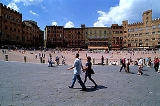
| Siena Siena Siena is a city in Tuscany, Italy. It is the capital of the province of Siena.The historic centre of Siena has been declared by UNESCO a World Heritage Site. It is one of the nation's most visited tourist attractions, with over 163,000 international arrivals in 2008... |
Entire city | Perhaps 30,000 | Not entirely car free but most streets have very little traffic |
| Cinque Terre Cinque Terre The Cinque Terre is a rugged portion of coast on the Italian Riviera. It is in the Liguria region of Italy, to the west of the city of La Spezia. "The Five Lands" is composed of five villages: Monterosso al Mare, Vernazza, Corniglia, Manarola, and Riomaggiore... (5 towns on the Gulf of Genoa) |
Most or all of each town | Probably a few thousand each | Some towns are car free, others highly car-moderated |
| Lipari Lipari Lipari is the largest of the Aeolian Islands in the Tyrrhenian Sea off the north coast of Sicily, and the name of the island's main town. It has a permanent population of 11,231; during the May–September tourist season, its population may reach up to 20,000.... |
Entire village | 10.763 | |
| Chamois Chamois, Italy Chamois is a town and comune in the Aosta Valley region of north-western Italy.... |
Entire village | 96 | |
| Orta San Giulio Orta San Giulio Orta San Giulio is a town and comune in the Province of Novara in the Italian region of Piedmont, located about 100 km northeast of Turin and about 40 km northwest of Novara.... |
Entire town is car free; visitors may park in lots above the town and continue down by foot | 1177 | Medieval village on the shore of Lake Orta in the Piedmont region |
| Monte Isola Monte Isola Monte Isola is a town and comune in the province of Brescia, in Lombardy. It is located on an island of the same name in Lake Iseo.With a total area of 12.8 km², Monte Isola ranks as the largest lake island not only in Italy, but also in South and Central Europe... |
Entire village | 1.768 | |
| Florence Florence Florence is the capital city of the Italian region of Tuscany and of the province of Florence. It is the most populous city in Tuscany, with approximately 370,000 inhabitants, expanding to over 1.5 million in the metropolitan area.... |
Many streets in the historic center of the city are now moderated or mostly car free, at least during the high season. | Market area of the old city | |
| Rome Rome Rome is the capital of Italy and the country's largest and most populated city and comune, with over 2.7 million residents in . The city is located in the central-western portion of the Italian Peninsula, on the Tiber River within the Lazio region of Italy.Rome's history spans two and a half... |
Many streets and squares in the historic center with limited or no traffic | Areas of the historic center inside the walls, especially the medieval core with narrow lanes, pedestrianazed squares and archeological fields. Delivery trucks and motorbikes are generally permitted | |
| Parma Parma Parma is a city in the Italian region of Emilia-Romagna famous for its ham, its cheese, its architecture and the fine countryside around it. This is the home of the University of Parma, one of the oldest universities in the world.... |
Small area in the city center, probably 6 to 10 streets | Unknown, probably a few thousand | Probably some delivery trucks permitted during limited hours |
| Naples Naples Naples is a city in Southern Italy, situated on the country's west coast by the Gulf of Naples. Lying between two notable volcanic regions, Mount Vesuvius and the Phlegraean Fields, it is the capital of the region of Campania and of the province of Naples... |
Small car free area at center | Shopping area in downtown | |
| Milan Milan Milan is the second-largest city in Italy and the capital city of the region of Lombardy and of the province of Milan. The city proper has a population of about 1.3 million, while its urban area, roughly coinciding with its administrative province and the bordering Province of Monza and Brianza ,... |
Small area near cathedral | Wide streets completely filled with pedestrians after work | |
| Ferrara Ferrara Ferrara is a city and comune in Emilia-Romagna, northern Italy, capital city of the Province of Ferrara. It is situated 50 km north-northeast of Bologna, on the Po di Volano, a branch channel of the main stream of the Po River, located 5 km north... |
The medieval center has car free streets and is over all "car-lite" | Heavy bike use | |
| Perugia Perugia Perugia is the capital city of the region of Umbria in central Italy, near the River Tiber, and the capital of the province of Perugia. The city is located about north of Rome. It covers a high hilltop and part of the valleys around the area.... |
While the town suffers heavily from cars and traffic, some areas are so narrow that they are car free | Medieval hill town | |
| Assisi Assisi - Churches :* The Basilica of San Francesco d'Assisi is a World Heritage Site. The Franciscan monastery, il Sacro Convento, and the lower and upper church of St Francis were begun immediately after his canonization in 1228, and completed in 1253... |
Much of the town is highly car-moderated | Visitors must park at the foot of the hill; some residents' cars are allowed in town | |
| Spoleto Spoleto Spoleto is an ancient city in the Italian province of Perugia in east central Umbria on a foothill of the Apennines. It is S. of Trevi, N. of Terni, SE of Perugia; SE of Florence; and N of Rome.-History:... |
Some parts of the upper old city are car free | Pre-medieval hill town | |
The Netherlands
| Location | Area | Population | Character |
|---|---|---|---|
| Giethoorn Giethoorn Giethoorn is a village in the Dutch province of Overijssel. It is located in the municipality of Steenwijkerland, about 5 km southwest of Steenwijk.... |
Entire town | about 2500 | Transport by canal boat |
| Amsterdam Amsterdam Amsterdam is the largest city and the capital of the Netherlands. The current position of Amsterdam as capital city of the Kingdom of the Netherlands is governed by the constitution of August 24, 1815 and its successors. Amsterdam has a population of 783,364 within city limits, an urban population... GWL project |
600 unit car free residential area | About 1500 | Modern architecture on the site of a disused waterworks; some car parking at the edge |
| Kalverstraat Kalverstraat The Kalverstraat is the busiest shopping street of Amsterdam, the capital of the Netherlands. It is named after the kalvermarkt that was held here until the 17th Century.... /Nieuwendijk Nieuwendijk Nieuwendijk is a town in the Dutch province of North Brabant. It is a part of the municipality of Werkendam, and lies about 8 km south of Gorinchem.In 2001, the town of Nieuwendijk had 2,212 inhabitants... , Amsterdam |
Long main shopping street with many narrow side streets | Unknown; primarily commercial | Shopping district; delivery vehicles allowed in AM |
| Delft Delft Delft is a city and municipality in the province of South Holland , the Netherlands. It is located between Rotterdam and The Hague.... |
Most of the old center | Medieval center | |
| Islands of Vlieland Vlieland Vlieland is a municipality in the northern Netherlands. The municipality of Vlieland has only one major town: Oost-Vlieland . It is the second-least densely populated municipality in the Netherlands .... and Schiermonnikoog Schiermonnikoog Schiermonnikoog is an island, a municipality, and a national park in the northern Netherlands. Schiermonnikoog is one of the West Frisian Islands, and is part of the province of Friesland.... |
Entire islands | About 1000 residents on each plus lots of tourists in season | Only residents are allowed to bring cars onto the islands |
| Groningen | Most of the old city center | 16,551 within the City Centre | Much of the City Centre is pedestrianised. The City Centre has no through routes for motor traffic; much of it is pedestrianised |
Poland
| Location | Area | Population | Character |
|---|---|---|---|
| Kraków Kraków Kraków also Krakow, or Cracow , is the second largest and one of the oldest cities in Poland. Situated on the Vistula River in the Lesser Poland region, the city dates back to the 7th century. Kraków has traditionally been one of the leading centres of Polish academic, cultural, and artistic life... |
Large car free area around the Old Town Square encircled by a park known as Planty | 5,345 (Old Town in 1998), 780,000 (whole city - 2004) | Old town |
| Kielce Kielce Kielce ) is a city in central Poland with 204,891 inhabitants . It is also the capital city of the Świętokrzyskie Voivodeship since 1999, previously in Kielce Voivodeship... |
|||
| Łódź | |||
| Poznań Poznan Poznań is a city on the Warta river in west-central Poland, with a population of 556,022 in June 2009. It is among the oldest cities in Poland, and was one of the most important centres in the early Polish state, whose first rulers were buried at Poznań's cathedral. It is sometimes claimed to be... |
|||
| Sopot Sopot Sopot is a seaside town in Eastern Pomerania on the southern coast of the Baltic Sea in northern Poland, with a population of approximately 40,000.... |
|||
| Suwałki | |||
| Toruń Torun Toruń is an ancient city in northern Poland, on the Vistula River. Its population is more than 205,934 as of June 2009. Toruń is one of the oldest cities in Poland. The medieval old town of Toruń is the birthplace of the astronomer Nicolaus Copernicus.... |
|||
| Warsaw Warsaw Warsaw is the capital and largest city of Poland. It is located on the Vistula River, roughly from the Baltic Sea and from the Carpathian Mountains. Its population in 2010 was estimated at 1,716,855 residents with a greater metropolitan area of 2,631,902 residents, making Warsaw the 10th most... |
|||
| Wrocław | |||
| Zakopane Zakopane Zakopane , is a town in southern Poland. It lies in the southern part of the Podhale region at the foot of the Tatra Mountains. From 1975 to 1998 it was in of Nowy Sącz Province, but since 1999 it has been in Lesser Poland Province. It had a population of about 28,000 as of 2004. Zakopane is a... |
|||
| Zielona Góra Zielona Góra Zielona Góra is a city in Lubusz Voivodeship, in western Poland, with 117,557 inhabitants within the city limits and 294,000 inhabitants within the metropolitan area, including three neighbouring counties .... |
|||
| Złotów |
Russia
| Location | Area | Population | Character |
|---|---|---|---|
| Moscow | (Old) Arbat Street Arbat Street The Arbat is an approximately one-kilometer long pedestrian street in the historical centre of Moscow. The Arbat has existed at least since the 15th century, thus laying claim to being one of the oldest surviving streets of the Russian capital. It forms the heart of the Arbat District of Moscow... is a picturesque pedestrian street |
Tourist area | |
| Moscow | Luzhniki Olympic Complex Luzhniki Olympic Complex The Luzhniki Olympic Complex is a sport facilities complex located in Moscow, Russia.- Venues :*Grand Sports Arena*Luzhniki Palace of Sports*Luzhniki Small Sports Arena*Olympic Pool... |
about 10000 in non-transit area | Three areas: walled pedestrian transit area nearby Luzhniki Metro Bridge Luzhniki Metro Bridge Luzhniki Metro Bridge , also known as Metromost , is a concrete two-level arch bridge carrying road and subway over the Moskva River in Moscow, Russia, connecting the city center with Sparrow Hills. The bridge houses Vorobyovy Gory, the only station of Moscow Metro located above water. Originally... (24 hours access except events), the another walled area open 10 to 22, access most times free of charge, authority area to cars northern to the stadium (northern border is transit road - Khamovnichesky Val) with public transport. In additional, there is a non-transit area nearby to the metro Sportivnaya |
| Moscow | Moscow Kremlin Moscow Kremlin The Moscow Kremlin , sometimes referred to as simply The Kremlin, is a historic fortified complex at the heart of Moscow, overlooking the Moskva River , Saint Basil's Cathedral and Red Square and the Alexander Garden... - UNESCO World Heritage Site, Entire area of walled town |
N/A | Cars are allowed only durning parade Parade A parade is a procession of people, usually organized along a street, often in costume, and often accompanied by marching bands, floats or sometimes large balloons. Parades are held for a wide range of reasons, but are usually celebrations of some kind... |
| Moscow | White House, Moscow White House, Moscow The White House , also known as the Russian White House, is a government building in Moscow. It stands on Krasnopresnenskaya embankment. Construction started in 1965 and ended in 1981. Originally called The House of Soviets, it was designed by the architects Dmitry Chechulin and P. Shteller... - after 1993 building zone, pedastrian zone and car zone were divided, transit cars were diverted to embarks, local cars to adjustment streets |
N/A | for pedastrian zone used impassable to most vehicles area and were walled |
Portugal
| Location | Area | Population | Character |
|---|---|---|---|
| Óbidos | Entire area of walled town | Around 3,100 | Medieval walled hill town (now tourist area); only residents permitted to drive into the town, although cars are a nuisance |
| Aveiro | Many small streets | 75,000 | Praça do Peixe, a large pub area and the judicial city |
| Baixa, Lisbon Lisbon Lisbon is the capital city and largest city of Portugal with a population of 545,245 within its administrative limits on a land area of . The urban area of Lisbon extends beyond the administrative city limits with a population of 3 million on an area of , making it the 9th most populous urban... |
One long shopping street, with a few side streets | 18th C 5-story mixed use | |
| Santarém Santarém, Portugal Santarém is a city in the Santarém Municipality in Portugal. The city itself has a population of 28,760 and the entire municipality has 64,124 inhabitants.It is the capital of Santarém District.... |
Most of the streets in the oldest part of town | 64,124 | 3 story, old, mixed use area |
| Faro Faro, Portugal Faro is the southernmost city in Portugal. It is located in the Faro Municipality in southern Portugal. The city proper has 41,934 inhabitants and the entire municipality has 58,305. It is the seat of the Faro District and capital of the Algarve region... |
Some of the downtown area | 50,000 (whole city) | 6 to 8 old streets that form a small network in the center of town |
| Tavira Tavira Tavira is a Portuguese city, situated at 37°07' north, 7°39' west in the east of the Algarve on the south coast of Portugal. It is 30 km east of Faro and 160 km west of Seville in Spain. The Gilão River meets the Atlantic Ocean in Tavira.... |
Some of the old downtown | 25,000 (whole city) | Narrow, winding streets in the old part of town. |
| Évora Évora Évora is a municipality in Portugal. It has total area of with a population of 55,619 inhabitants. It is the seat of the Évora District and capital of the Alentejo region. The municipality is composed of 19 civil parishes, and is located in Évora District.... |
Most of the old walled city | 8500 (in the walled city) | Some cars |
| Coimbra Coimbra Coimbra is a city in the municipality of Coimbra in Portugal. Although it served as the nation's capital during the High Middle Ages, it is better-known for its university, the University of Coimbra, which is one of the oldest in Europe and the oldest academic institution in the... |
Many small streets | Old medieval quarter | |
| Viseu Viseu Viseu is both a city and a municipality in the Dão-Lafões Subregion of Centro Region, Portugal. The municipality, with an area of 507.1 km², has a population of 99,593 , and the city proper has 47,250... |
A number of narrow streets in the town center | Largely intact medieval city; on Fridays, the entire old center is car free | |
Spain
| Location | Area | Population | Character |
|---|---|---|---|
| Málaga Málaga Málaga is a city and a municipality in the Autonomous Community of Andalusia, Spain. With a population of 568,507 in 2010, it is the second most populous city of Andalusia and the sixth largest in Spain. This is the southernmost large city in Europe... |
3,900 m² car free and limited access streets | Moorish and XIX century historic center | |
| Seville Seville Seville is the artistic, historic, cultural, and financial capital of southern Spain. It is the capital of the autonomous community of Andalusia and of the province of Seville. It is situated on the plain of the River Guadalquivir, with an average elevation of above sea level... |
Santa Cruz district has many narrow, car free streets | Medieval/Renaissance quarter | |
| Bilbao Bilbao Bilbao ) is a Spanish municipality, capital of the province of Biscay, in the autonomous community of the Basque Country. With a population of 353,187 , it is the largest city of its autonomous community and the tenth largest in Spain... |
Casco Viejo (Old Town) district has narrow streets with limited car access | Medieval quarter | |
| Vitoria | Most of the old walled city, as well as most of the "Ensanche" streets | Medieval quarter and 19th century center | |
| Madrid Madrid Madrid is the capital and largest city of Spain. The population of the city is roughly 3.3 million and the entire population of the Madrid metropolitan area is calculated to be 6.271 million. It is the third largest city in the European Union, after London and Berlin, and its metropolitan... Puerta del Sol |
6 blocks square (limited car access) | Busy central area | |
| Salamanca Salamanca Salamanca is a city in western Spain, in the community of Castile and León. Because it is known for its beautiful buildings and urban environment, the Old City was declared a UNESCO World Heritage Site in 1988. It is the most important university city in Spain and is known for its contributions to... |
Entire Medieval city including old Roman bridges | Plaza mayor and entire old city. | |
| Segovia Segovia Segovia is a city in Spain, the capital of Segovia Province in the autonomous community of Castile and León. It is situated north of Madrid, 30 minutes by high speed train. The municipality counts some 55,500 inhabitants.-Etymology:... |
Large parts of the old, walled city | Medieval area | |
| Pontevedra Pontevedra Pontevedra is a city in the north-west of the Iberian Peninsula. It is the capital of both the comarca and province of Pontevedra, in Galicia . It is also the capital of its own municipality which is, in fact, often considered as an extension of the actual city... |
Large central pedestrian zone | Whole old town, narrow streets and small squares. No cars. | |
| Santiago de Compostela Santiago de Compostela Santiago de Compostela is the capital of the autonomous community of Galicia, Spain.The city's Cathedral is the destination today, as it has been throughout history, of the important 9th century medieval pilgrimage route, the Way of St. James... |
Large central pedestrian zone | ||
| Ayamonte Ayamonte Ayamonte is a town and municipality located in the province of Huelva, Spain. According to the 2005 census, the city has a population of 18,001 inhabitants.-Location and history:... (in S.W. corner) |
Downtown commercial district | Old medieval quarter with very narrow streets; river town on the flanks of a hill | |
| Barri Gòtic Barri Gòtic The Gothic Quarter is the centre of the old city of Barcelona. It stretches from La Rambla to Via Laietana, and from the Mediterranean seafront to Ronda de Sant Pere.... , Barcelona Barcelona Barcelona is the second largest city in Spain after Madrid, and the capital of Catalonia, with a population of 1,621,537 within its administrative limits on a land area of... |
A number of car free streets, others car-light | 27,946 | Medieval center |
| Girona Girona Girona is a city in the northeast of Catalonia, Spain at the confluence of the rivers Ter, Onyar, Galligants and Güell, with an official population of 96,236 in January 2009. It is the capital of the province of the same name and of the comarca of the Gironès... |
Rambla (promenade and shopping street) and network of narrow residential streets | Historic centre | |
| Granada Granada Granada is a city and the capital of the province of Granada, in the autonomous community of Andalusia, Spain. Granada is located at the foot of the Sierra Nevada mountains, at the confluence of three rivers, the Beiro, the Darro and the Genil. It sits at an elevation of 738 metres above sea... |
Albaicin neighborhood (limited car access on a few streets) | Historic Moorish quarter | |
| Laguardia Laguardia, Álava Laguardia is a town and municipality located in the province of Álava, in the Basque Country, northern Spain.The site of a 10th century castle, of which two towers remain, the present village has medieval walls dating back to the 15th century surrounding the houses and old cobblestoned streets.The... (Biasteri) photos |
|||
| Valladolid Valladolid Valladolid is a historic city and municipality in north-central Spain, situated at the confluence of the Pisuerga and Esgueva rivers, and located within three wine-making regions: Ribera del Duero, Rueda and Cigales... |
Central square and surrounding streets. | Historic centre, although most buildings are now modern. |
Sweden
| Location | Area | Population | Character |
|---|---|---|---|
| Gamla stan Gamla stan Gamla stan , until 1980 officially Staden mellan broarna , is the old town of Stockholm, Sweden. Gamla stan consists primarily of the island Stadsholmen. The surrounding islets Riddarholmen, Helgeandsholmen, and Strömsborg are officially part of, but not colloquially included in, Gamla stan... , Stockholm Stockholm Stockholm is the capital and the largest city of Sweden and constitutes the most populated urban area in Scandinavia. Stockholm is the most populous city in Sweden, with a population of 851,155 in the municipality , 1.37 million in the urban area , and around 2.1 million in the metropolitan area... (Old Town) |
Most of the old heart (ca. 0.3 km²) | 3000 | Oldest part of the city; medieval area; low traffic in central parts of the Old Town during part of the day, AM deliveries allowed and taxis allowed 24 h; there is no supervision and no control so in reality the medieval city is not essentially car free. |
| Malmö Malmö Malmö , in the southernmost province of Scania, is the third most populous city in Sweden, after Stockholm and Gothenburg.Malmö is the seat of Malmö Municipality and the capital of Skåne County... |
Large pedestrian precinct | City center; further expansion planned | |
| Växjö, Sweden | Entire city center | car free district in fossil-fuel reduced city (external link) | |
| Jakriborg Jakriborg Jakriborg is a housing estate, or new town in Hjärup, Staffanstorp Municipality between Malmö and Lund in Scania, southern Sweden. The area was built in the late 1990s by the real estate firm Jakri AB and has been growing ever since. Jakri AB was founded by two brothers, Jan Berggren and Krister... |
Entire village | 2000 - 5000 | Newbuilt suburb/village in old style, connected to Malmö and Lund Lund -Main sights:During the 12th and 13th centuries, when the town was the seat of the archbishop, many churches and monasteries were built. At its peak, Lund had 27 churches, but most of them were demolished as result of the Reformation in 1536. Several medieval buildings remain, including Lund... via rail. |
| Southern Göteborg Archipelago | Archipelago including Vrångö, Brännö, Styrsö, and Vargö | 5,000 permanent, another 6,000 summer | West of Gothenburg Gothenburg Gothenburg is the second-largest city in Sweden and the fifth-largest in the Nordic countries. Situated on the west coast of Sweden, the city proper has a population of 519,399, with 549,839 in the urban area and total of 937,015 inhabitants in the metropolitan area... |
Switzerland
| Location | Area | Population | Character |
|---|---|---|---|
| Zermatt Zermatt Zermatt is a municipality in the district of Visp in the German-speaking section of the canton of Valais in Switzerland. It has a population of about 5,800 inhabitants.... |
Entire town | 5687 | car free Alpine resort with prototype "Utility Area" at the entrance; slow electric taxis and freight vehicles used, although these are sometimes driven at higher speeds |
| Bettmeralp Bettmeralp Bettmeralp is a village and ski resort in the Swiss canton of Valais, 1'957 m above sea level, in the municipality of Betten.Bettmeralp is a car free village which can be reached by cable car from the Betten train station . From there another cable car leads near to the summit of Bettmerhorn, which... |
Entire town | Alpine resort, sometimes considerable traffic of utility vehicles | |
| Braunwald Braunwald Braunwald is a former municipality in the canton of Glarus in Switzerland. Effective from 1 January 2011, Braunwald is part of the municipality of Glarus Süd.-Geography:... |
Entire town | 398 | Alpine resort |
| Riederalp Riederalp Riederalp is a municipality in the district of Raron in the canton of Valais in Switzerland. It was created in 2003 through the merger of Goppisberg, Greich and Ried-Mörel.-Geography:... |
Entire town | 555 | Alpine resort |
| Rigi Rigi - Mt. Rigi in Art:Mt. Rigi has been featured in many works of art, including both paintings and literary publications. Perhaps the most famous paintings of the Rigi were by JMW Turner, including "The Blue Rigi, Lake of Lucerne, Sunrise"... |
Entire mountain | Mountain resort, some utility vehicles | |
| Saas-Fee Saas-Fee Saas-Fee is the main village in the Saastal, or the Saas Valley, and is a municipality in the district of Visp in the canton of Valais in Switzerland... |
Entire town | 1607 | Alpine resort; small electric utility vehicles |
| Stoos Stoos Stoos is a village located in the municipality of Morschach. It lies at 1,300 metres in the Swiss canton of Schwyz and has about 100 inhabitants. It is used as a small ski resort with a cable car leading to the Fronalpstock. The village itself is car-free and is accessible via a funicular.-External... |
Entire town | Alpine resort; small electric utility vehicles, mainly from the resorts hotels. | |
| Wengen Wengen, Switzerland Wengen is a village in the Bernese Oberland in the canton of Bern, located in central Switzerland at an elevation of 1274 m above sea level, and is part of the Jungfrauregion. Wengen has approximately 1,300 year-round residents... |
Entire town | 1400 | Alpine resort |
| Zürich Zürich Zurich is the largest city in Switzerland and the capital of the canton of Zurich. It is located in central Switzerland at the northwestern tip of Lake Zurich... |
Large parts of the old town | car free medieval urban core | |
| Lausanne Lausanne Lausanne is a city in Romandy, the French-speaking part of Switzerland, and is the capital of the canton of Vaud. The seat of the district of Lausanne, the city is situated on the shores of Lake Geneva . It faces the French town of Évian-les-Bains, with the Jura mountains to its north-west... |
Large parts of the old town | The lower mediaeval part of the old town is car free. Cars are allowed but uncommon in the upper ancient part. Taxis are allowed. | |
| Geneva Geneva Geneva In the national languages of Switzerland the city is known as Genf , Ginevra and Genevra is the second-most-populous city in Switzerland and is the most populous city of Romandie, the French-speaking part of Switzerland... |
10 streets | 10,000 | car free areas in the heart |
| Basel Basel Basel or Basle In the national languages of Switzerland the city is also known as Bâle , Basilea and Basilea is Switzerland's third most populous city with about 166,000 inhabitants. Located where the Swiss, French and German borders meet, Basel also has suburbs in France and Germany... |
Parts of the medieval town are car free | The city is heavily dependent on an excellent tram system and most of the center city is highly car moderated if not car free | |
| St. Gallen St. Gallen St. Gallen is the capital of the canton of St. Gallen in Switzerland. It evolved from the hermitage of Saint Gall, founded in the 7th century. Today, it is a large urban agglomeration and represents the center of eastern Switzerland. The town mainly relies on the service sector for its economic... |
Old center | car free | |
| Neuchâtel | Old center | car free | |
| Appenzell Appenzell (town) Appenzell is the capital of the canton of Appenzell Innerrhoden in Switzerland. Appenzell has no municipal government of its own; rather, the different parts of Appenzell belong to the districts Appenzell, Schwende and Rüte... |
Old center | car free | |
| Gstaad Gstaad Gstaad is a village in the German-speaking section of the Canton of Berne in southwestern Switzerland. Part of the municipality of Saanen, Gstaad is known as one of the most exclusive ski resorts in the world.... |
Village center | car free | |
| Gruyere Gruyère (district) Gruyère District is a district of the canton of Fribourg in Switzerland. It has a population of . Its capital is Bulle.-Municipalities:-Mergers and name changes:... |
Village center | Reportedly significant car free area | |
| Rapperswil Rapperswil Rapperswil-Jona is a municipality in the Wahlkreis of See-Gaster in the canton of St. Gallen in Switzerland.Besides Rapperswil and Jona, which were separate municipalities until 2006, the municipality includes Bollingen, Busskirch, Curtiberg, Kempraten-Lenggis, Wagen, and Wurmsbach.-Today:On... |
Medieval center | car free center | |
| Brig Brig, Switzerland Brig, officially Brig-Glis is a municipality in the district of Brig in the canton of Valais in Switzerland.The current municipality was formed in 1972 through the merger of Brig , Brigerbad and Glis.-History:... |
Perhaps 10 blocks in downtown | Old part of the city, mixed use | |
| Winterthur Winterthur Winterthur is a city in the canton of Zurich in northern Switzerland. It has the country's sixth largest population with an estimate of more than 100,000 people. In the local dialect and by its inhabitants, it is usually abbreviated to Winti... |
Historic center | ||
| Lugano Lugano Lugano is a city of inhabitants in the city proper and a total of over 145,000 people in the agglomeration/city region, in the south of Switzerland, in the Italian-speaking canton of Ticino, which borders Italy... |
Most of the old quarter | ||
| Mürren Mürren Mürren is a traditional Walser mountain village in Bernese Oberland, Switzerland, at an elevation of 1,650 m above sea level and unreachable by public road.... |
Entire town | 450 | Alpine resort; some utility traffic |
| Gimmelwald Gimmelwald Gimmelwald is a small village in the Bernese Oberland in Switzerland, halfway up the mountain between Stechelberg and Mürren, at an elevation of 1363 meters... |
Entire town | 130 | Small village |
| Bern - Halen | 79 apartments | Terraced neighborhood; built 1961; parking at edge | |
| ID=592 Boll-Sinneringen - Wohnanlage Schloßpark | 73 apartments | Built 1996; parking at edge | |
UK and Channel Islands
| Location | Area | Population | Character |
|---|---|---|---|
| Island of Sark Sark Sark is a small island in the Channel Islands in southwestern English Channel, off the French coast of Normandy. It is a royal fief, geographically located in the Channel Islands in the Bailiwick of Guernsey, with its own set of laws based on Norman law and its own parliament. It has a population... (Channel Islands Channel Islands The Channel Islands are an archipelago of British Crown Dependencies in the English Channel, off the French coast of Normandy. They include two separate bailiwicks: the Bailiwick of Guernsey and the Bailiwick of Jersey... ) |
Whole island | 560 | Entirely car free (only motorized vehicles are tractors) |
| Island of Herm Herm Herm is the smallest of the Channel Islands that is open to the public and is part of the Bailiwick of Guernsey. Cars are banned from the small island just like its Channel Island neighbour, Sark. Unlike Sark, bicycles are also banned... (Channel Islands Channel Islands The Channel Islands are an archipelago of British Crown Dependencies in the English Channel, off the French coast of Normandy. They include two separate bailiwicks: the Bailiwick of Guernsey and the Bailiwick of Jersey... ) |
Whole island | 60 | Cars and bicycles are both banned (quad bikes are allowed, but only for maintenance) |
| Cambridge Cambridge The city of Cambridge is a university town and the administrative centre of the county of Cambridgeshire, England. It lies in East Anglia about north of London. Cambridge is at the heart of the high-technology centre known as Silicon Fen – a play on Silicon Valley and the fens surrounding the... |
City centre and university campus | Several thousand | University town with heavy tourism; cars banned most of the day from centre |
| Oxford Oxford The city of Oxford is the county town of Oxfordshire, England. The city, made prominent by its medieval university, has a population of just under 165,000, with 153,900 living within the district boundary. It lies about 50 miles north-west of London. The rivers Cherwell and Thames run through... |
Areas in city centre | Medieval university town. Cornmarket Street, Radliffe Square surrounding the Radcliffe Camera and University Church, and Brasenose Lane are pedestrian only; Queen Street is bus only; many surrounding streets have restricted vehicular access | |
| Salisbury Salisbury Salisbury is a cathedral city in Wiltshire, England and the only city in the county. It is the second largest settlement in the county... |
City centre and cathedral close | 115,800 | Large section of town centre is car free, including the Cathedral Close |
| Edinburgh Edinburgh Edinburgh is the capital city of Scotland, the second largest city in Scotland, and the eighth most populous in the United Kingdom. The City of Edinburgh Council governs one of Scotland's 32 local government council areas. The council area includes urban Edinburgh and a rural area... |
Slateford Green car free development, High street on the Royal Mile between George IV Bridge and South Bridge. Rose street is also pedestrianized. | ||
| York York York is a walled city, situated at the confluence of the Rivers Ouse and Foss in North Yorkshire, England. The city has a rich heritage and has provided the backdrop to major political events throughout much of its two millennia of existence... |
Part of the city centre is carfree (approx 400 x 400 m) during the day | 198,800 (2009) | Restricted access for deliveries; disabled car access and parking is maintained. |
| Leeds Leeds Leeds is a city and metropolitan borough in West Yorkshire, England. In 2001 Leeds' main urban subdivision had a population of 443,247, while the entire city has a population of 798,800 , making it the 30th-most populous city in the European Union.Leeds is the cultural, financial and commercial... |
Entire city centre shopping district centred around Briggate Briggate Briggate is one of the pedestrianised principal shopping streets in central Leeds, England. Most of Leeds' department stores are on Briggate, including the Harvey Nichols branch. It is home to a number of major high street retailers as well as banks, restaurants and cafes. Recently there have been... (approx 400 x 400 m) |
770,800 | Pedestrian precinct (access for delivery to some areas allowed between 23:00 and 06:00 hours). |
| Lincoln Lincoln, Lincolnshire Lincoln is a cathedral city and county town of Lincolnshire, England.The non-metropolitan district of Lincoln has a population of 85,595; the 2001 census gave the entire area of Lincoln a population of 120,779.... |
Several cobbled streets around the Cathedral | 86,000 | car free area near the centre |
| Isles of Scilly Isles of Scilly The Isles of Scilly form an archipelago off the southwestern tip of the Cornish peninsula of Great Britain. The islands have had a unitary authority council since 1890, and are separate from the Cornwall unitary authority, but some services are combined with Cornwall and the islands are still part... |
Group of islands off Land's End | Combined population of 2000 | Island of Tresco is car free |
| Clovelly Clovelly Clovelly is a village in the Torridge district of Devon, England. It is a major tourist attraction, famous for its history and beauty, its extremely steep car-free cobbled main street, donkeys, and its location looking out over the Bristol Channel. Thick woods shelter it and render the climate so... |
Village in North Devon | 1600 | Entirely car-free |
| Shrewsbury Shrewsbury Shrewsbury is the county town of Shropshire, in the West Midlands region of England. Lying on the River Severn, it is a civil parish home to some 70,000 inhabitants, and is the primary settlement and headquarters of Shropshire Council... |
Several streets in town centre | 72,000 | Medieval town enclosed within loop of River Severn River Severn The River Severn is the longest river in Great Britain, at about , but the second longest on the British Isles, behind the River Shannon. It rises at an altitude of on Plynlimon, Ceredigion near Llanidloes, Powys, in the Cambrian Mountains of mid Wales... . Pride Hill entirely motor-vehicle free except limited access for loading in mornings. The Square, Fish St (2m width restriction), Butcher Row allowed for access and delivery only. 2009 closure of Music Hall removed much access/delivery traffic from The Square. Grope Lane and the "shuts" too narrow for traffic. |
Other Europe
| Location | Area | Population | Character |
|---|---|---|---|
| Prague Prague Prague is the capital and largest city of the Czech Republic. Situated in the north-west of the country on the Vltava river, the city is home to about 1.3 million people, while its metropolitan area is estimated to have a population of over 2.3 million... , Czech Republic Czech Republic The Czech Republic is a landlocked country in Central Europe. The country is bordered by Poland to the northeast, Slovakia to the east, Austria to the south, and Germany to the west and northwest.... |
Large car free area starting at Old Town Square and extending across the river | Medieval quarter | |
| Tábor Tábor Tábor is a city of the Czech Republic, in the South Bohemian Region. It is named after Mount Tabor, which is believed by many to be the place of the Transfiguration of Christ; however, the name became popular and nowadays translates to "camp" or "encampment" in the Czech language.The town was... , Czech Republic Czech Republic The Czech Republic is a landlocked country in Central Europe. The country is bordered by Poland to the northeast, Slovakia to the east, Austria to the south, and Germany to the west and northwest.... |
"Modest network of car free streets" | Old town | |
| Poděbrady Podebrady Poděbrady is a historical spa town in the Central Bohemian Region, Czech Republic. It lies on the river Labe 50 km east of Prague on the D11 highway. A historic milestone in the life of the town was the year 1905, when it was visited by the German estate owner Prince von Bülow... , Czech Republic Czech Republic The Czech Republic is a landlocked country in Central Europe. The country is bordered by Poland to the northeast, Slovakia to the east, Austria to the south, and Germany to the west and northwest.... |
"Town center is free of cars and bicycles" | Spa town with mineral water | |
| Dubrovnik Dubrovnik Dubrovnik is a Croatian city on the Adriatic Sea coast, positioned at the terminal end of the Isthmus of Dubrovnik. It is one of the most prominent tourist destinations on the Adriatic, a seaport and the centre of Dubrovnik-Neretva county. Its total population is 42,641... , Croatia Croatia Croatia , officially the Republic of Croatia , is a unitary democratic parliamentary republic in Europe at the crossroads of the Mitteleuropa, the Balkans, and the Mediterranean. Its capital and largest city is Zagreb. The country is divided into 20 counties and the city of Zagreb. Croatia covers ... |
The old walled city | Nearly car free | |
| Rovinj Rovinj Rovinj is a city in Croatia situated on the north Adriatic Sea with a population of 13,562 . It is located on the western coast of the Istrian peninsula and is a popular tourist resort and an active fishing port... , Croatia Croatia Croatia , officially the Republic of Croatia , is a unitary democratic parliamentary republic in Europe at the crossroads of the Mitteleuropa, the Balkans, and the Mediterranean. Its capital and largest city is Zagreb. The country is divided into 20 counties and the city of Zagreb. Croatia covers ... |
The old town is reported to be largely or entirely car free | Undoubtedly medieval | |
| Vilnius Vilnius Vilnius is the capital of Lithuania, and its largest city, with a population of 560,190 as of 2010. It is the seat of the Vilnius city municipality and of the Vilnius district municipality. It is also the capital of Vilnius County... , Lithuania Lithuania Lithuania , officially the Republic of Lithuania is a country in Northern Europe, the biggest of the three Baltic states. It is situated along the southeastern shore of the Baltic Sea, whereby to the west lie Sweden and Denmark... |
Large car free area reported | One of the largest surviving medieval quarters in Europe | |
| Kaunas Kaunas Kaunas is the second-largest city in Lithuania and has historically been a leading centre of Lithuanian economic, academic, and cultural life. Kaunas was the biggest city and the center of a powiat in Trakai Voivodeship of the Grand Duchy of Lithuania since 1413. During Russian Empire occupation... , Lithuania Lithuania Lithuania , officially the Republic of Lithuania is a country in Northern Europe, the biggest of the three Baltic states. It is situated along the southeastern shore of the Baltic Sea, whereby to the west lie Sweden and Denmark... |
Laisves Aleja | A double tree lined five block pedestrian shopping street car free other than intersections | |
| Riga Riga Riga is the capital and largest city of Latvia. With 702,891 inhabitants Riga is the largest city of the Baltic states, one of the largest cities in Northern Europe and home to more than one third of Latvia's population. The city is an important seaport and a major industrial, commercial,... , Latvia Latvia Latvia , officially the Republic of Latvia , is a country in the Baltic region of Northern Europe. It is bordered to the north by Estonia , to the south by Lithuania , to the east by the Russian Federation , to the southeast by Belarus and shares maritime borders to the west with Sweden... |
Old town | The walled old town is nearly car free, requiring enough permits and entrance fees for motor vehicles that cars are seldom seen | |
| Tallinn Tallinn Tallinn is the capital and largest city of Estonia. It occupies an area of with a population of 414,940. It is situated on the northern coast of the country, on the banks of the Gulf of Finland, south of Helsinki, east of Stockholm and west of Saint Petersburg. Tallinn's Old Town is in the list... , Estonia Estonia Estonia , officially the Republic of Estonia , is a state in the Baltic region of Northern Europe. It is bordered to the north by the Gulf of Finland, to the west by the Baltic Sea, to the south by Latvia , and to the east by Lake Peipsi and the Russian Federation . Across the Baltic Sea lies... |
"Modest network of car free streets" | Old town | |
| Kotor Kotor Kotor is a coastal city in Montenegro. It is located in a secluded part of the Gulf of Kotor. The city has a population of 13,510 and is the administrative center of the municipality.... , Montenegro Montenegro Montenegro Montenegrin: Crna Gora Црна Гора , meaning "Black Mountain") is a country located in Southeastern Europe. It has a coast on the Adriatic Sea to the south-west and is bordered by Croatia to the west, Bosnia and Herzegovina to the northwest, Serbia to the northeast and Albania to the... |
The old town is car free. | 23,481 | The old Mediterranean port of Kotor, surrounded by an impressive city wall, is very well preserved and protected by UNESCO UNESCO The United Nations Educational, Scientific and Cultural Organization is a specialized agency of the United Nations... . |
| Mamaia Mamaia Mamaia is a resort on the Romanian Black Sea shore, considered to be Romania's most popular resort. It is situated immediately north-east of Constanţa... , Romania Romania Romania is a country located at the crossroads of Central and Southeastern Europe, on the Lower Danube, within and outside the Carpathian arch, bordering on the Black Sea... |
About 5 km car free esplanade on the Black Sea shore. | The biggest beach summer resort on Romanian Black Sea Black Sea The Black Sea is bounded by Europe, Anatolia and the Caucasus and is ultimately connected to the Atlantic Ocean via the Mediterranean and the Aegean seas and various straits. The Bosphorus strait connects it to the Sea of Marmara, and the strait of the Dardanelles connects that sea to the Aegean... shore featuring shops, art galleries, cafes, festivals, restaurants, beach bars, night clubs, pools. |
|
| Belgrade Belgrade Belgrade is the capital and largest city of Serbia. It is located at the confluence of the Sava and Danube rivers, where the Pannonian Plain meets the Balkans. According to official results of Census 2011, the city has a population of 1,639,121. It is one of the 15 largest cities in Europe... , Serbia Serbia Serbia , officially the Republic of Serbia , is a landlocked country located at the crossroads of Central and Southeast Europe, covering the southern part of the Carpathian basin and the central part of the Balkans... |
Knez Mihajlova street, Kalemegdan Kalemegdan Belgrade Fortress , represent old citadel and Kalemegdan Park on the confluence of the River Sava and Danube, in an urban area of modern Belgrade, the capital of Serbia. It is located in Belgrade's municipality of Stari Grad... and Ada ciganlija Ada Ciganlija Ada Ciganlija , colloquially shortened to Ada, is a river island that has artificially been turned into a peninsula, located in the Sava River's course through central Belgrade, the capital of Serbia. The name can also refer to the adjoining artificial Sava Lake and its beach... |
||
Canada
| Location | Area | Population | Character |
|---|---|---|---|
| Calgary, Alberta | 7th & 8th Avenue Malls | Non-Residential | 7th Ave. is a transit mall; 8th Ave. is a pedestrian mall for several blocks that offers some retailers selling coffee, food, drinks and tourist merchandise. |
| Toronto Islands Toronto Islands The Toronto Islands are a chain of small islands in the city of Toronto, Ontario. Comprising the only group of islands in the western part of Lake Ontario, the Toronto Islands are located just offshore from the city centre, and provide shelter for Toronto Harbour... |
Several car free islands just off downtown | 700 | Urban park, neighbourhoods, and ecological community. Accessible by ferry or private boat from downtown Toronto. Bicycles are permitted on ferries. |
| Victoria Beach Victoria Beach, Manitoba Victoria Beach is a rural municipality located on the southeastern shores of Lake Winnipeg. It is approximately north of Winnipeg, the provincial capital of Manitoba, Canada. Its land area is 20.279 km² , making it the smallest rural municipality in Manitoba. It is slightly less than half the size... , Manitoba Manitoba Manitoba is a Canadian prairie province with an area of . The province has over 110,000 lakes and has a largely continental climate because of its flat topography. Agriculture, mostly concentrated in the fertile southern and western parts of the province, is vital to the province's economy; other... |
Restricted area of resort municipality | 450 permanent. 16,000 summer. | Cottage lined sand streets (paths, actually) connect beaches, sailing club, tennis courts, golf course, grassy central square with adjacent bakery. The restricted area can only be used by pedestrians and cyclists during the summer months (from the week before Canada Day Canada Day Canada Day , formerly Dominion Day , is the national day of Canada, a federal statutory holiday celebrating the anniversary of the July 1, 1867, enactment of the British North America Act , which united three British colonies into a single country, called Canada, within the British Empire... until Labour Day). |
| Toronto Toronto Toronto is the provincial capital of Ontario and the largest city in Canada. It is located in Southern Ontario on the northwestern shore of Lake Ontario. A relatively modern city, Toronto's history dates back to the late-18th century, when its land was first purchased by the British monarchy from... , Ontario Ontario Ontario is a province of Canada, located in east-central Canada. It is Canada's most populous province and second largest in total area. It is home to the nation's most populous city, Toronto, and the nation's capital, Ottawa.... |
Distillery District | Historic industrial district; red brick streets and architecture, art galleries, shops, cafes, residences, various festivals, breweries, distilleries, winemaking, pubs, fresh beer, bicycle parking, adjacent to Don Valley bicycle trail network through the city. | |
| Toronto Toronto Toronto is the provincial capital of Ontario and the largest city in Canada. It is located in Southern Ontario on the northwestern shore of Lake Ontario. A relatively modern city, Toronto's history dates back to the late-18th century, when its land was first purchased by the British monarchy from... , Ontario Ontario Ontario is a province of Canada, located in east-central Canada. It is Canada's most populous province and second largest in total area. It is home to the nation's most populous city, Toronto, and the nation's capital, Ottawa.... |
Outer Harbour East Headland (Leslie Street Spit Leslie Street Spit The Leslie Street Spit, or officially the Outer Harbour East Headland, is a man-made headland in Toronto, Ontario, extending from the city's east end in a roughly southwesterly direction into Lake Ontario. It is about 5 km long.... ) |
0 | Wilderness on a 5 km-long man-made peninsula area near downtown. Access by bicycle, pedestrian or boat. |
| Ottawa, Ontario | Sparks Street Sparks Street Sparks Street is a street in downtown Ottawa, Canada that was converted into an outdoor pedestrian street in 1966, making it the earliest such street or mall in North America.... |
Non-residential | 6-block shopping street 1 block south of Canadian Parliament Building. |
| Montreal Montreal Montreal is a city in Canada. It is the largest city in the province of Quebec, the second-largest city in Canada and the seventh largest in North America... , Quebec Quebec Quebec or is a province in east-central Canada. It is the only Canadian province with a predominantly French-speaking population and the only one whose sole official language is French at the provincial level.... |
Rue Prince-Arthur | Pedestrian street lined with restaurants and cafés located west of Montreal in the borough of Plateau Mont-Royal. | |
| Montreal Montreal Montreal is a city in Canada. It is the largest city in the province of Quebec, the second-largest city in Canada and the seventh largest in North America... , Quebec Quebec Quebec or is a province in east-central Canada. It is the only Canadian province with a predominantly French-speaking population and the only one whose sole official language is French at the provincial level.... |
Gay Village Gay Village, Montreal Montreal's Gay Village is located on Saint Catherine Street East, centred on Beaudry metro station, and on Amherst Street in the Ville-Marie borough of the city... |
The main artery of St. Catherine Street, from Berri in the west to Papineau in the east is car free from May 26 to September 13. | |
| Mont-Tremblant Mont Tremblant Resort Mont Tremblant Ski Resort is a year-round resort in the Laurentian Mountains of Quebec, Canada, about 130 km northwest of Montreal. It is best known as a ski destination, but also features a lake suitable for swimming and two golf courses in the summer months... , Quebec Quebec Quebec or is a province in east-central Canada. It is the only Canadian province with a predominantly French-speaking population and the only one whose sole official language is French at the provincial level.... |
Ski resort built as an Auto-Free European-style village. | ||
| Quebec City, Quebec | Vieux-Québec | 528,595 | Many streets in the oldest part of Quebec City are car free as is Rue Saint-Jean for most of the day during the tourist season. |
| Digby Island Digby Island Digby Island is a small island off the coast of Prince Rupert, British Columbia. The island is home to the Prince Rupert Airport and the small community of Dodge Cove. The island is named for Henry A. Digby, an officer on the HMS Malacca.... , British Columbia British Columbia British Columbia is the westernmost of Canada's provinces and is known for its natural beauty, as reflected in its Latin motto, Splendor sine occasu . Its name was chosen by Queen Victoria in 1858... |
Dodge Cove | 50 | Artisan and commuter community on an island near Prince Rupert, BC. Accessible by ferry. |
| St. John's St. John's, Newfoundland and Labrador St. John's is the capital and largest city in Newfoundland and Labrador, and is the oldest English-founded city in North America. It is located on the eastern tip of the Avalon Peninsula on the island of Newfoundland. With a population of 192,326 as of July 1, 2010, the St... , Newfoundland and Labrador Newfoundland and Labrador Newfoundland and Labrador is the easternmost province of Canada. Situated in the country's Atlantic region, it incorporates the island of Newfoundland and mainland Labrador with a combined area of . As of April 2011, the province's estimated population is 508,400... |
George Street George Street, St. John's George Street is a street located in St. John's, Newfoundland and Labrador, that is known for its many bars and pubs.The short street is populated mainly by bars and pubs and is open only to pedestrians in the evenings and during most of the business day, only being open to traffic from 8:00am... |
Historic street dotted with pubs, car free every night after 8:00 pm with the exception of taxis and emergency vehicles. | |
| Charlottetown Charlottetown Charlottetown is a Canadian city. It is both the largest city on and the provincial capital of Prince Edward Island, and the county seat of Queens County. Named after Queen Charlotte, the wife of George III, Charlottetown was first incorporated as a town in 1855 and designated as a city in 1885... , Prince Edward Island Prince Edward Island Prince Edward Island is a Canadian province consisting of an island of the same name, as well as other islands. The maritime province is the smallest in the nation in both land area and population... |
Victoria Row | One block section of Richmond Street adjacent to Confederation Centre of the Arts, fronting on cafes, restaurants and artisan shops, pedestrianized during the summer months. Street remains open for emergency vehicles, as well as delivery vehicles which operate outside of heavy pedestrian activity. | |
| Charlottetown Charlottetown Charlottetown is a Canadian city. It is both the largest city on and the provincial capital of Prince Edward Island, and the county seat of Queens County. Named after Queen Charlotte, the wife of George III, Charlottetown was first incorporated as a town in 1855 and designated as a city in 1885... , Prince Edward Island Prince Edward Island Prince Edward Island is a Canadian province consisting of an island of the same name, as well as other islands. The maritime province is the smallest in the nation in both land area and population... |
Victoria Park Victoria Park, Charlottetown Victoria Park is a waterfront park in the Canadian city of Charlottetown, Prince Edward Island. It is about 15 hectares in area.-History:... |
Section of the Park Driveway permanently converted to pedestrian use; remains accessible for emergency vehicles. The inside lane of another street in the park -- the Park Roadway, which follows the shoreline of Charlottetown Harbour -- is converted to a bicycle and roller blading path during the summer months. | |
| Halifax, Nova Scotia Nova Scotia Nova Scotia is one of Canada's three Maritime provinces and is the most populous province in Atlantic Canada. The name of the province is Latin for "New Scotland," but "Nova Scotia" is the recognized, English-language name of the province. The provincial capital is Halifax. Nova Scotia is the... |
Granville Street Pedestrian Mall | One block section at the north end of Granville Street converted to pedestrian use, fronting on NSCAD University studios, cafes, restaurants and artisan shops. Pedestrianized year-round, remains accessible for emergency vehicles. | |
Mexico
| Location | Area | Population | Character |
|---|---|---|---|
| Guadalajara, Jalisco Guadalajara, Jalisco Guadalajara is the capital of the Mexican state of Jalisco, and the seat of the municipality of Guadalajara. The city is located in the central region of Jalisco in the western-pacific area of Mexico. With a population of 1,564,514 it is Mexico's second most populous municipality... |
Zona Peatonal, Downtown | 4,000,000 | 15 streets dedicated to pedestrians. Surrounded by civic, touristic and commercial areas |
| Historic center of Mexico City Historic center of Mexico City The historic center of Mexico City is also known as the "Centro" or "Centro Histórico." This neighborhood is focused on the Zócalo or main plaza in Mexico City and extends in all directions for a number of blocks with its farthest extent being west to the Alameda Central The Zocalo is the largest... |
Madero and Regina Streets | 20,000,000 | Car free except for cross streets |
| Guanajuato Guanajuato, Guanajuato Guanajuato is a city and municipality in central Mexico and the capital of the state of the same name. It is located in a narrow valley, which makes the streets of the city narrow and winding. Most are alleys that cars cannot pass through, and some are long sets of stairs up the mountainsides.... , Guanajuato Guanajuato Guanajuato officially Estado Libre y Soberano de Guanajuato is one of the 31 states which, with the Federal District, comprise the 32 Federal Entities of Mexico. It is divided in 46 municipalities and its capital city is Guanajuato.... |
Most of the historic town | 70,798 | One main narrow street running through town; the few remaining streets run underground |
| Holbox | The whole island | 1,486 | Only sand roads with golf carts and very few cars |
Costa Rica
| Location | Area | Population | Character |
|---|---|---|---|
| Parismina Parismina Barra del Parismina is a village of about 600 people located on the Caribbean coast of Costa Rica, at the mouth of the Reventazón River. Parismina is about half way between Tortuguero and Limon on the Tortuguero canals. There is no road to Parismina; it is accessible only by boat or plane... , Limón |
Entire Village | 600 | Small coastal village has no paved roads and one tractor for trash collection. |
| Tortuguero Tortuguero Tortuguero, Costa Rica, which can be translated as Land of Turtles, is a village on the Northern Caribbean coast of Costa Rica in the Limón Province. It gave its name to the neighboring Tortuguero National Park.... , Limón |
Entire Island | 500 | A small village located near the Tortuguero National Park, it is located on a small "island" that is bordered on one side by the ocean and on the other by a river cannal. The island is only accessible by boat or airplane. |
Puerto Rico
| Location | Area | Population | Character |
|---|---|---|---|
| Río Piedras | Zona Peatonal Paseo de Diego | 1,000,000 / Part of city | Working class neighbourhood, about 1 km dedicated to pedestrians, commercial areas, served by new automated Tren Urbano Tren Urbano The Tren Urbano — or Urban Train in English — is a fully automated rapid transit that serves the metropolitan area of San Juan, which includes the municipalities of San Juan, Bayamón and Guaynabo. It is electrified by third rail at 750 V DC... nearby University of Puerto Rico University of Puerto Rico, Rio Piedras Campus The University of Puerto Rico, Río Piedras , also referred to as UPR-RP, is a public research university located on a campus in Río Piedras, San Juan, Puerto Rico... and Botanical Gardens San Juan Botanical Garden The San Juan Botanical Garden, also known as the Botanical Garden of the University of Puerto Rico, is located in the Caribbean city of San Juan, capital of Puerto Rico. This lush “urban garden” of native and exotic flora serves as a laboratory for the study, conservation and enrichment of... . |
| Old San Juan, Puerto Rico Old San Juan, Puerto Rico Old San Juan is the oldest settlement within Puerto Rico and it is the historic colonial section of San Juan, Puerto Rico.-Location:... |
(In planning stages) large portion of historic district | Aprox 7,000 | Narrow cobblestone Cobblestone Cobblestones are stones that were frequently used in the pavement of early streets. "Cobblestone" is derived from the very old English word "cob", which had a wide range of meanings, one of which was "rounded lump" with overtones of large size... streets, buildings and numerous public plazas and churches which date back to the 16th and 17th century. A modern tramway line to serve the area is in the planning stages. |
United States
With a few notable exceptions, most US cities have only relatively small car free zones.| State | Location | Area | Population | Character |
|---|---|---|---|---|
| Alaska Alaska Alaska is the largest state in the United States by area. It is situated in the northwest extremity of the North American continent, with Canada to the east, the Arctic Ocean to the north, and the Pacific Ocean to the west and south, with Russia further west across the Bering Strait... |
Halibut Cove | entire Town | 35 | Originally a fishing village, Halibut Cove, located inside Kachemak Bay State Park, is now home to several art studios/galleries and businesses. One of the world's only floating towns, it is a popular tourist destination. Only way to get around the cove is by boat. Outside access is by water taxis from Homer, 6 miles away. |
| Arkansas Arkansas Arkansas is a state located in the southern region of the United States. Its name is an Algonquian name of the Quapaw Indians. Arkansas shares borders with six states , and its eastern border is largely defined by the Mississippi River... |
Little Rock/North Little Rock Little Rock, Arkansas Little Rock is the capital and the largest city of the U.S. state of Arkansas. The Metropolitan Statistical Area had a population of 699,757 people in the 2010 census... |
17 miles (27.4 km) Arkansas River Trail Arkansas River Trail The Arkansas River Trail is a recreation rail trail that runs in along both sides of the Arkansas River in Central Arkansas. The trail is open for use by hikers, joggers, and cyclists year-round... |
272,000 (LR/NLR) | 17 miles (27.4 km) pedestrian use only loop that runs parallel to both sides of the Arkansas River Arkansas River The Arkansas River is a major tributary of the Mississippi River. The Arkansas generally flows to the east and southeast as it traverses the U.S. states of Colorado, Kansas, Oklahoma, and Arkansas. The river's initial basin starts in the Western United States in Colorado, specifically the Arkansas... . It cuts through the Little Rock and North Little Rock downtown areas and crosses over the United States longest pedestrian-only bridge, the Big Dam Bridge Big Dam Bridge Originally intended to be called Murray Bridge, the Big Dam Bridge is the longest pedestrian bridge to span the Arkansas River between Little Rock and North Little Rock, Arkansas over the Murray Lock and Dam, and is open only to pedestrian and bicycle traffic. The bridge is also the longest... . There are businesses and residences that connect to the loop on both sides of the river. |
| Arizona Arizona Arizona ; is a state located in the southwestern region of the United States. It is also part of the western United States and the mountain west. The capital and largest city is Phoenix... |
Arcosanti Arcosanti Arcosanti is an experimental town that began construction in 1970 in central Arizona, north of Phoenix, at an elevation of 3,732 feet... |
entire Town | 100 | Arcology Arcology Arcology, a portmanteau of the words "architecture" and "ecology", is a set of architectural design principles aimed toward the design of enormous habitats of extremely high human population density. These largely hypothetical structures would contain a variety of residential, commercial, and... being built by Paolo Soleri Paolo Soleri Paolo Soleri is an Italian-American architect. He established Arcosanti and the educational Cosanti Foundation. Soleri is a lecturer in the College of Architecture at Arizona State University and a National Design Award recipient in 2006.-Early life:Soleri was born in Turin, Italy... |
| California California California is a state located on the West Coast of the United States. It is by far the most populous U.S. state, and the third-largest by land area... |
Catalina Island Santa Catalina Island, California Santa Catalina Island, often called Catalina Island, or just Catalina, is a rocky island off the coast of the U.S. state of California. The island is long and across at its greatest width. The island is located about south-southwest of Los Angeles, California. The highest point on the island is... |
most of Island | 3,696 | car free except for gasoline-powered golf carts in the town of Avalon |
| California California California is a state located on the West Coast of the United States. It is by far the most populous U.S. state, and the third-largest by land area... |
Columbia Columbia, California Columbia is a former California Gold Rush boomtown located in the Sierra Nevada foothills. The central portion of the town is preserved as a California state historic park and a National Historic Landmark that preserves the original, gold-rush-town flavor of the town, once dubbed the "Gem of the... |
Pedestrian mall | Small car free district at the center | |
| California California California is a state located on the West Coast of the United States. It is by far the most populous U.S. state, and the third-largest by land area... |
Davis Davis, California Davis is a city in Yolo County, California, United States. It is part of the Sacramento–Arden-Arcade–Roseville Metropolitan Statistical Area... |
University of California Campus | Extensive bicycle path network linking all points into a regional bicycle transportation system. Large areas of the city are "bicycle only". | |
| California California California is a state located on the West Coast of the United States. It is by far the most populous U.S. state, and the third-largest by land area... |
Riverside Riverside, California Riverside is a city in Riverside County, California, United States, and the county seat of the eponymous county. Named for its location beside the Santa Ana River, it is the largest city in the Riverside-San Bernardino-Ontario metropolitan area of Southern California, 4th largest inland California... |
Downtown Main Street | Riverside's Main Street Pedestrian Mall is car free from 10th Street to 6th Street in downtown Riverside with traffic crossing points at 9th Street, University Ave, and Mission Inn Ave. Notable sites include; the historic Mission Inn Mission Inn The Mission Inn, now known as The Mission Inn Hotel & Spa, is a historic landmark hotel in downtown Riverside, California. Although a composite of many architectural styles, it is generally considered the largest Mission Revival Style building in the United States.-History:The property began as a... , the California Museum of Photography, and statues of Martin Luther King, Mahatma Gandhi Mahatma Gandhi Mohandas Karamchand Gandhi , pronounced . 2 October 1869 – 30 January 1948) was the pre-eminent political and ideological leader of India during the Indian independence movement... , and An Chang-ho. Small boutiques, antique stores, and restaurants are mixed with business and government offices, including Riverside's City Hall, and the State's 11-story California Tower. |
|
| California California California is a state located on the West Coast of the United States. It is by far the most populous U.S. state, and the third-largest by land area... |
Sacramento Sacramento, California Sacramento is the capital city of the U.S. state of California and the county seat of Sacramento County. It is located at the confluence of the Sacramento River and the American River in the northern portion of California's expansive Central Valley. With a population of 466,488 at the 2010 census,... |
'K' Street Mall | Covers 12 blocks (1 mile) of 'K' Street, including an outdoor shopping mall, a pedestrian freeway underpass to the city's historic district, shopping, entertainment, and a business and mixed-use residential district. | |
| California California California is a state located on the West Coast of the United States. It is by far the most populous U.S. state, and the third-largest by land area... |
Santa Monica Santa Monica, California Santa Monica is a beachfront city in western Los Angeles County, California, US. Situated on Santa Monica Bay, it is surrounded on three sides by the city of Los Angeles — Pacific Palisades on the northwest, Brentwood on the north, West Los Angeles on the northeast, Mar Vista on the east, and... |
Third Street Promenade Third Street Promenade The Third Street Promenade is a public entertainment venue in the downtown area of Santa Monica, California. It is considered a premier shopping and dining district on the Westside and draws crowds from all over Los Angeles County... , 1/2 mile (800 m) of 3rd Street |
car free shopping district, with further expansion planned | |
| California California California is a state located on the West Coast of the United States. It is by far the most populous U.S. state, and the third-largest by land area... |
Venice | Venice Canals | 30,000 (pop. of Venice) | A small portion of a large canal system created by Abbot Kinney to be the 'Venice of America' still exists. A majority of the canals were filled in 1929 to make way for the automobile. A square roughly 300 meters on a side. |
| Colorado Colorado Colorado is a U.S. state that encompasses much of the Rocky Mountains as well as the northeastern portion of the Colorado Plateau and the western edge of the Great Plains... |
Aspen Aspen, Colorado The City of Aspen is a Home Rule Municipality that is the county seat and the most populous city of Pitkin County, Colorado, United States. The United States Census Bureau estimates that the city population was 5,804 in 2005... |
Pedestrian malls | Three blocks of E. Hyman Ave., S. Mill St., and E. Cooper Ave. in downtown, adjacent to Wagner Park, have been pedestrianized. | |
| Colorado Colorado Colorado is a U.S. state that encompasses much of the Rocky Mountains as well as the northeastern portion of the Colorado Plateau and the western edge of the Great Plains... |
Boulder Boulder, Colorado Boulder is the county seat and most populous city of Boulder County and the 11th most populous city in the U.S. state of Colorado. Boulder is located at the base of the foothills of the Rocky Mountains at an elevation of... |
Pedestrian mall | At the city center; there is some debate as to whether this really is a car free area or not. The Pearl Street Mall Pearl Street Mall The Pearl Street Mall is a four block pedestrian mall in Boulder, Colorado... is absolutely car free, and extends through several blocks of the center of the city. |
|
| Colorado Colorado Colorado is a U.S. state that encompasses much of the Rocky Mountains as well as the northeastern portion of the Colorado Plateau and the western edge of the Great Plains... |
Denver Denver, Colorado The City and County of Denver is the capital and the most populous city of the U.S. state of Colorado. Denver is a consolidated city-county, located in the South Platte River Valley on the western edge of the High Plains just east of the Front Range of the Rocky Mountains... |
16th Street Mall, about a mile (1.6 km) long | Transit mall with pedestrian-only extensions. However, electric buses and police cars drive throughout the area at all times, alongside pedicabs and horse-drawn carriages. It is forbidden to ride ordinary bicycles along the mall except on Sundays, and bicycles parked on the mall are impounded by police after a few hours' notice. | |
| Colorado Colorado Colorado is a U.S. state that encompasses much of the Rocky Mountains as well as the northeastern portion of the Colorado Plateau and the western edge of the Great Plains... |
Fort Collins Fort Collins, Colorado Fort Collins is a Home Rule Municipality situated on the Cache La Poudre River along the Colorado Front Range, and is the county seat and most populous city of Larimer County, Colorado, United States. Fort Collins is located north of the Colorado State Capitol in Denver. With a 2010 census... |
7 acres (28,000 m²), 4 streets | City population 115,000 | Old Town, commercial district, no traffic except for maintenance crews; area includes 60 apartments for the elderly |
| Colorado Colorado Colorado is a U.S. state that encompasses much of the Rocky Mountains as well as the northeastern portion of the Colorado Plateau and the western edge of the Great Plains... |
Fort Collins Fort Collins, Colorado Fort Collins is a Home Rule Municipality situated on the Cache La Poudre River along the Colorado Front Range, and is the county seat and most populous city of Larimer County, Colorado, United States. Fort Collins is located north of the Colorado State Capitol in Denver. With a 2010 census... |
Colorado State University Colorado State University Colorado State University is a public research university located in Fort Collins, Colorado. The university is the state's land grant university, and the flagship university of the Colorado State University System.The enrollment is approximately 29,932 students, including resident and... , 4 long streets |
25,000 students | car free area of university campus, to be expanded |
| Florida Florida Florida is a state in the southeastern United States, located on the nation's Atlantic and Gulf coasts. It is bordered to the west by the Gulf of Mexico, to the north by Alabama and Georgia and to the east by the Atlantic Ocean. With a population of 18,801,310 as measured by the 2010 census, it... |
Miami Beach Miami Beach, Florida Miami Beach is a coastal resort city in Miami-Dade County, Florida, United States, incorporated on March 26, 1915. The municipality is located on a barrier island between the Atlantic Ocean and Biscayne Bay, the latter which separates the Beach from Miami city proper... |
Lincoln Road Mall Lincoln Road Lincoln Road is a pedestrian road running east-west between 16th Street and 17th Street in Miami Beach, Florida, United States. Once open to vehicular traffic, it now hosts a pedestrian row of shops, restaurants, galleries, and other businesses between Washington Avenue and Alton... , 7 blocks or 0.5 mile (800 m) |
Shopping, socializing, cafes, dining al fresco in the heart of the Art Deco district | |
| Georgia Georgia (U.S. state) Georgia is a state located in the southeastern United States. It was established in 1732, the last of the original Thirteen Colonies. The state is named after King George II of Great Britain. Georgia was the fourth state to ratify the United States Constitution, on January 2, 1788... |
Metro Atlanta Atlanta, Georgia Atlanta is the capital and most populous city in the U.S. state of Georgia. According to the 2010 census, Atlanta's population is 420,003. Atlanta is the cultural and economic center of the Atlanta metropolitan area, which is home to 5,268,860 people and is the ninth largest metropolitan area in... |
East Lake Commons, 67 dwellings planned | Probably 200 | Parking will be located on the perimeter of the village. Access within the village core will be by walking, carts, and bicycles |
| Indiana Indiana Indiana is a US state, admitted to the United States as the 19th on December 11, 1816. It is located in the Midwestern United States and Great Lakes Region. With 6,483,802 residents, the state is ranked 15th in population and 16th in population density. Indiana is ranked 38th in land area and is... |
Indianapolis Indianapolis, Indiana Indianapolis is the capital of the U.S. state of Indiana, and the county seat of Marion County, Indiana. As of the 2010 United States Census, the city's population is 839,489. It is by far Indiana's largest city and, as of the 2010 U.S... |
The Canal | One and a half mile canal through downtown Indianapolis, features sidewalks on either side and is lined by apartments, museums (with cafes), hotels, and the White River State Park. Opportunity to rent kayaks, Segways, bicycles, paddleboats, etc. Completely car-free. | |
| Iowa Iowa Iowa is a state located in the Midwestern United States, an area often referred to as the "American Heartland". It derives its name from the Ioway people, one of the many American Indian tribes that occupied the state at the time of European exploration. Iowa was a part of the French colony of New... |
Iowa City Iowa City, Iowa Iowa City is a city in Johnson County, State of Iowa. As of the 2010 Census, the city had a total population of about 67,862, making it the sixth-largest city in the state. Iowa City is the county seat of Johnson County and home to the University of Iowa... |
Pedestrian mall | Several blocks of the Iowa City-Ped Mall, located near the University of Iowa campus in the Old Capital district, are completely car free. | |
| Louisiana Louisiana Louisiana is a state located in the southern region of the United States of America. Its capital is Baton Rouge and largest city is New Orleans. Louisiana is the only state in the U.S. with political subdivisions termed parishes, which are local governments equivalent to counties... |
New Orleans New Orleans, Louisiana New Orleans is a major United States port and the largest city and metropolitan area in the state of Louisiana. The New Orleans metropolitan area has a population of 1,235,650 as of 2009, the 46th largest in the USA. The New Orleans – Metairie – Bogalusa combined statistical area has a population... |
Several blocks between the French Quarter and the river | Car free mixed use area served by Vintage Streetcar Line Streetcars in New Orleans Streetcars in New Orleans have been an integral part of the city's public transportation network since the first half of the 19th century. The longest of New Orleans' streetcar lines, the St. Charles Avenue Streetcar, is the oldest continuously operating street railway system in the world,... . |
|
| Louisiana Louisiana Louisiana is a state located in the southern region of the United States of America. Its capital is Baton Rouge and largest city is New Orleans. Louisiana is the only state in the U.S. with political subdivisions termed parishes, which are local governments equivalent to counties... |
Marsh Island Marsh Island (Louisiana) Marsh Island is an island off the coast of southern Louisiana in the United States.Marsh Island is an uninhabited low-lying marshy island in Iberia Parish, south coastal Louisiana, lying between Vermilion Bay and the Gulf of Mexico... |
Entire island (99 square miles) | Wildlife refuge off the coast of Louisiana that is car free. | |
| Maine Maine Maine is a state in the New England region of the northeastern United States, bordered by the Atlantic Ocean to the east and south, New Hampshire to the west, and the Canadian provinces of Quebec to the northwest and New Brunswick to the northeast. Maine is both the northernmost and easternmost... |
Monhegan Island | entire Island | 75 permanent residents | Car free except for a fleet of pick-up trucks for utility purposes. |
| Massachusetts Massachusetts The Commonwealth of Massachusetts is a state in the New England region of the northeastern United States of America. It is bordered by Rhode Island and Connecticut to the south, New York to the west, and Vermont and New Hampshire to the north; at its east lies the Atlantic Ocean. As of the 2010... |
Boston | Downtown Crossing, several car free streets | Heart of the commercial district in old downtown Boston | |
| Massachusetts Massachusetts The Commonwealth of Massachusetts is a state in the New England region of the northeastern United States of America. It is bordered by Rhode Island and Connecticut to the south, New York to the west, and Vermont and New Hampshire to the north; at its east lies the Atlantic Ocean. As of the 2010... |
Cambridge Cambridge, Massachusetts Cambridge is a city in Middlesex County, Massachusetts, United States, in the Greater Boston area. It was named in honor of the University of Cambridge in England, an important center of the Puritan theology embraced by the town's founders. Cambridge is home to two of the world's most prominent... |
Memorial Drive | Closed to cars on Sundays (11 am-7 pm) starting the last Sunday of April until the 2nd Sunday of November. See http://www.cambridgema.gov/Traffic/MemorialDriveClosedSundays.cfm | |
| Michigan Michigan Michigan is a U.S. state located in the Great Lakes Region of the United States of America. The name Michigan is the French form of the Ojibwa word mishigamaa, meaning "large water" or "large lake".... |
Mackinac Island Mackinac Island Mackinac Island is an island and resort area covering in land area, part of the U.S. state of Michigan. It is located in Lake Huron, at the eastern end of the Straits of Mackinac, between the state's Upper and Lower Peninsulas. The island was home to a Native American settlement before European... |
entire Island | 600 permanent residents | Resort island; horse-and-buggy transport |
| Michigan Michigan Michigan is a U.S. state located in the Great Lakes Region of the United States of America. The name Michigan is the French form of the Ojibwa word mishigamaa, meaning "large water" or "large lake".... |
Russell Island Russell Island (Michigan) Russell Island is a small private island in the St. Clair River in the U.S. state of Michigan between Algonac and Walpole Island, Ontario, Canada. It is immediately upriver from Harsens Island, of which it can be considered the uppermost extension, and includes two smaller islands, Anderson Island... |
entire Island | 150 cottages | Car free resort community accessible only by boat; only bikes and golf carts are allowed on the island |
| Minnesota Minnesota Minnesota is a U.S. state located in the Midwestern United States. The twelfth largest state of the U.S., it is the twenty-first most populous, with 5.3 million residents. Minnesota was carved out of the eastern half of the Minnesota Territory and admitted to the Union as the thirty-second state... |
Minneapolis Minneapolis, Minnesota Minneapolis , nicknamed "City of Lakes" and the "Mill City," is the county seat of Hennepin County, the largest city in the U.S. state of Minnesota, and the 48th largest in the United States... |
Nicollet Mall Nicollet Mall Nicollet Mall is a portion of Nicollet Avenue running through downtown Minneapolis, Minnesota, United States. Working as a pedestrian and transit mall, it is also an upscale shopping and dining district... Central E/W downtown street; access to motor-vehicles limited to Metro Transit busses |
Wide street level sidewalks give access to popular retail and dining establishments as well as many of downtown Minneapolis's office towers. There is a Hiawatha Line light rail station. | |
| Minnesota Minnesota Minnesota is a U.S. state located in the Midwestern United States. The twelfth largest state of the U.S., it is the twenty-first most populous, with 5.3 million residents. Minnesota was carved out of the eastern half of the Minnesota Territory and admitted to the Union as the thirty-second state... |
Minneapolis Minneapolis, Minnesota Minneapolis , nicknamed "City of Lakes" and the "Mill City," is the county seat of Hennepin County, the largest city in the U.S. state of Minnesota, and the 48th largest in the United States... |
skyway Skyway In an urban setting, a skyway, catwalk, sky bridge, or skywalk is a type of pedway consisting of an enclosed or covered bridge between two buildings. This protects pedestrians from the weather. These skyways are usually owned by businesses, and are therefore not public spaces... 5 miles (8 km) of enclosed overhead passageways |
1,500 residences; 4,000 hotel rooms | Commercial/retail heart of the city. 200 million square feet (19 km²) of office space, and 2.5 million square feet (230,000 m²) of retail space. |
| Minnesota Minnesota Minnesota is a U.S. state located in the Midwestern United States. The twelfth largest state of the U.S., it is the twenty-first most populous, with 5.3 million residents. Minnesota was carved out of the eastern half of the Minnesota Territory and admitted to the Union as the thirty-second state... |
Saint Paul Saint Paul, Minnesota Saint Paul is the capital and second-most populous city of the U.S. state of Minnesota. The city lies mostly on the east bank of the Mississippi River in the area surrounding its point of confluence with the Minnesota River, and adjoins Minneapolis, the state's largest city... |
skyway Skyway In an urban setting, a skyway, catwalk, sky bridge, or skywalk is a type of pedway consisting of an enclosed or covered bridge between two buildings. This protects pedestrians from the weather. These skyways are usually owned by businesses, and are therefore not public spaces... a grid of enclosed overhead and underground passageways |
Commercial/retail heart of the city. | |
| Missouri Missouri Missouri is a US state located in the Midwestern United States, bordered by Iowa, Illinois, Kentucky, Tennessee, Arkansas, Oklahoma, Kansas and Nebraska. With a 2010 population of 5,988,927, Missouri is the 18th most populous state in the nation and the fifth most populous in the Midwest. It... |
Branson Branson, Missouri Branson is a city in Taney County in the U.S. state of Missouri. It was named after Reuben Branson, postmaster and operator of a general store in the area in the 1880s.... |
Branson Landing district | car-free riverfront condos, shopping, dining, and nightlife | |
| New Jersey New Jersey New Jersey is a state in the Northeastern and Middle Atlantic regions of the United States. , its population was 8,791,894. It is bordered on the north and east by the state of New York, on the southeast and south by the Atlantic Ocean, on the west by Pennsylvania and on the southwest by Delaware... |
Cape May Cape May, New Jersey Cape May is a city at the southern tip of Cape May Peninsula in Cape May County, New Jersey, where the Delaware Bay meets the Atlantic Ocean and is one of the country's oldest vacation resort destinations. It is part of the Ocean City Metropolitan Statistical Area. As of the 2010 United States... |
Washington Street from Ocean Street to Perry Street (pedestrian mall) Washington Street (Cape May) Washington Street is the name of a major east-west street in downtown Cape May, New Jersey. It begins at Lafayette Street and ends at Ocean Street. Unofficially, there is a famous walkway, named the Washington Street Mall, between Ocean Street and Perry Street... |
3,607 (entire city of Cape May) | Downtown car free area of 1 street, 4 blocks long |
| New York New York New York is a state in the Northeastern region of the United States. It is the nation's third most populous state. New York is bordered by New Jersey and Pennsylvania to the south, and by Connecticut, Massachusetts and Vermont to the east... |
Buffalo Buffalo, New York Buffalo is the second most populous city in the state of New York, after New York City. Located in Western New York on the eastern shores of Lake Erie and at the head of the Niagara River across from Fort Erie, Ontario, Buffalo is the seat of Erie County and the principal city of the... |
Main Street Mall (Buffalo), Downtown light-rail "main street" mall | Theater district, retail, restaurants, pedestrian/LRV mall | |
| New York New York New York is a state in the Northeastern region of the United States. It is the nation's third most populous state. New York is bordered by New Jersey and Pennsylvania to the south, and by Connecticut, Massachusetts and Vermont to the east... |
Fire Island Fire Island, New York Fire Island is one of the outer barrier islands adjacent to the south shore of Long Island, New York. It is approximately long and varies between broad. Fire Island is part of Suffolk County. It comprises a number of hamlets, census-designated places , and villages, all of which lie within the... |
most of Island | 310 | Most of the island is accessible only by passenger ferries, or by foot or bicycle from the parking lot at the western end (which is reachable by a cars-only bridge); wagons used for transport. Residents can get car access permits for non-summer months. |
| New York New York New York is a state in the Northeastern region of the United States. It is the nation's third most populous state. New York is bordered by New Jersey and Pennsylvania to the south, and by Connecticut, Massachusetts and Vermont to the east... |
Ithaca Ithaca, New York The city of Ithaca, is a city in upstate New York and the county seat of Tompkins County, as well as the largest community in the Ithaca-Tompkins County metropolitan area... |
Ithaca Commons Ithaca Commons The Ithaca Commons is a two-block pedestrian mall in downtown Ithaca, New York, built in 1974. Its boundaries are Green Street to the south, Cayuga Street to the west, Seneca Street to the north, and Aurora Street to the east. It sits at the intersection of Tioga and State Streets... (pedestrian mall) |
30,000 (entire city of Ithaca) | Downtown car free area of 1 street, 2 blocks long |
| New York New York New York is a state in the Northeastern region of the United States. It is the nation's third most populous state. New York is bordered by New Jersey and Pennsylvania to the south, and by Connecticut, Massachusetts and Vermont to the east... |
New York City New York City New York is the most populous city in the United States and the center of the New York Metropolitan Area, one of the most populous metropolitan areas in the world. New York exerts a significant impact upon global commerce, finance, media, art, fashion, research, technology, education, and... |
Broadway in Times and Herald Squares | 8,175,133 (entire New York City area) | |
| New York New York New York is a state in the Northeastern region of the United States. It is the nation's third most populous state. New York is bordered by New Jersey and Pennsylvania to the south, and by Connecticut, Massachusetts and Vermont to the east... |
Governors Island Governors Island Governors Island is a island in Upper New York Bay, approximately one-half mile from the southern tip of Manhattan Island and separated from Brooklyn by Buttermilk Channel. It is legally part of the borough of Manhattan in New York City... (New York City) |
entire Island | 0 | Cars and trucks are only allowed for specific purposes. Electric golf carts and minibuses are in limited use by park staff and contractors. Bicycles and human-powered quad vehicles are allowed and available for rent. Access is via ferry or private, human-powered boat. |
| New York New York New York is a state in the Northeastern region of the United States. It is the nation's third most populous state. New York is bordered by New Jersey and Pennsylvania to the south, and by Connecticut, Massachusetts and Vermont to the east... |
Roosevelt Island Roosevelt Island Roosevelt Island, known as Welfare Island from 1921 to 1973, and before that Blackwell's Island, is a narrow island in the East River of New York City. It lies between the island of Manhattan to its west and the borough of Queens to its east... (New York City) |
most of Island | 9,500 | Cars are allowed on one bridge and on spine road, but long-term parking is only available at one central parking garage. Access is via subway, tram, or riverfront footpaths. |
| Nevada Nevada Nevada is a state in the western, mountain west, and southwestern regions of the United States. With an area of and a population of about 2.7 million, it is the 7th-largest and 35th-most populous state. Over two-thirds of Nevada's people live in the Las Vegas metropolitan area, which contains its... |
Las Vegas Las Vegas, Nevada Las Vegas is the most populous city in the U.S. state of Nevada and is also the county seat of Clark County, Nevada. Las Vegas is an internationally renowned major resort city for gambling, shopping, and fine dining. The city bills itself as The Entertainment Capital of the World, and is famous... |
Fremont Street Experience Fremont Street Experience The Fremont Street Experience is a pedestrian mall and attraction in downtown Las Vegas, Nevada. The FSE occupies the westernmost 5 blocks of Fremont Street, including the area known for years as "Glitter Gulch," and portions of some other adjacent streets.The attraction is a barrel vault canopy,... |
6,489 hotel rooms | Car free 5+ block pedestrian mall with 60 restaurants, 10 casinos, 2 stages, overhead light show and a brewery. Pedestrian 'friendly' 3 block extension with extra wide sidewalks and lots of small clubs. The main casino strip also has pedestrian bridges over the streets. Room numbers for FSE only. |
| North Carolina North Carolina North Carolina is a state located in the southeastern United States. The state borders South Carolina and Georgia to the south, Tennessee to the west and Virginia to the north. North Carolina contains 100 counties. Its capital is Raleigh, and its largest city is Charlotte... |
Bald Head Island | entire Island | 173 | Exclusive, golf-cart-based community |
| Ohio Ohio Ohio is a Midwestern state in the United States. The 34th largest state by area in the U.S.,it is the 7th‑most populous with over 11.5 million residents, containing several major American cities and seven metropolitan areas with populations of 500,000 or more.The state's capital is Columbus... |
Cleveland Cleveland, Ohio Cleveland is a city in the U.S. state of Ohio and is the county seat of Cuyahoga County, the most populous county in the state. The city is located in northeastern Ohio on the southern shore of Lake Erie, approximately west of the Pennsylvania border... |
E. 4th Street | Approximately 350 along the street (several thousand in adjacent streets) | Public street about 170 m long, entirely car-free; Mixed use historic conversion of five- to eight-story buildings, primarily into upscale restaurants and apartments. E. 4th Street has developed into a noteworthy culinary district; among others, the street is home to Iron Chef Michael Symon's restaurant Lola. |
| Oregon Oregon Oregon is a state in the Pacific Northwest region of the United States. It is located on the Pacific coast, with Washington to the north, California to the south, Nevada on the southeast and Idaho to the east. The Columbia and Snake rivers delineate much of Oregon's northern and eastern... |
Portland Portland, Oregon Portland is a city located in the Pacific Northwest, near the confluence of the Willamette and Columbia rivers in the U.S. state of Oregon. As of the 2010 Census, it had a population of 583,776, making it the 29th most populous city in the United States... |
Portland Center, two pedestrian streets run parallel through the development, which includes two parks (car free streets total about 1 miles (1.6 km) length) | 1200 | Mixed-use development with apartments, retail, and offices |
| Oregon Oregon Oregon is a state in the Pacific Northwest region of the United States. It is located on the Pacific coast, with Washington to the north, California to the south, Nevada on the southeast and Idaho to the east. The Columbia and Snake rivers delineate much of Oregon's northern and eastern... |
Portland Portland, Oregon Portland is a city located in the Pacific Northwest, near the confluence of the Willamette and Columbia rivers in the U.S. state of Oregon. As of the 2010 Census, it had a population of 583,776, making it the 29th most populous city in the United States... |
RiverPlace Riverplace Riverplace may refer to:* Riverplace Tower, a skyscraper in Jacksonville, Florida* Riverplace , a JTA Skyway station in Jacksonville, Florida* RiverPlace Condominiums, a proposed residential tower in Baton Rouge, Louisiana... , pedestrian promenade about 1/2 mile (800 m) long (the only large car free area); pedestrian alleys connect other buildings to the promenade; the site is 73 acres (300,000 m²) |
1,200 | Mixed-use development along the riverfront including apartments, retail, restaurants, a small market, and a waterfront pedestrian promenade |
| South Carolina South Carolina South Carolina is a state in the Deep South of the United States that borders Georgia to the south, North Carolina to the north, and the Atlantic Ocean to the east. Originally part of the Province of Carolina, the Province of South Carolina was one of the 13 colonies that declared independence... |
Bicycle City Bicycle City Bicycle City is a planned, car-free communities project with a mission to create sustainable places where people can live, work and visit. Parking is planned to be on the edge of the community near your home.... |
Entire Town | This 160-acre car-free community within the Columbia metro area began development in 2009. All parking will be on the perimeter of the community nearest people’s homes. Specialized bike and walking trails are being constructed and the first phase of homes are planned for 2011. | |
| South Carolina South Carolina South Carolina is a state in the Deep South of the United States that borders Georgia to the south, North Carolina to the north, and the Atlantic Ocean to the east. Originally part of the Province of Carolina, the Province of South Carolina was one of the 13 colonies that declared independence... |
Daufuskie Island | part of Island & Haig Point | 429 | Car free resort development of the 1980s, only accessible by ferry. Private residential golf development on an island adjacent to Hilton Head Island, South Carolina. Golf carts allowed. Other areas of the island have limited cars. |
| South Carolina South Carolina South Carolina is a state in the Deep South of the United States that borders Georgia to the south, North Carolina to the north, and the Atlantic Ocean to the east. Originally part of the Province of Carolina, the Province of South Carolina was one of the 13 colonies that declared independence... |
Harbour Town, Hilton Head, South Carolina | Artificial harbor with promenade and shops | Few hundred | Car free resort community from the 1960s and 70s |
| South Carolina South Carolina South Carolina is a state in the Deep South of the United States that borders Georgia to the south, North Carolina to the north, and the Atlantic Ocean to the east. Originally part of the Province of Carolina, the Province of South Carolina was one of the 13 colonies that declared independence... |
Shelter Cove Harbor, Hilton Head, South Carolina | Artificial harbor with promenade and shops, larger than Harbour Town | Several hundred | Car free resort community 1980s |
| Virginia Virginia The Commonwealth of Virginia , is a U.S. state on the Atlantic Coast of the Southern United States. Virginia is nicknamed the "Old Dominion" and sometimes the "Mother of Presidents" after the eight U.S. presidents born there... |
Colonial Williamsburg Colonial Williamsburg Colonial Williamsburg is the private foundation representing the historic district of the city of Williamsburg, Virginia, USA. The district includes buildings dating from 1699 to 1780 which made colonial Virginia's capital. The capital straddled the boundary of the original shires of Virginia —... |
5 blocks plus side streets (from 09:00 to 17:00) | 100 families of workers | Restored Colonial-era village |
| Tennessee Tennessee Tennessee is a U.S. state located in the Southeastern United States. It has a population of 6,346,105, making it the nation's 17th-largest state by population, and covers , making it the 36th-largest by total land area... |
Knoxville Knoxville, Tennessee Founded in 1786, Knoxville is the third-largest city in the U.S. state of Tennessee, U.S.A., behind Memphis and Nashville, and is the county seat of Knox County. It is the largest city in East Tennessee, and the second-largest city in the Appalachia region... |
Market Square Market Square, Knoxville Market Square is a pedestrian mall located in Knoxville, Tennessee, USA. Established in 1854 as a market place for regional farmers, the square has developed over the decades into a multipurpose venue that accommodates events ranging from concerts to political rallies, and has long provided a... , (150 m) |
One-block pedestrian mall in Knoxville's historic downtown, surrounded by shops and restaurants and used year-round for various outdoor events | |
| Tennessee Tennessee Tennessee is a U.S. state located in the Southeastern United States. It has a population of 6,346,105, making it the nation's 17th-largest state by population, and covers , making it the 36th-largest by total land area... |
Memphis Memphis, Tennessee Memphis is a city in the southwestern corner of the U.S. state of Tennessee, and the county seat of Shelby County. The city is located on the 4th Chickasaw Bluff, south of the confluence of the Wolf and Mississippi rivers.... |
Main Street Mall, 3/4 of a mile (1200 m) | 5000 | Car free mixed-use district in the heart of the city |
| Texas Texas Texas is the second largest U.S. state by both area and population, and the largest state by area in the contiguous United States.The name, based on the Caddo word "Tejas" meaning "friends" or "allies", was applied by the Spanish to the Caddo themselves and to the region of their settlement in... |
San Antonio San Antonio, Texas San Antonio is the seventh-largest city in the United States of America and the second-largest city within the state of Texas, with a population of 1.33 million. Located in the American Southwest and the south–central part of Texas, the city serves as the seat of Bexar County. In 2011,... |
River Walk San Antonio River Walk The San Antonio River Walk is a network of walkways along the banks of the San Antonio River, one story beneath downtown San Antonio, Texas... |
1,296,682 | Mixed-use development along the riverfront including apartments, retail, restaurants, a small market, and a waterfront pedestrian promenade; Entertainment and shopping district (similar to Venice, Italy-most people travel on the River Walk via boats) |
| Vermont Vermont Vermont is a state in the New England region of the northeastern United States of America. The state ranks 43rd in land area, , and 45th in total area. Its population according to the 2010 census, 630,337, is the second smallest in the country, larger only than Wyoming. It is the only New England... |
Burlington Burlington, Vermont Burlington is the largest city in the U.S. state of Vermont and the shire town of Chittenden County. Burlington lies south of the U.S.-Canadian border and some south of Montreal.... |
Church Street Marketplace Church Street Marketplace The Church Street Marketplace or Burlington Town Center is a partially enclosed shopping mall located in Burlington, Vermont.There are about 86 storefronts. The Church Street Maretplace Commission manages the pedestrian mall, while the enclosed mall is managed by General Growth Properties. It... |
38,889 Burlington proper (2000 Census) | Pedestrianized main downtown shopping street, 4 car free blocks. Bicycles must be walked. |
| Virginia Virginia The Commonwealth of Virginia , is a U.S. state on the Atlantic Coast of the Southern United States. Virginia is nicknamed the "Old Dominion" and sometimes the "Mother of Presidents" after the eight U.S. presidents born there... |
Charlottesville Charlottesville, Virginia Charlottesville is an independent city geographically surrounded by but separate from Albemarle County in the Commonwealth of Virginia, United States, and named after Charlotte of Mecklenburg-Strelitz, the queen consort of King George III of the United Kingdom.The official population estimate for... |
Pedestrian mall | 120 shops, 30 restaurants, outdoor concert space in historic brick paved downtown area, free Trolley Tourist trolley A tourist trolley, also called a road trolley, is a rubber-tired bus , which is made to resemble an old-style streetcar or tram.... to University of Virginia University of Virginia The University of Virginia is a public research university located in Charlottesville, Virginia, United States, founded by Thomas Jefferson... grounds |
|
| Virginia Virginia The Commonwealth of Virginia , is a U.S. state on the Atlantic Coast of the Southern United States. Virginia is nicknamed the "Old Dominion" and sometimes the "Mother of Presidents" after the eight U.S. presidents born there... |
Tangier Island | entire Island | 604 | car free fishing & tourism community |
| Wisconsin Wisconsin Wisconsin is a U.S. state located in the north-central United States and is part of the Midwest. It is bordered by Minnesota to the west, Iowa to the southwest, Illinois to the south, Lake Michigan to the east, Michigan to the northeast, and Lake Superior to the north. Wisconsin's capital is... |
Madison Madison, Wisconsin Madison is the capital of the U.S. state of Wisconsin and the county seat of Dane County. It is also home to the University of Wisconsin–Madison.... |
State Street State Street (Madison) State Street is a pedestrian mall located in downtown Madison, Wisconsin, United States, near the Wisconsin State Capitol. The road proper extends from the west corner of land comprising the Capitol westward to Lake Street, adjoining the campus of the University of Wisconsin - Madison at Library... |
200,000 (approx) | 6 block car free retail street connecting the university and the capitol. Traditional street & sidewalk layout; the street is used by buses, bicycles, police cars, taxicabs, and numerous delivery (motor) vehicles; pedestrians and the occasional delivery vehicle (parked) on the sidewalks. |
| Wisconsin Wisconsin Wisconsin is a U.S. state located in the north-central United States and is part of the Midwest. It is bordered by Minnesota to the west, Iowa to the southwest, Illinois to the south, Lake Michigan to the east, Michigan to the northeast, and Lake Superior to the north. Wisconsin's capital is... |
Rock Island Rock Island (Wisconsin) Rock Island is a wooded island off the tip of Wisconsin's Door Peninsula at the mouth of Green Bay. The uninhabited island is almost entirely owned by the Wisconsin DNR, which maintains Rock Island State Park. It is the northernmost part of the Town of Washington.-History:Rock Island was... |
entire Island | 0 | State park, ferry access from nearby Washington Island Washington Island The name Washington Island refers to:*Washington Island , the largest of the islands that make up the Town of Washington in Door County, Wisconsin*Washington Island in Keweenaw County, Michigan... . No cars or bicycles allowed. |
Argentina
| Location | Area | Population | Character |
|---|---|---|---|
| Buenos Aires Buenos Aires Buenos Aires is the capital and largest city of Argentina, and the second-largest metropolitan area in South America, after São Paulo. It is located on the western shore of the estuary of the Río de la Plata, on the southeastern coast of the South American continent... |
Downtown pedestrian circuit [Microcentro] | 2.9 million (Capital) | The pedestrian circuit in the city centre is composed by Florida Street Florida Street Florida Street is an elegant shopping street in Downtown Buenos Aires, Argentina. A pedestrian street since 1971, some stretches have been pedestrianized since 1913.... , about 12 blocks, 5 blocks of Lavalle Street, one block of Diagonal Norte, two blocks Tres Sargentos Street and one block of the Pasaje Carlos Discepolo, very vibrant area with many restaurants, theatres, shopping, etc., a short walk from the obelisk, people throng here, streets are entirely car free, but crossing streets are not. Access by bus and the Metro (subte) Line C Line C (Buenos Aires) Line C of the Buenos Aires Metro that runs from Retiro to Constitución terminus, opened on 9 November 1934, and it has a length of 4.3 km.-Stations and connections:-Murals:... . Buenos Aires, for the most part, is a very walkable city. |
| Puerto Madero, Buenos Aires Puerto Madero Puerto Madero, also known within the urban planning community as the Puerto Madero Waterfront, is a barrio of the Argentine capital at Buenos Aires CBD, occupying a significant portion of the Río de la Plata riverbank and representing the latest architectural trends in the city of Buenos... |
City centre waterfront | Part of city | Very successful waterfront redevelopment area. Highly pedestrianized and car free mixed use district which includes corporate headquarters, luxury condos, residential and business lofts, five star hotels, exclusive restaurants, parks and an ecological reserve. Puerto Madero website. A recently inaugurated 2 kilometre modern tramway (Tranvía del Este Tranvía del Este Tranvía del Este or “Puerto Madero Tramway ” is a 12-block "demonstration" tramway line in the Puerto Madero neighborhood of Buenos Aires operated by the rail company Ferrovías.... ) line serves the area. |
| La Boca, Buenos Aires La Boca La Boca is a neighborhood, or barrio of the Argentine capital, Buenos Aires. It retains a strong European flavour, with many of its early settlers being from the Italian city of Genoa. In fact the name has a strong assonance with the Genoese neighborhood of Boccadasse , and some people believe that... |
Several blocks of main street | Part of city | Barrio La Boca is a colourful working class neighbourhood where descendants of Italian immigrants once settled, El Caminito, its main street, is pedestrianized and touristy. An extension of Puerto Madero's light rail tram system to Retiro Station and Barrio La Boca is contemplated. |
| Greater Buenos Aires Greater Buenos Aires Greater Buenos Aires is the generic denomination to refer to the megalopolis comprising the autonomous city of Buenos Aires and the conurbation around it, over the province of Buenos Aires—namely the adjacent 24 partidos or municipalities—which nonetheless do not constitute a single administrative... |
Tren de la Costa Tren de la Costa Tren de la Costa is a suburban , 11-station light rail line in Greater Buenos Aires, between Maipú Avenue station in the northern suburb of Olivos and Delta station in Tigre, on the Río de la Plata... , car free artery |
12.4 million | A unique suburban modern leisure tramway artery that stretches for 15 kilometres by the River Plate from Olivos to the village of Tigre, each of its eleven "turn of the century" picturesque stations have a charm of its own with its plazas, cafes, antique shops, movie theatres, boutiques, restaurants and regional product markets. You can get on and off during the day as many times as you wish. Good sample of Transit-oriented development Transit-oriented development A transit-oriented development is a mixed-use residential or commercial area designed to maximize access to public transport, and often incorporates features to encourage transit ridership... . Tren de la Costa website. |
| Tigre, Buenos Aires Tigre, Buenos Aires Tigre is a town in the Buenos Aires Province, Argentina, situated in the north of Greater Buenos Aires, north of Buenos Aires city. Tigre lies on the Paraná Delta and is an important tourist and weekend attraction, easily reached by bus and train services, including the scenic Tren de la Costa... |
Delta | Several thousand | The village of Tigre Tigre, Buenos Aires Tigre is a town in the Buenos Aires Province, Argentina, situated in the north of Greater Buenos Aires, north of Buenos Aires city. Tigre lies on the Paraná Delta and is an important tourist and weekend attraction, easily reached by bus and train services, including the scenic Tren de la Costa... is the starting point of the magnificent Delta where commuter mahogany launches reminiscent of the roaring twenties travel its web of connecting rivers and streams dotted with week-end homes, English style rowing clubs, countless marinas, large mansions from the Belle Époque Belle Époque The Belle Époque or La Belle Époque was a period in European social history that began during the late 19th century and lasted until World War I. Occurring during the era of the French Third Republic and the German Empire, it was a period characterised by optimism and new technological and medical... and a variety of recreational complexes which offer food, lodging and entertainment. Total absence of cars. |
| Mendoza Mendoza, Argentina Mendoza is the capital city of Mendoza Province, in Argentina. It is located in the northern-central part of the province, in a region of foothills and high plains, on the eastern side of the Andes. As of the , Mendoza's population was 110,993... |
Several blocks, centre of town | 111,000 | Wide tree-lined streets, many parks and plazas, ceramic-tiled sidewalks, pedestrianised "Peatonal Sarmiento" adjacent to Plaza Independencia features many outdoor cafe's, restaurants, wine bars and shops. City is served by antiquated trolleybus lines. Mendoza is the capital of the wine producing Mendoza Province Mendoza Province The Province of Mendoza is a province of Argentina, located in the western central part of the country in the Cuyo region. It borders to the north with San Juan, the south with La Pampa and Neuquén, the east with San Luis, and to the west with the republic of Chile; the international limit is... . |
| Rosario | Central business district | 1.2 millon | Almost 2 kilometre of retail area, system of parks that line the riverfront area. |
| Córdoba Córdoba, Argentina Córdoba is a city located near the geographical center of Argentina, in the foothills of the Sierras Chicas on the Suquía River, about northwest of Buenos Aires. It is the capital of Córdoba Province. Córdoba is the second-largest city in Argentina after the federal capital Buenos Aires, with... |
various pedestrian circuits | 120.000 people | The city's downtown includes 2 kilometres of pedestrianized areas with theatres, shops, outdoor cafes, restaurants, parks and plazas, and an active nightlife. Trolleybus and bus provide access. |
| La Cumbrecita La Cumbrecita La Cumbrecita is a small picturesque secluded alpine-like hamlet amongst spruce and pine at 1450 meters above sea level where is not unusual to see a blanket of snow in winter time in the Province of Córdoba, Argentina. It is situated in the Calamuchita Valley in the Grand Sierras of Córdoba... , Córdoba |
First pedestrian village in Argentina | Several hundred | A beautiful small picturesque secluded alpine-like village in Córdoba Province settled by central Europeans. Focused on eco-tourism, no paved roads, transport on foot. Excursions to La Cumbrecita can be taken from nearby Villa General Belgrano Villa General Belgrano Villa General Belgrano, a small mountain village of 6,260 inhabitants is named after the creator of the Argentine flag Manuel Belgrano and located in a lush green valley of Calamuchita in the hills in the Province of Córdoba in central Argentina.-History:... , not car free but pedestrian friendly. |
Brazil
| Location | Area | Population | Character |
|---|---|---|---|
| Curitiba Curitiba Curitiba is the capital of the Brazilian state of Paraná. It is the largest city with the biggest economy of both Paraná and southern Brazil. The population of Curitiba numbers approximately 1.75 million people and the latest GDP figures for the city surpass US$61 billion according to... , Brazil Brazil Brazil , officially the Federative Republic of Brazil , is the largest country in South America. It is the world's fifth largest country, both by geographical area and by population with over 192 million people... |
car free area in downtown, 24 linear blocks | 2.7 million (2000 census) | Twenty blocks in the heart of the city are paved with decorative tile in which vehicular traffic is restricted to delivery trucks at set hours, part of this area was pedestrianized in the 70's. It includes much of the historic district. photos Much of the pedestrianized space permits the passage of cross traffic at each block. Its served by a unique bus system Bus rapid transit Bus rapid transit is a term applied to a variety of public transportation systems using buses to provide faster, more efficient service than an ordinary bus line. Often this is achieved by making improvements to existing infrastructure, vehicles and scheduling... running on dedicated streets and providing excellent, low-cost service. http://www.solutions-site.org/artman/publish/cat_index_13.shtml |
| Ilha do Mel, Paraná Paraná (state) Paraná is one of the states of Brazil, located in the South of the country, bordered on the north by São Paulo state, on the east by the Atlantic Ocean, on the south by Santa Catarina state and the Misiones Province of Argentina, and on the west by Mato Grosso do Sul and the republic of Paraguay,... , Brazil Brazil Brazil , officially the Federative Republic of Brazil , is the largest country in South America. It is the world's fifth largest country, both by geographical area and by population with over 192 million people... |
Small Island offshore of Paranaguá | The Island has two small fishing villages | The entire Island is car free, and even cattle free. All goods and materials are carted around by big wheel barrows. Economy is traditionally fishing but Ecotourism is now a big part of economy. 95% of Island is now an ecological reserve. Villages are connected by 2 meter wide sandy walking paths |
| Ilha Grande Ilha Grande Ilha Grande is an island located off the coast of Rio de Janeiro state, Brazil, and part of the municipality of Angra dos Reis. The island is largely undeveloped and noted for its scenic beauty, which includes tropical beaches, luxuriant vegetation and a rugged landscape. The land area is... , Rio de janeiro Rio de Janeiro (state) Rio de Janeiro is one of the 27 states of Brazil.Rio de Janeiro has the second largest economy of Brazil behind only São Paulo state.The state of Rio de Janeiro is located within the Brazilian geopolitical region classified as the Southeast... , Brazil Brazil Brazil , officially the Federative Republic of Brazil , is the largest country in South America. It is the world's fifth largest country, both by geographical area and by population with over 192 million people... |
Entire island | 177,832 | Large car-free island off the coast of the state, part of Angra dos Reis Angra dos Reis Angra dos Reis is a Brazilian municipality located in the southern part of Rio de Janeiro state. It is located at an altitude of 6 meters and includes in its territory 365 offshore islands. It was discovered on January 6, 1502, but has been under continual settlement since 1556. Its population... municipality. Only allowed vehicles are bicycles, tractors and rentable jeeps. |
| Paquetá Island Paquetá Island Paquetá Island is an island in Guanabara Bay, Rio de Janeiro. The name of the island is a Tupi word meaning "many pacas". The island is an auto-free zone, so travel is limited to bicycles and horse-drawn carriages. Paquetá has twenty baobabs, a type of African tree - the only ones in Brazil beside... , Rio de Janeiro Rio de Janeiro Rio de Janeiro , commonly referred to simply as Rio, is the capital city of the State of Rio de Janeiro, the second largest city of Brazil, and the third largest metropolitan area and agglomeration in South America, boasting approximately 6.3 million people within the city proper, making it the 6th... , Brazil Brazil Brazil , officially the Federative Republic of Brazil , is the largest country in South America. It is the world's fifth largest country, both by geographical area and by population with over 192 million people... |
Entire island | About 7000 | Extremely peaceful, car-free island in Guanabara Bay, an hour by ferry from downtown Rio. The place is as quiet as Eden. Residents ride bikes, which they park neatly along the curbs of the island's tamped sand streets. Bikes are never locked and tend to congregate on downtown streets or at the foot of the stairs leading to the hillside slums. Not as popular with city residents and tourists as it used to be, you can still rent bikes from a handful of bike shops. In the south portion of the island, Danke de Mattos Park is cycle-free. |
Chile
| Location | Area | Population | Character |
|---|---|---|---|
| Santiago, Chile Santiago, Chile Santiago , also known as Santiago de Chile, is the capital and largest city of Chile, and the center of its largest conurbation . It is located in the country's central valley, at an elevation of above mean sea level... |
Three interconnected streets in downtown square | 5.4 million | Ahumada, Huerfanos & Estado Streets around Plaza de Armas, the city's main square and historical centre. Shopping, office and cultural activities. Santiagos ultra modern line 5 metro station is located under the plaza. |
Colombia
| Location | Area | Population | Character |
|---|---|---|---|
| Bogotá Bogotá Bogotá, Distrito Capital , from 1991 to 2000 called Santa Fé de Bogotá, is the capital, and largest city, of Colombia. It is also designated by the national constitution as the capital of the department of Cundinamarca, even though the city of Bogotá now comprises an independent Capital district... , Colombia Colombia Colombia, officially the Republic of Colombia , is a unitary constitutional republic comprising thirty-two departments. The country is located in northwestern South America, bordered to the east by Venezuela and Brazil; to the south by Ecuador and Peru; to the north by the Caribbean Sea; to the... |
The Ciclovía Ciclovía Ciclovía is term which translates from Spanish into English as "bike path" and now used worldwide to describe either a permanently designated bicycle route or a temporary event, the closing of the street to automobiles for use by others.-Origins in Colombia:Each Sunday and holiday certain main... , 110 kilometers of roads throughout the city |
6.5 million | The Ciclovía Ciclovía Ciclovía is term which translates from Spanish into English as "bike path" and now used worldwide to describe either a permanently designated bicycle route or a temporary event, the closing of the street to automobiles for use by others.-Origins in Colombia:Each Sunday and holiday certain main... roads are closed to traffic Sundays and holidays for 7 hours, from 0700 to 1400, when more than 1.5 million people practice various sports, visit the recreational facilities, or go to cycle-mass. The city also plans to become largely car free during rush hour by the year 2015. |
Africa
| Location | Area | Population | Character |
|---|---|---|---|
| Ouagadougou Ouagadougou Ouagadougou is the capital of Burkina Faso and the administrative, communications, cultural and economic center of the nation. It is also the country's largest city, with a population of 1,475,223 . The city's name is often shortened to Ouaga. The inhabitants are called ouagalais... , Burkina Faso Burkina Faso Burkina Faso – also known by its short-form name Burkina – is a landlocked country in west Africa. It is surrounded by six countries: Mali to the north, Niger to the east, Benin to the southeast, Togo and Ghana to the south, and Côte d'Ivoire to the southwest.Its size is with an estimated... |
City center | 960,100 | Until very recently (2004), most of the city saw very little cars on the street, and transport within the city basically consisted of the bicycle or by foot. This was because of the cities' urban planning (mostly boulevards planted on both sides with green trees or baobabs, yet presumably also because of the villager's low income. At present, more mechanized transport is seen on the streets such as motorcycles and small cars. |
| Lamu Lamu -Threats to Lamu:In a 2010 report titled Saving Our Vanishing Heritage, Global Heritage Fund identified Lamu as one of 12 worldwide sites most "On the Verge" of irreparable loss and damage, citing insufficient management and development pressure as primary causes.- See also :* Juma and the Magic... , Kenya Kenya Kenya , officially known as the Republic of Kenya, is a country in East Africa that lies on the equator, with the Indian Ocean to its south-east... |
Entire Island | Several thousand but exact population unknown. | Lamu town is an old, Swahili Swahili people The Swahili people are a Bantu ethnic group and culture found in East Africa, mainly in the coastal regions and the islands of Kenya, Tanzania and north Mozambique. According to JoshuaProject, the Swahili number in at around 1,328,000. The name Swahili is derived from the Arabic word Sawahil,... settlement where only foot, cycle and donkey traffic is allowed. |
| Fes el Bali Fes el Bali Fes el Bali is the oldest and walled part of Fes, Morocco. Fes el Bali was originally founded as the capital of the Idrisid Dynasty in between 789 and 808 AD... , Morocco Morocco Morocco , officially the Kingdom of Morocco , is a country located in North Africa. It has a population of more than 32 million and an area of 710,850 km², and also primarily administers the disputed region of the Western Sahara... |
Entire medina of Fes | 156,000 (2002), making it the most populated car free district in the world | Fes-al-Bali, the larger of the two medinas of Fes, is a nearly intact medieval city. The entire medina was designated a UNESCO World Heritage Site in 1981, with 13,380 historic buildings since enumerated in the course of a thorough GIS survey of the medina. There are reputed to be 10,539 retail businesses in the medina, which remains a prime commercial center of the city of Fes (population about 1,000,000). Fes-el-Bali's medieval streets are entirely inaccessible by automobile. Only foot, cycle, donkey and cart traffic is even possible. A few access streets for emergency vehicles are being built. |
Asia
| Location | Area | Population | Character | |
|---|---|---|---|---|
| Tripoli, Lebanon Tripoli, Lebanon Tripoli is the largest city in northern Lebanon and the second-largest city in Lebanon. Situated 85 km north of the capital Beirut, Tripoli is the capital of the North Governorate and the Tripoli District. Geographically located on the east of the Mediterranean, the city's history dates back... |
Old City | 100,000 | The old city of Tripoli consists of narrow alleys and stairs that do not accommodate cars. In addition to the old city, a group of activists has launched a campaign "Towards a CAR-FREE city in Mina Tripoli". | |
| Island in the Gulf of Thailand Gulf of Thailand The Gulf of Thailand , also known in to Malays as Teluk Siam literally meant Gulf of Siam, is a shallow arm of the South China Sea.-Geography:... and Andaman Sea Andaman Sea The Andaman Sea or Burma Sea is a body of water to the southeast of the Bay of Bengal, south of Burma, west of Thailand and east of the Andaman Islands, India; it is part of the Indian Ocean.... (Thailand Thailand Thailand , officially the Kingdom of Thailand , formerly known as Siam , is a country located at the centre of the Indochina peninsula and Southeast Asia. It is bordered to the north by Burma and Laos, to the east by Laos and Cambodia, to the south by the Gulf of Thailand and Malaysia, and to the... ) |
Several large and smaller island | Thousands | Several island are not accessible to cars, but the large ones may have motorbike tracks. | |
| Perhentian Islands Perhentian Islands The Perhentian Islands lie approximately 10 nautical miles off the coast of northeastern Malaysia inthe state of Terengganu, approximately 40 miles south of the Thai border.... , Malaysia |
two inhabited islands | several thousand | popular tourist destination | |
| Gili Islands Gili Islands The Gili Islands are an archipelago of three small islands — Gili Trawangan, Gili Meno and Gili Air — just off the northwest coast of Lombok, Indonesia.... , off Lombok, Indonesia |
three inhabited islands | several thousand | popular tourist destination | |
| Büyükada Büyükada Büyükada is the largest of the nine so-called Princes' Islands in the Sea of Marmara, near Istanbul, with an area of about two square miles... , Istanbul Istanbul Istanbul , historically known as Byzantium and Constantinople , is the largest city of Turkey. Istanbul metropolitan province had 13.26 million people living in it as of December, 2010, which is 18% of Turkey's population and the 3rd largest metropolitan area in Europe after London and... , Turkey Turkey Turkey , known officially as the Republic of Turkey , is a Eurasian country located in Western Asia and in East Thrace in Southeastern Europe... |
Largest of the Princes' Islands in the Sea of Marmara, part of Istanbul | 7,320 | Almost entirely car free. To prevent the island from becoming polluted, the only motorized vehicles permitted on the island are service vehicles (ambulance, fire, police, and the like), the only forms of transport are by foot and horse carriages. Passenger ferries take residents and visitors to and from mainland Istanbul. | |
| Heybeliada, Istanbul Istanbul Istanbul , historically known as Byzantium and Constantinople , is the largest city of Turkey. Istanbul metropolitan province had 13.26 million people living in it as of December, 2010, which is 18% of Turkey's population and the 3rd largest metropolitan area in Europe after London and... , Turkey Turkey Turkey , known officially as the Republic of Turkey , is a Eurasian country located in Western Asia and in East Thrace in Southeastern Europe... |
Second largest of the Princes' Islands in the Sea of Marmara, part of Istanbul | 3,000 | Almost entirely car free. To prevent the island from becoming polluted, the only motorized vehicles permitted on the island are service vehicles (ambulance, fire, police, and the like), the only forms of transport are by foot and horse carriages. Passenger ferries take residents and visitors to and from mainland Istanbul. | |
| Burgazada Burgazada Burgazada, Burgazadası, or Burgaz shortly is the third largest of the Princes' Islands in the Sea of Marmara, near Istanbul.It is officially a neighbourhood in the Adalar district of Istanbul, Turkey. Burgaz is a common setting and even a major theme for writer Sait Faik Abasıyanık, where he also... , Istanbul Istanbul Istanbul , historically known as Byzantium and Constantinople , is the largest city of Turkey. Istanbul metropolitan province had 13.26 million people living in it as of December, 2010, which is 18% of Turkey's population and the 3rd largest metropolitan area in Europe after London and... , Turkey Turkey Turkey , known officially as the Republic of Turkey , is a Eurasian country located in Western Asia and in East Thrace in Southeastern Europe... |
Third largest of the Princes' Islands in the Sea of Marmara, part of Istanbul | 1,500 | Almost entirely car free. To prevent the island from becoming polluted, the only motorized vehicles permitted on the island are service vehicles (ambulance, fire, police, and the like), the only forms of transport are by foot and horse carriages. Passenger ferries take residents and visitors to and from mainland Istanbul. | |
| Kınalıada Kinaliada Kınalıada is an island in the Sea of Marmara; it is the closest of the Princes' Islands to Istanbul, Turkey, about south. Administratively, it is a neighbourhood in the Adalar district of Istanbul.... , Istanbul Istanbul Istanbul , historically known as Byzantium and Constantinople , is the largest city of Turkey. Istanbul metropolitan province had 13.26 million people living in it as of December, 2010, which is 18% of Turkey's population and the 3rd largest metropolitan area in Europe after London and... , Turkey Turkey Turkey , known officially as the Republic of Turkey , is a Eurasian country located in Western Asia and in East Thrace in Southeastern Europe... |
Fourth largest of the Princes' Islands in the Sea of Marmara, part of Istanbul | 1,500 | Almost entirely car free. To prevent the island from becoming polluted, the only motorized vehicles permitted on the island are service vehicles (ambulance, fire, police, and the like), the only forms of transport are by foot and horse carriages. Passenger ferries take residents and visitors to and from mainland Istanbul. | |
| Discovery Bay Discovery Bay Discovery Bay is a mixed, primarily residential, development comprising a residential development and private and public recreational facilities in Hong Kong. It is situated on the north-eastern coast of Lantau Island in the New Territories. The development spans an area of 650 hectares , and... , Hong Kong Hong Kong Hong Kong is one of two Special Administrative Regions of the People's Republic of China , the other being Macau. A city-state situated on China's south coast and enclosed by the Pearl River Delta and South China Sea, it is renowned for its expansive skyline and deep natural harbour... (People's Republic of China People's Republic of China China , officially the People's Republic of China , is the most populous country in the world, with over 1.3 billion citizens. Located in East Asia, the country covers approximately 9.6 million square kilometres... ) |
Modern residential development set on the northeastern coast of Lantau Island Lantau Island Lantau Island , based on the old local name of Lantau Peak , is the largest island in Hong Kong, located at the mouth of the Pearl River. Administratively, most of Lantau Island is part of the Islands District of Hong Kong... |
14,300 | Private cars are prohibited on the road network in Discovery Bay; however buses and delivery vehicles as well as vehicles owned by the developer are allowed. Residents travel internally via the bus network or a controlled number of private golf carts; and commute externally via the ferry or external bus service which connects with the mass transit systems in Hong Kong. | |
| Ma Wan Ma Wan Ma Wan is an island of Hong Kong, located between Lantau Island and Tsing Yi Island, with an area of 0.97 km². Administratively, it is part of Tsuen Wan District.... , Hong Kong Hong Kong Hong Kong is one of two Special Administrative Regions of the People's Republic of China , the other being Macau. A city-state situated on China's south coast and enclosed by the Pearl River Delta and South China Sea, it is renowned for its expansive skyline and deep natural harbour... (People's Republic of China People's Republic of China China , officially the People's Republic of China , is the most populous country in the world, with over 1.3 billion citizens. Located in East Asia, the country covers approximately 9.6 million square kilometres... ) |
Entire island dominated by Park Island residential development | 15,700 | Private cars are prohibited on the island, which has road connections to the Lantau Link Lantau Link The Lantau Link, formerly known as the Lantau Fixed Crossing, is a series of infrastructures linking Hong Kong International Airport to the urban areas in Hong Kong. It was officially opened on 27 April 1997, and it opened to traffic on 22 May the same year.-Infrastructure:The Lantau Link is 3.5 km... ; however buses and delivery vehicles as well as vehicles owned by the developer are allowed. Residents commute externally via the ferry or external bus service which connects with the mass transit systems in Hong Kong. |
|
| Cheung Chau Cheung Chau Cheung Chau is a small island 10 km southwest of Hong Kong Island, is nicknamed as the 'dumbbell island' for its shape. It has been inhabited for longer than most other places in the territory of Hong Kong, with a population of about 23,000 up to 2006... , Hong Kong Hong Kong Hong Kong is one of two Special Administrative Regions of the People's Republic of China , the other being Macau. A city-state situated on China's south coast and enclosed by the Pearl River Delta and South China Sea, it is renowned for its expansive skyline and deep natural harbour... (People's Republic of China People's Republic of China China , officially the People's Republic of China , is the most populous country in the world, with over 1.3 billion citizens. Located in East Asia, the country covers approximately 9.6 million square kilometres... ) |
Entire island | 30,000 | No full size automobiles allowed. A few miniature emergency vehicles exist as do small utilitarian vehicles. Residents walk, via an extensive and well-maintained network of trails. Ferries take residents to the rest of Hong Kong. | |
| Lamma Island Lamma Island Lamma Island , also known as Pok Liu Chau or simply Pok Liu , is the third largest island in Hong Kong. Administratively, it is part of the Islands District.-Name:... , Hong Kong Hong Kong Hong Kong is one of two Special Administrative Regions of the People's Republic of China , the other being Macau. A city-state situated on China's south coast and enclosed by the Pearl River Delta and South China Sea, it is renowned for its expansive skyline and deep natural harbour... (People's Republic of China People's Republic of China China , officially the People's Republic of China , is the most populous country in the world, with over 1.3 billion citizens. Located in East Asia, the country covers approximately 9.6 million square kilometres... ) |
Third largest island in Hong Kong Hong Kong Hong Kong is one of two Special Administrative Regions of the People's Republic of China , the other being Macau. A city-state situated on China's south coast and enclosed by the Pearl River Delta and South China Sea, it is renowned for its expansive skyline and deep natural harbour... |
6,000 | No full size automobiles allowed, except for the area within the Hong Kong Electricity power station. A few miniature emergency vehicles exist as do small utilitarian vehicles. Residents walk, via an extensive and well-maintained network of trails. Ferries take residents to and from the two largest settlements to the rest of Hong Kong. | |
| Dayan Old Town, Lijiang City, Yunnan Yunnan Yunnan is a province of the People's Republic of China, located in the far southwest of the country spanning approximately and with a population of 45.7 million . The capital of the province is Kunming. The province borders Burma, Laos, and Vietnam.Yunnan is situated in a mountainous area, with... , (People's Republic of China People's Republic of China China , officially the People's Republic of China , is the most populous country in the world, with over 1.3 billion citizens. Located in East Asia, the country covers approximately 9.6 million square kilometres... ) |
Tourist area of Lijiang City | ? | Cars are prohibited in this section of Lijiang; however, given the cobblestone paths, bridges and network of waterways, driving would be impossible anyway. Though tourism is the dominant economic activity, the residents here rely on foot, basket, and trike to keep the area functioning. Called the "Venice of the East" by some. | |
| Gulangyu Gulangyu Gulangyu may refer to:* Gulangyu Island, former Foreign Concession in Xiamen harbour* Gulangyu Subdistrict, formerly district, in Xiamen Municipality, China... , Xiamen Xiamen Xiamen , also known as Amoy , is a major city on the southeast coast of the People's Republic of China. It is administered as a sub-provincial city of Fujian province with an area of and population of 3.53 million... , Fujian Fujian ' , formerly romanised as Fukien or Huguing or Foukien, is a province on the southeast coast of mainland China. Fujian is bordered by Zhejiang to the north, Jiangxi to the west, and Guangdong to the south. Taiwan lies to the east, across the Taiwan Strait... , People's Republic of China People's Republic of China China , officially the People's Republic of China , is the most populous country in the world, with over 1.3 billion citizens. Located in East Asia, the country covers approximately 9.6 million square kilometres... |
Small Island near Xiamen | 16000 | All vehicles, including bicycles, are banned on the island, with some electric vehicles circulating for tourist transit and emergency services. | |
| Pontocho Pontocho Pontochō is a Hanamachi district in Kyoto, Japan, known for geisha and home to many geisha houses and traditional tea houses. Like Gion, Pontochō is famous for the preservation of forms of traditional architecture and entertainment.-Etymology:... & Nishiki Market Nishiki Market is a marketplace in downtown Kyoto, located on a road one block north and parallel to and west of . Rich with history and tradition, the market is renowned as the place to obtain many of Kyoto's famous foods and goods.-Shops:... , Kyoto Kyoto is a city in the central part of the island of Honshū, Japan. It has a population close to 1.5 million. Formerly the imperial capital of Japan, it is now the capital of Kyoto Prefecture, as well as a major part of the Osaka-Kobe-Kyoto metropolitan area.-History:... , Japan |
Central market district | ? | Three covered pedestrian streets (Nishiki, Teramachi, Shinkyogoku) and several open-air, pedestrian-only streets, including main food market and shopping streets. | |
| Heiwa Dori, Naha, Japan | Off Kokusai Dori | 300,000 | Network of open-air, pedestrian-only streets, featuring restaurants, bargain shops aimed at locals as well as tourist-oriented shops. | |
| Matheran Matheran - Getting to Matheran :Matheran is located about 100 km from Mumbai, 120 km from Pune. and 320 km from Surat. It lies on the busy Mumbai-Pune rail link and the nearest train station is at Neral, approximately 11 km from Matheran. From Neral, one can either rent a taxi to the... , Maharashtra Maharashtra Maharashtra is a state located in India. It is the second most populous after Uttar Pradesh and third largest state by area in India... , India |
Hill Station | ? | Automobiles are not allowed to keep the area pollution free.Residents and tourinst both rely on horses or have to walk by foot. However the paths for walking being as wide as roads emergency vehicles like police cars, ambulances etc. are allowed. | |
| Jerusalem, Israel Israel The State of Israel is a parliamentary republic located in the Middle East, along the eastern shore of the Mediterranean Sea... |
Old City | 35,000 | Most of the old walled city is a maze of interesting alleys and narrow streets accessible only to foot traffic. Small motorised "mini-tractors" are permitted for goods delivery. Previously the area was truly car-free when donkeys were used for goods delivery, but they are now banned because of the associated hygiene problems. | |
| Jerusalem, Israel Israel The State of Israel is a parliamentary republic located in the Middle East, along the eastern shore of the Mediterranean Sea... |
Ben Yehuda Street Ben Yehuda Street Ben Yehuda Street , known as the "Midrachov" is a major street in downtown Jerusalem, Israel. It is now a pedestrian mall and closed to vehicular traffic. The street runs from the intersection of King George Street to Zion Square and Jaffa Road... |
N/A | Part of this central thoroughfare was pedestrianized in the 1980s and has since become a major commercial Commerce While business refers to the value-creating activities of an organization for profit, commerce means the whole system of an economy that constitutes an environment for business. The system includes legal, economic, political, social, cultural, and technological systems that are in operation in any... center. |
|
| Tel Aviv Tel Aviv Tel Aviv , officially Tel Aviv-Yafo , is the second most populous city in Israel, with a population of 404,400 on a land area of . The city is located on the Israeli Mediterranean coastline in west-central Israel. It is the largest and most populous city in the metropolitan area of Gush Dan, with... , Israel Israel The State of Israel is a parliamentary republic located in the Middle East, along the eastern shore of the Mediterranean Sea... |
Nahalat Binyamin | N/A | This is a pedestrianized street lined by shops and cafes, which hosts a weekly arts fair. | |
| Beirut Beirut Beirut is the capital and largest city of Lebanon, with a population ranging from 1 million to more than 2 million . Located on a peninsula at the midpoint of Lebanon's Mediterranean coastline, it serves as the country's largest and main seaport, and also forms the Beirut Metropolitan... , Lebanon Lebanon Lebanon , officially the Republic of LebanonRepublic of Lebanon is the most common term used by Lebanese government agencies. The term Lebanese Republic, a literal translation of the official Arabic and French names that is not used in today's world. Arabic is the most common language spoken among... |
Downtown Beirut | N/A | The area is filled with shops, restaurants and cafes. | |
| Masdar City Masdar City Masdar is a project in Abu Dhabi, in the United Arab Emirates. Its core is a planned city, which is being built by the Abu Dhabi Future Energy Company, a subsidiary of Mubadala Development Company, with the majority of seed capital provided by the government of Abu Dhabi... , Abu Dhabi Abu Dhabi Abu Dhabi , literally Father of Gazelle, is the capital and the second largest city of the United Arab Emirates in terms of population and the largest of the seven member emirates of the United Arab Emirates. Abu Dhabi lies on a T-shaped island jutting into the Persian Gulf from the central western... |
New, purpose-built sustainable city | 75,000 | Under construction in 2010, due to open in 2016. Home to the nation's new sustainability institute. | |
| Bhaktapur Bhaktapur Bhaktapur , also Bhadgaon or Khwopa is an ancient Newar town in the east corner of the Kathmandu Valley, Nepal. It is located in Bhaktapur District in the Bagmati Zone... , Nepal Nepal Nepal , officially the Federal Democratic Republic of Nepal, is a landlocked sovereign state located in South Asia. It is located in the Himalayas and bordered to the north by the People's Republic of China, and to the south, east, and west by the Republic of India... |
Entire town | Around 70,000 | A brick-paved historical culture town and a UNESCO UNESCO The United Nations Educational, Scientific and Cultural Organization is a specialized agency of the United Nations... World Heritage site. Formally, motorized traffic is banned, but the law is not enforced. As a result, motorcycles and (to a lesser extent) larger vehicles are seen along the main streets. |
Pacific Islands
| Location | Area | Population | Character |
|---|---|---|---|
| Tokelau Tokelau Tokelau is a territory of New Zealand in the South Pacific Ocean that consists of three tropical coral atolls with a combined land area of 10 km2 and a population of approximately 1,400... |
Pacific Island Nation | 1466 permanent residents | Although cars are allowed on the islands, due to its limited development, only 4 cars are present on the whole of the 4 islands. |
Australia
| Location | Area | Population | Character |
|---|---|---|---|
| Rottnest Island Rottnest Island Rottnest Island is located off the coast of Western Australia, near Fremantle. It is called Wadjemup by the Noongar people, meaning "place across the water". The island is long, and at its widest point with a total land area of . It is classified as an A Class Reserve and is managed by the... , Western Australia Western Australia Western Australia is a state of Australia, occupying the entire western third of the Australian continent. It is bounded by the Indian Ocean to the north and west, the Great Australian Bight and Indian Ocean to the south, the Northern Territory to the north-east and South Australia to the south-east... |
Tourist island | 300 permanent residents | No cars allowed on island, all transport is on foot or bicycles. Occasional tourist bus. |
| French Island, Victoria Victoria (Australia) Victoria is the second most populous state in Australia. Geographically the smallest mainland state, Victoria is bordered by New South Wales, South Australia, and Tasmania on Boundary Islet to the north, west and south respectively.... |
Island | 70 permanent residents | No cars allowed on island, all transport is on foot or bicycles. Most of island is national park. |
| Maria Island Maria Island Maria Island is a mountainous island off the east coast of Tasmania. The entire island is a national park. Maria Island National Park has a total area of 115.50 km², which includes a marine area of 18.78 km² off the island's northwest coast. The island is about 20 km in length from... , Tasmania Tasmania Tasmania is an Australian island and state. It is south of the continent, separated by Bass Strait. The state includes the island of Tasmania—the 26th largest island in the world—and the surrounding islands. The state has a population of 507,626 , of whom almost half reside in the greater Hobart... |
Tourist island | 15 permanent residents | No cars allowed on island, all transport is on foot or bicycles. Park rangers are only permanent residents. |
| Lord Howe Island Lord Howe Island Lord Howe Island is an irregularly crescent-shaped volcanic remnant in the Tasman Sea between Australia and New Zealand, directly east of mainland Port Macquarie, and about from Norfolk Island. The island is about 11 km long and between 2.8 km and 0.6 km wide with an area of... , New South Wales New South Wales New South Wales is a state of :Australia, located in the east of the country. It is bordered by Queensland, Victoria and South Australia to the north, south and west respectively. To the east, the state is bordered by the Tasman Sea, which forms part of the Pacific Ocean. New South Wales... |
Tourist island | 350 permanent residents | A small number of resident permits, however most transport is on foot or bicycles. |
| Melbourne city centre Melbourne city centre Melbourne City Centre is an area of Melbourne in Victoria, Australia. It is not to be confused with the larger local government area of the City of Melbourne... (some areas) |
Bourke Street Mall and large number of city laneways including Block Arcade, Royal Arcade, Degraves Lane, QV, City Square and Federation Square Federation Square Federation Square is a civic centre and cultural precinct in the city of Melbourne, Victoria, Australia.... . Home to growing residential population. Entire length of Swanston Street Swanston Street, Melbourne Swanston Street is a major thoroughfare in the centre of Melbourne, Australia. It is historically one of the main streets of central Melbourne, laid out in 1837 as part of the Hoddle Grid, the layout of major streets that makes up the central business district... soon to become car free. |
20,000 permanent residents. Thousands of workers and tourists. | No private cars, some exemptions for Swanston Street. Bicycles not allowed on Bourke Street Mall. |
| Civic Square, Canberra Canberra Canberra is the capital city of Australia. With a population of over 345,000, it is Australia's largest inland city and the eighth-largest city overall. The city is located at the northern end of the Australian Capital Territory , south-west of Sydney, and north-east of Melbourne... ACT Australian Capital Territory The Australian Capital Territory, often abbreviated ACT, is the capital territory of the Commonwealth of Australia and is the smallest self-governing internal territory... |
Central shopping area from Civic Bus Interchange, all the way down to Glebe Park, Canberra Glebe Park, Canberra Glebe Park is a public park on the eastern side of Civic, Canberra, Australia. The park is bounded by Coranderrk, Ballumbir, Akuna, and Bunda Streets, and to the south, the National Convention Centre.-History:... . Includes Garema Place and Petrie Plaza. Until recently, Civic Bus Interchange was also a Shared Zone Shared Zone A shared zone refers to a section of street in Australia and New Zealand where pedestrians, cyclists and motorised traffic share the same road space. Special rules and speed limits apply for shared zones... , however shared zone signs have now been removed and replaced with standard 20 km/h speed limit signs, thus removing right of way for pedestrians. |
No private cars. An area frequented by tourists, students and shoppers. Plenty of bike parking exists. | |
| Queen Street Mall, Brisbane Queen Street Mall, Brisbane The Queen Street Mall is a pedestrian mall on Queen Street in the centre of Brisbane, Queensland, Australia.It is Brisbane's predominant retail district, featuring shopping centres, hotels, restaurant and coffee shops, cinemas, clothing, music, jewellery and book stores, newsagencies, and banks... Queensland Queensland Queensland is a state of Australia, occupying the north-eastern section of the mainland continent. It is bordered by the Northern Territory, South Australia and New South Wales to the west, south-west and south respectively. To the east, Queensland is bordered by the Coral Sea and Pacific Ocean... |
Central shopping area, connects with King George Square King George Square, Brisbane King George Square is a public square, located between Adelaide Street and Ann Street , in Brisbane, Queensland, Australia. Adjacent to King George Square is Brisbane City Hall... |
No private cars. Underground busway. | |
| Sydney central business district Sydney central business district The Sydney central business district is the main commercial centre of Sydney, New South Wales, Australia. It extends southwards for about 3 kilometres from Sydney Cove, the point of first European settlement. Its north–south axis runs from Circular Quay in the north to Central railway station in... (some areas) |
Central shopping area. Pitt Street Mall Sydney and tourist precinct Darling Harbour, New South Wales Darling Harbour, New South Wales Darling Harbour is a locality of the city centre of Sydney, Australia. It is a large recreational and pedestrian precinct that is situated on western outskirts of the Sydney central business district. The locality extends northwards from Chinatown, along both sides of Cockle Bay to King Street... |
Some ferries, trams and monorail | |