
Tornadoes of 2006
Encyclopedia
This page documents the tornado
es and tornado outbreaks of 2006. Since the greatest coverage is in the United States
, most of these events listed were primarily in the US. However, there were many other notable tornado events elsewhere in the world.
In 2006, there were 1,333 reported tornadoes in the US (of which 1,114 tornadoes were confirmed), with 69 reported fatalities (about half of those recorded in Tennessee
). In addition, four other tornado-related deaths were reported in Europe - all of them in Germany
where 119 tornadoes were confirmed, 12 deaths in Japan
and one tornado fatality has been reported in Canada
, in the province of Manitoba
for a worldwide total of 86.
air mass
prevailed over much of the United States east of the Rockies
. However, by the start of the new year the pattern began to reverse itself, and moist, unstable air once again flowed northward from the Gulf of Mexico
(a pattern normally reserved for spring) and combined with a series of strong low pressure systems tracking across the country, conditions were present for tornado formation.
The formation had led to an enormous upswing in tornado activity in the early spring, and the tornado reports were at record pace, with nearly continuous activity for an eight-week period throughout March and April, similar to the pace of tropical
activity in the 2005 Atlantic hurricane season
.
Activity slowed down in May with fewer tornadoes overall spread out over a much larger area due to less favorable conditions. The air became somewhat more stable and wind shear decreased, despite the large number of storms that tracked across the US. Since then, activity has been generally fairly low, with no major outbreaks anywhere in the summer of 2006, although the actual number of tornadoes has been moderate. However, in Canada
a series of strong low pressure systems, combined with high heat and humidity had led to numerous severe weather events across the country with several tornadoes occurring in the Prairies
, in Ontario
and Quebec
.
The fall severe weather season began unusually early, with a moderate event in mid-September followed by a significant outbreak in the latter part of the month. After that, activity slowed down with few significant tornadoes in October and early November. However, several significant events took place in the second half of November into December, to end 2006.
The most severe tornadoes reported were two F4 tornadoes. They took place on March 12 in Monroe City, Missouri
and on September 22 in Crosstown, Missouri
. The deadliest single tornado was on April 2 in Newbern, Tennessee
where 16 people were killed (out of 29 in the outbreak). The most destructive tornado outside the US was on November 7 in Saroma, Hokkaido
, Japan, where nine people died.
forecast a moderate risk of severe thunderstorms for much of the southeastern United States from the Ohio Valley to the Gulf Coast. Two major clusters of tornadic supercell
thunderstorms developed, one in central Kentucky
and one in western Georgia
. This outbreak produced several strong (F2-F3) tornadoes, which hit Elizabethtown, Kentucky
and Fayette
/Pike
counties, Georgia. Fortunately there were only a few minor injuries.
Damages from the tornadoes totaled $7.452 million.
. Both were rated as F1's. Two people were injured in James City.
Damages from the tornadoes totaled $40,000.
began to organize over eastern parts of Oklahoma
and Texas
. A rotating supercell
embedded within the squall line produced an F2 tornado in Yell County, Arkansas
. The next day several tornadoes developed from supercells that evolved from the remnants of that squall line all across the southeastern states, with the first tornado-inflicted death of 2006 in an F1 tornado near Belleville, Alabama as well as about a dozen students injured at a damaged school in Baker, Florida
.
Damages from the tornadoes totaled $8.395 million.
. There was no damage associated with the tornado.
and the fourth in Washington state.
Damages from the tornadoes totaled $110,000.
in August 2005. The western suburbs, particularly Kenner
, took most of the hits. Several homes were heavily damaged, most of them already damaged by Katrina but suffering additional damage. Louis Armstrong International Airport
took a direct hit from one of the tornadoes, which caused more damage than was done by the hurricane several months earlier. Electricity was also cut to the airport. The tornado was rated as an F1.
Damages from the tornadoes totaled $1.785 million.
Damages from the tornadoes totaled $92,000.
and Illinois
. At least 13 deaths were blamed on the severe weather, 10 as a result of tornadoes.
Most of the activity on March 9 took the form of a serial derecho
, although eight tornadoes were reported. At least two people were killed that day in storms, but not in tornadoes. There was little activity on March 10, but it picked up again on March 11 with 18 tornadoes in the mid-Mississippi Valley. Two people were killed near Saint Mary, Missouri when their truck was thrown into a propane tank.
The main outbreak took place on March 12, with at least 62 tornadoes, including most of the strong tornadoes and the only violent one, and nine fatalities. Activity continued farther south over Alabama
and Mississippi
on March 13 with 15 weak (F0-F1) tornadoes before the outbreak finally ended.
on March 19 and March 20, with one tornado in Texas
and several in Mississippi
and Oklahoma
.
The strongest tornado (and first of the event) took place in Uvalde, Texas
late on March 19, where an F2 tornado touched down. Severe damage was reported in the community, and several homes were destroyed, including mobile homes. Remarkably, no injuries were reported. The tornado damage was difficult to distinguish from the damage reported as a result of microburst
s in the area which had winds as strong as 90 mph (145 km/h). It was the strongest tornado in the region since October 2001.
A total of six tornadoes were reported on March 20. Two took place in Oklahoma and four in Mississippi. All were rated F0 or F1 and damage was generally minor.
late on March 23, on the island of Lanai
. It occurred at about 9:35 p.m. HST (0735 UTC), and little damage was reported from the F0 tornado. It was only notable because of its unusual location.
Tornadoes are very rare in Hawaii; since 1950 there have been only 34 tornadoes in the state. The strongest was an F2 tornado on the Big Island
in 1971.
, France
, Belgium
, and Germany
, spawning tornadoes in Germany, including one that tracked through the southern section of Hamburg
at about 7:00 p.m. local time (1700 UTC) on March 27. The tornadoes killed two people who were caught on construction
crane
s when the tornado hit. 300,000 people also lost electricity
as a result of the storms. Damage was reported to be significant, including flipped cars and major roof damage to numerous houses. Rail
traffic was also halted temporarily. Damage was estimated at several million euro
s. No Fujita scale
rating was officially assigned. However, the damage suggested an F1 to F2 tornado.
, from Iowa
to Oklahoma
. There were 24 tornadoes reported, of which 12 were confirmed. However, most touched down in rural areas and there have only been isolated damage reports. One person died six months later, and five others were injured. Many more reports of straight-line winds, microburst
s and large hail (as large as baseball
s) were reported.
There were three tornadoes of note. The strongest tornado touched down in Andrew County, Missouri
, which severely damaged several houses. It was a high-end F2. Another tornado touched down in Sedalia, Missouri
, which was hard hit by the March 12 tornado outbreak. Damage was much less than the last hit. That one was confirmed to have been a low-end F1. There was a report in the city of Omaha, Nebraska
of an F1.
The activity continued on March 31, although it was primarily a straight line wind event across the Ohio Valley. Three tornadoes were reported, two of them were F2: one in Van Wert, Ohio
and another in western Shelby County, Indiana
.
to Mississippi
and from western Missouri
to the central Ohio Valley. 66 tornadoes were confirmed that day, and 29 people were killed, 27 by tornadoes.
The outbreak was first expected to begin on April 1. Despite considerable threat levels and awareness, only one small tornado was reported on April 1, in Pawnee County, Kansas
. Severe weather was largely restricted to significant microbursts and large hail.
Severe weather quickly picked up on April 2 across a nine-state region. There were no less than 66 confirmed tornadoes. Damage was widespread in dozens of communities, in addition to very strong microbursts of winds as strong as 90 mph (145 km/h) and hail as large as softball
s. The hardest-hit area was Dyer and Gibson counties in Tennessee
, where at least 24 people were killed.
There was a moderate risk of severe weather on April 3 in the southeastern United States
as the line was expected to refire. However, no tornadoes were reported, just straight-line wind damage.
area, where 10 deaths (seven in Gallatin
, three near McMinnville
) and heavy damage were reported. Another fatality was reported in Marion County, Alabama
.
The Storm Prediction Center
had issued a rare high risk for severe weather for both April 6 and 7, with an unprecedented 60% probability of a tornado within 25 miles of a point south of the Nashville
area.
, bringing many reports of large hail along with reports of strong tornadoes, some with debris. It was unexpected, as the SPC issued only a slight risk of severe weather and never issued a tornado watch
. The worst impacts were felt in and around Iowa City
, where significant damage and numerous injuries were reported, in addition to at least one fatality.
A steady stream of severe weather occurred for several days in the upper Mississippi Valley, lower Great Lakes
, and Ohio Valley regions over the Easter weekend. A moderate risk of severe weather was in place for Saturday, April 15 in parts of Iowa and Nebraska
. Moderate risks of severe weather were also issued for parts of central Illinois
and southern Indiana
on Good Friday
, April 14 and Easter Sunday, April 16. There were five to twenty reports of tornadoes each day.
Scattered tornadoes causing relatively light damage continued on April 17, 18, and 19.
late in the evening of April 21 and early on April 22 along a cold front. There were several tornadoes reported, but all of them were relatively weak. No injuries were reported.
, causing some moderate damage particularly around Oklahoma City
. No injuries were reported. There were some spectacular television images captured, including footage of a rare anti-cyclonic tornado in El Reno, Oklahoma
.
and southern Oklahoma
on April 28, although it was primarily a derecho event. There was also an isolated tornado in Louisiana
on April 29.
There were at least nine reported tornadoes in the area on April 28 and 29 along with numerous reports of significant wind damage. At least four people were injured in Coldspring, Texas
when a tornado touched down there. It was confirmed to have been an F2 tornado. There were also numerous reports of straight-line winds as strong as 100 mph (160 km/h) and hail as large as baseballs and 10 tornadoes reported.
There was also one tornado in Louisiana, just north of New Orleans, late on April 29.
on the evening of May 2. Two main clusters - one over Texas
and Oklahoma
, and the other primarily in South Dakota
- produced a total of 10 reported tornadoes, along with powerful straight-line winds of up to 86 mph (139 km/h) and hail up to softball-sized. Damage was sporadic in the region, with isolated pockets of varying degrees of damage. No injuries were reported.
Several more tornadoes developed on May 3 and again on May 4 across the same regions, but damage was relatively minor.
The activity became somewhat more severe once again on May 5 across Texas. There were 18 reported tornadoes and many reports of wind and hail damage. One person was injured. A strong storm formed over the Waco
area in the late hours of the night of May 5, and early morning hours of May 6. This storm spawned a single tornado with damage rated as an F2 on the Fujita Scale
. An article with a report of this tornado can be seen here: http://www.kwtx.com/home/headlines/2758976.html
and Texas
. There were seven reported tornadoes, two of them severe - one of which was a killer.
The first major tornado touched down in Childress, Texas
. It was reported by KAMR-TV
that a touchdown in Childress led to severe damage and that electricity
was out in the entire city. According to KAMR, several businesses and houses in the community were heavily damaged due to the tornado and large hail. One minor injury was reported by the tornado, which was ranked a low-end F2 on the Fujita scale
.
The second major tornado touched down in the area of Westminster, Texas
in northern Collin County
. The tornado destroyed at least six solid-frame houses and flattened several mobile homes in the area. Three people were killed as a result and ten were injured. That tornado was initially declared a high-end F3 on the Fujita scale
but could be upgraded.
More severe storms developed across a broad swath from Michigan
to South Texas
on May 10. Again, they were somewhat isolated in nature and less severe, but at least 15 tornadoes were reported across the large area, plus many reports of large hail and damaging winds.
on the afternoon of May 14. While the bulk of the damage was due to large hail, there were at least 17 tornadoes reported (of which seven were confirmed), with the most severe one taking place near Concord, North Carolina
. Significant structural damage was reported in the area, including roofs blown off houses. It was confirmed to have been an F1 tornado.
The other tornadoes were scattered around the Carolinas and in Texas
on the same line. Most of them were relatively minor.
's second significant outbreak of 2006 took place, primarily in Germany
. There were at least nine confirmed tornadoes in the region, all of which were F1 or F2. It was part of a longer squall line
that resulted in significant damage and many injuries along with one death.
took place on May 21. It was an isolated event in Hampton Falls, New Hampshire
and was confirmed to have been an F2 tornado.
Damage was significant along a narrow path, primarily to trees and vehicles along Interstate 95
in the area. Two people were injured.
on May 24 and extended along the Mississippi Valley. It was primarily a straight-line wind event, although there were at least five tornadoes reported, some of which produced significant damage.
A greater risk of tornadic activity was issued by the SPC on May 25 for a large swath from the Great Lakes
to the central Mississippi Valley. The event turned into a derecho with hundreds of severe wind damage reports, but only six tornado reports. There were no tornado-related injuries, but at least one person was injured by straight-line winds.
and Quebec
, and severe thunderstorms and tornadoes were sparked by a cold front. Numerous severe weather events were reported across Michigan
, Indiana
, Illinois
and New York
- primarily damaging wind and hail events - when a storm system crossed the area during these two days.
On May 31 there were at least 6 reports of tornadoes in Indiana and Illinois with no immediate reports of significant damage or injuries. Also, Lanark County
in eastern Ontario
had two tornado warnings in a span of 18 hours, with the threat of a strong tornado on the evening of May 30. While damage was reported near Highway 7
southwest of Perth
due to straight-line damaging winds, there were no immediate reports of tornadoes despite rotation inside two distinct supercells detected by radar.
and southwestern Wisconsin
during these two days (of which at least seven were confirmed), 14 of them occurring on June 6. Two tornadoes were located near Barneveld, Wisconsin
, which was the site of an F5 tornado almost the same day in 1984. Both tornadoes were an F0. with damage especially confined to trees, although one home was damaged. There were no reported injuries. There was another tornado in Sauk
and Columbia
counties in Wisconsin, an F1.
A separate system had reportedly spawned a tornado which inflicted damage to numerous houses near Seymour, Indiana
north of Louisville, Kentucky
, but it was confirmed to have been a microburst
.
. There was also significant damage to trees and powerlines in New Florence, Missouri
west of St. Louis
.
. There were 16 tornadoes reported; four in Florida
, three in Georgia
, six in South Carolina
and three in North Carolina
. At least seven of the tornadoes were confirmed; one was an F1 and the rest were F0. One person suffered minor injuries in one of the tornadoes.
, Kansas
, Oklahoma
and Texas
. Despite the severity of the storms, only four tornadoes were reported in Kansas and three were confirmed; one was an F0 and the other two were F1, all in Sherman County
.
and Quebec
during this period of severe weather. With the passage of a cold front
and instability, it created a wide area of severe thunderstorms, some as supercell
s and others as squall line
s, which created numerous damage in several U.S. cities as well as important Canadian cities such as Ottawa
, Sherbrooke and Granby, Quebec
.
First, an unexpected tornado touched down in Hartford, Wisconsin
in the middle of a rain storm with few other storm reports on June 18. Over 50 buildings were reported to have been damaged. Three people were injured by what turned out to be an F1 tornado. Meanwhile in Pembroke, Ontario
further to the east, what was possibly a tornado but confirmed as a microburst
, several roofs including one from a marina and another one from a large warehouse were blown away during the passage of a supercell
storm.
On June 19, a widespread severe weather event took place throughout the Great Lakes
region and into the Northeast
. There were no confirmed tornadoes in the US that day, but two were confirmed in Ontario
, Canada. One tornado touched down just north of Stratford, Ontario
; it was an F1 and caused moderate damage. A second tornado near Collingwood
occurred late Sunday evening and also rated F1, with a storage shed completely destroyed.
and adjacent areas of Ontario
. The most severe weather took place along the I-90
corridor and around Thunder Bay
, Ontario, where tornadoes were reported. Another tornado was reported southwest of Detroit inside a massive cluster of severe thunderstorms that passed through the area in the early evening. However, the tornado did little damage; most of the damage in southeast Michigan was due to straight-line winds.
Another area of severe weather spawned numerous possible tornadoes in Kansas
, Texas
, Oklahoma
and Colorado
, with severe weather reports also occurring in Iowa
, Wisconsin
, Missouri
and Nebraska
.
Three people were injured as a result of a landfalling waterspout
in Charlotte County, Florida
in a separate and isolated event. It also damaged numerous homes and destroyed several mobile homes. It was confirmed that there were two tornadoes; one was an F2 and one was an F0.
More severe weather took place the following day in areas slightly farther south than the previous day's activity. Again, it was primarily a straight-line wind event, with at least 250 wind reports from Ohio
, Indiana
, Pennsylvania
, Kentucky
, Illinois
, Missouri
, West Virginia
and New York
with additional reports from the Carolinas, Florida
, Georgia
, Texas and Oklahoma.
A small tornado outbreak occurred in two distinct areas: the Southern Plains and the Ohio Valley. 19 tornadoes were reported - five of them in Elbert County, Colorado
(one was confirmed, destroying a house under construction), likely from the same supercell and five from northwest Ohio in Allen
and Van Wert counties. Two of the Van Wert County tornadoes were rated F0 (in Willshire
and Delphos
) and another F1 (also in Willshire) while one of the tornadoes in Allen County
was rated F1 with damage limited to sheds and roofs near Beaverdam
. Another F0 would hit Willshire the following day. The area has a long history of destructive tornadoes. (See also Veterans Day Weekend tornado outbreak of 2002 and Palm Sunday tornado outbreak of 1965.)
One tornado destroyed some barns and heavily damaged two houses in Holmes County, Ohio
. That one was an F2, and another tornado in Stark County
was rated F1. Other tornadoes were reported from Illinois
, Missouri
and Kansas
.
Numerous funnel clouds were also spotted in Alberta
with a separate family of thunderstorms over the Canadian Prairies which also brought tornadoes in the Dakotas the following two days.
on the afternoon of June 30 out of a long west-east axis line of severe thunderstorms that developed in the Niagara Peninsula
of Ontario
and crossed into New York
. Damage reports remain sketchy at this time, but there were reports of structural damage to several buildings (mainly industrial buildings) in Cheektowaga, New York
, according to WGRZ coverage. Also, many vehicles were being thrown off Interstate 90
(the New York State Thruway
). There were at least two reported injuries due to this tornado.
at about 7 p.m. ADT (2200 UTC) near the western towns of Argyle and Glassville
. Rotation was first detected by the Caribou, Maine
radar and later confirmed as tornadic activity after Environment Canada surveyed the damage the next day. Several structures such as barns and homes sustained considerable damage and numerous trees were downed during the storm. The tornado was rated as an F1 with winds of about 75 mph (120 km/h) and had a path of roughly 7 km long (about 4 miles) and no injuries were reported.
, took place on July 11. At least 10 tornadoes were reported in the area. There was significant damage reported in Warren County
as well as Montgomery County
. One person was injured. Seven tornadoes were confirmed - four of them were F1 and three were F0.
The next day, the same weather system tracked eastward into the Northeast
. A tornado touched down in Westchester County, New York
. The tornado began on the Rockland County
shore of the Hudson River
, moving at 25 mph across the river toward Sleepy Hollow
, just north of the Tappan Zee Bridge
. It cut a 200 to 300 yard wide path straight across Westchester and into Fairfield County, Connecticut
. That tornado was confirmed to have been an F2, causing F1 damage farther east in Greenwich, Connecticut
. Finally, there was what was described as a "strong F2" tornado that formed near Wickett Pond in Wendell, Massachusetts
and ripped through the Wendell State Forest
. Although many trees were snapped in half, there was very little structural damage, and no injuries.
and Quebec
and the US Midwest including the derecho
, which possibly spawned numerous tornadoes that swept through northeastern Ontario and southwestern Quebec, at least three tornadoes were reported: one in Larder Lake
and two later-confirmed tornadoes in Newmarket
, north of Toronto
, which were rated F1 and F0. One of these tornadoes traveled for 10 kilometres (6.2 mi). Also, significant tornado-like damage was recorded on Manitoulin Island
and in the North Bay
area. Another tornado was reported in Notre-Dame du Laus, Quebec north of Gatineau
and Ottawa
. However, the multiple tree and trailer damage was caused by a microburst
embedded inside a powerful progressive derecho.
At least two deaths and numerous injuries were reported; however they resulted from the wider derecho, not the tornado events embedded within it.
, although the risk of tornadoes was initially declared even greater. The greatest risk on July 19 was over southern Minnesota
and Wisconsin
, spreading eastward over Michigan
, southern Ontario
and into the north-central Appalachians on July 20. The risk extends as far south as roughly the Interstate 70
corridor.
A moderate risk of severe weather had been declared by the SPC for July 19. A cluster of storms did develop in the late afternoon and early evening hours in Missouri
and Illinois
with additional activity in Wisconsin and southern Minnesota. Three tornadoes were reported including a derecho
that formed in the St. Louis
metro area with heavy damage to trees and power lines, knocking out power to over 500,000 people. The other reports came from Illinois. In addition, there have been 80-90 reports of severe wind including reports of 80 mph (130 km/h) winds in De Soto, Missouri
and in Havana, Illinois
.
Severe weather was quite limited the next day, although significant wind reports with local damage were reported in western and southern Quebec
. No tornadoes were reported inside the most concerned zone.
in the Saguenay–Lac-Saint-Jean region which is located about 180 kilometres north-northwest of Quebec City
. During the event, golf ball-size hail smashed windows of houses and automobiles and damaged patio furniture as well as home facades. Corn and vegetable crops were ruined during the brief but robust storm. Farms and sheds sustained damage from the tornadic winds as well as trees. This very region was hit by 5 tornadoes during the summer of 2001, including some of the region's main cities such as Saguenay
and Alma
. Tornadoes are considered to be rare occurrences in this region, at least prior to 2001.
, Macon and Vermilion
counties. Of those reports, 4 were confirmed, including three F0's and another unrated tornado in Rossville
. Generally the tornadoes were primarily in the rural areas surrounding Champaign
-Urbana
. Overall damage was minor, but one shed was destroyed in Hoopeston
.
, and six tornadoes were reported, including a large one near Dawson
in Lac qui Parle County
near the South Dakota
border. Damage reports from the four confirmed tornadoes (three F0's and one F1') were limited to destroyed crops, branches, cottonwoods and signs.
Violent thunderstorms produced two tornadoes in the southern Quebec
region August 1 during the evening hours. The damage associated with the F2 tornado was located in Lac-Drolet
in the Eastern Townships
near Granby
. Two people were injured when the winds ripped the whole roof of a home, while a barn was completed destroyed. Several other homes sustained significant damage or nearly destroyed. The tornado was caught on camera.
Another tornado, an F1, hit the community of Saint-Gédéon-de-Beauce
in the Beauce
region. Numerous maple trees were uprooted by the storm and damage was pegged at 150 000$ Canadian dollars.
Two people were killed by events unrelated to the tornado but associated by the thunderstorms related to the derecho that crossed southern Quebec for the Upper Laurentians to the coast of Maine
. In the Montreal
area, a motorist was killed when a tree fell on his vehicle while driving on a local street in Westmount
. Also in the Mauricie
region, another was killed by a lightning bolt. Overall, nearly 450,000 homes were without power during the height of the storms.
Meanwhile, the same cold front produced violent weather in Minnesota
with a localized tornado event. Four tornadoes were reported and four were confirmed, but one was an F3 - the first in the US since May. It took place in Watonwan County
near the town of Butterfield
. Another tornado near St. James
in Cottonwood County
was reported; it was an F1. With the first tornado, one farmhouse was flattened, but it was poorly attached - preventing an F4 according to early surveys. It also destroyed the barns, cornfields and silos surrounding the farmhouse. No injuries were reported. The second tornado left moderate damage - including tearing the roofs of a few houses, although it destroyed a few outbuildings. The path of the second tornado was quite erratic at times.
The same cold front redeveloped on August 2 across the Great Lakes
region, leading to numerous tornado and wind damage reports as a strong line of storms, a bow echo, raced through southern-central Ontario with intense supercell
s on its way to eastern Ontario including one that prompted a tornado warning for the city of Ottawa
. According to a survey by Environment Canada, there were 11 tornadoes confirmed in the province on that day. It was the largest single day tornado outbreak in Ontario since May 31, 1985. The final reports counted two F2, five F1, three F0 strength confirmed tornadoes and one additional (as yet unconfirmed F0) bringing the total to 10 (or possibly 11).
Initially rate an F1, but upgraded to a F2 the strongest of the evening tornadoes touched down south of Barry's Bay
, in the town of Combermere
at 8:30 p.m. EDT. With the video footage and reports the tornado did extensive damage in the town and a nearby trailer camp site. Numerous trees and hydro poles were snapped. Two train cars were lifted off a rail line. A local Home Hardware
store warehouse was also completely destroyed, several structures including trailers were also heavily damaged or destroyed and cottages and decks sustained significant damage with possible reports of cottages being thrown on the shores and in some cases into the nearby Madawaska River
. A state of emergency has been declared in that area as damage was pegged in the millions of dollars. It had a path of about 3 kilometres long and 300 metres wide.
East of Bancroft
, another F2 was later confirmed as that tornado traveled for 10 kilometres and had a path of damage of about 500 metres wide. One house sustained heavy damage with its roof and 2 walls destroyed. Two barns were also destroyed during the storm.
A F0 was spotted by a weather trainer 3 km east of Morriston near Guelph
in the area of Highway 401 and Highway 6 at 3:20 pm, with no reports of damage. That cell occurred nearly 5 hours prior to the main tornado producing storms.
Six other tornadoes were later confirmed as F0's or F1's. They were located in West Guilford (F1), Minden Hills (F1), Drag Lake (F0), Uffington (near Gravenhurst
) (F0), Anstruther Lake (near Apsley) (F1), Catchacoma (F0) and Galway-Cavendish and Harvey Township
(F0). The Minden Hills tornado also destroyed a 500m-long suspension bridge that passes though a nature reserve of original growth white pine forest, often used during guided school tours. The bridge was closed at the time. These locations are in the Muskoka
, Haliburton
and Kawartha Highlands
regions of Central Ontario.
Overall, over 150,000 customers were without power during August 2's storms, mostly in the Georgian Bay
, Haliburton
, Hastings
and Toronto regions, as well as areas near Arnprior
, Peterborough
, Belleville
, Tweed
and Napanee
in eastern Ontario. Some 20,000 residents of central and eastern Ontario remained without power 6 days following the storm event.
During the same storm system other non-tornadic winds produced damage, including Hagersville
in Haldimand County
, where a silo collapsed under the strong winds and crashed into a house. A roof of a house was torn off in Newmarket
, the same town hit by two confirmed tornadoes two weeks earlier. Also, an animal shelter in Midland
north of Barrie
was completely destroyed by a fire caused by the storm. Several animals perished in the blaze. Straight-line damaging winds of about 120 km/h (75 mph) were recorded in many locations, the harder hit areas were central and eastern Ontario but winds and lightning were also high in the south. Power interruption also resulted from a shutdown circuit on on a 500kv power line in the Muskoka area as a result of the storm.
along the Canada–US border. The SPC issued a moderate risk of severe weather and there were strong initial indications of a possible outbreak.
Severe weather erupted in northern Minnesota
, southern Manitoba
and northwestern Ontario
as a strong low pressure system hit the area on August 5. There were two strong tornadoes.
A tornado touched down near Gull Lake, Manitoba, north of Winnipeg
and just off Lake Winnipeg
, in which one person was killed by the storm while been caught in the tornado's path while walking near campground. Boats, power lines, and cottages were completely destroyed by the 5:19 p.m. CDT (2219 UTC) storm. Ten other people were injured. The storm was later rated as an F2 tornado and Manitoba Premier Gary Doer
visited the area devastated by the storm on the next day. Two other tornadoes were confirmed to have touched down in the area. It was the first fatal Canadian tornado since the Pine Lake, Alberta
F3 tornado in July 2000.
Another strong tornado was reported near Warroad, Minnesota
, on the Manitoba border. It was confirmed to have been an F3 tornado. There was significant damage reported along a 19 miles (30.6 km) path, including several trailers demolished, a factory complex heavily damaged, several houses also severely damaged and a campground destroyed. Remarkably, no injuries were reported there - the campground had evacuated, and the factory was nearly empty, being a Saturday. Three smaller tornadoes - all of them F0 and F1 - also took place in the area.
Otherwise, the moderate risk of severe weather busted (for the second time in less than two weeks - another MDT bust took place on July 27). Only a few reports of severe winds and hail and no tornadoes were reported beyond the border counties.
in Australind, Western Australia
which is located 163 km south of Perth
. The Western Australia
n Bureau of Meteorology
measured the tornado to be a F2 on the Fujita scale
, with the damage area measuring around 100m by 2000m.
. Affected areas were central and eastern Poland, where at least 6 tornadoes took place within 8 hours. An F2 tracked through Stara Wies in Lubelskie region. Other tornadoes were reported from the regions of Lodzkie, Podkarpackie, Lubelskie and Warminsko-Mazurskie.
A tornado touched down near St. Andrews, Manitoba
.
in Germany
on the evening of August 21. Significant damage was reported in the area as it hit a campground. One person was killed and several others were injured as a result. It was the fourth tornado fatality in Europe in 2006.
on August 24 as a sharp cold front passed. On the previous day, there were at least two tornadoes in the province of Saskatchewan
but no damage was reported. There were local reports of hail bigger than golf balls (over 5 cm/2" in diameter) on the initial development.
A moderate risk of severe weather was issued by the SPC for August 24, with a significant threat for tornadoes, some of which could be strong. The main threat area ran from North Dakota
southeastward into Minnesota
and northern Iowa
to western Wisconsin
.
During the morning hours there was at least one powerful tornadic cell, and severe cells continued to develop into the afternoon and evening hours. The morning cells were mostly large hail producers, but in the afternoon tornadic thunderstorms formed and hit several towns in southern Minnesota. Heavy damage was reported in several communities, mostly in Nicollet
and Le Sueur
counties. One elderly man was killed in a collapsed home in Kasota, Minnesota
in Le Sueur County, and 37 other people were injured. The large tornado that caused the fatality in Kasota was rated an F3 by the National Weather Service and had a damage path of 33 miles. In that tornado at least 20 homes were completely destroyed. Many more structures were heavily damaged and scores of cattle were also killed in the storm. One other tornado was reported in Minnesota, an F0 that was reported west of Courtland
.
Significant damage was also reported across South Dakota
as a line of supercells moved across the area. One tornado in Wolsey
in Beadle County
was reported to be a quarter-mile wide and was later rated an F3 as well as another one in McPherson County
.
There were, in total, 24 reported tornadoes in the area — 11 tornadoes were confirmed as of September 16 and several remain unconfirmed.
and Ohio
on August 28. Nine tornadoes were reported - primarily near Rushville, Indiana
, Decatur, Indiana
and Circleville, Ohio
. The Decatur and Circleville area tornadoes led to significant damage, including minor structural damage. A tornado in Auglaize County, Ohio
appeared to have a maximum path width of 300 yards but only a length of 3/4 of a mile (still to be confirmed).
Three tornadoes were confirmed. The first one was in Rush County, Indiana
, an F0 which tracked for less than 1 mile. Damage was limited to roof shingles and trees. F1 tornadoes were confirmed in Putnam
and Adams
counties near the Ohio/Indiana border. Garages were destroyed, trees uprooted, power lines snapped, and some damage to homes. One car, was also flipped over on its roof in Adams County.
It was unusual due to the lack of other severe weather in the area; such is normally only seen in tropical systems.
, England
struck the covered bridge at Barnsley
, several areas of Leeds
, and Harrogate
http://news.bbc.co.uk/1/hi/england/west_yorkshire/5347064.stm.
After a quiet first half of September, an early-season cold front was expected to trigger significant severe weather on September 15 and 16 across much of the central United States.
The first signs of activity took place on the evening of the 15th, particularly in Nebraska
and Kansas
. Several tornadoes were reported with varying degrees of damage. The worst tornado, confirmed as an F2, touched down in Surprise, Nebraska
, where at least one mobile home was destroyed and roofs were torn off several businesses. Another tornado was later confirmed in Buffalo County
. In addition, it knocked out power to most of Butler County
. Governor
Dave Heineman
declared a disaster area in the county. No one was injured.
On September 16, the Storm Prediction Center
issues a moderate risk of severe over parts of the northern and central plains, with a large swath from the Canadian border to Oklahoma
having tornado potential.
Tornadoes first fired off in the late afternoon in South Dakota
where several have been reported, with damage reported. In the evening, activity spread into the North Dakota
, Minnesota
, Iowa
, Nebraska and Kansas. 15 tornadoes have been reported including a large one in South Dakota leading to significant damage and one in southwest Omaha, Nebraska
, although no major damage has been reported there as of yet.
Eight tornadoes were confirmed, including one in McCook County
that was rated an F2 and another in Minnehaha County
near Colton
that was rated F1. The worst tornado in this outbreak occurred later in the evening when a killer tornado struck in Hennepin County, Minnesota
. At approximately 10:00 p.m., an F2 tornado touched down near Rogers
and was on the ground for 8 miles, passing through Dayton
and lifting back into the clouds near Ramsey
. A 10-year-old girl was killed in Rogers when the home she was in collapsed. Seven others were also injured in this same storm. The tornado severely damaged or destroyed 50 homes, and at least 200 additional homes sustained minor damage.
A tornado touched down at 2:00 P.M on the north side of the city of Barranquilla
in the Campoalegre neighborhood, and began to move towards the Ciudad Jardín neighborhood where it caused more damage. The tornado destroyed three schools in the city, light towers, water tanks and pulled trees out of the ground, roots and all. There was 13 people injured including children from the schools. The tornado was classified as an F3 tornado. There were no deaths reported. After the tornadic storm passed through, the Barranquilla streets turned into rivers from the powerful storm. Lightning had also destroyed the electricity cables in the city.
in Miyazaki Prefecture
on Kyūshū
, Japan, at the time the deadliest Japanese tornado since 1941. Less than two months later it was surpassed by the Saroma tornado
which killed nine on November 7. The Nobeoka tornado damaged 1800 buildings and derailed an express train.
and Southern United States
. The total number of tornadoes confirmed in the outbreak was 41.
On September 21, a total of 16 tornadoes were reported. 12 were related to the outbreak - two in Oklahoma
and 10 in Kansas
(plus four unrelated tornadoes in a separate band of activity in Louisiana
). Seven of those were confirmed through preliminary surveys. One of the tornadoes was an F1 that struck the town of Russell
causing about $100,000 of damage, while two others touched down in open fields across Lincoln County, Kansas
.
A moderate risk of severe weather was issued for September 22 for much of the region. 43 tornadoes were reported mostly in Missouri
, Illinois
, Alabama
and Arkansas
with local significant damage and injuries reported. On this day, at least 31 tornadoes were confirmed including an F3 in Metropolis, Illinois
and an F4 in Crosstown, Missouri
.
Significant tornadoes were expected on September 23, particularly in the Mississippi Valley. However, only one tornado in Tennessee
and two tornadoes in Michigan
were confirmed, all of them being F0s.
12 people were killed by the event, but the deaths were not related to tornadoes.
, at 1:45 a.m. CET
(2345 UTC) on October 2, a tornado struck the village of Quirla in Thuringia
, causing major damage. Several houses lost their roofs, a few weaker walls collapsed, and forests were completely destroyed within the tornado path. It is rated as a lower F3 (T6) according to tree damage; damage to buildings is on upper F2 (T5) level.
on October 15. While high wind shear prevented it from becoming a tropical cyclone, the same wind shear allowed numerous tornadoes to develop over eastern Texas
and Louisiana
as it tracked northward early in the morning of October 16 and continued to produce severe weather throughout the day and into the morning of October 17. There were 20 tornadoes reported with at least 14 being confirmed - all of them F0 or F1 except for one in West Hattiesburg, Mississippi
which was an F2 that did significant damage. Several injuries were reported while mobile home
s and boats were destroyed. According to Accuweather
there were three deaths reported in the severe weather outbreak (but not by tornadoes); two of them when their vehicle was submerged by flood waters while a third was killed in a rollover into a ditch.
on October 26. The SPC reported 20 tornadoes, although many were likely duplicate reports. The Dodge City
NWS office later posted in an article that 28 were spotted, with only 2 causing damage. One of the tornadoes was described as large. One hospital in Ulysses
sustained significant roof damage while locally sheds were destroyed. The number of confirmed tornadoes is still undetermined and there were no injuries reported.
Several more tornadoes were reported on the morning of October 27 in the U.S. Gulf Coast from the same system. At least five were confirmed in Louisiana
and Mississippi
, all of them F1. Several more were reported in the Florida Panhandle
.
, killing 9 and injuring 26.
on the afternoon of November 7, mostly in Seminole County
. The strongest was a high-end F1. Moderate damage was reported in Goldenrod
and Oviedo
, with the worst being a mobile home that was destroyed. Two people were injured.
farther north in 2005.
The initial wave of severe weather produced five reported tornadoes in Louisiana
and Mississippi
on November 14. At least 15 more tornadoes were reported in the overnight and morning hours. One tornado in Greensburg, Louisiana
resulted in one death in a mobile home. Another significant tornado took place near Hattiesburg, Mississippi
at 2:50 am CST (0850 UTC), where major structural damage was reported. At least eight people were injured in that tornado, which was confirmed as an F3. Numerous injuries were also reported in Amite, Louisiana from a tornado and Palestine, Arkansas
from straight-line winds. Another major tornado took place in the east end of Montgomery, Alabama
, where the Fun Zone Skate Center was destroyed with over 30 children inside. Remarkably, only a few minor injuries were reported. Several other buildings suffered major damage as well.
The deadliest tornado of the outbreak occurred just outside of Wilmington, North Carolina
in the community of Riegelwood
. Eight people were killed by this F3 tornado including two children. One more person died in Iredell County, North Carolina
a month after a tornado hit there. In total, the storms resulted in 13 deaths (including non-tornadic).
in Wales
was struck by an F1 tornado. There was moderate damage reported in the street to about 25 houses, along with extensive tree and power line damage. The tornado blocked the main route through the village (the A487 road
) and damaged a railroad bridge. No injuries were reported.
. Three tornadoes occurred in Marengo
and Hale
counties within a line of moderate showers. This convection did not contain any lightning or thunder. These showers were moving eastward around 50 miles an hour. The atmospheric environment was characterized by high wind shear—winds increasing and changing direction with increasing height. Several other counties reported wind damage (trees being blown down), including Tuscaloosa
, Bibb
and Jefferson
counties. One of the tornadoes was rated an F1. All of these storms occurred ahead of the Arctic cold front that was causing severe winter weather from the southern Great Plains into the mid-Mississippi River valley.
when several small lines or cells of thunderstorms affected the area during the afternoon. 5 tornadoes have been confirmed including an F2 in Luzerne County, Pennsylvania
. This F2 tornado originated in Nescopeck Township, lifting up tractor trailers and campers, tossing them like toys. Several houses were also badly damaged. The tornado traveled 15 miles into Mountain Top
. One person was killed by a falling tree in Dauphin County
. They were part of a larger winter weather event.
, United Kingdom
. Numerous houses lost their roofs and one apartment building lost a portion of its facade. Extensive car and tree damage was reported. A car was also buried in the debris. In all, about 100 to 150 houses were affected, 20 of them were left inhabitable. Six people were also injured. The tornado was rated T4 on the TORRO scale
with winds of well over 100 mph (160 km/h) which is equivalent to an F2 tornado on the Fujita Scale
.
, primarily in Florida
. There were five tornadoes confirmed - four of them F2 and the other F0. One tornado destroyed several homes in Lake City
, and significant tornadoes were also reported in Tampa
, San Antonio
, Daytona Beach
, Deland
and in Leesburg
. In all, over 250 houses were damaged and some were destroyed. Several people were injured but no fatalities were reported.
Very significant damage was done to the Embry–Riddle Aeronautical University's Daytona Beach campus as the F2 tornado that touched down in Daytona beach cut right through the heart of the campus. It obliterated 50 of the school's 75 aircraft, mostly Cessna
s. More info can be found: http://www.srh.noaa.gov/mlb/surveys/122506/index.html
. There were at least 22 tornadoes reported that day, many of them producing significant damage. The most severe tornado took place in Groesbeck
in Limestone County
, south of the Dallas-Fort Worth area, where at least one person was killed and 12 injured by a tornado. Severe damage was reported there.
The line squalled that evening, although one more tornado was reported early on December 30 in Louisiana
.
, Northern Ireland
, causing some minor structural damage. This was followed by one of the worst New Year's Eve storms in many years. No one was injured in the tornado.
Tornado
A tornado is a violent, dangerous, rotating column of air that is in contact with both the surface of the earth and a cumulonimbus cloud or, in rare cases, the base of a cumulus cloud. They are often referred to as a twister or a cyclone, although the word cyclone is used in meteorology in a wider...
es and tornado outbreaks of 2006. Since the greatest coverage is in the United States
United States
The United States of America is a federal constitutional republic comprising fifty states and a federal district...
, most of these events listed were primarily in the US. However, there were many other notable tornado events elsewhere in the world.
In 2006, there were 1,333 reported tornadoes in the US (of which 1,114 tornadoes were confirmed), with 69 reported fatalities (about half of those recorded in Tennessee
Tennessee
Tennessee is a U.S. state located in the Southeastern United States. It has a population of 6,346,105, making it the nation's 17th-largest state by population, and covers , making it the 36th-largest by total land area...
). In addition, four other tornado-related deaths were reported in Europe - all of them in Germany
Germany
Germany , officially the Federal Republic of Germany , is a federal parliamentary republic in Europe. The country consists of 16 states while the capital and largest city is Berlin. Germany covers an area of 357,021 km2 and has a largely temperate seasonal climate...
where 119 tornadoes were confirmed, 12 deaths in Japan
Japan
Japan is an island nation in East Asia. Located in the Pacific Ocean, it lies to the east of the Sea of Japan, China, North Korea, South Korea and Russia, stretching from the Sea of Okhotsk in the north to the East China Sea and Taiwan in the south...
and one tornado fatality has been reported in Canada
Canada
Canada is a North American country consisting of ten provinces and three territories. Located in the northern part of the continent, it extends from the Atlantic Ocean in the east to the Pacific Ocean in the west, and northward into the Arctic Ocean...
, in the province of Manitoba
Manitoba
Manitoba is a Canadian prairie province with an area of . The province has over 110,000 lakes and has a largely continental climate because of its flat topography. Agriculture, mostly concentrated in the fertile southern and western parts of the province, is vital to the province's economy; other...
for a worldwide total of 86.
Synopsis
November 2005 was very active for tornadoes across the United States, with three large outbreaks and one additional significant tornado (see the List of tornadoes and tornado outbreaks). For much of December 2005; a cold, stable ArcticArctic
The Arctic is a region located at the northern-most part of the Earth. The Arctic consists of the Arctic Ocean and parts of Canada, Russia, Greenland, the United States, Norway, Sweden, Finland, and Iceland. The Arctic region consists of a vast, ice-covered ocean, surrounded by treeless permafrost...
air mass
Air mass
In meteorology, an air mass is a volume of air defined by its temperature and water vapor content. Air masses cover many hundreds or thousands of square miles, and adopt the characteristics of the surface below them. They are classified according to latitude and their continental or maritime...
prevailed over much of the United States east of the Rockies
Rocky Mountains
The Rocky Mountains are a major mountain range in western North America. The Rocky Mountains stretch more than from the northernmost part of British Columbia, in western Canada, to New Mexico, in the southwestern United States...
. However, by the start of the new year the pattern began to reverse itself, and moist, unstable air once again flowed northward from the Gulf of Mexico
Gulf of Mexico
The Gulf of Mexico is a partially landlocked ocean basin largely surrounded by the North American continent and the island of Cuba. It is bounded on the northeast, north and northwest by the Gulf Coast of the United States, on the southwest and south by Mexico, and on the southeast by Cuba. In...
(a pattern normally reserved for spring) and combined with a series of strong low pressure systems tracking across the country, conditions were present for tornado formation.
The formation had led to an enormous upswing in tornado activity in the early spring, and the tornado reports were at record pace, with nearly continuous activity for an eight-week period throughout March and April, similar to the pace of tropical
Tropical cyclone
A tropical cyclone is a storm system characterized by a large low-pressure center and numerous thunderstorms that produce strong winds and heavy rain. Tropical cyclones strengthen when water evaporated from the ocean is released as the saturated air rises, resulting in condensation of water vapor...
activity in the 2005 Atlantic hurricane season
2005 Atlantic hurricane season
The 2005 Atlantic hurricane season was the most active Atlantic hurricane season in recorded history, repeatedly shattering numerous records. The impact of the season was widespread and ruinous with an estimated 3,913 deaths and record damage of about $159.2 billion...
.
Activity slowed down in May with fewer tornadoes overall spread out over a much larger area due to less favorable conditions. The air became somewhat more stable and wind shear decreased, despite the large number of storms that tracked across the US. Since then, activity has been generally fairly low, with no major outbreaks anywhere in the summer of 2006, although the actual number of tornadoes has been moderate. However, in Canada
Canada
Canada is a North American country consisting of ten provinces and three territories. Located in the northern part of the continent, it extends from the Atlantic Ocean in the east to the Pacific Ocean in the west, and northward into the Arctic Ocean...
a series of strong low pressure systems, combined with high heat and humidity had led to numerous severe weather events across the country with several tornadoes occurring in the Prairies
Canadian Prairies
The Canadian Prairies is a region of Canada, specifically in western Canada, which may correspond to several different definitions, natural or political. Notably, the Prairie provinces or simply the Prairies comprise the provinces of Alberta, Saskatchewan, and Manitoba, as they are largely covered...
, in Ontario
Ontario
Ontario is a province of Canada, located in east-central Canada. It is Canada's most populous province and second largest in total area. It is home to the nation's most populous city, Toronto, and the nation's capital, Ottawa....
and Quebec
Quebec
Quebec or is a province in east-central Canada. It is the only Canadian province with a predominantly French-speaking population and the only one whose sole official language is French at the provincial level....
.
The fall severe weather season began unusually early, with a moderate event in mid-September followed by a significant outbreak in the latter part of the month. After that, activity slowed down with few significant tornadoes in October and early November. However, several significant events took place in the second half of November into December, to end 2006.
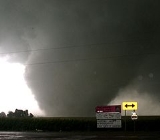
The most severe tornadoes reported were two F4 tornadoes. They took place on March 12 in Monroe City, Missouri
Monroe City, Missouri
Monroe City is a city in Marion, Monroe, and Ralls counties in the US state of Missouri. The population was 2,588 at the 2000 census.The Marion and Ralls County portions of Monroe City are part of the Hannibal Micropolitan Statistical Area.-Geography:...
and on September 22 in Crosstown, Missouri
Crosstown, Missouri
``Crosstown, Missouri is an unincorporated settlement in Perry County, Missouri, near the Mississippi River.It is most notable for being devastated by an F4 tornado on September 22, 2006, although no one was killed....
. The deadliest single tornado was on April 2 in Newbern, Tennessee
Newbern, Tennessee
Newbern is a town in Dyer County, Tennessee, in the United States. As of the 2010 census, the town population was 3,313.-Natural Disasters:Sixteen people were killed in Newbern when its surrounding communities were directly hit by an F3 tornado April 2, 2006...
where 16 people were killed (out of 29 in the outbreak). The most destructive tornado outside the US was on November 7 in Saroma, Hokkaido
Saroma, Hokkaido
is a town in the Tokoro District, Okhotsk Subprefecture, Hokkaido, Japan.The name comes from the Ainu place name saro oma pet, meaning place of many miscanthus reeds.:...
, Japan, where nine people died.
Events
January
There were 43 tornadoes reported in the US in January. All 43 were confirmed as well as an additional 4 findings.January 1–2
On January 2, the Storm Prediction CenterStorm Prediction Center
The Storm Prediction Center , located in Norman, Oklahoma, is tasked with forecasting the risk of severe thunderstorms and tornadoes in the contiguous United States. The agency issues convective outlooks, mesoscale discussions, and watches as a part of this process...
forecast a moderate risk of severe thunderstorms for much of the southeastern United States from the Ohio Valley to the Gulf Coast. Two major clusters of tornadic supercell
Supercell
A supercell is a thunderstorm that is characterized by the presence of a mesocyclone: a deep, continuously-rotating updraft. For this reason, these storms are sometimes referred to as rotating thunderstorms...
thunderstorms developed, one in central Kentucky
Kentucky
The Commonwealth of Kentucky is a state located in the East Central United States of America. As classified by the United States Census Bureau, Kentucky is a Southern state, more specifically in the East South Central region. Kentucky is one of four U.S. states constituted as a commonwealth...
and one in western Georgia
Georgia (U.S. state)
Georgia is a state located in the southeastern United States. It was established in 1732, the last of the original Thirteen Colonies. The state is named after King George II of Great Britain. Georgia was the fourth state to ratify the United States Constitution, on January 2, 1788...
. This outbreak produced several strong (F2-F3) tornadoes, which hit Elizabethtown, Kentucky
Elizabethtown, Kentucky
Elizabethtown is a city in and the county seat of Hardin County, Kentucky, United States. The population was 28,531 at the 2010 census, making it the eleventh-largest city in the state...
and Fayette
Fayette County, Georgia
Fayette County is a county located in the U.S. state of Georgia. As of 2000, the population was 91,263. The 2007 Census Estimate shows a population of 106,144. The county seat is Fayetteville....
/Pike
Pike County, Georgia
Pike County is a county located in the U.S. state of Georgia. It was created on December 9, 1822. As of 2000, the population was 13,688. The 2007 Census Estimate shows a population of 17,204...
counties, Georgia. Fortunately there were only a few minor injuries.
Damages from the tornadoes totaled $7.452 million.
January 11
In the final review of 2007, an two isolated tornadoes were confirmed to have touched down in VirginiaVirginia
The Commonwealth of Virginia , is a U.S. state on the Atlantic Coast of the Southern United States. Virginia is nicknamed the "Old Dominion" and sometimes the "Mother of Presidents" after the eight U.S. presidents born there...
. Both were rated as F1's. Two people were injured in James City.
Damages from the tornadoes totaled $40,000.
January 12–14
Late in the evening of January 12, a squall lineSquall line
A squall line is a line of severe thunderstorms that can form along or ahead of a cold front. In the early 20th century, the term was used as a synonym for cold front. It contains heavy precipitation, hail, frequent lightning, strong straight-line winds, and possibly tornadoes and waterspouts....
began to organize over eastern parts of Oklahoma
Oklahoma
Oklahoma is a state located in the South Central region of the United States of America. With an estimated 3,751,351 residents as of the 2010 census and a land area of 68,667 square miles , Oklahoma is the 28th most populous and 20th-largest state...
and Texas
Texas
Texas is the second largest U.S. state by both area and population, and the largest state by area in the contiguous United States.The name, based on the Caddo word "Tejas" meaning "friends" or "allies", was applied by the Spanish to the Caddo themselves and to the region of their settlement in...
. A rotating supercell
Supercell
A supercell is a thunderstorm that is characterized by the presence of a mesocyclone: a deep, continuously-rotating updraft. For this reason, these storms are sometimes referred to as rotating thunderstorms...
embedded within the squall line produced an F2 tornado in Yell County, Arkansas
Yell County, Arkansas
Yell County is a county located in the U.S. state of Arkansas. As of 2010, the population was 22,185. The county has two county seats, Dardanelle and Danville...
. The next day several tornadoes developed from supercells that evolved from the remnants of that squall line all across the southeastern states, with the first tornado-inflicted death of 2006 in an F1 tornado near Belleville, Alabama as well as about a dozen students injured at a damaged school in Baker, Florida
Baker, Florida
Baker is an unincorporated town in Okaloosa County, Florida. It is located about northwest of the county seat, Crestview, in the Florida Panhandle. The Baker Block Museum is in Baker....
.
Damages from the tornadoes totaled $8.395 million.
January 14 (California)
In the final review of 2006, an F0 tornado was confirmed to have briefly touched down in Mariposa County, CaliforniaMariposa County, California
Mariposa County is a county in the U.S. state of California, located in the western foothills of the Sierra Nevada mountains. It lies north of Fresno, east of Merced, and southeast of Stockton. As of the 2010 census, the population was 18,251 up from 17,130 at the 2000 census...
. There was no damage associated with the tornado.
January 17
In the final review of 2006, an F0 tornado was confirmed to have briefly touched down in Laurens County, South Carolina. Damage from the tornado totaled $1000.January 28
In the final review of 2006, four F0 tornadoes were confirmed to have touched down, three of which were in KansasKansas
Kansas is a US state located in the Midwestern United States. It is named after the Kansas River which flows through it, which in turn was named after the Kansa Native American tribe, which inhabited the area. The tribe's name is often said to mean "people of the wind" or "people of the south...
and the fourth in Washington state.
Damages from the tornadoes totaled $110,000.
February 2
On February 2, several tornadoes tore through Greater New Orleans which had already been devastated by catastrophic Hurricane KatrinaHurricane Katrina
Hurricane Katrina of the 2005 Atlantic hurricane season was a powerful Atlantic hurricane. It is the costliest natural disaster, as well as one of the five deadliest hurricanes, in the history of the United States. Among recorded Atlantic hurricanes, it was the sixth strongest overall...
in August 2005. The western suburbs, particularly Kenner
Kenner, Louisiana
Kenner is a city in Jefferson Parish, Louisiana, United States, and a suburb of New Orleans. The population was 66,702 at the 2010 census....
, took most of the hits. Several homes were heavily damaged, most of them already damaged by Katrina but suffering additional damage. Louis Armstrong International Airport
Louis Armstrong New Orleans International Airport
Louis Armstrong New Orleans International Airport is a Class B public use international airport in Jefferson Parish, Louisiana, United States. It is owned by the City of New Orleans and is located 10 nautical miles west of its central business district. The airport's address is 900 Airline Drive...
took a direct hit from one of the tornadoes, which caused more damage than was done by the hurricane several months earlier. Electricity was also cut to the airport. The tornado was rated as an F1.
Damages from the tornadoes totaled $1.785 million.
February 4
In the final review of 2006, two F0 and one F1 tornadoes were confirmed to have touched down.Damages from the tornadoes totaled $92,000.
March 9–13
An enormous multi-day tornado outbreak occurred starting on March 9 and continuing until March 13. Over those five days, there were 105 tornadoes confirmed out of as many as 160 tornadoes reported. 29 of them were considered "strong" (F2-F3) and one was considered "violent" (F4-F5) The majority (62) of the tornadoes occurred on March 12, particularly in MissouriMissouri
Missouri is a US state located in the Midwestern United States, bordered by Iowa, Illinois, Kentucky, Tennessee, Arkansas, Oklahoma, Kansas and Nebraska. With a 2010 population of 5,988,927, Missouri is the 18th most populous state in the nation and the fifth most populous in the Midwest. It...
and Illinois
Illinois
Illinois is the fifth-most populous state of the United States of America, and is often noted for being a microcosm of the entire country. With Chicago in the northeast, small industrial cities and great agricultural productivity in central and northern Illinois, and natural resources like coal,...
. At least 13 deaths were blamed on the severe weather, 10 as a result of tornadoes.
Most of the activity on March 9 took the form of a serial derecho
Derecho
A derecho is a widespread and long-lived, violent convectively induced straight-line windstorm that is associated with a fast-moving band of severe thunderstorms in the form of a squall line usually taking the form of a bow echo...
, although eight tornadoes were reported. At least two people were killed that day in storms, but not in tornadoes. There was little activity on March 10, but it picked up again on March 11 with 18 tornadoes in the mid-Mississippi Valley. Two people were killed near Saint Mary, Missouri when their truck was thrown into a propane tank.
The main outbreak took place on March 12, with at least 62 tornadoes, including most of the strong tornadoes and the only violent one, and nine fatalities. Activity continued farther south over Alabama
Alabama
Alabama is a state located in the southeastern region of the United States. It is bordered by Tennessee to the north, Georgia to the east, Florida and the Gulf of Mexico to the south, and Mississippi to the west. Alabama ranks 30th in total land area and ranks second in the size of its inland...
and Mississippi
Mississippi
Mississippi is a U.S. state located in the Southern United States. Jackson is the state capital and largest city. The name of the state derives from the Mississippi River, which flows along its western boundary, whose name comes from the Ojibwe word misi-ziibi...
on March 13 with 15 weak (F0-F1) tornadoes before the outbreak finally ended.
March 19–20
A small tornado event took place in the South Central United StatesSouth Central United States
The South Central United States or South Central states is a region of the United States located in the south central part of the country. It evolved out of the archaic southwest, which originally was literally the western U.S. South...
on March 19 and March 20, with one tornado in Texas
Texas
Texas is the second largest U.S. state by both area and population, and the largest state by area in the contiguous United States.The name, based on the Caddo word "Tejas" meaning "friends" or "allies", was applied by the Spanish to the Caddo themselves and to the region of their settlement in...
and several in Mississippi
Mississippi
Mississippi is a U.S. state located in the Southern United States. Jackson is the state capital and largest city. The name of the state derives from the Mississippi River, which flows along its western boundary, whose name comes from the Ojibwe word misi-ziibi...
and Oklahoma
Oklahoma
Oklahoma is a state located in the South Central region of the United States of America. With an estimated 3,751,351 residents as of the 2010 census and a land area of 68,667 square miles , Oklahoma is the 28th most populous and 20th-largest state...
.
The strongest tornado (and first of the event) took place in Uvalde, Texas
Uvalde, Texas
Uvalde is a city in and the county seat of Uvalde County, Texas, United States. The population was 14,929 at the 2000 census.Uvalde was founded by Reading Wood Black in 1853 as the town of Encina. In 1856, when the county was organized, the town was renamed Uvalde for Spanish governor Juan de...
late on March 19, where an F2 tornado touched down. Severe damage was reported in the community, and several homes were destroyed, including mobile homes. Remarkably, no injuries were reported. The tornado damage was difficult to distinguish from the damage reported as a result of microburst
Microburst
A microburst is a very localized column of sinking air, producing damaging divergent and straight-line winds at the surface that are similar to, but distinguishable from, tornadoes, which generally have convergent damage. There are two types of microbursts: wet microbursts and dry microbursts...
s in the area which had winds as strong as 90 mph (145 km/h). It was the strongest tornado in the region since October 2001.
A total of six tornadoes were reported on March 20. Two took place in Oklahoma and four in Mississippi. All were rated F0 or F1 and damage was generally minor.
- Uvalde tornado information from San Antonio NWS office
- Sam's Weather site - complete tornado list for 2006
March 23
An extremely rare tornado touched down in HawaiiHawaii
Hawaii is the newest of the 50 U.S. states , and is the only U.S. state made up entirely of islands. It is the northernmost island group in Polynesia, occupying most of an archipelago in the central Pacific Ocean, southwest of the continental United States, southeast of Japan, and northeast of...
late on March 23, on the island of Lanai
Lanai
Lānai or Lanai is the sixth-largest of the Hawaiian Islands. It is also known as the Pineapple Island because of its past as an island-wide pineapple plantation. The only town is Lānai City, a small settlement....
. It occurred at about 9:35 p.m. HST (0735 UTC), and little damage was reported from the F0 tornado. It was only notable because of its unusual location.
Tornadoes are very rare in Hawaii; since 1950 there have been only 34 tornadoes in the state. The strongest was an F2 tornado on the Big Island
Hawaii (island)
The Island of Hawaii, also called the Big Island or Hawaii Island , is a volcanic island in the North Pacific Ocean...
in 1971.
March 27
A line of thunderstorms with some supercells tracked across The NetherlandsNetherlands
The Netherlands is a constituent country of the Kingdom of the Netherlands, located mainly in North-West Europe and with several islands in the Caribbean. Mainland Netherlands borders the North Sea to the north and west, Belgium to the south, and Germany to the east, and shares maritime borders...
, France
France
The French Republic , The French Republic , The French Republic , (commonly known as France , is a unitary semi-presidential republic in Western Europe with several overseas territories and islands located on other continents and in the Indian, Pacific, and Atlantic oceans. Metropolitan France...
, Belgium
Belgium
Belgium , officially the Kingdom of Belgium, is a federal state in Western Europe. It is a founding member of the European Union and hosts the EU's headquarters, and those of several other major international organisations such as NATO.Belgium is also a member of, or affiliated to, many...
, and Germany
Germany
Germany , officially the Federal Republic of Germany , is a federal parliamentary republic in Europe. The country consists of 16 states while the capital and largest city is Berlin. Germany covers an area of 357,021 km2 and has a largely temperate seasonal climate...
, spawning tornadoes in Germany, including one that tracked through the southern section of Hamburg
Hamburg
-History:The first historic name for the city was, according to Claudius Ptolemy's reports, Treva.But the city takes its modern name, Hamburg, from the first permanent building on the site, a castle whose construction was ordered by the Emperor Charlemagne in AD 808...
at about 7:00 p.m. local time (1700 UTC) on March 27. The tornadoes killed two people who were caught on construction
Construction
In the fields of architecture and civil engineering, construction is a process that consists of the building or assembling of infrastructure. Far from being a single activity, large scale construction is a feat of human multitasking...
crane
Crane (machine)
A crane is a type of machine, generally equipped with a hoist, wire ropes or chains, and sheaves, that can be used both to lift and lower materials and to move them horizontally. It uses one or more simple machines to create mechanical advantage and thus move loads beyond the normal capability of...
s when the tornado hit. 300,000 people also lost electricity
Electricity
Electricity is a general term encompassing a variety of phenomena resulting from the presence and flow of electric charge. These include many easily recognizable phenomena, such as lightning, static electricity, and the flow of electrical current in an electrical wire...
as a result of the storms. Damage was reported to be significant, including flipped cars and major roof damage to numerous houses. Rail
Rail transport
Rail transport is a means of conveyance of passengers and goods by way of wheeled vehicles running on rail tracks. In contrast to road transport, where vehicles merely run on a prepared surface, rail vehicles are also directionally guided by the tracks they run on...
traffic was also halted temporarily. Damage was estimated at several million euro
Euro
The euro is the official currency of the eurozone: 17 of the 27 member states of the European Union. It is also the currency used by the Institutions of the European Union. The eurozone consists of Austria, Belgium, Cyprus, Estonia, Finland, France, Germany, Greece, Ireland, Italy, Luxembourg,...
s. No Fujita scale
Fujita scale
The Fujita scale , or Fujita-Pearson scale, is a scale for rating tornado intensity, based primarily on the damage tornadoes inflict on human-built structures and vegetation...
rating was officially assigned. However, the damage suggested an F1 to F2 tornado.
March 30–31
On March 30, a moderate tornado event developed across the central United StatesCentral United States
The Central United States is sometimes conceived as between the Eastern United States and Western United States as part of a three-region model, roughly coincident with the Midwestern United States plus the western and central portions of the Southern United States; the term is also sometimes used...
, from Iowa
Iowa
Iowa is a state located in the Midwestern United States, an area often referred to as the "American Heartland". It derives its name from the Ioway people, one of the many American Indian tribes that occupied the state at the time of European exploration. Iowa was a part of the French colony of New...
to Oklahoma
Oklahoma
Oklahoma is a state located in the South Central region of the United States of America. With an estimated 3,751,351 residents as of the 2010 census and a land area of 68,667 square miles , Oklahoma is the 28th most populous and 20th-largest state...
. There were 24 tornadoes reported, of which 12 were confirmed. However, most touched down in rural areas and there have only been isolated damage reports. One person died six months later, and five others were injured. Many more reports of straight-line winds, microburst
Microburst
A microburst is a very localized column of sinking air, producing damaging divergent and straight-line winds at the surface that are similar to, but distinguishable from, tornadoes, which generally have convergent damage. There are two types of microbursts: wet microbursts and dry microbursts...
s and large hail (as large as baseball
Baseball
Baseball is a bat-and-ball sport played between two teams of nine players each. The aim is to score runs by hitting a thrown ball with a bat and touching a series of four bases arranged at the corners of a ninety-foot diamond...
s) were reported.
There were three tornadoes of note. The strongest tornado touched down in Andrew County, Missouri
Andrew County, Missouri
-External links:* from University of Missouri Division of Special Collections, Archives, and Rare Books...
, which severely damaged several houses. It was a high-end F2. Another tornado touched down in Sedalia, Missouri
Sedalia, Missouri
Sedalia is a city located about south of the Missouri River in Pettis County, Missouri. U.S. Highway 50 and U.S. Highway 65 intersect in the city. As of 2006, the city had a total population of 20,669. It is the county seat of Pettis County. The Sedalia Micropolitan Statistical Area consists of...
, which was hard hit by the March 12 tornado outbreak. Damage was much less than the last hit. That one was confirmed to have been a low-end F1. There was a report in the city of Omaha, Nebraska
Omaha, Nebraska
Omaha is the largest city in the state of Nebraska, United States, and is the county seat of Douglas County. It is located in the Midwestern United States on the Missouri River, about 20 miles north of the mouth of the Platte River...
of an F1.
The activity continued on March 31, although it was primarily a straight line wind event across the Ohio Valley. Three tornadoes were reported, two of them were F2: one in Van Wert, Ohio
Van Wert, Ohio
As of the census of 2000, there were 10,690 people, 4,556 households, and 2,947 families residing in the city. The population density was 1,803.8 people per square mile . There were 4,927 housing units at an average density of 831.4 per square mile...
and another in western Shelby County, Indiana
Shelby County, Indiana
As of the census of 2000, there were 43,445 people, 16,561 households, and 12,056 families residing in the county. The population density was 105 people per square mile . There were 17,633 housing units at an average density of 43 per square mile...
.
April 1–3
The second major tornado outbreak of 2006 took place on April 2 in a large swath from IowaIowa
Iowa is a state located in the Midwestern United States, an area often referred to as the "American Heartland". It derives its name from the Ioway people, one of the many American Indian tribes that occupied the state at the time of European exploration. Iowa was a part of the French colony of New...
to Mississippi
Mississippi
Mississippi is a U.S. state located in the Southern United States. Jackson is the state capital and largest city. The name of the state derives from the Mississippi River, which flows along its western boundary, whose name comes from the Ojibwe word misi-ziibi...
and from western Missouri
Missouri
Missouri is a US state located in the Midwestern United States, bordered by Iowa, Illinois, Kentucky, Tennessee, Arkansas, Oklahoma, Kansas and Nebraska. With a 2010 population of 5,988,927, Missouri is the 18th most populous state in the nation and the fifth most populous in the Midwest. It...
to the central Ohio Valley. 66 tornadoes were confirmed that day, and 29 people were killed, 27 by tornadoes.
The outbreak was first expected to begin on April 1. Despite considerable threat levels and awareness, only one small tornado was reported on April 1, in Pawnee County, Kansas
Pawnee County, Kansas
Pawnee County is a county located in the U.S. state of Kansas. As of the 2010 census, the county population was 6,973...
. Severe weather was largely restricted to significant microbursts and large hail.
Severe weather quickly picked up on April 2 across a nine-state region. There were no less than 66 confirmed tornadoes. Damage was widespread in dozens of communities, in addition to very strong microbursts of winds as strong as 90 mph (145 km/h) and hail as large as softball
Softball
Softball is a bat-and-ball sport played between two teams of 10 to 14 players. It is a direct descendant of baseball although there are some key differences: softballs are larger than baseballs, and the pitches are thrown underhand rather than overhand...
s. The hardest-hit area was Dyer and Gibson counties in Tennessee
Tennessee
Tennessee is a U.S. state located in the Southeastern United States. It has a population of 6,346,105, making it the nation's 17th-largest state by population, and covers , making it the 36th-largest by total land area...
, where at least 24 people were killed.
There was a moderate risk of severe weather on April 3 in the southeastern United States
Southeastern United States
The Southeastern United States, colloquially referred to as the Southeast, is the eastern portion of the Southern United States. It is one of the most populous regions in the United States of America....
as the line was expected to refire. However, no tornadoes were reported, just straight-line wind damage.
April 6–8
The third major tornado outbreak occurred over the Central and Southern United States on April 6 and 7, and lasted into early April 8. At least 62 tornadoes were confirmed out of over 80 reported tornadoes. The hardest hit region was the Middle TennesseeMiddle Tennessee
Middle Tennessee is a distinct portion of the state of Tennessee, delineated according to state law as the 41 counties in the Middle Grand Division of Tennessee....
area, where 10 deaths (seven in Gallatin
Gallatin, Tennessee
Gallatin is a city in and the county seat of Sumner County, Tennessee, United States, along a navigable tributary of the Cumberland River. The population was 23,230 at the 2000 census. Named for U.S...
, three near McMinnville
McMinnville, Tennessee
McMinnville is the largest city in and the county seat of Warren County, Tennessee, United States. The population was 13,605 at the 2010 census...
) and heavy damage were reported. Another fatality was reported in Marion County, Alabama
Marion County, Alabama
Marion County is a county of the U.S. state of Alabama. Marion County was created by an act of the Alabama Territorial General Assembly on February 13, 1818. The county is located in the northwestern part of the state, bounded on the west by the state of Mississippi. It encompasses . Marion County...
.
The Storm Prediction Center
Storm Prediction Center
The Storm Prediction Center , located in Norman, Oklahoma, is tasked with forecasting the risk of severe thunderstorms and tornadoes in the contiguous United States. The agency issues convective outlooks, mesoscale discussions, and watches as a part of this process...
had issued a rare high risk for severe weather for both April 6 and 7, with an unprecedented 60% probability of a tornado within 25 miles of a point south of the Nashville
Nashville, Tennessee
Nashville is the capital of the U.S. state of Tennessee and the county seat of Davidson County. It is located on the Cumberland River in Davidson County, in the north-central part of the state. The city is a center for the health care, publishing, banking and transportation industries, and is home...
area.
April 13–19
On April 13, a complex of severe thunderstorms formed in eastern IowaIowa
Iowa is a state located in the Midwestern United States, an area often referred to as the "American Heartland". It derives its name from the Ioway people, one of the many American Indian tribes that occupied the state at the time of European exploration. Iowa was a part of the French colony of New...
, bringing many reports of large hail along with reports of strong tornadoes, some with debris. It was unexpected, as the SPC issued only a slight risk of severe weather and never issued a tornado watch
Tornado watch
A tornado watch is issued when conditions are right for a tornado to form. Since any thunderstorm capable of producing a tornado is defined as severe, a tornado watch is also automatically a severe thunderstorm watch...
. The worst impacts were felt in and around Iowa City
Iowa City, Iowa
Iowa City is a city in Johnson County, State of Iowa. As of the 2010 Census, the city had a total population of about 67,862, making it the sixth-largest city in the state. Iowa City is the county seat of Johnson County and home to the University of Iowa...
, where significant damage and numerous injuries were reported, in addition to at least one fatality.
A steady stream of severe weather occurred for several days in the upper Mississippi Valley, lower Great Lakes
Great Lakes
The Great Lakes are a collection of freshwater lakes located in northeastern North America, on the Canada – United States border. Consisting of Lakes Superior, Michigan, Huron, Erie, and Ontario, they form the largest group of freshwater lakes on Earth by total surface, coming in second by volume...
, and Ohio Valley regions over the Easter weekend. A moderate risk of severe weather was in place for Saturday, April 15 in parts of Iowa and Nebraska
Nebraska
Nebraska is a state on the Great Plains of the Midwestern United States. The state's capital is Lincoln and its largest city is Omaha, on the Missouri River....
. Moderate risks of severe weather were also issued for parts of central Illinois
Illinois
Illinois is the fifth-most populous state of the United States of America, and is often noted for being a microcosm of the entire country. With Chicago in the northeast, small industrial cities and great agricultural productivity in central and northern Illinois, and natural resources like coal,...
and southern Indiana
Indiana
Indiana is a US state, admitted to the United States as the 19th on December 11, 1816. It is located in the Midwestern United States and Great Lakes Region. With 6,483,802 residents, the state is ranked 15th in population and 16th in population density. Indiana is ranked 38th in land area and is...
on Good Friday
Good Friday
Good Friday , is a religious holiday observed primarily by Christians commemorating the crucifixion of Jesus Christ and his death at Calvary. The holiday is observed during Holy Week as part of the Paschal Triduum on the Friday preceding Easter Sunday, and may coincide with the Jewish observance of...
, April 14 and Easter Sunday, April 16. There were five to twenty reports of tornadoes each day.
Scattered tornadoes causing relatively light damage continued on April 17, 18, and 19.
April 21–22
A small tornado event took place in the Deep SouthDeep South
The Deep South is a descriptive category of the cultural and geographic subregions in the American South. Historically, it is differentiated from the "Upper South" as being the states which were most dependent on plantation type agriculture during the pre-Civil War period...
late in the evening of April 21 and early on April 22 along a cold front. There were several tornadoes reported, but all of them were relatively weak. No injuries were reported.
April 24
On April 24, a small tornado event spawned at least two tornadoes in northeastern and central OklahomaOklahoma
Oklahoma is a state located in the South Central region of the United States of America. With an estimated 3,751,351 residents as of the 2010 census and a land area of 68,667 square miles , Oklahoma is the 28th most populous and 20th-largest state...
, causing some moderate damage particularly around Oklahoma City
Oklahoma city
Oklahoma City is the capital and largest city of the U.S. state of Oklahoma.Oklahoma City may also refer to:*Oklahoma City metropolitan area*Downtown Oklahoma City*Uptown Oklahoma City*Oklahoma City bombing*Oklahoma City National Memorial...
. No injuries were reported. There were some spectacular television images captured, including footage of a rare anti-cyclonic tornado in El Reno, Oklahoma
El Reno, Oklahoma
El Reno is a city in Canadian County, Oklahoma, United States, in the central part of the state. A part of the Oklahoma City Metropolitan Statistical Area, El Reno is west of downtown Oklahoma City...
.
April 28–29
A small tornado event developed primarily in TexasTexas
Texas is the second largest U.S. state by both area and population, and the largest state by area in the contiguous United States.The name, based on the Caddo word "Tejas" meaning "friends" or "allies", was applied by the Spanish to the Caddo themselves and to the region of their settlement in...
and southern Oklahoma
Oklahoma
Oklahoma is a state located in the South Central region of the United States of America. With an estimated 3,751,351 residents as of the 2010 census and a land area of 68,667 square miles , Oklahoma is the 28th most populous and 20th-largest state...
on April 28, although it was primarily a derecho event. There was also an isolated tornado in Louisiana
Louisiana
Louisiana is a state located in the southern region of the United States of America. Its capital is Baton Rouge and largest city is New Orleans. Louisiana is the only state in the U.S. with political subdivisions termed parishes, which are local governments equivalent to counties...
on April 29.
There were at least nine reported tornadoes in the area on April 28 and 29 along with numerous reports of significant wind damage. At least four people were injured in Coldspring, Texas
Coldspring, Texas
Coldspring is a city in San Jacinto County, Texas, United States. The population was 691 at the 2000 census. It is the county seat of San Jacinto County which is named after the river that traverses it and shares its name with the Battle which gave Texas its independence.-History:The history of...
when a tornado touched down there. It was confirmed to have been an F2 tornado. There were also numerous reports of straight-line winds as strong as 100 mph (160 km/h) and hail as large as baseballs and 10 tornadoes reported.
There was also one tornado in Louisiana, just north of New Orleans, late on April 29.
May 2–5
Another small but widespread tornado event developed across much of the Great PlainsGreat Plains
The Great Plains are a broad expanse of flat land, much of it covered in prairie, steppe and grassland, which lies west of the Mississippi River and east of the Rocky Mountains in the United States and Canada. This area covers parts of the U.S...
on the evening of May 2. Two main clusters - one over Texas
Texas
Texas is the second largest U.S. state by both area and population, and the largest state by area in the contiguous United States.The name, based on the Caddo word "Tejas" meaning "friends" or "allies", was applied by the Spanish to the Caddo themselves and to the region of their settlement in...
and Oklahoma
Oklahoma
Oklahoma is a state located in the South Central region of the United States of America. With an estimated 3,751,351 residents as of the 2010 census and a land area of 68,667 square miles , Oklahoma is the 28th most populous and 20th-largest state...
, and the other primarily in South Dakota
South Dakota
South Dakota is a state located in the Midwestern region of the United States. It is named after the Lakota and Dakota Sioux American Indian tribes. Once a part of Dakota Territory, South Dakota became a state on November 2, 1889. The state has an area of and an estimated population of just over...
- produced a total of 10 reported tornadoes, along with powerful straight-line winds of up to 86 mph (139 km/h) and hail up to softball-sized. Damage was sporadic in the region, with isolated pockets of varying degrees of damage. No injuries were reported.
Several more tornadoes developed on May 3 and again on May 4 across the same regions, but damage was relatively minor.
The activity became somewhat more severe once again on May 5 across Texas. There were 18 reported tornadoes and many reports of wind and hail damage. One person was injured. A strong storm formed over the Waco
Waco, Texas
Waco is a city in and the county seat of McLennan County, Texas. Situated along the Brazos River and on the I-35 corridor, halfway between Dallas and Austin, it is the economic, cultural, and academic center of the 'Heart of Texas' region....
area in the late hours of the night of May 5, and early morning hours of May 6. This storm spawned a single tornado with damage rated as an F2 on the Fujita Scale
Fujita scale
The Fujita scale , or Fujita-Pearson scale, is a scale for rating tornado intensity, based primarily on the damage tornadoes inflict on human-built structures and vegetation...
. An article with a report of this tornado can be seen here: http://www.kwtx.com/home/headlines/2758976.html
May 9–10
A series of isolated tornadoes developed on May 9 primarily in OklahomaOklahoma
Oklahoma is a state located in the South Central region of the United States of America. With an estimated 3,751,351 residents as of the 2010 census and a land area of 68,667 square miles , Oklahoma is the 28th most populous and 20th-largest state...
and Texas
Texas
Texas is the second largest U.S. state by both area and population, and the largest state by area in the contiguous United States.The name, based on the Caddo word "Tejas" meaning "friends" or "allies", was applied by the Spanish to the Caddo themselves and to the region of their settlement in...
. There were seven reported tornadoes, two of them severe - one of which was a killer.
The first major tornado touched down in Childress, Texas
Childress, Texas
Childress is a city in Childress County, Texas, United States. The population was 6,778 at the 2000 census. It is the county seat of Childress County. Like the county, the city is named for George Campbell Childress, a native of Nashville, Tennessee, who was the principal author of the Texas...
. It was reported by KAMR-TV
KAMR-TV
KAMR-TV is an NBC affiliate in Amarillo, Texas, USA. The station was acquired by Nexstar Broadcasting Group after merging with KAMR's parent company, Quorum Broadcasting in 2003. This station operates shared services agreements with Mission Broadcasting's stations, KCIT and KCPN-LP. Syndicated...
that a touchdown in Childress led to severe damage and that electricity
Electricity
Electricity is a general term encompassing a variety of phenomena resulting from the presence and flow of electric charge. These include many easily recognizable phenomena, such as lightning, static electricity, and the flow of electrical current in an electrical wire...
was out in the entire city. According to KAMR, several businesses and houses in the community were heavily damaged due to the tornado and large hail. One minor injury was reported by the tornado, which was ranked a low-end F2 on the Fujita scale
Fujita scale
The Fujita scale , or Fujita-Pearson scale, is a scale for rating tornado intensity, based primarily on the damage tornadoes inflict on human-built structures and vegetation...
.
The second major tornado touched down in the area of Westminster, Texas
Westminster, Texas
Westminster is an unincorporated community in northeastern Collin County, Texas, United States. The population was 390 at the 2000 census, at which time it was a city....
in northern Collin County
Collin County, Texas
As of the census of 2000, there were 491,675 people, 181,970 households, and 132,292 families residing in the county. The population density was 580 people per square mile . There were 194,892 housing units at an average density of 230 per square mile...
. The tornado destroyed at least six solid-frame houses and flattened several mobile homes in the area. Three people were killed as a result and ten were injured. That tornado was initially declared a high-end F3 on the Fujita scale
Fujita scale
The Fujita scale , or Fujita-Pearson scale, is a scale for rating tornado intensity, based primarily on the damage tornadoes inflict on human-built structures and vegetation...
but could be upgraded.
More severe storms developed across a broad swath from Michigan
Michigan
Michigan is a U.S. state located in the Great Lakes Region of the United States of America. The name Michigan is the French form of the Ojibwa word mishigamaa, meaning "large water" or "large lake"....
to South Texas
South Texas
South Texas is a region of the U.S. state of Texas that lies roughly south of and including San Antonio. The southern and western boundary is the Rio Grande River, and to the east it is the Gulf of Mexico. The population of this region is about 3.7 million. The southern portion of this region is...
on May 10. Again, they were somewhat isolated in nature and less severe, but at least 15 tornadoes were reported across the large area, plus many reports of large hail and damaging winds.
May 14
A line of severe storms developed over much of the Southern United StatesSouthern United States
The Southern United States—commonly referred to as the American South, Dixie, or simply the South—constitutes a large distinctive area in the southeastern and south-central United States...
on the afternoon of May 14. While the bulk of the damage was due to large hail, there were at least 17 tornadoes reported (of which seven were confirmed), with the most severe one taking place near Concord, North Carolina
Concord, North Carolina
Concord is a city in the U.S. state of North Carolina. According to Census 2010, the city has a current population of 79,066. It is the largest city in Cabarrus County and is the county seat. In terms of population, the city of Concord is the second largest city in the Charlotte Metropolitan Area...
. Significant structural damage was reported in the area, including roofs blown off houses. It was confirmed to have been an F1 tornado.
The other tornadoes were scattered around the Carolinas and in Texas
Texas
Texas is the second largest U.S. state by both area and population, and the largest state by area in the contiguous United States.The name, based on the Caddo word "Tejas" meaning "friends" or "allies", was applied by the Spanish to the Caddo themselves and to the region of their settlement in...
on the same line. Most of them were relatively minor.
May 19–20
EuropeEurope
Europe is, by convention, one of the world's seven continents. Comprising the westernmost peninsula of Eurasia, Europe is generally 'divided' from Asia to its east by the watershed divides of the Ural and Caucasus Mountains, the Ural River, the Caspian and Black Seas, and the waterways connecting...
's second significant outbreak of 2006 took place, primarily in Germany
Germany
Germany , officially the Federal Republic of Germany , is a federal parliamentary republic in Europe. The country consists of 16 states while the capital and largest city is Berlin. Germany covers an area of 357,021 km2 and has a largely temperate seasonal climate...
. There were at least nine confirmed tornadoes in the region, all of which were F1 or F2. It was part of a longer squall line
Squall line
A squall line is a line of severe thunderstorms that can form along or ahead of a cold front. In the early 20th century, the term was used as a synonym for cold front. It contains heavy precipitation, hail, frequent lightning, strong straight-line winds, and possibly tornadoes and waterspouts....
that resulted in significant damage and many injuries along with one death.
May 21
The first significant tornado in the Northeastern United StatesNortheastern United States
The Northeastern United States is a region of the United States as defined by the United States Census Bureau.-Composition:The region comprises nine states: the New England states of Connecticut, Maine, Massachusetts, New Hampshire, Rhode Island and Vermont; and the Mid-Atlantic states of New...
took place on May 21. It was an isolated event in Hampton Falls, New Hampshire
Hampton Falls, New Hampshire
Hampton Falls is a New England town in Rockingham County, New Hampshire, United States. The population was 2,236 at the 2010 census.-History:...
and was confirmed to have been an F2 tornado.
Damage was significant along a narrow path, primarily to trees and vehicles along Interstate 95
Interstate 95 in New Hampshire
Interstate 95, the main Interstate Highway on the east coast of the United States, cuts through the Seacoast Region of New Hampshire. The majority of it, from the Massachusetts border to the Portsmouth Circle in Portsmouth, is the 14.29-mile Blue Star Turnpike or New Hampshire Turnpike, a toll...
in the area. Two people were injured.
May 24–25
A strong front developed over the Upper MidwestUpper Midwest
The Upper Midwest is a region in the northern portion of the U.S. Census Bureau's Midwestern United States. It is largely a sub-region of the midwest. Although there are no uniformly agreed-upon boundaries, the region is most commonly used to refer to the states of Minnesota, Wisconsin, and...
on May 24 and extended along the Mississippi Valley. It was primarily a straight-line wind event, although there were at least five tornadoes reported, some of which produced significant damage.
A greater risk of tornadic activity was issued by the SPC on May 25 for a large swath from the Great Lakes
Great Lakes
The Great Lakes are a collection of freshwater lakes located in northeastern North America, on the Canada – United States border. Consisting of Lakes Superior, Michigan, Huron, Erie, and Ontario, they form the largest group of freshwater lakes on Earth by total surface, coming in second by volume...
to the central Mississippi Valley. The event turned into a derecho with hundreds of severe wind damage reports, but only six tornado reports. There were no tornado-related injuries, but at least one person was injured by straight-line winds.
May 30–31
A hot and humid air mass entered the northeastern part of the U.S as well as much of southern OntarioOntario
Ontario is a province of Canada, located in east-central Canada. It is Canada's most populous province and second largest in total area. It is home to the nation's most populous city, Toronto, and the nation's capital, Ottawa....
and Quebec
Quebec
Quebec or is a province in east-central Canada. It is the only Canadian province with a predominantly French-speaking population and the only one whose sole official language is French at the provincial level....
, and severe thunderstorms and tornadoes were sparked by a cold front. Numerous severe weather events were reported across Michigan
Michigan
Michigan is a U.S. state located in the Great Lakes Region of the United States of America. The name Michigan is the French form of the Ojibwa word mishigamaa, meaning "large water" or "large lake"....
, Indiana
Indiana
Indiana is a US state, admitted to the United States as the 19th on December 11, 1816. It is located in the Midwestern United States and Great Lakes Region. With 6,483,802 residents, the state is ranked 15th in population and 16th in population density. Indiana is ranked 38th in land area and is...
, Illinois
Illinois
Illinois is the fifth-most populous state of the United States of America, and is often noted for being a microcosm of the entire country. With Chicago in the northeast, small industrial cities and great agricultural productivity in central and northern Illinois, and natural resources like coal,...
and New York
New York
New York is a state in the Northeastern region of the United States. It is the nation's third most populous state. New York is bordered by New Jersey and Pennsylvania to the south, and by Connecticut, Massachusetts and Vermont to the east...
- primarily damaging wind and hail events - when a storm system crossed the area during these two days.
On May 31 there were at least 6 reports of tornadoes in Indiana and Illinois with no immediate reports of significant damage or injuries. Also, Lanark County
Lanark County, Ontario
Lanark County is a county located in the Canadian province of Ontario. As of 2006, the population is 63,785. Its county seat is Perth.The county took its name from the town of Lanark in Scotland.-Geography:...
in eastern Ontario
Ontario
Ontario is a province of Canada, located in east-central Canada. It is Canada's most populous province and second largest in total area. It is home to the nation's most populous city, Toronto, and the nation's capital, Ottawa....
had two tornado warnings in a span of 18 hours, with the threat of a strong tornado on the evening of May 30. While damage was reported near Highway 7
Ontario Highway 7
King's Highway 7, commonly referred to as Highway 7 and historically as the Northern Highway, is a provincially maintained highway in the Canadian province of Ontario...
southwest of Perth
Perth, Ontario
Perth is a town in the eastern portion of Southern Ontario, Canada . It is located on the Tay River, 83 km southwest of Ottawa, and is the seat of Lanark County.-History:...
due to straight-line damaging winds, there were no immediate reports of tornadoes despite rotation inside two distinct supercells detected by radar.
June 5–7
A low pressure system over the northern Plains and a cold front triggered a small tornado outbreak. 17 tornadoes were reported in the Dakotas, eastern IowaIowa
Iowa is a state located in the Midwestern United States, an area often referred to as the "American Heartland". It derives its name from the Ioway people, one of the many American Indian tribes that occupied the state at the time of European exploration. Iowa was a part of the French colony of New...
and southwestern Wisconsin
Wisconsin
Wisconsin is a U.S. state located in the north-central United States and is part of the Midwest. It is bordered by Minnesota to the west, Iowa to the southwest, Illinois to the south, Lake Michigan to the east, Michigan to the northeast, and Lake Superior to the north. Wisconsin's capital is...
during these two days (of which at least seven were confirmed), 14 of them occurring on June 6. Two tornadoes were located near Barneveld, Wisconsin
Barneveld, Wisconsin
Barneveld is a village in Iowa County, Wisconsin, United States. It is the fourth most populous community in Iowa County, while the second largest village, and largest village located fully within the county. The population was 1,088 at the 2000 census...
, which was the site of an F5 tornado almost the same day in 1984. Both tornadoes were an F0. with damage especially confined to trees, although one home was damaged. There were no reported injuries. There was another tornado in Sauk
Sauk County, Wisconsin
Sauk County is a county in the U.S. state of Wisconsin. As of 2000, the population was 55,225. Its county seat and largest city is Baraboo. Sauk County is included in the Baraboo Micropolitan Statistical Area and in the Madison Combined Statistical Area....
and Columbia
Columbia County, Wisconsin
-Unincorporated communities:*Anacker*Belle Fountain*Durwards Glen*East Friesland*Harmony Grove*Ingle*Keyeser*Lake Wisconsin*Leeds*Lowville*Marcellon*North Leeds*Okee*Otsego-External links:***...
counties in Wisconsin, an F1.
A separate system had reportedly spawned a tornado which inflicted damage to numerous houses near Seymour, Indiana
Seymour, Indiana
Seymour was the site of the World's First Train Robbery, committed by the local Reno Gang, on October 6, 1866 just east of town. The gang was put into prison for the robbery, and later hanged at Hangman's Crossing outside of town....
north of Louisville, Kentucky
Louisville, Kentucky
Louisville is the largest city in the U.S. state of Kentucky, and the county seat of Jefferson County. Since 2003, the city's borders have been coterminous with those of the county because of a city-county merger. The city's population at the 2010 census was 741,096...
, but it was confirmed to have been a microburst
Microburst
A microburst is a very localized column of sinking air, producing damaging divergent and straight-line winds at the surface that are similar to, but distinguishable from, tornadoes, which generally have convergent damage. There are two types of microbursts: wet microbursts and dry microbursts...
.
June 10
More widespread severe weather occurred in the Central Plains with over 100 reports, mostly wind and hail events including reports of hurricane force wind-gusts. Tornadoes were confined especially in Nebraska where a mobile home and a barn were damaged and trailer was overturned near Gordon, NebraskaGordon, Nebraska
Gordon is a city in Sheridan County, Nebraska, United States. The population was 1,612 at the 2010 census.- Geography :Gordon is located at ....
. There was also significant damage to trees and powerlines in New Florence, Missouri
New Florence, Missouri
New Florence is a city in Montgomery County, Missouri, United States. The population was 764 at the 2000 census.It includes a branch of Stone Hill Winery, based in Hermann, Missouri. From here to the St...
west of St. Louis
St. Louis, Missouri
St. Louis is an independent city on the eastern border of Missouri, United States. With a population of 319,294, it was the 58th-largest U.S. city at the 2010 U.S. Census. The Greater St...
.
June 11–14: Tropical Storm Alberto
Tropical Storm Alberto made landfall on June 13, but was producing squalls well before then. Alberto's bands produced a small tornado event in the southeastern United StatesSoutheastern United States
The Southeastern United States, colloquially referred to as the Southeast, is the eastern portion of the Southern United States. It is one of the most populous regions in the United States of America....
. There were 16 tornadoes reported; four in Florida
Florida
Florida is a state in the southeastern United States, located on the nation's Atlantic and Gulf coasts. It is bordered to the west by the Gulf of Mexico, to the north by Alabama and Georgia and to the east by the Atlantic Ocean. With a population of 18,801,310 as measured by the 2010 census, it...
, three in Georgia
Georgia (U.S. state)
Georgia is a state located in the southeastern United States. It was established in 1732, the last of the original Thirteen Colonies. The state is named after King George II of Great Britain. Georgia was the fourth state to ratify the United States Constitution, on January 2, 1788...
, six in South Carolina
South Carolina
South Carolina is a state in the Deep South of the United States that borders Georgia to the south, North Carolina to the north, and the Atlantic Ocean to the east. Originally part of the Province of Carolina, the Province of South Carolina was one of the 13 colonies that declared independence...
and three in North Carolina
North Carolina
North Carolina is a state located in the southeastern United States. The state borders South Carolina and Georgia to the south, Tennessee to the west and Virginia to the north. North Carolina contains 100 counties. Its capital is Raleigh, and its largest city is Charlotte...
. At least seven of the tornadoes were confirmed; one was an F1 and the rest were F0. One person suffered minor injuries in one of the tornadoes.
June 16
A major wind event occurred in the Southern Plains states as a low pressure system crossed the area. There were at least 17 wind reports exceeding 75 mph (120 km/h) with significant local damage. The heaviest of the activity occurred in NebraskaNebraska
Nebraska is a state on the Great Plains of the Midwestern United States. The state's capital is Lincoln and its largest city is Omaha, on the Missouri River....
, Kansas
Kansas
Kansas is a US state located in the Midwestern United States. It is named after the Kansas River which flows through it, which in turn was named after the Kansa Native American tribe, which inhabited the area. The tribe's name is often said to mean "people of the wind" or "people of the south...
, Oklahoma
Oklahoma
Oklahoma is a state located in the South Central region of the United States of America. With an estimated 3,751,351 residents as of the 2010 census and a land area of 68,667 square miles , Oklahoma is the 28th most populous and 20th-largest state...
and Texas
Texas
Texas is the second largest U.S. state by both area and population, and the largest state by area in the contiguous United States.The name, based on the Caddo word "Tejas" meaning "friends" or "allies", was applied by the Spanish to the Caddo themselves and to the region of their settlement in...
. Despite the severity of the storms, only four tornadoes were reported in Kansas and three were confirmed; one was an F0 and the other two were F1, all in Sherman County
Sherman County, Kansas
Sherman County is a county located in the U.S. state of Kansas. As of the 2010 census, the county population was 6,010...
.
June 18–19
A warm and humid air mass was covering much of the eastern U.S. as well as OntarioOntario
Ontario is a province of Canada, located in east-central Canada. It is Canada's most populous province and second largest in total area. It is home to the nation's most populous city, Toronto, and the nation's capital, Ottawa....
and Quebec
Quebec
Quebec or is a province in east-central Canada. It is the only Canadian province with a predominantly French-speaking population and the only one whose sole official language is French at the provincial level....
during this period of severe weather. With the passage of a cold front
Cold front
A cold front is defined as the leading edge of a cooler mass of air, replacing a warmer mass of air.-Development of cold front:The cooler and denser air wedges under the less-dense warmer air, lifting it...
and instability, it created a wide area of severe thunderstorms, some as supercell
Supercell
A supercell is a thunderstorm that is characterized by the presence of a mesocyclone: a deep, continuously-rotating updraft. For this reason, these storms are sometimes referred to as rotating thunderstorms...
s and others as squall line
Squall line
A squall line is a line of severe thunderstorms that can form along or ahead of a cold front. In the early 20th century, the term was used as a synonym for cold front. It contains heavy precipitation, hail, frequent lightning, strong straight-line winds, and possibly tornadoes and waterspouts....
s, which created numerous damage in several U.S. cities as well as important Canadian cities such as Ottawa
Ottawa
Ottawa is the capital of Canada, the second largest city in the Province of Ontario, and the fourth largest city in the country. The city is located on the south bank of the Ottawa River in the eastern portion of Southern Ontario...
, Sherbrooke and Granby, Quebec
Granby, Quebec
Granby is a city in southwestern Quebec, located east of Montreal. The population as of the Canada 2006 Census was 47,637. Granby is the seat of La Haute-Yamaska Regional County Municipality. It is the fifth most populated city in Montérégie after Longueuil, Saint-Jean-sur-Richelieu, Brossard and...
.
First, an unexpected tornado touched down in Hartford, Wisconsin
Hartford, Wisconsin
Hartford is a city in Dodge and Washington Counties in the U.S. state of Wisconsin. As of the 2000 census, the city had a population of 10,978. The city is growing at estimated rate of 10.66% annually, resulting in an estimated population of 13,900 by January 2009.-Tornado of 2006:The city was the...
in the middle of a rain storm with few other storm reports on June 18. Over 50 buildings were reported to have been damaged. Three people were injured by what turned out to be an F1 tornado. Meanwhile in Pembroke, Ontario
Pembroke, Ontario
Pembroke is a city in the province of Ontario, Canada, at the confluence of the Muskrat River and the Ottawa River in the Ottawa Valley...
further to the east, what was possibly a tornado but confirmed as a microburst
Microburst
A microburst is a very localized column of sinking air, producing damaging divergent and straight-line winds at the surface that are similar to, but distinguishable from, tornadoes, which generally have convergent damage. There are two types of microbursts: wet microbursts and dry microbursts...
, several roofs including one from a marina and another one from a large warehouse were blown away during the passage of a supercell
Supercell
A supercell is a thunderstorm that is characterized by the presence of a mesocyclone: a deep, continuously-rotating updraft. For this reason, these storms are sometimes referred to as rotating thunderstorms...
storm.
On June 19, a widespread severe weather event took place throughout the Great Lakes
Great Lakes
The Great Lakes are a collection of freshwater lakes located in northeastern North America, on the Canada – United States border. Consisting of Lakes Superior, Michigan, Huron, Erie, and Ontario, they form the largest group of freshwater lakes on Earth by total surface, coming in second by volume...
region and into the Northeast
Northeastern United States
The Northeastern United States is a region of the United States as defined by the United States Census Bureau.-Composition:The region comprises nine states: the New England states of Connecticut, Maine, Massachusetts, New Hampshire, Rhode Island and Vermont; and the Mid-Atlantic states of New...
. There were no confirmed tornadoes in the US that day, but two were confirmed in Ontario
Ontario
Ontario is a province of Canada, located in east-central Canada. It is Canada's most populous province and second largest in total area. It is home to the nation's most populous city, Toronto, and the nation's capital, Ottawa....
, Canada. One tornado touched down just north of Stratford, Ontario
Stratford, Ontario
Stratford is a city on the Avon River in Perth County in southwestern Ontario, Canada with a population of 32,000.When the area was first settled by Europeans in 1832, the townsite and the river were named after Stratford-upon-Avon, England. It is the seat of Perth County. Stratford was...
; it was an F1 and caused moderate damage. A second tornado near Collingwood
Collingwood, Ontario
Collingwood is a town in Simcoe County, Ontario, Canada. Geographically, it is situated on Nottawasaga Bay at the southern point of Georgian Bay.-History:...
occurred late Sunday evening and also rated F1, with a storage shed completely destroyed.
June 21–24
On the first day of summer, June 21, a significant severe weather outbreak began to develop in much of the MidwestMidwestern United States
The Midwestern United States is one of the four U.S. geographic regions defined by the United States Census Bureau, providing an official definition of the American Midwest....
and adjacent areas of Ontario
Ontario
Ontario is a province of Canada, located in east-central Canada. It is Canada's most populous province and second largest in total area. It is home to the nation's most populous city, Toronto, and the nation's capital, Ottawa....
. The most severe weather took place along the I-90
Interstate 90
Interstate 90 is the longest Interstate Highway in the United States at . It is the northernmost coast-to-coast interstate, and parallels US 20 for the most part. Its western terminus is in Seattle, at Edgar Martinez Drive S. near Safeco Field and CenturyLink Field, and its eastern terminus is in...
corridor and around Thunder Bay
Thunder Bay
-In Canada:Thunder Bay is the name of three places in the province of Ontario, Canada along Lake Superior:*Thunder Bay District, Ontario, a district in Northwestern Ontario*Thunder Bay, a city in Thunder Bay District*Thunder Bay, Unorganized, Ontario...
, Ontario, where tornadoes were reported. Another tornado was reported southwest of Detroit inside a massive cluster of severe thunderstorms that passed through the area in the early evening. However, the tornado did little damage; most of the damage in southeast Michigan was due to straight-line winds.
Another area of severe weather spawned numerous possible tornadoes in Kansas
Kansas
Kansas is a US state located in the Midwestern United States. It is named after the Kansas River which flows through it, which in turn was named after the Kansa Native American tribe, which inhabited the area. The tribe's name is often said to mean "people of the wind" or "people of the south...
, Texas
Texas
Texas is the second largest U.S. state by both area and population, and the largest state by area in the contiguous United States.The name, based on the Caddo word "Tejas" meaning "friends" or "allies", was applied by the Spanish to the Caddo themselves and to the region of their settlement in...
, Oklahoma
Oklahoma
Oklahoma is a state located in the South Central region of the United States of America. With an estimated 3,751,351 residents as of the 2010 census and a land area of 68,667 square miles , Oklahoma is the 28th most populous and 20th-largest state...
and Colorado
Colorado
Colorado is a U.S. state that encompasses much of the Rocky Mountains as well as the northeastern portion of the Colorado Plateau and the western edge of the Great Plains...
, with severe weather reports also occurring in Iowa
Iowa
Iowa is a state located in the Midwestern United States, an area often referred to as the "American Heartland". It derives its name from the Ioway people, one of the many American Indian tribes that occupied the state at the time of European exploration. Iowa was a part of the French colony of New...
, Wisconsin
Wisconsin
Wisconsin is a U.S. state located in the north-central United States and is part of the Midwest. It is bordered by Minnesota to the west, Iowa to the southwest, Illinois to the south, Lake Michigan to the east, Michigan to the northeast, and Lake Superior to the north. Wisconsin's capital is...
, Missouri
Missouri
Missouri is a US state located in the Midwestern United States, bordered by Iowa, Illinois, Kentucky, Tennessee, Arkansas, Oklahoma, Kansas and Nebraska. With a 2010 population of 5,988,927, Missouri is the 18th most populous state in the nation and the fifth most populous in the Midwest. It...
and Nebraska
Nebraska
Nebraska is a state on the Great Plains of the Midwestern United States. The state's capital is Lincoln and its largest city is Omaha, on the Missouri River....
.
Three people were injured as a result of a landfalling waterspout
Waterspout
A waterspout is an intense columnar vortex that occurs over a body of water and is connected to a cumuliform cloud. In the common form, it is a non-supercell tornado over water. While it is often weaker than most of its land counterparts, stronger versions spawned by mesocyclones do occur...
in Charlotte County, Florida
Charlotte County, Florida
Charlotte County is a county located in the U.S. state of Florida. As of 2000, the population was 141,627. In 2005, the population of the MSA was 154,030.The U.S. Census Bureau 2007 estimate for the county was 152,814...
in a separate and isolated event. It also damaged numerous homes and destroyed several mobile homes. It was confirmed that there were two tornadoes; one was an F2 and one was an F0.
More severe weather took place the following day in areas slightly farther south than the previous day's activity. Again, it was primarily a straight-line wind event, with at least 250 wind reports from Ohio
Ohio
Ohio is a Midwestern state in the United States. The 34th largest state by area in the U.S.,it is the 7th‑most populous with over 11.5 million residents, containing several major American cities and seven metropolitan areas with populations of 500,000 or more.The state's capital is Columbus...
, Indiana
Indiana
Indiana is a US state, admitted to the United States as the 19th on December 11, 1816. It is located in the Midwestern United States and Great Lakes Region. With 6,483,802 residents, the state is ranked 15th in population and 16th in population density. Indiana is ranked 38th in land area and is...
, Pennsylvania
Pennsylvania
The Commonwealth of Pennsylvania is a U.S. state that is located in the Northeastern and Mid-Atlantic regions of the United States. The state borders Delaware and Maryland to the south, West Virginia to the southwest, Ohio to the west, New York and Ontario, Canada, to the north, and New Jersey to...
, Kentucky
Kentucky
The Commonwealth of Kentucky is a state located in the East Central United States of America. As classified by the United States Census Bureau, Kentucky is a Southern state, more specifically in the East South Central region. Kentucky is one of four U.S. states constituted as a commonwealth...
, Illinois
Illinois
Illinois is the fifth-most populous state of the United States of America, and is often noted for being a microcosm of the entire country. With Chicago in the northeast, small industrial cities and great agricultural productivity in central and northern Illinois, and natural resources like coal,...
, Missouri
Missouri
Missouri is a US state located in the Midwestern United States, bordered by Iowa, Illinois, Kentucky, Tennessee, Arkansas, Oklahoma, Kansas and Nebraska. With a 2010 population of 5,988,927, Missouri is the 18th most populous state in the nation and the fifth most populous in the Midwest. It...
, West Virginia
West Virginia
West Virginia is a state in the Appalachian and Southeastern regions of the United States, bordered by Virginia to the southeast, Kentucky to the southwest, Ohio to the northwest, Pennsylvania to the northeast and Maryland to the east...
and New York
New York
New York is a state in the Northeastern region of the United States. It is the nation's third most populous state. New York is bordered by New Jersey and Pennsylvania to the south, and by Connecticut, Massachusetts and Vermont to the east...
with additional reports from the Carolinas, Florida
Florida
Florida is a state in the southeastern United States, located on the nation's Atlantic and Gulf coasts. It is bordered to the west by the Gulf of Mexico, to the north by Alabama and Georgia and to the east by the Atlantic Ocean. With a population of 18,801,310 as measured by the 2010 census, it...
, Georgia
Georgia (U.S. state)
Georgia is a state located in the southeastern United States. It was established in 1732, the last of the original Thirteen Colonies. The state is named after King George II of Great Britain. Georgia was the fourth state to ratify the United States Constitution, on January 2, 1788...
, Texas and Oklahoma.
A small tornado outbreak occurred in two distinct areas: the Southern Plains and the Ohio Valley. 19 tornadoes were reported - five of them in Elbert County, Colorado
Elbert County, Colorado
Elbert County is the 21st most populous of the 64 counties of the State of Colorado of the United States. The county population was 19,872 at U.S. Census 2000. The county seat is Kiowa...
(one was confirmed, destroying a house under construction), likely from the same supercell and five from northwest Ohio in Allen
Allen County, Ohio
Allen County is a county located in the U.S. state of Ohio. Its population was 106,331 as of the 2010 census. It is included in the Lima, Ohio Metropolitan Statistical Area as well as the Lima–Van Wert–Wapakoneta Combined Statistical Area....
and Van Wert counties. Two of the Van Wert County tornadoes were rated F0 (in Willshire
Willshire, Ohio
Willshire is a village in Van Wert County, Ohio, United States. The population was 463 at the 2000 census. It is included within the Van Wert, Ohio Micropolitan Statistical Area.-History:...
and Delphos
Delphos, Ohio
Delphos is a city in Allen and Van Wert Counties in the U.S. state of Ohio. It had a population of 6,944 at the 2000 census.The Allen County portion of Delphos is part of the Lima Metropolitan Statistical Area, while the Van Wert County portion is part of the Van Wert Micropolitan Statistical...
) and another F1 (also in Willshire) while one of the tornadoes in Allen County
Allen County, Ohio
Allen County is a county located in the U.S. state of Ohio. Its population was 106,331 as of the 2010 census. It is included in the Lima, Ohio Metropolitan Statistical Area as well as the Lima–Van Wert–Wapakoneta Combined Statistical Area....
was rated F1 with damage limited to sheds and roofs near Beaverdam
Beaverdam, Ohio
Beaverdam is a village in Allen County, Ohio, United States. Its population was 356 as of the 2000 census. It is included in the Lima, Ohio Metropolitan Statistical Area.-Geography:Beaverdam is located at ....
. Another F0 would hit Willshire the following day. The area has a long history of destructive tornadoes. (See also Veterans Day Weekend tornado outbreak of 2002 and Palm Sunday tornado outbreak of 1965.)
One tornado destroyed some barns and heavily damaged two houses in Holmes County, Ohio
Holmes County, Ohio
As of the census of 2000, there were 38,943 people, 11,337 households, and 9,194 families residing in the county. The population density was 92 people per square mile . There were 12,280 housing units at an average density of 29 per square mile...
. That one was an F2, and another tornado in Stark County
Stark County, Ohio
Stark County is a county located in the U.S. state of Ohio. As of the 2010 census, the population was 375,586. It is included in the Canton-Massillon, Ohio Metropolitan Statistical Area....
was rated F1. Other tornadoes were reported from Illinois
Illinois
Illinois is the fifth-most populous state of the United States of America, and is often noted for being a microcosm of the entire country. With Chicago in the northeast, small industrial cities and great agricultural productivity in central and northern Illinois, and natural resources like coal,...
, Missouri
Missouri
Missouri is a US state located in the Midwestern United States, bordered by Iowa, Illinois, Kentucky, Tennessee, Arkansas, Oklahoma, Kansas and Nebraska. With a 2010 population of 5,988,927, Missouri is the 18th most populous state in the nation and the fifth most populous in the Midwest. It...
and Kansas
Kansas
Kansas is a US state located in the Midwestern United States. It is named after the Kansas River which flows through it, which in turn was named after the Kansa Native American tribe, which inhabited the area. The tribe's name is often said to mean "people of the wind" or "people of the south...
.
Numerous funnel clouds were also spotted in Alberta
Alberta
Alberta is a province of Canada. It had an estimated population of 3.7 million in 2010 making it the most populous of Canada's three prairie provinces...
with a separate family of thunderstorms over the Canadian Prairies which also brought tornadoes in the Dakotas the following two days.
June 25
The third significant event of 2006 for Europe took place on June 25. There were at least nine tornadoes reported, and various reports of damage. None of the tornadoes have been officially confirmed yet. There were also reports of significant wind damage from a related squall line.June 30
A sudden F1 tornado took place near Buffalo, New YorkBuffalo, New York
Buffalo is the second most populous city in the state of New York, after New York City. Located in Western New York on the eastern shores of Lake Erie and at the head of the Niagara River across from Fort Erie, Ontario, Buffalo is the seat of Erie County and the principal city of the...
on the afternoon of June 30 out of a long west-east axis line of severe thunderstorms that developed in the Niagara Peninsula
Niagara Peninsula
The Niagara Peninsula is the portion of Southern Ontario, Canada lying between the south shore of Lake Ontario and the north shore of Lake Erie. It stretches from the Niagara River in the east to Hamilton, Ontario in the west. The population of the peninsula is roughly 1,000,000 people...
of Ontario
Ontario
Ontario is a province of Canada, located in east-central Canada. It is Canada's most populous province and second largest in total area. It is home to the nation's most populous city, Toronto, and the nation's capital, Ottawa....
and crossed into New York
New York
New York is a state in the Northeastern region of the United States. It is the nation's third most populous state. New York is bordered by New Jersey and Pennsylvania to the south, and by Connecticut, Massachusetts and Vermont to the east...
. Damage reports remain sketchy at this time, but there were reports of structural damage to several buildings (mainly industrial buildings) in Cheektowaga, New York
Cheektowaga (town), New York
Cheektowaga is a town in Erie County, New York, United States. As of the 2000 census, the town had a total population of 94,019. The name comes from the Iroquoian word Ji-ik-do-wa-gah, meaning the place of the crab apple tree...
, according to WGRZ coverage. Also, many vehicles were being thrown off Interstate 90
Interstate 90
Interstate 90 is the longest Interstate Highway in the United States at . It is the northernmost coast-to-coast interstate, and parallels US 20 for the most part. Its western terminus is in Seattle, at Edgar Martinez Drive S. near Safeco Field and CenturyLink Field, and its eastern terminus is in...
(the New York State Thruway
New York State Thruway
The New York State Thruway is a system of limited-access highways located within the state of New York in the United States. The system, known officially as the Governor Thomas E. Dewey Thruway for former New York Governor Thomas E. Dewey, is operated by the New York State Thruway Authority and...
). There were at least two reported injuries due to this tornado.
July
There were 68 tornadoes reported in the US in July, of which at least 29 have been confirmed.July 2
A rare tornado hit the Canadian province of New BrunswickNew Brunswick
New Brunswick is one of Canada's three Maritime provinces and is the only province in the federation that is constitutionally bilingual . The provincial capital is Fredericton and Saint John is the most populous city. Greater Moncton is the largest Census Metropolitan Area...
at about 7 p.m. ADT (2200 UTC) near the western towns of Argyle and Glassville
Glassville, New Brunswick
Glassville is a community in the Canadian province of New Brunswick....
. Rotation was first detected by the Caribou, Maine
Caribou, Maine
Caribou is the second largest city in Aroostook County, Maine, United States. Its population was 8,189 at the 2010 census.-History:Between 1838 and 1839, the undeclared Aroostook War flared between the United States and Canada, and the Battle of Caribou occurred in December 1838...
radar and later confirmed as tornadic activity after Environment Canada surveyed the damage the next day. Several structures such as barns and homes sustained considerable damage and numerous trees were downed during the storm. The tornado was rated as an F1 with winds of about 75 mph (120 km/h) and had a path of roughly 7 km long (about 4 miles) and no injuries were reported.
July 11–12
A small tornado event, centered in southwestern OhioOhio
Ohio is a Midwestern state in the United States. The 34th largest state by area in the U.S.,it is the 7th‑most populous with over 11.5 million residents, containing several major American cities and seven metropolitan areas with populations of 500,000 or more.The state's capital is Columbus...
, took place on July 11. At least 10 tornadoes were reported in the area. There was significant damage reported in Warren County
Warren County, Ohio
Warren County is a county located in the state of Ohio, United States. The population was 212,693 at the 2010 census. Its county seat is Lebanon. Warren County was erected May 1, 1803, from Hamilton County, and named for Dr...
as well as Montgomery County
Montgomery County, Ohio
Montgomery County is a county located in the state of Ohio, United States. The population was 535,153 in the 2010 Census. It was named in honor of Richard Montgomery, an American Revolutionary War general killed in 1775 while attempting to capture Quebec City, Canada. The county seat is Dayton...
. One person was injured. Seven tornadoes were confirmed - four of them were F1 and three were F0.
The next day, the same weather system tracked eastward into the Northeast
Northeastern United States
The Northeastern United States is a region of the United States as defined by the United States Census Bureau.-Composition:The region comprises nine states: the New England states of Connecticut, Maine, Massachusetts, New Hampshire, Rhode Island and Vermont; and the Mid-Atlantic states of New...
. A tornado touched down in Westchester County, New York
Westchester County, New York
Westchester County is a county located in the U.S. state of New York. Westchester covers an area of and has a population of 949,113 according to the 2010 Census, residing in 45 municipalities...
. The tornado began on the Rockland County
Rockland County, New York
Rockland County is a suburban county 15 miles to the northwest of Manhattan and part of the New York City Metropolitan Area, in the U.S. state of New York. It is the southernmost county in New York west of the Hudson River, and the smallest county in New York outside of New York City. The...
shore of the Hudson River
Hudson River
The Hudson is a river that flows from north to south through eastern New York. The highest official source is at Lake Tear of the Clouds, on the slopes of Mount Marcy in the Adirondack Mountains. The river itself officially begins in Henderson Lake in Newcomb, New York...
, moving at 25 mph across the river toward Sleepy Hollow
Sleepy Hollow, New York
Sleepy Hollow is a village in the town of Mount Pleasant in Westchester County, New York, United States. It is located on the eastern bank of the Hudson River, about north of midtown Manhattan in New York City, and is served by the Philipse Manor stop on the Metro-North Hudson Line.Originally...
, just north of the Tappan Zee Bridge
Tappan Zee Bridge
The Governor Malcolm Wilson Tappan Zee Bridge, usually referred to as Tappan Zee Bridge, is a cantilever bridge in New York over the Hudson River at one of its widest points; the Tappan Zee is named for an American Indian tribe from the area called "Tappan"; and zee being the Dutch word for "sea"....
. It cut a 200 to 300 yard wide path straight across Westchester and into Fairfield County, Connecticut
Fairfield County, Connecticut
Fairfield County is a county located in the southwestern corner of the U.S. state of Connecticut. The county population is 916,829 according to the 2010 Census. There are currently 1,465 people per square mile in the county. It is the most populous county in the State of Connecticut and contains...
. That tornado was confirmed to have been an F2, causing F1 damage farther east in Greenwich, Connecticut
Greenwich, Connecticut
Greenwich is a town in Fairfield County, Connecticut, United States. As of the 2010 census, the town had a total population of 61,171. It is home to many hedge funds and other financial service companies. Greenwich is the southernmost and westernmost municipality in Connecticut and is 38+ minutes ...
. Finally, there was what was described as a "strong F2" tornado that formed near Wickett Pond in Wendell, Massachusetts
Wendell, Massachusetts
Wendell is a town in Franklin County, Massachusetts, United States. The population was 986 at the 2000 census. It is part of the Springfield, Massachusetts Metropolitan Statistical Area.- History :...
and ripped through the Wendell State Forest
Wendell State Forest
Wendell State Forest, , is located on a forested and hilly upland plateau south of the Millers River and west of the Quabbin Reservoir in Massachusetts. Much of the park roads were developed by the Civilian Conservation Corps in the 1930s. There is a day use area at Ruggles Pond in the center of...
. Although many trees were snapped in half, there was very little structural damage, and no injuries.
July 17–18
While much of the focus was on the multiple lines of thunderstorms that crossed over OntarioOntario
Ontario is a province of Canada, located in east-central Canada. It is Canada's most populous province and second largest in total area. It is home to the nation's most populous city, Toronto, and the nation's capital, Ottawa....
and Quebec
Quebec
Quebec or is a province in east-central Canada. It is the only Canadian province with a predominantly French-speaking population and the only one whose sole official language is French at the provincial level....
and the US Midwest including the derecho
Derecho
A derecho is a widespread and long-lived, violent convectively induced straight-line windstorm that is associated with a fast-moving band of severe thunderstorms in the form of a squall line usually taking the form of a bow echo...
, which possibly spawned numerous tornadoes that swept through northeastern Ontario and southwestern Quebec, at least three tornadoes were reported: one in Larder Lake
Larder Lake, Ontario
Larder Lake is a township and community in the Canadian province of Ontario, in the Timiskaming District. It is located along Highway 66 at the north-western part of the lake bearing the same name.The township had a population of 735 in the Canada 2006 Census...
and two later-confirmed tornadoes in Newmarket
Newmarket, Ontario
Newmarket is a town in Southern Ontario located approximately 50 km north of downtown Toronto, Ontario, Canada. It is part of the Greater Toronto Area and is connected to Toronto by freeway, and is served by three interchanges along Highway 404. It is also connected to Highway 400 via Highway 9...
, north of Toronto
Toronto
Toronto is the provincial capital of Ontario and the largest city in Canada. It is located in Southern Ontario on the northwestern shore of Lake Ontario. A relatively modern city, Toronto's history dates back to the late-18th century, when its land was first purchased by the British monarchy from...
, which were rated F1 and F0. One of these tornadoes traveled for 10 kilometres (6.2 mi). Also, significant tornado-like damage was recorded on Manitoulin Island
Manitoulin Island
Manitoulin Island is a Canadian island in Lake Huron, in the province of Ontario. It is the largest island in a freshwater lake in the world. In addition to the historic Anishinaabe and European settlement of the island, archeological discoveries at Sheguiandah have demonstrated Paleo-Indian and...
and in the North Bay
North Bay, Ontario
North Bay is a city in Northeastern Ontario, Canada. It is the seat of Nipissing District, and takes its name from its position on the shore of Lake Nipissing.-History:...
area. Another tornado was reported in Notre-Dame du Laus, Quebec north of Gatineau
Gatineau
Gatineau is a city in western Quebec, Canada. It is the fourth largest city in the province. It is located on the northern banks of the Ottawa River, immediately across from Ottawa, Ontario, and together they form Canada's National Capital Region. Ottawa and Gatineau comprise a single Census...
and Ottawa
Ottawa
Ottawa is the capital of Canada, the second largest city in the Province of Ontario, and the fourth largest city in the country. The city is located on the south bank of the Ottawa River in the eastern portion of Southern Ontario...
. However, the multiple tree and trailer damage was caused by a microburst
Microburst
A microburst is a very localized column of sinking air, producing damaging divergent and straight-line winds at the surface that are similar to, but distinguishable from, tornadoes, which generally have convergent damage. There are two types of microbursts: wet microbursts and dry microbursts...
embedded inside a powerful progressive derecho.
At least two deaths and numerous injuries were reported; however they resulted from the wider derecho, not the tornado events embedded within it.
July 19–20
A similar pattern to the previous event shaped up over parts of the Upper MidwestUpper Midwest
The Upper Midwest is a region in the northern portion of the U.S. Census Bureau's Midwestern United States. It is largely a sub-region of the midwest. Although there are no uniformly agreed-upon boundaries, the region is most commonly used to refer to the states of Minnesota, Wisconsin, and...
, although the risk of tornadoes was initially declared even greater. The greatest risk on July 19 was over southern Minnesota
Minnesota
Minnesota is a U.S. state located in the Midwestern United States. The twelfth largest state of the U.S., it is the twenty-first most populous, with 5.3 million residents. Minnesota was carved out of the eastern half of the Minnesota Territory and admitted to the Union as the thirty-second state...
and Wisconsin
Wisconsin
Wisconsin is a U.S. state located in the north-central United States and is part of the Midwest. It is bordered by Minnesota to the west, Iowa to the southwest, Illinois to the south, Lake Michigan to the east, Michigan to the northeast, and Lake Superior to the north. Wisconsin's capital is...
, spreading eastward over Michigan
Michigan
Michigan is a U.S. state located in the Great Lakes Region of the United States of America. The name Michigan is the French form of the Ojibwa word mishigamaa, meaning "large water" or "large lake"....
, southern Ontario
Ontario
Ontario is a province of Canada, located in east-central Canada. It is Canada's most populous province and second largest in total area. It is home to the nation's most populous city, Toronto, and the nation's capital, Ottawa....
and into the north-central Appalachians on July 20. The risk extends as far south as roughly the Interstate 70
Interstate 70
Interstate 70 is an Interstate Highway in the United States that runs from Interstate 15 near Cove Fort, Utah, to a Park and Ride near Baltimore, Maryland. It was the first Interstate Highway project in the United States. I-70 approximately traces the path of U.S. Route 40 east of the Rocky...
corridor.
A moderate risk of severe weather had been declared by the SPC for July 19. A cluster of storms did develop in the late afternoon and early evening hours in Missouri
Missouri
Missouri is a US state located in the Midwestern United States, bordered by Iowa, Illinois, Kentucky, Tennessee, Arkansas, Oklahoma, Kansas and Nebraska. With a 2010 population of 5,988,927, Missouri is the 18th most populous state in the nation and the fifth most populous in the Midwest. It...
and Illinois
Illinois
Illinois is the fifth-most populous state of the United States of America, and is often noted for being a microcosm of the entire country. With Chicago in the northeast, small industrial cities and great agricultural productivity in central and northern Illinois, and natural resources like coal,...
with additional activity in Wisconsin and southern Minnesota. Three tornadoes were reported including a derecho
Derecho
A derecho is a widespread and long-lived, violent convectively induced straight-line windstorm that is associated with a fast-moving band of severe thunderstorms in the form of a squall line usually taking the form of a bow echo...
that formed in the St. Louis
St. Louis, Missouri
St. Louis is an independent city on the eastern border of Missouri, United States. With a population of 319,294, it was the 58th-largest U.S. city at the 2010 U.S. Census. The Greater St...
metro area with heavy damage to trees and power lines, knocking out power to over 500,000 people. The other reports came from Illinois. In addition, there have been 80-90 reports of severe wind including reports of 80 mph (130 km/h) winds in De Soto, Missouri
De Soto, Missouri
De Soto is a city in Jefferson County, Missouri, United States. The population was 6,477 at the estimated 2008 census. The Van Metre family were first to settle in 1803 .The town was organized in 1857 and is named for the explorer Hernando De Soto, who claimed the Louisiana Territory for Spain. ...
and in Havana, Illinois
Havana, Illinois
Havana is a city in Mason County, Illinois, United States. The population was 3,577 at the 2000 census, and 3,260 at a 2009 estimate. It is the county seat of Mason County.-Geography:...
.
Severe weather was quite limited the next day, although significant wind reports with local damage were reported in western and southern Quebec
Quebec
Quebec or is a province in east-central Canada. It is the only Canadian province with a predominantly French-speaking population and the only one whose sole official language is French at the provincial level....
. No tornadoes were reported inside the most concerned zone.
July 25
An F1 tornado was confirmed in the town of Hébertville, QuebecHébertville, Quebec
-External links:...
in the Saguenay–Lac-Saint-Jean region which is located about 180 kilometres north-northwest of Quebec City
Quebec City
Quebec , also Québec, Quebec City or Québec City is the capital of the Canadian province of Quebec and is located within the Capitale-Nationale region. It is the second most populous city in Quebec after Montreal, which is about to the southwest...
. During the event, golf ball-size hail smashed windows of houses and automobiles and damaged patio furniture as well as home facades. Corn and vegetable crops were ruined during the brief but robust storm. Farms and sheds sustained damage from the tornadic winds as well as trees. This very region was hit by 5 tornadoes during the summer of 2001, including some of the region's main cities such as Saguenay
Saguenay, Quebec
Saguenay is a city in the Saguenay-Lac-Saint-Jean region of Quebec, Canada, on the Saguenay River, about north of Quebec City....
and Alma
Alma, Quebec
Alma is a town in the Canadian province of Quebec.-Geography:Alma is located on the southeast coast of Lac Saint-Jean where it flows into the Saguenay River, in the Saguenay–Lac-Saint-Jean region of Quebec, Canada, approximately 175 km north of Quebec City...
. Tornadoes are considered to be rare occurrences in this region, at least prior to 2001.
July 26
Central Illinois saw a small tornado event take place on July 26. Eight tornadoes were reported in the area, including PiattPiatt County, Illinois
Piatt County is a county located in the U.S. state of Illinois. According to the 2010 census, it has a population of 16,729, which is an increase of 2.2% from 16,365 in 2000...
, Macon and Vermilion
Vermilion County, Illinois
Vermilion County is a county located in the eastern part of the U.S. state of Illinois, between the Indiana border and Champaign County. It was established in 1826 and was the 45th of Illinois' 102 counties...
counties. Of those reports, 4 were confirmed, including three F0's and another unrated tornado in Rossville
Rossville, Illinois
Rossville is a village in Ross Township, Vermilion County, Illinois, United States. It is part of the 'Danville, Illinois Metropolitan Statistical Area'. The population was 1,217 at the 2000 census, and 1,147 in 2009.-History:...
. Generally the tornadoes were primarily in the rural areas surrounding Champaign
Champaign, Illinois
Champaign is a city in Champaign County, Illinois, in the United States. The city is located south of Chicago, west of Indianapolis, Indiana, and 178 miles northeast of St. Louis, Missouri. Though surrounded by farm communities, Champaign is notable for sharing the campus of the University of...
-Urbana
Urbana, Illinois
Urbana is the county seat of Champaign County, Illinois, United States. As of the 2010 census, the population was 41,250. Urbana is the tenth-most populous city in Illinois outside of the Chicago metropolitan area....
. Overall damage was minor, but one shed was destroyed in Hoopeston
Hoopeston, Illinois
Hoopeston is a city in Grant Township, Vermilion County, Illinois, United States. It is part of the Danville, Illinois, Metropolitan Statistical Area. The population was 5,965 at the 2000 census, and 5,602 in 2009.-History:Hoopeston was laid out in 1871...
.
July 27
A small outbreak occurred in western MinnesotaMinnesota
Minnesota is a U.S. state located in the Midwestern United States. The twelfth largest state of the U.S., it is the twenty-first most populous, with 5.3 million residents. Minnesota was carved out of the eastern half of the Minnesota Territory and admitted to the Union as the thirty-second state...
, and six tornadoes were reported, including a large one near Dawson
Dawson, Minnesota
As of the census of 2000, there were 1,539 people, 677 households, and 398 families residing in the city. The population density was 1,043.4 people per square mile . There were 756 housing units at an average density of 512.6 per square mile...
in Lac qui Parle County
Lac qui Parle County, Minnesota
As of the census of 2000, there were 8,067 people, 3,316 households, and 2,225 families residing in the county. The population density was 10 people per square mile . There were 3,774 housing units at an average density of 5 per square mile...
near the South Dakota
South Dakota
South Dakota is a state located in the Midwestern region of the United States. It is named after the Lakota and Dakota Sioux American Indian tribes. Once a part of Dakota Territory, South Dakota became a state on November 2, 1889. The state has an area of and an estimated population of just over...
border. Damage reports from the four confirmed tornadoes (three F0's and one F1') were limited to destroyed crops, branches, cottonwoods and signs.
Southern Quebec
Violent thunderstorms produced two tornadoes in the southern Quebec
Quebec
Quebec or is a province in east-central Canada. It is the only Canadian province with a predominantly French-speaking population and the only one whose sole official language is French at the provincial level....
region August 1 during the evening hours. The damage associated with the F2 tornado was located in Lac-Drolet
Lac-Drolet, Quebec
Lac-Drolet is a municipality in the Municipalité régionale de comté du Granit in Estrie, Quebec, Canada. Population is 1,108 as of 2006.The minor Battle of the Chaudière, opposing British police and Lower Canadian rebels, was fought at Lac-Drolet during the Patriots' War in 1838...
in the Eastern Townships
Eastern Townships
The Eastern Townships is a tourist region and a former administrative region in south-eastern Quebec, lying between the former seigneuries south of the Saint Lawrence River and the United States border. Its northern boundary roughly followed Logan's Line, the geologic boundary between the flat,...
near Granby
Granby, Quebec
Granby is a city in southwestern Quebec, located east of Montreal. The population as of the Canada 2006 Census was 47,637. Granby is the seat of La Haute-Yamaska Regional County Municipality. It is the fifth most populated city in Montérégie after Longueuil, Saint-Jean-sur-Richelieu, Brossard and...
. Two people were injured when the winds ripped the whole roof of a home, while a barn was completed destroyed. Several other homes sustained significant damage or nearly destroyed. The tornado was caught on camera.
Another tornado, an F1, hit the community of Saint-Gédéon-de-Beauce
Saint-Gédéon-de-Beauce, Quebec
Saint-Gédéon-de-Beauce is a municipality in the Municipalité régionale de comté de Beauce-Sartigan in Quebec, Canada. It is part of the Chaudière-Appalaches region and the population is 2,343 as of 2009. It is named after biblical judge Gideon....
in the Beauce
Beauce, Quebec
Beauce is a historical and traditional region of Quebec located south of Quebec City. It corresponds approximately to the regional county municipalities of Beauce-Sartigan, Robert-Cliche and La Nouvelle-Beauce, and its major communities are Saint-Georges, Sainte-Marie, Beauceville,...
region. Numerous maple trees were uprooted by the storm and damage was pegged at 150 000$ Canadian dollars.
Two people were killed by events unrelated to the tornado but associated by the thunderstorms related to the derecho that crossed southern Quebec for the Upper Laurentians to the coast of Maine
Maine
Maine is a state in the New England region of the northeastern United States, bordered by the Atlantic Ocean to the east and south, New Hampshire to the west, and the Canadian provinces of Quebec to the northwest and New Brunswick to the northeast. Maine is both the northernmost and easternmost...
. In the Montreal
Montreal
Montreal is a city in Canada. It is the largest city in the province of Quebec, the second-largest city in Canada and the seventh largest in North America...
area, a motorist was killed when a tree fell on his vehicle while driving on a local street in Westmount
Westmount, Quebec
Westmount is a city on the Island of Montreal, an enclave of the city of Montreal, in southwestern Quebec, Canada; pop. 20,494; area 4.02 km²; population density of 5,092.56 inhabitants/km²....
. Also in the Mauricie
Mauricie
Mauricie is a traditional and current administrative region of Quebec. La Mauricie National Park is contained within the region, making it a prime tourist location. The region has a land area of 35,855.22 km² and a 2006 census population of 258,928 residents...
region, another was killed by a lightning bolt. Overall, nearly 450,000 homes were without power during the height of the storms.
Minnesota
Meanwhile, the same cold front produced violent weather in Minnesota
Minnesota
Minnesota is a U.S. state located in the Midwestern United States. The twelfth largest state of the U.S., it is the twenty-first most populous, with 5.3 million residents. Minnesota was carved out of the eastern half of the Minnesota Territory and admitted to the Union as the thirty-second state...
with a localized tornado event. Four tornadoes were reported and four were confirmed, but one was an F3 - the first in the US since May. It took place in Watonwan County
Watonwan County, Minnesota
As of the census of 2000, there were 11,876 people, 4,627 households, and 3,141 families residing in the county. The population density was 27 people per square mile . There were 5,036 housing units at an average density of 12 per square mile...
near the town of Butterfield
Butterfield, Minnesota
Butterfield is a city in Watonwan County, Minnesota, United States. The population was 586 at the 2010 census.-Geography:According to the United States Census Bureau, the city has a total area of , all of it land....
. Another tornado near St. James
St. James, Minnesota
As of the census of 2000, there were 4,695 people, 1,845 households, and 1,186 families residing in the city. The population density was 2,050.3 people per square mile . There were 2,006 housing units at an average density of 876.0 per square mile...
in Cottonwood County
Cottonwood County, Minnesota
Cottonwood County is a county located in the U.S. state of Minnesota. As of 2010, the population was 11,687. Its county seat is Windom.-History:...
was reported; it was an F1. With the first tornado, one farmhouse was flattened, but it was poorly attached - preventing an F4 according to early surveys. It also destroyed the barns, cornfields and silos surrounding the farmhouse. No injuries were reported. The second tornado left moderate damage - including tearing the roofs of a few houses, although it destroyed a few outbuildings. The path of the second tornado was quite erratic at times.
Southern Ontario
The same cold front redeveloped on August 2 across the Great Lakes
Great Lakes
The Great Lakes are a collection of freshwater lakes located in northeastern North America, on the Canada – United States border. Consisting of Lakes Superior, Michigan, Huron, Erie, and Ontario, they form the largest group of freshwater lakes on Earth by total surface, coming in second by volume...
region, leading to numerous tornado and wind damage reports as a strong line of storms, a bow echo, raced through southern-central Ontario with intense supercell
Supercell
A supercell is a thunderstorm that is characterized by the presence of a mesocyclone: a deep, continuously-rotating updraft. For this reason, these storms are sometimes referred to as rotating thunderstorms...
s on its way to eastern Ontario including one that prompted a tornado warning for the city of Ottawa
Ottawa
Ottawa is the capital of Canada, the second largest city in the Province of Ontario, and the fourth largest city in the country. The city is located on the south bank of the Ottawa River in the eastern portion of Southern Ontario...
. According to a survey by Environment Canada, there were 11 tornadoes confirmed in the province on that day. It was the largest single day tornado outbreak in Ontario since May 31, 1985. The final reports counted two F2, five F1, three F0 strength confirmed tornadoes and one additional (as yet unconfirmed F0) bringing the total to 10 (or possibly 11).
Initially rate an F1, but upgraded to a F2 the strongest of the evening tornadoes touched down south of Barry's Bay
Barry's Bay, Ontario
Barry's Bay is a community in the township of Madawaska Valley, Ontario, Canada, located two hours west of Ottawa on the shores of Kamaniskeg Lake, with a population of approximately 1,300 people...
, in the town of Combermere
Combermere, Ontario
Combermere is a village located along the Madawaska River in south-eastern Ontario, Canada. It is part of Township of Madawaska Valley.Combermere is best known as home to Madonna House, but the community hosts a farmer's market and also provides access to numerous lakes and rivers for cottagers and...
at 8:30 p.m. EDT. With the video footage and reports the tornado did extensive damage in the town and a nearby trailer camp site. Numerous trees and hydro poles were snapped. Two train cars were lifted off a rail line. A local Home Hardware
Home Hardware
Home Hardware is a privately held Canadian home improvement, construction materials, and furniture retailer. Co-founded in 1964 by Walter Hachborn and headquartered in St...
store warehouse was also completely destroyed, several structures including trailers were also heavily damaged or destroyed and cottages and decks sustained significant damage with possible reports of cottages being thrown on the shores and in some cases into the nearby Madawaska River
Madawaska River (Ontario)
The Madawaska River is a river in Ontario, Canada. The river is long and drains an area of . It originates at Source Lake in the highlands of Algonquin Park at an elevation of and flows east, dropping before emptying into the Ottawa River at Arnprior....
. A state of emergency has been declared in that area as damage was pegged in the millions of dollars. It had a path of about 3 kilometres long and 300 metres wide.
East of Bancroft
Bancroft, Ontario
Bancroft is a town located on the York River in Hastings County in the Canadian province of Ontario.- History :In 1853 the first pioneer family settled in the area, and over the next 15 years the settlement grew quickly, as another 88 families followed...
, another F2 was later confirmed as that tornado traveled for 10 kilometres and had a path of damage of about 500 metres wide. One house sustained heavy damage with its roof and 2 walls destroyed. Two barns were also destroyed during the storm.
A F0 was spotted by a weather trainer 3 km east of Morriston near Guelph
Guelph
Guelph is a city in Ontario, Canada.Guelph may also refer to:* Guelph , consisting of the City of Guelph, Ontario* Guelph , as the above* University of Guelph, in the same city...
in the area of Highway 401 and Highway 6 at 3:20 pm, with no reports of damage. That cell occurred nearly 5 hours prior to the main tornado producing storms.
Six other tornadoes were later confirmed as F0's or F1's. They were located in West Guilford (F1), Minden Hills (F1), Drag Lake (F0), Uffington (near Gravenhurst
Gravenhurst, Ontario
Gravenhurst is a town in the Muskoka Region of Ontario, Canada. It is located approximately south of Bracebridge, Ontario. The mayor is Paisley Donaldson...
) (F0), Anstruther Lake (near Apsley) (F1), Catchacoma (F0) and Galway-Cavendish and Harvey Township
Galway-Cavendish and Harvey, Ontario
Galway-Cavendish and Harvey is a township in the rural, mostly wooded northern section of Peterborough County, Ontario, Canada.The municipality was formed in 1998 through an amalgamation of the Township of Galway & Cavendish and the Township of Harvey....
(F0). The Minden Hills tornado also destroyed a 500m-long suspension bridge that passes though a nature reserve of original growth white pine forest, often used during guided school tours. The bridge was closed at the time. These locations are in the Muskoka
Muskoka District Municipality, Ontario
The District Municipality of Muskoka, more generally referred to as the District of Muskoka, or simply Muskoka, is a Regional Municipality located in Central Ontario, Canada. Muskoka extends from Georgian Bay in the west, to the northern tip of Lake Couchiching in the south, to the western border...
, Haliburton
Haliburton County, Ontario
Haliburton is a county of Ontario, Canada, known as a tourist and cottage area in Central Ontario for its scenery and for its resident artists. Minden Hills is the county seat. Haliburton County was established in 1983, but had existed as the Provisional County of Haliburton since 1874...
and Kawartha Highlands
Kawartha Highlands Provincial Park
Kawartha Highlands Provincial Park is a 375 km² area of preserved wilderness and recreational areas in south-central Ontario, Canada. It is located to the north and east of the main belt of the Kawartha lakes primarily in the township of North Kawartha...
regions of Central Ontario.
Overall, over 150,000 customers were without power during August 2's storms, mostly in the Georgian Bay
Georgian Bay
Georgian Bay is a large bay of Lake Huron, located entirely within Ontario, Canada...
, Haliburton
Haliburton County, Ontario
Haliburton is a county of Ontario, Canada, known as a tourist and cottage area in Central Ontario for its scenery and for its resident artists. Minden Hills is the county seat. Haliburton County was established in 1983, but had existed as the Provisional County of Haliburton since 1874...
, Hastings
Hastings County, Ontario
Hastings County is located in the province of Ontario, Canada. It is The Cheese Capital of Canada. Geographically, it is located on the border of Eastern Ontario and Central Ontario. The population was 125,915 in 2001 and grew to 130,474 in the 2006 Canada Census...
and Toronto regions, as well as areas near Arnprior
Arnprior, Ontario
Arnprior is a town in Renfrew County, in the eastern portion of Southern Ontario, Canada. It is located at the mouth of the Madawaska River, as it enters the Ottawa River in the Ottawa Valley...
, Peterborough
Peterborough, Ontario
Peterborough is a city on the Otonabee River in southern Ontario, Canada, 125 kilometres northeast of Toronto. The population of the City of Peterborough was 74,898 as of the 2006 census, while the census metropolitan area has a population of 121,428 as of a 2009 estimate. It presently ranks...
, Belleville
Belleville, Ontario
Belleville is a city located at the mouth of the Moira River on the Bay of Quinte in Southern Ontario, Canada, in the Quebec City-Windsor Corridor. It is the seat of Hastings County, but is politically independent of it. and the centre of the Bay of Quinte Region...
, Tweed
Tweed, Ontario
Tweed is a municipality and a village located in central-eastern Ontario, Canada, in Hastings County.The Municipality of Tweed is an amalgamated municipality comprising the former Village of Tweed and the former Townships of Hungerford and Elzevir & Grimsthorpe...
and Napanee
Greater Napanee, Ontario
Greater Napanee is a town in Lennox and Addington County in the Eastern portion of Southern Ontario, Canada and is approximately 40 kilometres or 24.8 miles west of Kingston. It is located on the eastern end of the Bay of Quinte...
in eastern Ontario. Some 20,000 residents of central and eastern Ontario remained without power 6 days following the storm event.
During the same storm system other non-tornadic winds produced damage, including Hagersville
Hagersville, Ontario
Hagersville is a community in Haldimand County, Ontario which gained international notoriety in 1990 for a gigantic uncontrolled tire fire which spewed toxic smoke for seventeen days...
in Haldimand County
Haldimand County, Ontario
Haldimand is a rural city-status single-tier municipality on the Niagara Peninsula in Southern Ontario, Canada, on the north shore of Lake Erie, and on the Grand River. Municipal offices are located in Cayuga....
, where a silo collapsed under the strong winds and crashed into a house. A roof of a house was torn off in Newmarket
Newmarket, Ontario
Newmarket is a town in Southern Ontario located approximately 50 km north of downtown Toronto, Ontario, Canada. It is part of the Greater Toronto Area and is connected to Toronto by freeway, and is served by three interchanges along Highway 404. It is also connected to Highway 400 via Highway 9...
, the same town hit by two confirmed tornadoes two weeks earlier. Also, an animal shelter in Midland
Midland, Ontario
Midland is a town located on Georgian Bay in Simcoe County, Ontario, Canada.Situated at the southern end of Georgian Bay's 30,000 Islands, Midland is the economic centre of the region, with a 125-bed hospital and a local airport. It is the main town of the southern Georgian Bay area...
north of Barrie
Barrie
Barrie may refer to:* Barrie, city in Ontario, Canada* Barrie , Canadian federal electoral district* Barrie , provincial electoral district* Barrie—Simcoe—Bradford, former Canadian electoral district...
was completely destroyed by a fire caused by the storm. Several animals perished in the blaze. Straight-line damaging winds of about 120 km/h (75 mph) were recorded in many locations, the harder hit areas were central and eastern Ontario but winds and lightning were also high in the south. Power interruption also resulted from a shutdown circuit on on a 500kv power line in the Muskoka area as a result of the storm.
August 5
Early indications were predicting a very active severe weather day in the northern PlainsGreat Plains
The Great Plains are a broad expanse of flat land, much of it covered in prairie, steppe and grassland, which lies west of the Mississippi River and east of the Rocky Mountains in the United States and Canada. This area covers parts of the U.S...
along the Canada–US border. The SPC issued a moderate risk of severe weather and there were strong initial indications of a possible outbreak.
Severe weather erupted in northern Minnesota
Minnesota
Minnesota is a U.S. state located in the Midwestern United States. The twelfth largest state of the U.S., it is the twenty-first most populous, with 5.3 million residents. Minnesota was carved out of the eastern half of the Minnesota Territory and admitted to the Union as the thirty-second state...
, southern Manitoba
Manitoba
Manitoba is a Canadian prairie province with an area of . The province has over 110,000 lakes and has a largely continental climate because of its flat topography. Agriculture, mostly concentrated in the fertile southern and western parts of the province, is vital to the province's economy; other...
and northwestern Ontario
Ontario
Ontario is a province of Canada, located in east-central Canada. It is Canada's most populous province and second largest in total area. It is home to the nation's most populous city, Toronto, and the nation's capital, Ottawa....
as a strong low pressure system hit the area on August 5. There were two strong tornadoes.
A tornado touched down near Gull Lake, Manitoba, north of Winnipeg
Winnipeg
Winnipeg is the capital and largest city of Manitoba, Canada, and is the primary municipality of the Winnipeg Capital Region, with more than half of Manitoba's population. It is located near the longitudinal centre of North America, at the confluence of the Red and Assiniboine Rivers .The name...
and just off Lake Winnipeg
Lake Winnipeg
Lake Winnipeg is a large, lake in central North America, in the province of Manitoba, Canada, with its southern tip about north of the city of Winnipeg...
, in which one person was killed by the storm while been caught in the tornado's path while walking near campground. Boats, power lines, and cottages were completely destroyed by the 5:19 p.m. CDT (2219 UTC) storm. Ten other people were injured. The storm was later rated as an F2 tornado and Manitoba Premier Gary Doer
Gary Doer
Gary Albert Doer, OM is a Canadian diplomat and politician from Manitoba, Canada. Since October 19, 2009, he has served as Canada's Ambassador to the United States...
visited the area devastated by the storm on the next day. Two other tornadoes were confirmed to have touched down in the area. It was the first fatal Canadian tornado since the Pine Lake, Alberta
Pine Lake, Alberta
Pine Lake is an unincorporated community in the province of Alberta.-Name:Pine Lake got its name from the adjacent lake, the lake used to be known as Ghost Pine Lake from a native legend.-History:The Pine Lake post office opened in 1895...
F3 tornado in July 2000.
Another strong tornado was reported near Warroad, Minnesota
Warroad, Minnesota
As of the census of 2000, there were 1,722 people, 657 households, and 419 families residing in the city. The population density was . There were 766 housing units at an average density of . The racial makeup of the city was 81.65% White, 0.29% Black or African American, 7.38% Native American,...
, on the Manitoba border. It was confirmed to have been an F3 tornado. There was significant damage reported along a 19 miles (30.6 km) path, including several trailers demolished, a factory complex heavily damaged, several houses also severely damaged and a campground destroyed. Remarkably, no injuries were reported there - the campground had evacuated, and the factory was nearly empty, being a Saturday. Three smaller tornadoes - all of them F0 and F1 - also took place in the area.
Otherwise, the moderate risk of severe weather busted (for the second time in less than two weeks - another MDT bust took place on July 27). Only a few reports of severe winds and hail and no tornadoes were reported beyond the border counties.
August 7
50 houses were damaged with 7 houses completely losing roofs and two people received minor injuries in the suburb of LeschenaultLeschenault, Western Australia
Leschenault is an outer suburb of Bunbury, Western Australia, and is located 16 km to the north-east. Its Local Government Area is the Shire of Harvey.-History:...
in Australind, Western Australia
Australind, Western Australia
Australind is a satellite town and outer northern suburb of Bunbury, Western Australia, and is located 12 km north-east of Bunbury's central business district. Its Local Government Area is the Shire of Harvey. At the 2006 census, Australind had a population of 8,717. -History:Prior to European...
which is located 163 km south of Perth
Perth, Western Australia
Perth is the capital and largest city of the Australian state of Western Australia and the fourth most populous city in Australia. The Perth metropolitan area has an estimated population of almost 1,700,000....
. The Western Australia
Western Australia
Western Australia is a state of Australia, occupying the entire western third of the Australian continent. It is bounded by the Indian Ocean to the north and west, the Great Australian Bight and Indian Ocean to the south, the Northern Territory to the north-east and South Australia to the south-east...
n Bureau of Meteorology
Bureau of Meteorology
The Bureau of Meteorology is an Executive Agency of the Australian Government responsible for providing weather services to Australia and surrounding areas. It was established in 1906 under the Meteorology Act, and brought together the state meteorological services that existed before then...
measured the tornado to be a F2 on the Fujita scale
Fujita scale
The Fujita scale , or Fujita-Pearson scale, is a scale for rating tornado intensity, based primarily on the damage tornadoes inflict on human-built structures and vegetation...
, with the damage area measuring around 100m by 2000m.
August 20
At least one strong tornado struck PolandPoland
Poland , officially the Republic of Poland , is a country in Central Europe bordered by Germany to the west; the Czech Republic and Slovakia to the south; Ukraine, Belarus and Lithuania to the east; and the Baltic Sea and Kaliningrad Oblast, a Russian exclave, to the north...
. Affected areas were central and eastern Poland, where at least 6 tornadoes took place within 8 hours. An F2 tracked through Stara Wies in Lubelskie region. Other tornadoes were reported from the regions of Lodzkie, Podkarpackie, Lubelskie and Warminsko-Mazurskie.
A tornado touched down near St. Andrews, Manitoba
St. Andrews, Manitoba
St. Andrews is a rural municipality in Manitoba, Canada. It is located to the north-east of Winnipeg and the Red River demarcates the eastern boundary of the municipality. St. Andrews contains the communities of Clandeboye, Petersfield, and Lockport . It is part of Manitoba census division 13....
.
August 21
An isolated, strong tornado was reported in RemagenRemagen
Remagen is a town in Germany in Rhineland-Palatinate, in the district of Ahrweiler. It is about a one hour drive from Cologne , just south of Bonn, the former West German capital. It is situated on the River Rhine. There is a ferry across the Rhine from Remagen every 10–15 minutes in the summer...
in Germany
Germany
Germany , officially the Federal Republic of Germany , is a federal parliamentary republic in Europe. The country consists of 16 states while the capital and largest city is Berlin. Germany covers an area of 357,021 km2 and has a largely temperate seasonal climate...
on the evening of August 21. Significant damage was reported in the area as it hit a campground. One person was killed and several others were injured as a result. It was the fourth tornado fatality in Europe in 2006.
August 23–24
After a calm period, significant severe weather occurred over the Upper MidwestUpper Midwest
The Upper Midwest is a region in the northern portion of the U.S. Census Bureau's Midwestern United States. It is largely a sub-region of the midwest. Although there are no uniformly agreed-upon boundaries, the region is most commonly used to refer to the states of Minnesota, Wisconsin, and...
on August 24 as a sharp cold front passed. On the previous day, there were at least two tornadoes in the province of Saskatchewan
Saskatchewan
Saskatchewan is a prairie province in Canada, which has an area of . Saskatchewan is bordered on the west by Alberta, on the north by the Northwest Territories, on the east by Manitoba, and on the south by the U.S. states of Montana and North Dakota....
but no damage was reported. There were local reports of hail bigger than golf balls (over 5 cm/2" in diameter) on the initial development.
A moderate risk of severe weather was issued by the SPC for August 24, with a significant threat for tornadoes, some of which could be strong. The main threat area ran from North Dakota
North Dakota
North Dakota is a state located in the Midwestern region of the United States of America, along the Canadian border. The state is bordered by Canada to the north, Minnesota to the east, South Dakota to the south and Montana to the west. North Dakota is the 19th-largest state by area in the U.S....
southeastward into Minnesota
Minnesota
Minnesota is a U.S. state located in the Midwestern United States. The twelfth largest state of the U.S., it is the twenty-first most populous, with 5.3 million residents. Minnesota was carved out of the eastern half of the Minnesota Territory and admitted to the Union as the thirty-second state...
and northern Iowa
Iowa
Iowa is a state located in the Midwestern United States, an area often referred to as the "American Heartland". It derives its name from the Ioway people, one of the many American Indian tribes that occupied the state at the time of European exploration. Iowa was a part of the French colony of New...
to western Wisconsin
Wisconsin
Wisconsin is a U.S. state located in the north-central United States and is part of the Midwest. It is bordered by Minnesota to the west, Iowa to the southwest, Illinois to the south, Lake Michigan to the east, Michigan to the northeast, and Lake Superior to the north. Wisconsin's capital is...
.
During the morning hours there was at least one powerful tornadic cell, and severe cells continued to develop into the afternoon and evening hours. The morning cells were mostly large hail producers, but in the afternoon tornadic thunderstorms formed and hit several towns in southern Minnesota. Heavy damage was reported in several communities, mostly in Nicollet
Nicollet County, Minnesota
As of the census of 2000, there were 29,771 people, 10,642 households, and 7,311 families residing in the county. The population density was 66 people per square mile . There were 11,240 housing units at an average density of 25 per square mile...
and Le Sueur
Le Sueur County, Minnesota
As of the census of 2000, there were 25,426 people, 9,630 households, and 6,923 families residing in the county. The population density was 57 people per square mile . There were 10,858 housing units at an average density of 24 per square mile...
counties. One elderly man was killed in a collapsed home in Kasota, Minnesota
Kasota, Minnesota
Kasota is a city in Le Sueur County, Minnesota, United States. The population was 675 at the 2010 census.-Geography:According to the United States Census Bureau, the city has a total area of , all of it land....
in Le Sueur County, and 37 other people were injured. The large tornado that caused the fatality in Kasota was rated an F3 by the National Weather Service and had a damage path of 33 miles. In that tornado at least 20 homes were completely destroyed. Many more structures were heavily damaged and scores of cattle were also killed in the storm. One other tornado was reported in Minnesota, an F0 that was reported west of Courtland
Courtland, Minnesota
Courtland is a city in Nicollet County, Minnesota, United States. The population was 611 at the 2010 census. It is part of the Mankato–North Mankato Metropolitan Statistical Area.-Geography:...
.
Significant damage was also reported across South Dakota
South Dakota
South Dakota is a state located in the Midwestern region of the United States. It is named after the Lakota and Dakota Sioux American Indian tribes. Once a part of Dakota Territory, South Dakota became a state on November 2, 1889. The state has an area of and an estimated population of just over...
as a line of supercells moved across the area. One tornado in Wolsey
Wolsey, South Dakota
Wolsey is a town in Beadle County, South Dakota, United States. The population was 376 at the 2010 census.-Geography:Wolsey is located at .According to the United States Census Bureau, the town has a total area of , all of it land....
in Beadle County
Beadle County, South Dakota
Beadle County is a county located in the U.S. state of South Dakota. As of the 2010 census, the population was 17,398. Its county seat is Huron.Beadle County is the only county in the Huron Micropolitan Statistical Area.-History:...
was reported to be a quarter-mile wide and was later rated an F3 as well as another one in McPherson County
McPherson County, South Dakota
As of the census of 2000, there were 2,904 people, 1,227 households, and 822 families residing in the county. The population density was 3 people per square mile . There were 1,465 housing units at an average density of 1 per square mile...
.
There were, in total, 24 reported tornadoes in the area — 11 tornadoes were confirmed as of September 16 and several remain unconfirmed.
August 28
One of the more unexpected tornado events took place in IndianaIndiana
Indiana is a US state, admitted to the United States as the 19th on December 11, 1816. It is located in the Midwestern United States and Great Lakes Region. With 6,483,802 residents, the state is ranked 15th in population and 16th in population density. Indiana is ranked 38th in land area and is...
and Ohio
Ohio
Ohio is a Midwestern state in the United States. The 34th largest state by area in the U.S.,it is the 7th‑most populous with over 11.5 million residents, containing several major American cities and seven metropolitan areas with populations of 500,000 or more.The state's capital is Columbus...
on August 28. Nine tornadoes were reported - primarily near Rushville, Indiana
Rushville, Indiana
Rushville is a city in Rushville Township, Rush County, Indiana, United States. The population was 6,341 at the 2010 census. The city is the county seat of Rush County. It was the campaign headquarters for Wendell Willkie's 1940 presidential campaign against Franklin D. Roosevelt. Willkie is buried...
, Decatur, Indiana
Decatur, Indiana
Decatur is a city in Root and Washington townships, Adams County, Indiana, United States. The city, which serves as the county seat of Adams County, takes its name after the prominent war hero Stephen Decatur, Jr., one of the captains of the original 6 frigates of the US navy...
and Circleville, Ohio
Circleville, Ohio
Circleville is a city in and the county seat of Pickaway County, Ohio, United States, along the Scioto River. The population was 13,485 at the 2000 census.-History:...
. The Decatur and Circleville area tornadoes led to significant damage, including minor structural damage. A tornado in Auglaize County, Ohio
Auglaize County, Ohio
As of the census of 2000, there were 46,611 people, 17,376 households, and 12,771 families residing in the county. The population density was 116 people per square mile . There were 18,470 housing units at an average density of 46 per square mile...
appeared to have a maximum path width of 300 yards but only a length of 3/4 of a mile (still to be confirmed).
Three tornadoes were confirmed. The first one was in Rush County, Indiana
Rush County, Indiana
As of the census of 2000, there were 18,261 people, 6,923 households, and 5,046 families residing in the county. The population density was 45 people per square mile . There were 7,337 housing units at an average density of 18 per square mile...
, an F0 which tracked for less than 1 mile. Damage was limited to roof shingles and trees. F1 tornadoes were confirmed in Putnam
Putnam County, Ohio
Putnam County is a county located in the state of Ohio, United States. As of the 2010 census, the population was 34,499. The name is in honor of Israel Putnam, who was a hero in the French and Indian War and a general in the American Revolutionary War. Its county seat is...
and Adams
Adams County, Indiana
Adams County lies in northeastern Indiana in the United States and shares its eastern border with Ohio. It was officially established in 1836. The county seat is Decatur....
counties near the Ohio/Indiana border. Garages were destroyed, trees uprooted, power lines snapped, and some damage to homes. One car, was also flipped over on its roof in Adams County.
It was unusual due to the lack of other severe weather in the area; such is normally only seen in tropical systems.
September
For the month of September, there were 90 tornadoes reported in the U.S, of which at least 61 were confirmed.September 14
A tornado in YorkshireYorkshire
Yorkshire is a historic county of northern England and the largest in the United Kingdom. Because of its great size in comparison to other English counties, functions have been increasingly undertaken over time by its subdivisions, which have also been subject to periodic reform...
, England
England
England is a country that is part of the United Kingdom. It shares land borders with Scotland to the north and Wales to the west; the Irish Sea is to the north west, the Celtic Sea to the south west, with the North Sea to the east and the English Channel to the south separating it from continental...
struck the covered bridge at Barnsley
Barnsley
Barnsley is a town in South Yorkshire, England. It lies on the River Dearne, north of the city of Sheffield, south of Leeds and west of Doncaster. Barnsley is surrounded by several smaller settlements which together form the Metropolitan Borough of Barnsley, of which Barnsley is the largest and...
, several areas of Leeds
Leeds
Leeds is a city and metropolitan borough in West Yorkshire, England. In 2001 Leeds' main urban subdivision had a population of 443,247, while the entire city has a population of 798,800 , making it the 30th-most populous city in the European Union.Leeds is the cultural, financial and commercial...
, and Harrogate
Harrogate
Harrogate is a spa town in North Yorkshire, England. The town is a tourist destination and its visitor attractions include its spa waters, RHS Harlow Carr gardens, and Betty's Tea Rooms. From the town one can explore the nearby Yorkshire Dales national park. Harrogate originated in the 17th...
http://news.bbc.co.uk/1/hi/england/west_yorkshire/5347064.stm.
Northern Plains
After a quiet first half of September, an early-season cold front was expected to trigger significant severe weather on September 15 and 16 across much of the central United States.
The first signs of activity took place on the evening of the 15th, particularly in Nebraska
Nebraska
Nebraska is a state on the Great Plains of the Midwestern United States. The state's capital is Lincoln and its largest city is Omaha, on the Missouri River....
and Kansas
Kansas
Kansas is a US state located in the Midwestern United States. It is named after the Kansas River which flows through it, which in turn was named after the Kansa Native American tribe, which inhabited the area. The tribe's name is often said to mean "people of the wind" or "people of the south...
. Several tornadoes were reported with varying degrees of damage. The worst tornado, confirmed as an F2, touched down in Surprise, Nebraska
Surprise, Nebraska
Surprise is a village in Butler County, Nebraska, United States. The population was 44 at the 2000 census.-Geography:Surprise is located at ....
, where at least one mobile home was destroyed and roofs were torn off several businesses. Another tornado was later confirmed in Buffalo County
Buffalo County, Nebraska
-Demographics:As of the census of 2000, there were 42,259 people, 15,930 households, and 10,227 families residing in the county. The population density was 44 people per square mile . There were 16,830 housing units at an average density of 17 per square mile...
. In addition, it knocked out power to most of Butler County
Butler County, Nebraska
-Demographics:As of the census of 2000, there were 8,767 people, 3,426 households, and 2,350 families residing in the county. The population density was 15 people per square mile . There were 3,901 housing units at an average density of 7 per square mile...
. Governor
Governor of Nebraska
The Governor of Nebraska holds the "supreme executive power" of the State of Nebraska as provided by the fourth article of the Nebraska Constitution. The current Governor is Dave Heineman, a Republican, who assumed office on January 20, 2005 upon the resignation of Mike Johanns . He won a full...
Dave Heineman
Dave Heineman
David Eugene "Dave" Heineman is the 39th and current Governor of Nebraska. He is a member of the Republican Party.-Early life, education and career:...
declared a disaster area in the county. No one was injured.
On September 16, the Storm Prediction Center
Storm Prediction Center
The Storm Prediction Center , located in Norman, Oklahoma, is tasked with forecasting the risk of severe thunderstorms and tornadoes in the contiguous United States. The agency issues convective outlooks, mesoscale discussions, and watches as a part of this process...
issues a moderate risk of severe over parts of the northern and central plains, with a large swath from the Canadian border to Oklahoma
Oklahoma
Oklahoma is a state located in the South Central region of the United States of America. With an estimated 3,751,351 residents as of the 2010 census and a land area of 68,667 square miles , Oklahoma is the 28th most populous and 20th-largest state...
having tornado potential.
Tornadoes first fired off in the late afternoon in South Dakota
South Dakota
South Dakota is a state located in the Midwestern region of the United States. It is named after the Lakota and Dakota Sioux American Indian tribes. Once a part of Dakota Territory, South Dakota became a state on November 2, 1889. The state has an area of and an estimated population of just over...
where several have been reported, with damage reported. In the evening, activity spread into the North Dakota
North Dakota
North Dakota is a state located in the Midwestern region of the United States of America, along the Canadian border. The state is bordered by Canada to the north, Minnesota to the east, South Dakota to the south and Montana to the west. North Dakota is the 19th-largest state by area in the U.S....
, Minnesota
Minnesota
Minnesota is a U.S. state located in the Midwestern United States. The twelfth largest state of the U.S., it is the twenty-first most populous, with 5.3 million residents. Minnesota was carved out of the eastern half of the Minnesota Territory and admitted to the Union as the thirty-second state...
, Iowa
Iowa
Iowa is a state located in the Midwestern United States, an area often referred to as the "American Heartland". It derives its name from the Ioway people, one of the many American Indian tribes that occupied the state at the time of European exploration. Iowa was a part of the French colony of New...
, Nebraska and Kansas. 15 tornadoes have been reported including a large one in South Dakota leading to significant damage and one in southwest Omaha, Nebraska
Omaha, Nebraska
Omaha is the largest city in the state of Nebraska, United States, and is the county seat of Douglas County. It is located in the Midwestern United States on the Missouri River, about 20 miles north of the mouth of the Platte River...
, although no major damage has been reported there as of yet.
Eight tornadoes were confirmed, including one in McCook County
McCook County, South Dakota
As of the census of 2000, there were 5,832 people, 2,204 households, and 1,558 families residing in the county. The population density was 10 people per square mile . There were 2,383 housing units at an average density of 4 per square mile...
that was rated an F2 and another in Minnehaha County
Minnehaha County, South Dakota
As of the census of 2000, there were 148,281 people, 57,996 households, and 37,581 families residing in the county. The population density was 183 people per square mile . There were 60,237 housing units at an average density of 74 per square mile...
near Colton
Colton, South Dakota
Colton is a city in Minnehaha County, South Dakota, United States. The population was 687 at the 2010 census.-Geography:Colton is located at ....
that was rated F1. The worst tornado in this outbreak occurred later in the evening when a killer tornado struck in Hennepin County, Minnesota
Hennepin County, Minnesota
Hennepin County is a county located in the U.S. state of Minnesota, named in honor of the 17th-century explorer Father Louis Hennepin. As of 2010 the population was 1,152,425. Its county seat is Minneapolis. It is by far the most populous county in Minnesota; more than one in five Minnesotans live...
. At approximately 10:00 p.m., an F2 tornado touched down near Rogers
Rogers, Minnesota
As of the census of 2000, there were 3,588 people, 1,195 households, and 982 families residing in the city. The population density was 715.1 people per square mile . There were 1,245 housing units at an average density of 248.1 per square mile...
and was on the ground for 8 miles, passing through Dayton
Dayton, Minnesota
Dayton is a city in Hennepin and Wright counties in the U.S. state of Minnesota. The population was 4,671 at the 2010 census. Dayton is mainly in Hennepin County, but a part of the city extends into Wright County as well. It is the northernmost city in Hennepin County.The city of Dayton, platted...
and lifting back into the clouds near Ramsey
Ramsey, Minnesota
As of the census of 2000, there were 18,510 people, 5,906 households, and 5,102 families residing in the city. The population density was 642.9 people per square mile . There were 5,946 housing units at an average density of 206.5 per square mile...
. A 10-year-old girl was killed in Rogers when the home she was in collapsed. Seven others were also injured in this same storm. The tornado severely damaged or destroyed 50 homes, and at least 200 additional homes sustained minor damage.
Colombia
A tornado touched down at 2:00 P.M on the north side of the city of Barranquilla
Barranquilla
Barranquilla is an industrial port city and municipality located in northern Colombia, near the Caribbean Sea. The capital of the Atlántico Department, it is the largest industrial city and port in the Colombian Caribbean region with a population of 1,148,506 as of 2005, which makes it Colombia's...
in the Campoalegre neighborhood, and began to move towards the Ciudad Jardín neighborhood where it caused more damage. The tornado destroyed three schools in the city, light towers, water tanks and pulled trees out of the ground, roots and all. There was 13 people injured including children from the schools. The tornado was classified as an F3 tornado. There were no deaths reported. After the tornadic storm passed through, the Barranquilla streets turned into rivers from the powerful storm. Lightning had also destroyed the electricity cables in the city.
September 18
A tornado killed three and injured over 100 at NobeokaNobeoka, Miyazaki
is the northernmost city located in Miyazaki, Japan.-Population:As of the January 1, 2008 merger, the city has an estimated population of 130,435 and a population density of 150 persons per km². The total area is 867.97 km².-History:...
in Miyazaki Prefecture
Miyazaki Prefecture
is a prefecture of Japan located on the island of Kyushu. The capital is the city of Miyazaki.- History :Historically, after the Meiji Restoration, Hyūga Province was renamed Miyazaki Prefecture....
on Kyūshū
Kyushu
is the third largest island of Japan and most southwesterly of its four main islands. Its alternate ancient names include , , and . The historical regional name is referred to Kyushu and its surrounding islands....
, Japan, at the time the deadliest Japanese tornado since 1941. Less than two months later it was surpassed by the Saroma tornado
2006 Saroma tornado
On November 7, 2006, a deadly tornado struck the town of Saroma, Hokkaidō in northern Japan. The tornado destroyed ten buildings. Nine people are confirmed dead and 26 people injured as of November 9, 2006 . Most of the casualties occurred at the work site for a tunnel, where the storm swept over...
which killed nine on November 7. The Nobeoka tornado damaged 1800 buildings and derailed an express train.
September 21–23
Another significant system produced severe weather from September 21 to 23 across a large swath of the MidwesternMidwestern United States
The Midwestern United States is one of the four U.S. geographic regions defined by the United States Census Bureau, providing an official definition of the American Midwest....
and Southern United States
Southern United States
The Southern United States—commonly referred to as the American South, Dixie, or simply the South—constitutes a large distinctive area in the southeastern and south-central United States...
. The total number of tornadoes confirmed in the outbreak was 41.
On September 21, a total of 16 tornadoes were reported. 12 were related to the outbreak - two in Oklahoma
Oklahoma
Oklahoma is a state located in the South Central region of the United States of America. With an estimated 3,751,351 residents as of the 2010 census and a land area of 68,667 square miles , Oklahoma is the 28th most populous and 20th-largest state...
and 10 in Kansas
Kansas
Kansas is a US state located in the Midwestern United States. It is named after the Kansas River which flows through it, which in turn was named after the Kansa Native American tribe, which inhabited the area. The tribe's name is often said to mean "people of the wind" or "people of the south...
(plus four unrelated tornadoes in a separate band of activity in Louisiana
Louisiana
Louisiana is a state located in the southern region of the United States of America. Its capital is Baton Rouge and largest city is New Orleans. Louisiana is the only state in the U.S. with political subdivisions termed parishes, which are local governments equivalent to counties...
). Seven of those were confirmed through preliminary surveys. One of the tornadoes was an F1 that struck the town of Russell
Russell, Kansas
Russell is the most populous city in and county seat of Russell County, Kansas, United States. As of the 2010 census, the city population was 4,506.-History:...
causing about $100,000 of damage, while two others touched down in open fields across Lincoln County, Kansas
Lincoln County, Kansas
Lincoln County is a county located in the U.S. state of Kansas. As of the 2010 census, the county population was 3,241...
.
A moderate risk of severe weather was issued for September 22 for much of the region. 43 tornadoes were reported mostly in Missouri
Missouri
Missouri is a US state located in the Midwestern United States, bordered by Iowa, Illinois, Kentucky, Tennessee, Arkansas, Oklahoma, Kansas and Nebraska. With a 2010 population of 5,988,927, Missouri is the 18th most populous state in the nation and the fifth most populous in the Midwest. It...
, Illinois
Illinois
Illinois is the fifth-most populous state of the United States of America, and is often noted for being a microcosm of the entire country. With Chicago in the northeast, small industrial cities and great agricultural productivity in central and northern Illinois, and natural resources like coal,...
, Alabama
Alabama
Alabama is a state located in the southeastern region of the United States. It is bordered by Tennessee to the north, Georgia to the east, Florida and the Gulf of Mexico to the south, and Mississippi to the west. Alabama ranks 30th in total land area and ranks second in the size of its inland...
and Arkansas
Arkansas
Arkansas is a state located in the southern region of the United States. Its name is an Algonquian name of the Quapaw Indians. Arkansas shares borders with six states , and its eastern border is largely defined by the Mississippi River...
with local significant damage and injuries reported. On this day, at least 31 tornadoes were confirmed including an F3 in Metropolis, Illinois
Metropolis, Illinois
Metropolis is a city located along the Ohio River in Massac County, Illinois, in the United States. As of the 2000 census, the city population was 6,482...
and an F4 in Crosstown, Missouri
Crosstown, Missouri
``Crosstown, Missouri is an unincorporated settlement in Perry County, Missouri, near the Mississippi River.It is most notable for being devastated by an F4 tornado on September 22, 2006, although no one was killed....
.
Significant tornadoes were expected on September 23, particularly in the Mississippi Valley. However, only one tornado in Tennessee
Tennessee
Tennessee is a U.S. state located in the Southeastern United States. It has a population of 6,346,105, making it the nation's 17th-largest state by population, and covers , making it the 36th-largest by total land area...
and two tornadoes in Michigan
Michigan
Michigan is a U.S. state located in the Great Lakes Region of the United States of America. The name Michigan is the French form of the Ojibwa word mishigamaa, meaning "large water" or "large lake"....
were confirmed, all of them being F0s.
12 people were killed by the event, but the deaths were not related to tornadoes.
October 2
In GermanyGermany
Germany , officially the Federal Republic of Germany , is a federal parliamentary republic in Europe. The country consists of 16 states while the capital and largest city is Berlin. Germany covers an area of 357,021 km2 and has a largely temperate seasonal climate...
, at 1:45 a.m. CET
Central European Time
Central European Time , used in most parts of the European Union, is a standard time that is 1 hour ahead of Coordinated Universal Time . The time offset from UTC can be written as +01:00...
(2345 UTC) on October 2, a tornado struck the village of Quirla in Thuringia
Thuringia
The Free State of Thuringia is a state of Germany, located in the central part of the country.It has an area of and 2.29 million inhabitants, making it the sixth smallest by area and the fifth smallest by population of Germany's sixteen states....
, causing major damage. Several houses lost their roofs, a few weaker walls collapsed, and forests were completely destroyed within the tornado path. It is rated as a lower F3 (T6) according to tree damage; damage to buildings is on upper F2 (T5) level.
October 15–17
A tropical system developed over the Gulf of MexicoGulf of Mexico
The Gulf of Mexico is a partially landlocked ocean basin largely surrounded by the North American continent and the island of Cuba. It is bounded on the northeast, north and northwest by the Gulf Coast of the United States, on the southwest and south by Mexico, and on the southeast by Cuba. In...
on October 15. While high wind shear prevented it from becoming a tropical cyclone, the same wind shear allowed numerous tornadoes to develop over eastern Texas
Texas
Texas is the second largest U.S. state by both area and population, and the largest state by area in the contiguous United States.The name, based on the Caddo word "Tejas" meaning "friends" or "allies", was applied by the Spanish to the Caddo themselves and to the region of their settlement in...
and Louisiana
Louisiana
Louisiana is a state located in the southern region of the United States of America. Its capital is Baton Rouge and largest city is New Orleans. Louisiana is the only state in the U.S. with political subdivisions termed parishes, which are local governments equivalent to counties...
as it tracked northward early in the morning of October 16 and continued to produce severe weather throughout the day and into the morning of October 17. There were 20 tornadoes reported with at least 14 being confirmed - all of them F0 or F1 except for one in West Hattiesburg, Mississippi
West Hattiesburg, Mississippi
West Hattiesburg, also known as Oak Grove, is, in part, a census designated place defined for statistical purposes in an urbanized area west of Hattiesburg, Mississippi in Lamar County, Mississippi, United States. It is part of the Hattiesburg, Mississippi Metropolitan Statistical Area. The...
which was an F2 that did significant damage. Several injuries were reported while mobile home
Mobile home
Mobile homes or static caravans are prefabricated homes built in factories, rather than on site, and then taken to the place where they will be occupied...
s and boats were destroyed. According to Accuweather
AccuWeather
AccuWeather is an American media company that provides for-profit weather forecasting services worldwide.AccuWeather was founded in 1962 by Joel N. Myers, then a Penn State graduate student working on degrees in meteorology. His first customer was a gas company in Pennsylvania. While running the...
there were three deaths reported in the severe weather outbreak (but not by tornadoes); two of them when their vehicle was submerged by flood waters while a third was killed in a rollover into a ditch.
October 26–27
A low pressure system over the central Plains produced a string of tornadoes across KansasKansas
Kansas is a US state located in the Midwestern United States. It is named after the Kansas River which flows through it, which in turn was named after the Kansa Native American tribe, which inhabited the area. The tribe's name is often said to mean "people of the wind" or "people of the south...
on October 26. The SPC reported 20 tornadoes, although many were likely duplicate reports. The Dodge City
Dodge City, Kansas
Dodge City is a city in, and the county seat of, Ford County, Kansas, United States. Named after nearby Fort Dodge, the city is famous in American culture for its history as a wild frontier town of the Old West. As of the 2010 census, the city population was 27,340.-History:The first settlement of...
NWS office later posted in an article that 28 were spotted, with only 2 causing damage. One of the tornadoes was described as large. One hospital in Ulysses
Ulysses, Kansas
Ulysses is a city in and the county seat of Grant County, Kansas, United States. As of the 2010 census, the city population was 6,161.-Geography:Ulysses is located at...
sustained significant roof damage while locally sheds were destroyed. The number of confirmed tornadoes is still undetermined and there were no injuries reported.
Several more tornadoes were reported on the morning of October 27 in the U.S. Gulf Coast from the same system. At least five were confirmed in Louisiana
Louisiana
Louisiana is a state located in the southern region of the United States of America. Its capital is Baton Rouge and largest city is New Orleans. Louisiana is the only state in the U.S. with political subdivisions termed parishes, which are local governments equivalent to counties...
and Mississippi
Mississippi
Mississippi is a U.S. state located in the Southern United States. Jackson is the state capital and largest city. The name of the state derives from the Mississippi River, which flows along its western boundary, whose name comes from the Ojibwe word misi-ziibi...
, all of them F1. Several more were reported in the Florida Panhandle
Florida Panhandle
The Florida Panhandle, an informal, unofficial term for the northwestern part of Florida, is a strip of land roughly 200 miles long and 50 to 100 miles wide , lying between Alabama on the north and the west, Georgia also on the north, and the Gulf of Mexico to the south. Its eastern boundary is...
.
November 7 (Japan)
A strong tornado on November 7, the deadliest in Japan since 1941, struck Saroma, HokkaidōSaroma, Hokkaido
is a town in the Tokoro District, Okhotsk Subprefecture, Hokkaido, Japan.The name comes from the Ainu place name saro oma pet, meaning place of many miscanthus reeds.:...
, killing 9 and injuring 26.
November 7 (USA)
Several tornadoes touched down across parts of central FloridaCentral Florida
Central Florida is a regional designation for the area surrounding Orlando in east central Florida, United States. The area represents the third largest population concentration in Florida, after the South Florida and Tampa Bay regions, respectively....
on the afternoon of November 7, mostly in Seminole County
Seminole County, Florida
Seminole County is a county in the U.S. state of Florida. Located between Orlando to the south and Deland and Daytona Beach to the north, it is part of the Greater Orlando metropolitan area. Its county seat and largest city is Sanford...
. The strongest was a high-end F1. Moderate damage was reported in Goldenrod
Goldenrod, Florida
Goldenrod is a census-designated place in Orange and Seminole counties in the U.S. state of Florida. The population was 12,871 at the 2000 census...
and Oviedo
Oviedo, Florida
Oviedo is a city in Seminole County, Florida, United States. The population was 26,316 as of the 2000 census. As of 2009, the population recorded by the U.S. Census Bureau is 32,961...
, with the worst being a mobile home that was destroyed. Two people were injured.
November 10
An F1 tornado occurred in Fulton County, Arkansas during the afternoon of November 10. The path length was over 13 miles, and several mobile homes were damaged.November 14–16
A significant severe weather event was expected over the U.S. Gulf Coast eastward into the Carolinas, especially beginning overnight on November 15, which was one year exactly after another significant outbreakMid-November 2005 Tornado Outbreak
The Mid-November 2005 outbreak was an unseasonably strong tornado outbreak on November 15, 2005 in the central United States. It occurred along a cold front separating warm, humid air from the southeast from cold Arctic air to the north and northwest...
farther north in 2005.
The initial wave of severe weather produced five reported tornadoes in Louisiana
Louisiana
Louisiana is a state located in the southern region of the United States of America. Its capital is Baton Rouge and largest city is New Orleans. Louisiana is the only state in the U.S. with political subdivisions termed parishes, which are local governments equivalent to counties...
and Mississippi
Mississippi
Mississippi is a U.S. state located in the Southern United States. Jackson is the state capital and largest city. The name of the state derives from the Mississippi River, which flows along its western boundary, whose name comes from the Ojibwe word misi-ziibi...
on November 14. At least 15 more tornadoes were reported in the overnight and morning hours. One tornado in Greensburg, Louisiana
Greensburg, Louisiana
Greensburg is a town in and the parish seat of St. Helena Parish, Louisiana, United States. The population was 631 at the 2000 census. It is part of the Baton Rouge Metropolitan Statistical Area. Greensburg is one of the oldest towns in Louisiana....
resulted in one death in a mobile home. Another significant tornado took place near Hattiesburg, Mississippi
Hattiesburg, Mississippi
Hattiesburg is a city in Forrest County, Mississippi, United States. The population was 44,779 at the 2000 census . It is the county seat of Forrest County...
at 2:50 am CST (0850 UTC), where major structural damage was reported. At least eight people were injured in that tornado, which was confirmed as an F3. Numerous injuries were also reported in Amite, Louisiana from a tornado and Palestine, Arkansas
Palestine, Arkansas
Palestine is a city in St. Francis County, Arkansas, United States, along the L'Anguille River. The population was 741 at the 2000 census.-Geography:Palestine is located at ....
from straight-line winds. Another major tornado took place in the east end of Montgomery, Alabama
Montgomery, Alabama
Montgomery is the capital of the U.S. state of Alabama, and is the county seat of Montgomery County. It is located on the Alabama River southeast of the center of the state, in the Gulf Coastal Plain. As of the 2010 census, Montgomery had a population of 205,764 making it the second-largest city...
, where the Fun Zone Skate Center was destroyed with over 30 children inside. Remarkably, only a few minor injuries were reported. Several other buildings suffered major damage as well.
The deadliest tornado of the outbreak occurred just outside of Wilmington, North Carolina
Wilmington, North Carolina
Wilmington is a port city in and is the county seat of New Hanover County, North Carolina, United States. The population is 106,476 according to the 2010 Census, making it the eighth most populous city in the state of North Carolina...
in the community of Riegelwood
Riegelwood, North Carolina
Riegelwood is an unincorporated town in Columbus County, North Carolina. It is noted as a site of paper mills for the lumber industry.-Severe Weather Event in 2006:...
. Eight people were killed by this F3 tornado including two children. One more person died in Iredell County, North Carolina
Iredell County, North Carolina
Iredell County, along with Moore County in the eastern Piedmont, are among a very few counties in the United States sharing borders with nine adjacent counties.-Demographics:...
a month after a tornado hit there. In total, the storms resulted in 13 deaths (including non-tornadic).
November 28
In the early hours of November 28 at 0115 UTC, the village of Bow StreetBow Street, Ceredigion
Bow Street is a large village in the Tirymynach district of Ceredigion, Wales, approximately north-east of Aberystwyth. As well as Bow Street itself, it is now often considered to include the neighbouring smaller village of Pen-y-garn and the hamlet of Rhydypennau...
in Wales
Wales
Wales is a country that is part of the United Kingdom and the island of Great Britain, bordered by England to its east and the Atlantic Ocean and Irish Sea to its west. It has a population of three million, and a total area of 20,779 km²...
was struck by an F1 tornado. There was moderate damage reported in the street to about 25 houses, along with extensive tree and power line damage. The tornado blocked the main route through the village (the A487 road
A487 road
The A487 is a trunk road in Wales, running up the western side of the country from Haverfordwest in the south to Bangor in the north.It starts at Merlin's Bridge near Haverfordwest, from where it travels north west to St David's, then switches back north east through Fishguard, Cardigan, Aberaeron,...
) and damaged a railroad bridge. No injuries were reported.
November 30
On the evening of November 30, a unique severe weather episode occurred across parts of west-central AlabamaAlabama
Alabama is a state located in the southeastern region of the United States. It is bordered by Tennessee to the north, Georgia to the east, Florida and the Gulf of Mexico to the south, and Mississippi to the west. Alabama ranks 30th in total land area and ranks second in the size of its inland...
. Three tornadoes occurred in Marengo
Marengo County, Alabama
Marengo County is a county of the U.S. state of Alabama. It is named in honor of a battlefield near Turin, Italy, where the French defeated the Austrians on June 14, 1800. As of 2010 the population was 21,027...
and Hale
Hale County, Alabama
Hale County is a county of the U.S. state of Alabama. It is named in honor of Confederate officer Stephen Fowler Hale. As of 2010 the population was 15,760. Its county seat is Greensboro and it is part of the Tuscaloosa Metropolitan Statistical Area....
counties within a line of moderate showers. This convection did not contain any lightning or thunder. These showers were moving eastward around 50 miles an hour. The atmospheric environment was characterized by high wind shear—winds increasing and changing direction with increasing height. Several other counties reported wind damage (trees being blown down), including Tuscaloosa
Tuscaloosa County, Alabama
Tuscaloosa County is a county of the U.S. state of Alabama.It is named in honor of the pre-Choctaw chief Tuskaloosa. In 2010, the population was 194,656...
, Bibb
Bibb County, Alabama
Bibb County is a county in the U.S. state of Alabama. Its name is in honor of William W. Bibb, the first Governor of Alabama. As of 2010 the population was 22,915. The county seat is Centreville...
and Jefferson
Jefferson County, Alabama
Jefferson County is the most populous county in the U.S. state of Alabama, with its county seat being located in Birmingham.As of the 2010 U.S. Census, the population of Jefferson County was 658,466...
counties. One of the tornadoes was rated an F1. All of these storms occurred ahead of the Arctic cold front that was causing severe winter weather from the southern Great Plains into the mid-Mississippi River valley.
December
There were 40 tornadoes reported in the US in December, of which all 40 were confirmed.December 1
A rare December tornado outbreak, part of a much more significant severe weather event, affected parts of northeastern PennsylvaniaPennsylvania
The Commonwealth of Pennsylvania is a U.S. state that is located in the Northeastern and Mid-Atlantic regions of the United States. The state borders Delaware and Maryland to the south, West Virginia to the southwest, Ohio to the west, New York and Ontario, Canada, to the north, and New Jersey to...
when several small lines or cells of thunderstorms affected the area during the afternoon. 5 tornadoes have been confirmed including an F2 in Luzerne County, Pennsylvania
Luzerne County, Pennsylvania
- Demographics :As of the 2010 census, the county was 90.7% White, 3.4% Black or African American, 0.2% Native American, 1.0% Asian, 3.3% were of some other race, and 1.5% were two or more races. 6.7% of the population was of Hispanic or Latino ancestry...
. This F2 tornado originated in Nescopeck Township, lifting up tractor trailers and campers, tossing them like toys. Several houses were also badly damaged. The tornado traveled 15 miles into Mountain Top
Mountain Top, Pennsylvania
Mountain Top is a census-designated place in Luzerne County, Pennsylvania, in the United States. As of the 2000 census, the CDP population was 15,269....
. One person was killed by a falling tree in Dauphin County
Dauphin County, Pennsylvania
Dauphin County is a county in the U.S. state of Pennsylvania and is one of the three counties comprising the Harrisburg–Carlisle Metropolitan Statistical Area. As of 2010 census, the population was 268,100. The county includes the city of Harrisburg, which has served as the state capital...
. They were part of a larger winter weather event.
December 7
A surprise early December tornado lasting for less than a minute and high winds caused significant damage to portions of the suburb of Kensal Rise in North West LondonLondon
London is the capital city of :England and the :United Kingdom, the largest metropolitan area in the United Kingdom, and the largest urban zone in the European Union by most measures. Located on the River Thames, London has been a major settlement for two millennia, its history going back to its...
, United Kingdom
United Kingdom
The United Kingdom of Great Britain and Northern IrelandIn the United Kingdom and Dependencies, other languages have been officially recognised as legitimate autochthonous languages under the European Charter for Regional or Minority Languages...
. Numerous houses lost their roofs and one apartment building lost a portion of its facade. Extensive car and tree damage was reported. A car was also buried in the debris. In all, about 100 to 150 houses were affected, 20 of them were left inhabitable. Six people were also injured. The tornado was rated T4 on the TORRO scale
TORRO scale
The TORRO tornado intensity scale is a scale measuring tornado intensity between T0 and T11. It was developed by Terence Meaden of the Tornado and Storm Research Organisation , a meteorological organisation in the United Kingdom, as an extension of the Beaufort scale.- History and derivation from...
with winds of well over 100 mph (160 km/h) which is equivalent to an F2 tornado on the Fujita Scale
Fujita scale
The Fujita scale , or Fujita-Pearson scale, is a scale for rating tornado intensity, based primarily on the damage tornadoes inflict on human-built structures and vegetation...
.
December 25
After a lengthy period of inactivity, a moderate tornado event took place on Christmas Day in the southeastern United StatesSoutheastern United States
The Southeastern United States, colloquially referred to as the Southeast, is the eastern portion of the Southern United States. It is one of the most populous regions in the United States of America....
, primarily in Florida
Florida
Florida is a state in the southeastern United States, located on the nation's Atlantic and Gulf coasts. It is bordered to the west by the Gulf of Mexico, to the north by Alabama and Georgia and to the east by the Atlantic Ocean. With a population of 18,801,310 as measured by the 2010 census, it...
. There were five tornadoes confirmed - four of them F2 and the other F0. One tornado destroyed several homes in Lake City
Lake City, Florida
Lake City is the county seat of Columbia County, Florida, in the United States. In 2009, the U.S. Census Bureau estimated the city's population at 12,614. In addition, it is the Principal City of the Lake City Micropolitan Statistical Area, which is composed of Columbia County, and had an...
, and significant tornadoes were also reported in Tampa
Tampa, Florida
Tampa is a city in the U.S. state of Florida. It serves as the county seat for Hillsborough County. Tampa is located on the west coast of Florida. The population of Tampa in 2010 was 335,709....
, San Antonio
San Antonio, Florida
San Antonio is a city in Pasco County, Florida, United States. It is a suburban city included in the Tampa-St. Petersburg-Clearwater, Florida Metropolitan Statistical Area. The population was 655 at the 2000 census, although local officials claim the true population in 2000 was 842. As of 2004,...
, Daytona Beach
Daytona Beach, Florida
Daytona Beach is a city in Volusia County, Florida, USA. According to 2008 U.S. Census Bureau estimates, the city has a population of 64,211. Daytona Beach is a principal city of the Deltona – Daytona Beach – Ormond Beach, Florida Metropolitan Statistical Area, which the census bureau estimated had...
, Deland
DeLand, Florida
DeLand is the county seat of Volusia County, Florida. In 2006, the U.S. Census Bureau estimated the city's population to be 24,375. It is part of the Deltona-Daytona Beach-Ormond Beach, Florida Metropolitan Statistical Area, which had an estimated population of 436,575 in 2006...
and in Leesburg
Leesburg, Florida
Leesburg is a city in Lake County, Florida, United States. The population was 15,956 at the 2000 census. As of 2005, the population recorded by the U.S. Census Bureau is 19,086.. Leesburg is located in central Florida, between Lake Harris and Lake Griffin, at the head of the Oklawaha River system....
. In all, over 250 houses were damaged and some were destroyed. Several people were injured but no fatalities were reported.
Very significant damage was done to the Embry–Riddle Aeronautical University's Daytona Beach campus as the F2 tornado that touched down in Daytona beach cut right through the heart of the campus. It obliterated 50 of the school's 75 aircraft, mostly Cessna
Cessna
The Cessna Aircraft Company is an airplane manufacturing corporation headquartered in Wichita, Kansas, USA. Their main products are general aviation aircraft. Although they are the most well known for their small, piston-powered aircraft, they also produce business jets. The company is a subsidiary...
s. More info can be found: http://www.srh.noaa.gov/mlb/surveys/122506/index.html
December 29–30
A significant late-season severe weather event took place on December 29 in much of TexasTexas
Texas is the second largest U.S. state by both area and population, and the largest state by area in the contiguous United States.The name, based on the Caddo word "Tejas" meaning "friends" or "allies", was applied by the Spanish to the Caddo themselves and to the region of their settlement in...
. There were at least 22 tornadoes reported that day, many of them producing significant damage. The most severe tornado took place in Groesbeck
Groesbeck, Texas
Groesbeck is a city in and the county seat of Limestone County, Texas, United States. The population was 4,291 at the 2000 census. The community is named after a railroad employee.- History :...
in Limestone County
Limestone County, Texas
Limestone County is a county located in the U.S. state of Texas. As of 2000, the population was 22,051. Its county seat is Groesbeck.-Geography:According to the U.S. Census Bureau, the county has a total area of , of which is land and is water....
, south of the Dallas-Fort Worth area, where at least one person was killed and 12 injured by a tornado. Severe damage was reported there.
The line squalled that evening, although one more tornado was reported early on December 30 in Louisiana
Louisiana
Louisiana is a state located in the southern region of the United States of America. Its capital is Baton Rouge and largest city is New Orleans. Louisiana is the only state in the U.S. with political subdivisions termed parishes, which are local governments equivalent to counties...
.
December 31
A tornado struck County ArmaghCounty Armagh
-History:Ancient Armagh was the territory of the Ulaid before the fourth century AD. It was ruled by the Red Branch, whose capital was Emain Macha near Armagh. The site, and subsequently the city, were named after the goddess Macha...
, Northern Ireland
Northern Ireland
Northern Ireland is one of the four countries of the United Kingdom. Situated in the north-east of the island of Ireland, it shares a border with the Republic of Ireland to the south and west...
, causing some minor structural damage. This was followed by one of the worst New Year's Eve storms in many years. No one was injured in the tornado.
See also
- List of tornado events by year
- 2006 Atlantic hurricane season2006 Atlantic hurricane seasonThe 2006 Atlantic hurricane season was significantly less active than the record previous season. It marked the first since 2001 in which no hurricanes made landfall in the United States, and was the first since 1994 that no tropical cyclones formed during October. Following the intense activity of...
- List of tornadoes and tornado outbreaks
- winter storms of 2006-07
External links
- Storm Prediction Center monthly tornado stats
- Annual Severe Weather Report Summary 2006 (SPC)
- Tornado Project tornadoes of 2006
- State of the Climate: Tornadoes: 2006 (NCDC)
- 2006 Significant Tornado Outbreaks (NCDCNational Climatic Data CenterThe United States National Climatic Data Center in Asheville, North Carolina is the world's largest active archive of weather data. The center became established in late 1951, with the move into the new facility occurring in early 1952....
) - Skywarn Deutschland: European Tornado Outbreaks
- Weather Fatalities in the United States
- U.S. tornadoes in 2006 - Tornado History Project
- 2006 Tornadoes in Minnesota