
Leschenault, Western Australia
Encyclopedia
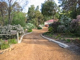
Leschenault is an outer suburb of Bunbury
, Western Australia
, and is located 16 km to the north-east. Its Local Government Area
is the Shire of Harvey
.
, who was part of Nicolas Baudin
's 1802-1803 voyage which visited the coast and explored the estuary and nearby rivers. However, the first reported sighting of the coast was by Captain A.P. Jonk in the VOC
Emeloort, who sighted land at 33°12' (most likely opposite the estuary from Australind) on 24 February 1658 while looking for the Vergulde Draeck
but did not land.
Until the 1980s, the area was used only for low-level agriculture such as grazing, and some holiday homes were built along Cathedral Drive (formerly Scenic Drive) - as recently as 1988, the area was undeveloped. In the mid-1980s the State Government and the Shire of Harvey made plans for a new industrial park at nearby Kemerton, and interest in land at Leschenault for residential purposes increased during the 1990s as facilities became established in nearby Australind and the Australind Bypass was constructed. Most of the land was released in small rural residential estates such as Ashmere Heights, Parklands Estate, Wildflower Woods and Westgarth with large lots separated by natural and other parklands.
On 7 August 2006 a small tornado hit a 200m x 100m area in the Marine Drive area of Leschenault, damaging 60 houses, 20 of which residents were not permitted to return to and seven of which lost their roofs. The small community pulled together to assist the affected families and nearby Leschenault Leisure Centre (in Australind) served as an emergency camp. The State Government announced aid would be forthcoming. .
, to the west by the Leschenault Estuary
and to the east by the Australind Bypass (part of National Highway 1) and a line running north from the rubbish tip.
Leschenault contained 2,556 residents as at the 2001 ABS census.
dot the area, and a community centre, Settlers' Hall on Marine Drive, provides a central meeting place. Some northern parts of the suburb provide access to the Leschenault Peninsula Conservation Park, while the region's rubbish tip is located just off Australind Bypass.
Bunbury, Western Australia
The port city of Bunbury is the third largest city in Western Australia after the State Capital Perth and Mandurah. It is situated south of Perth's central business district...
, Western Australia
Western Australia
Western Australia is a state of Australia, occupying the entire western third of the Australian continent. It is bounded by the Indian Ocean to the north and west, the Great Australian Bight and Indian Ocean to the south, the Northern Territory to the north-east and South Australia to the south-east...
, and is located 16 km to the north-east. Its Local Government Area
Local Government Areas of Western Australia
The Australian state of Western Australia is divided into 141 local government areas...
is the Shire of Harvey
Shire of Harvey
The Shire of Harvey is a Local Government Area of Western Australia. It is located in the state's South West region, approximately 140km south of Perth, and includes some of Bunbury's northern suburbs. The shire covers an area of 1,728 km² and has a estimated population of about 24,000...
.
History
The name Leschenault honours botanist Jean Baptiste Leschenault de la TourJean Baptiste Leschenault de la Tour
Jean Baptiste Louis Claude Theodore Leschenault de la Tour was a French botanist and ornithologist.Leschenault de la Tour was chief botanist on Nicolas Baudin's expedition to Australia between 1800 and 1803...
, who was part of Nicolas Baudin
Nicolas Baudin
Nicolas-Thomas Baudin was a French explorer, cartographer, naturalist and hydrographer.Baudin was born a commoner in Saint-Martin-de-Ré on the Île de Ré. At the age of fifteen he joined the merchant navy, and at twenty joined the French East India Company...
's 1802-1803 voyage which visited the coast and explored the estuary and nearby rivers. However, the first reported sighting of the coast was by Captain A.P. Jonk in the VOC
Dutch East India Company
The Dutch East India Company was a chartered company established in 1602, when the States-General of the Netherlands granted it a 21-year monopoly to carry out colonial activities in Asia...
Emeloort, who sighted land at 33°12' (most likely opposite the estuary from Australind) on 24 February 1658 while looking for the Vergulde Draeck
Vergulde Draeck
The Vergulde Draeck was a Dutch East India Company ship of the seventeenth century. She sailed from Texel bound for Batavia , under Pieter Albertsz and was carrying trade goods and eight chests of silver worth 78,6000 guilders...
but did not land.
Until the 1980s, the area was used only for low-level agriculture such as grazing, and some holiday homes were built along Cathedral Drive (formerly Scenic Drive) - as recently as 1988, the area was undeveloped. In the mid-1980s the State Government and the Shire of Harvey made plans for a new industrial park at nearby Kemerton, and interest in land at Leschenault for residential purposes increased during the 1990s as facilities became established in nearby Australind and the Australind Bypass was constructed. Most of the land was released in small rural residential estates such as Ashmere Heights, Parklands Estate, Wildflower Woods and Westgarth with large lots separated by natural and other parklands.
On 7 August 2006 a small tornado hit a 200m x 100m area in the Marine Drive area of Leschenault, damaging 60 houses, 20 of which residents were not permitted to return to and seven of which lost their roofs. The small community pulled together to assist the affected families and nearby Leschenault Leisure Centre (in Australind) served as an emergency camp. The State Government announced aid would be forthcoming. .
Geography
Leschenault is bordered to the south by the Brunswick River and Old Coast RoadOld Coast Road
Old Coast Road is a Western Australian highway linking Mandurah, WA's second-largest city located 75 km south of Perth, with Bunbury, WA's third-largest city. It is signed as Route 1 for most of its length and is long.-Overview:...
, to the west by the Leschenault Estuary
Leschenault Estuary
Leschenault Estuary is an estuarine lagoon that lies to the north of Bunbury, Western Australia.It had in the past met the Indian Ocean at the Leschenault Inlet - but that has been altered by harbour works for Bunbury, and the creation of The Cut north of the historical inlet location.The estuary...
and to the east by the Australind Bypass (part of National Highway 1) and a line running north from the rubbish tip.
Leschenault contained 2,556 residents as at the 2001 ABS census.
Facilities
Leschenault's educational and shopping needs are serviced by neighbouring Australind. Numerous caravan parks and B&BsBed and breakfast
A bed and breakfast is a small lodging establishment that offers overnight accommodation and breakfast, but usually does not offer other meals. Since the 1980s, the meaning of the term has also extended to include accommodations that are also known as "self-catering" establishments...
dot the area, and a community centre, Settlers' Hall on Marine Drive, provides a central meeting place. Some northern parts of the suburb provide access to the Leschenault Peninsula Conservation Park, while the region's rubbish tip is located just off Australind Bypass.