
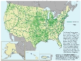
National Network
Encyclopedia
State highway
State highway, state road or state route can refer to one of three related concepts, two of them related to a state or provincial government in a country that is divided into states or provinces :#A...
s and interstate
Interstate Highway System
The Dwight D. Eisenhower National System of Interstate and Defense Highways, , is a network of limited-access roads including freeways, highways, and expressways forming part of the National Highway System of the United States of America...
s for commercial truck driver
Truck driver
A truck driver , is a person who earns a living as the driver of a truck, usually a semi truck, box truck, or dump truck.Truck drivers provide an essential service to...
s in the United States
United States
The United States of America is a federal constitutional republic comprising fifty states and a federal district...
. The Surface Transportation Assistance Act of 1982 authorized the establishment of a national network of highways designated for use by large truck
Truck
A truck or lorry is a motor vehicle designed to transport cargo. Trucks vary greatly in size, power, and configuration, with the smallest being mechanically similar to an automobile...
s. On these highways, Federal width and length limits apply. The National Network (NN) includes almost all of the Interstate Highway System
Interstate Highway System
The Dwight D. Eisenhower National System of Interstate and Defense Highways, , is a network of limited-access roads including freeways, highways, and expressways forming part of the National Highway System of the United States of America...
and other, specified non-Interstate highways. The network comprises more than 200,000 miles of highways.
Definition
§658.9 National Network CriteriaThe National Network listed in the appendix to this part is available for use by commercial motor vehicles of the dimensions and configurations described in §658.13 and §658.15. For those States with detailed lists of individual routes in the appendix, the routes have been designated on the basis of their general adherence to the following criteria.
- The route is a geometrically typical component of the Federal-Aid Primary System, serving to link principal cities and densely developed portions of the States.
- The route is a high volume route utilized extensively by large vehicles for interstate commerce.
- The route does not have any restrictions precluding use by conventional combination vehicles.
- The route has adequate geometrics to support safe operations, considering sight distance, severity and length of grades, pavement width, horizontal curvature, shoulder width, bridge clearances and load limits, traffic volumes and vehicle mix, and intersection geometry.
- The route consists of lanes designed to be a width of 12 feet or more or is otherwise consistent with highway safety.
- The route does not have any unusual characteristics causing current or anticipated safety problems.
The National Network was most recently defined by the Intermodal Surface Transportation Efficiency Act of 1991. Information on these routes are taken from §658 Appendix A. Some states such as Indiana
Indiana
Indiana is a US state, admitted to the United States as the 19th on December 11, 1816. It is located in the Midwestern United States and Great Lakes Region. With 6,483,802 residents, the state is ranked 15th in population and 16th in population density. Indiana is ranked 38th in land area and is...
, Arkansas
Arkansas
Arkansas is a state located in the southern region of the United States. Its name is an Algonquian name of the Quapaw Indians. Arkansas shares borders with six states , and its eastern border is largely defined by the Mississippi River...
, and Ohio
Ohio
Ohio is a Midwestern state in the United States. The 34th largest state by area in the U.S.,it is the 7th‑most populous with over 11.5 million residents, containing several major American cities and seven metropolitan areas with populations of 500,000 or more.The state's capital is Columbus...
allow truck traffic on all numbered state or U.S. highways. Other states, such as New York
New York
New York is a state in the Northeastern region of the United States. It is the nation's third most populous state. New York is bordered by New Jersey and Pennsylvania to the south, and by Connecticut, Massachusetts and Vermont to the east...
and California
California
California is a state located on the West Coast of the United States. It is by far the most populous U.S. state, and the third-largest by land area...
, have a specially defined set of highways which are recommended for trucks. The law allows for "reasonable access" to and from the NN for terminals, deliverires, trucks stops, repairs, and other reasons. The NN is recommended for through truck traffic (e.g. traffic that is passing through the area), and trucks are allowed to operate on truck-restricted roads if they have no other means of access to their destination.
Alabama
| Route | From | To |
|---|---|---|
| US 43 | I-65 Interstate 65 in Alabama Interstate 65, beginning in Mobile at an interchange with Interstate 10, meanders across of the Alabama countryside linking six of the state's ten largest cities. The highway links together many important roadways that make commerce inside and outside of the state's boundaries possible... N of Mobile |
Sunflower |
| US 43 | AL 5 near Russellville | TN Tennessee Tennessee is a U.S. state located in the Southeastern United States. It has a population of 6,346,105, making it the nation's 17th-largest state by population, and covers , making it the 36th-largest by total land area... State Line |
| US 72 | MS Mississippi Mississippi is a U.S. state located in the Southern United States. Jackson is the state capital and largest city. The name of the state derives from the Mississippi River, which flows along its western boundary, whose name comes from the Ojibwe word misi-ziibi... State Line |
CR 33 Hollywood |
| US 72 | Alt US 72 Tuscumbia | US 72/231/431 Huntsville |
| US 78 | End of 4-lane W. of AL 5 Jasper Jasper, Alabama Jasper is a city in Walker County, Alabama, United States. At the 2000 census the population was 14,659. As of 2011 the population had was 13,857. The city is the county seat of Walker County, and once ranked among the world's leading producers of coal.... |
I-59 Birmingham Birmingham, Alabama Birmingham is the largest city in Alabama. The city is the county seat of Jefferson County. According to the 2010 United States Census, Birmingham had a population of 212,237. The Birmingham-Hoover Metropolitan Area, in estimate by the U.S... |
| US 80 | AL 14 W. Int. Selma Selma, Alabama Selma is a city in and the county seat of Dallas County, Alabama, United States, located on the banks of the Alabama River. The population was 20,512 at the 2000 census.... |
US 82 Montgomery Montgomery, Alabama Montgomery is the capital of the U.S. state of Alabama, and is the county seat of Montgomery County. It is located on the Alabama River southeast of the center of the state, in the Gulf Coastal Plain. As of the 2010 census, Montgomery had a population of 205,764 making it the second-largest city... |
| US 82 | Coker W. of I-59 | Eoline W. of AL 5 |
| US 82 | AL 206 Prattville Prattville, Alabama Prattville is a city in Autauga and Elmore counties in the U.S. state of Alabama. As of the 2010 Census, the population of the city is 33,960. Nicknamed "The Fountain City" due to the many artesian wells in the area, Prattville is part of the Montgomery metropolitan statistical area and serves as... |
US 231 N. Int. Montgomery Montgomery, Alabama Montgomery is the capital of the U.S. state of Alabama, and is the county seat of Montgomery County. It is located on the Alabama River southeast of the center of the state, in the Gulf Coastal Plain. As of the 2010 census, Montgomery had a population of 205,764 making it the second-largest city... |
| US 84 | AL 92 E. of Daleville Daleville, Alabama Daleville is a city in Dale County, Alabama, United States. At the 2000 census the population was 4,653. It is part of the Enterprise–Ozark Micropolitan Statistical Area. The city's nickname is "Gateway to Fort Rucker", as this U.S. Army post is located just north of town... (via AL 210 Dothan Cir.) |
End of 4-lane E. of Dothan Dothan, Alabama Dothan is a city located in the southeastern corner of the US state of Alabama, situated approximately west of the Georgia state line and north of Florida. It is the seat of Houston County, with portions extending into nearby Dale County and Henry County... |
| US 98 | I-10 Daphne Daphne, Alabama Daphne is a city in Baldwin County, Alabama, United States, on the eastern shoreline of Mobile Bay. The city is located along I-10, 11 miles east of Mobile and 150 miles southwest of the state capital of Montgomery. The United States Census 2000 lists the population of the city as 16,581 making... |
End of 4-lane near Fairhope Fairhope, Alabama Fairhope is a city in Baldwin County, Alabama, on a sloping plateau, along the cliffs and shoreline of Mobile Bay. The 2010 census lists the population of the city as 16,176.... |
| US 231 | FL State Line (via AL 210 Dothan Dothan, Alabama Dothan is a city located in the southeastern corner of the US state of Alabama, situated approximately west of the Georgia state line and north of Florida. It is the seat of Houston County, with portions extending into nearby Dale County and Henry County... Circle) |
End of 4-lane N. of Wetumpka Wetumpka, Alabama Wetumpka is a city in Elmore County, Alabama, United States. At the 2000 census the population was 5,726.The city is the county seat of Elmore County, one of the fastest growing counties in the state.... |
| US 231 | Arab Arab, Alabama Arab is a city in both Cullman County, Alabama and Marshall County, Alabama in the northeastern part of the U.S. state of Alabama, located ten miles from Guntersville Lake and Guntersville Dam, and is included in the Huntsville-Decatur Combined Statistical Area... |
TN State Line. |
| US 280 | US 31 Mountain Brook Mountain Brook, Alabama Mountain Brook is a city in southeastern Jefferson County, Alabama, and a suburb of Birmingham. According to 2005 Census Bureau estimates, the population of the city is 20,821. Mountain Brook is a particularly affluent city within the Birmingham metropolitan area and has appeared in several lists... |
AL 22 Alexander City Alexander City, Alabama Alexander City is the principal city of the Alexander City Micropolitan Statistical Area, a micropolitan area that covers Coosa and Tallapoosa counties and had a combined population of 53,677 at the 2000 census.... |
| US 280 | I-85 Opelika Opelika, Alabama Opelika is a city in and the county seat of Lee County in the east central part of the U.S. state of Alabama. It is a principal city of the Auburn-Opelika Metropolitan Area. According to 2010 Census, the population of Opelika was 26,477... |
GA State Line Phenix City Phenix City, Alabama Phenix City is a city and the county seat in Russell County in the U.S. state of Alabama. Portions of Lee County are addressed as Phenix City, 36870 ZIP code, for the sole purpose that Smiths Station does not have full incorporation to annex the area... |
| US 431 | AL 210 Dothan Dothan, Alabama Dothan is a city located in the southeastern corner of the US state of Alabama, situated approximately west of the Georgia state line and north of Florida. It is the seat of Houston County, with portions extending into nearby Dale County and Henry County... |
AL 173 Headland Headland, Alabama Headland is a city in Henry County, Alabama, United States. It is part of the Dothan, Alabama Metropolitan Statistical Area. At the 2000 census the population was 3,523. Ray Marler is the current mayor.-Geography:... |
| US 431 | I-20 Anniston Anniston, Alabama Anniston is a city in Calhoun County in the state of Alabama, United States.As of the 2000 census, the population of the city is 24,276. According to the 2005 U.S. Census estimates, the city had a population of 23,741... |
AL 79 N. Int. Columbus City Columbus, Georgia Columbus is a city in and the county seat of Muscogee County, Georgia, United States, with which it is consolidated. As of the 2010 census, the city had a population of 189,885. It is the principal city of the Columbus, Georgia metropolitan area, which, in 2009, had an estimated population of 292,795... (via I-59 — AL 77 Gadsden Gadsden, Alabama The city of Gadsden is the county seat of Etowah County in the U.S. state of Alabama, and it is located about 65 miles northeast of Birmingham, Alabama. It is the primary city of the Gadsden Metropolitan Statistical Area, which has a population of 103,459. Gadsden is closely associated with the... ) |
| US 431 | CR 8 New Hope New Hope, Alabama New Hope is a city in Madison County, Alabama, United States, and is included in the Huntsville-Decatur Combined Statistical Area. As of the 2000 census, the population is 2,539.-History:... |
TN State Line |
| AL 21 | US 31 Atmore Atmore, Alabama Atmore is a city in Escambia County, Alabama, United States. At the 2000 census the population was 7,676. According to the 2005 U.S. Census estimates, the city had a population of 7,530. The city was named for Mr. C.P. Atmore.... |
I-65 N. of Atmore |
| AL 21 | US 431 Anniston Anniston, Alabama Anniston is a city in Calhoun County in the state of Alabama, United States.As of the 2000 census, the population of the city is 24,276. According to the 2005 U.S. Census estimates, the city had a population of 23,741... |
Jacksonville Jacksonville, Alabama Jacksonville is a city in Calhoun County, Alabama, United States. which is a 49% increase since 2000. It is included in the Anniston-Oxford Metropolitan Statistical Area... |
| AL 67 | I-65 Priceville Priceville, Alabama Priceville is the third largest municipality in Morgan County, Alabama, and is included in the Decatur Metropolitan Area, as well as the Huntsville-Decatur Combined Statistical Area. As of the 2006 census estimate, the population of the town is 2,380.... |
US 72 Alt. W. of Decatur Decatur, Alabama Decatur is a city in Limestone and Morgan Counties in the U.S. state of Alabama. The city, affectionately known as "The River City", is located in Northern Alabama on the banks of Wheeler Lake, along the Tennessee River. It is the largest city and county seat of Morgan County... |
| AL 79 | I-59 Birmingham Birmingham, Alabama Birmingham is the largest city in Alabama. The city is the county seat of Jefferson County. According to the 2010 United States Census, Birmingham had a population of 212,237. The Birmingham-Hoover Metropolitan Area, in estimate by the U.S... |
Pinson Pinson, Alabama Pinson is a city in Birmingham, Alabama, United States northwest from Center Point. At the 2000 census, the population was 5,033.-Geography:This city is located at .According to the U.S... |
| AL 152 | US 231 N. Int. Montgomery Montgomery, Alabama Montgomery is the capital of the U.S. state of Alabama, and is the county seat of Montgomery County. It is located on the Alabama River southeast of the center of the state, in the Gulf Coastal Plain. As of the 2010 census, Montgomery had a population of 205,764 making it the second-largest city... |
I-65 N. Int. Montgomery. |
| AL 210 | Dothan Dothan, Alabama Dothan is a city located in the southeastern corner of the US state of Alabama, situated approximately west of the Georgia state line and north of Florida. It is the seat of Houston County, with portions extending into nearby Dale County and Henry County... Circle (Beltway) |
|
| AL 248 | US 84 Enterprise Enterprise, Alabama Enterprise is a city in the southeastern part of Coffee and Dale Counties in the southeastern part of Alabama in the Southern United States. The population was estimated to be 25,909 in the year 2009.... |
Fort Rucker Fort Rucker Fort Rucker is a U.S. Army post located mostly in Dale County, Alabama, United States. It was named for a Civil War officer, Confederate General Edmund Rucker. The post is the primary flight training base for Army Aviation and is home to the United States Army Aviation Center of Excellence and... |
| AL 249 | Fort Rucker Fort Rucker Fort Rucker is a U.S. Army post located mostly in Dale County, Alabama, United States. It was named for a Civil War officer, Confederate General Edmund Rucker. The post is the primary flight training base for Army Aviation and is home to the United States Army Aviation Center of Excellence and... |
US 231 |
Alaska
| Route | From | To |
|---|---|---|
| AK 1 | Potter Weigh Station Anchorage Anchorage, Alaska Anchorage is a unified home rule municipality in the southcentral part of the U.S. state of Alaska. It is the northernmost major city in the United States... |
AK 3 Palmer Palmer, Alaska Palmer is the borough seat of the Matanuska-Susitna Borough in the state of Alaska, USA. It is part of the Anchorage Metropolitan Statistical Area. As of the 2010 census, the population of the city is 5,937.... |
| AK 2 | AK 3 Fairbanks Fairbanks, Alaska Fairbanks is a home rule city in and the borough seat of the Fairbanks North Star Borough in the U.S. state of Alaska.Fairbanks is the largest city in the Interior region of Alaska, and second largest in the state behind Anchorage... |
Milepost 1412 Delta Junction Delta Junction, Alaska Delta Junction is a city in the Southeast Fairbanks Census Area, Alaska, United States. According to 2005 Census Bureau estimates, the population of the city is 897. The city is located a short distance south of the confluence of the Delta River with the Tanana River, which is at Big Delta... |
| AK 3 | AK 1 Palmer Palmer, Alaska Palmer is the borough seat of the Matanuska-Susitna Borough in the state of Alaska, USA. It is part of the Anchorage Metropolitan Statistical Area. As of the 2010 census, the population of the city is 5,937.... |
AK 2 Fairbanks Fairbanks, Alaska Fairbanks is a home rule city in and the borough seat of the Fairbanks North Star Borough in the U.S. state of Alaska.Fairbanks is the largest city in the Interior region of Alaska, and second largest in the state behind Anchorage... |
Arizona
| Route | From | To |
|---|---|---|
| US 60 | I-10 Brenda Brenda, Arizona Brenda, Arizona is a small community in southwestern Arizona. It is located approximately 13 miles east of Quartzsite, , and 4 miles northeast on US 60 in Arizona.... |
I-17 Phoenix Phoenix, Arizona Phoenix is the capital, and largest city, of the U.S. state of Arizona, as well as the sixth most populated city in the United States. Phoenix is home to 1,445,632 people according to the official 2010 U.S. Census Bureau data... |
| US 60 | AZ 87 Mesa Mesa, Arizona According to the 2010 Census, the racial composition of Mesa was as follows:* White: 77.1% * Hispanic or Latino : 26.54%* Black or African American: 3.5%* Two or more races: 3.4%* Native American: 2.4%... |
AZ 70 Globe Globe, Arizona Globe has an arid climate, characterized by hot summers and moderate to warm winters. Globe's arid climate is somewhat tempered by its elevation, however, leading to slightly cooler temperatures and slightly more precipitation than Phoenix or Yuma.... |
| US 60 | AZ 260 E. Int. Show Low Show Low, Arizona Winters in Show Low bring highs between 45°F and 55°F , with lows usually below freezing between November and March, averaging in the 20s December through February, and in the low 30s for November and March.... |
NM State Line |
| US 64 | US 160 Teec Nos Pos Teec Nos Pos, Arizona Teec Nos Pos is a census-designated place in Apache County, Arizona, United States. The population was 799 at the 2000 census. The Navajo name of this community translates as "cottonwoods in a Circle". It is the western terminus of U.S... |
NM State Line |
| US 70 | US 60 Globe Globe, Arizona Globe has an arid climate, characterized by hot summers and moderate to warm winters. Globe's arid climate is somewhat tempered by its elevation, however, leading to slightly cooler temperatures and slightly more precipitation than Phoenix or Yuma.... |
NM State Line |
| US 80 | AZ 92 Bisbee Bisbee, Arizona Bisbee is a city in Cochise County, Arizona, United States, 82 miles southeast of Tucson. According to 2005 Census Bureau estimates, the population of the city was 6,177... |
NM State Line |
| US 89 | I-10 Tucson Tucson, Arizona Tucson is a city in and the county seat of Pima County, Arizona, United States. The city is located 118 miles southeast of Phoenix and 60 miles north of the U.S.-Mexico border. The 2010 United States Census puts the city's population at 520,116 with a metropolitan area population at 1,020,200... |
US 60 Florence Junction |
| US 89 | AZ 69 Prescott Prescott, Arizona Prescott is a city in Yavapai County, Arizona, USA. It was designated "Arizona's Christmas City" by Arizona Governor Rose Mofford in the late 1980s.... |
I-40 Ash Fork Ash Fork, Arizona Ash Fork is a census-designated place in Yavapai County, Arizona, United States. The population was 457 at the 2000 census.-Geography:Ash Fork is located at .... |
| US 89 | I-40 Flagstaff Flagstaff, Arizona Flagstaff is a city located in northern Arizona, in the southwestern United States. In 2010, the city's population was 65,870. The population of the Metropolitan Statistical Area was at 134,421 in 2010. It is the county seat of Coconino County... |
UT State Line |
| US 95 | Mexican Border | I-8 Yuma Yuma, Arizona Yuma is a city in and the county seat of Yuma County, Arizona, United States. It is located in the southwestern corner of the state, and the population of the city was 77,515 at the 2000 census, with a 2008 Census Bureau estimated population of 90,041.... |
| US 160 | US 89 Tuba City Tuba City, Arizona Tuba City is a census-designated place in Coconino County, Arizona, United States. The population was 8,225 at the 2000 census. It is the Dine' Nation's largest community, slightly larger than Shiprock, New Mexico. The Hopi town of Moenkopi lies directly to its southeast.The name of the town... |
NM State Line |
| US 163 | US 160 Kayenta Kayenta, Arizona Kayenta is a census-designated place which is part of the Navajo Nation and is in Navajo County, Arizona, United States. The population was 5,189 at the 2010 census. Kayenta is located south of Monument Valley and contains a number of hotels and motels which service visitors to Monument... |
UT State Line |
| US 666 | I-10 Bowie Bowie, Arizona Bowie is an unincorporated community in Cochise County, Arizona. The community lies on Interstate 10 in eastern Arizona close to the western New Mexico border... |
US 70 Safford Safford, Arizona - History :Safford was founded by Joshua Eaton Bailey, Hiram Kennedy and Edward Tuttle, who came from Gila Bend, in southwestern Arizona. They left Gila Bend in the winter of 1873-74; their work on canals and dams having been destroyed by high water the previous summer... |
| US 666 | US 60 Springerville Springerville, Arizona Springerville is a town in Apache County, Arizona, United States within the White Mountains. Its postal ZIP code is 85938. According to 2006 Census Bureau estimates, the population of the town is 1,956.Springerville sits at an elevation of 6,974 feet... |
I-40 Sanders Sanders, Arizona Sanders is an unincorporated community in Apache County, Arizona, United States. Sanders is located at the junction of US 191 and Interstate 40, within the Navajo Nation.... |
| US 666 | Mexican Border | US 80 Douglas Douglas, Arizona Douglas is a city in Cochise County, Arizona, United States. Douglas has a border crossing with Mexico and a history of mining.The population was 14,312 at the 2000 census... |
| AZ 69 | US 89 Prescott Prescott, Arizona Prescott is a city in Yavapai County, Arizona, USA. It was designated "Arizona's Christmas City" by Arizona Governor Rose Mofford in the late 1980s.... |
I-17 Cordes Junction |
| AZ 77 | US 60 Show Low Show Low, Arizona Winters in Show Low bring highs between 45°F and 55°F , with lows usually below freezing between November and March, averaging in the 20s December through February, and in the low 30s for November and March.... |
I-40 Holbrook Holbrook, Arizona -Historical events:*During 1881 & 1882, railroad tracks were laid down and a railroad station was built. The community was then named Holbrook after the first engineer of the Atlantic and Pacific Railroad... |
| AZ 84 | I-10 Picacho Picacho, Arizona Picacho is an unincorporated community and census-designated place in Pinal County, Arizona, United States. The population was 471 at the 2010 census.... |
AZ 87 E. of Eloy Eloy, Arizona Eloy is a city in Pinal County, Arizona, United States. According to 2005 Census Bureau estimates, the population of the city is 10,855.-Geography:... |
| AZ 87 | AZ 84 E. of Eloy Eloy, Arizona Eloy is a city in Pinal County, Arizona, United States. According to 2005 Census Bureau estimates, the population of the city is 10,855.-Geography:... |
AZ 387 W. of Coolidge Coolidge, Arizona Coolidge is a city in Pinal County, Arizona, United States. According to 2005 Census Bureau estimates, the population of the city is 8,154.Arizona Highway 87 and Arizona Highway 287 pass through the town. Coolidge is 56 miles southeast of Phoenix, and 69 miles northwest of Tucson. It is 21 miles... |
| AZ 87 | AZ 587 Chandler Chandler, Arizona -Demographics:As of the Census of 2010, there were 236,123 people, 86,924 households, and 60,212 families residing in the city. The racial makeup of the city was 73.3% White, 4.8% Black or African American, 1.5% Native American, 8.2% Asian, 0.2% Pacific Islander, 21.9% Hispanic or Latino, and 8.3%... |
US 60 Mesa Mesa, Arizona According to the 2010 Census, the racial composition of Mesa was as follows:* White: 77.1% * Hispanic or Latino : 26.54%* Black or African American: 3.5%* Two or more races: 3.4%* Native American: 2.4%... |
| AZ 90 | I-10 Benson Benson, Arizona -Transportation:Benson Airport is located 3 miles north west of the city.Benson is served by Interstate 10 to the north, which travels directly to downtown Tucson.... |
AZ 92 Sierra Vista Sierra Vista, Arizona Sierra Vista is a city in Cochise County, Arizona, United States. According to 2007 Census Bureau estimates, the population of the city is 43,044.... |
| AZ 169 | AZ 69 Dewey | I-17 S. of Camp Verde Camp Verde, Arizona Camp Verde is a town in Yavapai County, Arizona, United States. According to 2006 Census Bureau estimates, the population of the town is 10,610.... |
| AZ 189 | Mexican Border | I-19 Nogales Nogales, Arizona Nogales is a city in Santa Cruz County, Arizona, United States. The population was 21,017 at the 2010 census. According to 2005 Census Bureau estimates, the population of the city is 20,833. The city is the county seat of Santa Cruz County.... |
| AZ 287 | AZ 87 Coolidge Coolidge, Arizona Coolidge is a city in Pinal County, Arizona, United States. According to 2005 Census Bureau estimates, the population of the city is 8,154.Arizona Highway 87 and Arizona Highway 287 pass through the town. Coolidge is 56 miles southeast of Phoenix, and 69 miles northwest of Tucson. It is 21 miles... |
US 89 Florence Florence, Arizona -Demographics:As of the census of 2000, there were 17,054 people, 2,226 households, and 1,540 families residing in the town. The population density was 2,056.2 people per square mile . There were 3,216 housing units at an average density of 387.7 per square mile... |
| AZ 360 | I-10 Phoenix Phoenix, Arizona Phoenix is the capital, and largest city, of the U.S. state of Arizona, as well as the sixth most populated city in the United States. Phoenix is home to 1,445,632 people according to the official 2010 U.S. Census Bureau data... |
AZ 87 Mesa Mesa, Arizona According to the 2010 Census, the racial composition of Mesa was as follows:* White: 77.1% * Hispanic or Latino : 26.54%* Black or African American: 3.5%* Two or more races: 3.4%* Native American: 2.4%... |
| AZ 387 | I-10 Exit 185 | AZ 87 W. of Coolidge Coolidge, Arizona Coolidge is a city in Pinal County, Arizona, United States. According to 2005 Census Bureau estimates, the population of the city is 8,154.Arizona Highway 87 and Arizona Highway 287 pass through the town. Coolidge is 56 miles southeast of Phoenix, and 69 miles northwest of Tucson. It is 21 miles... |
| AZ 587 (Old AZ 93) | I-10 Exit 175 | AZ 87 Chandler Chandler, Arizona -Demographics:As of the Census of 2010, there were 236,123 people, 86,924 households, and 60,212 families residing in the city. The racial makeup of the city was 73.3% White, 4.8% Black or African American, 1.5% Native American, 8.2% Asian, 0.2% Pacific Islander, 21.9% Hispanic or Latino, and 8.3%... |
Arkansas
No additional routes have been federally designated; under State law STAA-dimensioned commercial vehicles may legally operate on all highways which, prior to June 1, 1991, were designated as Federal-aid primary highways.California
| Route | From | To |
|---|---|---|
| I-80 Bus. Loop (US 50 - CA 51) | I-80 W. Sacramento Sacramento, California Sacramento is the capital city of the U.S. state of California and the county seat of Sacramento County. It is located at the confluence of the Sacramento River and the American River in the northern portion of California's expansive Central Valley. With a population of 466,488 at the 2010 census,... |
I-80 near Watt Ave., Sacramento |
| US 6 | US 395 Bishop Bishop, California Bishop is a city in Inyo County, California, United States. Though Bishop is the only city and the largest populated place in Inyo County, the county seat is Independence. Bishop is located near the northern end of the Owens Valley, at an elevation of 4147 feet . The population was 3,879 at the... |
NV State Line |
| US 50 | I-80 W. of Sacramento Sacramento, California Sacramento is the capital city of the U.S. state of California and the county seat of Sacramento County. It is located at the confluence of the Sacramento River and the American River in the northern portion of California's expansive Central Valley. With a population of 466,488 at the 2010 census,... |
Sly Park Rd. Pollock Pines Pollock Pines, California Pollock Pines is a census-designated place in El Dorado County, California, United States. It is part of the Sacramento–Arden-Arcade–Roseville Metropolitan Statistical Area... |
| US 95 | I-40 near Needles Needles, California Needles is a city located in the Mojave Desert on the western banks of the Colorado River in San Bernardino County, California. It is located in the Mohave Valley, which straddles the California–Arizona border. The city is accessible via Interstate 40 and U.S. Route 95... |
NV State Line |
| US 101 | I-5 Los Angeles Los Ángeles Los Ángeles is the capital of the province of Biobío, in the commune of the same name, in Region VIII , in the center-south of Chile. It is located between the Laja and Biobío rivers. The population is 123,445 inhabitants... |
I-80 San Francisco |
| US 395 | I-15 S. of Victorville Victorville, California Victorville is a city located in the Victor Valley of southwestern San Bernardino County, California. According to the U.S. Census Bureau's 2010 census, the city had a population of 115,903, up from 64,030 at the 2000 census.-Geography and climate:... |
NV State Line |
| CA 2 | I-5 | I-210 Los Angeles Los Ángeles Los Ángeles is the capital of the province of Biobío, in the commune of the same name, in Region VIII , in the center-south of Chile. It is located between the Laja and Biobío rivers. The population is 123,445 inhabitants... |
| CA 10 (San Bernardino Freeway San Bernardino Freeway The San Bernardino Freeway, formerly known as the Ramona Freeway is a freeway in Los Angeles and Orange Counties in the southern part of the U.S. state of California. It refers to the following two segments:... ) |
US 101 | I-5 Los Angeles Los Ángeles Los Ángeles is the capital of the province of Biobío, in the commune of the same name, in Region VIII , in the center-south of Chile. It is located between the Laja and Biobío rivers. The population is 123,445 inhabitants... |
| CA 14 | I-5 near San Fernando San Fernando, California San Fernando is a city located in the San Fernando Valley, in northwestern region of Los Angeles, California, United States. The population was 23,645 at the 2010 census, up from 23,564 at the 2000 census.-History:... |
US 395 Ridgecrest Ridgecrest, California Ridgecrest, formerly known as Crumville, was incorporated as a city in 1913. It is located in the Indian Wells Valley in northeastern Kern County, California, adjacent to the Naval Air Weapons Station China Lake . Ridgecrest is the only incorporated city along US 395 in Kern County... |
| CA 15 | I-5 | I-805 San Diego |
| CA 22 | I-405 Seal Beach Seal Beach, California -Neighborhoods:Seal Beach encompasses the Leisure World retirement gated community with roughly 9,000 residents. This was the first major planned retirement community of its type in the U.S... |
CA 55 Orange Orange, California Southern California is well-known for year-round pleasant weather: - On average, the warmest month is August. - The highest recorded temperature was in 1985. - On average, the coolest month is December. - The lowest recorded temperature was in 1950... |
| CA 24 | I-580 Oakland Oakland, California Oakland is a major West Coast port city on San Francisco Bay in the U.S. state of California. It is the eighth-largest city in the state with a 2010 population of 390,724... |
I-680 Walnut Creek Walnut Creek, California Walnut Creek is an incorporated city located east of the city of Oakland. It lies in the East Bay region of the San Francisco Bay Area. While not as large as neighboring Concord, Walnut Creek serves as the business and entertainment hub for the neighboring cities within central Contra Costa... |
| CA 52 | I-5 | I-805 San Diego |
| CA 55 | I-405 Costa Mesa Costa Mesa, California Costa Mesa is a city in Orange County, California. The population was 109,960 at the 2010 census. Since its incorporation in 1953, the city has grown from a semi-rural farming community of 16,840 to a primarily suburban and "edge" city with an economy based on retail, commerce, and light... |
CA 91 Anaheim Anaheim, California Anaheim is a city in Orange County, California. As of the 2010 United States Census, the city population was about 365,463, making it the most populated city in Orange County, the 10th most-populated city in California, and ranked 54th in the United States... |
| CA 57 | I-5 Santa Ana Santa Ana, California Santa Ana is the county seat and second most populous city in Orange County, California, and with a population of 324,528 at the 2010 census, Santa Ana is the 57th-most populous city in the United States.... |
I-210 Pomona Pomona, California -2010:The 2010 United States Census reported that Pomona had a population of 149,058, a slight decline from the 2000 census population. The population density was 6,491.2 people per square mile... |
| CA 58 | CA 99 Bakersfield Bakersfield, California Bakersfield is a city near the southern end of the San Joaquin Valley in Kern County, California. It is roughly equidistant between Fresno and Los Angeles, to the north and south respectively.... |
I-15 Barstow Barstow, California Barstow is a city in San Bernardino County, California, United States. The population was 22,639 at the 2010 census, up from 21,119 at the 2000 census. Barstow is located north of San Bernardino.... |
| CA 60 | I-10 Los Angeles Los Ángeles Los Ángeles is the capital of the province of Biobío, in the commune of the same name, in Region VIII , in the center-south of Chile. It is located between the Laja and Biobío rivers. The population is 123,445 inhabitants... |
I-10 Beaumont Beaumont, California Beaumont is a city in Riverside County, California, United States in the Greater Los Angeles area.Now a growing, community planned city, the population was 36,877 at the 2010 census, and expected to be up to 125,000 projected by 2040, making Beaumont as California's next, newest fastest-growing... |
| CA 71 | CA 57 | CA 60 Pomona Pomona, California -2010:The 2010 United States Census reported that Pomona had a population of 149,058, a slight decline from the 2000 census population. The population density was 6,491.2 people per square mile... |
| CA 78 | I-5 Carlsbad Carlsbad, California -2010:The 2010 United States Census reported that Carlsbad had a population of 105,328. The population density was 2,693.1 people per square mile . The racial makeup of Carlsbad was 87,205 White, 1,379 African American, 514 Native American, 7,460 Asian, 198 Pacific Islander, 4,189 from other... |
I-15 Escondido Escondido, California Escondido is a city occupying a shallow valley ringed by rocky hills, just north of the city of San Diego, California. Founded in 1888, it is one of the oldest cities in San Diego County. The city had a population of 143,911 at the 2010 census. Its municipal government set itself an operating... |
| CA 85 | I-280 near San Jose San Jose, California San Jose is the third-largest city in California, the tenth-largest in the U.S., and the county seat of Santa Clara County which is located at the southern end of San Francisco Bay... |
CA 101 Mountain View Mountain View, California -Downtown:Mountain View has a pedestrian-friendly downtown centered on Castro Street. The downtown area consists of the seven blocks of Castro Street from the Downtown Mountain View Station transit center in the north to the intersection with El Camino Real in the south... |
| CA 91 | I-110 Los Angeles Los Ángeles Los Ángeles is the capital of the province of Biobío, in the commune of the same name, in Region VIII , in the center-south of Chile. It is located between the Laja and Biobío rivers. The population is 123,445 inhabitants... |
I-215/CA 60 Riverside Riverside, California Riverside is a city in Riverside County, California, United States, and the county seat of the eponymous county. Named for its location beside the Santa Ana River, it is the largest city in the Riverside-San Bernardino-Ontario metropolitan area of Southern California, 4th largest inland California... |
| CA 92 | I-280 San Mateo San Mateo, California San Mateo is a city in San Mateo County, California, United States, in the San Francisco Bay Area. With a population of approximately 100,000 , it is one of the larger suburbs on the San Francisco Peninsula, located between Burlingame to the north, Foster City to the east, Belmont to the south,... |
I-880 Hayward Hayward, California Hayward is a city located in the East Bay in Alameda County, California. With a population of 144,186, Hayward is the sixth largest city in the San Francisco Bay Area and the third largest in Alameda County. Hayward was ranked as the 37th most populous municipality in California. It is included in... |
| CA 94 | I-5 | CA 125 San Diego |
| CA 99 | I-5 Wheeler Ridge Wheeler Ridge, California Wheeler Ridge is an unincorporated community in Kern County, California. It is located south-southeast of Mettler, at an elevation of 955 feet .A post office operated at Wheeler Ridge from 1923 to 1972.... |
I-80 Bus. Loop/US 50 Sacramento Sacramento, California Sacramento is the capital city of the U.S. state of California and the county seat of Sacramento County. It is located at the confluence of the Sacramento River and the American River in the northern portion of California's expansive Central Valley. With a population of 466,488 at the 2010 census,... |
| CA 110 | I-10 | US 101 Los Angeles Los Ángeles Los Ángeles is the capital of the province of Biobío, in the commune of the same name, in Region VIII , in the center-south of Chile. It is located between the Laja and Biobío rivers. The population is 123,445 inhabitants... |
| CA 118 | I-405 Los Angeles Los Ángeles Los Ángeles is the capital of the province of Biobío, in the commune of the same name, in Region VIII , in the center-south of Chile. It is located between the Laja and Biobío rivers. The population is 123,445 inhabitants... |
I-210 San Fernando San Fernando, California San Fernando is a city located in the San Fernando Valley, in northwestern region of Los Angeles, California, United States. The population was 23,645 at the 2010 census, up from 23,564 at the 2000 census.-History:... |
| CA 125 | CA 94 | I-8 La Mesa La Mesa, California La Mesa is a city in San Diego County, California. The population was 57,065 at the 2010 census, up from 54,749 at the 2000 census. It was founded in 1869 and officially incorporated as a city on February 16, 1912. Its official flower is the bougainvillea.... |
| CA 133 | I-405 | I-5 near El Toro |
| CA 134 | US 101 Los Angeles Los Ángeles Los Ángeles is the capital of the province of Biobío, in the commune of the same name, in Region VIII , in the center-south of Chile. It is located between the Laja and Biobío rivers. The population is 123,445 inhabitants... |
I-210 Pasadena Pasadena, California Pasadena is a city in Los Angeles County, California, United States. Although famous for hosting the annual Rose Bowl football game and Tournament of Roses Parade, Pasadena is the home to many scientific and cultural institutions, including the California Institute of Technology , the Jet... |
| CA 163 | I-8 | I-15 San Diego |
| CA 170 | US 101 | I-5 Los Angeles Los Ángeles Los Ángeles is the capital of the province of Biobío, in the commune of the same name, in Region VIII , in the center-south of Chile. It is located between the Laja and Biobío rivers. The population is 123,445 inhabitants... |
| CA 198 | I-5 Coalinga Coalinga, California Coalinga is a city in Fresno County, California. The population was 13,380 at the 2010 census, up from 11,668 at the 2000 census. It is the site of both Pleasant Valley State Prison and Coalinga State Hospital. Coalinga is located southwest of Fresno, at an elevation of 673 feet .-Early... |
CA 99 Visalia Visalia, California Visalia is a Central California city situated in the heart of California’s agricultural San Joaquin Valley, approximately southeast of San Francisco and north of Los Angeles... |
| CA 215 | I-15 N. of Temecula Temecula, California Temecula is a city in southwestern Riverside County, California, United States with a population of 100,097 according to the 2010 United States Census, making it the lowest populated American city over 100,000 population. It was incorporated on December 1, 1989... |
CA 60 Riverside Riverside, California Riverside is a city in Riverside County, California, United States, and the county seat of the eponymous county. Named for its location beside the Santa Ana River, it is the largest city in the Riverside-San Bernardino-Ontario metropolitan area of Southern California, 4th largest inland California... |
| CA 905 (Old CA 117) | I-5 | I-805 San Diego |
| Note: I-580 Oakland — All vehicles over 41/2 tons (except passenger buses and stages) are prohibited on MacArthur Freeway between Grand Ave. and the north city limits of San Leandro San Leandro, California San Leandro is a city in Alameda County, California, United States. It is considered a suburb of Oakland and San Francisco. The population was 84,950 as of 2010 census. The climate of the city is mild throughout the year.-Geography and water resources:... . (Excepted under 23 CFR 658.11(f)). |
||
Colorado
No additional routes have been federally designated; under State law STAA-dimensioned commercial vehicles may legally operate on all highways which, prior to June 1, 1991, were designated as Federal-aid primary highways.Connecticut
| Route | From | To |
|---|---|---|
| CT 2 | Columbus Blvd. Hartford Hartford, Connecticut Hartford is the capital of the U.S. state of Connecticut. The seat of Hartford County until Connecticut disbanded county government in 1960, it is the second most populous city on New England's largest river, the Connecticut River. As of the 2010 Census, Hartford's population was 124,775, making... |
I-395 Norwich Norwich, Connecticut Regular steamship service between New York and Boston helped Norwich to prosper as a shipping center through the early part of the 20th century. During the Civil War, Norwich once again rallied and saw the growth of its textile, armaments, and specialty item manufacturing... |
| CT 8 | I-95 Bridgeport Bridgeport, Connecticut Bridgeport is the most populous city in the U.S. state of Connecticut. Located in Fairfield County, the city had an estimated population of 144,229 at the 2010 United States Census and is the core of the Greater Bridgeport area... |
US 44 Winsted Winsted, Connecticut Winsted is a census-designated place and an incorporated city in Litchfield County, Connecticut, United States. It is part of the town of Winchester, Connecticut. The population was 7,321 at the 2000 census.-History:... |
| CT 9 | I-95 Old Saybrook Old Saybrook, Connecticut Old Saybrook is a town in Middlesex County, Connecticut, United States. The population was 10,367 at the 2000 census. It contains the incorporated borough of Fenwick, as well as the census-designated places of Old Saybrook Center and Saybrook Manor.-History:... |
I-91 Cromwell Cromwell, Connecticut Cromwell is a town in Middlesex County, Connecticut, United States located in the middle of the state. The population was 12,871 at the 2000 census.The town was named after Oliver Cromwell, Lord Protector of the Commonwealth of England.-Points of interest:... |
| CT 20 | CT 401 Bradley Intl. Airport Bradley International Airport Bradley International Airport is a joint civil-military public airport located in Windsor Locks on the border with East Granby and Suffield, in Hartford County, Connecticut, United States. It is owned by the State of Connecticut.... , Windsor Locks Windsor Locks, Connecticut Windsor Locks is a town located in Hartford County, Connecticut, United States. As of the 2000 census, its population was 12,043. It is the site of Bradley International Airport, which serves the Greater Hartford-Springfield region. It is also the site of the New England Air Museum... |
I-91 Windsor Windsor, Connecticut Windsor is a town in Hartford County, Connecticut, United States, and was the first English settlement in the state. It lies on the northern border of Connecticut's capital, Hartford. The population was estimated at 28,778 in 2005.... |
| CT 401 | CT 20 Windsor Locks Windsor Locks, Connecticut Windsor Locks is a town located in Hartford County, Connecticut, United States. As of the 2000 census, its population was 12,043. It is the site of Bradley International Airport, which serves the Greater Hartford-Springfield region. It is also the site of the New England Air Museum... |
Bradley Intl. Airport Bradley International Airport Bradley International Airport is a joint civil-military public airport located in Windsor Locks on the border with East Granby and Suffield, in Hartford County, Connecticut, United States. It is owned by the State of Connecticut.... Access Rd., Windsor Locks |
Delaware
| Route | From | To |
|---|---|---|
| US 13 | MD State Line | I-495 S. Int. Wilmington Wilmington, Delaware Wilmington is the largest city in the state of Delaware, United States, and is located at the confluence of the Christina River and Brandywine Creek, near where the Christina flows into the Delaware River. It is the county seat of New Castle County and one of the major cities in the Delaware Valley... |
| US 40 | MD State Line | I-295/US 13 Wilmington Wilmington, Delaware Wilmington is the largest city in the state of Delaware, United States, and is located at the confluence of the Christina River and Brandywine Creek, near where the Christina flows into the Delaware River. It is the county seat of New Castle County and one of the major cities in the Delaware Valley... |
| US 113 | MD State Line | US 13 Dover Dover, Delaware The city of Dover is the capital and second largest city in the U.S. state of Delaware. It is also the county seat of Kent County, and the principal city of the Dover, Delaware Metropolitan Statistical Area, which encompasses all of Kent County. It is located on the St. Jones River in the Delaware... |
| US 301 | MD State Line | I-295/US 13 Wilmington Wilmington, Delaware Wilmington is the largest city in the state of Delaware, United States, and is located at the confluence of the Christina River and Brandywine Creek, near where the Christina flows into the Delaware River. It is the county seat of New Castle County and one of the major cities in the Delaware Valley... |
District of Columbia
| Route | From | To |
|---|---|---|
| Anacostia Freeway/Kenilworth Ave. | I-295 | MD State Line Cheverly MD Cheverly, Maryland Cheverly is a town in central Maryland, just outside Washington, D.C., United States. The town was founded in 1918 and it was incorporated in 1931. Cheverly had 6,433 residents as of the 2000 Census.... |
| Note: I-66 — There is a 24 hour total truck ban on the Theodore Roosevelt Memorial Bridge and its approaches. (Excepted under 23 CFR 658.11(f).) | ||
Florida
| Route | From | To |
|---|---|---|
| US 27 | Florida's Turnpike Florida's Turnpike Florida's Turnpike , designated as the Ronald Reagan Turnpike, and originally known as the Sunshine State Parkway is a north–south toll road that runs through 11 counties in the Florida peninsula, from U.S... Ext. |
FL 84 Andytown Andytown, Florida Andytown, Florida, was a town located in Broward County at the intersection of U.S. 27 and SR 84. It was demolished in 1979 in order to allow for the expansion of the Alligator Alley portion of Interstate 75. Andytown can be found on maps from the 1970s . It still remains today on some online... |
| US 27 | South Bay South Bay, Florida South Bay is a city in Palm Beach County, Florida, United States. It is the westernmost municipality in the South Florida metropolitan area. The population was 3,859 at the 2000 census. As of 2007, the population recorded by the U.S. Census Bureau is 4,506... |
I-75 Ocala Ocala, Florida Ocala is a city in Marion County, Florida. As of 2007, the population recorded by the U.S. Census Bureau was 53,491. It is the county seat of Marion County, and the principal city of the Ocala, Florida Metropolitan Statistical Area, which had an estimated 2007 population of 324,857.-History:Ocala... |
| US 301 | SR 24 Waldo Waldo, Florida Waldo is a city in Alachua County, Florida, United States. The population was 821 at the 2000 census. According to the U.S. Census Bureau's 2004 estimates, the city had a population of 784.... |
I-10 |
| FL 24 | SR 331 Gainesville Gainesville, Florida Gainesville is the largest city in, and the county seat of, Alachua County, Florida, United States as well as the principal city of the Gainesville, Florida Metropolitan Statistical Area . The preliminary 2010 Census population count for Gainesville is 124,354. Gainesville is home to the sixth... |
US 301 Waldo Waldo, Florida Waldo is a city in Alachua County, Florida, United States. The population was 821 at the 2000 census. According to the U.S. Census Bureau's 2004 estimates, the city had a population of 784.... |
| FL 85 | FL 397 Valparaiso Valparaiso, Florida Valparaiso is a city in Okaloosa County, Florida, in the United States, and it is named after the Chilean city of Valparaiso. As of the 2000 census, the city population was 6,408. According to the U.S. Census Bureau's 2004 estimates, the city had a population of 6,336... |
I-10 near Crestview Crestview, Florida Crestview is a city in Okaloosa County, Florida, United States. Crestview’s name was chosen because of its location on the peak of a long woodland range between the Yellow and Shoal rivers which flow almost parallel on the east and west side of the City.... |
| FL 202 | I-95 Jacksonville Jacksonville, Florida Jacksonville is the largest city in the U.S. state of Florida in terms of both population and land area, and the largest city by area in the contiguous United States. It is the county seat of Duval County, with which the city government consolidated in 1968... |
FL A-1-A. |
| FL 263 | US 90 W. of Tallahassee Tallahassee, Florida Tallahassee is the capital of the U.S. state of Florida. It is the county seat and only incorporated municipality in Leon County, and is the 128th largest city in the United States. Tallahassee became the capital of Florida, then the Florida Territory, in 1824. In 2010, the population recorded by... |
I-10 |
| FL 331 | I-75 S. of Gainesville Gainesville, Florida Gainesville is the largest city in, and the county seat of, Alachua County, Florida, United States as well as the principal city of the Gainesville, Florida Metropolitan Statistical Area . The preliminary 2010 Census population count for Gainesville is 124,354. Gainesville is home to the sixth... |
FL 24 |
| FL 397 | Entrance Eglin AFB Eglin Air Force Base Eglin Air Force Base is a United States Air Force base located approximately 3 miles southwest of Valparaiso, Florida in Okaloosa County.... |
FL 85 Valparaiso Valparaiso, Florida Valparaiso is a city in Okaloosa County, Florida, in the United States, and it is named after the Chilean city of Valparaiso. As of the 2000 census, the city population was 6,408. According to the U.S. Census Bureau's 2004 estimates, the city had a population of 6,336... |
| FL 528 - FL 407 | I-4 Orlando Orlando, Florida Orlando is a city in the central region of the U.S. state of Florida. It is the county seat of Orange County, and the center of the Greater Orlando metropolitan area. According to the 2010 US Census, the city had a population of 238,300, making Orlando the 79th largest city in the United States... |
Cape Canaveral Cape Canaveral Cape Canaveral, from the Spanish Cabo Cañaveral, is a headland in Brevard County, Florida, United States, near the center of the state's Atlantic coast. Known as Cape Kennedy from 1963 to 1973, it lies east of Merritt Island, separated from it by the Banana River.It is part of a region known as the... |
| 20th St. Expwy | I-95 Jacksonville Jacksonville, Florida Jacksonville is the largest city in the U.S. state of Florida in terms of both population and land area, and the largest city by area in the contiguous United States. It is the county seat of Duval County, with which the city government consolidated in 1968... |
Adams St. near Mathews Bridge Mathews Bridge The Mathews Bridge is a truss bridge in Jacksonville, Florida, which spans the St. Johns River. Constructed in 1953, the bridge brings traffic along the Arlington Expressway between downtown Jacksonville and the Arlington neighborhood. It was named after John E... |
| FL Turnpike | S. end of Homestead Homestead, Florida Homestead is a city in Miami-Dade County, Florida, United States nestled between Biscayne National Park to the east and Everglades National Park to the west. Homestead is primarily a Miami suburb and a major agricultural area.... Extension |
I-75 Wildwood Wildwood, Florida Wildwood is a city in Sumter County, Florida, United States. The population was 3,924 at the 2000 census. According to the U.S. Census Bureau's 2004 estimates, the city had a population of 3,598.-Geography:Wildwood is located at .... |
Georgia
| Route | From | To |
|---|---|---|
| US 19 | FL State Line | US 82 Albany Albany, Georgia Albany is a city in and the county seat of Dougherty County, Georgia, United States, in the southwestern part of the state. It is the principal city of the Albany, Georgia metropolitan area and the southwest part of the state. The population was 77,434 at the 2010 U.S. Census, making it the... |
| US 23/GA 365 | I-985 near Gainesville Gainesville, Georgia -Severe Weather:Gainesville sits on the very fringe of Tornado Alley, a region of the United States where severe weather is common. Supercell thunderstorms can sweep through any time between March and November, but are concentrated most in the spring... |
US 441 near Cornelia Cornelia, Georgia Cornelia is a city in Habersham County, Georgia, United States. The population was 3,834 at the 2010 census. It is home to one of the world's largest apple sculptures, which is displayed on top of an obelisk shaped monument... |
| US 25 | I-16 | N. of Statesboro Statesboro, Georgia Statesboro is a city in southeast Georgia, United States, and is the county seat and most populous city of Bulloch County. Statesboro has a population of 28,422 and the Statesboro, GA Micropolitan Statistical Area had a population of 70,217... |
| US 27 | GA 53 Rome Rome, Georgia Located in the foothills of the Appalachian Mountains, Rome is the largest city and the county seat of Floyd County, Georgia, United States. It is the principal city of the Rome, Georgia Metropolitan Statistical Area which encompasses all of Floyd County... |
US 278 Cedartown Cedartown, Georgia Cedartown is a city in Polk County, Georgia, United States. As of the 2010 census, the city had a population of 9,750. The city is the county seat of Polk County... |
| US 27 | FL State Line | GA 38 Bainbridge Bainbridge, Georgia As of the census of 2000, there were 11,722 people, 4,444 households, and 3,013 families residing in the city. The population density was 255.6/km² . There were 5,051 housing units at an average density of 285.2 per square mile... |
| US 27 Alt./GA 85 | I-185 Columbus Columbus, Georgia Columbus is a city in and the county seat of Muscogee County, Georgia, United States, with which it is consolidated. As of the 2010 census, the city had a population of 189,885. It is the principal city of the Columbus, Georgia metropolitan area, which, in 2009, had an estimated population of 292,795... |
Ellerslie Ellerslie, Georgia Ellerslie is an unincorporated town in Harris County, Georgia, United States. Ellerslie is a part of the columbus, georgia- metropolitan statistical area.-Notes:... |
| US 29 | US 78 W. Int. | US 129/441 E. Int. Athens Athens, Georgia Athens-Clarke County is a consolidated city–county in U.S. state of Georgia, in the northeastern part of the state, comprising the former City of Athens proper and Clarke County. The University of Georgia is located in this college town and is responsible for the initial growth of the city... |
| US 41 | I-75 W. of Morrow Morrow, Georgia Morrow is a city in Clayton County, Georgia, United States. The population was 4,882 at the 2000 census. It is the home of Clayton State University.-Geography:Morrow is located at .... |
Near Barnesville Barnesville, Georgia Barnesville is a city in Lamar County, Georgia, United States. The city is a part of the Atlanta Metropolitan Area. As of the 2010 census, the city had a population of 6,755. The city is the county seat of Lamar County.... |
| US 41 | GA 5 Connector | County Road 633 Emerson Emerson, Georgia Emerson is a city in far southern Bartow County, Georgia, United States, on highways 41, 293, and 75. The population was 1,092 at the 2000 census.... |
| US 76 | I-75 Dalton Dalton, Georgia Dalton is a city in Whitfield County, Georgia, United States. It is the county seat of Whitfield County and the principal city of the Dalton, Georgia Metropolitan Statistical Area, which encompasses all of both Murray and Whitfield counties. As of the 2010 census, the city had a population of 33,128... |
US 411 Chatsworth Chatsworth, Georgia Chatsworth is a city in Murray County, Georgia, United States. It is part of the Dalton, Georgia Metropolitan Statistical Area. The population was 3,531 at the 2000 census, but was estimated around 3,890 as of the 2005 census. The city is the county seat of Murray County... |
| US 78 - US 29 | GA 138 Monroe Monroe, Georgia Monroe is a city in Walton County, Georgia, United States. The population was 13,381 at the 2008 census. The city is the county seat of Walton County, Georgia.-Geography:Monroe is located at .... |
US 29 W. Int. Athens Athens, Georgia Athens-Clarke County is a consolidated city–county in U.S. state of Georgia, in the northeastern part of the state, comprising the former City of Athens proper and Clarke County. The University of Georgia is located in this college town and is responsible for the initial growth of the city... |
| US 78/GA 410 | Valleybrook Rd. Scottdale Scottdale, Georgia Scottdale is a census-designated place in DeKalb County, Georgia, United States. The population was 10,631 at the 2010 census.-Geography:... |
GA 10 Stone Mountain Stone Mountain, Georgia Stone Mountain is a city in eastern DeKalb County, Georgia, United States. The population was 5,802 at the 2010 census. It is an outer suburb of the Atlanta Metropolitan Area.-Geography:... |
| US 78/GA 10 | Stone Mountain Freeway Stone Mountain Freeway The Stone Mountain Freeway is a limited-access highway that connects Interstate 285 on the east side of Atlanta, Georgia, with the suburbs of Stone Mountain and Snellville before transitioning into an arterial road that continues to Athens. The freeway is signed as U.S... |
Monroe Monroe, Georgia Monroe is a city in Walton County, Georgia, United States. The population was 13,381 at the 2008 census. The city is the county seat of Walton County, Georgia.-Geography:Monroe is located at .... Bypass |
| US 80/GA 22 | AL State Line | GA 85 Columbus Columbus, Georgia Columbus is a city in and the county seat of Muscogee County, Georgia, United States, with which it is consolidated. As of the 2010 census, the city had a population of 189,885. It is the principal city of the Columbus, Georgia metropolitan area, which, in 2009, had an estimated population of 292,795... |
| US 82/GA 520 | Dawson | I-95 Exit 6 Brunswick Brunswick, Georgia Brunswick is the major urban and economic center in southeastern Georgia in the United States. The municipality is located on a harbor near the Atlantic Ocean, approximately 30 miles north of Florida and 70 miles south of South Carolina. Brunswick is bordered on the east by the Atlantic... |
| US 84/GA 38 | Alabama State Line | I-75 |
| US 84/GA 38 | GA 520 Waycross Waycross, Georgia Waycross is the county seat of, and only incorporated city in, Ware County in the U.S. state of Georgia. The population was 14,725 at the 2010 Census. A small portion of the city extends into Pierce County. According the U.S... |
GA 32 Patterson Patterson, Georgia Patterson is a city in Pierce County, Georgia, United States. The population was 627 at the 2000 census. It is part of the Waycross Micropolitan Statistical Area.... |
| US 129 | I-I6 | Gray Gray, Georgia Gray is a city in Jones County, Georgia, United States. The population was 2,084 at the 2010 census. The city is the county seat of Jones County.Gray is part of the Macon Metropolitan Statistical Area.-Geography:... |
| US 129 | GA 247 Connector Warner Robins Warner Robins, Georgia Warner Robins is a city in the U.S. state of Georgia, located primarily in Houston County with a small portion in Peach County. The city has its own metropolitan statistical area . As of the 2000 census, the city had a total population of 48,804... |
I-75 Macon Macon, Georgia Macon is a city located in central Georgia, US. Founded at the fall line of the Ocmulgee River, it is part of the Macon metropolitan area, and the county seat of Bibb County. A small portion of the city extends into Jones County. Macon is the biggest city in central Georgia... |
| US 129/GA 11 | I-85 | I-985 |
| US 280/GA 520 | Alabama State Line | Dawson |
| US 319/GA 35 | US 19/GA 300 Thomasville Thomasville, Georgia Thomasville is the county seat of Thomas County, Georgia, United States. The city is the second largest in Southwest Georgia after Albany.The city deems itself the City of Roses and holds an annual Rose Festival. The town features plantations open to the public, a historic downtown, a large... |
US 82/GA 520 Tifton Tifton, Georgia Tifton is a city in Tift County, Georgia, United States. The population was 15,060 at the 2000 census. The city is the county seat of Tift County.-Major highways:* Interstate 75* U.S. Highway 41* U.S. Highway 82* U.S... |
| US 411 - US 41 | US 27 Rome Rome, Georgia Located in the foothills of the Appalachian Mountains, Rome is the largest city and the county seat of Floyd County, Georgia, United States. It is the principal city of the Rome, Georgia Metropolitan Statistical Area which encompasses all of Floyd County... |
I-75 near Emerson Emerson, Georgia Emerson is a city in far southern Bartow County, Georgia, United States, on highways 41, 293, and 75. The population was 1,092 at the 2000 census.... |
| US 441/GA 31 | US 82/GA 520 Pearson Pearson, Georgia Pearson is a city in Atkinson County, Georgia, United States. The population was 1,805 at the 2000 census. The city is the county seat of Atkinson County.-Geography:Pearson is located at .... |
GA 135 Douglas Douglas, Georgia Douglas is a city in Coffee County, Georgia, United States. As of the 2010 census, the city had a population of 11,589. Douglas is the county seat of Coffee County and the core city of the Douglas, Georgia Micropolitan Statistical Area which has a population of 48,708 as of the 2008 census... |
| US 441/GA 24 | I-20 | GA 22 Milledgeville Milledgeville, Georgia Milledgeville is a city in and the county seat of Baldwin County in the U.S. state of Georgia. It is northeast of Macon, located just before Eatonton on the way to Athens along U.S. Highway 441, and it is located on the Oconee River. The relatively rapid current of the Oconee here made this an... |
| US 441/GA 15 | Athens Athens, Georgia Athens-Clarke County is a consolidated city–county in U.S. state of Georgia, in the northeastern part of the state, comprising the former City of Athens proper and Clarke County. The University of Georgia is located in this college town and is responsible for the initial growth of the city... Bypass |
I-85 |
| GA 2 | US 27 Fort Oglethorpe Fort Oglethorpe, Georgia Fort Oglethorpe is a city in Catoosa County in the U.S. state of Georgia. As of the 2010 census, the city had a population of 9,263. It is part of the Chattanooga, TN–GA Metropolitan Statistical Area... |
I-75 |
| GA 5 Connector | I-75 | US 41 |
| GA 6 | I-20 | GA 6 Bypass near Dallas Dallas, Georgia Dallas is a city in and the county seat of Paulding County, Georgia, United States. As of the 2010 census, the city had a population of 11,544. It was named for George M. Dallas, Vice President of the United States of America under James K. Polk.-History:... |
| GA 6 Bypass | E. of Dallas Dallas, Georgia Dallas is a city in and the county seat of Paulding County, Georgia, United States. As of the 2010 census, the city had a population of 11,544. It was named for George M. Dallas, Vice President of the United States of America under James K. Polk.-History:... |
W. of Dallas |
| GA 10 Loop | E. and S. Bypass in Athens Athens, Georgia Athens-Clarke County is a consolidated city–county in U.S. state of Georgia, in the northeastern part of the state, comprising the former City of Athens proper and Clarke County. The University of Georgia is located in this college town and is responsible for the initial growth of the city... |
. |
| GA 14 Spur | US 29/Welcome All Road | I-85/285 S. Int. Atlanta |
| GA 21 | I-95 Monteith | GA 204 Savannah Savannah, Georgia Savannah is the largest city and the county seat of Chatham County, in the U.S. state of Georgia. Established in 1733, the city of Savannah was the colonial capital of the Province of Georgia and later the first state capital of Georgia. Today Savannah is an industrial center and an important... |
| GA 25 | GA 520 | GA 25 Spur |
| GA 25 Spur | US 17 N. of Brunswick Brunswick, Georgia Brunswick is the major urban and economic center in southeastern Georgia in the United States. The municipality is located on a harbor near the Atlantic Ocean, approximately 30 miles north of Florida and 70 miles south of South Carolina. Brunswick is bordered on the east by the Atlantic... |
I-95 Exit 8 |
| GA 53 | Rome Rome, Georgia Located in the foothills of the Appalachian Mountains, Rome is the largest city and the county seat of Floyd County, Georgia, United States. It is the principal city of the Rome, Georgia Metropolitan Statistical Area which encompasses all of Floyd County... |
I-75 Calhoun Calhoun, Georgia Calhoun is a city in Gordon County, Georgia, United States. As of the 2010 census, the city had a population of 15,650. The city is the county seat of Gordon County.-Geography:Calhoun is located at , along the Oostanaula River.... |
| GA 61 | I-20 | GA 166 near Carrollton Carrollton, Georgia Carrollton is a city in West Georgia, United States, in the foothills of the Appalachian Mountains. As of the 2010 census, the city had a population of 24,388... |
| GA 85 | Fayetteville Fayetteville, Georgia Fayetteville is a town in Fayette County, Georgia, United States. As of the 2010 census, the city had a population of 15,945. The city is the county seat of Fayette County. Fayetteville is located approximately 22 miles from the city of Atlanta.... |
I-75 |
| GA 138 | I-20 Conyers Conyers, Georgia Conyers is the only city in Rockdale County, Georgia, USA. It is twenty-four miles east of Atlanta. As of the 2000 census, the city population was 10,689. Census estimates of 2005 indicate a population of 12,205. The city is the county seat of Rockdale County. By 2009, the reported population was... |
US 78 Monroe Monroe, Georgia Monroe is a city in Walton County, Georgia, United States. The population was 13,381 at the 2008 census. The city is the county seat of Walton County, Georgia.-Geography:Monroe is located at .... |
| GA 166 | GA 61 End of 4-lane section of W. | GA 1 Carrollton Carrollton, Georgia Carrollton is a city in West Georgia, United States, in the foothills of the Appalachian Mountains. As of the 2010 census, the city had a population of 24,388... |
| GA 247C | I-75 | GA 247 Warner Robins Warner Robins, Georgia Warner Robins is a city in the U.S. state of Georgia, located primarily in Houston County with a small portion in Peach County. The city has its own metropolitan statistical area . As of the 2000 census, the city had a total population of 48,804... |
| GA 300 | US 82 Albany Albany, Georgia Albany is a city in and the county seat of Dougherty County, Georgia, United States, in the southwestern part of the state. It is the principal city of the Albany, Georgia metropolitan area and the southwest part of the state. The population was 77,434 at the 2010 U.S. Census, making it the... |
I-75 near Cordele Cordele, Georgia Cordele, also known as The Watermelon Capital of the World, is a city in Crisp County, Georgia, United States. The population was 11,608 at the 2000 census. The city is the county seat of Crisp County... |
| GA 316 | I-85 | US 29 |
| GA 400 | I-285 near Atlanta | GA 60 |
| GA 515 | I-575 | Blairsville Blairsville, Georgia -Demographics:As of the census of 2000, there were 659 people, 226 households, and 101 families residing in the city. The population density was 619.7 people per square mile . There were 261 housing units at an average density of 245.4 per square mile... |
| GA 520 | I-95 | GA 25 |
| Note: Atlanta area — Interstate highways within the I-285 beltway are not available to through trucks with more than 6 wheels because of construction. | ||
Hawaii
| Route | From | To |
|---|---|---|
| HI 61 | HI 98 (Vineyard Boulevard) | Kawainui Bridge Kailua |
| HI 63 | HI 92 (Nimitz Hwy.) | HI 83 (Kahekili Hwy.) |
| HI 64 | Sand Island Park | HI 92 (Nimitz Hwy.) |
| HI 72 | 61 Kailua/Waimanalo Junction | Ainakoa |
| HI 78 | H-1 Middle St | HI 99 (Kamehameha Hwy.) Aiea |
| HI 83 | HI 99 Weed Junction | HI 61 (Kalanianaole Hwy) |
| HI 92 | Pearl Harbor Pearl Harbor Pearl Harbor, known to Hawaiians as Puuloa, is a lagoon harbor on the island of Oahu, Hawaii, west of Honolulu. Much of the harbor and surrounding lands is a United States Navy deep-water naval base. It is also the headquarters of the U.S. Pacific Fleet... /Main Gate |
Kalakaua Avenue |
| HI 93 | Beginning of H-1 | Makaha Bridge |
| HI 95 | H-1 | Barbers Point Harbor |
| HI 99 | Pearl Harbor Pearl Harbor Pearl Harbor, known to Hawaiians as Puuloa, is a lagoon harbor on the island of Oahu, Hawaii, west of Honolulu. Much of the harbor and surrounding lands is a United States Navy deep-water naval base. It is also the headquarters of the U.S. Pacific Fleet... Int. |
HI 83 Weed Junction |
Idaho
| Route | From | To |
|---|---|---|
| I-15B | I-15/US 26 S. of Idaho Falls Idaho Falls, Idaho Idaho Falls is a city in and the county seat of Bonneville County, Idaho, United States, and the largest city in Eastern Idaho. As of the 2010 census, the population of Idaho Falls was 56,813, with a metro population of 130,374.... |
US 26 N. Int. Idaho Falls |
| US 2 | Dover Dover, Idaho Dover is a city in Bonner County, Idaho, United States. The population was 556 at the 2010 census.-Geography:Dover is located at .According to the United States Census Bureau, the city has a total area of , all of it land.... |
US 95 Sandpoint Sandpoint, Idaho Sandpoint is the largest city in, and the county seat of, Bonner County, Idaho, United States. Its population was 7,365 at the 2010 census.Sandpoint's major economic contributors include forest products and light manufacturing, tourism and recreation and government services... |
| US 2 | US 95 Bonners Ferry Bonners Ferry, Idaho Bonners Ferry is a city in and the county seat of Boundary County, Idaho, United States. The population was 2,543 at the 2010 census.-History:... |
MT State Line |
| US 20/26 | OR State Line | I-84 W. Caldwell Int. Caldwell Caldwell, Idaho Caldwell is a city in and the county seat of Canyon County, Idaho, United States. The U.S. Census Bureau estimated the population to be 43,281, as of July 2009.Caldwell is the home of the College of Idaho. It is considered part of the Boise metropolitan area.... |
| US 20 | I-84 Mountain Home Mountain Home, Idaho Mountain Home is the largest city and county seat of Elmore County, Idaho. The population was 14,206 at the 2010 census. Mountain Home is the principal city of the Mountain Home, ID Micropolitan Statistical Area, which includes Elmore County.... |
MT State Line |
| US 26 | I-84 Bliss Bliss, Idaho Bliss is a city in Gooding County, Idaho, United States. The population was 275 at the 2000 census.-Geography:Bliss is located at .According to the United States Census Bureau, the city has a total area of , all land.... |
I-15 Blackfoot Blackfoot, Idaho Blackfoot is a city in Bingham County, Idaho, United States. The population was 10,419 at the 2000 census. The city is the county seat of Bingham County. Blackfoot is self-designated the "Potato Capital of the World", because it claims to have the largest potato industry in the world... |
| US 30 | US 95 Fruitland Fruitland, Idaho Fruitland is a city in Payette County, Idaho, United States. It lies along U.S. Route 95 in the Treasure Valley of southwest Idaho, about 50 miles west of Boise and near the border with Oregon. Fruitland is named after the apple orchards that surround the community, and its slogan is "The Big... |
ID 72 New Plymouth New Plymouth, Idaho New Plymouth is a city in Payette County, Idaho, United States. The population was 1,400 at the 2000 census. It was incorporated on February 15, 1896. It is the host of the annual Payette County Fair.... |
| US 30 | I-15 McCammon McCammon, Idaho McCammon is a city in Bannock County, Idaho, United States. It is part of the 'Pocatello, Idaho Metropolitan Statistical Area'. The population was 805 at the 2000 census.-Geography:McCammon is located at .... |
WY State Line |
| US 89 | UT State Line | US 30 Montpelier Montpelier, Idaho Montpelier is a city in Bear Lake County, Idaho, United States. The population was 2,785 at the 2000 census. The city is the largest community in the Bear Lake Valley, a farming region north of Bear Lake in southeastern Idaho along the Utah border... |
| US 91 | UT State Line | I-15 Virginia |
| US 93 | NV State Line | Arco Arco, Idaho Arco is a city in Butte County, Idaho, United States. The population was 995 at the 2010 census. The city is the county seat of Butte County.Craters of the Moon National Monument is located along U.S. Route 20, southwest of the city. The Idaho National Laboratory is located east of Arco... |
| US 95 | OR State Line S. of Marsing Marsing, Idaho Marsing is a city in Owyhee County, Idaho, United States. The population was 890 at the 2000 census. It is part of the Boise City–Nampa, Idaho Metropolitan Statistical Area.-Geography:Marsing is located at .... |
OR State Line Weiser Weiser, Idaho Weiser is a city in the rural western part of the U.S. state of Idaho and the county seat of Washington County. With its mild climate, the city supports farm, orchard, and livestock endeavors in the vicinity. The city sits at the confluence of the Weiser River with the great Snake River, which... (via US 95 Spur) |
| US 95 | Grangeville Grangeville, Idaho Grangeville is the largest city in and the county seat of Idaho County, Idaho, United States, in the west central part of the state. It had a population of 3,141 at the 2010 census.- Culture :... |
Moscow Moscow, Idaho Moscow is a city in northern Idaho, situated along the Washington/Idaho border. It is the most populous city and county seat of Latah County and the home of the University of Idaho, the land grant institution and primary research university for the state... |
| US 95 | I-90 Coeur d'Alene Coeur d'Alene, Idaho Coeur d'Alene is the largest city and county seat of Kootenai County, Idaho, United States. It is the principal city of the Coeur d'Alene Metropolitan Statistical Area. Coeur d'Alene has the second largest metropolitan area in the state of Idaho. As of the 2010 census the population of Coeur... |
US 2 Bonners Ferry Bonners Ferry, Idaho Bonners Ferry is a city in and the county seat of Boundary County, Idaho, United States. The population was 2,543 at the 2010 census.-History:... |
| ID 16 | ID 44 Star Star, Idaho Star is a city in northwestern Ada County, Idaho, United States. The population was 1,795 at the 2000 census. It was named in the 19th century by travelers on their way to Middleton and Boise who used the star on the school house to find east and west. The name stuck and it became Star, Idaho... |
Emmett Emmett, Idaho Emmett is a city in Gem County, Idaho, United States. The population was 5,490 at the 2000 census; it was estimated to have risen to 6,341 by 2007... |
| ID 28 | ID 33 Mud Lake Mud Lake, Idaho Mud Lake is a city in Jefferson County, Idaho, United States. It is part of the Idaho Falls, Idaho Metropolitan Statistical Area. The population was 270 at the 2000 census.-History:... |
US 93 Salmon Salmon, Idaho Salmon is a city in Lemhi County, Idaho, United States. The population was 3,122 at the 2000 census. The city is the county seat of Lemhi County... |
| ID 33 | ID 28 Mud Lake Mud Lake, Idaho Mud Lake is a city in Jefferson County, Idaho, United States. It is part of the Idaho Falls, Idaho Metropolitan Statistical Area. The population was 270 at the 2000 census.-History:... |
US 20 Rexburg Rexburg, Idaho -Demographics:As of the census of 2000, there were 17,257 people, 4,274 households, and 2,393 families residing in the city. The population density was 3,534.4 people per square mile . There were 4,533 housing units at an average density of 928.4 per square mile... |
| ID 44 | I-84 Caldwell Caldwell, Idaho Caldwell is a city in and the county seat of Canyon County, Idaho, United States. The U.S. Census Bureau estimated the population to be 43,281, as of July 2009.Caldwell is the home of the College of Idaho. It is considered part of the Boise metropolitan area.... |
ID 55 Eagle Eagle, Idaho Eagle is a city in Ada County, Idaho, United States. The population was 19,908 at the 2010 census. Due to growth in the Boise metropolitan area, Eagle has become increasingly suburban in recent years.-Geography:... |
| ID 51 | NV State Line | I-84 Mountain Home Mountain Home, Idaho Mountain Home is the largest city and county seat of Elmore County, Idaho. The population was 14,206 at the 2010 census. Mountain Home is the principal city of the Mountain Home, ID Micropolitan Statistical Area, which includes Elmore County.... |
| ID 53 | WA State Line | US 95 Garwood Garwood, Idaho Garwood is a small unincorporated community in northern Kootenai County, Idaho, United States. It consists of several ranch houses.... |
| ID 55 | US 95 Marsing Marsing, Idaho Marsing is a city in Owyhee County, Idaho, United States. The population was 890 at the 2000 census. It is part of the Boise City–Nampa, Idaho Metropolitan Statistical Area.-Geography:Marsing is located at .... |
I-84 Nampa Nampa, Idaho Nampa is the largest and the fastest growing city in Canyon County, Idaho, USA. The population of Nampa was 81,557 at the 2010 census. Nampa is located about west of Boise along Interstate 84, and six miles west of Meridian. Nampa is part of the Boise metropolitan area... |
| ID 55 | US 20/26 S. of Eagle Eagle, Idaho Eagle is a city in Ada County, Idaho, United States. The population was 19,908 at the 2010 census. Due to growth in the Boise metropolitan area, Eagle has become increasingly suburban in recent years.-Geography:... |
ID 44 Eagle |
| ID 75 | US 93 Shoshone Shoshone, Idaho Shoshone is the county seat and largest city of Lincoln County, Idaho, United States. The population was 1,398 at the 2000 census. In contrast to the Shoshone Native American tribe for which it is named, the city's name is correctly pronounced "Show-shown," with a silent 'e'.- History :Shoshone has... |
Ketchum Ketchum, Idaho Ketchum is a city in Blaine County, Idaho, United States, in the central part of the state. The population was 3,003 at the 2000 census. It is in the Wood River Valley, adjacent to Sun Valley; the two communities share many resources and both sit in the same valley beneath Bald Mountain, with its... |
| ID 87 | US 20 N. of Macks Inn | MT State Line |
Illinois
| Route | From | To |
|---|---|---|
| US 20 | US 20 BR W. of Rockford Rockford, Illinois Rockford is a mid-sized city located on both banks of the Rock River in far northern Illinois. Often referred to as "The Forest City", Rockford is the county seat of Winnebago County, Illinois, USA. As reported in the 2010 U.S. census, the city was home to 152,871 people, the third most populated... |
I-39 Rockford |
| US 36 | IL 100 NW. of Winchester Winchester, Illinois Winchester is a city in Scott County, Illinois, United States. It is the county seat of Scott County. The population was 1,650 at the 2000 census. According to the United States Census Bureau, the city has a total area of , all of it land... |
I-55 Springfield Springfield, Illinois Springfield is the third and current capital of the US state of Illinois and the county seat of Sangamon County with a population of 117,400 , making it the sixth most populated city in the state and the second most populated Illinois city outside of the Chicago Metropolitan Area... |
| US 50 | US 50 BR E. of Lawrenceville Lawrenceville, Illinois Lawrenceville is a city in Lawrence County, Illinois, along the Embarras River. The population was 4,745 at the 2000 census. It is the county seat of Lawrence County... |
IN State Line |
| US 51 | US 51 BR S. of Decatur Decatur, Illinois Decatur is the largest city and the county seat of Macon County in the U.S. state of Illinois. The city, sometimes called "the Soybean Capital of the World", was founded in 1823 and is located along the Sangamon River and Lake Decatur in Central Illinois. In 2000 the city population was 81,500,... |
I-72 Decatur |
| US 67 | IL 92 Rock Island Rock Island, Illinois Rock Island is the county seat of Rock Island County, Illinois, United States. The population was 40,884 at the 2010 census. Located on the Mississippi River, it is one of the Quad Cities, along with neighboring Moline, East Moline, and the Iowa cities of Davenport and Bettendorf. The Quad Cities... |
IA State Line |
| IL 6 | I-74/474 Peoria Peoria, Illinois Peoria is the largest city on the Illinois River and the county seat of Peoria County, Illinois, in the United States. It is named after the Peoria tribe. As of the 2010 census, the city was the seventh-most populated in Illinois, with a population of 115,007, and is the third-most populated... |
IL 88 N. of Peoria |
| IL 53 | Army Trail Rd. Addison Addison, Illinois Addison is a village located west of the Chicago Metropolitan Area, in DuPage County, Illinois, United States. The population was 35,914 at the 2000 census. The estimated population was 36,378 as of 2002.The Village of Addison lies on Salt Creek... |
IL 68 Arlington Heights Arlington Heights, Illinois Arlington Heights is a village in Cook and Lake counties in the U.S. state of Illinois. A suburb of Chicago, it lies about 25 miles northwest of the city's downtown. The population was 75,101 at the 2010 census.... |
| IL 92 | I-280 Rock Island Rock Island, Illinois Rock Island is the county seat of Rock Island County, Illinois, United States. The population was 40,884 at the 2010 census. Located on the Mississippi River, it is one of the Quad Cities, along with neighboring Moline, East Moline, and the Iowa cities of Davenport and Bettendorf. The Quad Cities... |
US 67 Rock Island |
| IL 336 | IL 57 Fall Creek Fall Creek, Illinois Fall Creek is an unincorporated community in Fall Creek Township, Adams County, Illinois, United States. Fall Creek is located along Interstate 172 southwest of Payson.... |
US 24 NE. of Quincy Quincy, Illinois Quincy, known as Illinois' "Gem City," is a river city along the Mississippi River and the county seat of Adams County. As of the 2010 census the city held a population of 40,633. The city anchors its own micropolitan area and is the economic and regional hub of West-central Illinois, catering a... |
| IL 394 | IL 1 Goodenow | I-80/94/294 South Holland South Holland, Illinois South Holland is a village in Cook County, Illinois, United States and serves as the seat of Thornton Township. The population was 22,147 at the 2000 census.-History:... |
| IL Toll Hwys | All routes | All routes |
Indiana
No additional routes have been federally designated; under State law STAA-dimensioned commercial vehicles may legally operate on all highways which, prior to June 1, 1991, were designated as Federal-aid primary highways.Iowa
Note: Iowa State law allows STAA-dimensioned vehicles to operate on all highways in the state. The routes shown below were incorporated into the NN by the FHWA in 1984.| Route | From | To |
|---|---|---|
| US 6 | NE State Line | I-80 Council Bluffs Council Bluffs, Iowa Council Bluffs, known until 1852 as Kanesville, Iowathe historic starting point of the Mormon Trail and eventual northernmost anchor town of the other emigrant trailsis a city in and the county seat of Pottawattamie County, Iowa, United States and is on the east bank of the Missouri River across... |
| US 6 | IA 48 Lewis Lewis, Iowa Lewis is a city in Cass County, Iowa, United States, along the East Nishnabotna River. The population was 438 at the 2000 census.-Geography:Lewis is located at .... |
I-80 N. of Wilton Wilton, Iowa Wilton is a city in Cedar and Muscatine Counties in the U.S. state of Iowa. The population was 2,839 at the 2010 census. The Muscatine County portion of Wilton is part of the Muscatine Micropolitan Statistical Area.... |
| US 6 | IA 130 Davenport Davenport, Iowa Davenport is a city located along the Mississippi River in Scott County, Iowa, United States. Davenport is the county seat of and largest city in Scott County. Davenport was founded on May 14, 1836 by Antoine LeClaire and was named for his friend, George Davenport, a colonel during the Black Hawk... |
I-74 |
| US 18 | WCL Rock Valley Rock Valley, Iowa Rock Valley is a city in Sioux County, Iowa, United States, along the Rock River. The population was 2,702 at the 2000 census.-Geography:Rock Valley is located at .... |
WI State Line |
| US 20 | I-29 Sioux City Sioux City, Iowa Sioux City is a city in Plymouth and Woodbury counties in the western part of the U.S. state of Iowa. The population was 82,684 in the 2010 census, a decline from 85,013 in the 2000 census, which makes it currently the fourth largest city in the state.... |
IL State Line |
| US 30 | Missouri River Missouri River The Missouri River flows through the central United States, and is a tributary of the Mississippi River. It is the longest river in North America and drains the third largest area, though only the thirteenth largest by discharge. The Missouri's watershed encompasses most of the American Great... Bridge (NE) |
IL State Line Clinton Clinton, Iowa Clinton is a city in and the county seat of Clinton County, Iowa, United States. The population was 26231as of 2010. Clinton, along with DeWitt, Iowa , was named in honor of the seventh governor of New York, DeWitt Clinton. Clinton is the principal city of the Clinton Micropolitan Statistical... |
| US 34 | Missouri River Missouri River The Missouri River flows through the central United States, and is a tributary of the Mississippi River. It is the longest river in North America and drains the third largest area, though only the thirteenth largest by discharge. The Missouri's watershed encompasses most of the American Great... Bridge (NE) |
IL State Line Burlington Burlington, Iowa Burlington is a city in, and the county seat of Des Moines County, Iowa, United States. The population was 25,663 in the 2010 census, a decline from the 26,839 population in the 2000 census. Burlington is the center of a micropolitan area including West Burlington, Iowa and Middletown, Iowa and... |
| US 52 | US 61 Dubuque Dubuque, Iowa Dubuque is a city in and the county seat of Dubuque County, Iowa, United States, located along the Mississippi River. In 2010 its population was 57,637, making it the ninth-largest city in the state and the county's population was 93,653.... |
IA 386 N. Int. Sageville Sageville, Iowa Sageville is a city in Dubuque County, Iowa, United States. The population was 203 at the 2000 census.-Geography:Sageville is located at .According to the United States Census Bureau, the city has a total area of , all of it land.... |
| US 52 | IA 3 Luxemburg Luxemburg, Iowa Luxemburg is a city in Dubuque County, Iowa, United States. It is part of the 'Dubuque, Iowa Metropolitan Statistical Area'. The population was 246 at the 2000 census... |
US 18 E. Int. |
| US 52 | ECL Calmar Calmar, Iowa Calmar is a city in Winneshiek County, Iowa, United States. The population was 1,058 at the 2000 census. It is located at the junction of U.S. Highway 52 and State highways 150 and 24... |
Burr Oak Burr Oak, Iowa Burr Oak is a small unincorporated community in Winneshiek County, Iowa, United States, very close to the Minnesota state line. Burr Oak is a census-designated place and the population was 166 in the 2010 census -History:... |
| US 59 | IA 2 Shenandoah Shenandoah, Iowa Shenandoah is a city in Fremont and Page Counties in the U.S. state of Iowa. The population was 5,546 at the 2000 census.Once referred to as the "seed and nursery center of the world," Shenandoah is the home to Earl May Seed Company and the radio station KMA, founded by Earl May... |
IA 184 |
| US 59 | IA 92 Carson Carson, Iowa Carson is a city in Pottawattamie County, Iowa, United States. The population was 668 at the 2000 census.-History:Carson was formed in 1881 as a result of the establishment of a depot on the Burlington and Rock Island Railroad at this location during the previous year.-Geography:Carson's longitude... |
US 6 N. Int. |
| US 59 | IA 83 Avoca Avoca, Iowa Avoca is a city in Pottawattamie County, Iowa, United States. The population was 1,610 at the 2000 census.-History:Avoca was founded in 1869 in connection with the construction of the Chicago, Rock Island and Pacific Railroad through the area. It quickly developed as a regional service center for... |
US 30 Denison Denison, Iowa Denison is a city in Crawford County, Iowa, United States, along the Boyer River. The population was 7,339 at the 2000 census. It is the county seat of Crawford County.-Geography:Denison is located at .... |
| US 59 | US 20 Holstein Holstein, Iowa -2010 census:The 2010 census recorded a population of 1,396 in the city, with a population density of . There were 674 housing units, of which 616 were occupied. -2000 census:... |
IA 3 |
| US 59 | IA 10 E. Int. W. of Sutherland Sutherland, Iowa As of the census of 2000, there were 707 people, 315 households, and 200 families residing in the city. The population density was 810.2 people per square mile . There were 348 housing units at an average density of 398.8 per square mile... |
US 18 Sanborn Sanborn, Iowa As of the census of 2000, there were 1,353 people, 558 households, and 372 families residing in the city. The population density was 747.1 people per square mile . There were 593 housing units at an average density of 327.5 per square mile... |
| US 61 | Des Moines River Des Moines River The Des Moines River is a tributary river of the Mississippi River, approximately long to its farther headwaters, in the upper Midwestern United States... Bridge (MO) Keokuk Keokuk, Iowa Keokuk is a city in the southeastern part of the U.S. state of Iowa and one of the county seats of Lee County. The other county seat is Fort Madison. The population was 11,427 at the 2000 census. The city is named after the Sauk Chief Keokuk, who is thought to be buried in Rand Park... |
WI State Line |
| US 63 | MO State Line | IA 146 New Sharon New Sharon, Iowa New Sharon is a city in Mahaska County, Iowa, United States. The population was 1,301 at the 2000 census.-Geography:New Sharon is located at .... |
| US 63 | I-80 Malcom Malcom, Iowa Malcom is a city in Poweshiek County, Iowa, United States. The population was 352 at the 2000 census.-Geography:Malcom is located at .According to the United States Census Bureau, the city has a total area of , all of it land.... |
NCL Chester Chester, Iowa Chester is a city in Howard County, Iowa, United States. The population was 127 in the 2010 census, a decrease of 15.9% from the 151 population in the 2000 census... |
| US 65 | US 34 N. Int. Lucas Lucas, Iowa Lucas is a city in Lucas County, Iowa, United States. The population was 243 at the 2000 census.-History:The Burlington and Missouri River Railroad Company established a station at Lucas in 1866, named after Lucas County and Robert Lucas. A plat for the town was filed on May 9, 1868 and the town... |
IA 117/330 |
| US 65 | US 30 Colo Colo, Iowa Colo is a city in Story County, Iowa, United States. The population was 868 at the 2000 census. It is part of the Ames, Iowa Metropolitan Statistical Area, which is a part of the larger Ames-Boone, Iowa Combined Statistical Area.-Geography:... |
Sheffield Sheffield, Iowa Sheffield is a city in Franklin County, Iowa, United States. The population was 930 at the 2000 census.-Geography:Sheffield is located at .... |
| US 65 | SCL Mason City Mason City, Iowa Mason City is the county seat of Cerro Gordo County, Iowa, United States. The population was 28,079 in the 2010 census, a decline from 29,172 in the 2000 census. The Mason City Micropolitan Statistical Area includes all of Cerro Gordo and Worth counties.... |
IA 105 Northwood Northwood, Iowa Northwood is a city in Worth County, Iowa, United States, along the Shell Rock River. The population was 2,050 at the 2000 census. It is the county seat of Worth County.Northwood is part of the Mason City Micropolitan Statistical Area.-Geography:... |
| US 67 | IL State Line Davenport Davenport, Iowa Davenport is a city located along the Mississippi River in Scott County, Iowa, United States. Davenport is the county seat of and largest city in Scott County. Davenport was founded on May 14, 1836 by Antoine LeClaire and was named for his friend, George Davenport, a colonel during the Black Hawk... |
4.64 miles N. of Clinton Clinton, Iowa Clinton is a city in and the county seat of Clinton County, Iowa, United States. The population was 26231as of 2010. Clinton, along with DeWitt, Iowa , was named in honor of the seventh governor of New York, DeWitt Clinton. Clinton is the principal city of the Clinton Micropolitan Statistical... |
| US 69 | SCL Lamoni Lamoni, Iowa -Demographics:As of the census of 2000, there were 2,444 people, 818 households, and 428 families residing in the city. The population density was 761.1 people per square mile . There were 904 housing units at an average density of 281.5 per square mile... |
I-35 |
| US 69 | US 6/65 Des Moines Des Moines, Iowa Des Moines is the capital and the most populous city in the US state of Iowa. It is also the county seat of Polk County. A small portion of the city extends into Warren County. It was incorporated on September 22, 1851, as Fort Des Moines which was shortened to "Des Moines" in 1857... |
IA 105 Lake Mills Lake Mills, Iowa Lake Mills is a city in Winnebago County, Iowa, United States. The population was 2,140 at the 2000 census.-Geography:Lake Mills is located at .... |
| US 71 | MO State Line | IA 196 Ulmer |
| US 71 | US 20 Early Early, Iowa Early is a city in Sac County, Iowa, United States. The population was 605 at the 2000 census.-Geography:Early is located at .According to the United States Census Bureau, the city has a total area of , all of it land.... |
MN State Line |
| US 75 | I-29 N. Int. Sioux City Sioux City, Iowa Sioux City is a city in Plymouth and Woodbury counties in the western part of the U.S. state of Iowa. The population was 82,684 in the 2010 census, a decline from 85,013 in the 2000 census, which makes it currently the fourth largest city in the state.... |
IA 9 E. Int. |
| US 77 | NE State Line | I-29 Sioux City Sioux City, Iowa Sioux City is a city in Plymouth and Woodbury counties in the western part of the U.S. state of Iowa. The population was 82,684 in the 2010 census, a decline from 85,013 in the 2000 census, which makes it currently the fourth largest city in the state.... |
| US 136 | Des Moines River Des Moines River The Des Moines River is a tributary river of the Mississippi River, approximately long to its farther headwaters, in the upper Midwestern United States... Bridge (MO) |
Mississippi River Mississippi River The Mississippi River is the largest river system in North America. Flowing entirely in the United States, this river rises in western Minnesota and meanders slowly southwards for to the Mississippi River Delta at the Gulf of Mexico. With its many tributaries, the Mississippi's watershed drains... Bridge Keokuk Keokuk, Iowa Keokuk is a city in the southeastern part of the U.S. state of Iowa and one of the county seats of Lee County. The other county seat is Fort Madison. The population was 11,427 at the 2000 census. The city is named after the Sauk Chief Keokuk, who is thought to be buried in Rand Park... |
| US 151 | I-80 E. of Williamsburg Williamsburg, Iowa Williamsburg is a city in Iowa County, Iowa, United States. The population was 2,622 at the 2000 census. Williamsburg is known for Holden's Foundation Seeds... |
US 61 S. Int. |
| US 169 | SCL Arispe Arispe, Iowa Arispe is a city in Union County, Iowa, United States. The population was 89 at the 2000 census. It is closely related to the nearby town of Creston.-Geography:Arispe is located at .... |
IA 92 Winterset Winterset, Iowa Winterset is a city in Madison County, Iowa, United States. The population was 4,768 at the 2000 census. It is the county seat of Madison County.... |
| US 169 | SCL De Soto De Soto, Iowa De Soto is a city in Dallas County, Iowa, United States. The population was 1,009 at the 2000 census. It is part of the Des Moines–West Des Moines Metropolitan Statistical Area.-Geography:De Soto is located at .... |
I-80 |
| US 169 | US 6 Adel Adel, Iowa Adel is a city along the North Raccoon River in Dallas County in the U.S. state of Iowa. The population was 3,435 at the 2000 census. It is the county seat of Dallas County and the birthplace of 1939 Heisman Trophy winner Nile Kinnick.... |
IA 141 Perry Perry, Iowa Perry is a city in Dallas County, Iowa, United States, along the North Raccoon River. The population was 7,633 at the 2000 census. It is part of the Des Moines–West Des Moines Metropolitan Statistical Area.... |
| US 169 | US 30 Beaver Beaver, Iowa Beaver is a city in Amaqua Township, Boone County, Iowa, United States. The population was 53 at the 2000 census. It is part of the 'Boone, Iowa Micropolitan Statistical Area', which is a part of the larger 'Ames-Boone, Iowa Combined Statistical Area'.... |
IA 3 |
| US 169 | US 18 Algona Algona, Iowa Algona is a city in and the county seat of Kossuth County, Iowa, United States. The population was 5,741 at the 2000 census. Ambrose A. Call State Park is located two miles southwest of the city.-History:... |
IA 9 W. Int. Swea City Swea City, Iowa Swea City is a city in Kossuth County, Iowa, United States. The population was 642 at the 2000 census.-History:In February 1893, the town of Reynolds became known as Swea City. Swea City was petitioned for incorporation on December 11, 1894 with a population of 161... |
| US 218 | US 136 Keokuk Keokuk, Iowa Keokuk is a city in the southeastern part of the U.S. state of Iowa and one of the county seats of Lee County. The other county seat is Fort Madison. The population was 11,427 at the 2000 census. The city is named after the Sauk Chief Keokuk, who is thought to be buried in Rand Park... |
IA 92 Ainsworth Ainsworth, Iowa Ainsworth is a city in Washington County, Iowa, United States. It part of the Iowa City, Iowa Metropolitan Statistical Area. The population was 524 at the 2000 census... |
| US 218 | IA 22 Riverside Riverside, Iowa Riverside is a city in rural Washington County, Iowa, United States, along the English River on Iowa Highway 22. It is part of the Iowa City, Iowa Metropolitan Statistical Area. The population was 928 at the 2000 census. It is part of the Highland Community School District.Riverside proclaimed... |
IA 227 |
| IA 1 | IA 16 N. Int | IA 78 W. Int. Richland Richland, Iowa Richland is a city in Keokuk County, Iowa, United States. The population was 587 at the 2000 census.-Geography:Richland is located at .... |
| IA 1 | IA 92 N. Int | IA 22 Kalona Kalona, Iowa Kalona is a city in Washington County, Iowa, United States. It is part of the Iowa City, Iowa Metropolitan Statistical Area. The population was 2,293 at the 2000 census. Kalona is the second largest city in Washington County.-History:... |
| IA 1 | US 6/218 N. Int. Iowa City Iowa City, Iowa Iowa City is a city in Johnson County, State of Iowa. As of the 2010 Census, the city had a total population of about 67,862, making it the sixth-largest city in the state. Iowa City is the county seat of Johnson County and home to the University of Iowa... |
I-80 Iowa City |
| IA 1 | SCL Martelle Martelle, Iowa Martelle is a city in Jones County, Iowa, United States. The population was 280 at the 2000 census. It is part of the Cedar Rapids Metropolitan Statistical Area.-Geography:Martelle is located at .... |
US 151 |
| IA 2 | NE State Line | IA 25 W. of Mt. Ayr Mount Ayr, Iowa Mount Ayr is a city in Ringgold County, Iowa, United States. The population was 1,822 at the 2000 census. It is the county seat of Ringgold County.-Geography:Mount Ayr's longitude and latitude coordinatesin decimal form are 40.714210, -94.236892... |
| IA 2 | Decatur Co. Decatur County, Iowa -2010 census:The 2010 census recorded a population of 8,457 in the county, with a population density of . There were 3,834 housing units, of which 3,223 were occupied.-2000 census:... Line |
Mississippi River Mississippi River The Mississippi River is the largest river system in North America. Flowing entirely in the United States, this river rises in western Minnesota and meanders slowly southwards for to the Mississippi River Delta at the Gulf of Mexico. With its many tributaries, the Mississippi's watershed drains... Bridge (IL) Ft. Madison Fort Madison, Iowa Fort Madison, situated on the Mississippi River, is a city in and one of the county seats of Lee County, Iowa, United States. The other county seat is Keokuk. The population was 10,715 at the 2000 census... |
| IA 3 | SD State Line | IA 12 N. Int. Akron Akron, Iowa Akron is a city in Plymouth County, Iowa, United States. The population was 1,489 at the 2000 census.-Geography:Akron is located at , along the Big Sioux River.... |
| IA 3 | US 75 Le Mars Le Mars, Iowa Le Mars is a city in and the county seat of Plymouth County, Iowa, United States. The population was 9,237 at the 2000 census. Le Mars is the home of Wells' Dairy, the world's largest producer of ice cream novelties in one location and is the self-proclaimed "Ice Cream Capital of the World". Wells... |
IA 7 |
| IA 3 | IA 17 E. Int. Goldfield Goldfield, Iowa Goldfield is a city in Wright County, Iowa, United States. The population was 680 at the 2000 census.-Geography:Goldfield's longitude and latitude coordinatesin decimal form are 42.734708, -93.920163... |
IA 13 W. Int. |
| IA 4 | IA 3 Pocahontas Pocahontas, Iowa Pocahontas is a city in and the county seat of Pocahontas County, Iowa, United States. The population was 1,789 in the 2010 census, a decline from the 1,970 population in the 2000 census.-History:... |
US 18 E. Int. |
| IA 4 | SCL Wallingford Wallingford, Iowa Wallingford is a city in Emmet County, Iowa, United States. The population was 210 at the 2000 census.-Geography:Wallingford is located at .According to the United States Census Bureau, the city has a total area of , all of it land.... |
IA 9 Estherville Estherville, Iowa Estherville is a city in Emmet County, Iowa, United States. The population was 6,360 in the 2010 census, a decline from 6,656 in the 2000 census. It is the county seat of Emmet County. Estherville is home to the main campus of Iowa Lakes Community College... |
| IA 5 | IA 2 Centerville Centerville, Iowa Centerville is a city in and the county seat of Appanoose County, Iowa, United States. The population was 5,528 in the 2010 census, a decline from 5,924 in the 2000 census. After the turn of the 20th century Centerville had a booming coal mining industry that attracted many European immigrants... |
I-35 |
| IA 7 | IA 3 | US 71 N. Int. Storm Lake Storm Lake, Iowa Storm Lake is a city in Buena Vista County, Iowa, United States. The population was 10,600 in the 2010 census, an increase from 10,076 in the 2000 census. It is the county seat of Buena Vista County. Storm Lake is home to Buena Vista University, originally Buena Vista College... |
| IA 7 | Barnum Barnum, Iowa Barnum is a city in Webster County, Iowa, United States located just off U.S. Route 7. The population was 195 at the 2000 census.-Geography:Barnum is located at .... |
US 20 Fort Dodge Fort Dodge, Iowa Fort Dodge is a city and county seat of Webster County, Iowa, United States, along the Des Moines River. The population was 25,206 in the 2010 census, an increase from 25,136 in the 2000 census. Fort Dodge is a major commercial center for North Central and Northwest Iowa. It is located on U.S... |
| IA 8 | US 63 Traer Traer, Iowa Traer is a city in Tama County, Iowa, United States. The population was 1,594 at the 2000 census. James "Tama Jim" Wilson lived in Traer after serving as U.S. Secretary of Agriculture and was buried in a cemetery northwest of the town in 1920. Traer is known for the iron winding staircase that... |
US 218 |
| IA 9 | IA 60 | IA 26 Lansing Lansing, Iowa Lansing is a city in Lansing Township, Allamakee County, Iowa, United States. The population was 1,012 at the 2000 census.-Geography:Lansing's longitude and latitude coordinatesin decimal form are 43.361525, -91.223378... |
| IA 10 | US 59 E. Int | ECL Sutherland Sutherland, Iowa As of the census of 2000, there were 707 people, 315 households, and 200 families residing in the city. The population density was 810.2 people per square mile . There were 348 housing units at an average density of 398.8 per square mile... |
| IA 12 | US 20 | NCL Sioux City Sioux City, Iowa Sioux City is a city in Plymouth and Woodbury counties in the western part of the U.S. state of Iowa. The population was 82,684 in the 2010 census, a decline from 85,013 in the 2000 census, which makes it currently the fourth largest city in the state.... |
| IA 13 | US 30 Bertram Bertram, Iowa Bertram is a city in Linn County, Iowa, United States. The population was 681 at the 2000 census, although the official population was later revised to 263 when officials discovered that 418 students living in a Cornell College dormitory in nearby Mount Vernon had incorrectly been reported as... |
US 52 |
| IA 14 | IA 92/5 | NCL Newton Newton, Iowa Newton is a city in and the county seat of Jasper County, Iowa, United States. As of the 2010 census, the city population was 15,254. It is the home of Maytag Dairy Farms and was formerly home to the Maytag Corporation's corporate headquarters until the Whirlpool Corporation acquired it in 2006... |
| IA 14 | US 30 Marshalltown Marshalltown, Iowa Marshalltown is a city in and the county seat of Marshall County, Iowa, United States. The population was 27,552 in the 2010 census, an increase from the 26,009 population in the 2000 census. -History:... |
US 20 S. Int. |
| IA 15 | US 18 Whittemore Whittemore, Iowa Whittemore is a city in Kossuth County, Iowa, United States. The population was 530 at the 2000 census.-Geography:According to the United States Census Bureau, the city has a total area of , all of it land.-Demographics:... |
IA 9 W. Int. |
| IA 16 | NCL Eldon Eldon, Iowa Eldon is a city in Wapello County, Iowa, United States. The population was 998 at the 2000 census. Eldon is the site of the small Carpenter Gothic style house that has come to be known as the American Gothic House because Grant Wood used it for the background in his famous 1930 painting American... |
IA 1 N. Int. |
| IA 16 | Denmark Denmark, Iowa Denmark is an unincorporated community in northeastern Lee County, Iowa, United States. It lies along Iowa Highway 16 north of the city of Fort Madison, the county seat of Lee County. Its elevation is 722 feet . Although Denmark is unincorporated, it has a post office, with the ZIP code of... |
US 61 Wever Wever, Iowa Wever is an unincorporated community in northeastern Lee County, Iowa, United States. It lies along U.S. Route 61 northeast of the city of Fort Madison, the county seat of Lee County. Its elevation is 561 feet . Although Wever is unincorporated, it has a post office, with the ZIP code of... |
| IA 17 | IA 141 Granger Granger, Iowa As of the census of 2000, there were 583 people, 245 households, and 150 families residing in the city. The population density was 1,136.6 people per square mile . There were 265 housing units at an average density of 516.6 per square mile . The racial makeup of the city was 98.63% White, 0.17%... |
IA 3 E. Int. |
| IA 21 | SCL What Cheer What Cheer, Iowa What Cheer is a city in Keokuk County, Iowa, United States. The population was 678 at the 2000 census.- The name What Cheer :When the future What Cheer was founded in 1865, it was named Petersburg for Peter Britton, the settlement's founder. This name was rejected by the Post Office, forcing a... |
IA 412 Waterloo Waterloo, Iowa Waterloo is a city in and the county seat of Black Hawk County, Iowa, United States. As of the 2010 United States Census the population decreased by 0.5% to 68,406. Waterloo is part of the Waterloo – Cedar Falls Metropolitan Statistical Area, and is the more populous of the two... |
| IA 22 | WCL Wellman Wellman, Iowa Wellman is a city in Washington County, Iowa, United States. It part of the Iowa City, Iowa Metropolitan Statistical Area. The population was 1,393 at the 2000 census.-History:... |
IA 70 W. Int. |
| IA 23 | US 63 Ottumwa Ottumwa, Iowa Ottumwa is a city in and the county seat of Wapello County, Iowa, United States. The population was 24,998 at the 2000 census. It is located in the southeastern part of Iowa, and the city is split into northern and southern halves by the Des Moines River.... |
IA 137 Eddyville Eddyville, Iowa Eddyville is a city in Mahaska, Monroe, and Wapello Counties in the U.S. state of Iowa. The population was 1,024 at the 2010 census.-History:... |
| IA 25 | IA 2 | IA 92 Greenfield Greenfield, Iowa Greenfield is a city in Greenfield Township, Adair County, Iowa, United States. The population was 2,129 at the 2000 census. It is the county seat of Adair County. The current courthouse, which sits in the middle of the Greenfield Square, was built in 1891 and is listed on the National Register of... |
| IA 25 | IA 925 W. Int | IA 44 Guthrie Center Guthrie Center, Iowa Guthrie Center is a city in Guthrie County, Iowa, United States, along the South Raccoon River. The population was 1,668 at the 2000 census. It is the county seat of Guthrie County.... |
| IA 26 | IA 9 Lansing Lansing, Iowa Lansing is a city in Lansing Township, Allamakee County, Iowa, United States. The population was 1,012 at the 2000 census.-Geography:Lansing's longitude and latitude coordinatesin decimal form are 43.361525, -91.223378... |
New Albin New Albin, Iowa New Albin is a city in Iowa Township, Allamakee County, Iowa, United States. It is the farthest northeast town in Iowa, located on the Mississippi River and the Minnesota border... |
| IA 28 | IA 92 | US 6 Des Moines Des Moines, Iowa Des Moines is the capital and the most populous city in the US state of Iowa. It is also the county seat of Polk County. A small portion of the city extends into Warren County. It was incorporated on September 22, 1851, as Fort Des Moines which was shortened to "Des Moines" in 1857... |
| IA 31 | SCL Correctionville Correctionville, Iowa Correctionville is a city in Woodbury County, Iowa, United States. It is part of the Sioux City, IA–NE–SD Metropolitan Statistical Area. The population was 851 at the 2000 census. The town name comes from the original survey of the town. The site lies on a surveyor's correction line,... |
US 59 |
| IA 37 | WCL Earling Earling, Iowa Earling is a city in Shelby County, Iowa, United States. The population was 437 at the 2010 census.-History:The town was platted in 1882 by the Milwaukee Land Company and was first known as Marthan. However there was already a town called Marathon in Iowa, so the name of the town was soon changed... |
US 59 |
| IA 38 | US 61 Muscatine Muscatine, Iowa Muscatine is a city in Muscatine County, Iowa, United States. The population was 22,886 in the 2010 census, an increase from 22,697 in the 2000 census. It is the county seat of Muscatine County... |
I-80 |
| IA 38 | SCL Tipton Tipton, Iowa Tipton is a city in Cedar County, Iowa, United States. The population was 3,155 at the 2000 census. It is the county seat of Cedar County.-Geography:Tipton is located at .... |
US 30 E. Int. |
| IA 39 | US 59 Denison Denison, Iowa Denison is a city in Crawford County, Iowa, United States, along the Boyer River. The population was 7,339 at the 2000 census. It is the county seat of Crawford County.-Geography:Denison is located at .... |
Deloit Deloit, Iowa Deloit is a city in Crawford County, Iowa, United States, along the Boyer River. The population was 288 at the 2000 census.-Geography:Deloit is located at .... |
| IA 44 | US 71 Hamlin Hamlin, Iowa Hamlin is a unincorporated community in Audubon County, Iowa, United States. The population was 251 at the 2000 census.-Geography:Hamlin is located at -Demographics:... |
IA 141 |
| IA 46 | IA 5 | IA 163 Des Moines Des Moines, Iowa Des Moines is the capital and the most populous city in the US state of Iowa. It is also the county seat of Polk County. A small portion of the city extends into Warren County. It was incorporated on September 22, 1851, as Fort Des Moines which was shortened to "Des Moines" in 1857... |
| IA 48 | US 59 Shenandoah Shenandoah, Iowa Shenandoah is a city in Fremont and Page Counties in the U.S. state of Iowa. The population was 5,546 at the 2000 census.Once referred to as the "seed and nursery center of the world," Shenandoah is the home to Earl May Seed Company and the radio station KMA, founded by Earl May... |
NCL Essex Essex, Iowa -2010 census:The 2010 census recorded a population of 798 in the city, with a population density of . There were 372 housing units, of which 333 were occupied... |
| IA 48 | US 34 Red Oak Red Oak, Iowa -2010 census:The 2010 census recorded a population of 5,742 in the city, with a population density of . There were 2,887 housing units, of which 2,406 were occupied.... |
US 6 |
| IA 49 | SCL Lenox Lenox, Iowa Lenox is a city in Adams and Taylor counties in the U.S. state of Iowa. The population was 1,401 at the 2000 census.-Geography:Lenox is located at .... |
US 34 |
| IA 51 | US 18 Postville Postville, Iowa Postville is a city in Allamakee and Clayton Counties in the U.S. state of Iowa. It lies near the junction of four counties and at the intersection of U.S. Routes 18 and 52 and Iowa Highway 51, with airport facilities in the neighboring communities of Waukon, Decorah, Monona, and Prairie du Chien.... |
IA 9 |
| IA 55 | Seymour Seymour, Iowa Seymour is a city in Wayne County, Iowa, United States. The population was 810 at the 2000 census.-History:The first coal mines in Seymour were opened in 1884. In 1902, the Numa Numa Block Coal Company took over these mines. In 1908, "Big Jim", Numa Block number 2 was 1 mile east of the Chicago,... |
IA 2 |
| IA 60 | US 75 Le Mars Le Mars, Iowa Le Mars is a city in and the county seat of Plymouth County, Iowa, United States. The population was 9,237 at the 2000 census. Le Mars is the home of Wells' Dairy, the world's largest producer of ice cream novelties in one location and is the self-proclaimed "Ice Cream Capital of the World". Wells... |
MN State Line |
| IA 62 | US 61 Maquoketa Maquoketa, Iowa Maquoketa is a city in Clinton and Jackson counties in the U.S. state of Iowa. Located on the Maquoketa River, it is the county seat of Jackson County.... |
US 52 Bellevue Bellevue, Iowa Bellevue is a city in Jackson County, Iowa, United States. The population was 2,350 at the 2000 census. The city lies along the Mississippi River , next to Bellevue State Park.... |
| IA 64 | US 151 Anamosa Anamosa, Iowa As of the census of 2000, there were 5,494 people, 1,750 households, and 1,135 families residing in the city. The population density was 2,453.4 people per square mile . There were 1,884 housing units at an average density of 841.3 per square mile... |
US 61 |
| IA 70 | Columbus City Columbus City, Iowa Columbus City is a city in Louisa County, Iowa, United States. The population was 376 at the 2000 census. It is part of the Muscatine Micropolitan Statistical Area.-Geography:Columbus City is located at .... |
IA 22 W. Int. |
| IA 77 | IA 92 | Keota Keota, Iowa Keota is a city in Keokuk County, Iowa, United States. The population was 1,025 at the 2000 census.- 2010 Fire :A large part of historic downtown Keota was damaged by a fire on December 4, 2010... |
| IA 78 | IA 149 | IA 249 Winfield Winfield, Iowa Winfield is a city in Henry County, Iowa, United States. The population was 1,131 at the 2000 census.-Geography:Winfield is located at .According to the United States Census Bureau, the city has a total area of , all of it land.... |
| IA 78 | WCL Morning Sun Morning Sun, Iowa Morning Sun is a city in Louisa County, Iowa, United States. The population was 872 at the 2000 census. It is part of the Muscatine Micropolitan Statistical Area.-Geography:Morning Sun is located at .... |
US 61 |
| IA 83 | S. of Walnut Walnut, Iowa Walnut is a city in Pottawattamie County, Iowa, United States. The population was 778 at the 2000 census. Walnut is located on Interstate 80 and is famous for its many antique stores... |
US 6 Atlantic Atlantic, Iowa Atlantic is a city in and the county seat of Cass County, Iowa, United States, located along the East Nishnabotna River. The population was 7,112 in the 2010 census, a decline from the 7,257 population in the 2000 census. -History:... |
| IA 85 | US 63 Montezuma Montezuma, Iowa Montezuma is a city in Poweshiek County, Iowa, United States. The population was 1,440 at the 2000 census. It is the county seat of Poweshiek County.-Geography:Montezuma's longitude and latitude coordinatesin decimal form are 41.584737, -92.525258... |
IA 21 |
| IA 86 | US 71 | IA 9 Montgomery Montgomery, Iowa Montgomery is an unincorporated community in Diamond Lake Township, Dickinson County, Iowa, United States.-Geography:Montgomery is located at at an elevation of 1457 feet.... |
| IA 92 | NE State Line | IA 48 Griswold Griswold, Iowa Griswold is a city in Cass County, Iowa, United States. The population was 1,039 at the 2000 census.-Geography:Griswold is located at .According to the United States Census Bureau, the city has a total area of , all of it land.... |
| IA 92 | WCL Fontanelle Fontanelle, Iowa Fontanelle is a city in Summerset Township, Adair County, Iowa, United States. The population was 692 at the 2000 census.-Geography:Fontanelle is located at .... |
IA 1 N. Int. |
| IA 92 | IA 1 S. Int | Cotter Cotter, Iowa Cotter is a city in Louisa County, Iowa, United States. The population was 48 at the 2000 census. It is part of the Muscatine Micropolitan Statistical Area.-Geography:Cotter is located at .... |
| IA 93 | WCL Sumner Sumner, Iowa Sumner is a city in Bremer County, Iowa, United States. The city is located along the county's eastern border, between Bremer and Fayette counties. The population was 2,106 at the 2000 census. The Bremer County portion of Sumner is part of the Waterloo–Cedar Falls Metropolitan Statistical Area... |
IA 150 Fayette Fayette, Iowa Fayette is a city in Fayette County, Iowa, in the United States. As of the 2000 census, the city population was 1,300. It was named after the Marquis de la Fayette, French hero of the American Revolutionary War. Fayette is the home of Upper Iowa University, a small private college... |
| IA 94 | I-380 Cedar Rapids Cedar Rapids, Iowa Cedar Rapids is the second largest city in Iowa and is the county seat of Linn County. The city lies on both banks of the Cedar River, north of Iowa City and east of Des Moines, the state's capital and largest city... |
Palo Palo, Iowa Palo is a city in Linn County, Iowa, United States. The population was 614 at the 2000 census; a special census in 2006 counted 899 residents. It is part of the Cedar Rapids Metropolitan Statistical Area.... |
| IA 96 | Gladbrook Gladbrook, Iowa Gladbrook is a city in Tama County, Iowa, United States. The population was 1,015 at the 2000 census.-History:On March 21, 1910, The Green Mountain train wreck occurs between Gladbrook and Green Mountain in which a derailment killed more than fifty people riding on the Chicago, Rock Island and... |
US 63 Traer Traer, Iowa Traer is a city in Tama County, Iowa, United States. The population was 1,594 at the 2000 census. James "Tama Jim" Wilson lived in Traer after serving as U.S. Secretary of Agriculture and was buried in a cemetery northwest of the town in 1920. Traer is known for the iron winding staircase that... |
| IA 99 | Toolesboro Toolesboro, Iowa Toolesboro is an unincorporated community in Louisa County, Iowa, United States. The Toolesboro Mound Group, a National Historic Landmark, lies nearby.... |
US 61 Wapello Wapello, Iowa Wapello is a city in Louisa County, Iowa, United States. The population was 2,124 at the 2000 census. It is the county seat of Louisa County. It is pronounced whop-UH-low, and almost rhymes with Tupelo.... |
| IA 100 | IA 151 Cedar Rapids Cedar Rapids, Iowa Cedar Rapids is the second largest city in Iowa and is the county seat of Linn County. The city lies on both banks of the Cedar River, north of Iowa City and east of Des Moines, the state's capital and largest city... |
I-380 |
| IA 103 | US 218 | US 61 Fort Madison Fort Madison, Iowa Fort Madison, situated on the Mississippi River, is a city in and one of the county seats of Lee County, Iowa, United States. The other county seat is Keokuk. The population was 10,715 at the 2000 census... |
| IA 105 | US 69 Lake Mills Lake Mills, Iowa Lake Mills is a city in Winnebago County, Iowa, United States. The population was 2,140 at the 2000 census.-Geography:Lake Mills is located at .... |
US 218 St. Ansgar St. Ansgar, Iowa St. Ansgar is a city in Mitchell County, Iowa, United States. The population was 1,031 at the 2000 census.-History:St. Ansgar is named for the patron saint of Scandinavia, a French Benedictine monk who Christianized much of Denmark, Sweden, and northern Germany between 830 and 865 A.D. The town is... |
| IA 107 | SCL Thornton Thornton, Iowa Thornton is a city in Cerro Gordo County, Iowa, United States. The population was 422 at the 2000 census. It is part of the Mason City Micropolitan Statistical Area.-Geography:Thornton is located at .... |
US 18 Clear Lake Clear Lake, Iowa Clear Lake is a city in Cerro Gordo County, Iowa, United States. The population was 8,161 at the 2000 census. The city is named for the large lake on which it is located. It is the home of a number of marinas, state parks and tourism-related businesses. Clear Lake is also a major stop on Interstate... |
| IA 110 | US 20 | IA 7 Storm Lake Storm Lake, Iowa Storm Lake is a city in Buena Vista County, Iowa, United States. The population was 10,600 in the 2010 census, an increase from 10,076 in the 2000 census. It is the county seat of Buena Vista County. Storm Lake is home to Buena Vista University, originally Buena Vista College... |
| IA 111 | US 18 Britt Britt, Iowa Britt is a city in Hancock County, Iowa, United States, and is the home of the National Hobo Convention. The population was 2,052 at the 2000 census.-Geography:Britt is located at .... |
Woden Woden, Iowa Woden is a city in Hancock County, Iowa, United States. The population was 243 at the 2000 census.-Geography:Woden is located at .According to the United States Census Bureau, the city has a total area of , all of it land.... |
| IA 117 | IA 163 Prairie City Prairie City, Iowa Prairie City is a city in Jasper County, Iowa, United States. The population was 1,680 at the 2010 census.-History:Prairie City was founded by James Elliot in 1856, for whom it was originally named; it was later changed because there was already another Elliot in the state. The first resident was... |
US 65 |
| IA 127 | IA 183 S. Int | US 30 Logan Logan, Iowa Logan is a city in Harrison County, Iowa, United States, along the Boyer River. The population was 1,545 at the 2000 census. It is the county seat of Harrison County. Henry Reel founded Logan in 1867, naming it in honor of General John A. Logan, a favorite army officer.-Geography:Logan's longitude... |
| IA 130 | US 61/67 Davenport Davenport, Iowa Davenport is a city located along the Mississippi River in Scott County, Iowa, United States. Davenport is the county seat of and largest city in Scott County. Davenport was founded on May 14, 1836 by Antoine LeClaire and was named for his friend, George Davenport, a colonel during the Black Hawk... |
I-80 |
| IA 133 | US 30 | Nevada Nevada, Iowa Nevada is a city in and the county seat of Story County, Iowa, United States. The population was 6,798 in the 2010 census, an increase from 6,658 in the 2000 census. It is also part of the 'Ames, Iowa Metropolitan Statistical Area', which is a part of the larger 'Ames-Boone, Iowa Combined... |
| IA 136 | ECL Delmar Delmar, Iowa Delmar is a city in Clinton County, Iowa, United States. The population was 514 at the 2000 census.-Geography:Delmar is located at .According to the United States Census Bureau, the city has a total area of , all of it land.... |
WCL Lost Nation Lost Nation, Iowa Lost Nation is a city in Clinton County, Iowa, United States. The population was 497 at the 2000 census.-Geography:Lost Nation is located at .... |
| IA 136 | SCL Worthington Worthington, Iowa Worthington is a city in Dubuque County, Iowa, United States. The population was 381 at the 2000 census. Iowa Highway 136's route takes it through Worthington, which is north of Cascade and south of Dyersville.-History:... |
US 52/IA 3 Luxemburg Luxemburg, Iowa Luxemburg is a city in Dubuque County, Iowa, United States. It is part of the 'Dubuque, Iowa Metropolitan Statistical Area'. The population was 246 at the 2000 census... |
| IA 137 | IA 5 Albia Albia, Iowa Albia is a city in and the county seat of Monroe County, Iowa, United States. The population was 3,706 at the 2000 census.-Geography:Albia's longitude and latitude coordinatesin decimal form are 41.026600, −92.805262.... |
IA 23 |
| IA 141 | I-29 | US 30/59 Denison Denison, Iowa Denison is a city in Crawford County, Iowa, United States, along the Boyer River. The population was 7,339 at the 2000 census. It is the county seat of Crawford County.-Geography:Denison is located at .... |
| IA 141 | WCL Manning Manning, Iowa Manning is a city in Carroll County, Iowa, United States, along Iowa Highway 141. The population was 1,490 at the 2000 census. It is named for Orlando Harrison Manning, a Lieutenant Governor of Iowa.-History:... |
US 169 |
| IA 141 | IA 210 Woodward Woodward, Iowa As of the census of 2000, there were 1,200 people, 490 households, and 309 families residing in the city. The population density was 1,319.1 people per square mile . There were 528 housing units at an average density of 580.4 per square mile... |
I-35 Urbandale Urbandale, Iowa Urbandale is a city in Polk and Dallas counties in the U.S. state of Iowa. As of the 2000 census, the city population was 29,072; a special census taken by the city in 2005 counted 35,904 residents and the United States Census Bureau estimated that 38,369 residents lived there in 2008... |
| IA 144 | IA 141 Perry Perry, Iowa Perry is a city in Dallas County, Iowa, United States, along the North Raccoon River. The population was 7,633 at the 2000 census. It is part of the Des Moines–West Des Moines Metropolitan Statistical Area.... |
US 30 Grand Junction Grand Junction, Iowa Grand Junction is a city in Greene County, Iowa, United States. The population was 964 at the 2000 census.-Geography:Grand Junction is located at .... |
| IA 145 | I-29 | ECL Thurman Thurman, Iowa Thurman is a city in Fremont County, Iowa, United States. The population was 236 at the 2000 census.-Geography:Thurman is located at .According to the United States Census Bureau, the city has a total area of , all of it land.... |
| IA 146 | US 63 New Sharon New Sharon, Iowa New Sharon is a city in Mahaska County, Iowa, United States. The population was 1,301 at the 2000 census.-Geography:New Sharon is located at .... |
Dunbar |
| IA 148 | IA 2 Bedford Bedford, Iowa Bedford is a city in Taylor County, Iowa, United States. The population was 1,620 at the 2000 census. It is the county seat of Taylor County. Lake of Three Fires State Park is located a few miles northeast of Bedford.-History:... |
US 34 |
| IA 148 | IA 951 Carbon Carbon, Iowa Carbon is a city in Douglas Township, Adams County, Iowa, United States. The population was 28 at the 2000 census.- History :Carbon Iowa is located on the Nodaway River. This was home to the Pottawatomie, Oto and Iowa Indian tribes until the treaty of 1851 forced their removal to Kansas or Indian... |
I-80 |
| IA 149 | US 63 | IA 78 Martinsburg Martinsburg, Iowa Martinsburg is a city in Keokuk County, Iowa, United States. The population was 126 at the 2000 census. The only businesses open to the public in Martinsburg is McBeth Wrecker and Auto Service and periodically a gas station/convenience store with restaurant.... |
| IA 149 | SCL Williamsburg Williamsburg, Iowa Williamsburg is a city in Iowa County, Iowa, United States. The population was 2,622 at the 2000 census. Williamsburg is known for Holden's Foundation Seeds... |
I-80 |
| IA 150 | US 218 Vinton Vinton, Iowa -2010 census:The 2010 census recorded a population of 5,257 in the city, with a population density of . There were 2,299 housing units, of which 2,187 were occupied.... |
IA 283 |
| IA 150 | US 20 | US 18 West Union West Union, Iowa West Union is a city in Fayette County, Iowa, United States. The population was 2,549 at the 2000 census. It is the county seat of Fayette County... |
| IA 150 (Old) | 0 Center Point Center Point, Iowa Center Point is a city in Linn County, Iowa, United States. The population was 2,007 at the 2000 census. It is part of the Cedar Rapids Metropolitan Statistical Area.-Geography:Center Point is located at .... |
IA 150 |
| IA 157 | US 63 | Lime Springs Lime Springs, Iowa Lime Springs is a city in Howard County, Iowa, United States. The population was 496 at the 2000 census.-Geography:Lime Springs is located at... |
| IA 160 | US 69/IA 415 | I-35 Ankeny Ankeny, Iowa Ankeny is a city in Polk County, Iowa, United States. The population was 45,562 in the 2010 census, an increase of 68% from the 27,117 population in the 2000 census. It is part of the Des Moines–West Des Moines Metropolitan Statistical Area.-History:... |
| IA 163 | US 65 Des Moines Des Moines, Iowa Des Moines is the capital and the most populous city in the US state of Iowa. It is also the county seat of Polk County. A small portion of the city extends into Warren County. It was incorporated on September 22, 1851, as Fort Des Moines which was shortened to "Des Moines" in 1857... |
IA 92 Oskaloosa Oskaloosa, Iowa Oskaloosa is the county seat of Mahaska County, Iowa, United States. The population was 11,463 in the 2010 census, an increase from 10,938 in the 2000 census. -History:... |
| IA 173 | IA 83 Atlantic Atlantic, Iowa Atlantic is a city in and the county seat of Cass County, Iowa, United States, located along the East Nishnabotna River. The population was 7,112 in the 2010 census, a decline from the 7,257 population in the 2000 census. -History:... |
I-80 |
| IA 175 | NE State Line | ECL Onawa Onawa, Iowa Onawa is a city in Monona County, Iowa, United States. The population was 3,091 at the 2000 census. It is the county seat of Monona County. It is the largest town on the Iowa side of the Missouri River between Council Bluffs and Sioux City.... |
| IA 175 | US 71 S. Int | ECL Lake City Lake City, Iowa Lake City is a city in Calhoun County, Iowa, United States, founded in 1856. The population was 1,787 at the 2000 census. The sign coming into town proudly proclaims that Lake City has "Everything but a Lake."... |
| IA 175 | Gowrie Gowrie, Iowa Gowrie is a city in Webster County, Iowa, United States. The population was 1,038 at the 2000 census.-Geography:Gowrie is located at .According to the United States Census Bureau, the city has a total area of , all of it land.... |
ECL Dayton Dayton, Iowa Dayton is a city in Webster County, Iowa, United States. The population was 884 at the 2000 census.-Geography:Dayton is located at .According to the United States Census Bureau, the city has a total area of , all of it land.... |
| IA 175 | WCL Stratford Stratford, Iowa Stratford is a city in Hamilton and Webster counties in the U.S. state of Iowa. As of the 2000 census, the city population was 746.-Geography:Stratford's longitude and latitude coordinatesin decimal form are 42.270919, -93.926862... |
ECL Radcliffe Radcliffe, Iowa Radcliffe is a city in Hardin County, Iowa, United States. The population was 607 at the 2000 census.-Geography:Radcliffe is located at .According to the United States Census Bureau, the city has a total area of , all of it land.... |
| IA 175 | US 65 N. Int | US 63 Voorhies |
| IA 181 | Melcher-Dallas Melcher-Dallas, Iowa Melcher-Dallas is a city in Marion County, Iowa, United States. The population was 1,298 at the 2000 census.Melcher and Dallas were separate cities until they merged into one city in 1986.-History:... |
IA 5/92 |
| IA 183 | IA 127 N. Int | NCL Pisgah Pisgah, Iowa Pisgah is a city in Harrison County, Iowa, United States, along the Soldier River. The community is located in the midst of the modestly scenic Loess Hills.The population was 316 at the 2000 census.... |
| IA 184 | WCL Randolph Randolph, Iowa Randolph is a city in Fremont County, Iowa, United States. The population was 209 at the 2000 census. It is the birthplace of Virginia Smith, Republican U.S... |
US 59 |
| IA 192 | I-29/80 | I-29 Council Bluffs Council Bluffs, Iowa Council Bluffs, known until 1852 as Kanesville, Iowathe historic starting point of the Mormon Trail and eventual northernmost anchor town of the other emigrant trailsis a city in and the county seat of Pottawattamie County, Iowa, United States and is on the east bank of the Missouri River across... |
| IA 196 | US 71 | US 20 Sac City Sac City, Iowa Sac City is a city in and the county seat of Sac County, Iowa, United States, located in the rolling hills along the valley of the North Raccoon River, in one of America's prime agricultural regions. U.S. Route 20 bisects the city, forming its Main Street, and the city is one of 45 designated Main... |
| IA 210 | IA 141 | NCL Woodward Woodward, Iowa As of the census of 2000, there were 1,200 people, 490 households, and 309 families residing in the city. The population density was 1,319.1 people per square mile . There were 528 housing units at an average density of 580.4 per square mile... |
| IA 210 | IA 17 N. Int | ECL Slater Slater, Iowa Slater is a city in Story County, Iowa, United States. The population was 1,306 at the 2000 census.-Geography:Slater is located at .According to the United States Census Bureau, the city has a total area of , all of it land.... |
| IA 215 | Union Union, Iowa Union is a city in Hardin County, Iowa, United States. The population was 427 at the 2000 census.-Geography:Union is located at .According to the United States Census Bureau, the city has a total area of , all of it land.... |
IA 175 Eldora Eldora, Iowa Eldora is a city in Hardin County, Iowa, United States. The population was 3,035 at the 2000 census. It is the county seat of Hardin County. Eldora is located adjacent to the Iowa River and Pine Lake State Park. The city is most famous for the filming of the 1996 movie Twister on location. The... |
| IA 221 | I-35 | Roland Roland, Iowa Roland is a city in Story County, Iowa, United States. The population was 1,324 at the 2000 census. It is part of the 'Ames, Iowa Metropolitan Statistical Area', which is a part of the larger 'Ames-Boone, Iowa Combined Statistical Area'.- Geography :... |
| IA 227 | US 218 | Stacyville Stacyville, Iowa Stacyville is a city in Mitchell County, Iowa, United States. The population was 469 at the 2000 census.-Geography:Stacyville is located at .... |
| IA 244 | I-80 | IA 191 Neola Neola, Iowa Neola is a city in Pottawattamie County, Iowa, United States. The population was 845 at the 2000 census.-Geography:Neola is located at .According to the United States Census Bureau, the city has a total area of , all of it land.... |
| IA 249 | IA 78 | Winfield Winfield, Iowa Winfield is a city in Henry County, Iowa, United States. The population was 1,131 at the 2000 census.-Geography:Winfield is located at .According to the United States Census Bureau, the city has a total area of , all of it land.... |
| IA 272 | Elma Elma, Iowa Elma is a city in Howard County, Iowa, United States. The population was 598 at the 2000 census.-Geography:Elma is located at .According to the United States Census Bureau, the city has a total area of , all of it land.... |
US 63 |
| IA 273 | WCL Drakesville Drakesville, Iowa Drakesville is a city in Davis County, Iowa, United States. The population was 185 at the 2000 census.-Geography:Drakesville is located at .According to the United States Census Bureau, the city has a total area of , all of it land.... |
US 63 |
| IA 276 | US 71 | IA 327 Orleans Orleans, Iowa Orleans is a city in Dickinson County, Iowa, United States. The population was 583 at the 2000 census. Orleans is part of the Iowa Great Lakes region, located along Spirit Lake... |
| IA 279 | US 30 | Atkins Atkins, Iowa Atkins is a city in Benton County, Iowa, United States. The population was 977 at the 2000 census; a special census conducted by the city in 2005 counted 1,297 residents. It is part of the Cedar Rapids Metropolitan Statistical Area.-Geography:... |
| IA 281 | WCL Fairbank Fairbank, Iowa Fairbank is a city in Buchanan and Fayette Counties in the U.S. state of Iowa. The population was 1,041 at the 2000 census.-Geography:Fairbank is located at .... |
IA 150 |
| IA 283 | Brandon Brandon, Iowa Brandon is a city in Buchanan County, Iowa, United States. The population was 311 at the 2000 census.-Geography:Brandon is located at .According to the United States Census Bureau, the city has a total area of , all of it land.... |
IA 150 |
| IA 287 | US 30 | Newhall Newhall, Iowa Newhall is a city in Benton County, Iowa, United States. The population was 886 at the 2000 census. It is part of the Cedar Rapids Metropolitan Statistical Area.-Geography:Newhall is located at .... |
| IA 300 | Modale Modale, Iowa Modale is a city in Harrison County, Iowa, United States. The population was 303 at the 2000 census.Modale just stands for "Missouri-dale", a reference to the nearby Missouri River.-Geography:Modale is located at .... |
I-29 |
| IA 316 | IA 5 Pleasantville Pleasantville, Iowa Pleasantville is a city in Marion County, Iowa, United States. The population was 1,539 at the 2000 census.-History:Pleasantville was surveyed and established as a town on August 1, 1849 on land then owned by William Wesley Jordan. Previous to the ownership of Mr... |
NCL Runnells Runnells, Iowa Runnells is a city in Polk County, Iowa, United States. The population was 352 at the 2000 census. It is part of the Des Moines–West Des Moines Metropolitan Statistical Area.-History:... |
| IA 330 | US 65 | US 30 Marshalltown Marshalltown, Iowa Marshalltown is a city in and the county seat of Marshall County, Iowa, United States. The population was 27,552 in the 2010 census, an increase from the 26,009 population in the 2000 census. -History:... |
| IA 363 | IA 101 | Urbana Urbana, Iowa Urbana is a city in Benton County, Iowa, United States. The population was 1,019 at the 2000 census. It is part of the Cedar Rapids Metropolitan Statistical Area.-Geography:Urbana is located at .... |
| IA 401 | US 6 | Johnston Johnston, Iowa -2010 census:The 2010 census recorded a population of 17,278 in the city, with a population density of . There were 6,618 housing units, of which 6,369 were occupied.... |
| IA 405 | Lone Tree Lone Tree, Iowa Lone Tree is a city in southeastern Johnson County, Iowa, United States. It is part of the Iowa City, Iowa Metropolitan Statistical Area. The population was 1,151 at the 2000 census.-History:... |
IA 22 |
| IA 406 | US 34 | US 61 Burlington Burlington, Iowa Burlington is a city in, and the county seat of Des Moines County, Iowa, United States. The population was 25,663 in the 2010 census, a decline from the 26,839 population in the 2000 census. Burlington is the center of a micropolitan area including West Burlington, Iowa and Middletown, Iowa and... |
| IA 415 | US 6 Des Moines Des Moines, Iowa Des Moines is the capital and the most populous city in the US state of Iowa. It is also the county seat of Polk County. A small portion of the city extends into Warren County. It was incorporated on September 22, 1851, as Fort Des Moines which was shortened to "Des Moines" in 1857... |
IA 160 |
| IA 927 | IA 38 Wilton Wilton, Iowa Wilton is a city in Cedar and Muscatine Counties in the U.S. state of Iowa. The population was 2,839 at the 2010 census. The Muscatine County portion of Wilton is part of the Muscatine Micropolitan Statistical Area.... |
I-280 Davenport Davenport, Iowa Davenport is a city located along the Mississippi River in Scott County, Iowa, United States. Davenport is the county seat of and largest city in Scott County. Davenport was founded on May 14, 1836 by Antoine LeClaire and was named for his friend, George Davenport, a colonel during the Black Hawk... |
| IA 928 | US 20/IA 17 | US 20 Williams Williams, Iowa Williams is a city in Hamilton County, Iowa, United States. The population was 427 at the 2000 census. Williams is a regional center of wind power generation.-Geography:Williams is located at .... |
| IA 930 | US 30 | Ames Ames, Iowa Ames is a city located in the central part of the U.S. state of Iowa in Story County, and approximately north of Des Moines. The U.S. Census Bureau designates that Ames, Iowa metropolitan statistical area as encompassing all of Story County, and which, when combined with the Boone, Iowa... |
| IA 939 | IA 150 Independence Independence, Iowa Independence is a city in and the county seat of Buchanan County, Iowa, United States. The population was 5,966 in the 2010 census, a decline from 6,014 in the 2000 census... |
IA 187 |
| IA 964 | IA 5/92 | IA 975/14 Knoxville Knoxville, Iowa Knoxville is a city in Marion County, Iowa, United States. The population was 7,731 at the 2000 census. It is the county seat of Marion County. Knoxville is home of the National Sprint Car Hall of Fame & Museum located next to the famous dirt track known as Knoxville Raceway.-History:The site for... |
| IA 967 | US 20 | Farley Farley, Iowa Farley is a city in Dubuque County, Iowa, United States. It is part of the Dubuque, Iowa Metropolitan Statistical Area. The population was 1,334 at the 2000 census, but is now estimated to be 1,415... |
| IA 975 | IA 5/92 | IA 964/14 Knoxville Knoxville, Iowa Knoxville is a city in Marion County, Iowa, United States. The population was 7,731 at the 2000 census. It is the county seat of Marion County. Knoxville is home of the National Sprint Car Hall of Fame & Museum located next to the famous dirt track known as Knoxville Raceway.-History:The site for... |
| University Ave | US 20 SW. of Cedar Falls Cedar Falls, Iowa Cedar Falls is a city in Black Hawk County, Iowa, United States, and it is home to one of Iowa's three public universities, the University of Northern Iowa. The population was 39,260 in the 2010 census, an increase from the 36,145 population in the 2000 census... |
US 218 Cedar Falls |
Kansas
No additional routes have been federally designated; under State law STAA-dimensioned commercial vehicles may legally operate on all highways which, prior to June 1, 1991, were designated as Federal-aid primary highways.Kentucky
| Route | From | To |
|---|---|---|
| I-471 | Connector US 27 Highland Heights Highland Heights, Kentucky Highland Heights is a city in Campbell County, Kentucky, United States. The population was 6,554 at the 2000 census.Highland Heights is home to Northern Kentucky University... |
I-275/471 Interchange |
| US 23 | Virginia State Line | US 119 near Jenkins Jenkins, Kentucky As of the census of 2010, there were 2,203 people, 877 households, and 671 families residing in the city. The population density was 281.2 people per square mile . There were 1,122 housing units at an average density of 131.4 per square mile... |
| US 23 | US 119 N. of Pikeville Pikeville, Kentucky Pikeville is a city in Pike County, Kentucky. The population was 6,903 at the 2010 census. It is the county seat of Pike County.-History:On March 25, 1822, the county's government officials decided to build a new county seat named Liberty, one and one-half mile below the mouth of the Russell Fork... |
S. end U.S. Grant Bridge U.S. Grant Bridge The original U.S. Grant Bridge was a suspension bridge. The bridge opened to traffic as a toll bridge in 1927. It wasn't until 1974 when the Ohio Department of Transportation bought the bridge from the Ohio Bridge Commission and removed the tolls. The U.S... South Shore South Shore, Kentucky As of the census of 2000, there were 1,226 people, 539 households, and 335 families residing in the city. The population density was 1,916.9 people per square mile . There were 605 housing units at an average density of 945.9 per square mile... |
| US 23 Spur | US 60 Ashland Ashland, Kentucky Ashland, formerly known as Poage Settlement, is a city in Boyd County, Kentucky, United States, nestled along the banks of the Ohio River. The population was 21,981 at the 2000 census. Ashland is a part of the Huntington-Ashland, WV-KY-OH, Metropolitan Statistical Area . As of the 2000 census, the... (via 13th St. Bridge) |
OH State Line |
| US 25/421 | Int. US25/US 421 S. of Richmond Richmond, Kentucky There were 10,795 households out of which 24.4% had children under the age of 18 living with them, 35.2% were married couples living together, 12.8% had a female householder with no husband present, and 48.6% were non-families. Of all households, 34.7% were made up of individuals and 8.8% had... |
KY 876 Richmond |
| US 25/421 | KY 418 (via KY 4) | Nandino Blvd., Lexington Lexington, Kentucky Lexington is the second-largest city in Kentucky and the 63rd largest in the US. Known as the "Thoroughbred City" and the "Horse Capital of the World", it is located in the heart of Kentucky's Bluegrass region... |
| US 25E | Virginia State Line | I-75 Exit 29 N. of Corbin Corbin, Kentucky - Economy :Originally formed by L&N Railroad, rail transport was the backbone of the local economy in the first half of the twentieth century. While the railroad continues to play an important role, the decline of the rail industry in the latter half of the twentieth century, as well as the loss... |
| US 27 | Tennessee State Line (via KY 4 Lexington Lexington, Kentucky Lexington is the second-largest city in Kentucky and the 63rd largest in the US. Known as the "Thoroughbred City" and the "Horse Capital of the World", it is located in the heart of Kentucky's Bluegrass region... ) |
Ohio State Line |
| US 31W | Tennessee State Line | KY 255 Park City Park City, Kentucky Park City is a city in Barren County, Kentucky, United States. The population was 517 at the 2000 census. It has historically served as a gateway to nearby Mammoth Cave National Park and Diamond Caverns, a privately-owned cave attraction.... |
| US 31W Byp | US 31W N. of Elizabethtown Elizabethtown, Kentucky Elizabethtown is a city in and the county seat of Hardin County, Kentucky, United States. The population was 28,531 at the 2010 census, making it the eleventh-largest city in the state... |
I-264 Exit 8 Louisville Louisville, Kentucky Louisville is the largest city in the U.S. state of Kentucky, and the county seat of Jefferson County. Since 2003, the city's borders have been coterminous with those of the county because of a city-county merger. The city's population at the 2010 census was 741,096... |
| US 31W Byp | Western Kentucky Parkway Western Kentucky Parkway The Wendell H. Ford Western Kentucky Parkway is a controlled-access highway running from Elizabethtown, Kentucky to near Eddyville, Kentucky. It intersects with Interstate 65 at its eastern terminus, and Interstate 24 at its western terminus. It is one of nine highways that are part of the... Exit 136 |
US 31W N. of Elizabethtown Elizabethtown, Kentucky Elizabethtown is a city in and the county seat of Hardin County, Kentucky, United States. The population was 28,531 at the 2010 census, making it the eleventh-largest city in the state... |
| US 41 | Pennyrile Parkway Pennyrile Parkway The Edward T. Breathitt Pennyrile Parkway is a controlled-access highway from Henderson to Hopkinsville, Kentucky. The parkway begins at Henderson as a continuation of the limited-access U.S. Route 41 at exit 81; the northernmost three miles of the Pennyrile Parkway are signed as US 41... Henderson Henderson, Kentucky Henderson is a city in Henderson County, Kentucky, United States, along the Ohio River in the western part of the state. The population was 27,952 at the 2010 census. It is part of the Evansville Metropolitan Area often referred to as "Kentuckiana", although "Tri-State Area" or "Tri-State" are more... |
Indiana State Line |
| US 41 | Tennessee State Line | Pennyrile Parkway Pennyrile Parkway The Edward T. Breathitt Pennyrile Parkway is a controlled-access highway from Henderson to Hopkinsville, Kentucky. The parkway begins at Henderson as a continuation of the limited-access U.S. Route 41 at exit 81; the northernmost three miles of the Pennyrile Parkway are signed as US 41... near SCL Hopkinsville Hopkinsville, Kentucky Hopkinsville is a city in Christian County, Kentucky, United States. The population was 31,577 at the 2010 census. It is the county seat of Christian County.- History :... |
| US 45 | Jackson Purchase Parkway Purchase Parkway The Julian M. Carroll Purchase Parkway is a controlled-access highway running from Fulton, Kentucky to Calvert City, Kentucky, near Kentucky Dam, for a length of 52 miles... N. of Mayfield Mayfield, Kentucky As of the census of 2000, there were 10,349 people, 4,358 households, and 2,667 families residing in the city. The population density was 1,549.8 people per square mile . There were 4,907 housing units at an average density of 734.8 per square mile... |
US 60 Paducah Paducah, Kentucky Paducah is the largest city in Kentucky's Jackson Purchase Region and the county seat of McCracken County, Kentucky, United States. It is located at the confluence of the Tennessee River and the Ohio River, halfway between the metropolitan areas of St. Louis, Missouri, to the west and Nashville,... |
| US 60 | US 45 Paducah Paducah, Kentucky Paducah is the largest city in Kentucky's Jackson Purchase Region and the county seat of McCracken County, Kentucky, United States. It is located at the confluence of the Tennessee River and the Ohio River, halfway between the metropolitan areas of St. Louis, Missouri, to the west and Nashville,... |
Int. US 60/62 Paducah |
| US 60 | US 60 Byp W. of Owensboro Owensboro, Kentucky Owensboro is the fourth largest city by population in the U.S. state of Kentucky. It is the county seat of Daviess County. It is located on U.S. Route 60 about southeast of Evansville, Indiana, and is the principal city of the Owensboro, Kentucky, Metropolitan Statistical Area. The city's... |
KY 69 Hawesville Hawesville, Kentucky Hawesville is a city in Hancock County, Kentucky, United States, along the Ohio River. The population was 971 at the 2000 census. It is included in the Owensboro, Kentucky Metropolitan Statistical Area... |
| US 60 | KY 144 Garrett | US 31W S. of Muldraugh Muldraugh, Kentucky Muldraugh is a city in Hardin and Meade Counties in the U.S. state of Kentucky. It lies on U.S. Route 31W, approximately halfway between Louisville and Elizabethtown. The city's limits are completely encompassed by the Fort Knox Army base... |
| US 60 | Int. US 421/KY 676 Frankfort Frankfort, Kentucky Frankfort is a city in Kentucky that serves as the state capital and the county seat of Franklin County. The population was 27,741 at the 2000 census; by population it is the 5th smallest state capital in the United States... (via KY 4 Lexington Lexington, Kentucky Lexington is the second-largest city in Kentucky and the 63rd largest in the US. Known as the "Thoroughbred City" and the "Horse Capital of the World", it is located in the heart of Kentucky's Bluegrass region... ) |
I-75 Exit 110 Lexington |
| US 60 | KY 180 Cannonsburg Cannonsburg, Kentucky Cannonsburg is an unincorporated community in Boyd County, Kentucky, United States. Cannonsburg is generally considered a part of nearby Ashland, although Cannonsburg is not within Ashland city limits. Most of Cannonsburg shares its mailing zipcode with Ashland; however, parts are within the... |
US 23 Ashland Ashland, Kentucky Ashland, formerly known as Poage Settlement, is a city in Boyd County, Kentucky, United States, nestled along the banks of the Ohio River. The population was 21,981 at the 2000 census. Ashland is a part of the Huntington-Ashland, WV-KY-OH, Metropolitan Statistical Area . As of the 2000 census, the... |
| US 60 Byp | US 60 W. of Owensboro Owensboro, Kentucky Owensboro is the fourth largest city by population in the U.S. state of Kentucky. It is the county seat of Daviess County. It is located on U.S. Route 60 about southeast of Evansville, Indiana, and is the principal city of the Owensboro, Kentucky, Metropolitan Statistical Area. The city's... |
US 60 E. of Owensboro |
| US 62 | I-24 Exit 7 Paducah Paducah, Kentucky Paducah is the largest city in Kentucky's Jackson Purchase Region and the county seat of McCracken County, Kentucky, United States. It is located at the confluence of the Tennessee River and the Ohio River, halfway between the metropolitan areas of St. Louis, Missouri, to the west and Nashville,... (via US 60 Paducah) |
US 68 |
| US 62/68 | Washington Washington, Kentucky Washington is a village near the Ohio River in Mason County in the U.S. state of Kentucky. It is one of the earliest settlements in Kentucky and also one of the earliest American settlements west of the Appalachian Mountains... |
Ohio State Line |
| US 68 | US 62 | I-24 Exit 16 |
| US 68 | I-24 Exit 65 E. of Cadiz Cadiz, Kentucky Cadiz is a city in Trigg County, Kentucky, United States. The population was 2,373 at the 2000 census. It is the county seat of Trigg County. It is an old town located close to the Land Between the Lakes, a popular recreation area, and was a base of Union and Confederate operations in the American... (via US 41 Hopkinsville Hopkinsville, Kentucky Hopkinsville is a city in Christian County, Kentucky, United States. The population was 31,577 at the 2010 census. It is the county seat of Christian County.- History :... ) |
Green River Parkway Exit 5 Bowling Green Bowling Green, Kentucky Bowling Green is the third-most populous city in the state of Kentucky after Louisville and Lexington, with a population of 58,067 as of the 2010 Census. It is the county seat of Warren County and the principal city of the Bowling Green, Kentucky Metropolitan Statistical Area with an estimated 2009... |
| US 68 | US 27 Paris Paris, Kentucky As of the census of 2000, there were 9,183 people, 3,857 households, and 2,487 families residing in the city. The population density was . There were 4,222 housing units at an average density of . The racial makeup of the city was 84.23% White, 12.71% African American, 0.16% Native American, 0.16%... (via Paris Byp) |
Int. US 62/68 Washington Washington, Kentucky Washington is a village near the Ohio River in Mason County in the U.S. state of Kentucky. It is one of the earliest settlements in Kentucky and also one of the earliest American settlements west of the Appalachian Mountains... |
| US 119 | KY 15 E. of Whitesburg Whitesburg, Kentucky Whitesburg is a city in Letcher County, Kentucky, United States. The population was 2,139 at the 2010 census. It is the county seat of Letcher County.-Culture:... |
US 23 near Jenkins Jenkins, Kentucky As of the census of 2010, there were 2,203 people, 877 households, and 671 families residing in the city. The population density was 281.2 people per square mile . There were 1,122 housing units at an average density of 131.4 per square mile... |
| US 119 | US 25E S. of Pineville Pineville, Kentucky Pineville is a city in Bell County, Kentucky, United States. The population was 2,093 at the 2000 census. It is the county seat of Bell County. It is located on a small strip of land between the Cumberland River and Pine Mountain.-History:... |
US 421 Harlan Harlan, Kentucky Harlan is a city in Harlan County, Kentucky, United States. The population was 2,081 at the 2000 census and was estimated at 1,880 in 2007. It is the county seat of Harlan County.-History:... |
| US 119 | US 23 N. of Pikeville Pikeville, Kentucky Pikeville is a city in Pike County, Kentucky. The population was 6,903 at the 2010 census. It is the county seat of Pike County.-History:On March 25, 1822, the county's government officials decided to build a new county seat named Liberty, one and one-half mile below the mouth of the Russell Fork... |
KY 1441 |
| US 127 | KY 22 Owenton Owenton, Kentucky Owenton is a city in Owen County, Kentucky, United States. The population was 1,387 at the 2000 census and was estimated at 1,461 in 2009. It is the county seat of Owen County... |
KY 35 Bromley Bromley, Kentucky Bromley is a city in Kenton County, Kentucky, United States, along the Ohio River. The population was 838 at the 2000 census.-Geography:Bromley is located at .... |
| US 127 | US 127 Byp. N. of Danville Danville, Kentucky Danville is a city in and the county seat of Boyle County, Kentucky, United States. The population was 16,218 at the 2010 census.Danville is the principal city of the Danville Micropolitan Statistical Area, which includes all of Boyle and Lincoln counties.... (via US 68 Harrodsburg Harrodsburg, Kentucky Harrodsburg is a city in and the county seat of Mercer County, Kentucky, United States. The population was 8,014 at the 2000 census. It is the oldest city in Kentucky.-History:... ) |
US 60 Frankfort Frankfort, Kentucky Frankfort is a city in Kentucky that serves as the state capital and the county seat of Franklin County. The population was 27,741 at the 2000 census; by population it is the 5th smallest state capital in the United States... (via Lawrenceburg Lawrenceburg, Kentucky Lawrenceburg is a city in Anderson County, Kentucky, United States. The population was 10,505 at the 2010 census. It is the county seat of Anderson County... Byp.) |
| US 127 Byp | US 127 S. of Danville Danville, Kentucky Danville is a city in and the county seat of Boyle County, Kentucky, United States. The population was 16,218 at the 2010 census.Danville is the principal city of the Danville Micropolitan Statistical Area, which includes all of Boyle and Lincoln counties.... |
US 127 N. of Danville |
| US 127 Byp | US 127 S. of Lawrenceburg Lawrenceburg, Kentucky Lawrenceburg is a city in Anderson County, Kentucky, United States. The population was 10,505 at the 2010 census. It is the county seat of Anderson County... |
US 127 N. of Lawrenceburg |
| US 150 | US 62 Bardstown Bardstown, Kentucky As of the census of 2010, there were 11,700 people, 4,712 households, and 2,949 families residing in the city. The population density was . There were 5,113 housing units at an average density of... (via US 68 Perryville Perryville, Kentucky Perryville is a historical city in western Boyle County, Kentucky, United States. The population was 763 at the 2000 census. It is part of the Danville Micropolitan Statistical Area.-History:... , the Danville Danville, Kentucky Danville is a city in and the county seat of Boyle County, Kentucky, United States. The population was 16,218 at the 2010 census.Danville is the principal city of the Danville Micropolitan Statistical Area, which includes all of Boyle and Lincoln counties.... Byp, and the Stanford Stanford, Kentucky Stanford is a city in Lincoln County, Kentucky, United States. It is one of the oldest settlements in Kentucky, having been founded in 1775. Its population was 3,430 at the 2000 census... Byp) |
US 27 N. of Stanford Stanford, Kentucky Stanford is a city in Lincoln County, Kentucky, United States. It is one of the oldest settlements in Kentucky, having been founded in 1775. Its population was 3,430 at the 2000 census... |
| US 150 Byp | US 127 S. of Danville Danville, Kentucky Danville is a city in and the county seat of Boyle County, Kentucky, United States. The population was 16,218 at the 2010 census.Danville is the principal city of the Danville Micropolitan Statistical Area, which includes all of Boyle and Lincoln counties.... |
US 150 E. of Danville |
| US 150 Byp | US 150 N. of Stanford Stanford, Kentucky Stanford is a city in Lincoln County, Kentucky, United States. It is one of the oldest settlements in Kentucky, having been founded in 1775. Its population was 3,430 at the 2000 census... |
US 27 N. of Stanford |
| US 231 | US 60 Byp. Owensboro Owensboro, Kentucky Owensboro is the fourth largest city by population in the U.S. state of Kentucky. It is the county seat of Daviess County. It is located on U.S. Route 60 about southeast of Evansville, Indiana, and is the principal city of the Owensboro, Kentucky, Metropolitan Statistical Area. The city's... |
Indiana State Line |
| US 421 | 0.1 Mile S. of Harlan Harlan, Kentucky Harlan is a city in Harlan County, Kentucky, United States. The population was 2,081 at the 2000 census and was estimated at 1,880 in 2007. It is the county seat of Harlan County.-History:... Appalachian Regional Hospital |
US 119 |
| US 421 | Int. US 60/460 Frankfort Frankfort, Kentucky Frankfort is a city in Kentucky that serves as the state capital and the county seat of Franklin County. The population was 27,741 at the 2000 census; by population it is the 5th smallest state capital in the United States... |
US 127 Wilkinson Blvd. Owenton Rd. Interchange Frankfort |
| US 431 | US 60 Byp. Owensboro Owensboro, Kentucky Owensboro is the fourth largest city by population in the U.S. state of Kentucky. It is the county seat of Daviess County. It is located on U.S. Route 60 about southeast of Evansville, Indiana, and is the principal city of the Owensboro, Kentucky, Metropolitan Statistical Area. The city's... |
US 60 (4th St.) Owensboro |
| US 460 | I-64 Exit 110 N. of Mt. Sterling Mount Sterling, Kentucky The Mt. Sterling-Montgomery County Library was established in 1871. The Mt. Sterling – Montgomery County Library moved to the current location, accessible from both Main and Locust Streets, in July 1984. The building was officially dedicated on September 30, 1984... |
KY 686 Mt. Sterling |
| US 460 | E. end Mountain Parkway Extension | US 23 W. of Paintsville Paintsville, Kentucky -Demographics:As of the census of 2000, there were 4,132 people, 1,681 households, and 1,079 families residing in the city. The population density was 786.1 people per square mile . There were 1,901 housing units at an average density of 361.7 per square mile... |
| US 641 | Tennessee State Line | KY 348 Benton Benton, Kentucky Benton is a city in Marshall County, Kentucky, United States. The population was 4,197 at the 2000 census. It is the county seat of Marshall County.... |
| KY 4 | US 27 S. Lexington Lexington, Kentucky Lexington is the second-largest city in Kentucky and the 63rd largest in the US. Known as the "Thoroughbred City" and the "Horse Capital of the World", it is located in the heart of Kentucky's Bluegrass region... |
Entire Circle of Lexington |
| KY 11 | KY 3170 Lewisburg Lewisburg, Kentucky Lewisburg is a city in Logan County, Kentucky, United States. The population was 903 at the 2000 census. It is not to be confused with Lewisburg in Mason County.NASA astronaut Timothy L. Kopra, a U.S... |
US 62/68 Maysville Maysville, Kentucky Maysville is a city in and the county seat of Mason County, Kentucky, United States. The population was 8,993 at the 2000 census, making it the fiftieth largest city in Kentucky by population. Maysville is on the Ohio River, northeast of Lexington. It is the principal city of the Maysville... |
| KY 15 | US 119 Whitesburg Whitesburg, Kentucky Whitesburg is a city in Letcher County, Kentucky, United States. The population was 2,139 at the 2010 census. It is the county seat of Letcher County.-Culture:... (via KY 7 Isom Isom, Kentucky Isom is a small unincorporated community in Letcher County, Kentucky, United States. It is located at the junction of KY 7, KY 15 and KY 1148 nine miles northwest of Whitesburg. As of the 2000 United States Census, the approximate population of the area in the Isom zip code was... ) |
KY 15 Spur/KY 191 Campton Campton, Kentucky As of the census of 200, there were 44 people, 16 households, and 17 families residing in the city. The population density was 33.4 people per square mile . There were 29 housing units at an average density of 212.5 per square mile . The racial makeup of the city was 99.76% White, and 0.24% from... |
| KY 15 Spur | KY 15/191 Campton Campton, Kentucky As of the census of 200, there were 44 people, 16 households, and 17 families residing in the city. The population density was 33.4 people per square mile . There were 29 housing units at an average density of 212.5 per square mile . The racial makeup of the city was 99.76% White, and 0.24% from... |
Mountain Parkway Exit 43 |
| KY 21 | I-75 Exit 76 W. of Berea Berea, Kentucky -Demographics:As of the census of 2000, there were 9,851 people, 3,693 households, and 2,426 families residing in the city. The population density was 1,055.4 people per square mile . There were 4,115 housing units at an average density of 440.9 per square mile... |
US 25 Berea |
| KY 35 | US 127 Bromley Bromley, Kentucky Bromley is a city in Kenton County, Kentucky, United States, along the Ohio River. The population was 838 at the 2000 census.-Geography:Bromley is located at .... |
I-71 Exit 57 |
| KY 55 | Cumberland Parkway Cumberland Parkway The Louie B. Nunn Cumberland Parkway is an 88.547 mile long east–west controlled-access highway in the U.S. state of Kentucky, extending from Barren County in the west to Somerset in the east... Exit 49 Columbia Columbia, Kentucky Columbia is a city in Adair County, Kentucky, United States, just above Russell Creek. The area was settled around 1802 by Daniel Trabue. The post office was opened on April 1, 1806 by John Field, who also ran a local store. The population was 4,014 at the 2000 census. It is the county seat of... |
US 150 Springfield Springfield, Kentucky Springfield is a city in and county seat of Washington County, Kentucky, United States. The population was 2,634 at the 2000 census. It was established in 1793 and probably named for springs in the area.-Geography:... |
| KY 61 | Peytonsburg Peytonsburg, Kentucky Peytonsburg is an unincorporated community in Cumberland County, Kentucky, United States. It lies along Route 61 south of the city of Burkesville, the county seat of Cumberland County, and almost on the Tennessee border. Its elevation is 1,001 feet .... |
KY 90 Burkesville Burkesville, Kentucky Burkesville is a city in Cumberland County, Kentucky, United States. Nestled among the rolling foothills of Appalachia and bordered by the Cumberland River to the south and east, it is the county seat of Cumberland County... |
| KY 69 | US 60 Hawesville Hawesville, Kentucky Hawesville is a city in Hancock County, Kentucky, United States, along the Ohio River. The population was 971 at the 2000 census. It is included in the Owensboro, Kentucky Metropolitan Statistical Area... |
Indiana State Line |
| KY 70/90 | I-65 Exit 53 | US 31E Glasgow Glasgow, Kentucky Glasgow is a city in and the county seat of Barren County, Kentucky, United States. The population was 14,200 at the 2000 census. The city is well-known for its annual Scottish Highland Games. In 2007, Barren County was named the number one rural place to live by Progressive Farmer magazine... |
| KY 79 | KY 1051 Brandenburg Brandenburg, Kentucky Brandenburg is a city in Meade County, Kentucky, United States, along the Ohio River. The population was 2,049 at the 2000 census. It is the county seat of Meade County.-History:... |
Indiana State Line |
| KY 80 | KY 80 Byp. E. of Somerset Somerset, Kentucky The major demographic differences between the city and the micropolitan area relate to income, housing composition and age. The micropolitan area, as compared to the incorporated city, is more suburban in flavor and has a significantly younger housing stock, a higher income, and contains most of... |
US 25 N. of London London, Kentucky -Education:All of the following schools are administered by the Laurel County School District.-Primary schools:* * * * * * * * * * * * -High schools:* * -Colleges:* Laurel Technical College* * -Notable natives:... |
| KY 80 | KY 15 N. of Hazard Hazard, Kentucky As of the census of 2000, there were 4,806 people, 1,946 households, and 1,266 families residing in the city. The population density was 684.6 people per square mile . There were 2,291 housing units at an average density of 326.4 per square mile... |
US 23 Water Gap |
| KY 80/US 421 | S. ramps Daniel Boone Parkway Exit 20 | 2nd Street Manchester Manchester, Kentucky As of the census of 2000, there were 1,738 people, 778 households, and 455 families residing in the city. The population density was 1,148.4 people per square mile . There were 844 housing units at an average density of 557.7 per square mile... |
| KY 80 Byp | US 27 Somerset Somerset, Kentucky The major demographic differences between the city and the micropolitan area relate to income, housing composition and age. The micropolitan area, as compared to the incorporated city, is more suburban in flavor and has a significantly younger housing stock, a higher income, and contains most of... |
KY 80 E. of Somerset |
| KY 90 | KY 61 Burkesville Burkesville, Kentucky Burkesville is a city in Cumberland County, Kentucky, United States. Nestled among the rolling foothills of Appalachia and bordered by the Cumberland River to the south and east, it is the county seat of Cumberland County... |
US 27 Burnside Burnside, Kentucky Burnside is a city in Pulaski County, Kentucky, United States. The population was 637 at the 2000 census. In 2005, Burnside became the only town in Pulaski County or any adjoining county to allow the sale of alcoholic beverages in qualified establishments... |
| KY 114 | US 460 E. of Salyersville Salyersville, Kentucky Salyersville is a city in and the county seat of Magoffin County, Kentucky, United States. It is located on the Licking River. The population was 1,604 at the 2000 census.-History:... |
US 23/460 S. of Prestonsburg Prestonsburg, Kentucky Prestonsburg is a city in and the county seat of Floyd County, Kentucky, United States. It lies in the eastern part of the state, along the banks of the Levisa Fork of the Big Sandy River. It was founded in 1797 by Col. John Preston—for whom it was named—along with Solomon Stratton, Matthias... |
| KY 118 | Int. US 421/KY 80 Hyden Hyden, Kentucky Hyden is a city in Leslie County, Kentucky, United States. The population was 365 at the 2010 census. It is the county seat of Leslie County. It is located at the junction of U.S. Route 421 and Kentucky Route 80, along the Middle Fork of the Kentucky River.... |
Daniel Boone Parkway Exit 44 |
| KY 144 | KY 448 | US 60 Garrett |
| KY 151 | US 127 N. of Lawrenceburg Lawrenceburg, Kentucky Lawrenceburg is a city in Anderson County, Kentucky, United States. The population was 10,505 at the 2010 census. It is the county seat of Anderson County... |
I-64 Exit 48 |
| KY 180 | I-64 Exit 185 | Int. US 60/KY 180 Cannonsburg Cannonsburg, Kentucky Cannonsburg is an unincorporated community in Boyd County, Kentucky, United States. Cannonsburg is generally considered a part of nearby Ashland, although Cannonsburg is not within Ashland city limits. Most of Cannonsburg shares its mailing zipcode with Ashland; however, parts are within the... |
| KY 192 | I-75 Exit 38 | Daniel Boone Parkway E. of London London, Kentucky -Education:All of the following schools are administered by the Laurel County School District.-Primary schools:* * * * * * * * * * * * -High schools:* * -Colleges:* Laurel Technical College* * -Notable natives:... |
| KY 259 | Western Kentucky Parkway Western Kentucky Parkway The Wendell H. Ford Western Kentucky Parkway is a controlled-access highway running from Elizabethtown, Kentucky to near Eddyville, Kentucky. It intersects with Interstate 65 at its eastern terminus, and Interstate 24 at its western terminus. It is one of nine highways that are part of the... Exit 107 |
US 62 Leitchfield Leitchfield, Kentucky As of the census of 2000, there were 6,139 people, 2,485 households, and 1,615 families residing in the city. The population density was . There were 2,797 housing units at an average density of . The racial makeup of the city was 96.63% White, 1.56% African American, 0.26% Native American, 0.18%... |
| KY 418 | US 25/421 Lexington Lexington, Kentucky Lexington is the second-largest city in Kentucky and the 63rd largest in the US. Known as the "Thoroughbred City" and the "Horse Capital of the World", it is located in the heart of Kentucky's Bluegrass region... |
I-75 Exit 104 |
| KY 446 | US 31W Bowling Green Bowling Green, Kentucky Bowling Green is the third-most populous city in the state of Kentucky after Louisville and Lexington, with a population of 58,067 as of the 2010 Census. It is the county seat of Warren County and the principal city of the Bowling Green, Kentucky Metropolitan Statistical Area with an estimated 2009... |
I-65 Exit 28 |
| KY 448 | KY 144 | KY 1051 Brandenburg Brandenburg, Kentucky Brandenburg is a city in Meade County, Kentucky, United States, along the Ohio River. The population was 2,049 at the 2000 census. It is the county seat of Meade County.-History:... |
| KY 555 | US 150 Springfield Springfield, Kentucky Springfield is a city in and county seat of Washington County, Kentucky, United States. The population was 2,634 at the 2000 census. It was established in 1793 and probably named for springs in the area.-Geography:... |
Bluegrass Parkway Bluegrass Parkway The Martha Layne Collins Blue Grass Parkway is a controlled-access highway running from Elizabethtown, Kentucky to Woodford County, Kentucky, for a length of 71.134 miles . It intersects with Interstate 65 at its western terminus, and U.S. Route 60 at its eastern terminus. It is one of nine... Exit 42 |
| KY 676 | US 127 Frankfort Frankfort, Kentucky Frankfort is a city in Kentucky that serves as the state capital and the county seat of Franklin County. The population was 27,741 at the 2000 census; by population it is the 5th smallest state capital in the United States... |
US 60/421 Frankfort |
| KY 686 | US 460 Mt. Sterling Mount Sterling, Kentucky The Mt. Sterling-Montgomery County Library was established in 1871. The Mt. Sterling – Montgomery County Library moved to the current location, accessible from both Main and Locust Streets, in July 1984. The building was officially dedicated on September 30, 1984... |
KY 11 S. of Mt. Sterling |
| KY 876 | I-75 Exit 87 Richmond Richmond, Kentucky There were 10,795 households out of which 24.4% had children under the age of 18 living with them, 35.2% were married couples living together, 12.8% had a female householder with no husband present, and 48.6% were non-families. Of all households, 34.7% were made up of individuals and 8.8% had... |
KY 52 |
| KY 922 | KY 4 Lexington Lexington, Kentucky Lexington is the second-largest city in Kentucky and the 63rd largest in the US. Known as the "Thoroughbred City" and the "Horse Capital of the World", it is located in the heart of Kentucky's Bluegrass region... |
I-64/75 Exit 115 |
| KY 1051 | KY 448 S. of Brandenburg Brandenburg, Kentucky Brandenburg is a city in Meade County, Kentucky, United States, along the Ohio River. The population was 2,049 at the 2000 census. It is the county seat of Meade County.-History:... |
KY 79 |
| KY 1682 | US 68 W. of Hopkinsville Hopkinsville, Kentucky Hopkinsville is a city in Christian County, Kentucky, United States. The population was 31,577 at the 2010 census. It is the county seat of Christian County.- History :... |
Pennyrile Parkway Pennyrile Parkway The Edward T. Breathitt Pennyrile Parkway is a controlled-access highway from Henderson to Hopkinsville, Kentucky. The parkway begins at Henderson as a continuation of the limited-access U.S. Route 41 at exit 81; the northernmost three miles of the Pennyrile Parkway are signed as US 41... Exit 12 NCL Hopkinsville |
| KY 1958 | KY 627 S. of Winchester Winchester, Kentucky Winchester is a city in and the county seat of Clark County, Kentucky, United States. The population was 16,724 at the 2000 census. It is part of the Lexington-Fayette, KY Metropolitan Statistical Area.-Geography:... |
I-64 Exit 94 Winchester |
| Audubon Parkway Audubon Parkway The Audubon Parkway is a four-lane controlled-access freeway connecting the cities of Henderson and Owensboro, Kentucky.... |
Pennyrile Parkway Pennyrile Parkway The Edward T. Breathitt Pennyrile Parkway is a controlled-access highway from Henderson to Hopkinsville, Kentucky. The parkway begins at Henderson as a continuation of the limited-access U.S. Route 41 at exit 81; the northernmost three miles of the Pennyrile Parkway are signed as US 41... Exit 77 Henderson Henderson, Kentucky Henderson is a city in Henderson County, Kentucky, United States, along the Ohio River in the western part of the state. The population was 27,952 at the 2010 census. It is part of the Evansville Metropolitan Area often referred to as "Kentuckiana", although "Tri-State Area" or "Tri-State" are more... |
US 60 Byp. Owensboro Owensboro, Kentucky Owensboro is the fourth largest city by population in the U.S. state of Kentucky. It is the county seat of Daviess County. It is located on U.S. Route 60 about southeast of Evansville, Indiana, and is the principal city of the Owensboro, Kentucky, Metropolitan Statistical Area. The city's... |
| Bluegrass Parkway Bluegrass Parkway The Martha Layne Collins Blue Grass Parkway is a controlled-access highway running from Elizabethtown, Kentucky to Woodford County, Kentucky, for a length of 71.134 miles . It intersects with Interstate 65 at its western terminus, and U.S. Route 60 at its eastern terminus. It is one of nine... |
I-65 Exit 93 E. of Elizabethtown Elizabethtown, Kentucky Elizabethtown is a city in and the county seat of Hardin County, Kentucky, United States. The population was 28,531 at the 2010 census, making it the eleventh-largest city in the state... |
US 60 E. of Versailles Versailles, Kentucky As of the census of 2000, there were 7,511 people, 3,160 households, and 2,110 families residing in the city. The population density was . There were 3,330 housing units at an average density of . The racial makeup of the city was 88.18% White, 8.67% African American, 0.15% Native American, 0.35%... |
| Cumberland Parkway Cumberland Parkway The Louie B. Nunn Cumberland Parkway is an 88.547 mile long east–west controlled-access highway in the U.S. state of Kentucky, extending from Barren County in the west to Somerset in the east... |
I-65 Exit 43 N. of Hays | US 27 Somerset Somerset, Kentucky The major demographic differences between the city and the micropolitan area relate to income, housing composition and age. The micropolitan area, as compared to the incorporated city, is more suburban in flavor and has a significantly younger housing stock, a higher income, and contains most of... |
| Daniel Boone Parkway | US 25 N. of London London, Kentucky -Education:All of the following schools are administered by the Laurel County School District.-Primary schools:* * * * * * * * * * * * -High schools:* * -Colleges:* Laurel Technical College* * -Notable natives:... |
KY 15 N. of Hazard Hazard, Kentucky As of the census of 2000, there were 4,806 people, 1,946 households, and 1,266 families residing in the city. The population density was 684.6 people per square mile . There were 2,291 housing units at an average density of 326.4 per square mile... |
| Green River Parkway | I-65 Exit 20 SE. of Bowling Green Bowling Green, Kentucky Bowling Green is the third-most populous city in the state of Kentucky after Louisville and Lexington, with a population of 58,067 as of the 2010 Census. It is the county seat of Warren County and the principal city of the Bowling Green, Kentucky Metropolitan Statistical Area with an estimated 2009... |
US 60 Byp. Owensboro Owensboro, Kentucky Owensboro is the fourth largest city by population in the U.S. state of Kentucky. It is the county seat of Daviess County. It is located on U.S. Route 60 about southeast of Evansville, Indiana, and is the principal city of the Owensboro, Kentucky, Metropolitan Statistical Area. The city's... |
| Jackson Purchase Parkway Purchase Parkway The Julian M. Carroll Purchase Parkway is a controlled-access highway running from Fulton, Kentucky to Calvert City, Kentucky, near Kentucky Dam, for a length of 52 miles... |
Tennessee State Line | I-24 Exit 25 E. of Calvert City Calvert City, Kentucky Calvert City is a city in Marshall County, Kentucky, United States. The population was 2,701 at the 2000 census.-Geography:Calvert City is located at .... |
| Mountain Parkway and Mountain Parkway Extension | I-64 Exit 98 E. of Winchester Winchester, Kentucky Winchester is a city in and the county seat of Clark County, Kentucky, United States. The population was 16,724 at the 2000 census. It is part of the Lexington-Fayette, KY Metropolitan Statistical Area.-Geography:... |
US 460 Salyersville Salyersville, Kentucky Salyersville is a city in and the county seat of Magoffin County, Kentucky, United States. It is located on the Licking River. The population was 1,604 at the 2000 census.-History:... |
| Pennyrile Parkway Pennyrile Parkway The Edward T. Breathitt Pennyrile Parkway is a controlled-access highway from Henderson to Hopkinsville, Kentucky. The parkway begins at Henderson as a continuation of the limited-access U.S. Route 41 at exit 81; the northernmost three miles of the Pennyrile Parkway are signed as US 41... |
US 41 Alt. Hopkinsville Hopkinsville, Kentucky Hopkinsville is a city in Christian County, Kentucky, United States. The population was 31,577 at the 2010 census. It is the county seat of Christian County.- History :... |
US 41 Henderson Henderson, Kentucky Henderson is a city in Henderson County, Kentucky, United States, along the Ohio River in the western part of the state. The population was 27,952 at the 2010 census. It is part of the Evansville Metropolitan Area often referred to as "Kentuckiana", although "Tri-State Area" or "Tri-State" are more... |
| Western Kentucky Parkway Western Kentucky Parkway The Wendell H. Ford Western Kentucky Parkway is a controlled-access highway running from Elizabethtown, Kentucky to near Eddyville, Kentucky. It intersects with Interstate 65 at its eastern terminus, and Interstate 24 at its western terminus. It is one of nine highways that are part of the... |
I-24 Exit 42 S. of Eddyville Eddyville, Kentucky Eddyville is a city in Lyon County, Kentucky, United States. The population was 2,350 at the 2000 census. It is the county seat of Lyon County . The Kentucky State Penitentiary is located in Eddyville.-History:... |
I-65 Exit 91 S. of Elizabethtown Elizabethtown, Kentucky Elizabethtown is a city in and the county seat of Hardin County, Kentucky, United States. The population was 28,531 at the 2010 census, making it the eleventh-largest city in the state... |
Note: US 23 crosses the Ohio River
Ohio River
The Ohio River is the largest tributary, by volume, of the Mississippi River. At the confluence, the Ohio is even bigger than the Mississippi and, thus, is hydrologically the main stream of the whole river system, including the Allegheny River further upstream...
between South Shore, KY and Portsmouth, OH via the U.S. Grant Bridge
U.S. Grant Bridge
The original U.S. Grant Bridge was a suspension bridge. The bridge opened to traffic as a toll bridge in 1927. It wasn't until 1974 when the Ohio Department of Transportation bought the bridge from the Ohio Bridge Commission and removed the tolls. The U.S...
. Although the state line is near the Ohio shoreline, putting most of the bridge in Kentucky, the terminal point for US 23 is listed as the south end of the bridge because the bridge is maintained by the Ohio DOT.
Louisiana
No additional routes have been federally designated; under State law STAA-dimensioned commercial vehicles may legally operate on all highways which, prior to June 1, 1991, were designated as Federal-aid primary highways.Maine
| Route | From | To |
|---|---|---|
| US 1 | I-95 Brunswick Brunswick, Maine Brunswick is a town in Cumberland County, Maine, United States. The population was 20,278 at the 2010 census. It is part of the Portland-South Portland-Biddeford metropolitan area. Brunswick is home to Bowdoin College, the Bowdoin College Museum of Art, the Peary-MacMillan Arctic Museum, , and the... |
Old US 1 (Vicinity of Congress St.) Bath Bath, Maine Bath is a city in Sagadahoc County, Maine, in the United States. As of the 2000 census, the city population was 9,266. It is the county seat of Sagadahoc County. Located on the Kennebec River, Bath is a port of entry with a good harbor. The city is popular with tourists, many drawn by its... |
| Scarboro Connector | I-295 South Portland South Portland, Maine South Portland is a city in Cumberland County, Maine, United States, and is the fourth-largest city in the state. Founded in 1895, as of the 2010 census, the city population was 25,002. Known for its working waterfront, South Portland is situated on Portland Harbor and overlooks the skyline of... |
US 1 Scarborough |
| South Portland Spur | I-95 South Portland South Portland, Maine South Portland is a city in Cumberland County, Maine, United States, and is the fourth-largest city in the state. Founded in 1895, as of the 2010 census, the city population was 25,002. Known for its working waterfront, South Portland is situated on Portland Harbor and overlooks the skyline of... |
US 1 South Portland |
Maryland
| Route | From | To |
|---|---|---|
| US 13 | VA State Line | DE State Line |
| US 15 | US 40/340 Frederick Frederick, Maryland Frederick is a city in north-central Maryland. It is the county seat of Frederick County, the largest county by area in the state of Maryland. Frederick is an outlying community of the Washington-Arlington-Alexandria, DC-VA-MD-WV Metropolitan Statistical Area, which is part of a greater... |
MD 26 Frederick |
| US 40 | US 15/340 Frederick Frederick, Maryland Frederick is a city in north-central Maryland. It is the county seat of Frederick County, the largest county by area in the state of Maryland. Frederick is an outlying community of the Washington-Arlington-Alexandria, DC-VA-MD-WV Metropolitan Statistical Area, which is part of a greater... |
I-70/270 Frederick |
| US 48 | WV State Line | I-70 Hancock Hancock, Maryland Hancock is a town in Washington County, Maryland, United States. The population was 1,725 at the 2000 census. The Western Maryland community is notable for being located at the narrowest part of the state... |
| US 50 | MD 201/Kenilworth Ave. Cheverly Cheverly, Maryland Cheverly is a town in central Maryland, just outside Washington, D.C., United States. The town was founded in 1918 and it was incorporated in 1931. Cheverly had 6,433 residents as of the 2000 Census.... |
US 13 Salisbury Salisbury, Maryland -Demographics:Salisbury is the principal city of the Salisbury-Ocean Pines CSA, a Combined Statistical Area that includes the Salisbury metropolitan area and the Ocean Pines micropolitan area , which had a combined population of 176,657 at the 2010 census.As of the census of 2000, there were... |
| US 301 | VA State Line | DE State Line |
| US 340 | MD 67 Weverton Weverton, Maryland Weverton is an unincorporated hamlet located in the southern tip of Washington County, Maryland, near the north shore of the Potomac River. Its population is approximately 500. Weverton is located at the intersection of MD Route 67 and U.S. Route 340... |
US 15/40 Frederick Frederick, Maryland Frederick is a city in north-central Maryland. It is the county seat of Frederick County, the largest county by area in the state of Maryland. Frederick is an outlying community of the Washington-Arlington-Alexandria, DC-VA-MD-WV Metropolitan Statistical Area, which is part of a greater... |
| MD 3 | US 50/301 Bowie Bowie, Maryland Bowie is a city in Prince George's County, Maryland, United States. The population was 54,727 at the 2010 census. Bowie has grown from a small railroad stop to the largest municipality in Prince George's County, and the fifth most populous city and third largest city by area in the state of... |
I-695/MD 695 Glen Burnie Glen Burnie, Maryland Glen Burnie is a census-designated place in Anne Arundel County, Maryland, United States, and is a suburb of Baltimore. The population was 67,639 at the 2010 census... |
| MD 4 | I-95 Forestville Forestville, Maryland Forestville is an unincorporated area and census-designated place in Prince George's County, Maryland, United States. The population was 12,707 at the 2000 census... |
US 301 Upper Marlboro Upper Marlboro, Maryland Upper Marlboro is a town in and the county seat of Prince George's County, Maryland, United States. The live-in population of the town core proper was only 648 at the 2000 census, although Greater Upper Marlboro is many times larger.... |
| MD 10 | MD 648 Glen Burnie Glen Burnie, Maryland Glen Burnie is a census-designated place in Anne Arundel County, Maryland, United States, and is a suburb of Baltimore. The population was 67,639 at the 2010 census... |
MD 695 Glen Burnie |
| MD 100 | MD 3 | MD 607 Jacobsville Jacobsville, Maryland Jacobsville is an unincorporated community in Anne Arundel County, Maryland, United States.... |
| MD 201 (Kenilworth Ave.) | D.C. Line | US 50 Cheverly Cheverly, Maryland Cheverly is a town in central Maryland, just outside Washington, D.C., United States. The town was founded in 1918 and it was incorporated in 1931. Cheverly had 6,433 residents as of the 2000 Census.... |
| MD 295 | I-695 Linthicum Linthicum, Maryland Linthicum is a census-designated place and an unincorporated community in Anne Arundel County, Maryland, United States. The population was 7,539 at the 2000 census. It is the approximate location of Baltimore-Washington International Thurgood Marshall Airport... |
I-95 Baltimore Baltimore Baltimore is the largest independent city in the United States and the largest city and cultural center of the US state of Maryland. The city is located in central Maryland along the tidal portion of the Patapsco River, an arm of the Chesapeake Bay. Baltimore is sometimes referred to as Baltimore... |
| MD 695 | I-695/MD 3 Glen Burnie Glen Burnie, Maryland Glen Burnie is a census-designated place in Anne Arundel County, Maryland, United States, and is a suburb of Baltimore. The population was 67,639 at the 2010 census... |
I-95/695 Kenwood |
| MD 702 | Old Eastern Avenue | MD 695 Essex Essex, Maryland -Demographics:As of the census of 2000, there were 39,078 people, 15,952 households, and 10,336 families residing in the CDP. The population density was 4,104.1 people per square mile . There were 16,997 housing units at an average density of 1,785.1 per square mile... |
Note: I-895 Baltimore
Baltimore
Baltimore is the largest independent city in the United States and the largest city and cultural center of the US state of Maryland. The city is located in central Maryland along the tidal portion of the Patapsco River, an arm of the Chesapeake Bay. Baltimore is sometimes referred to as Baltimore...
— Widths over 96 inches and tandem trailers may be prohibited on the Harbor Tunnel Thruway because of construction.
Massachusetts
| Route | From | To |
|---|---|---|
| US 3 | I-95 Burlington Burlington, Massachusetts Burlington is a town in Middlesex County, Massachusetts, United States. The population was 24,498 at the 2010 census.- History :It is believed that Burlington takes its name from the English town of Bridlington, however this has never been confirmed.... |
NH State Line |
| MA 2 | I-190 Leominster Leominster, Massachusetts Leominster is a city in Worcester County, Massachusetts, United States. It is the second-largest city in Worcester County, with a population of 40,759 at the 2010 census. Leominster is located north of Worcester and west of Boston. Both Route 2 and Route 12 pass through Leominster. Interstate 190,... |
I-495 Littleton Littleton, Massachusetts Littleton is a town in Middlesex County, Massachusetts, United States. The population was 8,924 at the 2010 census.... |
| MA 24 | I-195 Fall River Fall River, Massachusetts Fall River is a city in Bristol County, Massachusetts, in the United States. It is located about south of Boston, southeast of Providence, Rhode Island, and west of New Bedford and south of Taunton. The city's population was 88,857 during the 2010 census, making it the tenth largest city in... |
I-93 Randolph Randolph, Massachusetts The Town of Randolph is a city in Norfolk County, Massachusetts, United States. As of the 2010 census, the town population was 32,112. Randolph adopted a new charter effective January 2010 providing for a council-manager form of government instead of the traditional town meeting... |
| MA 140 | I-195 New Bedford New Bedford, Massachusetts New Bedford is a city in Bristol County, Massachusetts, United States, located south of Boston, southeast of Providence, Rhode Island, and about east of Fall River. As of the 2010 census, the city had a total population of 95,072, making it the sixth-largest city in Massachusetts... |
MA 24 Taunton Taunton, Massachusetts Taunton is a city in Bristol County, Massachusetts, United States. It is the seat of Bristol County and the hub of the Greater Taunton Area. The city is located south of Boston, east of Providence, north of Fall River and west of Plymouth. The City of Taunton is situated on the Taunton River... |
Note: I-93 Boston
Boston
Boston is the capital of and largest city in Massachusetts, and is one of the oldest cities in the United States. The largest city in New England, Boston is regarded as the unofficial "Capital of New England" for its economic and cultural impact on the entire New England region. The city proper had...
— Restrictions may be applied, when necessary, to portions of I-93 affected by reconstruction of the Central Artery
Central Artery
The John F. Fitzgerald Expressway, known locally as the Central Artery, is a section of freeway in downtown Boston, Massachusetts, designated as Interstate 93, U.S. Route 1 and Route 3. It was initially constructed in the 1950s as a partly elevated and partly tunneled divided highway...
(I-93) and construction of the Third Harbor Tunnel
Ted Williams Tunnel
The Ted Williams Tunnel, also known as the Williams Tunnel, is the name of the third highway tunnel under Boston Harbor in Boston, Massachusetts, the Sumner and Callahan Tunnels being the other two...
(I-90).
Michigan
| Route | From | To |
|---|---|---|
| I-75 Conn | US 24BR Pontiac Pontiac, Michigan Pontiac is a city in the U.S. state of Michigan named after the Ottawa Chief Pontiac, located within the Detroit metropolitan area. As of the 2010 census, the city had a total population of 59,515. It is the county seat of Oakland County... |
I-75 |
| US 2 | WI State Line Ironwood Ironwood, Michigan Ironwood is a city in Gogebic County in the U.S. state of Michigan, about south of Lake Superior. The population was 6,293 at the 2000 census. The city is on US 2 and is situated opposite the Montreal River from Hurley, Wisconsin. It is the westernmost city in Michigan, situated on the same line... |
WI State Line S. of Crystal Falls Crystal Falls, Michigan -Demographics:As of the census of 2000, there were 1,791 people, 795 households, and 470 families residing in the city. The population density was 530.6 per square mile . There were 913 housing units at an average density of 270.5 per square mile... |
| US 2 | WI State Line Iron Mountain Iron Mountain, Michigan Iron Mountain is a city in the U.S. state of Michigan. As of the 2000 census, the city population was 8,154. It is the county seat of Dickinson County, in the state's Upper Peninsula.... |
I-75 St. Ignace St. Ignace, Michigan Saint Ignace, usually written as St. Ignace, is a city in the U.S. state of Michigan. As of the 2000 census, the city population was 2,678. It is the county seat of Mackinac County. From the Lower Peninsula, St. Ignace is the gateway to the Upper Peninsula.St... |
| US 8 | US 2 Norway Norway, Michigan Norway is a city in Dickinson County in the U.S. state of Michigan. The population was 2,959 at the 2000 census. It is part of the Iron Mountain, MI–WI Micropolitan Statistical Area.... |
WI State Line |
| US 10 | Ludington Ludington, Michigan Ludington is a city in the U.S. state of Michigan. As of the 2000 census, the city population was 8,357. It is the county seat of Mason County.Ludington is a harbor town located on Lake Michigan at the mouth of the Pere Marquette River... |
I-75 Bay City Bay City, Michigan Bay City is a city in the U.S. state of Michigan located near the base of the Saginaw Bay on Lake Huron. As of the 2010 census, the city's population was 34,932, and is the principal city of the Bay City Metropolitan Statistical Area, which is included in the Saginaw-Bay City-Saginaw Township North... |
| US 12 | IN State Line | I-94 W. Jct. Ypsilanti Ypsilanti, Michigan Ypsilanti is a city in Washtenaw County in the U.S. state of Michigan. As of the 2000 census, the city population was 22,362. The city is bounded to the north by the Charter Township of Superior and on the west, south, and east by the Charter Township of Ypsilanti... |
| US 23 | OH State Line | I-75 Mackinaw City Mackinaw City, Michigan Mackinaw City is a village in Emmet and Cheboygan counties in the U.S. state of Michigan. At the 2000 census the population was 859. The name "Mackinaw City" is a bit of a misnomer as it is actually a village... |
| US 24 | OH State Line | M-15 Waterford |
| US 24BR | US 24 S. of Pontiac Pontiac, Michigan Pontiac is a city in the U.S. state of Michigan named after the Ottawa Chief Pontiac, located within the Detroit metropolitan area. As of the 2010 census, the city had a total population of 59,515. It is the county seat of Oakland County... |
M-1 Pontiac |
| US 31 | IN State Line | I-75 Mackinaw City Mackinaw City, Michigan Mackinaw City is a village in Emmet and Cheboygan counties in the U.S. state of Michigan. At the 2000 census the population was 859. The name "Mackinaw City" is a bit of a misnomer as it is actually a village... |
| US 33 | IN State Line | US 12 Niles Niles, Michigan Niles is a city in Berrien and Cass counties in the U.S. state of Michigan, near South Bend, Indiana. The population was 11,600 at the 2010 census. It is the greater populated of two principal cities of and included in the Niles-Benton Harbor, Michigan Metropolitan Statistical Area, which has a... |
| US 41 | WI State Line | Houghton Houghton, Michigan Houghton is a city in the U.S. state of Michigan's Upper Peninsula and largest city in the Copper Country on the Keweenaw Peninsula. As of the 2010 census, the city population was 7,708. It is the county seat of Houghton County... |
| US 45 | WI State Line | M-26 Rockland |
| US 127 | OH State Line | I-75 S. of Grayling Grayling, Michigan Grayling is a city in the U.S. state of Michigan and the county seat of Crawford County. The population was 1,952 at the 2000 census. Grayling takes its name from the Grayling fish that was once prevalent in its lakes and streams.... |
| US 131 | IN State Line | US 31 Petoskey Petoskey, Michigan Petoskey is a city and coastal resort community in the U.S. state of Michigan. As of the 2000 census, the city population was 6,080. It is the county seat of Emmet County.... |
| US 141 | WI State Line S. of Crystal Falls Crystal Falls, Michigan -Demographics:As of the census of 2000, there were 1,791 people, 795 households, and 470 families residing in the city. The population density was 530.6 per square mile . There were 913 housing units at an average density of 270.5 per square mile... |
US 41/M-28 |
| US 223 | US 23 | US 12/US 127 Somerset |
| M-10 | I-375 Detroit | Orchard Lake Road |
| M-13 | I-69 Lennon Lennon, Michigan Lennon is a village in the U.S. state of Michigan. The population was 517 at the 2000 census. The village is situated on M-13, the boundary between Venice Township in Shiawassee County and Clayton Township in Genesee County and is partially in both.... |
I-75 Saginaw Saginaw, Michigan Saginaw is a city in the U.S. state of Michigan and the seat of Saginaw County. The city of Saginaw was once a thriving lumber town and manufacturing center. Saginaw and Saginaw County lie in the Flint/Tri-Cities region of Michigan... (via M-81) |
| M-13 | I-75 Kawkawlin (via I-75 Conn.) | US 23 Standish Standish, Michigan Standish is a city in the U.S. state of Michigan. As of the 2000 census, the city population was 1,581. It is the county seat of Arenac County.The town was platted by John D. Standish in 1871... |
| M-14 | I-94 Ann Arbor Ann Arbor, Michigan Ann Arbor is a city in the U.S. state of Michigan and the county seat of Washtenaw County. The 2010 census places the population at 113,934, making it the sixth largest city in Michigan. The Ann Arbor Metropolitan Statistical Area had a population of 344,791 as of 2010... |
I-96/I-275 Plymouth Plymouth, Michigan Plymouth is a city in Wayne County of the U.S. state of Michigan. The population was 9,132 at the 2010 census. The City of Plymouth is an enclave completely surrounded by Plymouth Charter Township, Michigan.-Geography:... |
| M-15 | US 24 Clarkston Clarkston, Michigan Clarkston, known officially by the name City of the Village of Clarkston, is a small city located within Independence Charter Township in Oakland County in the U.S. state of Michigan. The population was 882 at the 2010 census.-Overview:... |
M-25 Bay City Bay City, Michigan Bay City is a city in the U.S. state of Michigan located near the base of the Saginaw Bay on Lake Huron. As of the 2010 census, the city's population was 34,932, and is the principal city of the Bay City Metropolitan Statistical Area, which is included in the Saginaw-Bay City-Saginaw Township North... |
| M-18 | US 10 | M-61 Gladwin Gladwin, Michigan Gladwin is a city in the U.S. state of Michigan. As of the 2000 census, the city population was 3,001. It is the county seat of Gladwin County.The city is at the southwest corner of Gladwin Township, but is politically independent.... |
| M-20 | US 31 New Era New Era, Michigan New Era is a village in Shelby Township, Oceana County in the U.S. state of Michigan. The population was 461 at the 2000 census.New Era is the birthplace of Caldecott Medal-winning children's author Verna Aardema... |
M-37 White Cloud White Cloud, Michigan White Cloud is a city in the U.S. state of Michigan. As of the 2010 census, the city population was 1,408. It is the county seat of Newaygo County.-Geography:... |
| M-20 | US 127 Mt. Pleasant Mount Pleasant, Michigan Mount Pleasant is a city in the U.S. state of Michigan and the county seat of Isabella County. As of the 2000 census, the city population was 25,946. The 2008 census estimate places the population at 26,675.... |
US 10 Midland Midland, Michigan Midland is a city in the U.S. state of Michigan in the Tri-Cities region of the state. It is the county seat of Midland County. The city's population was 41,863 as of the 2010 census. It is the principal city of the Midland Micropolitan Statistical Area.... |
| M-21 | I-96 near Grand Rapids Grand Rapids, Michigan Grand Rapids is a city in the U.S. state of Michigan. The city is located on the Grand River about 40 miles east of Lake Michigan. As of the 2010 census, the city population was 188,040. In 2010, the Grand Rapids metropolitan area had a population of 774,160 and a combined statistical area, Grand... |
I-69 Flint Flint, Michigan Flint is a city in the U.S. state of Michigan and is located along the Flint River, northwest of Detroit. The U.S. Census Bureau reports the 2010 population to be placed at 102,434, making Flint the seventh largest city in Michigan. It is the county seat of Genesee County which lies in the... |
| M-24 | I-75 Auburn Hills Auburn Hills, Michigan Auburn Hills is a city in Metro Detroit, Oakland County, in the U.S. state of Michigan. The population was 21,412 at the 2010 census. The city was formed in 1983 when Pontiac Township became the City of Auburn Hills.-Economy:... (via I-75 Conn.) |
I-69 Lapeer Lapeer, Michigan Lapeer is a city in the U.S. state of Michigan and is the county seat of Lapeer County. As of the 2010 census, the city population was 8,841. Most of the city was incorporated from land that was formerly in Lapeer Township, though portions were also annexed from Mayfield Township and Elba... |
| M-24 | M-46 | M-81 Caro Caro, Michigan Caro is a city in and the county seat of Tuscola County, Michigan, United States. The population was 4,229 at the 2010 census and 4,145 at the 2000 census .... |
| M-26 | US 45 Rockland | M-38 |
| M-27 | I-75 | US 23 Cheboygan Cheboygan, Michigan Cheboygan is a city in the U.S. state of Michigan. As of the 2000 census, the city population was 5,295. It is the county seat of Cheboygan County.... |
| M-28 | US 2 Wakefield Wakefield, Michigan Wakefield is a city in Gogebic County in the US state of Michigan. It is located in the western Upper Peninsula. The population was 1,851 at the 2010 census.... |
I-75 |
| M-32 | Hillman Hillman, Michigan Hillman is a village in Alpena and Montmorency counties in the U.S. state of Michigan. The population was 685 at the 2000 census. Nearly all of the village is located within Hillman Township , with only a tiny portion extending into Green Township .-Geography:According to the United States Census... |
Alpena Alpena, Michigan Alpena is a city in the U.S. state of Michigan and the county seat of Alpena County. It is considered to be part of Northern Michigan. The Thunder Bay National Marine Sanctuary is located in the city. The population was 10,483 at the 2010 census... |
| M-33 | Mio Mio, Michigan Mio is an unincorporated community in the U.S. state of Michigan. It is the county seat of Oscoda County and is situated along the boundary between Mentor Township on the east and Big Creek Township on the west.... |
Fairview Fairview, Michigan Fairview is an unincorporated community in Comins Township, Oscoda County in the northeastern Lower Peninsula of the U.S. state of Michigan. It is at the intersection of routes M-33 and M-72 at... |
| M-35 | US 2/US 41 Escanaba Escanaba, Michigan Escanaba is a city in the U.S. state of Michigan, located in the banana belt on the state's Upper Peninsula. As of the 2000 census, the city population was 13,140, making it the third-largest city in the Upper Peninsula after Marquette and Sault Ste. Marie... |
US 2/US 41 Gladstone Gladstone, Michigan Gladstone is a city in Delta County in the U.S. state of Michigan. First settled in 1877, Gladstone's original name was Saunders Point. The population was 5,032 at the 2000 census.... |
| M-36 | US 127 Mason Mason, Michigan Mason is a city in the U.S. state of Michigan. It is named after the state's first governor, Stevens T. Mason. As of the 2010 census, the city population was 8,252. It is the county seat of Ingham County. Mason is the only city in the U.S. that serves as a county seat ahead of a state capital,... |
Dansville Dansville, Michigan As of the census of 2000, there were 429 people, 142 households, and 111 families residing in the village. The population density was 429.0 per square mile . There were 148 housing units at an average density of 148.0 per square mile... |
| M-37 | M-55 | US 31/M-72 Traverse City Traverse City, Michigan Traverse City is a city in the U.S. state of Michigan. It is the county seat of Grand Traverse County, although a small portion extends into Leelanau County. It is the largest city in the 21-county Northern Michigan region. The population was 14,674 at the 2010 census, with 143,372 in the Traverse... |
| M-37 | I-96 Grand Rapids Grand Rapids, Michigan Grand Rapids is a city in the U.S. state of Michigan. The city is located on the Grand River about 40 miles east of Lake Michigan. As of the 2010 census, the city population was 188,040. In 2010, the Grand Rapids metropolitan area had a population of 774,160 and a combined statistical area, Grand... |
M-46 Kent City Kent City, Michigan Kent City is a village in Kent County in the U.S. state of Michigan. The population was 1,061 at the 2000 census.The village was named for New York jurist and legal scholar, James Kent, as was Kent County.-Geography:... |
| M-38 | US 45 Ontonagon Ontonagon, Michigan Ontonagon is a village in the U.S. state of Michigan. As of the 2000 census, the village had a total population of 1,769. It is the county seat of Ontonagon County.... |
US 41 Baraga Baraga, Michigan Baraga is a village in Baraga County in the U.S. state of Michigan. The population was 1,285 at the 2000 census. The village is named after Bishop Frederic Baraga.... |
| M-39 | I-75 Lincoln Park Lincoln Park, Michigan Lincoln Park is a city in Wayne County in the U.S. state of Michigan. It lies in an area of cities and communities known as Downriver. The population was 38,144 at the 2010 census . The settlement was organized as a village in 1921, and reorganized as a city in 1925. The area was originally home to... |
M-10 Southfield Southfield, Michigan According to the United States Census Bureau, the city has a total area of , of which 0.04% is water. The main branch of the River Rouge runs through Southfield. The city is bounded to the south by Eight Mile Road, its western border is Inkster Road, and to the east it is bounded by Greenfield Road... |
| M-40 | M-89 Allegan Allegan, Michigan Allegan is a city in the U.S. state of Michigan. As of the 2000 census, the city population was 4,838. It is the county seat of Allegan County. The city lies within Allegan Township, but is administratively autonomous.... |
US 31BR/I-196BL Holland Holland, Michigan Holland is a city in the western region of the Lower Peninsula of the U.S. state of Michigan. It is situated near the eastern shore of Lake Michigan on Lake Macatawa, which is fed by the Macatawa River .... |
| M-43 | M-37 Hastings Hastings, Michigan Hastings is a city in the U.S. state of Michigan, the county seat of Barry County as well as the county's only city. The population was 7,095 at the 2000 census. The city borders Hastings Charter Township on the north, east, and south, and Rutland Charter Township on the west... |
US 127 Lansing Lansing, Michigan Lansing is the capital of the U.S. state of Michigan. It is located mostly in Ingham County, although small portions of the city extend into Eaton County. The 2010 Census places the city's population at 114,297, making it the fifth largest city in Michigan... |
| M-46 | US 131 Howard City Howard City, Michigan Howard City is a village in Montcalm County in the U.S. state of Michigan. The population was 1,585 at the 2000 census. The village is within Reynolds Township.-History:... |
M-25 Port Sanilac Port Sanilac, Michigan Port Sanilac is a village in Sanilac Township, Sanilac County in the U.S. state of Michigan. The population was 658 at the 2000 census.-History:... |
| M-47 | I-675 Saginaw Saginaw, Michigan Saginaw is a city in the U.S. state of Michigan and the seat of Saginaw County. The city of Saginaw was once a thriving lumber town and manufacturing center. Saginaw and Saginaw County lie in the Flint/Tri-Cities region of Michigan... (via M-58) |
US 10 |
| M-50 | M-43/M-66 Woodbury | M-99 Eaton Rapids Eaton Rapids, Michigan Eaton Rapids is a city in Eaton County in the U.S. state of Michigan. The population was 5,214 at the 2010 census.The city is located in the south of Eaton Rapids Township, on the boundary with Hamlin Township, though it is politically independent of both townships... |
| M-50 | US 127 | S. Jct I-75 Monroe Monroe, Michigan Monroe is a city in the U.S. state of Michigan. The population was 20,733 at the 2010 census. It is the largest city and county seat of Monroe County. The city is bordered on the south by Monroe Charter Township, but both are politically independent. The city is located approximately 14 miles ... |
| M-51 | US 12 Niles Niles, Michigan Niles is a city in Berrien and Cass counties in the U.S. state of Michigan, near South Bend, Indiana. The population was 11,600 at the 2010 census. It is the greater populated of two principal cities of and included in the Niles-Benton Harbor, Michigan Metropolitan Statistical Area, which has a... |
I-94 |
| M-52 | OH State Line | US 12 Clinton Clinton, Lenawee County, Michigan Clinton is a village in Lenawee County in the Irish Hills area of the U.S. state of Michigan. The population was 2,336 at the 2010 census. The village is located within Clinton Township.... |
| M-52 | I-96 Webberville Webberville, Michigan Webberville is a village in Leroy Township, Ingham County in the U.S. state of Michigan. The population was 1,272 at the 2010 census.The village is just northeast of the junction of M-43 and M-52 with I-96... |
M-46 W. of Saginaw Saginaw, Michigan Saginaw is a city in the U.S. state of Michigan and the seat of Saginaw County. The city of Saginaw was once a thriving lumber town and manufacturing center. Saginaw and Saginaw County lie in the Flint/Tri-Cities region of Michigan... |
| M-53 | M-3 Detroit | M-25 Port Austin Port Austin, Michigan Port Austin is a village in Huron County in the U.S. state of Michigan. The population was 737 at the 2000 census. The village is within Port Austin Township.-Geography:... |
| M-55 | US 31 Manistee Manistee, Michigan Manistee is a city in the U.S. state of Michigan. As of the 2000 census, the city population was 6,586. It is the county seat of Manistee County. The name "Manistee" is from an Ojibwe word first applied to the principal river of the county. The derivation is not certain, but it may be from... |
I-75 |
| M-55 | M-65 | US 23 Tawas City Tawas City, Michigan Tawas City is a city along Lake Huron in the Lower Peninsula of the U.S. state of Michigan. As of the 2000 census, the city population was 2,005. It is the county seat of Iosco County... |
| M-57 | US 131 N. of Rockford Rockford, Michigan Rockford is a city in Kent County in the U.S. state of Michigan. As of the 2010 census, the city population was 5,719. It is on the Rogue River and is only a few miles north of Grand Rapids.- History :... |
US 127 |
| M-57 | M-52 Chesaning Chesaning, Michigan Chesaning is a village in Saginaw County in the U.S. state of Michigan. The population was 2,548 at the 2000 census. The village is located within Chesaning Township.-History:... |
I-75 Clio Clio, Michigan Clio is a city in Genesee County in the U.S. state of Michigan.As of the 2000 census, the city had a population of 2,483. Clio is home to Michigan's second tallest construction, the WEYI Tower... |
| M-59 | US 24 BR Pontiac Pontiac, Michigan Pontiac is a city in the U.S. state of Michigan named after the Ottawa Chief Pontiac, located within the Detroit metropolitan area. As of the 2010 census, the city had a total population of 59,515. It is the county seat of Oakland County... |
I-94 |
| M-60 | M-62 Cassopolis Cassopolis, Michigan Cassopolis is a village in the U.S. state of Michigan. As of the 2010 census, the village population was 14,275. It is the county seat of Cass County. The village and county are named after statesman Lewis Cass, a New Hampshire native and a prominent U.S... |
I-69 |
| M-61 | M-115 | US 127 Harrison Harrison, Michigan Harrison is a city in the U.S. state of Michigan. As of the 2000 census, the city population was 2,108. It is the county seat of Clare County.The city is named after U.S. President William Henry Harrison.... |
| M-61 | M-18 Gladwin Gladwin, Michigan Gladwin is a city in the U.S. state of Michigan. As of the 2000 census, the city population was 3,001. It is the county seat of Gladwin County.The city is at the southwest corner of Gladwin Township, but is politically independent.... |
US 23 Standish Standish, Michigan Standish is a city in the U.S. state of Michigan. As of the 2000 census, the city population was 1,581. It is the county seat of Arenac County.The town was platted by John D. Standish in 1871... |
| M-63 | US 31 Scottdale | I-196 |
| M-65 | US 23 Omer Omer, Michigan Omer is a city in Arenac County in the U.S. state of Michigan. As of the 2010 census, the city population was 313. Though self-proclaimed through signage on US-23 as "Michigan's Smallest City," it is actually the second-smallest city in the state as of the 2010 census... |
I-55 |
| M-65 | M-72 Curran | M-32 |
| M-65 | Posen Posen, Michigan Posen is a village in Presque Isle County of the U.S. state of Michigan. As of the 2000 census, the village population was 292. The village is located within Posen Township.... |
US 23 N. of Posen |
| M-66 | IN State Line | US 12 Sturgis Sturgis, Michigan Sturgis, is a city in St. Joseph County in the U.S. state of Michigan. The population was 10,994 at the 2010 census. The city is located at the northeast corner of Sturgis Township and at the intersection of US 12 and M-66.... |
| M-66 | Battle Creek Battle Creek, Michigan Battle Creek is a city in the U.S. state of Michigan, in northwest Calhoun County, at the confluence of the Kalamazoo and Battle Creek Rivers. It is the principal city of the Battle Creek, Michigan Metropolitan Statistical Area , which encompasses all of Calhoun county... |
M-78 |
| M-66 | M-43/M-50 Woodbury | M-46 Edmore Edmore, Michigan Edmore is a village in Montcalm County of the U.S. state of Michigan. As of the 2000 census, the village population was 1,244.Edmore was founded and platted by Edwin B. Moore, a real estate man, in 1878, and named with a contraction of his name. A post office was established on July 22, 1878 with... |
| M-67 | US 41 Trenary | M-94 Chatham Chatham, Michigan Chatham is a village in Rock River Township of Alger County in the U.S. state of Michigan. As of the 2000 census, the village population was 231... |
| M-68 | US 31 Petoskey Petoskey, Michigan Petoskey is a city and coastal resort community in the U.S. state of Michigan. As of the 2000 census, the city population was 6,080. It is the county seat of Emmet County.... |
US 23 Rogers City Rogers City, Michigan -Commercial airports:The nearest commercial airports are Alpena County Regional Airport an Cherry Capital Airport -US Highway Business Loops:* BUS US 23-Intercounty Highways:* F-21-Demographics:... |
| M-69 | US 2/US 141 Crystal Falls Crystal Falls, Michigan -Demographics:As of the census of 2000, there were 1,791 people, 795 households, and 470 families residing in the city. The population density was 530.6 per square mile . There were 913 housing units at an average density of 270.5 per square mile... |
M-95 Sagola |
| M-72 | US 31/M-37 Traverse City Traverse City, Michigan Traverse City is a city in the U.S. state of Michigan. It is the county seat of Grand Traverse County, although a small portion extends into Leelanau County. It is the largest city in the 21-county Northern Michigan region. The population was 14,674 at the 2010 census, with 143,372 in the Traverse... |
US 23 Harrisville Harrisville, Michigan Harrisville is a city in the U.S. state of Michigan and the county seat of Alcona County. The population was 493 at the 2010 census. The city is surrounded by Harrisville Township, but is administratively autonomous... |
| M-77 | US 2 | M-28 Seney Seney, Michigan Seney is an unincorporated community in Schoolcraft County in the Upper Peninsula of Michigan in the United States. The town is built on the outskirts of the Seney National Wildlife Refuge, administered by the U.S. Fish and Wildlife Service. It was featured in the Ernest Hemingway short story "Big... |
| M-78 | M-66 | I-69 Olivet Olivet, Michigan Olivet is a city in Eaton County in the U.S. state of Michigan. The population was 1,758 at the 2000 census. Olivet College is located there.-Geography:According to the United States Census Bureau, the city has a total area of , all land.-Demographics:... |
| M-81 | M-24 Caro Caro, Michigan Caro is a city in and the county seat of Tuscola County, Michigan, United States. The population was 4,229 at the 2010 census and 4,145 at the 2000 census .... |
M-53 |
| M-82 | M-37 S. Jct. Newaygo Newaygo, Michigan Newaygo is a city in Newaygo County in the U.S. state of Michigan. The population was 1,976 at the 2010 census. The character of the town is quite rural.-Geography:... |
US 131 |
| M-83 | Frankenmuth Frankenmuth, Michigan Frankenmuth is a city in Saginaw County in the U.S. state of Michigan. The population was 4,838 at the 2000 census. The 2009 census estimate places the population at 4,619. The city is located within Frankenmuth Township, but is politically independent. Bronner's CHRISTmas Wonderland, which bills... |
I-75 |
| M-84 | I-75 | M-25 Bay City Bay City, Michigan Bay City is a city in the U.S. state of Michigan located near the base of the Saginaw Bay on Lake Huron. As of the 2010 census, the city's population was 34,932, and is the principal city of the Bay City Metropolitan Statistical Area, which is included in the Saginaw-Bay City-Saginaw Township North... |
| M-89 | M-40 Allegan Allegan, Michigan Allegan is a city in the U.S. state of Michigan. As of the 2000 census, the city population was 4,838. It is the county seat of Allegan County. The city lies within Allegan Township, but is administratively autonomous.... |
US 131 |
| M-94 | US 41 | M-28 Munising Munising, Michigan Munising is a city on the southern shore of Lake Superior on the Upper Peninsula of the U.S. state of Michigan. As of the 2000 census, the city population was 2,539. It is the county seat of Alger County... |
| M-95 | US 2 Iron Mountain Iron Mountain, Michigan Iron Mountain is a city in the U.S. state of Michigan. As of the 2000 census, the city population was 8,154. It is the county seat of Dickinson County, in the state's Upper Peninsula.... |
US 41/M-28 |
| M-104 | US 31 Grand Haven Grand Haven, Michigan Grand Haven is a city in the U.S. state of Michigan and is the county seat of Ottawa County. Grand Haven is located on the eastern shore of Lake Michigan at the mouth of the Grand River, for which it is named. As of the 2010 census, Grand Haven had a population of 10,412. It is part of the... |
I-96 |
| M-115 | US 127 | M-22 Frankfort Frankfort, Michigan Frankfort is a city in Benzie County in the U.S. state of Michigan. The population was 1,513 at the 2000 census. The elevation of Frankfort is above sea level. The city is situated with Lake Michigan to the west, Lake Betsie, formed by the Betsie River before flowing into Lake Michigan, on the... |
| M-117 | US 2 Engadine | M-28 |
| M-123 | I-75 N. of St. Ignace St. Ignace, Michigan Saint Ignace, usually written as St. Ignace, is a city in the U.S. state of Michigan. As of the 2000 census, the city population was 2,678. It is the county seat of Mackinac County. From the Lower Peninsula, St. Ignace is the gateway to the Upper Peninsula.St... |
M-28 |
| M-142 | M-25 Bay Port | M-53 |
Minnesota
| Route | From | To |
|---|---|---|
| US 2 | ND State Line East Grand Forks East Grand Forks, Minnesota -K-12:The East Grand Forks School District enrolls over 1,000 students and operates two elementary schools , Central Middle School, and East Grand Forks Senior High School. There are also two private Christian schools. Sacred Heart School is a Roman Catholic elementary, middle, and high school... |
I-35 Duluth Duluth, Minnesota Duluth is a port city in the U.S. state of Minnesota and is the county seat of Saint Louis County. The fourth largest city in Minnesota, Duluth had a total population of 86,265 in the 2010 census. Duluth is also the second largest city that is located on Lake Superior after Thunder Bay, Ontario,... |
| US 10 | CH 11 E. of Moorhead Moorhead, Minnesota Moorhead is a city in Clay County, Minnesota, United States, and the largest city in northwest Minnesota. The population was 38,065 at the 2010 Census. It is the county seat of Clay County.... |
I-694 Arden Hills Arden Hills, Minnesota As of the census of 2000, there were 9,652 people, 2,959 households, and 2,228 families residing in the city. The population density was 1,087.3 people per square mile . There were 3,017 housing units at an average density of 339.9 per square mile... |
| US 12 | US 59 Holloway Holloway, Minnesota Holloway is a city in Swift County, Minnesota, United States. The population was 92 at the 2010 census.-Geography:According to the United States Census Bureau, the city has a total area of , all of it land.... |
I-94 Minneapolis |
| US 14 | US 75 Lake Benton Lake Benton, Minnesota Lake Benton is a city in Lincoln County, Minnesota, United States. The population was 683 at the 2010 census.Lake Benton is also the name of the approximately seven-mile-long lake adjacent to the city of Lake Benton... |
US 52 Rochester Rochester, Minnesota Rochester is a city in the U.S. state of Minnesota and is the county seat of Olmsted County. Located on both banks of the Zumbro River, The city has a population of 106,769 according to the 2010 United States Census, making it Minnesota's third-largest city and the largest outside of the... |
| US 52 | I-90 S. of Rochester Rochester, Minnesota Rochester is a city in the U.S. state of Minnesota and is the county seat of Olmsted County. Located on both banks of the Zumbro River, The city has a population of 106,769 according to the 2010 United States Census, making it Minnesota's third-largest city and the largest outside of the... |
MN 110 Inver Grove Heights Inver Grove Heights, Minnesota As of the census of 2000, there were 29,751 people, 11,257 households, and 7,924 families residing in the city. The population density was 1,038.8 people per square mile . There were 11,457 housing units at an average density of 400.1 per square mile... |
| US 53 | I-35/535 Duluth Duluth, Minnesota Duluth is a port city in the U.S. state of Minnesota and is the county seat of Saint Louis County. The fourth largest city in Minnesota, Duluth had a total population of 86,265 in the 2010 census. Duluth is also the second largest city that is located on Lake Superior after Thunder Bay, Ontario,... |
US 169 S. Int. Virginia Virginia, Minnesota As of the census of 2000, there were 9,157 people, 4,333 households, and 2,270 families residing in the city. The population density was 486.1 people per square mile . There were 4,692 housing units at an average density of 249.1 per square mile... |
| US 59 | I-90 Worthington Worthington, Minnesota Worthington is a city in Nobles County, Minnesota, United States. The population was 12,764 at the 2010 census. It is the county seat of Nobles County.The city's site was first settled in the 1870s as Okabena Station on a line of the Chicago, St... |
MN 30 S. Int. Slayton Slayton, Minnesota As of the census of 2000, there were 2,072 people, 914 households, and 556 families residing in the city. The population density was 1,163.3 people per square mile . There were 1,022 housing units at an average density of 573.8 per square mile... |
| US 59 | MN 7 Appleton Appleton, Minnesota As of the census of 2000, there were 2,871 people, 729 households, and 376 families residing in the city. The population density was 1,442.2 people per square mile . There were 860 housing units at an average density of 432.0 per square mile... |
US 12 Holloway Holloway, Minnesota Holloway is a city in Swift County, Minnesota, United States. The population was 92 at the 2010 census.-Geography:According to the United States Census Bureau, the city has a total area of , all of it land.... |
| US 59 | I-94 N. Int. Fergus Falls Fergus Falls, Minnesota Fergus Falls is a city in and the county seat of Otter Tail County, Minnesota, United States. The population was 13,138 at the 2010 census.-Today:... |
MN 175 Lake Bronson Lake Bronson, Minnesota As of the census of 2000, there were 246 people, 128 households, and 66 families residing in the city. The population density was 410.3 people per square mile . There were 147 housing units at an average density of 245.2 per square mile... |
| US 61 | WI State Line | MN 60 Wabasha Wabasha, Minnesota As of the census of 2000, there were 2,599 people, 1,062 households, and 665 families residing in the city. The population density was 318.4 people per square mile . There were 1,166 housing units at an average density of 142.9 per square mile... |
| US 61 | MN 55 Hastings Hastings, Minnesota Hastings is a city in Dakota counties in the U.S. state of Minnesota, near the confluence of the Mississippi and St. Croix Rivers. The population was 22,172 at the 2010 census. It is the county seat of Dakota County. The bulk of Hastings is in Dakota County; only a small part of the city extends... |
I-94 St. Paul Saint Paul, Minnesota Saint Paul is the capital and second-most populous city of the U.S. state of Minnesota. The city lies mostly on the east bank of the Mississippi River in the area surrounding its point of confluence with the Minnesota River, and adjoins Minneapolis, the state's largest city... |
| US 61 | I-35 Duluth Duluth, Minnesota Duluth is a port city in the U.S. state of Minnesota and is the county seat of Saint Louis County. The fourth largest city in Minnesota, Duluth had a total population of 86,265 in the 2010 census. Duluth is also the second largest city that is located on Lake Superior after Thunder Bay, Ontario,... |
CH 2 Two Harbors Two Harbors, Minnesota As of the census of 2000, there were 3,613 people, 1,636 households, and 953 families residing in the city. The population density was 1,120.7 people per square mile . There were 1,631 housing units at an average density of 505.9 per square mile... |
| US 63 | I-90 Rochester Rochester, Minnesota Rochester is a city in the U.S. state of Minnesota and is the county seat of Olmsted County. Located on both banks of the Zumbro River, The city has a population of 106,769 according to the 2010 United States Census, making it Minnesota's third-largest city and the largest outside of the... |
US 52 Rochester |
| US 63 | MN 58 Red Wing Red Wing, Minnesota Red Wing is a city in Goodhue County, Minnesota, United States, on the Mississippi River. The population was 16,459 at the 2010 census. It is the county seat of Goodhue County.... |
WI State Line |
| US 71 | IA State Line | MN 34 Park Rapids Park Rapids, Minnesota As of the census of 2000, there were 3,276 people, 1,476 households, and 788 families residing in the city. The population density was 547.5 people per square mile . There were 1,616 housing units at an average density of 270.1 per square mile... |
| US 75 | I-90 | US 2 Crookston Crookston, Minnesota As of the census of 2000, there were 8,192 people, 3,078 households, and 1,819 families residing in the city. The population density was 1,658.8 people per square mile . There were 3,382 housing units at an average density of 684.8 per square mile... |
| US 75 | MN 175 Hallock Hallock, Minnesota Hallock is a city in and the county seat of Kittson County, Minnesota, United States. The population was 981 at the 2010 census.-Geography:According to the United States Census Bureau, the city has a total area of , all of it land.U.S... |
Canadian Border |
| US 169 | I-90 Blue Earth Blue Earth, Minnesota As of the census of 2000, there were 3,621 people, 1,535 households, and 925 families residing in the city. The population density was 1,137.0 people per square mile . There were 1,666 housing units at an average density of 523.1 per square mile... |
US 212 Chanhassen Chanhassen, Minnesota Chanhassen is a city in Carver and Hennepin counties in the U.S. state of Minnesota. It is southwest of Minneapolis. The population was 22,952 at the 2010 census.... |
| US 169 | I-94 Brooklyn Park Brooklyn Park, Minnesota According to the 2010 census, there were 75,781 people residing in the city. The racial makeup of the city was 52% White, 24% African American, 1% Native American, 15% Asian, 42 residents identifying themselves as Pacific Islander, 4% from other races, and 4% from two or more races... |
MN 23 Milaca Milaca, Minnesota Milaca is a city in Mille Lacs County, Minnesota, United States. The population was 2,946 at the 2010 census. It is the county seat of Mille Lacs County and is situated on the Rum River.-Geography:... |
| US 169 | US 2 Grand Rapids Grand Rapids, Minnesota As of the census of 2000, there were 7,764 people, 3,446 households, and 1,943 families residing in the city. The population density was 1,057.8 people per square mile . There were 3,621 housing units at an average density of 493.3 per square mile... |
US 53 S. Int. Virginia Virginia, Minnesota As of the census of 2000, there were 9,157 people, 4,333 households, and 2,270 families residing in the city. The population density was 486.1 people per square mile . There were 4,692 housing units at an average density of 249.1 per square mile... |
| US 212 | SD State Line | MN 62 Edina Edina, Minnesota Edina is a city in Hennepin County, Minnesota, United States, and a first-ring suburb situated immediately southwest of Minneapolis. Edina began as a small farming and milling community in the 1860s. The population was 47,941 at the 2010 census.-Geography:... |
| US 218 | I-90 Austin Austin, Minnesota As of the census of 2000, there were 23,314 people, 9,897 households, and 6,076 families residing in the city. The population density was 2,168.2 people per square mile . There were 10,261 housing units at an average density of 954.3 per square mile... |
US 14 Owatonna Owatonna, Minnesota Owatonna is a city in Steele County, Minnesota, United States. The population was 25,599 at the 2010 census. It is the county seat of Steele County. Owatonna is home to the Steele County Fairgrounds, which hosts the Steele County Free Fair in August.... |
| MN 1 | ND State Line | US 59/MN 32 Thief River Falls Thief River Falls, Minnesota As of the census of 2000, there were 8,410 people, 3,619 households, and 2,091 families residing in the city. The population density was 1,760.0 people per square mile . There were 3,931 housing units at an average density of 822.7 per square mile... |
| MN 3 | MN 110 Inver Grove Heights Inver Grove Heights, Minnesota As of the census of 2000, there were 29,751 people, 11,257 households, and 7,924 families residing in the city. The population density was 1,038.8 people per square mile . There were 11,457 housing units at an average density of 400.1 per square mile... |
I-94 St. Paul Saint Paul, Minnesota Saint Paul is the capital and second-most populous city of the U.S. state of Minnesota. The city lies mostly on the east bank of the Mississippi River in the area surrounding its point of confluence with the Minnesota River, and adjoins Minneapolis, the state's largest city... |
| MN 5 | MN 22 Gaylord Gaylord, Minnesota As of the census of 2000, there were 2,279 people, 897 households, and 592 families residing in the city. The population density was 1,435.3 people per square mile . There were 930 housing units at an average density of 585.7 per square mile... |
US 212 |
| MN 7 | US 75 near Odessa Odessa, Minnesota -References:... |
MN 100 St. Louis Park St. Louis Park, Minnesota As of the census of 2000, there were 44,126 people, 20,782 households, and 10,557 families residing in the city. The population density was 4,122.5 persons per square mile . There were 21,140 housing units at an average density of 1,975.0 per square mile... |
| MN 9 | US 12 Benson Benson, Minnesota As of the census of 2000, there were 3,376 people, 1,451 households, and 880 families residing in the city. The population density was 1,360.5 people per square mile . There were 1,566 housing units at an average density of 631.1 per square mile... |
US 59 Morris Morris, Minnesota As of the census of 2000, there were 5,068 people, 1,929 households, and 985 families residing in the town. The population density was 1,183.2 people per square mile . There were 2,067 housing units at an average density of 482.6 per square mile... |
| MN 11 | MN 32 Greenbush Greenbush, Minnesota As of the census of 2000, there were 784 people, 317 households, and 194 families residing in the city. The population density was 534.6 people per square mile . There were 348 housing units at an average density of 237.3 per square mile... |
MN 72 Baudette Baudette, Minnesota -Demographics:As of the census of 2000, there were 1,104 people, 490 households, and 271 families residing in the city. The population density was 334.1 people per square mile . There were 540 housing units at an average density of 163.4 per square mile... |
| MN 13 | I-90 | MN 14 Waseca Waseca, Minnesota As of the census of 2000, there were 8,493 people, 3,388 households, and 2,219 families residing in the city. The population density was 2,215.6 people per square mile . There were 3,563 housing units at an average density of 929.5 per square mile... |
| MN 15 | I-90 Fairmont Fairmont, Minnesota As of the census of 2000, there were 10,889 people and 2,962 families residing in the city. The population density was 747.5 people per square mile . There were 5,036 housing units at an average density of 345.7 per square mile... |
MN 60 |
| MN 15 | US 14 New Ulm New Ulm, Minnesota New Ulm is a city in Brown County, Minnesota, United States. The population was 13,522 at the 2010 census. It is the county seat of Brown County.... |
MN 19 Winthrop Winthrop, Minnesota As of the census of 2000, there were 1,367 people, 591 households, and 346 families residing in the city. The population density was 1,303.8 people per square mile . There were 632 housing units at an average density of 602.8 per square mile... |
| MN 19 | US 59 Marshall Marshall, Minnesota As of the census of 2000, there were 12,735 people, 4,914 households, and 2,914 families residing in the city. The population density was 1,537.0 people per square mile . There were 5,182 housing units at an average density of 625.4 per square mile... |
MN 22 Gaylord Gaylord, Minnesota As of the census of 2000, there were 2,279 people, 897 households, and 592 families residing in the city. The population density was 1,435.3 people per square mile . There were 930 housing units at an average density of 585.7 per square mile... |
| MN 22 | MN 109 Wells Wells, Minnesota As of the census of 2000, there were 2,494 people, 1,032 households, and 665 families residing in the city. The population density was 1,846.5 people per square mile . There were 1,097 housing units at an average density of 812.2 per square mile... |
US 14/MN 60 Mankato Mankato, Minnesota Mankato is a city in Blue Earth, Nicollet, and Le Sueur counties in the U.S. state of Minnesota. The population was 39,309 at the 2010 census, making it the fourth largest city in Minnesota outside of the Minneapolis-St. Paul metropolitan area. The county seat of Blue Earth County, it is located... |
| MN 22 | US 212 Glencoe Glencoe, Minnesota As of the census of 2000, there were 5,453 people, 2,103 households, and 1,446 families residing in the city. The population density was 2,045.6 people per square mile . There were 2,169 housing units at an average density of 813.7 per square mile... |
US 12 Litchfield Litchfield, Minnesota As of the census of 2000, there were 6,562 people, 2,624 households, and 1,653 families residing in the city. The population density was 1,748.4 people per square mile . There were 2,741 housing units at an average density of 730.3 per square mile... |
| MN 23 | US 75 Pipestone Pipestone, Minnesota As of the census of 2000, there were 4,280 people, 1,900 households, and 1,138 families residing in the city. The population density was 1,090.8 people per square mile . There were 2,097 housing units at an average density of 534.4 per square mile... |
I-35 near Hinckley Hinckley, Minnesota As of the census of 2000, there were 1,291 people, 551 households, and 332 families residing in the city. The population density was 454.3 people per square mile . There were 614 housing units at an average density of 216.0 per square mile... |
| MN 24 | I-94 Clearwater Clearwater, Minnesota As of the census of 2000, there were 858 people, 327 households, and 223 families residing in the city. The population density was 740.9 people per square mile . There were 355 housing units at an average density of 306.5 per square mile... |
US 10 Clear Lake Clear Lake, Minnesota Clear Lake is a city in Sherburne County, Minnesota, United States. The population was 545 at the 2010 census.-Geography:According to the United States Census Bureau, the city has a total area of , of which, of it is land and 1.23% is water.U.S... |
| MN 25 | I-94 Monticello Monticello, Minnesota Monticello is a city in Wright County, Minnesota, United States. Monticello was founded in 1856 and celebrated its 150th anniversary in 2006. The population was 12,759 at the 2010 census. The name Monticello is derived from the Italian word for "Little Mountain," it translates literally to... |
US 10 Big Lake Big Lake, Minnesota As of the census of 2000, there were 6,063 people, 2,117 households, and 1,570 families residing in the city. The population density was 1,688.4 people per square mile . There were 2,206 housing units at an average density of 614.3 per square mile... |
| MN 27 | MN 29 Alexandria Alexandria, Minnesota As of the census of 2000, there were 8,820 people, however the most recent count suggests a population upwards of 10,000, which is displayed on Alexandria's city limits signs. The census lists 4,047 households, and 2,011 families residing in the city. The population density was 992.5 people per... |
MN 127 Osakis Osakis, Minnesota As of the census of 2000, there were 1,567 people, 661 households, and 405 families residing in the city. The population density was 779.4 people per square mile . There were 760 housing units at an average density of 378.0 per square mile... |
| MN 27 | US 71 N. Int. Long Prairie Long Prairie, Minnesota At the 2000 census, there were 3,040 people, 1,229 households and 769 families residing in the city. The population density was 1,285.2 per square mile . There were 1,334 housing units at an average density of 564.0 per square mile... |
US 10 Little Falls Little Falls, Minnesota As of the census of 2000, there were 7,719 people , 3,197 households, and 1,899 families residing in the city. The population density was 1,232.5 people per square mile . There were 3,358 housing units at an average density of 536.2 per square mile... |
| MN 28 | SD State Line Browns Valley Browns Valley, Minnesota As of the census of 2000, there were 690 people, 285 households, and 171 families residing in the city. The population density was 878.5 people per square mile . There were 317 housing units at an average density of 403.6 per square mile... |
I-94/US 71 Sauk Centre Sauk Centre, Minnesota As of the census of 2000, there were 3,930 people, 1,616 households, and 1,042 families residing in the city. The population density was 1,057.2 people per square mile . There were 1,709 housing units at an average density of 459.7 per square mile... |
| MN 29 | I-94 Alexandria Alexandria, Minnesota As of the census of 2000, there were 8,820 people, however the most recent count suggests a population upwards of 10,000, which is displayed on Alexandria's city limits signs. The census lists 4,047 households, and 2,011 families residing in the city. The population density was 992.5 people per... |
MN 27 Alexandria |
| MN 30 | US 75 Pipestone Pipestone, Minnesota As of the census of 2000, there were 4,280 people, 1,900 households, and 1,138 families residing in the city. The population density was 1,090.8 people per square mile . There were 2,097 housing units at an average density of 534.4 per square mile... |
US 59 S. Int. Slayton Slayton, Minnesota As of the census of 2000, there were 2,072 people, 914 households, and 556 families residing in the city. The population density was 1,163.3 people per square mile . There were 1,022 housing units at an average density of 573.8 per square mile... |
| MN 32 | US 59/MN 1 Thief River Falls Thief River Falls, Minnesota As of the census of 2000, there were 8,410 people, 3,619 households, and 2,091 families residing in the city. The population density was 1,760.0 people per square mile . There were 3,931 housing units at an average density of 822.7 per square mile... |
MN 11 Greenbush Greenbush, Minnesota As of the census of 2000, there were 784 people, 317 households, and 194 families residing in the city. The population density was 534.6 people per square mile . There were 348 housing units at an average density of 237.3 per square mile... |
| MN 33 | I-35 Cloquet Cloquet, Minnesota As of the census of 2000, there were 11,201 people, 4,636 households, and 2,967 families residing in the city. The population density was 317.9 people per square mile . There were 4,805 housing units at an average density of 136.4 per square mile... |
US 53 Independence Independence, Minnesota Independence is a city in Hennepin County, Minnesota, United States. The population was 3,504 at the 2010 census. U.S. Route 12 serves as a main arterial route in the community.-Geography:... |
| MN 34 | US 71 Park Rapids Park Rapids, Minnesota As of the census of 2000, there were 3,276 people, 1,476 households, and 788 families residing in the city. The population density was 547.5 people per square mile . There were 1,616 housing units at an average density of 270.1 per square mile... |
MN 371 Walker Walker, Minnesota As of the census of 2000, there were 1,069 people, 449 households, and 258 families residing in the city. The population density was 734.3 people per square mile . There were 517 housing units at an average density of 355.1 per square mile... |
| MN 36 | I-35W Roseville Roseville, Minnesota As of the census of 2000, there were 33,690 people, 14,598 households, and 8,598 families residing in the city. The population density was 2,543.9 people per square mile . There were 14,917 housing units at an average density of 1,126.4 per square mile... |
MN 95 Oak Park Heights Oak Park Heights, Minnesota Oak Park Heights is a city in Washington County, Minnesota, United States. The population was 4,339 at the 2010 census.-Geography:According to the United States Census Bureau, the city has a total area of , all land... |
| MN 43 | I-90 Wilson Wilson, Minnesota Wilson is an unincorporated community located in Winona County, Minnesota at latitude 43.96 and longitude -91.685 . The elevation is 1,339 feet. Wilson appears on the Wilson U.S. Geological Survey Map.-External links:*... |
US 61 Winona Winona, Minnesota Winona is a city in and the county seat of Winona County, in the U.S. State of Minnesota. Located in picturesque bluff country on the Mississippi River, its most noticeable physical landmark is Sugar Loaf.... |
| MN 55 | MN 28 Glenwood Glenwood, Minnesota As of the census of 2000, there were 2,594 people, 1,131 households, and 629 families residing in the city. The population density was 466.0 people per square mile . There were 1,202 housing units at an average density of 215.9 per square mile... |
7th St. N., W. Int. Minneapolis |
| MN 55 | I-94 E. Int. Minneapolis | MN 3 Inver Grove Heights Inver Grove Heights, Minnesota As of the census of 2000, there were 29,751 people, 11,257 households, and 7,924 families residing in the city. The population density was 1,038.8 people per square mile . There were 11,457 housing units at an average density of 400.1 per square mile... |
| MN 60 | IA State Line Bigelow Bigelow, Minnesota Bigelow is a city in Nobles County, Minnesota, United States. The population was 235 at the 2010 census.-Geography:According to the United States Census Bureau, the city has a total area of , all of it land. The town of Bigelow is located in southcentral Nobles County in section 31 of Bigelow... |
US 14/169 Mankato Mankato, Minnesota Mankato is a city in Blue Earth, Nicollet, and Le Sueur counties in the U.S. state of Minnesota. The population was 39,309 at the 2010 census, making it the fourth largest city in Minnesota outside of the Minneapolis-St. Paul metropolitan area. The county seat of Blue Earth County, it is located... |
| MN 62 | US 212 Edina Edina, Minnesota Edina is a city in Hennepin County, Minnesota, United States, and a first-ring suburb situated immediately southwest of Minneapolis. Edina began as a small farming and milling community in the 1860s. The population was 47,941 at the 2010 census.-Geography:... |
MN 100 Edina |
| MN 65 | I-694 Fridley Fridley, Minnesota As of the census of 2000, there were 27,449 people, 11,328 households, and 7,317 families residing in the city. The population density was 2,701.3 people per square mile . There were 11,504 housing units at an average density of 1,132.1 per square mile... |
MN 23 Mora Mora, Minnesota Mora is a city in and the county seat of Kanabec County in the central part of the U.S. state of Minnesota. It is located at the junction of Minnesota State Highways 23 and 65. The population was 3,571 at the 2010 census.-History:... |
| MN 68 | US 75 Canby Canby, Minnesota As of the census of 2000, there are 1,903 people, 842 households, and 453 families residing in the city. The population density is 876.5 people per square mile . There are 918 housing units at an average density of 422.8 per square mile... |
MN 19 Marshall Marshall, Minnesota As of the census of 2000, there were 12,735 people, 4,914 households, and 2,914 families residing in the city. The population density was 1,537.0 people per square mile . There were 5,182 housing units at an average density of 625.4 per square mile... |
| MN 101 | I-94 Rogers Rogers, Minnesota As of the census of 2000, there were 3,588 people, 1,195 households, and 982 families residing in the city. The population density was 715.1 people per square mile . There were 1,245 housing units at an average density of 248.1 per square mile... |
US 10 Elk River Elk River, Minnesota As of the census of 2000, there were 16,447 people, 5,664 households, and 4,400 families residing in the city. Recent estimates show the population at 21,329 as of 2005. The population density was 385.5 people per square mile . There were 5,782 housing units at an average density of 135.5 per... |
| MN 109 | I-90 Alden Alden, Minnesota Alden is a city in Freeborn County, Minnesota, United States. The population was 661 at the 2010 census.-Geography:According to the United States Census Bureau, the city has a total area of , of which, of it is land and of it is water.... |
MN 22 Wells Wells, Minnesota As of the census of 2000, there were 2,494 people, 1,032 households, and 665 families residing in the city. The population density was 1,846.5 people per square mile . There were 1,097 housing units at an average density of 812.2 per square mile... |
| MN 175 | US 75 Hallock Hallock, Minnesota Hallock is a city in and the county seat of Kittson County, Minnesota, United States. The population was 981 at the 2010 census.-Geography:According to the United States Census Bureau, the city has a total area of , all of it land.U.S... |
US 59 |
| MN 210 | ND State Line Breckenridge Breckenridge, Minnesota As of the census of 2000, there were 3,559 people, 1,438 households, and 911 families residing in the city. The population density was 1,516.4 people per square mile . There were 1,582 housing units at an average density of 674.0 per square mile... |
US 59 W. Int. Fergus Falls Fergus Falls, Minnesota Fergus Falls is a city in and the county seat of Otter Tail County, Minnesota, United States. The population was 13,138 at the 2010 census.-Today:... |
| MN 210 | US 10 Motley Motley, Minnesota As of the census of 2000, there were 585 people, 258 households, and 167 families residing in the city. The population density was 442.7 people per square mile . There were 270 housing units at an average density of 204.3 per square mile... |
I-35 Carlton Carlton, Minnesota Carlton is a city in Carlton County, Minnesota, United States. The population was 862 at the 2010 census. It is the county seat of Carlton County.Minnesota State Highways 45 and 210; and County Roads 1 and 3 are four of the main routes in the community.... |
| MN 371 | US 10 Little Falls Little Falls, Minnesota As of the census of 2000, there were 7,719 people , 3,197 households, and 1,899 families residing in the city. The population density was 1,232.5 people per square mile . There were 3,358 housing units at an average density of 536.2 per square mile... |
US 2 Cass Lake Cass Lake, Minnesota As of the census of 2000, there were 860 people, 331 households, and 192 families residing in the city. The population density was 753.2 people per square mile . There were 384 housing units at an average density of 336.3 per square mile . The racial makeup of the city was 30.12% White, 64.42%... |
NOTE: I-35E St. Paul
Saint Paul, Minnesota
Saint Paul is the capital and second-most populous city of the U.S. state of Minnesota. The city lies mostly on the east bank of the Mississippi River in the area surrounding its point of confluence with the Minnesota River, and adjoins Minneapolis, the state's largest city...
— The parkway segment of I-35E from 7th Street to I-94 is not available to trucks because of reduced design standards.
Mississippi
No additional routes have been federally designated; under State law STAA-dimensioned commercial vehicles may legally operate on all highways which, prior to June 1, 1991, were designated as Federal-aid primary highways.Missouri
| Route | From | To |
|---|---|---|
| US 24 | I-435 Kansas City Kansas City, Missouri Kansas City, Missouri is the largest city in the U.S. state of Missouri and is the anchor city of the Kansas City Metropolitan Area, the second largest metropolitan area in Missouri. It encompasses in parts of Jackson, Clay, Cass, and Platte counties... |
US 65 Waverly Waverly, Missouri Waverly is a city in Lafayette County, Missouri, United States. The population was 806 at the 2000 census.It is the location of Baltimore Bend Winery, one of the many excellent small wineries established in the state since the 1960s... |
| US 24 | US 36 E. Jct. W. of Hannibal Hannibal, Missouri Hannibal is a city in Marion and Ralls counties in the U.S. state of Missouri. Hannibal is located at the intersection of Interstate 72 and U.S. Routes 24, 36 and 61, approximately northwest of St. Louis. According to the 2010 U.S. Census the population was 17,606... |
IL State Line |
| US 36 | KS State Line St. Joseph Saint Joseph, Missouri Saint Joseph is the second largest city in northwest Missouri, only second to Kansas City in size, serving as the county seat for Buchanan County. As of the 2010 census, Saint Joseph had a total population of 76,780, making it the eighth largest city in the state. The St... |
IL State Line Hannibal Hannibal, Missouri Hannibal is a city in Marion and Ralls counties in the U.S. state of Missouri. Hannibal is located at the intersection of Interstate 72 and U.S. Routes 24, 36 and 61, approximately northwest of St. Louis. According to the 2010 U.S. Census the population was 17,606... |
| US 40 | I-70 Wentzville Wentzville, Missouri Wentzville is a city located in western St. Charles County, Missouri, United States. As of the 2010 census, the city had a total population of 29,070. The city's major employer is General Motors which has a full size van assembly plant located there. As the site of the county fairgrounds,... |
I-270 W. of St. Louis St. Louis, Missouri St. Louis is an independent city on the eastern border of Missouri, United States. With a population of 319,294, it was the 58th-largest U.S. city at the 2010 U.S. Census. The Greater St... |
| US 50 | I-470 Exit 7 Kansas City Kansas City, Missouri Kansas City, Missouri is the largest city in the U.S. state of Missouri and is the anchor city of the Kansas City Metropolitan Area, the second largest metropolitan area in Missouri. It encompasses in parts of Jackson, Clay, Cass, and Platte counties... |
I-44 Exit 247 Union Union, Missouri Union is a city in and the county seat of Franklin County, Missouri, United States. The population was 10,204 at the 2010 census making Union the fastest growing community in Franklin County, Missouri. It is located on the Bourbeuse River. The city was founded in 1827 and is named after the... |
| US 54 | US 54BR Lake Ozark Lake Ozark, Missouri -Demographics:As of the census of 2000, there were 1,489 people, 649 households, and 427 families residing in the city. The population density was 211.6 people per square mile . There were 1,143 housing units at an average density of 162.4 per square mile... |
IL State Line |
| US 59 | KS State Line | I-229 St. Joseph Saint Joseph, Missouri Saint Joseph is the second largest city in northwest Missouri, only second to Kansas City in size, serving as the county seat for Buchanan County. As of the 2010 census, Saint Joseph had a total population of 76,780, making it the eighth largest city in the state. The St... |
| US 60 | OK State Line | US 71 Neosho Neosho, Missouri Neosho is the most populous city in and the county seat of Newton County, Missouri, United States. Neosho is an integral part of the Joplin, Missouri Metropolitan Statistical Area.... |
| US 60 | MO 37 Monett Monett, Missouri Monett is a city in Monett Township in Barry County and Pierce Township in Lawrence County, Missouri, United States. The population was 8,873 at the 2010 census... |
US 63 Cabool Cabool, Missouri Cabool is a city in Texas County, Missouri, United States. The population was 2,146 at the 2010 census.-Geography:According to the United States Census Bureau, Cabool has a total area of , of which is land and is water.- Origin of name :... |
| US 60 | 2 Mi. E. of E. Jct. MO 21 Ellsinore Ellsinore, Missouri Ellsinore is a city in Carter County, Missouri, United States. The population was 363 at the 2000 census.-Geography:Ellsinore is located at .... |
I-55/57 Sikeston Sikeston, Missouri Sikeston is a city located both in southern Scott County and northern New Madrid County, in the U.S. state of Missouri. It is geographically situated just north of the "Missouri Bootheel", although many locals consider Sikeston a part of it. By way of Interstate 55, Sikeston is close to the... |
| US 61 | I-70 Wentzville Wentzville, Missouri Wentzville is a city located in western St. Charles County, Missouri, United States. As of the 2010 census, the city had a total population of 29,070. The city's major employer is General Motors which has a full size van assembly plant located there. As the site of the county fairgrounds,... |
IA State Line |
| US 63 | AR State Line Thayer Thayer, Missouri Thayer is a city in Oregon County, Missouri, United States. The population was 2,243 at the 2010 census. Its original name was Augusta.Thayer is considered a railroad town, as it was laid out in 1882 to be a division point. Currently, the Burlington Northern Santa Fe railroad travels through... |
IA State Line |
| US 65 | AR State Line Ridgedale Ridgedale, Missouri Ridgedale is an unincorporated community in southern Taney County, Missouri, United States. It lies about ten miles south of Branson on U.S. Route 65 near the Arkansas state line. Several homes, a few businesses, and a post office are located there.... |
IA State Line |
| US 67 | AR State Line | I-55 Exit 174 Crystal City Crystal City, Missouri Crystal City is a city in Jefferson County, Missouri, United States. The population was 4,523 at the estimated 2009 census. It was 4,247 at the 2000 census.... |
| US 67 | MO 367 N. of St. Louis St. Louis, Missouri St. Louis is an independent city on the eastern border of Missouri, United States. With a population of 319,294, it was the 58th-largest U.S. city at the 2010 U.S. Census. The Greater St... |
IL State Line |
| US 71 | AR State Line | I-435/470 Kansas City Kansas City, Missouri Kansas City, Missouri is the largest city in the U.S. state of Missouri and is the anchor city of the Kansas City Metropolitan Area, the second largest metropolitan area in Missouri. It encompasses in parts of Jackson, Clay, Cass, and Platte counties... |
| US 71 | I-29 Exit 53 N. of St. Joseph Saint Joseph, Missouri Saint Joseph is the second largest city in northwest Missouri, only second to Kansas City in size, serving as the county seat for Buchanan County. As of the 2010 census, Saint Joseph had a total population of 76,780, making it the eighth largest city in the state. The St... |
US 136 Maryville Maryville, Missouri Maryville is a city in Nodaway County, Missouri, United States. The population was 10,581 at the 2000 census. The town, organized on February 14, 1845, was named for Mrs. Mary Graham, wife of Amos Graham, then the county clerk. Mary was the first Caucasian woman to have lived within the boundaries... |
| US 71 Alt | I-44 E. of Joplin Joplin, Missouri Joplin is a city in southern Jasper County and northern Newton County in the southwestern corner of the US state of Missouri. Joplin is the largest city in Jasper County, though it is not the county seat. As of the 2010 census, the city population was 50,150... |
US 71 Carthage Carthage, Missouri Carthage is a city in Jasper County, Missouri, United States. The population was 14,378 at the 2010 census. It is the county seat of Jasper County and is nicknamed "America's Maple Leaf City."... |
| US 136 | NE State Line | I-29 Exit 110 Rock Port Rock Port, Missouri Rock Port is a city in Clay Township, Atchison County, Missouri, United States and the county seat of Atchison County. The population was 1,318 at the 2010 census... |
| US 166 | KS State Line | I-44 SW. of Joplin Joplin, Missouri Joplin is a city in southern Jasper County and northern Newton County in the southwestern corner of the US state of Missouri. Joplin is the largest city in Jasper County, though it is not the county seat. As of the 2010 census, the city population was 50,150... |
| US 169 | I-29 Kansas City Kansas City, Missouri Kansas City, Missouri is the largest city in the U.S. state of Missouri and is the anchor city of the Kansas City Metropolitan Area, the second largest metropolitan area in Missouri. It encompasses in parts of Jackson, Clay, Cass, and Platte counties... |
MO 152 Kansas City |
| US 412 | AR State Line | I-55 Exit 19 Hayti Hayti, Missouri Hayti is a city in Pemiscot County, Missouri, United States. The population was 3,207 at the 2000 census.In 1955, a small earthquake broke windows in the village.- Geography :Hayti is located at .... |
| MO 5 | AR State Line | US 60 Mansfield Mansfield, Missouri Mansfield is a city in Wright County, Missouri, United States. The population was 1,349 at the 2000 census.-Geography:Mansfield is located at .... |
| MO 7 | US 71 Harrisonville Harrisonville, Missouri Harrisonville is a city in Cass County, Missouri, United States. The population was 10,019 at the 2010 census. It is the county seat of CassCounty.Harrisonville was found in 1837, and was named for Congressman Albert G. Harrison... |
MO 13 Clinton Clinton, Missouri Clinton is a city in Henry County, Missouri, United States. The city was named for New York Governor DeWitt Clinton. The population was 9,311 at the 2000 census. It is the county seat of Henry County.-Geography:Clinton is located at... |
| MO 13 | I-44 Springfield Springfield, Missouri Springfield is the third largest city in the U.S. state of Missouri and the county seat of Greene County. According to the 2010 census data, the population was 159,498, an increase of 5.2% since the 2000 census. The Springfield Metropolitan Area, population 436,712, includes the counties of... |
US 24 Lexington Lexington, Missouri Lexington is a city in Lafayette County, Missouri, United States. The population was 4,453 at the 2000 census. It is the county seat of Lafayette County. Located in western Missouri, Lexington lies about 40 miles east of Kansas City and is part of the Greater Kansas City Metropolitan Area... |
| MO 25 | US 412 near Kennett Kennett, Missouri Kennett is a city in Dunklin County, Missouri, United States. The population was 11,260 at the 2000 census, but a 2008 estimate indicates a 4.9% decrease in population to 10,707. Kennett is the county seat of Dunklin County... |
US 60 Dexter Dexter, Missouri -Government:* Mayor: Joe Weber* City Administrator: Mark Stidham* Aldermen:* Ward 1: Jerry Corder, Terry Battles* Ward 2: Kent Essner, Rick Hux* Ward 3: Ray Pixley, John "Kirby" Taylor-Notable residents:* George K. Sisler, Medal of Honor recipient... |
| MO 37 | MO 76 Cassville Cassville, Missouri Cassville is a city in Flat Creek Township, Barry County, Missouri, United States. The population was 3,266 at the 2010 census. It is the county seat of Barry County. Crowder College offers 2 year degree programs in Cassville... |
US 60 Monett Monett, Missouri Monett is a city in Monett Township in Barry County and Pierce Township in Lawrence County, Missouri, United States. The population was 8,873 at the 2010 census... |
| MO 47 | US 50 Union Union, Missouri Union is a city in and the county seat of Franklin County, Missouri, United States. The population was 10,204 at the 2010 census making Union the fastest growing community in Franklin County, Missouri. It is located on the Bourbeuse River. The city was founded in 1827 and is named after the... |
MO 100 Washington Washington, Missouri Washington is a city on the Missouri River in Franklin County, Missouri, United States. The population was 13,243 at the 2000 census. It is the corn cob pipe capital of the world, with Missouri Meerschaum located in Washington.-Geography:... |
| MO 84 | AR State Line | US 412 near Kennett Kennett, Missouri Kennett is a city in Dunklin County, Missouri, United States. The population was 11,260 at the 2000 census, but a 2008 estimate indicates a 4.9% decrease in population to 10,707. Kennett is the county seat of Dunklin County... |
| MO 100 | MO 47 Washington Washington, Missouri Washington is a city on the Missouri River in Franklin County, Missouri, United States. The population was 13,243 at the 2000 census. It is the corn cob pipe capital of the world, with Missouri Meerschaum located in Washington.-Geography:... |
I-44 SE. of Washington |
| MO 171 | KS State Line/KS 57 | US 71 Webb City Webb City, Missouri Webb City is a city in Jasper County, Missouri, United States. The population was 10,996 at the 2010 census. It is part of the Joplin, Missouri Metropolitan Statistical Area.-Geography:Webb City is located at .... |
| MO 367 | I-270 N. of St. Louis St. Louis, Missouri St. Louis is an independent city on the eastern border of Missouri, United States. With a population of 319,294, it was the 58th-largest U.S. city at the 2010 U.S. Census. The Greater St... |
US 67 N. of St. Louis |
Montana
No additional routes have been federally designated; under State law STAA-dimensioned commercial vehicles may legally operate on all highways which, prior to June 1, 1991, were designated as Federal-aid primary highways.Nebraska
No additional routes have been federally designated; under State law STAA-dimensioned commercial vehicles may legally operate on all highways which, prior to June 1, 1991, were designated as Federal-aid primary highways.Nevada
No additional routes have been federally designated; under State law STAA-dimensioned commercial vehicles may legally operate on all highways which, prior to June 1, 1991, were designated as Federal-aid primary highways.New Hampshire
| Route | From | To |
|---|---|---|
| US 3 | MA State Line | NH 101A Nashua Nashua, New Hampshire -Climate:-Demographics:As of the census of 2010, there were 86,494 people, 35,044 households, and 21,876 families residing in the city. The population density was 2,719.9 people per square mile . There were 37,168 housing units at an average density of 1,202.8 per square mile... |
| US 4/Spaulding Turnpike Spaulding Turnpike The Spaulding Turnpike is a toll road in New Hampshire, USA, running from Interstate 95 in Portsmouth northwest to Milton. The turnpike roughly parallels the Maine border, and in the mid-1990s New Hampshire Route 16 was re-signed onto the turnpike... |
I-95 Portsmouth Portsmouth, New Hampshire Portsmouth is a city in Rockingham County, New Hampshire in the United States. It is the largest city but only the fourth-largest community in the county, with a population of 21,233 at the 2010 census... |
Exit 6 E. of Durham Durham, New Hampshire As of the census of 2000, there were 12,664 people, 2,882 households, and 1,582 families residing in the town. The population density was 565.5 people per square mile . There were 2,923 housing units at an average density of 130.5 per square mile... |
New Jersey
| Route | From | To |
|---|---|---|
| US 130 | US 322 Bridgeport Bridgeport, New Jersey Bridgeport is an unincorporated area within Logan Township, located in Gloucester County, New Jersey. The area is served as United States Postal Service ZIP Code 08014.... |
I-295 Logan Township Logan Township, New Jersey Logan Township is a township in Gloucester County, New Jersey, United States. As of the United States 2000 Census, the township population was 6,032.... |
| US 130 | I-295/NJ 44 West Deptford Township West Deptford Township, New Jersey -Demographics:As of the census of 2000, there were 19,368 people, 7,719 households, and 5,125 families residing in the township. The population density was 1,218.4 people per square mile . There were 7,999 housing units at an average density of 503.2 per square mile... |
I-295 West Deptford Township |
| US 322 | PA State Line | US 130 Bridgeport Bridgeport, New Jersey Bridgeport is an unincorporated area within Logan Township, located in Gloucester County, New Jersey. The area is served as United States Postal Service ZIP Code 08014.... |
| NJ 42 | Atlantic City Expressway Atlantic City Expressway The Atlantic City Expressway is a , controlled-access toll road in New Jersey, managed and operated by the South Jersey Transportation Authority... Turnersville Turnersville, New Jersey Turnersville is a census-designated place and unincorporated area located within Washington Township, in Gloucester County, New Jersey. As of the United States 2000 Census, the CDP population was 3,867. It is named after the Turner family, one of the original families of Washington Township... |
I-295 Bellmawr Bellmawr, New Jersey -Local government:Bellmawr is governed under the borough form of New Jersey municipal government. The government consists of a mayor and a borough council comprising six council members, with all positions elected at large. A mayor is elected directly by the voters to a four-year term of office... |
| NJ 81 | I-95 Elizabeth Elizabeth, New Jersey Elizabeth is a city in Union County, New Jersey, United States. As of the 2010 United States Census, the city had a total population of 124,969, retaining its ranking as New Jersey's fourth largest city with an increase of 4,401 residents from its 2000 Census population of 120,568... |
US 1/9 Newark International Airport Newark Liberty International Airport Newark Liberty International Airport , first named Newark Metropolitan Airport and later Newark International Airport, is an international airport within the city limits of both Newark and Elizabeth, New Jersey, United States... |
| NJ 440 | I-287/I-95 Edison Edison, New Jersey Edison Township is a township in Middlesex County, New Jersey. What is now Edison Township was originally incorporated as Raritan Township by an Act of the New Jersey Legislature on March 17, 1870, from portions of both Piscataway Township and Woodbridge Township... |
NY State Line Outerbridge Crossing Outerbridge Crossing The Outerbridge Crossing is a cantilever bridge which spans the Arthur Kill. The "Outerbridge", as it is commonly known, connects Perth Amboy, New Jersey, with the New York City borough of Staten Island and carries NY-440 and NJ-440, each road ending at the respective state border.The bridge was... |
| Note: I-95 — The following two sections of the New Jersey Turnpike New Jersey Turnpike The New Jersey Turnpike is a toll road in New Jersey, maintained by the New Jersey Turnpike Authority. According to the International Bridge, Tunnel and Turnpike Association, the Turnpike is the nation's sixth-busiest toll road and is among one of the most heavily traveled highways in the United... are available to STAA-dimensioned vehicles. They were added to the Interstate System on March 3, 1983, but are not signed as Interstate. |
||
| Pennsylvania Turnpike Pennsylvania Turnpike The Pennsylvania Turnpike is a toll highway system operated by the Pennsylvania Turnpike Commission in the Commonwealth of Pennsylvania, United States. The three sections of the turnpike system total . The main section extends from Ohio to New Jersey and is long... Connector |
PA State Line | Exit 6 Mansfield Township Mansfield Township, Burlington County, New Jersey -Demographics:As of the census of 2000, there were 5,090 people, 2,077 households, and 1,561 families residing in the township. The population density was 234.3 people per square mile . There were 2,122 housing units at an average density of 97.7 per square mile... |
| New Jersey Turnpike New Jersey Turnpike The New Jersey Turnpike is a toll road in New Jersey, maintained by the New Jersey Turnpike Authority. According to the International Bridge, Tunnel and Turnpike Association, the Turnpike is the nation's sixth-busiest toll road and is among one of the most heavily traveled highways in the United... |
Exit 6 Mansfield Township Mansfield Township, Burlington County, New Jersey -Demographics:As of the census of 2000, there were 5,090 people, 2,077 households, and 1,561 families residing in the township. The population density was 234.3 people per square mile . There were 2,122 housing units at an average density of 97.7 per square mile... |
Exit 10 Edison Edison, New Jersey Edison Township is a township in Middlesex County, New Jersey. What is now Edison Township was originally incorporated as Raritan Township by an Act of the New Jersey Legislature on March 17, 1870, from portions of both Piscataway Township and Woodbridge Township... |
New Mexico
| Route | From | To |
|---|---|---|
| US 56 | I-25 Springer Springer, New Mexico Springer is a town in Colfax County, New Mexico, United States. The population was 1,285 at the 2000 census. It was the Colfax County county seat from 1882—1897. Springer was part of the Lucien B. Maxwell land grant. It is near the Cimarron Cutoff of the Santa Fe Trail... |
OK State Line |
| US 60 | AZ State Line | I-25 Socorro Socorro, New Mexico Socorro is a city in Socorro County in the U.S. state of New Mexico. It stands in the Rio Grande Valley at an elevation of . The population was 9,051 at the 2010 census... |
| US 62 | US 285 Carlsbad Carlsbad, New Mexico Carlsbad is a city in and the county seat of Eddy County, New Mexico, in the United States. As of the 2010 census, the city population was 26,138. Carlsbad is the center of the designated micropolitan area of Carlsbad-Artesia, which has a total population of 55,435... |
TX State Line |
| US 64 | AZ State Line | NM 516 Farmington Farmington, New Mexico Farmington is a city in San Juan County in the U.S. state of New Mexico. As of the 2010 U.S. Census the city had a total population of 45,877 people. Farmington makes up one of the four Metropolitan Statistical Areas in New Mexico. The U.S... |
| US 70 | AZ State Line | I-10 Lordsburg Lordsburg, New Mexico -Demographics:As of the census of 2000, there were 3,379 people, 1,220 households, and 854 families residing in the city. The population density was 403.1 people per square mile . There were 1,414 housing units at an average density of 168.7 per square mile... |
| US 70 | I-10 Las Cruces Las Cruces, New Mexico Las Cruces, also known as "The City of the Crosses", is the county seat of Doña Ana County, New Mexico, United States. The population was 97,618 in 2010 according to the 2010 Census, making it the second largest city in the state.... |
US 54 Tularosa Tularosa, New Mexico Tularosa is a village in Otero County, New Mexico, United States. It shares its name with the Tularosa Basin, in which the town is located. To the east, Tularosa is flanked by the western edge of the Sacramento Mountains. The population was 2,864 at the 2000 census... |
| US 70 | US 285 Roswell Roswell, New Mexico Roswell is a city in and the county seat of Chaves County in the southeastern quarter of the state of New Mexico, United States. The population was 48,366 at the 2010 census. It is a center for irrigation farming, dairying, ranching, manufacturing, distribution, and petroleum production. It is also... |
US 84 Clovis Clovis, New Mexico Clovis is the county seat of Curry County, New Mexico, United States. Its population was 32,667 at the 2000 census; according to 2010 Census Bureau estimates, the population had risen to 37,775.... |
| US 80 | AZ State Line | I-10 Road Forks |
| US 84 | TX State Line Clovis Clovis, New Mexico Clovis is the county seat of Curry County, New Mexico, United States. Its population was 32,667 at the 2000 census; according to 2010 Census Bureau estimates, the population had risen to 37,775.... |
CO State Line |
| US 87 | US 56 Clayton Clayton, New Mexico Clayton is a town in Union County, New Mexico, United States. The population was 2,524 at the 2000 census. It is the county seat of Union County. Tourists heading from Texas to Colorado often pass through Clayton, which is located in the northeast corner of New Mexico.Clayton is named for a son of... |
TX State Line |
| US 160 | AZ State Line (Four Corners) | CO State Line |
| US 285 | TX State Line S. of Carlsbad Carlsbad, New Mexico Carlsbad is a city in and the county seat of Eddy County, New Mexico, in the United States. As of the 2010 census, the city population was 26,138. Carlsbad is the center of the designated micropolitan area of Carlsbad-Artesia, which has a total population of 55,435... |
CO State Line |
| US 491 | I-40 Gallup Gallup, New Mexico - Demographics :As of the census of 2000, there were 20,209 people, 6,810 households, and 4,869 families residing in the city. The population density was 1,513.7 people per square mile... |
CO State Line |
| US 516 | US 64 Farmington Farmington, New Mexico Farmington is a city in San Juan County in the U.S. state of New Mexico. As of the 2010 U.S. Census the city had a total population of 45,877 people. Farmington makes up one of the four Metropolitan Statistical Areas in New Mexico. The U.S... |
US 550 Aztec Aztec, New Mexico Aztec is a city in San Juan County, New Mexico, United States. It is part of the Farmington, New Mexico Metropolitan Statistical Area. The population was 6,378 at the 2000 census. It is the county seat of San Juan County... |
| US 550 | NM 516 Aztec Aztec, New Mexico Aztec is a city in San Juan County, New Mexico, United States. It is part of the Farmington, New Mexico Metropolitan Statistical Area. The population was 6,378 at the 2000 census. It is the county seat of San Juan County... |
CO State Line |
New York
| Route | From | To |
|---|---|---|
| US 15 | Presho Lindley, New York Lindley is a town in southern Steuben County, New York, United States. The population was 1,913 at the 2000 census. The town was named after the early settler Eleazer Lindsley.The town is situated south of the city of Corning.-Geography:... |
Int NY 17 Painted Post Painted Post, New York Painted Post is a village in Steuben County, New York, United States. The village is in the town of Erwin, west of the city of Corning. The population was 1,842 at the 2000 census. The name comes from a painted and carved post found by explorers at the junction of three local rivers... |
| US 20 | NY 75 Mt. Vernon Mount Vernon, Erie County, New York Mount Vernon, New York is an unincorporated hamlet in the town of Hamburg in Erie County, New York, USA.. It is located within the Frontier Central School District.-References:... |
Howard Rd. Mt. Vernon |
| US 219 | NY 39 Springville Springville, New York Springville is a village in the southeast part of the town of Concord in Erie County, New York, United States. Springville is the principal community in the town and a major business location in south Erie County. The population was 4,252 at the 2000 census. It is part of the Buffalo–Niagara... |
I-90 S. of Exit 55 |
| NY 5 | NY 174 Camillus Camillus (town), New York Camillus is a town in Onondaga County, New York, U.S. The population was 24,167 at the 2010 census. The town was named after Roman military leader Marcus Furius Camillus by a clerk interested in the classics.... |
NY 695 Fairmount Fairmount, New York Fairmount is a hamlet in Onondaga County, New York, United States. The Fairmount area was originally part of the New York State Salt Reservation, but was annexed to the Town of Camillus in 1834. Prior to that date, census enumerations for Fairmount were included in the Town of Onondaga census... |
| NY 5 | ECL Schenectady Schenectady, New York Schenectady is a city in Schenectady County, New York, United States, of which it is the county seat. As of the 2010 census, the city had a population of 66,135... |
I-87 Colonie |
| NY 5 | NY 179 Woodlawn Beach Woodlawn, Erie County, New York Woodlawn, New York is an unincorporated hamlet in the town of Hamburg in Erie County, New York, USA.-References:... |
NY 75 Mt. Vernon Mount Vernon, Erie County, New York Mount Vernon, New York is an unincorporated hamlet in the town of Hamburg in Erie County, New York, USA.. It is located within the Frontier Central School District.-References:... |
| NY 7 | Schenectady Schenectady County, New York Schenectady County is a county located in the U.S. state of New York. As of the 2010 census, the population was 154,727. It is part of the Albany-Schenectady-Troy Metropolitan Statistical Area. The county seat is Schenectady. The name is from a Mohawk Indian word meaning "on the other side of the... /Albany Co. Albany County, New York Albany County is a county located in the U.S. state of New York, and is part of the Albany-Schenectady-Troy Metropolitan Statistical Area. The name is from the title of the Duke of York and Albany, who became James II of England . As of the 2010 census, the population was 304,204... Line |
I-87 Colonie |
| NY 8 | CR 9/Main St. Sauquoit | I-790 Utica Utica, New York Utica is a city in and the county seat of Oneida County, New York, United States. The population was 62,235 at the 2010 census, an increase of 2.6% from the 2000 census.... |
| NY 12 | I-790 Utica Utica, New York Utica is a city in and the county seat of Oneida County, New York, United States. The population was 62,235 at the 2010 census, an increase of 2.6% from the 2000 census.... |
Putnam Road Trenton Trenton, New York ----Trenton is a town in Oneida County, New York, United States. The population was 4,670 at the 2000 census. The town is reportedly named after Trenton, New Jersey.- History :... |
| NY 17 | Exit 24 Allegany Allegany (town), New York Allegany is a town in Cattaraugus County, New York, United States. The population was 8,230 at the 2000 census.The Town of Allegany is on the south border of the county, west of the City of Olean. There is a village called Allegany inside this town.... |
I-87 Exit 16 Harriman Harriman, New York Harriman is a village in Orange County, New York, United States. The population was 2,252 at the 2000 census. It is part of the Poughkeepsie–Newburgh–Middletown, NY Metropolitan Statistical Area as well as the larger New York–Newark–Bridgeport, NY-NJ-CT-PA Combined... |
| NY 17 | NJ State Line | I-87 Exit 15 Suffern Suffern, New York Suffern is a village in the Town of Ramapo, Rockland County, New York, United States located north of the State of New Jersey; east of Hillburn; south of Montebello and west of Airmont... |
| NY 33 | Michigan Ave. Buffalo Buffalo, New York Buffalo is the second most populous city in the state of New York, after New York City. Located in Western New York on the eastern shores of Lake Erie and at the head of the Niagara River across from Fort Erie, Ontario, Buffalo is the seat of Erie County and the principal city of the... |
Buffalo Niagara International Airport Buffalo Niagara International Airport Buffalo Niagara International Airport is an airport located in Cheektowaga CDP, Town of Cheektowaga, in Erie County, New York, USA. It is named after the Buffalo – Niagara Falls metropolitan area. The airport serves Buffalo, New York as well as Southern Ontario, Canada... |
| NY 49 | NY 365 Rome Rome, New York Rome is a city in Oneida County, New York, United States. It is located in north-central or "upstate" New York. The population was 44,797 at the 2010 census. It is in New York's 24th congressional district. In 1758, British forces began construction of Fort Stanwix at this strategic location, but... |
NY 291 near Oriskany Oriskany, New York Oriskany is a village in Oneida County, New York, United States. The population was 2,744 at the 2000 census. The name is derived from the Iroquois word for "nettles."The Village of Oriskany is in the Town of Whitestown, southeast of the City of Rome... |
| NY 104 | Maplewood Dr. Rochester Rochester, New York Rochester is a city in Monroe County, New York, south of Lake Ontario in the United States. Known as The World's Image Centre, it was also once known as The Flour City, and more recently as The Flower City... |
Monroe Monroe County, New York Monroe County is a county located in the U.S. state of New York. As of the 2010 census, the population was 744,344. It is named after James Monroe, fifth President of the United States of America. Its county seat is the city of Rochester.... /Wayne Co. Wayne County, New York Wayne County is a county located in the US state of New York. It is part of the Rochester, New York Metropolitan Statistical Area and lies on the south shore of Lake Ontario, forming part of the northern border of the United States with Canada. The name honors General Anthony Wayne, an American... Line. |
| NY 179 | NY 5 Woodlawn Beach Woodlawn, Erie County, New York Woodlawn, New York is an unincorporated hamlet in the town of Hamburg in Erie County, New York, USA.-References:... |
I-90 Exit 56 Windom Windom, New York Windom, New York is an unincorporated hamlet in the towns of Hamburg and Orchard Park in Erie County, New York, USA.-References:... |
| NY 198 | I-190 Exit N11 | NY 33 Buffalo Buffalo, New York Buffalo is the second most populous city in the state of New York, after New York City. Located in Western New York on the eastern shores of Lake Erie and at the head of the Niagara River across from Fort Erie, Ontario, Buffalo is the seat of Erie County and the principal city of the... |
| NY 254 | I-87 Glens Falls Glens Falls, New York Glens Falls is a city in Warren County, New York, United States. Glens Falls Metropolitan Statistical Area. The population was 14,700 at the 2010 census... |
0.3 Miles E. of US 9 |
| NY 365 | I-90 Exit 33 | NY 49 Rome Rome, New York Rome is a city in Oneida County, New York, United States. It is located in north-central or "upstate" New York. The population was 44,797 at the 2010 census. It is in New York's 24th congressional district. In 1758, British forces began construction of Fort Stanwix at this strategic location, but... |
| NY 390 | I-390/490 Rochester Rochester, New York Rochester is a city in Monroe County, New York, south of Lake Ontario in the United States. Known as The World's Image Centre, it was also once known as The Flour City, and more recently as The Flower City... |
NY 18 North Greece Greece (town), New York Greece is a town in Monroe County, New York, United States. As of the 2010 United States census, the town had a total population of 96,095. The town motto is "Discover the Promise."... |
| NY 400 | I-90 Exit 54 | NY 16 South Wales South Wales, New York South Wales, New York is an unincorporated hamlet in the towns of Aurora and Wales in Erie County, New York, USA. WGRZ's broadcast tower and in-house weather radar are based in the hamlet.-References:... |
| NY 481 | I-81 North Syracuse North Syracuse, New York North Syracuse is a village in Onondaga County, New York, United States. The population was 6,863 at the 2000 census.The Village of North Syracuse is partly in the Town of Cicero, but is primarily within the Town of Clay. North Syracuse is north of the City of Syracuse.- History :The village was... |
NY 3 Fulton Fulton, Oswego County, New York Fulton is a small city in Oswego County, New York, United States. The population was 11,855 at the 2000 census. The city is named after Robert Fulton, inventor of the steamboat.The city of Fulton is located in the western part of the county.... |
| NY 590 | I-490/590 Rochester Rochester, New York Rochester is a city in Monroe County, New York, south of Lake Ontario in the United States. Known as The World's Image Centre, it was also once known as The Flour City, and more recently as The Flower City... |
NY 104 Irondequoit Irondequoit, New York Irondequoit is a town in Monroe County, New York, USA. As of the 2010 census, the coterminous town-CDP had a total population of 51,692... |
| NY 690 | I-90/690 Lakeland Lakeland, New York Lakeland is a hamlet in Onondaga County, New York, United States. The population was 2,852 at the 2000 census. The community name is derived from its location next to Onondaga Lake.... |
NY 370 Baldwinsville Baldwinsville, New York Baldwinsville is a village in Onondaga County, New York, United States. The population was 7,053 at the 2000 census. It is part of the Syracuse Metropolitan Statistical Area.... |
| NY 695 | NY 5 Fairmount Fairmount, New York Fairmount is a hamlet in Onondaga County, New York, United States. The Fairmount area was originally part of the New York State Salt Reservation, but was annexed to the Town of Camillus in 1834. Prior to that date, census enumerations for Fairmount were included in the Town of Onondaga census... |
I-690 Solvay Solvay, New York Solvay is a village located in Onondaga County, New York, and a suburb of the city of Syracuse. According to the 2000 census, the village had a total population of 6,845... |
| Berkshire Conn. (NY 912M) | I-87 Exit 21A S. of Albany Albany, New York Albany is the capital city of the U.S. state of New York, the seat of Albany County, and the central city of New York's Capital District. Roughly north of New York City, Albany sits on the west bank of the Hudson River, about south of its confluence with the Mohawk River... |
I-90 Exit B1 |
| Inner Loop (NY 940T) | I-490 W. Int. Rochester Rochester, New York Rochester is a city in Monroe County, New York, south of Lake Ontario in the United States. Known as The World's Image Centre, it was also once known as The Flour City, and more recently as The Flower City... |
I-490 E. Int. Rochester |
| Walden Avenue (NY 952Q) | I-90 Exit 52 | NY 277 Cheektowaga Cheektowaga (town), New York Cheektowaga is a town in Erie County, New York, United States. As of the 2000 census, the town had a total population of 94,019. The name comes from the Iroquoian word Ji-ik-do-wa-gah, meaning the place of the crab apple tree... |
North Carolina
| Route | From | To |
|---|---|---|
| I-40 Conn | US 19/23/74 Clyde Clyde, North Carolina Clyde is a town in Haywood County, North Carolina, United States. The 200 census recorded the population at 1,324 people. It is part of the Asheville Metropolitan Statistical Area.-Geography:Clyde is located at .... |
I-40 W. of Clyde |
| I-95 BR | I-95 S. of Fayetteville Fayetteville, North Carolina Fayetteville is a city located in Cumberland County, North Carolina, United States. It is the county seat of Cumberland County, and is best known as the home of Fort Bragg, a U.S. Army post located northwest of the city.... |
I-95 N. of Fayetteville |
| US 1 | US 74 Rockingham Rockingham, North Carolina Rockingham is a city in Richmond County, North Carolina, United States named after the Marquis of Rockingham. The population was 9,672 at the 2000 census. It is the county seat of Richmond County... |
I-85 near Henderson Henderson, North Carolina Henderson, with a population of 16,095 at the 2000 census, is the county seat of Vance County, North Carolina, United States.The city was named in honor of former North Carolina Supreme Court Chief Justice Leonard Henderson, who lived nearby and was a friend of early settler Lewis Reavis... |
| US 15 | US 401 Laurinburg Laurinburg, North Carolina Laurinburg is a mid-sized city in Scotland County, North Carolina, United States. It is the county seat of Scotland County. Located in southern North Carolina near the South Carolina state border, Laurinburg is southwest of Fayetteville and is home to St. Andrews Presbyterian College... |
US 1 Aberdeen Aberdeen, North Carolina Aberdeen is a town in Moore County, North Carolina, United States. The population was 3,400 at the 2000 census.-Geography:Aberdeen is located at .... |
| US 15 | US 1 Northview | US 64 Pittsboro Pittsboro, North Carolina Pittsboro, North Carolina is a town located in Chatham County, 34 miles southwest of Raleigh, 47 miles southeast of Greensboro, and 17 miles south of Chapel Hill. The population was 3,743 at the 2010 census. It is the county seat of Chatham County.... |
| US 17 | SC State Line | US 74/76 W. of Wilmington Wilmington, North Carolina Wilmington is a port city in and is the county seat of New Hanover County, North Carolina, United States. The population is 106,476 according to the 2010 Census, making it the eighth most populous city in the state of North Carolina... |
| US 17 | SR 1409 E. of Wilmington Wilmington, North Carolina Wilmington is a port city in and is the county seat of New Hanover County, North Carolina, United States. The population is 106,476 according to the 2010 Census, making it the eighth most populous city in the state of North Carolina... |
VA State Line |
| US 19/US 23 | I-240 Asheville Asheville, North Carolina Asheville is a city in and the county seat of Buncombe County, North Carolina, United States. It is the largest city in Western North Carolina, and the 11th largest city in North Carolina. The City is home to the United States National Climatic Data Center , which is the world's largest active... |
N. Int. Mars Hill Mars Hill, North Carolina Mars Hill is a town in Madison County, North Carolina, United States. The population was 1,764 at the 2000 census. It is the home of Mars Hill College, which is named after the town. The town is located approximately one mile west of Interstate 26, and due north of Asheville, western North... |
| US 23 | US 441 Franklin Franklin, North Carolina Franklin is a town in Franklin Township, Macon County, North Carolina, United States, within the Nantahala National Forest. The population was 3,490 as of the 2000 census. It is the county seat of Macon County. Franklin is an official Appalachian Trail friendly destination... |
US 74 Dillsboro Dillsboro, North Carolina Dillsboro is a town in Jackson County, North Carolina, United States. The town is a popular tourist location, at which visitors tend to stop on their way into the Great Smoky Mountains. The town of Sylva is located just one mile east of Dillsboro and is the county seat... |
| US 25 | SC State Line | I-26 East Flat Rock East Flat Rock, North Carolina East Flat Rock is a census-designated place in Henderson County, North Carolina, United States. The population was 4,151 at the 2000 census... |
| US 25/US 70 | US 19/23 Weaverville Weaverville, North Carolina Weaverville is a town in Buncombe County, North Carolina, United States. The population was 2,646 in 2007. It is part of the Asheville Metropolitan Statistical Area.-Geography:Weaverville is located at .... |
US 25/70 Bypass Marshall Marshall, North Carolina Marshall is a town in Madison County, North Carolina, United States. The population was 840 at the 2000 census. It is the county seat of Madison County.Marshall is part of the Asheville Metropolitan Statistical Area.-Geography:Marshall is located at .... |
| US 29 | US 52 Lexington Lexington, North Carolina Lexington is the county seat of Davidson County, North Carolina, United States. As of the 2000 census, the city had a total population of 19,953. It is located in central North Carolina, twenty miles south of Winston-Salem. Major highways include I-85, U.S. Route 29, U.S. Route 70, U.S. Route 52 ... |
VA State Line |
| US 52 | NC 24/27 Albemarle Albemarle, North Carolina Albemarle is the county seat of Stanly County, North Carolina. The population was 15,680 at the 2000 census. It is governed by Mayor Elbert L. "Whit" Whitley, Jr... |
VA State Line |
| US 64 | I-40 Morganton Morganton, North Carolina Morganton is a city in Burke County, North Carolina, United States. Reader's Digest included Morganton in its list of top ten places to raise a family. The town was recently profiled in The 50 Best Small Southern Towns. The population was 17,310 at the 2000 census... |
US 321 Lenoir Lenoir, North Carolina Lenoir is a city in Caldwell County, North Carolina, United States. The population was 18,228 at the 2010 census. It is the county seat of Caldwell County. Lenoir is located in the Blue Ridge foothills. The city also contains the Brushy Mountains, a spur of the Blue Ridge Mountains... |
| US 64 | US 29 Lexington Lexington, North Carolina Lexington is the county seat of Davidson County, North Carolina, United States. As of the 2000 census, the city had a total population of 19,953. It is located in central North Carolina, twenty miles south of Winston-Salem. Major highways include I-85, U.S. Route 29, U.S. Route 70, U.S. Route 52 ... |
US 15 Pittsboro Pittsboro, North Carolina Pittsboro, North Carolina is a town located in Chatham County, 34 miles southwest of Raleigh, 47 miles southeast of Greensboro, and 17 miles south of Chapel Hill. The population was 3,743 at the 2010 census. It is the county seat of Chatham County.... |
| US 64 | US 1/70/401 Raleigh Raleigh, North Carolina Raleigh is the capital and the second largest city in the state of North Carolina as well as the seat of Wake County. Raleigh is known as the "City of Oaks" for its many oak trees. According to the U.S. Census Bureau, the city's 2010 population was 403,892, over an area of , making Raleigh... |
US 17 Williamston Williamston, North Carolina Williamston is a town in Martin County, North Carolina, United States. The population was 5,843 at the 2000 census. It is the county seat of Martin County. The closest major city is Greenville, approx. 28 mi to the southwest.-Geography:... |
| US 70 | I-77 Statesville Statesville, North Carolina Statesville is a city located in Iredell County, North Carolina, United States and was named an All-America City in 1997 and 2009. The population was 24,633 at the 2010 census... |
I-85 Salisbury Salisbury, North Carolina Salisbury is a city in Rowan County in North Carolina, a state of the United States of America. The population was 33,663 in the 2010 Census . It is the county seat of Rowan County... (via US 601) |
| US 70 | I-85 Durham Durham, North Carolina Durham is a city in the U.S. state of North Carolina. It is the county seat of Durham County and also extends into Wake County. It is the fifth-largest city in the state, and the 85th-largest in the United States by population, with 228,330 residents as of the 2010 United States census... |
US 70A W. of Smithfield Smithfield, North Carolina Smithfield is a town in Johnston County, North Carolina, United States. In 2008, the estimated population was 12,965. It is the county seat of Johnston County... |
| US 70A | US 70 W. of Smithfield Smithfield, North Carolina Smithfield is a town in Johnston County, North Carolina, United States. In 2008, the estimated population was 12,965. It is the county seat of Johnston County... |
US 70 Princeton Princeton, North Carolina Princeton is a town in Johnston County, North Carolina, United States. In 2006, the estimated population was 1,093.-Geography:Princeton is located at .... |
| US 70 | US 70A Princeton Princeton, North Carolina Princeton is a town in Johnston County, North Carolina, United States. In 2006, the estimated population was 1,093.-Geography:Princeton is located at .... |
Beaufort Beaufort, North Carolina Beaufort is a town in Carteret County, North Carolina, United States. Established in 1709, it is the third-oldest town in North Carolina.The population was 4,189 at the 2008 census and it is the county seat of Carteret County... |
| US 74 | TN State Line | I-40 Conn. Clyde Clyde, North Carolina Clyde is a town in Haywood County, North Carolina, United States. The 200 census recorded the population at 1,324 people. It is part of the Asheville Metropolitan Statistical Area.-Geography:Clyde is located at .... |
| US 74 | US 221 Rutherfordton Rutherfordton, North Carolina Rutherfordton is a town in Rutherford County, North Carolina, United States. The population was 4,131 at the 2000 census. It is the county seat of Rutherford County.-Geography:Rutherfordton is located at .... |
I-85 Kings Mountain Kings Mountain, North Carolina Kings Mountain is a small suburban city of Gastonia and Charlotte in Cleveland and Gaston counties, North Carolina, United States. The population was 9,693 at the 2000 census.... |
| US 74 | I-277 Charlotte Charlotte, North Carolina Charlotte is the largest city in the U.S. state of North Carolina and the seat of Mecklenburg County. In 2010, Charlotte's population according to the US Census Bureau was 731,424, making it the 17th largest city in the United States based on population. The Charlotte metropolitan area had a 2009... |
US 17 W. Int. Wilmington Wilmington, North Carolina Wilmington is a port city in and is the county seat of New Hanover County, North Carolina, United States. The population is 106,476 according to the 2010 Census, making it the eighth most populous city in the state of North Carolina... |
| US 74 | I-26 Exit 36 | US 74 ALT: near Forest City Forest City, North Carolina Forest City, formerly known as "Burnt Chimney," is a town in Rutherford County, North Carolina, United States. The population was 7,549 as of the 2000 census.-Geography:Forest City is located at .... (See Note Below) |
| US 76 | US 17//74 W. Int. Wilmington Wilmington, North Carolina Wilmington is a port city in and is the county seat of New Hanover County, North Carolina, United States. The population is 106,476 according to the 2010 Census, making it the eighth most populous city in the state of North Carolina... |
SR 1409 E. of Wilmington |
| US 158 | I-40 Winston-Salem Winston-Salem, North Carolina Winston-Salem is a city in the U.S. state of North Carolina, with a 2010 population of 229,617. Winston-Salem is the county seat and largest city of Forsyth County and the fourth-largest city in the state. Winston-Salem is the second largest municipality in the Piedmont Triad region and is home to... |
US 29 Reidsville Reidsville, North Carolina Reidsville is a city located in Rockingham County, North Carolina. As of the 2000 census, the city had a total population of 14,485.Originally established in the early 19th century as an outpost and stop on the stage line that ran between Salisbury, NC and Danville, VA called Wrights Crossroads,... |
| US 158 | I-85 Henderson Henderson, North Carolina Henderson, with a population of 16,095 at the 2000 census, is the county seat of Vance County, North Carolina, United States.The city was named in honor of former North Carolina Supreme Court Chief Justice Leonard Henderson, who lived nearby and was a friend of early settler Lewis Reavis... |
US 258 Murfreesboro Murfreesboro, North Carolina Murfreesboro is a town in Hertford County, North Carolina, United States. The population was 2,045 at the 2000 census. Murfreesboro is located in North Carolina's Inner Banks region.-Geography:Murfreesboro is located at .... |
| US 220 | US 74 Rockingham Rockingham, North Carolina Rockingham is a city in Richmond County, North Carolina, United States named after the Marquis of Rockingham. The population was 9,672 at the 2000 census. It is the county seat of Richmond County... |
VA State Line |
| US 221 | US 74 Rutherfordton Rutherfordton, North Carolina Rutherfordton is a town in Rutherford County, North Carolina, United States. The population was 4,131 at the 2000 census. It is the county seat of Rutherford County.-Geography:Rutherfordton is located at .... |
I-40 Glenwood |
| US 258 | NC 24 N. Int. Richlands Richlands, North Carolina Richlands is a town in Onslow County, North Carolina, United States. The 2005 estimated population was 827. It is included in the Jacksonville, North Carolina Metropolitan Statistical Area.-Geography:... |
US 64 Tarboro Tarboro, North Carolina Tarboro is a city located in Edgecombe County, North Carolina. It is part of the Rocky Mount, North Carolina Metropolitan Statistical Area. As of 2010, the town had a total population of 13,121. It is the county seat of Edgecombe County. Tarboro is located in North Carolina's Inner Banks region... |
| US 258 | US 158 Murfreesboro Murfreesboro, North Carolina Murfreesboro is a town in Hertford County, North Carolina, United States. The population was 2,045 at the 2000 census. Murfreesboro is located in North Carolina's Inner Banks region.-Geography:Murfreesboro is located at .... |
VA State Line |
| US 264 | US 64 Zebulon Zebulon, North Carolina Zebulon is the eastern-most town in Wake County, North Carolina, United States. In 2008, the population was estimated to be 4,732. Zebulon is part of the Research Triangle metropolitan region... |
US 17 Washington Washington, North Carolina Washington is a city in Beaufort County, North Carolina, United States. The population was 9,744 at the 2010 census. It is the county seat of Beaufort County. The closest major city is Greenville, approximately 20 miles to the west.... |
| US 301 | I-95 Kenly Kenly, North Carolina Kenly, known as "Friendly Kenly," is a town in Johnston and Wilson counties in the U.S. state of North Carolina. The population was 1,569 at the 2000 census... |
NC 4 Battleboro |
| US 321 | SC State Line | I-85 Gastonia Gastonia, North Carolina Gastonia is the largest city and county seat of Gaston County, North Carolina, United States. It is also the third largest suburb of the Charlotte Area, behind Concord and Rock Hill. The population was 71,226 as of Gastonia is the largest city and county seat of Gaston County, North Carolina,... |
| US 321 | I-40 Hickory Hickory, North Carolina Hickory is a city in Catawba County, North Carolina. Hickory has the 162nd largest urban area in the United States. As of the 2000 census, the Metropolitan Statistical Area had a population of 341,851, making it the 4th largest metropolitan area in North Carolina. The city's population was 37,222... |
NC 18/90 Lenoir Lenoir, North Carolina Lenoir is a city in Caldwell County, North Carolina, United States. The population was 18,228 at the 2010 census. It is the county seat of Caldwell County. Lenoir is located in the Blue Ridge foothills. The city also contains the Brushy Mountains, a spur of the Blue Ridge Mountains... |
| US 401 | SC State Line | I-40 Raleigh Raleigh, North Carolina Raleigh is the capital and the second largest city in the state of North Carolina as well as the seat of Wake County. Raleigh is known as the "City of Oaks" for its many oak trees. According to the U.S. Census Bureau, the city's 2010 population was 403,892, over an area of , making Raleigh... |
| US 421 | Carolina Beach Carolina Beach, North Carolina Carolina Beach is a town in New Hanover County, North Carolina, United States. The population was 4,701 at the 2000 census. It is located on part of the Wilmington metropolitan area... |
I-95 Dunn Dunn, North Carolina Dunn is a city in Harnett County, North Carolina, United States. The population was 9,196 at the 2000 census.It is the birthplace of early an rock and roll guitar player, Link Wray, and General William C. Lee, father of the American Army Airborne. The city's slogan is "It's all right here." The... |
| US 421 | US 1 Sanford Sanford, North Carolina Sanford is a city in Lee County, North Carolina, United States. The population was 23,220 at the 2000 census. It is the county seat of Lee County.-Geography:Sanford is located at .... |
US 64 Siler City Siler City, North Carolina Siler City is a town in Chatham County, North Carolina, United States. The population is right at 8,747 within corporate limits and 14,005 within corporate limits and ETJ... |
| US 421 | I-40 Winston-Salem Winston-Salem, North Carolina Winston-Salem is a city in the U.S. state of North Carolina, with a 2010 population of 229,617. Winston-Salem is the county seat and largest city of Forsyth County and the fourth-largest city in the state. Winston-Salem is the second largest municipality in the Piedmont Triad region and is home to... |
Wilkesboro Wilkesboro, North Carolina Wilkesboro is a town in and the county seat of Wilkes County, North Carolina, United States. The population was 3,159 at the 2000 census, and it is the second largest municipality in the county. The 2010 Census listed the town's population at 3,044. The town is located along the south bank of the... |
| US 521 | SC State Line | I-77 Charlotte Charlotte, North Carolina Charlotte is the largest city in the U.S. state of North Carolina and the seat of Mecklenburg County. In 2010, Charlotte's population according to the US Census Bureau was 731,424, making it the 17th largest city in the United States based on population. The Charlotte metropolitan area had a 2009... |
| US 601 | SC State Line | US 74 Monroe Monroe, North Carolina Monroe is a city in Union County, North Carolina, United States. The population was 36,397 as of the 2010 census. It is the seat of government of Union County and is also part of the Charlotte-Gastonia-Rock Hill, NC-SC Metropolitan area.-Geography:... |
| NC 4 | I-95 Gold Rock | US 301 Battleboro |
| NC 11 | US 70 Kinston Kinston, North Carolina Kinston is a city in Lenoir County, North Carolina, United States. The population was 23,688 at the 2000 census. The population was estimated at 22,360 in 2008. It has been the county seat of Lenoir County since its formation in 1791 . Kinston is located in North Carolina's Inner Banks... |
US 264 Greenville Greenville, North Carolina Greenville is the county seat of Pitt County and principal city of the Greenville, North Carolina metropolitan area. Greenville is the health, entertainment, and educational hub of North Carolina's Tidewater and Coastal Plain and in 2008 was listed as the Tenth Largest City in North Carolina... |
| NC 24 | US 74 Charlotte Charlotte, North Carolina Charlotte is the largest city in the U.S. state of North Carolina and the seat of Mecklenburg County. In 2010, Charlotte's population according to the US Census Bureau was 731,424, making it the 17th largest city in the United States based on population. The Charlotte metropolitan area had a 2009... |
US 52 Albemarle Albemarle, North Carolina Albemarle is the county seat of Stanly County, North Carolina. The population was 15,680 at the 2000 census. It is governed by Mayor Elbert L. "Whit" Whitley, Jr... |
| NC 24 | NC 87 Spout Springs Spout Springs, North Carolina Spout Springs is an unincorporated community in the Johnsonville Township of Harnett County, North Carolina. Spout Springs formerly produced lumber and naval stores .... |
I-95 Fayetteville Fayetteville, North Carolina Fayetteville is a city located in Cumberland County, North Carolina, United States. It is the county seat of Cumberland County, and is best known as the home of Fort Bragg, a U.S. Army post located northwest of the city.... |
| NC 24 | US 421 Clinton Clinton, North Carolina Clinton is the county seat of Sampson County, North Carolina, United States. The population of Clinton is 8,639 according to the 2010 US Census. Clinton is named for American Revolution General Richard Clinton.-History:... |
US 70 Mansfield |
| NC 49 | I-85 Charlotte Charlotte, North Carolina Charlotte is the largest city in the U.S. state of North Carolina and the seat of Mecklenburg County. In 2010, Charlotte's population according to the US Census Bureau was 731,424, making it the 17th largest city in the United States based on population. The Charlotte metropolitan area had a 2009... |
US 64 Asheboro Asheboro, North Carolina Asheboro is a city in Randolph County, North Carolina, United States. The population was 21,672 at the 2000 census. It is the county seat of Randolph County, and is the home of the state-owned North Carolina Zoo.-Geography:... |
| NC 87 | NC 24/27 Spout Springs Spout Springs, North Carolina Spout Springs is an unincorporated community in the Johnsonville Township of Harnett County, North Carolina. Spout Springs formerly produced lumber and naval stores .... |
US 1 Sanford Sanford, North Carolina Sanford is a city in Lee County, North Carolina, United States. The population was 23,220 at the 2000 census. It is the county seat of Lee County.-Geography:Sanford is located at .... |
| SR 1409 | US 76 E. of Wilmington Wilmington, North Carolina Wilmington is a port city in and is the county seat of New Hanover County, North Carolina, United States. The population is 106,476 according to the 2010 Census, making it the eighth most populous city in the state of North Carolina... |
US 17 |
| SR 1728 | I-40 W. of Raleigh Raleigh, North Carolina Raleigh is the capital and the second largest city in the state of North Carolina as well as the seat of Wake County. Raleigh is known as the "City of Oaks" for its many oak trees. According to the U.S. Census Bureau, the city's 2010 population was 403,892, over an area of , making Raleigh... |
US 1/Wade Ave. Raleigh |
| SR 1959 – SR 2028 | US 70 Bethesda Bethesda, Durham County, North Carolina Bethesda is an unincorporated community in southeastern Durham County, North Carolina, USA, on South Miami Boulevard, off of U.S. Route 70. The community has two churches, two schools, an approximate population of 30, and a ZIP code of 27703. It has mostly been annexed into the city of... |
I-40 S. of Durham Durham, North Carolina Durham is a city in the U.S. state of North Carolina. It is the county seat of Durham County and also extends into Wake County. It is the fifth-largest city in the state, and the 85th-largest in the United States by population, with 228,330 residents as of the 2010 United States census... |
Note: US 74 Charlotte
Charlotte, North Carolina
Charlotte is the largest city in the U.S. state of North Carolina and the seat of Mecklenburg County. In 2010, Charlotte's population according to the US Census Bureau was 731,424, making it the 17th largest city in the United States based on population. The Charlotte metropolitan area had a 2009...
— STAA-dimensioned vehicles are subject to State restrictions on US 74 in Charlotte because of narrow lane widths.
North Dakota
| Route | From | To |
|---|---|---|
| US 2 | MT State Line | MN State Line Grand Forks Grand Forks, North Dakota Grand Forks is the third-largest city in the U.S. state of North Dakota and the county seat of Grand Forks County. According to the 2010 census, the city's population was 52,838, while that of the city and surrounding metropolitan area was 98,461... |
| US 10 | I-94 West Fargo West Fargo, North Dakota As of the census of 2000, there were 14,940 people, 5,771 households, and 4,091 families residing in the city, however the current population of West Fargo is estimated at over 26,000 residents. The population density was 2,049.2 per square mile . There were 5,968 housing units at an average... |
MN State Line |
| US 12 | MT State Line Marmarth Marmarth, North Dakota As of the census of 2000, there were 140 people, 66 households, and 35 families residing in the city. The population density was 55.2 people per square mile . There were 101 housing units at an average density of 39.8 per square mile . The racial makeup of the city was 99.29% White, and 0.71% from... |
SD State Line |
| US 52 | I-94 Jamestown Jamestown, North Dakota As of the census of 2000, there were 15,527 people, 6,505 households, and 3,798 families residing in the city. The population density was 1,246.7 per square mile . There were 6,970 housing units at an average density of 559.6 per square mile... |
Canadian Border |
| US 81 | I-29 Manvel | I-29 Joliette Joliette, North Dakota Joliette is an unincorporated community located along Interstate 29 in Joliette Township in Pembina County in the U.S. State of North Dakota. It was established in 1879 as a rural post office. It was settled by French Canadians and named for Joliette, Quebec, the hometown of the town's first settler... |
| US 83 | SD State Line | Canadian Border Westhope Westhope, North Dakota As of the census of 2000, there were 533 people, 228 households, and 134 families residing in the city. The population density was 1,663.5 people per square mile . There were 268 housing units at an average density of 836.5 per square mile... |
| US 85 | SD State Line | Canadian Border Fortuna Fortuna, North Dakota As of the census of 2000, there were 31 people, 17 households, and 8 families residing in the city. The population density was 31.0 people per square mile . There were 39 housing units at an average density of 39.0 per square mile . The racial makeup of the city was 100.00% White... |
| US 281 | SD State Line Ellendale Ellendale, North Dakota As of the census of 2000, there were 1,559 people, 603 households, and 355 families residing in the city. The population density was 1,083.6 people per square mile . There were 750 housing units at an average density of 521.3 per square mile... |
Canadian Border |
| ND 1 | ND 11 Ludden Ludden, North Dakota Ludden is a city in Dickey County, North Dakota in the United States. The population was 23 at the 2010 census. Ludden was founded in 1886.-Geography:Ludden is located at .... |
ND 13 S. Jct. |
| ND 5 | MT State Line | US 85 Fortuna Fortuna, North Dakota As of the census of 2000, there were 31 people, 17 households, and 8 families residing in the city. The population density was 31.0 people per square mile . There were 39 housing units at an average density of 39.0 per square mile . The racial makeup of the city was 100.00% White... |
| ND 11 | US 281 Ellendale Ellendale, North Dakota As of the census of 2000, there were 1,559 people, 603 households, and 355 families residing in the city. The population density was 1,083.6 people per square mile . There were 750 housing units at an average density of 521.3 per square mile... |
ND 1 Ludden Ludden, North Dakota Ludden is a city in Dickey County, North Dakota in the United States. The population was 23 at the 2010 census. Ludden was founded in 1886.-Geography:Ludden is located at .... |
| ND 13 | ND 1 S. Jct | MN State Line |
| ND 32 | W Junction of ND Hwy 13 | I-94 |
| ND 68 | MT State Line | US 85 Alexander Alexander, North Dakota As of the census of 2000, there were 217 people, 87 households, and 60 families residing in the city. The population density was 150.6 people per square mile . There were 106 housing units at an average density of 73.6 per square mile . The racial makeup of the city was 93.55% White, 5.99% Native... |
| ND 200 | MT State Line | US 85 Alexander Alexander, North Dakota As of the census of 2000, there were 217 people, 87 households, and 60 families residing in the city. The population density was 150.6 people per square mile . There were 106 housing units at an average density of 73.6 per square mile . The racial makeup of the city was 93.55% White, 5.99% Native... |
Ohio
No additional routes have been federally designated; under State law STAA-dimensioned commercial vehicles may legally operate on all highways which, prior to June 1, 1991, were designated as Federal-aid primary highways.Oklahoma
No additional routes have been federally designated; STAA-dimensioned commercial vehicles may legally operate on all Federal-aid Primary highways under State law.Oregon
| Route | From | To |
|---|---|---|
| US 20 | OR 34 W. Int. Philomath Philomath, Oregon Philomath is a city in Benton County, Oregon, United States. It was named for Philomath College. The population was 3,838 at the 2000 census. It is part of the Corvallis, Oregon Metropolitan Statistical Area.- History :... |
ECL Sweet Home Sweet Home, Oregon Sweet Home is a city in Linn County, Oregon, United States. The population was 8,016 at the 2000 census. Sweet Home is sometimes referred to as the "Gateway to the Santiam Playground", due to its proximity to nearby lakes, rivers and the Cascade Mountains.... |
| US 20 | OR 126 Sisters Sisters, Oregon Sisters is a city in Deschutes County, Oregon, United States. It is part of the Bend, Oregon Metropolitan Statistical Area. The population was 959 at the 2000 census, but more than doubled to 2038 as of the 2010 census.- History :... |
ID State Line Nyssa Nyssa, Oregon Nyssa is a city in Malheur County, Oregon, United States. The population was 3,163 at the 2000 census. The city is located along the Snake River on the Idaho border, in the region of far eastern Oregon known as the "Treasure Valley"... |
| US 26 | US 101 Cannon Beach Junction | OR 126 Prineville Prineville, Oregon Prineville is a city in and the county seat of Crook County, Oregon, United States. It was named for the first merchant located in the present location, Barney Prine. The population was 9,253 at the 2010 census.- History :... |
| US 30 | US 101 Astoria Astoria, Oregon Astoria is the county seat of Clatsop County, Oregon, United States. Situated near the mouth of the Columbia River, the city was named after the American investor John Jacob Astor. His American Fur Company founded Fort Astoria at the site in 1811... |
I-405 Portland Portland, Oregon Portland is a city located in the Pacific Northwest, near the confluence of the Willamette and Columbia rivers in the U.S. state of Oregon. As of the 2010 Census, it had a population of 583,776, making it the 29th most populous city in the United States... |
| US 30 BR | OR 201 Ontario Ontario, Oregon Ontario is the largest city in Malheur County, Oregon, United States. It lies along the Snake River at the Idaho border. The population was 10,985 at the 2000 census, with an estimated population of 11,245 in 2006... |
ID State Line |
| US 95 | NV State Line | ID State Line |
| US 95 Spur | OR 201 | ID State Line Weiser Weiser, Idaho Weiser is a city in the rural western part of the U.S. state of Idaho and the county seat of Washington County. With its mild climate, the city supports farm, orchard, and livestock endeavors in the vicinity. The city sits at the confluence of the Weiser River with the great Snake River, which... |
| US 97 | CA State Line | WA State Line |
| US 101 | SCL Port Orford Port Orford, Oregon Port Orford is a city in Curry County, Oregon, United States. It is on the southern Oregon Coast, at the northern end of what coastal Oregonians call the Banana Belt, because the weather from Port Orford south is noticeably warmer than the weather north of nearby Cape Blanco... |
OR 126 Florence Florence, Oregon Florence is a city in Lane County, Oregon, United States. As of the 2010 census, the city had a total population of 8,466.-History:The Florence area was originally inhabited by the Siuslaw tribe of Native Americans. Some state that the city was named for state senator A. B... |
| US 101 | US 20 Newport Newport, Oregon Newport is a city in Lincoln County, Oregon, United States. It was incorporated in 1882, though the name dates back to the establishment of a post office in 1868... |
OR 18 Otis Otis, Oregon Otis is an unincorporated community in Lincoln County, Oregon, United States, a half mile north of Otis Junction on Oregon Route 18. It is near the Salmon River.... |
| US 101 | OR 6 Tillamook Tillamook, Oregon The city of Tillamook is the county seat of Tillamook County, Oregon, United States. The city is located on the southeast end of Tillamook Bay on the Pacific Ocean. The population was 4,352 at the 2000 census... |
WA State Line |
| US 197 | I-84 The Dalles The Dalles, Oregon The Dalles is the largest city and county seat of Wasco County, Oregon, United States. The name of the city comes from the French word dalle The Dalles is the largest city and county seat of Wasco County, Oregon, United States. The name of the city comes from the French word dalle The Dalles is... |
WA State Line |
| US 199 | CA State Line | OR 99 Grants Pass Grants Pass, Oregon -Rogue River:The Rogue River runs through Grants Pass.-Demographics:As of the census of 2000, there were 23,003 people, 9,376 households, and 5,925 families residing in the city. The population density was . There were 9,885 housing units at an average density of 1,303.3 per square mile . By 2008,... |
| US 395 | CA State Line | US 26 John Day John Day, Oregon John Day is a city located about north of Canyon City in Grant County, Oregon, at the intersection of U.S. Routes 26 and 395. The city was named for the nearby John Day River, which had been named for a Virginian member of the 1811 Astor Expedition, John Day... |
| US 395 | I-84 Stanfield Stanfield, Oregon Stanfield is a city in Umatilla County, Oregon, United States. The population was 1,979 at the 2000 census. It is part of the Pendleton–Hermiston Micropolitan Statistical Area.-Geography:... |
US 730 near Umatilla Umatilla, Oregon Umatilla is a city in Umatilla County, Oregon, United States. It is named for the Umatilla River, which enters the Columbia River on the side of the city. The river is named after the Umatilla Tribe. The city is located on the south side of the Columbia River, and is located on U.S... |
| US 730 | I-84 Boardman Boardman, Oregon Boardman is a city in Morrow County, Oregon, United States on the Columbia River and Interstate 84. As of the 2010 census the population was 3,220. It is part of the Pendleton–Hermiston Micropolitan Statistical Area.-History:... |
WA State Line |
| OR 6 | US 101 Tillamook Tillamook, Oregon The city of Tillamook is the county seat of Tillamook County, Oregon, United States. The city is located on the southeast end of Tillamook Bay on the Pacific Ocean. The population was 4,352 at the 2000 census... |
US 26 near Banks Banks, Oregon Banks is a city in Washington County, Oregon, United States. The population was 1,777 at the 2010 census. The community was named for settler Robert Banks and his father, John Banks.-Geography:... |
| OR 8 | OR 47 Forest Grove Forest Grove, Oregon Forest Grove is a city in Washington County, Oregon, United States, west of Portland. Originally a small farm town, it is now primarily a bedroom suburb of Portland. Settled in the 1840s, the town was platted in 1850 and then incorporated in 1872 and was the first city in Washington County... |
OR 217 Beaverton Beaverton, Oregon Beaverton is a city in Washington County, Oregon, United States, seven miles west of Portland in the Tualatin River Valley.As of the 2010 census, the population is 90,267. This makes it the second-largest city in the county and Oregon's sixth-largest city... |
| OR 11 | I-84 Pendleton Pendleton, Oregon Pendleton is a city in Umatilla County, Oregon, United States. Pendleton was named in 1868 by the county commissioners for George H. Pendleton, Democratic candidate for Vice-President in the 1864 presidential campaign. The population was 16,612 at the 2010 census... |
WA State Line |
| OR 18 | US 101 Otis Otis, Oregon Otis is an unincorporated community in Lincoln County, Oregon, United States, a half mile north of Otis Junction on Oregon Route 18. It is near the Salmon River.... |
OR 99W Dayton Dayton, Oregon Dayton is a city in Yamhill County, Oregon, United States. The population was 2,119 at the 2000 census. As of July 2007 its estimated population was 2,495.-History:... |
| OR 19 | OR 206 Condon Condon, Oregon Condon is a city in Gilliam County, Oregon, United States. The population was 759 at the 2000 census. It is the county seat of Gilliam County. It is located on Oregon Route 19.... |
I-84 Arlington Arlington, Oregon Arlington is a city in Gilliam County, Oregon, United States. The account of how this city received its name varies: one tradition claims it was named after the lawyer Nathan Arlington Cornish; another tradition claims that the Southern inhabitants of this city had enough clout to rename the city... |
| OR 22 | OR 18 near Willamina Willamina, Oregon Willamina is a city in Polk and Yamhill Counties in the U.S. state of Oregon. The population was 1,844 at the 2000 census, with an unofficial estimated population of 1,885 in 2006.... |
US 20 Santiam Junction Santiam Junction, Oregon Santiam Junction is a highway junction and unincorporated locale in Linn County, Oregon, United States, at the intersection of U.S. Route 20/Oregon Route 126 and Oregon Route 22.... |
| OR 31 | US 97 La Pine La Pine, Oregon La Pine is a city in Deschutes County, Oregon, United States, incorporated on December 7, 2006.La Pine is part of the Bend, Oregon Metropolitan Statistical Area. The population was 5,799 at the 2000 census, at which time it was a census-designated place . La Pine is in an isolated area of Central... |
US 395 Valley Falls Valley Falls, Oregon Valley Falls is an unincorporated community in Lake County, Oregon, United States. Valley Falls lies on U.S. Route 395 just south of its junction with Oregon Route 31 near Lake Abert.... |
| OR 34 | OR 99W Corvallis Corvallis, Oregon Corvallis is a city located in central western Oregon, United States. It is the county seat of Benton County and the principal city of the Corvallis, Oregon Metropolitan Statistical Area, which encompasses all of Benton County. As of the 2010 United States Census, the population was 54,462.... |
US 20 Lebanon Lebanon, Oregon Lebanon is a city in Linn County, Oregon, United States. Lebanon is located in northwest Oregon, southeast of Salem. The population was 12,950 at the 2000 census and the 2008 census data shows the population at 15,397.-Geography:... |
| OR 35 | US 26 Government Camp Government Camp, Oregon Government Camp is an unincorporated community located in Clackamas County, Oregon, United States, south of Mount Hood and north of Tom, Dick and Harry Mountain. It is a gateway to several ski resorts, the most popular being Timberline Lodge and Mount Hood Skibowl. Also, Government Camp has its... |
I-84 Hood River Hood River, Oregon The city of Hood River is the seat of Hood River County, Oregon, United States. It is a port on the Columbia River, and is named for the nearby Hood River. As of the 2000 census, the city population was 5,831... |
| OR 38 | US 101 Reedsport Reedsport, Oregon Reedsport is a city in Douglas County, Oregon, United States. As of the 2010 census, the population was 4,154.- History :Reedsport was established on the estuary of the Umpqua River on January 7, 1852. It was named for a local settler, Alfred W. Reed, who founded the city in 1912... |
I-5 Anlauf Anlauf, Oregon Anlauf is an unincorporated community in Douglas County, Oregon, United States. Anlauf is located along Interstate 5 north of Yoncalla.... |
| OR 39 | CA State Line | OR 140 E. of Klamath Falls Klamath Falls, Oregon Klamath Falls is a city in Klamath County, Oregon, United States. Originally called Linkville when George Nurse founded the town in 1867, after the Link River on whose falls this city sat, although no falls currently exist; the name was changed to Klamath Falls in 1892... |
| OR 42 | US 101 Coos Bay Coos Bay, Oregon Coos Bay is a city located in Coos County, Oregon, United States, where the Coos River enters Coos Bay on the Pacific Ocean. The city borders the city of North Bend, and together they are often referred to as one entity called either Coos Bay-North Bend or the Bay Area... |
OR 42S Coquille Coquille, Oregon Coquille is a city that is the county seat of Coos County, Oregon, United States. The population was 4,184 at the 2000 census. The 2007 estimate is 4,215 residents. The primary economic base is the timber industry... |
| OR 47 | OR 8 Forest Grove Forest Grove, Oregon Forest Grove is a city in Washington County, Oregon, United States, west of Portland. Originally a small farm town, it is now primarily a bedroom suburb of Portland. Settled in the 1840s, the town was platted in 1850 and then incorporated in 1872 and was the first city in Washington County... |
US 26 N. of Banks Banks, Oregon Banks is a city in Washington County, Oregon, United States. The population was 1,777 at the 2010 census. The community was named for settler Robert Banks and his father, John Banks.-Geography:... |
| OR 58 | I-5 Eugene Eugene, Oregon Eugene is the second largest city in the U.S. state of Oregon and the seat of Lane County. It is located at the south end of the Willamette Valley, at the confluence of the McKenzie and Willamette rivers, about east of the Oregon Coast.As of the 2010 U.S... |
US 97 near Chemult Chemult, Oregon Chemult is an unincorporated community in Klamath County, Oregon, United States, on U.S. Route 97. Chemult has a population of about 300 people. Chemult's elevation is .... |
| OR 62 | Medford Medford, Oregon Medford is a city in Jackson County, Oregon, United States. As of the 2010 US Census, the city had a total population of 74,907 and a metropolitan area population of 207,010, making the Medford MSA the 4th largest metro area in Oregon... |
OR 140 White City White City, Oregon White City is an unincorporated community in Jackson County, Oregon, United States. For statistical purposes, the United States Census Bureau has defined White City as a census-designated place . The census definition of the area may not precisely correspond to local understanding of the area with... |
| OR 78 | Burns Burns, Oregon Burns is a city in and the county seat of Harney County, Oregon, United States. As of the 2010 census the population was 2,806.-History:Burns was established in the early 1880s and incorporated upon Harney county's creation in 1889... |
US 95 Burns Junction Burns Junction, Oregon Burns Junction is a highway junction and unincorporated locale in Malheur County, Oregon, United States. Burns Junction lies at the intersection of U.S. Route 95 and Oregon Route 78, about southeast of the Harney County city of Burns.... |
| OR 99 | I-5 E. of Rogue River Rogue River, Oregon Rogue River is a city in Jackson County, Oregon, United States. As of the 2010 census, the population was 2,131.-History:The settlement was known as Woodville for many years, but was changed to Rogue River about 1912... |
I-5 Grants Pass Grants Pass, Oregon -Rogue River:The Rogue River runs through Grants Pass.-Demographics:As of the census of 2000, there were 23,003 people, 9,376 households, and 5,925 families residing in the city. The population density was . There were 9,885 housing units at an average density of 1,303.3 per square mile . By 2008,... |
| OR 99 | I-5 Eugene Eugene, Oregon Eugene is the second largest city in the U.S. state of Oregon and the seat of Lane County. It is located at the south end of the Willamette Valley, at the confluence of the McKenzie and Willamette rivers, about east of the Oregon Coast.As of the 2010 U.S... |
OR 99W/E Junction City Junction City, Oregon Junction City is a city in Lane County, Oregon, United States. The population was 5,392 at the 2010 census.- History :In the 1870s, Junction City was named by railroad magnate Ben Holladay, who decided this would be where the rail line on the east side of the Willamette Valley would meet the rail... |
| OR 99E | OR 99/99W Junction City Junction City, Oregon Junction City is a city in Lane County, Oregon, United States. The population was 5,392 at the 2010 census.- History :In the 1870s, Junction City was named by railroad magnate Ben Holladay, who decided this would be where the rail line on the east side of the Willamette Valley would meet the rail... |
I-5 Albany Albany, Oregon Albany is the eleventh largest city in the U.S. state of Oregon, and is the county seat of Linn County. It is located in the Willamette Valley at the confluence of the Calapooia River and the Willamette River in both Linn and Benton counties, just east of Corvallis and south of Salem. It is... |
| OR 99E | I-5 Salem Salem, Oregon Salem is the capital of the U.S. state of Oregon, and the county seat of Marion County. It is located in the center of the Willamette Valley alongside the Willamette River, which runs north through the city. The river forms the boundary between Marion and Polk counties, and the city neighborhood... |
I-5 Portland Portland, Oregon Portland is a city located in the Pacific Northwest, near the confluence of the Willamette and Columbia rivers in the U.S. state of Oregon. As of the 2010 Census, it had a population of 583,776, making it the 29th most populous city in the United States... |
| OR 99W | OR 99/99E Junction City Junction City, Oregon Junction City is a city in Lane County, Oregon, United States. The population was 5,392 at the 2010 census.- History :In the 1870s, Junction City was named by railroad magnate Ben Holladay, who decided this would be where the rail line on the east side of the Willamette Valley would meet the rail... |
I-5 Portland Portland, Oregon Portland is a city located in the Pacific Northwest, near the confluence of the Willamette and Columbia rivers in the U.S. state of Oregon. As of the 2010 Census, it had a population of 583,776, making it the 29th most populous city in the United States... |
| OR 126 | US 101 Florence Florence, Oregon Florence is a city in Lane County, Oregon, United States. As of the 2010 census, the city had a total population of 8,466.-History:The Florence area was originally inhabited by the Siuslaw tribe of Native Americans. Some state that the city was named for state senator A. B... |
US 26 Prineville Prineville, Oregon Prineville is a city in and the county seat of Crook County, Oregon, United States. It was named for the first merchant located in the present location, Barney Prine. The population was 9,253 at the 2010 census.- History :... |
| OR 138 | OR 38 Elkton Elkton, Oregon Elkton is a city in Douglas County, Oregon, United States. It is located on the lower Umpqua River, at the junction of Oregon Route 38 and Oregon Route 138, about west of Interstate 5 and about west of Drain... |
I-5 near Sutherlin Sutherlin, Oregon Sutherlin is a city in Douglas County, Oregon, United States. The population was 6,669 at the 2000 census. Nearby features include Cooper Creek Reservoir, the Umpqua River, a few golf courses, and numerous vineyards.-Geography:... |
| OR 140 | OR 62 White City White City, Oregon White City is an unincorporated community in Jackson County, Oregon, United States. For statistical purposes, the United States Census Bureau has defined White City as a census-designated place . The census definition of the area may not precisely correspond to local understanding of the area with... |
OR 39 E. of Klamath Falls Klamath Falls, Oregon Klamath Falls is a city in Klamath County, Oregon, United States. Originally called Linkville when George Nurse founded the town in 1867, after the Link River on whose falls this city sat, although no falls currently exist; the name was changed to Klamath Falls in 1892... |
| OR 201 | US 26 Cairo Cairo, Oregon Cairo is an unincorporated community in Malheur County, Oregon, United States. Its elevation is 2192 feet . It is about four miles southwest of Ontario and a half mile north of Cairo Junction, an intersection where U.S. Route 20/U.S. Route 26, running concurrently with Oregon Route 201, turn south... |
US 95 Spur near Weiser Weiser, Idaho Weiser is a city in the rural western part of the U.S. state of Idaho and the county seat of Washington County. With its mild climate, the city supports farm, orchard, and livestock endeavors in the vicinity. The city sits at the confluence of the Weiser River with the great Snake River, which... |
| OR 207 | US 730 Cold Springs Jct. | OR 74 S. Int. Heppner Heppner, Oregon The city of Heppner is the county seat of Morrow County, Oregon, United States. It was originally called Standsbury Flat for George W. Standsbury, one of the first white settlers in the area. It was later renamed to honor Henry Heppner, a Jewish pioneer who opened the first general store there in... |
| OR 212 | OR 224 E. Int. near Rock Creek Corner | US 26 near Boring Boring, Oregon Boring is an unincorporated community located in Clackamas County, Oregon, United States, on Oregon Route 212. It is approximately eight miles south of Gresham and about the same distance from Clackamas, both suburbs of Portland. The town is roughly twenty-two miles southeast from downtown... |
| OR 214 | I-5 Woodburn Woodburn, Oregon Woodburn is a city in Marion County, Oregon, United States. Incorporated in 1889, the community had been platted in 1871 after the arrival of the railroad. The city is located in the northern end of the Willamette Valley along Interstate 5 between Portland and Salem... |
OR 213 Silverton Silverton, Oregon Silverton is a city in Marion County, Oregon, United States, along the 45th parallel. The population was 7,414 at the 2000 census. It is part of the Salem Metropolitan Statistical Area.-Geography:... |
| OR 217 | US 26 Beaverton Beaverton, Oregon Beaverton is a city in Washington County, Oregon, United States, seven miles west of Portland in the Tualatin River Valley.As of the 2010 census, the population is 90,267. This makes it the second-largest city in the county and Oregon's sixth-largest city... |
I-5 Tigard Tigard, Oregon Tigard is a city in Washington County, Oregon, United States. The population was 48,035 at the 2010 census. As of 2007, Tigard was the state's 12th largest city. Incorporated in 1961, the city is located south of Beaverton and north of Tualatin, and is part of the Portland metropolitan area... |
| OR 223 | Kings Valley Hwy. in Dallas Dallas, Oregon The city of Dallas is the county seat of Polk County, Oregon, United States. The population was 14,583 at the 2010 census.Dallas is located on Rickreall Creek, approximately 15 miles west of Salem, at an altitude of 325 feet above sea level... |
OR 99W Rickreall Rickreall, Oregon Rickreall is an unincorporated community in Polk County, Oregon, United States. For statistical purposes, the United States Census Bureau has defined Rickreall as a census-designated place . The census definition of the area may not precisely correspond to local understanding of the area with the... |
| OR 224 | OR 99E Milwaukie Milwaukie, Oregon Milwaukie is a city in Clackamas County, Oregon, United States. A very small portion of the city extends into Multnomah County. The population was 20,291 at the 2010 census. Founded in 1848 on the banks of the Willamette River, the city, known as the Dogwood City of the West, was incorporated in... |
OR 212 E. Int. near Rock Creek Corner Rockcreek, Oregon Rockcreek is a census-designated place in Washington County, Oregon, north of U.S. Route 26. It is named for the Rock Creek neighborhood in the area. As of the 2000 census, the CDP population was 9,404.-Geography:... |
Pennsylvania
| Route | From | To |
|---|---|---|
| US 1 | US 13 Morrisville Morrisville, Bucks County, Pennsylvania Morrisville is a borough in Bucks County, Pennsylvania, United States. The population was 8,728 at the 2010 census.-Geography:Morrisville is located at . It is situated on the Delaware River directly across from Trenton, New Jersey... |
NJ State Line |
| US 6 | Conneaut Lake Borough Conneaut Lake, Pennsylvania Conneaut Lake is a borough in Crawford County, Pennsylvania at the southern end of a lake with the same name. The population was 708 at the 2000 census.-History:... |
End of 4-lane Bypass NE of Meadville Meadville, Pennsylvania Meadville is a city in and the county seat of Crawford County, Pennsylvania, United States. The city is generally considered part of the Pittsburgh Tri-State and is within 40 miles of Erie, Pennsylvania. It was the first permanent settlement in northwest Pennsylvania... |
| US 11 | PA Turnpike Pennsylvania Turnpike The Pennsylvania Turnpike is a toll highway system operated by the Pennsylvania Turnpike Commission in the Commonwealth of Pennsylvania, United States. The three sections of the turnpike system total . The main section extends from Ohio to New Jersey and is long... Int. 16 |
US 15 Harrisburg Harrisburg, Pennsylvania Harrisburg is the capital of Pennsylvania. As of the 2010 census, the city had a population of 49,528, making it the ninth largest city in Pennsylvania... |
| US 13 | US 1 Morrisville Morrisville, Bucks County, Pennsylvania Morrisville is a borough in Bucks County, Pennsylvania, United States. The population was 8,728 at the 2010 census.-Geography:Morrisville is located at . It is situated on the Delaware River directly across from Trenton, New Jersey... |
PA Turnpike Int. 29 |
| US 15 | PA Turnpike Int. 17 | US 11 Harrisburg Harrisburg, Pennsylvania Harrisburg is the capital of Pennsylvania. As of the 2010 census, the city had a population of 49,528, making it the ninth largest city in Pennsylvania... Expwy. |
| US 15 | PA 642 West Milton | White Deer Int. |
| US 15 | I-180/US 220 Williamsport Williamsport, Pennsylvania Williamsport is a city in and the county seat of Lycoming County, Pennsylvania in the United States. In 2009, the population was estimated at 29,304... |
End of lim. acc. Williamsport |
| US 20 | PA 89 North East North East, Pennsylvania North East is a borough in Erie County, Pennsylvania, northeast of Erie. Fruit growing was an early economic endeavor, and is still to this day, as this is a popular area for especially cherries and grapes. There is an annual Cherry Festival in the summer and an annual in the fall. It contains... |
I-90 Int. 12 |
| US 22 | WV State Line | I-79 Int. 15 Carnegie Carnegie, Pennsylvania Carnegie is a borough in Allegheny County, Pennsylvania, United States and is part of the Pittsburgh Metro Area. The population was 7,972 at the 2010 census.-Geography:Carnegie is located at . It is approximately southwest of Pittsburgh... |
| US 22 | I-78 Fogelsville Fogelsville, Pennsylvania Fogelsville is a village in Lehigh County, Pennsylvania, in the United States. It is a suburb of Allentown, in Upper Macungie Township, in the Lehigh Valley region of the state.... |
NJ State Line |
| US 30 | End of lim. acc. W. of Greensburg Greensburg, Pennsylvania Greensburg is a city in Westmoreland County, Pennsylvania, United States, and a part of the Pittsburgh Metro Area. The city is named after Nathanael Greene, a major general of the Continental Army in the American Revolutionary War... |
End of lim. acc. E. of Greensburg |
| US 30 | PA 462 W. of York York, Pennsylvania York, known as the White Rose City , is a city located in York County, Pennsylvania, United States which is in the South Central region of the state. The population within the city limits was 43,718 at the 2010 census, which was a 7.0% increase from the 2000 count of 40,862... |
PA 462 E. of Lancaster Lancaster, Pennsylvania Lancaster is a city in the south-central part of the Commonwealth of Pennsylvania. It is the county seat of Lancaster County and one of the older inland cities in the United States, . With a population of 59,322, it ranks eighth in population among Pennsylvania's cities... |
| US 119 | End of lim. acc. S. of Uniontown Uniontown, Pennsylvania Uniontown is a city in Fayette County, Pennsylvania, southeast of Pittsburgh and part of the Pittsburgh Metro Area. Population in 1900, 7,344; in 1910, 13,344; in 1920, 15,692; and in 1940, 21,819. The population was 10,372 at the 2010 census... |
US 30 Greensburg Greensburg, Pennsylvania Greensburg is a city in Westmoreland County, Pennsylvania, United States, and a part of the Pittsburgh Metro Area. The city is named after Nathanael Greene, a major general of the Continental Army in the American Revolutionary War... |
| US 202 | DE State Line | I-76 Int. 26 King of Prussia King of Prussia, Pennsylvania King of Prussia is a census-designated place in Upper Merion Township, Montgomery County, Pennsylvania, United States. As of the 2010 census, its population was 19,936. The community took its name in the 18th century from a local tavern named the King of Prussia Inn, which was named after... |
| US 209 | PA 33 Snydersville Hamilton Township, Monroe County, Pennsylvania Hamilton Township is a township in Monroe County, Pennsylvania, United States. The population was 8,235 at the 2000 census.-Geography:According to the United States Census Bureau, the township has a total area of , of which, of it is land and of it is water... |
I-80 Stroudsburg Stroudsburg, Pennsylvania Stroudsburg is a borough in Monroe County, Pennsylvania, United States. It is located in the Poconos region of the state, approximately five miles from the Delaware Water Gap, at the confluence of the Brodhead and Pocono Creeks. It is the county seat of Monroe County. Stroudsburg is part of the... |
| US 219 | PA 601 N. of Somerset Somerset, Pennsylvania -Demographics:As of the census of 2000, there were 6,762 people, 3,035 households, and 1,717 families residing in the borough. The population density was 2,466.0 people per square mile . There were 3,313 housing units at an average density of 1,208.2 per square mile... |
US 422 W. Int. |
| US 219 | South Bradford Bradford Township, McKean County, Pennsylvania Bradford Township is a township in McKean County, Pennsylvania, United States. The population was 4,816 at the 2000 census.-Geography:According to the United States Census Bureau, the township has a total area of , of which, of it is land and of it is water. The city of Bradford abuts the... Int. |
NY State Line |
| US 220 | PA Turnpike Int. 11 | King |
| US 220 | End of lim. acc. Linden Woodward Township, Lycoming County, Pennsylvania Woodward Township is a township in Lycoming County, Pennsylvania, in the United States. The population was 2,397 at the 2000 census. It is part of the Williamsport, Pennsylvania Metropolitan Statistical Area.-History:... |
I-180/US 15 Williamsport Williamsport, Pennsylvania Williamsport is a city in and the county seat of Lycoming County, Pennsylvania in the United States. In 2009, the population was estimated at 29,304... |
| US 220 | PA 199 S. of Athens Athens, Pennsylvania Athens is a borough in Bradford County, Pennsylvania, two miles south of the N. Y. State line on the Susquehanna and Chemung rivers. Population in 1900, 3,749; and in 1910, 3,796. The population was 3,415 at the 2000 census... |
NY State Line NY 17 |
| US 222 | US 422 N. Int. Reading Reading, Pennsylvania Reading is a city in southeastern Pennsylvania, USA, and seat of Berks County. Reading is the principal city of the Greater Reading Area and had a population of 88,082 as of the 2010 census, making it the fifth most populated city in the state after Philadelphia, Pittsburgh, Allentown and Erie,... |
PA 61 S. of Tuckerton |
| US 222 | US 30 Lancaster Lancaster, Pennsylvania Lancaster is a city in the south-central part of the Commonwealth of Pennsylvania. It is the county seat of Lancaster County and one of the older inland cities in the United States, . With a population of 59,322, it ranks eighth in population among Pennsylvania's cities... |
PA Turnpike Int. 21 |
| US 322 | NJ State Line (Commodore Barry Bridge Commodore Barry Bridge The Commodore Barry Bridge is a cantilever bridge that spans the Delaware River from Chester, Pennsylvania to Bridgeport, in Logan Township, New Jersey, USA... ) |
I-95 Chester Chester, Pennsylvania Chester is a city in Delaware County, Pennsylvania, United States, with a population of 33,972 at the 2010 census. Chester is situated on the Delaware River, between the cities of Philadelphia and Wilmington, Delaware.- History :... |
| US 322 | I-83/283 | US 422/PA 39 Hershey Hershey, Pennsylvania Hershey is a census-designated place in Derry Township, Dauphin County in the Commonwealth of Pennsylvania. The community is located 14 miles east of Harrisburg and is part of the Harrisburg–Carlisle Metropolitan Statistical Area. Hershey has no legal status as an incorporated municipality... |
| US 422 | US 322/PA 39 Hershey Hershey, Pennsylvania Hershey is a census-designated place in Derry Township, Dauphin County in the Commonwealth of Pennsylvania. The community is located 14 miles east of Harrisburg and is part of the Harrisburg–Carlisle Metropolitan Statistical Area. Hershey has no legal status as an incorporated municipality... |
Hockersville Rd. Hershey |
| US 422 | US 422 Bus. Reiffton Reiffton, Pennsylvania Reiffton is a census-designated place in Exeter Township, Berks County, Pennsylvania, United States. The population was 2,888 at the 2000 census.-Geography:Reiffton is located at .... |
US 422 Bus. Wyomissing Wyomissing, Pennsylvania Wyomissing is a borough in Berks County, Pennsylvania, United States, established on July 2, 1906. The population was 8,587 at the 2000 census, but after the January, 2002 merger with neighboring Wyomissing Hills, the combined 2000 Census estimate was 11,155 making it the most populous borough in... |
| PA 3 | US 202 | Garrett Rd. Upper Darby |
| PA 9 | PA Turnpike Int. 25 | I-81 Int. 58 N. of Scranton Scranton, Pennsylvania Scranton is a city in the northeastern part of Pennsylvania, United States. It is the county seat of Lackawanna County and the largest principal city in the Scranton/Wilkes-Barre metropolitan area. Scranton had a population of 76,089 in 2010, according to the U.S... |
| PA 28 | PA 8 Creighton Creighton, Pennsylvania Creighton is an unincorporated community in East Deer Township, Allegheny County, Pennsylvania, United States; it is located in Western Pennsylvania within the Pittsburgh Metropolitan Statistical Area, approximately northeast of Pittsburgh. Creighton is situated along the Allegheny River at Pool... |
|
| PA 33 | US 22 Easton Easton, Pennsylvania Easton is a city in Northampton County, Pennsylvania, United States. The population was 26,800 as of the 2010 census. It is the county seat of Northampton County.... |
I-80 |
| PA 42 | I-80 Int. 34 | US 11 Bloomsburg Bloomsburg, Pennsylvania Bloomsburg is a town in Columbia County, Pennsylvania, 40 miles southwest of Wilkes Barre along the Susquehanna River. In 1900, the population of Bloomsburg stood at 6,170; in 1910, 7,413; in 1940, 9,799, and in 1990, 12,439. The population was 14,855 at the 2010 census... |
| PA 51 | US 119 Uniontown Uniontown, Pennsylvania Uniontown is a city in Fayette County, Pennsylvania, southeast of Pittsburgh and part of the Pittsburgh Metro Area. Population in 1900, 7,344; in 1910, 13,344; in 1920, 15,692; and in 1940, 21,819. The population was 10,372 at the 2010 census... |
Monongahela River Monongahela River The Monongahela River is a river on the Allegheny Plateau in north-central West Virginia and southwestern Pennsylvania in the United States... at Elizabeth Elizabeth, Pennsylvania Elizabeth is a borough in Allegheny County, Pennsylvania, on the east bank of the Monongahela River, where Pennsylvania Route 51 crosses, upstream of Pittsburgh and close to the county line. The population was 1,493 at the 2010 census... |
| PA 54 | I-80 Int. 33 | US 11 Danville Danville, Pennsylvania Danville is a borough in Montour County, Pennsylvania, USA, of which it is the county seat, on the North Branch of the Susquehanna River. Danville was home to 8,042 people in 1900, 7,517 people in 1910, and 7,122 people in 1940. The population was 4,897 at the 2000 census... |
| PA 60 | PA 51 Beaver Falls Beaver Falls, Pennsylvania Beaver Falls is a city in Beaver County, Pennsylvania, United States. The population was 8,987 at the 2010 census. It is located 31 miles northwest of Pittsburgh, and on the Beaver River, six miles from its confluence with the Ohio River... |
US 22 |
| PA 60 - US 422 | I-80 Int. 1 | 1 Mile E. of PA 65 New Castle New Castle, Pennsylvania New Castle is a city in Lawrence County, Pennsylvania, United States, northwest of Pittsburgh and near the Pennsylvania-Ohio border just east of Youngstown, Ohio; in 1910, the total population was 36,280; in 1920, 44,938; and in 1940, 47,638. The population has fallen to 26,309 according to the... |
| PA 61 | US 222 S. of Tuckerton | I-78 Int. 9 |
| PA 93 | I-81 Int. 41 | PA 924 Hazleton Hazleton, Pennsylvania Hazleton is a city in Luzerne County, Pennsylvania, United States. The population was 25,340 at the 2010 census, an increase of 8.6% from the 2000 census count .-Greater Hazleton:... |
| PA 114 | US 11 Hogestown | I-81 Int. 18 |
| PA 132 | I-95 Cornwells Heights | PA Turnpike Int. 28 (via US 1 Connection) |
| PA 283 | I-283 Int. 2 | US 30 Lancaster Lancaster, Pennsylvania Lancaster is a city in the south-central part of the Commonwealth of Pennsylvania. It is the county seat of Lancaster County and one of the older inland cities in the United States, . With a population of 59,322, it ranks eighth in population among Pennsylvania's cities... |
| PA 924 | I-81 Int. 40 | PA 93 Hazleton Hazleton, Pennsylvania Hazleton is a city in Luzerne County, Pennsylvania, United States. The population was 25,340 at the 2010 census, an increase of 8.6% from the 2000 census count .-Greater Hazleton:... |
| Airport Access (SR 3032) | PA 283 | Harrisburg International Airport Harrisburg International Airport -Statistics:-Air cargo:Harrisburg International Airport is well positioned with freight-forwarding capabilities. The airport is located adjacent to I-76 , I-83, and I-81, allowing for fast air-to-ground transfer of goods and commodities... |
| Harrisburg Harrisburg, Pennsylvania Harrisburg is the capital of Pennsylvania. As of the 2010 census, the city had a population of 49,528, making it the ninth largest city in Pennsylvania... Expressway (SR 2022) |
US 11/15 | I-83 Int. 20 |
| Reading Reading, Pennsylvania Reading is a city in southeastern Pennsylvania, USA, and seat of Berks County. Reading is the principal city of the Greater Reading Area and had a population of 88,082 as of the 2010 census, making it the fifth most populated city in the state after Philadelphia, Pittsburgh, Allentown and Erie,... Outer Loop (SR 3055) |
PA 183 Leinbachs Leinbachs, Pennsylvania Leinbachs is an unincorporated community in southern Bern Township, Pennsylvania, just northwest of Reading and the Reading Regional Airport. it is also located near Blue Marsh Lake.... |
US 222 |
Puerto Rico
| Route | From | To |
|---|---|---|
| PR 1 | PR 2 Ponce Ponce, Puerto Rico Ponce is both a city and a municipality in the southern part of Puerto Rico. The city is the seat of the municipal government.The city of Ponce, the fourth most populated in Puerto Rico, and the most populated outside of the San Juan metropolitan area, is named for Juan Ponce de León y Loayza, the... |
PR 52 Ponce |
| PR 2 | PR 22 San Juan San Juan, Puerto Rico San Juan , officially Municipio de la Ciudad Capital San Juan Bautista , is the capital and most populous municipality in Puerto Rico, an unincorporated territory of the United States. As of the 2010 census, it had a population of 395,326 making it the 46th-largest city under the jurisdiction of... |
PR 1 Ponce Ponce, Puerto Rico Ponce is both a city and a municipality in the southern part of Puerto Rico. The city is the seat of the municipal government.The city of Ponce, the fourth most populated in Puerto Rico, and the most populated outside of the San Juan metropolitan area, is named for Juan Ponce de León y Loayza, the... |
| PR 3 | N. Ent. Roosevelt Roads Naval Station Roosevelt Roads Naval Station Roosevelt Roads Naval Station is a former United States military air base in the town of Ceiba, Puerto Rico. The site is run today as José Aponte de la Torre Airport, a public use airport.-History:... |
PR 26 Carolina Carolina, Puerto Rico Carolina is a city located in the northern part of Puerto Rico, bordering the Atlantic Ocean; it lies north of Gurabo and Juncos; east of Trujillo Alto and San Juan; and west of Canóvanas and Loíza. Carolina is spread over 12 wards plus Carolina Pueblo... |
| PR 18 | PR 52 San Juan San Juan, Puerto Rico San Juan , officially Municipio de la Ciudad Capital San Juan Bautista , is the capital and most populous municipality in Puerto Rico, an unincorporated territory of the United States. As of the 2010 census, it had a population of 395,326 making it the 46th-largest city under the jurisdiction of... |
PR 22 San Juan |
| PR 22 | PR 26 San Juan San Juan, Puerto Rico San Juan , officially Municipio de la Ciudad Capital San Juan Bautista , is the capital and most populous municipality in Puerto Rico, an unincorporated territory of the United States. As of the 2010 census, it had a population of 395,326 making it the 46th-largest city under the jurisdiction of... |
PR 165 Toa Baja Toa Baja, Puerto Rico Toa Baja is a municipality of Puerto Rico located in the northern coast, north of Toa Alta and Bayamón; east of Dorado; and west of Cataño. Toa Baja is spread over 5 wards and Toa Baja Pueblo . It is part of the San Juan-Caguas-Guaynabo Metropolitan Statistical Area.Toa Baja considered to be a... |
| PR 26 | PR 22 San Juan San Juan, Puerto Rico San Juan , officially Municipio de la Ciudad Capital San Juan Bautista , is the capital and most populous municipality in Puerto Rico, an unincorporated territory of the United States. As of the 2010 census, it had a population of 395,326 making it the 46th-largest city under the jurisdiction of... |
PR 3 Carolina Carolina, Puerto Rico Carolina is a city located in the northern part of Puerto Rico, bordering the Atlantic Ocean; it lies north of Gurabo and Juncos; east of Trujillo Alto and San Juan; and west of Canóvanas and Loíza. Carolina is spread over 12 wards plus Carolina Pueblo... |
| PR 30 | PR 52 Caguas Caguas, Puerto Rico Caguas , founded in 1775, is a city and municipality of Puerto Rico located in the Central Mountain Range of Puerto Rico, south of San Juan and Trujillo Alto, west of Gurabo and San Lorenzo, east of Aguas Buenas, Cidra, and Cayey.... |
PR 3 Humacao Humacao, Puerto Rico Humacao is a city in Puerto Rico located in the eastern coast of the island, north of Yabucoa; south of Naguabo; east of Las Piedras; and west of Vieques Passage. Humacao is spread over 10 wards and Humacao Pueblo... |
| PR 52 | PR 1 Ponce Ponce, Puerto Rico Ponce is both a city and a municipality in the southern part of Puerto Rico. The city is the seat of the municipal government.The city of Ponce, the fourth most populated in Puerto Rico, and the most populated outside of the San Juan metropolitan area, is named for Juan Ponce de León y Loayza, the... |
PR 18 San Juan San Juan, Puerto Rico San Juan , officially Municipio de la Ciudad Capital San Juan Bautista , is the capital and most populous municipality in Puerto Rico, an unincorporated territory of the United States. As of the 2010 census, it had a population of 395,326 making it the 46th-largest city under the jurisdiction of... |
| PR 165 | PR 22 Toa Baja Toa Baja, Puerto Rico Toa Baja is a municipality of Puerto Rico located in the northern coast, north of Toa Alta and Bayamón; east of Dorado; and west of Cataño. Toa Baja is spread over 5 wards and Toa Baja Pueblo . It is part of the San Juan-Caguas-Guaynabo Metropolitan Statistical Area.Toa Baja considered to be a... |
PR 2 Toa Baja |
Note: Routes added to the Interstate System under 23 U.S.C. 139(c) are included only to the extent designated above.
Rhode Island
| Route | From | To |
|---|---|---|
| RI 10 | RI 195 Providence Providence, Rhode Island Providence is the capital and most populous city of Rhode Island and was one of the first cities established in the United States. Located in Providence County, it is the third largest city in the New England region... |
I-95 Cranston Cranston, Rhode Island Cranston, once known as Pawtuxet, is a city in Providence County, Rhode Island, United States. With a population of 80,387 at the 2010 census, it is the third largest city in the state. The center of population of Rhode Island is located in Cranston... |
| RI 37 | I-295 Cranston Cranston, Rhode Island Cranston, once known as Pawtuxet, is a city in Providence County, Rhode Island, United States. With a population of 80,387 at the 2010 census, it is the third largest city in the state. The center of population of Rhode Island is located in Cranston... |
I-95 near Lincoln Park Lincoln, Rhode Island Lincoln is a town in Providence County, Rhode Island, United States. The population was 21,105 at the 2010 census. Lincoln is located in northeastern Rhode Island, north of Providence.... |
| RI 146 | I-95 Providence Providence, Rhode Island Providence is the capital and most populous city of Rhode Island and was one of the first cities established in the United States. Located in Providence County, it is the third largest city in the New England region... |
I-295 N. of Lime Rock Lime Rock, Rhode Island Lime Rock is a village and historic district near Lincoln, Providence County, Rhode Island, United States, off of 146 RI. The village was named after the Limestone Quarry in the area, which started in the 17th century and was the only major quarry in the area up to the present where Conklin... |
| RI 195 | I-295 Johnston Johnston, Rhode Island Johnston is a town in Providence County, Rhode Island, United States. The population was 28,769 at the 2010 census. Johnston is the site of the Clemence Irons House a stone-ender museum and the only landfill in Rhode Island... |
RI 10 Providence Providence, Rhode Island Providence is the capital and most populous city of Rhode Island and was one of the first cities established in the United States. Located in Providence County, it is the third largest city in the New England region... |
South Carolina
| Route | From | To |
|---|---|---|
| US 15/401 | NC State Line | US 52 Society Hill Society Hill, South Carolina Society Hill is a town in Darlington County, South Carolina, United States. The population was 700 at the 2000 census. It is part of the Florence Metropolitan Statistical Area... |
| US 17 | I-95 Pocotaligo | US 21 Gardens Corner |
| US 17 | I-26 Charleston Charleston, South Carolina Charleston is the second largest city in the U.S. state of South Carolina. It was made the county seat of Charleston County in 1901 when Charleston County was founded. The city's original name was Charles Towne in 1670, and it moved to its present location from a location on the west bank of the... |
NC State Line |
| US 21 | US 17 Gardens Corner | SC 170 Beaufort Beaufort, South Carolina Beaufort is a city in and the county seat of Beaufort County, South Carolina, United States. Chartered in 1711, it is the second-oldest city in South Carolina, behind Charleston. The city's population was 12,361 in the 2010 census. It is located in the Hilton Head Island-Beaufort Micropolitan... |
| US 25 | NC State Line | US 78 North Augusta North Augusta, South Carolina North Augusta is a city in Aiken County, South Carolina, United States, on the north bank of the Savannah River. The population was 21,348 at the 2010 census. The city is included in the Central Savannah River Area and is also part of the Augusta, Georgia metropolitan area.- History :North... (via Greenwood Bypass) |
| US 52 | US 15/401 Society Hill Society Hill, South Carolina Society Hill is a town in Darlington County, South Carolina, United States. The population was 700 at the 2000 census. It is part of the Florence Metropolitan Statistical Area... |
End of 4-ln. div. N. of urban limits of Kingstree Kingstree, South Carolina Kingstree is a town in and the county seat of Williamsburg County, South Carolina, United States. The population was 3,328 at the 2010 census.-History:... |
| US 52 | US 17 A1t. S. Int. Moncks Corner Moncks Corner, South Carolina Moncks Corner is a town in and the county seat of Berkeley County, South Carolina, United States. The population was 5,952 at the 2000 census.... |
I-26 Exit 208 North Charleston North Charleston, South Carolina North Charleston is the 3rd largest city in the U.S. state of South Carolina with incorporated areas in Berkeley, Charleston, and Dorchester counties. On June 12, 1972 the city of North Charleston incorporated and was the 9th largest city in South Carolina. According to the 2010 Census, North... connector |
| US 76 | US 52 Florence Florence, South Carolina -Municipal government and politics:The City of Florence has a council-manager form of government. The mayor and city council are elected every four years, with no term limits... |
SC 576 Marion Marion, South Carolina Marion is a city in Marion County, South Carolina, United States. The population was 7,042 at the 2000 census. It is the county seat of Marion County... |
| US 76 | SC 277 Columbia Columbia, South Carolina Columbia is the state capital and largest city in the U.S. state of South Carolina. The population was 129,272 according to the 2010 census. Columbia is the county seat of Richland County, but a portion of the city extends into neighboring Lexington County. The city is the center of a metropolitan... |
I-126 Columbia |
| US 78 | GA State Line | I-95 St. George St. George, South Carolina Saint George is a town in Dorchester County, South Carolina, United States. The population was 2,092 at the 2000 census. It has been the county seat of Dorchester County since the latter's formation from Colleton County in 1897.... |
| US 78 | I-26 Exit 205 North Charleston North Charleston, South Carolina North Charleston is the 3rd largest city in the U.S. state of South Carolina with incorporated areas in Berkeley, Charleston, and Dorchester counties. On June 12, 1972 the city of North Charleston incorporated and was the 9th largest city in South Carolina. According to the 2010 Census, North... |
US 52 North Charleston |
| US 123 | Bibb St. Westminster Westminster, South Carolina Westminster is a city in Oconee County, South Carolina, United States. It was started mostly as a station on the Southern Railway. Then as stores, shops and factories started to set up around the train stop, it bloomed into a decent-sized town. Its peak of expansion came in the 1920s. The... |
US 25 Greenville Greenville, South Carolina -Law and government:The city of Greenville adopted the Council-Manager form of municipal government in 1976.-History:The area was part of the Cherokee Nation's protected grounds after the Treaty of 1763, which ended the French and Indian War. No White man was allowed to enter, though some families... |
| US 21/178 Bypass | US 601 Orangeburg Orangeburg, South Carolina Orangeburg, also known as "The Garden City," is the principal city in and the county seat of Orangeburg County, South Carolina, United States. The city is also the fifth oldest city in the state of South Carolina. The city population was 12,765 at the 2000 census, within a Greater Orangeburg... |
Orangeburg |
| US 276 | I-385 Simpsonville Simpsonville, South Carolina Simpsonville is a city in Greenville County, South Carolina, United States. It is part of the Greenville–Mauldin–Easley Metropolitan Statistical Area. The population was 14,352 at the 2000 census, and estimated at 17,778 in 2009... |
I-85 Greenville Greenville, South Carolina -Law and government:The city of Greenville adopted the Council-Manager form of municipal government in 1976.-History:The area was part of the Cherokee Nation's protected grounds after the Treaty of 1763, which ended the French and Indian War. No White man was allowed to enter, though some families... |
| US 301 | US 321 Ulmer Ulmer, South Carolina Ulmer is a town in Allendale County, South Carolina, United States. The population was 102 at the 2000 census.-Geography:Ulmer is located at .... |
I-95 Santee Santee, South Carolina Santee is a town in Orangeburg County along the Santee River Valley in central South Carolina of the United States. It has become a resort town of note located centrally north-south along the Atlantic Seaboard of South Carolina... |
| US 321 | I-26 S. of Columbia Columbia, South Carolina Columbia is the state capital and largest city in the U.S. state of South Carolina. The population was 129,272 according to the 2010 census. Columbia is the county seat of Richland County, but a portion of the city extends into neighboring Lexington County. The city is the center of a metropolitan... |
I-95 Hardeeville Hardeeville, South Carolina Hardeeville is a city in Jasper County, South Carolina, United States. The population was 2,952 at the 2010 census, a 64 percent increase from its recorded population of 1,793 from the 2000 Census... |
| US 378 | SC 262 Columbia Columbia, South Carolina Columbia is the state capital and largest city in the U.S. state of South Carolina. The population was 129,272 according to the 2010 census. Columbia is the county seat of Richland County, but a portion of the city extends into neighboring Lexington County. The city is the center of a metropolitan... |
US 501 Conway Conway, South Carolina Conway is a city in Horry County, South Carolina, United States. The population was 16,317 at the 2010 census. It is the county seat of Horry County and is part of the Myrtle Beach metropolitan area. It is the home of Coastal Carolina University.... |
| US 501 | SC 576 Marion Marion, South Carolina Marion is a city in Marion County, South Carolina, United States. The population was 7,042 at the 2000 census. It is the county seat of Marion County... |
US 17 Myrtle Beach Myrtle Beach, South Carolina Myrtle Beach is a coastal city on the east coast of the United States in Horry County, South Carolina. It is situated on the center of a large and continuous stretch of beach known as the Grand Strand in northeastern South Carolina. It is considered to be a major tourist destination in the... |
| US 601 | NC State Line | SC 151 Pageland Pageland, South Carolina Pageland is a town in Chesterfield County, South Carolina, United States. The population was 2,521 at the 2000 census.-Geography:Pageland is located at .... |
| US 601 | I-26 Jamison | US 21/178 Bypass Orangeburg Orangeburg, South Carolina Orangeburg, also known as "The Garden City," is the principal city in and the county seat of Orangeburg County, South Carolina, United States. The city is also the fifth oldest city in the state of South Carolina. The city population was 12,765 at the 2000 census, within a Greater Orangeburg... |
| SC 72 | US 25 Byp. Greenwood Greenwood, South Carolina Greenwood is a city in and the county seat of Greenwood County, South Carolina, United States. The population was 22,071 at the 2000 census and had slightly increased to 22,710 according to a 2009 estimate.-Geography:... |
I-77 Exit 61 (via SC 72 Byp.-US 21 BR-US 21 Rock Hill Rock Hill, South Carolina Rock Hill is the largest city in York County, South Carolina and the fourth-largest city in the state. It is also the third-largest city of the Charlotte metropolitan area, behind Charlotte and Concord, North Carolina. The population was 71,459 as of . Rock Hill has undergone rapid growth between... ) |
| SC 121 | SC 72 Whitmire Whitmire, South Carolina Whitmire is a town in Newberry County, South Carolina, along the Enoree River. The population was 1,512 at the 2000 census.-Geography:Whitmire is located at .... |
US 25 Trenton Trenton, South Carolina Trenton is a town in Edgefield County, South Carolina, United States. The population was 226 at the 2000 census. It is part of the Augusta, Georgia metropolitan area.-Geography:Trenton is located at .... |
| SC 151 | US 601 Pageland Pageland, South Carolina Pageland is a town in Chesterfield County, South Carolina, United States. The population was 2,521 at the 2000 census.-Geography:Pageland is located at .... |
US 52 Darlington Darlington, South Carolina Darlington is a city in and the county seat of Darlington County, in the northeastern part of the U.S. state of South Carolina. It is a center for tobacco farming. The population was 6,720 at the 2000 census and is part of the Florence Metropolitan Statistical Area... |
| SC 277 | I-77 Columbia Columbia, South Carolina Columbia is the state capital and largest city in the U.S. state of South Carolina. The population was 129,272 according to the 2010 census. Columbia is the county seat of Richland County, but a portion of the city extends into neighboring Lexington County. The city is the center of a metropolitan... |
US 76 Columbia |
| SC 576 | US 76 Marion Marion, South Carolina Marion is a city in Marion County, South Carolina, United States. The population was 7,042 at the 2000 census. It is the county seat of Marion County... |
US 501 Marion |
South Dakota
No additional routes have been federally designated; under State law STAA-dimensioned commercial vehicles may legally operate on all highways which, prior to June 1, 1991, were designated as Federal-aid primary highways.Tennessee
| Route | From | To |
|---|---|---|
| US 25E | I-81 | VA State Line Cumberland Gap Cumberland Gap Cumberland Gap is a pass through the Cumberland Mountains region of the Appalachian Mountains, also known as the Cumberland Water Gap, at the juncture of the U.S. states of Tennessee, Kentucky, and Virginia... |
| US 27 | End of I-124 Chattanooga Chattanooga, Tennessee Chattanooga is the fourth-largest city in the US state of Tennessee , with a population of 169,887. It is the seat of Hamilton County... |
US 127 Chattanooga |
| US 27 | TN 153 Chattanooga Chattanooga, Tennessee Chattanooga is the fourth-largest city in the US state of Tennessee , with a population of 169,887. It is the seat of Hamilton County... |
KY State Line Winfield Winfield, Tennessee Winfield is a town in Scott County, Tennessee, United States. The population was 911 at the 2000 census.-Geography:Winfield is located at .... |
| US 43 | AL State Line St. Joseph St. Joseph, Tennessee St. Joseph is a city in Lawrence County, Tennessee, United States. The population was 829 at the 2000 census.-Geography:St. Joseph is located at .... |
US 64 Lawrenceburg Lawrenceburg, Tennessee Lawrenceburg is a city in Lawrence County, Tennessee, United States. The population was 10,796 at the 2000 census. It is the county seat of Lawrence County... |
| US 45 | MS State Line | US 45 Bypass S. Int. Jackson Jackson, Tennessee Jackson is a city in Madison County, Tennessee, United States. The total population was 65,211 at the 2010 census. Jackson is the primary city of the Jackson, Tennessee metropolitan area, which is included in the Jackson-Humboldt, Tennessee Combined Statistical Area... |
| US 45 Bypass-US 45W | US 45 S. Int. Jackson Jackson, Tennessee Jackson is a city in Madison County, Tennessee, United States. The total population was 65,211 at the 2010 census. Jackson is the primary city of the Jackson, Tennessee metropolitan area, which is included in the Jackson-Humboldt, Tennessee Combined Statistical Area... |
US 51 Union City Union City, Tennessee Union City is a city in Obion County, Tennessee, United States. The population was 10,876 at the 2000 census. It is the county seat of Obion County. The name comes from its location at the union of two railroads, one running roughly east-west and the other roughly north-south... |
| US 51 | TN 300 Memphis Memphis, Tennessee Memphis is a city in the southwestern corner of the U.S. state of Tennessee, and the county seat of Shelby County. The city is located on the 4th Chickasaw Bluff, south of the confluence of the Wolf and Mississippi rivers.... |
KY State Line Jackson Purchase Parkway Purchase Parkway The Julian M. Carroll Purchase Parkway is a controlled-access highway running from Fulton, Kentucky to Calvert City, Kentucky, near Kentucky Dam, for a length of 52 miles... |
| US 64 | I-40 E. Int. Memphis Memphis, Tennessee Memphis is a city in the southwestern corner of the U.S. state of Tennessee, and the county seat of Shelby County. The city is located on the 4th Chickasaw Bluff, south of the confluence of the Wolf and Mississippi rivers.... |
I-24 Monteagle Monteagle, Tennessee Monteagle is a town in Franklin, Grundy, and Marion counties in the U.S. state of Tennessee, in the Cumberland Plateau region of the southeastern part of the state... |
| US 70 | Alt US 79 Atwood Atwood, Tennessee Atwood is a town in Carroll County, Tennessee, United States. The population was 938 at the 2010 census.-Geography:According to the United States Census Bureau, the town has a total area of , all of it land.-Demographics:... |
TN 22 Huntingdon Huntingdon, Tennessee Huntingdon is a town in Carroll County, Tennessee, United States. The population was 4,349 at the 2000 census. It is the county seat of Carroll County.-Geography:Huntingdon is located at .... |
| US 70 | TN 22 Huntingdon Huntingdon, Tennessee Huntingdon is a town in Carroll County, Tennessee, United States. The population was 4,349 at the 2000 census. It is the county seat of Carroll County.-Geography:Huntingdon is located at .... |
TN 96 Dickson Dickson, Tennessee Dickson is a city in Dickson County, Tennessee, United States. It is part of the Nashville Metropolitan Statistical Area. The population was 12,244 at the 2000 census.-Demographics:... |
| US 70 | TN 155 Nashville Nashville, Tennessee Nashville is the capital of the U.S. state of Tennessee and the county seat of Davidson County. It is located on the Cumberland River in Davidson County, in the north-central part of the state. The city is a center for the health care, publishing, banking and transportation industries, and is home... |
US 127 Crossville Crossville, Tennessee Crossville is a city in and the county seat of Cumberland County, Tennessee, United States. The population was 10,795 at the 2010 Census.-Geography:Crossville is located at... |
| US 70S | TN 102 Smyrna Smyrna, Tennessee Smyrna is a town in Rutherford County, Tennessee, United States. Smyrna's population was 25,569 people at the 2000 census. The Census estimate of the 2009 population is 39,142.-Geography:Smyrna is located at .... |
US 70/TN 111 Sparta Sparta, Tennessee Sparta is a city in White County, Tennessee, United States. The population was 4,599 at the 2000 census. It is the county seat of White County. It was the hometown of Lester Flatt of the bluegrass music legends Flatt and Scruggs.-Geography:... |
| US 72 | AL State Line | I-24 Kimball Kimball, Tennessee Kimball is a town in Marion County, Tennessee, United States. The population was 1,312 at the 2000 census. It is part of the Chattanooga, TN–GA Metropolitan Statistical Area.-Geography:Kimball is located at .... |
| US 74 | I-75 Cleveland Cleveland, Tennessee Cleveland is a city in Bradley County, Tennessee, United States. The population was 41,285 at the 2010 census. It is the county seat of Bradley County... |
NC State Line Isabella |
| US 79 | I-40 Memphis Memphis, Tennessee Memphis is a city in the southwestern corner of the U.S. state of Tennessee, and the county seat of Shelby County. The city is located on the 4th Chickasaw Bluff, south of the confluence of the Wolf and Mississippi rivers.... |
KY State Line US 41 Guthrie Guthrie, Kentucky Guthrie is a city in Todd County, Kentucky, United States. The population was 1,469 at the 2000 census. The city is named for James Guthrie, president of the Louisville and Nashville Railroad when the city was incorporated in 1867.-Geography:... |
| US 127 | US 27 Chattanooga Chattanooga, Tennessee Chattanooga is the fourth-largest city in the US state of Tennessee , with a population of 169,887. It is the seat of Hamilton County... |
TN 27 W. Int. |
| US 127 | TN 28 Dunlap Dunlap, Tennessee Dunlap is a city in Sequatchie County, Tennessee, United States. The population was 4,173 at the 2000 census. It is the county seat of Sequatchie County.Dunlap is part of the Chattanooga, TN–GA Metropolitan Statistical Area.-Geography:... |
KY State Line Static |
| US 231 | AL State Line S. of Fayetteville Fayetteville, Tennessee Fayetteville is a city in Lincoln County, Tennessee, United States. The population was 6,994 at the 2000 census. It is the county seat of Lincoln County.-History:... |
KY State Line N. of Westmoreland Westmoreland, Tennessee Westmoreland is a town in Sumner County, Tennessee, United States. The population was 2,093 at the 2000 census. The town name originates from the historic English county Westmorland, now part of Cumbria.-Geography:... |
| US 412 | I-40 Jackson Jackson, Tennessee Jackson is a city in Madison County, Tennessee, United States. The total population was 65,211 at the 2010 census. Jackson is the primary city of the Jackson, Tennessee metropolitan area, which is included in the Jackson-Humboldt, Tennessee Combined Statistical Area... |
US 51 Dyersburg Dyersburg, Tennessee Dyersburg is a city in and the county seat of Dyer County, Tennessee, United States, north-northeast of Memphis on the Forked Deer River. The population was 17,145 at the 2010 census.-Geography:Dyersburg is located at... |
| US 641 | I-40 near Natchez Trace State Park Natchez Trace State Park Natchez Trace State Park is a state park located in western Tennessee.Natchez Trace State Park was named for the famous Natchez Trace, a Natchez, Mississippi-to-Nashville highway that was an important wilderness road during the late 18th and early 19th centuries. A western spur of the trace ran... |
KY State Line N. of Paris Paris, Tennessee Paris is a city in Henry County, Tennessee, United States, west of Nashville, on a fork of the West Sandy River. In 1900, 2,018 people lived in Paris, Tennessee; in 1910, 3,881; and in 1940, 6,395. As of the 2000 census, the city had a total population of 9,763. It is the county seat of Henry... |
| TN 96 | US 70 Dickson Dickson, Tennessee Dickson is a city in Dickson County, Tennessee, United States. It is part of the Nashville Metropolitan Statistical Area. The population was 12,244 at the 2000 census.-Demographics:... |
I-40 E. of Dickson |
| TN 153 | I-75 Chattanooga Chattanooga, Tennessee Chattanooga is the fourth-largest city in the US state of Tennessee , with a population of 169,887. It is the seat of Hamilton County... |
US 27 Chattanooga |
| TN 155 | I-40 Nashville Nashville, Tennessee Nashville is the capital of the U.S. state of Tennessee and the county seat of Davidson County. It is located on the Cumberland River in Davidson County, in the north-central part of the state. The city is a center for the health care, publishing, banking and transportation industries, and is home... |
I-65 N. of Nashville |
| TN 300 | I-40 Memphis Memphis, Tennessee Memphis is a city in the southwestern corner of the U.S. state of Tennessee, and the county seat of Shelby County. The city is located on the 4th Chickasaw Bluff, south of the confluence of the Wolf and Mississippi rivers.... |
US 51 Memphis |
Texas
No additional routes have been federally designated; under State law STAA-dimensioned commercial vehicles may legally operate on all highways which, prior to June 1, 1991, were designated as Federal-aid primary highways.Utah
No additional routes have been federally designated; under State law STAA-dimensioned commercial vehicles may legally operate on all highways which, prior to June 1, 1991, were designated as Federal-aid primary highways.Vermont
| Route | From | To |
|---|---|---|
| US 4 | NY State Line | ECL Rutland |
| US 7 | End of 4-lane divided hwy. Wallingford | US 4 N. Int. Rutland |
| VT 9 | I-91 Int. 3 N. of Brattleboro Brattleboro, Vermont Brattleboro, originally Brattleborough, is a town in Windham County, Vermont, United States, located in the southeast corner of the state, along the state line with New Hampshire. The population was 12,046 at the 2010 census... |
NH State Line |
Virginia
| Route | From | To |
|---|---|---|
| US 11 | I-81 Exit 195 | 0.16 Mi. N. of VA 645 Rockbridge Co. Rockbridge County, Virginia As of the census of 2000, there were 20,808 people, 8,486 households, and 6,075 families residing in the county. The population density was 35 people per square mile . There were 9,550 housing units at an average density of 16 per square mile... |
| US 11 | VA 220 Alt. N. Int | 2.15 Mi. S. of VA 220 Alt. N. Int. Cloverdale Cloverdale, Virginia Cloverdale is a census-designated place in Botetourt County, Virginia, United States. The population was 2,986 at the 2000 census. It is part of the Roanoke Metropolitan Statistical Area.... |
| US 11 | VA 100 Dublin Dublin, Virginia Dublin is a town in Pulaski County, Virginia, United States. The population was 2,534 at the 2010 census. It is part of the Blacksburg–Christiansburg–Radford Metropolitan Statistical Area... |
VA 643 S. of Dublin |
| US 11 | 1.52 Miles N. of VA 75 | US 19 N. Int. Abingdon Abingdon, Virginia Abingdon is a town in Washington County, Virginia, USA, 133 miles southwest of Roanoke. The population was 8,191 at the 2010 census. It is the county seat of Washington County and is a designated Virginia Historic Landmark... |
| US 13 | MD State Line | I-64 Exit 282 Norfolk Norfolk, Virginia Norfolk is an independent city in the Commonwealth of Virginia in the United States. With a population of 242,803 as of the 2010 Census, it is Virginia's second-largest city behind neighboring Virginia Beach.... |
| US 17 | US 29 Opal Opal, Virginia Opal is a census-designated place in Fauquier County, Virginia, on U.S. Highway 15/U.S. Route 17 and Virginia State Route 28, at an elevation of 449 feet . The population as of the 2010 Census was 691.... |
VA 2/US 17 BR New Post |
| US 17 | VA 134 York Co. York County, Virginia York County is a county located on the north side of the Virginia Peninsula in the Hampton Roads metropolitan area of the Commonwealth of Virginia, a state of the United States. Situated on the York River and many tributaries, the county seat is the unincorporated town of Yorktown... |
I-64 Exit 258 Newport News Newport News, Virginia Newport News is an independent city located in the Hampton Roads metropolitan area of Virginia. It is at the southeastern end of the Virginia Peninsula, on the north shore of the James River extending southeast from Skiffe's Creek along many miles of waterfront to the river's mouth at Newport News... |
| US 17 BR | SCL Fredericksburg Fredericksburg, Virginia Fredericksburg is an independent city in the Commonwealth of Virginia located south of Washington, D.C., and north of Richmond. As of the 2010 census, the city had a population of 24,286... |
US 17/VA 2 New Post |
| US 19 | I-81 Exit 14 (via VA 140) Abingdon Abingdon, Virginia Abingdon is a town in Washington County, Virginia, USA, 133 miles southwest of Roanoke. The population was 8,191 at the 2010 census. It is the county seat of Washington County and is a designated Virginia Historic Landmark... |
US 460 N. Int./VA 720 Bluefield Bluefield, Virginia Bluefield is a town in Tazewell County, Virginia, along the Bluestone River. The population was 5,078 at the 2000 census. It is part of the Bluefield WV-VA micropolitan area which has a population of 107,578... |
| US 23 | TN State Line | US 58 Alt Big Stone Gap Big Stone Gap, Virginia Big Stone Gap is a town in Wise County, Virginia, United States. The population was 5,643 at the 2010 census.-History:The community was formerly known as "Meneral City" and "Three Forks." The "Big Stone Gap" refers to the valley which has been created on the Appalachia Straight, located between... |
| US 23 | 0.33 Mi. N. of US 23 BR Norton Norton, Virginia Norton is an independent city within the confines of Wise County in the Commonwealth of Virginia. As of the 2010 Census, the city population was 3,958, making it the smallest city in the state by population... |
KY State Line |
| US 25E | TN State Line | KY State Line |
| US 29 | NC State Line | I-66 Exit 43 Gainesville Gainesville, Virginia -Demographics:Gainesville is currently the third-largest CDP in Prince William County. As of the census estimate of 2009, there were 28,662 people, 10,300 households, and 8,604 families residing in the CDP. The population density was 1,150.2 people per square mile . There were 10,300 housing units... |
| US 33 | N. Carlton St. Harrisonburg Harrisonburg, Virginia Harrisonburg is an independent city in the Shenandoah Valley region of Virginia in the United States. Its population as of 2010 is 48,914, and at the 2000 census, 40,468. Harrisonburg is the county seat of Rockingham County and the core city of the Harrisonburg, Virginia Metropolitan Statistical... |
US 340 Elkton Elkton, Virginia Elkton is an incorporated town in Rockingham County, Virginia, United States. It is included in the Harrisonburg, Virginia Metropolitan Statistical Area. The population was 2,042 at the 2000 census. Elkton was named for the Elk Run stream.It is located along the south fork of the Shenandoah River... |
| US 33 | I-295 Exit 49 | 0.96 Mile W. of I-295 Hanover Co. Hanover County, Virginia As of the census of 2000, there were 86,320 people, 31,121 households, and 24,461 families residing in the county. The population density was 183 people per square mile . There were 32,196 housing units at an average density of 68 per square mile... |
| US 50 | VA 259 Gore Gore, Virginia Gore is an unincorporated town in western Frederick County, Virginia, United States located off the Northwestern Turnpike on Gore Road west of Winchester. The community is nestled in the Back Creek valley.... |
VA 37 Frederick Co. Frederick County, Virginia Frederick County is a county located in the Commonwealth of Virginia. It is included in the Winchester, Virginia-West Virginia Metropolitan Statistical Area. It was formed in 1743 by the splitting of Orange County. For ten years it was the home of George Washington. As of 2010, the population was... |
| US 50 | Apple Blossom Loop Rd. Winchester Winchester, Virginia Winchester is an independent city located in the northwestern portion of the Commonwealth of Virginia in the USA. The city's population was 26,203 according to the 2010 Census... |
I-81 Exit 313 Winchester |
| US 58 | VA 721 W. of Martinsville Martinsville, Virginia Martinsville is an independent city which is surrounded by Henry County, Virginia, United States. The population was 13,821 in 2010. The Bureau of Economic Analysis combines the city of Martinsville with Henry County for statistical purposes... |
US 220 BR N. Int. Martinsville |
| US 58 | S. Fairy St. Martinsville Martinsville, Virginia Martinsville is an independent city which is surrounded by Henry County, Virginia, United States. The population was 13,821 in 2010. The Bureau of Economic Analysis combines the city of Martinsville with Henry County for statistical purposes... |
WCL Emporia Emporia, Virginia Emporia is an independent city located within the confines of Greensville County, Virginia, United States. The population was estimated to be 5,927 in 2010. The Bureau of Economic Analysis combines the city of Emporia with surrounding Greensville county for statistical purposes... |
| US 58 | 0.6 Mile E. of ECL Emporia Emporia, Virginia Emporia is an independent city located within the confines of Greensville County, Virginia, United States. The population was estimated to be 5,927 in 2010. The Bureau of Economic Analysis combines the city of Emporia with surrounding Greensville county for statistical purposes... |
VA 35 S. Int. Courtland Courtland, Virginia Courtland is an incorporated town in Southampton County, Virginia, United States. The population was 1,270 at the 2000 census. It is the county seat of Southampton County.... |
| US 58 | US 58 BR E. of Courtland Courtland, Virginia Courtland is an incorporated town in Southampton County, Virginia, United States. The population was 1,270 at the 2000 census. It is the county seat of Southampton County.... |
US 13/I-264 Bowers Hill |
| US 58 | Alt US 23 Norton Norton, Virginia Norton is an independent city within the confines of Wise County in the Commonwealth of Virginia. As of the 2010 Census, the city population was 3,958, making it the smallest city in the state by population... |
US 19 Hansonville |
| US 58 Alt | 0.4 Mile W. of US 11 | I-81 Exit 17 Abingdon Abingdon, Virginia Abingdon is a town in Washington County, Virginia, USA, 133 miles southwest of Roanoke. The population was 8,191 at the 2010 census. It is the county seat of Washington County and is a designated Virginia Historic Landmark... |
| US 58 BR | VA 35 Courtland Courtland, Virginia Courtland is an incorporated town in Southampton County, Virginia, United States. The population was 1,270 at the 2000 census. It is the county seat of Southampton County.... |
US 58 E. of Courtland |
| US 58 | W. Int. VA 337 Claremont St. Norfolk Norfolk, Virginia Norfolk is an independent city in the Commonwealth of Virginia in the United States. With a population of 242,803 as of the 2010 Census, it is Virginia's second-largest city behind neighboring Virginia Beach.... |
US 460/St. Paul’s Blvd. Norfolk |
| US 60 | 0.03 Mi. West of VA 887 Chesterfield Co. Chesterfield County, Virginia Chesterfield County is a county located in the Commonwealth of Virginia, a state of the United States. In 2010, its population was estimated to be 316,236. Chesterfield County is now the fourth-largest municipality in Virginia . Its county seat is Chesterfield... |
US 522 Powhatan Powhatan, Virginia Powhatan is an unincorporated community in and the county seat of Powhatan County, Virginia, United States. Powhatan was initially known as Scottville for a brief time, and historically has also been known as Powhatan Court House and Powhatan Courthouse... |
| US 220 | NC State Line | I-581 Roanoke Roanoke, Virginia Roanoke is an independent city in the Mid-Atlantic U.S. state of Virginia and is the tenth-largest city in the Commonwealth. It is located in the Roanoke Valley of the Roanoke Region of Virginia. The population within the city limits was 97,032 as of 2010... |
| US 220 | I-81 Exit 150 | SCL Fincastle Fincastle, Virginia Fincastle is a town in Botetourt County, Virginia, United States. The population was 353 at the 2010 census. It is the county seat of Botetourt County.Fincastle is part of the Roanoke Metropolitan Statistical Area.-History:... |
| US 220 BR | US 220 S. Int | 0.16 Mi. N. of VA 825 S. of Martinsville Martinsville, Virginia Martinsville is an independent city which is surrounded by Henry County, Virginia, United States. The population was 13,821 in 2010. The Bureau of Economic Analysis combines the city of Martinsville with Henry County for statistical purposes... |
| US 220 BR | US 58 N. Int. Martinsville Martinsville, Virginia Martinsville is an independent city which is surrounded by Henry County, Virginia, United States. The population was 13,821 in 2010. The Bureau of Economic Analysis combines the city of Martinsville with Henry County for statistical purposes... |
US 220 N. Int. Bassett Forks |
| US 250 | US 340 E. Int. Waynesboro Waynesboro, Virginia Waynesboro, deriving its name from General Anthony Wayne, is an independent city surrounded by Augusta County in the U.S. state of Virginia. The population was 21,006 in 2010..... |
VA 254 Waynesboro |
| US 250 | I-81 Exit 222 | VA 261 Statler Blvd. Staunton Staunton, Virginia Staunton is an independent city within the confines of Augusta County in the commonwealth of Virginia. The population was 23,746 as of 2010. It is the county seat of Augusta County.... |
| US 258 | NC State Line | US 58 Franklin Franklin, Virginia Franklin is an independent city in Virginia. The Bureau of Economic Analysis combines the city of Franklin with Southampton county for statistical purposes. The population was 8,582 in 2010.-History:... |
| US 258 | VA 10 Benns Church Benns Church, Virginia Benns Church is a census-designated place in Isle of Wight County, Virginia, United States. It is located at the junction of U.S. Route 258 and State Routes 10 and 32, southeast of Smithfield. The population as of the 2010 Census was 872.... |
VA 143 Jefferson Ave. Newport News Newport News, Virginia Newport News is an independent city located in the Hampton Roads metropolitan area of Virginia. It is at the southeastern end of the Virginia Peninsula, on the north shore of the James River extending southeast from Skiffe's Creek along many miles of waterfront to the river's mouth at Newport News... |
| US 301 | VA 1250 S. of I-295 | I-295 Exit 41 Hanover Co. Hanover County, Virginia As of the census of 2000, there were 86,320 people, 31,121 households, and 24,461 families residing in the county. The population density was 183 people per square mile . There were 32,196 housing units at an average density of 68 per square mile... |
| US 301 | US 301 BR N. Int. Bowling Green Bowling Green, Virginia Bowling Green is an incorporated town in Caroline County, Virginia, United States. The population was 936 at the 2000 census.The county seat of Caroline County since 1803, Bowling Green is best known as the "cradle of American horse racing", the home of the second oldest Masonic Lodge, and the... |
MD State Line |
| US 340/522 | I-66 Exit 6 Front Royal Front Royal, Virginia Front Royal is a town in Warren County, Virginia, United States. The population was 13,589 at the 2000 census. It is the county seat of Warren County.-Geography:Front Royal is roughly west of Washington, D.C.... |
2.85 Miles N. of I-66 |
| US 340 | VA 7 Berryville Berryville, Virginia Berryville is an incorporated town in and the county seat of Clarke County, Virginia, United States. The population was 2,963 at the 2000 census.-Geography:... |
WV State Line |
| US 360 | US 58 South Boston South Boston, Virginia South Boston is a town in Halifax County, Virginia, United States. The population was 8,142 at the 2010 census.- History :On December 8, 1796, the General Assembly authorized eight commissioners to establish at Boyd's Ferry on the south side of the Dan River the town of South Boston, named for... |
VA 150 Chesterfield Co. Chesterfield County, Virginia Chesterfield County is a county located in the Commonwealth of Virginia, a state of the United States. In 2010, its population was estimated to be 316,236. Chesterfield County is now the fourth-largest municipality in Virginia . Its county seat is Chesterfield... |
| US 360 | I-64 Exit 192 Richmond Richmond, Virginia Richmond is the capital of the Commonwealth of Virginia, in the United States. It is an independent city and not part of any county. Richmond is the center of the Richmond Metropolitan Statistical Area and the Greater Richmond area... |
VA 617 Village Village, Virginia Village is an unincorporated community in Northumberland and Richmond counties, Virginia, United States. Village is located on U.S. Route 360 east of Warsaw.... |
| US 460 | VA 67 W. Int. Raven Raven, Virginia Raven is a census-designated place in Russell and Tazewell counties in the U.S. state of Virginia. The population was 2,593 at the 2000 census.-Geography:Raven is located at .... |
US 19 Claypool Hill Claypool Hill, Virginia Claypool Hill is a census-designated place in Tazewell County, Virginia, United States. The population was 1,719 at the 2000 census. It is part of the Bluefield WV-VA micropolitan area which has a population of 107,578.-Geography:... |
| US 460 | VA 720 Bluefield Bluefield, Virginia Bluefield is a town in Tazewell County, Virginia, along the Bluestone River. The population was 5,078 at the 2000 census. It is part of the Bluefield WV-VA micropolitan area which has a population of 107,578... |
WV State Line at Bluefield |
| US 460 | WV State Line at Glen Lyn Glen Lyn, Virginia Glen Lyn is a town in Giles County, Virginia, United States, at the confluence of the East and New Rivers. The population was 151 at the 2000 census... |
I-81 Exit 118 Christiansburg Christiansburg, Virginia Christiansburg is a town in Montgomery County, Virginia, United States. The population was 21,041 at the 2010 census. It is the county seat of Montgomery County... |
| US 460 | I-581 Roanoke Roanoke, Virginia Roanoke is an independent city in the Mid-Atlantic U.S. state of Virginia and is the tenth-largest city in the Commonwealth. It is located in the Roanoke Valley of the Roanoke Region of Virginia. The population within the city limits was 97,032 as of 2010... |
0.08 Mile E. of VA 1512 Lynchburg Lynchburg, Virginia Lynchburg is an independent city in the Commonwealth of Virginia. The population was 75,568 as of 2010. Located in the foothills of the Blue Ridge Mountains along the banks of the James River, Lynchburg is known as the "City of Seven Hills" or "The Hill City." Lynchburg was the only major city in... |
| US 460 | US 29 Lynchburg Lynchburg, Virginia Lynchburg is an independent city in the Commonwealth of Virginia. The population was 75,568 as of 2010. Located in the foothills of the Blue Ridge Mountains along the banks of the James River, Lynchburg is known as the "City of Seven Hills" or "The Hill City." Lynchburg was the only major city in... |
1 Mile W. of VA 24 Appomattox Co. Appomattox County, Virginia Appomattox County is a county located in the Commonwealth of Virginia. As of 2010, the population was 14,973. Its county seat is Appomattox. For a long time, Appomattox was a prohibition or dry county... |
| US 460 | 0.64 Mile E. of VA 707 Appomattox Co. Appomattox County, Virginia Appomattox County is a county located in the Commonwealth of Virginia. As of 2010, the population was 14,973. Its county seat is Appomattox. For a long time, Appomattox was a prohibition or dry county... |
I -85 Exit 61 Petersburg Petersburg, Virginia Petersburg is an independent city in Virginia, United States located on the Appomattox River and south of the state capital city of Richmond. The city's population was 32,420 as of 2010, predominantly of African-American ethnicity... |
| US 460 | I-95 Exit 50 Petersburg Petersburg, Virginia Petersburg is an independent city in Virginia, United States located on the Appomattox River and south of the state capital city of Richmond. The city's population was 32,420 as of 2010, predominantly of African-American ethnicity... |
US 58 Suffolk Suffolk, Virginia Suffolk is the largest city by area in Virginia, United States, and is located in the Hampton Roads metropolitan area. As of the 2010 census, the city had a total population of 84,585. Its median household income was $57,546.-History:... |
| US 501 | VA 360 S. Int. Halifax Halifax, Virginia Halifax is a town in Halifax County, Virginia, United States, along the Banister River. The population was 1,389 at the 2000 census. It is the county seat of Halifax County.-Geography:Halifax is located at .... |
US 58 South Boston South Boston, Virginia South Boston is a town in Halifax County, Virginia, United States. The population was 8,142 at the 2010 census.- History :On December 8, 1796, the General Assembly authorized eight commissioners to establish at Boyd's Ferry on the south side of the Dan River the town of South Boston, named for... |
| US 522 | 0.60 Mile S. of US 50 | US 50 Frederick Co. Frederick County, Virginia Frederick County is a county located in the Commonwealth of Virginia. It is included in the Winchester, Virginia-West Virginia Metropolitan Statistical Area. It was formed in 1743 by the splitting of Orange County. For ten years it was the home of George Washington. As of 2010, the population was... |
| US 522 | VA 37 Frederick Co. Frederick County, Virginia Frederick County is a county located in the Commonwealth of Virginia. It is included in the Winchester, Virginia-West Virginia Metropolitan Statistical Area. It was formed in 1743 by the splitting of Orange County. For ten years it was the home of George Washington. As of 2010, the population was... |
1.07 Miles N. of VA 705 Cross Junction Cross Junction, Virginia Cross Junction is an unincorporated community in northern Frederick County, Virginia, USA. Cross Junction is located on the North Frederick Pike at its intersection with Collinsville Road... |
| VA 3 | US 1 Fredericksburg Fredericksburg, Virginia Fredericksburg is an independent city in the Commonwealth of Virginia located south of Washington, D.C., and north of Richmond. As of the 2010 census, the city had a population of 24,286... |
VA 20 Wilderness Wilderness, Virginia Wilderness is the name of an area near the border of Orange and Spotsylvania counties in Virginia. Although not an official town, it is known as a locality and understood to be at the intersection of Virginia primary 20 and Virginia primary 3.... |
| VA 7 | I-81 Exit 315 Winchester Winchester, Virginia Winchester is an independent city located in the northwestern portion of the Commonwealth of Virginia in the USA. The city's population was 26,203 according to the 2010 Census... |
0.68 Mile W. of WCL Round Hill Round Hill, Frederick County, Virginia Round Hill is an unincorporated community in Frederick County, Virginia, USA. Round Hill is located west of Winchester on the Northwestern Turnpike . It is often referred to as Round Hill after Round Hill but this may cause confusion as there is already an incorporated town in Virginia with the... |
| VA 10 | US 58 Suffolk Suffolk, Virginia Suffolk is the largest city by area in Virginia, United States, and is located in the Hampton Roads metropolitan area. As of the 2010 census, the city had a total population of 84,585. Its median household income was $57,546.-History:... |
VA 666 Smithfield Smithfield, Virginia Smithfield is a town in Isle of Wight County, in the South Hampton Roads subregion of the Hampton Roads region of Virginia in the United States. The population was 8,089 at the 2010 census.... |
| VA 10 | ECL Hopewell Hopewell, Virginia Hopewell is an independent city in the Commonwealth of Virginia. The population was 22,591 at the 2010 Census . It is in Tri-Cities area of the Richmond-Petersburg region and is a portion of the Richmond Metropolitan Statistical Area... |
0.37 Mile W. of W. Int. VA 156 Hopewell |
| VA 10 | US 1 Chesterfield Co. Chesterfield County, Virginia Chesterfield County is a county located in the Commonwealth of Virginia, a state of the United States. In 2010, its population was estimated to be 316,236. Chesterfield County is now the fourth-largest municipality in Virginia . Its county seat is Chesterfield... |
VA 827 W. of Hopewell Hopewell, Virginia Hopewell is an independent city in the Commonwealth of Virginia. The population was 22,591 at the 2010 Census . It is in Tri-Cities area of the Richmond-Petersburg region and is a portion of the Richmond Metropolitan Statistical Area... |
| VA 20 | I-64 Exit 121 | Carlton Rd. Charlottesville Charlottesville, Virginia Charlottesville is an independent city geographically surrounded by but separate from Albemarle County in the Commonwealth of Virginia, United States, and named after Charlotte of Mecklenburg-Strelitz, the queen consort of King George III of the United Kingdom.The official population estimate for... |
| VA 30 | I-95 Exit 98 Doswell Doswell, Virginia Doswell is an unincorporated community in Hanover County in the Central Region of the U.S. state of Virginia. Originally called Hanover Junction, it was located on the Virginia Central Railroad, which later became part of the Chesapeake and Ohio Railroad at a crossing of the Richmond,... |
US 1 |
| VA 33 | I-64 Exit 220 | VA 30 E. Int. West Point West Point, Virginia West Point is an incorporated town in King William County, Virginia, United States. The population was 2,867 at the 2000 census.-Geography:West Point is located at... |
| VA 36 | I-95 Exit 52 Petersburg Petersburg, Virginia Petersburg is an independent city in Virginia, United States located on the Appomattox River and south of the state capital city of Richmond. The city's population was 32,420 as of 2010, predominantly of African-American ethnicity... |
VA 156 Hopewell Hopewell, Virginia Hopewell is an independent city in the Commonwealth of Virginia. The population was 22,591 at the 2010 Census . It is in Tri-Cities area of the Richmond-Petersburg region and is a portion of the Richmond Metropolitan Statistical Area... |
| VA 37 | I-81 Exit 310 S. of Winchester Winchester, Virginia Winchester is an independent city located in the northwestern portion of the Commonwealth of Virginia in the USA. The city's population was 26,203 according to the 2010 Census... |
I-81 Exit 317 (via US 11) N. of Winchester |
| VA 42 | VA 257 S. Int. Bridgewater Bridgewater, Virginia Bridgewater is an incorporated town in Rockingham County, Virginia, United States. The population was 5,644 at the 2010 census. It is included in the Harrisonburg, Virginia Metropolitan Statistical Area. Bridgewater is home to the Reds of the Rockingham County Baseball League... |
VA 290 Dayton Dayton, Virginia Dayton is a town in Rockingham County, Virginia, United States. The population is 1,530 as of the 2010 census. It is included in the Harrisonburg, Virginia Metropolitan Statistical Area.-Geography:Dayton is located at... |
| VA 57 | VA 753 Bassett Bassett, Virginia Bassett is a census-designated place in Henry County, Virginia, United States. The population was 1,338 at the 2000 census. It is part of the Martinsville Micropolitan Statistical Area. The town was founded along a rail line by the same family that later started Bassett Furniture. Bassett... |
US 220 Bassett Forks |
| VA 86 | US 29 Danville Danville, Virginia Danville is an independent city in Virginia, United States, bounded by Pittsylvania County, Virginia and Caswell County, North Carolina. It was the last capital of the Confederate States of America. The Bureau of Economic Analysis combines the city of Danville with Pittsylvania county for... |
NC State Line |
| VA 100 | I-81 Exit 98 | US 11 Dublin Dublin, Virginia Dublin is a town in Pulaski County, Virginia, United States. The population was 2,534 at the 2010 census. It is part of the Blacksburg–Christiansburg–Radford Metropolitan Statistical Area... |
| VA 105 | US 60 Newport News Newport News, Virginia Newport News is an independent city located in the Hampton Roads metropolitan area of Virginia. It is at the southeastern end of the Virginia Peninsula, on the north shore of the James River extending southeast from Skiffe's Creek along many miles of waterfront to the river's mouth at Newport News... |
I-64 Exit 250 |
| VA 114 | US 460 Christiansburg Christiansburg, Virginia Christiansburg is a town in Montgomery County, Virginia, United States. The population was 21,041 at the 2010 census. It is the county seat of Montgomery County... |
0.09 Mile E. of VA 750 Montgomery Co. Montgomery County, Virginia As of the census of 2000, there were 83,629 people, 30,997 households, and 17,203 families residing in the county. The population density was 215 people per square mile . There were 32,527 housing units at an average density of 84 per square mile... |
| VA 156 | VA 10 W. Int. Hopewell Hopewell, Virginia Hopewell is an independent city in the Commonwealth of Virginia. The population was 22,591 at the 2010 Census . It is in Tri-Cities area of the Richmond-Petersburg region and is a portion of the Richmond Metropolitan Statistical Area... |
VA 36 Hopewell |
| VA 199 | US 60 Williamsburg Williamsburg, Virginia Williamsburg is an independent city located on the Virginia Peninsula in the Hampton Roads metropolitan area of Virginia, USA. As of the 2010 Census, the city had an estimated population of 14,068. It is bordered by James City County and York County, and is an independent city... |
I-64 Exit 242 |
| VA 207 | I-95 Exit 104 | 0.2 Mile S. of VA 619 Bowling Green Bowling Green, Virginia Bowling Green is an incorporated town in Caroline County, Virginia, United States. The population was 936 at the 2000 census.The county seat of Caroline County since 1803, Bowling Green is best known as the "cradle of American horse racing", the home of the second oldest Masonic Lodge, and the... |
| VA 220 Alt | US 11 N. Int. N. of Cloverdale Cloverdale, Virginia Cloverdale is a census-designated place in Botetourt County, Virginia, United States. The population was 2,986 at the 2000 census. It is part of the Roanoke Metropolitan Statistical Area.... |
I-81 Exit 150/US 220 |
| VA 277 | I-81 Exit 307 Stephens City Stephens City, Virginia Stephens City is an incorporated town in the southern part of Frederick County, Virginia, United States, with a population of 1,829 at the time of the 2010 Census.... |
1.6 Miles E. of I-81 Exit 307 |
| VA 419 | I-81 Exit 141 Salem Salem, Virginia Salem is an independent city in Virginia, USA, bordered by the city of Roanoke to the east but otherwise adjacent to Roanoke County. It is part of the Roanoke Metropolitan Statistical Area. The population was 24,802 according to 2010 U.S. Census... |
Midland Ave. Salem |
| VA 624 | I-64 Exit 96 | Old SCL Waynesboro Waynesboro, Virginia Waynesboro, deriving its name from General Anthony Wayne, is an independent city surrounded by Augusta County in the U.S. state of Virginia. The population was 21,006 in 2010..... |
| Commonwealth Blvd. in Martinsville Martinsville, Virginia Martinsville is an independent city which is surrounded by Henry County, Virginia, United States. The population was 13,821 in 2010. The Bureau of Economic Analysis combines the city of Martinsville with Henry County for statistical purposes... |
Market St. | N. Fairy Street |
Note 1: I-66 Washington, D.C.
Washington, D.C.
Washington, D.C., formally the District of Columbia and commonly referred to as Washington, "the District", or simply D.C., is the capital of the United States. On July 16, 1790, the United States Congress approved the creation of a permanent national capital as permitted by the U.S. Constitution....
, area — There is a 24-hour total truck ban on I-66 from I-495 Capital Beltway to the District of Columbia. (Excepted under 23 CFR 658.11(f)).
Note 2: I-264 Norfolk
Norfolk, Virginia
Norfolk is an independent city in the Commonwealth of Virginia in the United States. With a population of 242,803 as of the 2010 Census, it is Virginia's second-largest city behind neighboring Virginia Beach....
— Truck widths are limited to 96 inches for the westbound tube of the Elizabeth River
Elizabeth River (Virginia)
The Elizabeth River is a tidal estuary forming an arm of Hampton Roads harbor at the southern end of Chesapeake Bay in southeast Virginia in the United States. It is located along the southern side of the mouth of the James River, between the cities of Portsmouth and Norfolk...
Downtown Tunnel
Downtown Tunnel
The Downtown Tunnel on Interstate 264 crosses the Southern Branch of the Elizabeth River in the South Hampton Roads area. It links the independent City of Portsmouth with the independent City of Norfolk...
from Norfolk to Portsmouth
Portsmouth, Virginia
Portsmouth is located in the Hampton Roads metropolitan area of the U.S. Commonwealth of Virginia. As of 2010, the city had a total population of 95,535.The Norfolk Naval Shipyard, often called the Norfolk Navy Yard, is a historic and active U.S...
because of clearance deficiencies.
Washington
No additional routes have been federally designated; under State law STAA-dimensioned commercial vehicles may legally operate on all highways which, prior to June 1, 1991, were designated as Federal-aid primary highways.West Virginia
| Route | From | To |
|---|---|---|
| US 19 | I-77 Bradley Bradley, West Virginia Bradley is a census-designated place in Raleigh County, West Virginia, United States. The population was 2,040 at the 2010 census.-Geography:Bradley is located at .... |
I-79 Gassaway Gassaway, West Virginia Gassaway is a town in Braxton County, West Virginia, in the United States. The population was 901 at the 2000 census. Gassaway was incorporated in 1905 and named for Henry Gassaway Davis... |
| US 35 | WV 34 Winfield Winfield, West Virginia Winfield is a town in Putnam County, West Virginia, along the Kanawha River. The population was 2,301 at the 2010 census. It is the county seat of Putnam County.... |
OH State Line |
| US 48 | I-79 Morgantown Morgantown, West Virginia Morgantown is a city in Monongalia County, West Virginia. It is the county seat of Monongalia County. Placed along the banks of the Monongahela River, Morgantown is the largest city in North-Central West Virginia, and the base of the Morgantown metropolitan area... |
MD State Line |
| US 50 | I-77 Parkersburg Parkersburg, West Virginia As of the census of 2000, there were 33,099 people, 14,467 households, and 8,767 families residing in the city. In 2006 the U.S. Census Bureau estimated that Parkersburg's population had decreased 4.4% to 31,755. The population density was 2,800.5 people per square mile . There were 16,100 housing... |
I-79 Clarksburg Clarksburg, West Virginia Clarksburg is a city in and the county seat of Harrison County, West Virginia, United States, in the north-central region of the state. It is the principal city of the Clarksburg, WV Micropolitan Statistical Area... |
| US 460 | VA State Line Bluefield Bluefield, West Virginia Bluefield is a city in Mercer County, West Virginia, United States. The population was 10,447 at the 2010 census. It is also the core city of the Bluefield WV-VA micropolitan area which has a population of 107,342.-Geography & Climate:... |
VA State Line Kellysville Kellysville, West Virginia Kellysville is an unincorporated community in Mercer County, West Virginia, United States. Kellysville is northeast of Oakvale. Kellysville has a post office with ZIP code 24732.... |
| WV 34 | I-64 Putnam Co. Putnam County, West Virginia As of the census of 2000, there were 51,589 people, 20,028 households, and 15,281 families residing in the county. The population density was 149 people per square mile . There were 21,621 housing units at an average density of 62 per square mile... |
US 35 Winfield Winfield, West Virginia Winfield is a town in Putnam County, West Virginia, along the Kanawha River. The population was 2,301 at the 2010 census. It is the county seat of Putnam County.... |
Wisconsin
| Route | From | To |
|---|---|---|
| US 2 | I-535/US 53 Superior Superior, Wisconsin Superior is a city in and the county seat of Douglas County, Wisconsin, United States. The population was 26,960 at the 2010 census. Located at the junction of U.S. Highways 2 and 53, it is north of and adjacent to both the Village of Superior and the Town of Superior.Superior is at the western... |
MI State Line Hurley Hurley, Wisconsin Hurley is a city in and the county seat of Iron County, Wisconsin, United States. The population was 1,818 at the 2000 census. It is directly across the Montreal River from Ironwood, Michigan.-History:... |
| US 2 | MI State Line W. of Florence | MI State Line E. of Florence |
| US 8 | US 63 Turtle Lake Turtle Lake, Wisconsin Turtle Lake is a village in Barron and Polk counties in the U.S. state of Wisconsin. The population was 1,065 at the 2000 census. The village is split between the towns of Almena and Beaver .-Geography:... |
MI State Line Norway Norway, Michigan Norway is a city in Dickinson County in the U.S. state of Michigan. The population was 2,959 at the 2000 census. It is part of the Iron Mountain, MI–WI Micropolitan Statistical Area.... |
| US 10 | US 53 Osseo Osseo, Wisconsin Osseo is a city located in Trempealeau County, Wisconsin, at the confluence of the North and South Forks of the Buffalo River. As of the 2000 census, the city had a total population of 1,669.-Geography:... |
I-43 Manitowoc Manitowoc, Wisconsin Manitowoc is a city in and the county seat of Manitowoc County, Wisconsin, United States. The city is located on Lake Michigan at the mouth of the Manitowoc River. According to the 2000 census, Manitowoc had a population of 34,053, with over 50,000 residents in the surrounding communities... |
| US 12 | I-94/CH “EE” W. of Eau Claire Eau Claire, Wisconsin Eau Claire is a city located in the west-central part of the U.S. state of Wisconsin. The population was 65,883 as of the 2010 census, making it the largest municipality in the northwestern portion of the state, and the 9th largest in the state overall. It is the county seat of Eau Claire County,... |
US 53 Eau Claire |
| US 12 | I-90/94 Lake Delton Lake Delton, Wisconsin Lake Delton is a village located on the Wisconsin River in Sauk County, Wisconsin, United States. As of the 2000 census, the village had a total population of 1,982, but in 2009, it had an estimated population of 3,081 which is a 55.4% increase. It also makes it the largest community in the Dells... |
End of 4-lane S. of West Baraboo West Baraboo, Wisconsin West Baraboo is a village in Sauk County, Wisconsin, along the Baraboo River. The population was 1,248 at the 2000 census. It is part of the Baraboo micropolitan statistical area.-Geography:West Baraboo is located at .... |
| US 12 | WI 67 S. Jct. Elkhorn Elkhorn, Wisconsin Elkhorn is a city in Walworth County, Wisconsin, United States. It is southwest of Milwaukee and northwest of Chicago. The population was 7,305 at the 2000 census. It is the county seat of Walworth County... |
IL State Line Genoa City Genoa City, Wisconsin Genoa City is a village located in Kenosha, and Walworth Counties in the U.S. state of Wisconsin, 43 miles south-southwest of Milwaukee. The population was 1,949 at the 2000 census.... |
| US 14 | US 51 N. of Janesville Janesville, Wisconsin Janesville is a city in southern Wisconsin, United States. It is the county seat of Rock County and the principal municipality of the Janesville, Wisconsin Metropolitan Statistical Area. As of the 2010 census, the city had a population of 62,998.-History:... |
I-90 Janesville |
| US 14 | WI 11/89 N. of Darien Darien, Wisconsin Darien is a village in Walworth County, Wisconsin, United States. It is pronounced or . The population was 1,572 at the 2000 census. The village is located within the Town of Darien.-Geography:Darien is located at .... |
I-43 Darien |
| US 18 | IA State Line Prairie du Chien Prairie du Chien, Wisconsin Prairie du Chien is a city in and the county seat of Crawford County, Wisconsin, United States. The population was 5,911 at the 2010 census. Its Zip Code is 53821.... |
I-90 Madison Madison, Wisconsin Madison is the capital of the U.S. state of Wisconsin and the county seat of Dane County. It is also home to the University of Wisconsin–Madison.... |
| US 41 | National Ave. Milwaukee | Garfield Ave. Milwaukee |
| US 41 | 107th St. Milwaukee | MI State Line Marinette Marinette, Wisconsin Marinette is a city in and the county seat of Marinette County, Wisconsin, United States. The population was 11,749 at the 2000 census.Marinette is the principal city of the Marinette, WI–MI Micropolitan Statistical Area, which includes all of Marinette County, Wisconsin and Menominee... |
| US 45 | IL State Line Bristol Bristol, Wisconsin Bristol is the name of two locations in the U.S. state of Wisconsin:*Bristol, Wisconsin, a village in Kenosha County*Bristol, Dane County, Wisconsin, a town in Dane County... |
WI 28 Kewaskum Kewaskum, Wisconsin Kewaskum is a village in Washington and Fond du Lac counties in the U.S. state of Wisconsin. The population was 3,274 at the 2000 census. The village is located mostly within the Town of Kewaskum.-History:... |
| US 45 | WI 29 Wittenberg Wittenberg, Wisconsin Wittenberg is a village in Shawano County, Wisconsin, Wisconsin, United States. The population was 1,177 at the 2000 census. The village is located within the Town of Wittenberg.-Geography:Wittenberg is located at .... |
MI State Line Land O' Lakes |
| US 51 | SCL Janesville Janesville, Wisconsin Janesville is a city in southern Wisconsin, United States. It is the county seat of Rock County and the principal municipality of the Janesville, Wisconsin Metropolitan Statistical Area. As of the 2010 census, the city had a population of 62,998.-History:... |
US 14 Janesville |
| US 51 | WI 78 N. of Portage Portage, Wisconsin Portage is a city in and the county seat of Columbia County, Wisconsin, United States. The population was 10,662 at the 2010 census making it the largest city in Columbia County... |
US 2 Hurley Hurley, Wisconsin Hurley is a city in and the county seat of Iron County, Wisconsin, United States. The population was 1,818 at the 2000 census. It is directly across the Montreal River from Ironwood, Michigan.-History:... |
| US 53 | US 14/61 La Crosse La Crosse, Wisconsin La Crosse is a city in and the county seat of La Crosse County, Wisconsin, United States. The city lies alongside the Mississippi River.The 2011 Census Bureau estimates the city had a population of 52,485... |
US 10 Osseo Osseo, Wisconsin Osseo is a city located in Trempealeau County, Wisconsin, at the confluence of the North and South Forks of the Buffalo River. As of the 2000 census, the city had a total population of 1,669.-Geography:... |
| US 53 | I-94 Eau Claire Eau Claire, Wisconsin Eau Claire is a city located in the west-central part of the U.S. state of Wisconsin. The population was 65,883 as of the 2010 census, making it the largest municipality in the northwestern portion of the state, and the 9th largest in the state overall. It is the county seat of Eau Claire County,... |
I-535/US 2 Superior Superior, Wisconsin Superior is a city in and the county seat of Douglas County, Wisconsin, United States. The population was 26,960 at the 2010 census. Located at the junction of U.S. Highways 2 and 53, it is north of and adjacent to both the Village of Superior and the Town of Superior.Superior is at the western... |
| US 61 | IA State Line Dubuque Dubuque, Iowa Dubuque is a city in and the county seat of Dubuque County, Iowa, United States, located along the Mississippi River. In 2010 its population was 57,637, making it the ninth-largest city in the state and the county's population was 93,653.... |
MN State Line La Crosse La Crosse, Wisconsin La Crosse is a city in and the county seat of La Crosse County, Wisconsin, United States. The city lies alongside the Mississippi River.The 2011 Census Bureau estimates the city had a population of 52,485... (via WI 129 Lancaster Byp.) |
| US 63 | MN State Line Red Wing Red Wing, Minnesota Red Wing is a city in Goodhue County, Minnesota, United States, on the Mississippi River. The population was 16,459 at the 2010 census. It is the county seat of Goodhue County.... |
MN US 2 W. of Ashland Ashland, Wisconsin Ashland is a city in Ashland and Bayfield counties in the U.S. state of Wisconsin. The city is a port on Lake Superior, near the head of Chequamegon Bay. The population was 8,695 at the 2010 census.... |
| US 141 | US 41 Abrams Abrams, Wisconsin Abrams is a town in Oconto County, Wisconsin, United States. The population was 1,757 at the 2000 Census. The census-designated place of Abrams is located in the town. Abrams in named after W. J... |
US 8 Pembine Pembine, Wisconsin Pembine is a town in Marinette County, Wisconsin, United States. The population was 1,036 at the 2000 census. The unincorporated community of Kremlin is located in the town, The census-designated place of Pembine is also located in the town.-Geography:... |
| US 151 | IA State Line Dubuque Dubuque, Iowa Dubuque is a city in and the county seat of Dubuque County, Iowa, United States, located along the Mississippi River. In 2010 its population was 57,637, making it the ninth-largest city in the state and the county's population was 93,653.... |
US 18 E. of Dodgeville Dodgeville, Wisconsin Dodgeville is the most populous city and county seat of Iowa County, Wisconsin, United States. The population was 4,698 at the 2010 census, making it the 9th largest city within the Madison metropolitan area. The Greater Dodgeville Area however had a population of 6,529... |
| US 151 | I-90/94 Madison Madison, Wisconsin Madison is the capital of the U.S. state of Wisconsin and the county seat of Dane County. It is also home to the University of Wisconsin–Madison.... |
US 41 Fond du Lac Fond du Lac, Wisconsin Fond du Lac is a city in Fond du Lac County, Wisconsin, United States. The name is French for bottom of the lake, for it is located at the bottom of Lake Winnebago. The population was 42,203 at the 2000 census... |
| WI 11 | IA State Line Dubuque Dubuque, Iowa Dubuque is a city in and the county seat of Dubuque County, Iowa, United States, located along the Mississippi River. In 2010 its population was 57,637, making it the ninth-largest city in the state and the county's population was 93,653.... |
US 51 Janesville Janesville, Wisconsin Janesville is a city in southern Wisconsin, United States. It is the county seat of Rock County and the principal municipality of the Janesville, Wisconsin Metropolitan Statistical Area. As of the 2010 census, the city had a population of 62,998.-History:... |
| WI 11 | I-90 Janesville Janesville, Wisconsin Janesville is a city in southern Wisconsin, United States. It is the county seat of Rock County and the principal municipality of the Janesville, Wisconsin Metropolitan Statistical Area. As of the 2010 census, the city had a population of 62,998.-History:... |
US 14/WI 89 N. of Darien Darien, Wisconsin Darien is a village in Walworth County, Wisconsin, United States. It is pronounced or . The population was 1,572 at the 2000 census. The village is located within the Town of Darien.-Geography:Darien is located at .... |
| WI 11 | I-43 Elkhorn Elkhorn, Wisconsin Elkhorn is a city in Walworth County, Wisconsin, United States. It is southwest of Milwaukee and northwest of Chicago. The population was 7,305 at the 2000 census. It is the county seat of Walworth County... |
WI 31 Racine Racine, Wisconsin Racine is a city in and the county seat of Racine County, Wisconsin, United States. According to 2008 U.S. Census Bureau estimates, the city had a population of 82,196... |
| WI 13 | WI 21 Friendship Friendship, Wisconsin Friendship is a village in Adams County in the U.S. state of Wisconsin. The population was 698 at the 2000 census.-Geology:The Friendship Mound sits just to the north of town. It is a castillated mound formed from the last glaciers to cover the area during the Ice Age. Another mound, Roche-A-Cri,... |
US 2 Ashland Ashland, Wisconsin Ashland is a city in Ashland and Bayfield counties in the U.S. state of Wisconsin. The city is a port on Lake Superior, near the head of Chequamegon Bay. The population was 8,695 at the 2010 census.... |
| WI 16 | WI 78 Portage Portage, Wisconsin Portage is a city in and the county seat of Columbia County, Wisconsin, United States. The population was 10,662 at the 2010 census making it the largest city in Columbia County... |
I-94 Waukesha Waukesha, Wisconsin Waukesha is a city in and the county seat of Waukesha County, Wisconsin, in the Upper Midwest region of the United States. The population was 70,718 at the 2010 census, making it the largest community in the county and 7th largest in the state. The city is located adjacent to the Town of Waukesha... |
| WI 17 | US 8 Rhinelander Rhinelander, Wisconsin Rhinelander is a city in and the county seat of Oneida County, Wisconsin, United States. Its population was 7,735 at the 2000 census.-Claim to fame:... |
US 45 Eagle River Eagle River, Wisconsin Eagle River is a city in Vilas County, Wisconsin, United States. The population was 1,443 at the 2000 census. It is the county seat of Vilas County. The city is known for being a popular "Northwoods" vacation town... |
| WI 20 | I-94 Racine Racine, Wisconsin Racine is a city in and the county seat of Racine County, Wisconsin, United States. According to 2008 U.S. Census Bureau estimates, the city had a population of 82,196... |
WI 31 Racine |
| WI 21 | WI 27 Sparta Sparta, Wisconsin Sparta is a city in and the county seat of Monroe County, Wisconsin, United States, along the La Crosse River. The population was 9,522 at the 2010 census.-Notable people:*William Hawley Atwell, U.S. District Court Judge in Texas*Larry Baumel, NASCAR... |
US 41 Oshkosh Oshkosh, Wisconsin As of the census of 2000, there were 62,916 people, 24,082 households, and 13,654 families residing in the city. The population density was 2,662.2 people per square mile . There were 25,420 housing units at an average density of 1,075.6 per square mile... |
| WI 23 | WI 32 N. of Sheboygan Falls Sheboygan Falls, Wisconsin Sheboygan Falls is a city in Sheboygan County, Wisconsin, United States whose population was 6,772 at the 2000 census. It is included in the Sheboygan, Wisconsin Metropolitan Statistical Area.-Geography:... |
Taylor Dr. Sheboygan Sheboygan, Wisconsin -Airport:Sheboygan is served by the Sheboygan County Memorial Airport, which is located several miles from the city.-Roads:Interstate 43 is the primary north-south transportation route into Sheboygan, and forms the west boundary of the city. U.S... |
| WI 26 | I-94 Johnson Creek | WI 16 Watertown Watertown, Wisconsin Watertown is a city in Dodge and Jefferson counties in the U.S. state of Wisconsin. Most of the city's population is in Jefferson County. Division Street, several blocks north of downtown, marks the county line. The population of Watertown was 21,598 at the 2000 census... |
| WI 26 | US 151 Waupun Waupun, Wisconsin Waupun is a city in Dodge and Fond du Lac Counties in the U.S. state of Wisconsin. The population was 10,718 at the 2000 census. In Fond du Lac County, there is also the Town of Waupun which abuts the city of Waupun.... |
US 41 SW of Oshkosh Oshkosh, Wisconsin As of the census of 2000, there were 62,916 people, 24,082 households, and 13,654 families residing in the city. The population density was 2,662.2 people per square mile . There were 25,420 housing units at an average density of 1,075.6 per square mile... |
| WI 27 | US 14/61 Westby Westby, Wisconsin Westby is a city in Vernon County, Wisconsin, United States. The population was 2,045 at the 2000 census.-History:Westby was named after general store owner and Civil War Union soldier Ole T. Westby of Biri, Norway, where many of the city's Norwegian-American settlers originated... |
US 10 Fairchild Fairchild, Wisconsin Fairchild is a village in Eau Claire County, Wisconsin, United States. The population was 564 at the 2000 census. The village is located within the Town of Fairchild.-Geography:Fairchild is located at .... |
| WI 28 | US 41 Theresa Theresa, Wisconsin Theresa is a village in Dodge County, Wisconsin, United States. The population was 1,252 at the 2000 census. The village is within the Town of Theresa.-Geography:Theresa is located at .... |
US 45 Kewaskum Kewaskum, Wisconsin Kewaskum is a village in Washington and Fond du Lac counties in the U.S. state of Wisconsin. The population was 3,274 at the 2000 census. The village is located mostly within the Town of Kewaskum.-History:... |
| WI 29 | I-94 Elk Mound Elk Mound, Wisconsin Elk Mound is a village in Dunn County, Wisconsin, United States. The population was 785 at the 2000 census. The village, named for Elk Mound, is located within the Town of Elk Mound.-Geography:Elk Mound is located at .... |
US 53 Chippewa Falls Chippewa Falls, Wisconsin Chippewa Falls is a city located on the Chippewa River in Chippewa County in the U.S. state of Wisconsin. The population was 13,661 at the 2010 census. Incorporated as a city in 1869, it is the county seat of Chippewa County.... |
| WI 29 | WI 124 S. of Chippewa Falls Chippewa Falls, Wisconsin Chippewa Falls is a city located on the Chippewa River in Chippewa County in the U.S. state of Wisconsin. The population was 13,661 at the 2010 census. Incorporated as a city in 1869, it is the county seat of Chippewa County.... |
US 41 Green Bay Green Bay, Wisconsin Green Bay is a city in and the county seat of Brown County in the U.S. state of Wisconsin, located at the head of Green Bay, a sub-basin of Lake Michigan, at the mouth of the Fox River. It has an elevation of above sea level and is located north of Milwaukee. As of the 2010 United States Census,... |
| WI 30 | US 151 Madison Madison, Wisconsin Madison is the capital of the U.S. state of Wisconsin and the county seat of Dane County. It is also home to the University of Wisconsin–Madison.... |
I-90/94 Madison |
| WI 31 | WI 11 Racine Racine, Wisconsin Racine is a city in and the county seat of Racine County, Wisconsin, United States. According to 2008 U.S. Census Bureau estimates, the city had a population of 82,196... |
WI 20 Racine |
| WI 32 | WI 29 W. of Green Bay Green Bay, Wisconsin Green Bay is a city in and the county seat of Brown County in the U.S. state of Wisconsin, located at the head of Green Bay, a sub-basin of Lake Michigan, at the mouth of the Fox River. It has an elevation of above sea level and is located north of Milwaukee. As of the 2010 United States Census,... |
Gillett Gillett, Wisconsin Gillett is a city in Oconto County, Wisconsin, United States. The population was 1,256 according to the 2000 census. It is part of the Green Bay Metropolitan Statistical Area... |
| WI 34 | WI 13 Wisconsin Rapids Wisconsin Rapids, Wisconsin Wisconsin Rapids is a city in and the county seat of Wood County, Wisconsin, United States. The population was 18,435 at the 2000 census.According to the 2010 census, the Wisconsin Rapids micropolitan area was home to 54,362 people... |
US 51 Knowlton Knowlton, Wisconsin Knowlton is a town in Marathon County, Wisconsin, United States. It is part of the Wausau, Wisconsin Metropolitan Statistical Area. The population was 1,688 at the 2000 census. The unincorporated communities of Dancy and Knowlton are located in the town... |
| WI 42 | I-43 Manitowoc Manitowoc, Wisconsin Manitowoc is a city in and the county seat of Manitowoc County, Wisconsin, United States. The city is located on Lake Michigan at the mouth of the Manitowoc River. According to the 2000 census, Manitowoc had a population of 34,053, with over 50,000 residents in the surrounding communities... |
WI 57 SW. of Sturgeon Bay Sturgeon Bay, Wisconsin Sturgeon Bay is a city in and the county seat of Door County, Wisconsin, United States. The population was 9,437 at the 2000 census. It is located at the natural end of Sturgeon Bay, although the Sturgeon Bay Ship Canal was built across the remainder of the Door Peninsula.-Geography:Sturgeon Bay is... |
| WI 47 | US 10 Appleton Appleton, Wisconsin Appleton is a city in Outagamie, Calumet, and Winnebago Counties in the U.S. state of Wisconsin. It is situated on the Fox River, 30 miles southwest of Green Bay and 100 miles north of Milwaukee. Appleton is the county seat of Outagamie County. The population was 78,086 at the 2010 census... |
WI 29 Bonduel Bonduel, Wisconsin Bonduel is a village in Shawano County, Wisconsin, United States. The population was 1,416 at the 2000 census.-History:The village is named after a Jesuit missionary, the Rev... |
| WI 50 | I-94 Kenosha Kenosha, Wisconsin Kenosha is a city and the county seat of Kenosha County in the State of Wisconsin in United States. With a population of 99,218 as of May 2011, Kenosha is the fourth-largest city in Wisconsin. Kenosha is also the fourth-largest city on the western shore of Lake Michigan, following Chicago,... |
45th Ave. Kenosha |
| WI 54 | WI 13 Wisconsin Rapids Wisconsin Rapids, Wisconsin Wisconsin Rapids is a city in and the county seat of Wood County, Wisconsin, United States. The population was 18,435 at the 2000 census.According to the 2010 census, the Wisconsin Rapids micropolitan area was home to 54,362 people... |
US 51 Plover Plover, Wisconsin Plover is a village in Portage County, Wisconsin, United States and is a suburb of Stevens Point. It is included in the Stevens Point Micropolitan Statistical Area. The population was 10,520 at the 2000 census.-History:... |
| WI 57 | I-43 Green Bay Green Bay, Wisconsin Green Bay is a city in and the county seat of Brown County in the U.S. state of Wisconsin, located at the head of Green Bay, a sub-basin of Lake Michigan, at the mouth of the Fox River. It has an elevation of above sea level and is located north of Milwaukee. As of the 2010 United States Census,... |
Sturgeon Bay Sturgeon Bay, Wisconsin Sturgeon Bay is a city in and the county seat of Door County, Wisconsin, United States. The population was 9,437 at the 2000 census. It is located at the natural end of Sturgeon Bay, although the Sturgeon Bay Ship Canal was built across the remainder of the Door Peninsula.-Geography:Sturgeon Bay is... |
| WI 69 | WI 11 Monroe Monroe, Wisconsin Monroe, known as "the Swiss Cheese Capital of the USA", is a city in and the county seat of Green County, Wisconsin, United States. The population, was 10,843 at the 2000 census. The city is located partially within the Town of Monroe and partially in the Town of Clarno.-Geography:Monroe is located... |
CH “PB” Paoli Paoli, Wisconsin Paoli is an unincorporated community in the town of Montrose, in Dane County, Wisconsin, United States.-Notes:... |
| WI 73 | US 51 Plainfield Plainfield, Wisconsin Plainfield is a village in Waushara County, Wisconsin, United States. A tiny portion extends into adjacent Town of Oasis. The village is located almost entirely within the Town of Plainfield... |
WI 54 Wisconsin Rapids Wisconsin Rapids, Wisconsin Wisconsin Rapids is a city in and the county seat of Wood County, Wisconsin, United States. The population was 18,435 at the 2000 census.According to the 2010 census, the Wisconsin Rapids micropolitan area was home to 54,362 people... |
| WI 78 | I-90/94 S. of Portage Portage, Wisconsin Portage is a city in and the county seat of Columbia County, Wisconsin, United States. The population was 10,662 at the 2010 census making it the largest city in Columbia County... |
US 51 N. of Portage |
| WI 80 | WI 21 Necedah Necedah, Wisconsin Necedah is a village in Juneau County, Wisconsin, United States. The population was 888 at the 2000 census. The village is located within the Town of Necedah.-Attractions:The Necedah Shrine and the Necedah National Wildlife Refuge are located nearby.... |
WI 13 Pittsville Pittsville, Wisconsin Pittsville is a city in Wood County, Wisconsin, United States. The population was 866 at the 2000 census.-Geography:Pittsville is located at... |
| WI 119 | I-94 Milwaukee | WI 38 Milwaukee |
| WI 124 | US 53 N. of Eau Claire Eau Claire, Wisconsin Eau Claire is a city located in the west-central part of the U.S. state of Wisconsin. The population was 65,883 as of the 2010 census, making it the largest municipality in the northwestern portion of the state, and the 9th largest in the state overall. It is the county seat of Eau Claire County,... |
WI 29 S. of Chippewa Falls Chippewa Falls, Wisconsin Chippewa Falls is a city located on the Chippewa River in Chippewa County in the U.S. state of Wisconsin. The population was 13,661 at the 2010 census. Incorporated as a city in 1869, it is the county seat of Chippewa County.... |
| WI 139 | US 8 Cavour Cavour, Wisconsin Cavour is an unincorporated community in Forest County, Wisconsin, United States. Cavour is located in the town of Caswell, east-northeast of Crandon.... |
Long Lake Long Lake, Florence County, Wisconsin Long Lake is a town in Florence County, Wisconsin, United States. The population was 197 at the 2000 census. The census-designated place of Long Lake is located in the town.-History:... |
| WI 145 | Broadway Milwaukee | US 41/45 Milwaukee |
| WI 172 | US 41 Ashwaubenon Ashwaubenon, Wisconsin Ashwaubenon is a village in Brown County in the U.S. state of Wisconsin. As of the 2000 census, the village population was 17,634, however many village signs still reflect the 1990 census figure of 17,777. Ashwaubenon is a suburb of Green Bay, Wisconsin and is part of the Green Bay Metropolitan... |
CH “x” S. of Green Bay Green Bay, Wisconsin Green Bay is a city in and the county seat of Brown County in the U.S. state of Wisconsin, located at the head of Green Bay, a sub-basin of Lake Michigan, at the mouth of the Fox River. It has an elevation of above sea level and is located north of Milwaukee. As of the 2010 United States Census,... |
| CH “PB” | WI 69 Paoli Paoli, Wisconsin Paoli is an unincorporated community in the town of Montrose, in Dane County, Wisconsin, United States.-Notes:... |
US 18/151 E. of Verona Verona, Wisconsin Verona is a city in Dane County, Wisconsin, in the United States and is a suburb of Madison. As of the 2000 census, the city population was 7,052. With an estimated 2009 population of 11,486, Verona is among the fastest growing municipalities in the state. The city is located ten miles southwest of... |
Wyoming
No additional routes have been federally designated; under State law STAA-dimensioned commercial vehicles may legally operate on all highways which, prior to June 1, 1991, were designated as Federal-aid primary highways.Note: Information on additional highways on which STAA-dimensioned vehicles may legally operate may be obtained from the respective State highway agencies.