
Mountain Home, Idaho
Encyclopedia
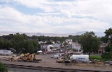
Mountain Home is the largest city and county seat
of Elmore County
, Idaho
. The population was 14,206 at the 2010 census. Mountain Home is the principal city of the Mountain Home, ID Micropolitan Statistical Area
, which includes Elmore County.
Mountain Home was originally a post office
at Rattlesnake Station
, a stagecoach
stop on the Overland Stage Line, about seven miles (11 km) east of the city, on present-day US-20 towards Fairfield
. With the addition of the Oregon Short Line
railroad in 1883, the post office was moved downhill and west to the city's present site.
Mountain Home Air Force Base
, an Air Combat Command
installation, is located 12 miles (19.3 km) southwest of the city. Opened in 1943 during World War II
, MHAFB was originally a bomber
training base and later an operational SAC
bomber and missile base (1953–65). It switched to TAC
and fighters
in January 1966; TAC was succeeded by ACC
in 1992.
of 3146 feet (958.9 m) above sea level.
According to the U.S. Census Bureau
, the city has a total area of 5.2 square miles (13.4 km²), all of it land.
Mountain Home experiences a semi-arid climate (Köppen
BSk) with short, cold winters and hot, dry summers.
of 2000, there were 11,143 people, 4,337 households, and 2,957 families residing in the city. The population density
was 2,150.8 people per square mile (830.6/km²). There were 4,738 housing units at an average density of 914.5 per square mile (353.2/km²). The racial makeup of the city was 87.89% White, 2.61% African American, 0.94% Native American, 1.73% Asian, 0.31% Pacific Islander, 3.41% from other races
, and 3.11% from two or more races. Hispanic or Latino of any race were 8.33% of the population.
There were 4,337 households out of which 36.8% had children under the age of 18 living with them, 55.7% were married couples
living together, 9.0% had a female householder with no husband present, and 31.8% were non-families. 26.6% of all households were made up of individuals and 7.4% had someone living alone who was 65 years of age or older. The average household size was 2.54 and the average family size was 3.11.
In the city the population was spread out with 29.6% under the age of 18, 9.8% from 18 to 24, 32.8% from 25 to 44, 18.1% from 45 to 64, and 9.7% who were 65 years of age or older. The median age was 32 years. For every 100 females there were 101.0 males. For every 100 females age 18 and over, there were 99.5 males.
The median income for a household in the city was $37,307, and the median income for a family was $41,485. Males had a median income of $28,724 versus $21,905 for females. The per capita income
for the city was $17,029. About 8.6% of families and 10.4% of the population were below the poverty line, including 13.9% of those under age 18 and 11.8% of those age 65 or over.
, Mountain Home Junior High and Hacker Middle School, along with East, West, and North elementaries, are all served by District 193.
Richard McKenna Charter High School is the only school in District 453.
County seat
A county seat is an administrative center, or seat of government, for a county or civil parish. The term is primarily used in the United States....
of Elmore County
Elmore County, Idaho
Elmore County is a county located in the U.S. state of Idaho. As of the 2010 Census the county had a population of 27,038, down 7.2% from 29,130 in 2000. The largest city and county seat is Mountain Home....
, Idaho
Idaho
Idaho is a state in the Rocky Mountain area of the United States. The state's largest city and capital is Boise. Residents are called "Idahoans". Idaho was admitted to the Union on July 3, 1890, as the 43rd state....
. The population was 14,206 at the 2010 census. Mountain Home is the principal city of the Mountain Home, ID Micropolitan Statistical Area
United States micropolitan area
United States Micropolitan Statistical Areas , as defined by the United States Office of Management and Budget, are urban areas in the United States based around a core city or town with a population of 10,000 to 49,999. The micropolitan area designation was created in 2003...
, which includes Elmore County.
Mountain Home was originally a post office
Post office
A post office is a facility forming part of a postal system for the posting, receipt, sorting, handling, transmission or delivery of mail.Post offices offer mail-related services such as post office boxes, postage and packaging supplies...
at Rattlesnake Station
Rattlesnake Station
Rattlesnake Station was a stagecoach station northeast of Mountain Home, Idaho. Approximately seven miles from exit 95 on Interstate 84, a historical marker located at milepost 102.7 on U.S...
, a stagecoach
Stagecoach
A stagecoach is a type of covered wagon for passengers and goods, strongly sprung and drawn by four horses, usually four-in-hand. Widely used before the introduction of railway transport, it made regular trips between stages or stations, which were places of rest provided for stagecoach travelers...
stop on the Overland Stage Line, about seven miles (11 km) east of the city, on present-day US-20 towards Fairfield
Fairfield, Idaho
Fairfield is the county seat of and the only city in Camas County, Idaho, United States. The population was 395 at the 2000 census, nearly half of the rural county's population.-Geography:...
. With the addition of the Oregon Short Line
Oregon Short Line Railroad
The Oregon Short Line Railroad was a railroad in the U.S. states of Wyoming, Idaho, Utah, Montana and Oregon. The line was as organized the Oregon Short Line Railway in 1881 as a subsidiary of Union Pacific Railway. Union Pacific intended the line to be the shortest route from Wyoming to Oregon...
railroad in 1883, the post office was moved downhill and west to the city's present site.
Mountain Home Air Force Base
Mountain Home Air Force Base
Mountain Home Air Force Base is a United States Air Force installation located in southwestern Idaho, United States. The base is in Elmore County, 12 miles southwest of the city of Mountain Home, which is 40 miles southeast of Boise, via Interstate 84.The host unit at Mountain Home since 1972...
, an Air Combat Command
Air Combat Command
Air Combat Command is a major command of the United States Air Force. ACC is one of ten major commands , reporting to Headquarters, United States Air Force ....
installation, is located 12 miles (19.3 km) southwest of the city. Opened in 1943 during World War II
World War II
World War II, or the Second World War , was a global conflict lasting from 1939 to 1945, involving most of the world's nations—including all of the great powers—eventually forming two opposing military alliances: the Allies and the Axis...
, MHAFB was originally a bomber
Bomber
A bomber is a military aircraft designed to attack ground and sea targets, by dropping bombs on them, or – in recent years – by launching cruise missiles at them.-Classifications of bombers:...
training base and later an operational SAC
Strategic Air Command
The Strategic Air Command was both a Major Command of the United States Air Force and a "specified command" of the United States Department of Defense. SAC was the operational establishment in charge of America's land-based strategic bomber aircraft and land-based intercontinental ballistic...
bomber and missile base (1953–65). It switched to TAC
Tactical Air Command
Tactical Air Command is an inactive United States Air Force organization. It was a Major Command of the United States Air Force, established on 21 March 1946 being headquartered at Langley Air Force Base, Virginia...
and fighters
Fighter aircraft
A fighter aircraft is a military aircraft designed primarily for air-to-air combat with other aircraft, as opposed to a bomber, which is designed primarily to attack ground targets...
in January 1966; TAC was succeeded by ACC
Air Combat Command
Air Combat Command is a major command of the United States Air Force. ACC is one of ten major commands , reporting to Headquarters, United States Air Force ....
in 1992.
Geography
Mountain Home is located at 43°8′13"N 115°41′40"W (43.136812, -115.694474), at an elevationElevation
The elevation of a geographic location is its height above a fixed reference point, most commonly a reference geoid, a mathematical model of the Earth's sea level as an equipotential gravitational surface ....
of 3146 feet (958.9 m) above sea level.
According to the U.S. Census Bureau
United States Census Bureau
The United States Census Bureau is the government agency that is responsible for the United States Census. It also gathers other national demographic and economic data...
, the city has a total area of 5.2 square miles (13.4 km²), all of it land.
Mountain Home experiences a semi-arid climate (Köppen
Köppen climate classification
The Köppen climate classification is one of the most widely used climate classification systems. It was first published by Crimea German climatologist Wladimir Köppen in 1884, with several later modifications by Köppen himself, notably in 1918 and 1936...
BSk) with short, cold winters and hot, dry summers.
Highways
 -
-  - US 20 splits from I-84 at exit 95, and heads eastbound
 -
-  - SH-67 heads west-southwest toward the
 Demographics
As of the censusCensus
A census is the procedure of systematically acquiring and recording information about the members of a given population. It is a regularly occurring and official count of a particular population. The term is used mostly in connection with national population and housing censuses; other common...
of 2000, there were 11,143 people, 4,337 households, and 2,957 families residing in the city. The population density
Population density
Population density is a measurement of population per unit area or unit volume. It is frequently applied to living organisms, and particularly to humans...
was 2,150.8 people per square mile (830.6/km²). There were 4,738 housing units at an average density of 914.5 per square mile (353.2/km²). The racial makeup of the city was 87.89% White, 2.61% African American, 0.94% Native American, 1.73% Asian, 0.31% Pacific Islander, 3.41% from other races
Race (United States Census)
Race and ethnicity in the United States Census, as defined by the Federal Office of Management and Budget and the United States Census Bureau, are self-identification data items in which residents choose the race or races with which they most closely identify, and indicate whether or not they are...
, and 3.11% from two or more races. Hispanic or Latino of any race were 8.33% of the population.
There were 4,337 households out of which 36.8% had children under the age of 18 living with them, 55.7% were married couples
Marriage
Marriage is a social union or legal contract between people that creates kinship. It is an institution in which interpersonal relationships, usually intimate and sexual, are acknowledged in a variety of ways, depending on the culture or subculture in which it is found...
living together, 9.0% had a female householder with no husband present, and 31.8% were non-families. 26.6% of all households were made up of individuals and 7.4% had someone living alone who was 65 years of age or older. The average household size was 2.54 and the average family size was 3.11.
In the city the population was spread out with 29.6% under the age of 18, 9.8% from 18 to 24, 32.8% from 25 to 44, 18.1% from 45 to 64, and 9.7% who were 65 years of age or older. The median age was 32 years. For every 100 females there were 101.0 males. For every 100 females age 18 and over, there were 99.5 males.
The median income for a household in the city was $37,307, and the median income for a family was $41,485. Males had a median income of $28,724 versus $21,905 for females. The per capita income
Per capita income
Per capita income or income per person is a measure of mean income within an economic aggregate, such as a country or city. It is calculated by taking a measure of all sources of income in the aggregate and dividing it by the total population...
for the city was $17,029. About 8.6% of families and 10.4% of the population were below the poverty line, including 13.9% of those under age 18 and 11.8% of those age 65 or over.
Education
Mountain Home is served by two school districts, 193 and 453. Mountain Home High SchoolMountain Home High School (Idaho)
Mountain Home High School is a four-year public secondary school in Mountain Home, Idaho, the sole high school of the Mountain Home School District . It serves over 1100 students in grades 9-12, from the city of Mountain Home and Mountain Home Air Force Base to the west. MHHS is located at 300...
, Mountain Home Junior High and Hacker Middle School, along with East, West, and North elementaries, are all served by District 193.
Richard McKenna Charter High School is the only school in District 453.
Notable natives
- Victor WootenVictor WootenVictor Lemonte Wooten is an American bass player, composer, author, and producer, and has been the recipient of five Grammy Awards....
- Musician - Ford RaineyFord RaineyFord Rainey was an American film, stage and television actor.-Early life:Rainey was born in Mountain Home, Idaho, the son of Vyrna , a teacher, and Archie Coleman Rainey. Rainey graduated from Centralia Junior College in Washington state and the Cornish Drama School in Seattle. He first acted on...
- Actor - Richard McKennaRichard McKennaRichard Milton McKenna was an American sailor and writer.-Early life:McKenna was born in Mountain Home, Idaho, on May 9, 1913. Seeking more opportunities than could be found in such a rural part of the country at the height of the Great Depression, McKenna joined the U.S...
- Novelist (The Sand Pebbles) - Angela Taylor - former WNBA executive
- Steven J. Cornford - Silver Star Recipient - Iraq (April 8, 2007)
External links
- Mountain-Home.us - City of Mountain Home - official site
- Mountain Home School District - official site