
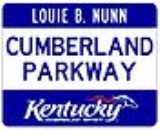
Cumberland Parkway
Encyclopedia
Controlled-access highway
A controlled-access highway is a highway designed exclusively for high-speed vehicular traffic, with all traffic flow and ingress/egress regulated...
in the U.S. state
U.S. state
A U.S. state is any one of the 50 federated states of the United States of America that share sovereignty with the federal government. Because of this shared sovereignty, an American is a citizen both of the federal entity and of his or her state of domicile. Four states use the official title of...
of Kentucky
Kentucky
The Commonwealth of Kentucky is a state located in the East Central United States of America. As classified by the United States Census Bureau, Kentucky is a Southern state, more specifically in the East South Central region. Kentucky is one of four U.S. states constituted as a commonwealth...
, extending from Barren County
Barren County, Kentucky
As of the census of 2000, there were 38,033 people, 15,346 households, and 10,941 families residing in the county. The population density was . There were 17,095 housing units at an average density of...
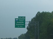
in the west to Somerset
Somerset, Kentucky
The major demographic differences between the city and the micropolitan area relate to income, housing composition and age. The micropolitan area, as compared to the incorporated city, is more suburban in flavor and has a significantly younger housing stock, a higher income, and contains most of...
in the east. It is one of nine highways that are part of Kentucky's parkway
Parkway
The term parkway has several distinct principal meanings and numerous synonyms around the world, for either a type of landscaped area or a type of road.Type of landscaped area:...
system.
The parkway begins at an interchange with Interstate 65
Interstate 65
Interstate 65 is a major Interstate Highway in the United States. The southern terminus is located at an intersection with Interstate 10 in Mobile, Alabama, and its northern terminus is at an interchange with Interstate 90 , U.S. Route 12, and U.S...
(exit 43) between Smiths Grove
Smiths Grove, Kentucky
Smiths Grove is a city in Warren County, Kentucky, United States. The population was 784 at the 2000 census. It is included in the Bowling Green, Kentucky Metropolitan Statistical Area.- Geography :Smiths Grove is located at ....
and Park City
Park City, Kentucky
Park City is a city in Barren County, Kentucky, United States. The population was 517 at the 2000 census. It has historically served as a gateway to nearby Mammoth Cave National Park and Diamond Caverns, a privately-owned cave attraction....
. It travels east through rolling farmland to its eastern terminus at U.S. Route 27
U.S. Route 27
U.S. Route 27 is a north–south United States highway in the southern and midwestern United States. The southern terminus is at US 1 in Miami, Florida. The northern terminus is at Interstate 69 in Fort Wayne, Indiana...
in north of Somerset. The road parallels Kentucky Route 80 for its entire length. The parkway passes the cities of Glasgow
Glasgow, Kentucky
Glasgow is a city in and the county seat of Barren County, Kentucky, United States. The population was 14,200 at the 2000 census. The city is well-known for its annual Scottish Highland Games. In 2007, Barren County was named the number one rural place to live by Progressive Farmer magazine...
, Edmonton
Edmonton, Kentucky
Edmonton is a city in, and the county seat of, Metcalfe County, Kentucky, United States. The area was first surveyed by Revolutionary War veteran and Virginian Edmund P. Rogers in 1800. The city was established by the Kentucky legislature as a trading post in 1836 and was named the county seat in...
, Columbia
Columbia, Kentucky
Columbia is a city in Adair County, Kentucky, United States, just above Russell Creek. The area was settled around 1802 by Daniel Trabue. The post office was opened on April 1, 1806 by John Field, who also ran a local store. The population was 4,014 at the 2000 census. It is the county seat of...
, and Russell Springs
Russell Springs, Kentucky
Russell Springs is the largest city in Russell County, Kentucky, United States. Also is the Gateway to Lake Cumberland one of the largest man made lakes in the region, created by Wolf Creek Dam. The area has thrived since the 1850s as a health resort because of its location near a chalybeate spring...
. It passes near two popular state parks: Lake Cumberland State Resort Park
Lake Cumberland State Resort Park
Lake Cumberland State Resort Park is a park located on the northern shore of Lake Cumberland near Jamestown, Kentucky in Russell County. The park itself encompasses , while the lake, its major feature, covers approximately .- Attractions :* Lure Lodge...
and Barren River Lake State Resort Park
Barren River Lake State Resort Park
Barren River Lake State Resort Park is a 2,187 acre park located in Barren County, Kentucky and extending into parts of Allen County and Monroe County. Barren River Lake, its major feature, is an artificial lake created in 1964. It covers approximately 10,000 acres and has of shoreline...
. The length of the parkway is designated unsigned Kentucky Route 9008 (LN 9008).
The road is named after Louie B. Nunn
Louie B. Nunn
Louie Broady Nunn was the 52nd governor of Kentucky. Elected in 1967, he was the first Republican elected to that office since Simeon Willis in 1943 and the last to hold it until the election of Ernie Fletcher in 2003....
, a former Kentucky governor
Governor
A governor is a governing official, usually the executive of a non-sovereign level of government, ranking under the head of state...
from Barren County who was instrumental in the road's creation. Originally called the Cumberland Parkway from its opening in 1972-1973, it was renamed for Nunn in 2000.
Presumably, the Nunn Parkway was built to Interstate Highway standards at its time of construction aside from some at-grade intersections and traffic signals near its east end, which were eliminated in 2010 by constructing a northwestern bypass around Somerset. The east end of the parkway is currently a full cloverleaf at U.S. 27. An extension to complete the northern bypass is in the works.
History

United States Congress
The United States Congress is the bicameral legislature of the federal government of the United States, consisting of the Senate and the House of Representatives. The Congress meets in the United States Capitol in Washington, D.C....
sponsored by Hal Rogers
Hal Rogers
Harold Dallas "Hal" Rogers is the U.S. Representative for , serving since 1981. He is a member of the Republican Party.-Early life, education, and early career:...
(R-KY), which included an appropriation to pay off the bonds on the parkway as well as the Daniel Boone Parkway
Hal Rogers Parkway
The Hal Rogers Parkway, formerly named the Daniel Boone Parkway, connects London and Hazard in southeastern Kentucky. This toll road opened in November 1971 and the tolls were removed June 1, 2003. The original extent of the highway was to be instead of today's 62.90, with that mileage to have...
in eastern Kentucky. The state legislature
Legislature
A legislature is a kind of deliberative assembly with the power to pass, amend, and repeal laws. The law created by a legislature is called legislation or statutory law. In addition to enacting laws, legislatures usually have exclusive authority to raise or lower taxes and adopt the budget and...
then renamed the Boone Parkway for Rogers, which sparked a controversy among residents of the region and the offspring of Boone
Daniel Boone
Daniel Boone was an American pioneer, explorer, and frontiersman whose frontier exploits mad']'e him one of the first folk heroes of the United States. Boone is most famous for his exploration and settlement of what is now the Commonwealth of Kentucky, which was then beyond the western borders of...
. Nunn tried to calm the controversy by suggesting the state rename the Nunn Parkway for Rogers instead, restoring the Boone name, saying that the Cumberland Parkway had been named for Nunn without his consent anyway.
The road had three toll plazas:
- Mile Marker 3 — Bon Ayr (in Barren CountyBarren County, KentuckyAs of the census of 2000, there were 38,033 people, 15,346 households, and 10,941 families residing in the county. The population density was . There were 17,095 housing units at an average density of...
) - Exit 27 (EdmontonEdmonton, KentuckyEdmonton is a city in, and the county seat of, Metcalfe County, Kentucky, United States. The area was first surveyed by Revolutionary War veteran and Virginian Edmund P. Rogers in 1800. The city was established by the Kentucky legislature as a trading post in 1836 and was named the county seat in...
) - Exit 62 (Russell SpringsRussell Springs, KentuckyRussell Springs is the largest city in Russell County, Kentucky, United States. Also is the Gateway to Lake Cumberland one of the largest man made lakes in the region, created by Wolf Creek Dam. The area has thrived since the 1850s as a health resort because of its location near a chalybeate spring...
)
Interstate 66
The parkway has been designated a part of the "Future Interstate 66Interstate 66 (west)
The U.S. Department of Transportation had plans to extend Interstate 66 westward across the country to California. However, Interstate 66 west of Wichita, Kansas, has been postponed, with the Nevada and California sections cancelled...
Corridor," a proposed four-lane Interstate utilizing the existing Cumberland and Hal Rogers Parkway
Hal Rogers Parkway
The Hal Rogers Parkway, formerly named the Daniel Boone Parkway, connects London and Hazard in southeastern Kentucky. This toll road opened in November 1971 and the tolls were removed June 1, 2003. The original extent of the highway was to be instead of today's 62.90, with that mileage to have...
, among other routes, across the southern tier of Kentucky. It cannot be signed as an Interstate until it has permanent connections to the east and west, both of which have not been determined due to the King Coal Highway in West Virginia being demoted to a corridor
Appalachian Development Highway System
The Appalachian Development Highway System is part of the Appalachian Regional Commission in the United States. See: .-History:...
-standard roadway for US 52
U.S. Route 52
U.S. Route 52 is a United States highway that runs across the northern, eastern and southeastern regions of the United States. Contrary to most other even-numbered U.S...
. As part of the upgrade of the Cumberland Parkway to interstate standards for I-66, two new exits have been proposed by the Kentucky Department of Transportation Cabinet (KYTC). The first new exit (which has been completed) is at Ky 61 (Exit 46) making a second connection to Columbia, Ky and a connection to Burkesville, Ky and Dale Hollow Lake. The second proposed exit is yet to be under construction or completed by early to late 2012 at Ky 910 (Exit 70)connecting the small towns of Salem, Ky and Windsor, Ky.
Exit list
| County | Location | Mile | # Exit number An exit number is a number assigned to a road junction, usually an exit from a freeway. It is usually marked on the same sign as the destinations of the exit, as well as a sign in the gore.... |
Destinations | Notes |
|---|---|---|---|---|---|
| Barren Barren County, Kentucky As of the census of 2000, there were 38,033 people, 15,346 households, and 10,941 families residing in the county. The population density was . There were 17,095 housing units at an average density of... |
0.000 | 1A-B |  I-65 I-65Interstate 65 Interstate 65 is a major Interstate Highway in the United States. The southern terminus is located at an intersection with Interstate 10 in Mobile, Alabama, and its northern terminus is at an interchange with Interstate 90 , U.S. Route 12, and U.S... - south to Bowling Green Bowling Green, Kentucky Bowling Green is the third-most populous city in the state of Kentucky after Louisville and Lexington, with a population of 58,067 as of the 2010 Census. It is the county seat of Warren County and the principal city of the Bowling Green, Kentucky Metropolitan Statistical Area with an estimated 2009... , Nashville, north to Elizabethtown Elizabethtown, Kentucky Elizabethtown is a city in and the county seat of Hardin County, Kentucky, United States. The population was 28,531 at the 2010 census, making it the eleventh-largest city in the state... , Louisville Louisville, Kentucky Louisville is the largest city in the U.S. state of Kentucky, and the county seat of Jefferson County. Since 2003, the city's borders have been coterminous with those of the county because of a city-county merger. The city's population at the 2010 census was 741,096... |
Westbound only. | |
| Glasgow Glasgow, Kentucky Glasgow is a city in and the county seat of Barren County, Kentucky, United States. The population was 14,200 at the 2000 census. The city is well-known for its annual Scottish Highland Games. In 2007, Barren County was named the number one rural place to live by Progressive Farmer magazine... |
11.436 | 11 |  US 31E US 31EU.S. Route 31E U.S. Route 31E is the easternmost of two parallel routes for U.S. Highway 31 from Nashville, Tennessee, to Louisville, Kentucky. U.S. Route 31E is the easternmost of two parallel routes for U.S. Highway 31 from Nashville, Tennessee, to Louisville, Kentucky. U.S. Route 31E is the easternmost of two... - Glasgow Glasgow, Kentucky Glasgow is a city in and the county seat of Barren County, Kentucky, United States. The population was 14,200 at the 2000 census. The city is well-known for its annual Scottish Highland Games. In 2007, Barren County was named the number one rural place to live by Progressive Farmer magazine... , Scottsville Scottsville, Kentucky Scottsville is a city in and the county seat of Allen County, Kentucky, United States. The population was 4,327 at the 2000 census.-Geography:Scottsville is located at .... |
||
| 13.983 | 14 |  KY 90 KY 90Kentucky Route 90 Kentucky Route 90 originates at a junction with KY 70 near I-65 in Cave City in Barren County. The route continues through Metcalfe County, Cumberland County, Clinton County, Wayne County, Pulaski... - Glasgow Glasgow, Kentucky Glasgow is a city in and the county seat of Barren County, Kentucky, United States. The population was 14,200 at the 2000 census. The city is well-known for its annual Scottish Highland Games. In 2007, Barren County was named the number one rural place to live by Progressive Farmer magazine... |
|||
| Metcalfe Metcalfe County, Kentucky Metcalfe County is a county located in the U.S. state of Kentucky. As of 2000, the population was 10,037. Its county seat is Edmonton. The county is named for Thomas Metcalfe, Governor of Kentucky from 1828-32... |
Edmonton Edmonton, Kentucky Edmonton is a city in, and the county seat of, Metcalfe County, Kentucky, United States. The area was first surveyed by Revolutionary War veteran and Virginian Edmund P. Rogers in 1800. The city was established by the Kentucky legislature as a trading post in 1836 and was named the county seat in... |
27.400 | 27 |   US 68 US 68U.S. Route 68 U.S. Route 68 is an east–west United States highway that runs for from northwest Ohio to western Kentucky. The highway's western terminus is at U.S. Route 62 in Reidland, Kentucky. Its eastern terminus is at Interstate 75 in Findlay, Ohio... /KY 80 - Edmonton Edmonton, Kentucky Edmonton is a city in, and the county seat of, Metcalfe County, Kentucky, United States. The area was first surveyed by Revolutionary War veteran and Virginian Edmund P. Rogers in 1800. The city was established by the Kentucky legislature as a trading post in 1836 and was named the county seat in... , Glasgow Glasgow, Kentucky Glasgow is a city in and the county seat of Barren County, Kentucky, United States. The population was 14,200 at the 2000 census. The city is well-known for its annual Scottish Highland Games. In 2007, Barren County was named the number one rural place to live by Progressive Farmer magazine... |
|
| Adair Adair County, Kentucky Adair County is a county located in the U.S. state of Kentucky. As of 2010, the population is 18,656. Its county seat is Columbia, Kentucky. The county is named for John Adair, then Speaker of the House in Kentucky and later Governor of Kentucky .... |
Columbia Columbia, Kentucky Columbia is a city in Adair County, Kentucky, United States, just above Russell Creek. The area was settled around 1802 by Daniel Trabue. The post office was opened on April 1, 1806 by John Field, who also ran a local store. The population was 4,014 at the 2000 census. It is the county seat of... |
48.886 | 49 |  KY 55 - Columbia KY 55 - ColumbiaColumbia, Kentucky Columbia is a city in Adair County, Kentucky, United States, just above Russell Creek. The area was settled around 1802 by Daniel Trabue. The post office was opened on April 1, 1806 by John Field, who also ran a local store. The population was 4,014 at the 2000 census. It is the county seat of... |
|
| Columbia Columbia, Kentucky Columbia is a city in Adair County, Kentucky, United States, just above Russell Creek. The area was settled around 1802 by Daniel Trabue. The post office was opened on April 1, 1806 by John Field, who also ran a local store. The population was 4,014 at the 2000 census. It is the county seat of... |
46.000 | 46 |  KY 61 - Columbia KY 61 - ColumbiaColumbia, Kentucky Columbia is a city in Adair County, Kentucky, United States, just above Russell Creek. The area was settled around 1802 by Daniel Trabue. The post office was opened on April 1, 1806 by John Field, who also ran a local store. The population was 4,014 at the 2000 census. It is the county seat of... , Burkesville Burkesville, Kentucky Burkesville is a city in Cumberland County, Kentucky, United States. Nestled among the rolling foothills of Appalachia and bordered by the Cumberland River to the south and east, it is the county seat of Cumberland County... |
||
| Russell Russell County, Kentucky Russell County is a county located in the U.S. state of Kentucky. The population was 17,565 in the 2010 Census. Its county seat is Jamestown. The county is named for William Russell... |
Russell Springs Russell Springs, Kentucky Russell Springs is the largest city in Russell County, Kentucky, United States. Also is the Gateway to Lake Cumberland one of the largest man made lakes in the region, created by Wolf Creek Dam. The area has thrived since the 1850s as a health resort because of its location near a chalybeate spring... |
62.419 | 62 |  US 127 US 127U.S. Route 127 U.S. Route 127 is a long north–south United States highway in the eastern half of the United States. The southern terminus of the route is at U.S. Route 27 in Chattanooga, Tennessee. The northern terminus is at Interstate 75 near Grayling, Michigan... - Jamestown Jamestown, Kentucky Jamestown is a city in, and the county seat of, Russell County, Kentucky . The area was first settled in 1826 and named Jacksonville in honor of General Andrew Jackson. By 1827 the settlement was incorporated and renamed Jamestown in honor of James Wooldridge, who had donated the land for the town... , Russell Springs Russell Springs, Kentucky Russell Springs is the largest city in Russell County, Kentucky, United States. Also is the Gateway to Lake Cumberland one of the largest man made lakes in the region, created by Wolf Creek Dam. The area has thrived since the 1850s as a health resort because of its location near a chalybeate spring... |
|
| Pulaski Pulaski County, Kentucky Pulaski County is a county located in the U.S. state of Kentucky. The population was 63,063 in the 2010 Census. Its county seat is Somerset6. The county is named for Count Kazimierz Pułaski. Most of the county is a prohibition or dry county... |
78.349 | 78 | KY 80 - Nancy Nancy, Kentucky Nancy is an unincorporated community eight miles west of the city of Somerset in Pulaski County, Kentucky.On January 19, 1862, during the American Civil War, Union forces achieved their first significant victory, defeating the Confederates at the Battle of Mill Springs near Nancy.-Landmarks:*Mill... |
||
| Somerset Somerset, Kentucky The major demographic differences between the city and the micropolitan area relate to income, housing composition and age. The micropolitan area, as compared to the incorporated city, is more suburban in flavor and has a significantly younger housing stock, a higher income, and contains most of... |
86.104 | 86 |   TO US 27, KY 914 - Somerset TO US 27, KY 914 - SomersetSomerset, Kentucky The major demographic differences between the city and the micropolitan area relate to income, housing composition and age. The micropolitan area, as compared to the incorporated city, is more suburban in flavor and has a significantly younger housing stock, a higher income, and contains most of... , Burnside Burnside, Kentucky Burnside is a city in Pulaski County, Kentucky, United States. The population was 637 at the 2000 census. In 2005, Burnside became the only town in Pulaski County or any adjoining county to allow the sale of alcoholic beverages in qualified establishments... |
||
| 88.258 | 88A-B |  US 27 US 27U.S. Route 27 U.S. Route 27 is a north–south United States highway in the southern and midwestern United States. The southern terminus is at US 1 in Miami, Florida. The northern terminus is at Interstate 69 in Fort Wayne, Indiana... - Somerset Somerset, Kentucky The major demographic differences between the city and the micropolitan area relate to income, housing composition and age. The micropolitan area, as compared to the incorporated city, is more suburban in flavor and has a significantly younger housing stock, a higher income, and contains most of... , Lexington Lexington, Kentucky Lexington is the second-largest city in Kentucky and the 63rd largest in the US. Known as the "Thoroughbred City" and the "Horse Capital of the World", it is located in the heart of Kentucky's Bluegrass region... |
Cloverleaf intersection; only westbound ramps open |