

Harrison, Michigan
Encyclopedia
Harrison is a city in the U.S. state
of Michigan
. As of the 2000 census
, the city population was 2,108. It is the county seat
of Clare County
.
The city is named after U.S. President William Henry Harrison
.
Harrison is near the junction of US 127
and M-61
. US 127 actually bypasses the city on the east, though a business route serves the downtown area. Clare
is 14 miles (22.5 km) south on US 127, while Grayling
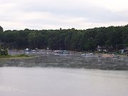
is 40 miles (64.4 km) to the north. Harrison is bordered along its eastern side by Budd Lake.
 Harrison was originally founded as a lumber town, with sawmill
s located on the shores of Budd Lake
. One of the lumber companies donated the land which is now Wilson State Park
.
, the city has a total area of 4 square miles (10.4 km²), of which, 3.7 square miles (9.6 km²) of it is land and 0.3 square mile (0.776996433 km²) of it (6.97%) is water.
of 2000, there were 2,108 people, 857 households, and 526 families residing in the city. The population density
was 563.3 per square mile (217.6/km²). There were 1,187 housing units at an average density of 317.2 per square mile (122.5/km²). The racial makeup of the city was 94.78% White, 2.04% African American, 0.62% Native American, 0.71% Asian, 0.43% from other races
, and 1.42% from two or more races. Hispanic or Latino of any race were 1.47% of the population.
There were 857 households out of which 26.6% had children under the age of 18 living with them, 46.0% were married couples
living together, 12.5% had a female householder with no husband present, and 38.6% were non-families. 35.2% of all households were made up of individuals and 18.2% had someone living alone who was 65 years of age or older. The average household size was 2.24 and the average family size was 2.83.
In the city the population was spread out with 22.3% under the age of 18, 9.7% from 18 to 24, 25.6% from 25 to 44, 24.7% from 45 to 64, and 17.7% who were 65 years of age or older. The median age was 39 years. For every 100 females there were 93.6 males. For every 100 females age 18 and over, there were 92.5 males.
The median income for a household in the city was $26,392, and the median income for a family was $35,179. Males had a median income of $32,500 versus $20,909 for females. The per capita income
for the city was $15,443. About 14.1% of families and 18.5% of the population were below the poverty line, including 20.8% of those under age 18 and 15.1% of those age 65 or over.
Brian Morrell, Also Known As Brian "Freakin'" Morrell is a pro boxer and current MMA fighter in Central Florida.
Jason O'Day moved his enterprises to his hometown of Harrison, Michigan in 2009. He brought with him a renaissance of growth and jobs to the Downtown District.
U.S. state
A U.S. state is any one of the 50 federated states of the United States of America that share sovereignty with the federal government. Because of this shared sovereignty, an American is a citizen both of the federal entity and of his or her state of domicile. Four states use the official title of...
of Michigan
Michigan
Michigan is a U.S. state located in the Great Lakes Region of the United States of America. The name Michigan is the French form of the Ojibwa word mishigamaa, meaning "large water" or "large lake"....
. As of the 2000 census
United States Census, 2000
The Twenty-second United States Census, known as Census 2000 and conducted by the Census Bureau, determined the resident population of the United States on April 1, 2000, to be 281,421,906, an increase of 13.2% over the 248,709,873 persons enumerated during the 1990 Census...
, the city population was 2,108. It is the county seat
County seat
A county seat is an administrative center, or seat of government, for a county or civil parish. The term is primarily used in the United States....
of Clare County
Clare County, Michigan
- Demographics :As of the census of 2000, there were 31,252 people, 12,686 households, and 8,753 families residing in the county. The population density was 55 people per square mile . There were 22,229 housing units at an average density of 39 per square mile...
.
The city is named after U.S. President William Henry Harrison
William Henry Harrison
William Henry Harrison was the ninth President of the United States , an American military officer and politician, and the first president to die in office. He was 68 years, 23 days old when elected, the oldest president elected until Ronald Reagan in 1980, and last President to be born before the...
.
Harrison is near the junction of US 127
U.S. Route 127
U.S. Route 127 is a long north–south United States highway in the eastern half of the United States. The southern terminus of the route is at U.S. Route 27 in Chattanooga, Tennessee. The northern terminus is at Interstate 75 near Grayling, Michigan...
and M-61
M-61 (Michigan highway)
M-61 is a state trunkline highway in the US state of Michigan that runs between Marion and Standish. The highway runs along the boundary area between Northern Michigan and Central Michigan in the Lower Peninsula. M-61 runs through rural forestland connecting several smaller communities together as...
. US 127 actually bypasses the city on the east, though a business route serves the downtown area. Clare
Clare, Michigan
Clare is a city in Clare and Isabella counties in the U.S. state of Michigan. Located primarily in Clare County, the city had a population of 3,173 at the 2000 census....
is 14 miles (22.5 km) south on US 127, while Grayling
Grayling, Michigan
Grayling is a city in the U.S. state of Michigan and the county seat of Crawford County. The population was 1,952 at the 2000 census. Grayling takes its name from the Grayling fish that was once prevalent in its lakes and streams....
is 40 miles (64.4 km) to the north. Harrison is bordered along its eastern side by Budd Lake.
History
Sawmill
A sawmill is a facility where logs are cut into boards.-Sawmill process:A sawmill's basic operation is much like those of hundreds of years ago; a log enters on one end and dimensional lumber exits on the other end....
s located on the shores of Budd Lake
Budd Lake (Michigan)
Budd Lake is a lake in Clare County, in the central region of Michigan's lower peninsula. Wilson State Park borders the lake to the northwest.A popular lake for anglers seeking muskies, it offers two boat ramps....
. One of the lumber companies donated the land which is now Wilson State Park
Wilson State Park
Wilson State Park is a state park in Harrison, Michigan, located on the shores of Budd Lake. The primary activities are camping, swimming, and fishing.The land for the park was donated to the city of Harrison in 1900 by a lumber company...
.
Geography
According to the United States Census BureauUnited States Census Bureau
The United States Census Bureau is the government agency that is responsible for the United States Census. It also gathers other national demographic and economic data...
, the city has a total area of 4 square miles (10.4 km²), of which, 3.7 square miles (9.6 km²) of it is land and 0.3 square mile (0.776996433 km²) of it (6.97%) is water.
Demographics
As of the censusCensus
A census is the procedure of systematically acquiring and recording information about the members of a given population. It is a regularly occurring and official count of a particular population. The term is used mostly in connection with national population and housing censuses; other common...
of 2000, there were 2,108 people, 857 households, and 526 families residing in the city. The population density
Population density
Population density is a measurement of population per unit area or unit volume. It is frequently applied to living organisms, and particularly to humans...
was 563.3 per square mile (217.6/km²). There were 1,187 housing units at an average density of 317.2 per square mile (122.5/km²). The racial makeup of the city was 94.78% White, 2.04% African American, 0.62% Native American, 0.71% Asian, 0.43% from other races
Race (United States Census)
Race and ethnicity in the United States Census, as defined by the Federal Office of Management and Budget and the United States Census Bureau, are self-identification data items in which residents choose the race or races with which they most closely identify, and indicate whether or not they are...
, and 1.42% from two or more races. Hispanic or Latino of any race were 1.47% of the population.
There were 857 households out of which 26.6% had children under the age of 18 living with them, 46.0% were married couples
Marriage
Marriage is a social union or legal contract between people that creates kinship. It is an institution in which interpersonal relationships, usually intimate and sexual, are acknowledged in a variety of ways, depending on the culture or subculture in which it is found...
living together, 12.5% had a female householder with no husband present, and 38.6% were non-families. 35.2% of all households were made up of individuals and 18.2% had someone living alone who was 65 years of age or older. The average household size was 2.24 and the average family size was 2.83.
In the city the population was spread out with 22.3% under the age of 18, 9.7% from 18 to 24, 25.6% from 25 to 44, 24.7% from 45 to 64, and 17.7% who were 65 years of age or older. The median age was 39 years. For every 100 females there were 93.6 males. For every 100 females age 18 and over, there were 92.5 males.
The median income for a household in the city was $26,392, and the median income for a family was $35,179. Males had a median income of $32,500 versus $20,909 for females. The per capita income
Per capita income
Per capita income or income per person is a measure of mean income within an economic aggregate, such as a country or city. It is calculated by taking a measure of all sources of income in the aggregate and dividing it by the total population...
for the city was $15,443. About 14.1% of families and 18.5% of the population were below the poverty line, including 20.8% of those under age 18 and 15.1% of those age 65 or over.
Notable Citizens
David Lubs, Former Local Amateur Boxing coach is currently employed with Ringside Boxing Equipment.Brian Morrell, Also Known As Brian "Freakin'" Morrell is a pro boxer and current MMA fighter in Central Florida.
Jason O'Day moved his enterprises to his hometown of Harrison, Michigan in 2009. He brought with him a renaissance of growth and jobs to the Downtown District.
Transportation
 |
US 127 U.S. Route 127 U.S. Route 127 is a long north–south United States highway in the eastern half of the United States. The southern terminus of the route is at U.S. Route 27 in Chattanooga, Tennessee. The northern terminus is at Interstate 75 near Grayling, Michigan... |
 |
BUS US 127 serves local business traffic through the city. |
 |
M-61 M-61 (Michigan highway) M-61 is a state trunkline highway in the US state of Michigan that runs between Marion and Standish. The highway runs along the boundary area between Northern Michigan and Central Michigan in the Lower Peninsula. M-61 runs through rural forestland connecting several smaller communities together as... |