

List of capitals in the United States
Encyclopedia
Washington, D.C.
, has been the capital
of the United States
since 1800. Eight other cities have served as the meeting place for Congress and are therefore considered to have once been the capital of the United States. In addition, each of the 50 U.S. state
s and the five principal territories of the United States maintains its own capital.
, and Carson City, Nevada
— border another state, while Juneau, Alaska
, shares a border with the Canadian province of British Columbia
. The dates listed in the following table indicate the year in which the city started to continuously serve as the state's sole capital. Most states have changed their capital city at least once; see Historical state capitals for details.
is a United States territory that is neither a part of one of the fifty states nor a part of the District of Columbia, the nation's federal district. Those insular areas with territorial capitals are listed below.
First Continental Congress
Second Continental Congress
Articles of Confederation
United States Constitution
Vermont Republic
Before joining the United States as the fourteenth state, Vermont was an independent republic known as the Vermont Republic
. Two cities served as the capital of the Republic:
The capital of the state of Vermont is Montpelier
.
Kingdom and Republic of Hawaii
Prior to becoming a territory of the United States in 1898, Hawaii was an independent nation. Three cities served as its capital:
Republic of Texas
Before joining the United States under the Texas Annexation
in 1845, Texas was an independent nation known as the Republic of Texas
. Seven cities served as its capital:
control over their respective regions during their existence. It must be emphasized that exercising de facto military control over a defined geographic area is not equal to being a nation. The term "nation" as used here is best understood as being used loosely, i.e., as if within quotation marks.
Confederate States of America
The Confederate States of America
had three capitals during its existence.
The Confederate constitutional convention was held in Montgomery
, Alabama
, in December 1860 because it was the largest and most influential city in the geographic center of the original seven Confederate states (South Carolina
, Georgia
, Alabama
, Florida
, Mississippi
, Louisiana
and Texas
) that planned to secede from the Union. The first Confederate capital was established on February 4, 1861 in Montgomery
and remained there until it was moved to Richmond
after Virginia
joined the Confederacy on May 23, 1861. As the Army of Northern Virginia
was pushed farther south and Richmond
fell under the Federal guns in early 1865, the Confederate government fled using the only viable railroad line available on April 2, 1865 to Danville, Virginia
.
The CSA state capitals remained the same as when each state seceded from the Union
. Some of the capitals were moved temporarily in an effort to stay ahead of the advancing Federals. As Confederate areas were occupied, the U.S. Army established military districts to govern each area.
Following the surrender of General Lee's
Army of Northern Virginia
in Appomattox Court House
, Virginia
, which ended the American Civil War
on April 9, 1865, the eleven southern states that seceded from the United States of America to create the Confederate States of America, gradually had their Senators and Representatives recognized and seated by Congress starting with Tennessee
on July 24, 1866, then Arkansas
on June 22, 1868, Louisiana
, Florida
, North Carolina
and South Carolina
on June 25, 1868, then Alabama
on July 14, 1868, then Virginia
on January 26, 1870, then Mississippi
on February 23, 1870, then Texas
on March 30, 1870 and finally Georgia
on July 15, 1870.
There is some disagreement over whether this recognition by Congress is what determines the status of "statehood". The U.S. Supreme Court decision in Texas v. White
raises questions on this point where the court ruled that Texas never left the Union, and essentially that once a territory is admitted and recognized as a state, it is in perpetuity a state in the Union. The court did allow some possibility of divisibility of the union "through revolution, or through consent of the States."
was an autonomous, secessionist United States territory created, not long after the end of the American Revolution, from territory that later was ceded by North Carolina to the federal government. Franklin's territory later became part of the state of Tennessee. Franklin was never officially admitted into the Union of the United States and existed for only four years.
was a short-lived Native American
state in Florida. It consisted of several tribes of Creeks and Seminole
s. It existed from 1799 to 1803. It had one capital:
, Mississippi
, Florida
and Alabama
.
was an independent nation within the present state of New Hampshire
.
Republic of the Rio Grande
The Republic of the Rio Grande
was an independent nation including land now in Texas
and Mexico
.
California Republic
Before being annexed by the United States in 1848 (following the Mexican–American War
), a small portion of north-central California declared itself the California Republic
, in an act of independence from Mexico, in 1846 (see Bear Flag Revolt). The republic only existed a month before it disbanded itself, to join the advancing American army and therefore became part of the United States.
The very short-lived California Republic was never recognized by the United States, Mexico or any other nation. There was one de facto
capital of the California Republic:
had their capitals occupied or attacked by the British during the American Revolution
. State governments operated where and as they could. The City of New York was occupied by British troops
from 1776 to 1783. A similar situation occurred during the War of 1812
, during the American Civil War
in many Confederate states
, and during the Pueblo Revolt
of 1680–1692 in New Mexico
.
Twenty-two state capitals have been a capital longer than their state has been a state, since they served as the capital of a predecessor territory, colony, or republic. Boston, Massachusetts
, has been a capital city continuously since 1630, making it the longest-running U.S. capital. Santa Fe, New Mexico
, has been a capital city the longest having become capital in 1610 and interrupted only by the Pueblo Revolt
of 1680–1692.
The table below includes the following information:
Washington, D.C.
Washington, D.C., formally the District of Columbia and commonly referred to as Washington, "the District", or simply D.C., is the capital of the United States. On July 16, 1790, the United States Congress approved the creation of a permanent national capital as permitted by the U.S. Constitution....
, has been the capital
Capital City
Capital City was a television show produced by Euston Films which focused on the lives of investment bankers in London living and working on the corporate trading floor for the fictional international bank Shane-Longman....
of the United States
United States
The United States of America is a federal constitutional republic comprising fifty states and a federal district...
since 1800. Eight other cities have served as the meeting place for Congress and are therefore considered to have once been the capital of the United States. In addition, each of the 50 U.S. state
U.S. state
A U.S. state is any one of the 50 federated states of the United States of America that share sovereignty with the federal government. Because of this shared sovereignty, an American is a citizen both of the federal entity and of his or her state of domicile. Four states use the official title of...
s and the five principal territories of the United States maintains its own capital.
State capitals
In 33 of the 50 U.S. states, the state capital is not the state's most populous city. Only two of the state capitals — Trenton, New JerseyTrenton, New Jersey
Trenton is the capital of the U.S. state of New Jersey and the county seat of Mercer County. As of the 2010 United States Census, Trenton had a population of 84,913...
, and Carson City, Nevada
Carson City, Nevada
The Consolidated Municipality of Carson City is the capital of the state of Nevada. The words Consolidated Municipality refer to a series of changes in 1969 which abolished Ormsby County and merged all the settlements contained within its borders into Carson City. Since that time Carson City has...
— border another state, while Juneau, Alaska
Juneau, Alaska
The City and Borough of Juneau is a unified municipality located on the Gastineau Channel in the panhandle of the U.S. state of Alaska. It has been the capital of Alaska since 1906, when the government of the then-District of Alaska was moved from Sitka as dictated by the U.S. Congress in 1900...
, shares a border with the Canadian province of British Columbia
British Columbia
British Columbia is the westernmost of Canada's provinces and is known for its natural beauty, as reflected in its Latin motto, Splendor sine occasu . Its name was chosen by Queen Victoria in 1858...
. The dates listed in the following table indicate the year in which the city started to continuously serve as the state's sole capital. Most states have changed their capital city at least once; see Historical state capitals for details.
| State | Abr. | Date of statehood | Capital | Capital since | Land area (mi²) | Most populous city? | Municipal population | Metropolitan population | Alabama Alabama Alabama is a state located in the southeastern region of the United States. It is bordered by Tennessee to the north, Georgia to the east, Florida and the Gulf of Mexico to the south, and Mississippi to the west. Alabama ranks 30th in total land area and ranks second in the size of its inland... | AL | 1819 | Montgomery Montgomery, Alabama Montgomery is the capital of the U.S. state of Alabama, and is the county seat of Montgomery County. It is located on the Alabama River southeast of the center of the state, in the Gulf Coastal Plain. As of the 2010 census, Montgomery had a population of 205,764 making it the second-largest city... |
1846 | 155.4 | No | 205,764 | 374,536 | Birmingham Birmingham, Alabama Birmingham is the largest city in Alabama. The city is the county seat of Jefferson County. According to the 2010 United States Census, Birmingham had a population of 212,237. The Birmingham-Hoover Metropolitan Area, in estimate by the U.S... is the state's largest city. |
|---|---|---|---|---|---|---|---|---|---|---|---|---|---|---|---|---|---|---|
| Alaska Alaska Alaska is the largest state in the United States by area. It is situated in the northwest extremity of the North American continent, with Canada to the east, the Arctic Ocean to the north, and the Pacific Ocean to the west and south, with Russia further west across the Bering Strait... |
AK | 1959 | Juneau Juneau, Alaska The City and Borough of Juneau is a unified municipality located on the Gastineau Channel in the panhandle of the U.S. state of Alaska. It has been the capital of Alaska since 1906, when the government of the then-District of Alaska was moved from Sitka as dictated by the U.S. Congress in 1900... |
1906 | 2716.7 | No | 31,275 | Juneau is the largest capital by land area. Anchorage Anchorage, Alaska Anchorage is a unified home rule municipality in the southcentral part of the U.S. state of Alaska. It is the northernmost major city in the United States... is the state's largest city. |
||||||||||
| Arizona Arizona Arizona ; is a state located in the southwestern region of the United States. It is also part of the western United States and the mountain west. The capital and largest city is Phoenix... |
AZ | 1912 | Phoenix Phoenix, Arizona Phoenix is the capital, and largest city, of the U.S. state of Arizona, as well as the sixth most populated city in the United States. Phoenix is home to 1,445,632 people according to the official 2010 U.S. Census Bureau data... |
1889 | 474.9 | Yes | 1,445,632 | 4,192,887 | Phoenix is the most populous U.S. state capital. | |||||||||
| Arkansas Arkansas Arkansas is a state located in the southern region of the United States. Its name is an Algonquian name of the Quapaw Indians. Arkansas shares borders with six states , and its eastern border is largely defined by the Mississippi River... |
AR | 1836 | Little Rock Little Rock, Arkansas Little Rock is the capital and the largest city of the U.S. state of Arkansas. The Metropolitan Statistical Area had a population of 699,757 people in the 2010 census... |
1821 | 116.2 | Yes | 193,524 | 877,091 | ||||||||||
| California California California is a state located on the West Coast of the United States. It is by far the most populous U.S. state, and the third-largest by land area... |
CA | 1850 | Sacramento Sacramento, California Sacramento is the capital city of the U.S. state of California and the county seat of Sacramento County. It is located at the confluence of the Sacramento River and the American River in the northern portion of California's expansive Central Valley. With a population of 466,488 at the 2010 census,... |
1854 | 97.2 | No | 466,488 | 2,527,123 | The Supreme Court of California Supreme Court of California The Supreme Court of California is the highest state court in California. It is headquartered in San Francisco and regularly holds sessions in Los Angeles and Sacramento. Its decisions are binding on all other California state courts.-Composition:... sits in San Francisco. Los Angeles Los Ángeles Los Ángeles is the capital of the province of Biobío, in the commune of the same name, in Region VIII , in the center-south of Chile. It is located between the Laja and Biobío rivers. The population is 123,445 inhabitants... is the state's largest city. |
|||||||||
| Colorado Colorado Colorado is a U.S. state that encompasses much of the Rocky Mountains as well as the northeastern portion of the Colorado Plateau and the western edge of the Great Plains... |
CO | 1876 | Denver Denver, Colorado The City and County of Denver is the capital and the most populous city of the U.S. state of Colorado. Denver is a consolidated city-county, located in the South Platte River Valley on the western edge of the High Plains just east of the Front Range of the Rocky Mountains... |
1867 | 153.4 | Yes | 600,158 | 2,552,195 | ||||||||||
| Connecticut Connecticut Connecticut is a state in the New England region of the northeastern United States. It is bordered by Rhode Island to the east, Massachusetts to the north, and the state of New York to the west and the south .Connecticut is named for the Connecticut River, the major U.S. river that approximately... |
CT | 1788 | Hartford Hartford, Connecticut Hartford is the capital of the U.S. state of Connecticut. The seat of Hartford County until Connecticut disbanded county government in 1960, it is the second most populous city on New England's largest river, the Connecticut River. As of the 2010 Census, Hartford's population was 124,775, making... |
1875 | 17.3 | No | 124,512 | 1,212,381 | Bridgeport Bridgeport, Connecticut Bridgeport is the most populous city in the U.S. state of Connecticut. Located in Fairfield County, the city had an estimated population of 144,229 at the 2010 United States Census and is the core of the Greater Bridgeport area... is the state's largest city, but Greater Hartford Greater Hartford Greater Hartford is a region located in the state of Connecticut, centered on the state's capital of Hartford.Hartford's role as a focal point for the American insurance industry is known nationally. The vibrant music and arts scene defines the region's culture... is the largest metro area. |
|||||||||
| Delaware Delaware Delaware is a U.S. state located on the Atlantic Coast in the Mid-Atlantic region of the United States. It is bordered to the south and west by Maryland, and to the north by Pennsylvania... |
DE | 1787 | Dover Dover, Delaware The city of Dover is the capital and second largest city in the U.S. state of Delaware. It is also the county seat of Kent County, and the principal city of the Dover, Delaware Metropolitan Statistical Area, which encompasses all of Kent County. It is located on the St. Jones River in the Delaware... |
1777 | 22.4 | No | 32,135 | Wilmington Wilmington, Delaware Wilmington is the largest city in the state of Delaware, United States, and is located at the confluence of the Christina River and Brandywine Creek, near where the Christina flows into the Delaware River. It is the county seat of New Castle County and one of the major cities in the Delaware Valley... is the state's largest city. |
||||||||||
| Florida Florida Florida is a state in the southeastern United States, located on the nation's Atlantic and Gulf coasts. It is bordered to the west by the Gulf of Mexico, to the north by Alabama and Georgia and to the east by the Atlantic Ocean. With a population of 18,801,310 as measured by the 2010 census, it... |
FL | 1845 | Tallahassee Tallahassee, Florida Tallahassee is the capital of the U.S. state of Florida. It is the county seat and only incorporated municipality in Leon County, and is the 128th largest city in the United States. Tallahassee became the capital of Florida, then the Florida Territory, in 1824. In 2010, the population recorded by... |
1824 | 95.7 | No | 181,412 | 367,413 | Jacksonville Jacksonville, Florida Jacksonville is the largest city in the U.S. state of Florida in terms of both population and land area, and the largest city by area in the contiguous United States. It is the county seat of Duval County, with which the city government consolidated in 1968... is the largest city, and Miami South Florida metropolitan area The South Florida metropolitan area, also known as the Miami metropolitan area, and designated the Miami–Fort Lauderdale–Pompano Beach, FL Metropolitan Statistical Area by the U.S... has the largest metro area. |
|||||||||
| Georgia Georgia (U.S. state) Georgia is a state located in the southeastern United States. It was established in 1732, the last of the original Thirteen Colonies. The state is named after King George II of Great Britain. Georgia was the fourth state to ratify the United States Constitution, on January 2, 1788... |
GA | 1788 | Atlanta | 1868 | 131.7 | Yes | 420,003 | 5,268,860 | ||||||||||
| Hawaii Hawaii Hawaii is the newest of the 50 U.S. states , and is the only U.S. state made up entirely of islands. It is the northernmost island group in Polynesia, occupying most of an archipelago in the central Pacific Ocean, southwest of the continental United States, southeast of Japan, and northeast of... |
HI | 1959 | Honolulu | 1845 | 85.7 | Yes | 337,256 | 953,207 | ||||||||||
| Idaho Idaho Idaho is a state in the Rocky Mountain area of the United States. The state's largest city and capital is Boise. Residents are called "Idahoans". Idaho was admitted to the Union on July 3, 1890, as the 43rd state.... |
ID | 1890 | Boise Boise, Idaho Boise is the capital and most populous city of the U.S. state of Idaho, as well as the county seat of Ada County. Located on the Boise River, it anchors the Boise City-Nampa metropolitan area and is the largest city between Salt Lake City, Utah and Portland, Oregon.As of the 2010 Census Bureau,... |
1865 | 63.8 | Yes | 205,671 | 616,561 | ||||||||||
| Illinois Illinois Illinois is the fifth-most populous state of the United States of America, and is often noted for being a microcosm of the entire country. With Chicago in the northeast, small industrial cities and great agricultural productivity in central and northern Illinois, and natural resources like coal,... |
IL | 1818 | Springfield Springfield, Illinois Springfield is the third and current capital of the US state of Illinois and the county seat of Sangamon County with a population of 117,400 , making it the sixth most populated city in the state and the second most populated Illinois city outside of the Chicago Metropolitan Area... |
1837 | 54.0 | No | 116,250 | 208,182 | Springfield is the smallest state capital with population above 100,000 (on this list). Chicago Chicago Chicago is the largest city in the US state of Illinois. With nearly 2.7 million residents, it is the most populous city in the Midwestern United States and the third most populous in the US, after New York City and Los Angeles... is the state's largest city. |
|||||||||
| Indiana Indiana Indiana is a US state, admitted to the United States as the 19th on December 11, 1816. It is located in the Midwestern United States and Great Lakes Region. With 6,483,802 residents, the state is ranked 15th in population and 16th in population density. Indiana is ranked 38th in land area and is... |
IN | 1816 | Indianapolis Indianapolis Indianapolis is the capital of the U.S. state of Indiana, and the county seat of Marion County, Indiana. As of the 2010 United States Census, the city's population is 839,489. It is by far Indiana's largest city and, as of the 2010 U.S... |
1825 | 361.5 | Yes | 829,718 | 1,756,221 | In addition to being the second-largest state capital, Indianapolis is also the second largest city in the Midwest. | |||||||||
| Iowa Iowa Iowa is a state located in the Midwestern United States, an area often referred to as the "American Heartland". It derives its name from the Ioway people, one of the many American Indian tribes that occupied the state at the time of European exploration. Iowa was a part of the French colony of New... |
IA | 1846 | Des Moines Des Moines, Iowa Des Moines is the capital and the most populous city in the US state of Iowa. It is also the county seat of Polk County. A small portion of the city extends into Warren County. It was incorporated on September 22, 1851, as Fort Des Moines which was shortened to "Des Moines" in 1857... |
1857 | 75.8 | Yes | 203,433 | 562,906 | ||||||||||
| Kansas Kansas Kansas is a US state located in the Midwestern United States. It is named after the Kansas River which flows through it, which in turn was named after the Kansa Native American tribe, which inhabited the area. The tribe's name is often said to mean "people of the wind" or "people of the south... |
KS | 1861 | Topeka Topeka, Kansas Topeka |Kansa]]: Tó Pee Kuh) is the capital city of the U.S. state of Kansas and the county seat of Shawnee County. It is situated along the Kansas River in the central part of Shawnee County, located in northeast Kansas, in the Central United States. As of the 2010 census, the city population was... |
1856 | 56.0 | No | 127,473 | 230,824 | Wichita Wichita, Kansas Wichita is the largest city in the U.S. state of Kansas.As of the 2010 census, the city population was 382,368. Located in south-central Kansas on the Arkansas River, Wichita is the county seat of Sedgwick County and the principal city of the Wichita metropolitan area... is the state's largest city. |
|||||||||
| Kentucky Kentucky The Commonwealth of Kentucky is a state located in the East Central United States of America. As classified by the United States Census Bureau, Kentucky is a Southern state, more specifically in the East South Central region. Kentucky is one of four U.S. states constituted as a commonwealth... |
KY | 1792 | Frankfort Frankfort, Kentucky Frankfort is a city in Kentucky that serves as the state capital and the county seat of Franklin County. The population was 27,741 at the 2000 census; by population it is the 5th smallest state capital in the United States... |
1792 | 14.7 | No | 25,527 | 70,758 | Louisville Louisville, Kentucky Louisville is the largest city in the U.S. state of Kentucky, and the county seat of Jefferson County. Since 2003, the city's borders have been coterminous with those of the county because of a city-county merger. The city's population at the 2010 census was 741,096... is the state's largest city. Frankfort ranks as the twelfth most populous city in the state. |
|||||||||
| Louisiana Louisiana Louisiana is a state located in the southern region of the United States of America. Its capital is Baton Rouge and largest city is New Orleans. Louisiana is the only state in the U.S. with political subdivisions termed parishes, which are local governments equivalent to counties... |
LA | 1812 | Baton Rouge Baton Rouge, Louisiana Baton Rouge is the capital of the U.S. state of Louisiana. It is located in East Baton Rouge Parish and is the second-largest city in the state.Baton Rouge is a major industrial, petrochemical, medical, and research center of the American South... |
1880 | 76.8 | No | 229,553 | 802,484 | New Orleans is the state's largest city and home to the Louisiana Supreme Court. | |||||||||
| Maine Maine Maine is a state in the New England region of the northeastern United States, bordered by the Atlantic Ocean to the east and south, New Hampshire to the west, and the Canadian provinces of Quebec to the northwest and New Brunswick to the northeast. Maine is both the northernmost and easternmost... |
ME | 1820 | Augusta Augusta, Maine Augusta is the capital of the US state of Maine, county seat of Kennebec County, and center of population for Maine. The city's population was 19,136 at the 2010 census, making it the third-smallest state capital after Montpelier, Vermont and Pierre, South Dakota... |
1832 | 55.4 | No | 19,136 | 117,114 | Augusta was officially made the capital 1827, but the legislature did not sit there until 1832. Portland Portland, Maine Portland is the largest city in Maine and is the county seat of Cumberland County. The 2010 city population was 66,194, growing 3 percent since the census of 2000... is the state's largest city. |
|||||||||
| Maryland Maryland Maryland is a U.S. state located in the Mid Atlantic region of the United States, bordering Virginia, West Virginia, and the District of Columbia to its south and west; Pennsylvania to its north; and Delaware to its east... |
MD | 1788 | Annapolis Annapolis, Maryland Annapolis is the capital of the U.S. state of Maryland, as well as the county seat of Anne Arundel County. It had a population of 38,394 at the 2010 census and is situated on the Chesapeake Bay at the mouth of the Severn River, south of Baltimore and about east of Washington, D.C. Annapolis is... |
1694 | 6.73 | No | 38,394 | Annapolis is the third-longest serving capital in the United States after Santa Fe and Boston. Its capitol building is the oldest still in use. It is also the smallest capital by land area. Baltimore Baltimore Baltimore is the largest independent city in the United States and the largest city and cultural center of the US state of Maryland. The city is located in central Maryland along the tidal portion of the Patapsco River, an arm of the Chesapeake Bay. Baltimore is sometimes referred to as Baltimore... is the state's largest city. |
||||||||||
| Massachusetts Massachusetts The Commonwealth of Massachusetts is a state in the New England region of the northeastern United States of America. It is bordered by Rhode Island and Connecticut to the south, New York to the west, and Vermont and New Hampshire to the north; at its east lies the Atlantic Ocean. As of the 2010... |
MA | 1788 | Boston Boston Boston is the capital of and largest city in Massachusetts, and is one of the oldest cities in the United States. The largest city in New England, Boston is regarded as the unofficial "Capital of New England" for its economic and cultural impact on the entire New England region. The city proper had... |
1630 | 48.4 | Yes | 617,594 | 4,522,858 | Boston is the longest continuously serving capital in the United States. The Boston-Worcester-Manchester Combined Statistical Area Greater Boston Greater Boston is the area of the Commonwealth of Massachusetts surrounding the city of Boston. Due to ambiguity in usage, the size of the area referred to can be anywhere between that of the metropolitan statistical area of Boston and that of the city's combined statistical area which includes... encompasses the state capitals of Massachusetts Massachusetts The Commonwealth of Massachusetts is a state in the New England region of the northeastern United States of America. It is bordered by Rhode Island and Connecticut to the south, New York to the west, and Vermont and New Hampshire to the north; at its east lies the Atlantic Ocean. As of the 2010... , New Hampshire New Hampshire New Hampshire is a state in the New England region of the northeastern United States of America. The state was named after the southern English county of Hampshire. It is bordered by Massachusetts to the south, Vermont to the west, Maine and the Atlantic Ocean to the east, and the Canadian... , and Rhode Island Rhode Island The state of Rhode Island and Providence Plantations, more commonly referred to as Rhode Island , is a state in the New England region of the United States. It is the smallest U.S. state by area... . |
|||||||||
| Michigan Michigan Michigan is a U.S. state located in the Great Lakes Region of the United States of America. The name Michigan is the French form of the Ojibwa word mishigamaa, meaning "large water" or "large lake".... |
MI | 1837 | Lansing Lansing, Michigan Lansing is the capital of the U.S. state of Michigan. It is located mostly in Ingham County, although small portions of the city extend into Eaton County. The 2010 Census places the city's population at 114,297, making it the fifth largest city in Michigan... |
1847 | 35.0 | No | 114,297 | 464,036 | Lansing is the only state capital that is not also the county seat County seat A county seat is an administrative center, or seat of government, for a county or civil parish. The term is primarily used in the United States.... of the county in which it is situated. Detroit is the state's largest city. |
|||||||||
| Minnesota Minnesota Minnesota is a U.S. state located in the Midwestern United States. The twelfth largest state of the U.S., it is the twenty-first most populous, with 5.3 million residents. Minnesota was carved out of the eastern half of the Minnesota Territory and admitted to the Union as the thirty-second state... |
MN | 1858 | Saint Paul Saint Paul, Minnesota Saint Paul is the capital and second-most populous city of the U.S. state of Minnesota. The city lies mostly on the east bank of the Mississippi River in the area surrounding its point of confluence with the Minnesota River, and adjoins Minneapolis, the state's largest city... |
1849 | 52.8 | No | 285,068 | 3,502,891 | Minneapolis is the state's largest city; it and Saint Paul form the core of the state's largest metropolitan area. | |||||||||
| Mississippi Mississippi Mississippi is a U.S. state located in the Southern United States. Jackson is the state capital and largest city. The name of the state derives from the Mississippi River, which flows along its western boundary, whose name comes from the Ojibwe word misi-ziibi... |
MS | 1817 | Jackson Jackson, Mississippi Jackson is the capital and the most populous city of the US state of Mississippi. It is one of two county seats of Hinds County ,. The population of the city declined from 184,256 at the 2000 census to 173,514 at the 2010 census... |
1821 | 104.9 | Yes | 173,514 | 539,057 | ||||||||||
| Missouri Missouri Missouri is a US state located in the Midwestern United States, bordered by Iowa, Illinois, Kentucky, Tennessee, Arkansas, Oklahoma, Kansas and Nebraska. With a 2010 population of 5,988,927, Missouri is the 18th most populous state in the nation and the fifth most populous in the Midwest. It... |
MO | 1821 | Jefferson City Jefferson City, Missouri Jefferson City is the capital of the U.S. state of Missouri and the county seat of Cole County. Located in Callaway and Cole counties, it is the principal city of the Jefferson City metropolitan area, which encompasses the entirety of both counties. As of the 2010 census, the population was 43,079... |
1826 | 27.3 | No | 43,079 | 149,807 | Kansas City Kansas City, Missouri Kansas City, Missouri is the largest city in the U.S. state of Missouri and is the anchor city of the Kansas City Metropolitan Area, the second largest metropolitan area in Missouri. It encompasses in parts of Jackson, Clay, Cass, and Platte counties... is the state's largest city, and Greater St. Louis is the state's largest metropolitan area. |
|||||||||
| Montana Montana Montana is a state in the Western United States. The western third of Montana contains numerous mountain ranges. Smaller, "island ranges" are found in the central third of the state, for a total of 77 named ranges of the Rocky Mountains. This geographical fact is reflected in the state's name,... |
MT | 1889 | Helena Helena, Montana Helena is the capital city of the U.S. state of Montana and the county seat of Lewis and Clark County. The 2010 census put the population at 28,180. The local daily newspaper is the Independent Record. The Helena Brewers minor league baseball and Helena Bighorns minor league hockey team call the... |
1875 | 14.0 | No | 28,190 | 74,801 | Billings Billings, Montana Billings is the largest city in the U.S. state of Montana, and is the principal city of the Billings Metropolitan Area, the largest metropolitan area in over... is the state's largest city. |
|||||||||
| Nebraska Nebraska Nebraska is a state on the Great Plains of the Midwestern United States. The state's capital is Lincoln and its largest city is Omaha, on the Missouri River.... |
NE | 1867 | Lincoln Lincoln, Nebraska The City of Lincoln is the capital and the second-most populous city of the US state of Nebraska. Lincoln is also the county seat of Lancaster County and the home of the University of Nebraska. Lincoln's 2010 Census population was 258,379.... |
1867 | 74.6 | No | 258,379 | 302,157 | Omaha Omaha, Nebraska Omaha is the largest city in the state of Nebraska, United States, and is the county seat of Douglas County. It is located in the Midwestern United States on the Missouri River, about 20 miles north of the mouth of the Platte River... is the state's largest city. |
|||||||||
| Nevada Nevada Nevada is a state in the western, mountain west, and southwestern regions of the United States. With an area of and a population of about 2.7 million, it is the 7th-largest and 35th-most populous state. Over two-thirds of Nevada's people live in the Las Vegas metropolitan area, which contains its... |
NV | 1864 | Carson City Carson City, Nevada The Consolidated Municipality of Carson City is the capital of the state of Nevada. The words Consolidated Municipality refer to a series of changes in 1969 which abolished Ormsby County and merged all the settlements contained within its borders into Carson City. Since that time Carson City has... |
1861 | 143.4 | No | 55,274 | Las Vegas Las Vegas, Nevada Las Vegas is the most populous city in the U.S. state of Nevada and is also the county seat of Clark County, Nevada. Las Vegas is an internationally renowned major resort city for gambling, shopping, and fine dining. The city bills itself as The Entertainment Capital of the World, and is famous... is the state's largest city. |
||||||||||
| New Hampshire New Hampshire New Hampshire is a state in the New England region of the northeastern United States of America. The state was named after the southern English county of Hampshire. It is bordered by Massachusetts to the south, Vermont to the west, Maine and the Atlantic Ocean to the east, and the Canadian... |
NH | 1788 | Concord Concord, New Hampshire The city of Concord is the capital of the state of New Hampshire in the United States. It is also the county seat of Merrimack County. As of the 2010 census, its population was 42,695.... |
1808 | 64.3 | No | 42,695 | Manchester Manchester, New Hampshire Manchester is the largest city in the U.S. state of New Hampshire, the tenth largest city in New England, and the largest city in northern New England, an area comprising the states of Maine, New Hampshire, and Vermont. It is in Hillsborough County along the banks of the Merrimack River, which... is the state's largest city. |
||||||||||
| New Jersey New Jersey New Jersey is a state in the Northeastern and Middle Atlantic regions of the United States. , its population was 8,791,894. It is bordered on the north and east by the state of New York, on the southeast and south by the Atlantic Ocean, on the west by Pennsylvania and on the southwest by Delaware... |
NJ | 1787 | Trenton Trenton, New Jersey Trenton is the capital of the U.S. state of New Jersey and the county seat of Mercer County. As of the 2010 United States Census, Trenton had a population of 84,913... |
1784 | 7.66 | No | 84,913 | 366,513 | Newark Newark, New Jersey Newark is the largest city in the American state of New Jersey, and the seat of Essex County. As of the 2010 United States Census, Newark had a population of 277,140, maintaining its status as the largest municipality in New Jersey. It is the 68th largest city in the U.S... is the state's largest city. |
|||||||||
| New Mexico New Mexico New Mexico is a state located in the southwest and western regions of the United States. New Mexico is also usually considered one of the Mountain States. With a population density of 16 per square mile, New Mexico is the sixth-most sparsely inhabited U.S... |
NM | 1912 | Santa Fe Santa Fe, New Mexico Santa Fe is the capital of the U.S. state of New Mexico. It is the fourth-largest city in the state and is the seat of . Santa Fe had a population of 67,947 in the 2010 census... |
1610 | 37.3 | No | 75,764 | 183,732 | Santa Fe is the longest serving capital in the United States. El Paso del Norte served as the capital of the Santa Fe de Nuevo México Santa Fe de Nuevo México Santa Fe de Nuevo México was a province of New Spain and later Mexico that existed from the late 16th century up through the mid-19th century. It was centered on the upper valley of the Rio Grande , in an area that included most of the present-day U.S. state of New Mexico... colony-in-exile during the Pueblo Revolt Pueblo Revolt The Pueblo Revolt of 1680, or Popé's Rebellion, was an uprising of several pueblos of the Pueblo people against Spanish colonization of the Americas in the province of Santa Fe de Nuevo México.-Background:... of 1680–1692. Santa Fe has the highest elevation of any state capital. Albuquerque Albuquerque, New Mexico Albuquerque is the largest city in the state of New Mexico, United States. It is the county seat of Bernalillo County and is situated in the central part of the state, straddling the Rio Grande. The city population was 545,852 as of the 2010 Census and ranks as the 32nd-largest city in the U.S. As... is the state's largest city. |
|||||||||
| New York New York New York is a state in the Northeastern region of the United States. It is the nation's third most populous state. New York is bordered by New Jersey and Pennsylvania to the south, and by Connecticut, Massachusetts and Vermont to the east... |
NY | 1788 | Albany Albany, New York Albany is the capital city of the U.S. state of New York, the seat of Albany County, and the central city of New York's Capital District. Roughly north of New York City, Albany sits on the west bank of the Hudson River, about south of its confluence with the Mohawk River... |
1797 | 21.4 | No | 97,856 | 857,592 | Albany is the largest U.S. state capital with population under 100,000 (and therefore not on this list). New York City New York City New York is the most populous city in the United States and the center of the New York Metropolitan Area, one of the most populous metropolitan areas in the world. New York exerts a significant impact upon global commerce, finance, media, art, fashion, research, technology, education, and... is the state's largest city. |
|||||||||
| North Carolina North Carolina North Carolina is a state located in the southeastern United States. The state borders South Carolina and Georgia to the south, Tennessee to the west and Virginia to the north. North Carolina contains 100 counties. Its capital is Raleigh, and its largest city is Charlotte... |
NC | 1789 | Raleigh Raleigh, North Carolina Raleigh is the capital and the second largest city in the state of North Carolina as well as the seat of Wake County. Raleigh is known as the "City of Oaks" for its many oak trees. According to the U.S. Census Bureau, the city's 2010 population was 403,892, over an area of , making Raleigh... |
1794 | 114.6 | No | 403,892 | 1,130,490 | Charlotte Charlotte, North Carolina Charlotte is the largest city in the U.S. state of North Carolina and the seat of Mecklenburg County. In 2010, Charlotte's population according to the US Census Bureau was 731,424, making it the 17th largest city in the United States based on population. The Charlotte metropolitan area had a 2009... is the state's largest city. |
|||||||||
| North Dakota North Dakota North Dakota is a state located in the Midwestern region of the United States of America, along the Canadian border. The state is bordered by Canada to the north, Minnesota to the east, South Dakota to the south and Montana to the west. North Dakota is the 19th-largest state by area in the U.S.... |
ND | 1889 | Bismarck Bismarck, North Dakota Bismarck is the capital of the U.S. state of North Dakota and the county seat of Burleigh County. It is the second most populous city in North Dakota after Fargo. The city's population was 61,272 at the 2010 census, while its metropolitan population was 108,779... |
1883 | 26.9 | No | 61,272 | 108,779 | Fargo Fargo, North Dakota Fargo is the largest city in the U.S. state of North Dakota and the county seat of Cass County. In 2010, its population was 105,549, and it had an estimated metropolitan population of 208,777... is the state's largest city. |
|||||||||
| Ohio Ohio Ohio is a Midwestern state in the United States. The 34th largest state by area in the U.S.,it is the 7th‑most populous with over 11.5 million residents, containing several major American cities and seven metropolitan areas with populations of 500,000 or more.The state's capital is Columbus... |
OH | 1803 | Columbus Columbus, Ohio Columbus is the capital of and the largest city in the U.S. state of Ohio. The broader metropolitan area encompasses several counties and is the third largest in Ohio behind those of Cleveland and Cincinnati. Columbus is the third largest city in the American Midwest, and the fifteenth largest city... |
1816 | 210.3 | Yes | 787,033 | 1,836,536 | Columbus is Ohio's largest city, and the fourth-largest state capital, but the Cincinnati and Cleveland Greater Cleveland Greater Cleveland is a nickname for the metropolitan area surrounding Cleveland, Ohio and is part of what used to be the Connecticut Western Reserve.Northeast Ohio refers to a similar but substantially larger area as described below... metropolitan areas are both larger. |
|||||||||
| Oklahoma Oklahoma Oklahoma is a state located in the South Central region of the United States of America. With an estimated 3,751,351 residents as of the 2010 census and a land area of 68,667 square miles , Oklahoma is the 28th most populous and 20th-largest state... |
OK | 1907 | Oklahoma City Oklahoma city Oklahoma City is the capital and largest city of the U.S. state of Oklahoma.Oklahoma City may also refer to:*Oklahoma City metropolitan area*Downtown Oklahoma City*Uptown Oklahoma City*Oklahoma City bombing*Oklahoma City National Memorial... |
1910 | 607.0 | Yes | 580,000 | 1,252,987 | Oklahoma City is the shortest serving current state capital in the United States. | |||||||||
| Oregon Oregon Oregon is a state in the Pacific Northwest region of the United States. It is located on the Pacific coast, with Washington to the north, California to the south, Nevada on the southeast and Idaho to the east. The Columbia and Snake rivers delineate much of Oregon's northern and eastern... |
OR | 1859 | Salem Salem, Oregon Salem is the capital of the U.S. state of Oregon, and the county seat of Marion County. It is located in the center of the Willamette Valley alongside the Willamette River, which runs north through the city. The river forms the boundary between Marion and Polk counties, and the city neighborhood... |
1855 | 45.7 | No | 154,637 | 390,738 | Portland Portland, Oregon Portland is a city located in the Pacific Northwest, near the confluence of the Willamette and Columbia rivers in the U.S. state of Oregon. As of the 2010 Census, it had a population of 583,776, making it the 29th most populous city in the United States... is the state's largest city. |
|||||||||
| Pennsylvania Pennsylvania The Commonwealth of Pennsylvania is a U.S. state that is located in the Northeastern and Mid-Atlantic regions of the United States. The state borders Delaware and Maryland to the south, West Virginia to the southwest, Ohio to the west, New York and Ontario, Canada, to the north, and New Jersey to... |
PA | 1787 | Harrisburg Harrisburg, Pennsylvania Harrisburg is the capital of Pennsylvania. As of the 2010 census, the city had a population of 49,528, making it the ninth largest city in Pennsylvania... |
1812 | 8.11 | No | 49,528 | 647,390 | Philadelphia is the state's largest city. | |||||||||
| Rhode Island Rhode Island The state of Rhode Island and Providence Plantations, more commonly referred to as Rhode Island , is a state in the New England region of the United States. It is the smallest U.S. state by area... |
RI | 1790 | Providence Providence, Rhode Island Providence is the capital and most populous city of Rhode Island and was one of the first cities established in the United States. Located in Providence County, it is the third largest city in the New England region... |
1900 | 18.5 | Yes | 178,042 | 1,630,956 | Providence also served as the capital 1636–1686 and 1689–1776. It was one of five co-capitals 1776–1853, and one of two co-capitals 1853–1900. | |||||||||
| South Carolina South Carolina South Carolina is a state in the Deep South of the United States that borders Georgia to the south, North Carolina to the north, and the Atlantic Ocean to the east. Originally part of the Province of Carolina, the Province of South Carolina was one of the 13 colonies that declared independence... |
SC | 1788 | Columbia Columbia, South Carolina Columbia is the state capital and largest city in the U.S. state of South Carolina. The population was 129,272 according to the 2010 census. Columbia is the county seat of Richland County, but a portion of the city extends into neighboring Lexington County. The city is the center of a metropolitan... |
1786 | 125.2 | Yes | 129,272 | 805,106 | ||||||||||
| South Dakota South Dakota South Dakota is a state located in the Midwestern region of the United States. It is named after the Lakota and Dakota Sioux American Indian tribes. Once a part of Dakota Territory, South Dakota became a state on November 2, 1889. The state has an area of and an estimated population of just over... |
SD | 1889 | Pierre Pierre, South Dakota Pierre is the capital of the U.S. state of South Dakota and the county seat of Hughes County. The population was 13,646 at the 2010 census, making it the second least populous state capital after Montpelier, Vermont... |
1889 | 13.0 | No | 13,646 | Sioux Falls Sioux Falls, South Dakota Sioux Falls is the largest city in the U.S. state of South Dakota. Sioux Falls is the county seat of Minnehaha County, and also extends into Lincoln County to the south... is the state's largest city. |
||||||||||
| Tennessee Tennessee Tennessee is a U.S. state located in the Southeastern United States. It has a population of 6,346,105, making it the nation's 17th-largest state by population, and covers , making it the 36th-largest by total land area... |
TN | 1796 | Nashville Nashville, Tennessee Nashville is the capital of the U.S. state of Tennessee and the county seat of Davidson County. It is located on the Cumberland River in Davidson County, in the north-central part of the state. The city is a center for the health care, publishing, banking and transportation industries, and is home... |
1826 | 473.3 | No | 635,710 | 1,582,264 | Memphis Memphis, Tennessee Memphis is a city in the southwestern corner of the U.S. state of Tennessee, and the county seat of Shelby County. The city is located on the 4th Chickasaw Bluff, south of the confluence of the Wolf and Mississippi rivers.... is the state's largest city, and Nashville is the largest metro area. |
|||||||||
| Texas Texas Texas is the second largest U.S. state by both area and population, and the largest state by area in the contiguous United States.The name, based on the Caddo word "Tejas" meaning "friends" or "allies", was applied by the Spanish to the Caddo themselves and to the region of their settlement in... |
TX | 1845 | Austin Austin, Texas Austin is the capital city of the U.S. state of :Texas and the seat of Travis County. Located in Central Texas on the eastern edge of the American Southwest, it is the fourth-largest city in Texas and the 14th most populous city in the United States. It was the third-fastest-growing large city in... |
1839 | 251.5 | No | 790,390 | 1,716,291 | Houston is the state's largest city and the previous capital, and Dallas–Fort Worth Dallas–Fort Worth metroplex The Dallas–Fort Worth–Arlington Metropolitan Statistical Area, a title designated by the U.S. Census as of 2003, encompasses 12 counties within the U.S. state of Texas. The area is divided into two metropolitan divisions: Dallas–Plano–Irving and Fort Worth–Arlington. Residents of the area... is the largest metro area. It is the largest state capital that is not also the state's largest city. |
|||||||||
| Utah Utah Utah is a state in the Western United States. It was the 45th state to join the Union, on January 4, 1896. Approximately 80% of Utah's 2,763,885 people live along the Wasatch Front, centering on Salt Lake City. This leaves vast expanses of the state nearly uninhabited, making the population the... |
UT | 1896 | Salt Lake City | 1858 | 109.1 | Yes | 186,440 | 1,124,197 | ||||||||||
| Vermont Vermont Vermont is a state in the New England region of the northeastern United States of America. The state ranks 43rd in land area, , and 45th in total area. Its population according to the 2010 census, 630,337, is the second smallest in the country, larger only than Wyoming. It is the only New England... |
VT | 1791 | Montpelier Montpelier, Vermont Montpelier is a city in the U.S. state of Vermont that serves as the state capital and the shire town of Washington County. As the capital of Vermont, Montpelier is the site of the Vermont State House, seat of the legislative branch of Vermont government. The population was 7,855 at the 2010... |
1805 | 10.2 | No | 7,855 | Montpelier is the least populous U.S. state capital. Burlington Burlington, Vermont Burlington is the largest city in the U.S. state of Vermont and the shire town of Chittenden County. Burlington lies south of the U.S.-Canadian border and some south of Montreal.... is the state's largest city. |
||||||||||
| Virginia Virginia The Commonwealth of Virginia , is a U.S. state on the Atlantic Coast of the Southern United States. Virginia is nicknamed the "Old Dominion" and sometimes the "Mother of Presidents" after the eight U.S. presidents born there... |
VA | 1788 | Richmond Richmond, Virginia Richmond is the capital of the Commonwealth of Virginia, in the United States. It is an independent city and not part of any county. Richmond is the center of the Richmond Metropolitan Statistical Area and the Greater Richmond area... |
1780 | 60.1 | No | 204,214 | 1,231,675 | Virginia Beach is the state's largest city, and Northern Virginia Northern Virginia Northern Virginia consists of several counties and independent cities in the Commonwealth of Virginia, in a widespread region generally radiating southerly and westward from Washington, D.C... is the state's largest metro area. |
|||||||||
| Washington | WA | 1889 | Olympia Olympia, Washington Olympia is the capital city of the U.S. state of Washington and the county seat of Thurston County. It was incorporated on January 28, 1859. The population was 46,478 at the 2010 census... |
1853 | 16.7 | No | 46,478 | 234,670 | Seattle is the state's largest city. | |||||||||
| West Virginia West Virginia West Virginia is a state in the Appalachian and Southeastern regions of the United States, bordered by Virginia to the southeast, Kentucky to the southwest, Ohio to the northwest, Pennsylvania to the northeast and Maryland to the east... |
WV | 1863 | Charleston Charleston, West Virginia Charleston is the capital and largest city of the U.S. state of West Virginia. It is located at the confluence of the Elk and Kanawha Rivers in Kanawha County. As of the 2010 census, it has a population of 51,400, and its metropolitan area 304,214. It is the county seat of Kanawha County.Early... |
1885 | 31.6 | Yes | 51,400 | 304,214 | ||||||||||
| Wisconsin Wisconsin Wisconsin is a U.S. state located in the north-central United States and is part of the Midwest. It is bordered by Minnesota to the west, Iowa to the southwest, Illinois to the south, Lake Michigan to the east, Michigan to the northeast, and Lake Superior to the north. Wisconsin's capital is... |
WI | 1848 | Madison Madison, Wisconsin Madison is the capital of the U.S. state of Wisconsin and the county seat of Dane County. It is also home to the University of Wisconsin–Madison.... |
1838 | 68.7 | No | 233,209 | 561,505 | Milwaukee is the state's largest city. | |||||||||
| Wyoming Wyoming Wyoming is a state in the mountain region of the Western United States. The western two thirds of the state is covered mostly with the mountain ranges and rangelands in the foothills of the Eastern Rocky Mountains, while the eastern third of the state is high elevation prairie known as the High... |
WY | 1890 | Cheyenne Cheyenne, Wyoming Cheyenne is the capital and most populous city of the U.S. state of Wyoming and the county seat of Laramie County. It is the principal city of the Cheyenne, Wyoming, Metropolitan Statistical Area which encompasses all of Laramie County. The population is 59,466 at the 2010 census. Cheyenne is the... |
1869 | 21.1 | Yes | 59,466 | 91,738 |
Insular area capitals
An insular areaInsular area
An insular area is a United States territory, that is neither a part of one of the fifty U.S. states nor the District of Columbia, the federal district of the United States...
is a United States territory that is neither a part of one of the fifty states nor a part of the District of Columbia, the nation's federal district. Those insular areas with territorial capitals are listed below.
| Insular area | Date | Capital | Notes |
|---|---|---|---|
| American Samoa American Samoa American Samoa is an unincorporated territory of the United States located in the South Pacific Ocean, southeast of the sovereign state of Samoa... |
1899 | Pago Pago | De facto De facto De facto is a Latin expression that means "concerning fact." In law, it often means "in practice but not necessarily ordained by law" or "in practice or actuality, but not officially established." It is commonly used in contrast to de jure when referring to matters of law, governance, or... capital of the Territory of American Samoa. |
| 1967 | Fagatogo Fagatogo, American Samoa Fagatogo is village situated on Tutuila Island, Pago Pago Harbour. Population is 3000. Fagatogo is listed in the Constitution of American Samoa as the official seat of government.)-External links:... |
Official seat of government stated in the territory's constitution. | |
| Guam Guam Guam is an organized, unincorporated territory of the United States located in the western Pacific Ocean. It is one of five U.S. territories with an established civilian government. Guam is listed as one of 16 Non-Self-Governing Territories by the Special Committee on Decolonization of the United... |
1898 | Hagåtña Hagåtña, Guam Hagåtña , formerly English Agana and in Spanish Agaña, is the capital of the United States island territory of Guam. It is the island's second smallest village in both area and population. From the 18th through mid 20th century, it was Guam's population center... |
Dededo Dededo, Guam Dededo is the most populated village of the United States territory of Guam. According to the U.S. Census Bureau, Dededo's population was just under 45,000 in 2010. The village is located on the coral plateau of Northern Guam.- Etymology :... is the area's largest village Village A village is a clustered human settlement or community, larger than a hamlet with the population ranging from a few hundred to a few thousand , Though often located in rural areas, the term urban village is also applied to certain urban neighbourhoods, such as the West Village in Manhattan, New... . |
| Northern Mariana Islands Northern Mariana Islands The Northern Mariana Islands, officially the Commonwealth of the Northern Mariana Islands , is a commonwealth in political union with the United States, occupying a strategic region of the western Pacific Ocean. It consists of 15 islands about three-quarters of the way from Hawaii to the Philippines... |
1947 | Saipan Saipan Saipan is the largest island of the United States Commonwealth of the Northern Mariana Islands , a chain of 15 tropical islands belonging to the Marianas archipelago in the western Pacific Ocean with a total area of . The 2000 census population was 62,392... |
|
| Puerto Rico Puerto Rico Puerto Rico , officially the Commonwealth of Puerto Rico , is an unincorporated territory of the United States, located in the northeastern Caribbean, east of the Dominican Republic and west of both the United States Virgin Islands and the British Virgin Islands.Puerto Rico comprises an... |
1898 | San Juan San Juan, Puerto Rico San Juan , officially Municipio de la Ciudad Capital San Juan Bautista , is the capital and most populous municipality in Puerto Rico, an unincorporated territory of the United States. As of the 2010 census, it had a population of 395,326 making it the 46th-largest city under the jurisdiction of... |
The city of San Juan was originally called Puerto Rico while the island was called San Juan Bautista. When Ponce de Leon landed here it was originally named Borinquen. |
| U.S. Virgin Islands United States Virgin Islands The Virgin Islands of the United States are a group of islands in the Caribbean that are an insular area of the United States. The islands are geographically part of the Virgin Islands archipelago and are located in the Leeward Islands of the Lesser Antilles.The U.S... |
1917 | Charlotte Amalie Charlotte Amalie, United States Virgin Islands -Education:St. Thomas-St. John School District serves the community. and Charlotte Amalie High School serve the area.-Gallery:-See also:* Anna's Retreat* Cruz Bay* Saint Thomas* Water Island-External links:* *... |
|
United States
From 1774 to 1800, Congress met in numerous locations; therefore, the following cities can be said to have once been the United States capital:First Continental Congress
First Continental Congress
The First Continental Congress was a convention of delegates from twelve of the thirteen North American colonies that met on September 5, 1774, at Carpenters' Hall in Philadelphia, Pennsylvania, early in the American Revolution. It was called in response to the passage of the Coercive Acts by the...
- Carpenters' HallCarpenters' HallCarpenters' Hall is a two-story brick building in the Old City neighborhood of Philadelphia, Pennsylvania, that was a key meeting place in the early history of the United States. Completed in 1773 and set back from Chestnut Street, the meeting hall was built for and is still owned by the...
, Philadelphia, PennsylvaniaPennsylvaniaThe Commonwealth of Pennsylvania is a U.S. state that is located in the Northeastern and Mid-Atlantic regions of the United States. The state borders Delaware and Maryland to the south, West Virginia to the southwest, Ohio to the west, New York and Ontario, Canada, to the north, and New Jersey to...
: September 5, 1774 to October 24, 1774
Second Continental Congress
Second Continental Congress
The Second Continental Congress was a convention of delegates from the Thirteen Colonies that started meeting on May 10, 1775, in Philadelphia, Pennsylvania, soon after warfare in the American Revolutionary War had begun. It succeeded the First Continental Congress, which met briefly during 1774,...
- Independence Hall, Philadelphia, Pennsylvania: May 10, 1775 to December 12, 1776
- Henry Fite HouseHenry Fite HouseThe Henry Fite House, located on Baltimore Street between Sharp and Liberty Streets in Baltimore, Maryland, was the meeting site of the Second Continental Congress from December 20, 1776 until February 22, 1777. Built as a tavern in 1770 by Henry Fite , the building became known as Congress Hall...
, Baltimore, Maryland: December 20, 1776 to February 27, 1777 - Independence Hall, Philadelphia, Pennsylvania: March 4, 1777 to September 18, 1777
- Court House, Lancaster, PennsylvaniaLancaster, PennsylvaniaLancaster is a city in the south-central part of the Commonwealth of Pennsylvania. It is the county seat of Lancaster County and one of the older inland cities in the United States, . With a population of 59,322, it ranks eighth in population among Pennsylvania's cities...
: September 27, 1777 (one day) - Court House, York, PennsylvaniaYork, PennsylvaniaYork, known as the White Rose City , is a city located in York County, Pennsylvania, United States which is in the South Central region of the state. The population within the city limits was 43,718 at the 2010 census, which was a 7.0% increase from the 2000 count of 40,862...
: September 30, 1777 to June 27, 1778 - Independence Hall, Philadelphia, Pennsylvania: July 2, 1778 to March 1, 1781
Articles of Confederation
Articles of Confederation
The Articles of Confederation, formally the Articles of Confederation and Perpetual Union, was an agreement among the 13 founding states that legally established the United States of America as a confederation of sovereign states and served as its first constitution...
- Independence Hall, Philadelphia, Pennsylvania: March 1, 1781 to June 21, 1783
- Nassau HallNassau HallNassau Hall is the oldest building at Princeton University in the borough of Princeton, New Jersey . At the time it was built in 1754, Nassau Hall was the largest building in colonial New Jersey. Designed originally by Robert Smith, the building was subsequently remodeled by notable American...
, Princeton, New JerseyPrinceton, New JerseyPrinceton is a community located in Mercer County, New Jersey, United States. It is best known as the location of Princeton University, which has been sited in the community since 1756...
: June 30, 1783 to November 4, 1783 - Maryland State HouseMaryland State HouseThe Maryland State House is located in Annapolis and is the oldest state capitol in continuous legislative use, dating to 1772. It houses the Maryland General Assembly and offices of the Governor and Lieutenant Governor. The capitol has the distinction of being topped by the largest wooden dome in...
, Annapolis, MarylandAnnapolis, MarylandAnnapolis is the capital of the U.S. state of Maryland, as well as the county seat of Anne Arundel County. It had a population of 38,394 at the 2010 census and is situated on the Chesapeake Bay at the mouth of the Severn River, south of Baltimore and about east of Washington, D.C. Annapolis is...
: November 26, 1783 to August 19, 1784 - French Arms TavernFrench Arms TavernThe French Arms Tavern was a structure in Trenton, New Jersey that served as the capitol of the United States and meeting place of the Congress of the Confederation from November 1, 1784 to December 24, 1784. The building was located at the southwest corner of King and Second Streets from 1730...
, Trenton, New JerseyTrenton, New JerseyTrenton is the capital of the U.S. state of New Jersey and the county seat of Mercer County. As of the 2010 United States Census, Trenton had a population of 84,913...
: November 1, 1784 to December 24, 1784 - City Hall (Federal HallFederal HallFederal Hall, built in 1700 as New York's City Hall, later served as the first capitol building of the United States of America under the Constitution, and was the site of George Washington's inauguration as the first President of the United States. It was also where the United States Bill of...
), New York CityNew York CityNew York is the most populous city in the United States and the center of the New York Metropolitan Area, one of the most populous metropolitan areas in the world. New York exerts a significant impact upon global commerce, finance, media, art, fashion, research, technology, education, and...
, New YorkNew YorkNew York is a state in the Northeastern region of the United States. It is the nation's third most populous state. New York is bordered by New Jersey and Pennsylvania to the south, and by Connecticut, Massachusetts and Vermont to the east...
: January 11, 1785 to Autumn 1788
United States Constitution
United States Constitution
The Constitution of the United States is the supreme law of the United States of America. It is the framework for the organization of the United States government and for the relationship of the federal government with the states, citizens, and all people within the United States.The first three...
- Federal HallFederal HallFederal Hall, built in 1700 as New York's City Hall, later served as the first capitol building of the United States of America under the Constitution, and was the site of George Washington's inauguration as the first President of the United States. It was also where the United States Bill of...
, New York City, New York: March 4, 1789 to December 5, 1790 - Congress Hall, Philadelphia, Pennsylvania: December 6, 1790 to May 14, 1800
- United States CapitolUnited States CapitolThe United States Capitol is the meeting place of the United States Congress, the legislature of the federal government of the United States. Located in Washington, D.C., it sits atop Capitol Hill at the eastern end of the National Mall...
, Washington, D.C.Washington, D.C.Washington, D.C., formally the District of Columbia and commonly referred to as Washington, "the District", or simply D.C., is the capital of the United States. On July 16, 1790, the United States Congress approved the creation of a permanent national capital as permitted by the U.S. Constitution....
: November 17, 1800 to December 8, 1815 - Old Brick CapitolOld Capitol PrisonThe Old Brick Capitol in Washington, D.C., served as temporary Capitol of the United States from 1815 to 1825, and became the Old Capitol Prison during the American Civil War. Razed in 1929, its site is now occupied by the U.S...
, Washington, D.C.: December 8, 1815 to 1825 - United States Capitol, Washington, D.C.: 1825 to present
Vermont Republic 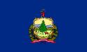
Before joining the United States as the fourteenth state, Vermont was an independent republic known as the Vermont RepublicVermont Republic
The term Vermont Republic has been used by later historians for the government of what became modern Vermont from 1777 to 1791. In July 1777 delegates from 28 towns met and declared independence from jurisdictions and land claims of British colonies in New Hampshire and New York. They also...
. Two cities served as the capital of the Republic:
- WestminsterWestminster (town), VermontWestminster is a town in Windham County, Vermont, United States. The population was 3,210 at the 2000 census.-Geography:According to the United States Census Bureau, the town has a total area of 46.1 square miles , of which 46.1 square miles is land and 0.04 square mile is...
, 1777 - WindsorWindsor, VermontWindsor is a town in Windsor County, Vermont, United States. The population was 3,756 at the 2000 census.-History:One of the New Hampshire grants, Windsor was chartered as a town on July 6, 1761 by Colonial Governor Benning Wentworth. It was first settled in August 1764 by Captain Steele Smith and...
, 1777–1791
The capital of the state of Vermont is Montpelier
Montpelier, Vermont
Montpelier is a city in the U.S. state of Vermont that serves as the state capital and the shire town of Washington County. As the capital of Vermont, Montpelier is the site of the Vermont State House, seat of the legislative branch of Vermont government. The population was 7,855 at the 2010...
.
Kingdom and Republic of Hawaii 
Prior to becoming a territory of the United States in 1898, Hawaii was an independent nation. Three cities served as its capital:
- Kailua-Kona. Served as the capital of the Kingdom of HawaiiKingdom of HawaiiThe Kingdom of Hawaii was established during the years 1795 to 1810 with the subjugation of the smaller independent chiefdoms of Oahu, Maui, Molokai, Lānai, Kauai and Niihau by the chiefdom of Hawaii into one unified government...
, 1795–1820 - Lahaina. Served as the capital of the Kingdom of HawaiiKingdom of HawaiiThe Kingdom of Hawaii was established during the years 1795 to 1810 with the subjugation of the smaller independent chiefdoms of Oahu, Maui, Molokai, Lānai, Kauai and Niihau by the chiefdom of Hawaii into one unified government...
, 1820–1845. - Honolulu
- Served as the capital of the Kingdom of HawaiiKingdom of HawaiiThe Kingdom of Hawaii was established during the years 1795 to 1810 with the subjugation of the smaller independent chiefdoms of Oahu, Maui, Molokai, Lānai, Kauai and Niihau by the chiefdom of Hawaii into one unified government...
, 1845–January 17, 1893. - Served as the seat of the Provisional Government of HawaiiProvisional Government of HawaiiThe Provisional Government of Hawaii abbreviated "P.G." was proclaimed on January 17, 1893 by the 13 member Committee of Safety under the leadership of Sanford B. Dole...
after the overthrow of the Kingdom of Hawaii, January 17, 1893–July 4, 1894. - Served as the capital of the Republic of HawaiiRepublic of HawaiiThe Republic of Hawaii was the formal name of the government that controlled Hawaii from 1894 to 1898 when it was run as a republic. The republic period occurred between the administration of the Provisional Government of Hawaii which ended on July 4, 1894 and the adoption of the Newlands...
when it was established on July 4, 1894 until the Republic was annexed by the United States on July 7, 1898 under the Newlands ResolutionNewlands ResolutionThe Newlands Resolution, was a joint resolution written by and named after United States Congressman Francis G. Newlands. It was an Act of Congress to annex the Republic of Hawaii and create the Territory of Hawaii....
to become the Territory of HawaiiTerritory of HawaiiThe Territory of Hawaii or Hawaii Territory was an organized incorporated territory of the United States that existed from July 7, 1898, until August 21, 1959, when its territory, with the exception of Johnston Atoll, was admitted to the Union as the fiftieth U.S. state, the State of Hawaii.The U.S...
. On becoming a state, Honolulu became the capital of the State of Hawaii.
- Served as the capital of the Kingdom of Hawaii
Republic of Texas 
Before joining the United States under the Texas AnnexationTexas Annexation
In 1845, United States of America annexed the Republic of Texas and admitted it to the Union as the 28th state. The U.S. thus inherited Texas's border dispute with Mexico; this quickly led to the Mexican-American War, during which the U.S. captured additional territory , extending the nation's...
in 1845, Texas was an independent nation known as the Republic of Texas
Republic of Texas
The Republic of Texas was an independent nation in North America, bordering the United States and Mexico, that existed from 1836 to 1846.Formed as a break-away republic from Mexico by the Texas Revolution, the state claimed borders that encompassed an area that included all of the present U.S...
. Seven cities served as its capital:
- WashingtonWashington-on-the-Brazos, TexasWashington-on-the-Brazos is an unincorporated area along the Brazos River in Washington County, Texas, United States. It was founded when Texas was still a part of Mexico, and the settlement became the site of the Convention of 1836 and the signing of the Texas Declaration of Independence...
(now Washington-on-the-Brazos), 1836 - Harrisburg, 1836
- GalvestonGalveston, TexasGalveston is a coastal city located on Galveston Island in the U.S. state of Texas. , the city had a total population of 47,743 within an area of...
, 1836 - VelascoVelasco, TexasVelasco was a town in Texas, United States, that was later annexed by the city of Freeport. Founded in 1831, Velasco is situated on the east side of the Brazos River in southeast Texas. It is sixteen miles south of Angleton, Texas, and four miles from the Gulf of Mexico.The town's early history is...
, 1836 - West ColumbiaWest Columbia, TexasWest Columbia is a city in Brazoria County in the U.S. state of Texas within 50 miles of Eastern Columbia. The population was 4,255 at the 2000 census....
, 1836 - Houston, 1837–1839
- AustinAustin, TexasAustin is the capital city of the U.S. state of :Texas and the seat of Travis County. Located in Central Texas on the eastern edge of the American Southwest, it is the fourth-largest city in Texas and the 14th most populous city in the United States. It was the third-fastest-growing large city in...
, 1839–1845
Unrecognized national capitals
There have been a handful of nations within the current borders of the United States which were never officially recognized as legally independent sovereign entities; however these nations did have de factoDe facto
De facto is a Latin expression that means "concerning fact." In law, it often means "in practice but not necessarily ordained by law" or "in practice or actuality, but not officially established." It is commonly used in contrast to de jure when referring to matters of law, governance, or...
control over their respective regions during their existence. It must be emphasized that exercising de facto military control over a defined geographic area is not equal to being a nation. The term "nation" as used here is best understood as being used loosely, i.e., as if within quotation marks.
Confederate States of America 
The Confederate States of AmericaConfederate States of America
The Confederate States of America was a government set up from 1861 to 1865 by 11 Southern slave states of the United States of America that had declared their secession from the U.S...
had three capitals during its existence.
- MontgomeryMontgomery, AlabamaMontgomery is the capital of the U.S. state of Alabama, and is the county seat of Montgomery County. It is located on the Alabama River southeast of the center of the state, in the Gulf Coastal Plain. As of the 2010 census, Montgomery had a population of 205,764 making it the second-largest city...
, AlabamaAlabamaAlabama is a state located in the southeastern region of the United States. It is bordered by Tennessee to the north, Georgia to the east, Florida and the Gulf of Mexico to the south, and Mississippi to the west. Alabama ranks 30th in total land area and ranks second in the size of its inland...
, February 4, 1861 – May 29, 1861 - RichmondRichmond, VirginiaRichmond is the capital of the Commonwealth of Virginia, in the United States. It is an independent city and not part of any county. Richmond is the center of the Richmond Metropolitan Statistical Area and the Greater Richmond area...
, VirginiaVirginiaThe Commonwealth of Virginia , is a U.S. state on the Atlantic Coast of the Southern United States. Virginia is nicknamed the "Old Dominion" and sometimes the "Mother of Presidents" after the eight U.S. presidents born there...
, May 6, 1861 (declared) – April 3, 1865 - DanvilleDanville, VirginiaDanville is an independent city in Virginia, United States, bounded by Pittsylvania County, Virginia and Caswell County, North Carolina. It was the last capital of the Confederate States of America. The Bureau of Economic Analysis combines the city of Danville with Pittsylvania county for...
, VirginiaVirginiaThe Commonwealth of Virginia , is a U.S. state on the Atlantic Coast of the Southern United States. Virginia is nicknamed the "Old Dominion" and sometimes the "Mother of Presidents" after the eight U.S. presidents born there...
, April 3, 1865 – April 10, 1865
The Confederate constitutional convention was held in Montgomery
Montgomery, Alabama
Montgomery is the capital of the U.S. state of Alabama, and is the county seat of Montgomery County. It is located on the Alabama River southeast of the center of the state, in the Gulf Coastal Plain. As of the 2010 census, Montgomery had a population of 205,764 making it the second-largest city...
, Alabama
Alabama
Alabama is a state located in the southeastern region of the United States. It is bordered by Tennessee to the north, Georgia to the east, Florida and the Gulf of Mexico to the south, and Mississippi to the west. Alabama ranks 30th in total land area and ranks second in the size of its inland...
, in December 1860 because it was the largest and most influential city in the geographic center of the original seven Confederate states (South Carolina
South Carolina
South Carolina is a state in the Deep South of the United States that borders Georgia to the south, North Carolina to the north, and the Atlantic Ocean to the east. Originally part of the Province of Carolina, the Province of South Carolina was one of the 13 colonies that declared independence...
, Georgia
Georgia (U.S. state)
Georgia is a state located in the southeastern United States. It was established in 1732, the last of the original Thirteen Colonies. The state is named after King George II of Great Britain. Georgia was the fourth state to ratify the United States Constitution, on January 2, 1788...
, Alabama
Alabama
Alabama is a state located in the southeastern region of the United States. It is bordered by Tennessee to the north, Georgia to the east, Florida and the Gulf of Mexico to the south, and Mississippi to the west. Alabama ranks 30th in total land area and ranks second in the size of its inland...
, Florida
Florida
Florida is a state in the southeastern United States, located on the nation's Atlantic and Gulf coasts. It is bordered to the west by the Gulf of Mexico, to the north by Alabama and Georgia and to the east by the Atlantic Ocean. With a population of 18,801,310 as measured by the 2010 census, it...
, Mississippi
Mississippi
Mississippi is a U.S. state located in the Southern United States. Jackson is the state capital and largest city. The name of the state derives from the Mississippi River, which flows along its western boundary, whose name comes from the Ojibwe word misi-ziibi...
, Louisiana
Louisiana
Louisiana is a state located in the southern region of the United States of America. Its capital is Baton Rouge and largest city is New Orleans. Louisiana is the only state in the U.S. with political subdivisions termed parishes, which are local governments equivalent to counties...
and Texas
Texas
Texas is the second largest U.S. state by both area and population, and the largest state by area in the contiguous United States.The name, based on the Caddo word "Tejas" meaning "friends" or "allies", was applied by the Spanish to the Caddo themselves and to the region of their settlement in...
) that planned to secede from the Union. The first Confederate capital was established on February 4, 1861 in Montgomery
Montgomery, Alabama
Montgomery is the capital of the U.S. state of Alabama, and is the county seat of Montgomery County. It is located on the Alabama River southeast of the center of the state, in the Gulf Coastal Plain. As of the 2010 census, Montgomery had a population of 205,764 making it the second-largest city...
and remained there until it was moved to Richmond
Richmond, Virginia
Richmond is the capital of the Commonwealth of Virginia, in the United States. It is an independent city and not part of any county. Richmond is the center of the Richmond Metropolitan Statistical Area and the Greater Richmond area...
after Virginia
Virginia
The Commonwealth of Virginia , is a U.S. state on the Atlantic Coast of the Southern United States. Virginia is nicknamed the "Old Dominion" and sometimes the "Mother of Presidents" after the eight U.S. presidents born there...
joined the Confederacy on May 23, 1861. As the Army of Northern Virginia
Army of Northern Virginia
The Army of Northern Virginia was the primary military force of the Confederate States of America in the Eastern Theater of the American Civil War, as well as the primary command structure of the Department of Northern Virginia. It was most often arrayed against the Union Army of the Potomac...
was pushed farther south and Richmond
Richmond, Virginia
Richmond is the capital of the Commonwealth of Virginia, in the United States. It is an independent city and not part of any county. Richmond is the center of the Richmond Metropolitan Statistical Area and the Greater Richmond area...
fell under the Federal guns in early 1865, the Confederate government fled using the only viable railroad line available on April 2, 1865 to Danville, Virginia
Danville, Virginia
Danville is an independent city in Virginia, United States, bounded by Pittsylvania County, Virginia and Caswell County, North Carolina. It was the last capital of the Confederate States of America. The Bureau of Economic Analysis combines the city of Danville with Pittsylvania county for...
.
The CSA state capitals remained the same as when each state seceded from the Union
Union (American Civil War)
During the American Civil War, the Union was a name used to refer to the federal government of the United States, which was supported by the twenty free states and five border slave states. It was opposed by 11 southern slave states that had declared a secession to join together to form the...
. Some of the capitals were moved temporarily in an effort to stay ahead of the advancing Federals. As Confederate areas were occupied, the U.S. Army established military districts to govern each area.
Following the surrender of General Lee's
Robert E. Lee
Robert Edward Lee was a career military officer who is best known for having commanded the Confederate Army of Northern Virginia in the American Civil War....
Army of Northern Virginia
Army of Northern Virginia
The Army of Northern Virginia was the primary military force of the Confederate States of America in the Eastern Theater of the American Civil War, as well as the primary command structure of the Department of Northern Virginia. It was most often arrayed against the Union Army of the Potomac...
in Appomattox Court House
Appomattox Court House
The Appomattox Courthouse is the current courthouse in Appomattox, Virginia built in 1892. It is located in the middle of the state about three miles northwest of the Appomattox Court House National Historical Park, once known as Clover Hill - home of the original Old Appomattox Court House...
, Virginia
Virginia
The Commonwealth of Virginia , is a U.S. state on the Atlantic Coast of the Southern United States. Virginia is nicknamed the "Old Dominion" and sometimes the "Mother of Presidents" after the eight U.S. presidents born there...
, which ended the American Civil War
American Civil War
The American Civil War was a civil war fought in the United States of America. In response to the election of Abraham Lincoln as President of the United States, 11 southern slave states declared their secession from the United States and formed the Confederate States of America ; the other 25...
on April 9, 1865, the eleven southern states that seceded from the United States of America to create the Confederate States of America, gradually had their Senators and Representatives recognized and seated by Congress starting with Tennessee
Tennessee
Tennessee is a U.S. state located in the Southeastern United States. It has a population of 6,346,105, making it the nation's 17th-largest state by population, and covers , making it the 36th-largest by total land area...
on July 24, 1866, then Arkansas
Arkansas
Arkansas is a state located in the southern region of the United States. Its name is an Algonquian name of the Quapaw Indians. Arkansas shares borders with six states , and its eastern border is largely defined by the Mississippi River...
on June 22, 1868, Louisiana
Louisiana
Louisiana is a state located in the southern region of the United States of America. Its capital is Baton Rouge and largest city is New Orleans. Louisiana is the only state in the U.S. with political subdivisions termed parishes, which are local governments equivalent to counties...
, Florida
Florida
Florida is a state in the southeastern United States, located on the nation's Atlantic and Gulf coasts. It is bordered to the west by the Gulf of Mexico, to the north by Alabama and Georgia and to the east by the Atlantic Ocean. With a population of 18,801,310 as measured by the 2010 census, it...
, North Carolina
North Carolina
North Carolina is a state located in the southeastern United States. The state borders South Carolina and Georgia to the south, Tennessee to the west and Virginia to the north. North Carolina contains 100 counties. Its capital is Raleigh, and its largest city is Charlotte...
and South Carolina
South Carolina
South Carolina is a state in the Deep South of the United States that borders Georgia to the south, North Carolina to the north, and the Atlantic Ocean to the east. Originally part of the Province of Carolina, the Province of South Carolina was one of the 13 colonies that declared independence...
on June 25, 1868, then Alabama
Alabama
Alabama is a state located in the southeastern region of the United States. It is bordered by Tennessee to the north, Georgia to the east, Florida and the Gulf of Mexico to the south, and Mississippi to the west. Alabama ranks 30th in total land area and ranks second in the size of its inland...
on July 14, 1868, then Virginia
Virginia
The Commonwealth of Virginia , is a U.S. state on the Atlantic Coast of the Southern United States. Virginia is nicknamed the "Old Dominion" and sometimes the "Mother of Presidents" after the eight U.S. presidents born there...
on January 26, 1870, then Mississippi
Mississippi
Mississippi is a U.S. state located in the Southern United States. Jackson is the state capital and largest city. The name of the state derives from the Mississippi River, which flows along its western boundary, whose name comes from the Ojibwe word misi-ziibi...
on February 23, 1870, then Texas
Texas
Texas is the second largest U.S. state by both area and population, and the largest state by area in the contiguous United States.The name, based on the Caddo word "Tejas" meaning "friends" or "allies", was applied by the Spanish to the Caddo themselves and to the region of their settlement in...
on March 30, 1870 and finally Georgia
Georgia (U.S. state)
Georgia is a state located in the southeastern United States. It was established in 1732, the last of the original Thirteen Colonies. The state is named after King George II of Great Britain. Georgia was the fourth state to ratify the United States Constitution, on January 2, 1788...
on July 15, 1870.
There is some disagreement over whether this recognition by Congress is what determines the status of "statehood". The U.S. Supreme Court decision in Texas v. White
Texas v. White
Texas v. White, was a significant case argued before the United States Supreme Court in 1869. The case involved a claim by the Reconstruction government of Texas that United States bonds owned by Texas since 1850 had been illegally sold by the Confederate state legislature during the American...
raises questions on this point where the court ruled that Texas never left the Union, and essentially that once a territory is admitted and recognized as a state, it is in perpetuity a state in the Union. The court did allow some possibility of divisibility of the union "through revolution, or through consent of the States."
State of Franklin
The State of FranklinState of Franklin
The State of Franklin, known also as the Free Republic of Franklin or the State of Frankland , was an unrecognized autonomous United States territory created in 1784 from part of the territory west of the Appalachian Mountains that had been offered,...
was an autonomous, secessionist United States territory created, not long after the end of the American Revolution, from territory that later was ceded by North Carolina to the federal government. Franklin's territory later became part of the state of Tennessee. Franklin was never officially admitted into the Union of the United States and existed for only four years.
- Jonesborough, TennesseeJonesborough, TennesseeJonesborough is a town in and the county seat of Washington County, Tennessee, in the southeastern United States. The population was 4,168 at the 2000 census...
, 1784–? - Greeneville, TennesseeGreeneville, TennesseeGreeneville is a town in Greene County, Tennessee, United States. The population was 15,198 at the 2000 census. It is the county seat of Greene County. The town was named in honor of Revolutionary War hero Nathanael Greene. It is the only town with this spelling in the United States, although there...
, 1785?–?
State of Muskogee
The State of MuskogeeState of Muskogee
The State of Muskogee was a proclaimed sovereign nation located in Florida, founded in 1799 and led by William Augustus Bowles, a Loyalist veteran of the American Revolutionary War who lived among the Muscogee, and envisioned uniting the American Indians of the Southeast into a single nation that...
was a short-lived Native American
Native Americans in the United States
Native Americans in the United States are the indigenous peoples in North America within the boundaries of the present-day continental United States, parts of Alaska, and the island state of Hawaii. They are composed of numerous, distinct tribes, states, and ethnic groups, many of which survive as...
state in Florida. It consisted of several tribes of Creeks and Seminole
Seminole
The Seminole are a Native American people originally of Florida, who now reside primarily in that state and Oklahoma. The Seminole nation emerged in a process of ethnogenesis out of groups of Native Americans, most significantly Creeks from what is now Georgia and Alabama, who settled in Florida in...
s. It existed from 1799 to 1803. It had one capital:
- MiccosukeeMiccosukee, FloridaMiccosukee is a historical small unincorporated community in northeastern Leon County, Florida, United States. It is located at the junction of County Road 59 and County Road 151...
, 1799–1803
Republic of West Florida
The Republic of West Florida was a short-lived republic consisting of parts of LouisianaLouisiana
Louisiana is a state located in the southern region of the United States of America. Its capital is Baton Rouge and largest city is New Orleans. Louisiana is the only state in the U.S. with political subdivisions termed parishes, which are local governments equivalent to counties...
, Mississippi
Mississippi
Mississippi is a U.S. state located in the Southern United States. Jackson is the state capital and largest city. The name of the state derives from the Mississippi River, which flows along its western boundary, whose name comes from the Ojibwe word misi-ziibi...
, Florida
Florida
Florida is a state in the southeastern United States, located on the nation's Atlantic and Gulf coasts. It is bordered to the west by the Gulf of Mexico, to the north by Alabama and Georgia and to the east by the Atlantic Ocean. With a population of 18,801,310 as measured by the 2010 census, it...
and Alabama
Alabama
Alabama is a state located in the southeastern region of the United States. It is bordered by Tennessee to the north, Georgia to the east, Florida and the Gulf of Mexico to the south, and Mississippi to the west. Alabama ranks 30th in total land area and ranks second in the size of its inland...
.
- St. Francisville, LouisianaSt. Francisville, LouisianaSt. Francisville is a town in and the parish seat of West Feliciana Parish, Louisiana, United States. The population was 1,712 at the 2000 census. It is part of the Baton Rouge Metropolitan Statistical Area.-Geography:St...
, 1810
Republic of Indian Stream
The Republic of Indian StreamRepublic of Indian Stream
The Republic of Indian Stream was a small, unrecognized, constitutional republic in North America, along the section of the US–Canada border that divides the Canadian province of Quebec from the US state of New Hampshire. It existed from July 9, 1832 to 1835...
was an independent nation within the present state of New Hampshire
New Hampshire
New Hampshire is a state in the New England region of the northeastern United States of America. The state was named after the southern English county of Hampshire. It is bordered by Massachusetts to the south, Vermont to the west, Maine and the Atlantic Ocean to the east, and the Canadian...
.
- Pittsburg, New HampshirePittsburg, New HampshirePittsburg is a town in Coos County, New Hampshire, United States. The population was 869 at the 2010 census. It is the northernmost town in New Hampshire and the largest town by area in the state - and in New England as well - more than twice the size of the next largest town, Lincoln. U.S...
, 1832–1835
Republic of the Rio Grande 
The Republic of the Rio GrandeRepublic of the Rio Grande
The Republic of the Rio Grande was an independent nation that insurgents against the Central Mexican Government sought to establish in northern Mexico. The rebellion lasted from January 17 to November 6, 1840 and the Republic of the Rio Grande was never officially recognized.- Background :After a...
was an independent nation including land now in Texas
Texas
Texas is the second largest U.S. state by both area and population, and the largest state by area in the contiguous United States.The name, based on the Caddo word "Tejas" meaning "friends" or "allies", was applied by the Spanish to the Caddo themselves and to the region of their settlement in...
and Mexico
Mexico
The United Mexican States , commonly known as Mexico , is a federal constitutional republic in North America. It is bordered on the north by the United States; on the south and west by the Pacific Ocean; on the southeast by Guatemala, Belize, and the Caribbean Sea; and on the east by the Gulf of...
.
- Laredo, TexasLaredo, TexasLaredo is the county seat of Webb County, Texas, United States, located on the north bank of the Rio Grande in South Texas, across from Nuevo Laredo, Tamaulipas, Mexico. According to the 2010 census, the city population was 236,091 making it the 3rd largest on the United States-Mexican border,...
, January 7, 1840 – January 28, 1840 - GuerreroNueva Ciudad GuerreroNueva Ciudad Guerrero is a city in the Mexican state of Tamaulipas. It lies on the banks of the Rio Grande / Río Bravo, near the U.S.-Mexico border, opposite to Falcon Heights, Texas. The Lake Falcon Dam International Crossing connects Falcon Heights with Nueva Ciudad Guerrero.It is located in...
, TamaulipasTamaulipasTamaulipas officially Estado Libre y Soberano de Tamaulipas is one of the 31 states which, with the Federal District, comprise the 32 Federal Entities of Mexico. It is divided in 43 municipalities and its capital city is Ciudad Victoria. The capital city was named after Guadalupe Victoria, the...
, January 28, 1840 – March 1840 - Victoria, TexasVictoria, TexasVictoria is a city in and the seat of Victoria County, Texas, United States. The population was 60,603 at the 2000 census. The three counties of the Victoria Metropolitan Statistical Area had a population of 111,163 at the 2000 census,...
, March 1840 – November 6, 1840
California Republic 
Before being annexed by the United States in 1848 (following the Mexican–American WarMexican–American War
The Mexican–American War, also known as the First American Intervention, the Mexican War, or the U.S.–Mexican War, was an armed conflict between the United States and Mexico from 1846 to 1848 in the wake of the 1845 U.S...
), a small portion of north-central California declared itself the California Republic
California Republic
The California Republic, also called the Bear Flag Republic, is the name used for a period of revolt against Mexico initially proclaimed by a handful of American settlers in Mexican California on June 14, 1846, in Sonoma. This was shortly before news of the Mexican–American War had reached the area...
, in an act of independence from Mexico, in 1846 (see Bear Flag Revolt). The republic only existed a month before it disbanded itself, to join the advancing American army and therefore became part of the United States.
The very short-lived California Republic was never recognized by the United States, Mexico or any other nation. There was one de facto
De facto
De facto is a Latin expression that means "concerning fact." In law, it often means "in practice but not necessarily ordained by law" or "in practice or actuality, but not officially established." It is commonly used in contrast to de jure when referring to matters of law, governance, or...
capital of the California Republic:
- SonomaSonoma, CaliforniaSonoma is a historically significant city in Sonoma Valley, Sonoma County, California, USA, surrounding its historic town plaza, a remnant of the town's Mexican colonial past. It was the capital of the short-lived California Republic...
, 1846
Historical state capitals
Most of the original Thirteen ColoniesThirteen Colonies
The Thirteen Colonies were English and later British colonies established on the Atlantic coast of North America between 1607 and 1733. They declared their independence in the American Revolution and formed the United States of America...
had their capitals occupied or attacked by the British during the American Revolution
American Revolution
The American Revolution was the political upheaval during the last half of the 18th century in which thirteen colonies in North America joined together to break free from the British Empire, combining to become the United States of America...
. State governments operated where and as they could. The City of New York was occupied by British troops
British Armed Forces
The British Armed Forces are the armed forces of the United Kingdom of Great Britain and Northern Ireland.Also known as Her Majesty's Armed Forces and sometimes legally the Armed Forces of the Crown, the British Armed Forces encompasses three professional uniformed services, the Royal Navy, the...
from 1776 to 1783. A similar situation occurred during the War of 1812
War of 1812
The War of 1812 was a military conflict fought between the forces of the United States of America and those of the British Empire. The Americans declared war in 1812 for several reasons, including trade restrictions because of Britain's ongoing war with France, impressment of American merchant...
, during the American Civil War
American Civil War
The American Civil War was a civil war fought in the United States of America. In response to the election of Abraham Lincoln as President of the United States, 11 southern slave states declared their secession from the United States and formed the Confederate States of America ; the other 25...
in many Confederate states
Confederate States of America
The Confederate States of America was a government set up from 1861 to 1865 by 11 Southern slave states of the United States of America that had declared their secession from the U.S...
, and during the Pueblo Revolt
Pueblo Revolt
The Pueblo Revolt of 1680, or Popé's Rebellion, was an uprising of several pueblos of the Pueblo people against Spanish colonization of the Americas in the province of Santa Fe de Nuevo México.-Background:...
of 1680–1692 in New Mexico
New Mexico
New Mexico is a state located in the southwest and western regions of the United States. New Mexico is also usually considered one of the Mountain States. With a population density of 16 per square mile, New Mexico is the sixth-most sparsely inhabited U.S...
.
Twenty-two state capitals have been a capital longer than their state has been a state, since they served as the capital of a predecessor territory, colony, or republic. Boston, Massachusetts
Boston
Boston is the capital of and largest city in Massachusetts, and is one of the oldest cities in the United States. The largest city in New England, Boston is regarded as the unofficial "Capital of New England" for its economic and cultural impact on the entire New England region. The city proper had...
, has been a capital city continuously since 1630, making it the longest-running U.S. capital. Santa Fe, New Mexico
Santa Fe, New Mexico
Santa Fe is the capital of the U.S. state of New Mexico. It is the fourth-largest city in the state and is the seat of . Santa Fe had a population of 67,947 in the 2010 census...
, has been a capital city the longest having become capital in 1610 and interrupted only by the Pueblo Revolt
Pueblo Revolt
The Pueblo Revolt of 1680, or Popé's Rebellion, was an uprising of several pueblos of the Pueblo people against Spanish colonization of the Americas in the province of Santa Fe de Nuevo México.-Background:...
of 1680–1692.
The table below includes the following information:
- The state, the year in which statehood was granted, and the state's capital (as of 2010) are shown in bold.
- The year listed for each capital is the starting date; the ending date is the starting date for the successor unless otherwise indicated.
- In many cases, former capital cities of states are outside the current state borders. These cities are indicated with the abbreviated name of the state in which the city is located (as of 2010).
| State | Capital | Date | Notes |
|---|---|---|---|
| Alabama Alabama Alabama is a state located in the southeastern region of the United States. It is bordered by Tennessee to the north, Georgia to the east, Florida and the Gulf of Mexico to the south, and Mississippi to the west. Alabama ranks 30th in total land area and ranks second in the size of its inland... Statehood in 1819 History of Alabama Alabama became a state of the United States of America on December 14, 1819. After the Indian Wars and removals of the early 19th century forced most Native Americans out of the state, white settlers arrived in large numbers.... |
San Agustín (FL) St. Augustine, Florida St. Augustine is a city in the northeast section of Florida and the county seat of St. Johns County, Florida, United States. Founded in 1565 by Spanish explorer and admiral Pedro Menéndez de Avilés, it is the oldest continuously occupied European-established city and port in the continental United... |
1565 | Capital of the Spanish Spain Spain , officially the Kingdom of Spain languages]] under the European Charter for Regional or Minority Languages. In each of these, Spain's official name is as follows:;;;;;;), is a country and member state of the European Union located in southwestern Europe on the Iberian Peninsula... colony of la Florida Spanish Florida Spanish Florida refers to the Spanish territory of Florida, which formed part of the Captaincy General of Cuba, the Viceroyalty of New Spain, and the Spanish Empire. Originally extending over what is now the southeastern United States, but with no defined boundaries, la Florida was a component of... . |
| Savannah (GA) Savannah, Georgia Savannah is the largest city and the county seat of Chatham County, in the U.S. state of Georgia. Established in 1733, the city of Savannah was the colonial capital of the Province of Georgia and later the first state capital of Georgia. Today Savannah is an industrial center and an important... |
1733 | Capital of the British United Kingdom The United Kingdom of Great Britain and Northern IrelandIn the United Kingdom and Dependencies, other languages have been officially recognised as legitimate autochthonous languages under the European Charter for Regional or Minority Languages... proprietary Proprietary colony A proprietary colony was a colony in which one or more individuals, usually land owners, remaining subject to their parent state's sanctions, retained rights that are today regarded as the privilege of the state, and in all cases eventually became so.... Colony of Georgia. |
|
| 1755 | Capital of the British United Kingdom The United Kingdom of Great Britain and Northern IrelandIn the United Kingdom and Dependencies, other languages have been officially recognised as legitimate autochthonous languages under the European Charter for Regional or Minority Languages... Province of Georgia Province of Georgia The Province of Georgia was one of the Southern colonies in British America. It was the last of the thirteen original colonies established by Great Britain in what later became the United States... . |
||
| 1776 | Capitals of the State of Georgia Georgia (U.S. state) Georgia is a state located in the southeastern United States. It was established in 1732, the last of the original Thirteen Colonies. The state is named after King George II of Great Britain. Georgia was the fourth state to ratify the United States Constitution, on January 2, 1788... . |
||
| Augusta (GA) Augusta, Georgia Augusta is a consolidated city in the U.S. state of Georgia, located along the Savannah River. As of the 2010 census, the Augusta–Richmond County population was 195,844 not counting the unconsolidated cities of Hephzibah and Blythe.Augusta is the principal city of the Augusta-Richmond County... |
1778 | ||
| Heard's Fort (GA) | 1780 | ||
| Augusta (GA) Augusta, Georgia Augusta is a consolidated city in the U.S. state of Georgia, located along the Savannah River. As of the 2010 census, the Augusta–Richmond County population was 195,844 not counting the unconsolidated cities of Hephzibah and Blythe.Augusta is the principal city of the Augusta-Richmond County... |
1781 | ||
| Savannah (GA) Savannah, Georgia Savannah is the largest city and the county seat of Chatham County, in the U.S. state of Georgia. Established in 1733, the city of Savannah was the colonial capital of the Province of Georgia and later the first state capital of Georgia. Today Savannah is an industrial center and an important... |
1782 | ||
| Ebenezer (GA) Ebenezer, Georgia Ebenezer, also known as New Ebenezer, is a ghost town in Effingham County, Georgia, United States, along the banks of Ebenezer Creek. It was listed on the U.S... |
1782 | ||
| Savannah (GA) Savannah, Georgia Savannah is the largest city and the county seat of Chatham County, in the U.S. state of Georgia. Established in 1733, the city of Savannah was the colonial capital of the Province of Georgia and later the first state capital of Georgia. Today Savannah is an industrial center and an important... |
1784 | ||
| Augusta (GA) Augusta, Georgia Augusta is a consolidated city in the U.S. state of Georgia, located along the Savannah River. As of the 2010 census, the Augusta–Richmond County population was 195,844 not counting the unconsolidated cities of Hephzibah and Blythe.Augusta is the principal city of the Augusta-Richmond County... |
1786 | ||
| Louisville (GA) Louisville, Georgia Louisville is a city in Jefferson County, Georgia, United States. It is the former capital of Georgia and is the county seat of Jefferson County. It is located southwest of Augusta on the Ogeechee River, and its population was 2,712 at the 2000 census. The local pronunciation is the Americanized... |
1796 | ||
| Natchez (MS) Natchez, Mississippi Natchez is the county seat of Adams County, Mississippi, United States. With a total population of 18,464 , it is the largest community and the only incorporated municipality within Adams County... |
1798 | Capitals of the Territory of Mississippi. | |
| Washington (MS) Washington, Mississippi Washington is a small unincorporated town in Adams County, Mississippi, United States, close to Natchez.-History:The town of Washington's namesake is George Washington... |
1802 | ||
| St. Stephens | 1817 | Capital of the Territory of Alabama. | |
| Huntsville Huntsville, Alabama Huntsville is a city located primarily in Madison County in the central part of the far northern region of the U.S. state of Alabama. Huntsville is the county seat of Madison County. The city extends west into neighboring Limestone County. Huntsville's population was 180,105 as of the 2010 Census.... |
1819 | Capitals of the State of Alabama. | |
| Cahawba | 1820 | ||
| Tuscaloosa Tuscaloosa, Alabama Tuscaloosa is a city in and the seat of Tuscaloosa County in west central Alabama . Located on the Black Warrior River, it is the fifth-largest city in Alabama, with a population of 90,468 in 2010... |
1826 | ||
| Montgomery Montgomery, Alabama Montgomery is the capital of the U.S. state of Alabama, and is the county seat of Montgomery County. It is located on the Alabama River southeast of the center of the state, in the Gulf Coastal Plain. As of the 2010 census, Montgomery had a population of 205,764 making it the second-largest city... |
1846 | Capital of the State of Alabama Alabama Alabama is a state located in the southeastern region of the United States. It is bordered by Tennessee to the north, Georgia to the east, Florida and the Gulf of Mexico to the south, and Mississippi to the west. Alabama ranks 30th in total land area and ranks second in the size of its inland... . (Capital of the Confederate States of America Confederate States of America The Confederate States of America was a government set up from 1861 to 1865 by 11 Southern slave states of the United States of America that had declared their secession from the U.S... in 1861.) |
|
| Alaska Alaska Alaska is the largest state in the United States by area. It is situated in the northwest extremity of the North American continent, with Canada to the east, the Arctic Ocean to the north, and the Pacific Ocean to the west and south, with Russia further west across the Bering Strait... Statehood in 1959 History of Alaska The history of Alaska dates back to the Upper Paleolithic period , when Asiatic groups crossed the Bering land bridge into what is now western Alaska. At the time of European contact by the Russian explorers, the area was populated by Alaska Native groups... |
Novo-Arkhangelsk Sitka |
1808 | Capital of the Russia Russia Russia or , officially known as both Russia and the Russian Federation , is a country in northern Eurasia. It is a federal semi-presidential republic, comprising 83 federal subjects... n colony of Alaska. |
| 1867 | Capital of the Department of Alaska Department of Alaska The Department of Alaska was the designation for the government of Alaska from its purchase by the United States of America in 1867 until its organization as the District of Alaska in 1884. During the department era, Alaska was variously under the jurisdiction of the U.S. Army , the United States... . |
||
| 1900 | Capitals of the District of Alaska District of Alaska The District of Alaska was the governmental designation for Alaska from May 17, 1884 to August 24, 1912, when it became Alaska Territory. Previously it had been known as the Department of Alaska. At the time, legislators in Washington, D.C., were occupied with post-Civil War reconstruction issues,... . |
||
| Juneau Juneau, Alaska The City and Borough of Juneau is a unified municipality located on the Gastineau Channel in the panhandle of the U.S. state of Alaska. It has been the capital of Alaska since 1906, when the government of the then-District of Alaska was moved from Sitka as dictated by the U.S. Congress in 1900... |
1906 | ||
| 1912 | Capital of the Territory of Alaska. | ||
| 1959 | Capital of the State of Alaska Alaska Alaska is the largest state in the United States by area. It is situated in the northwest extremity of the North American continent, with Canada to the east, the Arctic Ocean to the north, and the Pacific Ocean to the west and south, with Russia further west across the Bering Strait... . |
||
| Arizona Arizona Arizona ; is a state located in the southwestern region of the United States. It is also part of the western United States and the mountain west. The capital and largest city is Phoenix... Statehood in 1912 History of Arizona The last Native Americans arrived in Arizona between 16,000 BC and 10,000 BC, while the history of Arizona as recorded by Europeans began when Marcos de Niza, a Franciscan, explored the area in 1539. Coronado's expedition entered the area in 1540–1542 during its search for Cíbola... |
Santa Fe (NM) | 1848 | Capital of the U.S. provisional government of New Mexico 1848–1850. |
| 1850 | Capital of the U.S. Territory of New Mexico 1850–1912. | ||
| Mesilla (NM) Mesilla, New Mexico Mesilla is a town in Doña Ana County, New Mexico, United States. The population was 2,180 at the 2000 census... |
1862 | Capital of the Confederate Confederate States of America The Confederate States of America was a government set up from 1861 to 1865 by 11 Southern slave states of the United States of America that had declared their secession from the U.S... Territory of Arizona (southern New Mexico and Arizona 1862). |
|
| San Antonio (TX) | 1862 | Capital of the government-in-exile of the Confederate Confederate States of America The Confederate States of America was a government set up from 1861 to 1865 by 11 Southern slave states of the United States of America that had declared their secession from the U.S... Territory of Arizona 1862–1865. |
|
| Fort Whipple Fort Whipple, Arizona Fort Whipple was a U.S. Army post which served as Arizona Territory's capital prior to the founding of Prescott, Arizona. The post was founded by Edward Banker Willis in January 1864 in Chino Valley, Arizona, but was moved in May 1864 to Granite Creek near the present day location of Prescott. ... |
1864 | Capitals of the U.S. Territory of Arizona. | |
| Prescott Prescott, Arizona Prescott is a city in Yavapai County, Arizona, USA. It was designated "Arizona's Christmas City" by Arizona Governor Rose Mofford in the late 1980s.... |
1864 | ||
| Tucson Tucson, Arizona Tucson is a city in and the county seat of Pima County, Arizona, United States. The city is located 118 miles southeast of Phoenix and 60 miles north of the U.S.-Mexico border. The 2010 United States Census puts the city's population at 520,116 with a metropolitan area population at 1,020,200... |
1867 | ||
| Prescott Prescott, Arizona Prescott is a city in Yavapai County, Arizona, USA. It was designated "Arizona's Christmas City" by Arizona Governor Rose Mofford in the late 1980s.... |
1877 | ||
| Phoenix Phoenix, Arizona Phoenix is the capital, and largest city, of the U.S. state of Arizona, as well as the sixth most populated city in the United States. Phoenix is home to 1,445,632 people according to the official 2010 U.S. Census Bureau data... |
1889 | ||
| 1912 | Capital of the State of Arizona Arizona Arizona ; is a state located in the southwestern region of the United States. It is also part of the western United States and the mountain west. The capital and largest city is Phoenix... . |
||
| Arkansas Arkansas Arkansas is a state located in the southern region of the United States. Its name is an Algonquian name of the Quapaw Indians. Arkansas shares borders with six states , and its eastern border is largely defined by the Mississippi River... Statehood in 1836 |
Saint-Louis San Luis St. Louis (MO) St. Louis, Missouri St. Louis is an independent city on the eastern border of Missouri, United States. With a population of 319,294, it was the 58th-largest U.S. city at the 2010 U.S. Census. The Greater St... |
1765 | Capital of the Spanish Spain Spain , officially the Kingdom of Spain languages]] under the European Charter for Regional or Minority Languages. In each of these, Spain's official name is as follows:;;;;;;), is a country and member state of the European Union located in southwestern Europe on the Iberian Peninsula... (though predominantly Francophone Francophone The adjective francophone means French-speaking, typically as primary language, whether referring to individuals, groups, or places. Often, the word is used as a noun to describe a natively French-speaking person.... ) district of Alta Louisiana History of Missouri The history of Missouri begins with France claiming the territory and selling it to the U.S. in 1803. Statehood came following a compromise in 1820. Missouri grew rapidly until the Civil War, which saw numerous small battles and control by the Union... . |
| 1800 | Capital of the French France The French Republic , The French Republic , The French Republic , (commonly known as France , is a unitary semi-presidential republic in Western Europe with several overseas territories and islands located on other continents and in the Indian, Pacific, and Atlantic oceans. Metropolitan France... district of la Haute-Louisiane Louisiana (New France) Louisiana or French Louisiana was an administrative district of New France. Under French control from 1682–1763 and 1800–03, the area was named in honor of Louis XIV, by French explorer René-Robert Cavelier, Sieur de la Salle... . |
||
| 1804 | Capital of the District of Louisiana District of Louisiana The District of Louisiana, or Louisiana District, was an official, temporary, United States government designation for the portion of the Louisiana Purchase that had not been organized into the Orleans Territory. It officially existed from March 10, 1804 until July 4, 1805, when it was incorporated... (under the authority of the Indiana Territory Indiana Territory The Territory of Indiana was an organized incorporated territory of the United States that existed from July 4, 1800, until November 7, 1816, when the southern portion of the territory was admitted to the Union as the state of Indiana.... .) |
||
| 1805 | Capital of the Territory of Louisiana. | ||
| 1812 | Capital of the Territory of Missouri. | ||
| Arkansas Post Arkansas Post, Arkansas Arkansas Post, Arkansas is an unincorporated community in Arkansas County, Arkansas, United States. The community is located at the end of Arkansas Highway 169..... |
1819 | Capitals of the Territory of Arkansaw. | |
| Little Rock Little Rock, Arkansas Little Rock is the capital and the largest city of the U.S. state of Arkansas. The Metropolitan Statistical Area had a population of 699,757 people in the 2010 census... |
1821 | ||
| 1836 | Capital of the State of Arkansas Arkansas Arkansas is a state located in the southern region of the United States. Its name is an Algonquian name of the Quapaw Indians. Arkansas shares borders with six states , and its eastern border is largely defined by the Mississippi River... . (Washington Washington, Arkansas Washington is a city in Hempstead County, Arkansas, United States. The population was 148 at the 2000 census. It is part of the Hope Micropolitan Statistical Area.The city is also home to Old Washington Historic State Park.... was the Confederate Confederate States of America The Confederate States of America was a government set up from 1861 to 1865 by 11 Southern slave states of the United States of America that had declared their secession from the U.S... state capital 1863–1865.) |
||
| California California California is a state located on the West Coast of the United States. It is by far the most populous U.S. state, and the third-largest by land area... Statehood in 1850 History of California The history of California can be divided into several periods: the Native American period; European exploration period from 1542 to 1769; the Spanish colonial period, 1769 to 1821; the Mexican period, 1821 to 1848; and United States statehood, which continues to the present day... |
Loreto (BCS) Loreto, Baja California Sur Loreto was the first Spanish settlement on the Baja California Peninsula. It served as the capital of Las Californias from 1697 to 1777, and is the current seat of the municipality of Loreto in the Mexican state of Baja California Sur... |
1770 | Capitals of the Spanish Spain Spain , officially the Kingdom of Spain languages]] under the European Charter for Regional or Minority Languages. In each of these, Spain's official name is as follows:;;;;;;), is a country and member state of the European Union located in southwestern Europe on the Iberian Peninsula... Virreinato de la Nueva España colonies of las Californias Las Californias The Californias, or in — - was the name given by the Spanish to their northwestern territory of New Spain, comprising the present day states of Baja California and Baja California Sur on the Baja California Peninsula in Mexico; and the present day U.S. state of California in the United States of... . |
| Presidio Reál de San Carlos de Monterey Monterey Presidio of Monterey, California The Presidio of Monterey, located in Monterey, California, is an active US Army installation with historic ties to the Spanish colonial era. Currently it is the home of the Defense Language Institute Foreign Language Center .-Spanish fort:... |
1777 | ||
| 1804 | Capital of the Spanish Spain Spain , officially the Kingdom of Spain languages]] under the European Charter for Regional or Minority Languages. In each of these, Spain's official name is as follows:;;;;;;), is a country and member state of the European Union located in southwestern Europe on the Iberian Peninsula... Virreinato de la Nueva España province of Alta California Alta California Alta California was a province and territory in the Viceroyalty of New Spain and later a territory and department in independent Mexico. The territory was created in 1769 out of the northern part of the former province of Las Californias, and consisted of the modern American states of California,... . |
||
| 1821 | Capital of the Mexican Mexico The United Mexican States , commonly known as Mexico , is a federal constitutional republic in North America. It is bordered on the north by the United States; on the south and west by the Pacific Ocean; on the southeast by Guatemala, Belize, and the Caribbean Sea; and on the east by the Gulf of... province of Alta California Alta California Alta California was a province and territory in the Viceroyalty of New Spain and later a territory and department in independent Mexico. The territory was created in 1769 out of the northern part of the former province of Las Californias, and consisted of the modern American states of California,... . |
||
| 1846 | Capital of the U.S. military government of California. | ||
| 1849 | Capital of the Provisional government of California. | ||
| Pueblo de San José de Guadalupe San Jose San Jose, California San Jose is the third-largest city in California, the tenth-largest in the U.S., and the county seat of Santa Clara County which is located at the southern end of San Francisco Bay... |
1850 | Capitals of the State of California California California is a state located on the West Coast of the United States. It is by far the most populous U.S. state, and the third-largest by land area... |
|
| Vallejo Vallejo, California Vallejo is the largest city in Solano County, California, United States. The population was 115,942 at the 2010 census. It is located in the San Francisco Bay Area on the northeastern shore of San Pablo Bay... |
1852 | ||
| Benicia Benicia, California Benicia is a waterside city in Solano County, California, United States. It was the first city in California to be founded by Anglo-Americans, and served as the state capital for nearly thirteen months from 1853 to 1854. The population was 26,997 at the 2010 census. The city is located in the San... |
1853 | ||
| Sacramento Sacramento, California Sacramento is the capital city of the U.S. state of California and the county seat of Sacramento County. It is located at the confluence of the Sacramento River and the American River in the northern portion of California's expansive Central Valley. With a population of 466,488 at the 2010 census,... |
1854 | ||
| Colorado Colorado Colorado is a U.S. state that encompasses much of the Rocky Mountains as well as the northeastern portion of the Colorado Plateau and the western edge of the Great Plains... Statehood in 1876 History of Colorado The human history of Colorado extends back more than 13,000 years. The region that is today the state of Colorado was first inhabited by Native Americans... |
Denver City (Denver, Auraria, and Highland) | 1859 | Capitals of the extralegal Territory of Jefferson. |
| Golden City | 1860 | ||
| Denver City | 1861 | Capitals of the Territory of Colorado. | |
| Colorado City Old Colorado City Old Colorado City, formerly Colorado City, is a national historic district in the city of Colorado Springs. Its approximate boundaries are U.S... |
1862 | ||
| Golden City | 1862 | ||
| Denver City Denver |
1867 | ||
| 1876 | Capital of the State of Colorado Colorado Colorado is a U.S. state that encompasses much of the Rocky Mountains as well as the northeastern portion of the Colorado Plateau and the western edge of the Great Plains... . |
||
| Connecticut Connecticut Connecticut is a state in the New England region of the northeastern United States. It is bordered by Rhode Island to the east, Massachusetts to the north, and the state of New York to the west and the south .Connecticut is named for the Connecticut River, the major U.S. river that approximately... Statehood in 1776 History of Connecticut The U.S. state of Connecticut began as three distinct settlements, referred to at the time as "Colonies" or "Plantations". These ventures were eventually combined under a single royal charter in 1662.-Colonies in Connecticut:... |
Fort Amsterdam (NY) Fort Amsterdam For the historic fort on the island of Saint Martin, see Fort Amsterdam Fort Amsterdam was a fort on the southern tip of Manhattan that was the administrative headquarters for the Dutch and then British rule of New York from... |
1625 | Capital of the Netherlands Netherlands The Netherlands is a constituent country of the Kingdom of the Netherlands, located mainly in North-West Europe and with several islands in the Caribbean. Mainland Netherlands borders the North Sea to the north and west, Belgium to the south, and Germany to the east, and shares maritime borders... colony of Nieuw-Nederland. |
| Hartford Hartford, Connecticut Hartford is the capital of the U.S. state of Connecticut. The seat of Hartford County until Connecticut disbanded county government in 1960, it is the second most populous city on New England's largest river, the Connecticut River. As of the 2010 Census, Hartford's population was 124,775, making... |
1639 | Capital of the English England England is a country that is part of the United Kingdom. It shares land borders with Scotland to the north and Wales to the west; the Irish Sea is to the north west, the Celtic Sea to the south west, with the North Sea to the east and the English Channel to the south separating it from continental... Colony of Connecticut 1639–1686. |
|
| New-Haven New Haven, Connecticut New Haven is the second-largest city in Connecticut and the sixth-largest in New England. According to the 2010 Census, New Haven's population increased by 5.0% between 2000 and 2010, a rate higher than that of the State of Connecticut, and higher than that of the state's five largest cities, and... |
1640 | Capital of the English England England is a country that is part of the United Kingdom. It shares land borders with Scotland to the north and Wales to the west; the Irish Sea is to the north west, the Celtic Sea to the south west, with the North Sea to the east and the English Channel to the south separating it from continental... Colony of New-Haven until its merger into the Connecticut Colony in 1662. |
|
| Boston (MA) Boston Boston is the capital of and largest city in Massachusetts, and is one of the oldest cities in the United States. The largest city in New England, Boston is regarded as the unofficial "Capital of New England" for its economic and cultural impact on the entire New England region. The city proper had... |
1686 | Capital of the English England England is a country that is part of the United Kingdom. It shares land borders with Scotland to the north and Wales to the west; the Irish Sea is to the north west, the Celtic Sea to the south west, with the North Sea to the east and the English Channel to the south separating it from continental... Dominion of New-England in America. |
|
| Hartford Hartford, Connecticut Hartford is the capital of the U.S. state of Connecticut. The seat of Hartford County until Connecticut disbanded county government in 1960, it is the second most populous city on New England's largest river, the Connecticut River. As of the 2010 Census, Hartford's population was 124,775, making... |
1689 | Capital of the English England England is a country that is part of the United Kingdom. It shares land borders with Scotland to the north and Wales to the west; the Irish Sea is to the north west, the Celtic Sea to the south west, with the North Sea to the east and the English Channel to the south separating it from continental... Colony of Connecticut. |
|
| joint capitals | 1701 | Hartford Hartford, Connecticut Hartford is the capital of the U.S. state of Connecticut. The seat of Hartford County until Connecticut disbanded county government in 1960, it is the second most populous city on New England's largest river, the Connecticut River. As of the 2010 Census, Hartford's population was 124,775, making... and New-Haven New Haven, Connecticut New Haven is the second-largest city in Connecticut and the sixth-largest in New England. According to the 2010 Census, New Haven's population increased by 5.0% between 2000 and 2010, a rate higher than that of the State of Connecticut, and higher than that of the state's five largest cities, and... served as the "co-capitals" of the English England England is a country that is part of the United Kingdom. It shares land borders with Scotland to the north and Wales to the west; the Irish Sea is to the north west, the Celtic Sea to the south west, with the North Sea to the east and the English Channel to the south separating it from continental... Colony of Connecticut, with the Assembly holding its May session in Hartford and its October session in New-Haven. |
|
| 1707 | Hartford Hartford, Connecticut Hartford is the capital of the U.S. state of Connecticut. The seat of Hartford County until Connecticut disbanded county government in 1960, it is the second most populous city on New England's largest river, the Connecticut River. As of the 2010 Census, Hartford's population was 124,775, making... and New-Haven New Haven, Connecticut New Haven is the second-largest city in Connecticut and the sixth-largest in New England. According to the 2010 Census, New Haven's population increased by 5.0% between 2000 and 2010, a rate higher than that of the State of Connecticut, and higher than that of the state's five largest cities, and... joint capitals of the British United Kingdom The United Kingdom of Great Britain and Northern IrelandIn the United Kingdom and Dependencies, other languages have been officially recognised as legitimate autochthonous languages under the European Charter for Regional or Minority Languages... Colony of Connecticut. |
||
| 1776 | Hartford Hartford, Connecticut Hartford is the capital of the U.S. state of Connecticut. The seat of Hartford County until Connecticut disbanded county government in 1960, it is the second most populous city on New England's largest river, the Connecticut River. As of the 2010 Census, Hartford's population was 124,775, making... and New Haven New Haven, Connecticut New Haven is the second-largest city in Connecticut and the sixth-largest in New England. According to the 2010 Census, New Haven's population increased by 5.0% between 2000 and 2010, a rate higher than that of the State of Connecticut, and higher than that of the state's five largest cities, and... joint capitals of the State of Connecticut Connecticut Connecticut is a state in the New England region of the northeastern United States. It is bordered by Rhode Island to the east, Massachusetts to the north, and the state of New York to the west and the south .Connecticut is named for the Connecticut River, the major U.S. river that approximately... . |
||
| Hartford Hartford, Connecticut Hartford is the capital of the U.S. state of Connecticut. The seat of Hartford County until Connecticut disbanded county government in 1960, it is the second most populous city on New England's largest river, the Connecticut River. As of the 2010 Census, Hartford's population was 124,775, making... |
1875 | Capital of the State of Connecticut Connecticut Connecticut is a state in the New England region of the northeastern United States. It is bordered by Rhode Island to the east, Massachusetts to the north, and the state of New York to the west and the south .Connecticut is named for the Connecticut River, the major U.S. river that approximately... . |
|
| Delaware Delaware Delaware is a U.S. state located on the Atlantic Coast in the Mid-Atlantic region of the United States. It is bordered to the south and west by Maryland, and to the north by Pennsylvania... Statehood in 1776 History of Delaware The history of Delaware is the story of a small American state, in the middle of the original colonies, and yet until recently often overlooked by outsiders... |
Fort Kristina Fort Christina Fort Christina was the first Swedish settlement in North America and the principal settlement of the New Sweden colony... |
1638 | Capital of the Swedish Sweden Sweden , officially the Kingdom of Sweden , is a Nordic country on the Scandinavian Peninsula in Northern Europe. Sweden borders with Norway and Finland and is connected to Denmark by a bridge-tunnel across the Öresund.... colony of Nya Sverige New Sweden New Sweden was a Swedish colony along the Delaware River on the Mid-Atlantic coast of North America from 1638 to 1655. Fort Christina, now in Wilmington, Delaware, was the first settlement. New Sweden included parts of the present-day American states of Delaware, New Jersey, and Pennsylvania.... . |
| Fort Amsterdam Nieuw-Amsterdam New-York Nieuw-Oranje New-York (NY) Fort Amsterdam For the historic fort on the island of Saint Martin, see Fort Amsterdam Fort Amsterdam was a fort on the southern tip of Manhattan that was the administrative headquarters for the Dutch and then British rule of New York from... |
1655 | Capital of the Netherlands Netherlands The Netherlands is a constituent country of the Kingdom of the Netherlands, located mainly in North-West Europe and with several islands in the Caribbean. Mainland Netherlands borders the North Sea to the north and west, Belgium to the south, and Germany to the east, and shares maritime borders... province of Nieuw-Nederland. |
|
| 1664 | Capital of the English England England is a country that is part of the United Kingdom. It shares land borders with Scotland to the north and Wales to the west; the Irish Sea is to the north west, the Celtic Sea to the south west, with the North Sea to the east and the English Channel to the south separating it from continental... Colony of New-York. |
||
| 1673 | Capital of the Netherlands Netherlands The Netherlands is a constituent country of the Kingdom of the Netherlands, located mainly in North-West Europe and with several islands in the Caribbean. Mainland Netherlands borders the North Sea to the north and west, Belgium to the south, and Germany to the east, and shares maritime borders... military government of Nieuw-Nederland. |
||
| 1674 | Capital of the English England England is a country that is part of the United Kingdom. It shares land borders with Scotland to the north and Wales to the west; the Irish Sea is to the north west, the Celtic Sea to the south west, with the North Sea to the east and the English Channel to the south separating it from continental... Colony of New-York. |
||
| Philadelphia (PA) | 1682 | Capital of the English England England is a country that is part of the United Kingdom. It shares land borders with Scotland to the north and Wales to the west; the Irish Sea is to the north west, the Celtic Sea to the south west, with the North Sea to the east and the English Channel to the south separating it from continental... Colony of Pennsylvania. |
|
| New-Castle New Castle, Delaware New Castle is a city in New Castle County, Delaware, six miles south of Wilmington, situated on the Delaware River. In 1900, 3,380 people lived here; in 1910, 3,351... |
1704 | Capital of the English England England is a country that is part of the United Kingdom. It shares land borders with Scotland to the north and Wales to the west; the Irish Sea is to the north west, the Celtic Sea to the south west, with the North Sea to the east and the English Channel to the south separating it from continental... Lower Counties on the Delaware Delaware Colony Delaware Colony in the North American Middle Colonies was a region of the Province of Pennsylvania although never legally a separate colony. From 1682 until 1776 it was part of the Penn proprietorship and was known as the lower counties... . |
|
| 1707 | Capital of the British United Kingdom The United Kingdom of Great Britain and Northern IrelandIn the United Kingdom and Dependencies, other languages have been officially recognised as legitimate autochthonous languages under the European Charter for Regional or Minority Languages... Lower Counties on the Delaware Delaware Colony Delaware Colony in the North American Middle Colonies was a region of the Province of Pennsylvania although never legally a separate colony. From 1682 until 1776 it was part of the Penn proprietorship and was known as the lower counties... . |
||
| 1776 | Capitals of the State of Delaware Delaware Delaware is a U.S. state located on the Atlantic Coast in the Mid-Atlantic region of the United States. It is bordered to the south and west by Maryland, and to the north by Pennsylvania... . |
||
| Dover Dover, Delaware The city of Dover is the capital and second largest city in the U.S. state of Delaware. It is also the county seat of Kent County, and the principal city of the Dover, Delaware Metropolitan Statistical Area, which encompasses all of Kent County. It is located on the St. Jones River in the Delaware... |
1777 | ||
| Florida Florida Florida is a state in the southeastern United States, located on the nation's Atlantic and Gulf coasts. It is bordered to the west by the Gulf of Mexico, to the north by Alabama and Georgia and to the east by the Atlantic Ocean. With a population of 18,801,310 as measured by the 2010 census, it... Statehood in 1845 History of Florida The history of Florida can be traced back to when the first Native Americans began to inhabit the peninsula as early as 14,000 years ago. Recorded history begins with the arrival of Europeans to Florida, beginning with the Spanish explorer Juan Ponce de León, who explored the area in 1513... |
Fort de la Caroline Fort Caroline Fort Caroline was the first French colony in the present-day United States. Established in what is now Jacksonville, Florida, on June 22, 1564, under the leadership of René Goulaine de Laudonnière, it was intended as a refuge for the Huguenots. It lasted one year before being obliterated by the... |
1564 | Capital of the French France The French Republic , The French Republic , The French Republic , (commonly known as France , is a unitary semi-presidential republic in Western Europe with several overseas territories and islands located on other continents and in the Indian, Pacific, and Atlantic oceans. Metropolitan France... colony of la Caroline Fort Caroline Fort Caroline was the first French colony in the present-day United States. Established in what is now Jacksonville, Florida, on June 22, 1564, under the leadership of René Goulaine de Laudonnière, it was intended as a refuge for the Huguenots. It lasted one year before being obliterated by the... 1564–1565. |
| San Agustín St. Augustine St. Augustine, Florida St. Augustine is a city in the northeast section of Florida and the county seat of St. Johns County, Florida, United States. Founded in 1565 by Spanish explorer and admiral Pedro Menéndez de Avilés, it is the oldest continuously occupied European-established city and port in the continental United... |
1565 | Capital of the Spanish Spain Spain , officially the Kingdom of Spain languages]] under the European Charter for Regional or Minority Languages. In each of these, Spain's official name is as follows:;;;;;;), is a country and member state of the European Union located in southwestern Europe on the Iberian Peninsula... colony of la Florida Spanish Florida Spanish Florida refers to the Spanish territory of Florida, which formed part of the Captaincy General of Cuba, the Viceroyalty of New Spain, and the Spanish Empire. Originally extending over what is now the southeastern United States, but with no defined boundaries, la Florida was a component of... 1565–1763. |
|
| 1763 | Capital of the British United Kingdom The United Kingdom of Great Britain and Northern IrelandIn the United Kingdom and Dependencies, other languages have been officially recognised as legitimate autochthonous languages under the European Charter for Regional or Minority Languages... Colony of East Florida 1763–1783. |
||
| 1783 | Capital of the Spanish Spain Spain , officially the Kingdom of Spain languages]] under the European Charter for Regional or Minority Languages. In each of these, Spain's official name is as follows:;;;;;;), is a country and member state of the European Union located in southwestern Europe on the Iberian Peninsula... colony of Florida Oriental 1783–1821. |
||
| Santa María de Ochuse Pensacola Pensacola, Florida Pensacola is the westernmost city in the Florida Panhandle and the county seat of Escambia County, Florida, United States of America. As of the 2000 census, the city had a total population of 56,255 and as of 2009, the estimated population was 53,752... |
1763 | Capital of the British United Kingdom The United Kingdom of Great Britain and Northern IrelandIn the United Kingdom and Dependencies, other languages have been officially recognised as legitimate autochthonous languages under the European Charter for Regional or Minority Languages... Colony of West Florida 1763–1783. |
|
| 1783 | Capital of the Spanish Spain Spain , officially the Kingdom of Spain languages]] under the European Charter for Regional or Minority Languages. In each of these, Spain's official name is as follows:;;;;;;), is a country and member state of the European Union located in southwestern Europe on the Iberian Peninsula... colony of Florida Occidental 1783–1821. |
||
| Tallahassee Tallahassee, Florida Tallahassee is the capital of the U.S. state of Florida. It is the county seat and only incorporated municipality in Leon County, and is the 128th largest city in the United States. Tallahassee became the capital of Florida, then the Florida Territory, in 1824. In 2010, the population recorded by... |
1824 | Capital of the Territory of Florida. | |
| 1845 | Capital of the State of Florida Florida Florida is a state in the southeastern United States, located on the nation's Atlantic and Gulf coasts. It is bordered to the west by the Gulf of Mexico, to the north by Alabama and Georgia and to the east by the Atlantic Ocean. With a population of 18,801,310 as measured by the 2010 census, it... . |
||
| Georgia Georgia (U.S. state) Georgia is a state located in the southeastern United States. It was established in 1732, the last of the original Thirteen Colonies. The state is named after King George II of Great Britain. Georgia was the fourth state to ratify the United States Constitution, on January 2, 1788... Statehood in 1776 History of Georgia (U.S. state) The history of Georgia spans pre-Columbian time to the present day.-Pre-Columbian:Before European contact, Native American cultures are divided into four lengthy archeological time periods: Paleo, Archaic, Woodland and Mississippian.... |
San Agustín (FL) St. Augustine, Florida St. Augustine is a city in the northeast section of Florida and the county seat of St. Johns County, Florida, United States. Founded in 1565 by Spanish explorer and admiral Pedro Menéndez de Avilés, it is the oldest continuously occupied European-established city and port in the continental United... |
1565 | Capital of the Spanish Spain Spain , officially the Kingdom of Spain languages]] under the European Charter for Regional or Minority Languages. In each of these, Spain's official name is as follows:;;;;;;), is a country and member state of the European Union located in southwestern Europe on the Iberian Peninsula... colony of la Florida Spanish Florida Spanish Florida refers to the Spanish territory of Florida, which formed part of the Captaincy General of Cuba, the Viceroyalty of New Spain, and the Spanish Empire. Originally extending over what is now the southeastern United States, but with no defined boundaries, la Florida was a component of... . |
| Savannah Savannah, Georgia Savannah is the largest city and the county seat of Chatham County, in the U.S. state of Georgia. Established in 1733, the city of Savannah was the colonial capital of the Province of Georgia and later the first state capital of Georgia. Today Savannah is an industrial center and an important... |
1733 | Capital of the British United Kingdom The United Kingdom of Great Britain and Northern IrelandIn the United Kingdom and Dependencies, other languages have been officially recognised as legitimate autochthonous languages under the European Charter for Regional or Minority Languages... proprietary Proprietary colony A proprietary colony was a colony in which one or more individuals, usually land owners, remaining subject to their parent state's sanctions, retained rights that are today regarded as the privilege of the state, and in all cases eventually became so.... Colony of Georgia. |
|
| 1755 | Capital of the British United Kingdom The United Kingdom of Great Britain and Northern IrelandIn the United Kingdom and Dependencies, other languages have been officially recognised as legitimate autochthonous languages under the European Charter for Regional or Minority Languages... Province of Georgia Province of Georgia The Province of Georgia was one of the Southern colonies in British America. It was the last of the thirteen original colonies established by Great Britain in what later became the United States... . |
||
| 1776 | Capitals of the State of Georgia Georgia (U.S. state) Georgia is a state located in the southeastern United States. It was established in 1732, the last of the original Thirteen Colonies. The state is named after King George II of Great Britain. Georgia was the fourth state to ratify the United States Constitution, on January 2, 1788... . |
||
| Augusta Augusta, Georgia Augusta is a consolidated city in the U.S. state of Georgia, located along the Savannah River. As of the 2010 census, the Augusta–Richmond County population was 195,844 not counting the unconsolidated cities of Hephzibah and Blythe.Augusta is the principal city of the Augusta-Richmond County... |
1778 | ||
| Heard's Fort | 1780 | ||
| Augusta Augusta, Georgia Augusta is a consolidated city in the U.S. state of Georgia, located along the Savannah River. As of the 2010 census, the Augusta–Richmond County population was 195,844 not counting the unconsolidated cities of Hephzibah and Blythe.Augusta is the principal city of the Augusta-Richmond County... |
1781 | ||
| Savannah Savannah, Georgia Savannah is the largest city and the county seat of Chatham County, in the U.S. state of Georgia. Established in 1733, the city of Savannah was the colonial capital of the Province of Georgia and later the first state capital of Georgia. Today Savannah is an industrial center and an important... |
1782 | ||
| Ebenezer Ebenezer, Georgia Ebenezer, also known as New Ebenezer, is a ghost town in Effingham County, Georgia, United States, along the banks of Ebenezer Creek. It was listed on the U.S... |
1782 | ||
| Savannah Savannah, Georgia Savannah is the largest city and the county seat of Chatham County, in the U.S. state of Georgia. Established in 1733, the city of Savannah was the colonial capital of the Province of Georgia and later the first state capital of Georgia. Today Savannah is an industrial center and an important... |
1784 | ||
| Augusta Augusta, Georgia Augusta is a consolidated city in the U.S. state of Georgia, located along the Savannah River. As of the 2010 census, the Augusta–Richmond County population was 195,844 not counting the unconsolidated cities of Hephzibah and Blythe.Augusta is the principal city of the Augusta-Richmond County... |
1786 | ||
| Louisville Louisville, Georgia Louisville is a city in Jefferson County, Georgia, United States. It is the former capital of Georgia and is the county seat of Jefferson County. It is located southwest of Augusta on the Ogeechee River, and its population was 2,712 at the 2000 census. The local pronunciation is the Americanized... |
1796 | ||
| Milledgeville Milledgeville, Georgia Milledgeville is a city in and the county seat of Baldwin County in the U.S. state of Georgia. It is northeast of Macon, located just before Eatonton on the way to Athens along U.S. Highway 441, and it is located on the Oconee River. The relatively rapid current of the Oconee here made this an... |
1807 | ||
| Macon Macon, Georgia Macon is a city located in central Georgia, US. Founded at the fall line of the Ocmulgee River, it is part of the Macon metropolitan area, and the county seat of Bibb County. A small portion of the city extends into Jones County. Macon is the biggest city in central Georgia... |
1864 | ||
| Milledgeville Milledgeville, Georgia Milledgeville is a city in and the county seat of Baldwin County in the U.S. state of Georgia. It is northeast of Macon, located just before Eatonton on the way to Athens along U.S. Highway 441, and it is located on the Oconee River. The relatively rapid current of the Oconee here made this an... |
1865 | ||
| Atlanta | 1868 | ||
| Hawaii Hawaii Hawaii is the newest of the 50 U.S. states , and is the only U.S. state made up entirely of islands. It is the northernmost island group in Polynesia, occupying most of an archipelago in the central Pacific Ocean, southwest of the continental United States, southeast of Japan, and northeast of... Statehood in 1959 History of Hawaii The human history of Hawaii includes phases of early Polynesian settlement, British arrival, unification, Euro-American and Asian immigrators, the overthrow of the Hawaiian monarchy, a brief period as the Republic of Hawaii, and admission to the United States as Hawaii Territory and then as the... |
Lahaina | 1820 | Capitals of the Kingdom of Hawaii Kingdom of Hawaii The Kingdom of Hawaii was established during the years 1795 to 1810 with the subjugation of the smaller independent chiefdoms of Oahu, Maui, Molokai, Lānai, Kauai and Niihau by the chiefdom of Hawaii into one unified government... . |
| Honolulu | 1845 | ||
| 1894 | Capital of the Republic of Hawaii Republic of Hawaii The Republic of Hawaii was the formal name of the government that controlled Hawaii from 1894 to 1898 when it was run as a republic. The republic period occurred between the administration of the Provisional Government of Hawaii which ended on July 4, 1894 and the adoption of the Newlands... . |
||
| 1898 | Capital of the Territory of Hawaii Territory of Hawaii The Territory of Hawaii or Hawaii Territory was an organized incorporated territory of the United States that existed from July 7, 1898, until August 21, 1959, when its territory, with the exception of Johnston Atoll, was admitted to the Union as the fiftieth U.S. state, the State of Hawaii.The U.S... . |
||
| 1959 | Capital of the State of Hawaii Hawaii Hawaii is the newest of the 50 U.S. states , and is the only U.S. state made up entirely of islands. It is the northernmost island group in Polynesia, occupying most of an archipelago in the central Pacific Ocean, southwest of the continental United States, southeast of Japan, and northeast of... . |
||
| Idaho Idaho Idaho is a state in the Rocky Mountain area of the United States. The state's largest city and capital is Boise. Residents are called "Idahoans". Idaho was admitted to the Union on July 3, 1890, as the 43rd state.... Statehood in 1890 History of Idaho The history of Idaho is an examination of the human history and social activity within the state of Idaho, a geographical area in the Pacific Northwest area near the west coast of the United States and Canada... |
Fort Vancouver (WA) | 1825 | Capital de facto De facto De facto is a Latin expression that means "concerning fact." In law, it often means "in practice but not necessarily ordained by law" or "in practice or actuality, but not officially established." It is commonly used in contrast to de jure when referring to matters of law, governance, or... of the Oregon Country Oregon Country The Oregon Country was a predominantly American term referring to a disputed ownership region of the Pacific Northwest of North America. The region was occupied by British and French Canadian fur traders from before 1810, and American settlers from the mid-1830s, with its coastal areas north from... . |
| Oregon City (OR) Oregon City, Oregon Oregon City was the first city in the United States west of the Rocky Mountains to be incorporated. It is the county seat of Clackamas County, Oregon... |
1843 | Capital of the Provisional Government of Oregon Provisional Government of Oregon The Provisional Government of Oregon was a popularly elected government created in the Oregon Country, in the Pacific Northwest region of North America. It existed from May 2, 1843 until March 3, 1849. Created at a time when no country had sovereignty over the region, this independent government... in the Oregon Country Oregon Country The Oregon Country was a predominantly American term referring to a disputed ownership region of the Pacific Northwest of North America. The region was occupied by British and French Canadian fur traders from before 1810, and American settlers from the mid-1830s, with its coastal areas north from... . |
|
| 1848 | Capitals of the Territory of Oregon (all of Idaho 1848–1853, southern Idaho 1853–1859.) | ||
| Salem (OR) Salem, Oregon Salem is the capital of the U.S. state of Oregon, and the county seat of Marion County. It is located in the center of the Willamette Valley alongside the Willamette River, which runs north through the city. The river forms the boundary between Marion and Polk counties, and the city neighborhood... |
1851 | ||
| Olympia (WA) Olympia, Washington Olympia is the capital city of the U.S. state of Washington and the county seat of Thurston County. It was incorporated on January 28, 1859. The population was 46,478 at the 2010 census... |
1853 | Capital of the Territory of Washington (northern Idaho 1853–1859, all of Idaho 1859–1863.) | |
| Lewiston Lewiston, Idaho Lewiston is a city in and also the county seat of Nez Perce County in the Pacific Northwest state of Idaho. It is the second-largest city in the northern Idaho region, behind Coeur d'Alene and ninth-largest in the state. Lewiston is the principal city of the Lewiston, ID - Clarkston, WA... |
1863 | Capitals of the Territory of Idaho. | |
| Boise Boise, Idaho Boise is the capital and most populous city of the U.S. state of Idaho, as well as the county seat of Ada County. Located on the Boise River, it anchors the Boise City-Nampa metropolitan area and is the largest city between Salt Lake City, Utah and Portland, Oregon.As of the 2010 Census Bureau,... |
1865 | ||
| 1890 | Capital of the State of Idaho Idaho Idaho is a state in the Rocky Mountain area of the United States. The state's largest city and capital is Boise. Residents are called "Idahoans". Idaho was admitted to the Union on July 3, 1890, as the 43rd state.... . |
||
| Illinois Illinois Illinois is the fifth-most populous state of the United States of America, and is often noted for being a microcosm of the entire country. With Chicago in the northeast, small industrial cities and great agricultural productivity in central and northern Illinois, and natural resources like coal,... Statehood in 1818 History of Illinois The history of Illinois may be defined by several broad historical periods, namely, the pre-Columbian period, the Era of European Exploration and Colonization, its development as part of the American frontier, and finally, its growth into one of the most populous and economically powerful states of... |
Marietta (OH) Marietta, Ohio Marietta is a city in and the county seat of Washington County, Ohio, United States. During 1788, pioneers to the Ohio Country established Marietta as the first permanent American settlement of the new United States in the Northwest Territory. Marietta is located in southeastern Ohio at the mouth... |
1788 | Capital of the Territory Northwest of the River Ohio. |
| Vincennes (IN) Vincennes, Indiana Vincennes is a city in and the county seat of Knox County, Indiana, United States. It is located on the Wabash River in the southwestern part of the state. The population was 18,701 at the 2000 census... |
1800 | Capital of the Territory of Indiana. | |
| Kaskaskia Kaskaskia, Illinois Kaskaskia is a village in Randolph County, Illinois, United States. In the 2010 census the population was 14, making it the second-smallest incorporated community in the State of Illinois in terms of population. A major French colonial town of the Illinois Country, its peak population was about... |
1809 | Capital of the Territory of Illinois. | |
| 1818 | Capitals of the State of Illinois Illinois Illinois is the fifth-most populous state of the United States of America, and is often noted for being a microcosm of the entire country. With Chicago in the northeast, small industrial cities and great agricultural productivity in central and northern Illinois, and natural resources like coal,... . |
||
| Vandalia Vandalia, Illinois Vandalia is a city in Fayette County, Illinois, United States, northeast of St. Louis, on the Kaskaskia River. From 1819 to 1839 it served as the state capital of Illinois. Vandalia was the western terminus of the National Road. Today it is the county seat of Fayette County and the home of the... |
1820 | ||
| Springfield Springfield, Illinois Springfield is the third and current capital of the US state of Illinois and the county seat of Sangamon County with a population of 117,400 , making it the sixth most populated city in the state and the second most populated Illinois city outside of the Chicago Metropolitan Area... |
1839 | ||
| Indiana Indiana Indiana is a US state, admitted to the United States as the 19th on December 11, 1816. It is located in the Midwestern United States and Great Lakes Region. With 6,483,802 residents, the state is ranked 15th in population and 16th in population density. Indiana is ranked 38th in land area and is... Statehood in 1816 History of Indiana The history of human activity in Indiana, a US state in the Midwest, began with migratory tribes of Native Americans who inhabited Indiana as early as 8000 BC. Tribes succeeded one another in dominance for several thousand years and reached their peak of development during the period of... |
Marietta (OH) Marietta, Ohio Marietta is a city in and the county seat of Washington County, Ohio, United States. During 1788, pioneers to the Ohio Country established Marietta as the first permanent American settlement of the new United States in the Northwest Territory. Marietta is located in southeastern Ohio at the mouth... |
1788 | Capital of the Territory Northwest of the River Ohio. |
| Vincennes Vincennes, Indiana Vincennes is a city in and the county seat of Knox County, Indiana, United States. It is located on the Wabash River in the southwestern part of the state. The population was 18,701 at the 2000 census... |
1800 | Capitals of the Territory of Indiana. | |
| Corydon Corydon, Indiana Corydon is a town in Harrison Township, Harrison County, Indiana, United States, founded in 1808, and is known as Indiana's First State Capital. After Vincennes, Corydon was the second capital of the Indiana Territory from May 1, 1813, until December 11, 1816. After statehood, the town was the... |
1813 | ||
| 1816 | Capitals of the State of Indiana Indiana Indiana is a US state, admitted to the United States as the 19th on December 11, 1816. It is located in the Midwestern United States and Great Lakes Region. With 6,483,802 residents, the state is ranked 15th in population and 16th in population density. Indiana is ranked 38th in land area and is... . |
||
| Indianapolis Indianapolis Indianapolis is the capital of the U.S. state of Indiana, and the county seat of Marion County, Indiana. As of the 2010 United States Census, the city's population is 839,489. It is by far Indiana's largest city and, as of the 2010 U.S... |
1825 | ||
| Iowa Iowa Iowa is a state located in the Midwestern United States, an area often referred to as the "American Heartland". It derives its name from the Ioway people, one of the many American Indian tribes that occupied the state at the time of European exploration. Iowa was a part of the French colony of New... Statehood in 1846 History of Iowa Although Native Americans have occupied what is now Iowa for 13,000 years, the written history of Iowa begins with the protohistoric accounts of Native Americans by explorers such as Marquette and Joliet in the 1680s. Until the early 19th century Iowa was occupied exclusively by Indians and a few... |
Saint-Louis San Luis St. Louis (MO) St. Louis, Missouri St. Louis is an independent city on the eastern border of Missouri, United States. With a population of 319,294, it was the 58th-largest U.S. city at the 2010 U.S. Census. The Greater St... |
1765 | Capital of the Spanish Spain Spain , officially the Kingdom of Spain languages]] under the European Charter for Regional or Minority Languages. In each of these, Spain's official name is as follows:;;;;;;), is a country and member state of the European Union located in southwestern Europe on the Iberian Peninsula... (though predominantly Francophone Francophone The adjective francophone means French-speaking, typically as primary language, whether referring to individuals, groups, or places. Often, the word is used as a noun to describe a natively French-speaking person.... ) district of Alta Louisiana History of Missouri The history of Missouri begins with France claiming the territory and selling it to the U.S. in 1803. Statehood came following a compromise in 1820. Missouri grew rapidly until the Civil War, which saw numerous small battles and control by the Union... . |
| 1800 | Capital of the French France The French Republic , The French Republic , The French Republic , (commonly known as France , is a unitary semi-presidential republic in Western Europe with several overseas territories and islands located on other continents and in the Indian, Pacific, and Atlantic oceans. Metropolitan France... district of la Haute-Louisiane Louisiana (New France) Louisiana or French Louisiana was an administrative district of New France. Under French control from 1682–1763 and 1800–03, the area was named in honor of Louis XIV, by French explorer René-Robert Cavelier, Sieur de la Salle... . |
||
| 1804 | Capital of the District of Louisiana District of Louisiana The District of Louisiana, or Louisiana District, was an official, temporary, United States government designation for the portion of the Louisiana Purchase that had not been organized into the Orleans Territory. It officially existed from March 10, 1804 until July 4, 1805, when it was incorporated... (under the authority of the Indiana Territory Indiana Territory The Territory of Indiana was an organized incorporated territory of the United States that existed from July 4, 1800, until November 7, 1816, when the southern portion of the territory was admitted to the Union as the state of Indiana.... .) |
||
| 1805 | Capital of the Territory of Louisiana. | ||
| 1812 | Capital of the Territory of Missouri (1812–1821). | ||
| Detroit (MI) | 1834 | Capital of the Territory of Michigan. | |
| Belmont (WI) Belmont, Wisconsin Belmont is a village in Lafayette County, Wisconsin, United States. The population was 871 according to the 2000 census.-History:Founded in 1835 by land speculator John Atchison, Belmont was the original capital of the Wisconsin Territory, and the original territorial capitol building is preserved... |
1836 | Capitals of the Territory of Wisconsin. | |
| Burlington Burlington, Iowa Burlington is a city in, and the county seat of Des Moines County, Iowa, United States. The population was 25,663 in the 2010 census, a decline from the 26,839 population in the 2000 census. Burlington is the center of a micropolitan area including West Burlington, Iowa and Middletown, Iowa and... |
1837 | ||
| 1838 | Capitals of the Territory of Iowa. | ||
| Iowa City Iowa City, Iowa Iowa City is a city in Johnson County, State of Iowa. As of the 2010 Census, the city had a total population of about 67,862, making it the sixth-largest city in the state. Iowa City is the county seat of Johnson County and home to the University of Iowa... |
1841 | ||
| 1846 | Capitals of the State of Iowa Iowa Iowa is a state located in the Midwestern United States, an area often referred to as the "American Heartland". It derives its name from the Ioway people, one of the many American Indian tribes that occupied the state at the time of European exploration. Iowa was a part of the French colony of New... . |
||
| Des Moines Des Moines, Iowa Des Moines is the capital and the most populous city in the US state of Iowa. It is also the county seat of Polk County. A small portion of the city extends into Warren County. It was incorporated on September 22, 1851, as Fort Des Moines which was shortened to "Des Moines" in 1857... |
1857 | ||
| Kansas Kansas Kansas is a US state located in the Midwestern United States. It is named after the Kansas River which flows through it, which in turn was named after the Kansa Native American tribe, which inhabited the area. The tribe's name is often said to mean "people of the wind" or "people of the south... Statehood in 1861 History of Kansas The history of Kansas, argued historian Carl L. Becker a century ago, reflects American ideals. He wrote: "The Kansas spirit is the American spirit double distilled. It is a new grafted product of American individualism, American idealism, American intolerance. Kansas is America in... |
Saint-Louis San Luis St. Louis (MO) St. Louis, Missouri St. Louis is an independent city on the eastern border of Missouri, United States. With a population of 319,294, it was the 58th-largest U.S. city at the 2010 U.S. Census. The Greater St... |
1765 | Capital of the Spanish Spain Spain , officially the Kingdom of Spain languages]] under the European Charter for Regional or Minority Languages. In each of these, Spain's official name is as follows:;;;;;;), is a country and member state of the European Union located in southwestern Europe on the Iberian Peninsula... (though predominantly Francophone Francophone The adjective francophone means French-speaking, typically as primary language, whether referring to individuals, groups, or places. Often, the word is used as a noun to describe a natively French-speaking person.... ) district of Alta Louisiana History of Missouri The history of Missouri begins with France claiming the territory and selling it to the U.S. in 1803. Statehood came following a compromise in 1820. Missouri grew rapidly until the Civil War, which saw numerous small battles and control by the Union... . |
| 1800 | Capital of the French France The French Republic , The French Republic , The French Republic , (commonly known as France , is a unitary semi-presidential republic in Western Europe with several overseas territories and islands located on other continents and in the Indian, Pacific, and Atlantic oceans. Metropolitan France... district of la Haute-Louisiane Louisiana (New France) Louisiana or French Louisiana was an administrative district of New France. Under French control from 1682–1763 and 1800–03, the area was named in honor of Louis XIV, by French explorer René-Robert Cavelier, Sieur de la Salle... . |
||
| 1804 | Capital of the District of Louisiana District of Louisiana The District of Louisiana, or Louisiana District, was an official, temporary, United States government designation for the portion of the Louisiana Purchase that had not been organized into the Orleans Territory. It officially existed from March 10, 1804 until July 4, 1805, when it was incorporated... (under the authority of the Indiana Territory Indiana Territory The Territory of Indiana was an organized incorporated territory of the United States that existed from July 4, 1800, until November 7, 1816, when the southern portion of the territory was admitted to the Union as the state of Indiana.... .) |
||
| 1805 | Capital of the Territory of Louisiana. | ||
| 1812 | Capital of the Territory of Missouri (1812–1821). | ||
| Pawnee Pawnee, Kansas Pawnee is a ghost town in Geary County, Kansas, United States, which served as the first official capital of the Kansas Territory in 1855. Pawnee was the territorial capital for exactly five days – from July 2 to July 6, 1855 – before pro-slavery legislators voted to move the capital to Shawnee... |
1855 | Capital of the Territory of Kansas (July 2 – July 6). | |
| Shawnee Mission Shawnee Methodist Mission Shawnee Methodist Mission was a camp established by missionaries in 1830 to minister to the Shawnee tribe of Native Americans, relocated to its present location in 1839. It was also the second capital of the Kansas Territory, holding that designation from July 16, 1855, to the spring of 1856... |
1855 | Capital of the Territory of Kansas. | |
| Lecompton Lecompton, Kansas Lecompton is a city in Douglas County, Kansas, United States. It is part of the Lawrence, Kansas Metropolitan Statistical Area. The population was 608 at the 2000 census. Lecompton played a major historical role in pre-Civil War America as the Territorial capital of Kansas from 1855 to 1861... |
1856 | Capital de jure De jure De jure is an expression that means "concerning law", as contrasted with de facto, which means "concerning fact".De jure = 'Legally', De facto = 'In fact'.... (pro-slavery) of the Territory of Kansas. |
|
| Topeka Topeka, Kansas Topeka |Kansa]]: Tó Pee Kuh) is the capital city of the U.S. state of Kansas and the county seat of Shawnee County. It is situated along the Kansas River in the central part of Shawnee County, located in northeast Kansas, in the Central United States. As of the 2010 census, the city population was... |
Capital de facto De facto De facto is a Latin expression that means "concerning fact." In law, it often means "in practice but not necessarily ordained by law" or "in practice or actuality, but not officially established." It is commonly used in contrast to de jure when referring to matters of law, governance, or... (anti-slavery) of the Territory of Kansas. |
||
| 1861 | Capital of the State of Kansas Kansas Kansas is a US state located in the Midwestern United States. It is named after the Kansas River which flows through it, which in turn was named after the Kansa Native American tribe, which inhabited the area. The tribe's name is often said to mean "people of the wind" or "people of the south... . |
||
| Kentucky Kentucky The Commonwealth of Kentucky is a state located in the East Central United States of America. As classified by the United States Census Bureau, Kentucky is a Southern state, more specifically in the East South Central region. Kentucky is one of four U.S. states constituted as a commonwealth... Statehood in 1792 History of Kentucky The history of Kentucky spans hundreds of years, and has been influenced by the state's diverse geography and central location.-Origin of the name:The name "Kentucky" derived from an Iroquois name for the area south of the Ohio River... |
Williamsburg (VA) Williamsburg, Virginia Williamsburg is an independent city located on the Virginia Peninsula in the Hampton Roads metropolitan area of Virginia, USA. As of the 2010 Census, the city had an estimated population of 14,068. It is bordered by James City County and York County, and is an independent city... |
1699 | Capital of the English England England is a country that is part of the United Kingdom. It shares land borders with Scotland to the north and Wales to the west; the Irish Sea is to the north west, the Celtic Sea to the south west, with the North Sea to the east and the English Channel to the south separating it from continental... Colony of Virginia. |
| 1707 | Capital of the British United Kingdom The United Kingdom of Great Britain and Northern IrelandIn the United Kingdom and Dependencies, other languages have been officially recognised as legitimate autochthonous languages under the European Charter for Regional or Minority Languages... Colony of Virginia. |
||
| 1776 | Capital of the Commonwealth of Virginia Virginia The Commonwealth of Virginia , is a U.S. state on the Atlantic Coast of the Southern United States. Virginia is nicknamed the "Old Dominion" and sometimes the "Mother of Presidents" after the eight U.S. presidents born there... . |
||
| Richmond (VA) Richmond, Virginia Richmond is the capital of the Commonwealth of Virginia, in the United States. It is an independent city and not part of any county. Richmond is the center of the Richmond Metropolitan Statistical Area and the Greater Richmond area... |
1780 | ||
| Frankfort Frankfort, Kentucky Frankfort is a city in Kentucky that serves as the state capital and the county seat of Franklin County. The population was 27,741 at the 2000 census; by population it is the 5th smallest state capital in the United States... |
1792 | Capital of the Commonwealth of Kentucky Kentucky The Commonwealth of Kentucky is a state located in the East Central United States of America. As classified by the United States Census Bureau, Kentucky is a Southern state, more specifically in the East South Central region. Kentucky is one of four U.S. states constituted as a commonwealth... . (Bowling Green Bowling Green, Kentucky Bowling Green is the third-most populous city in the state of Kentucky after Louisville and Lexington, with a population of 58,067 as of the 2010 Census. It is the county seat of Warren County and the principal city of the Bowling Green, Kentucky Metropolitan Statistical Area with an estimated 2009... was the rival Confederate Confederate States of America The Confederate States of America was a government set up from 1861 to 1865 by 11 Southern slave states of the United States of America that had declared their secession from the U.S... state capital 1861–1862.) |
|
| Louisiana Louisiana Louisiana is a state located in the southern region of the United States of America. Its capital is Baton Rouge and largest city is New Orleans. Louisiana is the only state in the U.S. with political subdivisions termed parishes, which are local governments equivalent to counties... Statehood in 1812 History of Louisiana The history of Louisiana is long and rich. From its earliest settlement by Native Americans to its status as linchpin of an empire to its incorporation as a U.S... |
San Agustín (FL) St. Augustine, Florida St. Augustine is a city in the northeast section of Florida and the county seat of St. Johns County, Florida, United States. Founded in 1565 by Spanish explorer and admiral Pedro Menéndez de Avilés, it is the oldest continuously occupied European-established city and port in the continental United... |
1565 | Capital of the Spanish Spain Spain , officially the Kingdom of Spain languages]] under the European Charter for Regional or Minority Languages. In each of these, Spain's official name is as follows:;;;;;;), is a country and member state of the European Union located in southwestern Europe on the Iberian Peninsula... colony of la Florida Spanish Florida Spanish Florida refers to the Spanish territory of Florida, which formed part of the Captaincy General of Cuba, the Viceroyalty of New Spain, and the Spanish Empire. Originally extending over what is now the southeastern United States, but with no defined boundaries, la Florida was a component of... . |
| Mobile Bay (AL) Mobile, Alabama Mobile is the third most populous city in the Southern US state of Alabama and is the county seat of Mobile County. It is located on the Mobile River and the central Gulf Coast of the United States. The population within the city limits was 195,111 during the 2010 census. It is the largest... |
1702 | Capitals of the French France The French Republic , The French Republic , The French Republic , (commonly known as France , is a unitary semi-presidential republic in Western Europe with several overseas territories and islands located on other continents and in the Indian, Pacific, and Atlantic oceans. Metropolitan France... colony of la Louisiane Louisiana (New France) Louisiana or French Louisiana was an administrative district of New France. Under French control from 1682–1763 and 1800–03, the area was named in honor of Louis XIV, by French explorer René-Robert Cavelier, Sieur de la Salle... . |
|
| Biloxi (MS) Biloxi, Mississippi Biloxi is a city in Harrison County, Mississippi, in the United States. The 2010 census recorded the population as 44,054. Along with Gulfport, Biloxi is a county seat of Harrison County.... |
1720 | ||
| la Nouvelle-Orléans Nueva Orleans New Orleans |
1722 | ||
| 1763 | Capital of the Spanish Spain Spain , officially the Kingdom of Spain languages]] under the European Charter for Regional or Minority Languages. In each of these, Spain's official name is as follows:;;;;;;), is a country and member state of the European Union located in southwestern Europe on the Iberian Peninsula... district of Baja Louisiana History of Louisiana The history of Louisiana is long and rich. From its earliest settlement by Native Americans to its status as linchpin of an empire to its incorporation as a U.S... . |
||
| 1800 | Capital of the French France The French Republic , The French Republic , The French Republic , (commonly known as France , is a unitary semi-presidential republic in Western Europe with several overseas territories and islands located on other continents and in the Indian, Pacific, and Atlantic oceans. Metropolitan France... district of la Basse-Louisiane Louisiana (New France) Louisiana or French Louisiana was an administrative district of New France. Under French control from 1682–1763 and 1800–03, the area was named in honor of Louis XIV, by French explorer René-Robert Cavelier, Sieur de la Salle... . |
||
| 1804 | Capital of the Territory of Orleans. | ||
| 1812 | Capitals of the State of Louisiana. | ||
| Donaldsonville Donaldsonville, Louisiana Donaldsonville is a city in and the parish seat of Ascension Parish, Louisiana, United States, along the west bank of the Mississippi River. The population was 7,605 at the 2000 census. It is part of the Baton Rouge Metropolitan Statistical Area.-History:Acadians began to settle in the area in... |
1830 | ||
| New Orleans | 1831 | ||
| Baton Rouge Baton Rouge, Louisiana Baton Rouge is the capital of the U.S. state of Louisiana. It is located in East Baton Rouge Parish and is the second-largest city in the state.Baton Rouge is a major industrial, petrochemical, medical, and research center of the American South... |
1849 | ||
| Opelousas Opelousas, Louisiana Opelousas is a city in and the parish seat of St. Landry Parish, Louisiana, United States. It lies at the junction of Interstate 49 and U.S. Route 190. The population was 22,860 at the 2000 census. Although the 2006 population estimate was 23,222, a 2004 annexation should put the city's... |
1862 | ||
| Shreveport Shreveport, Louisiana Shreveport is the third largest city in Louisiana. It is the principal city of the fourth largest metropolitan area in the state of Louisiana and is the 109th-largest city in the United States.... |
1863 | ||
| New Orleans | 1865 | ||
| Baton Rouge Baton Rouge, Louisiana Baton Rouge is the capital of the U.S. state of Louisiana. It is located in East Baton Rouge Parish and is the second-largest city in the state.Baton Rouge is a major industrial, petrochemical, medical, and research center of the American South... |
1880 | ||
| Maine Maine Maine is a state in the New England region of the northeastern United States, bordered by the Atlantic Ocean to the east and south, New Hampshire to the west, and the Canadian provinces of Quebec to the northwest and New Brunswick to the northeast. Maine is both the northernmost and easternmost... Statehood in 1820 History of Maine The history of the area comprising the U.S. state of Maine spans thousands of years, measured from the earliest human settlement, or less than two hundred, measured from the advent of U.S. statehood in 1820. The present article will concentrate on the period of European contact and after.The origin... |
Île Sainte-Croix Saint Croix Island, Maine Saint Croix Island , long known to locals as Dochet Island, is a small uninhabited island in Maine near the mouth of the Saint Croix River that forms part of the International Boundary separating Maine from New Brunswick.... |
1604 | Capitals of the French France The French Republic , The French Republic , The French Republic , (commonly known as France , is a unitary semi-presidential republic in Western Europe with several overseas territories and islands located on other continents and in the Indian, Pacific, and Atlantic oceans. Metropolitan France... colony of l'Acadie. |
| Port-Royal (NS) Port Royal, Nova Scotia Port Royal was the capital of Acadia from 1605 to 1710 and is now a town called Annapolis Royal in the western part of the Canadian province of Nova Scotia. Initially Port Royal was located on the north shore of the Annapolis Basin, Nova Scotia, at the site of the present reconstruction of the... |
1605 | ||
| Boston (MA) Boston Boston is the capital of and largest city in Massachusetts, and is one of the oldest cities in the United States. The largest city in New England, Boston is regarded as the unofficial "Capital of New England" for its economic and cultural impact on the entire New England region. The city proper had... |
1630 | Capital of the English England England is a country that is part of the United Kingdom. It shares land borders with Scotland to the north and Wales to the west; the Irish Sea is to the north west, the Celtic Sea to the south west, with the North Sea to the east and the English Channel to the south separating it from continental... Colony of Massachusetts Bay. |
|
| 1686 | Capital of the English England England is a country that is part of the United Kingdom. It shares land borders with Scotland to the north and Wales to the west; the Irish Sea is to the north west, the Celtic Sea to the south west, with the North Sea to the east and the English Channel to the south separating it from continental... Dominion of New-England in America. |
||
| 1689 | Capital of the dissident Colony of Massachusetts Bay. | ||
| 1691 | Capital of the English England England is a country that is part of the United Kingdom. It shares land borders with Scotland to the north and Wales to the west; the Irish Sea is to the north west, the Celtic Sea to the south west, with the North Sea to the east and the English Channel to the south separating it from continental... Province of Massachusetts Bay Province of Massachusetts Bay The Province of Massachusetts Bay was a crown colony in North America. It was chartered on October 7, 1691 by William and Mary, the joint monarchs of the kingdoms of England and Scotland... . |
||
| 1707 | Capital of the British United Kingdom The United Kingdom of Great Britain and Northern IrelandIn the United Kingdom and Dependencies, other languages have been officially recognised as legitimate autochthonous languages under the European Charter for Regional or Minority Languages... Province of Massachusetts Bay Province of Massachusetts Bay The Province of Massachusetts Bay was a crown colony in North America. It was chartered on October 7, 1691 by William and Mary, the joint monarchs of the kingdoms of England and Scotland... . |
||
| 1774 | Capital of the dissident Province of Massachusetts Bay Province of Massachusetts Bay The Province of Massachusetts Bay was a crown colony in North America. It was chartered on October 7, 1691 by William and Mary, the joint monarchs of the kingdoms of England and Scotland... . |
||
| 1776 | Capital of the State of Massachusetts Bay. | ||
| 1780 | Capital of the Commonwealth of Massachusetts Massachusetts The Commonwealth of Massachusetts is a state in the New England region of the northeastern United States of America. It is bordered by Rhode Island and Connecticut to the south, New York to the west, and Vermont and New Hampshire to the north; at its east lies the Atlantic Ocean. As of the 2010... . |
||
| Portland Portland, Maine Portland is the largest city in Maine and is the county seat of Cumberland County. The 2010 city population was 66,194, growing 3 percent since the census of 2000... |
1820 | Capital of the State of Maine Maine Maine is a state in the New England region of the northeastern United States, bordered by the Atlantic Ocean to the east and south, New Hampshire to the west, and the Canadian provinces of Quebec to the northwest and New Brunswick to the northeast. Maine is both the northernmost and easternmost... . |
|
| 1827 | Capital de facto De facto De facto is a Latin expression that means "concerning fact." In law, it often means "in practice but not necessarily ordained by law" or "in practice or actuality, but not officially established." It is commonly used in contrast to de jure when referring to matters of law, governance, or... of the State of Maine. |
||
| Augusta Augusta, Maine Augusta is the capital of the US state of Maine, county seat of Kennebec County, and center of population for Maine. The city's population was 19,136 at the 2010 census, making it the third-smallest state capital after Montpelier, Vermont and Pierre, South Dakota... |
Capital de jure De jure De jure is an expression that means "concerning law", as contrasted with de facto, which means "concerning fact".De jure = 'Legally', De facto = 'In fact'.... of the State of Maine Maine Maine is a state in the New England region of the northeastern United States, bordered by the Atlantic Ocean to the east and south, New Hampshire to the west, and the Canadian provinces of Quebec to the northwest and New Brunswick to the northeast. Maine is both the northernmost and easternmost... . |
||
| 1832 | Capital of the State of Maine Maine Maine is a state in the New England region of the northeastern United States, bordered by the Atlantic Ocean to the east and south, New Hampshire to the west, and the Canadian provinces of Quebec to the northwest and New Brunswick to the northeast. Maine is both the northernmost and easternmost... . |
||
| Maryland Maryland Maryland is a U.S. state located in the Mid Atlantic region of the United States, bordering Virginia, West Virginia, and the District of Columbia to its south and west; Pennsylvania to its north; and Delaware to its east... Statehood in 1776 History of Maryland The history of Maryland included only Native Americans until Europeans, starting with John Cabot in 1498, began exploring the area. The first settlements came in 1634 when the English arrived in significant numbers and created a permanent colony. In 1776, during the American Revolution, Maryland... |
St. Mary's City St. Mary's City, Maryland St. Mary's City, in St. Mary's County, Maryland, is a small unincorporated community near the southernmost end of the state on the western shore of the Chesapeake Bay. It is located on the eastern shore of the St. Mary's River, a tributary of the Potomac. St. Mary's City is the fourth oldest... |
1634 | Capital of the English England England is a country that is part of the United Kingdom. It shares land borders with Scotland to the north and Wales to the west; the Irish Sea is to the north west, the Celtic Sea to the south west, with the North Sea to the east and the English Channel to the south separating it from continental... proprietary Proprietary colony A proprietary colony was a colony in which one or more individuals, usually land owners, remaining subject to their parent state's sanctions, retained rights that are today regarded as the privilege of the state, and in all cases eventually became so.... Colony of Maryland. |
| Anne Arundel's Towne Annapolis Annapolis, Maryland Annapolis is the capital of the U.S. state of Maryland, as well as the county seat of Anne Arundel County. It had a population of 38,394 at the 2010 census and is situated on the Chesapeake Bay at the mouth of the Severn River, south of Baltimore and about east of Washington, D.C. Annapolis is... |
1694 | Capital of the English England England is a country that is part of the United Kingdom. It shares land borders with Scotland to the north and Wales to the west; the Irish Sea is to the north west, the Celtic Sea to the south west, with the North Sea to the east and the English Channel to the south separating it from continental... Province of Maryland Province of Maryland The Province of Maryland was an English and later British colony in North America that existed from 1632 until 1776, when it joined the other twelve of the Thirteen Colonies in rebellion against Great Britain and became the U.S... . |
|
| 1707 | Capital of the British United Kingdom The United Kingdom of Great Britain and Northern IrelandIn the United Kingdom and Dependencies, other languages have been officially recognised as legitimate autochthonous languages under the European Charter for Regional or Minority Languages... Province of Maryland Province of Maryland The Province of Maryland was an English and later British colony in North America that existed from 1632 until 1776, when it joined the other twelve of the Thirteen Colonies in rebellion against Great Britain and became the U.S... . |
||
| 1776 | Capital of the State of Maryland Maryland Maryland is a U.S. state located in the Mid Atlantic region of the United States, bordering Virginia, West Virginia, and the District of Columbia to its south and west; Pennsylvania to its north; and Delaware to its east... . (Capital of the United States of America 1783–1784.) |
||
| Massachusetts Massachusetts The Commonwealth of Massachusetts is a state in the New England region of the northeastern United States of America. It is bordered by Rhode Island and Connecticut to the south, New York to the west, and Vermont and New Hampshire to the north; at its east lies the Atlantic Ocean. As of the 2010... Statehood in 1776 History of Massachusetts Massachusetts was first colonized by principally English Europeans in the early 17th century, and became the Commonwealth of Massachusetts in the 18th century. Prior to English colonization of the area, it was inhabited by a variety of mainly Algonquian-speaking indigenous tribes... |
Plimouth | 1620 | Capital of the English England England is a country that is part of the United Kingdom. It shares land borders with Scotland to the north and Wales to the west; the Irish Sea is to the north west, the Celtic Sea to the south west, with the North Sea to the east and the English Channel to the south separating it from continental... Colony of New-Plimouth 1620–1686. |
| Boston Boston Boston is the capital of and largest city in Massachusetts, and is one of the oldest cities in the United States. The largest city in New England, Boston is regarded as the unofficial "Capital of New England" for its economic and cultural impact on the entire New England region. The city proper had... |
1630 | Capital of the English England England is a country that is part of the United Kingdom. It shares land borders with Scotland to the north and Wales to the west; the Irish Sea is to the north west, the Celtic Sea to the south west, with the North Sea to the east and the English Channel to the south separating it from continental... Colony of Massachusetts Bay 1630–1686. |
|
| 1686 | Capital of the English England England is a country that is part of the United Kingdom. It shares land borders with Scotland to the north and Wales to the west; the Irish Sea is to the north west, the Celtic Sea to the south west, with the North Sea to the east and the English Channel to the south separating it from continental... Dominion of New-England in America 1686–1689. |
||
| Plimouth | 1688 | Capital of the dissident Colony of New-Plimouth 1688–1692. | |
| Boston Boston Boston is the capital of and largest city in Massachusetts, and is one of the oldest cities in the United States. The largest city in New England, Boston is regarded as the unofficial "Capital of New England" for its economic and cultural impact on the entire New England region. The city proper had... |
1689 | Capital of the dissident Colony of Massachusetts Bay 1689–1692. | |
| 1692 | Capital of the English England England is a country that is part of the United Kingdom. It shares land borders with Scotland to the north and Wales to the west; the Irish Sea is to the north west, the Celtic Sea to the south west, with the North Sea to the east and the English Channel to the south separating it from continental... Province of Massachusetts Bay Province of Massachusetts Bay The Province of Massachusetts Bay was a crown colony in North America. It was chartered on October 7, 1691 by William and Mary, the joint monarchs of the kingdoms of England and Scotland... . |
||
| 1707 | Capital of the British United Kingdom The United Kingdom of Great Britain and Northern IrelandIn the United Kingdom and Dependencies, other languages have been officially recognised as legitimate autochthonous languages under the European Charter for Regional or Minority Languages... Province of Massachusetts Bay Province of Massachusetts Bay The Province of Massachusetts Bay was a crown colony in North America. It was chartered on October 7, 1691 by William and Mary, the joint monarchs of the kingdoms of England and Scotland... . |
||
| 1774 | Capital of the dissident Province of Massachusetts Bay Province of Massachusetts Bay The Province of Massachusetts Bay was a crown colony in North America. It was chartered on October 7, 1691 by William and Mary, the joint monarchs of the kingdoms of England and Scotland... . |
||
| 1776 | Capital of the State of Massachusetts Bay. | ||
| 1780 | Capital of the Commonwealth of Massachusetts Massachusetts The Commonwealth of Massachusetts is a state in the New England region of the northeastern United States of America. It is bordered by Rhode Island and Connecticut to the south, New York to the west, and Vermont and New Hampshire to the north; at its east lies the Atlantic Ocean. As of the 2010... . |
||
| Michigan Michigan Michigan is a U.S. state located in the Great Lakes Region of the United States of America. The name Michigan is the French form of the Ojibwa word mishigamaa, meaning "large water" or "large lake".... Statehood in 1837 History of Michigan See also Timeline of Michigan history.Thousands of years before the arrival of the first Europeans, eight indigenous tribes lived in what is today the state of Michigan... |
Marietta (OH) Marietta, Ohio Marietta is a city in and the county seat of Washington County, Ohio, United States. During 1788, pioneers to the Ohio Country established Marietta as the first permanent American settlement of the new United States in the Northwest Territory. Marietta is located in southeastern Ohio at the mouth... |
1788 | Capitals of the Territory Northwest of the River Ohio (all of Michigan 1788–1800, eastern Michigan 1800–1803.) |
| Chillicothe (OH) Chillicothe, Ohio Chillicothe is a city in and the county seat of Ross County, Ohio, United States.Chillicothe was the first and third capital of Ohio and is located in southern Ohio along the Scioto River. The name comes from the Shawnee name Chalahgawtha, meaning "principal town", as it was a major settlement of... |
1800 | ||
| Vincennes (IN) Vincennes, Indiana Vincennes is a city in and the county seat of Knox County, Indiana, United States. It is located on the Wabash River in the southwestern part of the state. The population was 18,701 at the 2000 census... |
Capitals of the Territory of Indiana (western Michigan 1800–1803; all of Michigan 1803–1805, a portion of the Upper Peninsula Upper Peninsula of Michigan The Upper Peninsula of Michigan is the northern of the two major land masses that make up the U.S. state of Michigan. It is commonly referred to as the Upper Peninsula, the U.P., or Upper Michigan. It is also known as the land "above the Bridge" linking the two peninsulas. The peninsula is bounded... 1805–1816.) |
||
| Corydon (IN) Corydon, Indiana Corydon is a town in Harrison Township, Harrison County, Indiana, United States, founded in 1808, and is known as Indiana's First State Capital. After Vincennes, Corydon was the second capital of the Indiana Territory from May 1, 1813, until December 11, 1816. After statehood, the town was the... |
1813 | ||
| Detroit | 1805 | Capital of the Territory of Michigan (Lower Peninsula Lower Peninsula of Michigan The Lower Peninsula of Michigan is the southern of the two major landmasses of the U.S. state of Michigan. It is surrounded by water on all sides except its southern border, which it shares with Ohio and Indiana. Geographically, the Lower Peninsula has a recognizable shape that many people... 1805–1818, all of Michigan 1818–1837.) (Detroit was occupied by British Armed Forces British Armed Forces The British Armed Forces are the armed forces of the United Kingdom of Great Britain and Northern Ireland.Also known as Her Majesty's Armed Forces and sometimes legally the Armed Forces of the Crown, the British Armed Forces encompasses three professional uniformed services, the Royal Navy, the... 1812–1813.) |
|
| 1837 | Capitals of the State of Michigan Michigan Michigan is a U.S. state located in the Great Lakes Region of the United States of America. The name Michigan is the French form of the Ojibwa word mishigamaa, meaning "large water" or "large lake".... . |
||
| Lansing Lansing, Michigan Lansing is the capital of the U.S. state of Michigan. It is located mostly in Ingham County, although small portions of the city extend into Eaton County. The 2010 Census places the city's population at 114,297, making it the fifth largest city in Michigan... |
1847 | ||
| Minnesota Minnesota Minnesota is a U.S. state located in the Midwestern United States. The twelfth largest state of the U.S., it is the twenty-first most populous, with 5.3 million residents. Minnesota was carved out of the eastern half of the Minnesota Territory and admitted to the Union as the thirty-second state... Statehood in 1858 History of Minnesota The history of the U.S. state of Minnesota is shaped by its original Native American residents, European exploration and settlement, and the emergence of industries made possible by the state's natural resources. Minnesota achieved prominence through fur trading, logging, and farming, and later... |
Saint-Louis San Luis St. Louis (MO) St. Louis, Missouri St. Louis is an independent city on the eastern border of Missouri, United States. With a population of 319,294, it was the 58th-largest U.S. city at the 2010 U.S. Census. The Greater St... |
1765 | Capital of the Spanish Spain Spain , officially the Kingdom of Spain languages]] under the European Charter for Regional or Minority Languages. In each of these, Spain's official name is as follows:;;;;;;), is a country and member state of the European Union located in southwestern Europe on the Iberian Peninsula... (though predominantly Francophone Francophone The adjective francophone means French-speaking, typically as primary language, whether referring to individuals, groups, or places. Often, the word is used as a noun to describe a natively French-speaking person.... ) district of Alta Louisiana History of Missouri The history of Missouri begins with France claiming the territory and selling it to the U.S. in 1803. Statehood came following a compromise in 1820. Missouri grew rapidly until the Civil War, which saw numerous small battles and control by the Union... 1765–1800. |
| 1800 | Capital of the French France The French Republic , The French Republic , The French Republic , (commonly known as France , is a unitary semi-presidential republic in Western Europe with several overseas territories and islands located on other continents and in the Indian, Pacific, and Atlantic oceans. Metropolitan France... district of la Haute-Louisiane Louisiana (New France) Louisiana or French Louisiana was an administrative district of New France. Under French control from 1682–1763 and 1800–03, the area was named in honor of Louis XIV, by French explorer René-Robert Cavelier, Sieur de la Salle... (west of Mississippi River Mississippi River The Mississippi River is the largest river system in North America. Flowing entirely in the United States, this river rises in western Minnesota and meanders slowly southwards for to the Mississippi River Delta at the Gulf of Mexico. With its many tributaries, the Mississippi's watershed drains... 1800–1804.) |
||
| 1804 | Capital of the District of Louisiana District of Louisiana The District of Louisiana, or Louisiana District, was an official, temporary, United States government designation for the portion of the Louisiana Purchase that had not been organized into the Orleans Territory. It officially existed from March 10, 1804 until July 4, 1805, when it was incorporated... (west of Mississippi River Mississippi River The Mississippi River is the largest river system in North America. Flowing entirely in the United States, this river rises in western Minnesota and meanders slowly southwards for to the Mississippi River Delta at the Gulf of Mexico. With its many tributaries, the Mississippi's watershed drains... under the authority of the Indiana Territory Indiana Territory The Territory of Indiana was an organized incorporated territory of the United States that existed from July 4, 1800, until November 7, 1816, when the southern portion of the territory was admitted to the Union as the state of Indiana.... 1804–1805.) |
||
| 1805 | Capital of the Territory of Louisiana (west of Mississippi River Mississippi River The Mississippi River is the largest river system in North America. Flowing entirely in the United States, this river rises in western Minnesota and meanders slowly southwards for to the Mississippi River Delta at the Gulf of Mexico. With its many tributaries, the Mississippi's watershed drains... 1805–1812.) |
||
| 1812 | Capital of the Territory of Missouri (west of Mississippi River Mississippi River The Mississippi River is the largest river system in North America. Flowing entirely in the United States, this river rises in western Minnesota and meanders slowly southwards for to the Mississippi River Delta at the Gulf of Mexico. With its many tributaries, the Mississippi's watershed drains... 1812–1821.) |
||
| Marietta (OH) Marietta, Ohio Marietta is a city in and the county seat of Washington County, Ohio, United States. During 1788, pioneers to the Ohio Country established Marietta as the first permanent American settlement of the new United States in the Northwest Territory. Marietta is located in southeastern Ohio at the mouth... |
1788 | Capital of the Territory Northwest of the River Ohio (east of Mississippi River Mississippi River The Mississippi River is the largest river system in North America. Flowing entirely in the United States, this river rises in western Minnesota and meanders slowly southwards for to the Mississippi River Delta at the Gulf of Mexico. With its many tributaries, the Mississippi's watershed drains... 1788–1800.) |
|
| Vincennes (IN) Vincennes, Indiana Vincennes is a city in and the county seat of Knox County, Indiana, United States. It is located on the Wabash River in the southwestern part of the state. The population was 18,701 at the 2000 census... |
1800 | Capital of the Territory of Indiana (east of Mississippi River Mississippi River The Mississippi River is the largest river system in North America. Flowing entirely in the United States, this river rises in western Minnesota and meanders slowly southwards for to the Mississippi River Delta at the Gulf of Mexico. With its many tributaries, the Mississippi's watershed drains... 1800–1809.) |
|
| Kaskaskia (IL) Kaskaskia, Illinois Kaskaskia is a village in Randolph County, Illinois, United States. In the 2010 census the population was 14, making it the second-smallest incorporated community in the State of Illinois in terms of population. A major French colonial town of the Illinois Country, its peak population was about... |
1809 | Capital of the Territory of Illinois (east of Mississippi River Mississippi River The Mississippi River is the largest river system in North America. Flowing entirely in the United States, this river rises in western Minnesota and meanders slowly southwards for to the Mississippi River Delta at the Gulf of Mexico. With its many tributaries, the Mississippi's watershed drains... 1809–1818.) |
|
| Detroit (MI) | 1818 | Capital of the Territory of Michigan (east of Mississippi River Mississippi River The Mississippi River is the largest river system in North America. Flowing entirely in the United States, this river rises in western Minnesota and meanders slowly southwards for to the Mississippi River Delta at the Gulf of Mexico. With its many tributaries, the Mississippi's watershed drains... 1818-1834, all of Minnesota 1834–1836.) |
|
| Belmont (WI) Belmont, Wisconsin Belmont is a village in Lafayette County, Wisconsin, United States. The population was 871 according to the 2000 census.-History:Founded in 1835 by land speculator John Atchison, Belmont was the original capital of the Wisconsin Territory, and the original territorial capitol building is preserved... |
1836 | Capitals of the Territory of Wisconsin. | |
| Burlington (IA) Burlington, Iowa Burlington is a city in, and the county seat of Des Moines County, Iowa, United States. The population was 25,663 in the 2010 census, a decline from the 26,839 population in the 2000 census. Burlington is the center of a micropolitan area including West Burlington, Iowa and Middletown, Iowa and... |
1837 | ||
| 1838 | Capital of the Territory of Iowa (west of Mississippi River Mississippi River The Mississippi River is the largest river system in North America. Flowing entirely in the United States, this river rises in western Minnesota and meanders slowly southwards for to the Mississippi River Delta at the Gulf of Mexico. With its many tributaries, the Mississippi's watershed drains... 1838–1841.) |
||
| Madison (WI) Madison, Wisconsin Madison is the capital of the U.S. state of Wisconsin and the county seat of Dane County. It is also home to the University of Wisconsin–Madison.... |
Capital of the Territory of Wisconsin (east of Mississippi River Mississippi River The Mississippi River is the largest river system in North America. Flowing entirely in the United States, this river rises in western Minnesota and meanders slowly southwards for to the Mississippi River Delta at the Gulf of Mexico. With its many tributaries, the Mississippi's watershed drains... 1838–1848.) |
||
| Iowa City (IA) Iowa City, Iowa Iowa City is a city in Johnson County, State of Iowa. As of the 2010 Census, the city had a total population of about 67,862, making it the sixth-largest city in the state. Iowa City is the county seat of Johnson County and home to the University of Iowa... |
1841 | Capital of the Territory of Iowa (west of Mississippi River Mississippi River The Mississippi River is the largest river system in North America. Flowing entirely in the United States, this river rises in western Minnesota and meanders slowly southwards for to the Mississippi River Delta at the Gulf of Mexico. With its many tributaries, the Mississippi's watershed drains... 1841–1846.) |
|
| Saint Paul Saint Paul, Minnesota Saint Paul is the capital and second-most populous city of the U.S. state of Minnesota. The city lies mostly on the east bank of the Mississippi River in the area surrounding its point of confluence with the Minnesota River, and adjoins Minneapolis, the state's largest city... |
1849 | Capital of the Territory of Minnesota. | |
| 1858 | Capital of the State of Minnesota Minnesota Minnesota is a U.S. state located in the Midwestern United States. The twelfth largest state of the U.S., it is the twenty-first most populous, with 5.3 million residents. Minnesota was carved out of the eastern half of the Minnesota Territory and admitted to the Union as the thirty-second state... . |
||
| Mississippi Mississippi Mississippi is a U.S. state located in the Southern United States. Jackson is the state capital and largest city. The name of the state derives from the Mississippi River, which flows along its western boundary, whose name comes from the Ojibwe word misi-ziibi... Statehood in 1817 History of Mississippi The state of Mississippi's history goes back beyond American statehood to ancient Native American times.-Native Americans:At the end of the last Ice Age Native American or Paleo-Indians appeared in what today is the South. Paleo Indians in the South were hunter-gatherers who pursued the mega fauna... |
San Agustín (FL) St. Augustine, Florida St. Augustine is a city in the northeast section of Florida and the county seat of St. Johns County, Florida, United States. Founded in 1565 by Spanish explorer and admiral Pedro Menéndez de Avilés, it is the oldest continuously occupied European-established city and port in the continental United... |
1565 | Capital of the Spanish Spain Spain , officially the Kingdom of Spain languages]] under the European Charter for Regional or Minority Languages. In each of these, Spain's official name is as follows:;;;;;;), is a country and member state of the European Union located in southwestern Europe on the Iberian Peninsula... colony of la Florida Spanish Florida Spanish Florida refers to the Spanish territory of Florida, which formed part of the Captaincy General of Cuba, the Viceroyalty of New Spain, and the Spanish Empire. Originally extending over what is now the southeastern United States, but with no defined boundaries, la Florida was a component of... . |
| Savannah (GA) Savannah, Georgia Savannah is the largest city and the county seat of Chatham County, in the U.S. state of Georgia. Established in 1733, the city of Savannah was the colonial capital of the Province of Georgia and later the first state capital of Georgia. Today Savannah is an industrial center and an important... |
1733 | Capital of the British United Kingdom The United Kingdom of Great Britain and Northern IrelandIn the United Kingdom and Dependencies, other languages have been officially recognised as legitimate autochthonous languages under the European Charter for Regional or Minority Languages... proprietary Proprietary colony A proprietary colony was a colony in which one or more individuals, usually land owners, remaining subject to their parent state's sanctions, retained rights that are today regarded as the privilege of the state, and in all cases eventually became so.... Colony of Georgia. |
|
| 1755 | Capital of the British United Kingdom The United Kingdom of Great Britain and Northern IrelandIn the United Kingdom and Dependencies, other languages have been officially recognised as legitimate autochthonous languages under the European Charter for Regional or Minority Languages... Province of Georgia Province of Georgia The Province of Georgia was one of the Southern colonies in British America. It was the last of the thirteen original colonies established by Great Britain in what later became the United States... . |
||
| 1776 | Capitals of the State of Georgia Georgia (U.S. state) Georgia is a state located in the southeastern United States. It was established in 1732, the last of the original Thirteen Colonies. The state is named after King George II of Great Britain. Georgia was the fourth state to ratify the United States Constitution, on January 2, 1788... . |
||
| Augusta (GA) Augusta, Georgia Augusta is a consolidated city in the U.S. state of Georgia, located along the Savannah River. As of the 2010 census, the Augusta–Richmond County population was 195,844 not counting the unconsolidated cities of Hephzibah and Blythe.Augusta is the principal city of the Augusta-Richmond County... |
1778 | ||
| Heard's Fort (GA) | 1780 | ||
| Augusta (GA) Augusta, Georgia Augusta is a consolidated city in the U.S. state of Georgia, located along the Savannah River. As of the 2010 census, the Augusta–Richmond County population was 195,844 not counting the unconsolidated cities of Hephzibah and Blythe.Augusta is the principal city of the Augusta-Richmond County... |
1781 | ||
| Savannah (GA) Savannah, Georgia Savannah is the largest city and the county seat of Chatham County, in the U.S. state of Georgia. Established in 1733, the city of Savannah was the colonial capital of the Province of Georgia and later the first state capital of Georgia. Today Savannah is an industrial center and an important... |
1782 | ||
| Ebenezer (GA) Ebenezer, Georgia Ebenezer, also known as New Ebenezer, is a ghost town in Effingham County, Georgia, United States, along the banks of Ebenezer Creek. It was listed on the U.S... |
1782 | ||
| Savannah (GA) Savannah, Georgia Savannah is the largest city and the county seat of Chatham County, in the U.S. state of Georgia. Established in 1733, the city of Savannah was the colonial capital of the Province of Georgia and later the first state capital of Georgia. Today Savannah is an industrial center and an important... |
1784 | ||
| Augusta (GA) Augusta, Georgia Augusta is a consolidated city in the U.S. state of Georgia, located along the Savannah River. As of the 2010 census, the Augusta–Richmond County population was 195,844 not counting the unconsolidated cities of Hephzibah and Blythe.Augusta is the principal city of the Augusta-Richmond County... |
1786 | ||
| Louisville (GA) Louisville, Georgia Louisville is a city in Jefferson County, Georgia, United States. It is the former capital of Georgia and is the county seat of Jefferson County. It is located southwest of Augusta on the Ogeechee River, and its population was 2,712 at the 2000 census. The local pronunciation is the Americanized... |
1796 | ||
| Natchez Natchez, Mississippi Natchez is the county seat of Adams County, Mississippi, United States. With a total population of 18,464 , it is the largest community and the only incorporated municipality within Adams County... |
1798 | Capitals of the Territory of Mississippi. | |
| Washington Washington, Mississippi Washington is a small unincorporated town in Adams County, Mississippi, United States, close to Natchez.-History:The town of Washington's namesake is George Washington... |
1802 | ||
| Natchez Natchez, Mississippi Natchez is the county seat of Adams County, Mississippi, United States. With a total population of 18,464 , it is the largest community and the only incorporated municipality within Adams County... |
1817 | Capitals of the State of Mississippi Mississippi Mississippi is a U.S. state located in the Southern United States. Jackson is the state capital and largest city. The name of the state derives from the Mississippi River, which flows along its western boundary, whose name comes from the Ojibwe word misi-ziibi... . |
|
| Jackson Jackson, Mississippi Jackson is the capital and the most populous city of the US state of Mississippi. It is one of two county seats of Hinds County ,. The population of the city declined from 184,256 at the 2000 census to 173,514 at the 2010 census... |
1821 | ||
| Missouri Missouri Missouri is a US state located in the Midwestern United States, bordered by Iowa, Illinois, Kentucky, Tennessee, Arkansas, Oklahoma, Kansas and Nebraska. With a 2010 population of 5,988,927, Missouri is the 18th most populous state in the nation and the fifth most populous in the Midwest. It... Statehood in 1821 History of Missouri The history of Missouri begins with France claiming the territory and selling it to the U.S. in 1803. Statehood came following a compromise in 1820. Missouri grew rapidly until the Civil War, which saw numerous small battles and control by the Union... |
Saint-Louis San Luis St. Louis St. Louis, Missouri St. Louis is an independent city on the eastern border of Missouri, United States. With a population of 319,294, it was the 58th-largest U.S. city at the 2010 U.S. Census. The Greater St... |
1765 | Capital of the Spanish Spain Spain , officially the Kingdom of Spain languages]] under the European Charter for Regional or Minority Languages. In each of these, Spain's official name is as follows:;;;;;;), is a country and member state of the European Union located in southwestern Europe on the Iberian Peninsula... (though predominantly Francophone Francophone The adjective francophone means French-speaking, typically as primary language, whether referring to individuals, groups, or places. Often, the word is used as a noun to describe a natively French-speaking person.... ) district of Alta Louisiana History of Missouri The history of Missouri begins with France claiming the territory and selling it to the U.S. in 1803. Statehood came following a compromise in 1820. Missouri grew rapidly until the Civil War, which saw numerous small battles and control by the Union... . |
| 1800 | Capital of the French France The French Republic , The French Republic , The French Republic , (commonly known as France , is a unitary semi-presidential republic in Western Europe with several overseas territories and islands located on other continents and in the Indian, Pacific, and Atlantic oceans. Metropolitan France... district of la Haute-Louisiane Louisiana (New France) Louisiana or French Louisiana was an administrative district of New France. Under French control from 1682–1763 and 1800–03, the area was named in honor of Louis XIV, by French explorer René-Robert Cavelier, Sieur de la Salle... . |
||
| 1804 | Capital of the District of Louisiana District of Louisiana The District of Louisiana, or Louisiana District, was an official, temporary, United States government designation for the portion of the Louisiana Purchase that had not been organized into the Orleans Territory. It officially existed from March 10, 1804 until July 4, 1805, when it was incorporated... (under the authority of the Indiana Territory Indiana Territory The Territory of Indiana was an organized incorporated territory of the United States that existed from July 4, 1800, until November 7, 1816, when the southern portion of the territory was admitted to the Union as the state of Indiana.... .) |
||
| 1805 | Capital of the Territory of Louisiana. | ||
| 1812 | Capital of the Territory of Missouri. | ||
| Saint Charles Saint Charles, Missouri St. Charles is a city in, and the county seat of, St. Charles County, Missouri. As of the 2010 census, the city had a population of 65,794, making St. Charles the 2nd largest city in St. Charles County. It lies just to the northwest of St. Louis, Missouri on the Missouri River, and, for a time,... |
1821 | Capitals of the State of Missouri. (A Confederate Confederate States of America The Confederate States of America was a government set up from 1861 to 1865 by 11 Southern slave states of the United States of America that had declared their secession from the U.S... state government in exile operated from Neosho Neosho, Missouri Neosho is the most populous city in and the county seat of Newton County, Missouri, United States. Neosho is an integral part of the Joplin, Missouri Metropolitan Statistical Area.... 1861–1863, and from Marshall, Texas Marshall, Texas Marshall is a city in Harrison County in the northeastern corner of Texas. Marshall is a major cultural and educational center in East Texas and the tri-state area. As of the 2010 U.S. Census, the population of Marshall was about 23,523... , 1863–1865.) |
|
| Jefferson City Jefferson City, Missouri Jefferson City is the capital of the U.S. state of Missouri and the county seat of Cole County. Located in Callaway and Cole counties, it is the principal city of the Jefferson City metropolitan area, which encompasses the entirety of both counties. As of the 2010 census, the population was 43,079... |
1826 | ||
| Montana Montana Montana is a state in the Western United States. The western third of Montana contains numerous mountain ranges. Smaller, "island ranges" are found in the central third of the state, for a total of 77 named ranges of the Rocky Mountains. This geographical fact is reflected in the state's name,... Statehood in 1889 History of Montana -Indigenous peoples :Archeological evidence has shown indigenous peoples lived in the area for thousands of years. For example, rock art in Pictograph Cave six miles south of Billings has been dated, showing human presence in the area more than 2,100 years ago. Most indigenous people of the... |
Saint-Louis San Luis St. Louis (MO) St. Louis, Missouri St. Louis is an independent city on the eastern border of Missouri, United States. With a population of 319,294, it was the 58th-largest U.S. city at the 2010 U.S. Census. The Greater St... |
1765 | Capital of the Spanish Spain Spain , officially the Kingdom of Spain languages]] under the European Charter for Regional or Minority Languages. In each of these, Spain's official name is as follows:;;;;;;), is a country and member state of the European Union located in southwestern Europe on the Iberian Peninsula... (though predominantly Francophone Francophone The adjective francophone means French-speaking, typically as primary language, whether referring to individuals, groups, or places. Often, the word is used as a noun to describe a natively French-speaking person.... ) district of Alta Louisiana History of Missouri The history of Missouri begins with France claiming the territory and selling it to the U.S. in 1803. Statehood came following a compromise in 1820. Missouri grew rapidly until the Civil War, which saw numerous small battles and control by the Union... (east of Continental Divide Continental Divide The Continental Divide of the Americas, or merely the Continental Gulf of Division or Great Divide, is the name given to the principal, and largely mountainous, hydrological divide of the Americas that separates the watersheds that drain into the Pacific Ocean from those river systems that drain... 1763–1800.) |
| 1800 | Capital of the French France The French Republic , The French Republic , The French Republic , (commonly known as France , is a unitary semi-presidential republic in Western Europe with several overseas territories and islands located on other continents and in the Indian, Pacific, and Atlantic oceans. Metropolitan France... district of la Haute-Louisiane Louisiana (New France) Louisiana or French Louisiana was an administrative district of New France. Under French control from 1682–1763 and 1800–03, the area was named in honor of Louis XIV, by French explorer René-Robert Cavelier, Sieur de la Salle... (east of Continental Divide Continental Divide The Continental Divide of the Americas, or merely the Continental Gulf of Division or Great Divide, is the name given to the principal, and largely mountainous, hydrological divide of the Americas that separates the watersheds that drain into the Pacific Ocean from those river systems that drain... 1800–1804.) |
||
| 1804 | Capital of the District of Louisiana District of Louisiana The District of Louisiana, or Louisiana District, was an official, temporary, United States government designation for the portion of the Louisiana Purchase that had not been organized into the Orleans Territory. It officially existed from March 10, 1804 until July 4, 1805, when it was incorporated... (east of Continental Divide Continental Divide The Continental Divide of the Americas, or merely the Continental Gulf of Division or Great Divide, is the name given to the principal, and largely mountainous, hydrological divide of the Americas that separates the watersheds that drain into the Pacific Ocean from those river systems that drain... under the authority of the Indiana Territory Indiana Territory The Territory of Indiana was an organized incorporated territory of the United States that existed from July 4, 1800, until November 7, 1816, when the southern portion of the territory was admitted to the Union as the state of Indiana.... 1804–1805.) |
||
| 1805 | Capital of the Territory of Louisiana (east of Continental Divide Continental Divide The Continental Divide of the Americas, or merely the Continental Gulf of Division or Great Divide, is the name given to the principal, and largely mountainous, hydrological divide of the Americas that separates the watersheds that drain into the Pacific Ocean from those river systems that drain... 1805–1812.) |
||
| 1812 | Capital of the Territory of Missouri (east of Continental Divide Continental Divide The Continental Divide of the Americas, or merely the Continental Gulf of Division or Great Divide, is the name given to the principal, and largely mountainous, hydrological divide of the Americas that separates the watersheds that drain into the Pacific Ocean from those river systems that drain... 1812–1821.) |
||
| Fort Vancouver (WA) | 1825 | Capital de facto De facto De facto is a Latin expression that means "concerning fact." In law, it often means "in practice but not necessarily ordained by law" or "in practice or actuality, but not officially established." It is commonly used in contrast to de jure when referring to matters of law, governance, or... of the Oregon Country Oregon Country The Oregon Country was a predominantly American term referring to a disputed ownership region of the Pacific Northwest of North America. The region was occupied by British and French Canadian fur traders from before 1810, and American settlers from the mid-1830s, with its coastal areas north from... (west of Continental Divide Continental Divide The Continental Divide of the Americas, or merely the Continental Gulf of Division or Great Divide, is the name given to the principal, and largely mountainous, hydrological divide of the Americas that separates the watersheds that drain into the Pacific Ocean from those river systems that drain... 1818–1843.) |
|
| Oregon City (OR) Oregon City, Oregon Oregon City was the first city in the United States west of the Rocky Mountains to be incorporated. It is the county seat of Clackamas County, Oregon... |
1843 | Capital of the Provisional Government of Oregon Provisional Government of Oregon The Provisional Government of Oregon was a popularly elected government created in the Oregon Country, in the Pacific Northwest region of North America. It existed from May 2, 1843 until March 3, 1849. Created at a time when no country had sovereignty over the region, this independent government... (west of Continental Divide Continental Divide The Continental Divide of the Americas, or merely the Continental Gulf of Division or Great Divide, is the name given to the principal, and largely mountainous, hydrological divide of the Americas that separates the watersheds that drain into the Pacific Ocean from those river systems that drain... 1843–1848.) |
|
| 1848 | Capitals of the Territory of Oregon (west of Continental Divide Continental Divide The Continental Divide of the Americas, or merely the Continental Gulf of Division or Great Divide, is the name given to the principal, and largely mountainous, hydrological divide of the Americas that separates the watersheds that drain into the Pacific Ocean from those river systems that drain... 1848–1853.) |
||
| Salem (OR) Salem, Oregon Salem is the capital of the U.S. state of Oregon, and the county seat of Marion County. It is located in the center of the Willamette Valley alongside the Willamette River, which runs north through the city. The river forms the boundary between Marion and Polk counties, and the city neighborhood... |
1851 | ||
| Olympia (WA) Olympia, Washington Olympia is the capital city of the U.S. state of Washington and the county seat of Thurston County. It was incorporated on January 28, 1859. The population was 46,478 at the 2010 census... |
1853 | Capital of the Territory of Washington (west of Continental Divide Continental Divide The Continental Divide of the Americas, or merely the Continental Gulf of Division or Great Divide, is the name given to the principal, and largely mountainous, hydrological divide of the Americas that separates the watersheds that drain into the Pacific Ocean from those river systems that drain... 1853–1863.) |
|
| Omaha (NE) Omaha, Nebraska Omaha is the largest city in the state of Nebraska, United States, and is the county seat of Douglas County. It is located in the Midwestern United States on the Missouri River, about 20 miles north of the mouth of the Platte River... |
1854 | Capital of the Territory of Nebraska (east of Continental Divide Continental Divide The Continental Divide of the Americas, or merely the Continental Gulf of Division or Great Divide, is the name given to the principal, and largely mountainous, hydrological divide of the Americas that separates the watersheds that drain into the Pacific Ocean from those river systems that drain... 1854–1861.) |
|
| Yankton (SD) Yankton, South Dakota Yankton is a city in, and the county seat of, Yankton County, South Dakota, United States. The population was 14,454 at the 2010 census. Yankton was the original capital of Dakota Territory. It is named for the Yankton tribe of Nakota Native Americans... |
1861 | Capital of the Territory of Dakota (east of Continental Divide Continental Divide The Continental Divide of the Americas, or merely the Continental Gulf of Division or Great Divide, is the name given to the principal, and largely mountainous, hydrological divide of the Americas that separates the watersheds that drain into the Pacific Ocean from those river systems that drain... 1861–1863.) |
|
| Lewiston (ID) Lewiston, Idaho Lewiston is a city in and also the county seat of Nez Perce County in the Pacific Northwest state of Idaho. It is the second-largest city in the northern Idaho region, behind Coeur d'Alene and ninth-largest in the state. Lewiston is the principal city of the Lewiston, ID - Clarkston, WA... |
1863 | Capital of the Territory of Idaho. | |
| Bannack Bannack, Montana Bannack is a ghost town in Beaverhead County, Montana, United States, located on Grasshopper Creek, approximately upstream from where Grasshopper Creek joins with the Beaverhead River south of Dillon.-History:... |
1864 | Capitals of the Territory of Montana. | |
| Virginia City Virginia City, Montana Virginia City is a town in and the county seat of Madison County, Montana, United States. In 1961, the town and the surrounding area was designated a National Historic Landmark District, the Virginia City Historic District... |
1865 | ||
| Helena Helena, Montana Helena is the capital city of the U.S. state of Montana and the county seat of Lewis and Clark County. The 2010 census put the population at 28,180. The local daily newspaper is the Independent Record. The Helena Brewers minor league baseball and Helena Bighorns minor league hockey team call the... |
1875 | ||
| 1889 | Capital of the State of Montana Montana Montana is a state in the Western United States. The western third of Montana contains numerous mountain ranges. Smaller, "island ranges" are found in the central third of the state, for a total of 77 named ranges of the Rocky Mountains. This geographical fact is reflected in the state's name,... . |
||
| Nebraska Nebraska Nebraska is a state on the Great Plains of the Midwestern United States. The state's capital is Lincoln and its largest city is Omaha, on the Missouri River.... Statehood in 1867 |
Saint-Louis San Luis St. Louis (MO) St. Louis, Missouri St. Louis is an independent city on the eastern border of Missouri, United States. With a population of 319,294, it was the 58th-largest U.S. city at the 2010 U.S. Census. The Greater St... |
1765 | Capital of the Spanish Spain Spain , officially the Kingdom of Spain languages]] under the European Charter for Regional or Minority Languages. In each of these, Spain's official name is as follows:;;;;;;), is a country and member state of the European Union located in southwestern Europe on the Iberian Peninsula... (though predominantly Francophone Francophone The adjective francophone means French-speaking, typically as primary language, whether referring to individuals, groups, or places. Often, the word is used as a noun to describe a natively French-speaking person.... ) district of Alta Louisiana History of Missouri The history of Missouri begins with France claiming the territory and selling it to the U.S. in 1803. Statehood came following a compromise in 1820. Missouri grew rapidly until the Civil War, which saw numerous small battles and control by the Union... . |
| 1800 | Capital of the French France The French Republic , The French Republic , The French Republic , (commonly known as France , is a unitary semi-presidential republic in Western Europe with several overseas territories and islands located on other continents and in the Indian, Pacific, and Atlantic oceans. Metropolitan France... district of la Haute-Louisiane Louisiana (New France) Louisiana or French Louisiana was an administrative district of New France. Under French control from 1682–1763 and 1800–03, the area was named in honor of Louis XIV, by French explorer René-Robert Cavelier, Sieur de la Salle... . |
||
| 1804 | Capital of the District of Louisiana District of Louisiana The District of Louisiana, or Louisiana District, was an official, temporary, United States government designation for the portion of the Louisiana Purchase that had not been organized into the Orleans Territory. It officially existed from March 10, 1804 until July 4, 1805, when it was incorporated... (under the authority of the Indiana Territory Indiana Territory The Territory of Indiana was an organized incorporated territory of the United States that existed from July 4, 1800, until November 7, 1816, when the southern portion of the territory was admitted to the Union as the state of Indiana.... .) |
||
| 1805 | Capital of the Territory of Louisiana. | ||
| 1812 | Capital of the Territory of Missouri (1812–1821). | ||
| Omaha Omaha, Nebraska Omaha is the largest city in the state of Nebraska, United States, and is the county seat of Douglas County. It is located in the Midwestern United States on the Missouri River, about 20 miles north of the mouth of the Platte River... |
1854 | Capitals of the Territory of Nebraska. | |
| Lancaster Lincoln Lincoln, Nebraska The City of Lincoln is the capital and the second-most populous city of the US state of Nebraska. Lincoln is also the county seat of Lancaster County and the home of the University of Nebraska. Lincoln's 2010 Census population was 258,379.... |
1867 | ||
| 1867 | Capital of the State of Nebraska Nebraska Nebraska is a state on the Great Plains of the Midwestern United States. The state's capital is Lincoln and its largest city is Omaha, on the Missouri River.... . |
||
| Nevada Nevada Nevada is a state in the western, mountain west, and southwestern regions of the United States. With an area of and a population of about 2.7 million, it is the 7th-largest and 35th-most populous state. Over two-thirds of Nevada's people live in the Las Vegas metropolitan area, which contains its... Statehood in 1864 |
Fillmore (UT) Fillmore, Utah Fillmore is a city in Millard County, Utah, United States. The population was 2,253 at the 2000 census. It is the county seat of Millard County. It is named for the thirteenth US President Millard Fillmore.... |
1850 | Capitals of the Territory of Utah. |
| Salt Lake City (UT) | 1858 | ||
| Carson City Carson City, Nevada The Consolidated Municipality of Carson City is the capital of the state of Nevada. The words Consolidated Municipality refer to a series of changes in 1969 which abolished Ormsby County and merged all the settlements contained within its borders into Carson City. Since that time Carson City has... |
1861 | Capital of the Territory of Nevada. | |
| 1864 | Capital of the State of Nevada Nevada Nevada is a state in the western, mountain west, and southwestern regions of the United States. With an area of and a population of about 2.7 million, it is the 7th-largest and 35th-most populous state. Over two-thirds of Nevada's people live in the Las Vegas metropolitan area, which contains its... . |
||
| New Hampshire New Hampshire New Hampshire is a state in the New England region of the northeastern United States of America. The state was named after the southern English county of Hampshire. It is bordered by Massachusetts to the south, Vermont to the west, Maine and the Atlantic Ocean to the east, and the Canadian... Statehood in 1776 History of New Hampshire New Hampshire is a state of the United States of America located in the New England region in the Northeast. New Hampshire was one of the Thirteen Colonies that revolted against British rule in the American Revolution.-Founding: 17th century–1775:... |
Boston (MA) Boston Boston is the capital of and largest city in Massachusetts, and is one of the oldest cities in the United States. The largest city in New England, Boston is regarded as the unofficial "Capital of New England" for its economic and cultural impact on the entire New England region. The city proper had... |
1630 | Capital of the English England England is a country that is part of the United Kingdom. It shares land borders with Scotland to the north and Wales to the west; the Irish Sea is to the north west, the Celtic Sea to the south west, with the North Sea to the east and the English Channel to the south separating it from continental... Colony of Massachusetts Bay. |
| Portsmouth Portsmouth, New Hampshire Portsmouth is a city in Rockingham County, New Hampshire in the United States. It is the largest city but only the fourth-largest community in the county, with a population of 21,233 at the 2010 census... |
1680 | Capital of the English England England is a country that is part of the United Kingdom. It shares land borders with Scotland to the north and Wales to the west; the Irish Sea is to the north west, the Celtic Sea to the south west, with the North Sea to the east and the English Channel to the south separating it from continental... Province of New Hampshire Province of New Hampshire The Province of New Hampshire is a name first given in 1629 to the territory between the Merrimack and Piscataqua rivers on the eastern coast of North America. It was formally organized as an English royal colony on October 7, 1691, during the period of English colonization... . |
|
| Boston (MA) Boston Boston is the capital of and largest city in Massachusetts, and is one of the oldest cities in the United States. The largest city in New England, Boston is regarded as the unofficial "Capital of New England" for its economic and cultural impact on the entire New England region. The city proper had... |
1686 | Capital of the English England England is a country that is part of the United Kingdom. It shares land borders with Scotland to the north and Wales to the west; the Irish Sea is to the north west, the Celtic Sea to the south west, with the North Sea to the east and the English Channel to the south separating it from continental... Dominion of New-England in America. |
|
| Portsmouth Portsmouth, New Hampshire Portsmouth is a city in Rockingham County, New Hampshire in the United States. It is the largest city but only the fourth-largest community in the county, with a population of 21,233 at the 2010 census... |
1689 | Capital of the dissident Province of New Hampshire Province of New Hampshire The Province of New Hampshire is a name first given in 1629 to the territory between the Merrimack and Piscataqua rivers on the eastern coast of North America. It was formally organized as an English royal colony on October 7, 1691, during the period of English colonization... . |
|
| 1691 | Capital of the English England England is a country that is part of the United Kingdom. It shares land borders with Scotland to the north and Wales to the west; the Irish Sea is to the north west, the Celtic Sea to the south west, with the North Sea to the east and the English Channel to the south separating it from continental... Province of New Hampshire Province of New Hampshire The Province of New Hampshire is a name first given in 1629 to the territory between the Merrimack and Piscataqua rivers on the eastern coast of North America. It was formally organized as an English royal colony on October 7, 1691, during the period of English colonization... . |
||
| 1698 | Capital of the English England England is a country that is part of the United Kingdom. It shares land borders with Scotland to the north and Wales to the west; the Irish Sea is to the north west, the Celtic Sea to the south west, with the North Sea to the east and the English Channel to the south separating it from continental... Province of New Hampshire Province of New Hampshire The Province of New Hampshire is a name first given in 1629 to the territory between the Merrimack and Piscataqua rivers on the eastern coast of North America. It was formally organized as an English royal colony on October 7, 1691, during the period of English colonization... under jurisdiction of the Royal Governor of the Province of Massachusetts Bay Province of Massachusetts Bay The Province of Massachusetts Bay was a crown colony in North America. It was chartered on October 7, 1691 by William and Mary, the joint monarchs of the kingdoms of England and Scotland... . |
||
| 1707 | Capital of the British United Kingdom The United Kingdom of Great Britain and Northern IrelandIn the United Kingdom and Dependencies, other languages have been officially recognised as legitimate autochthonous languages under the European Charter for Regional or Minority Languages... Province of New Hampshire Province of New Hampshire The Province of New Hampshire is a name first given in 1629 to the territory between the Merrimack and Piscataqua rivers on the eastern coast of North America. It was formally organized as an English royal colony on October 7, 1691, during the period of English colonization... under jurisdiction of the Royal Governor of the Province of Massachusetts Bay Province of Massachusetts Bay The Province of Massachusetts Bay was a crown colony in North America. It was chartered on October 7, 1691 by William and Mary, the joint monarchs of the kingdoms of England and Scotland... . |
||
| 1741 | Capital of the British United Kingdom The United Kingdom of Great Britain and Northern IrelandIn the United Kingdom and Dependencies, other languages have been officially recognised as legitimate autochthonous languages under the European Charter for Regional or Minority Languages... Province of New Hampshire Province of New Hampshire The Province of New Hampshire is a name first given in 1629 to the territory between the Merrimack and Piscataqua rivers on the eastern coast of North America. It was formally organized as an English royal colony on October 7, 1691, during the period of English colonization... . |
||
| Exeter Exeter, New Hampshire Exeter is a town in Rockingham County, New Hampshire, United States. The town's population was 14,306 at the 2010 census. Exeter was the county seat until 1997, when county offices were moved to neighboring Brentwood... |
1775 | Capital of the Revolutionary War American Revolutionary War The American Revolutionary War , the American War of Independence, or simply the Revolutionary War, began as a war between the Kingdom of Great Britain and thirteen British colonies in North America, and ended in a global war between several European great powers.The war was the result of the... government of New Hampshire New Hampshire New Hampshire is a state in the New England region of the northeastern United States of America. The state was named after the southern English county of Hampshire. It is bordered by Massachusetts to the south, Vermont to the west, Maine and the Atlantic Ocean to the east, and the Canadian... . |
|
| 1776 | Capitals of the State of New Hampshire New Hampshire New Hampshire is a state in the New England region of the northeastern United States of America. The state was named after the southern English county of Hampshire. It is bordered by Massachusetts to the south, Vermont to the west, Maine and the Atlantic Ocean to the east, and the Canadian... . |
||
| Concord Concord, New Hampshire The city of Concord is the capital of the state of New Hampshire in the United States. It is also the county seat of Merrimack County. As of the 2010 census, its population was 42,695.... |
1808 | ||
| New Jersey New Jersey New Jersey is a state in the Northeastern and Middle Atlantic regions of the United States. , its population was 8,791,894. It is bordered on the north and east by the state of New York, on the southeast and south by the Atlantic Ocean, on the west by Pennsylvania and on the southwest by Delaware... Statehood in 1776 History of New Jersey The history of New Jersey began at the end of the Younger Dryas climate, about 10 millennia ago. Native Americans moved into New Jersey soon after the reversal of the Younger Dryas, which had made the area uninhabitable and, during the preceding ice age, unreachable.European contact began with the... |
Fort Amsterdam (NY) Fort Amsterdam For the historic fort on the island of Saint Martin, see Fort Amsterdam Fort Amsterdam was a fort on the southern tip of Manhattan that was the administrative headquarters for the Dutch and then British rule of New York from... |
1625 | Capital of the Netherlands Netherlands The Netherlands is a constituent country of the Kingdom of the Netherlands, located mainly in North-West Europe and with several islands in the Caribbean. Mainland Netherlands borders the North Sea to the north and west, Belgium to the south, and Germany to the east, and shares maritime borders... colony of Nieuw-Nederland. |
| 1652 | Capital of the Netherlands Netherlands The Netherlands is a constituent country of the Kingdom of the Netherlands, located mainly in North-West Europe and with several islands in the Caribbean. Mainland Netherlands borders the North Sea to the north and west, Belgium to the south, and Germany to the east, and shares maritime borders... province of Nieuw-Nederland. |
||
| Elizabethtown (now Elizabeth) Elizabeth, New Jersey Elizabeth is a city in Union County, New Jersey, United States. As of the 2010 United States Census, the city had a total population of 124,969, retaining its ranking as New Jersey's fourth largest city with an increase of 4,401 residents from its 2000 Census population of 120,568... |
1665 | Capital of the English England England is a country that is part of the United Kingdom. It shares land borders with Scotland to the north and Wales to the west; the Irish Sea is to the north west, the Celtic Sea to the south west, with the North Sea to the east and the English Channel to the south separating it from continental... Province of New Jersey Province of New Jersey The Province of New Jersey was one of the Middle Colonies of Colonial America and became the U.S. state of New Jersey in 1776. The province had originally been settled by Europeans as part of New Netherland, but came under English rule after the surrender of Fort Amsterdam in 1664, becoming a... . |
|
| Perth Amboy Perth Amboy, New Jersey Perth Amboy is a city in Middlesex County, New Jersey, United States. The City of Perth Amboy is part of the New York metropolitan area. As of the 2010 United States Census, the city population was 50,814. Perth Amboy is known as the "City by the Bay", referring to Raritan Bay.-Name:The Lenape... |
1673 | Capital of the English England England is a country that is part of the United Kingdom. It shares land borders with Scotland to the north and Wales to the west; the Irish Sea is to the north west, the Celtic Sea to the south west, with the North Sea to the east and the English Channel to the south separating it from continental... Province of East Jersey 1673–1688. |
|
| Burlington Burlington, New Jersey Burlington is a city in Burlington County, New Jersey, United States and a suburb of Philadelphia. As of the 2010 United States Census, the city population was 9,920.... |
Capital of the English England England is a country that is part of the United Kingdom. It shares land borders with Scotland to the north and Wales to the west; the Irish Sea is to the north west, the Celtic Sea to the south west, with the North Sea to the east and the English Channel to the south separating it from continental... Province of West Jersey 1673–1688. |
||
| Boston (MA) Boston Boston is the capital of and largest city in Massachusetts, and is one of the oldest cities in the United States. The largest city in New England, Boston is regarded as the unofficial "Capital of New England" for its economic and cultural impact on the entire New England region. The city proper had... |
1688 | Capital of the English England England is a country that is part of the United Kingdom. It shares land borders with Scotland to the north and Wales to the west; the Irish Sea is to the north west, the Celtic Sea to the south west, with the North Sea to the east and the English Channel to the south separating it from continental... Dominion of New-England in America 1688–1689. |
|
| Perth Amboy Perth Amboy, New Jersey Perth Amboy is a city in Middlesex County, New Jersey, United States. The City of Perth Amboy is part of the New York metropolitan area. As of the 2010 United States Census, the city population was 50,814. Perth Amboy is known as the "City by the Bay", referring to Raritan Bay.-Name:The Lenape... |
1689 | Capital of the English England England is a country that is part of the United Kingdom. It shares land borders with Scotland to the north and Wales to the west; the Irish Sea is to the north west, the Celtic Sea to the south west, with the North Sea to the east and the English Channel to the south separating it from continental... Province of East Jersey 1689–1702. |
|
| Burlington Burlington, New Jersey Burlington is a city in Burlington County, New Jersey, United States and a suburb of Philadelphia. As of the 2010 United States Census, the city population was 9,920.... |
Capital of the English England England is a country that is part of the United Kingdom. It shares land borders with Scotland to the north and Wales to the west; the Irish Sea is to the north west, the Celtic Sea to the south west, with the North Sea to the east and the English Channel to the south separating it from continental... Province of West Jersey 1689–1702. |
||
| joint capitals | 1702 | East Jersey and West Jersey were re-united as the English England England is a country that is part of the United Kingdom. It shares land borders with Scotland to the north and Wales to the west; the Irish Sea is to the north west, the Celtic Sea to the south west, with the North Sea to the east and the English Channel to the south separating it from continental... Province of New Jersey Province of New Jersey The Province of New Jersey was one of the Middle Colonies of Colonial America and became the U.S. state of New Jersey in 1776. The province had originally been settled by Europeans as part of New Netherland, but came under English rule after the surrender of Fort Amsterdam in 1664, becoming a... in 1702. Perth Amboy and Burlington served jointly as the capital until 1784. |
|
| 1707 | Joint capitals of the British United Kingdom The United Kingdom of Great Britain and Northern IrelandIn the United Kingdom and Dependencies, other languages have been officially recognised as legitimate autochthonous languages under the European Charter for Regional or Minority Languages... Province of New Jersey Province of New Jersey The Province of New Jersey was one of the Middle Colonies of Colonial America and became the U.S. state of New Jersey in 1776. The province had originally been settled by Europeans as part of New Netherland, but came under English rule after the surrender of Fort Amsterdam in 1664, becoming a... . |
||
| 1776 | Joint capitals of the State of New Jersey. | ||
| Trenton Trenton, New Jersey Trenton is the capital of the U.S. state of New Jersey and the county seat of Mercer County. As of the 2010 United States Census, Trenton had a population of 84,913... |
1784 | Capital of the State of New Jersey New Jersey New Jersey is a state in the Northeastern and Middle Atlantic regions of the United States. , its population was 8,791,894. It is bordered on the north and east by the state of New York, on the southeast and south by the Atlantic Ocean, on the west by Pennsylvania and on the southwest by Delaware... . (Capital of the United States of America in 1784.) |
|
| New Mexico New Mexico New Mexico is a state located in the southwest and western regions of the United States. New Mexico is also usually considered one of the Mountain States. With a population density of 16 per square mile, New Mexico is the sixth-most sparsely inhabited U.S... Statehood in 1912 History of New Mexico Evidence from archaeologists conveys the existence of natives back to approximately 9200 BC. However, the history of New Mexico was not officially recorded until the arriving of the Conquistadors, who encountered Native American Pueblos when they explored the area in the 16th century... |
San Juan de los Caballeros San Juan, New Mexico San Juan is a census-designated place in Rio Arriba County, New Mexico, United States. The population was 592 at the 2000 census.-Geography:San Juan is located at , a few miles north of Espanola.... |
1598 | Capitals of the Spanish Spain Spain , officially the Kingdom of Spain languages]] under the European Charter for Regional or Minority Languages. In each of these, Spain's official name is as follows:;;;;;;), is a country and member state of the European Union located in southwestern Europe on the Iberian Peninsula... Virreinato de la Nueva España colony of Santa Fe de Nuevo México Santa Fe de Nuevo México Santa Fe de Nuevo México was a province of New Spain and later Mexico that existed from the late 16th century up through the mid-19th century. It was centered on the upper valley of the Rio Grande , in an area that included most of the present-day U.S. state of New Mexico... . |
| La Villa Real de la Santa Fé de San Francisco de Asís | 1610 | ||
| El Paso del Norte (now Ciudad Juárez CHH) | 1680 | Capital of the Spanish Spain Spain , officially the Kingdom of Spain languages]] under the European Charter for Regional or Minority Languages. In each of these, Spain's official name is as follows:;;;;;;), is a country and member state of the European Union located in southwestern Europe on the Iberian Peninsula... Virreinato de la Nueva España colony-in-exile of Santa Fe de Nuevo México Santa Fe de Nuevo México Santa Fe de Nuevo México was a province of New Spain and later Mexico that existed from the late 16th century up through the mid-19th century. It was centered on the upper valley of the Rio Grande , in an area that included most of the present-day U.S. state of New Mexico... (Pueblo Revolt Pueblo Revolt The Pueblo Revolt of 1680, or Popé's Rebellion, was an uprising of several pueblos of the Pueblo people against Spanish colonization of the Americas in the province of Santa Fe de Nuevo México.-Background:... 1680–1692). |
|
| La Villa Real de la Santa Fé de San Francisco de Asís Santa Fe Santa Fe, New Mexico Santa Fe is the capital of the U.S. state of New Mexico. It is the fourth-largest city in the state and is the seat of . Santa Fe had a population of 67,947 in the 2010 census... |
1692 | Capital of the Spanish Spain Spain , officially the Kingdom of Spain languages]] under the European Charter for Regional or Minority Languages. In each of these, Spain's official name is as follows:;;;;;;), is a country and member state of the European Union located in southwestern Europe on the Iberian Peninsula... Virreinato de la Nueva España colony of Santa Fe de Nuevo México Santa Fe de Nuevo México Santa Fe de Nuevo México was a province of New Spain and later Mexico that existed from the late 16th century up through the mid-19th century. It was centered on the upper valley of the Rio Grande , in an area that included most of the present-day U.S. state of New Mexico... . |
|
| 1821 | Capital of the Mexican Mexico The United Mexican States , commonly known as Mexico , is a federal constitutional republic in North America. It is bordered on the north by the United States; on the south and west by the Pacific Ocean; on the southeast by Guatemala, Belize, and the Caribbean Sea; and on the east by the Gulf of... province of Santa Fe de Nuevo México Santa Fe de Nuevo México Santa Fe de Nuevo México was a province of New Spain and later Mexico that existed from the late 16th century up through the mid-19th century. It was centered on the upper valley of the Rio Grande , in an area that included most of the present-day U.S. state of New Mexico... . |
||
| 1824 | Capital of the Mexican Mexico The United Mexican States , commonly known as Mexico , is a federal constitutional republic in North America. It is bordered on the north by the United States; on the south and west by the Pacific Ocean; on the southeast by Guatemala, Belize, and the Caribbean Sea; and on the east by the Gulf of... territory of Santa Fe de Nuevo México Santa Fe de Nuevo México Santa Fe de Nuevo México was a province of New Spain and later Mexico that existed from the late 16th century up through the mid-19th century. It was centered on the upper valley of the Rio Grande , in an area that included most of the present-day U.S. state of New Mexico... . |
||
| 1846 | Capital of the U.S. military government of New Mexico 1846. | ||
| 1846 | Capital of the U.S. provisional government of New Mexico U.S. provisional government of New Mexico Under the provisions of the Kearny Code, the first legislature of New Mexico commenced its session on December 6, 1847. The Council consisted of seven members, with Antonio Sandoval, of Bernalillo County, as president, and the House of twenty-one members, with W.Z... 1846–1850. |
||
| 1850 | Capital of the U.S. Territory of New Mexico 1850–1912. | ||
| Mesilla Mesilla, New Mexico Mesilla is a town in Doña Ana County, New Mexico, United States. The population was 2,180 at the 2000 census... |
1862 | Capital of the Confederate Confederate States of America The Confederate States of America was a government set up from 1861 to 1865 by 11 Southern slave states of the United States of America that had declared their secession from the U.S... Territory of Arizona (southern New Mexico and Arizona 1862). |
|
| San Antonio (TX) | 1862 | Capital of the government-in-exile of the Confederate Confederate States of America The Confederate States of America was a government set up from 1861 to 1865 by 11 Southern slave states of the United States of America that had declared their secession from the U.S... Territory of Arizona 1862–1865. |
|
| Santa Fe Santa Fe, New Mexico Santa Fe is the capital of the U.S. state of New Mexico. It is the fourth-largest city in the state and is the seat of . Santa Fe had a population of 67,947 in the 2010 census... |
1912 | Capital of the State of New Mexico New Mexico New Mexico is a state located in the southwest and western regions of the United States. New Mexico is also usually considered one of the Mountain States. With a population density of 16 per square mile, New Mexico is the sixth-most sparsely inhabited U.S... . |
|
| New York New York New York is a state in the Northeastern region of the United States. It is the nation's third most populous state. New York is bordered by New Jersey and Pennsylvania to the south, and by Connecticut, Massachusetts and Vermont to the east... Statehood in 1776 History of New York The history of New York begins around 10,000 BCE, when the first Native Americans arrived. By 1100 CE, New York's main tribes, the Iroquoian and Algonquian cultures, had developed. New York was discovered by the French in 1524 and first claimed in 1609 by the Dutch... |
Fort Amsterdam Nieuw-Amsterdam New-York Nieuw-Oranje New-York Fort Amsterdam For the historic fort on the island of Saint Martin, see Fort Amsterdam Fort Amsterdam was a fort on the southern tip of Manhattan that was the administrative headquarters for the Dutch and then British rule of New York from... |
1625 | Capital of the Netherlands Netherlands The Netherlands is a constituent country of the Kingdom of the Netherlands, located mainly in North-West Europe and with several islands in the Caribbean. Mainland Netherlands borders the North Sea to the north and west, Belgium to the south, and Germany to the east, and shares maritime borders... colony of Nieuw-Nederland (Novum Belgium). |
| 1652 | Capital of the Netherlands Netherlands The Netherlands is a constituent country of the Kingdom of the Netherlands, located mainly in North-West Europe and with several islands in the Caribbean. Mainland Netherlands borders the North Sea to the north and west, Belgium to the south, and Germany to the east, and shares maritime borders... province of Nieuw-Nederland. |
||
| 1664 | Capital of the English England England is a country that is part of the United Kingdom. It shares land borders with Scotland to the north and Wales to the west; the Irish Sea is to the north west, the Celtic Sea to the south west, with the North Sea to the east and the English Channel to the south separating it from continental... Province of New York Province of New York The Province of New York was an English and later British crown territory that originally included all of the present U.S. states of New York, New Jersey, Delaware and Vermont, along with inland portions of Connecticut, Massachusetts, and Maine, as well as eastern Pennsylvania... . |
||
| 1673 | Capital of the Netherlands Netherlands The Netherlands is a constituent country of the Kingdom of the Netherlands, located mainly in North-West Europe and with several islands in the Caribbean. Mainland Netherlands borders the North Sea to the north and west, Belgium to the south, and Germany to the east, and shares maritime borders... military government of Nieuw-Nederland. |
||
| 1674 | Capital of the English England England is a country that is part of the United Kingdom. It shares land borders with Scotland to the north and Wales to the west; the Irish Sea is to the north west, the Celtic Sea to the south west, with the North Sea to the east and the English Channel to the south separating it from continental... Province of New York Province of New York The Province of New York was an English and later British crown territory that originally included all of the present U.S. states of New York, New Jersey, Delaware and Vermont, along with inland portions of Connecticut, Massachusetts, and Maine, as well as eastern Pennsylvania... . |
||
| Boston (MA) Boston Boston is the capital of and largest city in Massachusetts, and is one of the oldest cities in the United States. The largest city in New England, Boston is regarded as the unofficial "Capital of New England" for its economic and cultural impact on the entire New England region. The city proper had... |
1688 | Capital of the English England England is a country that is part of the United Kingdom. It shares land borders with Scotland to the north and Wales to the west; the Irish Sea is to the north west, the Celtic Sea to the south west, with the North Sea to the east and the English Channel to the south separating it from continental... Dominion of New-England in America. |
|
| New-York New York City New York is the most populous city in the United States and the center of the New York Metropolitan Area, one of the most populous metropolitan areas in the world. New York exerts a significant impact upon global commerce, finance, media, art, fashion, research, technology, education, and... |
1689 | Capital of the dissident government of New-York Leisler's Rebellion Leisler's Rebellion was an uprising in late 17th century colonial New York, in which German American merchant and militia captain Jacob Leisler seized control of the colony's south and ruled it from 1689 to 1691. The uprising took place in the aftermath of Britain's Glorious Revolution and the... . |
|
| 1691 | Capital of the English England England is a country that is part of the United Kingdom. It shares land borders with Scotland to the north and Wales to the west; the Irish Sea is to the north west, the Celtic Sea to the south west, with the North Sea to the east and the English Channel to the south separating it from continental... Province of New York Province of New York The Province of New York was an English and later British crown territory that originally included all of the present U.S. states of New York, New Jersey, Delaware and Vermont, along with inland portions of Connecticut, Massachusetts, and Maine, as well as eastern Pennsylvania... . |
||
| 1707 | Capital of the British United Kingdom The United Kingdom of Great Britain and Northern IrelandIn the United Kingdom and Dependencies, other languages have been officially recognised as legitimate autochthonous languages under the European Charter for Regional or Minority Languages... Province of New York Province of New York The Province of New York was an English and later British crown territory that originally included all of the present U.S. states of New York, New Jersey, Delaware and Vermont, along with inland portions of Connecticut, Massachusetts, and Maine, as well as eastern Pennsylvania... . |
||
| 1776 | Capitals of the State of New York New York New York is a state in the Northeastern region of the United States. It is the nation's third most populous state. New York is bordered by New Jersey and Pennsylvania to the south, and by Connecticut, Massachusetts and Vermont to the east... . |
||
| Kingston Kingston, New York Kingston is a city in and the county seat of Ulster County, New York, USA. It is north of New York City and south of Albany. It became New York's first capital in 1777, and was burned by the British Oct. 16, 1777, after the Battles of Saratoga... |
1777 | ||
| Hurley Hurley (town), New York Hurley is a town in Ulster County, New York, USA. The population was 6,314 at the 2010 census.The Town of Hurley is in the northeast part of the county, west of the City of Kingston... |
1777 | ||
| Poughkeepsie | 1777 | ||
| New York New York City New York is the most populous city in the United States and the center of the New York Metropolitan Area, one of the most populous metropolitan areas in the world. New York exerts a significant impact upon global commerce, finance, media, art, fashion, research, technology, education, and... |
1788 | Capital of the State of New York New York New York is a state in the Northeastern region of the United States. It is the nation's third most populous state. New York is bordered by New Jersey and Pennsylvania to the south, and by Connecticut, Massachusetts and Vermont to the east... . (Capital of the United States of America 1785–1788 and 1789–1790.) |
|
| Albany Albany, New York Albany is the capital city of the U.S. state of New York, the seat of Albany County, and the central city of New York's Capital District. Roughly north of New York City, Albany sits on the west bank of the Hudson River, about south of its confluence with the Mohawk River... |
1797 | Capital of the State of New York New York New York is a state in the Northeastern region of the United States. It is the nation's third most populous state. New York is bordered by New Jersey and Pennsylvania to the south, and by Connecticut, Massachusetts and Vermont to the east... . |
|
| North Carolina North Carolina North Carolina is a state located in the southeastern United States. The state borders South Carolina and Georgia to the south, Tennessee to the west and Virginia to the north. North Carolina contains 100 counties. Its capital is Raleigh, and its largest city is Charlotte... Statehood in 1776 History of North Carolina The history of North Carolina from prehistory to the present covers the experiences of the people who have lived in the territory that now comprises the U.S. state of North Carolina.... |
San Agustín (FL) St. Augustine, Florida St. Augustine is a city in the northeast section of Florida and the county seat of St. Johns County, Florida, United States. Founded in 1565 by Spanish explorer and admiral Pedro Menéndez de Avilés, it is the oldest continuously occupied European-established city and port in the continental United... |
1565 | Capital of the Spanish Spain Spain , officially the Kingdom of Spain languages]] under the European Charter for Regional or Minority Languages. In each of these, Spain's official name is as follows:;;;;;;), is a country and member state of the European Union located in southwestern Europe on the Iberian Peninsula... colony of la Florida Spanish Florida Spanish Florida refers to the Spanish territory of Florida, which formed part of the Captaincy General of Cuba, the Viceroyalty of New Spain, and the Spanish Empire. Originally extending over what is now the southeastern United States, but with no defined boundaries, la Florida was a component of... . |
| Charlestown (SC) | 1670 | Capital of the English England England is a country that is part of the United Kingdom. It shares land borders with Scotland to the north and Wales to the west; the Irish Sea is to the north west, the Celtic Sea to the south west, with the North Sea to the east and the English Channel to the south separating it from continental... Province of Carolina Province of Carolina The Province of Carolina, originally chartered in 1629, was an English and later British colony of North America. Because the original Heath charter was unrealized and was ruled invalid, a new charter was issued to a group of eight English noblemen, the Lords Proprietors, in 1663... . |
|
| 1707 | Capital of the British United Kingdom The United Kingdom of Great Britain and Northern IrelandIn the United Kingdom and Dependencies, other languages have been officially recognised as legitimate autochthonous languages under the European Charter for Regional or Minority Languages... Province of Carolina Province of Carolina The Province of Carolina, originally chartered in 1629, was an English and later British colony of North America. Because the original Heath charter was unrealized and was ruled invalid, a new charter was issued to a group of eight English noblemen, the Lords Proprietors, in 1663... . |
||
| New Bern New Bern, North Carolina New Bern is a city in Craven County, North Carolina with a population of 29,524 as of the 2010 census.. It is located at the confluence of the Trent and the Neuse rivers... |
1712 | Capital of the British United Kingdom The United Kingdom of Great Britain and Northern IrelandIn the United Kingdom and Dependencies, other languages have been officially recognised as legitimate autochthonous languages under the European Charter for Regional or Minority Languages... Province of North Carolina Province of North Carolina The Province of North Carolina was originally part of the Province of Carolina in British America, which was chartered by eight Lords Proprietor. The province later became the U.S. states of North Carolina and Tennessee.... . |
|
| 1776 | Capitals of the State of North Carolina North Carolina North Carolina is a state located in the southeastern United States. The state borders South Carolina and Georgia to the south, Tennessee to the west and Virginia to the north. North Carolina contains 100 counties. Its capital is Raleigh, and its largest city is Charlotte... . |
||
| Fayetteville Fayetteville, North Carolina Fayetteville is a city located in Cumberland County, North Carolina, United States. It is the county seat of Cumberland County, and is best known as the home of Fort Bragg, a U.S. Army post located northwest of the city.... |
1789 | ||
| Raleigh Raleigh, North Carolina Raleigh is the capital and the second largest city in the state of North Carolina as well as the seat of Wake County. Raleigh is known as the "City of Oaks" for its many oak trees. According to the U.S. Census Bureau, the city's 2010 population was 403,892, over an area of , making Raleigh... |
1794 | ||
| North Dakota North Dakota North Dakota is a state located in the Midwestern region of the United States of America, along the Canadian border. The state is bordered by Canada to the north, Minnesota to the east, South Dakota to the south and Montana to the west. North Dakota is the 19th-largest state by area in the U.S.... Statehood in 1889 History of North Dakota North Dakota was first settled by Native Americans several thousand years ago. The first Europeans explored the area in the 18th century establishing some limited trade with the natives.... |
Saint-Louis San Luis St. Louis (MO) St. Louis, Missouri St. Louis is an independent city on the eastern border of Missouri, United States. With a population of 319,294, it was the 58th-largest U.S. city at the 2010 U.S. Census. The Greater St... |
1765 | Capital of the Spanish Spain Spain , officially the Kingdom of Spain languages]] under the European Charter for Regional or Minority Languages. In each of these, Spain's official name is as follows:;;;;;;), is a country and member state of the European Union located in southwestern Europe on the Iberian Peninsula... (though predominantly Francophone Francophone The adjective francophone means French-speaking, typically as primary language, whether referring to individuals, groups, or places. Often, the word is used as a noun to describe a natively French-speaking person.... ) district of Alta Louisiana History of Missouri The history of Missouri begins with France claiming the territory and selling it to the U.S. in 1803. Statehood came following a compromise in 1820. Missouri grew rapidly until the Civil War, which saw numerous small battles and control by the Union... . |
| 1800 | Capital of the French France The French Republic , The French Republic , The French Republic , (commonly known as France , is a unitary semi-presidential republic in Western Europe with several overseas territories and islands located on other continents and in the Indian, Pacific, and Atlantic oceans. Metropolitan France... district of la Haute-Louisiane Louisiana (New France) Louisiana or French Louisiana was an administrative district of New France. Under French control from 1682–1763 and 1800–03, the area was named in honor of Louis XIV, by French explorer René-Robert Cavelier, Sieur de la Salle... . |
||
| 1804 | Capital of the District of Louisiana District of Louisiana The District of Louisiana, or Louisiana District, was an official, temporary, United States government designation for the portion of the Louisiana Purchase that had not been organized into the Orleans Territory. It officially existed from March 10, 1804 until July 4, 1805, when it was incorporated... (under the authority of the Indiana Territory Indiana Territory The Territory of Indiana was an organized incorporated territory of the United States that existed from July 4, 1800, until November 7, 1816, when the southern portion of the territory was admitted to the Union as the state of Indiana.... .) |
||
| 1805 | Capital of the Territory of Louisiana. | ||
| 1812 | Capital of the Territory of Missouri (1812–1821). | ||
| Detroit (MI) | 1834 | Capital of the Territory of Michigan (east of Missouri River Missouri River The Missouri River flows through the central United States, and is a tributary of the Mississippi River. It is the longest river in North America and drains the third largest area, though only the thirteenth largest by discharge. The Missouri's watershed encompasses most of the American Great... and White Earth River White Earth River (North Dakota) The White Earth River is a tributary of the Missouri River, approximately 50 mi long, in northwestern North Dakota in the United States. It rises in the plains of southeastern Divide County, approximately 10 mi east of Wildrose. It flows east and south, through Mountrail County and... 1834–1836.) |
|
| Belmont (WI) Belmont, Wisconsin Belmont is a village in Lafayette County, Wisconsin, United States. The population was 871 according to the 2000 census.-History:Founded in 1835 by land speculator John Atchison, Belmont was the original capital of the Wisconsin Territory, and the original territorial capitol building is preserved... |
1836 | Capitals of the Territory of Wisconsin (east of Missouri River Missouri River The Missouri River flows through the central United States, and is a tributary of the Mississippi River. It is the longest river in North America and drains the third largest area, though only the thirteenth largest by discharge. The Missouri's watershed encompasses most of the American Great... and White Earth River White Earth River (North Dakota) The White Earth River is a tributary of the Missouri River, approximately 50 mi long, in northwestern North Dakota in the United States. It rises in the plains of southeastern Divide County, approximately 10 mi east of Wildrose. It flows east and south, through Mountrail County and... 1836–1838.) |
|
| Burlington (IA) Burlington, Iowa Burlington is a city in, and the county seat of Des Moines County, Iowa, United States. The population was 25,663 in the 2010 census, a decline from the 26,839 population in the 2000 census. Burlington is the center of a micropolitan area including West Burlington, Iowa and Middletown, Iowa and... |
1837 | ||
| 1838 | Capitals of the Territory of Iowa (east of Missouri River Missouri River The Missouri River flows through the central United States, and is a tributary of the Mississippi River. It is the longest river in North America and drains the third largest area, though only the thirteenth largest by discharge. The Missouri's watershed encompasses most of the American Great... and White Earth River White Earth River (North Dakota) The White Earth River is a tributary of the Missouri River, approximately 50 mi long, in northwestern North Dakota in the United States. It rises in the plains of southeastern Divide County, approximately 10 mi east of Wildrose. It flows east and south, through Mountrail County and... 1838–1846.) |
||
| Iowa City (IA) Iowa City, Iowa Iowa City is a city in Johnson County, State of Iowa. As of the 2010 Census, the city had a total population of about 67,862, making it the sixth-largest city in the state. Iowa City is the county seat of Johnson County and home to the University of Iowa... |
1841 | ||
| Saint Paul (MN) Saint Paul, Minnesota Saint Paul is the capital and second-most populous city of the U.S. state of Minnesota. The city lies mostly on the east bank of the Mississippi River in the area surrounding its point of confluence with the Minnesota River, and adjoins Minneapolis, the state's largest city... |
1849 | Capital of the Territory of Minnesota (east of Missouri River Missouri River The Missouri River flows through the central United States, and is a tributary of the Mississippi River. It is the longest river in North America and drains the third largest area, though only the thirteenth largest by discharge. The Missouri's watershed encompasses most of the American Great... and White Earth River White Earth River (North Dakota) The White Earth River is a tributary of the Missouri River, approximately 50 mi long, in northwestern North Dakota in the United States. It rises in the plains of southeastern Divide County, approximately 10 mi east of Wildrose. It flows east and south, through Mountrail County and... 1849–1858.) |
|
| Omaha (NE) Omaha, Nebraska Omaha is the largest city in the state of Nebraska, United States, and is the county seat of Douglas County. It is located in the Midwestern United States on the Missouri River, about 20 miles north of the mouth of the Platte River... |
1854 | Capital of the Territory of Nebraska (west of Missouri River Missouri River The Missouri River flows through the central United States, and is a tributary of the Mississippi River. It is the longest river in North America and drains the third largest area, though only the thirteenth largest by discharge. The Missouri's watershed encompasses most of the American Great... or White Earth River White Earth River (North Dakota) The White Earth River is a tributary of the Missouri River, approximately 50 mi long, in northwestern North Dakota in the United States. It rises in the plains of southeastern Divide County, approximately 10 mi east of Wildrose. It flows east and south, through Mountrail County and... 1854–1861.) |
|
| Yankton (SD) Yankton, South Dakota Yankton is a city in, and the county seat of, Yankton County, South Dakota, United States. The population was 14,454 at the 2010 census. Yankton was the original capital of Dakota Territory. It is named for the Yankton tribe of Nakota Native Americans... |
1861 | Capitals of the Territory of Dakota. | |
| Bismarck Bismarck, North Dakota Bismarck is the capital of the U.S. state of North Dakota and the county seat of Burleigh County. It is the second most populous city in North Dakota after Fargo. The city's population was 61,272 at the 2010 census, while its metropolitan population was 108,779... |
1883 | ||
| 1889 | Capital of the State of North Dakota North Dakota North Dakota is a state located in the Midwestern region of the United States of America, along the Canadian border. The state is bordered by Canada to the north, Minnesota to the east, South Dakota to the south and Montana to the west. North Dakota is the 19th-largest state by area in the U.S.... . |
||
| Ohio Ohio Ohio is a Midwestern state in the United States. The 34th largest state by area in the U.S.,it is the 7th‑most populous with over 11.5 million residents, containing several major American cities and seven metropolitan areas with populations of 500,000 or more.The state's capital is Columbus... Statehood in 1803 History of Ohio The history of Ohio includes many thousands of years of human activity. What is now Ohio was probably first settled by Paleo-Indian peoples, who lived in the area as early as 13,000 BCE. Later ancestors of Native Americans were known as the Archaic peoples... |
Marietta Marietta, Ohio Marietta is a city in and the county seat of Washington County, Ohio, United States. During 1788, pioneers to the Ohio Country established Marietta as the first permanent American settlement of the new United States in the Northwest Territory. Marietta is located in southeastern Ohio at the mouth... |
1788 | Capitals of the Territory Northwest of the River Ohio. |
| Chillicothe Chillicothe, Ohio Chillicothe is a city in and the county seat of Ross County, Ohio, United States.Chillicothe was the first and third capital of Ohio and is located in southern Ohio along the Scioto River. The name comes from the Shawnee name Chalahgawtha, meaning "principal town", as it was a major settlement of... |
1800 | ||
| 1803 | Capitals of the State of Ohio Ohio Ohio is a Midwestern state in the United States. The 34th largest state by area in the U.S.,it is the 7th‑most populous with over 11.5 million residents, containing several major American cities and seven metropolitan areas with populations of 500,000 or more.The state's capital is Columbus... . |
||
| Zanesville Zanesville, Ohio Zanesville is a city in and the county seat of Muskingum County, Ohio, United States. The population was 25,586 at the 2000 census.Zanesville was named after Ebenezer Zane, who had constructed Zane's Trace, a pioneer road through present-day Ohio... |
1810 | ||
| Chillicothe Chillicothe, Ohio Chillicothe is a city in and the county seat of Ross County, Ohio, United States.Chillicothe was the first and third capital of Ohio and is located in southern Ohio along the Scioto River. The name comes from the Shawnee name Chalahgawtha, meaning "principal town", as it was a major settlement of... |
1812 | ||
| Columbus Columbus, Ohio Columbus is the capital of and the largest city in the U.S. state of Ohio. The broader metropolitan area encompasses several counties and is the third largest in Ohio behind those of Cleveland and Cincinnati. Columbus is the third largest city in the American Midwest, and the fifteenth largest city... |
1816 | ||
| Oklahoma Oklahoma Oklahoma is a state located in the South Central region of the United States of America. With an estimated 3,751,351 residents as of the 2010 census and a land area of 68,667 square miles , Oklahoma is the 28th most populous and 20th-largest state... Statehood in 1907 History of Oklahoma The history of Oklahoma refers to the history of the state of Oklahoma and the land that the state now occupies. Areas of Oklahoma east of its panhandle were acquired in the Louisiana Purchase of 1803, while the Panhandle was not acquired until the U.S... |
Saint-Louis San Luis St. Louis (MO) St. Louis, Missouri St. Louis is an independent city on the eastern border of Missouri, United States. With a population of 319,294, it was the 58th-largest U.S. city at the 2010 U.S. Census. The Greater St... |
1765 | Capital of the Spanish Spain Spain , officially the Kingdom of Spain languages]] under the European Charter for Regional or Minority Languages. In each of these, Spain's official name is as follows:;;;;;;), is a country and member state of the European Union located in southwestern Europe on the Iberian Peninsula... (though predominantly Francophone Francophone The adjective francophone means French-speaking, typically as primary language, whether referring to individuals, groups, or places. Often, the word is used as a noun to describe a natively French-speaking person.... ) district of Alta Louisiana History of Missouri The history of Missouri begins with France claiming the territory and selling it to the U.S. in 1803. Statehood came following a compromise in 1820. Missouri grew rapidly until the Civil War, which saw numerous small battles and control by the Union... . |
| 1800 | Capital of the French France The French Republic , The French Republic , The French Republic , (commonly known as France , is a unitary semi-presidential republic in Western Europe with several overseas territories and islands located on other continents and in the Indian, Pacific, and Atlantic oceans. Metropolitan France... district of la Haute-Louisiane Louisiana (New France) Louisiana or French Louisiana was an administrative district of New France. Under French control from 1682–1763 and 1800–03, the area was named in honor of Louis XIV, by French explorer René-Robert Cavelier, Sieur de la Salle... . |
||
| 1804 | Capital of the District of Louisiana District of Louisiana The District of Louisiana, or Louisiana District, was an official, temporary, United States government designation for the portion of the Louisiana Purchase that had not been organized into the Orleans Territory. It officially existed from March 10, 1804 until July 4, 1805, when it was incorporated... (under the authority of the Indiana Territory Indiana Territory The Territory of Indiana was an organized incorporated territory of the United States that existed from July 4, 1800, until November 7, 1816, when the southern portion of the territory was admitted to the Union as the state of Indiana.... .) |
||
| 1805 | Capital of the Territory of Louisiana. | ||
| 1812 | Capital of the Territory of Missouri. | ||
| Arkansas Post (AR) Arkansas Post, Arkansas Arkansas Post, Arkansas is an unincorporated community in Arkansas County, Arkansas, United States. The community is located at the end of Arkansas Highway 169..... |
1819 | Capitals of the Territory of Arkansaw (south of the parallel 36°30' north Parallel 36°30' north The parallel 36° 30′ north is a circle of latitude that is 36 and one-half degrees north of the Equator of the Earth. This parallel of latitude is particularly significant in the History of the United States as the line of the Missouri Compromise, which was used to divide the prosepctiveslave and... 1819–1824, southeastern Oklahoma 1824–1828.) |
|
| Little Rock (AR) Little Rock, Arkansas Little Rock is the capital and the largest city of the U.S. state of Arkansas. The Metropolitan Statistical Area had a population of 699,757 people in the 2010 census... |
1821 | ||
| Tahlequah Tahlequah, Oklahoma Tahlequah is a city in Cherokee County, Oklahoma, United States located at the foothills of the Ozark Mountains. It was founded as a capital of the original Cherokee Nation in 1838 to welcome those Cherokee forced west on the Trail of Tears. The city's population was 15,753 at the 2010 census. It... |
1838 | Capital of the Cherokee Nation Cherokee Nation The Cherokee Nation is the largest of three Cherokee federally recognized tribes in the United States. It was established in the 20th century, and includes people descended from members of the old Cherokee Nation who relocated voluntarily from the Southeast to Indian Territory and Cherokees who... . |
|
| Tuskahoma Tuskahoma, Oklahoma Tuskahoma is a community in northern Pushmataha County, Oklahoma, four miles east of Clayton, Oklahoma.-History:A United States Post Office was established at Tushka Homma, Indian Territory on February 27, 1884. On October 28, 1891, the spelling changed to Tushkahomma. On December 6, 1910 the... |
1838 | Capital of the Choctaw Nation Choctaw Nation of Oklahoma The Choctaw Nation of Oklahoma is a semi-autonomous Native American homeland comprising twelve tribal districts. The Choctaw Nation maintains a special relationship with both the United States and Oklahoma governments... . |
|
| Tishomingo Tishomingo, Oklahoma Tishomingo is the largest city and the county seat of Johnston County, Oklahoma, United States. The population was 3,162 at the 2000 census. It was the first capital of the Chickasaw Nation. Murray State College, a community college, with an annual enrollment of 1,600 students is located in... |
1855 | Capital of the Chickasaw Nation Chickasaw Nation The Chickasaw Nation is a federally recognized Native American nation, located in Oklahoma. They are one of the members of the Five Civilized Tribes. The Five Civilized Tribes were differentiated from other Indian reservations in that they had semi-autonomous constitutional governments and... . |
|
| Wewoka Wewoka, Oklahoma Wewoka is a city in Seminole County, Oklahoma, United States. The population was 3,562 at the 2000 census. It is the county seat of Seminole County.Wewoka is the capital of the Seminole Nation of Oklahoma.-Geography:Wewoka is located at .... |
1866 | Capital of the Seminole Nation. | |
| Okmulgee Okmulgee, Oklahoma Okmulgee is a city in Okmulgee County, Oklahoma, United States. The population at the 2010 census was 12,321 a loss of 5.4 percent since the 2000 census figure of 13,022. It has been the capital of the Muscogee Nation since the United States Civil War. Okmulgee means "boiling waters" in the Creek... |
1867 | Capital of the Creek Nation. | |
| Pawhuska Pawhuska, Oklahoma Pawhuska is a city in and the county seat of Osage County, Oklahoma, United States, and the capital of the Osage Nation. The population was 3,589 at the 2010 census, a decline of 1.2 percent from 3,629 at the 2000 census. The ZIP Code for the city is 74056... |
? | Capital of the Osage Nation Osage Nation The Osage Nation is a Native American Siouan-language tribe in the United States that originated in the Ohio River valley in present-day Kentucky. After years of war with invading Iroquois, the Osage migrated west of the Mississippi River to their historic lands in present-day Arkansas, Missouri,... . |
|
| Guthrie Guthrie, Oklahoma Guthrie is a city in and the county seat of Logan County, Oklahoma, United States, and a part of the Oklahoma City Metroplex. The population was 9,925 at the 2000 census.Guthrie was the territorial and later the first state capital for Oklahoma... |
1889 | Capital of the Territory of Oklahoma. | |
| 1907 | Capitals of the State of Oklahoma Oklahoma Oklahoma is a state located in the South Central region of the United States of America. With an estimated 3,751,351 residents as of the 2010 census and a land area of 68,667 square miles , Oklahoma is the 28th most populous and 20th-largest state... . |
||
| Oklahoma City Oklahoma city Oklahoma City is the capital and largest city of the U.S. state of Oklahoma.Oklahoma City may also refer to:*Oklahoma City metropolitan area*Downtown Oklahoma City*Uptown Oklahoma City*Oklahoma City bombing*Oklahoma City National Memorial... |
1910 | ||
| Oregon Oregon Oregon is a state in the Pacific Northwest region of the United States. It is located on the Pacific coast, with Washington to the north, California to the south, Nevada on the southeast and Idaho to the east. The Columbia and Snake rivers delineate much of Oregon's northern and eastern... Statehood in 1859 History of Oregon The history of Oregon, a U.S. state, may be considered in five eras: geologic history, inhabitation by native peoples, early exploration by Europeans , settlement by pioneers, and modern development.... |
Champoeg Champoeg, Oregon Champoeg is a former town in the U.S. state of Oregon. Now a ghost town, it was an important settlement in the Willamette Valley in the early 1840s. It is positioned halfway between Oregon City and Salem and the site of the first provisional government of the Oregon Country... |
1841 | De facto Capital of the Oregon Country Oregon Country The Oregon Country was a predominantly American term referring to a disputed ownership region of the Pacific Northwest of North America. The region was occupied by British and French Canadian fur traders from before 1810, and American settlers from the mid-1830s, with its coastal areas north from... |
| Oregon City Oregon City, Oregon Oregon City was the first city in the United States west of the Rocky Mountains to be incorporated. It is the county seat of Clackamas County, Oregon... |
1843 | Capital of the Provisional Government of Oregon Provisional Government of Oregon The Provisional Government of Oregon was a popularly elected government created in the Oregon Country, in the Pacific Northwest region of North America. It existed from May 2, 1843 until March 3, 1849. Created at a time when no country had sovereignty over the region, this independent government... in the Oregon Country Oregon Country The Oregon Country was a predominantly American term referring to a disputed ownership region of the Pacific Northwest of North America. The region was occupied by British and French Canadian fur traders from before 1810, and American settlers from the mid-1830s, with its coastal areas north from... . |
|
| 1848 | Capitals of the Territory of Oregon. | ||
| Salem Salem, Oregon Salem is the capital of the U.S. state of Oregon, and the county seat of Marion County. It is located in the center of the Willamette Valley alongside the Willamette River, which runs north through the city. The river forms the boundary between Marion and Polk counties, and the city neighborhood... |
1851 | ||
| Corvallis Corvallis, Oregon Corvallis is a city located in central western Oregon, United States. It is the county seat of Benton County and the principal city of the Corvallis, Oregon Metropolitan Statistical Area, which encompasses all of Benton County. As of the 2010 United States Census, the population was 54,462.... |
1855 | ||
| Salem Salem, Oregon Salem is the capital of the U.S. state of Oregon, and the county seat of Marion County. It is located in the center of the Willamette Valley alongside the Willamette River, which runs north through the city. The river forms the boundary between Marion and Polk counties, and the city neighborhood... |
1855 | ||
| 1859 | Capital of the State of Oregon Oregon Oregon is a state in the Pacific Northwest region of the United States. It is located on the Pacific coast, with Washington to the north, California to the south, Nevada on the southeast and Idaho to the east. The Columbia and Snake rivers delineate much of Oregon's northern and eastern... . |
||
| Pennsylvania Pennsylvania The Commonwealth of Pennsylvania is a U.S. state that is located in the Northeastern and Mid-Atlantic regions of the United States. The state borders Delaware and Maryland to the south, West Virginia to the southwest, Ohio to the west, New York and Ontario, Canada, to the north, and New Jersey to... Statehood in 1776 History of Pennsylvania The history of Pennsylvania is as varied as any in the American experience and reflects the salad bowl vision of the United States. Before Pennsylvania was settled by Europeans, the area was home to the Delaware , Susquehannock, Iroquois, Eries, Shawnee and other Native American tribes... |
Philadelphia | 1682 | Capital of the English England England is a country that is part of the United Kingdom. It shares land borders with Scotland to the north and Wales to the west; the Irish Sea is to the north west, the Celtic Sea to the south west, with the North Sea to the east and the English Channel to the south separating it from continental... proprietary Proprietary colony A proprietary colony was a colony in which one or more individuals, usually land owners, remaining subject to their parent state's sanctions, retained rights that are today regarded as the privilege of the state, and in all cases eventually became so.... Colony of Pennsylvania. |
| 1707 | Capital of the British United Kingdom The United Kingdom of Great Britain and Northern IrelandIn the United Kingdom and Dependencies, other languages have been officially recognised as legitimate autochthonous languages under the European Charter for Regional or Minority Languages... proprietary Proprietary colony A proprietary colony was a colony in which one or more individuals, usually land owners, remaining subject to their parent state's sanctions, retained rights that are today regarded as the privilege of the state, and in all cases eventually became so.... Colony of Pennsylvania. |
||
| 1776 | Capital of the Commonwealth of Pennsylvania. (Capital of the United States of America 1776, 1777, 1778–1783, and 1790–1800.) |
||
| Lancaster Lancaster, Pennsylvania Lancaster is a city in the south-central part of the Commonwealth of Pennsylvania. It is the county seat of Lancaster County and one of the older inland cities in the United States, . With a population of 59,322, it ranks eighth in population among Pennsylvania's cities... |
1799 | Capital of the Commonwealth of Pennsylvania Pennsylvania The Commonwealth of Pennsylvania is a U.S. state that is located in the Northeastern and Mid-Atlantic regions of the United States. The state borders Delaware and Maryland to the south, West Virginia to the southwest, Ohio to the west, New York and Ontario, Canada, to the north, and New Jersey to... . (Capital of the United States of America 1777.) |
|
| Harrisburg Harrisburg, Pennsylvania Harrisburg is the capital of Pennsylvania. As of the 2010 census, the city had a population of 49,528, making it the ninth largest city in Pennsylvania... |
1812 | Capital of the Commonwealth of Pennsylvania Pennsylvania The Commonwealth of Pennsylvania is a U.S. state that is located in the Northeastern and Mid-Atlantic regions of the United States. The state borders Delaware and Maryland to the south, West Virginia to the southwest, Ohio to the west, New York and Ontario, Canada, to the north, and New Jersey to... . |
|
| Rhode Island Rhode Island The state of Rhode Island and Providence Plantations, more commonly referred to as Rhode Island , is a state in the New England region of the United States. It is the smallest U.S. state by area... Statehood in 1776 History of Rhode Island The history of Rhode Island includes the history of Rhode Island and Providence Plantations from pre-colonial times to modern day.-Pre-colonization:... |
Providence Providence, Rhode Island Providence is the capital and most populous city of Rhode Island and was one of the first cities established in the United States. Located in Providence County, it is the third largest city in the New England region... |
1636 | Capital of the English England England is a country that is part of the United Kingdom. It shares land borders with Scotland to the north and Wales to the west; the Irish Sea is to the north west, the Celtic Sea to the south west, with the North Sea to the east and the English Channel to the south separating it from continental... Colony of Providence History of Rhode Island The history of Rhode Island includes the history of Rhode Island and Providence Plantations from pre-colonial times to modern day.-Pre-colonization:... 1636–1663. |
| Portsmouth Portsmouth, Rhode Island Portsmouth is a town in Newport County, Rhode Island, United States. The population was 17,389 at the 2010 U.S. Census.-Geography:According to the United States Census Bureau, the town has a total area of , of which, of it is land and of it is water. Most of its land area lies on Aquidneck... |
1639 | Capital of the English England England is a country that is part of the United Kingdom. It shares land borders with Scotland to the north and Wales to the west; the Irish Sea is to the north west, the Celtic Sea to the south west, with the North Sea to the east and the English Channel to the south separating it from continental... Colony of Aquidneck Island History of Rhode Island The history of Rhode Island includes the history of Rhode Island and Providence Plantations from pre-colonial times to modern day.-Pre-colonization:... 1639–1644. |
|
| 1644 | Capital of the English England England is a country that is part of the United Kingdom. It shares land borders with Scotland to the north and Wales to the west; the Irish Sea is to the north west, the Celtic Sea to the south west, with the North Sea to the east and the English Channel to the south separating it from continental... Colony of Rhode Island 1644–1663. |
||
| Providence Providence, Rhode Island Providence is the capital and most populous city of Rhode Island and was one of the first cities established in the United States. Located in Providence County, it is the third largest city in the New England region... |
1663 | Capital of the English England England is a country that is part of the United Kingdom. It shares land borders with Scotland to the north and Wales to the west; the Irish Sea is to the north west, the Celtic Sea to the south west, with the North Sea to the east and the English Channel to the south separating it from continental... Colony of Rhode Island and Providence Plantations Colony of Rhode Island and Providence Plantations The Colony of Rhode Island and Providence Plantations was one of the original English Thirteen Colonies established on the east coast of North America that, after the American Revolution, became the modern U.S... . |
|
| Boston (MA) Boston Boston is the capital of and largest city in Massachusetts, and is one of the oldest cities in the United States. The largest city in New England, Boston is regarded as the unofficial "Capital of New England" for its economic and cultural impact on the entire New England region. The city proper had... |
1686 | Capital of the English England England is a country that is part of the United Kingdom. It shares land borders with Scotland to the north and Wales to the west; the Irish Sea is to the north west, the Celtic Sea to the south west, with the North Sea to the east and the English Channel to the south separating it from continental... Dominion of New-England in America. |
|
| Providence Providence, Rhode Island Providence is the capital and most populous city of Rhode Island and was one of the first cities established in the United States. Located in Providence County, it is the third largest city in the New England region... |
1689 | Capital of the English England England is a country that is part of the United Kingdom. It shares land borders with Scotland to the north and Wales to the west; the Irish Sea is to the north west, the Celtic Sea to the south west, with the North Sea to the east and the English Channel to the south separating it from continental... Colony of Rhode Island and Providence Plantations Colony of Rhode Island and Providence Plantations The Colony of Rhode Island and Providence Plantations was one of the original English Thirteen Colonies established on the east coast of North America that, after the American Revolution, became the modern U.S... . |
|
| 1707 | Capital of the British United Kingdom The United Kingdom of Great Britain and Northern IrelandIn the United Kingdom and Dependencies, other languages have been officially recognised as legitimate autochthonous languages under the European Charter for Regional or Minority Languages... Colony of Rhode Island and Providence Plantations Colony of Rhode Island and Providence Plantations The Colony of Rhode Island and Providence Plantations was one of the original English Thirteen Colonies established on the east coast of North America that, after the American Revolution, became the modern U.S... . |
||
| five capitals | 1776 | From 1776 to 1853, the legislature of the State of Rhode Island and Providence Plantations Rhode Island The state of Rhode Island and Providence Plantations, more commonly referred to as Rhode Island , is a state in the New England region of the United States. It is the smallest U.S. state by area... rotated among the county seats of the state's five counties: Providence Providence, Rhode Island Providence is the capital and most populous city of Rhode Island and was one of the first cities established in the United States. Located in Providence County, it is the third largest city in the New England region... , Newport Newport, Rhode Island Newport is a city on Aquidneck Island in Newport County, Rhode Island, United States, about south of Providence. Known as a New England summer resort and for the famous Newport Mansions, it is the home of Salve Regina University and Naval Station Newport which houses the United States Naval War... , East Greenwich East Greenwich, Rhode Island East Greenwich is a town in and the county seat of Kent County, Rhode Island, United States. The population was 13,146 at the 2010 census. East Greenwich is the wealthiest municipality within the state of Rhode Island.... , South Kingstown South Kingstown, Rhode Island South Kingstown is a town in Washington County, Rhode Island, United States. The population was 30,639 at the 2010 census.South Kingstown includes the villages of Kingston, West Kingston, Wakefield, Peace Dale, Snug Harbor, Tuckertown, East Matunuck, Matunuck, Green Hill, and Perryville. Peace... , and Bristol Bristol, Rhode Island Bristol is a town in and the historic county seat of Bristol County, Rhode Island, United States. The population was 22,954 at the 2010 census. Bristol, a deepwater seaport, is named after Bristol, England.... . |
|
| joint capitals | 1854 | From 1854 to 1899, the legislature of the State of Rhode Island and Providence Plantations Rhode Island The state of Rhode Island and Providence Plantations, more commonly referred to as Rhode Island , is a state in the New England region of the United States. It is the smallest U.S. state by area... alternated sessions between Providence and Newport. |
|
| Providence Providence, Rhode Island Providence is the capital and most populous city of Rhode Island and was one of the first cities established in the United States. Located in Providence County, it is the third largest city in the New England region... |
1900 | Capital of the State of Rhode Island and Providence Plantations Rhode Island The state of Rhode Island and Providence Plantations, more commonly referred to as Rhode Island , is a state in the New England region of the United States. It is the smallest U.S. state by area... . |
|
| South Carolina South Carolina South Carolina is a state in the Deep South of the United States that borders Georgia to the south, North Carolina to the north, and the Atlantic Ocean to the east. Originally part of the Province of Carolina, the Province of South Carolina was one of the 13 colonies that declared independence... Statehood in 1776 History of South Carolina South Carolina is one of the 13 original colonies of the United States. European exploration began in 1540, but the explorers brought European diseases that decimated the local Indian population. It was founded in 1663... |
San Agustín (FL) St. Augustine, Florida St. Augustine is a city in the northeast section of Florida and the county seat of St. Johns County, Florida, United States. Founded in 1565 by Spanish explorer and admiral Pedro Menéndez de Avilés, it is the oldest continuously occupied European-established city and port in the continental United... |
1565 | Capital of the Spanish Spain Spain , officially the Kingdom of Spain languages]] under the European Charter for Regional or Minority Languages. In each of these, Spain's official name is as follows:;;;;;;), is a country and member state of the European Union located in southwestern Europe on the Iberian Peninsula... colony of la Florida Spanish Florida Spanish Florida refers to the Spanish territory of Florida, which formed part of the Captaincy General of Cuba, the Viceroyalty of New Spain, and the Spanish Empire. Originally extending over what is now the southeastern United States, but with no defined boundaries, la Florida was a component of... . |
| Charlestown | 1670 | Capital of the English England England is a country that is part of the United Kingdom. It shares land borders with Scotland to the north and Wales to the west; the Irish Sea is to the north west, the Celtic Sea to the south west, with the North Sea to the east and the English Channel to the south separating it from continental... Province of Carolina Province of Carolina The Province of Carolina, originally chartered in 1629, was an English and later British colony of North America. Because the original Heath charter was unrealized and was ruled invalid, a new charter was issued to a group of eight English noblemen, the Lords Proprietors, in 1663... . |
|
| 1707 | Capital of the British United Kingdom The United Kingdom of Great Britain and Northern IrelandIn the United Kingdom and Dependencies, other languages have been officially recognised as legitimate autochthonous languages under the European Charter for Regional or Minority Languages... Province of Carolina Province of Carolina The Province of Carolina, originally chartered in 1629, was an English and later British colony of North America. Because the original Heath charter was unrealized and was ruled invalid, a new charter was issued to a group of eight English noblemen, the Lords Proprietors, in 1663... . |
||
| 1712 | Capital of the British United Kingdom The United Kingdom of Great Britain and Northern IrelandIn the United Kingdom and Dependencies, other languages have been officially recognised as legitimate autochthonous languages under the European Charter for Regional or Minority Languages... Province of South Carolina Province of South Carolina The South Carolina Colony, or Province of South Carolina, was originally part of the Province of Carolina, which was chartered in 1663. The colony later became the U.S. state of South Carolina.... . |
||
| 1776 | Capitals of the State of South Carolina South Carolina South Carolina is a state in the Deep South of the United States that borders Georgia to the south, North Carolina to the north, and the Atlantic Ocean to the east. Originally part of the Province of Carolina, the Province of South Carolina was one of the 13 colonies that declared independence... . |
||
| Columbia Columbia, South Carolina Columbia is the state capital and largest city in the U.S. state of South Carolina. The population was 129,272 according to the 2010 census. Columbia is the county seat of Richland County, but a portion of the city extends into neighboring Lexington County. The city is the center of a metropolitan... |
1786 | ||
| South Dakota South Dakota South Dakota is a state located in the Midwestern region of the United States. It is named after the Lakota and Dakota Sioux American Indian tribes. Once a part of Dakota Territory, South Dakota became a state on November 2, 1889. The state has an area of and an estimated population of just over... Statehood in 1889 |
Saint-Louis San Luis St. Louis (MO) St. Louis, Missouri St. Louis is an independent city on the eastern border of Missouri, United States. With a population of 319,294, it was the 58th-largest U.S. city at the 2010 U.S. Census. The Greater St... |
1765 | Capital of the Spanish Spain Spain , officially the Kingdom of Spain languages]] under the European Charter for Regional or Minority Languages. In each of these, Spain's official name is as follows:;;;;;;), is a country and member state of the European Union located in southwestern Europe on the Iberian Peninsula... (though predominantly Francophone Francophone The adjective francophone means French-speaking, typically as primary language, whether referring to individuals, groups, or places. Often, the word is used as a noun to describe a natively French-speaking person.... ) district of Alta Louisiana History of Missouri The history of Missouri begins with France claiming the territory and selling it to the U.S. in 1803. Statehood came following a compromise in 1820. Missouri grew rapidly until the Civil War, which saw numerous small battles and control by the Union... . |
| 1800 | Capital of the French France The French Republic , The French Republic , The French Republic , (commonly known as France , is a unitary semi-presidential republic in Western Europe with several overseas territories and islands located on other continents and in the Indian, Pacific, and Atlantic oceans. Metropolitan France... district of la Haute-Louisiane Louisiana (New France) Louisiana or French Louisiana was an administrative district of New France. Under French control from 1682–1763 and 1800–03, the area was named in honor of Louis XIV, by French explorer René-Robert Cavelier, Sieur de la Salle... . |
||
| 1804 | Capital of the District of Louisiana District of Louisiana The District of Louisiana, or Louisiana District, was an official, temporary, United States government designation for the portion of the Louisiana Purchase that had not been organized into the Orleans Territory. It officially existed from March 10, 1804 until July 4, 1805, when it was incorporated... (under the authority of the Indiana Territory Indiana Territory The Territory of Indiana was an organized incorporated territory of the United States that existed from July 4, 1800, until November 7, 1816, when the southern portion of the territory was admitted to the Union as the state of Indiana.... .) |
||
| 1805 | Capital of the Territory of Louisiana. | ||
| 1812 | Capital of the Territory of Missouri (1812–1821). | ||
| Detroit (MI) | 1834 | Capital of the Territory of Michigan (east of Missouri River Missouri River The Missouri River flows through the central United States, and is a tributary of the Mississippi River. It is the longest river in North America and drains the third largest area, though only the thirteenth largest by discharge. The Missouri's watershed encompasses most of the American Great... 1834–1836.) |
|
| Belmont (WI) Belmont, Wisconsin Belmont is a village in Lafayette County, Wisconsin, United States. The population was 871 according to the 2000 census.-History:Founded in 1835 by land speculator John Atchison, Belmont was the original capital of the Wisconsin Territory, and the original territorial capitol building is preserved... |
1836 | Capitals of the Territory of Wisconsin (east of Missouri River Missouri River The Missouri River flows through the central United States, and is a tributary of the Mississippi River. It is the longest river in North America and drains the third largest area, though only the thirteenth largest by discharge. The Missouri's watershed encompasses most of the American Great... 1836–1838.) |
|
| Burlington (IA) Burlington, Iowa Burlington is a city in, and the county seat of Des Moines County, Iowa, United States. The population was 25,663 in the 2010 census, a decline from the 26,839 population in the 2000 census. Burlington is the center of a micropolitan area including West Burlington, Iowa and Middletown, Iowa and... |
1837 | ||
| 1838 | Capitals of the Territory of Iowa (east of Missouri River Missouri River The Missouri River flows through the central United States, and is a tributary of the Mississippi River. It is the longest river in North America and drains the third largest area, though only the thirteenth largest by discharge. The Missouri's watershed encompasses most of the American Great... 1838–1846.) |
||
| Iowa City (IA) Iowa City, Iowa Iowa City is a city in Johnson County, State of Iowa. As of the 2010 Census, the city had a total population of about 67,862, making it the sixth-largest city in the state. Iowa City is the county seat of Johnson County and home to the University of Iowa... |
1841 | ||
| Saint Paul (MN) Saint Paul, Minnesota Saint Paul is the capital and second-most populous city of the U.S. state of Minnesota. The city lies mostly on the east bank of the Mississippi River in the area surrounding its point of confluence with the Minnesota River, and adjoins Minneapolis, the state's largest city... |
1849 | Capital of the Territory of Minnesota (east of Missouri River Missouri River The Missouri River flows through the central United States, and is a tributary of the Mississippi River. It is the longest river in North America and drains the third largest area, though only the thirteenth largest by discharge. The Missouri's watershed encompasses most of the American Great... 1849–1858.) |
|
| Omaha (NE) Omaha, Nebraska Omaha is the largest city in the state of Nebraska, United States, and is the county seat of Douglas County. It is located in the Midwestern United States on the Missouri River, about 20 miles north of the mouth of the Platte River... |
1854 | Capital of the Territory of Nebraska (west of Missouri River Missouri River The Missouri River flows through the central United States, and is a tributary of the Mississippi River. It is the longest river in North America and drains the third largest area, though only the thirteenth largest by discharge. The Missouri's watershed encompasses most of the American Great... 1854–1861.) |
|
| Yankton Yankton, South Dakota Yankton is a city in, and the county seat of, Yankton County, South Dakota, United States. The population was 14,454 at the 2010 census. Yankton was the original capital of Dakota Territory. It is named for the Yankton tribe of Nakota Native Americans... |
1861 | Capitals of the Territory of Dakota. | |
| Bismarck (ND) Bismarck, North Dakota Bismarck is the capital of the U.S. state of North Dakota and the county seat of Burleigh County. It is the second most populous city in North Dakota after Fargo. The city's population was 61,272 at the 2010 census, while its metropolitan population was 108,779... |
1883 | ||
| Pierre Pierre, South Dakota Pierre is the capital of the U.S. state of South Dakota and the county seat of Hughes County. The population was 13,646 at the 2010 census, making it the second least populous state capital after Montpelier, Vermont... |
1889 | Capital of the State of South Dakota South Dakota South Dakota is a state located in the Midwestern region of the United States. It is named after the Lakota and Dakota Sioux American Indian tribes. Once a part of Dakota Territory, South Dakota became a state on November 2, 1889. The state has an area of and an estimated population of just over... . |
|
| Tennessee Tennessee Tennessee is a U.S. state located in the Southeastern United States. It has a population of 6,346,105, making it the nation's 17th-largest state by population, and covers , making it the 36th-largest by total land area... Statehood in 1796 History of Tennessee Tennessee is a U.S. state, one of the 50 states of the United States. It was admitted to the Union on June 1, 1796.-Prehistory:Paleo-Indians are believed to have hunted and camped in what is now Tennessee as early as 12,000 years ago... |
New Bern (NC) New Bern, North Carolina New Bern is a city in Craven County, North Carolina with a population of 29,524 as of the 2010 census.. It is located at the confluence of the Trent and the Neuse rivers... |
1712 | Capital of the British United Kingdom The United Kingdom of Great Britain and Northern IrelandIn the United Kingdom and Dependencies, other languages have been officially recognised as legitimate autochthonous languages under the European Charter for Regional or Minority Languages... Province of North Carolina Province of North Carolina The Province of North Carolina was originally part of the Province of Carolina in British America, which was chartered by eight Lords Proprietor. The province later became the U.S. states of North Carolina and Tennessee.... . |
| 1776 | Capital of the State of North Carolina North Carolina North Carolina is a state located in the southeastern United States. The state borders South Carolina and Georgia to the south, Tennessee to the west and Virginia to the north. North Carolina contains 100 counties. Its capital is Raleigh, and its largest city is Charlotte... . |
||
| Rocky Mount Rocky Mount, Tennessee Rocky Mount, in Piney Flats, Tennessee, was the first territorial capital of the Southwest Territory.The property of William Cobb, the original residence at Rocky Mount served as the territorial capital from 1790 to 1792... |
1790 | Capitals of the Territory South of the River Ohio. | |
| White's Fort Knoxville Knoxville, Tennessee Founded in 1786, Knoxville is the third-largest city in the U.S. state of Tennessee, U.S.A., behind Memphis and Nashville, and is the county seat of Knox County. It is the largest city in East Tennessee, and the second-largest city in the Appalachia region... |
1791 | ||
| 1796 | Capital of the State of Tennessee Tennessee Tennessee is a U.S. state located in the Southeastern United States. It has a population of 6,346,105, making it the nation's 17th-largest state by population, and covers , making it the 36th-largest by total land area... . |
||
| Kingston Kingston, Tennessee Kingston is a city in and the county seat of Roane County, Tennessee, United States, and is adjacent to Watts Bar Lake. Kingston, with a population of 5,264 at the 2000 United States census, is included in the Harriman, Tennessee Micropolitan Statistical Area.... |
1807 | Capital of the State of Tennessee Tennessee Tennessee is a U.S. state located in the Southeastern United States. It has a population of 6,346,105, making it the nation's 17th-largest state by population, and covers , making it the 36th-largest by total land area... for one day in 1807 to fulfill treaty obligations with the Cherokee Nation Cherokee Nation The Cherokee Nation is the largest of three Cherokee federally recognized tribes in the United States. It was established in the 20th century, and includes people descended from members of the old Cherokee Nation who relocated voluntarily from the Southeast to Indian Territory and Cherokees who... . |
|
| Knoxville Knoxville, Tennessee Founded in 1786, Knoxville is the third-largest city in the U.S. state of Tennessee, U.S.A., behind Memphis and Nashville, and is the county seat of Knox County. It is the largest city in East Tennessee, and the second-largest city in the Appalachia region... |
1807 | Capitals of the State of Tennessee Tennessee Tennessee is a U.S. state located in the Southeastern United States. It has a population of 6,346,105, making it the nation's 17th-largest state by population, and covers , making it the 36th-largest by total land area... . |
|
| Nashville Nashville, Tennessee Nashville is the capital of the U.S. state of Tennessee and the county seat of Davidson County. It is located on the Cumberland River in Davidson County, in the north-central part of the state. The city is a center for the health care, publishing, banking and transportation industries, and is home... |
1812 | ||
| Knoxville Knoxville, Tennessee Founded in 1786, Knoxville is the third-largest city in the U.S. state of Tennessee, U.S.A., behind Memphis and Nashville, and is the county seat of Knox County. It is the largest city in East Tennessee, and the second-largest city in the Appalachia region... |
1817 | ||
| Murfreesboro Murfreesboro, Tennessee Murfreesboro is a city in and the county seat of Rutherford County, Tennessee, United States. The population was 108,755 according to the United States Census Bureau's 2010 U.S. Census, up from 68,816 residents certified during the 2000 census. The center of population of Tennessee is located in... |
1818 | ||
| Nashville Nashville, Tennessee Nashville is the capital of the U.S. state of Tennessee and the county seat of Davidson County. It is located on the Cumberland River in Davidson County, in the north-central part of the state. The city is a center for the health care, publishing, banking and transportation industries, and is home... |
1826 | ||
| Texas Texas Texas is the second largest U.S. state by both area and population, and the largest state by area in the contiguous United States.The name, based on the Caddo word "Tejas" meaning "friends" or "allies", was applied by the Spanish to the Caddo themselves and to the region of their settlement in... Statehood in 1845 History of Texas European conquistadors first arrived in the region now known as Texas in 1519, finding the region populated by various Native American tribes... |
Los Adaes (LA) Los Adaes Los Adaes was the capital of Tejas on the northeastern frontier of New Spain from 1729 to 1770. It included a mission, San Miguel de Linares de los Adaes, and a presidio, Nuestra Señora del Pilar de Los Adaes . The site is located in the present-day Natchitoches Parish, Louisiana. The Los Adaes... |
1729 | Capitals of the Spanish Spain Spain , officially the Kingdom of Spain languages]] under the European Charter for Regional or Minority Languages. In each of these, Spain's official name is as follows:;;;;;;), is a country and member state of the European Union located in southwestern Europe on the Iberian Peninsula... colony of Tejas History of Texas European conquistadors first arrived in the region now known as Texas in 1519, finding the region populated by various Native American tribes... . |
| San Antonio de Béxar (now San Antonio) | 1772 | ||
| Saltillo (COA) Saltillo Saltillo is the capital city of the northeastern Mexican state of Coahuila and the municipal seat of the municipality of the same name. The city is located about 400 km south of the U.S. state of Texas, and 90 km west of Monterrey, Nuevo León.... |
1824 | Capitals of the Mexican Mexico The United Mexican States , commonly known as Mexico , is a federal constitutional republic in North America. It is bordered on the north by the United States; on the south and west by the Pacific Ocean; on the southeast by Guatemala, Belize, and the Caribbean Sea; and on the east by the Gulf of... province of Coahuila y Tejas Coahuila y Tejas Coahuila y Tejas was one of the constituent states of the newly established United Mexican States under its 1824 Constitution.It had two capitals: first Saltillo, and then Monclova... . |
|
| Monclova (COA) Monclova On the other hand, temperatures during late spring and summer can have bouts of extreme heat, with evenings above 40°C for many consecutive days. In recent decades the hottest records have climbed as high as 43°C on July 13, 2005 and 45°C on May 4, 1984. However nighttime low temperatures are... |
1833 | ||
| Washington (now Washington-on-the-Brazos) Washington-on-the-Brazos, Texas Washington-on-the-Brazos is an unincorporated area along the Brazos River in Washington County, Texas, United States. It was founded when Texas was still a part of Mexico, and the settlement became the site of the Convention of 1836 and the signing of the Texas Declaration of Independence... |
1836 | Capitals of the Republic of Texas Republic of Texas The Republic of Texas was an independent nation in North America, bordering the United States and Mexico, that existed from 1836 to 1846.Formed as a break-away republic from Mexico by the Texas Revolution, the state claimed borders that encompassed an area that included all of the present U.S... . |
|
| Galveston Galveston, Texas Galveston is a coastal city located on Galveston Island in the U.S. state of Texas. , the city had a total population of 47,743 within an area of... |
1836 | ||
| Harrisburgh Harrisburg, Houston, Texas Harrisburg is located within the city of Houston, Texas, United States.... |
1836 | ||
| Velasco Velasco, Texas Velasco was a town in Texas, United States, that was later annexed by the city of Freeport. Founded in 1831, Velasco is situated on the east side of the Brazos River in southeast Texas. It is sixteen miles south of Angleton, Texas, and four miles from the Gulf of Mexico.The town's early history is... |
1836 | ||
| Columbia West Columbia, Texas West Columbia is a city in Brazoria County in the U.S. state of Texas within 50 miles of Eastern Columbia. The population was 4,255 at the 2000 census.... |
1836 | ||
| Houston | 1837 | ||
| Austin Austin, Texas Austin is the capital city of the U.S. state of :Texas and the seat of Travis County. Located in Central Texas on the eastern edge of the American Southwest, it is the fourth-largest city in Texas and the 14th most populous city in the United States. It was the third-fastest-growing large city in... |
1839 | ||
| 1845 | Capital of the State of Texas Texas Texas is the second largest U.S. state by both area and population, and the largest state by area in the contiguous United States.The name, based on the Caddo word "Tejas" meaning "friends" or "allies", was applied by the Spanish to the Caddo themselves and to the region of their settlement in... . |
||
| Utah Utah Utah is a state in the Western United States. It was the 45th state to join the Union, on January 4, 1896. Approximately 80% of Utah's 2,763,885 people live along the Wasatch Front, centering on Salt Lake City. This leaves vast expanses of the state nearly uninhabited, making the population the... Statehood in 1896 History of Utah The history of Utah is an examination of the human history and social activity within the state of Utah located in the western United States.- Early people :... |
Salt Lake City | 1849 | Capital of the extralegal State of Deseret State of Deseret The State of Deseret was a proposed state of the United States, propositioned in 1849 by Latter-day Saint settlers in Salt Lake City. The provisional state existed for slightly over two years and was never recognized by the United States government... . |
| Fillmore Fillmore, Utah Fillmore is a city in Millard County, Utah, United States. The population was 2,253 at the 2000 census. It is the county seat of Millard County. It is named for the thirteenth US President Millard Fillmore.... |
1850 | Capitals of the Territory of Utah. | |
| Salt Lake City | 1858 | ||
| 1896 | Capital of the State of Utah Utah Utah is a state in the Western United States. It was the 45th state to join the Union, on January 4, 1896. Approximately 80% of Utah's 2,763,885 people live along the Wasatch Front, centering on Salt Lake City. This leaves vast expanses of the state nearly uninhabited, making the population the... . |
||
| Vermont Vermont Vermont is a state in the New England region of the northeastern United States of America. The state ranks 43rd in land area, , and 45th in total area. Its population according to the 2010 census, 630,337, is the second smallest in the country, larger only than Wyoming. It is the only New England... Statehood in 1791 History of Vermont The history of Vermont begins more than 10,500 years before the present day.-Early history:Vermont was covered with shallow seas periodically from the Cambrian to Devonian periods. Most of the sedimentary rocks laid down in these seas were deformed by mountain-building. Fossils, however, are... |
Westminster Westminster (town), Vermont Westminster is a town in Windham County, Vermont, United States. The population was 3,210 at the 2000 census.-Geography:According to the United States Census Bureau, the town has a total area of 46.1 square miles , of which 46.1 square miles is land and 0.04 square mile is... |
1777 | Capitals of the Republic of New Connecticut. |
| Windsor Windsor, Vermont Windsor is a town in Windsor County, Vermont, United States. The population was 3,756 at the 2000 census.-History:One of the New Hampshire grants, Windsor was chartered as a town on July 6, 1761 by Colonial Governor Benning Wentworth. It was first settled in August 1764 by Captain Steele Smith and... |
1777 | ||
| 1777 | Capital of the Vermont Republic Vermont Republic The term Vermont Republic has been used by later historians for the government of what became modern Vermont from 1777 to 1791. In July 1777 delegates from 28 towns met and declared independence from jurisdictions and land claims of British colonies in New Hampshire and New York. They also... . |
||
| 1791 | Capitals of the State of Vermont Vermont Vermont is a state in the New England region of the northeastern United States of America. The state ranks 43rd in land area, , and 45th in total area. Its population according to the 2010 census, 630,337, is the second smallest in the country, larger only than Wyoming. It is the only New England... . |
||
| Montpelier Montpelier, Vermont Montpelier is a city in the U.S. state of Vermont that serves as the state capital and the shire town of Washington County. As the capital of Vermont, Montpelier is the site of the Vermont State House, seat of the legislative branch of Vermont government. The population was 7,855 at the 2010... |
1805 | ||
| Virginia Virginia The Commonwealth of Virginia , is a U.S. state on the Atlantic Coast of the Southern United States. Virginia is nicknamed the "Old Dominion" and sometimes the "Mother of Presidents" after the eight U.S. presidents born there... Statehood in 1776 History of Virginia The history of Virginia began with settlement of the geographic region now known as the Commonwealth of Virginia in the United States thousands of years ago by Native Americans. Permanent European settlement began with the establishment of Jamestown in 1607, by English colonists. As tobacco emerged... |
Jamestown Jamestown, Virginia Jamestown was a settlement in the Colony of Virginia. Established by the Virginia Company of London as "James Fort" on May 14, 1607 , it was the first permanent English settlement in what is now the United States, following several earlier failed attempts, including the Lost Colony of Roanoke... |
1619 | Capitals of the English England England is a country that is part of the United Kingdom. It shares land borders with Scotland to the north and Wales to the west; the Irish Sea is to the north west, the Celtic Sea to the south west, with the North Sea to the east and the English Channel to the south separating it from continental... Colony of Virginia. |
| Middle Plantation Williamsburg Williamsburg, Virginia Williamsburg is an independent city located on the Virginia Peninsula in the Hampton Roads metropolitan area of Virginia, USA. As of the 2010 Census, the city had an estimated population of 14,068. It is bordered by James City County and York County, and is an independent city... |
1698 | ||
| 1707 | Capital of the British United Kingdom The United Kingdom of Great Britain and Northern IrelandIn the United Kingdom and Dependencies, other languages have been officially recognised as legitimate autochthonous languages under the European Charter for Regional or Minority Languages... Colony of Virginia. |
||
| 1776 | Capital of the Commonwealth of Virginia Virginia The Commonwealth of Virginia , is a U.S. state on the Atlantic Coast of the Southern United States. Virginia is nicknamed the "Old Dominion" and sometimes the "Mother of Presidents" after the eight U.S. presidents born there... . |
||
| Richmond Richmond, Virginia Richmond is the capital of the Commonwealth of Virginia, in the United States. It is an independent city and not part of any county. Richmond is the center of the Richmond Metropolitan Statistical Area and the Greater Richmond area... |
1780 | Capital of the Commonwealth of Virginia Virginia The Commonwealth of Virginia , is a U.S. state on the Atlantic Coast of the Southern United States. Virginia is nicknamed the "Old Dominion" and sometimes the "Mother of Presidents" after the eight U.S. presidents born there... . (Capital of the Confederate States of America Confederate States of America The Confederate States of America was a government set up from 1861 to 1865 by 11 Southern slave states of the United States of America that had declared their secession from the U.S... 1861–1865.) (A rival pro-Union United States The United States of America is a federal constitutional republic comprising fifty states and a federal district... state government operated from Wheeling Wheeling, West Virginia Wheeling is a city in Ohio and Marshall counties in the U.S. state of West Virginia; it is the county seat of Ohio County. Wheeling is the principal city of the Wheeling Metropolitan Statistical Area... 1861–1863 and from Alexandria Alexandria, Virginia Alexandria is an independent city in the Commonwealth of Virginia. As of 2009, the city had a total population of 139,966. Located along the Western bank of the Potomac River, Alexandria is approximately six miles south of downtown Washington, D.C.Like the rest of northern Virginia, as well as... 1863–1865.) |
|
| Washington Statehood in 1889 |
Oregon City (OR) Oregon City, Oregon Oregon City was the first city in the United States west of the Rocky Mountains to be incorporated. It is the county seat of Clackamas County, Oregon... |
1843 | Capital of the Provisional Government of Oregon Provisional Government of Oregon The Provisional Government of Oregon was a popularly elected government created in the Oregon Country, in the Pacific Northwest region of North America. It existed from May 2, 1843 until March 3, 1849. Created at a time when no country had sovereignty over the region, this independent government... in the Oregon Country Oregon Country The Oregon Country was a predominantly American term referring to a disputed ownership region of the Pacific Northwest of North America. The region was occupied by British and French Canadian fur traders from before 1810, and American settlers from the mid-1830s, with its coastal areas north from... . |
| 1848 | Capitals of the Territory of Oregon. | ||
| Salem (OR) Salem, Oregon Salem is the capital of the U.S. state of Oregon, and the county seat of Marion County. It is located in the center of the Willamette Valley alongside the Willamette River, which runs north through the city. The river forms the boundary between Marion and Polk counties, and the city neighborhood... |
1851 | ||
| Olympia Olympia, Washington Olympia is the capital city of the U.S. state of Washington and the county seat of Thurston County. It was incorporated on January 28, 1859. The population was 46,478 at the 2010 census... |
1853 | Capital of the Territory of Washington. | |
| 1889 | Capital of the State of Washington. | ||
| West Virginia West Virginia West Virginia is a state in the Appalachian and Southeastern regions of the United States, bordered by Virginia to the southeast, Kentucky to the southwest, Ohio to the northwest, Pennsylvania to the northeast and Maryland to the east... Statehood in 1863 History of West Virginia West Virginia is one of two American states formed during the American Civil War , along with Nevada, and is the only state to form by seceding from a Confederate state... |
Jamestown (VA) Jamestown, Virginia Jamestown was a settlement in the Colony of Virginia. Established by the Virginia Company of London as "James Fort" on May 14, 1607 , it was the first permanent English settlement in what is now the United States, following several earlier failed attempts, including the Lost Colony of Roanoke... |
1619 | Capitals of the English England England is a country that is part of the United Kingdom. It shares land borders with Scotland to the north and Wales to the west; the Irish Sea is to the north west, the Celtic Sea to the south west, with the North Sea to the east and the English Channel to the south separating it from continental... Colony of Virginia. |
| Middle Plantation (VA) Williamsburg (VA) Williamsburg, Virginia Williamsburg is an independent city located on the Virginia Peninsula in the Hampton Roads metropolitan area of Virginia, USA. As of the 2010 Census, the city had an estimated population of 14,068. It is bordered by James City County and York County, and is an independent city... |
1698 | ||
| 1707 | Capital of the British United Kingdom The United Kingdom of Great Britain and Northern IrelandIn the United Kingdom and Dependencies, other languages have been officially recognised as legitimate autochthonous languages under the European Charter for Regional or Minority Languages... Colony of Virginia. |
||
| 1776 | Capitals of the Commonwealth of Virginia Virginia The Commonwealth of Virginia , is a U.S. state on the Atlantic Coast of the Southern United States. Virginia is nicknamed the "Old Dominion" and sometimes the "Mother of Presidents" after the eight U.S. presidents born there... . |
||
| Richmond (VA) Richmond, Virginia Richmond is the capital of the Commonwealth of Virginia, in the United States. It is an independent city and not part of any county. Richmond is the center of the Richmond Metropolitan Statistical Area and the Greater Richmond area... |
1780 | ||
| Wheeling Wheeling, West Virginia Wheeling is a city in Ohio and Marshall counties in the U.S. state of West Virginia; it is the county seat of Ohio County. Wheeling is the principal city of the Wheeling Metropolitan Statistical Area... |
1861 | Capital of the rival pro-Union United States The United States of America is a federal constitutional republic comprising fifty states and a federal district... government of the Commonwealth of Virginia Virginia The Commonwealth of Virginia , is a U.S. state on the Atlantic Coast of the Southern United States. Virginia is nicknamed the "Old Dominion" and sometimes the "Mother of Presidents" after the eight U.S. presidents born there... . |
|
| 1863 | Capitals of the State of West Virginia West Virginia West Virginia is a state in the Appalachian and Southeastern regions of the United States, bordered by Virginia to the southeast, Kentucky to the southwest, Ohio to the northwest, Pennsylvania to the northeast and Maryland to the east... . |
||
| Charleston Charleston, West Virginia Charleston is the capital and largest city of the U.S. state of West Virginia. It is located at the confluence of the Elk and Kanawha Rivers in Kanawha County. As of the 2010 census, it has a population of 51,400, and its metropolitan area 304,214. It is the county seat of Kanawha County.Early... |
1870 | ||
| Wheeling Wheeling, West Virginia Wheeling is a city in Ohio and Marshall counties in the U.S. state of West Virginia; it is the county seat of Ohio County. Wheeling is the principal city of the Wheeling Metropolitan Statistical Area... |
1875 | ||
| Charleston Charleston, West Virginia Charleston is the capital and largest city of the U.S. state of West Virginia. It is located at the confluence of the Elk and Kanawha Rivers in Kanawha County. As of the 2010 census, it has a population of 51,400, and its metropolitan area 304,214. It is the county seat of Kanawha County.Early... |
1885 | ||
| Wisconsin Wisconsin Wisconsin is a U.S. state located in the north-central United States and is part of the Midwest. It is bordered by Minnesota to the west, Iowa to the southwest, Illinois to the south, Lake Michigan to the east, Michigan to the northeast, and Lake Superior to the north. Wisconsin's capital is... Statehood in 1848 History of Wisconsin The history of Wisconsin encompasses the story not only of the people who have lived in Wisconsin since it became a state of the U.S., but also that of the Native American tribes who made their homeland in Wisconsin, the French and British colonists who were the first Europeans to live there, and... |
Marietta (OH) Marietta, Ohio Marietta is a city in and the county seat of Washington County, Ohio, United States. During 1788, pioneers to the Ohio Country established Marietta as the first permanent American settlement of the new United States in the Northwest Territory. Marietta is located in southeastern Ohio at the mouth... |
1788 | Capital of the Territory Northwest of the River Ohio. |
| Vincennes (IN) Vincennes, Indiana Vincennes is a city in and the county seat of Knox County, Indiana, United States. It is located on the Wabash River in the southwestern part of the state. The population was 18,701 at the 2000 census... |
1800 | Capital of the Territory of Indiana. | |
| Kaskaskia (IL) Kaskaskia, Illinois Kaskaskia is a village in Randolph County, Illinois, United States. In the 2010 census the population was 14, making it the second-smallest incorporated community in the State of Illinois in terms of population. A major French colonial town of the Illinois Country, its peak population was about... |
1809 | Capital of the Territory of Illinois. | |
| Detroit (MI) | 1818 | Capital of the Territory of Michigan. | |
| Belmont Belmont, Wisconsin Belmont is a village in Lafayette County, Wisconsin, United States. The population was 871 according to the 2000 census.-History:Founded in 1835 by land speculator John Atchison, Belmont was the original capital of the Wisconsin Territory, and the original territorial capitol building is preserved... |
1836 | Capitals of the Territory of Wisconsin. | |
| Burlington (IA) Burlington, Iowa Burlington is a city in, and the county seat of Des Moines County, Iowa, United States. The population was 25,663 in the 2010 census, a decline from the 26,839 population in the 2000 census. Burlington is the center of a micropolitan area including West Burlington, Iowa and Middletown, Iowa and... |
1837 | ||
| Madison Madison, Wisconsin Madison is the capital of the U.S. state of Wisconsin and the county seat of Dane County. It is also home to the University of Wisconsin–Madison.... |
1838 | ||
| 1848 | Capital of the State of Wisconsin Wisconsin Wisconsin is a U.S. state located in the north-central United States and is part of the Midwest. It is bordered by Minnesota to the west, Iowa to the southwest, Illinois to the south, Lake Michigan to the east, Michigan to the northeast, and Lake Superior to the north. Wisconsin's capital is... . |
||
| Wyoming Wyoming Wyoming is a state in the mountain region of the Western United States. The western two thirds of the state is covered mostly with the mountain ranges and rangelands in the foothills of the Eastern Rocky Mountains, while the eastern third of the state is high elevation prairie known as the High... Statehood in 1890 |
Lewiston (ID) Lewiston, Idaho Lewiston is a city in and also the county seat of Nez Perce County in the Pacific Northwest state of Idaho. It is the second-largest city in the northern Idaho region, behind Coeur d'Alene and ninth-largest in the state. Lewiston is the principal city of the Lewiston, ID - Clarkston, WA... |
1863 | Capital of the Territory of Idaho. |
| Yankton (SD) Yankton, South Dakota Yankton is a city in, and the county seat of, Yankton County, South Dakota, United States. The population was 14,454 at the 2010 census. Yankton was the original capital of Dakota Territory. It is named for the Yankton tribe of Nakota Native Americans... |
1864 | Capital of the Territory of Dakota. | |
| Cheyenne Cheyenne, Wyoming Cheyenne is the capital and most populous city of the U.S. state of Wyoming and the county seat of Laramie County. It is the principal city of the Cheyenne, Wyoming, Metropolitan Statistical Area which encompasses all of Laramie County. The population is 59,466 at the 2010 census. Cheyenne is the... |
1869 | Capital of the Territory of Wyoming. | |
| 1890 | Capital of the State of Wyoming Wyoming Wyoming is a state in the mountain region of the Western United States. The western two thirds of the state is covered mostly with the mountain ranges and rangelands in the foothills of the Eastern Rocky Mountains, while the eastern third of the state is high elevation prairie known as the High... . |
||
See also
- Historic regions of the United StatesHistoric regions of the United StatesThis is a list of historic regions of the United States.-Colonial era :-The Thirteen Colonies:* Connecticut Colony* Delaware Colony* Province of Georgia* Province of Maryland...
- History of the Philippines (1898–1946)
- History of the United StatesHistory of the United StatesThe history of the United States traditionally starts with the Declaration of Independence in the year 1776, although its territory was inhabited by Native Americans since prehistoric times and then by European colonists who followed the voyages of Christopher Columbus starting in 1492. The...
- List of countries with multiple capitals
- List of former national capitals
- Outline of United States history
- Political divisions of the United StatesPolitical divisions of the United StatesThe political units and divisions of the United States include:*The 50 states are subdivided into counties . The counties may be further subdivided into townships, or towns in New York and New England...
- Territorial evolution of the United StatesTerritorial evolution of the United StatesThis is a list of the evolution of the borders of the United States. This lists each change to the internal and external borders of the country, as well as status and name changes. It also shows the surrounding areas that eventually became part of the United States...
- Timeline of country and capital changesTimeline of country and capital changesThis is a timeline of country and capital changes around the world. It includes dates of independence, changes in country name, changes of capital city or name, and significant changes in territory....