

List of World Heritage Sites in Africa
Encyclopedia
The United Nations Educational, Scientific and Cultural Organization (UNESCO) has designated 127 World Heritage Site
s in Africa
. These sites are located in 37 countries (also called "state parties
"); Ethiopia
is home to the most with nine sites, and twelve countries have only a single site each. Three sites are shared between two countries: the Mount Nimba Strict Nature Reserve
(Côte d'Ivoire
and Guinea
), the Stone Circles of Senegambia (The Gambia
and Senegal
) and the Mosi-oa-Tunya / Victoria Falls
(Zambia
and Zimbabwe
). The first sites from the continent were inscribed in 1978, when the Island of Gorée of Senegal
and the Rock-Hewn Churches of Ethiopia were chosen during the list's conception.
Each year, UNESCO's World Heritage Committee
may inscribe new sites on the list, or delist sites that that no longer meet the criteria. Selection is based on ten criteria: six for cultural heritage
(i–vi) and four for natural heritage
(vii–x). Some sites, designated "mixed sites," represent both cultural and natural heritage. In Africa, there are 81 cultural, 41 natural, and 5 mixed sites. Several efforts have been devoted to increasing the number of sites and preserving the heritage of existing sites on the continent; for example, on 5 May 2006, the African World Heritage Fund was launched by UNESCO to target the region of Sub-Saharan Africa
. It planned to protect the sites by hiring personnel for state parties to maintain national inventories of existing sites, as well as to "prepare nomination dossiers for inscription onto the World Heritage List." Grants were also destined to help the "[conservation] and management of heritage properties in general" and to rehabilitate properties in danger. The drive was initially funded by South Africa
with US$
3.5 million, and, as of March 2011, has amassed $4.7 million from various countries, with an additional $4.1 million in pending pledge
s. UNESCO has also attempted to increase awareness of African human origin sites in Ethiopia, with a goal of conserving and protecting the areas from further deterioration.
The World Heritage Committee may also specify that a site is endangered, citing "conditions which threaten the very characteristics for which a property was inscribed on the World Heritage List." Along with other World Heritage Sites, sites in danger are subject to re-evaluation by the committee every year at their "ordinary sessions". Africa has the highest percentage of sites on the danger list with fifteen, accounting for 12% of the African sites and 42% of the 35 endangered sites worldwide, and the Democratic Republic of Congo is the only country to have more than two sites inscribed. Sites in Africa have been marked as such for a variety of reasons, such as deforestation
and hunting, civil war, threats to and hostage taking
of reserve staff, oil and gas projects and mining, declines in biodiversity
, and structural damage to buildings. Four sites were formerly declared as being in danger, but have since lost the status: the Ngorongoro Conservation Area
(1984–1989), Timbuktu
(1990–2005), the Rwenzori Mountains National Park
(1999–2004), and Tipasa (2002–2006). The Garamba National Park
had also lost the status in 1992, but later regained it in 1996. Despite its large number of endangered sites and the circumstances surrounding them, African World Heritage Sites have never been striped of their title
, something that has only occurred twice.
is included as part of North Africa
. The list also comprises a number of sites for which the state party is outside the continent, but the site itself is located in Africa; three such sites are located on the Canary Islands
(belonging to Spain
), one on Madeira
(belonging to Portugal
), one on Réunion
(belonging to France
), and one on Saint Helena
(belonging to the United Kingdom
). The table is sortable by column by clicking on the at the top of the appropriate column; alphanumerically for the Site, Area, and Year columns; by state party followed by the region for the Location column; and by criteria type followed by the country for the Criteria column.
World Heritage Site
A UNESCO World Heritage Site is a place that is listed by the UNESCO as of special cultural or physical significance...
s in Africa
Africa
Africa is the world's second largest and second most populous continent, after Asia. At about 30.2 million km² including adjacent islands, it covers 6% of the Earth's total surface area and 20.4% of the total land area...
. These sites are located in 37 countries (also called "state parties
Sovereign state
A sovereign state, or simply, state, is a state with a defined territory on which it exercises internal and external sovereignty, a permanent population, a government, and the capacity to enter into relations with other sovereign states. It is also normally understood to be a state which is neither...
"); Ethiopia
Ethiopia
Ethiopia , officially known as the Federal Democratic Republic of Ethiopia, is a country located in the Horn of Africa. It is the second-most populous nation in Africa, with over 82 million inhabitants, and the tenth-largest by area, occupying 1,100,000 km2...
is home to the most with nine sites, and twelve countries have only a single site each. Three sites are shared between two countries: the Mount Nimba Strict Nature Reserve
Mount Nimba Strict Nature Reserve
Mount Nimba Strict Nature Reserve is a protected area and UNESCO World Heritage Site in both Guinea and Côte d'Ivoire. A further extension of the reserve to include areas in Liberia has also been proposed....
(Côte d'Ivoire
Côte d'Ivoire
The Republic of Côte d'Ivoire or Ivory Coast is a country in West Africa. It has an area of , and borders the countries Liberia, Guinea, Mali, Burkina Faso and Ghana; its southern boundary is along the Gulf of Guinea. The country's population was 15,366,672 in 1998 and was estimated to be...
and Guinea
Guinea
Guinea , officially the Republic of Guinea , is a country in West Africa. Formerly known as French Guinea , it is today sometimes called Guinea-Conakry to distinguish it from its neighbour Guinea-Bissau. Guinea is divided into eight administrative regions and subdivided into thirty-three prefectures...
), the Stone Circles of Senegambia (The Gambia
The Gambia
The Republic of The Gambia, commonly referred to as The Gambia, or Gambia , is a country in West Africa. Gambia is the smallest country on mainland Africa, surrounded by Senegal except for a short coastline on the Atlantic Ocean in the west....
and Senegal
Senegal
Senegal , officially the Republic of Senegal , is a country in western Africa. It owes its name to the Sénégal River that borders it to the east and north...
) and the Mosi-oa-Tunya / Victoria Falls
Victoria Falls
The Victoria Falls or Mosi-oa-Tunya is a waterfall located in southern Africa on the Zambezi River between the countries of Zambia and Zimbabwe.-Introduction:...
(Zambia
Zambia
Zambia , officially the Republic of Zambia, is a landlocked country in Southern Africa. The neighbouring countries are the Democratic Republic of the Congo to the north, Tanzania to the north-east, Malawi to the east, Mozambique, Zimbabwe, Botswana and Namibia to the south, and Angola to the west....
and Zimbabwe
Zimbabwe
Zimbabwe is a landlocked country located in the southern part of the African continent, between the Zambezi and Limpopo rivers. It is bordered by South Africa to the south, Botswana to the southwest, Zambia and a tip of Namibia to the northwest and Mozambique to the east. Zimbabwe has three...
). The first sites from the continent were inscribed in 1978, when the Island of Gorée of Senegal
Senegal
Senegal , officially the Republic of Senegal , is a country in western Africa. It owes its name to the Sénégal River that borders it to the east and north...
and the Rock-Hewn Churches of Ethiopia were chosen during the list's conception.
Each year, UNESCO's World Heritage Committee
World Heritage Committee
The World Heritage Committee establishes the sites to be listed as UNESCO World Heritage Sites. It is responsible for the implementation of the World Heritage Convention, defines the use of the World Heritage Fund and allocates financial assistance upon requests from States Parties...
may inscribe new sites on the list, or delist sites that that no longer meet the criteria. Selection is based on ten criteria: six for cultural heritage
Cultural heritage
Cultural heritage is the legacy of physical artifacts and intangible attributes of a group or society that are inherited from past generations, maintained in the present and bestowed for the benefit of future generations...
(i–vi) and four for natural heritage
Natural heritage
Natural heritage is the legacy of natural objects and intangible attributes encompassing the countryside and natural environment, including flora and fauna, scientifically known as biodiversity, and geology and landforms ....
(vii–x). Some sites, designated "mixed sites," represent both cultural and natural heritage. In Africa, there are 81 cultural, 41 natural, and 5 mixed sites. Several efforts have been devoted to increasing the number of sites and preserving the heritage of existing sites on the continent; for example, on 5 May 2006, the African World Heritage Fund was launched by UNESCO to target the region of Sub-Saharan Africa
Sub-Saharan Africa
Sub-Saharan Africa as a geographical term refers to the area of the African continent which lies south of the Sahara. A political definition of Sub-Saharan Africa, instead, covers all African countries which are fully or partially located south of the Sahara...
. It planned to protect the sites by hiring personnel for state parties to maintain national inventories of existing sites, as well as to "prepare nomination dossiers for inscription onto the World Heritage List." Grants were also destined to help the "[conservation] and management of heritage properties in general" and to rehabilitate properties in danger. The drive was initially funded by South Africa
South Africa
The Republic of South Africa is a country in southern Africa. Located at the southern tip of Africa, it is divided into nine provinces, with of coastline on the Atlantic and Indian oceans...
with US$
United States dollar
The United States dollar , also referred to as the American dollar, is the official currency of the United States of America. It is divided into 100 smaller units called cents or pennies....
3.5 million, and, as of March 2011, has amassed $4.7 million from various countries, with an additional $4.1 million in pending pledge
Pledge drive
A pledge drive is an extended period of fundraising activities, generally used by public broadcasting stations to increase contributions. The term "pledge" originates from the promise a contributor makes to send in funding at regular intervals for a certain amount of time...
s. UNESCO has also attempted to increase awareness of African human origin sites in Ethiopia, with a goal of conserving and protecting the areas from further deterioration.
The World Heritage Committee may also specify that a site is endangered, citing "conditions which threaten the very characteristics for which a property was inscribed on the World Heritage List." Along with other World Heritage Sites, sites in danger are subject to re-evaluation by the committee every year at their "ordinary sessions". Africa has the highest percentage of sites on the danger list with fifteen, accounting for 12% of the African sites and 42% of the 35 endangered sites worldwide, and the Democratic Republic of Congo is the only country to have more than two sites inscribed. Sites in Africa have been marked as such for a variety of reasons, such as deforestation
Deforestation
Deforestation is the removal of a forest or stand of trees where the land is thereafter converted to a nonforest use. Examples of deforestation include conversion of forestland to farms, ranches, or urban use....
and hunting, civil war, threats to and hostage taking
Hostage crisis
A hostage crisis develops when one or more terrorists or criminals hold people against their will and try to hold off the authorities by force, threatening to kill the hostages if provoked or attacked....
of reserve staff, oil and gas projects and mining, declines in biodiversity
Biodiversity
Biodiversity is the degree of variation of life forms within a given ecosystem, biome, or an entire planet. Biodiversity is a measure of the health of ecosystems. Biodiversity is in part a function of climate. In terrestrial habitats, tropical regions are typically rich whereas polar regions...
, and structural damage to buildings. Four sites were formerly declared as being in danger, but have since lost the status: the Ngorongoro Conservation Area
Ngorongoro Conservation Area
The Ngorongoro Conservation Area is a conservation area and a UNESCO World Heritage Site situated west of Arusha in the Crater Highlands area of Tanzania. The conservation area is administered by the Ngorongoro Conservation Area Authority, an arm of the Tanzanian government, and its boundaries...
(1984–1989), Timbuktu
Timbuktu
Timbuktu , formerly also spelled Timbuctoo, is a town in the West African nation of Mali situated north of the River Niger on the southern edge of the Sahara Desert. The town is the capital of the Timbuktu Region, one of the eight administrative regions of Mali...
(1990–2005), the Rwenzori Mountains National Park
Rwenzori Mountains National Park
Rwenzori Mountains National Park is a Ugandan national park and UNESCO World Heritage Site located in the Rwenzori Mountains. Almost in size, the park has Africa's third highest mountain peak and many waterfalls, lakes, and glaciers. The park is known for its beautiful plant life.-History:Rwenzori...
(1999–2004), and Tipasa (2002–2006). The Garamba National Park
Garamba National Park
Garamba National Park, located in the Democratic Republic of the Congo in Africa, was established in 1938. One of Africa's oldest National parks, it was designated a UNESCO World Heritage Site in 1980. Garamba is the home to the world's last known wild population of Northern White Rhinoceros...
had also lost the status in 1992, but later regained it in 1996. Despite its large number of endangered sites and the circumstances surrounding them, African World Heritage Sites have never been striped of their title
Former UNESCO World Heritage Sites
The designation of World Heritage Site is a highly prestigious affair. Such a designation bestows not only honor but also has economic implications as it enhances tourism. World Heritage sites may lose their designation when the UNESCO World Heritage Committee determines that the designated site is...
, something that has only occurred twice.
Legend
The list below ignores UNESCO's geopolitical definition of Africa and includes what it describes as sites in the "Arab States". EgyptEgypt
Egypt , officially the Arab Republic of Egypt, Arabic: , is a country mainly in North Africa, with the Sinai Peninsula forming a land bridge in Southwest Asia. Egypt is thus a transcontinental country, and a major power in Africa, the Mediterranean Basin, the Middle East and the Muslim world...
is included as part of North Africa
North Africa
North Africa or Northern Africa is the northernmost region of the African continent, linked by the Sahara to Sub-Saharan Africa. Geopolitically, the United Nations definition of Northern Africa includes eight countries or territories; Algeria, Egypt, Libya, Morocco, South Sudan, Sudan, Tunisia, and...
. The list also comprises a number of sites for which the state party is outside the continent, but the site itself is located in Africa; three such sites are located on the Canary Islands
Canary Islands
The Canary Islands , also known as the Canaries , is a Spanish archipelago located just off the northwest coast of mainland Africa, 100 km west of the border between Morocco and the Western Sahara. The Canaries are a Spanish autonomous community and an outermost region of the European Union...
(belonging to Spain
Spain
Spain , officially the Kingdom of Spain languages]] under the European Charter for Regional or Minority Languages. In each of these, Spain's official name is as follows:;;;;;;), is a country and member state of the European Union located in southwestern Europe on the Iberian Peninsula...
), one on Madeira
Madeira
Madeira is a Portuguese archipelago that lies between and , just under 400 km north of Tenerife, Canary Islands, in the north Atlantic Ocean and an outermost region of the European Union...
(belonging to Portugal
Portugal
Portugal , officially the Portuguese Republic is a country situated in southwestern Europe on the Iberian Peninsula. Portugal is the westernmost country of Europe, and is bordered by the Atlantic Ocean to the West and South and by Spain to the North and East. The Atlantic archipelagos of the...
), one on Réunion
Réunion
Réunion is a French island with a population of about 800,000 located in the Indian Ocean, east of Madagascar, about south west of Mauritius, the nearest island.Administratively, Réunion is one of the overseas departments of France...
(belonging to France
France
The French Republic , The French Republic , The French Republic , (commonly known as France , is a unitary semi-presidential republic in Western Europe with several overseas territories and islands located on other continents and in the Indian, Pacific, and Atlantic oceans. Metropolitan France...
), and one on Saint Helena
Saint Helena, Ascension and Tristan da Cunha
Saint Helena, Ascension and Tristan da Cunha is a British overseas territory and overseas territory of the European Union consisting of the islands of Saint Helena, Ascension Island and the Tristan da Cunha group...
(belonging to the United Kingdom
United Kingdom
The United Kingdom of Great Britain and Northern IrelandIn the United Kingdom and Dependencies, other languages have been officially recognised as legitimate autochthonous languages under the European Charter for Regional or Minority Languages...
). The table is sortable by column by clicking on the at the top of the appropriate column; alphanumerically for the Site, Area, and Year columns; by state party followed by the region for the Location column; and by criteria type followed by the country for the Criteria column.
- Site – named after the World Heritage Committee's official designation
- Location – sorted by country, followed by the region at the regional or provincial level. In the case of multinational or multi-regional sites, the names are sorted alphabetically.
- Criteria – as defined by the World Heritage Committee
- Area – in hectareHectareThe hectare is a metric unit of area defined as 10,000 square metres , and primarily used in the measurement of land. In 1795, when the metric system was introduced, the are was defined as being 100 square metres and the hectare was thus 100 ares or 1/100 km2...
s and acreAcreThe acre is a unit of area in a number of different systems, including the imperial and U.S. customary systems. The most commonly used acres today are the international acre and, in the United States, the survey acre. The most common use of the acre is to measure tracts of land.The acre is related...
s, excluding any buffer zones. A value of zero implies that no data has been published by UNESCO - Year – during which the site was inscribed to the World Heritage List
- Description – brief information about the site, including reasons for qualifying as an endangered site, if applicable
Sites
| Site | | Image | | Location | | Criteria | | Area ha Hectare The hectare is a metric unit of area defined as 10,000 square metres , and primarily used in the measurement of land. In 1795, when the metric system was introduced, the are was defined as being 100 square metres and the hectare was thus 100 ares or 1/100 km2... (acre Acre The acre is a unit of area in a number of different systems, including the imperial and U.S. customary systems. The most commonly used acres today are the international acre and, in the United States, the survey acre. The most common use of the acre is to measure tracts of land.The acre is related... ) | | Year | | Description |
|---|---|---|---|---|---|---|
| Aapravasi Ghat Aapravasi Ghat The Immigration Depot is a building complex located in Port Louis, on the Indian Ocean island of Mauritius, which was the first British colony to receive indentured, or contracted, labor workforce from India. From 1849 to 1923, half a million Indian indentured labourers passed through the... |
Port Louis District, Mauritius Mauritius |
Cultural: (vi) |
0.16 (0.395368260824442 acre) | 2006 | Aapravasi Ghat was the first site chosen by the British government to take part in the "Great Experiment", where indentured laborers Indentured servant Indentured servitude refers to the historical practice of contracting to work for a fixed period of time, typically three to seven years, in exchange for transportation, food, clothing, lodging and other necessities during the term of indenture. Usually the father made the arrangements and signed... were used instead of slaves. Between 1834 and 1920, almost half a million contracted workers passed through Port Louis Port Louis -Economy:The economy is dominated by its port, which handles Mauritius' international trade. The port was founded by the French who preferred Port Louis as the City is shielded by the Port Louis/Moka mountain range. It is the largest container handling facility in the Indian Ocean and can... from India, either to work in Mauritius or to transfer to other British colonies. |
|
| Abu Mena Abu Mena Abu Mena was a town, monastery complex and Christian pilgrimage center in Late Antique Egypt, about 45 km southwest of Alexandria. Its remains were designated a World Heritage Site in 1979... |
 |
Abusir Abusir (Lake Mariout) Abusir, or Abousir is a seaside town on the shore of Lake Mariout on the western extremity of Egypt's Nile delta. It is situated about SW of Alexandria. Ruins of an ancient temple and an ancient replica of the Lighthouse of Alexandria are to be seen here... ,  Egypt Egypt |
Cultural: (iv) |
182 (449.7 acre) | 1979 | The ruins of the former Christian holy city contain a church, a baptistery, basilica Basilica The Latin word basilica , was originally used to describe a Roman public building, usually located in the forum of a Roman town. Public basilicas began to appear in Hellenistic cities in the 2nd century BC.The term was also applied to buildings used for religious purposes... s, public buildings, streets, monasteries, houses, and workshops, and were built over the tomb of Menas of Alexandria. The World Heritage Committee designated Abu Mena as an endangered site in 2001, due to cave-ins in the area caused by the clay at the surface, which becomes semi-liquid when met with "excess water". |
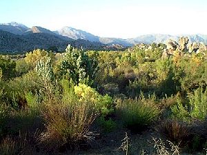
| Air and Ténéré Natural Reserves Aïr Mountains The Aïr Mountains is a triangular massif, located in northern Niger, within the Sahara desert... |
 |
Arlit Department Arlit Department Arlit is a department of the Agadez Region in Niger. Its capital lies at the city of Arlit.-Communes:It is divided administratively into the following communes:*Afassa*Aguelal*Arlit*Assarara*Elok*Gougaram*Iferouane*Imourarene*I-n-Azaoua*Inignaouei... ,  Niger Niger |
Natural: (vii), (ix), (x) |
7736000 (19,116,055.4 acre) | 1991 | Africa's largest protected area, located in the Saharan desert of Ténéré Ténéré The Ténéré is a desert region in the south central Sahara. It comprises a vast plain of sand stretching from northeastern Niger into western Chad, occupying an area of over... , consists of the volcanic rock mass of Aïr and a small isolated Sahel Sahel The Sahel is the ecoclimatic and biogeographic zone of transition between the Sahara desert in the North and the Sudanian Savannas in the south.It stretches across the North African continent between the Atlantic Ocean and the Red Sea.... ian pocket with unique flora and fauna. The natural reserve was placed on UNESCO's List of World Heritage in Danger in 1992, due to the increase in military conflicts and the hostage-taking of six reserve staff in February. Removal from this list was considered in 1999, but as of 2011, its position remains unchanged. |
| Aksum |  |
Tigray Region Tigray Region Tigray Region is the northernmost of the nine ethnic regions of Ethiopia containing the homeland of the Tigray people. It was formerly known as Region 1... ,  Ethiopia Ethiopia |
Cultural: (i), (iv) |
1980 | The ruins of the city of Aksum, dating from the 1st to the 13th century, mark the heart of ancient Ethiopia and what was the "most powerful state between the Eastern Roman Empire and Persia". It includes monolith Monolith A monolith is a geological feature such as a mountain, consisting of a single massive stone or rock, or a single piece of rock placed as, or within, a monument... ic obelisk Obelisk An obelisk is a tall, four-sided, narrow tapering monument which ends in a pyramid-like shape at the top, and is said to resemble a petrified ray of the sun-disk. A pair of obelisks usually stood in front of a pylon... s, giant stelae, royal tombs, and ruins of former castles. |
|
| Al Qal'a of Beni Hammad Al Qal'a of Beni Hammad Beni Hammad Fort, also called Al Qal'a of Beni Hammad is a ruined, fortified palatine city in Algeria. It served as the first capital of the Hammadid dynasty. It is located in the mountains northeast of M'Sila, at an elevation of 1,418 meters, and receives abundant water from the surrounding... |
Maadid Maadid Maadid is a town and commune in M'Sila Province, Algeria. According to the 1998 census it has a population of 22,274.... ,  Algeria Algeria |
Cultural: (iii) |
150 (370.7 acre) | 1980 | The fortified first capital of the Hammadid Hammadid The Hammadids were a Berber dynasty who ruled an area roughly corresponding to north-eastern modern Algeria for about a century and a half , until they were destroyed by the Almohads... emirs was originally built in 1007 and demolished in 1152. It features an 8-bay, 13-aisle mosque, which is one of the largest in Algeria. |
|
| Aldabra Atoll Aldabra Aldabra, the world's second largest coral atoll, is in the Aldabra Group of islands in the Indian Ocean that form part of the Seychelles. Uninhabited and extremely isolated, Aldabra is virtually untouched by humans, has distinctive island fauna including the Aldabra Giant Tortoise, and is... |
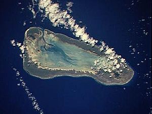 |
Aldabra Group Aldabra Group The Aldabra Group are part of the Outer Islands of the Seychelles, lying in the southwest of the island nation, 1000 kilometres from the capital, Victoria, on Mahé Island.The total land area of the Aldabra Group is 175.91 km².... ,  Seychelles Seychelles |
Natural: (vii), (ix), (x) |
35000 (86,486.8 acre) | 1982 | The Aldabra Atoll consists of four large coral islands and a lagoon, surrounded by a coral reef. The islands are home to the world's largest population of giant tortoise Giant tortoise Giant tortoises are characteristic reptiles of certain tropical islands. Often reaching enormous size—they can weigh as much as 300 kg and can grow to be 1.3 m long—they live, or lived , in the Seychelles, the Mascarenes and the Galapagos... s. |
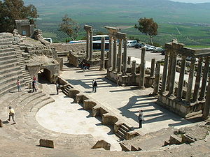
| Amphitheatre of El Jem | 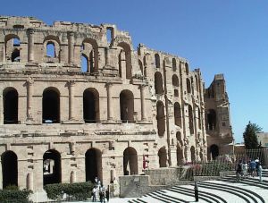 |
El Djem El Djem Drifting sand is preserving the market city of Thysdrus and the refined suburban villas that once surrounded it. The amphiteatre occupies archaeologists' attention: no digging required... ,  Tunisia Tunisia |
Cultural: (iv), (vi) |
1979 | The Amphitheatre of El Jem, built during the 3rd century, is North Africa's largest coliseum with a capacity of 35,000 spectators, and "illustrates the grandeur and extent of Imperial Rome." | |
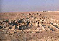
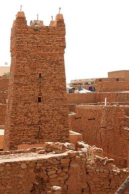
| Ancient Ksour of Ouadane Ouadane Ouadane or Wadan is a small town in the desert region of central Mauritania, situated on the southern edge of the Adrar Plateau, 93 km northeast of Chinguetti. The town was a staging post in the trans-Saharan trade and for caravans transporting slabs of salt from the mines at Idjil. A... , Chinguetti Chinguetti Chinguetti is a ksar or medieval trading centre in northern Mauritania, lying on the Adrar Plateau east of Atar.Founded in the 13th century, as the center of several trans-Saharan trade routes, this tiny city continues to attract a handful of visitors who admire its spare architecture, exotic... , Tichitt and Oualata Oualata Oualata or Walata is a small oasis town in south east Mauritania that was important in the thirteenth and fourteenth centuries as the southern terminus of a trans-Saharan trade route... |
 |
Chinguetti Chinguetti Chinguetti is a ksar or medieval trading centre in northern Mauritania, lying on the Adrar Plateau east of Atar.Founded in the 13th century, as the center of several trans-Saharan trade routes, this tiny city continues to attract a handful of visitors who admire its spare architecture, exotic... , Ouadane Ouadane Ouadane or Wadan is a small town in the desert region of central Mauritania, situated on the southern edge of the Adrar Plateau, 93 km northeast of Chinguetti. The town was a staging post in the trans-Saharan trade and for caravans transporting slabs of salt from the mines at Idjil. A... , Oualata Oualata Oualata or Walata is a small oasis town in south east Mauritania that was important in the thirteenth and fourteenth centuries as the southern terminus of a trans-Saharan trade route... , and Tichitt,  Mauritania Mauritania |
Cultural: (iii), (iv), (v) |
1996 | "Founded in the 11th and 12th centuries to serve the caravans crossing the Sahara, these trading and religious centres became focal points of Islamic culture. [...] Typically, houses with patios crowd along narrow streets around a mosque with a square minaret. They illustrate a traditional way of life centred on the nomadic culture of the people of the western Sahara." | |
| Ancient Thebes Thebes, Egypt Thebes is the Greek name for a city in Ancient Egypt located about 800 km south of the Mediterranean, on the east bank of the river Nile within the modern city of Luxor. The Theban Necropolis is situated nearby on the west bank of the Nile.-History:... with its Necropolis Theban Necropolis The Theban Necropolis is an area of the west bank of the Nile, opposite Thebes in Egypt. It was used for ritual burials for much of Pharaonic times, especially in the New Kingdom of Egypt.-Mortuary Temples:* Deir el-Bahri** Mortuary temple of Hatshepsut... |
 |
Qena Qena Qena is a city in Upper Egypt, and the capital of the Qena Governorate. Situated on the east bank of the Nile, it was known as Kaine during the Greco-Roman period and as Cainepolis in antiquity.- Overview :... , Egypt |
Cultural: (i), (iii), (vi) |
7390 (18,261.1 acre) | 1979 | The former capital of Egypt and city of the Egyptian god Amun Amun Amun, reconstructed Egyptian Yamānu , was a god in Egyptian mythology who in the form of Amun-Ra became the focus of the most complex system of theology in Ancient Egypt... contains relics from the height of Ancient Egypt Ancient Egypt Ancient Egypt was an ancient civilization of Northeastern Africa, concentrated along the lower reaches of the Nile River in what is now the modern country of Egypt. Egyptian civilization coalesced around 3150 BC with the political unification of Upper and Lower Egypt under the first pharaoh... . The temples, palaces and the necropolis Necropolis A necropolis is a large cemetery or burial ground, usually including structural tombs. The word comes from the Greek νεκρόπολις - nekropolis, literally meaning "city of the dead"... es of the Valley of the Kings and the Valley of the Queens bear "a striking testimony to Egyptian civilization." |
| Archaeological Site of Carthage |  |
Tunis Tunis Tunis is the capital of both the Tunisian Republic and the Tunis Governorate. It is Tunisia's largest city, with a population of 728,453 as of 2004; the greater metropolitan area holds some 2,412,500 inhabitants.... , Tunisia |
Cultural: (ii), (iii), (vi) |
1979 | Founded in the 9th century BCE, Carthage was developed into a trading empire spanning the Mediterranean, and was, according to UNESCO, "home to a brilliant civilization." The city was destroyed in 146 BCE in the Punic Wars Punic Wars The Punic Wars were a series of three wars fought between Rome and Carthage from 264 B.C.E. to 146 B.C.E. At the time, they were probably the largest wars that had ever taken place... at the hands of the Romans, but was later rebuilt by these. |
|
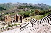
| Archaeological Site of Cyrene Cyrene, Libya Cyrene was an ancient Greek colony and then a Roman city in present-day Shahhat, Libya, the oldest and most important of the five Greek cities in the region. It gave eastern Libya the classical name Cyrenaica that it has retained to modern times.Cyrene lies in a lush valley in the Jebel Akhdar... |
Jebel Akhdar, Libya Libya |
Cultural: (ii), (iii), (vi) |
1982 | The formerly Greek colony was Romanized Ancient Rome Ancient Rome was a thriving civilization that grew on the Italian Peninsula as early as the 8th century BC. Located along the Mediterranean Sea and centered on the city of Rome, it expanded to one of the largest empires in the ancient world.... and transformed into a capital, until it was destroyed by an earthquake in 365. The thousand-year-old ruins have remained renowned since the 18th century. |
||
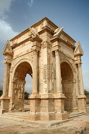
| Archaeological Site of Leptis Magna Leptis Magna Leptis Magna also known as Lectis Magna , also called Lpqy, Neapolis, Lebida or Lebda to modern-day residents of Libya, was a prominent city of the Roman Empire. Its ruins are located in Khoms, Libya, east of Tripoli, on the coast where the Wadi Lebda meets the sea... |
 |
Khoms, Libya |
Cultural: (i), (ii), (iii) |
1982 | The Roman city of Leptis Magna was enlarged by Emperor Septimius Severus Septimius Severus Septimius Severus , also known as Severus, was Roman Emperor from 193 to 211. Severus was born in Leptis Magna in the province of Africa. As a young man he advanced through the customary succession of offices under the reigns of Marcus Aurelius and Commodus. Severus seized power after the death of... , who was born there. Public monuments, a harbour, a marketplace, storehouses, shops, and homes were among the reasons for its induction into the list. |
|
| Archaeological Site of Sabratha Sabratha Sabratha, Sabratah or Siburata , in the Zawiya District in the northwestern corner of modern Libya, was the westernmost of the "three cities" of Tripolis. From 2001 to 2007 it was the capital of the former Sabratha wa Sorman District. It lies on the Mediterranean coast about west of Tripoli... |
 |
Sabratha Sabratha Sabratha, Sabratah or Siburata , in the Zawiya District in the northwestern corner of modern Libya, was the westernmost of the "three cities" of Tripolis. From 2001 to 2007 it was the capital of the former Sabratha wa Sorman District. It lies on the Mediterranean coast about west of Tripoli... , Libya |
Cultural: (iii) |
1982 | "A Phoenician trading-post that served as an outlet for the products of the African hinterland, Sabratha was part of the short-lived Numidian Kingdom of Massinissa before being Romanized and rebuilt in the 2nd and 3rd centuries." | |
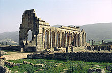
| Archaeological Site of Volubilis Volubilis Volubilis is an archaeological site in Morocco situated near Meknes between Fez and Rabat along the N13 road. The nearest town is Moulay Idriss. Volubilis features the best preserved Roman ruins in this part of northern Africa... |
 |
Meknes Meknes Meknes is a city in northern Morocco, located from the capital Rabat and from Fes. It is served by the A2 expressway between those two cities and by the corresponding railway. Meknes was the capital of Morocco under the reign of Moulay Ismail , before it was relocated to Marrakech. The... ,  Morocco Morocco |
Cultural: (ii), (iii), (iv), (vi) |
42 (103.8 acre) | 1997 | The important Roman outpost of Volubilis was founded in the 3rd century BCE to become the capital of Mauritania Mauritania Mauritania is a country in the Maghreb and West Africa. It is bordered by the Atlantic Ocean in the west, by Western Sahara in the north, by Algeria in the northeast, by Mali in the east and southeast, and by Senegal in the southwest... . It contained many buildings, the remains of which have survived extensively to this day. |
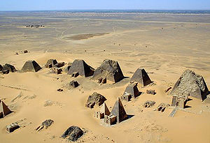
| Archaeological Sites of the Island of Meroe Meroë Meroë Meroitic: Medewi or Bedewi; Arabic: and Meruwi) is an ancient city on the east bank of the Nile about 6 km north-east of the Kabushiya station near Shendi, Sudan, approximately 200 km north-east of Khartoum. Near the site are a group of villages called Bagrawiyah... |
 |
Meroë Meroë Meroë Meroitic: Medewi or Bedewi; Arabic: and Meruwi) is an ancient city on the east bank of the Nile about 6 km north-east of the Kabushiya station near Shendi, Sudan, approximately 200 km north-east of Khartoum. Near the site are a group of villages called Bagrawiyah... ,  Sudan Sudan |
Cultural: (ii), (iii), (iv), (v) |
2357 (5,824.3 acre) | 2011 | The site was the centre of the Kingdom of Kush Kingdom of Kush The native name of the Kingdom was likely kaš, recorded in Egyptian as .The name Kash is probably connected to Cush in the Hebrew Bible , son of Ham .... , a major force active from the 8th century BCE to the 4th century CE. It is home to pyramids, temples, and domestic buildings, among other vestiges. |
| Asante Traditional Buildings Asante Traditional Buildings Asante Traditional Buildings is a World Heritage Site in Ghana, which is a collection of 13 traditionally built buildings from the time of the Ashanti Empire in the area.... |
Kumasi Kumasi Kumasi is a city in southern central Ghana's Ashanti region. It is located near Lake Bosomtwe, in the Rain Forest Region about northwest of Accra. Kumasi is approximately north of the Equator and north of the Gulf of Guinea... ,  Ghana Ghana |
Cultural: (v) |
1980 | The site, north-east of Kumasi Kumasi Kumasi is a city in southern central Ghana's Ashanti region. It is located near Lake Bosomtwe, in the Rain Forest Region about northwest of Accra. Kumasi is approximately north of the Equator and north of the Gulf of Guinea... , hosts the final intact remains of the Ashanti Empire Ashanti Empire The Ashanti Empire , also Asanteman was a West Africa state of the Ashanti people, the Akan people of the Ashanti Region, now in Ghana. The Ashanti or Asante are a major ethnic group in Ghana, a powerful, militaristic and highly disciplined people of West Africa... , which peaked in the 18th century. The dwellings, which are made of earth, wood, and straw, are susceptible to the damages caused by the "onslaught of time and weather." |
||
| Banc d'Arguin National Park Banc d'Arguin National Park The Banc d'Arguin National Park lies in Western Africa on the west coast of Mauritania between Nouakchott and Nouadhibou. The World Heritage Site is a major breeding site for migratory birds. A wide range of species include flamingos, broad-billed sandpipers, pelicans and terns. Much of the... |
Azefal and Nouadhibou Nouadhibou Nouadhibou is the second largest city in Mauritania and serves as a major commercial centre. The city itself has about 75,000 inhabitants expanding to over 90,000 in the larger metropolitan area. It is situated on a 40-mile peninsula or headland called Ras Nouadhibou, Cap Blanc, or Cabo Blanco, of... , Mauritania |
Natural: (ix), (x) |
1200000 (2,965,262 acre) | 1989 | The park consists of sand dunes, coastal swamps, small islands, and shallow bodies of water; all bordering the coast of the Atlantic Ocean. Birds are often found to migrate in the area, accompanied by various species of sea turtles and dolphins, whose presence fishermen often use to attract fish. | |
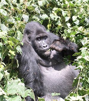
| Bwindi Impenetrable National Park Bwindi Impenetrable National Park Bwindi Impenetrable National Park is located in southwestern Uganda in East Africa. The park is part of the Bwindi Impenetrable Forest, and is situated along the Democratic Republic of Congo border next to the Virunga National Park and on the edge of the western Great Rift Valley... |
 |
Kabale District Kabale District Kabale District is a district in Western Uganda. As with most other Ugandan districts, it is named after its 'chief town', Kabale. It was originally part of the district of Kigezi, before the districts of Rukungiri, Kanungu and Kisoro were peeled off to form separate districts.-Location:Kabale... , Kisoro District Kisoro District Kisoro District is a district in Western Uganda. Like most other Ugandan districts, it is named after its 'chief town', Kisoro, where the district headquarters are located.-Location:... , and Rukungiri District Rukungiri District Rukungiri District is a district in Western Uganda. It is named after its 'chief town' of Rukungiri where the district headquarters are located.-Location:... ,  Uganda Uganda |
Natural: (vii), (x) |
32092 (79,301 acre) | 1994 | Located on the border of plain and mountain forests, the park in south-western Uganda is home to over 160 species of trees, over a hundred species of fern Fern A fern is any one of a group of about 12,000 species of plants belonging to the botanical group known as Pteridophyta. Unlike mosses, they have xylem and phloem . They have stems, leaves, and roots like other vascular plants... s, and various species of birds and butterflies. Many endangered species are within its boundaries as well, including the Mountain Gorilla Mountain Gorilla The Mountain Gorilla is one of the two subspecies of the Eastern Gorilla. There are two populations. One is found in the Virunga volcanic mountains of Central Africa, within three National Parks: Mgahinga, in south-west Uganda; Volcanoes, in north-west Rwanda; and Virunga in the eastern Democratic... . |
| Cape Floral Region Protected Areas Cape floristic region The Cape Floristic Region is a floristic region located near the southern tip of South Africa. It is the only floristic region of the Cape Floristic Kingdom, and includes only one floristic province, known as the Cape Floristic Province.The Cape Floristic Region, the smallest of the six recognised... |
 |
Eastern Cape Eastern Cape The Eastern Cape is a province of South Africa. Its capital is Bhisho, but its two largest cities are Port Elizabeth and East London. It was formed in 1994 out of the "independent" Xhosa homelands of Transkei and Ciskei, together with the eastern portion of the Cape Province... and Western Cape Western Cape The Western Cape is a province in the south west of South Africa. The capital is Cape Town. Prior to 1994, the region that now forms the Western Cape was part of the much larger Cape Province... ,  South Africa South Africa |
Natural: (ix), (x) |
553000 (1,366,491.6 acre) | 2004 | The site consists of eight protected areas that are among the richest in plant life worldwide, containing nearly 20% of Africa's total flora. Its scientific value is demonstrated by the presence of fire and radiation adaptivity in plants and seed dispersal by insects. |
| Chongoni Rock Art Area Chongoni Rock Art Area Chongoni Rock Art Area is located in the Central Region of Malawi. This was inscribed as a UNESCO World Heritage Site in 2006.... |
Dedza District Dedza District Dedza is a district in the Central Region of Malawi. It covers an area of 3,624 km.² to the south of the Malawi capital, Lilongwe, between Mozambique and Lake Malawi.-Geography:... ,  Malawi Malawi |
Cultural: (iii), (vi) |
12640 (31,234.1 acre) | 2006 | The 127-site area contains the richest concentration of rock art Rock art Rock art is a term used in archaeology for any human-made markings made on natural stone. They can be divided into:*Petroglyphs - carvings into stone surfaces*Pictographs - rock and cave paintings... in Central Africa, ranging from Stone Age Stone Age The Stone Age is a broad prehistoric period, lasting about 2.5 million years , during which humans and their predecessor species in the genus Homo, as well as the earlier partly contemporary genera Australopithecus and Paranthropus, widely used exclusively stone as their hard material in the... paintings to contemporary work from farmers. The symbols depicted in the rock art are strongly centred around women, and retain a cultural significance for the Chewa. |
|
| Cidade Velha, Historic Centre of Ribeira Grande Cidade Velha Cidade Velha , or simplyCidadi in Cape Verdean Creole, is a city located 15 km from Praia on the island of Santiago. It is the oldest settlement in Cape Verde and used to serve as the capital of Cape Verde... |
Ribeira Grande Ribeira Grande, Cape Verde Ribeira Grande is a municipality on the island of Santo Antão of the Barlavento group in Cape Verde. It covers one-third of the island and is home to two-thirds of the population.... ,  Cape Verde Cape Verde |
Cultural: (ii), (iii), (vi) |
209 (516.4 acre) | 2009 | The town, south of the island of Santiago, was the first European colonial outpost in the tropics, with remains dating back to the 16th century. Two churches, a royal fortress, and Pillary Square help comprise the tropical town's original street layout. | |
| Cliff of Bandiagara (Land of the Dogons) | Bandiagara Cercle Bandiagara Cercle Bandiagara Cercle is an administrative subdivision of the Mopti Region of Mali. The administrative center is the town of Bandiagara.The cercle is divided into 21 communes:*Bandiagara*Bara Sara*Borko*Dandoli*Diamnati*Dogani Béré... ,  Mali Mali |
Mixed: (v), (vii) |
327390 (808,997.6 acre) | 1989 | The sandy plateau and cliffs of Bandiagara outline the site, featuring houses, granaries, altars, sanctuaries, and Togu-Na meeting-places. Age-old social traditions such as masks, feasts, rituals, and ancestral worship also add to its cultural significance. | |
| Comoé National Park Comoé National Park Comoé National Park is a national park in north eastern Côte d'Ivoire as well as a UNESCO World Heritage Site since its inscription in 1983. It is in the Ivoirian Zanzan Region between the towns of Kong to the west of both the park and the Comoé River, and Bouna to the east of the park, and just... |
Zanzan Zanzan Zanzan is one of the 19 regions of Côte d'Ivoire, West Africa. The region's capital is Bondoukou. Covering 38,000 km², its population is 839,000.The region is divided into three departments: Bondoukou, Bouna, and Tanda.... ,  Côte d'Ivoire Côte d'Ivoire |
Natural: (ix), (x) |
1150000 (2,841,709.4 acre) | 1983 | Among the largest protected sites of West Africa, the park features the Comoé River and the unique flora which accompanies it. The site was placed on UNESCO's List of World Heritage in Danger in 2003, due to unrest in Côte d'Ivoire, and various other factors such as poaching Poaching Poaching is the illegal taking of wild plants or animals contrary to local and international conservation and wildlife management laws. Violations of hunting laws and regulations are normally punishable by law and, collectively, such violations are known as poaching.It may be illegal and in... , wildfires, lack of proper management of the site, and overgrazing Overgrazing Overgrazing occurs when plants are exposed to intensive grazing for extended periods of time, or without sufficient recovery periods. It can be caused by either livestock in poorly managed agricultural applications, or by overpopulations of native or non-native wild animals.Overgrazing reduces the... . |
|
| Dja Faunal Reserve Dja Faunal Reserve Dja Faunal Reserve, located in Cameroon, is a UNESCO World Heritage Site inscribed in 1987. Causes of inscription include diversity of species present in the park, the presence of five threatened species, and lack of disturbance within the park. The boundary that secludes the reserve is the Dja... |
 |
Dja-et-Lobo Dja-et-Lobo Dja-et-Lobo is a department of South Province in Cameroon. The department covers an area of 19,911 km² and as of 2001 had a total population of 173,219.The capital of the department lies at Sangmélima.-Subdivisions:... and Haut-Nyong Haut-Nyong Haut-Nyong is a department of East Province in Cameroon. The department covers an area of 36,384 km² and as of 2001 had a total population of 216,768.The capital of the department lies at Abong-Mbang.-Subdivisions:... ,  Cameroon Cameroon |
Natural: (ix), (x) |
526000 (1,299,773.2 acre) | 1987 | Among Africa's largest and best protected rain forests, the Cameroonian reserve is almost completely surrounded by the Dja River Dja River The Dja River is a stream in west-central Africa. It forms part of Cameroon–Republic of Congo border and has a course of roughly 450 miles .... and contains 107 mammal species, of which five are threatened. |
| Djémila Djemila Djémila is a mountain village in Algeria, near the northern coast east of Algiers, where some of the best preserved Berbero-Roman ruins in North Africa are found... |
 |
Sétif Sétif Sétif |Colonia]]) is a town in northeastern Algeria. It is the capital of Sétif Province and it has a population of 239,195 inhabitants as of the 1998 census. Setif is located to the east of Algiers and is the second most important Wilaya after the country's capital. It is 1,096 meters above sea... , Algeria |
Cultural: (iii), (iv) |
30 (74.1 acre) | 1982 | The ruins of a Roman town in a mountainous location, including a forum Forum (Roman) A forum was a public square in a Roman municipium, or any civitas, reserved primarily for the vending of goods; i.e., a marketplace, along with the buildings used for shops and the stoas used for open stalls... , temples Roman temple Ancient Roman temples are among the most visible archaeological remains of Roman culture, and are a significant source for Roman architecture. Their construction and maintenance was a major part of ancient Roman religion. The main room housed the cult image of the deity to whom the temple was... , basilica Basilica The Latin word basilica , was originally used to describe a Roman public building, usually located in the forum of a Roman town. Public basilicas began to appear in Hellenistic cities in the 2nd century BC.The term was also applied to buildings used for religious purposes... s, triumphal arch Triumphal arch A triumphal arch is a monumental structure in the shape of an archway with one or more arched passageways, often designed to span a road. In its simplest form a triumphal arch consists of two massive piers connected by an arch, crowned with a flat entablature or attic on which a statue might be... es and houses, each adapted to a location 900 m (2,952.8 ft) above sea level. |
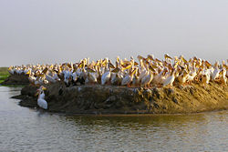
| Djoudj National Bird Sanctuary Djoudj National Bird Sanctuary The Djoudj National Bird Sanctuary lies on the southeast bank of the River Senegal in Senegal, in northern Biffeche, north east of St-Louis. It provides a range of wetland habitats which prove very popular with migrating birds, many of which have just crossed the Sahara. Of almost 400 species of... |
 |
Saint-Louis Region Saint-Louis Region The Saint-Louis Region of Senegal is on the border with Mauritania. Its capital is Saint-Louis.Famous for its cast iron bridge, built by French colonialists in the 19th century, it is close to the Djoudj National Bird Sanctuary, home to thousands of birds, some indigenous to the... ,  Senegal Senegal |
Natural: (vii), (x) |
16000 (39,536.8 acre) | 1981 | The Senegal River Sénégal River The Sénégal River is a long river in West Africa that forms the border between Senegal and Mauritania.The Sénégal's headwaters are the Semefé and Bafing rivers which both originate in Guinea; they form a small part of the Guinean-Malian border before coming together at Bafoulabé in Mali... delta wetland area consists of streams, lakes, ponds and backwaters. It is the home to 1.5 million birds, including the Great White Pelican, the Purple Heron Purple Heron The Purple Heron is a wading bird in the heron family Ardeidae, breeding in Africa, central and southern Europe, and southern and eastern Asia. The European populations are migratory, wintering in tropical Africa; the more northerly Asian populations also migrate further south within Asia... , the African Spoonbill African Spoonbill The African Spoonbill is a long-legged wading bird of the ibis and spoonbill family Threskiornithidae. The species is widespread across Africa and Madagascar, including Botswana, Kenya, Mozambique, Namibia, South Africa, and Zimbabwe. It lives in marshy wetlands with some open shallow water and... , the Great Egret Great Egret The Great Egret , also known as the Great White Egret or Common Egret, White Heron, or Great White Heron, is a large, widely-distributed egret. Distributed across most of the tropical and warmer temperate regions of the world, in southern Europe it is rather localized... , and cormorant Cormorant The bird family Phalacrocoracidae is represented by some 40 species of cormorants and shags. Several different classifications of the family have been proposed recently, and the number of genera is disputed.- Names :... s. The sanctuary also features crocodiles, African manatee African Manatee The African manatee , also known as the West African manatee or seacow, is a species of manatee and is the most endangered of the four species of sirenians. Scientists think they are most similar to West Indian manatees... s, and other typical Sahel Sahel The Sahel is the ecoclimatic and biogeographic zone of transition between the Sahara desert in the North and the Sudanian Savannas in the south.It stretches across the North African continent between the Atlantic Ocean and the Red Sea.... ian species. |
| Dougga / Thugga Dougga Dougga or Thugga is an ancient Roman city in northern Tunisia, included in a 65 hectare archaeological site.UNESCO qualified Dougga as a World Heritage Site in 1997, believing that it represents “the best-preserved Roman small town in North Africa”... |
 |
Béja Governorate Béja Governorate Béja Governorate is one of the twenty-four governorates of Tunisia. It is situated in northern Tunisia. It covers an area of 3,558 km² and has a population of 305,000 . The capital is Béja.... , Tunisia |
Cultural: (ii), (iii) |
70 (173 acre) | 1997 | The site features the ruins of Dougga, a former capital of a Libya Libya Libya is an African country in the Maghreb region of North Africa bordered by the Mediterranean Sea to the north, Egypt to the east, Sudan to the southeast, Chad and Niger to the south, and Algeria and Tunisia to the west.... n–Punic state, which flourished under Ancient Rome Ancient Rome Ancient Rome was a thriving civilization that grew on the Italian Peninsula as early as the 8th century BC. Located along the Mediterranean Sea and centered on the city of Rome, it expanded to one of the largest empires in the ancient world.... and the Byzantine Empire Byzantine Empire The Byzantine Empire was the Eastern Roman Empire during the periods of Late Antiquity and the Middle Ages, centred on the capital of Constantinople. Known simply as the Roman Empire or Romania to its inhabitants and neighbours, the Empire was the direct continuation of the Ancient Roman State... , but declined in the Islamic period Islamic Golden Age During the Islamic Golden Age philosophers, scientists and engineers of the Islamic world contributed enormously to technology and culture, both by preserving earlier traditions and by adding their own inventions and innovations... . |
| Ecosystem and Relict Cultural Landscape of Lopé-Okanda Lopé National Park Lopé National Park is a national park in central Gabon. Although the terrain is mostly rain forest, in the north the park contains the last remnants of grass savannas created in Central Africa during the last Ice Age, 15,000 years ago. It was the first protected area in Gabon when the Lopé-Okanda... |
Ogooué-Ivindo Ogooué-Ivindo The Ogooué-Ivindo province is the northeastern-most of the nine provinces of Gabon. The regional capital is Makokou, which is home to one-third of the provincial population. It gets its name from two rivers, the Ogooué and the Ivindo... and Ogooué-Lolo Ogooué-Lolo The Ogooué-Lolo province is one of the nine provinces of Gabon. The regional capital is Koulamoutou, a city of approximately 16,000 people. It is the ninth largest city in Gabon and the home of slightly more than one-third of the provincial population.... ,  Gabon Gabon |
Mixed: (iii), (iv), (ix), (x) |
491291 (1,214,005.4 acre) | 2007 | The park features well-preserved tropical rain forests and savanna, resulting in a diverse ecosystem consisting of endangered, large mammals. | |
| Fasil Ghebbi, Gondar Region Fasil Ghebbi Fasil Ghebbi is a fortress-enclosure located in Gondar, Ethiopia. It served as the home of Ethiopia's emperors in the 17th and 18th centuries. Its unique architecture shows diverse influences including Nubian, Arab, and Baroque styles... |
 |
Amhara Region Amhara Region Amhara is one of the nine ethnic divisions of Ethiopia, containing the homeland of the Amhara people. Previously known as Region 3, its capital is Bahir Dar.... , Ethiopia |
Cultural: (ii), (iii) |
1979 | The fortress was the residence of the Ethiopian emperors during the 16th and 17th century. The city remains, which feature buildings with Hindu and Arab influences, were later remodelled with Baroque Baroque architecture Baroque architecture is a term used to describe the building style of the Baroque era, begun in late sixteenth century Italy, that took the Roman vocabulary of Renaissance architecture and used it in a new rhetorical and theatrical fashion, often to express the triumph of the Catholic Church and... -style architecture by Jesuit missionaries. |
|
| Fort Jesus Fort Jesus Fort Jesus is a Portuguese fort built in 1593 by order of King Philip I of Portugal , then ruler of the joint Portuguese and Spanish Kingdoms, located on Mombasa Island to guard the Old Port of Mombasa, Kenya. It was built in the shape of a man , and was given the name of Jesus... |
Mombasa Mombasa Mombasa is the second-largest city in Kenya. Lying next to the Indian Ocean, it has a major port and an international airport. The city also serves as the centre of the coastal tourism industry.... ,  Kenya Kenya |
Cultural: (i), (iv) |
161485 (399,037.8 acre) | 2011 | Fort Jesus is a Portuguese Portugal Portugal , officially the Portuguese Republic is a country situated in southwestern Europe on the Iberian Peninsula. Portugal is the westernmost country of Europe, and is bordered by the Atlantic Ocean to the West and South and by Spain to the North and East. The Atlantic archipelagos of the... fort built from 1593 to 1596 on Mombasa Island Mombasa Island Mombasa Island is a 5 km by 3 km coral outcrop located on Kenya's coast on the Indian Ocean, which is connected to the mainland by a causeway. The city of Mombasa is located on the island.... to guard the old port of Mombasa, Kenya. The site's layout follows the Renaissance Renaissance The Renaissance was a cultural movement that spanned roughly the 14th to the 17th century, beginning in Italy in the Late Middle Ages and later spreading to the rest of Europe. The term is also used more loosely to refer to the historical era, but since the changes of the Renaissance were not... ideal that the human body is perfectly proportionate. |
|
| Forts and Castles, Volta, Greater Accra, Central and Western Regions | 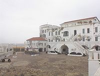 |
Central Region Central Region (Ghana) The Central Region is one of Ghana's ten administrative regions. It is bordered by the Ashanti and Eastern regions to the north, Western region to the west, Greater Accra region to the east, and to the south by the Atlantic Ocean.-Districts:... , Greater Accra, Volta Region Volta Region Volta Region is one of Ghana's ten administrative regions. It is to the east of Lake Volta. Its capital is Ho.-List of districts:The region has 18 districts consisting of 3 municipal and 15 ordinary districts:-Background:... , and Western Region Western Region (Ghana) The Western Region of Ghana, reaching from the Côte d'Ivoire border in the west to the Central Region in the east, includes the large twin city of Sekondi-Takoradi on the coast, coastal Axim, and a hilly inland area including Elubo. It includes Ghana's southernmost location, Cape Three Points,... , Ghana |
Cultural: (vi) |
1979 | The site features the remains of fortified trading posts, built along the Ghanaian coast between 1482 and 1786. | |
| Fossil Hominid Sites of Sterkfontein, Swartkrans, Kromdraai, and Environs Cradle of Humankind The Cradle of Humankind is a World Heritage Site first named by UNESCO in 1999, about 50 kilometres northwest of Johannesburg, South Africa in the Gauteng province. This site currently occupies ; it contains a complex of limestone caves, including the Sterkfontein Caves, where the 2.3-million... |
 |
Gauteng Gauteng Gauteng is one of the nine provinces of South Africa. It was formed from part of the old Transvaal Province after South Africa's first all-race elections on 27 April 1994... , Limpopo Limpopo Limpopo is the northernmost province of South Africa. The capital is Polokwane, formerly named Pietersburg. The province was formed from the northern region of Transvaal Province in 1994, and initially named Northern Transvaal... , and North West North West (South African province) North West is a province of South Africa. Its capital is Mafikeng. The province is located to the west of the major population centre of Gauteng.-History:... , South Africa |
Cultural: (iii), (vi) |
1999 | The various fossil sites contain traces of human occupation and evolution dating 3.3 million years. | |
| Garajonay National Park Garajonay National Park Garajonay National Park is located in the center and north of the island of La Gomera, one of the Canary Islands . It was declared a national park in 1981 and a World Heritage Site by UNESCO in 1986... |
 |
La Gomera La Gomera La Gomera is one of Spain's Canary Islands, located in the Atlantic Ocean off the coast of Africa. In area, it is the second-smallest of the seven main islands of this group.- Political organization :... ,  Spain Spain |
Natural: (vii), (ix) |
3984 (9,844.7 acre) | 1986 | Most of the park, in the middle of the island of La Gomera of the Canary Islands Canary Islands The Canary Islands , also known as the Canaries , is a Spanish archipelago located just off the northwest coast of mainland Africa, 100 km west of the border between Morocco and the Western Sahara. The Canaries are a Spanish autonomous community and an outermost region of the European Union... , is covered with a lush laurel forest Laurel forest Laurel forest is a subtropical or mild temperate forest, found in areas with high humidity and relatively stable and mild temperatures. They are characterized by tree species with evergreen, glossy, enlongated leaves, known as laurophyll or lauroide... . |
| Garamba National Park Garamba National Park Garamba National Park, located in the Democratic Republic of the Congo in Africa, was established in 1938. One of Africa's oldest National parks, it was designated a UNESCO World Heritage Site in 1980. Garamba is the home to the world's last known wild population of Northern White Rhinoceros... |
Orientale, Democratic Republic of the Congo Democratic Republic of the Congo |
Natural: (vii), (x) |
500000 (1,235,525.8 acre) | 1980 | The park has vast savannas, grasslands and woodland, featuring elephants, giraffes, hippopotamuses and the White Rhinoceros White Rhinoceros The White Rhinoceros or Square-lipped rhinoceros is one of the five species of rhinoceros that still exist. It has a wide mouth used for grazing and is the most social of all rhino species... . Garamba was deemed to be endangered following the diminution of the White Rhinoceros population in the area, but it was removed from the list in 1991. However, it later regained the status in 1996, when three rangers were killed and the population of White Rhinoceros fell once again. |
|
| Gebel Barkal and the Sites of the Napatan Region |  |
Meroë Meroë Meroë Meroitic: Medewi or Bedewi; Arabic: and Meruwi) is an ancient city on the east bank of the Nile about 6 km north-east of the Kabushiya station near Shendi, Sudan, approximately 200 km north-east of Khartoum. Near the site are a group of villages called Bagrawiyah... , Sudan |
Cultural: (i), (ii), (iii), (iv), (vi) |
183 (452.2 acre) | 2003 | The five sites in the Nile Valley feature temples that are testimonial to the Napata Napata Napata was a city-state of ancient Nubia on the west bank of the Nile River, at the site of modern Karima, Northern Sudan.During the 8th to 7th centuries BC, Napata was the capital of the Nubian kingdom of Kush, whence the 25th, or Nubian Dynasty conquered Egypt... n and Meroitic Meroë Meroë Meroitic: Medewi or Bedewi; Arabic: and Meruwi) is an ancient city on the east bank of the Nile about 6 km north-east of the Kabushiya station near Shendi, Sudan, approximately 200 km north-east of Khartoum. Near the site are a group of villages called Bagrawiyah... cultures. |
| Gough Gough Island Gough Island , also known historically as Gonçalo Álvares or Diego Alvarez, is a volcanic island in the South Atlantic Ocean. It is a dependency of Tristan da Cunha and part of the British overseas territory of Saint Helena, Ascension and Tristan da Cunha... and Inaccessible Island Inaccessible Island Inaccessible Island is an extinct volcano, 14 km² in area, rising out of the South Atlantic Ocean 45 km southwest of Tristan da Cunha. Inaccessible Island is located at . It is part of the archipelago of Tristan da Cunha, which is part of the overseas territory of the United Kingdom,... s |
 |
Saint Helena Saint Helena, Ascension and Tristan da Cunha Saint Helena, Ascension and Tristan da Cunha is a British overseas territory and overseas territory of the European Union consisting of the islands of Saint Helena, Ascension Island and the Tristan da Cunha group... ,  United Kingdom United Kingdom |
Natural: (vii), (x) |
7900 (19,521.3 acre) | 1995 | The site represent one of the least-disrupted islands and marine ecosystems in the North Temperate Zone. The cliffs are free of introduced mammals and feature one of the world's largest colonies of sea birds. |
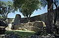
| Great Zimbabwe National Monument Great Zimbabwe Great Zimbabwe is a ruined city that was once the capital of the Kingdom of Zimbabwe, which existed from 1100 to 1450 C.E. during the country’s Late Iron Age. The monument, which first began to be constructed in the 11th century and which continued to be built until the 14th century, spanned an... |
 |
Masvingo Province, Zimbabwe Zimbabwe |
Cultural: (i), (iii), (vi) |
722 (1,784.1 acre) | 1986 | The city, now in ruins, was an important trading center between the 11th and 15th centuries, and was capital of the Bantu civilization. |
| Harar Jugol, the Fortified Historic Town | Harari Region Harari Region Harari or officially, Harari People's National Regional State is one of the nine ethnic divisions of Ethiopia, covering the homeland of the Harari people... , Ethiopia |
Cultural: (ii), (iii), (iv), (v) |
48 (118.6 acre) | 2006 | The city is on a plateau and surrounded by gorges and savanna. It contains 82 mosques, 102 shrines, and unique interior design in the townhouses. It is said to be the fourth-holiest city of Islam. | |
| Historic Cairo Islamic Cairo Islamic Cairo is a part of central Cairo noted for its historically important mosques and other Islamic monuments. It is overlooked by the Cairo Citadel.... |
Cairo Cairo Cairo , is the capital of Egypt and the largest city in the Arab world and Africa, and the 16th largest metropolitan area in the world. Nicknamed "The City of a Thousand Minarets" for its preponderance of Islamic architecture, Cairo has long been a centre of the region's political and cultural life... , Egypt |
Cultural: (i), (v), (vi) |
524 (1,294.8 acre) | 1979 | One of the world's oldest Islamic cities and in the middle of urban Cairo, the site dates from the 10th century and reached its golden age in the 14th century. It contains mosques, madrasah Madrasah Madrasah is the Arabic word for any type of educational institution, whether secular or religious... , hammam Hammam A Turkish bath is the Turkish variant of a steam bath, sauna or Russian Bath, distinguished by a focus on water, as distinct from ambient steam.... s and fountains. |
|
| Historic City of Meknes Meknes Meknes is a city in northern Morocco, located from the capital Rabat and from Fes. It is served by the A2 expressway between those two cities and by the corresponding railway. Meknes was the capital of Morocco under the reign of Moulay Ismail , before it was relocated to Marrakech. The... |
Meknes Meknes Meknes is a city in northern Morocco, located from the capital Rabat and from Fes. It is served by the A2 expressway between those two cities and by the corresponding railway. Meknes was the capital of Morocco under the reign of Moulay Ismail , before it was relocated to Marrakech. The... , Morocco |
Cultural: (iv) |
1996 | The former capital was founded in the 11th century and turned into a city with Spanish-Moorish influence during the 17th and 18th centuries. | ||
| Ichkeul National Park |  |
Bizerte Bizerte Bizerte or Benzert , is the capital city of Bizerte Governorate in Tunisia and the northernmost city in Africa. It has a population of 230,879 .-History:... , Tunisia |
Natural: (x) |
12600 (31,135.3 acre) | 1980 | Ichkeul Lake Ichkeul Lake Ichkeul Lake is a lake in northern Tunisia near the shore of the Mediterranean Sea. The lake and wetlands of Ichkeul National Park are an important stopping-over point for hundreds of thousands of migrating birds each year. Among the lake's visitors are ducks, geese, storks, and pink flamingoes... and the surrounding wetlands is a destination for hundreds of thousands of migrating birds, including ducks, geese, stork Stork Storks are large, long-legged, long-necked wading birds with long, stout bills. They belong to the family Ciconiidae. They are the only family in the biological order Ciconiiformes, which was once much larger and held a number of families.... s and pink flamingos. It was once part of a chain that extended across North Africa. |
| iSimangaliso Wetland Park | KwaZulu-Natal KwaZulu-Natal KwaZulu-Natal is a province of South Africa. Prior to 1994, the territory now known as KwaZulu-Natal was made up of the province of Natal and the homeland of KwaZulu.... , South Africa |
Natural: (vii), (ix), (x) |
239566 (591,980 acre) | 1999 | The park features a variety of landforms, including coral reef Coral reef Coral reefs are underwater structures made from calcium carbonate secreted by corals. Coral reefs are colonies of tiny living animals found in marine waters that contain few nutrients. Most coral reefs are built from stony corals, which in turn consist of polyps that cluster in groups. The polyps... s, long sandy beaches, coastal dunes, lake systems, and papyrus wetland, caused by fluvial Fluvial Fluvial is used in geography and Earth science to refer to the processes associated with rivers and streams and the deposits and landforms created by them... , marine and aeolian processes. |
|
| Island of Gorée |  |
Dakar Region Dakar Region Dakar région is the smallest and most populated région of Senegal, encompassing the capital city of the country, Dakar, and all its suburbs along the Cap–Vert Peninsula, Africa's most westerly point.-Administration:... , Senegal |
Cultural: (vi) |
1978 | The island was the largest slave-trading center on the African coast from the 15th to the 19th century. | |
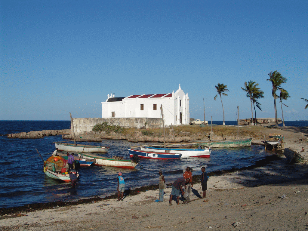
| Island of Mozambique Island of Mozambique The Island of Mozambique lies off northern Mozambique, between the Mozambique Channel and Mossuril Bay. It has a population of around 14,000 people and is part of Nampula Province.-History:... |
 |
Nampula Nampula Province Nampula is a province of Mozambique. It has an area of 81,606 km² and a population of 3.985.285 . Nampula is the capital of the province... ,  Mozambique Mozambique |
Cultural: (iv), (vi) |
1991 | The fortified former Portuguese trading post has used the same architectural techniques, style, and materials since the 16th century. | |
| Island of Saint-Louis Saint-Louis, Senegal Saint-Louis, or Ndar as it is called in Wolof, is the capital of Senegal's Saint-Louis Region. Located in the northwest of Senegal, near the mouth of the Senegal River, and 320 km north of Senegal's capital city Dakar, it has a population officially estimated at 176,000 in 2005. Saint-Louis... |
 |
Saint-Louis Region Saint-Louis Region The Saint-Louis Region of Senegal is on the border with Mauritania. Its capital is Saint-Louis.Famous for its cast iron bridge, built by French colonialists in the 19th century, it is close to the Djoudj National Bird Sanctuary, home to thousands of birds, some indigenous to the... , Senegal |
Cultural: (ii), (iv) |
2000 | The French colonial settlement from the 17th century is on an island in the mouth of the Sénégal River Sénégal River The Sénégal River is a long river in West Africa that forms the border between Senegal and Mauritania.The Sénégal's headwaters are the Semefé and Bafing rivers which both originate in Guinea; they form a small part of the Guinean-Malian border before coming together at Bafoulabé in Mali... . It played an important role in the culture and economy of West Africa. |
|
| James Island and Related Sites James Island (The Gambia) James Island is an island in the Gambia River, 30 km from the river mouth and near Juffureh in the country of The Gambia. On 6 February 2011 it was renamed Kunta Kinteh Island to give the Island a Gambian name. Fort James is located on the island... |
 |
Banjul Banjul -Transport:Ferries sail from Banjul to Barra. The city is served by the Banjul International Airport. Banjul is on the Trans–West African Coastal Highway connecting it to Dakar and Bissau, and will eventually provide a paved highway link to 11 other nations of ECOWAS.Banjul International Airport... , Lower Niumi Lower Niumi Lower Niumi is one of the six districts of the North Bank Division of The Gambia.... , and Upper Niumi Upper Niumi Upper Niumi is one of the six districts of the North Bank Division of The Gambia.... ,  The Gambia The Gambia |
Cultural: (iii), (vi) |
8 (19.8 acre) | 2003 | The site is a testimony to the encounters between Africa and Europe from pre-colonial times to independence along the Gambia River Gambia River The Gambia River is a major river in West Africa, running from the Fouta Djallon plateau in north Guinea westward through Senegal and The Gambia to the Atlantic Ocean at the city of Banjul... . |
| Kahuzi-Biega National Park Kahuzi-Biéga National Park Kahuzi-Biéga National Park is in eastern Democratic Republic of the Congo, 50 km west of the town of Bukavu in the Kivu Region, near to the western side of Lake Kivu and the Rwandan border.... |
 |
Maniema Maniema Maniema is a province of the Democratic Republic of the Congo. Its capital is Kindu.Following the 2005 Constitution , 25 new provinces were to be created from the 10 current provinces within 36 months . As of October 2010, this had not taken place... and South Kivu, Democratic Republic of the Congo |
Natural: (x) |
600000 (1,482,631 acre) | 1980 | The park is dominated by two extinct volcanoes, Kahuzi and Biega. It also has abundant fauna, including the graueria gorillas. The park was deemed to be endangered in 1997 when deforestation and hunting became a major problem. Militia groups and illegal settlers were also settling in the park, while fire and poaching helped justify the World Heritage Committee's decision. |
| Kairouan Kairouan Kairouan , also known as Kirwan or al-Qayrawan , is the capital of the Kairouan Governorate in Tunisia. Referred to as the Islamic Cultural Capital, it is a UNESCO World Heritage site. The city was founded by the Arabs around 670... |
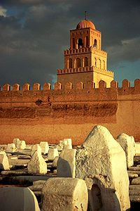 |
Kairouan Governorate Kairouan Governorate Kairouan Governorate is one of the twenty-four governorates of Tunisia. It is an inland province, situated in the centre of the country. It covers an area of 6,712 km² and has a population of 546,209... , Tunisia |
Cultural: (i), (ii), (iii), (v), (vi) |
1988 | The former capital was founded in 670 and flourished in the 9th century. Its heritage includes the Mosque of Uqba and the Mosque of the Three Gates. | |
| Kasbah of Algiers | 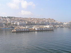 |
Algiers Algiers ' is the capital and largest city of Algeria. According to the 1998 census, the population of the city proper was 1,519,570 and that of the urban agglomeration was 2,135,630. In 2009, the population was about 3,500,000... , Algeria |
Cultural: (ii), (v) |
60 (148.3 acre) | 1992 | A unique Islamic city on the Mediterranean coast, the former site overlooks the Carthaginian trading posts of the 4th century BCE. It contains remains of a citadel, old mosques, and Ottoman-style palaces. |
| Khami Ruins National Monument | 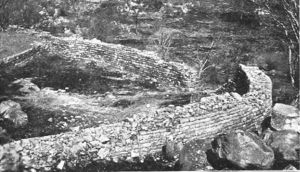 |
Matabeleland Matabeleland Modern day Matabeleland is a region in Zimbabwe divided into three provinces: Matabeleland North, Bulawayo and Matabeleland South. These provinces are in the west and south-west of Zimbabwe, between the Limpopo and Zambezi rivers. The region is named after its inhabitants, the Ndebele people... , Zimbabwe |
Cultural: (iii), (iv) |
1986 | The city was built after the mid-16th century and was an important trading center. | |
| Kilimanjaro National Park Kilimanjaro National Park Kilimanjaro National Park is a national park, located 200 miles south of the equater near Moshi, Tanzania. It is centered on Mount Kilimanjaro, and covers an area of from 2°45'–3°25'S, 37°00'–37°43'E.... |
Kilimanjaro Region Kilimanjaro Region Kilimanjaro is one of the 26 regions in Tanzania. The capital of the region is Moshi. Kilimanjaro region is home to Mount Kilimanjaro.Kilimanjaro Region is bordered to the North and East by Kenya, to the South by the Tanga Region, to the Southwest by the Manyara Region, and to the West by the... , |
Natural: (vii) |
75575 (186,749.7 acre) | 1987 | The volcanic massif Mount Kilimanjaro Mount Kilimanjaro Kilimanjaro, with its three volcanic cones, Kibo, Mawenzi, and Shira, is a dormant volcano in Kilimanjaro National Park, Tanzania and the highest mountain in Africa at above sea level .-Geology:... is Africa's highest point at 5895 metres (19,340.6 ft), and is surrounded by a park with savanna and forest featuring numerous mammals. |
|
| Kondoa Rock Art Sites Kondoa Rock Art Sites The Kondoa rock art sites are a series of caves carved into the side of a hill looking out over the steppe, c. nine kilometres off the main highway from Kondoa to Arusha, about 20 km north of Kondoa, in Tanzania. The caves contain paintings, some of which are believed by the Tanzania Antiquities... |
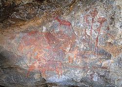 |
Kondoa District Kondoa district Kondoa is one of the five districts of the Dodoma Region of Tanzania. It is bordered to the south by the Dodoma Rural district, and to the southeast by the Kongwa district.... , |
Cultural: (iii), (vi) |
233600 (577,237.7 acre) | 2006 | Two millennia of rock carving, many of high artistic value, have been found at 150 shelters in the site. They tell the tale of socio-economic development from hunter-gatherer Hunter-gatherer A hunter-gatherer or forage society is one in which most or all food is obtained from wild plants and animals, in contrast to agricultural societies which rely mainly on domesticated species. Hunting and gathering was the ancestral subsistence mode of Homo, and all modern humans were... to agro-pastoralism. |
| Konso Cultural Landscape Konso Konso is a town on the Sagan River in southwestern Ethiopia. The administrative center of the Konso special woreda of the Southern Nations, Nationalities, and Peoples Region, this town has a latitude and longitude of and an elevation of 1650 meters... |
Southern Nations, Nationalities, and People's Region Southern Nations, Nationalities, and People's Region Southern Nations, Nationalities, and People's Region is one of the nine ethnic divisions of Ethiopia. It was formed from the merger of the former Regions 7-11 following the 1994 elections... , Ethiopia |
Cultural: (iii), (v) |
14000 (34,594.7 acre) | 2011 | The site features 55 kilometres (34.2 mi) of stonewalled terraces and fortified settlements in the Konso highlands of Ethiopia. | |
| Koutammakou, the Land of the Batammariba | Kara Region Kara Region Kara is one of Togo's five regions. Kara is the regional capital.Other major cities in the Kara region include Bafilo, Bassar, and Niamtougou.Kara is divided into the prefectures of Assoli, Bassar, Bimah, Dankpen, Doufelgou, Kéran, and Kozah.... ,  Togo Togo |
Cultural: (v), (vi) |
50000 (123,552.6 acre) | 2004 | The Batammariba's mud tower houses have become a symbol of Togo. They range up to two stories and feature spherical granaries. | |
| Ksar of Ait-Ben-Haddou |  |
Aït Benhaddou Aït Benhaddou Aït Benhaddou is a 'fortified city', or ksar, along the former caravan route between the Sahara and Marrakech in present-day Morocco. It is situated in Souss-Massa-Draâ on a hill along the Ounila River and has some beautiful examples of kasbahs, which unfortunately sustain damage during each... , Morocco |
Cultural: (iv), (v) |
3 (7.4 acre) | 1987 | The ksar Ksar Ksar is the Arabic term for "castle", loaned from Latin castrum.The Berber equivalent is aghrem or ighrman .... is an example of a traditional pre-Saharan habitat, surrounded by high walls and reinforced with corner towers. |
| Lake Malawi National Park Lake Malawi National Park Lake Malawi National Park is a national park located in Malawi at the southern end of Lake Malawi. It is the only national park in Malawi that was created to protect fish and aquatic habitats. Despite this, Lake Malawi National Park does include a fair amount of land, including several small... |
Central Region Central Region, Malawi The Central Region of Malawi, population 5,491,034 , covers an area of 35,592 km². Its capital city is Lilongwe, which is also the national capital... and Southern Region Southern Region, Malawi The Southern Region of Malawi, population 5,876,784, covers an area of 31,753 km². Its capital city is Blantyre.Of the 28 districts in Malawi, 12 are located within the Southern Region They are: Balaka, Blantyre, Chikwawa, Chiradzulu, Machinga, Mangochi, Mulanje, Mwanza, Neno, Nsanje,... , Malawi |
Natural: (vii), (ix), (x) |
9400 (23,227.9 acre) | 1984 | Lake Malawi Lake Malawi Lake Malawi , is an African Great Lake and the southernmost lake in the Great Rift Valley system of East Africa. This lake, the third largest in Africa and the eighth largest lake in the world, is located between Malawi, Mozambique, and Tanzania... contains hundreds of fish species, mostly endemic. |
|
| Lake Turkana National Parks Lake Turkana National Parks Lake Turkana National Parks is a group of three national parks located in Kenya. It was inscribed as a UNESCO World Heritage Site in 1997 and expanded in 2001. Reasons for the park's importance include its use as a stopping point for migratory birds, as a breeding ground for the Nile crocodile,... |
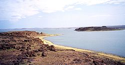 |
Lake Turkana Lake Turkana Lake Turkana , formerly known as Lake Rudolf, is a lake in the Great Rift Valley in Kenya, with its far northern end crossing into Ethiopia. It is the world's largest permanent desert lake and the world's largest alkaline lake... , Kenya |
Natural: (viii), (x) |
161485 (399,037.8 acre) | 1997 | Turkana, as Africa's largest saline Saline water Saline water is a general term for water that contains a significant concentration of dissolved salts . The concentration is usually expressed in parts per million of salt.... lake, is an important area for the study of fauna and flora. It is a breeding ground for the Nile crocodile Nile crocodile The Nile crocodile or Common crocodile is an African crocodile which is common in Somalia, Ethiopia, Uganda, Kenya, Egypt, Tanzania, Zambia, Zimbabwe, Gabon, South Africa, Malawi, Sudan, Botswana, and Cameroon... , hippopotamus Hippopotamus The hippopotamus , or hippo, from the ancient Greek for "river horse" , is a large, mostly herbivorous mammal in sub-Saharan Africa, and one of only two extant species in the family Hippopotamidae After the elephant and rhinoceros, the hippopotamus is the third largest land mammal and the heaviest... and several venomous snakes. |
| Lake System in the Great Rift Valley Great Rift Valley The Great Rift Valley is a name given in the late 19th century by British explorer John Walter Gregory to the continuous geographic trench, approximately in length, that runs from northern Syria in Southwest Asia to central Mozambique in South East Africa... |
Rift Valley Province, Kenya |
Natural: (viii), (x) |
161485 (399,037.8 acre) | 2011 | Located in the Great Rift Valley Great Rift Valley The Great Rift Valley is a name given in the late 19th century by British explorer John Walter Gregory to the continuous geographic trench, approximately in length, that runs from northern Syria in Southwest Asia to central Mozambique in South East Africa... , the site features three lakes: Lake Bogoria Lake Bogoria Lake Bogoria is a saline, alkaline lake that lies in a volcanic region in a half-graben basin south of Lake Baringo, Kenya, a little north of the equator. Lake Bogoria, like Lake Nakuru, Lake Elmenteita, and Lake Magadi further south in the Rift Valley, and Lake Logipi to the north, is home at... , Lake Nakuru Lake Nakuru Lake Nakuru is one of the Rift Valley soda lakes at an elevation of 1754 m above sea level. It lies to the south of Nakuru, in the rift valley of Kenya and is protected by Lake Nakuru National Park.... and Lake Elementaita. A highly diverse population of birds, including thirteen threatened species, frequent the area. |
|
| Lamu Old Town |  |
Lamu Lamu -Threats to Lamu:In a 2010 report titled Saving Our Vanishing Heritage, Global Heritage Fund identified Lamu as one of 12 worldwide sites most "On the Verge" of irreparable loss and damage, citing insufficient management and development pressure as primary causes.- See also :* Juma and the Magic... , Kenya |
Cultural: (ii), (iv), (vi) |
16 (39.5 acre) | 2001 | The town is the oldest Swahili Swahili people The Swahili people are a Bantu ethnic group and culture found in East Africa, mainly in the coastal regions and the islands of Kenya, Tanzania and north Mozambique. According to JoshuaProject, the Swahili number in at around 1,328,000. The name Swahili is derived from the Arabic word Sawahil,... settlement, and is built in coral stone and mangrove timber. It features inner courtyards, verandas, and elaborate wooden doors. |
| Laurisilva of Madeira Laurisilva Laurisilva or laurissilva is a subtropical forest, found in areas with high humidity and relatively stable and mild temperatures. They are characterised by evergreen, glossy-leaved tree species that look alike with leaves of lauroide type... |
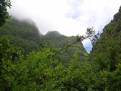 |
Madeira Madeira Madeira is a Portuguese archipelago that lies between and , just under 400 km north of Tenerife, Canary Islands, in the north Atlantic Ocean and an outermost region of the European Union... ,  Portugal Portugal |
Natural: (ix), (x) |
15000 (37,065.8 acre) | 1999 | The site is the largest surviving area of laurel forest Laurel forest Laurel forest is a subtropical or mild temperate forest, found in areas with high humidity and relatively stable and mild temperatures. They are characterized by tree species with evergreen, glossy, enlongated leaves, known as laurophyll or lauroide... . It consists of approximately 90% old-growth forest and is home to endemic species such as the Madeiran long-toed pigeon Trocaz Pigeon The Trocaz Pigeon, Madeira Laurel Pigeon or Long-toed Pigeon is a pigeon which is endemic to the island of Madeira. It is a mainly grey bird with a pinkish breast; its silvery neck patch and lack of white wing markings distinguish it from its close relative and probable ancestor, the Common Wood... . |
| Le Morne Cultural Landscape | 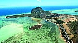 |
Black River District, Mauritius |
Cultural: (iii), (vi) |
349 (862.4 acre) | 2008 | The rugged mountain that juts into the ocean was used as a shelter by runaway slaves through the 18th and early 19th centuries. They formed small settlements in the caves and on its summit. |
| Lower Valley of the Awash Awash River The Awash is a major river of Ethiopia. Its course is entirely contained within the boundaries of Ethiopia, and empties into a chain of interconnected lakes that begin with Lake Gargori and end with Lake Abbe on the border with Djibouti, some 100 kilometers from the head of the Gulf of Tadjoura... |
Afar Region Afar Region Afar is one of the nine ethnic divisions of Ethiopia, and is the homeland of the Afar people. Formerly known as Region 2, its current capital is Asayita; a new capital named Semera on the paved Awash - Asseb highway is under construction.... , Ethiopia |
Cultural: (ii), (iii), (iv) |
1980 | Palaentological findings from at least four million years ago, such as Lucy Lucy (Australopithecus) Lucy is the common name of AL 288-1, several hundred pieces of bone representing about 40% of the skeleton of an individual Australopithecus afarensis. The specimen was discovered in 1974 at Hadar in the Awash Valley of Ethiopia's Afar Depression. Lucy is estimated to have lived 3.2 million years... , give evidence of human evolution. |
||
| Lower Valley of the Omo | 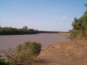 |
Southern Nations, Nationalities, and People's Region Southern Nations, Nationalities, and People's Region Southern Nations, Nationalities, and People's Region is one of the nine ethnic divisions of Ethiopia. It was formed from the merger of the former Regions 7-11 following the 1994 elections... , Ethiopia |
Cultural: (iii), (iv) |
1980 | The prehistoric site near Lake Turkana Lake Turkana Lake Turkana , formerly known as Lake Rudolf, is a lake in the Great Rift Valley in Kenya, with its far northern end crossing into Ethiopia. It is the world's largest permanent desert lake and the world's largest alkaline lake... is the location of many fossil findings, such as Homo gracilis. |
|
| M'Zab Valley M'zab The M'zab or Mzab, , is a region of the northern Sahara, in the Ghardaïa wilaya, an administrative division similar to a province, of Algeria... |
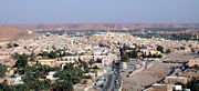 |
Ghardaïa Ghardaïa Ghardaïa is the capital city of Ghardaïa Province, Algeria. The commune of Ghardaïa has a population of 104,645, with 82,500 in the main city according to 2005 estimates. It is located in northern-central Algeria in the Sahara Desert and lies along the left bank of the Wadi Mzab... , Algeria |
Cultural: (ii), (iii), (v) |
4000 (9,884.2 acre) | 1982 | The intact, traditional human habitat was built around five ksour in the 10th century by the Ibadites. |
| Mana Pools National Park, Sapi and Chewore Safari Areas | 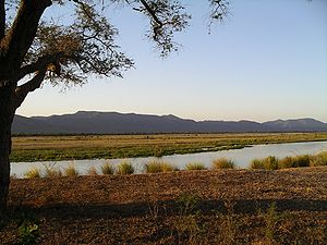 |
Matabeleland North Matabeleland North Matabeleland North is a province in western Zimbabwe. It borders the provinces of Midlands and Mashonaland West to the east and northeast respectively, and the province of Matabeleland South and the city of Bulawayo to the south. Its northern border is defined by the Zambezi river, while its... , Zimbabwe |
Natural: (vii), (ix), (x) |
676600 (1,671,913.5 acre) | 1984 | The park, located on the banks of the Zambezi River, features a variety of wild animals, such as buffalo African Buffalo The African buffalo, affalo, nyati, Mbogo or Cape buffalo is a large African bovine. It is not closely related to the slightly larger wild Asian water buffalo, but its ancestry remains unclear... , leopards, cheetahs and Nile crocodile Nile crocodile The Nile crocodile or Common crocodile is an African crocodile which is common in Somalia, Ethiopia, Uganda, Kenya, Egypt, Tanzania, Zambia, Zimbabwe, Gabon, South Africa, Malawi, Sudan, Botswana, and Cameroon... s. |
| Manovo-Gounda St. Floris National Park Manovo-Gounda St. Floris National Park Manovo-Gounda St.Floris National Park is a national park and UNESCO World Heritage Site located in the Central African Republic prefecture Bamingui-Bangoran, near the Chad border. It was inscribed to the list of World Heritage Sites in 1988 as a result of the diversity of life present within it... |
Bamingui-Bangoran Bamingui-Bangoran Bamingui-Bangoran is one of the 14 prefectures of the Central African Republic. It covers an area of 58,200 km² and has a population of 38,437 . The population density of 0.66/km² is the lowest in the country... ,  Central African Republic Central African Republic |
Natural: (ix), (x) |
1740000 (4,299,629.8 acre) | 1988 | The park features vast savannas with a wealth of flora and fauna, such as Black Rhinoceros Black Rhinoceros The Black Rhinoceros or Hook-lipped Rhinoceros , is a species of rhinoceros, native to the eastern and central areas of Africa including Kenya, Tanzania, Cameroon, South Africa, Namibia, Zimbabwe, and Angola... , elephant Elephant Elephants are large land mammals in two extant genera of the family Elephantidae: Elephas and Loxodonta, with the third genus Mammuthus extinct... s, cheetah Cheetah The cheetah is a large-sized feline inhabiting most of Africa and parts of the Middle East. The cheetah is the only extant member of the genus Acinonyx, most notable for modifications in the species' paws... s, leopard Leopard The leopard , Panthera pardus, is a member of the Felidae family and the smallest of the four "big cats" in the genus Panthera, the other three being the tiger, lion, and jaguar. The leopard was once distributed across eastern and southern Asia and Africa, from Siberia to South Africa, but its... s, wild dogs African Wild Dog Lycaon pictus is a large canid found only in Africa, especially in savannas and lightly wooded areas. It is variously called the African wild dog, African hunting dog, Cape hunting dog, painted dog, painted wolf, painted hunting dog, spotted dog, or ornate wolf... , red-fronted gazelle Red-fronted Gazelle The Red-fronted gazelle is a species of gazelle that is widely but unevenly distributed across the middle Africa from Senegal to north-eastern Ethiopia. It is mainly resident in the Sahel zone, a narrow cross-Africa band south of the Sahara, where it prefers arid grasslands, wooded savannas and... s and buffalo. The site was placed on the List of World Heritage in Danger in 1997 due to grazing Grazing Grazing generally describes a type of feeding, in which a herbivore feeds on plants , and also on other multicellular autotrophs... and poaching Poaching Poaching is the illegal taking of wild plants or animals contrary to local and international conservation and wildlife management laws. Violations of hunting laws and regulations are normally punishable by law and, collectively, such violations are known as poaching.It may be illegal and in... that is thought to have claimed 80% of the wildlife in the park. Also cited was the shooting of four park staff and "a general state of deteriorating security". |
|
| Mapungubwe Cultural Landscape | Limpopo Limpopo Limpopo is the northernmost province of South Africa. The capital is Polokwane, formerly named Pietersburg. The province was formed from the northern region of Transvaal Province in 1994, and initially named Northern Transvaal... , South Africa |
Cultural: (ii), (iii), (iv), (v) |
28168 (69,604.6 acre) | 2003 | The open savanna landscape lies at the confluence of the Limpopo Limpopo River The Limpopo River rises in central southern Africa, and flows generally eastwards to the Indian Ocean. It is around long, with a drainage basin in size. Its mean annual discharge is 170 m³/s at its mouth... and Shashe River Shashe River The Shashe River is a major left-bank tributary of the Limpopo River in Zimbabwe.It rises northwest of Francistown, Botswana and flows into the Limpopo River where Botswana, Zimbabwe and South Africa meet, site of the Shalimpo Transfrontier Conservation Area.- Hydrology :The Shashe River is a... s. It was the heart of the Mapungubwe Kingdom until the 14th century, when the area was abandoned, leaving untouched remains of palaces and settlements. |
|
| Matobo Hills | Matabeleland South Matabeleland South Matabeleland South is a province of Zimbabwe. It has an area of 54,172 km² and a population of approximately 650,000 . Gwanda is the capital of the province.-Geography:... , Zimbabwe |
Cultural: (iii), (v), (vi) |
205000 (506,565.6 acre) | 2003 | The large boulders have been used as natural shelters since the early Stone Age Stone Age The Stone Age is a broad prehistoric period, lasting about 2.5 million years , during which humans and their predecessor species in the genus Homo, as well as the earlier partly contemporary genera Australopithecus and Paranthropus, widely used exclusively stone as their hard material in the... and feature a collection of rock paintings. |
|
| Medina of Essaouira (formerly Mogador) Essaouira Mogador redirects here, for the hamlet in Surrey see Mogador, Surrey.Essaouira is a city in the western Moroccan economic region of Marrakech-Tensift-Al Haouz, on the Atlantic coast. Since the 16th century, the city has also been known by its Portuguese name of Mogador or Mogadore... |
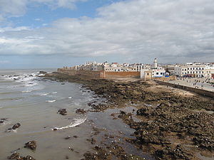 |
Essaouira Essaouira Mogador redirects here, for the hamlet in Surrey see Mogador, Surrey.Essaouira is a city in the western Moroccan economic region of Marrakech-Tensift-Al Haouz, on the Atlantic coast. Since the 16th century, the city has also been known by its Portuguese name of Mogador or Mogadore... , Morocco |
Cultural: (ii), (iv) |
30 (74.1 acre) | 2001 | The fortified seaport built during the late 18th century has a mix of North African and European architecture, and was a major trading hub between the Sahara and Europe. |
| Medina of Fez Fes el Bali Fes el Bali is the oldest and walled part of Fes, Morocco. Fes el Bali was originally founded as the capital of the Idrisid Dynasty in between 789 and 808 AD... |
Fez Fes Fes or Fez is the second largest city of Morocco, after Casablanca, with a population of approximately 1 million . It is the capital of the Fès-Boulemane region.... , Morocco |
Cultural: (ii), (v) |
280 (691.9 acre) | 1981 | The former capital was founded in the 9th century and features the world's oldest university. The urban fabric and main monuments date from the 13th and 14th centuries. | |
| Medina of Marrakesh | 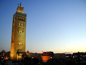 |
Marrakesh, Morocco |
Cultural: (i), (ii), (iv), (v) |
1107 (2,735.5 acre) | 1985 | The town was founded in the 1070s and remained a political, economic, and cultural centre for a long time. Monuments from that period include the Koutoubia Mosque, the kasbah Kasbah A kasbah or qassabah is a type of medina, Islamic city, or fortress .It was a place for the local leader to live and a defense when a city was under attack. A kasbah has high walls, usually without windows. Sometimes, they were built on hilltops so that they could be more easily defended... , and the battlements. The city also holds newer features, including palaces. |
| Medina of Sousse | 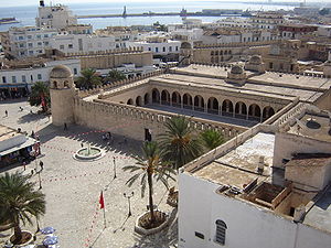 |
Sousse Governorate Sousse Governorate Sousse Governorate is one of the twenty-four governorates of Tunisia. It is situated in north-eastern Tunisia. It covers an area of 2,621 km² and has a population of 544,000... , Tunisia |
Cultural: (iii), (iv), (v) |
32 (79.1 acre) | 1988 | A prime example of a town from the early Islamic period, the city was an important port during the 9th century. |
| Medina of Tétouan (formerly known as Titawin) Tétouan Tetouan is a city in northern Morocco. The Berber name means literally "the eyes" and figuratively "the water springs". Tetouan is one of the two major ports of Morocco on the Mediterranean Sea. It lies a few miles south of the Strait of Gibraltar, and about 40 mi E.S.E. of Tangier... |
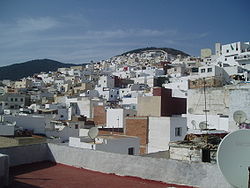 |
Tétouan Tétouan Tetouan is a city in northern Morocco. The Berber name means literally "the eyes" and figuratively "the water springs". Tetouan is one of the two major ports of Morocco on the Mediterranean Sea. It lies a few miles south of the Strait of Gibraltar, and about 40 mi E.S.E. of Tangier... , Morocco |
Cultural: (ii), (iv), (v) |
7 (17.3 acre) | 1997 | Morocco's most complete medina served as the main point of contact between Morocco and Andalusia Andalusia Andalusia is the most populous and the second largest in area of the autonomous communities of Spain. The Andalusian autonomous community is officially recognised as a nationality of Spain. The territory is divided into eight provinces: Huelva, Seville, Cádiz, Córdoba, Málaga, Jaén, Granada and... during the 8th century. The town was rebuilt by Andalusian refugees following the reconquista Reconquista The Reconquista was a period of almost 800 years in the Middle Ages during which several Christian kingdoms succeeded in retaking the Muslim-controlled areas of the Iberian Peninsula broadly known as Al-Andalus... . |
| Medina of Tunis | 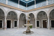 |
Tunis Tunis Tunis is the capital of both the Tunisian Republic and the Tunis Governorate. It is Tunisia's largest city, with a population of 728,453 as of 2004; the greater metropolitan area holds some 2,412,500 inhabitants.... , Tunisia |
Cultural: (ii), (iii), (v) |
1979 | The medina holds 700 monuments, including palaces, mosques, mausoleums, madrasah Madrasah Madrasah is the Arabic word for any type of educational institution, whether secular or religious... and fourtains, testifying to Tunis' golden age from the 12th to the 16th century. |
|
| Memphis Memphis, Egypt Memphis was the ancient capital of Aneb-Hetch, the first nome of Lower Egypt. Its ruins are located near the town of Helwan, south of Cairo.According to legend related by Manetho, the city was founded by the pharaoh Menes around 3000 BC. Capital of Egypt during the Old Kingdom, it remained an... and its Necropolis – the Pyramid Fields from Giza to Dahshur |
 |
Giza, Egypt |
Cultural: (i), (iii), (vi) |
16358 (40,421.5 acre) | 1979 | The former capital features funerary monuments, like rock tombs, mastaba Mastaba A mastaba, or "pr-djt" , is a type of ancient Egyptian tomb in the form of a flat-roofed, rectangular structure with outward sloping sides that marked the burial site of many eminent Egyptians of Egypt's ancient period... s, temples, and pyramids. It is one of the Seven Wonders of the Ancient World Seven Wonders of the Ancient World The Seven Wonders of the World refers to remarkable constructions of classical antiquity listed by various authors in guidebooks popular among the ancient Hellenic tourists, particularly in the 1st and 2nd centuries BC... . |
| Mosi-oa-Tunya / Victoria Falls Victoria Falls The Victoria Falls or Mosi-oa-Tunya is a waterfall located in southern Africa on the Zambezi River between the countries of Zambia and Zimbabwe.-Introduction:... |
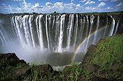 |
Livingstone District Livingstone District Livingstone District is a district of Zambia, located in Southern Province. The capital lies at Livingstone, Zambia. As of the 2000 Zambian Census, the district had a population of 103,288 people.-References:... and Matabeleland North Matabeleland North Matabeleland North is a province in western Zimbabwe. It borders the provinces of Midlands and Mashonaland West to the east and northeast respectively, and the province of Matabeleland South and the city of Bulawayo to the south. Its northern border is defined by the Zambezi river, while its... ,  Zambia* Zimbabwe* Zambia* Zimbabwe* |
Natural: (vii), (viii) |
8780 (21,695.8 acre) | 1989 | The falls of the Zambezi River, which is more than 2 km (1.2 mi) wide, plunge down various basalt gorges resulting in a colorful mist. |
| Mount Kenya National Park/Natural Forest Mount Kenya National Park Mount Kenya National Park, established in 1949, protects the region surrounding Mount Kenya. Initially it was a forest reserve before being announced as a national park. Currently the national park is within the forest reserve which encircles it. In April 1978 the area was designated a UNESCO... |
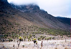 |
Central Province Central Province (Kenya) Kenya's Central Province covers an area of 13,191 km² and is located to north of Nairobi and west of Mt. Kenya. The province had 4,383,743 inhabitants according to the 2009 census... and Eastern Province Eastern Province (Kenya) The Eastern Province of Kenya is one of seven regions of the country. Its northern boundary is with Ethiopia; the North Eastern Province and Coast Province lie to the east and south; and the remainder of Kenya's provinces, including Central Province, run along its western border. The provincial... , Kenya |
Natural: (vii), (ix) |
142020 (350,938.8 acre) | 1997 | The park surrounds the 5199 m (17,057.1 ft) Mount Kenya Mount Kenya Mount Kenya is the highest mountain in Kenya and the second-highest in Africa, after Kilimanjaro. The highest peaks of the mountain are Batian , Nelion and Point Lenana . Mount Kenya is located in central Kenya, just south of the equator, around north-northeast of the capital Nairobi... and features twelve glaciers. |
| Mount Nimba Strict Nature Reserve Mount Nimba Strict Nature Reserve Mount Nimba Strict Nature Reserve is a protected area and UNESCO World Heritage Site in both Guinea and Côte d'Ivoire. A further extension of the reserve to include areas in Liberia has also been proposed.... |
Lola Prefecture Lola Prefecture Lola is a prefecture located in the Nzérékoré Region of Guinea. The capital is Lola. The prefecture covers an area of 3,940 km.² and has an estimated population of 124,000.-Sub-prefectures:The prefecture is divided admininstratively into 9 sub-prefectures:... , Côte d'Ivoire* Guinea* Guinea* |
Natural: (ix), (x) |
18000 (44,478.9 acre) | 1981 | The reserve features Mount Nimba Mount Nimba Mount Richard-Molard is a mountain along the border of Côte d'Ivoire and Guinea in West Africa. At 1,752 m it is the highest point in both nations. The mountain is the highest peak of the Nimba Range , straddling the border between the two countries and Liberia... , its slopes covered in dense forest and grassy mountain pastures. In 1992, the park was inscribed on the World Heritage Committee's danger list, citing a proposed iron and ore mining concession inside the park's boundaries and the apparition of refugees. The state party later stated that there was an error with the proposed mining site's boundaries, and that it was not in the reserve. However, as of 2011, the site remains on the list due to poor security on the Ivorian side. |
|
| Ngorongoro Conservation Area Ngorongoro Conservation Area The Ngorongoro Conservation Area is a conservation area and a UNESCO World Heritage Site situated west of Arusha in the Crater Highlands area of Tanzania. The conservation area is administered by the Ngorongoro Conservation Area Authority, an arm of the Tanzanian government, and its boundaries... |
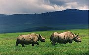 |
Arusha Region Arusha Region Arusha is one of Tanzania's 26 administrative regions. The regional capital and largest city is Arusha. Other towns include Monduli, just west of Arusha, Longido and Loliondo to the north, Mto Wa Mbu and Karatu to the west and Usa River to the east... , |
Mixed: (iv), (vii), (viii), (ix), (x) |
809440 (2,000,168 acre) | 1979 | The site features a concentration of wild animals in a crater beside the active volcano Oldonyo Lengai. |
| Niokolo-Koba National Park Niokolo-Koba National Park The Niokolo-Koba National Park is a World Heritage Site and natural protected area in south eastern Senegal near the Guinea-Bissau border.-National Park:... |
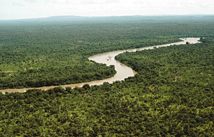 |
Kédougou Region Kédougou Region Kédougou Region is a region of Senegal. It was created in 2008. Formerly it was a department in the Region of Tambacounda.Kedougou has a number of ecotourism attractions... and Tambacounda Region Tambacounda Region Tambacounda, formerly known as Sénégal Orientale, is a region of Senegal. It used to be part of the Mali Empire before the borders were created to separate Mali from Senegal. Tambacounda is physically the largest of Senegal's 11 regions, but is sparsely populated and its economy lags behind the... , Senegal |
Natural: (x) |
913000 (2,256,070.1 acre) | 1981 | The forests and savannas bordering the Gambia River Gambia River The Gambia River is a major river in West Africa, running from the Fouta Djallon plateau in north Guinea westward through Senegal and The Gambia to the Atlantic Ocean at the city of Banjul... have a diverse fauna, including Derby Eland, chimpanzees, lions, birds, reptiles, and amphibians. The park was listed as being endangered for low mammal populations, the construction of a dam, and management problems. |
| Nubian Monuments from Abu Simbel to Philae | 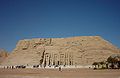 |
Aswan Aswan Aswan , formerly spelled Assuan, is a city in the south of Egypt, the capital of the Aswan Governorate.It stands on the east bank of the Nile at the first cataract and is a busy market and tourist centre... , Egypt |
Cultural: (i), (iii), (vi) |
374 (924.2 acre) | 1979 | Located along the Nile Nile The Nile is a major north-flowing river in North Africa, generally regarded as the longest river in the world. It is long. It runs through the ten countries of Sudan, South Sudan, Burundi, Rwanda, Democratic Republic of the Congo, Tanzania, Kenya, Ethiopia, Uganda and Egypt.The Nile has two major... , the site contains monuments such as the Temple of Ramesses II Ramesses II Ramesses II , referred to as Ramesses the Great, was the third Egyptian pharaoh of the Nineteenth dynasty. He is often regarded as the greatest, most celebrated, and most powerful pharaoh of the Egyptian Empire... and the Sanctuary of Isis Isis Isis or in original more likely Aset is a goddess in Ancient Egyptian religious beliefs, whose worship spread throughout the Greco-Roman world. She was worshipped as the ideal mother and wife as well as the matron of nature and magic... . |
| Okapi Wildlife Reserve Okapi Wildlife Reserve The Okapi Wildlife Reserve is a World Heritage Site in the Ituri Forest in the north-east of the Democratic Republic of the Congo, near the borders with Sudan and Uganda... |
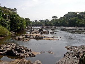 |
Orientale, Democratic Republic of the Congo |
Natural: (x) |
1372625 (3,391,827.2 acre) | 1996 | Covering a fifth of the Ituri Rainforest Ituri Rainforest The Ituri Rainforest is a rainforest located in the Ituri region of eastern Democratic Republic of the Congo formerly called Zaire. The forest's name derives from the nearby Ituri River which flows through the rainforest, connecting firstly to the Aruwimi River and finally into the Congo.-... in the Congo River Congo River The Congo River is a river in Africa, and is the deepest river in the world, with measured depths in excess of . It is the second largest river in the world by volume of water discharged, though it has only one-fifth the volume of the world's largest river, the Amazon... basin, the reserve contains many threatened species of primates and birds. It is inhabited by the nomadic pygmy Pygmy Pygmy is a term used for various ethnic groups worldwide whose average height is unusually short; anthropologists define pygmy as any group whose adult men grow to less than 150 cm in average height. A member of a slightly taller group is termed "pygmoid." The best known pygmies are the Aka,... Mbuti Mbuti Mbuti or Bambuti are one of several indigenous pygmy groups in the Congo region of Africa. Their languages belong to the Central Sudanic and also to Bantu languages.-Overview:... and Efé Efé The Efé are a group of part-time hunter-gatherer people living in the Ituri Rainforest of the Democratic Republic of Congo. In the depths of the forest they do not wear much clothing, using only leaf huts as shelter for their bodies in the intense heat. The Efé are Pygmies, and one of the shortest... tribes. In 1997, looting, the killing of elephants, and the departure of reserve staff led the World Heritage Committee to place the reserve on its List of World Heritage in Danger, only a year following its inscription as a natural heritage site. |
| Old Towns of Djenné | 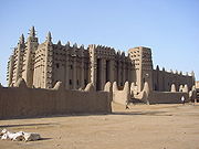 |
Djenné Djenné Djenné is an Urban Commune and town in the Inland Niger Delta region of central Mali. In the 2009 census the commune had a population of 32,944. Administratively it is part of the Mopti Region.... , Mali |
Cultural: (iii), (iv) |
1988 | Inhabited since 250 BCE, the city was an important link in the trans-Saharan gold trade. It contains 2,000 traditional houses. | |
| Old Town of Ghadamès Ghadames Ghadames or Ghadamis is an oasis town in the Nalut District of the Fezzan region in southwestern Libya.-Geography:Ghadames lies roughly to the southwest of Tripoli, near the borders with Algeria and Tunisia. Ghadames borders Illizi Province, Algeria and Tataouine Governorate, Tunisia.The oasis... |
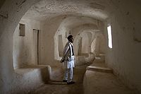 |
Ghadames Ghadames Ghadames or Ghadamis is an oasis town in the Nalut District of the Fezzan region in southwestern Libya.-Geography:Ghadames lies roughly to the southwest of Tripoli, near the borders with Algeria and Tunisia. Ghadames borders Illizi Province, Algeria and Tataouine Governorate, Tunisia.The oasis... , Libya |
Cultural: (v) |
1986 | Located in an oasis, Ghadames is one of the oldest pre-Saharan cities and represents a traditional architecture with vertical division of functions. | |
| Osun-Osogbo Sacred Grove | 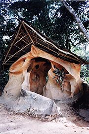 |
Osogbo Osogbo Osogbo is a city in Nigeria, the capital of Osun State and a Local Government Area.The Local Government Area has an area of 47 km² and a population of 156,694 at the 2006 census; the postal code of the area is 230.-Infrastructure and demographics:Osogbo lies on the railway line from Lagos to... ,  Nigeria Nigeria |
Cultural: (ii), (iii), (vi) |
75 (185.3 acre) | 2005 | The dense forests are one of the final remnants of high forests in southern Nigeria. It is the last sacred grove of the Yoruba culture Yoruba Culture Yoruba culture refers to the idiosyncratic cultural norms of Yorubaland and the Yoruba people.-Sculpture:The Yoruba are said to be prolific sculptors, famous for their magnificent terra cotta works throughout the 12th and 14th century; artists also harnests their capacity in making artwork out of... . |
| Pitons, Cirques and Remparts of Reunion Island Réunion Réunion is a French island with a population of about 800,000 located in the Indian Ocean, east of Madagascar, about south west of Mauritius, the nearest island.Administratively, Réunion is one of the overseas departments of France... |
 |
La Réunion La Reunion La Reunion may refer to:* La Reunion , a communal settlement near present-day Dallas, Texas*La Réunion, Lot-et-Garonne, a town in the Lot-et-Garonne department of France*Réunion, an island in the Indian Ocean east of Madagascar... ,  Early Modern France Early Modern France |
Natural: (vii), (x) |
105838 (261,531.2 acre) | 2010 | Outstanding terrain and biodiversity, as part of La Réunion National Park. |
| Portuguese City of Mazagan (El Jadida) El Jadida El Jadida is a port city on the Atlantic coast of Morocco, in the province of El Jadida. It has a population of 144,440... |
El Jadida El Jadida El Jadida is a port city on the Atlantic coast of Morocco, in the province of El Jadida. It has a population of 144,440... , Morocco |
Cultural: (ii), (iv) |
8 (19.8 acre) | 2004 | The fortification, akin to Renaissance Renaissance The Renaissance was a cultural movement that spanned roughly the 14th to the 17th century, beginning in Italy in the Late Middle Ages and later spreading to the rest of Europe. The term is also used more loosely to refer to the historical era, but since the changes of the Renaissance were not... military design from the early 16th century, was taken over by Morocco in 1769. Surviving buildings include the cistern and a Gothic Gothic architecture Gothic architecture is a style of architecture that flourished during the high and late medieval period. It evolved from Romanesque architecture and was succeeded by Renaissance architecture.... church. |
|
| Punic Town of Kerkuane Kerkouane Kerkouane is a Punic city in northeastern Tunisia, near Cape Bon. This Phoenician city was probably abandoned during the First Punic War , and as a result was not rebuilt by the Romans. It had existed for almost 400 years.... and its Necropolis Necropolis of Kerkouane A necropolis is located approximately northwest of the Punic city of Kerkouane, Tunisia. The necropolis consists of a series of vaults set in a seaside hill, four primary chamber-tombs, and a surrounding burial area... |
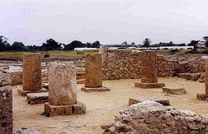 |
Nabeul Governorate Nabeul Governorate Nabeul Governorate is one of the 24 governorates of Tunisia. It is situated in north-eastern Tunisia. It covers an area of 2,788 km² and has a population of 694,000 . The capital is Nabeul.-Municipalities:... , Tunisia |
Cultural: (iii) |
1985 | The city was abandoned in 250 BCE during the First Punic War First Punic War The First Punic War was the first of three wars fought between Ancient Carthage and the Roman Republic. For 23 years, the two powers struggled for supremacy in the western Mediterranean Sea, primarily on the Mediterranean island of Sicily and its surrounding waters but also to a lesser extent in... , and is the only surviving example of a Phoenicio Phoenicia Phoenicia , was an ancient civilization in Canaan which covered most of the western, coastal part of the Fertile Crescent. Several major Phoenician cities were built on the coastline of the Mediterranean. It was an enterprising maritime trading culture that spread across the Mediterranean from 1550... –Punic settlement. |
|
| Rainforests of the Atsinanana Rainforests of the Atsinanana The Rainforests of the Atsinanana is a World Heritage Site that was inscribed in 2007 and consists 13 specific areas located within six national parks in the eastern part of Madagascar... |
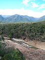 |
Eastern Madagascar, Madagascar Madagascar |
Natural: (ix), (x) |
479660 (1,185,264.6 acre) | 2007 | The site consists of six national parks, and protects the island's unique biodiversity, which has evolved in isolation for 60 million years. The park was deemed to be in danger in 2010, when logging and hunting activities continued to escalate, despite a ban by Madagascar on exporting illegal timber. |
| Richtersveld Cultural and Botanical Landscape | 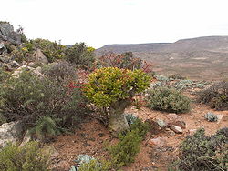 |
Northern Cape Northern Cape The Northern Cape is the largest and most sparsely populated province of South Africa. It was created in 1994 when the Cape Province was split up. Its capital is Kimberley. It includes the Kalahari Gemsbok National Park, part of an international park shared with Botswana... , South Africa |
Cultural: (iv), (v) |
160000 (395,368.3 acre) | 2007 | The mountainous desert sustains the semi-nomadic livelihood of the Namaqua Namaqua Nama are an African ethnic group of South Africa, Namibia and Botswana. They traditionally speak the Nama language of the Khoe-Kwadi language family, although many Nama now speak Afrikaans. The Nama are the largest group of the Khoikhoi people, most of whom have largely disappeared as a group,... , which includes seasonal migrations that have gone unchanged for two millennia. |
| Robben Island Robben Island Robben Island is an island in Table Bay, 6.9 km west of the coast of Bloubergstrand, Cape Town, South Africa. The name is Dutch for "seal island". Robben Island is roughly oval in shape, 3.3 km long north-south, and 1.9 km wide, with an area of 5.07 km². It is flat and only a... |
 |
Western Cape Western Cape The Western Cape is a province in the south west of South Africa. The capital is Cape Town. Prior to 1994, the region that now forms the Western Cape was part of the much larger Cape Province... , South Africa |
Cultural: (iii), (vi) |
475 (1,173.7 acre) | 1999 | Between the 17th and 20th century, the island was used as a prison, including for political prisoners, a hospital for socially unacceptable groups, and a military base. |
| Rock-Art Sites of Tadrart Acacus | 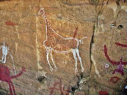 |
Fezzan Fezzan Fezzan is a south western region of modern Libya. It is largely desert but broken by mountains, uplands, and dry river valleys in the north, where oases enable ancient towns and villages to survive deep in the otherwise inhospitable Sahara.-Name:... , Libya |
Cultural: (iii) |
1985 | Thousands of cave paintings are visible in different styles, dating from 12,000 BCE to 100 CE. | |
| Rock-Hewn Churches, Lalibela |  |
Amhara Region Amhara Region Amhara is one of the nine ethnic divisions of Ethiopia, containing the homeland of the Amhara people. Previously known as Region 3, its capital is Bahir Dar.... , Ethiopia |
Cultural: (i), (ii), (iii) |
1978 | The site contains eleven medieval cave churches from the 13th century. | |
| Royal Hill of Ambohimanga | 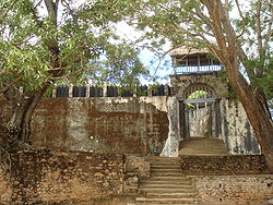 |
Antananarivo Antananarivo Antananarivo , formerly Tananarive , is the capital and largest city in Madagascar. It is also known by its French colonial shorthand form Tana.... , Madagascar |
Cultural: (iii), (iv), (vi) |
59 (145.8 acre) | 2001 | The royal city and burial site is a spiritual and sacred site which has created strong feelings of national identity for several centuries. |
| Royal Palaces of Abomey Royal Palaces of Abomey The Royal Palaces of Abomey are 12 palaces spread over a area at the heart of the Abomey town in Benin, formerly the capital of the West African Kingdom of Dahomey... |
Zou Department Zou Department Zou is one of the twelve departments of Benin.Zou is divided into the communes of Abomey, Agbangnizoun, Bohicon, Cové, Djidja, Ouinhi, Za-Kpota, Zangnanado, and Zogbodomey.... ,  Benin Benin |
Cultural: (iii), (iv) |
48 (118.6 acre) | 1985 | The city held the seat of twelve kings who ruled the Kingdom of Dahomey between 1625 and 1900. All but one king built their palace within the area. | |
| Ruins of Kilwa Kisiwani Kilwa Kisiwani Kilwa Kisiwani is a community on an island off the coast of East Africa, in present day Tanzania.- History :A document written around AD 1200 called al-Maqama al Kilwiyya discovered in Oman, gives details of a mission to reconvert Kilwa to Ibadism, as it had recently been effected by the Ghurabiyya... and Ruins of Songo Mnara |
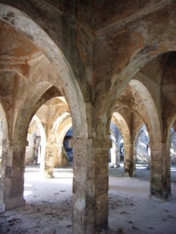 |
Kilwa District, |
Cultural: (iii) |
1981 | The site features the remains of two ports used extensively for trade across the Indian Ocean from the 13th and 16th century. It was placed onto the list of List of World Heritage in Danger by the World Heritage Committee in 2004, citing "the continuing deterioration and the serious threats affecting the property of the Ruins of Kilwa Kisiwani and Songo Mnara". | |
| Loropéni Loropeni Loropéni is a market town in southern Burkina Faso, lying west of Gaoua. Local features include pre-European stone ruins, about which little is known. One theory is that they formed the enclosure of the courtyard of a Kaan Iya from antiquity... ,  Burkina Faso Burkina Faso |
Cultural: (iii) |
1.1 (2.7 acre) | 2009 | More than a thousand years old, Loropéni is the best-preserved of ten fortresses in Lobi, which were part of about a hundred stone enclosures built during the trans-Saharan gold trade. | ||
| Rwenzori Mountains National Park Rwenzori Mountains National Park Rwenzori Mountains National Park is a Ugandan national park and UNESCO World Heritage Site located in the Rwenzori Mountains. Almost in size, the park has Africa's third highest mountain peak and many waterfalls, lakes, and glaciers. The park is known for its beautiful plant life.-History:Rwenzori... |
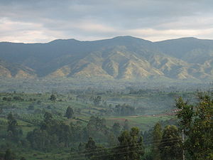 |
Bundibugyo District Bundibugyo District Bundibugyo District is a district in Western Uganda, bordering the Democratic Republic of the Congo. Like other Ugandan districts, it is named after its 'chief town', Bundibugyo, where the district headquarters are located.-Location:... , Kabarole District Kabarole District Kabarole District is a district in Western Uganda. Kabarole District is part of the Kingdom of Toro, one of the traditional monarchies that are constitutionally recognised in modern-day Uganda. The kingdom is coterminus with Toro sub-region... , and Kasese District Kasese District Kasese District is a district in Western Uganda. Like most other Ugandan districts, it is named after its 'chief town', Kasese, where the district headquarters are located.-Location:Kasese District is located along the Equator... , Uganda |
Natural: (vii), (x) |
99600 (246,116.7 acre) | 1994 | Covering most of the Rwenzori Mountains, including Mount Margherita, Africa's third-highest peak, the park features glaciers, waterfalls and lakes in an Alpine landscape. It also features various endangered species and unusual flora. |
| Sacred Mijikenda Kaya Forests | Coast Province Coast Province Coast Province of Kenya, along the Indian Ocean, is one of Kenya's seven administrative provinces outside Nairobi. It comprises the Indian Ocean coastal strip with the capital city at Mombasa and is inhabited by the Mijikenda and Swahili, among others... , Kenya |
Cultural: (iii), (v), (vi) |
1538 (3,800.5 acre) | 2008 | The site comprises eleven forests spread 200 km (124.3 mi) along the coast of Kenya. They hold the remains of villages built during the 16th century by the Mijikenda Mijikenda The Mijikenda are the nine ethnic groups along the coast of Kenya, from the border of Somalia in the north to the border of Tanzania in the south... , and are now considered sacred sites. |
|
| Saint Catherine Area | South Sinai Governorate, Egypt |
Cultural: (i), (iii), (iv), (vi) |
60100 (148,510.2 acre) | 2002 | The orthodox monastery from the 6th century is positioned near Mount Horeb Mount Horeb Mount Horeb, Hebrew: , Greek in the Septuagint: , Latin in the Vulgate: , is the mountain at which the book of Deuteronomy in the Hebrew Bible states that the Ten Commandments were given to Moses by God. It is described in two places as the Mountain of God or perhaps Mountain of the gods... where, according to the Old Testament Old Testament The Old Testament, of which Christians hold different views, is a Christian term for the religious writings of ancient Israel held sacred and inspired by Christians which overlaps with the 24-book canon of the Masoretic Text of Judaism... , Moses Moses Moses was, according to the Hebrew Bible and Qur'an, a religious leader, lawgiver and prophet, to whom the authorship of the Torah is traditionally attributed... received the Tablets of the Law. The region is sacred for Christians, Muslims and Jews. |
|
| Salonga National Park Salonga National Park Salonga National Park is a national park in the Democratic Republic of the Congo located in the Congo River basin. It is Africa's largest tropical rainforest reserve covering about 36,000 km². Animals in the park include bonobos, Salonga monkeys, Tshuapa red colobus, Zaire peacocks, forest... |
Maniema Maniema Maniema is a province of the Democratic Republic of the Congo. Its capital is Kindu.Following the 2005 Constitution , 25 new provinces were to be created from the 10 current provinces within 36 months . As of October 2010, this had not taken place... and South Kivu, Democratic Republic of the Congo |
Natural: (vii), (ix) |
3600000 (8,895,785.9 acre) | 1984 | Africa's largest tropical rain forest reserve is situated at the heart of the Congo River Congo River The Congo River is a river in Africa, and is the deepest river in the world, with measured depths in excess of . It is the second largest river in the world by volume of water discharged, though it has only one-fifth the volume of the world's largest river, the Amazon... basin and only accessible by water. It is the habitat of endangered species such as the bonobo Bonobo The bonobo , Pan paniscus, previously called the pygmy chimpanzee and less often, the dwarf or gracile chimpanzee, is a great ape and one of the two species making up the genus Pan. The other species in genus Pan is Pan troglodytes, or the common chimpanzee... , the Congo Peafowl Congo Peafowl The Congo Peafowl is a species of peafowl. It is the only member of the monotypic genus Afropavo.The male is a large bird of up to in length. Its feathers are deep blue with a metallic green and violet tinge. It has bare red neck skin, grey feet, and a black tail with fourteen feathers... , the forest elephant, and the slender-snouted crocodile Slender-snouted Crocodile The African Slender-snouted Crocodile is a species of crocodile. Recent studies in DNA and morphology suggest that it may belong in its own genus, Mecistops, but at present most continue to use Crocodylus for this species.African Slender-snouted Crocodile are native to freshwater habitats in... . The site was deemed to be in danger in 1999, due to increased poaching activities and encroachment Temporal encroachment Temporal encroachment is an action that affects the perception of time or that affects the ability to take action in the future. Temporal means related to the measurement or passing of time and encroachment is an intrusion, usually unwelcome, into the space of another.The space that temporal... s. |
|
| Saloum Delta Saloum Delta National Park Saloum Delta National Park or Parc National du Delta du Saloum in Senegal is a 76,000 - hectare national park in Senegal. Established in 1976, it is situated within the Saloum Delta at the juncture of the Saloum River and the North Atlantic.... |
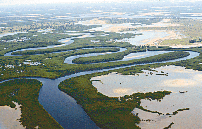 |
Senegal |
Cultural: (iii), (iv), (v) |
145811 (360,306.5 acre) | 2011 | The area has sustained human life thanks to fishing and shellfish gathering, for which there are 218 shellfish mounds across the site. |
| San Cristóbal de la Laguna San Cristóbal de la Laguna San Cristóbal de La Laguna is a city and municipality in the northern part of the island of Tenerife in the Province of Santa Cruz de Tenerife, on the Canary Islands . The city is third-most populous city of the archipelago and second-most populous city of the island. It is a suburban area of the... |
 |
Province of Santa Cruz de Tenerife, Spain |
Cultural: (ii), (iv) |
60 (148.3 acre) | 1999 | The city contains two centres: the unplanned Upper Town, and the planned Lower Town, laid out according to philosophical principals. Many of the buildings date from the 16th to the 18th centuries. |
| Selous Game Reserve Selous Game Reserve The Selous Game Reserve is one of the largest faunal reserves of the world, located in the south of Tanzania. It was named after Englishman Sir Frederick Selous, a famous big game hunter and early conservationist, who died at Beho Beho in this territory in 1917 while fighting against the Germans... |
Lindi Region Lindi Region Lindi is one of Tanzania's 26 administrative regions. The regional capital is also called Lindi.The Lindi region borders on Pwani, Morogoro, Ruvuma, and Mtwara. Much of the western part of the region is in the Selous Game Reserve.... , Morogoro Region Morogoro Region Morogoro Region is one of the regions of Tanzania. Its capital is Morogoro. It is bordered to the North by the Tanga Region, to the East by the Pwani and Lindi Regions, to the South by the Ruvuma Region and to the West by the Iringa and Dodoma Regions.... , Mtwara Region Mtwara Region Mtwara is a southern region of Tanzania which has been underdeveloped for a long time: development is constrained by the lack of highway and energy infrastructures. The Dar es Salaam-Kibiti-Lindi-Mtwara road has been improved by the completion of the Mkapa bridge over the Rufiji River... , Pwani Region Pwani Region Pwani is one of the 26 regions of Tanzania. Kibaha serves as the region's capital. The region is bordered to the North by the Tanga Region, to the East by Dar-es-Salaam and the Indian Ocean, to the South by the Lindi Region and to the West by the Morogoro Region... , and Ruvuma Region Ruvuma Region Ruvuma is a region in Tanzania. It is named after the Ruvuma River which forms most of its southern boundary with Mozambique. It is also bordered to the North by the Morogoro Region, to the Northeast by the Lindi Region, to the East by the Mtwara Region and to the Northwest by the Iringa Region. ... , |
Natural: (ix), (x) |
5000000 (12,355,258.2 acre) | 1982 | The park's vegetation varies from dense thickets to open wooded grasslands, and features large numbers of elephants, Black Rhinoceros Black Rhinoceros The Black Rhinoceros or Hook-lipped Rhinoceros , is a species of rhinoceros, native to the eastern and central areas of Africa including Kenya, Tanzania, Cameroon, South Africa, Namibia, Zimbabwe, and Angola... , cheetahs, giraffes, hippos and crocodiles. |
|
| Serengeti National Park Serengeti National Park The Serengeti National Park is a large national park in Serengeti area, Tanzania. It is most famous for its annual migration of over one and a half million white bearded wildebeest and 250,000 zebra... |
Arusha Region Arusha Region Arusha is one of Tanzania's 26 administrative regions. The regional capital and largest city is Arusha. Other towns include Monduli, just west of Arusha, Longido and Loliondo to the north, Mto Wa Mbu and Karatu to the west and Usa River to the east... , Mara Region Mara Region Mara is one of the 26 regions of Tanzania. The region is named after the Mara River. Musoma serves as the Region's capital.The neighbouring regions are Mwanza and Shinyanga , Arusha and Kagera . To the north east, it borders the Republic of Kenya... , and Shinyanga Region Shinyanga Region Shinyanga Region is one of the regions of Tanzania. Its capital is Shinyanga. It is bordered to the north by the Mwanza, Mara, and Kagera Regions, and to the south by the Tabora Region... , |
Natural: (vii), (x) |
1476300 (3,648,013.5 acre) | 1981 | The vast savanna is known for the annual migration for herds of wildebeest Wildebeest The wildebeest , also called the gnu is an antelope of the genus Connochaetes. It is a hooved mammal... , gazelle Gazelle A gazelle is any of many antelope species in the genus Gazella, or formerly considered to belong to it. Six species are included in two genera, Eudorcas and Nanger, which were formerly considered subgenera... , zebras, and their predators. |
|
| Simien National Park Semien Mountains National Park Simien Mountains National Park is one of the National Parks of Ethiopia. Located in the Semien Gondar Zone of the Amhara Region, its territory covers the Simien Mountains and includes Ras Dashan, the highest point in Ethiopia.... |
 |
Amhara Region Amhara Region Amhara is one of the nine ethnic divisions of Ethiopia, containing the homeland of the Amhara people. Previously known as Region 3, its capital is Bahir Dar.... , Ethiopia |
Natural: (vii), (x) |
22000 (54,363.1 acre) | 1978 | The eroded Ethiopian plateau comprises of jagged mountain peaks, deep valleys, and sharp precipices dropping about 1500 m (4,921.3 ft). The decrease of the Walia Ibex Walia Ibex The walia ibex is a species of ibex that is endangered. It is sometimes considered a subspecies of the Alpine Ibex... , bushbuck Bushbuck The bushbuck is the most widespread antelope in Sub-Saharan Africa, and is found in rain forests, montane forests, forest-savanna mosaics and bush savannaforest and woodland. Recently, genetic studies have shown that the bushbuck, is in fact a complex of two geographically and phenotypically... , and bushpig Bushpig The bushpig, Potamochoerus larvatus, is a member of the pig family and lives in forests, woodland, riverine vegetation and reedbeds in East and Southern Africa. Probably introduced populations are also present in Madagascar and the Comoros archipelago. Bushpigs are mainly nocturnal. There are... populations, as well as an increase of the human population in the park prompted the World Heritage Committee to place it on their List of World Heritage in Danger in 1996. |
| Stone Circles of Senegambia Senegambian stone circles The Senegambian stone circles lie in Gambia north of Janjanbureh and in central Senegal. Coordinates: 13° 41 N – 15° 31 W.Approximate area: 15,000 square miles . They are sometimes divided into the Wassu and Sine-Saloum circles, but this is purely a national division.The stones were erected... |
 |
Central River Division Central River Division Central River is the largest of the five administrative divisions of The Gambia. Its capital is Janjanbureh , on MacCarthy Island... and Kaolack Region Kaolack Region The Kaolack region is a region in Senegal. It borders Gambia and is a common stopping point for travel between Dakar and Banjul. Its borders correspond roughly to the Saalum Kingdom of precolonial days, and the area is still spoken of as the Saalum in Wolof, and its inhabitants are called... , The Gambia* Senegal* |
Cultural: (i), (iii) |
10 (24.7 acre) | 2006 | The groups of stone circles are among over 1,000 different monuments along the Gambia River Gambia River The Gambia River is a major river in West Africa, running from the Fouta Djallon plateau in north Guinea westward through Senegal and The Gambia to the Atlantic Ocean at the city of Banjul... . Used as burial grounds, they were erected between the 3rd century BCE and the 16th century CE. |
| Stone Town of Zanzibar |  |
Zanzibar Zanzibar Zanzibar ,Persian: زنگبار, from suffix bār: "coast" and Zangi: "bruin" ; is a semi-autonomous part of Tanzania, in East Africa. It comprises the Zanzibar Archipelago in the Indian Ocean, off the coast of the mainland, and consists of numerous small islands and two large ones: Unguja , and Pemba... , |
Cultural: (ii), (iii), (vi) |
96 (237.2 acre) | 2000 | A prime example of an East African coastal trading town, its urban fabric and townscape remains intact. |
| Sukur Cultural Landscape | 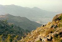 |
Madagali Madagali Madagali or Madagli is a town and local government area in Adamawa State, Nigeria. The LGA was created in 1991 when Taraba State was created out of Gongola State. It borders Michika to the north, Askira uba to the west, Gwoza local government area to the south and the Republic of Cameroon to the... , Nigeria |
Cultural: (iii), (v), (vi) |
1999 | The site features the Palace of the Hidi, terraced fields, and the remains of a former iron industry. | |
| Taï National Park Taï National Park Taï National Park is a national park in Côte d'Ivoire containing one of the last areas of primary rainforest in West Africa. It was inscribed as a World Heritage Site in 1982 due to the breadth of its flora and fauna... |
Guiglo Guiglo Guiglo is a town in Guiglo Department of Moyen-Cavally Region in western Côte d'Ivoire. Guiglo Town is located on the Nzo River, a tributary of the Sassandra River... and Sassandra Sassandra Sassandra is the chief town in Sassandra Department of Côte d'Ivoire. The department is located in Bas-Sassandra Region. The town of Sassandra lies on the Gulf of Guinea at the mouth of the Sassandra River. The town was founded by the Portuguese as Santo André and was later run by the British,... , Côte d'Ivoire |
Natural: (vii), (x) |
330000 (815,447 acre) | 1982 | One of few remaining sections of the West African tropical forest, the park features a rich flora, including eleven species of monkeys. | |
| Tassili n'Ajjer Tassili n'Ajjer Tassili n'Ajjer is a mountain range in the Algerian section of the Sahara Desert. It is a vast plateau in south-east Algeria at the borders of Libya, Niger and Mali, covering an area of 72,000 sq... |
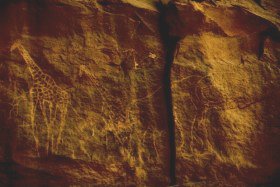 |
Illizi Illizi Illizi is a town situated in the south-eastern part of Algeria, capital of Illizi Province. It is one of the gates to the Tassili N'Ajjer National Park with caves situated under the sands containing prehistoric drawings dating from 6000 years BC. There is a hotel and two camping sites, as well as... and Tamanrasset, Algeria |
Mixed: (i), (iii), (vii), (viii) |
7200000 (17,791,571.7 acre) | 1982 | The site is in a landscape with 15,000 cave engravings that record climatic changes, animal migrations, and the evolution of human life, dating from 6,000 BCE to the first centuries CE. |
| Teide National Park Teide National Park Teide National Park is a national park located in Tenerife . It is centered around 3718m Mount Teide, the highest mountain of Spain and the islands of the Atlantic... |
 |
Province of Santa Cruz de Tenerife, Spain |
Natural: (vii), (viii) |
18990 (46,925.3 acre) | 2007 | The national park features the Teide Teide Mount Teide , is a volcano on Tenerife, Canary Islands. Its summit is the highest point in Spain, the highest point above sea level in the islands of the Atlantic, and it is the third highest volcano in the world measured from its base on the ocean floor, after Mauna Loa and Mauna Kea located in... stratovolcano Stratovolcano A stratovolcano, also known as a composite volcano, is a tall, conical volcano built up by many layers of hardened lava, tephra, pumice, and volcanic ash. Unlike shield volcanoes, stratovolcanoes are characterized by a steep profile and periodic, explosive eruptions... , which at 3718 m (12,198.2 ft) is Spain's tallest mountain and the world's third-tallest volcano. |
| Timbuktu Timbuktu Timbuktu , formerly also spelled Timbuctoo, is a town in the West African nation of Mali situated north of the River Niger on the southern edge of the Sahara Desert. The town is the capital of the Timbuktu Region, one of the eight administrative regions of Mali... |
 |
Timbuktu Cercle Timbuktu Cercle Timbuktu Cercle is an administrative subdivision of the Tombouctou Region of Mali. It is the largest cercle by area in the whole of Mali. The capital lies at the city of Timbuktu. The Cercle is divided into Rural and Urban Communes, and below this, quarters/villages... , Mali |
Cultural: (ii), (iv), (v) |
1988 | The city was a centre for the propagation of Islam in the 15th and 16th centuries, and features three mosques and many madrasah Madrasah Madrasah is the Arabic word for any type of educational institution, whether secular or religious... s. |
|
| Timgad Timgad Timgad , called Thamugas or Tamugadi in old Berber) was a Roman colonial town in the Aures mountain- numidia Algeria founded by the Emperor Trajan around 100 AD. The full name of the town was Colonia Marciana Ulpia Traiana Thamugadi... |
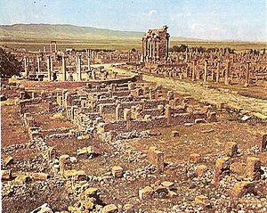 |
Batna Province Batna Province Batna is a wilaya of Algeria. Capital is Batna. Localities in this province include Barika, Merouana and Timgad. Belezma National Park is there.- Administrative divisions :It is made up of 22 districts and 61 municipalities.The districts are:... , Algeria |
Cultural: (ii), (iii), (iv) |
0.04 (0.0988420652061104 acre) | 1982 | A military colony built by Emperor Trajan in 100 CE, the site features cardo Cardo The cardo was a north-south oriented street in Roman cities, military camps, and coloniae. The cardo, an integral component of city planning, was lined with shops and vendors, and served as a hub of economic life. The main cardo was called cardo maximus.Most Roman cities also had a Decumanus... and decumanus streets, typical of a Roman town. |
| Tipasa | Tipaza, Algeria |
Cultural: (iii), (iv) |
52 (128.5 acre) | 1982 | First a Carthaginian trading center, Tipasa was converted into a military base by the Romans. Heavy Christian influences can be seen from the 3rd and 4th centuries, though Tipasa went into steady decline in the Byzantine Byzantine Byzantine usually refers to the Roman Empire during the Middle Ages.Byzantine may also refer to:* A citizen of the Byzantine Empire, or native Greek during the Middle Ages... period. |
|
| Tiya Tiya Tiya is a town in southern Ethiopia. Located in the Gurage Zone of the Southern Nations, Nationalities, and Peoples Region south of Addis Ababa, the town has a latitude and longitude of .... |
Southern Nations, Nationalities, and People's Region Southern Nations, Nationalities, and People's Region Southern Nations, Nationalities, and People's Region is one of the nine ethnic divisions of Ethiopia. It was formed from the merger of the former Regions 7-11 following the 1994 elections... , Ethiopia |
Cultural: (i), (iv) |
1980 | The archaeological site contains 36 monuments, which includes 32 carved stelae covered with symbols hard to decrypt. | ||
| Tomb of Askia Tomb of Askia The Tomb of Askia, in Gao, Mali, is believed to be the burial place of Askia Mohammad I, one of the Songhai Empire's most prolific emperors. It was built at the end of the fifteenth century and is designated as a UNESCO World Heritage Site.... |
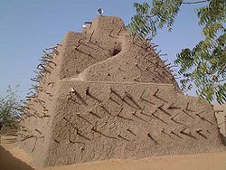 |
Gao Region Gao Region The Gao Region is located in eastern Mali. The region's capital city is Gao. Gao Region is bordered to the south and east by Niger, to the north by Kidal Region, and to the west by Tombouctou Region. Common ethnicities in the Gao Region include the Songhai, Bozo, Tuareg, Bambara, and Kounta... , Mali |
Cultural: (ii), (iii), (iv) |
4 (9.9 acre) | 2004 | Built in 1495, the pyramid was built as a tomb for Emperor Askia Mohamed Askiya Dynasty The Askiya Dynasty, also known as the Askia Dynasty, ruled the Songhai Empire at the height of that state's power. It was founded in 1493 by Askia Mohammad I, a general of the Songhai Empire who usurped the Sonni Dynasty. The Askiya ruled from Gao over the vast Songhai Empire until its defeat by a... . It represents the power of an empire that controlled the trans-Saharan gold trade. |
| Tombs of Buganda Kings at Kasubi | Kampala District Kampala District Kampala District is a district in Uganda that is coterminous with the country's capital city, Kampala. The district is named after the city. The main language spoken is Luganda. However many other languages are spoken, including: English, Swahili, Runyankole/Rukiga, Acholi and... , Uganda |
Cultural: (i), (iii), (iv), (vi) |
27 (66.7 acre) | 2001 | The tombs, built after 1884, are a major example of prime architecture using organic materials, principally wood, thatch, reed Reed (plant) Reed is a generic polyphyletic botanical term used to describe numerous tall, grass-like plants of wet places, which are the namesake vegetation of reed beds... , and wattle and daub Wattle and daub Wattle and daub is a composite building material used for making walls, in which a woven lattice of wooden strips called wattle is daubed with a sticky material usually made of some combination of wet soil, clay, sand, animal dung and straw... . The tombs were almost completely destroyed by a fire in March of 2010, prompting the World Heritage Committee to reluctantly mark the site as being in danger. The Ugandan government has since called for the reconstruction of the tombs, and UNESCO has agreed to mobilise funds for the project. |
|
| Tsingy de Bemaraha Strict Nature Reserve Tsingy de Bemaraha Strict Nature Reserve Tsingy de Bemaraha Strict Nature Reserve is a nature reserve located near the western coast of Madagascar in Melaky Region at . The area was listed as a UNESCO World Heritage Site in 1990 due to the unique geography, preserved mangrove forests, and wild bird and lemur populations... |
Melaky Melaky Melaky is a region in northwestern Madagascar. It borders Boeny Region in northeast, Betsiboka in east, Bongolava in southeast and Menabe in south. The capital of the region is Maintirano. The population was estimated to be 175,500 in 2004 within the area of... , Madagascar |
Natural: (vii), (x) |
152000 (375,599.8 acre) | 1990 | The canyon of the Manambolo River Manambolo River The Manambolo River is a river in the highlands of Madagascar, located 130km west of Antananarivo.... comprises karstic and limestone Limestone Limestone is a sedimentary rock composed largely of the minerals calcite and aragonite, which are different crystal forms of calcium carbonate . Many limestones are composed from skeletal fragments of marine organisms such as coral or foraminifera.... landscapes cut into peaks and a forest of limestone needles. It also holds undisturbed forests, lakes and mangrove swamps, which are the habitat for lemurs and birds. |
|
| Tsodilo Tsodilo Tsodilo is a UNESCO World Heritage Site located in northwestern Botswana. It was inscribed in 2001 due to its unique religious and spiritual significance to local peoples, as well as its unique record of human settlement over many millennia. It contains over 4,500 rock paintings in an area of... |
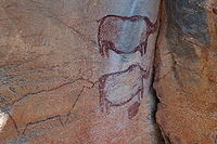 |
North-West North-West District (Botswana) North-West District Council is one of the local authorities of Botswana. It was established in 1966, overlapping the administrative districts of Chobe and Ngamiland... ,  Botswana Botswana |
Cultural: (i), (iii), (vi) |
4800 (11,861 acre) | 2001 | The site features more than 4,500 rock art paintings in the Kalahari Desert Kalahari Desert The Kalahari Desert is a large semi-arid sandy savannah in Southern Africa extending , covering much of Botswana and parts of Namibia and South Africa, as semi-desert, with huge tracts of excellent grazing after good rains. The Kalahari supports more animals and plants than a true desert... . Archaeological records provide evidence of human and environmental activities ranging over 100,000 years. |
| Twyfelfontein or /Ui-//aes Twyfelfontein Twyfelfontein , officially known as ǀUi-ǁAis , is a site of ancient rock engravings in the Kunene Region of north-western Namibia... |
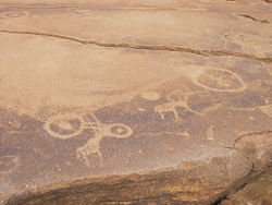 |
Kunene Kunene Region Kunene is one of the thirteen regions of Namibia and home to the Himba ethnic group. Compared to the rest of Namibia, it is relatively underdeveloped... ,  Namibia Namibia |
Cultural: (iii), (v) |
57 (140.8 acre) | 2007 | The site has one of the largest concentrations of rock engravings in Africa, which range from a period of over 2,000 years. |
| uKhahlamba / Drakensberg Park Drakensberg The Drakensberg is the highest mountain range in Southern Africa, rising to in height. In Zulu, it is referred to as uKhahlamba , and in Sesotho as Maluti... |
 |
KwaZulu-Natal KwaZulu-Natal KwaZulu-Natal is a province of South Africa. Prior to 1994, the territory now known as KwaZulu-Natal was made up of the province of Natal and the homeland of KwaZulu.... , South Africa |
Mixed: (i), (iii), (vii), (x) |
242813 (600,003.5 acre) | 2000 | The park features incisive dramatic cutbacks, golden sandstone ramparts, and the largest concentration of cave art in Sub-Saharan Africa. |
| Vallée de Mai Nature Reserve |  |
Praslin Praslin Praslin is the second largest island of the Seychelles, lying 44 km north east of Mahé. Praslin has a population of around 6,500 people and comprises two administrative districts; Baie Sainte Anne and Grand' Anse . The main settlements are the Baie Ste Anne, Anse Volbert and Grand' Anse.It was... , Seychelles |
Natural: (vii), (viii), (ix), (x) |
20 (49.4 acre) | 1983 | The natural palm Arecaceae Arecaceae or Palmae , are a family of flowering plants, the only family in the monocot order Arecales. There are roughly 202 currently known genera with around 2600 species, most of which are restricted to tropical, subtropical, and warm temperate climates... forest is preserved in almost its original state. |
| Virunga National Park Virunga National Park The Virunga National Park , formerly named Albert National Park, is a 7800 square km National Park that stretches from the Virunga Mountains in the South, to the Rwenzori Mountains in the North, in the eastern Democratic Republic of Congo, bordering Volcanoes National Park in Rwanda and Rwenzori... |
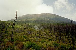 |
North Kivu and Orientale, Democratic Republic of the Congo |
Natural: (vii), (viii), (x) |
800000 (1,976,841.3 acre) | 1979 | The park comprises swamps, savannas, and snowfields. Virunga was inscribed on the World Heritage Committee's List of World Heritage in Danger in 1994, due to the war in Rwanda Rwandan Genocide The Rwandan Genocide was the 1994 mass murder of an estimated 800,000 people in the small East African nation of Rwanda. Over the course of approximately 100 days through mid-July, over 500,000 people were killed, according to a Human Rights Watch estimate... and the subsequent increase of the refugee population in the park, deforestation, poaching, departure of park staff, and depletion of forests. |
| Vredefort Dome | Free State Free State The Free State is a province of South Africa. Its capital is Bloemfontein, which is also South Africa's judicial capital. Its historical origins lie in the Orange Free State Boer republic and later Orange Free State Province. The current borders of the province date from 1994 when the Bantustans... and North West North West (South African province) North West is a province of South Africa. Its capital is Mafikeng. The province is located to the west of the major population centre of Gauteng.-History:... , South Africa |
Natural: (viii) |
30000 (74,131.5 acre) | 2005 | The crater, with a diameter of 190 km (118.1 mi), is the largest, oldest, and most deeply eroded astrobleme found on Earth, dating back more than two billion years. | |
| W National Park of Niger | 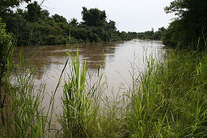 |
Say Department Say Department Say is a department of the Tillabéri Region in Niger. Its capital city is Say, and includes the towns of Guéladjo, Tamou, and Torodi. It abuts the urban Region of Niamey, and lies across the Niger River to the southwest of the capital. It extends to the Burkina Faso border over 60km to the west,... , Niger |
Natural: (ix), (x) |
220000 (543,631.4 acre) | 1996 | The park is in the zone between savanna and forest lands, and is an important ecosystem for the biogeographical area. |
| Wadi Al-Hitan (Whale Valley) Wadi Al-Hitan Wadi Al-Hitan is a paleontological site in the Al Fayyum Governorate of Egypt, some 150 km southwest of Cairo. It was designated a UNESCO World Heritage Site in July 2005 for its hundreds of fossils of some of the earliest forms of whale, the archaeoceti... |
Faiyum Governorate, Egypt |
Natural: (viii) |
20015 (49,458.1 acre) | 2005 | Located in western Egypt, the site contains fossil remains of the now extinct Archaeoceti Archaeoceti Archaeocetes, or "ancient whales", are a paraphyletic group of cetaceans that gave rise to the modern cetaceans.The archaeocetes were once thought to have evolved from the mesonychids, based on dental characteristics... , mapping the evolution of the whales Evolution of cetaceans The cetaceans are marine mammal descendants of land mammals. Their terrestrial origins are indicated by:* Their need to breathe air from the surface;* The bones of their fins, which resemble the limbs of land mammals... from a land-based to an aquatic mammal. |