
Maryland Route 632
Encyclopedia
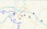
Maryland Route 632 is a state highway
in the U.S. state
of Maryland
. Known as Downsville Pike, the state highway runs 6.71 miles (10.8 km) from MD 63
in Downsville
north to Maryland Avenue in Hagerstown
. MD 632 was constructed along the path of a former turnpike in the late 1930s. The state highway's interchange with Interstate 70
(I-70) opened in 1999.
(Lappans Road). MD 632 begins to pass residential subdivisions and industrial properties ahead of its interchange with I-70 (Eisenhower Memorial Highway), through which the state highway is a four-lane divided highway. The intersection with the ramps to and from westbound I-70 is shared with Halfway Boulevard, which heads northwest toward U.S. Route 11
and I-81
. MD 632 reduces to two lanes again and passes through the southeastern part of Halfway
before crossing over Norfolk Southern Railway
's Hagerstown District. The state highway turns north to intersect Oak Ridge Drive, enters the city of Hagerstown, and passes through a forested area before reaching its northern terminus at the intersection of Maryland Avenue and Downsville Pike between South Hagerstown High School
to the east and a pair of shopping centers to the west. The roadway continues north as Maryland Avenue toward downtown Hagerstown, while Downsville Pike heads northeast toward Potomac Street just north of MD 65
's northern terminus.
!Location
!Mile
!Destinations
!Notes
|-
|Downsville
|0.00
|
|Southern terminus
|-
|St. James
|2.24
|
|
|-
|Halfway
|4.92
|
|I-70 Exit 28
|-
|Hagerstown
|6.71
|Maryland Avenue north / Downsville Road north
|Northern terminus
State highway
State highway, state road or state route can refer to one of three related concepts, two of them related to a state or provincial government in a country that is divided into states or provinces :#A...
in the U.S. state
U.S. state
A U.S. state is any one of the 50 federated states of the United States of America that share sovereignty with the federal government. Because of this shared sovereignty, an American is a citizen both of the federal entity and of his or her state of domicile. Four states use the official title of...
of Maryland
Maryland
Maryland is a U.S. state located in the Mid Atlantic region of the United States, bordering Virginia, West Virginia, and the District of Columbia to its south and west; Pennsylvania to its north; and Delaware to its east...
. Known as Downsville Pike, the state highway runs 6.71 miles (10.8 km) from MD 63
Maryland Route 63
Maryland Route 63 is a state highway in the U.S. state of Maryland. The state highway runs from MD 65 in Fairplay north to the Pennsylvania state line near Cearfoss, where the highway continues as Pennsylvania Route 163 . MD 63 is an L-shaped route that passes through central Washington County...
in Downsville
Downsville, Maryland
Downsville is an unincorporated community not considered as a census-designated place in southwestern Washington County, Maryland, United States. It is southeast of Williamsport, Maryland on Maryland Route 63 and on Maryland Route 632 southwest of Hagerstown, Maryland...
north to Maryland Avenue in Hagerstown
Hagerstown, Maryland
Hagerstown is a city in northwestern Maryland, United States. It is the county seat of Washington County, and, by many definitions, the largest city in a region known as Western Maryland. The population of Hagerstown city proper at the 2010 census was 39,662, and the population of the...
. MD 632 was constructed along the path of a former turnpike in the late 1930s. The state highway's interchange with Interstate 70
Interstate 70 in Maryland
Interstate 70 is a part of the Interstate Highway System that runs from Cove Fort, Utah to Baltimore, Maryland. In Maryland, the Interstate Highway runs from the Pennsylvania state line in Hancock east to the Interstate's eastern terminus near its junction with I-695 at a park and ride in...
(I-70) opened in 1999.
Route description
MD 632 begins at an intersection with MD 63 (Spielman Road) in Downsville. The state highway northeast as a two-lane road through farmland, in the midst of which the highway intersects MD 68Maryland Route 68
Maryland Route 68 is a state highway in the U.S. state of Maryland. The state highway runs from U.S. Route 40 in Clear Spring east to US 40 Alternate in Boonsboro. MD 68 crosses central Washington County to the south of Hagerstown, connecting Clear Spring and Boonsboro with Williamsport, where...
(Lappans Road). MD 632 begins to pass residential subdivisions and industrial properties ahead of its interchange with I-70 (Eisenhower Memorial Highway), through which the state highway is a four-lane divided highway. The intersection with the ramps to and from westbound I-70 is shared with Halfway Boulevard, which heads northwest toward U.S. Route 11
U.S. Route 11 in Maryland
U.S. Route 11 is a part of the U.S. Highway System that runs from New Orleans, Louisiana to Rouses Point, New York. In Maryland, the federal highway runs from the West Virginia state line at the Potomac River in Williamsport north to the Pennsylvania state line near Maugansville...
and I-81
Interstate 81 in Maryland
Interstate 81 is a part of the Interstate Highway System that runs from Dandridge, Tennessee to Fishers Landing, New York. In Maryland, the Interstate highway runs from the West Virginia state line at the Potomac River in Williamsport north to the Pennsylvania state line near Maugansville...
. MD 632 reduces to two lanes again and passes through the southeastern part of Halfway
Halfway, Maryland
Halfway is a census-designated place in Washington County, Maryland, United States. The population was 10,065 at the 2000 census. It is named for being halfway between Hagerstown and Williamsport...
before crossing over Norfolk Southern Railway
Norfolk Southern Railway
The Norfolk Southern Railway is a Class I railroad in the United States, owned by the Norfolk Southern Corporation. With headquarters in Norfolk, Virginia, the company operates 21,500 route miles in 22 eastern states, the District of Columbia and the province of Ontario, Canada...
's Hagerstown District. The state highway turns north to intersect Oak Ridge Drive, enters the city of Hagerstown, and passes through a forested area before reaching its northern terminus at the intersection of Maryland Avenue and Downsville Pike between South Hagerstown High School
South Hagerstown High School
South Hagerstown High School is located at 1101 South Potomac Street, in Hagerstown, Maryland, United States. The current principal is Richard Akers. The school is part of the Washington County Public Schools system. It enrolls 1280 Students and School day is 8:45 to 3:30. The size is 163,959...
to the east and a pair of shopping centers to the west. The roadway continues north as Maryland Avenue toward downtown Hagerstown, while Downsville Pike heads northeast toward Potomac Street just north of MD 65
Maryland Route 65
Maryland Route 65 is a state highway in the U.S. state of Maryland. Known for most of its length as Sharpsburg Pike, the state highway runs from MD 34 in Sharpsburg north to the southern end of Hagerstown, where the highway continues north as Potomac Street toward the downtown area...
's northern terminus.
History
The predecessor highway of MD 632 was the Downsville and Hagerstown Turnpike from Downsville to the Hagerstown and Sharpsburg Turnpike (now MD 65) in Hagerstown. MD 632 was designated and constructed as a modern highway between 1938 and 1940. The state highway was reconstructed around 1956. The portion of MD 632 around the I-70 overpass was expanded to a four-lane divided highway in 1968 despite no interchange being constructed at that time. The state highway was relocated in Halfway as part of the grade separation of the highway and the Norfolk Southern Railway line in 1978. MD 632's interchange with I-70 was constructed starting in February 1998 and was completed in September 1999.Junction list
{|class=wikitable!Location
!Mile
!Destinations
!Notes
|-
|Downsville
Downsville, Maryland
Downsville is an unincorporated community not considered as a census-designated place in southwestern Washington County, Maryland, United States. It is southeast of Williamsport, Maryland on Maryland Route 63 and on Maryland Route 632 southwest of Hagerstown, Maryland...
|0.00
|
|Southern terminus
|-
|St. James
St. James, Maryland
St. James is a census-designated place in Washington County, Maryland, United States. The population was 1,657 at the 2000 census. It is also the home of St. James School, Hagerstown, a small, Episcopalian, boarding school.-Geography:St...
|2.24
|
|
|-
|Halfway
Halfway, Maryland
Halfway is a census-designated place in Washington County, Maryland, United States. The population was 10,065 at the 2000 census. It is named for being halfway between Hagerstown and Williamsport...
|4.92
|
|I-70 Exit 28
|-
|Hagerstown
Hagerstown, Maryland
Hagerstown is a city in northwestern Maryland, United States. It is the county seat of Washington County, and, by many definitions, the largest city in a region known as Western Maryland. The population of Hagerstown city proper at the 2010 census was 39,662, and the population of the...
|6.71
|Maryland Avenue north / Downsville Road north
|Northern terminus