
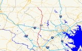
Maryland Route 97
Encyclopedia
Maryland Route 97 is a state highway
in the U.S. state
of Maryland
. The route runs 55.27 mi (88.95 km) from U.S. Route 29
in Silver Spring
, Montgomery County
north to the Pennsylvania
border in Carroll County
, where the road continues into that state as Pennsylvania Route 97. Throughout most of Montgomery County, MD 97 is known as Georgia Avenue, which continues south from the southern terminus along US 29 into Washington, D.C.
It is a suburban four- to six-lane divided highway
from Silver Spring north to Olney
. From here, the route continues as a rural two-lane road north through Brookeville
and into Howard County
. MD 97 continues through Carroll County where it passes through the county seat of Westminster
. The route intersects many major roads, including Interstate 495
(Capital Beltway) north of Silver Spring, Maryland Route 200 (Intercounty Connector) in Aspen Hill
, Maryland Route 28
in Norbeck
, Interstate 70
and U.S. Route 40
in Cooksville
, Maryland Route 26
in Dorsey Crossroads, and Maryland Route 27
, Maryland Route 32
, and Maryland Route 140
in the Westminster area.
With the creation of the U.S. Highway System in 1926, present-day MD 97 north of Westminster became a part of U.S. Route 140
. The designation MD 97 was first used by 1940 for the road running from US 29 in Silver Spring to north of US 40 in Cooksville. An extension of the route by 1960 took it to the Pennsylvania border northwest of Emmitsburg
, Frederick County
. It replaced Maryland Route 570, which ran from MD 26 to just north of the Carroll-Howard county line, paralled MD 32 between Westminster and Taneytown
, and replaced MD 32 from Taneytown to the Pennsylvania border. By 1979, MD 97 was shifted onto its current alignment north of Westminster with the removal of US 140 from the U.S. Highway System; the MD 140 designation was applied to the former MD 97 that ran northwest from Westminster.
suburbs in Montgomery County
, connecting several communities including Silver Spring
, Wheaton
, Glenmont
, Norbeck
, and Olney
. It continues north from there into rural areas of Howard
and Carroll
counties, passing through the Carroll County seat of Westminster
, before reaching the Pennsylvania
border.
 Maryland Route 97 begins at an intersection with U.S. Route 29
and Maryland Route 384
(Colesville Road) in downtown Silver Spring
in Montgomery County
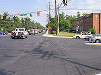
, heading north on Georgia Avenue
, a six-lane divided highway
with a 30 mph (48.3 km/h) speed limit. Washington Metro
's Red Line
runs below the route at this point. From the route’s southern terminus, Georgia Avenue continues south as part of US 29 toward Washington, D.C.
MD 97 passes commercial areas of high-rise buildings in Silver Spring before heading into residential neighborhoods. The route intersects the northern terminus of Maryland Route 390
(16th Street), which heads south and becomes 16th Street Northwest
upon entering the District of Columbia. It continues north as a six-lane undivided road with reversible lane
s through commecial areas before coming to a modified cloverleaf interchange
with Interstate 495
(Capital Beltway). Past this interchange, the road becomes a divided highway again and intersects Maryland Route 192
(Forest Glen Road). MD 97 passes more residences as a 35 mph (56.3 km/h) road that continues toward Wheaton
. The road heads into business areas again as it intersects Maryland Route 586
(Veirs Mill Road) near the Westfield Wheaton
shopping mall. A short distance later, the road crosses Maryland Route 193
(University Boulevard) and continues back into residential areas past that intersection. The route heads into a mix of residential and commercial areas as it heads toward Glenmont
, where it crosses Randolph Road
. A short distance later, MD 97 intersects the southern terminus of Maryland Route 182
(Layhill Road).
 From here, MD 97 turns northwest through residential neighborhoods, where as a 45 mph (72.4 km/h) road it passes the Glenmont station
terminus of Washington Metro's Red Line, before reaching some businesses near the intersection with the northern terminus of Maryland Route 185
(Connecticut Avenue) in Aspen Hill
. It turns north again past this intersection and crosses Bel Pre Road. After crossing Bel Pre Road, the route heads into wooded neighborhoods before it passes through a mix of businesses and houses. MD 97 crosses Maryland Route 28
(Norbeck Road) in Norbeck
, and continues past some residences where it intersects Maryland Route 655A, a short connector that provides access to westbound MD 28. MD 97 enters more wooded areas and narrows to four lanes, interchanging with Maryland Route 200 (Intercounty Connector). The route eventually passes parkland and residential areas as it crosses Emory Lane. The road approaches Olney
and passes by residential neighborhoods before heading into a business district at the intersection with Maryland Route 108
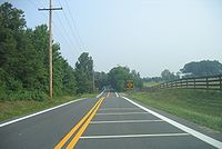
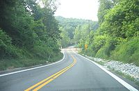
(Olney Sandy Spring Road). After this intersection, the road heads into wooded residential areas as a two-lane undivided road, with the speed limit dropping to 40 mph (64.4 km/h) and then to 30 mph (48.3 km/h) as the road enters Brookeville
. Upon entering Brookeville, MD 97 becomes High Street and passes more residences. The route makes a left turn onto Market Street and continues through wooded residential areas. It heads out of Brookeville, with the name changing back to Georgia Avenue and the speed limit increasing to 40 mph (64.4 km/h). The road heads into a more rural setting, with areas of farms, woods, and some residences. MD 97 reaches Sunshine, where the speed limit decreases to 30 mph (48.3 km/h) and the road crosses Maryland Route 650
(New Hampshire Avenue
/Damascus Road). Past Sunshine, MD 97 resumes through rural areas and enters woodland within Patuxent River State Park
, with the speed limit increasing to 50 mph (80.5 km/h) as it approaches the Patuxent River
.
In Montgomery County, the daily traffic counts on MD 97 range from a high of 84,140 vehicles at the Capital Beltway north of Silver Spring to a low of 11,130 vehicles at the intersection with MD 108 in Olney in 2007.
 MD 97 crosses the Patuxent River into Howard County
, where it becomes Roxbury Mills Road. It continues north, passing areas of woods and farms along with suburban residential developments. The road passes through the community of Glenwood
, where the speed limit drops to 45 mph (72.4 km/h). Upon leaving Glenwood, the speed limit climbs back to 50 mph (80.5 km/h) and MD 97 passes through agricultural areas before intersecting Maryland Route 144
(Frederick Road) in Cooksville
. A short distance later, the route interchanges with Interstate 70
and U.S. Route 40
. Past this interchange, MD 97 becomes Hoods Mill Road and passes rural residential areas, intersecting Old Frederick Road. From here, the speed limit drops to 40 mph (64.4 km/h) as the road winds through a mix of woods, farm fields, and residences before crossing the South Branch of the Patapsco River
.
In Howard County, the daily traffic counts on MD 97 range from a high of 15,711 vehicles at the intersection with MD 144 to a low of 9,061 vehicles at the intersection with Old Frederick Road in 2007.
and becomes Old Washington Road. The road crosses CSX's Old Main Line Subdivision railroad and the speed limit drops to 35 mph (56.3 km/h) as it passes wooded areas with some residences before increasing to 40 mph (64.4 km/h) again. It runs through a mix of woods and farms with some residences along the road. The number of residences increases as the route crosses Streaker Road in Berrett as a 35 mph (56.3 km/h) road. From here, MD 97 passes more residences as a 40 mph (64.4 km/h) road before intersecting Maryland Route 850
(Old Liberty Road) at a roundabout
; a short distance later, it intersects Maryland Route 26
(Liberty Road) at a folded diamond interchange in Dorsey Crossroads. Past MD 26, MD 97 becomes New Washington Road and heads north through a mix of farmland, woodland, and residential neighborhoods, paralleled to the west by Maryland Route 854
(Old Washington Road). The road passes through woodland before intersecting Nicodemus Road, where it continues past farms and woods before crossing Maryland Route 32
(Sykesville Road) in Fenby.
 Past this intersection, MD 97 passes to the east of Carroll Community College
and heads into residential areas as it approaches Westminster
, bypassing the center of the town to the east. The route becomes Malcolm Drive past the intersection with Main Street/Old Westminster Road and continues to an intersection with Maryland Route 140
(Baltimore Boulevard). Here, MD 97 makes a left turn to form a concurrency
with MD 140 on Baltimore Boulevard, a six-lane divided highway. The two routes head through commercial areas on the outskirts of Westminster, passing by the TownMall of Westminster
before interchanging with Maryland Route 27
(Manchester Road) at a folded-diamond interchange. Past this interchange, the road passes over the Maryland Midland Railway
and passes more businesses. At the Sullivan Road intersection, the road becomes College View Boulevard and a short distance later, MD 97 splits from MD 140 at an interchange near McDaniel College
.
MD 97 continues north on Littlestown Pike, a two-lane undivided road. The road passes Carroll County Regional Airport
before heading into a mix of farmland and residences, with the speed limit increasing to 50 mph (80.5 km/h). MD 97 intersects the southern terminus of Maryland Route 496
(Bachmans Valley Road), and continues northwest through agricultural and wooded areas with intermittent residences, with the speed limit eventually dropping to 40 mph (64.4 km/h). It passes through Union Mills
, where the speed limit drops to 35 mph (56.3 km/h) and the road intersects Old Hanover Road. The speed limit rises to 45 mph (72.4 km/h) upon leaving Union Mills before dropping to 35 mph (56.3 km/h) again as MD 97 enters Silver Run, a community of residences. Upon leaving this community, the speed limit on the route increases to 50 mph (80.5 km/h) as it continues through woods and farm fields. A short distance later, MD 97 reaches the Pennsylvania
border, where it becomes Pennsylvania Route 97
and continues north into Adams County
.
In Carroll County, the daily traffic counts on MD 97 range from a high of 58,582 vehicles at the south end of the MD 140 concurrency in Westminster to a low of 8,331 vehicles at the intersection with Blacks Schoolhouse Road just south of the Pennsylvania border in 2007.
, a U.S. Highway that ran from Baltimore
to Gettysburg
. The designation MD 97 was first used by 1940 for the road running from US 29 in Silver Spring to north of US 40 in Cooksville, while the present-day route from MD 26 to just north of the Howard-Carroll county line was designated as Maryland Route 570. MD 97 was extended to the Pennsylvania border northwest of Emmitsburg
, Frederick County
by 1960, running north from Cooksville to Westminster, replacing MD 570 in its entirety, and continuing northwest from Westminster through Taneytown
and Emmitsburg, paralleling a portion of MD 32 to Taneytown and replacing the route past there. Also by this time, MD 97 was widened into a divided highway between Silver Spring and Maryland Route 183 (Randolph Road) in Glenmont. The divided highway portion of MD 97 was extended further north to MD 28 by 1975. By 1979, U.S. Route 140 disappeared and MD 97 was moved to its current alignment north of Westminster, with the portion of the route that ran northwest from Westminster becoming a part of MD 140. MD 32 from Westminster to Taneytown became Maryland Route 832
by this time as well. Dualization of MD 97 in Montgomery County was extended further north from MD 28 to MD 108 by the 1990s. There are plans to build an interchange at the route’s intersection with Randolph Road in order to improve movements for automobiles as well as for pedestrians and bicycles accessing the nearby Glenmont Metro station. Another new interchange was built with Maryland Route 200 (Intercounty Connector) north of MD 28 and opened on February 23, 2011.
|-
!County
!Location
!Mile
!Destinations
!Notes
|-
|rowspan=13|Montgomery
|rowspan=5|Silver Spring
|0.00
| - Washington D.C.
|Southern terminus of MD 97
|-
|0.91
|- Washington D.C.
|
|-
|1.10
|Seminary Road
|Former MD 391
|-
|1.44
|, Northern Virginia
|I-495 Interchange 31
|-
|1.61
|
|
|-
|rowspan=2|Wheaton
|3.07
|
|
|-
|3.47
|
|
|-
|Glenmont
|4.81
|
|
|-
|Aspen Hill
|7.00
|
|
|-
|rowspan=2|Norbeck
|8.82
|
|-
|9.43
|
|Hybrid/Modified Cloverleaf Interchange, Access to/from MD-200 Westbound opened February 23, 2011, Access to/from MD-200 Eastbound opened November 22, 2011. MD-200 Exits 9A-B
|-
|Olney
|11.89
|
|
|-
|
|17.02
|
|
|-
|rowspan=4|Howard
|rowspan=2|Cooksville
|24.58
|
|Former US 40
|-
|25.03
|
|I-70/US 40 Interchange 76
|-
|
|25.68
|Old Frederick Road east
|
|-
|
|25.80
|Old Frederick Road west
|
|-
|rowspan=11|Carroll
|
|32.48
|
|Roundabout
, former MD 26
|-
|
|32.67
|
|Interchange
|-
|Fenby
|39.39
|
|
|-
|rowspan=4|Westminster
|42.20
|E. Main Street — Old Westminster Pike
|Former US 140
|-
|42.57
|
|South end of MD 140 overlap
|-
|43.93
|
|Interchange
|-
|44.89
|
|Interchange, north end of MD 140 overlap
|-
|
|47.29
|
|
|-
|Union Mills
|50.70
|Old Hanover Road northbound
|
|-
|Silver Run
|52.49
|Mayberry Road East
|
|-
|
|55.27
|
|Pennsylvania
state line, northern terminus of MD 97
State highway
State highway, state road or state route can refer to one of three related concepts, two of them related to a state or provincial government in a country that is divided into states or provinces :#A...
in the U.S. state
U.S. state
A U.S. state is any one of the 50 federated states of the United States of America that share sovereignty with the federal government. Because of this shared sovereignty, an American is a citizen both of the federal entity and of his or her state of domicile. Four states use the official title of...
of Maryland
Maryland
Maryland is a U.S. state located in the Mid Atlantic region of the United States, bordering Virginia, West Virginia, and the District of Columbia to its south and west; Pennsylvania to its north; and Delaware to its east...
. The route runs 55.27 mi (88.95 km) from U.S. Route 29
U.S. Route 29 in Maryland
U.S. Route 29 is a north–south United States highway that runs for from the western suburbs of Baltimore, Maryland, to Pensacola, Florida. In the U.S. state of Maryland, US 29 is a major highway that emerges from Washington D.C. and runs north into eastern Montgomery County, stretching...
in Silver Spring
Silver Spring, Maryland
Silver Spring is an unincorporated area and census-designated place in Montgomery County, Maryland, United States. It had a population of 71,452 at the 2010 census, making it the fourth most populous place in Maryland, after Baltimore, Columbia, and Germantown.The urbanized, oldest, and...
, Montgomery County
Montgomery County, Maryland
Montgomery County is a county in the U.S. state of Maryland, situated just to the north of Washington, D.C., and southwest of the city of Baltimore. It is one of the most affluent counties in the United States, and has the highest percentage of residents over 25 years of age who hold post-graduate...
north to the Pennsylvania
Pennsylvania
The Commonwealth of Pennsylvania is a U.S. state that is located in the Northeastern and Mid-Atlantic regions of the United States. The state borders Delaware and Maryland to the south, West Virginia to the southwest, Ohio to the west, New York and Ontario, Canada, to the north, and New Jersey to...
border in Carroll County
Carroll County, Maryland
Carroll County is a county located in the U.S. state of Maryland. In 2010, its population was 167,134. It was named for Charles Carroll of Carrollton , signer of the American Declaration of Independence. Its county seat is Westminster....
, where the road continues into that state as Pennsylvania Route 97. Throughout most of Montgomery County, MD 97 is known as Georgia Avenue, which continues south from the southern terminus along US 29 into Washington, D.C.
Washington, D.C.
Washington, D.C., formally the District of Columbia and commonly referred to as Washington, "the District", or simply D.C., is the capital of the United States. On July 16, 1790, the United States Congress approved the creation of a permanent national capital as permitted by the U.S. Constitution....
It is a suburban four- to six-lane divided highway
Divided Highway
Divided Highway is a compilation album by American rock band The Doobie Brothers, released in 2003. . All tracks are taken from the albums Cycles and Brotherhood .-Track listing:...
from Silver Spring north to Olney
Olney, Maryland
Olney, a census-designated place and an unincorporated area of Montgomery County, Maryland, USA, is located in the north central part of the county, twenty miles north of Washington, D.C. It was largely agricultural until the 1960s, when growth of the Washington suburbs led to its conversion into...
. From here, the route continues as a rural two-lane road north through Brookeville
Brookeville, Maryland
Brookeville is a town located twenty miles north of Washington, D.C. and two miles north of Olney in northeastern Montgomery County, Maryland. Brookeville was settled by Quakers late in the 18th century, and was formally incorporated as a town in 1808...
and into Howard County
Howard County, Maryland
-2010:Whereas according to the 2010 U.S. Census Bureau:*62.2% White*17.5% Black*0.3% Native American*14.4% Asian*0.0% Native Hawaiian or Pacific Islander*3.6% Two or more races*2.0% Other races*5.8% Hispanic or Latino -2000:...
. MD 97 continues through Carroll County where it passes through the county seat of Westminster
Westminster, Maryland
Westminster is a city in northern Maryland, United States. It is the seat of Carroll County. The city's population was 18,590 at the 2010 census. Westminster is an outlying community within the Baltimore-Towson, MD MSA, which is part of a greater Washington-Baltimore-Northern Virginia, DC-MD-VA-WV...
. The route intersects many major roads, including Interstate 495
Interstate 495 (Capital Beltway)
Interstate 495 is a Interstate Highway that surrounds the United States' capital of Washington, D.C., and its inner suburbs in adjacent Maryland and Virginia. I-495 is widely known as the Capital Beltway or simply the Beltway, especially when the context of Washington, D.C., is clear...
(Capital Beltway) north of Silver Spring, Maryland Route 200 (Intercounty Connector) in Aspen Hill
Aspen Hill, Maryland
Aspen Hill is a census-designated place and an unincorporated area in Montgomery County, Maryland. It got its name from aspen trees that once were found near the first post office in the area...
, Maryland Route 28
Maryland Route 28
Maryland Route 28 is a state highway in the U.S. state of Maryland. The state highway runs from U.S. Route 15 in Point of Rocks east to MD 182 in Norwood. The western portion of MD 28 is a rural highway connecting several villages in southern Frederick County and western Montgomery County...
in Norbeck
Norbeck, Maryland
Norbeck is the area of Montgomery County, Maryland around Norbeck Road east of Georgia Avenue to Layhill Road.A museum in Sandy Spring, Maryland provides the information that Norbeck is the:Southwestern outpost of the greater Sandy Spring neighborhood [and] put down roots as a free-black community...
, Interstate 70
Interstate 70 in Maryland
Interstate 70 is a part of the Interstate Highway System that runs from Cove Fort, Utah to Baltimore, Maryland. In Maryland, the Interstate Highway runs from the Pennsylvania state line in Hancock east to the Interstate's eastern terminus near its junction with I-695 at a park and ride in...
and U.S. Route 40
U.S. Route 40 in Maryland
U.S. Route 40 in the U.S. state of Maryland runs from western Maryland to Cecil County in the state's northeastern corner. With a total length of over , it is the longest numbered highway in Maryland. Almost half of the road overlaps with Interstate 68 or Interstate 70, while the old alignment...
in Cooksville
Cooksville, Maryland
Cooksville is an unincorporated community in Howard County, Maryland, United States. Roberts Inn was listed on the National Register of Historic Places in 1973.-References:...
, Maryland Route 26
Maryland Route 26
Maryland Route 26 is an east–west state highway in the U.S. state of Maryland. Outside of the Baltimore city limits, it is known as Liberty Road; inside the city limits it is known as Liberty Heights Avenue....
in Dorsey Crossroads, and Maryland Route 27
Maryland Route 27
Maryland Route 27 is a state highway in the central part of the U.S. state of Maryland.-Route description:MD 27, also known as Ridge Road and Manchester Road , begins in Germantown at MD 355...
, Maryland Route 32
Maryland Route 32
Maryland Route 32 is a state highway in the U.S. state of Maryland. The state highway runs from Interstate 97 and MD 3 in Millersville west and north to Washington Road in Westminster. The east–west portion of MD 32 is the Patuxent Freeway, a four- to six-lane...
, and Maryland Route 140
Maryland Route 140
Maryland Route 140 is a local long route in northern Maryland, United States.-Route description:MD 140 is known by various names depending on location; south of Reisterstown it is known as Reisterstown Road. Though Reisterstown itself is named after John Reister, the road is named after Jacob...
in the Westminster area.
With the creation of the U.S. Highway System in 1926, present-day MD 97 north of Westminster became a part of U.S. Route 140
U.S. Route 140
U.S. Route 140 U.S. Route 140 U.S. Route 140 ( was a U.S. highway connecting Gettysburg, Pennsylvania to Baltimore, Maryland. The route was deleted from the system in 1980; today the road's route is followed by portions of Pennsylvania Route 97, Maryland Route 97, and Maryland Route 140.Though it...
. The designation MD 97 was first used by 1940 for the road running from US 29 in Silver Spring to north of US 40 in Cooksville. An extension of the route by 1960 took it to the Pennsylvania border northwest of Emmitsburg
Emmitsburg, Maryland
-Demographics:As of the census of 2000, there were 2,290 people, 811 households, and 553 families residing in the town. The population density was 1,992.9 people per square mile . There were 862 housing units at an average density of 750.2 per square mile...
, Frederick County
Frederick County, Maryland
Frederick County is a county located in the western part of the U.S. state of Maryland, bordering the southern border of Pennsylvania and the northeastern border of Virginia. As of the 2010 Census, the population was 233,385....
. It replaced Maryland Route 570, which ran from MD 26 to just north of the Carroll-Howard county line, paralled MD 32 between Westminster and Taneytown
Taneytown, Maryland
Taneytown is a city in Carroll County, Maryland, United States. The population was 5,128 at the 2000 census. was founded in 1754. Of the town George Washington once wrote "Tan-nee town is but a small place with only the Street through wch. the road passes, built on...
, and replaced MD 32 from Taneytown to the Pennsylvania border. By 1979, MD 97 was shifted onto its current alignment north of Westminster with the removal of US 140 from the U.S. Highway System; the MD 140 designation was applied to the former MD 97 that ran northwest from Westminster.
Route description
Maryland Route 97 runs through the Washington, D.C.Washington, D.C.
Washington, D.C., formally the District of Columbia and commonly referred to as Washington, "the District", or simply D.C., is the capital of the United States. On July 16, 1790, the United States Congress approved the creation of a permanent national capital as permitted by the U.S. Constitution....
suburbs in Montgomery County
Montgomery County, Maryland
Montgomery County is a county in the U.S. state of Maryland, situated just to the north of Washington, D.C., and southwest of the city of Baltimore. It is one of the most affluent counties in the United States, and has the highest percentage of residents over 25 years of age who hold post-graduate...
, connecting several communities including Silver Spring
Silver Spring, Maryland
Silver Spring is an unincorporated area and census-designated place in Montgomery County, Maryland, United States. It had a population of 71,452 at the 2010 census, making it the fourth most populous place in Maryland, after Baltimore, Columbia, and Germantown.The urbanized, oldest, and...
, Wheaton
Wheaton, Maryland
Wheaton is an unincorporated, urbanized area in Montgomery County, Maryland, USA, north of Washington, D.C., northwest of Silver Spring. Wheaton takes its name from Frank Wheaton , a career officer in the United States Army and volunteer from Rhode Island in the Union Army who rose to the rank of...
, Glenmont
Glenmont, Maryland
Glenmont is an unincorporated community in Montgomery County, Maryland, USA. The U.S. Census Bureau combines Glenmont with nearby Wheaton to create the Census Designated Place of Wheaton-Glenmont.- Location :...
, Norbeck
Norbeck, Maryland
Norbeck is the area of Montgomery County, Maryland around Norbeck Road east of Georgia Avenue to Layhill Road.A museum in Sandy Spring, Maryland provides the information that Norbeck is the:Southwestern outpost of the greater Sandy Spring neighborhood [and] put down roots as a free-black community...
, and Olney
Olney, Maryland
Olney, a census-designated place and an unincorporated area of Montgomery County, Maryland, USA, is located in the north central part of the county, twenty miles north of Washington, D.C. It was largely agricultural until the 1960s, when growth of the Washington suburbs led to its conversion into...
. It continues north from there into rural areas of Howard
Howard County, Maryland
-2010:Whereas according to the 2010 U.S. Census Bureau:*62.2% White*17.5% Black*0.3% Native American*14.4% Asian*0.0% Native Hawaiian or Pacific Islander*3.6% Two or more races*2.0% Other races*5.8% Hispanic or Latino -2000:...
and Carroll
Carroll County, Maryland
Carroll County is a county located in the U.S. state of Maryland. In 2010, its population was 167,134. It was named for Charles Carroll of Carrollton , signer of the American Declaration of Independence. Its county seat is Westminster....
counties, passing through the Carroll County seat of Westminster
Westminster, Maryland
Westminster is a city in northern Maryland, United States. It is the seat of Carroll County. The city's population was 18,590 at the 2010 census. Westminster is an outlying community within the Baltimore-Towson, MD MSA, which is part of a greater Washington-Baltimore-Northern Virginia, DC-MD-VA-WV...
, before reaching the Pennsylvania
Pennsylvania
The Commonwealth of Pennsylvania is a U.S. state that is located in the Northeastern and Mid-Atlantic regions of the United States. The state borders Delaware and Maryland to the south, West Virginia to the southwest, Ohio to the west, New York and Ontario, Canada, to the north, and New Jersey to...
border.
Montgomery County
U.S. Route 29 in Maryland
U.S. Route 29 is a north–south United States highway that runs for from the western suburbs of Baltimore, Maryland, to Pensacola, Florida. In the U.S. state of Maryland, US 29 is a major highway that emerges from Washington D.C. and runs north into eastern Montgomery County, stretching...
and Maryland Route 384
Maryland Route 384
Maryland Route 384 is a state highway in the U.S. state of Maryland. The state highway runs from MD 390 east to U.S. Route 29 and MD 97 within Silver Spring...
(Colesville Road) in downtown Silver Spring
Silver Spring, Maryland
Silver Spring is an unincorporated area and census-designated place in Montgomery County, Maryland, United States. It had a population of 71,452 at the 2010 census, making it the fourth most populous place in Maryland, after Baltimore, Columbia, and Germantown.The urbanized, oldest, and...
in Montgomery County
Montgomery County, Maryland
Montgomery County is a county in the U.S. state of Maryland, situated just to the north of Washington, D.C., and southwest of the city of Baltimore. It is one of the most affluent counties in the United States, and has the highest percentage of residents over 25 years of age who hold post-graduate...
, heading north on Georgia Avenue
Georgia Avenue
Georgia Avenue is a major north-south artery in Northwest Washington, D.C. and Montgomery County, Maryland. Within the District of Columbia and a short distance in Silver Spring, Maryland, Georgia Avenue is also U.S. Route 29...
, a six-lane divided highway
Divided Highway
Divided Highway is a compilation album by American rock band The Doobie Brothers, released in 2003. . All tracks are taken from the albums Cycles and Brotherhood .-Track listing:...
with a 30 mph (48.3 km/h) speed limit. Washington Metro
Washington Metro
The Washington Metro, commonly called Metro, and unofficially Metrorail, is the rapid transit system in Washington, D.C., United States, and its surrounding suburbs. It is administered by the Washington Metropolitan Area Transit Authority , which also operates Metrobus service under the Metro name...
's Red Line
Red Line (Washington Metro)
The Red Line of the Washington Metro is a rail rapid transit service operating between 27 stations in Montgomery County, Maryland and the District of Columbia, United States. It is a primary line through downtown Washington, and the oldest and busiest line in the system...
runs below the route at this point. From the route’s southern terminus, Georgia Avenue continues south as part of US 29 toward Washington, D.C.
Washington, D.C.
Washington, D.C., formally the District of Columbia and commonly referred to as Washington, "the District", or simply D.C., is the capital of the United States. On July 16, 1790, the United States Congress approved the creation of a permanent national capital as permitted by the U.S. Constitution....
MD 97 passes commercial areas of high-rise buildings in Silver Spring before heading into residential neighborhoods. The route intersects the northern terminus of Maryland Route 390
Maryland Route 390
Maryland Route 390 is a state highway in the U.S. state of Maryland. The state highway runs from the boundary with Washington, D.C. north to MD 97 in Silver Spring...
(16th Street), which heads south and becomes 16th Street Northwest
16th Street Northwest (Washington, D.C.)
16th Street Northwest is a prominent north-south thoroughfare in the northwest quadrant of Washington, D.C.Part of Pierre L'Enfant's design for the city, 16th Street begins just north of the White House across Lafayette Park at H Street and continues due north in a straight line passing K Street,...
upon entering the District of Columbia. It continues north as a six-lane undivided road with reversible lane
Reversible lane
A reversible lane , called a counterflow lane or contraflow lane in transport engineering nomenclature, is a lane in which traffic may travel in either direction, depending on certain conditions...
s through commecial areas before coming to a modified cloverleaf interchange
Cloverleaf interchange
A cloverleaf interchange is a two-level interchange in which left turns, reverse direction in left-driving regions, are handled by ramp roads...
with Interstate 495
Interstate 495 (Capital Beltway)
Interstate 495 is a Interstate Highway that surrounds the United States' capital of Washington, D.C., and its inner suburbs in adjacent Maryland and Virginia. I-495 is widely known as the Capital Beltway or simply the Beltway, especially when the context of Washington, D.C., is clear...
(Capital Beltway). Past this interchange, the road becomes a divided highway again and intersects Maryland Route 192
Maryland Route 192
Maryland Route 192 is a state highway in the U.S. state of Maryland. The route runs from Summit Avenue in Kensington to Maryland Route 97 in Forest Glen. MD 192 provides access to the Forest Glen station of the Washington Metro and the Washington D.C...
(Forest Glen Road). MD 97 passes more residences as a 35 mph (56.3 km/h) road that continues toward Wheaton
Wheaton, Maryland
Wheaton is an unincorporated, urbanized area in Montgomery County, Maryland, USA, north of Washington, D.C., northwest of Silver Spring. Wheaton takes its name from Frank Wheaton , a career officer in the United States Army and volunteer from Rhode Island in the Union Army who rose to the rank of...
. The road heads into business areas again as it intersects Maryland Route 586
Maryland Route 586
Maryland Route 586 is a state highway in the U.S. state of Maryland. Known as Veirs Mill Road, the state highway runs from MD 28 in Rockville east to MD 97 in Wheaton.-Route description:...
(Veirs Mill Road) near the Westfield Wheaton
Westfield Wheaton
Westfield Wheaton is a two-level enclosed shopping mall in Wheaton, Maryland. It is owned by The Westfield Group.-History:...
shopping mall. A short distance later, the road crosses Maryland Route 193
Maryland Route 193
Maryland Route 193 is a state highway in the U.S. state of Maryland. Known for most of its length as University Boulevard and Greenbelt Road, the state highway runs from MD 185 in Kensington east to MD 202 in Greater Upper Marlboro...
(University Boulevard) and continues back into residential areas past that intersection. The route heads into a mix of residential and commercial areas as it heads toward Glenmont
Glenmont, Maryland
Glenmont is an unincorporated community in Montgomery County, Maryland, USA. The U.S. Census Bureau combines Glenmont with nearby Wheaton to create the Census Designated Place of Wheaton-Glenmont.- Location :...
, where it crosses Randolph Road
Randolph Road
Randolph Road is a major cross-county road in Montgomery County, Maryland, and is part of a longer road that runs across Montgomery and Prince George's counties. The full road, which is also known as Montrose Road on the western end and Cherry Hill Road at the southeast, runs between the Potomac...
. A short distance later, MD 97 intersects the southern terminus of Maryland Route 182
Maryland Route 182
Maryland Route 182 is a road that runs between Olney and Glenmont, Maryland. The road is first known as Dr. Bird Road for a short distance before becoming Norwood Road. When the road reaches Norwood, a right turn is required to stay on the route, which for its remainder is known as Layhill Road...
(Layhill Road).
Glenmont (Washington Metro)
Glenmont is a Washington Metro station in Montgomery County, Maryland on the Red Line. This is the northeastern terminus of the Red Line.Glenmont is the only station on the Red Line to feature the six-coffer arch design. The six-coffer design is also seen on the Green Line...
terminus of Washington Metro's Red Line, before reaching some businesses near the intersection with the northern terminus of Maryland Route 185
Maryland Route 185
Maryland Route 185 is a state highway in the U.S. state of Maryland. Known as Connecticut Avenue, the state highway runs from Chevy Chase Circle at the Washington, D.C. border north to MD 97 in Aspen Hill...
(Connecticut Avenue) in Aspen Hill
Aspen Hill, Maryland
Aspen Hill is a census-designated place and an unincorporated area in Montgomery County, Maryland. It got its name from aspen trees that once were found near the first post office in the area...
. It turns north again past this intersection and crosses Bel Pre Road. After crossing Bel Pre Road, the route heads into wooded neighborhoods before it passes through a mix of businesses and houses. MD 97 crosses Maryland Route 28
Maryland Route 28
Maryland Route 28 is a state highway in the U.S. state of Maryland. The state highway runs from U.S. Route 15 in Point of Rocks east to MD 182 in Norwood. The western portion of MD 28 is a rural highway connecting several villages in southern Frederick County and western Montgomery County...
(Norbeck Road) in Norbeck
Norbeck, Maryland
Norbeck is the area of Montgomery County, Maryland around Norbeck Road east of Georgia Avenue to Layhill Road.A museum in Sandy Spring, Maryland provides the information that Norbeck is the:Southwestern outpost of the greater Sandy Spring neighborhood [and] put down roots as a free-black community...
, and continues past some residences where it intersects Maryland Route 655A, a short connector that provides access to westbound MD 28. MD 97 enters more wooded areas and narrows to four lanes, interchanging with Maryland Route 200 (Intercounty Connector). The route eventually passes parkland and residential areas as it crosses Emory Lane. The road approaches Olney
Olney, Maryland
Olney, a census-designated place and an unincorporated area of Montgomery County, Maryland, USA, is located in the north central part of the county, twenty miles north of Washington, D.C. It was largely agricultural until the 1960s, when growth of the Washington suburbs led to its conversion into...
and passes by residential neighborhoods before heading into a business district at the intersection with Maryland Route 108
Maryland Route 108
Maryland Route 108 is a suburban state highway in the central part of the U.S. state of Maryland, starting in Damascus and ending near Columbia.-Route description:...
(Olney Sandy Spring Road). After this intersection, the road heads into wooded residential areas as a two-lane undivided road, with the speed limit dropping to 40 mph (64.4 km/h) and then to 30 mph (48.3 km/h) as the road enters Brookeville
Brookeville, Maryland
Brookeville is a town located twenty miles north of Washington, D.C. and two miles north of Olney in northeastern Montgomery County, Maryland. Brookeville was settled by Quakers late in the 18th century, and was formally incorporated as a town in 1808...
. Upon entering Brookeville, MD 97 becomes High Street and passes more residences. The route makes a left turn onto Market Street and continues through wooded residential areas. It heads out of Brookeville, with the name changing back to Georgia Avenue and the speed limit increasing to 40 mph (64.4 km/h). The road heads into a more rural setting, with areas of farms, woods, and some residences. MD 97 reaches Sunshine, where the speed limit decreases to 30 mph (48.3 km/h) and the road crosses Maryland Route 650
Maryland Route 650
Maryland Route 650 is a state highway in the U.S. state of Maryland. Known as New Hampshire Avenue for most of its length, the state highway runs from Eastern Avenue at the Washington, D.C. border north to MD 108 in Etchison...
(New Hampshire Avenue
New Hampshire Avenue
New Hampshire Avenue is a diagonal street in Washington, D.C., beginning at the Kennedy Center and extending northeast for about 5 miles and then continuing into Maryland where it is designated Maryland Route 650. New Hampshire Avenue, however, is not contiguous...
/Damascus Road). Past Sunshine, MD 97 resumes through rural areas and enters woodland within Patuxent River State Park
Patuxent River State Park
Patuxent River State Park is a state park in the state of Maryland. The park is located along the upper reaches of the Patuxent River in Howard and Montgomery Counties. The park features hunting, fishing, hiking and horseback riding.-External links:*...
, with the speed limit increasing to 50 mph (80.5 km/h) as it approaches the Patuxent River
Patuxent River
The Patuxent River is a tributary of the Chesapeake Bay in the state of Maryland. There are three main river drainages for central Maryland: the Potomac River to the west passing through Washington D.C., the Patapsco River to the northeast passing through Baltimore, and the Patuxent River between...
.
In Montgomery County, the daily traffic counts on MD 97 range from a high of 84,140 vehicles at the Capital Beltway north of Silver Spring to a low of 11,130 vehicles at the intersection with MD 108 in Olney in 2007.
Howard County
Howard County, Maryland
-2010:Whereas according to the 2010 U.S. Census Bureau:*62.2% White*17.5% Black*0.3% Native American*14.4% Asian*0.0% Native Hawaiian or Pacific Islander*3.6% Two or more races*2.0% Other races*5.8% Hispanic or Latino -2000:...
, where it becomes Roxbury Mills Road. It continues north, passing areas of woods and farms along with suburban residential developments. The road passes through the community of Glenwood
Glenwood, Howard County, Maryland
Glenwood is an unincorporated community in Howard County, Maryland, United States. It is conveniently located between Baltimore and Washington D.C., therefore attracting commuters to those employment centers...
, where the speed limit drops to 45 mph (72.4 km/h). Upon leaving Glenwood, the speed limit climbs back to 50 mph (80.5 km/h) and MD 97 passes through agricultural areas before intersecting Maryland Route 144
Maryland Route 144
Maryland Route 144 is a collection of state highways in the U.S. state of Maryland. These highways are sections of old alignment of U.S. Route 40 between Cumberland and Baltimore...
(Frederick Road) in Cooksville
Cooksville, Maryland
Cooksville is an unincorporated community in Howard County, Maryland, United States. Roberts Inn was listed on the National Register of Historic Places in 1973.-References:...
. A short distance later, the route interchanges with Interstate 70
Interstate 70 in Maryland
Interstate 70 is a part of the Interstate Highway System that runs from Cove Fort, Utah to Baltimore, Maryland. In Maryland, the Interstate Highway runs from the Pennsylvania state line in Hancock east to the Interstate's eastern terminus near its junction with I-695 at a park and ride in...
and U.S. Route 40
U.S. Route 40 in Maryland
U.S. Route 40 in the U.S. state of Maryland runs from western Maryland to Cecil County in the state's northeastern corner. With a total length of over , it is the longest numbered highway in Maryland. Almost half of the road overlaps with Interstate 68 or Interstate 70, while the old alignment...
. Past this interchange, MD 97 becomes Hoods Mill Road and passes rural residential areas, intersecting Old Frederick Road. From here, the speed limit drops to 40 mph (64.4 km/h) as the road winds through a mix of woods, farm fields, and residences before crossing the South Branch of the Patapsco River
Patapsco River
The Patapsco River is a river in central Maryland which flows into Chesapeake Bay. The river's tidal portion forms the harbor for the city of Baltimore...
.
In Howard County, the daily traffic counts on MD 97 range from a high of 15,711 vehicles at the intersection with MD 144 to a low of 9,061 vehicles at the intersection with Old Frederick Road in 2007.
Carroll County
Upon crossing the river, MD 97 enters Carroll CountyCarroll County, Maryland
Carroll County is a county located in the U.S. state of Maryland. In 2010, its population was 167,134. It was named for Charles Carroll of Carrollton , signer of the American Declaration of Independence. Its county seat is Westminster....
and becomes Old Washington Road. The road crosses CSX's Old Main Line Subdivision railroad and the speed limit drops to 35 mph (56.3 km/h) as it passes wooded areas with some residences before increasing to 40 mph (64.4 km/h) again. It runs through a mix of woods and farms with some residences along the road. The number of residences increases as the route crosses Streaker Road in Berrett as a 35 mph (56.3 km/h) road. From here, MD 97 passes more residences as a 40 mph (64.4 km/h) road before intersecting Maryland Route 850
Maryland Route 850
Maryland Route 850 is a collection of state highways in the U.S. state of Maryland. These six highways are sections of old alignment of MD 26, most of which are named Old Liberty Road, in the communities of Taylorsville, Winfield, and Eldersburg in southern Carroll County...
(Old Liberty Road) at a roundabout
Roundabout
A roundabout is the name for a road junction in which traffic moves in one direction around a central island. The word dates from the early 20th century. Roundabouts are common in many countries around the world...
; a short distance later, it intersects Maryland Route 26
Maryland Route 26
Maryland Route 26 is an east–west state highway in the U.S. state of Maryland. Outside of the Baltimore city limits, it is known as Liberty Road; inside the city limits it is known as Liberty Heights Avenue....
(Liberty Road) at a folded diamond interchange in Dorsey Crossroads. Past MD 26, MD 97 becomes New Washington Road and heads north through a mix of farmland, woodland, and residential neighborhoods, paralleled to the west by Maryland Route 854
Maryland Route 854
Maryland Route 854 is a collection of state highways in the U.S. state of Maryland. This pair of highways comprise the old alignment of MD 97 between MD 26 near Eldersburg and MD 32 in Fenby in Carroll County...
(Old Washington Road). The road passes through woodland before intersecting Nicodemus Road, where it continues past farms and woods before crossing Maryland Route 32
Maryland Route 32
Maryland Route 32 is a state highway in the U.S. state of Maryland. The state highway runs from Interstate 97 and MD 3 in Millersville west and north to Washington Road in Westminster. The east–west portion of MD 32 is the Patuxent Freeway, a four- to six-lane...
(Sykesville Road) in Fenby.
Carroll Community College
Carroll County Community College is a 2-year Community college serving the residents of Carroll County, Maryland.- History :Responding to interest expressed by citizens of Carroll County, the Carroll County Board of Commissioners examined the need for additional educational opportunities in the...
and heads into residential areas as it approaches Westminster
Westminster, Maryland
Westminster is a city in northern Maryland, United States. It is the seat of Carroll County. The city's population was 18,590 at the 2010 census. Westminster is an outlying community within the Baltimore-Towson, MD MSA, which is part of a greater Washington-Baltimore-Northern Virginia, DC-MD-VA-WV...
, bypassing the center of the town to the east. The route becomes Malcolm Drive past the intersection with Main Street/Old Westminster Road and continues to an intersection with Maryland Route 140
Maryland Route 140
Maryland Route 140 is a local long route in northern Maryland, United States.-Route description:MD 140 is known by various names depending on location; south of Reisterstown it is known as Reisterstown Road. Though Reisterstown itself is named after John Reister, the road is named after Jacob...
(Baltimore Boulevard). Here, MD 97 makes a left turn to form a concurrency
Concurrency (road)
A concurrency, overlap, or coincidence in a road network is an instance of one physical road bearing two or more different highway, motorway, or other route numbers...
with MD 140 on Baltimore Boulevard, a six-lane divided highway. The two routes head through commercial areas on the outskirts of Westminster, passing by the TownMall of Westminster
TownMall of Westminster
TownMall of Westminster is a shopping mall located in Westminster, Maryland, United States on Maryland Route 140. Managed by Jones Lang LaSalle, the mall features more than 80 stores, including a food court and Regal Cinemas...
before interchanging with Maryland Route 27
Maryland Route 27
Maryland Route 27 is a state highway in the central part of the U.S. state of Maryland.-Route description:MD 27, also known as Ridge Road and Manchester Road , begins in Germantown at MD 355...
(Manchester Road) at a folded-diamond interchange. Past this interchange, the road passes over the Maryland Midland Railway
Maryland Midland Railway
The Maryland Midland Railway is a Class III short-line railroad operating about 63 miles of track in central Maryland. It was originally headquartered in the former Western Maryland Railway station in Union Bridge, Maryland, however it is now located in a new facility across the street from the...
and passes more businesses. At the Sullivan Road intersection, the road becomes College View Boulevard and a short distance later, MD 97 splits from MD 140 at an interchange near McDaniel College
McDaniel College
McDaniel College is a private four-year liberal arts college in Westminster, Maryland, located 30 miles northwest of Baltimore. The college also has a satellite campus located in Budapest, Hungary. Until July 2002, it was known as Western Maryland College...
.
MD 97 continues north on Littlestown Pike, a two-lane undivided road. The road passes Carroll County Regional Airport
Carroll County Regional Airport
Carroll County Regional Airport , also known as Jack B. Poage Field, is a public airport located three miles north of the central business district of Westminster, in Carroll County, Maryland, United States. The airport is owned by Carroll County Board of Commissioners...
before heading into a mix of farmland and residences, with the speed limit increasing to 50 mph (80.5 km/h). MD 97 intersects the southern terminus of Maryland Route 496
Maryland Route 496
Maryland Route 496 is a state highway in the U.S. state of Maryland. Known as Bachmans Valley Road, the state highway runs from MD 97 near Pleasant Valley east to MD 30 in Melrose. MD 496 was constructed from Pleasant Valley to Bachman Mills in the mid-1930s...
(Bachmans Valley Road), and continues northwest through agricultural and wooded areas with intermittent residences, with the speed limit eventually dropping to 40 mph (64.4 km/h). It passes through Union Mills
Union Mills, Maryland
Union Mills is an unincorporated community in Carroll County, Maryland, United States. The community is home to the Union Mills Homestead Historic District, added to the National Register of Historic Places in 1971. The Solomon Arter House was listed in 1987 and the Philip and Uriah Arter Farm in...
, where the speed limit drops to 35 mph (56.3 km/h) and the road intersects Old Hanover Road. The speed limit rises to 45 mph (72.4 km/h) upon leaving Union Mills before dropping to 35 mph (56.3 km/h) again as MD 97 enters Silver Run, a community of residences. Upon leaving this community, the speed limit on the route increases to 50 mph (80.5 km/h) as it continues through woods and farm fields. A short distance later, MD 97 reaches the Pennsylvania
Pennsylvania
The Commonwealth of Pennsylvania is a U.S. state that is located in the Northeastern and Mid-Atlantic regions of the United States. The state borders Delaware and Maryland to the south, West Virginia to the southwest, Ohio to the west, New York and Ontario, Canada, to the north, and New Jersey to...
border, where it becomes Pennsylvania Route 97
Pennsylvania Route 97 (south)
Pennsylvania Route 97 , also known as Baltimore Pike, is one of two routes known as Pennsylvania Route 97, the other is in Erie. PA 97 in Adams County is a local road that has its northern terminus at U.S. Route 15 southeast of Gettysburg. Its southern terminus is at the Maryland state line where...
and continues north into Adams County
Adams County, Pennsylvania
Adams County is a county in the U.S. state of Pennsylvania. As of the 2010 census, the population was 101,407. It was created on January 22, 1800, from part of York County and named in honor of the second President of the United States, John Adams...
.
In Carroll County, the daily traffic counts on MD 97 range from a high of 58,582 vehicles at the south end of the MD 140 concurrency in Westminster to a low of 8,331 vehicles at the intersection with Blacks Schoolhouse Road just south of the Pennsylvania border in 2007.
History
Following the creation of the U.S. Highway System in 1926, the portion of present-day MD 97 north of Westminster was designated as part of U.S. Route 140U.S. Route 140
U.S. Route 140 U.S. Route 140 U.S. Route 140 ( was a U.S. highway connecting Gettysburg, Pennsylvania to Baltimore, Maryland. The route was deleted from the system in 1980; today the road's route is followed by portions of Pennsylvania Route 97, Maryland Route 97, and Maryland Route 140.Though it...
, a U.S. Highway that ran from Baltimore
Baltimore
Baltimore is the largest independent city in the United States and the largest city and cultural center of the US state of Maryland. The city is located in central Maryland along the tidal portion of the Patapsco River, an arm of the Chesapeake Bay. Baltimore is sometimes referred to as Baltimore...
to Gettysburg
Gettysburg, Pennsylvania
Gettysburg is a borough that is the county seat, part of the Gettysburg Battlefield, and the eponym for the 1863 Battle of Gettysburg. The town hosts visitors to the Gettysburg National Military Park and has 3 institutions of higher learning: Lutheran Theological Seminary, Gettysburg College, and...
. The designation MD 97 was first used by 1940 for the road running from US 29 in Silver Spring to north of US 40 in Cooksville, while the present-day route from MD 26 to just north of the Howard-Carroll county line was designated as Maryland Route 570. MD 97 was extended to the Pennsylvania border northwest of Emmitsburg
Emmitsburg, Maryland
-Demographics:As of the census of 2000, there were 2,290 people, 811 households, and 553 families residing in the town. The population density was 1,992.9 people per square mile . There were 862 housing units at an average density of 750.2 per square mile...
, Frederick County
Frederick County, Maryland
Frederick County is a county located in the western part of the U.S. state of Maryland, bordering the southern border of Pennsylvania and the northeastern border of Virginia. As of the 2010 Census, the population was 233,385....
by 1960, running north from Cooksville to Westminster, replacing MD 570 in its entirety, and continuing northwest from Westminster through Taneytown
Taneytown, Maryland
Taneytown is a city in Carroll County, Maryland, United States. The population was 5,128 at the 2000 census. was founded in 1754. Of the town George Washington once wrote "Tan-nee town is but a small place with only the Street through wch. the road passes, built on...
and Emmitsburg, paralleling a portion of MD 32 to Taneytown and replacing the route past there. Also by this time, MD 97 was widened into a divided highway between Silver Spring and Maryland Route 183 (Randolph Road) in Glenmont. The divided highway portion of MD 97 was extended further north to MD 28 by 1975. By 1979, U.S. Route 140 disappeared and MD 97 was moved to its current alignment north of Westminster, with the portion of the route that ran northwest from Westminster becoming a part of MD 140. MD 32 from Westminster to Taneytown became Maryland Route 832
Maryland Route 832
Maryland Route 832 is a state highway in the U.S. state of Maryland. Known as Old Taneytown Road, the state highway runs from MD 140 near Taneytown east to MD 140 near Westminster. MD 832 is the old alignment of the highway now designated MD 140 in western Carroll County...
by this time as well. Dualization of MD 97 in Montgomery County was extended further north from MD 28 to MD 108 by the 1990s. There are plans to build an interchange at the route’s intersection with Randolph Road in order to improve movements for automobiles as well as for pedestrians and bicycles accessing the nearby Glenmont Metro station. Another new interchange was built with Maryland Route 200 (Intercounty Connector) north of MD 28 and opened on February 23, 2011.
Junction list
{| class=wikitable|-
!County
!Location
!Mile
!Destinations
!Notes
|-
|rowspan=13|Montgomery
Montgomery County, Maryland
Montgomery County is a county in the U.S. state of Maryland, situated just to the north of Washington, D.C., and southwest of the city of Baltimore. It is one of the most affluent counties in the United States, and has the highest percentage of residents over 25 years of age who hold post-graduate...
|rowspan=5|Silver Spring
Silver Spring, Maryland
Silver Spring is an unincorporated area and census-designated place in Montgomery County, Maryland, United States. It had a population of 71,452 at the 2010 census, making it the fourth most populous place in Maryland, after Baltimore, Columbia, and Germantown.The urbanized, oldest, and...
|0.00
| - Washington D.C.
|Southern terminus of MD 97
|-
|0.91
|- Washington D.C.
|
|-
|1.10
|Seminary Road
|Former MD 391
|-
|1.44
|, Northern Virginia
Northern Virginia
Northern Virginia consists of several counties and independent cities in the Commonwealth of Virginia, in a widespread region generally radiating southerly and westward from Washington, D.C...
|I-495 Interchange 31
|-
|1.61
|
|
|-
|rowspan=2|Wheaton
Wheaton, Maryland
Wheaton is an unincorporated, urbanized area in Montgomery County, Maryland, USA, north of Washington, D.C., northwest of Silver Spring. Wheaton takes its name from Frank Wheaton , a career officer in the United States Army and volunteer from Rhode Island in the Union Army who rose to the rank of...
|3.07
|
|
|-
|3.47
|
|
|-
|Glenmont
Glenmont, Maryland
Glenmont is an unincorporated community in Montgomery County, Maryland, USA. The U.S. Census Bureau combines Glenmont with nearby Wheaton to create the Census Designated Place of Wheaton-Glenmont.- Location :...
|4.81
|
|
|-
|Aspen Hill
Aspen Hill, Maryland
Aspen Hill is a census-designated place and an unincorporated area in Montgomery County, Maryland. It got its name from aspen trees that once were found near the first post office in the area...
|7.00
|
|
|-
|rowspan=2|Norbeck
Norbeck, Maryland
Norbeck is the area of Montgomery County, Maryland around Norbeck Road east of Georgia Avenue to Layhill Road.A museum in Sandy Spring, Maryland provides the information that Norbeck is the:Southwestern outpost of the greater Sandy Spring neighborhood [and] put down roots as a free-black community...
|8.82
|
|-
|9.43
|
|Hybrid/Modified Cloverleaf Interchange, Access to/from MD-200 Westbound opened February 23, 2011, Access to/from MD-200 Eastbound opened November 22, 2011. MD-200 Exits 9A-B
|-
|Olney
Olney, Maryland
Olney, a census-designated place and an unincorporated area of Montgomery County, Maryland, USA, is located in the north central part of the county, twenty miles north of Washington, D.C. It was largely agricultural until the 1960s, when growth of the Washington suburbs led to its conversion into...
|11.89
|
|
|-
|
|17.02
|
|
|-
|rowspan=4|Howard
Howard County, Maryland
-2010:Whereas according to the 2010 U.S. Census Bureau:*62.2% White*17.5% Black*0.3% Native American*14.4% Asian*0.0% Native Hawaiian or Pacific Islander*3.6% Two or more races*2.0% Other races*5.8% Hispanic or Latino -2000:...
|rowspan=2|Cooksville
Cooksville, Maryland
Cooksville is an unincorporated community in Howard County, Maryland, United States. Roberts Inn was listed on the National Register of Historic Places in 1973.-References:...
|24.58
|
|Former US 40
|-
|25.03
|
|I-70/US 40 Interchange 76
|-
|
|25.68
|Old Frederick Road east
|
|-
|
|25.80
|Old Frederick Road west
|
|-
|rowspan=11|Carroll
Carroll County, Maryland
Carroll County is a county located in the U.S. state of Maryland. In 2010, its population was 167,134. It was named for Charles Carroll of Carrollton , signer of the American Declaration of Independence. Its county seat is Westminster....
|
|32.48
|
|Roundabout
Roundabout
A roundabout is the name for a road junction in which traffic moves in one direction around a central island. The word dates from the early 20th century. Roundabouts are common in many countries around the world...
, former MD 26
|-
|
|32.67
|
|Interchange
|-
|Fenby
|39.39
|
|
|-
|rowspan=4|Westminster
Westminster, Maryland
Westminster is a city in northern Maryland, United States. It is the seat of Carroll County. The city's population was 18,590 at the 2010 census. Westminster is an outlying community within the Baltimore-Towson, MD MSA, which is part of a greater Washington-Baltimore-Northern Virginia, DC-MD-VA-WV...
|42.20
|E. Main Street — Old Westminster Pike
|Former US 140
|-
|42.57
|
|South end of MD 140 overlap
|-
|43.93
|
|Interchange
|-
|44.89
|
|Interchange, north end of MD 140 overlap
|-
|
|47.29
|
|
|-
|Union Mills
Union Mills, Maryland
Union Mills is an unincorporated community in Carroll County, Maryland, United States. The community is home to the Union Mills Homestead Historic District, added to the National Register of Historic Places in 1971. The Solomon Arter House was listed in 1987 and the Philip and Uriah Arter Farm in...
|50.70
|Old Hanover Road northbound
|
|-
|Silver Run
|52.49
|Mayberry Road East
|
|-
|
|55.27
|
|Pennsylvania
Pennsylvania
The Commonwealth of Pennsylvania is a U.S. state that is located in the Northeastern and Mid-Atlantic regions of the United States. The state borders Delaware and Maryland to the south, West Virginia to the southwest, Ohio to the west, New York and Ontario, Canada, to the north, and New Jersey to...
state line, northern terminus of MD 97