

Maryland Route 32
Encyclopedia
Maryland Route 32 (MD 32) is a state highway
in the U.S. state of Maryland
. The state highway runs 51.79 miles (83.3 km) from Interstate 97 (I-97) and MD 3
in Millersville
west and north to Washington Road in Westminster
. The east–west portion of MD 32 is the Patuxent Freeway, a four- to six-lane freeway between I-97 and MD 108
in Clarksville
. The freeway passes through Odenton
and Fort Meade
, the site of Fort George G. Meade
and the National Security Agency
(NSA), in western Anne Arundel County
and along the southern part of Columbia
in Howard County
. Via I-97, MD 32 connects those communities with U.S. Route 50
and US 301
in Annapolis
. The state highway also intersects the four primary highways connecting Baltimore and Washington
: the Baltimore–Washington Parkway, US 1
, I-95
, and US 29
. MD 32's north–south section, Sykesville Road, connects Clarksville and Westminster by way of Sykesville
and Eldersburg
in southern Carroll County
. MD 32 is a part of the National Highway System
from its eastern terminus in Millersville to I-70
and US 40
in West Friendship
.
MD 32 was constructed as the original state road from West Friendship to Taneytown
in the early 1910s. The state highway was extended northwest to the Pennsylvania
state line near Emmitsburg
in the late 1910s. The portion of MD 32 from Glenelg
to US 1 in Savage
was built as MD 106 in the 1920s and early 1930s. MD 32 was extended south from West Friendship and assumed all of MD 106 in the mid-1940s. In the mid-1950s, MD 32 was replaced north of Westminster by MD 97
. MD 32 would later be restored to its old route through Westminster and west toward Taneytown when MD 97, which is now MD 140
north of Westminster, was relocated in the early 1960s. MD 32 was truncated to Westminster in the late 1970s and rolled back to its present northern terminus in 2001.
Along its present course, MD 32 bypassed Sykesville and was relocated from Clarksville to Glenelg in the early 1960s. The state highway was also extended east from Savage to Fort Meade in the late 1960s. A disjoint segment of MD 32 was constructed on a new alignment from MD 175
in Odenton to MD 178
in Crownsville
in the early 1970s. The Patuxent Freeway was built from Fort Meade to Columbia in the mid-1980s and from Fort Meade to Millersville in the late 1980s and early 1990s. The freeway was completed from Columbia to Clarksville in the mid-1990s and through Fort George G. Meade in 2005. Future plans call for MD 32 to be upgraded to a freeway from Clarksville to West Friendship.
. The state highway's first interchange is with Sappington Station Road, a spur from the westbound ramps of MD 32 that is unsigned MD 32AA. The eastbound ramps connect with county-maintained Burns Crossing Road. MD 32 continues northwest along the northern edge of Odenton, where the freeway gradually curves to the southwest, has a diamond interchange
with MD 170
(Telegraph Road) and a partial cloverleaf interchange with MD 175 (Annapolis Road), and crosses over the Amtrak Northeast Corridor and MARC
's Penn Line
between the interchanges.
MD 32 heads west from Odenton along the southern edge of Fort George G. Meade. The freeway has a dumbbell interchange with MD 198
(Laurel Fort Meade Road) just north of Tipton Airport
. MD 32 curves northwest and has an interchange with Samford Road, which is one of two interchanges that provide access to NSA. The median of MD 32 widens at the interchange as the eastbound ramps enter and exit on the left to a roundabout
, from which Samford Road crosses the westbound lanes of MD 32. The freeway is maintained by the U.S. government
from Samford Road to its trumpet interchange with Canine Road, which provides access to NSA, the National Vigilance Park
, and the National Cryptologic Museum
. Immediately to the north of the Canine Road interchange is a cloverleaf interchange
with the Baltimore–Washington Parkway.
, where northbound MD 32 has an interchange with Guilford Road, which leads to National Business Parkway and the historic home Grassland
. The state highway crosses over CSX
's Capital Subdivision into Howard County and immediately has a partial cloverleaf interchange with Dorsey Run Road. Dorsey Run Road, which is unsigned MD 732R, provides access to the Savage
station on MARC's Camden Line
and several industrial parks in Annapolis Junction. MD 32 continues northwest into Savage, where the highway has a cloverleaf interchange with US 1 (Washington Boulevard) that includes collector-distributor lanes in both directions. North of Savage, the freeway has a partial cloverleaf interchange with I-95 that has a pair of left-exiting ramps from westbound MD 32 to southbound I-95 and from eastbound MD 32 to northbound I-95.
MD 32 continues west as a six-lane freeway through the expansive new town
of Columbia. he freeway passes south and north of the villages of King's Contrivance and Owen Brown
, respectively, where the highway has a partial cloverleaf interchange with Broken Land Parkway and a four-loop interchange with Eden Brook Drive and Shaker Drive. MD 32 crosses the Little Patuxent River between the two interchanges. Just south of Simpsonville
, the state highway has a cloverleaf interchange with US 29 (Columbia Pike), which provides access to Columbia Town Center
. The freeway reduces to four lanes and crosses the Middle Patuxent River just east of its diamond interchange with Sanner Road and Cedar Lane. MD 32 continues along the southern edge of the village of River Hill
, where the highway has a half-interchange with Great Star Drive, which is unsigned MD 732V, allowing access to and from the east. The state highway continues northwest to Clarksville, where the highway has a diamond interchange with MD 108 (Clarksville Pike).
, the state highway passes by MDSHA's Dayton shops. In Glenelg
, MD 32 passes under Triadelphia Road and expands to a two-lane divided highway for its dumbbell interchange with Burnt Woods Road, which also provides access to the northern end of Ten Oaks Road and Pfefferkorn Road. The state highway becomes undivided again and veers northeast and north toward West Friendship. MD 32 crosses the Middle Patuxent River and Terrapin Branch before its intersection with MD 144
(Frederick Road), where the highway expands to a four-lane divided highway. The state highway has a diamond interchange with I-70 and US 40 (Baltimore National Pike) before reducing to a four-lane undivided highway that continues north to MD 32's intersection with MD 99
(Old Frederick Road).
MD 32 continues north as a two-lane road to Sykesville. Just south of the town, the state highway intersects West Friendship Road, the old alignment of MD 32 that is now unsigned MD 851
. MD 32 veers northeast and crosses the Patapsco River
and CSX's Old Main Line Subdivision into Carroll County; immediately to the east of MD 32's crossing is the highway's old aluminum bridge. The state highway passes to the west of Springfield Hospital Center
, whose original buildings are preserved as the Warfield Complex, Hubner, and T Buildings
. MD 32 temporarily expands to a four-lane divided highway at its intersection with Springfield Avenue, which is the northern end of MD 851, and continues north into the suburban community of Eldersburg. The state highway expands to a four-lane divided highway at Piney Ridge Parkway and maintains that form through its intersection with MD 26
(Liberty Road). MD 32 continues through the suburban area as a four-lane undivided highway with two lanes northbound, one lane southbound, and a center turn lane. The state highway passes to the east of Liberty High School and reduces to two lanes north of Bennett Road.
MD 32 heads into a forested area and crosses the Morgan Run arm of Liberty Reservoir
. The state highway passes through an S-curve before heading through the communities of Louisville
and Gamber
, where the highway meets the southern end of MD 91
(Gamber Road). MD 32 continues northwest through a mix of farmland and residential subdivisions toward Fenby, where the highway intersects MD 97 (New Washington Road). Just north of MD 97 adjacent to Carroll Community College
, the state highway meets MD 97's old alignment, Old Washington Road, which is unsigned MD 854B
. MD 32 continues north as Washington Road through a suburban area; the highway parallels MD 97 and passes to the east of the historic Friendship Valley Farm
and Carroll County Almshouse and Farm
, which is now the Carroll County Farm Museum. Just north of Bennett Avenue, MD 32 reaches its northern terminus at the southern city limit of Westminster. The roadway continues north as a municipal street to Main Street, which heads northwest through the Westminster Historic District
.
(MDSHA), laid out its original state road system in 1909, the commission included the roads from Westminster to Taneytown and from West Friendship to Westminster via Eldersburg. These highways already contained several stretches of improved highway; Main Street in Westminster and the highways for 1 miles (1.6 km) on either side of Gamber and for 2 miles (3.2 km) on either side of Sykesville were paved by 1910. In addition, the designated state roads included two turnpikes: the Westminster and Meadow Branch Turnpike operated from the western city limit of Westminster northwest to Fountain Valley on the road to Taneytown; and the Westminster and Fenby Turnpike operated from the southern city limit of Westminster to Fenby.
In 1911, the whole highway from West Friendship to Eldersburg was completed after the addition of 14 feet (4.3 m) wide macadam sections on either side of the existing paved road through Sykesville. That same year, construction began on the state road between Eldersburg and Fenby. The roads from Eldersburg to the existing paved road through Gamber and from Gamber to Fenby were completed with a 14 feet (4.3 m) wide macadam surface in 1912 and 1913, respectively. The road from Fountain Valley to Taneytown was paved as a 14 feet (4.3 m) wide concrete road from Fountain Valley through Frizzelburg
in 1914 and from there to Taneytown in 1915. The former turnpikes still remained to be improved in 1915; those roads were resurfaced with macadam by 1919 to complete the original state road from West Friendship to Taneytown.
The next portion of what was to become MD 32 to be constructed was an extension of the Taneytown road northwest through Emmitsburg, which was planned by 1915. The sections from Taneytown to the Monocacy River
and from the river 3 miles (4.8 km) west toward Emmitsburg were completed as a 14 feet (4.3 m) wide concrete road by 1919. The remaining 2 miles (3.2 km) to Emmitsburg were underway by 1920 and built as a 15 feet (4.6 m) wide concrete road by 1921. The highway was completed from Emmitsburg northwest to the Pennsylvania state line by 1923. When MDSRC started assigning numbers to its state roads in 1927, the highway from US 40 in West Friendship to the Pennsylvania state line northwest of Emmitsburg was designated MD 32.
The portion of MD 32 from Glenelg to Savage was originally designated MD 106. This highway was paved in concrete from Dayton to Clarksville and from Clarksville to about 1 miles (1.6 km) west of the Middle Patuxent River near Simpsonville by 1923. That same year, a concrete road was added south from West Friendship to the Middle Patuxent River. The concrete road from Clarksville was extended to the Middle Patuxent River opposite Simpsonville in 1925. A macadam road was built from Atholton to Oakland Mills Road in Guilford
between 1924 and 1926. Guilford was connected to US 1 near Savage with a gravel road by 1927. The gap in MD 106 through Simpsonville was filled with a concrete road in 1929 and 1930. MD 32 was extended southwest from the Middle Patuxent River to north of Glenelg around 1933. MD 106 was extended north from Dayton to Glenelg as a macadam road in 1934. The gap in the highway north of Glenelg was filled by 1946, by which time MD 32 had been extended south and east over the course of MD 106 to Savage.
over the Monocacy River with a wider triple-span concrete arch bridge in 1925. The highway was widened to 20 feet (6.1 m) from Westminster to just east of Taneytown by 1930 and from Taneytown to the Pennsylvania state line by 1934. MD 32 was reconstructed and widened again from Emmitsburg to the Pennsylvania state line in 1948 and through Taneytown in 1949. When US 40 was relocated as a four-lane divided highway through West Friendship in 1951, the new highway was placed on a bridge over MD 32 and a two-way ramp added to connect the grade-separated highways. MD 32 was relocated between Eldersburg and Louisville and a new bridge was constructed over Morgan Run in 1952 to replace the old road that would have been submerged by the filling of Liberty Reservoir.
 In 1956, MD 32 was replaced by MD 97, which had been extended north from Howard County, from Fenby through Westminster, Taneytown, and Emmitsburg to the Pennsylvania state line. The portion of MD 32 from MD 26 in Eldersburg to MD 97 in Fenby was transferred to county maintenance at the same time. In 1960, the road from Eldersburg to Fenby returned to the state highway system. MD 97 was moved to a new alignment, New Washington Road, from Fenby to US 140
(now MD 140), then followed the Westminster Bypass to the northwest side of the city. MD 32 was extended along its original alignment through Westminster to MD 97 near Western Maryland College. MD 32 would later be assigned to its original alignment from Fountain Valley to east of Taneytown when MD 97's new alignment between the two communities was completed in 1965. The disjoint segment of MD 32 was renumbered MD 832
in 1978. In 1979, US 140 was decommissioned; MD 97 and MD 140 swapped alignments north of Westminster to their present courses. MD 32's northern terminus was rolled back to MD 31
around 1987. The state highway was truncated at the Westminster city limit in 2001 following the reconstruction of Main Street and its transfer to city maintenance.
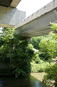
MD 32 was reconstructed and widened from Sykesville to Eldersburg starting in 1957 and from West Friendship to just south of Sykesville in 1958. The state highway's bypass of Sykesville was completed in 1963; the old road through the center of Sykesville became MD 851. MD 32's new bridge across the Patapsco River was the longest of only three aluminum triangular box beam girder bridges constructed in the United States. The girder system was topped by a concrete slab deck and underlain with standard concrete abutments and piers and steel bearing pads on which the aluminum girders rested. These bridges, which were designed by Fairchild Engine and Airplane Company, were constructed of aluminum due to that metal's light weight but similar strength compared to steel. Many experimental aluminum bridges were built due to a severe shortage of steel in the early 1960s. Aluminum bridges are rarely constructed because they are much more expensive than steel and concrete bridges.
In the 1990s, MDSHA discovered the bridge's rarity while conducting a bridge inventory. The inventory also found premature deterioration of its supports due to galvanic corrosion involving the steel bearing pads and aluminum girder structure. Because repairing the structure would have been extremely difficult, MDSHA decided to build a replacement bridge immediately to the west of the aluminum bridge; the new bridge opened in 2004 along with a slight relocation in MD 32 on both sides of the bridge. The aluminum bridge was added to the state's Historic Bridge Registry and was left in place as a historic landmark after MD 32's new bridge over the Patapsco River opened.
Construction on the Patuxent Freeway resumed in 1981 in Howard County. The freeway opened from Dorsey Run Road to US 29 in 1985. The freeway was extended across the Middle Patuxent River to tie into the existing two-lane road near Cedar Lane by 1987. The new highway was extended east from Dorsey Run Road to just west of the Baltimore–Washington Parkway as a four-lane divided highway that same year. Sections of MD 32's old alignment became part of MD 732. The highway from Dorsey Run Road to the parkway was upgraded to a freeway with the completion of interchanges at Dorsey Run Road and a ramp to Guilford Road in 1991. The interchange between MD 32 and the Baltimore–Washington Parkway was upgraded to a full cloverleaf around 1993. The final section of the Patuxent Freeway in Howard County opened from west of US 29 to west of MD 108 in 1996.
I-97 was under construction from Annapolis to Millersville by 1987. When that section of the Interstate was completed in 1989, the highway took over the portion of MD 32 from MD 178 to MD 3. The easternmost portion of MD 32 became I-97's Exit 5 interchange ramps; the MD 3 interchange was upgraded to provide full access. Also in 1989, construction began on MD 32 between the Baltimore–Washington Parkway and I-97. MD 32 was extended as a four-lane divided highway along the existing road from the parkway east to MD 198 and as a two-lane road on a new alignment from MD 198 to MD 175. The sections of MD 32 from MD 198 to MD 175 west of Odenton and from Burns Crossing Road to I-97 were under construction to expand them to a freeway; the freeway segment from MD 175 to Burns Crossing Road on the north side of Odenton was also under construction. The freeway between MD 198 and MD 175 was complete by 1991. The remainder of the Patuxent Freeway from Fort Meade to Millersville was completed in 1993.
In 2000, construction began on the gap in the Patuxent Freeway through Fort George G. Meade. MD 32's interchanges with MD 198 and Samford Road were completed in 2002. The MD 198 project involved extending the latter highway east along the northern edge of Tipton Airport so MD 198 could tie into the fort's Mapes Road entrance; the Mapes Road intersection east of MD 198 was also eliminated by the construction. The Patuxent Freeway through Fort Meade was finished when MD 32's interchange with Canine Road was completed in 2005.
State highway
State highway, state road or state route can refer to one of three related concepts, two of them related to a state or provincial government in a country that is divided into states or provinces :#A...
in the U.S. state of Maryland
Maryland
Maryland is a U.S. state located in the Mid Atlantic region of the United States, bordering Virginia, West Virginia, and the District of Columbia to its south and west; Pennsylvania to its north; and Delaware to its east...
. The state highway runs 51.79 miles (83.3 km) from Interstate 97 (I-97) and MD 3
Maryland Route 3
Maryland Route 3, also part of Robert Crain Highway, is the designation given to the former alignment of U.S. Route 301 from Bowie, Maryland, USA, to Baltimore. It is named for Robert Crain of Baltimore.-Route description:...
in Millersville
Millersville, Maryland
Millersville is an unincorporated community in Anne Arundel County, Maryland, United States.-Geography:Millersville is located at .-History:...
west and north to Washington Road in Westminster
Westminster, Maryland
Westminster is a city in northern Maryland, United States. It is the seat of Carroll County. The city's population was 18,590 at the 2010 census. Westminster is an outlying community within the Baltimore-Towson, MD MSA, which is part of a greater Washington-Baltimore-Northern Virginia, DC-MD-VA-WV...
. The east–west portion of MD 32 is the Patuxent Freeway, a four- to six-lane freeway between I-97 and MD 108
Maryland Route 108
Maryland Route 108 is a suburban state highway in the central part of the U.S. state of Maryland, starting in Damascus and ending near Columbia.-Route description:...
in Clarksville
Clarksville, Maryland
Clarksville is both the name of an unincorporated community and the name associated with Districts 4 & 5 in Howard County, the third wealthiest county in the United States according to the U.S. Census Bureau. The community is named for William Clark, a farmer who owned much of the land on which the...
. The freeway passes through Odenton
Odenton, Maryland
Odenton is a census-designated place in Anne Arundel County, Maryland, United States. The population was 20,534 at the 2000 census. The town is named after former Governor of Maryland, Oden Bowie. It is bordered by Gambrills to the east, Severn to the north, Fort Meade to the west, and Crofton to...
and Fort Meade
Fort Meade, Maryland
Fort Meade is a census-designated place in Anne Arundel County, Maryland, United States. The population was 9,882 at the 2000 census. It is the home to the National Security Agency, which is located on the US Army post Fort George G...
, the site of Fort George G. Meade
Fort George G. Meade
Fort George G. Meade is a United States Army installation that includes the Defense Information School, the United States Army Field Band, and the headquarters of United States Cyber Command, the National Security Agency, and the Defense Courier Service...
and the National Security Agency
National Security Agency
The National Security Agency/Central Security Service is a cryptologic intelligence agency of the United States Department of Defense responsible for the collection and analysis of foreign communications and foreign signals intelligence, as well as protecting U.S...
(NSA), in western Anne Arundel County
Anne Arundel County, Maryland
Anne Arundel County is a county located in the U.S. state of Maryland. It is named for Anne Arundell , a member of the ancient family of Arundells in Cornwall, England and the wife of Cæcilius Calvert, 2nd Baron Baltimore. Its county seat is Annapolis, which is also the capital of the state...
and along the southern part of Columbia
Columbia, Maryland
Columbia is a planned community that consists of ten self-contained villages, located in Howard County, Maryland, United States. It began with the idea that a city could enhance its residents' quality of life. Creator and developer James W. Rouse saw the new community in terms of human values, not...
in Howard County
Howard County, Maryland
-2010:Whereas according to the 2010 U.S. Census Bureau:*62.2% White*17.5% Black*0.3% Native American*14.4% Asian*0.0% Native Hawaiian or Pacific Islander*3.6% Two or more races*2.0% Other races*5.8% Hispanic or Latino -2000:...
. Via I-97, MD 32 connects those communities with U.S. Route 50
U.S. Route 50 in Maryland
U.S. Route 50 is a major east–west route of the U.S. Highway system, stretching just over from Ocean City, Maryland on the Atlantic Ocean to West Sacramento, California. In the U.S. state of Maryland, US 50 exists in two sections. The longer of these serves as a major route connecting...
and US 301
U.S. Route 301 in Maryland
U.S. Route 301 in Maryland is a major highway that runs from Delaware to the Governor Harry W. Nice Memorial Bridge into Virginia. It passes through three of Maryland's four main regions: the Eastern Shore, the Baltimore-Washington Metropolitan Area, and Southern Maryland...
in Annapolis
Annapolis, Maryland
Annapolis is the capital of the U.S. state of Maryland, as well as the county seat of Anne Arundel County. It had a population of 38,394 at the 2010 census and is situated on the Chesapeake Bay at the mouth of the Severn River, south of Baltimore and about east of Washington, D.C. Annapolis is...
. The state highway also intersects the four primary highways connecting Baltimore and Washington
Washington, D.C.
Washington, D.C., formally the District of Columbia and commonly referred to as Washington, "the District", or simply D.C., is the capital of the United States. On July 16, 1790, the United States Congress approved the creation of a permanent national capital as permitted by the U.S. Constitution....
: the Baltimore–Washington Parkway, US 1
U.S. Route 1 in Maryland
U.S. Route 1 is the easternmost and longest of the major north–south routes of the United States Numbered Highway System, running from Key West, Florida to Fort Kent, Maine. In the U.S...
, I-95
Interstate 95 in Maryland
Interstate 95 in Maryland is a major highway that runs diagonally from northeast to southwest, from Maryland's border with Delaware, to the Woodrow Wilson Bridge, briefly entering the District of Columbia before reaching Virginia...
, and US 29
U.S. Route 29 in Maryland
U.S. Route 29 is a north–south United States highway that runs for from the western suburbs of Baltimore, Maryland, to Pensacola, Florida. In the U.S. state of Maryland, US 29 is a major highway that emerges from Washington D.C. and runs north into eastern Montgomery County, stretching...
. MD 32's north–south section, Sykesville Road, connects Clarksville and Westminster by way of Sykesville
Sykesville, Maryland
Sykesville is a town in Carroll County, Maryland, United States. The population was 4,197 at the 2000 census.-History:The land on which Sykesville sits started out as part of a Springfield Estate, owned by wealthy Baltimore shipbuilder William Patterson...
and Eldersburg
Eldersburg, Maryland
Eldersburg is a census-designated place in Carroll County, Maryland, United States. The population was 27,741 at the 2000 census.-History:...
in southern Carroll County
Carroll County, Maryland
Carroll County is a county located in the U.S. state of Maryland. In 2010, its population was 167,134. It was named for Charles Carroll of Carrollton , signer of the American Declaration of Independence. Its county seat is Westminster....
. MD 32 is a part of the National Highway System
National Highway System (United States)
The National Highway System is a network of strategic highways within the United States, including the Interstate Highway System and other roads serving major airports, ports, rail or truck terminals, railway stations, pipeline terminals and other strategic transport facilities.Individual states...
from its eastern terminus in Millersville to I-70
Interstate 70 in Maryland
Interstate 70 is a part of the Interstate Highway System that runs from Cove Fort, Utah to Baltimore, Maryland. In Maryland, the Interstate Highway runs from the Pennsylvania state line in Hancock east to the Interstate's eastern terminus near its junction with I-695 at a park and ride in...
and US 40
U.S. Route 40 in Maryland
U.S. Route 40 in the U.S. state of Maryland runs from western Maryland to Cecil County in the state's northeastern corner. With a total length of over , it is the longest numbered highway in Maryland. Almost half of the road overlaps with Interstate 68 or Interstate 70, while the old alignment...
in West Friendship
West Friendship, Maryland
West Friendship is an affluent semi-rural community in western Howard County, Maryland. West Friendship is located at the junction of Interstate 70/U.S. Highway 40/Maryland Route 144 and Maryland Route 32.- History :...
.
MD 32 was constructed as the original state road from West Friendship to Taneytown
Taneytown, Maryland
Taneytown is a city in Carroll County, Maryland, United States. The population was 5,128 at the 2000 census. was founded in 1754. Of the town George Washington once wrote "Tan-nee town is but a small place with only the Street through wch. the road passes, built on...
in the early 1910s. The state highway was extended northwest to the Pennsylvania
Pennsylvania
The Commonwealth of Pennsylvania is a U.S. state that is located in the Northeastern and Mid-Atlantic regions of the United States. The state borders Delaware and Maryland to the south, West Virginia to the southwest, Ohio to the west, New York and Ontario, Canada, to the north, and New Jersey to...
state line near Emmitsburg
Emmitsburg, Maryland
-Demographics:As of the census of 2000, there were 2,290 people, 811 households, and 553 families residing in the town. The population density was 1,992.9 people per square mile . There were 862 housing units at an average density of 750.2 per square mile...
in the late 1910s. The portion of MD 32 from Glenelg
Glenelg, Maryland
Glenelg is an unincorporated community in Howard County, Maryland, United States. It is in the 21737 zip code, and the 410 area code. It is the home town of Glenelg High School and Glenelg Country School...
to US 1 in Savage
Savage, Maryland
Savage is a historic town located in Howard County, Maryland, about south of Baltimore and north of Washington, D.C. It is situated close to the city of Laurel and to the planned community of Columbia.A rich vein of American industrial history lies in Savage...
was built as MD 106 in the 1920s and early 1930s. MD 32 was extended south from West Friendship and assumed all of MD 106 in the mid-1940s. In the mid-1950s, MD 32 was replaced north of Westminster by MD 97
Maryland Route 97
Maryland Route 97 is a state highway in the U.S. state of Maryland. The route runs from U.S. Route 29 in Silver Spring, Montgomery County north to the Pennsylvania border in Carroll County, where the road continues into that state as Pennsylvania Route 97...
. MD 32 would later be restored to its old route through Westminster and west toward Taneytown when MD 97, which is now MD 140
Maryland Route 140
Maryland Route 140 is a local long route in northern Maryland, United States.-Route description:MD 140 is known by various names depending on location; south of Reisterstown it is known as Reisterstown Road. Though Reisterstown itself is named after John Reister, the road is named after Jacob...
north of Westminster, was relocated in the early 1960s. MD 32 was truncated to Westminster in the late 1970s and rolled back to its present northern terminus in 2001.
Along its present course, MD 32 bypassed Sykesville and was relocated from Clarksville to Glenelg in the early 1960s. The state highway was also extended east from Savage to Fort Meade in the late 1960s. A disjoint segment of MD 32 was constructed on a new alignment from MD 175
Maryland Route 175
-Annapolis Road:MD 175 begins at MD 3, just south of the latter's northern terminus at Interstate 97, known as Annapolis Road. It runs west as a two-lane suburban highway, passing through local neighborhoods and south of Arundel High School before widening into a four-lane suburban arterial south...
in Odenton to MD 178
Maryland Route 178
Maryland Route 178, known locally as Generals Highway, is a north–south highway in Anne Arundel County, Maryland. It parallels Interstate 97 and once was the main eastbound route to Annapolis, Maryland. It begins at its intersection with Maryland Route 450 in Parole, near the Westfield...
in Crownsville
Crownsville, Maryland
Crownsville is a census-designated place in Anne Arundel County, Maryland, United States. The population was 1,670 at the 2000 census. It hosts the Anne Arundel County Fair each September, as well as the annual Maryland Renaissance Festival for several summer weekends. A state psychiatric hospital...
in the early 1970s. The Patuxent Freeway was built from Fort Meade to Columbia in the mid-1980s and from Fort Meade to Millersville in the late 1980s and early 1990s. The freeway was completed from Columbia to Clarksville in the mid-1990s and through Fort George G. Meade in 2005. Future plans call for MD 32 to be upgraded to a freeway from Clarksville to West Friendship.
Millersville to Fort Meade
MD 32 begins at a partial cloverleaf interchange with I-97 and MD 3 (Robert Crain Highway) in Millersville. MD 32 starts as a pair of two-lane flyover ramps that split west from northbound I-97 and join southbound I-97; the MD 32 ramps head northwest while I-97 curves to the northeast and settles into the wide median of the northern end of MD 3. After passing through its interchange with MD 3, MD 32 heads northwest as the Patuxent Freeway, a four-lane freeway that passes to the north of the community of GambrillsGambrills, Maryland
Gambrills is an unincorporated town in Anne Arundel County, Maryland, in the Baltimore metro area.The community was named for Augustine Gambrill, plantation owner.-Population:...
. The state highway's first interchange is with Sappington Station Road, a spur from the westbound ramps of MD 32 that is unsigned MD 32AA. The eastbound ramps connect with county-maintained Burns Crossing Road. MD 32 continues northwest along the northern edge of Odenton, where the freeway gradually curves to the southwest, has a diamond interchange
Diamond interchange
A diamond interchange is a common type of road junction, used where a freeway crosses a minor road. The freeway itself is grade-separated from the minor road, one crossing the other over a bridge...
with MD 170
Maryland Route 170
Maryland Route 170 is a roughly 13-mile-long road in Anne Arundel County.-Route description:MD 170 begins at the intersection of MD 175 Annapolis Road and Piney Orchard Parkway, in Odenton. It runs north towards Severn, interchanging with MD 32 northwest of the town...
(Telegraph Road) and a partial cloverleaf interchange with MD 175 (Annapolis Road), and crosses over the Amtrak Northeast Corridor and MARC
MARC Train
MARC , known prior to 1984 as Maryland Rail Commuter Service, is a regional rail system comprising three lines in the Baltimore-Washington Metropolitan Area. MARC is administered by the Maryland Transit Administration , a Maryland Department of Transportation agency, and is operated under contract...
's Penn Line
Penn Line (MARC)
The Penn Line is a MARC commuter rail line running from Union Station, Washington D.C. to Perryville, Maryland via Penn Station, Baltimore, Maryland on Amtrak's Northeast Corridor. It is MARC's busiest and only electric line. Currently the line is the fastest commuter rail line in the country, with...
between the interchanges.
MD 32 heads west from Odenton along the southern edge of Fort George G. Meade. The freeway has a dumbbell interchange with MD 198
Maryland Route 198
Maryland Route 198 is an east–west state highway in the central part of the U.S. state of Maryland that connects Fort Meade at Maryland Route 32 to Maryland Route 28 and Maryland Route 650 near Spencerville.-Spencerville Road:...
(Laurel Fort Meade Road) just north of Tipton Airport
Tipton Airport
Tipton Airport is a public airport located just south of Fort George G. Meade in Odenton, Anne Arundel County, Maryland. The facility is bordered by Fort Meade, the National Security Agency, and the Patuxent Wildlife Research Center. This airport opened in 1999 on the site of a former United...
. MD 32 curves northwest and has an interchange with Samford Road, which is one of two interchanges that provide access to NSA. The median of MD 32 widens at the interchange as the eastbound ramps enter and exit on the left to a roundabout
Roundabout
A roundabout is the name for a road junction in which traffic moves in one direction around a central island. The word dates from the early 20th century. Roundabouts are common in many countries around the world...
, from which Samford Road crosses the westbound lanes of MD 32. The freeway is maintained by the U.S. government
Federal government of the United States
The federal government of the United States is the national government of the constitutional republic of fifty states that is the United States of America. The federal government comprises three distinct branches of government: a legislative, an executive and a judiciary. These branches and...
from Samford Road to its trumpet interchange with Canine Road, which provides access to NSA, the National Vigilance Park
National Vigilance Park
The United States National Vigilance Park is a memorial to the military servicemen who participated in aerial reconnaissance during the Cold War. Dedicated on , NVP is located just one block from the NSA headquarters at Fort George G. Meade, Maryland. It is open 24 hours a day for viewing...
, and the National Cryptologic Museum
National Cryptologic Museum
The National Cryptologic Museum is an American museum of cryptologic history that is affiliated with the National Security Agency . The first public museum in the U.S. Intelligence Community, NCM is located in the former Colony Seven Motel, just two blocks from the NSA headquarters at Fort...
. Immediately to the north of the Canine Road interchange is a cloverleaf interchange
Cloverleaf interchange
A cloverleaf interchange is a two-level interchange in which left turns, reverse direction in left-driving regions, are handled by ramp roads...
with the Baltimore–Washington Parkway.
Fort Meade to Clarksville
MD 32 traverses Dorsey Run into the industrial community of Annapolis JunctionAnnapolis Junction, Maryland
Annapolis Junction is an unincorporated community in Howard County, Maryland, United States.-Demographics:The ZIP Code for Annapolis Junction is 20701. 2000 Census for 20701*Population 40*Median age 31.5 years*Single family homes 6...
, where northbound MD 32 has an interchange with Guilford Road, which leads to National Business Parkway and the historic home Grassland
Grassland (Annapolis Junction, Maryland)
Grassland is a historic home at Annapolis Junction, Anne Arundel County, Maryland. It was built in 1853, and is a three-part brick structure constructed in a telescoping manner...
. The state highway crosses over CSX
CSX Transportation
CSX Transportation operates a Class I railroad in the United States known as the CSX Railroad. It is the main subsidiary of the CSX Corporation. The company is headquartered in Jacksonville, Florida, and owns approximately 21,000 route miles...
's Capital Subdivision into Howard County and immediately has a partial cloverleaf interchange with Dorsey Run Road. Dorsey Run Road, which is unsigned MD 732R, provides access to the Savage
Savage (MARC station)
Savage is a passenger rail station on the MARC Camden Line between Washington, DC and Baltimore's Camden Station. It is officially located at 9009 Dorsey Run Road in Savage, Maryland, however Dorsey Run Road runs over the railroad tracks as well as Brock Bridge Road, which runs along the south side...
station on MARC's Camden Line
Camden Line
The Camden Line is a MARC commuter rail line that runs between Union Station, Washington, D.C. and Camden Station, Baltimore, Maryland over the CSX Capital Subdivision. Service began along this route in 1835 as part of the Baltimore and Ohio Railroad , making it the oldest passenger rail line in...
and several industrial parks in Annapolis Junction. MD 32 continues northwest into Savage, where the highway has a cloverleaf interchange with US 1 (Washington Boulevard) that includes collector-distributor lanes in both directions. North of Savage, the freeway has a partial cloverleaf interchange with I-95 that has a pair of left-exiting ramps from westbound MD 32 to southbound I-95 and from eastbound MD 32 to northbound I-95.
MD 32 continues west as a six-lane freeway through the expansive new town
New town
A new town is a specific type of a planned community, or planned city, that was carefully planned from its inception and is typically constructed in a previously undeveloped area. This contrasts with settlements that evolve in a more ad hoc fashion. Land use conflicts are uncommon in new...
of Columbia. he freeway passes south and north of the villages of King's Contrivance and Owen Brown
Owen Brown, Columbia, Maryland
Owen Brown is one of the 10 villages in Columbia, Maryland, USA, incorporated in 1972. Neighborhoods in the village include Dasher Green, Elkhorn, and Hopewell...
, respectively, where the highway has a partial cloverleaf interchange with Broken Land Parkway and a four-loop interchange with Eden Brook Drive and Shaker Drive. MD 32 crosses the Little Patuxent River between the two interchanges. Just south of Simpsonville
Simpsonville, Maryland
Simpsonville is an unincorporated community in Howard County, Maryland, United States.-References:...
, the state highway has a cloverleaf interchange with US 29 (Columbia Pike), which provides access to Columbia Town Center
Town Center, Columbia, Maryland
Town Center is one of the ten villages in Columbia, Maryland, United States, first occupied in 1974. It is a non-contiguous, diverse area, and the most urban-like, ranging from multi-level high density apartments homes and office buildings, to single family homes....
. The freeway reduces to four lanes and crosses the Middle Patuxent River just east of its diamond interchange with Sanner Road and Cedar Lane. MD 32 continues along the southern edge of the village of River Hill
River Hill, Columbia, Maryland
River Hill is the last and westernmost village to be developed in the town of Columbia, Maryland, though numerous residents have addresses in Clarksville. Construction started in 1990. It is bounded by Maryland Route 108 and Maryland Route 32, and is centered on Trotter Road...
, where the highway has a half-interchange with Great Star Drive, which is unsigned MD 732V, allowing access to and from the east. The state highway continues northwest to Clarksville, where the highway has a diamond interchange with MD 108 (Clarksville Pike).
Clarksville to Westminster
West of its interchange with MD 108, MD 32's name changes to Sykesville Road, which continues northwest as a partially-controlled access two-lane highway through a mix of farmland and large-plot residential subdivisions. The state highway is paralleled to the west by its old alignment, Ten Oaks Road. East of the community of DaytonDayton, Maryland
Dayton is an unincorporated community of about 10,000 located in Howard County, Maryland.Dayton is also the home to the annual Dayton Daze Parade that began in honor of Lenny Hobbs. Dayton is in the 21036 zip code area and belongs to the 410 area code...
, the state highway passes by MDSHA's Dayton shops. In Glenelg
Glenelg, Maryland
Glenelg is an unincorporated community in Howard County, Maryland, United States. It is in the 21737 zip code, and the 410 area code. It is the home town of Glenelg High School and Glenelg Country School...
, MD 32 passes under Triadelphia Road and expands to a two-lane divided highway for its dumbbell interchange with Burnt Woods Road, which also provides access to the northern end of Ten Oaks Road and Pfefferkorn Road. The state highway becomes undivided again and veers northeast and north toward West Friendship. MD 32 crosses the Middle Patuxent River and Terrapin Branch before its intersection with MD 144
Maryland Route 144
Maryland Route 144 is a collection of state highways in the U.S. state of Maryland. These highways are sections of old alignment of U.S. Route 40 between Cumberland and Baltimore...
(Frederick Road), where the highway expands to a four-lane divided highway. The state highway has a diamond interchange with I-70 and US 40 (Baltimore National Pike) before reducing to a four-lane undivided highway that continues north to MD 32's intersection with MD 99
Maryland Route 99
Maryland Route 99 is a state highway in the U.S. state of Maryland. Known as Old Frederick Road, the state highway runs from MD 32 near West Friendship east to U.S. Route 29 in Ellicott City. MD 99 parallels the north side of Interstate 70 through a rural and suburban area in northeastern...
(Old Frederick Road).
MD 32 continues north as a two-lane road to Sykesville. Just south of the town, the state highway intersects West Friendship Road, the old alignment of MD 32 that is now unsigned MD 851
Maryland Route 851
Maryland Route 851 is a state highway in the U.S. state of Maryland. The state highway runs as a north–south highway between junctions with MD 32 in Sykesville. MD 851 is the old alignment of MD 32 through Sykesville, which was paved by 1910. The state highway was designated when the MD...
. MD 32 veers northeast and crosses the Patapsco River
Patapsco River
The Patapsco River is a river in central Maryland which flows into Chesapeake Bay. The river's tidal portion forms the harbor for the city of Baltimore...
and CSX's Old Main Line Subdivision into Carroll County; immediately to the east of MD 32's crossing is the highway's old aluminum bridge. The state highway passes to the west of Springfield Hospital Center
Springfield Hospital Center
Springfield Hospital Center is a regional psychiatric hospital located in Sykesville, Maryland.It is operated by the Department of Health and Mental Hygiene through the Mental Hygiene Administration. The historic core of the hospital was added to the National Register of Historic Places as the...
, whose original buildings are preserved as the Warfield Complex, Hubner, and T Buildings
Warfield Complex, Hubner, and T Buildings
Warfield Complex, Hubner, and T Buildings is a national historic district at Sykesville, Carroll County, Maryland, United States. It comprises the historic core of the women's facility at Springfield State Hospital, a public mental institution. It was developed over the period 1898-1939...
. MD 32 temporarily expands to a four-lane divided highway at its intersection with Springfield Avenue, which is the northern end of MD 851, and continues north into the suburban community of Eldersburg. The state highway expands to a four-lane divided highway at Piney Ridge Parkway and maintains that form through its intersection with MD 26
Maryland Route 26
Maryland Route 26 is an east–west state highway in the U.S. state of Maryland. Outside of the Baltimore city limits, it is known as Liberty Road; inside the city limits it is known as Liberty Heights Avenue....
(Liberty Road). MD 32 continues through the suburban area as a four-lane undivided highway with two lanes northbound, one lane southbound, and a center turn lane. The state highway passes to the east of Liberty High School and reduces to two lanes north of Bennett Road.
MD 32 heads into a forested area and crosses the Morgan Run arm of Liberty Reservoir
Liberty Reservoir
The Liberty Reservoir is a reservoir in the suburbs of Baltimore, Maryland. It is owned by the City of Baltimore Department of Public Works, but is located outside of the city, and it divides Baltimore and Carroll Counties.-History:...
. The state highway passes through an S-curve before heading through the communities of Louisville
Louisville, Maryland
Louisville is an unincorporated community in Carroll County, Maryland, United States.-References:...
and Gamber
Gamber, Maryland
Gamber is an unincorporated town located in Carroll County, Maryland. It is the hometown of MTV's The Real World personality Jon Brennan. Gamber is located at the intersection of Maryland Route 91 and Maryland Route 32, near the border of Carroll and Baltimore Counties...
, where the highway meets the southern end of MD 91
Maryland Route 91
Maryland Route 91 is a short highway that runs through central Maryland. It is one of only four routes still surviving in the route cluster assigned to Carroll County in the 1933 route numbering plan.-Counties traversed:*Carroll County*Baltimore County...
(Gamber Road). MD 32 continues northwest through a mix of farmland and residential subdivisions toward Fenby, where the highway intersects MD 97 (New Washington Road). Just north of MD 97 adjacent to Carroll Community College
Carroll Community College
Carroll County Community College is a 2-year Community college serving the residents of Carroll County, Maryland.- History :Responding to interest expressed by citizens of Carroll County, the Carroll County Board of Commissioners examined the need for additional educational opportunities in the...
, the state highway meets MD 97's old alignment, Old Washington Road, which is unsigned MD 854B
Maryland Route 854
Maryland Route 854 is a collection of state highways in the U.S. state of Maryland. This pair of highways comprise the old alignment of MD 97 between MD 26 near Eldersburg and MD 32 in Fenby in Carroll County...
. MD 32 continues north as Washington Road through a suburban area; the highway parallels MD 97 and passes to the east of the historic Friendship Valley Farm
Friendship Valley Farm
Friendship Valley Farm is a historic home and farm complex located at Westminster, Carroll County, Maryland, United States. It was established in the late 18th century. About that time a -story "T"-shaped main house was built of brick on a stone foundation. It was later expanded to its current "H"...
and Carroll County Almshouse and Farm
Carroll County Almshouse and Farm
Carroll County Almshouse and Farm, also known as the Carroll County Farm Museum, is a historic farm complex located at Westminster, Carroll County, Maryland. It consists of a complex of 15 buildings including the main house and dependencies. The 30-room brick main house was originally designed and...
, which is now the Carroll County Farm Museum. Just north of Bennett Avenue, MD 32 reaches its northern terminus at the southern city limit of Westminster. The roadway continues north as a municipal street to Main Street, which heads northwest through the Westminster Historic District
Westminster Historic District
The Westminster Historic District comprises the historic center of Westminster, Maryland. The district includes about 1400 structures, with a high proportion of contributing structures...
.
Original construction
When the Maryland State Roads Commission (MDSRC), the predecessor of the Maryland State Highway AdministrationMaryland State Highway Administration
The Maryland State Highway Administration is the state agency responsible for maintaining Maryland numbered highways outside of Baltimore City...
(MDSHA), laid out its original state road system in 1909, the commission included the roads from Westminster to Taneytown and from West Friendship to Westminster via Eldersburg. These highways already contained several stretches of improved highway; Main Street in Westminster and the highways for 1 miles (1.6 km) on either side of Gamber and for 2 miles (3.2 km) on either side of Sykesville were paved by 1910. In addition, the designated state roads included two turnpikes: the Westminster and Meadow Branch Turnpike operated from the western city limit of Westminster northwest to Fountain Valley on the road to Taneytown; and the Westminster and Fenby Turnpike operated from the southern city limit of Westminster to Fenby.
In 1911, the whole highway from West Friendship to Eldersburg was completed after the addition of 14 feet (4.3 m) wide macadam sections on either side of the existing paved road through Sykesville. That same year, construction began on the state road between Eldersburg and Fenby. The roads from Eldersburg to the existing paved road through Gamber and from Gamber to Fenby were completed with a 14 feet (4.3 m) wide macadam surface in 1912 and 1913, respectively. The road from Fountain Valley to Taneytown was paved as a 14 feet (4.3 m) wide concrete road from Fountain Valley through Frizzelburg
Frizzelburg, Maryland
Frizzelburg is an unincorporated community in Carroll County, Maryland, United States.-References:...
in 1914 and from there to Taneytown in 1915. The former turnpikes still remained to be improved in 1915; those roads were resurfaced with macadam by 1919 to complete the original state road from West Friendship to Taneytown.
The next portion of what was to become MD 32 to be constructed was an extension of the Taneytown road northwest through Emmitsburg, which was planned by 1915. The sections from Taneytown to the Monocacy River
Monocacy River
The Monocacy River is a free-flowing tributary of the Potomac River, which empties into the Atlantic Ocean via the Chesapeake Bay. The river is long, with a drainage area of about...
and from the river 3 miles (4.8 km) west toward Emmitsburg were completed as a 14 feet (4.3 m) wide concrete road by 1919. The remaining 2 miles (3.2 km) to Emmitsburg were underway by 1920 and built as a 15 feet (4.6 m) wide concrete road by 1921. The highway was completed from Emmitsburg northwest to the Pennsylvania state line by 1923. When MDSRC started assigning numbers to its state roads in 1927, the highway from US 40 in West Friendship to the Pennsylvania state line northwest of Emmitsburg was designated MD 32.
The portion of MD 32 from Glenelg to Savage was originally designated MD 106. This highway was paved in concrete from Dayton to Clarksville and from Clarksville to about 1 miles (1.6 km) west of the Middle Patuxent River near Simpsonville by 1923. That same year, a concrete road was added south from West Friendship to the Middle Patuxent River. The concrete road from Clarksville was extended to the Middle Patuxent River opposite Simpsonville in 1925. A macadam road was built from Atholton to Oakland Mills Road in Guilford
Guilford, Maryland
Guilford is a community located in Howard County in the state of Maryland in the United States of America. Formerly a small railroad stop, it now lies within the boundaries of Columbia....
between 1924 and 1926. Guilford was connected to US 1 near Savage with a gravel road by 1927. The gap in MD 106 through Simpsonville was filled with a concrete road in 1929 and 1930. MD 32 was extended southwest from the Middle Patuxent River to north of Glenelg around 1933. MD 106 was extended north from Dayton to Glenelg as a macadam road in 1934. The gap in the highway north of Glenelg was filled by 1946, by which time MD 32 had been extended south and east over the course of MD 106 to Savage.
Improvements
The first major improvement to the original course of MD 32 was the replacement of the highway's one-lane covered bridgeCovered bridge
A covered bridge is a bridge with enclosed sides and a roof, often accommodating only a single lane of traffic. Most covered bridges are wooden; some newer ones are concrete or metal with glass sides...
over the Monocacy River with a wider triple-span concrete arch bridge in 1925. The highway was widened to 20 feet (6.1 m) from Westminster to just east of Taneytown by 1930 and from Taneytown to the Pennsylvania state line by 1934. MD 32 was reconstructed and widened again from Emmitsburg to the Pennsylvania state line in 1948 and through Taneytown in 1949. When US 40 was relocated as a four-lane divided highway through West Friendship in 1951, the new highway was placed on a bridge over MD 32 and a two-way ramp added to connect the grade-separated highways. MD 32 was relocated between Eldersburg and Louisville and a new bridge was constructed over Morgan Run in 1952 to replace the old road that would have been submerged by the filling of Liberty Reservoir.
U.S. Route 140
U.S. Route 140 U.S. Route 140 U.S. Route 140 ( was a U.S. highway connecting Gettysburg, Pennsylvania to Baltimore, Maryland. The route was deleted from the system in 1980; today the road's route is followed by portions of Pennsylvania Route 97, Maryland Route 97, and Maryland Route 140.Though it...
(now MD 140), then followed the Westminster Bypass to the northwest side of the city. MD 32 was extended along its original alignment through Westminster to MD 97 near Western Maryland College. MD 32 would later be assigned to its original alignment from Fountain Valley to east of Taneytown when MD 97's new alignment between the two communities was completed in 1965. The disjoint segment of MD 32 was renumbered MD 832
Maryland Route 832
Maryland Route 832 is a state highway in the U.S. state of Maryland. Known as Old Taneytown Road, the state highway runs from MD 140 near Taneytown east to MD 140 near Westminster. MD 832 is the old alignment of the highway now designated MD 140 in western Carroll County...
in 1978. In 1979, US 140 was decommissioned; MD 97 and MD 140 swapped alignments north of Westminster to their present courses. MD 32's northern terminus was rolled back to MD 31
Maryland Route 31
Maryland Route 31 is a state highway in the U.S. state of Maryland. Known for most of its length as New Windsor Road, the state highway runs from MD 26 in Libertytown east to MD 140 in Westminster. MD 31 connects the county seats of Frederick and Westminster via Libertytown in eastern Frederick...
around 1987. The state highway was truncated at the Westminster city limit in 2001 following the reconstruction of Main Street and its transfer to city maintenance.
MD 32 was reconstructed and widened from Sykesville to Eldersburg starting in 1957 and from West Friendship to just south of Sykesville in 1958. The state highway's bypass of Sykesville was completed in 1963; the old road through the center of Sykesville became MD 851. MD 32's new bridge across the Patapsco River was the longest of only three aluminum triangular box beam girder bridges constructed in the United States. The girder system was topped by a concrete slab deck and underlain with standard concrete abutments and piers and steel bearing pads on which the aluminum girders rested. These bridges, which were designed by Fairchild Engine and Airplane Company, were constructed of aluminum due to that metal's light weight but similar strength compared to steel. Many experimental aluminum bridges were built due to a severe shortage of steel in the early 1960s. Aluminum bridges are rarely constructed because they are much more expensive than steel and concrete bridges.
In the 1990s, MDSHA discovered the bridge's rarity while conducting a bridge inventory. The inventory also found premature deterioration of its supports due to galvanic corrosion involving the steel bearing pads and aluminum girder structure. Because repairing the structure would have been extremely difficult, MDSHA decided to build a replacement bridge immediately to the west of the aluminum bridge; the new bridge opened in 2004 along with a slight relocation in MD 32 on both sides of the bridge. The aluminum bridge was added to the state's Historic Bridge Registry and was left in place as a historic landmark after MD 32's new bridge over the Patapsco River opened.
Patuxent Freeway
In 1956, MD 32 was extended east on Guilford Road from US 1 to the Howard – Anne Arundel county line at Annapolis Junction. The state highway was relocated to its present alignment from Glenelg to Clarksville between 1961 and 1964, bypassing Ten Oaks Road. MD 32 was expanded to a four-lane divided highway in West Friendship when its interchange with I-70 was reconstructed as a diamond interchange in 1973. MD 32 was extended east into Anne Arundel County in 1969 when the designation was extended to just east of the Baltimore–Washington Parkway on the edge of Fort George G. Meade. The first two sections of what would become the Patuxent Freeway opened in 1972. A short section of divided highway opened from just west of Oakland Mills Road in Guilford to a turnaround just west of Vollmerhausen Road that included MD 32's modern interchange with I-95. The other section was a two-lane road from MD 175 in Odenton northeast along Sappington Station Road and then east along the current alignments of MD 32 and I-97 to MD 178 just east of I-97 Exit 5 in Crownsville. The eastern section, which from 1972 to 1977 was one of the three disjoint sections of mainline MD 32 between Crownsville and Taneytown, included an interchange with MD 3 in Millersville. As of 1978, MD 32's interchange with the Baltimore–Washington Parkway was a partial cloverleaf interchange with four ramps on the north side of MD 32—due to the state highway closely paralleling the Baltimore & Ohio Railroad's spur to the military base—and a fifth ramp from the northbound parkway to eastbound MD 32. The MD 3 interchange included the ramps to and from MD 32 in the direction of Fort Meade plus a ramp from westbound MD 32 to northbound MD 3. All other movements were made via MD 178 or Millersville Road.Construction on the Patuxent Freeway resumed in 1981 in Howard County. The freeway opened from Dorsey Run Road to US 29 in 1985. The freeway was extended across the Middle Patuxent River to tie into the existing two-lane road near Cedar Lane by 1987. The new highway was extended east from Dorsey Run Road to just west of the Baltimore–Washington Parkway as a four-lane divided highway that same year. Sections of MD 32's old alignment became part of MD 732. The highway from Dorsey Run Road to the parkway was upgraded to a freeway with the completion of interchanges at Dorsey Run Road and a ramp to Guilford Road in 1991. The interchange between MD 32 and the Baltimore–Washington Parkway was upgraded to a full cloverleaf around 1993. The final section of the Patuxent Freeway in Howard County opened from west of US 29 to west of MD 108 in 1996.
I-97 was under construction from Annapolis to Millersville by 1987. When that section of the Interstate was completed in 1989, the highway took over the portion of MD 32 from MD 178 to MD 3. The easternmost portion of MD 32 became I-97's Exit 5 interchange ramps; the MD 3 interchange was upgraded to provide full access. Also in 1989, construction began on MD 32 between the Baltimore–Washington Parkway and I-97. MD 32 was extended as a four-lane divided highway along the existing road from the parkway east to MD 198 and as a two-lane road on a new alignment from MD 198 to MD 175. The sections of MD 32 from MD 198 to MD 175 west of Odenton and from Burns Crossing Road to I-97 were under construction to expand them to a freeway; the freeway segment from MD 175 to Burns Crossing Road on the north side of Odenton was also under construction. The freeway between MD 198 and MD 175 was complete by 1991. The remainder of the Patuxent Freeway from Fort Meade to Millersville was completed in 1993.
In 2000, construction began on the gap in the Patuxent Freeway through Fort George G. Meade. MD 32's interchanges with MD 198 and Samford Road were completed in 2002. The MD 198 project involved extending the latter highway east along the northern edge of Tipton Airport so MD 198 could tie into the fort's Mapes Road entrance; the Mapes Road intersection east of MD 198 was also eliminated by the construction. The Patuxent Freeway through Fort Meade was finished when MD 32's interchange with Canine Road was completed in 2005.
Sykesville Road upgrade
MDSHA has long-term plans to upgrade MD 32 to a four-lane freeway from MD 108 to I-70. The first project, which involved constructing a modified dumbbell interchange to connect MD 32 with Burnt Woods Road, Ten Oaks Road, Pfefferkorn Road, and Ivory Road in Glenelg, was completed in 2008. The next project planned is to construct a diamond interchange at Linden Church Road, which presently meets MD 32 at a pair of signalized, three-way directional crossover intersections between Glenelg and Clarksville. The Linden Church Road interchange is expected to start construction in 2012. Several other interchanges will be constructed or modified:- At MDSHA's Dayton Shop south of Glenelg, a half-diamond interchange will be built on the southbound side of MD 32 and a right-in/right-outRight-in/right-outRight-in/right-out and left-in/left-out refer to a type of road intersection where turning movements of vehicles are restricted. A RIRO permits only right turns and a LILO permits only left turns. RIRO is usual where vehicles drive on the right, and LILO is usual where vehicles drive on the left...
interchange constructed for northbound MD 32 traffic to access the maintenance facility. - North of Glenelg, Rosemary Lane will be extended west to cross over MD 32. The county highway will be connected to MD 32 via right-in/right-out interchanges between the state highway and frontage roads.
- In West Friendship, northbound MD 32 would have half of a partial cloverleaf interchange with MD 144. Access between MD 144 and southbound MD 32 would be via a right-in/right-out interchange with a frontage road. MD 144's intersections with the frontage road and the ramps to and from northbound MD 32 will be roundabouts.
- MD 32's interchange with I-70 will be transformed from a diamond interchange to a partial cloverleaf interchange with free-flowing ramps from MD 32 to I-70.
Junction list
MD 32 is signed east–west from I-97 in Millersville to MD 108 in Clarksville and north–south from MD 108 to Westminster.Auxiliary routes
MD 32 has three existing auxiliary routes:- MD 32AA is the designation for Sappington Station Road, which runs 1 miles (1.6 km) from westbound MD 32 west to MD 175 in Odenton. The state highway begins at the westbound MD 32 exit ramp for Exit 3. MD 32AA merges with the entrance ramp to westbound MD 32 and intersects the northern section of Burns Crossing Road before crossing over MD 32. The state highway intersects the southern section of Burns Crossing Road and heads southwest to its terminus at a roundabout with MD 175 (Annapolis Road), Odenton Road, and Higgins Drive.
- MD 32AH is the designation for Lodigiani Avenue, a 0.04 mile (0.0643736 km) spur east from Gambrills Road just south of Gambrills Road's overpass of MD 32 in Gambrills.
- MD 32B is the designation for the unnamed 0.02 mile (0.0321868 km) connector between MD 32 and MD 851H, which is a spur of old alignment of MD 32 north of West Friendship.