

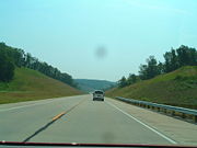
Two-lane freeway
Encyclopedia
A two-lane expressway is an expressway
with only one lane in each direction, and usually no median barrier. It may be built that way because of constraints, or may be intended for expansion once traffic volumes rise. The term super two
is often used by roadgeek
s for this type of road, but traffic engineer
s use that term for a high-quality surface road. Most of these roads are not tolled.
A somewhat related concept is a four-lane undivided expressway. This is much rarer; an example is some sections of U.S. Route 101
in northern California
.
compromise or as a way to overcome problems constrained from highway reconstruction when there are four lanes or more. If the road is widened, the existing road is typically allocated to traffic going in one direction, and the lanes for the other direction are built as a whole new roadbed adjacent to the existing one. When upgraded in this manner, the road becomes a typical freeway. Many two-lane freeways are built so that when the road is upgraded to a proper divided freeway, the existing overpasses and ramps do not need reconstruction.
A super-2 expressway is a high-speed surface road with at-grade intersections, depending on the common usage of the term expressway in the area. By this definition, Super-2s can be considered the first stage of project which is expected to become a full freeway, with the transportation authority owning the land necessary for the future adjacent carraigeway. At-grade intersections exist but there is sufficient land to replace them with interchanges. In some US states, a super-2 expressway is simply referred to as a super-2, regardless of whether it is fully controlled-access or not.
When an undivided freeway has four lanes, it is known as a super-4, though these are an oddity as most multi-lane freeways are divided, due to potential accidents from high-speed traffic crossing to the opposing side. Highway 27 directly north of Highway 401 in Toronto, Ontario is an example of a super-4 freeway by this definition, as it has four lanes of undivided traffic, and is fully controlled-access with interchanges and service roads to provide access to property in the area.
A super-4 expressway is a multi-lane divided highway with at-grade intersections, although the highway will become a full controlled-access freeway if the intersections are replaced with interchanges. A super-4 may have formerly been a super-2 that has been twinned, although such instances of super-4 intermediaries are rare as super-2s are often upgraded right away to full freeways. Highway 40 in Ontario is a super-4 expressway between Highway 402 and Wellington St., and from Indian Rd to Courtright. The remaining sections of Highway 40 are super-2 expressways. Other super-4 expressways include the Hanlon Parkway
in Guelph and the Black Creek Drive
in Toronto, both which have sufficient right of way to allow for interchanges and overpasses to replace the at-grade crossings.
When a super-2 expressway is converted to a 4-lane divided freeway, conversion artifacts such as double yellow lines, or broken yellow lines in passing zones are usually cleanly bestowed in favor of more consistent road marking for 4-lane divided expressways.
and the N2
highways.
, Route 12, is a two-lane limited access tollway for 144 of its 183 kilometers, between exits 14 (Danyang) and 26 (East Dongguryeong). It is fully integrated into South Korea's ticketed tollway system. This section is to be widened to four lanes by 2015.
was initially a two-lane toll expressway before being upgraded to a full expressway in 1997. While the full four-lane divided toll expressways are more favored in recent years due to their higher traffic capacity, a few two-lane expressways do exist, such as the Kempas Highway
and the North Klang Straits Bypass
. These expressways, however, only have partial access control with at-grade intersections commonly available like most other federal and state roads. Nevertheless, these two-lane highways are still classified as "two-lane expressways" as they are maintained by highway concessionaires, namely PLUS Expressways Berhad
(Kempas Highway) and Shapadu (North Klang Straits Bypass).
The first true two-lane expressway with full access control
is the section of the Senai-Desaru Expressway
between Cahaya Baru and Penawar.
US-400 bypasses Neodesha
to the south and west. The western portion of this bypass is two-lanes, while the eastern section, multiplexed with US-75 is a conventional 4-lane freeway.
Limited-access road
A limited-access road known by various terms worldwide, including limited-access highway, dual-carriageway and expressway, is a highway or arterial road for high-speed traffic which has many or most characteristics of a controlled-access highway , including limited or no access to adjacent...
with only one lane in each direction, and usually no median barrier. It may be built that way because of constraints, or may be intended for expansion once traffic volumes rise. The term super two
Super two
A super two, super two-lane highway or wide two lane is a two-lane surface road built to high standards, typically including partial control of access, occasional passing lanes and hard shoulders...
is often used by roadgeek
Roadgeek
A roadgeek is an individual involved in "roadgeeking" or "road enthusiasm"—an interest in roads, and especially going on road trips, as a hobby...
s for this type of road, but traffic engineer
Traffic engineering (transportation)
For the engineering of communications and computer networks, see Teletraffic engineering.Traffic engineering is a branch of civil engineering that uses engineering techniques to achieve the safe and efficient movement of people and goods on roadways...
s use that term for a high-quality surface road. Most of these roads are not tolled.
A somewhat related concept is a four-lane undivided expressway. This is much rarer; an example is some sections of U.S. Route 101
U.S. Route 101
U.S. Route 101, or U.S. Highway 101, is an important north–south U.S. highway that runs through the states of California, Oregon, and Washington, on the West Coast of the United States...
in northern California
California
California is a state located on the West Coast of the United States. It is by far the most populous U.S. state, and the third-largest by land area...
.
Justification
Two-lane freeways are usually built as a temporary solution due to lack of funds, as an environmentalEnvironmental movement
The environmental movement, a term that includes the conservation and green politics, is a diverse scientific, social, and political movement for addressing environmental issues....
compromise or as a way to overcome problems constrained from highway reconstruction when there are four lanes or more. If the road is widened, the existing road is typically allocated to traffic going in one direction, and the lanes for the other direction are built as a whole new roadbed adjacent to the existing one. When upgraded in this manner, the road becomes a typical freeway. Many two-lane freeways are built so that when the road is upgraded to a proper divided freeway, the existing overpasses and ramps do not need reconstruction.
A super-2 expressway is a high-speed surface road with at-grade intersections, depending on the common usage of the term expressway in the area. By this definition, Super-2s can be considered the first stage of project which is expected to become a full freeway, with the transportation authority owning the land necessary for the future adjacent carraigeway. At-grade intersections exist but there is sufficient land to replace them with interchanges. In some US states, a super-2 expressway is simply referred to as a super-2, regardless of whether it is fully controlled-access or not.
When an undivided freeway has four lanes, it is known as a super-4, though these are an oddity as most multi-lane freeways are divided, due to potential accidents from high-speed traffic crossing to the opposing side. Highway 27 directly north of Highway 401 in Toronto, Ontario is an example of a super-4 freeway by this definition, as it has four lanes of undivided traffic, and is fully controlled-access with interchanges and service roads to provide access to property in the area.
A super-4 expressway is a multi-lane divided highway with at-grade intersections, although the highway will become a full controlled-access freeway if the intersections are replaced with interchanges. A super-4 may have formerly been a super-2 that has been twinned, although such instances of super-4 intermediaries are rare as super-2s are often upgraded right away to full freeways. Highway 40 in Ontario is a super-4 expressway between Highway 402 and Wellington St., and from Indian Rd to Courtright. The remaining sections of Highway 40 are super-2 expressways. Other super-4 expressways include the Hanlon Parkway
Hanlon Parkway
The Hanlon Parkway is a high-capacity at-grade suburban expressway in the city of Guelph, Ontario, Canada, which connects it with Highway 401. It runs in a general north-south direction in the city's west end. It is signed as Highway 6 for its whole length; from Wellington Street to Woodlawn Road,...
in Guelph and the Black Creek Drive
Black Creek Drive
Black Creek Drive is a north-south arterial road in Toronto, Ontario that extends from Highway 400 at Jane Street, near Ontario Highway 401 to Weston Road in the south. Originally intended to be a freeway extension of Ontario Highway 400, it was built instead as an arterial road after public...
in Toronto, both which have sufficient right of way to allow for interchanges and overpasses to replace the at-grade crossings.
When a super-2 expressway is converted to a 4-lane divided freeway, conversion artifacts such as double yellow lines, or broken yellow lines in passing zones are usually cleanly bestowed in favor of more consistent road marking for 4-lane divided expressways.
Australia
- In MelbourneMelbourneMelbourne is the capital and most populous city in the state of Victoria, and the second most populous city in Australia. The Melbourne City Centre is the hub of the greater metropolitan area and the Census statistical division—of which "Melbourne" is the common name. As of June 2009, the greater...
, VictoriaVictoria (Australia)Victoria is the second most populous state in Australia. Geographically the smallest mainland state, Victoria is bordered by New South Wales, South Australia, and Tasmania on Boundary Islet to the north, west and south respectively....
the Mornington Peninsula FreewayMornington Peninsula FreewayMornington Peninsula Freeway is an incomplete freeway in Melbourne, Victoria, Australia, that provides a link from outer suburban Melbourne to the Mornington Peninsula.- History :...
, , is a two-lane freeway between the interchange with Jetty Road and the interchange with Boneo Road at 90 km/h.
 - In BrisbaneBrisbaneBrisbane is the capital and most populous city in the Australian state of Queensland and the third most populous city in Australia. Brisbane's metropolitan area has a population of over 2 million, and the South East Queensland urban conurbation, centred around Brisbane, encompasses a population of...
, QueenslandQueenslandQueensland is a state of Australia, occupying the north-eastern section of the mainland continent. It is bordered by the Northern Territory, South Australia and New South Wales to the west, south-west and south respectively. To the east, Queensland is bordered by the Coral Sea and Pacific Ocean...
the Cunningham HighwayCunningham HighwayThe Cunningham Highway is a National Highway in Queensland, Australia. It is named after the explorer and botanist Allan Cunningham who followed a route close to where the modern day highway runs.-Route:...
, , is a two-lane freeway between Warwick Road and Ripley Road, After Ripley Road the Cunningham HighwayCunningham HighwayThe Cunningham Highway is a National Highway in Queensland, Australia. It is named after the explorer and botanist Allan Cunningham who followed a route close to where the modern day highway runs.-Route:...
is grade separated until it meets the Ipswich MotorwayIpswich MotorwayThe M7 runs from the junction of Ipswich Road and Granard Road to the M2 Logan Motorway interchange. It is then signed M2 until the junction of the Warrego Highway and the Cunningham Highway between Brisbane and Ipswich in South East Queensland, Australia.It initially passes through the suburbs of...
, M2. - In HobartHobartHobart is the state capital and most populous city of the Australian island state of Tasmania. Founded in 1804 as a penal colony,Hobart is Australia's second oldest capital city after Sydney. In 2009, the city had a greater area population of approximately 212,019. A resident of Hobart is known as...
, TasmaniaTasmaniaTasmania is an Australian island and state. It is south of the continent, separated by Bass Strait. The state includes the island of Tasmania—the 26th largest island in the world—and the surrounding islands. The state has a population of 507,626 , of whom almost half reside in the greater Hobart...
, theKingston Bypass Kingston BypassThe Kingston Bypass is a proposed Southern Outlet extension that would see the bypassing of Kingston, Tasmania. The original concept was first mentioned in Hobart's Transportation study of 1965....
has been constructed as a Two-Lane expressway, with provision for Dual carriagewayDual carriagewayA dual carriageway is a class of highway with two carriageways for traffic travelling in opposite directions separated by a central reservation...
in the future when needed. - In north-eastern TasmaniaTasmaniaTasmania is an Australian island and state. It is south of the continent, separated by Bass Strait. The state includes the island of Tasmania—the 26th largest island in the world—and the surrounding islands. The state has a population of 507,626 , of whom almost half reside in the greater Hobart...
, theBass Highway has some grade-separated interchanges, and the standard rural freeway 110 km/h speed limit, but with some sections having only two lanes.
- On the Sunshine CoastSunshine Coast, QueenslandThe Sunshine Coast is an urban area in South East Queensland, north of the state capital of Brisbane on the Pacific Ocean coastline. Although it does not have a central business district, by population it ranks as the 10th largest metropolis in Australia and the third largest in...
in QueenslandQueenslandQueensland is a state of Australia, occupying the north-eastern section of the mainland continent. It is bordered by the Northern Territory, South Australia and New South Wales to the west, south-west and south respectively. To the east, Queensland is bordered by the Coral Sea and Pacific Ocean...
the Sunshine MotorwaySunshine MotorwayThe Sunshine Motorway is a thirty-three kilometre Australian motorway on the Sunshine Coast region of Queensland, just north of Brisbane. It was initially a tolled motorway before these were removed in 1993 after excessive complaint regarding any such need of a toll.-Overview:The Sunshine Motorway...
, , is a two-lane freeway between the Bruce HighwayBruce HighwayThe Bruce Highway is a major highway in Queensland, Australia. Commencing in the state capital, Brisbane, it passes through areas close to the eastern coast to Cairns in Far North Queensland. The route is a part of the Australian National Highway and also part of Highway 1...
and Nicklin Way, and again between Maroochydore Road and Emu Mountain Road (although it has a roundaboutRoundaboutA roundabout is the name for a road junction in which traffic moves in one direction around a central island. The word dates from the early 20th century. Roundabouts are common in many countries around the world...
in this section). - In Townsville, QueenslandQueenslandQueensland is a state of Australia, occupying the north-eastern section of the mainland continent. It is bordered by the Northern Territory, South Australia and New South Wales to the west, south-west and south respectively. To the east, Queensland is bordered by the Coral Sea and Pacific Ocean...
, the future Townsville Ring RoadTownsville Ring RoadThe Townsville Ring Road, is the future A1/M1 Route that will eventually bypass the inner metro area of Townsville, Australia. The road will be built in 4 stages with the first three stages built as a two-laned main road...
is planned to be the future route of Highway 1Highway 1 (Australia)Australia's Highway 1 is a network of highways that circumnavigate the Australian continent, joining all mainland state capitals. At a total length of approximately it is the longest national highway in the world, longer than the Trans-Siberian Highway and the Trans-Canada Highway...
through the city. The first stage of the project, the two-laned Douglas Arterial RoadDouglas Arterial RoadThe Douglas Arterial Road is a two-lane motorway grade road located in Townsville, Queensland. The road is commonly known by locals as either the Ring Road or the Douglas Motorway...
opened in April 2005. Once all four stages are built, it will have two lanes in each direction, and be designated as the M1. - Canberra's Gungahlin DriveGungahlin Drive ExtensionThe Gungahlin Drive Extension is a major road project in Canberra, Australia. It is 9 kilometres long and extended the previously existing Gungahlin Drive from the Barton Highway in the district of Gungahlin to the Glenloch Interchange to connect with Parkes Way and the Tuggeranong Parkway. The...
is a two-lane grade-separated freeway for most of its length. Although the road has since been duplicated to 4 lanes - The suburbSuburbThe word suburb mostly refers to a residential area, either existing as part of a city or as a separate residential community within commuting distance of a city . Some suburbs have a degree of administrative autonomy, and most have lower population density than inner city neighborhoods...
of Blue HavenBlue Haven, New South WalesBlue Haven is a suburb on the Central Coast of New South Wales, Australia, located on Pacific Highway at Wallarah Creek. Its Local Government Area is the Wyong Shire.-History:...
(Near Doyalson) on the Central CoastCentral Coast, New South WalesThe Central Coast is an urban region in the Australian state of New South Wales, located on the coast north of Sydney and south of Lake Macquarie....
in New South WalesNew South WalesNew South Wales is a state of :Australia, located in the east of the country. It is bordered by Queensland, Victoria and South Australia to the north, south and west respectively. To the east, the state is bordered by the Tasman Sea, which forms part of the Pacific Ocean. New South Wales...
, on the "Motorway Link Road", , between the Pacific HighwayPacific Highway (Australia)The Pacific Highway is a major transport route along part of the east coast of Australia and is part of Australia's national route 1.It is 960 km long and links Sydney, the capital of New South Wales, to Brisbane, the capital of Queensland, along the coast, via Gosford, Newcastle, Taree, Port...
and the F3 Freeway, is also another example of a two-way freeway - that has a speed limit of 100 km/h.
New Zealand
- Linking the cities of NapierNapier, New ZealandNapier is a New Zealand city with a seaport, located in Hawke's Bay on the eastern coast of the North Island. The population of Napier is about About 18 kilometres south of Napier is the inland city of Hastings. These two neighboring cities are often called "The Twin Cities" or "The Bay Cities"...
and HastingsHastings, New ZealandThe city of Hastings is a major urban settlement in the Hawke's Bay region of the North Island of New Zealand, and it is the largest settlement by population in Hawke's Bay. Hastings city is the administrative centre of the Hastings District...
is the two-laned Napier - Hastings Motorway. - ChristchurchChristchurchChristchurch is the largest city in the South Island of New Zealand, and the country's second-largest urban area after Auckland. It lies one third of the way down the South Island's east coast, just north of Banks Peninsula which itself, since 2006, lies within the formal limits of...
- In the southwestern part of the city is the two-laned Christchurch Southern Arterial Motorway. This will be duplicated to four lanes in 2012-2014.
- Linking Christchurch with LytteltonLyttelton, New ZealandLyttelton is a port town on the north shore of Lyttelton Harbour close to Banks Peninsula, a suburb of Christchurch on the eastern coast of the South Island of New Zealand....
is the Limited-Access Tunnel Road.
- DunedinDunedinDunedin is the second-largest city in the South Island of New Zealand, and the principal city of the Otago Region. It is considered to be one of the four main urban centres of New Zealand for historic, cultural, and geographic reasons. Dunedin was the largest city by territorial land area until...
- The main northern access road into Dunedin is the Dunedin Northern MotorwayDunedin Northern MotorwayDunedin-Waitati Highway , formerly called Dunedin Northern Motorway, is a two to four-lane limited-access road which provides the main route north from the city of Dunedin, New Zealand. It was constructed in the 1950s to replace narrow, winding routes via Port Chalmers and Mount Cargill...
, which winds through rough and at times unstable terrain. Much of this road is two-laned, though passing lanes exist on many of the steeper uphill sections. - The city's main southern access road, the Dunedin Southern MotorwayDunedin Southern MotorwayThe Dunedin Southern Motorway is the main arterial route south from the South Island city of Dunedin, part of New Zealand's State Highway 1. It is one of the world's southernmost motorways.-Route:...
, also has a short one-kilometre section which is only two-laned.
- The main northern access road into Dunedin is the Dunedin Northern Motorway
Europe
- In a few EuropeEuropeEurope is, by convention, one of the world's seven continents. Comprising the westernmost peninsula of Eurasia, Europe is generally 'divided' from Asia to its east by the watershed divides of the Ural and Caucasus Mountains, the Ural River, the Caspian and Black Seas, and the waterways connecting...
an countries (like GermanyGermanyGermany , officially the Federal Republic of Germany , is a federal parliamentary republic in Europe. The country consists of 16 states while the capital and largest city is Berlin. Germany covers an area of 357,021 km2 and has a largely temperate seasonal climate...
and SwitzerlandSwitzerlandSwitzerland name of one of the Swiss cantons. ; ; ; or ), in its full name the Swiss Confederation , is a federal republic consisting of 26 cantons, with Bern as the seat of the federal authorities. The country is situated in Western Europe,Or Central Europe depending on the definition....
), many rural highways have been converted into two-lane freeways. However, most of these have been built with low overpasses wide enough to accommodate only 2 lanes, which indicates that there is no intent to widen them into freeways in the foreseeable future. In GermanGerman languageGerman is a West Germanic language, related to and classified alongside English and Dutch. With an estimated 90 – 98 million native speakers, German is one of the world's major languages and is the most widely-spoken first language in the European Union....
this type of road is called an Autostrasse. - In Germany rural segments of the A 8Bundesautobahn 8is an autobahn in southern Germany that runs 497 km from the Luxembourg A13 motorway at Schengen via Neunkirchen, Pirmasens, Karlsruhe, Stuttgart, Ulm, Augsburg and Munich to the Austrian West Autobahn near Salzburg....
in the Saarland (between Saarlouis and the Luxembourg border), the A 60 from the exit for PrümPrümPrüm is a town in the Westeifel , Germany. Formerly a district capital, today it is the administrative seat of the Verbandsgemeinde Prüm.-Geography:...
to the BelgianBelgiumBelgium , officially the Kingdom of Belgium, is a federal state in Western Europe. It is a founding member of the European Union and hosts the EU's headquarters, and those of several other major international organisations such as NATO.Belgium is also a member of, or affiliated to, many...
border, and the A 62Bundesautobahn 62is an autobahn in southwestern Germany, connecting the A 1 with the A 6. It also connects numerous communities throughout the central Hunsrück mountains...
between the A 6Bundesautobahn 6, also known as Via Carolina is a 477 km long German autobahn. It starts at the French border near Saarbrücken in the west and end at the Czech border near Waidhaus in the east....
and the A 8, are two lanes (or, in the former two cases, 2 + 1 with an extra climbing lane). Unlike the Autostrassen previously mentioned, these segments are built to Autobahn standards but with only one carriageway; all of the overpasses, culverts and short bridges, cuttings and earthworks are wide enough for twin carriageways, and only some long bridges would need to be dualized for upgrading to a full 4- or 5-lane Autobahn. - In CroatiaCroatiaCroatia , officially the Republic of Croatia , is a unitary democratic parliamentary republic in Europe at the crossroads of the Mitteleuropa, the Balkans, and the Mediterranean. Its capital and largest city is Zagreb. The country is divided into 20 counties and the city of Zagreb. Croatia covers ...
, the Istrian YIstrian YThe Istrian Y is a highway complex in the Croatian highway network, consisting of section A8 Matulji-Kanfanar and section A9 Slovenia-Kanfanar-Pula. It is called the Istrian Y because it is shaped like the letter Y, with the three stretches all meeting at Kanfanar interchange in south central...
highway complex used to consist out of two-lane freeways, which were due to be upgraded to four-lane ones, should the traffic increase. The complex is currently classified as consisting of expressways and as such has a general speed limit of 110 km/h (68 mph), although a limit of 100 km/h (62.1 mph) tends to be more prevalent there. However, as the traffic increases came sooner than it was predicted, the status of Istrian Y was changed to semi-highway, as a widening to four or six lanes is already in progress. - Highway 19 in the Czech RepublicCzech RepublicThe Czech Republic is a landlocked country in Central Europe. The country is bordered by Poland to the northeast, Slovakia to the east, Austria to the south, and Germany to the west and northwest....
is a 2-lane expressway between Highway 3 and Zahradka. - Some of the motorways in former German areas in Poland were originally two-lane expressways when built in the 1930s. This may be still the ling from Elblag to Kaliningrad.
United Kingdom
- The former A6144(M) in ManchesterManchesterManchester is a city and metropolitan borough in Greater Manchester, England. According to the Office for National Statistics, the 2010 mid-year population estimate for Manchester was 498,800. Manchester lies within one of the UK's largest metropolitan areas, the metropolitan county of Greater...
had one lane in each direction, although to Motorway standards. It has now been downgraded to an A road. - The A601(M)A601(M) motorwayThe A601 is a motorway in Lancashire, England. It is 1.1 miles long, and meets the M6 at Junction 35. It is a unique motorway within the United Kingdom as it has a dual carriageway section leading north from Junction 35 of the M6, with a single carriageway section leading south, where it...
road in LancashireLancashireLancashire is a non-metropolitan county of historic origin in the North West of England. It takes its name from the city of Lancaster, and is sometimes known as the County of Lancaster. Although Lancaster is still considered to be the county town, Lancashire County Council is based in Preston...
is a two-lane freeway between its junction with the M6M6 motorwayThe M6 motorway runs from junction 19 of the M1 at the Catthorpe Interchange, near Rugby via Birmingham then heads north, passing Stoke-on-Trent, Manchester, Preston, Carlisle and terminating at the Gretna junction . Here, just short of the Scottish border it becomes the A74 which continues to...
and terminus at the B6254. - The Runcorn Spur Road in RuncornRuncornRuncorn is an industrial town and cargo port within the borough of Halton in the ceremonial county of Cheshire, England. In 2009, its population was estimated to be 61,500. The town is on the southern bank of the River Mersey where the estuary narrows to form Runcorn Gap. Directly to the north...
is a 2-lane expressway with grade separations and at-grade intersections (partially motorway-like).
South Africa
Some sections of two lane freeway can be found on the N1N1 (South Africa)
The N1 is a South African National Route, running from Cape Town to Beit Bridge on the border with Zimbabwe. It is also the main road link between Johannesburg and Cape Town, and forms the first section of the famed Cape to Cairo Road....
and the N2
N2 (South Africa)
The N2 is a National Route in South Africa; it is the main highway along the Indian Ocean coast of the country. The N2 starts in Cape Town in the Western Cape and runs through the cities of Port Elizabeth and East London in the Eastern Cape and Durban in KwaZulu-Natal to end at Ermelo in...
highways.
South Korea
The 88 Olympic Expressway88 Olympic Expressway
The 88 Olympic Expressway is a freeway in South Korea, connecting Gwangju to Daegu .-See also:* Roads and expressways in South Korea* Transportation in South Korea* List of Korea-related topics-External links:...
, Route 12, is a two-lane limited access tollway for 144 of its 183 kilometers, between exits 14 (Danyang) and 26 (East Dongguryeong). It is fully integrated into South Korea's ticketed tollway system. This section is to be widened to four lanes by 2015.
Indonesia
- The part of Semarang Toll Road, the Jatingaleh-Krapyak section, is a two-lane expressway.
- The part of Amplas Interchange to southern terminus of Belmera Toll RoadBelmera Toll RoadBelmera Toll Road, an abbreviation from Belawan - Medan - Tanjung Morawa is a toll road located in the city of Medan. The toll road was completed on December 15, 1986. Belmera is the first toll road that is located outside the island of Java.The operator of Belmera is PT Jasa Marga.-Route:-External...
, is a two-lane expressway. But, there is a construction to upgrade the toll road into a 4 lane expressway .
Japan
While most expressways in Japan are 4-lane divided expressways with median barriers, some expressways in rural areas are 2-lane expressways, such as some sections of the Hokkaidō Expressway. The 2-lane expressways in Japan are built in the same manner as the ordinary 4-lane expressways with grade-separated interchanges and full access control, allowing future conversions to full 4-lane divided expressways.Malaysia
The two-lane expressway is not a new concept in Malaysia, as the Kuala Lumpur – Karak ExpresswayKuala Lumpur – Karak Expressway
The Kuala Lumpur – Karak Expressway or Karak Expressway , or also known as Karak Highway is a controlled-access highway or motorway in Malaysia connecting the capital city of Kuala Lumpur to the town of Karak in Pahang...
was initially a two-lane toll expressway before being upgraded to a full expressway in 1997. While the full four-lane divided toll expressways are more favored in recent years due to their higher traffic capacity, a few two-lane expressways do exist, such as the Kempas Highway
Kempas Highway
Kempas Highway or Jalan Kempas is a major highway in Johor Bahru, Johor, Malaysia. It is the only state road in Malaysia constructed as a 2-lane highway by an expressway concessionaire company, PLUS Expressway Berhad as a part of the North-South Expressway project...
and the North Klang Straits Bypass
North Klang Straits Bypass
North Klang Straits Bypass, Federal Route is the main highway bypass to Port Klang in Klang, Selangor, Malaysia. Federal Route 20 became the backbone of the road system linking Sungai Rasau to Port Klang before being surpassed by the New North Klang Straits Bypass...
. These expressways, however, only have partial access control with at-grade intersections commonly available like most other federal and state roads. Nevertheless, these two-lane highways are still classified as "two-lane expressways" as they are maintained by highway concessionaires, namely PLUS Expressways Berhad
PLUS Expressways Berhad
The PLUS Expressways Berhad or Projek Lebuhraya Utara Selatan Berhad is the biggest Highway Concessionaries or Build-Operate-Transfer operator company in Malaysia...
(Kempas Highway) and Shapadu (North Klang Straits Bypass).
The first true two-lane expressway with full access control
Controlled-access highway
A controlled-access highway is a highway designed exclusively for high-speed vehicular traffic, with all traffic flow and ingress/egress regulated...
is the section of the Senai-Desaru Expressway
Senai-Desaru Expressway
Senai-Desaru Expressway, SDE , is an expressway in Johor, Malaysia. It is also part of the Iskandar Malaysia . It connects Senai in western Johor to Desaru in eastern Johor. The expressway measures a total length of...
between Cahaya Baru and Penawar.
Canada
- Many of the 100-series highways in Nova ScotiaNova ScotiaNova Scotia is one of Canada's three Maritime provinces and is the most populous province in Atlantic Canada. The name of the province is Latin for "New Scotland," but "Nova Scotia" is the recognized, English-language name of the province. The provincial capital is Halifax. Nova Scotia is the...
and arterial highways in New BrunswickNew BrunswickNew Brunswick is one of Canada's three Maritime provinces and is the only province in the federation that is constitutionally bilingual . The provincial capital is Fredericton and Saint John is the most populous city. Greater Moncton is the largest Census Metropolitan Area...
are two-lane freeways, with diamond interchangeDiamond interchangeA diamond interchange is a common type of road junction, used where a freeway crosses a minor road. The freeway itself is grade-separated from the minor road, one crossing the other over a bridge...
s and grade separationGrade separationGrade separation is the method of aligning a junction of two or more transport axes at different heights so that they will not disrupt the traffic flow on other transit routes when they cross each other. The composition of such transport axes does not have to be uniform; it can consist of a...
s with many intersecting roads. - Some QuebecQuebecQuebec or is a province in east-central Canada. It is the only Canadian province with a predominantly French-speaking population and the only one whose sole official language is French at the provincial level....
AutoroutesAutoroute (Quebec)The Autoroute system is a network of expressways in the province of Quebec, Canada, operating under the same principle of controlled access as the Interstate Highway System in the United States or the 400-Series Highways in neighbouring Ontario. The Autoroutes are the backbone of Quebec's highway...
are also two-lane freeways for some of their length, including Autoroute 50 in MirabelMirabel, QuebecMirabel is a city in Quebec, Canada. It is an off-island suburb north-west of Montreal.Mirabel is also the name of a territory equivalent to a regional county municipality and census division of Quebec, coextensive with the city of Mirabel. Its geographical code is 74.Mirabel's population was...
and Autoroute 20 in Rimouski. - See List of Ontario expressways for two-lane freeways in OntarioOntarioOntario is a province of Canada, located in east-central Canada. It is Canada's most populous province and second largest in total area. It is home to the nation's most populous city, Toronto, and the nation's capital, Ottawa....
. - Some sections of the Trans Canada Highway in NewfoundlandNewfoundland and LabradorNewfoundland and Labrador is the easternmost province of Canada. Situated in the country's Atlantic region, it incorporates the island of Newfoundland and mainland Labrador with a combined area of . As of April 2011, the province's estimated population is 508,400...
, OntarioOntarioOntario is a province of Canada, located in east-central Canada. It is Canada's most populous province and second largest in total area. It is home to the nation's most populous city, Toronto, and the nation's capital, Ottawa....
, ManitobaManitobaManitoba is a Canadian prairie province with an area of . The province has over 110,000 lakes and has a largely continental climate because of its flat topography. Agriculture, mostly concentrated in the fertile southern and western parts of the province, is vital to the province's economy; other...
, SaskatchewanSaskatchewanSaskatchewan is a prairie province in Canada, which has an area of . Saskatchewan is bordered on the west by Alberta, on the north by the Northwest Territories, on the east by Manitoba, and on the south by the U.S. states of Montana and North Dakota....
, AlbertaAlbertaAlberta is a province of Canada. It had an estimated population of 3.7 million in 2010 making it the most populous of Canada's three prairie provinces...
, and British ColumbiaBritish ColumbiaBritish Columbia is the westernmost of Canada's provinces and is known for its natural beauty, as reflected in its Latin motto, Splendor sine occasu . Its name was chosen by Queen Victoria in 1858...
are two-lane freeways.
Mexico
- A new Super-2 bypass of MexicaliMexicaliMexicali is the capital of the State of Baja California, seat of the Municipality of Mexicali, and 2nd largest city in Baja California. The City of Mexicali has a population of 689,775, according to the 2010 census, while the population of the entire metropolitan area reaches 936,826.The city...
(MEX-2D) was completed in summer 2006. It features 1 lane in each direction and is a toll road. Three interchanges exist—one at each end, and one in the middle, providing access to MEX-5 (north to downtown Mexicali and south to San FelipeSan Felipe, Baja CaliforniaSan Felipe is a town on the Gulf of California in the Mexican state of Baja California, 190 km south of the United States border and within the municipality of Mexicali. It also serves as a borough seat of its surrouding area....
). The road has complete control of access. According to a toll collector, this Super-2 is scheduled for an upgrade to a full toll freeway (four lanes, two in each direction) by sometime in 2008. Eventually, this freeway may be constructed all the way to San Luis Río ColoradoSan Luis Río ColoradoSan Luis Río Colorado is a city and its surrounding municipality lying in the northwestern corner of the state of Sonora, Mexico.- Location :...
, replacing the existing four lane undivided highway, MEX-2.
- A Super-2 toll road, MEX-150D and MEX-190D (MEX-150D travels to VeracruzVeracruz, VeracruzVeracruz, officially known as Heroica Veracruz, is a major port city and municipality on the Gulf of Mexico in the Mexican state of Veracruz. The city is located in the central part of the state. It is located along Federal Highway 140 from the state capital Xalapa, and is the state's most...
), connects Mexico CityMexico CityMexico City is the Federal District , capital of Mexico and seat of the federal powers of the Mexican Union. It is a federal entity within Mexico which is not part of any one of the 31 Mexican states but belongs to the federation as a whole...
and OaxacaOaxaca, OaxacaThe city and municipality of Oaxaca de Juárez, or simply Oaxaca, is the capital and largest city of the Mexican state of the same name . It is located in the Centro District in the Central Valleys region of the state, in the foothills of the Sierra Madre at the base of the Cerro del Fortín...
.
- A Super-2 bypass of Poza Rica, Veracruz, was finished in 2005. This two-lane toll highway connects MEX 131 north of Poza Rica to MEX 180 east of Papantla.
- A Super-2 toll road (MEX-15D) connects most of the distance between MazatlánMazatlánMazatlán is a city in the Mexican state of Sinaloa; the surrounding municipio for which the city serves as the municipal seat is Mazatlán Municipality. It is located at on the Pacific coast, across from the southernmost tip of the Baja California peninsula.Mazatlán is a Nahuatl word meaning...
and TepicTepicTepic is the capital and largest city of the Mexican state of Nayarit.It is located in the central part of the state, at.It stands at an altitude above sea level of some 915 meters, on the banks of the Río Mololoa and the Río Tepic, approximately 225 kilometers north-west of Guadalajara, Jalisco....
.
Arkansas
- Highway 530, part of a future expansion of Interstate 530Interstate 530Interstate 530 in Arkansas is a spur route of the Interstate highway system, traveling from Little Rock at the junction of Interstate 30 and Interstate 440 in the northwest, to Pine Bluff in the southeast.-Route description:...
, opened as a two-lane freeway between US 278 in WilmarWilmar, ArkansasWilmar is a city in Drew County, Arkansas, United States. The population was 571 at the 2000 census.-Geography:Wilmar is located at .According to the United States Census Bureau, the city has a total area of , all of it land....
and Highway 35 in June 2006. - The US 167 bypass of El Dorado is a two-lane freeway with provisions to be upgraded to 4 lanes in the future.
California
- The TruckeeTruckee, CaliforniaTruckee is an incorporated town in Nevada County, California, United States. The population was 16,180 at the 2010 census, up from 13,864 at the 2000 census.-Name:...
Bypass, the current routing of California State Route 267California State Route 267State Route 267, known as North Shore Boulevard, is a California state highway near Lake Tahoe, USA. It connects Interstate 80 in Truckee to the Northstar at Tahoe ski resort and Kings Beach on Lake Tahoe, and serves as an alternate route to Route 89 for connecting between Interstate 80 and Route...
, is a two-lane expressway with provisions to be upgraded to 4 lanes in the future.
Connecticut
- A 1 miles (1.6 km) portion of the Milford Connector from the Wilbur Cross ParkwayWilbur Cross ParkwayThe Wilbur Cross Parkway is a limited access road in Connecticut, comprising the portion of Route 15 between Milford and Meriden. It is named after Wilbur Lucius Cross, a former governor of the state...
to Wheelers Farms Road in MilfordMilford, ConnecticutMilford is a coastal city in southwestern New Haven County, Connecticut, United States, located between Bridgeport and New Haven. The population was 52,759 at the 2010 census...
. This divided 2-lane extension of the original connector opened in 1993.
- Route 190Connecticut Route 190Route 190 is a state route in the northern part of the U.S. state of Connecticut. It starts at Route 75 in the town of Suffield and proceeds eastward across the Connecticut River through the towns of Enfield, Somers, and Stafford. It ends at Route 171, in the town of Union. Route 190 was...
between Route 159 in SuffieldSuffield, ConnecticutSuffield is a town in Hartford County, Connecticut, United States. It had once been within the boundaries of Massachusetts. The town is located in the Connecticut River Valley with the town of Enfield neighboring to the east. In 1900, 3,521 people lived in Suffield; and in 1910, 3,841. As of the...
and the Pearl Street underpass in EnfieldEnfield, ConnecticutEnfield is a town located in Hartford County, Connecticut, United States. The population was 45,212 at the 2000 census. It sits on the border with Longmeadow, Massachusetts and East Longmeadow, Massachusetts to the north, Somers to the east, East Windsor and Ellington to the south, and the...
is a two-lane undivided freeway. It was originally planned to be a 4-lane expressway across northern Connecticut.
- Route 2A from the eastbound on-ramp from Mohegan Boulevard to Route 12Connecticut Route 12Connecticut Route 12 is a state highway that runs between Groton and the state line near Thompson.-History:Route 12 was preceded by New England Interstate Route 12. The southern terminus of NE-12 was originally at New London, Connecticut. It travelled along present-day Route 32 from New London to...
(0.8 miles).
Florida
- State Road 407State Road 407 (Florida)State Road 407 , known locally as Challenger Memorial Parkway, is a spur from SR 528 that links to SR 405. By utilizing the SR 407 to SR 405 route, travelers from Central Florida can access the Kennedy Space Center and the city of Titusville...
, providing a connection between the Beachline Expresswayhttp://maps.google.com/maps?f=q&hl=en&q=kennedy+space+center,+fl&ll=28.453119,-80.876412&spn=0.008584,0.020642&t=h, Interstate 95Interstate 95 in FloridaInterstate 95 is the main Interstate Highway on the east coast of the United States; it serves the Atlantic coast of Florida. It begins at a partial interchange with U.S. Highway 1 just south of downtown Miami, and heads north past Daytona Beach and Jacksonville to the Georgia state line at the St...
, and State Road 405State Road 405 (Florida)State Road 405 is a street making a sweeping arc in Titusville, Florida, and providing a major access route for the Kennedy Space Center on nearby Merritt Island...
for direct access into Kennedy Space CenterKennedy Space CenterThe John F. Kennedy Space Center is the NASA installation that has been the launch site for every United States human space flight since 1968. Although such flights are currently on hiatus, KSC continues to manage and operate unmanned rocket launch facilities for America's civilian space program...
, is a two-lane freeway for most of its distance. An at-grade intersection is near its eastern terminus.http://maps.google.com/maps?f=q&hl=en&q=kennedy+space+center,+fl&ll=28.51614,-80.828492&spn=0.002145,0.005161&t=h - State Road 570State Road 570 (Florida)The Polk Parkway, also known as State Road 570, is a , limited-access toll road which runs through Polk County, Florida. It is operated as part of the Florida's Turnpike Enterprise system of limited-access expressways...
, Polk Parkway, was a two-lane freeway along its northernmost six miles from its opening in 1999 to 2011. It is currently two lanes for approximately 3.5 miles from Old Dixie Highway to a point three miles south of Interstate 4Interstate 4Interstate 4 is a intrastate Highway located entirely within the state of Florida, United States. It goes from Interstate 275 in Tampa, Florida to Interstate 95 at Daytona Beach, Florida . It also has the Florida Department of Transportation designation of State Road 400, but only a small...
. This is an example of a two-lane toll roadToll roadA toll road is a privately or publicly built road for which a driver pays a toll for use. Structures for which tolls are charged include toll bridges and toll tunnels. Non-toll roads are financed using other sources of revenue, most typically fuel tax or general tax funds...
.
Kansas
US-400 bypasses Neodesha
Neodesha, Kansas
Neodesha is a city in Wilson County, Kansas, United States. As of the 2010 census, the city population was 2,486. The name is derived from the Osage Indian word, Ni-o-sho-de, and is translated as The-Water-Is-Smoky-With-Mud.-19th century:...
to the south and west. The western portion of this bypass is two-lanes, while the eastern section, multiplexed with US-75 is a conventional 4-lane freeway.
Kentucky
- The Hal Rogers ParkwayHal Rogers ParkwayThe Hal Rogers Parkway, formerly named the Daniel Boone Parkway, connects London and Hazard in southeastern Kentucky. This toll road opened in November 1971 and the tolls were removed June 1, 2003. The original extent of the highway was to be instead of today's 62.90, with that mileage to have...
(formerly Daniel Boone Parkway), connecting HazardHazard, KentuckyAs of the census of 2000, there were 4,806 people, 1,946 households, and 1,266 families residing in the city. The population density was 684.6 people per square mile . There were 2,291 housing units at an average density of 326.4 per square mile...
and LondonLondon, Kentucky-Education:All of the following schools are administered by the Laurel County School District.-Primary schools:* * * * * * * * * * * * -High schools:* * -Colleges:* Laurel Technical College* * -Notable natives:...
, is a two-lane freeway for virtually its entire length (approximately 65 miles (104.6 km)), with occasional truck lanes on hills. The only four-lane section is the northern bypass of London at the road's western end. Originally, the road was tolled from the eastern end of the London bypass to Hazard. May be upgraded to four lanes in the future as part of a possible extension to Interstate 66Interstate 66 (west)The U.S. Department of Transportation had plans to extend Interstate 66 westward across the country to California. However, Interstate 66 west of Wichita, Kansas, has been postponed, with the Nevada and California sections cancelled...
.
- The Bert T. Combs Mountain ParkwayBert T. Combs Mountain ParkwayThe Bert T. Combs Mountain Parkway, commonly known as the Mountain Parkway, is a freeway in eastern Kentucky. The route runs fromInterstate 64 just east of Winchester southeast for 75.627 miles to a junction with U.S. Route 460 near Salyersville...
, another road that was originally a toll road but has since ceased toll collection, is a two-lane freeway from Exit 43 at CamptonCampton, KentuckyAs of the census of 200, there were 44 people, 16 households, and 17 families residing in the city. The population density was 33.4 people per square mile . There were 29 housing units at an average density of 212.5 per square mile . The racial makeup of the city was 99.76% White, and 0.24% from...
to the road's eastern terminus in SalyersvilleSalyersville, KentuckySalyersville is a city in and the county seat of Magoffin County, Kentucky, United States. It is located on the Licking River. The population was 1,604 at the 2000 census.-History:...
.
Louisiana
- Louisiana Highway 1, the first elevated section is a 2 lane toll bridge crossing Bayou LafourcheBayou LafourcheBayou Lafourche, originally called Chetimachas River, is a bayou in southeastern Louisiana, United States, that flows into the Gulf of Mexico. The first settlements of Acadians in southern Louisiana were near Bayou Lafourche and Bayou des Écores, which led to a close association of the bayou with...
in Leeville with future phases to eventually convert LA 1 between Golden MeadowGolden Meadow, LouisianaGolden Meadow is a town along Bayou Lafourche in Lafourche Parish, Louisiana, United States. The population was 2,193 at the 2000 census. It is part of the Houma–Bayou Cane–Thibodaux Metropolitan Statistical Area. Its main source of revenue is revenue from property tax, sales tax, and...
to Port FourchonPort Fourchon, LouisianaPort Fourchon is Louisiana’s southernmost port, located on the southern tip of Lafourche Parish, Louisiana, on the Gulf of Mexico. It is a sea port, with significant petroleum industry traffic from offshore Gulf oil platforms and drilling rigs as well as the Louisiana Offshore Oil Port pipeline...
into a four lane elevated expressway.
Maine
- Interstate 95Interstate 95 in MaineIn the U.S. state of Maine, Interstate 95 is a long highway running from the New Hampshire border near Kittery, to the Canadian border near Houlton. It is the only two-digit Interstate Highway in Maine...
north of BangorBangor, MaineBangor is a city in and the county seat of Penobscot County, Maine, United States, and the major commercial and cultural center for eastern and northern Maine...
was originally constructed as a two-lane freeway. In 1981 the present divided highway was completed between Bangor and HoultonHoulton, MaineHoulton is a town in Aroostook County, Maine, on the United States – Canada border, located at . As of the 2010 census, the town population was 6,123. It is perhaps best known as being at the northern terminus of Interstate 95 and for being the birthplace of Samantha Smith...
at the Canadian border.
Maryland
- Maryland Route 90Maryland Route 90Maryland Route 90 is a state highway in the U.S. state of Maryland. Known as the Ocean City Expressway, the state highway runs from U.S. Route 50 near Whaleyville to MD 528 in Ocean City. MD 90 is a two-lane expressway that provides one of the main access routes to Ocean City, especially the...
is mostly a two-lane freeway (it has 1 traffic lightTraffic lightTraffic lights, which may also be known as stoplights, traffic lamps, traffic signals, signal lights, robots or semaphore, are signalling devices positioned at road intersections, pedestrian crossings and other locations to control competing flows of traffic...
) - Portions of the Francis Scott Key BridgeFrancis Scott Key Bridge (Baltimore)The Francis Scott Key Bridge, also known as the Outer Harbor Bridge or simply the Key Bridge, is a continuous truss bridge spanning the Patapsco River in Baltimore, Maryland, USA. The main span of is the third longest span of any continuous truss in the world.The bridge was opened in March 1977...
approach (Exit 42 to Exit 44) on the Baltimore Beltway were originally a two-lane freeway when the final section of the beltway opened in 1977. The highway was updated to four lanes in the mid-1990s.
Massachusetts
- US 6 on Cape CodCape CodCape Cod, often referred to locally as simply the Cape, is a cape in the easternmost portion of the state of Massachusetts, in the Northeastern United States...
, from exit 9 (MA 134Route 134 (Massachusetts)Route 134 is a north–south highway entirely within the town of Dennis on Cape Cod. It is slightly over in length and has a full cloverleaf interchange at U.S. Route 6 . Except for its termini, Route 134 is almost entirely located within the village of South Dennis.-History:This highway has...
) in DennisDennis, MassachusettsDennis is a town in Barnstable County, Massachusetts, United States; located near the center of Cape Cod. The population was 14,207 at the 2010 census.The town encompasses five distinct villages, each of which has its own post office...
to the OrleansOrleans, MassachusettsOrleans is a town in Barnstable County, Massachusetts, United States. Barnstable County is coextensive with Cape Cod. The population was 5,890 at the 2010 census....
RotaryRoundaboutA roundabout is the name for a road junction in which traffic moves in one direction around a central island. The word dates from the early 20th century. Roundabouts are common in many countries around the world...
. This stretch of highway is known to locals as "Suicide Alley" due to the high number of fatalities from head-on collisionsCar accidentA traffic collision, also known as a traffic accident, motor vehicle collision, motor vehicle accident, car accident, automobile accident, Road Traffic Collision or car crash, occurs when a vehicle collides with another vehicle, pedestrian, animal, road debris, or other stationary obstruction,...
. Median construction has alleviated this problem somewhat. - Route 2Route 2 (Massachusetts)Route 2 is a major east–west state highway in Massachusetts, parts of which are sometimes known as the Cambridge and Concord Turnpike. Along with Route 9 and U.S. Route 20 to the south, these highways are the main alternatives to the Massachusetts Turnpike/I-90 toll highway...
, from ErvingErving, MassachusettsErving is a town in Franklin County, Massachusetts, United States. The population was 1,467 at the 2000 census. It is part of the Springfield, Massachusetts metropolitan statistical area.-History:...
to the eastern US 202 interchange in PhillipstonPhillipston, MassachusettsPhillipston is a town in Worcester County, Massachusetts, United States. The population was 1,682 at the 2010 census.- History :Phillipston was first settled in 1751, and incorporated as the town of Gerry in 1786...
. - US 7 from the Connecticut state line to SheffieldSheffield, MassachusettsNot to be confused with the city of Sheffield in the UK, or Sheffield, Vermont.Sheffield is a town in Berkshire County, Massachusetts, United States. It is part of the Pittsfield, Massachusetts Metropolitan Statistical Area. The population was 3,257 at the 2010 census. Sheffield is home to...
is a Super-2 expressway originally built in 1959 as part of a planned—but now cancelled—expressway in the US-7 corridor from Norwalk, Connecticut to Burlington, Vermont. - Plimoth Plantation HighwayPlimoth Plantation HighwayPlimoth Plantation Highway is a short unnumbered two-lane freeway with plastic stanchions posted on a rumbled asphalt median in Plymouth, Massachusetts.-Route description:...
, a spur off Route 3Route 3 (Massachusetts)Route 3 is a southward continuation of U.S. Route 3, connecting Cambridge, Massachusetts with Cape Cod. All of it, except for the northernmost end in downtown Boston and Cambridge, is a freeway....
in Plymouth. - US 44 from Route 105 in MiddleboroughMiddleborough, MassachusettsMiddleborough is a town in Plymouth County, Massachusetts, United States. The population was 21,117 as of 2008.For geographic and demographic information on the village of Middleborough Center, please see the article Middleborough Center, Massachusetts....
to Route 58 in CarverCarver, MassachusettsCarver is a town in Plymouth County, Massachusetts, United States. The population was 11,163 at the 2000 census, with an estimated 2008 population of 11,574. It is named for John Carver, the first governor of the Plymouth Colony.- Demographics :...
. This stretch of highway has a guard railGuard railGuard rail or guardrail, sometimes referred to as guide rail or railing, is a system designed to keep people or vehicles from straying into dangerous or off-limits areas...
that acts as a median barrier.
Michigan
- See List of expressways in Michigan for two-lane freeways in the state of MichiganMichiganMichigan is a U.S. state located in the Great Lakes Region of the United States of America. The name Michigan is the French form of the Ojibwa word mishigamaa, meaning "large water" or "large lake"....
.
Minnesota
- US 12 bypass around Long LakeLong Lake, MinnesotaLong Lake is a city in Hennepin County, Minnesota, United States. The population was 1,768 at the 2010 census.- History :The first settlers arrived in Long Lake in early spring, 1855...
, from WayzataWayzata, MinnesotaWayzata is a city in Hennepin County, Minnesota, United States, a western suburb of Minneapolis. Wayzata came into existence in the center of Chief Shakopee's Indian village.-Early settlement:...
to OronoOrono, MinnesotaAs of the census of 2000, there were 7,538 people, 2,766 households, and 2,196 families residing in the city. The population density was 468.9 people per square mile . There were 2,909 housing units at an average density of 181.0 per square mile...
.
New Hampshire
- Interstate 93Interstate 93Interstate 93 is an Interstate Highway in the New England section of the United States. Its southern terminus is in Canton, Massachusetts, in the Boston metropolitan area, at Interstate 95; its northern terminus is near St. Johnsbury, Vermont, at Interstate 91...
("Franconia NotchFranconia NotchFranconia Notch is a major mountain pass through the White Mountains of New Hampshire. Dominated by Cannon Mountain, it lies principally within Franconia Notch State Park and is traversed by the Franconia Notch Parkway Franconia Notch (el. 1950 ft. / 590 m.) is a major mountain pass through...
Parkway") from LincolnLincoln, New HampshireLincoln is a town in Grafton County, New Hampshire, United States. It is the second-largest town by area in New Hampshire. The population was 1,662 at the 2010 census. The town is home to the New Hampshire Highland Games and to a portion of Franconia Notch State Park. Set in the White Mountains,...
to FranconiaFranconia, New HampshireFranconia is a town in Grafton County, New Hampshire, United States. The population was 1,104 at the 2010 census. Set in the White Mountains, Franconia is home to the northern half of Franconia Notch State Park. Parts of the White Mountain National Forest are in the eastern and southern portions...
, due to fears that blasting out a 4-lane highway would destabilize the Old Man of the MountainOld Man of the MountainThe Old Man of the Mountain, also known as the Great Stone Face or the Profile, was a series of five granite cliff ledges on Cannon Mountain in the White Mountains of New Hampshire, USA that, when viewed from the north, appeared to be the jagged profile of a face. The rock formation was above...
. The highway was constructed with a median divider. Subsequently, the Old Man of the Mountain collapsed of natural erosion in 2003. This segment of I-93 is now the only Interstate highway with fewer than four lanes. - LaconiaLaconia, New HampshireAs of the census of 2000, there were 16,411 people, 6,724 households, and 4,168 families residing in the city. The population density was 809.3 people per square mile . There were 8,554 housing units at an average density of 421.8 per square mile...
Bypass (U.S. Route 3U.S. Route 3U.S. Route 3 is a north–south United States highway that runs from its southern terminus in Cambridge, Massachusetts through New Hampshire to its terminus near Third Connecticut Lake at the Canadian border, where the road continues north as Quebec Route 257.In New Hampshire parts of US 3 are...
and New Hampshire Route 11New Hampshire Route 11New Hampshire Route 11 is a long east–west state highway in New Hampshire, running westward along the southern shore of Lake Winnipesaukee. Its eastern terminus is at the Maine state line in the city of Rochester, where it continues north as Maine State Route 11. U.S. Route 202, which runs...
) - New Hampshire Route 101New Hampshire Route 101New Hampshire Route 101 is a state-maintained highway in southern New Hampshire extending from Keene to Hampton Beach. It is the major east–west highway in the southern portion of the state....
from MilfordMilford, New HampshireMilford is a town in Hillsborough County, New Hampshire, United States, on the Souhegan River. The population was 15,115 at the 2010 census. It is the retail and manufacturing center of a six-town area known informally as the Souhegan Valley....
to AmherstAmherst, New HampshireAmherst is a town in Hillsborough County, New Hampshire, United States. The population was 11,201 at the 2010 census. Amherst is home to Ponemah Bog Wildlife Sanctuary, Hodgman State Forest, the Joe English Reservation and Baboosic Lake....
and again from Exit 13 (NH 27New Hampshire Route 27New Hampshire Route 27 is a long east–west highway in southeastern New Hampshire. The western terminus of NH 27 is in Hooksett at U.S. Route 3 and New Hampshire Route 28 north of Manchester...
) in HamptonHampton, New HampshireHampton is a town in Rockingham County, New Hampshire, United States. The population was 14,976 at the 2010 census. Located beside the Atlantic Ocean, Hampton is home to Hampton Beach, a summer tourist destination....
to Highland Ave. at Hampton BeachHampton Beach, New HampshireHampton Beach is a village district, census-designated place, and beach resort within the town of Hampton, in the U.S. state of New Hampshire, located on the Atlantic Ocean. Its population at the 2010 census was 2,275. Hampton Beach is located in Rockingham County, approximately south of Portsmouth... - Spaulding TurnpikeSpaulding TurnpikeThe Spaulding Turnpike is a toll road in New Hampshire, USA, running from Interstate 95 in Portsmouth northwest to Milton. The turnpike roughly parallels the Maine border, and in the mid-1990s New Hampshire Route 16 was re-signed onto the turnpike...
from RochesterRochester, New HampshireRochester is a city in Strafford County, New Hampshire, United States. As of the 2010 census, the city population was 29,752. The city includes the villages of East Rochester and Gonic. Rochester is home to Skyhaven Airport and the annual Rochester Fair....
to MiltonMilton, New HampshireMilton is a town in Strafford County, New Hampshire, United States. The population was 4,598 at the 2010 census. A manufacturing, resort and residential town, Milton includes the village of Milton Mills... - New Hampshire Route 9 and U.S. Route 202U.S. Route 202U.S. Route 202 is a highway stretching from Delaware to Maine, also passing through the states of Pennsylvania, New Jersey, New York, Connecticut, Massachusetts, and New Hampshire....
overlap from HennikerHenniker, New HampshireHenniker is a town in Merrimack County, New Hampshire, United States. As of the 2010 census, the town had a total population of 4,836. Henniker is home to New England College, Ames State Forest and Craney Hill State Forest....
to HillsboroughHillsborough, New HampshireHillsborough, frequently spelled Hillsboro, is a town in Hillsborough County, New Hampshire, United States. The population was 6,011 at the 2010 census...
New Jersey
- The FreeholdFreehold Borough, New JerseyFreehold is a borough in Monmouth County, New Jersey, United States. As of the 2010 United States Census, the borough population was 12,052. It is the county seat of Monmouth County....
Bypass of Route 33Route 33 (New Jersey)Route 33 is a state highway in the U.S. state of New Jersey. The highway extends , from Trenton at an intersection with U.S. Route 1 and Route 129 to an intersection with Route 71 in Neptune Township. The speed limit on Route 33 differs in zones. The highest is 55 mph in Zone 9...
is a two-lane freeway between Halls Mill Road (CR 55) and Brickyard Road. There is a full cloverleaf at Halls Mill, a westbound entrance at Howell Road, and full access from Fairfield Road.
New York
- An example of a two-lane parkwayParkwayThe term parkway has several distinct principal meanings and numerous synonyms around the world, for either a type of landscaped area or a type of road.Type of landscaped area:...
is Bethpage State ParkwayBethpage State ParkwayThe Bethpage State Parkway is a 2.49 mile long state parkway in Nassau County, New York, United States. Its southern end is an interchange with the Southern State Parkway, and its northern end is a traffic circle within Bethpage State Park. In between are three interchanges that service...
on Long IslandLong IslandLong Island is an island located in the southeast part of the U.S. state of New York, just east of Manhattan. Stretching northeast into the Atlantic Ocean, Long Island contains four counties, two of which are boroughs of New York City , and two of which are mainly suburban...
. This was constructed by Robert MosesRobert MosesRobert Moses was the "master builder" of mid-20th century New York City, Long Island, Rockland County, and Westchester County, New York. As the shaper of a modern city, he is sometimes compared to Baron Haussmann of Second Empire Paris, and is one of the most polarizing figures in the history of...
as a two-lane freeway in part due to aesthetics. Like most parkways (especially those created by Moses), the road was originally meant to deliver a pleasurable motoring experience, and as such incorporates natural scenery, as well as pedestrian and bicycle trails for those who choose not to drive. - NY 104New York State Route 104New York State Route 104 is a long east–west state highway in Upstate New York, United States. It spans six counties and enters the vicinity of four cities—Niagara Falls, Lockport, Rochester, and Oswego—as it follows a routing largely parallel to that of the southern shoreline of Lake...
has two-lane freeway sections between RochesterRochester, New YorkRochester is a city in Monroe County, New York, south of Lake Ontario in the United States. Known as The World's Image Centre, it was also once known as The Flour City, and more recently as The Flower City...
and OswegoOswego, New YorkOswego is a city in Oswego County, New York, United States. The population was 18,142 at the 2010 census. Oswego is located on Lake Ontario in north-central New York and promotes itself as "The Port City of Central New York"...
. It was originally intended to become a freeway, but only one set of lanes were built.
North Carolina
- US 1U.S. Route 1 in North CarolinaU.S. Route 1 is an north–south United States highway that runs for from the South Carolina state line, near Rockingham, to the Virginia state line, near Wise...
between CaryCary, North CarolinaCary is a large town and suburb of Raleigh, North Carolina in Wake and Chatham counties in the U.S. state of North Carolina. Located almost entirely in Wake County, it is the second largest municipality in that county and the third largest municipality in The Triangle after Raleigh and Durham...
and SanfordSanford, North CarolinaSanford is a city in Lee County, North Carolina, United States. The population was 23,220 at the 2000 census. It is the county seat of Lee County.-Geography:Sanford is located at ....
(exits 70 and 98) was a two-lane freeway until its expansion to 4 divided lanes in the late 1990s. - US 17U.S. Route 17 in North CarolinaIn the U.S. state of North Carolina U.S. Route 17 is a north–south highway that is known as the Coastal Highway in the southeastern half of the state and the Ocean Highway in other areas...
between exits 224 and 229 in the EdentonEdenton, North CarolinaEdenton is a town in Chowan County, North Carolina, United States. The population was 4,966 at the 2008 census. It is the county seat of Chowan County. Edenton is located in North Carolina's Inner Banks region. In recent years Edenton has become a popular retirement location and a destination for...
area was a two-lane freeway until the early 1990s. - US 64 between exits 457 and 463 in the NashvilleNashville, North CarolinaNashville is a town in Nash County, North Carolina, United States. The town was founded in 1780 and features a rare collection of Victorian and Queen Anne style homes. It is part of the Rocky Mount, North Carolina Metropolitan Statistical Area. The population was 4,538 in 2008. It is the county...
area was a two-lane freeway until the mid 1980s. - US 421U.S. Route 421 in North CarolinaU.S. Route 421 traverses approximately across North Carolina; from Fort Fisher, on a peninsula between the Atlantic and Cape Fear River, to the Tennessee state line near the community of Zionville....
was originally constructed with three two-lane freeway segments - the first between Winston-SalemWinston-Salem, North CarolinaWinston-Salem is a city in the U.S. state of North Carolina, with a 2010 population of 229,617. Winston-Salem is the county seat and largest city of Forsyth County and the fourth-largest city in the state. Winston-Salem is the second largest municipality in the Piedmont Triad region and is home to...
and YadkinvilleYadkinville, North CarolinaYadkinville is a town in Yadkin County, North Carolina, United States. The population was 2,818 at the 2000 census. Located in the Piedmont Triad, it is the county seat and largest city of Yadkin County.-Geography:Yadkinville is located at ....
, with the second sections as part of a bypass around the towns of North WilkesboroNorth Wilkesboro, North CarolinaNorth Wilkesboro is a town in Wilkes County, North Carolina, United States. The population was approximately 4,116 at the 2000 census and is now 4,245 as of the 2010 census. North Wilkesboro is the birthplace and original home of Lowe's Home Improvement, which continues to have a major presence in...
and WilkesboroWilkesboro, North CarolinaWilkesboro is a town in and the county seat of Wilkes County, North Carolina, United States. The population was 3,159 at the 2000 census, and it is the second largest municipality in the county. The 2010 Census listed the town's population at 3,044. The town is located along the south bank of the...
. These sections were converted into 4-lane, divided freeways between the 1970s and 1990s.
Ohio
- U.S. Route 33U.S. Route 33U.S. Route 33 is a United States federal highway that runs northwest-southeast for 709 miles from northern Indiana to Richmond, Virginia, passing through Ohio and West Virginia en route. Although most odd-numbered U.S...
, from AthensAthens, OhioAthens is the largest city in, and the county seat of, Athens County, Ohio, United States. It is located along the Hocking River in the southeastern part of Ohio. A historic college town, Athens is home to Ohio University and is the principal city of the Athens, Ohio Micropolitan Statistical Area. ...
to DarwinDarwin, OhioDarwin is a small unincorporated community in central Bedford Township, Meigs County, Ohio, in the United States. It is located along U.S. Route 33 between Athens and Pomeroy, at its intersection with State Route 681.-Education:...
, and again between SR 7 and Ravenswood, West VirginiaRavenswood, West VirginiaRavenswood is a city in Jackson County, West Virginia, United States, along the Ohio River. The population was 4,031 at the 2000 census.-Geography:Ravenswood is located at , along the Ohio River at the mouth of Sandy Creek.... - In the DelawareDelaware, OhioThe City of Delaware is a city in and the county seat of Delaware County in the United States state of Ohio. Delaware was founded in 1808 and was incorporated in 1816. It is located near the center of Ohio, is about north of Columbus, and is part of the Columbus, Ohio Metropolitan Area...
urban area, U.S. Route 42U.S. Route 42U.S. Route 42 is an east–west United States highway that runs northeast-southwest for 355 miles from Cleveland, Ohio to Louisville, Kentucky. The route has several names including Pearl Road from Cleveland to Medina in Northeast Ohio, the Cincinnati and Lebanon Pike in southwestern Ohio and...
is a 2-lane freeway between London Rd. and U.S. Route 23, it has some grade-separations. Incidentally its intersection with US-23, which it runs concurrent with, is at-grade.
Oregon
- U.S. Route 101U.S. Route 101U.S. Route 101, or U.S. Highway 101, is an important north–south U.S. highway that runs through the states of California, Oregon, and Washington, on the West Coast of the United States...
, from the southern edge of Cannon BeachCannon Beach, OregonCannon Beach is a city in Clatsop County, Oregon, United States. The population was 1,588 as of the 2000 census. The 2007 estimate is 1,680 residents.- History :...
north to the interchange with U.S. Highway 26 south of SeasideSeaside, OregonSeaside is a city in Clatsop County, Oregon, United States. The name Seaside is derived from Seaside House, a historic summer resort built in the 1870s by railroad magnate Ben Holladay. The city's population was 6,457 at the 2010 census.-History:...
. - Oregon Route 22 is a four-lane divided freeway from SalemSalem, OregonSalem is the capital of the U.S. state of Oregon, and the county seat of Marion County. It is located in the center of the Willamette Valley alongside the Willamette River, which runs north through the city. The river forms the boundary between Marion and Polk counties, and the city neighborhood...
east to just north of AumsvilleAumsville, OregonAumsville is a city in Marion County, Oregon, United States. The population was 3,584 at the 2010 census. It is part of the Salem Metropolitan Statistical Area.-History:...
. It becomes a true freeway for about 5 miles through StaytonStayton, OregonStayton is a city in Marion County, Oregon, United States, located southeast of the state capital, Salem, on Oregon Route 22. It is south of Sublimity and east of Aumsville. Located on the North Santiam River, Stayton is a regional agricultural and light manufacturing center. The population was...
/SublimitySublimity, OregonSublimity is a city in Marion County, Oregon, United States. As of the United States 2000 Census, the city population was 2,148. It is part of the Salem Metropolitan Statistical Area.-Geography:...
, then is a two-lane freeway for about another mile east. (The freeway section between Aumsville and Stayton was, until recently, a two-lane freeway itself.)
Pennsylvania
- U.S. Route 220U.S. Route 220U.S. Route 220 is a long U.S. Route in the eastern United States.US 220 is a spur route of U.S. Route 20 but at present, the two routes do not intersect nor do they connect via other spurs of US 20. The former U. S. Route 120, which was signed in Pennsylvania between 1926 and 1967, intersected...
, south of the BedfordBedford, PennsylvaniaBedford is a borough in Bedford County, Pennsylvania, west of the State Capital, Harrisburg. It is the county seat of Bedford County. Bedford was established in the mid-18th century. Population counts follow: 1890, 2,242; 1900, 2,167; 1910, 2,385. The population was 3,141 at the 2000...
Fairgrounds interchange to the intersection with Business Route 220.
Rhode Island
- Route 78Route 78 (Rhode Island)Route 78, also known as the Westerly Bypass is a two-lane arterial boulevard and expressway between Stonington, Connecticut to Westerly, Rhode Island. The route is about long and begins at Connecticut Route 2 in Stonington, crossing into Rhode Island at the Pawcatuck River, where it continues as...
, which starts about 200 yards (meters) inside Connecticut bypasses the city of Westerly to the north and east, and is a key route for traffic heading between I-95Interstate 95 in ConnecticutInterstate 95, the main north–south Interstate Highway on the East Coast of the United States, runs in a general east–west compass direction for 111.57 miles in Connecticut from the Rhode Island state line to the New York State line. I-95 Southbound from East Lyme to the New York State...
and the Rhode Island beaches.
- Route 138Route 138 (Rhode Island)Route 138 is a numbered State Highway running in Rhode Island. It runs from the Connecticut state line to the Massachusetts state line and is the only state-numbered route that traverses the entire state.-Route description:...
was originally a 2-lane freeway between US-1 and the Jamestown BridgeJamestown BridgeThe Jamestown Bridge, usually referred to as the Old Jamestown Bridge to avoid confusion with its replacement, the new Jamestown Verrazzano Bridge, was a cantilever truss bridge that connected Conanicut Island to mainland North Kingstown, Rhode Island, spanning the West passage of Narragansett Bay...
, but was widened to 4 lanes following the opening of the Jamestown-Verrazano BridgeJamestown-Verrazano BridgeThe Jamestown Verrazzano Bridge spans the West Passage of Narragansett Bay in Rhode Island, United States...
in 1992.
Texas
- A section of State Highway 19 east of HuntsvilleHuntsville, TexasHuntsville is a city in and the county seat of Walker County, Texas, United States. The population was 35,508 at the 2010 census. It is the center of the Huntsville micropolitan area....
is a two-lane freeway. - Most of Loop 322Texas State Highway Loop 322Loop 322 is a loop route in the city of Abilene in the U.S. state of Texas. It is located in Taylor County.Until the late 1990s, virtually all of Loop 322 was a two-lane freeway...
in AbileneAbilene, TexasAbilene is a city in Taylor and Jones counties in west central Texas. The population was 117,063 at the 2010 census. It is the principal city of the Abilene Metropolitan Statistical Area, which had a 2006 estimated population of 158,063. It is the county seat of Taylor County...
was once a two-lane freeway, however, it was later upgraded to a conventional divided highway. - Loop 49 in TylerTyler, TexasTyler is a city in and the county seat of Smith County, Texas, in the United States. It takes its name from President John Tyler . The city had a population of 109,000 in 2010, according to the United States Census Bureau...
is a two-lane tollway.
Utah
- U.S. Routes 6U.S. Route 6 in UtahU.S. Route 6 is a major east–west state highway through the central part of the U.S. state of Utah. Although it is about longer than US-50, it serves more populated areas, and in fact follows what had been US-50's routing until it was moved to follow I-70 in 1976...
and 191U.S. Route 191 in UtahU.S. Route 191 is a major north–south state highway through the eastern part of the U.S. state of Utah. The present alignment of US-191, which stretches from Mexico to Canada, was created in 1981 through Utah...
are routed around PricePrice, UtahPrice is a city in Carbon County, Utah, United States. The city is home to the USU-College of Eastern Utah, as well as the large USU Eastern Prehistoric Museum affiliated with the college. Price is located within short distances from both Nine Mile Canyon and the Manti-La Sal National Forest...
on a two-lane freeway bypass.
Vermont
- US 7 just north of Bennington to just north of Manchester is a full expressway that turns into a two-lane freeway just after Exit 2 (VT 7A). There are two more exits on this section of Route 7. Exit 3 serves VT 7A in the Arlington area, and Exit 4 serves VT Routes 30 and 11 for Manchester.
- Route 289, which was once planned as Interstate 289, around BurlingtonBurlington, VermontBurlington is the largest city in the U.S. state of Vermont and the shire town of Chittenden County. Burlington lies south of the U.S.-Canadian border and some south of Montreal....
. There are plans to extend the Super-2 both north and south, and current mile markers are based upon the entire length as originally planned. - The Bennington Bypass will be a 2-lane bypass of Bennington when completed. One segment from US-7 to New York Route 7 is open and signed as Route 279. The remaining portions of the bypass, yet to be built, will be signed as US-7 when construction is completed.
Virginia
- The DanvilleDanville, VirginiaDanville is an independent city in Virginia, United States, bounded by Pittsylvania County, Virginia and Caswell County, North Carolina. It was the last capital of the Confederate States of America. The Bureau of Economic Analysis combines the city of Danville with Pittsylvania county for...
Bypass (U.S. Highway 29) was originally constructed as a two-lane freeway. - The WarrentonWarrenton, VirginiaWarrenton is a town in Fauquier County, Virginia, United States. The population was 6,670 at the 2000 census, and 14,634 at the 2010 estimate. It is the county seat of Fauquier County. Public schools in the town include Fauquier High School, Warrenton Middle School, Taylor Middle School and two...
Bypass portion of U.S. Highway 29 was originally constructed as a two-lane freeway. It has since been upgraded to a divided highway. - The StauntonStaunton, VirginiaStaunton is an independent city within the confines of Augusta County in the commonwealth of Virginia. The population was 23,746 as of 2010. It is the county seat of Augusta County....
Loop Road (Virginia State Route 262Virginia State Route 262State Route 262 is a primary state highway in the U.S. state of Virginia. It forms a western beltway of Staunton, built partly to freeway standards. Route 262 replaced Route 275 in 2006.-Junctions:*Interstate 64/Interstate 81 *U.S. Route 11...
) is a two-lane freeway for most of its length. Grading already exists for this highway to be upgraded to a fully divided highway in the future. - U.S. Highway 501U.S. Route 501-North Carolina business loops:-Virginia business loop:-External links:*...
in LynchburgLynchburg, VirginiaLynchburg is an independent city in the Commonwealth of Virginia. The population was 75,568 as of 2010. Located in the foothills of the Blue Ridge Mountains along the banks of the James River, Lynchburg is known as the "City of Seven Hills" or "The Hill City." Lynchburg was the only major city in...
. - U.S. Highway 17 where it bypasses FredericksburgFredericksburg, VirginiaFredericksburg is an independent city in the Commonwealth of Virginia located south of Washington, D.C., and north of Richmond. As of the 2010 census, the city had a population of 24,286...
. - U.S. Route 301U.S. Route 301U.S. Route 301 is a spur of U.S. Route 1 running through the South Atlantic States. It currently runs 1,099 miles from Glasgow, Delaware at U.S. Route 40 to Sarasota, Florida. It passes through the states of Delaware, Maryland, Virginia, North Carolina, South Carolina, Georgia, and Florida...
in southern Virginia where it parallels Interstate 95Interstate 95 in VirginiaIn the Commonwealth of Virginia, Interstate 95 runs through the state. It runs concurrently for with Interstate 64 in Richmond, and meets the northern terminus of Interstate 85 in Petersburg. Though Interstate 95 was originally planned to go straight through Washington, D.C., it was instead...
. It was originally wider before the construction of I-95. - Virginia State Route 10Virginia State Route 10Virginia State Route 10 is a primary state highway in the U.S. state of Virginia. The state highway runs from U.S. Route 360 in Richmond east to SR 337 in Suffolk. SR 10 is a major suburban highway through Chesterfield County between the Southside of Richmond and Hopewell...
and U.S. Route 258U.S. Route 258U.S. Route 258 is a spur of US 58 in the U.S. states of North Carolina and Virginia. The U.S. Highway runs from US 17 Business and North Carolina Highway 24 Business in Jacksonville, North Carolina north to Virginia State Route 143 at Fort Monroe in Hampton, Virginia...
where they bypass SmithfieldSmithfield, VirginiaSmithfield is a town in Isle of Wight County, in the South Hampton Roads subregion of the Hampton Roads region of Virginia in the United States. The population was 8,089 at the 2010 census....
.
Washington
- U.S. Route 101U.S. Route 101U.S. Route 101, or U.S. Highway 101, is an important north–south U.S. highway that runs through the states of California, Oregon, and Washington, on the West Coast of the United States...
from the interchange with Washington State Route 3 to the northern city limits of SheltonShelton, WashingtonShelton is the county seat, of Mason County, Washington, United States. Shelton is the westernmost city on Puget Sound. The population was 9,834 at the 2010 census. In terms of population, the city is ranked 161 out of approximately 500 municipalities in Washington...
(half-freeway with two-way traffic on northbound side and no plans for the southbound half being constructed) and a section between SequimSequim, WashingtonSequim is a city in Clallam County, Washington, United States. The 2010 US Census counted a population of 6,606. Sequim is located along the Dungeness River near the base of the Olympic Mountains...
and Port AngelesPort Angeles, WashingtonPort Angeles is a city in and the county seat of Clallam County, Washington, United States. The population was 19,038 at the 2010 census. The area's harbor was dubbed Puerto de Nuestra Señora de los Ángeles by Spanish explorer Francisco de Eliza in 1791, but by the mid-19th century the name had...
(half-freeway with two-way traffic on the eastbound side, with some intersection segments upgraded to full freeway and plans for further improvements). - State Route 522 after the at-grade intersection with State Route 524 to downtown MonroeMonroe, WashingtonMonroe is a city in Snohomish County, Washington, United States. The population as of 17,304 at the 2010 census.-History:The history of Monroe is intertwined with that of the Great Northern Railway which pushed over the Cascade Range at Stevens Pass and worked its way down the Skykomish River...
.
West Virginia
- The West Virginia TurnpikeWest Virginia TurnpikeThe West Virginia Turnpike is a toll road in the US state of West Virginia. It is also signed as Interstate 77 for its entire length as well as Interstate 64 from Charleston to just south of Beckley. From Beckley, the road extends south to Princeton...
was a two-lane freeway from its opening in 1954 until it was expanded to four lanes in 1986.
Wisconsin
- U.S. Highway 14, south of the interchange with County MM at OregonOregon, WisconsinOregon is a village in Dane County, Wisconsin, United States. The current population of Oregon is 9498. It is part of the Madison Metropolitan Statistical Area and is a suburb of Madison. The village is located mostly within the Town of Oregon....
, to Wisconsin 138. This section was expanded to four lanes during the summer of 2009. - A segment of Wisconsin 26 bypassing Fort AtkinsonFort Atkinson, WisconsinFort Atkinson is a city in Jefferson County, Wisconsin, United States. It is located on the Rock River, a few miles upstream from Lake Koshkonong. In 1996, Money Magazine named Fort Atkinson "One of America's Hottest Little Boomtowns." The population was 11,621 at the 2000 census.- History :Fort...
was built as a two-lane limited access freeway. This section was expanded to four lanes during the summer of 2011. - The U.S. Highway 151 bypasses of Beaver DamBeaver Dam, WisconsinBeaver Dam is a city in Dodge County, Wisconsin, United States, along Beaver Dam Lake and the Beaver Dam River. The population was 16,243 at the 2010 census, making it the second largest city in Dodge County, and the largest city fully located within the county. It is the principal city of the...
and WaupunWaupun, WisconsinWaupun is a city in Dodge and Fond du Lac Counties in the U.S. state of Wisconsin. The population was 10,718 at the 2000 census. In Fond du Lac County, there is also the Town of Waupun which abuts the city of Waupun....
were originally built as Super-2s during the 1970s to accommodate future expansion; these have since been upgraded as part of the highway's ongoing conversion to a four-lane facility through the entire state. - Portions of Interstate 39Interstate 39Interstate 39 is a highway in the midwestern United States. I-39 runs from Normal, Illinois at Interstate 55 to Highway 29 in Rothschild, Wisconsin, approximately six miles south of Wausau. I-39 was designed to replace US Highway 51, which in the early 1980s was one of the busiest two-lane...
/ U.S. Highway 51, first near WestfieldWestfield, WisconsinWestfield is a village in Marquette County, Wisconsin, United States. The population was 1,217 at the 2000 census. The village is located mostly within the Town of Westfield...
and later near TomahawkTomahawk, WisconsinTomahawk is a city in Lincoln County, Wisconsin, United States. The population was 3,346 at the 2010 census. The city is located to the northeast of the Town of Tomahawk and is not contiguous with it.-History:...
, were built as a two-lane freeways; these were expanded in the late 1980s and 1990s respectively. - WI 35/65 on the River FallsRiver Falls, WisconsinRiver Falls is a city in Pierce and St. Croix counties in the U.S. state of Wisconsin. The population was 15,000 at the 2010 census, making it the second largest city in the Twin Cities Wisconsin suburbs, which is the eighth largest metropolitan area in the state...
Bypass from WI 29 to when the four-lane starts.