

Black Creek Drive
Encyclopedia
Black Creek Drive is a north-south arterial road in Toronto
, Ontario
that extends from Highway 400 at Jane Street, near Ontario Highway 401 to Weston Road
in the south. Originally intended to be a freeway extension of Ontario Highway 400, it was built instead as an arterial road after public opposition to building freeways into central Toronto. The roadway is named after the Black Creek watercourse, and runs parallel to the creek for most of its route.
. Coronation Park and Trethewey Park occupy the eastern side of the road north of Eglinton, while the western side is occupied by commercial and industrial uses. Much of this land was a former Kodak plant, marked today only by the existence of Photography Drive. North of Trethewey Drive, the road passes between residential subdivisions within the Black Creek ravine. North of Lawrence Avenue West
, the road diverges from the Black Creek ravine. It is separated at-grade from Queens Drive and Maple Leaf Drive, which pass overhead. At Jane Street, Black Creek Drive becomes Highway 400 and thereafter falls under the control of the Ministry of Transportation of Ontario.
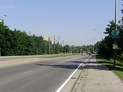
The road has signalized intersections at Photography Drive, Eglinton Avenue West, Todd Bayliss Boulevard, Trethewey Drive and Lawrence Avenue West. From Trethewey north, the two directions are separated by a concrete barrier, and north of Lawrence, the directions are separated by a set of steel guard rails. South of Trethewey, the two directions are separated by a grass median. The speed limit is 70 km/h from Weston Road to Maple Leaf Drive, 80 km/h from Maple Leaf Drive to Jane Street. Bicycles and pedestrians are banned from using the roadway or paved shoulders.
alignment along Dupont Street (connecting with the Crosstown at present-day Christie Street), before continuing southward along Christie and Clinton Streets to the Gardiner Expressway
. Alternate alignments included one following Parkside Drive south to the Gardiner, and one following the CN
tracks south to Front Street
, before continuing onto the Gardiner.
 The cancellation of the Spadina Expressway
in 1971 spelled the end of expressway projects in Toronto, including the Crosstown and the Richview Expressways. However, the Highway 400 Extension was still being considered as a possibility, and the Province still intended to extend Highway 400 south to Eglinton Avenue.
The provincial government still owned the right-of-way along the Black Creek Valley and agreed to construct it as a four-lane arterial road, instead of a grade-separated expressway. The Metro Toronto
government agreed to extend it farther south to St. Clair Avenue
. The Province began construction on the 400 Extension in 1976.
Fresh from battling the Spadina Expressway
, anti-Spadina groups started battling the extension and soon, Parkdale
residents joined in the debate, fearing an extension would pass directly through their neighbourhood. Additionally, the City of Toronto objected to the construction of the road south to St. Clair Avenue. A compromise was reached over Weston Road
; the 400 Extension would end there, but Weston Road would be widened to support the flow of traffic from Black Creek Drive.
The roadway opened in 1982 from Jane Street south to Weston Road. On March 1, 1983, Metro Council performed a land transfer in which the right-of-way for the Spadina Expressway
south of Eglinton was assumed by the province in exchange for Black Creek Drive being transferred to Metro. In 1989, Metro Toronto initiated a study of the extension of Black Creek Drive south to the Gardiner Expressway.
Toronto
Toronto is the provincial capital of Ontario and the largest city in Canada. It is located in Southern Ontario on the northwestern shore of Lake Ontario. A relatively modern city, Toronto's history dates back to the late-18th century, when its land was first purchased by the British monarchy from...
, Ontario
Ontario
Ontario is a province of Canada, located in east-central Canada. It is Canada's most populous province and second largest in total area. It is home to the nation's most populous city, Toronto, and the nation's capital, Ottawa....
that extends from Highway 400 at Jane Street, near Ontario Highway 401 to Weston Road
Weston Road
Weston Road is a north-south street in west end Toronto, Ontario, Canada. The route is named for the former Village of Weston, which was located near Weston Road and Lawrence Avenue West....
in the south. Originally intended to be a freeway extension of Ontario Highway 400, it was built instead as an arterial road after public opposition to building freeways into central Toronto. The roadway is named after the Black Creek watercourse, and runs parallel to the creek for most of its route.
Route description
Black Creek Drive begins at Weston Road at the intersection with Humber Boulevard. The four-lane road passes beneath railway lines and travels north alongside Black Creek, with Keelesdale Park to the east. The road continues north and northwest, passing Eglinton Avenue WestEglinton Avenue
Eglinton Avenue, originally known as the Richview Sideroad within Etobicoke, is an east-west arterial thoroughfare in Toronto and Mississauga, in the Canadian province of Ontario. Within Toronto, Eglinton Avenue is the only road which crosses through all six former boroughs...
. Coronation Park and Trethewey Park occupy the eastern side of the road north of Eglinton, while the western side is occupied by commercial and industrial uses. Much of this land was a former Kodak plant, marked today only by the existence of Photography Drive. North of Trethewey Drive, the road passes between residential subdivisions within the Black Creek ravine. North of Lawrence Avenue West
Lawrence Avenue
Lawrence Avenue is a major east-west thoroughfare in Toronto, Ontario, Canada. It is divided into east and west portions by Yonge Street, the dividing line of east-west streets in Toronto....
, the road diverges from the Black Creek ravine. It is separated at-grade from Queens Drive and Maple Leaf Drive, which pass overhead. At Jane Street, Black Creek Drive becomes Highway 400 and thereafter falls under the control of the Ministry of Transportation of Ontario.
The road has signalized intersections at Photography Drive, Eglinton Avenue West, Todd Bayliss Boulevard, Trethewey Drive and Lawrence Avenue West. From Trethewey north, the two directions are separated by a concrete barrier, and north of Lawrence, the directions are separated by a set of steel guard rails. South of Trethewey, the two directions are separated by a grass median. The speed limit is 70 km/h from Weston Road to Maple Leaf Drive, 80 km/h from Maple Leaf Drive to Jane Street. Bicycles and pedestrians are banned from using the roadway or paved shoulders.
History
By 1966, the province had completed the first leg of the Highway 400 Extension southeasterly to Jane Street, and had acquired the necessary lands through the Black Creek Valley down to Eglinton Avenue (which, at the time, was mostly farmland). This was part of an ambitious project, which included links to the proposed Crosstown and Richview Expressways, and would continue down from Highway 401 along its present alignment (connecting with the Richview at present-day Eglinton Avenue), then following Weston Road and the CPCanadian Pacific Railway
The Canadian Pacific Railway , formerly also known as CP Rail between 1968 and 1996, is a historic Canadian Class I railway founded in 1881 and now operated by Canadian Pacific Railway Limited, which began operations as legal owner in a corporate restructuring in 2001...
alignment along Dupont Street (connecting with the Crosstown at present-day Christie Street), before continuing southward along Christie and Clinton Streets to the Gardiner Expressway
Gardiner Expressway
The Frederick G. Gardiner Expressway, colloquially referred to as "the Gardiner", is a municipal expressway in the Canadian province of Ontario, connecting downtown Toronto with its western suburbs...
. Alternate alignments included one following Parkside Drive south to the Gardiner, and one following the CN
Canadian National Railway
The Canadian National Railway Company is a Canadian Class I railway headquartered in Montreal, Quebec. CN's slogan is "North America's Railroad"....
tracks south to Front Street
Front Street (Toronto)
Front Street is an east-west road in downtown Toronto, Ontario, Canada. The street marks the rough outline of the shoreline of Lake Ontario as it existed during the original English settlement of York, then called Palace Street...
, before continuing onto the Gardiner.
Spadina Expressway
The Spadina Expressway was a proposed north-south freeway in Toronto, Ontario, Canada. It was only partially built before being cancelled in 1971 due to public opposition. It was proposed in the mid-1960s as part of a network of freeways for Metropolitan Toronto. Its cancellation prompted the...
in 1971 spelled the end of expressway projects in Toronto, including the Crosstown and the Richview Expressways. However, the Highway 400 Extension was still being considered as a possibility, and the Province still intended to extend Highway 400 south to Eglinton Avenue.
The provincial government still owned the right-of-way along the Black Creek Valley and agreed to construct it as a four-lane arterial road, instead of a grade-separated expressway. The Metro Toronto
Metropolitan Toronto
The Municipality of Metropolitan Toronto was a senior level of municipal government in the Toronto, Ontario, Canada area from 1954 to 1998. It was created out of York County and was a precursor to the later concept of a regional municipality, being formed of smaller municipalities but having more...
government agreed to extend it farther south to St. Clair Avenue
St. Clair Avenue
St. Clair Avenue is a major east-west street in Toronto, Ontario, Canada. It was laid out in the late 18th century by the British as a concession road , north of Bloor Street and north of Queen Street....
. The Province began construction on the 400 Extension in 1976.
Fresh from battling the Spadina Expressway
Spadina Expressway
The Spadina Expressway was a proposed north-south freeway in Toronto, Ontario, Canada. It was only partially built before being cancelled in 1971 due to public opposition. It was proposed in the mid-1960s as part of a network of freeways for Metropolitan Toronto. Its cancellation prompted the...
, anti-Spadina groups started battling the extension and soon, Parkdale
Parkdale, Toronto
Parkdale is a neighbourhood and former village in Toronto, Ontario, Canada, west of downtown. The neighbourhood is bounded on the west by Roncesvalles Avenue, on the north by Queen Street. It is bounded on the east by Dufferin Street from Queen Street south, and on the south by Lake Ontario...
residents joined in the debate, fearing an extension would pass directly through their neighbourhood. Additionally, the City of Toronto objected to the construction of the road south to St. Clair Avenue. A compromise was reached over Weston Road
Weston Road
Weston Road is a north-south street in west end Toronto, Ontario, Canada. The route is named for the former Village of Weston, which was located near Weston Road and Lawrence Avenue West....
; the 400 Extension would end there, but Weston Road would be widened to support the flow of traffic from Black Creek Drive.
The roadway opened in 1982 from Jane Street south to Weston Road. On March 1, 1983, Metro Council performed a land transfer in which the right-of-way for the Spadina Expressway
Spadina Expressway
The Spadina Expressway was a proposed north-south freeway in Toronto, Ontario, Canada. It was only partially built before being cancelled in 1971 due to public opposition. It was proposed in the mid-1960s as part of a network of freeways for Metropolitan Toronto. Its cancellation prompted the...
south of Eglinton was assumed by the province in exchange for Black Creek Drive being transferred to Metro. In 1989, Metro Toronto initiated a study of the extension of Black Creek Drive south to the Gardiner Expressway.