
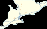
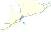
List of Ontario expressways
Encyclopedia
The majority of the freeways and expressways in Ontario
are 400-series highways
; there are also some others which do not have that designation. The full list appears below.

Two-lane freeway
Expressway
Ontario
Ontario is a province of Canada, located in east-central Canada. It is Canada's most populous province and second largest in total area. It is home to the nation's most populous city, Toronto, and the nation's capital, Ottawa....
are 400-series highways
400-series highways (Ontario)
The 400-series highways are a network of controlled-access highways throughout the southern portion of the Canadian province of Ontario, forming a special subset of the provincial highway system. They are analogous to the Interstate Highway System in the United States or the British Motorway...
; there are also some others which do not have that designation. The full list appears below.
400-Series Highways
- Highway 400: Jane Street, TorontoTorontoToronto is the provincial capital of Ontario and the largest city in Canada. It is located in Southern Ontario on the northwestern shore of Lake Ontario. A relatively modern city, Toronto's history dates back to the late-18th century, when its land was first purchased by the British monarchy from...
– Bowes Street in Parry SoundParry Sound, OntarioParry Sound is a town in Central Ontario, Canada, located on Parry Sound on the eastern shore of Georgian Bay. Parry Sound is located south of Sudbury and north of Toronto. It is the seat of Parry Sound District, a popular cottage country region for Southern Ontario residents. It is also the...
(Highway 69Ontario Highway 69King's Highway 69, commonly referred to as Highway 69, is a major north–south highway in the central area of the Canadian province of Ontario, linking Highway 400 north of Parry Sound with Sudbury...
continues northward) - Highway 401: WindsorWindsor, OntarioWindsor is the southernmost city in Canada and is located in Southwestern Ontario at the western end of the heavily populated Quebec City – Windsor Corridor. It is within Essex County, Ontario, although administratively separated from the county government. Separated by the Detroit River, Windsor...
– QuebecQuebecQuebec or is a province in east-central Canada. It is the only Canadian province with a predominantly French-speaking population and the only one whose sole official language is French at the provincial level....
border near Curry Hill - Highway 402: U.S. border border at SarniaSarnia, OntarioSarnia is a city in Southern Ontario, Canada . It is the largest city on Lake Huron and is located where the upper Great Lakes empty into the St. Clair River....
– Highway 401 in LondonLondon, OntarioLondon is a city in Southwestern Ontario, Canada, situated along the Quebec City – Windsor Corridor. The city has a population of 352,395, and the metropolitan area has a population of 457,720, according to the 2006 Canadian census; the metro population in 2009 was estimated at 489,274. The city... - Highway 403: WoodstockWoodstock, OntarioWoodstock is a city and the county seat of Oxford County in Southern Ontario, Canada. Woodstock is located 128 km southwest of Toronto, north of Highway 401 along the historic Thames River...
– Mississauga - Highway 404: Toronto – NewmarketNewmarket, OntarioNewmarket is a town in Southern Ontario located approximately 50 km north of downtown Toronto, Ontario, Canada. It is part of the Greater Toronto Area and is connected to Toronto by freeway, and is served by three interchanges along Highway 404. It is also connected to Highway 400 via Highway 9...
- Highway 405: QEW north of Niagara FallsNiagara Falls, OntarioNiagara Falls is a Canadian city on the Niagara River in the Golden Horseshoe region of Southern Ontario. The municipality was incorporated on June 12, 1903...
– U.S. border at QueenstonQueenston, OntarioQueenston is located 5 km north of Niagara Falls, Ontario in the Town of Niagara-on-the-Lake. The community is bordered by Highway 405 and the Niagara River; its location on the Niagara Escarpment led to the establishment of the now-defunct Queenston Quarry in the area... - Highway 406: E Main St. (Niagara Road 27) in ThoroldThorold, OntarioThorold is a city in Ontario, Canada, located on the Niagara Escarpment. It is also the seat of the Regional Municipality of Niagara....
– QEW in St. Catharines, a Super-2Super twoA super two, super two-lane highway or wide two lane is a two-lane surface road built to high standards, typically including partial control of access, occasional passing lanes and hard shoulders...
with at-grade intersections between Port Robinson Rd. and E Main St. (Niagara Road 27) - Highway 407: BurlingtonBurlington, OntarioBurlington , is a city located in Halton Region at the western end of Lake Ontario. Burlington is part of the Greater Toronto Area, and is also included in the Hamilton Census Metropolitan Area. Physically, Burlington lies between the north shore of Lake Ontario and the Niagara Escarpment...
– PickeringPickering, OntarioPickering is a city located in Southern Ontario, Canada immediately east of Toronto in Durham Region. It is part of the Greater Toronto Area, the largest metropolitan area in Canada.- Early Period :...
(privately owned) - Highway 409: Toronto Pearson International AirportToronto Pearson International AirportToronto Pearson International Airport is an international airport serving Toronto, Ontario, Canada; its metropolitan area; and the Golden Horseshoe, an urban agglomeration that is home to 8.1 million people – approximately 25% of Canada's population...
– Highway 401 in Toronto - Highway 410: Mississauga – Highway 10 at Valleywood in CaledonCaledon, OntarioCaledon is a town in the Regional Municipality of Peel in the Greater Toronto Area of Ontario, Canada. In terms of land use, Caledon is somewhat urban, though it is primarily rural in nature...
- Highway 416: Highway 401 in JohnstownJohnstown, Leeds and Grenville United Counties, OntarioJohnstown is a community in the United Counties of Leeds and Grenville, in eastern Ontario, Canada, part of the township of Edwardsburgh/Cardinal. It is located at the Canadian terminus of the Ogdensburg-Prescott International Bridge and at the southern terminus of Highway 416 and Highway...
– Highway 417 in OttawaOttawaOttawa is the capital of Canada, the second largest city in the Province of Ontario, and the fourth largest city in the country. The city is located on the south bank of the Ottawa River in the eastern portion of Southern Ontario... - Highway 417: Ottawa Road 29 in ArnpriorArnprior, OntarioArnprior is a town in Renfrew County, in the eastern portion of Southern Ontario, Canada. It is located at the mouth of the Madawaska River, as it enters the Ottawa River in the Ottawa Valley...
– Quebec border near Pointe-FortunePointe-Fortune, QuebecPointe-Fortune is a village in southwestern Quebec on the Ottawa River in Vaudreuil-Soulanges northwest of Montreal. The population as of the Canada 2006 Census was 507.-Population:Population trend-Language:... - Highway 420: Montrose Road – Stanley Avenue in Niagara Falls
- Highway 427: Evans Avenue near QEW in Toronto – VaughanVaughan, OntarioVaughan is a city in York Region north of Toronto, Ontario, Canada. Vaughan is the fastest growing municipality in Canada achieving a population growth rate of 80.2% between 1996–2006, according to Statistics Canada having nearly doubled in population since 1991. Vaughan is located in Southern...
- Queen Elizabeth WayQueen Elizabeth WayThe Queen Elizabeth Way, commonly abbreviated as the QEW, is a 400-Series highway in the Canadian province of Ontario. The freeway links Buffalo, New York and the Niagara Peninsula with Toronto. It begins at the Peace Bridge in Fort Erie and travels around the western shore of Lake Ontario, ending...
: U.S. border at Fort ErieFort Erie, OntarioFort Erie is a town on the Niagara River in the Niagara Region, Ontario, Canada. It is located directly across the river from Buffalo, New York....
(Peace BridgePeace BridgeThe Peace Bridge is an international bridge between Canada and the United States at the east end of Lake Erie at the source of the Niagara River, about upriver of Niagara Falls. It connects the City of Buffalo, New York, in the United States to the Town of Fort Erie, Ontario, in Canada...
) – Highway 427 in Toronto; the designations 451 and 1 are sometimes used internally by the MTO
Other provincial freeways
The province also maintains freeways which are up to 400-series standards, yet are not numbered as part of the 400-series network. This is despite some of those freeways exceeding existing 400-series highways in size and traffic volume and despite some of them being connected to the 400-series network. Nonetheless, Ontario freeways do not receive a 400-series number unless they are designed to be complete controlled-access freeways for their whole length. The non 400-series routes listed below have significant open-access portions besides the freeway section, with the freeway segment typically being a small section not at the route's termini.- The Conestoga ParkwayConestoga ParkwayThe Conestoga Parkway is a freeway in the Regional Municipality of Waterloo, in the Canadian province of Ontario. It runs northeast/southwest through the cities of Kitchener and Waterloo, and is connected to Highway 401 via the Highway 8 Freeport Diversion and King Street East.- Route...
- BadenBaden, OntarioBaden is a community in Township of Wilmot, Regional Municipality of Waterloo, Ontario, Canada. It has a population of less than 1000 and was named after Baden-Baden in Germany...
to St. JacobsSt. Jacobs, OntarioThe community of St. Jacobs is located in southwest Ontario, just north of Waterloo in Woolwich Township, Waterloo Region. It is a popular location for tourism, due to its Mennonite heritage and retail focus. The Conestogo River, which powered the village's original gristmill, runs through the...
through Kitchener/WaterlooKitchener, OntarioThe City of Kitchener is a city in Southern Ontario, Canada. It was the Town of Berlin from 1854 until 1912 and the City of Berlin from 1912 until 1916. The city had a population of 204,668 in the Canada 2006 Census...
. It carries the designations Highway 7Highway 7 (Ontario)King's Highway 7, commonly referred to as Highway 7 and historically as the Northern Highway, is a provincially maintained highway in the Canadian province of Ontario...
, Highway 8Highway 8 (Ontario)Provincial Highway 8 is a provincially maintained highway in the Canadian province of Ontario. Its total length is 138.5 km, though it was once much longer, running farther east from Hamilton to Niagara Falls, before the Queen Elizabeth Way replaced its role.- History :Highway 8 is one of the...
, and Highway 85Highway 85 (Ontario)King's Highway 85, commonly referred to as Highway 85, is a provincially maintained highway in the Canadian province of Ontario. The highway, which is mostly controlled-access, travels through the Regional Municipality of Waterloo along the Conestoga Parkway from its interchange with...
. Highway 85's southern terminus is at the part where Highway 7 turns off of the freeway portion. Its northern terminus is at Regional Road 15 (King Street North), where it continues as Arthur Street, or Regional Road 85. - Highway 6 is a freeway in 2 segments:
- Highway 403 to Clappison's Corners at Highway 5Highway 5 (Ontario)King's Highway 5, also known as Highway 5 and historically as the Dundas Highway, is a provincially maintained highway in the Canadian province of Ontario. The east–west highway travels a distance of between Highway 8 at Peter's Corners, north of Hamilton and Highway 6 at Clappison's Corners...
. This freeway is a newly-completed, 2.5 km stretch north of HamiltonHamilton, OntarioHamilton is a port city in the Canadian province of Ontario. Conceived by George Hamilton when he purchased the Durand farm shortly after the War of 1812, Hamilton has become the centre of a densely populated and industrialized region at the west end of Lake Ontario known as the Golden Horseshoe...
. Plans are to eventually continue this freeway north to Highway 401 at GuelphGuelph, OntarioGuelph is a city in Southwestern Ontario, Canada. Known as "The Royal City", Guelph is roughly east of Waterloo and west of downtown Toronto at the intersection of Highway 6 and Highway 7. It is the seat of Wellington County, but is politically independent of it...
. - College Avenue to Paisley Rd. in Guelph, as part of the Hanlon ParkwayHanlon ParkwayThe Hanlon Parkway is a high-capacity at-grade suburban expressway in the city of Guelph, Ontario, Canada, which connects it with Highway 401. It runs in a general north-south direction in the city's west end. It is signed as Highway 6 for its whole length; from Wellington Street to Woodlawn Road,...
. The rest of the Hanlon is an expressway with at-grade intersections. Plans are to eventually turn the entire length of the Hanlon into a freeway.
- Highway 403 to Clappison's Corners at Highway 5
- Highway 7Ontario Highway 7King's Highway 7, commonly referred to as Highway 7 and historically as the Northern Highway, is a provincially maintained highway in the Canadian province of Ontario...
is a freeway in 3 segments, a fourth segment is in planning:- Baden to WaterlooWaterloo, OntarioWaterloo is a city in Southern Ontario, Canada. It is the smallest of the three cities in the Regional Municipality of Waterloo, and is adjacent to the city of Kitchener....
(see Conestoga Parkway above); - Concurrent with Highway 115 from the interchange with Highway 7A to Television Road in PeterboroughPeterborough, OntarioPeterborough is a city on the Otonabee River in southern Ontario, Canada, 125 kilometres northeast of Toronto. The population of the City of Peterborough was 74,898 as of the 2006 census, while the census metropolitan area has a population of 121,428 as of a 2009 estimate. It presently ranks...
, bypassing the city; - Carleton PlaceCarleton Place, OntarioCarleton Place is a town in the eastern portion of Eastern Ontario, Canada, in Lanark County, about west of downtown Ottawa. It is located at the crossroads of Highway 15 and Highway 7, halfway between the towns of Perth, Almonte, Smiths Falls, and the nation's capital, Ottawa...
to Highway 417 in Ottawa. Part of this freeway segment is still under construction. - Plans are to upgrade Highway 7 from the Conestoga Parkway eastward to Hanlon Parkway into a freeway, along with the Hanlon.
- Baden to Waterloo
- Highway 8Ontario Highway 8Provincial Highway 8 is a provincially maintained highway in the Canadian province of Ontario. Its total length is 138.5 km, though it was once much longer, running farther east from Hamilton to Niagara Falls, before the Queen Elizabeth Way replaced its role.- History :Highway 8 is one of the...
- Highway 401 and King Street East to the Conestoga Parkway in KitchenerKitchener, OntarioThe City of Kitchener is a city in Southern Ontario, Canada. It was the Town of Berlin from 1854 until 1912 and the City of Berlin from 1912 until 1916. The city had a population of 204,668 in the Canada 2006 Census...
. The freeway portion of Highway 8 in Kitchener is known as the "Freeport Diversion" or the "King Street Bypass" or, by many area residents, as "the Highway 8 Expressway." Since 1987, the Freeport Diversion has been extended to Highway 401. Though this new section is signed as Highway 8 going westbound and Highway 401 going eastbound, it carries the unsigned designation of Highway 7187. Before 1987, traffic continued on King Street East, an undivided 4-lane arterial road to an interchange with Highway 401. Highway 8 is also a freeway co-signed with Highway 7 on the Conestoga Parkway from King Street to Baden. - Highway 11 is a freeway in several segments (much of the non-freeway segments from Highway 400 to Sudbury are expressways, with a speed limitSpeed limitRoad speed limits are used in most countries to regulate the speed of road vehicles. Speed limits may define maximum , minimum or no speed limit and are normally indicated using a traffic sign...
of 90 or 80 km/h. These expressways have few at-grade intersctions, and mostly use RIRO ramps to connect to intersecting roads.)- Highway 400 at BarrieBarrieBarrie may refer to:* Barrie, city in Ontario, Canada* Barrie , Canadian federal electoral district* Barrie , provincial electoral district* Barrie—Simcoe—Bradford, former Canadian electoral district...
to Penetanguishene Rd.; - Line 15 North to Carlyon Line (Orillia bypass);
- Simcoe County Rd. 169 at Washago to Southwood Rd. at Severn BridgeSevern Bridge, OntarioSevern Bridge, Ontario is a small community in the Town of Gravenhurst, Ontario of the District of Muskoka in the province of Ontario, Canada. It is located around 100 kilometres north of Toronto, on the Severn River, roughly halfway between Orillia and Gravenhurst. Its population is around 300 ....
; - Hewitt St. at GravenhurstGravenhurst, OntarioGravenhurst is a town in the Muskoka Region of Ontario, Canada. It is located approximately south of Bracebridge, Ontario. The mayor is Paisley Donaldson...
to Kirk Line at BracebridgeBracebridge, OntarioBracebridge is a town and the seat of the Muskoka District Municipality of Ontario, Canada.The town was built around a waterfall on the Muskoka River in the centre of town, and is known for its other nearby waterfalls . It was first incorporated in 1875...
; - Main St. in HuntsvilleHuntsville, OntarioHuntsville is a town in the Muskoka Region of Ontario, Canada. It is located north of Toronto and south of North Bay....
to Station Rd. in Scotia; - Highway 552 to Highway 522B (Trout CreekTrout Creek, OntarioTrout Creek is a community located on Highway 11 in Northern Ontario, 12 kilometres south of Powassan. A designated place within the municipal boundaries of Powassan, Trout Creek is in the eastern end of the District of Parry Sound....
bypass); - Highway 94 at CallanderCallander, OntarioThe Municipality of Callander is a township in central Ontario, Canada, located at the southeast end of Lake Nipissing in the District of Parry Sound...
to Highway 17 in North BayNorth Bay, OntarioNorth Bay is a city in Northeastern Ontario, Canada. It is the seat of Nipissing District, and takes its name from its position on the shore of Lake Nipissing.-History:...
. The length of Highway 11 from BarrieBarrie, OntarioBarrie is a city in Southern Ontario, Canada, located on the western shore of Lake Simcoe, approximately 90 km north of Toronto. Although located in Simcoe County, the city is politically independent...
to North BayNorth Bay, OntarioNorth Bay is a city in Northeastern Ontario, Canada. It is the seat of Nipissing District, and takes its name from its position on the shore of Lake Nipissing.-History:...
is currently planned to be upgraded to a fully controlled access highway in the long term; no 400-series designation is planned.
- Highway 400 at Barrie
- Highway 17 is a freeway in 2 segments:
- In Sudbury, from Municipal Road 55 in Whitefish to MR 55 in Lively.
- The Whitefish to Lively section transitions to a two-lane freewayTwo-lane freewayA two-lane expressway is an expressway with only one lane in each direction, and usually no median barrier. It may be built that way because of constraints, or may be intended for expansion once traffic volumes rise. The term super two is often used by roadgeeks for this type of road, but traffic...
from Lively to MR 55 west of Coniston. This two-lane segment briefly transitions back to a divided freeway at the Highway 69Ontario Highway 69King's Highway 69, commonly referred to as Highway 69, is a major north–south highway in the central area of the Canadian province of Ontario, linking Highway 400 north of Parry Sound with Sudbury...
interchange, to ease future freeway conversion on the segment; the Ontario government has announced that the segment will be upgraded to full freeway in the early 2010s. These segments may be incorporated into a future expansion of Highway 417. Additionally, the expressway portion of Highway 17 near Sault Ste. MarieSault Ste. Marie, OntarioSault Ste. Marie is a city on the St. Marys River in Algoma District, Ontario, Canada. It is the third largest city in Northern Ontario, after Sudbury and Thunder Bay, with a population of 74,948. The community was founded as a French religious mission: Sault either means "jump" or "rapids" in...
could also be upgraded into a full freeway in the future, but currently contains at-grade intersections.
- Highway 35/Highway 115 is a freeway in 3 segments:
- Highway 401 at NewcastleNewcastle, OntarioNewcastle is a community in the Municipality of Clarington in Durham Region, Ontario, Canada. The Town of Newcastle was also the original name of what is now Clarington....
to Concession Rd. 3; - Concession Rd. 4 to Concession Rd. 8;
- Wilcox Rd. to Highway 7 in PeterboroughPeterborough, OntarioPeterborough is a city on the Otonabee River in southern Ontario, Canada, 125 kilometres northeast of Toronto. The population of the City of Peterborough was 74,898 as of the 2006 census, while the census metropolitan area has a population of 121,428 as of a 2009 estimate. It presently ranks...
.
- Highway 401 at Newcastle
- Highway 58 - ThoroldThorold, OntarioThorold is a city in Ontario, Canada, located on the Niagara Escarpment. It is also the seat of the Regional Municipality of Niagara....
(from 406 to Thorold Stone Rd. only) (segment expected to incorporate into medium-term Highway 420 plans) - Highway 85 (see Conestoga Parkway above)
- Highway 137 - Connection to Interstate 81Interstate 81Interstate 81 is an Interstate Highway in the eastern part of the United States. Its southern terminus is at Interstate 40 in Dandridge, Tennessee; its northern terminus is on Wellesley Island at the Canadian border, where the Thousand Islands Bridge connects it to Highway 401, the main freeway...
in Ivy Lea (from Thousand Islands Parkway to Highway 401 only).
Municipal expressways/freeways
These include both municipal-constructed freeways and former provincial freeways downloaded to municipalities.- Allen RoadAllen RoadWilliam R. Allen Road, known more commonly as Allen Road, The Allen Expressway or simply The Allen and formerly as the Spadina Expressway, is a short expressway/freeway in Toronto, Ontario, which runs from Kennard Avenue in the north, to Eglinton Avenue West in the south...
- TorontoTorontoToronto is the provincial capital of Ontario and the largest city in Canada. It is located in Southern Ontario on the northwestern shore of Lake Ontario. A relatively modern city, Toronto's history dates back to the late-18th century, when its land was first purchased by the British monarchy from...
(from Eglinton Avenue West to Transit Road only) - Burlington StreetBurlington StreetBurlington Street is a road in Hamilton, Ontario, stretching along the south shore of Hamilton Harbour in Lake Ontario. Burlington Street has four different statuses along the route. In its western terminus, it is a collector route ending at Bay Street North...
- HamiltonHamilton, OntarioHamilton is a port city in the Canadian province of Ontario. Conceived by George Hamilton when he purchased the Durand farm shortly after the War of 1812, Hamilton has become the centre of a densely populated and industrialized region at the west end of Lake Ontario known as the Golden Horseshoe...
(from west of Kenilworth Avenue to QEW only) - Don Valley ParkwayDon Valley ParkwayThe Don Valley Parkway is a controlled-access six-lane municipal expressway in Toronto connecting the Gardiner Expressway in downtown Toronto with Ontario Highway 401, the Macdonald–Cartier Freeway. North of Highway 401, it continues as Ontario Highway 404. The parkway runs through...
- TorontoTorontoToronto is the provincial capital of Ontario and the largest city in Canada. It is located in Southern Ontario on the northwestern shore of Lake Ontario. A relatively modern city, Toronto's history dates back to the late-18th century, when its land was first purchased by the British monarchy from...
(from Gardiner Expressway to Highway 401-the entire length of the DVP) - Dougall Parkway - WindsorWindsor, OntarioWindsor is the southernmost city in Canada and is located in Southwestern Ontario at the western end of the heavily populated Quebec City – Windsor Corridor. It is within Essex County, Ontario, although administratively separated from the county government. Separated by the Detroit River, Windsor...
(from Howard Avenue to Highway 401 only) - E.C. Row Expressway - WindsorWindsor, OntarioWindsor is the southernmost city in Canada and is located in Southwestern Ontario at the western end of the heavily populated Quebec City – Windsor Corridor. It is within Essex County, Ontario, although administratively separated from the county government. Separated by the Detroit River, Windsor...
, also turns into a two-lane freewayTwo-lane freewayA two-lane expressway is an expressway with only one lane in each direction, and usually no median barrier. It may be built that way because of constraints, or may be intended for expansion once traffic volumes rise. The term super two is often used by roadgeeks for this type of road, but traffic... - Highbury AvenueHighbury AvenueHighbury Avenue begins at South Edgeware Road in St. Thomas where it proceeds north as a two lane highway until Wilton Grove Road in London...
- LondonLondon, OntarioLondon is a city in Southwestern Ontario, Canada, situated along the Quebec City – Windsor Corridor. The city has a population of 352,395, and the metropolitan area has a population of 457,720, according to the 2006 Canadian census; the metro population in 2009 was estimated at 489,274. The city...
(from Highway 401 to Hamilton Road only) - Kingston Road DiversionHighway 2A (Ontario)King's Highway 2A, commonly referred to as Highway 2A, was the designation of five separate provincially maintained highways in the Canadian province of Ontario. Highway 2A was an alternate route to Highway 2 in London, Chatham and Cornwall; these routes were all eventually redesignated...
/formerly Highway 2A - ScarboroughScarborough, OntarioScarborough is a dissolved municipality within the city of Toronto, Ontario, Canada. Geographically, it comprises the eastern part of Toronto. It is bordered on the south by Lake Ontario, on the west by Victoria Park Avenue, on the north by Steeles Avenue East, and on the east by the Rouge River...
(from Lawson Rd. to 401 only) - Gardiner ExpresswayGardiner ExpresswayThe Frederick G. Gardiner Expressway, colloquially referred to as "the Gardiner", is a municipal expressway in the Canadian province of Ontario, connecting downtown Toronto with its western suburbs...
- Toronto (from Don Valley Parkway to Highway 427-its entire length) - Lincoln M. Alexander ParkwayLincoln M. Alexander ParkwayThe Lincoln Alexander Parkway, officially nicknamed "The Linc", is a municipal expressway in the Canadian city of Hamilton, Ontario. Located on the Hamilton mountain, atop the Niagara Escarpment...
- HamiltonHamilton, OntarioHamilton is a port city in the Canadian province of Ontario. Conceived by George Hamilton when he purchased the Durand farm shortly after the War of 1812, Hamilton has become the centre of a densely populated and industrialized region at the west end of Lake Ontario known as the Golden Horseshoe... - Red Hill Valley ParkwayRed Hill Valley ParkwayThe Red Hill Valley Parkway , referred to as the Red Hill Creek Expressway during planning is a municipal expressway in the Canadian city of Hamilton, Ontario. The route connects the Lincoln M. Alexander Parkway, Hamilton's second municipal expressway, to the Queen Elizabeth Way near Hamilton...
- HamiltonHamilton, OntarioHamilton is a port city in the Canadian province of Ontario. Conceived by George Hamilton when he purchased the Durand farm shortly after the War of 1812, Hamilton has become the centre of a densely populated and industrialized region at the west end of Lake Ontario known as the Golden Horseshoe... - Regional Road 174 (Queensway EastQueensway (Ottawa)The Queensway is a major controlled-access freeway running through Ottawa, Ontario, Canada, from Kanata in the west to Orleans in the east. It is the primary east-west transportation artery in the Ottawa-Gatineau area....
) (from 417 at GloucesterGloucester, OntarioGloucester is a suburb of and within the City of Ottawa. Gloucester Township was established in 1792 and originally included lands east of the Rideau River from the Ottawa River south to Manotick. It was incorporated as a township in 1850 and became a city in 1981...
to Trim RoadTrim Road (Ottawa)Trim Road is an arterial road in the eastern end of Orléans, Ontario . It serves as the only road access to Petrie Island and its public beach in the Ottawa River. From Petrie Island, Trim runs south through the eastern suburban areas of Orleans and then south into rural former Cumberland Township...
in OrleansOrléans, OntarioOrleans , also written Orléans, is a suburban area within the city of Ottawa, Ontario, Canada. It is located in the eastern part of the city along the Ottawa River, about from downtown Ottawa. The Canada 2006 Census gave Orleans a population of 95,491. It became a ward of the City of Ottawa in 2001...
only).
Two-lane freewayTwo-lane freewayA two-lane expressway is an expressway with only one lane in each direction, and usually no median barrier. It may be built that way because of constraints, or may be intended for expansion once traffic volumes rise. The term super two is often used by roadgeeks for this type of road, but traffic...
s
- Highway 3Ontario Highway 3King's Highway 3, commonly referred to as Highway 3 and historically as the Talbot Trail, is a provincially maintained highway in the Canadian province of Ontario which travels parallel to the shore of Lake Erie. It has three segments, the first of which runs from the Ambassador Bridge in Windsor...
- St. ThomasSt. Thomas, OntarioSt. Thomas is a city in southern , Ontario, Canada. It is the seat for Elgin County and gained its city charter on March 4, 1881.-History:...
(from Wellington Rd. to Centennial Rd. only) - Highway 6 - Argyle St. South to Green Rd. (CaledoniaCaledonia, OntarioCaledonia is a small riverside community and former town located on the Grand River in Haldimand County, Ontario, Canada. Haldimand County is in the western part of the Niagara Peninsula, and had a population of 43,280 in 2001. The current mayor of Haldimand County is Ken Hewitt; Caledonia is...
Bypass) and from Garner Road near Highway 403 to south of Airport Road in HamiltonHamilton, OntarioHamilton is a port city in the Canadian province of Ontario. Conceived by George Hamilton when he purchased the Durand farm shortly after the War of 1812, Hamilton has become the centre of a densely populated and industrialized region at the west end of Lake Ontario known as the Golden Horseshoe...
. Both of these are two-lane freeways, although expansion is planned. - Highway 7Ontario Highway 7King's Highway 7, commonly referred to as Highway 7 and historically as the Northern Highway, is a provincially maintained highway in the Canadian province of Ontario...
- From Monaghan Parkway to Sherbrooke Street (Regional Road 9) east of PeterboroughPeterborough, OntarioPeterborough is a city on the Otonabee River in southern Ontario, Canada, 125 kilometres northeast of Toronto. The population of the City of Peterborough was 74,898 as of the 2006 census, while the census metropolitan area has a population of 121,428 as of a 2009 estimate. It presently ranks...
. - Highway 17 is a two-lane freeway in 3 segments:
- In Greater Sudbury, where the freeway portion transitions to a two-lane freeway (see Highway 17 above)
- Highway 417's terminus at ArnpriorArnprior, OntarioArnprior is a town in Renfrew County, in the eastern portion of Southern Ontario, Canada. It is located at the mouth of the Madawaska River, as it enters the Ottawa River in the Ottawa Valley...
to Haley Station, north of Renfrew. This 20 km stretch will likely be twinned to become an extension of Highway 417. - County Road 40 south of PembrokePembroke, OntarioPembroke is a city in the province of Ontario, Canada, at the confluence of the Muskrat River and the Ottawa River in the Ottawa Valley...
to north of PetawawaPetawawa, OntarioPetawawa is a town located in eastern portion of Southern Ontario. Situated in the Ottawa Valley, with a population of 14,651 . Petawawa is the most populous municipality in Renfrew County.-Geography:...
.
- Highway 17A (the KenoraKenora, OntarioKenora , originally named Rat Portage, is a small city situated on the Lake of the Woods in Northwestern Ontario, Canada, close to the Manitoba boundary, and about east of Winnipeg...
bypass) is a 2-lane freeway in its entirety. - Niagara Regional Road 27 - between Wellington street in Welland and Moyer road.
- Highway 40 (see Highway 40 below)
- Highway 144 - between Chelmsford and Highway 17 near Lively, in Greater Sudbury.
- Highway 406 - between Port Robinson Rd. and Niagara Regional Road 27 in Welland.
- Niagara Regional Highway 525 - Between Highway 58A's eastern terminus (i.e. Highway 525's western terminus as well) and Miler Rd. (with Keefer Rd. as an L connector).
- Airport ParkwayAirport Parkway (Ottawa)Airport Parkway is an expressway in Ottawa, Ontario, Canada. It runs from the Ottawa Macdonald-Cartier International Airport to an interchange with Heron Road where it turns into Bronson Avenue.-Route description:...
- OttawaOttawaOttawa is the capital of Canada, the second largest city in the Province of Ontario, and the fourth largest city in the country. The city is located on the south bank of the Ottawa River in the eastern portion of Southern Ontario... - Monaghan Parkway - between Highway 7 and Brealy Dr.; between Brealy Dr. and Highway 115 as Sir Sanford Flemming Dr.
- Pike Creek Bypass - Lakeshore, OntarioLakeshore, OntarioLakeshore is a town in southwestern Ontario, Canada, on Lake St. Clair. Its nearest city is Windsor, located in Essex County. The town was incorporated in 1999 by amalgamating the Town of Belle River with the townships of Maidstone, Rochester, Tilbury North, and Tilbury West.Lakeshore has a...
(from terminus of E.C. Row Expressway to Essex County Road 2), has no grade-separations, only intersections, and no adjacent property access - Sir Sanford Fleming Dr. (see above)
ExpresswayLimited-access roadA limited-access road known by various terms worldwide, including limited-access highway, dual-carriageway and expressway, is a highway or arterial road for high-speed traffic which has many or most characteristics of a controlled-access highway , including limited or no access to adjacent...
s
- Airport ParkwayAirport Parkway (Ottawa)Airport Parkway is an expressway in Ottawa, Ontario, Canada. It runs from the Ottawa Macdonald-Cartier International Airport to an interchange with Heron Road where it turns into Bronson Avenue.-Route description:...
- is an expressway in Ottawa running from the Ottawa International AirportOttawa Macdonald-Cartier International AirportOttawa/Macdonald-Cartier International Airport or Macdonald-Cartier International Airport , in Ottawa, Ontario, Canada is named after Sirs John A. Macdonald and George-Étienne Cartier...
to Heron RoadHeron Road (Ottawa)Heron Road is a major road in Ottawa, Ontario, Canada. It runs from Walkley Road at an angle to the Rideau River, where it turns into Baseline Road. Heron is home to the Public Works and Government Services Canada headquarters, as well as the Canada Post headquarters and the Edward Drake Building...
. - Cootes DriveCootes DriveCootes Drive, formerly known as the Dundas Diversion, is a city street in Hamilton, Ontario. The route connects York Boulevard and King Street in Dundas with Highway 2 and Highway 8 to the southeast, and is considered the first divided highway in Canada....
- Ancaster, OntarioAncaster, OntarioAncaster is a picturesque and historic community located on the Niagara escarpment, within the greater area of the city of Hamilton, Ontario, Canada. This former town was founded officially in 1793 and was one of the oldest European communities established in present day Ontario along with Windsor...
/Hamilton, OntarioHamilton, OntarioHamilton is a port city in the Canadian province of Ontario. Conceived by George Hamilton when he purchased the Durand farm shortly after the War of 1812, Hamilton has become the centre of a densely populated and industrialized region at the west end of Lake Ontario known as the Golden Horseshoe...
/Dundas, OntarioDundas, OntarioDundas is a formerly independent town and now constituent community in the city of Hamilton in Ontario, Canada. It's nickname is the Valley Town. The population has been stable for decades at about twenty thousand, largely because it has not annexed rural land from the protected Dundas Valley...
(formerly known as The King's Highway 102). First divided dual-carriageway in Canada and Ontario, built in mid-1930s near McMaster UniversityMcMaster UniversityMcMaster University is a public research university whose main campus is located in Hamilton, Ontario, Canada. The main campus is located on of land in the residential neighbourhood of Westdale, adjacent to Hamilton's Royal Botanical Gardens...
. - Eastgate Parkway in Mississauga is a divided at-grade expressway where it follows the old Highway 403 right of way from current Highway 403 to just west of Fieldgate Drive.
- Eastport Drive (Highway 7189) - HamiltonHamilton, OntarioHamilton is a port city in the Canadian province of Ontario. Conceived by George Hamilton when he purchased the Durand farm shortly after the War of 1812, Hamilton has become the centre of a densely populated and industrialized region at the west end of Lake Ontario known as the Golden Horseshoe...
- Exmouth St. is an expressway between Old Exmouth St. and Old London Rd. east of Sarnia, ON
- Harbour ExpresswayHarbour ExpresswayThe Harbour Expressway is a four lane highway with signalized intersections running the Intercity business district of Thunder Bay, Ontario, Canada....
- Thunder BayThunder Bay-In Canada:Thunder Bay is the name of three places in the province of Ontario, Canada along Lake Superior:*Thunder Bay District, Ontario, a district in Northwestern Ontario*Thunder Bay, a city in Thunder Bay District*Thunder Bay, Unorganized, Ontario... - Hanlon ParkwayHanlon ParkwayThe Hanlon Parkway is a high-capacity at-grade suburban expressway in the city of Guelph, Ontario, Canada, which connects it with Highway 401. It runs in a general north-south direction in the city's west end. It is signed as Highway 6 for its whole length; from Wellington Street to Woodlawn Road,...
- GuelphGuelphGuelph is a city in Ontario, Canada.Guelph may also refer to:* Guelph , consisting of the City of Guelph, Ontario* Guelph , as the above* University of Guelph, in the same city... - Mud Street - between Lincoln M. Alexander ParkwayLincoln M. Alexander ParkwayThe Lincoln Alexander Parkway, officially nicknamed "The Linc", is a municipal expressway in the Canadian city of Hamilton, Ontario. Located on the Hamilton mountain, atop the Niagara Escarpment...
/Red Hill Valley ParkwayRed Hill Valley ParkwayThe Red Hill Valley Parkway , referred to as the Red Hill Creek Expressway during planning is a municipal expressway in the Canadian city of Hamilton, Ontario. The route connects the Lincoln M. Alexander Parkway, Hamilton's second municipal expressway, to the Queen Elizabeth Way near Hamilton...
intersection and Regional highway 20 in the Hamilton area. - Highway 7Ontario Highway 7King's Highway 7, commonly referred to as Highway 7 and historically as the Northern Highway, is a provincially maintained highway in the Canadian province of Ontario...
is a brief expressway between Highway 115Highway 115 (Ontario)King's Highway 115, commonly referred to as Highway 115 is a provincially maintained highway in the Canadian province of Ontario that connects Peterborough with Toronto via Highway 401...
's eastern terminus and Keene Rd. - Highway 11 - (see Thunder Bay Expressway)
- Highway 17 - (see Thunder Bay Expressway)
- Highway 17 - Sault Ste. MarieSault Ste. Marie, OntarioSault Ste. Marie is a city on the St. Marys River in Algoma District, Ontario, Canada. It is the third largest city in Northern Ontario, after Sudbury and Thunder Bay, with a population of 74,948. The community was founded as a French religious mission: Sault either means "jump" or "rapids" in...
to DesbaratsDesbarats, OntarioJohnson is a township in the Canadian province of Ontario, located within the Algoma District. The township had a population of 701 in the Canada 2006 Census.-Communities:... - Highway 27 directly north of Highway 401 in Toronto, Ontario. It has four lanes of undivided traffic, and is fully controlled-access with interchanges and service roads to provide access to property in the area.
- Highway 40 is a four-lane divided expressway around the SarniaSarnia, OntarioSarnia is a city in Southern Ontario, Canada . It is the largest city on Lake Huron and is located where the upper Great Lakes empty into the St. Clair River....
area where it is known as the Sarnia Bypass. It is a two-lane freewayTwo-lane freewayA two-lane expressway is an expressway with only one lane in each direction, and usually no median barrier. It may be built that way because of constraints, or may be intended for expansion once traffic volumes rise. The term super two is often used by roadgeeks for this type of road, but traffic...
south of Sarnia as far south as WallaceburgWallaceburg, OntarioWallaceburg is an unincorporated community and town located in the municipality of Chatham-Kent in Southern Ontario, Canada. Originally a small settlement, it was recognized for its significant contribution to the lumber and boat building industries and strategic location along the banks of the...
. Highway 40 is designed such that it can be upgraded to a full freeway, although it is unlikely since current traffic levels do not warrant the upgrade. - Highway 58A is a 2-lane expressway in its entirety.
- Highway 140 is a 2-lane expressway in its entirety.
- Ottawa River ParkwayOttawa River ParkwayThe Ottawa River Parkway is a four-lane scenic parkway along the Ottawa River in Ottawa, Ontario, Canada. It runs from Carling Avenue near Connaught Avenue, to Booth Street at the Canadian War Museum. It is maintained by the National Capital Commission. The speed limit is , enforced by the Royal...
- is a four-lane scenic parkway/expressway from downtown Ottawa to Carling Avenue along the Ottawa RiverOttawa RiverThe Ottawa River is a river in the Canadian provinces of Ontario and Quebec. For most of its length, it now defines the border between these two provinces.-Geography:...
in Ottawa - Municipal Road 55 in Greater Sudbury - from Municipal Road 24 (approximately one kilometre west of the Highway 17 interchange) in Lively to Big Nickel Mine RoadBig NickelThe Big Nickel is a nine-metre replica of a 1951 Canadian nickel, located at the grounds of Dynamic Earth in Sudbury, Ontario, Canada...
- Regional Road 420 - Former section of Highway 420 from Stanley Avenue to the Rainbow BridgeRainbow Bridge (Niagara Falls)The Rainbow Bridge at Niagara Falls is an international steel arch bridge across the Niagara River gorge, and is a world-famous tourist site. It connects the cities of Niagara Falls, New York, United States , and Niagara Falls, Ontario, Canada .-Construction:The Rainbow Bridge was built near the...
in Niagara Falls. - Thunder Bay ExpresswayThunder Bay ExpresswayThe Thunder Bay Expressway is a four lane highway with signalized intersections running on the western edge of Thunder Bay, Ontario, Canada.- Route description :...
- Thunder BayThunder Bay-In Canada:Thunder Bay is the name of three places in the province of Ontario, Canada along Lake Superior:*Thunder Bay District, Ontario, a district in Northwestern Ontario*Thunder Bay, a city in Thunder Bay District*Thunder Bay, Unorganized, Ontario... - Veterans Memorial ParkwayVeterans Memorial ParkwayThe Veterans Memorial Parkway is a expressway located in London, Ontario. The expressway was previously known as Highway 100 from 1977 until 1994 and as Airport Road prior to September 2006. It is currently an at-grade, four-lane expressway...
- LondonLondon, OntarioLondon is a city in Southwestern Ontario, Canada, situated along the Quebec City – Windsor Corridor. The city has a population of 352,395, and the metropolitan area has a population of 457,720, according to the 2006 Canadian census; the metro population in 2009 was estimated at 489,274. The city...
Sources
- The Expresswaysite (Ontario section)
- Google Maps (satellite view helps fish out roads conforming to freeway and expressway criteria.