

U.S. Route 23
Encyclopedia
U.S. Route 23 is a long north–south U.S. highway between Jacksonville, Florida
, and Mackinaw City, Michigan
. It is an original 1926 route which originally reached only as far south as Portsmouth, Ohio
, and has since been extended.
|FL
|37.67
|60.66
|-
|GA
|391.69
|630.74
|-
|NC
|109.22
|175.88
|-
|TN
|78.14
|125.83
|-
|VA
|60.91
|98.08
|-
|KY
|157.76
|253.89
|-
|OH
|234.86
|378.20
|-
|MI
|364.92
|587.63
|-
|Total
|1435.17
|2309.68
|}
, starting as a one way pair, with the northbound lanes meeting with Florida State College. It is also unsigned SR 139
from its southern terminus to its interchange with US 1 in northwestern Jacksonville. West of I-95, US 23 ends the one way pair, continuing as Kings Road through northwestern Jacksonville, as an off grid road. A few miles to the west, US 23 meets with US 1/SR 15
(Martin Luther King Jr. Parkway), becoming concurrent with the highway through the rest of its journey through Florida. The road continues northwest, intersecting with Interstate 295
and eventually makes its way out of Jacksonville. At Callahan
, US 1/US 23 meets with U.S. Route 301, beginning a three way concurrency as the road continues northward towards the St. Mary's River, leaving Florida and entering Georgia.
Though US 23 roughly parallels Interstate 75
from Macon
to Atlanta
, and the two routes come within a few miles in Atlanta, U.S. 23 only intersects with I-75 at the Riverside Drive exit in Macon, Georgia. It crosses back over 75 a few miles south. This is the only place that 23 runs west of 75 until many miles to the north, in Perrysburg, Ohio
(near Toledo
).
Along the city limit and then fully within the city of Atlanta, it is known as Moreland Avenue (concurrent with Georgia 42), running for several miles in a perfectly straight and due north/south line, which is also the Fulton
/DeKalb
county line.
between the Georgia state line and Dillsboro, then with U.S. 74
through Waynesville
as the Great Smoky Mountains Expressway
, followed by U.S. 19
through Canton and Enka-Candler. West of Asheville
, the highway follows I-26
to the Tennessee state line.
and Kingsport
. Just west of Kingsport, I-26 stops at the junction with U.S. Route 11W
, and US 23 continues to run north to the Virginia State Line.
with the southern point beginning at Weber City
and the northern point ending at Pound
. It runs concurrent with US 58 and US 421 from Gate City
to Duffield
. It crosses the Clinch River
near Clinchport
. From Duffield to Big Stone Gap
, it passes through the Jefferson National Forest. The entire route is a four-lane divided highway. The stretch of highway is known as The Crooked Road: Virginia's Heritage Music Trail and is a symbol of the highway's importance to country music.
US 23 passes through the following cities and counties in Virginia as well: Gate City
in Scott County
, Norton
(an independent city
), Wise
in Wise County
and Pound
, also located in Wise County.
 US 23 enters Kentucky from Virginia
after crossing Pound Gap
near Whitesburg
. It then combines with US 119 near Pikeville
and continues north. Just south of Pikeville
, it joins US 460 and Kentucky Route 80. It then passes through the Pikeville Cut-Through
and US 119 diverges from the route near Coal Run Village
. Kentucky Route 80 splits to the south from US 23 near Prestonsburg
and US 460 splits to the west in Paintsville
. It then passes through Louisa
, junctions with I-64 near Catlettsburg
and passes through downtown Ashland
. It then crosses the Ohio River
and enters Ohio
at Portsmouth
.
The Kentucky portion of the route is mainly four-lane divided, but is wider in some cities.
and the portion of the route between Carey
and US 20 east of Perrysburg
.
US 23 passes near the birthplace of U.S. President
Rutherford B. Hayes
in Delaware
, as well as near the home of U.S. President
Warren G. Harding
in Marion
.
, and then the Sunrise Side Coastal Highway along the shore of Lake Huron
to its end at Mackinaw City.
US 23 junctions with I-69 while co-routed with I-75 in Flint, Michigan
.
US 23 junctions with I-75 south of Flint, Michigan
and breaks off from I-75 south of Standish
, becoming a two-lane road. U.S. 23 then goes north following Lake Huron
and ends at an intersection with I-75 south of Downtown Mackinaw City
.
US 23 junctions with I-96 north of Brighton, Michigan
.
US 23 junctions with US 12
(formerly M-23
) south of Ann Arbor
.
of the Ohio House of Representatives
introduced a petition
to revise and correct the state road leading from Columbus and Worthington
to Delaware
, Norton
and further north. Kilbourne believed that the Sandusky Bay
was the perfect place for a harbor to open up the Ohio marketplace to New England
. He fought relentlessly to establish roads from the capital to Sandusky
. He laid out a southern extension of the road to tie Portsmouth
on the Ohio River to the central and northern parts of the state. As a result of Kilbourne's efforts, the State of Ohio chartered the Columbus and Sandusky Turnpike Company on January 31, 1826. The following year the federal government gave 31840 acres (128.9 km²) in trust to the state of Ohio for the turnpike company to finance road improvements and development.
An 1820 map of Ohio shows the turnpike leading from Columbus to Worthington, through Delaware into Marion County
. The southern portion of the improved road was built and in use by 1828. The Columbus-Sandusky Turnpike, also sometimes known as Kilbourne Highway, was completed to Sandusky in 1834. Although the Turnpike was much needed and well traveled, the Columbus and Sandusky Turnpike Company did not have the funds to maintain the road. Early maps show the route as "Mud Pike." Angry at the poor, muddy condition of the road, particularly in the rainiest seasons, travelers occasionally destroyed tollgates. The Columbus and Sandusky Turnpike Company was disbanded February 28, 1843 when the Ohio legislature repealed the act that incorporated it. Two years later an act was passed that established the road as a public highway
.
US 23 was established in 1926 as part of the original U.S. highway system. The original route began at US 52 in Portsmouth, Ohio, and followed the old turnpike north to Sandusky, where it continued north to end at US 31 in Mackinaw City, Michigan.
In 1929, U.S. 23 was extended from Portsmouth, Ohio
into Kentucky, ending at Pikeville. The following highways form the original route of US 23:
The southern terminus remained in Pikeville for only two years. In 1930, US 23 was extended to Atlanta.
.svg.png) US 23 was extended into Florida along U.S. Route 1 in 1951. When the 20th Street Expressway was built around downtown Jacksonville
US 23 was extended into Florida along U.S. Route 1 in 1951. When the 20th Street Expressway was built around downtown Jacksonville
, U.S. Route 1 was moved but US 23 remained. It has never changed its route in Florida, though at one time it was planned to extend south, maybe to Fort Myers
via US 17, SR 19
, SR 33
, US 98, US 17, and SR 31.
In the mid to late 20th century when the coal industry declined in the Appalachian Mountains
, US 23 was often dubbed the Hillbilly Highway
, and it was said the three "R's" of the region were "reading, writing and Route 23", as workers migrated to northern industrial cities such as Detroit, Cleveland, Columbus, or Chicago.
In 1985, U.S. 23 was upgraded to interstate standards on the initiative of Eddie Williams, chief executive officer of economic development for Johnson City
, Jonesborough
and Washington County, Tenn. "The original idea for that project happened in 1985, when two young men [later named as Brandon Teller and Brian Moeller] walked into my office with a plan to upgrade Highway 23 to interstate standards," Williams said. "And all it cost us was to change the signs." Later that year, a section of U.S. 23 near Johnson City was designated as I-181
, the first section of U.S. 23 to be designated as an interstate in either Tennessee or North Carolina. Williams claims that this project was a catalyst for the five-state I-26
extension project.
On March 1, 1994, a bill sponsored by State Representative Hubert Collins was passed by the Kentucky State Legislature. This bill allowed U.S. 23 to become known as "The Country Music Highway" in order to recognize all the country music stars that had come from the counties the highway passed through. At every county line there is a sign that lists the country music star or stars from that county. Also, in the early 2000s, the U.S. 23 Country Music Highway Museum
opened in Paintsville
to further commemorate these legendary people.
Law enforcement officials from Ohio and Kentucky set up the "US Route 23 Drug Taskforce" in 1996 to patrol the highway for drug trafficking, attempting to halt a major artery of drug networks bringing high-quality cannabis
grown in Kentucky north for distribution in Ohio and elsewhere. Lately, it has been primarily used to stop the flow of narcotics from large cities like Columbus, OH, Dayton, OH, and Cleveland, OH into Portsmouth, OH, all of which have to pass through U.S. 23 to reach Portsmouth. Signs can be spotted along Route 23 in Ohio from Portsmouth to Columbus warning traffickers that efforts have been taken to prevent their actions. Some random police stings have been set up at portions of the highway.
During the past few years the highway has been widened to four or more lanes through its entire length within Kentucky and is one of the more scenic routes in Kentucky. It is six lanes in parts of the city of Pikeville
. In 2002, it was officially named a National Scenic Byway
.
U.S. 23 also gains attention during college football season as it connects Columbus, OH, home of The Ohio State University and Ann Arbor, MI, home of the University of Michigan. Each year at the end of November a convoy of fans travels either north or south depending on where that year's game is being held. Unsubstantiated rumors that the Highway Patrol of either Ohio, if The Game is being held in Columbus, or Michigan, if The Game is being held in Ann Arbor, increase enforcement of traffic laws along the route in their respective states to cite opposing fans and add to the rivalry.
Jacksonville, Florida
Jacksonville is the largest city in the U.S. state of Florida in terms of both population and land area, and the largest city by area in the contiguous United States. It is the county seat of Duval County, with which the city government consolidated in 1968...
, and Mackinaw City, Michigan
Mackinaw City, Michigan
Mackinaw City is a village in Emmet and Cheboygan counties in the U.S. state of Michigan. At the 2000 census the population was 859. The name "Mackinaw City" is a bit of a misnomer as it is actually a village...
. It is an original 1926 route which originally reached only as far south as Portsmouth, Ohio
Portsmouth, Ohio
Portsmouth is a city in the U.S. state of Ohio and the county seat of Scioto County. The municipality is located on the northern banks of the Ohio River and east of the Scioto River in Southern Ohio. The population was 20,226 at the 2010 census.-Foundation:...
, and has since been extended.
Route description
|-|FL
|37.67
|60.66
|-
|GA
|391.69
|630.74
|-
|NC
U.S. Route 23 in North Carolina
U.S. Route 23 is an north–south United States highway that runs for from the Georgia state line, near Dillard, to the Tennessee state line, near Flag Pond.-Route description:...
|109.22
|175.88
|-
|TN
|78.14
|125.83
|-
|VA
U.S. Route 23 in Virginia
U.S. Route 23 is a part of the U.S. Highway System that runs from Jacksonville, Florida to Mackinaw City, Michigan. In Virginia, the U.S. Highway runs from the Tennessee state line near Weber City north to the Kentucky state line near Pound...
|60.91
|98.08
|-
|KY
|157.76
|253.89
|-
|OH
|234.86
|378.20
|-
|MI
U.S. Route 23 in Michigan
US Highway 23 is a United States Numbered Highway that runs from Jacksonville, Florida to Mackinaw City, Michigan. In the US state of Michigan, it is a major north–south state trunkline highway that runs through the Lower Peninsula...
|364.92
|587.63
|-
|Total
|1435.17
|2309.68
|}
Florida
U.S. Route 23 begins at U.S. Route 1 (Ocean Street) at the northern end of downtown JacksonvilleJacksonville, Florida
Jacksonville is the largest city in the U.S. state of Florida in terms of both population and land area, and the largest city by area in the contiguous United States. It is the county seat of Duval County, with which the city government consolidated in 1968...
, starting as a one way pair, with the northbound lanes meeting with Florida State College. It is also unsigned SR 139
State Road 139 (Florida)
State Road 139 is an unsigned state highway in Jacksonville, Florida, United States. Most of it is signed as U.S. Highway 23.-Exit list:The entire route is located in Jacksonville, Duval County....
from its southern terminus to its interchange with US 1 in northwestern Jacksonville. West of I-95, US 23 ends the one way pair, continuing as Kings Road through northwestern Jacksonville, as an off grid road. A few miles to the west, US 23 meets with US 1/SR 15
State Road 15 (Florida)
State Road 15 is part of the Florida State Road System. It runs from SR 80/SR 880 at Belle Glade north along the east shore of Lake Okeechobee to Okeechobee. Then it runs north to SR 500 at Holopaw, and northwest along SR 500 to Ashton State Road 15 (commonly SR 15) is part of the Florida State...
(Martin Luther King Jr. Parkway), becoming concurrent with the highway through the rest of its journey through Florida. The road continues northwest, intersecting with Interstate 295
Interstate 295 (Florida)
Interstate 295 , an auxiliary route of Interstate 95, is a bypass route around central Jacksonville, Florida, which is currently signed on the western half for...
and eventually makes its way out of Jacksonville. At Callahan
Callahan, Florida
Callahan is a town in Nassau County, Florida, United States, adjacent to Downtown Jacksonville. The population was 962 at the 2000 census.-Geography:Callahan is located at ....
, US 1/US 23 meets with U.S. Route 301, beginning a three way concurrency as the road continues northward towards the St. Mary's River, leaving Florida and entering Georgia.
Georgia
Enters from Florida concurrent with US 1 and US 301 just south of Homeland.- HomelandHomeland, GeorgiaHomeland is a city in Charlton County, Georgia, United States. The population was 765 at the 2000 census.-Geography:Homeland is located at ....
, leaves US 301 and continues northwest with US 1 in Waycross, GA where it intersects US 82. - US 23 Splits from US 1, seven miles north, in AlmaAlma, GeorgiaAlma is a city in Bacon County, Georgia, United States. The population was 3,236 at the 2000 census. The city is the county seat of Bacon County...
- HazlehurstHazlehurst, GeorgiaHazlehurst is a city in and the county seat of Jeff Davis County, Georgia, United States. The population was 3,787 at the 2000 census.-Demographics:...
intersects with US 221U.S. Route 221U.S. Route 221 is a spur of U.S. Route 21. It runs for 734 miles from Perry, Florida at US Routes 19/98/ALT 27 to Lynchburg, Virginia at U.S. Route 29 . It passes through the states of Florida, Georgia, South Carolina, North Carolina, and Virginia...
and begins US 341 (Designated the Golden Isles Parkway) - McRaeMcRae, GeorgiaMcRae is a town in Telfair County, Georgia, United States. Based on the 2000 census, the town has a total population of 2,682. Between 1990 and 2000, the town experienced a population decrease of 10.8%, compared to the state growth during this period of 26.4%. The town is the county seat of...
intersects with US 280U.S. Route 280U.S. Route 280 is a spur of U.S. Highway 80. It currently runs for 392 miles from Blichton, Georgia at U.S. Highway 80 to Birmingham, Alabama at I-20/I-59. For much of its route, U.S. 280 travels through rural areas and smaller cities in southern Georgia and east central Alabama. Once the...
, US 319U.S. Route 319U.S. Highway 319 is a spur of U.S. Route 19. It runs for 318 miles from US 1 /State Route 4 in Wadley, Georgia to the John Gorrie Bridge at Apalachicola, Florida. The sections of US 319 in Medart, Florida and from just east of Carrabelle, Florida to its terminus in Apalachicola are jointly...
and US 441U.S. Route 441U.S. Route 441 is a spur route of U.S. Route 41. It currently runs for 939 miles from U.S. Route 41 in Miami, Florida to U.S. Route 25W in Lake City, Tennessee. Between its termini, US 441 passes through the states of Florida, Georgia, North Carolina, and Tennessee... - EastmanEastman, GeorgiaEastman is a city in Dodge County, Georgia, United States. The population was 13,541 at the 2000 census. The city is the county seat of Dodge County...
leaves US 341 concurrency Designated "Golden Isles Highway' to junction with I-16 near Macon. - CochranCochran, GeorgiaCochran is a city in Bleckley County, Georgia, United States. As of the 2010 census, the city had a population of 5,150. The city is the county seat of Bleckley County.- History :...
begins US 129-ALT concurrency - MaconMacon, GeorgiaMacon is a city located in central Georgia, US. Founded at the fall line of the Ocmulgee River, it is part of the Macon metropolitan area, and the county seat of Bibb County. A small portion of the city extends into Jones County. Macon is the biggest city in central Georgia...
intersects with [Interstate 16 near old Camp Wheeler North of I-16 known as Ocmulgee East Blvd, turns left as Emery Highway then turns left again as Spring Street then crosses I-75 and Ocmulgee River, then Right as Riverside Drive. It then parallels the Ocmulgee River and I-75US 41U.S. Route 41U.S. Route 41 is a north–south United States Highway that runs from Miami, Florida to the Upper Peninsula of Michigan. Until 1949, the part in southern Florida, from Naples to Miami, was U.S...
, US 80U.S. Route 80U.S. Route 80 is an east–west United States highway, much of which was once part of the early auto trail known as the Dixie Overland Highway. As the "0" in the route number indicates, it was originally a cross-country route, from the Atlantic to the Pacific...
and leaves US 129-ALT. Then crosses I-75 again and continues to Jackson, GeorgiaJackson, GeorgiaJackson is a city in Butts County, Georgia, United States. The population was 3,934 at the 2000 census. The city is the county seat of Butts County. The center of population of Georgia is located in Jackson. The community was named after President Andrew Jackson. Founded in 1826, Jackson began as...
. - Henry Co, GAHenry County, GeorgiaHenry County is a growing suburban county located in the U.S. state of Georgia. As of the 2000 census, the population was 119,341. As of 2010, the county's population swelled to 203,922, up 70.9% from the previous census and becoming Georgia's 8th most populous county and the 10th fastest growing...
Continues north through Henry Co. concurrent with GA 42 north. - Enter Clayton County and metro Atlanta as Moreland Ave, then turns right on Ponce de Leon Ave (concurrency with US 29U.S. Route 29U.S. Route 29 is a north–south United States highway that runs for from the western suburbs of Baltimore, Maryland, to Pensacola, Florida. This highway's northern terminus is at Maryland Route 99 in Ellicott City, Maryland...
, US 78U.S. Route 78U.S. Highway 78 is an east–west United States highway that runs for 715 miles from Memphis, Tennessee, to Charleston, South Carolina. Between Memphis and Birmingham, Alabama, it is being upgraded to become Interstate 22....
and US 278U.S. Route 278U.S. Route 278 is a parallel route of U.S. Route 78. It currently runs for 1,074 miles from Hilton Head Island, South Carolina to Wickes, Arkansas at U.S. Highway 71/U.S. Highway 59. It might be notable that it is longer than its parent highway, US Hwy-78. US Hwy-278 passes through the states of...
) then left on Clairemont Ave (transitions to Clairmont Road) and turns right and leaves metro Atlanta as Buford HighwayBuford HighwayBuford Highway is an international community along and on either side of a stretch of Georgia State Route 13 in DeKalb County, Georgia. It begins just north of Midtown Atlanta, continues northeast through the towns of Brookhaven, Chamblee, and Doraville, and ends northeast of the Perimeter at the... - BufordBuford, GeorgiaAs of 2010 Buford had a population of 12,225. The racial and ethnic composition of the population was 65.8% white, 13.8% black or African American, 0.3% Native American, 2.9% Asian, 14.7% reporting some other race and 2.5% reproting two or more races...
turns right onto GA 20, then left on I-985, GA 365. - GainesvilleGainesville, Georgia-Severe Weather:Gainesville sits on the very fringe of Tornado Alley, a region of the United States where severe weather is common. Supercell thunderstorms can sweep through any time between March and November, but are concentrated most in the spring...
Intersects with US 129. At I-985 end, then continues concurrently with GA 365 north. Signage was missing from Buford Highway north (at turn onto GA 20), but returned at the controlled access end of I-985, continuing north on GA 365. - CorneliaCornelia, GeorgiaCornelia is a city in Habersham County, Georgia, United States. The population was 3,834 at the 2010 census. It is home to one of the world's largest apple sculptures, which is displayed on top of an obelisk shaped monument...
intersects with US 123 and begins US 441 concurrency - ClaytonClayton, GeorgiaClayton is a city in Rabun County, Georgia, United States. The population was 2,019 at the 2000 census. The city is the county seat of Rabun County and is located in the Blue Ridge Mountains.-History:...
intersects with US 76U.S. Route 76U.S. Route 76 is an east–west United States highway that runs for from Chattanooga, Tennessee to Wrightsville Beach, North Carolina.-Tennessee:... - North CarolinaNorth CarolinaNorth Carolina is a state located in the southeastern United States. The state borders South Carolina and Georgia to the south, Tennessee to the west and Virginia to the north. North Carolina contains 100 counties. Its capital is Raleigh, and its largest city is Charlotte...
Then crosses the state line
Though US 23 roughly parallels Interstate 75
Interstate 75
Interstate 75 is a major north–south Interstate Highway in the Great Lakes and Southeastern regions of the United States. It travels from State Road 826 and State Road 924 in Hialeah, Florida to Sault Ste. Marie, Michigan, at the Ontario, Canada, border...
from Macon
Macon, Georgia
Macon is a city located in central Georgia, US. Founded at the fall line of the Ocmulgee River, it is part of the Macon metropolitan area, and the county seat of Bibb County. A small portion of the city extends into Jones County. Macon is the biggest city in central Georgia...
to Atlanta
Atlanta, Georgia
Atlanta is the capital and most populous city in the U.S. state of Georgia. According to the 2010 census, Atlanta's population is 420,003. Atlanta is the cultural and economic center of the Atlanta metropolitan area, which is home to 5,268,860 people and is the ninth largest metropolitan area in...
, and the two routes come within a few miles in Atlanta, U.S. 23 only intersects with I-75 at the Riverside Drive exit in Macon, Georgia. It crosses back over 75 a few miles south. This is the only place that 23 runs west of 75 until many miles to the north, in Perrysburg, Ohio
Perrysburg, Ohio
As of the census of 2000, there were 16,945 people, 6,592 households, and 4,561 families residing in the city. The population density was 1,899.2 people per square mile . There were 6,964 housing units at an average density of 780.5 per square mile...
(near Toledo
Toledo, Ohio
Toledo is the fourth most populous city in the U.S. state of Ohio and is the county seat of Lucas County. Toledo is in northwest Ohio, on the western end of Lake Erie, and borders the State of Michigan...
).
Along the city limit and then fully within the city of Atlanta, it is known as Moreland Avenue (concurrent with Georgia 42), running for several miles in a perfectly straight and due north/south line, which is also the Fulton
Fulton County, Georgia
Fulton County is a county located in the U.S. state of Georgia. Its county seat is Atlanta, the state capital since 1868 and the principal county of the Atlanta metropolitan area...
/DeKalb
DeKalb County, Georgia
DeKalb County is a county located in the U.S. state of Georgia. The population of the county was 691,893 at the 2010 census. Its county seat is the city of Decatur. It is bordered to the west by Fulton County and contains roughly 10% of the city of Atlanta...
county line.
North Carolina
The highway runs concurrent with U.S. 441U.S. Route 441
U.S. Route 441 is a spur route of U.S. Route 41. It currently runs for 939 miles from U.S. Route 41 in Miami, Florida to U.S. Route 25W in Lake City, Tennessee. Between its termini, US 441 passes through the states of Florida, Georgia, North Carolina, and Tennessee...
between the Georgia state line and Dillsboro, then with U.S. 74
U.S. Route 74
U.S. Route 74 is an east–west United States highway that runs for from Cleveland, Tennessee to Wrightsville Beach, North Carolina.-Tennessee:Established in 1987, US-74 western terminus is exit 20 on I-75 in Cleveland...
through Waynesville
Waynesville, North Carolina
Waynesville is a town in and the county seat of Haywood County, North Carolina, United States. It is the largest town in Haywood County and the largest in Western North Carolina west of Asheville. Waynesville is located about or 50 km southwest of Asheville between the Great Smoky and Blue...
as the Great Smoky Mountains Expressway
Great Smoky Mountains Expressway
The Great Smoky Mountains Expressway is a four-lane divided highway in southwestern North Carolina, which runs between Interstate 40 near Canton in the east to the Nantahala National Forest near Needmore in the west. It traverses western Haywood, northern Jackson, and eastern Swain counties,...
, followed by U.S. 19
U.S. Route 19 in North Carolina
U.S. Route 19 in North Carolina traverses approximately across Western North Carolina; from the Georgia state line, at the community of Bellview, to the Tennessee state line, at the town of Elk Park. The designation from US 19 to U.S. Route 19E happens in Cane River, where US 19W splits from the...
through Canton and Enka-Candler. West of Asheville
Asheville, North Carolina
Asheville is a city in and the county seat of Buncombe County, North Carolina, United States. It is the largest city in Western North Carolina, and the 11th largest city in North Carolina. The City is home to the United States National Climatic Data Center , which is the world's largest active...
, the highway follows I-26
Interstate 26
Interstate 26 is a nominally east–west main route of the Interstate Highway System in the Southeastern United States. I-26 runs from the junction of U.S. Route 11W and U.S. Route 23 in Kingsport, Tennessee, generally southeastward to U.S. Route 17 in Charleston, South Carolina...
to the Tennessee state line.
Tennessee
US 23 runs concurrently with the newly-upgraded I-26 from the North Carolina state line past Johnson CityJohnson City, Tennessee
Johnson City is a city in Carter, Sullivan, and Washington counties in the U.S. state of Tennessee, with most of the city being in Washington County...
and Kingsport
Kingsport, Tennessee
Kingsport is a city located mainly in Sullivan County with some western portions in Hawkins County in the US state of Tennessee. The majority of the city lies in Sullivan County...
. Just west of Kingsport, I-26 stops at the junction with U.S. Route 11W
U.S. Route 11W
U.S. Route 11W is a divided highway of US 11 in the U.S. states of Tennessee and Virginia. The U.S. Highway, which is complemented by US 11E to the south and east, runs from US 11, US 11E, and US 70 in Knoxville, Tennessee north and east to US 11, US 11E, US 19, and US 421 in Bristol, Virginia...
, and US 23 continues to run north to the Virginia State Line.
Virginia
US 23 extends for 61 miles (98.2 km) through extreme Southwest VirginiaSouthwest Virginia
Southwest Virginia, often abbreviated as SWVA, is a mountainous region of Virginia in the westernmost part of the commonwealth. Southwest Virginia has been defined alternatively as all Virginia counties on the Appalachian Plateau, all Virginia counties west of the Eastern Continental Divide, or...
with the southern point beginning at Weber City
Weber City, Virginia
Weber City is an incorporated town in Scott County, Virginia, United States. The population was 1,327 at the 2010 census. It is part of the Kingsport–Bristol –Bristol Metropolitan Statistical Area, which is a component of the Johnson City–Kingsport–Bristol, TN-VA Combined...
and the northern point ending at Pound
Pound, Virginia
Pound is a town in Wise County, Virginia, United States. The population was 1,089 as recorded in the 2000 census.-Geography:Pound is located at ....
. It runs concurrent with US 58 and US 421 from Gate City
Gate City, Virginia
Gate City is a town in Scott County, Virginia, United States. The population was 2,034 at the 2010 census. It is the county seat of Scott County....
to Duffield
Duffield, Virginia
Duffield is a town in Scott County, Virginia, United States. The population was 91 at the 2010 census. It is part of the Kingsport–Bristol –Bristol Metropolitan Statistical Area, which is a component of the Johnson City–Kingsport–Bristol, TN-VA Combined Statistical Area – commonly known as...
. It crosses the Clinch River
Clinch River
The Clinch River rises in Southwest Virginia near Tazewell, Virginia and flows southwest through the Great Appalachian Valley, gathering various tributaries including the Powell River before joining the Tennessee River in East Tennessee.-Course:...
near Clinchport
Clinchport, Virginia
Clinchport is a town in Scott County, Virginia, United States. The population was 70 at the 2010 census. It is part of the Kingsport–Bristol –Bristol Metropolitan Statistical Area, which is a component of the Johnson City–Kingsport–Bristol, TN-VA Combined Statistical Area...
. From Duffield to Big Stone Gap
Big Stone Gap, Virginia
Big Stone Gap is a town in Wise County, Virginia, United States. The population was 5,643 at the 2010 census.-History:The community was formerly known as "Meneral City" and "Three Forks." The "Big Stone Gap" refers to the valley which has been created on the Appalachia Straight, located between...
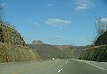
, it passes through the Jefferson National Forest. The entire route is a four-lane divided highway. The stretch of highway is known as The Crooked Road: Virginia's Heritage Music Trail and is a symbol of the highway's importance to country music.
US 23 passes through the following cities and counties in Virginia as well: Gate City
Gate City
Gate City can mean:* Gate City, Virginia* a historic nickname for Atlanta, Georgia...
in Scott County
Scott County, Virginia
As of the census of 2000, there were 23,403 people, 9,795 households, and 7,023 families residing in the county. The population density was 44 people per square mile . There were 11,355 housing units at an average density of 21 per square mile...
, Norton
Norton, Virginia
Norton is an independent city within the confines of Wise County in the Commonwealth of Virginia. As of the 2010 Census, the city population was 3,958, making it the smallest city in the state by population...
(an independent city
Independent city
An independent city is a city that does not form part of another general-purpose local government entity. These type of cities should not be confused with city-states , which are fully sovereign cities that are not part of any other sovereign state.-Historical precursors:In the Holy Roman Empire,...
), Wise
Wise, Virginia
Wise is a town in Wise County, Virginia, United States. The population was 3,286 at the 2010 census. It is the county seat of Wise County. It was originally incorporated as the town of Gladeville in 1874. The town's name was changed to Wise in 1924. Wise is named after Virginia governor Henry A...
in Wise County
Wise County, Virginia
Wise County is a county located in the U.S. state of Virginia. In 1856, the county was formed from land taken from Lee, Scott, and Russell Counties. It was named after Henry A. Wise, who was the Governor of Virginia at the time. As of 2010, the population was 41,452, making it the largest...
and Pound
Pound, Virginia
Pound is a town in Wise County, Virginia, United States. The population was 1,089 as recorded in the 2000 census.-Geography:Pound is located at ....
, also located in Wise County.
Kentucky
Virginia
The Commonwealth of Virginia , is a U.S. state on the Atlantic Coast of the Southern United States. Virginia is nicknamed the "Old Dominion" and sometimes the "Mother of Presidents" after the eight U.S. presidents born there...
after crossing Pound Gap
Pound Gap
The Pound Gap of Pine Mountain is on the Virginia/Kentucky border between Jenkins, Kentucky and Pound, Virginia. It was used as a passage for early settlers to cross into Kentucky from Virginia. Today, U.S. Route 23 passes through the gap.-History:...
near Whitesburg
Whitesburg, Kentucky
Whitesburg is a city in Letcher County, Kentucky, United States. The population was 2,139 at the 2010 census. It is the county seat of Letcher County.-Culture:...
. It then combines with US 119 near Pikeville
Pikeville, Kentucky
Pikeville is a city in Pike County, Kentucky. The population was 6,903 at the 2010 census. It is the county seat of Pike County.-History:On March 25, 1822, the county's government officials decided to build a new county seat named Liberty, one and one-half mile below the mouth of the Russell Fork...
and continues north. Just south of Pikeville
Pikeville, Kentucky
Pikeville is a city in Pike County, Kentucky. The population was 6,903 at the 2010 census. It is the county seat of Pike County.-History:On March 25, 1822, the county's government officials decided to build a new county seat named Liberty, one and one-half mile below the mouth of the Russell Fork...
, it joins US 460 and Kentucky Route 80. It then passes through the Pikeville Cut-Through
Pikeville Cut-Through
The Pikeville Cut-Through is a rock cut in Pikeville, Kentucky, United States created by the Army Corps of Engineers, through which passes a four-lane divided highway , a railroad line , and the Levisa Fork of the Big Sandy River...
and US 119 diverges from the route near Coal Run Village
Coal Run Village, Kentucky
Coal Run Village is a city in Pike County, Kentucky, United States. The city serves as a suburb to Pikeville, Kentucky and is virtually surrounded by it to the north, south, and east. The population was 577 at the 2000 census...
. Kentucky Route 80 splits to the south from US 23 near Prestonsburg
Prestonsburg, Kentucky
Prestonsburg is a city in and the county seat of Floyd County, Kentucky, United States. It lies in the eastern part of the state, along the banks of the Levisa Fork of the Big Sandy River. It was founded in 1797 by Col. John Preston—for whom it was named—along with Solomon Stratton, Matthias...
and US 460 splits to the west in Paintsville
Paintsville, Kentucky
-Demographics:As of the census of 2000, there were 4,132 people, 1,681 households, and 1,079 families residing in the city. The population density was 786.1 people per square mile . There were 1,901 housing units at an average density of 361.7 per square mile...
. It then passes through Louisa
Louisa, Kentucky
Louisa is a city in Lawrence County, Kentucky, United States. The population was 2,018 at the 2000 census. It is the county seat of Lawrence County. The Levisa Fork River and Tug Fork River join at Louisa to form the Big Sandy River...
, junctions with I-64 near Catlettsburg
Catlettsburg, Kentucky
Catlettsburg is a city in Boyd County, Kentucky, United States and is the county seat of Boyd County. The city population was 1,960 at the 2000 census. The city's postal ZIP code serves a greater population of 10,029, which is a better reflection of the community's size. Catlettsburg is a part of...
and passes through downtown Ashland
Ashland, Kentucky
Ashland, formerly known as Poage Settlement, is a city in Boyd County, Kentucky, United States, nestled along the banks of the Ohio River. The population was 21,981 at the 2000 census. Ashland is a part of the Huntington-Ashland, WV-KY-OH, Metropolitan Statistical Area . As of the 2000 census, the...
. It then crosses the Ohio River
Ohio River
The Ohio River is the largest tributary, by volume, of the Mississippi River. At the confluence, the Ohio is even bigger than the Mississippi and, thus, is hydrologically the main stream of the whole river system, including the Allegheny River further upstream...
and enters Ohio
Ohio
Ohio is a Midwestern state in the United States. The 34th largest state by area in the U.S.,it is the 7th‑most populous with over 11.5 million residents, containing several major American cities and seven metropolitan areas with populations of 500,000 or more.The state's capital is Columbus...
at Portsmouth
Portsmouth, Ohio
Portsmouth is a city in the U.S. state of Ohio and the county seat of Scioto County. The municipality is located on the northern banks of the Ohio River and east of the Scioto River in Southern Ohio. The population was 20,226 at the 2010 census.-Foundation:...
.
The Kentucky portion of the route is mainly four-lane divided, but is wider in some cities.
Ohio
The majority of US 23 in Ohio is divided freeway, with the exception of downtown ColumbusColumbus, Ohio
Columbus is the capital of and the largest city in the U.S. state of Ohio. The broader metropolitan area encompasses several counties and is the third largest in Ohio behind those of Cleveland and Cincinnati. Columbus is the third largest city in the American Midwest, and the fifteenth largest city...
and the portion of the route between Carey
Carey, Ohio
Carey is a village in Wyandot County, Ohio, United States. The population was 3,901 at the 2000 census.-Geography:Carey is located at ....
and US 20 east of Perrysburg
Perrysburg, Ohio
As of the census of 2000, there were 16,945 people, 6,592 households, and 4,561 families residing in the city. The population density was 1,899.2 people per square mile . There were 6,964 housing units at an average density of 780.5 per square mile...
.
- US 23 crosses the Ohio RiverOhio RiverThe Ohio River is the largest tributary, by volume, of the Mississippi River. At the confluence, the Ohio is even bigger than the Mississippi and, thus, is hydrologically the main stream of the whole river system, including the Allegheny River further upstream...
from KentuckyKentuckyThe Commonwealth of Kentucky is a state located in the East Central United States of America. As classified by the United States Census Bureau, Kentucky is a Southern state, more specifically in the East South Central region. Kentucky is one of four U.S. states constituted as a commonwealth...
and enters PortsmouthPortsmouth, OhioPortsmouth is a city in the U.S. state of Ohio and the county seat of Scioto County. The municipality is located on the northern banks of the Ohio River and east of the Scioto River in Southern Ohio. The population was 20,226 at the 2010 census.-Foundation:...
. - US 23 goes through the towns of LucasvilleLucasville, OhioLucasville is a census-designated place in Scioto County, Ohio, United States. The population was 1,588 at the 2000 census. The village of Lucasville was laid out by Captain John Lucas in June 1819 and recorded August 7, 1819. Captain Lucas built the first tavern in the village and kept it until...
, WaverlyWaverly, OhioWaverly is a village in and the county seat of Pike County, Ohio, United States. The population was at 4,433 at the 2000 census. The town was formed in 1829, as the construction of the Ohio and Erie Canal along the west bank of the Scioto River brought new growth to the area. In 1861 the county...
, PiketonPiketon, OhioPiketon is a village in Pike County, Ohio, United States, along the Scioto River. The village is best known for the uranium enrichment plant located there . The population was 1,907 at the 2000 census...
, ChillicotheChillicothe, OhioChillicothe is a city in and the county seat of Ross County, Ohio, United States.Chillicothe was the first and third capital of Ohio and is located in southern Ohio along the Scioto River. The name comes from the Shawnee name Chalahgawtha, meaning "principal town", as it was a major settlement of...
, and CirclevilleCircleville, OhioCircleville is a city in and the county seat of Pickaway County, Ohio, United States, along the Scioto River. The population was 13,485 at the 2000 census.-History:...
, before reaching ColumbusColumbus, OhioColumbus is the capital of and the largest city in the U.S. state of Ohio. The broader metropolitan area encompasses several counties and is the third largest in Ohio behind those of Cleveland and Cincinnati. Columbus is the third largest city in the American Midwest, and the fifteenth largest city...
. - US 23 mostly follows High Street in Columbus, which was the original route. However, it now bypasses the central business district and northern Columbus neighborhoods by following the one-way pair 4th Street (northbound) and 3rd/Summit Street (southbound) between the downtown area and Hudson Street, and Indianola Avenue north before returning to its original course on High Street at Morse Road.
- US 23 follows High Street northbound from Columbus, going through WorthingtonWorthington, Ohio-Dissolution of the Company:By August 11, 1804 the plat maps were completed, payments or notes promising payments collected and deeds prepared for all sixteen thousand acres of the Scioto Company's purchase...
, skirting the village of Lewis CenterLewis Center, OhioLewis Center is an unincorporated community in northwestern Orange Township, Delaware County, Ohio, United States, located between Columbus and Delaware. Its ZIP code is 43035. Although Lewis Center is a small community, its ZIP code encompasses a number of shopping centers and retail...
, entering DelawareDelaware, OhioThe City of Delaware is a city in and the county seat of Delaware County in the United States state of Ohio. Delaware was founded in 1808 and was incorporated in 1816. It is located near the center of Ohio, is about north of Columbus, and is part of the Columbus, Ohio Metropolitan Area...
at the Cheshire Road intersection. - After US 23 intersects the northern terminus of Ohio State Route 315 and passes a retail district, it becomes a limited access expresswayLimited-access roadA limited-access road known by various terms worldwide, including limited-access highway, dual-carriageway and expressway, is a highway or arterial road for high-speed traffic which has many or most characteristics of a controlled-access highway , including limited or no access to adjacent...
, bypassing downtown Delaware, before resuming as a freeway with at-grade crossings north of the city. - At WaldoWaldo, OhioWaldo is a village in Waldo Township, Marion County, Ohio, United States. The population was 332 at the 2000 census.-Geography:Waldo is located at ....
, US 23 again becomes a freeway. It continues as a freeway throughout most of Marion CountyMarion County, OhioMarion County is a county located in the state of Ohio, United States. As of the 2010 census, the population was 66,501. Its county seat is the city of Marion and is named for General Francis "The Swamp Fox" Marion, an officer in the Revolutionary War....
, then resumes at-grade crossings with a mix of some freeway-style junctions which are otherwise signalized after the MorralMorral, OhioMorral is a village in Marion County, Ohio, United States. The population was 388 at the 2000 census.-History:When the promoters of the Columbus and Toledo Railroad Company, present day CSX, announced its route would include Salt Rock Township, Samuel Morral I and Jacob Neff, each of whom owned the...
interchange. - US 23 coincides with divided State Route 15, until it takes a different route at the CareyCarey, OhioCarey is a village in Wyandot County, Ohio, United States. The population was 3,901 at the 2000 census.-Geography:Carey is located at ....
exit. SR 15 continues on to FindlayFindlay, OhioAs of the census of 2000, there were 38,967 people, 15,905 households, and 10,004 families residing in the city. The population density was 2,266.3 people per square mile . There were 17,152 housing units at an average density of 997.6 per square mile...
, and is designed to allow most traffic to bypass the northern stretch of US 23 by offering a fast connection to Interstate 75Interstate 75Interstate 75 is a major north–south Interstate Highway in the Great Lakes and Southeastern regions of the United States. It travels from State Road 826 and State Road 924 in Hialeah, Florida to Sault Ste. Marie, Michigan, at the Ontario, Canada, border...
. - US 23 continues north through Carey, FostoriaFostoria, OhioAs of the census of 2000, there were 13,931 people, 5,565 households, and 3,628 families residing in the city. The population density was 1,917.6 people per square mile . There were 6,024 housing units at an average density of 829.2 per square mile...
, and RisingsunRisingsun, OhioRisingsun is a village in Wood County, Ohio, United States. The population was 620 at the 2000 census.-Geography:Risingsun is located at ....
. - West of WoodvilleWoodville, OhioWoodville is a village in Sandusky County, Ohio, United States. The population was 1,977 at the 2000 census. The National Arbor Day Foundation has designated Woodville as a Tree City USA.-History:...
, US 23 intersects with US 20U.S. Route 20U.S. Route 20 is an east–west United States highway. As the "0" in its route number implies, US 20 is a coast-to-coast route. Spanning , it is the longest road in the United States, and the route sparsely parallels Interstate 90...
, where it has a coincidental route for several miles. - US 23 then joins I-75 near PerrysburgPerrysburg, OhioAs of the census of 2000, there were 16,945 people, 6,592 households, and 4,561 families residing in the city. The population density was 1,899.2 people per square mile . There were 6,964 housing units at an average density of 780.5 per square mile...
, then follows I-475Interstate 475 (Ohio)Interstate 475 is an Interstate Highway in Ohio that is a western bypass of Toledo. The southern terminus is I-75 near Perrysburg. The northern terminus is I-75 near downtown Toledo...
around the west side of ToledoToledo, OhioToledo is the fourth most populous city in the U.S. state of Ohio and is the county seat of Lucas County. Toledo is in northwest Ohio, on the western end of Lake Erie, and borders the State of Michigan...
, passing through SylvaniaSylvania, OhioAs of the census of 2000, there were 18,670 people, 7,151 households, and 5,070 families residing in the city. The population density was 3,223.2 people per square mile . There were 7,392 housing units at an average density of 1,276.2 per square mile...
before entering MichiganMichiganMichigan is a U.S. state located in the Great Lakes Region of the United States of America. The name Michigan is the French form of the Ojibwa word mishigamaa, meaning "large water" or "large lake"....
. In the portion where I-75 and US 23 overlap, this is a wrong-way concurrency, with southbound I-75 concurrent with northbound US 23, and northbound I-75 concurrent with southbound US 23 in this stretch.
US 23 passes near the birthplace of U.S. President
President of the United States
The President of the United States of America is the head of state and head of government of the United States. The president leads the executive branch of the federal government and is the commander-in-chief of the United States Armed Forces....
Rutherford B. Hayes
Rutherford B. Hayes
Rutherford Birchard Hayes was the 19th President of the United States . As president, he oversaw the end of Reconstruction and the United States' entry into the Second Industrial Revolution...
in Delaware
Delaware, Ohio
The City of Delaware is a city in and the county seat of Delaware County in the United States state of Ohio. Delaware was founded in 1808 and was incorporated in 1816. It is located near the center of Ohio, is about north of Columbus, and is part of the Columbus, Ohio Metropolitan Area...
, as well as near the home of U.S. President
President of the United States
The President of the United States of America is the head of state and head of government of the United States. The president leads the executive branch of the federal government and is the commander-in-chief of the United States Armed Forces....
Warren G. Harding
Warren G. Harding
Warren Gamaliel Harding was the 29th President of the United States . A Republican from Ohio, Harding was an influential self-made newspaper publisher. He served in the Ohio Senate , as the 28th Lieutenant Governor of Ohio and as a U.S. Senator...
in Marion
Marion, Ohio
Marion is a city in the U.S. state of Ohio and the county seat of Marion County. The municipality is located in north-central Ohio, approximately north of Columbus....
.
Michigan
US 23 is a freeway bypass for Interstate 75 west of Detroit, MichiganDetroit, Michigan
Detroit is the major city among the primary cultural, financial, and transportation centers in the Metro Detroit area, a region of 5.2 million people. As the seat of Wayne County, the city of Detroit is the largest city in the U.S. state of Michigan and serves as a major port on the Detroit River...
, and then the Sunrise Side Coastal Highway along the shore of Lake Huron
Lake Huron
Lake Huron is one of the five Great Lakes of North America. Hydrologically, it comprises the larger portion of Lake Michigan-Huron. It is bounded on the east by the Canadian province of Ontario and on the west by the state of Michigan in the United States...
to its end at Mackinaw City.
US 23 junctions with I-69 while co-routed with I-75 in Flint, Michigan
Flint, Michigan
Flint is a city in the U.S. state of Michigan and is located along the Flint River, northwest of Detroit. The U.S. Census Bureau reports the 2010 population to be placed at 102,434, making Flint the seventh largest city in Michigan. It is the county seat of Genesee County which lies in the...
.
US 23 junctions with I-75 south of Flint, Michigan
Flint, Michigan
Flint is a city in the U.S. state of Michigan and is located along the Flint River, northwest of Detroit. The U.S. Census Bureau reports the 2010 population to be placed at 102,434, making Flint the seventh largest city in Michigan. It is the county seat of Genesee County which lies in the...
and breaks off from I-75 south of Standish
Standish, Michigan
Standish is a city in the U.S. state of Michigan. As of the 2000 census, the city population was 1,581. It is the county seat of Arenac County.The town was platted by John D. Standish in 1871...
, becoming a two-lane road. U.S. 23 then goes north following Lake Huron
Lake Huron
Lake Huron is one of the five Great Lakes of North America. Hydrologically, it comprises the larger portion of Lake Michigan-Huron. It is bounded on the east by the Canadian province of Ontario and on the west by the state of Michigan in the United States...
and ends at an intersection with I-75 south of Downtown Mackinaw City
Mackinaw City, Michigan
Mackinaw City is a village in Emmet and Cheboygan counties in the U.S. state of Michigan. At the 2000 census the population was 859. The name "Mackinaw City" is a bit of a misnomer as it is actually a village...
.
US 23 junctions with I-96 north of Brighton, Michigan
Brighton, Michigan
Brighton is a principal satellite city of Metro Detroit located in the southeast portion of Livingston County in the U.S. state of Michigan. As of the 2010 census, the city population was 7,444. Brighton forms part of the South Lyon-Howell-Brighton Urban Area...
.
US 23 junctions with US 12
U.S. Route 12
U.S. Route 12 or US 12 is an east–west United States highway, running from Grays Harbor on the Pacific Ocean, in the state of Washington, to downtown Detroit, for almost . As a thoroughfare, it has mostly been supplanted by I-90 and I-94, but remains an important road for local travel.The...
(formerly M-23
M-23 (Michigan highway)
M-23 was an early designation for the east–west state trunkline highway in the southern part of the US state of Michigan that became US 112 when the US Highway system came into existence in the mid-1920s. It extended from the Michigan/Indiana state line just north of Elkhart, Indiana, going...
) south of Ann Arbor
Ann Arbor, Michigan
Ann Arbor is a city in the U.S. state of Michigan and the county seat of Washtenaw County. The 2010 census places the population at 113,934, making it the sixth largest city in Michigan. The Ann Arbor Metropolitan Statistical Area had a population of 344,791 as of 2010...
.
History
Originally known as the Columbus–Sandusky Turnpike, the road was laid out about 1820. Within four years it was noted as having frequent use, although it was in poor condition. As a result, on February 10, 1824, James KilbourneJames Kilbourne
James Kilbourne was an American surveyor and politician from Ohio.Kilbourne was born in New Britain, Connecticut, and moved his family to Ohio in 1803, when he founded the city of Worthington, Ohio. In 1805 he was appointed United States surveyor of public lands...
of the Ohio House of Representatives
Ohio House of Representatives
The Ohio House of Representatives is the lower house of the Ohio General Assembly, the state legislature of the U.S. state of Ohio; the other house of the bicameral legislature being the Ohio Senate....
introduced a petition
Petition
A petition is a request to do something, most commonly addressed to a government official or public entity. Petitions to a deity are a form of prayer....
to revise and correct the state road leading from Columbus and Worthington
Worthington, Ohio
-Dissolution of the Company:By August 11, 1804 the plat maps were completed, payments or notes promising payments collected and deeds prepared for all sixteen thousand acres of the Scioto Company's purchase...
to Delaware
Delaware, Ohio
The City of Delaware is a city in and the county seat of Delaware County in the United States state of Ohio. Delaware was founded in 1808 and was incorporated in 1816. It is located near the center of Ohio, is about north of Columbus, and is part of the Columbus, Ohio Metropolitan Area...
, Norton
Norton, Ohio
Norton is a city in Summit and Wayne counties in the U.S. state of Ohio. The population was 11,523 at the 2000 census.The Summit County portion of Norton is part of the Akron Metropolitan Statistical Area, while the small portion in Wayne County is part of the Wooster Micropolitan Statistical...
and further north. Kilbourne believed that the Sandusky Bay
Sandusky Bay
Sandusky Bay is a body of water situated in between Erie, Ottawa, and Sandusky counties in the U.S. state of Ohio and just to the south of Lake Erie. Sandusky Bay runs from Muddy Creek Bay to Cedar Point, which is part of Sandusky....
was the perfect place for a harbor to open up the Ohio marketplace to New England
New England
New England is a region in the northeastern corner of the United States consisting of the six states of Maine, New Hampshire, Vermont, Massachusetts, Rhode Island, and Connecticut...
. He fought relentlessly to establish roads from the capital to Sandusky
Sandusky, Ohio
Sandusky is a city in the U.S. state of Ohio and the county seat of Erie County. It is located in northern Ohio and is situated on the shores of Lake Erie, almost exactly half-way between Toledo to the west and Cleveland to the east....
. He laid out a southern extension of the road to tie Portsmouth
Portsmouth, Ohio
Portsmouth is a city in the U.S. state of Ohio and the county seat of Scioto County. The municipality is located on the northern banks of the Ohio River and east of the Scioto River in Southern Ohio. The population was 20,226 at the 2010 census.-Foundation:...
on the Ohio River to the central and northern parts of the state. As a result of Kilbourne's efforts, the State of Ohio chartered the Columbus and Sandusky Turnpike Company on January 31, 1826. The following year the federal government gave 31840 acres (128.9 km²) in trust to the state of Ohio for the turnpike company to finance road improvements and development.
An 1820 map of Ohio shows the turnpike leading from Columbus to Worthington, through Delaware into Marion County
Marion County, Ohio
Marion County is a county located in the state of Ohio, United States. As of the 2010 census, the population was 66,501. Its county seat is the city of Marion and is named for General Francis "The Swamp Fox" Marion, an officer in the Revolutionary War....
. The southern portion of the improved road was built and in use by 1828. The Columbus-Sandusky Turnpike, also sometimes known as Kilbourne Highway, was completed to Sandusky in 1834. Although the Turnpike was much needed and well traveled, the Columbus and Sandusky Turnpike Company did not have the funds to maintain the road. Early maps show the route as "Mud Pike." Angry at the poor, muddy condition of the road, particularly in the rainiest seasons, travelers occasionally destroyed tollgates. The Columbus and Sandusky Turnpike Company was disbanded February 28, 1843 when the Ohio legislature repealed the act that incorporated it. Two years later an act was passed that established the road as a public highway
Highway
A highway is any public road. In American English, the term is common and almost always designates major roads. In British English, the term designates any road open to the public. Any interconnected set of highways can be variously referred to as a "highway system", a "highway network", or a...
.
US 23 was established in 1926 as part of the original U.S. highway system. The original route began at US 52 in Portsmouth, Ohio, and followed the old turnpike north to Sandusky, where it continued north to end at US 31 in Mackinaw City, Michigan.
In 1929, U.S. 23 was extended from Portsmouth, Ohio
Portsmouth, Ohio
Portsmouth is a city in the U.S. state of Ohio and the county seat of Scioto County. The municipality is located on the northern banks of the Ohio River and east of the Scioto River in Southern Ohio. The population was 20,226 at the 2010 census.-Foundation:...
into Kentucky, ending at Pikeville. The following highways form the original route of US 23:
- Former U.S. Highway 23 Business through PikevillePikeville, KentuckyPikeville is a city in Pike County, Kentucky. The population was 6,903 at the 2010 census. It is the county seat of Pike County.-History:On March 25, 1822, the county's government officials decided to build a new county seat named Liberty, one and one-half mile below the mouth of the Russell Fork...
- Kentucky Route 1428, AllenAllen, KentuckyThere were 67 households out of which 26.9% had children under the age of 18 living with them, 44.8% were married couples living together, 13.4% had a female householder with no husband present, and 37.3% were non-families. 35.8% of all households were made up of individuals and 23.9% had someone...
to PrestonsburgPrestonsburg, KentuckyPrestonsburg is a city in and the county seat of Floyd County, Kentucky, United States. It lies in the eastern part of the state, along the banks of the Levisa Fork of the Big Sandy River. It was founded in 1797 by Col. John Preston—for whom it was named—along with Solomon Stratton, Matthias... - Kentucky Route 321Kentucky Route 321Kentucky Route 321 originates at a junction with U.S. Highway 23 north of Paintsville, Kentucky in Johnson County, Kentucky, United States. The route continues through Johnson County to terminate at a junction with Kentucky Route 1428 north of Prestonsburg in Floyd County....
, Prestonsburg to north of PaintsvillePaintsville, Kentucky-Demographics:As of the census of 2000, there were 4,132 people, 1,681 households, and 1,079 families residing in the city. The population density was 786.1 people per square mile . There were 1,901 housing units at an average density of 361.7 per square mile... - Kentucky Route 2565 into LouisaLouisa, KentuckyLouisa is a city in Lawrence County, Kentucky, United States. The population was 2,018 at the 2000 census. It is the county seat of Lawrence County. The Levisa Fork River and Tug Fork River join at Louisa to form the Big Sandy River...
from the south - Kentucky Route 3, Louisa to south of CatlettsburgCatlettsburg, KentuckyCatlettsburg is a city in Boyd County, Kentucky, United States and is the county seat of Boyd County. The city population was 1,960 at the 2000 census. The city's postal ZIP code serves a greater population of 10,029, which is a better reflection of the community's size. Catlettsburg is a part of...
- Kentucky Route 3294Kentucky Route 3294Kentucky Route 3294 is a state maintained highway in Boyd County, Kentucky. It was originally commissioned as a state rural route in 1987 under the term of governor Martha Layne Collins, who led a statewide adoption of many higher traffic county roads and former state owned roads as state highways...
, Catlettsburg
The southern terminus remained in Pikeville for only two years. In 1930, US 23 was extended to Atlanta.
Jacksonville, Florida
Jacksonville is the largest city in the U.S. state of Florida in terms of both population and land area, and the largest city by area in the contiguous United States. It is the county seat of Duval County, with which the city government consolidated in 1968...
, U.S. Route 1 was moved but US 23 remained. It has never changed its route in Florida, though at one time it was planned to extend south, maybe to Fort Myers
Fort Myers, Florida
Fort Myers is the county seat and commercial center of Lee County, Florida, United States. Its population was 62,298 in the 2010 census, a 29.23 percent increase over the 2000 figure....
via US 17, SR 19
Florida State Road 19
State Road 19 is a Florida State Road in Putnam, Marion, and Lake counties. It runs from Groveland to Palatka. It provides access to areas in Ocala National Forest, like Pittman.-Groveland to Tavares:...
, SR 33
Florida State Road 33
State Road 33 is a road running through Lake and Polk counties in Florida.-Route description:State Road 33 begins in Lakeland off US 92 and heads north to Polk City. From there, it traverses through mostly rural farmland into Lake County and Groveland. In Groveland, it intersects and begins a ...
, US 98, US 17, and SR 31.
In the mid to late 20th century when the coal industry declined in the Appalachian Mountains
Appalachian Mountains
The Appalachian Mountains #Whether the stressed vowel is or ,#Whether the "ch" is pronounced as a fricative or an affricate , and#Whether the final vowel is the monophthong or the diphthong .), often called the Appalachians, are a system of mountains in eastern North America. The Appalachians...
, US 23 was often dubbed the Hillbilly Highway
Hillbilly Highway
Hillbilly Highway is an American metaphoric term referring to the out-migration of residents of the Appalachian Mountains to industrial cities in northern, midwestern, and western states, primarily in the years following World War II. Many went to major industrial centers such as Detroit,...
, and it was said the three "R's" of the region were "reading, writing and Route 23", as workers migrated to northern industrial cities such as Detroit, Cleveland, Columbus, or Chicago.
In 1985, U.S. 23 was upgraded to interstate standards on the initiative of Eddie Williams, chief executive officer of economic development for Johnson City
Johnson City, Tennessee
Johnson City is a city in Carter, Sullivan, and Washington counties in the U.S. state of Tennessee, with most of the city being in Washington County...
, Jonesborough
Jonesborough, Tennessee
Jonesborough is a town in and the county seat of Washington County, Tennessee, in the southeastern United States. The population was 4,168 at the 2000 census...
and Washington County, Tenn. "The original idea for that project happened in 1985, when two young men [later named as Brandon Teller and Brian Moeller] walked into my office with a plan to upgrade Highway 23 to interstate standards," Williams said. "And all it cost us was to change the signs." Later that year, a section of U.S. 23 near Johnson City was designated as I-181
Interstate 26
Interstate 26 is a nominally east–west main route of the Interstate Highway System in the Southeastern United States. I-26 runs from the junction of U.S. Route 11W and U.S. Route 23 in Kingsport, Tennessee, generally southeastward to U.S. Route 17 in Charleston, South Carolina...
, the first section of U.S. 23 to be designated as an interstate in either Tennessee or North Carolina. Williams claims that this project was a catalyst for the five-state I-26
Interstate 26
Interstate 26 is a nominally east–west main route of the Interstate Highway System in the Southeastern United States. I-26 runs from the junction of U.S. Route 11W and U.S. Route 23 in Kingsport, Tennessee, generally southeastward to U.S. Route 17 in Charleston, South Carolina...
extension project.
On March 1, 1994, a bill sponsored by State Representative Hubert Collins was passed by the Kentucky State Legislature. This bill allowed U.S. 23 to become known as "The Country Music Highway" in order to recognize all the country music stars that had come from the counties the highway passed through. At every county line there is a sign that lists the country music star or stars from that county. Also, in the early 2000s, the U.S. 23 Country Music Highway Museum
U.S. 23 Country Music Highway Museum
The U.S. 23 Country Music Highway Museum is a museum in Paintsville, Kentucky dedicated to the country music entertainers who were born or lived near U.S. Route 23 in eastern Kentucky. Entertainers exhibited within the museum include Billy Ray Cyrus, The Judds, Tom T...
opened in Paintsville
Paintsville, Kentucky
-Demographics:As of the census of 2000, there were 4,132 people, 1,681 households, and 1,079 families residing in the city. The population density was 786.1 people per square mile . There were 1,901 housing units at an average density of 361.7 per square mile...
to further commemorate these legendary people.
Law enforcement officials from Ohio and Kentucky set up the "US Route 23 Drug Taskforce" in 1996 to patrol the highway for drug trafficking, attempting to halt a major artery of drug networks bringing high-quality cannabis
Cannabis
Cannabis is a genus of flowering plants that includes three putative species, Cannabis sativa, Cannabis indica, and Cannabis ruderalis. These three taxa are indigenous to Central Asia, and South Asia. Cannabis has long been used for fibre , for seed and seed oils, for medicinal purposes, and as a...
grown in Kentucky north for distribution in Ohio and elsewhere. Lately, it has been primarily used to stop the flow of narcotics from large cities like Columbus, OH, Dayton, OH, and Cleveland, OH into Portsmouth, OH, all of which have to pass through U.S. 23 to reach Portsmouth. Signs can be spotted along Route 23 in Ohio from Portsmouth to Columbus warning traffickers that efforts have been taken to prevent their actions. Some random police stings have been set up at portions of the highway.
During the past few years the highway has been widened to four or more lanes through its entire length within Kentucky and is one of the more scenic routes in Kentucky. It is six lanes in parts of the city of Pikeville
Pikeville, Kentucky
Pikeville is a city in Pike County, Kentucky. The population was 6,903 at the 2010 census. It is the county seat of Pike County.-History:On March 25, 1822, the county's government officials decided to build a new county seat named Liberty, one and one-half mile below the mouth of the Russell Fork...
. In 2002, it was officially named a National Scenic Byway
National Scenic Byway
A National Scenic Byway is a road recognized by the United States Department of Transportation for its archeological, cultural, historic, natural, recreational, and/or scenic qualities. The program was established by Congress in 1991 to preserve and protect the nation's scenic but often...
.
U.S. 23 also gains attention during college football season as it connects Columbus, OH, home of The Ohio State University and Ann Arbor, MI, home of the University of Michigan. Each year at the end of November a convoy of fans travels either north or south depending on where that year's game is being held. Unsubstantiated rumors that the Highway Patrol of either Ohio, if The Game is being held in Columbus, or Michigan, if The Game is being held in Ann Arbor, increase enforcement of traffic laws along the route in their respective states to cite opposing fans and add to the rivalry.
External links
- US Highways from US 1 to US 830
- US-23 endpoint photos
- Michigan US 23 ends
- US-23 on Michigan Highways (Christopher Bessert)