

List of extreme weather events
Encyclopedia
Definition
The most commonly used definition of extreme weather is based on an event's climatological distribution. Extreme weather occurs only 5% or less of the time. Extreme events, by definition, are rare.Winter Weather
- Significant solar output which is expected to continue agitated the January 31 – February 2, 2011 North American winter stormJanuary 31 – February 2, 2011 North American winter stormThe January 31 – February 2, 2011 North American winter storm, also called the 2011 Groundhog Day Blizzard, was a powerful and historic winter storm, situated around the US and Canadian holiday Groundhog Day. In the initial stages of the storm, some meteorologists predicted that the system would...
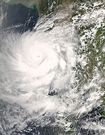
with direct damages estimated at US$1 billion, and Cyclone YasiCyclone YasiSevere Tropical Cyclone Yasi was a tropical cyclone that made landfall in northern Queensland, Australia in the early hours of Thursday, 3 February 2011. Yasi originated from a tropical low near Fiji. The system intensified to a Category 3 cyclone at about 5pm AEST on 31 January 2011...
as well as other rainfall events over Australia resulting in extreme flooding, damages upwards of A$5 billion, and loss of life.
Tornadoes
- Over 300 people were killed from April 25 to 28, 2011 during the 2011 Super Outbreak in Southeastern United StatesSoutheastern United StatesThe Southeastern United States, colloquially referred to as the Southeast, is the eastern portion of the Southern United States. It is one of the most populous regions in the United States of America....
after 334 confirmed tornadoes ravaged over 10 US states. April 27 was the deadliest tornado day in the United States since the 1925 "Tri-State" outbreak, which produced the infamous Tri-State TornadoTri-State TornadoThe Tri-State Tornado of Wednesday, March 18, 1925, was the deadliest tornado in U.S. history. With 695 confirmed fatalities, the tornado killed more than twice as many as the second deadliest, the 1840 Great Natchez Tornado...
. It is also the costliest tornado outbreak in US history, with damages possibly over $10 billion.
- The May 21–27, 2011 tornado outbreak occurs in Midwest United States, killing well over 170 people when 180 confirmed tornadoes touched down in seven days. One extremely powerful tornado2011 Joplin tornadoThe 2011 Joplin tornado was a devastating EF5 multiple-vortex tornado that struck Joplin, Missouri, USA late in the afternoon of Sunday, May 22, 2011. It was part of a larger late-May tornado outbreak sequence and reached a maximum width of in excess of during its path through the southern part of...
ravaged Joplin, MissouriJoplin, MissouriJoplin is a city in southern Jasper County and northern Newton County in the southwestern corner of the US state of Missouri. Joplin is the largest city in Jasper County, though it is not the county seat. As of the 2010 census, the city population was 50,150...
and contributed to most of the deaths. Costs for repairing are between $4-7 billion.
Thunderstorms
- The August 24, 2011 Toronto Severe Thunderstorm formed because of humid weather, then hit a large portion of Southern OntarioSouthern OntarioSouthern Ontario is a region of the province of Ontario, Canada that lies south of the French River and Algonquin Park. Depending on the inclusion of the Parry Sound and Muskoka districts, its surface area would cover between 14 to 15% of the province. It is the southernmost region of...
, including the Greater Toronto AreaGreater Toronto AreaThe Greater Toronto Area is the largest metropolitan area in Canada, with a 2006 census population of 5.5 million. The Greater Toronto Area is usually defined as the central city of Toronto, along with four regional municipalities surrounding it: Durham, Halton, Peel, and York...
on the evening of August 24, 2011, and lasted for nearly one hour. Severe Thunderstorm watches and Tornado watches were issued in the region on August 24, hours before the storm hit. The damage was minimal, but significant, and this storm was one of the worst weather events in Ontario in the 21st century, along with the August 20, 2009 Southern Ontario Thunderstorm/Tornado Outbreak, and the January 31 – February 2, 2011 North American winter stormJanuary 31 – February 2, 2011 North American winter stormThe January 31 – February 2, 2011 North American winter storm, also called the 2011 Groundhog Day Blizzard, was a powerful and historic winter storm, situated around the US and Canadian holiday Groundhog Day. In the initial stages of the storm, some meteorologists predicted that the system would...
on February 1-2, 2011.
Winter Weather
- Early January 2010- temperatures dip well below normal and snowfall is witnessed in the upper reaches of Himachal, Pradesh, and the Kashmir valley. Normal life was disturbed for the fourth consecutive day and over 125 deaths were reported from across India as a result of the cold.
- Early January 2010 - A High Pressure system near Greenland resulting from a fluctuation in the North Atlantic OscillationNorth Atlantic oscillationThe North Atlantic oscillation is a climatic phenomenon in the North Atlantic Ocean of fluctuations in the difference of atmospheric pressure at sea level between the Icelandic low and the Azores high. Through east-west oscillation motions of the Icelandic low and the Azores high, it controls the...
blocks the normal West to East flow of weather, driving Arctic Air unusually far south, resulting in record low temperatures in almost every U.S. state east of the Rocky Mountain continental divide. Snow and sleet were reported as far south as Ocala/Tampa, FL, and precipitating freezing rain as far south as Sanford, FL. Temperatures below freezing extended as far south as Miami, FL, for the first time in over 20 years, resulting in billions in crop and citrus losses. More notable than the strength of the event is the duration, with some locations in FL seeing 10-12 consecutive days with temperatures below freezing, breaking records for such events.
Extreme Rain
- Much of Australia had record breaking rain, ending the drought over the East Coast of Australia which had been in place for nearly 10 years.
Dust Storm
The east coast of Australia experienced its biggest dust storm to date2009 Australian dust storm
In 2009, a dust storm swept across the Australian states of New South Wales and Queensland from 22 to 24 September. The capital, Canberra, experienced the dust storm on 22 September, and on 23 September the storm reached Sydney and Brisbane....
affecting millions and shutting down transport.
Heat waves
- The late January to early February 2009 southeastern Australia heat wave caused record high temperatures in most of the southeastern states in Australia.
- The August 2009 Argentine winter heat waveAugust 2009 Argentine winter heat waveThe 2009 Argentine winter heat wave was a period of unusual and exceptionally hot weather that arrived at the end of the winter on August 2009 in Argentina. Several provinces of the country were most affected. Several records were broken...
was a period of exceptionally hot weather that arrived at the end of August 2009 in the South American country of ArgentinaArgentinaArgentina , officially the Argentine Republic , is the second largest country in South America by land area, after Brazil. It is constituted as a federation of 23 provinces and an autonomous city, Buenos Aires...
Wildfires
- The Black Saturday 2009 fires in VictoriaVictoria (Australia)Victoria is the second most populous state in Australia. Geographically the smallest mainland state, Victoria is bordered by New South Wales, South Australia, and Tasmania on Boundary Islet to the north, west and south respectively....
, AustraliaAustraliaAustralia , officially the Commonwealth of Australia, is a country in the Southern Hemisphere comprising the mainland of the Australian continent, the island of Tasmania, and numerous smaller islands in the Indian and Pacific Oceans. It is the world's sixth-largest country by total area...
resulted in the deaths of 173 people.
Floods=
- Throughout the month of August, Ireland experienced rainfall totaling multiples of the average for the month. Flooding was widespread throughout the island throughout the entire month, causing major disruptions to travel, infrastructure and forcing many events to be canceled. Worst affected were CarlowCarlowCarlow is the county town of County Carlow in Ireland. It is situated in the south-east of Ireland, 84 km from Dublin. County Carlow is the second smallest county in Ireland by area, however Carlow Town is the 14th largest urban area in Ireland by population according to the 2006 census. The...
, where parts of the town were under two meteres of floodwater, and BelfastBelfastBelfast is the capital of and largest city in Northern Ireland. By population, it is the 14th biggest city in the United Kingdom and second biggest on the island of Ireland . It is the seat of the devolved government and legislative Northern Ireland Assembly...
, where one road (the WestlinkWestlink BelfastThe Westlink road in Belfast, Northern Ireland is a dual carriageway throughpass, designated the A12, connecting the M1 to the M2 and M3 motorways which run south, north and east of the city, respectively...
) was under six meteres of water at one stage.
Tropical cyclones
- Cyclone GeneCyclone GeneSevere Tropical Cyclone Gene was the deadliest storm as well as the most damaging tropical cyclone of the 2007–08 South Pacific cyclone season east of 160ºE...
caused severe flooding in Fiji which killed eight people and caused $35 million (USD) in damages. - Cyclone IvanCyclone IvanCyclone Ivan was a powerful tropical cyclone that struck Madagascar in February 2008. Forming from a persistent area of convection on February 7, Ivan initially tracked southeastward, before looping to the west-southwest. Encountering favourable conditions, it strengthened to attain peak winds on...
killed 93 people and left 176 others missing in Madagascar after making landfall on February 17 at peak intensity. - Cyclone JokweCyclone JokweCyclone Jokwe was the first tropical cyclone to make landfall in Mozambique since Cyclone Favio struck in the previous year. The tenth named storm of the 2007-08 South-West Indian Ocean cyclone season, Jokwe was first classified as a tropical depression on March 2 over the open Southwest Indian Ocean...
, a small but intense cyclone, killed at least 16 people in Mozambique after making landfall with winds of 120 mph (195 km/h). - Typhoon NeogruiTyphoon Neoguri (2008)Typhoon Neoguri was the earliest tropical cyclone on record to strike The People's Republic of China...
made landfall in southern ChinaChinaChinese civilization may refer to:* China for more general discussion of the country.* Chinese culture* Greater China, the transnational community of ethnic Chinese.* History of China* Sinosphere, the area historically affected by Chinese culture...
on April 19, becoming the earliest typhoon to make landfall in mainland China. The storm killed three people, left 40 fishermen missing, and caused $58 million (USDUnited States dollarThe United States dollar , also referred to as the American dollar, is the official currency of the United States of America. It is divided into 100 smaller units called cents or pennies....
) in damages. - Cyclone NargisCyclone NargisCyclone Nargis , was a strong tropical cyclone that caused the worst natural disaster in the recorded history of Burma. The cyclone made landfall in Burma on Friday, May 2, 2008, causing catastrophic destruction and at least 138,000 fatalities...
struck the Irrawaddy DeltaIrrawaddy DeltaThe Irrawaddy Delta or Ayeyarwady Delta lies in the Ayeyarwady Region , the lowest expanse of land in Burma that fans out from the limit of tidal influence at Myan Aung to the Bay of Bengal and Andaman Sea, 290 km to the south at the mouth of the Ayeyarwady River...
in southern MyanmarMyanmarBurma , officially the Republic of the Union of Myanmar , is a country in Southeast Asia. Burma is bordered by China on the northeast, Laos on the east, Thailand on the southeast, Bangladesh on the west, India on the northwest, the Bay of Bengal to the southwest, and the Andaman Sea on the south....
on May 2, killing an estimated 140,000 people and causing $10 billion (USD) in damages. - Tropical Storm HalongTropical Storm Halong (2008)Severe Tropical Storm Halong was the fourth severe tropical storm named by the Japan Meteorological Agency who are the Regional Specialized Meteorological Centre for the Northwestern Pacific Ocean...
made landfall in the PhilippinesPhilippinesThe Philippines , officially known as the Republic of the Philippines , is a country in Southeast Asia in the western Pacific Ocean. To its north across the Luzon Strait lies Taiwan. West across the South China Sea sits Vietnam...
on May 17, killing 66 people and causing $94 million (USD) in damages. - Typhoon FengshenTyphoon Fengshen (2008)Typhoon Fengshen was the sixth named storm and the fourth typhoon recognised by the Japan Meteorological Agency...
killed nearly 1,400 people in the Philippines, nearly 800 of which were killed after a ferry capsized near the center of the typhoon, and caused $480 million (USD) in damages. - Heavy rains from Tropical Storm KammuriTropical Storm Kammuri (2008)Severe Tropical Storm Kammuri was a storm which made landfall on south China, having a maximum wind speed of...
killed at least 140 people in Vietnam. - Typhoon HagupitTyphoon Hagupit (2008)Typhoon Hagupit is recognised as the 14th Tropical Storm, the 12th Severe Tropical Storm and the 10th Typhoon of the 2008 Pacific typhoon season by the Japan Meteorological Agency who are the Regional Specialized Meteorological Centre for the North Western Pacific...
killed 67 people and left 22 others missing in China and Vietnam. The storm also caused an estimated $3 billion (USD) in damages. - Severe flooding triggered by the remnants of Deep Depression ARB 022008 Yemen cycloneDeep Depression ARB 02 was the sixth tropical cyclone of the 2008 North Indian Ocean cyclone season, and the second tropical cyclone in the Arabian Sea that year...
killed over 180 people and caused $1 billion in damages in mid-October. - In September Hurricane IkeHurricane IkeHurricane Ike was the second-costliest hurricane ever to make landfall in the United States, the costliest hurricane ever to impact Cuba and the second most active hurricane to reach the Canadian mainland in the Great Lakes Region after Hurricane Hazel in 1954...
hit TexasTexasTexas is the second largest U.S. state by both area and population, and the largest state by area in the contiguous United States.The name, based on the Caddo word "Tejas" meaning "friends" or "allies", was applied by the Spanish to the Caddo themselves and to the region of their settlement in...
making it the most costiest hurricane in Texas. - In late-November, Cyclone Nisha produced torrential rains over southern IndiaIndiaIndia , officially the Republic of India , is a country in South Asia. It is the seventh-largest country by geographical area, the second-most populous country with over 1.2 billion people, and the most populous democracy in the world...
and Sri LankaSri LankaSri Lanka, officially the Democratic Socialist Republic of Sri Lanka is a country off the southern coast of the Indian subcontinent. Known until 1972 as Ceylon , Sri Lanka is an island surrounded by the Indian Ocean, the Gulf of Mannar and the Palk Strait, and lies in the vicinity of India and the...
which killed 204 people and caused $800 million in damages.
Tornadoes
- The 2008 Super Tuesday tornado outbreak2008 Super Tuesday tornado outbreakThe 2008 Super Tuesday tornado outbreak was a deadly tornado outbreak which affected the Southern United States and the lower Ohio Valley on February 5 and 6, 2008. The event began on Super Tuesday, while 24 U.S. states were holding primary elections and caucuses to select the presidential...
was a deadly tornado outbreak affecting the Southern United StatesSouthern United StatesThe Southern United States—commonly referred to as the American South, Dixie, or simply the South—constitutes a large distinctive area in the southeastern and south-central United States...
and the lower Ohio Valley from February 5 to February 6, 2008. With more than 80 confirmed tornados and 58 deaths, the outbreak was the deadliest in the U.S. since the May 31, 1985 outbreak that killed 76 across Ohio and Pennsylvania.
A Supercell formed over Delaware, New Jersey, and Pennsylvania around August 10, 2008. It produced many tornadoes and big hail. Tornadoes actually touched down in East Greenwich, NJ, and in Sussex County, NJ, and one almost touched down in Mullica Hill, NJ, which hadn't gotten a tornado in about 50–60 years.
Wildfires
- Wildfires in CaliforniaSummer 2008 California wildfiresThe summer 2008 California wildfires, collectively dubbed the Northern California Lightning Series by CAL FIRE, were a concentrated outbreak of wildfires during the summer of 2008. Over 2,780 individual fires were burning at the height of the period, burning large portions of forests and chaparral...
kill eight people and burn over one million acres (4,000 km²) over a three month span from June to August. - An 11,000 acre wildfireSayre FireThe Sayre Fire, also known as the Sylmar Fire, is a November 2008 wildfire that resulted in the loss of 489 residences in Los Angeles, California, United States, the "worst loss of homes due to fire" in the city's history. The fire was first reported at 10:29 p.m. PDT on November 14, 2008, in the...
destroys nearly 500 homes in southern California after burning for nearly a week during mid-November.
Winter weather
- A large and powerful non-tropical cycloneJanuary 2008 Western North American super stormThe January 2008 Western North American storm complex was a powerful Pacific Ocean coastal storm that affected a large area in Western North America stretching from western British Columbia to near the Tijuana, Mexico area starting on January 3, 2008...
in early January dropped over ten feet of snow over the Sierra Nevada Mountains and nearly ten inches of rain over lower elevation areas, leading to the deaths of 12 people. - The worst winter weather in China2008 Chinese winter stormsThe 2008 Chinese winter storms(2008年中国雪灾、2008年中国南方雪灾)are a series of winter storm events that affected large portions of southern and central China starting on 25 January 2008 until 6 February 2008. The systems affected most of the area with heavy snows, ice and cold temperatures causing extensive...
in nearly half a century kills 129 people and causes 151.65 billion yuan in damages during late January through early February.
2007
- A huge storm system, the February–March 2007 tornado outbreak, produced at least 31 tornadoes from MinnesotaMinnesotaMinnesota is a U.S. state located in the Midwestern United States. The twelfth largest state of the U.S., it is the twenty-first most populous, with 5.3 million residents. Minnesota was carved out of the eastern half of the Minnesota Territory and admitted to the Union as the thirty-second state...
to the Gulf of MexicoGulf of MexicoThe Gulf of Mexico is a partially landlocked ocean basin largely surrounded by the North American continent and the island of Cuba. It is bounded on the northeast, north and northwest by the Gulf Coast of the United States, on the southwest and south by Mexico, and on the southeast by Cuba. In...
, killing 10 in Alabama, 9 in Georgia and 1 in Missouri. - Record high temperatures were logged at 11 monitoring points in five Japanese prefectures on March 4, with three points recording summer-like temperatures of over 25 °C.
- Ireland experiences its warmest April since records began; with average daytime maximum temperatures two to five degrees (°C) above average. At some stations, it has been the driest and sunniest April since records began there.
- After an intense dry period over the Australian regions of GippslandGippslandGippsland is a large rural region in Victoria, Australia. It begins immediately east of the suburbs of Melbourne and stretches to the New South Wales border, lying between the Great Dividing Range to the north and Bass Strait to the south...
and East GippslandEast GippslandEast Gippsland is the eastern region of Gippsland, Australia covering 31,740 square kilometres of Victoria. It has a population of 80,114....
, extremelly heavy rain fell over the region in June. Over 300 mm (12 inches) fell over East Gippslands largest city, Bairnsdale, with more rainfall in the nearby mountains. This caused major flooding on the Gippsland LakesGippsland LakesThe Gippsland Lakes are a network of lakes, marshes and lagoons in east Gippsland, Victoria, Australia covering an area of about 600 km2. The largest of the lakes are Lake Wellington , Lake King and Lake Victoria. They are fed by the Avon, Thomson, Latrobe, Mitchell, Nicholson and Tambo...
, flooded numerous Rivers and cut off towns for days until flood waters receded. - In mid June, flooding struck parts of the province of UlsterUlsterUlster is one of the four provinces of Ireland, located in the north of the island. In ancient Ireland, it was one of the fifths ruled by a "king of over-kings" . Following the Norman invasion of Ireland, the ancient kingdoms were shired into a number of counties for administrative and judicial...
in IrelandIrelandIreland is an island to the northwest of continental Europe. It is the third-largest island in Europe and the twentieth-largest island on Earth...
. After a long, relatively dry and warm time of weather lasting almost three months (temperatures up to 29 °C / 84 °F on 11 June), extreme thunderstorms caused flooding in BelfastBelfastBelfast is the capital of and largest city in Northern Ireland. By population, it is the 14th biggest city in the United Kingdom and second biggest on the island of Ireland . It is the seat of the devolved government and legislative Northern Ireland Assembly...
, OmaghOmaghOmagh is the county town of County Tyrone, Northern Ireland. It is situated where the rivers Drumragh and Camowen meet to form the Strule. The town, which is the largest in the county, had a population of 19,910 at the 2001 Census. Omagh also contains the headquarters of Omagh District Council and...
and RaphoeRaphoeRaphoe is a town in County Donegal, part of the province of Ulster in Ireland. It is the main town in the fertile district of East Donegal known as the Laggan, as well as giving its name to the Roman Catholic Diocese of Raphoe and the Church of Ireland Diocese of Derry and Raphoe.-Name:Raphoe,...
on 12 June. Some locations received more than the monthly amount in just 30 minutes. - A series of destructive floods2007 United Kingdom floodsThe 2007 United Kingdom floods were a series of destructive floods that occurred in various areas across the country during the summer of 2007. The most severe floods occurred across Northern Ireland on 12 June; East Yorkshire and The Midlands on 15 June; Yorkshire, The Midlands, Gloucestershire,...
hit the United KingdomUnited KingdomThe United Kingdom of Great Britain and Northern IrelandIn the United Kingdom and Dependencies, other languages have been officially recognised as legitimate autochthonous languages under the European Charter for Regional or Minority Languages...
during June and July, with EnglandEnglandEngland is a country that is part of the United Kingdom. It shares land borders with Scotland to the north and Wales to the west; the Irish Sea is to the north west, the Celtic Sea to the south west, with the North Sea to the east and the English Channel to the south separating it from continental...
receiving double the average June rainfall. Thirteen people were killed and damage totaled over £6 billion. The rescue effort was described as the biggest in peacetime Britain. - The Southeast United States experienced record drought and temperatures during September. The drought was most severe in Alabama, Tennessee, North Carolina and Florida
Flooding
- In February, a massive mudslide2006 Southern Leyte mudslideA massive rock slide-debris avalanche occurred on 17 February 2006 in the Philippine province of Southern Leyte that caused widespread damage and loss of life. The deadly landslide followed a ten-day period of heavy rains and a minor earthquake of magnitude 2.6 on the Richter scale...
buried the town of Guinsaugon on LeyteLeyteLeyte is a province of the Philippines located in the Eastern Visayas region. Its capital is Tacloban City and occupies the northern three-quarters of the Leyte Island. Leyte is located west of Samar Island, north of Southern Leyte and south of Biliran...
Island in the PhilippinesPhilippinesThe Philippines , officially known as the Republic of the Philippines , is a country in Southeast Asia in the western Pacific Ocean. To its north across the Luzon Strait lies Taiwan. West across the South China Sea sits Vietnam...
. The entire town of 1,400 people was buried by the mudslide, and in total at least 1,119 people were reported dead or missing. - In May, heavy flooding in northern ThailandThailandThailand , officially the Kingdom of Thailand , formerly known as Siam , is a country located at the centre of the Indochina peninsula and Southeast Asia. It is bordered to the north by Burma and Laos, to the east by Laos and Cambodia, to the south by the Gulf of Thailand and Malaysia, and to the...
has left over 130 people dead or missing. 51 people have been confirmed dead. - In June, heavy, record-setting rainfall in the Mid-AtlanticMid-Atlantic StatesThe Mid-Atlantic states, also called middle Atlantic states or simply the mid Atlantic, form a region of the United States generally located between New England and the South...
region of the United States caused widespread floodingMid-Atlantic United States flood of 2006The Mid-Atlantic United States flood of 2006 was a significant flood that affected much of the Mid-Atlantic region of the eastern United States. The flooding was very widespread, affecting numerous rivers, lakes and communities from upstate New York to North Carolina. It is widely considered to be...
that led to at least 16 deaths. It was considered the heaviest flooding in the country since Hurricane KatrinaHurricane KatrinaHurricane Katrina of the 2005 Atlantic hurricane season was a powerful Atlantic hurricane. It is the costliest natural disaster, as well as one of the five deadliest hurricanes, in the history of the United States. Among recorded Atlantic hurricanes, it was the sixth strongest overall...
. - The monsoonMonsoonMonsoon is traditionally defined as a seasonal reversing wind accompanied by corresponding changes in precipitation, but is now used to describe seasonal changes in atmospheric circulation and precipitation associated with the asymmetric heating of land and sea...
left at least 574 people dead in India, as it began early and remained unusually active. - In July, heavy rains caused widespread flooding that has killed at least 549 people in North KoreaNorth KoreaThe Democratic People’s Republic of Korea , , is a country in East Asia, occupying the northern half of the Korean Peninsula. Its capital and largest city is Pyongyang. The Korean Demilitarized Zone serves as the buffer zone between North Korea and South Korea...
, while an additional 295 are still missing, forcing North Korea to appeal for help from South Korea. Flooding also killed 25 people in South KoreaSouth KoreaThe Republic of Korea , , is a sovereign state in East Asia, located on the southern portion of the Korean Peninsula. It is neighbored by the People's Republic of China to the west, Japan to the east, North Korea to the north, and the East China Sea and Republic of China to the south...
and 22 in Japan. A South Korean aid group has said that in actuality a phenomenal 58,000 were left dead or missing. There has been no more comment from the North Korean government. - In August, heavy flooding hit several portions of the country of EthiopiaEthiopiaEthiopia , officially known as the Federal Democratic Republic of Ethiopia, is a country located in the Horn of Africa. It is the second-most populous nation in Africa, with over 82 million inhabitants, and the tenth-largest by area, occupying 1,100,000 km2...
, resulting in hundreds of deaths. Flooding devastated the city of Dire DawaDire DawaDire Dawa is one of two chartered cities in Ethiopia . This chartered city is divided administratively into two woredas, the city proper and the non-urban woreda of Gurgura....
, EthiopiaEthiopiaEthiopia , officially known as the Federal Democratic Republic of Ethiopia, is a country located in the Horn of Africa. It is the second-most populous nation in Africa, with over 82 million inhabitants, and the tenth-largest by area, occupying 1,100,000 km2...
killing 256 people and leaving an additional 300 missing. An additional 190 people have been killed in flooding in the southern part of the country. In total, about 900 people are feared dead in the flooding throughout the country. - In August, Monsoon flooding devastated a wide swath of land from western India through northern PakistanPakistanPakistan , officially the Islamic Republic of Pakistan is a sovereign state in South Asia. It has a coastline along the Arabian Sea and the Gulf of Oman in the south and is bordered by Afghanistan and Iran in the west, India in the east and China in the far northeast. In the north, Tajikistan...
and eastern AfghanistanAfghanistanAfghanistan , officially the Islamic Republic of Afghanistan, is a landlocked country located in the centre of Asia, forming South Asia, Central Asia and the Middle East. With a population of about 29 million, it has an area of , making it the 42nd most populous and 41st largest nation in the world...
. At least 417 people have been confirmed dead, and 200,000 people were evacuated in the SuratSuratSurat , also known as Suryapur, is the commercial capital city of the Indian state of Gujarat. Surat is India's Eighth most populous city and Ninth-most populous urban agglomeration. It is also administrative capital of Surat district and one of the fastest growing cities in India. The city proper...
area. More flooding hit the Thar DesertThar DesertThe Thar Desert |Punjab]] province. The Cholistan Desert adjoins the Thar desert spreading into Pakistani Punjab province.-Location and description:...
late in the month, killing at least 135 people.
Tornadoes
- Forty-four tornadoes touched down across Missouri on March 11–12, killing twelve people and injuring more than a hundred (Austin, K. (March 31, 2006) "Tornado force scale adjusted," Missourian News, columbiamissourian.com.) The March 2006 tornado outbreak sequenceMarch 2006 Tornado Outbreak SequenceThe March 2006 Tornado Outbreak Sequence was an early season and long lasting tornado outbreak sequence in the central United States that started on the morning of March 9 and continued for over four days until the evening of March 13. The outbreak produced 105 confirmed tornadoes. At least 13...
had been, until 2007, the worst tornado storm in March, and was the largest two-day outbreak in history. At least 84 tornadoes touched down. - March 31, 2006 - more tornadoes in the U.S. midwest reported 30-60.
- April 2, 2006 - The April 2, 2006 tornado outbreakApril 2, 2006 Tornado OutbreakThe April 2, 2006 Central United States tornado outbreak was a series of tornadoes that occurred during the late afternoon and evening of April 2, 2006 in the central United States. It was the second major outbreak of 2006, in the same area that suffered considerable destruction in a previous...
killed a total of 28 people, mostly in TennesseeTennesseeTennessee is a U.S. state located in the Southeastern United States. It has a population of 6,346,105, making it the nation's 17th-largest state by population, and covers , making it the 36th-largest by total land area...
. Tornadoes and hail as big as softballs ripped through eight Midwestern states, killing at least 27 people, injuring scores and destroying hundreds of homes. In Tennessee, tornadoes killed 23 people, including an infant and a family of four. Severe thunderstorms, many producing tornadoes, also struck parts of Iowa, Kentucky, Arkansas, Missouri, Ohio, Illinois and Indiana. Strong wind was blamed or at least three deaths in Missouri. The weather service's Storm Prediction Center in Norman, Okla., said it had preliminary reports of 63 tornadoes. The worst damage occurred throughout the Tennessee ValleyTennessee ValleyThe Tennessee Valley is the drainage basin of the Tennessee River and is largely within the U.S. state of Tennessee. It stretches from southwest Kentucky to northwest Georgia and from northeast Mississippi to the mountains of Virginia and North Carolina...
. - April 6–8, 2006 - The April 6–8, 2006 tornado outbreak killed a total of 13 people. Dozens of tornadoes in the U.S. Mid-central through Eastern states both days. According to The Weather Channel, the number of U.S. tornadoes in the first seven days of April came within 15% of the average number of tornadoes for April. Tennessee was again the area most affected by this outbreak.
Heat waves
- From July–August, a major heat wave2006 North American heat waveThe 2006 North American heat wave spread throughout most of the United States and Canada beginning on July 15, 2006, killing at least 225 people. That day the temperature reached 117 °F in Pierre, South Dakota, with many places in South Dakota that hit well into the 120s. A 130 degree...
in the United States contributed to the deaths of at least 225 people, including 163 in CaliforniaCaliforniaCalifornia is a state located on the West Coast of the United States. It is by far the most populous U.S. state, and the third-largest by land area...
. The heat wave lingered in the Southern statesSouthern United StatesThe Southern United States—commonly referred to as the American South, Dixie, or simply the South—constitutes a large distinctive area in the southeastern and south-central United States...
until late in the month, when cooler temperatures finally arrived.
Tropical cyclones
- In March, Cyclone LarryCyclone LarrySevere Tropical Cyclone Larry was a tropical cyclone that made landfall in Australia during the 2005-06 Southern Hemisphere tropical cyclone season. Larry originated as a low pressure system over the eastern Coral Sea on 16 March and was monitored by the Australian Bureau of Meteorology in...
struck the north coast of AustraliaAustraliaAustralia , officially the Commonwealth of Australia, is a country in the Southern Hemisphere comprising the mainland of the Australian continent, the island of Tasmania, and numerous smaller islands in the Indian and Pacific Oceans. It is the world's sixth-largest country by total area...
, near the town of InnisfailInnisfail, QueenslandInnisfail is a town located in the far north of the state of Queensland, Australia. It is the major township of the Cassowary Coast and is well renowned for its sugar and banana industries, as well as for being one of Australia's wettest towns...
, causing A$1 billion in damage, and one fatality. Approximately 80% of the Australian banana crop was wiped out in the storm. - In April, Cyclone MalaCyclone MalaCyclone Mala, also known as Very Severe Cyclonic Storm Mala, was the strongest tropical cyclone of the 2006 North Indian Ocean cyclone season...
hit MyanmarMyanmarBurma , officially the Republic of the Union of Myanmar , is a country in Southeast Asia. Burma is bordered by China on the northeast, Laos on the east, Thailand on the southeast, Bangladesh on the west, India on the northwest, the Bay of Bengal to the southwest, and the Andaman Sea on the south....
(Burma) as a category 4-equivalent tropical cyclone, killing 22 people. It was the most intense named cyclone on record in the North Indian Ocean (although other unnamed storms were stronger). - In May, Typhoon ChanchuTyphoon ChanchuThe name Chanchu has been used for two tropical cyclones in the western north Pacific Ocean. The name, submitted by Macau, means pearl.* 2000's Tropical Storm Chanchu - formed from the remnants of Tropical Storm Upana and mistakenly renamed, but not a threat to land.* 2006's Typhoon Chanchu -...
plowed through the Philippines and wreaked havoc through the South China SeaSouth China SeaThe South China Sea is a marginal sea that is part of the Pacific Ocean, encompassing an area from the Singapore and Malacca Straits to the Strait of Taiwan of around...
before hitting southeastern China. In total, 294 people were killed or are missing, most from several fishing boats that sunk off the coast of VietnamVietnamVietnam – sometimes spelled Viet Nam , officially the Socialist Republic of Vietnam – is the easternmost country on the Indochina Peninsula in Southeast Asia. It is bordered by China to the north, Laos to the northwest, Cambodia to the southwest, and the South China Sea –...
. - In July, Typhoon EwiniarTyphoon Ewiniar (2006)Typhoon Ewiniar was the third named storm of the 2006 Pacific typhoon season and one that lasted for twelve days as a tropical cyclone, moving on a generally northward track...
killed at least 40 people in South KoreaSouth KoreaThe Republic of Korea , , is a sovereign state in East Asia, located on the southern portion of the Korean Peninsula. It is neighbored by the People's Republic of China to the west, Japan to the east, North Korea to the north, and the East China Sea and Republic of China to the south...
and ChinaPeople's Republic of ChinaChina , officially the People's Republic of China , is the most populous country in the world, with over 1.3 billion citizens. Located in East Asia, the country covers approximately 9.6 million square kilometres...
. - In July, Tropical Storm Bilis made landfall in China and killed a total of 625 people as it persisted inland for nearly a week after landfall.
- In July, 92 people were killed or are missing after Typhoon Kaemi made landfall in China in nearly the same area as Bilis just a week earlier.
- In August, Typhoon Prapiroon killed at least 80 people when it made landfall in southern China, affecting areas already devastated by the landfalls of Bilis and Kaemi just in the previous 3 weeks.
- In August, Typhoon SaomaiTyphoon SaomaiThe name Saomai has been used to name two tropical cyclones in the northwestern Pacific Ocean. The name is the Vietnamese name of the planet Venus .* 2000's Typhoon Saomai...
made landfall in China as a Category 4-equivalent tropical cyclone in China in the same area affected by Bilis, Kaemi, and Prapiroon just in the previous month. At least 441 people were killed by the storm. - In September, Typhoon XangsaneTyphoon XangsaneThe name Xangsane has been used to name two tropical cyclones in the northwestern Pacific Ocean. The name was contributed by Laos and is a Laotian word for elephant.* 2000's Typhoon Xangsane - affected the Philippines and Taiwan....
caused extensive damage to Metro ManilaMetro ManilaMetropolitan Manila , the National Capital Region , or simply Metro Manila, is the metropolitan region encompassing the City of Manila and its surrounding areas in the Philippines...
in the Philippines as well as Vietnam, leading to at least 279 deaths. - In November, Typhoon DurianTyphoon DurianTyphoon Durian was an intense storm that wreaked havoc in the Philippines, causing massive loss of life when mudslides from the Mayon Volcano buried many villages...
caused widespread destruction in the central Philippines, killing over 1,200 people. It also impacted Vietnam, causing 81 deaths there.
Winter weather
- In January, the coldest weather in decades2006 European cold waveThe 2006 European cold wave was an unusual cold wave which resulted in abnormal winter conditions over much of Europe. This marked a period of unusual weather over much of Europe where southern Europe saw cold and snow while places in northern Norway saw abnormally mild conditions. The phenomenon...
, accompanied by heavy snowfall and high winds in areas, occurred throughout Russia, Eastern EuropeEastern EuropeEastern Europe is the eastern part of Europe. The term has widely disparate geopolitical, geographical, cultural and socioeconomic readings, which makes it highly context-dependent and even volatile, and there are "almost as many definitions of Eastern Europe as there are scholars of the region"...
, and ScandinaviaScandinaviaScandinavia is a cultural, historical and ethno-linguistic region in northern Europe that includes the three kingdoms of Denmark, Norway and Sweden, characterized by their common ethno-cultural heritage and language. Modern Norway and Sweden proper are situated on the Scandinavian Peninsula,...
, leaving hundreds of people dead. Snow fell throughout Europe, even as far south as the GreekGreeceGreece , officially the Hellenic Republic , and historically Hellas or the Republic of Greece in English, is a country in southeastern Europe....
Isles or the Portuguese sea resorts, with record-setting snowfall and near-record cold in many areas.
Flooding
- In July, widespread, devastating flooding2005 Maharashtra floodsThe 2005 Maharashtra floods refers to the flooding of many parts of the Indian state of Maharashtra including large areas of the metropolis Mumbai, a city located on the coast of the Arabian Sea, on the western coast of India, in which at least 5,000 people died. It occurred just one month after...
in MaharashtraMaharashtraMaharashtra is a state located in India. It is the second most populous after Uttar Pradesh and third largest state by area in India...
and MumbaiMumbaiMumbai , formerly known as Bombay in English, is the capital of the Indian state of Maharashtra. It is the most populous city in India, and the fourth most populous city in the world, with a total metropolitan area population of approximately 20.5 million...
(caused by extremely heavy rainfall, 100 cm in one day in Mumbai), India killed at least 1,000 people and caused approximately US$3.5 billion in damage. - In October, 10 people were killed from widespread and record-setting rainfallNortheast U.S. flooding of October 2005In October 2005, remnants of Tropical Storm Tammy and Subtropical Depression Twenty-Two merged with incoming continental cold fronts to produce torrential rains over interior New England, as well as over parts of New Jersey and New York. Particularly hard hit was the state of New Hampshire, which...
throughout the Northeastern United StatesNortheastern United StatesThe Northeastern United States is a region of the United States as defined by the United States Census Bureau.-Composition:The region comprises nine states: the New England states of Connecticut, Maine, Massachusetts, New Hampshire, Rhode Island and Vermont; and the Mid-Atlantic states of New...
.
Heatwaves
- In descending order, the five years with the highest global average annual temperatures were 2005, 1998, 2002, 2003 and 2004, said Drew Shindell of the NASANASAThe National Aeronautics and Space Administration is the agency of the United States government that is responsible for the nation's civilian space program and for aeronautics and aerospace research...
institute in New York City on January 24, 2006. "I think it's even fair to say that [2005 had] the warmest... temperatures the world has experienced probably in the last million years."
Severe weather
- In January, storm winds swept across northern Europe. They killed at least 13 people and left millions without electricity.
- In November, a tornadoEvansville Tornado of November 2005- Evansville area tornado :On Sunday, November 6, 2005 at around 1:50 am CST , a tornado touched down 2 miles north-northwest of Smith Mills in Henderson County, Kentucky, near the Indiana/Kentucky border, and then crossed the Ohio River into Vanderburgh County, Indiana...
in northern KentuckyKentuckyThe Commonwealth of Kentucky is a state located in the East Central United States of America. As classified by the United States Census Bureau, Kentucky is a Southern state, more specifically in the East South Central region. Kentucky is one of four U.S. states constituted as a commonwealth...
and Evansville, IndianaEvansville, IndianaEvansville is the third-largest city in the U.S. state of Indiana and the largest city in Southern Indiana. As of the 2010 census, the city had a total population of 117,429. It is the county seat of Vanderburgh County and the regional hub for both Southwestern Indiana and the...
, U.S. killed 26 people.
Tropical cyclones
Evansville Tornado of November 2005
- Evansville area tornado :On Sunday, November 6, 2005 at around 1:50 am CST , a tornado touched down 2 miles north-northwest of Smith Mills in Henderson County, Kentucky, near the Indiana/Kentucky border, and then crossed the Ohio River into Vanderburgh County, Indiana...
in northern Kentucky
Kentucky
The Commonwealth of Kentucky is a state located in the East Central United States of America. As classified by the United States Census Bureau, Kentucky is a Southern state, more specifically in the East South Central region. Kentucky is one of four U.S. states constituted as a commonwealth...
and Evansville, Indiana
Evansville, Indiana
Evansville is the third-largest city in the U.S. state of Indiana and the largest city in Southern Indiana. As of the 2010 census, the city had a total population of 117,429. It is the county seat of Vanderburgh County and the regional hub for both Southwestern Indiana and the...
, U.S. killed 26 people.
- In July, Hurricane DennisHurricane DennisHurricane Dennis was an early-forming major hurricane in the Caribbean and Gulf of Mexico during the very active 2005 Atlantic hurricane season. Dennis was the fourth named storm, second hurricane, and first major hurricane of the season...
killed 82 people in HaitiHaitiHaiti , officially the Republic of Haiti , is a Caribbean country. It occupies the western, smaller portion of the island of Hispaniola, in the Greater Antillean archipelago, which it shares with the Dominican Republic. Ayiti was the indigenous Taíno or Amerindian name for the island...
, CubaCubaThe Republic of Cuba is an island nation in the Caribbean. The nation of Cuba consists of the main island of Cuba, the Isla de la Juventud, and several archipelagos. Havana is the largest city in Cuba and the country's capital. Santiago de Cuba is the second largest city...
, and the United States and destroyed at least 16,000 homes. Total damages amounted to US$3–5 billion. - In August, Hurricane KatrinaHurricane KatrinaHurricane Katrina of the 2005 Atlantic hurricane season was a powerful Atlantic hurricane. It is the costliest natural disaster, as well as one of the five deadliest hurricanes, in the history of the United States. Among recorded Atlantic hurricanes, it was the sixth strongest overall...
caused catastrophic damage along the Gulf Coast of the United StatesGulf Coast of the United StatesThe Gulf Coast of the United States, sometimes referred to as the Gulf South, South Coast, or 3rd Coast, comprises the coasts of American states that are on the Gulf of Mexico, which includes Texas, Louisiana, Mississippi, Alabama, and Florida and are known as the Gulf States...
, forcing the effective abandonment of southeastern LouisianaLouisianaLouisiana is a state located in the southern region of the United States of America. Its capital is Baton Rouge and largest city is New Orleans. Louisiana is the only state in the U.S. with political subdivisions termed parishes, which are local governments equivalent to counties...
(including New OrleansNew Orleans, LouisianaNew Orleans is a major United States port and the largest city and metropolitan area in the state of Louisiana. The New Orleans metropolitan area has a population of 1,235,650 as of 2009, the 46th largest in the USA. The New Orleans – Metairie – Bogalusa combined statistical area has a population...
) for up to 2 months and damaging oil wells that sent gas prices in the U.S. to an all-time record high. Katrina killed at least 1,836 people and caused at least $75 billion US in damages, making it one of the costliest natural disasters of all time. - In September, Hurricane RitaHurricane RitaHurricane Rita was the fourth-most intense Atlantic hurricane ever recorded and the most intense tropical cyclone ever observed in the Gulf of Mexico. Rita caused $11.3 billion in damage on the U.S. Gulf Coast in September 2005...
left 119 people dead along the U.S. Gulf CoastGulf Coast of the United StatesThe Gulf Coast of the United States, sometimes referred to as the Gulf South, South Coast, or 3rd Coast, comprises the coasts of American states that are on the Gulf of Mexico, which includes Texas, Louisiana, Mississippi, Alabama, and Florida and are known as the Gulf States...
and caused $9.4 billion US in damage. - In September, Typhoon Talim caused extensive flooding and killed at least 145 people in TaiwanTaiwanTaiwan , also known, especially in the past, as Formosa , is the largest island of the same-named island group of East Asia in the western Pacific Ocean and located off the southeastern coast of mainland China. The island forms over 99% of the current territory of the Republic of China following...
and southern China. - In September, Typhoon Damrey caused extensive flooding throughout Southeast AsiaSoutheast AsiaSoutheast Asia, South-East Asia, South East Asia or Southeastern Asia is a subregion of Asia, consisting of the countries that are geographically south of China, east of India, west of New Guinea and north of Australia. The region lies on the intersection of geological plates, with heavy seismic...
, killing 94 people in Vietnam, the PhilippinesPhilippinesThe Philippines , officially known as the Republic of the Philippines , is a country in Southeast Asia in the western Pacific Ocean. To its north across the Luzon Strait lies Taiwan. West across the South China Sea sits Vietnam...
, southern China, and ThailandThailandThailand , officially the Kingdom of Thailand , formerly known as Siam , is a country located at the centre of the Indochina peninsula and Southeast Asia. It is bordered to the north by Burma and Laos, to the east by Laos and Cambodia, to the south by the Gulf of Thailand and Malaysia, and to the...
, with its remnants killing an additional 51 from heavy flooding in NepalNepalNepal , officially the Federal Democratic Republic of Nepal, is a landlocked sovereign state located in South Asia. It is located in the Himalayas and bordered to the north by the People's Republic of China, and to the south, east, and west by the Republic of India...
. - In October, extensive flooding exacerbated by Hurricane StanHurricane StanHurricane Stan was the eighteenth named tropical storm and eleventh hurricane of the 2005 Atlantic hurricane season. It was also the sixth of seven tropical cyclones to make landfall in Mexico. Stan was a relatively weak storm that only briefly reached hurricane status...
affected nearly the entirety of Central AmericaCentral AmericaCentral America is the central geographic region of the Americas. It is the southernmost, isthmian portion of the North American continent, which connects with South America on the southeast. When considered part of the unified continental model, it is considered a subcontinent...
and southern Mexico. The storm, combined with Stan, killed between 1,080 and 2,100 people in Mexico, GuatemalaGuatemalaGuatemala is a country in Central America bordered by Mexico to the north and west, the Pacific Ocean to the southwest, Belize to the northeast, the Caribbean to the east, and Honduras and El Salvador to the southeast...
, HondurasHondurasHonduras is a republic in Central America. It was previously known as Spanish Honduras to differentiate it from British Honduras, which became the modern-day state of Belize...
, El SalvadorEl SalvadorEl Salvador or simply Salvador is the smallest and the most densely populated country in Central America. The country's capital city and largest city is San Salvador; Santa Ana and San Miguel are also important cultural and commercial centers in the country and in all of Central America...
, NicaraguaNicaraguaNicaragua is the largest country in the Central American American isthmus, bordered by Honduras to the north and Costa Rica to the south. The country is situated between 11 and 14 degrees north of the Equator in the Northern Hemisphere, which places it entirely within the tropics. The Pacific Ocean...
, and Costa RicaCosta RicaCosta Rica , officially the Republic of Costa Rica is a multilingual, multiethnic and multicultural country in Central America, bordered by Nicaragua to the north, Panama to the southeast, the Pacific Ocean to the west and the Caribbean Sea to the east....
. Villages along the shores of Lake Atitlan in GuatemalaGuatemalaGuatemala is a country in Central America bordered by Mexico to the north and west, the Pacific Ocean to the southwest, Belize to the northeast, the Caribbean to the east, and Honduras and El Salvador to the southeast...
and other areas throughout the country were completely destroyed - In October, Hurricane WilmaHurricane WilmaHurricane Wilma was the most intense tropical cyclone ever recorded in the Atlantic basin. Wilma was the twenty-second storm , thirteenth hurricane, sixth major hurricane, and fourth Category 5 hurricane of the record-breaking 2005 season...
killed 62 people in JamaicaJamaicaJamaica is an island nation of the Greater Antilles, in length, up to in width and 10,990 square kilometres in area. It is situated in the Caribbean Sea, about south of Cuba, and west of Hispaniola, the island harbouring the nation-states Haiti and the Dominican Republic...
, HaitiHaitiHaiti , officially the Republic of Haiti , is a Caribbean country. It occupies the western, smaller portion of the island of Hispaniola, in the Greater Antillean archipelago, which it shares with the Dominican Republic. Ayiti was the indigenous Taíno or Amerindian name for the island...
, Mexico, CubaCubaThe Republic of Cuba is an island nation in the Caribbean. The nation of Cuba consists of the main island of Cuba, the Isla de la Juventud, and several archipelagos. Havana is the largest city in Cuba and the country's capital. Santiago de Cuba is the second largest city...
, and the United States and at one point became the most intense Atlantic Basin hurricane on record and the second-fastest-intensifying tropical cyclone on record. Wilma caused $25 billion in damage, making it one of the costliest hurricanes on record. - In October, Tropical Storm AlphaTropical Storm Alpha (2005)Tropical Storm Alpha was the twenty-third named storm of the 2005 Atlantic hurricane season. The twenty-one names from the predetermined A–W list having been used, Alpha was the first tropical storm ever to be given a name from the Greek alphabet. On October 20, Tropical Depression...
killed 42 people in HaitiHaitiHaiti , officially the Republic of Haiti , is a Caribbean country. It occupies the western, smaller portion of the island of Hispaniola, in the Greater Antillean archipelago, which it shares with the Dominican Republic. Ayiti was the indigenous Taíno or Amerindian name for the island...
, the Dominican RepublicDominican RepublicThe Dominican Republic is a nation on the island of La Hispaniola, part of the Greater Antilles archipelago in the Caribbean region. The western third of the island is occupied by the nation of Haiti, making Hispaniola one of two Caribbean islands that are shared by two countries...
, and the Bahamas. It also broke the record for the most active Atlantic hurricane season on record. - In October, Tropical Storm 04B killed at least 100 people in eastern India from extensive flooding.
- In November, Tropical Storm GammaTropical Storm Gamma (2005)Tropical Storm Gamma was the 24th tropical storm of the 2005 Atlantic hurricane season. It was the first tropical cyclone to make landfall in Honduras since Hurricane Mitch of 1998. Gamma formed on November 18 from a tropical wave which had left the coast of Africa on November 3...
caused widespread flooding that killed 37 people in HondurasHondurasHonduras is a republic in Central America. It was previously known as Spanish Honduras to differentiate it from British Honduras, which became the modern-day state of Belize...
, BelizeBelizeBelize is a constitutional monarchy and the northernmost country in Central America. Belize has a diverse society, comprising many cultures and languages. Even though Kriol and Spanish are spoken among the population, Belize is the only country in Central America where English is the official...
, and Saint VincentSaint Vincent and the GrenadinesSaint Vincent and the Grenadines is an island country in the Lesser Antilles chain, namely in the southern portion of the Windward Islands, which lie at the southern end of the eastern border of the Caribbean Sea where the latter meets the Atlantic Ocean....
.
2000 to 2004
2004- August: Hurricane CharleyHurricane CharleyHurricane Charley was the third named storm, the second hurricane, and the second major hurricane of the 2004 Atlantic hurricane season. Charley lasted from August 9 to August 15, and at its peak intensity it attained 150 mph winds, making it a strong Category 4 hurricane on the...
makes landfall in southwest FloridaFloridaFlorida is a state in the southeastern United States, located on the nation's Atlantic and Gulf coasts. It is bordered to the west by the Gulf of Mexico, to the north by Alabama and Georgia and to the east by the Atlantic Ocean. With a population of 18,801,310 as measured by the 2010 census, it...
, killing 13. - September: Hurricane FrancesHurricane FrancesHurricane Frances was the sixth named storm, the fourth hurricane, and the third major hurricane of the 2004 Atlantic hurricane season. The system crossing the open Atlantic during mid to late August, moving to the north of the Lesser Antilles while strengthening. Its outer bands affected Puerto...
makes landfall in FloridaFloridaFlorida is a state in the southeastern United States, located on the nation's Atlantic and Gulf coasts. It is bordered to the west by the Gulf of Mexico, to the north by Alabama and Georgia and to the east by the Atlantic Ocean. With a population of 18,801,310 as measured by the 2010 census, it...
. Hurricane IvanHurricane IvanHurricane Ivan was a large, long-lived, Cape Verde-type hurricane that caused widespread damage in the Caribbean and United States. The cyclone was the ninth named storm, the sixth hurricane and the fourth major hurricane of the active 2004 Atlantic hurricane season...
landed near Gulf Shores, AlabamaGulf Shores, Alabama-External links:*...
, near the Florida PanhandleFlorida PanhandleThe Florida Panhandle, an informal, unofficial term for the northwestern part of Florida, is a strip of land roughly 200 miles long and 50 to 100 miles wide , lying between Alabama on the north and the west, Georgia also on the north, and the Gulf of Mexico to the south. Its eastern boundary is...
. Hurricane JeanneHurricane JeanneHurricane Jeanne was the deadliest hurricane in the 2004 Atlantic hurricane season. It was the tenth named storm, the seventh hurricane, and the fifth major hurricane of the season, as well as the third hurricane and fourth named storm of the season to make landfall in Florida...
makes landfall in central Florida and kills 3,000 in HaitiHaitiHaiti , officially the Republic of Haiti , is a Caribbean country. It occupies the western, smaller portion of the island of Hispaniola, in the Greater Antillean archipelago, which it shares with the Dominican Republic. Ayiti was the indigenous Taíno or Amerindian name for the island...
. - December: A freak snowstorm hits the southernmost parts of TexasTexasTexas is the second largest U.S. state by both area and population, and the largest state by area in the contiguous United States.The name, based on the Caddo word "Tejas" meaning "friends" or "allies", was applied by the Spanish to the Caddo themselves and to the region of their settlement in...
and LouisianaLouisianaLouisiana is a state located in the southern region of the United States of America. Its capital is Baton Rouge and largest city is New Orleans. Louisiana is the only state in the U.S. with political subdivisions termed parishes, which are local governments equivalent to counties...
, dumping snow into regions that do not normally witness winter snowfall during the hours leading up to December 25 in what is called the 2004 Christmas Eve Snowstorm2004 Christmas Eve SnowstormThe 2004 Christmas Eve Snowstorm was a rare weather event that took place in Louisiana and Texas in the United States on December 24, 2004 before the storm moved northeast to affect the coastal sections of the Mid-Atlantic states and New England in the succeeding few days...
.
2003
- August: A heat waveHeat waveA heat wave is a prolonged period of excessively hot weather, which may be accompanied by high humidity. There is no universal definition of a heat wave; the term is relative to the usual weather in the area...
with temperatures as high as 42 degrees CelsiusCelsiusCelsius is a scale and unit of measurement for temperature. It is named after the Swedish astronomer Anders Celsius , who developed a similar temperature scale two years before his death...
(108 degrees FahrenheitFahrenheitFahrenheit is the temperature scale proposed in 1724 by, and named after, the German physicist Daniel Gabriel Fahrenheit . Within this scale, the freezing of water into ice is defined at 32 degrees, while the boiling point of water is defined to be 212 degrees...
) strikes Europe. Because summer temperatures in much of northern Europe rarely exceed 30 °C (86 °F), the area was unprepared for the disaster. Residential homes in this part of Europe rarely have Air ConditioningAir conditioningAn air conditioner is a home appliance, system, or mechanism designed to dehumidify and extract heat from an area. The cooling is done using a simple refrigeration cycle...
. The death toll of the heat wave has been estimated to exceed 10,000. In relation with the heat wave, wildfires killed 18 people in Portugal. See: European Heat Wave of 2003 - September: Hurricane IsabelHurricane IsabelHurricane Isabel was the costliest and deadliest hurricane in the 2003 Atlantic hurricane season. The ninth named storm, fifth hurricane, and second major hurricane of the season, Isabel formed near the Cape Verde Islands from a tropical wave on September 6 in the tropical Atlantic Ocean...
makes landfall on the United States, killing at least 40 people.
2000
- July–September: A heat waveHeat waveA heat wave is a prolonged period of excessively hot weather, which may be accompanied by high humidity. There is no universal definition of a heat wave; the term is relative to the usual weather in the area...
occurs in the southern United States, breaking all-time high temperature records in various cities. See 2000 Southern United States heat wave.
1950 to 1999
1998- January: North American ice storm of 1998North American ice storm of 1998The North American ice storm of 1998 was a massive combination of five smaller successive ice storms which combined to strike a relatively narrow swath of land from eastern Ontario to southern Quebec to Nova Scotia in Canada, and bordering areas from northern New York to central Maine in the...
, knocking down over a thousand electrical pylons and causing over 5 billion dollars in damage. - October: Massive flooding hits the south central region of TexasTexasTexas is the second largest U.S. state by both area and population, and the largest state by area in the contiguous United States.The name, based on the Caddo word "Tejas" meaning "friends" or "allies", was applied by the Spanish to the Caddo themselves and to the region of their settlement in...
from October 18–19, dumping approximately 30 inches (762 mm) of rainfall in that 48 hour time period and causing 32 deaths and US$1.5 billion in damage.
1996
- Tropical Cyclone OliviaCyclone OliviaSevere Tropical Cyclone Olivia was a powerful Category 4 cyclone that produced the highest non-tornadic winds on record, 408 km/h .-Meteorological history:...
produced a wind gust of 408 km/h (253 mph, 220 kt) at Varanus Island, Western AustraliaVaranus IslandVaranus Island is the largest of the Lowendal Islands, an archipelago off the north west coast of Western Australia, near Karratha in the Pilbara region...
, the strongest non-tornadic wind-gust recorded on the surface of the earth. This cyclone also produced several other extreme wind gusts of over 300 km/h (187 mph). The record was only recently ratified by the World Meteorological Organization, who confirmed that the anemometer was mechanically sound and the gust was within statistical probability. This eclipsed the 374 km/h (232 mph) gust recorded on Mount Washington in 1934.
1995
- August: during the Terremoto Blanco (Spanish for White Earthquake) a cold front struck southern ChileChileChile ,officially the Republic of Chile , is a country in South America occupying a long, narrow coastal strip between the Andes mountains to the east and the Pacific Ocean to the west. It borders Peru to the north, Bolivia to the northeast, Argentina to the east, and the Drake Passage in the far...
causing temperatures to drop below -14 °C followed by heavy snowfalls. It is estimated that in Magallanes Region 20% of the sheep livestock died and in Tierra del Fuego ProvinceTierra del Fuego Province, ChileTierra del Fuego Province is one of four provinces in the southern Chilean region of Magallanes and Antártica Chilena . It includes the Chilean part of the main island of Tierra del Fuego. There is also an Argentine province of the same name, Tierra del Fuego Province, Argentina...
up to 80%.
1993
- March: The "Storm of the Century" hit the east coast of the United States.
- Summer: Severe flooding along the Mississippi and Missouri rivers, worst flooding since 1927. See also Great Flood of 1993Great Flood of 1993The Great Mississippi and Missouri Rivers Flood of 1993 occurred in the American Midwest, along the Mississippi and Missouri rivers and their tributaries, from April to October 1993. The flood was among the most costly and devastating to ever occur in the United States, with $15 billion in damages...
. In the southeastSouthern United StatesThe Southern United States—commonly referred to as the American South, Dixie, or simply the South—constitutes a large distinctive area in the southeastern and south-central United States...
drought and heatwave throughout the summer, also the Carolinas saw the hottest month of July 1993.
1992
- August: Hurricane AndrewHurricane AndrewHurricane Andrew was the third Category 5 hurricane to make landfall in the United States, after the Labor Day Hurricane of 1935 and Hurricane Camille in 1969. Andrew was the first named storm and only major hurricane of the otherwise inactive 1992 Atlantic hurricane season...
slammed FloridaFloridaFlorida is a state in the southeastern United States, located on the nation's Atlantic and Gulf coasts. It is bordered to the west by the Gulf of Mexico, to the north by Alabama and Georgia and to the east by the Atlantic Ocean. With a population of 18,801,310 as measured by the 2010 census, it...
, formerly the costliest event until Hurricane KatrinaHurricane KatrinaHurricane Katrina of the 2005 Atlantic hurricane season was a powerful Atlantic hurricane. It is the costliest natural disaster, as well as one of the five deadliest hurricanes, in the history of the United States. Among recorded Atlantic hurricanes, it was the sixth strongest overall...
.
1991
- August Hurricane BobHurricane BobHurricane Bob was one of the costliest hurricanes in New England history. The second named storm and first hurricane of the 1991 Atlantic hurricane season, Bob developed from an area of low pressure near The Bahamas on August 16. The depression steadily intensified, and became Tropical Storm Bob...
hit Long IslandLong IslandLong Island is an island located in the southeast part of the U.S. state of New York, just east of Manhattan. Stretching northeast into the Atlantic Ocean, Long Island contains four counties, two of which are boroughs of New York City , and two of which are mainly suburban...
and New EnglandNew EnglandNew England is a region in the northeastern corner of the United States consisting of the six states of Maine, New Hampshire, Vermont, Massachusetts, Rhode Island, and Connecticut...
as a Category 2 storm; this area rarely sees very strong Hurricanes. - October The 1991 Perfect Storm hits New EnglandNew EnglandNew England is a region in the northeastern corner of the United States consisting of the six states of Maine, New Hampshire, Vermont, Massachusetts, Rhode Island, and Connecticut...
as a Category 1 hurricane and causes $1 billion dollars in damage.
1983
- August: Hurricane AliciaHurricane AliciaHurricane Alicia was the costliest tropical cyclone in the Atlantic since Hurricane Agnes in 1972. Alicia was the third depression, the first tropical storm, and the only major hurricane of the 1983 Atlantic hurricane season...
pounded Texas, causing $5.1 billion in damage and killing 21 people.
1985
January 19–22: A severe cold snap broke many records in the Southern U.S. and also forced President Ronald Reagan
Ronald Reagan
Ronald Wilson Reagan was the 40th President of the United States , the 33rd Governor of California and, prior to that, a radio, film and television actor....
's inauguration to take place inside the Capitol.
1982
- January 17: Cold SundayCold Sunday"Cold Sunday" was a meteorological event which took place on January 17, 1982, when unprecedentedly cold air swept down from Canada and plunged temperatures across much of the United States far below existing all-time record lows....
occurred.
1980
- Summer: A heatwave1980 United States heat waveThe 1980 United States Heat Wave was a period of intense heat and drought that wreaked havoc on much of the midwestern United States throughout the summer of 1980. It is among the most devastating natural disasters in terms of deaths and destruction in U.S...
hit much of the United States, killing as many as 1,250 people in one of the deadliest heat waves in history. - July - August: Hurricane AllenHurricane AllenHurricane Allen was the first and strongest hurricane of the 1980 Atlantic hurricane season. It was one of the strongest hurricanes in recorded history, one of the few hurricanes to reach Category 5 status on the Saffir-Simpson Hurricane Scale on three separate occasions, and spent more time...
, the most powerful Atlantic hurricane in that year's hurricane season, causes death and devastation throughout the Lesser AntillesLesser AntillesThe Lesser Antilles are a long, partly volcanic island arc in the Western Hemisphere. Most of its islands form the eastern boundary of the Caribbean Sea with the Atlantic Ocean, with the remainder located in the southern Caribbean just north of South America...
, HaitiHaitiHaiti , officially the Republic of Haiti , is a Caribbean country. It occupies the western, smaller portion of the island of Hispaniola, in the Greater Antillean archipelago, which it shares with the Dominican Republic. Ayiti was the indigenous Taíno or Amerindian name for the island...
, the northeast coast of JamaicaJamaicaJamaica is an island nation of the Greater Antilles, in length, up to in width and 10,990 square kilometres in area. It is situated in the Caribbean Sea, about south of Cuba, and west of Hispaniola, the island harbouring the nation-states Haiti and the Dominican Republic...
, and the coasts of TexasTexasTexas is the second largest U.S. state by both area and population, and the largest state by area in the contiguous United States.The name, based on the Caddo word "Tejas" meaning "friends" or "allies", was applied by the Spanish to the Caddo themselves and to the region of their settlement in...
and LouisianaLouisianaLouisiana is a state located in the southern region of the United States of America. Its capital is Baton Rouge and largest city is New Orleans. Louisiana is the only state in the U.S. with political subdivisions termed parishes, which are local governments equivalent to counties...
. It also spawned numerous tornadoes in TexasTexasTexas is the second largest U.S. state by both area and population, and the largest state by area in the contiguous United States.The name, based on the Caddo word "Tejas" meaning "friends" or "allies", was applied by the Spanish to the Caddo themselves and to the region of their settlement in...
, with one particularly powerful cyclonic system causing US$100 million in damage in the city of AustinAustin, TexasAustin is the capital city of the U.S. state of :Texas and the seat of Travis County. Located in Central Texas on the eastern edge of the American Southwest, it is the fourth-largest city in Texas and the 14th most populous city in the United States. It was the third-fastest-growing large city in...
.
1978
- Winter: one of the worst cold wavesCold wave of 1978The cold wave of 1978 was a weather event that occurred in the United States and parts of North America. The cold wave, which began in December 1977, produced one of the coldest winters on record.-December:...
to hit America.
1977
- December 19-21: The Great Bakersfield Dust StormGreat Bakersfield Dust Storm of 1977The Great Bakersfield Dust Storm of 1977 was a severe dust storm in the Southern San Joaquin Valley, California. It started in the late evening on December 19, 1977 and ended in the afternoon of December 21...
hit the Southern San Joaquin ValleySan Joaquin ValleyThe San Joaquin Valley is the area of the Central Valley of California that lies south of the Sacramento – San Joaquin River Delta in Stockton...
, in CaliforniaCaliforniaCalifornia is a state located on the West Coast of the United States. It is by far the most populous U.S. state, and the third-largest by land area...
; resulting in 3 deaths and $40 million in damages.
1976
- July: a stationary rainstorm in the Rocky MountainsRocky MountainsThe Rocky Mountains are a major mountain range in western North America. The Rocky Mountains stretch more than from the northernmost part of British Columbia, in western Canada, to New Mexico, in the southwestern United States...
caused a flash flood in a narrow canyon of the Big Thompson RiverBig Thompson RiverThe Big Thompson River is a tributary of the South Platte River, approximately 78 miles long, in the U.S. state of Colorado.- Course of the river :...
that killed 145 people and caused more than $40 million dollars in damage, including the destruction of parts of highway 34.
1974
- December: Cyclone TracyCyclone TracyCyclone Tracy was a tropical cyclone that devastated the city of Darwin, Northern Territory, Australia, from Christmas Eve to Christmas Day, 1974...
, which reached Category 3 levels of strength, hit DarwinDarwin, Northern TerritoryDarwin is the capital city of the Northern Territory, Australia. Situated on the Timor Sea, Darwin has a population of 127,500, making it by far the largest and most populated city in the sparsely populated Northern Territory, but the least populous of all Australia's capital cities...
on Christmas Day. It was the most compact hurricane or equivalent-strength tropical cyclone on record in the Australian basin, with gale-force winds extending only 48 kilometres (30 mi) from the centre and was the most compact system worldwide until 2008 when Tropical Storm Marco of the 2008 Atlantic hurricane season broke the record.Tracy killed 71 people, caused $837 million in damage (1974 AUD) and destroyed more than 70 percent of Darwin's buildings, including 80 percent of houses. Tracy left homeless more than 20,000 out of the 49,000 inhabitants of the city prior to landfall and required the evacuation of over 30,000 people.
1969
- August 17: Hurricane CamilleHurricane CamilleHurricane Camille was the third and strongest tropical cyclone and second hurricane during the 1969 Atlantic hurricane season. The second of three catastrophic Category 5 hurricanes to make landfall in the United States during the 20th century , which it did near the mouth of the Mississippi River...
, Camille was the only Atlantic hurricane to exhibit officially recorded sustained wind speeds of at least 190 miles (305.8 km) per hour (310 km/h) until Allen equaled that number in 1980, and remains the only Atlantic hurricane in recorded history to make landfall at or above such intensity. The hurricane flattened nearly everything along the coast of the U.S. state of Mississippi, and caused additional flooding and deaths inland while crossing the Appalachian Mountains of Virginia. In total, Camille killed 259 people and caused $1.42 billion (1969 USD, $8.43 billion 2010 USD) in damages.
1961
- September: Hurricane CarlaHurricane CarlaHurricane Carla was one of two Category 5 tropical cyclones during the 1961 Atlantic hurricane season. It struck the Texas coast as a Category 4 hurricane, becoming one of the most powerful storms to ever strike the United States. Hurricane Carla was the second most intense storm to ever...
, which reached Category 5 levels of strength, hit the TexasTexasTexas is the second largest U.S. state by both area and population, and the largest state by area in the contiguous United States.The name, based on the Caddo word "Tejas" meaning "friends" or "allies", was applied by the Spanish to the Caddo themselves and to the region of their settlement in...
coast as a Category 4 hurricane, thus becoming one of the strongest storms in United States history and the strongest hurricane to ever impact Texas. The damages from this hurricane totaled over US$2 billion (adjusted for inflation ca. 2005), but only ended up killing 43, thanks to massive evacuation efforts.
1954
- October 15: Torrential rains and the subsequent flooding from Hurricane Hazel killed 81 in Toronto.
1951
- July: The Great Flood of 1951Great Flood of 1951In mid-July 1951, heavy rains led to a great rise of water in the Kansas River and other surrounding areas. Flooding resulted in the Kansas, Neosho, Marais Des Cygnes, and Verdigris river basins. The damage in June and July 1951 exceeded $935 million dollars in an area covering eastern Kansas and...
along the Kansas River claims 28 lives and causes extensive damage in Kansas and Missouri.
1899 to 1949
1936- February–March: Record cold followed by rapid warming causes flooding across several northeastern states, killing 171 and leaving 430,000 homeless
- April: The Tupelo-Gainesville tornado outbreak of tornadoes kills 436
- July–August: A heat wave across the MidwestMidwestern United StatesThe Midwestern United States is one of the four U.S. geographic regions defined by the United States Census Bureau, providing an official definition of the American Midwest....
and NortheastNortheastern United StatesThe Northeastern United States is a region of the United States as defined by the United States Census Bureau.-Composition:The region comprises nine states: the New England states of Connecticut, Maine, Massachusetts, New Hampshire, Rhode Island and Vermont; and the Mid-Atlantic states of New...
U.S. claims 5,000 lives. Record temperatures from this event still stand across fifteen states.
1934
- April 12, highest wind gust directly measured at the Earth's surface, at 231 mph (372 km/h) were recorded at Mount Washington (New Hampshire)Mount Washington (New Hampshire)Mount Washington is the highest peak in the Northeastern United States at , famous for dangerously erratic weather. For 76 years, a weather observatory on the summit held the record for the highest wind gust directly measured at the Earth's surface, , on the afternoon of April 12, 1934...
1927
- Flooding along the lower Mississippi River claims estimated 250-1,000 lives, leaving 700,000 homeless.
1923
- Marble Bar in Western AustraliaWestern AustraliaWestern Australia is a state of Australia, occupying the entire western third of the Australian continent. It is bounded by the Indian Ocean to the north and west, the Great Australian Bight and Indian Ocean to the south, the Northern Territory to the north-east and South Australia to the south-east...
experiences 160 consecutive days of maxima reaching or exceeding 37.8 °C (100 °F) from 31 October 1923 to 7 April 1924.
1921
- September 9–10: The ThrallThrall, TexasThrall is a city in Williamson County, Texas, United States. The population was 710 at the 2000 census, and 847 in the 2005 census estimate. The name Thrall was chosen for the community to honor the Rev. Homer S. Thrall, a Methodist minister and historian much admired by local settlers and...
Flood set the national official 24-hour rainfall record for the US- 38.2 inches in the 24 hours ending 7 AM on September 10, 1921. This storm caused the most deadly floods in Texas, with a total of 215 fatalities.
1913
- Highest temperature ever recorded (at the time) at Furnace Creek in Death ValleyDeath ValleyDeath Valley is a desert valley located in Eastern California. Situated within the Mojave Desert, it features the lowest, driest, and hottest locations in North America. Badwater, a basin located in Death Valley, is the specific location of the lowest elevation in North America at 282 feet below...
, CaliforniaCaliforniaCalifornia is a state located on the West Coast of the United States. It is by far the most populous U.S. state, and the third-largest by land area...
in July.
1900
- September 8: The Galveston HurricaneGalveston Hurricane of 1900The Hurricane of 1900 made landfall on the city of Galveston in the U.S. state of Texas, on September 8, 1900.It had estimated winds of at landfall, making it a Category 4 storm on the Saffir-Simpson Hurricane Scale...
claims in excess of 8,000 lives
1899
- February 11–13: The Great Blizzard of 1899Great Blizzard of 1899The Great Blizzard of 1899 was an unprecedented winter weather event that affected the southern United States. What made it historic was both the severity of winter weather and the extent of the U.S. it affected, especially in the South. The first reports indicated record-high barometric pressure...
occurred, causing heavy snowfall, which is uncommon to exceedingly rare, to fall in the South. Unusually low temperatures accompanied the blizzard.