

Roads in the United Kingdom
Encyclopedia
Road
s in the United Kingdom form a network of varied quality and capacity. Road distances are shown in miles or yards and UK speed limits
are in miles per hour
(mph) or use of the national speed limit (NSL) symbol. Some vehicle categories have various lower maximum limits enforced by speed limiter
s. Enforcement of UK road speed limits
increasingly uses speed guns, automated in-vehicle
systems and automated roadside traffic cameras. A unified numbering system
is in place for Great Britain
, whilst in Northern Ireland
there is no available explanation for the allocation of road numbers.
The earliest specifically engineered roads were built during the British Iron Age
. The road network was expanded during the Roman occupation
. Some of these survive and others were lost. New roads were added in the mediæval period and from the 17th century onwards. Whilst control has been transferred from local to central bodies and back again, currently management and development of the road network is shared between local authorities, the devolved administrations of Scotland
, Wales
and Northern Ireland
and the Highways Agency
. Certain aspects of the legal framework remain under the competence of the United Kingdom parliament
.
Although some roads have much older origins, the network was subject to major development from the 1950s to the mid-1990s. From then, construction
of roads has become increasingly controversial with direct action
campaigns by environmentalist
s in opposition.
, the Highway Code
applies to drivers. In Northern Ireland the Highway Code for Northern Ireland applies.
UK speed limit
s are shown in mph
and are in increments of 10 ranging from 20 miles per hour (9 m/s) to 70 miles per hour (31 m/s). Unless a lower speed limit is posted on a road the national speed limit applies, which varies between class of vehicles and the type of road. In a built-up area (usually indicated by street lights), unless signs indicate otherwise, a limit of 30 miles per hour (13.4 m/s) applies. Other limits are shown in the table.
Generally in the UK, goods vehicles are electronically speed limited
to 90 km/h (56 mph).
For a road to be classed as a dual carriageway, the two directions of traffic flow
must be physically separated by a central reservation
.
 Roads in the UK are classified into M (Motorway), A, and B roads. For internal purposes, Local Authorities may also use C, D and U (the latter standing for 'Unclassified'). Each road is given a number which is combined with the prefix, for example M40
, A40
and B1110
. Roads in Great Britain are numbered according to a zonal system
. There is no available explanation for the allocation of road numbers in Northern Ireland. Motorways are used for the majority of the major inter-urban routes and are designed to carry long distance traffic. Between them is the primary route network, which are A roads. A primary route is defined as:
and large towns, to which, as a result of their size, a high volume of traffic is expected to go. However, in rural areas, smaller towns or villages may be awarded primary status if located at junctions of significant roads: for example, Llangurig
in Wales
and Crianlarich
in Scotland
. As a further example, Scotch Corner
in northern England
is not a village - only a hotel and a few other buildings - yet has the status of a primary destination resulting from its location at the interchange of the A1 and A66 road
s. For similar reasons, certain airport
s, sea ports, bridge
s and tunnel
s have been designated as primary destinations.
The status of both primary destinations and roads is maintained by the Department for Transport
in combination with the Highways Agency
in England and Wales
and the Scottish Government in Scotland
. The concept of primary roads was introduced in the 1960s as part of a national reclassification of roads.
an norms, though a number of signs are unique to Britain and direction signs omit European route
numbers. All length distances are shown in miles or yards, speed is in miles per hour
whilst height and width restrictions are required to be shown in feet and inches (though the metric measurements may optionally also appear). Until recently the government was obliged to convert all signs to metric under a commitment made at the time of the UK's accession to the European Economic Community
. The European Commission
has now abandoned that requirement.
The signage system currently in use was developed in the late 1950s and the early 1960s by the Anderson Committee, which established the motorway signing system, and by the Worboys Committee
, which reformed signing for existing all-purpose (non-motorway) roads. It was introduced in 1965 and is governed by the Traffic Signs Regulations and General Directions. Signs may be of an informative, warning or instructional nature. Instructional signs are generally circular, warnings are triangular and informative signs are rectangular or square. Motorway informative signs use white text on a blue background, primary routes are indicated by green directional and distance signs with yellow text, whilst secondary roads use black text on a white background.
 Nearly all motorised vehicles registered in the United Kingdom are required to have a vehicle licence
(tax
disc) on display. Fuel for motor vehicles is subject to fuel duty
which is levied before adding VAT
to the total cost per gallon
.
and Forth Road Bridge
. There were two public toll roads (Roydon Road in Stanstead Abbots and College Road in Dulwich
) and about five private toll roads. The UK's first privately operated motorway opened in 2003. The M6 Toll
(originally the Birmingham Northern Relief Road) is designed to relieve the M6 through Birmingham, which is one of the most heavily used roads in the country. In 2005, the Government published proposals for a UK wide road pricing
scheme. This was designed to be revenue neutral, with other motoring taxes to be reduced to compensate. The plans have been extremely controversial with 1.8 million people signing a petition against them.
and west London
are required to pay a daily charge under the London congestion charge
. The power to introduce a form of congestion charge was given to any future mayor in the Greater London Authority Act 1999
. Having won the first mayoral election in 2000, Ken Livingstone
opted to exercise these powers as promised in his independent manifesto, and carried out a series of consultations with interested parties. The basic scheme was agreed in February 2002, and charging commenced, with some concessions accepted, on 17 February 2003. On introduction, the scheme was the largest ever undertaken by a capital city
. The extension of the zone into West London came into effect on 19 February 2007, despite the majority of residents opposing it in the two consultations. In April 2003 the Dartford Crossing
toll, which was due to be withdrawn that month as the cost of construction had been paid for and a sufficient maintenance fund accumulated, was instead converted into a congestion charge.
Proposals in Edinburgh
for a system of a £2 charge for one of two cordons were rejected following a public referendum
in 2005 by 74% of the votes cast.
A later proposal for a Manchester congestion charge scheme was cancelled in December 2008 when a majority of voters in each council area voted against it in a referendum. Unlike the current version of the London charge, two cordons would have been used, one covering the urban area of Manchester
and another covering the city centre
.
In June 2008 the Road Safety Foundation reported that 30 per cent of the primary route network in Great Britain failed to rate as safe, and a quarter of all motorways were outside the safest risk band.
The 8 miles (12.9 km) Cat and Fiddle Road
between Macclesfield and Buxton was named as Britain’s most dangerous road. The single-carriageway road has been the scene of 43 fatal or serious collisions since 2001, nearly three-quarters of them involving motorcyclists. When collisions involving motorcyclists are removed from the analysis, the A61
between Barnsley
and Wakefield
was found to be the most dangerous road in Britain.
Between 2003 and 2006, the most improved safety record was for the A453
from the A38
to Tamworth
in Staffordshire
. This rural single carriageway saw an 88 per cent drop in the number of fatal or serious collisions in the last six years, taking it from a medium risk road to one of the safest. According to the Foundation, this has been achieved by introducing traffic lights, speed limit reductions and village pedestrian facilities.
Research undertaken in July 2008 has shown that investment in a safe road infrastructure programme could yield a one-third reduction in road deaths, saving as much as £6 billion per year. A consortium of 13 major road safety stakeholders have formed the Campaign for Safe Road Design
, which is calling on the UK Government to make safe road design a national transport priority.
and non trunk routes. Trunk roads, which are the most important roads, are administered by the Highways Agency
in England
, Transport Scotland
in Scotland
and the Department of Economy and Transport in Wales
. England's 6500 miles (10,461 km) of trunk roads account for 33% of all road travel and 50% of lorry
travel. Scotland has 2174 miles (3,499 km) (about 7% of the total roads in Scotland), accounting for 35% of all road journeys and over 50% of lorry movements. Wales has 1000 miles (1,609.3 km) of trunk roads. In London
, Transport for London
is responsible for all trunk roads and other major roads, which are part of the Transport for London Road Network. All other roads are the responsibility of the relevant County Council
or unitary authority
. In Northern Ireland
, the Roads Service Northern Ireland is responsible for all 5592 miles (8,999.4 km) roads. The pan-British total is 24,559 km.
Whilst generally they are trunk roads, several motorways are the responsibility of local authorities, for example the M275
.
During design, planning, maintenance and construction, metric
is used. As a result (and anticipating that the roadsigns themselves will one day be changed to display in metric units) recently-erected signs are increasingly being placed at metric intervals but display an imperial unit as required by the current road-signage rules. For example, a 110 yd
marker might actually be placed at the 100 m distance. Since 2008, location marker posts
have appeared on motorways and major A roads in England, situated generally at intervals of 500 metres (though the dimension is not given). These repeat the information given on the co-sited surveyors' marker post which, since the 1960's have reported distances on such roads in kilometres from a datum - usually the start of the road, or the planned start-point of the road.
. A timber road was preserved in peat in Geldeston
, Norfolk
, with tree rings suggesting a date of 75 BC, likely built by the Iceni
tribe.
and Richborough
), and with the earlier legionary bases at Colchester
(Camulodunum
), Lincoln
(Lindum
), Wroxeter
(Viroconium), Gloucester
and Exeter
. As Roman influence expanded, so did the network, until around 180 A.D. when the known network was complete.
Few Roman roads extended into Scotland
due to their inability to subjugate the local population. Part of the Scottish Lowlands
came under Roman control in 142, and the Antonine Wall
was constructed on the northern boundary. However, the Roman legions withdrew in 164 to their former northern boundary, Hadrian's Wall
.
The primary function of Roman roads was to allow the rapid movement of troops and military supplies, but it also provided vital infrastructure for trade and the transport of goods. The roads were paved, a first for the island, and could carry heavy goods in all weathers. Following the Roman withdrawal from Britain, road maintenance became a very ad-hoc activity.
to supplement the use of rivers as a system of transportation. Many of these roadways were developed as a result of trading of goods and services, such as wool
, sheep, cattle
and salt
. They linked together market town
s, towns with bridge
s, harbours and ports. Other roadways developed to meet the needs of pilgrim
s visiting shrine
s, such as Walsingham
, and for transporting corpses from isolated communities to local graveyard
s.
was introduced under the Highways Act 1555
. Road rates were introduced in England and Wales in the seventeenth century. The first turnpike road, whereby travellers paid tolls to be used for road upkeep, was authorised by the Highways Act 1663 for a section of the Great North Road in Hertfordshire
. The first turnpike trust
was established by the Parliament of England
through a Turnpike Act in 1706. Scotland continued to maintain its own Parliament until the Acts of Union 1707
, when the two parliaments merged to form the Kingdom of Great Britain
.
In the second half of the eighteenth century, turnpike trusts became numerous, with trusts also set up in Wales and lowland Scotland. This expansion was facilitated by the ability to use mortgages to fund the work. By 1821 there were 18000 miles (28,968.1 km) of turnpike roads in England, with 1,000 trusts by 1845
The Rebecca Riots
in Wales
between 1839 and 1843 against high toll. The riots ceased after some ringleaders, John Jones (Shoni Sguborfawr) and David Davies (Dai'r Cantwr)
, were convicted and transported
to Australia
. Following several attempts at reform, detrunking began in the 1860s with the last trust ending in 1885. The protests prompted several reforms, including a Royal Commission into the question of toll roads. The Local Government Act 1888
created borough and county councils with responsibility for maintaining the major roads.
After complaints about the first tram companies
damaging the road surface, Parliament introduced the Tramways Act 1870
, making tram
companies responsible for the maintenance of the shared surface of the tramway and several feet either side, as a condition of being granted a licence. This was a popular move as maintenance was removed from the public purse. The local authority could also purchase the whole line at a later date at a discount, or force the tram company to reinstate the road.
, with the Government receiving revenue from excise duty on road vehicles and from the sale of licences for horse-drawn carriages and driving licences. As road traffic began to grow, the condition of the road network became an issue, with most of it in a poor state of repair. The new Ministry of Transport
created a classification system for the important routes connecting large population centres or for through traffic, with the definitive list being published in 1922/3 and revised in 1926/7.
High unemployment after the end of World War I
led the Minister of Transport to provide grant funding to the County Council
s to improve roads, particularly where labour was recruited from areas of high unemployment and adjoining areas, and men with dependants. Two unemployment relief programmes were run, the first from 1920 to 1925 and the second from 1929 to 1930. Government grants were limited to trunk roads and bridges, with the money coming from the Road Fund. Some 500 miles (804.7 km) of bypasses
were built by 1935, about half of what was originally planned at the start of the programmes. In 1930, responsibility for all roads was vested in the County councils. The first inter-urban new road built in the UK was the East Lancs Road
, which was built between 1929 and 1934 at a cost of £8 million.
For the first time since the Roman occupation
, the Ministry of Transport took direct control of the core road network through the Trunk Roads Act 1936. During the 1930s both the Institution of Highway Engineers and The County Surveyors' Society had published plans for a network of high speed roads, whilst the Minister of Transport
, Leslie Burgin
, also visited the autobahn under construction in Germany
. Lancashire County Council
proposed a new scheme for a motorway and it was agreed to go ahead. This was, however, postponed due to the start of World War II
.
During World War II, government plans were drawn up to create a new network of high speed routes across the country. The passing of the Special Roads Act 1949
gave the government legal powers to build roads that were not automatically rights of way for certain types of user.
. The first major motorway to open was the M1
between Crick
and Berrygrove.
In 1963 a report on urban transport planning policy, Traffic in Towns
, was produced for the UK Department of Transport
by a team headed by the architect
, civil engineer
and planner Colin Buchanan
. While it advocated the construction and reorganisation of towns to accommodate the motor car and lorry, it stressed that this would have to be balanced with restrictions, in accordance with local needs. It highlighted the urgency of the problem of dealing with the expected massive growth in road traffic, the damage it could cause to our towns and cities if unplanned, the eventual need for demand management
but with implications of restricting the mass of the population from doing something they didn't see as wrong, and of the inevitable need for a change in policy as the social costs increased.
In 1966 a revision of design standards was proposed which would, it was stated, save "acres of land" and £22,000 per mile in construction costs. The revision involved reducing from 10 ft (3 m) to 5 ft (1.5 m) the width of roadside grass verges on newly constructed "rural" motorways, and removing 1 foot (0.3 m) of the width of the "marginal strips" that separated each carriageway from the central reservation.
The 1968-9 Ministry of Transport report Roads in England planned to complement the new interurban routes with £1bn of new urban trunk roads outside London in order to "alleviate traffic congestion", complemented by parking controls, traffic management and public transport.
The first 1000 miles (1,609.3 km) of motorway had been built by 1972 and more motorways opened into the 1980s;
Whilst roads outside urban areas continued to be built throughout the 1970s, the urban routes soon ran into opposition. Plans by the Greater London Council
for a series of ringways
were cancelled following extensive protests headed by Homes before Roads
and a rise in costs. Plans to widen the Archway Road in London were also hit by determined opposition over a 20 year period from the 1970s.
Whilst work on planning motorways in Northern Ireland had begun prior to the Second World War, the legal authority for motorways was not provided for until the Special Roads Act (Northern Ireland) 1963, similar to that in the 1949 Act. The first motorway to open was the M1 motorway
in 1962, though did so under temporary powers until the Special Roads Act had been passed. Work on the motorways continued until the 1970s, when the oil crisis
and The Troubles
both intervened, causing the abandonment of many schemes.
from 1979 adopted a pro roads policy. During this period numerous road upgrades were built and the M25 motorway
was completed. In 1989 it announced a large-scale roads programme (stated to be the largest since the Romans) in the Roads for Prosperity
White Paper
. It proposed 500 road schemes at a cost of £
23 billion and foresaw an increase of road traffic of 142 percent by 2025. It would have involved the doubling of the trunk road capacity with around 150 bypasses
being built, caricatured in later years as predict and provide, whereby the government predicted the required capacity in forthcoming years and built roads to match. From 1985 to 1995, the road network expanded by 24000 miles (38,624 km).
 This road building programme continued into the start of the Premiership of John Major
. In the early 1990s the government decided to complete the M3 motorway
by building a six lane road in a cutting through Twyford Down
. This attracted the first direct action
protests against a major road in the country. Construction work was delayed considerably, and anti roads protesters gained large amounts of publicity. The Newbury bypass
saw some of the largest protests against a road in the UK. Proposed originally in the 1980s, the bypass was subject to strong support and opposition. Also in this time frame, the M11 link road protest
saw protracted disturbance during the upgrading of a section of the A12 through east London. Costs increased rapidly, the Newbury bypass being 50% over budget and many other schemes showed increases of 100%.
The Standing Advisory Committee on Trunk Road Assessment had also concluded in 1994 that building new roads simply generated more traffic, and was therefore largely self-defeating. By 1994, following the recession of the early 1990s a significant number of remaining schemes were cancelled, although the government still intended to continue with others using private financing. The Secretary for state for transport, Dr Brian Mawhinney
launched a 'Great Debate' about the future direction for transport in the UK and the required level of road building stating that the road network was "broadly complete".
A major Royal Commission
report, 'Transport and the Environment
' was published in October 1994 highlight the serious environmental consequences of UK's transport system in response to which the New Scientist
commented "Rarely, if ever, can a ministry have emerged so badly from an official report as John MacGregor's old department" in an article titled "Head-on collision over transport: The British government has received its sternest warning yet that its unflagging support for the car is seriously at odds with its own green principles".
The last new motorway in the United Kingdom (The M3 motorway
in Northern Ireland) opened in 1994. In 1996 the total length of motorways reached 2000 miles (3,218.7 km).
studies to investigate non-road alternatives, following the introduction of the A New Deal for Trunk Roads in England
White Paper.
In 1998, it was proposed to transfer parts of the English trunk road network to local councils, retaining central control for the network connecting major population centres, ports, airports, key cross-border links and the Trans-European Road Network
. Around 40% of the network was transferred to local authorities.
In 2002 the government proposed a new major road building program with 360 miles (579.4 km) of the strategic road network to be widened, 80 major new trunk road schemes to improve safety and 100 new bypasses on trunk and local roads. The protesters reformed.
In 2004 the Government announced in the Queen's speech a major new funding source from transport schemes, the Transport Innovation Fund (TIF)
.
In 2007 a new Planning Bill
was introduced to parliament which would speed up the process of approving new roads and other transport infrastructure but which has raised concerns that it may erode democracy
and be a "developer's charter".
Traffic has increased by 80% between 1980 and 2005 whilst road capacity has increased by 10%.
Road
A road is a thoroughfare, route, or way on land between two places, which typically has been paved or otherwise improved to allow travel by some conveyance, including a horse, cart, or motor vehicle. Roads consist of one, or sometimes two, roadways each with one or more lanes and also any...
s in the United Kingdom form a network of varied quality and capacity. Road distances are shown in miles or yards and UK speed limits
Road speed limits in the United Kingdom
Road speed limits in the United Kingdom are used to define the maximum legal speed limit for road vehicles using public roads in the UK, and are one of the measures available to attempt to control traffic speeds. The speed limit in each location is indicated on a nearby traffic sign or by the...
are in miles per hour
Miles per hour
Miles per hour is an imperial unit of speed expressing the number of statute miles covered in one hour. It is currently the standard unit used for speed limits, and to express speeds generally, on roads in the United Kingdom and the United States. It is also often used to express the speed of...
(mph) or use of the national speed limit (NSL) symbol. Some vehicle categories have various lower maximum limits enforced by speed limiter
Speed limiter
A speed limiter is a governor used to limit the top speed of a vehicle. For some classes of vehicle and in some jurisdictions they are a statutory requirement, for some other vehicles the manufacturer provides a non-statutary system which may be fixed or programmable by the driver.-Mopeds:Mopeds in...
s. Enforcement of UK road speed limits
Road speed limit enforcement in the United Kingdom
Road speed limit enforcement in the United Kingdom is the action taken by appropriately empowered authorities to attempt to persuade road vehicle users to comply with the speed limits in force on the UK's roads...
increasingly uses speed guns, automated in-vehicle
VASCAR
VASCAR is a type of device for calculating the speed of a moving vehicle. The first VASCAR device was created in 1966 by Arthur Marshall...
systems and automated roadside traffic cameras. A unified numbering system
Great Britain road numbering scheme
The Great Britain road numbering scheme is a numbering scheme used to classify and identify all roads in Great Britain. Each road is given a single letter, which represents the road's category, and a subsequent number, with a length of between 1 and 4 digits. Originally introduced to arrange...
is in place for Great Britain
Great Britain
Great Britain or Britain is an island situated to the northwest of Continental Europe. It is the ninth largest island in the world, and the largest European island, as well as the largest of the British Isles...
, whilst in Northern Ireland
Northern Ireland
Northern Ireland is one of the four countries of the United Kingdom. Situated in the north-east of the island of Ireland, it shares a border with the Republic of Ireland to the south and west...
there is no available explanation for the allocation of road numbers.
The earliest specifically engineered roads were built during the British Iron Age
British Iron Age
The British Iron Age is a conventional name used in the archaeology of Great Britain, referring to the prehistoric and protohistoric phases of the Iron-Age culture of the main island and the smaller islands, typically excluding prehistoric Ireland, and which had an independent Iron Age culture of...
. The road network was expanded during the Roman occupation
Roman Britain
Roman Britain was the part of the island of Great Britain controlled by the Roman Empire from AD 43 until ca. AD 410.The Romans referred to the imperial province as Britannia, which eventually comprised all of the island of Great Britain south of the fluid frontier with Caledonia...
. Some of these survive and others were lost. New roads were added in the mediæval period and from the 17th century onwards. Whilst control has been transferred from local to central bodies and back again, currently management and development of the road network is shared between local authorities, the devolved administrations of Scotland
Scotland
Scotland is a country that is part of the United Kingdom. Occupying the northern third of the island of Great Britain, it shares a border with England to the south and is bounded by the North Sea to the east, the Atlantic Ocean to the north and west, and the North Channel and Irish Sea to the...
, Wales
Wales
Wales is a country that is part of the United Kingdom and the island of Great Britain, bordered by England to its east and the Atlantic Ocean and Irish Sea to its west. It has a population of three million, and a total area of 20,779 km²...
and Northern Ireland
Northern Ireland
Northern Ireland is one of the four countries of the United Kingdom. Situated in the north-east of the island of Ireland, it shares a border with the Republic of Ireland to the south and west...
and the Highways Agency
Highways Agency
The Highways Agency is an executive agency, part of the Department for Transport in England. It has responsibility for managing the core road network in England...
. Certain aspects of the legal framework remain under the competence of the United Kingdom parliament
Parliament of the United Kingdom
The Parliament of the United Kingdom of Great Britain and Northern Ireland is the supreme legislative body in the United Kingdom, British Crown dependencies and British overseas territories, located in London...
.
Although some roads have much older origins, the network was subject to major development from the 1950s to the mid-1990s. From then, construction
Construction
In the fields of architecture and civil engineering, construction is a process that consists of the building or assembling of infrastructure. Far from being a single activity, large scale construction is a feat of human multitasking...
of roads has become increasingly controversial with direct action
Direct action
Direct action is activity undertaken by individuals, groups, or governments to achieve political, economic, or social goals outside of normal social/political channels. This can include nonviolent and violent activities which target persons, groups, or property deemed offensive to the direct action...
campaigns by environmentalist
Environmentalist
An environmentalist broadly supports the goals of the environmental movement, "a political and ethical movement that seeks to improve and protect the quality of the natural environment through changes to environmentally harmful human activities"...
s in opposition.
Driving
In the UK, vehicles drive on the left and on multi-lane carriageways drivers are expected to keep to the left lane except when overtaking. In Great BritainGreat Britain
Great Britain or Britain is an island situated to the northwest of Continental Europe. It is the ninth largest island in the world, and the largest European island, as well as the largest of the British Isles...
, the Highway Code
Highway Code
The Highway Code is the official road user guide for Great Britain. In Northern Ireland the applies while the Republic of Ireland has its own Rules of the Road. It contains 306 numbered rules and 9 annexes covering pedestrians, animals, cyclists, motorcyclists and drivers...
applies to drivers. In Northern Ireland the Highway Code for Northern Ireland applies.
UK speed limit
Road speed limits in the United Kingdom
Road speed limits in the United Kingdom are used to define the maximum legal speed limit for road vehicles using public roads in the UK, and are one of the measures available to attempt to control traffic speeds. The speed limit in each location is indicated on a nearby traffic sign or by the...
s are shown in mph
MPH
MPH is a three-letter acronym that refers to miles per hour, a measurement of speedMPH may also refer to:* Make Poverty History, a campaign supported by Bob Geldof to end poverty in Africa...
and are in increments of 10 ranging from 20 miles per hour (9 m/s) to 70 miles per hour (31 m/s). Unless a lower speed limit is posted on a road the national speed limit applies, which varies between class of vehicles and the type of road. In a built-up area (usually indicated by street lights), unless signs indicate otherwise, a limit of 30 miles per hour (13.4 m/s) applies. Other limits are shown in the table.
| Type of vehicle | Speed limit | |||||
|---|---|---|---|---|---|---|
| Single carriageway | Dual carriageway | Motorway | ||||
| mph | km/h | mph | km/h | mph | km/h | |
| Car Automobile An automobile, autocar, motor car or car is a wheeled motor vehicle used for transporting passengers, which also carries its own engine or motor... /motorcycle Motorcycle A motorcycle is a single-track, two-wheeled motor vehicle. Motorcycles vary considerably depending on the task for which they are designed, such as long distance travel, navigating congested urban traffic, cruising, sport and racing, or off-road conditions.Motorcycles are one of the most... , car derived van Van A van is a kind of vehicle used for transporting goods or groups of people.In British English usage, it can be either specially designed or based on a saloon or sedan car, the latter type often including derivatives with open backs... s up to 2 ton Ton The ton is a unit of measure. It has a long history and has acquired a number of meanings and uses over the years. It is used principally as a unit of weight, and as a unit of volume. It can also be used as a measure of energy, for truck classification, or as a colloquial term.It is derived from... s |
bgcolor="#ffffcc" 60 | 26.8 | bgcolor="#ffcccc" 70 | 31.3 | bgcolor="#ffcccc" 70 | 31.3 |
| Car with caravan Travel trailer A travel trailer or caravan is towed behind a road vehicle to provide a place to sleep which is more comfortable and protected than a tent . It provides the means for people to have their own home on a journey or a vacation, without relying on a motel or hotel, and enables them to stay in places... or trailer |
bgcolor="#ccffcc" 50 | 22.4 | bgcolor="#ffffcc" 60 | 26.8 | bgcolor="#ffffcc" 60 | 26.8 |
| Bus Bus A bus is a road vehicle designed to carry passengers. Buses can have a capacity as high as 300 passengers. The most common type of bus is the single-decker bus, with larger loads carried by double-decker buses and articulated buses, and smaller loads carried by midibuses and minibuses; coaches are... , Minibus or coach Coach (vehicle) A coach is a large motor vehicle, a type of bus, used for conveying passengers on excursions and on longer distance express coach scheduled transport between cities - or even between countries... up to 13.12 yd long |
bgcolor="#ccffcc" 50 | 22.4 | bgcolor="#ffffcc" 60 | 26.8 | bgcolor="#ffcccc" 70 | 31.3 |
| Goods vehicle below 7.5 tons | bgcolor="#ccffcc" 50 | 22.4 | bgcolor="#ffffcc" 60 | 26.8 | bgcolor="#ffcccc" 70 | 31.3 |
| Goods vehicle over 7.5 tons | bgcolor="#ccccff" 40 | 17.9 | bgcolor="#ccffcc" 50 | 22.4 | bgcolor="#ffffcc" 60 | 26.8 |
Generally in the UK, goods vehicles are electronically speed limited
Governor (device)
A governor, or speed limiter, is a device used to measure and regulate the speed of a machine, such as an engine. A classic example is the centrifugal governor, also known as the Watt or fly-ball governor, which uses a rotating assembly of weights mounted on arms to determine how fast the engine...
to 90 km/h (56 mph).
For a road to be classed as a dual carriageway, the two directions of traffic flow
Traffic flow
Traffic flow, in mathematics and civil engineering, is the study of interactions between vehicles, drivers, and infrastructure , with the aim of understanding and developing an optimal road network with efficient movement of traffic and minimal traffic congestion problems.-History:Attempts to...
must be physically separated by a central reservation
Central reservation
On divided roads, such as divided highways or freeways/motorways, the central reservation , median, parkway , median strip or central nature strip is the area which separates opposing lanes of traffic...
.
Classification
M40 motorway
The M40 motorway is a motorway in the British transport network that forms a major part of the connection between London and Birmingham. Part of this road forms a section of the unsigned European route E05...
, A40
A40 road
The A40 is a major trunk road connecting London to Fishguard, Wales and officially called The London to Fishguard Trunk Road in all legal documents and Acts...
and B1110
B1110 road
The B1110 runs for about between Holt and Dereham, and is entirely within the county of Norfolk. The road is a link between the A148 and the A47 at the town of Dereham.-History:...
. Roads in Great Britain are numbered according to a zonal system
Great Britain road numbering scheme
The Great Britain road numbering scheme is a numbering scheme used to classify and identify all roads in Great Britain. Each road is given a single letter, which represents the road's category, and a subsequent number, with a length of between 1 and 4 digits. Originally introduced to arrange...
. There is no available explanation for the allocation of road numbers in Northern Ireland. Motorways are used for the majority of the major inter-urban routes and are designed to carry long distance traffic. Between them is the primary route network, which are A roads. A primary route is defined as:
Primary destinations
Primary destinations are usually citiesCity status in the United Kingdom
City status in the United Kingdom is granted by the British monarch to a select group of communities. The holding of city status gives a settlement no special rights other than that of calling itself a "city". Nonetheless, this appellation carries its own prestige and, consequently, competitions...
and large towns, to which, as a result of their size, a high volume of traffic is expected to go. However, in rural areas, smaller towns or villages may be awarded primary status if located at junctions of significant roads: for example, Llangurig
Llangurig
Llangurig is a village in Powys, within the historic county boundaries of Montgomeryshire, mid Wales, lying on the River Wye. The population is 670.Llangurig is reputed to be the highest village in Wales at an altitude of 1000 feet...
in Wales
Wales
Wales is a country that is part of the United Kingdom and the island of Great Britain, bordered by England to its east and the Atlantic Ocean and Irish Sea to its west. It has a population of three million, and a total area of 20,779 km²...
and Crianlarich
Crianlarich
Crianlarich is a village in the Stirling district and registration county of Perthshire, Scotland, about six miles north-east of the head of Loch Lomond...
in Scotland
Scotland
Scotland is a country that is part of the United Kingdom. Occupying the northern third of the island of Great Britain, it shares a border with England to the south and is bounded by the North Sea to the east, the Atlantic Ocean to the north and west, and the North Channel and Irish Sea to the...
. As a further example, Scotch Corner
Scotch Corner
Scotch Corner is an important junction of the A1 and A66 trunk roads near Richmond, North Yorkshire, England. It has been described as "the modern gateway to Cumbria, the North East and Scotland".-Geography:...
in northern England
Northern England
Northern England, also known as the North of England, the North or the North Country, is a cultural region of England. It is not an official government region, but rather an informal amalgamation of counties. The southern extent of the region is roughly the River Trent, while the North is bordered...
is not a village - only a hotel and a few other buildings - yet has the status of a primary destination resulting from its location at the interchange of the A1 and A66 road
A66 road
The A66 is a major road in northern England which in part follows the course of the Roman road from Scotch Corner to Penrith. It runs from east of Middlesbrough in the ceremonial county of North Yorkshire to Workington in Cumbria...
s. For similar reasons, certain airport
Airport
An airport is a location where aircraft such as fixed-wing aircraft, helicopters, and blimps take off and land. Aircraft may be stored or maintained at an airport...
s, sea ports, bridge
Bridge
A bridge is a structure built to span physical obstacles such as a body of water, valley, or road, for the purpose of providing passage over the obstacle...
s and tunnel
Tunnel
A tunnel is an underground passageway, completely enclosed except for openings for egress, commonly at each end.A tunnel may be for foot or vehicular road traffic, for rail traffic, or for a canal. Some tunnels are aqueducts to supply water for consumption or for hydroelectric stations or are sewers...
s have been designated as primary destinations.
The status of both primary destinations and roads is maintained by the Department for Transport
Department for Transport
In the United Kingdom, the Department for Transport is the government department responsible for the English transport network and a limited number of transport matters in Scotland, Wales and Northern Ireland which are not devolved...
in combination with the Highways Agency
Highways Agency
The Highways Agency is an executive agency, part of the Department for Transport in England. It has responsibility for managing the core road network in England...
in England and Wales
England and Wales
England and Wales is a jurisdiction within the United Kingdom. It consists of England and Wales, two of the four countries of the United Kingdom...
and the Scottish Government in Scotland
Scotland
Scotland is a country that is part of the United Kingdom. Occupying the northern third of the island of Great Britain, it shares a border with England to the south and is bounded by the North Sea to the east, the Atlantic Ocean to the north and west, and the North Channel and Irish Sea to the...
. The concept of primary roads was introduced in the 1960s as part of a national reclassification of roads.
Regional destinations
Regional destinations are commonly used on long distance routes throughout the country alongside primary destinations. They are displayed on signs in capitals to distinguish them from towns and cities. The boundaries of these regional destinations are not specifically defined and apply to generalised areas.- NORTH WALES
- SCOTLAND
- SOUTH WALES
- The EAST
- The LAKES
- The MIDLANDS
- The NORTH
- The NORTH EAST
- The NORTH WEST
- The SOUTH
- The SOUTH WEST
- The WEST
Signage
Signage on the UK network conforms broadly to EuropeEurope
Europe is, by convention, one of the world's seven continents. Comprising the westernmost peninsula of Eurasia, Europe is generally 'divided' from Asia to its east by the watershed divides of the Ural and Caucasus Mountains, the Ural River, the Caspian and Black Seas, and the waterways connecting...
an norms, though a number of signs are unique to Britain and direction signs omit European route
International E-road network
The international E-road network is a numbering system for roads in Europe developed by the United Nations Economic Commission for Europe . The network is numbered from E 1 up and its roads cross national borders...
numbers. All length distances are shown in miles or yards, speed is in miles per hour
MPH
MPH is a three-letter acronym that refers to miles per hour, a measurement of speedMPH may also refer to:* Make Poverty History, a campaign supported by Bob Geldof to end poverty in Africa...
whilst height and width restrictions are required to be shown in feet and inches (though the metric measurements may optionally also appear). Until recently the government was obliged to convert all signs to metric under a commitment made at the time of the UK's accession to the European Economic Community
European Economic Community
The European Economic Community The European Economic Community (EEC) The European Economic Community (EEC) (also known as the Common Market in the English-speaking world, renamed the European Community (EC) in 1993The information in this article primarily covers the EEC's time as an independent...
. The European Commission
European Commission
The European Commission is the executive body of the European Union. The body is responsible for proposing legislation, implementing decisions, upholding the Union's treaties and the general day-to-day running of the Union....
has now abandoned that requirement.
The signage system currently in use was developed in the late 1950s and the early 1960s by the Anderson Committee, which established the motorway signing system, and by the Worboys Committee
Worboys Committee
The Worboys Committee was formed by the British government in July 1963 to review signage on all British roads. This was in response to two articles published in 1961 by graphic designer Herbert Spencer, illustrating the shortcomings of non-motorway British road signs.The committee was chaired by...
, which reformed signing for existing all-purpose (non-motorway) roads. It was introduced in 1965 and is governed by the Traffic Signs Regulations and General Directions. Signs may be of an informative, warning or instructional nature. Instructional signs are generally circular, warnings are triangular and informative signs are rectangular or square. Motorway informative signs use white text on a blue background, primary routes are indicated by green directional and distance signs with yellow text, whilst secondary roads use black text on a white background.
Motoring taxation
Vehicle licence
A valid vehicle licence is required by law in some countries to be displayed on any registered motor vehicle if it is to be used or kept on a public road.-Worldwide:...
(tax
Vehicle excise duty
Vehicle Excise Duty is a vehicle road use tax levied as an excise duty which must be paid for most types of vehicle which are to be used on the public roads in the United Kingdom...
disc) on display. Fuel for motor vehicles is subject to fuel duty
Hydrocarbon oil duty
Hydrocarbon oil duty is fuel tax levied on some fuels used by road vehicles in the United Kingdom. Between 1993 and 1999 the Government's Fuel Price Escalator led to significant rises in the cost of fuel which led to fuel tax protests in 2000, 2005 and 2007. In May 2008, UK fuel tax rates were one...
which is levied before adding VAT
Vat
Vat or VAT may refer to:* A type of container such as a barrel, storage tank, or tub, often constructed of welded sheet stainless steel, and used for holding, storing, and processing liquids such as milk, wine, and beer...
to the total cost per gallon
Gallon
The gallon is a measure of volume. Historically it has had many different definitions, but there are three definitions in current use: the imperial gallon which is used in the United Kingdom and semi-officially within Canada, the United States liquid gallon and the lesser used United States dry...
.
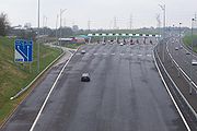
Tolls
Until the early 21st century, tolls were generally only applied to major bridges and tunnels, for example the Dartford CrossingDartford Crossing
The Dartford - Thurrock River Crossing, Dartford River Crossing is a major road crossing of the River Thames in England, connecting Dartford in the south to Thurrock in the north, via two road tunnels and the Queen Elizabeth II Bridge. It opened in stages, the west tunnel in 1963, the east tunnel...
and Forth Road Bridge
Forth Road Bridge
The Forth Road Bridge is a suspension bridge in east central Scotland. The bridge, opened in 1964, spans the Firth of Forth, connecting the capital city Edinburgh, at South Queensferry, to Fife, at North Queensferry...
. There were two public toll roads (Roydon Road in Stanstead Abbots and College Road in Dulwich
Dulwich
Dulwich is an area of South London, England. The settlement is mostly in the London Borough of Southwark with parts in the London Borough of Lambeth...
) and about five private toll roads. The UK's first privately operated motorway opened in 2003. The M6 Toll
M6 Toll
The M6 Toll , connects M6 Junction 4 at the NEC to M6 Junction 11A at Wolverhampton with of six-lane motorway. The weekday cash cost is £5.30 for a car and £10.60 for a HGV...
(originally the Birmingham Northern Relief Road) is designed to relieve the M6 through Birmingham, which is one of the most heavily used roads in the country. In 2005, the Government published proposals for a UK wide road pricing
Road pricing
Road pricing is an economic concept regarding the various direct charges applied for the use of roads. The road charges includes fuel taxes, licence fees, parking taxes, tolls, and congestion charges, including those which may vary by time of day, by the specific road, or by the specific vehicle...
scheme. This was designed to be revenue neutral, with other motoring taxes to be reduced to compensate. The plans have been extremely controversial with 1.8 million people signing a petition against them.
Congestion charges
England's first modern-day congestion charge was introduced in Durham in October 2002. In London, vehicles entering parts of centralCentral London
Central London is the innermost part of London, England. There is no official or commonly accepted definition of its area, but its characteristics are understood to include a high density built environment, high land values, an elevated daytime population and a concentration of regionally,...
and west London
London
London is the capital city of :England and the :United Kingdom, the largest metropolitan area in the United Kingdom, and the largest urban zone in the European Union by most measures. Located on the River Thames, London has been a major settlement for two millennia, its history going back to its...
are required to pay a daily charge under the London congestion charge
London congestion charge
The London congestion charge is a fee charged for some categories of motor vehicle to travel at certain times within the Congestion Charge Zone , a traffic area in London. The charge aims to reduce congestion, and raise investment funds for London's transport system...
. The power to introduce a form of congestion charge was given to any future mayor in the Greater London Authority Act 1999
Greater London Authority Act 1999
The Greater London Authority Act 1999 is the Act of Parliament that established the Greater London Authority, the London Assembly and the Mayor of London....
. Having won the first mayoral election in 2000, Ken Livingstone
Ken Livingstone
Kenneth Robert "Ken" Livingstone is an English politician who is currently a member of the centrist to centre-left Labour Party...
opted to exercise these powers as promised in his independent manifesto, and carried out a series of consultations with interested parties. The basic scheme was agreed in February 2002, and charging commenced, with some concessions accepted, on 17 February 2003. On introduction, the scheme was the largest ever undertaken by a capital city
Capital City
Capital City was a television show produced by Euston Films which focused on the lives of investment bankers in London living and working on the corporate trading floor for the fictional international bank Shane-Longman....
. The extension of the zone into West London came into effect on 19 February 2007, despite the majority of residents opposing it in the two consultations. In April 2003 the Dartford Crossing
Dartford Crossing
The Dartford - Thurrock River Crossing, Dartford River Crossing is a major road crossing of the River Thames in England, connecting Dartford in the south to Thurrock in the north, via two road tunnels and the Queen Elizabeth II Bridge. It opened in stages, the west tunnel in 1963, the east tunnel...
toll, which was due to be withdrawn that month as the cost of construction had been paid for and a sufficient maintenance fund accumulated, was instead converted into a congestion charge.
Proposals in Edinburgh
Edinburgh
Edinburgh is the capital city of Scotland, the second largest city in Scotland, and the eighth most populous in the United Kingdom. The City of Edinburgh Council governs one of Scotland's 32 local government council areas. The council area includes urban Edinburgh and a rural area...
for a system of a £2 charge for one of two cordons were rejected following a public referendum
Referendum
A referendum is a direct vote in which an entire electorate is asked to either accept or reject a particular proposal. This may result in the adoption of a new constitution, a constitutional amendment, a law, the recall of an elected official or simply a specific government policy. It is a form of...
in 2005 by 74% of the votes cast.
A later proposal for a Manchester congestion charge scheme was cancelled in December 2008 when a majority of voters in each council area voted against it in a referendum. Unlike the current version of the London charge, two cordons would have been used, one covering the urban area of Manchester
Manchester
Manchester is a city and metropolitan borough in Greater Manchester, England. According to the Office for National Statistics, the 2010 mid-year population estimate for Manchester was 498,800. Manchester lies within one of the UK's largest metropolitan areas, the metropolitan county of Greater...
and another covering the city centre
Manchester City Centre
Manchester city centre is the central business district of Manchester, England. It lies within the Manchester Inner Ring Road, next to the River Irwell...
.
Road traffic safety
The United Kingdom is among the best countries in the world for road safety and is still improving, but the improvement has not kept pace with those in Sweden and the Netherlands.In June 2008 the Road Safety Foundation reported that 30 per cent of the primary route network in Great Britain failed to rate as safe, and a quarter of all motorways were outside the safest risk band.
The 8 miles (12.9 km) Cat and Fiddle Road
Cat and Fiddle Road
The Cat and Fiddle is a road in England running between Buxton, Derbyshire and Macclesfield, Cheshire, named after the public house at its summit. Formed by parts of the A537, A54 and A53 it is famous for its scenic views across the Greater Manchester conurbation, Peak District National Park and...
between Macclesfield and Buxton was named as Britain’s most dangerous road. The single-carriageway road has been the scene of 43 fatal or serious collisions since 2001, nearly three-quarters of them involving motorcyclists. When collisions involving motorcyclists are removed from the analysis, the A61
A61 road
The A61 is a major trunk road in England. It runs from Derby to Thirsk in North Yorkshire. From Derby, it heads north via Alfreton, Clay Cross, Chesterfield, Sheffield, Barnsley, Wakefield, Leeds, Harrogate and Ripon...
between Barnsley
Barnsley
Barnsley is a town in South Yorkshire, England. It lies on the River Dearne, north of the city of Sheffield, south of Leeds and west of Doncaster. Barnsley is surrounded by several smaller settlements which together form the Metropolitan Borough of Barnsley, of which Barnsley is the largest and...
and Wakefield
Wakefield
Wakefield is the main settlement and administrative centre of the City of Wakefield, a metropolitan district of West Yorkshire, England. Located by the River Calder on the eastern edge of the Pennines, the urban area is and had a population of 76,886 in 2001....
was found to be the most dangerous road in Britain.
Between 2003 and 2006, the most improved safety record was for the A453
A453 road
The A453 road was formerly the main trunk road connecting the English cities of Nottingham and Birmingham. However, the middle section of this mainly single-carriageway road has largely been downgraded to B roads or unclassified roads following the construction of the parallel M42-A42 link around...
from the A38
A38 road
The A38, part of which is also known as the Devon Expressway, is a major A-class trunk road in England.The road runs from Bodmin in Cornwall to Mansfield in Nottinghamshire. It is long, making it one of the longest A-roads in England. It was formerly known as the Leeds — Exeter Trunk Road,...
to Tamworth
Tamworth
Tamworth is a town and local government district in Staffordshire, England, located north-east of Birmingham city centre and north-west of London. The town takes its name from the River Tame, which flows through the town, as does the River Anker...
in Staffordshire
Staffordshire
Staffordshire is a landlocked county in the West Midlands region of England. For Eurostat purposes, the county is a NUTS 3 region and is one of four counties or unitary districts that comprise the "Shropshire and Staffordshire" NUTS 2 region. Part of the National Forest lies within its borders...
. This rural single carriageway saw an 88 per cent drop in the number of fatal or serious collisions in the last six years, taking it from a medium risk road to one of the safest. According to the Foundation, this has been achieved by introducing traffic lights, speed limit reductions and village pedestrian facilities.
Research undertaken in July 2008 has shown that investment in a safe road infrastructure programme could yield a one-third reduction in road deaths, saving as much as £6 billion per year. A consortium of 13 major road safety stakeholders have formed the Campaign for Safe Road Design
Campaign for Safe Road Design
The Campaign for Safe Road Design is a partnership between 13 UK major road safety stakeholders that is calling for the UK Government to invest in a safe road infrastructure which in their view could cut deaths on British roads by 33%.-Aims:...
, which is calling on the UK Government to make safe road design a national transport priority.
Administration
Responsibility for the road network differs between trunkTrunk road
A trunk road, trunk highway, or strategic road is a major road—usually connecting two or more cities, ports, airports, and other things.—which is the recommended route for long-distance and freight traffic...
and non trunk routes. Trunk roads, which are the most important roads, are administered by the Highways Agency
Highways Agency
The Highways Agency is an executive agency, part of the Department for Transport in England. It has responsibility for managing the core road network in England...
in England
England
England is a country that is part of the United Kingdom. It shares land borders with Scotland to the north and Wales to the west; the Irish Sea is to the north west, the Celtic Sea to the south west, with the North Sea to the east and the English Channel to the south separating it from continental...
, Transport Scotland
Transport Scotland
Transport Scotland was created on 1 January 2006 as the national transport agency of Scotland. It is an Executive Agency of the Scottish Government's Enterprise, Transport and Lifelong Learning Department and accountable to Scottish Ministers...
in Scotland
Scotland
Scotland is a country that is part of the United Kingdom. Occupying the northern third of the island of Great Britain, it shares a border with England to the south and is bounded by the North Sea to the east, the Atlantic Ocean to the north and west, and the North Channel and Irish Sea to the...
and the Department of Economy and Transport in Wales
Wales
Wales is a country that is part of the United Kingdom and the island of Great Britain, bordered by England to its east and the Atlantic Ocean and Irish Sea to its west. It has a population of three million, and a total area of 20,779 km²...
. England's 6500 miles (10,461 km) of trunk roads account for 33% of all road travel and 50% of lorry
Lorry
-Transport:* Lorry or truck, a large motor vehicle* Lorry, or a Mine car in USA: an open gondola with a tipping trough* Lorry , a horse-drawn low-loading trolley-In fiction:...
travel. Scotland has 2174 miles (3,499 km) (about 7% of the total roads in Scotland), accounting for 35% of all road journeys and over 50% of lorry movements. Wales has 1000 miles (1,609.3 km) of trunk roads. In London
London
London is the capital city of :England and the :United Kingdom, the largest metropolitan area in the United Kingdom, and the largest urban zone in the European Union by most measures. Located on the River Thames, London has been a major settlement for two millennia, its history going back to its...
, Transport for London
Transport for London
Transport for London is the local government body responsible for most aspects of the transport system in Greater London in England. Its role is to implement the transport strategy and to manage transport services across London...
is responsible for all trunk roads and other major roads, which are part of the Transport for London Road Network. All other roads are the responsibility of the relevant County Council
County council
A county council is the elected administrative body governing an area known as a county. This term has slightly different meanings in different countries.-United Kingdom:...
or unitary authority
Unitary authority
A unitary authority is a type of local authority that has a single tier and is responsible for all local government functions within its area or performs additional functions which elsewhere in the relevant country are usually performed by national government or a higher level of sub-national...
. In Northern Ireland
Northern Ireland
Northern Ireland is one of the four countries of the United Kingdom. Situated in the north-east of the island of Ireland, it shares a border with the Republic of Ireland to the south and west...
, the Roads Service Northern Ireland is responsible for all 5592 miles (8,999.4 km) roads. The pan-British total is 24,559 km.
Whilst generally they are trunk roads, several motorways are the responsibility of local authorities, for example the M275
M275 motorway
The M275 is a long, dual three-lane motorway in the county of Hampshire, southern England. It is the principal route for entering and leaving Portsmouth. It continues as the A3 into Portsmouth, and meets the M27 at its northern terminus...
.
During design, planning, maintenance and construction, metric
Metric system
The metric system is an international decimalised system of measurement. France was first to adopt a metric system, in 1799, and a metric system is now the official system of measurement, used in almost every country in the world...
is used. As a result (and anticipating that the roadsigns themselves will one day be changed to display in metric units) recently-erected signs are increasingly being placed at metric intervals but display an imperial unit as required by the current road-signage rules. For example, a 110 yd
Yard
A yard is a unit of length in several different systems including English units, Imperial units and United States customary units. It is equal to 3 feet or 36 inches...
marker might actually be placed at the 100 m distance. Since 2008, location marker posts
Driver location signs
Driver location signs are English highway route markers, first introduced in 2003, that complement distance marker posts. Both types of marker post display the distances from a nominal start point in kilometres...
have appeared on motorways and major A roads in England, situated generally at intervals of 500 metres (though the dimension is not given). These repeat the information given on the co-sited surveyors' marker post which, since the 1960's have reported distances on such roads in kilometres from a datum - usually the start of the road, or the planned start-point of the road.
Iron Age
The earliest evidence of engineered roads dates to the first century BC. A metalled and cambered road, 1.5 metres high and six metres wide, was unearthed at Bayston Hill quarry, near ShrewsburyShrewsbury
Shrewsbury is the county town of Shropshire, in the West Midlands region of England. Lying on the River Severn, it is a civil parish home to some 70,000 inhabitants, and is the primary settlement and headquarters of Shropshire Council...
. A timber road was preserved in peat in Geldeston
Geldeston
Geldeston is a parish in Norfolk. It is about 1 mile west of Gillingham and 2 miles north west of Beccles. Other nearby villages include Ellingham and Broome to the west. It covers an area of and had a population of 398 in 161 households as of the 2001 census....
, Norfolk
Norfolk
Norfolk is a low-lying county in the East of England. It has borders with Lincolnshire to the west, Cambridgeshire to the west and southwest and Suffolk to the south. Its northern and eastern boundaries are the North Sea coast and to the north-west the county is bordered by The Wash. The county...
, with tree rings suggesting a date of 75 BC, likely built by the Iceni
Iceni
The Iceni or Eceni were a British tribe who inhabited an area of East Anglia corresponding roughly to the modern-day county of Norfolk between the 1st century BC and the 1st century AD...
tribe.
Roman Britain
Roads built in the first phase of Roman occupation (43–68 AD) connected London with the ports used in the invasion (ChichesterChichester
Chichester is a cathedral city in West Sussex, within the historic County of Sussex, South-East England. It has a long history as a settlement; its Roman past and its subsequent importance in Anglo-Saxon times are only its beginnings...
and Richborough
Richborough
Richborough is a settlement north of Sandwich on the east coast of the county of Kent, England. Richborough lies close to the Isle of Thanet....
), and with the earlier legionary bases at Colchester
Colchester
Colchester is an historic town and the largest settlement within the borough of Colchester in Essex, England.At the time of the census in 2001, it had a population of 104,390. However, the population is rapidly increasing, and has been named as one of Britain's fastest growing towns. As the...
(Camulodunum
Camulodunum
Camulodunum is the Roman name for the ancient settlement which is today's Colchester, a town in Essex, England. Camulodunum is claimed to be the oldest town in Britain as recorded by the Romans, existing as a Celtic settlement before the Roman conquest, when it became the first Roman town, and...
), Lincoln
Lincoln, Lincolnshire
Lincoln is a cathedral city and county town of Lincolnshire, England.The non-metropolitan district of Lincoln has a population of 85,595; the 2001 census gave the entire area of Lincoln a population of 120,779....
(Lindum
Lindum Colonia
Lindum Colonia was a town in the Roman province of Britannia. Today it is called Lincoln, in the English county of Lincolnshire.-Fort and name:...
), Wroxeter
Wroxeter
Wroxeter is a village in Shropshire, England. It forms part of the civil parish of Wroxeter and Uppington and is located in the Severn Valley about south-east of Shrewsbury.-History:...
(Viroconium), Gloucester
Gloucester
Gloucester is a city, district and county town of Gloucestershire in the South West region of England. Gloucester lies close to the Welsh border, and on the River Severn, approximately north-east of Bristol, and south-southwest of Birmingham....
and Exeter
Exeter
Exeter is a historic city in Devon, England. It lies within the ceremonial county of Devon, of which it is the county town as well as the home of Devon County Council. Currently the administrative area has the status of a non-metropolitan district, and is therefore under the administration of the...
. As Roman influence expanded, so did the network, until around 180 A.D. when the known network was complete.
Few Roman roads extended into Scotland
Scotland
Scotland is a country that is part of the United Kingdom. Occupying the northern third of the island of Great Britain, it shares a border with England to the south and is bounded by the North Sea to the east, the Atlantic Ocean to the north and west, and the North Channel and Irish Sea to the...
due to their inability to subjugate the local population. Part of the Scottish Lowlands
Scottish Lowlands
The Scottish Lowlands is a name given to the Southern half of Scotland.The area is called a' Ghalldachd in Scottish Gaelic, and the Lawlands ....
came under Roman control in 142, and the Antonine Wall
Antonine Wall
The Antonine Wall is a stone and turf fortification built by the Romans across what is now the Central Belt of Scotland, between the Firth of Forth and the Firth of Clyde. Representing the northernmost frontier barrier of the Roman Empire, it spanned approximately 39 miles and was about ten feet ...
was constructed on the northern boundary. However, the Roman legions withdrew in 164 to their former northern boundary, Hadrian's Wall
Hadrian's Wall
Hadrian's Wall was a defensive fortification in Roman Britain. Begun in AD 122, during the rule of emperor Hadrian, it was the first of two fortifications built across Great Britain, the second being the Antonine Wall, lesser known of the two because its physical remains are less evident today.The...
.
The primary function of Roman roads was to allow the rapid movement of troops and military supplies, but it also provided vital infrastructure for trade and the transport of goods. The roads were paved, a first for the island, and could carry heavy goods in all weathers. Following the Roman withdrawal from Britain, road maintenance became a very ad-hoc activity.
Medieval roads
A network of roadways was developed in Britain in the middle agesMiddle Ages
The Middle Ages is a periodization of European history from the 5th century to the 15th century. The Middle Ages follows the fall of the Western Roman Empire in 476 and precedes the Early Modern Era. It is the middle period of a three-period division of Western history: Classic, Medieval and Modern...
to supplement the use of rivers as a system of transportation. Many of these roadways were developed as a result of trading of goods and services, such as wool
Wool
Wool is the textile fiber obtained from sheep and certain other animals, including cashmere from goats, mohair from goats, qiviut from muskoxen, vicuña, alpaca, camel from animals in the camel family, and angora from rabbits....
, sheep, cattle
Cattle
Cattle are the most common type of large domesticated ungulates. They are a prominent modern member of the subfamily Bovinae, are the most widespread species of the genus Bos, and are most commonly classified collectively as Bos primigenius...
and salt
Salt
In chemistry, salts are ionic compounds that result from the neutralization reaction of an acid and a base. They are composed of cations and anions so that the product is electrically neutral...
. They linked together market town
Market town
Market town or market right is a legal term, originating in the medieval period, for a European settlement that has the right to host markets, distinguishing it from a village and city...
s, towns with bridge
Bridge
A bridge is a structure built to span physical obstacles such as a body of water, valley, or road, for the purpose of providing passage over the obstacle...
s, harbours and ports. Other roadways developed to meet the needs of pilgrim
Pilgrim
A pilgrim is a traveler who is on a journey to a holy place. Typically, this is a physical journeying to some place of special significance to the adherent of a particular religious belief system...
s visiting shrine
Shrine
A shrine is a holy or sacred place, which is dedicated to a specific deity, ancestor, hero, martyr, saint, daemon or similar figure of awe and respect, at which they are venerated or worshipped. Shrines often contain idols, relics, or other such objects associated with the figure being venerated....
s, such as Walsingham
Walsingham
Walsingham is a village in the English county of Norfolk. The village is famed for its religious shrines in honour of the Virgin Mary and as a major pilgrimage centre...
, and for transporting corpses from isolated communities to local graveyard
Graveyard
A graveyard is any place set aside for long-term burial of the dead, with or without monuments such as headstones...
s.
Pre 20th century
The first legislated control in EnglandEngland
England is a country that is part of the United Kingdom. It shares land borders with Scotland to the north and Wales to the west; the Irish Sea is to the north west, the Celtic Sea to the south west, with the North Sea to the east and the English Channel to the south separating it from continental...
was introduced under the Highways Act 1555
Highways Act 1555
The Highways Act 1555 , sometimes the First Statute of Highways, was an Act of Parliament of the Parliament of England passed in 1555...
. Road rates were introduced in England and Wales in the seventeenth century. The first turnpike road, whereby travellers paid tolls to be used for road upkeep, was authorised by the Highways Act 1663 for a section of the Great North Road in Hertfordshire
Hertfordshire
Hertfordshire is a ceremonial and non-metropolitan county in the East region of England. The county town is Hertford.The county is one of the Home Counties and lies inland, bordered by Greater London , Buckinghamshire , Bedfordshire , Cambridgeshire and...
. The first turnpike trust
Turnpike trust
Turnpike trusts in the United Kingdom were bodies set up by individual Acts of Parliament, with powers to collect road tolls for maintaining the principal highways in Britain from the 17th but especially during the 18th and 19th centuries...
was established by the Parliament of England
Parliament of England
The Parliament of England was the legislature of the Kingdom of England. In 1066, William of Normandy introduced a feudal system, by which he sought the advice of a council of tenants-in-chief and ecclesiastics before making laws...
through a Turnpike Act in 1706. Scotland continued to maintain its own Parliament until the Acts of Union 1707
Acts of Union 1707
The Acts of Union were two Parliamentary Acts - the Union with Scotland Act passed in 1706 by the Parliament of England, and the Union with England Act passed in 1707 by the Parliament of Scotland - which put into effect the terms of the Treaty of Union that had been agreed on 22 July 1706,...
, when the two parliaments merged to form the Kingdom of Great Britain
Kingdom of Great Britain
The former Kingdom of Great Britain, sometimes described as the 'United Kingdom of Great Britain', That the Two Kingdoms of Scotland and England, shall upon the 1st May next ensuing the date hereof, and forever after, be United into One Kingdom by the Name of GREAT BRITAIN. was a sovereign...
.
In the second half of the eighteenth century, turnpike trusts became numerous, with trusts also set up in Wales and lowland Scotland. This expansion was facilitated by the ability to use mortgages to fund the work. By 1821 there were 18000 miles (28,968.1 km) of turnpike roads in England, with 1,000 trusts by 1845
The Rebecca Riots
Rebecca Riots
The Rebecca Riots took place between 1839 and 1843 in South and Mid Wales. They were a series of protests undertaken by local farmers and agricultural workers in response to perceived unfair taxation. The rioters, often men dressed as women, took their actions against toll-gates, as they were...
in Wales
Wales
Wales is a country that is part of the United Kingdom and the island of Great Britain, bordered by England to its east and the Atlantic Ocean and Irish Sea to its west. It has a population of three million, and a total area of 20,779 km²...
between 1839 and 1843 against high toll. The riots ceased after some ringleaders, John Jones (Shoni Sguborfawr) and David Davies (Dai'r Cantwr)
David Davies (Dai'r Cantwr)
David Davies, also known as Dai'r Cantwr , was a Welsh poet and lay-preacher. He was convicted and sentenced to transportation to Australia for his actions during the Rebecca Riots.-Early life:...
, were convicted and transported
Penal transportation
Transportation or penal transportation is the deporting of convicted criminals to a penal colony. Examples include transportation by France to Devil's Island and by the UK to its colonies in the Americas, from the 1610s through the American Revolution in the 1770s, and then to Australia between...
to Australia
Australia
Australia , officially the Commonwealth of Australia, is a country in the Southern Hemisphere comprising the mainland of the Australian continent, the island of Tasmania, and numerous smaller islands in the Indian and Pacific Oceans. It is the world's sixth-largest country by total area...
. Following several attempts at reform, detrunking began in the 1860s with the last trust ending in 1885. The protests prompted several reforms, including a Royal Commission into the question of toll roads. The Local Government Act 1888
Local Government Act 1888
The Local Government Act 1888 was an Act of the Parliament of the United Kingdom, which established county councils and county borough councils in England and Wales...
created borough and county councils with responsibility for maintaining the major roads.
After complaints about the first tram companies
History of Trams
Tram, streetcar or trolley systems were common throughout the industrialized world in the late 19th and early 20th centuries, but they disappeared from many cities in the mid-20th century. In recent years, they have made a comeback...
damaging the road surface, Parliament introduced the Tramways Act 1870
Tramways Act 1870
The Tramways Act 1870 was an important step in the development of urban transport in Britain. Street tramways had originated in the United States, and were introduced to Britain by George Francis Train in the 1860s, the first recorded installation being a short line from Woodside Ferry to...
, making tram
Tram
A tram is a passenger rail vehicle which runs on tracks along public urban streets and also sometimes on separate rights of way. It may also run between cities and/or towns , and/or partially grade separated even in the cities...
companies responsible for the maintenance of the shared surface of the tramway and several feet either side, as a condition of being granted a licence. This was a popular move as maintenance was removed from the public purse. The local authority could also purchase the whole line at a later date at a discount, or force the tram company to reinstate the road.
1900-1950
The Roads Act of 1920 brought in the Road FundVehicle excise duty
Vehicle Excise Duty is a vehicle road use tax levied as an excise duty which must be paid for most types of vehicle which are to be used on the public roads in the United Kingdom...
, with the Government receiving revenue from excise duty on road vehicles and from the sale of licences for horse-drawn carriages and driving licences. As road traffic began to grow, the condition of the road network became an issue, with most of it in a poor state of repair. The new Ministry of Transport
Department for Transport
In the United Kingdom, the Department for Transport is the government department responsible for the English transport network and a limited number of transport matters in Scotland, Wales and Northern Ireland which are not devolved...
created a classification system for the important routes connecting large population centres or for through traffic, with the definitive list being published in 1922/3 and revised in 1926/7.
High unemployment after the end of World War I
World War I
World War I , which was predominantly called the World War or the Great War from its occurrence until 1939, and the First World War or World War I thereafter, was a major war centred in Europe that began on 28 July 1914 and lasted until 11 November 1918...
led the Minister of Transport to provide grant funding to the County Council
County council
A county council is the elected administrative body governing an area known as a county. This term has slightly different meanings in different countries.-United Kingdom:...
s to improve roads, particularly where labour was recruited from areas of high unemployment and adjoining areas, and men with dependants. Two unemployment relief programmes were run, the first from 1920 to 1925 and the second from 1929 to 1930. Government grants were limited to trunk roads and bridges, with the money coming from the Road Fund. Some 500 miles (804.7 km) of bypasses
Bypass (road)
A bypass is a road or highway that avoids or "bypasses" a built-up area, town, or village, to let through traffic flow without interference from local traffic, to reduce congestion in the built-up area, and to improve road safety....
were built by 1935, about half of what was originally planned at the start of the programmes. In 1930, responsibility for all roads was vested in the County councils. The first inter-urban new road built in the UK was the East Lancs Road
A580 road
The A580 is a primary A road in England that connects Walton, near Liverpool and Salford, near Manchester and known officially as Liverpool-East Lancashire Road. Locally, the road is shortened to the "East Lancs". The road was designed and built to provide better access to the Port of Liverpool for...
, which was built between 1929 and 1934 at a cost of £8 million.
For the first time since the Roman occupation
Roman Britain
Roman Britain was the part of the island of Great Britain controlled by the Roman Empire from AD 43 until ca. AD 410.The Romans referred to the imperial province as Britannia, which eventually comprised all of the island of Great Britain south of the fluid frontier with Caledonia...
, the Ministry of Transport took direct control of the core road network through the Trunk Roads Act 1936. During the 1930s both the Institution of Highway Engineers and The County Surveyors' Society had published plans for a network of high speed roads, whilst the Minister of Transport
Secretary of State for Transport
The Secretary of State for Transport is the member of the cabinet responsible for the British Department for Transport. The role has had a high turnover as new appointments are blamed for the failures of decades of their predecessors...
, Leslie Burgin
Leslie Burgin
Edward Leslie Burgin was a British Liberal and later Liberal National politician in the 1930s.Burgin trained as a solicitor specialising in international law and served as principal and director of legal studies to the Law Society...
, also visited the autobahn under construction in Germany
Germany
Germany , officially the Federal Republic of Germany , is a federal parliamentary republic in Europe. The country consists of 16 states while the capital and largest city is Berlin. Germany covers an area of 357,021 km2 and has a largely temperate seasonal climate...
. Lancashire County Council
Lancashire County Council
Lancashire County Council is the upper-tier local authority for the non-metropolitan county of Lancashire, England. It currently consists of 84 councillors, and is controlled by the Conservative Party, who won control of the council in the local council elections in June 2009, ending 28 years of...
proposed a new scheme for a motorway and it was agreed to go ahead. This was, however, postponed due to the start of World War II
World War II
World War II, or the Second World War , was a global conflict lasting from 1939 to 1945, involving most of the world's nations—including all of the great powers—eventually forming two opposing military alliances: the Allies and the Axis...
.
During World War II, government plans were drawn up to create a new network of high speed routes across the country. The passing of the Special Roads Act 1949
Special Roads Act 1949
The Special Roads Act 1949 was an Act of the Parliament of the United Kingdom that:*Authorised the construction of special roads*Allowed these roads to be restricted to specific types of vehicles...
gave the government legal powers to build roads that were not automatically rights of way for certain types of user.
1950-1979
In 1958 the first motorway was opened as the Preston Bypass, now part of the M6 motorwayM6 motorway
The M6 motorway runs from junction 19 of the M1 at the Catthorpe Interchange, near Rugby via Birmingham then heads north, passing Stoke-on-Trent, Manchester, Preston, Carlisle and terminating at the Gretna junction . Here, just short of the Scottish border it becomes the A74 which continues to...
. The first major motorway to open was the M1
M1 motorway
The M1 is a north–south motorway in England primarily connecting London to Leeds, where it joins the A1 near Aberford. While the M1 is considered to be the first inter-urban motorway to be completed in the United Kingdom, the first road to be built to motorway standard in the country was the...
between Crick
Crick, Northamptonshire
Crick is a village in the Daventry district of the county of Northamptonshire in England. It is close to the border with Warwickshire, west of Rugby and north-west of Northampton. The villages of Crick and West Haddon were by-passed by the A428 main road from Rugby to Northampton when the...
and Berrygrove.
In 1963 a report on urban transport planning policy, Traffic in Towns
Traffic in Towns
Traffic in Towns was an influential report and popular book on urban and transport planning policy produced in 1963 for the UK Ministry of Transport by a team headed by the architect, civil engineer and planner Professor Sir Colin Buchanan....
, was produced for the UK Department of Transport
Department for Transport
In the United Kingdom, the Department for Transport is the government department responsible for the English transport network and a limited number of transport matters in Scotland, Wales and Northern Ireland which are not devolved...
by a team headed by the architect
Architect
An architect is a person trained in the planning, design and oversight of the construction of buildings. To practice architecture means to offer or render services in connection with the design and construction of a building, or group of buildings and the space within the site surrounding the...
, civil engineer
Civil engineer
A civil engineer is a person who practices civil engineering; the application of planning, designing, constructing, maintaining, and operating infrastructures while protecting the public and environmental health, as well as improving existing infrastructures that have been neglected.Originally, a...
and planner Colin Buchanan
Colin Buchanan (town planner)
Professor Sir Colin D Buchanan was a British town planner. He became Britain's most famous planner following the publication ofTraffic in Towns in 1963, which presented a comprehensive view of the issues surrounding the growth of personal car ownership and urban traffic in the UK.-Life:Buchanan...
. While it advocated the construction and reorganisation of towns to accommodate the motor car and lorry, it stressed that this would have to be balanced with restrictions, in accordance with local needs. It highlighted the urgency of the problem of dealing with the expected massive growth in road traffic, the damage it could cause to our towns and cities if unplanned, the eventual need for demand management
Transportation Demand Management
Transportation demand management, traffic demand management or travel demand management is the application of strategies and policies to reduce travel demand , or to redistribute this demand in space or in time.In transport as in any network, managing demand can be a cost-effective alternative to...
but with implications of restricting the mass of the population from doing something they didn't see as wrong, and of the inevitable need for a change in policy as the social costs increased.
In 1966 a revision of design standards was proposed which would, it was stated, save "acres of land" and £22,000 per mile in construction costs. The revision involved reducing from 10 ft (3 m) to 5 ft (1.5 m) the width of roadside grass verges on newly constructed "rural" motorways, and removing 1 foot (0.3 m) of the width of the "marginal strips" that separated each carriageway from the central reservation.
The 1968-9 Ministry of Transport report Roads in England planned to complement the new interurban routes with £1bn of new urban trunk roads outside London in order to "alleviate traffic congestion", complemented by parking controls, traffic management and public transport.
The first 1000 miles (1,609.3 km) of motorway had been built by 1972 and more motorways opened into the 1980s;
Whilst roads outside urban areas continued to be built throughout the 1970s, the urban routes soon ran into opposition. Plans by the Greater London Council
Greater London Council
The Greater London Council was the top-tier local government administrative body for Greater London from 1965 to 1986. It replaced the earlier London County Council which had covered a much smaller area...
for a series of ringways
London Ringways
The London Ringways were a series of four ring roads planned in the 1960s to circle London at various distances from the city centre. They were part of a comprehensive scheme developed by the Greater London Council to alleviate traffic congestion on the city's road system by providing high speed...
were cancelled following extensive protests headed by Homes before Roads
Homes before Roads
Homes before Roads was a 1970s political movement and campaign in the United Kingdom initially formed in London in 1970 to oppose plans to construct a system of four interlinked concentric motorways through and around London, known as Ringways...
and a rise in costs. Plans to widen the Archway Road in London were also hit by determined opposition over a 20 year period from the 1970s.
Whilst work on planning motorways in Northern Ireland had begun prior to the Second World War, the legal authority for motorways was not provided for until the Special Roads Act (Northern Ireland) 1963, similar to that in the 1949 Act. The first motorway to open was the M1 motorway
M1 motorway (Northern Ireland)
The M1 is a motorway in Northern Ireland. It is the longest motorway in Northern Ireland and runs for from Belfast to Dungannon through County Down and County Armagh...
in 1962, though did so under temporary powers until the Special Roads Act had been passed. Work on the motorways continued until the 1970s, when the oil crisis
1973 oil crisis
The 1973 oil crisis started in October 1973, when the members of Organization of Arab Petroleum Exporting Countries or the OAPEC proclaimed an oil embargo. This was "in response to the U.S. decision to re-supply the Israeli military" during the Yom Kippur war. It lasted until March 1974. With the...
and The Troubles
The Troubles
The Troubles was a period of ethno-political conflict in Northern Ireland which spilled over at various times into England, the Republic of Ireland, and mainland Europe. The duration of the Troubles is conventionally dated from the late 1960s and considered by many to have ended with the Belfast...
both intervened, causing the abandonment of many schemes.
1979-1997
The Conservative government of Margaret ThatcherPremiership of Margaret Thatcher
The Premiership of Margaret Thatcher began on 4 May 1979, with a mandate to reverse the UK's economic decline and to reduce the role of the state in the economy...
from 1979 adopted a pro roads policy. During this period numerous road upgrades were built and the M25 motorway
M25 motorway
The M25 motorway, or London Orbital, is a orbital motorway that almost encircles Greater London, England, in the United Kingdom. The motorway was first mooted early in the 20th century. A few sections, based on the now abandoned London Ringways plan, were constructed in the early 1970s and it ...
was completed. In 1989 it announced a large-scale roads programme (stated to be the largest since the Romans) in the Roads for Prosperity
Roads for Prosperity
Roads for Prosperity was a controversial white paper published by the Conservative UK Government in 1989 detailing the 'largest road building program for the UK since the Romans' produced in response to rapid increases in car ownership and use over the previous decade...
White Paper
White paper
A white paper is an authoritative report or guide that helps solve a problem. White papers are used to educate readers and help people make decisions, and are often requested and used in politics, policy, business, and technical fields. In commercial use, the term has also come to refer to...
. It proposed 500 road schemes at a cost of £
Pound sterling
The pound sterling , commonly called the pound, is the official currency of the United Kingdom, its Crown Dependencies and the British Overseas Territories of South Georgia and the South Sandwich Islands, British Antarctic Territory and Tristan da Cunha. It is subdivided into 100 pence...
23 billion and foresaw an increase of road traffic of 142 percent by 2025. It would have involved the doubling of the trunk road capacity with around 150 bypasses
Bypass (road)
A bypass is a road or highway that avoids or "bypasses" a built-up area, town, or village, to let through traffic flow without interference from local traffic, to reduce congestion in the built-up area, and to improve road safety....
being built, caricatured in later years as predict and provide, whereby the government predicted the required capacity in forthcoming years and built roads to match. From 1985 to 1995, the road network expanded by 24000 miles (38,624 km).
John Major
Sir John Major, is a British Conservative politician, who served as Prime Minister of the United Kingdom and Leader of the Conservative Party from 1990–1997...
. In the early 1990s the government decided to complete the M3 motorway
M3 motorway
The M3 motorway runs in England for approximately from Sunbury-on-Thames, Surrey, to Southampton, Hampshire and forms an unsigned section European route E05. It is dual three lanes as far as Junction 8 near Basingstoke and then dual two lane until Junction 9 near Winchester and then dual three...
by building a six lane road in a cutting through Twyford Down
Twyford Down
Twyford Down is a small area of ancient chalk downland lying directly to the southeast of Winchester, Hampshire, England. The down's summit, known as Deacon Hill, is towards the north-eastern edge of the area which is renowned for its dramatic rolling scenery, ecologically rich grassland and as a...
. This attracted the first direct action
Direct action
Direct action is activity undertaken by individuals, groups, or governments to achieve political, economic, or social goals outside of normal social/political channels. This can include nonviolent and violent activities which target persons, groups, or property deemed offensive to the direct action...
protests against a major road in the country. Construction work was delayed considerably, and anti roads protesters gained large amounts of publicity. The Newbury bypass
Newbury bypass
The Newbury bypass, officially known as The Winchester-Preston Trunk Road , is a stretch of dual carriageway road which bypasses the town of Newbury in Berkshire, England...
saw some of the largest protests against a road in the UK. Proposed originally in the 1980s, the bypass was subject to strong support and opposition. Also in this time frame, the M11 link road protest
M11 link road protest
The M11 link road protest was a major anti-road protest in east London, United Kingdom, in the early 1990s opposing the construction of the "A12 Hackney to M11 link road", also known as the M11 Link Road...
saw protracted disturbance during the upgrading of a section of the A12 through east London. Costs increased rapidly, the Newbury bypass being 50% over budget and many other schemes showed increases of 100%.
The Standing Advisory Committee on Trunk Road Assessment had also concluded in 1994 that building new roads simply generated more traffic, and was therefore largely self-defeating. By 1994, following the recession of the early 1990s a significant number of remaining schemes were cancelled, although the government still intended to continue with others using private financing. The Secretary for state for transport, Dr Brian Mawhinney
Brian Mawhinney
Brian Stanley Mawhinney, Baron Mawhinney PC is a British Conservative Party politician. He was a member of the Cabinet from 1994 until 1997 and a Member of Parliament from 1979 until 2005.-Early life:...
launched a 'Great Debate' about the future direction for transport in the UK and the required level of road building stating that the road network was "broadly complete".
A major Royal Commission
Royal Commission
In Commonwealth realms and other monarchies a Royal Commission is a major ad-hoc formal public inquiry into a defined issue. They have been held in various countries such as the United Kingdom, Australia, Canada, New Zealand, and Saudi Arabia...
report, 'Transport and the Environment
Transport and the Environment (1994 report)
The Transport and the Environment report, published in 1994, was the 18th report published by the Royal Commission on Environmental Pollution. It provided a detailed and comprehensive study of the environmental impact of transport in the United Kingdom and was chaired by Sir John Houghton...
' was published in October 1994 highlight the serious environmental consequences of UK's transport system in response to which the New Scientist
New Scientist
New Scientist is a weekly non-peer-reviewed English-language international science magazine, which since 1996 has also run a website, covering recent developments in science and technology for a general audience. Founded in 1956, it is published by Reed Business Information Ltd, a subsidiary of...
commented "Rarely, if ever, can a ministry have emerged so badly from an official report as John MacGregor's old department" in an article titled "Head-on collision over transport: The British government has received its sternest warning yet that its unflagging support for the car is seriously at odds with its own green principles".
The last new motorway in the United Kingdom (The M3 motorway
M3 motorway (Northern Ireland)
The M3 is an urban motorway 0.8 miles in length owned by Siac Construction and Cintra, S.A. that connects the M2 in north Belfast, Northern Ireland to the A2 Sydenham Bypass in east Belfast. It is the shortest motorway in Northern Ireland, and one of the busiest, carrying 60,000 vehicles per...
in Northern Ireland) opened in 1994. In 1996 the total length of motorways reached 2000 miles (3,218.7 km).
1997 - the present day
After the election of the Labour government in 1997, most remaining road schemes were cancelled and problem areas of the road network subject to multi-modalModal share
Modal share, Mode split or Modal split, is a traffic / transport term that describes the number of trips or percentage of travelers using a particular type of transportation....
studies to investigate non-road alternatives, following the introduction of the A New Deal for Trunk Roads in England
A New Deal for Trunk Roads in England
A New Deal for Trunk Roads in England was a response to the A New Deal for Transport: Better for everyone report reviewing the UK Government's strategic roads programme based on criteria of accessibility, safety, economy, environment and integration.-Overview:...
White Paper.
In 1998, it was proposed to transfer parts of the English trunk road network to local councils, retaining central control for the network connecting major population centres, ports, airports, key cross-border links and the Trans-European Road Network
Trans-European road network
The Trans-European road network was defined by Council Decision 93/629/EEC of October 29, 1993, and is a project to improve the internal road infrastructure of the European Union...
. Around 40% of the network was transferred to local authorities.
In 2002 the government proposed a new major road building program with 360 miles (579.4 km) of the strategic road network to be widened, 80 major new trunk road schemes to improve safety and 100 new bypasses on trunk and local roads. The protesters reformed.
In 2004 the Government announced in the Queen's speech a major new funding source from transport schemes, the Transport Innovation Fund (TIF)
Transport Innovation Fund (TIF)
The Transport Innovation Fund was a transport funding mechanism in England, that has been replaced by the Urban Challenge Fund in March 2010. Its creation was announced by Her Majesty's Government in the July 2004 White Paper, ’The Future of Transport’...
.
In 2007 a new Planning Bill
United Kingdom Planning Bill
The Planning Act 2008 is an Act of the Parliament of the United Kingdom intended to speed up the process for approving major new infrastructure projects such as airports, roads, harbours, energy facilities such as nuclear power and waste facilities...
was introduced to parliament which would speed up the process of approving new roads and other transport infrastructure but which has raised concerns that it may erode democracy
and be a "developer's charter".
Traffic has increased by 80% between 1980 and 2005 whilst road capacity has increased by 10%.
See also
- Transport in the United KingdomTransport in the United KingdomTransport in the United Kingdom is facilitated with road, air, rail, and water networks. A radial road network totals of main roads, of motorways and of paved roads. The National Rail network of 10,072 route miles in Great Britain and 189 route miles in Northern Ireland carries over 18,000...
- Roads in the Isle of Man
- Roads in Northern IrelandRoads in Northern IrelandThe main roads in Northern Ireland, which connect well with those in the south, are classified "M"/"A"/"B" as in Great Britain. Whereas the roads in Great Britain are numbered according to a zonal system, there is no available explanation for the allocation of road numbers in Northern Ireland,...
External links
- Highways Agency network map
- Map of Scottish Trunk Roads
- International Transport Statistics Database: Transport in Great Britain
- EuroRAP GB Tracking Survey Results 2008
- Pathetic Motorways, a list of unusual or "lost" motorways in Britain