
Trunk road
Encyclopedia
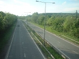
_1.jpg)
Road
A road is a thoroughfare, route, or way on land between two places, which typically has been paved or otherwise improved to allow travel by some conveyance, including a horse, cart, or motor vehicle. Roads consist of one, or sometimes two, roadways each with one or more lanes and also any...
—usually connecting two or more cities
City
A city is a relatively large and permanent settlement. Although there is no agreement on how a city is distinguished from a town within general English language meanings, many cities have a particular administrative, legal, or historical status based on local law.For example, in the U.S...
, port
Port
A port is a location on a coast or shore containing one or more harbors where ships can dock and transfer people or cargo to or from land....
s, airport
Airport
An airport is a location where aircraft such as fixed-wing aircraft, helicopters, and blimps take off and land. Aircraft may be stored or maintained at an airport...
s, and other things.—which is the recommended route for long-distance and freight traffic. Many trunk roads have segregated lanes in a dual carriageway
Dual carriageway
A dual carriageway is a class of highway with two carriageways for traffic travelling in opposite directions separated by a central reservation...
, or are motorway standard.
United Kingdom
In the United KingdomUnited Kingdom
The United Kingdom of Great Britain and Northern IrelandIn the United Kingdom and Dependencies, other languages have been officially recognised as legitimate autochthonous languages under the European Charter for Regional or Minority Languages...
, Trunk Roads were first defined for Great Britain
Great Britain
Great Britain or Britain is an island situated to the northwest of Continental Europe. It is the ninth largest island in the world, and the largest European island, as well as the largest of the British Isles...
in the Trunk Roads Act 1936. Thirty major road
Road
A road is a thoroughfare, route, or way on land between two places, which typically has been paved or otherwise improved to allow travel by some conveyance, including a horse, cart, or motor vehicle. Roads consist of one, or sometimes two, roadways each with one or more lanes and also any...
s were classed as Trunk Roads and the Minister of Transport
Department for Transport
In the United Kingdom, the Department for Transport is the government department responsible for the English transport network and a limited number of transport matters in Scotland, Wales and Northern Ireland which are not devolved...
took direct control of them and the bridges across them. This development did not extend to Northern Ireland
Northern Ireland
Northern Ireland is one of the four countries of the United Kingdom. Situated in the north-east of the island of Ireland, it shares a border with the Republic of Ireland to the south and west...
, which has always had a separate system of highway and road traffic law.
At that time, 4500 miles (7,242 km) of British road were classified as Trunk Roads. Additional roads have been 'trunked', notably in the Trunk Roads Act 1946. Others, like virtually all British motorways, have entered the system as a result of new construction. As of 2004, Great Britain
Great Britain
Great Britain or Britain is an island situated to the northwest of Continental Europe. It is the ninth largest island in the world, and the largest European island, as well as the largest of the British Isles...
has 7,845 miles (12,625 km) of Trunk Roads, of which 2,161 miles (3,478 km) are motorways. http://www.dft.gov.uk/stellent/groups/dft_transstats/documents/page/dft_transstats_041575.xls
Trunk roads in England
England
England is a country that is part of the United Kingdom. It shares land borders with Scotland to the north and Wales to the west; the Irish Sea is to the north west, the Celtic Sea to the south west, with the North Sea to the east and the English Channel to the south separating it from continental...
are managed by the Highways Agency
Highways Agency
The Highways Agency is an executive agency, part of the Department for Transport in England. It has responsibility for managing the core road network in England...
. Scotland
Scotland
Scotland is a country that is part of the United Kingdom. Occupying the northern third of the island of Great Britain, it shares a border with England to the south and is bounded by the North Sea to the east, the Atlantic Ocean to the north and west, and the North Channel and Irish Sea to the...
has had responsibility for its own trunk roads since 1955; these are currently managed by Transport Scotland
Transport Scotland
Transport Scotland was created on 1 January 2006 as the national transport agency of Scotland. It is an Executive Agency of the Scottish Government's Enterprise, Transport and Lifelong Learning Department and accountable to Scottish Ministers...
. Wales
Wales
Wales is a country that is part of the United Kingdom and the island of Great Britain, bordered by England to its east and the Atlantic Ocean and Irish Sea to its west. It has a population of three million, and a total area of 20,779 km²...
has had responsibility for its trunk roads since 1965. England has 4,814 miles (7,747 km), Scotland has 1,982 miles (3,190 km) and Wales has 1,048 miles (1,687 km) of trunk roads, inclusive of motorways. The Highways Agency also have a full network map of trunk roads and motorways in England.
Most interurban trunk roads are "primary routes", the category of recommended roads for long distance and freight transport, but not all primary routes are trunk roads, the difference being that trunk roads are maintained by central government bodies rather than the local councils. Primary routes are identified by their direction signs, which feature white text on a green background with route numbers in yellow. Trunk roads, like other 'A' roads, can either be single- or dual-carriageway.
Trunk roads were often listed on older maps with a "T" in brackets after their number so as to distinguish them from non-trunk parts of the same road, however this addition is no longer included on current Ordnance Survey
Ordnance Survey
Ordnance Survey , an executive agency and non-ministerial government department of the Government of the United Kingdom, is the national mapping agency for Great Britain, producing maps of Great Britain , and one of the world's largest producers of maps.The name reflects its creation together with...
maps which simply distinguish between primary and non-primary 'A' roads. A trunk road which has been upgraded to motorway standard can sometimes retain its original "A" number but with an "M" in brackets to denote that motorway regulations apply on it. Long distance examples of this are the A1(M) in England
England
England is a country that is part of the United Kingdom. It shares land borders with Scotland to the north and Wales to the west; the Irish Sea is to the north west, the Celtic Sea to the south west, with the North Sea to the east and the English Channel to the south separating it from continental...
, and the A74(M)
A74 road
The A74 was a major trunk road in the United Kingdom, linking Glasgow in Scotland to Carlisle in the North West of England. The road has been largely replaced by the A74 and M74 motorways and now only one short stub remains....
in Scotland
Scotland
Scotland is a country that is part of the United Kingdom. Occupying the northern third of the island of Great Britain, it shares a border with England to the south and is bounded by the North Sea to the east, the Atlantic Ocean to the north and west, and the North Channel and Irish Sea to the...
.
De-trunking: United Kingdom
It is possible for roads to become 'de-trunked' to non-trunk roads (county 'A' roads in the UK), for example when superseded by a motorway following a similar route. When a road is 'detrunked' signposts are often replaced, making the route of the original road harder to follow.In some places however, the road number will change and will usually be signposted in the style "B000, was A00", although repeated changes can lead to such oddities as "A5183, was A5" (between St Albans
St Albans
St Albans is a city in southern Hertfordshire, England, around north of central London, which forms the main urban area of the City and District of St Albans. It is a historic market town, and is now a sought-after dormitory town within the London commuter belt...
and Redbourn
Redbourn
Redbourn is a village and civil parish in Hertfordshire, United Kingdom, lying on Watling Street, 3 miles from Harpenden, 4 miles from St Albans and 5 miles from Hemel Hempstead. It has a population of around 6,000.-History:...
).
In England the government has de-trunked much of the trunk road network since the late 1990s, transferring responsibility to local councils to allow the Highways Agency
Highways Agency
The Highways Agency is an executive agency, part of the Department for Transport in England. It has responsibility for managing the core road network in England...
to concentrate on a selection of core trunk routes, mostly dual carriageways and motorways.
Ireland
In the Republic of IrelandRepublic of Ireland
Ireland , described as the Republic of Ireland , is a sovereign state in Europe occupying approximately five-sixths of the island of the same name. Its capital is Dublin. Ireland, which had a population of 4.58 million in 2011, is a constitutional republic governed as a parliamentary democracy,...
major roads were previously classified under an old system
Trunk Roads in Ireland
Ireland has an extensive network of public roads which connect all parts of the country with each other. Roads in Ireland are currently classified as motorways, National Primary routes, National secondary routes, Regional roads and Local roads. The introduction of this classification system began...
as Trunk Roads, and had route numbers prefixed by "T". Connecting roads were classified as Link Roads, and had route numbers prefixed by "L". Many of these roads had their origins in historic routes
History of Roads in Ireland
There have been routes and trackways in Ireland connecting settlements and facilitating trade since ancient times and the country now has an extensive network of public roads connecting all parts of the island.-Early history:...
, including turnpike roads.
Although a number of old road signs
Road signs in the Republic of Ireland
Road signs in Ireland mostly differ from the traffic signs used elsewhere in Europe. Directional signage is similar to that of the United Kingdom, but is bilingual. Distances are in kilometres. Apart from directional signage, the basic prohibitory signs such as "no left turn" and "no right turn"...
using these route designations may still be encountered, Ireland
Republic of Ireland
Ireland , described as the Republic of Ireland , is a sovereign state in Europe occupying approximately five-sixths of the island of the same name. Its capital is Dublin. Ireland, which had a population of 4.58 million in 2011, is a constitutional republic governed as a parliamentary democracy,...
has long since adopted a newer classification scheme of National Primary
National primary road
A national primary road is a road classification in the Republic of Ireland. National primary roads form the major routes between the major urban centres. There are over 2,700km of national primary roads. This category of road has the prefix "N" followed by one or two digits...
and National Secondary
National secondary road
A national secondary road is a category of road in Ireland. These roads form an important part of the national route network, but are secondary to the main arterial routes which are classified as national primary roads. National secondary roads are designated with route numbers higher than those...
routes ("N" roads), Regional road
Regional road
A regional road in Ireland is a class of road not forming a major route , but nevertheless forming a link in the national route network. There are over 11,600 kilometres of regional roads. Regional roads are numbered with three digit route numbers, prefixed by "R" A regional road in Ireland is a...
s ("R" roads), and Local roads
Local Roads in Ireland
A Local Road in Ireland is a class of public road not classified as a National road or as a Regional road but nevertheless forming a link in the national network of roads...
("L"-prefixed roads). Local roads were previously not signposted, although they are now signposted in many areas of the country.
The current "L"-prefixed Local roads are not connected with the previous "L"-prefixed Link Road classification.
De-trunking: Ireland
Some former Trunk RoadsTrunk Roads in Ireland
Ireland has an extensive network of public roads which connect all parts of the country with each other. Roads in Ireland are currently classified as motorways, National Primary routes, National secondary routes, Regional roads and Local roads. The introduction of this classification system began...
, or sections of former Trunk Roads, became non-trunk Regional roads under the new road numbering system introduced in the 1970s and 1980s. More recently, sections of some National Primary routes which have been bypassed by motorways
Motorways in the Republic of Ireland
In Ireland, the highest category of road is a Motorway , indicated by the prefix M followed by one or two digits...
or other road improvement schemes have been downgraded to Regional road status.
United States
Though the term trunk road is not commonly used in American EnglishAmerican English
American English is a set of dialects of the English language used mostly in the United States. Approximately two-thirds of the world's native speakers of English live in the United States....
, the U.S. highway and Interstate highway systems can be considered American trunk highways. However, individual states are responsible for actual highway construction and maintenance, even though the federal government helps fund these activities as long as the states enact certain laws and enforce them. (Such laws have included the raising of the minimum drinking age and the lowering of speed limits.) Each state maintains all of its roads and tries to integrate them into a system appropriate for that state. Notably, the states of Michigan, Minnesota, and Wisconsin designate their highways as "state trunklines" and "state trunk highways," respectively.
China
ChinaPeople's Republic of China
China , officially the People's Republic of China , is the most populous country in the world, with over 1.3 billion citizens. Located in East Asia, the country covers approximately 9.6 million square kilometres...
has begun development of the National Trunk Highway System (NTHS), which will create many east-west and north-south highways, plus seven radials heading out of the capital, Beijing
Beijing
Beijing , also known as Peking , is the capital of the People's Republic of China and one of the most populous cities in the world, with a population of 19,612,368 as of 2010. The city is the country's political, cultural, and educational center, and home to the headquarters for most of China's...
.
Sweden
The most important roads in Sweden are labeled national trunk road. In 1992, the parliament decided upon which roads were to become national trunk roads. They are considered recommended main roads for long-distance traffic.National trunk roads are planned nationally, as opposed to other roads who are planned locally. They also have a special, slightly larger budget. However, they aren't signed in any special way. Therefore drivers won't notice any difference in signage, numbering, road standard or map marking from other national roads. Some national roads are only considered trunk for part of their length. National road 73 and National road 75 are both built to motorway standard, have high traffic but are not considered trunk. European routes are always trunk everywhere in Sweden, and are more visible with special numbering.
List of swedish trunk roads
- E4European route E4European route E 4 passes from north to south through Sweden from the border with Finland, total length . The Finnish part lies entirely within Tornio in northern Finland, and is actually only long...
, all the way Helsingborg–Stockholm–Gävle–Sundsvall–Haparanda - E6European route E6European route E 6 is the designation for the main north-south road in Norway, and the west coast of Sweden, running from the southern tip of Sweden, at Trelleborg, into Norway and through almost all of the country north to Finnmark. The route ends close to the Norwegian border with Russia...
, all the way Trelleborg–Göteborg–Svinesund - E10European route E10European route E 10 is a road part of the International E-road network. It begins in Å, Norway and ends in Luleå, Sweden. The road is about 850 km in length...
, all the way Töre–Riksgränsen - E12European route E12European route E 12 is a road that is part of the International E-road network. It begins in Mo i Rana, Norway, tranverses Sweden and ends in Helsinki, Finland, with a ferry line between Sweden and Finland. The part within Finland is Finnish national highway 3...
, all the way from Holmsund to the norwegian border - E14European route E14European route E 14 is a road part of the International E-road network. It begins in Trondheim, Norway and ends in Sundsvall, Sweden. The road is in length....
, all the way Sundsvall–Storlien - E18European route E18European route E18 runs from Craigavon in the United Kingdom to Saint Petersburg in Russia, passing through Norway, Sweden, and Finland. It is about 1,890 km in length.-United Kingdom:...
, all the way norwegian border-Karlstad-Örebro-Stockholm-Kapellskär - E20European route E20The European route E 20 is part of the United Nations International E-road network.It runs roughly west-east through Ireland, the United Kingdom, Denmark, Sweden, Estonia and finally Russia. The length is . The road is not continuous, at three points, a sea crossing is required. ...
, all the way Malmö–Göteborg–Örebro–Stockholm - E22European route E22The European route E 22 is one of the longest European routes. It has a length of about . Many of the E-roads have been extended into Asia since the year 2000; the E 22 was extended on 24 June 2002.-United Kingdom:...
, all the way Malmö–Karlskrona–Norrköping - E45European route E45The European route E 45 goes between Sweden and Italy, through Denmark, Germany and Austria. With a length of about , it is the longest north-south European route...
, all the way Göteborg–Trollhättan–Grums–Mora–Östersund–Storuman–Karesuando - E65European route E65European route E 65 is a north-south Class-A European route that begins in Malmö, Sweden and ends in Chaniá, Greece. The road is about in length.-Itinerary:* Sweden** E 65: Malmö – Ystad* Baltic sea, ferry Ystad-Świnoujście* Poland...
, all the way Malmö–Ystad - Riksväg 25, all the way Halmstad–Växjö–Kalmar
- Riksväg 26, all the way Halmstad–Jönköping–Kristinehamn–Mora)
- Riksväg 40, all the way Göteborg–Jönköping–Västervik
- Riksväg 50, only Ödeshög–Falun
- Riksväg 56, all the way sträckan Norrköping–Katrineholm–Kungsör–Västerås–Sala–Gävle
- Riksväg 70, all the way Enköping–Mora
- Riksväg 71, all the way Malung–Borlänge
- Riksväg 80, all the way Falun–Gävle
- Länsväg 239, only from the norwegian border to Torsby
See also
- British Road Numbering Scheme
- HighwayHighwayA highway is any public road. In American English, the term is common and almost always designates major roads. In British English, the term designates any road open to the public. Any interconnected set of highways can be variously referred to as a "highway system", a "highway network", or a...
- Motorway
- Off-network tactical diversion routeOff-Network Tactical Diversion RouteIn the United Kingdom, Emergency Diversion Routes are planned road traffic routes that bypass the main trunk road network.Emergency Diversion routes provide the public with a pre-planned, checked and agreed junction to junction diversion route that circumnavigates an incident which has resulted in...
- Post roadPost roadFor other uses, see Post Road .A post road is a road designated for the transportation of postal mail. In past centuries only major towns had a post house, and the roads used by post riders or mail coaches to carry mail among them were particularly important ones or, due to the special attention...