

Pacific Coast Ranges
Encyclopedia
Canada
Canada is a North American country consisting of ten provinces and three territories. Located in the northern part of the continent, it extends from the Atlantic Ocean in the east to the Pacific Ocean in the west, and northward into the Arctic Ocean...
) and the Pacific Mountain System (in the United States
United States
The United States of America is a federal constitutional republic comprising fifty states and a federal district...
) are the series of mountain range
Mountain range
A mountain range is a single, large mass consisting of a succession of mountains or narrowly spaced mountain ridges, with or without peaks, closely related in position, direction, formation, and age; a component part of a mountain system or of a mountain chain...
s that stretch along the West Coast of North America
North America
North America is a continent wholly within the Northern Hemisphere and almost wholly within the Western Hemisphere. It is also considered a northern subcontinent of the Americas...
from Alaska
Alaska
Alaska is the largest state in the United States by area. It is situated in the northwest extremity of the North American continent, with Canada to the east, the Arctic Ocean to the north, and the Pacific Ocean to the west and south, with Russia further west across the Bering Strait...
south to Northern and Central Mexico
Mexico
The United Mexican States , commonly known as Mexico , is a federal constitutional republic in North America. It is bordered on the north by the United States; on the south and west by the Pacific Ocean; on the southeast by Guatemala, Belize, and the Caribbean Sea; and on the east by the Gulf of...
. Both the Canadian and United States portions are often referred to as Pacific Coast Ranges.
The Pacific Coast Ranges are part of the North American Cordillera
North American Cordillera
The North American Cordillera is the North American portion of the American Cordillera which is a cordillera extending up and down the western side of the Americas. The North American Cordillera covers an extensive area of mountain ranges, intermontane basins, and plateaus in western North...
(sometimes known as the Western Cordillera, or in Canada
Canada
Canada is a North American country consisting of ten provinces and three territories. Located in the northern part of the continent, it extends from the Atlantic Ocean in the east to the Pacific Ocean in the west, and northward into the Arctic Ocean...
, as the Pacific Cordillera and/or the Canadian Cordillera), which includes the Rocky Mountains
Rocky Mountains
The Rocky Mountains are a major mountain range in western North America. The Rocky Mountains stretch more than from the northernmost part of British Columbia, in western Canada, to New Mexico, in the southwestern United States...
, Columbia Mountains
Columbia Mountains
The Columbia Mountains are a group of mountain ranges located in southeastern British Columbia, and partially in Montana, Idaho and Washington. The mountain range covers 135,952 km² . The range is bounded by the Rocky Mountain Trench on the east, and the Kootenay River on the south; their...
, Interior Mountains
Interior Mountains
The Interior Mountains, also called the Northern Interior Mountains and Interior Ranges, are the semi-official names for a huge area that comprises much of the northern two thirds of the Canadian province of British Columbia and a large area of southern Yukon...
, the Interior Plateau
Interior Plateau
The Interior Plateau comprises a large region of central British Columbia, and lies between the Cariboo and Monashee Mountains on the east, and the Hazelton Mountains, Coast Mountains and Cascade Range on the west. The continuation of the plateau into the United States is known there as the...
, Sierra Nevada Mountains, the Great Basin mountain ranges, and other ranges and various plateaus and basins.
The Pacific Coast Ranges designation, however, only applies to the Western System of the Western Cordillera, which comprises the Saint Elias Mountains
Saint Elias Mountains
The Saint Elias Mountains are a subgroup of the Pacific Coast Ranges, located in southeastern Alaska in the United States, southwestern Yukon and the very far northwestern part of British Columbia in Canada. The range spans Wrangell-St. Elias National Park and Preserve in the USA and Kluane...
, Coast Mountains
Coast Mountains
The Coast Mountains are a major mountain range, in the Pacific Coast Ranges, of western North America, extending from southwestern Yukon through the Alaska Panhandle and virtually all of the Coast of British Columbia. They are so-named because of their proximity to the sea coast, and are often...
, Insular Mountains
Insular Mountains
The Insular Mountains are a range of mountains in the Pacific Coast Ranges on the coast of British Columbia, Canada, comprising the Vancouver Island Ranges and Queen Charlotte Mountains. The Insular Mountains are rugged, particularly on Vancouver Island where peaks in Strathcona Provincial Park...
, Olympic Mountains
Olympic Mountains
The Olympic Mountains is a mountain range on the Olympic Peninsula of western Washington in the United States. The mountains, part of the Pacific Coast Ranges, are not especially high - Mount Olympus is the highest at - but the western slopes of the Olympics rise directly out of the Pacific...
, Cascade Range
Cascade Range
The Cascade Range is a major mountain range of western North America, extending from southern British Columbia through Washington and Oregon to Northern California. It includes both non-volcanic mountains, such as the North Cascades, and the notable volcanoes known as the High Cascades...
, Oregon Coast Range
Oregon Coast Range
The Oregon Coast Range, often called simply the Coast Range and sometimes the Pacific Coast Range, is a mountain range, in the Pacific Coast Ranges physiographic region, in the U.S. state of Oregon along the Pacific Ocean...
, California Coast Ranges, Transverse Ranges
Transverse Ranges
The Transverse Ranges are a group of mountain ranges of southern California, in the Pacific Coast Ranges physiographic region that runs along the Pacific coast from Alaska to Mexico in North America. The Transverse Ranges begin at the southern end of the California Coast Ranges and lie between...
, Peninsular Ranges
Peninsular Ranges
The Peninsular Ranges are a group of mountain ranges, in the Pacific Coast Ranges, which stretch from southern California in the United States to the southern tip of Mexico's Baja California peninsula; they are part of the North American Coast Ranges that run along the Pacific coast from Alaska...
, and the Sierra Nevada Mountains.
Other uses
The term Coast Range is used by the United States Geological SurveyUnited States Geological Survey
The United States Geological Survey is a scientific agency of the United States government. The scientists of the USGS study the landscape of the United States, its natural resources, and the natural hazards that threaten it. The organization has four major science disciplines, concerning biology,...
to refer only to the ranges south from the Strait of Juan de Fuca
Strait of Juan de Fuca
The Strait of Juan de Fuca is a large body of water about long that is the Salish Sea outlet to the Pacific Ocean...
in Washington to the California-Mexico border; and only the ranges west of Puget Sound, the Willamette valley, the Sacramento
Sacramento Valley
The Sacramento Valley is the portion of the California Central Valley that lies to the north of the San Joaquin-Sacramento Delta in the U.S. state of California. It encompasses all or parts of ten counties.-Geography:...
and San Joaquin
San Joaquin Valley
The San Joaquin Valley is the area of the Central Valley of California that lies south of the Sacramento – San Joaquin River Delta in Stockton...
valleys or 'California Central Valley
California Central Valley
California's Central Valley is a large, flat valley that dominates the central portion of California. It is home to California's most productive agricultural efforts. The valley stretches approximately from northwest to southeast inland and parallel to the Pacific Ocean coast. Its northern half is...
' (thereby excluding the Sierra Nevada and Cascade Ranges), and the Mojave
Mojave Desert
The Mojave Desert occupies a significant portion of southeastern California and smaller parts of central California, southern Nevada, southwestern Utah and northwestern Arizona, in the United States...
(High)
High Desert (California)
The High Desert is an unofficial and vaguely-defined geographic area of southern California located to the northeast of the San Gabriel Mountains. The term "High Desert" is used most commonly by the news media, especially in weather forecasts, and in the names of businesses and organizations...
and Sonoran
Sonoran Desert
The Sonoran Desert is a North American desert which straddles part of the United States-Mexico border and covers large parts of the U.S. states of Arizona and California and the northwest Mexican states of Sonora, Baja California, and Baja California Sur. It is one of the largest and hottest...
(Low)
Low Desert
The Low Desert is a common name for one the Deserts of California regional areas, that includes the Colorado Desert and Yuha Desert in the Southern California portion of the Sonoran Desert...
Deserts.
i.e. the Pacific Border province
Pacific Border province
The Pacific Border province is a physiographic province of the Physiographic regions of the world physical geography system.-Description:The Pacific Border province encompasses most of the North American Pacific Coast, with the southern end at the start of the Lower California-Peninsular Ranges...
. The same term is used informally in Canada to refer to the Coast Mountains
Coast Mountains
The Coast Mountains are a major mountain range, in the Pacific Coast Ranges, of western North America, extending from southwestern Yukon through the Alaska Panhandle and virtually all of the Coast of British Columbia. They are so-named because of their proximity to the sea coast, and are often...
and adjoining inland ranges such as the Hazelton Mountains
Hazelton Mountains
The Hazelton Mountains are a grouping of mountain ranges on the inland lee of the Kitimat Ranges of the Coast Mountains in northwestern British Columbia, Canada, spanning the area of Hazelton, British Columbia south to the Nechako Reservoir...
, and sometimes also the (Saint Elias Mountains)
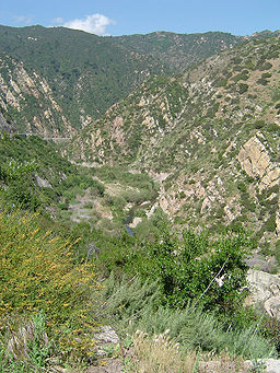
Geography
The character of the ranges varies considerably, from the record-setting tidewater glaciers in the ranges of Alaska, to the rugged Central and Southern CaliforniaSouthern California
Southern California is a megaregion, or megapolitan area, in the southern area of the U.S. state of California. Large urban areas include Greater Los Angeles and Greater San Diego. The urban area stretches along the coast from Ventura through the Southland and Inland Empire to San Diego...
ranges, the Transverse Ranges
Transverse Ranges
The Transverse Ranges are a group of mountain ranges of southern California, in the Pacific Coast Ranges physiographic region that runs along the Pacific coast from Alaska to Mexico in North America. The Transverse Ranges begin at the southern end of the California Coast Ranges and lie between...
and Peninsular Ranges
Peninsular Ranges
The Peninsular Ranges are a group of mountain ranges, in the Pacific Coast Ranges, which stretch from southern California in the United States to the southern tip of Mexico's Baja California peninsula; they are part of the North American Coast Ranges that run along the Pacific coast from Alaska...
, in the chaparral and woodlands
California chaparral and woodlands
The California chaparral and woodlands is a terrestrial ecoregion of lower northern, central, and southern California and northwestern Baja California , located on the west coast of North America...
ecoregion with Oak Woodland
California oak woodland
California oak woodland is a plant community found throughout the California chaparral and woodlands ecoregion of California in the United States and northwestern Baja California in Mexico...
, Chaparral
Chaparral
Chaparral is a shrubland or heathland plant community found primarily in the U.S. state of California and in the northern portion of the Baja California peninsula, Mexico...
shrub forest or Coastal sage scrub
Coastal sage scrub
Coastal sage scrub is a low scrubland plant community found in the California chaparral and woodlands ecoregion of coastal California and northern Baja California. It is characterized by low-growing aromatic, and drought-deciduous shrubs adapted to the semi-arid Mediterranean climate of the...
-covering them. The coastline is often dropping steeply into the sea with photogenic views. Along the British Columbia
British Columbia
British Columbia is the westernmost of Canada's provinces and is known for its natural beauty, as reflected in its Latin motto, Splendor sine occasu . Its name was chosen by Queen Victoria in 1858...
and Alaska coast, the mountains intermix with the sea in a complex maze of fjords, with thousands of islands. Off the Southern California coast the Channel Islands
Channel Islands of California
The Channel Islands of California are a chain of eight islands located in the Pacific Ocean off the coast of Southern California along the Santa Barbara Channel in the United States of America...
archipelago
Archipelago
An archipelago , sometimes called an island group, is a chain or cluster of islands. The word archipelago is derived from the Greek ἄρχι- – arkhi- and πέλαγος – pélagos through the Italian arcipelago...
of the Santa Monica Mountains
Santa Monica Mountains
The Santa Monica Mountains are a Transverse Range in Southern California, along the coast of the Pacific Ocean in the United States.-Geography:...
extends for 160 miles.
There are coastal plains at the mouths of rivers that have punched through the mountains spreading sediments, most notably at the Copper River
Copper River (Alaska)
The Copper River or Ahtna River is a 300-mile river in south-central Alaska in the United States. It drains a large region of the Wrangell Mountains and Chugach Mountains into the Gulf of Alaska...
in Alaska, the Fraser River
Fraser River
The Fraser River is the longest river within British Columbia, Canada, rising at Fraser Pass near Mount Robson in the Rocky Mountains and flowing for , into the Strait of Georgia at the city of Vancouver. It is the tenth longest river in Canada...
in British Columbia, and the Columbia River
Columbia River
The Columbia River is the largest river in the Pacific Northwest region of North America. The river rises in the Rocky Mountains of British Columbia, Canada, flows northwest and then south into the U.S. state of Washington, then turns west to form most of the border between Washington and the state...
between Washington and Oregon. In California: the Sacramento
Sacramento River
The Sacramento River is an important watercourse of Northern and Central California in the United States. The largest river in California, it rises on the eastern slopes of the Klamath Mountains, and after a journey south of over , empties into Suisun Bay, an arm of the San Francisco Bay, and...
and San Joaquin
San Joaquin River
The San Joaquin River is the largest river of Central California in the United States. At over long, the river starts in the high Sierra Nevada, and flows through a rich agricultural region known as the San Joaquin Valley before reaching Suisun Bay, San Francisco Bay, and the Pacific Ocean...
Rivers' San Francisco Bay
San Francisco Bay
San Francisco Bay is a shallow, productive estuary through which water draining from approximately forty percent of California, flowing in the Sacramento and San Joaquin rivers from the Sierra Nevada mountains, enters the Pacific Ocean...
, the Santa Clara River's
Santa Clara River (California)
The Santa Clara River is approximately long, located in southern California in the United States. It drains an area of the coastal mountains north of Los Angeles. The Santa Clara is one of the largest river systems along the coast of Southern California and one of only a few remaining river...
Oxnard Plain
Oxnard Plain
The Oxnard Plain is a large coastal plain in southwest Ventura County, California bounded by the Santa Monica Mountains, the Santa Susana Mountains, and Oak Ridge to the east, the Topatopa Mountains to the north, the Santa Clara River Valley to the northeast and the Pacific Ocean to the south and...
(home to some of the most fertile soil in the world), the Los Angeles, San Gabriel, and Santa Ana Rivers' Los Angeles Basin
Los Angeles Basin
The Los Angeles Basin is the coastal sediment-filled plain located between the Peninsular and Transverse ranges in southern California in the United States containing the central part of the city of Los Angeles as well as its southern and southeastern suburbs...
- a coastal sediment-filled plain between the peninsular and transverse ranges with sediment in the basin up to 6 miles (10 km) deep, and the San Diego River's Mission Bay.
From the vicinity of San Francisco Bay north, it is common in winter for cool unstable air masses from the Gulf of Alaska
Gulf of Alaska
The Gulf of Alaska is an arm of the Pacific Ocean defined by the curve of the southern coast of Alaska, stretching from the Alaska Peninsula and Kodiak Island in the west to the Alexander Archipelago in the east, where Glacier Bay and the Inside Passage are found.The entire shoreline of the Gulf is...
to make landfall in one of the Coast Ranges, resulting in heavy precipitation
Precipitation (meteorology)
In meteorology, precipitation In meteorology, precipitation In meteorology, precipitation (also known as one of the classes of hydrometeors, which are atmospheric water phenomena is any product of the condensation of atmospheric water vapor that falls under gravity. The main forms of precipitation...
, both as rain
Rain
Rain is liquid precipitation, as opposed to non-liquid kinds of precipitation such as snow, hail and sleet. Rain requires the presence of a thick layer of the atmosphere to have temperatures above the melting point of water near and above the Earth's surface...
and snow
Snow
Snow is a form of precipitation within the Earth's atmosphere in the form of crystalline water ice, consisting of a multitude of snowflakes that fall from clouds. Since snow is composed of small ice particles, it is a granular material. It has an open and therefore soft structure, unless packed by...
, especially on their western slopes. The same Winter weather occurs with less frequency and precipitation in Southern California, with the mountains' western faces and peaks causing an eastward rainshadow that produces the arid desert regions
Desert Region of California
The Deserts of California have unique ecosystems and habitats, a sociocultural and historical "Old West" collection of legends, districts, and communities; and a popular tourism region of dramatic natural features and recreational development...
.
Omitted from the list below, but often included is the Sierra Nevada, a major mountain range of eastern California that is separated by the Central Valley over much of its length from the California Coast Ranges and the Transverse Ranges.
Major ranges
These are the members of the Pacific Coast Ranges, from north to south:- Kenai MountainsKenai MountainsThe Kenai Mountains are a mountain range in the U.S. state of Alaska. They extend 192 km northeast from the southern end of the Kenai Peninsula to the Chugach Mountains....
, southern AlaskaAlaskaAlaska is the largest state in the United States by area. It is situated in the northwest extremity of the North American continent, with Canada to the east, the Arctic Ocean to the north, and the Pacific Ocean to the west and south, with Russia further west across the Bering Strait... - Chugach MountainsChugach MountainsThe Chugach Mountains of southern Alaska are the northernmost of the several mountain ranges that make up the Pacific Coast Ranges of the western edge of North America. The range is about 500 km long, running generally east-west. Its highest point is Mount Marcus Baker, at , but most of its...
, southern Alaska - Talkeetna MountainsTalkeetna MountainsThe Talkeetna Mountains are a mountain range in Alaska. The Matanuska and Susitna River valleys, with towns such as Trapper Creek, Talkeetna, Wasilla, Palmer, Sutton, and Chickaloon, roughly bound the Talkeetnas in the westerly parts of the range. Sovereign Mountain rises to 8849 feet in the...
, southern Alaska
- Yukon RangesYukon RangesThe Yukon Ranges are a mountain range comprising the mountains in the southeastern part of the U.S. state of Alaska and most of the Yukon, Canada...
, Alaska, YukonYukonYukon is the westernmost and smallest of Canada's three federal territories. It was named after the Yukon River. The word Yukon means "Great River" in Gwich’in....
- Wrangell MountainsWrangell MountainsThe Wrangell Mountains are a high mountain range of eastern Alaska in the United States. Much of the range is included in Wrangell-Saint Elias National Park and Preserve. The Wrangell Mountains are almost entirely volcanic in origin, and they include the second and third highest volcanoes in the...
, southern Alaska
- Wrangell Mountains
- Saint Elias MountainsSaint Elias MountainsThe Saint Elias Mountains are a subgroup of the Pacific Coast Ranges, located in southeastern Alaska in the United States, southwestern Yukon and the very far northwestern part of British Columbia in Canada. The range spans Wrangell-St. Elias National Park and Preserve in the USA and Kluane...
, southern Alaska, southwestern Yukon, far northwestern British ColumbiaBritish ColumbiaBritish Columbia is the westernmost of Canada's provinces and is known for its natural beauty, as reflected in its Latin motto, Splendor sine occasu . Its name was chosen by Queen Victoria in 1858...
- Alsek RangesAlsek RangesThe Alsek Ranges are the southeasternmost subdivision of the Saint Elias Mountains of the Pacific Cordillera. They span the region between the Alsek River, Glacier Bay and the Kelsall River...
- Fairweather RangeFairweather RangeThe Fairweather Range is the unofficial name for a mountain range located in the U.S. state of Alaska and the Canadian province of British Columbia. It is the southernmost range of the Saint Elias Mountains...
- Takshanuk MountainsTakshanuk MountainsThe Takshanuk Mountains are a mountain range in Southeast Alaska, United States that separate the Chilkoot and Chilkat watersheds and also form the northern portion of the Chilkat Peninsula....
, HainesHaines, AlaskaHaines is a census-designated place in Haines Borough, Alaska, United States. As of the 2000 census, the population of the area was 1,811. Haines was formerly a city but no longer has a municipal government...
, AlaskaAlaskaAlaska is the largest state in the United States by area. It is situated in the northwest extremity of the North American continent, with Canada to the east, the Arctic Ocean to the north, and the Pacific Ocean to the west and south, with Russia further west across the Bering Strait...
-area. Between ChilkatChilkat RiverThe Chilkat River is a river in British Columbia and southeastern Alaska that flows southward from the Coast Range to the Chilkat Inlet and ultimately Lynn Canal. It is about long. It begins at Chilkat Glacier, in Alaska, flows west and south in British Columbia for , enters Alaska and continues...
and ChilkootChilkoot RiverThe Chilkoot River is a river in Southeast Alaska, USA, which extends about from its source and covers a watershed area of . The source of the river is in the Takshanuk Mountains to the west and the Freebee glacier and unnamed mountains to the east. From its source, the upper reach of the river...
watersheds
- Fairweather Range
- Alsek Ranges
- Coast MountainsCoast MountainsThe Coast Mountains are a major mountain range, in the Pacific Coast Ranges, of western North America, extending from southwestern Yukon through the Alaska Panhandle and virtually all of the Coast of British Columbia. They are so-named because of their proximity to the sea coast, and are often...
- Boundary RangesBoundary RangesThe Boundary Ranges, also known in the singular and as the Alaska Boundary Range, are the largest and most northerly subrange of the Coast Mountains...
, southeastern Alaska, northwestern British ColumbiaBritish ColumbiaBritish Columbia is the westernmost of Canada's provinces and is known for its natural beauty, as reflected in its Latin motto, Splendor sine occasu . Its name was chosen by Queen Victoria in 1858...
- Cheja RangeCheja RangeThe Cheja Range is an icefield-bound mountain range on the inside perimeter of the Alaska Panhandle in northernwestern British Columbia, Canada. It has an area of 732 km2 and lies between the South Whiting River and the Samotua River. It is a subrange of the Boundary Ranges which in turn form...
(southeast of Taku/Whiting Rivers) - Chechidla RangeChechidla RangeThe Chechidla Range is a mountain range in northernwestern British Columbia, Canada, located about west of Dease Lake and 125–150 km south-southeast of Atlin. It has an area of 3236 km2 and lies roughly in between the Whiting and Sutlahine Rivers on the west and northwest and the Samotua...
- Chutine Icefield
- Adam MountainsAdam MountainsThe Adam Mountains, sometimes called the Adam Range, are a small mountain range in the southeastern extremity of the Alaska Panhandle, in the Ketchikan Gateway Borough near the Halleck Range. It has an area of 50 km2 and is a subrange of the Boundary Ranges which in turn form part of the Coast...
- Ashington RangeAshington RangeThe Ashington Range is a mountain range of the Boundary Ranges in northwestern British Columbia, Canada. North of the Ashington Range lies the Burniston Range....
- Burniston RangeBurniston RangeThe Burniston Range is a mountain range of the Boundary Ranges in northwestern British Columbia, Canada, located on the northeast side of Portland Canal and north of the Ashington Range....
- Dezadeash RangeDezadeash RangeThe Dezadeash Range is a mountain range in southern Yukon, Canada, located east of Haines Junction and south of the Alaska Highway. It has an area of and its appearance has a triangular shape. Although it can be considered to lie within the northern Boundary Ranges of the Coast Mountains, the...
- Florence RangeFlorence RangeThe Florence Range is a small mountain range in northwestern British Columbia, Canada, located at the southern end of Taku Arm and west of Nelson Lake. It has an area of 153 km2 and is a subrange of the Boundary Ranges which in turn form part of the Coast Mountains....
- Halleck RangeHalleck RangeThe Halleck Range is a small mountain range in southeastern Alaska, United States, located on the Alaskan side of the Portland Canal. It has an area of 127 km2 and is a subrange of the Boundary Ranges which in turn form part of the Coast Mountains. The range is located within the Misty Fjords...
- Juneau IcefieldJuneau IcefieldThe Juneau Icefield is an ice field located just north of Juneau, Alaska and continues north through the border with British Columbia and is the fifth-largest ice field in the Western Hemisphere, extending through an area of in the Coast Range ranging north to south and east to west. The...
- Kakuhan RangeKakuhan RangeThe Kakuhan Range is a mountain range in southeastern Alaska, United States, located on the east side of the Lynn Canal north of Berners Bay. It has an area of 323 km2 and is a subrange of the Boundary Ranges which in turn form part of the Coast Mountains.-References:...
- Lincoln MountainsLincoln MountainsThe Lincoln Mountains is a mountain range in southeastern Alaska, United States, located on the Alaskan side of the Portland Canal between the Salmon River and the Soule River, near the community of Hyder. It has an area of 235 km2 and is a subrange of the Boundary Ranges which in turn form...
- Longview RangeLongview RangeThe Longview Range is a small mountain range in northwestern British Columbia, Canada, located between Bowser Lake and Surveyors Creek. It has an area of 165 km2 and is a subrange of the Boundary Ranges which in turn form part of the Coast Mountains....
- Peabody MountainsPeabody MountainsThe Peabody Mountains is a mountain range in southeastern Alaska, United States, located between the lower Portland Canal and the Marten River. It has an area of 1387 km2 and is a subrange of the Boundary Ranges which in turn form part of the Coast Mountains.The range is located entirely...
- Rousseau RangeRousseau RangeThe Rousseau Range is a small mountain range in southeastern Alaska, United States, located just north of the Peabody Mountains. It has an area of 264 km2 and is a subrange of the Boundary Ranges which in turn form part of the Coast Mountains. The range is located entirely within Misty Fjords...
- Seward MountainsSeward Mountains (Alaska)The Seward Mountains is a small mountain range in southeastern Alaska, United States, located on the upper Portland Canal. It has an area of 107 km2 and is a subrange of the Boundary Ranges which in turn form part of the Coast Mountains. Part of the eastern border of Misty Fjords National...
- Snowslide RangeSnowslide RangeThe Snowslide Range is a mountain range in northwestern British Columbia, Canada, located west of the Bell-Irving River, between Treaty Creek in the south and Teigen Creek in the north. It has an area of 189 km2 and is a subrange of the Boundary Ranges which in turn form part of the Coast...
- Spectrum RangeSpectrum RangeThe Spectrum Range, formerly called the Spectrum Mountains and the Rainbow Mountains, is a subrange of the Tahltan Highland in the Stikine Country of northwestern British Columbia, 20 km west of the Stewart-Cassiar Highway, south of Mount Edziza and north of the Arctic Lake Plateau. The...
- Stikine IcecapStikine IcecapThe Stikine Icecap is a large icefield straddled on the Alaska–British Columbia boundary in the Alaska Panhandle region. It lies in the Boundary Ranges of the Coast Mountains...
- Cheja Range
- Kitimat RangesKitimat RangesThe Kitimat Ranges are one of the three main subdivisions of the Coast Mountains in British Columbia, Canada, the other being the Pacific Ranges to the south and the Boundary Ranges to the north...
BC North Coast - Pacific RangesPacific RangesThe Pacific Ranges are the southernmost subdivision of the Coast Mountains portion of the Pacific Cordillera. Located entirely within British Columbia, Canada, they run northwest from the lower stretches of the Fraser River to Bella Coola, north of which are the Kitimat Ranges.The Pacific Ranges...
BC South & Central Coast- Rainbow RangeRainbow Range (Coast Mountains)The Rainbow Range, formerly known as the Rainbow Mountains, is a mountain range in British Columbia, Canada, located northwest of Anahim Lake...
northwest Chilcotin, also classifiable as part of the Interior PlateauInterior PlateauThe Interior Plateau comprises a large region of central British Columbia, and lies between the Cariboo and Monashee Mountains on the east, and the Hazelton Mountains, Coast Mountains and Cascade Range on the west. The continuation of the plateau into the United States is known there as the...
- Pantheon RangePantheon RangeThe Pantheon Range is a subrange of the Pacific Ranges of the Coast Mountains in British Columbia. It is located between the edge of the Chilcotin Plateau at Tatla Lake on its northeast and the Klinaklini River on its west, with a southeastern boundary along Mosley Creek, a major tributary of the...
Homathko area - Niut RangeNiut RangeThe Niut Range is 3600 km² in area. It is a subrange of the Pacific Ranges of the Coast Mountains of British Columbia, although in some classifications it is considered part of the Chilcotin Ranges . The Niut and is located in the angle of the Homathko River and its main west fork, Mosley...
Homathko area - Waddington RangeWaddington RangeThe Waddington Range is a subrange of the Pacific Ranges of the Coast Mountains in southwestern British Columbia, Canada. It is only about 4000 km² in area, relatively small in area within the expanse of the range, but it is the highest area of the Pacific Ranges and of the Coast Mountains, being...
Homathko area - Whitemantle RangeWhitemantle RangeThe Whitemantle Range is a subrange of the Pacific Ranges of the Coast Mountains in British Columbia. Located between the heads of Bute Inlet on the east and Knight Inlet on the west, it is extremely rugged and glaciated...
Homathko area - Bendor RangeBendor RangeThe Bendor Range is a small but once-famous subrange of the Pacific Ranges of the Coast Mountains, about It is approximately 7,000 square kilometres in area and about 40 km long and about 18 km at its widest...
- Garibaldi RangesGaribaldi RangesThe Garibaldi Ranges are the next-to-southwesternmost subdivision of the Pacific Ranges of the Coast Mountains; only the North Shore Mountains are farther south. They lie between the valley formed by the pass between the Cheakamus River and Green River on the west and the valley of the Lillooet...
- Clendinning RangeClendinning RangeThe Clendenning Range is a subrange of the Pacific Ranges of the Coast Mountains of British Columbia. About 1500 km2 in area and lies to the northwest of the better-known Tantalus Range near Squamish...
- Tantalus RangeTantalus RangeThe Tantalus Range is a small but spectacular subrange of the Pacific Ranges of the Coast Mountains in southern British Columbia, Canada. The range is well-known to travellers to and from the ski resort at Whistler as the stunning vista on the highway to the resort from Squamish.To Sḵwxwú7mesh,...
- Chilcotin RangesChilcotin RangesThe Chilcotin Ranges are a subdivision of the Pacific Ranges of the Coast Mountains . They lie on the inland lea of the Pacific Ranges, abutting the Interior Plateau of British Columbia...
- Dickson RangeDickson RangeThe Dickson Range is a subrange of the Chilcotin Ranges subset of the Pacific Ranges of the Coast Mountains in southwest-central British Columbia. It is located just west of the town of Gold Bridge between the valley of Slim Creek to the north and Downton Lake Reservoir to the south...
- Shulaps RangeShulaps RangeThe Shulaps Range is a subrange of the Chilcotin Ranges subset of the Pacific Ranges of the Coast Mountains in southwest-central British Columbia. The range is 55 km NW–SE and 15 km SW–NE and 2,970 km² in area....
- Camelsfoot RangeCamelsfoot RangeThe Camelsfoot Range is a sub-range of the Chilcotin Ranges subdivision of the Pacific Ranges of the Coast Mountains in British Columbia.* The range is c...
- Dickson Range
- Lillooet RangesLillooet RangesThe Lillooet Ranges are the southeasternmost subdivision of the Pacific Ranges of the Coast Mountains of British Columbia. They are located between the drainage of the Lillooet River and Harrison Lake on the west and the canyon of the Fraser River on the east, and by the lowland coastal valley of...
, (Fraser Canyon west bank)'- Cantilever RangeCantilever RangeThe Cantilever Range is a subrange of the Lillooet Ranges subgrouping of the Pacific Ranges of the Coast Mountains. About 1100 km² in area and about 50 km E-W and 35 km N-S, it is located southwest of Lytton between the valleys of the Stein River and Kwoiek Creek .The Cantilever...
- Cayoosh RangeCayoosh RangeThe Cayoosh Range is the northernmost section of the Lillooet Ranges, which are a subrange of the Pacific Ranges of the Coast Mountains in British Columbia. The range is c...
- Cantilever Range
- Douglas RangesDouglas RangesThe Douglas Ranges are a subrange of the Pacific Ranges of the Coast Mountains of the Canadian province of British Columbia, about 70 km east of downtown Vancouver, north of the Fraser River and between the valleys of Stave and Harrison Lakes. They are approximately 4900 km² in area...
- Front Ranges (North Shore MountainsNorth Shore MountainsThe North Shore Mountains are a mountain range overlooking Vancouver in British Columbia, Canada. Their southernmost peaks are visible from most areas in Vancouver and form a distinctive backdrop for the city....
)
- Rainbow Range
- Boundary Ranges
- Insular MountainsInsular MountainsThe Insular Mountains are a range of mountains in the Pacific Coast Ranges on the coast of British Columbia, Canada, comprising the Vancouver Island Ranges and Queen Charlotte Mountains. The Insular Mountains are rugged, particularly on Vancouver Island where peaks in Strathcona Provincial Park...
, British Columbia- Vancouver Island RangesVancouver Island RangesThe Vancouver Island Ranges, formerly called the Vancouver Island Mountains, is a mountain range extending along the length of Vancouver Island which has an area of 31,788 km² . The Vancouver Island Ranges comprise the central and largest part of the island...
, British Columbia - Queen Charlotte MountainsQueen Charlotte MountainsThe Queen Charlotte Mountains are a mountain range comprising all mountains and small mountain ranges of Haida Gwaii , British Columbia, Canada. It is the northernmost subrange of the Insular Mountains...
, British Columbia
- Vancouver Island Ranges
- Olympic MountainsOlympic MountainsThe Olympic Mountains is a mountain range on the Olympic Peninsula of western Washington in the United States. The mountains, part of the Pacific Coast Ranges, are not especially high - Mount Olympus is the highest at - but the western slopes of the Olympics rise directly out of the Pacific...
, Washington - Cascade RangeCascade RangeThe Cascade Range is a major mountain range of western North America, extending from southern British Columbia through Washington and Oregon to Northern California. It includes both non-volcanic mountains, such as the North Cascades, and the notable volcanoes known as the High Cascades...
, British Columbia (Fraser Canyon west bank), Washington, OregonOregonOregon is a state in the Pacific Northwest region of the United States. It is located on the Pacific coast, with Washington to the north, California to the south, Nevada on the southeast and Idaho to the east. The Columbia and Snake rivers delineate much of Oregon's northern and eastern...
and CaliforniaCaliforniaCalifornia is a state located on the West Coast of the United States. It is by far the most populous U.S. state, and the third-largest by land area... - Oregon Coast RangeOregon Coast RangeThe Oregon Coast Range, often called simply the Coast Range and sometimes the Pacific Coast Range, is a mountain range, in the Pacific Coast Ranges physiographic region, in the U.S. state of Oregon along the Pacific Ocean...
, Oregon- Northern Oregon Coast RangeNorthern Oregon Coast RangeThe Northern Oregon Coast Range is the northern section of the Oregon Coast Range, in the Pacific Coast Ranges physiographic region, located in the northwest portion of the state of Oregon, United States. This section of the mountain range, part of the Pacific Coast Ranges, contains peaks as high...
- Central Oregon Coast RangeCentral Oregon Coast RangeThe Central Oregon Coast Range is the middle section of the Oregon Coast Range, in the Pacific Coast Ranges physiographic region, and located in the west-central portion of the state of Oregon, United States roughly between the Salmon River and the Umpqua River and the Willamette Valley and the...
- Southern Oregon Coast RangeSouthern Oregon Coast RangeThe Southern Oregon Coast Range is the southernmost section of the Oregon Coast Range, in the Pacific Coast Ranges, located in the southwest portion of the state of Oregon, United States roughly between the Umpqua River and the middle fork of the Coquille River, beyond which are the Klamath...
- Northern Oregon Coast Range
- Calapooya MountainsCalapooya MountainsThe Calapooya Mountains are a mountain range in Lane and Douglas counties of southwestern Oregon in the United States. The range runs for approximately west from the Cascade Range between Eugene on the north and Roseburg on the south.- Geology :...
, Oregon - Klamath-Siskiyou, Oregon, Northern California
- Klamath MountainsKlamath MountainsThe Klamath Mountains, which include the Siskiyou, Marble, Scott, Trinity, Trinity Alps, Salmon, and northern Yolla-Bolly Mountains, are a rugged lightly populated mountain range in northwest California and southwest Oregon in the United States...
, Oregon, Northern California - Siskiyou MountainsSiskiyou MountainsThe Siskiyou Mountains are a coastal mountain range in the northern Klamath Mountains in northwestern California and southwestern Oregon in the United States. They extend in an arc for approximately from east of Crescent City, California northeast along the north side of the Klamath River into...
, Oregon, Northern California - Trinity AlpsTrinity AlpsThe Trinity Alps are mountains in Northern California, in the Pacific Coast Ranges physiographic region, located to the northwest of Redding. Elevations there range from to at Thompson Peak. The Trinity Alps Wilderness covers , making it the second largest wilderness area in California...
and Salmon MountainsSalmon MountainsThe Salmon Mountains are a mountain range in Siskiyou County, California and a sub-range of the Klamath Mountains....
, Northern California - Yolla Bolly Mountains, Northern California
- Klamath Mountains
- Northern Coast Ranges, Northern California
- King Range, Northern California
- Mendocino RangeMendocino RangeThe Mendocino Range is one of several coastal mountain ranges which compose the Pacific Coast Range. This massive range of coastal mountains was formed during a period of coastal orogeny, millions of years ago. The Mendocino Range is a component of the California Coast Ranges of California...
, Northern California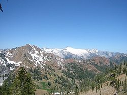
- Mayacamas Mountains, Northern California
- Marin HillsMarin HillsThe Marin Hills are a series of steep high ridges and peaks in southern Marin County. They are a part of the long Pacific Coast Ranges mountain system. The centerpoint of these hills is the 2,571 foot Mount Tamalpais near Mill Valley...
, Northern California, (including Mount TamalpaisMount TamalpaisMount Tamalpais is a peak in Marin County, California, United States, often considered symbolic of Marin County. Much of Mount Tamalpais is protected within public lands such as Mount Tamalpais State Park and the Mount Tamalpais Watershed.-Geography:...
)
- Central California Coast Ranges, Central California
- Santa Cruz MountainsSanta Cruz MountainsThe Santa Cruz Mountains, part of the Pacific Coast Ranges, are a mountain range in central California, United States. They form a ridge along the San Francisco Peninsula, south of San Francisco, separating the Pacific Ocean from San Francisco Bay and the Santa Clara Valley, and continuing south,...
, Central California - Diablo RangeDiablo RangeThe Diablo Range is a mountain range in the California Coast Ranges subdivision of the Pacific Coast Ranges. It is located in the eastern San Francisco Bay area south to the Salinas Valley area of northern California, the United States.-Geography:...
, Central California - Santa Lucia Range, Central California
- Temblor RangeTemblor RangeThe Temblor Range is a mountain range within the California Coast Ranges, at the southwestern extremity of the San Joaquin Valley in California in the United States. It runs in a northwest-southeasterly direction along the borders of Kern County and San Luis Obispo County. The name of the range is...
, Central California - Caliente RangeCaliente RangeThe Caliente Range is a west-east trending zone of uplift mountains in the Pacific Coast Ranges, in central California. They are home to 5106 foot Caliente Mountain, the highest peak in San Luis Obispo County, California.-Geologic setting:...
, Central California
- Santa Cruz Mountains
- Transverse RangesTransverse RangesThe Transverse Ranges are a group of mountain ranges of southern California, in the Pacific Coast Ranges physiographic region that runs along the Pacific coast from Alaska to Mexico in North America. The Transverse Ranges begin at the southern end of the California Coast Ranges and lie between...
, Southern California- Sierra Madre MountainsSierra Madre Mountains (California)The Sierra Madre Mountains are a mountain range in northern Santa Barbara County, California, USA. They are a portion of the Inner South Coast Ranges, representing the southernmost part, which are themselves part of the Pacific Coast Ranges of western North America. The Sierra Madre Mountains...
, Southern California - Sierra Pelona MountainsSierra Pelona MountainsThe Sierra Pelona Mountains , or the Sierra Pelona Ridge, is a mountain range in the Transverse Ranges of Southern California.. They are located within Los Angeles and Kern Counties.-Geography:...
, Southern California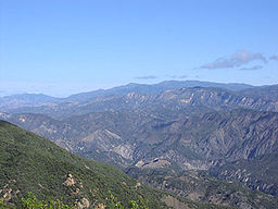
- San Emigdio MountainsSan Emigdio MountainsThe San Emigdio Mountains are a part of the Transverse Ranges in Southern California, extending from Interstate 5 at Lebec and Gorman on the east to Highway 33–166 on the west. They link the Tehachapis and Temblor Range and form the southern wall of the San Joaquin Valley.The range is within Los...
, Southern California - San Rafael MountainsSan Rafael MountainsThe San Rafael Mountains are a mountain range in central Santa Barbara County, California, U.S.. They are part of the Transverse Ranges system of Southern California which in turn are part of the Pacific Coast Ranges system of western North America....
, Southern California - Santa Ynez MountainsSanta Ynez MountainsThe Santa Ynez Mountains are a portion of the Transverse Ranges, part of the Pacific Coast Ranges of the west coast of North America, and are one of the northernmost mountain ranges in Southern California.-Geography:...
, Southern California - Tehachapi MountainsTehachapi MountainsThe Tehachapi Mountains , regionally also called The Tehachapis, are a mountain range in the Transverse Ranges system of California in the Western United States...
, Southern California - Topatopa MountainsTopatopa MountainsThe Topatopa Mountains are a mountain range in Ventura County, California, north of Santa Paula. They are part of the Transverse Ranges of Southern California. The range lies in an east-west direction northeast of the community of Ojai, and west of the Sespe Condor Sanctuary. The ranges reaches an...
, Southern California - Santa Susana MountainsSanta Susana MountainsThe Santa Susana Mountains are a transverse range of mountains in southern California, north of the city of Los Angeles, in the United States. The range runs east-west separating the San Fernando Valley and Simi Valley on its south, from Santa Clara River Valley to the north, and Santa Clarita...
, Southern California - Simi HillsSimi HillsThe Simi Hills are a low rocky mountain range of the Transverse Ranges, located in eastern Ventura County and western Los Angeles County, of southern California, United States.-Geography:...
, Southern California - Santa Monica MountainsSanta Monica MountainsThe Santa Monica Mountains are a Transverse Range in Southern California, along the coast of the Pacific Ocean in the United States.-Geography:...
, Southern California - Chalk HillsChalk HillsThe Chalk Hills are a north—south running low 'mountain' range in the San Fernando Valley perpendicular to and adjoining the Santa Monica Mountains. They are located in the Woodland Hills District of the City of Los Angeles in Southern California.-Environs:...
, Southern California - San Gabriel MountainsSan Gabriel MountainsThe San Gabriel Mountains Range is located in northern Los Angeles County and western San Bernardino County, California, United States. The mountain range lies between the Los Angeles Basin and the Mojave Desert, with Interstate 5 to the west and Interstate 15 to the east...
, Southern California - San Rafael HillsSan Rafael HillsThe San Rafael Hills are a mountain range in Los Angeles County, California. They are one of the lower Transverse Ranges, and are parallel to and below the San Gabriel Mountains to the south, adjacent to the San Gabriel Valley overlooking the Los Angeles Basin.-Geography:The Hills contain all or...
, Southern California - Puente HillsPuente HillsThe Puente Hills is a chain of hills, one of the lower Transverse Ranges, in an unincorporated area in eastern Los Angeles County, California.-Geography:...
, Southern California - San Bernardino MountainsSan Bernardino MountainsThe San Bernardino Mountains are a short transverse mountain range north and east of San Bernardino in Southern California in the United States. The mountains run for approximately 60 miles east-west on the southern edge of the Mojave Desert in southwestern San Bernardino County, north of the...
, Southern California - Little San Bernardino MountainsLittle San Bernardino MountainsThe Little San Bernardino Mountains are a short mountain range of the Transverse Ranges, located in southern California in the United States. They extend for approximately 40 mi southeast from the San Bernardino Mountains through San Bernardino and Riverside Counties to near the northeast...
, Southern California
- Sierra Madre Mountains
- Peninsular RangesPeninsular RangesThe Peninsular Ranges are a group of mountain ranges, in the Pacific Coast Ranges, which stretch from southern California in the United States to the southern tip of Mexico's Baja California peninsula; they are part of the North American Coast Ranges that run along the Pacific coast from Alaska...
, Southern California and Mexico- Santa Ana MountainsSanta Ana MountainsThe Santa Ana Mountains are a short peninsular mountain range along the coast of Southern California in the United States. They extend for approximately 36 mi southeast of the Los Angeles Basin largely along the border between Orange and Riverside counties.- Geography :The range starts in the...
, Southern California - Chino HillsChino HillsThe Chino Hills are a mountain range on the border of Orange, Los Angeles, and San Bernardino Counties, California, with a small portion in Riverside County...
, Southern California - San Jacinto MountainsSan Jacinto MountainsThe San Jacinto Mountains are a mountain range east of Los Angeles in southern California in the United States. The mountains are named for Saint Hyacinth . The Pacific Crest Trail runs along the spine of the range.The range extends for approximately from the San Bernardino Mountains southeast to...
, Southern California - Palomar Mountain RangePalomar Mountain RangeThe Palomar Mountain Range is a high Peninsular mountain range in northern San Diego County of Southern California. The name, which means pigeon roost in Spanish, was given to it due to the prevalence of Band-tailed Pigeons....
, Southern California - Laguna MountainsLaguna MountainsThe Laguna Mountains are a section of the Peninsular Ranges in eastern San Diego County, California. The mountains run in a northwest/southeast alignment for approximately ....
, Southern California - Sierra JuarezSierra de JuárezSierra de Juárez is a mountain range on the Baja California Peninsula, of Baja California, Mexico. It is part of the Peninsular Ranges. The Laguna Mountains of California lie to the north and the Sierra San Pedro Mártir lies to the south....
, Northern Baja California, Mexico - Sierra San Pedro MartirSierra San Pedro MártirSierra de San Pedro Mártir is a mountain range that is one of the Peninsular Ranges of the Baja California peninsula, Mexico. At , the highest peak is the Picacho del Diablo, also known as Cerro de la Encantada or Picacho la Providencia...
, Central Baja California, Mexico - Sierra de la GigantaSierra de la GigantaThe Sierra de la Giganta is a mountain range of Baja California Sur state in northwestern Mexico. The range extends parallel to the coast of the Gulf of California, west of the town of Loreto. The Sierra de la Giganta is one of the landforms in the Peninsular Ranges, which extend from Southern...
, Southern Baja California, Mexico - Sierra de la LagunaSierra de la LagunaThe Sierra de la Laguna is a mountain range on the Baja California Peninsula of Mexico. It lies at the southern end of the peninsula in the state of Baja California Sur, and is the southernmost range of the Peninsular Ranges....
, Southern Baja California, Mexico
- Santa Ana Mountains
- Sierra Madre OccidentalSierra Madre OccidentalThe Sierra Madre Occidental is a mountain range in western Mexico.-Setting:The range runs north to south, from just south of the Sonora–Arizona border southeast through eastern Sonora, western Chihuahua, Sinaloa, Durango, Zacatecas, Nayarit, Jalisco, Aguascalientes to Guanajuato, where it joins...
, Northwestern MexicoMexicoThe United Mexican States , commonly known as Mexico , is a federal constitutional republic in North America. It is bordered on the north by the United States; on the south and west by the Pacific Ocean; on the southeast by Guatemala, Belize, and the Caribbean Sea; and on the east by the Gulf of...
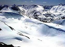
Major icefields
These are not named as ranges, but amount to the same thing. The Pacific Coast Ranges are home to the largest temperate-latitude icefields in the world.- Harding IcefieldHarding IcefieldThe Harding Icefield is an expansive icefield located in the Kenai Mountains of the Kenai Peninsula in Alaska. It is also partially located in Kenai Fjords National Park. It is named for United States President Warren G...
- Sargent IcefieldSargent IcefieldThe Sargent Icefield is a large icefield located on the eastern portion of the Kenai Peninsula bordering Prince William Sound in Alaska. The ice field has numerous outflow glaciers including the Chenega, Princeton, and Ellsworth Glaciers....
- Bagley IcefieldBagley IcefieldThe Bagley Icefield in southeastern Alaska is the largest nonpolar icefield in North America. It was named after James W. Bagley, a USGS topographic engineer who developed the Bagley T-3 camera and mapped Alaska prior to World War I...
- Kluane Icefields
- Juneau IcefieldJuneau IcefieldThe Juneau Icefield is an ice field located just north of Juneau, Alaska and continues north through the border with British Columbia and is the fifth-largest ice field in the Western Hemisphere, extending through an area of in the Coast Range ranging north to south and east to west. The...
- Stikine IcecapStikine IcecapThe Stikine Icecap is a large icefield straddled on the Alaska–British Columbia boundary in the Alaska Panhandle region. It lies in the Boundary Ranges of the Coast Mountains...
- Ha-Iltzuk IcefieldHa-Iltzuk IcefieldThe Ha-Iltzuk Icefield is an icefield in the central Pacific Ranges of the Coast Mountains in British Columbia, Canada. It is the largest icefield in the Coast Mountains south of the Alaska Panhandle, with an area of . It is located on the west side of the Klinaklini River and the Waddington Range...
(Silverthrone Glacier) - Monarch IcefieldMonarch IcefieldThe Monarch Icefield is the northernmost of a series of large continental icecaps studding the heights of the Pacific Ranges of the Coast Mountains in southern British Columbia...
- Waddington IcefieldWaddington RangeThe Waddington Range is a subrange of the Pacific Ranges of the Coast Mountains in southwestern British Columbia, Canada. It is only about 4000 km² in area, relatively small in area within the expanse of the range, but it is the highest area of the Pacific Ranges and of the Coast Mountains, being...
- Homathko IcefieldHomathko IcefieldThe Homathko Icefield is an icefield in British Columbia, Canada. Officially named the Homathko Snowfield from 1950 until the current name was adopted in 1976, it is one of the largest icefields in the southern half of the Coast Mountains, with an area of over...
- Lillooet IcecapLillooet IcecapThe Lillooet Icecap, also called the Lillooet Icefield or the Lillooet Crown, is a large icefield in the Pacific Ranges of the Coast Mountains in southwestern British Columbia, Canada. It is about northwest of the towns of Pemberton and Whistler, and about north of Vancouver, British Columbia...
(Lillooet Crown) - Pemberton IcefieldPemberton IcefieldThe Pemberton Icefield, also known unofficially as the Pemberton Icecap, is the southernmost of the series of very large icefields studding the Pacific Ranges of the southern Coast Mountains in British Columbia, Canada...
Only the largest icefields are listed above; smaller icefields may be listed on the various range pages. Formally unnamed icefields are not listed
See also
Category: Pacific Coast Ranges- Coast Range (ecoregion)Coast Range (ecoregion)The Coast Range ecoregion is a Level III ecoregion designated by the Environmental Protection Agency in the U.S. states of Washington, Oregon, and California...
- California Coast Ranges (geomorphic province)
- United States physiographic regionUnited States physiographic regionThe list of continental United States Physiographic regions identifies the 8 regions, 25 provinces, and 85 sections. The system dates to Nevin Fenneman's paper Physiographic Subdivision of the United States, published in 1917...
s
External links
-->