
Mount Tamalpais
Encyclopedia
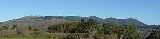
Mount Tamalpais is a peak
in Marin County
, California
, United States, often considered symbolic of Marin County. Much of Mount Tamalpais is protected within public lands such as Mount Tamalpais State Park
and the Mount Tamalpais Watershed.
, which are part of the Northern California Coast Ranges. The elevation at the East Peak, its second highest point, is 2572 feet (784 m). The West Peak, the mountain's highest peak where a radar dome currently stands, is 2574 feet (785 m). It stood over 2600 feet (792 m) before the summit was flattened for the radar dome construction. The mountain is clearly visible from the city of San Francisco and the East Bay
region.
The majority of the mountain is contained in protected public lands, including Mount Tamalpais State Park, Muir Woods National Monument
, and the Mount Tamalpais Watershed. It adjoins the Golden Gate National Recreation Area
(which in turn adjoins Point Reyes National Seashore
) as well as several Marin County Open Space Preserves. This provides nearly 40 miles (64 km) of continuous publicly accessible open space. Some of the lower slopes of Mount Tamalpais fall within several cities and unincorporated communities of Marin County, including Mill Valley
, Tamalpais-Homestead Valley
, Stinson Beach
, and Kentfield
. These areas are generally developed, consisting of mostly low-density single-family homes.
as it slides along the Pacific Plate
near the San Andreas fault zone
.
In 2004 it was suggested that a blind thrust fault, like the one that caused the infamous Northridge earthquake
, lies beneath Mount Tamalpais. This idea was partly based on the steepness of Mount Tamalpais and of nearby Bolinas Ridge, such steepness on the visible surface often being the result of blind thrust faults. Another reason for the suggestion was that the San Andreas Fault creeps more slowly, south of Mount Tamalpais, than it does in its sections north of Mount Tamalpais and in the Olema Valley
, and the existence of a blind thrust fault may explain the different creeping velocities. If a blind thrust fault does exist under Mount Tamalpais, and if it ruptures, it could be potentially devastating to the North Bay, San Francisco, and any other nearby locale resting on unstable earth and loose fill.
Major Mount Tamalpais rockforms include serpentine, particularly evident in outcroppings near the summit and on the north side. A number of serpentine endemic
plants grow in the serpentine soils in this part of the mountain.
, which in turn discharges to Richardson Bay
.
 With its height, various faces, and proximity to the ocean and bay, the mountain contains many microclimate
s, ranging from cool and foggy in lower ocean-facing valleys with their redwood forests, to hot and dry on the manzanita
slopes, cool and breezy at the summit, and shady on the heavily Douglas-fir
-forested north slopes near Alpine Lake.
Annual precipitation around Mount Tamalpais varies greatly from around 27.5–31.5 inches (700–800 mm) in the drier, eastern foothills to about 59 inches (1,500 mm) near the Bolinas Ridge
, close to the Pacific Ocean. Both Mount Tamalpais and the Bolinas Ridge force moisture out of the air efficiently, since the air is cooled rapidly as it ascends the steep mountain faces and thus Mount Tamalpais's western part is heavily forested with tall redwoods and Douglas-firs. The same fact holds for the steep, south-facing bowl canyon that Muir Woods is located in, with precipitation in Redwood Canyon at around 39.4–47.2 inches (1,000–1,200 mm).
As in San Francisco, most of the annual precipitation falls during the winter months. During cold, wet winter storms, the mountain also regularly gets some snowfall, sometimes as much as 6 inches (15.2 cm) overnight, as observed in February 2001, March 2006, and February 2011. The region sometimes gets hit with strong Pacific storms that may topple trees, and bring hurricane force winds to exposed, barren areas like the Bolinas Ridge and the summit of Mount Tamalpais. In summer, the area gets almost no precipitation, except for fog drip
that occurs in Muir Woods, the Bolinas Ridge and the western end of Mount Tamalpais, where summer fog and oceanic breezes are more prevalent. In contrast, the eastern foothills, sheltered from the oceanic breezes and fog, are drier, since the foothills force little moisture out of the air. This leads to the fact that the eastern slopes contain only oak, pine, shrub, woodland
, and sparse Douglas-fir forest.
Temperatures on top of Mount Tamalpais are generally somewhat cooler than places next to the San Francisco Bay or the ocean due to elevation. In summer, however, the top of Mount Tamalpais may actually be warmer than the middle, foggy elevations due to a thermal inversion. The summer fog and breezes make locations on Mount Tamalpais closer to the ocean cooler than the blazing hot interior valleys.
, including oak-bay-madrone forest, oak woodland, and oak savannah. Oak-bay-madrone forests are found in areas with moderate moisture and particularly favor north-facing slopes. They are dominated by one or more of three hardwood tree species – Coast Live Oak, California bay
, and madrone. Coast live oak tends to be dominant in somewhat drier areas, while bay is more dominant in shadier, moister areas; madrone is abundant in certain soil types in both moist and dry spots. Oak woodlands are a more open-canopy forest dominated by coast live oak, while oak savannah
has a completely open canopy and represents a mixture of coast live oak woodland and grassland.
The great diversity of microclimates on Mount Tamalpais insures a wide variety of plant communities as well. Plant communities on the mountain include various types of hardwood and coniferous forests, coastal scrub
, chaparral
, grassland
, and wetland
vegetation. Wholly or partially coniferous forest types are found in the moistest areas of Mount Tamalpais. Coast redwood forests are restricted to areas where the particular ecological needs of redwood are met: areas characterized by high overall moisture, low elevations below the fog line, and deep soils. Muir Woods is the most extensive and best-known redwood forest of the Mount Tamalpais area. Mixed evergreen forests of various combinations of tanoak
, madrone, coast and canyon live oak
, and Douglas-fir
are found in moist areas on middle to high elevations on the mountain. Very moist areas of mixed evergreen forest may also include bay, redwood, and California torreya
. Areas in which mixed evergreen forests are predominant include areas of Fairfax-Bolinas Road and Ridgecrest Boulevard and around Alpine Lake
.
Various kinds of scrub communities are also widespread. Low-elevation areas below the fog line with relatively low overall rainfall or thin soils are often the site of a northern coastal scrub
community characterized by coastal sage-coyote brush association, with lesser amounts of poison-oak, bush monkeyflower
, California blackberry
, western bracken fern
, and various species of grasses
and forb
s. Chaparral
is predominant in areas characterized by thin, rocky soils and little moisture. Two main types of chaparral are found the mountain chamise
chaparral and manzanita
chaparral. Chamise is dominant in the hottest, most xeric
areas of the mountain, particularly on south- and west-facing slopes, while manzanita is dominant in other xeric areas, particularly on east-facing slopes and forest borders. Areas of mixed chamise-manzanita chaparral occur in relatively more mesic
areas; Ceanothus
and dwarfed interior live oak may also predominate on such sites. Areas in which various kinds of chaparral communities are dominant include areas along Old Railroad Grade.
Grassland areas are also common on Mount Tamalpais. Native perennial bunchgrass
species were originally dominant, but most of these grasslands are now dominated by invasive
annual grasses of European origin. Native grasslands, still found in a few isolated areas, are of two types. Northern coastal prairie
is found below the fog line and is characterized by a Festuca-Danthonia
association, while valley grassland, found in drier areas, is dominated by Nassella pulchra
, with Elymus glaucus
and Leymus triticoides
also being common.
Wetland vegetation types found on Mount Tamalpais include coastal riparian forests, wet meadows, and some marsh areas. Coastal riparian forest is predominant along the valley streams of Mount Tamalpais. Red and white alder
(Alnus rubra and Alnus rhombifolia
) and arroyo and yellow willow
(Salix lasiolepis
and S. lasiandra
) are dominant in these types of woodland, with bigleaf maple (Acer macrophyllum), box-elder (Acer negundo
ssp. californicum), and California bay also being common. Wet meadows are present in several high-elevation spots on the mountain, while High Marsh represents a rare example of a marsh
community on the mountain.
Serpentine soil
s have a high rate of endemism and are the site of several unique subtypes of the above plant communities. Serpentine grasslands are some of the few grasslands in which native perennial grasses are still relatively dominant. Serpentine chaparral forms a unique plant community, dominated by dwarfed leather oak (Quercus durata
), Jepson ceanothus (Ceanothus jepsonii
), Tamalpais manzanita (), and Sargent cypress (Cupressus sargentii
). On the upper slopes of the mountain, small groves of Sargent cypress trees up to 50 feet (15 m) tall can be found in serpentine areas.
Several species of endemic plants are found only on serpentine soils; these species may be widespread, but only occur on serpentine soils, or the may be more restricted, only growing in a few other places besides Mount Tamalpais, or may even be restricted just to Mount Tamalpais. The Mount Tamalpais thistle (Cirsium hydrophilum
var. vaseyi), for example, is a rare variety of thistle known only from the serpentine seeps of the mountain. The Mount Tamalpais jewelflower (Streptanthus batrachopus
) is also limited to the area.
refuges in the Bay Area. Urbanization has invaded wildlife habitat, forcing many fauna
in southern Marin County to retreat up onto Mount Tamalpais, Muir Woods
, and the Bolinas Ridge
. A wide variety
of avifauna
, amphibian
s, arthropod
s and mammal
s are found on Mount Tamalpais, including a number of rare
and endangered species
. Nonetheless, Mt. Tamalpais and the neighboring Golden Gate Recreation Area together encompass over 115 square miles (298 square kilometers) of land, forming one of the largest preserved parklands located near a U.S. urban center.
of the name. One version holds that the name comes from ostensibly Coast Miwok
words for "coast mountain" (tamal pais). Another holds that it comes from the Spanish Tamal pais, meaning "Tamal country," Tamal being the name that the Spanish missionaries gave to the Coast Miwok peoples. Yet another version holds that the name is the Coast Miwok word for "sleeping maiden" and is taken from a "Legend of the Sleeping Maiden
." However, this legend actually has no basis in Coast Miwok myth and is instead a piece of Victorian-era apocrypha
.
The Coast Miwok are said to have believed that an evil witch dwelled at the top of Mount Tamalpais and therefore never set foot on the peak. However, it has been said the Miwoks did this in order to keep settlers off the sacred mountain.
Tamalpais was home to the Mount Tamalpais and Muir Woods Railway, also known as "The Crookedest Railroad in the World," a railroad which meandered its way up to the peak from downtown Mill Valley
until a road was constructed to the peak, and automobiles gained popularity. The 8-mile standard-gauge railroad required geared steam locomotive
s and operated from 1896 to 1930.
Early wireless towers were constructed on the mountain in the early 20th century, only to be destroyed by one of the periodic hurricane-force windstorms.
The U.S. Weather Bureau operated a weather station at the site of the now defunct Mill Valley Air Force Station
for many years.
The peak and its surrounding areas are the birthplace of mountain biking
in the 1970s, where early mountain bikers such as Gary Fisher
, Charlie Kelly, and Joe Breeze
were active.
In 1979 and 1980, Mount Tamalpais was the scene of a series of murders of hikers carried out by serial killer
David Carpenter
, also known as the "Trailside Killer."
, with over 100 miles (160.9 km) of trails and fire roads. With numerous trailheads, a well-networked trail and road system, and hikes of greatly varying length and difficulty, the mountain offers a compelling range of attractions. Marin Municipal Water District
maintains several reservoirs on the north slopes of Mount Tamalpais, including Alpine Lake, Kent Lake, Bon Tempe Lake, and Lake Lagunitas.
The western slopes of the mountain descend to the Pacific Ocean at Stinson Beach
. The annual Dipsea Race
traverses the mountain from Mill Valley to Stinson Beach. Though backpack camping isn't allowed, a walk-in camp exists at the Pan Toll ranger station. Trailhead parking within Mt. Tamalpais State Park is available generally with a self-service fee. The scenic Ridgecrest Blvd. running along the ridgeline between the Rock Spring trailhead and Fairfax-Bolinas Road, with panoramic views of the summit, Pacific, San Francisco, Bolinas, and Point Reyes
, is featured in many auto and other video and print advertisements, as well as being the local hang-gliding launch point. Mount Tam is also home to the Edgewood Botanic Garden
and to the Sidney B. Cushing Amphitheatre
where Broadway musical productions are performed every year by the Mountain Play Association. Monthly astronomy viewings and lectures are held at Rock Springs and Mountain Theater April through October.
Mt. Tamalpais State Park now offers Wi-Fi
service. Visitors with wireless enabled devices may access the internet from within about 200 feet (61 m) of the Park Ranger Station.
and redwood trees, clear, open grassland, and shrublands. All roads leading to the many trailheads around Mount Tamalpais are usually open, but during fire season, some of these roads may be closed due to high fire risk.
The many roads, paved and unpaved, that cross the Mount Tamalpais region are particularly popular with mountain bikers, especially on weekends, due to magnificent views and sights the mountain offers. With these attractions, Mount Tamalpais played a role in the birth of mountain biking many years ago. Mount Tam is also the birthplace of the Gary Fisher mountain bike.
Since Mount Tamalpais is a very popular mountain biking area, there has been considerable controversy around trail access on Mount Tamalpais for mountain bikes, both in terms of environmental impact and the safety of other trail users. As a result, bicycles have been banned from the majority of narrow, single-track trails, though bicycles are still allowed on fire roads. The fire roads on Mt. Tam are mixed-use and they are popular running, hiking, biking and horseback riding routes.
, Harry Cassie Best, Albert Bierstadt
, Norton Bush, Russell Chatham
, Edwin Deakin, Percy Gray
, Ransome Gillet Holdredge, William Keith, Tom Killion
, William Marple, William Birch McMurtrie, Gilbert Munger http://www.d.umn.edu/tma/MungerSite/FramesVar.html?Pages/ID3.html, Julian Rix
, Frederick Schafer, Jules Tavernier
, Nancy Wallace, Thaddeus Welch, Ludmilla Welch, Virgil Williams
, Jack Wisby, Theodore Wores
, and Raymond Dabb Yelland.
Mountain
Image:Himalaya_annotated.jpg|thumb|right|The Himalayan mountain range with Mount Everestrect 58 14 160 49 Chomo Lonzorect 200 28 335 52 Makalurect 378 24 566 45 Mount Everestrect 188 581 920 656 Tibetan Plateaurect 250 406 340 427 Rong River...
in Marin County
Marin County, California
Marin County is a county located in the North San Francisco Bay Area of the U.S. state of California, across the Golden Gate Bridge from San Francisco. As of 2010, the population was 252,409. The county seat is San Rafael and the largest employer is the county government. Marin County is well...
, California
California
California is a state located on the West Coast of the United States. It is by far the most populous U.S. state, and the third-largest by land area...
, United States, often considered symbolic of Marin County. Much of Mount Tamalpais is protected within public lands such as Mount Tamalpais State Park
Mount Tamalpais State Park
Mount Tamalpais State Park is a California state park, located in Marin County, California. The primary feature of the park is the Mount Tamalpais. The park contains mostly redwood and oak forests. The mountain itself covers around . There are about of hiking trails, which are connected to a...
and the Mount Tamalpais Watershed.
Geography
Mount Tamalpais is the highest peak in the Marin HillsMarin Hills
The Marin Hills are a series of steep high ridges and peaks in southern Marin County. They are a part of the long Pacific Coast Ranges mountain system. The centerpoint of these hills is the 2,571 foot Mount Tamalpais near Mill Valley...
, which are part of the Northern California Coast Ranges. The elevation at the East Peak, its second highest point, is 2572 feet (784 m). The West Peak, the mountain's highest peak where a radar dome currently stands, is 2574 feet (785 m). It stood over 2600 feet (792 m) before the summit was flattened for the radar dome construction. The mountain is clearly visible from the city of San Francisco and the East Bay
East Bay (San Francisco Bay Area)
The East Bay is a commonly used, informal term for the lands on the eastern side of the San Francisco Bay, in the San Francisco Bay Area, in California, United States...
region.
The majority of the mountain is contained in protected public lands, including Mount Tamalpais State Park, Muir Woods National Monument
Muir Woods National Monument
Muir Woods National Monument is a unit of the National Park Service on the Pacific coast of southwestern Marin County, California, north of San Francisco and part of the Golden Gate National Recreation Area...
, and the Mount Tamalpais Watershed. It adjoins the Golden Gate National Recreation Area
Golden Gate National Recreation Area
The Golden Gate National Recreation Area is a U.S. National Recreation Area administered by the National Park Service that surrounds the San Francisco Bay area. It is one of the most visited units of the National Park system in the United States, with over 13 million visitors a year...
(which in turn adjoins Point Reyes National Seashore
Point Reyes National Seashore
Point Reyes National Seashore is a park preserve located on the Point Reyes Peninsula in Marin County, California, USA. As a national seashore, it is maintained by the US National Park Service as a nationally important nature preserve within which existing agricultural uses are allowed to continue...
) as well as several Marin County Open Space Preserves. This provides nearly 40 miles (64 km) of continuous publicly accessible open space. Some of the lower slopes of Mount Tamalpais fall within several cities and unincorporated communities of Marin County, including Mill Valley
Mill Valley, California
Mill Valley is a city in Marin County, California, United States located about north of San Francisco via the Golden Gate Bridge. The population was 13,903 at the 2010 census.Mill Valley is located on the western and northern shores of Richardson Bay...
, Tamalpais-Homestead Valley
Tamalpais Valley, California
Tamalpais Valley is an unincorporated community in Marin County, California. It is located west of Mill Valley, at an elevation of 108 feet...
, Stinson Beach
Stinson Beach, California
Stinson Beach is a census-designated place in Marin County, California, on the west coast of the United States. Stinson Beach is located east-southeast of Bolinas, at an elevation of 26 feet . The population of the Stinson Beach CDP was 632 at the 2010 census.Stinson Beach is about a 35-minute...
, and Kentfield
Kentfield, California
Kentfield is a census-designated place in Marin County, California, United States, just north of San Francisco. Kentfield is located on the Northwestern Pacific Railroad southwest of downtown San Rafael, at an elevation of 115 feet . The population was 6,485 at the 2010 census...
. These areas are generally developed, consisting of mostly low-density single-family homes.
Natural history
Geology and soils
Like the rest of the California Coast Ranges, Mount Tamalpais is the result of uplift, buckling, and folding of the North American plateNorth American Plate
The North American Plate is a tectonic plate covering most of North America, Greenland, Cuba, Bahamas, and parts of Siberia, Japan and Iceland. It extends eastward to the Mid-Atlantic Ridge and westward to the Chersky Range in eastern Siberia. The plate includes both continental and oceanic crust...
as it slides along the Pacific Plate
Pacific Plate
The Pacific Plate is an oceanic tectonic plate that lies beneath the Pacific Ocean. At 103 million square kilometres, it is the largest tectonic plate....
near the San Andreas fault zone
San Andreas Fault
The San Andreas Fault is a continental strike-slip fault that runs a length of roughly through California in the United States. The fault's motion is right-lateral strike-slip...
.
In 2004 it was suggested that a blind thrust fault, like the one that caused the infamous Northridge earthquake
Northridge earthquake
The Northridge earthquake was a massive earthquake that occurred on January 17, 1994, at 04:31 Pacific Standard Time in Reseda, a neighborhood in the city of Los Angeles, California, lasting for about 10–20 seconds...
, lies beneath Mount Tamalpais. This idea was partly based on the steepness of Mount Tamalpais and of nearby Bolinas Ridge, such steepness on the visible surface often being the result of blind thrust faults. Another reason for the suggestion was that the San Andreas Fault creeps more slowly, south of Mount Tamalpais, than it does in its sections north of Mount Tamalpais and in the Olema Valley
Olema Valley
Olema Valley is a gorge formed by the San Andreas Fault in rural west Marin County, Northern California. The valley runs from the town of Olema through Dogtown and Point Reyes to the Bolinas Lagoon, which lies between Bolinas and Stinson Beach near Drake's Bay....
, and the existence of a blind thrust fault may explain the different creeping velocities. If a blind thrust fault does exist under Mount Tamalpais, and if it ruptures, it could be potentially devastating to the North Bay, San Francisco, and any other nearby locale resting on unstable earth and loose fill.
Major Mount Tamalpais rockforms include serpentine, particularly evident in outcroppings near the summit and on the north side. A number of serpentine endemic
Endemic (ecology)
Endemism is the ecological state of being unique to a defined geographic location, such as an island, nation or other defined zone, or habitat type; organisms that are indigenous to a place are not endemic to it if they are also found elsewhere. For example, all species of lemur are endemic to the...
plants grow in the serpentine soils in this part of the mountain.
Hydrology
Since the steep slopes of Mount Tamalpais force out moisture from passing storms and/or fog, the mountain supports several year-round streams like Redwood Creek on the southern face of the mountain down into Muir Woods. The steep southeastern slopes of Mount Tamalpais drain to Arroyo Corte Madera del PresidioArroyo Corte Madera del Presidio
Arroyo Corte Madera del Presidio is a year-round stream in southern Marin County, California, USA. This watercourse is also known as Corte Madera Creek, although the actual stream of that name flows into San Francisco Bay further north at Point San Quentin...
, which in turn discharges to Richardson Bay
Richardson Bay
Richardson Bay is a shallow, ecologically rich arm of San Francisco Bay, managed under a Joint Powers Agency of four Northern California cities. The Richardson Bay Sanctuary was acquired in the early 1960s by the National Audubon Society. The bay was named for William A...
.
Climate
Microclimate
A microclimate is a local atmospheric zone where the climate differs from the surrounding area. The term may refer to areas as small as a few square feet or as large as many square miles...
s, ranging from cool and foggy in lower ocean-facing valleys with their redwood forests, to hot and dry on the manzanita
Manzanita
Manzanita is a common name for many species of the genus Arctostaphylos. They are evergreen shrubs or small trees present in the chaparral biome of western North America, where they occur from southern British Columbia, Washington to California, Arizona and New Mexico in the United States, and...
slopes, cool and breezy at the summit, and shady on the heavily Douglas-fir
Douglas-fir
Douglas-fir is one of the English common names for evergreen coniferous trees of the genus Pseudotsuga in the family Pinaceae. Other common names include Douglas tree, and Oregon pine. There are five species, two in western North America, one in Mexico, and two in eastern Asia...
-forested north slopes near Alpine Lake.
Annual precipitation around Mount Tamalpais varies greatly from around 27.5–31.5 inches (700–800 mm) in the drier, eastern foothills to about 59 inches (1,500 mm) near the Bolinas Ridge
Bolinas Ridge
Bolinas Ridge is a north-south ridge in southwestern Marin County, California. Much of the western side of the ridge is protected parkland in the Golden Gate National Recreation Area, and the eastern side is watershed lands of the Marin Municipal Water District....
, close to the Pacific Ocean. Both Mount Tamalpais and the Bolinas Ridge force moisture out of the air efficiently, since the air is cooled rapidly as it ascends the steep mountain faces and thus Mount Tamalpais's western part is heavily forested with tall redwoods and Douglas-firs. The same fact holds for the steep, south-facing bowl canyon that Muir Woods is located in, with precipitation in Redwood Canyon at around 39.4–47.2 inches (1,000–1,200 mm).
As in San Francisco, most of the annual precipitation falls during the winter months. During cold, wet winter storms, the mountain also regularly gets some snowfall, sometimes as much as 6 inches (15.2 cm) overnight, as observed in February 2001, March 2006, and February 2011. The region sometimes gets hit with strong Pacific storms that may topple trees, and bring hurricane force winds to exposed, barren areas like the Bolinas Ridge and the summit of Mount Tamalpais. In summer, the area gets almost no precipitation, except for fog drip
Fog drip
Fog drip is a type of precipitation that forms when fog droplets condense on the needles or leaves of trees or other objects, and drips to the ground....
that occurs in Muir Woods, the Bolinas Ridge and the western end of Mount Tamalpais, where summer fog and oceanic breezes are more prevalent. In contrast, the eastern foothills, sheltered from the oceanic breezes and fog, are drier, since the foothills force little moisture out of the air. This leads to the fact that the eastern slopes contain only oak, pine, shrub, woodland
Woodland
Ecologically, a woodland is a low-density forest forming open habitats with plenty of sunlight and limited shade. Woodlands may support an understory of shrubs and herbaceous plants including grasses. Woodland may form a transition to shrubland under drier conditions or during early stages of...
, and sparse Douglas-fir forest.
Temperatures on top of Mount Tamalpais are generally somewhat cooler than places next to the San Francisco Bay or the ocean due to elevation. In summer, however, the top of Mount Tamalpais may actually be warmer than the middle, foggy elevations due to a thermal inversion. The summer fog and breezes make locations on Mount Tamalpais closer to the ocean cooler than the blazing hot interior valleys.
Plant communities
Hardwood woodland types are generally subtypes of California oak woodlandCalifornia oak woodland
California oak woodland is a plant community found throughout the California chaparral and woodlands ecoregion of California in the United States and northwestern Baja California in Mexico...
, including oak-bay-madrone forest, oak woodland, and oak savannah. Oak-bay-madrone forests are found in areas with moderate moisture and particularly favor north-facing slopes. They are dominated by one or more of three hardwood tree species – Coast Live Oak, California bay
Umbellularia
Umbellularia californica is a large tree native to coastal forests of California and slightly extended into Oregon.It is the sole species in the genus Umbellularia....
, and madrone. Coast live oak tends to be dominant in somewhat drier areas, while bay is more dominant in shadier, moister areas; madrone is abundant in certain soil types in both moist and dry spots. Oak woodlands are a more open-canopy forest dominated by coast live oak, while oak savannah
Savannah
Savannah or savanna is a type of grassland.It can also mean:-People:* Savannah King, a Canadian freestyle swimmer* Savannah Outen, a singer who gained popularity on You Tube...
has a completely open canopy and represents a mixture of coast live oak woodland and grassland.
The great diversity of microclimates on Mount Tamalpais insures a wide variety of plant communities as well. Plant communities on the mountain include various types of hardwood and coniferous forests, coastal scrub
Coastal sage scrub
Coastal sage scrub is a low scrubland plant community found in the California chaparral and woodlands ecoregion of coastal California and northern Baja California. It is characterized by low-growing aromatic, and drought-deciduous shrubs adapted to the semi-arid Mediterranean climate of the...
, chaparral
Chaparral
Chaparral is a shrubland or heathland plant community found primarily in the U.S. state of California and in the northern portion of the Baja California peninsula, Mexico...
, grassland
Grassland
Grasslands are areas where the vegetation is dominated by grasses and other herbaceous plants . However, sedge and rush families can also be found. Grasslands occur naturally on all continents except Antarctica...
, and wetland
Wetland
A wetland is an area of land whose soil is saturated with water either permanently or seasonally. Wetlands are categorised by their characteristic vegetation, which is adapted to these unique soil conditions....
vegetation. Wholly or partially coniferous forest types are found in the moistest areas of Mount Tamalpais. Coast redwood forests are restricted to areas where the particular ecological needs of redwood are met: areas characterized by high overall moisture, low elevations below the fog line, and deep soils. Muir Woods is the most extensive and best-known redwood forest of the Mount Tamalpais area. Mixed evergreen forests of various combinations of tanoak
Notholithocarpus
Notholithocarpus densiflorus, commonly known as the Tanoak or Tanbark-oak, is an evergreen tree in the beech family Fagaceae, native to the western United States, in California as far south as the Transverse Ranges, north to southwest Oregon, and east in the Sierra Nevada...
, madrone, coast and canyon live oak
Quercus chrysolepis
Quercus chrysolepis, commonly termed Canyon Live Oak, or Golden Cup Oak, is a species of evergreen oak that is found in the southwestern part of North America, notably in the California Coast Ranges. This tree is often found near creeks and drainage swales growing in moist cool microhabitats...
, and Douglas-fir
Douglas-fir
Douglas-fir is one of the English common names for evergreen coniferous trees of the genus Pseudotsuga in the family Pinaceae. Other common names include Douglas tree, and Oregon pine. There are five species, two in western North America, one in Mexico, and two in eastern Asia...
are found in moist areas on middle to high elevations on the mountain. Very moist areas of mixed evergreen forest may also include bay, redwood, and California torreya
Torreya californica
Torreya californica is species of conifer endemic to California, occurring in the Pacific Coast Ranges and the foothills of the Sierra Nevada...
. Areas in which mixed evergreen forests are predominant include areas of Fairfax-Bolinas Road and Ridgecrest Boulevard and around Alpine Lake
Alpine Lake
Alpine Lake is a reservoir in Marin County, California. Formed by Alpine Dam, it provides water to the Marin Municipal Water District. Below the dam lies Kent Lake.-See also:*Lake Alpine*List of lakes in California...
.
Various kinds of scrub communities are also widespread. Low-elevation areas below the fog line with relatively low overall rainfall or thin soils are often the site of a northern coastal scrub
Northern coastal scrub
Northern coastal scrub is a scrubland plant community of California and Oregon. It occurs along the Pacific Coast from Point Sur on the Central California coast in Monterey County, California, to southern Oregon...
community characterized by coastal sage-coyote brush association, with lesser amounts of poison-oak, bush monkeyflower
Mimulus aurantiacus
Mimulus aurantiacus, the Sticky monkey-flower and Orange bush monkey-flower, is a flowering plant that grows in a subshrub form, native to southwestern North America from southwestern Oregon south through most of California...
, California blackberry
Blackberry
The blackberry is an edible fruit produced by any of several species in the Rubus genus of the Rosaceae family. The fruit is not a true berry; botanically it is termed an aggregate fruit, composed of small drupelets. The plants typically have biennial canes and perennial roots. Blackberries and...
, western bracken fern
Bracken
Bracken are several species of large, coarse ferns of the genus Pteridium. Ferns are vascular plants that have alternating generations, large plants that produce spores and small plants that produce sex cells . Brackens are in the family Dennstaedtiaceae, which are noted for their large, highly...
, and various species of grasses
Poaceae
The Poaceae is a large and nearly ubiquitous family of flowering plants. Members of this family are commonly called grasses, although the term "grass" is also applied to plants that are not in the Poaceae lineage, including the rushes and sedges...
and forb
Forb
A forb is a herbaceous flowering plant that is not a graminoid . The term is used in biology and in vegetation ecology, especially in relation to grasslands and understory.-Etymology:...
s. Chaparral
Chaparral
Chaparral is a shrubland or heathland plant community found primarily in the U.S. state of California and in the northern portion of the Baja California peninsula, Mexico...
is predominant in areas characterized by thin, rocky soils and little moisture. Two main types of chaparral are found the mountain chamise
Adenostoma fasciculatum
Adenostoma fasciculatum is a flowering plant native to California and northern Baja California. This shrub is one of the most widespread plants of the chaparral biome.-Description:...
chaparral and manzanita
Manzanita
Manzanita is a common name for many species of the genus Arctostaphylos. They are evergreen shrubs or small trees present in the chaparral biome of western North America, where they occur from southern British Columbia, Washington to California, Arizona and New Mexico in the United States, and...
chaparral. Chamise is dominant in the hottest, most xeric
Deserts and xeric shrublands
Deserts and xeric shrublands is a biome characterized by, relating to, or requiring only a small amount of moisture.-Definition and occurrence:...
areas of the mountain, particularly on south- and west-facing slopes, while manzanita is dominant in other xeric areas, particularly on east-facing slopes and forest borders. Areas of mixed chamise-manzanita chaparral occur in relatively more mesic
Mesic habitat
In ecology, a mesic habitat is a type of habitat with a moderate or well-balanced supply of moisture, e.g., a mesic forest, a temperate hardwood forest, or dry-mesic prairie. Compared to a dry habitat, a mesic habitat is moister....
areas; Ceanothus
Ceanothus
Ceanothus L. is a genus of about 50–60 species of shrubs or small trees in the buckthorn family Rhamnaceae. The genus is confined to North America, the center of its distribution in California, with some species in the eastern United States and southeast Canada, and others extending as far south...
and dwarfed interior live oak may also predominate on such sites. Areas in which various kinds of chaparral communities are dominant include areas along Old Railroad Grade.
Grassland areas are also common on Mount Tamalpais. Native perennial bunchgrass
Tussock (grass)
Tussock grasses or bunch grasses are found as native plants in natural ecosystems, as forage in pastures, and as ornamental grasses in gardens....
species were originally dominant, but most of these grasslands are now dominated by invasive
Invasive species
"Invasive species", or invasive exotics, is a nomenclature term and categorization phrase used for flora and fauna, and for specific restoration-preservation processes in native habitats, with several definitions....
annual grasses of European origin. Native grasslands, still found in a few isolated areas, are of two types. Northern coastal prairie
California coastal prairie
California coastal prairie, also known as northern coastal grassland, is a grassland plant community of California and Oregon in the Temperate grasslands, savannas, and shrublands Biome...
is found below the fog line and is characterized by a Festuca-Danthonia
Danthonia
Danthonia is a genus of grass species. Grasses of this genus are sometimes referred to as oatgrass, but that common name is not restricted to this genus.Species include:*Danthonia alpina Vest*Danthonia cachemyriana Jaub. & Spach...
association, while valley grassland, found in drier areas, is dominated by Nassella pulchra
Nassella pulchra
Nassella pulchra is a species of grass known by the common name purple needlegrass. It is native to California, where it occurs throughout the coastal hills, valleys, and mountain ranges, as well as the Sacramento Valley and parts of the Sierra Nevada foothills, and Baja California.It grows in many...
, with Elymus glaucus
Elymus glaucus
Elymus glaucus is a species of wild rye known by the common name blue wild rye. This grass is native to North America from Alaska to New York to northern Mexico...
and Leymus triticoides
Leymus triticoides
Leymus triticoides, with the common names Creeping wild rye and Beardless wild rye, is a species of wild rye. It is native to western North America from British Columbia, in California, to Texas.-Habitat:...
also being common.
Wetland vegetation types found on Mount Tamalpais include coastal riparian forests, wet meadows, and some marsh areas. Coastal riparian forest is predominant along the valley streams of Mount Tamalpais. Red and white alder
Alder
Alder is the common name of a genus of flowering plants belonging to the birch family . The genus comprises about 30 species of monoecious trees and shrubs, few reaching large size, distributed throughout the North Temperate Zone and in the Americas along the Andes southwards to...
(Alnus rubra and Alnus rhombifolia
Alnus rhombifolia
Alnus rhombifolia, the White Alder, is an alder tree native to western North America, from Washington east to western Montana, southeast to the Sierra Nevada, and south through the Peninsular Ranges and Colorado Desert oases in Southern California. It occurs in riparian zone habitats at an...
) and arroyo and yellow willow
Willow
Willows, sallows, and osiers form the genus Salix, around 400 species of deciduous trees and shrubs, found primarily on moist soils in cold and temperate regions of the Northern Hemisphere...
(Salix lasiolepis
Salix lasiolepis
Salix lasiolepis is a species of willow native to western and southwestern North America, in the United States from central and southern Washington and southwestern Idaho south to California and Texas, and in Mexico from the Baja California peninsula east to Coahuila and south to Jalisco. The name...
and S. lasiandra
Salix lucida
Salix lucida is a species of willow native to northern and western North America, occurring in wetland habitats....
) are dominant in these types of woodland, with bigleaf maple (Acer macrophyllum), box-elder (Acer negundo
Acer negundo
Acer negundo is a species of maple native to North America. Box Elder, Boxelder Maple, and Maple Ash are its most common names in the United States...
ssp. californicum), and California bay also being common. Wet meadows are present in several high-elevation spots on the mountain, while High Marsh represents a rare example of a marsh
Marsh
In geography, a marsh, or morass, is a type of wetland that is subject to frequent or continuous flood. Typically the water is shallow and features grasses, rushes, reeds, typhas, sedges, other herbaceous plants, and moss....
community on the mountain.
Serpentine soil
Serpentine soil
A serpentine soil is derived from ultramafic rocks, in particular serpentinite, a rock formed by the hydration and metamorphic transformation of ultramafic rock from the Earth's mantle....
s have a high rate of endemism and are the site of several unique subtypes of the above plant communities. Serpentine grasslands are some of the few grasslands in which native perennial grasses are still relatively dominant. Serpentine chaparral forms a unique plant community, dominated by dwarfed leather oak (Quercus durata
Quercus durata
Quercus durata is an oak endemic to California.Quercus durata var. durata is a strict serpentine endemic that occurs in the Coast Range and northern Sierra Nevadas. It is often a component of serpentine chaparral...
), Jepson ceanothus (Ceanothus jepsonii
Ceanothus jepsonii
Ceanothus jepsonii is a species of shrub in the buckthorn family Rhamnaceae known by the common names musk brush and Jepson ceanothus.-Description:This species of shrub is variable, particularly across its two varieties:...
), Tamalpais manzanita (), and Sargent cypress (Cupressus sargentii
Cupressus sargentii
Cupressus sargentii is a species of conifer in the Cupressaceae family known by the common name Sargent's cypress. It is endemic to California, where it is known from Mendocino county southwards to Santa Barbara county. This taxon is limited to the Coast Range mountains. Like Mcnab Cypress, it...
). On the upper slopes of the mountain, small groves of Sargent cypress trees up to 50 feet (15 m) tall can be found in serpentine areas.
Several species of endemic plants are found only on serpentine soils; these species may be widespread, but only occur on serpentine soils, or the may be more restricted, only growing in a few other places besides Mount Tamalpais, or may even be restricted just to Mount Tamalpais. The Mount Tamalpais thistle (Cirsium hydrophilum
Cirsium hydrophilum
Cirsium hydrophilum is a species of thistle which is endemic to California, where it is found only in the San Francisco Bay Area and the Sacramento-San Joaquin River Delta. This native thistle grows in wet boggy habitats.-Description:...
var. vaseyi), for example, is a rare variety of thistle known only from the serpentine seeps of the mountain. The Mount Tamalpais jewelflower (Streptanthus batrachopus
Streptanthus batrachopus
Streptanthus batrachopus is a rare species of flowering plant in the mustard family known by the common name Mt. Tamalpais jewelflower. It is endemic to Marin County, California, where it is known only from Mt. Tamalpais and surrounding terrain...
) is also limited to the area.
Wildlife
Mount Tamalpais provides one of the last remaining wildlifeWildlife
Wildlife includes all non-domesticated plants, animals and other organisms. Domesticating wild plant and animal species for human benefit has occurred many times all over the planet, and has a major impact on the environment, both positive and negative....
refuges in the Bay Area. Urbanization has invaded wildlife habitat, forcing many fauna
Fauna
Fauna or faunæ is all of the animal life of any particular region or time. The corresponding term for plants is flora.Zoologists and paleontologists use fauna to refer to a typical collection of animals found in a specific time or place, e.g. the "Sonoran Desert fauna" or the "Burgess shale fauna"...
in southern Marin County to retreat up onto Mount Tamalpais, Muir Woods
Muir Woods National Monument
Muir Woods National Monument is a unit of the National Park Service on the Pacific coast of southwestern Marin County, California, north of San Francisco and part of the Golden Gate National Recreation Area...
, and the Bolinas Ridge
Bolinas Ridge
Bolinas Ridge is a north-south ridge in southwestern Marin County, California. Much of the western side of the ridge is protected parkland in the Golden Gate National Recreation Area, and the eastern side is watershed lands of the Marin Municipal Water District....
. A wide variety
Biodiversity
Biodiversity is the degree of variation of life forms within a given ecosystem, biome, or an entire planet. Biodiversity is a measure of the health of ecosystems. Biodiversity is in part a function of climate. In terrestrial habitats, tropical regions are typically rich whereas polar regions...
of avifauna
Bird
Birds are feathered, winged, bipedal, endothermic , egg-laying, vertebrate animals. Around 10,000 living species and 188 families makes them the most speciose class of tetrapod vertebrates. They inhabit ecosystems across the globe, from the Arctic to the Antarctic. Extant birds range in size from...
, amphibian
Amphibian
Amphibians , are a class of vertebrate animals including animals such as toads, frogs, caecilians, and salamanders. They are characterized as non-amniote ectothermic tetrapods...
s, arthropod
Arthropod
An arthropod is an invertebrate animal having an exoskeleton , a segmented body, and jointed appendages. Arthropods are members of the phylum Arthropoda , and include the insects, arachnids, crustaceans, and others...
s and mammal
Mammal
Mammals are members of a class of air-breathing vertebrate animals characterised by the possession of endothermy, hair, three middle ear bones, and mammary glands functional in mothers with young...
s are found on Mount Tamalpais, including a number of rare
Rare species
A rare species is a group of organisms that are very uncommon or scarce. This designation may be applied to either a plant or animal taxon, and may be distinct from the term "endangered" or "threatened species" but not "extinct"....
and endangered species
Endangered species
An endangered species is a population of organisms which is at risk of becoming extinct because it is either few in numbers, or threatened by changing environmental or predation parameters...
. Nonetheless, Mt. Tamalpais and the neighboring Golden Gate Recreation Area together encompass over 115 square miles (298 square kilometers) of land, forming one of the largest preserved parklands located near a U.S. urban center.
Cultural history
The name Tamalpais was first recorded in 1845. The meaning of the name is not well-established and there are several versions of the etymologyEtymology
Etymology is the study of the history of words, their origins, and how their form and meaning have changed over time.For languages with a long written history, etymologists make use of texts in these languages and texts about the languages to gather knowledge about how words were used during...
of the name. One version holds that the name comes from ostensibly Coast Miwok
Coast Miwok
The Coast Miwok were the second largest group of Miwok Native American people. The Coast Miwok inhabited the general area of modern Marin County and southern Sonoma County in Northern California, from the Golden Gate north to Duncans Point and eastward to Sonoma Creek...
words for "coast mountain" (tamal pais). Another holds that it comes from the Spanish Tamal pais, meaning "Tamal country," Tamal being the name that the Spanish missionaries gave to the Coast Miwok peoples. Yet another version holds that the name is the Coast Miwok word for "sleeping maiden" and is taken from a "Legend of the Sleeping Maiden
The Sleeping Lady
-Mountains:The Sleeping Lady is a nickname for the following mountains:*Western United States :...
." However, this legend actually has no basis in Coast Miwok myth and is instead a piece of Victorian-era apocrypha
Apocrypha
The term apocrypha is used with various meanings, including "hidden", "esoteric", "spurious", "of questionable authenticity", ancient Chinese "revealed texts and objects" and "Christian texts that are not canonical"....
.
The Coast Miwok are said to have believed that an evil witch dwelled at the top of Mount Tamalpais and therefore never set foot on the peak. However, it has been said the Miwoks did this in order to keep settlers off the sacred mountain.
Tamalpais was home to the Mount Tamalpais and Muir Woods Railway, also known as "The Crookedest Railroad in the World," a railroad which meandered its way up to the peak from downtown Mill Valley
Mill Valley, California
Mill Valley is a city in Marin County, California, United States located about north of San Francisco via the Golden Gate Bridge. The population was 13,903 at the 2010 census.Mill Valley is located on the western and northern shores of Richardson Bay...
until a road was constructed to the peak, and automobiles gained popularity. The 8-mile standard-gauge railroad required geared steam locomotive
Geared steam locomotive
A geared steam locomotive is a type of steam locomotive which uses reduction gearing in the drivetrain, as opposed to the common directly driven design....
s and operated from 1896 to 1930.
Early wireless towers were constructed on the mountain in the early 20th century, only to be destroyed by one of the periodic hurricane-force windstorms.
The U.S. Weather Bureau operated a weather station at the site of the now defunct Mill Valley Air Force Station
Mill Valley Air Force Station
The AN/FPS-107 search radar operated with a 360° continuous spin, at a rate of 5 rotations per minute. It transmitted ten megawatt pulses of radio frequency energy, with each pulse having a duration of six microseconds. It had a detection range of 250 miles, up to an altitude of 100,000 feet...
for many years.
The peak and its surrounding areas are the birthplace of mountain biking
Mountain biking
Mountain biking is a sport which consists of riding bicycles off-road, often over rough terrain, using specially adapted mountain bikes. Mountain bikes share similarities with other bikes, but incorporate features designed to enhance durability and performance in rough terrain.Mountain biking can...
in the 1970s, where early mountain bikers such as Gary Fisher
Gary Fisher
Gary Christopher Fisher is considered one of the inventors of the modern mountain bike.Fisher started competing in road and track races at 12. He was suspended in 1968 because race organizers cited a rule that his hair was too long. By 1972 this rule had been repealed and Fisher's career continued...
, Charlie Kelly, and Joe Breeze
Joe Breeze
Joe Breeze is a bicycle designer and bicycling advocate. He was an early pioneer in the development of modern mountain bicycles, and is widely considered to be one of its inventors, along with other pioneers, including Tom Ritchey, Charlie Kelly, Charlie Cunningham, and Gary Fisher...
were active.
In 1979 and 1980, Mount Tamalpais was the scene of a series of murders of hikers carried out by serial killer
Serial killer
A serial killer, as typically defined, is an individual who has murdered three or more people over a period of more than a month, with down time between the murders, and whose motivation for killing is usually based on psychological gratification...
David Carpenter
David Carpenter
David Carpenter may refer to:*David Carpenter, early Texas settler and namesake of Carpenters Bayou*David Aaron Carpenter, violist, *David Carpenter , British historian*David Carpenter , Canadian novelist...
, also known as the "Trailside Killer."
Recreation
Mount Tamalpais is a popular hiking, picnicking, mountain and road cycling, horseback riding, and hang-gliding destination for residents of the San Francisco Bay AreaSan Francisco Bay Area
The San Francisco Bay Area, commonly known as the Bay Area, is a populated region that surrounds the San Francisco and San Pablo estuaries in Northern California. The region encompasses metropolitan areas of San Francisco, Oakland, and San Jose, along with smaller urban and rural areas...
, with over 100 miles (160.9 km) of trails and fire roads. With numerous trailheads, a well-networked trail and road system, and hikes of greatly varying length and difficulty, the mountain offers a compelling range of attractions. Marin Municipal Water District
Marin Municipal Water District
The Marin Municipal Water District is the government agency that provides drinking water to southern and central Marin County, California. Chartered in 1912, it became California's first municipal water district...
maintains several reservoirs on the north slopes of Mount Tamalpais, including Alpine Lake, Kent Lake, Bon Tempe Lake, and Lake Lagunitas.
The western slopes of the mountain descend to the Pacific Ocean at Stinson Beach
Stinson Beach, California
Stinson Beach is a census-designated place in Marin County, California, on the west coast of the United States. Stinson Beach is located east-southeast of Bolinas, at an elevation of 26 feet . The population of the Stinson Beach CDP was 632 at the 2010 census.Stinson Beach is about a 35-minute...
. The annual Dipsea Race
Dipsea Race
The Dipsea Race is the oldest cross-country trail running event—and one of the oldest foot races of any kind—in the United States. The 7.5 mile long Dipsea Race has been held annually almost every year since 1905, starting in Mill Valley, and finishing at Stinson Beach, in Marin County,...
traverses the mountain from Mill Valley to Stinson Beach. Though backpack camping isn't allowed, a walk-in camp exists at the Pan Toll ranger station. Trailhead parking within Mt. Tamalpais State Park is available generally with a self-service fee. The scenic Ridgecrest Blvd. running along the ridgeline between the Rock Spring trailhead and Fairfax-Bolinas Road, with panoramic views of the summit, Pacific, San Francisco, Bolinas, and Point Reyes
Point Reyes
Point Reyes is a prominent cape on the Pacific coast of northern California. It is located in Marin County approximately WNW of San Francisco. The term is often applied to the Point Reyes Peninsula, the region bounded by Tomales Bay on the northeast and Bolinas Lagoon on the southeast...
, is featured in many auto and other video and print advertisements, as well as being the local hang-gliding launch point. Mount Tam is also home to the Edgewood Botanic Garden
Edgewood Botanic Garden
The Edgewood Botanic Garden is a small botanical garden of less than 1 acre located at 436 Edgewood Avenue, on the southeastern side of Mount Tamalpais near the intersection of Edgewood with Cypress Avenue, in Mill Valley, California, USA. It is dedicated to the native plants of the region but is...
and to the Sidney B. Cushing Amphitheatre
Mountain Play
The Mountain Play Association is a 5013 organization responsible for the production of theatrical events at the Sidney B. Cushing Amphitheatre on Mount Tamalpais in Marin County, California. The stone amphitheatre, named for the owner of the railroad company which constructed the Mount Tamalpais...
where Broadway musical productions are performed every year by the Mountain Play Association. Monthly astronomy viewings and lectures are held at Rock Springs and Mountain Theater April through October.
Mt. Tamalpais State Park now offers Wi-Fi
Wi-Fi
Wi-Fi or Wifi, is a mechanism for wirelessly connecting electronic devices. A device enabled with Wi-Fi, such as a personal computer, video game console, smartphone, or digital audio player, can connect to the Internet via a wireless network access point. An access point has a range of about 20...
service. Visitors with wireless enabled devices may access the internet from within about 200 feet (61 m) of the Park Ranger Station.
Hiking and mountain biking
Since the Mount Tamalpais area contains large expanses of undeveloped, natural land, there are many trails and trailheads that criss-cross the area. Many of these trails are popular with hikers and bikers alike seeking refuge from the urban landscape of the San Francisco Bay Area. Some of these trails, usually the mountaintop or ridgetop trails, provide spectacular views of the San Francisco Bay, Pacific Ocean, or both. Other trails, usually lower elevation, valley trails, lead into natural, dense groves of mature Douglas-firDouglas-fir
Douglas-fir is one of the English common names for evergreen coniferous trees of the genus Pseudotsuga in the family Pinaceae. Other common names include Douglas tree, and Oregon pine. There are five species, two in western North America, one in Mexico, and two in eastern Asia...
and redwood trees, clear, open grassland, and shrublands. All roads leading to the many trailheads around Mount Tamalpais are usually open, but during fire season, some of these roads may be closed due to high fire risk.
The many roads, paved and unpaved, that cross the Mount Tamalpais region are particularly popular with mountain bikers, especially on weekends, due to magnificent views and sights the mountain offers. With these attractions, Mount Tamalpais played a role in the birth of mountain biking many years ago. Mount Tam is also the birthplace of the Gary Fisher mountain bike.
Since Mount Tamalpais is a very popular mountain biking area, there has been considerable controversy around trail access on Mount Tamalpais for mountain bikes, both in terms of environmental impact and the safety of other trail users. As a result, bicycles have been banned from the majority of narrow, single-track trails, though bicycles are still allowed on fire roads. The fire roads on Mt. Tam are mixed-use and they are popular running, hiking, biking and horseback riding routes.
Art
Mount Tamalpais has been a very popular subject in California landscape painting. Painters who have made Tamalpais the subject of one or more paintings include Etel AdnanEtel Adnan
Etel Adnan is a Lebanese-American poet, essayist, and visual artist.In 2003 MELUS, the journal of the Society for the Study of the Multi-Ethnic Literature of the United States, called Adnan "arguably the most celebrated and accomplished Arab American author writing today."She has said, "As for any...
, Harry Cassie Best, Albert Bierstadt
Albert Bierstadt
Albert Bierstadt was a German-American painter best known for his lavish, sweeping landscapes of the American West. In obtaining the subject matter for these works, Bierstadt joined several journeys of the Westward Expansion...
, Norton Bush, Russell Chatham
Russell Chatham
Russell Chatham is a contemporary American landscape artist living in Livingston, Montana. The artist is the grandson of landscape painter Gottardo Piazzoni, though he is essentially a self-taught artist. His work has been exhibited in over 400 one man shows and in museums and galleries over the...
, Edwin Deakin, Percy Gray
Percy Gray
Henry Percy Gray was an American painter. Gray was born into a San Francisco family endowed with a broad literary and artistic background. He studied under Arthur Frank Mathews at the San Francisco School of Design and later under William Merritt Chase...
, Ransome Gillet Holdredge, William Keith, Tom Killion
Tom Killion
Thomas "Tom" Killion is a member of the Pennsylvania House of Representatives from the 168th Legislative District. He currently sits on the House Appropriations, Insurance and Urban Affairs Committees.-Career:...
, William Marple, William Birch McMurtrie, Gilbert Munger http://www.d.umn.edu/tma/MungerSite/FramesVar.html?Pages/ID3.html, Julian Rix
Julian Rix
Julian Rix was a well-known American landscape artist around the dawn of the 20th century. A native of Vermont, he lived in California where his artwork caught the attention of silk tycoon, William Ryle, of Paterson, New Jersey. Ryle financed Rix's work and many of his portraits hang in the...
, Frederick Schafer, Jules Tavernier
Jules Tavernier (painter)
Jules Tavernier was a French painter. He was born in Paris in 1844 and died in Honolulu, Hawaii, in 1889. He studied with the French painter, Félix Joseph Barrias , but left France in the 1870s, never to return. Tavernier was employed as an illustrator by Harper's Magazine, which sent him on...
, Nancy Wallace, Thaddeus Welch, Ludmilla Welch, Virgil Williams
Virgil Williams
Virgil Williams is an American television producer and writer. He began working in television as a writer for 24 and wrote a single episode of the first season in 2002. He was hired as a story editor for 24 day 2 in fall 2002. He wrote two episodes of the second season and returned as a writer for...
, Jack Wisby, Theodore Wores
Theodore Wores
Theodore Wores was an American painter born in San Francisco, son of Joseph Wores and Gertrude Liebke. His father worked as a hat manufacturer in San Francisco. Wores began his art training at age twelve in the studio of Joseph Harrington, who taught him color, composition, drawing and perspective...
, and Raymond Dabb Yelland.
Theater
Broadway musicals are performed outdoors, several times each summer, in the stone amphitheatre on the southern side of Mt. Tam.See also
- Mount Tamalpais State ParkMount Tamalpais State ParkMount Tamalpais State Park is a California state park, located in Marin County, California. The primary feature of the park is the Mount Tamalpais. The park contains mostly redwood and oak forests. The mountain itself covers around . There are about of hiking trails, which are connected to a...
- List of highest points in California by county
- List of summits in the San Francisco Bay Area
- Mt. Tamalpais & Muir Woods RailwayMt. Tamalpais & Muir Woods RailwayThe Mount Tamalpais & Muir Woods Railway was a scenic tourist railway operating between Mill Valley and the peak of Mount Tamalpais in Marin County, California, covering a distance of , with a spur line through Muir Woods. The railroad began service in January 1896, closing only a little over...
Further reading
- Fairley, Lincoln. (1987). Mount Tamalpais: A History. San Francisco: Scottwall Associates. ISBN 0-942087-00-3 (hardbound), ISBN 0-942087-01-1 (paperback)
- Spitz, Barry. (1998). Tamalpais Trails. San Anselmo, CA: Potrero Meadow Publishing Co. ISBN 0-9620715-2-8
- Skolnick,Sharon. (1989) Dreams of Tamalpais. San Francisco,CA: Last Gasp of San Francisco. ISBN 978-0-86719-357-2
External links
- Mount Tamalpais State Park – official site
- Mount Tamalpais Watershed – official site
- Muir Woods National Monument - official site
- Mount Tamalpais Interpretive Association
- Tamalpais Conservation Club
- Mountain Play Association The group that performs yearly at the amphitheatre on mount Tam.
- SFAA Tam Star Parties Information on monthly star-gazing and lecture series.
Photographs
- CA State Parks Photo Slideshow: Mount Tamalpais SP
- Photos of Mt. Tam and Surrounding Areas at the DerangedTaco.com Gallery
Hiking and cycling
- Hiking in Marin County, Marin County Visitors Bureau
- Biking in Marin County, Marin County Visitors Bureau
- Marin County Bicycle Coalition
- Marin Trails (commercial site, but some free content present)