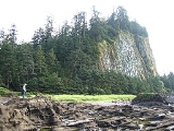
Queen Charlotte Mountains
Encyclopedia
The Queen Charlotte Mountains are a mountain range
comprising all mountain
s and small mountain range
s of Haida Gwaii (formerly Queen Charlotte Islands), British Columbia
, Canada
. It is the northernmost subrange of the Insular Mountains
. They are subdivided into the Queen Charlotte Ranges, which comprise a small part of southwestern Graham Island and most of Moresby Island, and the Skidegate Plateau, which runs NW-SE on central Graham Island and includes the northeastern tip of Moresby Island. To the plateau's northeast is the Queen Charlotte Lowland, which is part of the Hecate Depression and includes the Argonaut Plain.
The highest mountain associated with the Queen Charlotte Mountain is Mount Moresby
at 1164 m (3,819 ft).
Mountain range
A mountain range is a single, large mass consisting of a succession of mountains or narrowly spaced mountain ridges, with or without peaks, closely related in position, direction, formation, and age; a component part of a mountain system or of a mountain chain...
comprising all mountain
Mountain
Image:Himalaya_annotated.jpg|thumb|right|The Himalayan mountain range with Mount Everestrect 58 14 160 49 Chomo Lonzorect 200 28 335 52 Makalurect 378 24 566 45 Mount Everestrect 188 581 920 656 Tibetan Plateaurect 250 406 340 427 Rong River...
s and small mountain range
Mountain range
A mountain range is a single, large mass consisting of a succession of mountains or narrowly spaced mountain ridges, with or without peaks, closely related in position, direction, formation, and age; a component part of a mountain system or of a mountain chain...
s of Haida Gwaii (formerly Queen Charlotte Islands), British Columbia
British Columbia
British Columbia is the westernmost of Canada's provinces and is known for its natural beauty, as reflected in its Latin motto, Splendor sine occasu . Its name was chosen by Queen Victoria in 1858...
, Canada
Canada
Canada is a North American country consisting of ten provinces and three territories. Located in the northern part of the continent, it extends from the Atlantic Ocean in the east to the Pacific Ocean in the west, and northward into the Arctic Ocean...
. It is the northernmost subrange of the Insular Mountains
Insular Mountains
The Insular Mountains are a range of mountains in the Pacific Coast Ranges on the coast of British Columbia, Canada, comprising the Vancouver Island Ranges and Queen Charlotte Mountains. The Insular Mountains are rugged, particularly on Vancouver Island where peaks in Strathcona Provincial Park...
. They are subdivided into the Queen Charlotte Ranges, which comprise a small part of southwestern Graham Island and most of Moresby Island, and the Skidegate Plateau, which runs NW-SE on central Graham Island and includes the northeastern tip of Moresby Island. To the plateau's northeast is the Queen Charlotte Lowland, which is part of the Hecate Depression and includes the Argonaut Plain.
The highest mountain associated with the Queen Charlotte Mountain is Mount Moresby
Mount Moresby
Mount Moresby is the highest mountain of the Queen Charlotte Mountains located south of Queen Charlotte on the Queen Charlotte Islands, British Columbia, Canada....
at 1164 m (3,819 ft).
Sub-ranges
- Cameron RangeCameron RangeThe Cameron Range is a small, low mountain range in northernwestern British Columbia, Canada, located on the north side of Port Chanal on the western side of Graham Island of the Queen Charlotte Islands. It has an area of 41 km2 and is a subrange of the Queen Charlotte Mountains which in turn form...
: On the western side of Graham IslandGraham IslandGraham Island is the largest island in the Haida Gwaii archipelago , lying off the coast of British Columbia, Canada. It is separated only by a narrow channel from the other principal island of the group, Moresby Island Graham Island is the largest island in the Haida Gwaii archipelago (formerly... - Crease RangeCrease RangeThe Crease Range is a small, low mountain range in northernwestern British Columbia, Canada, located on north-central Graham Island of the Queen Charlotte Islands, between Lan and Adam Lakes. It has an area of 79 km2 and consists of hills. It is a subrange of the Queen Charlotte Mountains which in...
: On north-central Graham Island - McKay RangeMcKay RangeThe McKay Range is a small, low mountain range in northwestern British Columbia, Canada, located on the southern coast of Graham Island in the Queen Charlotte Islands. It has an area of 60 km2 and consists of hills. It is a subrange of the Queen Charlotte Mountains which in turn form part of the...
: On the south coast of Graham Island - San Christoval RangeSan Christoval RangeThe San Christoval Range is a 50 km long, jagged mountain range located on the west coast of Moresby Island, British Columbia, Canada. It is the only lineal mountain range in the Queen Charlotte Mountains and the highest peaks are just above 1000 m. The mountain range was named by Juan José...
: On the western side of Moresby IslandMoresby IslandMoresby Island is a large island that forms part of the Haida Gwaii archipelago in British Columbia, Canada, located at . Gwaii Haanas National Park Reserve and Haida Heritage Site includes Moresby and other islands...

