
Santa Monica Mountains
Encyclopedia
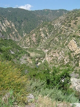
The Santa Monica Mountains are a Transverse Range
in Southern
California
, along the coast of the Pacific Ocean
in the United States
.
in Los Angeles
to Point Mugu in Ventura County
. The southern mountains form a barrier between the San Fernando Valley
and the Los Angeles Basin
, separating "the Valley" on the north and west-central Los Angeles on the south; and the northern mountains separate the Conejo Valley
from Malibu. The Santa Monica Mountains are parallel
to Santa Susana Mountains
, which are located directly north of the mountains across the San Fernando Valley.
are in the Santa Monica Mountains. Beginning at the western end of the San Fernando Valley
the river runs to the north of the mountains. After passing between the range and the Verdugo Mountains
it flows south around Elysian Park defining the easternmost extent of the mountains.
to be a westward extension of the Santa Monicas into the Pacific Ocean
. The range was created by repeated episodes of uplifting and submergence by the Raymond Fault
that created complex layers of sedimentary rock. Volcanic
instrusions have been exposed, including the poorly named "Sandstone Peak", the highest in the range at 948 meters (3,111 ft.). Malibu Creek
, which eroded its own channel while the mountains were slowly uplifted, bisects the mountain range.
, warm to humid summers and wet
, mild
to cool winters. In the summer, the climate is quite dry, which makes the range prone to wildfire
s. Snow
is unusual in the Santa Monica Mountains, since they are not as high as the nearby San Gabriel Mountains
.
On January 17, 2007, an unusually cold storm brought snow in the Santa Monica Mountains. Malibu picked up three inches (eight centimeters) of snow
- the first measurable snow in five decades (50 years). Snow was reported on Boney Peak
, in the winter of 2005; and in March 2006, snow also fell on the summit of the mountain. Snow also fell on the peak of Boney Mountain in late December 2008.
.
. Preservation of lands within the region are managed by the Santa Monica Mountains Conservancy
, the National Park Service
, the California State Parks
, and County and Municipal agencies. Today, the Santa Monica Mountains face pressure from local populations as a desirable residential area, and in the parks as a recreational retreat and wild place that's increasingly rare in urban Los Angeles
.
, Leo Carrillo State Park, Malibu Creek State Park
, Point Mugu State Park
, Will Rogers State Historic Park
, Point Dume State Beach, Griffith Park
, Marvin Braude Mulholland Gateway Park
, Charmlee Wilderness Park, Franklin Canyon Park
, Runyon Canyon Park
, King Gillette Ranch Park, and Paramount Ranch Park.
and lastly Elysian Park. Griffith Park is separated from the rest of the Santa Monica Mountains to the west by the Cahuenga Pass
, over which the 101 Freeway passes from the San Fernando Valley
into Hollywood. Elysian Park is in the easternmost part of the mountains and is bordered by the Los Angeles River
to the east and Downtown Los Angeles
nearby to the south.
. The Mountain lion population within the Santa Monica Mountains (which includes the Simi Hills & Santa Susana Pass) is severely depleted with only 7 known living adult individuals. The primary cause of the decline is due to a combination of traffic related mortality (3 from the area were killed within a matter of months,) anti-coagulants ingested from human poisoned prey (2 individuals within the Simi Hills) and attacks by other, more dominant mountain lions (an elder male, known as P1, killed both his son and his mate, this is thought to be due to a reduction in available habitat.) Snakes are common but only occasionally seen- the Southern Pacific Rattlesnake (the only venomous species), Mountain Kingsnake, California Kingsnake
, Gopher snake, and Garter snake
. The mountains are also home to the Western fence lizard
.
The Santa Monica Mountains are in the California chaparral and woodlands
Ecoregion
, and includes the California oak woodland
and Southern coastal sage scrub plant community, and are covered by hundreds of local plant species, some of which are very rare or endemic, and others which are widespread and have become popular horticultural ornamentals. The California Black Walnut
(Juglans californica), endemic to California, grows on the northern side of the mountains in the Valley and Griffith Park.
Many invasive
weeds
have colonized the mountain habitats, such as annual Mediterranean grasses
, Spanish Broom
(Genista juncea), and Yellow Starthistle (Centaurea solstitialis). In creekside riparian habitats are found plants such as Giant Cane
(Arundo donax), German Ivy
(Delairea odorata), Blue Periwinkle
(Vinca major), and Ivy
(Hedera spp.).
The New Zealand mud snail
has infested watersheds in the Santa Monica Mountains, posing serious threats to native species and complicating efforts to improve stream-water quality for the endangered steelhead trout. Within a period of four years, the snails have expanded from their first known population in Medea Creek in Agoura Hills to nearly 30 other stream sites. Researchers at the Santa Monica Bay Restoration Commission believe that the snails' expansion may have been expedited after the mollusks traveled from stream to stream on the gear of contractors and volunteers.
, present-day site of U.S. Route 101, is the easiest pass through the range connecting the Los Angeles Basin
to the San Fernando Valley
. In the 1800s, two battles were fought there, and the Treaty of Cahuenga
was signed nearby. In the heyday of Hollywood movie studios clustered on both sides of it. Sepulveda Pass
is the main north-south pass to the west, connecting the Westside to Sherman Oaks
via the San Diego Freeway
(I-405). Further west are Topanga Canyon Boulevard (SR 27), Laurel Canyon Boulevard
, Malibu Canyon Road, and Kanan Dume Road. Mulholland Drive
runs much of the length of the Santa Monica Mountains, from Cahuenga Pass to Woodland Hills while the Mulholland Highway
runs from Woodland Hills to Sequit Point at the Pacific Ocean
. The eastern end of the range, located in the City of Los Angeles, is more intensively developed than the western end of the range. The city of Malibu runs between the coast and the leading mountain ridge, from Topanga Canyon in the east to Leo Carrillo State Park in the west. The term Malibu Ozarks
is sometimes used derogatorily (or ironically) for the unincorporated part of Malibu beyond the leading mountain ridge and lacking an ocean view; the term is often used synonymously with "818 Malibu" (referring to the less desirable San Fernando Valley telephone area code prefix).
Communities along the south slope of the mountains include (from east to west):
, San Fernando
, Simi
, and Crescenta Valley
s. With trailheads in the mountains and valleys, it would link them via existing and new: walking, hiking, equestrian, and mountain biking trails; parklands; and conservation easement
s. The Rim of the Valley project also has the goal to protect flora-fauna habitat
s and wildlife corridor
s between the Santa Monica Mountains and the inland ranges.
Transverse Ranges
The Transverse Ranges are a group of mountain ranges of southern California, in the Pacific Coast Ranges physiographic region that runs along the Pacific coast from Alaska to Mexico in North America. The Transverse Ranges begin at the southern end of the California Coast Ranges and lie between...
in Southern
Southern California
Southern California is a megaregion, or megapolitan area, in the southern area of the U.S. state of California. Large urban areas include Greater Los Angeles and Greater San Diego. The urban area stretches along the coast from Ventura through the Southland and Inland Empire to San Diego...
California
California
California is a state located on the West Coast of the United States. It is by far the most populous U.S. state, and the third-largest by land area...
, along the coast of the Pacific Ocean
Pacific Ocean
The Pacific Ocean is the largest of the Earth's oceanic divisions. It extends from the Arctic in the north to the Southern Ocean in the south, bounded by Asia and Australia in the west, and the Americas in the east.At 165.2 million square kilometres in area, this largest division of the World...
in the United States
United States
The United States of America is a federal constitutional republic comprising fifty states and a federal district...
.
Geography
The range extends approximately 40 mi (64 km) east-west from the Hollywood HillsHollywood Hills
The Hollywood Hills is an affluent and exclusive neighborhood of Los Angeles, California, in the southeastern Santa Monica Mountains. It is bound by Laurel Canyon Boulevard to the west, Vermont Avenue to the east, Mulholland Drive to the north, and Sunset Boulevard to the south.-Hollywood Hills...
in Los Angeles
Los Angeles, California
Los Angeles , with a population at the 2010 United States Census of 3,792,621, is the most populous city in California, USA and the second most populous in the United States, after New York City. It has an area of , and is located in Southern California...
to Point Mugu in Ventura County
Ventura County, California
Ventura County is a county in the southern part of the U.S. state of California. It is located on California's Pacific coast. It is often referred to as the Gold Coast, and has a reputation of being one of the safest populated places and one of the most affluent places in the country...
. The southern mountains form a barrier between the San Fernando Valley
San Fernando Valley
The San Fernando Valley is an urbanized valley located in the Los Angeles metropolitan area of southern California, United States, defined by the dramatic mountains of the Transverse Ranges circling it...
and the Los Angeles Basin
Los Angeles Basin
The Los Angeles Basin is the coastal sediment-filled plain located between the Peninsular and Transverse ranges in southern California in the United States containing the central part of the city of Los Angeles as well as its southern and southeastern suburbs...
, separating "the Valley" on the north and west-central Los Angeles on the south; and the northern mountains separate the Conejo Valley
Conejo Valley
The Conejo Valley is a region spanning both southeastern Ventura County and northwestern Los Angeles County in Southern California, United States...
from Malibu. The Santa Monica Mountains are parallel
Parallel (geometry)
Parallelism is a term in geometry and in everyday life that refers to a property in Euclidean space of two or more lines or planes, or a combination of these. The assumed existence and properties of parallel lines are the basis of Euclid's parallel postulate. Two lines in a plane that do not...
to Santa Susana Mountains
Santa Susana Mountains
The Santa Susana Mountains are a transverse range of mountains in southern California, north of the city of Los Angeles, in the United States. The range runs east-west separating the San Fernando Valley and Simi Valley on its south, from Santa Clara River Valley to the north, and Santa Clarita...
, which are located directly north of the mountains across the San Fernando Valley.
Los Angeles River
The southwestern branch of the headwaters of the Los Angeles RiverLos Angeles River
The Los Angeles River is a river that starts in the San Fernando Valley, in the Simi Hills and Santa Susana Mountains, and flows through Los Angeles County, California, from Canoga Park in the western end of the San Fernando Valley, nearly southeast to its mouth in Long Beach...
are in the Santa Monica Mountains. Beginning at the western end of the San Fernando Valley
San Fernando Valley
The San Fernando Valley is an urbanized valley located in the Los Angeles metropolitan area of southern California, United States, defined by the dramatic mountains of the Transverse Ranges circling it...
the river runs to the north of the mountains. After passing between the range and the Verdugo Mountains
Verdugo Mountains
The Verdugo Mountains are a small, rugged mountain range of the Transverse Ranges system, located just south of the western San Gabriel Mountains in Los Angeles County, Southern California...
it flows south around Elysian Park defining the easternmost extent of the mountains.
Geology
Geologists consider the northern Channel IslandsChannel Islands of California
The Channel Islands of California are a chain of eight islands located in the Pacific Ocean off the coast of Southern California along the Santa Barbara Channel in the United States of America...
to be a westward extension of the Santa Monicas into the Pacific Ocean
Pacific Ocean
The Pacific Ocean is the largest of the Earth's oceanic divisions. It extends from the Arctic in the north to the Southern Ocean in the south, bounded by Asia and Australia in the west, and the Americas in the east.At 165.2 million square kilometres in area, this largest division of the World...
. The range was created by repeated episodes of uplifting and submergence by the Raymond Fault
Raymond Fault
The Raymond Fault is a fault across central Los Angeles County and western Ventura County in Southern California.-San Gabriel Valley area:The eastern end of the Raymond Fault branches from the San Andreas Fault in the San Gabriel Mountains where it forms the east fork of the San Gabriel River and...
that created complex layers of sedimentary rock. Volcanic
Volcano
2. Bedrock3. Conduit 4. Base5. Sill6. Dike7. Layers of ash emitted by the volcano8. Flank| 9. Layers of lava emitted by the volcano10. Throat11. Parasitic cone12. Lava flow13. Vent14. Crater15...
instrusions have been exposed, including the poorly named "Sandstone Peak", the highest in the range at 948 meters (3,111 ft.). Malibu Creek
Malibu Creek
Malibu Creek is a year-round stream in western Los Angeles County, California. It drains the southern Simi Hills and the westernmost San Fernando Valley, flows south through the Santa Monica Mountains, and enters Santa Monica Bay east of Malibu. The Malibu Creek watershed drains and its tributary...
, which eroded its own channel while the mountains were slowly uplifted, bisects the mountain range.
Climate
The Santa Monica Mountains have dryDry
Dry or dryness may refer to:* Lack of water* Prohibiting alcohol * Dryness , the lack of sugar in a drink, especially an alcoholic one * Dryness * Dryness...
, warm to humid summers and wet
Rain
Rain is liquid precipitation, as opposed to non-liquid kinds of precipitation such as snow, hail and sleet. Rain requires the presence of a thick layer of the atmosphere to have temperatures above the melting point of water near and above the Earth's surface...
, mild
Mild
Mild may mean:*Mild ale, often simply referred to as mild, from the Old English milde, meaning "young" or "immature"*Håkan Mild , Swedish former footballer and current director of sports of IFK Göteborg...
to cool winters. In the summer, the climate is quite dry, which makes the range prone to wildfire
Wildfire
A wildfire is any uncontrolled fire in combustible vegetation that occurs in the countryside or a wilderness area. Other names such as brush fire, bushfire, forest fire, desert fire, grass fire, hill fire, squirrel fire, vegetation fire, veldfire, and wilkjjofire may be used to describe the same...
s. Snow
Snow
Snow is a form of precipitation within the Earth's atmosphere in the form of crystalline water ice, consisting of a multitude of snowflakes that fall from clouds. Since snow is composed of small ice particles, it is a granular material. It has an open and therefore soft structure, unless packed by...
is unusual in the Santa Monica Mountains, since they are not as high as the nearby San Gabriel Mountains
San Gabriel Mountains
The San Gabriel Mountains Range is located in northern Los Angeles County and western San Bernardino County, California, United States. The mountain range lies between the Los Angeles Basin and the Mojave Desert, with Interstate 5 to the west and Interstate 15 to the east...
.
On January 17, 2007, an unusually cold storm brought snow in the Santa Monica Mountains. Malibu picked up three inches (eight centimeters) of snow
Snow
Snow is a form of precipitation within the Earth's atmosphere in the form of crystalline water ice, consisting of a multitude of snowflakes that fall from clouds. Since snow is composed of small ice particles, it is a granular material. It has an open and therefore soft structure, unless packed by...
- the first measurable snow in five decades (50 years). Snow was reported on Boney Peak
Boney Peak
Boney Peak, also known as Mount Boney to local residents, is a peak on Boney Mountain in the Santa Monica Mountains National Recreation Area of the National Park Service....
, in the winter of 2005; and in March 2006, snow also fell on the summit of the mountain. Snow also fell on the peak of Boney Mountain in late December 2008.
Archeology
The Santa Monica Mountains have more than 1,000 archeology sites of significance, primarily from the Californian Native American cultures of the Tongva and Chumash people. The mountains were part of their regional homelands for over eight thousand years before the invasion of the Spanish colonizersSpanish colonization of the Americas
Colonial expansion under the Spanish Empire was initiated by the Spanish conquistadores and developed by the Monarchy of Spain through its administrators and missionaries. The motivations for colonial expansion were trade and the spread of the Christian faith through indigenous conversions...
.
Parks
Much of the mountains are located within the Santa Monica Mountains National Recreation AreaSanta Monica Mountains National Recreation Area
The Santa Monica Mountains National Recreation Area or SMMNRA, is a United States National Recreation Area containing many individual parks and open space preserves, located primarily in the Santa Monica Mountains of Southern California...
. Preservation of lands within the region are managed by the Santa Monica Mountains Conservancy
Santa Monica Mountains Conservancy
The Santa Monica Mountains Conservancy is an agency of the state of California in the United States founded in 1980 and dedicated to the acquisition of land for preservation as open space, for wildlife and California native plants habitat Nature Preserves, and for public recreation...
, the National Park Service
National Park Service
The National Park Service is the U.S. federal agency that manages all national parks, many national monuments, and other conservation and historical properties with various title designations...
, the California State Parks
California Department of Parks and Recreation
The California Department of Parks and Recreation, also known as California State Parks, manages the California state parks system. The system administers 278 parks and 1.4 million acres , with over of coastline; of lake and river frontage; nearly 15,000 campsites; and of hiking, biking, and...
, and County and Municipal agencies. Today, the Santa Monica Mountains face pressure from local populations as a desirable residential area, and in the parks as a recreational retreat and wild place that's increasingly rare in urban Los Angeles
Los Ángeles
Los Ángeles is the capital of the province of Biobío, in the commune of the same name, in Region VIII , in the center-south of Chile. It is located between the Laja and Biobío rivers. The population is 123,445 inhabitants...
.
Regional parks
Over twenty individual state and municipal parks are in the Santa Monica Mountains, including: Topanga State ParkTopanga State Park
Topanga State Park is a California state park located in Los Angeles County. It is located adjacent to the unincorporated community of Topanga, California, within the city of Los Angeles, California...
, Leo Carrillo State Park, Malibu Creek State Park
Malibu Creek State Park
Malibu Creek State Park is a California state park in the Santa Monica Mountains near Malibu, in Calabasas. It opened to the public in 1976.-Location:Malibu Creek State Park stretches from below Malibu Lake in the west to Piuma Road in the east...
, Point Mugu State Park
Point Mugu State Park
Point Mugu State Park is a state park located in the Santa Monica Mountains National Recreation Area in Southern California. Part of the Western Santa Monica Mountains, the park is located at 9000 West Pacific Coast Highway, Malibu, California. There is a fee-based parking lot that is open from 8...
, Will Rogers State Historic Park
Will Rogers State Historic Park
Will Rogers State Historic Park is the former estate of American humorist Will Rogers. It lies in the Santa Monica mountains in Los Angeles, in the Pacific Palisades area.-Geography:...
, Point Dume State Beach, Griffith Park
Griffith Park
Griffith Park is a large municipal park at the eastern end of the Santa Monica Mountains in the Los Feliz neighborhood of Los Angeles, California. The park covers of land, making it one of the largest urban parks in North America...
, Marvin Braude Mulholland Gateway Park
Marvin Braude Mulholland Gateway Park
Marvin Braude Mulholland Gateway Park is a park in the Santa Monica Mountains with its trailhead at the southern terminus of Reseda Boulevard in Tarzana, Los Angeles, California. The park was named for former Los Angeles City Councilman Marvin Braude who for more than 30 years led the effort to...
, Charmlee Wilderness Park, Franklin Canyon Park
Franklin Canyon Park
Franklin Canyon Park is a public park located near Benedict Canyon at the eastern end of the Santa Monica Mountains. The park comprises , and is located at the purported geographical center of the city of Los Angeles. The park features a lake, a duck pond and over five miles of hiking trails....
, Runyon Canyon Park
Runyon Canyon Park
Runyon Canyon Park is a park in Los Angeles, California, at the eastern end of the Santa Monica Mountains, managed by the Los Angeles Department of Recreation and Parks. The southern entrance to the park is located at the north end of Fuller Avenue in Hollywood. The northern entrance is off the...
, King Gillette Ranch Park, and Paramount Ranch Park.
Griffith Park
At the eastern end of the Santa Monica Mountains are Griffith ParkGriffith Park
Griffith Park is a large municipal park at the eastern end of the Santa Monica Mountains in the Los Feliz neighborhood of Los Angeles, California. The park covers of land, making it one of the largest urban parks in North America...
and lastly Elysian Park. Griffith Park is separated from the rest of the Santa Monica Mountains to the west by the Cahuenga Pass
Cahuenga Pass
The Cahuenga Pass is a mountain pass through the eastern end of the Santa Monica Mountains in the Hollywood district of the City of Los Angeles, California....
, over which the 101 Freeway passes from the San Fernando Valley
San Fernando Valley
The San Fernando Valley is an urbanized valley located in the Los Angeles metropolitan area of southern California, United States, defined by the dramatic mountains of the Transverse Ranges circling it...
into Hollywood. Elysian Park is in the easternmost part of the mountains and is bordered by the Los Angeles River
Los Angeles River
The Los Angeles River is a river that starts in the San Fernando Valley, in the Simi Hills and Santa Susana Mountains, and flows through Los Angeles County, California, from Canoga Park in the western end of the San Fernando Valley, nearly southeast to its mouth in Long Beach...
to the east and Downtown Los Angeles
Downtown Los Angeles
Downtown Los Angeles is the central business district of Los Angeles, California, United States, located close to the geographic center of the metropolitan area...
nearby to the south.
Fauna
The range is host to an immense variety of wildlife, from mountain lions to the endangered steelheadRainbow trout
The rainbow trout is a species of salmonid native to tributaries of the Pacific Ocean in Asia and North America. The steelhead is a sea run rainbow trout usually returning to freshwater to spawn after 2 to 3 years at sea. In other words, rainbow trout and steelhead trout are the same species....
. The Mountain lion population within the Santa Monica Mountains (which includes the Simi Hills & Santa Susana Pass) is severely depleted with only 7 known living adult individuals. The primary cause of the decline is due to a combination of traffic related mortality (3 from the area were killed within a matter of months,) anti-coagulants ingested from human poisoned prey (2 individuals within the Simi Hills) and attacks by other, more dominant mountain lions (an elder male, known as P1, killed both his son and his mate, this is thought to be due to a reduction in available habitat.) Snakes are common but only occasionally seen- the Southern Pacific Rattlesnake (the only venomous species), Mountain Kingsnake, California Kingsnake
California Kingsnake
The California Kingsnake is a non-venomous colubrid snake found in the western United States and northern Mexico. It is a relatively small subspecies of the Common Kingsnake and is naturally found in a wide variety of habitats...
, Gopher snake, and Garter snake
Garter snake
The Garter snake is a Colubrid snake genus common across North America, ranging from Alaska and Canada to Central America. It is the single most widely distributed genus of reptile in North America. The garter snake is also the Massachusettsstate reptile.There is no real consensus on the...
. The mountains are also home to the Western fence lizard
Western fence lizard
The western fence lizard is a common lizard of California and the surrounding area. Because the ventral abdomen of an adult is characteristically blue, it is also known as the blue-belly...
.
Flora
- See also: Flora of California chaparral and woodlands and California native plantsCalifornia native plantsCalifornia native plants are plants that existed in California prior to the arrival of European explorers and colonists in the late 18th century...
The Santa Monica Mountains are in the California chaparral and woodlands
California chaparral and woodlands
The California chaparral and woodlands is a terrestrial ecoregion of lower northern, central, and southern California and northwestern Baja California , located on the west coast of North America...
Ecoregion
Ecoregion
An ecoregion , sometimes called a bioregion, is an ecologically and geographically defined area that is smaller than an ecozone and larger than an ecosystem. Ecoregions cover relatively large areas of land or water, and contain characteristic, geographically distinct assemblages of natural...
, and includes the California oak woodland
California oak woodland
California oak woodland is a plant community found throughout the California chaparral and woodlands ecoregion of California in the United States and northwestern Baja California in Mexico...
and Southern coastal sage scrub plant community, and are covered by hundreds of local plant species, some of which are very rare or endemic, and others which are widespread and have become popular horticultural ornamentals. The California Black Walnut
Juglans californica
Juglans californica, the California black walnut, also called the California walnut, or the Southern California black walnut, is a large shrub or small tree of the Juglandaceae family endemic to California....
(Juglans californica), endemic to California, grows on the northern side of the mountains in the Valley and Griffith Park.
Invasive species
- See also: Invasive speciesInvasive species"Invasive species", or invasive exotics, is a nomenclature term and categorization phrase used for flora and fauna, and for specific restoration-preservation processes in native habitats, with several definitions....
Many invasive
Invasive species
"Invasive species", or invasive exotics, is a nomenclature term and categorization phrase used for flora and fauna, and for specific restoration-preservation processes in native habitats, with several definitions....
weeds
Noxious weeds
A noxious weed is an invasive species of a plant that has been designated by country, state or provincial, or national agricultural authorities as one that is injurious to agricultural and/or horticultural crops, natural habitats and/or ecosystems, and/or humans or livestock...
have colonized the mountain habitats, such as annual Mediterranean grasses
Invasive grasses of North America
Grasses are one of the most abundant floras on all continents except Antarctica. Their divergence is estimated to have taken place 200 million years ago. Humans have intentionally and unintentionally introduced these species to North America through travel and trade. On the North American plains,...
, Spanish Broom
Spanish Broom
Spartium junceum , known as Spanish Broom or Weaver's Broom, is a perennial, leguminous shrub native to the Mediterranean region in southern Europe, southwest Asia and northwest Africa, where it is found in sunny sites, usually on dry, sandy soils...
(Genista juncea), and Yellow Starthistle (Centaurea solstitialis). In creekside riparian habitats are found plants such as Giant Cane
Arundo donax
Arundo donax, Giant Cane, is a tall perennial cane growing in damp soils, either fresh or moderately saline. Other common names include Carrizo, Arundo, Spanish cane, Wild cane, and Giant reed....
(Arundo donax), German Ivy
Delairea
Delairea is a plant genus within the family Asteraceae. It is classified within tribe Senecioneae. It contains only one species, Delairea odorata, which was previously included in the genus Senecio as Senecio mikanioides, and is known as cape ivy in some parts of the world and German ivy in...
(Delairea odorata), Blue Periwinkle
Vinca major
Vinca major, with the common names Bigleaf Periwinkle, Large Periwinkle, Greater Periwinkle and Blue Periwinkle, is an herbaceous, perennial, rhizomatous and stoloniferous flowering plant in the genus Vinca belonging to the family Apocynaceae.-Etymology:The genus name probably derives from the...
(Vinca major), and Ivy
Ivy
Ivy, plural ivies is a genus of 12–15 species of evergreen climbing or ground-creeping woody plants in the family Araliaceae, native to western, central and southern Europe, Macaronesia, northwestern Africa and across central-southern Asia east to Japan and Taiwan.-Description:On level ground they...
(Hedera spp.).
The New Zealand mud snail
New Zealand Mud Snail
The New Zealand mudsnail, Potamopyrgus antipodarum, sometimes previously known as Potamopyrgus jenkinsi, is a species of very small or minute freshwater snail with a gill and an operculum, an aquatic gastropod mollusk in the family Hydrobiidae....
has infested watersheds in the Santa Monica Mountains, posing serious threats to native species and complicating efforts to improve stream-water quality for the endangered steelhead trout. Within a period of four years, the snails have expanded from their first known population in Medea Creek in Agoura Hills to nearly 30 other stream sites. Researchers at the Santa Monica Bay Restoration Commission believe that the snails' expansion may have been expedited after the mollusks traveled from stream to stream on the gear of contractors and volunteers.
Roads and access
Cahuenga PassCahuenga Pass
The Cahuenga Pass is a mountain pass through the eastern end of the Santa Monica Mountains in the Hollywood district of the City of Los Angeles, California....
, present-day site of U.S. Route 101, is the easiest pass through the range connecting the Los Angeles Basin
Los Angeles Basin
The Los Angeles Basin is the coastal sediment-filled plain located between the Peninsular and Transverse ranges in southern California in the United States containing the central part of the city of Los Angeles as well as its southern and southeastern suburbs...
to the San Fernando Valley
San Fernando Valley
The San Fernando Valley is an urbanized valley located in the Los Angeles metropolitan area of southern California, United States, defined by the dramatic mountains of the Transverse Ranges circling it...
. In the 1800s, two battles were fought there, and the Treaty of Cahuenga
Treaty of Cahuenga
The Treaty of Cahuenga, also called the "Capitulation of Cahuenga," ended the fighting of the Mexican-American War in Alta California in 1847. It was not a formal treaty between nations but an informal agreement between rival military forces in which the Californios gave up fighting...
was signed nearby. In the heyday of Hollywood movie studios clustered on both sides of it. Sepulveda Pass
Sepulveda Pass
Sepulveda Pass is a mountain pass through the Santa Monica Mountains in Los Angeles.It connects the Los Angeles Basin to the San Fernando Valley via the San Diego Freeway and Sepulveda Boulevard and experiences heavy traffic on a regular basis, commonly experiencing major traffic slowdowns and...
is the main north-south pass to the west, connecting the Westside to Sherman Oaks
Sherman Oaks, Los Angeles, California
Sherman Oaks is an affluent district in the San Fernando Valley area of the city of Los Angeles, California. In contrast to much of the Valley, the area is relatively urbanized, with commercial skyscrapers along Ventura Boulevard as well as scattered throughout...
via the San Diego Freeway
Interstate 405 (California)
Interstate 405 is a major north–south Interstate Highway in Southern California. It is a bypass of Interstate 5, running along the western areas of the Greater Los Angeles Area from Irvine in the south to near San Fernando in the north...
(I-405). Further west are Topanga Canyon Boulevard (SR 27), Laurel Canyon Boulevard
Laurel Canyon Boulevard
Laurel Canyon Boulevard is a major street in the city of Los Angeles, California. It starts off at Polk Street in Sylmar in the northern San Fernando Valley near the junction of the San Diego and the Golden State ) freeways. Laurel Canyon Boulevard bypasses the city of San Fernando to the west,...
, Malibu Canyon Road, and Kanan Dume Road. Mulholland Drive
Mulholland Drive
Mulholland Drive is a street and road in the eastern Santa Monica Mountains of Southern California. It is named after Los Angeles pioneer civil engineer William Mulholland...
runs much of the length of the Santa Monica Mountains, from Cahuenga Pass to Woodland Hills while the Mulholland Highway
Mulholland Highway
Mulholland Highway is a scenic road in Los Angeles County, Southern California that runs approximately 50 miles through the western Santa Monica Mountains from the near U.S...
runs from Woodland Hills to Sequit Point at the Pacific Ocean
Pacific Ocean
The Pacific Ocean is the largest of the Earth's oceanic divisions. It extends from the Arctic in the north to the Southern Ocean in the south, bounded by Asia and Australia in the west, and the Americas in the east.At 165.2 million square kilometres in area, this largest division of the World...
. The eastern end of the range, located in the City of Los Angeles, is more intensively developed than the western end of the range. The city of Malibu runs between the coast and the leading mountain ridge, from Topanga Canyon in the east to Leo Carrillo State Park in the west. The term Malibu Ozarks
Malibu Ozarks
Malibu Ozarks is a term sometimes used derogatorily of inland land or property within the U.S. geographical zip code of 90265, receiving mail to Malibu, California, which lacks a traditional Malibu ocean view...
is sometimes used derogatorily (or ironically) for the unincorporated part of Malibu beyond the leading mountain ridge and lacking an ocean view; the term is often used synonymously with "818 Malibu" (referring to the less desirable San Fernando Valley telephone area code prefix).
Santa Monica Mountains-area communities
Communities along the north slope of the mountains include (from east to west):- the Los AngelesLos Angeles, CaliforniaLos Angeles , with a population at the 2010 United States Census of 3,792,621, is the most populous city in California, USA and the second most populous in the United States, after New York City. It has an area of , and is located in Southern California...
communities of:- Studio CityStudio City, Los Angeles, CaliforniaStudio City is an affluent residential neighborhood within the City of Los Angeles, California in the San Fernando Valley. Studio City expands over four ZIP code areas: 91604 and sections of 91602, 91607 and 90210....
- Sherman OaksSherman Oaks, Los Angeles, CaliforniaSherman Oaks is an affluent district in the San Fernando Valley area of the city of Los Angeles, California. In contrast to much of the Valley, the area is relatively urbanized, with commercial skyscrapers along Ventura Boulevard as well as scattered throughout...
- EncinoEncino, Los Angeles, CaliforniaEncino is a hilly district of the city of Los Angeles, California, United States. Specifically, it is located in the central portion of the southern San Fernando Valley and on the north slope of the Santa Monica Mountains...
- TarzanaTarzana, Los Angeles, CaliforniaTarzana is a district in the San Fernando Valley region of the city of Los Angeles, California, United States. The neighborhood is located on the site of a former ranch owned by author Edgar Rice Burroughs, who named it Tarzana after his jungle hero character Tarzan.-Geography:Tarzana, a district...
- Woodland HillsWoodland Hills, Los Angeles, CaliforniaWoodland Hills is a district in the city of Los Angeles, California.Woodland Hills is located in the southwestern area of the San Fernando Valley, east of Calabasas and west of Tarzana, with Warner Center in its northern section...
- West HillsWest Hills, Los Angeles, CaliforniaWest Hills is an affluent community and district in the western San Fernando Valley region of Los Angeles, California, United States.West Hills is bordered by Chatsworth and the Chatsworth Reservoir to the north, Canoga Park to the east, Woodland Hills to the south, Hidden Hills to the southwest,...
- Studio City
- CalabasasCalabasas, CaliforniaCalabasas is an affluent city in Los Angeles County, California in the western United States. It is located in the hills in the southwestern San Fernando Valley and the Santa Monica Mountains between Woodland Hills, Agoura Hills, West Hills, and Malibu, California. As of the 2010 census, the city...
- Bell CanyonBell Canyon, CaliforniaBell Canyon is a census-designated place in Ventura County, California. Bell Canyon is a residential unincorporated community located near West Hills and the western San Fernando Valley in the Simi Hills. Although only minutes from the Los Angeles city limits, Bell Canyon is a Horse Community. ...
- Agoura HillsAgoura Hills, CaliforniaAgoura Hills is a city in Los Angeles County, California, and has the ZIP code 91301. The population was 20,330 at the 2010 census, down from 20,537 at the 2000 census. It is located in the eastern Conejo Valley between the Simi Hills and the Santa Monica Mountains. This city on the Ventura...
- Westlake VillageWestlake Village, CaliforniaWestlake Village is a planned community that straddles the Los Angeles and Ventura county line. The eastern portion is the incorporated city Westlake Village, located on the western edge of Los Angeles County, California. The city, located in the region known as the Conejo Valley, encompasses half...
- Thousand OaksThousand Oaks, CaliforniaThousand Oaks is a city in southeastern Ventura County, California, in the United States. It was named after the many oak trees that grace the area, and the city seal is adorned with an oak....
Communities along the south slope of the mountains include (from east to west):
- the Los AngelesLos Angeles, CaliforniaLos Angeles , with a population at the 2010 United States Census of 3,792,621, is the most populous city in California, USA and the second most populous in the United States, after New York City. It has an area of , and is located in Southern California...
communities of:- Los FelizLos Feliz, Los Angeles, CaliforniaLos Feliz, also Rancho Los Feliz is an affluent, hilly neighborhood in the Hollywood district of Los Angeles, California, named after its land grantee José Vicente Feliz....
- Hollywood HillsHollywood HillsThe Hollywood Hills is an affluent and exclusive neighborhood of Los Angeles, California, in the southeastern Santa Monica Mountains. It is bound by Laurel Canyon Boulevard to the west, Vermont Avenue to the east, Mulholland Drive to the north, and Sunset Boulevard to the south.-Hollywood Hills...
- Bel-AirBel-Air, Los Angeles, CaliforniaBel Air is an affluent residential community in the hills of the Westside of the city of Los Angeles, California. Together with Beverly Hills and Holmby Hills it forms the Platinum Triangle of Los Angeles neighborhoods....
- Benedict CanyonBenedict Canyon, Los Angeles, CaliforniaBenedict Canyon is an area in the City of Los Angeles, California near Sherman Oaks northwest of Beverly Hills.-Geography and history:The Canyon is a ravine in the Santa Monica Mountains that drops in a north to south direction from its high point at the crestline of the Santa Monica Mountains on...
- BrentwoodBrentwood, Los Angeles, CaliforniaBrentwood is a district in western Los Angeles, California, United States. The district is located at the base of the Santa Monica Mountains, bounded by the San Diego Freeway on the east, Wilshire Boulevard on the south, the Santa Monica city limits on the southwest, the border of Topanga State...
- Pacific Palisades
- Los Feliz
- Beverly Hills
- the unincorporated community of TopangaTopanga, CaliforniaTopanga is a census-designated place in western Los Angeles County, California, USA. It is located in the Santa Monica Mountains. Occupying Topanga Canyon, it is often referred to by that name. Topanga is bounded on three sides by State Park or conservancy lands, and on the south by the Pacific...
- Malibu
Rim of the Valley Trail
The Rim of the Valley Trail is a plan in progress for accessing and connecting the parkland and recreational areas of the mountains surrounding the ConejoConejo Valley
The Conejo Valley is a region spanning both southeastern Ventura County and northwestern Los Angeles County in Southern California, United States...
, San Fernando
San Fernando Valley
The San Fernando Valley is an urbanized valley located in the Los Angeles metropolitan area of southern California, United States, defined by the dramatic mountains of the Transverse Ranges circling it...
, Simi
Simi Valley
Simi Valley is a synclinal valley in Southern California in the United States. It is an enclosed or hidden valley surrounded by mountains and hills. It is connected to the San Fernando Valley to the east by the Santa Susana Pass & 118 freeway, and in the west the narrows of the Arroyo Simi and 118...
, and Crescenta Valley
Crescenta Valley
The Crescenta Valley is a small inland valley in Los Angeles County, California lying between the San Gabriel Mountains on the northeast and the Verdugo Mountains and San Rafael Hills on the southwest. It opens into the San Fernando Valley at the northwest and the San Gabriel Valley at the southeast...
s. With trailheads in the mountains and valleys, it would link them via existing and new: walking, hiking, equestrian, and mountain biking trails; parklands; and conservation easement
Conservation easement
In the United States, a conservation easement is an encumbrance — sometimes including a transfer of usage rights — which creates a legally enforceable land preservation agreement between a landowner and a government agency or a qualified land...
s. The Rim of the Valley project also has the goal to protect flora-fauna habitat
Habitat
* Habitat , a place where a species lives and grows*Human habitat, a place where humans live, work or play** Space habitat, a space station intended as a permanent settlement...
s and wildlife corridor
Wildlife corridor
A wildlife corridor or green corridor is an area of habitat connecting wildlife populations separated by human activities . This allows an exchange of individuals between populations, which may help prevent the negative effects of inbreeding and reduced genetic diversity that often occur within...
s between the Santa Monica Mountains and the inland ranges.
Named peaks
| Peak | | Height | Notes | |
|---|---|---|---|
| | US | | SI | ||
| Sandstone Peak Sandstone Peak Sandstone Peak, officially Mount Allen, is the highest summit in the Santa Monica Mountains with an elevation of 3,111 feet . Located near the western edge of the Santa Monica Mountains National Recreation Area, the summit provides breathtaking views of Malibu, The Pacific Ocean, Santa Monica, the... |
3111 ft | 948 m | also known as Mount Allen, rising nearly a kilometer high |
| Tri-Peaks | 3010 ft | 917 m | |
| Exchange Peak | 2950 ft | 899 m | |
| Boney Peak Boney Peak Boney Peak, also known as Mount Boney to local residents, is a peak on Boney Mountain in the Santa Monica Mountains National Recreation Area of the National Park Service.... |
2825 ft | 861 m | |
| Castro Peak Castro Peak (California) Castro Peak is the highest peak in the middle part of the Santa Monica Mountains. It is 2,824 feet. The town of Malibu is located to the southeast of the peak. Castro Peak is located in the Santa Monica Mountains National Recreation Area.... |
2824 ft | 861 m | highest peak in the eastern end of the range |
| Saddle Peak | 2805 ft | 855 m | |
| Calabasas Peak | 2165 ft | 660 m | |
| Temescal Peak | 2126 ft | 648 m | |
| San Vicente Mountain | 1965 ft | 599 m | former site of a Nike missile Project Nike Project Nike was a U.S. Army project, proposed in May 1945 by Bell Laboratories, to develop a line-of-sight anti-aircraft missile system. The project delivered the United States' first operational anti-aircraft missile system, the Nike Ajax, in 1953... base, now a Cold War Cold War The Cold War was the continuing state from roughly 1946 to 1991 of political conflict, military tension, proxy wars, and economic competition between the Communist World—primarily the Soviet Union and its satellite states and allies—and the powers of the Western world, primarily the United States... park |
| Clarks Peak | 1965 ft | 599 m | |
| Mesa Peak | 1844 ft | 562 m | |
| Cahuenga Peak Cahuenga Peak Cahuenga Peak is the 12th highest named peak in the Santa Monica Mountains and is located just west of the Hollywood Sign. It provides a spectacular 360-degree panorama of the Los Angeles Basin and the San Fernando Valley for those hikers willing to climb the road-less peak.-History:Howard Hughes... |
1820 ft | 555 m | |
| Brents Mountain | 1713 ft | 522 m | |
| Mount Lee Mount Lee Mount Lee is a peak in the Santa Monica Mountains, in Griffith Park in Los Angeles, California, USA. The famous Hollywood Sign is located on its southern slope. The sign is visible north of the Mulholland Highway. A good view of it can be had by driving north up Gower Street from Hollywood... |
1640 ft | 500 m | the Hollywood Sign Hollywood Sign The Hollywood Sign is a landmark and American cultural icon in the Hollywood Hills area of Mount Lee, Santa Monica Mountains, in Los Angeles, California. The sign spells out the name of the area in and white letters. It was created as an advertisement in 1923, but garnered increasing recognition... is on the southern slope, at exactly half a kilometer high |
| Mount Hollywood | 1625 ft | 495 m | |
| Mount Chapel | 1622 ft | 494 m | |
| Mount Bell | 1587 ft | 484 m | |
| La Jolla Peak | 1567 ft | 478 m | |
| Laguna Peak | 1457 ft | 444 m | |
| Mugu Peak | 1266 ft | 386 m | the westernmost peak in the range, rising directly from the beach |
Adjacent ranges
- Chalk HillsChalk HillsThe Chalk Hills are a north—south running low 'mountain' range in the San Fernando Valley perpendicular to and adjoining the Santa Monica Mountains. They are located in the Woodland Hills District of the City of Los Angeles in Southern California.-Environs:...
(in Woodland Hills) - Simi HillsSimi HillsThe Simi Hills are a low rocky mountain range of the Transverse Ranges, located in eastern Ventura County and western Los Angeles County, of southern California, United States.-Geography:...
- Santa Susana MountainsSanta Susana MountainsThe Santa Susana Mountains are a transverse range of mountains in southern California, north of the city of Los Angeles, in the United States. The range runs east-west separating the San Fernando Valley and Simi Valley on its south, from Santa Clara River Valley to the north, and Santa Clarita...
- Verdugo MountainsVerdugo MountainsThe Verdugo Mountains are a small, rugged mountain range of the Transverse Ranges system, located just south of the western San Gabriel Mountains in Los Angeles County, Southern California...
- San Gabriel MountainsSan Gabriel MountainsThe San Gabriel Mountains Range is located in northern Los Angeles County and western San Bernardino County, California, United States. The mountain range lies between the Los Angeles Basin and the Mojave Desert, with Interstate 5 to the west and Interstate 15 to the east...
See also
- Santa Monica Mountains National Recreation AreaSanta Monica Mountains National Recreation AreaThe Santa Monica Mountains National Recreation Area or SMMNRA, is a United States National Recreation Area containing many individual parks and open space preserves, located primarily in the Santa Monica Mountains of Southern California...
- Sandstone PeakSandstone PeakSandstone Peak, officially Mount Allen, is the highest summit in the Santa Monica Mountains with an elevation of 3,111 feet . Located near the western edge of the Santa Monica Mountains National Recreation Area, the summit provides breathtaking views of Malibu, The Pacific Ocean, Santa Monica, the...
- Chumash people
- Rindge DamRindge DamThe -tall Rindge Dam on Malibu Creek is located in Malibu Creek State Park, about three miles from the coast of Malibu, California. It is situated just northeast of Malibu Canyon Road, from which it is only partially visible...
- Mulholland HighwayMulholland HighwayMulholland Highway is a scenic road in Los Angeles County, Southern California that runs approximately 50 miles through the western Santa Monica Mountains from the near U.S...
- Malibu fireMalibu fireSeveral fires have occurred in and around Malibu, California:*1970 Malibu Fire*1978 Agoura-Malibu Firestorm*1982 Malibu Fire*1993 Old Topanga Fire*Canyon Fire, in October 2007*Corral Fire, in November 2007-See also:*Malibu, California...
- Sherwood DamSherwood DamThe Lake Sherwood Dam, known also as The Potrero Dam or simply Sherwood Dam, is a 270-foot long concrete arch dam in Thousand Oaks, California, completed in 1904. Its construction led to the creation of the 165-acre Potrero Lake over the following winter...
- Leo Carillo State Beach
- Malibou LakeMalibou LakeMalibou Lake is a small, artificial lake in the Santa Monica Mountains, as well as a community, near Agoura Hills, California, USA. Located within Malibu Creek State Park, and almost completely surrounded by the Santa Monica Mountains National Recreation Area, is situated between Malibu Beach and...
- Santa Monica Mountains National Recreation Area (parks)Santa Monica Mountains National Recreation AreaThe Santa Monica Mountains National Recreation Area or SMMNRA, is a United States National Recreation Area containing many individual parks and open space preserves, located primarily in the Santa Monica Mountains of Southern California...
- Natural history of the Santa Monica Mountains index
External links
- Official Santa Monica Mountains National Recreation Area (SMMNRA) website
- Wildflowers of the Santa Monica Mountains
- Hikes in the Santa Monica Mountains Information on over 50 trails.
- Outdoor LA Hiking Trails Trails and trailheads with maps and directions.
- Ventura County Trails in SMMNRA Maps and trails descriptions.
- Santa Monica Mountains Conservancy
- Santa Monica Mountains Institute