
Light rail in North America
Encyclopedia
Light rail is a commonly used mode of rapid transit in North America
. The term light rail
was coined in 1972 by the U.S. Urban Mass Transportation Administration
(UMTA) to describe new streetcar transformations which were taking place in Europe and the United States. The Germans used the term Stadtbahn
, which is the predecessor of the North American light rail, to describe the concept, and many in the UMTA wanted to adopt the direct translation, which is city rail. However, in its reports the UMTA finally adopted the term light rail instead.
 From the mid-19th century onwards, horse-drawn trams (or horsecar
s) were used in cities around the world. In the late 1880s electrically powered street railways became technically feasible following the invention of a trolley pole
system of collecting current by American inventor Frank J. Sprague
who installed the first successful system at Richmond, Virginia
. They became popular because road
s were then poorly surfaced, and before the invention of the internal combustion engine
and the advent of motor-bus
es, they were the only practical means of public transport
around cities.
The streetcar systems constructed in the 19th and early 20th centuries typically only ran in single-car setups. Some rail lines experimented with multiple unit
configurations, where streetcars were joined together to make short trains, but this did not become common until later. When lines were built over longer distances (typically with a single track) before good roads were common, they were generally called interurban streetcars in most of North America
or radial railways in Ontario
. After World War II, seven major North American cities (Toronto
, Boston
, Philadelphia, San Francisco, Pittsburgh, Newark
, and New Orleans) continued to operate large streetcar systems. When these cities upgraded to new technology, they called it light rail to differentiate it from their existing streetcars since some continued to operate both the old and new systems.
In North America, many of these original Streetcar systems were decommissioned in the 1950s and onward as the popularity of the automobile
increased. Britain abandoned its last light rail system except Blackpool
by 1962. Although some traditional trolley or tram systems still exist to this day, the term "light rail" has come to mean a different type of rail system. Modern light rail technology has primarily German origins, since an attempt by Boeing Vertol to introduce a new American light rail vehicle was a technical failure. After World War II, the Germans retained their streetcar networks and evolved them into model light rail systems (stadtbahnen). Except for Hamburg, all large and most medium-sized German cities maintain light rail networks.
The renaissance of light rail in North American began in 1978 when the Canadian city of Edmonton, Alberta adopted the German Siemens-Duewag U2
system, followed three years later by Calgary
, Alberta
and San Diego, California
.
Historically, the rail gauge
has had considerable variations, with narrow gauge common in many early systems. However, most light rail systems are now standard gauge
. An important advantage of standard gauge is that standard railway maintenance equipment can be used on it, rather than custom-built machinery. Using standard gauge also allows light rail vehicles to be delivered and relocated conveniently using freight railways and locomotives. Another factor favoring standard gauge is that low-floor vehicles are becoming popular, and there is generally insufficient space for wheelchairs to move between the wheels in a narrow gauge layout.
adopted the German Siemens-Duewag U2
system, followed three years later by Calgary
and San Diego. These modern light-rail systems are more like subway or metro
systems that operate at street level. They include modern, multi-car trains that can only be accessed at stations that are spaced anywhere from a couple blocks to a mile or more apart. Some of these systems operate within roadways alongside automobile traffic, and others operate on their own separate right-of-way.
, San Diego, Minneapolis, do however see Light Rail as an efficient alternative and already have major Transit Expansions driven mostly by Light Rail.
Note: Ridership figures are in thousands. Daily ridership figures represent average weekday ridership figures for all cities except those marked with an asterisk (*), where they represent average for all days (i.e. including weekends).
Sources:
-powered trains, including the River Line
in New Jersey
(opened in 2004), the O-Train in Ottawa (opened in 2001), and the SPRINTER in northern San Diego County, California
. Diesel operations are chosen in corridors where lower ridership is expected (and thus do not justify the expense of the electric power infrastructure) or which have an "interurban" nature with stations spaced relatively far apart (electric power provides greater acceleration, making it essential for operations with closely spaced stations). Operations with diesel-powered trains can be an interim measure until ridership growth and the availability of funding allow the system to be upgraded to electric power operations.
As a result of lower government funding, Canadian cities have to recover a much higher share of their costs out of operating revenues. This lack of funding may explain why there is resistance to the high capital costs of rail systems and there are only a few light rail systems in Canada.
 Despite Calgary, Alberta having a relatively low population density, the city's C-Train
system has developed into one of the most successful and busiest light rail systems in North America with an average of 261,100 boardings per weekday in the fourth quarter of 2009. Only the Monterrey Metro
of Monterrey
, Mexico
, which carried approximately 403,000 passengers per day in second quarter of 2009 and Toronto
's streetcar system
, which carried 275,200 passengers per day, surpass the Calgary C-Train passenger load.
The Calgary system was started in 1981 as the result of decisions to avoid building either downtown freeways or a heavy rail system. At that time, Calgary had less than half a million people and was considered too small for rail transit, but when it first opened the C-Train carried about 40,000 passengers per day. By 2007, Calgary had twice as many residents, the system was over three times as long and carried over six times as many passengers.
As of 2007 45% of the people working in downtown Calgary took transit to work, and the city's objective was to increase that to 60%. Calgary's downtown core covers only 1.4 square miles (3.6 km²), and is isolated from the rest of the city by two rivers and a railway line. In the 1960s planners proposed a comprehensive freeway system to improve access, but this was rejected due to intense public opposition. The downtown street system is near maximum capacity and has little room for traffic growth, but the city is confident it can add another 60,000 downtown workers in the next 20 years without making space for more cars. Peak hour travel by LRT is equivalent to the capacity of about 16 free flow traffic lanes and allows the city to have fewer than 0.4 downtown parking places available per worker.
About 25% of the riders during rush hour are counterflow commuters - going out of downtown during the morning and into it during the afternoon. Many of these are students going to educational institutions, who receive deep discounts because they are filling seats that otherwise would be empty, and workers doing crosstown commutes to avoid the lack of freeways. However, as of 2007, the C-Train is suffering growing pains. Because population growth has exceeded expectations and LRT ridership has outpaced population growth, Calgary has had trouble buying enough new LRT vehicles and hiring enough new drivers to meet the demand. As a result, many passengers experience lengthy train waits due to overcrowding.
There are presently two extensions under construction. In November 2007, Calgary City Council approved another two further extensions on the two lines, to be completed by 2012. In addition, on November 20, 2007, Council gave final approval for the new West Leg of Calgary's LRT, which would be the system's fourth leg. Construction for the West leg began in 2009, with completion expected in 2012. When the new light rail vehicles ordered for the extension are finally delivered, the city will have a total of 223 LRVs.
Besides the ongoing program of extending all station platforms to 100 m to accommodate four-car trains, transportation planners have identified two additional lines to be constructed within the next 25 years. They are to the North-Central and South-East districts of the city. BRT service is in place along the future North-Central route and the South-East route as of September 1, 2009. Calgary may one day have to place a tunnel in their downtown to accommodate one of these new lines, or a combination of lines, much like Edmonton has already done.
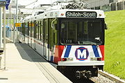
 Edmonton was the first city in North America with a population of less than one million to build a modern light rail system (Greater Edmonton now has over 1 million people). The route first started construction in 1974, and opened its first segment on April 22, 1978, in time for the 1978 Commonwealth Games. While groundbreaking at the time, the Edmonton Transit System
built much of its light rail system underground, which meant that it could not afford to lay as much track to the suburbs. In addition, Edmonton's central business district has less office space and the single line which was built did not reach areas which housed many commuters to downtown. The system is successful by North American standards. Edmonton has only built at grade stations since 1992, and in recent years has had a focus on TOD communities.
According to John Bakker, professor emeritus at the University of Alberta and one of the original designers of the system, going underground was a serious mistake. "Going into tunnels is about 10 times as expensive as going on the surface because you have to relocate utilities", said Mr Bakker. "Edmonton went into tunnels first, and it really bogged down everything thereafter, because they didn't have money". Edmonton's system is only 20.5 km long, while above ground systems could cover twice the distance for half the cost.
 In the 1970s and 1980s Ottawa, Ontario opted for grade-separated busways (the Ottawa Transitway) over light rail on the theory that buses were cheaper. In practice, the capital costs escalated from the original estimate of C$97 million to a final value of C$440 million, a cost overrun of about 450%. This is nearly as high as Calgary's C-Train system, which had a capital cost of C$548 million, is about the same length, and carries more passengers. Unfortunately, the Ottawa Transitway has reached capacity, with over 175 buses per hour on the downtown section, and has no cost-effective way to increase the volume.
In 2001, to supplement its BRT system, Ottawa opened a diesel light rail pilot project, (the O-Train), which was relatively inexpensive to construct (C$21 million), due to its single-track route along a neglected freight-rail right of way and use of diesel multiple unit
s (DMUs) to avoid the cost of building overhead lines
along the tracks. O-Train has had some success in attracting new ridership to the system (a few thousand more riders), due to its connection of a south end big box shopping mall (South Keys
), through Carleton University
to the east-west busway (Ottawa Transitway) near the downtown core of the city.
Ottawa produced plans to expand both the Transitway and to open additional rail routes. The intention of the light rail project was to add to the system (although, the denser parts of the city would have been served by buses and streetcars while the suburbs would have had rapid transit) not to replace the existing Transitway. However, in mid-December 2006, the new Ottawa city council voted to cancel the LRT system despite the fact that funding was already in place and contracts were already signed. As of 2008, lawsuits against the city of Ottawa over its canceled light rail system totaled over $280 million. Examinations for discovery are expected to start in the fall, with the trial beginning in 2009. The trial is expected to be lengthy.
In late 2009, Ottawa introduced a revised east-west LRT proposal, including a tunnel through Downtown Ottawa. The new LRT would follow part of the existing Transitway corridor from Tunney's Pasture Station
in the west to Blair Station
in the east.
.
It is the longest automated light rapid transit system in the world. It is usually not classified as light rail
due to its use of fully automated, driverless trains on elevated guideways, but if it were considered light rail, it would be the most heavily used such system in Canada, with 340,900 passengers per day in the fourth quarter of 2009.
In addition to using driverless trains, it uses two energized power rails (one at +300 VDC and the other at -300 VDC) rather than overhead wires to supply electricity, making it unsafe to operate in the street or use level crossings. Since it is not conventional light rail it is often called an advanced light rapid transit
or light metro system. The network, including the newer Millennium Line and extension, carries about 73.5 million passengers annually. In August, 2009, a new line, the Canada Line
, came into operation. It connects downtown with the airport and the suburb of Richmond. Another line, the Evergreen Line, is planned to be grade-separated automated light rapid transit. Additional extensions are planned for the Millennium Line mostly underground under Central Broadway to University of British Columbia
. There is preliminary talk about extending the Expo Line (although its routing has not yet been determined).
Monterrey
, Nuevo León
has Mexico's largest and North America's busiest light rail system. Both of the city's metro lines are light rail, one elevated and the other subterranean. The fact that the entire Metrorrey system is grade-separated
makes it different from most light rail systems and closer to being a metro
system, as its name suggests. Combined, the two lines carried approximately 136.6 million passengers in calendar year 2009. In the third quarter of 2009, the system carried approximately 418,700 passengers per day.
The first line of Metrorrey opened in 1991 and as of September 2008, the system included 32 stations and operated 40 high-floor trains on approximately 41 kilometers of routes. The light rail system is complemented by Transmetro, a single-fare bus service from a number of the lines' termini.
Guadalajara's
light rail system has two lines, one of which is entirely underground and is thereby is very similar to a metro, as with Monterrey. The north-south line, which replaced a trolleybus
line in 1989, has 19 stations, is 15.5 km in length and is only partially grade-separated, in the center of the city. The east-west line 2 opened in 1994, has 8 stations and runs 8.5 km completely underground from the center of the city to Tetlán. Both lines use high-platform boarding at all stations. The two lines combined carry approximately 72.6 million passengers in calendar year 2008 and an average of 208,000 passengers per day in 1Q2009, making it one of the busiest light rail systems in North America.
The Mexico City Metro
uses exclusively heavy rail
technology. However, the city's trolleybus
agency, Servicio de Transportes Eléctricos
, operates a 12.8 kilometres (8 mi) light rail line which runs in the southern extreme of the city, from Tasqueña metro station
(the southern terminus of Metro Line 2) to Xochimilco
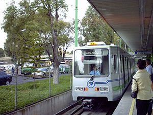
. The single line carries approximately 62,433 passengers per day.
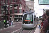
 The United States has a number of light rail systems in its mid-sized to large cities. In older systems, such as in San Francisco and Boston, the light rail is vestigal from streetcar days but were spared the fate of other streetcar systems by some grade separation from traffic and high ridership. A number of systems were built in the 1980s, a few more in the 1990s, and many more were opened in lower density cities in the early 2000s. The older systems attain higher ridership.
United States use of light rail is low by European standards. According to the American Public Transportation Authority, of the 20-odd light rail systems in the United States only five (Boston
, San Francisco, Los Angeles
, San Diego and Portland, OR), achieve more than 25 million passenger boardings per year, and only Boston exceeds the 50+ million boardings per year of the London Docklands Light Rail system.
Compared with that of Canada, the United States federal government offers considerably more funding for transportation projects of all types, resulting in smaller portions of light rail construction cost to be borne at the local and state levels. This funding is provided by the Federal Transit Administration
though as of 2004 the rules to determine which projects will be funded are biased against the simpler streetcar systems (partly because the vehicles tend to be somewhat slower). Some cities in the U.S. (e.g. San Pedro, California) have set about building the less expensive streetcar lines themselves or with only minimal federal support.
in Boston. With 235,300 daily ridership on its 25.4 miles (40.9 km) of track, the Green Line is a primary transportation route within downtown, and is patronized by students and workers from close-in neighborhoods like Brighton
and Allston
.
The subsurface portion of the line was opened in 1897 to alleviate congestion for street level trolley
cars, with numerous lines from the north and south converging via several portals to Park Street Station. By 1964, the transformation to today's system was nearly complete with the elimination of streetcars entering at Lechmere and Boylston; lines into the four remaining portals would be designated B, C, D, and E (the A line to Watertown being abandoned in the late 1960s). Three of today's four lines, although having their own separate path in the medians of their respective roads, still have segments without grade-separated rights-of-way, and consequently wait at traffic lights. The D line, which runs on a former Boston and Albany Railroad
right-of-way, is the lone exception.
In 2004, the MBTA removed the Causeway Street Elevated
portion of the line, and replaced it with an underground tunnel, as a part of Big Dig
environmental remediation, leaving the Lechmere Viaduct
as the only remaining elevated part of the line. Other work includes many station overhauls that will improve handicapped accessibility.
 The Los Angeles County Metro Rail
light rail system comprises three lines: the Green, Gold, and Blue lines. In June 2010, the lines collectively had 164,000 daily weekday boardings, making it the second busiest light rail system in the United States after Boston's. The Blue line, in particular is the busiest with 82,840 average weekday boardings. The Blue and Gold Lines run mostly at grade, with some street-running, elevated, and underground stretches in more densely populated areas. The Green Line is entirely grade separated, running in the median of I-105
and then turning southward along an elevated route.
The Blue Line opened first, in 1990. The Green Line began service in 1995, and the Gold Line entered service in 2003. A 9-mile extension of the Gold Line into East Los Angeles has finished construction and began regular service in November 2009. A further extension to Azusa
from the northern terminus of the same line is also planned. Additional extensions of the Gold line to Whittier, Montclair and possibly Ontario Airport are under active study.
A new line, the Expo light rail line which will run from Downtown Los Angeles
to Culver City (Phase 1) is currently under construction and is scheduled for completion in late 2010. An opening date has not been announced. A further extension to Santa Monica
(Phase 2) recently had its EIR approved by the Expo Line Construction Authority and will open in 2014 or 2015. Other extensions of the Los Angeles County light rail system are under study. Among these is the Crenshaw Corridor
Line, a light rail line running from the Miracle Mile
area to the Los Angeles International Airport
primarily along Crenshaw Boulevard.
(MUNI) light rail lines are vestigial from the city's streetcar days, and San Francisco is one of the few American cities to continuously operate light rail from the streetcar era. As a result, the present-day system has above ground portions running in mixed traffic, stopping at traffic lights as streetcars, while buried sections have their own right-of-way like a subway
. Though in other United States cities in 1950s, the trend was to replace streetcars with bus service, five heavily used lines traveled through tunnels or otherwise had private rights-of-way, making bus replacement not viable. About this time, plans for a subway, the Muni Metro
, were drawn up, and the subway section of Muni, operating underneath Market Street, opened in 1980. Similar to Boston's Green Line
, five separate lines above ground converge to one subway route, though in the former, the underground line was constructed first and surface routes later.
In response to the dot com boom
, and the increasing unreliability of the original Boeing
equipment, the system became strained and Muni ordered new, larger vehicles from Breda, which turned out to have their own noise and braking problems. In 1998, a four-station extension of the trunk line was built, and in 2007 light rail service began on a new line going south from downtown along 3rd Street, achieving limited success. Plans are underway for a three station underground light rail line, expected to serve 78,000 daily riders by 2030. Due to underground routing, the cost for the 1.7 miles (2.7 km) line is estimated at $1.5 billion.
. It has 52.6 miles (84.7 km), comprising four lines: the Blue
, Green
, Red
and Yellow
, and serves about 107,000 daily, counting the free boarding Free Rail Zone. Like most modern light rail systems MAX runs along city streets—albeit in reserved lanes—in the city, but has its own right-of-way farther out. The only mixed-traffic street running on the system is along the Portland Transit Mall
, in downtown, and light rail trains only share lanes with buses there, not any private vehicles. The length of MAX trains is limited to two cars by the relatively small 200 feet (61 m) blocks in downtown Portland.
The MAX system was born out of funds left over from the canceled Mount Hood Freeway, with the Gresham/eastside line (now part of the Blue Line) opening in 1986. The Hillsboro/westside line (now also part of Blue Line) opened in 1998, more than doubling the system's size, followed in 2001 by the Red Line connection to Portland International Airport
and in 2004 by the Yellow Line, which connects downtown to the Portland Expo Center
via Interstate Avenue. Route colors were adopted in 2000. The Green Line is a 6.5 miles (10.5 km) extension that opened in September 2009 and connects a new transit center at Clackamas Town Center
to the Gateway Transit Center, from where it follows previously existing MAX lines to downtown. Another major addition in 2009 was a new, second alignment through downtown, along the transit mall; it is used by both the Yellow and Green lines. A planned Orange Line
would be built from the Green Line's downtown terminus at Portland State University
to the southeast suburb of Milwaukie
and include a new bridge
across the Willamette River
.
is a 20 miles (32.2 km) light rail
line operating in the cities of Phoenix
, Tempe
, and Mesa
, Arizona
and is part of the Valley Metro
public transit system. Construction began in March 2005; operation started December 27, 2008.
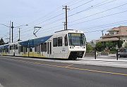
San Diego Trolley
currently comprises three lines, the Blue, Orange and Green, collectively running on 51.1 miles (82.2 km) of track and achieving a ridership of 107,000. During the time that the Metropolitan Transit Development Board (MTDB) was drawing up options for a transit system, Hurricane Kathleen
made landfall, damaging many of the tracks operated by the freight carrier, San Diego and Arizona Eastern Railway
, and cutting them off from the greater Southern Pacific Railroad
, and Southern Pacific petitioned for abandonment. The auspicious timing of the incident led the MTDB to buy and repair the tracks, opening a 13.5 miles (21.7 km) light rail segment on 1981, while also reestablishing freight service on the same line (the Blue Line runs on shared-use track). The system has been expanded incrementally ever since. There are currently plans for an 11 miles (17.7 km) extension to the University City community, connecting the University of California, San Diego (UCSD) campus and University Towne Centre shopping center to the rest of the system.
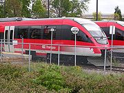
The North County Transit District
also operates a diesel light rail line, called the Sprinter which runs between Oceanside
and Escondido
. The service began operations in March 2008 and operates with Desiro
-class diesel multiple units (DMU) manufactured by Siemens
in Germany.
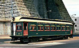
(SEPTA), which also operates other transit modes. The Norristown High-Speed Line is officially considered light rail, and serves 69th Street Terminal
in Upper Darby just outside of Philadelphia to the Norristown Transportation Center
, located in Norristown
, a far-off suburb of Philadelphia. Other systems consist of the Media-Sharon Hill Lines, which also begins at 69th Street Terminal, and the SEPTA Subway-Surface Trolley Lines
which run between Philadelphia Center City
and the nearby western suburbs. The NHSL, and MSH lines were once owned by the Philadelphia and Western Railroad
and Philadelphia Suburban Transportation Company. The Subway-Surface Trolley Lines share stations with SEPTA's Market-Frankford Line
between 30th Street
and 13th Street
.
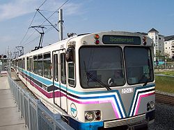
 St. Louis light rail system, St. Louis MetroLink
, consists of two lines, both running through the city center with 73.3 kilometres (45.5 mi) of track. There are terminals across the Mississippi River in southwestern Illinois, at Lambert St. Louis International Airport, and in the southwestern part of the metro area. The first part of the system (Red Line
: Lambert/Shiloh) opened in 1993. The second line of the system (Blue Line
: Shrewsbury/I-44) entered service in 2006. All track is in independent right of way, mostly at surface level, but includes several miles of subways and elevated track as well. St. Louis' light rail system has no street or traffic running trains. The system runs more similar to a heavy rail rail system than most light rail systems in North America. All stations are independent entry and platforms are all flush level with trains providing passengers easy access on/off. In the downtown area, the system uses abandoned railway tunnels built in the 19th century. The downtown subway stations have an ancient appearance with rough-hewn rock walls. The Shrewsbury/I-44 station also has a few portions in tunnels, which are large and of modern concrete construction. Since the line opened, expansion has continued, and the transit agency has future lines in planning stages.
(DART), the DART Light Rail
system is, by route miles, the nation's largest light rail network, with a 72 miles (115.9 km) rail system that serves Dallas
and five of its suburbs, complemented by a 34 miles (54.7 km) commuter rail line that connects to Fort Worth and runs through Irving
, a DART member city. The LRT lines began with the opening of the 20 miles (32.2 km) starter system in 1996. In the first few years after the turn of the century, DART opened several small expansions, culminating in the opening of the Green Line in December 2010.
DART currently runs four LRT lines. The Red Line begins in southwest Dallas at Westmoreland Station and runs northeast to downtown, then runs north through the suburbs of Richardson
and Plano
to its terminus at Parker Road Station. The Blue line begins in South Dallas at Ledbetter Station and runs north, joining the Red Line at 8th and Corinth Station on its trek to downtown. It continues north to Mockingbird Station before it breaks away from the Red Line and turns northeast toward Garland
, ending its run at Downtown Garland Station. The Green line runs from its southern terminus at Buckner Station in Pleasant Grove to the northwest towards Downtown Dallas. The Green Line then continues northeast passing through the suburbs of Farmers Branch
and Carrollton
ending at North Carrollton / Frankford Station. The Orange Line is a peak-service only line (running concurrently with some of the northern portions of the Green and Red lines) until 2012, when the first phase expansion towards D/FW Airport is completed.
The system is currently under expansion. The Orange Line will run from downtown, towards Las Colinas
in Irving and on to DFW Airport. The Blue Line is expanding east to Rowlett
and south to Interstate 20. When the latest expansion round is completed, DART's system will have 93 miles (149.7 km) of LRT.
(UTA) runs the 19 miles (30.6 km) light rail system known as TRAX
in the Salt Lake Valley
. The system, which opened in 1999, serves approximately 58,300 people every day and contains 69 vehicles. The system has 2 lines, both of which end Downtown
at Salt Lake Central Station. One line ends at the University of Utah
, while the other ends in the suburb of Sandy
. Four extensions have recently been approved and funded, with completion expected by 2014.
), opened its METRORail
service on January 1, 2004 to very large crowds. The system currently consists of a single double track line of 7.5 miles (12.1 km). The system serves 45,000 passengers daily. Like many other light rail systems in America, METRORail runs in city streets and does not have its own right of way for most of its route. Two-car trains are the maximum on the line due to Downtown Houston's city block size.
, consists of 42.2 miles (67.9 km) of track across three different lines.
The Alum Rock - Santa Teresa
line serves the eastern, northern, downtown, and southern areas of San Jose. The Mountain View - Winchester
line operates between Mountain View
and the Winchester
neighborhood of San Jose. Both of these lines share the same tracks and stations on First Street between Tasman Drive
in northern San Jose and the San Jose Convention Center
in downtown. A third line, the Ohlone-Chynoweth - Almaden line, is a three-stop spur that connects the Almaden Valley
area to the Alum Rock - Santa Teresa Line.
. This line runs from downtown Minneapolis, next to the Hubert H. Humphrey Metrodome
, near the University of Minnesota
campus, to the Minneapolis-St. Paul International Airport, then to the Mall of America
. This line opened in 2004, and by the end of 2009, two additional stations were added at Target Field in the downtown Minneapolis Warehouse District, and at American Boulevard in Bloomington. All stations were modified to accommodate 3-car trains in 2010. The Central Corridor
, which will run from downtown Minneapolis to downtown St. Paul
, is scheduled to begin service in 2014. The Southwest Corridor, which would run from Eden Prairie
to downtown Minneapolis is currently being planned and could begin service as early as 2015.
, New Jersey Transit
provides light rail service along three lines in different parts of the state.
, the West Side
and Downtown Jersey City
, Hoboken
, and the North Hudson
towns in three lines.
in the early 2000s. A second branch running through downtown to Newark-Broad St. station
was opened in the mid 2000's, and the system was rebranded again as Newark Light Rail.

The River Line is a diesel
light rail
line in southern New Jersey, running along, except at its ends, what was previously the Bordentown Secondary, from Trenton
to Camden
, serving communities along the Delaware River
between thee cities. This line is one of only two diesel light rail lines in North America, and the only one in the United States
.
_light_rail_station.jpg) The Baltimore Light Rail is a single line reaching from BWI Airport south of Baltimore, through the city and north to a strip mall and office park. With 30 miles (48.3 km) of track, the line achieves a daily ridership of 36,300.
The Baltimore Light Rail is a single line reaching from BWI Airport south of Baltimore, through the city and north to a strip mall and office park. With 30 miles (48.3 km) of track, the line achieves a daily ridership of 36,300.
Major efforts toward the creation of the light rail were championed by then mayor William Donald Schaefer
, who wanted a transit link to the new baseball park, Camden Yards, about to be built downtown. In order to have the line completed the month that the Baltimore Orioles
started playing in Camden Yards in 1992, the system was built entirely without federal money, a rarity in late 20th century U.S. transit projects. Federal funds would later be used to double track the whole system, decreasing headways which had been restricted to 17 minutes.
The light rail line was built entirely at grade, even through downtown's narrow streets. Though the majority of the track's length is grade-separated from acquiring disused railroad rights-of-way, trains run in the streets in some sections downtown. When the system was built, this resulted in vehicles having to wait in traffic lights, though in 2007 a signal preemption system was installed.
The Maryland Transit Administration
has drawn up plans for an additional four lines which may be light rail, bus rapid transit
, or heavy rail to create a comprehensive city system. As of 2007, only the future of one line is certain. The Red Line
, which is in its intermediate planning stages, would be an East-West link via either bus rapid transit or light rail. Whichever mode is selected, officials have insisted that the line be underground through the city center because of Baltimore's narrow streets and dense traffic.
.jpg) Charlotte's LYNX
Charlotte's LYNX
system consists of a single 9.6 miles (15.4 km) line called the Blue Line. After receiving a positive Record of Decision from the Federal Transit Administration on May 19, 2003, continued preparation and land acquisition would finally result in its groundbreaking in spring 2005. The line is in full operation, at a projected final cost of $462.7 million. This price tag does not include indirect or ancillary costs such as rerouting water and sewer lines to accommodate the line, estimated at an additional $72 million as of April 2006.
The Blue Line's construction is part of a greater comprehensive transit network for the Charlotte metropolitan region. 70.6 more miles of track are planned, though some of these could be constructed as Bus Rapid Transit
or streetcar lines.
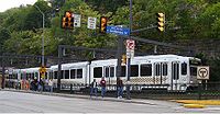 Pittsburgh's light rail network, commonly known as The T, is a 25 miles (40 km) light rail system in Pittsburgh, Pennsylvania
; it functions as a subway in downtown Pittsburgh and largely as an at-grade light rail service in the suburbs. The system is owned and operated by the Port Authority of Allegheny County
(PAT). It is the successor system to the far more extensive streetcar network formerly operated by Pittsburgh Railways
.
The current lines, which run south from the downtown into the South Hills area, were formerly operated by PCC streetcar
s. Beginning in the 1980s PAT reconstructed the lines along the existing right-of-way and ordered new trams
from Siemens. PCCs continued to operate in tandem with the new light rail vehicles until 1999 when the last five were retired from service. PAT also constructed a new subway line in the downtown, ending decades of street-running in the Golden Triangle. Current expansion plans include an extension from the downtown subway under the Allegheny River
to connect with PNC Park
and Heinz Field
; the North Shore Connector is slated to open by 2011.
along Main Street. Buffalo's NFTA
opened the Metro Rail in 1984 as a single line that was projected to grow into a large rapid transit system. However, cost overruns and population decline caused expansion plans to be put on hold. The system still serves about 20,000 people daily.
owns three main lines in Cleveland
, as well as Cuyahoga County
. The system was established in the 1970s through a merger between the Cleveland Interurban Railroad and the Shaker Heights Rapid Transit. The Blue and Green Lines
were established in 1913, and the Red Line
was established in 1955.
light rail system consists of two lines. The first is Tacoma Link and the other line is Central Link and runs 16 miles from Seattle-Tacoma International Airport
to downtown Seattle New lines to the north, south, and east were approved by voters in November 2008.
(HRT) and features an initial line extending 7.4 mi (11.9 km) through Downtown Norfolk
connecting Eastern Virginia Medical School
, Norfolk State University
, and Newtown Road.
United States
Canada
Mexico
North America
North America is a continent wholly within the Northern Hemisphere and almost wholly within the Western Hemisphere. It is also considered a northern subcontinent of the Americas...
. The term light rail
Light rail
Light rail or light rail transit is a form of urban rail public transportation that generally has a lower capacity and lower speed than heavy rail and metro systems, but higher capacity and higher speed than traditional street-running tram systems...
was coined in 1972 by the U.S. Urban Mass Transportation Administration
Federal Transit Administration
The Federal Transit Administration is an agency within the United States Department of Transportation that provides financial and technical assistance to local public transit systems. The FTA is one of ten modal administrations within the DOT...
(UMTA) to describe new streetcar transformations which were taking place in Europe and the United States. The Germans used the term Stadtbahn
Stadtbahn
A ' is a tramway or light railway that includes segments built to rapid transit standards, usually as part of a process of conversion to a metro railway, mainly by the building of tunnels in the central city area....
, which is the predecessor of the North American light rail, to describe the concept, and many in the UMTA wanted to adopt the direct translation, which is city rail. However, in its reports the UMTA finally adopted the term light rail instead.
History of Streetcar and Light rail
Horsecar
A horsecar or horse-drawn tram is an animal-powered streetcar or tram.These early forms of public transport developed out of industrial haulage routes that had long been in existence, and from the omnibus routes that first ran on public streets in the 1820s, using the newly improved iron or steel...
s) were used in cities around the world. In the late 1880s electrically powered street railways became technically feasible following the invention of a trolley pole
Trolley pole
A trolley pole is a tapered cylindrical pole of wood or metal, used to transfer electricity from a "live" overhead wire to the control and propulsion equipment of a tram or trolley bus. The use of overhead wire in a system of current collection is reputed to be the 1880 invention of Frank J....
system of collecting current by American inventor Frank J. Sprague
Frank J. Sprague
Frank Julian Sprague was an American naval officer and inventor who contributed to the development of the electric motor, electric railways, and electric elevators...
who installed the first successful system at Richmond, Virginia
Richmond, Virginia
Richmond is the capital of the Commonwealth of Virginia, in the United States. It is an independent city and not part of any county. Richmond is the center of the Richmond Metropolitan Statistical Area and the Greater Richmond area...
. They became popular because road
Road
A road is a thoroughfare, route, or way on land between two places, which typically has been paved or otherwise improved to allow travel by some conveyance, including a horse, cart, or motor vehicle. Roads consist of one, or sometimes two, roadways each with one or more lanes and also any...
s were then poorly surfaced, and before the invention of the internal combustion engine
Internal combustion engine
The internal combustion engine is an engine in which the combustion of a fuel occurs with an oxidizer in a combustion chamber. In an internal combustion engine, the expansion of the high-temperature and high -pressure gases produced by combustion apply direct force to some component of the engine...
and the advent of motor-bus
Bus
A bus is a road vehicle designed to carry passengers. Buses can have a capacity as high as 300 passengers. The most common type of bus is the single-decker bus, with larger loads carried by double-decker buses and articulated buses, and smaller loads carried by midibuses and minibuses; coaches are...
es, they were the only practical means of public transport
Public transport
Public transport is a shared passenger transportation service which is available for use by the general public, as distinct from modes such as taxicab, car pooling or hired buses which are not shared by strangers without private arrangement.Public transport modes include buses, trolleybuses, trams...
around cities.
The streetcar systems constructed in the 19th and early 20th centuries typically only ran in single-car setups. Some rail lines experimented with multiple unit
Multiple unit
The term multiple unit or MU is used to describe a self-propelled carriages capable of coupling with other units of the same or similar type and still being controlled from one driving cab. The term is commonly used to denote passenger trainsets consisting of more than one carriage...
configurations, where streetcars were joined together to make short trains, but this did not become common until later. When lines were built over longer distances (typically with a single track) before good roads were common, they were generally called interurban streetcars in most of North America
North America
North America is a continent wholly within the Northern Hemisphere and almost wholly within the Western Hemisphere. It is also considered a northern subcontinent of the Americas...
or radial railways in Ontario
Ontario
Ontario is a province of Canada, located in east-central Canada. It is Canada's most populous province and second largest in total area. It is home to the nation's most populous city, Toronto, and the nation's capital, Ottawa....
. After World War II, seven major North American cities (Toronto
Toronto
Toronto is the provincial capital of Ontario and the largest city in Canada. It is located in Southern Ontario on the northwestern shore of Lake Ontario. A relatively modern city, Toronto's history dates back to the late-18th century, when its land was first purchased by the British monarchy from...
, Boston
Boston
Boston is the capital of and largest city in Massachusetts, and is one of the oldest cities in the United States. The largest city in New England, Boston is regarded as the unofficial "Capital of New England" for its economic and cultural impact on the entire New England region. The city proper had...
, Philadelphia, San Francisco, Pittsburgh, Newark
Newark, New Jersey
Newark is the largest city in the American state of New Jersey, and the seat of Essex County. As of the 2010 United States Census, Newark had a population of 277,140, maintaining its status as the largest municipality in New Jersey. It is the 68th largest city in the U.S...
, and New Orleans) continued to operate large streetcar systems. When these cities upgraded to new technology, they called it light rail to differentiate it from their existing streetcars since some continued to operate both the old and new systems.
In North America, many of these original Streetcar systems were decommissioned in the 1950s and onward as the popularity of the automobile
Automobile
An automobile, autocar, motor car or car is a wheeled motor vehicle used for transporting passengers, which also carries its own engine or motor...
increased. Britain abandoned its last light rail system except Blackpool
Blackpool
Blackpool is a borough, seaside town, and unitary authority area of Lancashire, in North West England. It is situated along England's west coast by the Irish Sea, between the Ribble and Wyre estuaries, northwest of Preston, north of Liverpool, and northwest of Manchester...
by 1962. Although some traditional trolley or tram systems still exist to this day, the term "light rail" has come to mean a different type of rail system. Modern light rail technology has primarily German origins, since an attempt by Boeing Vertol to introduce a new American light rail vehicle was a technical failure. After World War II, the Germans retained their streetcar networks and evolved them into model light rail systems (stadtbahnen). Except for Hamburg, all large and most medium-sized German cities maintain light rail networks.
The renaissance of light rail in North American began in 1978 when the Canadian city of Edmonton, Alberta adopted the German Siemens-Duewag U2
Siemens-Duewag U2
The Siemens-Duewag U2 is a type of light-rail vehicle . The cars were built by consortium of Siemens, Wegmann & Co. and Duewag. The U2 design was built on the Siemens U1 prototype tram built in 1965 ....
system, followed three years later by Calgary
Calgary
Calgary is a city in the Province of Alberta, Canada. It is located in the south of the province, in an area of foothills and prairie, approximately east of the front ranges of the Canadian Rockies...
, Alberta
Alberta
Alberta is a province of Canada. It had an estimated population of 3.7 million in 2010 making it the most populous of Canada's three prairie provinces...
and San Diego, California
San Diego, California
San Diego is the eighth-largest city in the United States and second-largest city in California. The city is located on the coast of the Pacific Ocean in Southern California, immediately adjacent to the Mexican border. The birthplace of California, San Diego is known for its mild year-round...
.
Historically, the rail gauge
Rail gauge
Track gauge or rail gauge is the distance between the inner sides of the heads of the two load bearing rails that make up a single railway line. Sixty percent of the world's railways use a standard gauge of . Wider gauges are called broad gauge; smaller gauges, narrow gauge. Break-of-gauge refers...
has had considerable variations, with narrow gauge common in many early systems. However, most light rail systems are now standard gauge
Standard gauge
The standard gauge is a widely-used track gauge . Approximately 60% of the world's existing railway lines are built to this gauge...
. An important advantage of standard gauge is that standard railway maintenance equipment can be used on it, rather than custom-built machinery. Using standard gauge also allows light rail vehicles to be delivered and relocated conveniently using freight railways and locomotives. Another factor favoring standard gauge is that low-floor vehicles are becoming popular, and there is generally insufficient space for wheelchairs to move between the wheels in a narrow gauge layout.
Origins of light rail in North America
The renaissance of light rail in North American began in 1978 when EdmontonEdmonton
Edmonton is the capital of the Canadian province of Alberta and is the province's second-largest city. Edmonton is located on the North Saskatchewan River and is the centre of the Edmonton Capital Region, which is surrounded by the central region of the province.The city and its census...
adopted the German Siemens-Duewag U2
Siemens-Duewag U2
The Siemens-Duewag U2 is a type of light-rail vehicle . The cars were built by consortium of Siemens, Wegmann & Co. and Duewag. The U2 design was built on the Siemens U1 prototype tram built in 1965 ....
system, followed three years later by Calgary
Calgary
Calgary is a city in the Province of Alberta, Canada. It is located in the south of the province, in an area of foothills and prairie, approximately east of the front ranges of the Canadian Rockies...
and San Diego. These modern light-rail systems are more like subway or metro
Rapid transit
A rapid transit, underground, subway, elevated railway, metro or metropolitan railway system is an electric passenger railway in an urban area with a high capacity and frequency, and grade separation from other traffic. Rapid transit systems are typically located either in underground tunnels or on...
systems that operate at street level. They include modern, multi-car trains that can only be accessed at stations that are spaced anywhere from a couple blocks to a mile or more apart. Some of these systems operate within roadways alongside automobile traffic, and others operate on their own separate right-of-way.
Politics of light rail in North America
Due to lower density of many American cities, LRT speed relative to the automobile, generally lower ridership levels, and questions of cost-effectiveness, the construction of light rail systems has spurred political controversy as a use of public funds. Arguments made against light rail systems often bill it as less practical than equivalent bus systems and less effective than increases in highway capacity. Arguments in favor of light rail point to overall improvements in safety and quality of life in cities supporting rail-based mass transit and long-term sustainability benefits. They also encourage cities to change transportation back to transit and away from motor vehicles to make cities "grow upwards, not outwards" referring to the fact denser cities are most efficient than sprawled cities. Many cities, e.g. EdmontonEdmonton
Edmonton is the capital of the Canadian province of Alberta and is the province's second-largest city. Edmonton is located on the North Saskatchewan River and is the centre of the Edmonton Capital Region, which is surrounded by the central region of the province.The city and its census...
, San Diego, Minneapolis, do however see Light Rail as an efficient alternative and already have major Transit Expansions driven mostly by Light Rail.
Usage of light rail in North America
| System | Largest city served | Daily ridership (2010 Q3) |
Annual Ridership (2009) |
|---|---|---|---|
| Sistema de Transporte Colectivo Metrorrey | Monterrey* | 418.7 | 136,620.0 |
| Calgary Transit | Calgary | 252.6 | 77,058.7 |
| Massachusetts Bay Tr Auth | Boston | 215.4 | 74,091.7 |
| Sistema de Tren Eléctrico Urbano | Guadalajara* | 195.1 | 74,850.0 |
| Los Angeles County MTA | Los Angeles | 156.6 | 45,087.3 |
| San Francisco Muni Rwy | San Francisco | 153.9 | 52,163.2 |
| Tri-County Metro Trp Dist | Portland | 127.9 | 36,002.0 |
| Southeastern Penn TA | Philadelphia | 94.4 | 28,766.2 |
| Edmonton Transit System | Edmonton* | 93.6 | 20,605.1 |
| San Diego Trolley, Inc. | San Diego | 92.1 | 31,337.5 |
| Servicios de Transportes Electricos | Mexico City* | 70.1 | 25,307.0 |
| Dallas Area Rapid Transit | Dallas | 57.4 | 18,849.8 |
| New Jersey Transit Corp | Newark* | 57.2 | 21,090.6 |
| Bi-State Dev Agency | Saint Louis | 55.8 | 18,136.3 |
| Utah Transit Authority | Salt Lake City | 46.9 | 13,165.8 |
| Sacramento Reg Tr Dist | Sacramento | 44.4 | 16,690.0 |
| Regional Trp District | Denver | 42.6 | 19,759.3 |
| Valley Metro Rail, Inc. | Phoenix | 37.4 | 11,348.5 |
| Metro Tr Auth of Harris Co | Houston | 35.0 | 11,364.5 |
| Metro Transit | Minneapolis | 35.0 | 9,863.1 |
| Maryland Transit Admin | Baltimore | 34.3 | 8,981.2 |
| Santa Clara Valley Trp Auth | San Jose | 32.8 | 10,127.3 |
| Sound Transit | Seattle | 28.6 | 3,390.1 |
| Port Auth of Allegheny Co | Pittsburgh | 24.8 | 7,150.1 |
| Charlotte Area Transit | Charlotte | 20.2 | 4,760.0 |
| Niagara Frontier Trp Auth | Buffalo | 18.8 | 6,260.0 |
| Regional Transit Auth | New Orleans | 17.3 | 4,712.2 |
| Greater Cleveland Reg TA | Cleveland* | 7.7 | 2,836.5 |
| OC Transpo | Ottawa | 8.7 | 2,523.9 |
| North County Transit District | Oceanside | 7.1 | 2,104.7 |
| Memphis Area Transit Auth | Memphis | 3.8 | 1,158.8 |
| Hillsborough Area Reg TA | Tampa | 0.8 | 446.6 |
Note: Ridership figures are in thousands. Daily ridership figures represent average weekday ridership figures for all cities except those marked with an asterisk (*), where they represent average for all days (i.e. including weekends).
Sources:
- American Public Transportation Association 4Q2009 and 3Q2010.
- INEGI
Diesel light rail
A few recently opened systems in North America use dieselDiesel engine
A diesel engine is an internal combustion engine that uses the heat of compression to initiate ignition to burn the fuel, which is injected into the combustion chamber...
-powered trains, including the River Line
River Line (New Jersey Transit)
The River Line is a diesel light rail system in New Jersey, United States, that connects the cities of Camden and Trenton, New Jersey's capital. It is operated for New Jersey Transit by the Southern New Jersey Rail Group , which originally included Bechtel Group and Bombardier...
in New Jersey
New Jersey
New Jersey is a state in the Northeastern and Middle Atlantic regions of the United States. , its population was 8,791,894. It is bordered on the north and east by the state of New York, on the southeast and south by the Atlantic Ocean, on the west by Pennsylvania and on the southwest by Delaware...
(opened in 2004), the O-Train in Ottawa (opened in 2001), and the SPRINTER in northern San Diego County, California
California
California is a state located on the West Coast of the United States. It is by far the most populous U.S. state, and the third-largest by land area...
. Diesel operations are chosen in corridors where lower ridership is expected (and thus do not justify the expense of the electric power infrastructure) or which have an "interurban" nature with stations spaced relatively far apart (electric power provides greater acceleration, making it essential for operations with closely spaced stations). Operations with diesel-powered trains can be an interim measure until ridership growth and the availability of funding allow the system to be upgraded to electric power operations.
Light rail in Canada
In general, Canadian cities have rates of public transit use which are two to three times as high as comparably sized U.S. cities. Census data for 2006 show that 11.0% of Canadians use public transit to commute to work, compared to 4.8% of Americans. This means that transportation planners must allow for higher passenger volumes on Canadian transit systems than American ones.As a result of lower government funding, Canadian cities have to recover a much higher share of their costs out of operating revenues. This lack of funding may explain why there is resistance to the high capital costs of rail systems and there are only a few light rail systems in Canada.
Calgary
C-Train
C-Train is the light rail transit system in Calgary, Alberta, Canada. It has been in operation since May 25, 1981. The system is operated by Calgary Transit, a department of the Calgary municipal government.-Operations:...
system has developed into one of the most successful and busiest light rail systems in North America with an average of 261,100 boardings per weekday in the fourth quarter of 2009. Only the Monterrey Metro
Monterrey Metro
The Monterrey Metro is a fully grade-separated light rail, or metro, system in Monterrey, Nuevo León, Mexico. It is the newest of Mexico's metro systems, with operation beginning in 1991. As of October 2008, the system operated 40 high-floor electric trains along 31 km of routes...
of Monterrey
Monterrey
Monterrey , is the capital city of the northeastern state of Nuevo León in the country of Mexico. The city is anchor to the third-largest metropolitan area in Mexico and is ranked as the ninth-largest city in the nation. Monterrey serves as a commercial center in the north of the country and is the...
, Mexico
Mexico
The United Mexican States , commonly known as Mexico , is a federal constitutional republic in North America. It is bordered on the north by the United States; on the south and west by the Pacific Ocean; on the southeast by Guatemala, Belize, and the Caribbean Sea; and on the east by the Gulf of...
, which carried approximately 403,000 passengers per day in second quarter of 2009 and Toronto
Toronto
Toronto is the provincial capital of Ontario and the largest city in Canada. It is located in Southern Ontario on the northwestern shore of Lake Ontario. A relatively modern city, Toronto's history dates back to the late-18th century, when its land was first purchased by the British monarchy from...
's streetcar system
Toronto streetcar system
The Toronto streetcar system comprises eleven streetcar routes in Toronto, Ontario, Canada, operated by the Toronto Transit Commission , and is the largest such system in the Americas in terms of ridership, number of cars, and track length. The network is concentrated primarily in downtown and in...
, which carried 275,200 passengers per day, surpass the Calgary C-Train passenger load.
The Calgary system was started in 1981 as the result of decisions to avoid building either downtown freeways or a heavy rail system. At that time, Calgary had less than half a million people and was considered too small for rail transit, but when it first opened the C-Train carried about 40,000 passengers per day. By 2007, Calgary had twice as many residents, the system was over three times as long and carried over six times as many passengers.
As of 2007 45% of the people working in downtown Calgary took transit to work, and the city's objective was to increase that to 60%. Calgary's downtown core covers only 1.4 square miles (3.6 km²), and is isolated from the rest of the city by two rivers and a railway line. In the 1960s planners proposed a comprehensive freeway system to improve access, but this was rejected due to intense public opposition. The downtown street system is near maximum capacity and has little room for traffic growth, but the city is confident it can add another 60,000 downtown workers in the next 20 years without making space for more cars. Peak hour travel by LRT is equivalent to the capacity of about 16 free flow traffic lanes and allows the city to have fewer than 0.4 downtown parking places available per worker.
About 25% of the riders during rush hour are counterflow commuters - going out of downtown during the morning and into it during the afternoon. Many of these are students going to educational institutions, who receive deep discounts because they are filling seats that otherwise would be empty, and workers doing crosstown commutes to avoid the lack of freeways. However, as of 2007, the C-Train is suffering growing pains. Because population growth has exceeded expectations and LRT ridership has outpaced population growth, Calgary has had trouble buying enough new LRT vehicles and hiring enough new drivers to meet the demand. As a result, many passengers experience lengthy train waits due to overcrowding.
There are presently two extensions under construction. In November 2007, Calgary City Council approved another two further extensions on the two lines, to be completed by 2012. In addition, on November 20, 2007, Council gave final approval for the new West Leg of Calgary's LRT, which would be the system's fourth leg. Construction for the West leg began in 2009, with completion expected in 2012. When the new light rail vehicles ordered for the extension are finally delivered, the city will have a total of 223 LRVs.
Besides the ongoing program of extending all station platforms to 100 m to accommodate four-car trains, transportation planners have identified two additional lines to be constructed within the next 25 years. They are to the North-Central and South-East districts of the city. BRT service is in place along the future North-Central route and the South-East route as of September 1, 2009. Calgary may one day have to place a tunnel in their downtown to accommodate one of these new lines, or a combination of lines, much like Edmonton has already done.
Edmonton
Edmonton Transit System
The Edmonton Transit System, also called ETS, is the public transit service owned and operated by the city of Edmonton, Alberta. It operates Edmonton's bus and light rail systems.-Service:...
built much of its light rail system underground, which meant that it could not afford to lay as much track to the suburbs. In addition, Edmonton's central business district has less office space and the single line which was built did not reach areas which housed many commuters to downtown. The system is successful by North American standards. Edmonton has only built at grade stations since 1992, and in recent years has had a focus on TOD communities.
According to John Bakker, professor emeritus at the University of Alberta and one of the original designers of the system, going underground was a serious mistake. "Going into tunnels is about 10 times as expensive as going on the surface because you have to relocate utilities", said Mr Bakker. "Edmonton went into tunnels first, and it really bogged down everything thereafter, because they didn't have money". Edmonton's system is only 20.5 km long, while above ground systems could cover twice the distance for half the cost.
Ottawa
In 2001, to supplement its BRT system, Ottawa opened a diesel light rail pilot project, (the O-Train), which was relatively inexpensive to construct (C$21 million), due to its single-track route along a neglected freight-rail right of way and use of diesel multiple unit
Diesel multiple unit
A diesel multiple unit or DMU is a multiple unit train consisting of multiple carriages powered by one or more on-board diesel engines. They may also be referred to as a railcar or railmotor, depending on country.-Design:...
s (DMUs) to avoid the cost of building overhead lines
Overhead lines
Overhead lines or overhead wires are used to transmit electrical energy to trams, trolleybuses or trains at a distance from the energy supply point...
along the tracks. O-Train has had some success in attracting new ridership to the system (a few thousand more riders), due to its connection of a south end big box shopping mall (South Keys
South Keys Station (OC Transpo)
South Keys is a bus station on Ottawa's transitway system. Operated by OC Transpo, it is located at Bank Street and the Airport Parkway at the south end of the South Keys shopping complex. It is the main terminus of Route 97 .This is the last station on the transitway...
), through Carleton University
Carleton University
Carleton University is a comprehensive university located in the capital of Canada, Ottawa, Ontario. The enabling legislation is The Carleton University Act, 1952, S.O. 1952. Founded as a small college in 1942, Carleton now offers over 65 programs in a diverse range of disciplines. Carleton has...
to the east-west busway (Ottawa Transitway) near the downtown core of the city.
Ottawa produced plans to expand both the Transitway and to open additional rail routes. The intention of the light rail project was to add to the system (although, the denser parts of the city would have been served by buses and streetcars while the suburbs would have had rapid transit) not to replace the existing Transitway. However, in mid-December 2006, the new Ottawa city council voted to cancel the LRT system despite the fact that funding was already in place and contracts were already signed. As of 2008, lawsuits against the city of Ottawa over its canceled light rail system totaled over $280 million. Examinations for discovery are expected to start in the fall, with the trial beginning in 2009. The trial is expected to be lengthy.
In late 2009, Ottawa introduced a revised east-west LRT proposal, including a tunnel through Downtown Ottawa. The new LRT would follow part of the existing Transitway corridor from Tunney's Pasture Station
Tunney's Pasture Station (OC Transpo)
Tunney's Pasture Station is a stop on the transitway in Ottawa, Ontario. It is located at the Tunney's Pasture government office complex, on Scott Street at Holland Avenue.The transitway in the area is in a below-grade 'trench' parallel to Scott Street...
in the west to Blair Station
Blair Station (OC Transpo)
Blair Station is a station on Ottawa's transitway located at Blair Road and Regional Road 174. It is the eastern terminal for most weekday peak morning trips of Route 101 , several weekday trips of route 96 and crosstown route 12...
in the east.
Vancouver
In 1986, Vancouver, British Columbia built the Expo Line of the SkyTrainSkyTrain (Vancouver)
SkyTrain is a light rapid transit system in Metro Vancouver, British Columbia, Canada. SkyTrain has of track and uses fully automated trains on grade-separated tracks, running mostly on elevated guideways, which helps SkyTrain to hold consistently high on-time reliability...
.
It is the longest automated light rapid transit system in the world. It is usually not classified as light rail
Light rail
Light rail or light rail transit is a form of urban rail public transportation that generally has a lower capacity and lower speed than heavy rail and metro systems, but higher capacity and higher speed than traditional street-running tram systems...
due to its use of fully automated, driverless trains on elevated guideways, but if it were considered light rail, it would be the most heavily used such system in Canada, with 340,900 passengers per day in the fourth quarter of 2009.
In addition to using driverless trains, it uses two energized power rails (one at +300 VDC and the other at -300 VDC) rather than overhead wires to supply electricity, making it unsafe to operate in the street or use level crossings. Since it is not conventional light rail it is often called an advanced light rapid transit
Bombardier Advanced Rapid Transit
Advanced Rapid Transit or ART is the current name given to a rapid transit system manufactured by Bombardier Transportation. The original versions look like small subway cars that typically run in two-, four- or six-car trains, but the latest versions are more streamlined two-car articulated...
or light metro system. The network, including the newer Millennium Line and extension, carries about 73.5 million passengers annually. In August, 2009, a new line, the Canada Line
Canada Line
Canada Line is a rapid transit line in the Metro Vancouver region of British Columbia, Canada. Opened in August 2009, it is the third line in TransLink's SkyTrain metro network, servicing Vancouver, Richmond, and the Vancouver International Airport...
, came into operation. It connects downtown with the airport and the suburb of Richmond. Another line, the Evergreen Line, is planned to be grade-separated automated light rapid transit. Additional extensions are planned for the Millennium Line mostly underground under Central Broadway to University of British Columbia
University of British Columbia
The University of British Columbia is a public research university. UBC’s two main campuses are situated in Vancouver and in Kelowna in the Okanagan Valley...
. There is preliminary talk about extending the Expo Line (although its routing has not yet been determined).
Light rail in Mexico
Monterrey
Monterrey
Monterrey
Monterrey , is the capital city of the northeastern state of Nuevo León in the country of Mexico. The city is anchor to the third-largest metropolitan area in Mexico and is ranked as the ninth-largest city in the nation. Monterrey serves as a commercial center in the north of the country and is the...
, Nuevo León
Nuevo León
Nuevo León It is located in Northeastern Mexico. It is bordered by the states of Tamaulipas to the north and east, San Luis Potosí to the south, and Coahuila to the west. To the north, Nuevo León has a 15 kilometer stretch of the U.S.-Mexico border adjacent to the U.S...
has Mexico's largest and North America's busiest light rail system. Both of the city's metro lines are light rail, one elevated and the other subterranean. The fact that the entire Metrorrey system is grade-separated
Grade separation
Grade separation is the method of aligning a junction of two or more transport axes at different heights so that they will not disrupt the traffic flow on other transit routes when they cross each other. The composition of such transport axes does not have to be uniform; it can consist of a...
makes it different from most light rail systems and closer to being a metro
Rapid transit
A rapid transit, underground, subway, elevated railway, metro or metropolitan railway system is an electric passenger railway in an urban area with a high capacity and frequency, and grade separation from other traffic. Rapid transit systems are typically located either in underground tunnels or on...
system, as its name suggests. Combined, the two lines carried approximately 136.6 million passengers in calendar year 2009. In the third quarter of 2009, the system carried approximately 418,700 passengers per day.
The first line of Metrorrey opened in 1991 and as of September 2008, the system included 32 stations and operated 40 high-floor trains on approximately 41 kilometers of routes. The light rail system is complemented by Transmetro, a single-fare bus service from a number of the lines' termini.
Guadalajara
Guadalajara's
Guadalajara, Jalisco
Guadalajara is the capital of the Mexican state of Jalisco, and the seat of the municipality of Guadalajara. The city is located in the central region of Jalisco in the western-pacific area of Mexico. With a population of 1,564,514 it is Mexico's second most populous municipality...
light rail system has two lines, one of which is entirely underground and is thereby is very similar to a metro, as with Monterrey. The north-south line, which replaced a trolleybus
Trolleybus
A trolleybus is an electric bus that draws its electricity from overhead wires using spring-loaded trolley poles. Two wires and poles are required to complete the electrical circuit...
line in 1989, has 19 stations, is 15.5 km in length and is only partially grade-separated, in the center of the city. The east-west line 2 opened in 1994, has 8 stations and runs 8.5 km completely underground from the center of the city to Tetlán. Both lines use high-platform boarding at all stations. The two lines combined carry approximately 72.6 million passengers in calendar year 2008 and an average of 208,000 passengers per day in 1Q2009, making it one of the busiest light rail systems in North America.
Mexico City
The Mexico City Metro
Mexico City Metro
The Mexico City Metro , officially called Sistema de Transporte Colectivo, is a metro system that serves the metropolitan area of Mexico City...
uses exclusively heavy rail
Rapid transit
A rapid transit, underground, subway, elevated railway, metro or metropolitan railway system is an electric passenger railway in an urban area with a high capacity and frequency, and grade separation from other traffic. Rapid transit systems are typically located either in underground tunnels or on...
technology. However, the city's trolleybus
Trolleybus
A trolleybus is an electric bus that draws its electricity from overhead wires using spring-loaded trolley poles. Two wires and poles are required to complete the electrical circuit...
agency, Servicio de Transportes Eléctricos
Servicio de Transportes Eléctricos
Servicio de Transportes Eléctricos del Distrito Federal is a public transport agency responsible for the operation of all trolleybus and light rail services in Mexico City. As its name implies, its routes use only electrically powered vehicles...
, operates a 12.8 kilometres (8 mi) light rail line which runs in the southern extreme of the city, from Tasqueña metro station
Metro Tasqueña
Metro Tasqueña is a station on Line 2 of the Mexico City Metro system. It is located in the Campestre Churubusco neighborhood, within the Coyoacán borough of Mexico City, directly south of the city centre on Avenida Tasqueña and Canal de Miramontes...
(the southern terminus of Metro Line 2) to Xochimilco
Xochimilco
Xochimilco is one of the sixteen delegaciones or boroughs within Mexican Federal District. The borough is centered on the formerly independent city of Xochimilco, which was established on what was the southern shore of Lake Xochimilco in the pre-Hispanic period...
. The single line carries approximately 62,433 passengers per day.
Light rail in the United States
United States use of light rail is low by European standards. According to the American Public Transportation Authority, of the 20-odd light rail systems in the United States only five (Boston
Boston
Boston is the capital of and largest city in Massachusetts, and is one of the oldest cities in the United States. The largest city in New England, Boston is regarded as the unofficial "Capital of New England" for its economic and cultural impact on the entire New England region. The city proper had...
, San Francisco, Los Angeles
Los Ángeles
Los Ángeles is the capital of the province of Biobío, in the commune of the same name, in Region VIII , in the center-south of Chile. It is located between the Laja and Biobío rivers. The population is 123,445 inhabitants...
, San Diego and Portland, OR), achieve more than 25 million passenger boardings per year, and only Boston exceeds the 50+ million boardings per year of the London Docklands Light Rail system.
Compared with that of Canada, the United States federal government offers considerably more funding for transportation projects of all types, resulting in smaller portions of light rail construction cost to be borne at the local and state levels. This funding is provided by the Federal Transit Administration
Federal Transit Administration
The Federal Transit Administration is an agency within the United States Department of Transportation that provides financial and technical assistance to local public transit systems. The FTA is one of ten modal administrations within the DOT...
though as of 2004 the rules to determine which projects will be funded are biased against the simpler streetcar systems (partly because the vehicles tend to be somewhat slower). Some cities in the U.S. (e.g. San Pedro, California) have set about building the less expensive streetcar lines themselves or with only minimal federal support.
Boston
The oldest and one of the busiest light rail system in the United States is the MBTA Green LineGreen Line (MBTA)
The Green Line is a streetcar system run by the Massachusetts Bay Transportation Authority in the Boston, Massachusetts area of the United States. It is the oldest line of Boston's subway, which is known locally as the 'T'. The Green Line runs underground downtown and on the surface in outlying...
in Boston. With 235,300 daily ridership on its 25.4 miles (40.9 km) of track, the Green Line is a primary transportation route within downtown, and is patronized by students and workers from close-in neighborhoods like Brighton
Brighton, Boston, Massachusetts
Brighton is a dissolved municipality and current neighborhood of Boston, Massachusetts, United States, and is located in the northwest corner of the city. It is named after the town of Brighton in the English city of Brighton and Hove...
and Allston
Allston, Boston, Massachusetts
Allston is a neighborhood of Boston, Massachusetts, located in the western part of the city. It was named after the American painter and poet Washington Allston. It comprises the land covered by the zip code 02134. For the most part, Allston is administered collectively with the adjacent...
.
The subsurface portion of the line was opened in 1897 to alleviate congestion for street level trolley
Tram
A tram is a passenger rail vehicle which runs on tracks along public urban streets and also sometimes on separate rights of way. It may also run between cities and/or towns , and/or partially grade separated even in the cities...
cars, with numerous lines from the north and south converging via several portals to Park Street Station. By 1964, the transformation to today's system was nearly complete with the elimination of streetcars entering at Lechmere and Boylston; lines into the four remaining portals would be designated B, C, D, and E (the A line to Watertown being abandoned in the late 1960s). Three of today's four lines, although having their own separate path in the medians of their respective roads, still have segments without grade-separated rights-of-way, and consequently wait at traffic lights. The D line, which runs on a former Boston and Albany Railroad
Boston and Albany Railroad
The Boston and Albany Railroad was a railroad connecting Boston, Massachusetts to Albany, New York, later becoming part of the New York Central Railroad system, Conrail and CSX. The line is used by CSX for freight...
right-of-way, is the lone exception.
In 2004, the MBTA removed the Causeway Street Elevated
Causeway Street Elevated
The Causeway Street Elevated was a part of the MBTA's Green Line in Boston, Massachusetts that ran roughly northwards from Haymarket, then ran westwards for a short distance around the Boston Garden indoor sports venue's exterior through the Green Line's North Station stop, and resumed a...
portion of the line, and replaced it with an underground tunnel, as a part of Big Dig
Big Dig
The Central Artery/Tunnel Project , known unofficially as the Big Dig and as the Big Dug since completion, was a megaproject in Boston that rerouted the Central Artery , the chief highway through the heart of the city, into a 3.5-mile tunnel...
environmental remediation, leaving the Lechmere Viaduct
Lechmere Viaduct
The Lechmere Viaduct is the last remaining elevated portion of the MBTA's Green Line in Boston, Massachusetts. Opened June 1, 1912, the Viaduct connects the Lechmere stop to the Science Park Station at Leverett Circle. Currently, the Green Line descends into a tunnel just east of Science Park...
as the only remaining elevated part of the line. Other work includes many station overhauls that will improve handicapped accessibility.
Los Angeles
Los Angeles County Metro Rail
Metro Rail is the rapid transit rail system consisting of five separate lines serving 70 stations in the Los Angeles County, California area. The new Expo line is due to enter service in early 2012. It connects with the Metro liner bus rapid transit system and also with the Metrolink commuter...
light rail system comprises three lines: the Green, Gold, and Blue lines. In June 2010, the lines collectively had 164,000 daily weekday boardings, making it the second busiest light rail system in the United States after Boston's. The Blue line, in particular is the busiest with 82,840 average weekday boardings. The Blue and Gold Lines run mostly at grade, with some street-running, elevated, and underground stretches in more densely populated areas. The Green Line is entirely grade separated, running in the median of I-105
Interstate 105 (California)
Interstate 105 is an Interstate Highway in southern Los Angeles County, California that runs east–west from near the Los Angeles International Airport to Norwalk...
and then turning southward along an elevated route.
The Blue Line opened first, in 1990. The Green Line began service in 1995, and the Gold Line entered service in 2003. A 9-mile extension of the Gold Line into East Los Angeles has finished construction and began regular service in November 2009. A further extension to Azusa
Azusa, California
Azusa is a city in Los Angeles County, California, United States. The population was 46,361 at the 2010 census, up from 44,712 at the 2000 census. Though sometimes assumed to be a compaction of the phrase "everything from A to Z in the USA" from an old Jack Benny joke, the place name "Azusa"...
from the northern terminus of the same line is also planned. Additional extensions of the Gold line to Whittier, Montclair and possibly Ontario Airport are under active study.
A new line, the Expo light rail line which will run from Downtown Los Angeles
Downtown Los Angeles
Downtown Los Angeles is the central business district of Los Angeles, California, United States, located close to the geographic center of the metropolitan area...
to Culver City (Phase 1) is currently under construction and is scheduled for completion in late 2010. An opening date has not been announced. A further extension to Santa Monica
Santa Monica, California
Santa Monica is a beachfront city in western Los Angeles County, California, US. Situated on Santa Monica Bay, it is surrounded on three sides by the city of Los Angeles — Pacific Palisades on the northwest, Brentwood on the north, West Los Angeles on the northeast, Mar Vista on the east, and...
(Phase 2) recently had its EIR approved by the Expo Line Construction Authority and will open in 2014 or 2015. Other extensions of the Los Angeles County light rail system are under study. Among these is the Crenshaw Corridor
Crenshaw Corridor (Los Angeles Metro)
The Crenshaw Corridor is a mass-transit project to construct a new light-rail corridor through southwest Los Angeles. The corridor will run generally north-south and will connect the Crenshaw District and Leimert Park to Inglewood and LAX...
Line, a light rail line running from the Miracle Mile
Miracle Mile, Los Angeles, California
The Miracle Mile in Los Angeles, California, is an area in the Mid-Wilshire region consisting of an almost two-mile stretch of Wilshire Boulevard between Fairfax and Western Avenues...
area to the Los Angeles International Airport
Los Angeles International Airport
Los Angeles International Airport is the primary airport serving the Greater Los Angeles Area, the second-most populated metropolitan area in the United States. It is most often referred to by its IATA airport code LAX, with the letters pronounced individually...
primarily along Crenshaw Boulevard.
San Francisco
The San Francisco Municipal RailwaySan Francisco Municipal Railway
The San Francisco Municipal Railway is the public transit system for the city and county of San Francisco, California. In 2006, it served with an operating budget of about $700 million...
(MUNI) light rail lines are vestigial from the city's streetcar days, and San Francisco is one of the few American cities to continuously operate light rail from the streetcar era. As a result, the present-day system has above ground portions running in mixed traffic, stopping at traffic lights as streetcars, while buried sections have their own right-of-way like a subway
Rapid transit
A rapid transit, underground, subway, elevated railway, metro or metropolitan railway system is an electric passenger railway in an urban area with a high capacity and frequency, and grade separation from other traffic. Rapid transit systems are typically located either in underground tunnels or on...
. Though in other United States cities in 1950s, the trend was to replace streetcars with bus service, five heavily used lines traveled through tunnels or otherwise had private rights-of-way, making bus replacement not viable. About this time, plans for a subway, the Muni Metro
Muni Metro
Muni Metro is a light rail system serving San Francisco, California, operated by the San Francisco Municipal Railway , a division of the San Francisco Municipal Transportation Agency...
, were drawn up, and the subway section of Muni, operating underneath Market Street, opened in 1980. Similar to Boston's Green Line
Green Line (MBTA)
The Green Line is a streetcar system run by the Massachusetts Bay Transportation Authority in the Boston, Massachusetts area of the United States. It is the oldest line of Boston's subway, which is known locally as the 'T'. The Green Line runs underground downtown and on the surface in outlying...
, five separate lines above ground converge to one subway route, though in the former, the underground line was constructed first and surface routes later.
In response to the dot com boom
Dot-com bubble
The dot-com bubble was a speculative bubble covering roughly 1995–2000 during which stock markets in industrialized nations saw their equity value rise rapidly from growth in the more...
, and the increasing unreliability of the original Boeing
US Standard Light Rail Vehicle
The US Standard Light Rail Vehicle was an attempt at a standardized light rail vehicle promoted by the United States Urban Mass Transportation Administration and built by Boeing Vertol in the 1970s...
equipment, the system became strained and Muni ordered new, larger vehicles from Breda, which turned out to have their own noise and braking problems. In 1998, a four-station extension of the trunk line was built, and in 2007 light rail service began on a new line going south from downtown along 3rd Street, achieving limited success. Plans are underway for a three station underground light rail line, expected to serve 78,000 daily riders by 2030. Due to underground routing, the cost for the 1.7 miles (2.7 km) line is estimated at $1.5 billion.
Portland, Oregon
The Metropolitan Area Express (MAX) system serves the Portland metropolitan areaPortland metropolitan area
The Portland-Vancouver-Hillsboro, OR-WA Metropolitan Statistical Area , also known as the Portland metropolitan area or Greater Portland, is an urban area in the U.S. states of Oregon and Washington centered around the city of Portland, Oregon. The U.S...
. It has 52.6 miles (84.7 km), comprising four lines: the Blue
MAX Blue Line
The MAX Blue Line is a 33 mile light rail line in the MAX Light Rail system in the Portland metropolitan area in the U.S. state of Oregon. Operated by TriMet, the line runs between Hillsboro and Gresham, via downtown Portland...
, Green
MAX Green Line
The MAX Green Line is a light rail route in the MAX Light Rail system in Portland, Oregon, United States, extending to Clackamas, Oregon. Construction began in early 2007, and the line opened on September 12, 2009. The average daily ridership in June 2010 was 19,500 increasing to 23,200 by April...
, Red
MAX Red Line
The MAX Red Line is a route in the Metropolitan Area Express light rail system in the Portland, Oregon metropolitan area. It is 25.5 miles long...
and Yellow
MAX Yellow Line
The MAX Yellow Line is a 5.8-mile route in the Metropolitan Area Express light rail system in Portland, Oregon. The route, which opened May 1, 2004, runs between Portland State University , in downtown Portland, and the Portland Expo Center...
, and serves about 107,000 daily, counting the free boarding Free Rail Zone. Like most modern light rail systems MAX runs along city streets—albeit in reserved lanes—in the city, but has its own right-of-way farther out. The only mixed-traffic street running on the system is along the Portland Transit Mall
Portland Transit Mall
The Portland Transit Mall is a set of public transit corridors through the center of downtown Portland, Oregon, United States. More specifically, it is a pair of one-way streets—one for northbound traffic, the other for southbound—along which two of the three lanes are restricted to...
, in downtown, and light rail trains only share lanes with buses there, not any private vehicles. The length of MAX trains is limited to two cars by the relatively small 200 feet (61 m) blocks in downtown Portland.
The MAX system was born out of funds left over from the canceled Mount Hood Freeway, with the Gresham/eastside line (now part of the Blue Line) opening in 1986. The Hillsboro/westside line (now also part of Blue Line) opened in 1998, more than doubling the system's size, followed in 2001 by the Red Line connection to Portland International Airport
Portland International Airport
Portland International Airport is a joint civil-military airport and the largest airport in the U.S. state of Oregon, accounting for 90% of passenger travel and more than 95% of air cargo of the state. It is located within Portland's city limits just south of the Columbia River in Multnomah...
and in 2004 by the Yellow Line, which connects downtown to the Portland Expo Center
Portland Metropolitan Exposition Center
The Portland Metropolitan Exposition Center, usually referred to as the Expo Center, is a convention center located in the Kenton neighborhood of Portland, Oregon. Opened in the early 1920s as a livestock exhibition and auction facility, the Expo Center now hosts over 100 events a year, including...
via Interstate Avenue. Route colors were adopted in 2000. The Green Line is a 6.5 miles (10.5 km) extension that opened in September 2009 and connects a new transit center at Clackamas Town Center
Clackamas Town Center
Clackamas Town Center is a shopping mall in Clackamas, Oregon . It opened in 1981. It is managed and co-owned by General Growth Properties and is currently anchored by J.C. Penney, Macy's , Nordstrom, and Sears...
to the Gateway Transit Center, from where it follows previously existing MAX lines to downtown. Another major addition in 2009 was a new, second alignment through downtown, along the transit mall; it is used by both the Yellow and Green lines. A planned Orange Line
MAX Orange Line
The MAX Orange Line is a planned light rail line for the Metropolitan Area Express light rail system in Portland, Oregon, USA. It is currently under construction. The line is the second part of a two-phase transportation plan known as the South Corridor Project, bringing light rail service to...
would be built from the Green Line's downtown terminus at Portland State University
Portland State University
Portland State University is a public state urban university located in downtown Portland, Oregon, United States. Founded in 1946, it has the largest overall enrollment of any university in the state of Oregon, including undergraduate and graduate students. It is also the only public university in...
to the southeast suburb of Milwaukie
Milwaukie, Oregon
Milwaukie is a city in Clackamas County, Oregon, United States. A very small portion of the city extends into Multnomah County. The population was 20,291 at the 2010 census. Founded in 1848 on the banks of the Willamette River, the city, known as the Dogwood City of the West, was incorporated in...
and include a new bridge
Caruthers Bridge
The Caruthers Bridge is the working name for a bridge currently under construction across the Willamette River in Portland, Oregon, United States. The bridge will carry MAX light rail, the Portland Streetcar, buses, bicycles, and pedestrians. Private cars and trucks will not be permitted on the...
across the Willamette River
Willamette River
The Willamette River is a major tributary of the Columbia River, accounting for 12 to 15 percent of the Columbia's flow. The Willamette's main stem is long, lying entirely in northwestern Oregon in the United States...
.
Phoenix
METRO Light RailMETRO Light Rail (Phoenix)
Metro Light Rail is a 32 km light rail line operating in the U.S. state of Arizona. Part of the Valley Metro public transit system, it serves the cities of Phoenix, Tempe, and Mesa. Construction began in March 2005; operation started December 27, 2008...
is a 20 miles (32.2 km) light rail
Light rail
Light rail or light rail transit is a form of urban rail public transportation that generally has a lower capacity and lower speed than heavy rail and metro systems, but higher capacity and higher speed than traditional street-running tram systems...
line operating in the cities of Phoenix
Phoenix, Arizona
Phoenix is the capital, and largest city, of the U.S. state of Arizona, as well as the sixth most populated city in the United States. Phoenix is home to 1,445,632 people according to the official 2010 U.S. Census Bureau data...
, Tempe
Tempe, Arizona
Tempe is a city in Maricopa County, Arizona, USA, with the Census Bureau reporting a 2010 population of 161,719. The city is named after the Vale of Tempe in Greece. Tempe is located in the East Valley section of metropolitan Phoenix; it is bordered by Phoenix and Guadalupe on the west, Scottsdale...
, and Mesa
Mesa, Arizona
According to the 2010 Census, the racial composition of Mesa was as follows:* White: 77.1% * Hispanic or Latino : 26.54%* Black or African American: 3.5%* Two or more races: 3.4%* Native American: 2.4%...
, Arizona
Arizona
Arizona ; is a state located in the southwestern region of the United States. It is also part of the western United States and the mountain west. The capital and largest city is Phoenix...
and is part of the Valley Metro
Valley Metro (Phoenix)
Valley Metro is the unified public brand of the regional transit system in and around the Phoenix, Arizona, metropolitan area, responsible for public transit.-About Valley Metro:...
public transit system. Construction began in March 2005; operation started December 27, 2008.
San Diego
San Diego Trolley
San Diego Trolley
The San Diego Trolley is a light rail system operating in the metropolitan area of San Diego. The operator, San Diego Trolley, Inc. , is a subsidiary of the San Diego Metropolitan Transit System ...
currently comprises three lines, the Blue, Orange and Green, collectively running on 51.1 miles (82.2 km) of track and achieving a ridership of 107,000. During the time that the Metropolitan Transit Development Board (MTDB) was drawing up options for a transit system, Hurricane Kathleen
Hurricane Kathleen (1976)
Hurricane Kathleen was a hurricane of the 1976 Pacific hurricane season that caused destructive impacts in California. Kathleen caused widespread flooding and damage in northern Mexico and parts of the southwestern United States. It also took an unusual path. On September 7, a tropical depression...
made landfall, damaging many of the tracks operated by the freight carrier, San Diego and Arizona Eastern Railway
San Diego and Arizona Eastern Railway
The San Diego and Arizona Eastern Railway is a short-line American railroad originally founded in 1906 as the San Diego and Arizona Railway by sugar heir, developer, and entrepreneur John D. Spreckels...
, and cutting them off from the greater Southern Pacific Railroad
Southern Pacific Railroad
The Southern Pacific Transportation Company , earlier Southern Pacific Railroad and Southern Pacific Company, and usually simply called the Southern Pacific or Espee, was an American railroad....
, and Southern Pacific petitioned for abandonment. The auspicious timing of the incident led the MTDB to buy and repair the tracks, opening a 13.5 miles (21.7 km) light rail segment on 1981, while also reestablishing freight service on the same line (the Blue Line runs on shared-use track). The system has been expanded incrementally ever since. There are currently plans for an 11 miles (17.7 km) extension to the University City community, connecting the University of California, San Diego (UCSD) campus and University Towne Centre shopping center to the rest of the system.
The North County Transit District
North County Transit District
The North County Transit District is the agency responsible for public transportation in North San Diego County, California, United States...
also operates a diesel light rail line, called the Sprinter which runs between Oceanside
Oceanside, California
-2010:The 2010 United States Census reported that Oceanside had a population of 167,086. The population density was 3,961.8 people per square mile...
and Escondido
Escondido, California
Escondido is a city occupying a shallow valley ringed by rocky hills, just north of the city of San Diego, California. Founded in 1888, it is one of the oldest cities in San Diego County. The city had a population of 143,911 at the 2010 census. Its municipal government set itself an operating...
. The service began operations in March 2008 and operates with Desiro
Desiro
The Siemens Desiro is a family of diesel or electric multiple unit passenger trains. The main variants are the Desiro Classic, Desiro ML, Desiro UK and the future Desiro City and Desiro RUS. The trains are mostly used for commuter and regional services, and their rapid acceleration makes them...
-class diesel multiple units (DMU) manufactured by Siemens
Siemens
Siemens may refer toSiemens, a German family name carried by generations of telecommunications industrialists, including:* Werner von Siemens , inventor, founder of Siemens AG...
in Germany.
Philadelphia
Philadelphia has a light rail system operated by the Southeastern Pennsylvania Transportation AuthoritySoutheastern Pennsylvania Transportation Authority
The Southeastern Pennsylvania Transportation Authority is a metropolitan transportation authority that operates various forms of public transit—bus, subway and elevated rail, commuter rail, light rail, and electric trolley bus—that serve 3.9 million people in and around Philadelphia,...
(SEPTA), which also operates other transit modes. The Norristown High-Speed Line is officially considered light rail, and serves 69th Street Terminal
69th Street Terminal
69th Street Transportation Center is a SEPTA terminal in Upper Darby, Pennsylvania. It is also the southwestern terminus of Philadelphia's EL, the Market-Frankford Line ....
in Upper Darby just outside of Philadelphia to the Norristown Transportation Center
Norristown Transportation Center
Norristown Transportation Center is a two-level multimodal public transportation regional hub located in Norristown, Pennsylvania and operated by SEPTA...
, located in Norristown
Norristown, Pennsylvania
Norristown is a municipality in Montgomery County, Pennsylvania, northwest of the city limits of Philadelphia, on the Schuylkill River. The population was 34,324 as of the 2010 census. It is the county seat of Montgomery County...
, a far-off suburb of Philadelphia. Other systems consist of the Media-Sharon Hill Lines, which also begins at 69th Street Terminal, and the SEPTA Subway-Surface Trolley Lines
SEPTA Subway-Surface Trolley Lines
The Subway–Surface Trolley Lines or Green Lines are five SEPTA trolley lines that operate on street-level tracks in West Philadelphia and Delaware County, Pennsylvania, and in a shared subway with rapid transit trains in Philadelphia's Center City....
which run between Philadelphia Center City
Center City, Philadelphia
Center City, or Downtown Philadelphia includes the central business district and central neighborhoods of the City of Philadelphia, Pennsylvania, United States. As of 2005, its population of over 88,000 made it the third most populous downtown in the United States, after New York City's and Chicago's...
and the nearby western suburbs. The NHSL, and MSH lines were once owned by the Philadelphia and Western Railroad
Philadelphia and Western Railroad
The Philadelphia and Western Railroad was a high-speed, third rail-operated, commuter-hauling interurban electric railroad operating in the western suburbs of the U.S. city of Philadelphia, Pennsylvania. One of its lines is now SEPTA's R100 Norristown High Speed Line; the other has been abandoned...
and Philadelphia Suburban Transportation Company. The Subway-Surface Trolley Lines share stations with SEPTA's Market-Frankford Line
Market-Frankford Line
The Market–Frankford Line is a rapid transit line in Philadelphia, Pennsylvania, United States, operated by the Southeastern Pennsylvania Transportation Authority .-Route:The Market–Frankford Line begins at 69th Street Transportation Center, in Upper Darby...
between 30th Street
30th Street (SEPTA station)
30th Street is a rapid transit and trolley station on SEPTA's Market–Frankford and Subway–Surface lines in Philadelphia, Pennsylvania. The station is located on Market Street between 30th and 31st Streets in the University City neighborhood near Drexel University, and is the first station located...
and 13th Street
13th Street (SEPTA station)
13th Street is a SEPTA Market-Frankford Line and Subway-Surface Lines station in Philadelphia, Pennsylvania, under Market Street between 13th and Juniper Streets in Center City. The station serves the Market–Frankford Line and as the terminus for all five routes of the Subway–Surface Trolley Lines...
.
St. Louis
St. Louis Metrolink
MetroLink is the light rail transit system in the Greater St. Louis area of Missouri and the Metro East area of Illinois. The entire system currently consists of two lines connecting Lambert-St. Louis International Airport and Shrewsbury, MO with Scott Air Force Base near Shiloh, Illinois through...
, consists of two lines, both running through the city center with 73.3 kilometres (45.5 mi) of track. There are terminals across the Mississippi River in southwestern Illinois, at Lambert St. Louis International Airport, and in the southwestern part of the metro area. The first part of the system (Red Line
Red Line (St. Louis MetroLink)
The Red Line of the St. Louis MetroLink is a light rail service operating between 28 stations in Greater St. Louis. It is the oldest and longest line in the system.-Route description:...
: Lambert/Shiloh) opened in 1993. The second line of the system (Blue Line
Blue Line (St. Louis MetroLink)
The Blue Line of the St. Louis MetroLink is a light rail service operating between 24 stations in Greater St. Louis. It is the newest line in the system.-Route description:The Blue Line branch starts in Shrewsbury just west of River des Peres...
: Shrewsbury/I-44) entered service in 2006. All track is in independent right of way, mostly at surface level, but includes several miles of subways and elevated track as well. St. Louis' light rail system has no street or traffic running trains. The system runs more similar to a heavy rail rail system than most light rail systems in North America. All stations are independent entry and platforms are all flush level with trains providing passengers easy access on/off. In the downtown area, the system uses abandoned railway tunnels built in the 19th century. The downtown subway stations have an ancient appearance with rough-hewn rock walls. The Shrewsbury/I-44 station also has a few portions in tunnels, which are large and of modern concrete construction. Since the line opened, expansion has continued, and the transit agency has future lines in planning stages.
Dallas
Operated by Dallas Area Rapid TransitDallas Area Rapid Transit
The Dallas Area Rapid Transit authority is a transit agency based in Dallas, Texas . It operates buses, light rail, commuter rail, and high-occupancy vehicle lanes in Dallas and 12 of its suburbs...
(DART), the DART Light Rail
DART Light Rail
DART Light Rail is a light rail system in Dallas, Texas and its suburbs owned by the Dallas Area Rapid Transit. The system comprises between its three lines — the , the and the . Its 72 miles of track make it the largest light rail system in the United States. It has a daily ridership of...
system is, by route miles, the nation's largest light rail network, with a 72 miles (115.9 km) rail system that serves Dallas
Dallas, Texas
Dallas is the third-largest city in Texas and the ninth-largest in the United States. The Dallas-Fort Worth Metroplex is the largest metropolitan area in the South and fourth-largest metropolitan area in the United States...
and five of its suburbs, complemented by a 34 miles (54.7 km) commuter rail line that connects to Fort Worth and runs through Irving
Irving, Texas
Irving is a city located in the U.S. state of Texas within Dallas County. According to the 2010 U.S. Census, the city population was 216,290. Irving is within the Dallas–Plano–Irving metropolitan division of the Dallas–Fort Worth–Arlington metropolitan area, designated...
, a DART member city. The LRT lines began with the opening of the 20 miles (32.2 km) starter system in 1996. In the first few years after the turn of the century, DART opened several small expansions, culminating in the opening of the Green Line in December 2010.
DART currently runs four LRT lines. The Red Line begins in southwest Dallas at Westmoreland Station and runs northeast to downtown, then runs north through the suburbs of Richardson
Richardson, Texas
Richardson is a city in Dallas and Collin Counties in the U.S. state of Texas. As of the 2010 census, the city had a total population of 99,223. In 2011 the population was estimated to be 107,684. Richardson is an affluent inner suburb of Dallas and home of the Telecom Corridor with a high...
and Plano
Plano, Texas
Plano is a city in the state of Texas, located mostly within Collin County. The city's population was 259,841 at the 2010 census, making it the ninth-largest city in Texas and the 71st most populous city in the United States. Plano is located within the metropolitan area commonly referred to as...
to its terminus at Parker Road Station. The Blue line begins in South Dallas at Ledbetter Station and runs north, joining the Red Line at 8th and Corinth Station on its trek to downtown. It continues north to Mockingbird Station before it breaks away from the Red Line and turns northeast toward Garland
Garland, Texas
-Climate:* The average warmest month is July.* The highest recorded temperature was in 2000.* On average, the coolest month is January.* The lowest recorded temperature was in 1989.* The maximum average precipitation occurs in May....
, ending its run at Downtown Garland Station. The Green line runs from its southern terminus at Buckner Station in Pleasant Grove to the northwest towards Downtown Dallas. The Green Line then continues northeast passing through the suburbs of Farmers Branch
Farmers Branch, Texas
Farmers Branch is a city in Dallas County, Texas, United States. It is both an inner-ring suburb of Dallas and is part of the Dallas–Fort Worth Metroplex. The population was 27,508 at the 2000 census. A July 1, 2008 U.S...
and Carrollton
Carrollton, Texas
-Climate:*On average, the warmest month is July.*The highest recorded temperature was 112°F in 1980.*The average coolest month is January.*The lowest recorded temperature was 1°F in 1989.*The most precipitation on average occurs in May....
ending at North Carrollton / Frankford Station. The Orange Line is a peak-service only line (running concurrently with some of the northern portions of the Green and Red lines) until 2012, when the first phase expansion towards D/FW Airport is completed.
The system is currently under expansion. The Orange Line will run from downtown, towards Las Colinas
Las Colinas
Las Colinas is an upscale, developed area in the Dallas suburb of Irving, Texas.Due to its central location between Dallas and Fort Worth and its proximity to DFW Airport, Las Colinas has been a viable place in the Metroplex for corporate and business relocation.As a planned community, it has many...
in Irving and on to DFW Airport. The Blue Line is expanding east to Rowlett
Rowlett, Texas
-External links:*...
and south to Interstate 20. When the latest expansion round is completed, DART's system will have 93 miles (149.7 km) of LRT.
Salt Lake City
The Utah Transit AuthorityUtah Transit Authority
The Utah Transit Authority operates a public transportation system throughout the Wasatch Front of Utah, United States. It operates fixed route buses, express buses, ski buses, three light rail lines , and a commuter rail line from Salt Lake City to Pleasant View, north of Ogden. UTA is based in...
(UTA) runs the 19 miles (30.6 km) light rail system known as TRAX
UTA TRAX
TRAX is a three-line light rail system in Utah's Salt Lake Valley, serving Salt Lake City and several of its suburbs throughout Salt Lake County. The system is operated by the Utah Transit Authority ....
in the Salt Lake Valley
Salt Lake Valley
Salt Lake Valley is a valley in Salt Lake County in the north-central portion of the U.S. state of Utah. It contains Salt Lake City and many of its suburbs, notably West Valley City, Murray, Sandy, and West Jordan; its total population is 1,029,655 as of 2010...
. The system, which opened in 1999, serves approximately 58,300 people every day and contains 69 vehicles. The system has 2 lines, both of which end Downtown
Downtown Salt Lake City
Downtown is the oldest district in Salt Lake City. The grid from which the entire city is laid out originates at Temple Square, the location of the Salt Lake Temple.-Location:...
at Salt Lake Central Station. One line ends at the University of Utah
University of Utah
The University of Utah, also known as the U or the U of U, is a public, coeducational research university in Salt Lake City, Utah, United States. The university was established in 1850 as the University of Deseret by the General Assembly of the provisional State of Deseret, making it Utah's oldest...
, while the other ends in the suburb of Sandy
Sandy, Utah
Sandy is a city in Salt Lake County, Utah, United States. It is a suburb of Salt Lake City. The population was 87,461 at the 2010 census, making it the sixth-largest city in Utah....
. Four extensions have recently been approved and funded, with completion expected by 2014.
Houston
The Metropolitan Transit Authority of Harris County, Texas (METROMetropolitan Transit Authority of Harris County, Texas
The Metropolitan Transit Authority of Harris County is a major public transportation agency based in Houston . It operates bus, light rail, future commuter rail, and paratransit service in the city as well as most of Harris County...
), opened its METRORail
METRORail
METRORail is the light rail line in Houston . It is the second major light rail service in Texas following the Dallas Area Rapid Transit system. With an approximate daily ridership of 34,155, the METRORail ranks as the fourteenth most-traveled light rail system in the United States, with the...
service on January 1, 2004 to very large crowds. The system currently consists of a single double track line of 7.5 miles (12.1 km). The system serves 45,000 passengers daily. Like many other light rail systems in America, METRORail runs in city streets and does not have its own right of way for most of its route. Two-car trains are the maximum on the line due to Downtown Houston's city block size.
San Jose
San Jose's light rail network, owned and maintained by the Santa Clara Valley Transportation AuthoritySanta Clara Valley Transportation Authority
The Santa Clara Valley Transportation Authority is a special-purpose district responsible for public transit services, congestion management, specific highway improvement projects, and countywide transportation planning for Santa Clara County, California, United States...
, consists of 42.2 miles (67.9 km) of track across three different lines.
The Alum Rock - Santa Teresa
Alum Rock - Santa Teresa (VTA)
Alum Rock–Santa Teresa is a light rail route operated by Santa Clara Valley Transportation Authority . The Alum Rock–Santa Teresa route is one of three existing VTA light rail routes. The other two light rail routes are the Mountain View–Winchester line and the Ohlone/Chynoweth–Almaden line...
line serves the eastern, northern, downtown, and southern areas of San Jose. The Mountain View - Winchester
Mountain View - Winchester (VTA)
Mountain View–Winchester is a light rail route operated by Santa Clara Valley Transportation Authority . The Mountain View–Winchester route is one of three existing VTA light rail routes. The other two light rail routes are the Alum Rock–Santa Teresa line and Ohlone/Chynoweth–Almaden line...
line operates between Mountain View
Mountain View, California
-Downtown:Mountain View has a pedestrian-friendly downtown centered on Castro Street. The downtown area consists of the seven blocks of Castro Street from the Downtown Mountain View Station transit center in the north to the intersection with El Camino Real in the south...
and the Winchester
Winchester (San Jose)
The Winchester area of San Jose, California gains its name from early resident Sarah Lockwood Winchester, a Connecticut native and heiress to fifty percent ownership of the Winchester Repeating Arms Company, who built the famous Winchester Mystery House...
neighborhood of San Jose. Both of these lines share the same tracks and stations on First Street between Tasman Drive
Tasman (VTA)
Tasman is a light rail station operated by the Santa Clara Valley Transportation Authority. It is located in San Jose, California at First Street and Tasman Drive...
in northern San Jose and the San Jose Convention Center
Convention Center (VTA)
Convention Center is a light rail station operated by Santa Clara Valley Transportation Authority. The station is located located in San Jose, California in the median of West San Carlos Street between Market Street and Almaden Boulevard. It is directly in front of the San Jose Convention Center...
in downtown. A third line, the Ohlone-Chynoweth - Almaden line, is a three-stop spur that connects the Almaden Valley
Almaden Valley, San Jose, California
Almaden Valley is an upper-class neighborhood of about 37,000 in the southwestern portion of San Jose, California, USA, roughly equivalent to the 95120 ZIP Code. The neighborhood is south east of the town of Los Gatos, west of the Santa Teresa neighborhood of San Jose and south of Coleman Ave...
area to the Alum Rock - Santa Teresa Line.
Minneapolis
The Twin Cities have one LRT Line, the Hiawatha LineHiawatha Line
The Hiawatha Line is a light rail corridor in Hennepin County, Minnesota that extends from downtown Minneapolis to the southern suburb of Bloomington. It was formerly known as the Hiawatha Line named after Hiawatha Avenue. Major connections on the line include the Minneapolis-St...
. This line runs from downtown Minneapolis, next to the Hubert H. Humphrey Metrodome
Hubert H. Humphrey Metrodome
The Hubert H. Humphrey Metrodome, commonly called the Metrodome, is a domed sports stadium in downtown Minneapolis, Minnesota, United States. Opened in 1982, it replaced Metropolitan Stadium, which was on the current site of the Mall of America in Bloomington and Memorial Stadium on the University...
, near the University of Minnesota
University of Minnesota
The University of Minnesota, Twin Cities is a public research university located in Minneapolis and St. Paul, Minnesota, United States. It is the oldest and largest part of the University of Minnesota system and has the fourth-largest main campus student body in the United States, with 52,557...
campus, to the Minneapolis-St. Paul International Airport, then to the Mall of America
Mall of America
The Mall of America, also called MOA and the Megamall, is a shopping mall located in Bloomington, Minnesota, a suburb of the Twin Cities, in the United States. It is located southeast of the junction of Interstate 494 and Minnesota State Highway 77, north of the Minnesota River and is across the...
. This line opened in 2004, and by the end of 2009, two additional stations were added at Target Field in the downtown Minneapolis Warehouse District, and at American Boulevard in Bloomington. All stations were modified to accommodate 3-car trains in 2010. The Central Corridor
Central Corridor (Minnesota)
The Central Corridor is a light rail line under construction that is to cover the stretch between the downtown regions of Minneapolis and Saint Paul in Minnesota...
, which will run from downtown Minneapolis to downtown St. Paul
Saint Paul, Minnesota
Saint Paul is the capital and second-most populous city of the U.S. state of Minnesota. The city lies mostly on the east bank of the Mississippi River in the area surrounding its point of confluence with the Minnesota River, and adjoins Minneapolis, the state's largest city...
, is scheduled to begin service in 2014. The Southwest Corridor, which would run from Eden Prairie
Eden Prairie, Minnesota
As of the census of 2000, there were 54,901 people, 20,457 households, and 14,579 families residing in the city. The population density was . There were 21,026 housing units at an average density of 649.2 per square mile...
to downtown Minneapolis is currently being planned and could begin service as early as 2015.
New Jersey
In New JerseyNew Jersey
New Jersey is a state in the Northeastern and Middle Atlantic regions of the United States. , its population was 8,791,894. It is bordered on the north and east by the state of New York, on the southeast and south by the Atlantic Ocean, on the west by Pennsylvania and on the southwest by Delaware...
, New Jersey Transit
New Jersey Transit
The New Jersey Transit Corporation is a statewide public transportation system serving the United States state of New Jersey, and New York, Orange, and Rockland counties in New York State...
provides light rail service along three lines in different parts of the state.
Hudson County
The Hudson-Bergen Light Rail (HBLR) services BayonneBayonne, New Jersey
Bayonne is a city in Hudson County, New Jersey, United States. Located in the Gateway Region, Bayonne is a peninsula that is situated between Newark Bay to the west, the Kill van Kull to the south, and New York Bay to the east...
, the West Side
West Side, Jersey City
The West Side of Jersey City is a made of several diverse neighborhoods on either side of West Side Avenue, one of the city's main shopping streets...
and Downtown Jersey City
Downtown Jersey City
Downtown is an area of Jersey City, New Jersey that includes the Historic Downtown and the Waterfront. Historic Downtown can be further broken down into the neighborhoods of Harsimus Cove, The Village, Van Vorst Park, Grove Street, Hamilton Park and Boyle Plaza...
, Hoboken
Hoboken, New Jersey
Hoboken is a city in Hudson County, New Jersey, United States. As of the 2010 United States Census, the city's population was 50,005. The city is part of the New York metropolitan area and contains Hoboken Terminal, a major transportation hub for the region...
, and the North Hudson
North Hudson, New Jersey
North Hudson is the collective name of the municipalities of Weehawken , Union City , West New York , Guttenberg and North Bergen in Hudson County, New Jersey...
towns in three lines.
Newark
Like San Francisco, Newark never fully abandoned its old streetcar system, due to the fact that part of it had a dedicated, underground right-of-way in an old canal bed. Beginning in the 1940s, a system that once extended far into Newark's suburbs was pared down to just the underground route, "Streetcar #7" which was rebilled the Newark City Subway. After decades of cutbacks, the line was finally expanded northward to BellevilleBelleville, New Jersey
Belleville is a Township in Essex County, New Jersey, United States. As of the 2010 United States Census, the township population was 35,926.-History:...
in the early 2000s. A second branch running through downtown to Newark-Broad St. station
Broad Street Station (Newark)
Newark Broad Street is a New Jersey Transit commuter rail station at 25 University Avenue in Newark, New Jersey. Built in 1901-03 on the Delaware, Lackawanna and Western Railroad main line from Hoboken to Denville, Scranton and Buffalo, the station's historic architecture includes an elegant clock...
was opened in the mid 2000's, and the system was rebranded again as Newark Light Rail.
Trenton to Camden via Burlington City
The River Line is a diesel
Diesel engine
A diesel engine is an internal combustion engine that uses the heat of compression to initiate ignition to burn the fuel, which is injected into the combustion chamber...
light rail
Light rail
Light rail or light rail transit is a form of urban rail public transportation that generally has a lower capacity and lower speed than heavy rail and metro systems, but higher capacity and higher speed than traditional street-running tram systems...
line in southern New Jersey, running along, except at its ends, what was previously the Bordentown Secondary, from Trenton
Trenton Rail Station (New Jersey)
Trenton Transit Center, formerly known as Trenton Rail Station, is the main passenger train station in Trenton, New Jersey. It is the southernmost stop in New Jersey on the Northeast Corridor...
to Camden
Camden, New Jersey
The city of Camden is the county seat of Camden County, New Jersey. It is located across the Delaware River from Philadelphia, Pennsylvania. As of the 2010 United States Census, the city had a total population of 77,344...
, serving communities along the Delaware River
Delaware River
The Delaware River is a major river on the Atlantic coast of the United States.A Dutch expedition led by Henry Hudson in 1609 first mapped the river. The river was christened the South River in the New Netherland colony that followed, in contrast to the North River, as the Hudson River was then...
between thee cities. This line is one of only two diesel light rail lines in North America, and the only one in the United States
United States
The United States of America is a federal constitutional republic comprising fifty states and a federal district...
.
Baltimore
Major efforts toward the creation of the light rail were championed by then mayor William Donald Schaefer
William Donald Schaefer
William Donald Schaefer was an American politician who served in public office for 50 years at both the state and local level in Maryland. A Democrat, he was mayor of Baltimore from 1971 to 1987, the 58th Governor of Maryland from January 21, 1987 to January 18, 1995, and the Comptroller of...
, who wanted a transit link to the new baseball park, Camden Yards, about to be built downtown. In order to have the line completed the month that the Baltimore Orioles
Baltimore Orioles
The Baltimore Orioles are a professional baseball team based in Baltimore, Maryland in the United States. They are a member of the Eastern Division of Major League Baseball's American League. One of the American League's eight charter franchises in 1901, it spent its first year as a major league...
started playing in Camden Yards in 1992, the system was built entirely without federal money, a rarity in late 20th century U.S. transit projects. Federal funds would later be used to double track the whole system, decreasing headways which had been restricted to 17 minutes.
The light rail line was built entirely at grade, even through downtown's narrow streets. Though the majority of the track's length is grade-separated from acquiring disused railroad rights-of-way, trains run in the streets in some sections downtown. When the system was built, this resulted in vehicles having to wait in traffic lights, though in 2007 a signal preemption system was installed.
The Maryland Transit Administration
Maryland Transit Administration
The Maryland Transit Administration is a state-operated mass transit administration in Maryland, and is part of the Maryland Department of Transportation. It is better known as MTA Maryland to avoid confusion with other cities' transit agencies who share the initials MTA. The MTA operates a...
has drawn up plans for an additional four lines which may be light rail, bus rapid transit
Bus rapid transit
Bus rapid transit is a term applied to a variety of public transportation systems using buses to provide faster, more efficient service than an ordinary bus line. Often this is achieved by making improvements to existing infrastructure, vehicles and scheduling...
, or heavy rail to create a comprehensive city system. As of 2007, only the future of one line is certain. The Red Line
Red Line (Baltimore)
The Red Line is a proposed east-west mass transit light rail line for Baltimore, Maryland. It is still in the planning stages and has been granted federal approval to enter the preliminary engineering phase...
, which is in its intermediate planning stages, would be an East-West link via either bus rapid transit or light rail. Whichever mode is selected, officials have insisted that the line be underground through the city center because of Baltimore's narrow streets and dense traffic.
Charlotte
LYNX Rapid Transit Services
Lynx Rapid Transit Services comprises a light rail line serviced by the Charlotte Area Transit System in Charlotte, North Carolina, United States...
system consists of a single 9.6 miles (15.4 km) line called the Blue Line. After receiving a positive Record of Decision from the Federal Transit Administration on May 19, 2003, continued preparation and land acquisition would finally result in its groundbreaking in spring 2005. The line is in full operation, at a projected final cost of $462.7 million. This price tag does not include indirect or ancillary costs such as rerouting water and sewer lines to accommodate the line, estimated at an additional $72 million as of April 2006.
The Blue Line's construction is part of a greater comprehensive transit network for the Charlotte metropolitan region. 70.6 more miles of track are planned, though some of these could be constructed as Bus Rapid Transit
Bus rapid transit
Bus rapid transit is a term applied to a variety of public transportation systems using buses to provide faster, more efficient service than an ordinary bus line. Often this is achieved by making improvements to existing infrastructure, vehicles and scheduling...
or streetcar lines.
Pittsburgh
Pittsburgh, Pennsylvania
Pittsburgh is the second-largest city in the US Commonwealth of Pennsylvania and the county seat of Allegheny County. Regionally, it anchors the largest urban area of Appalachia and the Ohio River Valley, and nationally, it is the 22nd-largest urban area in the United States...
; it functions as a subway in downtown Pittsburgh and largely as an at-grade light rail service in the suburbs. The system is owned and operated by the Port Authority of Allegheny County
Port Authority of Allegheny County
Port Authority of Allegheny County is the second-largest public transit agency in Pennsylvania and the 11th-largest in the United States. When considering that its service area is the 20th largest in the U.S...
(PAT). It is the successor system to the far more extensive streetcar network formerly operated by Pittsburgh Railways
Pittsburgh Railways
Pittsburgh Railways was one of the predecessors of the Port Authority of Allegheny County. It had 666 PCC cars, the third largest fleet in North America. It had 68 street car routes, of which only three are used by the Port Authority as light rail routes...
.
The current lines, which run south from the downtown into the South Hills area, were formerly operated by PCC streetcar
PCC streetcar
The PCC streetcar design was first built in the United States in the 1930s. The design proved successful in its native country, and after World War II was licensed for use elsewhere in the world...
s. Beginning in the 1980s PAT reconstructed the lines along the existing right-of-way and ordered new trams
Siemens SD-400
The Siemens SD-400 LRV is an electric light rail vehicle locomotive built by Siemens-Duewag AG. It is powered by four individual Siemens DC-IBGT electric motors with each one developing and creating a combined total power output of . Electric current is received via an overhead catenary wire...
from Siemens. PCCs continued to operate in tandem with the new light rail vehicles until 1999 when the last five were retired from service. PAT also constructed a new subway line in the downtown, ending decades of street-running in the Golden Triangle. Current expansion plans include an extension from the downtown subway under the Allegheny River
Allegheny River
The Allegheny River is a principal tributary of the Ohio River; it is located in the Eastern United States. The Allegheny River joins with the Monongahela River to form the Ohio River at the "Point" of Point State Park in Downtown Pittsburgh, Pennsylvania...
to connect with PNC Park
PNC Park
PNC Park is a baseball park located in Pittsburgh, Pennsylvania. It is the fifth home of the Pittsburgh Pirates, the city's Major League Baseball franchise. It opened during the 2001 Major League Baseball season, after the controlled implosion of the Pirates' previous home, Three Rivers Stadium...
and Heinz Field
Heinz Field
Heinz Field is a stadium located in Pittsburgh, Pennsylvania. It primarily serves as the home to the Pittsburgh Steelers and University of Pittsburgh Panthers American football teams, members of the National Football League and National Collegiate Athletic Association respectively...
; the North Shore Connector is slated to open by 2011.
Buffalo
Buffalo has a somewhat unique rail system. While the majority of the 6.6 miles (11 km) of track operates as an underground, "heavy" rail system, the section within the city center—only about one-fifth of the line's length—operates on the surface, in a fare-free pedestrian mallTransit mall
A transit mall is a street, or set of streets, in a city or town along which automobile traffic is prohibited or greatly restricted and only public transit vehicles, bicycles and pedestrians are permitted....
along Main Street. Buffalo's NFTA
Niagara Frontier Transportation Authority
The Niagara Frontier Transportation Authority is a public authority responsible for the public transportation oversight of Erie and Niagara counties in the State of New York...
opened the Metro Rail in 1984 as a single line that was projected to grow into a large rapid transit system. However, cost overruns and population decline caused expansion plans to be put on hold. The system still serves about 20,000 people daily.
Cleveland
The Greater Cleveland Regional Transit AuthorityGreater Cleveland Regional Transit Authority
The Greater Cleveland Regional Transit Authority is the public transit agency for Cleveland, Ohio, United States, and the surrounding suburbs of Cuyahoga County. RTA is the largest transit agency in Ohio, providing over 44 million trips to residents and visitors of the Cleveland area in 2010...
owns three main lines in Cleveland
Cleveland, Ohio
Cleveland is a city in the U.S. state of Ohio and is the county seat of Cuyahoga County, the most populous county in the state. The city is located in northeastern Ohio on the southern shore of Lake Erie, approximately west of the Pennsylvania border...
, as well as Cuyahoga County
Cuyahoga County, Ohio
Cuyahoga County is a county located in the state of Ohio, United States. It is the most populous county in Ohio; as of the 2010 census, the population was 1,280,122. Its county seat is Cleveland. Cuyahoga County is part of Greater Cleveland, a metropolitan area, and Northeast Ohio, a...
. The system was established in the 1970s through a merger between the Cleveland Interurban Railroad and the Shaker Heights Rapid Transit. The Blue and Green Lines
Blue and Green Lines (Cleveland)
The Blue Line, Green Line, and Waterfront Line are the interurban/light rail component of the RTA Rapid Transit, a rapid transit rail system in greater Cleveland and Shaker Heights, Cuyahoga County, Ohio...
were established in 1913, and the Red Line
Red Line (Cleveland)
The Red Line is a rapid transit line of the RTA Rapid Transit in Cleveland, Ohio, running from Cleveland Hopkins International Airport northeast to Tower City in downtown Cleveland, then east and northeast to Windermere...
was established in 1955.
Seattle - Tacoma
The Seattle - Tacoma Metropolitan area Sound TransitSound Transit
Sound Transit has been the popular name of Washington state's Central Puget Sound Regional Transit Authority since September 19, 1999. It was formed in 1996 by the Snohomish, King, and Pierce County Councils...
light rail system consists of two lines. The first is Tacoma Link and the other line is Central Link and runs 16 miles from Seattle-Tacoma International Airport
Seattle-Tacoma International Airport
The Seattle–Tacoma International Airport , also known as Sea–Tac Airport or Sea–Tac , is an American airport located in SeaTac, Washington, at the intersections of State Routes 99 and 509 and 518, about west of Interstate 5...
to downtown Seattle New lines to the north, south, and east were approved by voters in November 2008.
Norfolk
Norfolk's light rail line is branded The Tide and is operated by Hampton Roads TransitHampton Roads Transit
Hampton Roads Transit a.k.a. "HRT" formed in October 1999 by the voluntary merging of PENTRAN on the Virginia Peninsula and TRT Hampton Roads Transit a.k.a. "HRT" formed in October 1999 by the voluntary merging of PENTRAN (Peninsula Transportation District Commission) on the Virginia Peninsula and...
(HRT) and features an initial line extending 7.4 mi (11.9 km) through Downtown Norfolk
Downtown Norfolk, Virginia
As the traditional center of shipping and port activities in the Hampton Roads region, Norfolk, Virginia's downtown waterfront historically played host to numerous and often noxious port and shipping-related uses...
connecting Eastern Virginia Medical School
Eastern Virginia Medical School
Eastern Virginia Medical School commonly referred to as EVMS, in Norfolk, Virginia is a public-private medical school founded by the citizens of Hampton Roads, Virginia...
, Norfolk State University
Norfolk State University
Norfolk State University is a four-year, state-supported, coed, liberal arts, historically black university located in Norfolk, Virginia. It is member school of the Thurgood Marshall Scholarship Fund and the Virginia High-Tech Partnership.-Academics:...
, and Newtown Road.
See also
- Politics of light rail in North AmericaPolitics of light rail in North AmericaThe distinct circumstances under which light rail systems have been introduced to North America have caused differences in the development and implementation of those systems as well as spur political controversy over the effectiveness of light rail....
United States
- Transportation in the United StatesTransportation in the United StatesTransportation in the United States is facilitated by road, air, rail, and water networks. The vast majority of passenger travel occurs by automobile for shorter distances, and airplane for longer distances...
- List of United States light rail systems by ridership
- List of rail transit systems in the United States
- Rail transit in BostonMassachusetts Bay Transportation AuthorityThe Massachusetts Bay Transportation Authority, often referred to as the MBTA or simply The T, is the public operator of most bus, subway, commuter rail and ferry systems in the greater Boston, Massachusetts, area. Officially a "body politic and corporate, and a political subdivision" of the...
- Transportation in Dallas, Texas
- Rail transit in metropolitan Denver
- Transportation in HoustonTransportation in Houston-Roads and highways:Houston’s freeway system includes 575.5 miles of freeways and expressways in the 10-county metro area. The State of Texas plans to spend $5.06 billion on Houston area highways between 2002 and 2007. Houston freeways are heavily traveled and often under construction to meet the...
- Rail transit in Kenosha, WisconsinStreetcars in Kenosha, WisconsinStreetcars have been running in Kenosha, Wisconsin for more than 100 years through a variety of companies and routes.-Kenosha Electric Railway:...
- Transportation in New York CityTransportation in New York CityThe transportation system of New York City is a cooperation of complex systems of infrastructure. New York City, being the largest city in the United States, has a transportation system which includes the largest subway system in the world, measured by track mileage; the world's first mechanically...
- Transportation in Hudson Country, New Jersey
- Los Angeles County Metro RailLos Angeles County Metro RailMetro Rail is the rapid transit rail system consisting of five separate lines serving 70 stations in the Los Angeles County, California area. The new Expo line is due to enter service in early 2012. It connects with the Metro liner bus rapid transit system and also with the Metrolink commuter...
- Transportation in Portland, OregonTransportation in Portland, OregonLike transportation in the rest of the United States, the primary mode of local transportation in Portland, Oregon is the automobile. But Portland's reputation as a well-planned city is due to Metro's regional master plan in which transit-oriented development plays a major role...
- Transportation in Salt Lake CityTransportation in Salt Lake CityTransportation in Salt Lake City consists of a wide network of roads, an extensive bus system, a light rail system, and a recently introduced commuter rail line. Although Salt Lake City is a traditionally car-oriented city Transportation in Salt Lake City consists of a wide network of roads, an...
- Transportation of St. Louis, MissouriTransportation of St. Louis, MissouriTransportation in St. Louis, Missouri includes road, rail, ship, and air transportation modes connecting the city of St. Louis with surrounding communities in Greater St. Louis, national transportation networks, and international locations. The city of St...
- Public Transportation in San Diego
- Transportation in San Francisco
- Transportation in San Jose, California
Canada
- Public transportation in Canada
- Calgary C-TrainC-TrainC-Train is the light rail transit system in Calgary, Alberta, Canada. It has been in operation since May 25, 1981. The system is operated by Calgary Transit, a department of the Calgary municipal government.-Operations:...
- Edmonton Light Rail TransitEdmonton Light Rail TransitEdmonton Light Rail Transit, more commonly referred to as the LRT, is a light rail system in Edmonton, Alberta. Part of the Edmonton Transit System , the 20.5-kilometre route starts in Edmonton's northeast suburbs and ends at Century Park in Edmonton's south end.The ETS designates the LRT as Route...
- Ottawa Rapid TransitOttawa Rapid TransitIn Ottawa, Ontario, Canada, the public transit service operated by OC Transpo has two rapid transit systems: the Transitway, a bus rapid transit network, and the O-Train, a diesel-powered light rail transit service operated on one line.-Major routes:...
- Toronto streetcar systemToronto streetcar systemThe Toronto streetcar system comprises eleven streetcar routes in Toronto, Ontario, Canada, operated by the Toronto Transit Commission , and is the largest such system in the Americas in terms of ridership, number of cars, and track length. The network is concentrated primarily in downtown and in...
- Scarborough RT
- Transit CityTransit CityTransit City was a plan for developing public transport in Toronto, Ontario, Canada. It was first proposed and announced by then-Toronto Mayor David Miller and Chair of the Toronto Transit Commission Adam Giambrone on March 16, 2007...
- Vancouver SkyTrain
- Calgary C-Train
Mexico
- Xochimilco light railXochimilco Light RailThe Xochimilco Light Rail is a light rail line that serves the southern part of Mexico City. It connects to, but is not considered a part of, the Mexico City Metro...
- Guadalajara light rail system
- Monterrey MetroMonterrey MetroThe Monterrey Metro is a fully grade-separated light rail, or metro, system in Monterrey, Nuevo León, Mexico. It is the newest of Mexico's metro systems, with operation beginning in 1991. As of October 2008, the system operated 40 high-floor electric trains along 31 km of routes...
External links
- A movie of Armour's electric trolley, circa 1897 from Library of CongressLibrary of CongressThe Library of Congress is the research library of the United States Congress, de facto national library of the United States, and the oldest federal cultural institution in the United States. Located in three buildings in Washington, D.C., it is the largest library in the world by shelf space and...
- List of Canadian urban rail systems
- Table of Light Rail Transit Agencies in the United States
- Commuter Rail, Light Rail & Rail Transit News
- Light Rail Central photos & news | site was down 03/03/2010
- American Public Transit Association
- Federal Transit Administration (U.S.)
- Light Rail & Transit News Current news concerning light rail development and issues
- Transportation Research Board (TRB) of the U.S. National Research Council